Embed Size (px)
Citation preview
Aquatic Plants and the Environment
First mid-term review
Oct 6, 2005
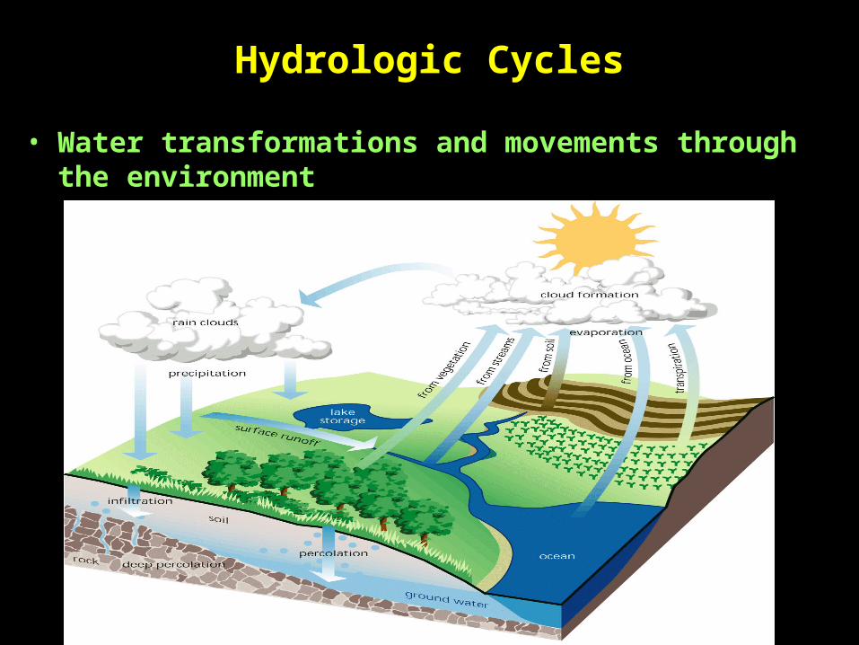
Hydrologic Cycles
• Water transformations and movements through the environment
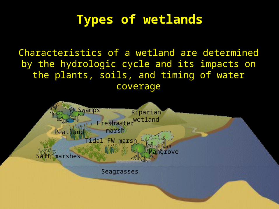
Types of wetlands
Tidal FW marsh
MangroveSalt marshes
Freshwater marsh
Riparian wetland
Peatland
Swamps
Characteristics of a wetland are determined by the hydrologic cycle and its impacts on the plants, soils, and timing of water
coverage
Seagrasses
Hydrologic cycle impacts:
Vegetation - hydrophytesObligate Hydrophytes are dependent on saturated soils Facultative hydrophytes can survive saturated soils
Soils - hydricHydric soils are those with saturated pore spaces and develop anaerobic conditions
Standing or flowing waterWater covering surface of soil for significant portions of the year. Typically enough to support hydrophytic plants and hydric soils.
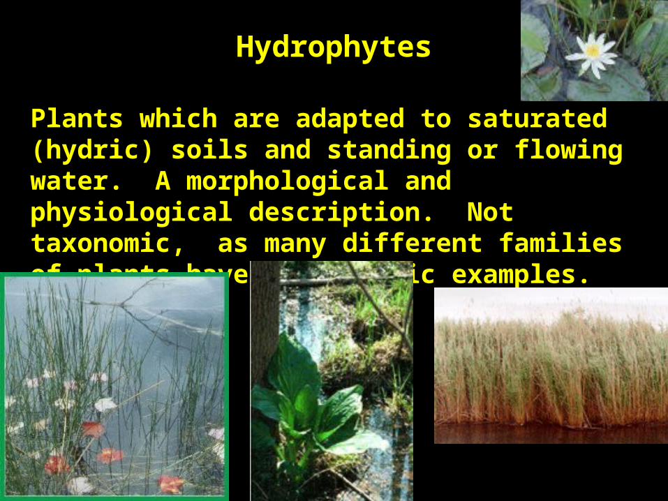
Hydrophytes
Plants which are adapted to saturated (hydric) soils and standing or flowing water. A morphological and physiological description. Not taxonomic, as many different families of plants have hydrophytic examples.
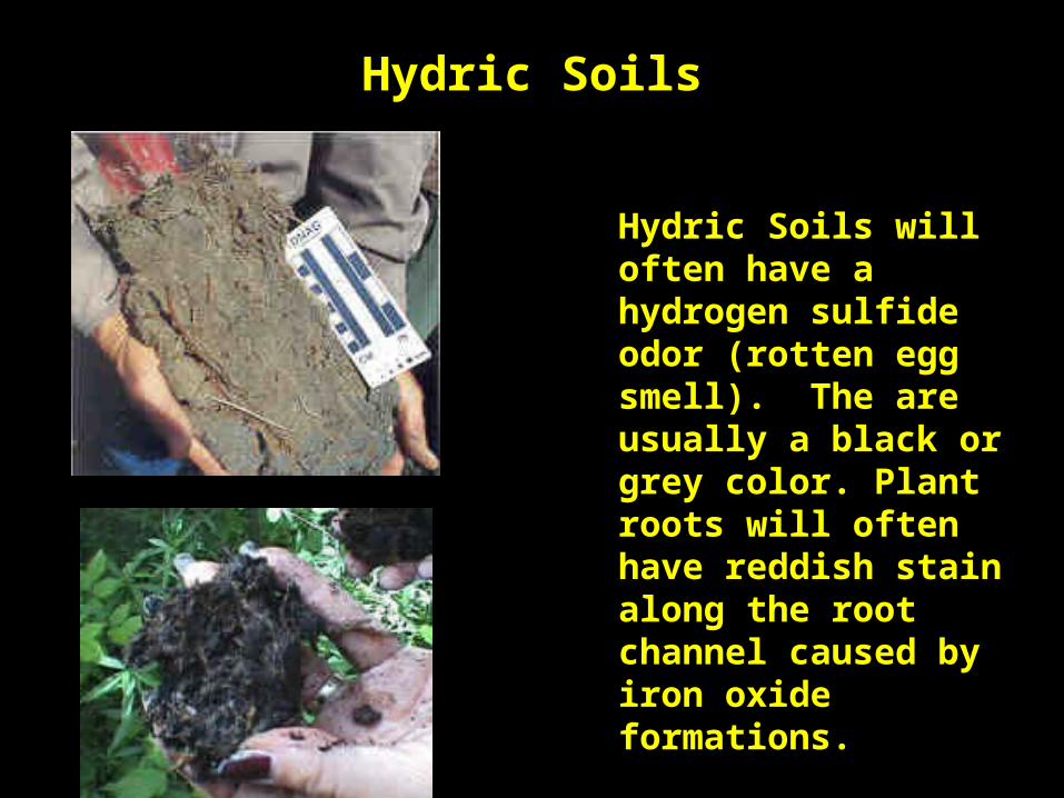
Hydric Soils
Hydric Soils will often have a hydrogen sulfide odor (rotten egg smell). The are usually a black or grey color. Plant roots will often have reddish stain along the root channel caused by iron oxide formations.
Water saturating and covering the surface
• Possible to have wetlands, even in areas with little precipitation if soils remain saturated.
• If water is present for enough time for soils to be saturated and develop anaerobic conditions, hydrophytes will begin to grow.
Wetland delineation
• Delineation – to determine the exact geographic boundaries of the wetland.
• Use field sampling, GPS and GIS to map the wetlands
• May require repeated mapping during the year to determine proper boundaries
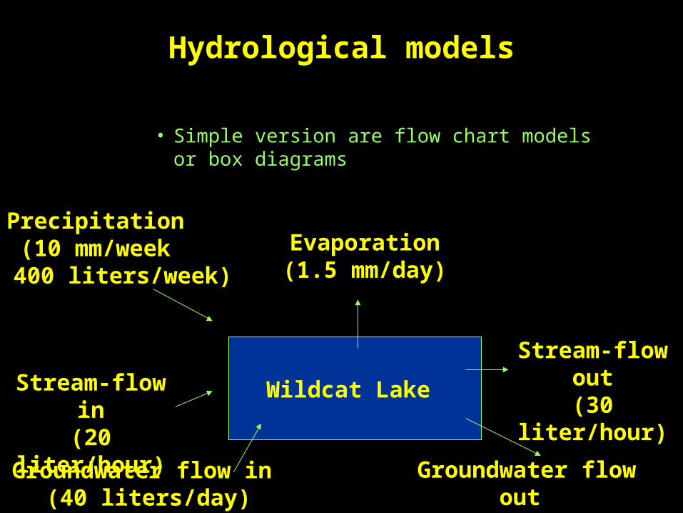
Hydrological models
• Simple version are flow chart models or box diagrams
Wildcat Lake
Precipitation(10 mm/week
or 400 liters/week)
Stream-flow in(20 liter/hour)
Groundwater flow in (40 liters/day)
Evaporation(1.5 mm/day)
Stream-flow out(30 liter/hour)
Groundwater flow out (20 liters/day)
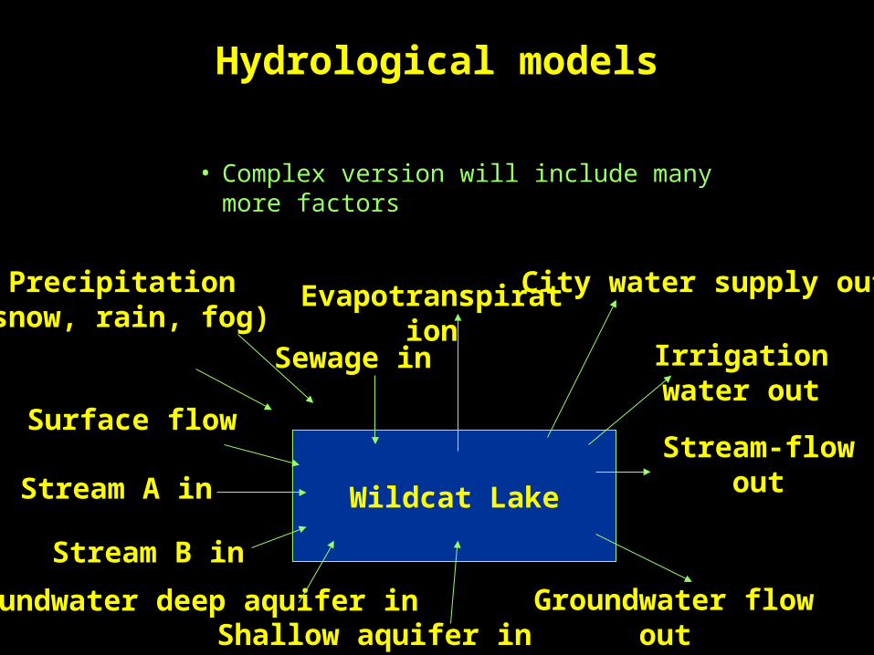
Hydrological models
• Complex version will include many more factors
Wildcat Lake
Precipitation(snow, rain, fog)
Stream A in
Groundwater deep aquifer in
Evapotranspiration
Stream-flow out
Groundwater flow out
Surface flow
Stream B in
City water supply out
Shallow aquifer in
Irrigation water outSewage in
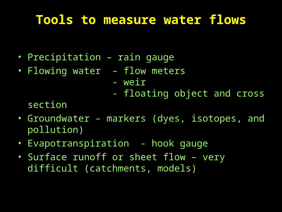
Tools to measure water flows
• Precipitation – rain gauge• Flowing water – flow meters
- weir- floating object and cross
section• Groundwater – markers (dyes, isotopes, and
pollution)• Evapotranspiration - hook gauge • Surface runoff or sheet flow – very difficult
(catchments, models)
Review
• Extent of a wetland is determined by hydrophytes, hydric soils, and water saturating or covering substrate.
• These factors are affected by the hydrology• Hydrologic models are constructed to study
movement of water and other compounds in aquatic ecosystems.
• There are a variety of equipment and techniques available to measure flow rates.