Embed Size (px)
Citation preview
Applying Advanced Symbology and
Labeling using ArcGIS Pro
Barbara Seje
Remmy Kesis
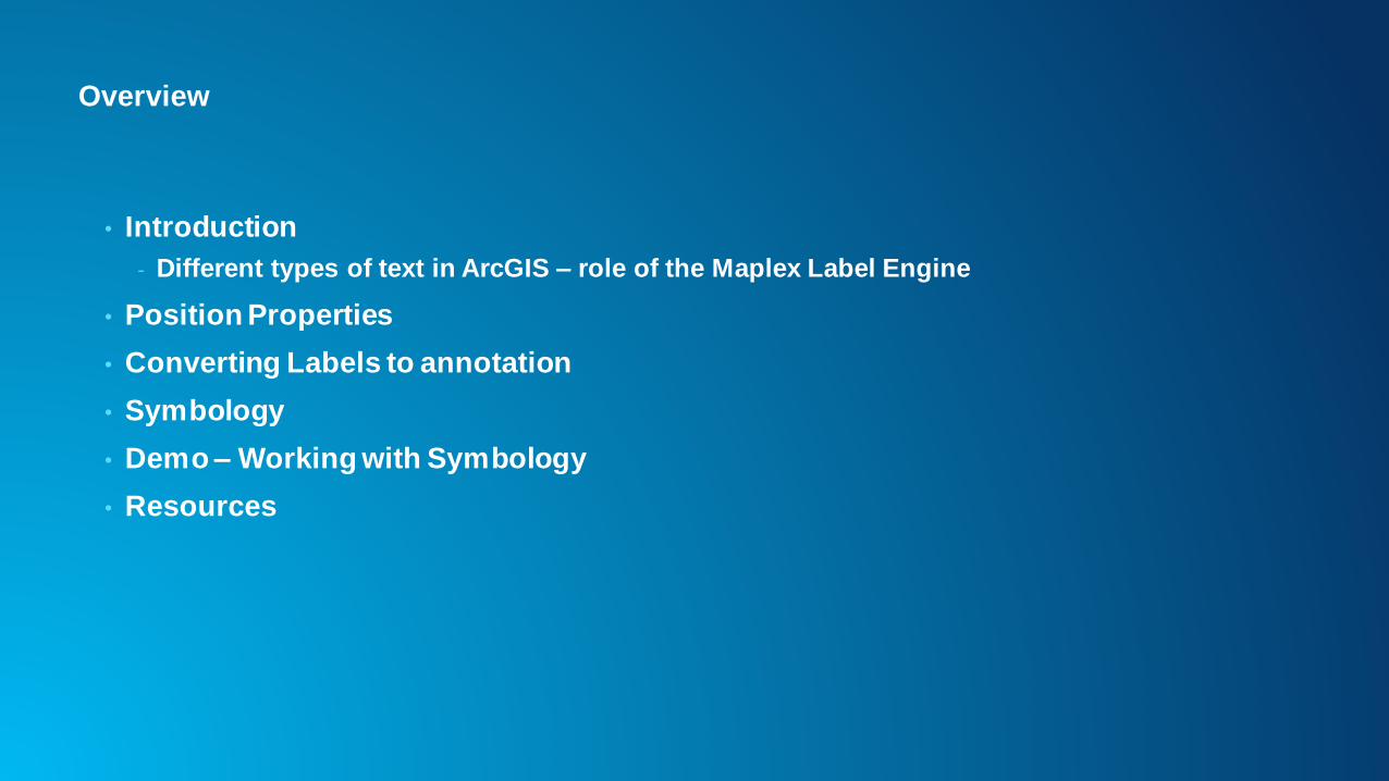
Overview
• Introduction
- Different types of text in ArcGIS – role of the Maplex Label Engine
• Position Properties
• Converting Labels to annotation
• Symbology
• Demo – Working with Symbology
• Resources

Advanced Labelling
Types of Text
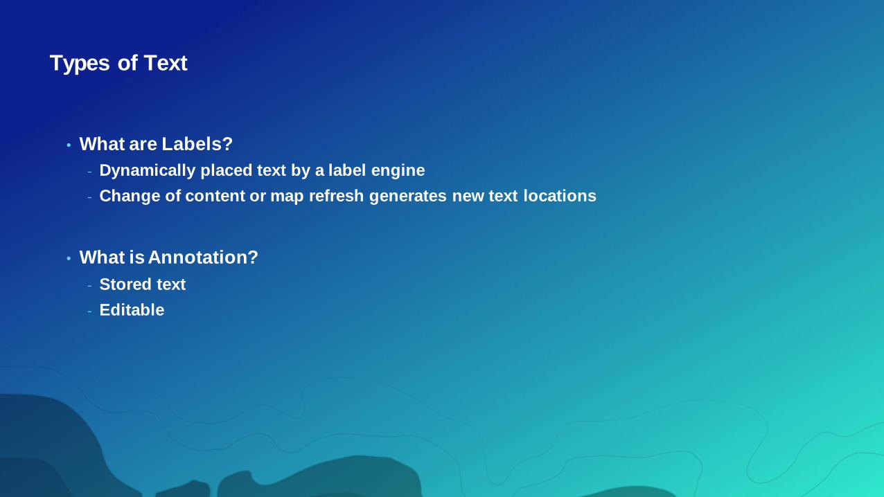
• What are Labels?
- Dynamically placed text by a label engine
- Change of content or map refresh generates new text locations
• What is Annotation?
- Stored text
- Editable

Maplex Label Engine
• Advanced high-quality cartographic text placementengine
• Licensing
- Started as an extension ‘Maplex for ArcGIS’
- At 10.1 Maplex becomes part of core software
• Labeling Framework
- Shared with standard label engine
- Maplex is now the default label engine in ArcGIS Pro
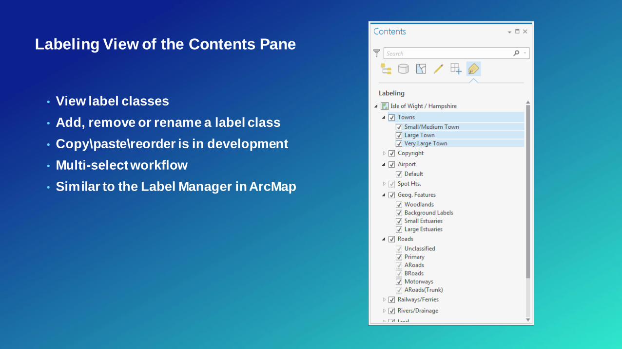
Labeling View of the Contents Pane
• View label classes
• Add, remove or rename a label class
• Copy\paste\reorder is in development
• Multi-select workflow
• Similar to the Label Manager in ArcMap
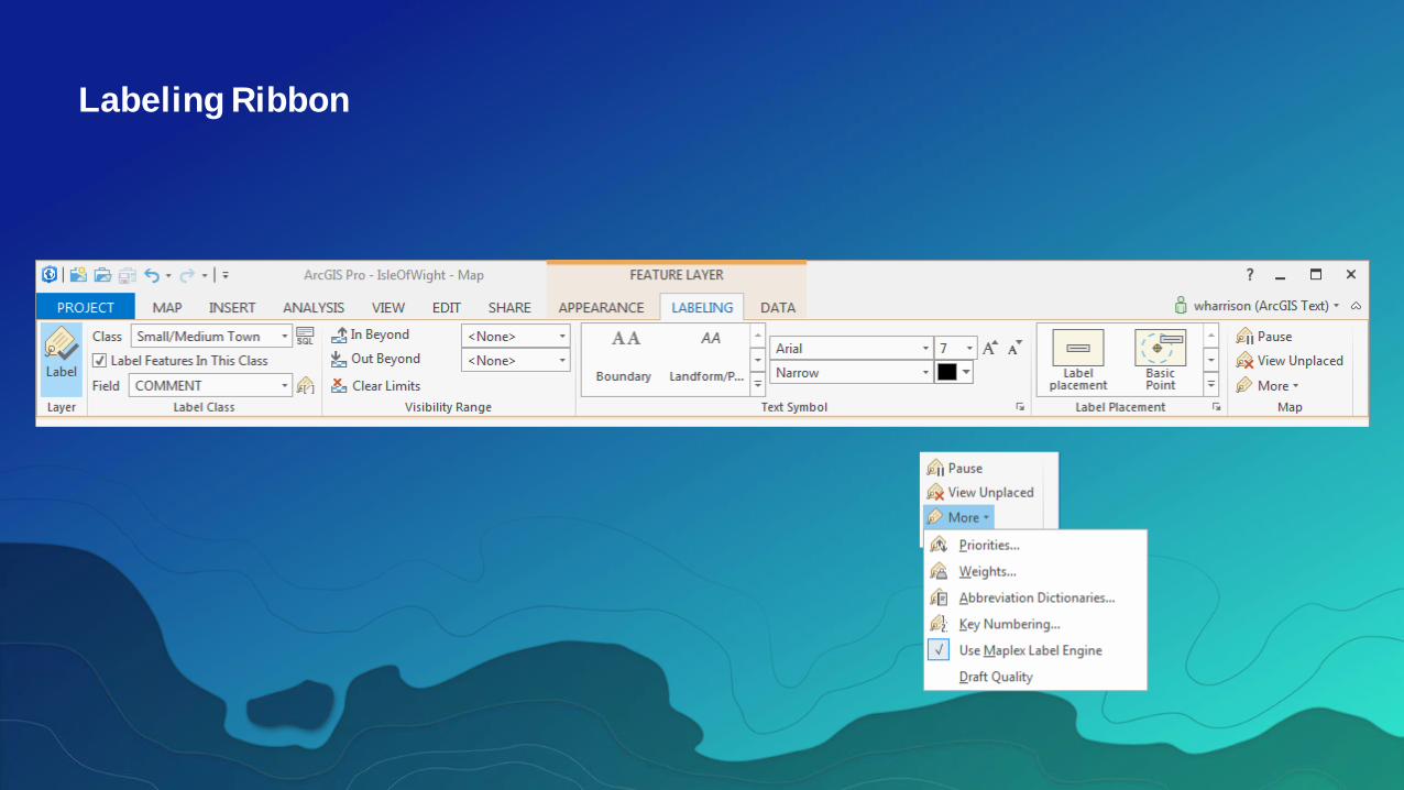
Labeling Ribbon
• UI shows all label classes in the map
• Controls the label placement order
• Also serves as the deletion priorityfor
conflict resolution
- If two labels are in conflict it’s the one that has
the higher priority that will win
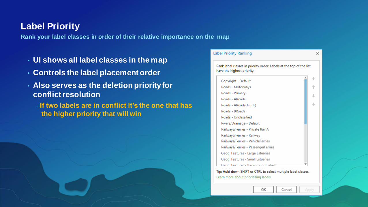
Label PriorityRank your label classes in order of their relative importance on the map

• Maplex weighting is based on values
from 0 – 1000
- zero weight allows full overlap
- Range 1 to 999 is the main ranking
- Tip: use the whole range to get the best
results
- 1000 is a special value – it represents a
set of barrier features
• Polygons also have a boundary weight
Feature WeightsControl the label-to-feature overlap on the map
T

Label Class Pane
• The details
- Label Expression
- SQL Query
- Visibility Range
- Text Symbol
- Placement properties
• Launch from:
- Ribbon
- Context menu on the feature layer

• Contour placement style
• Page or Uphill alignment
• Label laddering
Contour PlacementWhere you categorize a line as a terrain feature with height attribute
Street PlacementWhere you categorize a line as a street feature at large map scales
- Different placement methods
- label is placed inside a cased symbol (European
style)
- label is offset from the line symbol (North American
style)
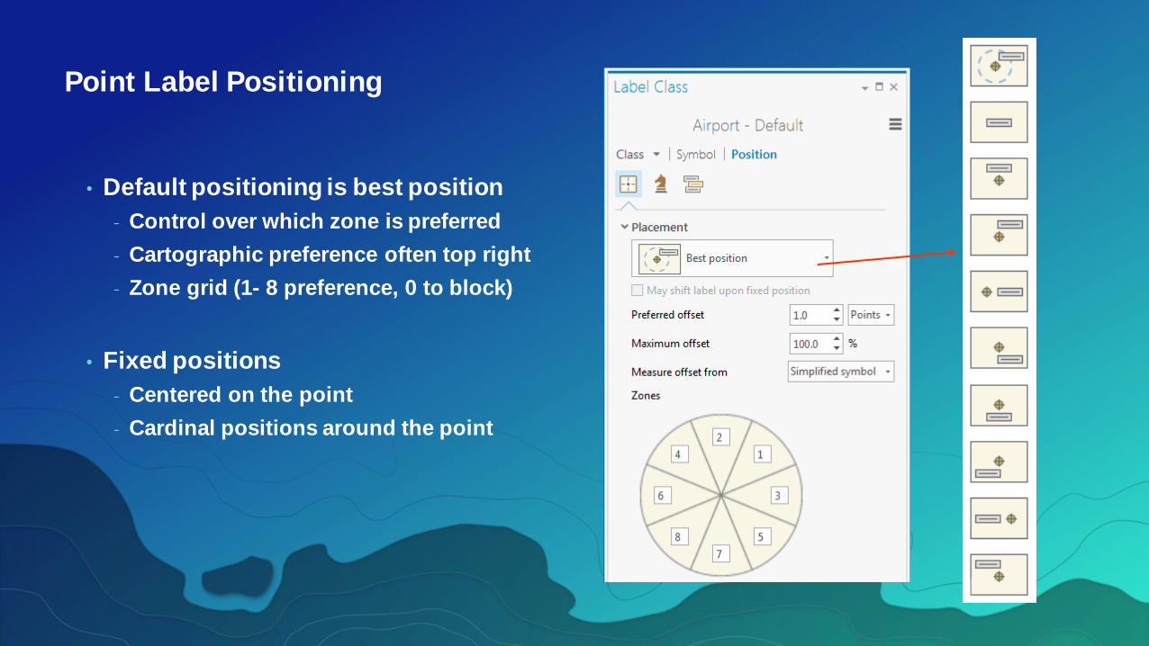
Point Label Positioning
• Default positioning is best position
- Control over which zone is preferred
- Cartographic preference often top right
- Zone grid (1- 8 preference, 0 to block)
• Fixed positions
- Centered on the point
- Cardinal positions around the point
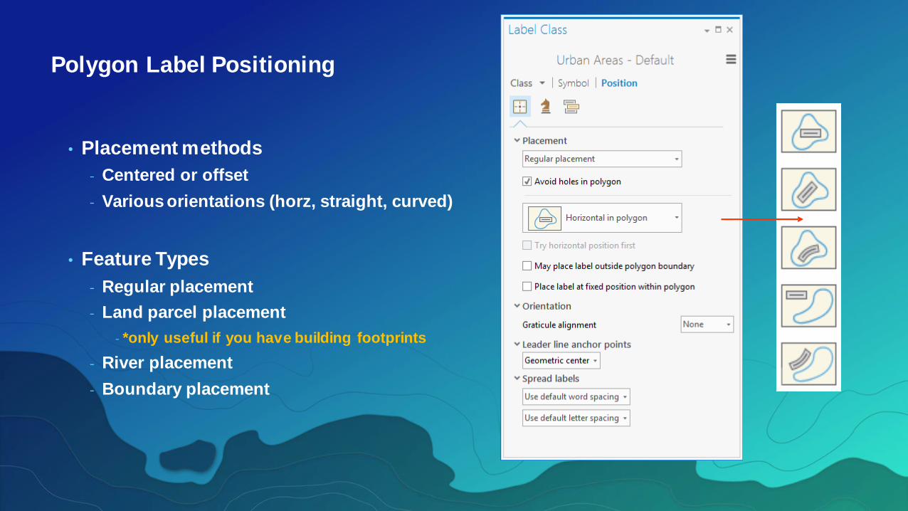
Polygon Label Positioning
• Placement methods
- Centered or offset
- Various orientations (horz, straight, curved)
• Feature Types
- Regular placement
- Land parcel placement
- *only useful if you have building footprints
- River placement
- Boundary placement
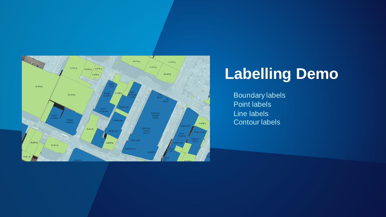
Labelling Demo
Boundary labels
Point labels
Line labelsContour labels
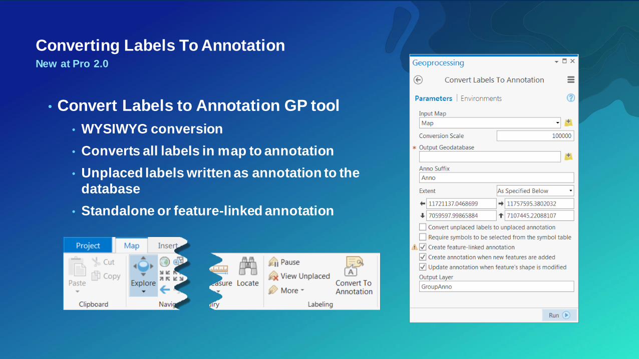
Converting Labels To AnnotationNew at Pro 2.0
• Convert Labels to Annotation GP tool
• WYSIWYG conversion
• Converts all labels in map to annotation
• Unplaced labels written as annotation to the
database
• Standalone or feature-linked annotation

Advanced Symbology

Symbolization
• Symbols graphically
describe, categorize, or
rank geographic features

Symbolize feature layers
• Symbolize feature layers in different ways
- Single symbol
- Unique values—Apply a different symbol to each category of features
within the layer based on one or more fields.
- Graduated colors—Show qualitative differences in feature values with a
range of colors.
- Graduated symbols—Show qualitative differences in feature values with
varying symbol sizes.
- Unclassed colors—Show qualitative differences in feature values with a
range of colors not broken into discrete classes.
- Heat Map—Draw the density of points as a continuous color gradient.
symbol layers
• Marker symbol layers
- Components of symbols that draw a specific shape
- Shape marker symbol layers
- Picture marker symbol layers
- 3D model marker symbol layers
- Procedural marker symbol layers
- Marker symbol layer properties
Using Symbols in
ArcGIS Pro

Resources