Embed Size (px)
Citation preview
APPENDIX E
HEC-RAS Results
Prepared for
The Boeing Company 5800 Woolsey Canyon Road, MC: 033-T436
Canoga Park, CA 91304-1148
Appendix E
HEC-RAS Results
Prepared by
6701 Center Drive West Suite 550 Los Angeles, CA 90045
Project Number SB0363R
September 21, 2011
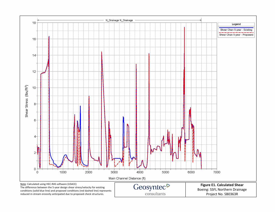
Figure E1. Calculated ShearBoeing: SSFL Northern Drainage
Project No. SB0363R
Shear S
tress (lb
s/ft²)
Note: Calculated using HEC‐RAS software (USACE)The difference between the 5‐year design shear stress/velocity for existing conditions (solid blue line) and proposed conditions (red dashed line) represents reduced in‐stream erosivity anticipated due to proposed check structures.
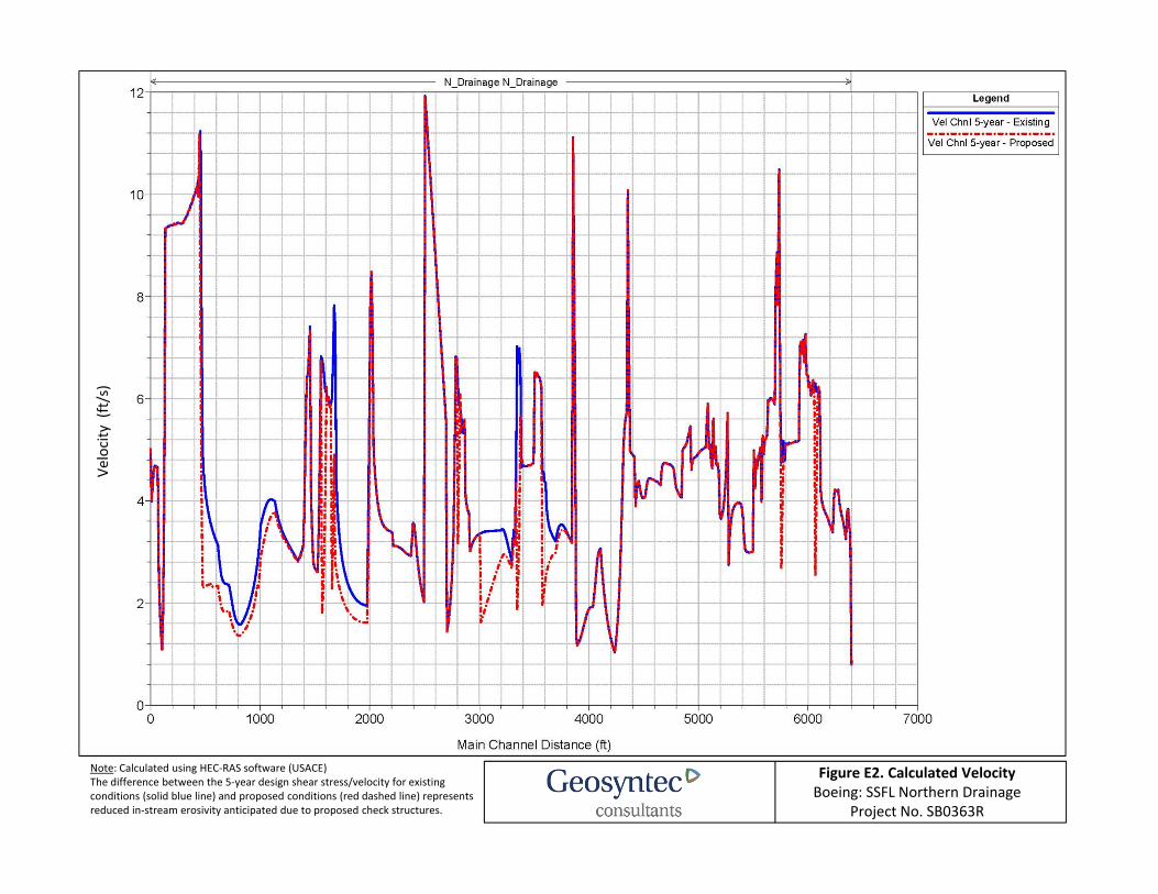
Figure E2. Calculated VelocityBoeing: SSFL Northern Drainage
Project No. SB0363R
Velocity (ft/s)
Note: Calculated using HEC‐RAS software (USACE)The difference between the 5‐year design shear stress/velocity for existing conditions (solid blue line) and proposed conditions (red dashed line) represents reduced in‐stream erosivity anticipated due to proposed check structures.
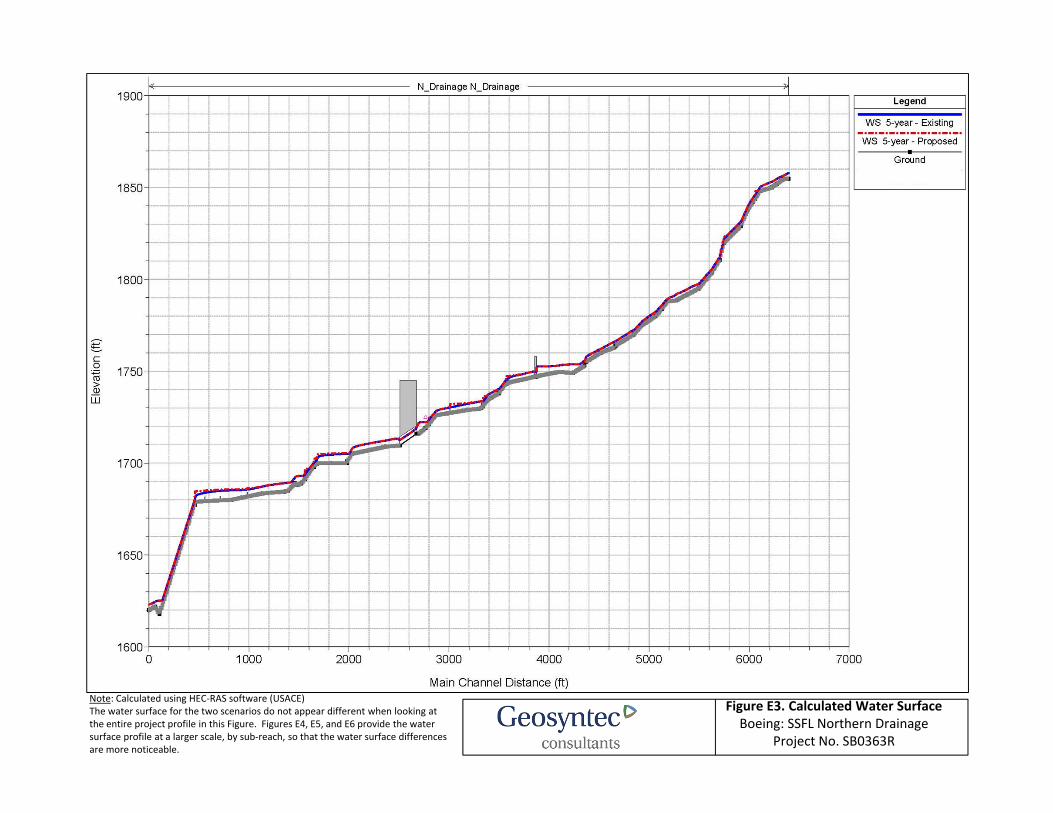
Figure E3. Calculated Water Surface Boeing: SSFL Northern Drainage
Project No. SB0363R
Note: Calculated using HEC‐RAS software (USACE)The water surface for the two scenarios do not appear different when looking at the entire project profile in this Figure. Figures E4, E5, and E6 provide the water surface profile at a larger scale, by sub‐reach, so that the water surface differences are more noticeable.
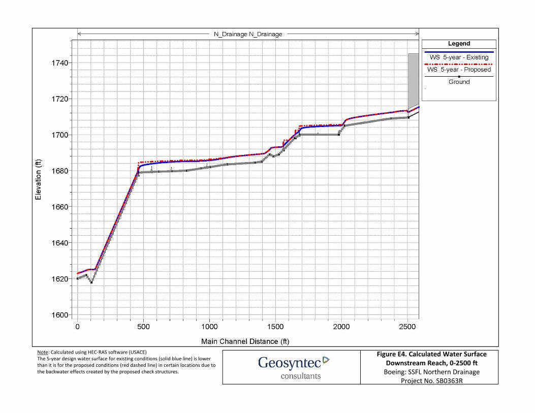
Figure E4. Calculated Water SurfaceDownstream Reach, 0‐2500 ft Boeing: SSFL Northern Drainage
Project No. SB0363R
Note: Calculated using HEC‐RAS software (USACE)The 5‐year design water surface for existing conditions (solid blue line) is lower than it is for the proposed conditions (red dashed line) in certain locations due to the backwater effects created by the proposed check structures.
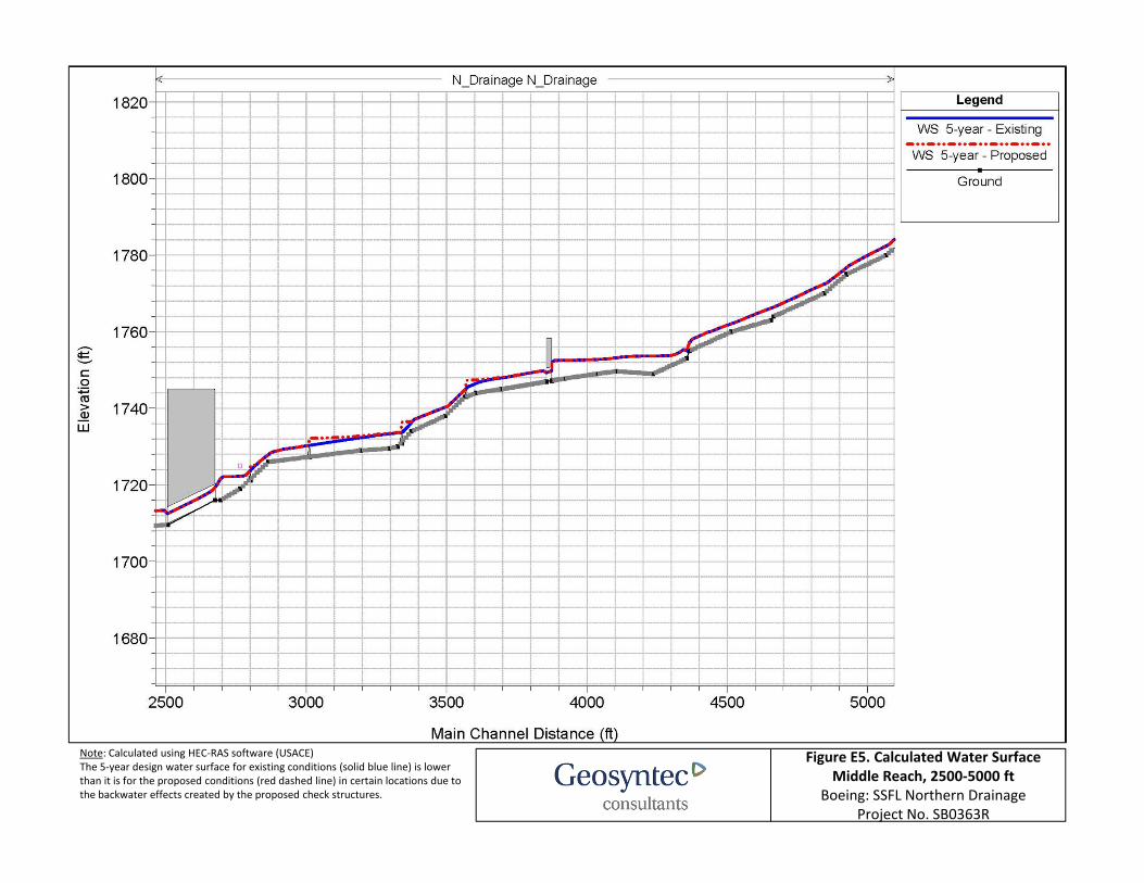
Figure E5. Calculated Water SurfaceMiddle Reach, 2500‐5000 ft
Boeing: SSFL Northern DrainageProject No. SB0363R
Note: Calculated using HEC‐RAS software (USACE)The 5‐year design water surface for existing conditions (solid blue line) is lower than it is for the proposed conditions (red dashed line) in certain locations due to the backwater effects created by the proposed check structures.
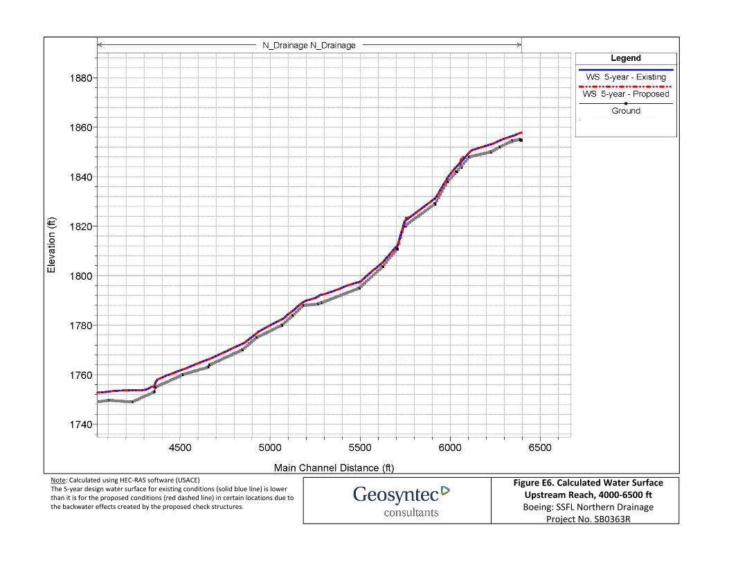
Figure E6. Calculated Water SurfaceUpstream Reach, 4000‐6500 ft Boeing: SSFL Northern Drainage
Project No. SB0363R
Note: Calculated using HEC‐RAS software (USACE)The 5‐year design water surface for existing conditions (solid blue line) is lower than it is for the proposed conditions (red dashed line) in certain locations due to the backwater effects created by the proposed check structures.


![Hec ras 4.1-applications_guide[1]](https://img.pdfslide.us/doc/110x75/55645fdfd8b42acd408b493b/hec-ras-41-applicationsguide1.jpg)