Embed Size (px)
Citation preview

Appendix D: CULTURAL RESOURCES
EARVIN “MAGIC” JOHNSON RECREATION AREA MASTER PLAN Draft ENVIRONMENTAL IMPACT REPORT
C U L T U R A L R E S O U R C E S A S S E S S M E N T
Earvin “Magic” Johnson Recreation Area State Master Plan Amendment/Ujima Vil lage Master Plan Project
City of Los Angeles, Los Angeles County, California
Prepared for:
Juan Villalobos RBF Consulting
3300 East Guasti Road, Suite 100 Ontario, California 91761-8656
Prepared by:
David Brunzell, M.A., RPA BCR Consulting LLC
1420 Guadalajara Place Claremont, California 91711
Project No. RBF1405
National Archaeological Data Base Information: Type of Study: Cultural Resources Assessment/Inventory
Resources Recorded: None Keywords: Ujima Village
USGS 7.5-Minute Quadrangle: Inglewood (1981), California
April 30, 2014

A P R I L 3 0 , 2 0 1 4 B C R C O N S U L T I N G L L C C U L T U R A L R E S O U R C E S A S S E S S M E N T M A G I C J O H N S O N R E C R E A T I O N A R E A / U J I M A V I L L A G E P R O J E C T
ii
MANAGEMENT SUMMARY BCR Consulting LLC (BCR Consulting) is under contract to RBF Consulting to conduct a Cultural Resources Assessment of the Earvin “Magic” Johnson Recreation Area State Master Plan Amendment/Ujima Village Master Plan Project (project) in the City of Los Angeles, Los Angeles County, California. The work is being performed pursuant to the California Environmental Quality Act (CEQA). A cultural resources records search, field survey, Native American Consultation, and Paleontological Resources Assessment were completed for the project. The records search revealed that 47 cultural resources studies have taken place resulting in the recording of 10 cultural resources within one mile of the project site. Of the 47 previous studies, two have previously assessed portions of the project site resulting in no cultural resources recorded within its boundaries. A project aerial is provided as Appendix A. Results of the Native American Consultation are provided in Appendix B, project photos are included in Appendix C, and the Paleontological Resources Assessment is included in Appendix D. During the field survey, BCR Consulting archaeologists did not discover any cultural resources (including prehistoric or historic-period archaeological sites or historic-period buildings) within the project site. As a result, BCR Consulting recommends a finding of no impacts to historical resources under CEQA. BCR Consulting also recommends that no additional cultural resources work or monitoring is necessary during proposed activities associated with the development of the project site. However, if previously undocumented cultural resources are identified during earthmoving activities, a qualified archaeologist should be contacted to assess the nature and significance of the find, diverting construction excavation if necessary. If human remains are encountered during the undertaking, State Health and Safety Code Section 7050.5 states that no further disturbance shall occur until the County Coroner has made a determination of origin and disposition pursuant to Public Resources Code Section 5097.98. The County Coroner must be notified of the find immediately. If the remains are determined to be prehistoric, the Coroner will notify the Native American Heritage Commission (NAHC), which will determine and notify a Most Likely Descendant (MLD). With the permission of the landowner or his/her authorized representative, the MLD may inspect the site of the discovery. The MLD shall complete the inspection within 48 hours of notification by the NAHC.
A P R I L 3 0 , 2 0 1 4 B C R C O N S U L T I N G L L C C U L T U R A L R E S O U R C E S A S S E S S M E N T M A G I C J O H N S O N R E C R E A T I O N A R E A / U J I M A V I L L A G E P R O J E C T
iii
TABLE OF CONTENTS
MANAGEMENT SUMMARY .................................................................................................... ii INTRODUCTION .................................................................................................................... 1 NATURAL SETTING ............................................................................................................... 1 CULTURAL SETTING ............................................................................................................ 3
PREHISTORIC CONTEXT ............................................................................................... 3 ETHNOGRAPHY .............................................................................................................. 3 HISTORY .......................................................................................................................... 3
PERSONNEL .......................................................................................................................... 4 METHODS .............................................................................................................................. 4
RESEARCH ...................................................................................................................... 4 FIELD SURVEY ................................................................................................................ 5
RESULTS ............................................................................................................................... 5
RESEARCH ...................................................................................................................... 5 FIELD SURVEY ................................................................................................................ 5
RECOMMENDATIONS ........................................................................................................... 5 REFERENCES ....................................................................................................................... 8 APPENDICES A: PROJECT AERIAL B: NATIVE AMERICAN CONSULTATION C: PALEONTOLOGICAL RESOURCES ASSESSMENT D: PROJECT PHOTOGRAPHS FIGURES 1: Project Location and Vicinity Map ..................................................................................... 2 TABLES A: Cultural Resources and Reports Located within One Mile of Project Site ........................ 5

A P R I L 3 0 , 2 0 1 4 B C R C O N S U L T I N G L L C C U L T U R A L R E S O U R C E S A S S E S S M E N T M A G I C J O H N S O N R E C R E A T I O N A R E A / U J I M A V I L L A G E P R O J E C T
1
INTRODUCTION BCR Consulting LLC (BCR Consulting) is under contract to conduct a Cultural Resources Assessment of the Earvin “Magic” Johnson Recreation Area State Master Plan Amendment/Ujima Village Master Plan Project (project) in the City of Los Angeles, Los Angeles County, California. The work is being performed pursuant to the California Environmental Quality Act (CEQA). The project site consists of approximately 120 acres comprising the Earvin “Magic” Johnson Recreation Area and the former Ujima Village property. The project site is located in Section 8 of Township 3 South, Range 13 West, San Bernardino Baseline and Meridian. It is depicted on the United States Geological Survey (USGS) Inglewood (1981), California 7.5-minute topographic quadrangle. The Department of Parks and Recreation intends to develop an Amendment to the State Master Plan for the Earvin “Magic” Johnson Recreation area that reflects a future expanded area that will include the adjoining Ujima Village property. NATURAL SETTING The project site is surrounded by residential developments and currently contains two artificial lakes connected by a stream, picnic areas, a playground, and includes walkways, landscaping, irrigation, and a parking lot. The local geologic region coincides with the physiographic area known as the Los Angeles Basin. It is characterized as a transverse-oriented lowland basin and coastal plain approximately 50 miles long and 20 miles wide. The basin originated as a deep marine trough during the Pliocene (7-2 million years ago) that eventually filled with shallow water fossil bearing sediments. By the beginning of the Pleistocene (after 2 million years ago) uplifting created the series of plains and mesas along the coast that now characterize the area (Lambert 1994, Mendenhall 1905, Woodford et al. 1954). The elevation of the project site ranges from approximately 95 to 118 feet above mean sea level (AMSL). Local rainfall ranges from 5 to 15 inches annually (Jaeger and Smith 1971: 36-37) and runoff tends to flow from west to east. Historically, Compton Creek to the east of the project provided local drainage, although most current runoff is channeled into concrete washes (USGS 1981). Native local vegetation communities were previously dominated by coastal sage scrub, although urbanization currently prevents its proliferation. Key native plants in the vicinity would have included black sage, California brittlebush, California buckwheat, California sagebrush, deerweed, golden yarrow, laurel sumac, lemonadeberry, poison oak, purple sage, sticky monkeyflower, sugar bush, toyon, white sage, coastal century plant, coastal cholla, and prickly-pear cactus. These plants were utilized by local animal species, which included kangaroo rats, California horned lizard, orange-throated whiptail, San Diego horned lizard, brown-headed cowbird, California gnatcatcher, California quail, cactus wren, darkling beetle, harvester ant, and Palos Verdes blue butterfly (Williams et al. 2008:117, 122). Peripheral species included deer, and various rodents and birds -all of which could be useful to prehistoric and historic inhabitants (Bean and Saubel 1972).
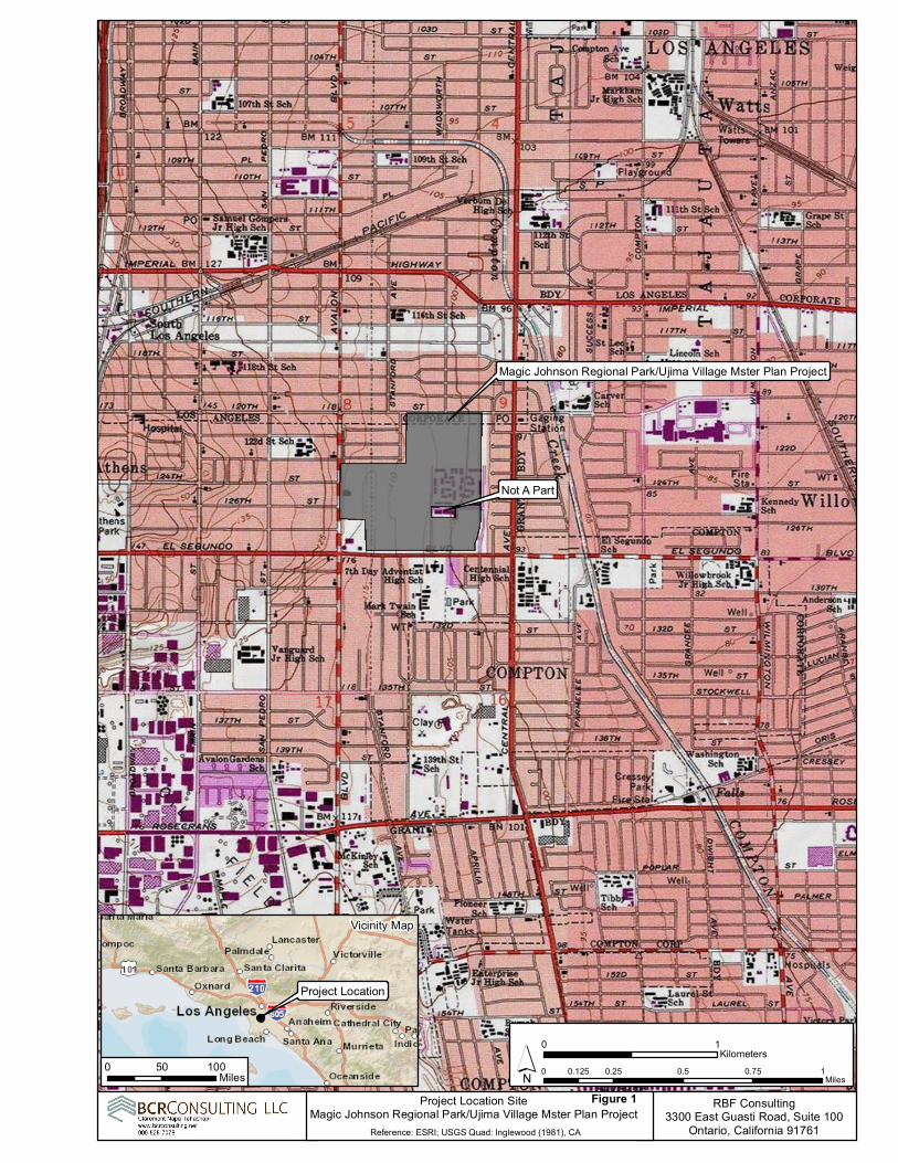
Figure 1
0 0.25 0.5 0.75 10.125Miles
0 1Kilometers´
Reference: ESRI; USGS Quad: Inglewood (1981), CA
Project Location SiteMagic Johnson Regional Park/Ujima Village Mster Plan Project RBF Consulting
3300 East Guasti Road, Suite 100Ontario, California 91761
Magic Johnson Regional Park/Ujima Village Mster Plan Project
Project Location
Vicinity Map
0 50 100Miles
Not A Part

A P R I L 3 0 , 2 0 1 4 B C R C O N S U L T I N G L L C C U L T U R A L R E S O U R C E S A S S E S S M E N T M A G I C J O H N S O N R E C R E A T I O N A R E A / U J I M A V I L L A G E P R O J E C T
3
CULTURAL SETTING
Prehistoric Context Two primary regional syntheses are commonly utilized in the archaeological literature for southern California. The first was advanced by Wallace in 1955, and defines four cultural horizons, each with characteristic local variations: Early Man Horizon, Milling Stone, Intermediate, and Late Prehistoric. Employing a more ecological approach, Warren (1986) defined five periods in southern California prehistory: Lake Mojave, Pinto, Gypsum, Saratoga Springs, and Protohistoric. Warren viewed cultural continuity and change in terms of various significant environmental shifts, defining the cultural ecological approach for archaeological research of the California deserts and coast. Many changes in settlement patterns and subsistence focus are viewed as cultural adaptations to a changing environment, beginning with the gradual environmental warming in the late Pleistocene, the desiccation of the desert lakes during the early Holocene, the short return to pluvial conditions during the middle Holocene, and the general warming and drying trend, with periodic reversals that continue to this day (Warren 1986). Ethnography Although no prehistoric sites have been locally recorded, in general the project site is situated within Gabrielino territory. Gabrielino. The Gabrielino probably first encountered Europeans when Spanish explorers reached California's southern coast during the 15th and 16th centuries (Bean and Smith 1978; Kroeber 1925). The first documented encounter, however, occurred in 1769 when Gaspar de Portola's expedition crossed Gabrielino territory (Bean and Smith 1978). Other brief encounters took place over the years, and are documented in McCawley 1996 (citing numerous sources). The Gabrielino name has been attributed by association with the Spanish mission of San Gabriel, and refers to a subset of people sharing speech and customs with other Cupan speakers (such as the Juaneño/Luiseño/Ajachemem) from the greater Takic branch of the Uto-Aztecan language family (Bean and Smith 1978). Gabrielino villages occupied the watersheds of various rivers (locally including the Santa Ana) and intermittent streams. Chiefs were usually descended through the male line and often administered several villages. Gabrielino society was somewhat stratified and is thought to have contained three hierarchically ordered social classes which dictated ownership rights and social status and obligations (Bean and Smith 1978:540-546). Plants utilized for food were heavily relied upon and included acorn-producing oaks, as well as seed-producing grasses and sage. Animal protein was commonly derived from rabbits and deer in inland regions, while coastal populations supplemented their diets with fish, shellfish, and marine mammals (Boscana 1933, Heizer 1968, Johnston 1962, McCawley 1996). Dog, coyote, bear, tree squirrel, pigeon, dove, mud hen, eagle, buzzard, raven, lizards, frogs, and turtles were specifically not utilized as a food source (Kroeber 1925:652). History Historic-era California is generally divided into three periods: the Spanish or Mission Period (1769 to 1821), the Mexican or Rancho Period (1821 to 1848), and the American Period (1848 to present).
A P R I L 3 0 , 2 0 1 4 B C R C O N S U L T I N G L L C C U L T U R A L R E S O U R C E S A S S E S S M E N T M A G I C J O H N S O N R E C R E A T I O N A R E A / U J I M A V I L L A G E P R O J E C T
4
Spanish Period. The first European to pass through the area is thought to be a Spaniard called Father Francisco Garces. Having become familiar with the area, Garces acted as a guide to Juan Bautista de Anza, who had been commissioned to lead a group across the desert from a Spanish outpost in Arizona to set up quarters at the Mission San Gabriel in 1771 near what today is Pasadena (Beck and Haase 1974). Garces was followed by Alta California Governor Pedro Fages, who briefly explored the region in 1772. Searching for San Diego Presidio deserters, Fages had traveled through Riverside to San Bernardino, crossed over the mountains into the Mojave Desert, and then journeyed westward to the San Joaquin Valley (Beck and Haase 1974). Mexican Period. In 1821, Mexico overthrew Spanish rule and the missions began to decline. By 1833, the Mexican government passed the Secularization Act, and the missions, reorganized as parish churches, lost their vast land holdings, and released their neophytes (Beattie and Beattie 1974). American Period. The American Period, 1848–Present, began with the Treaty of Guadalupe Hidalgo. In 1850, California was accepted into the Union of the United States primarily due to the population increase created by the Gold Rush of 1849. The cattle industry reached its greatest prosperity during the first years of the American Period. Mexican Period land grants had created large pastoral estates in California, and demand for beef during the Gold Rush led to a cattle boom that lasted from 1849–1855. However, beginning about 1855, the demand for beef began to decline due to imports of sheep from New Mexico and cattle from the Mississippi and Missouri Valleys. When the beef market collapsed, many California ranchers lost their ranchos through foreclosure. A series of disastrous floods in 1861–1862, followed by a significant drought diminished the economic impact of local ranching. This decline combined with ubiquitous agricultural and real estate developments of the late 19th century, set the stage for diversified economic pursuits that have continued to proliferate to this day (Beattie and Beattie 1974; Cleland 1941). PERSONNEL David Brunzell, M.A., RPA acted as the Project Manager and Principal Investigator for the current study. He also compiled the technical report. BCR Consulting Field Director Dan Leonard, PhD, performed the cultural resources records search at the South Central Coastal Information Center (SCCIC) located at California State University, Fullerton. Dr. Leonard also completed the field survey. METHODS Research Prior to fieldwork, an archaeological records search was conducted at the SCCIC. This included a review of all recorded historic and prehistoric cultural resources, as well as a review of known cultural resources, and survey and excavation reports generated from projects located within one mile of the project site. In addition, a review was conducted of the National Register of Historic Places (National Register), the California Register of Historical Resources (California Register), and documents and inventories from the California Office of Historic Preservation including the lists of California Historical
A P R I L 3 0 , 2 0 1 4 B C R C O N S U L T I N G L L C C U L T U R A L R E S O U R C E S A S S E S S M E N T M A G I C J O H N S O N R E C R E A T I O N A R E A / U J I M A V I L L A G E P R O J E C T
5
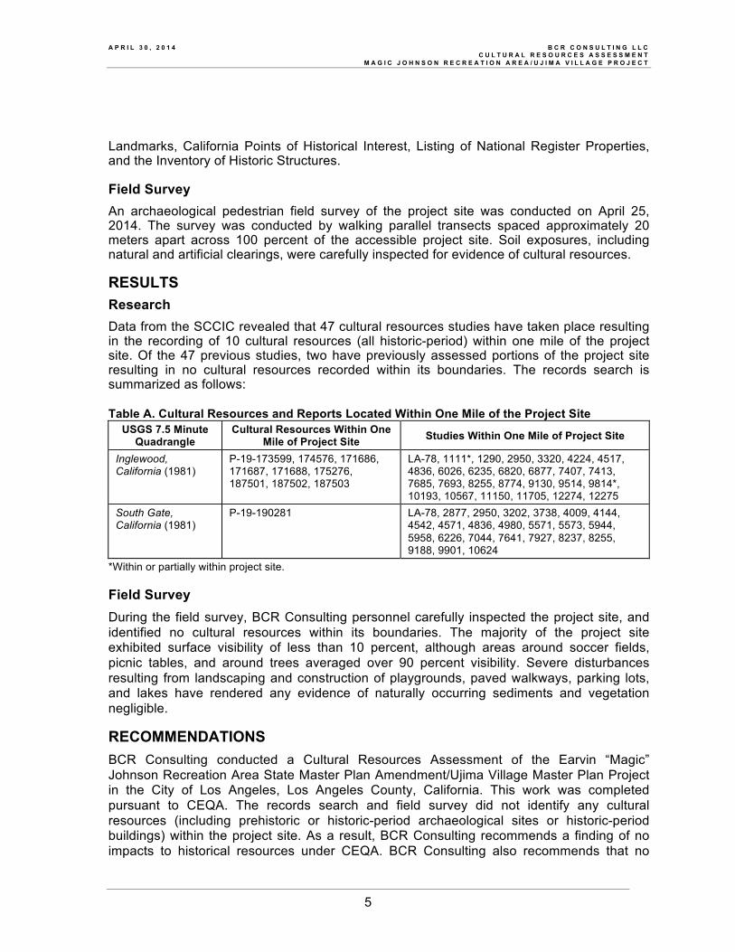
Landmarks, California Points of Historical Interest, Listing of National Register Properties, and the Inventory of Historic Structures. Field Survey An archaeological pedestrian field survey of the project site was conducted on April 25, 2014. The survey was conducted by walking parallel transects spaced approximately 20 meters apart across 100 percent of the accessible project site. Soil exposures, including natural and artificial clearings, were carefully inspected for evidence of cultural resources. RESULTS Research Data from the SCCIC revealed that 47 cultural resources studies have taken place resulting in the recording of 10 cultural resources (all historic-period) within one mile of the project site. Of the 47 previous studies, two have previously assessed portions of the project site resulting in no cultural resources recorded within its boundaries. The records search is summarized as follows: Table A. Cultural Resources and Reports Located Within One Mile of the Project Site
USGS 7.5 Minute Quadrangle
Cultural Resources Within One Mile of Project Site Studies Within One Mile of Project Site
Inglewood, California (1981)
P-19-173599, 174576, 171686, 171687, 171688, 175276, 187501, 187502, 187503
LA-78, 1111*, 1290, 2950, 3320, 4224, 4517, 4836, 6026, 6235, 6820, 6877, 7407, 7413, 7685, 7693, 8255, 8774, 9130, 9514, 9814*, 10193, 10567, 11150, 11705, 12274, 12275
South Gate, California (1981)
P-19-190281 LA-78, 2877, 2950, 3202, 3738, 4009, 4144, 4542, 4571, 4836, 4980, 5571, 5573, 5944, 5958, 6226, 7044, 7641, 7927, 8237, 8255, 9188, 9901, 10624
*Within or partially within project site. Field Survey During the field survey, BCR Consulting personnel carefully inspected the project site, and identified no cultural resources within its boundaries. The majority of the project site exhibited surface visibility of less than 10 percent, although areas around soccer fields, picnic tables, and around trees averaged over 90 percent visibility. Severe disturbances resulting from landscaping and construction of playgrounds, paved walkways, parking lots, and lakes have rendered any evidence of naturally occurring sediments and vegetation negligible. RECOMMENDATIONS BCR Consulting conducted a Cultural Resources Assessment of the Earvin “Magic” Johnson Recreation Area State Master Plan Amendment/Ujima Village Master Plan Project in the City of Los Angeles, Los Angeles County, California. This work was completed pursuant to CEQA. The records search and field survey did not identify any cultural resources (including prehistoric or historic-period archaeological sites or historic-period buildings) within the project site. As a result, BCR Consulting recommends a finding of no impacts to historical resources under CEQA. BCR Consulting also recommends that no
A P R I L 3 0 , 2 0 1 4 B C R C O N S U L T I N G L L C C U L T U R A L R E S O U R C E S A S S E S S M E N T M A G I C J O H N S O N R E C R E A T I O N A R E A / U J I M A V I L L A G E P R O J E C T
6
additional cultural resources work or monitoring is necessary during proposed project activities. However, if previously undocumented cultural resources are identified during earthmoving activities, a qualified archaeologist should be contacted to assess the nature and significance of the find, diverting construction excavation if necessary. If human remains are encountered during the undertaking, State Health and Safety Code Section 7050.5 states that no further disturbance shall occur until the County Coroner has made a determination of origin and disposition pursuant to Public Resources Code Section 5097.98. The County Coroner must be notified of the find immediately. If the remains are determined to be prehistoric, the Coroner will notify the Native American Heritage Commission (NAHC), which will determine and notify a Most Likely Descendant (MLD). With the permission of the landowner or his/her authorized representative, the MLD may inspect the site of the discovery. The MLD shall complete the inspection within 48 hours of notification by the NAHC.
A P R I L 3 0 , 2 0 1 4 B C R C O N S U L T I N G L L C C U L T U R A L R E S O U R C E S A S S E S S M E N T M A G I C J O H N S O N R E C R E A T I O N A R E A / U J I M A V I L L A G E P R O J E C T
7
REFERENCES Bean, Lowell John, and Charles Smith 1978 California, edited by R.F. Heizer. Handbook of North American Indians, Vol. 8, W.C.
Sturtevant, general editor, Smithsonian Institution. Washington, D.C. Beattie, George W., and Helen P. Beattie 1974 Heritage of the Valley: San Bernardino’s First Century. Biobooks: Oakland. Beck, Warren A., and Ynez D. Haase 1974 Historical Atlas of California. Oklahoma City: University of Oklahoma Press. Boscana, Father Geronimo 1933 Chinigchinich: A. Robinson's Translation, Fr. Geronimo Boscana's Historic Account
of the Belief, Usages, Customs and Extravagancies of the Indians of Mission of San Juan Capistrano Called the Acagchemem Tribe. Fine Arts Press, Santa Ana.
Cleland, Robert Glass 1941 The Cattle on a Thousand Hills—Southern California, 1850-80. San Marino, California: Huntington Library. Heizer, Robert F. 1968 Introduction and Notes: The Indians of Los Angeles County: Hugo Reid's Letters of
1852, edited and annotated by Robert F. Heizer. Southwest Museum, Los Angeles. Jaeger, Edmund C., and Arthur C. Smith 1971 Introduction to the Natural History of Southern California. California Natural History
Guides: 13. Los Angeles: University of California Press. Johnston, B.E. 1962 California's Gabrielino Indians. Southwest Museum, Los Angeles. Kroeber, Alfred L. 1925 Handbook of the Indians of California. Bureau of American Ethnology Bulletin 78. Washington D.C.: Smithsonian Institution. Reprinted in 1976, New York: Dover. Lambert, David 1994 The Field Guide to Prehistoric Life. Diagram Visual Information Limited. New York. McCawley, William 1996 The First Angelinos, The Gabrielino Indians of Los Angeles. Malki Museum Press/Ballena Press Cooperative Publication. Banning/Novato, California. Mendenhall, W.C. 1905 Developments of Underground Waters in the Eastern Coastal Plain Regions of Southern California. USGS Water Supply Paper, Number 137. United States Geological Survey 1981 Inglewood, California 7.5-minute topographic quadrangle map. 1981 South Gate, California 7.5-minute topographic quadrangle map.
A P R I L 3 0 , 2 0 1 4 B C R C O N S U L T I N G L L C C U L T U R A L R E S O U R C E S A S S E S S M E N T M A G I C J O H N S O N R E C R E A T I O N A R E A / U J I M A V I L L A G E P R O J E C T
8
Wallace, William J. 1955 Prehistoric Cultural Development in the Southern California Deserts. American Antiquity 28(2):172-180. Warren, Claude N. 1986 The Desert Region. In California Archaeology, (M. Moratto) contributions by D.A. Fredrickson, C. Raven, C.N. Warren, pp. 339–430. Academic Press, Orlando. Williams, Patricia, Leah Messinger, Sarah Johnson 2008 Habitats Alive! An Ecological Guide to California's Diverse Habitats. California Institute for Biodiversity, Claremont, California. Woodford, A.O., J.E. Schuellhamer, J.E. Wooder, and R.F. Yerkes 1954 Geology of the Los Angeles Basin. In Geology of Southern California, Bulletin 170. Division of Mines and Geology. San Francisco.

A P R I L 3 0 , 2 0 1 4 B C R C O N S U L T I N G L L C C U L T U R A L R E S O U R C E S A S S E S S M E N T M A G I C J O H N S O N R E C R E A T I O N A R E A / U J I M A V I L L A G E P R O J E C T
APPENDIX A
PROJECT AERIAL

%&d(
Cen
tral
Ave
El Segundo Blvd
Aval
on B
lvd
Ujima Village
Former Child CareCenter
120th St
EMJ Recreation Area
*Access
Access
Access
TransmissionCorridor
EARVIN 'MAGIC' JOHNSON RECREATION AREAAND UJIMA VILLAGE MASTER PLAN°0 1,000500
Feet
4/1/
2014
JN
M:\M
data
\136
713\
MX
D\M
eetin
gs\M
agic
Joh
nson
and
Ujim
a Vi
llage
Mas
ter P
lan
portr
ait.m
xd
Source: Eagle Aerial 2013
*
*

A P R I L 3 0 , 2 0 1 4 B C R C O N S U L T I N G L L C C U L T U R A L R E S O U R C E S A S S E S S M E N T M A G I C J O H N S O N R E C R E A T I O N A R E A / U J I M A V I L L A G E P R O J E C T
APPENDIX B
NATIVE AMERICAN CONSULTATION

A P R I L 3 0 , 2 0 1 4 B C R C O N S U L T I N G L L C C U L T U R A L R E S O U R C E S A S S E S S M E N T M A G I C J O H N S O N R E C R E A T I O N A R E A / U J I M A V I L L A G E P R O J E C T
APPENDIX C
PROJECT PHOTOGRAPHS
A P R I L 3 0 , 2 0 1 4 B C R C O N S U L T I N G L L C C U L T U R A L R E S O U R C E S A S S E S S M E N T M A G I C J O H N S O N R E C R E A T I O N A R E A / U J I M A V I L L A G E P R O J E C T
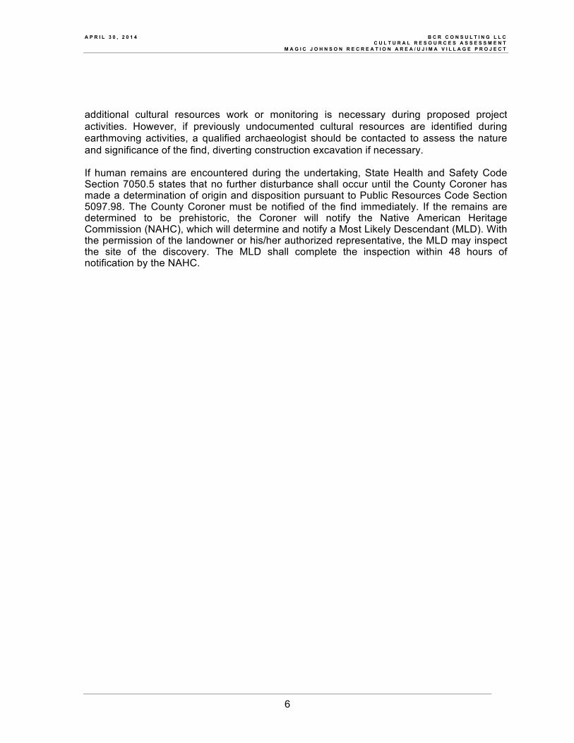
Photo 1: Project Site Overview from Clovis and El Segundo (View West)
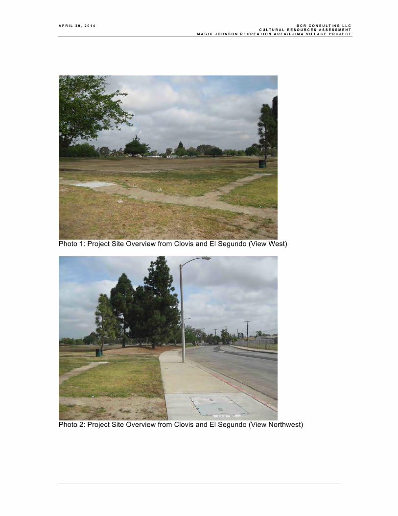
Photo 2: Project Site Overview from Clovis and El Segundo (View Northwest)
A P R I L 3 0 , 2 0 1 4 B C R C O N S U L T I N G L L C C U L T U R A L R E S O U R C E S A S S E S S M E N T M A G I C J O H N S O N R E C R E A T I O N A R E A / U J I M A V I L L A G E P R O J E C T
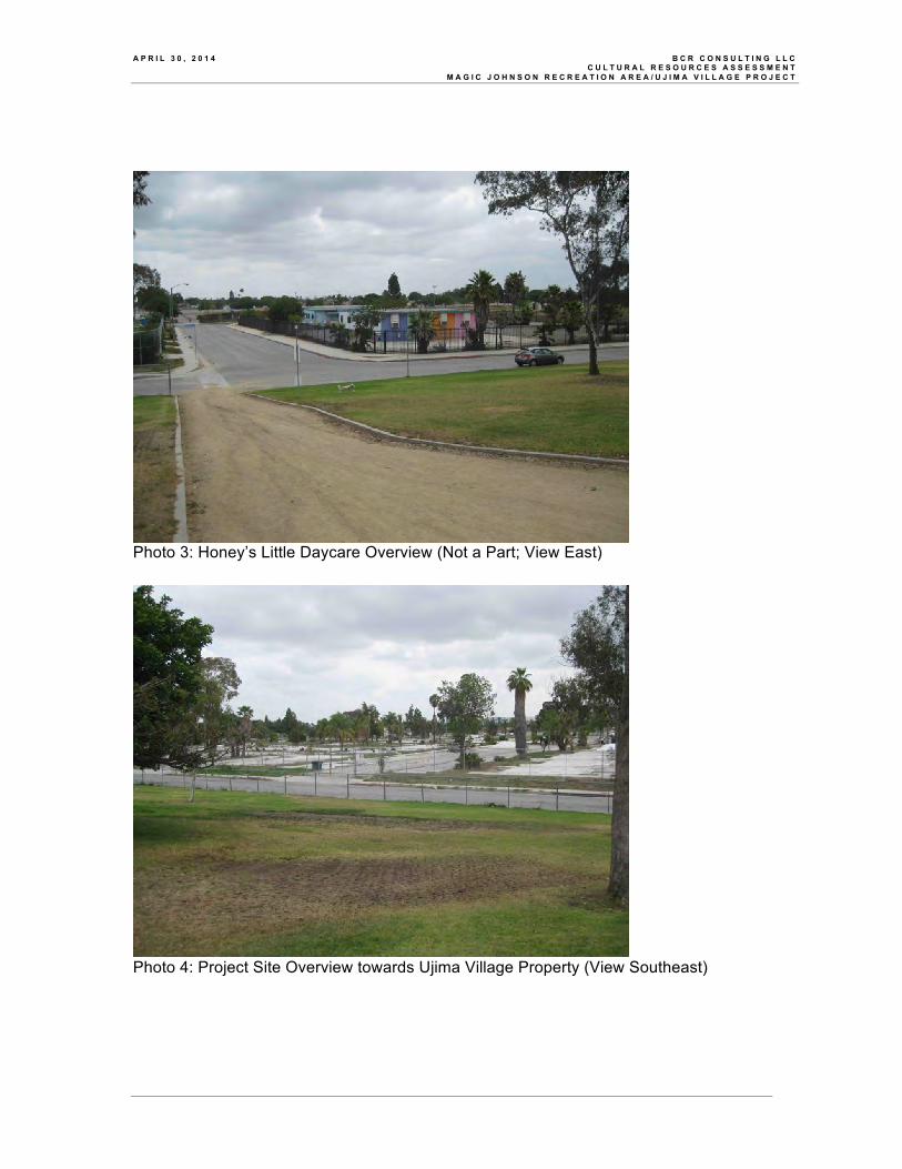
Photo 3: Honey’s Little Daycare Overview (Not a Part; View East)
Photo 4: Project Site Overview towards Ujima Village Property (View Southeast)
A P R I L 3 0 , 2 0 1 4 B C R C O N S U L T I N G L L C C U L T U R A L R E S O U R C E S A S S E S S M E N T M A G I C J O H N S O N R E C R E A T I O N A R E A / U J I M A V I L L A G E P R O J E C T
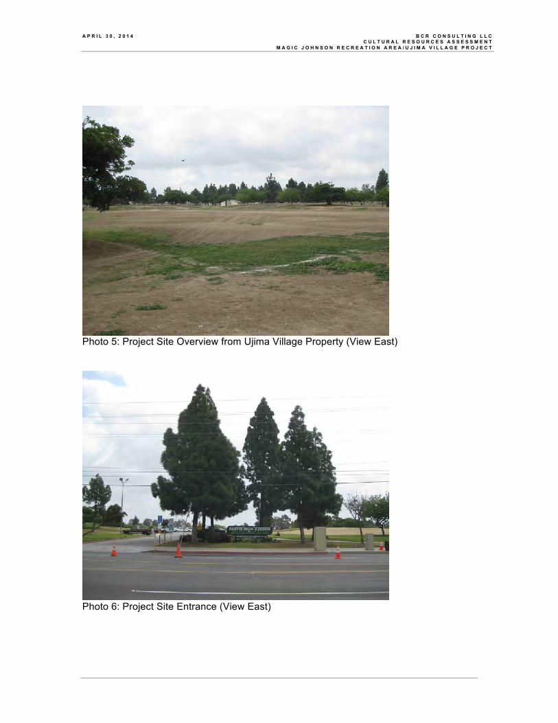
Photo 5: Project Site Overview from Ujima Village Property (View East)
Photo 6: Project Site Entrance (View East)

A P R I L 3 0 , 2 0 1 4 B C R C O N S U L T I N G L L C C U L T U R A L R E S O U R C E S A S S E S S M E N T M A G I C J O H N S O N R E C R E A T I O N A R E A / U J I M A V I L L A G E P R O J E C T
Photo 7: Footbridge Over Creek (View North)
Photo 8: North Lake (View North)

A P R I L 3 0 , 2 0 1 4 B C R C O N S U L T I N G L L C C U L T U R A L R E S O U R C E S A S S E S S M E N T M A G I C J O H N S O N R E C R E A T I O N A R E A / U J I M A V I L L A G E P R O J E C T
APPENDIX D
PALEONTOLOGICAL RESOURCES ASSESSMENT

Vertebrate Paleontology SectionTelephone: (213) 763-3325
Fax: (213) 746-7431e-mail: [email protected]
1 May 2014
BCR Consulting1420 Guadalajara PlaceClaremont, CA 91711
Attn: David Brunzell, Principal Investigator / Archaeologist
re: Paleontological resources for the proposed Magic Johnson Regional Park / Ujima VillageMaster Plan Project, in the City of Los Angeles, Los Angeles County, project area
Dear David:
I have conducted a thorough check of our paleontology collection records for the localityand specimen data for the proposed Magic Johnson Regional Park / Ujima Village Master PlanProject, in the City of Los Angeles, Los Angeles County, project area as outlined on the portionof the Inglewood USGS topographic quadrangle map that you sent to me via e-mail on 24 April2014. We do not have any vertebrate fossil localities that lie directly within the proposed projectboundaries, but we do we have fossil localities nearby from sedimentary deposits similar to thosethat may occur subsurface in the proposed project area.
The entire proposed project site area has surficial deposits of younger QuaternaryAlluvium, derived as alluvial fan deposits from the hills just to the west and as fluvial depositsfrom Compton Creek that flows just to the east. These younger Quaternary deposits usually donot contain significant vertebrate fossils, at least in the uppermost layers, but the underlying olderQuaternary deposits found at varying depths may well contain significant vertebrate fossils. Ourclosest vertebrate fossil locality from these older Quaternary deposits is probably LACM 4685,directly south of the western portion of the proposed project area between 135 and 136 Streetsth th
just east of Avalon Boulevard, that produced a fossil specimen of undetermined elephantoid,Proboscidea, from an unstated depth.
Our next closest vertebrate fossil localities from these older Quaternary deposits, LACM1344, 3266 and 3265, all directly west of the proposed project area around the Harbor Freewayand Athens on the Hill, produced fossil specimens of mammoth, Mammuthus, squirrel, Sciuridae,horse, Equus, and pronghorn antelope, Breameryx, at depths between 15 and 20 feet below thesurface. To the northwest of the proposed project area, at the Harbor Freeway (I-110) between112 and 113 Streets and along Imperial Highway near Main Street, we have additional olderth th
Quaternary localities LACM 1295 and 4206 that produced a typical late Pleistocene faunaincluding fossil specimens of pond turtle, Clemmys, puffin, Mancalla, turkey, Parapavo, groundsloth, Paramylodon, mammoth, Mammuthus, dire wolf, Canis dirus, rabbit, Sylvilagus, squirrel,Sciuridae, deer mouse, Microtus, pocket gopher, Thomomys, horse, Equus, deer, Cervus,pronghorn antelope, Capromeryx, and bison, Bison, at unstated but relatively shallow depths. Alittle further away but to the south-southeast of the proposed project area east of WilmingtonBoulevard and north of Artesia Boulevard, we have locality LACM 3382 that produced a fossilspecimen of mammoth Mammuthus, at a depth of approximately five feet below the surface.
Shallow excavations in the younger Quaternary Alluvium exposed throughout theproposed project area are unlikely to uncover significant vertebrate fossil remains. Deeperexcavations that extend down into older sedimentary deposits, however, may well encountersignificant vertebrate fossils. Any substantial excavations in the proposed project area, therefore,should be closely monitored to quickly and professionally collect any specimens withoutimpeding development. Any fossils recovered during mitigation should be deposited in anaccredited and permanent scientific institution for the benefit of current and future generations.
This records search covers only the vertebrate paleontology records of the Natural HistoryMuseum of Los Angeles County. It is not intended to be a thorough paleontological survey ofthe proposed project area covering other institutional records, a literature survey, or any potentialon-site survey.
Sincerely,
Samuel A. McLeod, Ph.D.Vertebrate Paleontology
enclosure: invoice