Embed Size (px)
Citation preview
Appendices
High School #5 PEA Irvine Unified School District
Appendix C Environmental Database Search Report
Appendices
The Planning Center|DC&E January 2014
This page left blank intentionally.
FORM-BAT-BXD
®kcehCoeG htiw tropeR ™paM suidaR RDE ehT
440 Wheelers Farms RoadMilford, CT 06461Toll Free: 800.352.0050www.edrnet.com
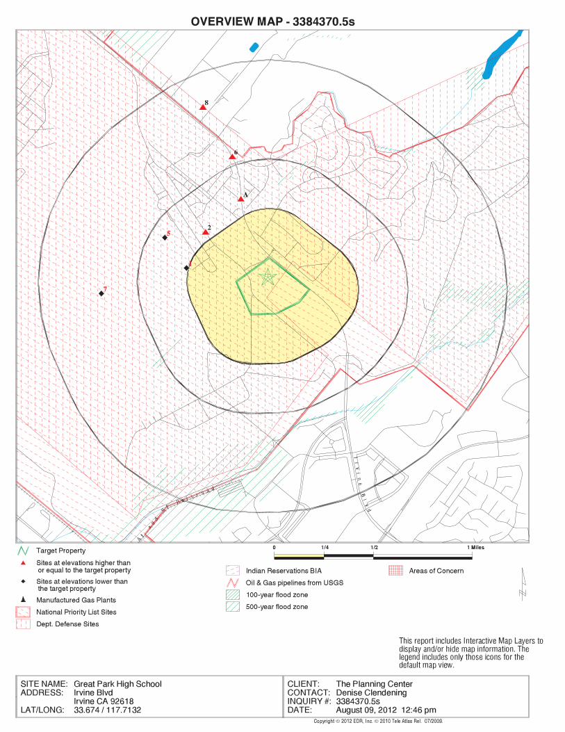
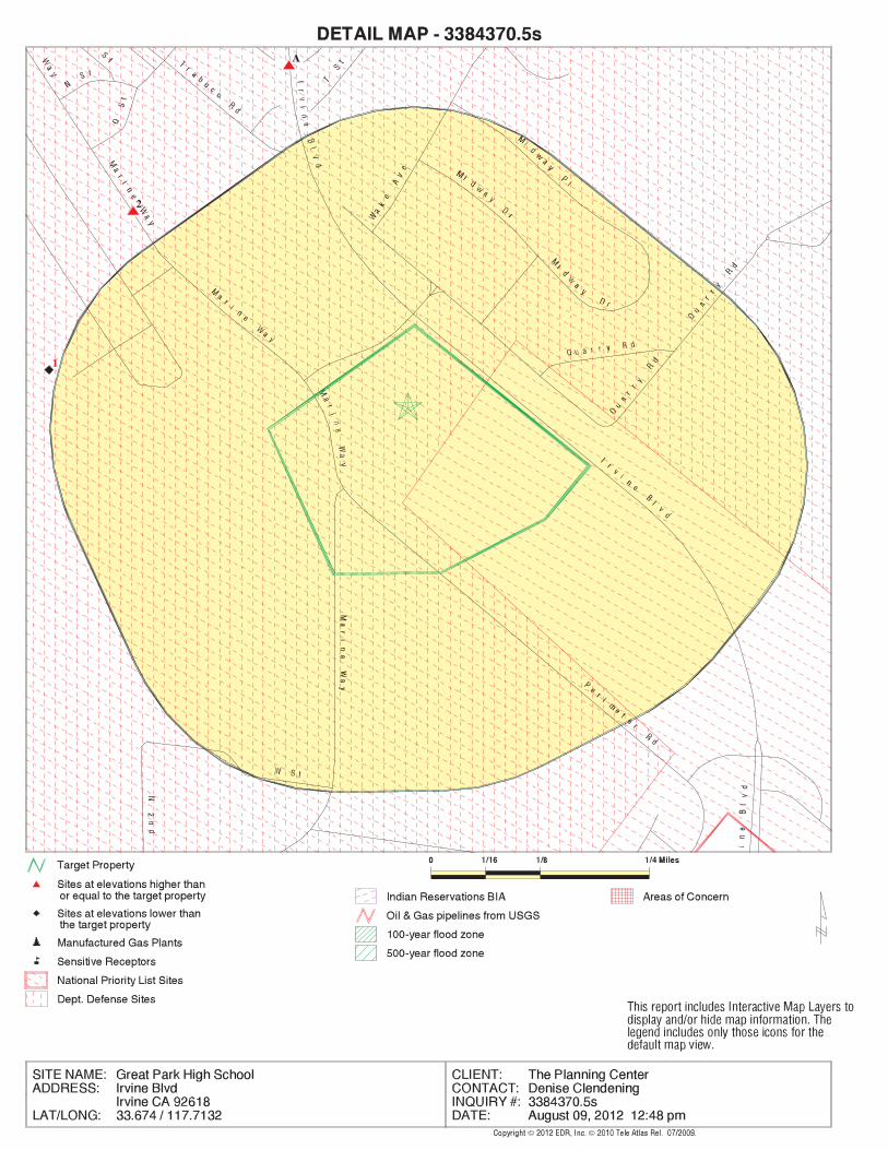
Great Park High SchoolIrvine BlvdIrvine, CA 92618
Inquiry Number: 3384370.5sAugust 09, 2012
SECTION PAGE
Executive Summary ES1
Overview Map 2
Detail Map 3
Map Findings Summary 4
Map Findings 8
Orphan Summary 240
Government Records Searched/Data Currency Tracking GR-1
GEOCHECK ADDENDUM
Physical Setting Source Addendum A-1
Physical Setting Source Summary A-2
Physical Setting SSURGO Soil Map A-5
Physical Setting Source Map A-8
Physical Setting Source Map Findings A-10
Physical Setting Source Records Searched A-14
TC3384370.5s Page 1
Thank you for your business.Please contact EDR at 1-800-352-0050
with any questions or comments.
Disclaimer - Copyright and Trademark Notice
This Report contains certain information obtained from a variety of public and other sources reasonably available to Environmental DataResources, Inc. It cannot be concluded from this Report that coverage information for the target and surrounding properties does not exist fromother sources. NO WARRANTY EXPRESSED OR IMPLIED, IS MADE WHATSOEVER IN CONNECTION WITH THIS REPORT. ENVIRONMENTALDATA RESOURCES, INC. SPECIFICALLY DISCLAIMS THE MAKING OF ANY SUCH WARRANTIES, INCLUDING WITHOUT LIMITATION,MERCHANTABILITY OR FITNESS FOR A PARTICULAR USE OR PURPOSE. ALL RISK IS ASSUMED BY THE USER. IN NO EVENT SHALLENVIRONMENTAL DATA RESOURCES, INC. BE LIABLE TO ANYONE, WHETHER ARISING OUT OF ERRORS OR OMISSIONS, NEGLIGENCE,ACCIDENT OR ANY OTHER CAUSE, FOR ANY LOSS OF DAMAGE, INCLUDING, WITHOUT LIMITATION, SPECIAL, INCIDENTAL,CONSEQUENTIAL, OR EXEMPLARY DAMAGES. ANY LIABILITY ON THE PART OF ENVIRONMENTAL DATA RESOURCES, INC. IS STRICTLYLIMITED TO A REFUND OF THE AMOUNT PAID FOR THIS REPORT. Purchaser accepts this Report "AS IS". Any analyses, estimates, ratings,environmental risk levels or risk codes provided in this Report are provided for illustrative purposes only, and are not intended to provide, norshould they be interpreted as providing any facts regarding, or prediction or forecast of, any environmental risk for any property. Only a Phase IEnvironmental Site Assessment performed by an environmental professional can provide information regarding the environmental risk for anyproperty. Additionally, the information provided in this Report is not to be construed as legal advice.
Copyright 2012 by Environmental Data Resources, Inc. All rights reserved. Reproduction in any media or format, in wholeor in part, of any report or map of Environmental Data Resources, Inc., or its affiliates, is prohibited without prior written permission.
EDR and its logos (including Sanborn and Sanborn Map) are trademarks of Environmental Data Resources, Inc. or its affiliates. All othertrademarks used herein are the property of their respective owners.
TABLE OF CONTENTS
EXECUTIVE SUMMARY
TC3384370.5s EXECUTIVE SUMMARY 1
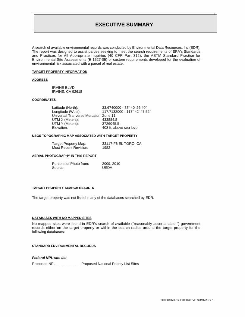
A search of available environmental records was conducted by Environmental Data Resources, Inc (EDR).The report was designed to assist parties seeking to meet the search requirements of EPA’s Standardsand Practices for All Appropriate Inquiries (40 CFR Part 312), the ASTM Standard Practice forEnvironmental Site Assessments (E 1527-05) or custom requirements developed for the evaluation ofenvironmental risk associated with a parcel of real estate.
TARGET PROPERTY INFORMATION
ADDRESS
IRVINE BLVDIRVINE, CA 92618
COORDINATES
33.6740000 - 33˚ 40’ 26.40’’Latitude (North): 117.7132000 - 117˚ 42’ 47.52’’Longitude (West): Zone 11Universal Tranverse Mercator: 433884.8UTM X (Meters): 3726045.5UTM Y (Meters): 408 ft. above sea levelElevation:
USGS TOPOGRAPHIC MAP ASSOCIATED WITH TARGET PROPERTY
33117-F6 EL TORO, CATarget Property Map:1982Most Recent Revision:
AERIAL PHOTOGRAPHY IN THIS REPORT
2009, 2010Portions of Photo from:USDASource:
TARGET PROPERTY SEARCH RESULTS
The target property was not listed in any of the databases searched by EDR.
DATABASES WITH NO MAPPED SITES
No mapped sites were found in EDR’s search of available ("reasonably ascertainable ") governmentrecords either on the target property or within the search radius around the target property for thefollowing databases:
STANDARD ENVIRONMENTAL RECORDS
Federal NPL site list
Proposed NPL Proposed National Priority List Sites
EXECUTIVE SUMMARY
TC3384370.5s EXECUTIVE SUMMARY 2
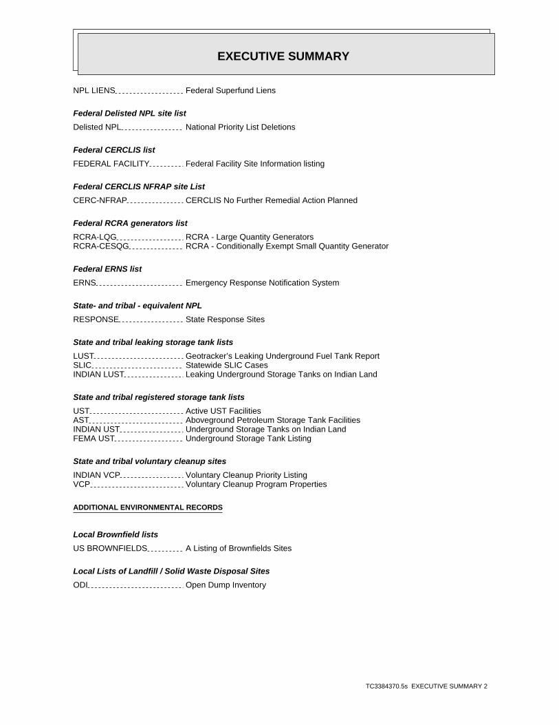
NPL LIENS Federal Superfund Liens
Federal Delisted NPL site list
Delisted NPL National Priority List Deletions
Federal CERCLIS list
FEDERAL FACILITY Federal Facility Site Information listing
Federal CERCLIS NFRAP site List
CERC-NFRAP CERCLIS No Further Remedial Action Planned
Federal RCRA generators list
RCRA-LQG RCRA - Large Quantity GeneratorsRCRA-CESQG RCRA - Conditionally Exempt Small Quantity Generator
Federal ERNS list
ERNS Emergency Response Notification System
State- and tribal - equivalent NPL
RESPONSE State Response Sites
State and tribal leaking storage tank lists
LUST Geotracker’s Leaking Underground Fuel Tank ReportSLIC Statewide SLIC CasesINDIAN LUST Leaking Underground Storage Tanks on Indian Land
State and tribal registered storage tank lists
UST Active UST FacilitiesAST Aboveground Petroleum Storage Tank FacilitiesINDIAN UST Underground Storage Tanks on Indian LandFEMA UST Underground Storage Tank Listing
State and tribal voluntary cleanup sites
INDIAN VCP Voluntary Cleanup Priority ListingVCP Voluntary Cleanup Program Properties
ADDITIONAL ENVIRONMENTAL RECORDS
Local Brownfield lists
US BROWNFIELDS A Listing of Brownfields Sites
Local Lists of Landfill / Solid Waste Disposal Sites
ODI Open Dump Inventory
EXECUTIVE SUMMARY
TC3384370.5s EXECUTIVE SUMMARY 3
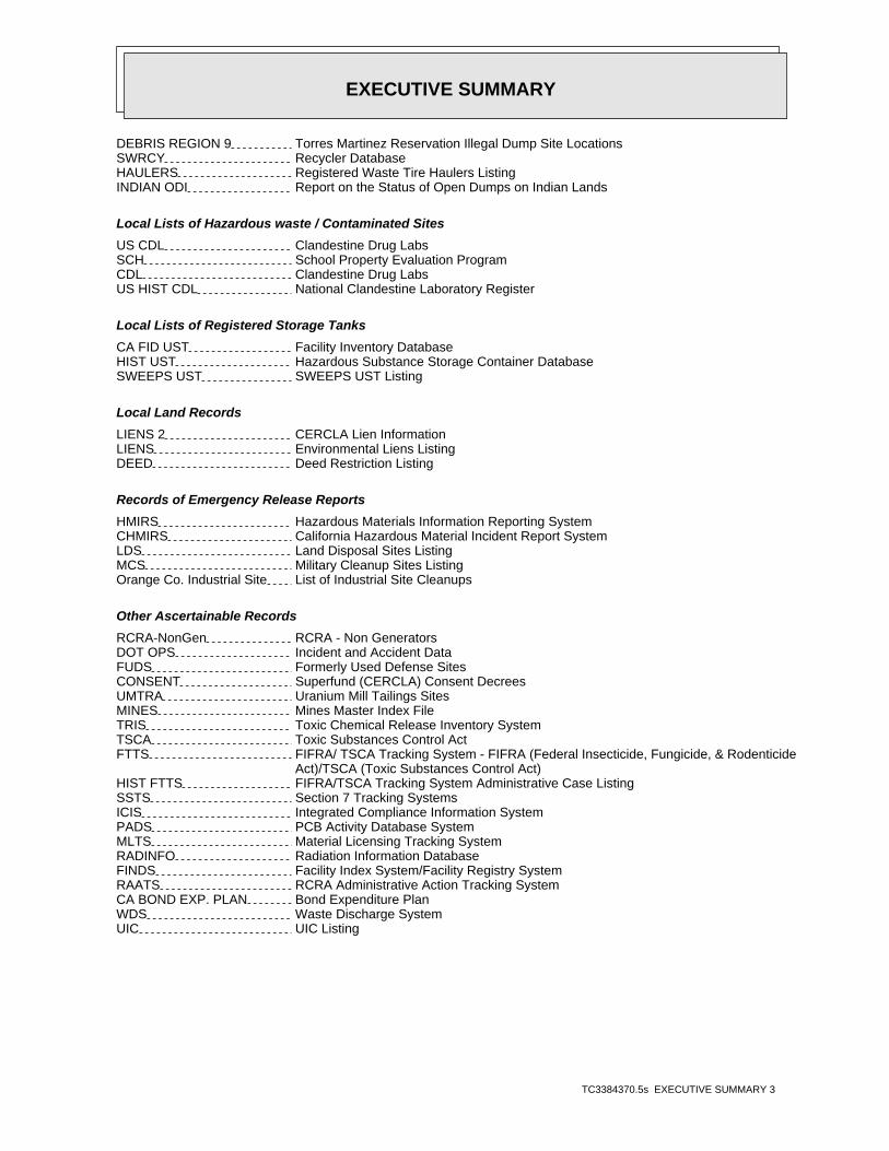
DEBRIS REGION 9 Torres Martinez Reservation Illegal Dump Site LocationsSWRCY Recycler DatabaseHAULERS Registered Waste Tire Haulers ListingINDIAN ODI Report on the Status of Open Dumps on Indian Lands
Local Lists of Hazardous waste / Contaminated Sites
US CDL Clandestine Drug LabsSCH School Property Evaluation ProgramCDL Clandestine Drug LabsUS HIST CDL National Clandestine Laboratory Register
Local Lists of Registered Storage Tanks
CA FID UST Facility Inventory DatabaseHIST UST Hazardous Substance Storage Container DatabaseSWEEPS UST SWEEPS UST Listing
Local Land Records
LIENS 2 CERCLA Lien InformationLIENS Environmental Liens ListingDEED Deed Restriction Listing
Records of Emergency Release Reports
HMIRS Hazardous Materials Information Reporting SystemCHMIRS California Hazardous Material Incident Report SystemLDS Land Disposal Sites ListingMCS Military Cleanup Sites ListingOrange Co. Industrial Site List of Industrial Site Cleanups
Other Ascertainable Records
RCRA-NonGen RCRA - Non GeneratorsDOT OPS Incident and Accident DataFUDS Formerly Used Defense SitesCONSENT Superfund (CERCLA) Consent DecreesUMTRA Uranium Mill Tailings SitesMINES Mines Master Index FileTRIS Toxic Chemical Release Inventory SystemTSCA Toxic Substances Control ActFTTS FIFRA/ TSCA Tracking System - FIFRA (Federal Insecticide, Fungicide, & Rodenticide Act)/TSCA (Toxic Substances Control Act)HIST FTTS FIFRA/TSCA Tracking System Administrative Case ListingSSTS Section 7 Tracking SystemsICIS Integrated Compliance Information SystemPADS PCB Activity Database SystemMLTS Material Licensing Tracking SystemRADINFO Radiation Information DatabaseFINDS Facility Index System/Facility Registry SystemRAATS RCRA Administrative Action Tracking SystemCA BOND EXP. PLAN Bond Expenditure PlanWDS Waste Discharge SystemUIC UIC Listing
EXECUTIVE SUMMARY
TC3384370.5s EXECUTIVE SUMMARY 4
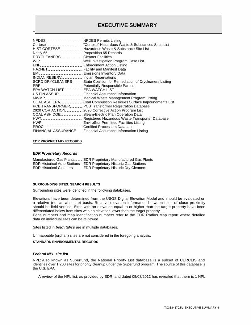
NPDES NPDES Permits ListingCortese "Cortese" Hazardous Waste & Substances Sites ListHIST CORTESE Hazardous Waste & Substance Site ListNotify 65 Proposition 65 RecordsDRYCLEANERS Cleaner FacilitiesWIP Well Investigation Program Case ListENF Enforcement Action ListingHAZNET Facility and Manifest DataEMI Emissions Inventory DataINDIAN RESERV Indian ReservationsSCRD DRYCLEANERS State Coalition for Remediation of Drycleaners ListingPRP Potentially Responsible PartiesEPA WATCH LIST EPA WATCH LISTUS FIN ASSUR Financial Assurance InformationMWMP Medical Waste Management Program ListingCOAL ASH EPA Coal Combustion Residues Surface Impoundments ListPCB TRANSFORMER PCB Transformer Registration Database2020 COR ACTION 2020 Corrective Action Program ListCOAL ASH DOE Sleam-Electric Plan Operation DataHWT Registered Hazardous Waste Transporter DatabaseHWP EnviroStor Permitted Facilities ListingPROC Certified Processors DatabaseFINANCIAL ASSURANCE Financial Assurance Information Listing
EDR PROPRIETARY RECORDS
EDR Proprietary Records
Manufactured Gas Plants EDR Proprietary Manufactured Gas PlantsEDR Historical Auto Stations EDR Proprietary Historic Gas StationsEDR Historical Cleaners EDR Proprietary Historic Dry Cleaners
SURROUNDING SITES: SEARCH RESULTS
Surrounding sites were identified in the following databases.
Elevations have been determined from the USGS Digital Elevation Model and should be evaluated ona relative (not an absolute) basis. Relative elevation information between sites of close proximityshould be field verified. Sites with an elevation equal to or higher than the target property have beendifferentiated below from sites with an elevation lower than the target property.Page numbers and map identification numbers refer to the EDR Radius Map report where detaileddata on individual sites can be reviewed.
Sites listed in bold italics are in multiple databases.
Unmappable (orphan) sites are not considered in the foregoing analysis.
STANDARD ENVIRONMENTAL RECORDS
Federal NPL site list
NPL: Also known as Superfund, the National Priority List database is a subset of CERCLIS andidentifies over 1,200 sites for priority cleanup under the Superfund program. The source of this database isthe U.S. EPA.
A review of the NPL list, as provided by EDR, and dated 05/08/2012 has revealed that there is 1 NPL
EXECUTIVE SUMMARY
TC3384370.5s EXECUTIVE SUMMARY 5
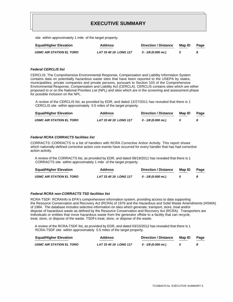
site within approximately 1 mile of the target property.
PageMap IDDirection / Distance Address Equal/Higher Elevation ____________________ ________ ___________________ _____ _____
USMC AIR STATION EL TORO LAT 33 40 19 LONG 117 0 - 1/8 (0.000 mi.) 0 8
Federal CERCLIS list
CERCLIS: The Comprehensive Environmental Response, Compensation and Liability Information Systemcontains data on potentially hazardous waste sites that have been reported to the USEPA by states,municipalities, private companies and private persons, pursuant to Section 103 of the ComprehensiveEnvironmental Response, Compensation and Liability Act (CERCLA). CERCLIS contains sites which are eitherproposed to or on the National Priorities List (NPL) and sites which are in the screening and assessment phasefor possible inclusion on the NPL.
A review of the CERCLIS list, as provided by EDR, and dated 12/27/2011 has revealed that there is 1 CERCLIS site within approximately 0.5 miles of the target property.
PageMap IDDirection / Distance Address Equal/Higher Elevation ____________________ ________ ___________________ _____ _____
USMC AIR STATION EL TORO LAT 33 40 19 LONG 117 0 - 1/8 (0.000 mi.) 0 8
Federal RCRA CORRACTS facilities list
CORRACTS: CORRACTS is a list of handlers with RCRA Corrective Action Activity. This report showswhich nationally-defined corrective action core events have occurred for every handler that has had correctiveaction activity.
A review of the CORRACTS list, as provided by EDR, and dated 08/19/2011 has revealed that there is 1 CORRACTS site within approximately 1 mile of the target property.
PageMap IDDirection / Distance Address Equal/Higher Elevation ____________________ ________ ___________________ _____ _____
USMC AIR STATION EL TORO LAT 33 40 19 LONG 117 0 - 1/8 (0.000 mi.) 0 8
Federal RCRA non-CORRACTS TSD facilities list
RCRA-TSDF: RCRAInfo is EPA’s comprehensive information system, providing access to data supportingthe Resource Conservation and Recovery Act (RCRA) of 1976 and the Hazardous and Solid Waste Amendments (HSWA)of 1984. The database includes selective information on sites which generate, transport, store, treat and/ordispose of hazardous waste as defined by the Resource Conservation and Recovery Act (RCRA). Transporters areindividuals or entities that move hazardous waste from the generator offsite to a facility that can recycle,treat, store, or dispose of the waste. TSDFs treat, store, or dispose of the waste.
A review of the RCRA-TSDF list, as provided by EDR, and dated 03/15/2012 has revealed that there is 1 RCRA-TSDF site within approximately 0.5 miles of the target property.
PageMap IDDirection / Distance Address Equal/Higher Elevation ____________________ ________ ___________________ _____ _____
USMC AIR STATION EL TORO LAT 33 40 19 LONG 117 0 - 1/8 (0.000 mi.) 0 8

EXECUTIVE SUMMARY
TC3384370.5s EXECUTIVE SUMMARY 6
Federal RCRA generators list
RCRA-SQG: RCRAInfo is EPA’s comprehensive information system, providing access to data supportingthe Resource Conservation and Recovery Act (RCRA) of 1976 and the Hazardous and Solid Waste Amendments (HSWA)of 1984. The database includes selective information on sites which generate, transport, store, treat and/ordispose of hazardous waste as defined by the Resource Conservation and Recovery Act (RCRA). Small quantitygenerators (SQGs) generate between 100 kg and 1,000 kg of hazardous waste per month.
A review of the RCRA-SQG list, as provided by EDR, and dated 03/15/2012 has revealed that there is 1 RCRA-SQG site within approximately 0.25 miles of the target property.
PageMap IDDirection / Distance Address Equal/Higher Elevation ____________________ ________ ___________________ _____ _____
USMC AIR STATION EL TORO LAT 33 40 19 LONG 117 0 - 1/8 (0.000 mi.) 0 8
Federal institutional controls / engineering controls registries
US ENG CONTROLS: A listing of sites with engineering controls in place.
A review of the US ENG CONTROLS list, as provided by EDR, and dated 12/30/2011 has revealed that there is 1 US ENG CONTROLS site within approximately 0.5 miles of the target property.
PageMap IDDirection / Distance Address Equal/Higher Elevation ____________________ ________ ___________________ _____ _____
USMC AIR STATION EL TORO LAT 33 40 19 LONG 117 0 - 1/8 (0.000 mi.) 0 8
US INST CONTROL: A listing of sites with institutional controls in place. Institutional controls includeadministrative measures, such as groundwater use restrictions, construction restrictions, property userestrictions, and post remediation care requirements intended to prevent exposure to contaminants remaining onsite. Deed restrictions are generally required as part of the institutional controls.
A review of the US INST CONTROL list, as provided by EDR, and dated 12/30/2011 has revealed that there is 1 US INST CONTROL site within approximately 0.5 miles of the target property.
PageMap IDDirection / Distance Address Equal/Higher Elevation ____________________ ________ ___________________ _____ _____
USMC AIR STATION EL TORO LAT 33 40 19 LONG 117 0 - 1/8 (0.000 mi.) 0 8
State- and tribal - equivalent CERCLIS
ENVIROSTOR: The Department of Toxic Substances Control’s (DTSC’s) Site Mitigation and BrownfieldsReuse Program’s (SMBRP’s) EnviroStor database identifes sites that have known contamination or sites for whichthere may be reasons to investigate further. The database includes the following site types: FederalSuperfund sites (National Priorities List (NPL)); State Response, including Military Facilities and StateSuperfund; Voluntary Cleanup; and School sites. EnviroStor provides similar information to the informationthat was available in CalSites, and provides additional site information, including, but not limited to,identification of formerly-contaminated properties that have been released for reuse, properties whereenvironmental deed restrictions have been recorded to prevent inappropriate land uses, and riskcharacterization information that is used to assess potential impacts to public health and the environment atcontaminated sites.
A review of the ENVIROSTOR list, as provided by EDR, and dated 06/13/2012 has revealed that there are
EXECUTIVE SUMMARY
TC3384370.5s EXECUTIVE SUMMARY 7
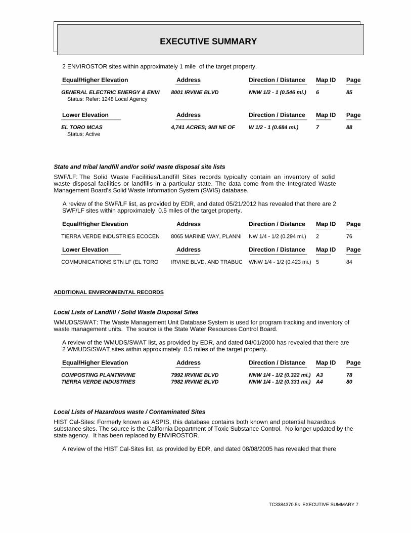
2 ENVIROSTOR sites within approximately 1 mile of the target property.
PageMap IDDirection / Distance Address Equal/Higher Elevation ____________________ ________ ___________________ _____ _____
GENERAL ELECTRIC ENERGY & ENVI 8001 IRVINE BLVD NNW 1/2 - 1 (0.546 mi.) 6 85Status: Refer: 1248 Local Agency
PageMap IDDirection / Distance Address Lower Elevation ____________________ ________ ___________________ _____ _____
EL TORO MCAS 4,741 ACRES; 9MI NE OF W 1/2 - 1 (0.684 mi.) 7 88Status: Active
State and tribal landfill and/or solid waste disposal site lists
SWF/LF: The Solid Waste Facilities/Landfill Sites records typically contain an inventory of solidwaste disposal facilities or landfills in a particular state. The data come from the Integrated WasteManagement Board’s Solid Waste Information System (SWIS) database.
A review of the SWF/LF list, as provided by EDR, and dated 05/21/2012 has revealed that there are 2 SWF/LF sites within approximately 0.5 miles of the target property.
PageMap IDDirection / Distance Address Equal/Higher Elevation ____________________ ________ ___________________ _____ _____
TIERRA VERDE INDUSTRIES ECOCEN 8065 MARINE WAY, PLANNI NW 1/4 - 1/2 (0.294 mi.) 2 76
PageMap IDDirection / Distance Address Lower Elevation ____________________ ________ ___________________ _____ _____
COMMUNICATIONS STN LF (EL TORO IRVINE BLVD. AND TRABUC WNW 1/4 - 1/2 (0.423 mi.) 5 84
ADDITIONAL ENVIRONMENTAL RECORDS
Local Lists of Landfill / Solid Waste Disposal Sites
WMUDS/SWAT: The Waste Management Unit Database System is used for program tracking and inventory ofwaste management units. The source is the State Water Resources Control Board.
A review of the WMUDS/SWAT list, as provided by EDR, and dated 04/01/2000 has revealed that there are 2 WMUDS/SWAT sites within approximately 0.5 miles of the target property.
PageMap IDDirection / Distance Address Equal/Higher Elevation ____________________ ________ ___________________ _____ _____
COMPOSTING PLANTIRVINE 7992 IRVINE BLVD NNW 1/4 - 1/2 (0.322 mi.) A3 78 TIERRA VERDE INDUSTRIES 7982 IRVINE BLVD NNW 1/4 - 1/2 (0.331 mi.) A4 80
Local Lists of Hazardous waste / Contaminated Sites
HIST Cal-Sites: Formerly known as ASPIS, this database contains both known and potential hazardoussubstance sites. The source is the California Department of Toxic Substance Control. No longer updated by thestate agency. It has been replaced by ENVIROSTOR.
A review of the HIST Cal-Sites list, as provided by EDR, and dated 08/08/2005 has revealed that there
EXECUTIVE SUMMARY
TC3384370.5s EXECUTIVE SUMMARY 8
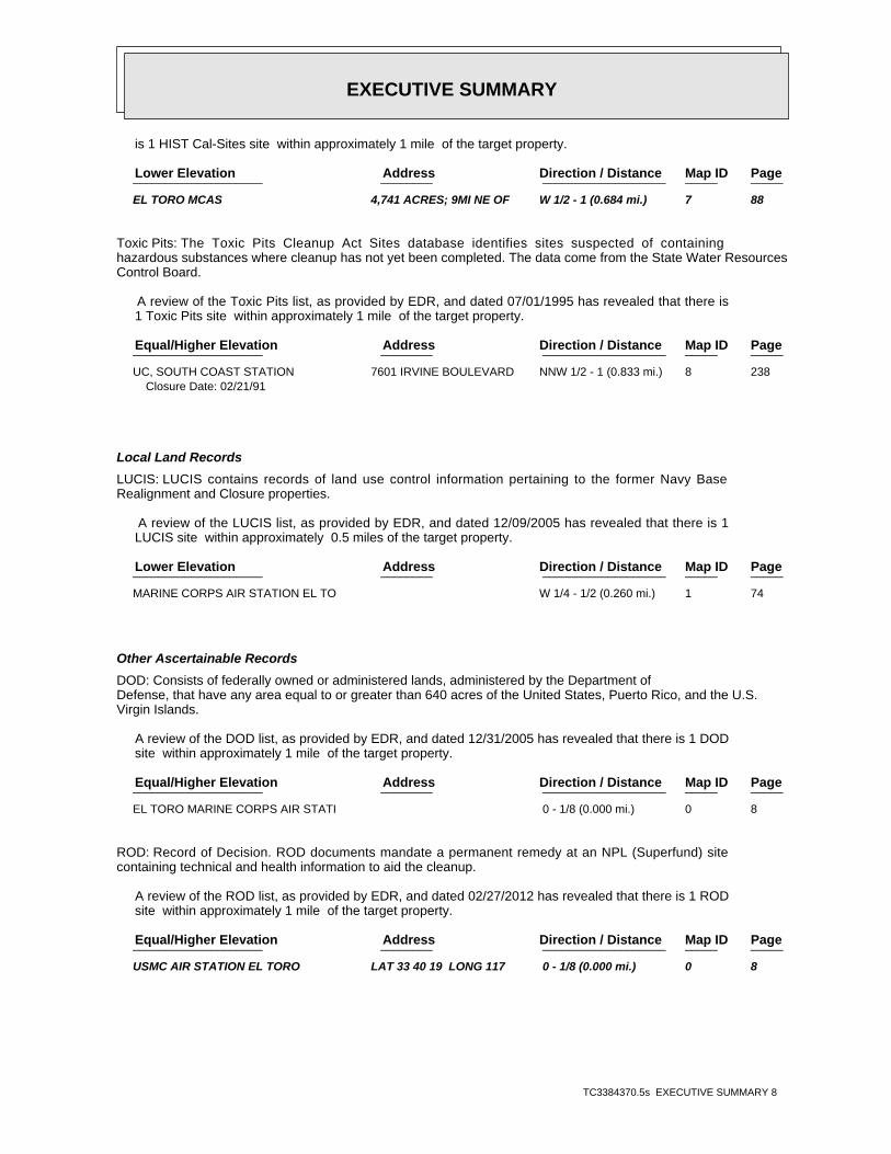
is 1 HIST Cal-Sites site within approximately 1 mile of the target property.
PageMap IDDirection / Distance Address Lower Elevation ____________________ ________ ___________________ _____ _____
EL TORO MCAS 4,741 ACRES; 9MI NE OF W 1/2 - 1 (0.684 mi.) 7 88
Toxic Pits: The Toxic Pits Cleanup Act Sites database identifies sites suspected of containinghazardous substances where cleanup has not yet been completed. The data come from the State Water ResourcesControl Board.
A review of the Toxic Pits list, as provided by EDR, and dated 07/01/1995 has revealed that there is 1 Toxic Pits site within approximately 1 mile of the target property.
PageMap IDDirection / Distance Address Equal/Higher Elevation ____________________ ________ ___________________ _____ _____
UC, SOUTH COAST STATION 7601 IRVINE BOULEVARD NNW 1/2 - 1 (0.833 mi.) 8 238Closure Date: 02/21/91
Local Land Records
LUCIS: LUCIS contains records of land use control information pertaining to the former Navy BaseRealignment and Closure properties.
A review of the LUCIS list, as provided by EDR, and dated 12/09/2005 has revealed that there is 1 LUCIS site within approximately 0.5 miles of the target property.
PageMap IDDirection / Distance Address Lower Elevation ____________________ ________ ___________________ _____ _____
MARINE CORPS AIR STATION EL TO W 1/4 - 1/2 (0.260 mi.) 1 74
Other Ascertainable Records
DOD: Consists of federally owned or administered lands, administered by the Department ofDefense, that have any area equal to or greater than 640 acres of the United States, Puerto Rico, and the U.S.Virgin Islands.
A review of the DOD list, as provided by EDR, and dated 12/31/2005 has revealed that there is 1 DOD site within approximately 1 mile of the target property.
PageMap IDDirection / Distance Address Equal/Higher Elevation ____________________ ________ ___________________ _____ _____
EL TORO MARINE CORPS AIR STATI 0 - 1/8 (0.000 mi.) 0 8
ROD: Record of Decision. ROD documents mandate a permanent remedy at an NPL (Superfund) sitecontaining technical and health information to aid the cleanup.
A review of the ROD list, as provided by EDR, and dated 02/27/2012 has revealed that there is 1 ROD site within approximately 1 mile of the target property.
PageMap IDDirection / Distance Address Equal/Higher Elevation ____________________ ________ ___________________ _____ _____
USMC AIR STATION EL TORO LAT 33 40 19 LONG 117 0 - 1/8 (0.000 mi.) 0 8
EXECUTIVE SUMMARY
TC3384370.5s EXECUTIVE SUMMARY 9
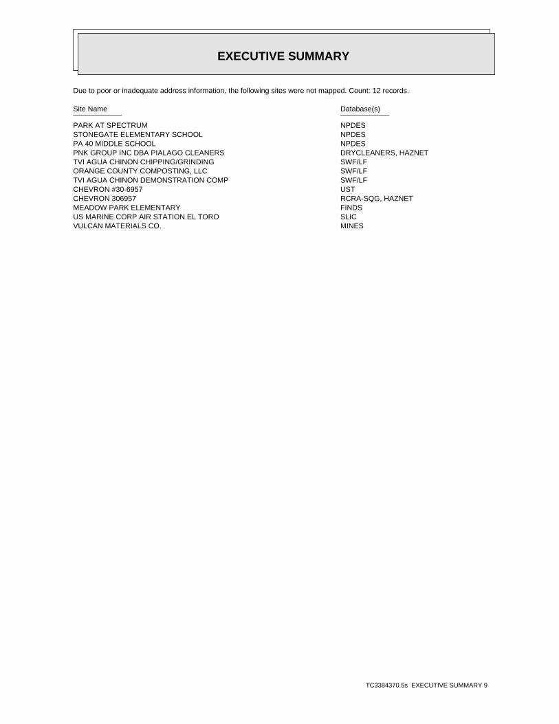
Due to poor or inadequate address information, the following sites were not mapped. Count: 12 records.
Site Name Database(s)____________ ____________
PARK AT SPECTRUM NPDESSTONEGATE ELEMENTARY SCHOOL NPDESPA 40 MIDDLE SCHOOL NPDESPNK GROUP INC DBA PIALAGO CLEANERS DRYCLEANERS, HAZNETTVI AGUA CHINON CHIPPING/GRINDING SWF/LFORANGE COUNTY COMPOSTING, LLC SWF/LFTVI AGUA CHINON DEMONSTRATION COMP SWF/LFCHEVRON #30-6957 USTCHEVRON 306957 RCRA-SQG, HAZNETMEADOW PARK ELEMENTARY FINDSUS MARINE CORP AIR STATION EL TORO SLICVULCAN MATERIALS CO. MINES
EDR Inc.EDR Inc.EDR Inc.EDR Inc.EDR Inc.EDR Inc.EDR Inc.EDR Inc.EDR Inc.EDR Inc.EDR Inc.EDR Inc.EDR Inc.EDR Inc.EDR Inc.EDR Inc.EDR Inc.EDR Inc.EDR Inc.EDR Inc.EDR Inc.EDR Inc.EDR Inc.EDR Inc.EDR Inc.EDR Inc.EDR Inc.EDR Inc.EDR Inc.EDR Inc.EDR Inc.EDR Inc.EDR Inc.EDR Inc.EDR Inc.EDR Inc.EDR Inc.EDR Inc.EDR Inc.EDR Inc.
640
7 60
72 0
6 00
80
0
7
6 060
0
5 6 0
6 80
5 2 0
5 2 0
6 00
72
0
5 6 0
7 2 0
68
0
6 4 0
6 40
6
8 06 4 0
68
0
64
0
5 60
68
06
40
5 20 64
0
6
4 0
320
3
36
0
360
3
40
0
400400
4
0 0
44
0
4 4 0
4 4 0
4 4 0
4 4 0
48
0
4 8 0
48
0
48
0
4 8 0
5 2 0
5 2 0
52
0
52
0
5 2 0
52
0
5 6 0
5 6 0
56
0
56
0
56
0
5 6 0
5 6 0
5 6 0
60
0
6
00
6 0 0
60
0 6 0 0
60
0
60 0
60
0
60
0
64
0
64 0
6 4 0
6 80
68
0
7 2 0
72
0
EDR Inc.EDR Inc.EDR Inc.EDR Inc.EDR Inc.EDR Inc.EDR Inc.EDR Inc.EDR Inc.EDR Inc.EDR Inc.EDR Inc.EDR Inc.EDR Inc.EDR Inc.EDR Inc.EDR Inc.EDR Inc.EDR Inc.EDR Inc.EDR Inc.EDR Inc.EDR Inc.EDR Inc.EDR Inc.EDR Inc.EDR Inc.EDR Inc.EDR Inc.EDR Inc.EDR Inc.EDR Inc.EDR Inc.EDR Inc.EDR Inc.EDR Inc.EDR Inc.EDR Inc.EDR Inc.EDR Inc.
5 6 0
400
440
4 4 0
480
480
520
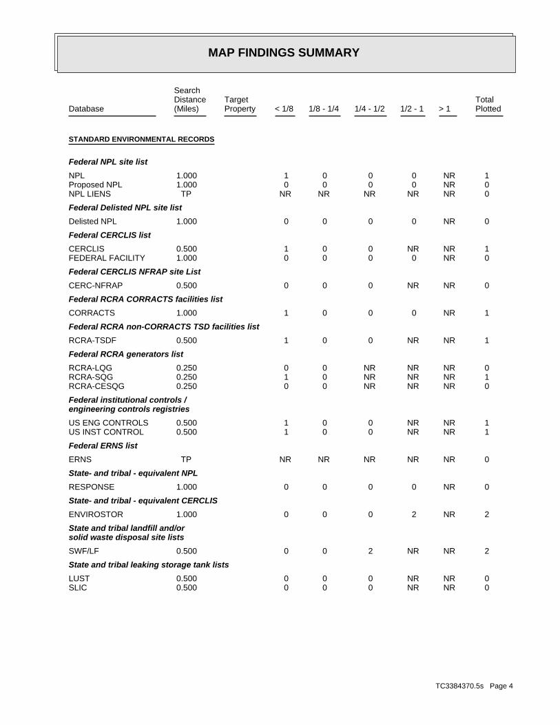
MAP FINDINGS SUMMARY
SearchTargetDistance Total
Database Property(Miles) < 1/8 1/8 - 1/4 1/4 - 1/2 1/2 - 1 > 1 Plotted
STANDARD ENVIRONMENTAL RECORDS
Federal NPL site list
1 NR 0 0 0 1 1.000NPL 0 NR 0 0 0 0 1.000Proposed NPL 0 NR NR NR NR NR TPNPL LIENS
Federal Delisted NPL site list
0 NR 0 0 0 0 1.000Delisted NPL
Federal CERCLIS list
1 NR NR 0 0 1 0.500CERCLIS 0 NR 0 0 0 0 1.000FEDERAL FACILITY
Federal CERCLIS NFRAP site List
0 NR NR 0 0 0 0.500CERC-NFRAP
Federal RCRA CORRACTS facilities list
1 NR 0 0 0 1 1.000CORRACTS
Federal RCRA non-CORRACTS TSD facilities list
1 NR NR 0 0 1 0.500RCRA-TSDF
Federal RCRA generators list
0 NR NR NR 0 0 0.250RCRA-LQG 1 NR NR NR 0 1 0.250RCRA-SQG 0 NR NR NR 0 0 0.250RCRA-CESQG
Federal institutional controls /engineering controls registries
1 NR NR 0 0 1 0.500US ENG CONTROLS 1 NR NR 0 0 1 0.500US INST CONTROL
Federal ERNS list
0 NR NR NR NR NR TPERNS
State- and tribal - equivalent NPL
0 NR 0 0 0 0 1.000RESPONSE
State- and tribal - equivalent CERCLIS
2 NR 2 0 0 0 1.000ENVIROSTOR
State and tribal landfill and/orsolid waste disposal site lists
2 NR NR 2 0 0 0.500SWF/LF
State and tribal leaking storage tank lists
0 NR NR 0 0 0 0.500LUST 0 NR NR 0 0 0 0.500SLIC
TC3384370.5s Page 4
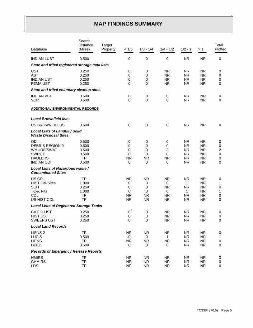
MAP FINDINGS SUMMARY
SearchTargetDistance Total
Database Property(Miles) < 1/8 1/8 - 1/4 1/4 - 1/2 1/2 - 1 > 1 Plotted
0 NR NR 0 0 0 0.500INDIAN LUST
State and tribal registered storage tank lists
0 NR NR NR 0 0 0.250UST 0 NR NR NR 0 0 0.250AST 0 NR NR NR 0 0 0.250INDIAN UST 0 NR NR NR 0 0 0.250FEMA UST
State and tribal voluntary cleanup sites
0 NR NR 0 0 0 0.500INDIAN VCP 0 NR NR 0 0 0 0.500VCP
ADDITIONAL ENVIRONMENTAL RECORDS
Local Brownfield lists
0 NR NR 0 0 0 0.500US BROWNFIELDS
Local Lists of Landfill / SolidWaste Disposal Sites
0 NR NR 0 0 0 0.500ODI 0 NR NR 0 0 0 0.500DEBRIS REGION 9 2 NR NR 2 0 0 0.500WMUDS/SWAT 0 NR NR 0 0 0 0.500SWRCY 0 NR NR NR NR NR TPHAULERS 0 NR NR 0 0 0 0.500INDIAN ODI
Local Lists of Hazardous waste /Contaminated Sites
0 NR NR NR NR NR TPUS CDL 1 NR 1 0 0 0 1.000HIST Cal-Sites 0 NR NR NR 0 0 0.250SCH 1 NR 1 0 0 0 1.000Toxic Pits 0 NR NR NR NR NR TPCDL 0 NR NR NR NR NR TPUS HIST CDL
Local Lists of Registered Storage Tanks
0 NR NR NR 0 0 0.250CA FID UST 0 NR NR NR 0 0 0.250HIST UST 0 NR NR NR 0 0 0.250SWEEPS UST
Local Land Records
0 NR NR NR NR NR TPLIENS 2 1 NR NR 1 0 0 0.500LUCIS 0 NR NR NR NR NR TPLIENS 0 NR NR 0 0 0 0.500DEED
Records of Emergency Release Reports
0 NR NR NR NR NR TPHMIRS 0 NR NR NR NR NR TPCHMIRS 0 NR NR NR NR NR TPLDS
TC3384370.5s Page 5
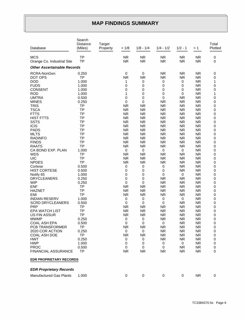
MAP FINDINGS SUMMARY
SearchTargetDistance Total
Database Property(Miles) < 1/8 1/8 - 1/4 1/4 - 1/2 1/2 - 1 > 1 Plotted
0 NR NR NR NR NR TPMCS 0 NR NR NR NR NR TPOrange Co. Industrial Site
Other Ascertainable Records
0 NR NR NR 0 0 0.250RCRA-NonGen 0 NR NR NR NR NR TPDOT OPS 1 NR 0 0 0 1 1.000DOD 0 NR 0 0 0 0 1.000FUDS 0 NR 0 0 0 0 1.000CONSENT 1 NR 0 0 0 1 1.000ROD 0 NR NR 0 0 0 0.500UMTRA 0 NR NR NR 0 0 0.250MINES 0 NR NR NR NR NR TPTRIS 0 NR NR NR NR NR TPTSCA 0 NR NR NR NR NR TPFTTS 0 NR NR NR NR NR TPHIST FTTS 0 NR NR NR NR NR TPSSTS 0 NR NR NR NR NR TPICIS 0 NR NR NR NR NR TPPADS 0 NR NR NR NR NR TPMLTS 0 NR NR NR NR NR TPRADINFO 0 NR NR NR NR NR TPFINDS 0 NR NR NR NR NR TPRAATS 0 NR 0 0 0 0 1.000CA BOND EXP. PLAN 0 NR NR NR NR NR TPWDS 0 NR NR NR NR NR TPUIC 0 NR NR NR NR NR TPNPDES 0 NR NR 0 0 0 0.500Cortese 0 NR NR 0 0 0 0.500HIST CORTESE 0 NR 0 0 0 0 1.000Notify 65 0 NR NR NR 0 0 0.250DRYCLEANERS 0 NR NR NR 0 0 0.250WIP 0 NR NR NR NR NR TPENF 0 NR NR NR NR NR TPHAZNET 0 NR NR NR NR NR TPEMI 0 NR 0 0 0 0 1.000INDIAN RESERV 0 NR NR 0 0 0 0.500SCRD DRYCLEANERS 0 NR NR NR NR NR TPPRP 0 NR NR NR NR NR TPEPA WATCH LIST 0 NR NR NR NR NR TPUS FIN ASSUR 0 NR NR NR 0 0 0.250MWMP 0 NR NR 0 0 0 0.500COAL ASH EPA 0 NR NR NR NR NR TPPCB TRANSFORMER 0 NR NR NR 0 0 0.2502020 COR ACTION 0 NR NR NR NR NR TPCOAL ASH DOE 0 NR NR NR 0 0 0.250HWT 0 NR 0 0 0 0 1.000HWP 0 NR NR 0 0 0 0.500PROC 0 NR NR NR NR NR TPFINANCIAL ASSURANCE
EDR PROPRIETARY RECORDS
EDR Proprietary Records
0 NR 0 0 0 0 1.000Manufactured Gas Plants
TC3384370.5s Page 6
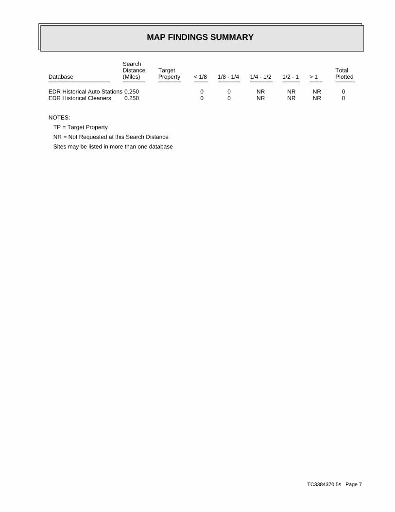
MAP FINDINGS SUMMARY
SearchTargetDistance Total
Database Property(Miles) < 1/8 1/8 - 1/4 1/4 - 1/2 1/2 - 1 > 1 Plotted
0 NR NR NR 0 0 0.250EDR Historical Auto Stations 0 NR NR NR 0 0 0.250EDR Historical Cleaners
NOTES:
TP = Target Property
NR = Not Requested at this Search Distance
Sites may be listed in more than one database
TC3384370.5s Page 7
MAP FINDINGSMap IDDirection
EDR ID NumberDistanceEPA ID NumberDatabase(s)SiteElevation
CAORANGETile name:YesDOD Site:CAState:Not reportedName 3:Not reportedName 2:El Toro Marine Corps Air Station (Closed)Name 1:Not reportedURL:Not reportedFeature 3:Not reportedFeature 2:Marine Corps DODFeature 1:
DOD:
1 ft.< 1/8
EL TORO MARINE CORPS AIR (County), CA Region N/ADOD DODEL TORO MARINE CORPS AIR STATION (CLOSED) CUSA143948
FederalLegal status: Not reportedOwner/operator telephone: USOwner/operator country: Not reported Not reportedOwner/operator address: U.S. MARINE CORPSOwner/operator name:
Owner/Operator Summary:
waste Handler is engaged in the treatment, storage or disposal of hazardousDescription: TSDFClassification: FederalLand type: 09EPA Region: Not reportedContact email: (619) 572-1404Contact telephone: Not reportedContact country: Not reported Not reportedContact address: EDWARD L NUNNContact: EAST IRVINE, CA 92650 PO BOX 444 CARETAKER SITE OFFICEMailing address: CA6170023208EPA ID: EL TORO, CA 92709 MCAS EL TOROFacility address: MARINE CORPS AIR STATION, EL TOROFacility name: 01/29/2002Date form received by agency:
RCRA-TSDF:
PRPRAATSFINDSPADSROD
US INST CONTROLUS ENG CONTROLS
1 ft. RCRA-SQG< 1/8 CORRACTS
CERCLISNEAR EL TORO, CA 92709Region NPLLAT 33 40 19 LONG 117 43 43 CA6170023208NPL RCRA-TSDFUSMC AIR STATION EL TORO 1000417911
TC3384370.5s Page 8

MAP FINDINGSMap IDDirection
EDR ID NumberDistanceEPA ID NumberDatabase(s)SiteElevation
Large Quantity GeneratorClassification: USMC AIR STATION EL TOROSite name: MARINE CORPS AIR STATION, EL TOROFacility name: 10/26/1993Date form received by agency:
Large Quantity GeneratorClassification: USMC MCAS EL TOROSite name: MARINE CORPS AIR STATION, EL TOROFacility name: 03/30/1994Date form received by agency:
Large Quantity GeneratorClassification: USMC MCAS EL TOROSite name: MARINE CORPS AIR STATION, EL TOROFacility name: 01/31/1996Date form received by agency:
Large Quantity GeneratorClassification: USMC AIR STATION EL TOROSite name: MARINE CORPS AIR STATION, EL TOROFacility name: 09/01/1996Date form received by agency:
Large Quantity GeneratorClassification: MCAS EL TOROSite name: MARINE CORPS AIR STATION, EL TOROFacility name: 04/15/1999Date form received by agency:
Large Quantity GeneratorClassification: MCAS EL TOROSite name: MARINE CORPS AIR STATION, EL TOROFacility name: 10/12/2000Date form received by agency:
Large Quantity GeneratorClassification: MARINE CORPS AIR STATION, EL TOROFacility name: 01/29/2002Date form received by agency:
Historical Generators:
NoUsed oil transporter: NoUsed oil transfer facility: NoUsed oil Specification marketer: NoUsed oil fuel marketer to burner: NoUser oil refiner: NoUsed oil processor: NoUsed oil fuel burner: NoFurnace exemption: NoOn-site burner exemption: NoUnderground injection activity: NoTreater, storer or disposer of HW: NoTransporter of hazardous waste: NoRecycler of hazardous waste: NoMixed waste (haz. and radioactive): NoU.S. importer of hazardous waste:
Handler Activities Summary:
Not reportedOwner/Op end date: 03/17/1943Owner/Op start date: OwnerOwner/Operator Type:
USMC AIR STATION EL TORO (Continued) 1000417911
TC3384370.5s Page 9
MAP FINDINGSMap IDDirection
EDR ID NumberDistanceEPA ID NumberDatabase(s)SiteElevation
Corrective Action Process TerminatedEvent: 08/29/2005Event date:
Corrective Action Process TerminatedEvent: 07/23/2004Event date:
under control. Current Human Exposures under Control, Current human exposures are NOTEvent: 06/17/1998Event date:
migration of contaminated groundwater is observed or expected. Igration of Contaminated Groundwater under Control, UnacceptableEvent: 06/17/1998Event date:
considerations and administrative considerations. at the facility, technical factors, the degree of risk, timing stabilization activity based on the status of corrective action work Stabilization Measures Evaluation,This facility is amenable toEvent: 06/17/1998Event date:
CA Responsibility Referred To A Non-RCRA Federal AuthorityEvent: 06/17/1998Event date:
Date For Remedy Selection (CM Imposed)Event: 09/30/1997Event date:
RFA Completed, Assessment was an RFA.Event: 05/01/1996Event date:
Action at the facility or area referred to CERCLA. CA Responsibility Referred To A Non-RCRA Federal Authority, CorrectiveEvent: 01/01/1996Event date:
action priority. CA Prioritization, Facility or area was assigned a medium correctiveEvent: 04/20/1991Event date:
RFI ImpositionEvent: 10/24/1990Event date:
CMS ImpositionEvent: 10/24/1990Event date:
CA049SIEvent: 06/01/1987Event date:
CA049PAEvent: 10/01/1986Event date:
CA029SFEvent: 10/01/1986Event date:
Corrective Action Summary:
Large Quantity GeneratorClassification: MCAS EL TORO FMD 1JG B.368Site name: MARINE CORPS AIR STATION, EL TOROFacility name: 02/29/1992Date form received by agency:
USMC AIR STATION EL TORO (Continued) 1000417911
TC3384370.5s Page 10
MAP FINDINGSMap IDDirection
EDR ID NumberDistanceEPA ID NumberDatabase(s)SiteElevation
Not reported Paid penalty amount: Not reported Final penalty amount: Not reported Proposed penalty amount: State Enforcement lead agency: Not reported Enf. disp. status date: Not reported Enf. disposition status: 05/20/1997 Enforcement action date: WRITTEN INFORMAL Enforcement action: StateViolation lead agency: 01/14/1998Date achieved compliance: 05/20/1997Date violation determined: TSD - GeneralArea of violation: FR - 264.170-177.IRegulation violated:
Not reported Paid penalty amount: Not reported Final penalty amount: Not reported Proposed penalty amount: State Enforcement lead agency: Not reported Enf. disp. status date: Not reported Enf. disposition status: 05/20/1997 Enforcement action date: WRITTEN INFORMAL Enforcement action: StateViolation lead agency: 01/14/1998Date achieved compliance: 05/20/1997Date violation determined: Generators - GeneralArea of violation: FR - 262.50-60Regulation violated:
Not reported Paid penalty amount: Not reported Final penalty amount: Not reported Proposed penalty amount: State Enforcement lead agency: Not reported Enf. disp. status date: Not reported Enf. disposition status: 05/20/1997 Enforcement action date: WRITTEN INFORMAL Enforcement action: StateViolation lead agency: 01/14/1998Date achieved compliance: 05/20/1997Date violation determined: TSD - GeneralArea of violation: FR - 264.10-18.BRegulation violated:
Not reported Paid penalty amount: Not reported Final penalty amount: Not reported Proposed penalty amount: State Enforcement lead agency: Not reported Enf. disp. status date: Not reported Enf. disposition status: 05/20/1997 Enforcement action date: WRITTEN INFORMAL Enforcement action: StateViolation lead agency: 01/14/1998Date achieved compliance: 05/20/1997Date violation determined: Generators - GeneralArea of violation: FR - 262.30-34.CRegulation violated:
Facility Has Received Notices of Violations:
USMC AIR STATION EL TORO (Continued) 1000417911
TC3384370.5s Page 11
MAP FINDINGSMap IDDirection
EDR ID NumberDistanceEPA ID NumberDatabase(s)SiteElevation
F - 262.30-34.CRegulation violated:
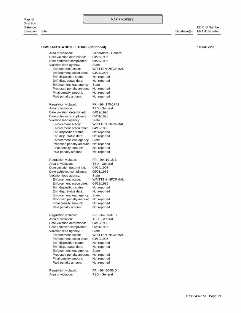
Not reported Paid penalty amount: Not reported Final penalty amount: Not reported Proposed penalty amount: State Enforcement lead agency: Not reported Enf. disp. status date: Not reported Enf. disposition status: 03/27/1996 Enforcement action date: WRITTEN INFORMAL Enforcement action: StateViolation lead agency: 09/27/1996Date achieved compliance: 03/27/1996Date violation determined: Generators - GeneralArea of violation: F - 262.40-43.DRegulation violated:
Not reported Paid penalty amount: Not reported Final penalty amount: Not reported Proposed penalty amount: State Enforcement lead agency: Not reported Enf. disp. status date: Not reported Enf. disposition status: 03/27/1996 Enforcement action date: WRITTEN INFORMAL Enforcement action: StateViolation lead agency: 09/27/1996Date achieved compliance: 03/27/1996Date violation determined: Generators - GeneralArea of violation: F - 262.20-23.BRegulation violated:
Not reported Paid penalty amount: Not reported Final penalty amount: Not reported Proposed penalty amount: State Enforcement lead agency: Not reported Enf. disp. status date: Not reported Enf. disposition status: 03/27/1996 Enforcement action date: WRITTEN INFORMAL Enforcement action: StateViolation lead agency: 09/27/1996Date achieved compliance: 03/27/1996Date violation determined: Generators - GeneralArea of violation: F - 262.50-60Regulation violated:
Not reported Paid penalty amount: Not reported Final penalty amount: Not reported Proposed penalty amount: State Enforcement lead agency: Not reported Enf. disp. status date: Not reported Enf. disposition status: 03/27/1996 Enforcement action date: WRITTEN INFORMAL Enforcement action: StateViolation lead agency: 09/27/1996Date achieved compliance: 03/27/1996Date violation determined: Generators - GeneralArea of violation: F - 261.5Regulation violated:
USMC AIR STATION EL TORO (Continued) 1000417911
TC3384370.5s Page 12
MAP FINDINGSMap IDDirection
EDR ID NumberDistanceEPA ID NumberDatabase(s)SiteElevation
TSD - GeneralArea of violation: FR - 264.50-56.DRegulation violated:
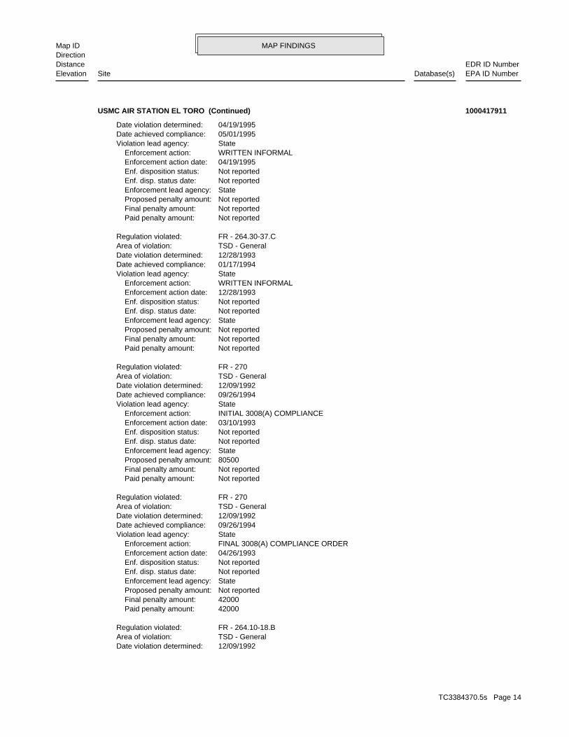
Not reported Paid penalty amount: Not reported Final penalty amount: Not reported Proposed penalty amount: State Enforcement lead agency: Not reported Enf. disp. status date: Not reported Enf. disposition status: 04/19/1995 Enforcement action date: WRITTEN INFORMAL Enforcement action: StateViolation lead agency: 05/01/1995Date achieved compliance: 04/19/1995Date violation determined: TSD - GeneralArea of violation: FR - 264.30-37.CRegulation violated:
Not reported Paid penalty amount: Not reported Final penalty amount: Not reported Proposed penalty amount: State Enforcement lead agency: Not reported Enf. disp. status date: Not reported Enf. disposition status: 04/19/1995 Enforcement action date: WRITTEN INFORMAL Enforcement action: StateViolation lead agency: 05/01/1995Date achieved compliance: 04/19/1995Date violation determined: TSD - GeneralArea of violation: FR - 264.10-18.BRegulation violated:
Not reported Paid penalty amount: Not reported Final penalty amount: Not reported Proposed penalty amount: State Enforcement lead agency: Not reported Enf. disp. status date: Not reported Enf. disposition status: 04/19/1995 Enforcement action date: WRITTEN INFORMAL Enforcement action: StateViolation lead agency: 05/01/1995Date achieved compliance: 04/19/1995Date violation determined: TSD - GeneralArea of violation: FR - 264.170-177.IRegulation violated:
Not reported Paid penalty amount: Not reported Final penalty amount: Not reported Proposed penalty amount: State Enforcement lead agency: Not reported Enf. disp. status date: Not reported Enf. disposition status: 03/27/1996 Enforcement action date: WRITTEN INFORMAL Enforcement action: StateViolation lead agency: 09/27/1996Date achieved compliance: 03/26/1996Date violation determined: Generators - GeneralArea of violation:
USMC AIR STATION EL TORO (Continued) 1000417911
TC3384370.5s Page 13
MAP FINDINGSMap IDDirection
EDR ID NumberDistanceEPA ID NumberDatabase(s)SiteElevation
12/09/1992Date violation determined: TSD - GeneralArea of violation: FR - 264.10-18.BRegulation violated:
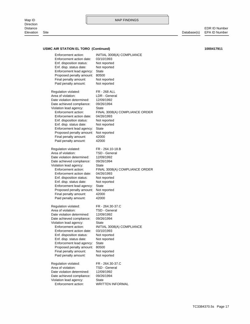
42000 Paid penalty amount: 42000 Final penalty amount: Not reported Proposed penalty amount: State Enforcement lead agency: Not reported Enf. disp. status date: Not reported Enf. disposition status: 04/26/1993 Enforcement action date: FINAL 3008(A) COMPLIANCE ORDER Enforcement action: StateViolation lead agency: 09/26/1994Date achieved compliance: 12/09/1992Date violation determined: TSD - GeneralArea of violation: FR - 270Regulation violated:
Not reported Paid penalty amount: Not reported Final penalty amount: 80500 Proposed penalty amount: State Enforcement lead agency: Not reported Enf. disp. status date: Not reported Enf. disposition status: 03/10/1993 Enforcement action date: INITIAL 3008(A) COMPLIANCE Enforcement action: StateViolation lead agency: 09/26/1994Date achieved compliance: 12/09/1992Date violation determined: TSD - GeneralArea of violation: FR - 270Regulation violated:
Not reported Paid penalty amount: Not reported Final penalty amount: Not reported Proposed penalty amount: State Enforcement lead agency: Not reported Enf. disp. status date: Not reported Enf. disposition status: 12/28/1993 Enforcement action date: WRITTEN INFORMAL Enforcement action: StateViolation lead agency: 01/17/1994Date achieved compliance: 12/28/1993Date violation determined: TSD - GeneralArea of violation: FR - 264.30-37.CRegulation violated:
Not reported Paid penalty amount: Not reported Final penalty amount: Not reported Proposed penalty amount: State Enforcement lead agency: Not reported Enf. disp. status date: Not reported Enf. disposition status: 04/19/1995 Enforcement action date: WRITTEN INFORMAL Enforcement action: StateViolation lead agency: 05/01/1995Date achieved compliance: 04/19/1995Date violation determined:
USMC AIR STATION EL TORO (Continued) 1000417911
TC3384370.5s Page 14
MAP FINDINGSMap IDDirection
EDR ID NumberDistanceEPA ID NumberDatabase(s)SiteElevation
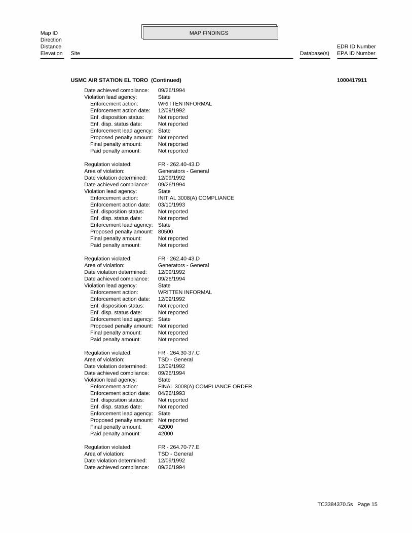
09/26/1994Date achieved compliance: 12/09/1992Date violation determined: TSD - GeneralArea of violation: FR - 264.70-77.ERegulation violated:
42000 Paid penalty amount: 42000 Final penalty amount: Not reported Proposed penalty amount: State Enforcement lead agency: Not reported Enf. disp. status date: Not reported Enf. disposition status: 04/26/1993 Enforcement action date: FINAL 3008(A) COMPLIANCE ORDER Enforcement action: StateViolation lead agency: 09/26/1994Date achieved compliance: 12/09/1992Date violation determined: TSD - GeneralArea of violation: FR - 264.30-37.CRegulation violated:
Not reported Paid penalty amount: Not reported Final penalty amount: Not reported Proposed penalty amount: State Enforcement lead agency: Not reported Enf. disp. status date: Not reported Enf. disposition status: 12/09/1992 Enforcement action date: WRITTEN INFORMAL Enforcement action: StateViolation lead agency: 09/26/1994Date achieved compliance: 12/09/1992Date violation determined: Generators - GeneralArea of violation: FR - 262.40-43.DRegulation violated:
Not reported Paid penalty amount: Not reported Final penalty amount: 80500 Proposed penalty amount: State Enforcement lead agency: Not reported Enf. disp. status date: Not reported Enf. disposition status: 03/10/1993 Enforcement action date: INITIAL 3008(A) COMPLIANCE Enforcement action: StateViolation lead agency: 09/26/1994Date achieved compliance: 12/09/1992Date violation determined: Generators - GeneralArea of violation: FR - 262.40-43.DRegulation violated:
Not reported Paid penalty amount: Not reported Final penalty amount: Not reported Proposed penalty amount: State Enforcement lead agency: Not reported Enf. disp. status date: Not reported Enf. disposition status: 12/09/1992 Enforcement action date: WRITTEN INFORMAL Enforcement action: StateViolation lead agency: 09/26/1994Date achieved compliance:
USMC AIR STATION EL TORO (Continued) 1000417911
TC3384370.5s Page 15
MAP FINDINGSMap IDDirection
EDR ID NumberDistanceEPA ID NumberDatabase(s)SiteElevation
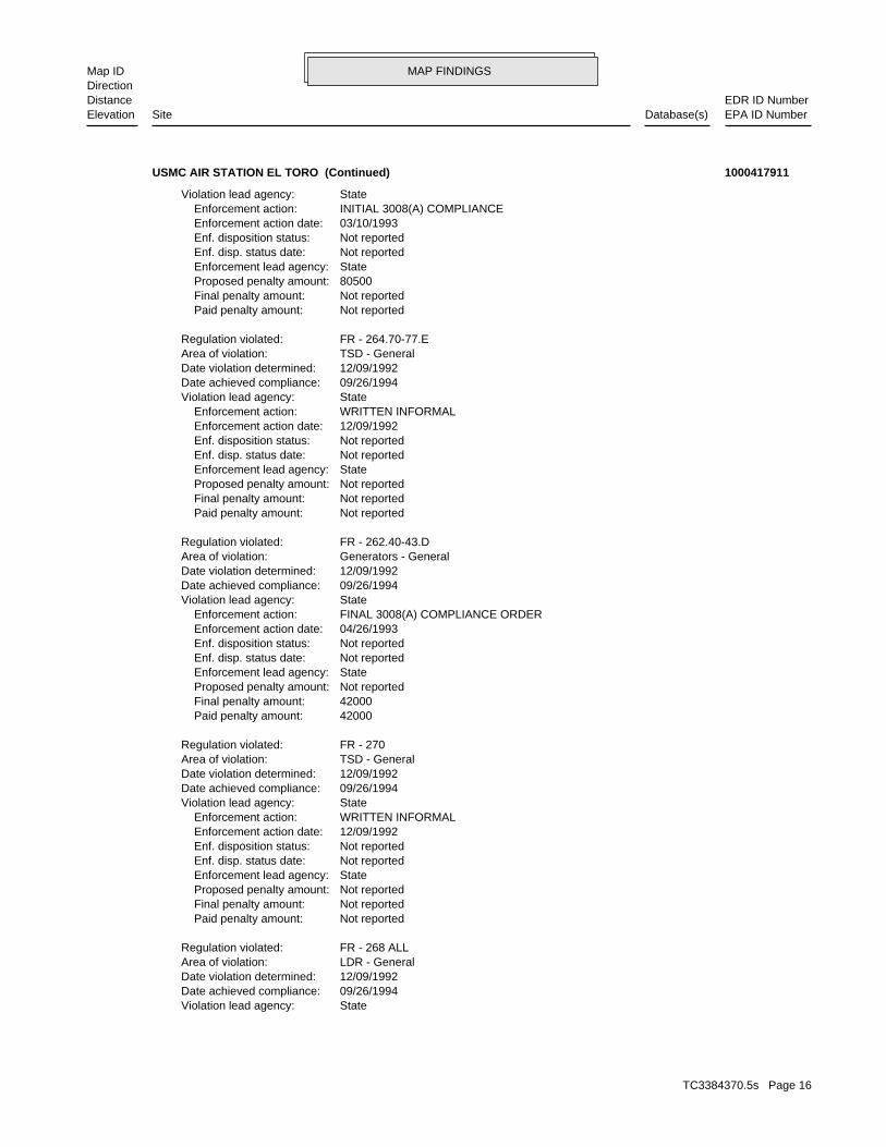
StateViolation lead agency: 09/26/1994Date achieved compliance: 12/09/1992Date violation determined: LDR - GeneralArea of violation: FR - 268 ALLRegulation violated:
Not reported Paid penalty amount: Not reported Final penalty amount: Not reported Proposed penalty amount: State Enforcement lead agency: Not reported Enf. disp. status date: Not reported Enf. disposition status: 12/09/1992 Enforcement action date: WRITTEN INFORMAL Enforcement action: StateViolation lead agency: 09/26/1994Date achieved compliance: 12/09/1992Date violation determined: TSD - GeneralArea of violation: FR - 270Regulation violated:
42000 Paid penalty amount: 42000 Final penalty amount: Not reported Proposed penalty amount: State Enforcement lead agency: Not reported Enf. disp. status date: Not reported Enf. disposition status: 04/26/1993 Enforcement action date: FINAL 3008(A) COMPLIANCE ORDER Enforcement action: StateViolation lead agency: 09/26/1994Date achieved compliance: 12/09/1992Date violation determined: Generators - GeneralArea of violation: FR - 262.40-43.DRegulation violated:
Not reported Paid penalty amount: Not reported Final penalty amount: Not reported Proposed penalty amount: State Enforcement lead agency: Not reported Enf. disp. status date: Not reported Enf. disposition status: 12/09/1992 Enforcement action date: WRITTEN INFORMAL Enforcement action: StateViolation lead agency: 09/26/1994Date achieved compliance: 12/09/1992Date violation determined: TSD - GeneralArea of violation: FR - 264.70-77.ERegulation violated:
Not reported Paid penalty amount: Not reported Final penalty amount: 80500 Proposed penalty amount: State Enforcement lead agency: Not reported Enf. disp. status date: Not reported Enf. disposition status: 03/10/1993 Enforcement action date: INITIAL 3008(A) COMPLIANCE Enforcement action: StateViolation lead agency:
USMC AIR STATION EL TORO (Continued) 1000417911
TC3384370.5s Page 16
MAP FINDINGSMap IDDirection
EDR ID NumberDistanceEPA ID NumberDatabase(s)SiteElevation
WRITTEN INFORMAL Enforcement action: StateViolation lead agency: 09/26/1994Date achieved compliance: 12/09/1992Date violation determined: TSD - GeneralArea of violation: FR - 264.30-37.CRegulation violated:
Not reported Paid penalty amount: Not reported Final penalty amount: 80500 Proposed penalty amount: State Enforcement lead agency: Not reported Enf. disp. status date: Not reported Enf. disposition status: 03/10/1993 Enforcement action date: INITIAL 3008(A) COMPLIANCE Enforcement action: StateViolation lead agency: 09/26/1994Date achieved compliance: 12/09/1992Date violation determined: TSD - GeneralArea of violation: FR - 264.30-37.CRegulation violated:
42000 Paid penalty amount: 42000 Final penalty amount: Not reported Proposed penalty amount: State Enforcement lead agency: Not reported Enf. disp. status date: Not reported Enf. disposition status: 04/26/1993 Enforcement action date: FINAL 3008(A) COMPLIANCE ORDER Enforcement action: StateViolation lead agency: 09/26/1994Date achieved compliance: 12/09/1992Date violation determined: TSD - GeneralArea of violation: FR - 264.10-18.BRegulation violated:
42000 Paid penalty amount: 42000 Final penalty amount: Not reported Proposed penalty amount: State Enforcement lead agency: Not reported Enf. disp. status date: Not reported Enf. disposition status: 04/26/1993 Enforcement action date: FINAL 3008(A) COMPLIANCE ORDER Enforcement action: StateViolation lead agency: 09/26/1994Date achieved compliance: 12/09/1992Date violation determined: LDR - GeneralArea of violation: FR - 268 ALLRegulation violated:
Not reported Paid penalty amount: Not reported Final penalty amount: 80500 Proposed penalty amount: State Enforcement lead agency: Not reported Enf. disp. status date: Not reported Enf. disposition status: 03/10/1993 Enforcement action date: INITIAL 3008(A) COMPLIANCE Enforcement action:
USMC AIR STATION EL TORO (Continued) 1000417911
TC3384370.5s Page 17
MAP FINDINGSMap IDDirection
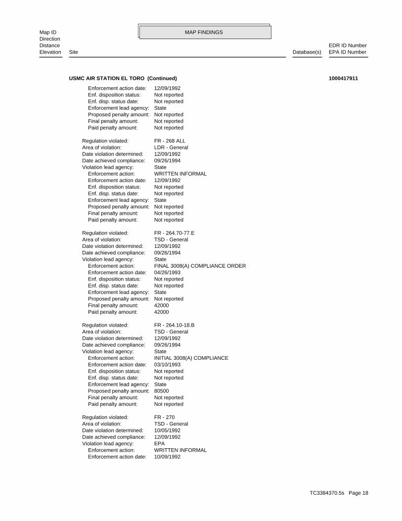
EDR ID NumberDistanceEPA ID NumberDatabase(s)SiteElevation
10/09/1992 Enforcement action date: WRITTEN INFORMAL Enforcement action: EPAViolation lead agency: 12/09/1992Date achieved compliance: 10/05/1992Date violation determined: TSD - GeneralArea of violation: FR - 270Regulation violated:
Not reported Paid penalty amount: Not reported Final penalty amount: 80500 Proposed penalty amount: State Enforcement lead agency: Not reported Enf. disp. status date: Not reported Enf. disposition status: 03/10/1993 Enforcement action date: INITIAL 3008(A) COMPLIANCE Enforcement action: StateViolation lead agency: 09/26/1994Date achieved compliance: 12/09/1992Date violation determined: TSD - GeneralArea of violation: FR - 264.10-18.BRegulation violated:
42000 Paid penalty amount: 42000 Final penalty amount: Not reported Proposed penalty amount: State Enforcement lead agency: Not reported Enf. disp. status date: Not reported Enf. disposition status: 04/26/1993 Enforcement action date: FINAL 3008(A) COMPLIANCE ORDER Enforcement action: StateViolation lead agency: 09/26/1994Date achieved compliance: 12/09/1992Date violation determined: TSD - GeneralArea of violation: FR - 264.70-77.ERegulation violated:
Not reported Paid penalty amount: Not reported Final penalty amount: Not reported Proposed penalty amount: State Enforcement lead agency: Not reported Enf. disp. status date: Not reported Enf. disposition status: 12/09/1992 Enforcement action date: WRITTEN INFORMAL Enforcement action: StateViolation lead agency: 09/26/1994Date achieved compliance: 12/09/1992Date violation determined: LDR - GeneralArea of violation: FR - 268 ALLRegulation violated:
Not reported Paid penalty amount: Not reported Final penalty amount: Not reported Proposed penalty amount: State Enforcement lead agency: Not reported Enf. disp. status date: Not reported Enf. disposition status: 12/09/1992 Enforcement action date:
USMC AIR STATION EL TORO (Continued) 1000417911
TC3384370.5s Page 18
MAP FINDINGSMap IDDirection
EDR ID NumberDistanceEPA ID NumberDatabase(s)SiteElevation
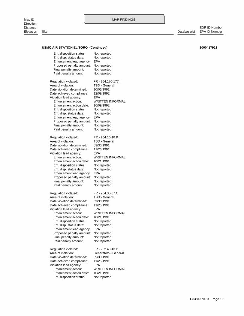
Not reported Enf. disposition status: 10/21/1991 Enforcement action date: WRITTEN INFORMAL Enforcement action: EPAViolation lead agency: 11/25/1991Date achieved compliance: 09/30/1991Date violation determined: Generators - GeneralArea of violation: FR - 262.40-43.DRegulation violated:
Not reported Paid penalty amount: Not reported Final penalty amount: Not reported Proposed penalty amount: EPA Enforcement lead agency: Not reported Enf. disp. status date: Not reported Enf. disposition status: 10/21/1991 Enforcement action date: WRITTEN INFORMAL Enforcement action: EPAViolation lead agency: 11/25/1991Date achieved compliance: 09/30/1991Date violation determined: TSD - GeneralArea of violation: FR - 264.30-37.CRegulation violated:
Not reported Paid penalty amount: Not reported Final penalty amount: Not reported Proposed penalty amount: EPA Enforcement lead agency: Not reported Enf. disp. status date: Not reported Enf. disposition status: 10/21/1991 Enforcement action date: WRITTEN INFORMAL Enforcement action: EPAViolation lead agency: 11/25/1991Date achieved compliance: 09/30/1991Date violation determined: TSD - GeneralArea of violation: FR - 264.10-18.BRegulation violated:
Not reported Paid penalty amount: Not reported Final penalty amount: Not reported Proposed penalty amount: EPA Enforcement lead agency: Not reported Enf. disp. status date: Not reported Enf. disposition status: 10/09/1992 Enforcement action date: WRITTEN INFORMAL Enforcement action: EPAViolation lead agency: 12/09/1992Date achieved compliance: 10/05/1992Date violation determined: TSD - GeneralArea of violation: FR - 264.170-177.IRegulation violated:
Not reported Paid penalty amount: Not reported Final penalty amount: Not reported Proposed penalty amount: EPA Enforcement lead agency: Not reported Enf. disp. status date: Not reported Enf. disposition status:
USMC AIR STATION EL TORO (Continued) 1000417911
TC3384370.5s Page 19
MAP FINDINGSMap IDDirection
EDR ID NumberDistanceEPA ID NumberDatabase(s)SiteElevation
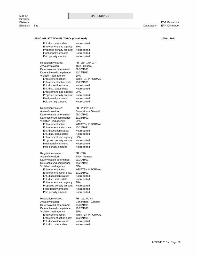
Not reported Enf. disp. status date: Not reported Enf. disposition status: 10/21/1991 Enforcement action date: WRITTEN INFORMAL Enforcement action: EPAViolation lead agency: 11/25/1991Date achieved compliance: 09/30/1991Date violation determined: Generators - GeneralArea of violation: FR - 262.50-60Regulation violated:
Not reported Paid penalty amount: Not reported Final penalty amount: Not reported Proposed penalty amount: EPA Enforcement lead agency: Not reported Enf. disp. status date: Not reported Enf. disposition status: 10/21/1991 Enforcement action date: WRITTEN INFORMAL Enforcement action: EPAViolation lead agency: 11/25/1991Date achieved compliance: 09/30/1991Date violation determined: TSD - GeneralArea of violation: FR - 270Regulation violated:
Not reported Paid penalty amount: Not reported Final penalty amount: Not reported Proposed penalty amount: EPA Enforcement lead agency: Not reported Enf. disp. status date: Not reported Enf. disposition status: 10/21/1991 Enforcement action date: WRITTEN INFORMAL Enforcement action: EPAViolation lead agency: 11/25/1991Date achieved compliance: 09/30/1991Date violation determined: Generators - GeneralArea of violation: FR - 262.20-23.BRegulation violated:
Not reported Paid penalty amount: Not reported Final penalty amount: Not reported Proposed penalty amount: EPA Enforcement lead agency: Not reported Enf. disp. status date: Not reported Enf. disposition status: 10/21/1991 Enforcement action date: WRITTEN INFORMAL Enforcement action: EPAViolation lead agency: 11/25/1991Date achieved compliance: 09/30/1991Date violation determined: TSD - GeneralArea of violation: FR - 264.170-177.IRegulation violated:
Not reported Paid penalty amount: Not reported Final penalty amount: Not reported Proposed penalty amount: EPA Enforcement lead agency: Not reported Enf. disp. status date:
USMC AIR STATION EL TORO (Continued) 1000417911
TC3384370.5s Page 20
MAP FINDINGSMap IDDirection
EDR ID NumberDistanceEPA ID NumberDatabase(s)SiteElevation
EPA Enforcement lead agency: Not reported Enf. disp. status date: Not reported Enf. disposition status: 09/28/1990 Enforcement action date: FINAL 3008(A) COMPLIANCE ORDER Enforcement action: EPAViolation lead agency: 11/25/1991Date achieved compliance: 07/11/1989Date violation determined: TSD - GeneralArea of violation: FR - 270Regulation violated:
Not reported Paid penalty amount: Not reported Final penalty amount: Not reported Proposed penalty amount: EPA Enforcement lead agency: Not reported Enf. disp. status date: Not reported Enf. disposition status: 08/06/1990 Enforcement action date: INITIAL 3008(A) COMPLIANCE Enforcement action: EPAViolation lead agency: 11/25/1991Date achieved compliance: 06/13/1990Date violation determined: TSD - GeneralArea of violation: FR - 270Regulation violated:
Not reported Paid penalty amount: Not reported Final penalty amount: Not reported Proposed penalty amount: EPA Enforcement lead agency: Not reported Enf. disp. status date: Not reported Enf. disposition status: 09/28/1990 Enforcement action date: FINAL 3008(A) COMPLIANCE ORDER Enforcement action: EPAViolation lead agency: 11/25/1991Date achieved compliance: 06/13/1990Date violation determined: TSD - GeneralArea of violation: FR - 270Regulation violated:
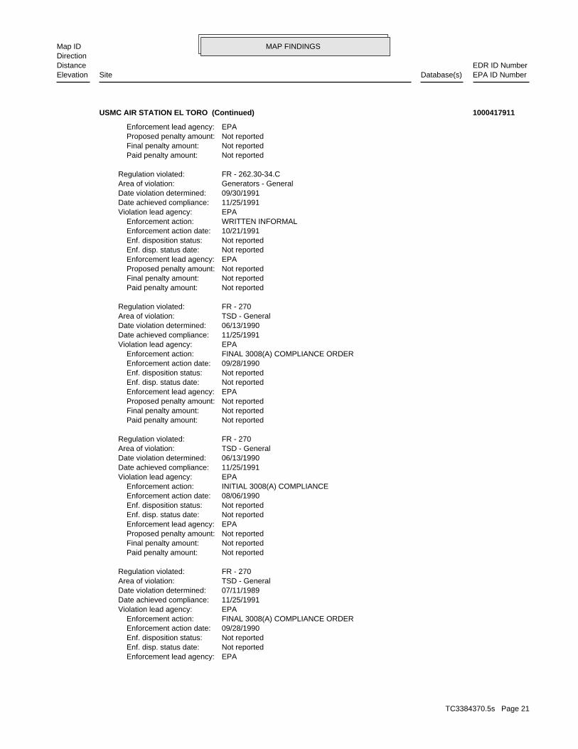
Not reported Paid penalty amount: Not reported Final penalty amount: Not reported Proposed penalty amount: EPA Enforcement lead agency: Not reported Enf. disp. status date: Not reported Enf. disposition status: 10/21/1991 Enforcement action date: WRITTEN INFORMAL Enforcement action: EPAViolation lead agency: 11/25/1991Date achieved compliance: 09/30/1991Date violation determined: Generators - GeneralArea of violation: FR - 262.30-34.CRegulation violated:
Not reported Paid penalty amount: Not reported Final penalty amount: Not reported Proposed penalty amount: EPA Enforcement lead agency:
USMC AIR STATION EL TORO (Continued) 1000417911
TC3384370.5s Page 21
MAP FINDINGSMap IDDirection
EDR ID NumberDistanceEPA ID NumberDatabase(s)SiteElevation
Not reported Proposed penalty amount: EPA Enforcement lead agency: Not reported Enf. disp. status date: Not reported Enf. disposition status: 09/28/1990 Enforcement action date: FINAL 3008(A) COMPLIANCE ORDER Enforcement action: EPAViolation lead agency: 06/13/1990Date achieved compliance: 07/11/1989Date violation determined: LDR - GeneralArea of violation: FR - 268.7Regulation violated:
Not reported Paid penalty amount: Not reported Final penalty amount: Not reported Proposed penalty amount: EPA Enforcement lead agency: Not reported Enf. disp. status date: Not reported Enf. disposition status: 08/06/1990 Enforcement action date: INITIAL 3008(A) COMPLIANCE Enforcement action: EPAViolation lead agency: 06/13/1990Date achieved compliance: 07/11/1989Date violation determined: LDR - GeneralArea of violation: FR - 268.7Regulation violated:
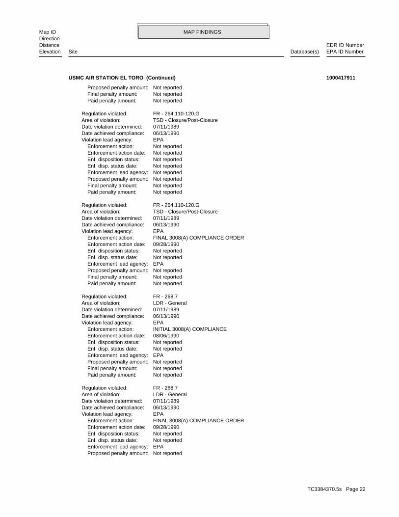
Not reported Paid penalty amount: Not reported Final penalty amount: Not reported Proposed penalty amount: EPA Enforcement lead agency: Not reported Enf. disp. status date: Not reported Enf. disposition status: 09/28/1990 Enforcement action date: FINAL 3008(A) COMPLIANCE ORDER Enforcement action: EPAViolation lead agency: 06/13/1990Date achieved compliance: 07/11/1989Date violation determined: TSD - Closure/Post-ClosureArea of violation: FR - 264.110-120.GRegulation violated:
Not reported Paid penalty amount: Not reported Final penalty amount: Not reported Proposed penalty amount: Not reported Enforcement lead agency: Not reported Enf. disp. status date: Not reported Enf. disposition status: Not reported Enforcement action date: Not reported Enforcement action: EPAViolation lead agency: 06/13/1990Date achieved compliance: 07/11/1989Date violation determined: TSD - Closure/Post-ClosureArea of violation: FR - 264.110-120.GRegulation violated:
Not reported Paid penalty amount: Not reported Final penalty amount: Not reported Proposed penalty amount:
USMC AIR STATION EL TORO (Continued) 1000417911
TC3384370.5s Page 22
MAP FINDINGSMap IDDirection
EDR ID NumberDistanceEPA ID NumberDatabase(s)SiteElevation
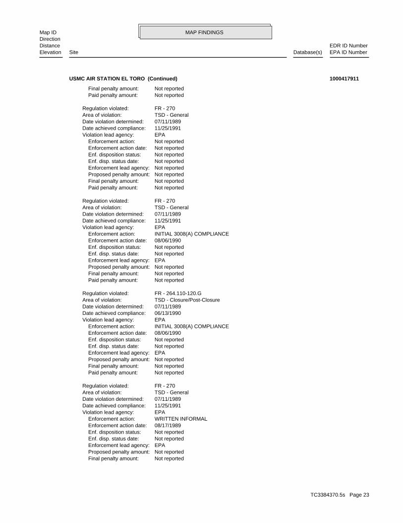
Not reported Final penalty amount: Not reported Proposed penalty amount: EPA Enforcement lead agency: Not reported Enf. disp. status date: Not reported Enf. disposition status: 08/17/1989 Enforcement action date: WRITTEN INFORMAL Enforcement action: EPAViolation lead agency: 11/25/1991Date achieved compliance: 07/11/1989Date violation determined: TSD - GeneralArea of violation: FR - 270Regulation violated:
Not reported Paid penalty amount: Not reported Final penalty amount: Not reported Proposed penalty amount: EPA Enforcement lead agency: Not reported Enf. disp. status date: Not reported Enf. disposition status: 08/06/1990 Enforcement action date: INITIAL 3008(A) COMPLIANCE Enforcement action: EPAViolation lead agency: 06/13/1990Date achieved compliance: 07/11/1989Date violation determined: TSD - Closure/Post-ClosureArea of violation: FR - 264.110-120.GRegulation violated:
Not reported Paid penalty amount: Not reported Final penalty amount: Not reported Proposed penalty amount: EPA Enforcement lead agency: Not reported Enf. disp. status date: Not reported Enf. disposition status: 08/06/1990 Enforcement action date: INITIAL 3008(A) COMPLIANCE Enforcement action: EPAViolation lead agency: 11/25/1991Date achieved compliance: 07/11/1989Date violation determined: TSD - GeneralArea of violation: FR - 270Regulation violated:
Not reported Paid penalty amount: Not reported Final penalty amount: Not reported Proposed penalty amount: Not reported Enforcement lead agency: Not reported Enf. disp. status date: Not reported Enf. disposition status: Not reported Enforcement action date: Not reported Enforcement action: EPAViolation lead agency: 11/25/1991Date achieved compliance: 07/11/1989Date violation determined: TSD - GeneralArea of violation: FR - 270Regulation violated:
Not reported Paid penalty amount: Not reported Final penalty amount:
USMC AIR STATION EL TORO (Continued) 1000417911
TC3384370.5s Page 23
MAP FINDINGSMap IDDirection
EDR ID NumberDistanceEPA ID NumberDatabase(s)SiteElevation
Not reported Paid penalty amount: Not reported Final penalty amount: Not reported Proposed penalty amount: EPA Enforcement lead agency: Not reported Enf. disp. status date: Not reported Enf. disposition status: 08/17/1989 Enforcement action date: WRITTEN INFORMAL Enforcement action: EPAViolation lead agency: 06/13/1990Date achieved compliance: 07/11/1989Date violation determined: TSD - Closure/Post-ClosureArea of violation: FR - 264.110-120.GRegulation violated:
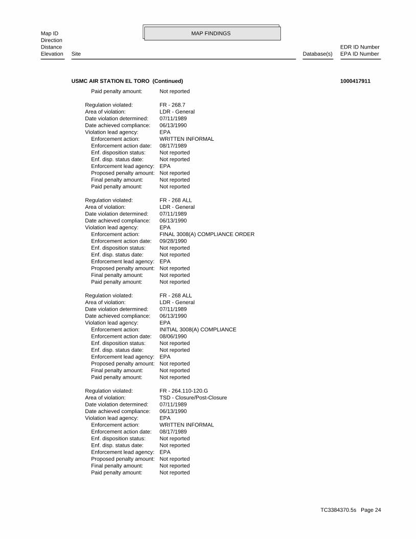
Not reported Paid penalty amount: Not reported Final penalty amount: Not reported Proposed penalty amount: EPA Enforcement lead agency: Not reported Enf. disp. status date: Not reported Enf. disposition status: 08/06/1990 Enforcement action date: INITIAL 3008(A) COMPLIANCE Enforcement action: EPAViolation lead agency: 06/13/1990Date achieved compliance: 07/11/1989Date violation determined: LDR - GeneralArea of violation: FR - 268 ALLRegulation violated:
Not reported Paid penalty amount: Not reported Final penalty amount: Not reported Proposed penalty amount: EPA Enforcement lead agency: Not reported Enf. disp. status date: Not reported Enf. disposition status: 09/28/1990 Enforcement action date: FINAL 3008(A) COMPLIANCE ORDER Enforcement action: EPAViolation lead agency: 06/13/1990Date achieved compliance: 07/11/1989Date violation determined: LDR - GeneralArea of violation: FR - 268 ALLRegulation violated:
Not reported Paid penalty amount: Not reported Final penalty amount: Not reported Proposed penalty amount: EPA Enforcement lead agency: Not reported Enf. disp. status date: Not reported Enf. disposition status: 08/17/1989 Enforcement action date: WRITTEN INFORMAL Enforcement action: EPAViolation lead agency: 06/13/1990Date achieved compliance: 07/11/1989Date violation determined: LDR - GeneralArea of violation: FR - 268.7Regulation violated:
Not reported Paid penalty amount:
USMC AIR STATION EL TORO (Continued) 1000417911
TC3384370.5s Page 24
MAP FINDINGSMap IDDirection
EDR ID NumberDistanceEPA ID NumberDatabase(s)SiteElevation
FR - 264.110-120.GRegulation violated:
Not reported Paid penalty amount: Not reported Final penalty amount: Not reported Proposed penalty amount: Not reported Enforcement lead agency: Not reported Enf. disp. status date: Not reported Enf. disposition status: Not reported Enforcement action date: Not reported Enforcement action: EPAViolation lead agency: 07/11/1989Date achieved compliance: 08/17/1988Date violation determined: TSD - Closure/Post-ClosureArea of violation: FR - 264.110-120.GRegulation violated:
Not reported Paid penalty amount: Not reported Final penalty amount: Not reported Proposed penalty amount: Not reported Enforcement lead agency: Not reported Enf. disp. status date: Not reported Enf. disposition status: Not reported Enforcement action date: Not reported Enforcement action: EPAViolation lead agency: 06/13/1990Date achieved compliance: 07/11/1989Date violation determined: LDR - GeneralArea of violation: FR - 268 ALLRegulation violated:
Not reported Paid penalty amount: Not reported Final penalty amount: Not reported Proposed penalty amount: EPA Enforcement lead agency: Not reported Enf. disp. status date: Not reported Enf. disposition status: 08/17/1989 Enforcement action date: WRITTEN INFORMAL Enforcement action: EPAViolation lead agency: 06/13/1990Date achieved compliance: 07/11/1989Date violation determined: LDR - GeneralArea of violation: FR - 268 ALLRegulation violated:
Not reported Paid penalty amount: Not reported Final penalty amount: Not reported Proposed penalty amount: Not reported Enforcement lead agency: Not reported Enf. disp. status date: Not reported Enf. disposition status: Not reported Enforcement action date: Not reported Enforcement action: EPAViolation lead agency: 06/13/1990Date achieved compliance: 07/11/1989Date violation determined: LDR - GeneralArea of violation: FR - 268.7Regulation violated:
USMC AIR STATION EL TORO (Continued) 1000417911
TC3384370.5s Page 25
MAP FINDINGSMap IDDirection
EDR ID NumberDistanceEPA ID NumberDatabase(s)SiteElevation
TSD - Closure/Post-ClosureArea of violation: FR - 264.110-120.GRegulation violated:
Not reported Paid penalty amount: Not reported Final penalty amount: Not reported Proposed penalty amount: EPA Enforcement lead agency: Not reported Enf. disp. status date: Not reported Enf. disposition status: 08/06/1990 Enforcement action date: INITIAL 3008(A) COMPLIANCE Enforcement action: EPAViolation lead agency: 07/11/1989Date achieved compliance: 08/17/1988Date violation determined: TSD - Closure/Post-ClosureArea of violation: FR - 264.110-120.GRegulation violated:
Not reported Paid penalty amount: Not reported Final penalty amount: Not reported Proposed penalty amount: EPA Enforcement lead agency: Not reported Enf. disp. status date: Not reported Enf. disposition status: 11/17/1988 Enforcement action date: WRITTEN INFORMAL Enforcement action: EPAViolation lead agency: 07/11/1989Date achieved compliance: 08/17/1988Date violation determined: TSD - GeneralArea of violation: FR - 270Regulation violated:
Not reported Paid penalty amount: Not reported Final penalty amount: Not reported Proposed penalty amount: EPA Enforcement lead agency: Not reported Enf. disp. status date: Not reported Enf. disposition status: 09/28/1990 Enforcement action date: FINAL 3008(A) COMPLIANCE ORDER Enforcement action: EPAViolation lead agency: 07/11/1989Date achieved compliance: 08/17/1988Date violation determined: TSD - GeneralArea of violation: FR - 270Regulation violated:
Not reported Paid penalty amount: Not reported Final penalty amount: Not reported Proposed penalty amount: EPA Enforcement lead agency: Not reported Enf. disp. status date: Not reported Enf. disposition status: 11/17/1988 Enforcement action date: WRITTEN INFORMAL Enforcement action: EPAViolation lead agency: 07/11/1989Date achieved compliance: 08/17/1988Date violation determined: TSD - Closure/Post-ClosureArea of violation:
USMC AIR STATION EL TORO (Continued) 1000417911
TC3384370.5s Page 26
MAP FINDINGSMap IDDirection
EDR ID NumberDistanceEPA ID NumberDatabase(s)SiteElevation
03/05/1987Date violation determined: TSD - GeneralArea of violation: FR - 270Regulation violated:
Not reported Paid penalty amount: Not reported Final penalty amount: Not reported Proposed penalty amount: Not reported Enforcement lead agency: Not reported Enf. disp. status date: Not reported Enf. disposition status: Not reported Enforcement action date: Not reported Enforcement action: EPAViolation lead agency: 08/17/1988Date achieved compliance: 03/05/1987Date violation determined: LDR - GeneralArea of violation: FR - 268 ALLRegulation violated:
Not reported Paid penalty amount: Not reported Final penalty amount: Not reported Proposed penalty amount: Not reported Enforcement lead agency: Not reported Enf. disp. status date: Not reported Enf. disposition status: Not reported Enforcement action date: Not reported Enforcement action: EPAViolation lead agency: 07/11/1989Date achieved compliance: 08/17/1988Date violation determined: TSD - GeneralArea of violation: FR - 270Regulation violated:
Not reported Paid penalty amount: Not reported Final penalty amount: Not reported Proposed penalty amount: EPA Enforcement lead agency: Not reported Enf. disp. status date: Not reported Enf. disposition status: 08/06/1990 Enforcement action date: INITIAL 3008(A) COMPLIANCE Enforcement action: EPAViolation lead agency: 07/11/1989Date achieved compliance: 08/17/1988Date violation determined: TSD - GeneralArea of violation: FR - 270Regulation violated:
Not reported Paid penalty amount: Not reported Final penalty amount: Not reported Proposed penalty amount: EPA Enforcement lead agency: Not reported Enf. disp. status date: Not reported Enf. disposition status: 09/28/1990 Enforcement action date: FINAL 3008(A) COMPLIANCE ORDER Enforcement action: EPAViolation lead agency: 07/11/1989Date achieved compliance: 08/17/1988Date violation determined:
USMC AIR STATION EL TORO (Continued) 1000417911
TC3384370.5s Page 27
MAP FINDINGSMap IDDirection
EDR ID NumberDistanceEPA ID NumberDatabase(s)SiteElevation
11/17/1993Evaluation date:
StateEvaluation lead agency: 05/01/1995Date achieved compliance: TSD - GeneralArea of violation: COMPLIANCE EVALUATION INSPECTION ON-SITEEvaluation: 03/30/1995Evaluation date:
StateEvaluation lead agency: 09/27/1996Date achieved compliance: Generators - GeneralArea of violation: COMPLIANCE EVALUATION INSPECTION ON-SITEEvaluation: 03/26/1996Evaluation date:
StateEvaluation lead agency: 01/14/1998Date achieved compliance: Generators - GeneralArea of violation: COMPLIANCE EVALUATION INSPECTION ON-SITEEvaluation: 05/20/1997Evaluation date:
StateEvaluation lead agency: 01/14/1998Date achieved compliance: TSD - GeneralArea of violation: COMPLIANCE EVALUATION INSPECTION ON-SITEEvaluation: 05/20/1997Evaluation date:
StateEvaluation lead agency: Not reportedDate achieved compliance: Not reportedArea of violation: COMPLIANCE EVALUATION INSPECTION ON-SITEEvaluation: 01/14/1998Evaluation date:
Evaluation Action Summary:
Not reported Paid penalty amount: Not reported Final penalty amount: Not reported Proposed penalty amount: Not reported Enforcement lead agency: Not reported Enf. disp. status date: Not reported Enf. disposition status: Not reported Enforcement action date: Not reported Enforcement action: EPAViolation lead agency: 08/17/1988Date achieved compliance: 03/05/1987Date violation determined: LDR - GeneralArea of violation: FR - 268.7Regulation violated:
Not reported Paid penalty amount: Not reported Final penalty amount: Not reported Proposed penalty amount: Not reported Enforcement lead agency: Not reported Enf. disp. status date: Not reported Enf. disposition status: Not reported Enforcement action date: Not reported Enforcement action: EPAViolation lead agency: 08/17/1988Date achieved compliance:
USMC AIR STATION EL TORO (Continued) 1000417911
TC3384370.5s Page 28
MAP FINDINGSMap IDDirection
EDR ID NumberDistanceEPA ID NumberDatabase(s)SiteElevation
06/13/1990Date achieved compliance: TSD - Closure/Post-ClosureArea of violation: COMPLIANCE EVALUATION INSPECTION ON-SITEEvaluation: 07/11/1989Evaluation date:
EPAEvaluation lead agency: 11/25/1991Date achieved compliance: TSD - GeneralArea of violation: COMPLIANCE EVALUATION INSPECTION ON-SITEEvaluation: 06/13/1990Evaluation date:
EPAEvaluation lead agency: 11/25/1991Date achieved compliance: Generators - GeneralArea of violation: COMPLIANCE EVALUATION INSPECTION ON-SITEEvaluation: 06/17/1991Evaluation date:
EPAEvaluation lead agency: 11/25/1991Date achieved compliance: TSD - GeneralArea of violation: COMPLIANCE EVALUATION INSPECTION ON-SITEEvaluation: 06/17/1991Evaluation date:
EPA Contractor/GranteeEvaluation lead agency: 12/09/1992Date achieved compliance: TSD - GeneralArea of violation: COMPLIANCE EVALUATION INSPECTION ON-SITEEvaluation: 06/17/1992Evaluation date:
EPAEvaluation lead agency: Not reportedDate achieved compliance: Not reportedArea of violation: COMPLIANCE EVALUATION INSPECTION ON-SITEEvaluation: 09/17/1992Evaluation date:
StateEvaluation lead agency: 09/26/1994Date achieved compliance: LDR - GeneralArea of violation: COMPLIANCE EVALUATION INSPECTION ON-SITEEvaluation: 10/26/1992Evaluation date:
StateEvaluation lead agency: 09/26/1994Date achieved compliance: Generators - GeneralArea of violation: COMPLIANCE EVALUATION INSPECTION ON-SITEEvaluation: 10/26/1992Evaluation date:
StateEvaluation lead agency: 09/26/1994Date achieved compliance: TSD - GeneralArea of violation: COMPLIANCE EVALUATION INSPECTION ON-SITEEvaluation: 10/26/1992Evaluation date:
StateEvaluation lead agency: 01/17/1994Date achieved compliance: TSD - GeneralArea of violation: COMPLIANCE EVALUATION INSPECTION ON-SITEEvaluation:
USMC AIR STATION EL TORO (Continued) 1000417911
TC3384370.5s Page 29
MAP FINDINGSMap IDDirection
EDR ID NumberDistanceEPA ID NumberDatabase(s)SiteElevation
92709Site Zip: FinalSite Status: EL TORO MARINE CORPS AIR STATIONSite Name:
Site Details:
10Category Value: Distance To Nearest Population-> 0 And <= 1/4 MileCategory Description: Currently on the Final NPLNPL Status:
100Category Value: Depth To Aquifer-> 50 And <= 100 FeetCategory Description: Currently on the Final NPLNPL Status:
Category Details:
1990-02-21 00:00:00Final Date: YFederal: 09EPA Region: CA6170023208EPA ID:
NPL:
EPAEvaluation lead agency: 08/17/1988Date achieved compliance: TSD - GeneralArea of violation: COMPLIANCE EVALUATION INSPECTION ON-SITEEvaluation: 03/05/1987Evaluation date:
EPAEvaluation lead agency: 08/17/1988Date achieved compliance: LDR - GeneralArea of violation: COMPLIANCE EVALUATION INSPECTION ON-SITEEvaluation: 03/05/1987Evaluation date:
EPAEvaluation lead agency: 07/11/1989Date achieved compliance: TSD - Closure/Post-ClosureArea of violation: COMPLIANCE EVALUATION INSPECTION ON-SITEEvaluation: 08/17/1988Evaluation date:
EPAEvaluation lead agency: 07/11/1989Date achieved compliance: TSD - GeneralArea of violation: COMPLIANCE EVALUATION INSPECTION ON-SITEEvaluation: 08/17/1988Evaluation date:
EPAEvaluation lead agency: 11/25/1991Date achieved compliance: TSD - GeneralArea of violation: COMPLIANCE EVALUATION INSPECTION ON-SITEEvaluation: 07/11/1989Evaluation date:
EPAEvaluation lead agency: 06/13/1990Date achieved compliance: LDR - GeneralArea of violation: COMPLIANCE EVALUATION INSPECTION ON-SITEEvaluation: 07/11/1989Evaluation date:
EPAEvaluation lead agency:
USMC AIR STATION EL TORO (Continued) 1000417911
TC3384370.5s Page 30
MAP FINDINGSMap IDDirection
EDR ID NumberDistanceEPA ID NumberDatabase(s)SiteElevation
NO PATHWAY INDICATEDPathway: 79-01-6CAS #: TRICHLOROETHYLENE (TCE)Substance: U228Substance ID: Currently on the Final NPLNPL Status:
4Scoring: GROUND WATER PATHWAYPathway: 56-23-5CAS #: CARBON TETRACHLORIDESubstance: U211Substance ID: Currently on the Final NPLNPL Status:
2Scoring: GROUND WATER PATHWAYPathway: 127-18-4CAS #: TETRACHLOROETHENESubstance: U210Substance ID: Currently on the Final NPLNPL Status:
4Scoring: GROUND WATER PATHWAYPathway: 67-66-3CAS #: CHLOROFORMSubstance: U044Substance ID: Currently on the Final NPLNPL Status:
3Scoring: GROUND WATER PATHWAYPathway: 7439-92-1CAS #: LEAD (PB)Substance: D008Substance ID: Currently on the Final NPLNPL Status:
1Scoring: NO PATHWAY INDICATEDPathway: 1336-36-3CAS #: POLYCHLORINATED BIPHENYLSSubstance: A046Substance ID: Currently on the Final NPLNPL Status:
Not reportedScoring: Not reportedPathway: Not reportedCAS #: Not reportedSubstance: Not reportedSubstance ID: Currently on the Final NPLNPL Status:
Substance Details:
02/21/90Date Finalized: Not reportedDate Deleted: 06/24/88Date Proposed: 09EPA Region: ORANGESite County: YesFederal Site: CASite State: EL TOROSite City:
USMC AIR STATION EL TORO (Continued) 1000417911
TC3384370.5s Page 31
MAP FINDINGSMap IDDirection
EDR ID NumberDistanceEPA ID NumberDatabase(s)SiteElevation
SUSite Settings Code: Federal FacilityClassification: 09EPA Region: Not reportedRST Code: Not reportedParent ID: Not reportedNFRAP Flag: Not reportedSite Init By Prog: Not reportedUSGS Quadrangle: Not reportedRCRA ID: NSite Orphan Flag: 4710.00000DMNSN Number: Federal FacilityFederal Facility: 18070204USGC Hydro Unit: 0360SMSA Number: 09H6IFMS ID: 47Congressional District: EL TORO MARINE CORPS AIRShort Name: ORANGEFacility County: CA6170023208EPA ID: 0902770Site ID:
CERCLIS:
CAState: EL TOROCity: EL TORO MARINE CORPS AIR STATIONNPL Name:
Narratives Details:
Not reportedDeleted Date: 02/21/1990Final Date: 06/24/1988Proposed Date: FinalNPL Status:
Site Status Details:
determine the extent and sources of contamination.focused on four contaminated areas. Further studies are continuing to1989, Station El Toro prepared a Perimeter Investigation Interim Report whichwells within 3 miles of the site. Status February 21, 1990): In Aprildowngradient of the site. An estimated 1,100 acres of land are irrigated bytrichloroethylene and tetrachloroethylene in shallow irrigation wells on andconducted early in 1987, the Orange County Water District foundfuels, and other ha ardous substances were dumped or spilled. In testslow-level radioactive waste; and areas where PCBs, battery acids, leadedcontaining both ha ardous and solid waste; buried drums of explosivesandidentified 21 problem areas at the station, including three landfillsclean up contamination from ha ardous materials. As part of IRP, the Navythe program, the Department of Defense seeksto identify, investigate, andin the Installation Restoration Program IRP), established in 1978. Underagricultural, is urbani ing rapidly. Station El Toro is participatingMarine Forces in the Pacific Ocean. The surrounding area, once primarilyOrange County, California. Commissioned in 1943, it supports the FleetStation covers approximately 4,700 acres southeast of Santa Ana in El Toro,Conditions at proposal June 24, 1988): The El Toro Marine Corps Air
Summary Details:
1Scoring:
USMC AIR STATION EL TORO (Continued) 1000417911
TC3384370.5s Page 32
MAP FINDINGSMap IDDirection
EDR ID NumberDistanceEPA ID NumberDatabase(s)SiteElevation
MCAS El Toro was commissioned in 1943 as a Marine Corps pilot fleet operationSite Description: Not reportedAlias Comments: SANTA ANA, CA 91702 EEPB FAC MGMT DEPTAlias Address: FORMER MCAS EL TOROAlias Name: 9270159Alias ID: EL TORO, CA 92709 EL TORO MARINE CORPS AIR STAAlias Address: EL TORO MARINE CORPS AIR STATIONAlias Name: 103Alias ID: SANTA ANA, CA 92709 EL TORO MARINE CORPS AIR STAAlias Address: EL TORO MARINE CORPS AIR STATIONAlias Name: 102Alias ID: SANTA ANA, CA Not reportedAlias Address: MARINE CORPS AIR STA EL TOROAlias Name: 101Alias ID:
CERCLIS Site Alias Name(s):
Not reportedContact Email: Site Assessment Manager (SAM)Contact Title: Not reportedContact Tel: Carl BricknerContact Name: 13004003.00000Contact ID:
Not reportedContact Email: Site Assessment Manager (SAM)Contact Title: (415) 972-4250Contact Tel: Sharon MurrayContact Name: 13003858.00000Contact ID:
Not reportedContact Email: Site Assessment Manager (SAM)Contact Title: (415) 972-3978Contact Tel: Leslie RamirezContact Name: 13003854.00000Contact ID:
Not reportedContact Email: Site Assessment Manager (SAM)Contact Title: (415) 972-3219Contact Tel: Karen JuristContact Name: 9271184.00000Contact ID:
CERCLIS Site Contact Name(s):
Not reportedSite FUDS Flag: Not reportedAlias EPA ID: Not reportedCC Concurrence FY: Not reportedCC Concurrence Date: 06059Site Fips Code: Not reportedNon NPL Status Date: Not reportedNon NPL Status: USNVRResp Fed Agency Code: Not reportedRBRAC Code: ACREDMNSN Unit Code: Currently on the Final NPLNPL Status:
USMC AIR STATION EL TORO (Continued) 1000417911
TC3384370.5s Page 33

MAP FINDINGSMap IDDirection
EDR ID NumberDistanceEPA ID NumberDatabase(s)SiteElevation
for MCAS El Toro. The DON reviewed the available reports and other documents1989, the DON began to prepare a Phase I RI Work Plan and associated documentsreuse; and 2) restoration and reuse is to be maximized by 1999. In Decemberstatements that: 1) fast-track remediation of sites is necessary to expediteaddition, the MCAS El Toro BCT has specified in its mission and visionprograms related to the operational closure of MCAS El Toro by July 1999. Inestablished to manage and coordinate environmental restoration and complianceCommand (SWDIV), U.S. EPA, DTSC, and RWQCB Santa Ana Region. The team wasrepresentatives from the DON Southwest Division Naval Facilities EngineeringBase Realignment and Closure (BRAC) Cleanup Team (BCT). The BCT consists ofimplementation of the FFA is included as one of the responsibilities of thenotification, and coordination between federal and state agencies. Theparticipation of the parties; and 4) assures adequate assessment, promptresponse actions; 3) facilities cooperation, exchange of information, andframework and schedule for developing, implementing, and monitoring appropriatetaken to protect human health and the environment; 2) establishes a proceduralenvironmental impacts are investigated and appropriate response actions areSanta Ana Region. The FFA is a cooperative agreement that: 1) assuresU.S. EPA Region IX, California Department of Health Services, and the RWQCB1990, the Marine Corps/DON signed a Federal Facilities Agreement (FFA) withadded to the National Priorities List (NPL) on 15 February 1990. In Octoberboundary and in the agricultural wells west of the Station. MCAS El Toro wasthe Superfund Program due to VOC groundwater contamination at the StationEPA) recommended adding MCAS El Toro to the National Priorities List (NPL) ofsites. In June 1988, the United States Environmental Protection Agency (U.S.basis for the Sampling and Analysis Plan for the RI/Feasibility Study (FS)sampling plans proposed in the IAS report. This SIPOA report served as the1988 included a recommendation of 19 sites for study and amended the sitea draft report. The Site Inspection Plan of Action (SIPOA) released in Augustperimeter groundwater volatile organic compound (VOC) investigation and submitorder to the Marine Corps. This order required the Station to initiate aQuality Control Board (RWQCB) Santa Ana Region issued a cleanup and abatementIn July 1987, while the SIPOA study was underway, (California) Regional Waterfor a review of the IAS to produce a Site Inspection Plan of Action (SIPOA).suspected contamination at the sites. In 1987, the Marine Corps contractedrecommended sampling locations and sample analytical parameters to confirm theon the results of record searches and employee interviews. The reportcontamination. The identification of potentially contaminated sites was basedthat time. The IAS report identified 17 sites as potential sources ofInstallation Pollutants Program, which was the DON version of the DoD IRP atFacilities Engineering Command under the Navy Assessment and Control ofcontaminated sites on the Station. This work was conducted for the Navalbegan to work on an Initial Assessment Study (IAS) to locate potentiallyapproximately 3,000 feet downgradient of MCAS El Toro. In 1985, the DONdiscovered trichloroethene (TCE) in groundwater at an irrigation well locatedroutine water-quality monitoring in 1985, when the Orange County Water Districtactions. The first indication of contamination at the Station occurred duringwith federal guidelines to manage and control past hazardous waste disposaldeveloped in 1980 by the United States Department of Defense (DoD) to complyperformed under the Installation Restoration Program (IRP). The IRP wascovered with soil. Environmental remediation activities at MCAS El Toro arewastes. Wastes were placed in unlined on-Station landfills, and burned oroils, solvents, paint residues, hydraulic fluid, used batteries, and othermilitary aircraft and ground-support equipment. These activities generatedcoast. The Station mission has involved the operation and maintenance ofmaster jet station and permanent center for Marine Corps aviation on the westtraining facility. In 1950, the Station was selected for development as a
USMC AIR STATION EL TORO (Continued) 1000417911
TC3384370.5s Page 34
MAP FINDINGSMap IDDirection
EDR ID NumberDistanceEPA ID NumberDatabase(s)SiteElevation
groundwater was performed. The purpose of this evaluation was to determinereleases. Subsequent to the Phase II RI, an evaluation of metals inwith background and reference levels during the RI to identify potentialThis enabled site-specific analytical results of soil sampling to be comparedof metals in soils and reference levels for pesticides and herbicides in soils.the same time period, DON performed an evaluation of background concentrationsmanagement decisions. The Phase II RI was conducted in 195 and 1996. Duringcorrect, and, ultimately, to collect sufficient information to support riskstrategy to establish confidence that inferences made from the data areobjectives of the plan were to present a data quality objective-based samplingPhase II RI at 24 IRP sites including 2 new sites, Site 24 and Site 25. ThePhase II RI/FS was issued. This Work Plan presented an approach to conduct theof hazardous materials and waste. In July 1995, a final Work Plan for theinterviewed had knowledge of operations and procedures for storage and disposalidentify new areas of potential environmental concern at MCAS El Toro. Thoseunderstanding of current and historical operations at MCAS El Toro, and toobtained from past interviews and field investigations, to obtain a betterToro. The objectives of the meeting were to confirm and supplement informationDivision and Facility Management Department were held in July 1994 at MCAS Elscope. Interviews with active and retired personnel form the Fuel Operationslines are located within Site 24, which was added to the Phase II RIevaluated in the RFA and was recommended for no further action. The sewerfor further action. Site 23 (Wastewater Treatment Plant Sewer Lines) wassolid waste management units (SWMU’s)/areas of concern (AOC’s) were recommendedwas submitted in July 1993. Base on an evaluation of the sampling results, 25further investigation under the Phase II RI/FS program. The final RFA reportto evaluate whether an additional 140 sites at MCAS El Toro would require(RCRA) Facilities Assessment (RFA) at MCAS El Toro. The purpose of the RFA waswith the Phase I RI, the DON conducted a Resource Conservation and Recovery Actthe RI/FS and to comply with the other requirements of the FFA. Concurrentof the FFA, Station closure would not affect the DON’s obligation to conductBRAC III list of military facilities considered for closure. Under the termsdata for the Phase II RI/FS. In March 1993, MCAS El Toro was placed on theand soil contamination. The results of the Phase I RI provided the primarypreliminary risk assessment of contaminants at the sites for both groundwatersampling events yielded sufficient information to warrant conducting asouthwest quadrant of the Station, but no specific source was identified. ThePhase I RI that the source of contamination for regional groundwater is in theherbicides, and polychlorinated biphenyls. It was also concluded during thesemi-volatile organic compounds (SVOCs), petroleum hydrocarbons, pesticides,the soil and sediment consisted primarily of low concentrations ofsediment at MCAS El Toro was identified during the Phase I RI. Contaminants in1996. A variety of contaminants in the groundwater, soil, surface water, andOctober 1994 and a draft final interim RI/FS Report for OU-1 issued in Augustissued in July 1994, a final Soil Gas Survey Technical Memorandum issued indraft Technical Memorandum issued in July 1993, a draft RI report for OU-1sites in OU-2 and OU-3. The results of the Phase I RI were documented in adetermine whether contamination exists and is affecting the environment atsource(s) of contamination in regional groundwater west of the Station andcontaminants. The principal objectives of the Phase I RI were to evaluate theThese sites were considered to be potential sources for a variety oflater moved to OU-3). The remaining 16 sites were grouped together as OU-3.(Sites 2, 3, 5, and 17) and Site 10, the Petroleum Disposal Area (this site wasconducted both on and off the Station. OU-2 included the four landfill sitescomprised the regional VOC groundwater investigation (Site 18), which wassites would be investigated. These sites were grouped into three OU’s. OU-1pertinent to past disposal practices at the Station and concluded that 22 IRP
USMC AIR STATION EL TORO (Continued) 1000417911
TC3384370.5s Page 35
MAP FINDINGSMap IDDirection
EDR ID NumberDistanceEPA ID NumberDatabase(s)SiteElevation
commercial/light-industrial uses. The 1996 plan was refined by the 1999 Airportparks, wildlife refuges, golf courses, homeless services, andfor a commercial airport as well as for other public uses including schools,of the Navy (DON) in 1996. The reuse plan proposed to use Former MCAS El Torocomplete. A community reuse plan was prepared and submitted to the Departmenta caretaker staff will remain at the Station until property transfer iscompliance and restoration activities have continued since Station closure, andcontamination. Former MCAS El Toro was closed on 02 July 1999. EnvironmentalToro have contributed to soil and groundwater volatile organic compound (VOC)administrative services. Past operations and practices at Former MCAS Elaircraft maintenance facilities, supply and storage facilities, and limitedstorage, and the golf course. - The southwestern quadrant consisted ofquadrant consisted of administrative services, maintenance facilities, ordnancetopographic relief and distance from other developments. - The southeasternhousing, community support services, and ordnance storage in areas isolated bytraining, maintenance, supply and storage, and airfield operations), familynortheastern quadrant consisted of Marine Aircraft Group activities (e.g.,family and bachelor housing, and community support services. - Theconsisted of the Former MCAS El Toro headquarters, administrative services,bisecting north-south and east-west runways. - The northwestern quadrantare described below for the following four quadrants, as defined by theFormer MCAS El Toro consisted of a few general types. General Station land usescommercial, industrial, and recreational. During operations, land use onadjacent/surrounding land uses around Former MCAS El Toro include residential,landscape nurseries, livestock grazing, and crop production. Theperimeter of the Station and are used for agricultural purposes, includingbecause of airfield safety clearances. The outleased lands are along theare designated as outleased lands that are not available for development580 acres that are leased for commercial farming. Approximately 1,000 acressupport facilities. Former MCAS El Toro occupies 4,738 acres of land, includingmaintenance and training facilities, housing, shopping facilities, and otheroperations were expanded over the years to include runways, aircraftdust-suppression activities. To support the Station’s mission, facilitywastes were released to the ground directly as the result of spills orplaced in unlined landfills and burned or covered with soil. In some cases,paint residues, hydraulic fluid, used batteries, and other wastes. Waste wereaircraft maintenance and repair. These activities generated oils, solvents,and ground-support equipment. Historical activities on the Station includedStation mission has involved the operation and maintenance of military aircraftstation and permanent center for Marine Corps aviation on the west coast. Thefacility. In 1950, the Station was selected for development as a master jetToro was commissioned in 1943 as a Marine Corps pilot fleet operation trainingIrvine and on the north and east by unincorporated lands. Former MCAS ElHills. Former MCAS El Toro is bordered on the south and west by the city ofFormer MCAS El Toro include the cities of Lake Forest, Irvine, and Lagunaindustrial and residential purposes. Residential areas in the vicinity ofthe land to the south and northeast is used mainly for commercial, lightof Laguna Beach. Land northwest of the Station is used for agriculture, whereasapproximately 8 miles southeast of Santa Ana and 12 miles northeast of the city(MCAS) El Toro lies in a semi-urban agricultural area of southern California,the assessments was issued in November 1999. Former Marine Corps Air Stationof the Station for reuse. A draft final HRA report summarizing the results ofassessment was performed as part of the base closure process, for the releaseDON conducted a historical radiological assessment (HRA) of MCAS El Toro. Theassociated with historical Station activities. From 1998 through 1999, thereflect ambient conditions or are the result of anthropogenic sourceswhether the reported concentrations of metals in groundwater at MCAS El Toro
USMC AIR STATION EL TORO (Continued) 1000417911
TC3384370.5s Page 36
MAP FINDINGSMap IDDirection
EDR ID NumberDistanceEPA ID NumberDatabase(s)SiteElevation
gallons per minute (gpm). Over the life of the system, reported concentrationspumped and treated groundwater from three extraction wells at approximately 30installed at this boundary. Between June 1989 and September 1993, the systemStation boundary, an interim groundwater pump and treatment system wasthe investigation revealed VOCs in the shallow groundwater unit near thea perimeter groundwater VOC investigation and submit a draft report. Becauseand Abatement Order (CAO) to the Marine Corps requiring the Station to initiatewhile the SIPOA study was under way, RWQCB Santa Ana Region issued a Cleanupremedial investigation (RI)/feasibility study (FS) sites. In July 1987,This SIPOA report was the basis for a sampling and analysis plan for thesites for study and amended the site sampling plans proposed in the IAS report.plan of action (SIPOA). The SIPOA, released in August 1988, recommended 19Marine Corps contracted for a review of the LAS to produce a site inspectionanalytical parameters to assess the suspected contamination. In 1987, therecord searches and employee interviews and recommended sampling locations andreport also identified potentially contaminated sites based on the results ofIAS report identified 17 sites as potential sources of contamination. Thewas the DON version of the Department of Defense (DoD) IRP at that time. Theunder the Navy Assessment and Control of Installation Pollutants Program, whichStation. This work was conducted for the Naval Facilities Engineering Commandinitial assessment study (IAS) to locate potentially contaminated sites on thedowngradient of Former MCAS El Toro. In 1985, the DON began to work on andiscovered TCE in groundwater at an irrigation well approximately 3,000 feetthe Station occurred during routine water quality monitoring in 1985, when OCWDhazardous waste disposal actions. The first indication of contamination atcomply with federal guidelines to manage and control contamination from past(IRP). The IRP was developed in 1980 by the Department of Defense (DoD) toFormer MCAS El Toro are performed under the Installation Restoration Programplume, as a drinking-water well. Environmental remediation activities atwell 18JTIC106, located approximately 1 mile from the leading edge of thethe plume. In addition, the Irvine Ranch Water District (IRWD) plans to acquiredrinking-water well (Dyer Road Well #3) is 3.2 miles from the leading edge ofhydraulically downgradient of the plume. The nearest downgradientmiles from the leading edge of the TCE plume; however, the well is notWell) is located at the intersection of Redhill and Walnut, approximately 2.5discharged for irrigation. The nearest drinking-water well (Tustin Walnutgroundwater is treated using air stripping to remove VOCs before it iswell does not represent an unacceptable human health risk, the extractedOrange County Water District (OCWD) in 1986 showed that the water from thisfrom an area within the TCE plume. Although a risk assessment performed by thegroundwater from the principal aquifer VOC plume. Well 18_ET1 extracts wateraquifer VOC plume and, because of its upgradient location, does not extract18JTIC055 is screened in the principal aquifer upgradient of the principalEight other irrigation wells are located in the vicinity of the Station. Welleast-west runway, is connected to the regional irrigation distribution system.agriculture. On-Station irrigation well 18_TIC055, at the western end of thequality standards; however, groundwater near the Station is used forconcentrations of total dissolved solids (TDS) and nitrates that exceed watersource of municipal drinking water because of widespread elevatedsupply source. The regional aquifer at Sites 18 and 24 is not currently aRegional Water Quality Control Board (RWQCB) Santa Ana Region as a public waterSubbasin (Irvine Subbasin), which has been designated by the Californiastatement. Former MCAS El Toro lies within the Irvine Forebay I GroundwaterToro and other alternatives in their joint environmental impactAviation Administration are evaluating this proposed reuse of Former MCAS Elresulted in some land use areas being redefined. The DON and the FederalSystem Master Plan, which incorporated airport planning activities that
USMC AIR STATION EL TORO (Continued) 1000417911
TC3384370.5s Page 37
MAP FINDINGSMap IDDirection
EDR ID NumberDistanceEPA ID NumberDatabase(s)SiteElevation
solvents containing VOCs such as trichloroethylene (TCE) and tetrachloroethenevehicle and aircraft washing, and waste disposal practices, involved the use ofsuch as dust suppression with waste liquids, paint stripping, degreasing,the Station boundaries in these locations. Industrial activities at Site 24,eastern portion of the site and Bee Canyon Wash on the western portion, neartransported via this network. The network discharges to Agua Chinon Wash on thewastewater generated from the concrete-paved areas would also have beensurfaces of Site 24. When industrial activities were conducted at Site 24,facility). A network of storm drains collects rainwater from the paved295 (the helicopter hangar), and Building 324 (the former engine testincluding slabs for Buildings 296 and 297 (the two aircraft hangars), Buildingwhere most of the industrial activities at Site 24 have been conducted,parking lots for military and personal vehicles. Concrete covers the areasacres) is paved. Asphalt-covered areas were used primarily for access roads andconsists of unpaved open ground, asphalt, and concrete. Most of the site (170for aircraft and vehicle maintenance and repair. The Site 24 surface coverhangars (Buildings 296 and 297) and several smaller buildings that were usedEl Toro. The site is highly industrialized and contains two large aircraftand wading. Site 24 is located in the southwestern quadrant of Former MCASlake. The lakes are used for recreation, including boating, sailing, fishing,Lake and South Lakes, and the childrens’ wading pools associated with eachfrom Site 18 is also used to supply two artificial surface water bodies, Northfor the extensive VOC contamination that originated at Site 24. Groundwater(TDS) and nitrate that is found throughout the basin, but it is not responsiblecontributed to the reportedly elevated concentrations of total dissolved solidsresidential, and commercial areas. The agricultural land use has likelyHowever, recently the land use has changed to mixed-use with agricultural,groundwater plume has historically been used for agricultural activities.reaches depths of 450 feet bgs in some areas. Land above the Site 18of the off-Station VOC plume is approximately 1/2 mile. VOC contaminationapproximately 3 miles to the west beneath the city of Irvine. The average widthStation boundary, and extends into the principal aquifer off-Stationaquifer at Site 24, migrates into the principal aquifer near the southwesternoff-Station. The contaminated groundwater of Site 18 originates in the shallowaquifer. Site 18 is downgradient of Site 24 and is located entirelyas the area where TCE concentrations are greater than 5 ug/L in the principal18, the regional groundwater volatile organic compound (VOC) plume, is definedFormer MCAS El Toro by July 1999. EPA OU-01: Basewide Groundwater Siterestoration and compliance programs related to the closure and disposal ofRegion. The team was established to manage and coordinate environmentalFacilities Engineering Command (SWDIV), U.S. EPA, DTSC, and RWQCB Santa AnaBCT consists of representatives from the DON Southwest Division NavalClosure (BRAC) Cleanup Team (BCT) is responsible for implementing the FFA. Theto as the DTSC), and RWQCB Santa Ana Region. The Base Realignment andwith U.S. EPA Region 9, California Department of Health Services (now referredNPL on 15 February 1990. In October 1990, the Marine Corps/DON signed an FFAagricultural wells west of the Station. Former MCAS El Toro was added to the(NPL) because of VOC contamination at the Station boundary and in theU.S. EPA recommended adding Former MCAS El Toro to the National Priorities ListSeptember 1993, the pump and treatment system was shut down. In June 1988,impacts associated with past and present activities at Former MCAS El Toro. Ina Federal Facilities Agreement (FFA) to investigate and remediate environmentalbecause the required actions were complete and because the DON had entered intoirrigate the Station golf course. On 13 April 1993, RWQCB rescinded the CAO,was treated with a granular activated carbon (GAC) treatment system and used toreported concentrations of PCE were 25 to 100 ug/L. The extracted groundwaterof TCE in the influent were about 10 to 160 micrograms per liter (ug/L) and
USMC AIR STATION EL TORO (Continued) 1000417911
TC3384370.5s Page 38
MAP FINDINGSMap IDDirection
EDR ID NumberDistanceEPA ID NumberDatabase(s)SiteElevation
containing VOCs such as trichloroethene (TCE) and tetrachloroethene (PCE).aircraft washing, and waste disposal practices involved the use of solventssuppression with waste liquids, paint stripping, degreasing, vehicle andquadrant of Former MCAS El Toro. Industrial activities at Site 24, such as dustOU-02: Site 24 Soil VOC Source Area Site 24 is located in the southwestDifferences addressing Operable Unit 1 was completed in March 2006. EPAwater that can be treated by the Modified IDP. An Explanation of Significantnitrates. The agreement specifies the quantity and quality of contaminatedtreatment requirements, including those for total dissolved solids andIRWD will continue to bear the costs associated with reclaimed water supplyprovides that the United States will bear the VOC treatment costs, and OCWD andAgreement was incorporated as part of the Final Groundwater ROD. The agreementand transport it to the Modified IDP for treatment. This SettlementMCAS El Toro boundary. At the point of connection, IRWD will accept the waterthe SGU will be conveyed by DON to a point of connection to be located at theconsidered the CERCLA Component of the Modified IDP. Groundwater extracted fromremoval. Treatment of extracted groundwater contaminated with VOCs isProject (IDP) to accept and treat groundwater from Site 24 and the PA for VOC(DON) reached a Settlement Agreement regarding the Modified Irvine Desaltercomprised of the U.S. Department of Justice (DOJ) and the Department of NavyIrvine Ranch Water District (IRWD), and the Settling Federal Agencies (SFA)for VOC removal at Sites 18 and 24. The Orange County Water District (OCWD),remedy uses the IDP as the key component of the groundwater treatment systemcontamination at Sites 18 and 24 was signed in June 2002. The DON’s selectedon 07 September 2001. A Record of Decision (ROD) addressing groundwater13 June 2001, by IRWD on 19 June 2001, by the DON on 18 July 2001, and by DOJagreement apportioning costs for the IDP components was signed by the OCWD ondrinking- and reclaimed-water supply from the principal aquifer. A settlementgroundwater containing high concentrations of TDS and nitrates to provide aremediate VOCs while achieving the OCWD and IRWD objectives of treatingreached an agreement on how the IDP could fulfill the DON’s obligation tothe Department of Justice (DOJ), on behalf of the Marine Corps, OCWD, and IRWDIRWD. IRWD will operate the project facilities. In June 2001, the DON anddesign, and construction of project facilities, with full participation byproject. The OCWD is responsible for the planning, right-of-way acquisition,agreement that covers design, construction, operation, and funding of theand state drinking-water standards. The OCWD and IRWD have entered into anaddition to TDS and nitrates. The IDP is being designed to meet all federalprimarily TCE, in area groundwater, the IDP was modified to address VOCs ingeology and agricultural practices. After later studies identified VOCs,area’s relatively poor quality of groundwater is mostly attributable to localtoward the main portion of the Orange County groundwater basin. The Irvineconstituents, mainly TDS and nitrates were migrating from the Irvine areaprompted by a 1984 regional groundwater study that showed inorganicits origin at Site 24. The Irvine Desalter Project (IDP) is a local projectcontamination, where present beneath Sites 7, 8, 9, 10, 11, 12, 22, and 25, hasgroundwater to levels above drinking water standards. Groundwaterpresent in deeper subsurface soil at Site 24 were high enough to contaminatethe Phase II remedial investigation (RI) showed that the concentrations of VOCsoff-Station approximately to Sand Canyon Avenue. Calculations performed duringgroundwater plume associated with Site 24 originates at this site and extendsEl Toro is believed to have been discontinued in the mid-1970s. The shallowquantities of individual releases are not documented. TCE usage at Former MCASorigin, nature, and use of TCE released at the site and the circumstances andbelieved to be the source of VOCs in the regional groundwater. The preciseleakage, runoff, storm drains, or direct application to the soil and are(PCE). Waste solvents may have reached the surface or subsurface through
USMC AIR STATION EL TORO (Continued) 1000417911
TC3384370.5s Page 39
MAP FINDINGSMap IDDirection
EDR ID NumberDistanceEPA ID NumberDatabase(s)SiteElevation
and PCE concentrations in the vadose zone source area were reduced to below thethe Site 24 vadose zone. At the time that the SVE system was shut down, TCERemediation of soil at Site 24 will be discussed further in the final ROD for24 was issued. This report is expected to be finalized in spring 2002.completed in April 2000. In June 2001, a draft closure report for soil at Sitesoil gas cleanup goals had been achieved throughout the soil gas plume) wereexisting SVE wells and installation of supplemental SVE wells (to confirm thatwells were below the soil gas cleanup (threshold) levels. Rebound testing ofmade in remediating the vadose zone, and vapor concentrations in all the SVEpiping began in May 1999. By the end of 1999, significant progress had beeninitial phase of additional SVE wells and the associated vapor conveyanceSVE wells. The central treatment system operation and installation of theMarch 1999 with the use of portable SVE systems to extract VOCs from existingtreatment system remediation equipment began. Actual remedial action started indesign for the SVE system was completed and operational testing of the centralsystem used at Norton AFB was completed in 1998. In January 1999, the remedialthat was finalized in September 1997. Transfer and installation of the SVEExtraction (SVE) was selected for vadose zone remediation in an interim RODgroundwater due to relatively low concentrations and toxicity. Soil Vaporgas volume nearly as large as that of TCE, but was not considered a threat toconcentrations. 1,1,2-Trichloro-1,2,2-trifluoroethane (Freon 113) had a soilreported in soil at Site 24, but with less frequency and at much lowersuch as PCE, carbon tetrachloride, and related organic chemicals, were alsothe vadose zone to groundwater. In addition to TCE, other chlorinated VOCs,groundwater and indicates that an active mechanism existed to transfer TCE in6,120 ug/L. This exceeds the concentration in equilibrium with TCE-contaminatedPhase I investigation. TCE in soil gas was reported at concentrations up toper kilogram (ug/kg), compared with a concentration of 400 ug/kg during theconcentration of TCE reported in soil during the Phase II RI was 190 microgramsconsistent with the end of TCE usage in approximately 1975. The maximumconcentration with depth suggested a depleting source at the surface, which isthe highest concentrations near the water table. The trend of increasingarea extended vertically to groundwater directly beneath those buildings, withprimary TCE source area was present beneath Buildings 296 and 297. This sourcegas analytical results. The results confirmed that, at the time of the RI, ain the vadose zone was characterized using Phase I and Phase II soil and soilused for agricultural purposes. The horizontal and vertical extent of VOCswater quality standards; however, groundwater in the vicinity of the Station iselevated concentrations of total dissolved solids and nitrates that exceednot currently a source of municipal drinking water because of widespreadpublic water supply source. The regional aquifer beneath Former MCAS El Toro isGroundwater Management Zone, which has been designated by Santa Ana RWQCB as arecreational and institutional. Former MCAS El Toro lies within the Irvinebasis of current local zoning, the future use of Site 24 is designated asmay have contributed to the VOC contamination present at the site. On theMaintenance activities (e.g., degreasing) that occurred within these buildingsbuildings that were used for aircraft and vehicle maintenance and repair.contains two large aircraft hangars (Buildings 296 and 297) and several smallerthe end of the east-west runway. The site is largely industrialized andthe east-west and north south runways to approximately 240 feet above MSL nearelevation of about 320 feet above mean sea level (MSL) at the intersection ofencompasses approximately 200 acres. The site slopes to the west from anEl Toro is believed to have been discontinued in the mid-1970s. Site 24quantities of individual releases are not documented. TCE usage at Former MCASorigin, nature, and use of TCE released at the site and the circumstances andrunoff, storm drain flow, or direct application to the soil. The preciseWaste solvents may have reached the surface or subsurface through leakage,
USMC AIR STATION EL TORO (Continued) 1000417911
TC3384370.5s Page 40
MAP FINDINGSMap IDDirection
EDR ID NumberDistanceEPA ID NumberDatabase(s)SiteElevation
pile was excavated and removed from Site 8 by a paving contractor. This soilRI in 1991. In December 1993, the top 2 feet of the soil beneath the refuse1990. The pile was removed and disposed of prior to initiation of the Phase Iback to 1952. This refuse pile remained visible in aerial photographs throughobserved near the center of the main storage yard on aerial photographs datingsite. The Phase II RI report documented that a refuse pile (Unit 3) wasto an offsite disposal facility. No other spills have been documented at thefoot below grade. A hazardous waste contractor transported the excavated soilthe spill area (approximately 1,500 square feet) was excavated to a depth of 1a small area at the east end of the main storage yard. PCB-contaminated soil ingallons of PCB-containing oil were spilled from a leaking electrical console inRemedial Investigation (RI) Report documented that in 1984, approximately 5spillage of PCB contaminated oil from scrap electrical components. The Phase Ithe shallow soil at the site. Soil at the site has also been impacted by theas lubrication oil, fuels, and solvents may have spilled or leaked, impactingoperation as a storage area for containerized liquids and scrap, liquids suchfrom the early years (late 1940s) of the Station operation. During itsformer wastewater treatment plants (WWTPs) Site 8 was used as a storage yardeast sludge-drying beds -Unit 3, a drainage ditch -Unit 4, the location oflocation of the west sludge-drying beds -Unit 2, the former location of theCanyon Wash. Site 12 consists of the following four units: -Unit 1, the formerSalvage Yard Site 12 is located near Plant Road, South Marine Way, and BeeBiphenyl (PCB) Spill Area (located within the east storage yard) -Unit 5, Oldformer refuse pile within the West Storage Yard) -Unit 4, PolychlorinatedYard -Unit 2, West Storage Yard -Unit 3, Refuse Pile Area (the location of asubdivided into the following five separate units: -Unit 1, East StorageStreet: an old salvage yard and a main storage yard. These two areas aresoutheast. Site 8 comprises two distinct but adjacent areas bisected by Rthe northwest, Building 360 to the southwest, and Building 800 to theliquids. Site 8 is bounded by South Marine Way to the northeast, Q Street tomaterials included mechanical and electrical components and various types ofsalvage materials from Former MCAS El Toro and Former MCAS Tustin. The scrapMarketing Office (DRMO) storage area for containerized liquids, and scrap andauction to a private developer. Site 8 was formerly a Defense Reutilization andDepartment of Navy (DON) transferred major portion of the Station via publicacreage, the Station comprised about 4,740 acres. In February 2005, theJuly 1999, as a part of the Base Closure and Realignment Act. At its maximumsupport for Marine Corps aviation activities until the Station was closed inquadrant of Former MCAS El Toro. Former MCAS El Toro provided material andmiles northeast of Laguna Beach. Sites 8 and 12 are located in the southwestOrange County, California, approximately 8 miles southeast of Santa Ana and 12Air Station (MCAS) El Toro. Former MCAS El Toro is situated in south-centralBeds Both these sites are within Operable Unit (OU)-3A at Former Marine CorpsReutilization and Marketing Office (DRMO) Storage Area -Site 12, Sludge Dryingfor the sites addressed in this Record of Decision (ROD) are: -Site 8, Defense1999. The Navy Installation Restoration Program (IRP) site numbers and namesBuilding 369. A Record of Decision was completed for Site 11 in Septemberwhile Unit 3 is the remainder of the unpaved fenced storage yard behinda strip of ground adjacent to it. Unit 2 is an asphalt lined drainage ditch,units. Unit 1 is a concrete pad that is about 30 feet by 30 feet in size withlocated in the southwest quadrant of the MCAS El Toro and is comprised of threecompleted in March 2006. EPA OU-03: Soil at Site 8, 11, and 12 Site 11 isextracted and treated at Site 24. A Record of Decision addressing OU 2 was(April 1995) through September 2000, approximately 2,000 pounds of VOCs wasconducted 7 months after shutdown. Between the start of pilot scale testingAdditionally, attainment of closure goals was confirmed by closure samplingfinal soil gas threshold concentrations set forth in the Interim ROD.
USMC AIR STATION EL TORO (Continued) 1000417911
TC3384370.5s Page 41
MAP FINDINGSMap IDDirection
EDR ID NumberDistanceEPA ID NumberDatabase(s)SiteElevation
EPA in the development of its preliminary remediation goal (PRG) table. It waswere not current, based on a comparison with those used by Region 9 of the U.S.several exposure factors and toxicity indices used to derive the risk estimatesconducted during the Phase II RI was reviewed in detail. The review showed thatfollowing the release of the Draft ROD, the human health risk assessment (HHRA)conducted as a part of the Phase II RI. As a part of activities conductedhas been removed. The RBCs were calculated based on the risk assessmentnon-radiological chemicals of concern (COCs) (e.g., PCBs and PAHs) at each areasoil exceeding the residential risk-based concentrations (RBCs) for theincluded confirmation sampling after excavation to ensure that the contaminatedsoil as cover material at the on-Station Site 2 or 17 landfills. The remedyexcavation of non-radiologically contaminated soil with recycling of excavatedand Site 12, Unit 3 noted as Alternative 3 in the Draft ROD consisted ofaction at Site 12, Unit 3. The selected remedy for Site 8, Units 3 and 5;Site 12, this ROD selected NFA for Site 12, Units 1, 2, and 4 and furtherSite 8, Units 1, 2, and 4 and further action for Site 8, Units 3 and 5. For11) at Former MCAS El Toro. This Draft ROD selected no further action (NFA) forROD was prepared for Sites 8 and 12 in combination with other OU-3A site (Siteand 4 of Sites 8 and 12. Following issuance of the Proposed Plan, a Draftdisposal option. The Proposed Plan recommended no further action at Units 1, 2,chemicals. Off-Station disposal of contaminated soil was also presented as aalternative for the portions of the sites contaminated with non-radiologicalmaterial at the on-Station Sites 2 and 17 landfills, as the preferredAlternative 3, excavation, with recycling of the excavated soil as coverUnits 3 and 5; and Site 12, Unit 3 in May 1999. The Proposed Plan identifiedPlan (in conjunction with Site 11) was released for public comment for Site 8,hydrocarbons [PAHs]) at the site. Based on the results of the FS, a Proposedchemicals of potential concern (COPCs) (e.g., PCBs and polynuclear aromaticalternatives that could be potentially used to remediate non-radiologicalfor Sites 8 and 12 in July 1997. The FS identified and evaluated thefrom the Phase I and Phase II RIs was used to complete a Feasibility Study (FS)the Phase I and Phase II RIs. The site characterization information obtainedaerial photograph survey, and soil sampling and analysis conducted as a part ofcontamination at Sites 8 and 12 based on the review of data obtained from anprovided an interpretation of the nature and extent of non-radiological(Site 11). The Phase II RI Report for OU-3A sites (Sites 8, 11, and 12)from 1995 through 1997 for Sites 8 and 12 in conjunction with other OU-3A sitewith a Phase I RI. Subsequent to the Phase I RI, a Phase II RI was conductedand 1993, the remedial action evaluation process was started for Sites 8 and 12herbicides, and target analyte list (TAL) metals at Sites 8 and 12. In 1992hydrocarbons (TPH), total recoverable petroleum hydrocarbons (TRPH),semivolatile organic compounds (SVOCs), pesticides, PCBs, total petroleumbeen prepared to address non-radiological contamination including VOCs,non-radiological investigations Investigation activities and documents havelower reach south of Plant Road via concrete culverts. History ofareas into a catch basin located north of Plant Road, which connects to theSite 12 is an unimproved earthen channel that skirted both sludge-drying bedimported fill material and graded in place. The drainage ditch (Unit 3) atin place. The earthen berms surrounding the sludge beds were combined withplant closed, the sludge remaining in the drying beds was reportedly abandonedfacility was dewatered in the two drying bed areas (east and west). After theapproximately 5 to 7 feet of fill material. The sludge produced at thisconcrete treatment tanks were demolished in place and then covered withby 1961. Data collected during the Phase II RI suggest that the abovegroundyears later. The industrial wastewater treatment plant (IWWTP) was dismantledWWTP at Site 12 ceased operation in the early 1970s and was demolished a fewwas placed in a 15-foot deep excavation (pit) at Unit 2 of IRP Site 19. The
USMC AIR STATION EL TORO (Continued) 1000417911
TC3384370.5s Page 42
MAP FINDINGSMap IDDirection
EDR ID NumberDistanceEPA ID NumberDatabase(s)SiteElevation
situated between Borrego Canyon Wash and one of its tributaries. The site isportion of MCAS El Toro. Site 2 occupies approximately 27 acres and isundeveloped areas, in the foothills of the Santa Ana Mountains, in the easternMay 2007. EPA OU-04: Sites 2 & 17 Landfills Sites 2 and 17 are located infurther response action under CERCLA. A ROD addressing OU 3 was completed inRa-226 were found at Units 1 and 4 of Site 8, these units were selected for12. However, since locations with higher than background concentrations ofand further consideration under CERCLA at Units 2, 3, and 5 of Site 8 and Sitehas been accomplished, and radionuclides will be removed from the list of COPCsdenotes that the CERCLA requirement for the site evaluation of radionuclideswas made for Units 2, 3, and 5 of Site 8 and Site 12. The SEA recommendationconcentrations. Therefore, a Site Evaluation Accomplished (SEA) recommendationRa-226 at Units 2, 3, and 5 of Site 8 and Site 12 are consistent with ambientdose assessments, this report concluded that the occurrence and distribution ofOutfall). Based on the statistical analyses of the Ra-226 data, and risk andUnits 2, 3, and 5 of Site 8 in conjunction with IRP Site 25 (Bee Canyon Washof Site 8. Therefore, a radiological release report was issued for Site 12, andconsistent with the background concentrations at Site 12, and Units 2, 3, and 5at Units 1 and 4 of Site 8. However, Ra-226 concentrations were found to beradium 226 (Ra-226) concentrations greater than background levels are presentfrom radiological surveys and soil sampling indicated that locations withPlan and the Radiological Sampling Amendment. An analysis of data obtainedThese investigations were performed in accordance with the Radiological Surveyconducted at Sites 8 and 12 in June through November 2001 and in March 2004.the HRA, on-site radiological characterization surveys and sampling wereconnected to the industrial waste sewer system. Subsequent to the issuance oflocation of radium room), and processed effluent from the Station buildingsIWWTP and sludge drying beds were located downstream of Building 296 (formerbeen stored at Site 8. Site 12 was considered potentially impacted since formerindicated that small quantities of radium painted parts and gauges may haveand 12. For Site 8 this recommendation was based on an employee interview whichrecommended further investigation, including radiological surveys at Sites 8conducted at Former MCAS El Toro. Based on these investigations, the HRAinterviews, records review, site inspections, and limited informal surveys wereas opposed to those posing no threat to human health. As a part of HRA,existing or derived information and to identify sites that need further actionknown sources of radioactive material and radioactive contamination based on1999 and 2000. The purpose of the HRA was to identify potential, likely, orstationwide Historical Radiological Assessment (HRA) for Former MCAS El Toro inradiological evaluation of Sites 8 and 12 was conducted as a part of theEvaluation Subsequent to the preparation of the FS and Draft ROD, ainvestigations is presented below. History of Radiologicalpotential radiological contamination were completed. The history of thesethe FS and Draft ROD, investigations to assess the nature and extent ofmanagement considerations was recommended. Subsequent to the preparation ofaction documented in the Draft ROD based on the updated site risks and riskSite 8, Units 3 and 5; and Site 12, Unit 3, a reevaluation of the responseUnits 1, 2, and 4 of both Sites 8 and 12 for non-radiological contaminants. Forvalues, the report concurred with the NFA recommendation in the Draft ROD forII RI risk assessment values. Based on the updated cancer and noncancer riskgeneral, the results of the updated HHRA indicated lower risks than the PhaseRegion 9 toxicity information and exposure factors for the year 2000. Inand the California Environmental Protection Agency (Cal/EPA) and U.S. EPARBCs. Thus, a risk reevaluation was conducted, utilizing all the available datashould also be incorporated into the risk assessment and the calculation of the1999 (subsequent to the Phase II RI) at Site 8, Unit 5 and Site 12, Unit 3also determined that the data from additional soil sampling conducted in May
USMC AIR STATION EL TORO (Continued) 1000417911
TC3384370.5s Page 43
MAP FINDINGSMap IDDirection
EDR ID NumberDistanceEPA ID NumberDatabase(s)SiteElevation
located in approximately the center of the site. Perchlorate was also presentabove state and federal provisional action levels (PALs) at only one well,perchlorate investigation at this site showed that perchlorate was present1 is a former explosive ordnance disposal (EOD) range. A site-specificaction ROD that was signed in June 2001. EPA OU-08: Site 1 EOD Range SiteOU-07: Sites 7 & 14 - No Further Action Sites 7 and 14 were addressed in a noalong with Site 25 in the signed no action ROD, dated September 1997. EPAthe environment, and recommended for no action. These sites were addressedwere investigated, found to contain no unacceptable risks to human health orOU-6: No Further Action Sites Sites 4, 6, 9, 10, 13, 15, 19, 20, 21, and 22an OU-2C ROD that is expected to be issued to the public in 2002. EPA17. EPA OU-05: Sites 3 & 5 Landfills Sites 3 and 5 will be addressed inthe survey and address radiological contamination, if any, at both Sites 2 andAugust through October 2001. The final ROD will also summarize the results ofin the final ROD. A radiological survey was conducted at Sites 2 and 17 ingroundwater at Site 17. Remediation of groundwater at Site 2 will be addressedaction for only vadose zone soil at Site 2 and for vadose zone soil andin July 2000. The ROD was interim because it presented the selected remedialboth sides. Sites 2 and 17 were addressed in an interim ROD that was signedconstructing drainage features to reduce the erosion that had been occurring atremoving drums and other debris from the surface of the landfill, andwere undertaken at Sites 2 and 17. Actions included fencing the sites,been disposed into the Site 17 landfill. From 1996 to 1997, removal actionslow-level radiological materials consistent with Station operations, could haveIt is also possible that equipment painted with radium paint, or othertype of waste generated at MCAS El Toro may have been disposed at the landfill.cooking grease, oils and fuels from sumps, and empty drums. Reportedly, anySuspected waste types disposed at the site include domestic waste and rubble,activities were under way as early as 1970 and continued through 1986.operational area of the landfill. Aerial photographs indicate that landfillingas a Stationwide disposal facility. The site boundaries represent theadjacent hilltop. The Site 17 landfill was actively used from 1981 to 1983in the canyon was largely obscured by refuse and soil from the excavation of aninvestigation (RI), refuse was visible at several locations and the former washand varying amounts of fill. At the time of the Phase II remedial570 feet above mean sea level. The landfill is covered with sparse vegetationabove mean sea level; at its upper end in the canyon, the elevation is aboutfor agriculture. At its lower end, the landfill elevation is about 440 feetextends beyond the canyon mouth onto a flat, weed-covered field formerly usedof the Magazine Road Landfill. The site is located in a small canyon andover the landfill. Site 17 occupies approximately 11 acres in a canyon westlisted threatened species. A fill cover of unknown thickness has been placedsage scrub, which serves as habitat for the California gnatcatcher, a federallyovergrown with shrubs and grasses, including a few individual plants of coastalSite 2 landfill. The landfill is not being used currently and has becomematerials consistent with Station operations, could have been disposed into thethat equipment painted with radium paint, or other low-level radiologicalfluids, paint residues, transformers, and waste solvents. It is also possibleinclude construction debris, municipal waste, batteries, waste oils, hydraulicdisposed in the Site 2 operational landfill. The suspected types of waste1970’s, all solid waste from MCAS El Toro and some waste from MCAS Tustin werehas occurred on an intermittent basis in Areas C1, C2, and D2. During thefrom the late 1950s until about 1980. Until recently, unauthorized disposalalong the southern and eastern boundary. The operational landfill was useddirection. Site 2 is bounded on the west by Magazine Road and a dirt road runsbisected by a man-made drainage channel that trends in a northeast-southwestsituated at an elevation approximately 500 feet above mean sea level and is
USMC AIR STATION EL TORO (Continued) 1000417911
TC3384370.5s Page 44
MAP FINDINGSMap IDDirection
EDR ID NumberDistanceEPA ID NumberDatabase(s)SiteElevation
finalized an Environmental Impact Report/Environmental Impact Study in MarchToro personnel. Following closure of the base, the Department of Navy (DON)investigations, aerial photograph reviews, and interviews with Former MCAS Elresults of shallow and deeper subsurface soils investigations, groundwaterconducted in support of the FFS. Data collected during the Site 16 RIs includedPhase I and Phase II RIs, pre-FS report sampling, and an MPE pilot testconducted at Site 16 include aerial photographic surveys, employee interviews,addressed in the Petroleum Corrective Action Program. Investigationshydrocarbons from fuels and oils burned and released at the site will becontaminants is not addressed in this Record of Decision (ROD). Petroleumhydrocarbons are present at Site 16, evaluation and cleanup of theseapproximately 330 feet downgradient of the main pit. Although petroleumplume extending from approximately 200 feet upgradient of the main pit to(TCE). TCE is present at concentrations above drinking water standards in asurface (bgs). The only chemical of concern in groundwater is trichloroetheneSite 16 is groundwater, which is found at approximately 160 feet below groundeventually, migrated into the groundwater. The primary medium of concern atsessions. Contaminants within the unlined pits have infiltrated the soil and,extinguished using water or fire extinguishers during fire-fighting practiceand combustible fluids that were placed in fire-fighting pits, ignited, andarea for firefighters. Contamination at the site originated from residual fuelsand 1985, Site 16 was used by Former MCAS El Toro crash crews as a trainingthe vicinity of the Station is used for agricultural purposes. Between 1972(TDS) and nitrates that exceed water quality standards; however, groundwater inwater because of widespread elevated concentrations of total dissolved solidsbeneath Former MCAS El Toro is not currently a source of municipal drinkingdrain, which eventually discharges into Bee Canyon Wash. The regional aquiferSite 16. Surface drainage from the site appears to flow northwest to a stormcurrent concrete-lined crash crew training pits located immediately south offluids pit has been partially covered by the asphalt pavement surrounding theas a result of the historical activities at this site. The former residualthe drainage ditch. The bottom of the burn pit itself is bare soil, discoloredpartial vegetation cover in the area surrounding the main burn pit and alongReport for Site 16. The ground surface at Site 16 consists of bare soil withand closed Runway 21. This unit was recommended for no further action in the RIterminates at a storm drain inlet near the intersection of El Toro Boulevardlow drainage swale located northwest of the pits. It slopes toward andhave been filled to the surrounding grade. Unit 3, Drainage Channel, is asince 1985, and the residual fluids and handheld fire-fighting training pitsused for training with handheld fire extinguishers. The pits have not been usedand 4 to 5 feet deep. The smaller third pit, roughly 10 feet by 3 feet, wasconnected to it by a buried pipe, is approximately 12 feet wide, 35 feet long,deep. The residual fluids pit, located about 40 feet south of the main pit andsite, is roughly circular (approximately 67 feet in diameter), and 2 to 3 feetwhich was used for most of the training exercises and is still present at theunlined earthen pits situated within the boundary of Unit 1. The largest pit,fire-control measure. Unit 2, Main Fire-Fighting Pits, consists of threeDuring the operational life of Site 16, this area was regularly tilled as asurrounding three pits that were used for firefighter training exercises.approximately 320- by 260-foot oval-shaped area comprising a buffer zoneToro. The site consists of three units. Unit 1, Pits Perimeter Area is anTraining Pit No. 2, is located in the northwest quadrant of Former MCAS Elat the Station. EPA OU-09: Site 16 Burn Pits Site 16, Crash CrewToro are naturally occurring and are not due to historical activities conductedradionuclides confirmed that the radionuclides in groundwater at Former MCAS Elresidential or industrial preliminary remediation goals. The evaluation ofin 4 of 42 soil samples. However, none of the reported concentrations exceeded
USMC AIR STATION EL TORO (Continued) 1000417911
TC3384370.5s Page 45
MAP FINDINGSMap IDDirection
EDR ID NumberDistanceEPA ID NumberDatabase(s)SiteElevation
Not reportedUrgency Indicator: Not reportedPlanning Status: EPA Fund-FinancedPrimary Responsibility: SITEWIDEOperable Unit: Not reportedPriority Level: 06/01/1987Date Completed: Not reportedDate Started: HAZARD RANKING SYSTEM PACKAGEAction: 001Action Code:
For detailed financial records, contact EDR for a Site Report.:
Not reportedAction Anomaly: Not reportedUrgency Indicator: Not reportedPlanning Status: Federal FacilitiesPrimary Responsibility: SITEWIDEOperable Unit: Higher priority for further assessmentPriority Level: 06/01/1987Date Completed: Not reportedDate Started: SITE INSPECTIONAction: 001Action Code:
For detailed financial records, contact EDR for a Site Report.:
Not reportedAction Anomaly: Not reportedUrgency Indicator: Not reportedPlanning Status: Federal FacilitiesPrimary Responsibility: SITEWIDEOperable Unit: Higher priority for further assessmentPriority Level: 10/01/1986Date Completed: Not reportedDate Started: PRELIMINARY ASSESSMENTAction: 001Action Code:
For detailed financial records, contact EDR for a Site Report.:
Not reportedAction Anomaly: Not reportedUrgency Indicator: Not reportedPlanning Status: Federal FacilitiesPrimary Responsibility: SITEWIDEOperable Unit: Not reportedPriority Level: 08/01/1986Date Completed: Not reportedDate Started: DISCOVERYAction: 001Action Code:
CERCLIS Assessment History:
2003.recreational (park). A ROD addressing Unit 3 of OU 9 was completed in Augustalternative for the Station. At this time, the most likely reuse of Site 16 iscurrently working with the local community to determine an appropriate2002 to evaluate several alternatives for the reuse of the Station. The DON is
USMC AIR STATION EL TORO (Continued) 1000417911
TC3384370.5s Page 46
MAP FINDINGSMap IDDirection
EDR ID NumberDistanceEPA ID NumberDatabase(s)SiteElevation
For detailed financial records, contact EDR for a Site Report.:
Not reportedAction Anomaly: Not reportedUrgency Indicator: PrimaryPlanning Status: Federal EnforcementPrimary Responsibility: SITEWIDEOperable Unit: Not reportedPriority Level: 09/28/1990Date Completed: 07/01/1989Date Started: INTERAGENCY AGREEMENT NEGOTIATIONSAction: 001Action Code:
For detailed financial records, contact EDR for a Site Report.:
Not reportedAction Anomaly: Not reportedUrgency Indicator: Not reportedPlanning Status: EPA Fund-FinancedPrimary Responsibility: SITEWIDEOperable Unit: Not reportedPriority Level: 05/21/1990Date Completed: Not reportedDate Started: Notice Letters IssuedAction: 001Action Code:
For detailed financial records, contact EDR for a Site Report.:
Not reportedAction Anomaly: Not reportedUrgency Indicator: Not reportedPlanning Status: EPA Fund-FinancedPrimary Responsibility: SITEWIDEOperable Unit: Not reportedPriority Level: 02/21/1990Date Completed: Not reportedDate Started: FINAL LISTING ON NATIONAL PRIORITIES LISTAction: 001Action Code:
For detailed financial records, contact EDR for a Site Report.:
Not reportedAction Anomaly: Not reportedUrgency Indicator: Not reportedPlanning Status: EPA Fund-FinancedPrimary Responsibility: SITEWIDEOperable Unit: Not reportedPriority Level: 06/24/1988Date Completed: Not reportedDate Started: PROPOSAL TO NATIONAL PRIORITIES LISTAction: 001Action Code:
For detailed financial records, contact EDR for a Site Report.:
Not reportedAction Anomaly:
USMC AIR STATION EL TORO (Continued) 1000417911
TC3384370.5s Page 47
MAP FINDINGSMap IDDirection
EDR ID NumberDistanceEPA ID NumberDatabase(s)SiteElevation
09/29/1997Date Completed: 09/28/1990Date Started: FEDERAL FACILITY REMEDIAL INVESTIGATION/FEASIBILITY STUDYAction: 006Action Code:
For detailed financial records, contact EDR for a Site Report.:
Not reportedAction Anomaly: Not reportedUrgency Indicator: Not reportedPlanning Status: Federal FacilitiesPrimary Responsibility: SOIL VOC SOURCE AREA: SITE 24Operable Unit: Not reportedPriority Level: 09/29/1997Date Completed: 09/28/1990Date Started: FEDERAL FACILITY REMEDIAL INVESTIGATION/FEASIBILITY STUDYAction: 007Action Code:
For detailed financial records, contact EDR for a Site Report.:
Not reportedAction Anomaly: Not reportedUrgency Indicator: Not reportedPlanning Status: Federal FacilitiesPrimary Responsibility: SITEWIDEOperable Unit: Not reportedPriority Level: Not reportedDate Completed: 04/01/1994Date Started: Restoration Advisory BoardAction: 001Action Code:
For detailed financial records, contact EDR for a Site Report.:
Not reportedAction Anomaly: Not reportedUrgency Indicator: Not reportedPlanning Status: Federal FacilitiesPrimary Responsibility: EOD RANGE: SITE 1Operable Unit: Not reportedPriority Level: 12/17/1993Date Completed: 09/28/1990Date Started: FEDERAL FACILITY REMEDIAL INVESTIGATIONAction: 001Action Code:
For detailed financial records, contact EDR for a Site Report.:
Not reportedAction Anomaly: Not reportedUrgency Indicator: PrimaryPlanning Status: Federal EnforcementPrimary Responsibility: SITEWIDEOperable Unit: Not reportedPriority Level: 09/28/1990Date Completed: 09/28/1990Date Started: FEDERAL INTERAGENCY AGREEMENTAction: 001Action Code:
USMC AIR STATION EL TORO (Continued) 1000417911
TC3384370.5s Page 48
MAP FINDINGSMap IDDirection
EDR ID NumberDistanceEPA ID NumberDatabase(s)SiteElevation
Federal FacilitiesPrimary Responsibility: NFA: SITES 7 & 14Operable Unit: Not reportedPriority Level: 09/07/1999Date Completed: 09/30/1997Date Started: FEDERAL FACILITY REMEDIAL INVESTIGATIONAction: 002Action Code:
For detailed financial records, contact EDR for a Site Report.:
Not reportedAction Anomaly: Not reportedUrgency Indicator: PrimaryPlanning Status: Federal FacilitiesPrimary Responsibility: SOIL VOC SOURCE AREA: SITE 24Operable Unit: Not reportedPriority Level: 01/20/1999Date Completed: 01/06/1998Date Started: FEDERAL FACILITY REMEDIAL DESIGNAction: 002Action Code:
For detailed financial records, contact EDR for a Site Report.:
Not reportedAction Anomaly: Not reportedUrgency Indicator: PrimaryPlanning Status: Federal FacilitiesPrimary Responsibility: SOIL VOC SOURCE AREA: SITE 24Operable Unit: Not reportedPriority Level: 09/29/1997Date Completed: Not reportedDate Started: RECORD OF DECISIONAction: 002Action Code:
For detailed financial records, contact EDR for a Site Report.:
Not reportedAction Anomaly: Not reportedUrgency Indicator: PrimaryPlanning Status: Federal FacilitiesPrimary Responsibility: NFA SITESOperable Unit: Not reportedPriority Level: 09/29/1997Date Completed: Not reportedDate Started: RECORD OF DECISIONAction: 006Action Code:
For detailed financial records, contact EDR for a Site Report.:
Not reportedAction Anomaly: Not reportedUrgency Indicator: Not reportedPlanning Status: Federal FacilitiesPrimary Responsibility: NFA SITESOperable Unit: Not reportedPriority Level:
USMC AIR STATION EL TORO (Continued) 1000417911
TC3384370.5s Page 49
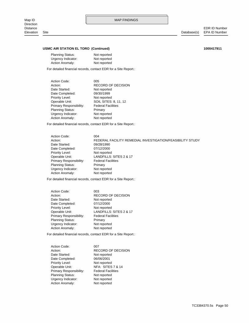
MAP FINDINGSMap IDDirection
EDR ID NumberDistanceEPA ID NumberDatabase(s)SiteElevation
Not reportedAction Anomaly: Not reportedUrgency Indicator: Not reportedPlanning Status: Federal FacilitiesPrimary Responsibility: NFA: SITES 7 & 14Operable Unit: Not reportedPriority Level: 06/06/2001Date Completed: Not reportedDate Started: RECORD OF DECISIONAction: 007Action Code:
For detailed financial records, contact EDR for a Site Report.:
Not reportedAction Anomaly: Not reportedUrgency Indicator: PrimaryPlanning Status: Federal FacilitiesPrimary Responsibility: LANDFILLS: SITES 2 & 17Operable Unit: Not reportedPriority Level: 07/12/2000Date Completed: Not reportedDate Started: RECORD OF DECISIONAction: 003Action Code:
For detailed financial records, contact EDR for a Site Report.:
Not reportedAction Anomaly: Not reportedUrgency Indicator: PrimaryPlanning Status: Federal FacilitiesPrimary Responsibility: LANDFILLS: SITES 2 & 17Operable Unit: Not reportedPriority Level: 07/12/2000Date Completed: 09/28/1990Date Started: FEDERAL FACILITY REMEDIAL INVESTIGATION/FEASIBILITY STUDYAction: 004Action Code:
For detailed financial records, contact EDR for a Site Report.:
Not reportedAction Anomaly: Not reportedUrgency Indicator: PrimaryPlanning Status: Federal FacilitiesPrimary Responsibility: SOIL SITES: 8, 11, 12Operable Unit: Not reportedPriority Level: 09/30/1999Date Completed: Not reportedDate Started: RECORD OF DECISIONAction: 005Action Code:
For detailed financial records, contact EDR for a Site Report.:
Not reportedAction Anomaly: Not reportedUrgency Indicator: Not reportedPlanning Status:
USMC AIR STATION EL TORO (Continued) 1000417911
TC3384370.5s Page 50
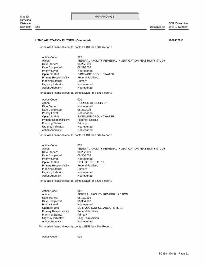
MAP FINDINGSMap IDDirection
EDR ID NumberDistanceEPA ID NumberDatabase(s)SiteElevation
001Action Code:
For detailed financial records, contact EDR for a Site Report.:
Not reportedAction Anomaly: Long Term ActionUrgency Indicator: PrimaryPlanning Status: Federal FacilitiesPrimary Responsibility: SOIL VOC SOURCE AREA: SITE 24Operable Unit: Not reportedPriority Level: 06/30/2002Date Completed: 05/17/1999Date Started: FEDERAL FACILITY REMEDIAL ACTIONAction: 002Action Code:
For detailed financial records, contact EDR for a Site Report.:
Not reportedAction Anomaly: Not reportedUrgency Indicator: PrimaryPlanning Status: Federal FacilitiesPrimary Responsibility: SOIL SITES: 8, 11, 12Operable Unit: Not reportedPriority Level: 06/30/2002Date Completed: 09/28/1990Date Started: FEDERAL FACILITY REMEDIAL INVESTIGATION/FEASIBILITY STUDYAction: 005Action Code:
For detailed financial records, contact EDR for a Site Report.:
Not reportedAction Anomaly: Not reportedUrgency Indicator: PrimaryPlanning Status: Federal FacilitiesPrimary Responsibility: BASEWIDE GROUNDWATEROperable Unit: Not reportedPriority Level: 06/27/2002Date Completed: Not reportedDate Started: RECORD OF DECISIONAction: 001Action Code:
For detailed financial records, contact EDR for a Site Report.:
Not reportedAction Anomaly: Not reportedUrgency Indicator: PrimaryPlanning Status: Federal FacilitiesPrimary Responsibility: BASEWIDE GROUNDWATEROperable Unit: Not reportedPriority Level: 06/27/2002Date Completed: 09/28/1990Date Started: FEDERAL FACILITY REMEDIAL INVESTIGATION/FEASIBILITY STUDYAction: 002Action Code:
For detailed financial records, contact EDR for a Site Report.:
USMC AIR STATION EL TORO (Continued) 1000417911
TC3384370.5s Page 51
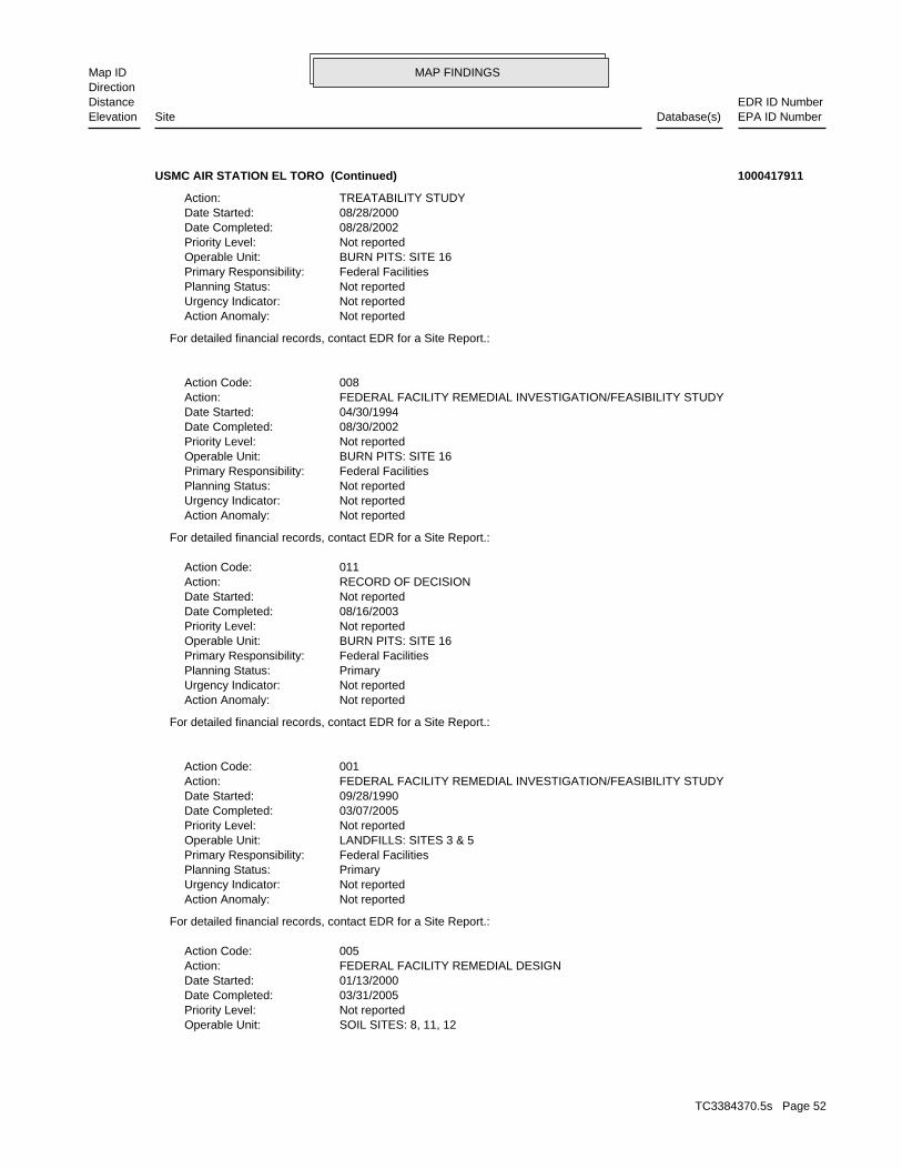
MAP FINDINGSMap IDDirection
EDR ID NumberDistanceEPA ID NumberDatabase(s)SiteElevation
SOIL SITES: 8, 11, 12Operable Unit: Not reportedPriority Level: 03/31/2005Date Completed: 01/13/2000Date Started: FEDERAL FACILITY REMEDIAL DESIGNAction: 005Action Code:
For detailed financial records, contact EDR for a Site Report.:
Not reportedAction Anomaly: Not reportedUrgency Indicator: PrimaryPlanning Status: Federal FacilitiesPrimary Responsibility: LANDFILLS: SITES 3 & 5Operable Unit: Not reportedPriority Level: 03/07/2005Date Completed: 09/28/1990Date Started: FEDERAL FACILITY REMEDIAL INVESTIGATION/FEASIBILITY STUDYAction: 001Action Code:
For detailed financial records, contact EDR for a Site Report.:
Not reportedAction Anomaly: Not reportedUrgency Indicator: PrimaryPlanning Status: Federal FacilitiesPrimary Responsibility: BURN PITS: SITE 16Operable Unit: Not reportedPriority Level: 08/16/2003Date Completed: Not reportedDate Started: RECORD OF DECISIONAction: 011Action Code:
For detailed financial records, contact EDR for a Site Report.:
Not reportedAction Anomaly: Not reportedUrgency Indicator: Not reportedPlanning Status: Federal FacilitiesPrimary Responsibility: BURN PITS: SITE 16Operable Unit: Not reportedPriority Level: 08/30/2002Date Completed: 04/30/1994Date Started: FEDERAL FACILITY REMEDIAL INVESTIGATION/FEASIBILITY STUDYAction: 008Action Code:
For detailed financial records, contact EDR for a Site Report.:
Not reportedAction Anomaly: Not reportedUrgency Indicator: Not reportedPlanning Status: Federal FacilitiesPrimary Responsibility: BURN PITS: SITE 16Operable Unit: Not reportedPriority Level: 08/28/2002Date Completed: 08/28/2000Date Started: TREATABILITY STUDYAction:
USMC AIR STATION EL TORO (Continued) 1000417911
TC3384370.5s Page 52
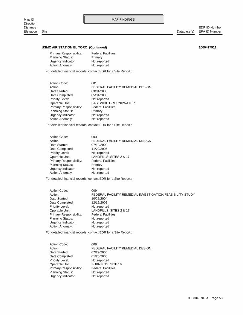
MAP FINDINGSMap IDDirection
EDR ID NumberDistanceEPA ID NumberDatabase(s)SiteElevation
Not reportedUrgency Indicator: Not reportedPlanning Status: Federal FacilitiesPrimary Responsibility: BURN PITS: SITE 16Operable Unit: Not reportedPriority Level: 01/20/2006Date Completed: 07/22/2005Date Started: FEDERAL FACILITY REMEDIAL DESIGNAction: 009Action Code:
For detailed financial records, contact EDR for a Site Report.:
Not reportedAction Anomaly: Not reportedUrgency Indicator: Not reportedPlanning Status: Federal FacilitiesPrimary Responsibility: LANDFILLS: SITES 2 & 17Operable Unit: Not reportedPriority Level: 12/19/2005Date Completed: 10/25/2004Date Started: FEDERAL FACILITY REMEDIAL INVESTIGATION/FEASIBILITY STUDYAction: 009Action Code:
For detailed financial records, contact EDR for a Site Report.:
Not reportedAction Anomaly: Not reportedUrgency Indicator: PrimaryPlanning Status: Federal FacilitiesPrimary Responsibility: LANDFILLS: SITES 2 & 17Operable Unit: Not reportedPriority Level: 11/22/2005Date Completed: 07/12/2000Date Started: FEDERAL FACILITY REMEDIAL DESIGNAction: 003Action Code:
For detailed financial records, contact EDR for a Site Report.:
Not reportedAction Anomaly: Not reportedUrgency Indicator: PrimaryPlanning Status: Federal FacilitiesPrimary Responsibility: BASEWIDE GROUNDWATEROperable Unit: Not reportedPriority Level: 05/31/2005Date Completed: 03/01/2003Date Started: FEDERAL FACILITY REMEDIAL DESIGNAction: 001Action Code:
For detailed financial records, contact EDR for a Site Report.:
Not reportedAction Anomaly: Not reportedUrgency Indicator: PrimaryPlanning Status: Federal FacilitiesPrimary Responsibility:
USMC AIR STATION EL TORO (Continued) 1000417911
TC3384370.5s Page 53
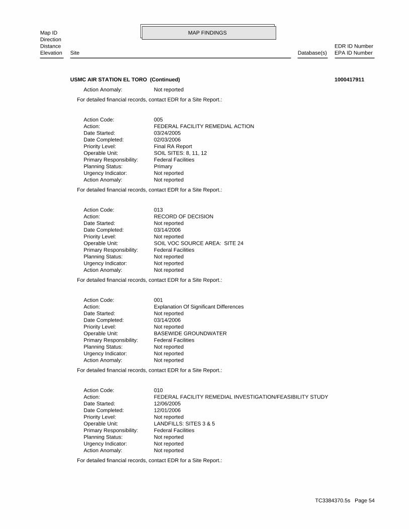
MAP FINDINGSMap IDDirection
EDR ID NumberDistanceEPA ID NumberDatabase(s)SiteElevation
For detailed financial records, contact EDR for a Site Report.:
Not reportedAction Anomaly: Not reportedUrgency Indicator: Not reportedPlanning Status: Federal FacilitiesPrimary Responsibility: LANDFILLS: SITES 3 & 5Operable Unit: Not reportedPriority Level: 12/01/2006Date Completed: 12/06/2005Date Started: FEDERAL FACILITY REMEDIAL INVESTIGATION/FEASIBILITY STUDYAction: 010Action Code:
For detailed financial records, contact EDR for a Site Report.:
Not reportedAction Anomaly: Not reportedUrgency Indicator: Not reportedPlanning Status: Federal FacilitiesPrimary Responsibility: BASEWIDE GROUNDWATEROperable Unit: Not reportedPriority Level: 03/14/2006Date Completed: Not reportedDate Started: Explanation Of Significant DifferencesAction: 001Action Code:
For detailed financial records, contact EDR for a Site Report.:
Not reportedAction Anomaly: Not reportedUrgency Indicator: Not reportedPlanning Status: Federal FacilitiesPrimary Responsibility: SOIL VOC SOURCE AREA: SITE 24Operable Unit: Not reportedPriority Level: 03/14/2006Date Completed: Not reportedDate Started: RECORD OF DECISIONAction: 013Action Code:
For detailed financial records, contact EDR for a Site Report.:
Not reportedAction Anomaly: Not reportedUrgency Indicator: PrimaryPlanning Status: Federal FacilitiesPrimary Responsibility: SOIL SITES: 8, 11, 12Operable Unit: Final RA ReportPriority Level: 02/03/2006Date Completed: 03/24/2005Date Started: FEDERAL FACILITY REMEDIAL ACTIONAction: 005Action Code:
For detailed financial records, contact EDR for a Site Report.:
Not reportedAction Anomaly:
USMC AIR STATION EL TORO (Continued) 1000417911
TC3384370.5s Page 54
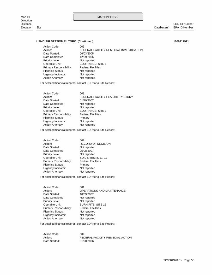
MAP FINDINGSMap IDDirection
EDR ID NumberDistanceEPA ID NumberDatabase(s)SiteElevation
01/20/2006Date Started: FEDERAL FACILITY REMEDIAL ACTIONAction: 009Action Code:
For detailed financial records, contact EDR for a Site Report.:
Not reportedAction Anomaly: Not reportedUrgency Indicator: Not reportedPlanning Status: Federal FacilitiesPrimary Responsibility: BURN PITS: SITE 16Operable Unit: Not reportedPriority Level: Not reportedDate Completed: 10/09/2007Date Started: OPERATIONS AND MAINTENANCEAction: 001Action Code:
For detailed financial records, contact EDR for a Site Report.:
Not reportedAction Anomaly: Not reportedUrgency Indicator: PrimaryPlanning Status: Federal FacilitiesPrimary Responsibility: SOIL SITES: 8, 11, 12Operable Unit: Not reportedPriority Level: 05/08/2007Date Completed: Not reportedDate Started: RECORD OF DECISIONAction: 009Action Code:
For detailed financial records, contact EDR for a Site Report.:
Not reportedAction Anomaly: Not reportedUrgency Indicator: PrimaryPlanning Status: Federal FacilitiesPrimary Responsibility: EOD RANGE: SITE 1Operable Unit: Not reportedPriority Level: Not reportedDate Completed: 01/29/2007Date Started: FEDERAL FACILITY FEASIBILITY STUDYAction: 001Action Code:
For detailed financial records, contact EDR for a Site Report.:
Not reportedAction Anomaly: Not reportedUrgency Indicator: Not reportedPlanning Status: Federal FacilitiesPrimary Responsibility: EOD RANGE: SITE 1Operable Unit: Not reportedPriority Level: 12/29/2006Date Completed: 06/03/2005Date Started: FEDERAL FACILITY REMEDIAL INVESTIGATIONAction: 003Action Code:
USMC AIR STATION EL TORO (Continued) 1000417911
TC3384370.5s Page 55
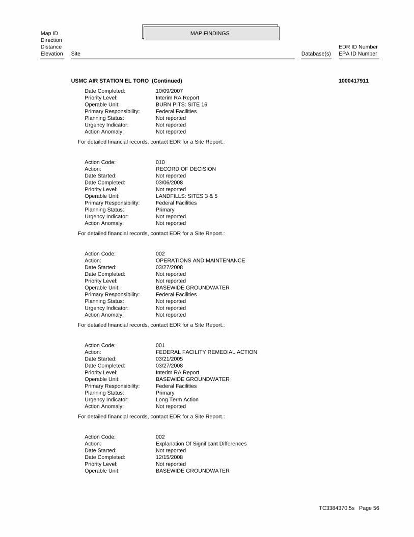
MAP FINDINGSMap IDDirection
EDR ID NumberDistanceEPA ID NumberDatabase(s)SiteElevation
BASEWIDE GROUNDWATEROperable Unit: Not reportedPriority Level: 12/15/2008Date Completed: Not reportedDate Started: Explanation Of Significant DifferencesAction: 002Action Code:
For detailed financial records, contact EDR for a Site Report.:
Not reportedAction Anomaly: Long Term ActionUrgency Indicator: PrimaryPlanning Status: Federal FacilitiesPrimary Responsibility: BASEWIDE GROUNDWATEROperable Unit: Interim RA ReportPriority Level: 03/27/2008Date Completed: 03/21/2005Date Started: FEDERAL FACILITY REMEDIAL ACTIONAction: 001Action Code:
For detailed financial records, contact EDR for a Site Report.:
Not reportedAction Anomaly: Not reportedUrgency Indicator: Not reportedPlanning Status: Federal FacilitiesPrimary Responsibility: BASEWIDE GROUNDWATEROperable Unit: Not reportedPriority Level: Not reportedDate Completed: 03/27/2008Date Started: OPERATIONS AND MAINTENANCEAction: 002Action Code:
For detailed financial records, contact EDR for a Site Report.:
Not reportedAction Anomaly: Not reportedUrgency Indicator: PrimaryPlanning Status: Federal FacilitiesPrimary Responsibility: LANDFILLS: SITES 3 & 5Operable Unit: Not reportedPriority Level: 03/06/2008Date Completed: Not reportedDate Started: RECORD OF DECISIONAction: 010Action Code:
For detailed financial records, contact EDR for a Site Report.:
Not reportedAction Anomaly: Not reportedUrgency Indicator: Not reportedPlanning Status: Federal FacilitiesPrimary Responsibility: BURN PITS: SITE 16Operable Unit: Interim RA ReportPriority Level: 10/09/2007Date Completed:
USMC AIR STATION EL TORO (Continued) 1000417911
TC3384370.5s Page 56
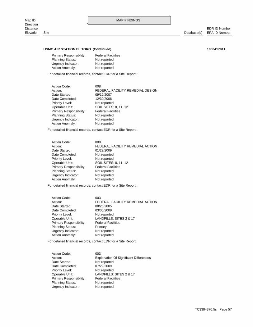
MAP FINDINGSMap IDDirection
EDR ID NumberDistanceEPA ID NumberDatabase(s)SiteElevation
Not reportedUrgency Indicator: Not reportedPlanning Status: Federal FacilitiesPrimary Responsibility: LANDFILLS: SITES 2 & 17Operable Unit: Not reportedPriority Level: 07/29/2009Date Completed: Not reportedDate Started: Explanation Of Significant DifferencesAction: 003Action Code:
For detailed financial records, contact EDR for a Site Report.:
Not reportedAction Anomaly: Not reportedUrgency Indicator: PrimaryPlanning Status: Federal FacilitiesPrimary Responsibility: LANDFILLS: SITES 2 & 17Operable Unit: Not reportedPriority Level: 03/05/2009Date Completed: 08/25/2005Date Started: FEDERAL FACILITY REMEDIAL ACTIONAction: 003Action Code:
For detailed financial records, contact EDR for a Site Report.:
Not reportedAction Anomaly: Not reportedUrgency Indicator: Not reportedPlanning Status: Federal FacilitiesPrimary Responsibility: SOIL SITES: 8, 11, 12Operable Unit: Not reportedPriority Level: Not reportedDate Completed: 01/22/2009Date Started: FEDERAL FACILITY REMEDIAL ACTIONAction: 008Action Code:
For detailed financial records, contact EDR for a Site Report.:
Not reportedAction Anomaly: Not reportedUrgency Indicator: Not reportedPlanning Status: Federal FacilitiesPrimary Responsibility: SOIL SITES: 8, 11, 12Operable Unit: Not reportedPriority Level: 12/30/2008Date Completed: 09/12/2007Date Started: FEDERAL FACILITY REMEDIAL DESIGNAction: 008Action Code:
For detailed financial records, contact EDR for a Site Report.:
Not reportedAction Anomaly: Not reportedUrgency Indicator: Not reportedPlanning Status: Federal FacilitiesPrimary Responsibility:
USMC AIR STATION EL TORO (Continued) 1000417911
TC3384370.5s Page 57
MAP FINDINGSMap IDDirection
EDR ID NumberDistanceEPA ID NumberDatabase(s)SiteElevation
For detailed financial records, contact EDR for a Site Report.:
Not reportedAction Anomaly: Not reportedUrgency Indicator: Not reportedPlanning Status: Federal FacilitiesPrimary Responsibility: LANDFILLS: SITES 3 & 5Operable Unit: Not reportedPriority Level: 08/09/2010Date Completed: Not reportedDate Started: RECORD OF DECISIONAction: 015Action Code:
For detailed financial records, contact EDR for a Site Report.:
Not reportedAction Anomaly: Not reportedUrgency Indicator: Not reportedPlanning Status: Federal FacilitiesPrimary Responsibility: SITEWIDEOperable Unit: Not reportedPriority Level: 09/28/2009Date Completed: Not reportedDate Started: FEDERAL FACILITY FIVE YEAR REVIEWAction: 002Action Code:
For detailed financial records, contact EDR for a Site Report.:
Not reportedAction Anomaly: Not reportedUrgency Indicator: PrimaryPlanning Status: Federal FacilitiesPrimary Responsibility: LANDFILLS: SITES 3 & 5Operable Unit: Not reportedPriority Level: Not reportedDate Completed: 08/17/2009Date Started: FEDERAL FACILITY REMEDIAL ACTIONAction: 004Action Code:
For detailed financial records, contact EDR for a Site Report.:
Not reportedAction Anomaly: Not reportedUrgency Indicator: PrimaryPlanning Status: Federal FacilitiesPrimary Responsibility: LANDFILLS: SITES 3 & 5Operable Unit: Not reportedPriority Level: 08/13/2009Date Completed: 09/01/2008Date Started: FEDERAL FACILITY REMEDIAL DESIGNAction: 004Action Code:
For detailed financial records, contact EDR for a Site Report.:
Not reportedAction Anomaly:
USMC AIR STATION EL TORO (Continued) 1000417911
TC3384370.5s Page 58
MAP FINDINGSMap IDDirection
EDR ID NumberDistanceEPA ID NumberDatabase(s)SiteElevation
CA6170023208EPA ID:
CORRACTS:
39 additional US CERCLIS Financial: record(s) in the EDR Site Report.Click this hyperlink while viewing on your computer to access
23988Page Number: 53Fed Register Volume: 06/24/1988Fed Register Date:
6154Page Number: 55Fed Register Volume: 02/21/1990Fed Register Date:
Federal Register Details:
For detailed financial records, contact EDR for a Site Report.:
Not reportedAction Anomaly: Not reportedUrgency Indicator: Not reportedPlanning Status: Federal FacilitiesPrimary Responsibility: LANDFILLS: SITES 3 & 5Operable Unit: Not reportedPriority Level: 07/19/2011Date Completed: 07/01/2011Date Started: FEDERAL FACILITY REMEDIAL DESIGNAction: 012Action Code:
For detailed financial records, contact EDR for a Site Report.:
Not reportedAction Anomaly: Not reportedUrgency Indicator: Not reportedPlanning Status: Federal FacilitiesPrimary Responsibility: LANDFILLS: SITES 3 & 5Operable Unit: Not reportedPriority Level: Not reportedDate Completed: 07/19/2011Date Started: FEDERAL FACILITY REMEDIAL ACTIONAction: 011Action Code:
For detailed financial records, contact EDR for a Site Report.:
Not reportedAction Anomaly: Not reportedUrgency Indicator: Not reportedPlanning Status: Federal FacilitiesPrimary Responsibility: EOD RANGE: SITE 1Operable Unit: Not reportedPriority Level: 04/13/2011Date Completed: 01/29/2007Date Started: FEDERAL FACILITY FEASIBILITY STUDYAction: 002Action Code:
USMC AIR STATION EL TORO (Continued) 1000417911
TC3384370.5s Page 59
MAP FINDINGSMap IDDirection
EDR ID NumberDistanceEPA ID NumberDatabase(s)SiteElevation
92811NAICS Code(s): corrective action priority CA075ME - CA Prioritization, Facility or area was assigned a mediumAction: 04/20/1991Actual Date: ENTIRE FACILITYArea Name: 09EPA Region: CA6170023208EPA ID:
Not reportedSchedule end date: Not reportedOriginal schedule date: National Security 92811NAICS Code(s): CA350 - CMS ApprovedAction: 01/23/1997Actual Date: OU2A - VADOSE ZONE SOILSArea Name: 09EPA Region: CA6170023208EPA ID:
Not reportedSchedule end date: Not reportedOriginal schedule date: National Security 92811NAICS Code(s): CA200 - RFI ApprovedAction: 01/23/1997Actual Date: OU2A - VADOSE ZONE SOILSArea Name: 09EPA Region: CA6170023208EPA ID:
Not reportedSchedule end date: Not reportedOriginal schedule date: National Security 92811NAICS Code(s): CA150 - RFI Workplan ApprovedAction: 01/23/1997Actual Date: OU2A - VADOSE ZONE SOILSArea Name: 09EPA Region: CA6170023208EPA ID:
Not reportedSchedule end date: Not reportedOriginal schedule date: National Security 92811NAICS Code(s): CA300 - CMS Workplan ApprovedAction: 01/23/1997Actual Date: OU2A - VADOSE ZONE SOILSArea Name: 09EPA Region: CA6170023208EPA ID:
Not reportedSchedule end date: Not reportedOriginal schedule date: National Security 92811NAICS Code(s): Corrective Action at the facility or area referred to CERCLA CA210SF - CA Responsibility Referred To A Non-RCRA Federal Authority,Action: 01/01/1996Actual Date: ENTIRE FACILITYArea Name: 09EPA Region:
USMC AIR STATION EL TORO (Continued) 1000417911
TC3384370.5s Page 60
MAP FINDINGSMap IDDirection
EDR ID NumberDistanceEPA ID NumberDatabase(s)SiteElevation
ENTIRE FACILITYArea Name: 09EPA Region: CA6170023208EPA ID:
Not reportedSchedule end date: Not reportedOriginal schedule date: National Security 92811NAICS Code(s): CA210 - CA Responsibility Referred To A Non-RCRA Federal AuthorityAction: 06/17/1998Actual Date: ENTIRE FACILITYArea Name: 09EPA Region: CA6170023208EPA ID:
Not reportedSchedule end date: Not reportedOriginal schedule date: National Security 92811NAICS Code(s): CA049SIAction: 06/01/1987Actual Date: ENTIRE FACILITYArea Name: 09EPA Region: CA6170023208EPA ID:
Not reportedSchedule end date: 05/01/1996Original schedule date: National Security 92811NAICS Code(s): CA070YE - RFA Determination Of Need For An RFI, RFI is NecessaryAction: 05/01/1996Actual Date: ENTIRE FACILITYArea Name: 09EPA Region: CA6170023208EPA ID:
Not reportedSchedule end date: 05/01/1996Original schedule date: National Security 92811NAICS Code(s): CA050 - RFA CompletedAction: 05/01/1996Actual Date: ENTIRE FACILITYArea Name: 09EPA Region: CA6170023208EPA ID:
Not reportedSchedule end date: Not reportedOriginal schedule date: National Security 92811NAICS Code(s): CA050RF - RFA Completed, Assessment was an RFAAction: 05/01/1996Actual Date: ENTIRE FACILITYArea Name: 09EPA Region: CA6170023208EPA ID:
Not reportedSchedule end date: Not reportedOriginal schedule date: National Security
USMC AIR STATION EL TORO (Continued) 1000417911
TC3384370.5s Page 61
MAP FINDINGSMap IDDirection
EDR ID NumberDistanceEPA ID NumberDatabase(s)SiteElevation
OU2A - VADOSE ZONE SOILSArea Name: 09EPA Region: CA6170023208EPA ID:
Not reportedSchedule end date: Not reportedOriginal schedule date: National Security 92811NAICS Code(s): CA999 - Corrective Action Process TerminatedAction: 07/23/2004Actual Date: FOST 1Area Name: 09EPA Region: CA6170023208EPA ID:
Not reportedSchedule end date: 07/23/2004Original schedule date: National Security 92811NAICS Code(s): Completed CA999RM - Corrective Action Process Terminated, Remedial ActivitiesAction: 07/23/2004Actual Date: FOST 1Area Name: 09EPA Region: CA6170023208EPA ID:
Not reportedSchedule end date: Not reportedOriginal schedule date: National Security 92811NAICS Code(s): exposures are NOT under control CA725NO - Current Human Exposures Under Control, Current humanAction: 06/17/1998Actual Date: ENTIRE FACILITYArea Name: 09EPA Region: CA6170023208EPA ID:
Not reportedSchedule end date: Not reportedOriginal schedule date: National Security 92811NAICS Code(s): expected Unacceptable migration of contaminated groundwater is observed or CA750NO - Migration of Contaminated Groundwater under Control,Action: 06/17/1998Actual Date: ENTIRE FACILITYArea Name: 09EPA Region: CA6170023208EPA ID:
Not reportedSchedule end date: Not reportedOriginal schedule date: National Security 92811NAICS Code(s): timing considerations and administrative considerations action work at the facility, technical factors, the degree of risk, amenable to stabilization activity based on the, status of corrective CA225YE - Stabilization Measures Evaluation, This facility ,isAction: 06/17/1998Actual Date:
USMC AIR STATION EL TORO (Continued) 1000417911
TC3384370.5s Page 62
MAP FINDINGSMap IDDirection
EDR ID NumberDistanceEPA ID NumberDatabase(s)SiteElevation
Not reportedSchedule end date: Not reportedOriginal schedule date: National Security 92811NAICS Code(s): CA100 - RFI ImpositionAction: 10/24/1990Actual Date: ENTIRE FACILITYArea Name: 09EPA Region: CA6170023208EPA ID:
Not reportedSchedule end date: Not reportedOriginal schedule date: National Security 92811NAICS Code(s): CA049PAAction: 10/01/1986Actual Date: ENTIRE FACILITYArea Name: 09EPA Region: CA6170023208EPA ID:
Not reportedSchedule end date: Not reportedOriginal schedule date: National Security 92811NAICS Code(s): CA029SFAction: 10/01/1986Actual Date: ENTIRE FACILITYArea Name: 09EPA Region: CA6170023208EPA ID:
Not reportedSchedule end date: Not reportedOriginal schedule date: National Security 92811NAICS Code(s): CA400 - Date For Remedy Selection (CM Imposed)Action: 09/30/1997Actual Date: OU2A - VADOSE ZONE SOILSArea Name: 09EPA Region: CA6170023208EPA ID:
Not reportedSchedule end date: Not reportedOriginal schedule date: National Security 92811NAICS Code(s): CA999 - Corrective Action Process TerminatedAction: 08/29/2005Actual Date: FOST 2Area Name: 09EPA Region: CA6170023208EPA ID:
Not reportedSchedule end date: Not reportedOriginal schedule date: National Security 92811NAICS Code(s): CA999 - Corrective Action Process TerminatedAction: 07/23/2004Actual Date:
USMC AIR STATION EL TORO (Continued) 1000417911
TC3384370.5s Page 63
MAP FINDINGSMap IDDirection
EDR ID NumberDistanceEPA ID NumberDatabase(s)SiteElevation
Carbon AdsorptionEngineering Control: GroundwaterContaminated Media : 01Operable Unit: 20020627Action Completion date: RECORD OF DECISIONAction Name: 001Action ID:
Air StrippingEngineering Control: GroundwaterContaminated Media : 01Operable Unit: 20020627Action Completion date: RECORD OF DECISIONAction Name: 001Action ID:
SamplingEngineering Control: Soil GasContaminated Media : 01Operable Unit: 20081215Action Completion date: Explanation Of Significant DifferencesAction Name: 002Action ID:
ReinjectionEngineering Control: GroundwaterContaminated Media : 01Operable Unit: 20060314Action Completion date: Explanation Of Significant DifferencesAction Name: 001Action ID:
DischargeEngineering Control: GroundwaterContaminated Media : 01Operable Unit: 20060314Action Completion date: Explanation Of Significant DifferencesAction Name: 001Action ID:
Not reportedActual Date: Not reportedEvent Code: ORANGECounty: 09EPA Region: EL TORO, CA 92709 EL TORO M C A S EL TORO MARINE CORPS AIR STAAddress: EL TORO MARINE CORPS AIR STATIONName: 0902770Site ID: CA6170023208EPA ID:
US ENG CONTROLS:
Not reportedSchedule end date: Not reportedOriginal schedule date: National Security 92811NAICS Code(s): CA250 - CMS ImpositionAction: 10/24/1990Actual Date: ENTIRE FACILITYArea Name: 09EPA Region: CA6170023208EPA ID:
USMC AIR STATION EL TORO (Continued) 1000417911
TC3384370.5s Page 64
MAP FINDINGSMap IDDirection
EDR ID NumberDistanceEPA ID NumberDatabase(s)SiteElevation
006Action ID:
CapEngineering Control: SoilContaminated Media : 04Operable Unit: 20000712Action Completion date: RECORD OF DECISIONAction Name: 003Action ID:
MonitoringEngineering Control: GroundwaterContaminated Media : 04Operable Unit: 20000712Action Completion date: RECORD OF DECISIONAction Name: 003Action ID:
Leachate ControlEngineering Control: GroundwaterContaminated Media : 04Operable Unit: 20000712Action Completion date: RECORD OF DECISIONAction Name: 003Action ID:
Soil Vapor Extraction (in-situ)Engineering Control: SoilContaminated Media : 02Operable Unit: 19970929Action Completion date: RECORD OF DECISIONAction Name: 002Action ID:
MonitoringEngineering Control: SoilContaminated Media : 02Operable Unit: 19970929Action Completion date: RECORD OF DECISIONAction Name: 002Action ID:
Carbon AdsorptionEngineering Control: SoilContaminated Media : 02Operable Unit: 19970929Action Completion date: RECORD OF DECISIONAction Name: 002Action ID:
MonitoringEngineering Control: GroundwaterContaminated Media : 01Operable Unit: 20020627Action Completion date: RECORD OF DECISIONAction Name: 001Action ID:
ExtractionEngineering Control: GroundwaterContaminated Media : 01Operable Unit: 20020627Action Completion date: RECORD OF DECISIONAction Name: 001Action ID:
USMC AIR STATION EL TORO (Continued) 1000417911
TC3384370.5s Page 65
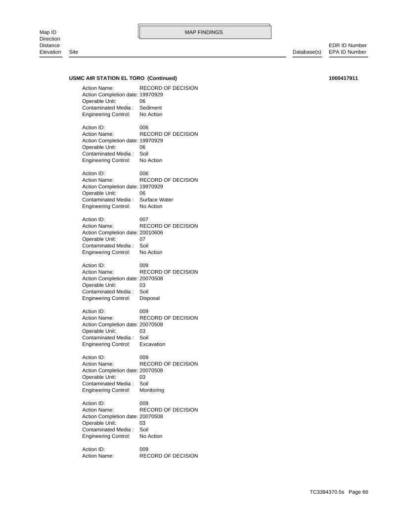
MAP FINDINGSMap IDDirection
EDR ID NumberDistanceEPA ID NumberDatabase(s)SiteElevation
RECORD OF DECISIONAction Name: 009Action ID:
No ActionEngineering Control: SoilContaminated Media : 03Operable Unit: 20070508Action Completion date: RECORD OF DECISIONAction Name: 009Action ID:
MonitoringEngineering Control: SoilContaminated Media : 03Operable Unit: 20070508Action Completion date: RECORD OF DECISIONAction Name: 009Action ID:
ExcavationEngineering Control: SoilContaminated Media : 03Operable Unit: 20070508Action Completion date: RECORD OF DECISIONAction Name: 009Action ID:
DisposalEngineering Control: SoilContaminated Media : 03Operable Unit: 20070508Action Completion date: RECORD OF DECISIONAction Name: 009Action ID:
No ActionEngineering Control: SoilContaminated Media : 07Operable Unit: 20010606Action Completion date: RECORD OF DECISIONAction Name: 007Action ID:
No ActionEngineering Control: Surface WaterContaminated Media : 06Operable Unit: 19970929Action Completion date: RECORD OF DECISIONAction Name: 006Action ID:
No ActionEngineering Control: SoilContaminated Media : 06Operable Unit: 19970929Action Completion date: RECORD OF DECISIONAction Name: 006Action ID:
No ActionEngineering Control: SedimentContaminated Media : 06Operable Unit: 19970929Action Completion date: RECORD OF DECISIONAction Name:
USMC AIR STATION EL TORO (Continued) 1000417911
TC3384370.5s Page 66
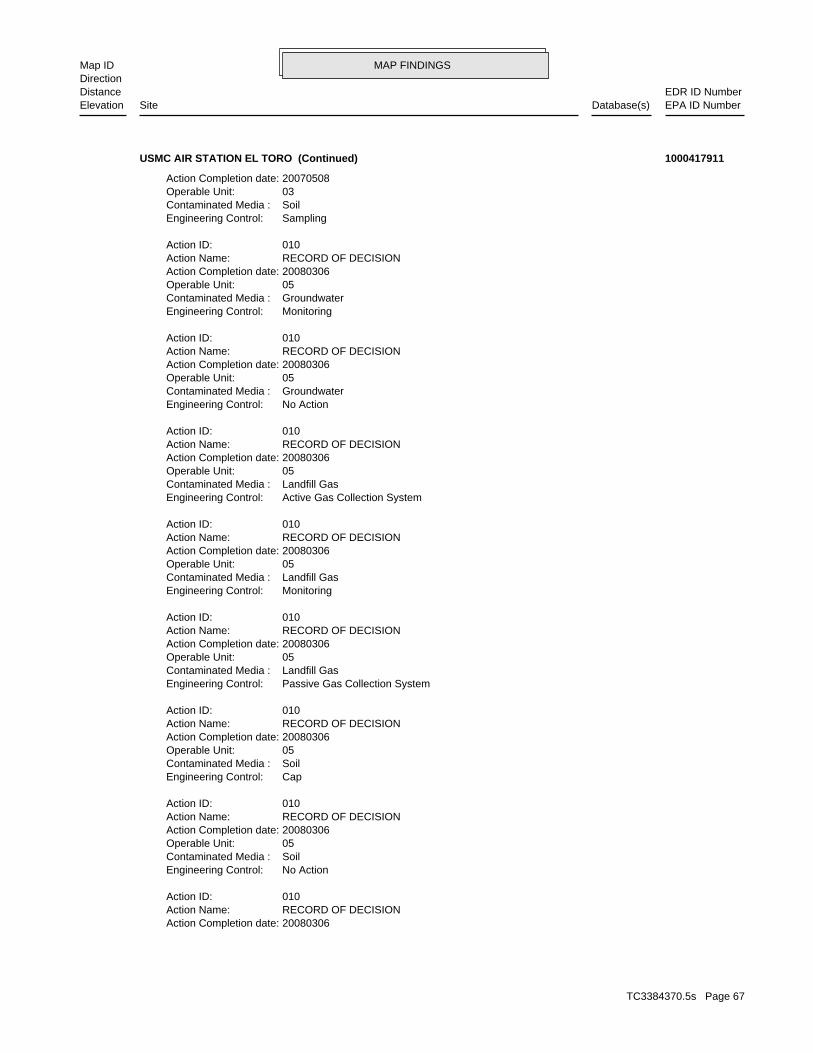
MAP FINDINGSMap IDDirection
EDR ID NumberDistanceEPA ID NumberDatabase(s)SiteElevation
20080306Action Completion date: RECORD OF DECISIONAction Name: 010Action ID:
No ActionEngineering Control: SoilContaminated Media : 05Operable Unit: 20080306Action Completion date: RECORD OF DECISIONAction Name: 010Action ID:
CapEngineering Control: SoilContaminated Media : 05Operable Unit: 20080306Action Completion date: RECORD OF DECISIONAction Name: 010Action ID:
Passive Gas Collection SystemEngineering Control: Landfill GasContaminated Media : 05Operable Unit: 20080306Action Completion date: RECORD OF DECISIONAction Name: 010Action ID:
MonitoringEngineering Control: Landfill GasContaminated Media : 05Operable Unit: 20080306Action Completion date: RECORD OF DECISIONAction Name: 010Action ID:
Active Gas Collection SystemEngineering Control: Landfill GasContaminated Media : 05Operable Unit: 20080306Action Completion date: RECORD OF DECISIONAction Name: 010Action ID:
No ActionEngineering Control: GroundwaterContaminated Media : 05Operable Unit: 20080306Action Completion date: RECORD OF DECISIONAction Name: 010Action ID:
MonitoringEngineering Control: GroundwaterContaminated Media : 05Operable Unit: 20080306Action Completion date: RECORD OF DECISIONAction Name: 010Action ID:
SamplingEngineering Control: SoilContaminated Media : 03Operable Unit: 20070508Action Completion date:
USMC AIR STATION EL TORO (Continued) 1000417911
TC3384370.5s Page 67
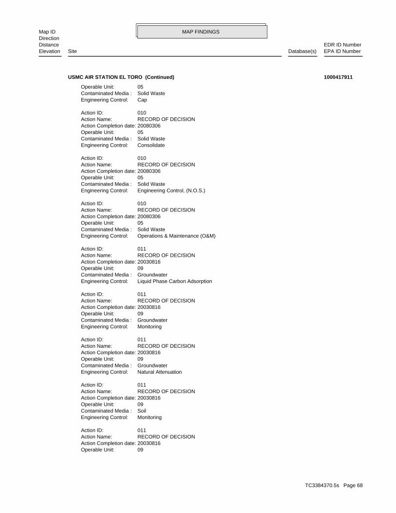
MAP FINDINGSMap IDDirection
EDR ID NumberDistanceEPA ID NumberDatabase(s)SiteElevation
09Operable Unit: 20030816Action Completion date: RECORD OF DECISIONAction Name: 011Action ID:
MonitoringEngineering Control: SoilContaminated Media : 09Operable Unit: 20030816Action Completion date: RECORD OF DECISIONAction Name: 011Action ID:
Natural AttenuationEngineering Control: GroundwaterContaminated Media : 09Operable Unit: 20030816Action Completion date: RECORD OF DECISIONAction Name: 011Action ID:
MonitoringEngineering Control: GroundwaterContaminated Media : 09Operable Unit: 20030816Action Completion date: RECORD OF DECISIONAction Name: 011Action ID:
Liquid Phase Carbon AdsorptionEngineering Control: GroundwaterContaminated Media : 09Operable Unit: 20030816Action Completion date: RECORD OF DECISIONAction Name: 011Action ID:
Operations & Maintenance (O&M)Engineering Control: Solid WasteContaminated Media : 05Operable Unit: 20080306Action Completion date: RECORD OF DECISIONAction Name: 010Action ID:
Engineering Control, (N.O.S.)Engineering Control: Solid WasteContaminated Media : 05Operable Unit: 20080306Action Completion date: RECORD OF DECISIONAction Name: 010Action ID:
ConsolidateEngineering Control: Solid WasteContaminated Media : 05Operable Unit: 20080306Action Completion date: RECORD OF DECISIONAction Name: 010Action ID:
CapEngineering Control: Solid WasteContaminated Media : 05Operable Unit:
USMC AIR STATION EL TORO (Continued) 1000417911
TC3384370.5s Page 68
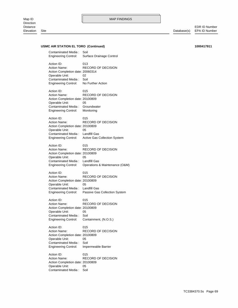
MAP FINDINGSMap IDDirection
EDR ID NumberDistanceEPA ID NumberDatabase(s)SiteElevation
SoilContaminated Media : 05Operable Unit: 20100809Action Completion date: RECORD OF DECISIONAction Name: 015Action ID:
Impermeable BarrierEngineering Control: SoilContaminated Media : 05Operable Unit: 20100809Action Completion date: RECORD OF DECISIONAction Name: 015Action ID:
Containment, (N.O.S.)Engineering Control: SoilContaminated Media : 05Operable Unit: 20100809Action Completion date: RECORD OF DECISIONAction Name: 015Action ID:
Passive Gas Collection SystemEngineering Control: Landfill GasContaminated Media : 05Operable Unit: 20100809Action Completion date: RECORD OF DECISIONAction Name: 015Action ID:
Operations & Maintenance (O&M)Engineering Control: Landfill GasContaminated Media : 05Operable Unit: 20100809Action Completion date: RECORD OF DECISIONAction Name: 015Action ID:
Active Gas Collection SystemEngineering Control: Landfill GasContaminated Media : 05Operable Unit: 20100809Action Completion date: RECORD OF DECISIONAction Name: 015Action ID:
MonitoringEngineering Control: GroundwaterContaminated Media : 05Operable Unit: 20100809Action Completion date: RECORD OF DECISIONAction Name: 015Action ID:
No Further ActionEngineering Control: SoilContaminated Media : 02Operable Unit: 20060314Action Completion date: RECORD OF DECISIONAction Name: 013Action ID:
Surface Drainage ControlEngineering Control: SoilContaminated Media :
USMC AIR STATION EL TORO (Continued) 1000417911
TC3384370.5s Page 69
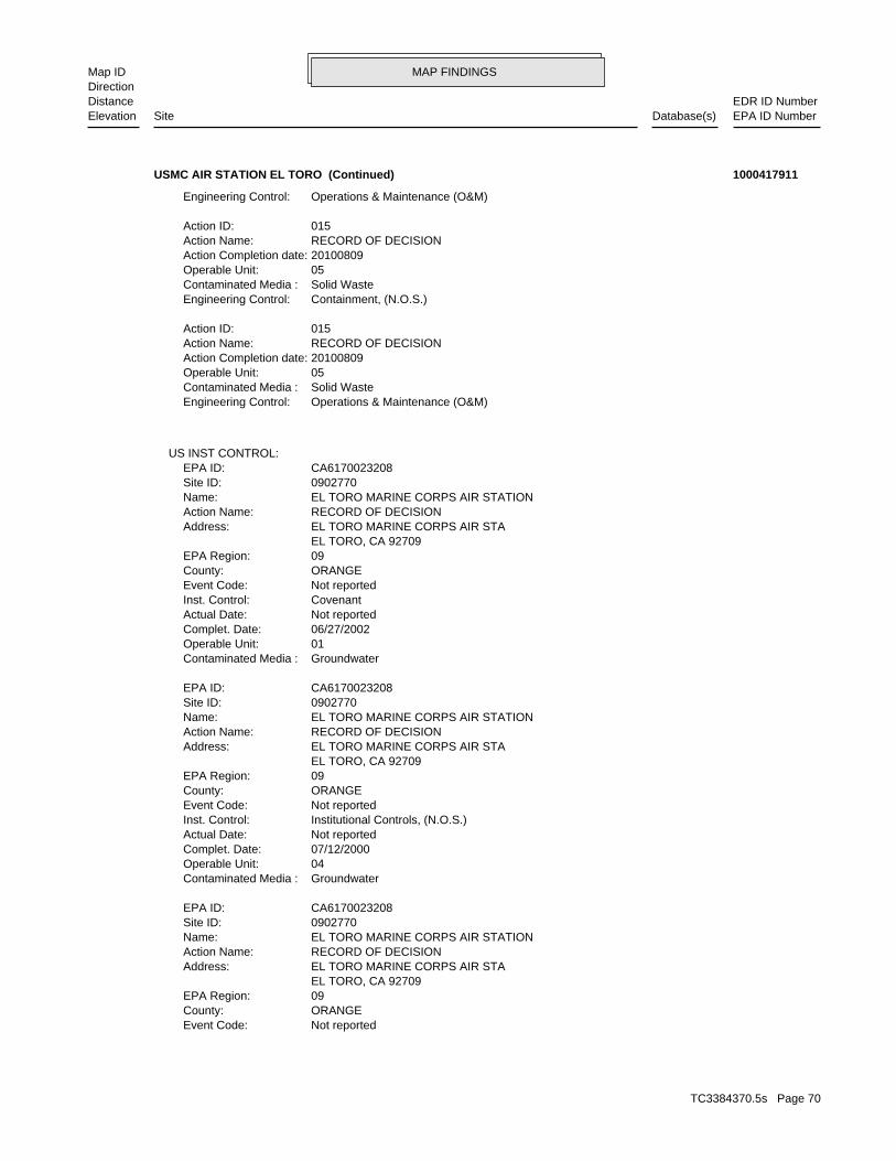
MAP FINDINGSMap IDDirection
EDR ID NumberDistanceEPA ID NumberDatabase(s)SiteElevation
Not reportedEvent Code: ORANGECounty: 09EPA Region: EL TORO, CA 92709 EL TORO MARINE CORPS AIR STAAddress: RECORD OF DECISIONAction Name: EL TORO MARINE CORPS AIR STATIONName: 0902770Site ID: CA6170023208EPA ID:
GroundwaterContaminated Media : 04Operable Unit: 07/12/2000Complet. Date: Not reportedActual Date: Institutional Controls, (N.O.S.)Inst. Control: Not reportedEvent Code: ORANGECounty: 09EPA Region: EL TORO, CA 92709 EL TORO MARINE CORPS AIR STAAddress: RECORD OF DECISIONAction Name: EL TORO MARINE CORPS AIR STATIONName: 0902770Site ID: CA6170023208EPA ID:
GroundwaterContaminated Media : 01Operable Unit: 06/27/2002Complet. Date: Not reportedActual Date: CovenantInst. Control: Not reportedEvent Code: ORANGECounty: 09EPA Region: EL TORO, CA 92709 EL TORO MARINE CORPS AIR STAAddress: RECORD OF DECISIONAction Name: EL TORO MARINE CORPS AIR STATIONName: 0902770Site ID: CA6170023208EPA ID:
US INST CONTROL:
Operations & Maintenance (O&M)Engineering Control: Solid WasteContaminated Media : 05Operable Unit: 20100809Action Completion date: RECORD OF DECISIONAction Name: 015Action ID:
Containment, (N.O.S.)Engineering Control: Solid WasteContaminated Media : 05Operable Unit: 20100809Action Completion date: RECORD OF DECISIONAction Name: 015Action ID:
Operations & Maintenance (O&M)Engineering Control:
USMC AIR STATION EL TORO (Continued) 1000417911
TC3384370.5s Page 70
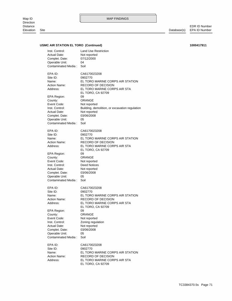
MAP FINDINGSMap IDDirection
EDR ID NumberDistanceEPA ID NumberDatabase(s)SiteElevation
EL TORO, CA 92709 EL TORO MARINE CORPS AIR STAAddress: RECORD OF DECISIONAction Name: EL TORO MARINE CORPS AIR STATIONName: 0902770Site ID: CA6170023208EPA ID:
SoilContaminated Media : 05Operable Unit: 03/06/2008Complet. Date: Not reportedActual Date: Zoning regulationInst. Control: Not reportedEvent Code: ORANGECounty: 09EPA Region: EL TORO, CA 92709 EL TORO MARINE CORPS AIR STAAddress: RECORD OF DECISIONAction Name: EL TORO MARINE CORPS AIR STATIONName: 0902770Site ID: CA6170023208EPA ID:
SoilContaminated Media : 05Operable Unit: 03/06/2008Complet. Date: Not reportedActual Date: Deed NoticesInst. Control: Not reportedEvent Code: ORANGECounty: 09EPA Region: EL TORO, CA 92709 EL TORO MARINE CORPS AIR STAAddress: RECORD OF DECISIONAction Name: EL TORO MARINE CORPS AIR STATIONName: 0902770Site ID: CA6170023208EPA ID:
SoilContaminated Media : 05Operable Unit: 03/06/2008Complet. Date: Not reportedActual Date: Building, demolition, or excavation regulationInst. Control: Not reportedEvent Code: ORANGECounty: 09EPA Region: EL TORO, CA 92709 EL TORO MARINE CORPS AIR STAAddress: RECORD OF DECISIONAction Name: EL TORO MARINE CORPS AIR STATIONName: 0902770Site ID: CA6170023208EPA ID:
SoilContaminated Media : 04Operable Unit: 07/12/2000Complet. Date: Not reportedActual Date: Land Use RestrictionInst. Control:
USMC AIR STATION EL TORO (Continued) 1000417911
TC3384370.5s Page 71
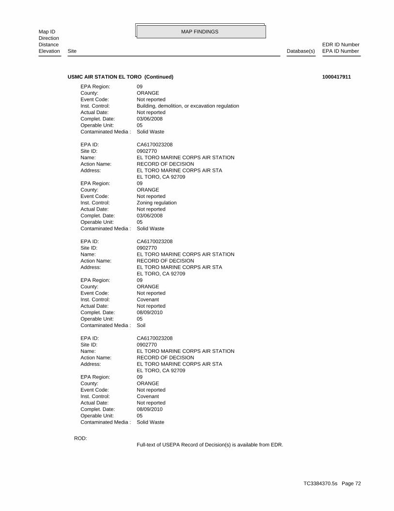
MAP FINDINGSMap IDDirection
EDR ID NumberDistanceEPA ID NumberDatabase(s)SiteElevation
Full-text of USEPA Record of Decision(s) is available from EDR.ROD:
Solid WasteContaminated Media : 05Operable Unit: 08/09/2010Complet. Date: Not reportedActual Date: CovenantInst. Control: Not reportedEvent Code: ORANGECounty: 09EPA Region: EL TORO, CA 92709 EL TORO MARINE CORPS AIR STAAddress: RECORD OF DECISIONAction Name: EL TORO MARINE CORPS AIR STATIONName: 0902770Site ID: CA6170023208EPA ID:
SoilContaminated Media : 05Operable Unit: 08/09/2010Complet. Date: Not reportedActual Date: CovenantInst. Control: Not reportedEvent Code: ORANGECounty: 09EPA Region: EL TORO, CA 92709 EL TORO MARINE CORPS AIR STAAddress: RECORD OF DECISIONAction Name: EL TORO MARINE CORPS AIR STATIONName: 0902770Site ID: CA6170023208EPA ID:
Solid WasteContaminated Media : 05Operable Unit: 03/06/2008Complet. Date: Not reportedActual Date: Zoning regulationInst. Control: Not reportedEvent Code: ORANGECounty: 09EPA Region: EL TORO, CA 92709 EL TORO MARINE CORPS AIR STAAddress: RECORD OF DECISIONAction Name: EL TORO MARINE CORPS AIR STATIONName: 0902770Site ID: CA6170023208EPA ID:
Solid WasteContaminated Media : 05Operable Unit: 03/06/2008Complet. Date: Not reportedActual Date: Building, demolition, or excavation regulationInst. Control: Not reportedEvent Code: ORANGECounty: 09EPA Region:
USMC AIR STATION EL TORO (Continued) 1000417911
TC3384370.5s Page 72
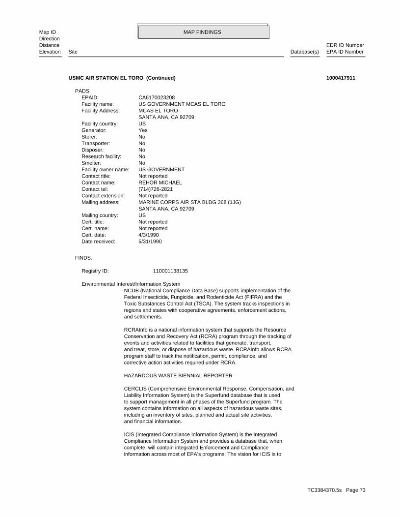
MAP FINDINGSMap IDDirection
EDR ID NumberDistanceEPA ID NumberDatabase(s)SiteElevation
information across most of EPA’s programs. The vision for ICIS is tocomplete, will contain integrated Enforcement and ComplianceCompliance Information System and provides a database that, whenICIS (Integrated Compliance Information System) is the Integrated
and financial information.including an inventory of sites, planned and actual site activities,system contains information on all aspects of hazardous waste sites,to support management in all phases of the Superfund program. TheLiability Information System) is the Superfund database that is usedCERCLIS (Comprehensive Environmental Response, Compensation, and
HAZARDOUS WASTE BIENNIAL REPORTER
corrective action activities required under RCRA.program staff to track the notification, permit, compliance, andand treat, store, or dispose of hazardous waste. RCRAInfo allows RCRAevents and activities related to facilities that generate, transport,Conservation and Recovery Act (RCRA) program through the tracking ofRCRAInfo is a national information system that supports the Resource
and settlements.regions and states with cooperative agreements, enforcement actions,Toxic Substances Control Act (TSCA). The system tracks inspections inFederal Insecticide, Fungicide, and Rodenticide Act (FIFRA) and theNCDB (National Compliance Data Base) supports implementation of the Environmental Interest/Information System
110001138135Registry ID:
FINDS:
5/31/1990Date received: 4/3/1990Cert. date: Not reportedCert. name: Not reportedCert. title: USMailing country: SANTA ANA, CA 92709 MARINE CORPS AIR STA BLDG 368 (1JG)Mailing address: Not reportedContact extension: (714)726-2821Contact tel: REHOR MICHAELContact name: Not reportedContact title: US GOVERNMENTFacility owner name: NoSmelter: NoResearch facility: NoDisposer: NoTransporter: NoStorer: YesGenerator: USFacility country: SANTA ANA, CA 92709 MCAS EL TOROFacility Address: US GOVERNMENT MCAS EL TOROFacility name: CA6170023208EPAID:
PADS:
USMC AIR STATION EL TORO (Continued) 1000417911
TC3384370.5s Page 73
MAP FINDINGSMap IDDirection
EDR ID NumberDistanceEPA ID NumberDatabase(s)SiteElevation
Incident Tracking, Compliance Assistance, and Compliance Monitoring.that support Compliance and Enforcement programs. These include;has the capability to track other activities occurring in the Regionthat information with Federal actions already in the system. ICIS alsoCompliance System (PCS) which supports the NPDES and will integrateit Headquarters. A future release of ICIS will replace the Permitinformation is maintained in ICIS by EPA in the Regional offices andFederal Administrative and Judicial enforcement actions. Thisa single repository for that information. Currently, ICIS contains allreplace EPA’s independent databases that contain Enforcement data with
USMC AIR STATION EL TORO (Continued) 1000417911
04/19/04Date rec. last updated: 04/16/04Date record created: Not reportedRestriction term: NoEarly transfer authority: / /NEPA complete date: 04/01/95EBS date: 07/10/00FOST date: / /Cleanup date: FAAProperty transferee: 12/03/01Sign date of deed: Federal Agency to Federal Agency TransferTransfer type: 901Acreage: Not reportedNEPA code: FAA Habitat PreserveDeed name: 1Deed ID:
LUCIS Deed Details:
04/16/04Last update date: 02/20/01Record creation date: / /Record update date: Not reportedZip Code: 0Acres owned: / /Last deed transferred by: Not reportedUIC: 07/02/99Closure date: 901Acres transferred: 4738Total acres to transfer: ClosureRecommendation: 93BRAC Year: Not reportedCaretaker: SWESTDIVEFD abbreviation: Not reportedStatus code: CAState: Marine Corps Air Station El ToroFacility name: 40BRACMIS facility ID:
LUCIS:
1373 ft.0.260 mi.
Relative:Lower
Actual:389 ft.
1/4-1/2 , CA West N/A1 LUCISMARINE CORPS AIR STATION EL TORO 1009526385
TC3384370.5s Page 74
MAP FINDINGSMap IDDirection
EDR ID NumberDistanceEPA ID NumberDatabase(s)SiteElevation
40_Transfer_Letter_El_Toro_FAAHabitat_392.pdfDocument name: 1220 Pacific Highway San Diego, CA 92132-5190Author address: Southwest DivAuthor city: William R. CarsilloAuthor: Transfer and Acceptance of Military Real PropertyDocument title: 807.00000Document ID: Deed AreaDocument code:
10/19/04Date rec. last update: 04/19/04Date record created: 11/26/01Document date: Not reportedVersion number: Not reportedDocument abbreviation: Not AvailableContact email: Not reportedContact Telephone: NAVFACENGCOMMPoint of contact: Not AvailableSource ID: 12.00000Document number: 40_MOU_El_Toro_FAAHabitat_392.pdfDocument name: 1220 Pacific Highway San Diego, CA 92132-5190Author address: Southwest Div.Author city: G.A. EngleAuthor: Memorandum of UnderstandingDocument title: 806.00000Document ID: Deed AreaDocument code:
10/19/04Date rec. last update: 04/19/04Date record created: 04/04/00Document date: Not reportedVersion number: Not reportedDocument abbreviation: Not AvailableContact email: Not reportedContact Telephone: NAVFACENGCOMMPoint of contact: Not AvailableSource ID: 16.00000Document number: 40_Environmental_Summary_Doc_El_Toro_FAAHabitat_392.pdfDocument name: 1220 Pacific Highway San Diego, CA 92132-5190Author address: Southwest DivAuthor city: R.E. SchenkAuthor: Environmental Summary Document for Certain Property Marine Corps Air Station El Toro, CADocument title: 805.00000Document ID: Deed AreaDocument code:
LUCIS Document Details:
of Irvine and on the east by the city of Lake Forest.MCAS El Toro is bordered on the northwest, south, and west by the city100 miles north of the California/Mexico border.approximately 40 miles south of downtown Los Angeles and approximatelylocated in a residential and industrial/manufacturaing areag, and other support facilities totaling 4,738 acres. MCAS El Toro isaircraft maintenance and training facilities, housininstallation was established in 1943 and is comprised of runways,in Southern California near the center of Orange County. TheMCAS El Toro is located on the Tustin Plain, a broad alluvial valley
LUCIS Base Description:
MARINE CORPS AIR STATION EL TORO (Continued) 1009526385
TC3384370.5s Page 75
MAP FINDINGSMap IDDirection
EDR ID NumberDistanceEPA ID NumberDatabase(s)SiteElevation
04/19/04Date rec. last update: 04/16/04Date record created: 03/31/95Document date: Not reportedVersion number: Not reportedDocument abbreviation: Not AvailableContact email: Not reportedContact Telephone: NAVFACENGCOMMPoint of contact: CLE-C01-01F2B4-S2-0004Source ID: 367.00000Document number: 40_El_Toro_EBS.pdfDocument name: 1220 Pacific Highway San Diego, CA 92132-5190Author address: Southwest Div.Author city: Mike Arends, P.E.Author: El Toro EBSDocument title: 804.00000Document ID: InstallationDocument code:
10/19/04Date rec. last update: 04/19/04Date record created: 10/31/01Document date: Not reportedVersion number: Not reportedDocument abbreviation: Not AvailableContact email: Not reportedContact Telephone: NAVFACENGCOMMPoint of contact: Not AvailableSource ID: 8.00000Document number:
MARINE CORPS AIR STATION EL TORO (Continued) 1009526385
MapGIS Source: Industrial,CommercialLanduse Name: PermittedRegulation Status: Composting Facility (Mixed)Activity: 39Permitted Acreage: PermittedPermit Status: 07/05/2011Permit Date: ActiveOperator’s Status: Irvine, CA 92650-0279Operator City,St,Zip: P.O. Box 279Operator Address2: Arthur KazarianOperator Address: 9495510363Operator Phone: Tierra Verde IndustriesOperator: Irvine, CA 92623Owner City,St,Zip: P.O. Box 19575Owner Address2: Not reportedOwner Address: 9497246247Owner Telephone: Orange County Great Parks CorporationOwner Name: 33.6730299 / -117.75086Lat/Long: 30-AB-0403Facility ID: STATERegion:
SWF/LF (SWIS):
1551 ft.0.294 mi.
Relative:Higher
Actual:409 ft.
1/4-1/2 IRVINE, CA NW 8065 MARINE WAY, PLANNING AREA 51 N/A2 SWF/LFTIERRA VERDE INDUSTRIES ECOCENTRE S111213959
TC3384370.5s Page 76
MAP FINDINGSMap IDDirection
EDR ID NumberDistanceEPA ID NumberDatabase(s)SiteElevation
Tons/dayRemaining Capacity with Units: Not reportedRemaining Capacity: 1890Permitted Capacity with Units: Tons/dayActual Throughput with Units: Not reportedPermitted Throughput with Units: Not reportedProgram Type: Not reportedWaste Discharge Requirement Num: 30-AB-0403SWIS Num: Not reportedDisposal Acreage: Not reportedClosure Type: Not reportedClosure Date: Construction/demolition,Mixed municipalAccepted Waste: MonthlyInspection Frequency: 02Unit Number: Transfer/ProcessingCategory: MapGIS Source: Industrial,CommercialLanduse Name: PermittedRegulation Status: Large Volume Transfer/Proc FacilityActivity: 6.7Permitted Acreage: PermittedPermit Status: 07/05/2011Permit Date: ActiveOperator’s Status: Irvine, CA 92650-0279Operator City,St,Zip: P.O. Box 279Operator Address2: Arthur KazarianOperator Address: 9495510363Operator Phone: Tierra Verde IndustriesOperator: Irvine, CA 92623Owner City,St,Zip: P.O. Box 19575Owner Address2: Not reportedOwner Address: 9497246247Owner Telephone: Orange County Great Parks CorporationOwner Name: 33.6730299 / -117.75086Lat/Long: 30-AB-0403Facility ID: STATERegion:
Tons/dayRemaining Capacity with Units: Not reportedRemaining Capacity: 3000Permitted Capacity with Units: Tons/dayActual Throughput with Units: 3000Permitted Throughput with Units: Not reportedProgram Type: Not reportedWaste Discharge Requirement Num: 30-AB-0403SWIS Num: Not reportedDisposal Acreage: Not reportedClosure Type: Not reportedClosure Date: Food Wastes,Green Materials,Wood wasteAccepted Waste: MonthlyInspection Frequency: 01Unit Number: CompostingCategory:
TIERRA VERDE INDUSTRIES ECOCENTRE (Continued) S111213959
TC3384370.5s Page 77
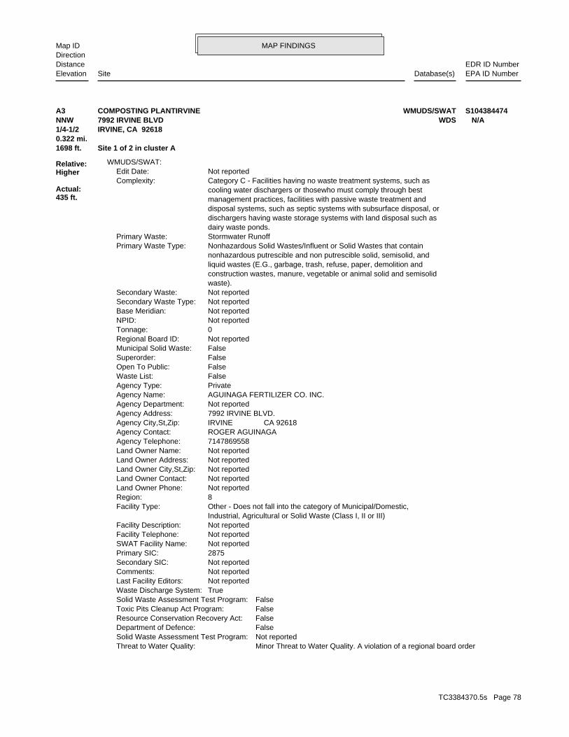
MAP FINDINGSMap IDDirection
EDR ID NumberDistanceEPA ID NumberDatabase(s)SiteElevation
Minor Threat to Water Quality. A violation of a regional board orderThreat to Water Quality: Not reportedSolid Waste Assessment Test Program: FalseDepartment of Defence: FalseResource Conservation Recovery Act: FalseToxic Pits Cleanup Act Program: FalseSolid Waste Assessment Test Program: TrueWaste Discharge System: Not reportedLast Facility Editors: Not reportedComments: Not reportedSecondary SIC: 2875Primary SIC: Not reportedSWAT Facility Name: Not reportedFacility Telephone: Not reportedFacility Description: Industrial, Agricultural or Solid Waste (Class I, II or III) Other - Does not fall into the category of Municipal/Domestic,Facility Type: 8Region: Not reportedLand Owner Phone: Not reportedLand Owner Contact: Not reportedLand Owner City,St,Zip: Not reportedLand Owner Address: Not reportedLand Owner Name: 7147869558Agency Telephone: ROGER AGUINAGAAgency Contact: IRVINE CA 92618Agency City,St,Zip: 7992 IRVINE BLVD.Agency Address: Not reportedAgency Department: AGUINAGA FERTILIZER CO. INC.Agency Name: PrivateAgency Type: FalseWaste List: FalseOpen To Public: FalseSuperorder: FalseMunicipal Solid Waste: Not reportedRegional Board ID: 0Tonnage: Not reportedNPID: Not reportedBase Meridian: Not reportedSecondary Waste Type: Not reportedSecondary Waste: waste). construction wastes, manure, vegetable or animal solid and semisolid liquid wastes (E.G., garbage, trash, refuse, paper, demolition and nonhazardous putrescible and non putrescible solid, semisolid, and Nonhazardous Solid Wastes/Influent or Solid Wastes that containPrimary Waste Type: Stormwater RunoffPrimary Waste: dairy waste ponds. dischargers having waste storage systems with land disposal such as disposal systems, such as septic systems with subsurface disposal, or management practices, facilities with passive waste treatment and cooling water dischargers or thosewho must comply through best Category C - Facilities having no waste treatment systems, such asComplexity: Not reportedEdit Date:
WMUDS/SWAT:
1698 ft. Site 1 of 2 in cluster A0.322 mi.
Relative:Higher
Actual:435 ft.
1/4-1/2 IRVINE, CA 92618NNW WDS7992 IRVINE BLVD N/AA3 WMUDS/SWATCOMPOSTING PLANTIRVINE S104384474
TC3384370.5s Page 78
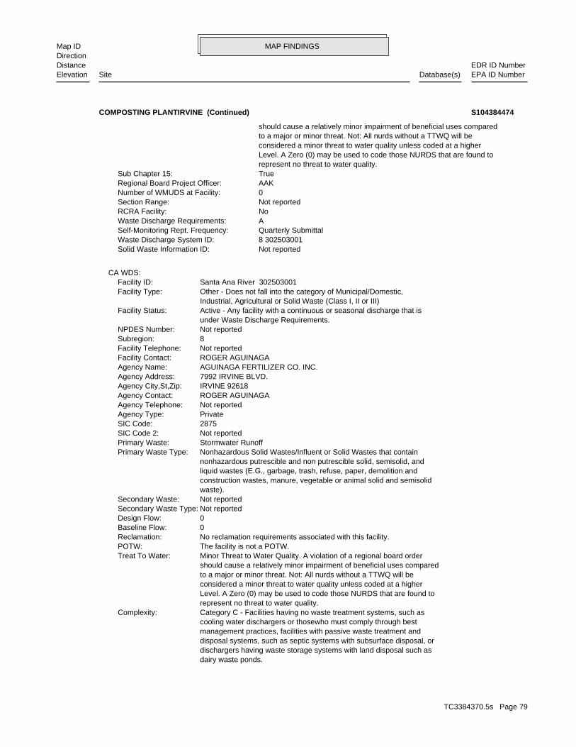
MAP FINDINGSMap IDDirection
EDR ID NumberDistanceEPA ID NumberDatabase(s)SiteElevation
dairy waste ponds. dischargers having waste storage systems with land disposal such as disposal systems, such as septic systems with subsurface disposal, or management practices, facilities with passive waste treatment and cooling water dischargers or thosewho must comply through best Category C - Facilities having no waste treatment systems, such asComplexity: represent no threat to water quality. Level. A Zero (0) may be used to code those NURDS that are found to considered a minor threat to water quality unless coded at a higher to a major or minor threat. Not: All nurds without a TTWQ will be should cause a relatively minor impairment of beneficial uses compared Minor Threat to Water Quality. A violation of a regional board orderTreat To Water: The facility is not a POTW.POTW: No reclamation requirements associated with this facility.Reclamation: 0Baseline Flow: 0Design Flow: Not reportedSecondary Waste Type: Not reportedSecondary Waste: waste). construction wastes, manure, vegetable or animal solid and semisolid liquid wastes (E.G., garbage, trash, refuse, paper, demolition and nonhazardous putrescible and non putrescible solid, semisolid, and Nonhazardous Solid Wastes/Influent or Solid Wastes that containPrimary Waste Type: Stormwater RunoffPrimary Waste: Not reportedSIC Code 2: 2875SIC Code: PrivateAgency Type: Not reportedAgency Telephone: ROGER AGUINAGAAgency Contact: IRVINE 92618Agency City,St,Zip: 7992 IRVINE BLVD.Agency Address: AGUINAGA FERTILIZER CO. INC.Agency Name: ROGER AGUINAGAFacility Contact: Not reportedFacility Telephone: 8Subregion: Not reportedNPDES Number: under Waste Discharge Requirements. Active - Any facility with a continuous or seasonal discharge that isFacility Status: Industrial, Agricultural or Solid Waste (Class I, II or III) Other - Does not fall into the category of Municipal/Domestic,Facility Type: Santa Ana River 302503001Facility ID:
CA WDS:
Not reportedSolid Waste Information ID: 8 302503001Waste Discharge System ID: Quarterly SubmittalSelf-Monitoring Rept. Frequency: AWaste Discharge Requirements: NoRCRA Facility: Not reportedSection Range: 0Number of WMUDS at Facility: AAKRegional Board Project Officer: TrueSub Chapter 15: represent no threat to water quality. Level. A Zero (0) may be used to code those NURDS that are found to considered a minor threat to water quality unless coded at a higher to a major or minor threat. Not: All nurds without a TTWQ will be should cause a relatively minor impairment of beneficial uses compared
COMPOSTING PLANTIRVINE (Continued) S104384474
TC3384370.5s Page 79
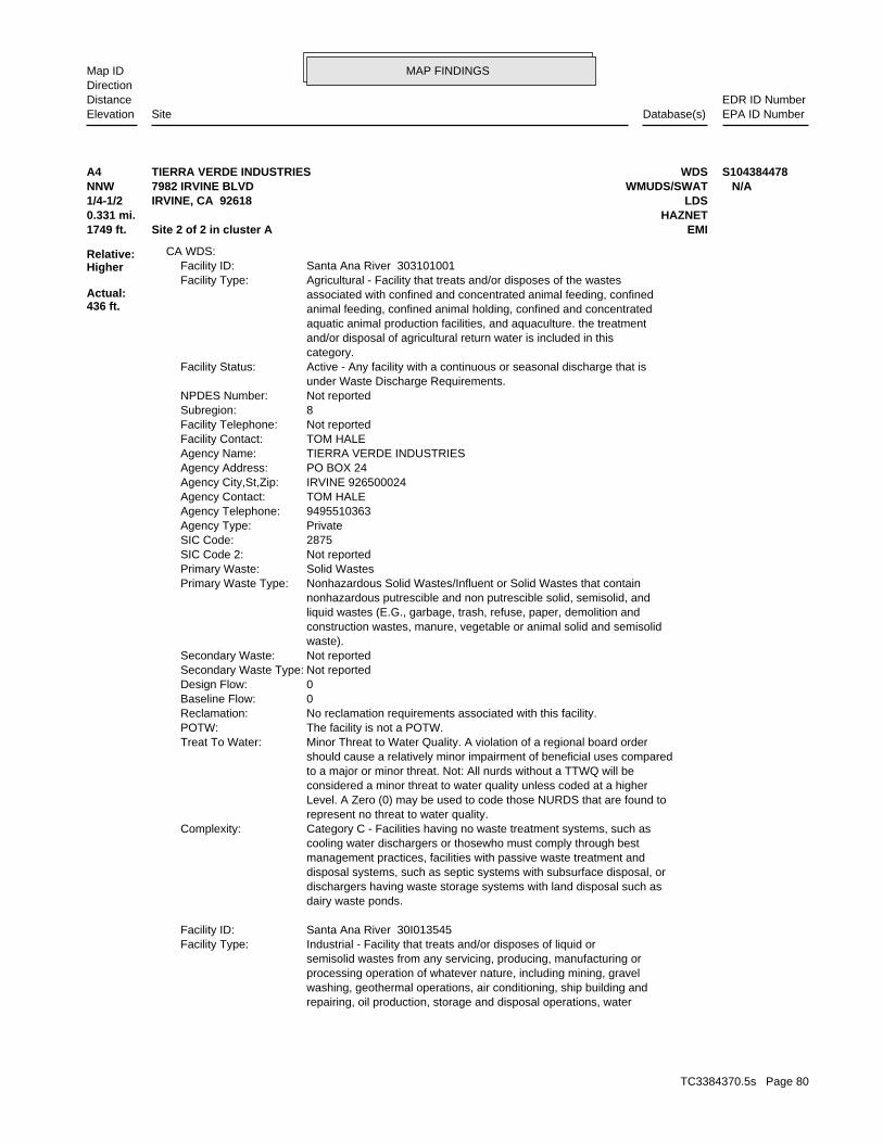
MAP FINDINGSMap IDDirection
EDR ID NumberDistanceEPA ID NumberDatabase(s)SiteElevation
repairing, oil production, storage and disposal operations, water washing, geothermal operations, air conditioning, ship building and processing operation of whatever nature, including mining, gravel semisolid wastes from any servicing, producing, manufacturing or Industrial - Facility that treats and/or disposes of liquid orFacility Type: Santa Ana River 30I013545Facility ID:
dairy waste ponds. dischargers having waste storage systems with land disposal such as disposal systems, such as septic systems with subsurface disposal, or management practices, facilities with passive waste treatment and cooling water dischargers or thosewho must comply through best Category C - Facilities having no waste treatment systems, such asComplexity: represent no threat to water quality. Level. A Zero (0) may be used to code those NURDS that are found to considered a minor threat to water quality unless coded at a higher to a major or minor threat. Not: All nurds without a TTWQ will be should cause a relatively minor impairment of beneficial uses compared Minor Threat to Water Quality. A violation of a regional board orderTreat To Water: The facility is not a POTW.POTW: No reclamation requirements associated with this facility.Reclamation: 0Baseline Flow: 0Design Flow: Not reportedSecondary Waste Type: Not reportedSecondary Waste: waste). construction wastes, manure, vegetable or animal solid and semisolid liquid wastes (E.G., garbage, trash, refuse, paper, demolition and nonhazardous putrescible and non putrescible solid, semisolid, and Nonhazardous Solid Wastes/Influent or Solid Wastes that containPrimary Waste Type: Solid WastesPrimary Waste: Not reportedSIC Code 2: 2875SIC Code: PrivateAgency Type: 9495510363Agency Telephone: TOM HALEAgency Contact: IRVINE 926500024Agency City,St,Zip: PO BOX 24Agency Address: TIERRA VERDE INDUSTRIESAgency Name: TOM HALEFacility Contact: Not reportedFacility Telephone: 8Subregion: Not reportedNPDES Number: under Waste Discharge Requirements. Active - Any facility with a continuous or seasonal discharge that isFacility Status: category. and/or disposal of agricultural return water is included in this aquatic animal production facilities, and aquaculture. the treatment animal feeding, confined animal holding, confined and concentrated associated with confined and concentrated animal feeding, confined Agricultural - Facility that treats and/or disposes of the wastesFacility Type: Santa Ana River 303101001Facility ID:
CA WDS:
1749 ft. EMISite 2 of 2 in cluster A0.331 mi. HAZNET
Relative:Higher
Actual:436 ft.
1/4-1/2 LDSIRVINE, CA 92618NNW WMUDS/SWAT7982 IRVINE BLVD N/AA4 WDSTIERRA VERDE INDUSTRIES S104384478
TC3384370.5s Page 80
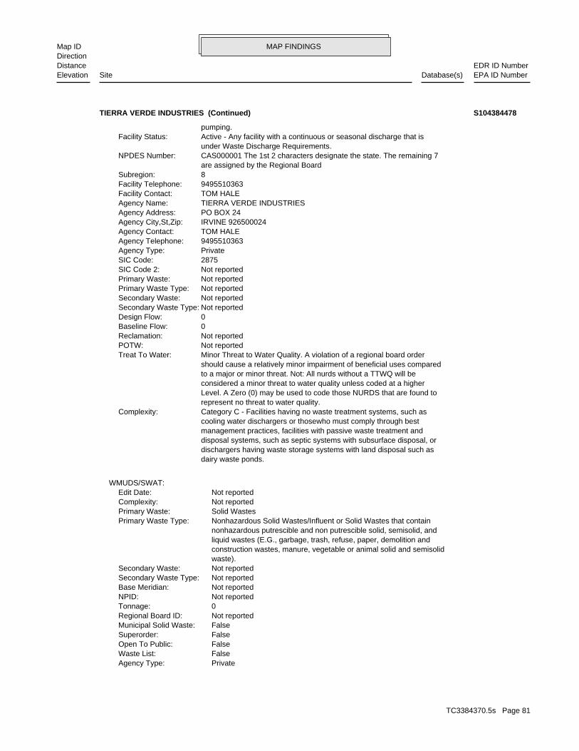
MAP FINDINGSMap IDDirection
EDR ID NumberDistanceEPA ID NumberDatabase(s)SiteElevation
PrivateAgency Type: FalseWaste List: FalseOpen To Public: FalseSuperorder: FalseMunicipal Solid Waste: Not reportedRegional Board ID: 0Tonnage: Not reportedNPID: Not reportedBase Meridian: Not reportedSecondary Waste Type: Not reportedSecondary Waste: waste). construction wastes, manure, vegetable or animal solid and semisolid liquid wastes (E.G., garbage, trash, refuse, paper, demolition and nonhazardous putrescible and non putrescible solid, semisolid, and Nonhazardous Solid Wastes/Influent or Solid Wastes that containPrimary Waste Type: Solid WastesPrimary Waste: Not reportedComplexity: Not reportedEdit Date:
WMUDS/SWAT:
dairy waste ponds. dischargers having waste storage systems with land disposal such as disposal systems, such as septic systems with subsurface disposal, or management practices, facilities with passive waste treatment and cooling water dischargers or thosewho must comply through best Category C - Facilities having no waste treatment systems, such asComplexity: represent no threat to water quality. Level. A Zero (0) may be used to code those NURDS that are found to considered a minor threat to water quality unless coded at a higher to a major or minor threat. Not: All nurds without a TTWQ will be should cause a relatively minor impairment of beneficial uses compared Minor Threat to Water Quality. A violation of a regional board orderTreat To Water: Not reportedPOTW: Not reportedReclamation: 0Baseline Flow: 0Design Flow: Not reportedSecondary Waste Type: Not reportedSecondary Waste: Not reportedPrimary Waste Type: Not reportedPrimary Waste: Not reportedSIC Code 2: 2875SIC Code: PrivateAgency Type: 9495510363Agency Telephone: TOM HALEAgency Contact: IRVINE 926500024Agency City,St,Zip: PO BOX 24Agency Address: TIERRA VERDE INDUSTRIESAgency Name: TOM HALEFacility Contact: 9495510363Facility Telephone: 8Subregion: are assigned by the Regional Board CAS000001 The 1st 2 characters designate the state. The remaining 7NPDES Number: under Waste Discharge Requirements. Active - Any facility with a continuous or seasonal discharge that isFacility Status: pumping.
TIERRA VERDE INDUSTRIES (Continued) S104384478
TC3384370.5s Page 81

MAP FINDINGSMap IDDirection
EDR ID NumberDistanceEPA ID NumberDatabase(s)SiteElevation
Not reportedPotential Media Affect: Not reportedFile Location: Not reportedLOC Case Number: 8 303101001RB Case Number: Not reportedLocal Agency: JPLCaseworker: SANTA ANA RWQCB (REGION 8)Lead Agency: 01/01/1965Status Date: Completed - Case ClosedStatus: Land Disposal SiteCase Type: -117.7167Longitude: 33.6845Latitude: L10009103326Global Id:
LDS:
Not reportedSolid Waste Information ID: 8 303101001Waste Discharge System ID: No Reporting RequirementsSelf-Monitoring Rept. Frequency: HWaste Discharge Requirements: NoRCRA Facility: Not reportedSection Range: 0Number of WMUDS at Facility: JPLRegional Board Project Officer: TrueSub Chapter 15: Not reportedThreat to Water Quality: Not reportedSolid Waste Assessment Test Program: FalseDepartment of Defence: FalseResource Conservation Recovery Act: FalseToxic Pits Cleanup Act Program: FalseSolid Waste Assessment Test Program: TrueWaste Discharge System: Not reportedLast Facility Editors: Not reportedComments: Not reportedSecondary SIC: 2875Primary SIC: Not reportedSWAT Facility Name: Not reportedFacility Telephone: Not reportedFacility Description: category. and/or disposal of agricultural return water is included in this aquatic animal production facilities, and aquaculture. the treatment animal feeding, confined animal holding, confined and concentrated associated with confined and concentrated animal feeding, confined Agricultural - Facility that treats and/or disposes of the wastesFacility Type: 8Region: Not reportedLand Owner Phone: Not reportedLand Owner Contact: Not reportedLand Owner City,St,Zip: Not reportedLand Owner Address: Not reportedLand Owner Name: 9495510363Agency Telephone: TOM HALEAgency Contact: IRVINE CA 92718Agency City,St,Zip: 7982 IRVINE BLVDAgency Address: Not reportedAgency Department: TIERRA VERDE INDUSTRIESAgency Name:
TIERRA VERDE INDUSTRIES (Continued) S104384478
TC3384370.5s Page 82
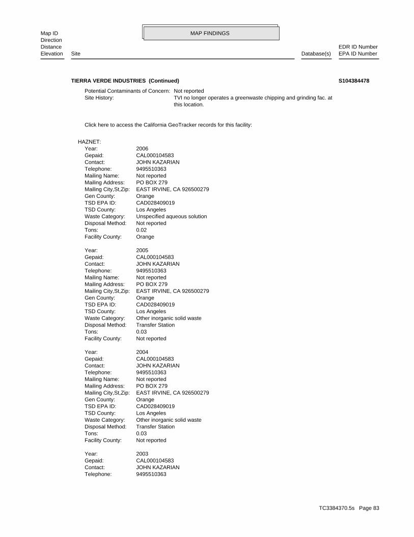
MAP FINDINGSMap IDDirection
EDR ID NumberDistanceEPA ID NumberDatabase(s)SiteElevation
9495510363Telephone: JOHN KAZARIANContact: CAL000104583Gepaid: 2003Year:
Not reportedFacility County: 0.03Tons: Transfer StationDisposal Method: Other inorganic solid wasteWaste Category: Los AngelesTSD County: CAD028409019TSD EPA ID: OrangeGen County: EAST IRVINE, CA 926500279Mailing City,St,Zip: PO BOX 279Mailing Address: Not reportedMailing Name: 9495510363Telephone: JOHN KAZARIANContact: CAL000104583Gepaid: 2004Year:
Not reportedFacility County: 0.03Tons: Transfer StationDisposal Method: Other inorganic solid wasteWaste Category: Los AngelesTSD County: CAD028409019TSD EPA ID: OrangeGen County: EAST IRVINE, CA 926500279Mailing City,St,Zip: PO BOX 279Mailing Address: Not reportedMailing Name: 9495510363Telephone: JOHN KAZARIANContact: CAL000104583Gepaid: 2005Year:
OrangeFacility County: 0.02Tons: Not reportedDisposal Method: Unspecified aqueous solutionWaste Category: Los AngelesTSD County: CAD028409019TSD EPA ID: OrangeGen County: EAST IRVINE, CA 926500279Mailing City,St,Zip: PO BOX 279Mailing Address: Not reportedMailing Name: 9495510363Telephone: JOHN KAZARIANContact: CAL000104583Gepaid: 2006Year:
HAZNET:
Click here to access the California GeoTracker records for this facility:
this location. TVI no longer operates a greenwaste chipping and grinding fac. atSite History: Not reportedPotential Contaminants of Concern:
TIERRA VERDE INDUSTRIES (Continued) S104384478
TC3384370.5s Page 83
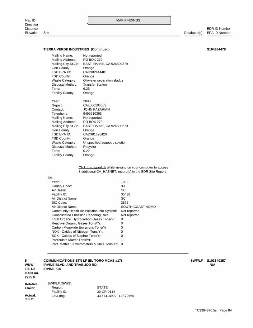
MAP FINDINGSMap IDDirection
EDR ID NumberDistanceEPA ID NumberDatabase(s)SiteElevation
0Part. Matter 10 Micrometers & Smllr Tons/Yr: 1Particulate Matter Tons/Yr: 0SOX - Oxides of Sulphur Tons/Yr: 0NOX - Oxides of Nitrogen Tons/Yr: 0Carbon Monoxide Emissions Tons/Yr: 0Reactive Organic Gases Tons/Yr: 0Total Organic Hydrocarbon Gases Tons/Yr: Not reportedConsolidated Emission Reporting Rule: Not reportedCommunity Health Air Pollution Info System: SOUTH COAST AQMDAir District Name: 2873SIC Code: SCAir District Name: 35438Facility ID: SCAir Basin: 30County Code: 1990Year:
EMI:
8 additional CA_HAZNET: record(s) in the EDR Site Report.Click this hyperlink while viewing on your computer to access
OrangeFacility County: 0.22Tons: RecyclerDisposal Method: Unspecified aqueous solutionWaste Category: OrangeTSD County: CAD981696420TSD EPA ID: OrangeGen County: EAST IRVINE, CA 926500279Mailing City,St,Zip: PO BOX 279Mailing Address: Not reportedMailing Name: 9495510363Telephone: JOHN KAZARIANContact: CAL000104583Gepaid: 2003Year:
OrangeFacility County: 6.25Tons: Transfer StationDisposal Method: Oil/water separation sludgeWaste Category: OrangeTSD County: CAD982444481TSD EPA ID: OrangeGen County: EAST IRVINE, CA 926500279Mailing City,St,Zip: PO BOX 279Mailing Address: Not reportedMailing Name:
TIERRA VERDE INDUSTRIES (Continued) S104384478
33.6741499 / -117.70766Lat/Long: 30-CR-0114Facility ID: STATERegion:
SWF/LF (SWIS):
2235 ft.0.423 mi.
Relative:Lower
Actual:389 ft.
1/4-1/2 IRVINE, CA WNW IRVINE BLVD. AND TRABUCO RD. N/A5 SWF/LFCOMMUNICATIONS STN LF (EL TORO MCAS #17) S103340357
TC3384370.5s Page 84
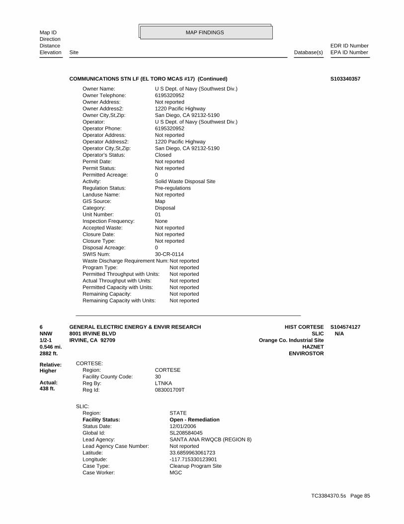
MAP FINDINGSMap IDDirection
EDR ID NumberDistanceEPA ID NumberDatabase(s)SiteElevation
Not reportedRemaining Capacity with Units: Not reportedRemaining Capacity: Not reportedPermitted Capacity with Units: Not reportedActual Throughput with Units: Not reportedPermitted Throughput with Units: Not reportedProgram Type: Not reportedWaste Discharge Requirement Num: 30-CR-0114SWIS Num: 0Disposal Acreage: Not reportedClosure Type: Not reportedClosure Date: Not reportedAccepted Waste: NoneInspection Frequency: 01Unit Number: DisposalCategory: MapGIS Source: Not reportedLanduse Name: Pre-regulationsRegulation Status: Solid Waste Disposal SiteActivity: 0Permitted Acreage: Not reportedPermit Status: Not reportedPermit Date: ClosedOperator’s Status: San Diego, CA 92132-5190Operator City,St,Zip: 1220 Pacific HighwayOperator Address2: Not reportedOperator Address: 6195320952Operator Phone: U S Dept. of Navy (Southwest Div.)Operator: San Diego, CA 92132-5190Owner City,St,Zip: 1220 Pacific HighwayOwner Address2: Not reportedOwner Address: 6195320952Owner Telephone: U S Dept. of Navy (Southwest Div.)Owner Name:
COMMUNICATIONS STN LF (EL TORO MCAS #17) (Continued) S103340357
MGCCase Worker: Cleanup Program SiteCase Type: -117.715330123901Longitude: 33.6859963061723Latitude: Not reportedLead Agency Case Number: SANTA ANA RWQCB (REGION 8)Lead Agency: SL208584045Global Id: 12/01/2006Status Date: Open - RemediationFacility Status: STATERegion:
SLIC:
083001709TReg Id: LTNKAReg By: 30Facility County Code: CORTESERegion:
CORTESE:
2882 ft. ENVIROSTOR0.546 mi. HAZNET
Relative:Higher
Actual:438 ft.
1/2-1 Orange Co. Industrial SiteIRVINE, CA 92709NNW SLIC8001 IRVINE BLVD N/A6 HIST CORTESEGENERAL ELECTRIC ENERGY & ENVIR RESEARCH S104574127
TC3384370.5s Page 85
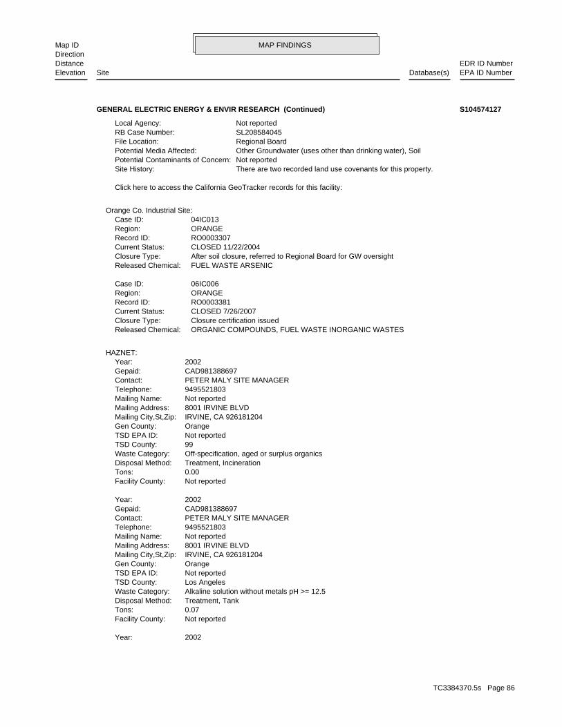
MAP FINDINGSMap IDDirection
EDR ID NumberDistanceEPA ID NumberDatabase(s)SiteElevation
2002Year:
Not reportedFacility County: 0.07Tons: Treatment, TankDisposal Method: Alkaline solution without metals pH >= 12.5Waste Category: Los AngelesTSD County: Not reportedTSD EPA ID: OrangeGen County: IRVINE, CA 926181204Mailing City,St,Zip: 8001 IRVINE BLVDMailing Address: Not reportedMailing Name: 9495521803Telephone: PETER MALY SITE MANAGERContact: CAD981388697Gepaid: 2002Year:
Not reportedFacility County: 0.00Tons: Treatment, IncinerationDisposal Method: Off-specification, aged or surplus organicsWaste Category: 99TSD County: Not reportedTSD EPA ID: OrangeGen County: IRVINE, CA 926181204Mailing City,St,Zip: 8001 IRVINE BLVDMailing Address: Not reportedMailing Name: 9495521803Telephone: PETER MALY SITE MANAGERContact: CAD981388697Gepaid: 2002Year:
HAZNET:
ORGANIC COMPOUNDS, FUEL WASTE INORGANIC WASTESReleased Chemical: Closure certification issuedClosure Type: CLOSED 7/26/2007Current Status: RO0003381Record ID: ORANGERegion: 06IC006Case ID:
FUEL WASTE ARSENICReleased Chemical: After soil closure, referred to Regional Board for GW oversightClosure Type: CLOSED 11/22/2004Current Status: RO0003307Record ID: ORANGERegion: 04IC013Case ID:
Orange Co. Industrial Site:
Click here to access the California GeoTracker records for this facility:
There are two recorded land use covenants for this property.Site History: Not reportedPotential Contaminants of Concern: Other Groundwater (uses other than drinking water), SoilPotential Media Affected: Regional BoardFile Location: SL208584045RB Case Number: Not reportedLocal Agency:
GENERAL ELECTRIC ENERGY & ENVIR RESEARCH (Continued) S104574127
TC3384370.5s Page 86
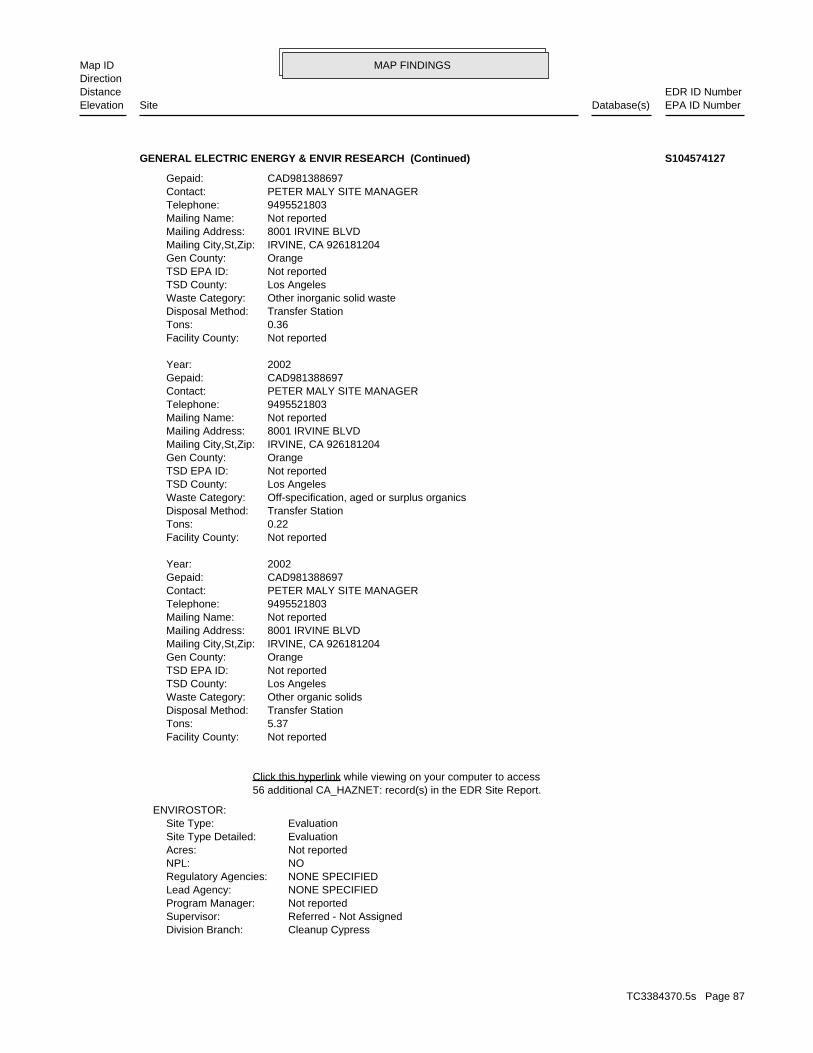
MAP FINDINGSMap IDDirection
EDR ID NumberDistanceEPA ID NumberDatabase(s)SiteElevation
Cleanup CypressDivision Branch: Referred - Not AssignedSupervisor: Not reportedProgram Manager: NONE SPECIFIEDLead Agency: NONE SPECIFIEDRegulatory Agencies: NONPL: Not reportedAcres: EvaluationSite Type Detailed: EvaluationSite Type:
ENVIROSTOR:
56 additional CA_HAZNET: record(s) in the EDR Site Report.Click this hyperlink while viewing on your computer to access
Not reportedFacility County: 5.37Tons: Transfer StationDisposal Method: Other organic solidsWaste Category: Los AngelesTSD County: Not reportedTSD EPA ID: OrangeGen County: IRVINE, CA 926181204Mailing City,St,Zip: 8001 IRVINE BLVDMailing Address: Not reportedMailing Name: 9495521803Telephone: PETER MALY SITE MANAGERContact: CAD981388697Gepaid: 2002Year:
Not reportedFacility County: 0.22Tons: Transfer StationDisposal Method: Off-specification, aged or surplus organicsWaste Category: Los AngelesTSD County: Not reportedTSD EPA ID: OrangeGen County: IRVINE, CA 926181204Mailing City,St,Zip: 8001 IRVINE BLVDMailing Address: Not reportedMailing Name: 9495521803Telephone: PETER MALY SITE MANAGERContact: CAD981388697Gepaid: 2002Year:
Not reportedFacility County: 0.36Tons: Transfer StationDisposal Method: Other inorganic solid wasteWaste Category: Los AngelesTSD County: Not reportedTSD EPA ID: OrangeGen County: IRVINE, CA 926181204Mailing City,St,Zip: 8001 IRVINE BLVDMailing Address: Not reportedMailing Name: 9495521803Telephone: PETER MALY SITE MANAGERContact: CAD981388697Gepaid:
GENERAL ELECTRIC ENERGY & ENVIR RESEARCH (Continued) S104574127
TC3384370.5s Page 87
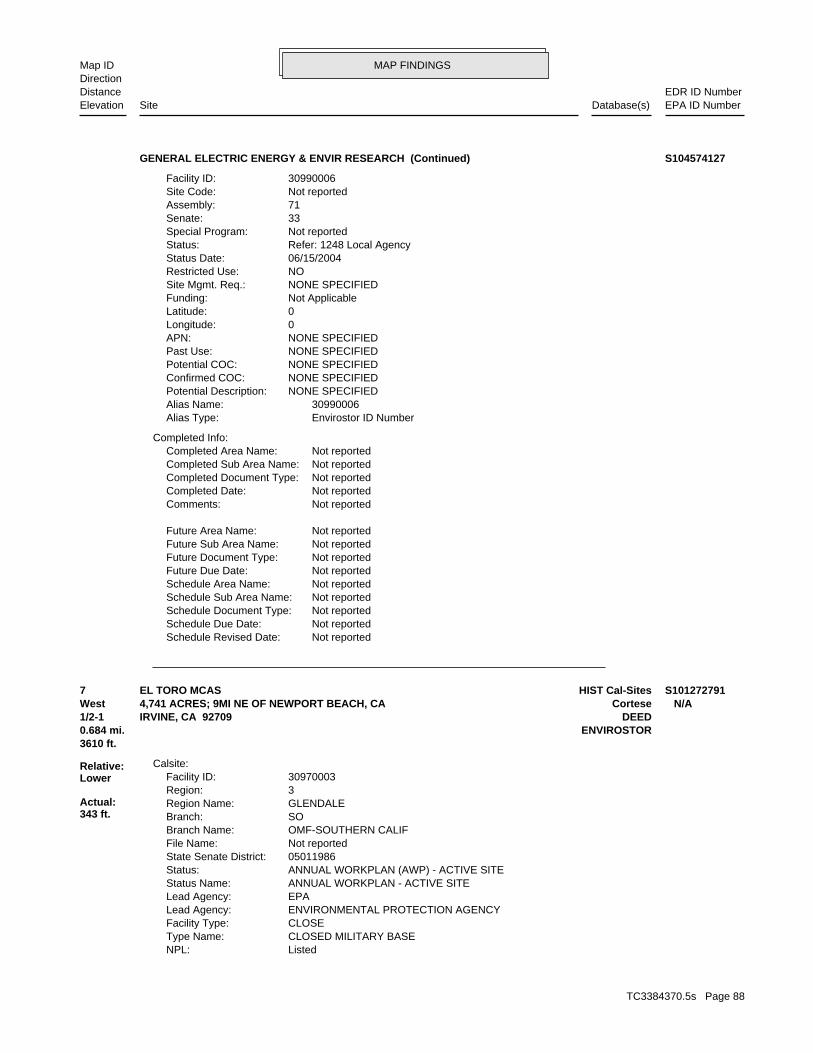
MAP FINDINGSMap IDDirection
EDR ID NumberDistanceEPA ID NumberDatabase(s)SiteElevation
Not reportedSchedule Revised Date: Not reportedSchedule Due Date: Not reportedSchedule Document Type: Not reportedSchedule Sub Area Name: Not reportedSchedule Area Name: Not reportedFuture Due Date: Not reportedFuture Document Type: Not reportedFuture Sub Area Name: Not reportedFuture Area Name:
Not reportedComments: Not reportedCompleted Date: Not reportedCompleted Document Type: Not reportedCompleted Sub Area Name: Not reportedCompleted Area Name:
Completed Info:
Envirostor ID NumberAlias Type: 30990006Alias Name: NONE SPECIFIEDPotential Description: NONE SPECIFIEDConfirmed COC: NONE SPECIFIEDPotential COC: NONE SPECIFIEDPast Use: NONE SPECIFIEDAPN: 0Longitude: 0Latitude: Not ApplicableFunding: NONE SPECIFIEDSite Mgmt. Req.: NORestricted Use: 06/15/2004Status Date: Refer: 1248 Local AgencyStatus: Not reportedSpecial Program: 33Senate: 71Assembly: Not reportedSite Code: 30990006Facility ID:
GENERAL ELECTRIC ENERGY & ENVIR RESEARCH (Continued) S104574127
ListedNPL: CLOSED MILITARY BASEType Name: CLOSEFacility Type: ENVIRONMENTAL PROTECTION AGENCYLead Agency: EPALead Agency: ANNUAL WORKPLAN - ACTIVE SITEStatus Name: ANNUAL WORKPLAN (AWP) - ACTIVE SITEStatus: 05011986State Senate District: Not reportedFile Name: OMF-SOUTHERN CALIFBranch Name: SOBranch: GLENDALERegion Name: 3Region: 30970003Facility ID:
Calsite:
3610 ft.0.684 mi. ENVIROSTOR
Relative:Lower
Actual:343 ft.
1/2-1 DEEDIRVINE, CA 92709West Cortese4,741 ACRES; 9MI NE OF NEWPORT BEACH, CA N/A7 HIST Cal-SitesEL TORO MCAS S101272791
TC3384370.5s Page 88
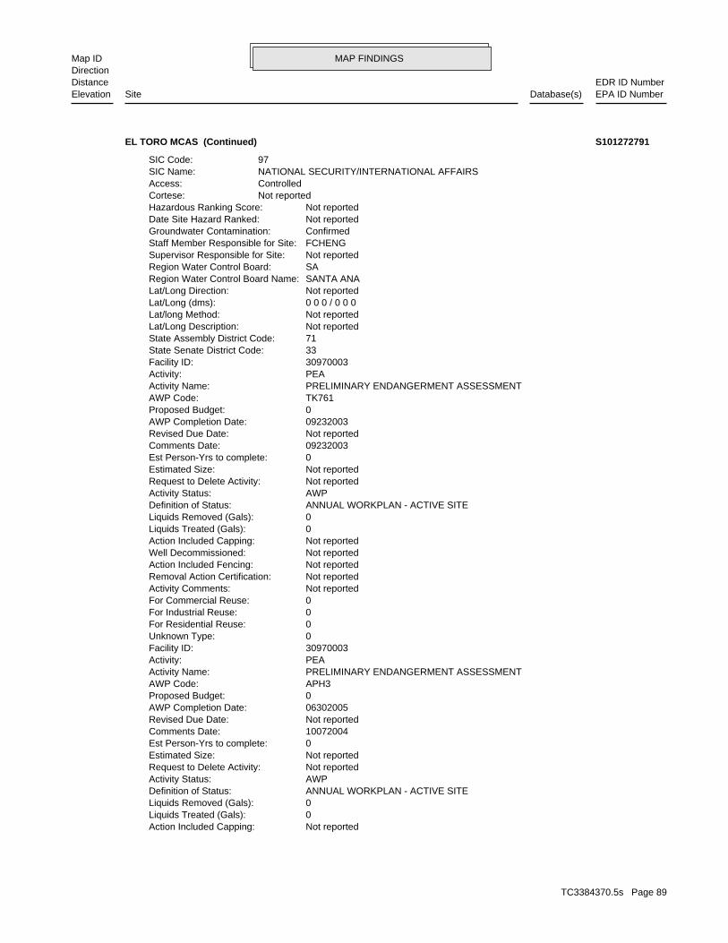
MAP FINDINGSMap IDDirection
EDR ID NumberDistanceEPA ID NumberDatabase(s)SiteElevation
Not reportedAction Included Capping: 0Liquids Treated (Gals): 0Liquids Removed (Gals): ANNUAL WORKPLAN - ACTIVE SITEDefinition of Status: AWPActivity Status: Not reportedRequest to Delete Activity: Not reportedEstimated Size: 0Est Person-Yrs to complete: 10072004Comments Date: Not reportedRevised Due Date: 06302005AWP Completion Date: 0Proposed Budget: APH3AWP Code: PRELIMINARY ENDANGERMENT ASSESSMENTActivity Name: PEAActivity: 30970003Facility ID: 0Unknown Type: 0For Residential Reuse: 0For Industrial Reuse: 0For Commercial Reuse: Not reportedActivity Comments: Not reportedRemoval Action Certification: Not reportedAction Included Fencing: Not reportedWell Decommissioned: Not reportedAction Included Capping: 0Liquids Treated (Gals): 0Liquids Removed (Gals): ANNUAL WORKPLAN - ACTIVE SITEDefinition of Status: AWPActivity Status: Not reportedRequest to Delete Activity: Not reportedEstimated Size: 0Est Person-Yrs to complete: 09232003Comments Date: Not reportedRevised Due Date: 09232003AWP Completion Date: 0Proposed Budget: TK761AWP Code: PRELIMINARY ENDANGERMENT ASSESSMENTActivity Name: PEAActivity: 30970003Facility ID: 33State Senate District Code: 71State Assembly District Code: Not reportedLat/Long Description: Not reportedLat/long Method: 0 0 0 / 0 0 0Lat/Long (dms): Not reportedLat/Long Direction: SANTA ANARegion Water Control Board Name: SARegion Water Control Board: Not reportedSupervisor Responsible for Site: FCHENGStaff Member Responsible for Site: ConfirmedGroundwater Contamination: Not reportedDate Site Hazard Ranked: Not reportedHazardous Ranking Score: Not reportedCortese: ControlledAccess: NATIONAL SECURITY/INTERNATIONAL AFFAIRSSIC Name: 97SIC Code:
EL TORO MCAS (Continued) S101272791
TC3384370.5s Page 89
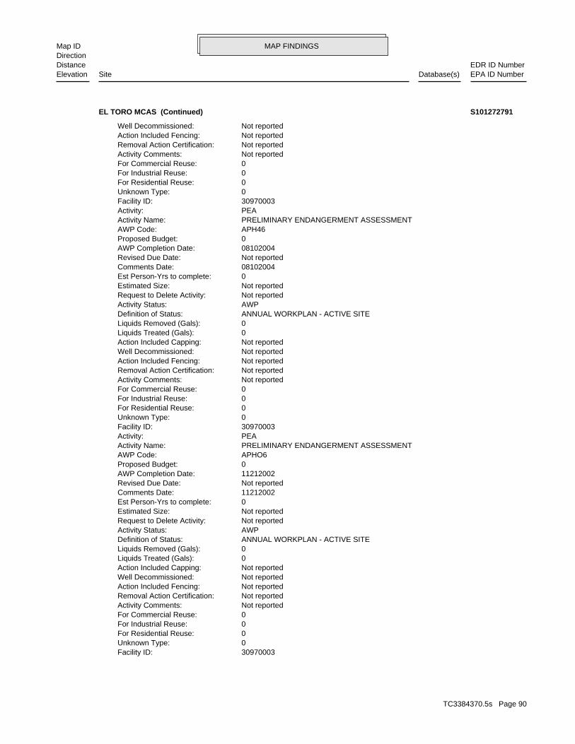
MAP FINDINGSMap IDDirection
EDR ID NumberDistanceEPA ID NumberDatabase(s)SiteElevation
30970003Facility ID: 0Unknown Type: 0For Residential Reuse: 0For Industrial Reuse: 0For Commercial Reuse: Not reportedActivity Comments: Not reportedRemoval Action Certification: Not reportedAction Included Fencing: Not reportedWell Decommissioned: Not reportedAction Included Capping: 0Liquids Treated (Gals): 0Liquids Removed (Gals): ANNUAL WORKPLAN - ACTIVE SITEDefinition of Status: AWPActivity Status: Not reportedRequest to Delete Activity: Not reportedEstimated Size: 0Est Person-Yrs to complete: 11212002Comments Date: Not reportedRevised Due Date: 11212002AWP Completion Date: 0Proposed Budget: APHO6AWP Code: PRELIMINARY ENDANGERMENT ASSESSMENTActivity Name: PEAActivity: 30970003Facility ID: 0Unknown Type: 0For Residential Reuse: 0For Industrial Reuse: 0For Commercial Reuse: Not reportedActivity Comments: Not reportedRemoval Action Certification: Not reportedAction Included Fencing: Not reportedWell Decommissioned: Not reportedAction Included Capping: 0Liquids Treated (Gals): 0Liquids Removed (Gals): ANNUAL WORKPLAN - ACTIVE SITEDefinition of Status: AWPActivity Status: Not reportedRequest to Delete Activity: Not reportedEstimated Size: 0Est Person-Yrs to complete: 08102004Comments Date: Not reportedRevised Due Date: 08102004AWP Completion Date: 0Proposed Budget: APH46AWP Code: PRELIMINARY ENDANGERMENT ASSESSMENTActivity Name: PEAActivity: 30970003Facility ID: 0Unknown Type: 0For Residential Reuse: 0For Industrial Reuse: 0For Commercial Reuse: Not reportedActivity Comments: Not reportedRemoval Action Certification: Not reportedAction Included Fencing: Not reportedWell Decommissioned:
EL TORO MCAS (Continued) S101272791
TC3384370.5s Page 90

MAP FINDINGSMap IDDirection
EDR ID NumberDistanceEPA ID NumberDatabase(s)SiteElevation
Not reportedEstimated Size: 0Est Person-Yrs to complete: 10222002Comments Date: Not reportedRevised Due Date: 10222002AWP Completion Date: 0Proposed Budget: TA529AWP Code: PRELIMINARY ENDANGERMENT ASSESSMENTActivity Name: PEAActivity: 30970003Facility ID: 0Unknown Type: 0For Residential Reuse: 0For Industrial Reuse: 0For Commercial Reuse: Not reportedActivity Comments: Not reportedRemoval Action Certification: Not reportedAction Included Fencing: Not reportedWell Decommissioned: Not reportedAction Included Capping: 0Liquids Treated (Gals): 0Liquids Removed (Gals): ANNUAL WORKPLAN - ACTIVE SITEDefinition of Status: AWPActivity Status: Not reportedRequest to Delete Activity: Not reportedEstimated Size: 0Est Person-Yrs to complete: 10222002Comments Date: Not reportedRevised Due Date: 10222002AWP Completion Date: 0Proposed Budget: TA626AWP Code: PRELIMINARY ENDANGERMENT ASSESSMENTActivity Name: PEAActivity: 30970003Facility ID: 0Unknown Type: 0For Residential Reuse: 0For Industrial Reuse: 0For Commercial Reuse: Not reportedActivity Comments: Not reportedRemoval Action Certification: Not reportedAction Included Fencing: Not reportedWell Decommissioned: Not reportedAction Included Capping: 0Liquids Treated (Gals): 0Liquids Removed (Gals): ANNUAL WORKPLAN - ACTIVE SITEDefinition of Status: AWPActivity Status: Not reportedRequest to Delete Activity: Not reportedEstimated Size: 0Est Person-Yrs to complete: 11212002Comments Date: Not reportedRevised Due Date: 11212002AWP Completion Date: 0Proposed Budget: T359BAWP Code: PRELIMINARY ENDANGERMENT ASSESSMENTActivity Name: PEAActivity:
EL TORO MCAS (Continued) S101272791
TC3384370.5s Page 91
MAP FINDINGSMap IDDirection
EDR ID NumberDistanceEPA ID NumberDatabase(s)SiteElevation
Not reportedRemoval Action Certification: Not reportedAction Included Fencing: Not reportedWell Decommissioned: Not reportedAction Included Capping: 0Liquids Treated (Gals): 0Liquids Removed (Gals): ANNUAL WORKPLAN - ACTIVE SITEDefinition of Status: AWPActivity Status: Not reportedRequest to Delete Activity: Not reportedEstimated Size: 0Est Person-Yrs to complete: 07242002Comments Date: Not reportedRevised Due Date: 07242002AWP Completion Date: 0Proposed Budget: B307AWP Code: PRELIMINARY ENDANGERMENT ASSESSMENTActivity Name: PEAActivity: 30970003Facility ID: 0Unknown Type: 0For Residential Reuse: 0For Industrial Reuse: 0For Commercial Reuse: Not reportedActivity Comments: Not reportedRemoval Action Certification: Not reportedAction Included Fencing: Not reportedWell Decommissioned: Not reportedAction Included Capping: 0Liquids Treated (Gals): 0Liquids Removed (Gals): ANNUAL WORKPLAN - ACTIVE SITEDefinition of Status: AWPActivity Status: Not reportedRequest to Delete Activity: Not reportedEstimated Size: 0Est Person-Yrs to complete: 10222002Comments Date: Not reportedRevised Due Date: 10222002AWP Completion Date: 0Proposed Budget: TA778AWP Code: PRELIMINARY ENDANGERMENT ASSESSMENTActivity Name: PEAActivity: 30970003Facility ID: 0Unknown Type: 0For Residential Reuse: 0For Industrial Reuse: 0For Commercial Reuse: Not reportedActivity Comments: Not reportedRemoval Action Certification: Not reportedAction Included Fencing: Not reportedWell Decommissioned: Not reportedAction Included Capping: 0Liquids Treated (Gals): 0Liquids Removed (Gals): ANNUAL WORKPLAN - ACTIVE SITEDefinition of Status: AWPActivity Status: Not reportedRequest to Delete Activity:
EL TORO MCAS (Continued) S101272791
TC3384370.5s Page 92
MAP FINDINGSMap IDDirection
EDR ID NumberDistanceEPA ID NumberDatabase(s)SiteElevation
OU316AWP Code: DEED RESTRICTIONSActivity Name: DEEDActivity: 30970003Facility ID: 0Unknown Type: 0For Residential Reuse: 0For Industrial Reuse: 0For Commercial Reuse: Not reportedActivity Comments: Not reportedRemoval Action Certification: Not reportedAction Included Fencing: Not reportedWell Decommissioned: Not reportedAction Included Capping: 0Liquids Treated (Gals): 0Liquids Removed (Gals): ANNUAL WORKPLAN - ACTIVE SITEDefinition of Status: AWPActivity Status: Not reportedRequest to Delete Activity: Not reportedEstimated Size: 0Est Person-Yrs to complete: 07312001Comments Date: Not reportedRevised Due Date: 07312001AWP Completion Date: 0Proposed Budget: TA307AWP Code: PRELIMINARY ENDANGERMENT ASSESSMENTActivity Name: PEAActivity: 30970003Facility ID: 0Unknown Type: 0For Residential Reuse: 0For Industrial Reuse: 0For Commercial Reuse: Not reportedActivity Comments: Not reportedRemoval Action Certification: Not reportedAction Included Fencing: Not reportedWell Decommissioned: Not reportedAction Included Capping: 0Liquids Treated (Gals): 0Liquids Removed (Gals): ANNUAL WORKPLAN - ACTIVE SITEDefinition of Status: AWPActivity Status: Not reportedRequest to Delete Activity: Not reportedEstimated Size: 0Est Person-Yrs to complete: 01162002Comments Date: Not reportedRevised Due Date: 01162002AWP Completion Date: 0Proposed Budget: OU31AWP Code: REMOVAL ACTION WORKPLANActivity Name: RAWActivity: 30970003Facility ID: 0Unknown Type: 0For Residential Reuse: 0For Industrial Reuse: 0For Commercial Reuse: Not reportedActivity Comments:
EL TORO MCAS (Continued) S101272791
TC3384370.5s Page 93
MAP FINDINGSMap IDDirection
EDR ID NumberDistanceEPA ID NumberDatabase(s)SiteElevation
ANNUAL WORKPLAN - ACTIVE SITEDefinition of Status: AWPActivity Status: Not reportedRequest to Delete Activity: Not reportedEstimated Size: 0Est Person-Yrs to complete: Not reportedComments Date: Not reportedRevised Due Date: 01262007AWP Completion Date: 0Proposed Budget: OU316AWP Code: OPERATION & MAINTENANCEActivity Name: OMActivity: 30970003Facility ID: 0Unknown Type: 0For Residential Reuse: 0For Industrial Reuse: 0For Commercial Reuse: Not reportedActivity Comments: Not reportedRemoval Action Certification: Not reportedAction Included Fencing: Not reportedWell Decommissioned: Not reportedAction Included Capping: 0Liquids Treated (Gals): 0Liquids Removed (Gals): ANNUAL WORKPLAN - ACTIVE SITEDefinition of Status: AWPActivity Status: Not reportedRequest to Delete Activity: Not reportedEstimated Size: 0Est Person-Yrs to complete: Not reportedComments Date: Not reportedRevised Due Date: 06282006AWP Completion Date: 0Proposed Budget: OU316AWP Code: REMOVAL ACTIONActivity Name: RAActivity: 30970003Facility ID: 0Unknown Type: 0For Residential Reuse: 0For Industrial Reuse: 0For Commercial Reuse: Not reportedActivity Comments: Not reportedRemoval Action Certification: Not reportedAction Included Fencing: Not reportedWell Decommissioned: Not reportedAction Included Capping: 0Liquids Treated (Gals): 0Liquids Removed (Gals): ANNUAL WORKPLAN - ACTIVE SITEDefinition of Status: AWPActivity Status: Not reportedRequest to Delete Activity: Not reportedEstimated Size: 0Est Person-Yrs to complete: Not reportedComments Date: Not reportedRevised Due Date: 07312006AWP Completion Date: 0Proposed Budget:
EL TORO MCAS (Continued) S101272791
TC3384370.5s Page 94
MAP FINDINGSMap IDDirection
EDR ID NumberDistanceEPA ID NumberDatabase(s)SiteElevation
0For Industrial Reuse: 0For Commercial Reuse: Not reportedActivity Comments: Not reportedRemoval Action Certification: Not reportedAction Included Fencing: Not reportedWell Decommissioned: Not reportedAction Included Capping: 0Liquids Treated (Gals): 0Liquids Removed (Gals): ANNUAL WORKPLAN - ACTIVE SITEDefinition of Status: AWPActivity Status: Not reportedRequest to Delete Activity: Not reportedEstimated Size: 0Est Person-Yrs to complete: 10032003Comments Date: Not reportedRevised Due Date: 10032003AWP Completion Date: 0Proposed Budget: OU316AWP Code: REMEDIAL ACTION PLAN / RECORD OF DECISIONActivity Name: RAPActivity: 30970003Facility ID: 0Unknown Type: 0For Residential Reuse: 0For Industrial Reuse: 0For Commercial Reuse: Not reportedActivity Comments: Not reportedRemoval Action Certification: Not reportedAction Included Fencing: Not reportedWell Decommissioned: Not reportedAction Included Capping: 0Liquids Treated (Gals): 0Liquids Removed (Gals): ANNUAL WORKPLAN - ACTIVE SITEDefinition of Status: AWPActivity Status: Not reportedRequest to Delete Activity: Not reportedEstimated Size: 0Est Person-Yrs to complete: Not reportedComments Date: Not reportedRevised Due Date: 04282006AWP Completion Date: 0Proposed Budget: OU316AWP Code: DESIGNActivity Name: DESActivity: 30970003Facility ID: 0Unknown Type: 0For Residential Reuse: 0For Industrial Reuse: 0For Commercial Reuse: Not reportedActivity Comments: Not reportedRemoval Action Certification: Not reportedAction Included Fencing: Not reportedWell Decommissioned: Not reportedAction Included Capping: 0Liquids Treated (Gals): 0Liquids Removed (Gals):
EL TORO MCAS (Continued) S101272791
TC3384370.5s Page 95
MAP FINDINGSMap IDDirection
EDR ID NumberDistanceEPA ID NumberDatabase(s)SiteElevation
Not reportedRevised Due Date: 02262006AWP Completion Date: 0Proposed Budget: OU38AWP Code: OPERATION & MAINTENANCEActivity Name: OMActivity: 30970003Facility ID: 0Unknown Type: 0For Residential Reuse: 0For Industrial Reuse: 0For Commercial Reuse: Not reportedActivity Comments: Not reportedRemoval Action Certification: Not reportedAction Included Fencing: Not reportedWell Decommissioned: Not reportedAction Included Capping: 0Liquids Treated (Gals): 0Liquids Removed (Gals): ANNUAL WORKPLAN - ACTIVE SITEDefinition of Status: AWPActivity Status: Not reportedRequest to Delete Activity: Not reportedEstimated Size: 0Est Person-Yrs to complete: Not reportedComments Date: Not reportedRevised Due Date: 04282006AWP Completion Date: 0Proposed Budget: OU311AWP Code: DESIGNActivity Name: DESActivity: 30970003Facility ID: 0Unknown Type: 0For Residential Reuse: 0For Industrial Reuse: 0For Commercial Reuse: Not reportedActivity Comments: Not reportedRemoval Action Certification: Not reportedAction Included Fencing: Not reportedWell Decommissioned: Not reportedAction Included Capping: 0Liquids Treated (Gals): 0Liquids Removed (Gals): ANNUAL WORKPLAN - ACTIVE SITEDefinition of Status: AWPActivity Status: Not reportedRequest to Delete Activity: Not reportedEstimated Size: 0Est Person-Yrs to complete: Not reportedComments Date: Not reportedRevised Due Date: 07292006AWP Completion Date: 0Proposed Budget: OU311AWP Code: REMOVAL ACTIONActivity Name: RAActivity: 30970003Facility ID: 0Unknown Type: 0For Residential Reuse:
EL TORO MCAS (Continued) S101272791
TC3384370.5s Page 96
MAP FINDINGSMap IDDirection
EDR ID NumberDistanceEPA ID NumberDatabase(s)SiteElevation
Not reportedAction Included Capping: 0Liquids Treated (Gals): 0Liquids Removed (Gals): ANNUAL WORKPLAN - ACTIVE SITEDefinition of Status: AWPActivity Status: Not reportedRequest to Delete Activity: Not reportedEstimated Size: 0Est Person-Yrs to complete: Not reportedComments Date: Not reportedRevised Due Date: 07292006AWP Completion Date: 0Proposed Budget: OU38AWP Code: REMEDIAL ACTION PLAN / RECORD OF DECISIONActivity Name: RAPActivity: 30970003Facility ID: 0Unknown Type: 0For Residential Reuse: 0For Industrial Reuse: 0For Commercial Reuse: Not reportedActivity Comments: Not reportedRemoval Action Certification: Not reportedAction Included Fencing: Not reportedWell Decommissioned: Not reportedAction Included Capping: 0Liquids Treated (Gals): 0Liquids Removed (Gals): ANNUAL WORKPLAN - ACTIVE SITEDefinition of Status: AWPActivity Status: Not reportedRequest to Delete Activity: Not reportedEstimated Size: 0Est Person-Yrs to complete: Not reportedComments Date: Not reportedRevised Due Date: 04282006AWP Completion Date: 0Proposed Budget: OU38AWP Code: DESIGNActivity Name: DESActivity: 30970003Facility ID: 0Unknown Type: 0For Residential Reuse: 0For Industrial Reuse: 0For Commercial Reuse: Not reportedActivity Comments: Not reportedRemoval Action Certification: Not reportedAction Included Fencing: Not reportedWell Decommissioned: Not reportedAction Included Capping: 0Liquids Treated (Gals): 0Liquids Removed (Gals): ANNUAL WORKPLAN - ACTIVE SITEDefinition of Status: AWPActivity Status: Not reportedRequest to Delete Activity: Not reportedEstimated Size: 0Est Person-Yrs to complete: Not reportedComments Date:
EL TORO MCAS (Continued) S101272791
TC3384370.5s Page 97
MAP FINDINGSMap IDDirection
EDR ID NumberDistanceEPA ID NumberDatabase(s)SiteElevation
30970003Facility ID: 0Unknown Type: 0For Residential Reuse: 0For Industrial Reuse: 0For Commercial Reuse: Not reportedActivity Comments: Not reportedRemoval Action Certification: Not reportedAction Included Fencing: Not reportedWell Decommissioned: Not reportedAction Included Capping: 0Liquids Treated (Gals): 0Liquids Removed (Gals): ANNUAL WORKPLAN - ACTIVE SITEDefinition of Status: AWPActivity Status: Not reportedRequest to Delete Activity: Not reportedEstimated Size: 0Est Person-Yrs to complete: Not reportedComments Date: Not reportedRevised Due Date: 01312008AWP Completion Date: 0Proposed Budget: OU31AWP Code: OPERATION & MAINTENANCEActivity Name: OMActivity: 30970003Facility ID: 0Unknown Type: 0For Residential Reuse: 0For Industrial Reuse: 0For Commercial Reuse: Not reportedActivity Comments: Not reportedRemoval Action Certification: Not reportedAction Included Fencing: Not reportedWell Decommissioned: Not reportedAction Included Capping: 0Liquids Treated (Gals): 0Liquids Removed (Gals): ANNUAL WORKPLAN - ACTIVE SITEDefinition of Status: AWPActivity Status: Not reportedRequest to Delete Activity: Not reportedEstimated Size: 0Est Person-Yrs to complete: Not reportedComments Date: Not reportedRevised Due Date: 04302008AWP Completion Date: 0Proposed Budget: OU31AWP Code: REMOVAL ACTIONActivity Name: RAActivity: 30970003Facility ID: 0Unknown Type: 0For Residential Reuse: 0For Industrial Reuse: 0For Commercial Reuse: Not reportedActivity Comments: Not reportedRemoval Action Certification: Not reportedAction Included Fencing: Not reportedWell Decommissioned:
EL TORO MCAS (Continued) S101272791
TC3384370.5s Page 98

MAP FINDINGSMap IDDirection
EDR ID NumberDistanceEPA ID NumberDatabase(s)SiteElevation
Not reportedEstimated Size: 0Est Person-Yrs to complete: Not reportedComments Date: Not reportedRevised Due Date: 03292006AWP Completion Date: 0Proposed Budget: OU31AWP Code: REMEDIAL INVESTIGATION / FEASIBILITY STUDYActivity Name: RIFSActivity: 30970003Facility ID: 0Unknown Type: 0For Residential Reuse: 0For Industrial Reuse: 0For Commercial Reuse: Not reportedActivity Comments: Not reportedRemoval Action Certification: Not reportedAction Included Fencing: Not reportedWell Decommissioned: Not reportedAction Included Capping: 0Liquids Treated (Gals): 0Liquids Removed (Gals): ANNUAL WORKPLAN - ACTIVE SITEDefinition of Status: AWPActivity Status: Not reportedRequest to Delete Activity: Not reportedEstimated Size: 0Est Person-Yrs to complete: Not reportedComments Date: Not reportedRevised Due Date: 11262006AWP Completion Date: 0Proposed Budget: OU31AWP Code: REMEDIAL ACTION PLAN / RECORD OF DECISIONActivity Name: RAPActivity: 30970003Facility ID: 0Unknown Type: 0For Residential Reuse: 0For Industrial Reuse: 0For Commercial Reuse: Not reportedActivity Comments: Not reportedRemoval Action Certification: Not reportedAction Included Fencing: Not reportedWell Decommissioned: Not reportedAction Included Capping: 0Liquids Treated (Gals): 0Liquids Removed (Gals): ANNUAL WORKPLAN - ACTIVE SITEDefinition of Status: AWPActivity Status: Not reportedRequest to Delete Activity: Not reportedEstimated Size: 0Est Person-Yrs to complete: Not reportedComments Date: Not reportedRevised Due Date: 04302007AWP Completion Date: 0Proposed Budget: OU31AWP Code: DESIGNActivity Name: DESActivity:
EL TORO MCAS (Continued) S101272791
TC3384370.5s Page 99
MAP FINDINGSMap IDDirection
EDR ID NumberDistanceEPA ID NumberDatabase(s)SiteElevation
Not reportedRemoval Action Certification: Not reportedAction Included Fencing: Not reportedWell Decommissioned: Not reportedAction Included Capping: 0Liquids Treated (Gals): 0Liquids Removed (Gals): ANNUAL WORKPLAN - ACTIVE SITEDefinition of Status: AWPActivity Status: Not reportedRequest to Delete Activity: Not reportedEstimated Size: 0Est Person-Yrs to complete: Not reportedComments Date: Not reportedRevised Due Date: 04302007AWP Completion Date: 0Proposed Budget: OU2CAWP Code: REMOVAL ACTIONActivity Name: RAActivity: 30970003Facility ID: 0Unknown Type: 0For Residential Reuse: 0For Industrial Reuse: 0For Commercial Reuse: Not reportedActivity Comments: Not reportedRemoval Action Certification: Not reportedAction Included Fencing: Not reportedWell Decommissioned: Not reportedAction Included Capping: 0Liquids Treated (Gals): 0Liquids Removed (Gals): ANNUAL WORKPLAN - ACTIVE SITEDefinition of Status: AWPActivity Status: Not reportedRequest to Delete Activity: Not reportedEstimated Size: 0Est Person-Yrs to complete: Not reportedComments Date: Not reportedRevised Due Date: 10312007AWP Completion Date: 0Proposed Budget: OU2CAWP Code: DEED RESTRICTIONSActivity Name: DEEDActivity: 30970003Facility ID: 0Unknown Type: 0For Residential Reuse: 0For Industrial Reuse: 0For Commercial Reuse: Not reportedActivity Comments: Not reportedRemoval Action Certification: Not reportedAction Included Fencing: Not reportedWell Decommissioned: Not reportedAction Included Capping: 0Liquids Treated (Gals): 0Liquids Removed (Gals): ANNUAL WORKPLAN - ACTIVE SITEDefinition of Status: AWPActivity Status: Not reportedRequest to Delete Activity:
EL TORO MCAS (Continued) S101272791
TC3384370.5s Page 100
MAP FINDINGSMap IDDirection
EDR ID NumberDistanceEPA ID NumberDatabase(s)SiteElevation
OU2BAWP Code: DEED RESTRICTIONSActivity Name: DEEDActivity: 30970003Facility ID: 0Unknown Type: 0For Residential Reuse: 0For Industrial Reuse: 0For Commercial Reuse: Not reportedActivity Comments: Not reportedRemoval Action Certification: Not reportedAction Included Fencing: Not reportedWell Decommissioned: Not reportedAction Included Capping: 0Liquids Treated (Gals): 0Liquids Removed (Gals): ANNUAL WORKPLAN - ACTIVE SITEDefinition of Status: AWPActivity Status: Not reportedRequest to Delete Activity: Not reportedEstimated Size: 0Est Person-Yrs to complete: Not reportedComments Date: Not reportedRevised Due Date: 07292006AWP Completion Date: 0Proposed Budget: OU2CAWP Code: DESIGNActivity Name: DESActivity: 30970003Facility ID: 0Unknown Type: 0For Residential Reuse: 0For Industrial Reuse: 0For Commercial Reuse: Not reportedActivity Comments: Not reportedRemoval Action Certification: Not reportedAction Included Fencing: Not reportedWell Decommissioned: Not reportedAction Included Capping: 0Liquids Treated (Gals): 0Liquids Removed (Gals): ANNUAL WORKPLAN - ACTIVE SITEDefinition of Status: AWPActivity Status: Not reportedRequest to Delete Activity: Not reportedEstimated Size: 0Est Person-Yrs to complete: Not reportedComments Date: Not reportedRevised Due Date: 05292006AWP Completion Date: 0Proposed Budget: OU2CAWP Code: OPERATION & MAINTENANCEActivity Name: OMActivity: 30970003Facility ID: 0Unknown Type: 0For Residential Reuse: 0For Industrial Reuse: 0For Commercial Reuse: Not reportedActivity Comments:
EL TORO MCAS (Continued) S101272791
TC3384370.5s Page 101

MAP FINDINGSMap IDDirection
EDR ID NumberDistanceEPA ID NumberDatabase(s)SiteElevation
ANNUAL WORKPLAN - ACTIVE SITEDefinition of Status: AWPActivity Status: Not reportedRequest to Delete Activity: Not reportedEstimated Size: 0Est Person-Yrs to complete: Not reportedComments Date: Not reportedRevised Due Date: 06282006AWP Completion Date: 0Proposed Budget: OU2BIAWP Code: OPERATION & MAINTENANCEActivity Name: OMActivity: 30970003Facility ID: 0Unknown Type: 0For Residential Reuse: 0For Industrial Reuse: 0For Commercial Reuse: Not reportedActivity Comments: Not reportedRemoval Action Certification: Not reportedAction Included Fencing: Not reportedWell Decommissioned: Not reportedAction Included Capping: 0Liquids Treated (Gals): 0Liquids Removed (Gals): ANNUAL WORKPLAN - ACTIVE SITEDefinition of Status: AWPActivity Status: Not reportedRequest to Delete Activity: Not reportedEstimated Size: 0Est Person-Yrs to complete: Not reportedComments Date: Not reportedRevised Due Date: 04282006AWP Completion Date: 0Proposed Budget: OU2BAWP Code: REMOVAL ACTIONActivity Name: RAActivity: 30970003Facility ID: 0Unknown Type: 0For Residential Reuse: 0For Industrial Reuse: 0For Commercial Reuse: Not reportedActivity Comments: Not reportedRemoval Action Certification: Not reportedAction Included Fencing: Not reportedWell Decommissioned: Not reportedAction Included Capping: 0Liquids Treated (Gals): 0Liquids Removed (Gals): ANNUAL WORKPLAN - ACTIVE SITEDefinition of Status: AWPActivity Status: Not reportedRequest to Delete Activity: Not reportedEstimated Size: 0Est Person-Yrs to complete: Not reportedComments Date: Not reportedRevised Due Date: 07292006AWP Completion Date: 0Proposed Budget:
EL TORO MCAS (Continued) S101272791
TC3384370.5s Page 102
MAP FINDINGSMap IDDirection
EDR ID NumberDistanceEPA ID NumberDatabase(s)SiteElevation
0For Industrial Reuse: 0For Commercial Reuse: Not reportedActivity Comments: Not reportedRemoval Action Certification: Not reportedAction Included Fencing: Not reportedWell Decommissioned: Not reportedAction Included Capping: 0Liquids Treated (Gals): 0Liquids Removed (Gals): ANNUAL WORKPLAN - ACTIVE SITEDefinition of Status: AWPActivity Status: Not reportedRequest to Delete Activity: Not reportedEstimated Size: 0Est Person-Yrs to complete: Not reportedComments Date: Not reportedRevised Due Date: 09302006AWP Completion Date: 0Proposed Budget: OU2AAWP Code: DEED RESTRICTIONSActivity Name: DEEDActivity: 30970003Facility ID: 0Unknown Type: 0For Residential Reuse: 0For Industrial Reuse: 0For Commercial Reuse: Not reportedActivity Comments: Not reportedRemoval Action Certification: Not reportedAction Included Fencing: Not reportedWell Decommissioned: Not reportedAction Included Capping: 0Liquids Treated (Gals): 0Liquids Removed (Gals): ANNUAL WORKPLAN - ACTIVE SITEDefinition of Status: AWPActivity Status: Not reportedRequest to Delete Activity: Not reportedEstimated Size: 0Est Person-Yrs to complete: Not reportedComments Date: Not reportedRevised Due Date: 07292006AWP Completion Date: 0Proposed Budget: OU2BIAWP Code: DESIGNActivity Name: DESActivity: 30970003Facility ID: 0Unknown Type: 0For Residential Reuse: 0For Industrial Reuse: 0For Commercial Reuse: Not reportedActivity Comments: Not reportedRemoval Action Certification: Not reportedAction Included Fencing: Not reportedWell Decommissioned: Not reportedAction Included Capping: 0Liquids Treated (Gals): 0Liquids Removed (Gals):
EL TORO MCAS (Continued) S101272791
TC3384370.5s Page 103
MAP FINDINGSMap IDDirection
EDR ID NumberDistanceEPA ID NumberDatabase(s)SiteElevation
Not reportedRevised Due Date: 07312006AWP Completion Date: 0Proposed Budget: OU1AWP Code: REMOVAL ACTIONActivity Name: RAActivity: 30970003Facility ID: 0Unknown Type: 0For Residential Reuse: 0For Industrial Reuse: 0For Commercial Reuse: Not reportedActivity Comments: Not reportedRemoval Action Certification: Not reportedAction Included Fencing: Not reportedWell Decommissioned: Not reportedAction Included Capping: 0Liquids Treated (Gals): 0Liquids Removed (Gals): ANNUAL WORKPLAN - ACTIVE SITEDefinition of Status: AWPActivity Status: Not reportedRequest to Delete Activity: Not reportedEstimated Size: 0Est Person-Yrs to complete: Not reportedComments Date: Not reportedRevised Due Date: 09302006AWP Completion Date: 0Proposed Budget: OU1AWP Code: DEED RESTRICTIONSActivity Name: DEEDActivity: 30970003Facility ID: 0Unknown Type: 0For Residential Reuse: 0For Industrial Reuse: 0For Commercial Reuse: Not reportedActivity Comments: Not reportedRemoval Action Certification: Not reportedAction Included Fencing: Not reportedWell Decommissioned: Not reportedAction Included Capping: 0Liquids Treated (Gals): 0Liquids Removed (Gals): ANNUAL WORKPLAN - ACTIVE SITEDefinition of Status: AWPActivity Status: Not reportedRequest to Delete Activity: Not reportedEstimated Size: 0Est Person-Yrs to complete: 06272002Comments Date: Not reportedRevised Due Date: 06272002AWP Completion Date: 0Proposed Budget: OU2AAWP Code: REMEDIAL ACTION PLAN / RECORD OF DECISIONActivity Name: RAPActivity: 30970003Facility ID: 0Unknown Type: 0For Residential Reuse:
EL TORO MCAS (Continued) S101272791
TC3384370.5s Page 104
MAP FINDINGSMap IDDirection
EDR ID NumberDistanceEPA ID NumberDatabase(s)SiteElevation
Not reportedAction Included Capping: 0Liquids Treated (Gals): 0Liquids Removed (Gals): ANNUAL WORKPLAN - ACTIVE SITEDefinition of Status: AWPActivity Status: Not reportedRequest to Delete Activity: Not reportedEstimated Size: 0Est Person-Yrs to complete: 06272002Comments Date: Not reportedRevised Due Date: 06272002AWP Completion Date: 0Proposed Budget: OU1AWP Code: REMEDIAL ACTION PLAN / RECORD OF DECISIONActivity Name: RAPActivity: 30970003Facility ID: 0Unknown Type: 0For Residential Reuse: 0For Industrial Reuse: 0For Commercial Reuse: Not reportedActivity Comments: Not reportedRemoval Action Certification: Not reportedAction Included Fencing: Not reportedWell Decommissioned: Not reportedAction Included Capping: 0Liquids Treated (Gals): 0Liquids Removed (Gals): ANNUAL WORKPLAN - ACTIVE SITEDefinition of Status: AWPActivity Status: Not reportedRequest to Delete Activity: Not reportedEstimated Size: 0Est Person-Yrs to complete: Not reportedComments Date: Not reportedRevised Due Date: 02262006AWP Completion Date: 0Proposed Budget: OU1AWP Code: OPERATION & MAINTENANCEActivity Name: OMActivity: 30970003Facility ID: 0Unknown Type: 0For Residential Reuse: 0For Industrial Reuse: 0For Commercial Reuse: Not reportedActivity Comments: Not reportedRemoval Action Certification: Not reportedAction Included Fencing: Not reportedWell Decommissioned: Not reportedAction Included Capping: 0Liquids Treated (Gals): 0Liquids Removed (Gals): ANNUAL WORKPLAN - ACTIVE SITEDefinition of Status: AWPActivity Status: Not reportedRequest to Delete Activity: Not reportedEstimated Size: 0Est Person-Yrs to complete: Not reportedComments Date:
EL TORO MCAS (Continued) S101272791
TC3384370.5s Page 105

MAP FINDINGSMap IDDirection
EDR ID NumberDistanceEPA ID NumberDatabase(s)SiteElevation
30970003Facility ID: 0Unknown Type: 0For Residential Reuse: 0For Industrial Reuse: 0For Commercial Reuse: Not reportedActivity Comments: Not reportedRemoval Action Certification: Not reportedAction Included Fencing: Not reportedWell Decommissioned: Not reportedAction Included Capping: 0Liquids Treated (Gals): 0Liquids Removed (Gals): ANNUAL WORKPLAN - ACTIVE SITEDefinition of Status: AWPActivity Status: Not reportedRequest to Delete Activity: Not reportedEstimated Size: 0Est Person-Yrs to complete: 07132001Comments Date: Not reportedRevised Due Date: 07132001AWP Completion Date: 0Proposed Budget: OU37AWP Code: REMEDIAL ACTION PLAN / RECORD OF DECISIONActivity Name: RAPActivity: 30970003Facility ID: 0Unknown Type: 0For Residential Reuse: 0For Industrial Reuse: 0For Commercial Reuse: Not reportedActivity Comments: Not reportedRemoval Action Certification: Not reportedAction Included Fencing: Not reportedWell Decommissioned: Not reportedAction Included Capping: 0Liquids Treated (Gals): 0Liquids Removed (Gals): ANNUAL WORKPLAN - ACTIVE SITEDefinition of Status: AWPActivity Status: Not reportedRequest to Delete Activity: Not reportedEstimated Size: 0Est Person-Yrs to complete: 09262002Comments Date: Not reportedRevised Due Date: 09262002AWP Completion Date: 0Proposed Budget: OU316AWP Code: REMEDIAL INVESTIGATION / FEASIBILITY STUDYActivity Name: RIFSActivity: 30970003Facility ID: 0Unknown Type: 0For Residential Reuse: 0For Industrial Reuse: 0For Commercial Reuse: Not reportedActivity Comments: Not reportedRemoval Action Certification: Not reportedAction Included Fencing: Not reportedWell Decommissioned:
EL TORO MCAS (Continued) S101272791
TC3384370.5s Page 106
MAP FINDINGSMap IDDirection
EDR ID NumberDistanceEPA ID NumberDatabase(s)SiteElevation
Not reportedEstimated Size: 0Est Person-Yrs to complete: 04172001Comments Date: Not reportedRevised Due Date: 04172001AWP Completion Date: 0Proposed Budget: OU2BAWP Code: FINDING OF SUITABILITY TO TRANSFERActivity Name: FOSTActivity: 30970003Facility ID: 3731Unknown Type: 0For Residential Reuse: 0For Industrial Reuse: 0For Commercial Reuse: Not reportedActivity Comments: Not reportedRemoval Action Certification: Not reportedAction Included Fencing: Not reportedWell Decommissioned: Not reportedAction Included Capping: 0Liquids Treated (Gals): 0Liquids Removed (Gals): ANNUAL WORKPLAN - ACTIVE SITEDefinition of Status: AWPActivity Status: Not reportedRequest to Delete Activity: Not reportedEstimated Size: 0Est Person-Yrs to complete: 04172001Comments Date: Not reportedRevised Due Date: 04172001AWP Completion Date: 0Proposed Budget: MSTRAWP Code: FINDING OF SUITABILITY TO LEASEActivity Name: FOSLActivity: 30970003Facility ID: 0Unknown Type: 0For Residential Reuse: 0For Industrial Reuse: 0For Commercial Reuse: Not reportedActivity Comments: Not reportedRemoval Action Certification: Not reportedAction Included Fencing: Not reportedWell Decommissioned: Not reportedAction Included Capping: 0Liquids Treated (Gals): 0Liquids Removed (Gals): ANNUAL WORKPLAN - ACTIVE SITEDefinition of Status: AWPActivity Status: Not reportedRequest to Delete Activity: Not reportedEstimated Size: 0Est Person-Yrs to complete: 10152001Comments Date: Not reportedRevised Due Date: 10152001AWP Completion Date: 0Proposed Budget: P5A2AWP Code: FINDING OF SUITABILITY TO TRANSFERActivity Name: FOSTActivity:
EL TORO MCAS (Continued) S101272791
TC3384370.5s Page 107

MAP FINDINGSMap IDDirection
EDR ID NumberDistanceEPA ID NumberDatabase(s)SiteElevation
Not reportedRemoval Action Certification: Not reportedAction Included Fencing: Not reportedWell Decommissioned: Not reportedAction Included Capping: 0Liquids Treated (Gals): 0Liquids Removed (Gals): ANNUAL WORKPLAN - ACTIVE SITEDefinition of Status: AWPActivity Status: Not reportedRequest to Delete Activity: Not reportedEstimated Size: 0Est Person-Yrs to complete: 02152000Comments Date: Not reportedRevised Due Date: 02152000AWP Completion Date: 0Proposed Budget: AP06AWP Code: PRELIMINARY ENDANGERMENT ASSESSMENTActivity Name: PEAActivity: 30970003Facility ID: 0Unknown Type: 0For Residential Reuse: 0For Industrial Reuse: 0For Commercial Reuse: Not reportedActivity Comments: Not reportedRemoval Action Certification: Not reportedAction Included Fencing: Not reportedWell Decommissioned: Not reportedAction Included Capping: 0Liquids Treated (Gals): 0Liquids Removed (Gals): ANNUAL WORKPLAN - ACTIVE SITEDefinition of Status: AWPActivity Status: Not reportedRequest to Delete Activity: Not reportedEstimated Size: 0Est Person-Yrs to complete: 02152000Comments Date: Not reportedRevised Due Date: 02152000AWP Completion Date: 0Proposed Budget: AP07AWP Code: PRELIMINARY ENDANGERMENT ASSESSMENTActivity Name: PEAActivity: 30970003Facility ID: 901Unknown Type: 0For Residential Reuse: 0For Industrial Reuse: 0For Commercial Reuse: Not reportedActivity Comments: Not reportedRemoval Action Certification: Not reportedAction Included Fencing: Not reportedWell Decommissioned: Not reportedAction Included Capping: 0Liquids Treated (Gals): 0Liquids Removed (Gals): ANNUAL WORKPLAN - ACTIVE SITEDefinition of Status: AWPActivity Status: Not reportedRequest to Delete Activity:
EL TORO MCAS (Continued) S101272791
TC3384370.5s Page 108
MAP FINDINGSMap IDDirection
EDR ID NumberDistanceEPA ID NumberDatabase(s)SiteElevation
AP03AWP Code: PRELIMINARY ENDANGERMENT ASSESSMENTActivity Name: PEAActivity: 30970003Facility ID: 0Unknown Type: 0For Residential Reuse: 0For Industrial Reuse: 0For Commercial Reuse: Not reportedActivity Comments: Not reportedRemoval Action Certification: Not reportedAction Included Fencing: Not reportedWell Decommissioned: Not reportedAction Included Capping: 0Liquids Treated (Gals): 0Liquids Removed (Gals): ANNUAL WORKPLAN - ACTIVE SITEDefinition of Status: AWPActivity Status: Not reportedRequest to Delete Activity: Not reportedEstimated Size: 0Est Person-Yrs to complete: 02152000Comments Date: Not reportedRevised Due Date: 02152000AWP Completion Date: 0Proposed Budget: AP04AWP Code: PRELIMINARY ENDANGERMENT ASSESSMENTActivity Name: PEAActivity: 30970003Facility ID: 0Unknown Type: 0For Residential Reuse: 0For Industrial Reuse: 0For Commercial Reuse: Not reportedActivity Comments: Not reportedRemoval Action Certification: Not reportedAction Included Fencing: Not reportedWell Decommissioned: Not reportedAction Included Capping: 0Liquids Treated (Gals): 0Liquids Removed (Gals): ANNUAL WORKPLAN - ACTIVE SITEDefinition of Status: AWPActivity Status: Not reportedRequest to Delete Activity: Not reportedEstimated Size: 0Est Person-Yrs to complete: 02152000Comments Date: Not reportedRevised Due Date: 02152000AWP Completion Date: 0Proposed Budget: AP05AWP Code: PRELIMINARY ENDANGERMENT ASSESSMENTActivity Name: PEAActivity: 30970003Facility ID: 0Unknown Type: 0For Residential Reuse: 0For Industrial Reuse: 0For Commercial Reuse: Not reportedActivity Comments:
EL TORO MCAS (Continued) S101272791
TC3384370.5s Page 109
MAP FINDINGSMap IDDirection
EDR ID NumberDistanceEPA ID NumberDatabase(s)SiteElevation
ANNUAL WORKPLAN - ACTIVE SITEDefinition of Status: AWPActivity Status: Not reportedRequest to Delete Activity: Not reportedEstimated Size: 0Est Person-Yrs to complete: 02152000Comments Date: Not reportedRevised Due Date: 02152000AWP Completion Date: 0Proposed Budget: OU311AWP Code: REMEDIAL ACTION PLAN / RECORD OF DECISIONActivity Name: RAPActivity: 30970003Facility ID: 0Unknown Type: 0For Residential Reuse: 0For Industrial Reuse: 0For Commercial Reuse: Not reportedActivity Comments: Not reportedRemoval Action Certification: Not reportedAction Included Fencing: Not reportedWell Decommissioned: Not reportedAction Included Capping: 0Liquids Treated (Gals): 0Liquids Removed (Gals): ANNUAL WORKPLAN - ACTIVE SITEDefinition of Status: AWPActivity Status: Not reportedRequest to Delete Activity: Not reportedEstimated Size: 0Est Person-Yrs to complete: 02152000Comments Date: Not reportedRevised Due Date: 02152000AWP Completion Date: 0Proposed Budget: AP01AWP Code: PRELIMINARY ENDANGERMENT ASSESSMENTActivity Name: PEAActivity: 30970003Facility ID: 0Unknown Type: 0For Residential Reuse: 0For Industrial Reuse: 0For Commercial Reuse: Not reportedActivity Comments: Not reportedRemoval Action Certification: Not reportedAction Included Fencing: Not reportedWell Decommissioned: Not reportedAction Included Capping: 0Liquids Treated (Gals): 0Liquids Removed (Gals): ANNUAL WORKPLAN - ACTIVE SITEDefinition of Status: AWPActivity Status: Not reportedRequest to Delete Activity: Not reportedEstimated Size: 0Est Person-Yrs to complete: 02152000Comments Date: Not reportedRevised Due Date: 02152000AWP Completion Date: 0Proposed Budget:
EL TORO MCAS (Continued) S101272791
TC3384370.5s Page 110
MAP FINDINGSMap IDDirection
EDR ID NumberDistanceEPA ID NumberDatabase(s)SiteElevation
0For Industrial Reuse: 0For Commercial Reuse: REMOVAL OF CONTAMINATED SOIL.Activity Comments: NRemoval Action Certification: Not reportedAction Included Fencing: Not reportedWell Decommissioned: Not reportedAction Included Capping: 0Liquids Treated (Gals): 5Liquids Removed (Gals): ANNUAL WORKPLAN - ACTIVE SITEDefinition of Status: AWPActivity Status: Not reportedRequest to Delete Activity: Not reportedEstimated Size: 0Est Person-Yrs to complete: 07261999Comments Date: Not reportedRevised Due Date: 07261999AWP Completion Date: 0Proposed Budget: SW131AWP Code: REMOVAL ACTIONActivity Name: RAActivity: 30970003Facility ID: 0Unknown Type: 0For Residential Reuse: 0For Industrial Reuse: 0For Commercial Reuse: Not reportedActivity Comments: Not reportedRemoval Action Certification: Not reportedAction Included Fencing: Not reportedWell Decommissioned: Not reportedAction Included Capping: 0Liquids Treated (Gals): 0Liquids Removed (Gals): ANNUAL WORKPLAN - ACTIVE SITEDefinition of Status: AWPActivity Status: Not reportedRequest to Delete Activity: Not reportedEstimated Size: 0Est Person-Yrs to complete: 08101999Comments Date: Not reportedRevised Due Date: 08101999AWP Completion Date: 0Proposed Budget: SWM46AWP Code: PRELIMINARY ENDANGERMENT ASSESSMENTActivity Name: PEAActivity: 30970003Facility ID: 0Unknown Type: 0For Residential Reuse: 0For Industrial Reuse: 0For Commercial Reuse: Not reportedActivity Comments: Not reportedRemoval Action Certification: Not reportedAction Included Fencing: Not reportedWell Decommissioned: Not reportedAction Included Capping: 0Liquids Treated (Gals): 0Liquids Removed (Gals):
EL TORO MCAS (Continued) S101272791
TC3384370.5s Page 111
MAP FINDINGSMap IDDirection
EDR ID NumberDistanceEPA ID NumberDatabase(s)SiteElevation
06101999AWP Completion Date: 0Proposed Budget: 390ABAWP Code: PRELIMINARY ENDANGERMENT ASSESSMENTActivity Name: PEAActivity: 30970003Facility ID: 0Unknown Type: 0For Residential Reuse: 0For Industrial Reuse: 0For Commercial Reuse: Not reportedActivity Comments: Not reportedRemoval Action Certification: Not reportedAction Included Fencing: Not reportedWell Decommissioned: Not reportedAction Included Capping: 0Liquids Treated (Gals): 0Liquids Removed (Gals): ANNUAL WORKPLAN - ACTIVE SITEDefinition of Status: AWPActivity Status: Not reportedRequest to Delete Activity: Not reportedEstimated Size: 0Est Person-Yrs to complete: 06111999Comments Date: Not reportedRevised Due Date: 06111999AWP Completion Date: 0Proposed Budget: GOLFCAWP Code: FINDING OF SUITABILITY TO LEASEActivity Name: FOSLActivity: 30970003Facility ID: 0Unknown Type: 0For Residential Reuse: 0For Industrial Reuse: 0For Commercial Reuse: IS APPROXIMATELY 200 ACRES. THE SEV AMOUNT IS 914 SCFM. SOIL VAPOR EXTRACTION SYSTEM ADDRESSED THE VADOSE ZONE OF SITE 24 THATActivity Comments: NRemoval Action Certification: Not reportedAction Included Fencing: Not reportedWell Decommissioned: Not reportedAction Included Capping: 0Liquids Treated (Gals): 0Liquids Removed (Gals): ANNUAL WORKPLAN - ACTIVE SITEDefinition of Status: AWPActivity Status: Not reportedRequest to Delete Activity: Not reportedEstimated Size: 0Est Person-Yrs to complete: 08132002Comments Date: Not reportedRevised Due Date: 08132002AWP Completion Date: 0Proposed Budget: OU2ASAWP Code: REMOVAL ACTIONActivity Name: RAActivity: 30970003Facility ID: 0Unknown Type: 0For Residential Reuse:
EL TORO MCAS (Continued) S101272791
TC3384370.5s Page 112
MAP FINDINGSMap IDDirection
EDR ID NumberDistanceEPA ID NumberDatabase(s)SiteElevation
0Liquids Treated (Gals): 0Liquids Removed (Gals): ANNUAL WORKPLAN - ACTIVE SITEDefinition of Status: AWPActivity Status: Not reportedRequest to Delete Activity: Not reportedEstimated Size: 0Est Person-Yrs to complete: 04081999Comments Date: Not reportedRevised Due Date: 04081999AWP Completion Date: 0Proposed Budget: SWMU7AWP Code: REMOVAL ACTIONActivity Name: RAActivity: 30970003Facility ID: 0Unknown Type: 0For Residential Reuse: 0For Industrial Reuse: 0For Commercial Reuse: Not reportedActivity Comments: Not reportedRemoval Action Certification: Not reportedAction Included Fencing: Not reportedWell Decommissioned: Not reportedAction Included Capping: 0Liquids Treated (Gals): 0Liquids Removed (Gals): ANNUAL WORKPLAN - ACTIVE SITEDefinition of Status: AWPActivity Status: Not reportedRequest to Delete Activity: Not reportedEstimated Size: 0Est Person-Yrs to complete: 06081999Comments Date: Not reportedRevised Due Date: 06081999AWP Completion Date: 0Proposed Budget: OU2ASAWP Code: OPERATION & MAINTENANCEActivity Name: OMActivity: 30970003Facility ID: 0Unknown Type: 0For Residential Reuse: 0For Industrial Reuse: 0For Commercial Reuse: Not reportedActivity Comments: Not reportedRemoval Action Certification: Not reportedAction Included Fencing: Not reportedWell Decommissioned: Not reportedAction Included Capping: 0Liquids Treated (Gals): 0Liquids Removed (Gals): ANNUAL WORKPLAN - ACTIVE SITEDefinition of Status: AWPActivity Status: Not reportedRequest to Delete Activity: Not reportedEstimated Size: 0Est Person-Yrs to complete: 06101999Comments Date: Not reportedRevised Due Date:
EL TORO MCAS (Continued) S101272791
TC3384370.5s Page 113
MAP FINDINGSMap IDDirection
EDR ID NumberDistanceEPA ID NumberDatabase(s)SiteElevation
0For Commercial Reuse: Not reportedActivity Comments: Not reportedRemoval Action Certification: Not reportedAction Included Fencing: Not reportedWell Decommissioned: Not reportedAction Included Capping: 0Liquids Treated (Gals): 0Liquids Removed (Gals): ANNUAL WORKPLAN - ACTIVE SITEDefinition of Status: AWPActivity Status: Not reportedRequest to Delete Activity: Not reportedEstimated Size: 0Est Person-Yrs to complete: 04131999Comments Date: Not reportedRevised Due Date: 04131999AWP Completion Date: 0Proposed Budget: TA765AWP Code: PRELIMINARY ENDANGERMENT ASSESSMENTActivity Name: PEAActivity: 30970003Facility ID: 0Unknown Type: 0For Residential Reuse: 0For Industrial Reuse: 0For Commercial Reuse: AREA APPROXIMATELY 6 FEET BY 6 FEET. REMOVAL OF CONTAMINATED SOIL FROM THE TOP 48 INCHES OF SOIL FROM ANActivity Comments: NRemoval Action Certification: Not reportedAction Included Fencing: Not reportedWell Decommissioned: Not reportedAction Included Capping: 0Liquids Treated (Gals): 4Liquids Removed (Gals): ANNUAL WORKPLAN - ACTIVE SITEDefinition of Status: AWPActivity Status: Not reportedRequest to Delete Activity: Not reportedEstimated Size: 0Est Person-Yrs to complete: 04081999Comments Date: Not reportedRevised Due Date: 04081999AWP Completion Date: 0Proposed Budget: SW244AWP Code: REMOVAL ACTIONActivity Name: RAActivity: 30970003Facility ID: 0Unknown Type: 0For Residential Reuse: 0For Industrial Reuse: 0For Commercial Reuse: SOIL. THE CONTAMINATED BORING LOCATION WERE REMOVED. 0.4 CUBIC YARDS OF THE TOP 18 INCHES OF SOIL FROM AN AREA 2 1/2 FOOT BY 2 1/2 FOOT AROUNDActivity Comments: NRemoval Action Certification: Not reportedAction Included Fencing: Not reportedWell Decommissioned: Not reportedAction Included Capping:
EL TORO MCAS (Continued) S101272791
TC3384370.5s Page 114
MAP FINDINGSMap IDDirection
EDR ID NumberDistanceEPA ID NumberDatabase(s)SiteElevation
0Proposed Budget: OU2B2AWP Code: REMOVAL ACTIONActivity Name: RAActivity: 30970003Facility ID: 0Unknown Type: 0For Residential Reuse: 0For Industrial Reuse: 0For Commercial Reuse: FEETFENCE INSTALLED. 3,500 TONS OF CONCRETE AND SOIL REMOVED, 37 DRUMS REMOVED, 2,350Activity Comments: NRemoval Action Certification: XAction Included Fencing: Not reportedWell Decommissioned: Not reportedAction Included Capping: 0Liquids Treated (Gals): 3500Liquids Removed (Gals): ANNUAL WORKPLAN - ACTIVE SITEDefinition of Status: AWPActivity Status: Not reportedRequest to Delete Activity: Not reportedEstimated Size: 0Est Person-Yrs to complete: 08131998Comments Date: Not reportedRevised Due Date: 08131998AWP Completion Date: 0Proposed Budget: O2B17AWP Code: REMOVAL ACTIONActivity Name: RAActivity: 30970003Facility ID: 0Unknown Type: 0For Residential Reuse: 0For Industrial Reuse: 0For Commercial Reuse: Not reportedActivity Comments: Not reportedRemoval Action Certification: Not reportedAction Included Fencing: Not reportedWell Decommissioned: Not reportedAction Included Capping: 0Liquids Treated (Gals): 0Liquids Removed (Gals): ANNUAL WORKPLAN - ACTIVE SITEDefinition of Status: AWPActivity Status: Not reportedRequest to Delete Activity: Not reportedEstimated Size: 0Est Person-Yrs to complete: 03181999Comments Date: Not reportedRevised Due Date: 03181999AWP Completion Date: 0Proposed Budget: TAA77AWP Code: PRELIMINARY ENDANGERMENT ASSESSMENTActivity Name: PEAActivity: 30970003Facility ID: 0Unknown Type: 0For Residential Reuse: 0For Industrial Reuse:
EL TORO MCAS (Continued) S101272791
TC3384370.5s Page 115
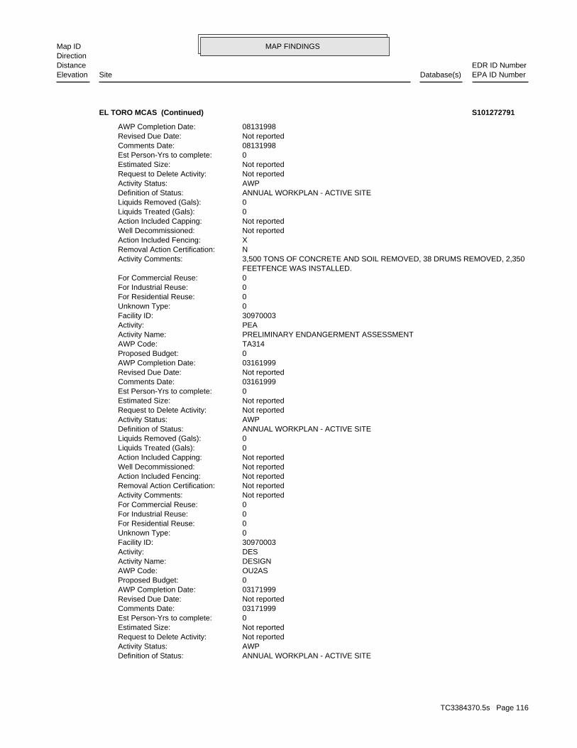
MAP FINDINGSMap IDDirection
EDR ID NumberDistanceEPA ID NumberDatabase(s)SiteElevation
ANNUAL WORKPLAN - ACTIVE SITEDefinition of Status: AWPActivity Status: Not reportedRequest to Delete Activity: Not reportedEstimated Size: 0Est Person-Yrs to complete: 03171999Comments Date: Not reportedRevised Due Date: 03171999AWP Completion Date: 0Proposed Budget: OU2ASAWP Code: DESIGNActivity Name: DESActivity: 30970003Facility ID: 0Unknown Type: 0For Residential Reuse: 0For Industrial Reuse: 0For Commercial Reuse: Not reportedActivity Comments: Not reportedRemoval Action Certification: Not reportedAction Included Fencing: Not reportedWell Decommissioned: Not reportedAction Included Capping: 0Liquids Treated (Gals): 0Liquids Removed (Gals): ANNUAL WORKPLAN - ACTIVE SITEDefinition of Status: AWPActivity Status: Not reportedRequest to Delete Activity: Not reportedEstimated Size: 0Est Person-Yrs to complete: 03161999Comments Date: Not reportedRevised Due Date: 03161999AWP Completion Date: 0Proposed Budget: TA314AWP Code: PRELIMINARY ENDANGERMENT ASSESSMENTActivity Name: PEAActivity: 30970003Facility ID: 0Unknown Type: 0For Residential Reuse: 0For Industrial Reuse: 0For Commercial Reuse: FEETFENCE WAS INSTALLED. 3,500 TONS OF CONCRETE AND SOIL REMOVED, 38 DRUMS REMOVED, 2,350Activity Comments: NRemoval Action Certification: XAction Included Fencing: Not reportedWell Decommissioned: Not reportedAction Included Capping: 0Liquids Treated (Gals): 0Liquids Removed (Gals): ANNUAL WORKPLAN - ACTIVE SITEDefinition of Status: AWPActivity Status: Not reportedRequest to Delete Activity: Not reportedEstimated Size: 0Est Person-Yrs to complete: 08131998Comments Date: Not reportedRevised Due Date: 08131998AWP Completion Date:
EL TORO MCAS (Continued) S101272791
TC3384370.5s Page 116
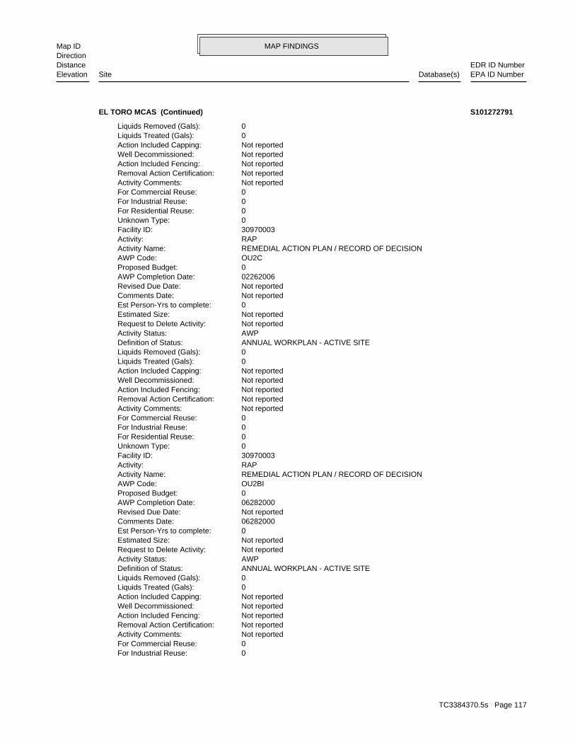
MAP FINDINGSMap IDDirection
EDR ID NumberDistanceEPA ID NumberDatabase(s)SiteElevation
0For Industrial Reuse: 0For Commercial Reuse: Not reportedActivity Comments: Not reportedRemoval Action Certification: Not reportedAction Included Fencing: Not reportedWell Decommissioned: Not reportedAction Included Capping: 0Liquids Treated (Gals): 0Liquids Removed (Gals): ANNUAL WORKPLAN - ACTIVE SITEDefinition of Status: AWPActivity Status: Not reportedRequest to Delete Activity: Not reportedEstimated Size: 0Est Person-Yrs to complete: 06282000Comments Date: Not reportedRevised Due Date: 06282000AWP Completion Date: 0Proposed Budget: OU2BIAWP Code: REMEDIAL ACTION PLAN / RECORD OF DECISIONActivity Name: RAPActivity: 30970003Facility ID: 0Unknown Type: 0For Residential Reuse: 0For Industrial Reuse: 0For Commercial Reuse: Not reportedActivity Comments: Not reportedRemoval Action Certification: Not reportedAction Included Fencing: Not reportedWell Decommissioned: Not reportedAction Included Capping: 0Liquids Treated (Gals): 0Liquids Removed (Gals): ANNUAL WORKPLAN - ACTIVE SITEDefinition of Status: AWPActivity Status: Not reportedRequest to Delete Activity: Not reportedEstimated Size: 0Est Person-Yrs to complete: Not reportedComments Date: Not reportedRevised Due Date: 02262006AWP Completion Date: 0Proposed Budget: OU2CAWP Code: REMEDIAL ACTION PLAN / RECORD OF DECISIONActivity Name: RAPActivity: 30970003Facility ID: 0Unknown Type: 0For Residential Reuse: 0For Industrial Reuse: 0For Commercial Reuse: Not reportedActivity Comments: Not reportedRemoval Action Certification: Not reportedAction Included Fencing: Not reportedWell Decommissioned: Not reportedAction Included Capping: 0Liquids Treated (Gals): 0Liquids Removed (Gals):
EL TORO MCAS (Continued) S101272791
TC3384370.5s Page 117

MAP FINDINGSMap IDDirection
EDR ID NumberDistanceEPA ID NumberDatabase(s)SiteElevation
Not reportedRevised Due Date: 02091998AWP Completion Date: 0Proposed Budget: OU3AAWP Code: REMEDIAL INVESTIGATION / FEASIBILITY STUDYActivity Name: RIFSActivity: 30970003Facility ID: 0Unknown Type: 0For Residential Reuse: 0For Industrial Reuse: 0For Commercial Reuse: Not reportedActivity Comments: Not reportedRemoval Action Certification: Not reportedAction Included Fencing: Not reportedWell Decommissioned: Not reportedAction Included Capping: 0Liquids Treated (Gals): 0Liquids Removed (Gals): ANNUAL WORKPLAN - ACTIVE SITEDefinition of Status: AWPActivity Status: Not reportedRequest to Delete Activity: Not reportedEstimated Size: 0Est Person-Yrs to complete: 04061998Comments Date: Not reportedRevised Due Date: 04061998AWP Completion Date: 0Proposed Budget: OU2AGAWP Code: REMEDIAL INVESTIGATION / FEASIBILITY STUDYActivity Name: RIFSActivity: 30970003Facility ID: 0Unknown Type: 0For Residential Reuse: 0For Industrial Reuse: 0For Commercial Reuse: Not reportedActivity Comments: Not reportedRemoval Action Certification: Not reportedAction Included Fencing: Not reportedWell Decommissioned: Not reportedAction Included Capping: 0Liquids Treated (Gals): 0Liquids Removed (Gals): ANNUAL WORKPLAN - ACTIVE SITEDefinition of Status: AWPActivity Status: Not reportedRequest to Delete Activity: Not reportedEstimated Size: 0Est Person-Yrs to complete: 04061998Comments Date: Not reportedRevised Due Date: 04061998AWP Completion Date: 0Proposed Budget: OU1AWP Code: REMEDIAL INVESTIGATION / FEASIBILITY STUDYActivity Name: RIFSActivity: 30970003Facility ID: 0Unknown Type: 0For Residential Reuse:
EL TORO MCAS (Continued) S101272791
TC3384370.5s Page 118

MAP FINDINGSMap IDDirection
EDR ID NumberDistanceEPA ID NumberDatabase(s)SiteElevation
Not reportedAction Included Capping: 0Liquids Treated (Gals): 0Liquids Removed (Gals): ANNUAL WORKPLAN - ACTIVE SITEDefinition of Status: AWPActivity Status: Not reportedRequest to Delete Activity: Not reportedEstimated Size: 0Est Person-Yrs to complete: 11041997Comments Date: Not reportedRevised Due Date: 11041997AWP Completion Date: 0Proposed Budget: LF-5AWP Code: REMEDIAL INVESTIGATION / FEASIBILITY STUDYActivity Name: RIFSActivity: 30970003Facility ID: 0Unknown Type: 0For Residential Reuse: 0For Industrial Reuse: 0For Commercial Reuse: Not reportedActivity Comments: Not reportedRemoval Action Certification: Not reportedAction Included Fencing: Not reportedWell Decommissioned: Not reportedAction Included Capping: 0Liquids Treated (Gals): 0Liquids Removed (Gals): ANNUAL WORKPLAN - ACTIVE SITEDefinition of Status: AWPActivity Status: Not reportedRequest to Delete Activity: Not reportedEstimated Size: 0Est Person-Yrs to complete: 09301997Comments Date: Not reportedRevised Due Date: 09301997AWP Completion Date: 0Proposed Budget: 3AS25AWP Code: REMEDIAL ACTION PLAN / RECORD OF DECISIONActivity Name: RAPActivity: 30970003Facility ID: 0Unknown Type: 0For Residential Reuse: 0For Industrial Reuse: 0For Commercial Reuse: Not reportedActivity Comments: Not reportedRemoval Action Certification: Not reportedAction Included Fencing: Not reportedWell Decommissioned: Not reportedAction Included Capping: 0Liquids Treated (Gals): 0Liquids Removed (Gals): ANNUAL WORKPLAN - ACTIVE SITEDefinition of Status: AWPActivity Status: Not reportedRequest to Delete Activity: Not reportedEstimated Size: 0Est Person-Yrs to complete: 02091998Comments Date:
EL TORO MCAS (Continued) S101272791
TC3384370.5s Page 119

MAP FINDINGSMap IDDirection
EDR ID NumberDistanceEPA ID NumberDatabase(s)SiteElevation
30970003Facility ID: 0Unknown Type: 0For Residential Reuse: 0For Industrial Reuse: 0For Commercial Reuse: Not reportedActivity Comments: Not reportedRemoval Action Certification: Not reportedAction Included Fencing: Not reportedWell Decommissioned: Not reportedAction Included Capping: 0Liquids Treated (Gals): 0Liquids Removed (Gals): ANNUAL WORKPLAN - ACTIVE SITEDefinition of Status: AWPActivity Status: Not reportedRequest to Delete Activity: Not reportedEstimated Size: 0Est Person-Yrs to complete: 10231997Comments Date: Not reportedRevised Due Date: 10231997AWP Completion Date: 0Proposed Budget: LF-17AWP Code: REMEDIAL INVESTIGATION / FEASIBILITY STUDYActivity Name: RIFSActivity: 30970003Facility ID: 0Unknown Type: 0For Residential Reuse: 0For Industrial Reuse: 0For Commercial Reuse: Not reportedActivity Comments: Not reportedRemoval Action Certification: Not reportedAction Included Fencing: Not reportedWell Decommissioned: Not reportedAction Included Capping: 0Liquids Treated (Gals): 0Liquids Removed (Gals): ANNUAL WORKPLAN - ACTIVE SITEDefinition of Status: AWPActivity Status: Not reportedRequest to Delete Activity: Not reportedEstimated Size: 0Est Person-Yrs to complete: 10281997Comments Date: Not reportedRevised Due Date: 10281997AWP Completion Date: 0Proposed Budget: LF-3AWP Code: REMEDIAL INVESTIGATION / FEASIBILITY STUDYActivity Name: RIFSActivity: 30970003Facility ID: 0Unknown Type: 0For Residential Reuse: 0For Industrial Reuse: 0For Commercial Reuse: Not reportedActivity Comments: Not reportedRemoval Action Certification: Not reportedAction Included Fencing: Not reportedWell Decommissioned:
EL TORO MCAS (Continued) S101272791
TC3384370.5s Page 120

MAP FINDINGSMap IDDirection
EDR ID NumberDistanceEPA ID NumberDatabase(s)SiteElevation
Not reportedEstimated Size: 0Est Person-Yrs to complete: 05121997Comments Date: Not reportedRevised Due Date: 05121997AWP Completion Date: 0Proposed Budget: STE25AWP Code: REMEDIAL INVESTIGATION / FEASIBILITY STUDYActivity Name: RIFSActivity: 30970003Facility ID: 0Unknown Type: 0For Residential Reuse: 0For Industrial Reuse: 0For Commercial Reuse: Not reportedActivity Comments: Not reportedRemoval Action Certification: Not reportedAction Included Fencing: Not reportedWell Decommissioned: Not reportedAction Included Capping: 0Liquids Treated (Gals): 0Liquids Removed (Gals): ANNUAL WORKPLAN - ACTIVE SITEDefinition of Status: AWPActivity Status: Not reportedRequest to Delete Activity: Not reportedEstimated Size: 0Est Person-Yrs to complete: 09301997Comments Date: Not reportedRevised Due Date: 09301997AWP Completion Date: 0Proposed Budget: OU2ASAWP Code: REMEDIAL ACTION PLAN / RECORD OF DECISIONActivity Name: RAPActivity: 30970003Facility ID: 0Unknown Type: 0For Residential Reuse: 0For Industrial Reuse: 0For Commercial Reuse: Not reportedActivity Comments: Not reportedRemoval Action Certification: Not reportedAction Included Fencing: Not reportedWell Decommissioned: Not reportedAction Included Capping: 0Liquids Treated (Gals): 0Liquids Removed (Gals): ANNUAL WORKPLAN - ACTIVE SITEDefinition of Status: AWPActivity Status: Not reportedRequest to Delete Activity: Not reportedEstimated Size: 0Est Person-Yrs to complete: 10201997Comments Date: Not reportedRevised Due Date: 10201997AWP Completion Date: 0Proposed Budget: LF-2AWP Code: REMEDIAL INVESTIGATION / FEASIBILITY STUDYActivity Name: RIFSActivity:
EL TORO MCAS (Continued) S101272791
TC3384370.5s Page 121
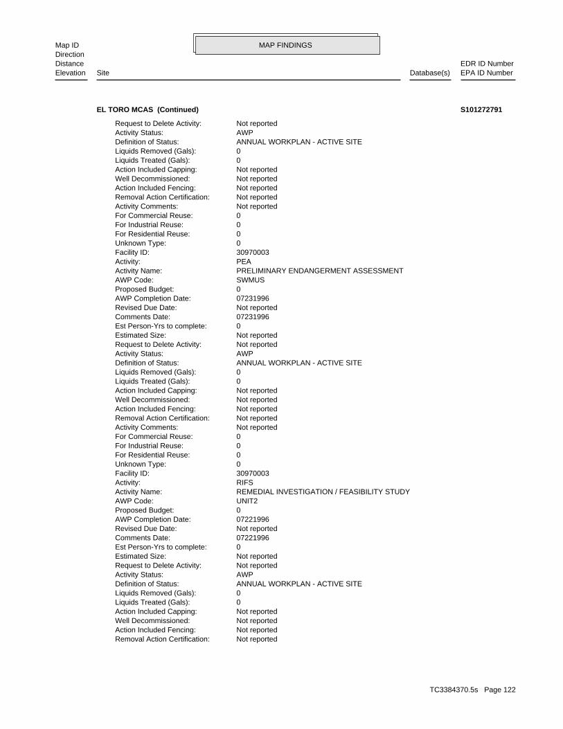
MAP FINDINGSMap IDDirection
EDR ID NumberDistanceEPA ID NumberDatabase(s)SiteElevation
Not reportedRemoval Action Certification: Not reportedAction Included Fencing: Not reportedWell Decommissioned: Not reportedAction Included Capping: 0Liquids Treated (Gals): 0Liquids Removed (Gals): ANNUAL WORKPLAN - ACTIVE SITEDefinition of Status: AWPActivity Status: Not reportedRequest to Delete Activity: Not reportedEstimated Size: 0Est Person-Yrs to complete: 07221996Comments Date: Not reportedRevised Due Date: 07221996AWP Completion Date: 0Proposed Budget: UNIT2AWP Code: REMEDIAL INVESTIGATION / FEASIBILITY STUDYActivity Name: RIFSActivity: 30970003Facility ID: 0Unknown Type: 0For Residential Reuse: 0For Industrial Reuse: 0For Commercial Reuse: Not reportedActivity Comments: Not reportedRemoval Action Certification: Not reportedAction Included Fencing: Not reportedWell Decommissioned: Not reportedAction Included Capping: 0Liquids Treated (Gals): 0Liquids Removed (Gals): ANNUAL WORKPLAN - ACTIVE SITEDefinition of Status: AWPActivity Status: Not reportedRequest to Delete Activity: Not reportedEstimated Size: 0Est Person-Yrs to complete: 07231996Comments Date: Not reportedRevised Due Date: 07231996AWP Completion Date: 0Proposed Budget: SWMUSAWP Code: PRELIMINARY ENDANGERMENT ASSESSMENTActivity Name: PEAActivity: 30970003Facility ID: 0Unknown Type: 0For Residential Reuse: 0For Industrial Reuse: 0For Commercial Reuse: Not reportedActivity Comments: Not reportedRemoval Action Certification: Not reportedAction Included Fencing: Not reportedWell Decommissioned: Not reportedAction Included Capping: 0Liquids Treated (Gals): 0Liquids Removed (Gals): ANNUAL WORKPLAN - ACTIVE SITEDefinition of Status: AWPActivity Status: Not reportedRequest to Delete Activity:
EL TORO MCAS (Continued) S101272791
TC3384370.5s Page 122

MAP FINDINGSMap IDDirection
EDR ID NumberDistanceEPA ID NumberDatabase(s)SiteElevation
4EECAAWP Code: REMEDIAL INVESTIGATION / FEASIBILITY STUDYActivity Name: RIFSActivity: 30970003Facility ID: 0Unknown Type: 0For Residential Reuse: 0For Industrial Reuse: 0For Commercial Reuse: Not reportedActivity Comments: Not reportedRemoval Action Certification: Not reportedAction Included Fencing: Not reportedWell Decommissioned: Not reportedAction Included Capping: 0Liquids Treated (Gals): 0Liquids Removed (Gals): ANNUAL WORKPLAN - ACTIVE SITEDefinition of Status: AWPActivity Status: Not reportedRequest to Delete Activity: Not reportedEstimated Size: 0Est Person-Yrs to complete: 11121995Comments Date: Not reportedRevised Due Date: 11121995AWP Completion Date: 0Proposed Budget: 20EEAWP Code: REMEDIAL INVESTIGATION / FEASIBILITY STUDYActivity Name: RIFSActivity: 30970003Facility ID: 0Unknown Type: 0For Residential Reuse: 0For Industrial Reuse: 0For Commercial Reuse: Not reportedActivity Comments: Not reportedRemoval Action Certification: Not reportedAction Included Fencing: Not reportedWell Decommissioned: Not reportedAction Included Capping: 0Liquids Treated (Gals): 0Liquids Removed (Gals): ANNUAL WORKPLAN - ACTIVE SITEDefinition of Status: AWPActivity Status: Not reportedRequest to Delete Activity: Not reportedEstimated Size: 0Est Person-Yrs to complete: 01231997Comments Date: Not reportedRevised Due Date: 01231997AWP Completion Date: 0Proposed Budget: OU2ASAWP Code: REMEDIAL INVESTIGATION / FEASIBILITY STUDYActivity Name: RIFSActivity: 30970003Facility ID: 0Unknown Type: 0For Residential Reuse: 0For Industrial Reuse: 0For Commercial Reuse: Not reportedActivity Comments:
EL TORO MCAS (Continued) S101272791
TC3384370.5s Page 123
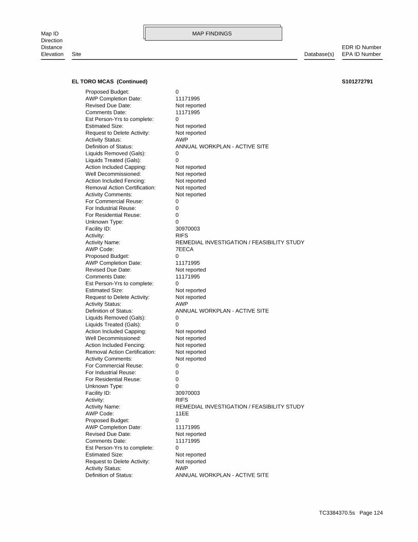
MAP FINDINGSMap IDDirection
EDR ID NumberDistanceEPA ID NumberDatabase(s)SiteElevation
ANNUAL WORKPLAN - ACTIVE SITEDefinition of Status: AWPActivity Status: Not reportedRequest to Delete Activity: Not reportedEstimated Size: 0Est Person-Yrs to complete: 11171995Comments Date: Not reportedRevised Due Date: 11171995AWP Completion Date: 0Proposed Budget: 11EEAWP Code: REMEDIAL INVESTIGATION / FEASIBILITY STUDYActivity Name: RIFSActivity: 30970003Facility ID: 0Unknown Type: 0For Residential Reuse: 0For Industrial Reuse: 0For Commercial Reuse: Not reportedActivity Comments: Not reportedRemoval Action Certification: Not reportedAction Included Fencing: Not reportedWell Decommissioned: Not reportedAction Included Capping: 0Liquids Treated (Gals): 0Liquids Removed (Gals): ANNUAL WORKPLAN - ACTIVE SITEDefinition of Status: AWPActivity Status: Not reportedRequest to Delete Activity: Not reportedEstimated Size: 0Est Person-Yrs to complete: 11171995Comments Date: Not reportedRevised Due Date: 11171995AWP Completion Date: 0Proposed Budget: 7EECAAWP Code: REMEDIAL INVESTIGATION / FEASIBILITY STUDYActivity Name: RIFSActivity: 30970003Facility ID: 0Unknown Type: 0For Residential Reuse: 0For Industrial Reuse: 0For Commercial Reuse: Not reportedActivity Comments: Not reportedRemoval Action Certification: Not reportedAction Included Fencing: Not reportedWell Decommissioned: Not reportedAction Included Capping: 0Liquids Treated (Gals): 0Liquids Removed (Gals): ANNUAL WORKPLAN - ACTIVE SITEDefinition of Status: AWPActivity Status: Not reportedRequest to Delete Activity: Not reportedEstimated Size: 0Est Person-Yrs to complete: 11171995Comments Date: Not reportedRevised Due Date: 11171995AWP Completion Date: 0Proposed Budget:
EL TORO MCAS (Continued) S101272791
TC3384370.5s Page 124
MAP FINDINGSMap IDDirection
EDR ID NumberDistanceEPA ID NumberDatabase(s)SiteElevation
0For Industrial Reuse: 0For Commercial Reuse: Not reportedActivity Comments: Not reportedRemoval Action Certification: Not reportedAction Included Fencing: Not reportedWell Decommissioned: Not reportedAction Included Capping: 0Liquids Treated (Gals): 0Liquids Removed (Gals): ANNUAL WORKPLAN - ACTIVE SITEDefinition of Status: AWPActivity Status: Not reportedRequest to Delete Activity: Not reportedEstimated Size: 0Est Person-Yrs to complete: 11171995Comments Date: Not reportedRevised Due Date: 11171995AWP Completion Date: 0Proposed Budget: 14EEAWP Code: REMEDIAL INVESTIGATION / FEASIBILITY STUDYActivity Name: RIFSActivity: 30970003Facility ID: 0Unknown Type: 0For Residential Reuse: 0For Industrial Reuse: 0For Commercial Reuse: Not reportedActivity Comments: Not reportedRemoval Action Certification: Not reportedAction Included Fencing: Not reportedWell Decommissioned: Not reportedAction Included Capping: 0Liquids Treated (Gals): 0Liquids Removed (Gals): ANNUAL WORKPLAN - ACTIVE SITEDefinition of Status: AWPActivity Status: Not reportedRequest to Delete Activity: Not reportedEstimated Size: 0Est Person-Yrs to complete: 11171995Comments Date: Not reportedRevised Due Date: 11171995AWP Completion Date: 0Proposed Budget: 13EEAWP Code: REMEDIAL INVESTIGATION / FEASIBILITY STUDYActivity Name: RIFSActivity: 30970003Facility ID: 0Unknown Type: 0For Residential Reuse: 0For Industrial Reuse: 0For Commercial Reuse: Not reportedActivity Comments: Not reportedRemoval Action Certification: Not reportedAction Included Fencing: Not reportedWell Decommissioned: Not reportedAction Included Capping: 0Liquids Treated (Gals): 0Liquids Removed (Gals):
EL TORO MCAS (Continued) S101272791
TC3384370.5s Page 125

MAP FINDINGSMap IDDirection
EDR ID NumberDistanceEPA ID NumberDatabase(s)SiteElevation
Not reportedRevised Due Date: 04011995AWP Completion Date: 0Proposed Budget: MCASEAWP Code: BASEWIDE ENVIRONMENTAL BASELINE SURVEYActivity Name: BWEBSActivity: 30970003Facility ID: 0Unknown Type: 0For Residential Reuse: 0For Industrial Reuse: 0For Commercial Reuse: Not reportedActivity Comments: Not reportedRemoval Action Certification: Not reportedAction Included Fencing: Not reportedWell Decommissioned: Not reportedAction Included Capping: 0Liquids Treated (Gals): 0Liquids Removed (Gals): ANNUAL WORKPLAN - ACTIVE SITEDefinition of Status: AWPActivity Status: Not reportedRequest to Delete Activity: Not reportedEstimated Size: 0Est Person-Yrs to complete: 11171995Comments Date: Not reportedRevised Due Date: 11171995AWP Completion Date: 0Proposed Budget: 20EEAWP Code: REMEDIAL INVESTIGATION / FEASIBILITY STUDYActivity Name: RIFSActivity: 30970003Facility ID: 0Unknown Type: 0For Residential Reuse: 0For Industrial Reuse: 0For Commercial Reuse: Not reportedActivity Comments: Not reportedRemoval Action Certification: Not reportedAction Included Fencing: Not reportedWell Decommissioned: Not reportedAction Included Capping: 0Liquids Treated (Gals): 0Liquids Removed (Gals): ANNUAL WORKPLAN - ACTIVE SITEDefinition of Status: AWPActivity Status: Not reportedRequest to Delete Activity: Not reportedEstimated Size: 0Est Person-Yrs to complete: 11171995Comments Date: Not reportedRevised Due Date: 11171995AWP Completion Date: 0Proposed Budget: 19EEAWP Code: REMEDIAL INVESTIGATION / FEASIBILITY STUDYActivity Name: RIFSActivity: 30970003Facility ID: 0Unknown Type: 0For Residential Reuse:
EL TORO MCAS (Continued) S101272791
TC3384370.5s Page 126
MAP FINDINGSMap IDDirection
EDR ID NumberDistanceEPA ID NumberDatabase(s)SiteElevation
Not reportedAction Included Capping: 0Liquids Treated (Gals): 0Liquids Removed (Gals): ANNUAL WORKPLAN - ACTIVE SITEDefinition of Status: AWPActivity Status: Not reportedRequest to Delete Activity: Not reportedEstimated Size: 0Est Person-Yrs to complete: 05171994Comments Date: Not reportedRevised Due Date: 05171994AWP Completion Date: 0Proposed Budget: BASWDAWP Code: PRELIMINARY ENDANGERMENT ASSESSMENTActivity Name: PEAActivity: 30970003Facility ID: 0Unknown Type: 0For Residential Reuse: 0For Industrial Reuse: 0For Commercial Reuse: Not reportedActivity Comments: Not reportedRemoval Action Certification: Not reportedAction Included Fencing: Not reportedWell Decommissioned: Not reportedAction Included Capping: 0Liquids Treated (Gals): 0Liquids Removed (Gals): ANNUAL WORKPLAN - ACTIVE SITEDefinition of Status: AWPActivity Status: Not reportedRequest to Delete Activity: Not reportedEstimated Size: 0Est Person-Yrs to complete: 03241995Comments Date: Not reportedRevised Due Date: 03241995AWP Completion Date: 0Proposed Budget: 2982AAWP Code: COMMUNITY ENVIRONMENTAL RESPONSE FACILITATION ACTActivity Name: CERFAActivity: 30970003Facility ID: 0Unknown Type: 0For Residential Reuse: 0For Industrial Reuse: 0For Commercial Reuse: Not reportedActivity Comments: Not reportedRemoval Action Certification: Not reportedAction Included Fencing: Not reportedWell Decommissioned: Not reportedAction Included Capping: 0Liquids Treated (Gals): 0Liquids Removed (Gals): ANNUAL WORKPLAN - ACTIVE SITEDefinition of Status: AWPActivity Status: Not reportedRequest to Delete Activity: Not reportedEstimated Size: 0Est Person-Yrs to complete: 04011995Comments Date:
EL TORO MCAS (Continued) S101272791
TC3384370.5s Page 127

MAP FINDINGSMap IDDirection
EDR ID NumberDistanceEPA ID NumberDatabase(s)SiteElevation
30970003Facility ID: 0Unknown Type: 0For Residential Reuse: 0For Industrial Reuse: 0For Commercial Reuse: Not reportedActivity Comments: Not reportedRemoval Action Certification: Not reportedAction Included Fencing: Not reportedWell Decommissioned: Not reportedAction Included Capping: 0Liquids Treated (Gals): 0Liquids Removed (Gals): ANNUAL WORKPLAN - ACTIVE SITEDefinition of Status: AWPActivity Status: Not reportedRequest to Delete Activity: Not reportedEstimated Size: 0Est Person-Yrs to complete: 06261987Comments Date: Not reportedRevised Due Date: 06261987AWP Completion Date: 0Proposed Budget: Not reportedAWP Code: SITE SCREENINGActivity Name: SSActivity: 30970003Facility ID: 0Unknown Type: 0For Residential Reuse: 0For Industrial Reuse: 0For Commercial Reuse: Not reportedActivity Comments: Not reportedRemoval Action Certification: Not reportedAction Included Fencing: Not reportedWell Decommissioned: Not reportedAction Included Capping: 0Liquids Treated (Gals): 0Liquids Removed (Gals): ANNUAL WORKPLAN - ACTIVE SITEDefinition of Status: AWPActivity Status: Not reportedRequest to Delete Activity: Not reportedEstimated Size: 0Est Person-Yrs to complete: 06291990Comments Date: Not reportedRevised Due Date: 06291990AWP Completion Date: 0Proposed Budget: Not reportedAWP Code: PUBLIC PARTICIPATION PLANActivity Name: PPPActivity: 30970003Facility ID: 0Unknown Type: 0For Residential Reuse: 0For Industrial Reuse: 0For Commercial Reuse: Not reportedActivity Comments: Not reportedRemoval Action Certification: Not reportedAction Included Fencing: Not reportedWell Decommissioned:
EL TORO MCAS (Continued) S101272791
TC3384370.5s Page 128

MAP FINDINGSMap IDDirection
EDR ID NumberDistanceEPA ID NumberDatabase(s)SiteElevation
Not reportedEstimated Size: 0Est Person-Yrs to complete: 09162004Comments Date: 09302004Revised Due Date: 09162004AWP Completion Date: 0Proposed Budget: TA606AWP Code: PRELIMINARY ENDANGERMENT ASSESSMENTActivity Name: PEAActivity: 30970003Facility ID: 0Unknown Type: 0For Residential Reuse: 0For Industrial Reuse: 0For Commercial Reuse: Not reportedActivity Comments: Not reportedRemoval Action Certification: Not reportedAction Included Fencing: Not reportedWell Decommissioned: Not reportedAction Included Capping: 0Liquids Treated (Gals): 0Liquids Removed (Gals): ANNUAL WORKPLAN - ACTIVE SITEDefinition of Status: AWPActivity Status: Not reportedRequest to Delete Activity: Not reportedEstimated Size: 0Est Person-Yrs to complete: 09072004Comments Date: 09302004Revised Due Date: 09072004AWP Completion Date: 0Proposed Budget: TA779AWP Code: PRELIMINARY ENDANGERMENT ASSESSMENTActivity Name: PEAActivity: 30970003Facility ID: 0Unknown Type: 0For Residential Reuse: 0For Industrial Reuse: 0For Commercial Reuse: Not reportedActivity Comments: Not reportedRemoval Action Certification: Not reportedAction Included Fencing: Not reportedWell Decommissioned: Not reportedAction Included Capping: 0Liquids Treated (Gals): 0Liquids Removed (Gals): ANNUAL WORKPLAN - ACTIVE SITEDefinition of Status: AWPActivity Status: Not reportedRequest to Delete Activity: Not reportedEstimated Size: 0Est Person-Yrs to complete: 09012004Comments Date: 09302004Revised Due Date: 09012004AWP Completion Date: 0Proposed Budget: TA658AWP Code: PRELIMINARY ENDANGERMENT ASSESSMENTActivity Name: PEAActivity:
EL TORO MCAS (Continued) S101272791
TC3384370.5s Page 129

MAP FINDINGSMap IDDirection
EDR ID NumberDistanceEPA ID NumberDatabase(s)SiteElevation
Not reportedRemoval Action Certification: Not reportedAction Included Fencing: Not reportedWell Decommissioned: Not reportedAction Included Capping: 0Liquids Treated (Gals): 0Liquids Removed (Gals): ANNUAL WORKPLAN - ACTIVE SITEDefinition of Status: AWPActivity Status: Not reportedRequest to Delete Activity: Not reportedEstimated Size: 0Est Person-Yrs to complete: 10152004Comments Date: Not reportedRevised Due Date: 08022004AWP Completion Date: 0Proposed Budget: FOSTAWP Code: FINDING OF SUITABILITY TO TRANSFERActivity Name: FOSTActivity: 30970003Facility ID: 0Unknown Type: 0For Residential Reuse: 0For Industrial Reuse: 0For Commercial Reuse: Not reportedActivity Comments: Not reportedRemoval Action Certification: Not reportedAction Included Fencing: Not reportedWell Decommissioned: Not reportedAction Included Capping: 0Liquids Treated (Gals): 0Liquids Removed (Gals): ANNUAL WORKPLAN - ACTIVE SITEDefinition of Status: AWPActivity Status: Not reportedRequest to Delete Activity: Not reportedEstimated Size: 0Est Person-Yrs to complete: 09132004Comments Date: 09302004Revised Due Date: 09132004AWP Completion Date: 0Proposed Budget: TA605AWP Code: PRELIMINARY ENDANGERMENT ASSESSMENTActivity Name: PEAActivity: 30970003Facility ID: 0Unknown Type: 0For Residential Reuse: 0For Industrial Reuse: 0For Commercial Reuse: Not reportedActivity Comments: Not reportedRemoval Action Certification: Not reportedAction Included Fencing: Not reportedWell Decommissioned: Not reportedAction Included Capping: 0Liquids Treated (Gals): 0Liquids Removed (Gals): ANNUAL WORKPLAN - ACTIVE SITEDefinition of Status: AWPActivity Status: Not reportedRequest to Delete Activity:
EL TORO MCAS (Continued) S101272791
TC3384370.5s Page 130
MAP FINDINGSMap IDDirection
EDR ID NumberDistanceEPA ID NumberDatabase(s)SiteElevation
TA461AWP Code: PRELIMINARY ENDANGERMENT ASSESSMENTActivity Name: PEAActivity: 30970003Facility ID: 0Unknown Type: 0For Residential Reuse: 0For Industrial Reuse: 0For Commercial Reuse: Not reportedActivity Comments: Not reportedRemoval Action Certification: Not reportedAction Included Fencing: Not reportedWell Decommissioned: Not reportedAction Included Capping: 0Liquids Treated (Gals): 0Liquids Removed (Gals): ANNUAL WORKPLAN - ACTIVE SITEDefinition of Status: AWPActivity Status: Not reportedRequest to Delete Activity: Not reportedEstimated Size: 0Est Person-Yrs to complete: 04122004Comments Date: Not reportedRevised Due Date: 04122004AWP Completion Date: 0Proposed Budget: TA744AWP Code: PRELIMINARY ENDANGERMENT ASSESSMENTActivity Name: PEAActivity: 30970003Facility ID: 0Unknown Type: 0For Residential Reuse: 0For Industrial Reuse: 0For Commercial Reuse: Not reportedActivity Comments: Not reportedRemoval Action Certification: Not reportedAction Included Fencing: Not reportedWell Decommissioned: Not reportedAction Included Capping: 0Liquids Treated (Gals): 0Liquids Removed (Gals): ANNUAL WORKPLAN - ACTIVE SITEDefinition of Status: AWPActivity Status: Not reportedRequest to Delete Activity: Not reportedEstimated Size: 0Est Person-Yrs to complete: 07132004Comments Date: Not reportedRevised Due Date: 07132004AWP Completion Date: 0Proposed Budget: TA31AAWP Code: PRELIMINARY ENDANGERMENT ASSESSMENTActivity Name: PEAActivity: 30970003Facility ID: 0Unknown Type: 0For Residential Reuse: 0For Industrial Reuse: 0For Commercial Reuse: Not reportedActivity Comments:
EL TORO MCAS (Continued) S101272791
TC3384370.5s Page 131

MAP FINDINGSMap IDDirection
EDR ID NumberDistanceEPA ID NumberDatabase(s)SiteElevation
ANNUAL WORKPLAN - ACTIVE SITEDefinition of Status: AWPActivity Status: Not reportedRequest to Delete Activity: Not reportedEstimated Size: 0Est Person-Yrs to complete: 03232004Comments Date: Not reportedRevised Due Date: 03232004AWP Completion Date: 0Proposed Budget: OW845AWP Code: PRELIMINARY ENDANGERMENT ASSESSMENTActivity Name: PEAActivity: 30970003Facility ID: 0Unknown Type: 0For Residential Reuse: 0For Industrial Reuse: 0For Commercial Reuse: Not reportedActivity Comments: Not reportedRemoval Action Certification: Not reportedAction Included Fencing: Not reportedWell Decommissioned: Not reportedAction Included Capping: 0Liquids Treated (Gals): 0Liquids Removed (Gals): ANNUAL WORKPLAN - ACTIVE SITEDefinition of Status: AWPActivity Status: Not reportedRequest to Delete Activity: Not reportedEstimated Size: 0Est Person-Yrs to complete: 03302004Comments Date: Not reportedRevised Due Date: 03302004AWP Completion Date: 0Proposed Budget: MSCP1AWP Code: PRELIMINARY ENDANGERMENT ASSESSMENTActivity Name: PEAActivity: 30970003Facility ID: 0Unknown Type: 0For Residential Reuse: 0For Industrial Reuse: 0For Commercial Reuse: Not reportedActivity Comments: Not reportedRemoval Action Certification: Not reportedAction Included Fencing: Not reportedWell Decommissioned: Not reportedAction Included Capping: 0Liquids Treated (Gals): 0Liquids Removed (Gals): ANNUAL WORKPLAN - ACTIVE SITEDefinition of Status: AWPActivity Status: Not reportedRequest to Delete Activity: Not reportedEstimated Size: 0Est Person-Yrs to complete: 04122004Comments Date: Not reportedRevised Due Date: 04122004AWP Completion Date: 0Proposed Budget:
EL TORO MCAS (Continued) S101272791
TC3384370.5s Page 132
MAP FINDINGSMap IDDirection
EDR ID NumberDistanceEPA ID NumberDatabase(s)SiteElevation
0For Industrial Reuse: 0For Commercial Reuse: Not reportedActivity Comments: Not reportedRemoval Action Certification: Not reportedAction Included Fencing: Not reportedWell Decommissioned: Not reportedAction Included Capping: 0Liquids Treated (Gals): 0Liquids Removed (Gals): ANNUAL WORKPLAN - ACTIVE SITEDefinition of Status: AWPActivity Status: Not reportedRequest to Delete Activity: Not reportedEstimated Size: 0Est Person-Yrs to complete: 12302003Comments Date: Not reportedRevised Due Date: 12302003AWP Completion Date: 0Proposed Budget: TA240AWP Code: PRELIMINARY ENDANGERMENT ASSESSMENTActivity Name: PEAActivity: 30970003Facility ID: 0Unknown Type: 0For Residential Reuse: 0For Industrial Reuse: 0For Commercial Reuse: Not reportedActivity Comments: Not reportedRemoval Action Certification: Not reportedAction Included Fencing: Not reportedWell Decommissioned: Not reportedAction Included Capping: 0Liquids Treated (Gals): 0Liquids Removed (Gals): ANNUAL WORKPLAN - ACTIVE SITEDefinition of Status: AWPActivity Status: Not reportedRequest to Delete Activity: Not reportedEstimated Size: 0Est Person-Yrs to complete: 01022004Comments Date: Not reportedRevised Due Date: 01022004AWP Completion Date: 0Proposed Budget: MSCP2AWP Code: PRELIMINARY ENDANGERMENT ASSESSMENTActivity Name: PEAActivity: 30970003Facility ID: 0Unknown Type: 0For Residential Reuse: 0For Industrial Reuse: 0For Commercial Reuse: Not reportedActivity Comments: Not reportedRemoval Action Certification: Not reportedAction Included Fencing: Not reportedWell Decommissioned: Not reportedAction Included Capping: 0Liquids Treated (Gals): 0Liquids Removed (Gals):
EL TORO MCAS (Continued) S101272791
TC3384370.5s Page 133
MAP FINDINGSMap IDDirection
EDR ID NumberDistanceEPA ID NumberDatabase(s)SiteElevation
Not reportedRevised Due Date: 10302003AWP Completion Date: 0Proposed Budget: TA441AWP Code: PRELIMINARY ENDANGERMENT ASSESSMENTActivity Name: PEAActivity: 30970003Facility ID: 0Unknown Type: 0For Residential Reuse: 0For Industrial Reuse: 0For Commercial Reuse: Not reportedActivity Comments: Not reportedRemoval Action Certification: Not reportedAction Included Fencing: Not reportedWell Decommissioned: Not reportedAction Included Capping: 0Liquids Treated (Gals): 0Liquids Removed (Gals): ANNUAL WORKPLAN - ACTIVE SITEDefinition of Status: AWPActivity Status: Not reportedRequest to Delete Activity: Not reportedEstimated Size: 0Est Person-Yrs to complete: 11072003Comments Date: Not reportedRevised Due Date: 11072003AWP Completion Date: 0Proposed Budget: TA772AWP Code: PRELIMINARY ENDANGERMENT ASSESSMENTActivity Name: PEAActivity: 30970003Facility ID: 0Unknown Type: 0For Residential Reuse: 0For Industrial Reuse: 0For Commercial Reuse: Not reportedActivity Comments: Not reportedRemoval Action Certification: Not reportedAction Included Fencing: Not reportedWell Decommissioned: Not reportedAction Included Capping: 0Liquids Treated (Gals): 0Liquids Removed (Gals): ANNUAL WORKPLAN - ACTIVE SITEDefinition of Status: AWPActivity Status: Not reportedRequest to Delete Activity: Not reportedEstimated Size: 0Est Person-Yrs to complete: 12162003Comments Date: Not reportedRevised Due Date: 12162003AWP Completion Date: 0Proposed Budget: T371AAWP Code: PRELIMINARY ENDANGERMENT ASSESSMENTActivity Name: PEAActivity: 30970003Facility ID: 0Unknown Type: 0For Residential Reuse:
EL TORO MCAS (Continued) S101272791
TC3384370.5s Page 134
MAP FINDINGSMap IDDirection
EDR ID NumberDistanceEPA ID NumberDatabase(s)SiteElevation
Not reportedAction Included Capping: 0Liquids Treated (Gals): 0Liquids Removed (Gals): ANNUAL WORKPLAN - ACTIVE SITEDefinition of Status: AWPActivity Status: Not reportedRequest to Delete Activity: Not reportedEstimated Size: 0Est Person-Yrs to complete: 10152003Comments Date: Not reportedRevised Due Date: 10152003AWP Completion Date: 0Proposed Budget: T651AAWP Code: PRELIMINARY ENDANGERMENT ASSESSMENTActivity Name: PEAActivity: 30970003Facility ID: 0Unknown Type: 0For Residential Reuse: 0For Industrial Reuse: 0For Commercial Reuse: Not reportedActivity Comments: Not reportedRemoval Action Certification: Not reportedAction Included Fencing: Not reportedWell Decommissioned: Not reportedAction Included Capping: 0Liquids Treated (Gals): 0Liquids Removed (Gals): ANNUAL WORKPLAN - ACTIVE SITEDefinition of Status: AWPActivity Status: Not reportedRequest to Delete Activity: Not reportedEstimated Size: 0Est Person-Yrs to complete: 10152003Comments Date: Not reportedRevised Due Date: 10152003AWP Completion Date: 0Proposed Budget: TA289AWP Code: PRELIMINARY ENDANGERMENT ASSESSMENTActivity Name: PEAActivity: 30970003Facility ID: 0Unknown Type: 0For Residential Reuse: 0For Industrial Reuse: 0For Commercial Reuse: Not reportedActivity Comments: Not reportedRemoval Action Certification: Not reportedAction Included Fencing: Not reportedWell Decommissioned: Not reportedAction Included Capping: 0Liquids Treated (Gals): 0Liquids Removed (Gals): ANNUAL WORKPLAN - ACTIVE SITEDefinition of Status: AWPActivity Status: Not reportedRequest to Delete Activity: Not reportedEstimated Size: 0Est Person-Yrs to complete: 10302003Comments Date:
EL TORO MCAS (Continued) S101272791
TC3384370.5s Page 135
MAP FINDINGSMap IDDirection
EDR ID NumberDistanceEPA ID NumberDatabase(s)SiteElevation
30970003Facility ID: 0Unknown Type: 0For Residential Reuse: 0For Industrial Reuse: 0For Commercial Reuse: Not reportedActivity Comments: Not reportedRemoval Action Certification: Not reportedAction Included Fencing: Not reportedWell Decommissioned: Not reportedAction Included Capping: 0Liquids Treated (Gals): 0Liquids Removed (Gals): ANNUAL WORKPLAN - ACTIVE SITEDefinition of Status: AWPActivity Status: Not reportedRequest to Delete Activity: Not reportedEstimated Size: 0Est Person-Yrs to complete: Not reportedComments Date: Not reportedRevised Due Date: 11302006AWP Completion Date: 0Proposed Budget: OU316AWP Code: CERTIFICATIONActivity Name: CERTActivity: 30970003Facility ID: 0Unknown Type: 0For Residential Reuse: 0For Industrial Reuse: 0For Commercial Reuse: Not reportedActivity Comments: Not reportedRemoval Action Certification: Not reportedAction Included Fencing: Not reportedWell Decommissioned: Not reportedAction Included Capping: 0Liquids Treated (Gals): 0Liquids Removed (Gals): ANNUAL WORKPLAN - ACTIVE SITEDefinition of Status: AWPActivity Status: Not reportedRequest to Delete Activity: Not reportedEstimated Size: 0Est Person-Yrs to complete: 09292003Comments Date: Not reportedRevised Due Date: 09292003AWP Completion Date: 0Proposed Budget: TA636AWP Code: PRELIMINARY ENDANGERMENT ASSESSMENTActivity Name: PEAActivity: 30970003Facility ID: 0Unknown Type: 0For Residential Reuse: 0For Industrial Reuse: 0For Commercial Reuse: Not reportedActivity Comments: Not reportedRemoval Action Certification: Not reportedAction Included Fencing: Not reportedWell Decommissioned:
EL TORO MCAS (Continued) S101272791
TC3384370.5s Page 136
MAP FINDINGSMap IDDirection
EDR ID NumberDistanceEPA ID NumberDatabase(s)SiteElevation
Not reportedEstimated Size: 0Est Person-Yrs to complete: Not reportedComments Date: Not reportedRevised Due Date: 06302008AWP Completion Date: 0Proposed Budget: OU31AWP Code: CERTIFICATIONActivity Name: CERTActivity: 30970003Facility ID: 0Unknown Type: 0For Residential Reuse: 0For Industrial Reuse: 0For Commercial Reuse: Not reportedActivity Comments: Not reportedRemoval Action Certification: Not reportedAction Included Fencing: Not reportedWell Decommissioned: Not reportedAction Included Capping: 0Liquids Treated (Gals): 0Liquids Removed (Gals): ANNUAL WORKPLAN - ACTIVE SITEDefinition of Status: AWPActivity Status: Not reportedRequest to Delete Activity: Not reportedEstimated Size: 0Est Person-Yrs to complete: Not reportedComments Date: Not reportedRevised Due Date: 12312006AWP Completion Date: 0Proposed Budget: OU38AWP Code: CERTIFICATIONActivity Name: CERTActivity: 30970003Facility ID: 0Unknown Type: 0For Residential Reuse: 0For Industrial Reuse: 0For Commercial Reuse: Not reportedActivity Comments: Not reportedRemoval Action Certification: Not reportedAction Included Fencing: Not reportedWell Decommissioned: Not reportedAction Included Capping: 0Liquids Treated (Gals): 0Liquids Removed (Gals): ANNUAL WORKPLAN - ACTIVE SITEDefinition of Status: AWPActivity Status: Not reportedRequest to Delete Activity: Not reportedEstimated Size: 0Est Person-Yrs to complete: Not reportedComments Date: Not reportedRevised Due Date: 12312006AWP Completion Date: 0Proposed Budget: OU311AWP Code: CERTIFICATIONActivity Name: CERTActivity:
EL TORO MCAS (Continued) S101272791
TC3384370.5s Page 137

MAP FINDINGSMap IDDirection
EDR ID NumberDistanceEPA ID NumberDatabase(s)SiteElevation
Not reportedRemoval Action Certification: Not reportedAction Included Fencing: Not reportedWell Decommissioned: Not reportedAction Included Capping: 0Liquids Treated (Gals): 0Liquids Removed (Gals): ANNUAL WORKPLAN - ACTIVE SITEDefinition of Status: AWPActivity Status: Not reportedRequest to Delete Activity: Not reportedEstimated Size: 0Est Person-Yrs to complete: Not reportedComments Date: Not reportedRevised Due Date: 07312005AWP Completion Date: 0Proposed Budget: OU2BAWP Code: CERTIFICATIONActivity Name: CERTActivity: 30970003Facility ID: 0Unknown Type: 0For Residential Reuse: 0For Industrial Reuse: 0For Commercial Reuse: Not reportedActivity Comments: Not reportedRemoval Action Certification: Not reportedAction Included Fencing: Not reportedWell Decommissioned: Not reportedAction Included Capping: 0Liquids Treated (Gals): 0Liquids Removed (Gals): ANNUAL WORKPLAN - ACTIVE SITEDefinition of Status: AWPActivity Status: Not reportedRequest to Delete Activity: Not reportedEstimated Size: 0Est Person-Yrs to complete: Not reportedComments Date: Not reportedRevised Due Date: 04302008AWP Completion Date: 0Proposed Budget: OU2CAWP Code: CERTIFICATIONActivity Name: CERTActivity: 30970003Facility ID: 0Unknown Type: 0For Residential Reuse: 0For Industrial Reuse: 0For Commercial Reuse: Not reportedActivity Comments: Not reportedRemoval Action Certification: Not reportedAction Included Fencing: Not reportedWell Decommissioned: Not reportedAction Included Capping: 0Liquids Treated (Gals): 0Liquids Removed (Gals): ANNUAL WORKPLAN - ACTIVE SITEDefinition of Status: AWPActivity Status: Not reportedRequest to Delete Activity:
EL TORO MCAS (Continued) S101272791
TC3384370.5s Page 138

MAP FINDINGSMap IDDirection
EDR ID NumberDistanceEPA ID NumberDatabase(s)SiteElevation
FFAAWP Code: I/SE, IORSE, FFA, FFSRA, VCA, EAActivity Name: ORDERActivity: 30970003Facility ID: 0Unknown Type: 0For Residential Reuse: 0For Industrial Reuse: 0For Commercial Reuse: Not reportedActivity Comments: Not reportedRemoval Action Certification: Not reportedAction Included Fencing: Not reportedWell Decommissioned: Not reportedAction Included Capping: 0Liquids Treated (Gals): 0Liquids Removed (Gals): ANNUAL WORKPLAN - ACTIVE SITEDefinition of Status: AWPActivity Status: Not reportedRequest to Delete Activity: Not reportedEstimated Size: 0Est Person-Yrs to complete: Not reportedComments Date: Not reportedRevised Due Date: 01312008AWP Completion Date: 0Proposed Budget: OU1AWP Code: CERTIFICATIONActivity Name: CERTActivity: 30970003Facility ID: 0Unknown Type: 0For Residential Reuse: 0For Industrial Reuse: 0For Commercial Reuse: Not reportedActivity Comments: Not reportedRemoval Action Certification: Not reportedAction Included Fencing: Not reportedWell Decommissioned: Not reportedAction Included Capping: 0Liquids Treated (Gals): 0Liquids Removed (Gals): ANNUAL WORKPLAN - ACTIVE SITEDefinition of Status: AWPActivity Status: Not reportedRequest to Delete Activity: Not reportedEstimated Size: 0Est Person-Yrs to complete: Not reportedComments Date: Not reportedRevised Due Date: 01312008AWP Completion Date: 0Proposed Budget: OU2AAWP Code: CERTIFICATIONActivity Name: CERTActivity: 30970003Facility ID: 0Unknown Type: 0For Residential Reuse: 0For Industrial Reuse: 0For Commercial Reuse: Not reportedActivity Comments:
EL TORO MCAS (Continued) S101272791
TC3384370.5s Page 139

MAP FINDINGSMap IDDirection
EDR ID NumberDistanceEPA ID NumberDatabase(s)SiteElevation
ANNUAL WORKPLAN - ACTIVE SITEDefinition of Status: AWPActivity Status: Not reportedRequest to Delete Activity: Not reportedEstimated Size: 0Est Person-Yrs to complete: 07232004Comments Date: Not reportedRevised Due Date: Not reportedAWP Completion Date: 0Proposed Budget: NOE1AWP Code: CEQA INCLUDING NEGATIVE DECSActivity Name: CEQAActivity: 30970003Facility ID: 0Unknown Type: 0For Residential Reuse: 0For Industrial Reuse: 0For Commercial Reuse: Not reportedActivity Comments: Not reportedRemoval Action Certification: Not reportedAction Included Fencing: Not reportedWell Decommissioned: Not reportedAction Included Capping: 0Liquids Treated (Gals): 0Liquids Removed (Gals): ANNUAL WORKPLAN - ACTIVE SITEDefinition of Status: AWPActivity Status: Not reportedRequest to Delete Activity: Not reportedEstimated Size: 0Est Person-Yrs to complete: 08192004Comments Date: 09302004Revised Due Date: Not reportedAWP Completion Date: 0Proposed Budget: CERT1AWP Code: CERTIFICATIONActivity Name: CERTActivity: 30970003Facility ID: 0Unknown Type: 0For Residential Reuse: 0For Industrial Reuse: 0For Commercial Reuse: Not reportedActivity Comments: Not reportedRemoval Action Certification: Not reportedAction Included Fencing: Not reportedWell Decommissioned: Not reportedAction Included Capping: 0Liquids Treated (Gals): 0Liquids Removed (Gals): ANNUAL WORKPLAN - ACTIVE SITEDefinition of Status: AWPActivity Status: Not reportedRequest to Delete Activity: Not reportedEstimated Size: 0Est Person-Yrs to complete: 09271990Comments Date: Not reportedRevised Due Date: Not reportedAWP Completion Date: 0Proposed Budget:
EL TORO MCAS (Continued) S101272791
TC3384370.5s Page 140
MAP FINDINGSMap IDDirection
EDR ID NumberDistanceEPA ID NumberDatabase(s)SiteElevation
t report, the net carcinogenic risk is less than 1X10⁻⁶ for the rComments: 12302003Comments Date: the MCAS El Toro. Based on the results from the site assessmenComments: 12302003Comments Date: erm located southeast of Building240 in the northwest quadrant ofComments: 12302003Comments Date: RI report due 10/15/92, OU 4; draft RI report due 9/15/93Comments: 10241990Comments Date: as follows: OU 1; draft RI report due 6/15/92, OU 2&3; draftComments: 10241990Comments Date: DTSC, and RWQCB. Deadlines established in Appendix A wereComments: 10241990Comments Date: Federal Facility Agreement (FFA) was signed by Navy, USEPA,Comments: 10241990Comments Date: the southwestern end of IRP Site 5 and the golf course trail.Comments: 08102004Comments Date: efuse area (approximately 300 x 300 feet) designated as MSC R2atComments: 08102004Comments Date: resented by DHS (now DTSC) and the RWQCB. s signed in October 1990 by the U.S. Navy, EPA and the State, rep ral Facility Agreement (FFA)for the remediation of the station wa icides, herbicides and polychlorinated biphenyls (PCBs). A Fede inants such as VOCs, semivolatile organic compounds (SVOCs), pest U-3 includes sites with potential sources for a variety of contam (soil and shallow groundwater) and the former landfill sites. O latile organic compounds (VOCs). OU-2 include the VOC source area its (OUs). OU-1 is the regional groundwater contaminated with vo tion Restoration Program sites are grouped into three Operable Un water extending three miles off-station. A total of 24 Installa t in 1990 due to a trichloroethene (TCE) plume in regional ground equipment. MCAS El Toro was added to the National Priority Lis operation and maintenance of military aircraft and ground support nd was closed on July 2, 1999. The station mission involved the Marine Corps Air Station (MCAS) El Toro began operation in 1943 aBackground Info: IRVINE, CA 92709Alternate City,St,Zip: SAND CANYON AND IRVINE BOULEVARDAlternate Address: IRVINE, CA 92709Alternate City,St,Zip: MARINE CORPS AIR STATION (MCAS)Alternate Address: IRVINE, CA 92709Alternate City,St,Zip: EL TORO MARINE CORPS AIR STATIONAlternate Address: IRVINE, CA 92709Alternate City,St,Zip: 4,741 ACRES;9MI SW OF NEWPORT BEACH, CAAlternate Address: IRVINE, CA 92709Alternate City,St,Zip: 4,741 ACRES; 9MI NE OF NEWPORT BEACH, CAAlternate Address: IRVINE, CA 92709Alternate City,St,Zip: 4,741 ACRE;9MI SE OF SANTA ANA, CAAlternate Address: 0Unknown Type: 0For Residential Reuse: 0For Industrial Reuse: 0For Commercial Reuse: Not reportedActivity Comments: Not reportedRemoval Action Certification: Not reportedAction Included Fencing: Not reportedWell Decommissioned: Not reportedAction Included Capping: 0Liquids Treated (Gals): 0Liquids Removed (Gals):
EL TORO MCAS (Continued) S101272791
TC3384370.5s Page 141
MAP FINDINGSMap IDDirection
EDR ID NumberDistanceEPA ID NumberDatabase(s)SiteElevation
09282004Comments Date: petroleum hydrocarbons (TPH) as gasoline, TPH as diesel, pesticiComments: 09282004Comments Date: analyzed for volatile organic compounds (VOCs), semi-VOCs, totalComments: 09282004Comments Date: tions at 18 and 36 inches below ground surface. The samples wereComments: 09282004Comments Date: ng two duplicates, were collected from two hand auger boring locaComments: 09282004Comments Date: ite visit on February 12, 2003, six confirmation samples, includiComments: 09282004Comments Date: , metal roof, and berm. Based on agreement reached during a sComments: 09282004Comments Date: e unit is described as 12-feet by 12-feet concrete pad, with sumpComments: 09282004Comments Date: storage of waste oil, turbine shaft oil, and hydraulic fluid. ThComments: 09282004Comments Date: ent (RFA) prepared for El Toro. The HWSA may have been used forComments: 09282004Comments Date: nt of the Resource Conservation and Recovery Act Facility AssessmComments: 09282004Comments Date: inactive hazardous waste storage area (HWSA) during the developmeComments: 09282004Comments Date: 3 in the southeast quadrant of the Station) was identified as anComments: 09282004Comments Date: Waste Management Unit (SWMU) 186 located southeast of Building 67Comments: 09282004Comments Date: ted at TAA 673 in March 2003. TAA 673 (also referenced as SolidComments: 09282004Comments Date: TAA) 673 summarizes the results of additional soil samples collecComments: 09282004Comments Date: The May 23, 2003 Closure Report for Temporary Accumulation Area (Comments: 09282004Comments Date: y Study Report, DTSC concurs with the findings.Comments: 09262002Comments Date: hydraulic containment. Following review of the Focused FeasibilitComments: 09262002Comments Date: idered for groundwater include monitored natural attenuation andComments: 09262002Comments Date: conditions and results of MPE pilot study, the alternatives consComments: 09262002Comments Date: due to the site-specific geology. As a result, based on the siteComments: 09262002Comments Date: aminants from soil, it was ineffective for groundwater extractionComments: 09262002Comments Date: udy, it was determined that although MPE effectively removed contComments: 09262002Comments Date: extraction (MPE) was conducted. Based upon the results of the stComments: 09262002Comments Date: tudy, a pilot study to evaluate the effectiveness of multi-phaseComments: 09262002Comments Date: of groundwater contaminated with VOCs. During the feasibility sComments: 09262002Comments Date: icial uses of the shallow groundwater aquifer, and preventing useComments: 09262002Comments Date: esidential uses. Also, the target organ hazard index (HI) using mComments: 12302003Comments Date:
EL TORO MCAS (Continued) S101272791
TC3384370.5s Page 142
MAP FINDINGSMap IDDirection
EDR ID NumberDistanceEPA ID NumberDatabase(s)SiteElevation
uilding 698 in the northeast quadrant of the Station) was identifComments: 09292004Comments Date: as Solid Waste Management Unit (SWMU) 186 located southeast of BComments: 09292004Comments Date: ted at TAA 698 in March and April 2003. TAA 698 (also referencedComments: 09292004Comments Date: TAA) 698 summarizes the results of additional soil samples collecComments: 09292004Comments Date: The June 6, 2003 Closure Report for Temporary Accumulation Area (Comments: 09292004Comments Date: port.Comments: 09292003Comments Date: DTSC concurs with the findings and conclusions of the closure reComments: 09292003Comments Date: ampling analytical results were below residential cleanup goals.Comments: 09292003Comments Date: tals. Based on the results from the 2002 site assessment, the sComments: 09292003Comments Date: , TPH as diesel, pesticides and polychlorinated biphenyls, and meComments: 09292003Comments Date: ic compounds (VOCs), Semi-VOCs, total petroleum (TPH) as gasolineComments: 09292003Comments Date: ocation at TAA 636B. The samples were analyzed for volatile organComments: 09292003Comments Date: September 19, 2002 from two locations at TAA 636A and from one lComments: 09292003Comments Date: 10-foot by 10-foot. Confirmation soil samples were collected onComments: 09292003Comments Date: d TAA 636B is described as a concrete pad with berm approximatelyComments: 09292003Comments Date: ed over a sandbag berm encompassing an 11-foot by 16-foot area anComments: 09292003Comments Date: waste fuel and oil. TAA 636A is described as a canvas sheet drapComments: 09292003Comments Date: The hazardous waste stored included waste oil and absorbent withComments: 09292003Comments Date: as identified as SWMU 160 in the RFA prepared for MCAS El Toro.Comments: 09292003Comments Date: as TAA 636A and 636B. Hazardous waste storage at Building 636 wComments: 09292003Comments Date: tivities at two separate storage areas at Building 636 designatedComments: 09292003Comments Date: PEA - TA636: MCAS El Toro conducted confirmation soil sampling acComments: 09292003Comments Date: cals is less than 1.0 for residential scenario.Comments: 09282004Comments Date: ntial scenario and the non-cancer hazard index for detected chemiComments: 09282004Comments Date: n update. The net carcinogenic risk is less than 10-6 for resideComments: 09282004Comments Date: esidential uses in the next Base Realignment Closure Business PlaComments: 09282004Comments Date: lso, the unit should be identified as closed and suitable for rComments: 09282004Comments Date: ree with the Navy s recommended no further action for TAA 673. AComments: 09282004Comments Date: des, and metals. Based on DTSC review of the document, we agComments:
EL TORO MCAS (Continued) S101272791
TC3384370.5s Page 143
MAP FINDINGSMap IDDirection
EDR ID NumberDistanceEPA ID NumberDatabase(s)SiteElevation
10152001Comments Date: ental condition area type 3. Some dioxins, furans, and explosiveComments: 10152001Comments Date: oximately 3.3-acre area (Subparcel) was determined to be environmComments: 10152001Comments Date: is currently undergoing a CERCLA remedial investigation. An apprComments: 10152001Comments Date: originate from these sites but from Site 24 and will beComments: 10011997Comments Date: contaminated with Volatile Organic Compounds(VOC) and do notComments: 10011997Comments Date: Sites 9, 10, 13, 15, 21, 22, and portions of Site 25 areComments: 10011997Comments Date: cals present in the soil. However, groundwater underlyingComments: 10011997Comments Date: restrictions are required for these sites because of chemi-Comments: 10011997Comments Date: is protective of human health and the environment. No deedComments: 10011997Comments Date: Navy has determined that the existing condition of the sitesComments: 10011997Comments Date: 6, 9, 10, 13, 15, 19, 20, 21, 22 and 25 at MCAS El Toro. TheComments: 10011997Comments Date: the selected remedial action (no action remedy) for Sites 4,Comments: 10011997Comments Date: OU2A & OU3A - RAP: The Record of Decision (ROD) documentsComments: 10011997Comments Date: gnment Closure Business Plan update.Comments: 09292004Comments Date: closed and suitable for residential uses in the next Base RealiComments: 09292004Comments Date: ther action for TAA 698. Also, the unit should be identified asComments: 09292004Comments Date: ember 24, 2004, we agree with the Navy s recommendation of no furComments: 09292004Comments Date: this closure report and supplemental information received on SeptComments: 09292004Comments Date: H as diesel, pesticides, and metals. Based on the review ofComments: 09292004Comments Date: s), semi-VOCs, total petroleum hydrocarbons (TPH) as gasoline, TPComments: 09292004Comments Date: e. The samples were analyzed for volatile organic compounds (VOCComments: 09292004Comments Date: nd auger boring locations at 18 and 36 inches below ground surfacComments: 09292004Comments Date: y 12, 2003, six confirmation samples were collected from three haComments: 09292004Comments Date: rm. Based on agreement reached during a site visit on FebruarComments: 09292004Comments Date: as 10-feet by 10-feet concrete pad, with sump, metal roof, and beComments: 09292004Comments Date: ty Assessment (RFA) prepared for El Toro. The unit is describedComments: 09292004Comments Date: development of the Resource Conservation and Recovery Act FaciliComments: 09292004Comments Date: ied as an inactive hazardous waste storage area (HWSA) during theComments: 09292004Comments Date:
EL TORO MCAS (Continued) S101272791
TC3384370.5s Page 144
MAP FINDINGSMap IDDirection
EDR ID NumberDistanceEPA ID NumberDatabase(s)SiteElevation
d by concrete berms approximately 6 inches high. The TAA 651A waComments: 10152003Comments Date: d placed on a portland cement concrete loading dock and surroundeComments: 10152003Comments Date: d for MCAS El Toro. The storage unit is described as a metal sheComments: 10152003Comments Date: tals. The TAA 651A was identified as SWMU 165 in the RFA prepareComments: 10152003Comments Date: al petroleum (TPH) as gasoline, TPH as diesel, pesticides, and meComments: 10152003Comments Date: re analyzed for volatile organic compounds (VOCs), Semi-VOCs, totComments: 10152003Comments Date: 36 inches below ground surface. The confirmation soil samplesweComments: 10152003Comments Date: results of two soil samples collected beneath the sump at 18 andComments: 10152003Comments Date: tivities on November 12, 2002. The closure report summarized theComments: 10152003Comments Date: PEA - T651A: MCAS El Toro conducted confirmation soil sampling acComments: 10152003Comments Date: ncurs with the findings and conclusions of the closure report.Comments: 10152003Comments Date: analytical results were below residential cleanup goals. DTSC coComments: 10152003Comments Date: ased on the results from the site assessment report, the samplingComments: 10152003Comments Date: east of Building 288 in the northernquadrant of the Station. BComments: 10152003Comments Date: ete storage pad with a concrete berm around the perimeter locatedComments: 10152003Comments Date: roduct drums. TAA 289 is described as a 10-foot by 20-foot concrComments: 10152003Comments Date: g waste oil, JP-5, hydraulic fluid, turbine cleaner, as well as pComments: 10152003Comments Date: have been used for the storage of hazardous waste drums containinComments: 10152003Comments Date: ed as SWMU 70 in the RFA prepared for MCAS El Toro. The unit mayComments: 10152003Comments Date: ted biphenyls, metals, PH, and cyanide. The TAA 289 was identifiComments: 10152003Comments Date: eum (TPH) as gasoline, TPH as diesel, pesticides and polychlorinaComments: 10152003Comments Date: ed for volatile organic compounds (VOCs), Semi-VOCs, total petrolComments: 10152003Comments Date: to and within TAA 289. The confirmation soil samples were analyzComments: 10152003Comments Date: results of 13 soil samples collected from six locations adjacentComments: 10152003Comments Date: tivities on October 29, 1999. The closure report summarized theComments: 10152003Comments Date: PEA - TA289: MCAS El Toro conducted confirmation soil sampling acComments: 10152003Comments Date: dial action.Comments: 10152001Comments Date: bparcel; however, concentrations do not require a removal or remeComments: 10152001Comments Date: constituents were detected in soil samples collected from the SuComments:
EL TORO MCAS (Continued) S101272791
TC3384370.5s Page 145
MAP FINDINGSMap IDDirection
EDR ID NumberDistanceEPA ID NumberDatabase(s)SiteElevation
10222002Comments Date: ns, laboratory analyses, and an assessment of potential risk to hComments: 10222002Comments Date: tallation Restoration Program Site 20 based on field investigatioComments: 10222002Comments Date: t signatories. This ROD included a decision of no action for InsComments: 10222002Comments Date: dated September 1997 was signed by the Federal Facility AgreemenComments: 10222002Comments Date: , No Action Sites, Marine Corps Air Station, El Toro, California,Comments: 10222002Comments Date: ns. The Draft Final Record of Decision, Operable Units 2A and 3AComments: 10222002Comments Date: s the results of historical information review and site inspectioComments: 10222002Comments Date: sure Report for TAA 626 on August 15, 2001. The report summarizeComments: 10222002Comments Date: can be considered closed. PEA - TA626: The Navy submitted a CloComments: 10222002Comments Date: the findings and conclusions of the closure report and the siteComments: 10222002Comments Date: elow the respective screening values. DTSC therefore concurs withComments: 10222002Comments Date: nstrated that the site-related cancer risk and hazard index are bComments: 10222002Comments Date: , the screening risk assessment for the residential scenario demoComments: 10222002Comments Date: des and metals were detected in some of the soil samples; howeverComments: 10222002Comments Date: boring where a sample was only collected at 18 inch bgs. PesticiComments: 10222002Comments Date: ches below ground surface (bgs) from each boring, except for oneComments: 10222002Comments Date: ed in and around the TAA. Samples were collected at 18 and 36 inComments: 10222002Comments Date: A total of 11 soil samples were collected from six borings placComments: 10222002Comments Date: ite inspection, confirmation soil sampling, and waste management.Comments: 10222002Comments Date: at the site. Field activities conducted at the site included a sComments: 10222002Comments Date: ld activities conducted at the site. Field activities conductedComments: 10222002Comments Date: 529 on January 5, 2001. The report summarizes the results of fieComments: 10222002Comments Date: PEA - TA529: The Navy submitted a Revised Closure Report for TAAComments: 10222002Comments Date: ions of the closure report.Comments: 10152003Comments Date: dential cleanup goals. DTSC concurs with the findings and conclusComments: 10152003Comments Date: assessment report, the samplinganalytical results were below resiComments: 10152003Comments Date: rn quadrant of the Station. Based on the results from the siteComments: 10152003Comments Date: s located on the southwest side of Building 288 in the northwesteComments: 10152003Comments Date:
EL TORO MCAS (Continued) S101272791
TC3384370.5s Page 146
MAP FINDINGSMap IDDirection
EDR ID NumberDistanceEPA ID NumberDatabase(s)SiteElevation
ng analytical results were below residential cleanup goals. DTSCComments: 03232004Comments Date: ry 3. Based on the results from the site assessment, the sampliComments: 03232004Comments Date: the OWS 845 with Environmental Condition of Property (ECP) categoComments: 03232004Comments Date: motor oil fractions. The report recommends no further action forComments: 03232004Comments Date: s (VOCs), metals, total petroleum (TPH) as gasoline, diesel, andComments: 03232004Comments Date: llected. The samples were analyzed for volatile organic compoundComments: 03232004Comments Date: the north side of the unit and a total of 11 soil samples were coComments: 03232004Comments Date: e OWS. Also, in May 2003, two soil soil borings were drilled atComments: 03232004Comments Date: e advanced to 30 feet belowground surface at the south side of thComments: 03232004Comments Date: of the closure report and the site can be considered closed.Comments: 10222002Comments Date: values. DTSC therefore concurs with the findings and conclusionsComments: 10222002Comments Date: cancer risk and hazard index are below the respective screeningComments: 10222002Comments Date: t for the residential scenario demonstrated that the site-relatedComments: 10222002Comments Date: n some of the soil samples; however, the screening risk assessmenComments: 10222002Comments Date: volatile organic compounds, pesticides and metals were detected iComments: 10222002Comments Date: i-volatile organic compounds. Total petroleum hydrocarbons, semi-Comments: 10222002Comments Date: locations and depthes since the holding time for analysis of semComments: 10222002Comments Date: mber of samples includes additional samples collected at the sameComments: 10222002Comments Date: inches below ground surface (bgs) from each boring. The total nuComments: 10222002Comments Date: aced in and around the TAA. Samples were collected at 18 and 36Comments: 10222002Comments Date: t. A total of 23 soil samples were collected from six borings plComments: 10222002Comments Date: site inspection, confirmation soil sampling, and waste managemenComments: 10222002Comments Date: d at the site. Field activities conducted at the site included aComments: 10222002Comments Date: . The report summarizes the results of field activities conducteComments: 10222002Comments Date: The Navy submitted a Closure Report for TAA 778 on March 21, 2001Comments: 10222002Comments Date: or TAA 626 and the site can be considered closed. PEA - TA778:Comments: 10222002Comments Date: C concurs with the recommended designation of no further action fComments: 10222002Comments Date: undary of Unit 4 of Installation Restoration Program Site 20, DTSComments: 10222002Comments Date: uman health. Since TAA 626 is located within the investigation boComments:
EL TORO MCAS (Continued) S101272791
TC3384370.5s Page 147

MAP FINDINGSMap IDDirection
EDR ID NumberDistanceEPA ID NumberDatabase(s)SiteElevation
03302004Comments Date: Baseline Survey (EBS) for MCAS El Toro. The EBS indicated that BComments: 03302004Comments Date: torage area MSCP 1 was identified in the 1995 Final EnvironmentalComments: 03302004Comments Date: will be addressed in a separate report. The former pesticide sComments: 03302004Comments Date: ticides, and herbicides. MSCP 1, Unit 2 near former Building 493Comments: 03302004Comments Date: he samples were analyzed for semi-volatile organic compounds, pesComments: 03302004Comments Date: , Unit 1 on May 24, 1999, June 3, 1999, and September 21, 2000. TComments: 03302004Comments Date: confirmation samples collected from thirteen locations at MSCP 1Comments: 03302004Comments Date: PEA - MSCP1: The closure report summarizes the results of 60 soilComments: 03302004Comments Date: closed.Comments: 03291999Comments Date: conclusions of the closure report and the site can be consideredComments: 03291999Comments Date: provided in the closure report, DTSC concurs with the findings anComments: 03291999Comments Date: confirmation soil samples were obtained. Based on the informationComments: 03291999Comments Date: of potentially PCB-contaminated soil). After the removal, threeComments: 03291999Comments Date: of soil from an area approximately 6 feet by 6 feet (4 cubic yardComments: 03291999Comments Date: taken. The Remedial Action Contractor removed the top 48 inchesComments: 03291999Comments Date: presence of PCB Aroclor 1260 in one of the seven (7) soil samplesComments: 03291999Comments Date: action at SWMU 244. The first phase of sampling revealed theComments: 03291999Comments Date: RCRA Stabilization Initiative programs to take this expeditedComments: 03291999Comments Date: Navy used both the Superfund Accelerated Cleanup Model (SCAM) andComments: 03291999Comments Date: excavated area; and off-site disposal of contaminated soil. TheComments: 03291999Comments Date: sampling and analysis of soil samples collected from theComments: 03291999Comments Date: area as recommended in the final RFA Report; confirmation soilComments: 03291999Comments Date: removal of surface soil in the vicinity of the former PCB spillComments: 03291999Comments Date: were to conduct field remedial activities including limitedComments: 03291999Comments Date: activities conducted at the site. The objectives of the projectComments: 03291999Comments Date: 26, 1998 for SWMU244. The report summarized the results of fieldComments: 03291999Comments Date: RA - SWMU244: The Navy submitted a Closure Report dated OctoberComments: 03291999Comments Date: concurs with the findings and conclusions of the report.Comments: 03232004Comments Date:
EL TORO MCAS (Continued) S101272791
TC3384370.5s Page 148
MAP FINDINGSMap IDDirection
EDR ID NumberDistanceEPA ID NumberDatabase(s)SiteElevation
esults of an additional 6 soil confirmation samples collected froComments: 04122004Comments Date: tivities on August 27, 2003. The closure report summarizes the rComments: 04122004Comments Date: PEA - TA461: MCAS El Toro conducted confirmation soil sampling acComments: 04122004Comments Date: DTSC therefore concurs the site can be considered closed.Comments: 04091999Comments Date: investigated for releases of hazardous wastes and constituents.Comments: 04091999Comments Date: provided in the closure report, SWMU 7 has been adequatelyComments: 04091999Comments Date: below residential cleanup goals. Based on the informationComments: 04091999Comments Date: removal area. Confirmation sampling analytical results wereComments: 04091999Comments Date: two confirmation soil samples were collected within the soilComments: 04091999Comments Date: foot by 2 1/2 foot around the contaminated boring location. Also,Comments: 04091999Comments Date: Contractor removed the top 18 inches of soil from an area 2 1/2Comments: 04091999Comments Date: to take expedited action at SWMU 7. The remedial ActionComments: 04091999Comments Date: Cleanup Model (SCAM) and RCRA Stabilization Initiative programsComments: 04091999Comments Date: residential PRG. The Navy used both the Superfund AcceleratedComments: 04091999Comments Date: location detected concentration of Aroclor 1260 above theComments: 04091999Comments Date: 5 feet below ground surface from six locations. One samplingComments: 04091999Comments Date: samples were collected at the surface, at depths of 2 feet, andComments: 04091999Comments Date: requested additional sampling of the site. A total of 18 soilComments: 04091999Comments Date: revealed the presence of poly-chlorinated biphenyls (PCBs). DTSCComments: 04091999Comments Date: activities conducted at the site. The initial phase of samplingComments: 04091999Comments Date: 21, 1998 for SWMU 7. The report summarized the results of fieldComments: 04091999Comments Date: RA - SWMU 7: The Navy submitted a Closure Report dated OctoberComments: 04091999Comments Date: micals is less than 1.0 for residential scenario.Comments: 03302004Comments Date: ial uses. Also, the non-cancer hazard index (HI) for detected cheComments: 03302004Comments Date: t, the net carcinogenic risk is less than 1X10⁻⁶ for the residentComments: 03302004Comments Date: AS El Toro. Based on the results from the site assessment reporComments: 03302004Comments Date: feet. The unit is located in the southeastern quadrant of the MCComments: 03302004Comments Date: demolished. MSC P1, Unit 1 area is approximately 80 feet by 80Comments: 03302004Comments Date: uilding 1687 was in use from 1959 to 1987 , when the building wasComments:
EL TORO MCAS (Continued) S101272791
TC3384370.5s Page 149
MAP FINDINGSMap IDDirection
EDR ID NumberDistanceEPA ID NumberDatabase(s)SiteElevation
06122005Comments Date: TBE), and volatile organic compounds (VOCs). TPH was detected, bComments: 06122005Comments Date: e, toluene, ethylbenzene, xylenes, methyl-tertiary butyl ether (MComments: 06122005Comments Date: samples were analyzed for TPH as gasoline, TPH as diesel, benzenComments: 06122005Comments Date: onfirmation samples were taken at approximately 10 feet bgs. TheComments: 06122005Comments Date: s (PRGs). In 1999 OWS 795A/UST 759B tanks were removed and two cComments: 06122005Comments Date: compounds (VOCs) detected were below preliminary remediation goalComments: 06122005Comments Date: e 15 foot sample, but not at the other depths. Volatile organicComments: 06122005Comments Date: ce (bgs). Total petroleum hydrocarbons (TPH) were detected at thComments: 06122005Comments Date: les were collected at 5, 10 15, 20 and 27 feet below ground surfaComments: 06122005Comments Date: RFA). One soil boring was drilled to a depth of 27 feet and sampComments: 06122005Comments Date: source conservation and Recovery Act (RCRA) Facility Assessment (Comments: 06122005Comments Date: om each boring. Pesticides and metals above background concentraComments: 11212002Comments Date: at depths ranging from 5 to 20 feet below ground surface (bgs) frComments: 11212002Comments Date: e borings located within the slurry beds. Samples were collectedComments: 11212002Comments Date: land survey. A total of 18 soil samples were collected from fivComments: 11212002Comments Date: nd suitable for residential uses in the next Base Realignment CloComments: 04122004Comments Date: recommendation that this unit should be identified as "closed" aComments: 04122004Comments Date: MCAS El Toro. Based on our review, DTSC agrees with the Navy’sComments: 04122004Comments Date: e located eastof Building 461 in the southeastern quadrant of theComments: 04122004Comments Date: ,metal roof, ramp and sump, all surrounded by a chain-linked fencComments: 04122004Comments Date: is described as 12-feet by 12-feet concrete storage pad with bermComments: 04122004Comments Date: c fluid, waste oil, absorbent material, and antifreeze. TAA 461Comments: 04122004Comments Date: used for the storageof hazardous waste drums containing hydrauliComments: 04122004Comments Date: 138 in the RFA prepared for MCAS El Toro. The unit may have beenComments: 04122004Comments Date: pesticides, metals, and pH. The TAA 461 was identified as SWMUComments: 04122004Comments Date: Cs), Semi-VOCs, total petroleum (TPH) as gasoline, TPHas diesel,Comments: 04122004Comments Date: 461. The samples were analyzed for volatile organic compounds (VOComments: 04122004Comments Date: mthree locations at the former Temporary Accumulation Area (TAA)Comments: 04122004Comments Date:
EL TORO MCAS (Continued) S101272791
TC3384370.5s Page 150
MAP FINDINGSMap IDDirection
EDR ID NumberDistanceEPA ID NumberDatabase(s)SiteElevation
Irvin Desalter Plant, confirmatory groundwater sampling at the eComments: 06272002Comments Date: tripping and treatment of VOC vapors with activated carbon at theComments: 06272002Comments Date: l action, treatment of VOC-contaminated ground- water using air sComments: 06272002Comments Date: groundwater extraction, performance monitoring during the remediaComments: 06272002Comments Date: e to surface or subsurface soils at Site 24. The remedy includesComments: 06272002Comments Date: and in the shallow groundwater (Site 24) originated from a releasComments: 06272002Comments Date: nd 24 together because VOCs in the regional goundwater (Site 18)Comments: 06272002Comments Date: 8 and OU2A - Site 24. The ROD addresses groundwater at Site 18 aComments: 06272002Comments Date: ompounds (VOCs) at two related sites, Operable Unit(OU)1 - Site 1Comments: 06272002Comments Date: edial action for groundwater contaminated with volatile organic cComments: 06272002Comments Date: fornia, dated June 2002 (ROD). The ROD presents the selected remComments: 06272002Comments Date: 4- VOC Source Area, Former Marine Corps Air Station El Toro, CaliComments: 06272002Comments Date: e Organic Compound Groundwater Plume and Operable Unit 2A, Site 2Comments: 06272002Comments Date: Record of Decision, Operable Unit 1, Sites 18 - Regional VolatilComments: 06272002Comments Date: RAP - OU1 and OU2A: The Department of the Navy prepared the FinalComments: 06272002Comments Date: red.Comments: 06261987Comments Date: 4 & 10 site. Possible hazardous waste disposal. Mitre Model requiComments: 06261987Comments Date: Site Screening Done: Three onsite landfills. BEP & Calderon RankComments: 06261987Comments Date: ate.Comments: 06122005Comments Date: ntial uses in the next Base Realignment Closure Business Plan updComments: 06122005Comments Date: unit should be identified as ?oclosed ?? and suitable for resideComments: 06122005Comments Date: recommended no further action for OWS 759A/UST 759B. Also, theComments: 06122005Comments Date: Based on DTSC review of the document, we agree with the Navy ?TsComments: 06122005Comments Date: that TPH and VOCs were not detected above reporting limits.Comments: 06122005Comments Date: TPH as gasoline, TPH as diesel, and VOCs. The results indicatedComments: 06122005Comments Date: investigated depth of 15 feet bgs. The samples were analyzed forComments: 06122005Comments Date: ring to determine if there is contamination below the previouslyComments: 06122005Comments Date: In 2003, five soil samples were taken from a 25 foot soil boComments: 06122005Comments Date: ut VOCs detected were below preliminary remediation goals (PRGs).Comments:
EL TORO MCAS (Continued) S101272791
TC3384370.5s Page 151
MAP FINDINGSMap IDDirection
EDR ID NumberDistanceEPA ID NumberDatabase(s)SiteElevation
07132001Comments Date: nt of potential human-health risks at each location. The remedialComments: 07132001Comments Date: Removal Action: Groundwater extraction/treatment.Comments: 06301989Comments Date: his will be addressed in the Final ROD.Comments: 06282000Comments Date: terim ROD does not address groundwater contamination at Site 2. TComments: 06282000Comments Date: l radiological survey/sampling is complete. Additionally, this InComments: 06282000Comments Date: caps; however, remedial action (construction) will not begin untiComments: 06282000Comments Date: terim ROD allows commencement of remedial design of the landfillComments: 06282000Comments Date: n remains protective of human health and the environment. This InComments: 06282000Comments Date: nance access; and (10) five-year reviews to verify that the actioComments: 06282000Comments Date: d leachate; (8) groundwater monitoring; (9) inspection and mainteComments: 06282000Comments Date: ource/ habitat mitigation measures; (7) monitoring of soil gas anComments: 06282000Comments Date: ducting or overseeing monitoring and maintenance; (6) natural resComments: 06282000Comments Date: with landfill materials does not occur, and allow access for conComments: 06282000Comments Date: gation, prevent use of groundwater at Site 2, assure that contactComments: 06282000Comments Date: and-use restric- tions to protect the landfill cap, restrict irriComments: 06282000Comments Date: r to capping; (3) erosion control; (4) access restrictions; (5) lComments: 06282000Comments Date: 4-foot monolithic soil cap; (2) on-site waste consolidation prioComments: 06282000Comments Date: ary landfills and includes the following components:(1) a minimumComments: 06282000Comments Date: 17 is based on the EPA presumptive remedy for municipal and militComments: 06282000Comments Date: al action for each landfill. The selected remedy for Sites 2 andComments: 06282000Comments Date: d by DTSC on June 27, 2000. The ROD documents the selected remediComments: 06282000Comments Date: for OU-2B, Sites 2 and 17 waw issued on April 14, 2000 and signeComments: 06282000Comments Date: RAP - OU2B (Sites 2 and 17): The Interim Record of Decision (ROD)Comments: 06282000Comments Date: Regional Water Quality Control Board.Comments: 06272002Comments Date: Agency, Department of Toxic Substances Control and the CaliforniaComments: 06272002Comments Date: he Department of the Navy, United Staes Environmental ProtectionComments: 06272002Comments Date: ontaminated groundwater, protect equipment and allow access for tComments: 06272002Comments Date: nd of remediation, and institutional controls to prevent use of cComments: 06272002Comments Date:
EL TORO MCAS (Continued) S101272791
TC3384370.5s Page 152
MAP FINDINGSMap IDDirection
EDR ID NumberDistanceEPA ID NumberDatabase(s)SiteElevation
y Document for Parcel 5a1 to be transferred to the FAA. The envirComments: 04172001Comments Date: a Federal Agency-to-Agency Property Transfer Environmental SummarComments: 04172001Comments Date: FOST - OU2B (Site 2 and 17): The Department of the Navy preparedComments: 04172001Comments Date: the next Base Realignment Closure Business Plan update.Comments: 04122004Comments Date: ld be identified as "closed" and suitable for residential uses inComments: 04122004Comments Date: w, DTSC agrees with the Navy’s recommendation that this unit shouComments: 04122004Comments Date: e northwestern quadrant of the MCAS El Toro. Based on our revieComments: 04122004Comments Date: ump on both sides of the berm located north of Building 744 in thComments: 04122004Comments Date: with berms, and ramp dividedinto two sections by a berm with a sComments: 04122004Comments Date: s. TAA 744 is described as 12-feetby 20-feet concrete storage padComments: 04122004Comments Date: nts, hydraulic fluid, waste oil, absorbent material, and oily ragComments: 04122004Comments Date: en used for the storage of hazardous waste drums containing solveComments: 04122004Comments Date: PH asdiesel, pesticides,metals, and pH. The TAA 744 may have beComments: 04122004Comments Date: compounds (VOCs), Semi-VOCs, total petroleum (TPH) as gasoline, TComments: 04122004Comments Date: ion Area (TAA) 744. The samplewere analyzed for volatile organicComments: 04122004Comments Date: s collected from four locations at the former Temporary AccumulatComments: 04122004Comments Date: RAP - OU37 (OU-3, Site 7 and 14): The ROD for OU-3, Site 7 and 14Comments: 07132001Comments Date: oposed Plan and ROD for Sites 18 and 24.Comments: 07132001Comments Date: ociated with groundwater remediation, will be addressed in the PrComments: 07132001Comments Date: and allow access for monitoring and maintenance of equipment asssComments: 07132001Comments Date: hat prohibit drilling of wells and /or extraction of groundwaterComments: 07132001Comments Date: Sites 7 or 14. Groundwater cleanup, including use restrictions tComments: 07132001Comments Date: shown that the groundwater contamination does not originate fromComments: 07132001Comments Date: nated by volatile organic compounds, remedial investigations haveComments: 07132001Comments Date: h. Although shallow groundwater underlying these sites is contamiComments: 07132001Comments Date: tected in soil do not present an unacceptable risk to human healtComments: 07132001Comments Date: The human-health risk assessment shows that the contaminants deComments: 07132001Comments Date: to the shallow soil interval (0 to 10 feet below ground surface).Comments: 07132001Comments Date: investigation showed that site-related contamination is limitedComments:
EL TORO MCAS (Continued) S101272791
TC3384370.5s Page 153
MAP FINDINGSMap IDDirection
EDR ID NumberDistanceEPA ID NumberDatabase(s)SiteElevation
04172001Comments Date: a the execution of a Lease Restriction Revision Form, indicatingComments: 04172001Comments Date: be added to the lease for use once the restrictions are lifted viComments: 04172001Comments Date: tatus whereby they are secured from access. These facilities mayComments: 04172001Comments Date: lease, however, they will be maintained by the LRA in a layaway sComments: 04172001Comments Date: ified. Facilities with restrictions will not be included in theComments: 04172001Comments Date: human health and the environment subject to the retrictions identComments: 04172001Comments Date: d to Orange County for use or sublease in a manner protective ofComments: 04172001Comments Date: tem facilities. The FOSL documents that the Station can be leaseComments: 04172001Comments Date: e maintenance, public works, airfield, warehouse, and utility sysComments: 04172001Comments Date: Station includes administrative, recreational, housing, automotivComments: 04172001Comments Date: d a portion of 12b are specifically excluded from the lease. TheComments: 04172001Comments Date: a, 10b, 11a, 11b, 12h, 12i, 12j, 13f and 16. Parcels 5a, 13e, anComments: 04172001Comments Date: be lease to the LRA. This includes Parcels 2a,2b, 6d, 8, 9b, 10Comments: 04172001Comments Date: line-to-fenceline), consisting of approximately 3,731 acres, willComments: 04172001Comments Date: he Local Redevelopment Authority (LRA). The entire Station (fenceComments: 04172001Comments Date: ment of the Navy prepared a FOSL to support a master lease with tComments: 04172001Comments Date: h its value to endemic wildlife species. FOSL - MSTR:The DepartComments: 04172001Comments Date: life Service ensures that FAA will manage property consistent witComments: 04172001Comments Date: dum of agreement between the FAA and United States Fish and WildComments: 04172001Comments Date: to restrictions identified in the FOST. Additionally, a memoran-Comments: 04172001Comments Date: isk to human health and the environment. The transfer is subjectComments: 04172001Comments Date: gency for the proposed use (as a habitat area), with acceptable rComments: 04172001Comments Date: it is environmentally suitable for transfer to another federal aComments: 04172001Comments Date: l of contamination by hazardous substances or petroleum products,Comments: 04172001Comments Date: Pistol Range (type 7). Although the property contains some leveComments: 04172001Comments Date: s 9001 and 9002 (type 4), APHO 44 (type 7), OWS 806 (type 4), andComments: 04172001Comments Date: n of the following: Sites 2 and 17 (type 5), UST 568(type2), USTComments: 04172001Comments Date: onmental condition of Parcel 5a1 is area type 1 with the exceptioComments: 04172001Comments Date:
EL TORO MCAS (Continued) S101272791
TC3384370.5s Page 154
MAP FINDINGSMap IDDirection
EDR ID NumberDistanceEPA ID NumberDatabase(s)SiteElevation
ted action at TAA 765. Based on the information provided in theComments: 04201999Comments Date: (SCAM) and RCRA Stabilization Initiative programs to take expediComments: 04201999Comments Date: ected. The Navy used both the Superfund Accelerated Cleanup ModelComments: 04201999Comments Date: uplicate, lab matrix spike/spike duplicate samples were also collComments: 04201999Comments Date: cations. Equipment rinsate, duplicate sampling, trip blank, lab dComments: 04201999Comments Date: depths; 18 inches and 36 inches below ground surface from five loComments: 04201999Comments Date: te management. A total of 10 soil samples were collected at twoComments: 04201999Comments Date: tamination, confirmation soil sampling, rinsate sampling, and wasComments: 04201999Comments Date: site include a site inspection, a geophysical survey, site deconComments: 04201999Comments Date: ivities conducted at the site. Field activities conducted at theComments: 04201999Comments Date: 1998 for TAA 765. The report summarized the results of field actComments: 04201999Comments Date: PEA - TAA765: The Navy submitted a Closure Report dated July 21,Comments: 04201999Comments Date: approximately 2,000 pounds.Comments: 04201998Comments Date: s 3,100 ug/L. The mass of TCE beneath Site 24 is estimated to beComments: 04201998Comments Date: at the site. The maximum reported concentration in groundwater iComments: 04201998Comments Date: RIFS-OU2AG: Soil, soil gas and groundwater samples were collectedComments: 04201998Comments Date: ite. 15 remedial action alternatives were evaluated in the FS.Comments: 04201998Comments Date: ify and evaluate potential remedial action alternatives for the sComments: 04201998Comments Date: fer is 34 ug/L. The Feasibility Study (FS) was conducted to identComments: 04201998Comments Date: ion. The highest TCE concentration detected in the principal aquiComments: 04201998Comments Date: 2 miles; the plume extends approximately 3 miles west of the StatComments: 04201998Comments Date: Station are VOCs. The width of the TCE plume is approximately 1/Comments: 04201998Comments Date: ination. The primary contamin- ants found groundwater beneath theComments: 04201998Comments Date: ere used to determine the nature and extent of groundwater contamComments: 04201998Comments Date: r District, Irvine Ranch Water District, and the Irvine Company wComments: 04201998Comments Date: s. Additionally, off-Station data collected by Orange County WateComments: 04201998Comments Date: have taken place from some of the 121 multi-ports or cluster wellComments: 04201998Comments Date: RIFS-OU1(SITE 18): To date, six rounds of groundwater sampl- ingComments: 04201998Comments Date: that the property is environmentally suitable for lease.Comments:
EL TORO MCAS (Continued) S101272791
TC3384370.5s Page 155
MAP FINDINGSMap IDDirection
EDR ID NumberDistanceEPA ID NumberDatabase(s)SiteElevation
05022005Comments Date: training on decontamination of motor vehicles. The liquid wasteComments: 05022005Comments Date: ments for Marine Corps Air Station El Toro. APHO 38 was used forComments: 05022005Comments Date: ry Act (RCRA) Facility Assessment (RFA) Corrective Action requireComments: 05022005Comments Date: omaly (APHO) 38 to comply with a Resource Conservation and RecoveComments: 05022005Comments Date: MCAS El Toro submitted the December 19, 2003 Aerial Photograph AnComments: 05022005Comments Date: commends a no further action status for OWS 832.Comments: 05022005Comments Date: rial was buried beneath the concrete impoundments. The report reComments: 05022005Comments Date: e residential uses. The geophysical survey indicated that no mateComments: 05022005Comments Date: report shows the net carcinogenic risk is less than 1X10⁻⁶ for thComments: 05022005Comments Date: es were analyzed for VOCs. The results from the site assessmentComments: 05022005Comments Date: gasoline, TPH as diesel, and metals. Twenty one soil vapor samplComments: 05022005Comments Date: mpounds (VOCs), semi-VOCs, total petroleum hydrocarbons (TPH) asComments: 05022005Comments Date: ve locations. These samples were analyzed for volatile organic coComments: 05022005Comments Date: l samples including two surface soil samples were taken from twelComments: 05022005Comments Date: hat the grab samples were non-hazardous water. A total of 34 soiComments: 05022005Comments Date: etals, pH, and ignitibility. Results of the analysis indicated tComments: 05022005Comments Date: total petroleum hydrocarbons (TPH) as gasoline, TPH as diesel, mComments: 05022005Comments Date: nside the OWS and analyzed for volatile organic compounds (VOCs),Comments: 05022005Comments Date: he sanitary sewer system. Two grab samples were taken from iComments: 05022005Comments Date: scharge water from the lined impoundments before discharge into tComments: 05022005Comments Date: s for Marine Corps Air Station El Toro. OWS was used to treat diComments: 05022005Comments Date: The December 19, 2003 Summary Report for Aerial Photograph AnomalComments: 05022005Comments Date: closed.Comments: 04201999Comments Date: conclusions of the closure report and the site can be consideredComments: 04201999Comments Date: acceptable ranges. DTSC therefore concurs with the findings andComments: 04201999Comments Date: idential cancer risk and non cancer hazard indexes are within theComments: 04201999Comments Date: ases of hazardous wastes and constituents. The site-related resComments: 04201999Comments Date: closure report, TAA 765 has been adequately investigated for releComments: 04201999Comments Date:
EL TORO MCAS (Continued) S101272791
TC3384370.5s Page 156
MAP FINDINGSMap IDDirection
EDR ID NumberDistanceEPA ID NumberDatabase(s)SiteElevation
OM - OU2AS (SITE24): The Operation and Maintenance Manual (O&M) dComments: 06091999Comments Date: milestones established after RFA report approved.Comments: 06011992Comments Date: 1/2/95, OU 4; draft RI/FS workplan due 8/18/93; other FFAComments: 06011992Comments Date: OU 1; draft RI report due 12/30/93, OUs 2&3; RI report dueComments: 06011992Comments Date: Dispute resolved with modification to deadlines as follows:Comments: 06011992Comments Date: cost = unknown; funding = DSMOA.Comments: 05201994Comments Date: Endangerment Assessment on May 17, 1994. ApproximateComments: 05201994Comments Date: PEA - BASWD -- DTSC approved the Basewide PreliminaryComments: 05201994Comments Date: e for the VOC groundwater contamina- tion.Comments: 05191997Comments Date: tion data demonstrated that Site 24 and not Site 25 is responsiblComments: 05191997Comments Date: les, 31 sediment samples, and 49 surface water samples. InvestigaComments: 05191997Comments Date: included sampling and analyzing 94 soil samples, 68 soil gas sampComments: 05191997Comments Date: RIFS for OU2A, Site25 - The scope of the Site 25 investiga- tionComments: 05191997Comments Date: for unrestricted radiological release.Comments: 05022005Comments Date: and conclusions of the radiological assessment and recommendationComments: 05022005Comments Date: tion for APHO 38 pending regulatory concurrence with the resultsComments: 05022005Comments Date: s surveys, DTSC concurs with the no further action status designaComments: 05022005Comments Date: . Based on the results of the geophysical, soil, and soil gaComments: 05022005Comments Date: ts. The report recommends a no further action status for APHO 38Comments: 05022005Comments Date: cated that no material was buried beneath the concrete impoundmenComments: 05022005Comments Date: han 1X10⁻⁶ for the residential uses. The geophysical survey indiComments: 05022005Comments Date: site assessment report shows the net carcinogenic risk is less tComments: 05022005Comments Date: soil vapor samples were analyzed for VOCs. The results from theComments: 05022005Comments Date: carbons (TPH) as gasoline, TPH as diesel, and metals. Twenty oneComments: 05022005Comments Date: latile organic compounds (VOCs), semi-VOCs, total petroleum hydroComments: 05022005Comments Date: e taken from twelve locations. These samples were analyzed for voComments: 05022005Comments Date: A total of 34 soil samples including two surface soil samples werComments: 05022005Comments Date: nts and eventually discharged to the sanitary sewer system.Comments: 05022005Comments Date: s were discharged to large shotcrete and concrete lined impoundmeComments:
EL TORO MCAS (Continued) S101272791
TC3384370.5s Page 157
MAP FINDINGSMap IDDirection
EDR ID NumberDistanceEPA ID NumberDatabase(s)SiteElevation
06122005Comments Date: itional soil samples collected in 2003. OWS 759A/UST 759B is locComments: 06122005Comments Date: The February 3, 2005 closure report summarizes the results of addComments: 06122005Comments Date: the findings and conclusions of the closure report.Comments: 06101999Comments Date: s are within the acceptable ranges. DTSC therefore concurs withComments: 06101999Comments Date: site-related residential cancer risk and non cancer hazard indexeComments: 06101999Comments Date: tigated for releases of hazardous wastes and constituents. TheComments: 06101999Comments Date: the closure report, TAAs 390A and 390B have been adequately invesComments: 06101999Comments Date: mples were also collected. Based on the information provided inComments: 06101999Comments Date: , trip blank, lab duplicate, lab matrix spike/ spike duplicate saComments: 06101999Comments Date: location at TAA 390B. Equipment rinsate, lab duplicate samplingComments: 06101999Comments Date: samples were collected at two depths below ground surface from 9Comments: 06101999Comments Date: und surface from 2 locations at TAA 390A. Also, total of 18 soilComments: 06101999Comments Date: les were collected at two depths; 18 inches & 36 inches below groComments: 06101999Comments Date: , rinsate sampling, and waste management. A total of 4 soil sampComments: 06101999Comments Date: hysical surveys, site decontamination, confirmation soil samplingComments: 06101999Comments Date: tivities conducted at the sites included site inspections, a geopComments: 06101999Comments Date: the results of field activities conducted at the sites. Field acComments: 06101999Comments Date: dated May 4, 1999 for TAA 390A and 390B. The report summarizedComments: 06101999Comments Date: PEA - 390AB (TAA390A & 390B): The Navy submitted a Closure ReportComments: 06101999Comments Date: chematics.Comments: 06091999Comments Date: e components of the system, including electrical and mechanical sComments: 06091999Comments Date: ructions necessary to check-out, troubleshoot, repair, and replacComments: 06091999Comments Date: res to start and oprerate the system, repair require- ments, instComments: 06091999Comments Date: ns, process control, operation and maintenance duties and proceduComments: 06091999Comments Date: ilities of the SVE system, equipment description and specificatioComments: 06091999Comments Date: l detailed sections that provide information on the overall capabComments: 06091999Comments Date: SVE system demonstration at Site 24. The manual contains severaComments: 06091999Comments Date: escribes the operation and maintenance procedures for the in situComments: 06091999Comments Date:
EL TORO MCAS (Continued) S101272791
TC3384370.5s Page 158
MAP FINDINGSMap IDDirection
EDR ID NumberDistanceEPA ID NumberDatabase(s)SiteElevation
evaluate potential remedial action alternatives for theComments: 10241997Comments Date: The Feasibility Study was conducted to identify andComments: 10241997Comments Date: soil and groundwater samples.Comments: 10241997Comments Date: and petroleum hydrocarbons were detected in the shallowComments: 10241997Comments Date: landfill waste gases were found. Metals, VOCs, SVOCs,Comments: 10241997Comments Date: the landfill. No significant localized sources ofComments: 10241997Comments Date: that VOC’s and methane are present at low levels overComments: 10241997Comments Date: soil, and groundwater sampling. Air sampling showedComments: 10241997Comments Date: years. The site investigation included air, soil gas,Comments: 10241997Comments Date: RIFS - LF-17(OU2B): The landfill has been inactive for manyComments: 10241997Comments Date: Not reportedComments: 10241997Comments Date: the MCAS EL Toro.Comments: 10241997Comments Date: site. Site 2 is one of two sites in Operable Unit 2B forComments: 10241997Comments Date: evaluate potential remedial action alternatives for theComments: 10241997Comments Date: The Feasibility Study was conducted to identify andComments: 10241997Comments Date: were detected in grounwater samples beneath the landfill.Comments: 10241997Comments Date: PCE plumes were found beneath the landfill. Also, metalsComments: 10241997Comments Date: samples, and surface water samples. Two small TCE andComments: 10241997Comments Date: were detected in the shallow soil samples, sedimentComments: 10241997Comments Date: were found. Metals, VOCs, SVOCs, PCBs, and herbicidesComments: 10241997Comments Date: No significant localized sources of landfill waste gasesComments: 10241997Comments Date: methane gas are present at low levels over the landfill.Comments: 10241997Comments Date: sampling showed that volatile organic compounds andComments: 10241997Comments Date: soil, surface water, and groundwater sampling. AirComments: 10241997Comments Date: years. The site investigation included air, soil gas,Comments: 10241997Comments Date: RIFS - LF-2(OU2B): The landfill has been inactive for manyComments: 10241997Comments Date: at Building 655. Oil from the OWS was stored in the UST for dispComments: 06122005Comments Date: rine Way. OWS 759A and UST 759B received water from a wash rackComments: 06122005Comments Date: ated in the south central portion of the facility, north of S. MaComments:
EL TORO MCAS (Continued) S101272791
TC3384370.5s Page 159
MAP FINDINGSMap IDDirection
EDR ID NumberDistanceEPA ID NumberDatabase(s)SiteElevation
11071997Comments Date: potential remedial action alternatives for the site. Site 3Comments: 11071997Comments Date: The Feasibility Study was conducted to identify and evaluateComments: 11071997Comments Date: surface water, sediment, and groundwater samples.Comments: 11071997Comments Date: petroleum hydrocarbons were detected in the shallow soil,Comments: 11071997Comments Date: of landfill waste gases were found. Metals, VOCs, andComments: 11071997Comments Date: levels over the landfill. No significant localized sourcesComments: 11071997Comments Date: sampling showed that VOCs and methane are present at lowComments: 11071997Comments Date: surface water, sediment, and groundwater sampling. AirComments: 11071997Comments Date: years. The site investigation included air, soil gas, soil,Comments: 11071997Comments Date: RIFS - LF-3(OU2C): The landfill has been inactive for manyComments: 11071997Comments Date: the closure report.Comments: 10302003Comments Date: C concurs with the no further action findings and conclusions ofComments: 10302003Comments Date: ling analytical results were below residential cleanup goals. DTSComments: 10302003Comments Date: Based on the results from the site assessment report, the sampComments: 10302003Comments Date: d north of Building 441 in the southeast quadrant of the station.Comments: 10302003Comments Date: crete storage pad with a concrete berm around the perimeterlocateComments: 10302003Comments Date: rbent material. TAA 441 is described as a 10-foot by 30-foot conComments: 10302003Comments Date: ay have been used for the storage of hazardous waste oil and absoComments: 10302003Comments Date: fied as SWMU 256 in the RFA prepared for MCAS El Toro. The unit mComments: 10302003Comments Date: ated biphenyls, metals, pH, and cyanide. The TAA 441 was indentiComments: 10302003Comments Date: leum (TPH) as gasoline, TPH as diesel, pesticides and polychlorinComments: 10302003Comments Date: zed for volatile organic compounds (VOCs), Semi-VOCs, total petroComments: 10302003Comments Date: to and within TAA 441. The confirmation soil samples were analyComments: 10302003Comments Date: results of 13 soil samples collected from six locations adjacentComments: 10302003Comments Date: tivities on November 11, 1999. The closure report summarized theComments: 10302003Comments Date: PEA - TA441: MCAS El Toro conducted confirmation soil sampling acComments: 10302003Comments Date: the MCAS EL Toro.Comments: 10241997Comments Date: site. Site 17 is one of two sites in Operable Unit 2B forComments: 10241997Comments Date:
EL TORO MCAS (Continued) S101272791
TC3384370.5s Page 160
MAP FINDINGSMap IDDirection
EDR ID NumberDistanceEPA ID NumberDatabase(s)SiteElevation
rch 19, 2002. The report summarizes the results of field activitComments: 11212002Comments Date: PEA - APHO6: The Navy submitted a Summary Report for APHO 6 on MaComments: 11212002Comments Date: is one of two sites in Operable Unit 2C for the MCAS El Toro.Comments: 11131997Comments Date: potential remedial action alternatives for the site. Site 5Comments: 11131997Comments Date: The Feasibility Study was conducted to identify and evaluateComments: 11131997Comments Date: were detected in the shallow soil and groundwater samples.Comments: 11131997Comments Date: found. Metals, VOCs, SVOCs, and petroleum hydrocarbonsComments: 11131997Comments Date: significant localized sources of landfill waste gases wereComments: 11131997Comments Date: methane are present at low levels over the landfill. NoComments: 11131997Comments Date: groundwater sampling. Air sampling showed that VOCs andComments: 11131997Comments Date: The site investigation included air, soil gas, soil, andComments: 11131997Comments Date: RIFS - LF-5: The landfill has been inactive for many years.Comments: 11131997Comments Date: of the target organs of less than 1.0.Comments: 11072003Comments Date: t organ evaluation resulted in a non-cancer hazard index for eachComments: 11072003Comments Date: risk is less than 10-6 for residential scenario. Also, the targeComments: 11072003Comments Date: e Realignment Closure Business Plan update. The net carcinogenicComments: 11072003Comments Date: on that the unit should be identified as "closed" in the next BasComments: 11072003Comments Date: r 3. Based on our review, we agree with the Navy’s recommendatiComments: 11072003Comments Date: nt of the station approximately 100 feet south of DRMO yard numbeComments: 11072003Comments Date: ce on all sides. The unit was located in the southeastern quadraComments: 11072003Comments Date: eet concrete pad and berm, an aluminum roof, and a chain-link fenComments: 11072003Comments Date: he former storage unit consists of approximately 12- feet by 17-fComments: 11072003Comments Date: m (TPH) as diesel, pesticides, PCB’s, total cyanide, and metals.TComments: 11072003Comments Date: for volatile organic compounds (VOCs), Semi-VOCs, total petroleuComments: 11072003Comments Date: 1.5 and 3 feet below ground surface and the samples were analyzedComments: 11072003Comments Date: ure report summarizes the results of soil samples collected fromComments: 11072003Comments Date: tivities in October 1997, January 2001, and March 2003. The closComments: 11072003Comments Date: PEA - TA772: MCAS El Toro conducted confirmation soil sampling acComments: 11072003Comments Date: is one of two sites in Operable Unit 2C for the MCAS El Toro.Comments:
EL TORO MCAS (Continued) S101272791
TC3384370.5s Page 161
MAP FINDINGSMap IDDirection
EDR ID NumberDistanceEPA ID NumberDatabase(s)SiteElevation
12102004Comments Date: oil vapor sampling and confirmation soil sampling collected in MaComments: 12102004Comments Date: y Accumulation Area (TAA) 130A & 130B summarizes the results of sComments: 12102004Comments Date: The January 12, 2004 Closure Report submittal for former TemporarComments: 12102004Comments Date: 359B.Comments: 11212002Comments Date: and conclusions of the closure report and approves closure of TAAComments: 11212002Comments Date: k assessment and lead evaluation, DTSC concurs with the findingsComments: 11212002Comments Date: ated using LeadSpread. Based on the results of the screening risComments: 11212002Comments Date: ionally, lead concentrations detected above background were evaluComments: 11212002Comments Date: nd hazard index are below the respective screening values. AdditComments: 11212002Comments Date: dential scenario demonstrated that the site-related cancer risk aComments: 11212002Comments Date: re detected. However, the screening risk assessment for the resiComments: 11212002Comments Date: ydrocarbons and various metals above background concentrations weComments: 11212002Comments Date: es below ground surface (bgs) from each boring. Total petroleum hComments: 11212002Comments Date: d in and around the TAA. Samples were collected at 18 and 36 inchComments: 11212002Comments Date: A total of 10 soil samples were collected from five borings placeComments: 11212002Comments Date: The report summarizes the results of confirmation soil sampling,Comments: 11212002Comments Date: Navy submitted a Closure Report for TAA 359B on March 19, 2002.Comments: 11212002Comments Date: commendation for no further action for APHO 6. PEA - T359B: TheComments: 11212002Comments Date: e respective screening values. DTSC therefore concurs with the reComments: 11212002Comments Date: d that the site-related cancer risk and hazard index are below thComments: 11212002Comments Date: reening risk assessment for the residential scenario demonstrateComments: 11212002Comments Date: tions were detected in some of the soil samples. However, the scComments: 11212002Comments Date: ecessary nutrient and soes not a risk at this site.Comments: 12302003Comments Date: overload resultedin an HI of 1.7, however; iron is considered a nComments: 12302003Comments Date: cepton of iron overload. Using maximum concentrations, the ironComments: 12302003Comments Date: aximum values was less than 1.0 for all target organs with the exComments: 12302003Comments Date: e included a geophysical survey, verification soil sampling and aComments: 11212002Comments Date: ies conducted at the site. Field activities conducted at the sitComments: 11212002Comments Date:
EL TORO MCAS (Continued) S101272791
TC3384370.5s Page 162

MAP FINDINGSMap IDDirection
EDR ID NumberDistanceEPA ID NumberDatabase(s)SiteElevation
e RFA prepared for MCAS El Toro. The unit may have been used forComments: 12162003Comments Date: s, metals, and pH. The TAA 371A was identified as SWMU 107 in thComments: 12162003Comments Date: gasoline, TPH as diesel, pesticides and polychlorinated biphenylComments: 12162003Comments Date: ile organic compounds (VOCs), Semi-VOCs, total petroleum (TPH) asComments: 12162003Comments Date: TAA 371A. The confirmation soil samples were analyzed for volatComments: 12162003Comments Date: esults of 8 additional soil samples collected from 4 locations atComments: 12162003Comments Date: tivities on August 27, 2003. The closure report summarized the rComments: 12162003Comments Date: PEA - T371A: MCAS El Toro conducted confirmation soil sampling acComments: 12162003Comments Date: the approval letter is attached.Comments: 12102004Comments Date: he next Base Realignment Closure Business Plan update. A copy ofComments: 12102004Comments Date: ld be identified as closed and suitable for residential uses in tComments: 12102004Comments Date: on of no further action for TAA 130A & 130B. Also, the unit shouComments: 12102004Comments Date: iew of this closure report, we agree with the Navy’s recommendatiComments: 12102004Comments Date: 30 in the northeast quadrant of the Station. Based on the revComments: 12102004Comments Date: y 10 feet long by 20 feet wide located 40 feet west of Building 1Comments: 12102004Comments Date: 130B is described as an unbermed concrete paved area approximatelComments: 12102004Comments Date: oluene, xylene, chromium, lead, and cadmium. Former TAA 130A &Comments: 12102004Comments Date: for El Toro. The DSA may have been used for storage of paint, tComments: 12102004Comments Date: Conservation and Recovery Act Facility Assessment (RFA) preparedComments: 12102004Comments Date: ea (DSA) near Building 130 during the development of the ResourceComments: 12102004Comments Date: 295, respectively) were identified as a temporary Drum Storage ArComments: 12102004Comments Date: so referenced as Solid Waste Management Unit (SWMU) 294 and SWMUComments: 12102004Comments Date: e, TPH as diesel, pesticides, and metals. TAA 130A &130B (alComments: 12102004Comments Date: selected analytics, total petroleum hydrocarbons (TPH) as gasolinComments: 12102004Comments Date: nic compounds (VOCs), Selected Ion Monitoring (SIM) by SVOCs forComments: 12102004Comments Date: alyzed for volatile organic compounds (VOCs), semi- volatile orgaComments: 12102004Comments Date: hree locations within TAA 130A & 130 B. The soil samples were anComments: 12102004Comments Date: or samples and 12 confirmation soil samples were collected from tComments: 12102004Comments Date: y and July 2003 at the former TAA 130A & 130B. A total of 14 vapComments:
EL TORO MCAS (Continued) S101272791
TC3384370.5s Page 163
MAP FINDINGSMap IDDirection
EDR ID NumberDistanceEPA ID NumberDatabase(s)SiteElevation
07132001Comments Date: wo section concrete storage pad surrounded by a 6-inch concrete bComments: 12302003Comments Date: ll as product drums. TAA 240 is discribed as 0-feet by 20-feet tComments: 12302003Comments Date: ontaining hydraulic fluid, waste oil, waste JP-5, solvents, as weComments: 12302003Comments Date: it may have been used for the storage of hazardous waste drums cComments: 12302003Comments Date: entified as SWMU 64 in the RFA prepared for MCAS El Toro. The unComments: 12302003Comments Date: ed biphenyls, metals, total cyanide, and pH. The TAA 240 was idComments: 12302003Comments Date: um (TPH) as gasoline, TPH as diesel, pesticides and polychlorinatComments: 12302003Comments Date: d for volatile organic compounds (VOCs), Semi-VOCs, total petroleComments: 12302003Comments Date: collected from six locations at TAA240. The samples were analyzeComments: 12302003Comments Date: ield activities which involved the collection of 12 soil samplesComments: 12302003Comments Date: it. The report also summarizes the results of the October 1997 fComments: 12302003Comments Date: comment letter on the November 12, 1999 Closure Report for the unComments: 12302003Comments Date: collected on March 31, 2003 in response to DTSC’s March 22, 2000Comments: 12302003Comments Date: m three locations at TAA240. The confirmation soil samples wereComments: 12302003Comments Date: esults of an additional 3 soil confirmation samples collected froComments: 12302003Comments Date: tivities on August 27, 2003. The closure report summarizes the rComments: 12302003Comments Date: PEA - TA240: MCAS El Toro conducted confirmation soil sampling acComments: 12302003Comments Date: ssary nutrient and not a risk at this site.Comments: 12162003Comments Date: load resulted in an HI of 1.7, however, iron is considered a neceComments: 12162003Comments Date: on of iron overload. Using maximum concentrations, the iron overComments: 12162003Comments Date: m values was less than 1.0 for all target organs with the exceptiComments: 12162003Comments Date: ntial uses. Also, the target organ hazard index (HI) using maximuComments: 12162003Comments Date: ort, the net carcinogenic risk is less than 1x10⁻⁶ for the resideComments: 12162003Comments Date: the Station. Based on the results from the site assesssment repComments: 12162003Comments Date: e located northwest of Building 371 in the southeast quadrant ofComments: 12162003Comments Date: concrete storage pad with a concrete berm and chain- linked fencComments: 12162003Comments Date: ts, as well as product drums. TAA 371A is described as a 20-footComments: 12162003Comments Date: the storage of hazardous waste drums containing waste oil,solvenComments: 12162003Comments Date:
EL TORO MCAS (Continued) S101272791
TC3384370.5s Page 164
MAP FINDINGSMap IDDirection
EDR ID NumberDistanceEPA ID NumberDatabase(s)SiteElevation
and waste management. A total of 13 soil samples were collectedComments: 07182001Comments Date: the site included a site inspection, confirmation soil sampling,Comments: 07182001Comments Date: activities conducted at the site. Field activities conducted atComments: 07182001Comments Date: March 29, 2001. The report summarizes the results of fieldComments: 07182001Comments Date: PEA - TA307: The Navy submitted a Closure Report for TAA 307 onComments: 07182001Comments Date: chemicals is less than 1.0 for residential scenario.Comments: 07132004Comments Date: ential uses. Also, the non-cancer hazard index (HI) for detectedComments: 07132004Comments Date: shows the net carcinogenic risk is less than 1X10⁻⁶ for the residComments: 07132004Comments Date: y (ECP) category 3. The results from the site assessment reportComments: 07132004Comments Date: urther action for TAA 31A with Environmental Condition of PropertComments: 07132004Comments Date: Based on our review, we agree with the Navy’s recommended no fComments: 07132004Comments Date: Program (IRP) Site 15 in the northwestern section of CAS ElToro.Comments: 07132004Comments Date: roof, located adjacent to Building 31 and InstallationRestorationComments: 07132004Comments Date: enclosed by a six-inch concrete berm and covered by an aluminumComments: 07132004Comments Date: drums. TAA 31A is described as a 10-feet by 20-feet concrete padComments: 07132004Comments Date: ntaining wasteoil, hydraulic fluid, solvents, as well as productComments: 07132004Comments Date: it may have been used for the storage of hazardous waste drums coComments: 07132004Comments Date: overy Act Facility Assessment (RFA) prepared for El Toro. The unComments: 07132004Comments Date: ) 272 during the development of the Resource Conservation and RecComments: 07132004Comments Date: ls. TAA 31A was identified as Solid Waste Management Unit (SWMUComments: 07132004Comments Date: l petroleum (TPH) as gasoline, TPH as diesel, pesticides,and metaComments: 07132004Comments Date: e analyzed for volatile organic compounds (VOCs), Semi-VOCs, totaComments: 07132004Comments Date: on the December 2001 Closure Report for theunit. The samples werComments: 07132004Comments Date: porary Accumulation Area (TAA) 31A in response to DTSC’s commentsComments: 07132004Comments Date: sults of an additional soil confirmation samples collected at TemComments: 07132004Comments Date: vitieson November 12, 2002. The closure report summarizes the reComments: 07132004Comments Date: MCAS El Toro conducted additional confirmation soil sampling actiComments: 07132004Comments Date: field investigations, laboratory analyses and a thorough assessmeComments: 07132001Comments Date: lected remedy for Sites 7 and 14 is no action based on extensiveComments:
EL TORO MCAS (Continued) S101272791
TC3384370.5s Page 165
MAP FINDINGSMap IDDirection
EDR ID NumberDistanceEPA ID NumberDatabase(s)SiteElevation
07232004Comments Date: f DTSC, the United States Environmental Protection Agency, the ReComments: 07232004Comments Date: and cleanup activities conducted under the regulatory oversight oComments: 07232004Comments Date: rative decision by DTSC that previously completed investigationsComments: 07232004Comments Date: ctivities at the former MCAS El Toro. The project is an administComments: 07232004Comments Date: The project is exempt because it does not involve any physical aComments: 07232004Comments Date: facility. MCAS El Toro had a RCRA permit that expired in 2003.Comments: 07232004Comments Date: operty of MCAS El Toro, which is an inactiveRCRA hazardous wasteComments: 07232004Comments Date: ervation and Recovery Act (RCRA) because they were part of the prComments: 07232004Comments Date: ifornia Hazardous Waste Control Law and the federal Resource ConsComments: 07232004Comments Date: parcels were subject to corrective action requirementsof the CalComments: 07232004Comments Date: of Parcels I,II, and III) to make a decision on the RCACD. TheseComments: 07232004Comments Date: inding of Suitability to Transfer (FOST) (Parcel IV and PortionsComments: 07232004Comments Date: mer Marine Corps Air Station (MCAS) El Toro. DTSC utilized the FComments: 07232004Comments Date: a RCRA Hazardous Waste Facility Boundary Modification at the forComments: 07232004Comments Date: y Act (RCRA) Corrective Action Complete Determination (RCACD) andComments: 07232004Comments Date: ntal Quality Act (CEQA) for the Resource Conservation and RecoverComments: 07232004Comments Date: epared a Notice of Exemption (NOE) under the California EnvironmeComments: 07232004Comments Date: CEQA - NOE1: The Department of Toxic Substances Control (DTSC) prComments: 07232004Comments Date: considered closed.Comments: 07182001Comments Date: findings and conclusion of the closure report and the site can beComments: 07182001Comments Date: respective screening values. DTSC therefore concurs with theComments: 07182001Comments Date: site-related cancer risk and hazard index are below theComments: 07182001Comments Date: assessment for the residential scenario demonstrated that theComments: 07182001Comments Date: in some of the soil samples; however, the screening riskComments: 07182001Comments Date: inches bgs from one boring. Pesticides and metals were detectedComments: 07182001Comments Date: from each boring and a duplicate sample was collected at 42-Comments: 07182001Comments Date: were collected at 18 and 36 inches below ground surface (bgs)Comments: 07182001Comments Date: from six borings placed in areas of spills or stains. SamplesComments: 07182001Comments Date:
EL TORO MCAS (Continued) S101272791
TC3384370.5s Page 166
MAP FINDINGSMap IDDirection
EDR ID NumberDistanceEPA ID NumberDatabase(s)SiteElevation
esults of an additional soil confirmation samples collected at TAComments: 09012004Comments Date: ties in March 2003. The addendum closure report summarizes the rComments: 09012004Comments Date: AS El Toro conducted additional confirmation soil sampling activiComments: 09012004Comments Date: 8 was identified as Solid Waste Management Unit (SWMU) 171. MCComments: 09012004Comments Date: requirements for Marine Corps Air Station (MCAS) El Toro. TAA 65Comments: 09012004Comments Date: ocument, there has not been a significant release to the environmComments: 07242002Comments Date: stallation Restoration Program Site 24. Based on review of the dComments: 07242002Comments Date: s detected in the underlying groundwater plume associated with InComments: 07242002Comments Date: l three groundwater samples are consistent with the concentrationComments: 07242002Comments Date: as concentrations. Trichloroethene concentrations detected in alComments: 07242002Comments Date: il samples collected to coincide with the highest detected soil gComments: 07242002Comments Date: gas samples; however, VOCs were not detected in any of the six soComments: 07242002Comments Date: ds (VOCs). Low levels of VOCs were detected in some of the soilComments: 07242002Comments Date: s samples were collected an analyzed for volatile organic compounComments: 07242002Comments Date: samples throughout the investigation area. A total of 88 soil gaComments: 07242002Comments Date: ed the collection an analysis of soil gas, soil, and groundwaterComments: 07242002Comments Date: sewage disposal plant. Preliminary assessment activities includComments: 07242002Comments Date: ing 307 and along the adjacent sewer line extending to the formerComments: 07242002Comments Date: ts the results of a preliminary assessment performed inside BuildComments: 07242002Comments Date: eport was subsequently finalized in July 2002. The report presenComments: 07242002Comments Date: he Preliminary Assessment of Building 307 in October 2001. The rComments: 07242002Comments Date: PEA - B307: The Navy submitted a draft Technical Memorandum for tComments: 07242002Comments Date: s a result of moving the facility boundaries.Comments: 07232004Comments Date: ied to excludethe FOST property. No offsite impacts will occur aComments: 07232004Comments Date: g the former MCAS El Toro hazardous waste facility has been modifComments: 07232004Comments Date: and California HazardousWaste Control Law. The boundary defininComments: 07232004Comments Date: FOST, have satisfied the correctiveaction requirements under RCRAComments: 07232004Comments Date: nge County Health Care Agency, on the property identified in theComments: 07232004Comments Date: gional Water Quality Control Board, Santa Ana Region, and the OraComments:
EL TORO MCAS (Continued) S101272791
TC3384370.5s Page 167
MAP FINDINGSMap IDDirection
EDR ID NumberDistanceEPA ID NumberDatabase(s)SiteElevation
09072004Comments Date: ortheast quadrant of the Station approximately 250 feet northeastComments: 09072004Comments Date: nch concrete berm and covered with a metal roof, located in the nComments: 09072004Comments Date: as 17-feet by 12-feet concrete pad with ramp enclosed by a six-iComments: 09072004Comments Date: 5, synthetic oil, and photodeveloper waste. TAA 779 is describedComments: 09072004Comments Date: been used for the storage of hazardous waste drums containing JP-Comments: 09072004Comments Date: cility Assessment (RFA) prepared for El Toro. The unit may haveComments: 09072004Comments Date: the development of the Resource Conservation and Recovery Act FaComments: 09072004Comments Date: 9 was identified as Solid Waste Management Unit (SWMU) 227 duringComments: 09072004Comments Date: PH) as gasoline, TPH as diesel, pesticides, and metals. TAA 77Comments: 09072004Comments Date: anic compounds (VOCs), semi-VOCs, total petroleum hydrocarbons (TComments: 09072004Comments Date: ted in December 2002. The samples were analyzed for volatile orgComments: 09072004Comments Date: rizes the results of additional seven confirmation samples collecComments: 09072004Comments Date: sts in the March 2002 closure report. The Addendum report summaComments: 09072004Comments Date: in response to DTSC comments regarding sampling data gap that exiComments: 09072004Comments Date: eport submittal for former Temporary Accumulation Area (TAA) 779Comments: 09072004Comments Date: MCAS El Toro submitted the February 5, 2003 Addendum to Closure RComments: 09072004Comments Date: dential uses.Comments: 09012004Comments Date: te assessment report indicate that this site is suitable for resiComments: 09012004Comments Date: commended no further action for TAA 658. The results from the siComments: 09012004Comments Date: Building 658. Based on our review, we agree with the Navy’s reComments: 09012004Comments Date: concrete pad, with sump, metal roof, and berm, located south ofComments: 09012004Comments Date: drums. The unit consists of an approximately 15-feet by 15-feetComments: 09012004Comments Date: ontaining waste oil, hydraulic fluid, solvents as well as productComments: 09012004Comments Date: 658 may have been used for the storage of hazardous waste drums cComments: 09012004Comments Date: (TPH) as gasoline, TPH as diesel, pesticides, and metals. TAAComments: 09012004Comments Date: or volatile organic compounds (VOCs), Semi-VOCs, total petroleumComments: 09012004Comments Date: er 1999 Closure Report for the unit. The samples were analyzed fComments: 09012004Comments Date: A 658 in response to DTSC’s March 22, 2000 comments on the DecembComments: 09012004Comments Date:
EL TORO MCAS (Continued) S101272791
TC3384370.5s Page 168
MAP FINDINGSMap IDDirection
EDR ID NumberDistanceEPA ID NumberDatabase(s)SiteElevation
ted chemicals is less than 1.0 for residential scenario.Comments: 09162004Comments Date: or residential scenario and the non-cancer hazard index for detecComments: 09162004Comments Date: iness Plan update. The net carcinogenic risk is less than 10-6 fComments: 09162004Comments Date: ble for residential uses in the next Base Realignment Closure BusComments: 09162004Comments Date: A 606. Also, the unit should be identified as closed and suitaComments: 09162004Comments Date: nt, we agree with the Navy s recommended no further action for TAComments: 09162004Comments Date: , pesticides, and metals. Based on DTSC review of the documeComments: 09162004Comments Date: Cs, total petroleum hydrocarbons (TPH) as gasoline, TPH as dieselComments: 09162004Comments Date: ples were analyzed for volatile organic compounds (VOCs), semi-VOComments: 09162004Comments Date: oring locations at 18 and 36 inches below ground surface. The samComments: 09162004Comments Date: es, including a duplicate, were collected from three hand auger bComments: 09162004Comments Date: uring a site visit on February 12, 2003, seven confirmation samplComments: 09162004Comments Date: with sump, metal roof, and berm. Based on agreement reached dComments: 09162004Comments Date: pper. The unit is described as 12-feet by 12-feet concrete pad,Comments: 09162004Comments Date: f waste oil, hydraulic fluid, jet propellant fuel, and paint striComments: 09162004Comments Date: red for El Toro. Former TAA 606 may have been used for storage oComments: 09162004Comments Date: rce Conservation and Recovery Act Facility Assessment (RFA) prepaComments: 09162004Comments Date: ous waste storage area (HWSA) during the development of the ResouComments: 09162004Comments Date: 255 located southwest of Building 606) was identified as a hazardComments: 09162004Comments Date: TAA 606 (also referenced as Solid Waste Management Unit (SWMU)Comments: 09162004Comments Date: ts of additional soil samples collected at TAA 606 in March 2003.Comments: 09162004Comments Date: PEA - TA606: The May 13, 2003 closure report summarizes the resulComments: 09162004Comments Date: rio.Comments: 09072004Comments Date: HI) for detected chemicals is less than 1.0 for residential scenaComments: 09072004Comments Date: 0-6 for the residential uses. Also, the non-cancer hazard index (Comments: 09072004Comments Date: ssessment report shows the net carcinogenic risk is less than 1X1Comments: 09072004Comments Date: dition of Property (ECP) category 3. The results from the site aComments: 09072004Comments Date: recommended no further action for TAA 779 with Environmental ConComments: 09072004Comments Date: of Tank Farm 6. Based on our review, we agree with the Navy sComments:
EL TORO MCAS (Continued) S101272791
TC3384370.5s Page 169
MAP FINDINGSMap IDDirection
EDR ID NumberDistanceEPA ID NumberDatabase(s)SiteElevation
08102004Comments Date: her action for APHO 46 and MSC R2 pending the results of radiologComments: 08102004Comments Date: Based on our review, we agree with the Navy’s recommended no furtComments: 08102004Comments Date: tile organic compounds (VOCs) in the vadose zone, restoring benefComments: 09262002Comments Date: ust 2002. The objectives for remediation include monitoring volaComments: 09262002Comments Date: arine Corps Air Station, El Toro, California, was prepared in AugComments: 09262002Comments Date: contaminated media, soil and groundwater. The Interim RODComments: 10011997Comments Date: OU2AS (Site 24): the VOC Source Area, comprised of twoComments: 10011997Comments Date: Not reportedComments: 10011997Comments Date: addressed in the OU-1 and 2A RODs.Comments: 10011997Comments Date: udy Report, OU-3, Site 16 Crash Crew Training Pit No. 2, Former MComments: 09262002Comments Date: Site 16. Subsequently, the Final Phase II Focused Feasibility StComments: 09262002Comments Date: Station El Toro, California, dated June 1997 (RI), that includedComments: 09262002Comments Date: Phase II Remedial Investigation Report OU-3A. Marine Corps AirComments: 09262002Comments Date: RIFS - OU316: The Department of the Navy prepared the Draft FinalComments: 09262002Comments Date: oncurs with the findings and conclusions of the closure report.Comments: 09232003Comments Date: g analytical results were below residential cleanup goals. DTSC cComments: 09232003Comments Date: Based on the results from the 2002 site assessment, the samplinComments: 09232003Comments Date: December 2002 Site Assessment Report for SWMU 205 and SWMU 206.Comments: 09232003Comments Date: on of the former UST and OWS. The submittalis an addendum to theComments: 09232003Comments Date: hree previous soil borings were not located directlyat the locatiComments: 09232003Comments Date: al boring was performed to further investigate the site because tComments: 09232003Comments Date: site assessment performed at SWMU 205 and SWMU 206. One additionComments: 09232003Comments Date: escribes the additional May 2003 field activities and results forComments: 09232003Comments Date: te Assessment Report Addendum on August 21, 2003. The document dComments: 09232003Comments Date: removed from the site in February 2000. The Navy submitted a SiComments: 09232003Comments Date: nks were installed in 1982 and received waste oil until they wereComments: 09232003Comments Date: and UST 761B had a capacity of approximately 500 gallons. The taComments: 09232003Comments Date: PEA-TK761: OWS 761A hand a capacity of approximately 100 gallonsComments: 09232003Comments Date:
EL TORO MCAS (Continued) S101272791
TC3384370.5s Page 170
MAP FINDINGSMap IDDirection
EDR ID NumberDistanceEPA ID NumberDatabase(s)SiteElevation
materials along Borrego Canyou Wash. access rods were graded toComments: 08171998Comments Date: tion was placed along Site 2 to abate the erosion of landfillComments: 08171998Comments Date: approximately 2,350 feet of fencing at the site, riprap protec-Comments: 08171998Comments Date: The scope of work performed include the construction ofComments: 08171998Comments Date: debris along surface drainage channels at the landfill site.Comments: 08171998Comments Date: to provide security and to mitigate the erosion of landfillComments: 08171998Comments Date: critical removal action at the site. The action was intendedComments: 08171998Comments Date: RA - OU2B(SITE2): Approved the completion report for time-Comments: 08171998Comments Date: and completion of the Site 24 vadose zone remediation.Comments: 08132002Comments Date: nd as a result, DTSC concurs with the recommendation for closureComments: 08132002Comments Date: nal document, the remedial action objectives have been achieved aComments: 08132002Comments Date: ow groundwater unit above MCLs. Based upon review of the draft fiComments: 08132002Comments Date: ished threshold concentrations capable of contaminating the shallComments: 08132002Comments Date: emediation until VOC soil gas concentrations are below the establComments: 08132002Comments Date: t levels (MCLs) for drinking water and to continue vadose zone rComments: 08132002Comments Date: tion of the shallow groundwater unit above the mazimum contaminanComments: 08132002Comments Date: VOCs in the sources areas to prevent or minimize further degradaComments: 08132002Comments Date: e 24. The remedial action objectives to reduce concentrations ofComments: 08132002Comments Date: report presents the results of vadose zone remediation at IRP SitComments: 08132002Comments Date: ne Corps Air Station El Toro, California," dated June 2002. TheComments: 08132002Comments Date: IRP Site 24, Volatile Organic Compounds Source Area. Former MariComments: 08132002Comments Date: ed the "Draft Final Site Closure Report, Vadose Zone Remediation,Comments: 08132002Comments Date: mpletion of the remedial action the Department of the Navy preparComments: 08132002Comments Date: ource Area, Vadose Zone," dated 1997 (Interim ROD). Following coComments: 08132002Comments Date: the "Draft Final Interim Record of Decision, OU-2A, Site 24 VOC SComments: 08132002Comments Date: 24, soil vapor extraction was selected as the interim remedy inComments: 08132002Comments Date: areas associated with Installation Restoration Program(IRP) SiteComments: 08132002Comments Date: RA - OU2AS: To address the volatile organic compound (VOC) sourceComments: 08132002Comments Date: ical assessment of APHO 46.Comments:
EL TORO MCAS (Continued) S101272791
TC3384370.5s Page 171
MAP FINDINGSMap IDDirection
EDR ID NumberDistanceEPA ID NumberDatabase(s)SiteElevation
08192004Comments Date: States Environmental Protection Agency (US EPA) under the ComprehComments: 08192004Comments Date: r Quality Control Board, Santa Ana Region (RWQCB) and the UnitedComments: 08192004Comments Date: stigation and cleanup actions overseen by DTSC, the Regional WateComments: 08192004Comments Date: equirements for the FOST parcels have been completed through inveComments: 08192004Comments Date: ve RCRA hazardous waste facility. The RCRA corrective action rComments: 08192004Comments Date: hey were part of the property of MCAS El Toro, which is an inactiComments: 08192004Comments Date: e federal Resource Conservation and Recovery Act (RCRA) because tComments: 08192004Comments Date: requirements of the California Hazardous Waste Control Law and thComments: 08192004Comments Date: r MCAS El Toro. These parcels were subject to corrective actionComments: 08192004Comments Date: RCRA Hazardous Waste Facility Boundary Modification at the formeComments: 08192004Comments Date: ecovery Act (RCRA) Corrective Action Complete Determination and aComments: 08192004Comments Date: I, and III) to make a decision on the Resource Conservation and RComments: 08192004Comments Date: bility to Transfer (FOST) (Parcel IV and Portions of Parcels I, IComments: 08192004Comments Date: CAS) El Toro. DTSC utilized the July 2004 Final Finding Of SuitaComments: 08192004Comments Date: 2800 acres of property at the former Marine Corps Air Station (MComments: 08192004Comments Date: ation that corrective action has been completed for approximatelyComments: 08192004Comments Date: The Department of Toxic Substances Control (DTSC) made a determinComments: 08192004Comments Date: construction activities took place.Comments: 08171998Comments Date: In addition, monitoring of protected natural resources duringComments: 08171998Comments Date: and modified to convey surface waters from the site.Comments: 08171998Comments Date: removed about 2,400 feet of surface drainage channel was alignedComments: 08171998Comments Date: RA - OU2B(SITE17): Same as Site 2. And there were 38 drumsComments: 08171998Comments Date: Not reportedComments: 08171998Comments Date: construction activities took place.Comments: 08171998Comments Date: addition, monitoring of protected natural resources duringComments: 08171998Comments Date: were removed, recycled and/or sent to class I landfill. InComments: 08171998Comments Date: of the exposed concrete debris were removed and recycled, 37 drumComments: 08171998Comments Date: facilitate access to the landfill site. Approximately 3,500 tonsComments: 08171998Comments Date:
EL TORO MCAS (Continued) S101272791
TC3384370.5s Page 172
MAP FINDINGSMap IDDirection
EDR ID NumberDistanceEPA ID NumberDatabase(s)SiteElevation
5. The Navy also submitted additional informationregarding siteComments: 03232004Comments Date: firmation soil sampling activities performed at the former OWS 84Comments: 03232004Comments Date: 8. The August 21, 2003 Site Assessment Report documented the conComments: 03232004Comments Date: arcel has been designated as environmental condition type 6 thatComments: 10152001Comments Date: milar in nature to past use as an EOD Range. A majority of the pComments: 10152001Comments Date: ember 22, 1999 submittal for former Temporary Accumulation Area (Comments: 09012004Comments Date: PEA - TA658: The May 30, 2003 Addendum Closure Report and the DecComments: 09012004Comments Date: ter is attached.Comments: 08192004Comments Date: n Completion Determination and Boundary Modification approval letComments: 08192004Comments Date: ellaneous hazardous materials. A copy of the Corrective ActioComments: 08192004Comments Date: ocations which were evaluated for presence of PCBs, or other miscComments: 08192004Comments Date: es that received regulatory closure letters, and 3) 106 other lComments: 08192004Comments Date: decisions, 2) 211 aboveground and underground storage tank sitComments: 08192004Comments Date: ncern that received regulatory concurrence for No Further ActionComments: 08192004Comments Date: d transfer: 1) 113 hazardous substance and IRP locations of coComments: 08192004Comments Date: been identified and addressed within the parcels proposed for deeComments: 08192004Comments Date: transfer. In addition, the following locations of concern haveComments: 08192004Comments Date: orage or disposal units existing in the parcels proposed for deedComments: 08192004Comments Date: ed that there are no RCRA-regulated hazardous waste treatment, stComments: 08192004Comments Date: human health, safety and the environment. DTSC has determinComments: 08192004Comments Date: ents and that those actions were conducted to adequately protectComments: 08192004Comments Date: constituent releases identified by previous environmental assessmComments: 08192004Comments Date: ucted for all hazardous waste, hazardous substance and hazardousComments: 08192004Comments Date: ansfer by deed and documents that corrective action has been condComments: 08192004Comments Date: upport that the property proposed for transfer is suitable for trComments: 08192004Comments Date: Care Agency. The FOST documents environmental findings to sComments: 08192004Comments Date: nd cleanup actions overseen by the RWQCB and Orange County HealthComments: 08192004Comments Date: RCLA) and by underground/aboveground storage tank investigation aComments: 08192004Comments Date: ensive Environmental Response, Compensation and Liability Act (CEComments:
EL TORO MCAS (Continued) S101272791
TC3384370.5s Page 173
MAP FINDINGSMap IDDirection
EDR ID NumberDistanceEPA ID NumberDatabase(s)SiteElevation
10032003Comments Date: ly to impact groundwater above drinking water standards. The selComments: 10032003Comments Date: The study reduced to the extent that the levels they are not likeComments: 10032003Comments Date: ucted to implement a pilot scale for multiple phase extraction.Comments: 10032003Comments Date: t groundwater above drinking water standards. The study was condComments: 10032003Comments Date: one (10 feet to groundwater) was shown to have potential to impacComments: 10032003Comments Date: below ground surface). The contamination present in the vadose zComments: 10032003Comments Date: further action is reommended for shallow soil (0 foot to 10 feetComments: 10032003Comments Date: RAP - OU316: The ROD addresses cleanup of TCE in groundwater. NoComments: 10032003Comments Date: Marine Corps Air Station El Toro.Comments: 10011997Comments Date: Vapor Extraction remedy) for vadose zone soil at Site 24 atComments: 10011997Comments Date: Decision documents the selected remedial action (SoilComments: 10011997Comments Date: will be addressed in a separate ROD. The Interim Record ofComments: 10011997Comments Date: the soil at Site 24. Remediation of groundwater at Site 24Comments: 10011997Comments Date: for vadose zone addresses remediation of contamination inComments: 10011997Comments Date: Recovery Act (RCRA) Facility Assessment (RFA) Corrective ActionComments: 09012004Comments Date: TAA) 658 was sumbitted to comply with a Resource Conservation andComments: 09012004Comments Date: ct (RCRA) Facility Assessment (RFA) Corrective Action requirementComments: 05022005Comments Date: s submitted to comply with a Resource Conservation and Recovery AComments: 05022005Comments Date: y (APHO) 38 included closure for Oil Water Separator (OWS) 832 waComments: 05022005Comments Date: . The ROD documents the selected remedy forSites 7 and 14.The seComments: 07132001Comments Date: was issued on April 23, 2001 and signed by DTSC on June 18, 2001Comments: 07132001Comments Date: In 1993 OWS 759A/UST 759B was investigated as part of the ReComments: 06122005Comments Date: tank and UST 759B was approximately a 500 gallon capacity tank.Comments: 06122005Comments Date: osal elsewhere. OWS 759A was approximately a 100 gallon capacityComments: 06122005Comments Date: osure report summarizes the results of 8 soil confirmation sampleComments: 04122004Comments Date: confirmation soil sampling activities on August 26, 2003. The clComments: 04122004Comments Date: sure Business Plan update. PEA - TA744: MCAS El Toro conductedComments: 04122004Comments Date: investigation on March 11, 2004. In 1999, two soil borings werComments: 03232004Comments Date:
EL TORO MCAS (Continued) S101272791
TC3384370.5s Page 174
MAP FINDINGSMap IDDirection
EDR ID NumberDistanceEPA ID NumberDatabase(s)SiteElevation
OCs, total petroleum hydrocarbons (TPH) as gasoline, TPH as dieseComments: 10132004Comments Date: mples were analyzed for volatile organic compounds (VOCs), semi-VComments: 10132004Comments Date: greements reached during a site visit on August 27, 2002. The saComments: 10132004Comments Date: of additional soil samples collected in November 2002 based on aComments: 10132004Comments Date: rmer Temporary Accumulation Area (TAA) 770 summarizes the resultsComments: 10132004Comments Date: PEA - TA770:The January 9, 2003 Closure Report submittal for foComments: 10132004Comments Date: ached.Comments: 10072004Comments Date: tion for UST 765A/OWS 765B. A copy of the approval letter is attComments: 10072004Comments Date: 0, 2003, we agree with the Navy s recommendation of no further acComments: 10072004Comments Date: losure report and supplemental information received on November 1Comments: 10072004Comments Date: 00-gallon capacity steel tank). Based on the review of this cComments: 10072004Comments Date: tank used to store waste oil residue received from OWS 765B (a 1Comments: 10072004Comments Date: of the RFA prepared for El Toro. UST 765A was a 185-gallon steelComments: 10072004Comments Date: quadrant of the Station) were identified during the developmentComments: 10072004Comments Date: e intersection of West Marine Way and 7th Street in the northeastComments: 10072004Comments Date: hallow soil borings.UST 765A and OWS 765B are located near thComments: 10072004Comments Date: rocarbons (TPH) as gasoline, TPH as diesel, and metals from the sComments: 10072004Comments Date: alyzed for volatile organic compounds (VOCs), total petroleum hydComments: 10072004Comments Date: ional soil samples collected in August 2003. The samples were anComments: 10072004Comments Date: r 14, 1998 and the closure report summarizes the results of additComments: 10072004Comments Date: ments for El Toro. UST 765A and OWS 765B were removed on DecembeComments: 10072004Comments Date: ry Act (RCRA) Facility Assessment (RFA) Corrective Action requireComments: 10072004Comments Date: ) was submitted to comply with a Resource Conservation and RecoveComments: 10072004Comments Date: referenced as Solid Waste Management Unit (SWMU) 217 and SWMU 218Comments: 10072004Comments Date: Storage Tank (UST) 765A and Oil Water Separator (OWS) 765B (alsoComments: 10072004Comments Date: PEA - 765AB:The October 2, 2003 closure report for UndergroundComments: 10072004Comments Date: controls, vadose zone monitoring, and grading.Comments: 10032003Comments Date: vadose zone include monitored natural attenuation, institutionalComments: 10032003Comments Date: ected remedial alternative for remediation of groundwater and theComments:
EL TORO MCAS (Continued) S101272791
TC3384370.5s Page 175
MAP FINDINGSMap IDDirection
EDR ID NumberDistanceEPA ID NumberDatabase(s)SiteElevation
10152001Comments Date: type 6, will be restricted until completion of the CERCLA procesComments: 10152001Comments Date: out 70.4 additional acres), designated as environmental conditionComments: 10152001Comments Date: . However, access to the remaining portion of the IRP Site 1 (abComments: 10152001Comments Date: ype 3 and is available for immediate use by the FBI upon transferComments: 10152001Comments Date: a (Subparcel) was determined to be environmental condition area tComments: 10152001Comments Date: ature to past use as an EOD Range. An approximetely 3.3-acre areComments: 10152001Comments Date: sfer, the FBI plans to use the property for purposes similar in nComments: 10152001Comments Date: Parcel 5a2 (IRP Site 1) to be transferred to the FBI. Upon tranComments: 10152001Comments Date: -to-Agency Property Transfer, Environmental Summary Document forComments: 10152001Comments Date: FOST - P5A2: The Department of the Navy prepared a Federal AgencyComments: 10152001Comments Date: ter is attached.Comments: 10132004Comments Date: ignment Closure Business Plan update. A copy of the approval letComments: 10132004Comments Date: closed and suitable for residential uses in the next Base RealComments: 10132004Comments Date: rther action for TAA 770. Also, the unit should be identified asComments: 10132004Comments Date: closure report, we agree with the Navy s recommendation of no fuComments: 10132004Comments Date: outhwest quadrant of the Station. Based on the review of thisComments: 10132004Comments Date: n Restoration Program (IRP) Site 24, the VOC Source Area in the sComments: 10132004Comments Date: d northeast of Building 386, within the boundaries of InstallatioComments: 10132004Comments Date: 25 feet, that was constructed more recently. The unit is locateComments: 10132004Comments Date: th berm, sump, and access ramp, approximate dimensions 20 feet byComments: 10132004Comments Date: wide by 17 feet long constructed in 1983; and a concrete slab wiComments: 10132004Comments Date: units: an enclosed concrete slab with curb, approximately 17 feetComments: 10132004Comments Date: l, hydraulic fluid, and antifreeze. Former TAA 770 includes twoComments: 10132004Comments Date: for El Toro. The HWSA may have been used for storage of waste oiComments: 10132004Comments Date: Conservation and Recovery Act Facility Assessment (RFA) preparedComments: 10132004Comments Date: waste storage area (HWSA) during the development of the ResourceComments: 10132004Comments Date: Waste Management Unit (SWMU) 223) was identified as a hazardousComments: 10132004Comments Date: l, pesticides, and metals. TAA 770 (also referenced as SolidComments: 10132004Comments Date:
EL TORO MCAS (Continued) S101272791
TC3384370.5s Page 176
MAP FINDINGSMap IDDirection
EDR ID NumberDistanceEPA ID NumberDatabase(s)SiteElevation
P Site 11. The selected remedy consists of excavation of contamiComments: 02152000Comments Date: (EPA). The ROD documents remedial action for Units 1 and 2 of IRComments: 02152000Comments Date: d allowable by the United States Environmental Protection AgencyComments: 02152000Comments Date: ce both cancer and noncancer risks are within the range considereComments: 02152000Comments Date: e 11 Unit 3 is protective of human health and the environment sinComments: 02152000Comments Date: 1. The Navy has determined that the existing condition of IRP SitComments: 02152000Comments Date: cumented as the selected remedial action for Unit 3 of IRP Site 1Comments: 02152000Comments Date: selected remedial action for each of the Units. No action is doComments: 02152000Comments Date: 1999 and signed by DTSC on October 1, 1999. The ROD documents theComments: 02152000Comments Date: , Site 11 (Transformer Storage Area) was issued on September 30,Comments: 02152000Comments Date: RAP - OU311 (OU3, Site 11): The Record of Decision (ROD) for OU-3Comments: 02152000Comments Date: and Off-Station Disposal.Comments: 02101998Comments Date: al Desorption; Alternative 5 - Excavation, On-Site Soil Washing,Comments: 02101998Comments Date: -Station Disposal or Excavation and On-Site Low-Temperature ThermComments: 02101998Comments Date: - Excavation, On-Site Soil Washing, On-Site Incineration, and OffComments: 02101998Comments Date: Soil as Cover Material at the On-Station Landfills Alternative 4Comments: 02101998Comments Date: ants; Alternative 3 - Excavation with Recycling of the ExcavatedComments: 02101998Comments Date: ive 1 - No Action; Alternative 2 - Capping with Restrictive CovenComments: 02101998Comments Date: ntial concern. The Alternatives evaluated in the FS are: AlternatComments: 02101998Comments Date: Upon transfer, the FBI plans to use the property for purposes siComments: 10152001Comments Date: operty. Parcel 5a2 is anticipated to be transferred to the FBI.Comments: 10152001Comments Date: el 5a2 (IRP Site 1) to document the environmental condition of prComments: 10152001Comments Date: red a Site-Specific Environmental Baseline Survey Report for ParcComments: 10152001Comments Date: ied in the FOST. SSEBS - P5A2: The Department of the Navy prepaComments: 10152001Comments Date: the environment. The transfer is subject to restrictions identifComments: 10152001Comments Date: d use (as an EOD Range), with acceptable risk to human health andComments: 10152001Comments Date: y suitable for transfer to another federal agency for the proposeComments: 10152001Comments Date: hazardous substances or petroleum products, it is environmentallComments: 10152001Comments Date: s. Although the property contains some level of contamination byComments:
EL TORO MCAS (Continued) S101272791
TC3384370.5s Page 177
MAP FINDINGSMap IDDirection
EDR ID NumberDistanceEPA ID NumberDatabase(s)SiteElevation
03171999Comments Date: DES - OU2AS(SITE 24): The VOC Source Area, comprises of two conComments: 03171999Comments Date: ons of the closure report and the site can be considered closed.Comments: 03171999Comments Date: stes and constituents. DTSC concurs with the finding and conclusiComments: 03171999Comments Date: TAA has been adequately investigated for releases of hazardous wComments: 03171999Comments Date: ampling. Based on the information provided in the closure report,Comments: 03171999Comments Date: inspection of the surface concrete pad and confirma- tion soil sComments: 03171999Comments Date: leased from TAA 314. Field activities consisted of a visual siteComments: 03171999Comments Date: is to determine whether hazardous wastes or constituents were reComments: 03171999Comments Date: ities conducted at the site. The objective of the investiga- tionComments: 03171999Comments Date: 1998 for TAA314. The report summarized the results of field activComments: 03171999Comments Date: PEA - TAA314: The Navy submitted a Closure Report dated Dec. 23,Comments: 03171999Comments Date: ds.Comments: 02152000Comments Date: s, environmental program documents, and historical property recorComments: 02152000Comments Date: photograph anomaly based on evaluation of field inspection resultComments: 02152000Comments Date: Each report recommends a no further action status for the aerialComments: 02152000Comments Date: record search activities and visual inspection of the vicinity.Comments: 02152000Comments Date: eport for each aerial photograph anomaly presents the results ofComments: 02152000Comments Date: 7 (APHO 16, APHO 34, APHO 26, APHO 40 and APHO 12). The Summary RComments: 02152000Comments Date: ), AP06 (APHO 50, APHO 53, APHO 36, APHO 39 and APHO 49), and APOComments: 02152000Comments Date: and APHO 10), AP05 (APHO 35, APHO 9, APHO 30, APHO 8 and APHO 41Comments: 02152000Comments Date: 17, APHO 29 and APHO 52), AP04 (APHO 3, APHO 25, APHO 37, APHO 28Comments: 02152000Comments Date: PHO 18, APHO 4, APHO 33 and APHO 2), AP03 (APHO 19, APHO 7, APHOComments: 02152000Comments Date: ictions are not required for IRP Site 11. PEA - AP01 (APHO 5, AComments: 02152000Comments Date: ll be protective of human health and the environment. Deed restrComments: 02152000Comments Date: risks will be within the range considered allowable by EPA and wiComments: 02152000Comments Date: he contaminated soil has been removed, both cancer and noncancerComments: 02152000Comments Date: ons and disposal at an appropriate off- Station facility. Once tComments: 02152000Comments Date: nated soil above the estimated residential risk-based concentratiComments: 02152000Comments Date:
EL TORO MCAS (Continued) S101272791
TC3384370.5s Page 178
MAP FINDINGSMap IDDirection
EDR ID NumberDistanceEPA ID NumberDatabase(s)SiteElevation
t,TAA has been adequately investigated for releases of hazardousComments: 03221999Comments Date: locations. Based on the information provided in the closure reporComments: 03221999Comments Date: mples (including 4 QA/QC samples) were collected from six boringComments: 03221999Comments Date: cal survey, and confirmation soil sampling. A total of 16 soil saComments: 03221999Comments Date: ld activities consisted of a visual site inspection, a geophy- siComments: 03221999Comments Date: may pose potential health risk have been removed from TAA77. FieComments: 03221999Comments Date: determine whether hazardous waste, residue, and constituents thatComments: 03221999Comments Date: conducted at the site. The objective of the investigation is toComments: 03221999Comments Date: for TAA77 . The report summarized the results of field activitiesComments: 03221999Comments Date: PEA - TAA77: The Navy submitted a Closure Report dated Dec. 1998Comments: 03221999Comments Date: on.Comments: 03171999Comments Date: ystem after it had successfully completed the remediation at NortComments: 03171999Comments Date: presnet in the soil. The Navy is utilizing Norton Air Force SVE sComments: 03171999Comments Date: E are present as soil gas. Approximately 4,000 pounds of TCE areComments: 03171999Comments Date: 2-4 years. It is estimated that approximately 1,500 pounds of TCComments: 03171999Comments Date: etwork, once actually constructed. The estimated remedial time isComments: 03171999Comments Date: to submit the as-buit drawings of the well field and conveyance nComments: 03171999Comments Date: each phase of the remedial action. DTSC requested that the NavyComments: 03171999Comments Date: As many as 233 SVE wells are proposed to remediate the soil. ForComments: 03171999Comments Date: ed a phased approach for the remedial design and remedial action.Comments: 03171999Comments Date: ubmitting 100% design to the regulatory agencies, the Navy proposComments: 03171999Comments Date: ystem to address VOC contaminated soil at the site. Instead of sComments: 03171999Comments Date: nd implementation methodology for a soil vapor extraction (SVE) sComments: 03171999Comments Date: design report provides the engineering design, specifications, aComments: 03171999Comments Date: Extraction remedy) for vadose zone soil at Site 24. The remedialComments: 03171999Comments Date: eparate ROD. The Interim ROD selected remedial action (Soil VaporComments: 03171999Comments Date: 4. Remediation of groundwater at site 24 will be addressed in a sComments: 03171999Comments Date: zone addresses remediation of contamination in the soil at Site 2Comments: 03171999Comments Date: taminated media, soil and groundwater. The Interim ROD or vadoseComments:
EL TORO MCAS (Continued) S101272791
TC3384370.5s Page 179
MAP FINDINGSMap IDDirection
EDR ID NumberDistanceEPA ID NumberDatabase(s)SiteElevation
01031981Comments Date: Facility Identified: List 29 GRP2 located at Borrego Canyon. ListComments: 01031981Comments Date: enario.Comments: 01022004Comments Date: x (HI) for detected chemicals is less than 1.0 for residential scComments: 01022004Comments Date: 1X10⁻⁶ for the residential uses. Also, the non-cancer hazard indeComments: 01022004Comments Date: e site assessment report, the net carcinogenic risk is less thanComments: 01022004Comments Date: sternquadrant of the MCAS El Toro. Based on the results from thComments: 01022004Comments Date: use (Building 464) within the golf course facility in the southeaComments: 01022004Comments Date: t long concrete slab on the north side of the Golf Course Club HoComments: 01022004Comments Date: AS El Toro. MSC P2 is described as an area 20 feet wide by 60 feeComments: 01022004Comments Date: identified in the 1995 Final Environmental Baseline Survey for MCComments: 01022004Comments Date: ations at MSC P2. The former pesticide storage area MSC P2 wasComments: 01022004Comments Date: nvloved the collection of 11 soil samples collected from four locComments: 01022004Comments Date: o summarizes the results of the May 1999 field activities which iComments: 01022004Comments Date: ile organic compounds, pesticides, and herbicides. The report alsComments: 01022004Comments Date: re Report for the unit. The samples were analyzed for semi-volatComments: 01022004Comments Date: ust 21, 2000 comment letter on the January 31, 2000 summary ClosuComments: 01022004Comments Date: ollected from three locations at MSC P2 in response to DTSC’s AugComments: 01022004Comments Date: rizes the results of an additional 20 soil confirmation samples cComments: 01022004Comments Date: sampling activities on October 6, 2000. The closure report summaComments: 01022004Comments Date: MCP2 - PEA: MCAS El Toro conducted additional confirmation soilComments: 01022004Comments Date: roximately 1985 and was taken out of service in approximately 199Comments: 03232004Comments Date: feet in diameter by 11 feet long). The unit was installed in appComments: 03232004Comments Date: y of approximately 1900 gallons (with approximate dimensions,5.3Comments: 03232004Comments Date: dto an underground waste oil tank SWMU 249. OWS 845 had a capacitComments: 03232004Comments Date: washrack 846 and the oil residue removed by the OWS was dischargeComments: 03232004Comments Date: the washrack at Building 846. The OWS received wash water fromComments: 03232004Comments Date: PEA - OWS 845: OWS 845 was located approximately 12 feet south ofComments: 03232004Comments Date: wastes and constituents.Comments: 03221999Comments Date:
EL TORO MCAS (Continued) S101272791
TC3384370.5s Page 180
MAP FINDINGSMap IDDirection
EDR ID NumberDistanceEPA ID NumberDatabase(s)SiteElevation
atch basins that carried the rinse water to Oil/Water Separator 7Comments: 02082005Comments Date: rrounded by a 4-inch concrete berm. The wash rack contains two cComments: 02082005Comments Date: te wash surface approximately 60 feet long by 15 feet wide and suComments: 02082005Comments Date: SWMU 198, a former vehicle washrack 759, is described as a concreComments: 02082005Comments Date: ective Action requirements for Marine Corps Air Station El Toro.Comments: 02082005Comments Date: nservation and Recovery Act (RCRA) Facility Assessment (RFA) CorrComments: 02082005Comments Date: lid Waste Management Unit (SWMU) 198 to comply with a Resource CoComments: 02082005Comments Date: MCAS El Toro submitted the October 21, 2003 Summary Report for SoComments: 02082005Comments Date: Navy’s recommendation of no further action for SWMU 198.Comments: 02082005Comments Date: (SPLP). Based on review of the report, DTSC concurs with theComments: 02082005Comments Date: Phase II RIFS for OU2A - Soil for Site 24 completedComments: 01231997Comments Date: meets the substantive requirements of a RAW.Comments: 01162002Comments Date: er 3, 2001. As a result, DTSC approved this Final Work Plan thatComments: 01162002Comments Date: ay public comment period extending from November 3 through DecembComments: 01162002Comments Date: c notice was distributed and the Work Plan was release for a 30-dComments: 01162002Comments Date: zardous waste facility permit requirements. Additionally, a publiComments: 01162002Comments Date: afety Code, Chapter 6.8 Section 25358.9(a), for exclusion from haComments: 01162002Comments Date: an (RAW) and the conditions, specified in California Health and SComments: 01162002Comments Date: an meets the substantive requirements of a Removal Action Work PlComments: 01162002Comments Date: ate and detonate stable OE that may be encountered. This Work PlComments: 01162002Comments Date: includes procedures to blow-in-place unstable OE and to consolidComments: 01162002Comments Date: ide OE safety and clearance support during the RI. The Work PlanComments: 01162002Comments Date: hase II Remedial Investigation (RI) and will also be used to provComments: 01162002Comments Date: a range evaluation that will be conducted concurrently with the pComments: 01162002Comments Date: . The Work Plan details the objectives and procedures to conductComments: 01162002Comments Date: for Ordnance and Explosives (OE) Range Evaluation for IRP Site 1Comments: 01162002Comments Date: RAW - OU31: The department of the Navy prepared a Final Work PlanComments: 01162002Comments Date: o Rd.Comments: 01031981Comments Date: 30 GRP2 & GRP3 (5 acres) located south of Irvine Blvd and TrabucComments:
EL TORO MCAS (Continued) S101272791
TC3384370.5s Page 181
MAP FINDINGSMap IDDirection
EDR ID NumberDistanceEPA ID NumberDatabase(s)SiteElevation
07251991Comments Date: and provide services & materials to support the operationsComments: 07251991Comments Date: Active marine base with the mission to operate facilitiesComments: 07251991Comments Date: n for Building 307 and the associated sewer line.Comments: 07242002Comments Date: a result DTSC concurs with the recommendation of no further actioComments: 07242002Comments Date: ent at Building 307 or along the associated sewer alignment. AsComments: 07242002Comments Date: the soil, Groundwater beneath the sites was not addressed as poteComments: 02101998Comments Date: troleum hydro- carbons, cyanide, and TAL metals were detected inComments: 02101998Comments Date: indicate that SVOCs VOCs, PAHs, PCBs, pesticides, herbicides, peComments: 02101998Comments Date: hallow soil samples were collected. The sample analytical resultsComments: 02101998Comments Date: e 11, 28 shallow soil samples were collected; c) at Site 12, 25 sComments: 02101998Comments Date: surface soil (greater that 10 feet bgs) were collected; b) at SitComments: 02101998Comments Date: Site 8, a total of 141 shallow (0 to 10 feet bgs) and deeper subComments: 02101998Comments Date: RIFS-OU3As: The investigation included sampling as follows: a) atComments: 02101998Comments Date: e, TPH as diesel, and Synthetic Precipitation Leaching ProcedureComments: 02082005Comments Date: c compounds (VOCs), total petroleum hydrocarbons (TPH) as gasolinComments: 02082005Comments Date: ow ground surface. The samples were analyzed for volatile organiComments: 02082005Comments Date: ted from three boring locations at 5, 10, 15, 20, and 25 feet belComments: 02082005Comments Date: 98. The investigation includes 15 additional soil samples collecComments: 02082005Comments Date: along the sanitary sewer and the storm drain connected to SWMU 1Comments: 02082005Comments Date: 198. DTSC requested field sampling to assess potential releasesComments: 02082005Comments Date: eptember 1, 2000 Technical Information Supplement Report for SWMUComments: 02082005Comments Date: onducted in response to DTSC s October 10, 2000 comments on the SComments: 02082005Comments Date: Site on July 14 and 15, 2003. The additional investigation was cComments: 02082005Comments Date: zes the results of additional soil samples collected at SWMU 198Comments: 02082005Comments Date: Restoration Program (IRP) Site 24.The Summary Report summariComments: 02082005Comments Date: in the south-central portion of MCAS El Toro within InstallationComments: 02082005Comments Date: ewer line. SWMU 198 is located on the north side of Building 655Comments: 02082005Comments Date: 59-A and Underground Storage Tank (UST) 759B through a sanitary sComments: 02082005Comments Date:
EL TORO MCAS (Continued) S101272791
TC3384370.5s Page 182

MAP FINDINGSMap IDDirection
EDR ID NumberDistanceEPA ID NumberDatabase(s)SiteElevation
terms of the leases, including specified use restrictions, with aComments: 08022004Comments Date: within Parcels I, II and III) may be used in accordance with theComments: 08022004Comments Date: nveyance (LIFOC). Properties identified in this FOSL (Carve-OutsComments: 08022004Comments Date: l Toro are suitable to lease through a lease in furtherance of coComments: 08022004Comments Date: ons of Parcels I, II and III at former Marine Corps Air Station EComments: 08022004Comments Date: nmentally related findings that support the conclusion that portiComments: 08022004Comments Date: Parcels I, II, and III (approximately 921 acres) documents enviroComments: 08022004Comments Date: The Finding of Suitability to Lease (FOSL) for Carve-Outs WithinComments: 08022004Comments Date: s.Comments: 07261999Comments Date: ely investigated for releases of hazardous wastes and constituentComments: 07261999Comments Date: rmation provided in the closure report, SWMU 131 has been adequatComments: 07261999Comments Date: results were below residential cleanup goals. Based on the infoComments: 07261999Comments Date: collected within the excavation. Confirmation sampling analyticalComments: 07261999Comments Date: ples at four and eight feet bags (including two duplicates) wereComments: 07261999Comments Date: the soil removal area. Additionally five- confirmation soil samComments: 07261999Comments Date: il). Also, three confirmation soil samples were collected withinComments: 07261999Comments Date: ximately five (5) cubic yard of potentially SVOC- contaminated soComments: 07261999Comments Date: feet of soil around the contaminated boring location 131H1 (approComments: 07261999Comments Date: in the soil. The remedial action contractor removed the top 2.5Comments: 07261999Comments Date: revealed the presence of semi-volatile organic compounds (SVOCs)Comments: 07261999Comments Date: uding duplicates) were collected. The initial phase of samplingComments: 07261999Comments Date: tained area was observed at the site. Ten (10) soil samples (inclComments: 07261999Comments Date: site. During the Preliminary Review / Visual Site Assessment a sComments: 07261999Comments Date: port summarized the results of field activities conducted at theComments: 07261999Comments Date: dated June 16, 1999 pertaining to the laboratory analyses. The reComments: 07261999Comments Date: 999. The Navy also submitted a Supplement to the Closure ReportComments: 07261999Comments Date: RA - SWMU131: The Navy submitted a Closure Report dated May 14, 1Comments: 07261999Comments Date: (TCE, TCA, MEK), waste oils, fuels, and spent strippers.Comments: 07251991Comments Date: of aviation activities. Contaminants include spent solventsComments:
EL TORO MCAS (Continued) S101272791
TC3384370.5s Page 183
MAP FINDINGSMap IDDirection
EDR ID NumberDistanceEPA ID NumberDatabase(s)SiteElevation
08102004Comments Date: ges.Comments: 08101999Comments Date: risk and non cancer hazard indexes are within the acceptable ranComments: 08101999Comments Date: us wastes and constituents. The site-related residential cancerComments: 08101999Comments Date: SWMU 46 has been adequately investigated for releases of hazardoComments: 08101999Comments Date: ations. Based on the information provided in the closure report,Comments: 08101999Comments Date: e collected at depths of 8.5, 12, and 20.5 feet bgs from four locComments: 08101999Comments Date: additional sampling of the site. A total of 12 soil samples werComments: 08101999Comments Date: the presence of Total Petroleum Hydrocarbon(TPH). DTSC requestedComments: 08101999Comments Date: total of 8 samples collected at depths 2 & 5 feet bgs) revealedComments: 08101999Comments Date: ng to the risk characterization. The initial phase of sampling(aComments: 08101999Comments Date: d a Supplement to the Closure Report dated July 30, 1999 pertainiComments: 08101999Comments Date: cation activities conducted at the site. Also, the Navy submitteComments: 08101999Comments Date: 999 for SWMU46. The report summarized the result of field varifiComments: 08101999Comments Date: PEA - SWMU46: The Navy submitted a Closure Report dated May 28, 1Comments: 08101999Comments Date: mitted a letter of concurrence on July 22, 2004.Comments: 08022004Comments Date: SC reviewed and commented on several versions of the FOST and subComments: 08022004Comments Date: ntal Response, Compensation, and Liability Act (CERCLA).FOST. DTComments: 08022004Comments Date: the document, under Section 120(h) of the Comprehensive EnvironmeComments: 08022004Comments Date: o the notifications and restrictions set forth in Section 5.0 ofComments: 08022004Comments Date: suitable to transfer by deed for residential purposes, subject tComments: 08022004Comments Date: he base realignment and closure (BRAC) process is environmentallyComments: 08022004Comments Date: uments the conclusion that real property made available through tComments: 08022004Comments Date: ortions of Parcels I, II, and III (Approximately 2,798 acres) docComments: 08022004Comments Date: The Finding of Suitability to Transfer (FOST) for Parcel IV and PComments: 08022004Comments Date: a letter of concurrence on July 23, 2004Comments: 08022004Comments Date: ewed and commented on several versions of the FOSL and submittedComments: 08022004Comments Date: terference with the environmental restoration process. DTSC reviComments: 08022004Comments Date: cceptable risk to human health and the environment and without inComments: 08022004Comments Date:
EL TORO MCAS (Continued) S101272791
TC3384370.5s Page 184
MAP FINDINGSMap IDDirection
EDR ID NumberDistanceEPA ID NumberDatabase(s)SiteElevation
FEDERAL SUPERFUND - LISTEDSite/Facility Type: 30970003Envirostor Id: CORTESERegion:
CORTESE:
DEFENSE MEMORANDUM OF AGREEMENTSpecial Programs Name: DSMOASpecial Programs Code: BASE REALIGNMENT & CLOSURE, 3RD ROUNDSpecial Programs Name: BRAC3Special Programs Code: MCAS EL TORO; GROUNDWATEREL TORO MARINE BASEEL TORO MCASAlternate Name: P42088ID Value: BEP DATABASE PCODEID Name: CA6170023208ID Value: EPA IDENTIFICATION NUMBERID Name: S) for MCAS El Toro. The EBS reported the presence of a former rComments: 08102004Comments Date: s conducted as part of the 1995 Environmental Baseline Survey (EBComments: 08102004Comments Date: ruary 4, 1979. MSC R2 was identified based on personnel interviewComments: 08102004Comments Date: s identified during a review of historical photographs dated FebComments: 08102004Comments Date: adjacent to IRP Site 5 and northeast of golf course. APHO 46 waComments: 08102004Comments Date: tern portion of MCAS El Toro and constitutes an open unpaved areaComments: 08102004Comments Date: ed for dioxins in September 2003. APHO 46 is located in the easComments: 08102004Comments Date: onal seven soil samples from four locations at APHO 46 and analyzComments: 08102004Comments Date: response to regulatory agencies request, the DON collected additiComments: 08102004Comments Date: ls (PCBs), chlorinated herbicides, metals, and dioxins. Also, inComments: 08102004Comments Date: and motor oil, organochlorine pesticides, polychlorinated biphenyComments: 08102004Comments Date: Cs), Semi-VOCs, total petroleum (TPH) as gasoline, TPH as dieselComments: 08102004Comments Date: ons within APHO 46 and analyzed for volatile organic compounds(VOComments: 08102004Comments Date: n August 2002, eleven soil borings were collected from six locatiComments: 08102004Comments Date: evidence of waste placement or landfill activities at MSC R2. IComments: 08102004Comments Date: at MSC R2 during the geophysicalsurvey indicated that there is noComments: 08102004Comments Date: site inspection at APHO 46 and MSC R2. The field data collectedComments: 08102004Comments Date: partment of Navy (DON) conducteda geophysicalsurvey and a visualComments: 08102004Comments Date: aneous Refuse Area 2 (MSC R2) at the former MCAS El Toro. The DeComments: 08102004Comments Date: Anomaly (APHO) 46 and possible landfill area designatedas MiscellComments: 08102004Comments Date: tpresents the results of an investigation at Aerial PhotographicComments: 08102004Comments Date: PEA - APH46: The December 2003 Technical Memorandum Summary ReporComments:
EL TORO MCAS (Continued) S101272791
TC3384370.5s Page 185
MAP FINDINGSMap IDDirection
EDR ID NumberDistanceEPA ID NumberDatabase(s)SiteElevation
OTH, SOIL, SURFW, SOILPotential Description: ,30017,30024,30025,30027,3002502,, ,30470,30472,30018,30019,30020 10002-NO,10003-NO,10087-NO,10088-NO,10097-NO,10199-NO,,Confirmed COC: 30470, 30472 30018, 30024, 30025, 3002502, 30027, 30032, 30018, 30019, 30020, 10097, 10002, 10003, 10087, 10088, 10199, 30001, 30009, 30015, 30017,Potential COC: STORAGE/ REFUELING REPAIR, FIRE TRAINING AREAS, AIRCRAFT MAINTENANCE, FUEL - AIRCRAFT AIRCRAFT MAINTENANCE, AIRFIELD OPERATIONS, EQUIPMENT/INSTRUMENTPast Use: NONE SPECIFIEDAPN: -117.7338Longitude: 33.68305Latitude: BRAC 93Funding: NONE SPECIFIEDSite Mgmt. Req.: YESRestricted Use: 05/01/1986Status Date: ActiveStatus: NavySpecial Program: 37Senate: 68Assembly: 400055Site Code: 30970003Facility ID: Southern California Schools & Brownfields OutreachDivision Branch: Thomas CotaSupervisor: Quang ThanProgram Manager: US EPALead Agency: SMBRP, RWQCB 8 - Santa Ana, US EPARegulatory Agencies: YESNPL: 4712Acres: Closed BaseSite Type Detailed: Federal SuperfundSite Type:
ENVIROSTOR:
05/05/2010Deed Date(s):ACTIVEStatus:FEDERAL SUPERFUNDSite Type:16Sub Area:OU-3Area:
DEED:
Not reportedWaste Management Uit Name: Not reportedSolid Waste Id No: Not reportedWID Id: Not reportedRegion 2: Not reportedEffective Date: Not reportedWaste Discharge System No: Not reportedOrder No: exportFlag: Not reportedSwat R: Not reportedEnf Type: Not reportedOwner: -117.73388Longitude: 33.683055Latitude: 400055Site Code: 05/01/1986Status Date: ACTIVE - LAND USE RESTRICTIONSCleanup Status:
EL TORO MCAS (Continued) S101272791
TC3384370.5s Page 186
MAP FINDINGSMap IDDirection
EDR ID NumberDistanceEPA ID NumberDatabase(s)SiteElevation
T0605902016Alias Name: GeoTracker Global IDAlias Type: T0605902015Alias Name: GeoTracker Global IDAlias Type: T0605902014Alias Name: GeoTracker Global IDAlias Type: T0605902006Alias Name: GeoTracker Global IDAlias Type: T0605901968Alias Name: GeoTracker Global IDAlias Type: T0605901950Alias Name: GeoTracker Global IDAlias Type: T0605901895Alias Name: GeoTracker Global IDAlias Type: T0605901459Alias Name: GeoTracker Global IDAlias Type: T0605901450Alias Name: GeoTracker Global IDAlias Type: T0605901449Alias Name: GeoTracker Global IDAlias Type: T0605901448Alias Name: GeoTracker Global IDAlias Type: T0605901447Alias Name: GeoTracker Global IDAlias Type: T0605901323Alias Name: GeoTracker Global IDAlias Type: T0605901293Alias Name: GeoTracker Global IDAlias Type: T0605901132Alias Name: GeoTracker Global IDAlias Type: T0605901131Alias Name: GeoTracker Global IDAlias Type: T0605901130Alias Name: GeoTracker Global IDAlias Type: T0605901129Alias Name: GeoTracker Global IDAlias Type: T0605901128Alias Name: GeoTracker Global IDAlias Type: T0605901125Alias Name: GeoTracker Global IDAlias Type: T0605901113Alias Name: GeoTracker Global IDAlias Type: T0605900818Alias Name: GeoTracker Global IDAlias Type: T0605900619Alias Name: GeoTracker Global IDAlias Type: T0605900608Alias Name: GeoTracker Global IDAlias Type: T0605900514Alias Name: EPA (FRS #)Alias Type: 110033616219Alias Name: EPA Identification NumberAlias Type: CA6170023208Alias Name: Alternate NameAlias Type: MCAS EL TORO; GROUNDWATERAlias Name: Alternate NameAlias Type: EL TORO MARINE BASEAlias Name:
EL TORO MCAS (Continued) S101272791
TC3384370.5s Page 187
MAP FINDINGSMap IDDirection
EDR ID NumberDistanceEPA ID NumberDatabase(s)SiteElevation
OU-2BCompleted Area Name:Completed Info:
Envirostor ID NumberAlias Type: 30970003Alias Name: Project Code (Site Code)Alias Type: 400055Alias Name: RB-PCAAlias Type: 16582Alias Name: PCodeAlias Type: P42088Alias Name: GeoTracker Global IDAlias Type: T0607199280Alias Name: GeoTracker Global IDAlias Type: T0607199279Alias Name: GeoTracker Global IDAlias Type: T0605999130Alias Name: GeoTracker Global IDAlias Type: T0605999095Alias Name: GeoTracker Global IDAlias Type: T0605999094Alias Name: GeoTracker Global IDAlias Type: T0605999005Alias Name: GeoTracker Global IDAlias Type: T0605964530Alias Name: GeoTracker Global IDAlias Type: T0605953189Alias Name: GeoTracker Global IDAlias Type: T0605902287Alias Name: GeoTracker Global IDAlias Type: T0605902276Alias Name: GeoTracker Global IDAlias Type: T0605902272Alias Name: GeoTracker Global IDAlias Type: T0605902271Alias Name: GeoTracker Global IDAlias Type: T0605902242Alias Name: GeoTracker Global IDAlias Type: T0605902226Alias Name: GeoTracker Global IDAlias Type: T0605902175Alias Name: GeoTracker Global IDAlias Type: T0605902154Alias Name: GeoTracker Global IDAlias Type: T0605902152Alias Name: GeoTracker Global IDAlias Type: T0605902119Alias Name: GeoTracker Global IDAlias Type: T0605902118Alias Name: GeoTracker Global IDAlias Type: T0605902117Alias Name: GeoTracker Global IDAlias Type: T0605902034Alias Name: GeoTracker Global IDAlias Type: T0605902018Alias Name: GeoTracker Global IDAlias Type: T0605902017Alias Name: GeoTracker Global IDAlias Type:
EL TORO MCAS (Continued) S101272791
TC3384370.5s Page 188
MAP FINDINGSMap IDDirection
EDR ID NumberDistanceEPA ID NumberDatabase(s)SiteElevation
from the 2002 site assessment, the sampling analytical results were Assessment Report for SWMU 205 and SWMU 206. ‘ Based on the results and OWS. The submittalis an addendum to the December 2002 Site borings were not located directlyat the location of the former UST performed to further investigate the site because three previous soil performed at SWMU 205 and SWMU 206. One additional boring was additional May 2003 field activities and results for site assessment Report Addendum on August 21, 2003. The document describes the the site in February 2000. The Navy submitted a Site Assessment installed in 1982 and received waste oil until they were removed from UST 761B had a capacity of approximately 500 gallons. The tanks were PEA-TK761: OWS 761A hand a capacity of approximately 100 gallons andComments: 09/23/2003Completed Date: Preliminary Endangerment Assessment ReportCompleted Document Type: TK761Completed Sub Area Name: Sites With No Operable UnitCompleted Area Name:
Not reportedComments: 12/13/2011Completed Date: Operations and Maintenance ReportCompleted Document Type: 18&24Completed Sub Area Name: OU-1&2ACompleted Area Name:
Not reportedComments: 10/17/2011Completed Date: Long Term Monitoring ReportCompleted Document Type: 2 Soil & 17Completed Sub Area Name: OU-2BCompleted Area Name:
Not reportedComments: 06/02/2011Completed Date: Operations and Maintenance Plan AmendmentCompleted Document Type: 3 & 5Completed Sub Area Name: OU-2CCompleted Area Name:
Not reportedComments: 05/31/2011Completed Date: Operations and Maintenance Plan AmendmentCompleted Document Type: 2 Soil & 17Completed Sub Area Name: OU-2BCompleted Area Name:
Not reportedComments: 06/12/2012Completed Date: Removal Action Completion ReportCompleted Document Type: 8 & 12Completed Sub Area Name: OU-3Completed Area Name:
Not reportedComments: 03/08/2012Completed Date: Operations and Maintenance ReportCompleted Document Type: 18&24Completed Sub Area Name: OU-1&2ACompleted Area Name:
Not reportedComments: 03/02/2012Completed Date: Long Term Monitoring ReportCompleted Document Type: 2 Soil & 17Completed Sub Area Name:
EL TORO MCAS (Continued) S101272791
TC3384370.5s Page 189
MAP FINDINGSMap IDDirection
EDR ID NumberDistanceEPA ID NumberDatabase(s)SiteElevation
El Toro and constitutes an open unpaved area adjacent to IRP Site 5 September 2003. ‘ APHO 46 is located in the eastern portion of MCAS samples from four locations at APHO 46 and analyzed for dioxins in regulatory agencies request, the DON collected additional seven soil chlorinated herbicides, metals, and dioxins. Also, in response to oil, organochlorine pesticides, polychlorinated biphenyls (PCBs), Semi-VOCs, total petroleum (TPH) as gasoline, TPH as diesel and motor within APHO 46 and analyzed for volatile organic compounds(VOCs), August 2002, eleven soil borings were collected from six locations evidence of waste placement or landfill activities at MSC R2. In MSC R2 during the geophysicalsurvey indicated that there is no site inspection at APHO 46 and MSC R2. The field data collected at Department of Navy (DON) conducteda geophysicalsurvey and a visual Miscellaneous Refuse Area 2 (MSC R2) at the former MCAS El Toro. The Anomaly (APHO) 46 and possible landfill area designatedas Reportpresents the results of an investigation at Aerial Photographic PEA - APH46: The December 2003 Technical Memorandum SummaryComments: 08/10/2004Completed Date: Preliminary Endangerment Assessment ReportCompleted Document Type: APHO46Completed Sub Area Name: Sites With No Operable UnitCompleted Area Name:
the approval letter is attached. recommendation of no further action for UST 765A/OWS 765B. A copy of information received on November 10, 2003, we agree with the Navy+s Based on the review of this closure report and supplemental residue received from OWS 765B (a 100-gallon capacity steel tank). Toro. UST 765A was a 185-gallon steel tank used to store waste oil were identified during the development of the RFA prepared for El Marine Way and 7th Street in the northeast quadrant of the Station) UST 765A and OWS 765B are located near the intersection of West gasoline, TPH as diesel, and metals from the shallow soil borings. organic compounds (VOCs), total petroleum hydrocarbons (TPH) as collected in August 2003. The samples were analyzed for volatile the closure report summarizes the results of additional soil samples El Toro. UST 765A and OWS 765B were removed on December 14, 1998 and (RCRA) Facility Assessment (RFA) Corrective Action requirements for was submitted to comply with a Resource Conservation and Recovery Act referenced as Solid Waste Management Unit (SWMU) 217 and SWMU 218) Storage Tank (UST) 765A and Oil Water Separator (OWS) 765B (also PEA - 765AB: The October 2, 2003 closure report for UndergroundComments: 10/07/2004Completed Date: Preliminary Endangerment Assessment ReportCompleted Document Type: 765ABCompleted Sub Area Name: Sites With No Operable UnitCompleted Area Name:
the Record of Decision have been attained. site can only allowed after the risk-based cleanup goals specified in February 11, 2009. The condition is that unrestricted use of the DTSC gave a conditional concurrence to the RD/RA Work Plan onComments: 02/11/2009Completed Date: Design/Implementation WorkplanCompleted Document Type: 8 & 12Completed Sub Area Name: OU-3Completed Area Name:
conclusions of the closure report. below residential cleanup goals. DTSC concurs with the findings and
EL TORO MCAS (Continued) S101272791
TC3384370.5s Page 190
MAP FINDINGSMap IDDirection
EDR ID NumberDistanceEPA ID NumberDatabase(s)SiteElevation
10/22/2002Completed Date: Preliminary Endangerment Assessment ReportCompleted Document Type: TA529Completed Sub Area Name: Sites With No Operable UnitCompleted Area Name:
Not reportedComments: 10/22/2002Completed Date: Preliminary Endangerment Assessment ReportCompleted Document Type: TA626Completed Sub Area Name: Sites With No Operable UnitCompleted Area Name:
and approves closure of TAA 359B. DTSC concurs with the findings and conclusions of the closure report the results of the screening risk assessment and lead evaluation, detected above background were evaluated using LeadSpread. Based on respective screening values. Additionally, lead concentrations that the site-related cancer risk and hazard index are below the screening risk assessment for the residential scenario demonstrated above background concentrations were detected. However, the from each boring. Total petroleum hydrocarbons and various metals Samples were collected at 18 and 36 inches below ground surface (bgs) were collected from five borings placed in and around the TAA. the results of confirmation soil sampling, A total of 10 soil samples Closure Report for TAA 359B on March 19, 2002. The report summarizes no further action for APHO 6. ‘ PEA - T359B: The Navy submitted a screening values. DTSC therefore concurs with the recommendation for site-related cancer risk and hazard index are below the respective assessment for the residential scenario demonstrated that the detected in some of the soil samples. However, the screening risk boring. Pesticides and metals above background concentrations were ranging from 5 to 20 feet below ground surface (bgs) from each located within the slurry beds. Samples were collected at depths survey. A total of 18 soil samples were collected from five borings included a geophysical survey, verification soil sampling and a land conducted at the site. Field activities conducted at the site 19, 2002. The report summarizes the results of field activities PEA - APHO6: The Navy submitted a Summary Report for APHO 6 on MarchComments: 11/21/2002Completed Date: Preliminary Endangerment Assessment ReportCompleted Document Type: T359BCompleted Sub Area Name: Sites With No Operable UnitCompleted Area Name:
Not reportedComments: 11/21/2002Completed Date: Preliminary Endangerment Assessment ReportCompleted Document Type: APHO6Completed Sub Area Name: Sites With No Operable UnitCompleted Area Name:
the results of radiological assessment of APHO 46. Navy’s recommended no further action for APHO 46 and MSC R2 pending and the golf course trail. ‘ Based on our review, we agree with the 300 feet) designated as MSC R2at the southwestern end of IRP Site 5 reported the presence of a former refuse area (approximately 300 x 1995 Environmental Baseline Survey (EBS) for MCAS El Toro. The EBS identified based on personnel interviews conducted as part of the review of historical photographs dated February 4, 1979. MSC R2 was and northeast of golf course. APHO 46 was identified during a
EL TORO MCAS (Continued) S101272791
TC3384370.5s Page 191
MAP FINDINGSMap IDDirection
EDR ID NumberDistanceEPA ID NumberDatabase(s)SiteElevation
results of a preliminary assessment performed inside Building 307 and was subsequently finalized in July 2002. The report presents the Preliminary Assessment of Building 307 in October 2001. The report PEA - B307: The Navy submitted a draft Technical Memorandum for theComments: 07/24/2002Completed Date: Preliminary Endangerment Assessment ReportCompleted Document Type: B307Completed Sub Area Name: Sites With No Operable UnitCompleted Area Name:
the closure report and the site can be considered closed. values. DTSC therefore concurs with the findings and conclusions of cancer risk and hazard index are below the respective screening for the residential scenario demonstrated that the site-related in some of the soil samples; however, the screening risk assessment semi-volatile organic compounds, pesticides and metals were detected semi-volatile organic compounds. Total petroleum hydrocarbons, same locations and depthes since the holding time for analysis of total number of samples includes additional samples collected at the 18 and 36 inches below ground surface (bgs) from each boring. The six borings placed in and around the TAA. Samples were collected at and waste management. A total of 23 soil samples were collected from at the site included a site inspection, confirmation soil sampling, field activities conducted at the site. Field activities conducted for TAA 778 on March 21, 2001. The report summarizes the results of considered closed. ‘ PEA - TA778: The Navy submitted a Closure Report designation of no further action for TAA 626 and the site can be Restoration Program Site 20, DTSC concurs with the recommended located within the investigation boundary of Unit 4 of Installation assessment of potential risk to human health. Since TAA 626 is Site 20 based on field investigations, laboratory analyses, and an included a decision of no action for Installation Restoration Program signed by the Federal Facility Agreement signatories. This ROD Corps Air Station, El Toro, California, dated September 1997 was Record of Decision, Operable Units 2A and 3A, No Action Sites, Marine historical information review and site inspections. The Draft Final 626 on August 15, 2001. The report summarizes the results of closed. ‘ PEA - TA626: The Navy submitted a Closure Report for TAA conclusions of the closure report and the site can be considered screening values. DTSC therefore concurs with the findings and site-related cancer risk and hazard index are below the respective assessment for the residential scenario demonstrated that the detected in some of the soil samples; however, the screening risk sample was only collected at 18 inch bgs. Pesticides and metals were ground surface (bgs) from each boring, except for one boring where a and around the TAA. Samples were collected at 18 and 36 inches below total of 11 soil samples were collected from six borings placed in inspection, confirmation soil sampling, and waste management. A site. Field activities conducted at the site included a site activities conducted at the site. Field activities conducted at the on January 5, 2001. The report summarizes the results of field PEA - TA529: The Navy submitted a Revised Closure Report for TAA 529Comments: 10/22/2002Completed Date: Preliminary Endangerment Assessment ReportCompleted Document Type: TA778Completed Sub Area Name: Sites With No Operable UnitCompleted Area Name:
Not reportedComments:
EL TORO MCAS (Continued) S101272791
TC3384370.5s Page 192
MAP FINDINGSMap IDDirection
EDR ID NumberDistanceEPA ID NumberDatabase(s)SiteElevation
below ground surface). The contamination present in the vadose zone further action is reommended for shallow soil (0 foot to 10 feet RAP - OU316: The ROD addresses cleanup of TCE in groundwater. NoComments: 10/03/2003Completed Date: Remedial Action PlanCompleted Document Type: 16Completed Sub Area Name: OU-3Completed Area Name:
Not reportedComments: 10/15/2001Completed Date: Environmental Baseline SurveyCompleted Document Type: P5A2Completed Sub Area Name: Sites With No Operable UnitCompleted Area Name:
Not reportedComments: 07/31/2001Completed Date: Preliminary Endangerment Assessment ReportCompleted Document Type: TA307Completed Sub Area Name: Sites With No Operable UnitCompleted Area Name:
requirements of a RAW. DTSC approved this Final Work Plan that meets the substantive extending from November 3 through December 3, 2001. As a result, and the Work Plan was release for a 30-day public comment period permit requirements. Additionally, a public notice was distributed 6.8 Section 25358.9(a), for exclusion from hazardous waste facility conditions, specified in California Health and Safety Code, Chapter substantive requirements of a Removal Action Work Plan (RAW) and the detonate stable OE that may be encountered. This Work Plan meets the procedures to blow-in-place unstable OE and to consolidate and safety and clearance support during the RI. The Work Plan includes Remedial Investigation (RI) and will also be used to provide OE evaluation that will be conducted concurrently with the phase II Work Plan details the objectives and procedures to conduct a range Ordnance and Explosives (OE) Range Evaluation for IRP Site 1. The RAW - OU31: The department of the Navy prepared a Final Work Plan forComments: 01/16/2002Completed Date: *Action Memorandum (if <$1M)Completed Document Type: 1 SoilCompleted Sub Area Name: OU-3Completed Area Name:
associated sewer line. recommendation of no further action for Building 307 and the associated sewer alignment. As a result DTSC concurs with the significant release to the environment at Building 307 or along the Site 24. Based on review of the document, there has not been a groundwater plume associated with Installation Restoration Program consistent with the concentrations detected in the underlying concentrations detected in all three groundwater samples are the highest detected soil gas concentrations. Trichloroethene detected in any of the six soil samples collected to coincide with were detected in some of the soil gas samples; however, VOCs were not analyzed for volatile organic compounds (VOCs). Low levels of VOCs investigation area. A total of 88 soil gas samples were collected an analysis of soil gas, soil, and groundwater samples throughout the plant. Preliminary assessment activities included the collection an along the adjacent sewer line extending to the former sewage disposal
EL TORO MCAS (Continued) S101272791
TC3384370.5s Page 193
MAP FINDINGSMap IDDirection
EDR ID NumberDistanceEPA ID NumberDatabase(s)SiteElevation
presence of PCBs, or other miscellaneous hazardous materials. A letters, and 3) 106 other locations which were evaluated for and underground storage tank sites that received regulatory closure concurrence for No Further Action decisions, 2) 211 aboveground substance and IRP locations of concern that received regulatory within the parcels proposed for deed transfer: 1) 113 hazardous following locations of concern have been identified and addressed existing in the parcels proposed for deed transfer. In addition, the RCRA-regulated hazardous waste treatment, storage or disposal units the environment. DTSC has determined that there are no actions were conducted to adequately protect human health, safety and identified by previous environmental assessments and that those waste, hazardous substance and hazardous constituent releases documents that corrective action has been conducted for all hazardous property proposed for transfer is suitable for transfer by deed and The FOST documents environmental findings to support that the actions overseen by the RWQCB and Orange County Health Care Agency. underground/aboveground storage tank investigation and cleanup Response, Compensation and Liability Act (CERCLA) and by Protection Agency (US EPA) under the Comprehensive Environmental Board, Santa Ana Region (RWQCB) and the United States Environmental cleanup actions overseen by DTSC, the Regional Water Quality Control for the FOST parcels have been completed through investigation and hazardous waste facility. The RCRA corrective action requirements were part of the property of MCAS El Toro, which is an inactive RCRA federal Resource Conservation and Recovery Act (RCRA) because they requirements of the California Hazardous Waste Control Law and the MCAS El Toro. These parcels were subject to corrective action RCRA Hazardous Waste Facility Boundary Modification at the former Recovery Act (RCRA) Corrective Action Complete Determination and a II, and III) to make a decision on the Resource Conservation and Suitability to Transfer (FOST) (Parcel IV and Portions of Parcels I, Station (MCAS) El Toro. DTSC utilized the July 2004 Final Finding Of approximately 2800 acres of property at the former Marine Corps Air determination that corrective action has been completed for The Department of Toxic Substances Control (DTSC) made aComments: 08/19/2004Completed Date: CertificationCompleted Document Type: Not reportedCompleted Sub Area Name: PROJECT WIDECompleted Area Name:
Plan as written on September 10, 2009. convert the Draft Final WP to Final. DTSC accepts the Final Work The Final Work Plan was prepared using the change-out page package toComments: 09/10/2009Completed Date: Design/Implementation WorkplanCompleted Document Type: 3 & 5Completed Sub Area Name: OU-2CCompleted Area Name:
zone monitoring, and grading. include monitored natural attenuation, institutional controls, vadose alternative for remediation of groundwater and the vadose zone groundwater above drinking water standards. The selected remedial reduced to the extent that the levels they are not likely to impact to implement a pilot scale for multiple phase extraction. The study groundwater above drinking water standards. The study was conducted (10 feet to groundwater) was shown to have potential to impact
EL TORO MCAS (Continued) S101272791
TC3384370.5s Page 194
MAP FINDINGSMap IDDirection
EDR ID NumberDistanceEPA ID NumberDatabase(s)SiteElevation
GRP2 & GRP3 (5 acres) located south of Irvine Blvd and Trabuco Rd. Facility Identified: List 29 GRP2 located at Borrego Canyon. List 30Comments: 01/03/1981Completed Date: * DiscoveryCompleted Document Type: Not reportedCompleted Sub Area Name: PROJECT WIDECompleted Area Name:
RCRA hazardous waste facility. they were part of the property of MCAS El Toro, which is an inactive the federal Resource Conservation and Recovery Act (RCRA) because action requirements of the California Hazardous Waste Control Law and These parcels (approximately 8 acres) were subject to corrective (Portions of Parcels II and III) to make a decision on the RCACD. DTSC utilized the Finding of Suitability to Transfer No.2 (FOST 2) Modification at the former Marine Corps Air Station (MCAS) El Toro. Determination (RCACD) and a RCRA Hazardous Waste Facility Boundary Conservation and Recovery Act (RCRA) Corrective Action Complete The Department of Toxic Substances Control (DTSC) prepared a ResourceComments: 08/10/2005Completed Date: Environmental AssessmentCompleted Document Type: Not reportedCompleted Sub Area Name: MULTIPLE SITESCompleted Area Name:
remedial actions have been completed at this site. removed. Based on these findings, DTSC certifies that all necessary compacted after confirmation sampling indicated contaminated soil was slurry, and base were used to backfill the excavated areas and was transported to Kettleman Hills Disposal Facility. Sand, cement target cleanup goals. Approximately 560 tons of contaminated soil sampling taken showed no constituents of concern were above their approximately 25 foot by 25 foot area, of Unit 1. Confirmation 4 feet bgs was conducted in the vicinity of the southeastern portion, at the southeastern portion of Unit 1. Additional soil excavated to Aroclor 1260 above the target cleanup goal in one confirmation sample bottom and side walls indicated the presence of PCB constituent approximately 6 feet bgs. Confirmation sampling at the excavated approximately 25 feet in length, where soil was excavated to feet below ground surface (bgs) except in a portion of Unit 2, Unit 2 were removed. The soil was excavated to a depth of 2 to 3 2005. The concrete pad at Unit 1 and asphalt lined drainage ditch at remedial action evaluation. The remedial action began on July 4, polychlorinated biphenyl (PCB) transformer oil at the site lead to a transformers from approximately 1968 to 1983. A reported leak of 369. Site 11 was used as a maintenance and storage yard for is the remainder of the fenced, unpaved storage yard behind Building drainage ditch parallel to N Street at the northern boundary. Unit 3 strip of ground adjacent to it. Unit 2 consists of an asphalt lined concrete pad approximately 30 feet by 30 feet with a 3 feet wide southwest quadrant of the base consists of three units. Unit 1 is a IRP Site 11, formerly a transformer storage area, located in theComments: 12/06/2005Completed Date: CertificationCompleted Document Type: 11Completed Sub Area Name: OU-3Completed Area Name:
Modification approval letter is attached. copy of the Corrective Action Completion Determination and Boundary
EL TORO MCAS (Continued) S101272791
TC3384370.5s Page 195
MAP FINDINGSMap IDDirection
EDR ID NumberDistanceEPA ID NumberDatabase(s)SiteElevation
studies that caused the delay in 2004. Completed after resolution of radiological component and otherComments: 11/01/2005Completed Date: * Remedial or Removal DesignCompleted Document Type: Not reportedCompleted Sub Area Name: OU-2BCompleted Area Name:
adequately incorporated into the final Plan. acceptably responded to by the Navy and the responses have been comments DTSC had on the draft and draft final Plan have been DTSC concurred with the Final O&M Plan on April 1, 2009. TheComments: 04/01/2009Completed Date: Operations and Maintenance PlanCompleted Document Type: 2 Soil & 17Completed Sub Area Name: OU-2BCompleted Area Name:
Not reportedComments: 05/05/2010Completed Date: Land Use RestrictionCompleted Document Type: 16Completed Sub Area Name: OU-3Completed Area Name:
Not reportedComments: 09/27/1990Completed Date: Federal Facility AgreementCompleted Document Type: Not reportedCompleted Sub Area Name: PROJECT WIDECompleted Area Name:
facility boundaries. property. No offsite impacts will occur as a result of moving the Toro hazardous waste facility has been modified to excludethe FOST HazardousWaste Control Law. The boundary defining the former MCAS El the correctiveaction requirements under RCRA and California Care Agency, on the property identified in the FOST, have satisfied Quality Control Board, Santa Ana Region, and the Orange County Health United States Environmental Protection Agency, the Regional Water activities conducted under the regulatory oversight of DTSC, the decision by DTSC that previously completed investigations and cleanup at the former MCAS El Toro. The project is an administrative project is exempt because it does not involve any physical activities facility. MCAS El Toro had a RCRA permit that expired in 2003. ‘ The property of MCAS El Toro, which is an inactiveRCRA hazardous waste Conservation and Recovery Act (RCRA) because they were part of the California Hazardous Waste Control Law and the federal Resource parcels were subject to corrective action requirementsof the Parcels I,II, and III) to make a decision on the RCACD. These Finding of Suitability to Transfer (FOST) (Parcel IV and Portions of former Marine Corps Air Station (MCAS) El Toro. DTSC utilized the and a RCRA Hazardous Waste Facility Boundary Modification at the Recovery Act (RCRA) Corrective Action Complete Determination (RCACD) Environmental Quality Act (CEQA) for the Resource Conservation and prepared a Notice of Exemption (NOE) under the California CEQA - NOE1: The Department of Toxic Substances Control (DTSC)Comments: 07/23/2004Completed Date: * CEQACompleted Document Type: Not reportedCompleted Sub Area Name: PROJECT WIDECompleted Area Name:
EL TORO MCAS (Continued) S101272791
TC3384370.5s Page 196
MAP FINDINGSMap IDDirection
EDR ID NumberDistanceEPA ID NumberDatabase(s)SiteElevation
Station El Toro, California, dated June 1997 (RI), that included Site Phase II Remedial Investigation Report OU-3A. Marine Corps Air RIFS - OU316: The Department of the Navy prepared the Draft FinalComments: 09/26/2002Completed Date: Feasibility Study ReportCompleted Document Type: 16Completed Sub Area Name: OU-3Completed Area Name:
Not reportedComments: 04/17/2001Completed Date: Finding of Suitability to LeaseCompleted Document Type: MSTRCompleted Sub Area Name: Sites With No Operable UnitCompleted Area Name:
Control Board. Toxic Substances Control and the California Regional Water Quality the Navy, United Staes Environmental Protection Agency, Department of groundwater, protect equipment and allow access for the Department of and institutional controls to prevent use of contaminated Plant, confirmatory groundwater sampling at the end of remediation, treatment of VOC vapors with activated carbon at the Irvin Desalter treatment of VOC-contaminated ground- water using air stripping and extraction, performance monitoring during the remedial action, subsurface soils at Site 24. The remedy includes groundwater groundwater (Site 24) originated from a release to surface or VOCs in the regional goundwater (Site 18) and in the shallow 24. The ROD addresses groundwater at Site 18 and 24 together because at two related sites, Operable Unit(OU)1 - Site 18 and OU2A - Site for groundwater contaminated with volatile organic compounds (VOCs) dated June 2002 (ROD). The ROD presents the selected remedial action Source Area, Former Marine Corps Air Station El Toro, California, Organic Compound Groundwater Plume and Operable Unit 2A, Site 24- VOC Record of Decision, Operable Unit 1, Sites 18 - Regional Volatile RAP - OU1 and OU2A: The Department of the Navy prepared the FinalComments: 06/27/2002Completed Date: Remedial Action PlanCompleted Document Type: Not reportedCompleted Sub Area Name: OU-1Completed Area Name:
Project. Treatment System and PAP are also referred to as the Irvine Desalter operations, sampling, inspection, and routine maintenance. The SGU operate and maintain the SGU Treatment System and the PAP, including with the Manuals as written. The Manuals document the procedures to Plant (PAP) Operation and Maintenance (O&M) Manuals, DTSC concurs Shallow Groundwater Unit (SGU) Treatment System and Principal Aquifer After receiving the new cover pages and signature pages for theComments: 02/07/2008Completed Date: Operations and Maintenance ReportCompleted Document Type: 18Completed Sub Area Name: OU-1Completed Area Name:
Not reportedComments: 06/27/2002Completed Date: Remedial Action PlanCompleted Document Type: Not reportedCompleted Sub Area Name: OU-2ACompleted Area Name:
EL TORO MCAS (Continued) S101272791
TC3384370.5s Page 197
MAP FINDINGSMap IDDirection
EDR ID NumberDistanceEPA ID NumberDatabase(s)SiteElevation
another federal agency for the proposed use (as an EOD Range), with or petroleum products, it is environmentally suitable for transfer to property contains some level of contamination by hazardous substances be restricted until completion of the CERCLA process. Although the additional acres), designated as environmental condition type 6, will access to the remaining portion of the IRP Site 1 (about 70.4 available for immediate use by the FBI upon transfer. However, was determined to be environmental condition area type 3 and is past use as an EOD Range. An approximetely 3.3-acre area (Subparcel) the FBI plans to use the property for purposes similar in nature to Parcel 5a2 (IRP Site 1) to be transferred to the FBI. Upon transfer, -to-Agency Property Transfer, Environmental Summary Document for FOST - P5A2: The Department of the Navy prepared a Federal AgencyComments: 10/15/2001Completed Date: Finding of Suitability to TransferCompleted Document Type: P5A2Completed Sub Area Name: Sites With No Operable UnitCompleted Area Name:
ROD for Sites 18 and 24. groundwater remediation, will be addressed in the Proposed Plan and for monitoring and maintenance of equipment asssociated with drilling of wells and /or extraction of groundwater and allow access Groundwater cleanup, including use restrictions that prohibit the groundwater contamination does not originate from Sites 7 or 14. volatile organic compounds, remedial investigations have shown that shallow groundwater underlying these sites is contaminated by soil do not present an unacceptable risk to human health. Although human-health risk assessment shows that the contaminants detected in the shallow soil interval (0 to 10 feet below ground surface). The investigation showed that site-related contamination is limited to potential human-health risks at each location. The remedial investigations, laboratory analyses and a thorough assessment of remedy for Sites 7 and 14 is no action based on extensive field ROD documents the selected remedy forSites 7 and 14.The selected issued on April 23, 2001 and signed by DTSC on June 18, 2001. The RAP - OU37 (OU-3, Site 7 and 14): The ROD for OU-3, Site 7 and 14 wasComments: 07/13/2001Completed Date: Remedial Action PlanCompleted Document Type: 7Completed Sub Area Name: OU-3Completed Area Name:
findings. review of the Focused Feasibility Study Report, DTSC concurs with the monitored natural attenuation and hydraulic containment. Following pilot study, the alternatives considered for groundwater include geology. As a result, based on the site conditions and results of MPE ineffective for groundwater extraction due to the site-specific that although MPE effectively removed contaminants from soil, it was conducted. Based upon the results of the study, it was determined to evaluate the effectiveness of multi-phase extraction (MPE) was contaminated with VOCs. During the feasibility study, a pilot study shallow groundwater aquifer, and preventing use of groundwater compounds (VOCs) in the vadose zone, restoring beneficial uses of the The objectives for remediation include monitoring volatile organic Corps Air Station, El Toro, California, was prepared in August 2002. Report, OU-3, Site 16 Crash Crew Training Pit No. 2, Former Marine 16. Subsequently, the Final Phase II Focused Feasibility Study
EL TORO MCAS (Continued) S101272791
TC3384370.5s Page 198
MAP FINDINGSMap IDDirection
EDR ID NumberDistanceEPA ID NumberDatabase(s)SiteElevation
soil gas concentrations are below the established threshold drinking water and to continue vadose zone remediation until VOC groundwater unit above the mazimum contaminant levels (MCLs) for areas to prevent or minimize further degradation of the shallow action objectives to reduce concentrations of VOCs in the sources the results of vadose zone remediation at IRP Site 24. The remedial Station El Toro, California," dated June 2002. The report presents Volatile Organic Compounds Source Area. Former Marine Corps Air Final Site Closure Report, Vadose Zone Remediation, IRP Site 24, of the remedial action the Department of the Navy prepared the "Draft Area, Vadose Zone," dated 1997 (Interim ROD). Following completion "Draft Final Interim Record of Decision, OU-2A, Site 24 VOC Source soil vapor extraction was selected as the interim remedy in the areas associated with Installation Restoration Program(IRP) Site 24, RA - OU2AS: To address the volatile organic compound (VOC) sourceComments: 08/13/2002Completed Date: Removal Action Completion ReportCompleted Document Type: SOILCompleted Sub Area Name: OU-2ACompleted Area Name:
releases of hazardous wastes and constituents. closure report, SWMU 131 has been adequately investigated for residential cleanup goals. Based on the information provided in the excavation. Confirmation sampling analytical results were below feet bags (including two duplicates) were collected within the area. Additionally five- confirmation soil samples at four and eight confirmation soil samples were collected within the soil removal cubic yard of potentially SVOC- contaminated soil). Also, three around the contaminated boring location 131H1 (approximately five (5) The remedial action contractor removed the top 2.5 feet of soil the presence of semi-volatile organic compounds (SVOCs) in the soil. duplicates) were collected. The initial phase of sampling revealed was observed at the site. Ten (10) soil samples (including During the Preliminary Review / Visual Site Assessment a stained area summarized the results of field activities conducted at the site. June 16, 1999 pertaining to the laboratory analyses. The report The Navy also submitted a Supplement to the Closure Report dated RA - SWMU131: The Navy submitted a Closure Report dated May 14, 1999.Comments: 07/26/1999Completed Date: Removal Action Completion ReportCompleted Document Type: SW131Completed Sub Area Name: Sites With No Operable UnitCompleted Area Name:
a removal or remedial action. collected from the Subparcel; however, concentrations do not require furans, and explosive constituents were detected in soil samples determined to be environmental condition area type 3. Some dioxins, investigation. An approximately 3.3-acre area (Subparcel) was condition type 6 that is currently undergoing a CERCLA remedial A majority of the parcel has been designated as environmental property for purposes similar in nature to past use as an EOD Range. transferred to the FBI. Upon transfer, the FBI plans to use the environmental condition of property. Parcel 5a2 is anticipated to be Baseline Survey Report for Parcel 5a2 (IRP Site 1) to document the Department of the Navy prepared a Site-Specific Environmental subject to restrictions identified in the FOST. ‘ SSEBS - P5A2: The acceptable risk to human health and the environment. The transfer is
EL TORO MCAS (Continued) S101272791
TC3384370.5s Page 199
MAP FINDINGSMap IDDirection
EDR ID NumberDistanceEPA ID NumberDatabase(s)SiteElevation
facilities may be added to the lease for use once the restrictions a layaway status whereby they are secured from access. These included in the lease, however, they will be maintained by the LRA in retrictions identified. Facilities with restrictions will not be protective of human health and the environment subject to the can be leased to Orange County for use or sublease in a manner and utility system facilities. The FOSL documents that the Station housing, automotive maintenance, public works, airfield, warehouse, from the lease. The Station includes administrative, recreational, 16. Parcels 5a, 13e, and a portion of 12b are specifically excluded Parcels 2a,2b, 6d, 8, 9b, 10a, 10b, 11a, 11b, 12h, 12i, 12j, 13f and approximately 3,731 acres, will be lease to the LRA. This includes (LRA). The entire Station (fenceline-to-fenceline), consisting of FOSL to support a master lease with the Local Redevelopment Authority wildlife species. ‘ FOSL - MSTR:The Department of the Navy prepared a that FAA will manage property consistent with its value to endemic between the FAA and United States Fish and Wildlife Service ensures identified in the FOST. Additionally, a memoran- dum of agreement health and the environment. The transfer is subject to restrictions the proposed use (as a habitat area), with acceptable risk to human environmentally suitable for transfer to another federal agency for contamination by hazardous substances or petroleum products, it is Pistol Range (type 7). Although the property contains some level of USTs 9001 and 9002 (type 4), APHO 44 (type 7), OWS 806 (type 4), and exception of the following: Sites 2 and 17 (type 5), UST 568(type2), environmental condition of Parcel 5a1 is area type 1 with the Document for Parcel 5a1 to be transferred to the FAA. The Federal Agency-to-Agency Property Transfer Environmental Summary FOST - OU2B (Site 2 and 17): The Department of the Navy prepared aComments: 04/17/2001Completed Date: Finding of Suitability to TransferCompleted Document Type: Not reportedCompleted Sub Area Name: OU-2BCompleted Area Name:
Not reportedComments: 10/28/1997Completed Date: Feasibility Study ReportCompleted Document Type: 3Completed Sub Area Name: OU-2CCompleted Area Name:
Not reportedComments: 11/04/1997Completed Date: Feasibility Study ReportCompleted Document Type: 5Completed Sub Area Name: OU-2CCompleted Area Name:
Not reportedComments: 09/30/1997Completed Date: Remedial Action PlanCompleted Document Type: 25Completed Sub Area Name: OU-3Completed Area Name:
Site 24 vadose zone remediation. concurs with the recommendation for closure and completion of the remedial action objectives have been achieved and as a result, DTSC above MCLs. Based upon review of the draft final document, the concentrations capable of contaminating the shallow groundwater unit
EL TORO MCAS (Continued) S101272791
TC3384370.5s Page 200
MAP FINDINGSMap IDDirection
EDR ID NumberDistanceEPA ID NumberDatabase(s)SiteElevation
been removed, both cancer and noncancer risks will be within the appropriate off- Station facility. Once the contaminated soil has estimated residential risk-based concentrations and disposal at an selected remedy consists of excavation of contaminated soil above the documents remedial action for Units 1 and 2 of IRP Site 11. The United States Environmental Protection Agency (EPA). The ROD noncancer risks are within the range considered allowable by the protective of human health and the environment since both cancer and determined that the existing condition of IRP Site 11 Unit 3 is the selected remedial action for Unit 3 of IRP Site 11. The Navy has remedial action for each of the Units. No action is documented as and signed by DTSC on October 1, 1999. The ROD documents the selected Site 11 (Transformer Storage Area) was issued on September 30, 1999 RAP - OU311 (OU3, Site 11): The Record of Decision (ROD) for OU-3,Comments: 02/15/2000Completed Date: Remedial Action PlanCompleted Document Type: 11Completed Sub Area Name: OU-3Completed Area Name:
Not reportedComments: 02/15/2000Completed Date: Preliminary Endangerment Assessment ReportCompleted Document Type: AP01Completed Sub Area Name: Sites With No Operable UnitCompleted Area Name:
Not reportedComments: 02/15/2000Completed Date: Preliminary Endangerment Assessment ReportCompleted Document Type: AP03Completed Sub Area Name: Sites With No Operable UnitCompleted Area Name:
Not reportedComments: 02/15/2000Completed Date: Preliminary Endangerment Assessment ReportCompleted Document Type: AP04Completed Sub Area Name: Sites With No Operable UnitCompleted Area Name:
Not reportedComments: 02/15/2000Completed Date: Preliminary Endangerment Assessment ReportCompleted Document Type: AP05Completed Sub Area Name: Sites With No Operable UnitCompleted Area Name:
Not reportedComments: 02/15/2000Completed Date: Preliminary Endangerment Assessment ReportCompleted Document Type: AP06Completed Sub Area Name: Sites With No Operable UnitCompleted Area Name:
Not reportedComments: 02/15/2000Completed Date: Preliminary Endangerment Assessment ReportCompleted Document Type: AP07Completed Sub Area Name: Sites With No Operable UnitCompleted Area Name:
indicating that the property is environmentally suitable for lease. are lifted via the execution of a Lease Restriction Revision Form,
EL TORO MCAS (Continued) S101272791
TC3384370.5s Page 201

MAP FINDINGSMap IDDirection
EDR ID NumberDistanceEPA ID NumberDatabase(s)SiteElevation
OU-2BCompleted Area Name:
O2B17Comments: 08/13/1998Completed Date: Removal Action Completion ReportCompleted Document Type: 17Completed Sub Area Name: OU-2BCompleted Area Name:
Not reportedComments: 04/08/1999Completed Date: Removal Action Completion ReportCompleted Document Type: SW244Completed Sub Area Name: Sites With No Operable UnitCompleted Area Name:
SWMU7Comments: 04/08/1999Completed Date: Removal Action Completion ReportCompleted Document Type: SWMU7Completed Sub Area Name: Sites With No Operable UnitCompleted Area Name:
Not reportedComments: 06/11/1999Completed Date: Finding of Suitability to LeaseCompleted Document Type: GOLFCCompleted Sub Area Name: Sites With No Operable UnitCompleted Area Name:
cancer hazard indexes are within the acceptable ranges. constituents. ‘ The site-related residential cancer risk and non adequately investigated for releases of hazardous wastes and the information provided in the closure report, SWMU 46 has been depths of 8.5, 12, and 20.5 feet bgs from four locations. Based on sampling of the site. A total of 12 soil samples were collected at of Total Petroleum Hydrocarbon(TPH). DTSC requested additional 8 samples collected at depths 2 & 5 feet bgs) revealed the presence the risk characterization. The initial phase of sampling(a total of Supplement to the Closure Report dated July 30, 1999 pertaining to activities conducted at the site. Also, the Navy submitted a for SWMU46. The report summarized the result of field varification PEA - SWMU46: The Navy submitted a Closure Report dated May 28, 1999Comments: 08/10/1999Completed Date: Preliminary Endangerment Assessment ReportCompleted Document Type: SWM46Completed Sub Area Name: Sites With No Operable UnitCompleted Area Name:
historical property records. of field inspection results, environmental program documents, and action status for the aerial photograph anomaly based on evaluation inspection of the vicinity. Each report recommends a no further presents the results of record search activities and visual APHO 12). The Summary Report for each aerial photograph anomaly 39 and APHO 49), and APO7 (APHO 16, APHO 34, APHO 26, APHO 40 and APHO 30, APHO 8 and APHO 41), AP06 (APHO 50, APHO 53, APHO 36, APHO 3, APHO 25, APHO 37, APHO 28 and APHO 10), AP05 (APHO 35, APHO 9, 2), AP03 (APHO 19, APHO 7, APHO 17, APHO 29 and APHO 52), AP04 (APHO IRP Site 11. ‘ PEA - AP01 (APHO 5, APHO 18, APHO 4, APHO 33 and APHO health and the environment. Deed restrictions are not required for range considered allowable by EPA and will be protective of human
EL TORO MCAS (Continued) S101272791
TC3384370.5s Page 202
MAP FINDINGSMap IDDirection
EDR ID NumberDistanceEPA ID NumberDatabase(s)SiteElevation
Preliminary Endangerment Assessment ReportCompleted Document Type: TA765Completed Sub Area Name: Sites With No Operable UnitCompleted Area Name:
schematics. replace components of the system, including electrical and mechanical instructions necessary to check-out, troubleshoot, repair, and procedures to start and oprerate the system, repair require- ments, specifications, process control, operation and maintenance duties and capabilities of the SVE system, equipment description and detailed sections that provide information on the overall SVE system demonstration at Site 24. The manual contains several describes the operation and maintenance procedures for the in situ OM - OU2AS (SITE24): The Operation and Maintenance Manual (O&M)Comments: 06/08/1999Completed Date: Operations and Maintenance PlanCompleted Document Type: SOILCompleted Sub Area Name: OU-2ACompleted Area Name:
the closure report. ranges. DTSC therefore concurs with the findings and conclusions of cancer risk and non cancer hazard indexes are within the acceptable hazardous wastes and constituents. ‘ The site-related residential TAAs 390A and 390B have been adequately investigated for releases of collected. Based on the information provided in the closure report, duplicate, lab matrix spike/ spike duplicate samples were also 390B. Equipment rinsate, lab duplicate sampling, trip blank, lab collected at two depths below ground surface from 9 location at TAA from 2 locations at TAA 390A. Also, total of 18 soil samples were collected at two depths; 18 inches & 36 inches below ground surface sampling, and waste management. A total of 4 soil samples were surveys, site decontamination, confirmation soil sampling, rinsate conducted at the sites included site inspections, a geophysical results of field activities conducted at the sites. Field activities dated May 4, 1999 for TAA 390A and 390B. The report summarized the PEA - 390AB (TAA390A & 390B): The Navy submitted a Closure ReportComments: 06/10/1999Completed Date: Preliminary Endangerment Assessment ReportCompleted Document Type: 390ABCompleted Sub Area Name: Sites With No Operable UnitCompleted Area Name:
Not reportedComments: 04/06/1998Completed Date: Feasibility Study ReportCompleted Document Type: Not reportedCompleted Sub Area Name: OU-1Completed Area Name:
Not reportedComments: 03/16/1999Completed Date: Preliminary Endangerment Assessment ReportCompleted Document Type: TA314Completed Sub Area Name: Sites With No Operable UnitCompleted Area Name:
OU2B2Comments: 08/13/1998Completed Date: Removal Action Completion ReportCompleted Document Type: 2Completed Sub Area Name:
EL TORO MCAS (Continued) S101272791
TC3384370.5s Page 203
MAP FINDINGSMap IDDirection
EDR ID NumberDistanceEPA ID NumberDatabase(s)SiteElevation
will not begin until radiological survey/sampling is complete. design of the landfill caps; however, remedial action (construction) and the environment. This Interim ROD allows commencement of remedial reviews to verify that the action remains protective of human health monitoring; (9) inspection and maintenance access; and (10) five-year measures; (7) monitoring of soil gas and leachate; (8) groundwater monitoring and maintenance; (6) natural resource/ habitat mitigation does not occur, and allow access for conducting or overseeing groundwater at Site 2, assure that contact with landfill materials to protect the landfill cap, restrict irrigation, prevent use of erosion control; (4) access restrictions; (5) land-use restric- tions soil cap; (2) on-site waste consolidation prior to capping; (3) includes the following components:(1) a minimum 4-foot monolithic EPA presumptive remedy for municipal and military landfills and each landfill. The selected remedy for Sites 2 and 17 is based on the on June 27, 2000. The ROD documents the selected remedial action for OU-2B, Sites 2 and 17 waw issued on April 14, 2000 and signed by DTSC RAP - OU2B (Sites 2 and 17): The Interim Record of Decision (ROD) forComments: 06/28/2000Completed Date: Remedial Action PlanCompleted Document Type: 17Completed Sub Area Name: OU-2BCompleted Area Name:
constituents. adequately investigated for releases of hazardous wastes and Based on the information provided in the closure report,TAA has been (including 4 QA/QC samples) were collected from six boring locations. survey, and confirmation soil sampling. A total of 16 soil samples activities consisted of a visual site inspection, a geophy- sical pose potential health risk have been removed from TAA77. Field determine whether hazardous waste, residue, and constituents that may conducted at the site. The objective of the investigation is to TAA77 . The report summarized the results of field activities PEA - TAA77: The Navy submitted a Closure Report dated Dec. 1998 forComments: 03/18/1999Completed Date: Preliminary Endangerment Assessment ReportCompleted Document Type: TAA 77Completed Sub Area Name: Sites With No Operable UnitCompleted Area Name:
the closure report and the site can be considered closed. ranges. DTSC therefore concurs with the findings and conclusions of cancer risk and non cancer hazard indexes are within the acceptable hazardous wastes and constituents. ‘ The site-related residential report, TAA 765 has been adequately investigated for releases of action at TAA 765. Based on the information provided in the closure (SCAM) and RCRA Stabilization Initiative programs to take expedited collected. The Navy used both the Superfund Accelerated Cleanup Model duplicate, lab matrix spike/spike duplicate samples were also locations. Equipment rinsate, duplicate sampling, trip blank, lab depths; 18 inches and 36 inches below ground surface from five waste management. A total of 10 soil samples were collected at two decontamination, confirmation soil sampling, rinsate sampling, and include a site inspection, a geophysical survey, site conducted at the site. Field activities conducted at the site for TAA 765. The report summarized the results of field activities PEA - TAA765: The Navy submitted a Closure Report dated July 21, 1998Comments: 04/13/1999Completed Date:
EL TORO MCAS (Continued) S101272791
TC3384370.5s Page 204
MAP FINDINGSMap IDDirection
EDR ID NumberDistanceEPA ID NumberDatabase(s)SiteElevation
03/17/1999Completed Date: * Remedial or Removal DesignCompleted Document Type: SOILCompleted Sub Area Name: OU-2ACompleted Area Name:
Not reportedComments: 07/22/1996Completed Date: Feasibility Study ReportCompleted Document Type: UNIT2Completed Sub Area Name: Sites With No Operable UnitCompleted Area Name:
Not reportedComments: 07/23/1996Completed Date: Preliminary Endangerment Assessment ReportCompleted Document Type: SWMUSCompleted Sub Area Name: Sites With No Operable UnitCompleted Area Name:
Not reportedComments: 09/30/1997Completed Date: Remedial Action PlanCompleted Document Type: SOILCompleted Sub Area Name: OU-2ACompleted Area Name:
Not reportedComments: 10/20/1997Completed Date: Feasibility Study ReportCompleted Document Type: 2Completed Sub Area Name: OU-2BCompleted Area Name:
Not reportedComments: 10/23/1997Completed Date: Feasibility Study ReportCompleted Document Type: 17Completed Sub Area Name: OU-2BCompleted Area Name:
of TCE beneath Site 24 is estimated to be approximately 2,000 pounds. maximum reported concentration in groundwater is 3,100 ug/L. The mass soil gas and groundwater samples were collected at the site. The action alternatives were evaluated in the FS. ‘ RIFS-OU2AG: Soil, potential remedial action alternatives for the site. 15 remedial Feasibility Study (FS) was conducted to identify and evaluate TCE concentration detected in the principal aquifer is 34 ug/L. The plume extends approximately 3 miles west of the Station. The highest VOCs. The width of the TCE plume is approximately 1/2 miles; the The primary contamin- ants found groundwater beneath the Station are used to determine the nature and extent of groundwater contamination. District, Irvine Ranch Water District, and the Irvine Company were Additionally, off-Station data collected by Orange County Water taken place from some of the 121 multi-ports or cluster wells. RIFS-OU1(SITE 18): To date, six rounds of groundwater sampl- ing haveComments: 04/06/1998Completed Date: Feasibility Study ReportCompleted Document Type: GASCompleted Sub Area Name: OU-2ACompleted Area Name:
contamination at Site 2. This will be addressed in the Final ROD. Additionally, this Interim ROD does not address groundwater
EL TORO MCAS (Continued) S101272791
TC3384370.5s Page 205
MAP FINDINGSMap IDDirection
EDR ID NumberDistanceEPA ID NumberDatabase(s)SiteElevation
31 sediment samples, and 49 surface water samples. Investigation data included sampling and analyzing 94 soil samples, 68 soil gas samples, RIFS for OU2A, Site25 - The scope of the Site 25 investiga- tionComments: 05/12/1997Completed Date: Feasibility Study ReportCompleted Document Type: 25Completed Sub Area Name: OU-3Completed Area Name:
Excavation, On-Site Soil Washing, and Off-Station Disposal. and On-Site Low-Temperature Thermal Desorption; Alternative 5 - Washing, On-Site Incineration, and Off-Station Disposal or Excavation the On-Station Landfills Alternative 4 - Excavation, On-Site Soil Excavation with Recycling of the Excavated Soil as Cover Material at Alternative 2 - Capping with Restrictive Covenants; Alternative 3 - The Alternatives evaluated in the FS are: Alternative 1 - No Action; Groundwater beneath the sites was not addressed as potential concern. carbons, cyanide, and TAL metals were detected in the soil, that SVOCs VOCs, PAHs, PCBs, pesticides, herbicides, petroleum hydro- soil samples were collected. The sample analytical results indicate 11, 28 shallow soil samples were collected; c) at Site 12, 25 shallow subsurface soil (greater that 10 feet bgs) were collected; b) at Site Site 8, a total of 141 shallow (0 to 10 feet bgs) and deeper RIFS-OU3As: The investigation included sampling as follows: a) atComments: 02/09/1998Completed Date: Feasibility Study ReportCompleted Document Type: OU3ACompleted Sub Area Name: Sites With No Operable UnitCompleted Area Name:
completed the remediation at Norton. is utilizing Norton Air Force SVE system after it had successfully Approximately 4,000 pounds of TCE are presnet in the soil. The Navy approximately 1,500 pounds of TCE are present as soil gas. The estimated remedial time is 2-4 years. It is estimated that of the well field and conveyance network, once actually constructed. action. DTSC requested that the Navy to submit the as-buit drawings proposed to remediate the soil. For each phase of the remedial remedial design and remedial action. As many as 233 SVE wells are the regulatory agencies, the Navy proposed a phased approach for the contaminated soil at the site. Instead of submitting 100% design to methodology for a soil vapor extraction (SVE) system to address VOC the engineering design, specifications, and implementation for vadose zone soil at Site 24. The remedial design report provides Interim ROD selected remedial action (Soil Vapor Extraction remedy) groundwater at site 24 will be addressed in a separate ROD. The remediation of contamination in the soil at Site 24. Remediation of media, soil and groundwater. The Interim ROD or vadose zone addresses OU2AS(SITE 24): The VOC Source Area, comprises of two contaminated closure report and the site can be considered closed. ‘ DES - constituents. DTSC concurs with the finding and conclusions of the adequately investigated for releases of hazardous wstes and the information provided in the closure report, TAA has been the surface concrete pad and confirma- tion soil sampling. Based on TAA 314. Field activities consisted of a visual site inspection of determine whether hazardous wastes or constituents were released from conducted at the site. The objective of the investiga- tion is to for TAA314. The report summarized the results of field activities PEA - TAA314: The Navy submitted a Closure Report dated Dec. 23, 1998Comments:
EL TORO MCAS (Continued) S101272791
TC3384370.5s Page 206
MAP FINDINGSMap IDDirection
EDR ID NumberDistanceEPA ID NumberDatabase(s)SiteElevation
Not reportedComments: 11/17/1995Completed Date: Feasibility Study ReportCompleted Document Type: 20Completed Sub Area Name: OU-3Completed Area Name:
Not reportedComments: 11/17/1995Completed Date: Feasibility Study ReportCompleted Document Type: 19Completed Sub Area Name: OU-3Completed Area Name:
Not reportedComments: 11/17/1995Completed Date: Feasibility Study ReportCompleted Document Type: 14Completed Sub Area Name: OU-3Completed Area Name:
Not reportedComments: 11/17/1995Completed Date: Feasibility Study ReportCompleted Document Type: 13Completed Sub Area Name: OU-3Completed Area Name:
Not reportedComments: 11/17/1995Completed Date: Feasibility Study ReportCompleted Document Type: 11Completed Sub Area Name: OU-3Completed Area Name:
Not reportedComments: 11/17/1995Completed Date: Feasibility Study ReportCompleted Document Type: 7EECACompleted Sub Area Name: Sites With No Operable UnitCompleted Area Name:
Not reportedComments: 11/17/1995Completed Date: Feasibility Study ReportCompleted Document Type: 4EECACompleted Sub Area Name: Sites With No Operable UnitCompleted Area Name:
Not reportedComments: 11/12/1995Completed Date: Feasibility Study ReportCompleted Document Type: 20Completed Sub Area Name: OU-3Completed Area Name:
Phase II RIFS for OU2A - Soil for Site 24 completedComments: 01/23/1997Completed Date: Feasibility Study ReportCompleted Document Type: SOILCompleted Sub Area Name: OU-2ACompleted Area Name:
groundwater contamina- tion. demonstrated that Site 24 and not Site 25 is responsible for the VOC
EL TORO MCAS (Continued) S101272791
TC3384370.5s Page 207
MAP FINDINGSMap IDDirection
EDR ID NumberDistanceEPA ID NumberDatabase(s)SiteElevation
Sites 18 & 24Completed Area Name:
suitable for residential uses. results from the site assessment report indicate that this site is agree with the Navy’s recommended no further action for TAA 658. The and berm, located south of Building 658. Based on our review, we approximately 15-feet by 15-feet concrete pad, with sump, metal roof, fluid, solvents as well as product drums. The unit consists of an the storage of hazardous waste drums containing waste oil, hydraulic as diesel, pesticides, and metals. TAA 658 may have been used for compounds (VOCs), Semi-VOCs, total petroleum (TPH) as gasoline, TPH for the unit. The samples were analyzed for volatile organic to DTSC’s March 22, 2000 comments on the December 1999 Closure Report additional soil confirmation samples collected at TAA 658 in response March 2003. The addendum closure report summarizes the results of an Toro conducted additional confirmation soil sampling activities in was identified as Solid Waste Management Unit (SWMU) 171. MCAS El requirements for Marine Corps Air Station (MCAS) El Toro. TAA 658 Recovery Act (RCRA) Facility Assessment (RFA) Corrective Action (TAA) 658 was sumbitted to comply with a Resource Conservation and December 22, 1999 submittal for former Temporary Accumulation Area PEA - TA658: The May 30, 2003 Addendum Closure Report and theComments: 09/01/2004Completed Date: Preliminary Endangerment Assessment ReportCompleted Document Type: TAA 658Completed Sub Area Name: Sites With No Operable UnitCompleted Area Name:
10 site. Possible hazardous waste disposal. Mitre Model required. Site Screening Done: Three onsite landfills. BEP & Calderon Rank 4 &Comments: 06/26/1987Completed Date: Site ScreeningCompleted Document Type: Not reportedCompleted Sub Area Name: PROJECT WIDECompleted Area Name:
Not reportedComments: 06/29/1990Completed Date: Public Participation Plan / Community Relations PlanCompleted Document Type: Not reportedCompleted Sub Area Name: PROJECT WIDECompleted Area Name:
Not reportedComments: 05/17/1994Completed Date: Preliminary Endangerment Assessment ReportCompleted Document Type: Not reportedCompleted Sub Area Name: PROJECT WIDECompleted Area Name:
Not reportedComments: 03/24/1995Completed Date: * Community Environmental Response Facilitation ActCompleted Document Type: Not reportedCompleted Sub Area Name: PROJECT WIDECompleted Area Name:
Not reportedComments: 04/01/1995Completed Date: Environmental Baseline SurveyCompleted Document Type: Not reportedCompleted Sub Area Name: PROJECT WIDECompleted Area Name:
EL TORO MCAS (Continued) S101272791
TC3384370.5s Page 208
MAP FINDINGSMap IDDirection
EDR ID NumberDistanceEPA ID NumberDatabase(s)SiteElevation
is less than 10-6 for residential scenario and the non-cancer hazard Realignment Closure Business Plan update. The net carcinogenic risk as +closed+ and suitable for residential uses in the next Base no further action for TAA 606. Also, the unit should be identified on DTSC review of the document, we agree with the Navy+s recommended (TPH) as gasoline, TPH as diesel, pesticides, and metals. Based organic compounds (VOCs), semi-VOCs, total petroleum hydrocarbons inches below ground surface. The samples were analyzed for volatile were collected from three hand auger boring locations at 18 and 36 February 12, 2003, seven confirmation samples, including a duplicate, roof, and berm. Based on agreement reached during a site visit on is described as 12-feet by 12-feet concrete pad, with sump, metal hydraulic fluid, jet propellant fuel, and paint stripper. The unit El Toro. Former TAA 606 may have been used for storage of waste oil, Conservation and Recovery Act Facility Assessment (RFA) prepared for waste storage area (HWSA) during the development of the Resource located southwest of Building 606) was identified as a hazardous 606 (also referenced as Solid Waste Management Unit (SWMU) 255 of additional soil samples collected at TAA 606 in March 2003. TAA PEA - TA606: The May 13, 2003 closure report summarizes the resultsComments: 09/16/2004Completed Date: Preliminary Endangerment Assessment ReportCompleted Document Type: TAA 606Completed Sub Area Name: Sites With No Operable UnitCompleted Area Name:
1.0 for residential scenario. the non-cancer hazard index (HI) for detected chemicals is less than carcinogenic risk is less than 1X10⁻⁶ for the residential uses. Also, 3. The results from the site assessment report shows the net for TAA 779 with Environmental Condition of Property (ECP) category on our review, we agree with the Navy+s recommended no further action the Station approximately 250 feet northeast of Tank Farm 6. Based and covered with a metal roof, located in the northeast quadrant of 12-feet concrete pad with ramp enclosed by a six-inch concrete berm oil, and photodeveloper waste. TAA 779 is described as 17-feet by for the storage of hazardous waste drums containing JP-5, synthetic Assessment (RFA) prepared for El Toro. The unit may have been used development of the Resource Conservation and Recovery Act Facility identified as Solid Waste Management Unit (SWMU) 227 during the gasoline, TPH as diesel, pesticides, and metals. TAA 779 was compounds (VOCs), semi-VOCs, total petroleum hydrocarbons (TPH) as December 2002. The samples were analyzed for volatile organic results of additional seven confirmation samples collected in the March 2002 closure report. The Addendum report summarizes the response to DTSC comments regarding sampling data gap that exists in Report submittal for former Temporary Accumulation Area (TAA) 779 in MCAS El Toro submitted the February 5, 2003 Addendum to ClosureComments: 09/07/2004Completed Date: Preliminary Endangerment Assessment ReportCompleted Document Type: TAA 779Completed Sub Area Name: Sites With No Operable UnitCompleted Area Name:
September 2006 to August 2007, Groundwater Remedy, Sites 18 and 24. DTSC this date concurred with the Final Annual Remedy Status Report,Comments: 12/12/2008Completed Date: Other ReportCompleted Document Type: Not reportedCompleted Sub Area Name:
EL TORO MCAS (Continued) S101272791
TC3384370.5s Page 209
MAP FINDINGSMap IDDirection
EDR ID NumberDistanceEPA ID NumberDatabase(s)SiteElevation
846 and the oil residue removed by the OWS was dischargedto an washrack at Building 846. The OWS received wash water from washrack PEA - OWS 845: OWS 845 was located approximately 12 feet south of theComments: 03/23/2004Completed Date: Preliminary Endangerment Assessment ReportCompleted Document Type: OW845Completed Sub Area Name: Sites With No Operable UnitCompleted Area Name:
1.0 for residential scenario. the non-cancer hazard index (HI) for detected chemicals is less than carcinogenic risk is less than 1X10⁻⁶ for the residential uses. Also, Toro. ‘ Based on the results from the site assessment report, the net The unit is located in the southeastern quadrant of the MCAS El demolished. MSC P1, Unit 1 area is approximately 80 feet by 80 feet. Building 1687 was in use from 1959 to 1987 , when the building was Baseline Survey (EBS) for MCAS El Toro. The EBS indicated that storage area MSCP 1 was identified in the 1995 Final Environmental will be addressed in a separate report. ‘ The former pesticide pesticides, and herbicides. MSCP 1, Unit 2 near former Building 493 samples were analyzed for semi-volatile organic compounds, Unit 1 on May 24, 1999, June 3, 1999, and September 21, 2000. The confirmation samples collected from thirteen locations at MSCP 1, PEA - MSCP1: The closure report summarizes the results of 60 soilComments: 03/30/2004Completed Date: Preliminary Assessment/Site Inspection Report (PA/SI)Completed Document Type: MSC P1 U2Completed Sub Area Name: Sites With No Operable UnitCompleted Area Name:
Not reportedComments: 04/12/2004Completed Date: Preliminary Endangerment Assessment ReportCompleted Document Type: TA744Completed Sub Area Name: Sites With No Operable UnitCompleted Area Name:
a letter of concurrence on July 22, 2004. reviewed and commented on several versions of the FOST and submitted Response, Compensation, and Liability Act (CERCLA).FOST. DTSC document, under Section 120(h) of the Comprehensive Environmental notifications and restrictions set forth in Section 5.0 of the suitable to transfer by deed for residential purposes, subject to the the base realignment and closure (BRAC) process is environmentally documents the conclusion that real property made available through Portions of Parcels I, II, and III (Approximately 2,798 acres) The Finding of Suitability to Transfer (FOST) for Parcel IV andComments: 10/15/2004Completed Date: Finding of Suitability to TransferCompleted Document Type: Not reportedCompleted Sub Area Name: PROJECT WIDECompleted Area Name:
Not reportedComments: 09/13/2004Completed Date: Preliminary Endangerment Assessment ReportCompleted Document Type: TAA 605Completed Sub Area Name: Sites With No Operable UnitCompleted Area Name:
scenario. index for detected chemicals is less than 1.0 for residential
EL TORO MCAS (Continued) S101272791
TC3384370.5s Page 210
MAP FINDINGSMap IDDirection
EDR ID NumberDistanceEPA ID NumberDatabase(s)SiteElevation
than 1.0 for residential scenario. Also, the non-cancer hazard index (HI) for detected chemicals is less carcinogenic risk is less than 1X10⁻⁶ for the residential uses. The results from the site assessment report shows the net TAA 31A with Environmental Condition of Property (ECP) category 3. review, we agree with the Navy’s recommended no further action for Site 15 in the northwestern section of CAS ElToro. ‘ Based on our adjacent to Building 31 and InstallationRestoration Program (IRP) six-inch concrete berm and covered by an aluminum roof, located 31A is described as a 10-feet by 20-feet concrete pad enclosed by a wasteoil, hydraulic fluid, solvents, as well as product drums. TAA been used for the storage of hazardous waste drums containing Facility Assessment (RFA) prepared for El Toro. The unit may have during the development of the Resource Conservation and Recovery Act TAA 31A was identified as Solid Waste Management Unit (SWMU) 272 petroleum (TPH) as gasoline, TPH as diesel, pesticides,and metals. ‘ analyzed for volatile organic compounds (VOCs), Semi-VOCs, total on the December 2001 Closure Report for theunit. The samples were Temporary Accumulation Area (TAA) 31A in response to DTSC’s comments results of an additional soil confirmation samples collected at activitieson November 12, 2002. The closure report summarizes the MCAS El Toro conducted additional confirmation soil samplingComments: 07/13/2004Completed Date: Preliminary Endangerment Assessment ReportCompleted Document Type: TAA 31ACompleted Sub Area Name: Sites With No Operable UnitCompleted Area Name:
T651AComments: 10/15/2003Completed Date: Preliminary Endangerment Assessment ReportCompleted Document Type: T651ACompleted Sub Area Name: Sites With No Operable UnitCompleted Area Name:
Not reportedComments: 10/15/2003Completed Date: Preliminary Endangerment Assessment ReportCompleted Document Type: TA289Completed Sub Area Name: Sites With No Operable UnitCompleted Area Name:
report. cleanup goals. DTSC concurs with the findings and conclusions of the assessment, the sampling analytical results were below residential Property (ECP) category 3. ‘ Based on the results from the site no further action for the OWS 845 with Environmental Condition of as gasoline, diesel, and motor oil fractions. The report recommends for volatile organic compounds (VOCs), metals, total petroleum (TPH) a total of 11 soil samples were collected. The samples were analyzed two soil soil borings were drilled at the north side of the unit and belowground surface at the south side of the OWS. Also, in May 2003, 11, 2004. ‘ In 1999, two soil borings were advanced to 30 feet submitted additional informationregarding site investigation on March sampling activities performed at the former OWS 845. The Navy also 21, 2003 Site Assessment Report documented the confirmation soil 1985 and was taken out of service in approximately 1998. The August diameter by 11 feet long). The unit was installed in approximately approximately 1900 gallons (with approximate dimensions,5.3 feet in underground waste oil tank SWMU 249. OWS 845 had a capacity of
EL TORO MCAS (Continued) S101272791
TC3384370.5s Page 211
MAP FINDINGSMap IDDirection
EDR ID NumberDistanceEPA ID NumberDatabase(s)SiteElevation
the site assessment report, the net carcinogenic risk is less than southeasternquadrant of the MCAS El Toro. ‘ Based on the results from (Building 464) within the golf course facility in the concrete slab on the north side of the Golf Course Club House El Toro. MSC P2 is described as an area 20 feet wide by 60 feet long identified in the 1995 Final Environmental Baseline Survey for MCAS locations at MSC P2. ‘ The former pesticide storage area MSC P2 was invloved the collection of 11 soil samples collected from four summarizes the results of the May 1999 field activities which organic compounds, pesticides, and herbicides. The report also Report for the unit. The samples were analyzed for semi-volatile 21, 2000 comment letter on the January 31, 2000 summary Closure collected from three locations at MSC P2 in response to DTSC’s August summarizes the results of an additional 20 soil confirmation samples sampling activities on October 6, 2000. The closure report MCP2 - PEA: MCAS El Toro conducted additional confirmation soilComments: 01/02/2004Completed Date: Preliminary Endangerment Assessment ReportCompleted Document Type: MSCP2Completed Sub Area Name: Sites With No Operable UnitCompleted Area Name:
Closure Business Plan update. and suitable for residential uses in the next Base Realignment Navy’s recommendation that this unit should be identified as "closed" of the MCAS El Toro. ‘ Based on our review, DTSC agrees with the the berm located north of Building 744 in the northwestern quadrant ramp dividedinto two sections by a berm with a sump on both sides of described as 12-feetby 20-feet concrete storage pad with berms, and fluid, waste oil, absorbent material, and oily rags. TAA 744 is storage of hazardous waste drums containing solvents, hydraulic pesticides,metals, and pH. ‘ The TAA 744 may have been used for the Semi-VOCs, total petroleum (TPH) as gasoline, TPH asdiesel, The samplewere analyzed for volatile organic compounds (VOCs), four locations at the former Temporary Accumulation Area (TAA) 744. summarizes the results of 8 soil confirmation samples collected from sampling activities on August 26, 2003. The closure report update. ‘ PEA - TA744: MCAS El Toro conducted confirmation soil residential uses in the next Base Realignment Closure Business Plan this unit should be identified as "closed" and suitable for Based on our review, DTSC agrees with the Navy’s recommendation that Building 461 in the southeastern quadrant of the MCAS El Toro. ‘ and sump, all surrounded by a chain-linked fence located eastof as 12-feet by 12-feet concrete storage pad with berm,metal roof, ramp waste oil, absorbent material, and antifreeze. TAA 461 is described for the storageof hazardous waste drums containing hydraulic fluid, in the RFA prepared for MCAS El Toro. The unit may have been used pesticides, metals, and pH. ‘ The TAA 461 was identified as SWMU 138 Semi-VOCs, total petroleum (TPH) as gasoline, TPHas diesel, 461. The samples were analyzed for volatile organic compounds (VOCs), fromthree locations at the former Temporary Accumulation Area (TAA) results of an additional 6 soil confirmation samples collected activities on August 27, 2003. The closure report summarizes the PEA - TA461: MCAS El Toro conducted confirmation soil samplingComments: 04/12/2004Completed Date: Preliminary Endangerment Assessment ReportCompleted Document Type: TA461Completed Sub Area Name: Sites With No Operable UnitCompleted Area Name:
EL TORO MCAS (Continued) S101272791
TC3384370.5s Page 212
MAP FINDINGSMap IDDirection
EDR ID NumberDistanceEPA ID NumberDatabase(s)SiteElevation
.Comments: 06/29/2005Completed Date: Proposed PlanCompleted Document Type: 2Completed Sub Area Name: OU-2BCompleted Area Name:
completedComments: 04/01/2005Completed Date: Pilot Study/Treatability WorkplanCompleted Document Type: 1 SoilCompleted Sub Area Name: OU-3Completed Area Name:
Not reportedComments: 06/30/2005Completed Date: Monitoring ReportCompleted Document Type: Not reportedCompleted Sub Area Name: PROJECT WIDECompleted Area Name:
BRAC BUSINESS PLAN YEAR 2004 UPDATEComments: 03/31/2005Completed Date: Base / Site Management PlanCompleted Document Type: Not reportedCompleted Sub Area Name: PROJECT WIDECompleted Area Name:
TA636Comments: 09/29/2003Completed Date: Preliminary Assessment/Site Inspection Report (PA/SI)Completed Document Type: TA636Completed Sub Area Name: Sites With No Operable UnitCompleted Area Name:
this site. however, iron is considered a necessary nutrient and not a risk at maximum concentrations, the iron overload resulted in an HI of 1.7, 1.0 for all target organs with the exception of iron overload. Using the target organ hazard index (HI) using maximum values was less than carcinogenic risk is less than 1x10⁻⁶ for the residential uses. Also, Based on the results from the site assesssment report, the net northwest of Building 371 in the southeast quadrant of the Station. ‘ storage pad with a concrete berm and chain- linked fence located well as product drums. TAA 371A is described as a 20-foot concrete storage of hazardous waste drums containing waste oil,solvents, as prepared for MCAS El Toro. The unit may have been used for the metals, and pH. The TAA 371A was identified as SWMU 107 in the RFA gasoline, TPH as diesel, pesticides and polychlorinated biphenyls, organic compounds (VOCs), Semi-VOCs, total petroleum (TPH) as TAA 371A. The confirmation soil samples were analyzed for volatile results of 8 additional soil samples collected from 4 locations at activities on August 27, 2003. The closure report summarized the PEA - T371A: MCAS El Toro conducted confirmation soil samplingComments: 12/16/2003Completed Date: Preliminary Endangerment Assessment ReportCompleted Document Type: T371ACompleted Sub Area Name: Sites With No Operable UnitCompleted Area Name:
Not reported (HI) for detected chemicals is less than 1.0 for residential scenario. 1X10⁻⁶ for the residential uses. Also, the non-cancer hazard index
EL TORO MCAS (Continued) S101272791
TC3384370.5s Page 213
MAP FINDINGSMap IDDirection
EDR ID NumberDistanceEPA ID NumberDatabase(s)SiteElevation
than 1.0. in a non-cancer hazard index for each of the target organs of less for residential scenario. Also, the target organ evaluation resulted Business Plan update. The net carcinogenic risk is less than 10-6 be identified as "closed" in the next Base Realignment Closure review, we agree with the Navy’s recommendation that the unit should approximately 100 feet south of DRMO yard number 3. ‘ Based on our The unit was located in the southeastern quadrant of the station pad and berm, an aluminum roof, and a chain-link fence on all sides. storage unit consists of approximately 12- feet by 17-feet concrete as diesel, pesticides, PCB’s, total cyanide, and metals.The former volatile organic compounds (VOCs), Semi-VOCs, total petroleum (TPH) 1.5 and 3 feet below ground surface and the samples were analyzed for closure report summarizes the results of soil samples collected from activities in October 1997, January 2001, and March 2003. The PEA - TA772: MCAS El Toro conducted confirmation soil samplingComments: 11/07/2003Completed Date: Preliminary Endangerment Assessment ReportCompleted Document Type: TA772Completed Sub Area Name: Sites With No Operable UnitCompleted Area Name:
site. iron is considered a necessary nutrient and soes not a risk at this concentrations, the iron overload resultedin an HI of 1.7, however; organs with the excepton of iron overload. Using maximum index (HI) using maximum values was less than 1.0 for all target than 1X10⁻⁶ for the residential uses. Also, the target organ hazard from the site assessment report, the net carcinogenic risk is less in the northwest quadrant of the MCAS El Toro. ‘ Based on the results surrounded by a 6-inch concrete berm located southeast of Building240 is discribed as 0-feet by 20-feet two section concrete storage pad waste oil, waste JP-5, solvents, as well as product drums. TAA 240 for the storage of hazardous waste drums containing hydraulic fluid, 64 in the RFA prepared for MCAS El Toro. The unit may have been used metals, total cyanide, and pH. ‘ The TAA 240 was identified as SWMU gasoline, TPH as diesel, pesticides and polychlorinated biphenyls, organic compounds (VOCs), Semi-VOCs, total petroleum (TPH) as from six locations at TAA240. The samples were analyzed for volatile activities which involved the collection of 12 soil samples collected The report also summarizes the results of the October 1997 field comment letter on the November 12, 1999 Closure Report for the unit. collected on March 31, 2003 in response to DTSC’s March 22, 2000 three locations at TAA240. The confirmation soil samples were results of an additional 3 soil confirmation samples collected from activities on August 27, 2003. The closure report summarizes the PEA - TA240: MCAS El Toro conducted confirmation soil samplingComments: 12/30/2003Completed Date: Preliminary Endangerment Assessment ReportCompleted Document Type: TA240Completed Sub Area Name: Sites With No Operable UnitCompleted Area Name:
30-day public comment period ending on February 21, 2007. DTSC concurred with the Final Proposed Plan which was subjected to aComments: 04/19/2007Completed Date: Proposed PlanCompleted Document Type: 3 & 5Completed Sub Area Name: OU-2CCompleted Area Name:
EL TORO MCAS (Continued) S101272791
TC3384370.5s Page 214
MAP FINDINGSMap IDDirection
EDR ID NumberDistanceEPA ID NumberDatabase(s)SiteElevation
10, 2005. versions of the FOST and submitted a letter of concurrence on August Liability Act (CERCLA).FOST. DTSC reviewed and commented on several 120(h) of the Comprehensive Environmental Response, Compensation, and restrictions set forth in Section 5.0 of the document, under Section deed for residential purposes, subject to the notifications and closure (BRAC) process is environmentally suitable to transfer by that real property made available through the base realignment and Parcels II and III (Approximately 8 acres) documents the conclusion The Finding of Suitability to Transfer No.2 (FOST 2) for Portions ofComments: 08/10/2005Completed Date: Finding of Suitability to TransferCompleted Document Type: Not reportedCompleted Sub Area Name: * BASEWIDECompleted Area Name:
Public Comments period ended on April 26, 2006Comments: 03/29/2006Completed Date: Public Participation Plan / Community Relations PlanCompleted Document Type: Not reportedCompleted Sub Area Name: OU-3Completed Area Name:
Proposed Plan was public noticed on 3/29/2006.Comments: 03/29/2006Completed Date: Proposed PlanCompleted Document Type: Not reportedCompleted Sub Area Name: OU-3Completed Area Name:
in the Report. study phase. DTSC concurred with the conclusions and recommendations remediated. It recommended that the site proceed to the feasibility impacted soil in the central portion of the site need to be munitions and explosives-of-concern impacted soil, and naphthalene The RI Report concluded that the perchlorate impacted groundwater,Comments: 02/28/2007Completed Date: Remedial Investigation ReportCompleted Document Type: 1 SoilCompleted Sub Area Name: OU-3Completed Area Name:
action findings and conclusions of the closure report. below residential cleanup goals. DTSC concurs with the no further the site assessment report, the sampling analytical results were the southeast quadrant of the station. ‘ Based on the results from concrete berm around the perimeterlocated north of Building 441 in is described as a 10-foot by 30-foot concrete storage pad with a the storage of hazardous waste oil and absorbent material. TAA 441 the RFA prepared for MCAS El Toro. The unit may have been used for metals, pH, and cyanide. The TAA 441 was indentified as SWMU 256 in as gasoline, TPH as diesel, pesticides and polychlorinated biphenyls, volatile organic compounds (VOCs), Semi-VOCs, total petroleum (TPH) and within TAA 441. The confirmation soil samples were analyzed for results of 13 soil samples collected from six locations adjacent to activities on November 11, 1999. The closure report summarized the PEA - TA441: MCAS El Toro conducted confirmation soil samplingComments: 10/30/2003Completed Date: Preliminary Endangerment Assessment ReportCompleted Document Type: TA441Completed Sub Area Name: Sites With No Operable UnitCompleted Area Name:
EL TORO MCAS (Continued) S101272791
TC3384370.5s Page 215
MAP FINDINGSMap IDDirection
EDR ID NumberDistanceEPA ID NumberDatabase(s)SiteElevation
Unit 2 were removed. Soil was excavated to a depth of 2 to 3 feet 2005. The concrete pad at Unit 1 and asphalt lined drainage ditch at remedial action evaluation. Remedial action began on July 4, polychlorinated biphenyl (PCB) transformer oil at the site lead to a transformers from approximately 1968 to 1983. Reported leak of 369. Site 11 was used as a maintenance and storage yard for is the remainder of the fenced, unpaved storage yard behind Building drainage ditch parallel to N Street at the northern boundary. Unit 3 strip of ground adjacent to it. Unit 2 consists of an asphalt lined concrete pad approximately 30 feet by 30 feet with a 3 feet wide southwest quadrant of the base consists of three units. Unit 1 is a IRP Site 11, formerly a transformer storage area, located in theComments: 12/06/2005Completed Date: Removal Action Completion ReportCompleted Document Type: 11Completed Sub Area Name: OU-3Completed Area Name:
3, 2009. DTSC concurs with the final report and accepts it as written on JulyComments: 07/03/2009Completed Date: Operations and Maintenance ReportCompleted Document Type: 18&24Completed Sub Area Name: OU-1&2ACompleted Area Name:
and accepts the final report as written on March 24, 2009. DTSC concurs with the no further action recommendation for this siteComments: 03/24/2009Completed Date: Preliminary Endangerment Assessment ReportCompleted Document Type: APHO 122, Unit 2Completed Sub Area Name: Sites With No Operable UnitCompleted Area Name:
2009. version, which DTSC concurs with and accepts as written on May 13, Navy made minor changes to the Report and submitted the final Because regulatory agencies did not have substantial comments, theComments: 05/13/2009Completed Date: Long Term Monitoring ReportCompleted Document Type: 1, 2, & AA3Completed Sub Area Name: * NOT SPECIFIEDCompleted Area Name:
report’s recommendation for no futher investigation of these PRLs. PRLs do not pose a threat to human health or groundwater and with the DTSC concurs with the report’s conclusion that impacted soil at theComments: 08/21/2008Completed Date: *Site Inspection (SI) ReportCompleted Document Type: PRLsCompleted Sub Area Name: * BASEWIDECompleted Area Name:
parcels and a RCRA Facility Boundary Change to MCAS El Toro. made a RCRA Corrective Action Complete Determination on the transfer suitable for transfer in the report. On August 28, 2008, DTSC also 2008. Parcels I-C and II-U, which cover about 3.9 acres, were found DTSC concurred with the electronic Final FOST 3 Report on August 28,Comments: 08/28/2008Completed Date: Finding of Suitability to TransferCompleted Document Type: Not reportedCompleted Sub Area Name: * NOT SPECIFIEDCompleted Area Name:
EL TORO MCAS (Continued) S101272791
TC3384370.5s Page 216
MAP FINDINGSMap IDDirection
EDR ID NumberDistanceEPA ID NumberDatabase(s)SiteElevation
the former MCAS El Toro. The remedy consists of capping with a are two former trench-and-fill landfills located on the east side of The ROD documents the selected remedy for IRP Sites 3 and 5, which DTSC signed the Declaration Page of this ROD on February 21, 2008.Comments: 03/07/2008Completed Date: Record of DecisionCompleted Document Type: 3 & 5Completed Sub Area Name: OU-2CCompleted Area Name:
date. 2012 and with the final copy including complete signature page this DTSC concurred with the electronic copy of the ROD on January 18,Comments: 03/09/2012Completed Date: Record of DecisionCompleted Document Type: 1&2 GWCompleted Sub Area Name: OU 2B & 3Completed Area Name:
wells. monitor nickel concentrations in the future at a couple of Site 17 DTSC concurred with the report, requesting the Navy to closelyComments: 01/18/2007Completed Date: Monitoring ReportCompleted Document Type: Not reportedCompleted Sub Area Name: * BASEWIDECompleted Area Name:
DTSC concurred on the 100% remedial design for site 18/24 groundwaterComments: 08/31/2005Completed Date: Design/Implementation WorkplanCompleted Document Type: 18Completed Sub Area Name: OU-1Completed Area Name:
Not reportedComments: 03/15/2006Completed Date: Design/Implementation WorkplanCompleted Document Type: 16Completed Sub Area Name: OU-3Completed Area Name:
DTSC signed on 3/20/06Comments: 03/20/2006Completed Date: Record of DecisionCompleted Document Type: 24Completed Sub Area Name: OU-2ACompleted Area Name:
removed. compacted after confirmation sampling indicated contaminated soil was slurry, and base were used to backfill the excavated areas and was transported to Kettleman Hills Disposal Facility. Sand, cement target cleanup goals. Approximately 560 tons of contaminated soil sampling taken showed no constituents of concern were above their approximately 25 foot by 25 foot area, of Unit 1. Confirmation 4 feet bgs was conducted in the vicinity of the southeastern portion, at the southeastern portion of Unit 1. Additional soil excavated to Aroclor 1260 above the target cleanup goal in one confirmation sample bottom and side walls indicated the presence of PCB constituent approximately 6 feet bgs. Confirmation sampling at the excavated approximately 25 feet in length, where soil was excavated to below ground surface (bgs) except in a portion of Unit 2,
EL TORO MCAS (Continued) S101272791
TC3384370.5s Page 217
MAP FINDINGSMap IDDirection
EDR ID NumberDistanceEPA ID NumberDatabase(s)SiteElevation
update. residential uses in the next Base Realignment Closure Business Plan Also, the unit should be identified as +closed+ and suitable for with the Navy+s recommendation of no further action for TAA 698. supplemental information received on September 24, 2004, we agree metals. Based on the review of this closure report and hydrocarbons (TPH) as gasoline, TPH as diesel, pesticides, and volatile organic compounds (VOCs), semi-VOCs, total petroleum and 36 inches below ground surface. The samples were analyzed for samples were collected from three hand auger boring locations at 18 reached during a site visit on February 12, 2003, six confirmation concrete pad, with sump, metal roof, and berm. Based on agreement prepared for El Toro. The unit is described as 10-feet by 10-feet Resource Conservation and Recovery Act Facility Assessment (RFA) hazardous waste storage area (HWSA) during the development of the the northeast quadrant of the Station) was identified as an inactive Waste Management Unit (SWMU) 186 located southeast of Building 698 in TAA 698 in March and April 2003. TAA 698 (also referenced as Solid 698 summarizes the results of additional soil samples collected at The June 6, 2003 Closure Report for Temporary Accumulation Area (TAA)Comments: 09/28/2004Completed Date: Preliminary Endangerment Assessment ReportCompleted Document Type: TAA 698 - SWMU 186Completed Sub Area Name: Sites With No Operable UnitCompleted Area Name:
DHS approved the Final FS Addendum for IR Site 8 as adequate.Comments: 03/29/2006Completed Date: Feasibility Study ReportCompleted Document Type: 8Completed Sub Area Name: OU-3Completed Area Name:
approved Group 1 and 2 PRLs. Evaluating Group 3 PRLs.Comments: 08/28/2005Completed Date: Technical ReportCompleted Document Type: Not reportedCompleted Sub Area Name: PROJECT WIDECompleted Area Name:
Not reportedComments: 01/14/2005Completed Date: Design/Implementation WorkplanCompleted Document Type: 24Completed Sub Area Name: OU-2ACompleted Area Name:
Natural Attenuation with Institutional Controls. groundwater remedy implemented at this site, which is Monitored Properly and Successfully designation is applicable to the DTSC concurred with the Navy’s determination that the OperatingComments: 10/24/2007Completed Date: Technical ReportCompleted Document Type: 16Completed Sub Area Name: OU-3Completed Area Name:
the remedy documented in the ROD. Ana RWQCB, the CIWMB, and the California DPH have all concurred with institutional controls and monitoring. The USEPA, DTSC, the Santa single-barrier cap utilizing a flexible membrane liner, and
EL TORO MCAS (Continued) S101272791
TC3384370.5s Page 218
MAP FINDINGSMap IDDirection
EDR ID NumberDistanceEPA ID NumberDatabase(s)SiteElevation
Site Summary ReportCompleted Document Type: Tank Farm 6Completed Sub Area Name: RWQCB LeadCompleted Area Name:
Not reportedComments: 12/31/2006Completed Date: Site Summary ReportCompleted Document Type: Tank Farm 5Completed Sub Area Name: RWQCB LeadCompleted Area Name:
Not reportedComments: 06/30/2005Completed Date: Soil Vapor Extraction Monitoring PlanCompleted Document Type: Site 16 TPHCompleted Sub Area Name: RWQCB LeadCompleted Area Name:
Not reportedComments: 06/30/2005Completed Date: *Engineering Evaluation / Cost Analysis - Non-Time CriticalCompleted Document Type: UST 273BCompleted Sub Area Name: RWQCB LeadCompleted Area Name:
Not reportedComments: 10/31/2006Completed Date: *Engineering Evaluation / Cost Analysis - Non-Time CriticalCompleted Document Type: UST 651 GroupCompleted Sub Area Name: RWQCB LeadCompleted Area Name:
Not reportedComments: 06/30/2005Completed Date: UST Corrective Action PlanCompleted Document Type: UST 273BCompleted Sub Area Name: RWQCB LeadCompleted Area Name:
Not reportedComments: 10/31/2006Completed Date: Monitoring ReportCompleted Document Type: Tank 398 PlumeCompleted Sub Area Name: RWQCB LeadCompleted Area Name:
RAB meeting.Comments: 12/01/2004Completed Date: Public NoticeCompleted Document Type: Not reportedCompleted Sub Area Name: PROJECT WIDECompleted Area Name:
DTSC signed on 3/20/06Comments: 03/20/2006Completed Date: Record of Decision - InterimCompleted Document Type: Not reportedCompleted Sub Area Name: MULTIPLE SITESCompleted Area Name:
DTSC signed the ROD on May 22, 2007.Comments: 05/22/2007Completed Date: Record of DecisionCompleted Document Type: 8 & 12Completed Sub Area Name: OU-3Completed Area Name:
EL TORO MCAS (Continued) S101272791
TC3384370.5s Page 219
MAP FINDINGSMap IDDirection
EDR ID NumberDistanceEPA ID NumberDatabase(s)SiteElevation
residential uses in the next Base Realignment Closure Business Plan Also, the unit should be identified as +closed+ and suitable for with the Navy+s recommendation of no further action for TAA 770. Station. Based on the review of this closure report, we agree Site 24, the VOC Source Area in the southwest quadrant of the 386, within the boundaries of Installation Restoration Program (IRP) constructed more recently. The unit is located northeast of Building and access ramp, approximate dimensions 20 feet by 25 feet, that was feet long constructed in 1983; and a concrete slab with berm, sump, an enclosed concrete slab with curb, approximately 17 feet wide by 17 hydraulic fluid, and antifreeze. Former TAA 770 includes two units: El Toro. The HWSA may have been used for storage of waste oil, Conservation and Recovery Act Facility Assessment (RFA) prepared for waste storage area (HWSA) during the development of the Resource Solid Waste Management Unit (SWMU) 223) was identified as a hazardous diesel, pesticides, and metals. TAA 770 (also referenced as semi-VOCs, total petroleum hydrocarbons (TPH) as gasoline, TPH as samples were analyzed for volatile organic compounds (VOCs), agreements reached during a site visit on August 27, 2002. The additional soil samples collected in November 2002 based on Temporary Accumulation Area (TAA) 770 summarizes the results of PEA - TA770: The January 9, 2003 Closure Report submittal for formerComments: 10/13/2004Completed Date: Preliminary Endangerment Assessment ReportCompleted Document Type: TA770Completed Sub Area Name: Sites With No Operable UnitCompleted Area Name:
residential scenario. non-cancer hazard index for detected chemicals is less than 1.0 for carcinogenic risk is less than 10-6 for residential scenario and the the next Base Realignment Closure Business Plan update. The net should be identified as +closed+ and suitable for residential uses in Navy+s recommended no further action for TAA 673. Also, the unit metals. Based on DTSC review of the document, we agree with the hydrocarbons (TPH) as gasoline, TPH as diesel, pesticides, and volatile organic compounds (VOCs), semi-VOCs, total petroleum and 36 inches below ground surface. The samples were analyzed for duplicates, were collected from two hand auger boring locations at 18 February 12, 2003, six confirmation samples, including two and berm. Based on agreement reached during a site visit on described as 12-feet by 12-feet concrete pad, with sump, metal roof, waste oil, turbine shaft oil, and hydraulic fluid. The unit is prepared for El Toro. The HWSA may have been used for storage of Resource Conservation and Recovery Act Facility Assessment (RFA) hazardous waste storage area (HWSA) during the development of the southeast quadrant of the Station) was identified as an inactive Management Unit (SWMU) 186 located southeast of Building 673 in the TAA 673 in March 2003. TAA 673 (also referenced as Solid Waste 673 summarizes the results of additional soil samples collected at The May 23, 2003 Closure Report for Temporary Accumulation Area (TAA)Comments: 09/28/2004Completed Date: Preliminary Endangerment Assessment ReportCompleted Document Type: TAA 673Completed Sub Area Name: Sites With No Operable UnitCompleted Area Name:
Not reportedComments: 12/31/2005Completed Date:
EL TORO MCAS (Continued) S101272791
TC3384370.5s Page 220
MAP FINDINGSMap IDDirection
EDR ID NumberDistanceEPA ID NumberDatabase(s)SiteElevation
the Final. DTSC concurred with and accepted the final report as The Navy provided a change-out package to change the Draft Final intoComments: 09/09/2009Completed Date: Remedial Investigation / Feasibility StudyCompleted Document Type: AA3Completed Sub Area Name: * NOT SPECIFIEDCompleted Area Name:
Sites 1&2 Groundwater FS. remedial system. As a result, this FS will be incorporated into the remediate groundwater from both sites at the same time using the same groundwater from Site 1 has migrated to Site 2 and it is better to groundwater remediation at Site 1. The reason is that contaminated groundwater remediation at Site 2 will be combined with the 25, 2007 Base Realignment and Closure Cleanup Team (BCT) meeting, the As agreed to in a conference call on July 12, 2007 and at the JulyComments: 08/02/2007Completed Date: Feasibility Study ReportCompleted Document Type: 2Completed Sub Area Name: OU-2BCompleted Area Name:
No-Further-Action for the rest of the Group III PRLs. 297, 605, and 606 as part of the Group IV PRLs. DTSC concurred with The Navy agreed to conduct additional investigations at PRLs 296,Comments: 11/16/2006Completed Date: Environmental Baseline SurveyCompleted Document Type: Not reportedCompleted Sub Area Name: * BASEWIDECompleted Area Name:
update. A copy of the approval letter is attached. residential uses in the next Base Realignment Closure Business Plan 130B. Also, the unit should be identified as closed and suitable for with the Navy’s recommendation of no further action for TAA 130A & Station. Based on the review of this closure report, we agree located 40 feet west of Building 130 in the northeast quadrant of the concrete paved area approximately 10 feet long by 20 feet wide cadmium. Former TAA 130A & 130B is described as an unbermed been used for storage of paint, toluene, xylene, chromium, lead, and Facility Assessment (RFA) prepared for El Toro. The DSA may have during the development of the Resource Conservation and Recovery Act identified as a temporary Drum Storage Area (DSA) near Building 130 Management Unit (SWMU) 294 and SWMU 295, respectively) were and metals. TAA 130A &130B (also referenced as Solid Waste petroleum hydrocarbons (TPH) as gasoline, TPH as diesel, pesticides, Selected Ion Monitoring (SIM) by SVOCs for selected analytics, total organic compounds (VOCs), semi- volatile organic compounds (VOCs), within TAA 130A & 130 B. The soil samples were analyzed for volatile and 12 confirmation soil samples were collected from three locations July 2003 at the former TAA 130A & 130B. A total of 14 vapor samples vapor sampling and confirmation soil sampling collected in May and Accumulation Area (TAA) 130A & 130B summarizes the results of soil The January 12, 2004 Closure Report submittal for former TemporaryComments: 12/10/2004Completed Date: Preliminary Endangerment Assessment ReportCompleted Document Type: On-Station Fuel PipelineCompleted Sub Area Name: Sites With No Operable UnitCompleted Area Name:
update. A copy of the approval letter is attached.
EL TORO MCAS (Continued) S101272791
TC3384370.5s Page 221
MAP FINDINGSMap IDDirection
EDR ID NumberDistanceEPA ID NumberDatabase(s)SiteElevation
catch basins that carried the rinse water to Oil/Water Separator surrounded by a 4-inch concrete berm. The wash rack contains two wash surface approximately 60 feet long by 15 feet wide and SWMU 198, a former vehicle washrack 759, is described as a concrete Corrective Action requirements for Marine Corps Air Station El Toro. Conservation and Recovery Act (RCRA) Facility Assessment (RFA) Waste Management Unit (SWMU) 198 to comply with a Resource MCAS El Toro submitted the October 21, 2003 Summary Report for SolidComments: 02/08/2005Completed Date: Preliminary Endangerment Assessment ReportCompleted Document Type: SWMU 198Completed Sub Area Name: Sites With No Operable UnitCompleted Area Name:
Not reportedComments: 08/31/2009Completed Date: Long Term Monitoring ReportCompleted Document Type: 16Completed Sub Area Name: OU-3Completed Area Name:
Not reportedComments: 02/25/2010Completed Date: Other ReportCompleted Document Type: 16Completed Sub Area Name: OU-3Completed Area Name:
September 21, 2009. DTSC concurs with,and accepts as written, the Final Fact Sheet onComments: 09/21/2009Completed Date: Other ReportCompleted Document Type: 3 & 5Completed Sub Area Name: OU-2CCompleted Area Name:
Not reportedComments: 12/29/2009Completed Date: Proposed PlanCompleted Document Type: AA3Completed Sub Area Name: * NOT SPECIFIEDCompleted Area Name:
Not reportedComments: 06/28/2010Completed Date: Monitoring ReportCompleted Document Type: 1, 2, & AA3Completed Sub Area Name: * NOT SPECIFIEDCompleted Area Name:
Not reportedComments: 12/31/2006Completed Date: Technical ReportCompleted Document Type: JP5 Vault P11Completed Sub Area Name: RWQCB LeadCompleted Area Name:
Not reportedComments: 04/06/2010Completed Date: Site Characterization WorkplanCompleted Document Type: PCB A1 & TAA 370Completed Sub Area Name: Sites With No Operable UnitCompleted Area Name:
written on September 9, 2009.
EL TORO MCAS (Continued) S101272791
TC3384370.5s Page 222
MAP FINDINGSMap IDDirection
EDR ID NumberDistanceEPA ID NumberDatabase(s)SiteElevation
compounds (VOCs), semi-VOCs, total petroleum hydrocarbons (TPH) as twelve locations. These samples were analyzed for volatile organic 34 soil samples including two surface soil samples were taken from eventually discharged to the sanitary sewer system. A total of discharged to large shotcrete and concrete lined impoundments and on decontamination of motor vehicles. The liquid wastes were for Marine Corps Air Station El Toro. APHO 38 was used for training Act (RCRA) Facility Assessment (RFA) Corrective Action requirements Anomaly (APHO) 38 to comply with a Resource Conservation and Recovery MCAS El Toro submitted the December 19, 2003 Aerial PhotographComments: 05/02/2005Completed Date: Preliminary Endangerment Assessment ReportCompleted Document Type: On-Station Fuel PipelineCompleted Sub Area Name: Sites With No Operable UnitCompleted Area Name:
status for OWS 832. concrete impoundments. The report recommends a no further action geophysical survey indicated that no material was buried beneath the carcinogenic risk is less than 1X10⁻⁶ for the residential uses. The VOCs. The results from the site assessment report shows the net diesel, and metals. Twenty one soil vapor samples were analyzed for semi-VOCs, total petroleum hydrocarbons (TPH) as gasoline, TPH as These samples were analyzed for volatile organic compounds (VOCs), including two surface soil samples were taken from twelve locations. samples were non-hazardous water. A total of 34 soil samples ignitibility. Results of the analysis indicated that the grab hydrocarbons (TPH) as gasoline, TPH as diesel, metals, pH, and and analyzed for volatile organic compounds (VOCs), total petroleum sewer system. Two grab samples were taken from inside the OWS water from the lined impoundments before discharge into the sanitary Marine Corps Air Station El Toro. OWS was used to treat discharge (RCRA) Facility Assessment (RFA) Corrective Action requirements for submitted to comply with a Resource Conservation and Recovery Act (APHO) 38 included closure for Oil Water Separator (OWS) 832 was The December 19, 2003 Summary Report for Aerial Photograph AnomalyComments: 05/02/2005Completed Date: Preliminary Endangerment Assessment ReportCompleted Document Type: On-Station Fuel PipelineCompleted Sub Area Name: Sites With No Operable UnitCompleted Area Name:
no further action for SWMU 198. review of the report, DTSC concurs with the Navy’s recommendation of Synthetic Precipitation Leaching Procedure (SPLP). Based on petroleum hydrocarbons (TPH) as gasoline, TPH as diesel, and samples were analyzed for volatile organic compounds (VOCs), total locations at 5, 10, 15, 20, and 25 feet below ground surface. The includes 15 additional soil samples collected from three boring and the storm drain connected to SWMU 198. The investigation field sampling to assess potential releases along the sanitary sewer Technical Information Supplement Report for SWMU 198. DTSC requested response to DTSC+s October 10, 2000 comments on the September 1, 2000 July 14 and 15, 2003. The additional investigation was conducted in the results of additional soil samples collected at SWMU 198 Site on Restoration Program (IRP) Site 24. The Summary Report summarizes the south-central portion of MCAS El Toro within Installation sewer line. SWMU 198 is located on the north side of Building 655 in 759-A and Underground Storage Tank (UST) 759B through a sanitary
EL TORO MCAS (Continued) S101272791
TC3384370.5s Page 223
MAP FINDINGSMap IDDirection
EDR ID NumberDistanceEPA ID NumberDatabase(s)SiteElevation
OU-1&2ACompleted Area Name:
quarterly report so this report is accepted by DTSC this date. DTSC’s comments have been adequately addressed in the subsequentComments: 03/09/2010Completed Date: Other ReportCompleted Document Type: 18&24Completed Sub Area Name: OU-1&2ACompleted Area Name:
detected at less than regulatory or background levels. SVOCs, TPHs, metals, pesticides, and PCBs were either non-detect or analysis showed that chemicals of potential concern such as VOCs, 388B is a former drum storage area and results of soil sampling and the No-Further-Action recommendation. Temporary Accumulation Area DTSC accepted the final Closure Report as written and concurred withComments: 10/04/2007Completed Date: Other ReportCompleted Document Type: TAA 388BCompleted Sub Area Name: Sites With No Operable UnitCompleted Area Name:
institutional controls and monitoring. Addendum is capping (with a single barrier layer utilizing FML) with institutional controls. The current preferred remedy in the FS remedy in the FS was capping (with a monolithic soil layer) with DTSC issued concurence with the FS Addendum. The previous preferredComments: 02/20/2007Completed Date: Feasibility Study ReportCompleted Document Type: 3 & 5Completed Sub Area Name: OU-2CCompleted Area Name:
a letter of concurrence on July 23, 2004 reviewed and commented on several versions of the FOSL and submitted interference with the environmental restoration process. DTSC acceptable risk to human health and the environment and without terms of the leases, including specified use restrictions, with within Parcels I, II and III) may be used in accordance with the conveyance (LIFOC). Properties identified in this FOSL (Carve-Outs El Toro are suitable to lease through a lease in furtherance of portions of Parcels I, II and III at former Marine Corps Air Station environmentally related findings that support the conclusion that Parcels I, II, and III (approximately 921 acres) documents The Finding of Suitability to Lease (FOSL) for Carve-Outs WithinComments: 08/02/2004Completed Date: Finding of Suitability to LeaseCompleted Document Type: Not reportedCompleted Sub Area Name: PROJECT WIDECompleted Area Name:
assessment and recommendation for unrestricted radiological release. concurrence with the results and conclusions of the radiological further action status designation for APHO 38 pending regulatory the geophysical, soil, and soil gas surveys, DTSC concurs with the no a no further action status for APHO 38. Based on the results of was buried beneath the concrete impoundments. The report recommends residential uses. The geophysical survey indicated that no material shows the net carcinogenic risk is less than 1X10⁻⁶ for the were analyzed for VOCs. The results from the site assessment report gasoline, TPH as diesel, and metals. Twenty one soil vapor samples
EL TORO MCAS (Continued) S101272791
TC3384370.5s Page 224
MAP FINDINGSMap IDDirection
EDR ID NumberDistanceEPA ID NumberDatabase(s)SiteElevation
PROJECT WIDECompleted Area Name:
letter be corrected in the field by the Navy. DF as final and expects the issues pointed out in the June 28, 2006 so does not expect a submittal of a final report. DTSC accepts the 6/28/2006: DTSC has only minor comments on this GW Monitoring reportComments: 06/28/2006Completed Date: Monitoring ReportCompleted Document Type: Not reportedCompleted Sub Area Name: * BASEWIDECompleted Area Name:
Realignment Closure Business Plan update. GC#closedGCY and suitable for residential uses in the next Base action for OWS 759A/UST 759B. Also, the unit should be identified as of the document, we agree with the NavyGCOs recommended no further were not detected above reporting limits. Based on DTSC review TPH as diesel, and VOCs. The results indicated that TPH and VOCs depth of 15 feet bgs. The samples were analyzed for TPH as gasoline, determine if there is contamination below the previously investigated 2003, five soil samples were taken from a 25 foot soil boring to detected were below preliminary remediation goals (PRGs). In volatile organic compounds (VOCs). TPH was detected, but VOCs ethylbenzene, xylenes, methyl-tertiary butyl ether (MTBE), and analyzed for TPH as gasoline, TPH as diesel, benzene, toluene, samples were taken at approximately 10 feet bgs. The samples were 1999 OWS 795A/UST 759B tanks were removed and two confirmation (VOCs) detected were below preliminary remediation goals (PRGs). In sample, but not at the other depths. Volatile organic compounds Total petroleum hydrocarbons (TPH) were detected at the 15 foot collected at 5, 10 15, 20 and 27 feet below ground surface (bgs). soil boring was drilled to a depth of 27 feet and samples were conservation and Recovery Act (RCRA) Facility Assessment (RFA). One OWS 759A/UST 759B was investigated as part of the Resource UST 759B was approximately a 500 gallon capacity tank. In 1993 elsewhere. OWS 759A was approximately a 100 gallon capacity tank and Building 655. Oil from the OWS was stored in the UST for disposal Marine Way. OWS 759A and UST 759B received water from a wash rack at located in the south central portion of the facility, north of S. additional soil samples collected in 2003. OWS 759A/UST 759B is The February 3, 2005 closure report summarizes the results ofComments: 05/12/2005Completed Date: Preliminary Endangerment Assessment ReportCompleted Document Type: On-Station Fuel PipelineCompleted Sub Area Name: Sites With No Operable UnitCompleted Area Name:
at PRLs 296, 297, 354, 605, 606 and Runway Infield Area. DTSC concurred with the Navy’s Work Plan to conduct site inspectionComments: 06/30/2008Completed Date: *Site Inspection (SI) WorkplanCompleted Document Type: PRLsCompleted Sub Area Name: * BASEWIDECompleted Area Name:
the report as written on January 16, 2009. DTSC found the response to its comments acceptable and concurred withComments: 01/16/2009Completed Date: Other ReportCompleted Document Type: 18&24Completed Sub Area Name:
EL TORO MCAS (Continued) S101272791
TC3384370.5s Page 225
MAP FINDINGSMap IDDirection
EDR ID NumberDistanceEPA ID NumberDatabase(s)SiteElevation
Navy finalized the report. The remedial action completion report Because regulatory agencies had no comments on the draft report, theComments: 03/20/2009Completed Date: Remedial Action Completion ReportCompleted Document Type: 2Completed Sub Area Name: OU-2BCompleted Area Name:
Not reportedComments: 09/02/2010Completed Date: Record of DecisionCompleted Document Type: AA3Completed Sub Area Name: * NOT SPECIFIEDCompleted Area Name:
groundwater unit of Site 24 and the principal aquifer of Site 18. four documents comprising the comprehensive O&M Plan for the shallow operations-related problems or alarm conditions. It is one of the routine preventive and corrective maintenance, and response to at Site 24, including operations, sampling and analysis, inspections, maintain the groundwater extraction wellfield and conveyance system describes the necessary guidance and requirements to operate and Unit Wellfield & Conveyance System this date. The O&M Manual DTSC concurred with the Final O&M Mannual for the Shallow GroundwaterComments: 08/30/2007Completed Date: Operations and Maintenance ManualCompleted Document Type: 24Completed Sub Area Name: OU-2ACompleted Area Name:
Not reportedComments: 09/14/2010Completed Date: Remedy Constructed: Operating Properly & SuccessfullyCompleted Document Type: 24Completed Sub Area Name: OU-2ACompleted Area Name:
NOE pursuant to CEQA were also made. Complete Determination, a Change of RCRA Facility Boundary, and an in which no comments were received. An RCRA Corrective Action was submitted electronically after the close of public comment period DTSC on January 12,2009 concurred with the final FOST 4 report whichComments: 01/16/2009Completed Date: Finding of Suitability to TransferCompleted Document Type: Not reportedCompleted Sub Area Name: * BASEWIDECompleted Area Name:
the local media. cleanup plans, issuing fact sheets, and disseminating information to Advisory Board, conducting public meetings to present proposed activities include holding ongoing public meetings of the Restoration Navy, the regulatory agencies, and the local community. These best methods for conducting and enhancing communication between the the community may have regarding cleanup efforts and determine the The purpose of the Community Relations Plan is to identify concerns the Instillation Restoration Program for the Department of Defense. relations program being conducted by the Department of the Navy under The Community Relations Plan describes a comprehensive communityComments: 09/13/2005Completed Date: Public Participation Plan / Community Relations PlanCompleted Document Type: Not reportedCompleted Sub Area Name:
EL TORO MCAS (Continued) S101272791
TC3384370.5s Page 226
MAP FINDINGSMap IDDirection
EDR ID NumberDistanceEPA ID NumberDatabase(s)SiteElevation
DTSC approved closure report for TAA 388AComments: 06/05/2006Completed Date: Other ReportCompleted Document Type: On-Station Fuel PipelineCompleted Sub Area Name: Sites With No Operable UnitCompleted Area Name:
DTSC approved Closure Report.Comments: 08/14/2006Completed Date: Other ReportCompleted Document Type: On-Station Fuel PipelineCompleted Sub Area Name: Sites With No Operable UnitCompleted Area Name:
Not reportedComments: 04/29/2010Completed Date: Finding of Suitability to TransferCompleted Document Type: Not reportedCompleted Sub Area Name: * BASEWIDECompleted Area Name:
prior to the next monitoring event. will present the soil gas sampling procedure to DTSC for concurrence DTSC concurs with the final 2006 LTM on January 16, 2009. The NavyComments: 01/16/2009Completed Date: Long Term Monitoring ReportCompleted Document Type: 16Completed Sub Area Name: OU-3Completed Area Name:
Not reportedComments: 08/26/2011Completed Date: Remedial Design - Preliminary/IntermediateCompleted Document Type: AA3Completed Sub Area Name: * NOT SPECIFIEDCompleted Area Name:
15, 2009. DTSC has no comments and accepted the report as final on SeptemberComments: 09/15/2009Completed Date: Monitoring ReportCompleted Document Type: 1, 2, & AA3Completed Sub Area Name: * NOT SPECIFIEDCompleted Area Name:
DTSC approved the Work Plan on November 18, 2009.Comments: 11/18/2009Completed Date: Site Characterization WorkplanCompleted Document Type: SWMU 72Completed Sub Area Name: Sites With No Operable UnitCompleted Area Name:
Further Action recommendation for the site. After reviewing the requested information, DTSC concurred with the NoComments: 06/08/2007Completed Date: Other ReportCompleted Document Type: TAA 634Completed Sub Area Name: Sites With No Operable UnitCompleted Area Name:
March 20, 2009. plan. DTSC concurs with the report and accepts it as written on activities were performed in accordance with the remedial action work and specifications in the remedial design, and that construction documents that the construction conforms to the intent of the plans
EL TORO MCAS (Continued) S101272791
TC3384370.5s Page 227
MAP FINDINGSMap IDDirection
EDR ID NumberDistanceEPA ID NumberDatabase(s)SiteElevation
09/06/2006Completed Date: Other ReportCompleted Document Type: Not reportedCompleted Sub Area Name: PROJECT WIDECompleted Area Name:
DTSC approved Summary Report.Comments: 07/31/2006Completed Date: Preliminary Assessment ReportCompleted Document Type: UST 764A and OWS 764BCompleted Sub Area Name: Sites With No Operable UnitCompleted Area Name:
Base Realignment Closure Business Plan update. identified as oclosedo and suitable for residential uses in the next DTSC agrees with the Navy?s recommendation that this unit should be for detected chemicals is less than 1.0 for residential scenario. than 10-6 for residential scenario and the non-cancer hazard index 2005 letter have been addressed. The net carcinogenic risk is less metals. DTSC is satisfied that its comments raised in a August 4, Semi-VOCs, total petroleum hydrocarbons (TPH), pesticides, and samples were analyzed for volatile organic compounds (VOCs), auger boring locations at 18 and 36 inches below ground surface. The 27, 2002, four confirmation samples were collected from two hand the base. Based on agreements reached during a site visit on August 20-feet concrete pad, roof, and berm located southeast quadrant of El Toro. Former TAA 800 consists of an approximately 10-feet by (RCRA) Facility Assessment (RFA) Corrective Action requirements for submitted to comply with a Resource Conservation and Recovery Act 800, also referenced as Solid Waste Management Unit (SWMU) 229, was The October 2004 Closure Report for Temporary Accumulation Area (TAA)Comments: 11/21/2005Completed Date: Preliminary Endangerment Assessment ReportCompleted Document Type: On-Station Fuel PipelineCompleted Sub Area Name: Sites With No Operable UnitCompleted Area Name:
uses in the next Base Realignment Closure Business Plan update. unit should be identified as oclosedo and suitable for residential concurred with the Navy?s recommendation of no further action. The report and supplemental information received on August 26, 2005, DTSC southwest quadrant of the bse. Based on the review of this closure located southeast of Structure 175 (a water storage tank) in the concrete pad, roof, and berm enclosed by a chain link fence. It was El Toro. TAA 769 consisted of an approximately 17-feet by 12-feet (RCRA) Facility Assessment (RFA) Corrective Action requirements for submitted to comply with a Resource Conservation and Recovery Act 769 (also referenced as Solid Waste Management Unit (SWMU) 222 was The June 4, 2003 Closure Report for Temporary Accumulation Area (TAA)Comments: 11/08/2005Completed Date: Preliminary Endangerment Assessment ReportCompleted Document Type: On-Station Fuel PipelineCompleted Sub Area Name: Sites With No Operable UnitCompleted Area Name:
However, Landfills Sites 3 and 5 are not released. DHS approved unrestricted release for APHO 46 and Anomaly Area 3.Comments: 04/18/2006Completed Date: Other ReportCompleted Document Type: On-Station Fuel PipelineCompleted Sub Area Name: Sites With No Operable UnitCompleted Area Name:
EL TORO MCAS (Continued) S101272791
TC3384370.5s Page 228
MAP FINDINGSMap IDDirection
EDR ID NumberDistanceEPA ID NumberDatabase(s)SiteElevation
Sites With No Operable UnitCompleted Area Name:
sampling to fill data gaps at this site. storage area. This Work Plan documents the supplemental soil Temporary Accumulation Area (TAA) 5B is a former hazardous wasteComments: 05/22/2007Completed Date: Site Characterization WorkplanCompleted Document Type: TAA 5BCompleted Sub Area Name: Sites With No Operable UnitCompleted Area Name:
Not reportedComments: 01/19/2011Completed Date: Preliminary Endangerment Assessment ReportCompleted Document Type: SWMU 72Completed Sub Area Name: Sites With No Operable UnitCompleted Area Name:
document and therefore accepted it as final. final version submitted because DTSC has no comments on the draft the report on November 16, 2006. Note: there were no draft final or The report recommends no further action. DTSC concurred and approved non-detect or detected at less than regulatory or background levels. place in November 2005. Potential chemicals of concern were either Several rounds of sampling took place with the latest one takingComments: 11/16/2006Completed Date: Preliminary Endangerment Assessment ReportCompleted Document Type: TAA 672Completed Sub Area Name: Sites With No Operable UnitCompleted Area Name:
approved the report on January 3, 2007. levels. The report recommends no further action. DTSC concurred and either non-detect or detected at less than regulatory or background area, with the latest taking place in November 2005. Results were Several rounds of sampling were done at this former drum storageComments: 01/03/2007Completed Date: Preliminary Endangerment Assessment ReportCompleted Document Type: TAA 671Completed Sub Area Name: Sites With No Operable UnitCompleted Area Name:
comments on the draft document and therefore accepted it as final. for submittal of a draft final or final document because DTSC has no this closure report on December 28, 2006. Note: there was not a need The report recommends no further action. DTSC concurred and approved non-detect or detected at less than regulatory or background levels. latest round taking place in December 2005. Chemicals were either Several rounds of soil sampling were conducted at this site with theComments: 12/28/2006Completed Date: Preliminary Endangerment Assessment ReportCompleted Document Type: TAA 115Completed Sub Area Name: Sites With No Operable UnitCompleted Area Name:
DTSC concurred with No Further Action.Comments: 09/06/2006Completed Date: Other ReportCompleted Document Type: Not reportedCompleted Sub Area Name: PROJECT WIDECompleted Area Name:
DTSC concurred with No Further ActionComments:
EL TORO MCAS (Continued) S101272791
TC3384370.5s Page 229
MAP FINDINGSMap IDDirection
EDR ID NumberDistanceEPA ID NumberDatabase(s)SiteElevation
Not reportedCompleted Sub Area Name: Sites 18 & 24Completed Area Name:
Not reportedComments: 05/11/2011Completed Date: Proposed PlanCompleted Document Type: 1&2 GWCompleted Sub Area Name: OU 2B & 3Completed Area Name:
Not reportedComments: 05/06/2011Completed Date: Pilot/Treatability Study ReportCompleted Document Type: 1 SoilCompleted Sub Area Name: OU-3Completed Area Name:
Not reportedComments: 03/25/1993Completed Date: Inventory Project Report (INPR)Completed Document Type: Not reportedCompleted Sub Area Name: PROJECT WIDECompleted Area Name:
for disposal purposes. excavation footprint and proper classification of the excavated soil This Sampling and Analysis Plan allows better delineation of theComments: 12/14/2007Completed Date: Technical WorkplanCompleted Document Type: 8 & 12Completed Sub Area Name: OU-3Completed Area Name:
remediation activities have been completed for the site. an Interim RACR only. Final RACR documents will be submitted once conducted, and community involvement activities. Note that this is presents the remedial action objectives, remedial construction groundwater extraction and converyance system at Site 24. It I-RACR documents the completion of construction activities for the DTSC concurred with the final I-RACR on September 11, 2007. TheComments: 09/11/2007Completed Date: Remedial Action Completion ReportCompleted Document Type: 24Completed Sub Area Name: OU-2ACompleted Area Name:
reflects the remedial activities and systems installed at Site 18. DTSC concurs that the final report, dated March 2008, correctlyComments: 06/23/2008Completed Date: Remedial Action Completion ReportCompleted Document Type: 18Completed Sub Area Name: OU-1Completed Area Name:
release area and designation of NFA status on 4/25/2007. with the Navy’s proposal to manage APHO 118 as a potential petroleum with no-further-action (NFA) status on 1/16/2007. DTSC concurred appears that no prior petroleum release occurred. RWQCB concurred storage area. Based on site visual inspection and trenching, it Aerial Photograph Anomaly Area (APHO) 118 was a former fuel bladderComments: 04/25/2007Completed Date: Other ReportCompleted Document Type: APHO 118Completed Sub Area Name:
EL TORO MCAS (Continued) S101272791
TC3384370.5s Page 230
MAP FINDINGSMap IDDirection
EDR ID NumberDistanceEPA ID NumberDatabase(s)SiteElevation
HANGAR 297Completed Sub Area Name: Sites With No Operable UnitCompleted Area Name:
Suitability for Transfer (FOST) 3 report for parcels I-C and II-U. II-U. It also serves as a supporting document for the Finding of This SEBS summarizes the environmental conditions of parcels II-F andComments: 06/19/2008Completed Date: Supplemental Site Investigation Tech MemoCompleted Document Type: VariousCompleted Sub Area Name: * BASEWIDECompleted Area Name:
to investigate the presence of 1,2,3-TCP. these wells will start in Summer 2008. DTSC also requested the Navy was inadvertently left out by the Navy contractor. Monitoring of The wells were listed in the final Performance Monitoring Plan but direction of water flow in the Principal Aquifer underneath the Base. These wells would help in determining the groundwater gradient and DTSC noted the Navy’s plan to add 2 wells to the monitoring network.Comments: 08/27/2008Completed Date: Other ReportCompleted Document Type: Not reportedCompleted Sub Area Name: Sites 18 & 24Completed Area Name:
accepts it as written on March 19, 2009. the remedial action work plan. DTSC concurs with the report and and that construction activities were performed in accordance with the intent of the plans and specifications in the remedial design, report documents that the remedial action construction conforms to report, the Navy finalized the report from draft stage. The final Because regulatory agencies did not have any comments on the draftComments: 03/19/2009Completed Date: Remedial Action Completion ReportCompleted Document Type: 17Completed Sub Area Name: OU-2BCompleted Area Name:
Study Work Plan on May 8, 2009. and 2. DTSC concurred with and accepted as written the Final Pilot used in the Feasibility Study for groundwater remediation at Sites 1 Draft Final was not necessary. Results of the Pilot Study will be Navy incorporated them into the Final Work Plan. As a result, a subsequent discussion on the RTCs, the RTCs were accepted and the draft Work Plan at the January 28, 2009 BCT meeting. After The Navy presented the response to regulators’ comments (RTCs) on theComments: 05/08/2009Completed Date: Pilot Study/Treatability WorkplanCompleted Document Type: 1 SoilCompleted Sub Area Name: OU-3Completed Area Name:
groundwater extraction and treatment. methods to evaluate the performance of the remedy, which is remedy at IRP Sites 18&24, identifies the criteria and analysis comprehensive operation and maintenance (O&M) plan for groundwater PMSAP, which is one of the four documents comprising the 2007. DTSC concurred with the final PMSAP on December 13, 2007. The Signature page and front cover page were received on November 26,Comments: 12/13/2007Completed Date: Operations and Maintenance PlanCompleted Document Type:
EL TORO MCAS (Continued) S101272791
TC3384370.5s Page 231
MAP FINDINGSMap IDDirection
EDR ID NumberDistanceEPA ID NumberDatabase(s)SiteElevation
the report. On March 20, 2009, DTSC concurred with the Navy’s DTSC did not have comments on the draft report so the Navy finalizedComments: 03/20/2009Completed Date: Site Characterization ReportCompleted Document Type: TAA 771Completed Sub Area Name: Sites With No Operable UnitCompleted Area Name:
report as written. health and that no further action is necessary, and accepted the recommendation that the site poses no significant risks to human the report. On March 19, 2009, DTSC concurred with the Navy’s DTSC did not have comments on the draft report so the Navy finalizedComments: 03/19/2009Completed Date: Site Characterization ReportCompleted Document Type: TAA 130CCompleted Sub Area Name: Sites With No Operable UnitCompleted Area Name:
11, 2009. DTSC concurs with the final report and accepts it as written on MarchComments: 03/11/2009Completed Date: Site Characterization ReportCompleted Document Type: TAA 371BCompleted Sub Area Name: Sites With No Operable UnitCompleted Area Name:
find it acceptable and accept the report as final on April 24, 2009. DTSC received Navy’s response to its comments March 1, 2009. DTSCComments: 04/24/2009Completed Date: Other ReportCompleted Document Type: 18&24Completed Sub Area Name: OU-1&2ACompleted Area Name:
observation bunker, and (c) in a drum near Building 795. the northwest, (b) in the soil-filled ammumition cans near the characterizing munitions (a) at the site and on adjacent property to 2008. The scope of the munitions investigation include characterize munitions at Site 1, was accepted by DTSC on August 29, The final Work Plan, which presents the objectives and procedures toComments: 08/29/2008Completed Date: Site Characterization WorkplanCompleted Document Type: 1 SoilCompleted Sub Area Name: OU-3Completed Area Name:
sampling was part of the soil ROD. remediation) part of the groundwater Record of Decision (ROD). The confirmation soil vapor sampling (at the end of groundwater as written on February 5, 2009. The ESD proposes to make the DTSC accepts the Final Explanation of Significant Differences (ESD)Comments: 02/05/2009Completed Date: Record of Decision w/ESDCompleted Document Type: 18&24Completed Sub Area Name: OU-1&2ACompleted Area Name:
unrestricted use. California Department of Public Health releasing the building for DTSC sent a letter to the Navy forwarding the memorandum fromComments: 09/16/2008Completed Date: Site Summary ReportCompleted Document Type:
EL TORO MCAS (Continued) S101272791
TC3384370.5s Page 232
MAP FINDINGSMap IDDirection
EDR ID NumberDistanceEPA ID NumberDatabase(s)SiteElevation
Not reportedComments: 03/17/2011Completed Date: Long Term Monitoring ReportCompleted Document Type: 16Completed Sub Area Name: OU-3Completed Area Name:
Not reportedComments: 06/23/2010Completed Date: Long Term Monitoring ReportCompleted Document Type: 16Completed Sub Area Name: OU-3Completed Area Name:
conclusions, and accepts it as final. DTSC has no comment on the draft report, concurs with itsComments: 12/07/2010Completed Date: Operations and Maintenance ReportCompleted Document Type: 2 Soil & 17Completed Sub Area Name: OU-2BCompleted Area Name:
on February 10, 2010. DTSC has no comments on the report and accepted the report as writtenComments: 02/11/2010Completed Date: Operations and Maintenance ReportCompleted Document Type: 2 Soil & 17Completed Sub Area Name: OU-2BCompleted Area Name:
Not reportedComments: 04/06/2011Completed Date: Monitoring ReportCompleted Document Type: 1, 2, & AA3Completed Sub Area Name: * NOT SPECIFIEDCompleted Area Name:
of the Final FOST #6 report. DTSC issued the FOST #6 concurrence after reviewing the PDF versionComments: 03/24/2011Completed Date: Finding of Suitability to TransferCompleted Document Type: Not reportedCompleted Sub Area Name: PROJECT WIDECompleted Area Name:
No-Further-Investigation recommendation for these PRLs. DTSC concurred on February 4, 2009 with the Navy’sComments: 02/04/2009Completed Date: Site Characterization ReportCompleted Document Type: PRLsCompleted Sub Area Name: * BASEWIDECompleted Area Name:
Group VI PRLs Site Inspection as written. recommendation for PRL 354 and accepts the Final Summary Report, On September 25, 2009, DTSC concurs with the No-Further-InvestigationComments: 09/25/2009Completed Date: Site Characterization ReportCompleted Document Type: PRLsCompleted Sub Area Name: * BASEWIDECompleted Area Name:
health and that no further action is necessary. recommendation that the site poses no significant risks to human
EL TORO MCAS (Continued) S101272791
TC3384370.5s Page 233
MAP FINDINGSMap IDDirection
EDR ID NumberDistanceEPA ID NumberDatabase(s)SiteElevation
DTSC concurs this date with the no-further-action recommendation forComments: 04/08/2009Completed Date: Site Summary ReportCompleted Document Type: TAA 5BCompleted Sub Area Name: Sites With No Operable UnitCompleted Area Name:
Not reportedComments: 12/23/2010Completed Date: Operations and Maintenance PlanCompleted Document Type: 3 & 5Completed Sub Area Name: OU-2CCompleted Area Name:
accepted the final report as written on December 15, 2009. no-further-action designation for TAA 297 in July 2009. DTSC site in February and March 2009. The RWQCB concurred with the implementation of an excavation of petroleum-impacted soil at the The delay between mid-2007 to recently is due to the Navy’sComments: 12/15/2009Completed Date: Preliminary Endangerment Assessment ReportCompleted Document Type: TAA 297Completed Sub Area Name: Sites With No Operable UnitCompleted Area Name:
Not reportedComments: 01/12/2010Completed Date: Preliminary Endangerment Assessment ReportCompleted Document Type: TAA 155BCompleted Sub Area Name: Sites With No Operable UnitCompleted Area Name:
31, 2009. regulators. DTSC accepted the final report as written on December October 1, 2009 due to straightforward resolution of comments from The Navy submitted the final instead of the draft final report onComments: 12/31/2009Completed Date: 5 Year Review ReportsCompleted Document Type: Not reportedCompleted Sub Area Name: PROJECT WIDECompleted Area Name:
Not reportedComments: 11/04/2010Completed Date: Other ReportCompleted Document Type: 18&24Completed Sub Area Name: OU-1&2ACompleted Area Name:
and accepts it as written. On February 9, 2010, DTSC concurs with the conclusions in the ReportComments: 02/09/2010Completed Date: Operations and Maintenance ReportCompleted Document Type: 18&24Completed Sub Area Name: OU-1&2ACompleted Area Name:
appropriate, DTSC accepts the draft report as final. make revision to reports of future monitoring events where Because the Navy has acknowledged the comments made by DTSC and willComments: 02/25/2010Completed Date: Other ReportCompleted Document Type: 18&24Completed Sub Area Name: OU-1&2ACompleted Area Name:
EL TORO MCAS (Continued) S101272791
TC3384370.5s Page 234
MAP FINDINGSMap IDDirection
EDR ID NumberDistanceEPA ID NumberDatabase(s)SiteElevation
02/08/2011Completed Date: Operations and Maintenance ReportCompleted Document Type: 2 Soil & 17Completed Sub Area Name: OU-2BCompleted Area Name:
Not reportedComments: 02/13/2012Completed Date: Operations and Maintenance ReportCompleted Document Type: 3 & 5Completed Sub Area Name: OU-2CCompleted Area Name:
Not reportedComments: 09/20/2011Completed Date: Removal Action Completion ReportCompleted Document Type: 1 SoilCompleted Sub Area Name: OU-3Completed Area Name:
Not reportedComments: 08/11/2011Completed Date: Monitoring ReportCompleted Document Type: 1, 2, & AA3Completed Sub Area Name: * NOT SPECIFIEDCompleted Area Name:
DTSC has no comments on the Draft Report and accepts it as final.Comments: 11/15/2010Completed Date: Monitoring ReportCompleted Document Type: 1, 2, & AA3Completed Sub Area Name: * NOT SPECIFIEDCompleted Area Name:
Not reportedComments: 02/11/2011Completed Date: Site Summary ReportCompleted Document Type: PCB A1 & TAA 370Completed Sub Area Name: Sites With No Operable UnitCompleted Area Name:
written on January 20, 2010. DTSC concurs with the Final Work Plan Amendment and accepts it asComments: 01/21/2010Completed Date: Removal Action Workplan AmendmentCompleted Document Type: 24Completed Sub Area Name: OU-2ACompleted Area Name:
federal facility agreement (FFA) signatories on December 3, 2009. DTSC accepted as written the final version of the ESD containing allComments: 12/03/2009Completed Date: Record of Decision w/ESDCompleted Document Type: 2 Soil & 17Completed Sub Area Name: OU-2BCompleted Area Name:
Report as written on April 9, 2009. DTSC agrees with the no-further-action recommendation and accepts theComments: 04/09/2009Completed Date: Site Summary ReportCompleted Document Type: MSC P1 U2Completed Sub Area Name: Sites With No Operable UnitCompleted Area Name:
the site and accepts the final report as written on April 8, 2009.
EL TORO MCAS (Continued) S101272791
TC3384370.5s Page 235
MAP FINDINGSMap IDDirection
EDR ID NumberDistanceEPA ID NumberDatabase(s)SiteElevation
OU-1&2ACompleted Area Name:
Not reportedComments: 10/07/2011Completed Date: Operations and Maintenance ReportCompleted Document Type: 18&24Completed Sub Area Name: OU-1&2ACompleted Area Name:
Not reportedComments: 10/11/2011Completed Date: Operations and Maintenance ReportCompleted Document Type: 16Completed Sub Area Name: OU-3Completed Area Name:
Not reportedComments: 04/18/2012Completed Date: Preliminary Endangerment Assessment ReportCompleted Document Type: APHO 11Completed Sub Area Name: Sites With No Operable UnitCompleted Area Name:
Not reportedComments: 03/16/2011Completed Date: Record of Decision w/ESDCompleted Document Type: 2 Soil & 17Completed Sub Area Name: OU-2BCompleted Area Name:
Not reportedComments: 12/08/2010Completed Date: Operations and Maintenance ReportCompleted Document Type: 18&24Completed Sub Area Name: OU-1&2ACompleted Area Name:
Not reportedComments: 04/29/2011Completed Date: Feasibility Study ReportCompleted Document Type: 1&2 GWCompleted Sub Area Name: OU 2B & 3Completed Area Name:
Not reportedComments: 02/04/2011Completed Date: Remedial Action Implementation WorkplanCompleted Document Type: 16Completed Sub Area Name: OU-3Completed Area Name:
DTSC has no comments on the draft report and accepts it as final.Comments: 11/22/2010Completed Date: Long Term Monitoring ReportCompleted Document Type: 16Completed Sub Area Name: OU-3Completed Area Name:
Not reportedComments: 08/09/2011Completed Date: Long Term Monitoring ReportCompleted Document Type: 16Completed Sub Area Name: OU-3Completed Area Name:
Not reportedComments:
EL TORO MCAS (Continued) S101272791
TC3384370.5s Page 236
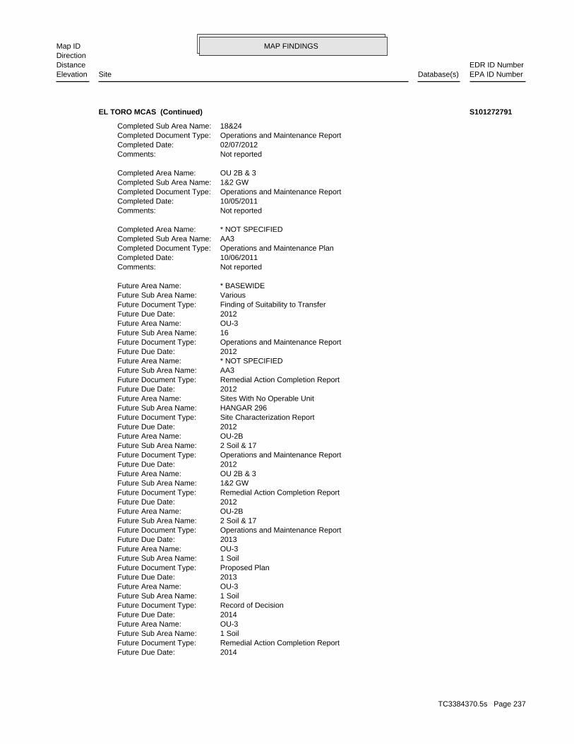
MAP FINDINGSMap IDDirection
EDR ID NumberDistanceEPA ID NumberDatabase(s)SiteElevation
2014Future Due Date: Remedial Action Completion ReportFuture Document Type: 1 SoilFuture Sub Area Name: OU-3Future Area Name: 2014Future Due Date: Record of DecisionFuture Document Type: 1 SoilFuture Sub Area Name: OU-3Future Area Name: 2013Future Due Date: Proposed PlanFuture Document Type: 1 SoilFuture Sub Area Name: OU-3Future Area Name: 2013Future Due Date: Operations and Maintenance ReportFuture Document Type: 2 Soil & 17Future Sub Area Name: OU-2BFuture Area Name: 2012Future Due Date: Remedial Action Completion ReportFuture Document Type: 1&2 GWFuture Sub Area Name: OU 2B & 3Future Area Name: 2012Future Due Date: Operations and Maintenance ReportFuture Document Type: 2 Soil & 17Future Sub Area Name: OU-2BFuture Area Name: 2012Future Due Date: Site Characterization ReportFuture Document Type: HANGAR 296Future Sub Area Name: Sites With No Operable UnitFuture Area Name: 2012Future Due Date: Remedial Action Completion ReportFuture Document Type: AA3Future Sub Area Name: * NOT SPECIFIEDFuture Area Name: 2012Future Due Date: Operations and Maintenance ReportFuture Document Type: 16Future Sub Area Name: OU-3Future Area Name: 2012Future Due Date: Finding of Suitability to TransferFuture Document Type: VariousFuture Sub Area Name: * BASEWIDEFuture Area Name:
Not reportedComments: 10/06/2011Completed Date: Operations and Maintenance PlanCompleted Document Type: AA3Completed Sub Area Name: * NOT SPECIFIEDCompleted Area Name:
Not reportedComments: 10/05/2011Completed Date: Operations and Maintenance ReportCompleted Document Type: 1&2 GWCompleted Sub Area Name: OU 2B & 3Completed Area Name:
Not reportedComments: 02/07/2012Completed Date: Operations and Maintenance ReportCompleted Document Type: 18&24Completed Sub Area Name:
EL TORO MCAS (Continued) S101272791
TC3384370.5s Page 237
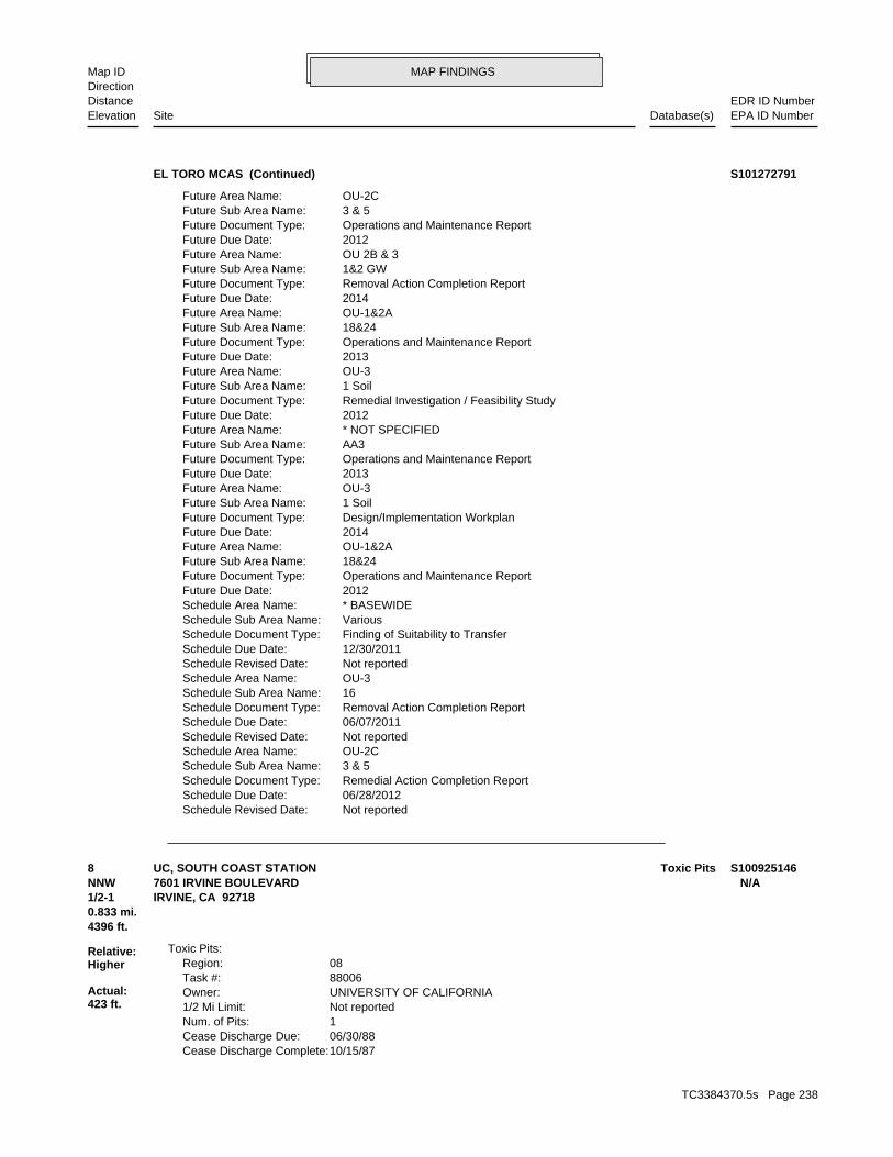
MAP FINDINGSMap IDDirection
EDR ID NumberDistanceEPA ID NumberDatabase(s)SiteElevation
Not reportedSchedule Revised Date: 06/28/2012Schedule Due Date: Remedial Action Completion ReportSchedule Document Type: 3 & 5Schedule Sub Area Name: OU-2CSchedule Area Name: Not reportedSchedule Revised Date: 06/07/2011Schedule Due Date: Removal Action Completion ReportSchedule Document Type: 16Schedule Sub Area Name: OU-3Schedule Area Name: Not reportedSchedule Revised Date: 12/30/2011Schedule Due Date: Finding of Suitability to TransferSchedule Document Type: VariousSchedule Sub Area Name: * BASEWIDESchedule Area Name: 2012Future Due Date: Operations and Maintenance ReportFuture Document Type: 18&24Future Sub Area Name: OU-1&2AFuture Area Name: 2014Future Due Date: Design/Implementation WorkplanFuture Document Type: 1 SoilFuture Sub Area Name: OU-3Future Area Name: 2013Future Due Date: Operations and Maintenance ReportFuture Document Type: AA3Future Sub Area Name: * NOT SPECIFIEDFuture Area Name: 2012Future Due Date: Remedial Investigation / Feasibility StudyFuture Document Type: 1 SoilFuture Sub Area Name: OU-3Future Area Name: 2013Future Due Date: Operations and Maintenance ReportFuture Document Type: 18&24Future Sub Area Name: OU-1&2AFuture Area Name: 2014Future Due Date: Removal Action Completion ReportFuture Document Type: 1&2 GWFuture Sub Area Name: OU 2B & 3Future Area Name: 2012Future Due Date: Operations and Maintenance ReportFuture Document Type: 3 & 5Future Sub Area Name: OU-2CFuture Area Name:
EL TORO MCAS (Continued) S101272791
10/15/87Cease Discharge Complete: 06/30/88Cease Discharge Due: 1Num. of Pits: Not reported1/2 Mi Limit: UNIVERSITY OF CALIFORNIAOwner: 88006Task #: 08Region:
Toxic Pits:
4396 ft.0.833 mi.
Relative:Higher
Actual:423 ft.
1/2-1 IRVINE, CA 92718NNW 7601 IRVINE BOULEVARD N/A8 Toxic PitsUC, SOUTH COAST STATION S100925146
TC3384370.5s Page 238
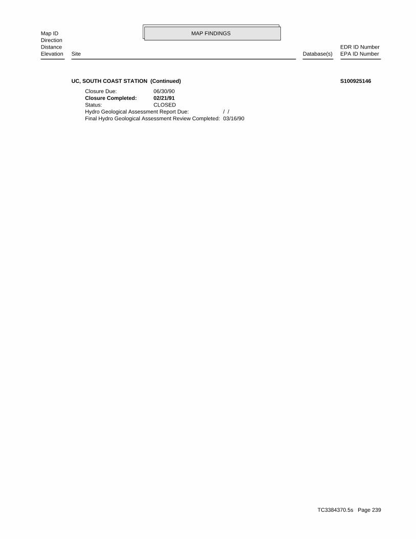
MAP FINDINGSMap IDDirection
EDR ID NumberDistanceEPA ID NumberDatabase(s)SiteElevation
03/16/90Final Hydro Geological Assessment Review Completed: / /Hydro Geological Assessment Report Due: CLOSEDStatus: 02/21/91Closure Completed: 06/30/90Closure Due:
UC, SOUTH COAST STATION (Continued) S100925146
TC3384370.5s Page 239
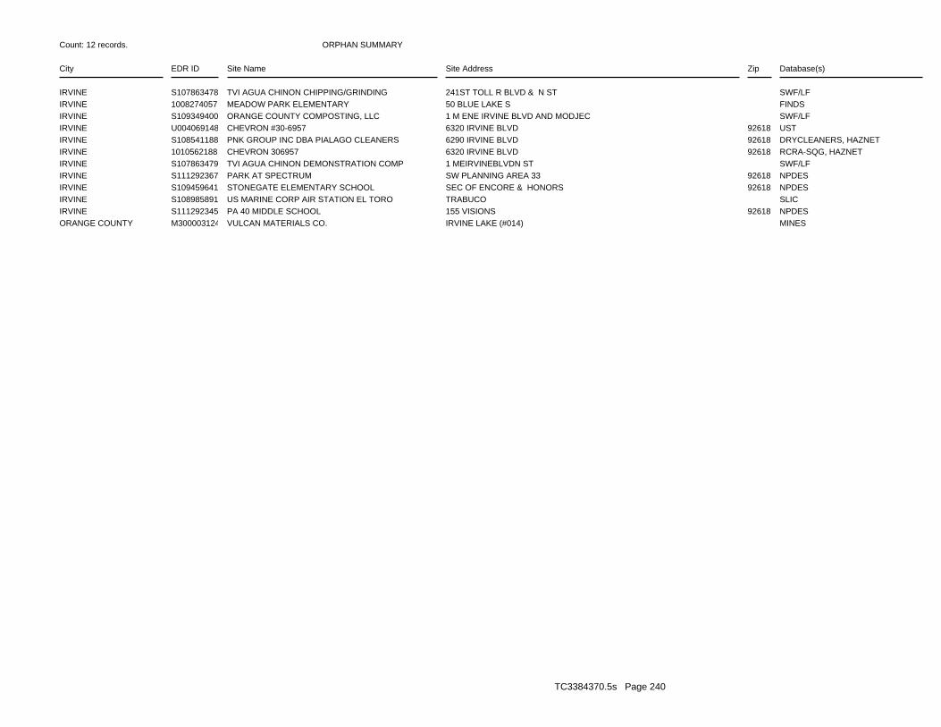
ORPHAN SUMMARY
City EDR ID Site Name Site Address Zip Database(s)
Count: 12 records.
IRVINE S107863478 TVI AGUA CHINON CHIPPING/GRINDING 241ST TOLL R BLVD & N ST SWF/LFIRVINE 1008274057 MEADOW PARK ELEMENTARY 50 BLUE LAKE S FINDSIRVINE S109349400 ORANGE COUNTY COMPOSTING, LLC 1 M ENE IRVINE BLVD AND MODJEC SWF/LFIRVINE U004069148 CHEVRON #30-6957 6320 IRVINE BLVD 92618 USTIRVINE S108541188 PNK GROUP INC DBA PIALAGO CLEANERS 6290 IRVINE BLVD 92618 DRYCLEANERS, HAZNETIRVINE 1010562188 CHEVRON 306957 6320 IRVINE BLVD 92618 RCRA-SQG, HAZNETIRVINE S107863479 TVI AGUA CHINON DEMONSTRATION COMP 1 MEIRVINEBLVDN ST SWF/LFIRVINE S111292367 PARK AT SPECTRUM SW PLANNING AREA 33 92618 NPDESIRVINE S109459641 STONEGATE ELEMENTARY SCHOOL SEC OF ENCORE & HONORS 92618 NPDESIRVINE S108985891 US MARINE CORP AIR STATION EL TORO TRABUCO SLICIRVINE S111292345 PA 40 MIDDLE SCHOOL 155 VISIONS 92618 NPDESORANGE COUNTY M300003124 VULCAN MATERIALS CO. IRVINE LAKE (#014) MINES
TC3384370.5s Page 240
To maintain currency of the following federal and state databases, EDR contacts the appropriate governmental agencyon a monthly or quarterly basis, as required.
Number of Days to Update: Provides confirmation that EDR is reporting records that have been updated within 90 daysfrom the date the government agency made the information available to the public.
STANDARD ENVIRONMENTAL RECORDS
Federal NPL site list
NPL: National Priority ListNational Priorities List (Superfund). The NPL is a subset of CERCLIS and identifies over 1,200 sites for prioritycleanup under the Superfund Program. NPL sites may encompass relatively large areas. As such, EDR provides polygoncoverage for over 1,000 NPL site boundaries produced by EPA’s Environmental Photographic Interpretation Center(EPIC) and regional EPA offices.
Date of Government Version: 05/08/2012Date Data Arrived at EDR: 05/10/2012Date Made Active in Reports: 05/15/2012Number of Days to Update: 5
Source: EPATelephone: N/ALast EDR Contact: 07/05/2012Next Scheduled EDR Contact: 10/22/2012Data Release Frequency: Quarterly
NPL Site Boundaries
Sources:
EPA’s Environmental Photographic Interpretation Center (EPIC)Telephone: 202-564-7333
EPA Region 1 EPA Region 6Telephone 617-918-1143 Telephone: 214-655-6659
EPA Region 3 EPA Region 7Telephone 215-814-5418 Telephone: 913-551-7247
EPA Region 4 EPA Region 8Telephone 404-562-8033 Telephone: 303-312-6774
EPA Region 5 EPA Region 9Telephone 312-886-6686 Telephone: 415-947-4246
EPA Region 10Telephone 206-553-8665
Proposed NPL: Proposed National Priority List SitesA site that has been proposed for listing on the National Priorities List through the issuance of a proposed rulein the Federal Register. EPA then accepts public comments on the site, responds to the comments, and places onthe NPL those sites that continue to meet the requirements for listing.
Date of Government Version: 03/30/2012Date Data Arrived at EDR: 04/05/2012Date Made Active in Reports: 05/15/2012Number of Days to Update: 40
Source: EPATelephone: N/ALast EDR Contact: 07/05/2012Next Scheduled EDR Contact: 10/22/2012Data Release Frequency: Quarterly
NPL LIENS: Federal Superfund LiensFederal Superfund Liens. Under the authority granted the USEPA by CERCLA of 1980, the USEPA has the authorityto file liens against real property in order to recover remedial action expenditures or when the property ownerreceived notification of potential liability. USEPA compiles a listing of filed notices of Superfund Liens.
Date of Government Version: 10/15/1991Date Data Arrived at EDR: 02/02/1994Date Made Active in Reports: 03/30/1994Number of Days to Update: 56
Source: EPATelephone: 202-564-4267Last EDR Contact: 08/15/2011Next Scheduled EDR Contact: 11/28/2011Data Release Frequency: No Update Planned
TC3384370.5s Page GR-1
GOVERNMENT RECORDS SEARCHED / DATA CURRENCY TRACKING
Federal Delisted NPL site list
DELISTED NPL: National Priority List DeletionsThe National Oil and Hazardous Substances Pollution Contingency Plan (NCP) establishes the criteria that theEPA uses to delete sites from the NPL. In accordance with 40 CFR 300.425.(e), sites may be deleted from theNPL where no further response is appropriate.
Date of Government Version: 03/30/2012Date Data Arrived at EDR: 04/05/2012Date Made Active in Reports: 05/15/2012Number of Days to Update: 40
Source: EPATelephone: N/ALast EDR Contact: 07/05/2012Next Scheduled EDR Contact: 10/22/2012Data Release Frequency: Quarterly
Federal CERCLIS list
CERCLIS: Comprehensive Environmental Response, Compensation, and Liability Information SystemCERCLIS contains data on potentially hazardous waste sites that have been reported to the USEPA by states, municipalities,private companies and private persons, pursuant to Section 103 of the Comprehensive Environmental Response, Compensation,and Liability Act (CERCLA). CERCLIS contains sites which are either proposed to or on the National PrioritiesList (NPL) and sites which are in the screening and assessment phase for possible inclusion on the NPL.
Date of Government Version: 12/27/2011Date Data Arrived at EDR: 02/27/2012Date Made Active in Reports: 03/12/2012Number of Days to Update: 14
Source: EPATelephone: 703-412-9810Last EDR Contact: 07/05/2012Next Scheduled EDR Contact: 09/10/2012Data Release Frequency: Quarterly
FEDERAL FACILITY: Federal Facility Site Information listingA listing of National Priority List (NPL) and Base Realignment and Closure (BRAC) sites found in the ComprehensiveEnvironmental Response, Compensation and Liability Information System (CERCLIS) Database where EPA Federal FacilitiesRestoration and Reuse Office is involved in cleanup activities.
Date of Government Version: 12/10/2010Date Data Arrived at EDR: 01/11/2011Date Made Active in Reports: 02/16/2011Number of Days to Update: 36
Source: Environmental Protection AgencyTelephone: 703-603-8704Last EDR Contact: 07/13/2012Next Scheduled EDR Contact: 10/22/2012Data Release Frequency: Varies
Federal CERCLIS NFRAP site List
CERCLIS-NFRAP: CERCLIS No Further Remedial Action PlannedArchived sites are sites that have been removed and archived from the inventory of CERCLIS sites. Archived statusindicates that, to the best of EPA’s knowledge, assessment at a site has been completed and that EPA has determinedno further steps will be taken to list this site on the National Priorities List (NPL), unless information indicatesthis decision was not appropriate or other considerations require a recommendation for listing at a later time.This decision does not necessarily mean that there is no hazard associated with a given site; it only means that,based upon available information, the location is not judged to be a potential NPL site.
Date of Government Version: 12/28/2011Date Data Arrived at EDR: 02/27/2012Date Made Active in Reports: 03/12/2012Number of Days to Update: 14
Source: EPATelephone: 703-412-9810Last EDR Contact: 07/05/2012Next Scheduled EDR Contact: 09/10/2012Data Release Frequency: Quarterly
Federal RCRA CORRACTS facilities list
CORRACTS: Corrective Action ReportCORRACTS identifies hazardous waste handlers with RCRA corrective action activity.
TC3384370.5s Page GR-2
GOVERNMENT RECORDS SEARCHED / DATA CURRENCY TRACKING
Date of Government Version: 08/19/2011Date Data Arrived at EDR: 08/31/2011Date Made Active in Reports: 01/10/2012Number of Days to Update: 132
Source: EPATelephone: 800-424-9346Last EDR Contact: 08/07/2012Next Scheduled EDR Contact: 11/26/2012Data Release Frequency: Quarterly
Federal RCRA non-CORRACTS TSD facilities list
RCRA-TSDF: RCRA - Treatment, Storage and DisposalRCRAInfo is EPA’s comprehensive information system, providing access to data supporting the Resource Conservationand Recovery Act (RCRA) of 1976 and the Hazardous and Solid Waste Amendments (HSWA) of 1984. The databaseincludes selective information on sites which generate, transport, store, treat and/or dispose of hazardous wasteas defined by the Resource Conservation and Recovery Act (RCRA). Transporters are individuals or entities thatmove hazardous waste from the generator offsite to a facility that can recycle, treat, store, or dispose of thewaste. TSDFs treat, store, or dispose of the waste.
Date of Government Version: 03/15/2012Date Data Arrived at EDR: 04/04/2012Date Made Active in Reports: 05/15/2012Number of Days to Update: 41
Source: Environmental Protection AgencyTelephone: (415) 495-8895Last EDR Contact: 07/02/2012Next Scheduled EDR Contact: 10/15/2012Data Release Frequency: Quarterly
Federal RCRA generators list
RCRA-LQG: RCRA - Large Quantity GeneratorsRCRAInfo is EPA’s comprehensive information system, providing access to data supporting the Resource Conservationand Recovery Act (RCRA) of 1976 and the Hazardous and Solid Waste Amendments (HSWA) of 1984. The databaseincludes selective information on sites which generate, transport, store, treat and/or dispose of hazardous wasteas defined by the Resource Conservation and Recovery Act (RCRA). Large quantity generators (LQGs) generateover 1,000 kilograms (kg) of hazardous waste, or over 1 kg of acutely hazardous waste per month.
Date of Government Version: 03/15/2012Date Data Arrived at EDR: 04/04/2012Date Made Active in Reports: 05/15/2012Number of Days to Update: 41
Source: Environmental Protection AgencyTelephone: (415) 495-8895Last EDR Contact: 07/02/2012Next Scheduled EDR Contact: 10/15/2012Data Release Frequency: Quarterly
RCRA-SQG: RCRA - Small Quantity GeneratorsRCRAInfo is EPA’s comprehensive information system, providing access to data supporting the Resource Conservationand Recovery Act (RCRA) of 1976 and the Hazardous and Solid Waste Amendments (HSWA) of 1984. The databaseincludes selective information on sites which generate, transport, store, treat and/or dispose of hazardous wasteas defined by the Resource Conservation and Recovery Act (RCRA). Small quantity generators (SQGs) generatebetween 100 kg and 1,000 kg of hazardous waste per month.
Date of Government Version: 03/15/2012Date Data Arrived at EDR: 04/04/2012Date Made Active in Reports: 05/15/2012Number of Days to Update: 41
Source: Environmental Protection AgencyTelephone: (415) 495-8895Last EDR Contact: 07/02/2012Next Scheduled EDR Contact: 10/15/2012Data Release Frequency: Quarterly
RCRA-CESQG: RCRA - Conditionally Exempt Small Quantity GeneratorsRCRAInfo is EPA’s comprehensive information system, providing access to data supporting the Resource Conservationand Recovery Act (RCRA) of 1976 and the Hazardous and Solid Waste Amendments (HSWA) of 1984. The databaseincludes selective information on sites which generate, transport, store, treat and/or dispose of hazardous wasteas defined by the Resource Conservation and Recovery Act (RCRA). Conditionally exempt small quantity generators(CESQGs) generate less than 100 kg of hazardous waste, or less than 1 kg of acutely hazardous waste per month.
Date of Government Version: 03/15/2012Date Data Arrived at EDR: 04/04/2012Date Made Active in Reports: 05/15/2012Number of Days to Update: 41
Source: Environmental Protection AgencyTelephone: (415) 495-8895Last EDR Contact: 07/02/2012Next Scheduled EDR Contact: 10/15/2012Data Release Frequency: Varies
TC3384370.5s Page GR-3
GOVERNMENT RECORDS SEARCHED / DATA CURRENCY TRACKING
Federal institutional controls / engineering controls registries
US ENG CONTROLS: Engineering Controls Sites ListA listing of sites with engineering controls in place. Engineering controls include various forms of caps, buildingfoundations, liners, and treatment methods to create pathway elimination for regulated substances to enter environmentalmedia or effect human health.
Date of Government Version: 12/30/2011Date Data Arrived at EDR: 12/30/2011Date Made Active in Reports: 01/10/2012Number of Days to Update: 11
Source: Environmental Protection AgencyTelephone: 703-603-0695Last EDR Contact: 06/11/2012Next Scheduled EDR Contact: 09/24/2012Data Release Frequency: Varies
US INST CONTROL: Sites with Institutional ControlsA listing of sites with institutional controls in place. Institutional controls include administrative measures,such as groundwater use restrictions, construction restrictions, property use restrictions, and post remediationcare requirements intended to prevent exposure to contaminants remaining on site. Deed restrictions are generallyrequired as part of the institutional controls.
Date of Government Version: 12/30/2011Date Data Arrived at EDR: 12/30/2011Date Made Active in Reports: 01/10/2012Number of Days to Update: 11
Source: Environmental Protection AgencyTelephone: 703-603-0695Last EDR Contact: 06/11/2012Next Scheduled EDR Contact: 09/24/2012Data Release Frequency: Varies
Federal ERNS list
ERNS: Emergency Response Notification SystemEmergency Response Notification System. ERNS records and stores information on reported releases of oil and hazardoussubstances.
Date of Government Version: 04/02/2012Date Data Arrived at EDR: 04/03/2012Date Made Active in Reports: 06/14/2012Number of Days to Update: 72
Source: National Response Center, United States Coast GuardTelephone: 202-267-2180Last EDR Contact: 07/02/2012Next Scheduled EDR Contact: 10/15/2012Data Release Frequency: Annually
State- and tribal - equivalent NPL
RESPONSE: State Response SitesIdentifies confirmed release sites where DTSC is involved in remediation, either in a lead or oversight capacity.These confirmed release sites are generally high-priority and high potential risk.
Date of Government Version: 06/13/2012Date Data Arrived at EDR: 06/14/2012Date Made Active in Reports: 07/06/2012Number of Days to Update: 22
Source: Department of Toxic Substances ControlTelephone: 916-323-3400Last EDR Contact: 08/07/2012Next Scheduled EDR Contact: 11/19/2012Data Release Frequency: Quarterly
State- and tribal - equivalent CERCLIS
ENVIROSTOR: EnviroStor DatabaseThe Department of Toxic Substances Control’s (DTSC’s) Site Mitigation and Brownfields Reuse Program’s (SMBRP’s)EnviroStor database identifes sites that have known contamination or sites for which there may be reasons to investigatefurther. The database includes the following site types: Federal Superfund sites (National Priorities List (NPL));State Response, including Military Facilities and State Superfund; Voluntary Cleanup; and School sites. EnviroStorprovides similar information to the information that was available in CalSites, and provides additional site information,including, but not limited to, identification of formerly-contaminated properties that have been released forreuse, properties where environmental deed restrictions have been recorded to prevent inappropriate land uses,and risk characterization information that is used to assess potential impacts to public health and the environmentat contaminated sites.
TC3384370.5s Page GR-4
GOVERNMENT RECORDS SEARCHED / DATA CURRENCY TRACKING
Date of Government Version: 06/13/2012Date Data Arrived at EDR: 06/14/2012Date Made Active in Reports: 07/06/2012Number of Days to Update: 22
Source: Department of Toxic Substances ControlTelephone: 916-323-3400Last EDR Contact: 08/07/2012Next Scheduled EDR Contact: 11/19/2012Data Release Frequency: Quarterly
State and tribal landfill and/or solid waste disposal site lists
SWF/LF (SWIS): Solid Waste Information SystemActive, Closed and Inactive Landfills. SWF/LF records typically contain an inve ntory of solid waste disposalfacilities or landfills. These may be active or i nactive facilities or open dumps that failed to meet RCRA Section4004 criteria for solid waste landfills or disposal sites.
Date of Government Version: 05/21/2012Date Data Arrived at EDR: 05/22/2012Date Made Active in Reports: 06/21/2012Number of Days to Update: 30
Source: Department of Resources Recycling and RecoveryTelephone: 916-341-6320Last EDR Contact: 05/22/2012Next Scheduled EDR Contact: 09/03/2012Data Release Frequency: Quarterly
State and tribal leaking storage tank lists
LUST: Geotracker’s Leaking Underground Fuel Tank ReportLeaking Underground Storage Tank Incident Reports. LUST records contain an inventory of reported leaking undergroundstorage tank incidents. Not all states maintain these records, and the information stored varies by state. Formore information on a particular leaking underground storage tank sites, please contact the appropriate regulatoryagency.
Date of Government Version: 06/14/2012Date Data Arrived at EDR: 06/14/2012Date Made Active in Reports: 06/21/2012Number of Days to Update: 7
Source: State Water Resources Control BoardTelephone: see region listLast EDR Contact: 07/19/2012Next Scheduled EDR Contact: 10/01/2012Data Release Frequency: Quarterly
LUST REG 2: Fuel Leak ListLeaking Underground Storage Tank locations. Alameda, Contra Costa, Marin, Napa, San Francisco, San Mateo, SantaClara, Solano, Sonoma counties.
Date of Government Version: 09/30/2004Date Data Arrived at EDR: 10/20/2004Date Made Active in Reports: 11/19/2004Number of Days to Update: 30
Source: California Regional Water Quality Control Board San Francisco Bay Region (2)Telephone: 510-622-2433Last EDR Contact: 09/19/2011Next Scheduled EDR Contact: 01/02/2012Data Release Frequency: Quarterly
LUST REG 6V: Leaking Underground Storage Tank Case ListingLeaking Underground Storage Tank locations. Inyo, Kern, Los Angeles, Mono, San Bernardino counties.
Date of Government Version: 06/07/2005Date Data Arrived at EDR: 06/07/2005Date Made Active in Reports: 06/29/2005Number of Days to Update: 22
Source: California Regional Water Quality Control Board Victorville Branch Office (6)Telephone: 760-241-7365Last EDR Contact: 09/12/2011Next Scheduled EDR Contact: 12/26/2011Data Release Frequency: No Update Planned
LUST REG 1: Active Toxic Site InvestigationDel Norte, Humboldt, Lake, Mendocino, Modoc, Siskiyou, Sonoma, Trinity counties. For more current information,please refer to the State Water Resources Control Board’s LUST database.
Date of Government Version: 02/01/2001Date Data Arrived at EDR: 02/28/2001Date Made Active in Reports: 03/29/2001Number of Days to Update: 29
Source: California Regional Water Quality Control Board North Coast (1)Telephone: 707-570-3769Last EDR Contact: 08/01/2011Next Scheduled EDR Contact: 11/14/2011Data Release Frequency: No Update Planned
TC3384370.5s Page GR-5
GOVERNMENT RECORDS SEARCHED / DATA CURRENCY TRACKING
LUST REG 8: Leaking Underground Storage TanksCalifornia Regional Water Quality Control Board Santa Ana Region (8). For more current information, please referto the State Water Resources Control Board’s LUST database.
Date of Government Version: 02/14/2005Date Data Arrived at EDR: 02/15/2005Date Made Active in Reports: 03/28/2005Number of Days to Update: 41
Source: California Regional Water Quality Control Board Santa Ana Region (8)Telephone: 909-782-4496Last EDR Contact: 08/15/2011Next Scheduled EDR Contact: 11/28/2011Data Release Frequency: Varies
LUST REG 7: Leaking Underground Storage Tank Case ListingLeaking Underground Storage Tank locations. Imperial, Riverside, San Diego, Santa Barbara counties.
Date of Government Version: 02/26/2004Date Data Arrived at EDR: 02/26/2004Date Made Active in Reports: 03/24/2004Number of Days to Update: 27
Source: California Regional Water Quality Control Board Colorado River Basin Region (7)Telephone: 760-776-8943Last EDR Contact: 08/01/2011Next Scheduled EDR Contact: 11/14/2011Data Release Frequency: No Update Planned
LUST REG 5: Leaking Underground Storage Tank DatabaseLeaking Underground Storage Tank locations. Alameda, Alpine, Amador, Butte, Colusa, Contra Costa, Calveras, ElDorado, Fresno, Glenn, Kern, Kings, Lake, Lassen, Madera, Mariposa, Merced, Modoc, Napa, Nevada, Placer, Plumas,Sacramento, San Joaquin, Shasta, Solano, Stanislaus, Sutter, Tehama, Tulare, Tuolumne, Yolo, Yuba counties.
Date of Government Version: 07/01/2008Date Data Arrived at EDR: 07/22/2008Date Made Active in Reports: 07/31/2008Number of Days to Update: 9
Source: California Regional Water Quality Control Board Central Valley Region (5)Telephone: 916-464-4834Last EDR Contact: 07/01/2011Next Scheduled EDR Contact: 10/17/2011Data Release Frequency: Quarterly
LUST REG 4: Underground Storage Tank Leak ListLos Angeles, Ventura counties. For more current information, please refer to the State Water Resources ControlBoard’s LUST database.
Date of Government Version: 09/07/2004Date Data Arrived at EDR: 09/07/2004Date Made Active in Reports: 10/12/2004Number of Days to Update: 35
Source: California Regional Water Quality Control Board Los Angeles Region (4)Telephone: 213-576-6710Last EDR Contact: 09/06/2011Next Scheduled EDR Contact: 12/19/2011Data Release Frequency: No Update Planned
LUST REG 6L: Leaking Underground Storage Tank Case ListingFor more current information, please refer to the State Water Resources Control Board’s LUST database.
Date of Government Version: 09/09/2003Date Data Arrived at EDR: 09/10/2003Date Made Active in Reports: 10/07/2003Number of Days to Update: 27
Source: California Regional Water Quality Control Board Lahontan Region (6)Telephone: 530-542-5572Last EDR Contact: 09/12/2011Next Scheduled EDR Contact: 12/26/2011Data Release Frequency: No Update Planned
LUST REG 3: Leaking Underground Storage Tank DatabaseLeaking Underground Storage Tank locations. Monterey, San Benito, San Luis Obispo, Santa Barbara, Santa Cruz counties.
Date of Government Version: 05/19/2003Date Data Arrived at EDR: 05/19/2003Date Made Active in Reports: 06/02/2003Number of Days to Update: 14
Source: California Regional Water Quality Control Board Central Coast Region (3)Telephone: 805-542-4786Last EDR Contact: 07/18/2011Next Scheduled EDR Contact: 10/31/2011Data Release Frequency: No Update Planned
LUST REG 9: Leaking Underground Storage Tank ReportOrange, Riverside, San Diego counties. For more current information, please refer to the State Water ResourcesControl Board’s LUST database.
TC3384370.5s Page GR-6
GOVERNMENT RECORDS SEARCHED / DATA CURRENCY TRACKING
Date of Government Version: 03/01/2001Date Data Arrived at EDR: 04/23/2001Date Made Active in Reports: 05/21/2001Number of Days to Update: 28
Source: California Regional Water Quality Control Board San Diego Region (9)Telephone: 858-637-5595Last EDR Contact: 09/26/2011Next Scheduled EDR Contact: 01/09/2012Data Release Frequency: No Update Planned
SLIC: Statewide SLIC CasesThe SLIC (Spills, Leaks, Investigations and Cleanup) program is designed to protect and restore water qualityfrom spills, leaks, and similar discharges.
Date of Government Version: 06/14/2012Date Data Arrived at EDR: 06/14/2012Date Made Active in Reports: 06/21/2012Number of Days to Update: 7
Source: State Water Resources Control BoardTelephone: 866-480-1028Last EDR Contact: 07/19/2012Next Scheduled EDR Contact: 10/01/2012Data Release Frequency: Varies
SLIC REG 1: Active Toxic Site InvestigationsThe SLIC (Spills, Leaks, Investigations and Cleanup) program is designed to protect and restore water qualityfrom spills, leaks, and similar discharges.
Date of Government Version: 04/03/2003Date Data Arrived at EDR: 04/07/2003Date Made Active in Reports: 04/25/2003Number of Days to Update: 18
Source: California Regional Water Quality Control Board, North Coast Region (1)Telephone: 707-576-2220Last EDR Contact: 08/01/2011Next Scheduled EDR Contact: 11/14/2011Data Release Frequency: No Update Planned
SLIC REG 2: Spills, Leaks, Investigation & Cleanup Cost Recovery ListingThe SLIC (Spills, Leaks, Investigations and Cleanup) program is designed to protect and restore water qualityfrom spills, leaks, and similar discharges.
Date of Government Version: 09/30/2004Date Data Arrived at EDR: 10/20/2004Date Made Active in Reports: 11/19/2004Number of Days to Update: 30
Source: Regional Water Quality Control Board San Francisco Bay Region (2)Telephone: 510-286-0457Last EDR Contact: 09/19/2011Next Scheduled EDR Contact: 01/02/2012Data Release Frequency: Quarterly
SLIC REG 3: Spills, Leaks, Investigation & Cleanup Cost Recovery ListingThe SLIC (Spills, Leaks, Investigations and Cleanup) program is designed to protect and restore water qualityfrom spills, leaks, and similar discharges.
Date of Government Version: 05/18/2006Date Data Arrived at EDR: 05/18/2006Date Made Active in Reports: 06/15/2006Number of Days to Update: 28
Source: California Regional Water Quality Control Board Central Coast Region (3)Telephone: 805-549-3147Last EDR Contact: 07/18/2011Next Scheduled EDR Contact: 10/31/2011Data Release Frequency: Semi-Annually
SLIC REG 4: Spills, Leaks, Investigation & Cleanup Cost Recovery ListingThe SLIC (Spills, Leaks, Investigations and Cleanup) program is designed to protect and restore water qualityfrom spills, leaks, and similar discharges.
Date of Government Version: 11/17/2004Date Data Arrived at EDR: 11/18/2004Date Made Active in Reports: 01/04/2005Number of Days to Update: 47
Source: Region Water Quality Control Board Los Angeles Region (4)Telephone: 213-576-6600Last EDR Contact: 07/01/2011Next Scheduled EDR Contact: 10/17/2011Data Release Frequency: Varies
SLIC REG 5: Spills, Leaks, Investigation & Cleanup Cost Recovery ListingThe SLIC (Spills, Leaks, Investigations and Cleanup) program is designed to protect and restore water qualityfrom spills, leaks, and similar discharges.
TC3384370.5s Page GR-7
GOVERNMENT RECORDS SEARCHED / DATA CURRENCY TRACKING
Date of Government Version: 04/01/2005Date Data Arrived at EDR: 04/05/2005Date Made Active in Reports: 04/21/2005Number of Days to Update: 16
Source: Regional Water Quality Control Board Central Valley Region (5)Telephone: 916-464-3291Last EDR Contact: 09/12/2011Next Scheduled EDR Contact: 12/26/2011Data Release Frequency: Semi-Annually
SLIC REG 6V: Spills, Leaks, Investigation & Cleanup Cost Recovery ListingThe SLIC (Spills, Leaks, Investigations and Cleanup) program is designed to protect and restore water qualityfrom spills, leaks, and similar discharges.
Date of Government Version: 05/24/2005Date Data Arrived at EDR: 05/25/2005Date Made Active in Reports: 06/16/2005Number of Days to Update: 22
Source: Regional Water Quality Control Board, Victorville BranchTelephone: 619-241-6583Last EDR Contact: 08/15/2011Next Scheduled EDR Contact: 11/28/2011Data Release Frequency: Semi-Annually
SLIC REG 6L: SLIC SitesThe SLIC (Spills, Leaks, Investigations and Cleanup) program is designed to protect and restore water qualityfrom spills, leaks, and similar discharges.
Date of Government Version: 09/07/2004Date Data Arrived at EDR: 09/07/2004Date Made Active in Reports: 10/12/2004Number of Days to Update: 35
Source: California Regional Water Quality Control Board, Lahontan RegionTelephone: 530-542-5574Last EDR Contact: 08/15/2011Next Scheduled EDR Contact: 11/28/2011Data Release Frequency: No Update Planned
SLIC REG 7: SLIC ListThe SLIC (Spills, Leaks, Investigations and Cleanup) program is designed to protect and restore water qualityfrom spills, leaks, and similar discharges.
Date of Government Version: 11/24/2004Date Data Arrived at EDR: 11/29/2004Date Made Active in Reports: 01/04/2005Number of Days to Update: 36
Source: California Regional Quality Control Board, Colorado River Basin RegionTelephone: 760-346-7491Last EDR Contact: 08/01/2011Next Scheduled EDR Contact: 11/14/2011Data Release Frequency: No Update Planned
SLIC REG 8: Spills, Leaks, Investigation & Cleanup Cost Recovery ListingThe SLIC (Spills, Leaks, Investigations and Cleanup) program is designed to protect and restore water qualityfrom spills, leaks, and similar discharges.
Date of Government Version: 04/03/2008Date Data Arrived at EDR: 04/03/2008Date Made Active in Reports: 04/14/2008Number of Days to Update: 11
Source: California Region Water Quality Control Board Santa Ana Region (8)Telephone: 951-782-3298Last EDR Contact: 09/12/2011Next Scheduled EDR Contact: 12/26/2011Data Release Frequency: Semi-Annually
SLIC REG 9: Spills, Leaks, Investigation & Cleanup Cost Recovery ListingThe SLIC (Spills, Leaks, Investigations and Cleanup) program is designed to protect and restore water qualityfrom spills, leaks, and similar discharges.
Date of Government Version: 09/10/2007Date Data Arrived at EDR: 09/11/2007Date Made Active in Reports: 09/28/2007Number of Days to Update: 17
Source: California Regional Water Quality Control Board San Diego Region (9)Telephone: 858-467-2980Last EDR Contact: 08/08/2011Next Scheduled EDR Contact: 11/21/2011Data Release Frequency: Annually
INDIAN LUST R8: Leaking Underground Storage Tanks on Indian LandLUSTs on Indian land in Colorado, Montana, North Dakota, South Dakota, Utah and Wyoming.
TC3384370.5s Page GR-8
GOVERNMENT RECORDS SEARCHED / DATA CURRENCY TRACKING
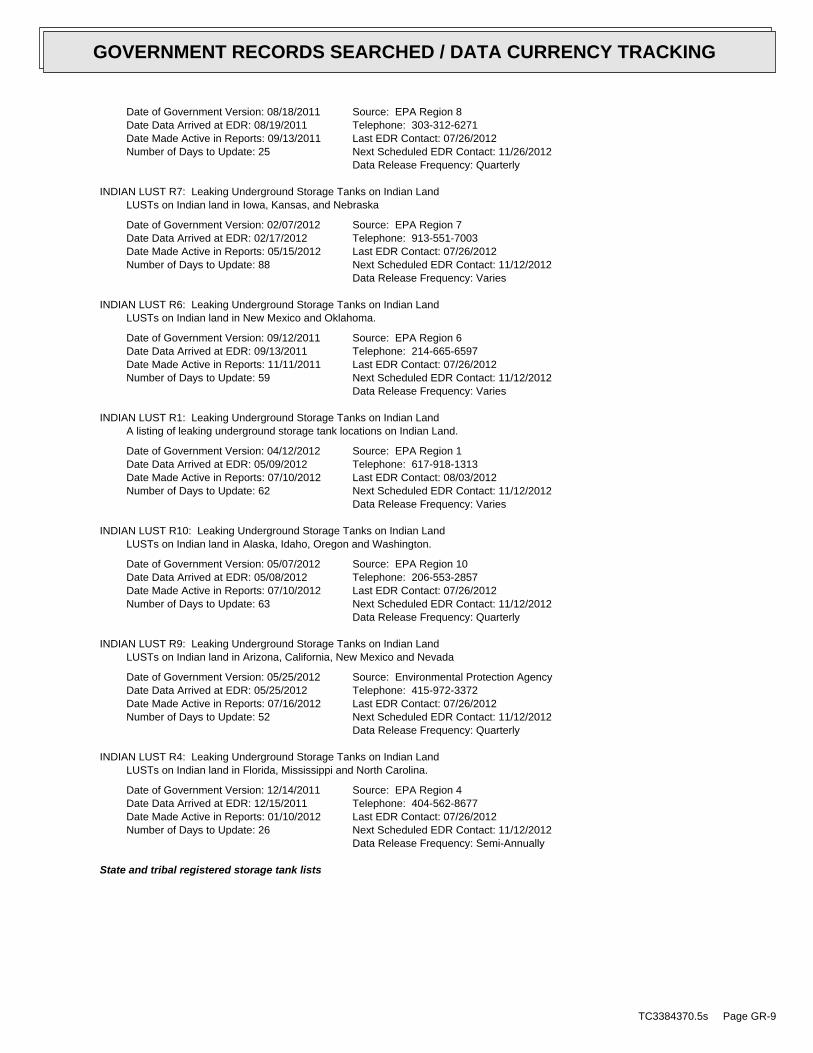
Date of Government Version: 08/18/2011Date Data Arrived at EDR: 08/19/2011Date Made Active in Reports: 09/13/2011Number of Days to Update: 25
Source: EPA Region 8Telephone: 303-312-6271Last EDR Contact: 07/26/2012Next Scheduled EDR Contact: 11/26/2012Data Release Frequency: Quarterly
INDIAN LUST R7: Leaking Underground Storage Tanks on Indian LandLUSTs on Indian land in Iowa, Kansas, and Nebraska
Date of Government Version: 02/07/2012Date Data Arrived at EDR: 02/17/2012Date Made Active in Reports: 05/15/2012Number of Days to Update: 88
Source: EPA Region 7Telephone: 913-551-7003Last EDR Contact: 07/26/2012Next Scheduled EDR Contact: 11/12/2012Data Release Frequency: Varies
INDIAN LUST R6: Leaking Underground Storage Tanks on Indian LandLUSTs on Indian land in New Mexico and Oklahoma.
Date of Government Version: 09/12/2011Date Data Arrived at EDR: 09/13/2011Date Made Active in Reports: 11/11/2011Number of Days to Update: 59
Source: EPA Region 6Telephone: 214-665-6597Last EDR Contact: 07/26/2012Next Scheduled EDR Contact: 11/12/2012Data Release Frequency: Varies
INDIAN LUST R1: Leaking Underground Storage Tanks on Indian LandA listing of leaking underground storage tank locations on Indian Land.
Date of Government Version: 04/12/2012Date Data Arrived at EDR: 05/09/2012Date Made Active in Reports: 07/10/2012Number of Days to Update: 62
Source: EPA Region 1Telephone: 617-918-1313Last EDR Contact: 08/03/2012Next Scheduled EDR Contact: 11/12/2012Data Release Frequency: Varies
INDIAN LUST R10: Leaking Underground Storage Tanks on Indian LandLUSTs on Indian land in Alaska, Idaho, Oregon and Washington.
Date of Government Version: 05/07/2012Date Data Arrived at EDR: 05/08/2012Date Made Active in Reports: 07/10/2012Number of Days to Update: 63
Source: EPA Region 10Telephone: 206-553-2857Last EDR Contact: 07/26/2012Next Scheduled EDR Contact: 11/12/2012Data Release Frequency: Quarterly
INDIAN LUST R9: Leaking Underground Storage Tanks on Indian LandLUSTs on Indian land in Arizona, California, New Mexico and Nevada
Date of Government Version: 05/25/2012Date Data Arrived at EDR: 05/25/2012Date Made Active in Reports: 07/16/2012Number of Days to Update: 52
Source: Environmental Protection AgencyTelephone: 415-972-3372Last EDR Contact: 07/26/2012Next Scheduled EDR Contact: 11/12/2012Data Release Frequency: Quarterly
INDIAN LUST R4: Leaking Underground Storage Tanks on Indian LandLUSTs on Indian land in Florida, Mississippi and North Carolina.
Date of Government Version: 12/14/2011Date Data Arrived at EDR: 12/15/2011Date Made Active in Reports: 01/10/2012Number of Days to Update: 26
Source: EPA Region 4Telephone: 404-562-8677Last EDR Contact: 07/26/2012Next Scheduled EDR Contact: 11/12/2012Data Release Frequency: Semi-Annually
State and tribal registered storage tank lists
TC3384370.5s Page GR-9
GOVERNMENT RECORDS SEARCHED / DATA CURRENCY TRACKING
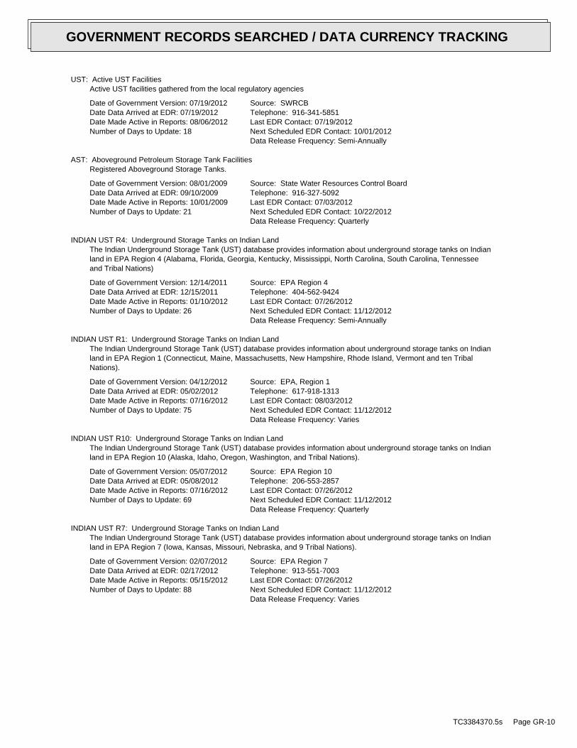
UST: Active UST FacilitiesActive UST facilities gathered from the local regulatory agencies
Date of Government Version: 07/19/2012Date Data Arrived at EDR: 07/19/2012Date Made Active in Reports: 08/06/2012Number of Days to Update: 18
Source: SWRCBTelephone: 916-341-5851Last EDR Contact: 07/19/2012Next Scheduled EDR Contact: 10/01/2012Data Release Frequency: Semi-Annually
AST: Aboveground Petroleum Storage Tank FacilitiesRegistered Aboveground Storage Tanks.
Date of Government Version: 08/01/2009Date Data Arrived at EDR: 09/10/2009Date Made Active in Reports: 10/01/2009Number of Days to Update: 21
Source: State Water Resources Control BoardTelephone: 916-327-5092Last EDR Contact: 07/03/2012Next Scheduled EDR Contact: 10/22/2012Data Release Frequency: Quarterly
INDIAN UST R4: Underground Storage Tanks on Indian LandThe Indian Underground Storage Tank (UST) database provides information about underground storage tanks on Indianland in EPA Region 4 (Alabama, Florida, Georgia, Kentucky, Mississippi, North Carolina, South Carolina, Tennesseeand Tribal Nations)
Date of Government Version: 12/14/2011Date Data Arrived at EDR: 12/15/2011Date Made Active in Reports: 01/10/2012Number of Days to Update: 26
Source: EPA Region 4Telephone: 404-562-9424Last EDR Contact: 07/26/2012Next Scheduled EDR Contact: 11/12/2012Data Release Frequency: Semi-Annually
INDIAN UST R1: Underground Storage Tanks on Indian LandThe Indian Underground Storage Tank (UST) database provides information about underground storage tanks on Indianland in EPA Region 1 (Connecticut, Maine, Massachusetts, New Hampshire, Rhode Island, Vermont and ten TribalNations).
Date of Government Version: 04/12/2012Date Data Arrived at EDR: 05/02/2012Date Made Active in Reports: 07/16/2012Number of Days to Update: 75
Source: EPA, Region 1Telephone: 617-918-1313Last EDR Contact: 08/03/2012Next Scheduled EDR Contact: 11/12/2012Data Release Frequency: Varies
INDIAN UST R10: Underground Storage Tanks on Indian LandThe Indian Underground Storage Tank (UST) database provides information about underground storage tanks on Indianland in EPA Region 10 (Alaska, Idaho, Oregon, Washington, and Tribal Nations).
Date of Government Version: 05/07/2012Date Data Arrived at EDR: 05/08/2012Date Made Active in Reports: 07/16/2012Number of Days to Update: 69
Source: EPA Region 10Telephone: 206-553-2857Last EDR Contact: 07/26/2012Next Scheduled EDR Contact: 11/12/2012Data Release Frequency: Quarterly
INDIAN UST R7: Underground Storage Tanks on Indian LandThe Indian Underground Storage Tank (UST) database provides information about underground storage tanks on Indianland in EPA Region 7 (Iowa, Kansas, Missouri, Nebraska, and 9 Tribal Nations).
Date of Government Version: 02/07/2012Date Data Arrived at EDR: 02/17/2012Date Made Active in Reports: 05/15/2012Number of Days to Update: 88
Source: EPA Region 7Telephone: 913-551-7003Last EDR Contact: 07/26/2012Next Scheduled EDR Contact: 11/12/2012Data Release Frequency: Varies
TC3384370.5s Page GR-10
GOVERNMENT RECORDS SEARCHED / DATA CURRENCY TRACKING
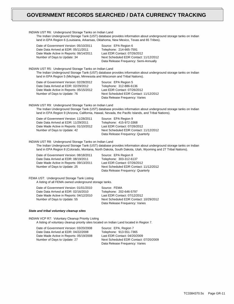
INDIAN UST R6: Underground Storage Tanks on Indian LandThe Indian Underground Storage Tank (UST) database provides information about underground storage tanks on Indianland in EPA Region 6 (Louisiana, Arkansas, Oklahoma, New Mexico, Texas and 65 Tribes).
Date of Government Version: 05/10/2011Date Data Arrived at EDR: 05/11/2011Date Made Active in Reports: 06/14/2011Number of Days to Update: 34
Source: EPA Region 6Telephone: 214-665-7591Last EDR Contact: 07/26/2012Next Scheduled EDR Contact: 11/12/2012Data Release Frequency: Semi-Annually
INDIAN UST R5: Underground Storage Tanks on Indian LandThe Indian Underground Storage Tank (UST) database provides information about underground storage tanks on Indianland in EPA Region 5 (Michigan, Minnesota and Wisconsin and Tribal Nations).
Date of Government Version: 02/28/2012Date Data Arrived at EDR: 02/29/2012Date Made Active in Reports: 05/15/2012Number of Days to Update: 76
Source: EPA Region 5Telephone: 312-886-6136Last EDR Contact: 07/26/2012Next Scheduled EDR Contact: 11/12/2012Data Release Frequency: Varies
INDIAN UST R9: Underground Storage Tanks on Indian LandThe Indian Underground Storage Tank (UST) database provides information about underground storage tanks on Indianland in EPA Region 9 (Arizona, California, Hawaii, Nevada, the Pacific Islands, and Tribal Nations).
Date of Government Version: 11/28/2011Date Data Arrived at EDR: 11/29/2011Date Made Active in Reports: 01/10/2012Number of Days to Update: 42
Source: EPA Region 9Telephone: 415-972-3368Last EDR Contact: 07/26/2012Next Scheduled EDR Contact: 11/12/2012Data Release Frequency: Quarterly
INDIAN UST R8: Underground Storage Tanks on Indian LandThe Indian Underground Storage Tank (UST) database provides information about underground storage tanks on Indianland in EPA Region 8 (Colorado, Montana, North Dakota, South Dakota, Utah, Wyoming and 27 Tribal Nations).
Date of Government Version: 08/18/2011Date Data Arrived at EDR: 08/19/2011Date Made Active in Reports: 09/13/2011Number of Days to Update: 25
Source: EPA Region 8Telephone: 303-312-6137Last EDR Contact: 07/26/2012Next Scheduled EDR Contact: 11/12/2012Data Release Frequency: Quarterly
FEMA UST: Underground Storage Tank ListingA listing of all FEMA owned underground storage tanks.
Date of Government Version: 01/01/2010Date Data Arrived at EDR: 02/16/2010Date Made Active in Reports: 04/12/2010Number of Days to Update: 55
Source: FEMATelephone: 202-646-5797Last EDR Contact: 07/12/2012Next Scheduled EDR Contact: 10/29/2012Data Release Frequency: Varies
State and tribal voluntary cleanup sites
INDIAN VCP R7: Voluntary Cleanup Priority LisitngA listing of voluntary cleanup priority sites located on Indian Land located in Region 7.
Date of Government Version: 03/20/2008Date Data Arrived at EDR: 04/22/2008Date Made Active in Reports: 05/19/2008Number of Days to Update: 27
Source: EPA, Region 7Telephone: 913-551-7365Last EDR Contact: 04/20/2009Next Scheduled EDR Contact: 07/20/2009Data Release Frequency: Varies
TC3384370.5s Page GR-11
GOVERNMENT RECORDS SEARCHED / DATA CURRENCY TRACKING
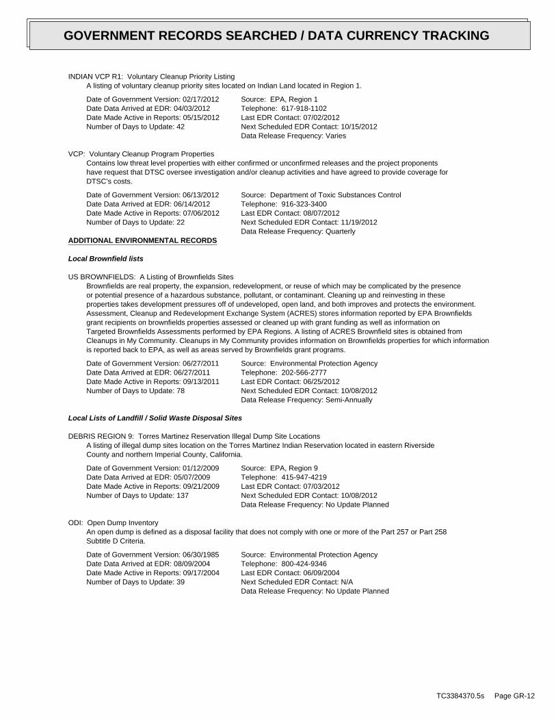
INDIAN VCP R1: Voluntary Cleanup Priority ListingA listing of voluntary cleanup priority sites located on Indian Land located in Region 1.
Date of Government Version: 02/17/2012Date Data Arrived at EDR: 04/03/2012Date Made Active in Reports: 05/15/2012Number of Days to Update: 42
Source: EPA, Region 1Telephone: 617-918-1102Last EDR Contact: 07/02/2012Next Scheduled EDR Contact: 10/15/2012Data Release Frequency: Varies
VCP: Voluntary Cleanup Program PropertiesContains low threat level properties with either confirmed or unconfirmed releases and the project proponentshave request that DTSC oversee investigation and/or cleanup activities and have agreed to provide coverage forDTSC’s costs.
Date of Government Version: 06/13/2012Date Data Arrived at EDR: 06/14/2012Date Made Active in Reports: 07/06/2012Number of Days to Update: 22
Source: Department of Toxic Substances ControlTelephone: 916-323-3400Last EDR Contact: 08/07/2012Next Scheduled EDR Contact: 11/19/2012Data Release Frequency: Quarterly
ADDITIONAL ENVIRONMENTAL RECORDS
Local Brownfield lists
US BROWNFIELDS: A Listing of Brownfields SitesBrownfields are real property, the expansion, redevelopment, or reuse of which may be complicated by the presenceor potential presence of a hazardous substance, pollutant, or contaminant. Cleaning up and reinvesting in theseproperties takes development pressures off of undeveloped, open land, and both improves and protects the environment.Assessment, Cleanup and Redevelopment Exchange System (ACRES) stores information reported by EPA Brownfieldsgrant recipients on brownfields properties assessed or cleaned up with grant funding as well as information onTargeted Brownfields Assessments performed by EPA Regions. A listing of ACRES Brownfield sites is obtained fromCleanups in My Community. Cleanups in My Community provides information on Brownfields properties for which informationis reported back to EPA, as well as areas served by Brownfields grant programs.
Date of Government Version: 06/27/2011Date Data Arrived at EDR: 06/27/2011Date Made Active in Reports: 09/13/2011Number of Days to Update: 78
Source: Environmental Protection AgencyTelephone: 202-566-2777Last EDR Contact: 06/25/2012Next Scheduled EDR Contact: 10/08/2012Data Release Frequency: Semi-Annually
Local Lists of Landfill / Solid Waste Disposal Sites
DEBRIS REGION 9: Torres Martinez Reservation Illegal Dump Site LocationsA listing of illegal dump sites location on the Torres Martinez Indian Reservation located in eastern RiversideCounty and northern Imperial County, California.
Date of Government Version: 01/12/2009Date Data Arrived at EDR: 05/07/2009Date Made Active in Reports: 09/21/2009Number of Days to Update: 137
Source: EPA, Region 9Telephone: 415-947-4219Last EDR Contact: 07/03/2012Next Scheduled EDR Contact: 10/08/2012Data Release Frequency: No Update Planned
ODI: Open Dump InventoryAn open dump is defined as a disposal facility that does not comply with one or more of the Part 257 or Part 258Subtitle D Criteria.
Date of Government Version: 06/30/1985Date Data Arrived at EDR: 08/09/2004Date Made Active in Reports: 09/17/2004Number of Days to Update: 39
Source: Environmental Protection AgencyTelephone: 800-424-9346Last EDR Contact: 06/09/2004Next Scheduled EDR Contact: N/AData Release Frequency: No Update Planned
TC3384370.5s Page GR-12
GOVERNMENT RECORDS SEARCHED / DATA CURRENCY TRACKING
WMUDS/SWAT: Waste Management Unit DatabaseWaste Management Unit Database System. WMUDS is used by the State Water Resources Control Board staff and theRegional Water Quality Control Boards for program tracking and inventory of waste management units. WMUDS is composedof the following databases: Facility Information, Scheduled Inspections Information, Waste Management Unit Information,SWAT Program Information, SWAT Report Summary Information, SWAT Report Summary Data, Chapter 15 (formerly Subchapter15) Information, Chapter 15 Monitoring Parameters, TPCA Program Information, RCRA Program Information, ClosureInformation, and Interested Parties Information.
Date of Government Version: 04/01/2000Date Data Arrived at EDR: 04/10/2000Date Made Active in Reports: 05/10/2000Number of Days to Update: 30
Source: State Water Resources Control BoardTelephone: 916-227-4448Last EDR Contact: 08/07/2012Next Scheduled EDR Contact: 11/26/2012Data Release Frequency: No Update Planned
SWRCY: Recycler DatabaseA listing of recycling facilities in California.
Date of Government Version: 06/11/2012Date Data Arrived at EDR: 06/14/2012Date Made Active in Reports: 07/06/2012Number of Days to Update: 22
Source: Department of ConservationTelephone: 916-323-3836Last EDR Contact: 06/14/2012Next Scheduled EDR Contact: 10/01/2012Data Release Frequency: Quarterly
HAULERS: Registered Waste Tire Haulers ListingA listing of registered waste tire haulers.
Date of Government Version: 05/10/2012Date Data Arrived at EDR: 05/10/2012Date Made Active in Reports: 05/25/2012Number of Days to Update: 15
Source: Integrated Waste Management BoardTelephone: 916-341-6422Last EDR Contact: 06/27/2012Next Scheduled EDR Contact: 09/03/2012Data Release Frequency: Varies
INDIAN ODI: Report on the Status of Open Dumps on Indian LandsLocation of open dumps on Indian land.
Date of Government Version: 12/31/1998Date Data Arrived at EDR: 12/03/2007Date Made Active in Reports: 01/24/2008Number of Days to Update: 52
Source: Environmental Protection AgencyTelephone: 703-308-8245Last EDR Contact: 08/03/2012Next Scheduled EDR Contact: 11/19/2012Data Release Frequency: Varies
Local Lists of Hazardous waste / Contaminated Sites
US CDL: Clandestine Drug LabsA listing of clandestine drug lab locations. The U.S. Department of Justice ("the Department") provides thisweb site as a public service. It contains addresses of some locations where law enforcement agencies reportedthey found chemicals or other items that indicated the presence of either clandestine drug laboratories or dumpsites.In most cases, the source of the entries is not the Department, and the Department has not verified the entryand does not guarantee its accuracy. Members of the public must verify the accuracy of all entries by, for example,contacting local law enforcement and local health departments.
Date of Government Version: 03/16/2012Date Data Arrived at EDR: 06/12/2012Date Made Active in Reports: 07/16/2012Number of Days to Update: 34
Source: Drug Enforcement AdministrationTelephone: 202-307-1000Last EDR Contact: 06/04/2012Next Scheduled EDR Contact: 09/17/2012Data Release Frequency: Quarterly
HIST CAL-SITES: Calsites DatabaseThe Calsites database contains potential or confirmed hazardous substance release properties. In 1996, CaliforniaEPA reevaluated and significantly reduced the number of sites in the Calsites database. No longer updated by thestate agency. It has been replaced by ENVIROSTOR.
TC3384370.5s Page GR-13
GOVERNMENT RECORDS SEARCHED / DATA CURRENCY TRACKING
Date of Government Version: 08/08/2005Date Data Arrived at EDR: 08/03/2006Date Made Active in Reports: 08/24/2006Number of Days to Update: 21
Source: Department of Toxic Substance ControlTelephone: 916-323-3400Last EDR Contact: 02/23/2009Next Scheduled EDR Contact: 05/25/2009Data Release Frequency: No Update Planned
SCH: School Property Evaluation ProgramThis category contains proposed and existing school sites that are being evaluated by DTSC for possible hazardousmaterials contamination. In some cases, these properties may be listed in the CalSites category depending on thelevel of threat to public health and safety or the environment they pose.
Date of Government Version: 06/13/2012Date Data Arrived at EDR: 06/14/2012Date Made Active in Reports: 07/06/2012Number of Days to Update: 22
Source: Department of Toxic Substances ControlTelephone: 916-323-3400Last EDR Contact: 08/07/2012Next Scheduled EDR Contact: 11/19/2012Data Release Frequency: Quarterly
TOXIC PITS: Toxic Pits Cleanup Act SitesToxic PITS Cleanup Act Sites. TOXIC PITS identifies sites suspected of containing hazardous substances where cleanuphas not yet been completed.
Date of Government Version: 07/01/1995Date Data Arrived at EDR: 08/30/1995Date Made Active in Reports: 09/26/1995Number of Days to Update: 27
Source: State Water Resources Control BoardTelephone: 916-227-4364Last EDR Contact: 01/26/2009Next Scheduled EDR Contact: 04/27/2009Data Release Frequency: No Update Planned
CDL: Clandestine Drug LabsA listing of drug lab locations. Listing of a location in this database does not indicate that any illegal druglab materials were or were not present there, and does not constitute a determination that the location eitherrequires or does not require additional cleanup work.
Date of Government Version: 12/31/2011Date Data Arrived at EDR: 02/14/2012Date Made Active in Reports: 02/21/2012Number of Days to Update: 7
Source: Department of Toxic Substances ControlTelephone: 916-255-6504Last EDR Contact: 08/06/2012Next Scheduled EDR Contact: 10/15/2012Data Release Frequency: Varies
US HIST CDL: National Clandestine Laboratory RegisterA listing of clandestine drug lab locations. The U.S. Department of Justice ("the Department") provides thisweb site as a public service. It contains addresses of some locations where law enforcement agencies reportedthey found chemicals or other items that indicated the presence of either clandestine drug laboratories or dumpsites.In most cases, the source of the entries is not the Department, and the Department has not verified the entryand does not guarantee its accuracy. Members of the public must verify the accuracy of all entries by, for example,contacting local law enforcement and local health departments.
Date of Government Version: 09/01/2007Date Data Arrived at EDR: 11/19/2008Date Made Active in Reports: 03/30/2009Number of Days to Update: 131
Source: Drug Enforcement AdministrationTelephone: 202-307-1000Last EDR Contact: 03/23/2009Next Scheduled EDR Contact: 06/22/2009Data Release Frequency: No Update Planned
Local Lists of Registered Storage Tanks
CA FID UST: Facility Inventory DatabaseThe Facility Inventory Database (FID) contains a historical listing of active and inactive underground storagetank locations from the State Water Resource Control Board. Refer to local/county source for current data.
Date of Government Version: 10/31/1994Date Data Arrived at EDR: 09/05/1995Date Made Active in Reports: 09/29/1995Number of Days to Update: 24
Source: California Environmental Protection AgencyTelephone: 916-341-5851Last EDR Contact: 12/28/1998Next Scheduled EDR Contact: N/AData Release Frequency: No Update Planned
TC3384370.5s Page GR-14
GOVERNMENT RECORDS SEARCHED / DATA CURRENCY TRACKING
UST MENDOCINO: Mendocino County UST DatabaseA listing of underground storage tank locations in Mendocino County.
Date of Government Version: 09/23/2009Date Data Arrived at EDR: 09/23/2009Date Made Active in Reports: 10/01/2009Number of Days to Update: 8
Source: Department of Public HealthTelephone: 707-463-4466Last EDR Contact: 06/04/2012Next Scheduled EDR Contact: 09/17/2012Data Release Frequency: Annually
HIST UST: Hazardous Substance Storage Container DatabaseThe Hazardous Substance Storage Container Database is a historical listing of UST sites. Refer to local/countysource for current data.
Date of Government Version: 10/15/1990Date Data Arrived at EDR: 01/25/1991Date Made Active in Reports: 02/12/1991Number of Days to Update: 18
Source: State Water Resources Control BoardTelephone: 916-341-5851Last EDR Contact: 07/26/2001Next Scheduled EDR Contact: N/AData Release Frequency: No Update Planned
SWEEPS UST: SWEEPS UST ListingStatewide Environmental Evaluation and Planning System. This underground storage tank listing was updated andmaintained by a company contacted by the SWRCB in the early 1990’s. The listing is no longer updated or maintained.The local agency is the contact for more information on a site on the SWEEPS list.
Date of Government Version: 06/01/1994Date Data Arrived at EDR: 07/07/2005Date Made Active in Reports: 08/11/2005Number of Days to Update: 35
Source: State Water Resources Control BoardTelephone: N/ALast EDR Contact: 06/03/2005Next Scheduled EDR Contact: N/AData Release Frequency: No Update Planned
Local Land Records
LIENS 2: CERCLA Lien InformationA Federal CERCLA (’Superfund’) lien can exist by operation of law at any site or property at which EPA has spentSuperfund monies. These monies are spent to investigate and address releases and threatened releases of contamination.CERCLIS provides information as to the identity of these sites and properties.
Date of Government Version: 02/16/2012Date Data Arrived at EDR: 03/26/2012Date Made Active in Reports: 06/14/2012Number of Days to Update: 80
Source: Environmental Protection AgencyTelephone: 202-564-6023Last EDR Contact: 07/27/2012Next Scheduled EDR Contact: 11/12/2012Data Release Frequency: Varies
LUCIS: Land Use Control Information SystemLUCIS contains records of land use control information pertaining to the former Navy Base Realignment and Closureproperties.
Date of Government Version: 12/09/2005Date Data Arrived at EDR: 12/11/2006Date Made Active in Reports: 01/11/2007Number of Days to Update: 31
Source: Department of the NavyTelephone: 843-820-7326Last EDR Contact: 05/21/2012Next Scheduled EDR Contact: 09/03/2012Data Release Frequency: Varies
LIENS: Environmental Liens ListingA listing of property locations with environmental liens for California where DTSC is a lien holder.
Date of Government Version: 03/12/2012Date Data Arrived at EDR: 03/13/2012Date Made Active in Reports: 04/02/2012Number of Days to Update: 20
Source: Department of Toxic Substances ControlTelephone: 916-323-3400Last EDR Contact: 06/25/2012Next Scheduled EDR Contact: 09/24/2012Data Release Frequency: Varies
TC3384370.5s Page GR-15
GOVERNMENT RECORDS SEARCHED / DATA CURRENCY TRACKING
DEED: Deed Restriction ListingSite Mitigation and Brownfields Reuse Program Facility Sites with Deed Restrictions & Hazardous Waste ManagementProgram Facility Sites with Deed / Land Use Restriction. The DTSC Site Mitigation and Brownfields Reuse Program(SMBRP) list includes sites cleaned up under the program’s oversight and generally does not include currentor former hazardous waste facilities that required a hazardous waste facility permit. The list represents deedrestrictions that are active. Some sites have multiple deed restrictions. The DTSC Hazardous Waste ManagementProgram (HWMP) has developed a list of current or former hazardous waste facilities that have a recorded landuse restriction at the local county recorder’s office. The land use restrictions on this list were required bythe DTSC HWMP as a result of the presence of hazardous substances that remain on site after the facility (orpart of the facility) has been closed or cleaned up. The types of land use restriction include deed notice, deedrestriction, or a land use restriction that binds current and future owners.
Date of Government Version: 06/11/2012Date Data Arrived at EDR: 06/12/2012Date Made Active in Reports: 07/06/2012Number of Days to Update: 24
Source: Department of Toxic Substances ControlTelephone: 916-323-3400Last EDR Contact: 06/12/2012Next Scheduled EDR Contact: 09/24/2012Data Release Frequency: Semi-Annually
Records of Emergency Release Reports
HMIRS: Hazardous Materials Information Reporting SystemHazardous Materials Incident Report System. HMIRS contains hazardous material spill incidents reported to DOT.
Date of Government Version: 04/01/2012Date Data Arrived at EDR: 04/03/2012Date Made Active in Reports: 06/14/2012Number of Days to Update: 72
Source: U.S. Department of TransportationTelephone: 202-366-4555Last EDR Contact: 07/02/2012Next Scheduled EDR Contact: 10/15/2012Data Release Frequency: Annually
CHMIRS: California Hazardous Material Incident Report SystemCalifornia Hazardous Material Incident Reporting System. CHMIRS contains information on reported hazardous materialincidents (accidental releases or spills).
Date of Government Version: 03/28/2012Date Data Arrived at EDR: 05/01/2012Date Made Active in Reports: 05/25/2012Number of Days to Update: 24
Source: Office of Emergency ServicesTelephone: 916-845-8400Last EDR Contact: 08/03/2012Next Scheduled EDR Contact: 11/12/2012Data Release Frequency: Varies
LDS: Land Disposal Sites ListingThe Land Disposal program regulates of waste discharge to land for treatment, storage and disposal in waste managementunits.
Date of Government Version: 06/14/2012Date Data Arrived at EDR: 06/14/2012Date Made Active in Reports: 07/06/2012Number of Days to Update: 22
Source: State Water Qualilty Control BoardTelephone: 866-480-1028Last EDR Contact: 07/19/2012Next Scheduled EDR Contact: 10/01/2012Data Release Frequency: Quarterly
MCS: Military Cleanup Sites ListingThe State Water Resources Control Board and nine Regional Water Quality Control Boards partner with the Departmentof Defense (DoD) through the Defense and State Memorandum of Agreement (DSMOA) to oversee the investigationand remediation of water quality issues at military facilities.
Date of Government Version: 06/14/2012Date Data Arrived at EDR: 06/14/2012Date Made Active in Reports: 07/06/2012Number of Days to Update: 22
Source: State Water Resources Control BoardTelephone: 866-480-1028Last EDR Contact: 07/19/2012Next Scheduled EDR Contact: 10/01/2012Data Release Frequency: Quarterly
Other Ascertainable Records
TC3384370.5s Page GR-16
GOVERNMENT RECORDS SEARCHED / DATA CURRENCY TRACKING
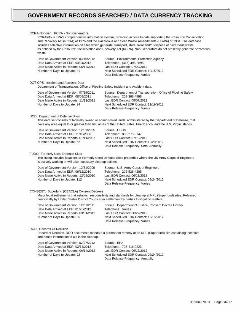
RCRA-NonGen: RCRA - Non GeneratorsRCRAInfo is EPA’s comprehensive information system, providing access to data supporting the Resource Conservationand Recovery Act (RCRA) of 1976 and the Hazardous and Solid Waste Amendments (HSWA) of 1984. The databaseincludes selective information on sites which generate, transport, store, treat and/or dispose of hazardous wasteas defined by the Resource Conservation and Recovery Act (RCRA). Non-Generators do not presently generate hazardouswaste.
Date of Government Version: 03/15/2012Date Data Arrived at EDR: 04/04/2012Date Made Active in Reports: 05/15/2012Number of Days to Update: 41
Source: Environmental Protection AgencyTelephone: (415) 495-8895Last EDR Contact: 07/02/2012Next Scheduled EDR Contact: 10/15/2012Data Release Frequency: Varies
DOT OPS: Incident and Accident DataDepartment of Transporation, Office of Pipeline Safety Incident and Accident data.
Date of Government Version: 07/29/2011Date Data Arrived at EDR: 08/09/2011Date Made Active in Reports: 11/11/2011Number of Days to Update: 94
Source: Department of Transporation, Office of Pipeline SafetyTelephone: 202-366-4595Last EDR Contact: 08/07/2012Next Scheduled EDR Contact: 11/19/2012Data Release Frequency: Varies
DOD: Department of Defense SitesThis data set consists of federally owned or administered lands, administered by the Department of Defense, thathave any area equal to or greater than 640 acres of the United States, Puerto Rico, and the U.S. Virgin Islands.
Date of Government Version: 12/31/2005Date Data Arrived at EDR: 11/10/2006Date Made Active in Reports: 01/11/2007Number of Days to Update: 62
Source: USGSTelephone: 888-275-8747Last EDR Contact: 07/19/2012Next Scheduled EDR Contact: 10/29/2012Data Release Frequency: Semi-Annually
FUDS: Formerly Used Defense SitesThe listing includes locations of Formerly Used Defense Sites properties where the US Army Corps of Engineersis actively working or will take necessary cleanup actions.
Date of Government Version: 12/31/2009Date Data Arrived at EDR: 08/12/2010Date Made Active in Reports: 12/02/2010Number of Days to Update: 112
Source: U.S. Army Corps of EngineersTelephone: 202-528-4285Last EDR Contact: 06/11/2012Next Scheduled EDR Contact: 09/24/2012Data Release Frequency: Varies
CONSENT: Superfund (CERCLA) Consent DecreesMajor legal settlements that establish responsibility and standards for cleanup at NPL (Superfund) sites. Releasedperiodically by United States District Courts after settlement by parties to litigation matters.
Date of Government Version: 12/01/2011Date Data Arrived at EDR: 01/25/2012Date Made Active in Reports: 03/01/2012Number of Days to Update: 36
Source: Department of Justice, Consent Decree LibraryTelephone: VariesLast EDR Contact: 06/27/2012Next Scheduled EDR Contact: 10/15/2012Data Release Frequency: Varies
ROD: Records Of DecisionRecord of Decision. ROD documents mandate a permanent remedy at an NPL (Superfund) site containing technicaland health information to aid in the cleanup.
Date of Government Version: 02/27/2012Date Data Arrived at EDR: 03/14/2012Date Made Active in Reports: 06/14/2012Number of Days to Update: 92
Source: EPATelephone: 703-416-0223Last EDR Contact: 06/13/2012Next Scheduled EDR Contact: 09/24/2012Data Release Frequency: Annually
TC3384370.5s Page GR-17
GOVERNMENT RECORDS SEARCHED / DATA CURRENCY TRACKING
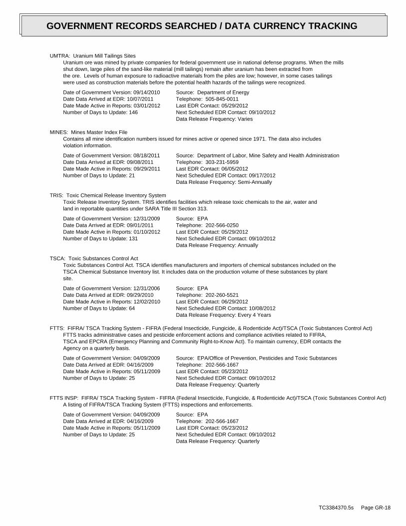
UMTRA: Uranium Mill Tailings SitesUranium ore was mined by private companies for federal government use in national defense programs. When the millsshut down, large piles of the sand-like material (mill tailings) remain after uranium has been extracted fromthe ore. Levels of human exposure to radioactive materials from the piles are low; however, in some cases tailingswere used as construction materials before the potential health hazards of the tailings were recognized.
Date of Government Version: 09/14/2010Date Data Arrived at EDR: 10/07/2011Date Made Active in Reports: 03/01/2012Number of Days to Update: 146
Source: Department of EnergyTelephone: 505-845-0011Last EDR Contact: 05/29/2012Next Scheduled EDR Contact: 09/10/2012Data Release Frequency: Varies
MINES: Mines Master Index FileContains all mine identification numbers issued for mines active or opened since 1971. The data also includesviolation information.
Date of Government Version: 08/18/2011Date Data Arrived at EDR: 09/08/2011Date Made Active in Reports: 09/29/2011Number of Days to Update: 21
Source: Department of Labor, Mine Safety and Health AdministrationTelephone: 303-231-5959Last EDR Contact: 06/05/2012Next Scheduled EDR Contact: 09/17/2012Data Release Frequency: Semi-Annually
TRIS: Toxic Chemical Release Inventory SystemToxic Release Inventory System. TRIS identifies facilities which release toxic chemicals to the air, water andland in reportable quantities under SARA Title III Section 313.
Date of Government Version: 12/31/2009Date Data Arrived at EDR: 09/01/2011Date Made Active in Reports: 01/10/2012Number of Days to Update: 131
Source: EPATelephone: 202-566-0250Last EDR Contact: 05/29/2012Next Scheduled EDR Contact: 09/10/2012Data Release Frequency: Annually
TSCA: Toxic Substances Control ActToxic Substances Control Act. TSCA identifies manufacturers and importers of chemical substances included on theTSCA Chemical Substance Inventory list. It includes data on the production volume of these substances by plantsite.
Date of Government Version: 12/31/2006Date Data Arrived at EDR: 09/29/2010Date Made Active in Reports: 12/02/2010Number of Days to Update: 64
Source: EPATelephone: 202-260-5521Last EDR Contact: 06/29/2012Next Scheduled EDR Contact: 10/08/2012Data Release Frequency: Every 4 Years
FTTS: FIFRA/ TSCA Tracking System - FIFRA (Federal Insecticide, Fungicide, & Rodenticide Act)/TSCA (Toxic Substances Control Act)FTTS tracks administrative cases and pesticide enforcement actions and compliance activities related to FIFRA,TSCA and EPCRA (Emergency Planning and Community Right-to-Know Act). To maintain currency, EDR contacts theAgency on a quarterly basis.
Date of Government Version: 04/09/2009Date Data Arrived at EDR: 04/16/2009Date Made Active in Reports: 05/11/2009Number of Days to Update: 25
Source: EPA/Office of Prevention, Pesticides and Toxic SubstancesTelephone: 202-566-1667Last EDR Contact: 05/23/2012Next Scheduled EDR Contact: 09/10/2012Data Release Frequency: Quarterly
FTTS INSP: FIFRA/ TSCA Tracking System - FIFRA (Federal Insecticide, Fungicide, & Rodenticide Act)/TSCA (Toxic Substances Control Act)A listing of FIFRA/TSCA Tracking System (FTTS) inspections and enforcements.
Date of Government Version: 04/09/2009Date Data Arrived at EDR: 04/16/2009Date Made Active in Reports: 05/11/2009Number of Days to Update: 25
Source: EPATelephone: 202-566-1667Last EDR Contact: 05/23/2012Next Scheduled EDR Contact: 09/10/2012Data Release Frequency: Quarterly
TC3384370.5s Page GR-18
GOVERNMENT RECORDS SEARCHED / DATA CURRENCY TRACKING
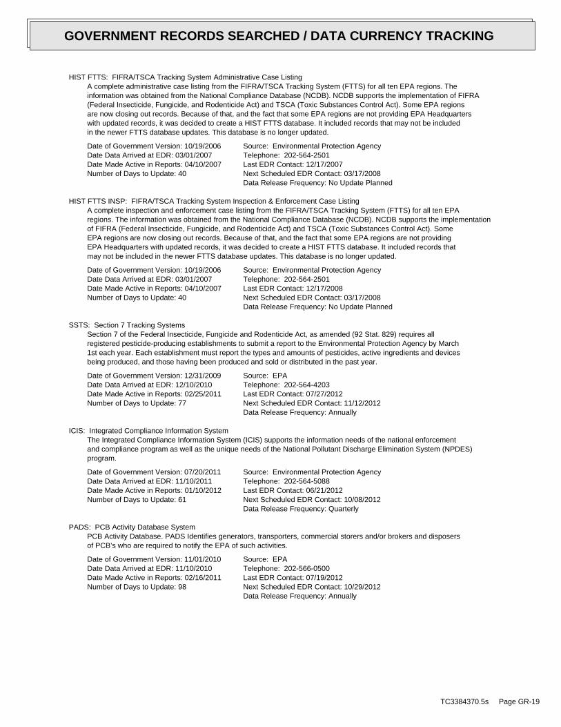
HIST FTTS: FIFRA/TSCA Tracking System Administrative Case ListingA complete administrative case listing from the FIFRA/TSCA Tracking System (FTTS) for all ten EPA regions. Theinformation was obtained from the National Compliance Database (NCDB). NCDB supports the implementation of FIFRA(Federal Insecticide, Fungicide, and Rodenticide Act) and TSCA (Toxic Substances Control Act). Some EPA regionsare now closing out records. Because of that, and the fact that some EPA regions are not providing EPA Headquarterswith updated records, it was decided to create a HIST FTTS database. It included records that may not be includedin the newer FTTS database updates. This database is no longer updated.
Date of Government Version: 10/19/2006Date Data Arrived at EDR: 03/01/2007Date Made Active in Reports: 04/10/2007Number of Days to Update: 40
Source: Environmental Protection AgencyTelephone: 202-564-2501Last EDR Contact: 12/17/2007Next Scheduled EDR Contact: 03/17/2008Data Release Frequency: No Update Planned
HIST FTTS INSP: FIFRA/TSCA Tracking System Inspection & Enforcement Case ListingA complete inspection and enforcement case listing from the FIFRA/TSCA Tracking System (FTTS) for all ten EPAregions. The information was obtained from the National Compliance Database (NCDB). NCDB supports the implementationof FIFRA (Federal Insecticide, Fungicide, and Rodenticide Act) and TSCA (Toxic Substances Control Act). SomeEPA regions are now closing out records. Because of that, and the fact that some EPA regions are not providingEPA Headquarters with updated records, it was decided to create a HIST FTTS database. It included records thatmay not be included in the newer FTTS database updates. This database is no longer updated.
Date of Government Version: 10/19/2006Date Data Arrived at EDR: 03/01/2007Date Made Active in Reports: 04/10/2007Number of Days to Update: 40
Source: Environmental Protection AgencyTelephone: 202-564-2501Last EDR Contact: 12/17/2008Next Scheduled EDR Contact: 03/17/2008Data Release Frequency: No Update Planned
SSTS: Section 7 Tracking SystemsSection 7 of the Federal Insecticide, Fungicide and Rodenticide Act, as amended (92 Stat. 829) requires allregistered pesticide-producing establishments to submit a report to the Environmental Protection Agency by March1st each year. Each establishment must report the types and amounts of pesticides, active ingredients and devicesbeing produced, and those having been produced and sold or distributed in the past year.
Date of Government Version: 12/31/2009Date Data Arrived at EDR: 12/10/2010Date Made Active in Reports: 02/25/2011Number of Days to Update: 77
Source: EPATelephone: 202-564-4203Last EDR Contact: 07/27/2012Next Scheduled EDR Contact: 11/12/2012Data Release Frequency: Annually
ICIS: Integrated Compliance Information SystemThe Integrated Compliance Information System (ICIS) supports the information needs of the national enforcementand compliance program as well as the unique needs of the National Pollutant Discharge Elimination System (NPDES)program.
Date of Government Version: 07/20/2011Date Data Arrived at EDR: 11/10/2011Date Made Active in Reports: 01/10/2012Number of Days to Update: 61
Source: Environmental Protection AgencyTelephone: 202-564-5088Last EDR Contact: 06/21/2012Next Scheduled EDR Contact: 10/08/2012Data Release Frequency: Quarterly
PADS: PCB Activity Database SystemPCB Activity Database. PADS Identifies generators, transporters, commercial storers and/or brokers and disposersof PCB’s who are required to notify the EPA of such activities.
Date of Government Version: 11/01/2010Date Data Arrived at EDR: 11/10/2010Date Made Active in Reports: 02/16/2011Number of Days to Update: 98
Source: EPATelephone: 202-566-0500Last EDR Contact: 07/19/2012Next Scheduled EDR Contact: 10/29/2012Data Release Frequency: Annually
TC3384370.5s Page GR-19
GOVERNMENT RECORDS SEARCHED / DATA CURRENCY TRACKING
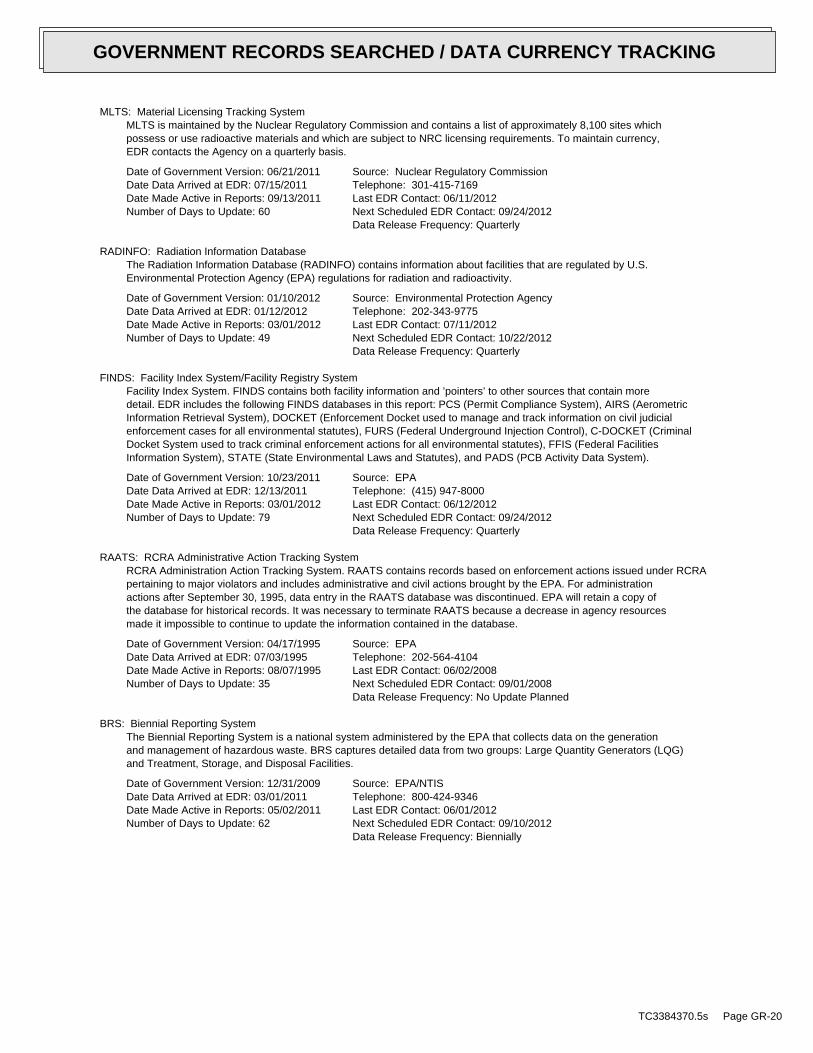
MLTS: Material Licensing Tracking SystemMLTS is maintained by the Nuclear Regulatory Commission and contains a list of approximately 8,100 sites whichpossess or use radioactive materials and which are subject to NRC licensing requirements. To maintain currency,EDR contacts the Agency on a quarterly basis.
Date of Government Version: 06/21/2011Date Data Arrived at EDR: 07/15/2011Date Made Active in Reports: 09/13/2011Number of Days to Update: 60
Source: Nuclear Regulatory CommissionTelephone: 301-415-7169Last EDR Contact: 06/11/2012Next Scheduled EDR Contact: 09/24/2012Data Release Frequency: Quarterly
RADINFO: Radiation Information DatabaseThe Radiation Information Database (RADINFO) contains information about facilities that are regulated by U.S.Environmental Protection Agency (EPA) regulations for radiation and radioactivity.
Date of Government Version: 01/10/2012Date Data Arrived at EDR: 01/12/2012Date Made Active in Reports: 03/01/2012Number of Days to Update: 49
Source: Environmental Protection AgencyTelephone: 202-343-9775Last EDR Contact: 07/11/2012Next Scheduled EDR Contact: 10/22/2012Data Release Frequency: Quarterly
FINDS: Facility Index System/Facility Registry SystemFacility Index System. FINDS contains both facility information and ’pointers’ to other sources that contain moredetail. EDR includes the following FINDS databases in this report: PCS (Permit Compliance System), AIRS (AerometricInformation Retrieval System), DOCKET (Enforcement Docket used to manage and track information on civil judicialenforcement cases for all environmental statutes), FURS (Federal Underground Injection Control), C-DOCKET (CriminalDocket System used to track criminal enforcement actions for all environmental statutes), FFIS (Federal FacilitiesInformation System), STATE (State Environmental Laws and Statutes), and PADS (PCB Activity Data System).
Date of Government Version: 10/23/2011Date Data Arrived at EDR: 12/13/2011Date Made Active in Reports: 03/01/2012Number of Days to Update: 79
Source: EPATelephone: (415) 947-8000Last EDR Contact: 06/12/2012Next Scheduled EDR Contact: 09/24/2012Data Release Frequency: Quarterly
RAATS: RCRA Administrative Action Tracking SystemRCRA Administration Action Tracking System. RAATS contains records based on enforcement actions issued under RCRApertaining to major violators and includes administrative and civil actions brought by the EPA. For administrationactions after September 30, 1995, data entry in the RAATS database was discontinued. EPA will retain a copy ofthe database for historical records. It was necessary to terminate RAATS because a decrease in agency resourcesmade it impossible to continue to update the information contained in the database.
Date of Government Version: 04/17/1995Date Data Arrived at EDR: 07/03/1995Date Made Active in Reports: 08/07/1995Number of Days to Update: 35
Source: EPATelephone: 202-564-4104Last EDR Contact: 06/02/2008Next Scheduled EDR Contact: 09/01/2008Data Release Frequency: No Update Planned
BRS: Biennial Reporting SystemThe Biennial Reporting System is a national system administered by the EPA that collects data on the generationand management of hazardous waste. BRS captures detailed data from two groups: Large Quantity Generators (LQG)and Treatment, Storage, and Disposal Facilities.
Date of Government Version: 12/31/2009Date Data Arrived at EDR: 03/01/2011Date Made Active in Reports: 05/02/2011Number of Days to Update: 62
Source: EPA/NTISTelephone: 800-424-9346Last EDR Contact: 06/01/2012Next Scheduled EDR Contact: 09/10/2012Data Release Frequency: Biennially
TC3384370.5s Page GR-20
GOVERNMENT RECORDS SEARCHED / DATA CURRENCY TRACKING
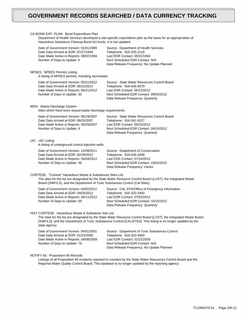
CA BOND EXP. PLAN: Bond Expenditure PlanDepartment of Health Services developed a site-specific expenditure plan as the basis for an appropriation ofHazardous Substance Cleanup Bond Act funds. It is not updated.
Date of Government Version: 01/01/1989Date Data Arrived at EDR: 07/27/1994Date Made Active in Reports: 08/02/1994Number of Days to Update: 6
Source: Department of Health ServicesTelephone: 916-255-2118Last EDR Contact: 05/31/1994Next Scheduled EDR Contact: N/AData Release Frequency: No Update Planned
NPDES: NPDES Permits ListingA listing of NPDES permits, including stormwater.
Date of Government Version: 05/21/2012Date Data Arrived at EDR: 05/22/2012Date Made Active in Reports: 06/21/2012Number of Days to Update: 30
Source: State Water Resources Control BoardTelephone: 916-445-9379Last EDR Contact: 05/22/2012Next Scheduled EDR Contact: 09/03/2012Data Release Frequency: Quarterly
WDS: Waste Discharge SystemSites which have been issued waste discharge requirements.
Date of Government Version: 06/19/2007Date Data Arrived at EDR: 06/20/2007Date Made Active in Reports: 06/29/2007Number of Days to Update: 9
Source: State Water Resources Control BoardTelephone: 916-341-5227Last EDR Contact: 05/23/2012Next Scheduled EDR Contact: 09/10/2012Data Release Frequency: Quarterly
UIC: UIC ListingA listing of underground control injection wells.
Date of Government Version: 12/09/2011Date Data Arrived at EDR: 02/29/2012Date Made Active in Reports: 04/04/2012Number of Days to Update: 35
Source: Deaprtment of ConservationTelephone: 916-445-2408Last EDR Contact: 07/24/2012Next Scheduled EDR Contact: 10/01/2012Data Release Frequency: Varies
CORTESE: "Cortese" Hazardous Waste & Substances Sites ListThe sites for the list are designated by the State Water Resource Control Board (LUST), the Integrated WasteBoard (SWF/LS), and the Department of Toxic Substances Control (Cal-Sites).
Date of Government Version: 04/02/2012Date Data Arrived at EDR: 04/03/2012Date Made Active in Reports: 06/11/2012Number of Days to Update: 69
Source: CAL EPA/Office of Emergency InformationTelephone: 916-323-3400Last EDR Contact: 07/02/2012Next Scheduled EDR Contact: 10/15/2012Data Release Frequency: Quarterly
HIST CORTESE: Hazardous Waste & Substance Site ListThe sites for the list are designated by the State Water Resource Control Board [LUST], the Integrated Waste Board[SWF/LS], and the Department of Toxic Substances Control [CALSITES]. This listing is no longer updated by thestate agency.
Date of Government Version: 04/01/2001Date Data Arrived at EDR: 01/22/2009Date Made Active in Reports: 04/08/2009Number of Days to Update: 76
Source: Department of Toxic Substances ControlTelephone: 916-323-3400Last EDR Contact: 01/22/2009Next Scheduled EDR Contact: N/AData Release Frequency: No Update Planned
NOTIFY 65: Proposition 65 RecordsListings of all Proposition 65 incidents reported to counties by the State Water Resources Control Board and theRegional Water Quality Control Board. This database is no longer updated by the reporting agency.
TC3384370.5s Page GR-21
GOVERNMENT RECORDS SEARCHED / DATA CURRENCY TRACKING
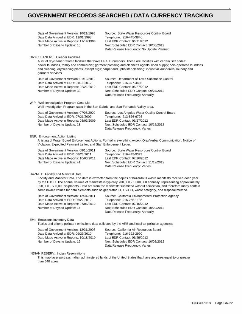
Date of Government Version: 10/21/1993Date Data Arrived at EDR: 11/01/1993Date Made Active in Reports: 11/19/1993Number of Days to Update: 18
Source: State Water Resources Control BoardTelephone: 916-445-3846Last EDR Contact: 06/21/2012Next Scheduled EDR Contact: 10/08/2012Data Release Frequency: No Update Planned
DRYCLEANERS: Cleaner FacilitiesA list of drycleaner related facilities that have EPA ID numbers. These are facilities with certain SIC codes:power laundries, family and commercial; garment pressing and cleaner’s agents; linen supply; coin-operated laundriesand cleaning; drycleaning plants, except rugs; carpet and upholster cleaning; industrial launderers; laundry andgarment services.
Date of Government Version: 01/19/2012Date Data Arrived at EDR: 01/19/2012Date Made Active in Reports: 02/21/2012Number of Days to Update: 33
Source: Department of Toxic Substance ControlTelephone: 916-327-4498Last EDR Contact: 06/27/2012Next Scheduled EDR Contact: 09/24/2012Data Release Frequency: Annually
WIP: Well Investigation Program Case ListWell Investigation Program case in the San Gabriel and San Fernando Valley area.
Date of Government Version: 07/03/2009Date Data Arrived at EDR: 07/21/2009Date Made Active in Reports: 08/03/2009Number of Days to Update: 13
Source: Los Angeles Water Quality Control BoardTelephone: 213-576-6726Last EDR Contact: 06/27/2012Next Scheduled EDR Contact: 10/15/2012Data Release Frequency: Varies
ENF: Enforcement Action ListingA listing of Water Board Enforcement Actions. Formal is everything except Oral/Verbal Communication, Notice ofViolation, Expedited Payment Letter, and Staff Enforcement Letter.
Date of Government Version: 08/15/2011Date Data Arrived at EDR: 08/23/2011Date Made Active in Reports: 10/03/2011Number of Days to Update: 41
Source: State Water Resoruces Control BoardTelephone: 916-445-9379Last EDR Contact: 07/26/2012Next Scheduled EDR Contact: 11/12/2012Data Release Frequency: Varies
HAZNET: Facility and Manifest DataFacility and Manifest Data. The data is extracted from the copies of hazardous waste manifests received each yearby the DTSC. The annual volume of manifests is typically 700,000 - 1,000,000 annually, representing approximately350,000 - 500,000 shipments. Data are from the manifests submitted without correction, and therefore many containsome invalid values for data elements such as generator ID, TSD ID, waste category, and disposal method.
Date of Government Version: 12/31/2011Date Data Arrived at EDR: 06/22/2012Date Made Active in Reports: 07/06/2012Number of Days to Update: 14
Source: California Environmental Protection AgencyTelephone: 916-255-1136Last EDR Contact: 07/16/2012Next Scheduled EDR Contact: 10/29/2012Data Release Frequency: Annually
EMI: Emissions Inventory DataToxics and criteria pollutant emissions data collected by the ARB and local air pollution agencies.
Date of Government Version: 12/31/2008Date Data Arrived at EDR: 09/29/2010Date Made Active in Reports: 10/18/2010Number of Days to Update: 19
Source: California Air Resources BoardTelephone: 916-322-2990Last EDR Contact: 06/29/2012Next Scheduled EDR Contact: 10/08/2012Data Release Frequency: Varies
INDIAN RESERV: Indian ReservationsThis map layer portrays Indian administered lands of the United States that have any area equal to or greaterthan 640 acres.
TC3384370.5s Page GR-22
GOVERNMENT RECORDS SEARCHED / DATA CURRENCY TRACKING
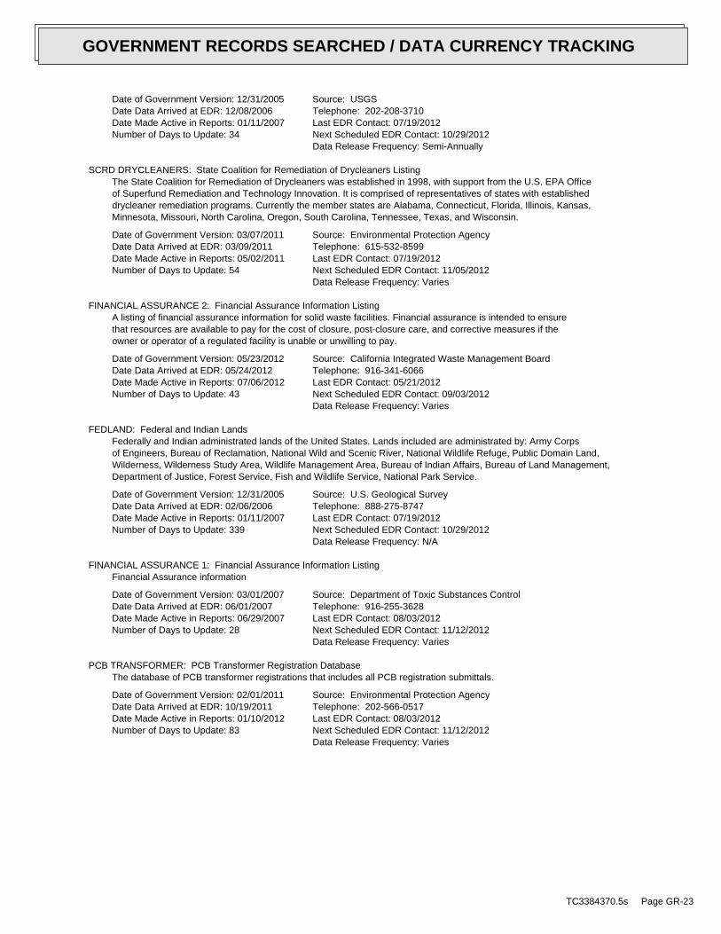
Date of Government Version: 12/31/2005Date Data Arrived at EDR: 12/08/2006Date Made Active in Reports: 01/11/2007Number of Days to Update: 34
Source: USGSTelephone: 202-208-3710Last EDR Contact: 07/19/2012Next Scheduled EDR Contact: 10/29/2012Data Release Frequency: Semi-Annually
SCRD DRYCLEANERS: State Coalition for Remediation of Drycleaners ListingThe State Coalition for Remediation of Drycleaners was established in 1998, with support from the U.S. EPA Officeof Superfund Remediation and Technology Innovation. It is comprised of representatives of states with establisheddrycleaner remediation programs. Currently the member states are Alabama, Connecticut, Florida, Illinois, Kansas,Minnesota, Missouri, North Carolina, Oregon, South Carolina, Tennessee, Texas, and Wisconsin.
Date of Government Version: 03/07/2011Date Data Arrived at EDR: 03/09/2011Date Made Active in Reports: 05/02/2011Number of Days to Update: 54
Source: Environmental Protection AgencyTelephone: 615-532-8599Last EDR Contact: 07/19/2012Next Scheduled EDR Contact: 11/05/2012Data Release Frequency: Varies
FINANCIAL ASSURANCE 2: Financial Assurance Information ListingA listing of financial assurance information for solid waste facilities. Financial assurance is intended to ensurethat resources are available to pay for the cost of closure, post-closure care, and corrective measures if theowner or operator of a regulated facility is unable or unwilling to pay.
Date of Government Version: 05/23/2012Date Data Arrived at EDR: 05/24/2012Date Made Active in Reports: 07/06/2012Number of Days to Update: 43
Source: California Integrated Waste Management BoardTelephone: 916-341-6066Last EDR Contact: 05/21/2012Next Scheduled EDR Contact: 09/03/2012Data Release Frequency: Varies
FEDLAND: Federal and Indian LandsFederally and Indian administrated lands of the United States. Lands included are administrated by: Army Corpsof Engineers, Bureau of Reclamation, National Wild and Scenic River, National Wildlife Refuge, Public Domain Land,Wilderness, Wilderness Study Area, Wildlife Management Area, Bureau of Indian Affairs, Bureau of Land Management,Department of Justice, Forest Service, Fish and Wildlife Service, National Park Service.
Date of Government Version: 12/31/2005Date Data Arrived at EDR: 02/06/2006Date Made Active in Reports: 01/11/2007Number of Days to Update: 339
Source: U.S. Geological SurveyTelephone: 888-275-8747Last EDR Contact: 07/19/2012Next Scheduled EDR Contact: 10/29/2012Data Release Frequency: N/A
FINANCIAL ASSURANCE 1: Financial Assurance Information ListingFinancial Assurance information
Date of Government Version: 03/01/2007Date Data Arrived at EDR: 06/01/2007Date Made Active in Reports: 06/29/2007Number of Days to Update: 28
Source: Department of Toxic Substances ControlTelephone: 916-255-3628Last EDR Contact: 08/03/2012Next Scheduled EDR Contact: 11/12/2012Data Release Frequency: Varies
PCB TRANSFORMER: PCB Transformer Registration DatabaseThe database of PCB transformer registrations that includes all PCB registration submittals.
Date of Government Version: 02/01/2011Date Data Arrived at EDR: 10/19/2011Date Made Active in Reports: 01/10/2012Number of Days to Update: 83
Source: Environmental Protection AgencyTelephone: 202-566-0517Last EDR Contact: 08/03/2012Next Scheduled EDR Contact: 11/12/2012Data Release Frequency: Varies
TC3384370.5s Page GR-23
GOVERNMENT RECORDS SEARCHED / DATA CURRENCY TRACKING
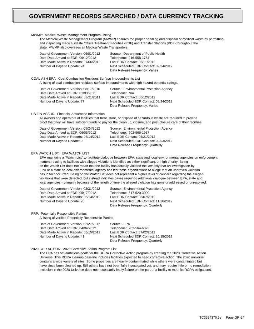
MWMP: Medical Waste Management Program ListingThe Medical Waste Management Program (MWMP) ensures the proper handling and disposal of medical waste by permittingand inspecting medical waste Offsite Treatment Facilities (PDF) and Transfer Stations (PDF) throughout thestate. MWMP also oversees all Medical Waste Transporters.
Date of Government Version: 06/01/2012Date Data Arrived at EDR: 06/12/2012Date Made Active in Reports: 07/06/2012Number of Days to Update: 24
Source: Department of Public HealthTelephone: 916-558-1784Last EDR Contact: 06/11/2012Next Scheduled EDR Contact: 09/24/2012Data Release Frequency: Varies
COAL ASH EPA: Coal Combustion Residues Surface Impoundments ListA listing of coal combustion residues surface impoundments with high hazard potential ratings.
Date of Government Version: 08/17/2010Date Data Arrived at EDR: 01/03/2011Date Made Active in Reports: 03/21/2011Number of Days to Update: 77
Source: Environmental Protection AgencyTelephone: N/ALast EDR Contact: 06/12/2012Next Scheduled EDR Contact: 09/24/2012Data Release Frequency: Varies
US FIN ASSUR: Financial Assurance InformationAll owners and operators of facilities that treat, store, or dispose of hazardous waste are required to provideproof that they will have sufficient funds to pay for the clean up, closure, and post-closure care of their facilities.
Date of Government Version: 05/24/2012Date Data Arrived at EDR: 06/05/2012Date Made Active in Reports: 06/14/2012Number of Days to Update: 9
Source: Environmental Protection AgencyTelephone: 202-566-1917Last EDR Contact: 05/21/2012Next Scheduled EDR Contact: 09/03/2012Data Release Frequency: Quarterly
EPA WATCH LIST: EPA WATCH LISTEPA maintains a "Watch List" to facilitate dialogue between EPA, state and local environmental agencies on enforcementmatters relating to facilities with alleged violations identified as either significant or high priority. Beingon the Watch List does not mean that the facility has actually violated the law only that an investigation byEPA or a state or local environmental agency has led those organizations to allege that an unproven violationhas in fact occurred. Being on the Watch List does not represent a higher level of concern regarding the allegedviolations that were detected, but instead indicates cases requiring additional dialogue between EPA, state andlocal agencies - primarily because of the length of time the alleged violation has gone unaddressed or unresolved.
Date of Government Version: 03/31/2012Date Data Arrived at EDR: 05/17/2012Date Made Active in Reports: 06/14/2012Number of Days to Update: 28
Source: Environmental Protection AgencyTelephone: 617-520-3000Last EDR Contact: 08/07/2012Next Scheduled EDR Contact: 11/26/2012Data Release Frequency: Quarterly
PRP: Potentially Responsible PartiesA listing of verified Potentially Responsible Parties
Date of Government Version: 02/27/2012Date Data Arrived at EDR: 04/04/2012Date Made Active in Reports: 05/15/2012Number of Days to Update: 41
Source: EPATelephone: 202-564-6023Last EDR Contact: 07/02/2012Next Scheduled EDR Contact: 10/15/2012Data Release Frequency: Quarterly
2020 COR ACTION: 2020 Corrective Action Program ListThe EPA has set ambitious goals for the RCRA Corrective Action program by creating the 2020 Corrective ActionUniverse. This RCRA cleanup baseline includes facilities expected to need corrective action. The 2020 universecontains a wide variety of sites. Some properties are heavily contaminated while others were contaminated buthave since been cleaned up. Still others have not been fully investigated yet, and may require little or no remediation.Inclusion in the 2020 Universe does not necessarily imply failure on the part of a facility to meet its RCRA obligations.
TC3384370.5s Page GR-24
GOVERNMENT RECORDS SEARCHED / DATA CURRENCY TRACKING
Date of Government Version: 11/11/2011Date Data Arrived at EDR: 05/18/2012Date Made Active in Reports: 05/25/2012Number of Days to Update: 7
Source: Environmental Protection AgencyTelephone: 703-308-4044Last EDR Contact: 05/18/2012Next Scheduled EDR Contact: 08/27/2012Data Release Frequency: Varies
COAL ASH DOE: Sleam-Electric Plan Operation DataA listing of power plants that store ash in surface ponds.
Date of Government Version: 12/31/2005Date Data Arrived at EDR: 08/07/2009Date Made Active in Reports: 10/22/2009Number of Days to Update: 76
Source: Department of EnergyTelephone: 202-586-8719Last EDR Contact: 07/16/2012Next Scheduled EDR Contact: 10/29/2012Data Release Frequency: Varies
HWP: EnviroStor Permitted Facilities ListingDetailed information on permitted hazardous waste facilities and corrective action ("cleanups") tracked in EnviroStor.
Date of Government Version: 05/31/2012Date Data Arrived at EDR: 06/01/2012Date Made Active in Reports: 07/31/2012Number of Days to Update: 60
Source: Department of Toxic Substances ControlTelephone: 916-323-3400Last EDR Contact: 06/01/2012Next Scheduled EDR Contact: 09/10/2012Data Release Frequency: Quarterly
HWT: Registered Hazardous Waste Transporter DatabaseA listing of hazardous waste transporters. In California, unless specifically exempted, it is unlawful for anyperson to transport hazardous wastes unless the person holds a valid registration issued by DTSC. A hazardouswaste transporter registration is valid for one year and is assigned a unique registration number.
Date of Government Version: 04/11/2012Date Data Arrived at EDR: 04/12/2012Date Made Active in Reports: 05/08/2012Number of Days to Update: 26
Source: Department of Toxic Substances ControlTelephone: 916-440-7145Last EDR Contact: 07/17/2012Next Scheduled EDR Contact: 10/29/2012Data Release Frequency: Quarterly
PROC: Certified Processors DatabaseA listing of certified processors.
Date of Government Version: 06/11/2012Date Data Arrived at EDR: 06/14/2012Date Made Active in Reports: 07/06/2012Number of Days to Update: 22
Source: Department of ConservationTelephone: 916-323-3836Last EDR Contact: 06/14/2012Next Scheduled EDR Contact: 10/01/2012Data Release Frequency: Quarterly
EDR PROPRIETARY RECORDS
EDR Proprietary Records
Manufactured Gas Plants: EDR Proprietary Manufactured Gas PlantsThe EDR Proprietary Manufactured Gas Plant Database includes records of coal gas plants (manufactured gas plants)compiled by EDR’s researchers. Manufactured gas sites were used in the United States from the 1800’s to 1950’sto produce a gas that could be distributed and used as fuel. These plants used whale oil, rosin, coal, or a mixtureof coal, oil, and water that also produced a significant amount of waste. Many of the byproducts of the gas production,such as coal tar (oily waste containing volatile and non-volatile chemicals), sludges, oils and other compoundsare potentially hazardous to human health and the environment. The byproduct from this process was frequentlydisposed of directly at the plant site and can remain or spread slowly, serving as a continuous source of soiland groundwater contamination.
Date of Government Version: N/ADate Data Arrived at EDR: N/ADate Made Active in Reports: N/ANumber of Days to Update: N/A
Source: EDR, Inc.Telephone: N/ALast EDR Contact: N/ANext Scheduled EDR Contact: N/AData Release Frequency: No Update Planned
TC3384370.5s Page GR-25
GOVERNMENT RECORDS SEARCHED / DATA CURRENCY TRACKING
EDR Historical Auto Stations: EDR Proprietary Historic Gas StationsEDR has searched selected national collections of business directories and has collected listings of potentialgas station/filling station/service station sites that were available to EDR researchers. EDR’s review was limitedto those categories of sources that might, in EDR’s opinion, include gas station/filling station/service stationestablishments. The categories reviewed included, but were not limited to gas, gas station, gasoline station,filling station, auto, automobile repair, auto service station, service station, etc.
Date of Government Version: N/ADate Data Arrived at EDR: N/ADate Made Active in Reports: N/ANumber of Days to Update: N/A
Source: EDR, Inc.Telephone: N/ALast EDR Contact: N/ANext Scheduled EDR Contact: N/AData Release Frequency: Varies
EDR Historical Cleaners: EDR Proprietary Historic Dry CleanersEDR has searched selected national collections of business directories and has collected listings of potentialdry cleaner sites that were available to EDR researchers. EDR’s review was limited to those categories of sourcesthat might, in EDR’s opinion, include dry cleaning establishments. The categories reviewed included, but werenot limited to dry cleaners, cleaners, laundry, laundromat, cleaning/laundry, wash & dry etc.
Date of Government Version: N/ADate Data Arrived at EDR: N/ADate Made Active in Reports: N/ANumber of Days to Update: N/A
Source: EDR, Inc.Telephone: N/ALast EDR Contact: N/ANext Scheduled EDR Contact: N/AData Release Frequency: Varies
COUNTY RECORDS
ALAMEDA COUNTY:
Contaminated SitesA listing of contaminated sites overseen by the Toxic Release Program (oil and groundwater contamination fromchemical releases and spills) and the Leaking Underground Storage Tank Program (soil and ground water contaminationfrom leaking petroleum USTs).
Date of Government Version: 04/03/2012Date Data Arrived at EDR: 04/04/2012Date Made Active in Reports: 05/08/2012Number of Days to Update: 34
Source: Alameda County Environmental Health ServicesTelephone: 510-567-6700Last EDR Contact: 06/27/2012Next Scheduled EDR Contact: 10/15/2012Data Release Frequency: Semi-Annually
Underground TanksUnderground storage tank sites located in Alameda county.
Date of Government Version: 04/03/2012Date Data Arrived at EDR: 04/04/2012Date Made Active in Reports: 05/08/2012Number of Days to Update: 34
Source: Alameda County Environmental Health ServicesTelephone: 510-567-6700Last EDR Contact: 06/27/2012Next Scheduled EDR Contact: 10/15/2012Data Release Frequency: Semi-Annually
CONTRA COSTA COUNTY:
Site ListList includes sites from the underground tank, hazardous waste generator and business plan/2185 programs.
Date of Government Version: 06/13/2012Date Data Arrived at EDR: 06/14/2012Date Made Active in Reports: 07/06/2012Number of Days to Update: 22
Source: Contra Costa Health Services DepartmentTelephone: 925-646-2286Last EDR Contact: 08/06/2012Next Scheduled EDR Contact: 11/19/2012Data Release Frequency: Semi-Annually
KERN COUNTY:
TC3384370.5s Page GR-26
GOVERNMENT RECORDS SEARCHED / DATA CURRENCY TRACKING
Underground Storage Tank Sites & Tank ListingKern County Sites and Tanks Listing.
Date of Government Version: 08/31/2010Date Data Arrived at EDR: 09/01/2010Date Made Active in Reports: 09/30/2010Number of Days to Update: 29
Source: Kern County Environment Health Services DepartmentTelephone: 661-862-8700Last EDR Contact: 06/15/2012Next Scheduled EDR Contact: 08/27/2012Data Release Frequency: Quarterly
LOS ANGELES COUNTY:
San Gabriel Valley Areas of ConcernSan Gabriel Valley areas where VOC contamination is at or above the MCL as designated by region 9 EPA office.
Date of Government Version: 03/30/2009Date Data Arrived at EDR: 03/31/2009Date Made Active in Reports: 10/23/2009Number of Days to Update: 206
Source: EPA Region 9Telephone: 415-972-3178Last EDR Contact: 06/21/2012Next Scheduled EDR Contact: 10/09/2012Data Release Frequency: No Update Planned
HMS: Street Number ListIndustrial Waste and Underground Storage Tank Sites.
Date of Government Version: 03/29/2012Date Data Arrived at EDR: 05/29/2012Date Made Active in Reports: 06/21/2012Number of Days to Update: 23
Source: Department of Public WorksTelephone: 626-458-3517Last EDR Contact: 07/16/2012Next Scheduled EDR Contact: 10/26/2012Data Release Frequency: Semi-Annually
List of Solid Waste FacilitiesSolid Waste Facilities in Los Angeles County.
Date of Government Version: 04/23/2012Date Data Arrived at EDR: 04/24/2012Date Made Active in Reports: 05/25/2012Number of Days to Update: 31
Source: La County Department of Public WorksTelephone: 818-458-5185Last EDR Contact: 07/26/2012Next Scheduled EDR Contact: 11/05/2012Data Release Frequency: Varies
City of Los Angeles LandfillsLandfills owned and maintained by the City of Los Angeles.
Date of Government Version: 03/05/2009Date Data Arrived at EDR: 03/10/2009Date Made Active in Reports: 04/08/2009Number of Days to Update: 29
Source: Engineering & Construction DivisionTelephone: 213-473-7869Last EDR Contact: 05/21/2012Next Scheduled EDR Contact: 09/03/2012Data Release Frequency: Varies
Site Mitigation ListIndustrial sites that have had some sort of spill or complaint.
Date of Government Version: 12/29/2011Date Data Arrived at EDR: 02/02/2012Date Made Active in Reports: 02/21/2012Number of Days to Update: 19
Source: Community Health ServicesTelephone: 323-890-7806Last EDR Contact: 07/17/2012Next Scheduled EDR Contact: 11/05/2012Data Release Frequency: Annually
City of El Segundo Underground Storage TankUnderground storage tank sites located in El Segundo city.
TC3384370.5s Page GR-27
GOVERNMENT RECORDS SEARCHED / DATA CURRENCY TRACKING
Date of Government Version: 04/26/2012Date Data Arrived at EDR: 05/01/2012Date Made Active in Reports: 05/24/2012Number of Days to Update: 23
Source: City of El Segundo Fire DepartmentTelephone: 310-524-2236Last EDR Contact: 07/17/2012Next Scheduled EDR Contact: 11/05/2012Data Release Frequency: Semi-Annually
City of Long Beach Underground Storage TankUnderground storage tank sites located in the city of Long Beach.
Date of Government Version: 03/28/2003Date Data Arrived at EDR: 10/23/2003Date Made Active in Reports: 11/26/2003Number of Days to Update: 34
Source: City of Long Beach Fire DepartmentTelephone: 562-570-2563Last EDR Contact: 07/26/2012Next Scheduled EDR Contact: 11/12/2012Data Release Frequency: Annually
City of Torrance Underground Storage TankUnderground storage tank sites located in the city of Torrance.
Date of Government Version: 07/12/2012Date Data Arrived at EDR: 07/23/2012Date Made Active in Reports: 08/02/2012Number of Days to Update: 10
Source: City of Torrance Fire DepartmentTelephone: 310-618-2973Last EDR Contact: 07/12/2012Next Scheduled EDR Contact: 10/29/2012Data Release Frequency: Semi-Annually
MARIN COUNTY:
Underground Storage Tank SitesCurrently permitted USTs in Marin County.
Date of Government Version: 05/22/2012Date Data Arrived at EDR: 05/29/2012Date Made Active in Reports: 07/06/2012Number of Days to Update: 38
Source: Public Works Department Waste ManagementTelephone: 415-499-6647Last EDR Contact: 07/23/2012Next Scheduled EDR Contact: 10/22/2012Data Release Frequency: Semi-Annually
NAPA COUNTY:
Sites With Reported ContaminationA listing of leaking underground storage tank sites located in Napa county.
Date of Government Version: 12/05/2011Date Data Arrived at EDR: 12/06/2011Date Made Active in Reports: 02/07/2012Number of Days to Update: 63
Source: Napa County Department of Environmental ManagementTelephone: 707-253-4269Last EDR Contact: 06/04/2012Next Scheduled EDR Contact: 09/17/2012Data Release Frequency: No Update Planned
Closed and Operating Underground Storage Tank SitesUnderground storage tank sites located in Napa county.
Date of Government Version: 01/15/2008Date Data Arrived at EDR: 01/16/2008Date Made Active in Reports: 02/08/2008Number of Days to Update: 23
Source: Napa County Department of Environmental ManagementTelephone: 707-253-4269Last EDR Contact: 12/05/2012Next Scheduled EDR Contact: 09/17/2012Data Release Frequency: No Update Planned
ORANGE COUNTY:
TC3384370.5s Page GR-28
GOVERNMENT RECORDS SEARCHED / DATA CURRENCY TRACKING
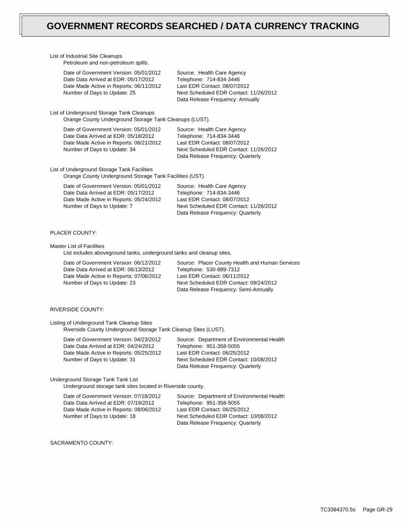
List of Industrial Site CleanupsPetroleum and non-petroleum spills.
Date of Government Version: 05/01/2012Date Data Arrived at EDR: 05/17/2012Date Made Active in Reports: 06/11/2012Number of Days to Update: 25
Source: Health Care AgencyTelephone: 714-834-3446Last EDR Contact: 08/07/2012Next Scheduled EDR Contact: 11/26/2012Data Release Frequency: Annually
List of Underground Storage Tank CleanupsOrange County Underground Storage Tank Cleanups (LUST).
Date of Government Version: 05/01/2012Date Data Arrived at EDR: 05/18/2012Date Made Active in Reports: 06/21/2012Number of Days to Update: 34
Source: Health Care AgencyTelephone: 714-834-3446Last EDR Contact: 08/07/2012Next Scheduled EDR Contact: 11/26/2012Data Release Frequency: Quarterly
List of Underground Storage Tank FacilitiesOrange County Underground Storage Tank Facilities (UST).
Date of Government Version: 05/01/2012Date Data Arrived at EDR: 05/17/2012Date Made Active in Reports: 05/24/2012Number of Days to Update: 7
Source: Health Care AgencyTelephone: 714-834-3446Last EDR Contact: 08/07/2012Next Scheduled EDR Contact: 11/26/2012Data Release Frequency: Quarterly
PLACER COUNTY:
Master List of FacilitiesList includes aboveground tanks, underground tanks and cleanup sites.
Date of Government Version: 06/12/2012Date Data Arrived at EDR: 06/13/2012Date Made Active in Reports: 07/06/2012Number of Days to Update: 23
Source: Placer County Health and Human ServicesTelephone: 530-889-7312Last EDR Contact: 06/11/2012Next Scheduled EDR Contact: 09/24/2012Data Release Frequency: Semi-Annually
RIVERSIDE COUNTY:
Listing of Underground Tank Cleanup SitesRiverside County Underground Storage Tank Cleanup Sites (LUST).
Date of Government Version: 04/23/2012Date Data Arrived at EDR: 04/24/2012Date Made Active in Reports: 05/25/2012Number of Days to Update: 31
Source: Department of Environmental HealthTelephone: 951-358-5055Last EDR Contact: 06/25/2012Next Scheduled EDR Contact: 10/08/2012Data Release Frequency: Quarterly
Underground Storage Tank Tank ListUnderground storage tank sites located in Riverside county.
Date of Government Version: 07/18/2012Date Data Arrived at EDR: 07/19/2012Date Made Active in Reports: 08/06/2012Number of Days to Update: 18
Source: Department of Environmental HealthTelephone: 951-358-5055Last EDR Contact: 06/25/2012Next Scheduled EDR Contact: 10/08/2012Data Release Frequency: Quarterly
SACRAMENTO COUNTY:
TC3384370.5s Page GR-29
GOVERNMENT RECORDS SEARCHED / DATA CURRENCY TRACKING
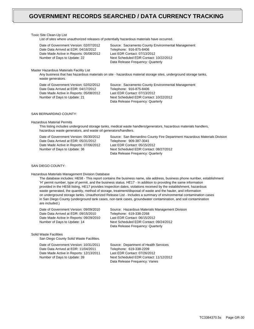
Toxic Site Clean-Up ListList of sites where unauthorized releases of potentially hazardous materials have occurred.
Date of Government Version: 02/07/2012Date Data Arrived at EDR: 04/16/2012Date Made Active in Reports: 05/08/2012Number of Days to Update: 22
Source: Sacramento County Environmental ManagementTelephone: 916-875-8406Last EDR Contact: 07/13/2012Next Scheduled EDR Contact: 10/22/2012Data Release Frequency: Quarterly
Master Hazardous Materials Facility ListAny business that has hazardous materials on site - hazardous material storage sites, underground storage tanks,waste generators.
Date of Government Version: 02/02/2012Date Data Arrived at EDR: 04/17/2012Date Made Active in Reports: 05/08/2012Number of Days to Update: 21
Source: Sacramento County Environmental ManagementTelephone: 916-875-8406Last EDR Contact: 07/13/2012Next Scheduled EDR Contact: 10/22/2012Data Release Frequency: Quarterly
SAN BERNARDINO COUNTY:
Hazardous Material PermitsThis listing includes underground storage tanks, medical waste handlers/generators, hazardous materials handlers,hazardous waste generators, and waste oil generators/handlers.
Date of Government Version: 05/30/2012Date Data Arrived at EDR: 05/31/2012Date Made Active in Reports: 07/06/2012Number of Days to Update: 36
Source: San Bernardino County Fire Department Hazardous Materials DivisionTelephone: 909-387-3041Last EDR Contact: 05/15/2012Next Scheduled EDR Contact: 08/27/2012Data Release Frequency: Quarterly
SAN DIEGO COUNTY:
Hazardous Materials Management Division DatabaseThe database includes: HE58 - This report contains the business name, site address, business phone number, establishment’H’ permit number, type of permit, and the business status. HE17 - In addition to providing the same informationprovided in the HE58 listing, HE17 provides inspection dates, violations received by the establishment, hazardouswaste generated, the quantity, method of storage, treatment/disposal of waste and the hauler, and informationon underground storage tanks. Unauthorized Release List - Includes a summary of environmental contamination casesin San Diego County (underground tank cases, non-tank cases, groundwater contamination, and soil contaminationare included.)
Date of Government Version: 09/09/2010Date Data Arrived at EDR: 09/15/2010Date Made Active in Reports: 09/29/2010Number of Days to Update: 14
Source: Hazardous Materials Management DivisionTelephone: 619-338-2268Last EDR Contact: 06/15/2012Next Scheduled EDR Contact: 09/24/2012Data Release Frequency: Quarterly
Solid Waste FacilitiesSan Diego County Solid Waste Facilities.
Date of Government Version: 10/31/2011Date Data Arrived at EDR: 11/04/2011Date Made Active in Reports: 12/13/2011Number of Days to Update: 39
Source: Department of Health ServicesTelephone: 619-338-2209Last EDR Contact: 07/26/2012Next Scheduled EDR Contact: 11/12/2012Data Release Frequency: Varies
TC3384370.5s Page GR-30
GOVERNMENT RECORDS SEARCHED / DATA CURRENCY TRACKING
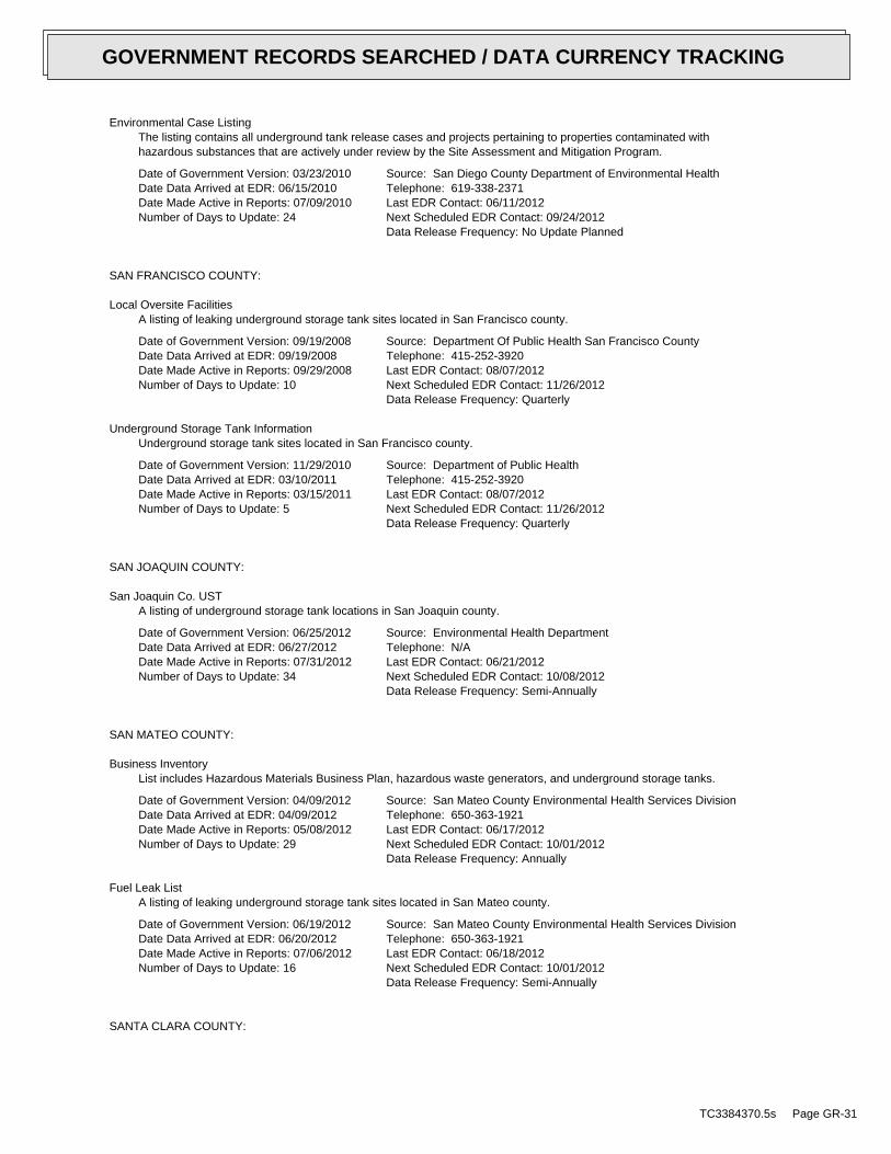
Environmental Case ListingThe listing contains all underground tank release cases and projects pertaining to properties contaminated withhazardous substances that are actively under review by the Site Assessment and Mitigation Program.
Date of Government Version: 03/23/2010Date Data Arrived at EDR: 06/15/2010Date Made Active in Reports: 07/09/2010Number of Days to Update: 24
Source: San Diego County Department of Environmental HealthTelephone: 619-338-2371Last EDR Contact: 06/11/2012Next Scheduled EDR Contact: 09/24/2012Data Release Frequency: No Update Planned
SAN FRANCISCO COUNTY:
Local Oversite FacilitiesA listing of leaking underground storage tank sites located in San Francisco county.
Date of Government Version: 09/19/2008Date Data Arrived at EDR: 09/19/2008Date Made Active in Reports: 09/29/2008Number of Days to Update: 10
Source: Department Of Public Health San Francisco CountyTelephone: 415-252-3920Last EDR Contact: 08/07/2012Next Scheduled EDR Contact: 11/26/2012Data Release Frequency: Quarterly
Underground Storage Tank InformationUnderground storage tank sites located in San Francisco county.
Date of Government Version: 11/29/2010Date Data Arrived at EDR: 03/10/2011Date Made Active in Reports: 03/15/2011Number of Days to Update: 5
Source: Department of Public HealthTelephone: 415-252-3920Last EDR Contact: 08/07/2012Next Scheduled EDR Contact: 11/26/2012Data Release Frequency: Quarterly
SAN JOAQUIN COUNTY:
San Joaquin Co. USTA listing of underground storage tank locations in San Joaquin county.
Date of Government Version: 06/25/2012Date Data Arrived at EDR: 06/27/2012Date Made Active in Reports: 07/31/2012Number of Days to Update: 34
Source: Environmental Health DepartmentTelephone: N/ALast EDR Contact: 06/21/2012Next Scheduled EDR Contact: 10/08/2012Data Release Frequency: Semi-Annually
SAN MATEO COUNTY:
Business InventoryList includes Hazardous Materials Business Plan, hazardous waste generators, and underground storage tanks.
Date of Government Version: 04/09/2012Date Data Arrived at EDR: 04/09/2012Date Made Active in Reports: 05/08/2012Number of Days to Update: 29
Source: San Mateo County Environmental Health Services DivisionTelephone: 650-363-1921Last EDR Contact: 06/17/2012Next Scheduled EDR Contact: 10/01/2012Data Release Frequency: Annually
Fuel Leak ListA listing of leaking underground storage tank sites located in San Mateo county.
Date of Government Version: 06/19/2012Date Data Arrived at EDR: 06/20/2012Date Made Active in Reports: 07/06/2012Number of Days to Update: 16
Source: San Mateo County Environmental Health Services DivisionTelephone: 650-363-1921Last EDR Contact: 06/18/2012Next Scheduled EDR Contact: 10/01/2012Data Release Frequency: Semi-Annually
SANTA CLARA COUNTY:
TC3384370.5s Page GR-31
GOVERNMENT RECORDS SEARCHED / DATA CURRENCY TRACKING
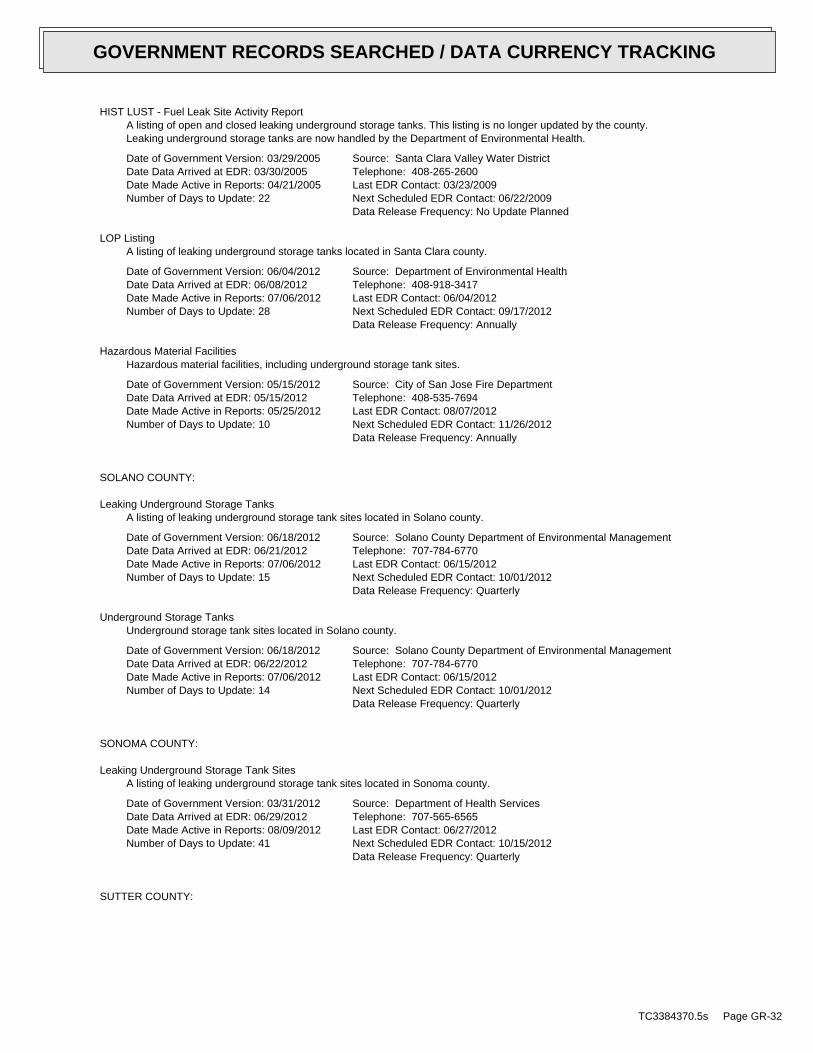
HIST LUST - Fuel Leak Site Activity ReportA listing of open and closed leaking underground storage tanks. This listing is no longer updated by the county.Leaking underground storage tanks are now handled by the Department of Environmental Health.
Date of Government Version: 03/29/2005Date Data Arrived at EDR: 03/30/2005Date Made Active in Reports: 04/21/2005Number of Days to Update: 22
Source: Santa Clara Valley Water DistrictTelephone: 408-265-2600Last EDR Contact: 03/23/2009Next Scheduled EDR Contact: 06/22/2009Data Release Frequency: No Update Planned
LOP ListingA listing of leaking underground storage tanks located in Santa Clara county.
Date of Government Version: 06/04/2012Date Data Arrived at EDR: 06/08/2012Date Made Active in Reports: 07/06/2012Number of Days to Update: 28
Source: Department of Environmental HealthTelephone: 408-918-3417Last EDR Contact: 06/04/2012Next Scheduled EDR Contact: 09/17/2012Data Release Frequency: Annually
Hazardous Material FacilitiesHazardous material facilities, including underground storage tank sites.
Date of Government Version: 05/15/2012Date Data Arrived at EDR: 05/15/2012Date Made Active in Reports: 05/25/2012Number of Days to Update: 10
Source: City of San Jose Fire DepartmentTelephone: 408-535-7694Last EDR Contact: 08/07/2012Next Scheduled EDR Contact: 11/26/2012Data Release Frequency: Annually
SOLANO COUNTY:
Leaking Underground Storage TanksA listing of leaking underground storage tank sites located in Solano county.
Date of Government Version: 06/18/2012Date Data Arrived at EDR: 06/21/2012Date Made Active in Reports: 07/06/2012Number of Days to Update: 15
Source: Solano County Department of Environmental ManagementTelephone: 707-784-6770Last EDR Contact: 06/15/2012Next Scheduled EDR Contact: 10/01/2012Data Release Frequency: Quarterly
Underground Storage TanksUnderground storage tank sites located in Solano county.
Date of Government Version: 06/18/2012Date Data Arrived at EDR: 06/22/2012Date Made Active in Reports: 07/06/2012Number of Days to Update: 14
Source: Solano County Department of Environmental ManagementTelephone: 707-784-6770Last EDR Contact: 06/15/2012Next Scheduled EDR Contact: 10/01/2012Data Release Frequency: Quarterly
SONOMA COUNTY:
Leaking Underground Storage Tank SitesA listing of leaking underground storage tank sites located in Sonoma county.
Date of Government Version: 03/31/2012Date Data Arrived at EDR: 06/29/2012Date Made Active in Reports: 08/09/2012Number of Days to Update: 41
Source: Department of Health ServicesTelephone: 707-565-6565Last EDR Contact: 06/27/2012Next Scheduled EDR Contact: 10/15/2012Data Release Frequency: Quarterly
SUTTER COUNTY:
TC3384370.5s Page GR-32
GOVERNMENT RECORDS SEARCHED / DATA CURRENCY TRACKING
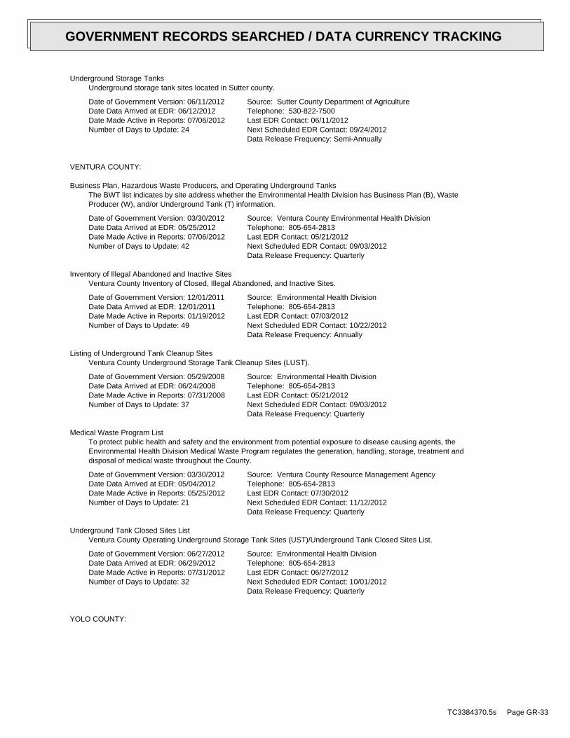
Underground Storage TanksUnderground storage tank sites located in Sutter county.
Date of Government Version: 06/11/2012Date Data Arrived at EDR: 06/12/2012Date Made Active in Reports: 07/06/2012Number of Days to Update: 24
Source: Sutter County Department of AgricultureTelephone: 530-822-7500Last EDR Contact: 06/11/2012Next Scheduled EDR Contact: 09/24/2012Data Release Frequency: Semi-Annually
VENTURA COUNTY:
Business Plan, Hazardous Waste Producers, and Operating Underground TanksThe BWT list indicates by site address whether the Environmental Health Division has Business Plan (B), WasteProducer (W), and/or Underground Tank (T) information.
Date of Government Version: 03/30/2012Date Data Arrived at EDR: 05/25/2012Date Made Active in Reports: 07/06/2012Number of Days to Update: 42
Source: Ventura County Environmental Health DivisionTelephone: 805-654-2813Last EDR Contact: 05/21/2012Next Scheduled EDR Contact: 09/03/2012Data Release Frequency: Quarterly
Inventory of Illegal Abandoned and Inactive SitesVentura County Inventory of Closed, Illegal Abandoned, and Inactive Sites.
Date of Government Version: 12/01/2011Date Data Arrived at EDR: 12/01/2011Date Made Active in Reports: 01/19/2012Number of Days to Update: 49
Source: Environmental Health DivisionTelephone: 805-654-2813Last EDR Contact: 07/03/2012Next Scheduled EDR Contact: 10/22/2012Data Release Frequency: Annually
Listing of Underground Tank Cleanup SitesVentura County Underground Storage Tank Cleanup Sites (LUST).
Date of Government Version: 05/29/2008Date Data Arrived at EDR: 06/24/2008Date Made Active in Reports: 07/31/2008Number of Days to Update: 37
Source: Environmental Health DivisionTelephone: 805-654-2813Last EDR Contact: 05/21/2012Next Scheduled EDR Contact: 09/03/2012Data Release Frequency: Quarterly
Medical Waste Program ListTo protect public health and safety and the environment from potential exposure to disease causing agents, theEnvironmental Health Division Medical Waste Program regulates the generation, handling, storage, treatment anddisposal of medical waste throughout the County.
Date of Government Version: 03/30/2012Date Data Arrived at EDR: 05/04/2012Date Made Active in Reports: 05/25/2012Number of Days to Update: 21
Source: Ventura County Resource Management AgencyTelephone: 805-654-2813Last EDR Contact: 07/30/2012Next Scheduled EDR Contact: 11/12/2012Data Release Frequency: Quarterly
Underground Tank Closed Sites ListVentura County Operating Underground Storage Tank Sites (UST)/Underground Tank Closed Sites List.
Date of Government Version: 06/27/2012Date Data Arrived at EDR: 06/29/2012Date Made Active in Reports: 07/31/2012Number of Days to Update: 32
Source: Environmental Health DivisionTelephone: 805-654-2813Last EDR Contact: 06/27/2012Next Scheduled EDR Contact: 10/01/2012Data Release Frequency: Quarterly
YOLO COUNTY:
TC3384370.5s Page GR-33
GOVERNMENT RECORDS SEARCHED / DATA CURRENCY TRACKING
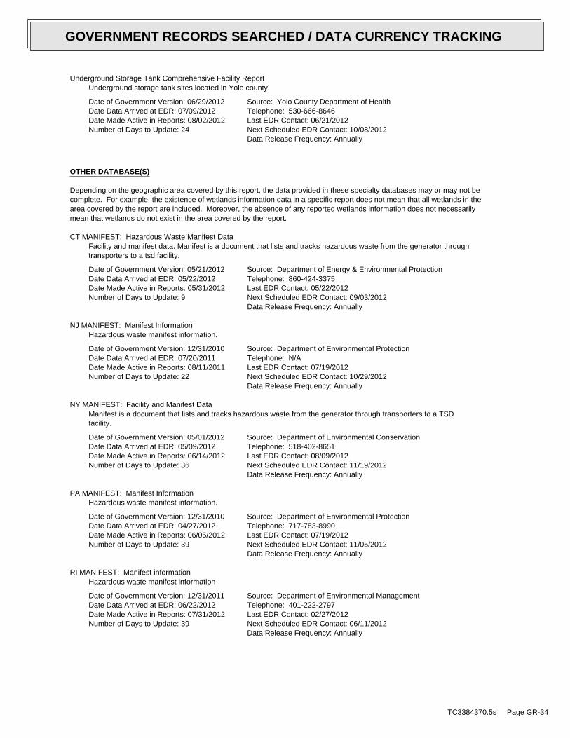
Underground Storage Tank Comprehensive Facility ReportUnderground storage tank sites located in Yolo county.
Date of Government Version: 06/29/2012Date Data Arrived at EDR: 07/09/2012Date Made Active in Reports: 08/02/2012Number of Days to Update: 24
Source: Yolo County Department of HealthTelephone: 530-666-8646Last EDR Contact: 06/21/2012Next Scheduled EDR Contact: 10/08/2012Data Release Frequency: Annually
OTHER DATABASE(S)
Depending on the geographic area covered by this report, the data provided in these specialty databases may or may not becomplete. For example, the existence of wetlands information data in a specific report does not mean that all wetlands in thearea covered by the report are included. Moreover, the absence of any reported wetlands information does not necessarilymean that wetlands do not exist in the area covered by the report.
CT MANIFEST: Hazardous Waste Manifest DataFacility and manifest data. Manifest is a document that lists and tracks hazardous waste from the generator throughtransporters to a tsd facility.
Date of Government Version: 05/21/2012Date Data Arrived at EDR: 05/22/2012Date Made Active in Reports: 05/31/2012Number of Days to Update: 9
Source: Department of Energy & Environmental ProtectionTelephone: 860-424-3375Last EDR Contact: 05/22/2012Next Scheduled EDR Contact: 09/03/2012Data Release Frequency: Annually
NJ MANIFEST: Manifest InformationHazardous waste manifest information.
Date of Government Version: 12/31/2010Date Data Arrived at EDR: 07/20/2011Date Made Active in Reports: 08/11/2011Number of Days to Update: 22
Source: Department of Environmental ProtectionTelephone: N/ALast EDR Contact: 07/19/2012Next Scheduled EDR Contact: 10/29/2012Data Release Frequency: Annually
NY MANIFEST: Facility and Manifest DataManifest is a document that lists and tracks hazardous waste from the generator through transporters to a TSDfacility.
Date of Government Version: 05/01/2012Date Data Arrived at EDR: 05/09/2012Date Made Active in Reports: 06/14/2012Number of Days to Update: 36
Source: Department of Environmental ConservationTelephone: 518-402-8651Last EDR Contact: 08/09/2012Next Scheduled EDR Contact: 11/19/2012Data Release Frequency: Annually
PA MANIFEST: Manifest InformationHazardous waste manifest information.
Date of Government Version: 12/31/2010Date Data Arrived at EDR: 04/27/2012Date Made Active in Reports: 06/05/2012Number of Days to Update: 39
Source: Department of Environmental ProtectionTelephone: 717-783-8990Last EDR Contact: 07/19/2012Next Scheduled EDR Contact: 11/05/2012Data Release Frequency: Annually
RI MANIFEST: Manifest informationHazardous waste manifest information
Date of Government Version: 12/31/2011Date Data Arrived at EDR: 06/22/2012Date Made Active in Reports: 07/31/2012Number of Days to Update: 39
Source: Department of Environmental ManagementTelephone: 401-222-2797Last EDR Contact: 02/27/2012Next Scheduled EDR Contact: 06/11/2012Data Release Frequency: Annually
TC3384370.5s Page GR-34
GOVERNMENT RECORDS SEARCHED / DATA CURRENCY TRACKING
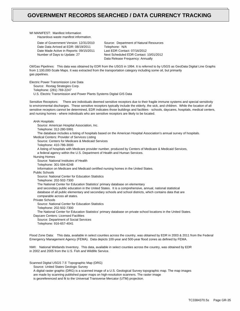
WI MANIFEST: Manifest InformationHazardous waste manifest information.
Date of Government Version: 12/31/2010Date Data Arrived at EDR: 08/19/2011Date Made Active in Reports: 09/15/2011Number of Days to Update: 27
Source: Department of Natural ResourcesTelephone: N/ALast EDR Contact: 07/16/2012Next Scheduled EDR Contact: 10/01/2012Data Release Frequency: Annually
Oil/Gas Pipelines: This data was obtained by EDR from the USGS in 1994. It is referred to by USGS as GeoData Digital Line Graphsfrom 1:100,000-Scale Maps. It was extracted from the transportation category including some oil, but primarilygas pipelines.
Electric Power Transmission Line DataSource: Rextag Strategies Corp.Telephone: (281) 769-2247U.S. Electric Transmission and Power Plants Systems Digital GIS Data
Sensitive Receptors: There are individuals deemed sensitive receptors due to their fragile immune systems and special sensitivityto environmental discharges. These sensitive receptors typically include the elderly, the sick, and children. While the location of allsensitive receptors cannot be determined, EDR indicates those buildings and facilities - schools, daycares, hospitals, medical centers,and nursing homes - where individuals who are sensitive receptors are likely to be located.
AHA Hospitals:Source: American Hospital Association, Inc.Telephone: 312-280-5991The database includes a listing of hospitals based on the American Hospital Association’s annual survey of hospitals.
Medical Centers: Provider of Services ListingSource: Centers for Medicare & Medicaid ServicesTelephone: 410-786-3000A listing of hospitals with Medicare provider number, produced by Centers of Medicare & Medicaid Services,a federal agency within the U.S. Department of Health and Human Services.
Nursing HomesSource: National Institutes of HealthTelephone: 301-594-6248Information on Medicare and Medicaid certified nursing homes in the United States.
Public SchoolsSource: National Center for Education StatisticsTelephone: 202-502-7300The National Center for Education Statistics’ primary database on elementaryand secondary public education in the United States. It is a comprehensive, annual, national statisticaldatabase of all public elementary and secondary schools and school districts, which contains data that arecomparable across all states.
Private SchoolsSource: National Center for Education StatisticsTelephone: 202-502-7300The National Center for Education Statistics’ primary database on private school locations in the United States.
Daycare Centers: Licensed FacilitiesSource: Department of Social ServicesTelephone: 916-657-4041
Flood Zone Data: This data, available in select counties across the country, was obtained by EDR in 2003 & 2011 from the FederalEmergency Management Agency (FEMA). Data depicts 100-year and 500-year flood zones as defined by FEMA.
NWI: National Wetlands Inventory. This data, available in select counties across the country, was obtained by EDRin 2002 and 2005 from the U.S. Fish and Wildlife Service.
Scanned Digital USGS 7.5’ Topographic Map (DRG)Source: United States Geologic SurveyA digital raster graphic (DRG) is a scanned image of a U.S. Geological Survey topographic map. The map imagesare made by scanning published paper maps on high-resolution scanners. The raster imageis georeferenced and fit to the Universal Transverse Mercator (UTM) projection.
TC3384370.5s Page GR-35
GOVERNMENT RECORDS SEARCHED / DATA CURRENCY TRACKING

STREET AND ADDRESS INFORMATION
© 2010 Tele Atlas North America, Inc. All rights reserved. This material is proprietary and the subject of copyright protectionand other intellectual property rights owned by or licensed to Tele Atlas North America, Inc. The use of this material is subjectto the terms of a license agreement. You will be held liable for any unauthorized copying or disclosure of this material.
TC3384370.5s Page GR-36
GOVERNMENT RECORDS SEARCHED / DATA CURRENCY TRACKING
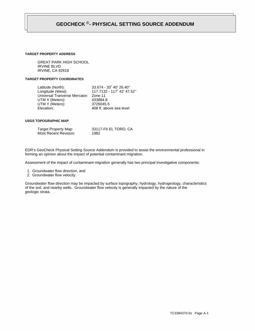
TC3384370.5s Page A-1
geologic strata.of the soil, and nearby wells. Groundwater flow velocity is generally impacted by the nature of theGroundwater flow direction may be impacted by surface topography, hydrology, hydrogeology, characteristics
2. Groundwater flow velocity. 1. Groundwater flow direction, and
Assessment of the impact of contaminant migration generally has two principal investigative components:
forming an opinion about the impact of potential contaminant migration.EDR’s GeoCheck Physical Setting Source Addendum is provided to assist the environmental professional in
1982Most Recent Revision:33117-F6 EL TORO, CATarget Property Map:
USGS TOPOGRAPHIC MAP
408 ft. above sea levelElevation:3726045.5UTM Y (Meters): 433884.8UTM X (Meters): Zone 11Universal Tranverse Mercator: 117.7132 - 117˚ 42’ 47.52’’Longitude (West): 33.674 - 33˚ 40’ 26.40’’Latitude (North):
TARGET PROPERTY COORDINATES
IRVINE, CA 92618IRVINE BLVDGREAT PARK HIGH SCHOOL
TARGET PROPERTY ADDRESS
®GEOCHECK - PHYSICAL SETTING SOURCE ADDENDUM®
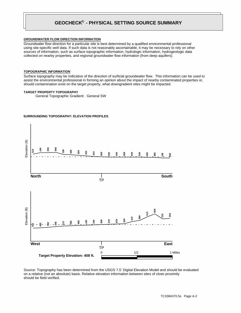
TC3384370.5s Page A-2
should be field verified.on a relative (not an absolute) basis. Relative elevation information between sites of close proximitySource: Topography has been determined from the USGS 7.5’ Digital Elevation Model and should be evaluated
SURROUNDING TOPOGRAPHY: ELEVATION PROFILES
Ele
vatio
n (f
t)E
leva
tion
(ft)
TP
TP0 1/2 1 Miles
✩Target Property Elevation: 408 ft.
North South
West East
383
387
396
400
403
404
406
404
402
408
419
432
445
455
461
506
502
497470331
340
351
363
372
382
390
397
402
408
412
418
429
470
496
573
636
531
542
General SWGeneral Topographic Gradient:TARGET PROPERTY TOPOGRAPHY
should contamination exist on the target property, what downgradient sites might be impacted.assist the environmental professional in forming an opinion about the impact of nearby contaminated properties or,Surface topography may be indicative of the direction of surficial groundwater flow. This information can be used toTOPOGRAPHIC INFORMATION
collected on nearby properties, and regional groundwater flow information (from deep aquifers).sources of information, such as surface topographic information, hydrologic information, hydrogeologic datausing site-specific well data. If such data is not reasonably ascertainable, it may be necessary to rely on otherGroundwater flow direction for a particular site is best determined by a qualified environmental professionalGROUNDWATER FLOW DIRECTION INFORMATION
®GEOCHECK - PHYSICAL SETTING SOURCE SUMMARY®
TC3384370.5s Page A-3
Not Reported
GENERAL DIRECTIONLOCATIONGROUNDWATER FLOWFROM TPMAP ID
hydrogeologically, and the depth to water table.authorities at select sites and has extracted the date of the report, groundwater flow direction as determinedflow at specific points. EDR has reviewed reports submitted by environmental professionals to regulatoryEDR has developed the AQUIFLOW Information System to provide data on the general direction of groundwater
AQUIFLOW®
Search Radius: 1.000 Mile.
Not found Status:1.25 miles Search Radius:
Site-Specific Hydrogeological Data*:
* ©1996 Site−specific hydrogeological data gathered by CERCLIS Alerts, Inc., Bainbridge Island, WA. All rights reserved. All of the information and opinions presented are those of the cited EPA report(s), which were completed undera Comprehensive Environmental Response Compensation and Liability Information System (CERCLIS) investigation.
contamination exist on the target property, what downgradient sites might be impacted.environmental professional in forming an opinion about the impact of nearby contaminated properties or, shouldof groundwater flow direction in the immediate area. Such hydrogeologic information can be used to assist theHydrogeologic information obtained by installation of wells on a specific site can often be an indicatorHYDROGEOLOGIC INFORMATION
YES - refer to the Overview Map and Detail MapEL TORO
NATIONAL WETLAND INVENTORYNWI ElectronicData CoverageNWI Quad at Target Property
Not ReportedAdditional Panels in search area:
06059C - FEMA DFIRM Flood dataFlood Plain Panel at Target Property:
YES - refer to the Overview Map and Detail MapORANGE, CA
FEMA FLOOD ZONEFEMA FloodElectronic DataTarget Property County
and bodies of water).Refer to the Physical Setting Source Map following this summary for hydrologic information (major waterways
contamination exist on the target property, what downgradient sites might be impacted.the environmental professional in forming an opinion about the impact of nearby contaminated properties or, shouldSurface water can act as a hydrologic barrier to groundwater flow. Such hydrologic information can be used to assistHYDROLOGIC INFORMATION
®GEOCHECK - PHYSICAL SETTING SOURCE SUMMARY®
TC3384370.5s Page A-4
Map, USGS Digital Data Series DDS - 11 (1994).of the Conterminous U.S. at 1:2,500,000 Scale - a digital representation of the 1974 P.B. King and H.M. BeikmanGeologic Age and Rock Stratigraphic Unit Source: P.G. Schruben, R.E. Arndt and W.J. Bawiec, Geology
ROCK STRATIGRAPHIC UNIT GEOLOGIC AGE IDENTIFICATION
Stratifed SequenceCategory:CenozoicEra:QuaternarySystem:QuaternarySeries:QCode: (decoded above as Era, System & Series)
at which contaminant migration may be occurring.Geologic information can be used by the environmental professional in forming an opinion about the relative speedGEOLOGIC INFORMATION IN GENERAL AREA OF TARGET PROPERTY
move more quickly through sandy-gravelly types of soils than silty-clayey types of soils.characteristics data collected on nearby properties and regional soil information. In general, contaminant plumesto rely on other sources of information, including geologic age identification, rock stratigraphic unit and soilusing site specific geologic and soil strata data. If such data are not reasonably ascertainable, it may be necessaryGroundwater flow velocity information for a particular site is best determined by a qualified environmental professionalGROUNDWATER FLOW VELOCITY INFORMATION
®GEOCHECK - PHYSICAL SETTING SOURCE SUMMARY®
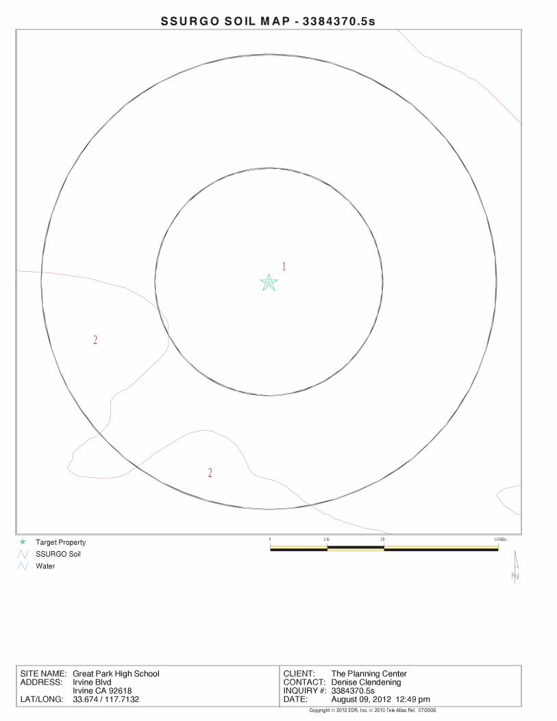
EDR Inc.EDR Inc.EDR Inc.EDR Inc.EDR Inc.EDR Inc.EDR Inc.EDR Inc.EDR Inc.EDR Inc.EDR Inc.EDR Inc.EDR Inc.EDR Inc.EDR Inc.EDR Inc.EDR Inc.EDR Inc.EDR Inc.EDR Inc.EDR Inc.EDR Inc.EDR Inc.EDR Inc.EDR Inc.EDR Inc.EDR Inc.EDR Inc.EDR Inc.EDR Inc.EDR Inc.EDR Inc.EDR Inc.EDR Inc.EDR Inc.EDR Inc.EDR Inc.EDR Inc.EDR Inc.EDR Inc.
1
2
2
0 1/16 1/8 1/4 Miles
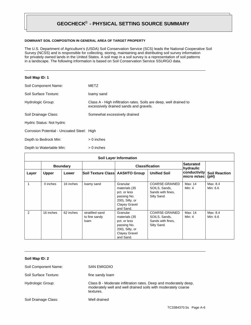
TC3384370.5s Page A-6
Well drainedSoil Drainage Class:
textures.moderately well and well drained soils with moderately coarseClass B - Moderate infiltration rates. Deep and moderately deep,Hydrologic Group:
fine sandy loamSoil Surface Texture:
SAN EMIGDIOSoil Component Name:
Soil Map ID: 2
Min: 6.6Max: 8.4
Min: 4Max: 14
Silty Sand.Sands with fines,SOILS, Sands,COARSE-GRAINED
and Sand.Clayey Gravel200), Silty, orpassing No.pct. or lessmaterials (35Granular
loamto fine sandystratified sand62 inches16 inches 2
Min: 6.6Max: 8.4
Min: 4Max: 14
Silty Sand.Sands with fines,SOILS, Sands,COARSE-GRAINED
and Sand.Clayey Gravel200), Silty, orpassing No.pct. or lessmaterials (35Granularloamy sand16 inches 0 inches 1
Soil Layer Information
Boundary Classification Saturatedhydraulicconductivitymicro m/sec
Layer Upper Lower Soil Texture Class AASHTO Group Unified Soil Soil Reaction(pH)
> 0 inchesDepth to Watertable Min:
> 0 inchesDepth to Bedrock Min:
HighCorrosion Potential - Uncoated Steel:
Hydric Status: Not hydric
Somewhat excessively drainedSoil Drainage Class:
excessively drained sands and gravels.Class A - High infiltration rates. Soils are deep, well drained toHydrologic Group:
loamy sandSoil Surface Texture:
METZSoil Component Name:
Soil Map ID: 1
in a landscape. The following information is based on Soil Conservation Service SSURGO data.for privately owned lands in the United States. A soil map in a soil survey is a representation of soil patternsSurvey (NCSS) and is responsible for collecting, storing, maintaining and distributing soil survey informationThe U.S. Department of Agriculture’s (USDA) Soil Conservation Service (SCS) leads the National Cooperative Soil
DOMINANT SOIL COMPOSITION IN GENERAL AREA OF TARGET PROPERTY
®GEOCHECK - PHYSICAL SETTING SOURCE SUMMARY®
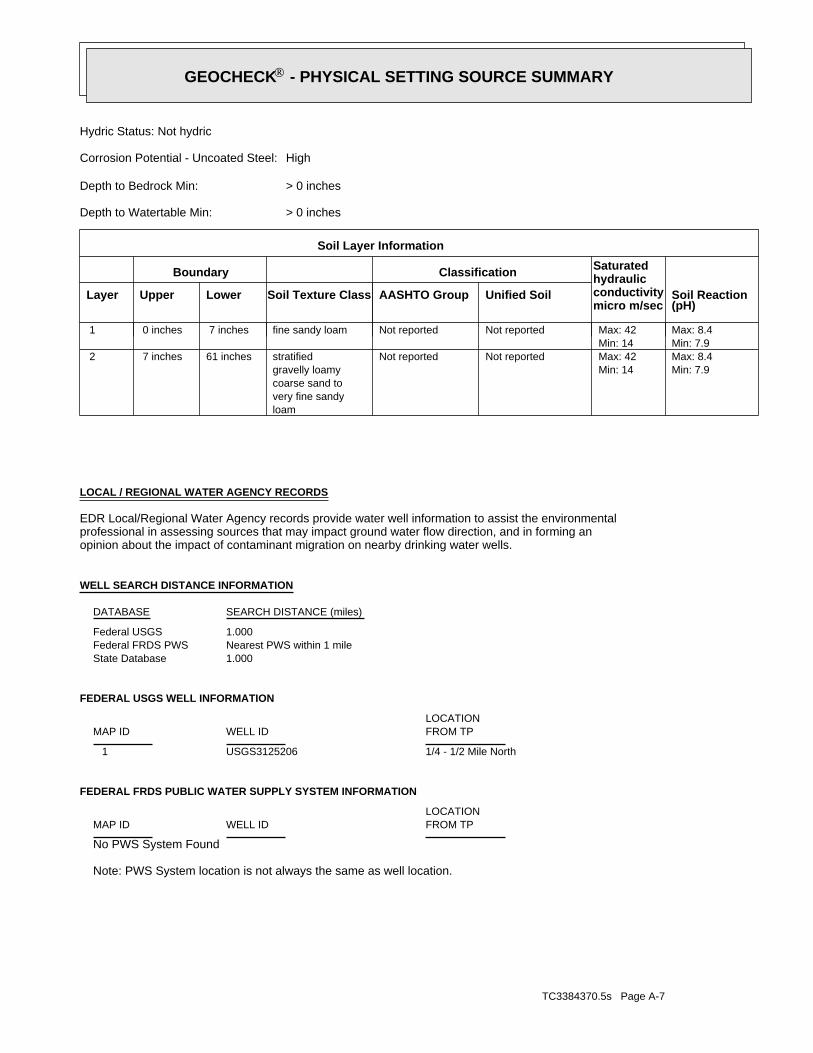
TC3384370.5s Page A-7
Note: PWS System location is not always the same as well location.
No PWS System Found
FEDERAL FRDS PUBLIC WATER SUPPLY SYSTEM INFORMATION
LOCATIONFROM TPWELL IDMAP ID
1/4 - 1/2 Mile NorthUSGS3125206 1
FEDERAL USGS WELL INFORMATION
LOCATIONFROM TPWELL IDMAP ID
1.000State DatabaseNearest PWS within 1 mileFederal FRDS PWS1.000Federal USGS
WELL SEARCH DISTANCE INFORMATION
SEARCH DISTANCE (miles)DATABASE
opinion about the impact of contaminant migration on nearby drinking water wells.professional in assessing sources that may impact ground water flow direction, and in forming anEDR Local/Regional Water Agency records provide water well information to assist the environmental
LOCAL / REGIONAL WATER AGENCY RECORDS
Min: 7.9Max: 8.4
Min: 14Max: 42 Not reportedNot reported
loamvery fine sandycoarse sand togravelly loamystratified61 inches 7 inches 2
Min: 7.9Max: 8.4
Min: 14Max: 42 Not reportedNot reportedfine sandy loam 7 inches 0 inches 1
Soil Layer Information
Boundary Classification Saturatedhydraulicconductivitymicro m/sec
Layer Upper Lower Soil Texture Class AASHTO Group Unified Soil Soil Reaction(pH)
> 0 inchesDepth to Watertable Min:
> 0 inchesDepth to Bedrock Min:
HighCorrosion Potential - Uncoated Steel:
Hydric Status: Not hydric
®GEOCHECK - PHYSICAL SETTING SOURCE SUMMARY®
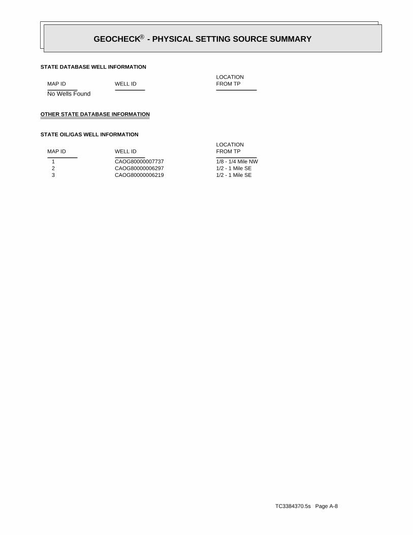
TC3384370.5s Page A-8
1/2 - 1 Mile SECAOG80000006219 31/2 - 1 Mile SECAOG80000006297 21/8 - 1/4 Mile NWCAOG80000007737 1
STATE OIL/GAS WELL INFORMATION
LOCATIONFROM TPWELL IDMAP ID
OTHER STATE DATABASE INFORMATION
No Wells Found
STATE DATABASE WELL INFORMATION
LOCATIONFROM TPWELL IDMAP ID
®GEOCHECK - PHYSICAL SETTING SOURCE SUMMARY®
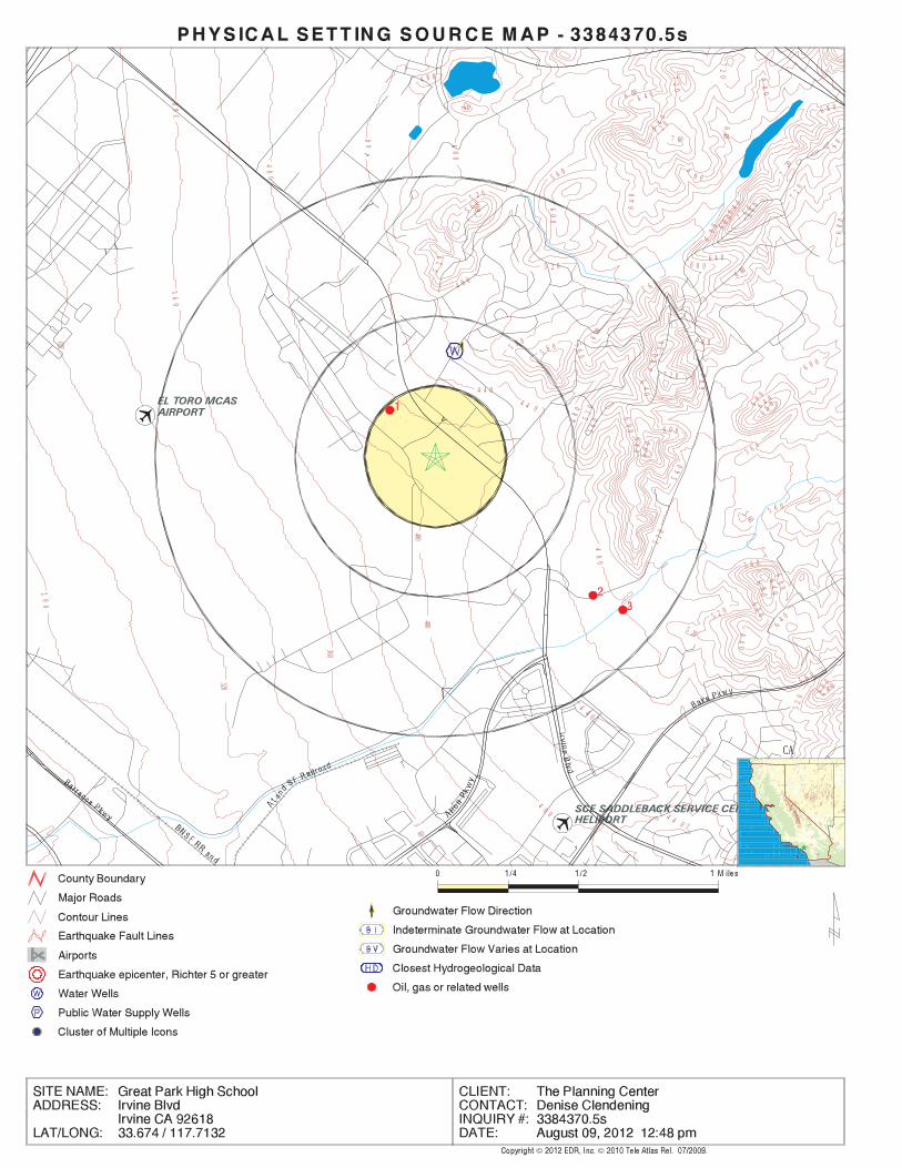
EDR Inc.EDR Inc.EDR Inc.EDR Inc.EDR Inc.EDR Inc.EDR Inc.EDR Inc.EDR Inc.EDR Inc.EDR Inc.EDR Inc.EDR Inc.EDR Inc.EDR Inc.EDR Inc.EDR Inc.EDR Inc.EDR Inc.EDR Inc.EDR Inc.EDR Inc.EDR Inc.EDR Inc.EDR Inc.EDR Inc.EDR Inc.EDR Inc.EDR Inc.EDR Inc.EDR Inc.EDR Inc.EDR Inc.EDR Inc.EDR Inc.EDR Inc.EDR Inc.EDR Inc.EDR Inc.EDR Inc.
4 8 0
72
072
0
520
640
7 607 6
0
7 2 0
600
80
0
7
6 060
0
5 6 0
6 80
5 2 0
52
0
600
72
0
5 6 0
7 2 0
68
0
6 4 0
64
0
6 8 06 4 0
68
0
64
0
560
6 80
64
0
5 20 64
0
6
4 0
6 4 0
28
0
320
320
36
0
36
0
360
360
40
0
400400
4
0 0
44
0
4 4 0
4 4 0
4
4 0
4 4 0
48
0
4 8 0
48
0
48
0
4 8 0
4 8 0
5 2 0
5 2 0
52
0
52
0
5 2 0
52
0
5 6 0
5 6 0
56
0
56
0
56
0
5 6 0
5 6 0
5 6 0
5 6 0
6 00
6
00
6 0 06
00 6 0 0
60
0
6 0 0
60 0
60
0
60
0
6 0 0
6 4 0
64
0
6 4 0
6 4 0
6
80
6
8 0
68
0
6 8 0
68
0
68
0
720
72
0
CA
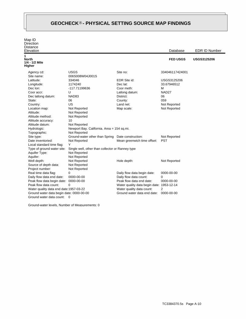
TC3384370.5s Page A-10
Ground-water levels, Number of Measurements: 0
0Ground water data count:0000-00-00Ground water data end date:Ground water data begin date: 0000-00-002Water quality data count:1957-03-22Water quality data end date:1953-12-14Water quality data begin date:0Peak flow data count:0000-00-00Peak flow data end date:0000-00-00Peak flow data begin date:0Daily flow data count:0000-00-00Daily flow data end date:0000-00-00Daily flow data begin date:0Real time data flag:
Not ReportedProject number:Not ReportedSource of depth data:
Not ReportedHole depth:Not ReportedWell depth:Not ReportedAquifer:Not ReportedAquifer Type:Single well, other than collector or Ranney typeType of ground water site:YLocal standard time flag:
PSTMean greenwich time offset:Not ReportedDate inventoried:Not ReportedDate construction:Ground-water other than SpringSite type:
Not ReportedTopographic:Newport Bay. California. Area = 154 sq.mi.Hydrologic:Not ReportedAltitude datum:10Altitude accuracy:Not ReportedAltitude method:Not ReportedAltitude:
Not ReportedMap scale:Not ReportedLocation map:Not ReportedLand net:USCountry:059County:06State:06District:NAD83Dec latlong datum:NAD27Latlong datum:UCoor accr:MCoor meth:-117.71199636Dec lon:33.67946512Dec lat:1174240Longitude:USGS3125206EDR Site id:334046Latitude:
006S008W04J001SSite name:334046117424001Site no:USGSAgency cd:
1North1/4 - 1/2 MileHigher
USGS3125206FED USGS
Map IDDirectionDistanceElevation EDR ID NumberDatabase
®GEOCHECK - PHYSICAL SETTING SOURCE MAP FINDINGS®
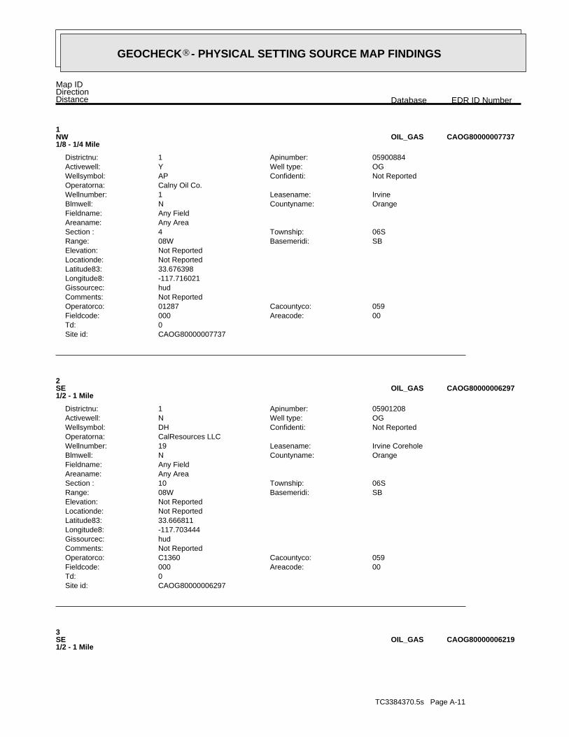
TC3384370.5s Page A-11
3SE1/2 - 1 Mile
CAOG80000006219OIL_GAS
CAOG80000006297Site id:0Td:
00Areacode:000Fieldcode:059Cacountyco:C1360Operatorco:
Not ReportedComments:hudGissourcec:-117.703444Longitude8:33.666811Latitude83:Not ReportedLocationde:Not ReportedElevation:
SBBasemeridi:08WRange:06STownship:10Section :
Any AreaAreaname:Any FieldFieldname:
OrangeCountyname:NBlmwell:Irvine CoreholeLeasename:19Wellnumber:
CalResources LLCOperatorna:Not ReportedConfidenti:DHWellsymbol:OGWell type:NActivewell:05901208Apinumber:1Districtnu:
2SE1/2 - 1 Mile
CAOG80000006297OIL_GAS
CAOG80000007737Site id:0Td:
00Areacode:000Fieldcode:059Cacountyco:01287Operatorco:
Not ReportedComments:hudGissourcec:-117.716021Longitude8:33.676398Latitude83:Not ReportedLocationde:Not ReportedElevation:
SBBasemeridi:08WRange:06STownship:4Section :
Any AreaAreaname:Any FieldFieldname:
OrangeCountyname:NBlmwell:IrvineLeasename:1Wellnumber:
Calny Oil Co.Operatorna:Not ReportedConfidenti:APWellsymbol:OGWell type:YActivewell:05900884Apinumber:1Districtnu:
1NW1/8 - 1/4 Mile
CAOG80000007737OIL_GAS
Map IDDirectionDistance EDR ID NumberDatabase
®GEOCHECK - PHYSICAL SETTING SOURCE MAP FINDINGS®
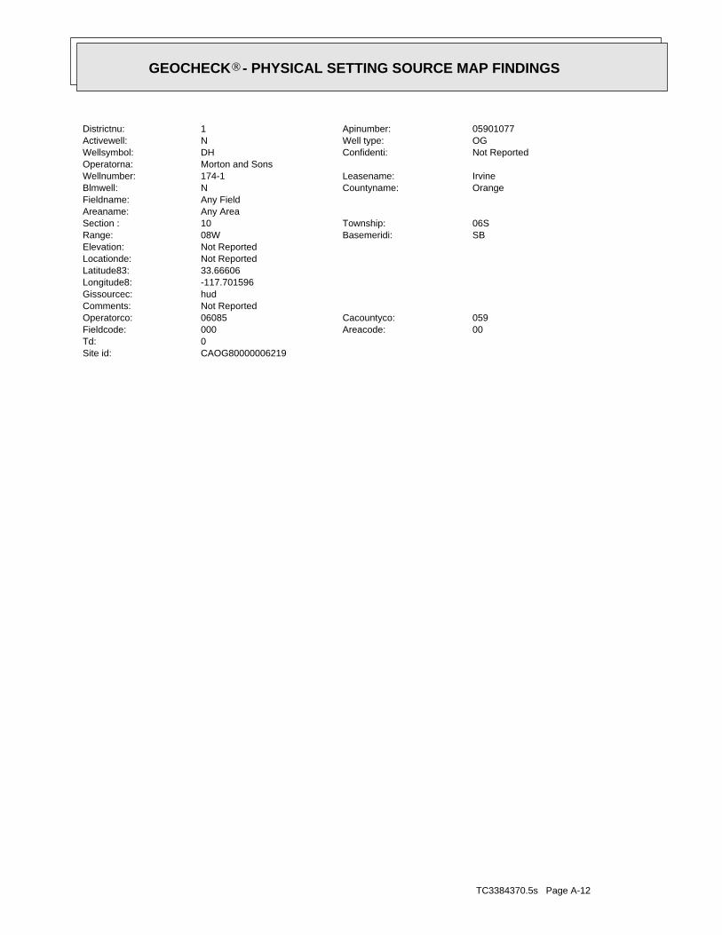
TC3384370.5s Page A-12
CAOG80000006219Site id:0Td:
00Areacode:000Fieldcode:059Cacountyco:06085Operatorco:
Not ReportedComments:hudGissourcec:-117.701596Longitude8:33.66606Latitude83:Not ReportedLocationde:Not ReportedElevation:
SBBasemeridi:08WRange:06STownship:10Section :
Any AreaAreaname:Any FieldFieldname:
OrangeCountyname:NBlmwell:IrvineLeasename:174-1Wellnumber:
Morton and SonsOperatorna:Not ReportedConfidenti:DHWellsymbol:OGWell type:NActivewell:05901077Apinumber:1Districtnu:
®GEOCHECK - PHYSICAL SETTING SOURCE MAP FINDINGS®
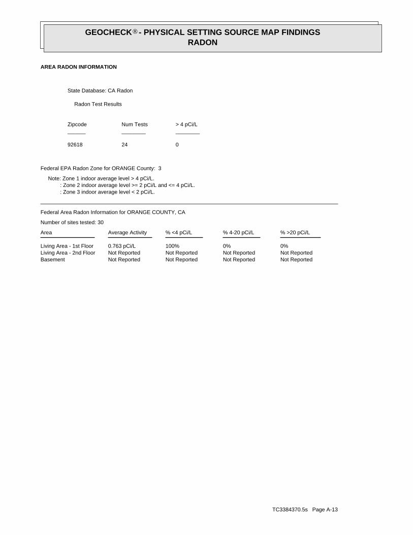
TC3384370.5s Page A-13
Not ReportedNot ReportedNot ReportedNot ReportedBasementNot ReportedNot ReportedNot ReportedNot ReportedLiving Area - 2nd Floor0%0%100%0.763 pCi/LLiving Area - 1st Floor
% >20 pCi/L% 4-20 pCi/L% <4 pCi/LAverage ActivityArea
Number of sites tested: 30
Federal Area Radon Information for ORANGE COUNTY, CA
: Zone 3 indoor average level < 2 pCi/L. : Zone 2 indoor average level >= 2 pCi/L and <= 4 pCi/L. Note: Zone 1 indoor average level > 4 pCi/L.
Federal EPA Radon Zone for ORANGE County: 3
02492618
______________________> 4 pCi/LNum TestsZipcode
Radon Test Results
State Database: CA Radon
AREA RADON INFORMATION
®GEOCHECK - PHYSICAL SETTING SOURCE MAP FINDINGSRADON
®
TOPOGRAPHIC INFORMATION
USGS 7.5’ Digital Elevation Model (DEM)Source: United States Geologic SurveyEDR acquired the USGS 7.5’ Digital Elevation Model in 2002 and updated it in 2006. The 7.5 minute DEM correspondsto the USGS 1:24,000- and 1:25,000-scale topographic quadrangle maps. The DEM provides elevation datawith consistent elevation units and projection.
Scanned Digital USGS 7.5’ Topographic Map (DRG)Source: United States Geologic SurveyA digital raster graphic (DRG) is a scanned image of a U.S. Geological Survey topographic map. The map imagesare made by scanning published paper maps on high-resolution scanners. The raster imageis georeferenced and fit to the Universal Transverse Mercator (UTM) projection.
HYDROLOGIC INFORMATION
Flood Zone Data: This data, available in select counties across the country, was obtained by EDR in 2003 & 2011 from the FederalEmergency Management Agency (FEMA). Data depicts 100-year and 500-year flood zones as defined by FEMA.
NWI: National Wetlands Inventory. This data, available in select counties across the country, was obtained by EDRin 2002 and 2005 from the U.S. Fish and Wildlife Service.
HYDROGEOLOGIC INFORMATION
AQUIFLOW Information SystemR
Source: EDR proprietary database of groundwater flow informationEDR has developed the AQUIFLOW Information System (AIS) to provide data on the general direction of groundwater
flow at specific points. EDR has reviewed reports submitted to regulatory authorities at select sites and hasextracted the date of the report, hydrogeologically determined groundwater flow direction and depth to water tableinformation.
GEOLOGIC INFORMATION
Geologic Age and Rock Stratigraphic UnitSource: P.G. Schruben, R.E. Arndt and W.J. Bawiec, Geology of the Conterminous U.S. at 1:2,500,000 Scale - A digitalrepresentation of the 1974 P.B. King and H.M. Beikman Map, USGS Digital Data Series DDS - 11 (1994).
STATSGO: State Soil Geographic DatabaseSource: Department of Agriculture, Natural Resources Conservation ServicesThe U.S. Department of Agriculture’s (USDA) Natural Resources Conservation Service (NRCS) leads the nationalConservation Soil Survey (NCSS) and is responsible for collecting, storing, maintaining and distributing soilsurvey information for privately owned lands in the United States. A soil map in a soil survey is a representationof soil patterns in a landscape. Soil maps for STATSGO are compiled by generalizing more detailed (SSURGO)soil survey maps.
SSURGO: Soil Survey Geographic DatabaseSource: Department of Agriculture, Natural Resources Conservation Services (NRCS)Telephone: 800-672-5559SSURGO is the most detailed level of mapping done by the Natural Resources Conservation Services, mappingscales generally range from 1:12,000 to 1:63,360. Field mapping methods using national standards are used toconstruct the soil maps in the Soil Survey Geographic (SSURGO) database. SSURGO digitizing duplicates theoriginal soil survey maps. This level of mapping is designed for use by landowners, townships and countynatural resource planning and management.
TC3384370.5s Page A-14
PHYSICAL SETTING SOURCE RECORDS SEARCHED
LOCAL / REGIONAL WATER AGENCY RECORDS
FEDERAL WATER WELLS
PWS: Public Water SystemsSource: EPA/Office of Drinking WaterTelephone: 202-564-3750Public Water System data from the Federal Reporting Data System. A PWS is any water system which provides water to at
least 25 people for at least 60 days annually. PWSs provide water from wells, rivers and other sources.
PWS ENF: Public Water Systems Violation and Enforcement DataSource: EPA/Office of Drinking WaterTelephone: 202-564-3750Violation and Enforcement data for Public Water Systems from the Safe Drinking Water Information System (SDWIS) after
August 1995. Prior to August 1995, the data came from the Federal Reporting Data System (FRDS).
USGS Water Wells: USGS National Water Inventory System (NWIS)This database contains descriptive information on sites where the USGS collects or has collected data on surfacewater and/or groundwater. The groundwater data includes information on wells, springs, and other sources of groundwater.
STATE RECORDS
Water Well DatabaseSource: Department of Water ResourcesTelephone: 916-651-9648
California Drinking Water Quality DatabaseSource: Department of Health ServicesTelephone: 916-324-2319The database includes all drinking water compliance and special studies monitoring for the state of California
since 1984. It consists of over 3,200,000 individual analyses along with well and water system information.
OTHER STATE DATABASE INFORMATION
California Oil and Gas Well LocationsSource: Department of ConservationTelephone: 916-323-1779Oil and Gas well locations in the state.
RADON
State Database: CA RadonSource: Department of Health ServicesTelephone: 916-324-2208Radon Database for California
Area Radon InformationSource: USGSTelephone: 703-356-4020The National Radon Database has been developed by the U.S. Environmental Protection Agency(USEPA) and is a compilation of the EPA/State Residential Radon Survey and the National Residential Radon Survey.The study covers the years 1986 - 1992. Where necessary data has been supplemented by information collected atprivate sources such as universities and research institutions.
EPA Radon ZonesSource: EPATelephone: 703-356-4020Sections 307 & 309 of IRAA directed EPA to list and identify areas of U.S. with the potential for elevated indoorradon levels.
TC3384370.5s Page A-15
PHYSICAL SETTING SOURCE RECORDS SEARCHED
OTHER
Airport Landing Facilities: Private and public use landing facilitiesSource: Federal Aviation Administration, 800-457-6656
Epicenters: World earthquake epicenters, Richter 5 or greaterSource: Department of Commerce, National Oceanic and Atmospheric Administration
California Earthquake Fault Lines: The fault lines displayed on EDR’s Topographic map are digitized quaternary fault lines,prepared in 1975 by the United State Geological Survey. Additional information (also from 1975) regarding activity at specific faultlines comes from California’s Preliminary Fault Activity Map prepared by the California Division of Mines and Geology.
STREET AND ADDRESS INFORMATION
© 2010 Tele Atlas North America, Inc. All rights reserved. This material is proprietary and the subject of copyright protectionand other intellectual property rights owned by or licensed to Tele Atlas North America, Inc. The use of this material is subjectto the terms of a license agreement. You will be held liable for any unauthorized copying or disclosure of this material.
TC3384370.5s Page A-16
PHYSICAL SETTING SOURCE RECORDS SEARCHED