Embed Size (px)
Citation preview
C5 FOREST MANAGEMENT PLAN 2006−2026
APPENDIX 9B. PORCUPINE HILLS HARVESTING AND SILVICULTURE STRATEGIES

C5 Forest Management Plan 2006−2026 2 Appendix 9b. Porcupine Hills Harvesting and Silviculture Strategies
Porcupine Hills Harvesting and Silviculture Strategies:
Minimizing the Risks to Successful Regeneration of Cutovers
Updated January 2005 Prepared by: Forest Management Branch,
Grant Klappstein, (Forest Biometrics) Leonard Barnhardt, (ATISC) Ken Greenway, (Harvesting and Renewal)
C5 Forest Management Plan 2006−2026 3 Appendix 9b. Porcupine Hills Harvesting and Silviculture Strategies

C5 Forest Management Plan 2006−2026 4 Appendix 9b. Porcupine Hills Harvesting and Silviculture Strategies

Table of Contents
Introduction ...................................................................................................................................6 Basis for Recommendations .........................................................................................................6 Stratification of AVI .......................................................................................................................7 Community Types of the Porcupine Hills ......................................................................................9 Recommendations ......................................................................................................................10 Harvest Systems and Associated Regeneration Survey Options ...............................................13
ADDENDUM I. Proposed Porcupine Hills Ecosite Types With Characteristic Vegetation Communities and Typical Site Conditions ..................................................................................18 ADDENDUM II. Limiting Factors for Interior Douglas-fir Reforestation......................................23
ADDENDUM III. Percentage Representation of Stand Types by Zone .....................................28
C5 Forest Management Plan 2006−2026 5 Appendix 9b. Porcupine Hills Harvesting and Silviculture Strategies

INTRODUCTION
Reforestation success of cutover lands in the Porcupine Hills of southern Alberta has been variable. While many cutovers have been regenerated successfully, many others have proven significantly more difficult, particularly (but not exclusively) when reforestation of interior Douglas-fir (Pseudotsuga menziesii var. glauca) is the objective. This document discusses how site characteristics and silvics for the tree species in question interact; as well, it provides guidance as to management activities that are likely to be successful in regenerating cut areas. The Porcupine Hills are unique in Alberta in supporting forest communities in which the interior variety of Douglas-fir is a dominant stand component in both early and late succession; thus emphasis is placed on creating conditions that facilitate Douglas-fir regeneration.
The Porcupine Hills are part of the Montane Natural Subregion of Alberta, yet the Montane is widely recognized as an ecologically heterogeneous subzone. It is characterized by a strong cordilleran influence modified by the distance from the main mountain masses and proximity to major mountain passes and their influence on chinooks and downslope wind patterns. The climate of the Porcupine Hills, relative to other Montane areas, is milder in the summer with a longer growing season, which favours establishment of interior Douglas-fir.
Forests over 1500 m elevation in the northern part of Porcupine Hills, and 1550 to 1600 m in the southern part, are primarily conifer-dominated throughout succession. Early succession stands are most often mixed lodgepole pine (Pinus contorta var. latifolia ) and Douglas-fir, but there are also fire-origin pure stands of both species. Succession is generally to mixed stands of Douglas-fir and hybrid spruce (hybrids between Picea engelmanii and Picea glauca). On moister sites, particularly on north and east aspects, there is frequently a minor component of Rocky Mountain alpine fir (Abies bifolia).
Under 1500 m, forest types are frequently mixedwood aspen (Populus tremuloides ) and Douglas-fir, with aspen being more prevalent in the north and Douglas-fir in the south. Succession to Douglas-fir and white spruce climax stage is typical.
BASIS FOR RECOMMENDATIONS
A literature search was conducted to investigate Montane and, in particular, interior Douglas-fir reforestation methods and their relative effectiveness in timely establishment of stands. Ecologically relevant comparisons were found between forest types of the Porcupine Hills and those of British Columbia occurring in the Ponderosa pine/Bunchgrass, interior Douglas-fir, and warm and dry variants of the Sub-boreal Spruce biogeoclimatic zones. For the United States, Daubenmire’s ecological classification provided enough information to allow relevant comparisons with interior Douglas-fir reforestation in western Montana, Idaho and interior Oregon.
C5 Forest Management Plan 2006−2026 6 Appendix 9b. Porcupine Hills Harvesting and Silviculture Strategies
The results of this literature review are summarized below.
1. Douglas-fir is a species that is tricky to manage throughout much of its range. Reforestation success can be difficult to achieve even in core areas of its range. As Douglas-fir is at the limits of its range in the Porcupine Hills, reforestation is likely to be very problematic.
2. Many jurisdictions have found that clearcut harvest systems have highly variable regeneration success, and any success appears related to micro/meso climate during the initial reforestation stages. Maximum Douglas-fir volume growth is typically found in open grown (clearcut) trees. Management of seedling micro-environment has been successfully accomplished through harvest designs.
3. Partial cutting systems have been shown to promote successful regeneration from seed and to buffer planted stock from the extreme conditions found in clearcuts. Seedling protection in hotter, drier climatic areas is necessary to attain adequate survival; however, as precipitation increases and temperatures decline, reforestation in clearcuts has been found to be acceptable.
4. Factors leading to good natural regeneration are seed crop periodicity coinciding with favorable climate occurring in the year or two following harvest. Favorable climate is primarily identified as sufficient spring and summer soil moisture.
5. Douglas-fir established regeneration is relatively drought hardy, (greater than for lodgepole pine, white or hybrid spruce and alpine fir); however, the ability of roots to follow the receding moisture front is critical to first year survival.
6. Douglas-fir is exceptionally prone to frost damage. Radiation frost1 on exposed higher elevation plateau surfaces and in lower slope and valley bottom positions (cold air collection points) is critical for Douglas-fir survival and growth. Management of freezing temperatures appears fundamental for successful reforestation at the initial establishment phase, and to promote vigorous growth.
7. Douglas-fir needle litter has been observed empirically and verified in laboratory studies to inhibit Douglas-fir regeneration to a measurable extent. Some form of mild scarification, ranging from drags to simply disturbance due to dispersed skidding, has been found to promote regeneration.
STRATIFICATION OF AVI
Stratification of the Porcupine Hills was conducted using the Alberta Vegetation Inventory (AVI) data to develop generalized ecological stand types. Four major subdivisions of the Porcupine Hills were created based on elevation (1500 m), and a latitude separation of north or south of Township 10. The creation of these four zones was to provide separation between major differing macro-climatic conditions observed in the Porcupine Hills. Within the four zones, canopy tree species composition (presence or absence of selected canopy tree species) was used to differentiate between broad community types. Attention was paid to identifying where Douglas-fir was a component in the stand, as well as where it occurred in mixtures. A final draft stratification was attempted using Digital Elevation Models (DEM) to fine-tune these major forest types based on aspect, but the results are not yet finalized. 1 Frost settles in a cutblock and “radiates” (disseminates) across the cutblock, due to nighttime cooling under dry, clear and light wind conditions. Usually occurs at higher elevations.
C5 Forest Management Plan 2006−2026 7 Appendix 9b. Porcupine Hills Harvesting and Silviculture Strategies
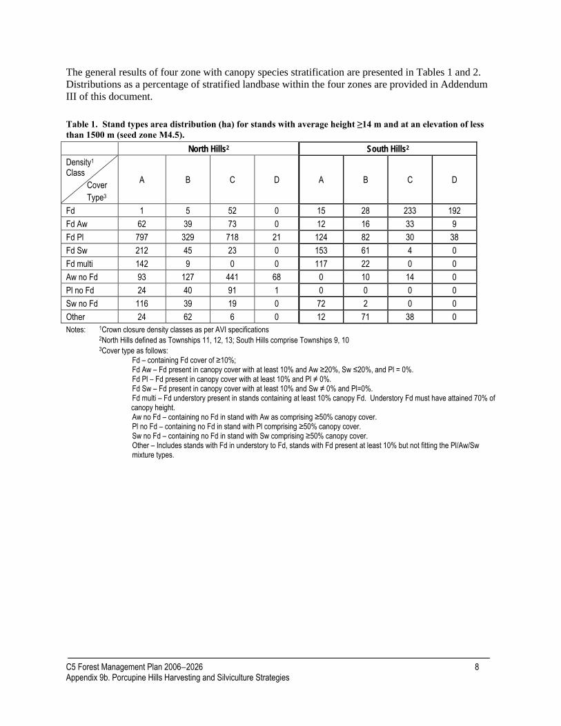
The general results of four zone with canopy species stratification are presented in Tables 1 and 2. Distributions as a percentage of stratified landbase within the four zones are provided in Addendum III of this document.
Table 1. Stand types area distribution (ha) for stands with average height ≥14 m and at an elevation of less than 1500 m (seed zone M4.5). North Hills2 South Hills2
Density1 Class Cover Type3
A B C D A B C D
Fd 1 5 52 0 15 28 233 192 Fd Aw 62 39 73 0 12 16 33 9 Fd Pl 797 329 718 21 124 82 30 38 Fd Sw 212 45 23 0 153 61 4 0 Fd multi 142 9 0 0 117 22 0 0 Aw no Fd 93 127 441 68 0 10 14 0 Pl no Fd 24 40 91 1 0 0 0 0 Sw no Fd 116 39 19 0 72 2 0 0 Other 24 62 6 0 12 71 38 0 Notes: 1Crown closure density classes as per AVI specifications 2North Hills defined as Townships 11, 12, 13; South Hills comprise Townships 9, 10 3Cover type as follows:
Fd – containing Fd cover of ≥10%; Fd Aw – Fd present in canopy cover with at least 10% and Aw ≥20%, Sw ≤20%, and Pl = 0%. Fd Pl – Fd present in canopy cover with at least 10% and Pl ≠ 0%. Fd Sw – Fd present in canopy cover with at least 10% and Sw ≠ 0% and Pl=0%. Fd multi – Fd understory present in stands containing at least 10% canopy Fd. Understory Fd must have attained 70% of canopy height. Aw no Fd – containing no Fd in stand with Aw as comprising ≥50% canopy cover. Pl no Fd – containing no Fd in stand with Pl comprising ≥50% canopy cover. Sw no Fd – containing no Fd in stand with Sw comprising ≥50% canopy cover. Other – Includes stands with Fd in understory to Fd, stands with Fd present at least 10% but not fitting the Pl/Aw/Sw mixture types.
C5 Forest Management Plan 2006−2026 8 Appendix 9b. Porcupine Hills Harvesting and Silviculture Strategies

Table 2. Stand types area distribution (ha) for stands with average height ≥14 m and at an elevation of greater than 1500 m (seed zone M5.5). North Hills2 South Hills2
Density1 Class Cover Type3
A B C D A B C D
Fd 35 45 18 28 123 88 542 533 Fd Aw 0 0 5 0 89 1 66 0 Fd Pl 1959 1319 2373 709 468 768 484 385 Fd Sw 90 94 13 0 629 332 9 0 Fd multi 15 20 0 0 125 85 0 0 Aw no Fd 11 31 154 8 0 11 0 0 Pl no Fd 114 133 299 221 0 0 0 0 Sw no Fd 135 11 25 0 35 27 0 0 Other 74 92 80 2 95 455 0 66 Notes: As per Table 1.
COMMUNITY TYPES OF THE PORCUPINE HILLS
Stand types (above) were reviewed by zone and links with the Field Guide to Ecosites of Southwestern Alberta, and ecological site classification plot data were attempted in order to provide a local “ecosite” guide for zones of the Porcupine Hills. This was done to facilitate reforestation risk assessment based on traditional ecosite types. Basic community types for the upper Montane (seed zone 5.5) and lower Montane (seed zone M4.5), along with descriptions of stand and risk differences for the north and south sections of the Porcupine Hills are listed in the community type description (Addendum I of this document). These types are proposed as keys for identifying specific site types based on actual site assessments.
General findings of the northern and southern sections of the Porcupine Hills. • Pure Douglas-fir stands are much more prevalent in the southern section of the Porcupine
Hills. • The most common AVI stand type is Douglas-fir/lodgepole pine in both the north and south
sections. • Pure aspen stands are uncommon in either section, especially at upper elevations (>1500 m). • Pure stands of any species are not common in either of the north or south sections except for
pure Fd in the south. • Second most common stand type (after mixed Douglas-fir/lodgepole pine stands) in the north
is pure lodgepole pine stands. • Status of Fa is unknown, as AVI does not distinguish it. Field experience, however, indicates
it is a common component of many upper elevation sites. • Mesic to hygric types are more common in the northern section of the Porcupine Hills, as are
stands with a Fa, false-azalea and grouseberry component.
C5 Forest Management Plan 2006−2026 9 Appendix 9b. Porcupine Hills Harvesting and Silviculture Strategies

• A higher proportion of Douglas-fir dominated stands occur in the southern section along with a higher incidence of submesic communities belonging to the rose/meadowsweet/aster/grass type (see Addendum I of this document).
Seed zone M4.5 is distinguished by the following characteristics: • Occurs at elevations between seed zone M5.5 and foothills fescue grasslands. • Soils are dominantly Dark Gray Luvisols and Orthic Black Chernozems (most have a distinct
Ah horizon). • Early succession is dominated by trembling aspen and Douglas-fir with a minor element of
lodgepole pine occurring on moister sites and at higher elevations. • Late succession stages are dominated by Douglas-fir and white spruce. • Shrub layer being dominated by service berries (generally Saskatoon), white snowberry and
rose. • Relative absence of a dwarf shrub component except on xeric and sub-xeric sites. • A species-rich forb component is present which increases and supersedes grass on hygric
sites. • The north section of the Porcupine Hills has a much higher occurrence of trembling aspen in
early succession while the south tends to be dominated by Douglas-fir throughout succession.
Seed zone M5.5 is distinguished by: • General occurrence above 1500 m north of Township 10 and 1550 m in Townships 9 and 10. • More typical forest soils that are dominantly Gray Luvisols and Eutric Brunisols. • Sub-alpine elements are present, including Rocky Mountain alpine fir, white-Engelmann
hybrid spruce, false azalea, grouseberry and white rhododendron. • Lodgepole pine as a co-dominant early successional species with interior Douglas-fir. • A more well developed dwarf shrub and moss layers relative to seed zone M4.5. • Dominant shrubs include rose, white meadowsweet and alder. False azalea more common
rather than service berries and snowberry (as present in seed zone M4.5). • North section has a higher representation of mesic and moister types with a significant
component of alpine fir and hybrid spruce; aspen is also more common on sub-xeric to submesic sites.
• The south section has a greater presence of Douglas-fir at all successional stages.
RECOMMENDATIONS
In order to provide a methodology for assessing appropriate harvesting and reforestation activities in the Porcupine Hills, and to ensure that Douglas-fir is retained at least at its current proportion in the Porcupine Hills, the following recommendations have been developed. The basis for the recommendations is that operational harvesting in stands with a high component of Douglas-fir, and which occur in high-risk sites, should be deferred until detailed pre-harvest planning can be
C5 Forest Management Plan 2006−2026 10 Appendix 9b. Porcupine Hills Harvesting and Silviculture Strategies

conducted and site-specific harvest and silvicultural systems be developed so that risk factors can be consistently overcome.
The key risk for Douglas-fir establishment is protection from the following (listed in order of priority):
1. summer frost, 2. summer drought/high radiation loads during initial establishment, and 3. winter damage (desiccation).
Of the four zones identified, sites in the north Porcupine Hills, and those at elevations greater than 1500 m that are composed of mixed conifer trees, are likely to be the least risky to reforest. The most problematic reforestation sites are found at lower elevations (<1500 m) in the south Porcupine Hills in stands composed mostly of Douglas-fir. South- and southwest-facing slopes (in all zones) are at increased risk of summer drought and winter desiccation damage, as they will be exposed to direct and intense sunlight.
While the above major risk factors may be assessed “on paper” with appropriate stand type and DEM information, the risk rating for any particular stand may change depending on variations from site to site. Detailed site assessments will be needed to justify appropriate harvesting and silvicultural practices.
Several recommendations are summarized below:
1. The Porcupine Hills be zoned into four forest operations based on expected levels of risk to Douglas-fir reforestation. Operational management zones established on elevation-based seed zones (different species, succession and climax) and a north/south split relative to Township 10 (different early succession; i.e., greater dominance of aspen in the north and Douglas-fir in the south).
2. Clearcut harvesting, accompanied by the appropriate reforestation activities, has a high probability of success when practiced in such stand types due to the reduced likelihood of summer drought restrictions. However, mortality and/or severe growth constraints are still likely due to summer frosts.
3. Pre-harvest assessments (PHA) are highly recommended on all proposed harvest units due to the high variability in Montane areas. Where limiting factors are noted in the PHA, appropriate harvest design modifications should be made. Silvicultural systems may be unable to offset limiting factors created by poor harvest designs. All areas proposed for partial harvesting shall have PHAs completed on them.
4. The collection and storage of adequate quantities of seed for artificial regeneration efforts for each of the four zones in the Porcupine Hills is required. This should include collections for each species being used within each of the four risk management zones.
5. Partial harvesting designs should be employed on sites where Douglas-fir is a major component and where risks of summer drought, frost and/or winter desiccation are found. Where high-risk sites are proposed, single tree selection or uniform shelterwoods shall be used, with evenly distributed dominants and co-dominants to be retained in addition to veterans and advanced regeneration.
C5 Forest Management Plan 2006−2026 11 Appendix 9b. Porcupine Hills Harvesting and Silviculture Strategies
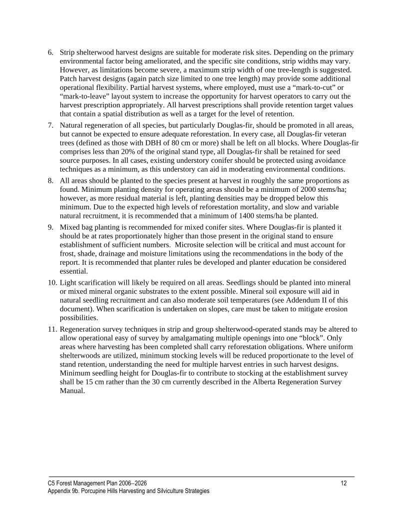
6. Strip shelterwood harvest designs are suitable for moderate risk sites. Depending on the primary environmental factor being ameliorated, and the specific site conditions, strip widths may vary. However, as limitations become severe, a maximum strip width of one tree-length is suggested. Patch harvest designs (again patch size limited to one tree length) may provide some additional operational flexibility. Partial harvest systems, where employed, must use a “mark-to-cut” or “mark-to-leave” layout system to increase the opportunity for harvest operators to carry out the harvest prescription appropriately. All harvest prescriptions shall provide retention target values that contain a spatial distribution as well as a target for the level of retention.
7. Natural regeneration of all species, but particularly Douglas-fir, should be promoted in all areas, but cannot be expected to ensure adequate reforestation. In every case, all Douglas-fir veteran trees (defined as those with DBH of 80 cm or more) shall be left on all blocks. Where Douglas-fir comprises less than 20% of the original stand type, all Douglas-fir shall be retained for seed source purposes. In all cases, existing understory conifer should be protected using avoidance techniques as a minimum, as this understory can aid in moderating environmental conditions.
8. All areas should be planted to the species present at harvest in roughly the same proportions as found. Minimum planting density for operating areas should be a minimum of 2000 stems/ha; however, as more residual material is left, planting densities may be dropped below this minimum. Due to the expected high levels of reforestation mortality, and slow and variable natural recruitment, it is recommended that a minimum of 1400 stems/ha be planted.
9. Mixed bag planting is recommended for mixed conifer sites. Where Douglas-fir is planted it should be at rates proportionately higher than those present in the original stand to ensure establishment of sufficient numbers. Microsite selection will be critical and must account for frost, shade, drainage and moisture limitations using the recommendations in the body of the report. It is recommended that planter rules be developed and planter education be considered essential.
10. Light scarification will likely be required on all areas. Seedlings should be planted into mineral or mixed mineral organic substrates to the extent possible. Mineral soil exposure will aid in natural seedling recruitment and can also moderate soil temperatures (see Addendum II of this document). When scarification is undertaken on slopes, care must be taken to mitigate erosion possibilities.
11. Regeneration survey techniques in strip and group shelterwood-operated stands may be altered to allow operational easy of survey by amalgamating multiple openings into one “block”. Only areas where harvesting has been completed shall carry reforestation obligations. Where uniform shelterwoods are utilized, minimum stocking levels will be reduced proportionate to the level of stand retention, understanding the need for multiple harvest entries in such harvest designs. Minimum seedling height for Douglas-fir to contribute to stocking at the establishment survey shall be 15 cm rather than the 30 cm currently described in the Alberta Regeneration Survey Manual.
C5 Forest Management Plan 2006−2026 12 Appendix 9b. Porcupine Hills Harvesting and Silviculture Strategies

HARVEST SYSTEMS AND ASSOCIATED REGENERATION SURVEY OPTIONS
The use of shelterwood regeneration systems is a key approach to ensuring Douglas-fir reforestation. This section describes how existing regeneration survey methodology (Alberta Regeneration Survey Manual, May 2003) may be adapted and applied in order to provide meaningful data and be carried out in an efficient manner. Also contained in this section is one alternative survey method, which would require authorization from the Director of Forest Management Branch prior to implementation. The survey approaches outlined below are each tailored for specific harvest designs.
For all the following harvest systems and associated regeneration survey approaches, collection of additional information to be included on the regeneration survey tally card is required. This information will help increase our collective understanding about Fd regeneration:
• Zone code (the zone in which the plot is located): P – patch, T – trail (access/extraction), S – shelterwood (partial retention).
• Location code (location of the plot within the zone): E – edge, C – center. To choose between E or C, use the “rule of thirds” – divide the zone into thirds across its width. The outside two thirds will be E (i.e., closest to standing timber), the middle portion will be C (the center is furthest from the standing timber)
C5 Forest Management Plan 2006−2026 13 Appendix 9b. Porcupine Hills Harvesting and Silviculture Strategies
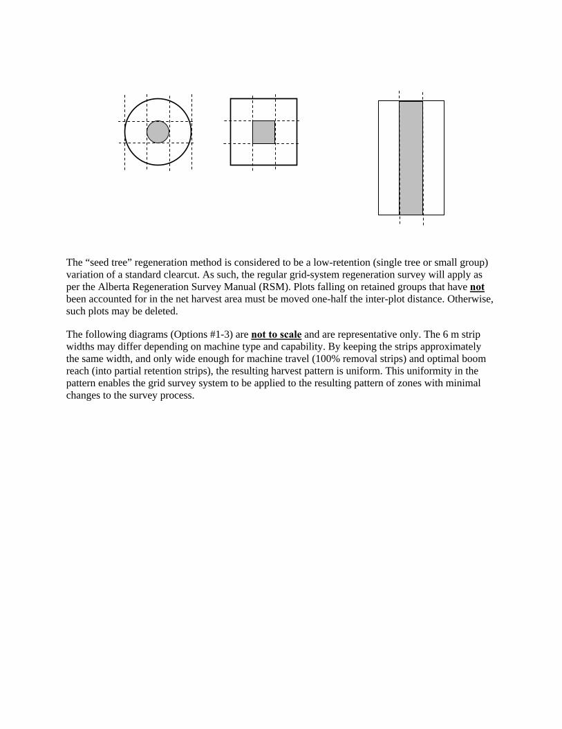
The “seed tree” regeneration method is considered to be a low-retention (single tree or small group) variation of a standard clearcut. As such, the regular grid-system regeneration survey will apply as per the Alberta Regeneration Survey Manual (RSM). Plots falling on retained groups that have not been accounted for in the net harvest area must be moved one-half the inter-plot distance. Otherwise, such plots may be deleted.
The following diagrams (Options #1-3) are not to scale and are representative only. The 6 m strip widths may differ depending on machine type and capability. By keeping the strips approximately the same width, and only wide enough for machine travel (100% removal strips) and optimal boom reach (into partial retention strips), the resulting harvest pattern is uniform. This uniformity in the pattern enables the grid survey system to be applied to the resulting pattern of zones with minimal changes to the survey process.

Option #1 – Strip Shelterwood
What it looks like:
50% retention is “reach-in” zone on either side of access/extraction trail. In second pass, the 100% retention becomes the new access/extraction trail, and the remaining 50% in the partial retention areas is removed also by “reach-in” method (to protect regeneration).
100 % retention zone
50% retention zone
100% removal (access trail) zone
6 m 6 m Control
Line
Good plot location. Plot to be moved ½ inter-plot spacing until fully inside either partial retention area or trail.
6 m
• Number of regen plots and spacing required is calculated on net harvest area (trails + partial
retention). • Grid/plot layout as in the Regeneration Survey Manual; however, since the number of plots
and spacing are calculated on the net harvest area, but the grid must be laid out on “artificial” boundary, all plots inside the 100% retention zone are to be moved (not deleted) 1/2 the inter-plot distance until fully within partial retention or trail zone, and until the required number of plots is achieved (add lines if necessary, as per the Regeneration Survey Manual, to attain appropriate plot density).
• Additional survey information required: zone code and location code.
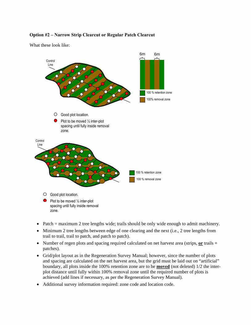
Option #2 – Narrow Strip Clearcut or Regular Patch Clearcut
What these look like:
100 % retention zone
100% removal zone
6m 6mControl
Line
Good plot location. Plot to be moved ½ inter-plot spacing until fully inside removal zone.
100 % retention zone
Control Line
Good plot location. Plot to be moved ½ inter-plot spacing until fully inside removal zone.
100 % removal zone
• Patch = maximum 2 tree lengths wide; trails should be only wide enough to admit machinery. • Minimum 2 tree lengths between edge of one clearing and the next (i.e., 2 tree lengths from
trail to trail, trail to patch, and patch to patch). • Number of regen plots and spacing required calculated on net harvest area (strips, or trails +
patches). • Grid/plot layout as in the Regeneration Survey Manual; however, since the number of plots
and spacing are calculated on the net harvest area, but the grid must be laid out on “artificial” boundary, all plots inside the 100% retention zone are to be moved (not deleted) 1/2 the inter-plot distance until fully within 100% removal zone until the required number of plots is achieved (add lines if necessary, as per the Regeneration Survey Manual).
• Additional survey information required: zone code and location code.
Option #3 – Irregular Patch Clearcut
What it looks like:
100 % retention zone
100% removal zone
Pre-determined, random plot location.
• This survey system requires authorization from the Director of Forest Management Branch prior to implementation, as it no longer adheres to the grid location system.
• Patch = maximum 2 tree lengths wide; trails should be only wide enough to admit machinery. • Minimum 2 tree lengths between edge of one clearing and the next (i.e., 2 tree lengths from
trail to trail, trail to patch, patch to patch). • Number of regen plots and spacing required calculated on net harvest area (trails + patches). • Plots are not located on a grid; random plot locations are pre-determined and plotted using
aerial photo or GPS/GIS map. Plots are allocated as per the following rules until required number of plots is achieved:
o 1-3 plots in each access/extraction trail segment (between patches), o 2-4 plots in each patch.
• It may be possible to use a “dot grid” overlay (on air photo or GPS/GIS map) and evenly distribute plots (deleting the “extras” until the required number of plots is achieved).
• Additional survey information required: zone code and location code.
C5 Forest Management Plan 2006−2026 17 Appendix 9b. Porcupine Hills Harvesting and Silviculture Strategies
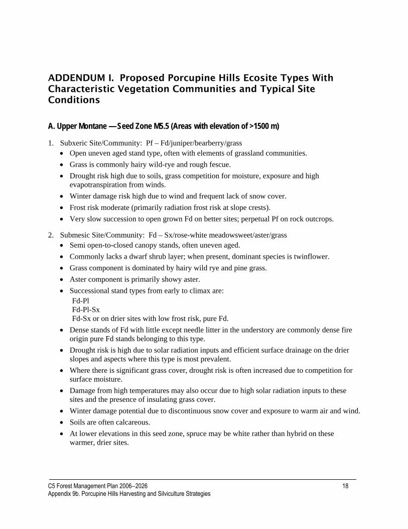
ADDENDUM I. Proposed Porcupine Hills Ecosite Types With Characteristic Vegetation Communities and Typical Site Conditions
A. Upper Montane — Seed Zone M5.5 (Areas with elevation of >1500 m) 1. Subxeric Site/Community: Pf – Fd/juniper/bearberry/grass
• Open uneven aged stand type, often with elements of grassland communities. • Grass is commonly hairy wild-rye and rough fescue. • Drought risk high due to soils, grass competition for moisture, exposure and high
evapotranspiration from winds. • Winter damage risk high due to wind and frequent lack of snow cover. • Frost risk moderate (primarily radiation frost risk at slope crests). • Very slow succession to open grown Fd on better sites; perpetual Pf on rock outcrops.
2. Submesic Site/Community: Fd – Sx/rose-white meadowsweet/aster/grass • Semi open-to-closed canopy stands, often uneven aged. • Commonly lacks a dwarf shrub layer; when present, dominant species is twinflower. • Grass component is dominated by hairy wild rye and pine grass. • Aster component is primarily showy aster. • Successional stand types from early to climax are:
Fd-Pl Fd-Pl-Sx Fd-Sx or on drier sites with low frost risk, pure Fd.
• Dense stands of Fd with little except needle litter in the understory are commonly dense fire origin pure Fd stands belonging to this type.
• Drought risk is high due to solar radiation inputs and efficient surface drainage on the drier slopes and aspects where this type is most prevalent.
• Where there is significant grass cover, drought risk is often increased due to competition for surface moisture.
• Damage from high temperatures may also occur due to high solar radiation inputs to these sites and the presence of insulating grass cover.
• Winter damage potential due to discontinuous snow cover and exposure to warm air and wind. • Soils are often calcareous. • At lower elevations in this seed zone, spruce may be white rather than hybrid on these
warmer, drier sites.
C5 Forest Management Plan 2006−2026 18 Appendix 9b. Porcupine Hills Harvesting and Silviculture Strategies

• Frost risk is lower due to site often occupying warmer aspects and steeper slopes where solar radiation losses are lower and cold air movement downslope is efficient and unimpeded; warm upslope movement of air at night may also help decrease the risk of frost.
3. Mesic Site/Community: Sx – Fa/twinflower/arnica/moss • Closed canopy stands. • Moss is dominantly feather mosses. • Moss layer not well developed on some plots but has greater cover than grasses. • Generally not a well-developed tall shrub layer. • Successional stand types from early to climax are:
Pl-Fd Pl-Fd-Sx Sx-Fd Sx-Fd-Fa
• This type is often found on north and east aspects. • Moderate risk of frost during growing season. • Frost risk will be highest along drainages and near or on high elevation crests/plateaus. • Where risk of frost is a high, Fd will be a minor component or absent from stands. • There is more snow and greater persistence in these types due to elevation and aspect. • Drought risk is low due to lower air temperatures and evapotraspiration, and increased
precipitation with elevation.
4. Subhygric Site/Community: Sx – Fa/false azalea-alder/bunchberry/arnica/moss • Closed canopy stands. • False azalea is a subalpine indicator. • Predominantly upper elevation north aspects. • Successional stand types from early to climax are:
Pl-Sx Pl-Sx-Fa Sx-Fa
• Fd is either absent or a minor component in these types. • Frost risk is high in most of these types. • Drought is not a risk factor, and snow and moisture are retained longer due to predominance
of north aspects. • Other subalpine indicators on these plots are grouseberry and occasionally white
rhododendron. • At lower elevations and on richer soils, this type can have a very species rich understory,
particularly for forbs.
5. Hygric Site/Community: Se/horsetail • Closed canopy stands. • Often associated with springs and seeps.
C5 Forest Management Plan 2006−2026 19 Appendix 9b. Porcupine Hills Harvesting and Silviculture Strategies
• Occupies a limited area. • In early succession, there is high species richness in the forb layer with species such as
baneberry, violet, white geranium, etc. • Successional stand types from early to climax are:
Pb Pb-Se Se
• No soil moisture deficit. • Douglas-fir is uncommon in this type, likely due to periodic soil saturation which is limiting
to Fd. • Frost risk can be high where sites are along drainages or in low areas. • These communities may be very small where they are localized around springs and seepage
areas.
B. Lower Montane — Seed zone M4.5 (areas with elevation <1500 m)
1. Xeric Site/Community: Grassland • Non-forested south aspects. • May be some tree invasion by Fd and Aw, with the former more common in the south section
and the latter more common in the north section of this seed zone. • Community composed primarily of species typical of foothills fescue grassland communities. • High drought risk due to high air temperatures, solar radiation input, grass competition and
wind. • High risk of high temperature damage due to exposure and prevalence of south aspects. • High winter damage potential due to Chinook winds and lack of snow cover. • Frost risk low.
2. Subxeric Site/Community Pf-Fd/juniper/rye grass • Open uneven aged stands in a prairie matrix. • Generally steeper southeast to southwest aspects and extension into grasslands at lower
elevations. • On rock outcrops and very exposed positions, Fd and Aw may be absent. • Stand types
Pf — severe sites, no succession to Fd. Pf-Fd — succession to more Fd over time but always suitable to some Pf. Pf-Fd-Aw — slow succession to Fd but always habitat suitable for Pf and Aw.
• Aspen more common in stands in the northern portion of the zone.
3. Submesic Site/Community: Fd/Saskatoon-snowberry/aster/grass • Closed and open even- and uneven-aged stands. • Most commonly east to south east and southeast to west aspects. • Successional stand sequences:
C5 Forest Management Plan 2006−2026 20 Appendix 9b. Porcupine Hills Harvesting and Silviculture Strategies

Fd (on drier and milder sites it may persist throughout succession) Aw Fd-Aw-Sw Fd-Sw Sw (often climax on sites subject to cold air drainage)
• Grass layer dominant. • Often significant rose component in the shrub layer. • Dwarf shrub layer absent or underdeveloped. • More common type in southern section. • High drought risk due to steep and southeast and southwest aspects as well as grass
competition for surface moisture. • Low risk of frost on steeper mid-to-upper slopes; moderate otherwise. • Winter damage risk high due to exposure to direct radiation and frequent lack of snow cover.
4. Mesic Site/Community: Fd – Sw/Saskatoon-rose/aster-strawberry/grass • Closed canopy stands both even and uneven aged. • Shrub and grass layer generally equally or more developed than forb layer. • Stand types:
Aw Aw-Fd Aw-Fd-Sw Fd-Sw Fd (climax on milder aspects and slopes) Sw (often climax on sites with cold air drainage)
• Dwarf shrub layer absent or weakly developed. • Often fairly equal representation of shrubs and grasses with forb cover being less or about
equal. • Drought risk moderate. • Frost risk moderate on slopes but higher along drainages. • Winter damage risk moderate. • High temperature risk moderate.
5. Subhygric Site/Community: Sw – Fd/delphinium-cow parsnip-baneberry-lily • Closed canopy stands both even and uneven aged. • Most commonly found on north and northeast aspects. • Forb layer generally species rich and dominates the understory in early succession. • Stand types:
Aw-Pb Aw-Pb-Sw-Fd Sw-Fd Sw
• Drought risk low.
C5 Forest Management Plan 2006−2026 21 Appendix 9b. Porcupine Hills Harvesting and Silviculture Strategies

• Low risk for high temperature damage. • Frost risk moderate on slopes but high where there may be cold air drainage or pooling. • Winter damage moderate due to greater retention of snow and protection from direct solar
radiation on north aspects.
6. Hygric Site/Community: Sw/horsetail • Closed canopy stands. • Often associated with wet springs, discharge areas and pond/steam edges. • Uncommon type in the hills. • In early succession there is high species richness due to higher deciduous cover component. • This forb dominance persists as succession proceeds, but total understory cover decreases. • Stand types include:
Pb Pb-Sw Sw
• No soil moisture deficit. • Excess moisture likely limiting to Fd. • Frost risk high where it is associated with depressions or areas of cold air drainage along
creeks. • Winter damage risk is moderate. More snow cover and north aspects. • Areas occupied by this type are limited.
C5 Forest Management Plan 2006−2026 22 Appendix 9b. Porcupine Hills Harvesting and Silviculture Strategies
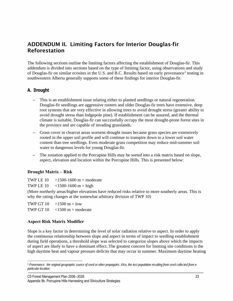
ADDENDUM II. Limiting Factors for Interior Douglas-fir Reforestation
The following sections outline the limiting factors affecting the establishment of Douglas-fir. This addendum is divided into sections based on the type of limiting factor, using observations and study of Douglas-fir on similar ecosites in the U.S. and B.C. Results based on early provenance2 testing in southwestern Alberta generally supports some of these findings for interior Douglas-fir.
A. Drought
− This is an establishment issue relating either to planted seedlings or natural regeneration. Douglas-fir seedlings are aggressive rooters and older Douglas-fir trees have extensive, deep root systems that are very effective in allowing trees to avoid drought stress (greater ability to avoid drought stress than lodgepole pine). If establishment can be assured, and the thermal climate is suitable, Douglas-fir can successfully occupy the most drought-prone forest sites in the province and are capable of invading grasslands.
− Grass cover in clearcut areas worsens drought issues because grass species are extensively rooted in the upper soil profile and will continue to transpire down to a lower soil water content than tree seedlings. Even moderate grass competition may reduce mid-summer soil water to dangerous levels for young Douglas-fir.
− The zonation applied to the Porcupine Hills may be sorted into a risk matrix based on slope, aspect, elevation and location within the Porcupine Hills. This is presented below:
Drought Matrix – Risk
TWP LE 10 >1500-1600 m = moderate TWP LE 10 <1500-1600 m = high (More northerly areas/higher elevations have reduced risks relative to more southerly areas. This is why the rating changes at the somewhat arbitrary division of TWP 10)
TWP GT 10 >1500 m = low TWP GT 10 <1500 m = moderate
Aspect Risk Matrix Modifier
Slope is a key factor in determining the level of solar radiation relative to aspect. In order to apply the continuous relationship between slope and aspect in terms of impact to seedling establishment during field operations, a threshold slope was selected to categorize slopes above which the impacts of aspect are likely to have a dominant effect. The greatest concern for limiting site conditions is the high daytime heat and vapour pressure deficits that may occur in summer. Maximum daytime heating
2 Provenance: the original geographic source of seed or other propagules. Also, the test population resulting from seed collected from a particular location.
C5 Forest Management Plan 2006−2026 23 Appendix 9b. Porcupine Hills Harvesting and Silviculture Strategies

for the Porcupine Hills (assuming a 50o latitude for all) is found on a southwest-facing 20o slope. Slopes ranging from -10 to +50o, however, will receive 87% of this maximum load (i.e., northerly slopes to a maximum of 10 degrees or 17% will receive similar solar radiation loads to a 50o south-facing slope). In high-risk stands, gains from a north aspect will only be realized where north slopes exceed 15%.
North (>15%) East South and Southwest West – 0 ++ +
To some extent, drought risk may also be assessed by standing timber type, understory vegetation complexes and other factors:
• If alpine fir is present, then drought risk is moderate to low (depending whether fir is in the understory, or more prevalent and represented in the main canopy).
• If lodgepole pine is present as a significant component of the canopy, the drought risk is moderate and likely only limiting during establishment. Lodgepole pine drought tolerance is less than that of Douglas-fir.
• Care must be taken in interpreting and assigning moisture regimes at the block-level in the Porcupine Hills, as the may change considerable over a very short distance due to the localized seepage areas. Douglas-fir will not establish in areas of high seepage, as it does not tolerate soils with high moisture content.
Drought Management 1. Site selection. Given average seasonal conditions, sites at higher elevation on north-facing slopes
in the northern section of the Porcupine Hills, and with moisture indicators present, are unlikely to have significant drought issues.
2. Good soil moisture in the year following a good cone crop is necessary for significant recruitment of natural regeneration. The pattern of Douglas-fir establishment and development of age cohorts, as observed throughout the range for Douglas-fir as well as in the Porcupine Hills, is related to these requirements probably as much as frequent light surface fires. This may explain the lack of continuous age distributions in many stands with understory cohorts. Because of this lengthy periodicity (or waves of establishment), natural regeneration will be promoted as much as possible; however, all hectares must be planted as well to ensure prompt and successful reforestation.
3. When planting Douglas-fir seedlings, whether following group selection or conventional clearcutting, advantage should be taken of any shade opportunities, particularly the inert shade from stumps and slash. For young seedlings, even moderate increases in shade on a seasonal and daily basis can aid in survival and growth.
4. Grass competition should be controlled as much as possible, particularly on sites with additional risk factors. It appears that moderate-to-low grass competition (relative to many boreal sites) may prove to be severe competition for the limited amount of upper soil moisture when seedlings are small.
5. Partial cutting systems should be employed whenever risk factors are moderate to high. Any high-risk sites need to be managed on a single tree selection basis to provide continuous shade.
C5 Forest Management Plan 2006−2026 24 Appendix 9b. Porcupine Hills Harvesting and Silviculture Strategies

Group shelterwood utilizing openings that are no more than one tree length relative to the major aspect are acceptable for moderate risk sites. The need for partial cutting systems is also dictated by other limiting factors as in the following sections.
B. Temperature Frost is the most frequently observed cause of tissue damage and mortality in Douglas-fir trials in the Montane region of southwestern Alberta. It is a potential problem on all sites and areas in the Porcupine Hills, and may be a result of cold air drainage3 and pooling and/or long-wave radiation loss. Sites least prone to frosts are on moderate-to-steep slopes where cold air drainage is not impeded, and warmer air movement upslope ensures reasonable mixing. Similarly, long-wave radiation losses are reduced (per unit ground area) on moderate slope sites.
Radiation Frost
• High elevation plateau surfaces are the sites at greatest risk (lapse rate and exposure allow long-wave radiation to bring air temperatures to critical values sooner).
• Sites with heavy organic matter accumulation or dense understory vegetation development (i.e., grasses) can increase the risk of radiation frost events.
Cold Air Drainage Frost
• Cold air pooling risks occur in all zones, and areas of cold air catchments can suffer from repeated frost events.
• Lower slopes at stand edges, depressions, and gentle slopes with cold air drainage restriction (e.g., grass) can facilitate accumulations of cold air.
Frost Management
• Heat absorption during the day and heat radiation back into the atmosphere at night from exposed mineral soil can lessen air temperature extremes.
• Presence of a retained over-topping vegetation can dramatically reduce night time radiative cooling
• Partial harvesting systems that retain high levels of well-dispersed canopy trees will buffer air temperatures and slow radiative cooling at night.
• As mid-to-upper slope positions are less vulnerable than plateaus, Douglas-fir plantings should not occur in potential cold air pockets. More frost-hardy species should be used in areas of known high frost probabilities.
• Harvest designs should facilitate cold air drainage as much as possible.
High Summer Temperatures
• Seedling mortality from direct heat injuries is possible. Temperatures in excess of 50°C are lethal to plant tissues.
• Lower elevations sites are more vulnerable to high temperature damage due to heat lapse rate. 3 Cold air draining from higher elevations to lower elevations and pocketing in cutblocks where it is prevented from escaping by adjacent vegetation.
C5 Forest Management Plan 2006−2026 25 Appendix 9b. Porcupine Hills Harvesting and Silviculture Strategies

• South and west aspects of slopes up to 50° are at greater risk of damage from high temperatures. The maximum heat load in the Porcupine Hills will be on southwest slopes with a 20° aspect.
• Dense grass canopies can increase problems resulting from high air temperatures by preventing heat absorption/transfer into the soil during daytime and act as a radiative cooling surface at night.
High Summer Temperature Risk Management
• Reduce grass cover and/or organic matter at establishment stage, and ensure adequate mineral soil exposure.
• Partial harvesting systems with high levels of retained canopy trees will significantly reduce summer temperature/drought limitations on lower elevations with south and west aspects.
• Provision of inert shade through planting next to slash and stumps can provide additional protection from excessive heat loads.
Low Summer Temperatures
Low temperatures can retard growth and may delay establishment. The best performance (height and diameter) in Alberta Douglas-fir population trials occurred where the summation of growing degree days (number of days >5°C) was near 1000. Performance was significantly reduced on sites with a lower summation of growing degree days. Low temperatures are, however, not likely to pose direct threats to plantation establishment.4
Low Summer Temperature Risk Management
Planting Douglas-fir should be avoided on sites dominated by lodgepole pine in early succession, or hybrid spruce and alpine fir in older stands that lack Douglas-fir and subalpine fir. Understory indicators such as grouseberry, false azalea and white rhododendron are likely to occur in areas of low summer temperatures
Low Winter Temperatures
• Winter frost drought occurs when roots are frozen, yet stomates open (from warm air temperatures). This can lead to needle death due to irreplaceable moisture loss.
• Frost cankers have been observed in Douglas-fir population trials in Porcupine Hills, Although their cause is not certain, very low winter temperature are likely the reason.
• Direct root damage can be a problem, as Douglas-fir cannot tolerate sustained cold soil temperatures.
• Winter die-back is a common and severely limiting factor noted in the Douglas-fir population trials, including the Porcupine Hills trial. While the exact cause(s) of the die-back are unknown, significant growth reductions can occur.
4 Growing degree days are the number of days times the number of degrees above a threshold (usually used as 5°C) in a year. Thus if only one day in an entire year had a mean temperature of 10°C, that would be 5 GDD—hence you can get more than 365 GDD in a calendar year.
C5 Forest Management Plan 2006−2026 26 Appendix 9b. Porcupine Hills Harvesting and Silviculture Strategies
Low Winter Temperature Risk Management
• Deep and continual snow cover and/or retention of intact canopies through partial harvest systems can increase snow retention and moderate extreme temperatures.
• Sites at lower risk from the effects of excessively low temperatures will be at higher elevations, out of the path of Chinooks, and on north aspects where daytime heating will be minimal.
C. Browse As Douglas-fir is a preferred browse species, mortality and/or growth losses caused by foragers is possible. Reduction of browse through silvicultural/harvest practices is limited. Increased stocking and seedling density, use of mixed species in appropriate areas, and retention of snow to ensure winter cover may reduce browse pressure.
D. Light competition
• Interior Douglas-fir is moderately shade tolerant (more than lodgepole pine; less than white spruce).
• More tolerant of shade as a seedling where moderate shade can improve survival. • Less tolerant of shade and grows better under nearly full light conditions once past the
seedling stage.
C5 Forest Management Plan 2006−2026 27 Appendix 9b. Porcupine Hills Harvesting and Silviculture Strategies

ADDENDUM III. Percentage Representation of Stand Types by Zone
A
0
5
10
15
20
25
30
35%
of S
trat
ified
Are
a
B
02468
10121416
FdFd A
wFd P
l
Fd Sw
Fd mult
i
Aw no Fd
Pl no F
d
Sw no Fd
Other
Stand Type
% o
f Str
atifi
ed A
rea
ABCD
Figure 1. Distribution of stand types by crown closure class within the north (A) and south (B) zones of the Porcupine Hills for stands at an elevation of <1500 m (seed zone M4.5).

A
0
5
10
15
20
25
% o
f Str
atifi
ed A
rea
B
02468
1012141618
FdFd A
wFd P
l
Fd Sw
Fd mult
i
Aw no Fd
Pl no Fd
Sw no Fd
Other
Stand Type
% o
f Str
atifi
ed A
rea A
BCD
Figure 2. Distribution of stand types by crown closure class within the north (A) and south (B) zones of the Porcupine Hills for stands at an elevation of >1500 m (seed zone M5.5).
C5 Forest Management Plan 2006−2026 29 Appendix 9b. Porcupine Hills Harvesting and Silviculture Strategies