Embed Size (px)
DESCRIPTION
Antarctic Spatial Data Infrastructure My Vision. Article III.1.c of the Treaty XXIII ATCM Resolution 4 (98) Recommend That. Antarctic Spatial Data Infrastructure. Scientific observations and results from Antarctica shall be exchanged and made freely available (Art. III). - PowerPoint PPT Presentation
Citation preview

Antarctic Spatial Data Infrastructure
My Vision
Article III.1.c of the Treaty
XXIII ATCM Resolution 4 (98)
Recommend That
Antarctic Spatial Data Infrastructure
Scientific observations and results from Antarctica shall be exchanged and
made freely available (Art. III)
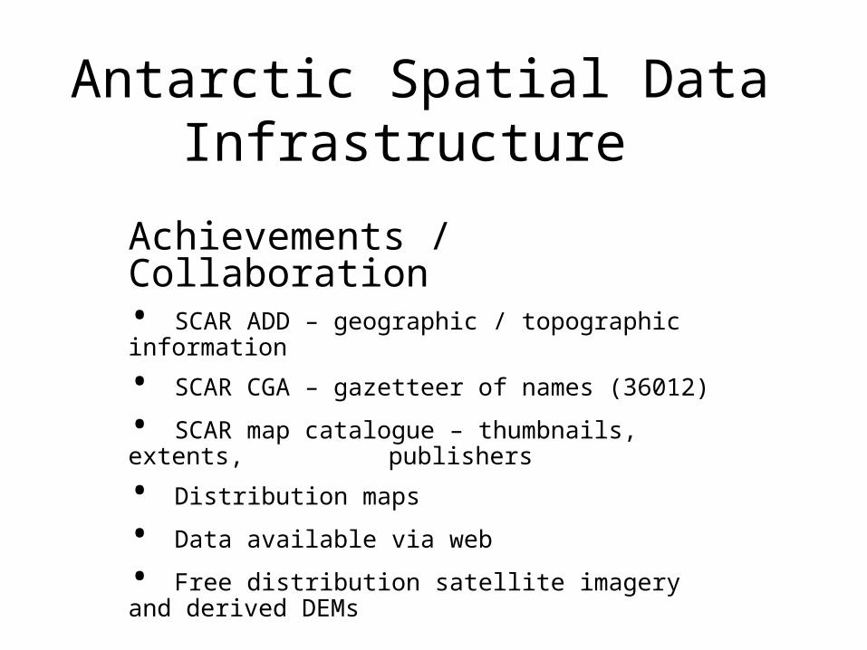
Antarctic Spatial Data Infrastructure
Achievements / Collaboration• SCAR ADD – geographic / topographic information
• SCAR CGA – gazetteer of names (36012)
• SCAR map catalogue – thumbnails, extents, publishers
• Distribution maps
• Data available via web
• Free distribution satellite imagery and derived DEMs
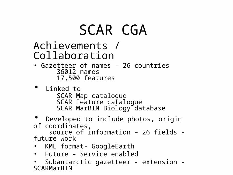
SCAR CGAAchievements / Collaboration• Gazetteer of names – 26 countries
36012 names17,500 features
• Linked toSCAR Map catalogueSCAR Feature catalogueSCAR MarBIN Biology database
• Developed to include photos, origin of coordinates, source of information – 26 fields - future work• KML format- GoogleEarth• Future – Service enabled • Subantarctic gazetteer - extension - SCARMarBIN

Antarctic Spatial Data Infrastructure
How has this been achieved?
COLLABORATION
• SCAR ADD – major sponsor – BP• Working together on national projects• Sharing data • Sharing methods to distribute data• Being open to discussion about problems with data• Commitment to SCAR Community Projects

Antarctic Spatial Data Infrastructure
• SCAR Data and Information Strategy
• Ownership of Strategy by SCAGI members
• SCAGI needs to implement it
• Show leadership within SCAR

SCAR DIMSImplementation?
• Not prescriptive
• How do we go about it?
• Build on what we have?
• Revise metadata in SCAR ADD?
• Complete fields in SCAR CGA – source of data
• New data – adhere to ISO Standards
• Method of Delivery?
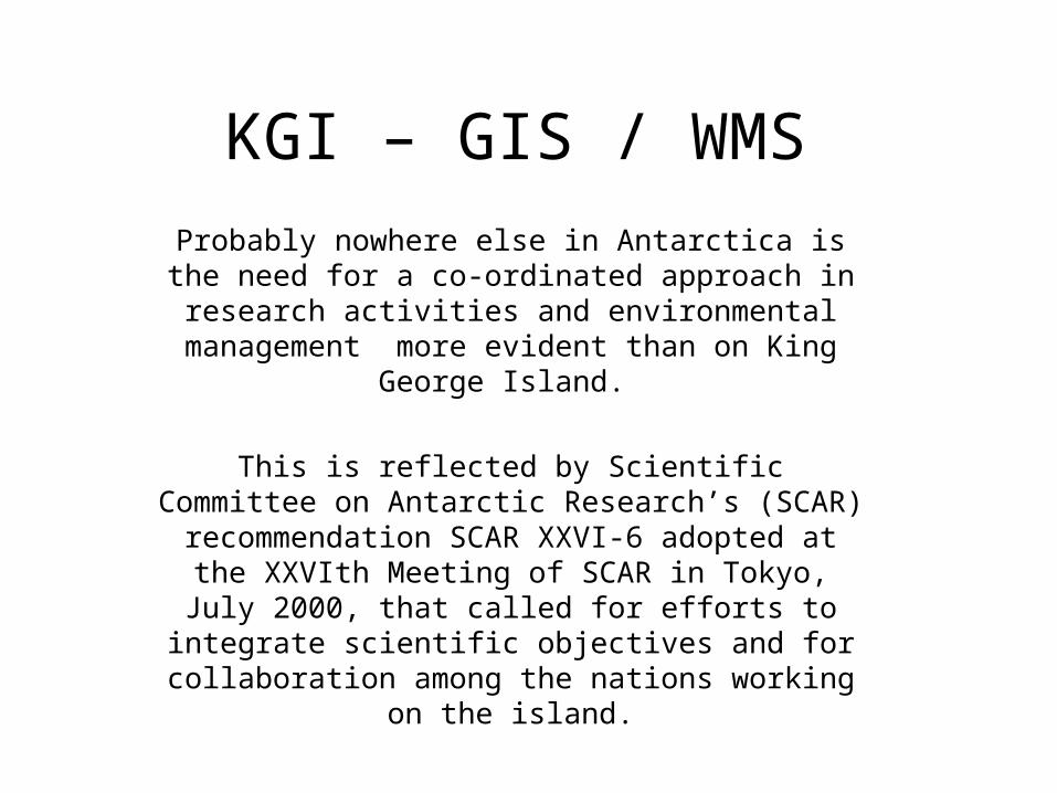
KGI – GIS / WMS
Probably nowhere else in Antarctica is the need for a co-ordinated approach in research activities and
environmental management more evident than on King George Island.
This is reflected by Scientific Committee on Antarctic Research’s (SCAR) recommendation SCAR XXVI-6
adopted at the XXVIth Meeting of SCAR in Tokyo, July 2000, that called for efforts to integrate scientific
objectives and for collaboration among the nations working on the island.
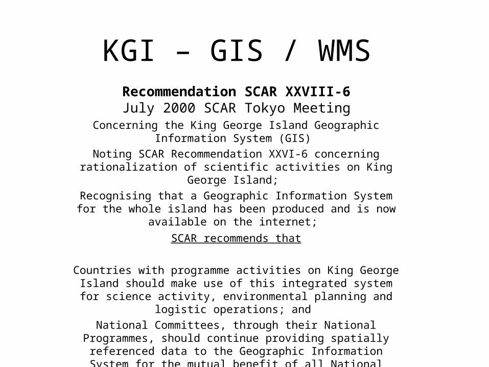
KGI – GIS / WMS Recommendation SCAR XXVIII-6
July 2000 SCAR Tokyo MeetingConcerning the King George Island Geographic Information System
(GIS)
Noting SCAR Recommendation XXVI-6 concerning rationalization of scientific activities on King George Island;
Recognising that a Geographic Information System for the whole island has been produced and is now available on the internet;
SCAR recommends that
Countries with programme activities on King George Island should make use of this integrated system for science activity,
environmental planning and logistic operations; and
National Committees, through their National Programmes, should continue providing spatially referenced data to the Geographic
Information System for the mutual benefit of all National Programmes with activities on the island.
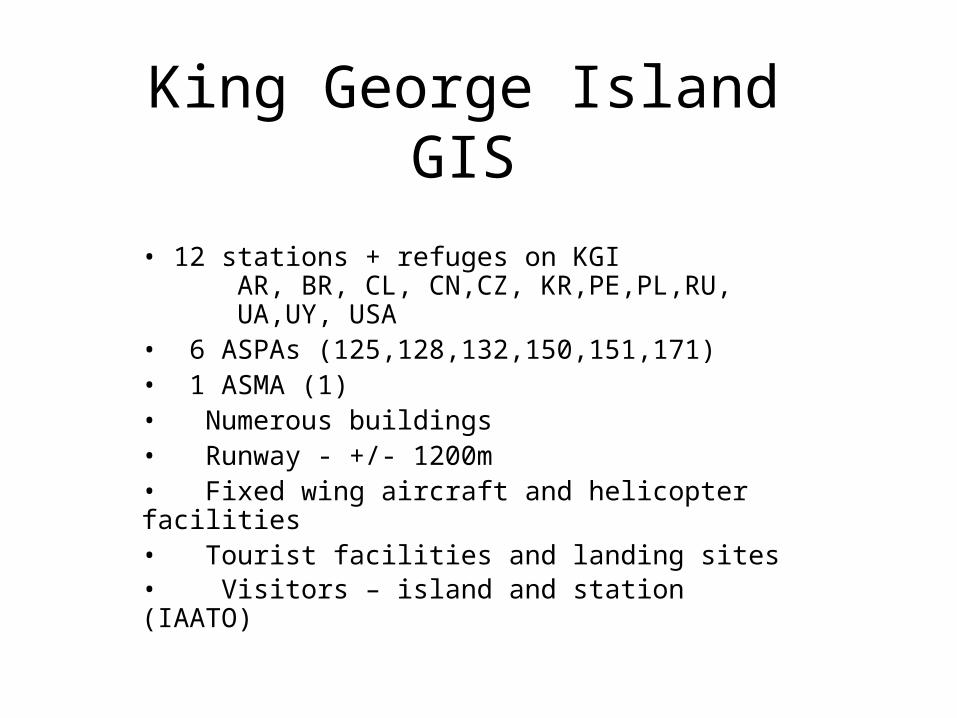
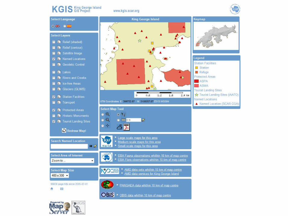
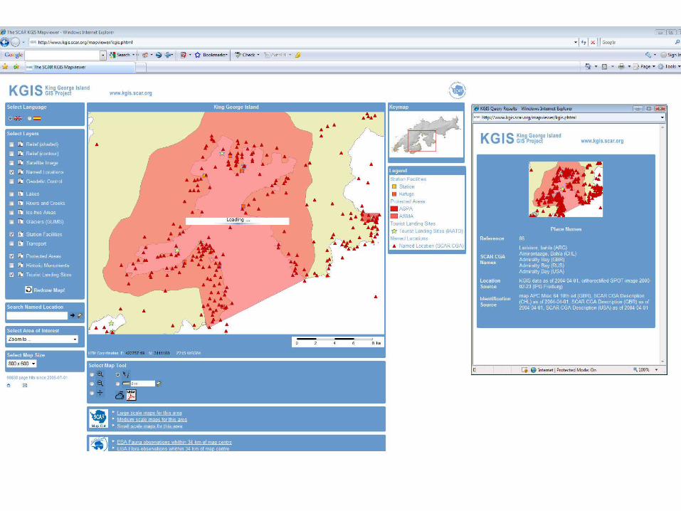
King George IslandGIS
• 12 stations + refuges on KGIAR, BR, CL, CN,CZ, KR,PE,PL,RU,
UA,UY, USA• 6 ASPAs (125,128,132,150,151,171)• 1 ASMA (1)• Numerous buildings• Runway - +/- 1200m• Fixed wing aircraft and helicopter facilities• Tourist facilities and landing sites• Visitors – island and station (IAATO)
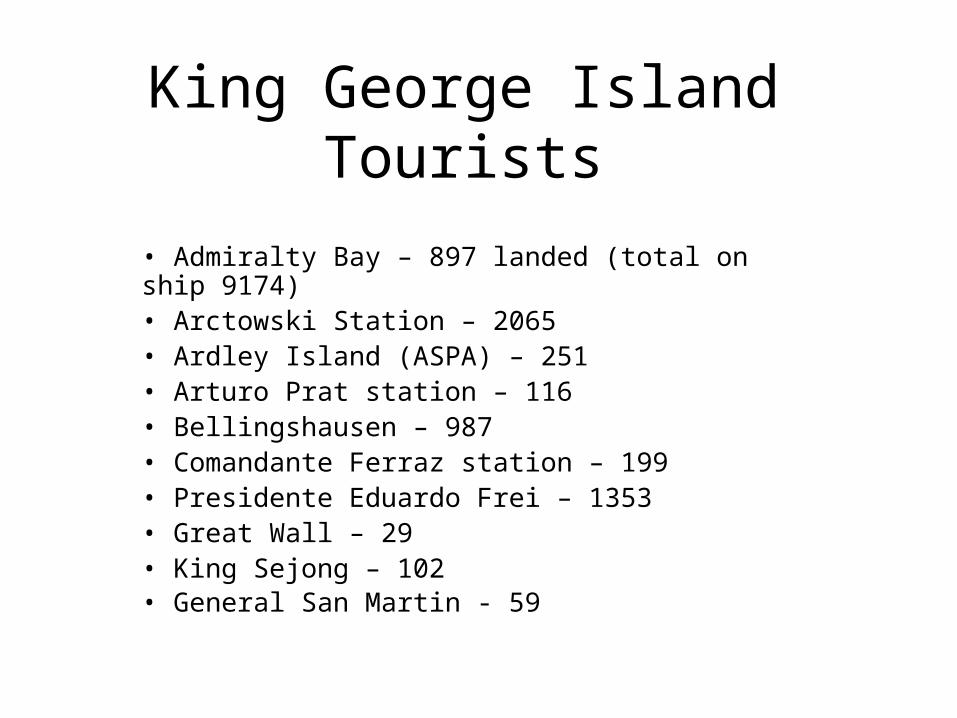
King George IslandTourists
• Admiralty Bay – 897 landed (total on ship 9174)• Arctowski Station – 2065• Ardley Island (ASPA) – 251• Arturo Prat station – 116• Bellingshausen – 987• Comandante Ferraz station – 199• Presidente Eduardo Frei – 1353• Great Wall – 29• King Sejong – 102• General San Martin - 59

King George IslandSTATUS
• Developer has departed – no communication
• Host web site – unable to edit data
• KGI nations – not one has taken up the challenge to take it over, or keep it functioning
• COMNAP – interest ?
• SCAR – Excom Committee – August meeting

King George IslandCHALLENGE
SCAGI
• Leadership – COMNAP / SCAR Ex Com meeting• KGI nations / COMNAP / SCAR / SCAGI reps• Plan - Resurrect the KGI / WMS• Project leader and active collaborators• Encourage others –to join in• Web Map Services – King George Island• Distant Future – develop Web Feature Services
(WFS)
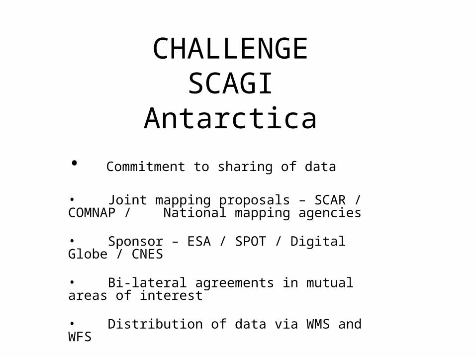
CHALLENGESCAGI
Antarctica
• Commitment to sharing of data
• Joint mapping proposals – SCAR / COMNAP / National mapping agencies
• Sponsor – ESA / SPOT / Digital Globe / CNES
• Bi-lateral agreements in mutual areas of interest
• Distribution of data via WMS and WFS
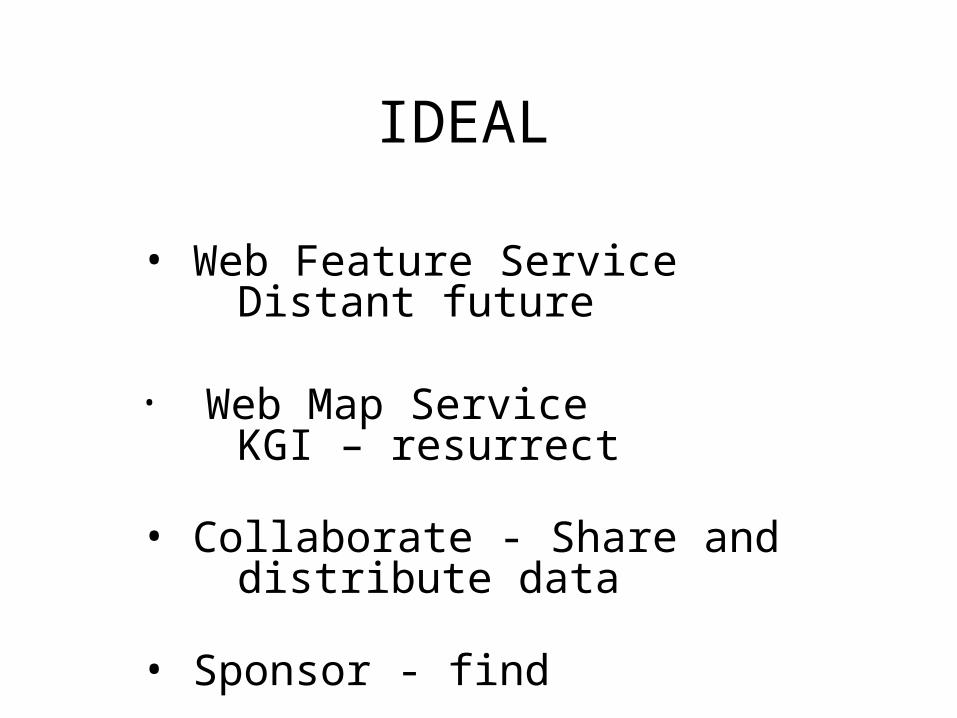
IDEAL
• Web Feature ServiceDistant future
• Web Map Service KGI – resurrect
• Collaborate - Share and distribute data
• Sponsor - find

IMPEDIMENTS• Collaboration - more active
• Data sharing / distribution- timely
• Delivery – mechanism
• Leadership – SCAR DIMS
• Sponsor


![Spatial Data Infrastructure (SDI) “[Spatial Data Infrastructure] provides a basis for spatial data discovery, evaluation, and application for users and](https://img.pdfslide.us/doc/110x75/56649d5f5503460f94a3f713/spatial-data-infrastructure-sdi-spatial-data-infrastructure-provides.jpg)