Embed Size (px)
Citation preview
Antarctic and Arctic Bathymetry Data Available Through Global Multi Resolution Topography (GMRT)
Frank Nitsche, Vicki Ferrini, Tinah Martin
And the GMRT Team:
John Morton, Andrew Goodwillie, Suzanne O’Hara, Kevin McLain, Ed Bohl, Eric Malikowski Claudia Giulivi, Suzanne Carbotte Neville Shane, Rose Ann Weissel and numerous summer students

Background
• Data from US academic ships (R2R)including NB Palmer, Sikuliaq, (Healy)
• Collected by PI-driven project
• MB data archived at MGDS
• Restricted hold for two years (usually)
• Integrating multibeam data into GMRT
• Long-term archive at NCEI
N.B. Palmer
R2R = Rolling Deck To RepositoryMGDS = Marine Geoscience Data Synthesis
Sikuliaq

GMRT - Overview
• Multi-resolution tiled synthesis
• Topography and bathymetry
• Comprehensive metadata
• Full attribution to sources and access to source data
• Three projections
• Elevation data in many formats• Grids, Images, Points, Profiles
https://www.gmrt.org
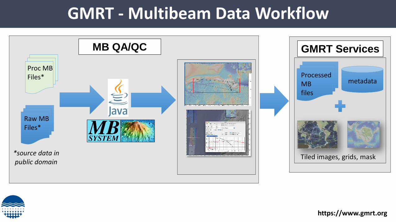
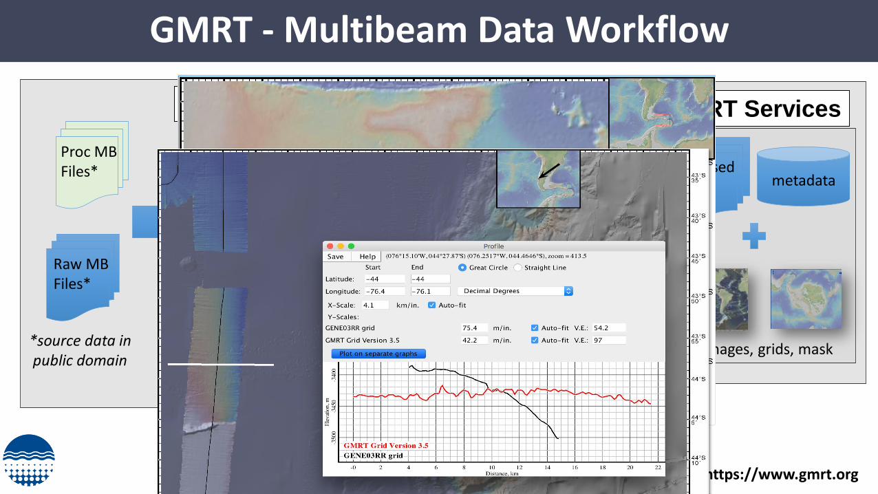
GMRT - Multibeam Data Workflow
Raw MB Files*
MB QA/QC
*source data inpublic domain
Processed MB files
metadata
Tiled images, grids, mask
GMRT Services
Proc MB Files*
https://www.gmrt.org
GMRT - Multibeam Data Workflow
Raw MB Files*
MB QA/QC
*source data inpublic domain
Processed MB files
metadata
Tiled images, grids, mask
GMRT Services
Proc MB Files*
https://www.gmrt.org
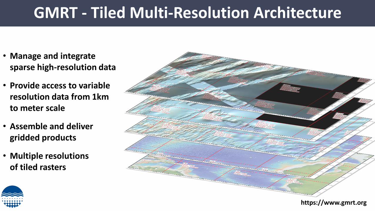
GMRT - Tiled Multi-Resolution Architecture
• Manage and integrate sparse high-resolution data
• Provide access to variable resolution data from 1km to meter scale
• Assemble and deliver gridded products
• Multiple resolutionsof tiled rasters
https://www.gmrt.org
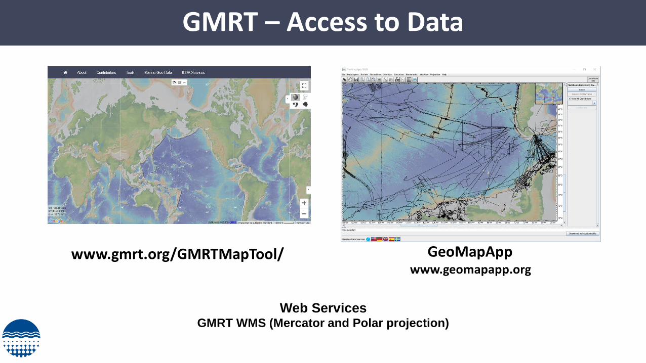
GMRT – Access to Data
www.gmrt.org/GMRTMapTool/ GeoMapAppwww.geomapapp.org
Web ServicesGMRT WMS (Mercator and Polar projection)
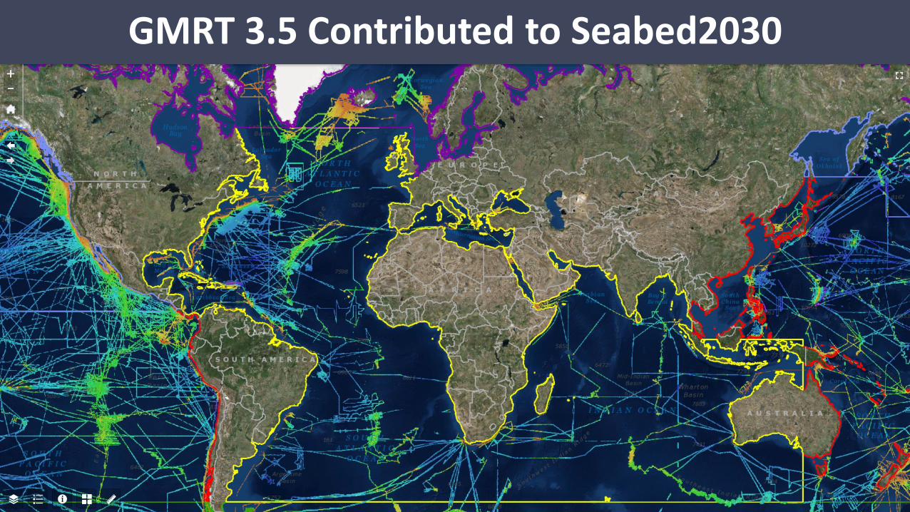
GMRT 3.5 Contributed to Seabed2030

GMRT 3.5 Contributed to GEBCO
GMRT grids (400m) have been provided to regional data centers
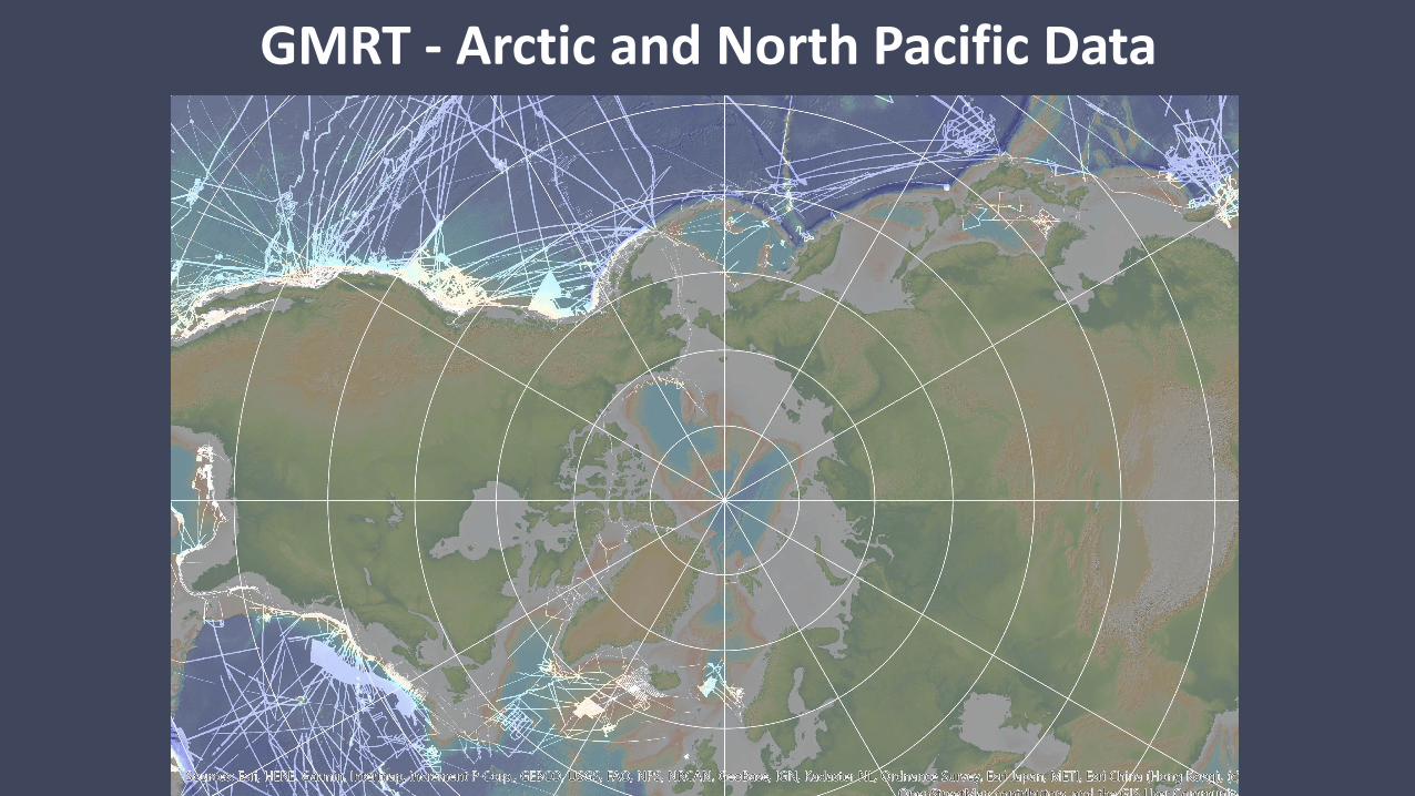
GMRT - Arctic and North Pacific Data
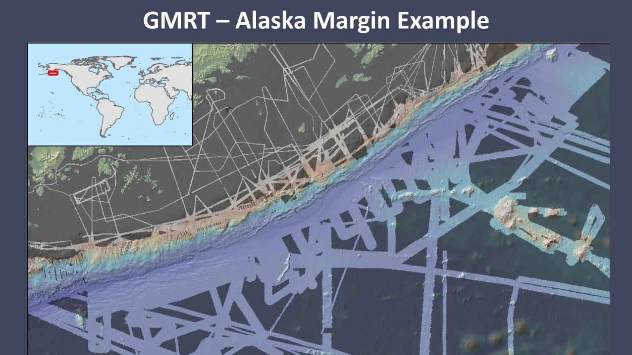
GMRT – Alaska Margin Example
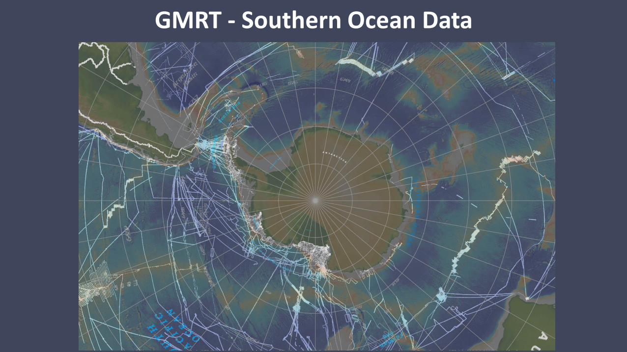
GMRT - Southern Ocean Data

GMRT - Southern Ocean Data

Example – East Antarctica / NBP1503

MGDS multibeam data not in GMRT yet
ROSETTA
2 new multibeam cruises 201915 cruises not in GMRT yet

Ross Ice Shelf – Predicted Bathymetry
ROSETTA
ROSETTA

Upcoming/Planned Cruises
• All PI driven• Not sure about the schedule
• late 2019 – Drake/Antarctic Peninsula?• 2020 – Amundsen Sea (Thwaites)• 2021 Ross Sea?
20202021?
Late2019
?
2021?
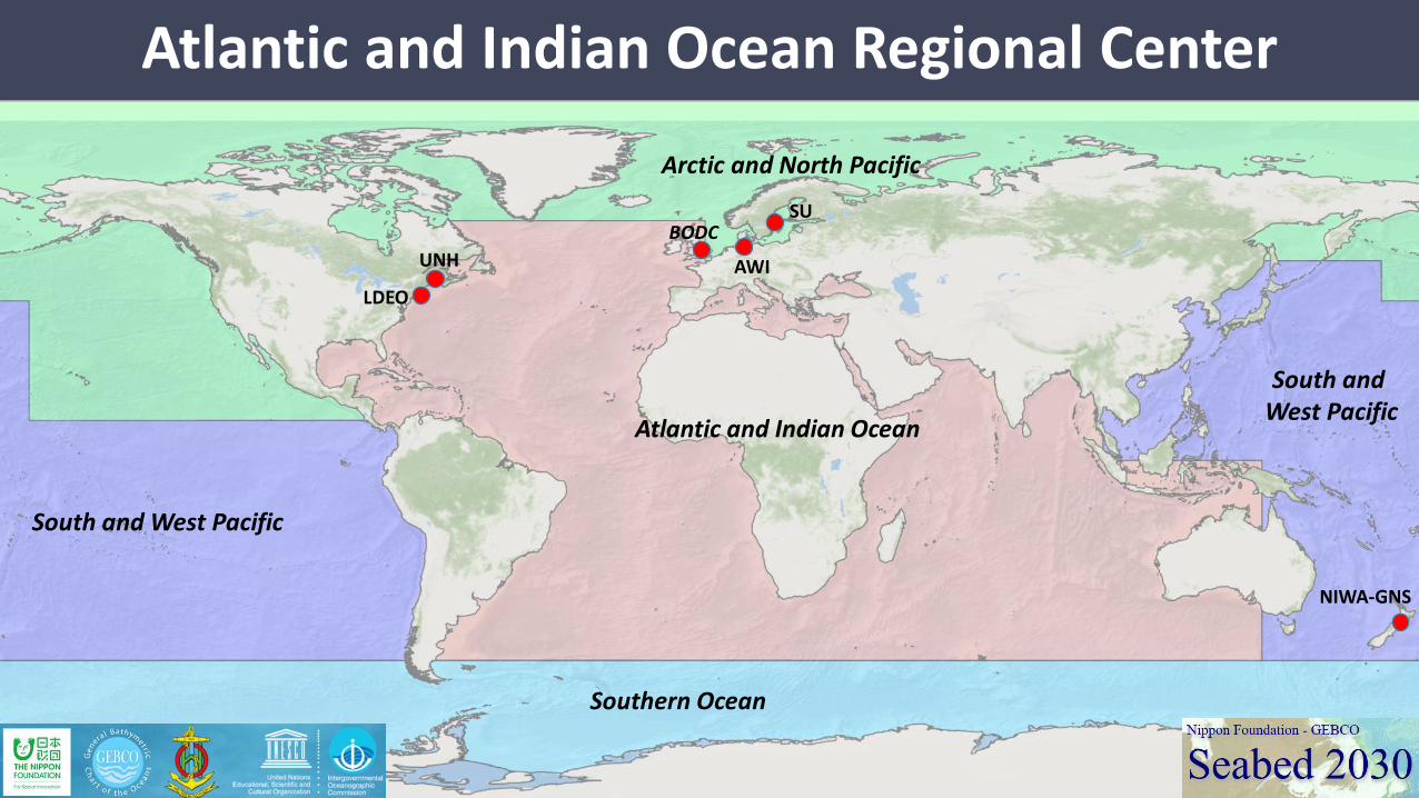
Atlantic and Indian Ocean Regional Center
South and West Pacific
Atlantic and Indian Ocean
South and West Pacific
Arctic and North Pacific
Southern Ocean
LDEO
UNH
BODCSU
NIWA-GNS
AWI
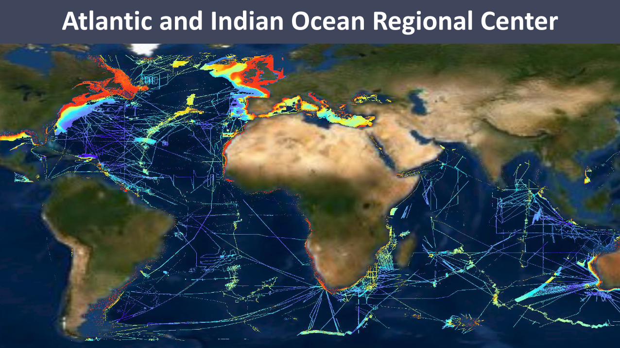
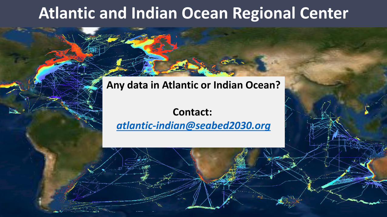
Atlantic and Indian Ocean Regional Center
Atlantic and Indian Ocean Regional Center
Any data in Atlantic or Indian Ocean?
Contact: [email protected]