Embed Size (px)
Citation preview

PMS 401
PMS Cool Grey 11
PMS 173
ANNUALREPORT2015–2016


NORTHERN TERRITORY PLANNING COMMISSIONLevel 2, Energy House 18-20 Cavenagh Street Darwin, Northern Territory, 0800
Postal Details Northern Territory Planning Commission GPO Box 1680 DARWIN NT 0801
Contact Phone: (08) 8924 7540 Email: [email protected]
www.planningcommission.nt.gov.au
PMS 401
PMS Cool Grey 11
PMS 173
y Letter to the Minister 2
y Foreword from the Chairman 3
y Highlights 2015 – 2016 4
y About the Planning Commission 5
y Our Organisation 6
y Our Members 7
y Meetings Attendance 10
y Work Program 11
y Strategic Plan 2014 – 2017 13
y Projects 14
y The Year Ahead 22
y Community Engagement 23
y Key Stakeholders 25
y Case Studies 27
y Financial Report 29
y Budget 31
y Operating Statement 32
ANNUAL REPORT CONTENTS
ISSN 2202-8218
NORTHERN TERRITORY PLANNING COMMISSION2
PMS 401
PMS Cool Grey 11
PMS 173
The Hon. Nicole Manison MLA Minister for Infrastructure, Planning and Logistics Parliament House DARWIN NT 0800
Dear Minister
2015-16 Annual Report – Northern Territory Planning Commission
I am pleased to present you with the annual report for the Northern Territory Planning Commission for the 2015–16 financial year.
Under section 81Y of the Planning Act, the Chairman must prepare and give to the Minister a report on the performance of the Planning Commission against its functions during each financial year. The report must be given to the Minister by 31 October following the end of the financial year and as responsible Minister, you are required to table a copy of the report in the Legislative Assembly within six sitting days of receiving the report.
Yours sincerely
The Hon. Gary Nairn AO Chairman NT Planning Commission
20 October 2016
Chairman Level 2 Energy House 18-20 Cavenagh Street DARWIN NT 0800
Postal Address GPO Box 1680 DARWIN NT 0801
T 08 8924 7540 E [email protected]
File Ref: NTPC16/69
LETTER TO THE MINISTER

ANNUAL REPORT 2015 – 2016 3
The last year has been the busiest yet for the Planning Commission since its establishment in January 2013. Our continuing focus on developing integrated strategic plans for the Territory has seen a number of land use and area plans completed this year, and we have developed policies to help streamline the NT Planning Scheme and provide housing
options for a growing population. This year we have delivered five strategic land use and area plans, and three planning scheme amendments and policies to the then Minister for Lands and Planning, recommending he place them on exhibition for inclusion in the NT Planning Scheme.
The Commission’s commitment to ‘upfront’ engagement through our Community Engagement Policy ensures all Territorians can have their say on strategic plans for their area before they are prepared rather than after. This has proved successful in the Darwin Region (Darwin Inner and Mid Suburbs Area Plans, Litchfield Subregional Land Use Plan), and other regions such as Alice Springs (Alice Springs Regional Land Use Plan). The Commission has spoken to over 2000 Territorians face to face, and has heard many differing opinions about how the Territory can meet the long term housing needs of a growing population. I am confident the Commission’s strategic land use and area plans will form a strong foundation to provide for this future growth, whenever it occurs, by establishing a robust land use framework.
I am personally grateful for the substantial commitment shown by each of the Planning Commission’s members, who are all fully committed to their roles and responsibilities. Each member brings a different expertise to the table, which has meant our discussions have been robust and enthusiastic, and I have appreciated their honesty and opinion in ensuring the Commission’s vision is achieved, and the aspirations of Territorians are understood.
I particularly thank Dr Brian Reid, whose appointment to the Planning Commission as Chair of the Heritage Council of the NT ended in September 2015. Brian’s valuable contribution during his time on the Planning Commission is appreciated.
The Planning Commission could not have achieved its work program this year without the cooperation and support from the Department of Lands, Planning and the Environment. Chief Executive Rod Applegate and Executive Director Bruce Michael have ensured the Commission has suitable resources and expertise to complete a very challenging work program. All Departmental staff, but particularly the Lands Planning unit headed by Mark Meldrum, and later Michael Holmes, worked closely with the Commission to ensure the Commission’s vision and values were transformed into workable, high quality plans and policies.
My personal thanks to Departmental staff who directly supported the Commission on a daily basis this year. Without such a dedicated staff, ably led by Kirsten McComiskie and more recently Louise Taylor, it would have been difficult to achieve so much this year.
As I reflect on the Commission’s many achievements since our establishment in 2013, and to our future work program that includes a land use plan for Tennant Creek and area plans for the central business districts and peripheral urban areas of Darwin, Palmerston and Alice Springs, as well as rural activity centres in Litchfield municipality, I am confident the Commission will continue to provide the long term strategic land use framework to ensure the Territory is well prepared to provide the appropriate land uses to meet long term population growth.
FOREWORD FROM THE CHAIRMAN
This is the Northern Territory Planning Commission’s fourth Annual Report I’ve had the pleasure to present.
The Hon Gary Nairn AO Chairman Northern Territory Planning Commission
NORTHERN TERRITORY PLANNING COMMISSION4
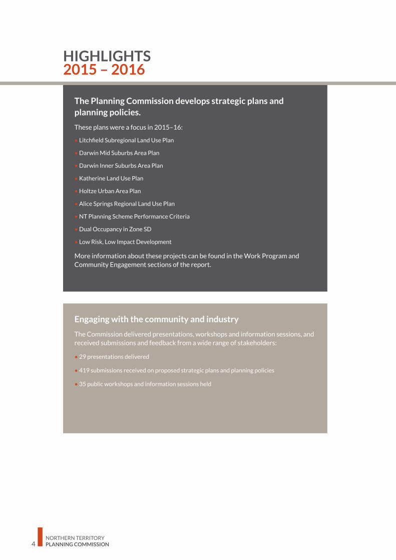
The Planning Commission develops strategic plans and planning policies.
These plans were a focus in 2015–16:
• Litchfield Subregional Land Use Plan
• Darwin Mid Suburbs Area Plan
• Darwin Inner Suburbs Area Plan
• Katherine Land Use Plan
• Holtze Urban Area Plan
• Alice Springs Regional Land Use Plan
• NT Planning Scheme Performance Criteria
• Dual Occupancy in Zone SD
• Low Risk, Low Impact Development
More information about these projects can be found in the Work Program and Community Engagement sections of the report.
Engaging with the community and industry
The Commission delivered presentations, workshops and information sessions, and received submissions and feedback from a wide range of stakeholders:
• 29 presentations delivered
• 419 submissions received on proposed strategic plans and planning policies
• 35 public workshops and information sessions held
HIGHLIGHTS 2015 – 2016

ANNUAL REPORT 2015 – 2016 5
PMS 401
PMS Cool Grey 11
PMS 173
ABOUT THE PLANNING COMMISSION

NORTHERN TERRITORY PLANNING COMMISSION6
The Planning Commission currently has seven members who provide planning leadership and deliver professional, independent advice. The Commission strengthens links between the Northern Territory Environment Protection Authority, Development Consent Authority, Heritage Council and local government.
The Planning Commission comprises:
• Chairman
• Chairpersons of the Development Consent Authority, Heritage
Council of the NT and NT Environment Protection Authority
• a representative of the Local Government Association of NT
• up to five additional members (currently two) with appropriate qualifications and expertise appointed by the Minister
The Commission membership includes the chairpersons of three bodies with statutory decision-making powers for development, providing for a greater shared understanding of
the aspirations of the planning system in delivery outcomes.
On 30 September 2015 Dr Brian Reid’s term as Chair of the Heritage Council of the NT finished. The Planning Commission is grateful to Dr Reid for his invaluable contribution. Wayne Kraft was appointed as Chair to the Heritage Council of the NT and joined the Commission from 1 October 2015.
OUR ORGANISATION
• strategic planning for land use and development, and for the sustainable use of resources
• strategic planning of transport corridors and other public infrastructure
• effective controls and guidelines for the appropriate use of land, having regard to its capabilities and limitations
• control of development to provide protection of the natural environment, including by sustainable use of land and water resources
• minimising adverse impacts of development on existing amenity and, wherever possible, ensuring that amenity is enhanced as a result of development
• ensuring, as far as possible, that planning reflects the wishes and needs of the community through appropriate public consultation and input in both the formulation and implementation of the Planning Schemes
• fair and open decision-making and appeals processes.
Who are weThe Planning Commission is an independent statutory authority that:
• develops strategic plans and planning policies
• advises on significant development proposals
What we doWe perform our functions and exercise our powers independently, impartially and in the public interest, according to the Planning Act.
The Commission plans and provides a framework of controls for the orderly use and development of land. This is to be achieved by:
Arrangements with the Department of Lands, Planning and the Environment
Under section 81E of the Act, the Chief Executive of the Department of Lands, Planning and the Environment provides the Planning Commission with staff and facilities to enable it to properly exercise its powers and perform its functions.
Professional and technical support is provided by the Department under the Planning Commission’s direction. The Commission accesses expertise throughout the Department in areas such as strategic planning, demography, spatial information, commercial analysis and public engagement. The Department also supports a Planning Commission Secretariat that manages the daily operations of the Planning Commission.
ABOUT THE PLANNING COMMISSION

ANNUAL REPORT 2015 – 2016 7
OUR MEMBERS
The Hon Gary Nairn AOChairman (appointed 1 January 2013; re-appointed 1 January 2015)
Gary is the Chairman of the Northern Territory Planning Commission and a Member of the Board of the NT Environment Protection Authority.
After a 25 year career as a surveyor in Australia, United Kingdom and Europe, including 13 years as Managing Director of his Darwin based surveying and mapping consultancy, Gary Nairn served as the Federal Member for Eden-Monaro from 1996 to 2007.
During his parliamentary career he was the Parliamentary Secretary to Prime Minister Howard from 2004 to 2006 and Special Minister of State from 2006 to 2007. His responsibilities in these roles included water reform, e-Government, Commonwealth properties, the Australian Electoral Commission and five Government Business Enterprises.
Gary lived in the Northern Territory from 1980 to 1995 and was involved in the planning, design and survey of many major developments including Palmerston, Cullen Bay, Bayview and Katherine East.
He remains involved in the spatial industry, is immediate past chair of the Tasmanian Spatial Information Council (TASSIC) and is the immediate past chairman of the Spatial Industries Business Association (SIBA). Mr Nairn was made an Officer of the Order of Australia (AO) in the June 2015 Queens Birthday Honours.
Dr Bill FreelandEx officio member (appointed 1 January 2013)
Bill became the inaugural Chair of the Northern Territory Environment Protection Authority on 1 January 2013. Earlier, he was an environmental consultant working with business and industry in environmental management in the NT. He is a former academic and Director and CEO of the Parks and Wildlife Commission of the NT, and Director of Conservation Strategy with the Queensland Government.
He has represented the Territory on national environmental groups, including the National Standing Committee for Water, Land and Biodiversity; Natural Resource Management Ministerial Council and the Standing Committee to the Australian and New Zealand Environment Council.
He has a MSc (University of Queensland) and a PhD in Zoology (University of Michigan). He has published more than 50 scientific papers and consultancy reports in the fields of conservation management, environmental impacts, waste management, ecologically sustainable development and tourism development.
Mr Wayne KraftEx officio member (appointed 1 October 2015)
Wayne has been a resident of the Northern Territory since 1972. A long-term resident of Alice Springs, he has also lived in Tennant Creek, Darwin and Barrow Creek.
He was a founding Board Member of the NT TAB, a past Member and Chairperson of the Museums and Art Galleries Board of the NT, and is current Chairperson of the Heritage Council of the Northern Territory, having been appointed in October 2015.
He was the long term owner of the Overlanders Steakhouse in Alice Springs and sold this business - after 27 years – in early 2016.
NORTHERN TERRITORY PLANNING COMMISSION8
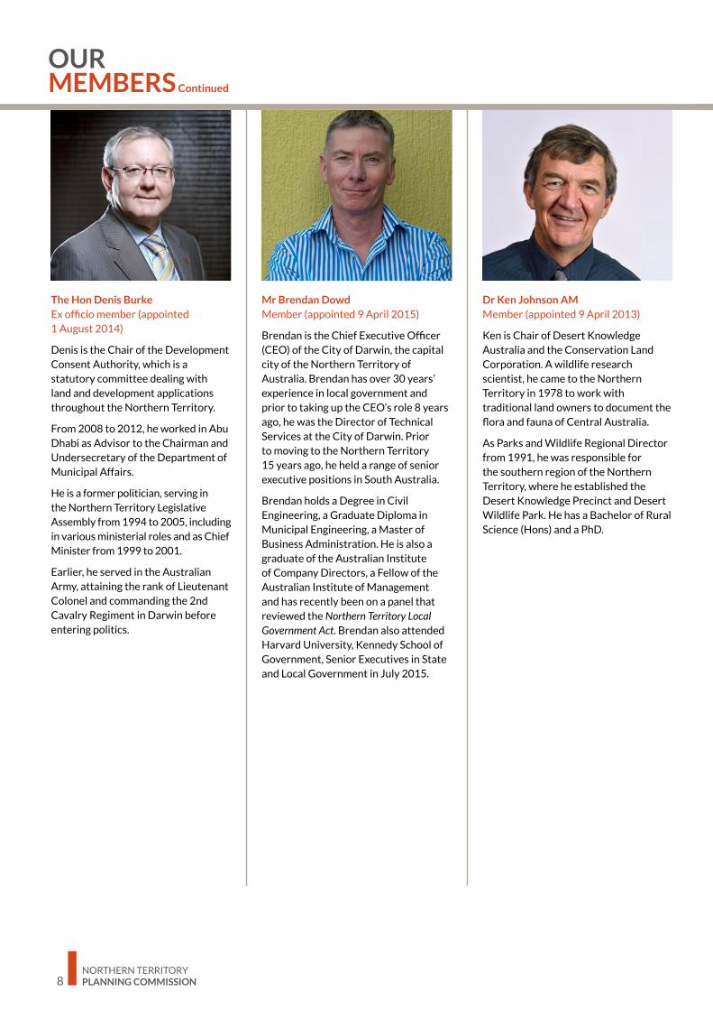
The Hon Denis BurkeEx officio member (appointed 1 August 2014)
Denis is the Chair of the Development Consent Authority, which is a statutory committee dealing with land and development applications throughout the Northern Territory.
From 2008 to 2012, he worked in Abu Dhabi as Advisor to the Chairman and Undersecretary of the Department of Municipal Affairs.
He is a former politician, serving in the Northern Territory Legislative Assembly from 1994 to 2005, including in various ministerial roles and as Chief Minister from 1999 to 2001.
Earlier, he served in the Australian Army, attaining the rank of Lieutenant Colonel and commanding the 2nd Cavalry Regiment in Darwin before entering politics.
Mr Brendan DowdMember (appointed 9 April 2015)
Brendan is the Chief Executive Officer (CEO) of the City of Darwin, the capital city of the Northern Territory of Australia. Brendan has over 30 years’ experience in local government and prior to taking up the CEO’s role 8 years ago, he was the Director of Technical Services at the City of Darwin. Prior to moving to the Northern Territory 15 years ago, he held a range of senior executive positions in South Australia.
Brendan holds a Degree in Civil Engineering, a Graduate Diploma in Municipal Engineering, a Master of Business Administration. He is also a graduate of the Australian Institute of Company Directors, a Fellow of the Australian Institute of Management and has recently been on a panel that reviewed the Northern Territory Local Government Act. Brendan also attended Harvard University, Kennedy School of Government, Senior Executives in State and Local Government in July 2015.
Dr Ken Johnson AMMember (appointed 9 April 2013)
Ken is Chair of Desert Knowledge Australia and the Conservation Land Corporation. A wildlife research scientist, he came to the Northern Territory in 1978 to work with traditional land owners to document the flora and fauna of Central Australia.
As Parks and Wildlife Regional Director from 1991, he was responsible for the southern region of the Northern Territory, where he established the Desert Knowledge Precinct and Desert Wildlife Park. He has a Bachelor of Rural Science (Hons) and a PhD.
OUR MEMBERS Continued

ANNUAL REPORT 2015 – 2016 9
OUR MEMBERS Continued
Mr Denys StedmanMember (appointed 9 April 2013)
Denys is a chartered accountant and managing partner of KPMG Darwin. Since coming to Darwin in 1979, he has advised many organisations regarding business planning and strategy development. He has extensive exposure through dealings with clients in the building and construction, pastoral, property and professional service industries.
He has a Bachelor of Business and is a Fellow of the Institute of Chartered Accountants, Fellow of the Taxation Institute of Australia, graduate of the Australian Institute of Company Directors and a Fellow of the Certified Practising Accountants Australia.
The following member completed his service during the reporting period:
Dr Brian Reid 1 January 2013 to 30 September 2015
Brian was the Chair of the Heritage Council of the NT until 30 September 2015 and is a long-term Darwin resident who has worked here for many years as a medical practitioner.
He is also a historian and a member of the Northern Territory branch of the Professional Historians’ Association. He is a past President of the Historical Society of the Northern Territory.

NORTHERN TERRITORY PLANNING COMMISSION10
DATE PRESENT APOLOGY
17th Meeting 28/07/15
Gary NairnKen JohnsonDenys StedmanBrian Reid
Bill FreelandDenis BurkeBrendan Dowd
18th Meeting 20/08/15
Gary NairnBill FreelandWayne KraftDenis BurkeBrendan DowdKen JohnsonDenys Stedman
NIL
19th Meeting 30/11/15
Gary NairnBill FreelandWayne KraftDenis BurkeBrendan DowdKen JohnsonDenys Stedman
NIL
20th Meeting 28/01/16
Gary NairnBill FreelandWayne KraftDenis BurkeBrendan DowdKen Johnson
Denys Stedman
21st Meeting 31/03/16
Gary NairnBill FreelandWayne KraftDenis BurkeBrendan DowdKen JohnsonDenys Stedman
NIL
22nd Meeting 7/06/16
Gary NairnBill FreelandWayne KraftDenis BurkeBrendan DowdKen JohnsonDenys Stedman
NIL
MEETINGS ATTENDANCE
The Planning Commission held six meeting in 2015-16:
In accordance with the Planning Act (NT) the Planning Commission is to meet as often as necessary, however must meet at least 4 times per year.

ANNUAL REPORT 2015 – 2016 11
PMS 401
PMS Cool Grey 11
PMS 173
WORK PROGRAM
NORTHERN TERRITORY PLANNING COMMISSION12
WORK PROGRAM
At the Planning Commission we• prepare integrated strategic plans, guidelines and assessment criteria
• review NT Planning Scheme matters at regular intervals
• advise on significant development proposals
Planning PrioritiesWe prepare strategic land use plans that anticipate growth and set frameworks with which to manage development. We set the strategic framework for better integrated land use, transport and infrastructure planning, delivering more sustainable and cost-effective outcomes for the community, with sensitivity to environmental and heritage values.
The Planning Commission is committed to providing expert and independent advice to the Minister that contributes to economic growth and development, and values the protection of the environment and natural assets.
Developing Strategic PlansOur primary role is to prepare integrated strategic land use plans in consultation with the community. These plans may also identify future transport corridors, utility corridors and sites for essential facilities including communication, water and power supply, gas and similar condensates, effluent treatment and regional waste, public and social infrastructure.
The Planning Commission may provide guidance on where and how communities or urban areas should grow. Our plans can include maps, policy statements and objectives relating to housing, transport, economic development, the environment, open space and conservation.
During 2015-16, the Planning Commission made key achievements in guiding the Territory’s long-term growth, and providing confidence and certainty for the community and industry on future land uses.
2014–17 Strategic PlanThe 2014-17 Strategic Plan is a high level document that sets out the Commission’s vision, mission, values, goals, priorities and projects over a three-year period. It is a flexible document whereby projects can be added as the need arises. Members finalised the 2014-17 Strategic Plan in early 2015 and it is available here and on our website.
An updated Strategic Plan will be developed next year to guide the Commission’s priorities and projects towards 2020.

ANNUAL REPORT 2015 – 2016 13
STR
ATE
GIC
PLA
N 2
014
-201
7
As a
t Feb
ruar
y 20
15
Pl
anni
ng fo
r Al
ice
Sprin
gs
•Co
mpl
ete
an A
lice
Sprin
gs L
and
Use
Pla
n •
Deve
lop
a Da
rwin
Reg
iona
l Lan
d U
se P
lan
as a
pol
icy
docu
men
t in
the
NT
Plan
ning
Sch
eme
•Co
mpl
ete
the
Litc
hfie
ld S
ub-R
egio
nal P
lan
•Gu
ide
prop
osed
Are
a Pl
ans t
hat a
re re
ferr
ed to
the
Com
miss
ion
Assis
t the
Min
ister
, as
requ
este
d, to
fulfi
l st
atut
ory
dutie
s in
resp
ect
to c
onsid
erat
ion
of
signi
fican
t dev
elop
men
t pr
opos
als
•Pr
ovid
e co
nsid
ered
and
tim
ely
signi
fican
t dev
elop
men
t re
port
s as r
equi
red
from
tim
e to
tim
e
Asse
ss a
nd u
pdat
e pl
anni
ng p
rovi
sions
•Re
com
men
d bu
ildin
g de
sign
crite
ria, i
nclu
ding
bui
lt fo
rm, h
eigh
ts a
nd in
tera
ctio
n w
ith p
ublic
spac
e
To b
e an
eff
ectiv
e,
inde
pend
ent a
nd
forw
ard
thin
king
lead
er
in th
e st
rate
gic
plan
ning
an
d de
velo
pmen
t of t
he
Nor
ther
n Te
rrito
ry
To p
rovi
de, t
hrou
ghou
t th
e N
orth
ern
Terr
itory
, fo
r the
ord
erly
de
velo
pmen
t and
su
stai
nabl
e us
e of
land
an
d w
ater
reso
urce
s to
fost
er e
cono
mic
gro
wth
an
d so
cial
im
prov
emen
ts, e
nhan
ce
amen
ity a
nd m
inim
ise
adve
rse
impa
cts o
f de
velo
pmen
t on
the
natu
ral e
nviro
nmen
t •
Proa
ctiv
e •
Prof
essi
onal
•
Cons
ulta
tive
•In
nova
tive
•Ba
lanc
ed
Plan
ning
for
Darw
in R
egio
n
Prom
ote
and
stim
ulat
e di
scus
sion
on p
lann
ing
prio
ritie
s and
app
roac
hes
•Co
nsid
er c
onte
mpo
rary
pla
nnin
g pr
actic
es fr
om
inte
rnat
iona
l jur
isdic
tions
•
Fost
er th
e de
velo
pmen
t of t
he N
T pl
anni
ng p
rofe
ssio
n in
par
tner
ship
with
indu
stry
bod
ies
•Ad
vise
on
advo
cacy
and
rese
arch
pap
ers f
rom
pol
icy
thin
k-ta
nks a
nd p
eak
indu
stry
org
anisa
tions

NORTHERN TERRITORY PLANNING COMMISSION14
Litchfield is one of six subregions identified in the Darwin Regional Land Use Plan, characterised as having a rural lifestyle with a focus on local communities. The Regional Plan recognises that Litchfield’s proximity to established and proposed urban infrastructure will inevitably increase demand for housing options in Litchfield, and identifies the need to plan for appropriate development to meet the needs of future residents.
We developed the Litchfield Subregional Land Use Plan to update and supersede the Litchfield Planning Concepts and Land Use Objectives 2002 and to provide a more informed response to strategic planning challenges in line with the direction set by the Darwin Regional Land Use Plan 2015.
The Plan provides a more detailed level of planning including statements of policy specific to the Litchfield subregion as well as land use concept plans to guide the future development of Area Plans for the rural activity centres.
Stage 1 community engagement commenced with upfront community input in October and November 2015. The Commission wrote to more than 7100 residents and spoke with people at industry and group meetings, shopping centres and markets, as well as holding a community workshop with 88 participants. Stage 2 consultation was the release of a draft plan in March 2016, followed by a further four weeks of active consultation.
The level of engagement from the community during both stages of consultation was encouraging with a total of over 1000 people stopping to talk with us, over 200 submissions received and a wide range of face-to-face feedback provided. The feedback informed numerous changes before the draft Litchfield Subregional Land Use Plan was provided to the Minister on 15 April 2016.
The Minister placed the subregional plan on public consultation for stage 3 consultation, exhibiting it from 22 April 2016 to 20 May 2016 as a proposed NT Planning Scheme amendment. A reporting body hearing was held on 17 June 2016. It is anticipated that the Minister will
make a decision on whether to approve the amendment and incorporate the plan into the NT Planning Scheme as a policy document in July 2016.
i
LITCHFIELD SUBREGIONAL
LAND USE PLAN 2016
Litchfield Subregional Land Use Plan
LITCHFIELD SUBREGIONAL LAND USE PLAN
Coolalinga Markets, Rick Burgess, Gary Nairn Litchfield consultation paper launch, Gary Nairn with media

ANNUAL REPORT 2015 – 2016 15
Katherine Land Use Plan
The Katherine Land Use Plan was prepared by the Planning Commission and incorporated into the NT Planning Scheme in June 2014. In September 2015, the Commission became aware of more up to date information which suggested the need to amend the Land Use Plan.
In 2015, the Katherine Region Flood Mitigation Advisory Committee hired a retail economist who identified an existing undersupply of commercial floor space in Katherine of some 5 000 square metres. This undersupply was largely attributed to flooding in the town centre as nearly all of the Central Business zone land is within the Katherine River flood plain.
The Land Use Plan identifies a site for a commercial development in the long term, however the identified site is currently isolated and requires significant capital investment to become viable. To satisfy the requirement for commercial space in the short term, we identified a site off the Stuart Highway in Katherine East adjacent to the Katherine Research Station for a new neighbourhood centre.
The site of the proposed neighbourhood centre is vacant Crown land; has strong access and exposure qualities and proximity to the growing Katherine East population; and is both immune to flood risk and damage and is able to provide for the key community needs in times of a flood event.
The Commission consulted with the Katherine community, including Katherine Town Council, NT Government agencies, business owners and community and industry groups in February and March 2016. A recommendation for an additional neighbourhood centre was made to the Minister for Lands and Planning in April 2016.
Litchfield consultation paper launch, Gary Nairn with media
Katherine Land Use Plan Map
Katherine
KATHERINE AMENDMENT TO THE LAND USE PLAN

NORTHERN TERRITORY PLANNING COMMISSION16
DARWININNERSUBURBSAREA PLANS
Darwin Mid Suburbs Draft Area Plan
The Darwin Inner Suburbs Area Plan was the initial project undertaken by the Commission in developing a suite of integrated strategic area plans for the Darwin Region. These plans are designed to create planning principles for suburbs and neighbourhoods that best reflect the needs of the current and future community. They also allow for service authorities, such as Power and Water Corporation, to plan and manage infrastructure upgrades.
The Darwin inner suburbs comprise The Gardens, Stuart Park, Parap, Woolner, Fannie Bay, The Narrows, Bayview and the area of Ludmilla south of Ludmilla Creek.
The Area Plan was developed by the Planning Commission over a period of 12 months, commencing in June 2015, in close consultation with all key stakeholders, including the community, service authorities, the City of Darwin and industry groups. The Commission wrote to all land owners and residents in the area, and engaged with over 800 residents at information stalls.
It establishes a framework to guide future development projected for the inner suburbs. It ensures adequate and effective housing and commercial opportunities as well as social, transport and essential services infrastructure are provided to accommodate future population growth, and has been strongly shaped by responses and information gained through the Planning Commission’s planning and consultation process.
The Area Plan also aims to provide confidence and clarity for the community, government agencies and developers by identifying areas proposed to change and areas where limited change is anticipated over the next 50 years.
New growth in activity centres is a main focus of the Area Plan which will facilitate walkability associated with the co-location of higher density residential development around a mix of commercial activity.
It is anticipated the Darwin Inner Suburbs Area Plan will be incorporated into the NT Planning Scheme in July 2016.
DARWIN INNER SUBURBS AREA PLAN
Community Consultation Stand, Mark Meldrum Michael Holmes and Gary Nairn, Fannie Bay Shops

ANNUAL REPORT 2015 – 2016 17
Michael Holmes and Gary Nairn, Fannie Bay Shops
The Darwin mid suburbs include Nightcliff, Millner, Rapid Creek, Coconut Grove and the area of Ludmilla north of Ludmilla Creek. These suburbs are strategically located between the major centres of the Darwin CBD and Casuarina and within the boundaries of Ludmilla Creek and Rapid Creek. The area is also significantly impacted by the Darwin International Airport/RAAF base located to the east.
The project followed a very similar approach to the Darwin Inner Suburbs Area Plan, with a discussion paper released on 30 September 2016 followed by six weeks of consultation. A second round of consultation, including the release of a draft Area Plan, commenced on 20 February 2016.
The Area Plan is informed by extensive studies into essential infrastructure, community infrastructure and transport services required to meet the needs of the community. Future growth in the mid suburbs will be focused to targeted areas, such as on Progress Drive near the Nightcliff shops, to provide housing options to future residents, while the majority of the area will continue to be developed within the parameters of the existing town planning zones, and enjoy the tropical characteristics that make up the mid suburbs. The Plan also outlines the essential infrastructure services required to manage the expected population growth over the longer term.
The Area Plan also responds to the recommendation by the Darwin Flood Mitigation Advisory Committee to rezone flood risk areas along Rapid Creek Road.
The Planning Commission recommended the Darwin Mid Suburbs Area Plan to the Minister for Lands and Planning in May 2016. Stage three of consultation, the public exhibition period, ran from 20 May 2016 until the 17 June 2016.
DARWIN MID SUBURBS AREA PLAN
DRAFTDarwin Mid SuburbsDraft Area Plan
February 2016
Louise Taylor and Julia Wanane at Nighcliff shops Mark Meldrum and Kirsten McComiskie at Nightcliff Markets
Darwin Mid Suburbs Draft Area Plan

NORTHERN TERRITORY PLANNING COMMISSION18
The locality of Holtze was identified in the Darwin Regional Land Use Plan 2015 as suitable for future urban and peri-urban development. With planning for the Palmerston Regional Hospital underway, consideration needed to be given to the proposed land uses for the area adjacent to the hospital.
Draft planning principles and an area plan were prepared by the Department of Lands, Planning and the Environment in early 2015. The Minister for Lands and Planning asked the Commission to undertaken community engagement with adjoining land owners, the local community and key stakeholders to seek comment on the draft principles and plan.
In July 2015, after extensive consultation with the community in the previous months, the Commission made several amendments to the draft plan and principles. Changes to the plan included the realignment of the Glyde Arterial Corridor, removing proposed residential classification of land north of the proposed arterial corridor (currently zoned RL) and removing the proposed service commercial area west of the Glyde Arterial.
On 11 August 2015, the Commission recommended to the Minister for Lands and Planning he exhibit the draft area plan and planning principles as a proposed Planning Scheme amendment. The Holtze Urban Area Plan was included into Part 8 the NT Planning Scheme on 18 March 2016.
HOLTZE URBAN PLANNING PRINCIPLES AND AREA PLAN
Holtze Urban Area Plan

ANNUAL REPORT 2015 – 2016 19
Alice Springs is strategically located within the centre of Australia. It plays an important role in transport, tourism and defence, and is the regional centre for government and social services. It is important for the future growth of the region to have a strong strategic framework guiding future land uses and development.
With this in mind, the Commission developed a regional land use plan for Alice Springs in late 2015. We launched a discussion paper and background information report in late September for consultation during October 2015. A consultation café, bringing together key stakeholders to discuss the needs and aspirations of the Alice Springs community was held during this time. Feedback received from the café, along with written submissions received, was integral to the development of the draft land use plan.
In November 2015 we released the draft Alice Springs Regional Land Use Plan for further consultation and comment from the community. During the following weeks we spoke with local land owners, residents and stakeholders about the Plan.
We received over 30 submissions and spoke to over 100 members of the local community. Using this feedback, we made several amendments to the draft Plan, a successful outcome for the community and the Commission.
The draft Alice Springs Regional Land Use Plan was presented to the Minister for Lands and Planning on 21 March 2015, recommending he exhibit the draft Plan as a proposed Planning Scheme Amendment. The Minister exhibited the draft Plan during May/June 2015.
ALICE SPRINGS LAND USE PLAN
Members site tour of Alice Springs
Louise Taylor, Alice Springs show

NORTHERN TERRITORY PLANNING COMMISSION20
We received community and industry feedback during 2015 which identified dual occupancy as a preferred option for increasing density in established residential areas. The Commission developed a dual occupancy policy in line with the feedback received.
Dual Occupancy generally refers to the ability to develop two dwellings on a site zoned for single dwelling residential purposes. The dwellings could either be attached, such as a duplex, or detached. From a strategic planning perspective, dual occupancy helps to deliver diversity in housing choice and affordability for a changing demographic as well as a more compact urban form to reduce urban sprawl and maximise efficiencies through existing infrastructure.
It is often seen as an option for accommodating future population growth while maintaining the existing character of a suburb. For some residents, subdividing a larger lot would provide an opportunity for renewal and revitalisation. For older residents, smaller blocks are found to be easier to maintain, and would enable residents to remain in their established community.
The Planning Commission released a discussion paper along with a draft dual occupancy proposal in March 2016. The discussion paper asked questions around issues such as minimum lot sizes, location and design controls.
As an NT wide proposal, the Chairman of the Planning Commission held information sessions on dual occupancy throughout the Territory, including two sessions in Darwin and one in Katherine, Tennant Creek and Alice Springs. Feedback obtained enabled the Commission to further refine the policy to reflect the views from the community and industry, including altering the minimum lot size and incorporating additional controls, such as a site coverage control.
The dual occupancy policy was recommended to the Minister for Lands and Planning in May 2016.
DUAL OCCUPANCY
Dual Occupancy in Zone SD (Single Dwelling Residential)
LOW RISK, LOW IMPACTLow Risk, Low Impact Development – Amendment to the Planning Scheme
The low risk, low impact development amendment was initiated by the Commission with the aim of reducing some of the regulatory burden of the NT Planning Scheme.
Under the Planning Scheme, minor development proposals (such as minor commercial additions) often require consent, and taking these proposals through a full planning approval process can cause unnecessary delays.
The proposed amendment looked at ways to improve the functionality of the Planning Scheme to make the planning process more efficient by increasing ‘permitted’ and ‘exempted’ uses for low risk developments. Changes considered included making greater allowance for minor additions, allowing for compliance to be achieved through varied design responses, and simplifying controls where the impact on amenity could be considered minimal.
The project involved two rounds of industry and stakeholder consultation, engaging with industry groups and local government in particular. This engagement contributed to several significant amendments made to the Planning Scheme as a result of this project, including exemptions for:
• Additions of 200m2 in industrial zones (subject to certain criteria)
• Additions of 100m2 in commercial zones (subject to certain criteria)
• Additions in residential zones (subject to certain criteria)
The proposal was recommended to the Minister for Lands and Planning in April 2016.

ANNUAL REPORT 2015 – 2016 21
REVIEW OF THE NT PLANNING SCHEME PERFORMANCE CRITERIA
Throughout our consultation on the Darwin inner and mid suburbs area plans, the issue of building design was raised many times by residents and industry stakeholders. Many expressed concerns that new residential developments, particularly apartment buildings, were visually unattractive, not conducive to the Territory’s tropical lifestyle, dependent on air conditioning and not properly landscaped amongst other things.
Additionally, planning for the development of activity centres proved difficult as the Planning Scheme places significant constraints on achieving proper mixed use buildings in Zone C (Commercial).
This project aims to respond to these concerns by reviewing performance criteria in the NT Planning Scheme, to improve building design outcomes in medium
to high density residential buildings and also facilitate improved mixed use buildings in Zone C.
In November 2015, we released the draft discussion paper ‘Review of the NT Planning Scheme Performance Criteria’. We will continue working on this project in the coming year, working with industry groups and local government to develop performance criteria to assist designers and developers achieve improved outcomes for mixed use buildings in commercial zones and residential developments in higher density residential zones.
The secondary role of the Planning Commission is to advise the Minister on significant development proposals.
A significant development proposal is one that may significantly impact on:
• the strategic planning of the Territory
• the natural environment or existing amenity, and/or
• land, adjoining land or other areas of land.
The Minister may refer significant development proposals to the Planning Commission for assessment.
When assessing a significant development proposal, the Commission must consider the objects of the Act, and the significant development report must identify and give advice about the possible impacts of the proposal on future land use and development in the Territory.
There were no significant development proposals referred to the Commission in 2015–16.
SIGNIFICANT DEVELOPMENT PROPOSALSWhat is a significant development proposal?

NORTHERN TERRITORY PLANNING COMMISSION22
THE YEAR AHEAD
We will achieve this by working closely with Northern Territory Government agencies, industry and community in developing our strategic plans.
The Commission will develop land use plans for the Territory including:
• Tennant Creek Land Use Plan
• An Area Plan for Darwin City Centre and Periphery, including the CBD, Waterfront, Esplanade, Larrakeyah, Cullen Bay, Myilly Point, Frances Bay Mooring Basin, Frances Bay South and One Mile Dam
• An Area Plan for Palmerston City Centre and Periphery, including the employment hubs of CBD, Yarrawonga, Gateway Retail Centre and Palmerston Medical Precinct
• Area Plans for rural activity centres in Howard Springs and Coolalinga/Freds Pass, with preliminary work on Humpty Doo rural activity centre Area Plan
The Commission will review the current Alice Springs CBD Area Plans, which may result in updated plans, or integrating the area plans into one contemporary plan.
We will continue our work to develop performance criteria to assist designers and developers achieve improved outcomes for mixed use buildings in commercial zones and residential developments in higher density residential zones.
Planning Commission HearingsAs foreseen in last year’s annual report, the Planning Act was amended in June 2016, resulting in the Commission taking over responsibility from the Development Consent Authority for receiving submissions and conducting hearings for Planning Scheme Amendments and Exceptional Development Permits exhibited after 28 July 2016.
We will report to the Minister about all submissions received, both in writing and at the hearing.
In 2016–17, the Commission will continue to produce strategic land use plans that cater for sustainable economic growth and provide certainty and confidence for the community and industry.

ANNUAL REPORT 2015 – 2016 23
PMS 401
PMS Cool Grey 11
PMS 173
COMMUNITY ENGAGEMENT

NORTHERN TERRITORY PLANNING COMMISSION24
ENGAGING WITH COMMUNITY
In 2015, the Commission developed a community engagement policy to provide the community with a clear understanding of our commitment to effective engagement. The policy outlines when, and at what level, engagement will occur. It guides our members and staff in the procedures for developing and managing engagement strategies for our projects and establishes criteria for evaluating the effectiveness of the consultation.
The engagement policy is guided by the International Association of Public Participation (IAP2) Spectrum of Public Participation.
The Commission engages with the community when developing:
• integrated strategic plans, including land use plans, sub regional plans and area plans
• planning policies, guidelines and proposals
• any other matter determined by the Commission, or as requested by the Minister for Lands and Planning.
Community engagement takes place as early in the planning process as possible to ensure the community has ample time to consider the information and provide feedback.
Consultants are engaged as required and depending on the complexity of the work.
The policy was published on 14 April 2015 and is available on our website.
We seek community input and feedback to produce strategic plans and policies that more accurately reflect the local view on land use in each region.
Consultation with the community is one of the primary functions of the Planning Commission. Under the Planning Act, the Commission must consult with the community before preparing strategic plans, guidelines and assessment criteria for inclusion in the NT Planning Scheme. The Commission decides the appropriate method and extent of the consultation, depending on the proposed integrated strategic plan, guidelines or assessment criteria being considered.
Community Engagement Policy
The Commission’s consultation process can be summarised by three stages:
Finalise the plan/policyand recommend it to the Minister for exhibition as a proposed
Planning Scheme amendment.
Prepare a draft plan/policy informed by initial community feedback and other information
obtained during Stage 1, and undertake further consultation on the draft plan/policy.
Information gathering and analysis,
including community consultation.
STAGE 1
1 2 3

ANNUAL REPORT 2015 – 2016 25
KEY STAKEHOLDERS
Our list of key stakeholders is updated regularly by the Commission. Key stakeholders include:
• local government
• members of the NT Legislative Assembly
• industry associations
• community groups
• environmental groups
• Aboriginal land councils
• traditional owners
• non-government organisations
• NT and Federal Government agencies
• consultants
• media
Residents are key stakeholders, but we do not include names of individual residents on our stakeholder lists for privacy reasons.

NORTHERN TERRITORY PLANNING COMMISSION26
Show CircuitThe Planning Commission held information stalls at the shows in Alice Springs, Katherine and Darwin during 2015.
In Alice Springs, we highlighted our intention to prepare a regional land use plan for Alice Springs. We attended the Katherine and Royal Darwin Shows to inform visitors to the shows about the Commission’s strategic plans and policies.
Road ShowIn April 2015 the Chairman held information sessions in Darwin, and travelled to Katherine, Alice Springs and Tennant Creek to educate the community about the Commission’s key functions, and to consult with stakeholders about the Dual Occupancy Policy the Commission was developing.
We used the feedback received to help prepare the Dual Occupancy Policy, recommended to the Minister for Lands and Planning in May 2016.
Collaborating with community and stakeholdersIn 2015–16, the Planning Commission delivered 29 presentations to stakeholders.
This included stakeholders such as local government, industry groups, MLA’s and many others. We also used a variety of consultation methods and processes in developing strategic plans. The methods included:
• land use forums
• workshops
• discussion papers
• public information displays
• letter drops and surveys
• market research
The Commission received over 400 submissions in relation to developing strategic plans and policy.
Discussion papers and further information about our activities are available on our website.
Humpty Doo Shopping Centre, Alex Maraganis, Rick Burgess and Chris Humphries
Alice Springs Regional Land use plan information session

ANNUAL REPORT 2015 – 2016 27
The inner suburbs include Stuart Park, Parap, Fannie Bay, The Gardens, Bayview, The Narrows, Woolner and the area of Ludmilla south of Ludmilla Creek. Population growth projections outline that over the next 40 to 50 years, the Darwin Region could almost double in population with an increase of approximately 120 000 residents. Darwin’s inner suburbs are likely to be one of the largest growth areas, with an expected demand for 4 500 extra dwellings likely over this time. The Planning Commission recognised the need to undertake effective strategic planning to accommodate this expected growth and began developing an Area Plan that would determine land use in the near term and the long term.
The project launched on 25 June 2015, with the release of a discussion paper and a first round of consultation extending over six weeks. Approximately 10 000 residents and property owners in the study area received an invitation to participate in the consultation. There were thirteen ‘pop up’ stalls at locations such as the Parap Markets, local shopping centres and the Darwin Mall. The Commission also attended the Darwin Show, showcasing the project to residents of the Greater Darwin region.
Briefings were held with industry bodies, community groups and government agencies and advertisements appeared in the NT News, directing interested people to the Commission’s webpage set up for this project. The Planning Commission also engaged independent consultants to assist in the consultation process and to conduct focus groups as part of market research.
Overwhelmingly, respondents wished to maintain and accentuate Darwin as a tropical city, incorporating tropical design, streetscapes and green open spaces. Further densification was preferred in areas where density already exists.
On 10 November 2015, the Commission released the draft Darwin Inner Suburbs Area Plan and Needs Assessment for a further five week consultation period which included an additional 10 000 letters to residents and property owners, seven ‘pop up’ stalls and additional briefings to government agencies, industry bodies and community groups.
The response from the community on the Area Plan was positive with over 800 people attending information stalls at markets and local shopping centres; 75 industry, government and community stakeholders attending briefings and 110 formal submissions received. The
extensive consultation process enabled the Planning Commission to better understand the issues that are important to the community and where growth in the inner suburbs can best be accommodated.
The cornerstone of the draft Area Plan is a revitalisation of the Stuart Highway as the primary entrance into Darwin’s CBD and a focus on creating and developing vibrant, liveable and enhanced activity centres where people can work, rest and play. There was wide-ranging support for these concepts, which will enable the inner suburbs to grow and develop in a planned way, and accommodate the growth expected over coming years, while maintaining the very characteristics that make the inner suburbs so appealing.
The Planning Commission recommended the Area Plan to the Minister for Lands and Planning in early February 2016 and stage three of consultation, the statutory exhibition under the Planning Act, commenced on 19 February 2016 for a 28 day period. A reporting body hearing was held on 8 April 2016 and it is anticipated the Minister for Lands and Planning will soon make a decision about whether the Area Plan will be incorporated into the NT Planning Scheme.
CASE STUDIES
Case Study 1 – Darwin Inner Suburbs Area Plan
Darwin Inner Suburbs Area Plan study area

NORTHERN TERRITORY PLANNING COMMISSION28
The Commission resolved to develop a Regional Land Use Plan for Alice Springs after receiving feedback from the community during engagement for the recently completed CBD Review. Stakeholders encouraged the development of a Land Use Plan to provide the Alice Springs region with a long term strategic framework for future growth and development.
We responded to this feedback, and as the first step, attended the Alice Springs Show in July 2015. Visitors to the stand were asked to place coloured dots on a large aerial view map, on areas they considered suitable for future residential and industrial growth. By doing this, the community was providing the first level of feedback in the development of the land use plan.
The Chairman announced the development of a regional land use plan on 23 September 2015, releasing a discussion paper and background investigation report for stage 1 consultation over the next four weeks.
On 24 September the Commission hosted a consultation café, bringing together key stakeholders which included 30 representatives from the Alice Springs business community, industry and community groups, local government and NT Government agencies.
Café participants considered what constraints and challenges faced a growing population in the region, discussed where future residential and industrial land could be located given the constraints and challenges identified by the group, and put forward a range of ideas about community space and facilities needed for the identified growth areas.
Feedback received from the café was integral to the development of the draft land use plan in the following months, as were the 16 submissions received during stage 1 consultation during September/October.
On 16 November 2015 we released the draft Alice Springs Regional Land Use Plan for stage 2 consultation. During the following weeks we held 3 industry and community briefings, 1 information session for the general public, 4 information stalls (including the Night Markets in Todd Mall), 6 stakeholder meetings and 2 briefings to local government. We received 17 written submissions during this consultation and compiled all feedback received to inform the finalised plan.
We made several amendments to the plan as a result of the consultation process, including the strengthening of discussion in the plan about the connection between aboriginal people and their history in the region, and ensuring clarity for rural residents by removing the term ‘rural lifestyle’, which had created much confusion amongst locals.
The changes represented a successful outcome for the community, and show the value of community consultation.
The Alice Springs Regional Land Use Plan was presented to the Minister for Lands and Planning on 21 March 2016.
i
Alice Springs Land Use Plan
CASE STUDIES
Case Study 2 – Alice Springs Regional Land Use Plan
Land use plan information session
ANNUAL REPORT 2015 – 2016 29
PMS 401
PMS Cool Grey 11
PMS 173
FINANCIAL REPORT

NORTHERN TERRITORY PLANNING COMMISSION30
The Planning Commission is financially supported by the Department of Lands, Planning and the Environment.
• The Northern Territory Government allocated $507 000 to the Department of Lands, Planning and the Environment to fund the Planning Commission to develop strategic plans and planning policy, and to advise on significant development proposals.
• From 1 July 2015 to 30 June 2016, the Planning Commission expended around $486 533 or 96% of the budget.
• The total expenditure of $486 533 includes $82 000 worth of notional charging which represents goods and services received free of charge from the Department of Corporate and Information Services and is fully offset by $82 000 in notional income.
• The Planning Commission came in slightly under its allocated budget for 2015–16.
FINANCIAL PERFORMANCE

ANNUAL REPORT 2015 – 2016 31
PLANNING COMMISSION BUDGET
2014–15 TO 2015–16
Budget
$000
Estimate
$000 % Change
Actual
$000 % Change
2014–15
812 914 12.6% 878 3.94%
2015–16
624 589 5.61% 487 17.32%
The Planning Commission also uses Departmental funds for consultancies to provide advice on strategic plans and conducting community consultations.
NORTHERN TERRITORY PLANNING COMMISSION32
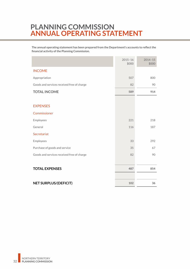
The annual operating statement has been prepared from the Department’s accounts to reflect the financial activity of the Planning Commission.
2015–16 $000
2014–15 $000
INCOME
Appropriation 507 800
Goods and services received free of charge 82 90
TOTAL INCOME 589 914
EXPENSES
Commissioner
Employees 221 218
General 116 187
Secretariat
Employees 33 292
Purchase of goods and service 35 67
Goods and services received free of charge 82 90
TOTAL EXPENSES 487 854
NET SURPLUS/(DEFICIT) 102 36
PLANNING COMMISSION ANNUAL OPERATING STATEMENT


NORTHERN TERRITORY PLANNING COMMISSIONLevel 2, Energy House 18-20 Cavenagh Street Darwin, Northern Territory, 0800
Postal Details Northern Territory Planning Commission GPO Box 1680 DARWIN NT 0801
Contact Phone: (08) 8924 7540 Email: [email protected]
www.planningcommission.nt.gov.au
PMS 401
PMS Cool Grey 11
PMS 173


![[Annual Report] FY2010 Annual Report(FULL)](https://img.pdfslide.us/doc/110x75/58a19c0c1a28abf0428b88ed/annual-report-fy2010-annual-reportfull.jpg)