Embed Size (px)
Citation preview
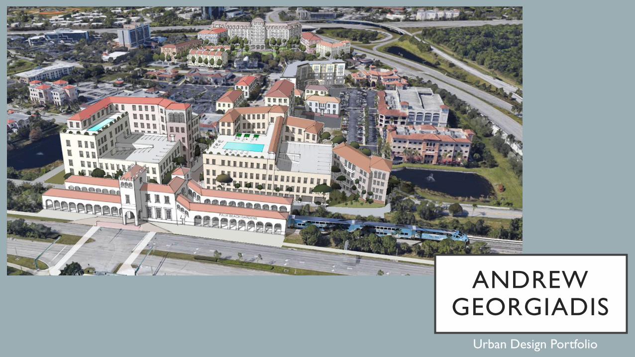
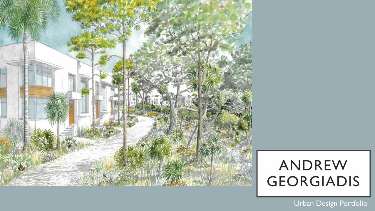
ANDREW GEORGIADIS
Urban Design Portfolio
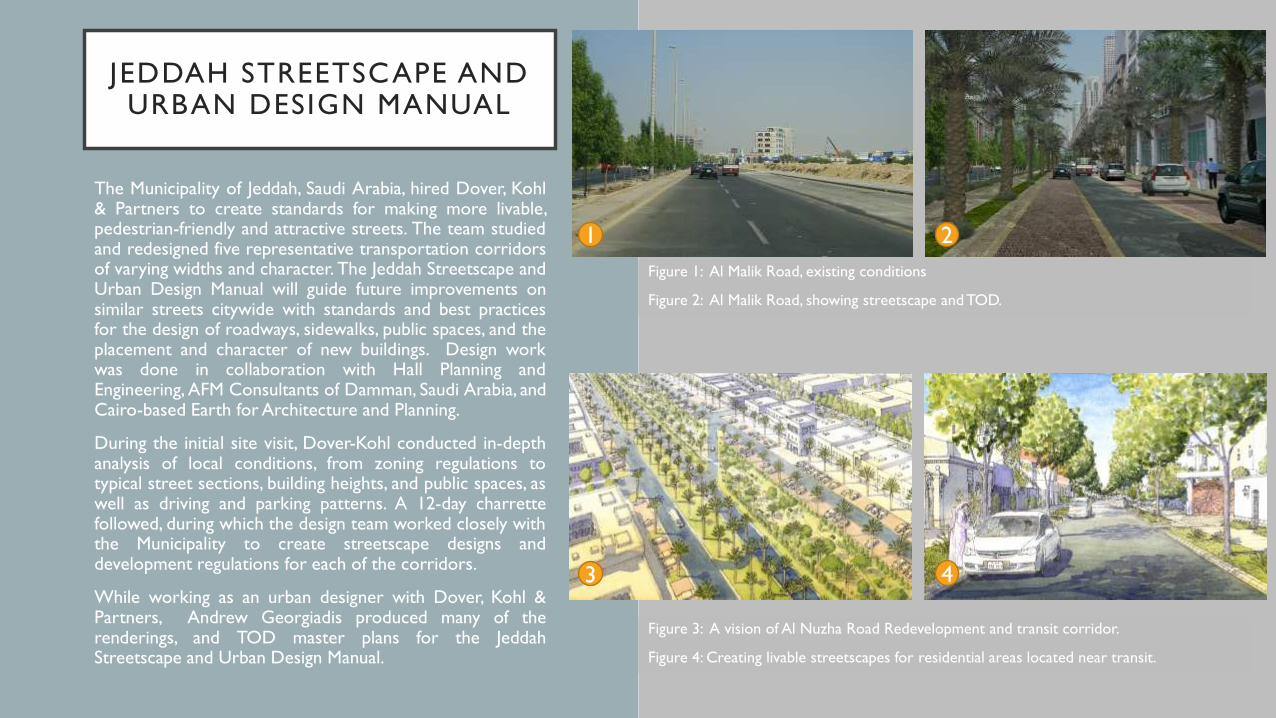
JEDDAH STREETSCAPE AND URBAN DESIGN MANUAL
The Municipality of Jeddah, Saudi Arabia, hired Dover, Kohl& Partners to create standards for making more livable,pedestrian-friendly and attractive streets. The team studiedand redesigned five representative transportation corridorsof varying widths and character. The Jeddah Streetscape andUrban Design Manual will guide future improvements onsimilar streets citywide with standards and best practicesfor the design of roadways, sidewalks, public spaces, and theplacement and character of new buildings. Design workwas done in collaboration with Hall Planning andEngineering, AFM Consultants of Damman, Saudi Arabia, andCairo-based Earth for Architecture and Planning.
During the initial site visit, Dover-Kohl conducted in-depthanalysis of local conditions, from zoning regulations totypical street sections, building heights, and public spaces, aswell as driving and parking patterns. A 12-day charrettefollowed, during which the design team worked closely withthe Municipality to create streetscape designs anddevelopment regulations for each of the corridors.
While working as an urban designer with Dover, Kohl &Partners, Andrew Georgiadis produced many of therenderings, and TOD master plans for the JeddahStreetscape and Urban Design Manual.
Figure 1: Al Malik Road, existing conditions
Figure 2: Al Malik Road, showing streetscape and TOD.
Figure 3: A vision of Al Nuzha Road Redevelopment and transit corridor.
Figure 4: Creating livable streetscapes for residential areas located near transit.
1 2
3 4
JEDDAH STREETSCAPE AND URBAN DESIGN MANUAL
The Streetscape and Urban Design Manual is the primaryimplementation tool for achieving the vision fortransforming Jeddah’s streets. Simple graphic instructionsare employed for numerous street design elements thathelp define quality public spaces. Standards include designparameters for travel lanes, transit facilities, sidewalks,landscaping, lighting, signage, and building façades that facestreets.
The Manual is intended for use by the Municipality, civilengineers, architects, contractors, developers and otherindividuals who help to design new streets, improveexisting streets, and for those involved in renovation andnew construction. By detailing the vehicular realm, thepedestrian realm and the private realm, the Manualestablishes a new model for urban design in Jeddah focusedon balancing the needs of all modes of travel. Theaccompanying technical plans specify the reconfiguration ofmajor streets and the exact location of streetscapeelements such as parking spaces and treeplacement. Specific roadway features and security factorswere also incorporated to allow safe travel for the Kingand other members of the royal family.
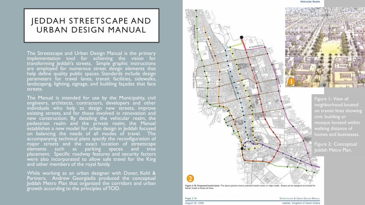
While working as an urban designer with Dover, Kohl &Partners, Andrew Georgiadis produced the conceptualJeddah Metro Plan that organized the corridors and urbangrowth according to the principles ofTOD.
1
Figure 1: View of
neighborhood located
on transit lines showing
civic building or
mosque located within
walking distance of
homes and businesses.
Figure 2: Conceptual
Jeddah Metro Plan.
2
1
PALM BEACH GARDENS TRI-RAIL TOD
The Treasure Coast Regional Planning Council has
received a grant to create TOD Master Plans for several
cities along the route of the new Tri-Rail Coastal Link
Commuter Rail (operating speed: 60-130 kph), which
has more frequent stops than the parallel Brightline
High Speed Rail (operating speed: 130-190 kph). While
Brightline stations are being constructed in Miami, Fort
Lauderdale, West Palm Beach, and Orlando, the Coastal
Link stations include transfers at the Brightline stations
as well as Palm Beach Gardens, Downtown Hollywood,
North Miami Beach, andWilton Manors.
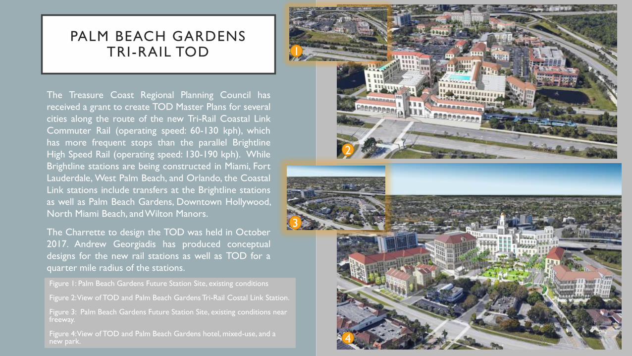
The Charrette to design the TOD was held in October
2017. Andrew Georgiadis has produced conceptual
designs for the new rail stations as well as TOD for a
quarter mile radius of the stations.
Figure 1: Palm Beach Gardens Future Station Site, existing conditions
Figure 2: View of TOD and Palm Beach Gardens Tri-Rail Costal Link Station.
Figure 3: Palm Beach Gardens Future Station Site, existing conditions near freeway.
Figure 4: View of TOD and Palm Beach Gardens hotel, mixed-use, and a new park.
2
4
1
3
HOLLYWOOD, FLORIDA DOWNTOWN TOD
Treasure Coast held a charrette in Downtown
Hollywood in December 2017. The charrette was open
to all the citizens of Hollywood and was attended by
developers, elected officials, and the press. Citizens
contributed their ideas regarding the missing retail,
housing, and office mix in the vicinity of the future rail
station. These were further researched by the
economists that were on the team.
Georgiadis has produced streetscape visualizations as
well as TOD master plans and illustrations for a radius
equivalent to a five minute walk from the stations.
These are based on input from the economists, citizens,
and other stakeholders.
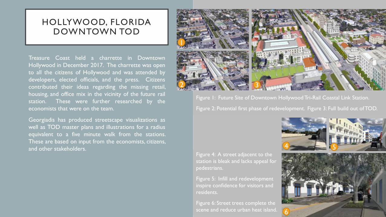
Figure 1: Future Site of Downtown Hollywood Tri-Rail Coastal Link Station.
Figure 2: Potential first phase of redevelopment. Figure 3: Full build out of TOD.
Figure 4: A street adjacent to the
station is bleak and lacks appeal for
pedestrians.
Figure 5: Infill and redevelopment
inspire confidence for visitors and
residents.
Figure 6: Street trees complete the
scene and reduce urban heat island.
1
2 3
54
6
COMPREHENSIVE PLAN FOR CITY OF EL PASO, TEXAS
In 2010 the City of El Paso commissioned Dover, Kohl & Partners tocreate a detailed Comprehensive Plan and regional-scale Future LandUse Map for the city. The Comprehensive Plan is an overarchingpolicy document that directs the City of El Paso in its implementationof consensus-based goals created through an extensive publicprocess.
The Plan El Paso Comprehensive Plan process was interactive andbilingual, and included two three-week charrettes in multiple areasthroughout the city. During the charrettes, the team was able to talkto over 800 studio visitors, meeting attendees, and hands-onparticipants. On March 6, 2012, Plan El Paso was adopted byunanimous vote of the El Paso City Council. The EPA awarded PlanEl Paso a 2011 National Award for Smart Growth Excellence inPrograms, Policies, and Regulations. The EPA grants this award yearlyto "recognize exceptional approaches to development that respectthe environment, foster economic vitality, and enhance quality oflife." Plan implementation has involved new capital improvementprojects, amendments to land development policy including form-based coding for large portions of the City, and private-publicpartnerships to build transit-oriented development along the City’sdeveloping Bus Rapid Transit Network and electric street carcorridors.
For Plan El Paso, Andrew Georgiadis was the editor of theTransportation Element and the primary author of both the Healthand Sustainability Elements. He also illustrated many of thestreetscape and TOD transformations found in the document, as wellas edited or authored many of the goals, policies, and actions foundthroughout the comprehensive plan.
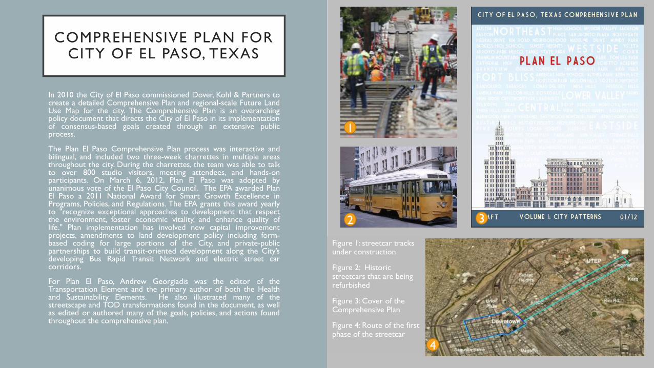
Figure 1: streetcar tracks under construction
Figure 2: Historic streetcars that are being refurbished
Figure 3: Cover of the Comprehensive Plan
Figure 4: Route of the first phase of the streetcar
1
2 3
4
CONNECTING EL PASO TRANSIT-ORIENTED
DEVELOPMENT
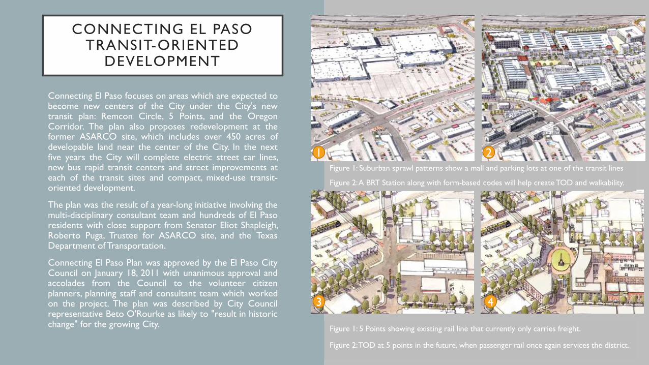
Connecting El Paso focuses on areas which are expected tobecome new centers of the City under the City's newtransit plan: Remcon Circle, 5 Points, and the OregonCorridor. The plan also proposes redevelopment at theformer ASARCO site, which includes over 450 acres ofdevelopable land near the center of the City. In the nextfive years the City will complete electric street car lines,new bus rapid transit centers and street improvements ateach of the transit sites and compact, mixed-use transit-oriented development.
The plan was the result of a year-long initiative involving themulti-disciplinary consultant team and hundreds of El Pasoresidents with close support from Senator Eliot Shapleigh,Roberto Puga, Trustee for ASARCO site, and the TexasDepartment of Transportation.
Connecting El Paso Plan was approved by the El Paso CityCouncil on January 18, 2011 with unanimous approval andaccolades from the Council to the volunteer citizenplanners, planning staff and consultant team which workedon the project. The plan was described by City Councilrepresentative Beto O'Rourke as likely to "result in historicchange" for the growing City.
Figure 1: Suburban sprawl patterns show a mall and parking lots at one of the transit lines
Figure 2: A BRT Station along with form-based codes will help create TOD and walkability.
Figure 1: 5 Points showing existing rail line that currently only carries freight.
Figure 2: TOD at 5 points in the future, when passenger rail once again services the district.
1 2
3 4
CITY OF OPA LOCKA TOD, MIAMI-DADE COUNTY,
FLORIDA
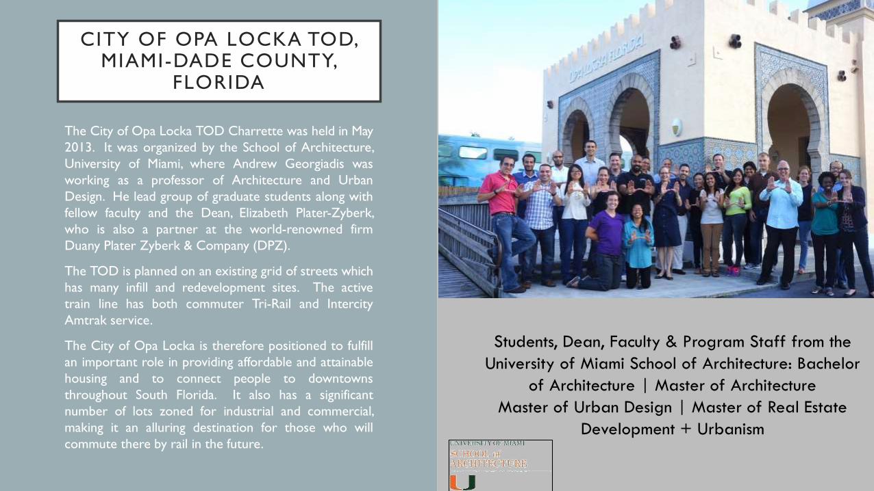
The City of Opa Locka TOD Charrette was held in May
2013. It was organized by the School of Architecture,
University of Miami, where Andrew Georgiadis was
working as a professor of Architecture and Urban
Design. He lead group of graduate students along with
fellow faculty and the Dean, Elizabeth Plater-Zyberk,
who is also a partner at the world-renowned firm
Duany Plater Zyberk & Company (DPZ).
The TOD is planned on an existing grid of streets which
has many infill and redevelopment sites. The active
train line has both commuter Tri-Rail and Intercity
Amtrak service.
The City of Opa Locka is therefore positioned to fulfill
an important role in providing affordable and attainable
housing and to connect people to downtowns
throughout South Florida. It also has a significant
number of lots zoned for industrial and commercial,
making it an alluring destination for those who will
commute there by rail in the future.
Students, Dean, Faculty & Program Staff from the
University of Miami School of Architecture: Bachelor
of Architecture | Master of Architecture
Master of Urban Design | Master of Real Estate
Development + Urbanism
CITY OF OPA LOCKA TOD, MIAMI-DADE COUNTY,
FLORIDA
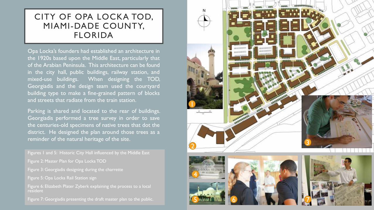
Opa Locka’s founders had established an architecture in
the 1920s based upon the Middle East, particularly that
of the Arabian Peninsula. This architecture can be found
in the city hall, public buildings, railway station, and
mixed-use buildings. When designing the TOD,
Georgiadis and the design team used the courtyard
building type to make a fine-grained pattern of blocks
and streets that radiate from the train station.
Parking is shared and located to the rear of buildings.
Georgiadis performed a tree survey in order to save
the centuries-old specimens of native trees that dot the
district. He designed the plan around those trees as a
reminder of the natural heritage of the site.
1
23
5 6 7
4
Figures 1 and 5: Historic City Hall influenced by the Middle East
Figure 2: Master Plan for Opa Locka TOD
Figure 3: Georgiadis designing during the charrette
Figure 5: Opa Locka Rail Station sign
Figure 6: Elizabeth Plater Zyberk explaining the process to a local resident
Figure 7: Georgiadis presenting the draft master plan to the public.
CITY OF OPA LOCKA TOD, MIAMI-DADE COUNTY,
FLORIDA
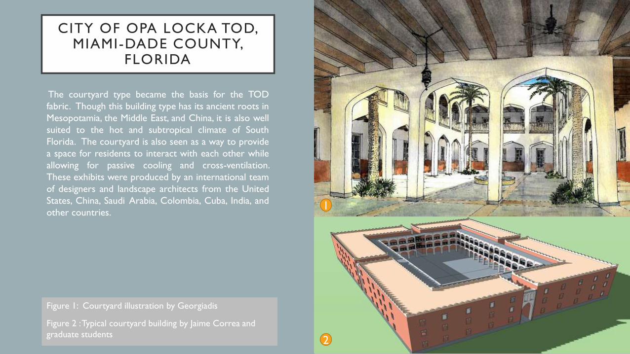
The courtyard type became the basis for the TOD
fabric. Though this building type has its ancient roots in
Mesopotamia, the Middle East, and China, it is also well
suited to the hot and subtropical climate of South
Florida. The courtyard is also seen as a way to provide
a space for residents to interact with each other while
allowing for passive cooling and cross-ventilation.
These exhibits were produced by an international team
of designers and landscape architects from the United
States, China, Saudi Arabia, Colombia, Cuba, India, and
other countries.1
2
Figure 1: Courtyard illustration by Georgiadis
Figure 2 : Typical courtyard building by Jaime Correa and
graduate students
CITY OF OPA LOCKA TOD, MIAMI-DADE COUNTY,
FLORIDA
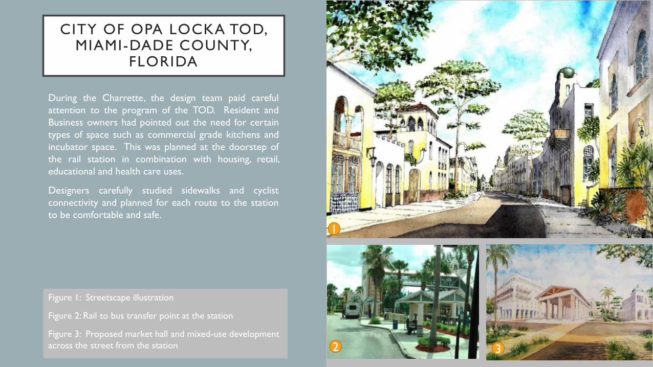
During the Charrette, the design team paid careful
attention to the program of the TOD. Resident and
Business owners had pointed out the need for certain
types of space such as commercial grade kitchens and
incubator space. This was planned at the doorstep of
the rail station in combination with housing, retail,
educational and health care uses.
Designers carefully studied sidewalks and cyclist
connectivity and planned for each route to the station
to be comfortable and safe.
1
2 3
Figure 1: Streetscape illustration
Figure 2: Rail to bus transfer point at the station
Figure 3: Proposed market hall and mixed-use development
across the street from the station
MIAMI CENTRAL STATION, METROMOVER, & METRORAIL TOD
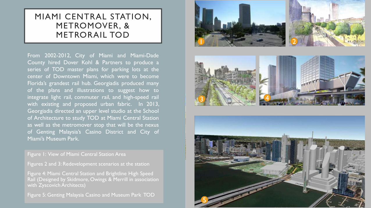
From 2002-2012, City of Miami and Miami-Dade
County hired Dover Kohl & Partners to produce a
series of TOD master plans for parking lots at the
center of Downtown Miami, which were to become
Florida’s grandest rail hub. Georgiadis produced many
of the plans and illustrations to suggest how to
integrate light rail, commuter rail, and high-speed rail
with existing and proposed urban fabric. In 2013,
Georgiadis directed an upper level studio at the School
of Architecture to study TOD at Miami Central Station
as well as the metromover stop that will be the nexus
of Genting Malaysia’s Casino District and City of
Miami’s Museum Park.
Figure 1: View of Miami Central Station Area
Figures 2 and 3: Redevelopment scenarios at the station
Figure 4: Miami Central Station and Brightline High Speed Rail (Designed by Skidmore, Owings & Merrill in association with Zyscovich Architects)
Figure 5: Genting Malaysia Casino and Museum Park TOD
1 2
5
3 4

MIAMI CENTRAL STATION, METROMOVER, & METRORAIL TOD
While teaching urban design and architecture at the
University of Miami School of Architecture in 2013,
Georgiadis led a studio to design TOD around multi-
modal transit hubs and stations in the core of Miami.
These included Metrobus, Metromover, Metrorail, Tri-
Rail, and Brightline, a privately funded high speed rail
service. The professor and his students organized a
series of public meetings with the Mayor, Department
of Transportation, Rail officials, Port of Miami, and other
stakeholders in order to show potential for increased
collaboration amongst those agencies. The result was
the only comprehensive TOD vision ever produced for
the core of Miami. The work attracted attention from
the press and has influenced decision makers as they
refine the designs for the various stations and TODs.
A central theme of the studio was sea-level rise
adaptation. The professor and students illustrated how
to raise infrastructure and city streets in order to make
the city resilient to the effects of climate change that
threaten Miami.
Figure 1: Culmer Station Redevelopment Potential
Figures 2 and 3: Before and After showing redevelopment potential for several
stations in the urban core of Miami
1
2 3

SARASOTA TRANSIT VISION PLAN
From 2013-2015 Andrew Georgiadis worked as theCity of Sarasota’s Principal Urban Designer and wastasked with rewriting the City’s zoning code, designingTOD, and planning a transit system for the city. A form-based code is intended to concentrate commercialactivity, public amenities, and residential density aroundstations and hubs. The transit plan is regarded as theorganizing framework for metropolitan growth andinvestment. It includes designs for optimizingintermodal transfers at the airport, a planned water busmarina, and Downtown Rail Station.
Figure 1: Future Transit Map as published in local newspapers
Figure 2: How Sarasota rail system could connect with the statewide rail network in the future
Figures 3 and 4: Existing and proposed conditions of Tamiami Trail showing how rail investments and zoning reform could create walkable urban development that revitalizes the economy
4
1
2
3
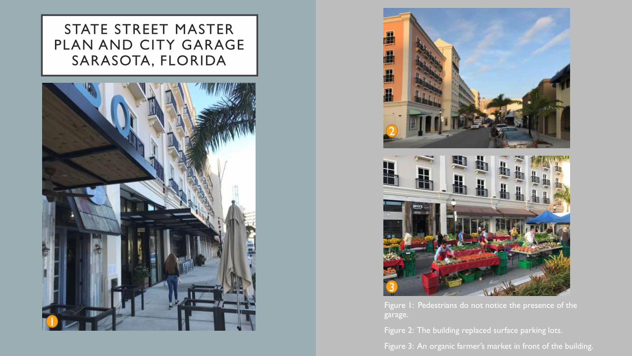
STATE STREET MASTER PLAN AND CITY GARAGE
SARASOTA, FLORIDA
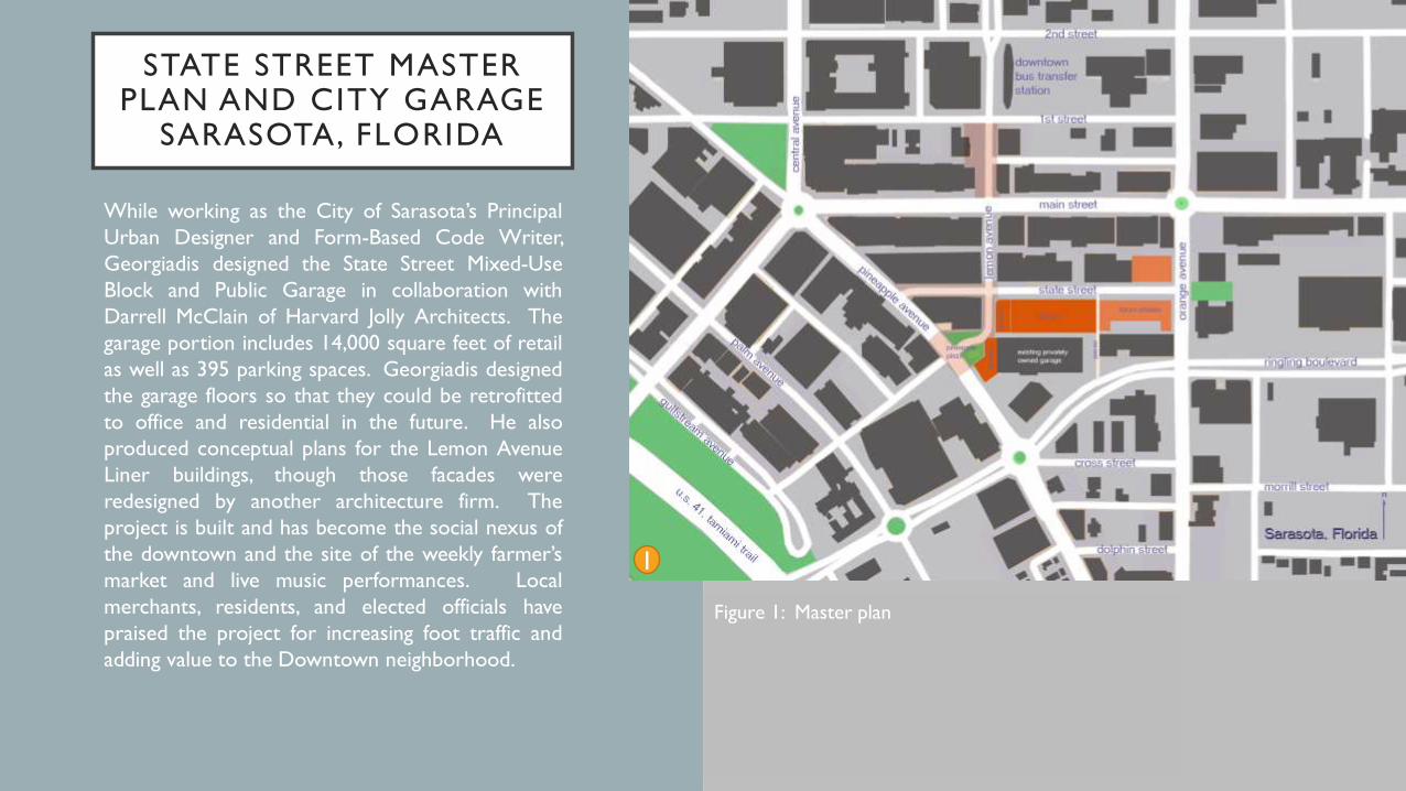
While working as the City of Sarasota’s Principal
Urban Designer and Form-Based Code Writer,
Georgiadis designed the State Street Mixed-Use
Block and Public Garage in collaboration with
Darrell McClain of Harvard Jolly Architects. The
garage portion includes 14,000 square feet of retail
as well as 395 parking spaces. Georgiadis designed
the garage floors so that they could be retrofitted
to office and residential in the future. He also
produced conceptual plans for the Lemon Avenue
Liner buildings, though those facades were
redesigned by another architecture firm. The
project is built and has become the social nexus of
the downtown and the site of the weekly farmer’s
market and live music performances. Local
merchants, residents, and elected officials have
praised the project for increasing foot traffic and
adding value to the Downtown neighborhood.
1
Figure 1: Master plan
2
1
STATE STREET MASTER PLAN AND CITY GARAGE
SARASOTA, FLORIDA
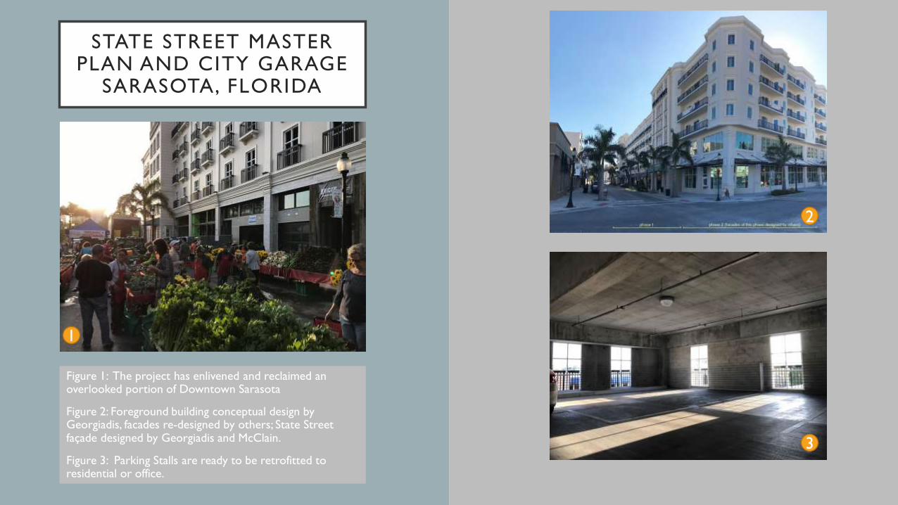
Figure 1: The project has enlivened and reclaimed an overlooked portion of Downtown Sarasota
Figure 2: Foreground building conceptual design by Georgiadis, facades re-designed by others; State Street façade designed by Georgiadis and McClain.
Figure 3: Parking Stalls are ready to be retrofitted to residential or office.
3
2
3
1
STATE STREET MASTER PLAN AND CITY GARAGE
SARASOTA, FLORIDA
Figure 1: Pedestrians do not notice the presence of the garage.
Figure 2: The building replaced surface parking lots.
Figure 3: An organic farmer’s market in front of the building.
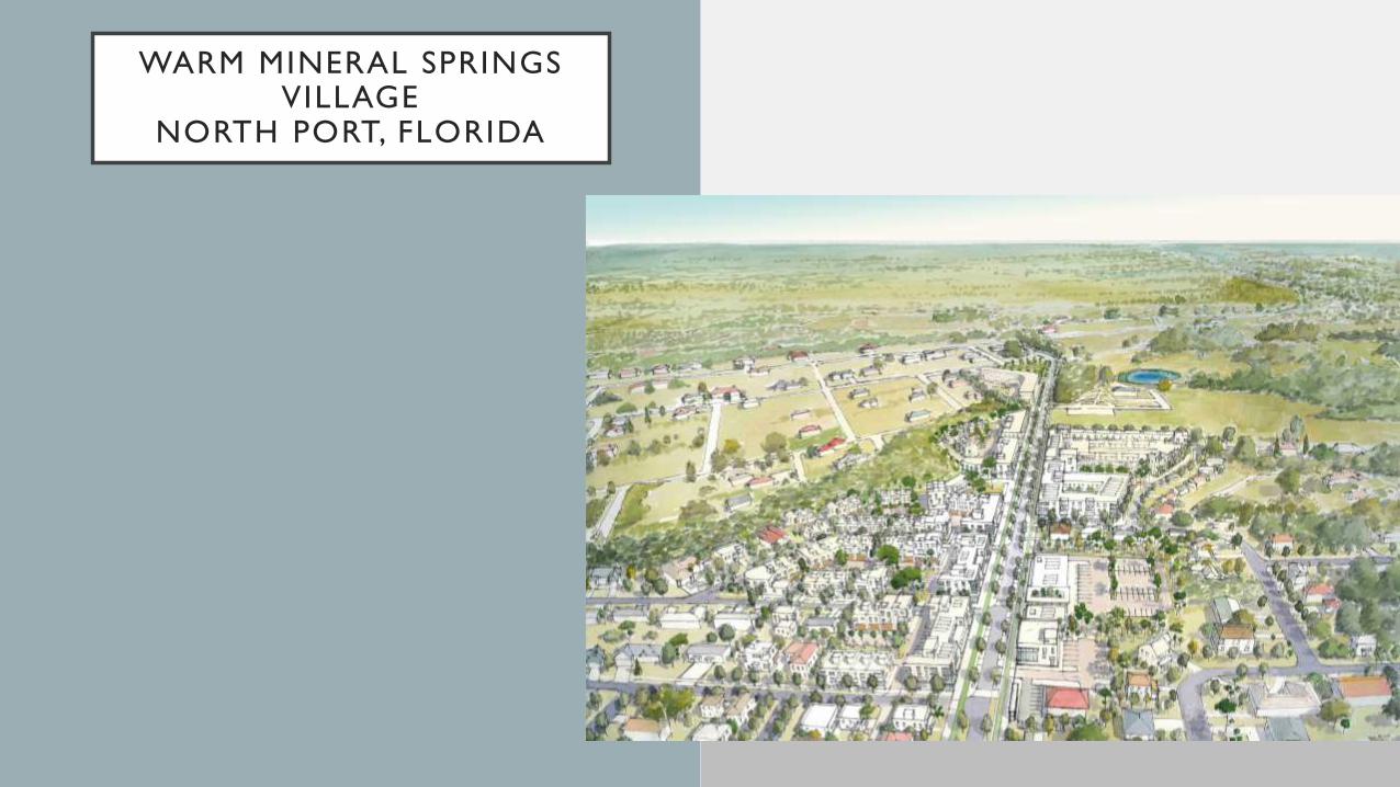
WARM MINERAL SPRINGSVILLAGE
NORTH PORT, FLORIDA
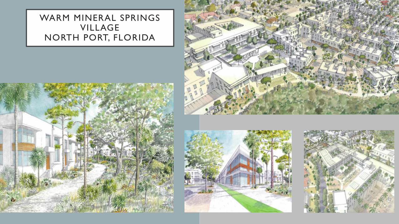
WARM MINERAL SPRINGS VILLAGE
NORTH PORT, FLORIDA
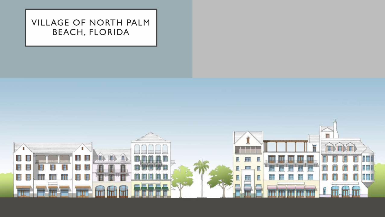
VILLAGE OF NORTH PALM BEACH, FLORIDA
ANDREW GEORGIADIS
Urban Design Portfolio