Embed Size (px)
Citation preview

Ancient Egypt:Geography
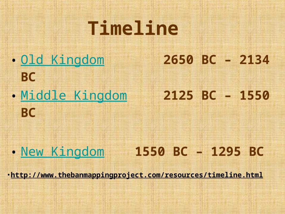
Timeline
• Old Kingdom 2650 BC – 2134 BC
• Middle Kingdom 2125 BC – 1550 BC
• New Kingdom 1550 BC – 1295 BC
•http://www.thebanmappingproject.com/resources/timeline.html
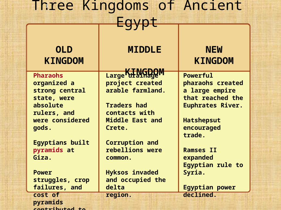
Powerful pharaohs created a large empire that reached the Euphrates River.
Hatshepsut encouraged trade.
Ramses II expanded Egyptian rule to Syria.
Egyptian power declined.
Large drainage project created arable farmland.
Traders had contacts with Middle East and Crete.
Corruption and rebellions were common.
Hyksos invaded and occupied the delta region.
Pharaohs organized a strong central state, were absolute rulers, and were considered gods.
Egyptians built pyramids at Giza.
Power struggles, crop failures, and cost of pyramids contributed to the collapse of the Old Kingdom.
NEW KINGDOM
MIDDLE
KINGDOM
OLD KINGDOM
Three Kingdoms of Ancient Egypt1
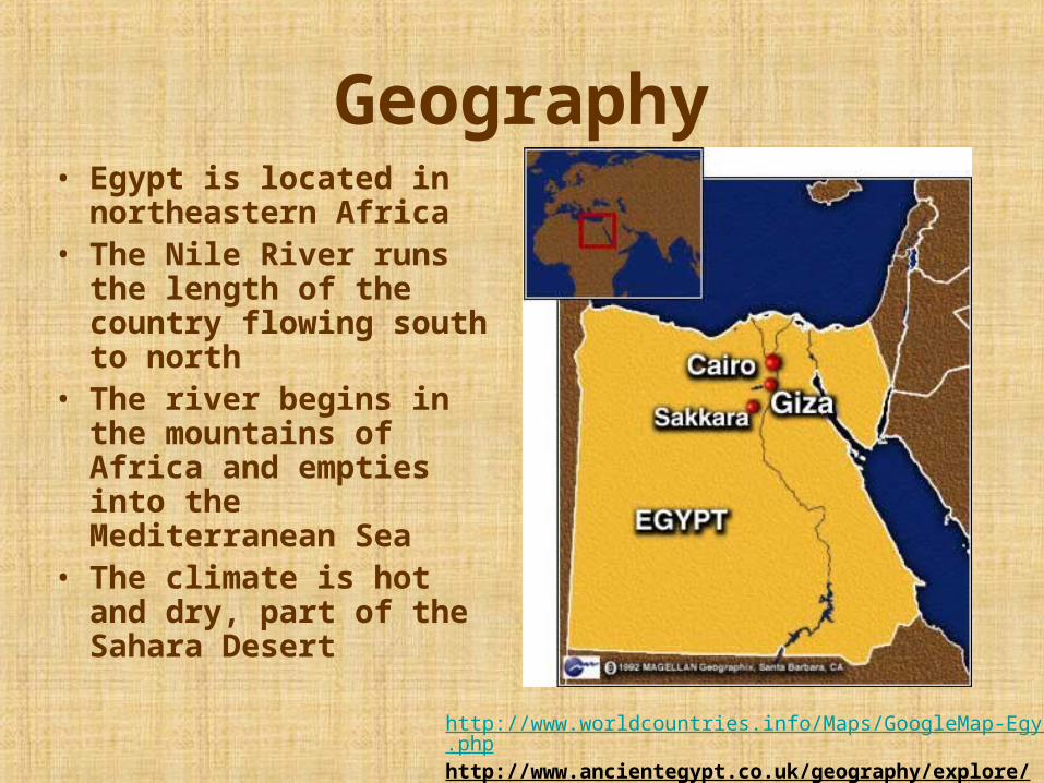
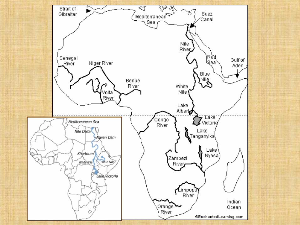
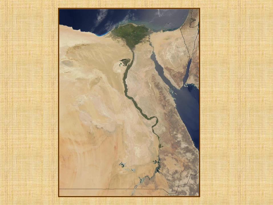
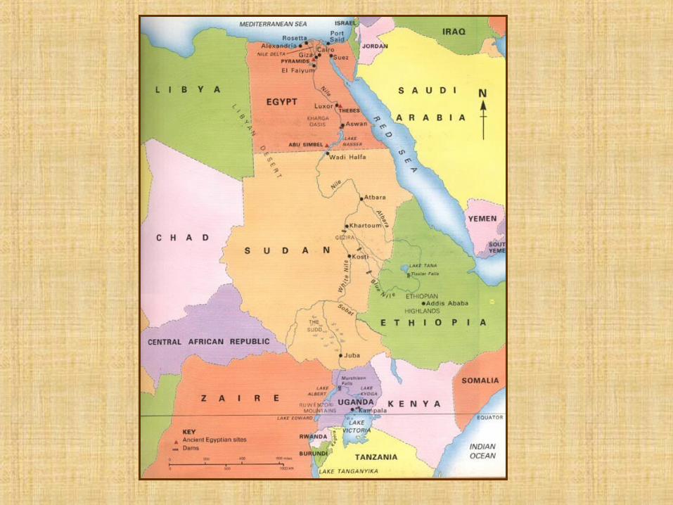
Geography• Egypt is located in
northeastern Africa • The Nile River runs the
length of the country flowing south to north
• The river begins in the mountains of Africa and empties into the Mediterranean Sea
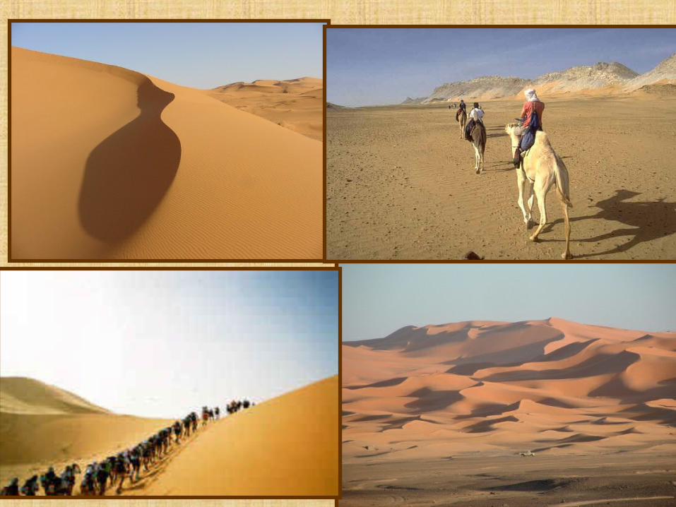
• The climate is hot and dry, part of the Sahara Desert
http://www.worldcountries.info/Maps/GoogleMap-Egypt.phphttp://www.ancientegypt.co.uk/geography/explore/ter.html
Geography
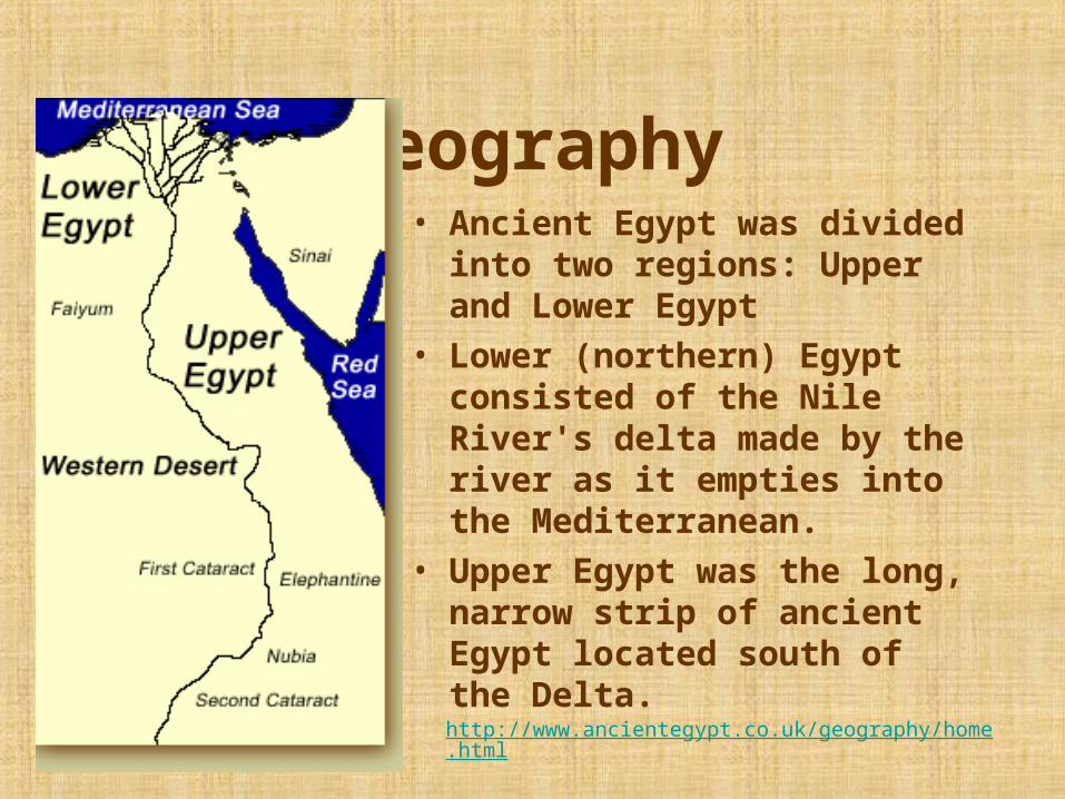
• Ancient Egypt was divided into two regions: Upper and Lower Egypt
• Lower (northern) Egypt consisted of the Nile River's delta made by the river as it empties into the Mediterranean.
• Upper Egypt was the long, narrow strip of ancient Egypt located south of the Delta.
http://www.ancientegypt.co.uk/geography/home.html
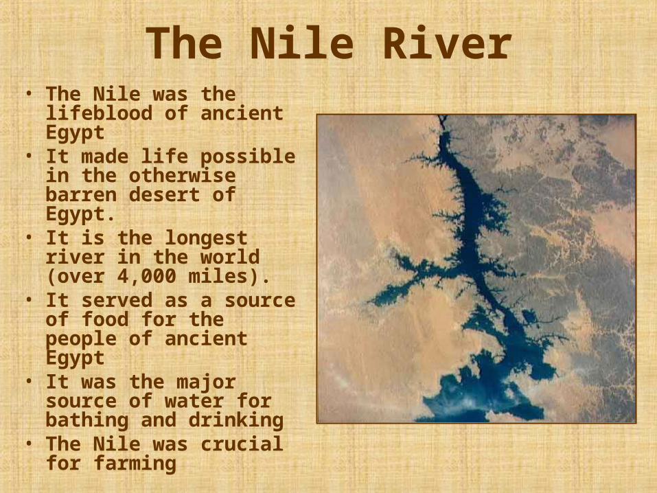
The Nile River• The Nile was the
lifeblood of ancient Egypt
• It made life possible in the otherwise barren desert of Egypt.
• It is the longest river in the world (over 4,000 miles).
• It served as a source of food for the people of ancient Egypt
• It was the major source of water for bathing and drinking
• The Nile was crucial for farming
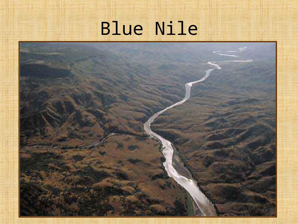
Blue Nile
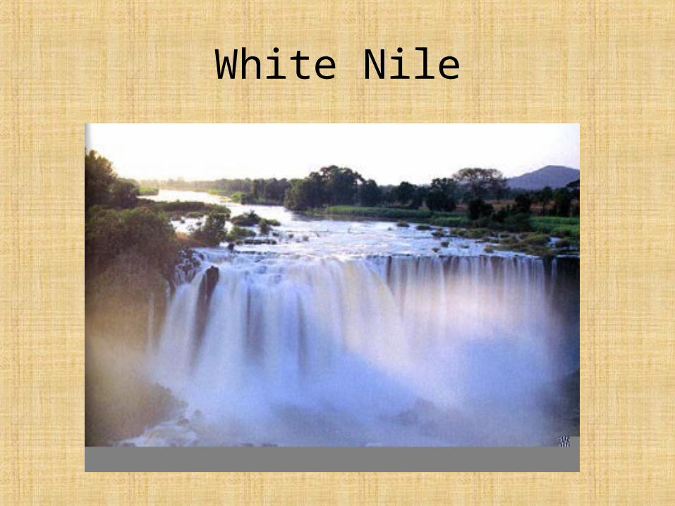
White Nile
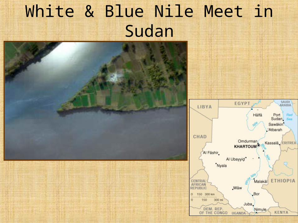
White & Blue Nile Meet in Sudan
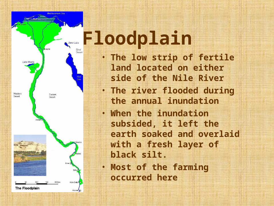
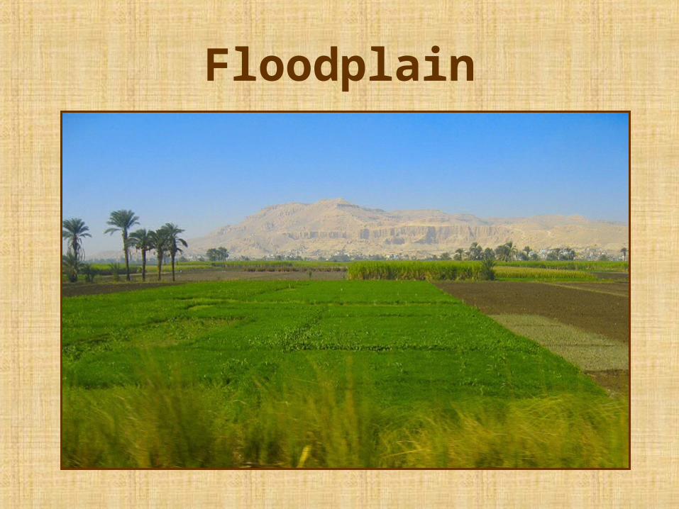
Floodplain
• The low strip of fertile land located on either side of the Nile River
• The river flooded during the annual inundation
• When the inundation subsided, it left the earth soaked and overlaid with a fresh layer of black silt.
• Most of the farming occurred here
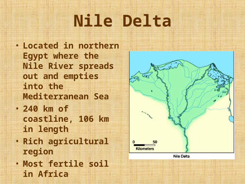
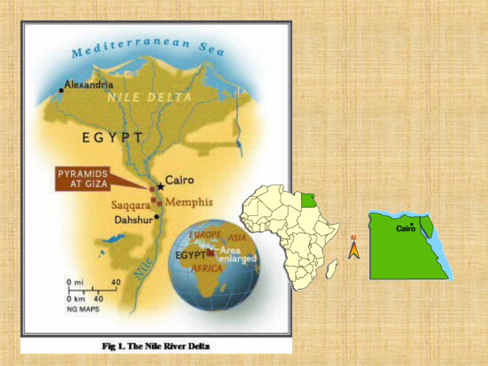
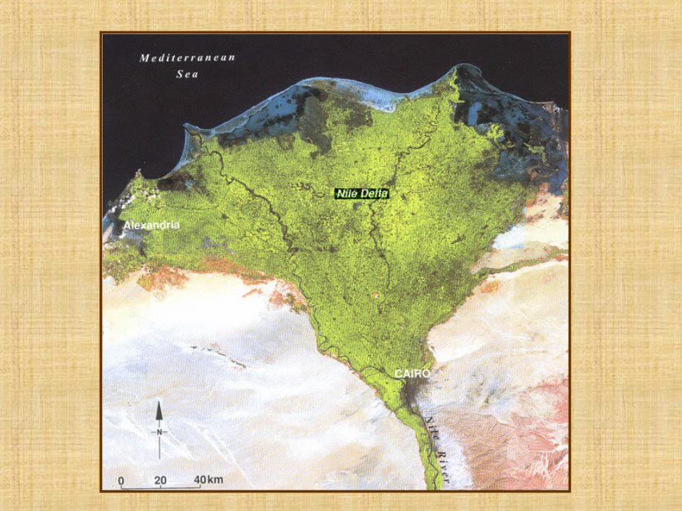
Nile Delta• Located in northern
Egypt where the Nile River spreads out and empties into the Mediterranean Sea
• 240 km of coastline, 106 km in length
• Rich agricultural region
• Most fertile soil in Africa
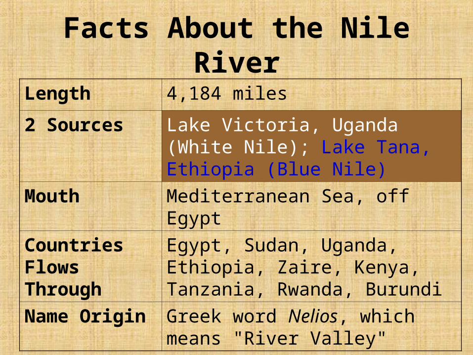
Facts About the Nile River
Length 4,184 miles
2 Sources Lake Victoria, Uganda (White Nile); Lake Tana, Ethiopia (Blue Nile)
Mouth Mediterranean Sea, off Egypt
Countries Flows Through
Egypt, Sudan, Uganda, Ethiopia, Zaire, Kenya, Tanzania, Rwanda, Burundi
Name Origin Greek word Nelios, which means "River Valley"
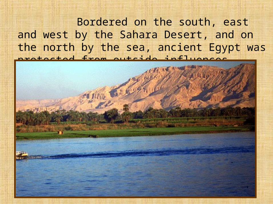
Bordered on the south, east and west by the Sahara Desert, and on the north by the sea, ancient Egypt was protected from outside influences.
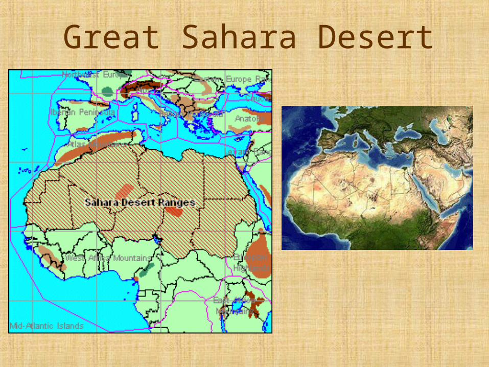
Great Sahara Desert
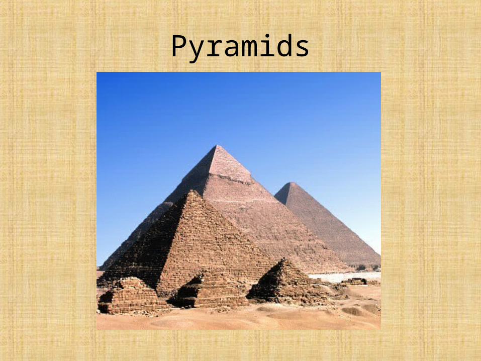
Pyramids
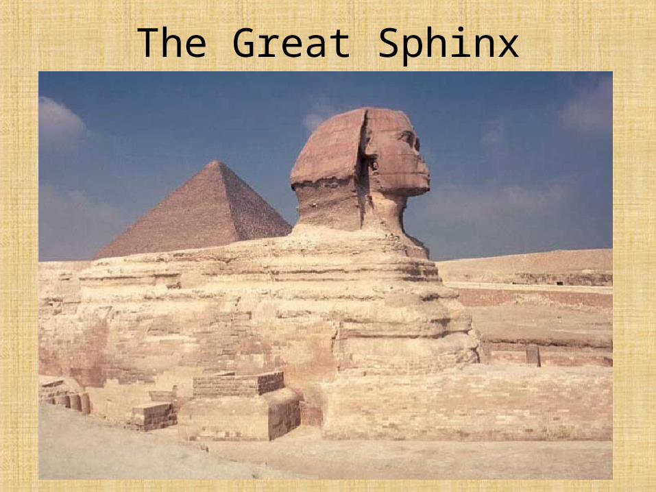
The Great Sphinx