Embed Size (px)
Citation preview
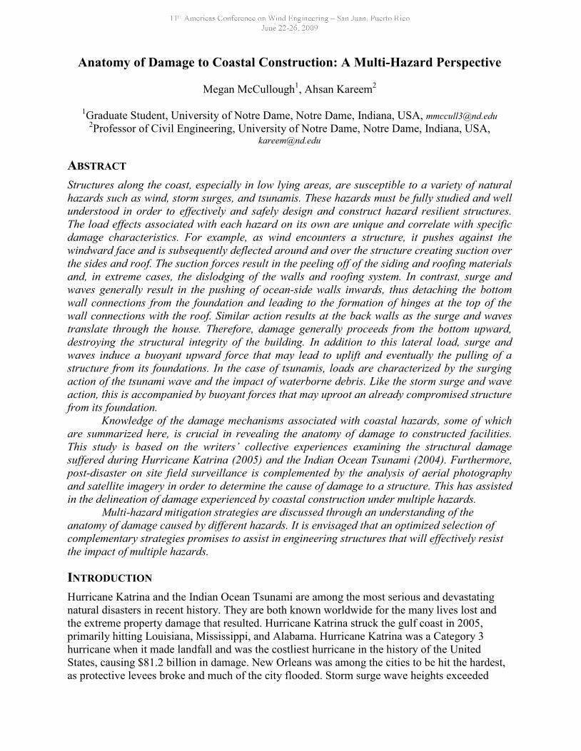
Anatomy of Damage to Coastal Construction: A Multi-Hazard Perspective
Megan McCullough1, Ahsan Kareem2
1Graduate Student, University of Notre Dame, Notre Dame, Indiana, USA, [email protected] of Civil Engineering, University of Notre Dame, Notre Dame, Indiana, USA,
ABSTRACT
Structures along the coast, especially in low lying areas, are susceptible to a variety of naturalhazards such as wind, storm surges, and tsunamis. These hazards must be fully studied and wellunderstood in order to effectively and safely design and construct hazard resilient structures.The load effects associated with each hazard on its own are unique and correlate with specificdamage characteristics. For example, as wind encounters a structure, it pushes against thewindward face and is subsequently deflected around and over the structure creating suction overthe sides and roof. The suction forces result in the peeling off of the siding and roofing materialsand, in extreme cases, the dislodging of the walls and roofing system. In contrast, surge andwaves generally result in the pushing of ocean-side walls inwards, thus detaching the bottomwall connections from the foundation and leading to the formation of hinges at the top of thewall connections with the roof. Similar action results at the back walls as the surge and wavestranslate through the house. Therefore, damage generally proceeds from the bottom upward,destroying the structural integrity of the building. In addition to this lateral load, surge andwaves induce a buoyant upward force that may lead to uplift and eventually the pulling of astructure from its foundations. In the case of tsunamis, loads are characterized by the surgingaction of the tsunami wave and the impact of waterborne debris. Like the storm surge and waveaction, this is accompanied by buoyant forces that may uproot an already compromised structurefrom its foundation.
Knowledge of the damage mechanisms associated with coastal hazards, some of whichare summarized here, is crucial in revealing the anatomy of damage to constructed facilities.This study is based on the writers’ collective experiences examining the structural damagesuffered during Hurricane Katrina (2005) and the Indian Ocean Tsunami (2004). Furthermore,post-disaster on site field surveillance is complemented by the analysis of aerial photographyand satellite imagery in order to determine the cause of damage to a structure. This has assistedin the delineation of damage experienced by coastal construction under multiple hazards.
Multi-hazard mitigation strategies are discussed through an understanding of theanatomy of damage caused by different hazards. It is envisaged that an optimized selection ofcomplementary strategies promises to assist in engineering structures that will effectively resistthe impact of multiple hazards.
INTRODUCTION
Hurricane Katrina and the Indian Ocean Tsunami are among the most serious and devastatingnatural disasters in recent history. They are both known worldwide for the many lives lost andthe extreme property damage that resulted. Hurricane Katrina struck the gulf coast in 2005,primarily hitting Louisiana, Mississippi, and Alabama. Hurricane Katrina was a Category 3hurricane when it made landfall and was the costliest hurricane in the history of the UnitedStates, causing $81.2 billion in damage. New Orleans was among the cities to be hit the hardest,as protective levees broke and much of the city flooded. Storm surge wave heights exceeded
twenty feet and flooded 80% of the city. The Gulf Coast of Mississippi was equally devastatedby storm surge and wave action as well as winds, as it was in the northeast quadrant of thehurricane. The Indian Ocean, or Boxing Day, Tsunami occurred on December 26, 2004,originating off the northwest coast of Sumatra, Indonesia. Its destructive effects were felt acrossthe Indian Ocean and all the way to the eastern coast of Africa. The tsunami resulted from amagnitude 9.2 subduction earthquake which caused the vertical displacement of water in theocean. The primary wave propagated from the epicenter of the earthquake and caused the mostdamage in Indonesia, Thailand, Sri Lanka, and India. It is estimated that 230,000 people werekilled as a result of the tsunami, in part because of the absence of a warning system. The tsunamiwas especially devastating in small Asian fishing villages that were built along the coast. Notonly did these disasters cause immediate destruction, but for some areas much of the devastationremains today. These events and their effects on the civil infrastructure where they occurred canbe used to learn how to better design and build structures in order to prevent future deaths anddestruction from similar disasters.
DAMAGE MECHANISMS OF COASTAL HAZARDS
It is important to summarize the basics of how coastal hazards interact with structures, thedevelopment of resulting loads, and the attendant performance of structures. Knowledge ofdamage mechanisms, therefore, provides insight into the development of better design andconstruction practices.
WINDWind has the potential to cause a wide range of damage to a structure. The wind speed andduration, the structure’s exposure and height, the structural shape and overall strength are allimportant characteristics that determine the extent of wind damage [1]. Usually, wind will affecta building envelope first, with damage initiating at the roof. As the wind encounters a structure,it pushes against the windward face (tries to push it in) and then is deflected around the structureresulting in suction over the roof and the sides. Therefore, the roof and sides experience suctionforces, which try to pull out the walls or roofing system or peel off the roofing tiles and siding ifthe structure is a house. The distribution of negative (suction) or positive (push) pressure is farfrom uniform in either space or time. The most severe negative pressures are created near edges,corners, and at discontinuities on the surface, where air is forced to separate as it rushes by.Accordingly, the roofing system and the siding are most vulnerable, especially if the roof is notproperly connected to the walls. The roof experiences the highest suction due to its exposure tothe strongest winds (wind speed increases with height). In mild cases of wind damage, it istypical to find missing shingles and damage to antennae or other objects that are attached to orplaced on the roof. Wind damage is further exacerbated if the building envelope is breachedwhich may be due to wind, water, or debris impact. Therefore, any opening by design, choice oras a consequence of local failure can influence the internal pressure. An opening in the windwardside would result in increasing the internal pressure as the air will rush into the building. Thiswill result in the pushing of the walls and roof outward and upward. These parts of the structureare already experiencing suction and therefore this internal push acting outwards would enhancethis action and cause added damage. Conversely, an opening in the region of negative externalpressure would lead to a decrease in the internal pressure, which helps to reduce loads on theroof and side walls but adds to the forces on the windward wall. If the building roof survives andthe building envelope endures the extreme negative pressure, the structure may lean in thedirection of wind. This results from possible development of a hinge at the base plate and as a
result the structure leans forward in the direction of the wind. In summary, wind damage oftenbegins at the top and progresses downwards.
The amount of damage a structure will suffer depends on a variety of factors. The age ofa building and the type of construction affect its susceptibility to damage from wind. Otherfactors include the material with which the building is constructed, as well as the wind directionand exposure. These factors should be taken into account when considering a building’s overallvulnerability to wind forces.
STORM SURGE/WAVESStorm surge and wave action result during coastal flooding events such as hurricanes. Forcesfrom storm surge and waves tend to cause damage to a structure in the areas where water makesdirect contact with the structure. Therefore, it makes sense that the damage caused by stormsurge and waves begins at the base of a structure and works its way upward. Surge and waves acton the house walls and induce loads that tend to dislodge them. In the case of surge/waveactions, the damage process generally entails ocean-side walls (under approaching surge andwaves) getting pushed inwards with the water flow forming hinges at the top near the roof andwall connections. While on the leeward (inland) side the walls are pushed outwards still forminga virtual hinge at the top. In some cases walls may be pushed in the opposite direction due toreceding waters or the orbital motion of water in waves, which introduces oscillatory loads. Thelateral forces on a structure from storm surge can generally be categorized as hydrostatic andhydrodynamic. The hydrostatic force results when the height of water inside a structure isdifferent than the height of water outside that structure. The resulting pressure differential causesthe force to act in the direction of higher water to lower water. If the water levels inside andoutside the structure are the same, the net force on the structure would be equal to zero. Thehydrodynamic force, often referred to as the drag force, is the result of water rushing aroundobstacles such as walls, columns, or any other impediments. It should also be noted that breakingwaves exert around five times the force that non-breaking waves exert.
In addition to the horizontal load introduced by surge/wave action, there is also anupward force caused by buoyancy. The buoyant force may lead to the uplift of the house bypulling it from the foundation. This force can be especially destructive because structures aretypically designed for gravity loads and the design and construction does not generally addressthe potential for upward forces. Once lifted the house can float and meander in the flowdepending on the current and wind speed and direction.
Scouring is an additional result of storm surge/waves. It is the destructive effect thatwater has as it washes away soil from around an obstruction. This can be very damaging overtime and can often lead to the loss of embedment of foundation stilts or piers leading to structuralfailure. Scouring often affects the corners of a foundation and leaves parts of a structure with nounder-support.
TSUNAMITsunamis typically consist of three general stages: the generation, the propagation, and theinundation. The inundation is of most interest to coastal construction, but is directly related toboth the generation and propagation. The generation, or source, determines the direction andspeed of the waves. The breaking of the tsunami waves, part of the propagation, depends on theoffshore bathymetry. If the breaking is progressive then the inundation will be slow and last arelatively long time (a few minutes). If the breaking is explosive, however, the inundation will bevery quick and turbulent [2]. The progressively breaking wave will lead to onshore damage and
forces similar to that of storm surge/waves. The explosively breaking wave, however, will leadto significant impact forces. Tsunamis can be extremely destructive, in part because tsunamisoften strike areas that have just experienced an earthquake, which has already created aweakened infrastructure. Since the water in a tsunami is moving quickly, the lateral forcesexperienced by the exposed portions of structures are greater than from typical storm surges andwave action. Also, the first wave of a train of tsunami waves creates massive amounts of debris,which continues to impact structures with each successive wave. Tsunamis last for very shortdurations as compared to storm surges/waves. Hydrostatic, hydrodynamic, and buoyant forcesare, once again, the causes of most of the destruction from tsunamis. As is the case in stormsurges, damage proceeds from the lower levels of structures to the upper levels. Scouring is amajor source of destruction in tsunamis as well, due to the high velocities at which the water istraveling. Overall tsunami forces on a structure increase according to the area exposed to theincoming waves [3]. Tsunami impact, hydrodynamic, and hydrostatic forces are currently noteasily quantifiable due to difficulties in predicting wave propagation, inundation heights andvelocities, and run-up.
DELINEATION OF DAMAGE USING AERIAL PHOTOGRAPHY AND SATELLITEIMAGERY
This section is based on the analysis of structures in the wake of Hurricane Katrina (2005) andthe Indian Ocean Tsunami (2004). Damage detected using aerial photography and site visits toMississippi and Louisiana after Hurricane Katrina is used to determine the cause of damage tostructures, with an emphasis on the delineation of multiple hazards, such as wind, storm surge,and waves. Examination of damage to structures following the Indian Ocean Tsunami sheds lighton the performance of structures under tsunami loading. Determination of the failuremechanisms of structures using aerial photography and satellite imagery promises to provide amore complete understanding of the loadings and their resulting effects on structures. Therefore,improved knowledge of how to build a structure in a coastal area threatened by multiple hazardscan be determined.
HURRICANEKATRINAAerial photography and satellite imagery taken within several days of Hurricane Katrina are ableto help determine the causes of damage to specific homes in areas affected by wind as well asstorm surge/waves. The images portray post-disaster and pre-clean-up damage experiencedduring Katrina. Knowledge of the damage mechanisms and specific loading patterns, asdiscussed previously, is imperative to making conclusions about damage sources and timelines.From images available through NOAA, NASA, and many other sources, building envelopedamage, scrubbed foundations, debris lines, and structural damage can be seen. Since the windfield of a typical hurricane is relatively large, many houses within a particular area were affectedby the same or very similar levels of wind. Houses in areas with similar wind intensities,however, suffered a broad range of damages. Some entire neighborhoods are scrubbed from theirfoundations while other houses within a few blocks have no visible structural damage or only asmall amount of damage to their building envelopes. Differences in surge and waves in theseareas are most likely the cause of the differences in the damage suffered. The origin of the stormsurge, maximum inundation depths, flood velocity and direction, and the duration of the eventare important variables that must be considered in the determination of damage. Damage patternsseen in the different images available of neighborhoods along the coast play a considerable rolewhen arriving at an opinion about the role of wind and water in the destruction of structures.
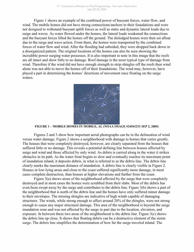
Figure 1 shows an example of the combined power of buoyant forces, water flow, andwind. The mobile homes did not have strong connections/anchors to their foundations and werenot designed to withstand buoyant uplift forces as well as static and dynamic lateral loads due tosurge and waves. As water flowed under the homes, the lateral loads weakened the connectionsand the buoyant forces lifted the homes off the ground. The dislodged homes were then set afloatdue to the surge and wave action. From there, the homes were transported by the combinedforces of water flow and wind. After the flooding had subsided, they were dropped back down ina disorganized pattern. The original locations of the homes can also be seen showing theincredible power surging water possesses. It is also important to note in this image that the roofsare all intact and show little to no damage. Roof damage is the most typical type of damage fromwind. Therefore if the wind did not have enough strength to strip shingles off the roofs then windalone was not able to move the homes off of their foundations. The wind may, however, haveplayed a part in determining the homes’ directions of movement once floating on the surgewaters.
FIGURE 1 – MOBILE HOMES IN MOBILE, AL (NOAA IMAGE #24541231 SEP 2, 2005)
Figures 2 and 3 show how important aerial photographs can be in the delineation of windversus water damage. Figure 2 shows a neighborhood with damage to homes that varies greatly.The houses that were completely destroyed, however, are clearly separated from the houses thatsuffered little or no damage. This reveals a potential defining line between houses affected bysurge and wind and those affected by only wind. As debris is carried along in the water it strikesobstacles in its path. As the water front begins to slow and eventually reaches its maximum pointof inundation inland, it deposits debris, in what is referred to as the debris line. The debris lineclearly marks the maximum distance of inundation. A debris line is clearly visible in Figure 2.Houses in low-lying areas and close to the coast suffered significantly more damage, in mostcases complete destruction, than houses at higher elevations and further from the coast.
Figure 3(a) shows areas of the neighborhood affected by the surge that were completelydestroyed and in most cases the homes were scrubbed from their slabs. Most of the debris haseven been swept away by the surge and contributes to the debris line. Figure 3(b) shows a part ofthe neighborhood that is north of the debris line and the homes have only suffered minor damageto their envelopes. The missing shingles are indicative of high winds capable of damagingstructures. The winds, while strong enough to affect around 20% of the shingles, were not strongenough to cause any major structural damage. This area of the neighborhood is beyond the surgeinundation zone and was not affected by the surge in part due to the location, elevation, andexposure. In between these two areas of the neighborhood is the debris line. Figure 3(c) showsthe debris line up close. It shows that floating debris can be a destructive element of the stormsurge. The debris line simplifies the determination of how far the surge traveled inland. The
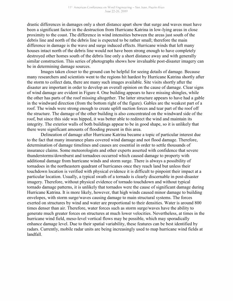
drastic differences in damages only a short distance apart show that surge and waves must havebeen a significant factor in the destruction from Hurricane Katrina in low-lying areas in closeproximity to the coast. The difference in wind intensities between the areas just south of thedebris line and north of the debris line is expected to be rather small; therefore the maindifference in damage is the wave and surge induced effects. Hurricane winds that left manyhouses intact north of the debris line would not have been strong enough to have completelydestroyed other homes south of the debris line only a short distance away and with generallysimilar construction. This series of photographs shows how invaluable post-disaster imagery canbe in determining damage sources.
Images taken closer to the ground can be helpful for seeing details of damage. Becausemany researchers and scientists went to the regions hit hardest by Hurricane Katrina shortly afterthe storm to collect data, there are many such images available. Site visits shortly after thedisaster are important in order to develop an overall opinion on the cause of damage. Clear signsof wind damage are evident in Figure 4. One building appears to have missing shingles, whilethe other has parts of the roof missing altogether. The latter structure appears to have had a gablein the windward direction (from the bottom right of the figure). Gables are the weakest part of aroof. The winds were strong enough to create uplift suction forces and tear part of the roof offthe structure. The damage of the other building is also concentrated on the windward side of theroof, but since this side was hipped, it was better able to redirect the wind and maintain itsintegrity. The exterior walls of both buildings appear to be in good shape, so it is unlikely thatthere were significant amounts of flooding present in this area.
Delineation of damage after Hurricane Katrina became a topic of particular interest dueto the fact that many insurance plans covered wind damage and not flood damage. Therefore,determination of damage timelines and causes are essential in order to settle thousands ofinsurance claims. Some meteorologists and other experts asserted with confidence that severethunderstorms/downburst and tornadoes occurred which caused damage to property withadditional damage from hurricane winds and storm surge. There is always a possibility oftornadoes in the northeastern quadrant of hurricanes once they reach land but unless theirtouchdown location is verified with physical evidence it is difficult to pinpoint their impact at aparticular location. Usually, a typical swath of a tornado is clearly discernable in post-disasterimagery. Therefore, without physical evidence of tornado touchdown and without typicaltornado damage patterns, it is unlikely that tornados were the cause of significant damage duringHurricane Katrina. It is more likely, however, that high winds caused minor damage to buildingenvelopes, with storm surge/waves causing damage to main structural systems. The forcesexerted on structures by wind and water are proportional to their densities. Water is around 800times denser than air. Therefore, water forces such as storm surge/waves have the ability togenerate much greater forces on structures at much lower velocities. Nevertheless, at times in thehurricane wind field, meso-level vortical flows may be possible, which may sporadicallyenhance damage level. Due to their spatial variability, these features can be best identified byradars. Currently, mobile radar units are being increasingly used to map hurricane wind fields atlandfall.
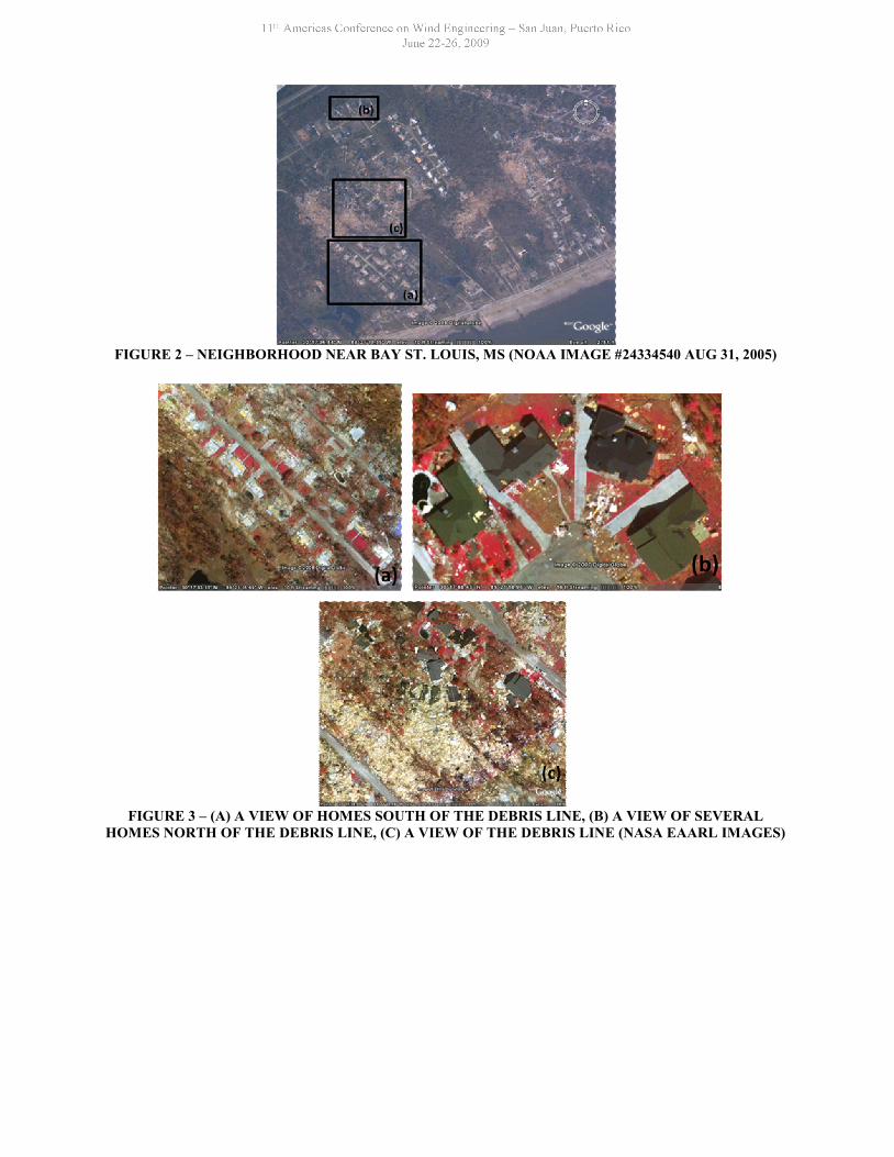
FIGURE 2 – NEIGHBORHOOD NEAR BAY ST. LOUIS, MS (NOAA IMAGE #24334540 AUG 31, 2005)
FIGURE 3 – (A) A VIEW OF HOMES SOUTH OF THE DEBRIS LINE, (B) A VIEW OF SEVERALHOMES NORTH OF THE DEBRIS LINE, (C) A VIEW OF THE DEBRIS LINE (NASA EAARL IMAGES)
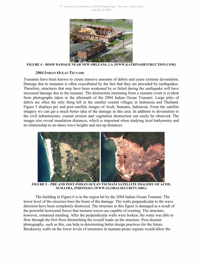
FIGURE 4 – ROOF DAMAGE NEAR NEW ORLEANS, LA (WWW.KATRINADESTRUCTION.COM)
2004 INDIANOCEAN TSUNAMITsunamis have been known to create massive amounts of debris and cause extreme devastation.Damage due to tsunamis is often exacerbated by the fact that they are preceded by earthquakes.Therefore, structures that may have been weakened by or failed during the earthquake will haveincreased damage due to the tsunami. The destruction stemming from a tsunami event is evidentfrom photographs taken in the aftermath of the 2004 Indian Ocean Tsunami. Large piles ofdebris are often the only thing left in the smaller coastal villages in Indonesia and Thailand.Figure 5 displays pre and post-satellite images of Aceh, Sumatra, Indonesia. From the satelliteimagery we can get a much better idea of the damage in this area. In addition to devastation tothe civil infrastructure, coastal erosion and vegetation destruction can easily be observed. Theimages also reveal inundation distances, which is important when studying local bathymetry andits relationship to on-shore wave heights and run-up distances.
FIGURE 5 – PRE AND POST-INDIAN OCEAN TSUMANI SATELLITE IMAGERY OF ACEH,SUMATRA, INDONESIA (WWW.GLOBALSECURITY.ORG)
The building in Figure 6 is in the region hit by the 2004 Indian Ocean Tsunami. Thelower level of the structure bore the brunt of the damage. The walls perpendicular to the wavedirection have been completely destroyed. The structure in this figure is damaged as a result ofthe powerful horizontal forces that tsunami waves are capable of creating. The structure,however, remained standing. After the perpendicular walls were broken, the water was able toflow through the first floor diminishing the overall loads on the structure. Post-disasterphotography, such as this, can help in determining better design practices for the future.Breakaway walls on the lower levels of structures in tsunami-prone regions would allow the
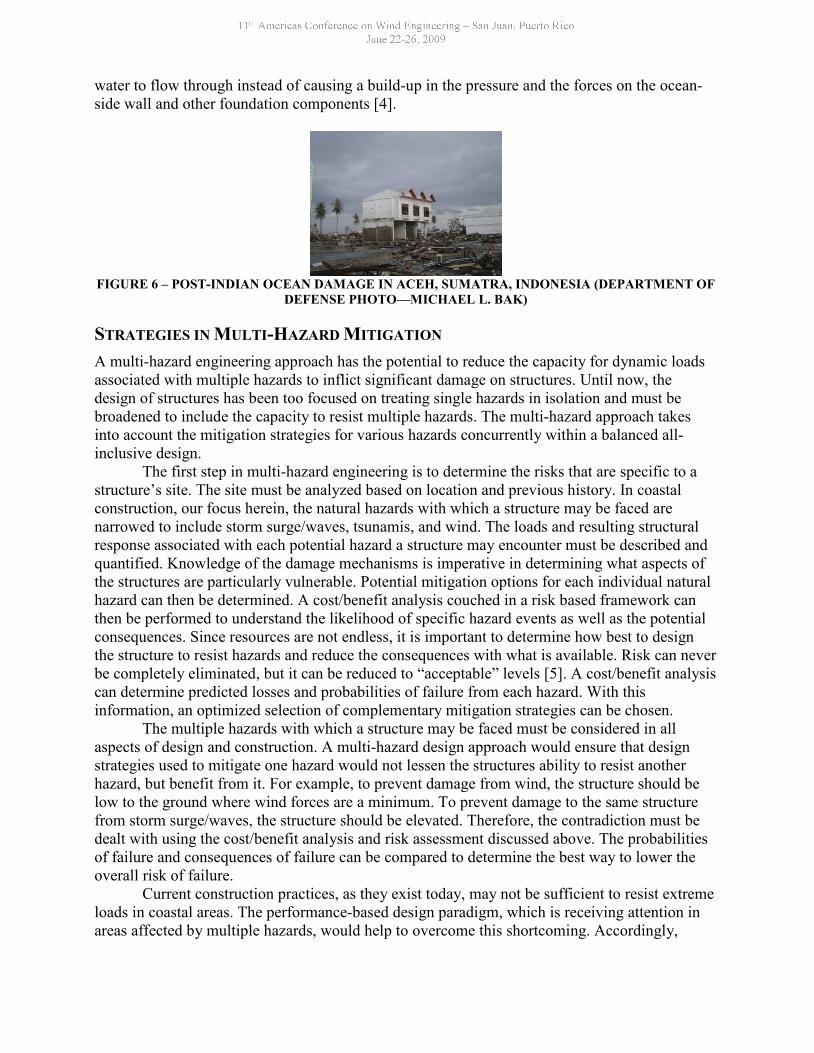
water to flow through instead of causing a build-up in the pressure and the forces on the ocean-side wall and other foundation components [4].
FIGURE 6 – POST-INDIAN OCEAN DAMAGE IN ACEH, SUMATRA, INDONESIA (DEPARTMENT OFDEFENSE PHOTO—MICHAEL L. BAK)
STRATEGIES IN MULTI-HAZARD MITIGATION
A multi-hazard engineering approach has the potential to reduce the capacity for dynamic loadsassociated with multiple hazards to inflict significant damage on structures. Until now, thedesign of structures has been too focused on treating single hazards in isolation and must bebroadened to include the capacity to resist multiple hazards. The multi-hazard approach takesinto account the mitigation strategies for various hazards concurrently within a balanced all-inclusive design.
The first step in multi-hazard engineering is to determine the risks that are specific to astructure’s site. The site must be analyzed based on location and previous history. In coastalconstruction, our focus herein, the natural hazards with which a structure may be faced arenarrowed to include storm surge/waves, tsunamis, and wind. The loads and resulting structuralresponse associated with each potential hazard a structure may encounter must be described andquantified. Knowledge of the damage mechanisms is imperative in determining what aspects ofthe structures are particularly vulnerable. Potential mitigation options for each individual naturalhazard can then be determined. A cost/benefit analysis couched in a risk based framework canthen be performed to understand the likelihood of specific hazard events as well as the potentialconsequences. Since resources are not endless, it is important to determine how best to designthe structure to resist hazards and reduce the consequences with what is available. Risk can neverbe completely eliminated, but it can be reduced to “acceptable” levels [5]. A cost/benefit analysiscan determine predicted losses and probabilities of failure from each hazard. With thisinformation, an optimized selection of complementary mitigation strategies can be chosen.
The multiple hazards with which a structure may be faced must be considered in allaspects of design and construction. A multi-hazard design approach would ensure that designstrategies used to mitigate one hazard would not lessen the structures ability to resist anotherhazard, but benefit from it. For example, to prevent damage from wind, the structure should below to the ground where wind forces are a minimum. To prevent damage to the same structurefrom storm surge/waves, the structure should be elevated. Therefore, the contradiction must bedealt with using the cost/benefit analysis and risk assessment discussed above. The probabilitiesof failure and consequences of failure can be compared to determine the best way to lower theoverall risk of failure.
Current construction practices, as they exist today, may not be sufficient to resist extremeloads in coastal areas. The performance-based design paradigm, which is receiving attention inareas affected by multiple hazards, would help to overcome this shortcoming. Accordingly,

further enhancement of building codes may increase initial construction costs, but long-termsavings may easily outweigh the initial investment. Within this broader context, engineers andbuilders must be particularly attentive to detail. Properly designed reinforcement, anchors, ties,and bracing may significantly enhance the overall robustness and resiliency of a structure. Astrong, multi-faceted structural system promises to mitigate damage from multiple hazards.
CONCLUSIONS
Continued development of coastal areas without consideration of the range of natural hazards,and the benefits and consequences of measures taken to mitigate them, will undoubtedly result infuture storm and flood damages, and increased public expenditures for post-storm response andrecovery. Multi-hazard mitigation aims to use available resources most effectively to design safestructures that are able to withstand a range of natural hazards. The most effective overallsolution can be created by considering the portfolio of expected threats to a location and puttingtogether an engineering design that creates the best design. An understanding of the damagemechanisms of each coastal hazard is integral to determining the best design and constructionpractices. Therefore, a performance analysis of a large suite of damaged structures in similarextreme events, such as was introduced briefly herein, promises to reveal causes of failure incoastal construction and how best to prevent similar damage in the future.
ACKNOWLEDGMENTS
The support for the study was provided by the Collaborative Research Program at NatHazModeling Laboratory and the Global Center of Excellence at Tokyo Polytechnic University:New Frontier of Education and Research in Wind Engineering. The center is funded by theMinistry of Education, Culture, Sports, Science and Technology (MEXT), Japan. The opinionspresented in this report do not necessarily reflect the views of the collaborators or the fundingagencies.
REFERENCES
[1] Kareem, A, “Structural Performance and Wind Speed Damage Correlation in Hurricane Alicia",Journal of Structural Engineering, ASCE, 2987, Vol.113, No.11, pp.2322-2323.
[2] Dias, F, “Dynamics of Tsunami Waves”, Extreme Man-Made and Natural Hazards in Dynamicsof Structures, Springer, 2007, pp. 201-224.
[3] Palermo, D., and I. Nistor, "Tsunami-Induced Loading on Structures beyond Hollywood’sScenarios", Structure Magazine, March 2008, pp. 10-13.
[4] Ghobarah, A., Saatcioglu, M., and I. Nistor, "The impact of the 26 December 2004 earthquakeand tsunami on structures and infrastructure", Engineering Structures, 28 (2006), pp. 312-326.
[5] Thompson, A.C.T., Katzman, G., and M.A. Johann, “Building Design for Extreme Events”,Structure Magazine, May 2007, pp. 42-45.