Embed Size (px)
DESCRIPTION
An Introduction to the Northeast River Forecast Center. OUTLINE. General information about NERFC NERFC Activities NERFC Products Uniqueness of Lake Chaplain and tributaries of St Lawrence Forecasts. Mission of NOAA’s NWS Hydrologic Services Program. - PowerPoint PPT Presentation
Citation preview
An Introduction to the Northeast An Introduction to the Northeast River Forecast CenterRiver Forecast Center

OUTLINEOUTLINE
General information about NERFCGeneral information about NERFC NERFC ActivitiesNERFC Activities NERFC ProductsNERFC Products Uniqueness of Lake Chaplain and Uniqueness of Lake Chaplain and
tributaries of St Lawrence Forecaststributaries of St Lawrence Forecasts
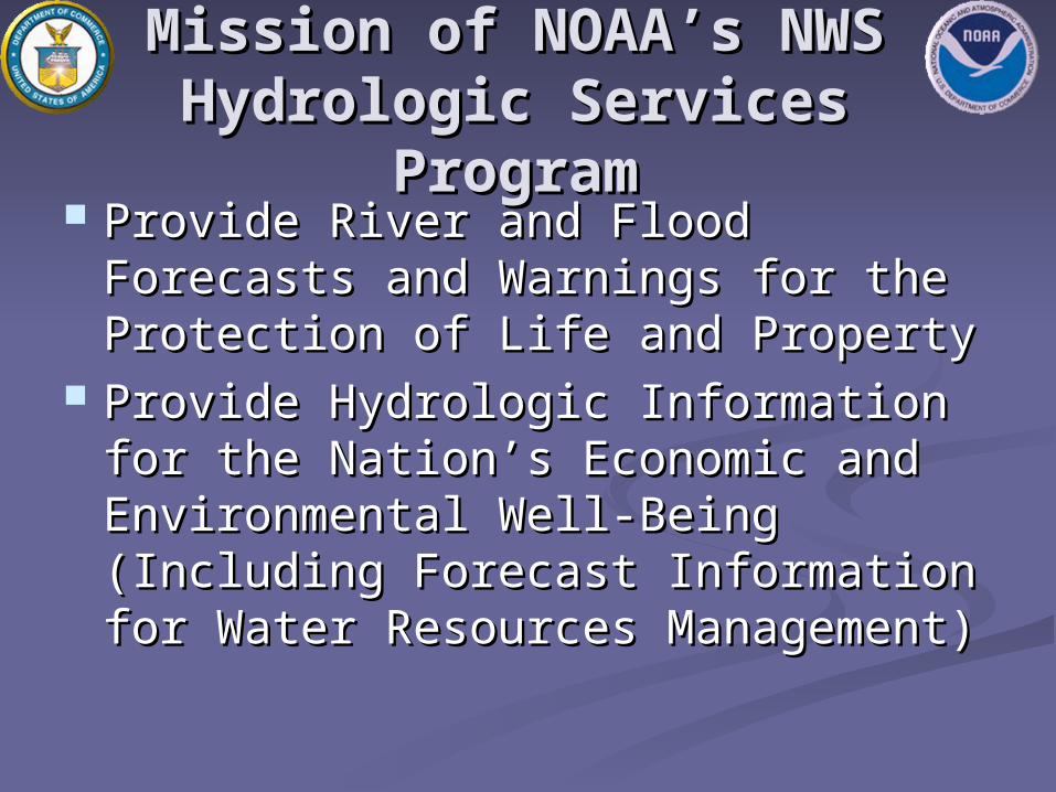
Mission of NOAA’s NWSMission of NOAA’s NWSHydrologic Services Hydrologic Services
ProgramProgram Provide River and Flood Forecasts Provide River and Flood Forecasts
and Warnings for the Protection of and Warnings for the Protection of Life and PropertyLife and Property
Provide Hydrologic Information for Provide Hydrologic Information for the Nation’s Economic and the Nation’s Economic and Environmental Well-Being Environmental Well-Being (Including Forecast Information for (Including Forecast Information for Water Resources Management)Water Resources Management)
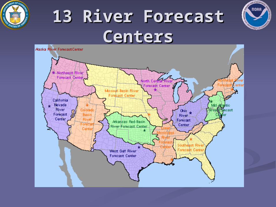
13 River Forecast 13 River Forecast CentersCenters
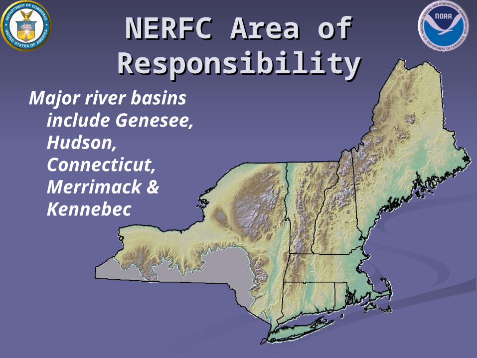
NERFC Area of NERFC Area of ResponsibilityResponsibility
Major river basins include Genesee, Hudson, Connecticut, Merrimack & Kennebec
Advanced Hydrologic Advanced Hydrologic Prediction Services (AHPS)Prediction Services (AHPS) ObjectiveObjective
Provide improved flood/river forecasting Provide improved flood/river forecasting capabilities for the Nation capabilities for the Nation
What will AHPS provide?What will AHPS provide? Extends current 1, 2, 3 day lead-times Extends current 1, 2, 3 day lead-times
out to weeks and monthsout to weeks and months Provides river forecasts with uncertainty Provides river forecasts with uncertainty
information for risk-based decisionsinformation for risk-based decisions Provides visual flood-forecast productsProvides visual flood-forecast products
NERFC AHPS FOCUSNERFC AHPS FOCUS
Soil moisture modelingSoil moisture modeling Convert from event based API to Convert from event based API to
continuous SAC SMAcontinuous SAC SMA Increase number of forecast pointsIncrease number of forecast points
Eventually will double the number of Eventually will double the number of locationslocations
Hydraulic routingHydraulic routing Lake ChamplainLake Champlain Lower Hudson and Connecticut RiversLower Hudson and Connecticut Rivers

NERFC ActivitiesNERFC Activities
OperationsOperations Hydrometeorological inputHydrometeorological input River forecastingRiver forecasting Product dissemination/coordinationProduct dissemination/coordination
DevelopmentDevelopment Model calibrationModel calibration Procedures/ProcessesProcedures/Processes System/DatabaseSystem/Database
FORECAST POINTSFORECAST POINTS
178 River forecast points – most daily 178 River forecast points – most daily with issuance of 54 hours of 6 hour with issuance of 54 hours of 6 hour time series forecaststime series forecasts
This is an increase of 48 during the This is an increase of 48 during the past 2 yearspast 2 years
Most of increase has been in New Most of increase has been in New York state and in MaineYork state and in Maine
An additional 27 new forecast points An additional 27 new forecast points are plannedare planned
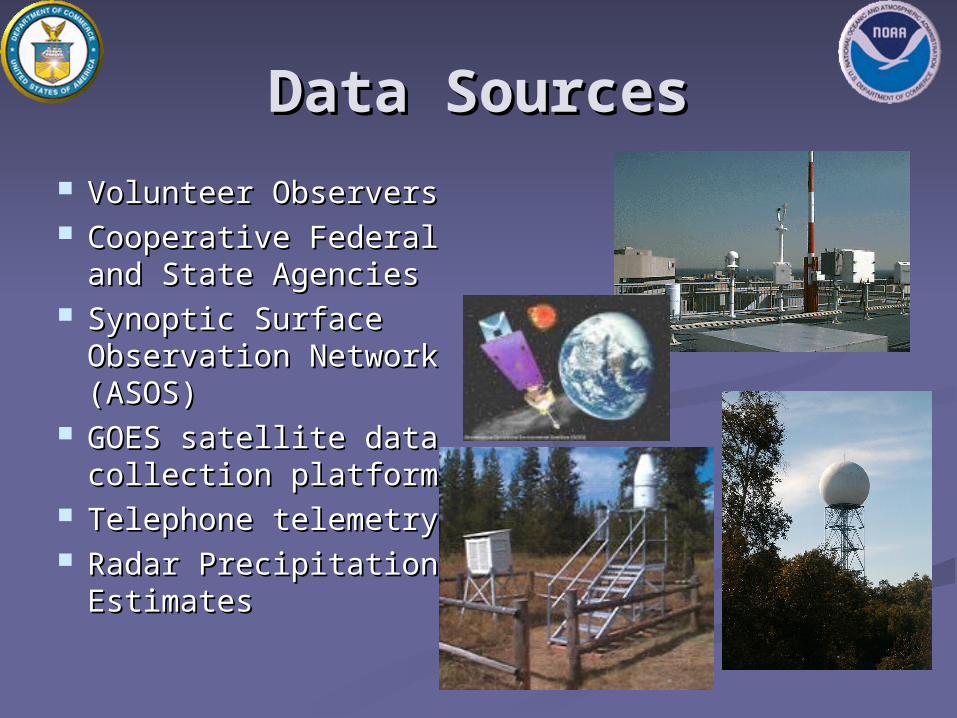
Data SourcesData Sources Volunteer ObserversVolunteer Observers Cooperative Federal Cooperative Federal
and State Agenciesand State Agencies Synoptic Surface Synoptic Surface
Observation Network Observation Network (ASOS)(ASOS)
GOES satellite data GOES satellite data collection platformscollection platforms
Telephone telemetryTelephone telemetry Radar Precipitation Radar Precipitation
EstimatesEstimates
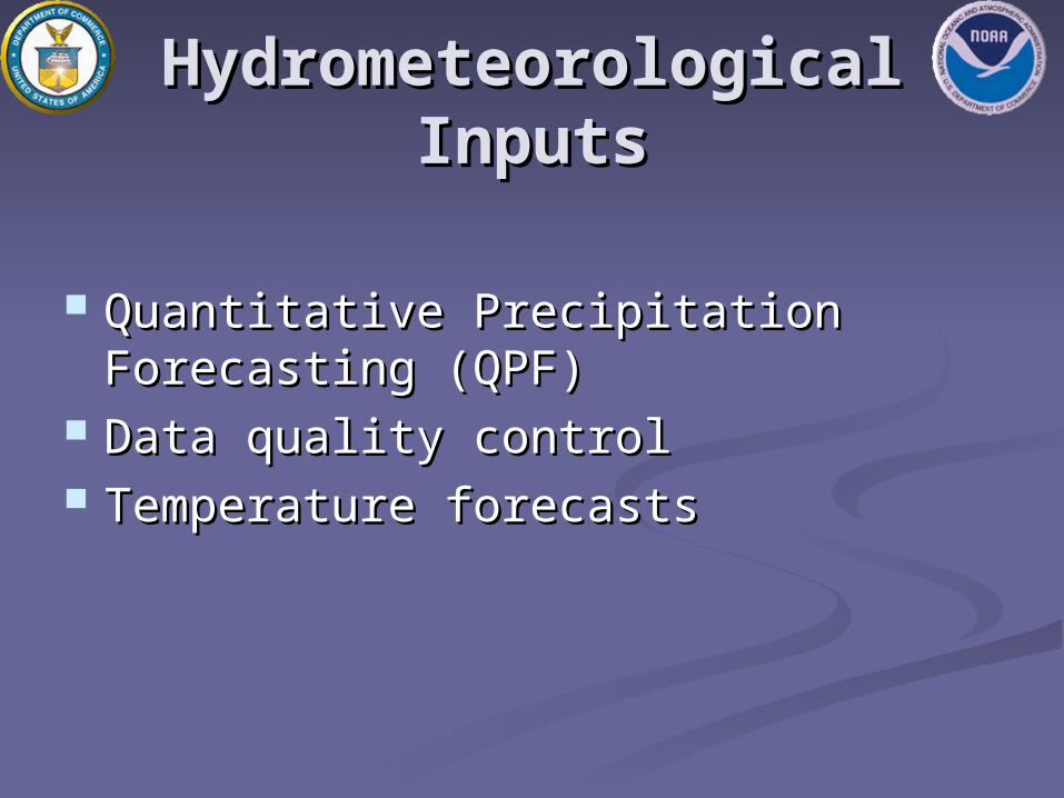
Hydrometeorological Hydrometeorological InputsInputs
Quantitative Precipitation Quantitative Precipitation Forecasting (QPF)Forecasting (QPF)
Data quality controlData quality control Temperature forecasts Temperature forecasts

National Weather Service National Weather Service River Forecast System River Forecast System
(NWSRFS)(NWSRFS) Hydrologic and Hydrologic and
hydraulic modelinghydraulic modeling ModularModular Nationally Nationally
supportedsupported Requires local Requires local
configuration and configuration and calibrationcalibration

NWSRFSNWSRFS
Collection of models and processesCollection of models and processes Snow accumulation/ablationSnow accumulation/ablation Compute runoffCompute runoff Channel and reservoir routingChannel and reservoir routing
ComponentsComponents CalibrationCalibration Operational forecastingOperational forecasting Ensemble streamflow prediction (ESP)Ensemble streamflow prediction (ESP)
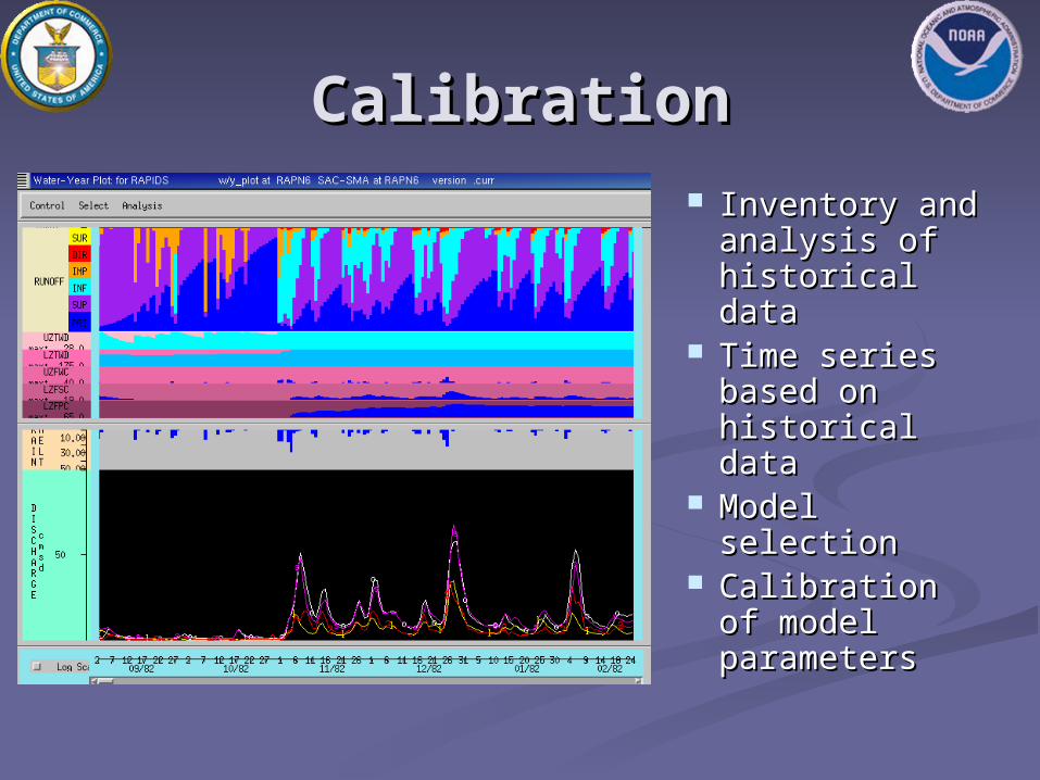
CalibrationCalibration Inventory and Inventory and
analysis of analysis of historical datahistorical data
Time series Time series based on based on historical datahistorical data
Model Model selectionselection
Calibration of Calibration of model model parametersparameters
Operational Forecast Operational Forecast SystemSystem
Preprocesses observed and future Preprocesses observed and future datadata
Updates model state parametersUpdates model state parameters Provides short-term river and flood Provides short-term river and flood
forecastsforecasts
Ensemble Streamflow Ensemble Streamflow PredictionPrediction
Uses historical precipitation, Uses historical precipitation, temperature, and evaporation datatemperature, and evaporation data
Uses current model states from the Uses current model states from the operational forecast systemoperational forecast system
Produces medium to long range Produces medium to long range probabilistic forecastsprobabilistic forecasts

River ConditionsRiver Conditions
Current and Forecast
River Conditions
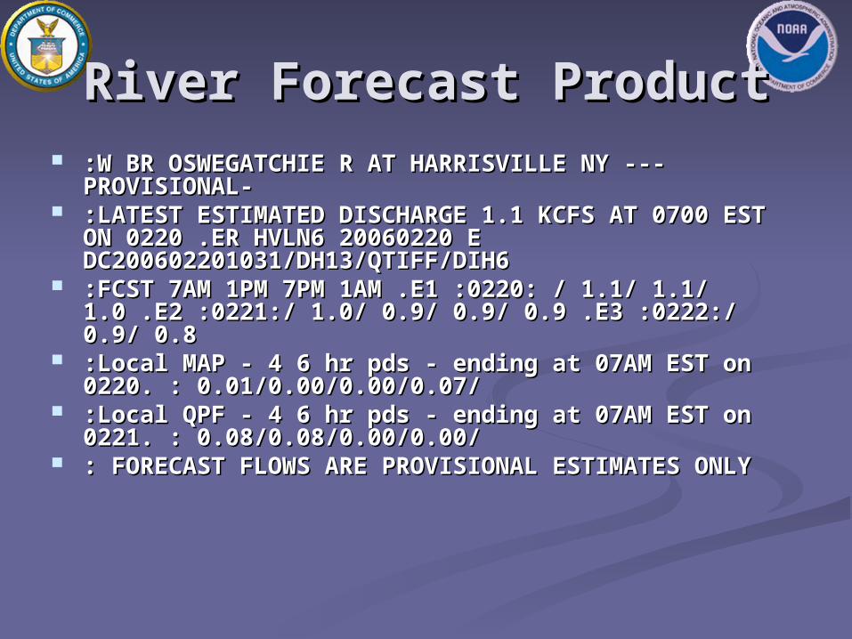
River Forecast ProductRiver Forecast Product :W BR OSWEGATCHIE R AT HARRISVILLE NY ---:W BR OSWEGATCHIE R AT HARRISVILLE NY ---
PROVISIONAL- PROVISIONAL- :LATEST ESTIMATED DISCHARGE 1.1 KCFS AT 0700 :LATEST ESTIMATED DISCHARGE 1.1 KCFS AT 0700
EST ON 0220 .ER HVLN6 20060220 E EST ON 0220 .ER HVLN6 20060220 E DC200602201031/DH13/QTIFF/DIH6 DC200602201031/DH13/QTIFF/DIH6
:FCST 7AM 1PM 7PM 1AM .E1 :0220: / 1.1/ 1.1/ :FCST 7AM 1PM 7PM 1AM .E1 :0220: / 1.1/ 1.1/ 1.0 .E2 :0221:/ 1.0/ 0.9/ 0.9/ 0.9 .E3 :0222:/ 0.9/ 0.8 1.0 .E2 :0221:/ 1.0/ 0.9/ 0.9/ 0.9 .E3 :0222:/ 0.9/ 0.8
:Local MAP - 4 6 hr pds - ending at 07AM EST on :Local MAP - 4 6 hr pds - ending at 07AM EST on 0220. : 0.01/0.00/0.00/0.07/ 0220. : 0.01/0.00/0.00/0.07/
:Local QPF - 4 6 hr pds - ending at 07AM EST on :Local QPF - 4 6 hr pds - ending at 07AM EST on 0221. : 0.08/0.08/0.00/0.00/ 0221. : 0.08/0.08/0.00/0.00/
: FORECAST FLOWS ARE PROVISIONAL ESTIMATES : FORECAST FLOWS ARE PROVISIONAL ESTIMATES ONLY ONLY

Graphical ForecastsGraphical Forecasts

Flood PotentialFlood Potential
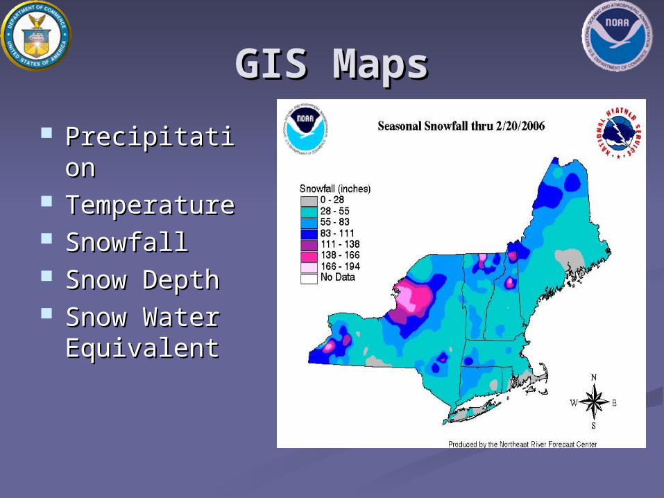
GIS MapsGIS Maps
PrecipitationPrecipitation TemperatureTemperature SnowfallSnowfall Snow DepthSnow Depth Snow Water Snow Water
EquivalentEquivalent

Ensemble Streamflow Ensemble Streamflow PredictionPrediction
Based on 40 Based on 40 years of years of historical historical precipitatioprecipitation and n and temperaturetemperature
Based on Based on current current snowpack snowpack and soil and soil moisture moisture conditionsconditions

Flood MappingFlood Mapping
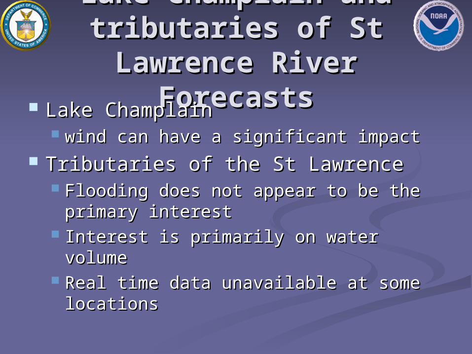
Lake Champlain and Lake Champlain and tributaries of St tributaries of St Lawrence RiverLawrence River
ForecastsForecasts Lake ChamplainLake Champlain wind can have a significant impactwind can have a significant impact
Tributaries of the St LawrenceTributaries of the St Lawrence Flooding does not appear to be the Flooding does not appear to be the
primary interestprimary interest Interest is primarily on water volumeInterest is primarily on water volume Real time data unavailable at some Real time data unavailable at some
locationslocations

QUESTIONSQUESTIONS
http://www.erh.noaa.gov/http://www.erh.noaa.gov/nerfc/nerfc/