Embed Size (px)
Citation preview
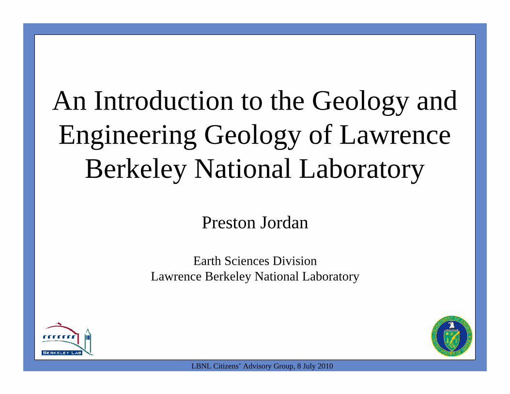
An Introduction to the Geology and Engineering Geology of Lawrence
Berkeley National Laboratory
Preston Jordan
Earth Sciences DivisionLawrence Berkeley National Laboratory
LBNL Citizens’ Advisory Group, 8 July 2010
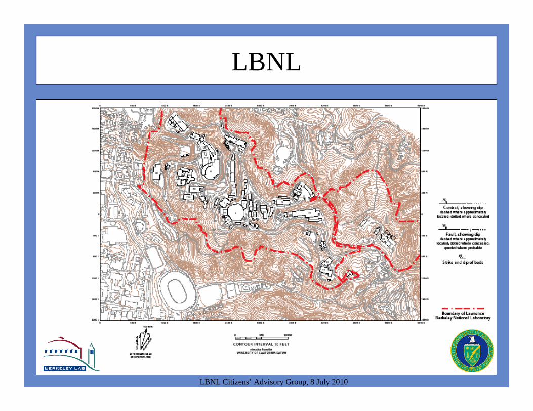
LBNL
LBNL Citizens’ Advisory Group, 8 July 2010

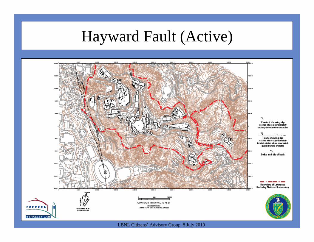
Hayward Fault (Active)
LBNL Citizens’ Advisory Group, 8 July 2010
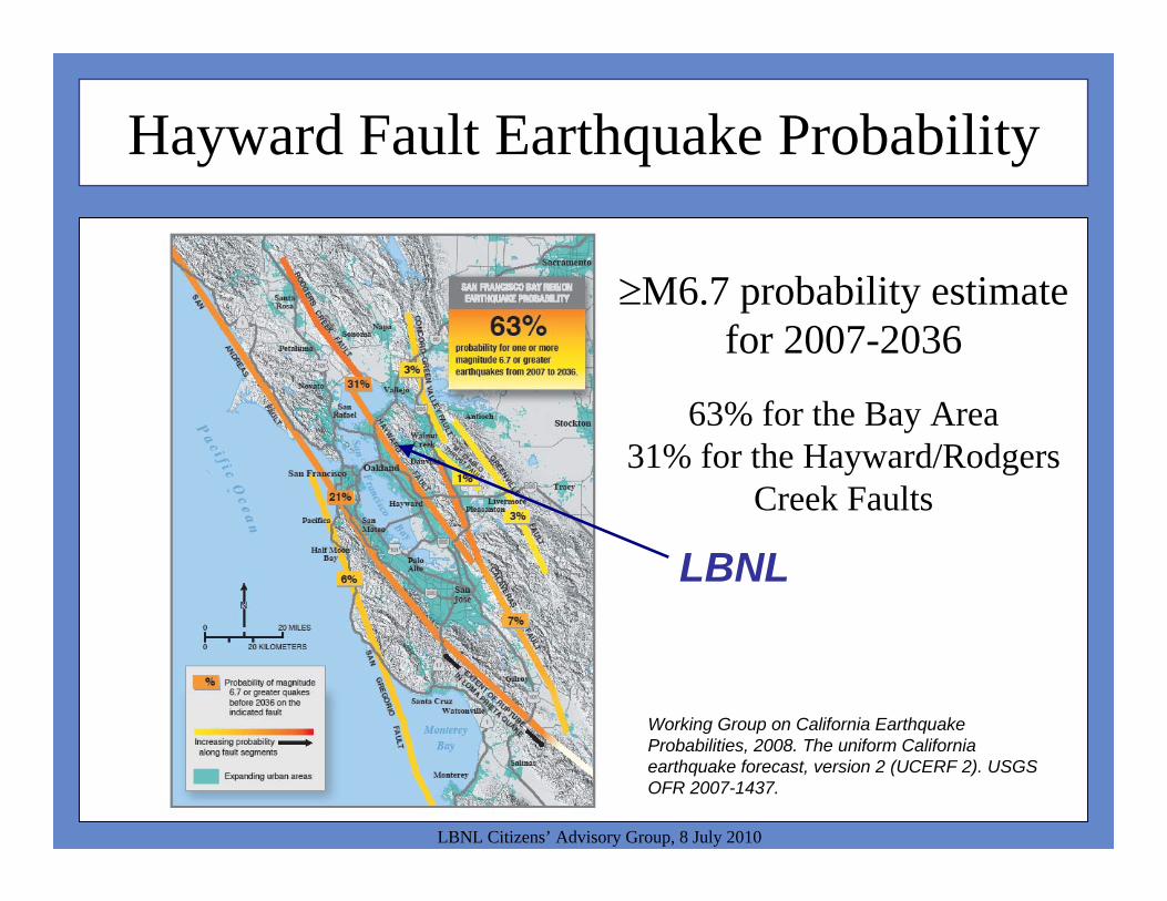
Hayward Fault Earthquake Probability
LBNL Citizens’ Advisory Group, 8 July 2010
M6.7 probability estimate for 2007-2036
63% for the Bay Area31% for the Hayward/Rodgers
Creek Faults
Working Group on California Earthquake Probabilities, 2008. The uniform California earthquake forecast, version 2 (UCERF 2). USGS OFR 2007-1437.
LBNL
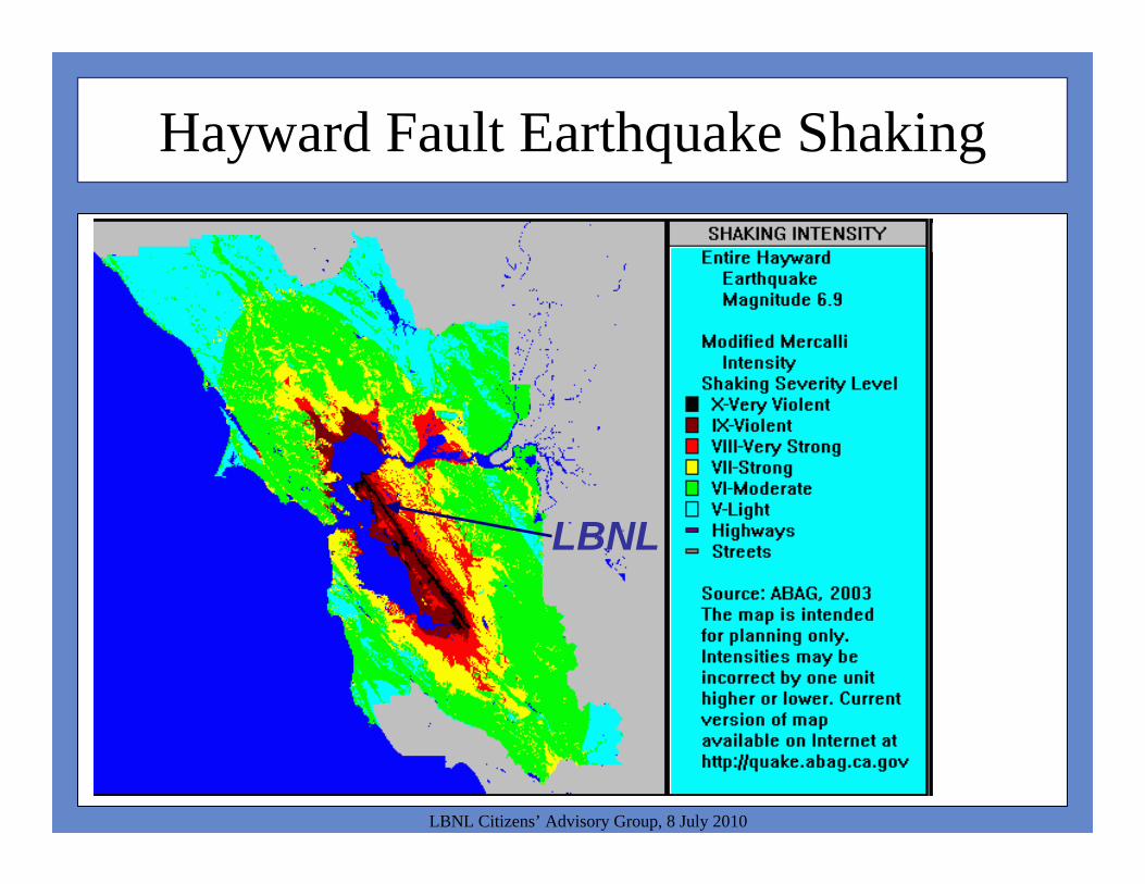
Hayward Fault Earthquake Shaking
LBNL Citizens’ Advisory Group, 8 July 2010
LBNL
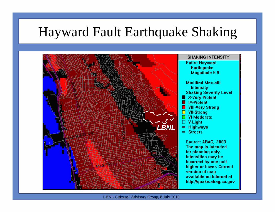
Hayward Fault Earthquake Shaking
LBNL Citizens’ Advisory Group, 8 July 2010
LBNL
Hayward Fault (Active)
LBNL Citizens’ Advisory Group, 8 July 2010
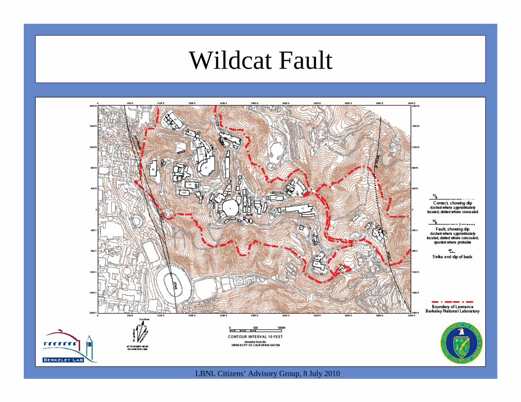
Wildcat Fault
LBNL Citizens’ Advisory Group, 8 July 2010
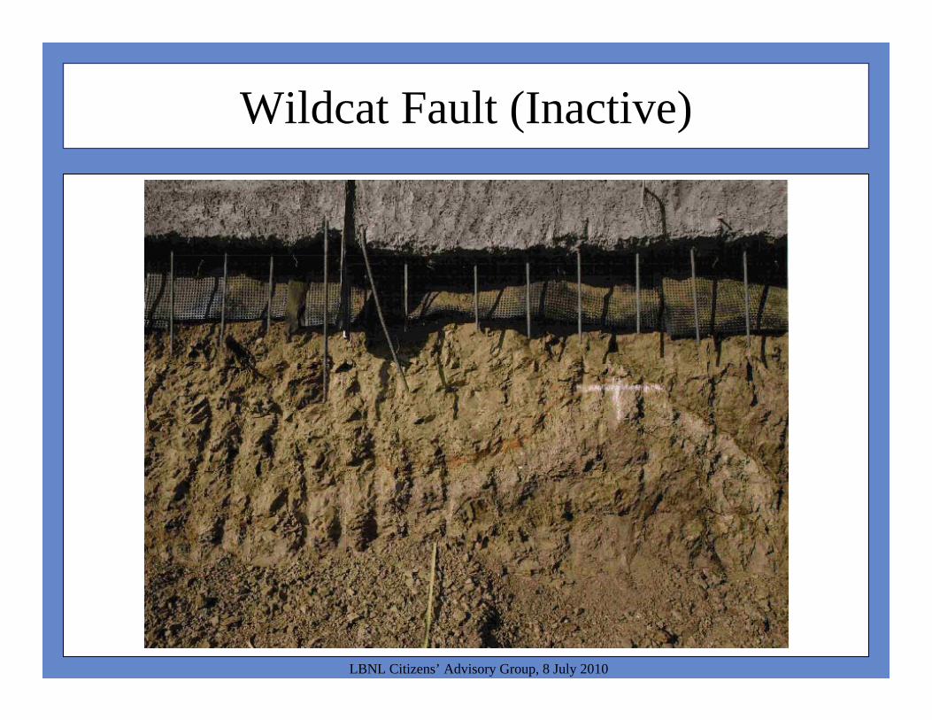
Wildcat Fault (Inactive)
LBNL Citizens’ Advisory Group, 8 July 2010

Wildcat Fault (Inactive)
LBNL Citizens’ Advisory Group, 8 July 2010
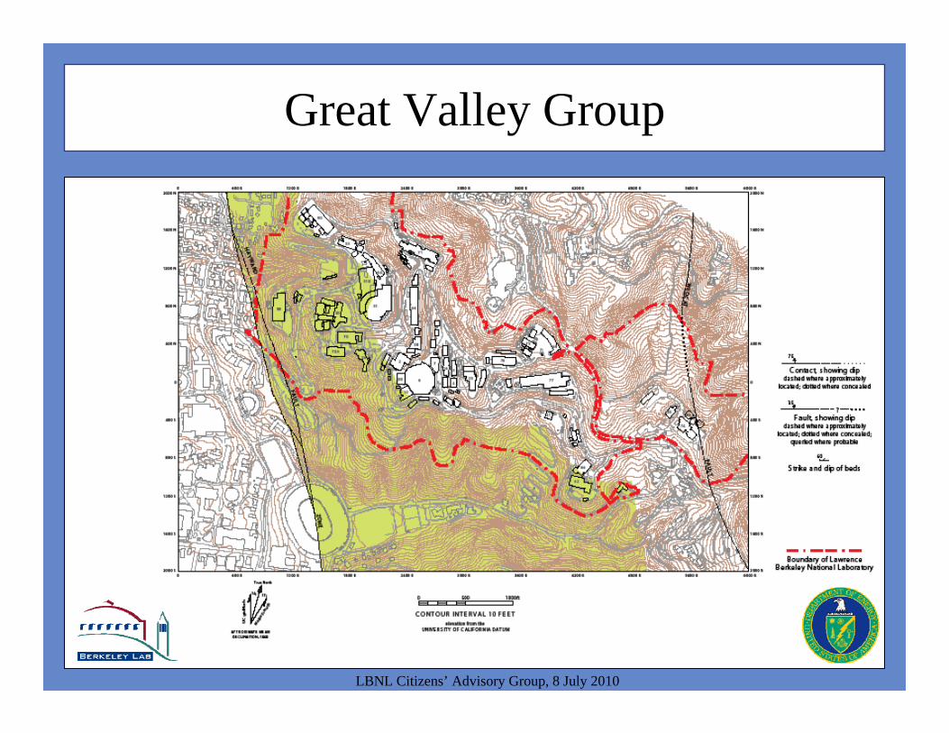
Great Valley Group
LBNL Citizens’ Advisory Group, 8 July 2010
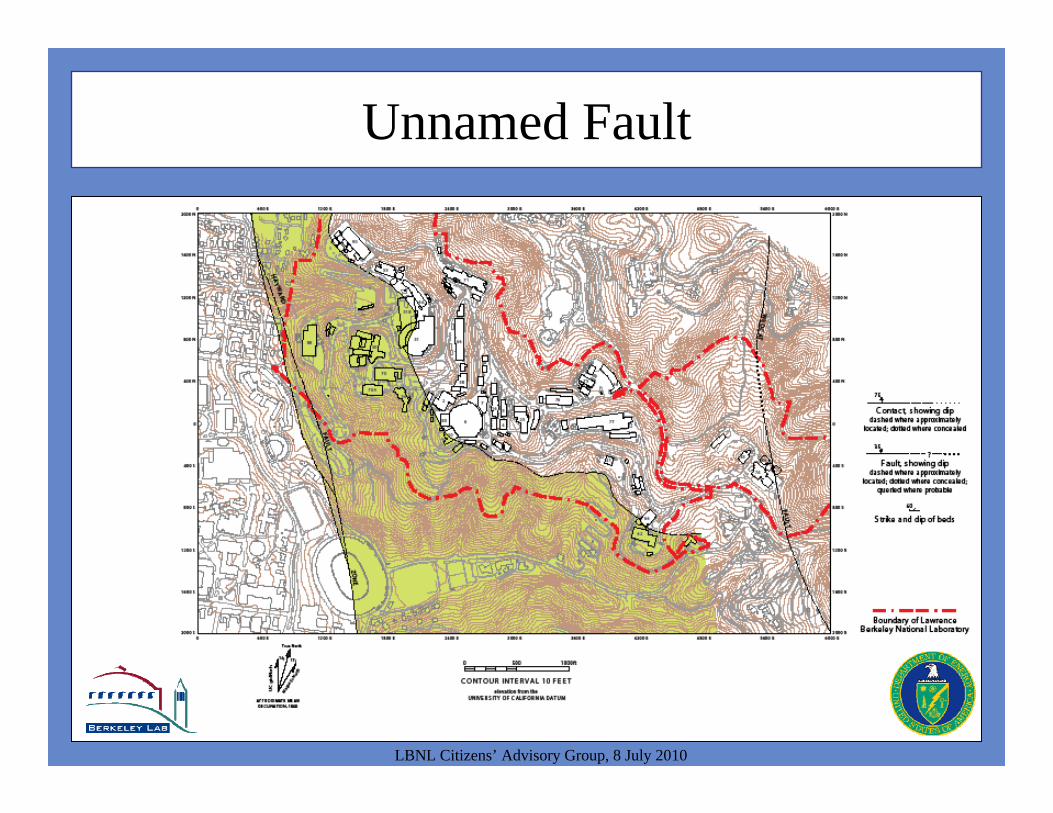
Unnamed Fault
LBNL Citizens’ Advisory Group, 8 July 2010
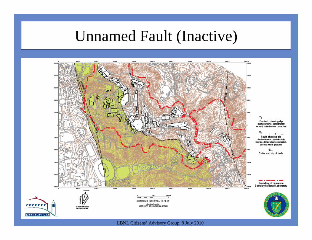
Unnamed Fault (Inactive)
LBNL Citizens’ Advisory Group, 8 July 2010

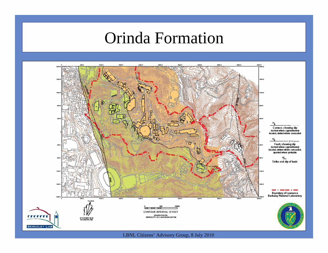
Orinda Formation
LBNL Citizens’ Advisory Group, 8 July 2010
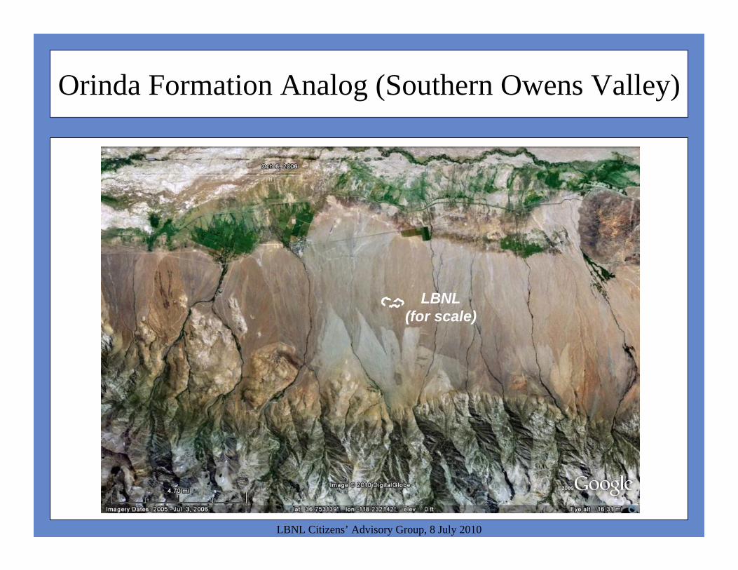
Orinda Formation Analog (Southern Owens Valley)
LBNL Citizens’ Advisory Group, 8 July 2010
LBNL(for scale)
Orinda Formation
LBNL Citizens’ Advisory Group, 8 July 2010
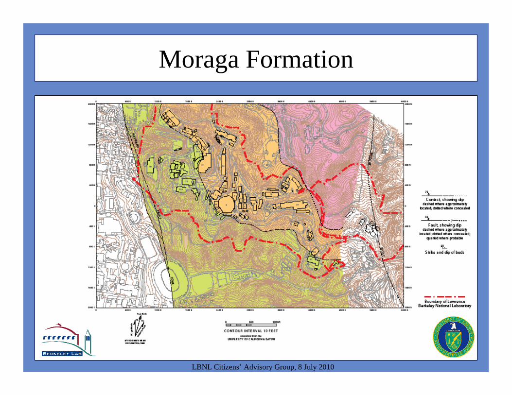
Moraga Formation
LBNL Citizens’ Advisory Group, 8 July 2010

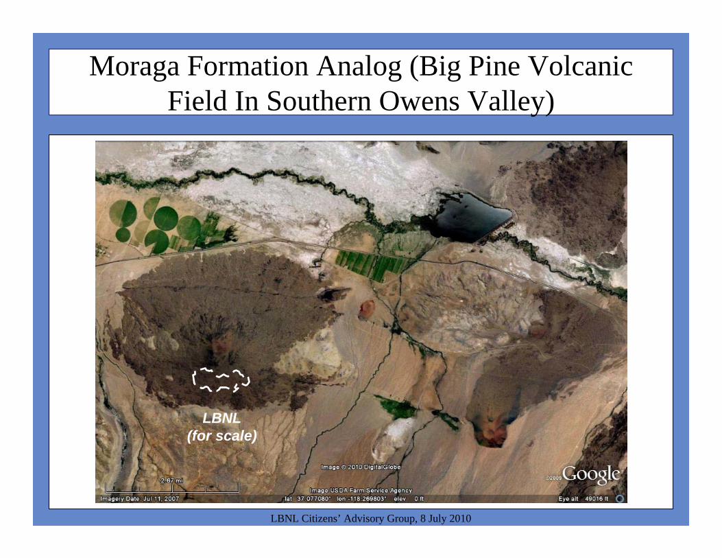
Moraga Formation Analog (Big Pine Volcanic Field In Southern Owens Valley)
LBNL Citizens’ Advisory Group, 8 July 2010
LBNL(for scale)
LBNL Citizens’ Advisory Group, 8 July 2010
Moraga Formation Analog (Big Pine Volcanic Field In Southern Owens Valley)
LBNL(for scale)
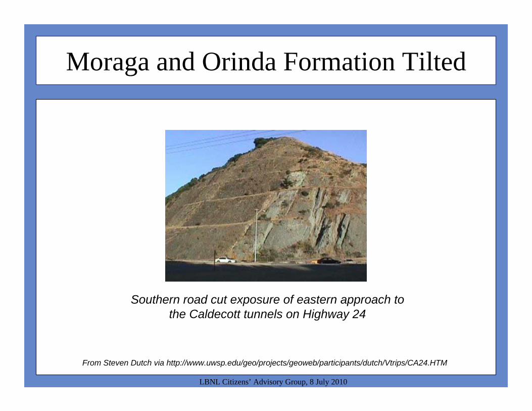
Moraga and Orinda Formation Tilted
LBNL Citizens’ Advisory Group, 8 July 2010
From Steven Dutch via http://www.uwsp.edu/geo/projects/geoweb/participants/dutch/Vtrips/CA24.HTM
Southern road cut exposure of eastern approach to the Caldecott tunnels on Highway 24

Moraga Formation
LBNL Citizens’ Advisory Group, 8 July 2010
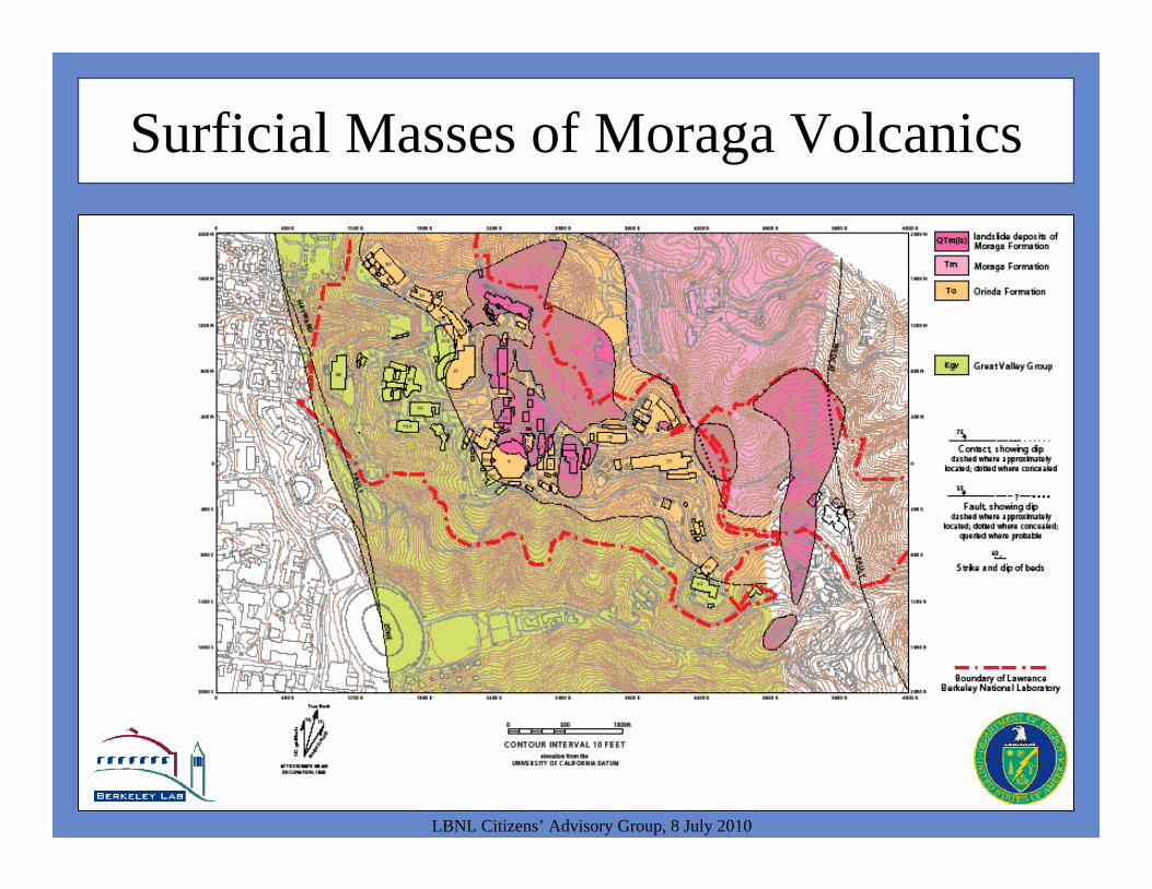
Surficial Masses of Moraga Volcanics
LBNL Citizens’ Advisory Group, 8 July 2010

Lab-Wide Geologic Section
LBNL Citizens’ Advisory Group, 8 July 2010

Lab-Wide Geologic Section
LBNL Citizens’ Advisory Group, 8 July 2010
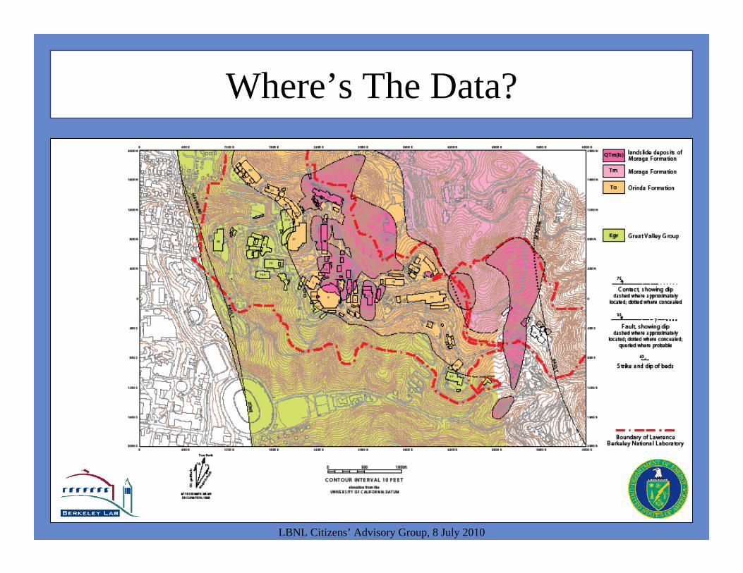
Where’s The Data?
LBNL Citizens’ Advisory Group, 8 July 2010
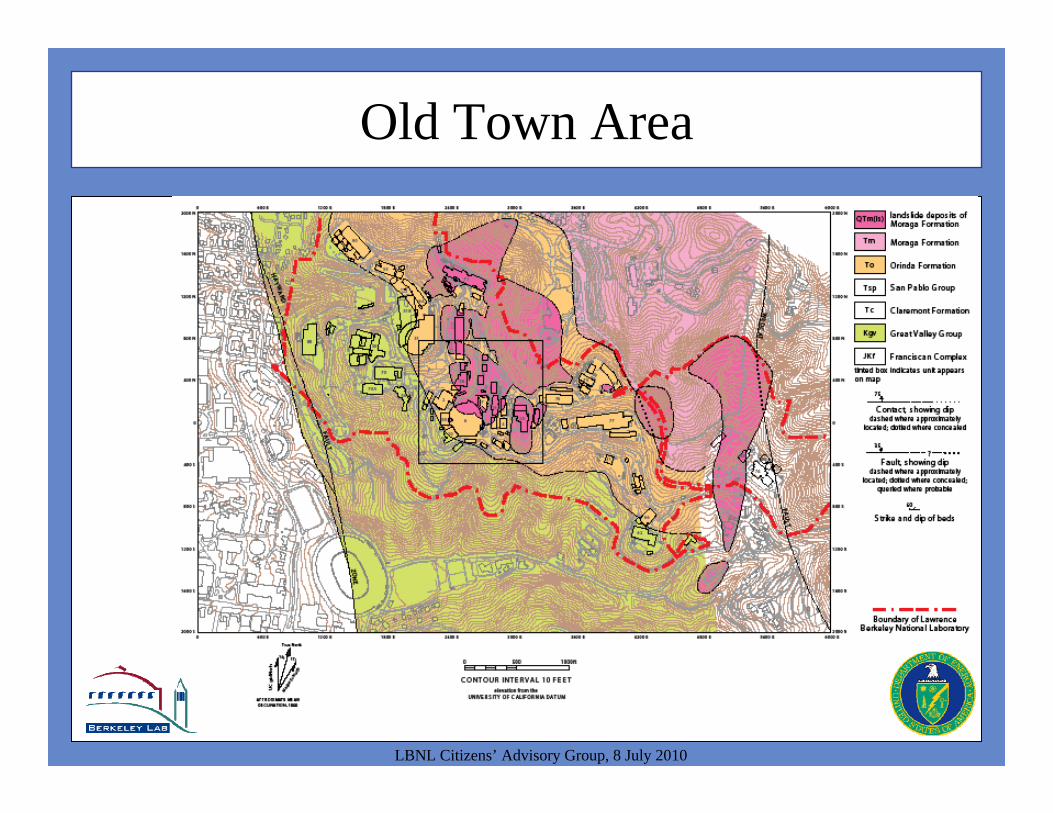
Old Town Area
LBNL Citizens’ Advisory Group, 8 July 2010
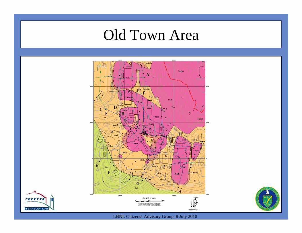
Old Town Area
LBNL Citizens’ Advisory Group, 8 July 2010
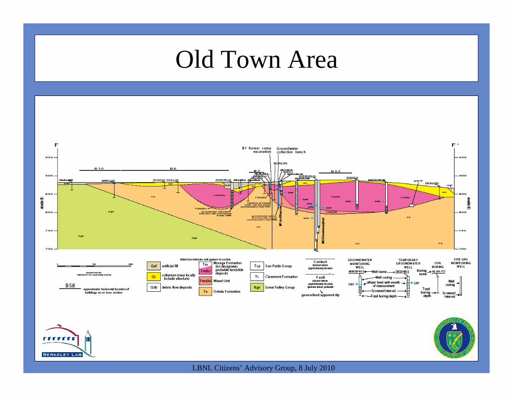
Old Town Area
LBNL Citizens’ Advisory Group, 8 July 2010
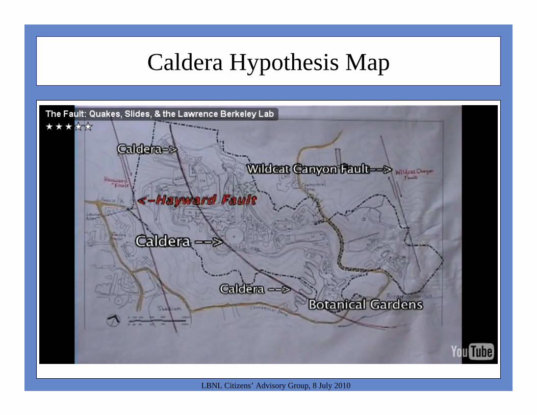
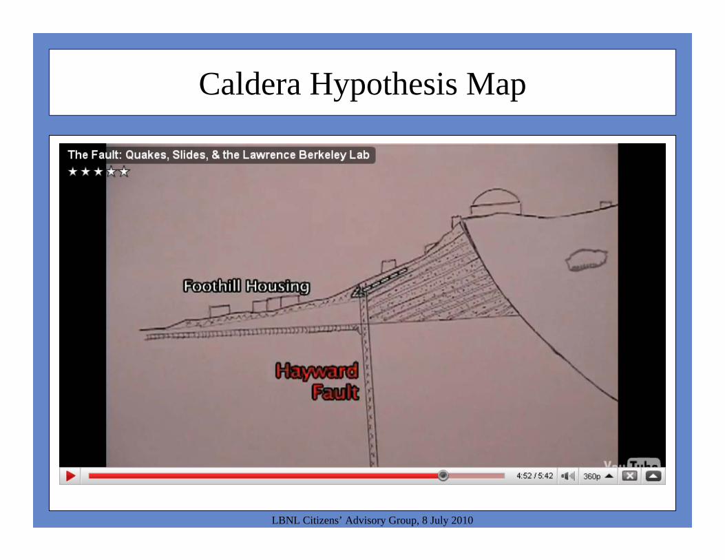
Caldera Hypothesis Map
LBNL Citizens’ Advisory Group, 8 July 2010
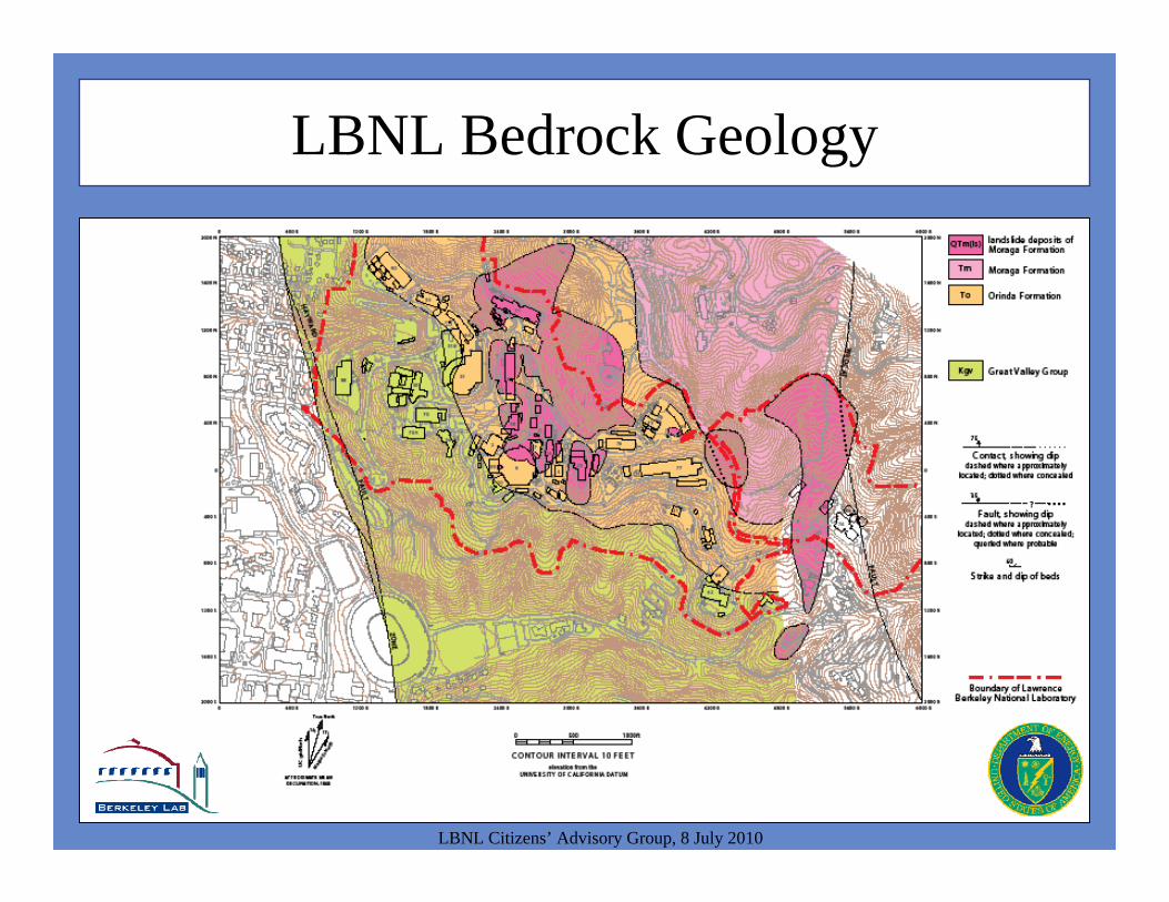
LBNL Bedrock Geology
LBNL Citizens’ Advisory Group, 8 July 2010
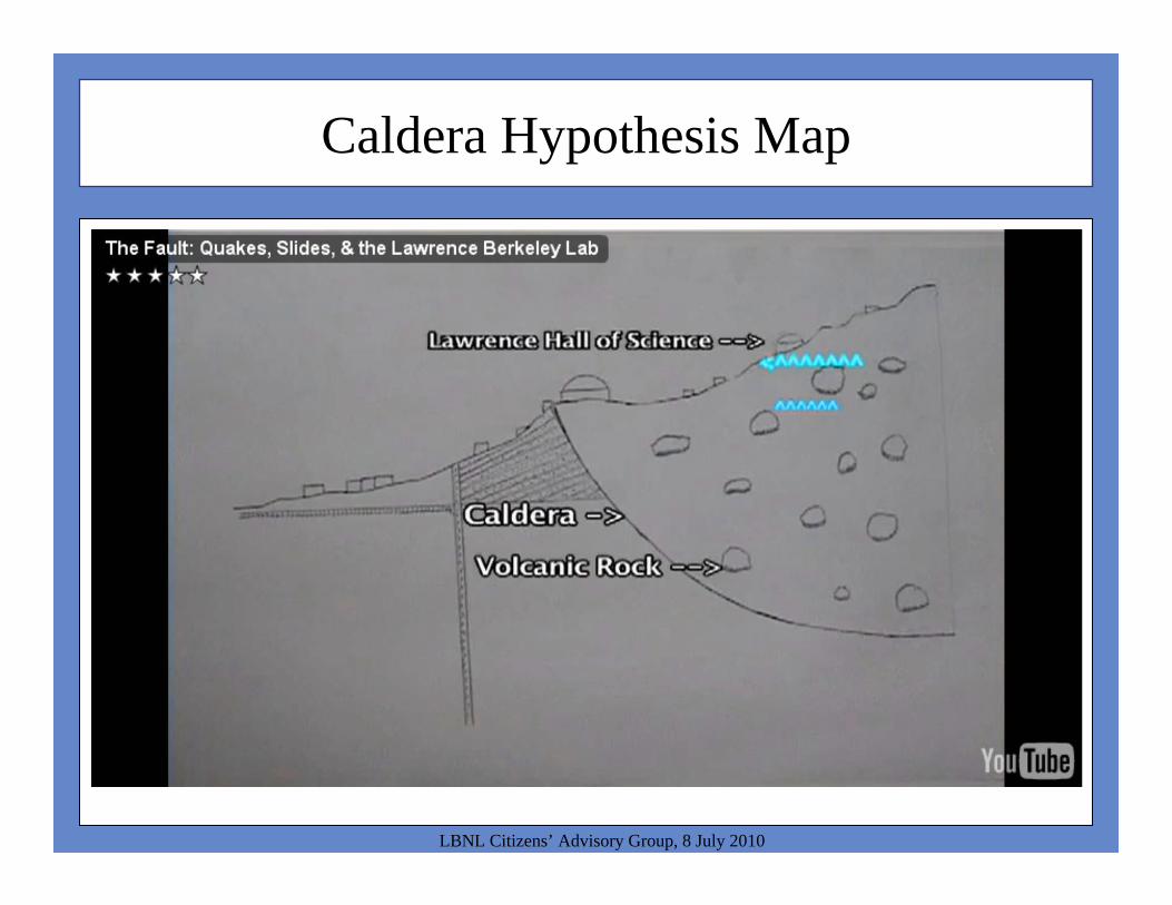
Caldera Hypothesis Map
LBNL Citizens’ Advisory Group, 8 July 2010

Lab-Wide Geologic Section
LBNL Citizens’ Advisory Group, 8 July 2010
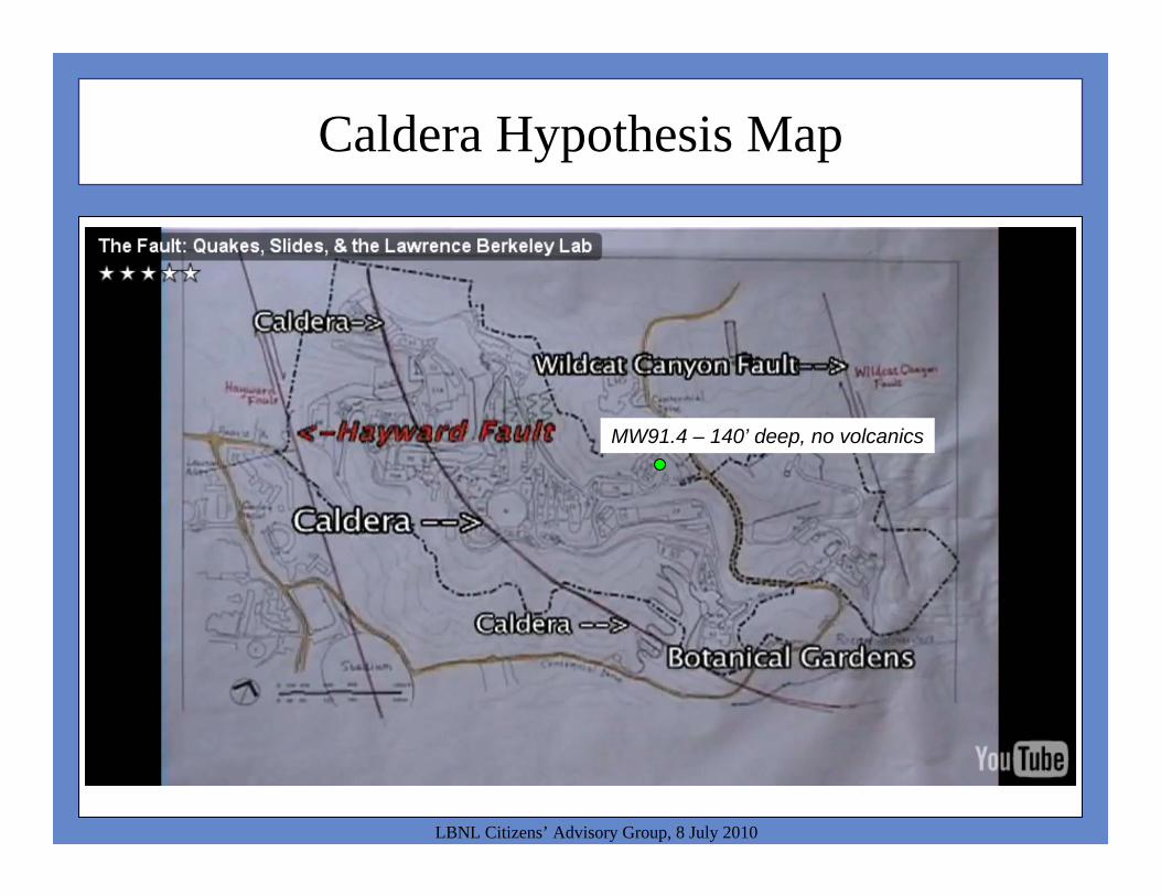
Caldera Hypothesis Map
LBNL Citizens’ Advisory Group, 8 July 2010
MW91.4 – 140’ deep, no volcanics
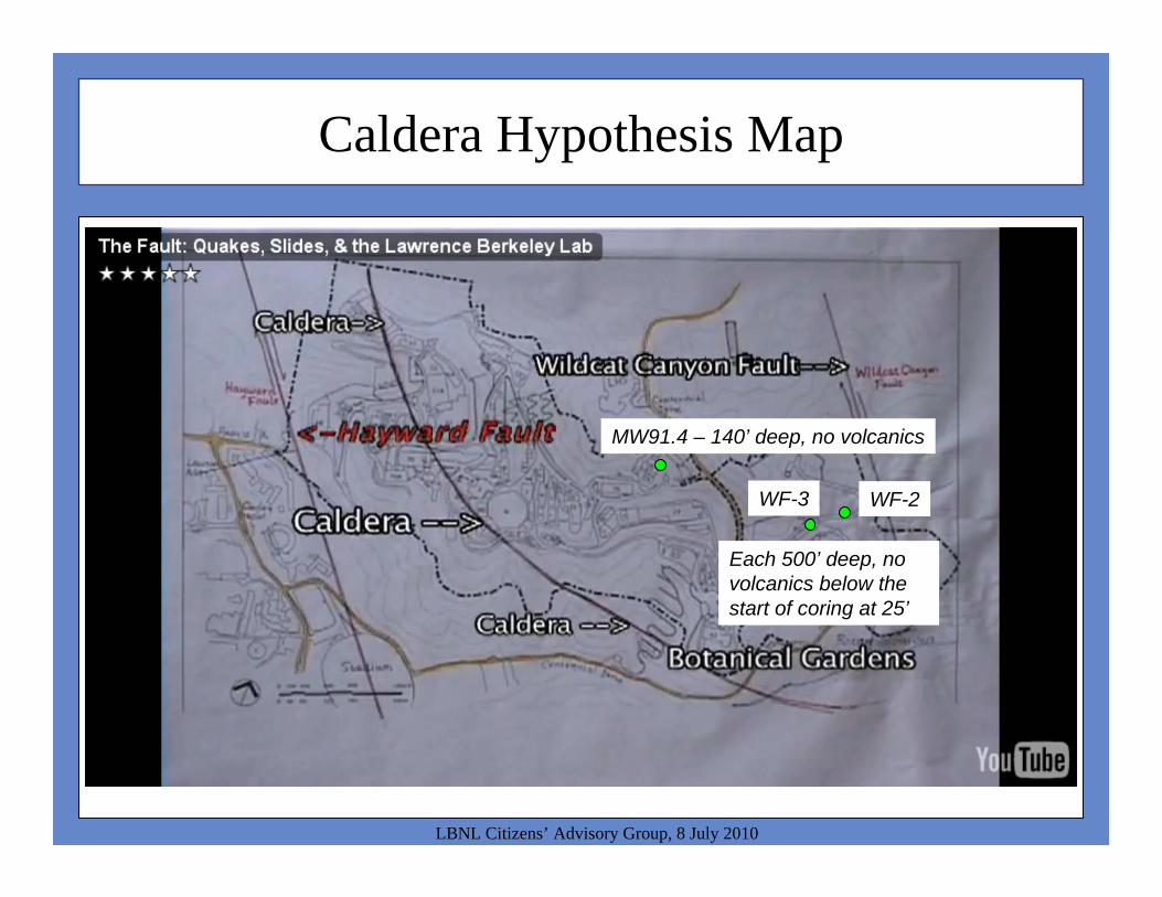
Caldera Hypothesis Map
LBNL Citizens’ Advisory Group, 8 July 2010
MW91.4 – 140’ deep, no volcanics
WF-2WF-3
Each 500’ deep, no volcanics below the start of coring at 25’
Caldera Hypothesis Map
LBNL Citizens’ Advisory Group, 8 July 2010
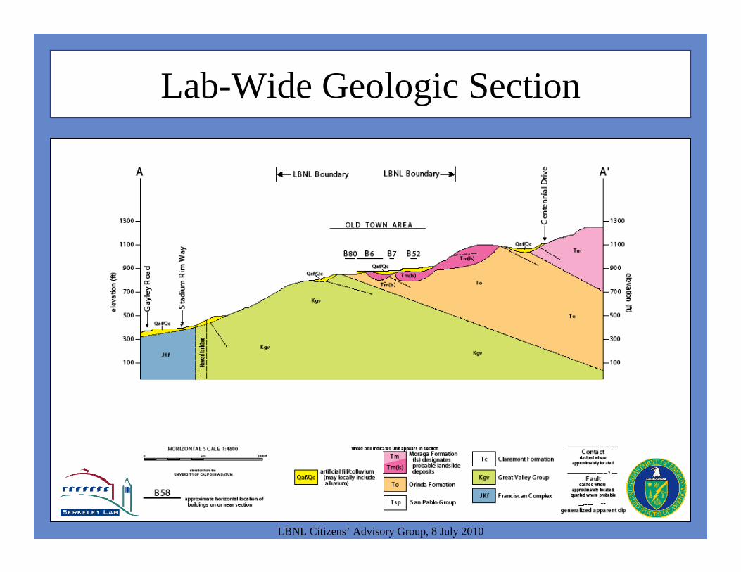
Lab-Wide Geologic Section
LBNL Citizens’ Advisory Group, 8 July 2010
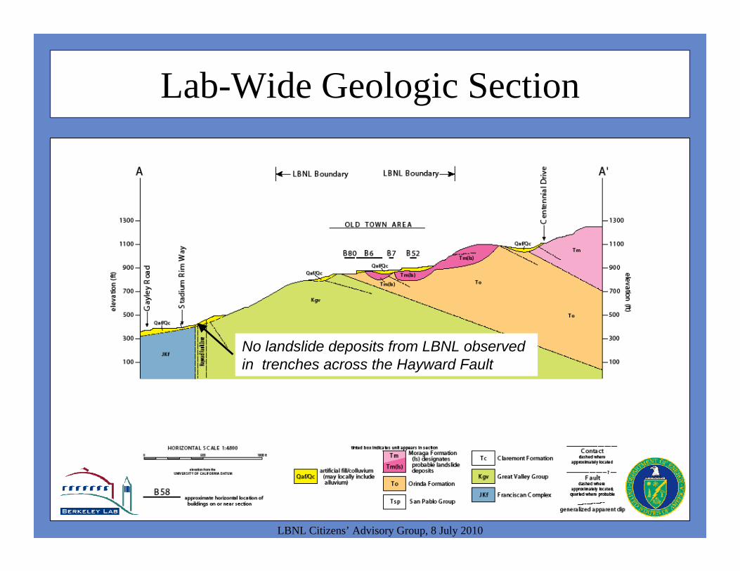
Lab-Wide Geologic Section
LBNL Citizens’ Advisory Group, 8 July 2010
No landslide deposits from LBNL observed in trenches across the Hayward Fault
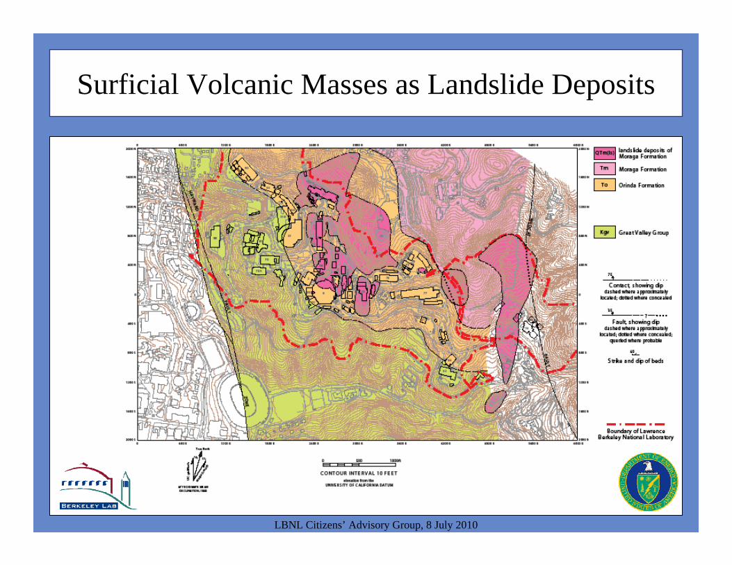
Surficial Volcanic Masses as Landslide Deposits
LBNL Citizens’ Advisory Group, 8 July 2010
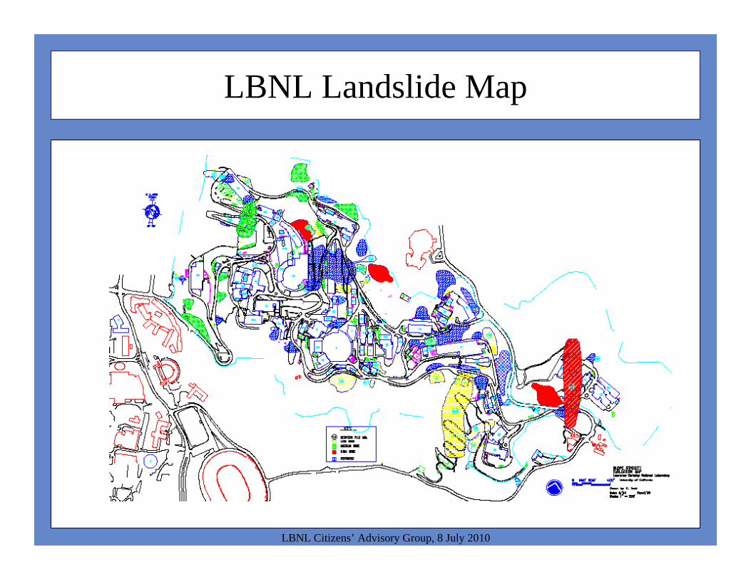
LBNL Landslide Map
LBNL Citizens’ Advisory Group, 8 July 2010
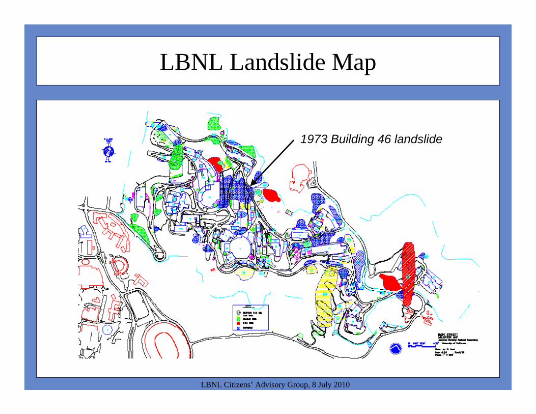
LBNL Landslide Map
LBNL Citizens’ Advisory Group, 8 July 2010
1973 Building 46 landslide
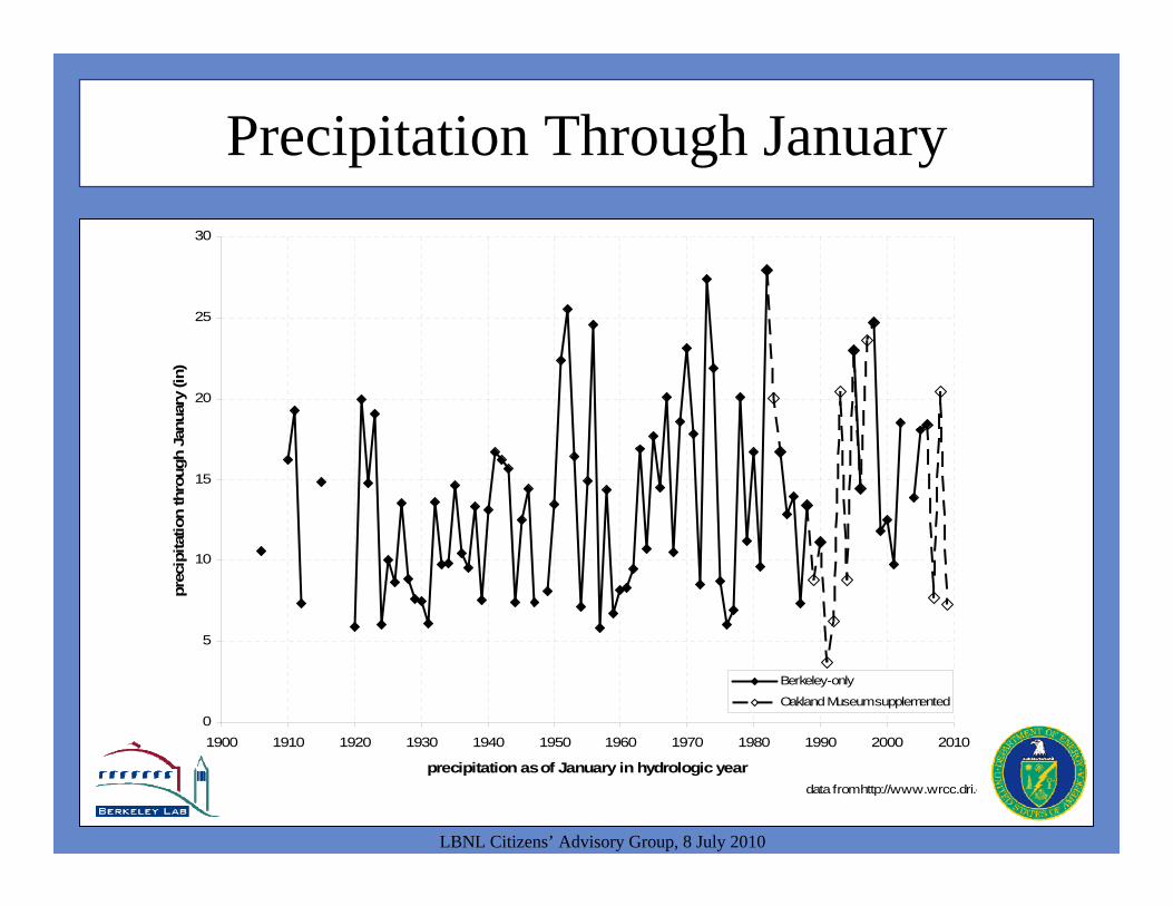
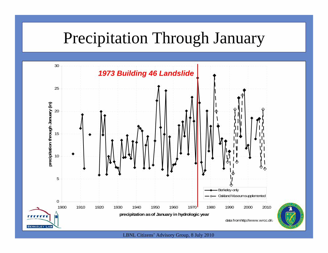
Precipitation Through January
LBNL Citizens’ Advisory Group, 8 July 2010
0
5
10
15
20
25
30
1900 1910 1920 1930 1940 1950 1960 1970 1980 1990 2000 2010
precipitation as of January in hydrologic year
prec
ipita
tion
thro
ugh
Janu
ary
(in)
Berkeley-only
Oakland Museum supplemented
data from http://www.wrcc.dri.e
1973 Building 46 Landslide
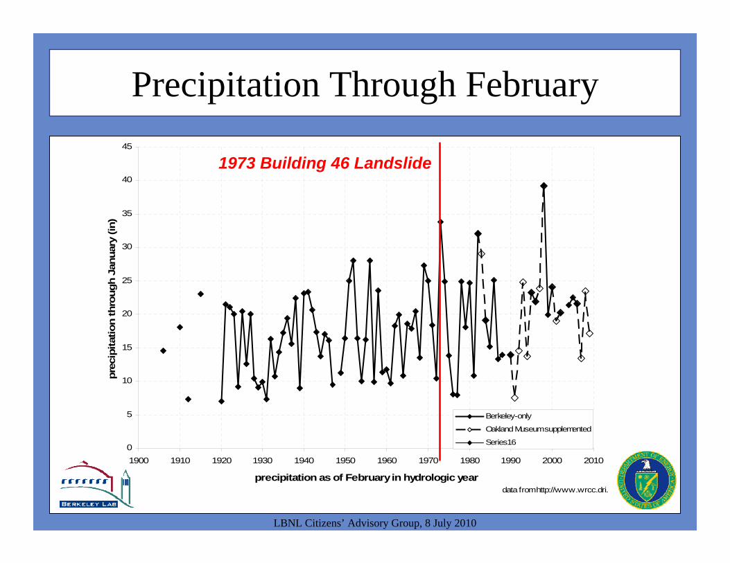
Precipitation Through February
LBNL Citizens’ Advisory Group, 8 July 2010
0
5
10
15
20
25
30
35
40
45
1900 1910 1920 1930 1940 1950 1960 1970 1980 1990 2000 2010
precipitation as of February in hydrologic year
prec
ipita
tion
thro
ugh
Janu
ary
(in)
Berkeley-only
Oakland Museum supplemented
Series16
data from http://www.wrcc.dri.
1973 Building 46 Landslideeffect?
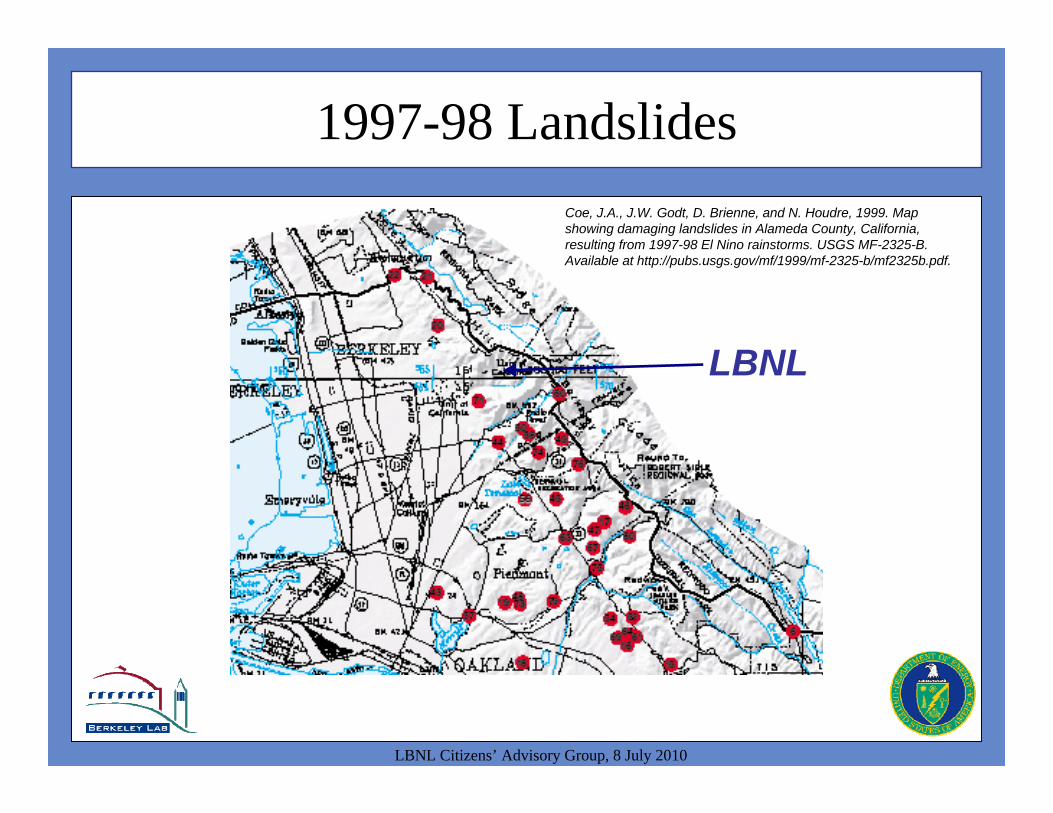
1997-98 Landslides
LBNL Citizens’ Advisory Group, 8 July 2010
Coe, J.A., J.W. Godt, D. Brienne, and N. Houdre, 1999. Map showing damaging landslides in Alameda County, California, resulting from 1997-98 El Nino rainstorms. USGS MF-2325-B. Available at http://pubs.usgs.gov/mf/1999/mf-2325-b/mf2325b.pdf.
LBNL
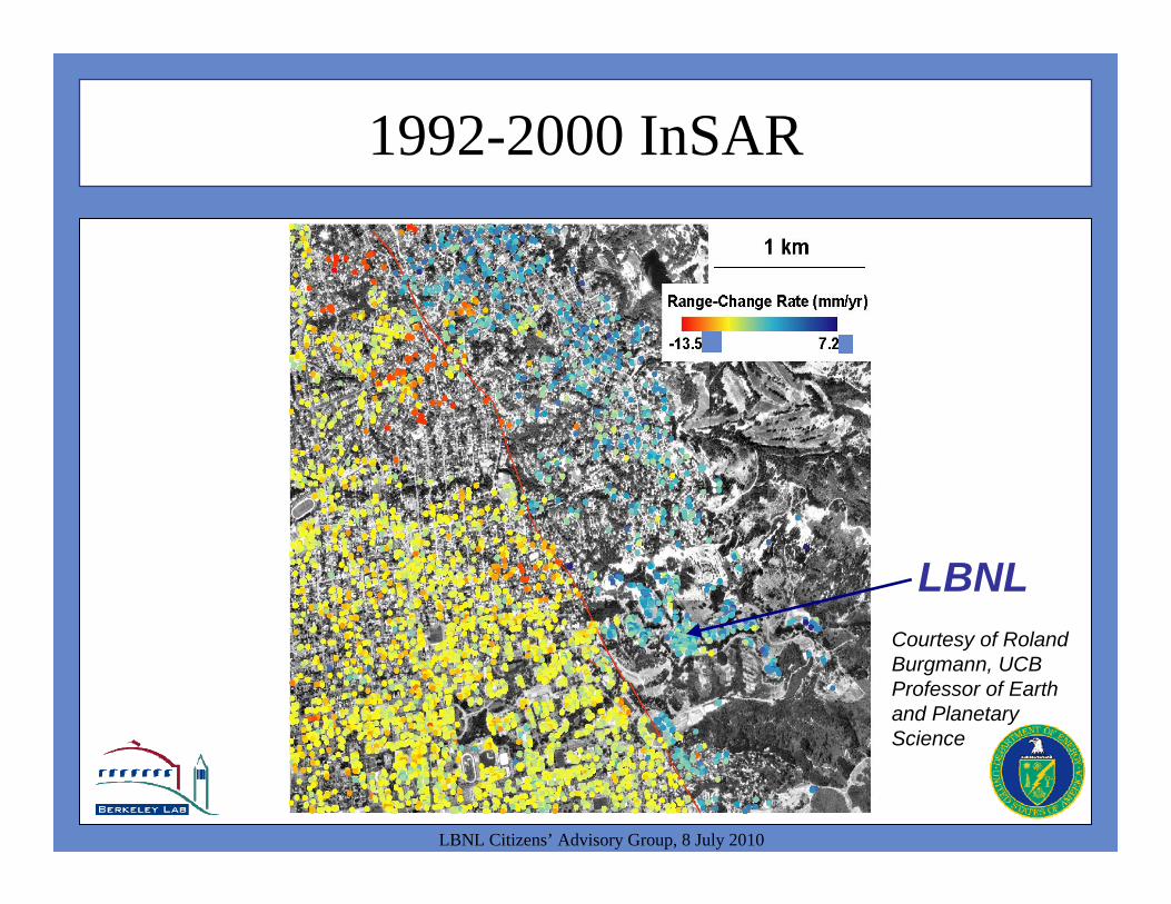
1992-2000 InSAR
LBNL Citizens’ Advisory Group, 8 July 2010
Courtesy of Roland Burgmann, UCB Professor of Earth and Planetary Science
LBNL
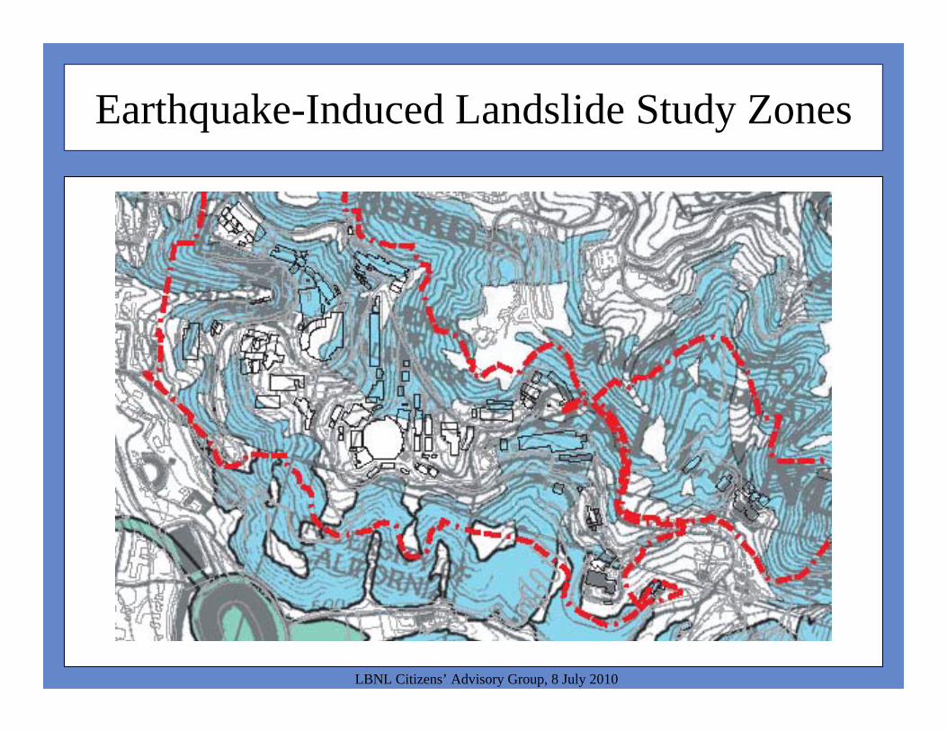
Earthquake-Induced Landslide Study Zones
LBNL Citizens’ Advisory Group, 8 July 2010
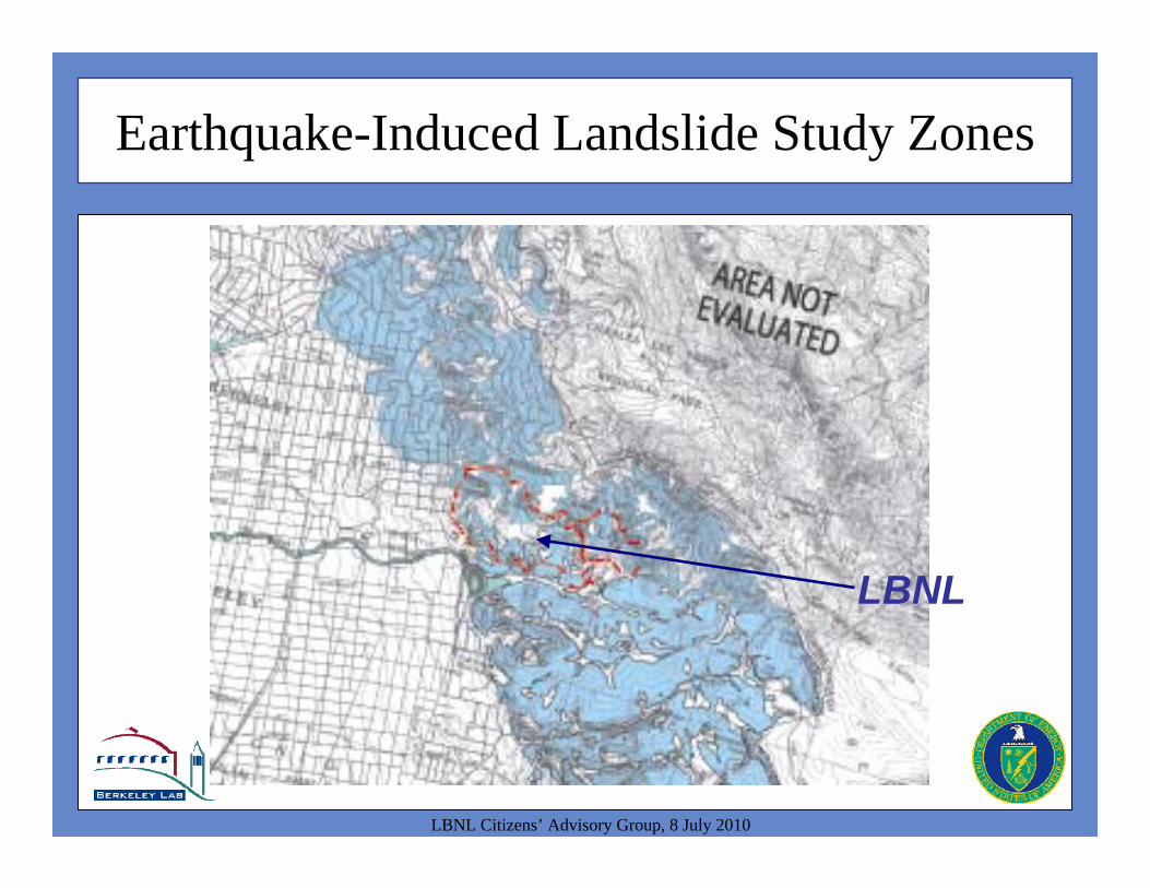
Earthquake-Induced Landslide Study Zones
LBNL Citizens’ Advisory Group, 8 July 2010
LBNL
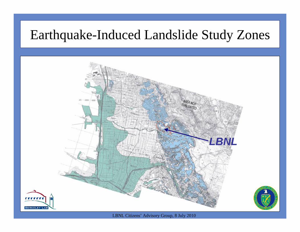
Earthquake-Induced Landslide Study Zones
LBNL Citizens’ Advisory Group, 8 July 2010
LBNL
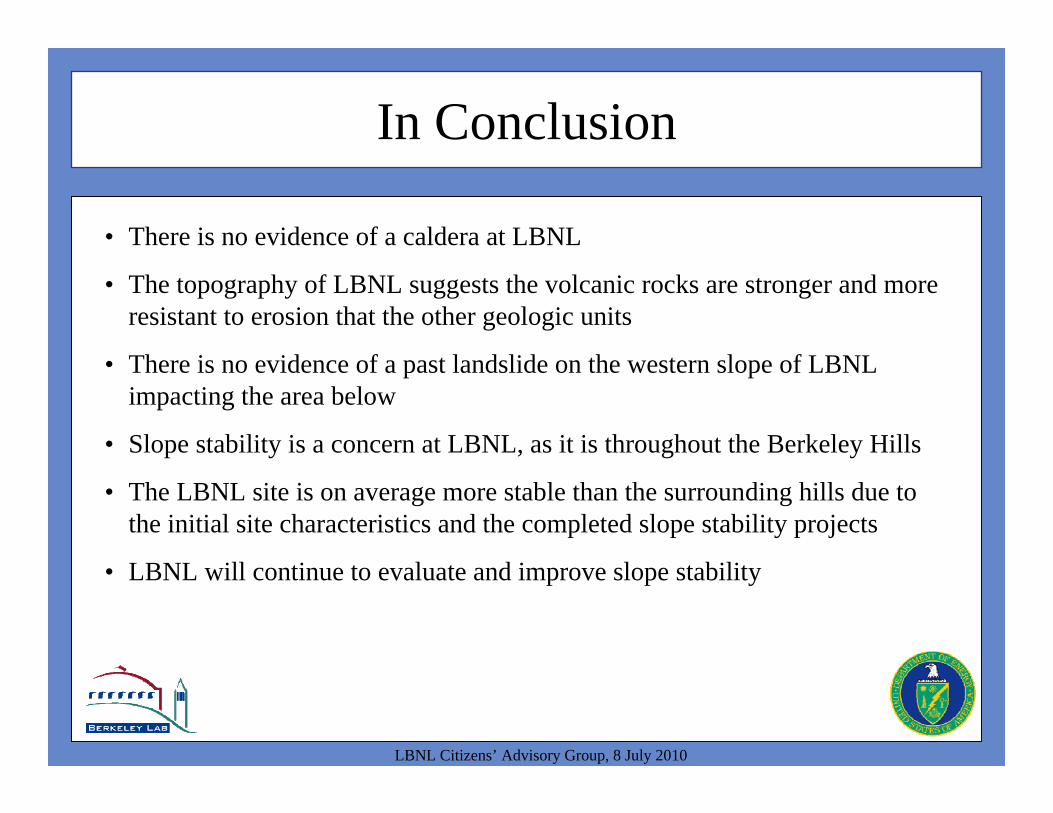
In Conclusion
LBNL Citizens’ Advisory Group, 8 July 2010
• There is no evidence of a caldera at LBNL
• The topography of LBNL suggests the volcanic rocks are stronger and more resistant to erosion that the other geologic units
• There is no evidence of a past landslide on the western slope of LBNL impacting the area below
• Slope stability is a concern at LBNL, as it is throughout the Berkeley Hills
• The LBNL site is on average more stable than the surrounding hills due to the initial site characteristics and the completed slope stability projects
• LBNL will continue to evaluate and improve slope stability