Embed Size (px)
Citation preview
An Introduction to Project 17 Development of Next-Generation
Seismic Design Value Maps
Ronald O. Hamburger, SE, SECB Senior Principal
Simpson Gumpertz & Heger Inc.
Chair Project 17 Planning Committee
Topics
• Planning Committee • Project purpose and schedule • Past milestones in map development
– Project 97 – Project 07
• Issues Presently Under Consideration • How do I participate?
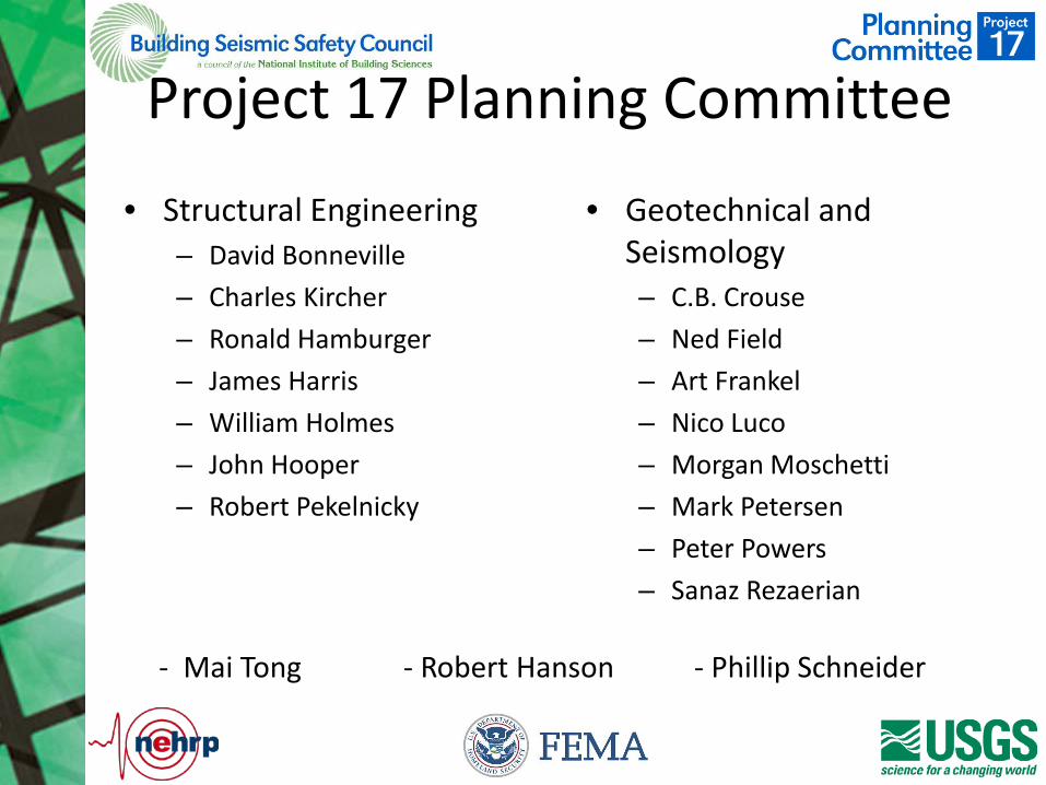
Project 17 Planning Committee
• Structural Engineering – David Bonneville – Charles Kircher – Ronald Hamburger – James Harris – William Holmes – John Hooper – Robert Pekelnicky
• Geotechnical and Seismology – C.B. Crouse – Ned Field – Art Frankel – Nico Luco – Morgan Moschetti – Mark Petersen – Peter Powers – Sanaz Rezaerian
- Mai Tong - Robert Hanson - Phillip Schneider
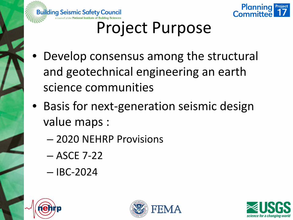
Project Purpose • Develop consensus among the structural
and geotechnical engineering an earth science communities
• Basis for next-generation seismic design value maps : – 2020 NEHRP Provisions – ASCE 7-22 – IBC-2024
Schedule
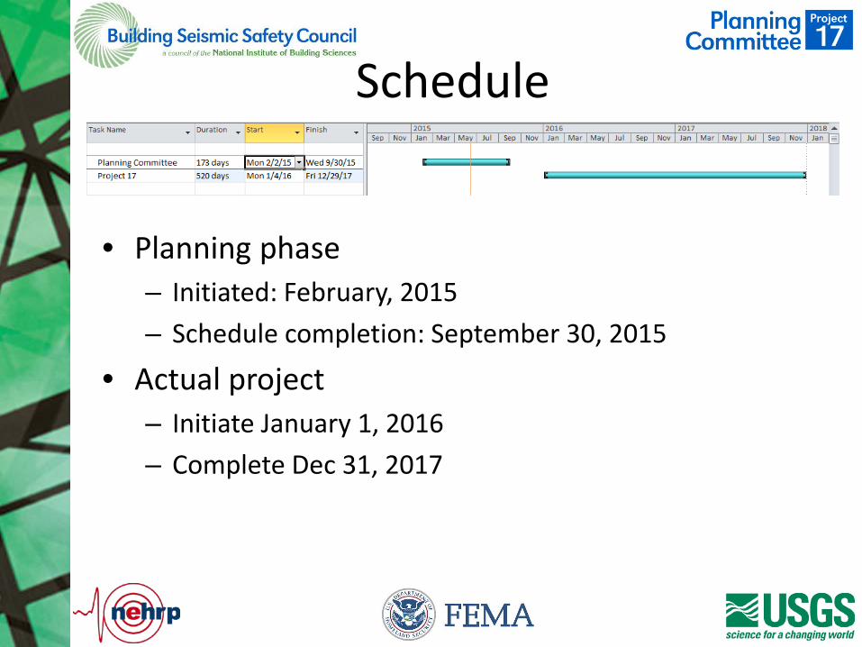
• Planning phase – Initiated: February, 2015 – Schedule completion: September 30, 2015
• Actual project – Initiate January 1, 2016 – Complete Dec 31, 2017
Planning Phase Purpose
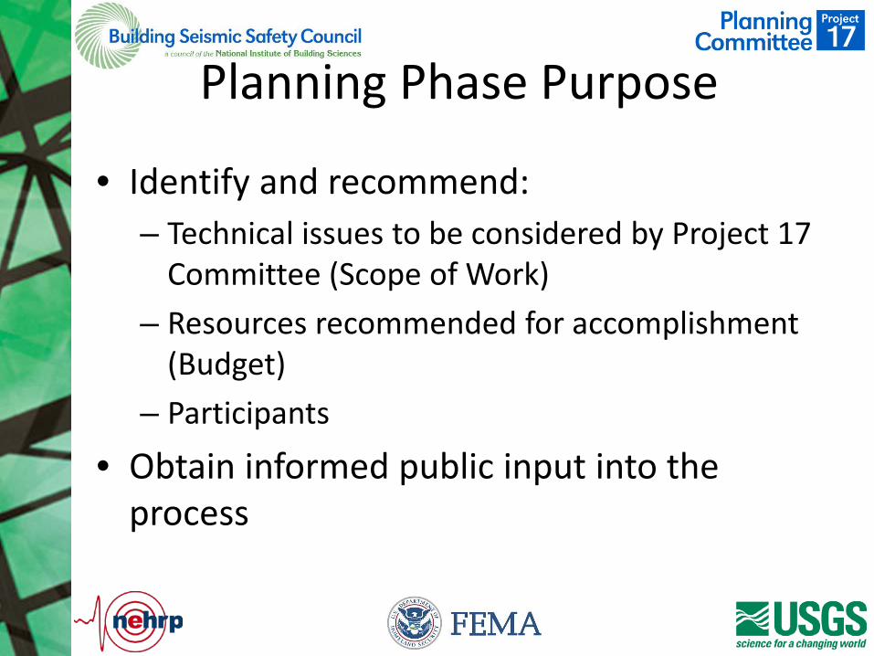
• Identify and recommend: – Technical issues to be considered by Project 17
Committee (Scope of Work) – Resources recommended for accomplishment
(Budget) – Participants
• Obtain informed public input into the process
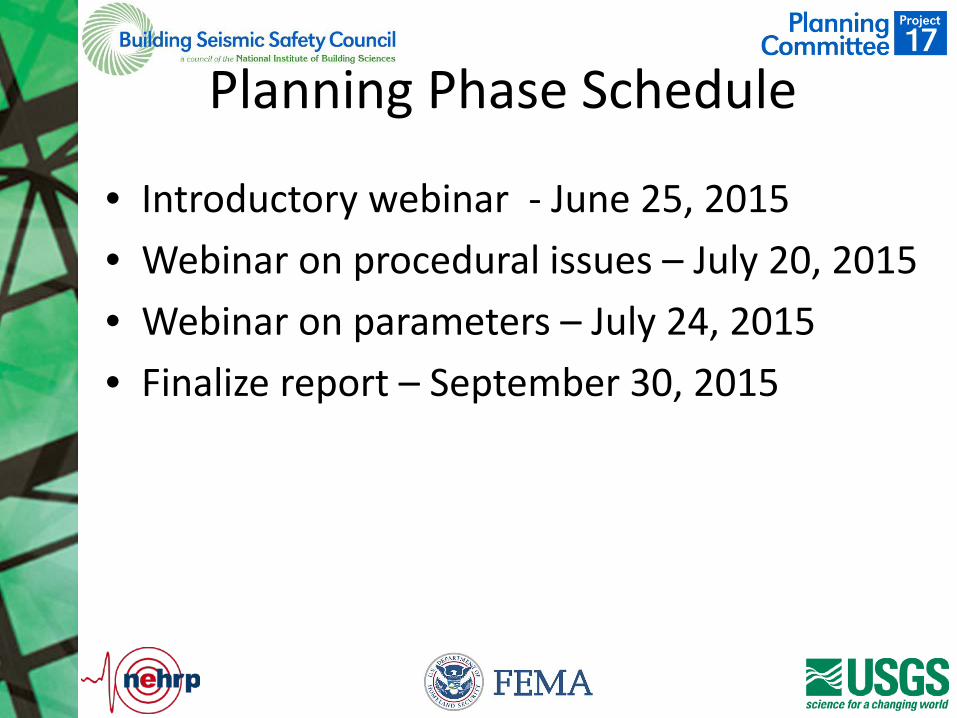
Planning Phase Schedule
• Introductory webinar - June 25, 2015 • Webinar on procedural issues – July 20, 2015 • Webinar on parameters – July 24, 2015 • Finalize report – September 30, 2015
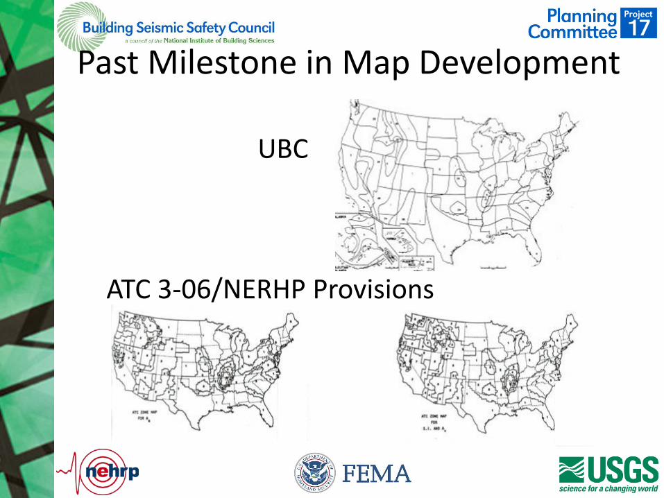
Past Milestone in Map Development
UBC
ATC 3-06/NERHP Provisions
Project 97
• Purpose: – Develop a sound basis for new seismic design
value maps that would form the basis for seismic design requirements in the new International Building Code

Project 97
• Followed on the heels of an earlier effort (Design Ground Motion Panel – Project 94) to perform the same function
• Project 94 could not develop consensus – Ground motions in regions of high seismicity
“too high” – Ground motions in regions of low seismicity
“too low” – “Cut and fill” considered but abandoned
Project 97
• Joint BSSC/USGS panel (30 persons, numerous subcommittees) met over a period of two years to identify: – New earth science knowledge and its potential
application – Means of providing adequate seismic protection
for eastern and western U.S. regions • USGS held series of regional workshops to
obtain input from the earth science community
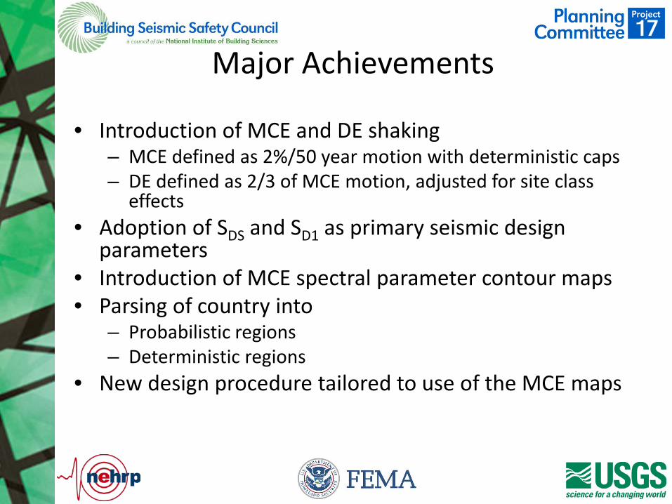
Major Achievements
• Introduction of MCE and DE shaking – MCE defined as 2%/50 year motion with deterministic caps – DE defined as 2/3 of MCE motion, adjusted for site class
effects • Adoption of SDS and SD1 as primary seismic design
parameters • Introduction of MCE spectral parameter contour maps • Parsing of country into
– Probabilistic regions – Deterministic regions
• New design procedure tailored to use of the MCE maps
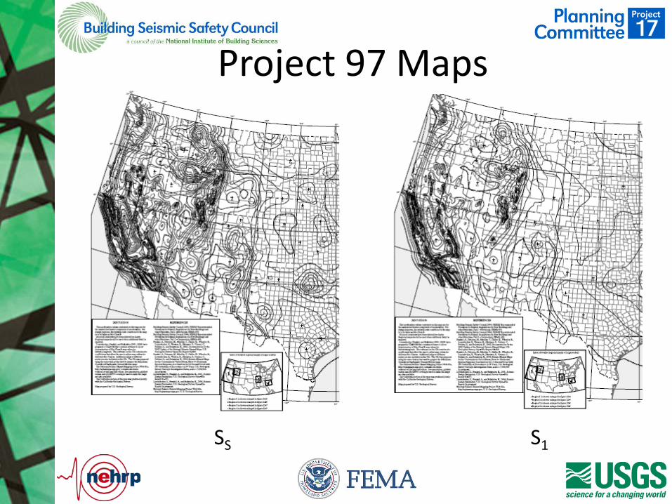
Project 97 Maps
SS S1
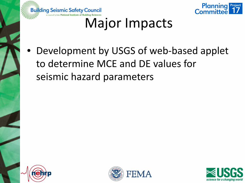
Major Impacts
• Development by USGS of web-based applet to determine MCE and DE values for seismic hazard parameters
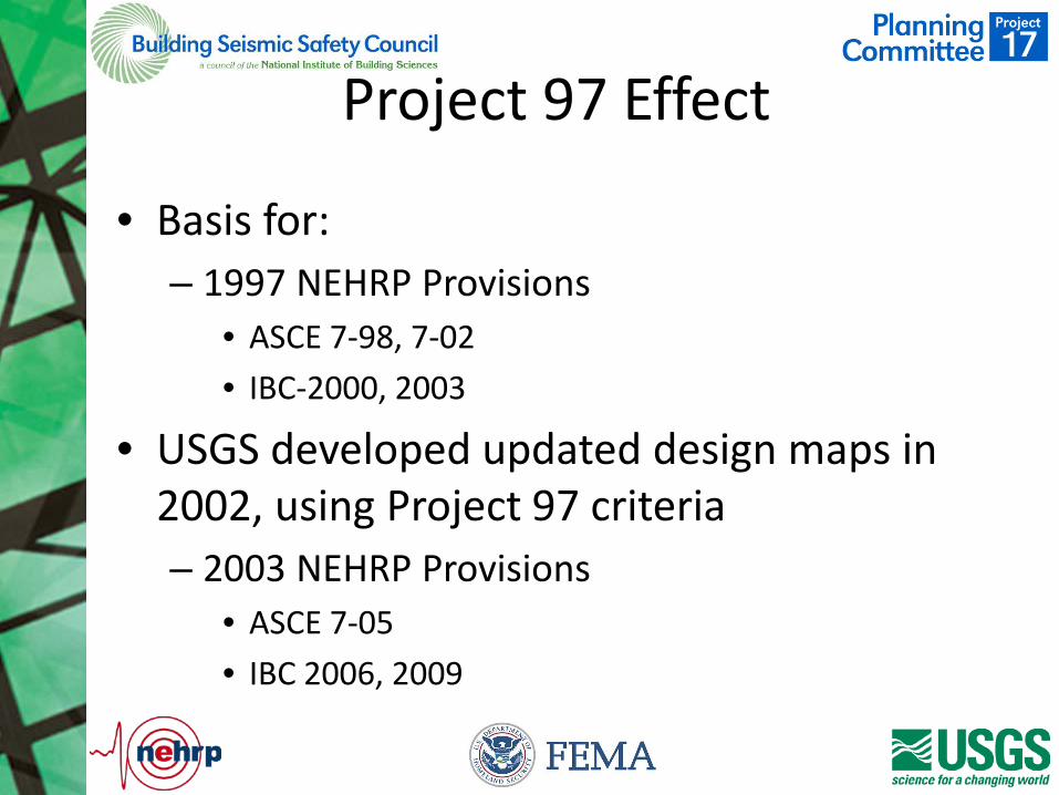
Project 97 Effect
• Basis for: – 1997 NEHRP Provisions
• ASCE 7-98, 7-02 • IBC-2000, 2003
• USGS developed updated design maps in 2002, using Project 97 criteria – 2003 NEHRP Provisions
• ASCE 7-05 • IBC 2006, 2009
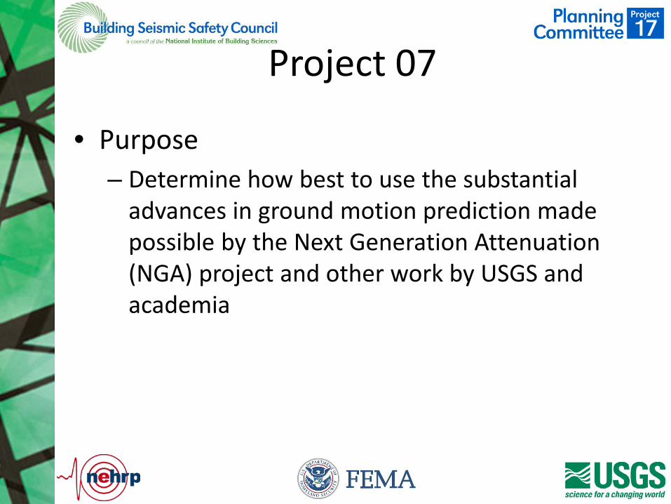
Project 07
• Purpose – Determine how best to use the substantial
advances in ground motion prediction made possible by the Next Generation Attenuation (NGA) project and other work by USGS and academia
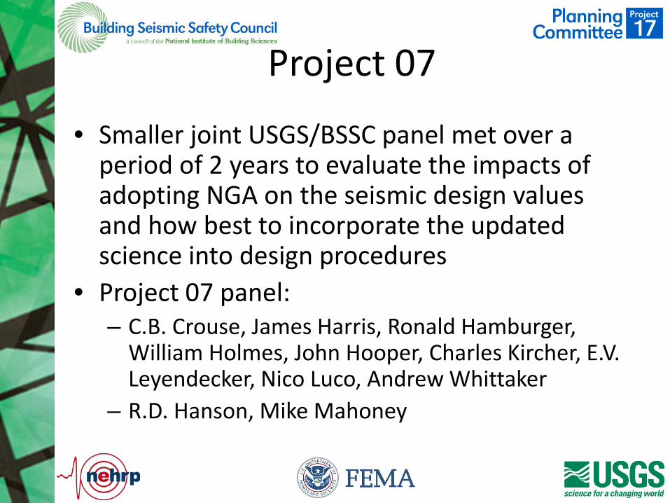
Project 07
• Smaller joint USGS/BSSC panel met over a period of 2 years to evaluate the impacts of adopting NGA on the seismic design values and how best to incorporate the updated science into design procedures
• Project 07 panel: – C.B. Crouse, James Harris, Ronald Hamburger,
William Holmes, John Hooper, Charles Kircher, E.V. Leyendecker, Nico Luco, Andrew Whittaker
– R.D. Hanson, Mike Mahoney
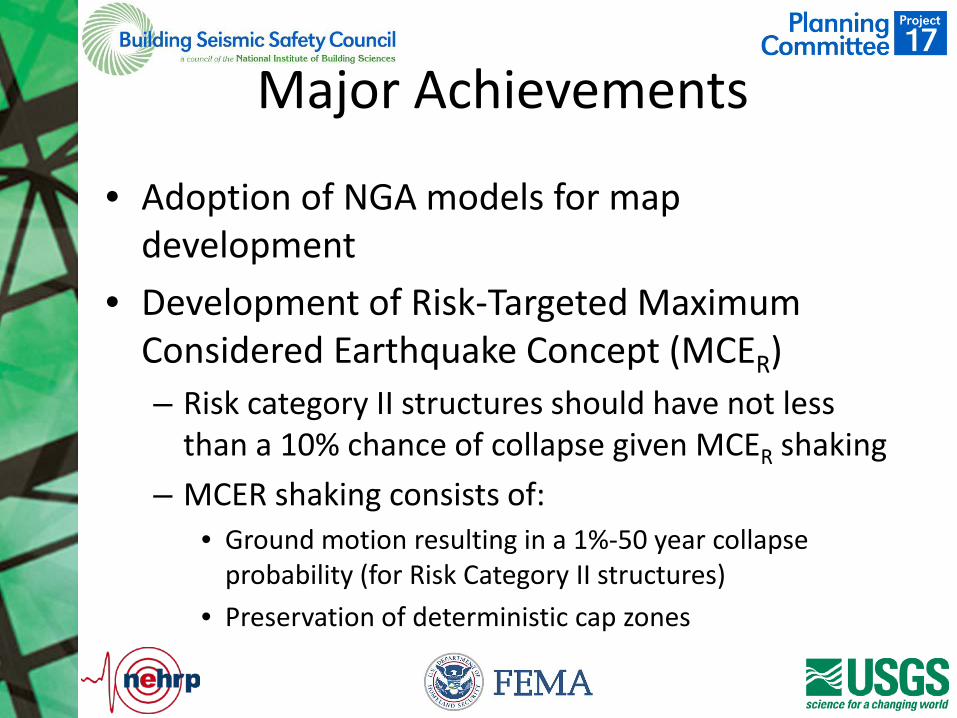
Major Achievements
• Adoption of NGA models for map development
• Development of Risk-Targeted Maximum Considered Earthquake Concept (MCER) – Risk category II structures should have not less
than a 10% chance of collapse given MCER shaking – MCER shaking consists of:
• Ground motion resulting in a 1%-50 year collapse probability (for Risk Category II structures)
• Preservation of deterministic cap zones
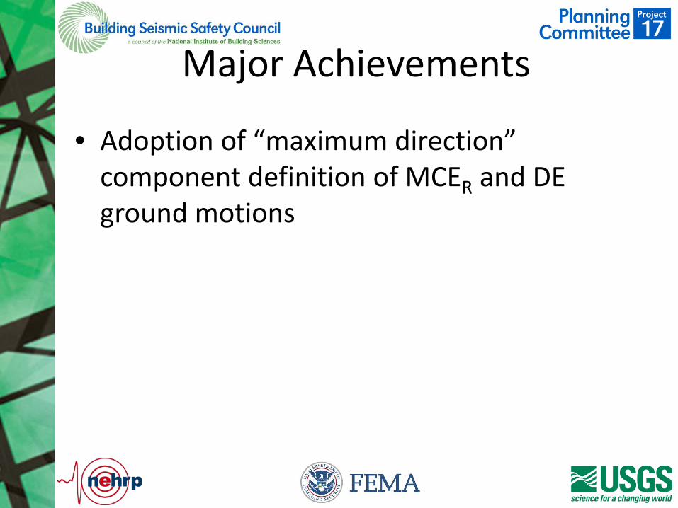
Major Achievements
• Adoption of “maximum direction” component definition of MCER and DE ground motions
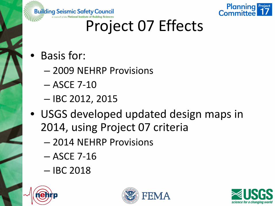
Project 07 Effects
• Basis for: – 2009 NEHRP Provisions – ASCE 7-10 – IBC 2012, 2015
• USGS developed updated design maps in 2014, using Project 07 criteria – 2014 NEHRP Provisions – ASCE 7-16 – IBC 2018
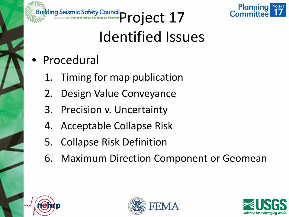
Project 17 Identified Issues
• Procedural 1. Timing for map publication 2. Design Value Conveyance 3. Precision v. Uncertainty 4. Acceptable Collapse Risk 5. Collapse Risk Definition 6. Maximum Direction Component or Geomean
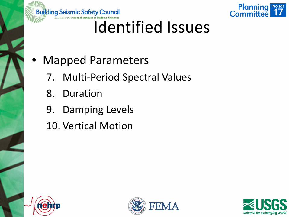
Identified Issues
• Mapped Parameters 7. Multi-Period Spectral Values 8. Duration 9. Damping Levels 10. Vertical Motion
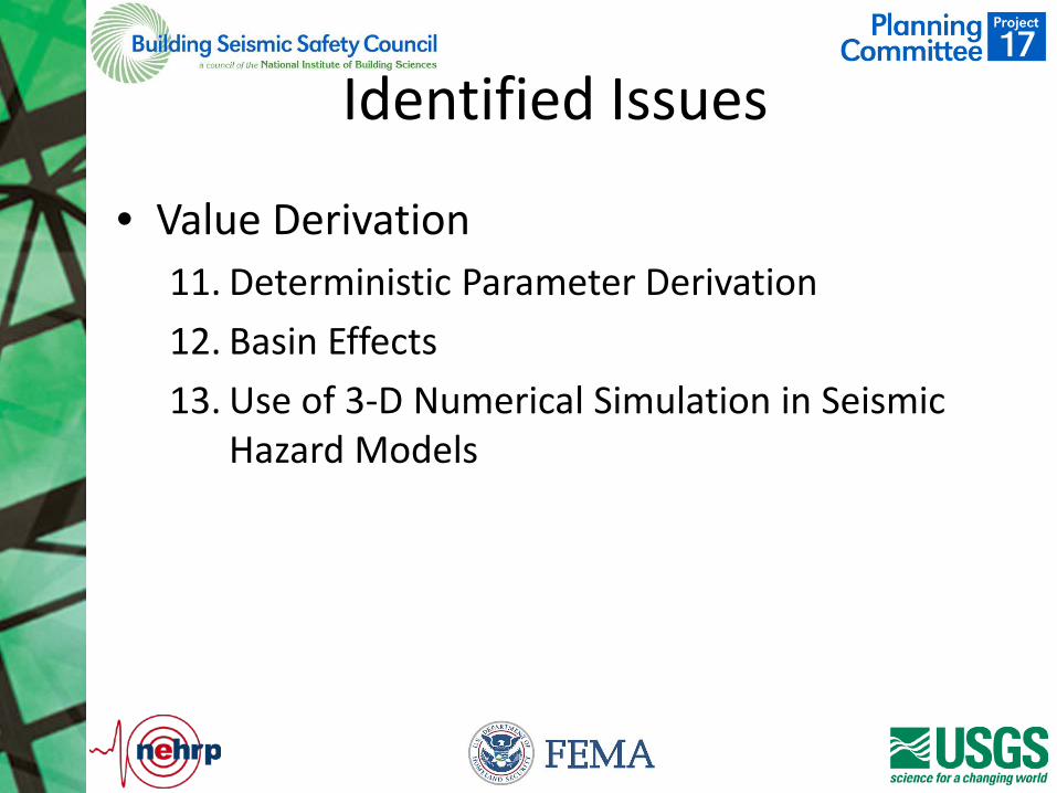
Identified Issues
• Value Derivation 11. Deterministic Parameter Derivation 12. Basin Effects 13. Use of 3-D Numerical Simulation in Seismic
Hazard Models
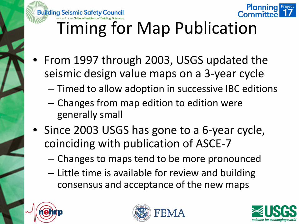
Timing for Map Publication
• From 1997 through 2003, USGS updated the seismic design value maps on a 3-year cycle – Timed to allow adoption in successive IBC editions – Changes from map edition to edition were
generally small • Since 2003 USGS has gone to a 6-year cycle,
coinciding with publication of ASCE-7 – Changes to maps tend to be more pronounced – Little time is available for review and building
consensus and acceptance of the new maps
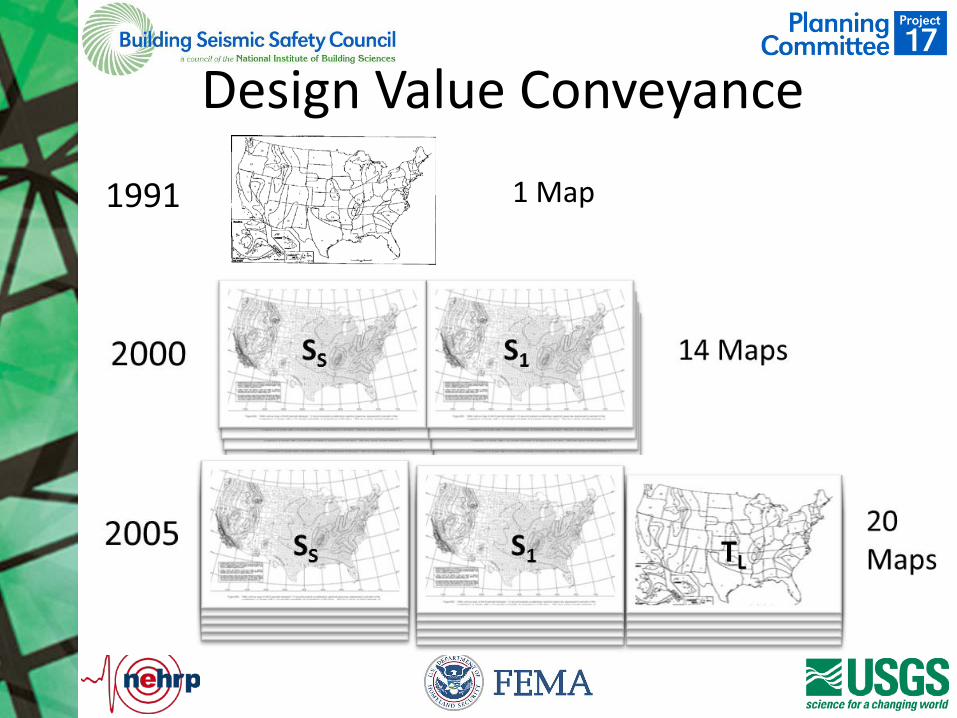
Design Value Conveyance
1991 1 Map
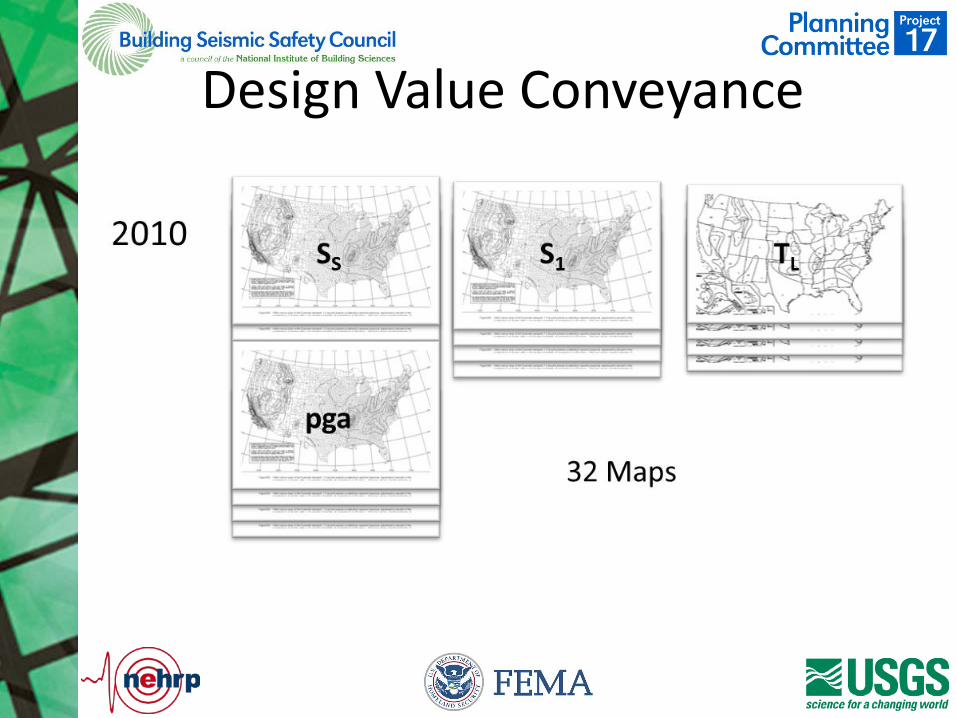
Design Value Conveyance
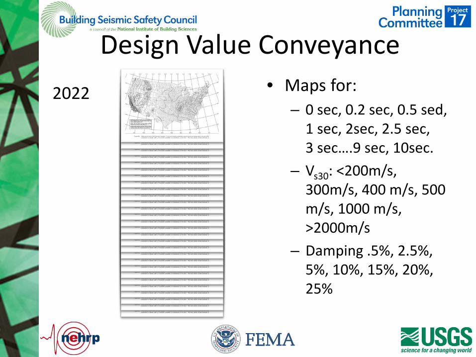
Design Value Conveyance • Maps for:
– 0 sec, 0.2 sec, 0.5 sed, 1 sec, 2sec, 2.5 sec, 3 sec….9 sec, 10sec.
– Vs30: <200m/s, 300m/s, 400 m/s, 500 m/s, 1000 m/s, >2000m/s
– Damping .5%, 2.5%, 5%, 10%, 15%, 20%, 25%
2022
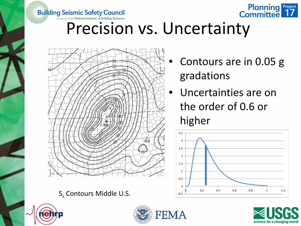
Precision vs. Uncertainty
• Contours are in 0.05 g gradations
• Uncertainties are on the order of 0.6 or higher
Ss Contours Middle U.S.
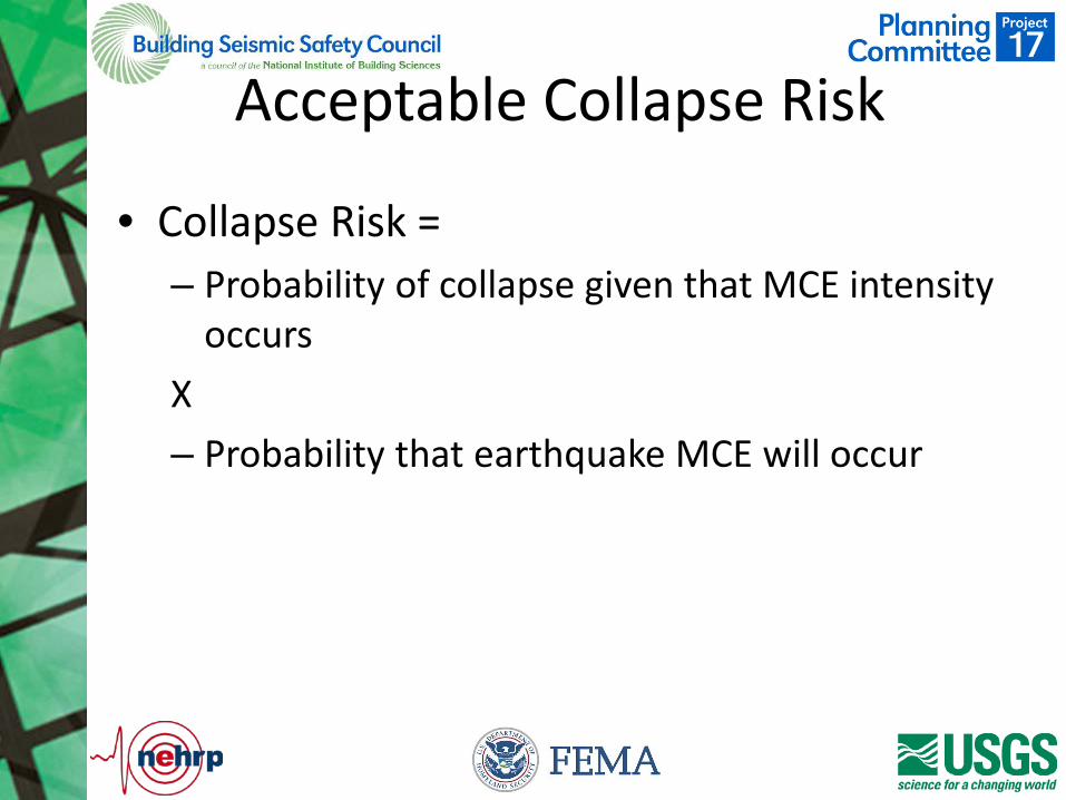
Acceptable Collapse Risk
• Collapse Risk = – Probability of collapse given that MCE intensity
occurs X – Probability that earthquake MCE will occur

Acceptable Collapse Risk
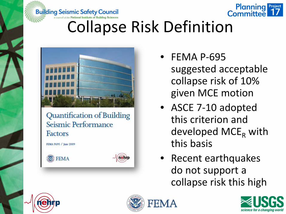
Collapse Risk Definition
• FEMA P-695 suggested acceptable collapse risk of 10% given MCE motion
• ASCE 7-10 adopted this criterion and developed MCER with this basis
• Recent earthquakes do not support a collapse risk this high
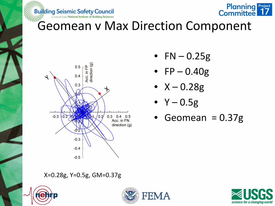
Geomean v Max Direction Component
• FN – 0.25g • FP – 0.40g • X – 0.28g • Y – 0.5g • Geomean = 0.37g
X=0.28g, Y=0.5g, GM=0.37g
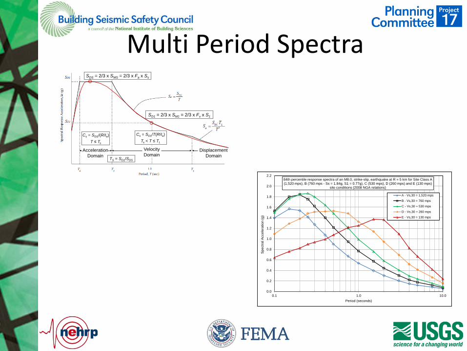
Multi Period Spectra
Acceleration Domain
Velocity Domain
Displacement Domain
SDS = 2/3 x SMS = 2/3 x Fa x Ss
TS = SD1/SDS
SD1 = 2/3 x SM1 = 2/3 x Fv x S1
Cs = SDS/(R/Ie)T ≤ Ts
Cs = SD1/T(R/Ie)Ts < T ≤ TL
0.0
0.2
0.4
0.6
0.8
1.0
1.2
1.4
1.6
1.8
2.0
2.2
0.1 1.0 10.0
Spec
tral A
ccel
erat
ion
(g)
Period (seconds)
84th percentile response spectra of an M8.0, strike-slip, earthquake at R = 5 km for Site Class A (1,520 mps), B (760 mps - Ss = 1.84g, S1 = 0.77g), C (530 mps), D (260 mps) and E (130 mps)
site conditions (2008 NGA relations)
A - Vs,30 = 1,520 mps
B - Vs,30 = 760 mps
C - Vs,30 = 530 mps
D - Vs,30 = 260 mps
E - Vs,30 = 130 mps
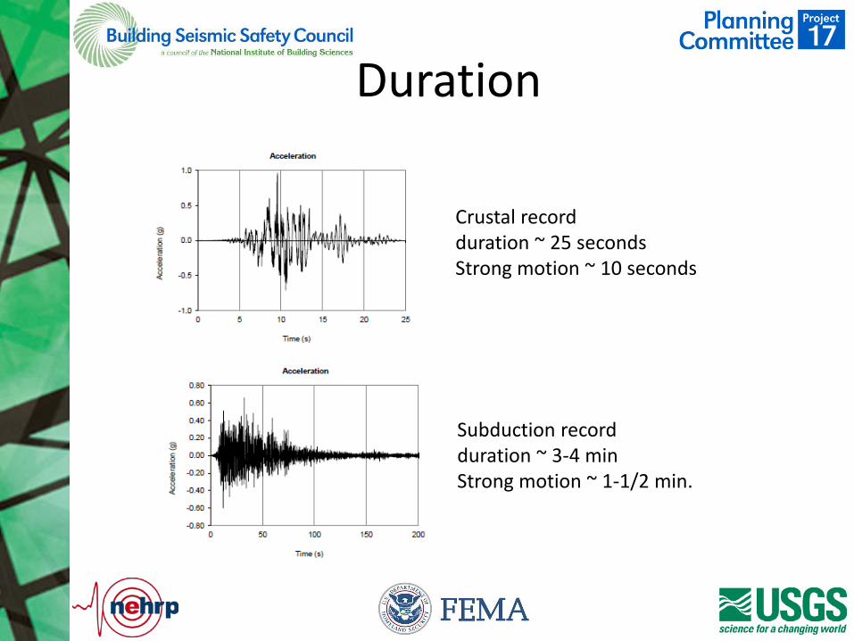
Duration
Crustal record duration ~ 25 seconds Strong motion ~ 10 seconds
Subduction record duration ~ 3-4 min Strong motion ~ 1-1/2 min.
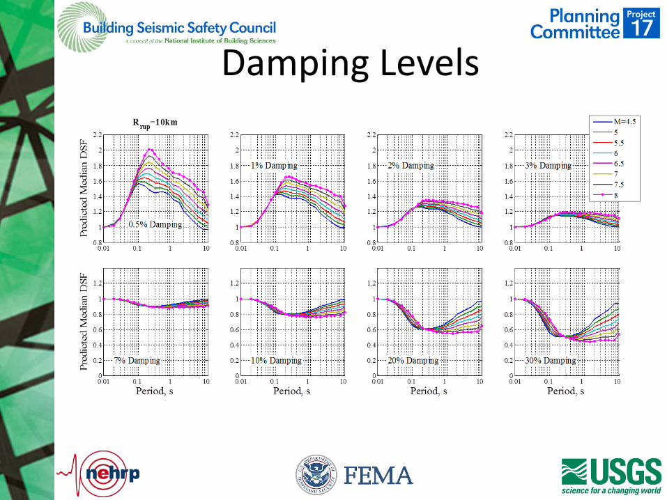
Damping Levels
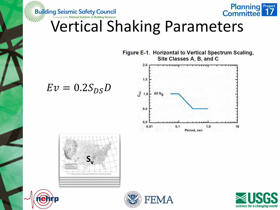
Vertical Shaking Parameters
𝐸𝐸𝐸𝐸 = 0.2𝑆𝑆𝐷𝐷𝐷𝐷𝐷𝐷
Sv
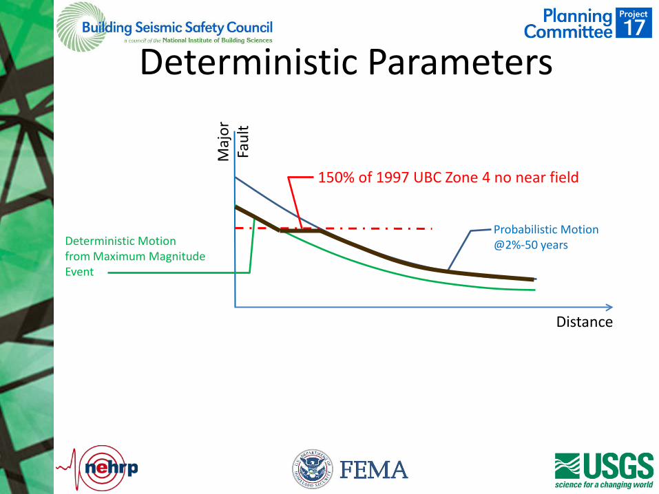
Deterministic Parameters
Maj
or
Faul
t
Distance
Probabilistic Motion @2%-50 years Deterministic Motion
from Maximum Magnitude Event
150% of 1997 UBC Zone 4 no near field
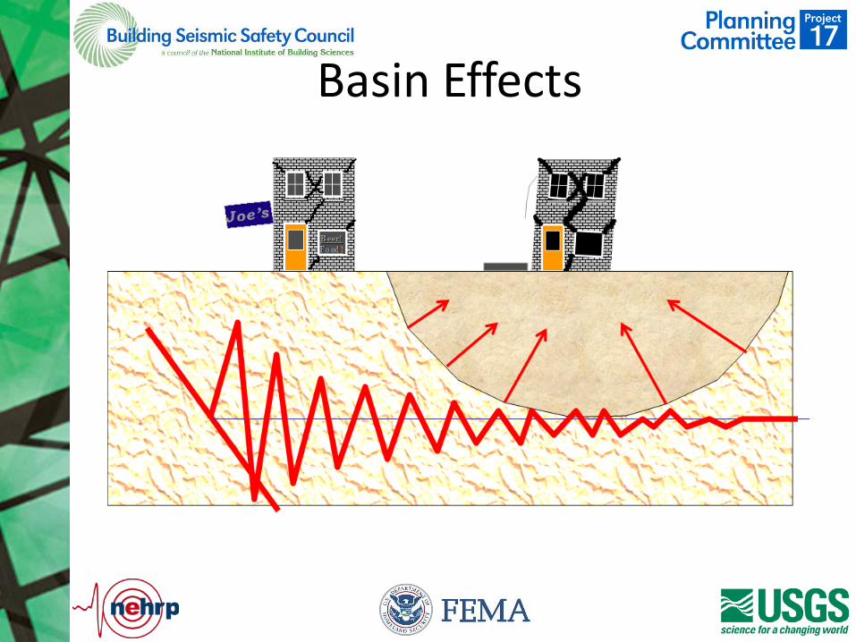
Basin Effects
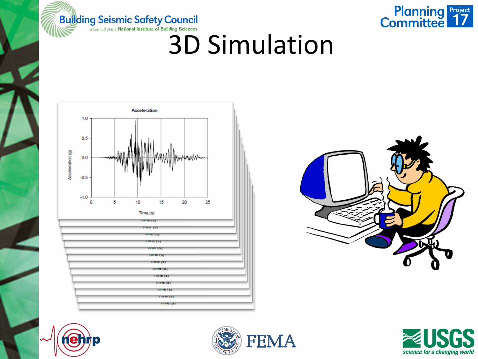
3D Simulation

How do I participate
• View detailed issue presentations • Suggest additional issues or Provide
Comment on Initial Issues – Email to: [email protected]
copy to: [email protected]
• Deadline for comment: August 1, 2015
Questions