Embed Size (px)
Citation preview
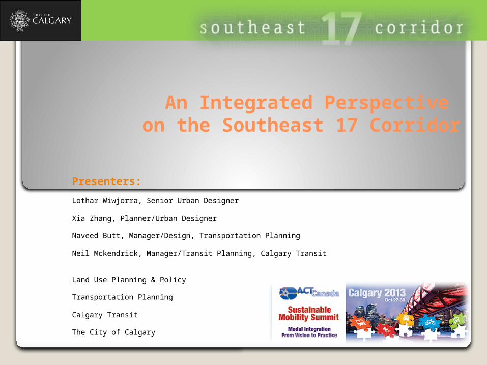
An Integrated Perspective on the Southeast 17 Corridor
Presenters:
Lothar Wiwjorra, Senior Urban Designer
Xia Zhang, Planner/Urban Designer
Naveed Butt, Manager/Design, Transportation Planning
Neil Mckendrick, Manager/Transit Planning, Calgary Transit
Land Use Planning & Policy
Transportation Planning
Calgary Transit
The City of Calgary
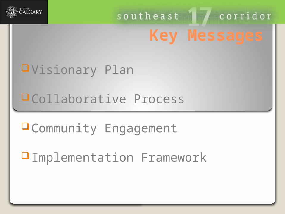
Visionary Plan
Collaborative Process
Community Engagement
Implementation Framework
Key Messages
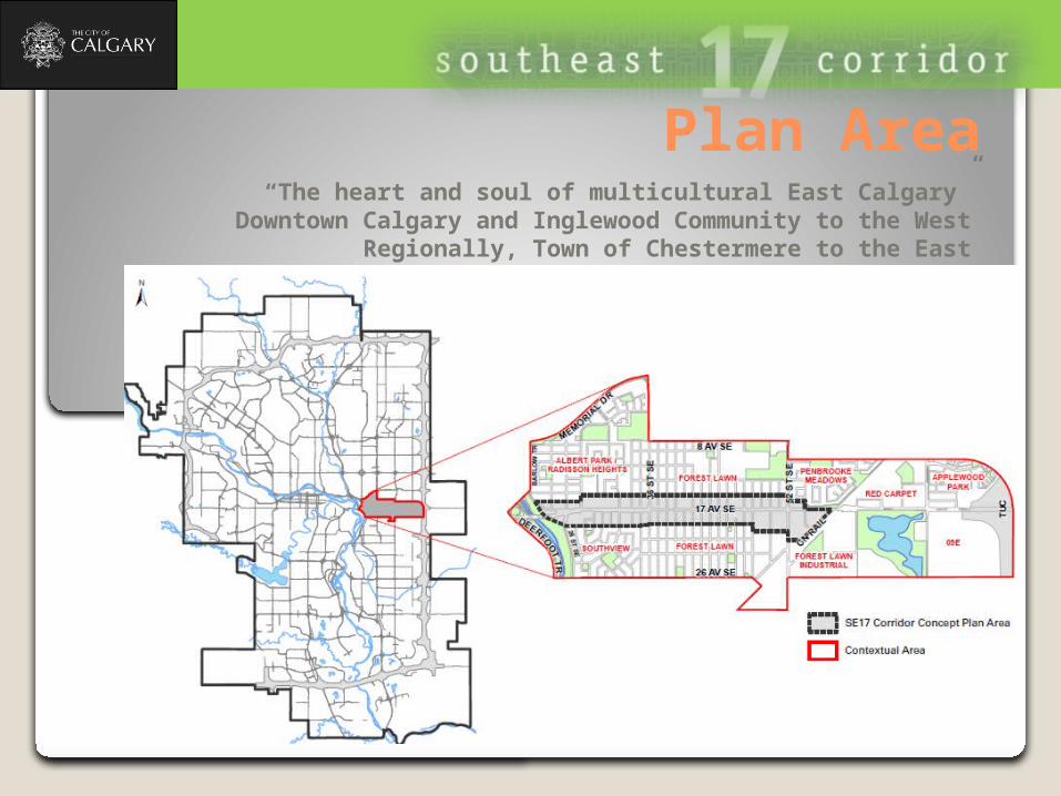
“The heart and soul of multicultural East Calgary”Downtown Calgary and Inglewood Community to the West
Regionally, Town of Chestermere to the East
Plan Area
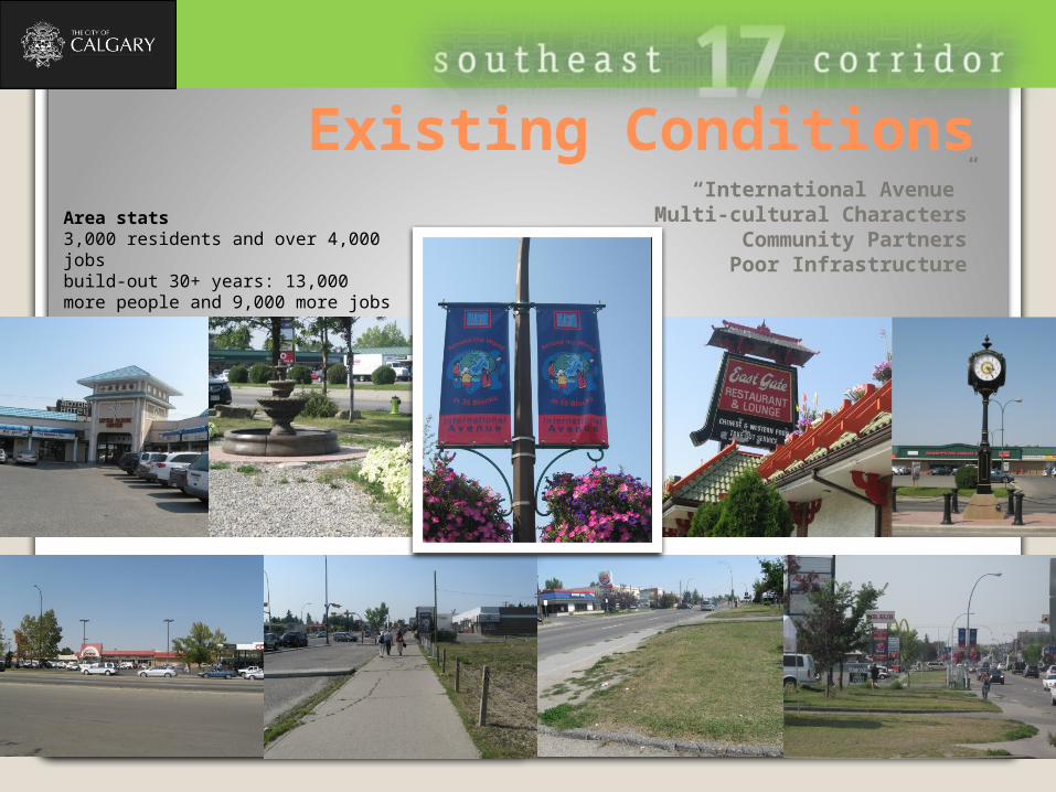
“International Avenue”Multi-cultural Characters
Community PartnersPoor Infrastructure
Existing ConditionsArea stats3,000 residents and over 4,000 jobsbuild-out 30+ years: 13,000 more people and 9,000 more jobs
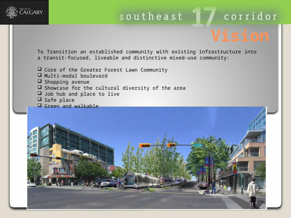
To Transition an established community with existing infrastructure into a transit-focused, liveable and distinctive mixed-use community:
Core of the Greater Forest Lawn Community Multi-modal boulevard Shopping avenue Showcase for the cultural diversity of the area Job hub and place to live Safe place Green and walkable
Vision
Policy AlignmentMDP (Municipal Development Plan)
Identifies the Plan Area as an Urban Corridor Typology with emphasis on a multi-modal boulevard fronted by a mix of higher intensity residential and business uses that foster a vibrant street environment.
Establishes a minimum intensity threshold of 200 jobs and population per gross developable hectare.
CTP (Calgary Transportation Plan)
Identifies 17 Avenue SE as an Urban Boulevard where highest priority should be given to walking, cycling and transit
Where the “Complete Street” policies should be implemented.
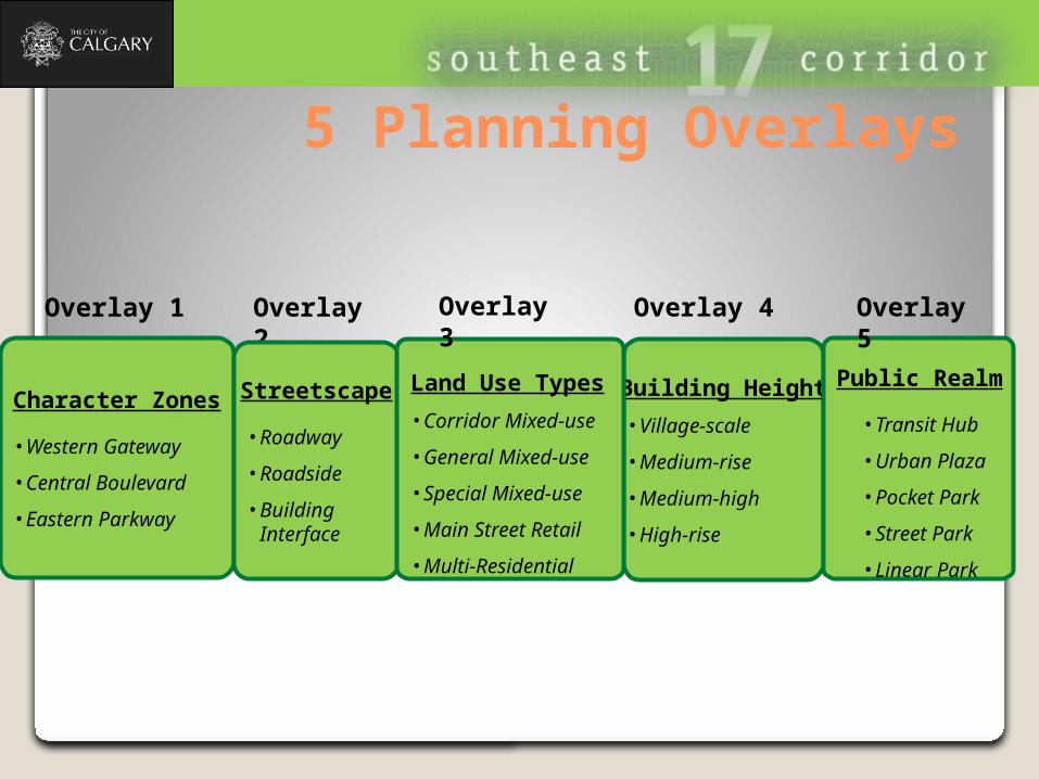
5 Planning Overlays
Character Zones
• Western Gateway
• Central Boulevard
• Eastern Parkway
Overlay 1
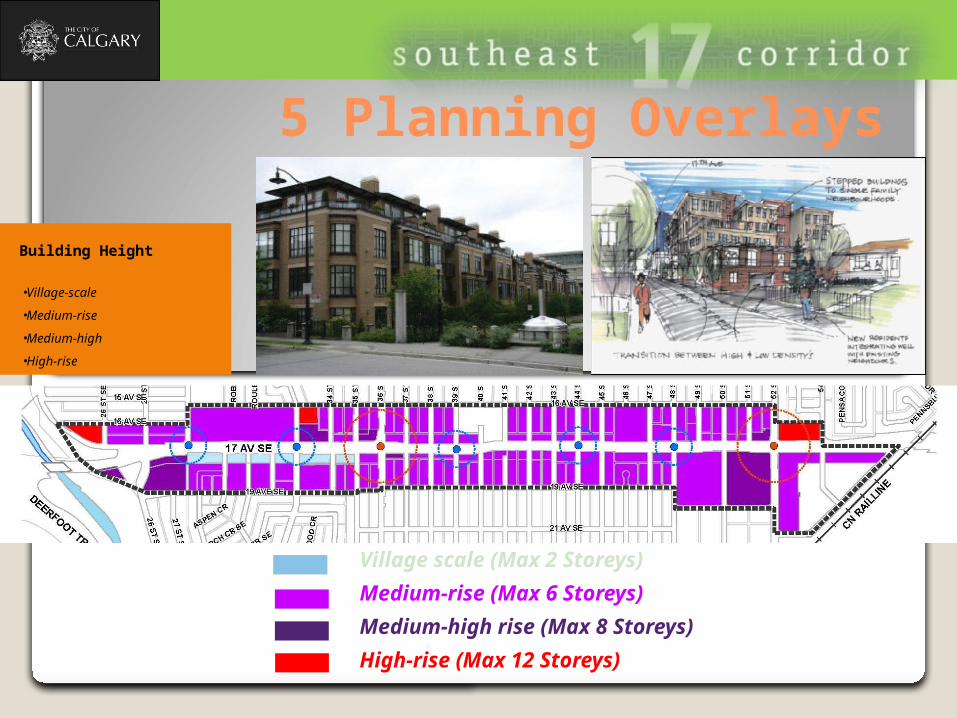
Building Height
• Village-scale
• Medium-rise
• Medium-high
• High-rise
Overlay 4
Public Realm
• Transit Hub
• Urban Plaza
• Pocket Park
• Street Park
• Linear Park
Overlay 5
Overlay 2
Streetscape
• Roadway
• Roadside
• Building Interface
Land Use Types
• Corridor Mixed-use
• General Mixed-use
• Special Mixed-use
• Main Street Retail
• Multi-Residential
Overlay 3
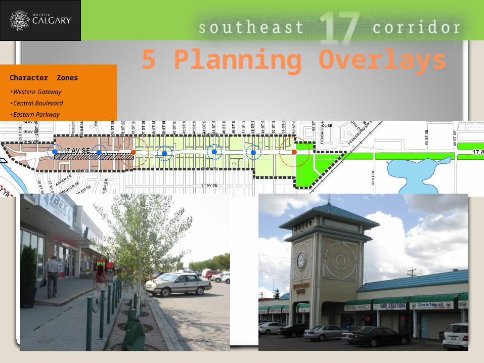
5 Planning OverlaysCharacter Zones
• Western Gateway
• Central Boulevard
• Eastern Parkway
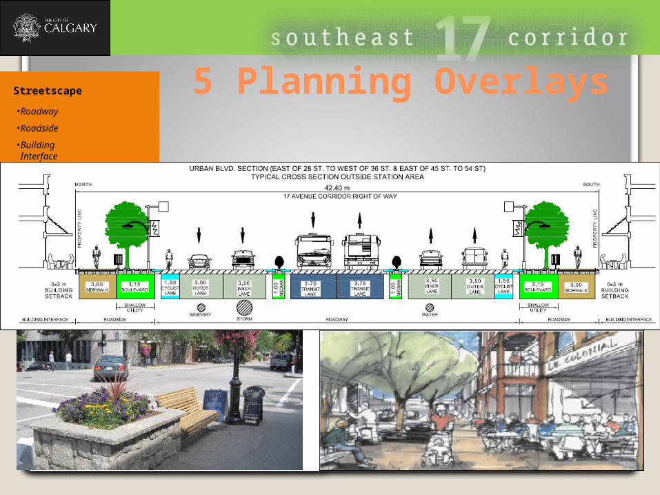
5 Planning OverlaysStreetscape
• Roadway
• Roadside
• Building Interface

5 Planning Overlays
Special mixed-use
General mixed-use
Corridor mixed-use
Main street retail
Multi-residential
Land Use Types
• Corridor Mixed-use
• General Mixed-use
• Special Mixed-use
• Main Street Retail
• Multi-Residential
5 Planning Overlays
Village scale (Max 2 Storeys)
Medium-rise (Max 6 Storeys)
Medium-high rise (Max 8 Storeys)
High-rise (Max 12 Storeys)
Building Height
• Village-scale
• Medium-rise
• Medium-high
• High-rise
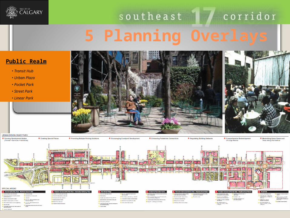
5 Planning OverlaysPublic Realm
• Transit Hub
• Urban Plaza
• Pocket Park
• Street Park
• Linear Park
Interdisciplinary Collaboration
Urban Design as a tool for effective public engagement and community buy-in Urban Design as part of the interdisciplinary team Urban Design concept triggers attention and inspires all to get things implemented over
time
This is definitely NOT our case!!!
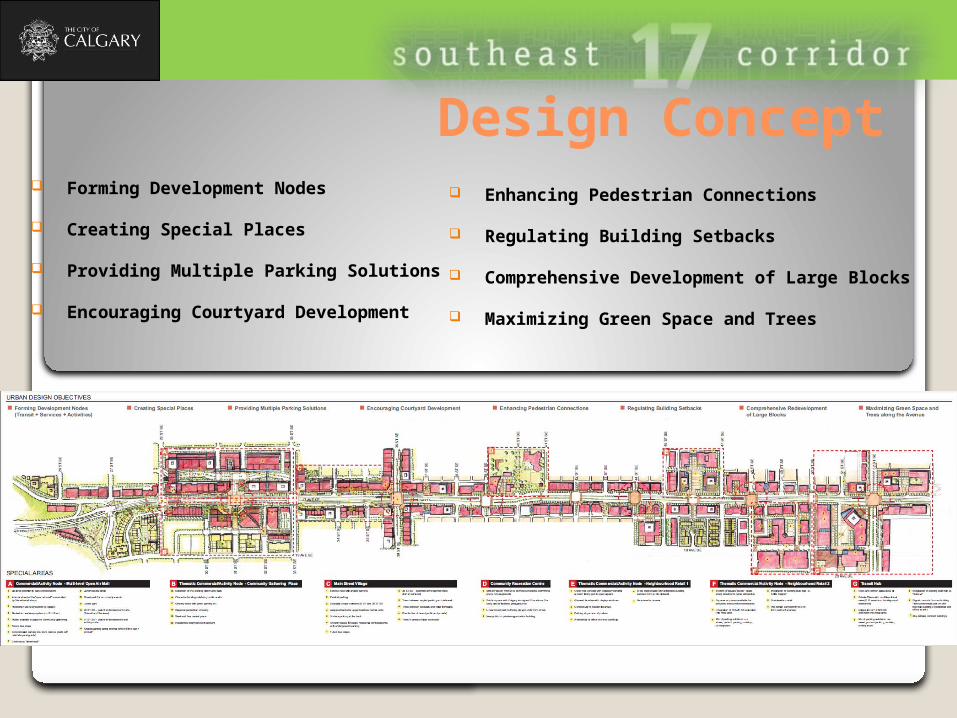
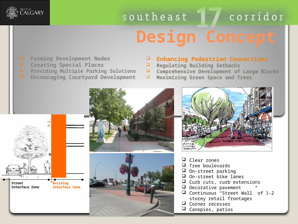
Design Concept Enhancing Pedestrian Connections
Regulating Building Setbacks
Comprehensive Development of Large Blocks
Maximizing Green Space and Trees
Forming Development Nodes
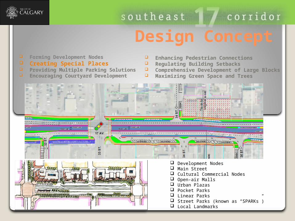
Creating Special Places
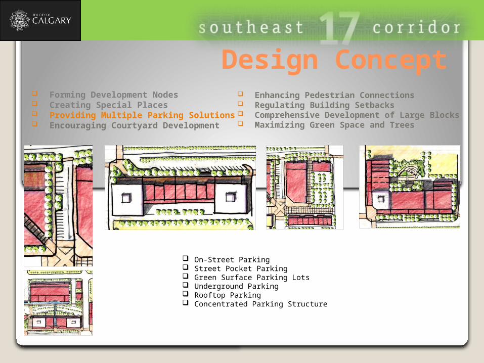
Providing Multiple Parking Solutions
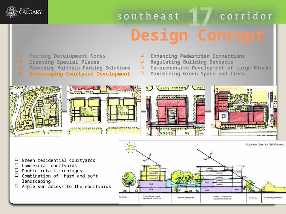
Encouraging Courtyard Development
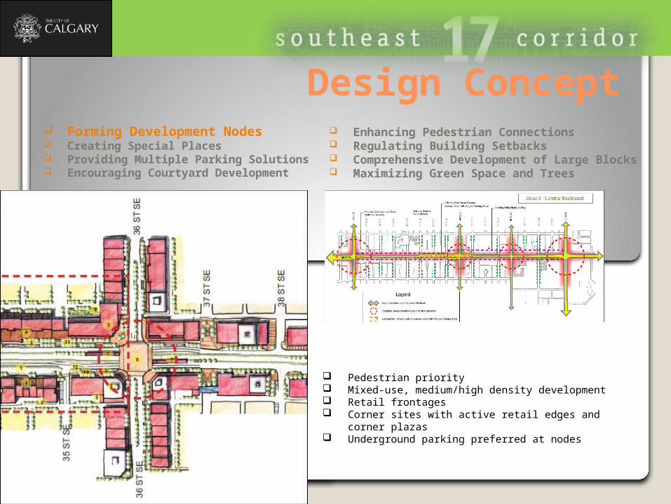
Design Concept
Pedestrian priority Mixed-use, medium/high density development Retail frontages Corner sites with active retail edges and corner plazas Underground parking preferred at nodes
Enhancing Pedestrian Connections Regulating Building Setbacks Comprehensive Development of Large Blocks Maximizing Green Space and Trees
Forming Development Nodes Creating Special Places Providing Multiple Parking Solutions Encouraging Courtyard Development
Design Concept Enhancing Pedestrian Connections Regulating Building Setbacks Comprehensive Development of Large Blocks Maximizing Green Space and Trees
Forming Development Nodes Creating Special Places Providing Multiple Parking Solutions Encouraging Courtyard Development
Development Nodes Main Street Cultural Commercial Nodes Open-air Malls Urban Plazas Pocket Parks Linear Parks Street Parks (known as “SPARKs”) Local Landmarks
Design Concept
On-Street Parking Street Pocket Parking Green Surface Parking Lots Underground Parking Rooftop Parking Concentrated Parking Structure
Enhancing Pedestrian Connections Regulating Building Setbacks Comprehensive Development of Large Blocks Maximizing Green Space and Trees
Forming Development Nodes Creating Special Places Providing Multiple Parking Solutions Encouraging Courtyard Development
Design Concept
Green residential courtyards Commercial courtyards Double retail frontages Combination of hard and soft landscaping Ample sun access to the courtyards
Enhancing Pedestrian Connections Regulating Building Setbacks Comprehensive Development of Large Blocks Maximizing Green Space and Trees
Forming Development Nodes Creating Special Places Providing Multiple Parking Solutions Encouraging Courtyard Development
Design Concept
Clear zones Tree boulevards On-street parking On-street bike lanes Curb cuts, curb extensions Decorative pavement Continuous “Street Wall” of 1-2 storey
retail frontages Corner recesses Canopies, patios
Enhancing Pedestrian Connections Regulating Building Setbacks Comprehensive Development of Large Blocks Maximizing Green Space and Trees
Forming Development Nodes Creating Special Places Providing Multiple Parking Solutions Encouraging Courtyard Development
Building Interface Zone
Street Interface Zone
P.L
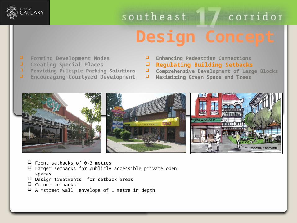
Design Concept
Front setbacks of 0-3 metres Larger setbacks for publicly accessible private open spaces Design treatments for setback areas Corner setbacks A “street wall” envelope of 1 metre in depth
Enhancing Pedestrian Connections Regulating Building Setbacks Comprehensive Development of Large Blocks Maximizing Green Space and Trees
Forming Development Nodes Creating Special Places Providing Multiple Parking Solutions Encouraging Courtyard Development
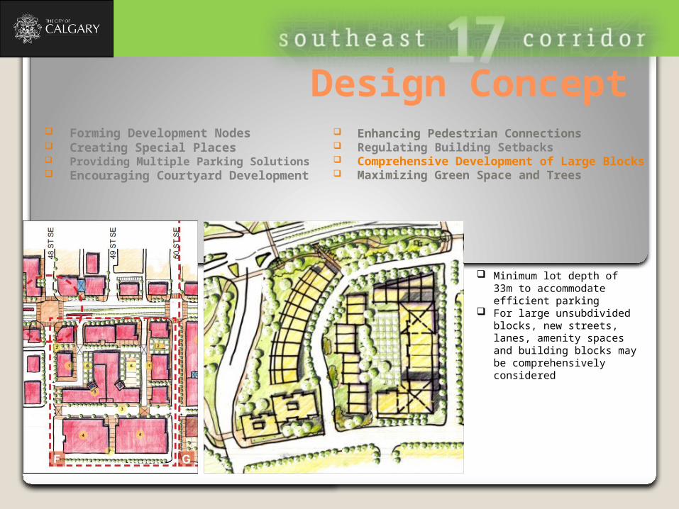
Design Concept
Minimum lot depth of 33m to accommodate efficient parking
For large unsubdivided blocks, new streets, lanes, amenity spaces and building blocks may be comprehensively considered
Enhancing Pedestrian Connections Regulating Building Setbacks Comprehensive Development of Large Blocks Maximizing Green Space and Trees
Forming Development Nodes Creating Special Places Providing Multiple Parking Solutions Encouraging Courtyard Development
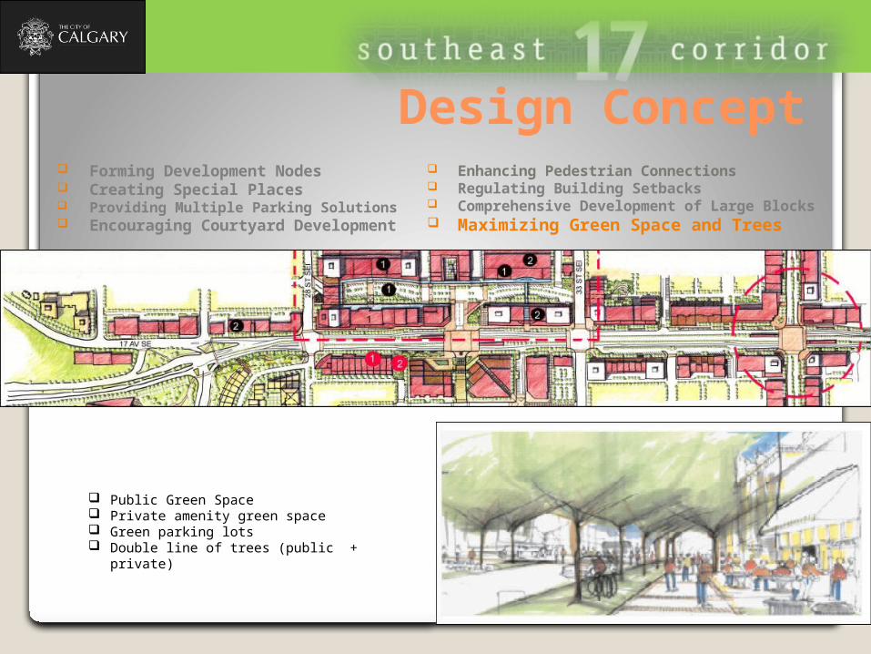
Design Concept
Public Green Space Private amenity green space Green parking lots Double line of trees (public + private)
Enhancing Pedestrian Connections Regulating Building Setbacks Comprehensive Development of Large Blocks Maximizing Green Space and Trees
Forming Development Nodes Creating Special Places Providing Multiple Parking Solutions Encouraging Courtyard Development
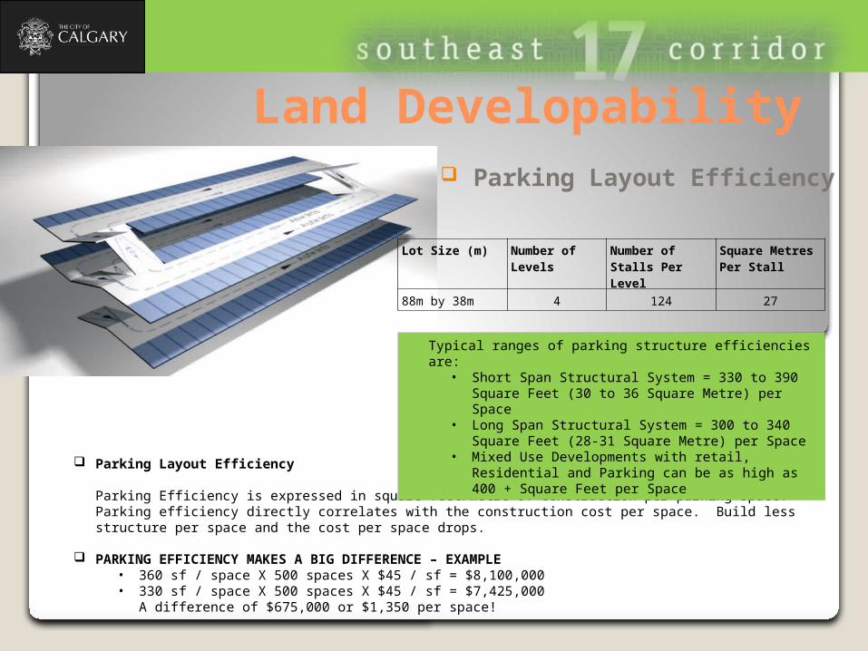
Land Developability
Parking Layout Efficiency
Parking Efficiency is expressed in square feet/metre of construction per parking space. Parking efficiency directly correlates with the construction cost per space. Build less structure per space and the cost per space drops.
PARKING EFFICIENCY MAKES A BIG DIFFERENCE – EXAMPLE• 360 sf / space X 500 spaces X $45 / sf = $8,100,000 • 330 sf / space X 500 spaces X $45 / sf = $7,425,000
A difference of $675,000 or $1,350 per space!
Parking Layout Efficiency
Lot Size (m) Number of Levels
Number of Stalls Per Level
Square Metres Per Stall
88m by 38m 4 124 27
Typical ranges of parking structure efficiencies are: • Short Span Structural System = 330 to 390 Square
Feet (30 to 36 Square Metre) per Space • Long Span Structural System = 300 to 340 Square
Feet (28-31 Square Metre) per Space• Mixed Use Developments with retail, Residential
and Parking can be as high as 400 + Square Feet per Space
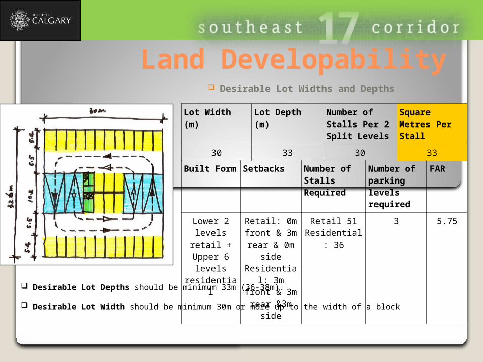
Land Developability Desirable Lot Widths and Depths
Lot Width (m)
Lot Depth (m)
Number of Stalls Per 2 Split Levels
Square Metres Per Stall
30 33 30 33
Built Form Setbacks Number of Stalls Required
Number of parking levels required
FAR
Lower 2 levels retail
+Upper 6 levels
residential
Retail: 0m front & 3m rear & 0m
sideResidential: 3m front &
3m rear &3m side
Retail 51Residential:
36
3 5.75
Desirable Lot Depths should be minimum 33m (36-38m).
Desirable Lot Width should be minimum 30m or more up to the width of a block
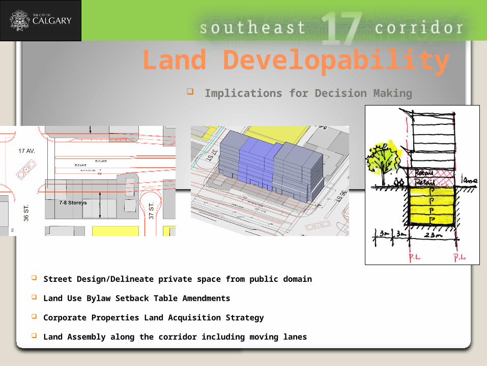
Land Developability
Street Design/Delineate private space from public domain
Land Use Bylaw Setback Table Amendments
Corporate Properties Land Acquisition Strategy
Land Assembly along the corridor including moving lanes
Implications for Decision Making


![TRANSFORMATION OF BANGALORE URBAN STRUCTURE WITH THE ADVENT OF COMMUTER RAIL SYSTEM ritu VERMA [urban planner & designer – urban EXPLORERS] 10 th Jan 2011:](https://img.pdfslide.us/doc/110x75/56649ceb5503460f949b6434/transformation-of-bangalore-urban-structure-with-the-advent-of-commuter-rail.jpg)