Embed Size (px)
Citation preview
An expert system for generating restoration targets for Carolina Piedmont riparian vegetation
Elizabeth R. Matthews, Michael Lee, M. Forbes Boyle, and Robert K. Peet
University of North Carolina, Chapel-Hill

CVS-EEP restoration protocol• Exploit a broad array of reference plots• Derive site-specific restoration targets• CVS plot and NVC data
• Design site-specific restoration plan• Implement the plan• Monitor change and assess success• Employ adaptive management along the way

CVS-EEP restoration protocol• Exploit a broad array of reference plots• Derive site-specific restoration targets• CVS plot and NVC data
• Design site-specific restoration plan• Implement the plan• Monitor change and assess success• Employ adaptive management along the way

Quantitative vegetation descriptions restoration targets
• Quantitative vegetation descriptions– Carolina Vegetation Survey
http://cvs.bio.unc.edu/– U.S. National Vegetation Classification
http://www.natureserve.org/explorer/• Match vegetation descriptions to restoration
sites– Cost-effective– Improvement on traditional approaches

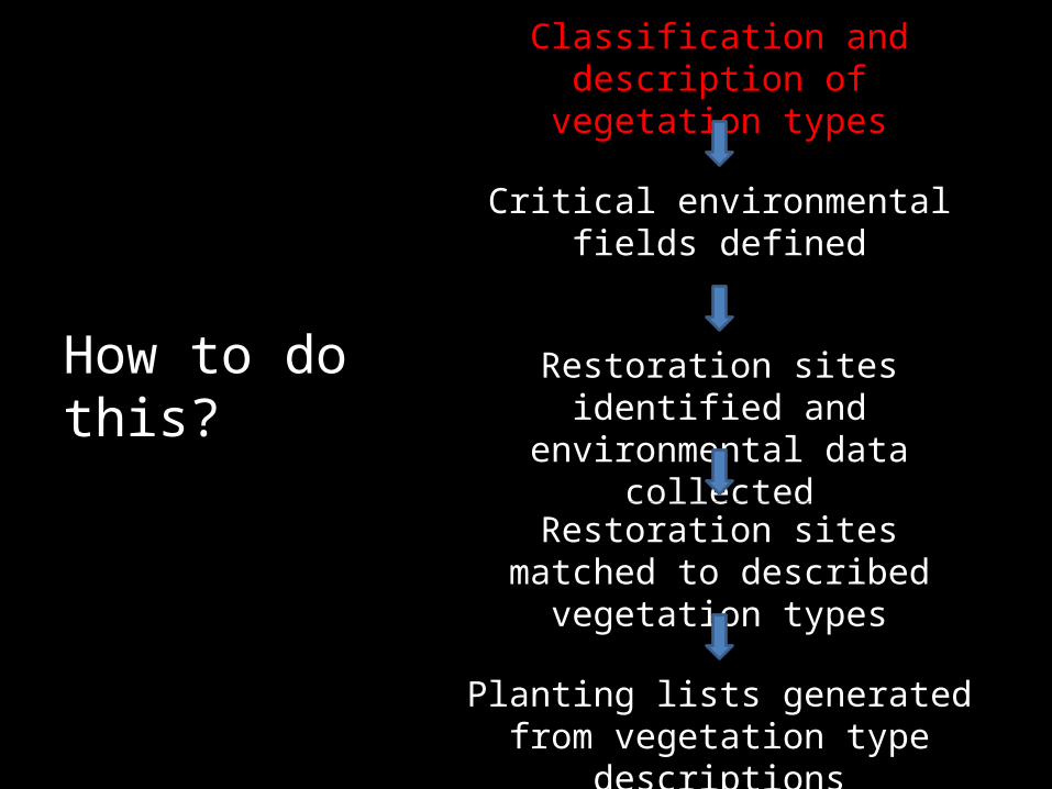
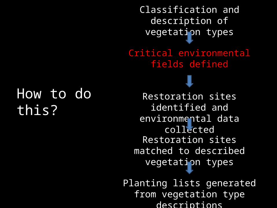
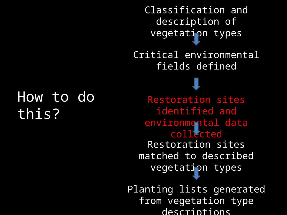
Classification and description of vegetation types
Critical environmental fields defined
Restoration sites identified and environmental data collected
Restoration sites matched to described vegetation types
Planting lists generated from vegetation type descriptions
How to do this?

Case study: Piedmont alluvial vegetation
• Quantitative classification of NC alluvial vegetation• North Carolina Ecosystem Enhancement Program
restoration sites
Classification and description of vegetation types
Critical environmental fields defined
Restoration sites identified and environmental data collected
Restoration sites matched to described vegetation types
Planting lists generated from vegetation type descriptions
How to do this?

Classification and description of vegetation types
• Collect reference site field data• Classify communities using standard
quantitative techniques– Cluster analysis; discriminant analyses; ordination

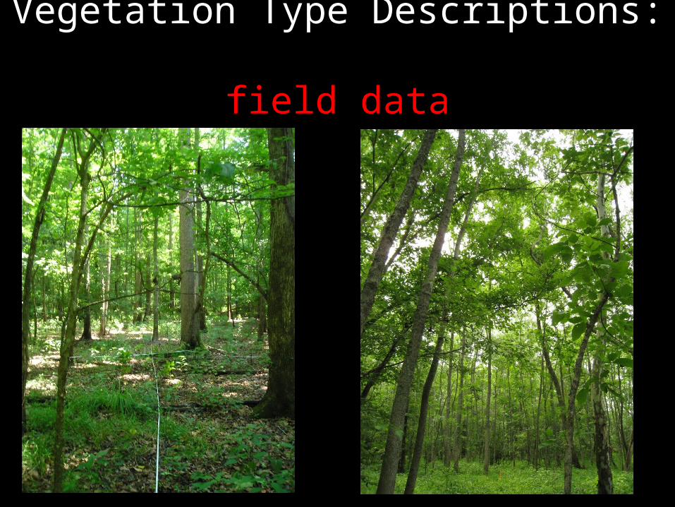
Vegetation Type Descriptions: field data
• Carolina Vegetation Survey (CVS) protocol 20m × 50m plots (Peet et al 1998)
• Cover by strata• Soil samples, environmental data, and geomorphology
Vegetation Type Descriptions: field data

Vegetation Type Descriptions: field data

•Flexible beta, β = -0.25•Cover by strata•2-tier, hierarchical classification•5 higher-level groups recognized•14 vegetation types recognized

• *
Quantitative Vegetation Descriptions
Small streamsOak-hickory flatsLarge river leveesBottomlands and swamp forests

Quantitative Vegetation Descriptions

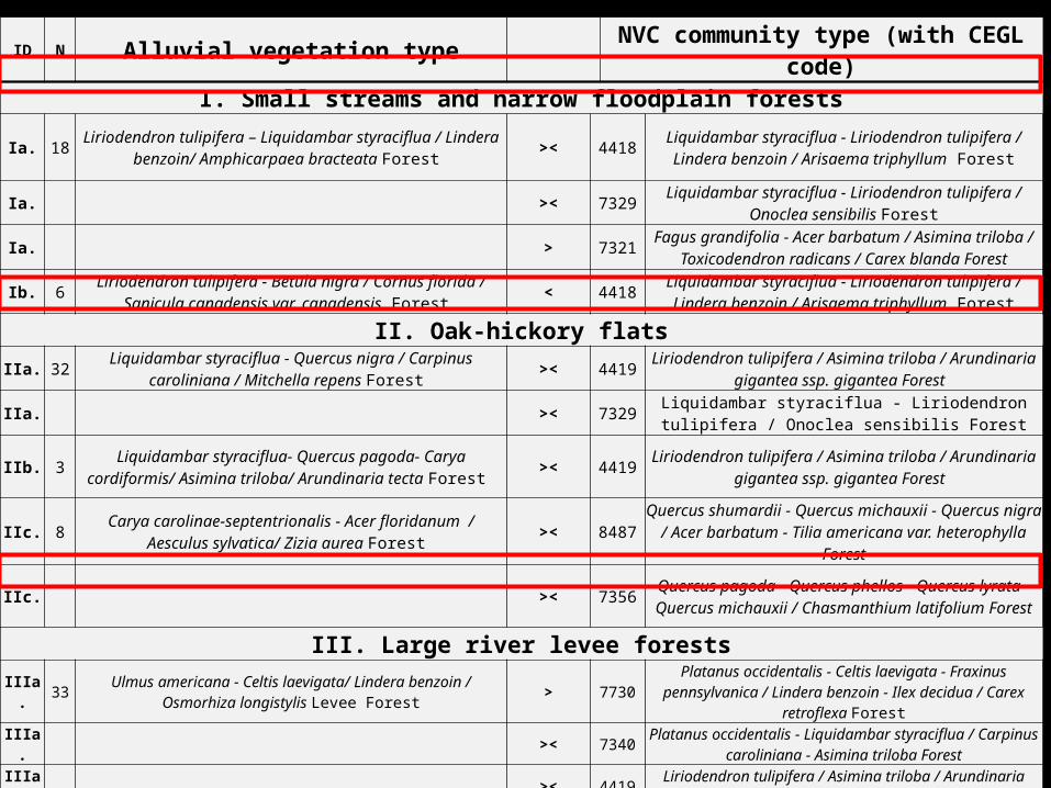
Classification as a guide to NVC revisionID N Alluvial vegetation type NVC community type (with CEGL code)
I. Small streams and narrow floodplain forests
Ia. 18Liriodendron tulipifera – Liquidambar
styraciflua / Lindera benzoin/ Amphicarpaea bracteata Forest
>< 4418Liquidambar styraciflua - Liriodendron tulipifera / Lindera benzoin / Arisaema
triphyllum Forest
Ia. >< 7329 Liquidambar styraciflua - Liriodendron tulipifera / Onoclea sensibilis Forest
Ia. > 7321Fagus grandifolia - Acer barbatum /
Asimina triloba / Toxicodendron radicans / Carex blanda Forest
Ib. 6Liriodendron tulipifera - Betula nigra /
Cornus florida / Sanicula canadensis var. canadensis Forest
< 4418Liquidambar styraciflua - Liriodendron tulipifera / Lindera benzoin / Arisaema
triphyllum Forest
II. Oak-hickory flats
IIa. 32Liquidambar styraciflua - Quercus nigra / Carpinus caroliniana / Mitchella repens
Forest >< 4419
Liriodendron tulipifera / Asimina triloba / Arundinaria gigantea ssp. gigantea
Forest
IIa. >< 7329 Liquidambar styraciflua - Liriodendron tulipifera / Onoclea sensibilis Forest
IIb. 3Liquidambar styraciflua- Quercus pagoda-
Carya cordiformis/ Asimina triloba/ Arundinaria tecta Forest
>< 4419Liriodendron tulipifera / Asimina triloba /
Arundinaria gigantea ssp. gigantea Forest
IIc. 8Carya carolinae-septentrionalis - Acer
floridanum / Aesculus sylvatica/ Zizia aurea Forest
>< 8487
Quercus shumardii - Quercus michauxii - Quercus nigra / Acer barbatum - Tilia
americana var. heterophylla Forest
IIc. >< 7356
Quercus pagoda - Quercus phellos - Quercus lyrata - Quercus michauxii /
Chasmanthium latifolium Forest
ID N Alluvial vegetation type NVC community type (with CEGL code)
I. Small streams and narrow floodplain forests
Ia. 18 Liriodendron tulipifera – Liquidambar styraciflua / Lindera benzoin/ Amphicarpaea bracteata Forest >< 4418 Liquidambar styraciflua - Liriodendron tulipifera / Lindera
benzoin / Arisaema triphyllum Forest
Ia. >< 7329 Liquidambar styraciflua - Liriodendron tulipifera / Onoclea sensibilis Forest
Ia. > 7321Fagus grandifolia - Acer barbatum / Asimina triloba /
Toxicodendron radicans / Carex blanda Forest
Ib. 6 Liriodendron tulipifera - Betula nigra / Cornus florida / Sanicula canadensis var. canadensis Forest < 4418 Liquidambar styraciflua - Liriodendron tulipifera / Lindera
benzoin / Arisaema triphyllum Forest
II. Oak-hickory flatsIIa. 32 Liquidambar styraciflua - Quercus nigra / Carpinus caroliniana /
Mitchella repens Forest >< 4419 Liriodendron tulipifera / Asimina triloba / Arundinaria gigantea ssp. gigantea Forest
IIa. >< 7329 Liquidambar styraciflua - Liriodendron tulipifera / Onoclea sensibilis Forest
IIb. 3 Liquidambar styraciflua- Quercus pagoda- Carya cordiformis/ Asimina triloba/ Arundinaria tecta Forest >< 4419 Liriodendron tulipifera / Asimina triloba / Arundinaria
gigantea ssp. gigantea Forest
IIc. 8 Carya carolinae-septentrionalis - Acer floridanum / Aesculus sylvatica/ Zizia aurea Forest >< 8487 Quercus shumardii - Quercus michauxii - Quercus nigra /
Acer barbatum - Tilia americana var. heterophylla Forest
IIc. >< 7356 Quercus pagoda - Quercus phellos - Quercus lyrata - Quercus michauxii / Chasmanthium latifolium Forest
III. Large river levee forests
IIIa. 33 Ulmus americana - Celtis laevigata/ Lindera benzoin / Osmorhiza longistylis Levee Forest > 7730
Platanus occidentalis - Celtis laevigata - Fraxinus pennsylvanica / Lindera benzoin - Ilex decidua / Carex retroflexa
Forest
IIIa. >< 7340 Platanus occidentalis - Liquidambar styraciflua / Carpinus caroliniana - Asimina triloba Forest
IIIa. >< 4419 Liriodendron tulipifera / Asimina triloba / Arundinaria gigantea ssp. gigantea Forest
IIIb. 30 Fraxinus pennsylvanica- Platanus occidentalis / Acer negundo/ Chasmanthium latifolium Levee Forest ~ 7340 Platanus occidentalis - Liquidambar styraciflua / Carpinus
caroliniana - Asimina triloba Forest
Classification and description of vegetation types
Critical environmental fields defined
Restoration sites identified and environmental data collected
Restoration sites matched to described vegetation types
Planting lists generated from vegetation type descriptions
How to do this?

Identify critical environmental variables
• Classification methods– Random Forests
• Preliminary list of environmental predictors established via:– past field work– expert knowledge – published literature– reference classifications
• Easily obtainable, GIS-derived environmental variables
Add graphic related to literature evironment or gis

• Classification methods, particularly Random Forests, great at identifying and ranking important variables
Classification and description of vegetation types
Critical environmental fields defined
Restoration sites identified and environmental data collected
Restoration sites matched to described vegetation types
Planting lists generated from vegetation type descriptions
How to do this?

Wells Creek,XXX County
Mason Farm,Orange County

Sandy Creek,XXX County
UT to Haw,XXX County
UT to West Fork Deep,XXX County
Mill Creek,XXX County

Collected environmental data (field and GIS) at each site

Classification and description of vegetation types
Critical environmental fields defined
Restoration sites identified and environmental data collected
Restoration sites matched to described vegetation types
Planting lists generated from vegetation type descriptions
How to do this?

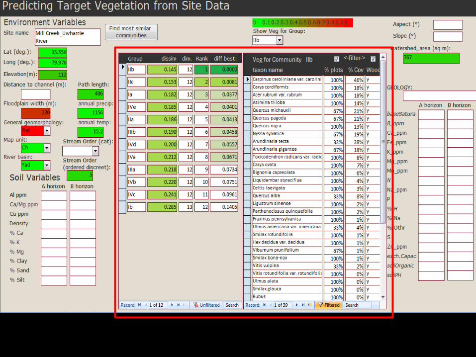
Quantitative matching
Bray-Curtis dissimilarity metric (Bray & Curtis 1957), defined as,
iii
iii
wGN
wGN
where Ni = i th environmental variable at the new site, Gi = group average for i th environmental variable, wi = weight for ith environmental variable.


Classification and description of vegetation types
Critical environmental fields defined
Restoration sites identified and environmental data collected
Restoration sites matched to described vegetation types
Planting lists generated from vegetation type descriptions
How to do this?


Planting lists
• Planting lists may be edited from type-descriptions – dispersal-limited – rare species– types with high
cover/constancy of early-successional species

Future directions
• Broader implementation– other systems, other classifications
• Fine-tuning of the tool• Feedback!
– Download the tool at:
ThanksSupport for this project came from the NC
Ecosystem Enhancement Program, North Carolina Beautiful, and the Society of Wetland Scientists
Forbes Boyle, Brenda Wichmann, Jessi Outzs, Jose Zúñiga, Megan Faestel, Brucie Sorrie,
Richard LeBlond, Mike Schafale, and the Plant Ecology Lab at UNC

Questions?