Embed Size (px)
DESCRIPTION
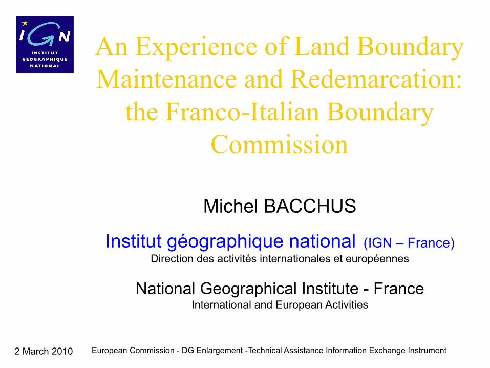
An Experience of Land Boundary Maintenance and Redemarcation: the Franco-Italian Boundary Commission Michel BACCHUS National Geographical Institute - France International and European Activities
Citation preview
2 March 2010 European Commission - DG Enlargement -Technical Assistance Information Exchange Instrument
An Experience of Land Boundary Maintenance and Redemarcation:
the Franco-Italian Boundary Commission
Michel BACCHUS
Institut géographique national (IGN – France)Direction des activités internationales et européennes
National Geographical Institute - FranceInternational and European Activities
2 March 2010
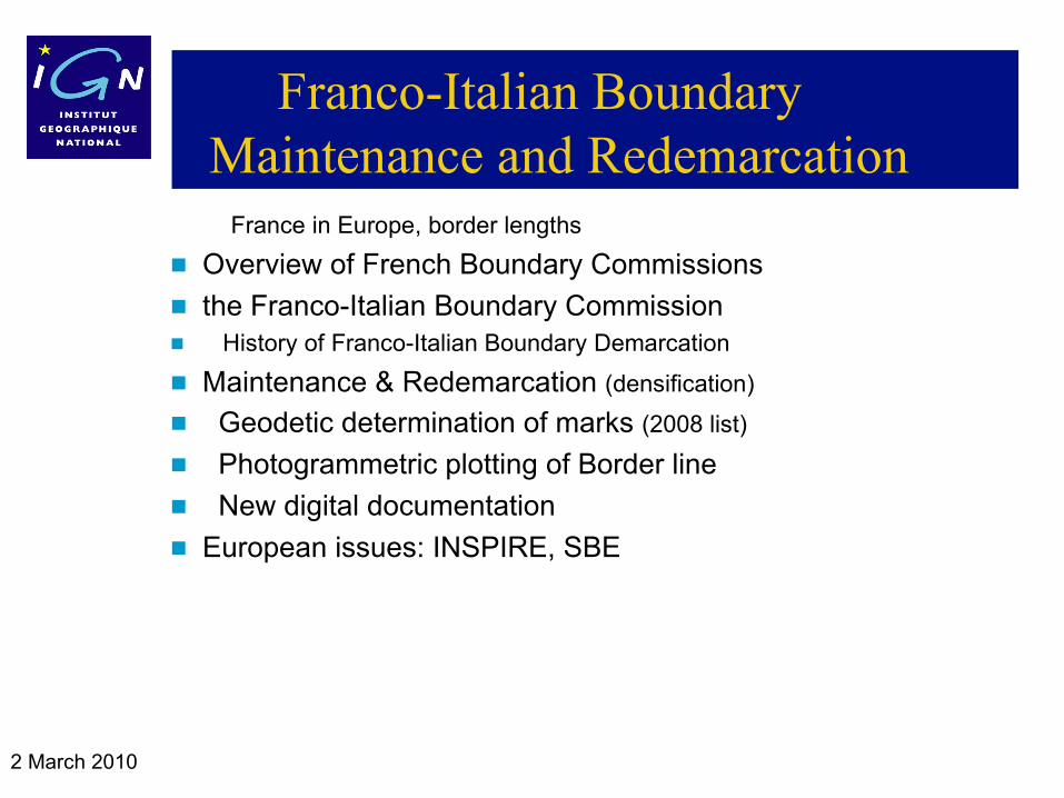
Franco-Italian Boundary Maintenance and Redemarcation
France in Europe, border lengths
Overview of French Boundary Commissions
the Franco-Italian Boundary Commission History of Franco-Italian Boundary Demarcation
Maintenance & Redemarcation (densification) Geodetic determination of marks (2008 list)
Photogrammetric plotting of Border line
New digital documentation
European issues: INSPIRE, SBE
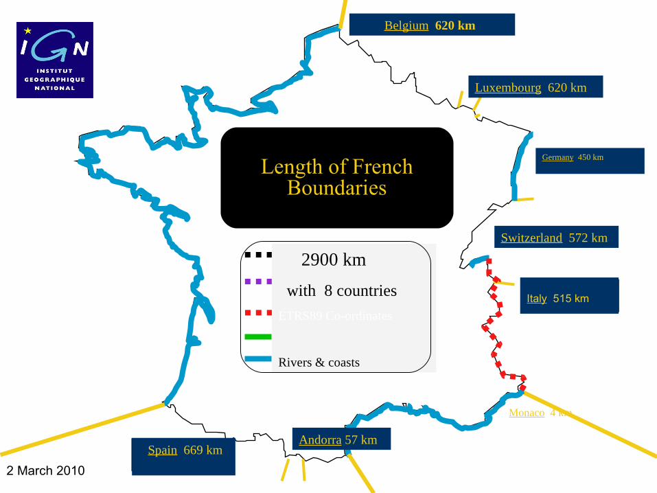
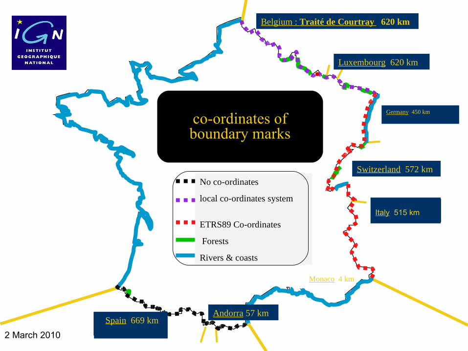
2 March 2010 Spain
Belgium 620 km
Italy 515 km
Luxembourg 620 km
2900 km
with 8 countries
ETRS89 Co-ordinates
Rivers & coasts
Length of French Boundaries
Switzerland 572 km
Andorra 57 km Spain 669 km
Germany 450 km
Monaco 4 km
2 March 2010 European Commission - DG Enlargement -Technical Assistance Information Exchange Instrument
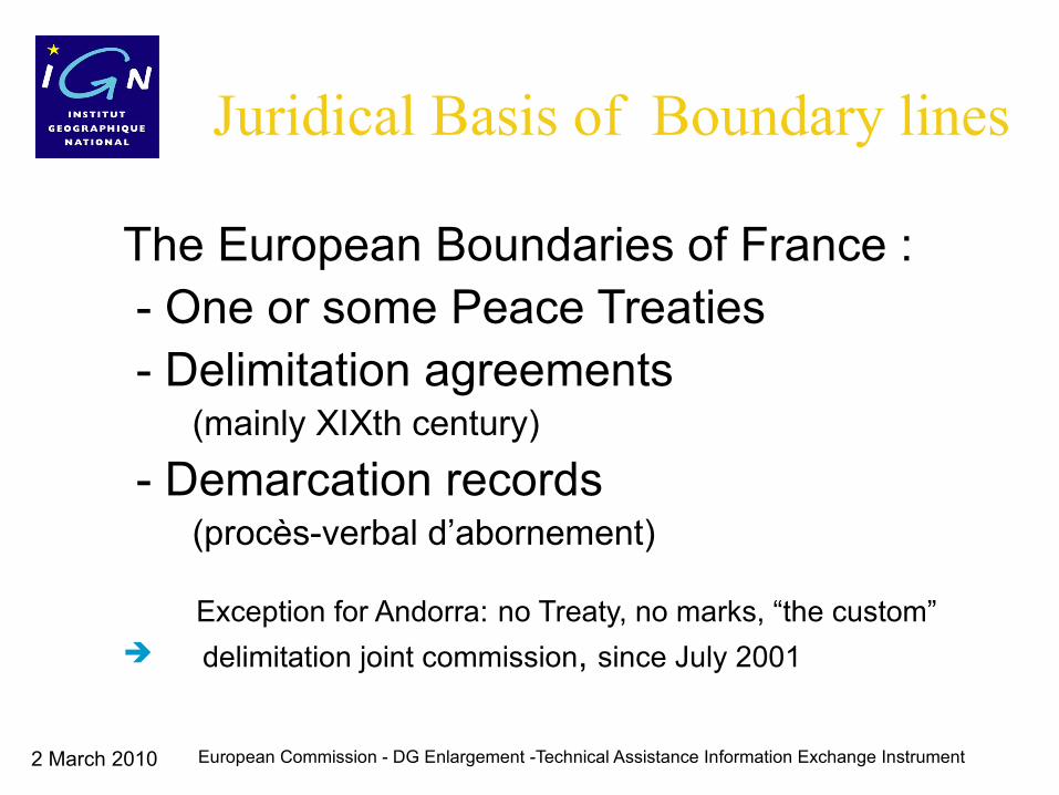
Juridical Basis of Boundary lines
The European Boundaries of France : - One or some Peace Treaties - Delimitation agreements (mainly XIXth century)
- Demarcation records (procès-verbal d’abornement)
Exception for Andorra: no Treaty, no marks, “the custom” delimitation joint commission, since July 2001
2 March 2010 European Commission - DG Enlargement -Technical Assistance Information Exchange Instrument
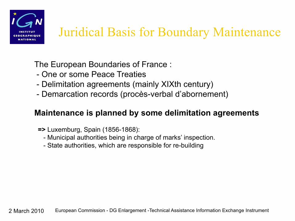
Juridical Basis for Boundary Maintenance
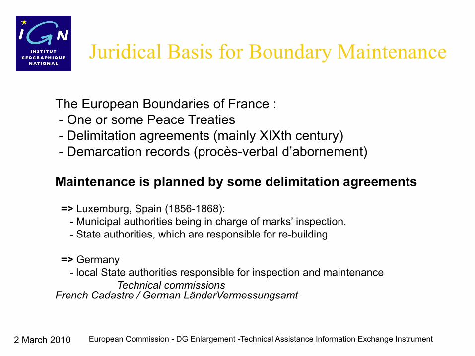
The European Boundaries of France : - One or some Peace Treaties - Delimitation agreements (mainly XIXth century) - Demarcation records (procès-verbal d’abornement)
Maintenance is planned by some delimitation agreements
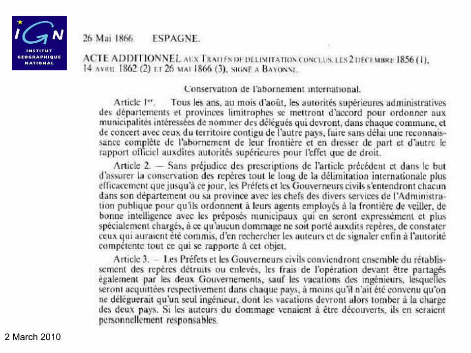
=> Luxemburg, Spain (1856-1868): - Municipal authorities being in charge of marks’ inspection. - State authorities, which are responsible for re-building
=> Germany - local State authorities responsible for inspection and maintenance Technical commissions French Cadastre / German LänderVermessungsamt
2 March 2010
2 March 2010 European Commission - DG Enlargement -Technical Assistance Information Exchange Instrument
Juridical Basis for Boundary Maintenance
The European Boundaries of France : - One or some Peace Treaties - Delimitation agreements (mainly XIXth century) - Demarcation records (procès-verbal d’abornement)
Maintenance is planned by some delimitation agreements
=> Luxemburg, Spain (1856-1868): - Municipal authorities being in charge of marks’ inspection. - State authorities, which are responsible for re-building
=> Germany - local State authorities responsible for inspection and maintenance Technical commissions French Cadastre / German LänderVermessungsamt
2 March 2010 European Commission - DG Enlargement -Technical Assistance Information Exchange Instrument
Juridical Basis for Boundary Maintenance
The European Boundaries of France : - One or some Peace Treaties - Delimitation agreements (mainly XIXth century) - Demarcation records (procès-verbal d’abornement)
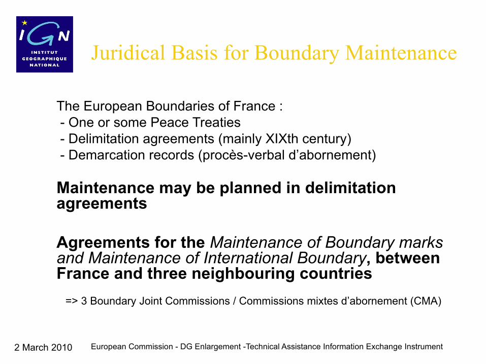
Maintenance may be planned in delimitation agreements
Agreements for the Maintenance of Boundary marks and Maintenance of International Boundary, between France and three neighbouring countries => Boundary Joint Commissions / Commissions mixts d’abornement
=> 3 Boundary Joint Commissions / Commissions mixtes d’abornement (CMA)
2 March 2010
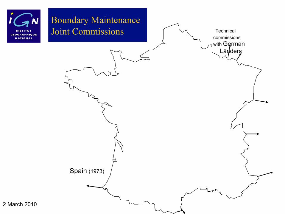
Boundary Maintenance Joint Commissions Technical
commissions
with German
Länders
Switzerland (1965)
Italy (1983)
Spain (1973)
2 March 2010
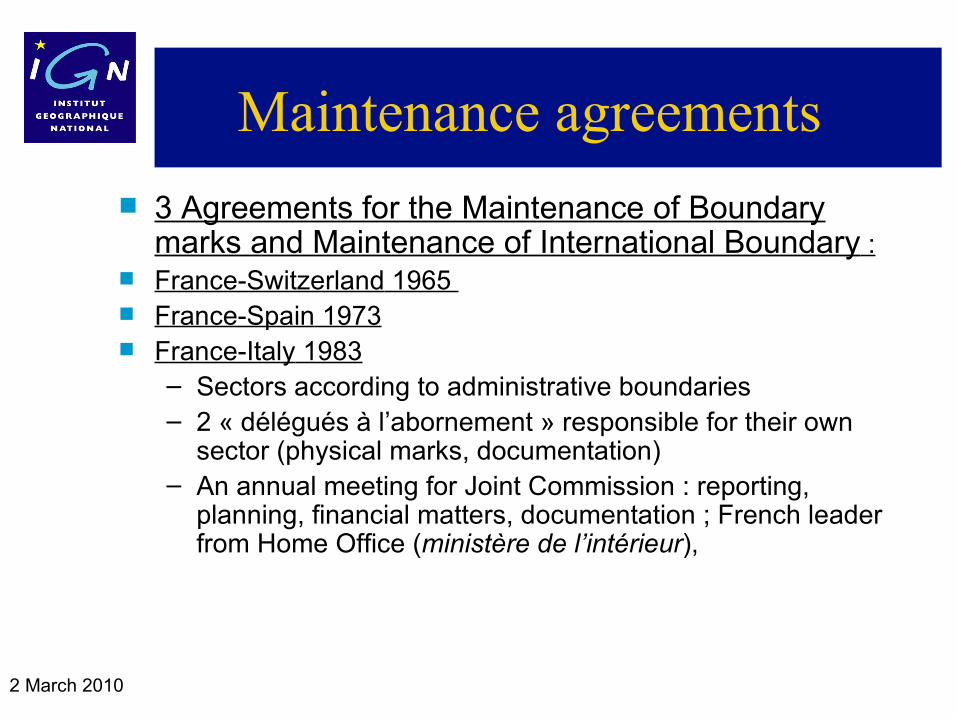
Maintenance agreements
3 Agreements for the Maintenance of Boundary marks and Maintenance of International Boundary :
France-Switzerland 1965 France-Spain 1973 France-Italy 1983
– Sectors according to administrative boundaries– 2 « délégués à l’abornement » responsible for their own
sector (physical marks, documentation)– An annual meeting for Joint Commission : reporting,
planning, financial matters, documentation ; French leader from Home Office (ministère de l’intérieur),
2 March 2010
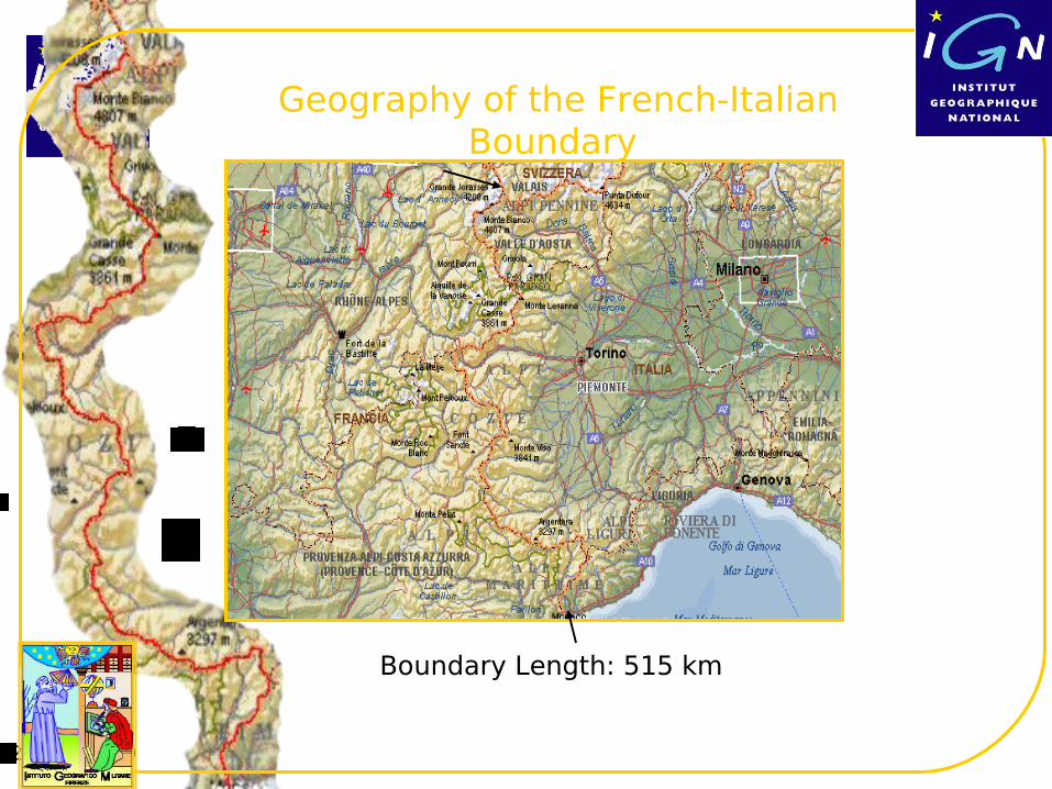
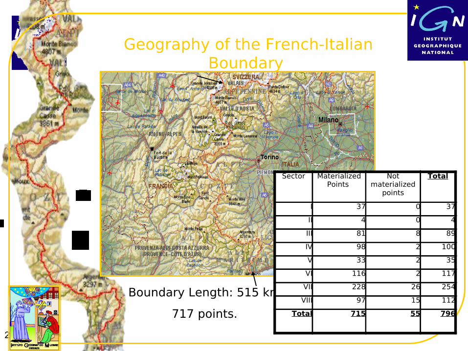
Geography of the French-Italian Boundary
Boundary Length: 515 km
2 March 2010
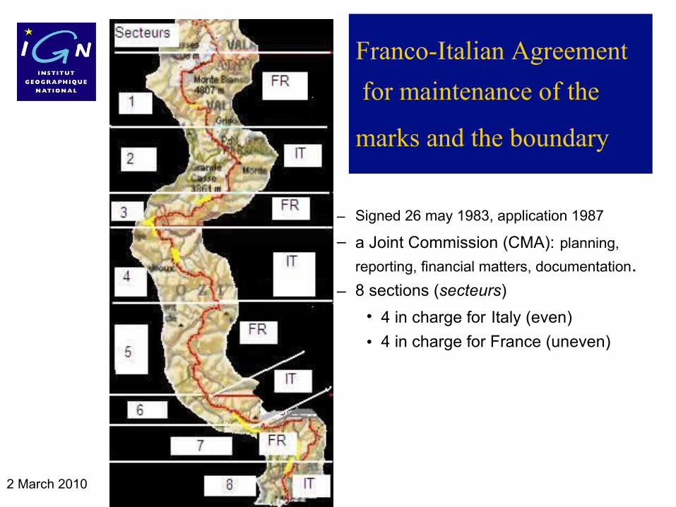
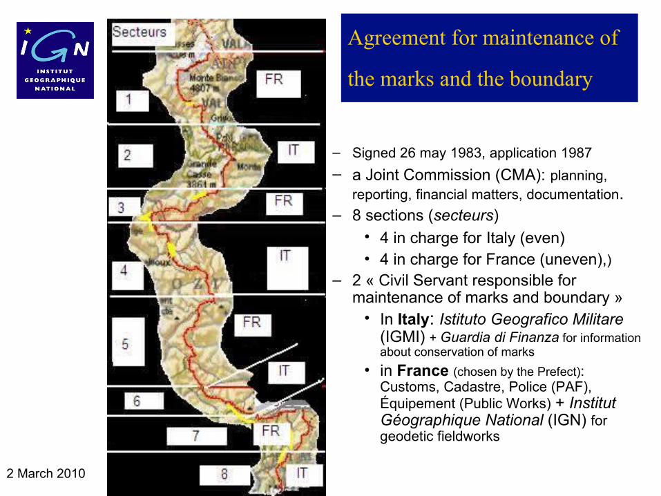
Franco-Italian Agreement
for maintenance of the
marks and the boundary
– Signed 26 may 1983, application 1987
– a Joint Commission (CMA): planning,
reporting, financial matters, documentation.– 8 sections (secteurs)
• 4 in charge for Italy (even)
• 4 in charge for France (uneven)
– 2 « Civil Servant responsible for maintenance of marks and boundary »
2 March 2010
Thank you for your attention
Any Question ?
1 2
3 4
. 5 .
6 7 8
8
2 March 2010
Agreement for maintenance of
the marks and the boundary
– Signed 26 may 1983, application 1987
– a Joint Commission (CMA): planning, reporting, financial matters, documentation.
– 8 sections (secteurs)• 4 in charge for Italy (even)• 4 in charge for France (uneven),)
– 2 « Civil Servant responsible for maintenance of marks and boundary »
• In Italy: Istituto Geografico Militare (IGMI) + Guardia di Finanza for information about conservation of marks
• in France (chosen by the Prefect): Customs, Cadastre, Police (PAF), Équipement (Public Works) + Institut Géographique National (IGN) for geodetic fieldworks
2 March 2010
Geography of the French-Italian Boundary
Boundary Length: 515 km
717 points.
Sector Materialized Points
Not materialized
points
Total
I 37 0 37
II 4 0 4
III 81 8 89
IV 98 2 100
V 33 2 35
VI 116 2 117
VII 228 26 254
VIII 97 15 112
Total 715 55 796
2 March 2010
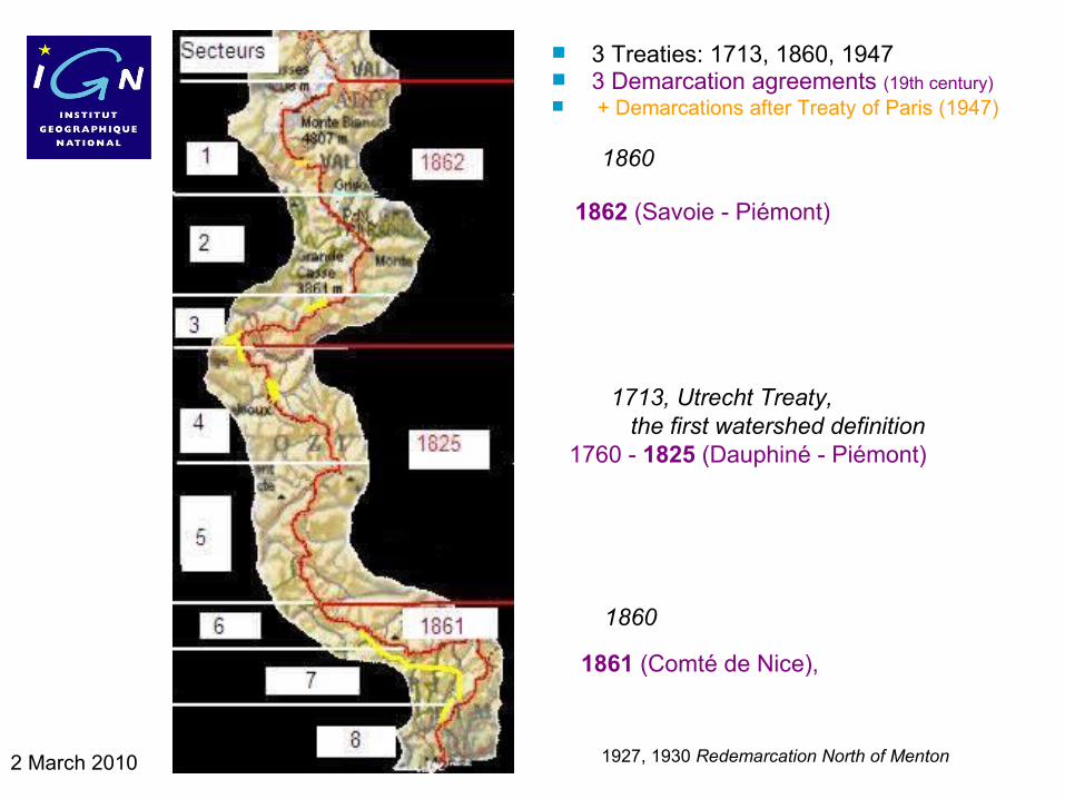
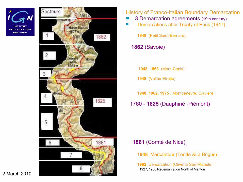
3 Treaties: 1713, 1860, 1947 3 Demarcation agreements (19th century) + Demarcations after Treaty of Paris (1947)
1860
1862 (Savoie - Piémont)
1713, Utrecht Treaty, the first watershed definition 1760 - 1825 (Dauphiné - Piémont)
1860
1861 (Comté de Nice),
1927, 1930 Redemarcation North of Menton
2 March 2010
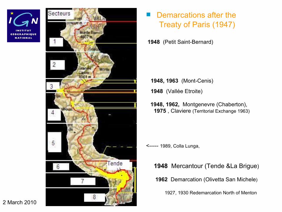
Demarcations after the Treaty of Paris (1947)
1948 (Petit Saint-Bernard)
1948, 1963 (Mont-Cenis)
1948 (Vallée Etroite)
1948, 1962, Montgenevre (Chaberton), 1975 1975 , Claviere (Territorial Exchange 1963)
<----- 1989, Colla Lunga,
1948 Mercantour (Tende &La Brigue)
1962 Demarcation (Olivetta San Michele)
1927, 1930 Redemarcation North of Menton
2 March 2010
History of Franco-Italian Boundary Demarcation 3 Demarcation agreements (19th century) Demarcations after Treaty of Paris (1947)
1948 (Petit Saint-Bernard)
1862 (Savoie)
1948, 1963 (Mont-Cenis)
1948 (Vallée Etroite)
1948, 1962, 1975 , Montgenevre, Claviere
1760 - 1825 (Dauphiné -Piémont)
1861 (Comté de Nice),
1948 Mercantour (Tende &La Brigue)
1962 Demarcation (Olivetta San Michele) 1927, 1930 Redemarcation North of Menton
2 March 2010
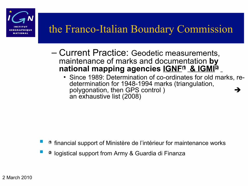
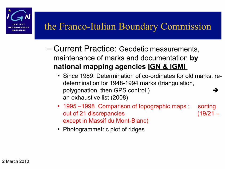
the Franco-Italian Boundary Commission
– Current Practice: Geodetic measurements, maintenance of marks and documentation by national mapping agencies IGNF(1) & IGMI(2)
• Since 1989: Determination of co-ordinates for old marks, re-determination for 1948-1994 marks (triangulation, polygonation, then GPS control ) an exhaustive list (2008)
• Comparison of topographic maps and sorting out of discrepancies 1995-1998 (19/21 – except in Massif du Mont-Blanc)
• Photogrammetric plot of boundary line
(1) financial support of Ministère de l’intérieur for maintenance works
(2) logistical support from Army & Guardia di Finanza
2 March 2010
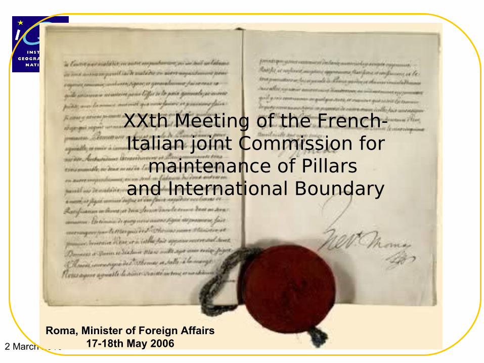
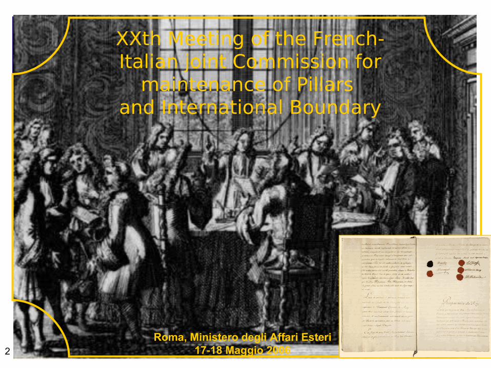
XXth Meeting of the French-Italian joint Commission for
maintenance of Pillars and International Boundary
Roma, Minister of Foreign Affairs 17-18th May 2006
2 March 2010
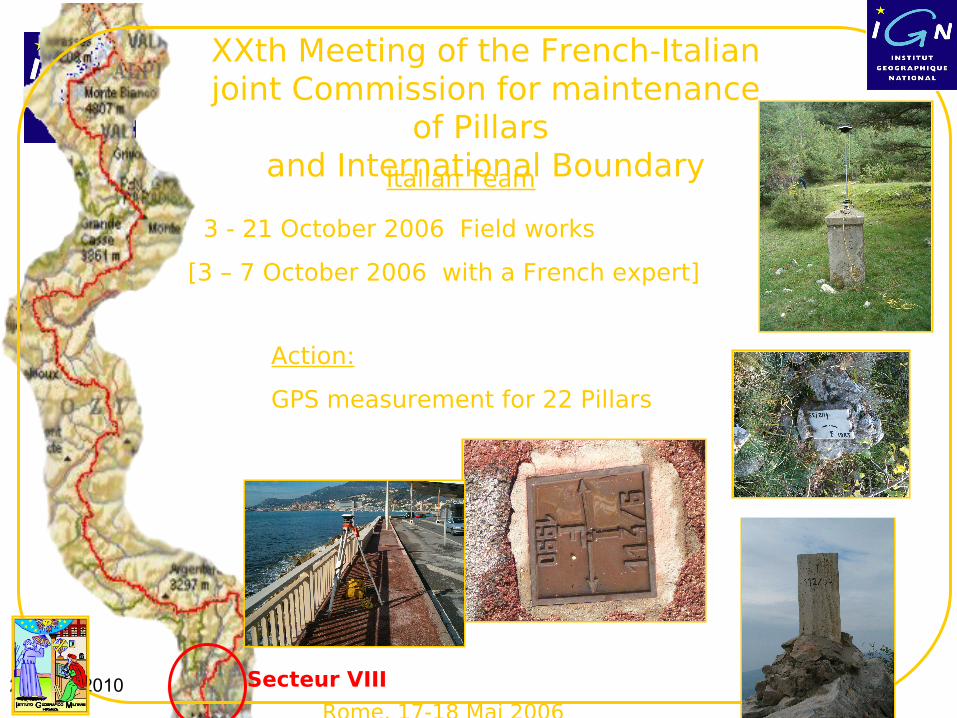
Rome, 17-18 Mai 2006
3 - 21 October 2006 Field works
[3 – 7 October 2006 with a French expert]
Action:
GPS measurement for 22 Pillars
Secteur VIII
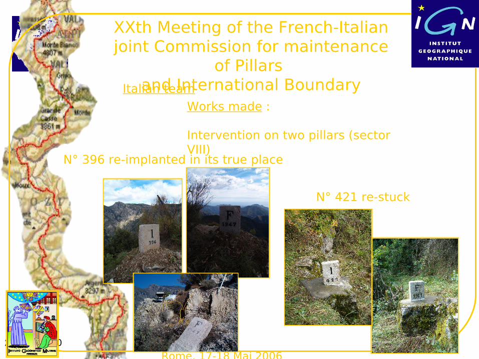
XXth Meeting of the French-Italian joint Commission for maintenance
of Pillars and International BoundaryItalian Team
2 March 2010
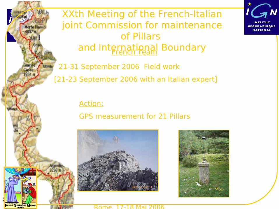
Rome, 17-18 Mai 2006
21-31 September 2006 Field work
[21-23 September 2006 with an Italian expert]
Action:
GPS measurement for 21 Pillars
XXth Meeting of the French-Italian joint Commission for maintenance
of Pillars and International BoundaryFrench Team
2 March 2010
Rome, 17-18 Mai 2006
N° 396 re-implanted in its true place
N° 421 re-stuck
Works made :
Intervention on two pillars (sector VIII)
XXth Meeting of the French-Italian joint Commission for maintenance
of Pillars and International BoundaryItalian team
2 March 2010
Rome, 17-18 Mai 2006
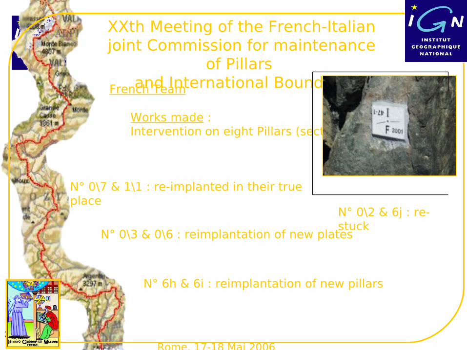
N° 0\7 & 1\1 : re-implanted in their true place
N° 0\2 & 6j : re-stuck
Works made :Intervention on eight Pillars (sector I)
XXth Meeting of the French-Italian joint Commission for maintenance
of Pillars and International BoundaryFrench Team
N° 0\3 & 0\6 : reimplantation of new plates
N° 6h & 6i : reimplantation of new pillars
2 March 2010
Roma, 17-18 Maggio 2006
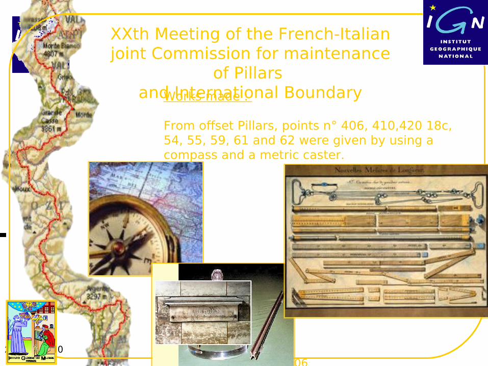
Works made :
From offset Pillars, points n° 406, 410,420 18c, 54, 55, 59, 61 and 62 were given by using a compass and a metric caster.
XXth Meeting of the French-Italian joint Commission for maintenance
of Pillars and International Boundary
2 March 2010
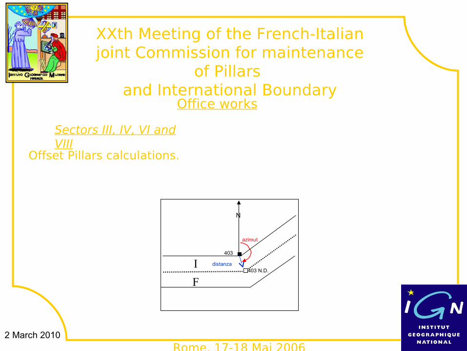
N
403 N.D.distanza
azimut
F
I403
Rome, 17-18 Mai 2006
Sectors III, IV, VI and VIII
Offset Pillars calculations.
Office works
XXth Meeting of the French-Italian joint Commission for maintenance
of Pillars and International Boundary
2 March 2010
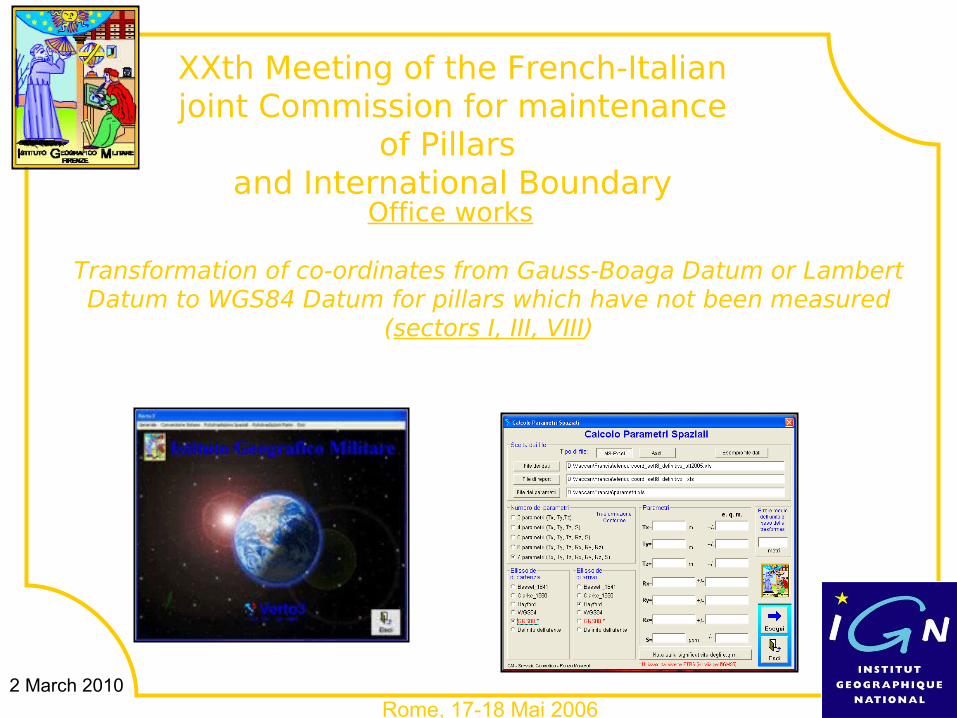
Rome, 17-18 Mai 2006
Transformation of co-ordinates from Gauss-Boaga Datum or Lambert Datum to WGS84 Datum for pillars which have not been measured
(sectors I, III, VIII)
Office works
XXth Meeting of the French-Italian joint Commission for maintenance
of Pillars and International Boundary
2 March 2010
Rome, 17-18 Mai 2006
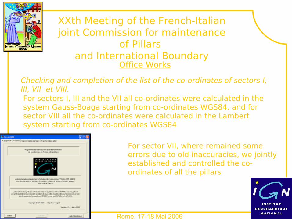
Office Works
Checking and completion of the list of the co-ordinates of sectors I, III, VII et VIII.For sectors I, III and the VII all co-ordinates were calculated in the system Gauss-Boaga starting from co-ordinates WGS84, and for sector VIII all the co-ordinates were calculated in the Lambert system starting from co-ordinates WGS84
For sector VII, where remained some errors due to old inaccuracies, we jointly established and controlled the co-ordinates of all the pillars
XXth Meeting of the French-Italian joint Commission for maintenance
of Pillars and International Boundary
2 March 2010
Rome, 17-18 Mai 2006
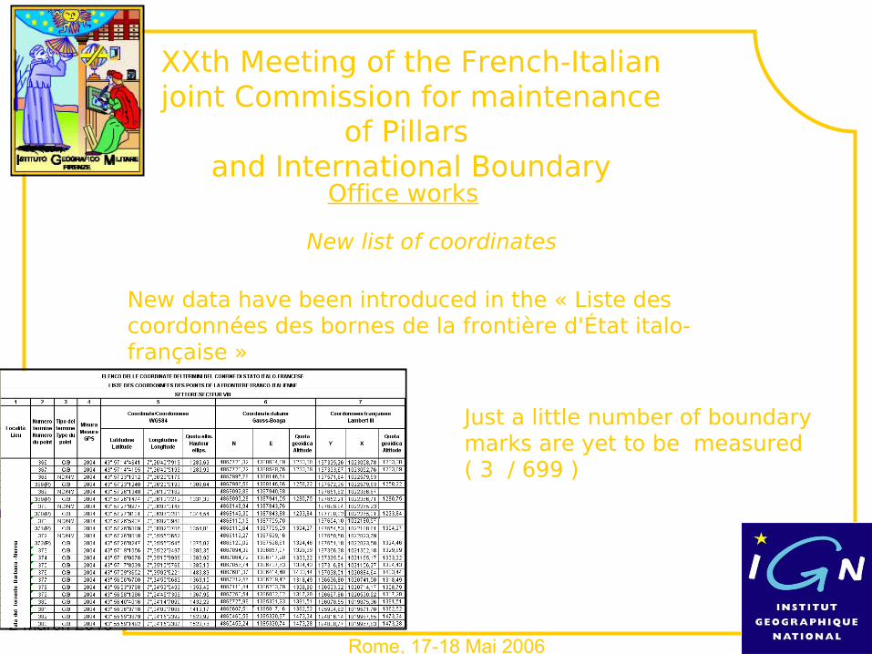
New list of coordinates
New data have been introduced in the « Liste des coordonnées des bornes de la frontière d'État italo-française »
Just a little number of boundary marks are yet to be measured ( 3 / 699 )
Office works
XXth Meeting of the French-Italian joint Commission for maintenance
of Pillars and International Boundary
2 March 2010
Roma, Ministero degli Affari Esteri 17-18 Maggio 2006
XXth Meeting of the French-Italian joint Commission for
maintenance of Pillars and International Boundary
2 March 2010 Spain
Belgium : Traité de Courtray 620 km
Italy 515 km
Luxembourg 620 km
No co-ordinates
local co-ordinates system
ETRS89 Co-ordinates
Forests
Rivers & coasts
co-ordinates of boundary marks
Switzerland 572 km
Andorra 57 km Spain 669 km
Germany 450 km
Monaco 4 km
2 March 2010
the Franco-Italian Boundary Commission
– Current Practice: Geodetic measurements, maintenance of marks and documentation by national mapping agencies IGN & IGMI
• Since 1989: Determination of co-ordinates for old marks, re-determination for 1948-1994 marks (triangulation, polygonation, then GPS control ) an exhaustive list (2008)
• 1995 –1998 Comparison of topographic maps ; sorting out of 21 discrepancies (19/21 – except in Massif du Mont-Blanc)
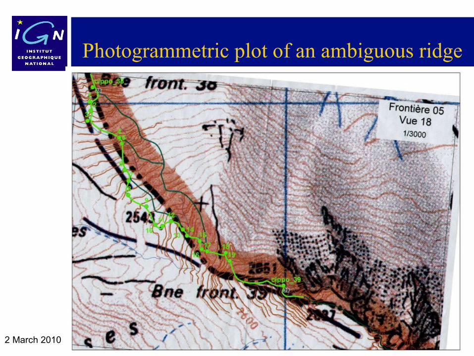
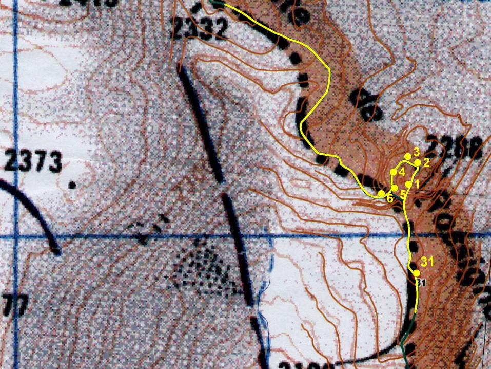
• Photogrammetric plot of ridges
2 March 2010
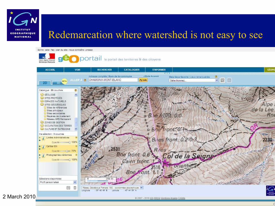
Redemarcation where watershed is not easy to see
France location in Europe, border lengths
2 March 2010
Photogrammetric plot of an ambiguous ridge
2 March 2010
2 March 2010
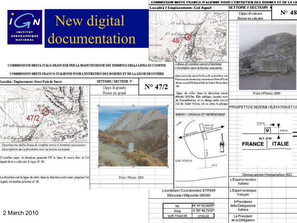
New digital documentation
2 March 2010
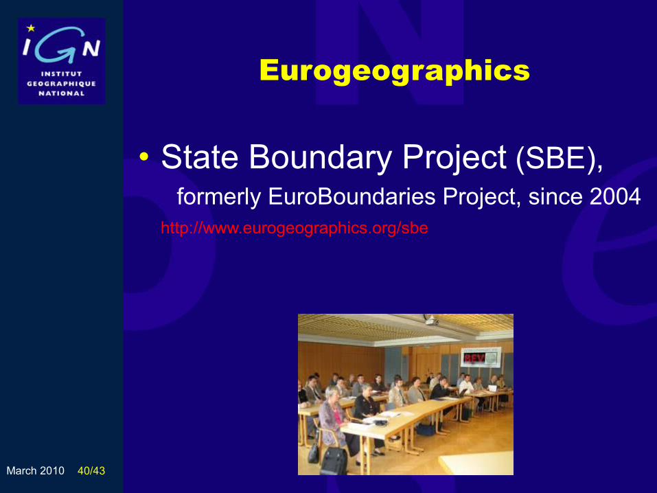
State Boundary of Europe (SBE)
EuroGeographics (EG) is an Association of more than 50 National Mapping and Cadastral Agencies (NMCA’s) of 42 European countries.
With geographic data of its members, EG has developed collaborative Products such as :
EuroBoundaryMap (seamless administrative limits data base) EuroGlobalMap, digital 1:1,000,000 scale map of Europe EuroRegionalMap, a system of 1:250,000 scale regional coverage. EG develops collaborative Projects such as SBE,
State Boundaries of Europe Project (formerly EuroBoundariesProject)
2 March 2010
European NMCA’s involvment
INfrastructure for SPatial InfoRmation in Europe (INSPIRE), article 10:
2. “In order to ensure that spatial data relating to a geographical feature, the location of which spans the frontier between two or more Member States, are coherent, Member States shall, where appropriate, decide by mutual consent on the depiction and position of such common features”.
2 March 2010
State Boundary Project (SBE)
The State Boundaries of Europe (SBE) Project aims at providing and maintaining:
• The administrative and legal definitions of State boundaries, based on boundary Treaties,
• Their precise geometric description expressed in ETRS89 coordinates of boundary points, marks and lines.
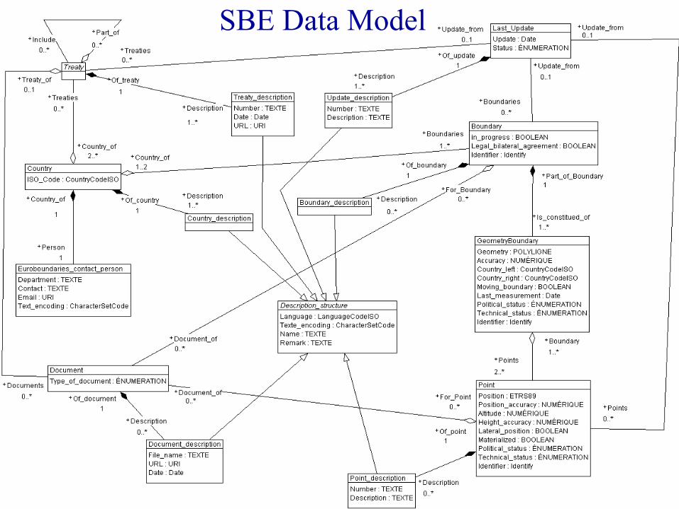
Swisstopo has created the conceptual data model of SBE Robert Balanche : [email protected]).
• Characteristic of the model : interoperability of the information (INSPIRE)
• In the model, we can find the technical characteristics of the boundary points marks and lines, with a minimum set of attributes (geographics coordinates, etc) and the related reference documents (scanned treaties or maps, etc).
March 2010 40/43
Eurogeographics
• State Boundary Project (SBE), formerly EuroBoundaries Project, since 2004
http://www.eurogeographics.org/sbe
March 2010 41/43
State Boundaries of Europe (SBE)
• Promote the data model, distribute the EB Guidelines and ask the EuroGeographics members to provide their international boundaries,
• Maintain close contacts with other EuroGeographics projects and products and with INSPIRE and GMES,
• Establish the needs of users and customers.• Swisstopo implements and manages the SBE
database,• Investigate the potential of incorporating the
international borders in the sea.
March 2010 42/43EuroBoundaries – General Assembly of PCC – June 2007
Project manager : Pierrette Fraisse
SBE Data Model
2 March 2010
Thank you for your attention
Any Question ?
1 2
3 4
. 5 .
6 7 8
8