Embed Size (px)
Citation preview

An Appraisal Report
4,227 Acres of Fort Mohave Lands W of Needles Highway and N of Nevada State Line
Laughlin, Clark County, Nevada 89029
Report Date: February 25, 2015
FOR
Clark County Real Property Management
Ms. Krynn Williams
Property Acquisition Administrator
500 S. Grand Central Parkway, 4th Floor
Las Vegas, NV 89155
Valbridge Property Advisors |
Lubawy & Associates, Inc.
3034 S. Durango Drive, Suite 100
Las Vegas, Nevada 89117
702-242-9369
702-242-6391 fax Valbridge Job No.:
NV01-15-0016-001
valbridge.com

February 25, 2015
Ms. Krynn Williams
Property Acquisition Administrator
Clark County Real Property Management
500 S. Grand Central Parkway, 4th Floor
Las Vegas, NV 89155
RE: Appraisal Report
W of Needles Highway and N of Nevada State Line
Laughlin, Clark County, Nevada 89029
Dear Ms. Williams:
In accordance with your request, we have prepared a real property appraisal of the above-referenced
property. This appraisal report sets forth the pertinent data gathered, the techniques employed, and the
reasoning leading to our value opinions.
The property is a land parcel located 1,320 feet west of Needles Highway, north of the Nevada State Line
in Laughlin, Clark County, Nevada, 89029. The site totals approximately 4,227.00 gross acres. The appraisal
assignment requests a valuation of the property separated into two sites totaling 2,596 acres and 1,629
acres, plus a 2-acre access easement. The subject is further identified as Assessor’s Parcel Numbers (APNs)
266-00-001-001, 009, and 010; portion of 266-00-002-002 and 003; 265-00-001-010 and 012; portion of
265-00-001-013, 043 and 002-001; portion of 265-00-001-013, 014, 041 and 043.
We developed our analyses, opinions, and conclusions and prepared this report in conformity with the
Uniform Standards of Professional Appraisal Practice (USPAP) of the Appraisal Foundation; the Code of
Professional Ethics and Standards of Professional Appraisal Practice of the Appraisal Institute; and the
requirements of our client as we understand them.
The purpose of the appraisal is to form an opinion of the current fair market value of the subject property.
Clark County Real Property Management is the client in this assignment. The intended user of the
appraisal and report is Clark County. The intended use is for possible lease of all or a portion of the
property. The value opinions reported herein are subject to the definitions, assumptions and limiting
conditions, and certification contained in this report.

Ms. Krynn Williams
Clark County Real Property Management
February 25, 2015
VALBRIDGE PROPERTY ADVISORS | Lubawy & Associates, Inc.
The acceptance of this appraisal assignment and the completion of the appraisal report submitted
herewith are contingent on the following extraordinary assumptions and/or hypothetical conditions:
Extraordinary Assumptions:
We have provided an opinion of value of the subject land for solar power use, and it is acknowledged that
in 2011 a large solar power project developer was unable to find a buyer for solar power to be generated
from a proposed project on the subject land. Consequently, an extraordinary assumption of the opinion of
value for solar power use of the subject land is that a buyer for the solar power produced on the land can
be found and placed under contract to buy the power.
Hypothetical Conditions:
There are no hypothetical conditions used in this appraisal assignment
Based on the analysis contained in the following report, our value conclusions involving the subject
property are summarized as follows:
VALUE CONCLUSIONS – LAUGHLIN COMMUNITY EXPANSION
VALUE CONCLUSIONS – SOLAR POWER PROJECTS*
* Assuming a buyer of the solar power to be generated can be found by the solar power developer.
This letter of transmittal is not considered valid if separated from this report, and must be accompanied
by all sections of this report as outlined in the Table of Contents, in order for the value opinions set forth
above to be valid.
Respectfully submitted,
Valbridge Property Advisors | Lubawy & Associates, Inc.
Kendal Stewart
Senior Appraiser
Nevada License #A.0002588-CG
License Expires April 30, 2015
Matthew Lubawy, MAI, CVA, CMEA
Senior Managing Director
Nevada License #A.0000044-CG
License Expires April 30, 2015
Value Type Value Premise Value PerspectiveInterest
Appraised
Effective
DateIndicated Value
Fair Market Value (4,227 AC) As Is Current Fee Simple 2/14/2015 $2,750,000
Fair Market Value (2,596 AC) As Is Current Fee Simple 2/14/2015 $1,690,000
Fair Market Value (1,629 AC) As Is Current Fee Simple 2/14/2015 $1,060,000
Fair Market Value (2-AC Road) As Is Current Fee Simple 2/14/2015 $0
Value Type Value Premise Value PerspectiveInterest
Appraised
Effective
DateIndicated Value
Fair Market Value (4,227 AC) As Is Current Fee Simple 2/14/2015 $11,400,000
Fair Market Value (2,596 AC) As Is Current Fee Simple 2/14/2015 $7,000,000
Fair Market Value (1,629 AC) As Is Current Fee Simple 2/14/2015 $4,400,000
Fair Market Value (2-AC Road) As Is Current Fee Simple 2/14/2015 $0

4,227 Acres of Fort Mohave Lands
TABLE OF CONTENTS
VALBRIDGE PROPERTY ADVISORS | Lubawy & Associates, Inc. Valbridge Job Number: NV01-15-0016-001
Table of Contents
Table of Contents .................................................................................................................................................................................. i
Summary of Salient Facts .................................................................................................................................................................. 1
Introduction ............................................................................................................................................................................................ 5
Regional & Market Area Analysis ............................................................................................................................................... 10
City & Neighborhood Analysis .................................................................................................................................................... 26
Site Description .................................................................................................................................................................................. 38
Zoning Information .......................................................................................................................................................................... 47
Assessment & Tax Data .................................................................................................................................................................. 48
Highest & Best Use ........................................................................................................................................................................... 50
Appraisal Methodology .................................................................................................................................................................. 57
Land Valuation For Laughlin Community Development ................................................................................................... 58
Valuation for Solar Power Use of the Land ............................................................................................................................. 73
Land Valuation for Renewable Energy Site ............................................................................................................................. 89
General Assumptions & Limiting Conditions ......................................................................................................................... 98
Certification........................................................................................................................................................................................ 104
Addenda .............................................................................................................................................................................................. 106

4,227 Acres of Fort Mohave Lands
SUMMARY OF SALIENT FACTS
VALBRIDGE PROPERTY ADVISORS | Lubawy & Associates, Inc. Valbridge Job Number: NV01-15-0016-001 Page 1
Summary of Salient Facts
Property Name:
4,227 Acres of Fort Mohave Lands
Location: W of Needles Highway and N of Nevada State Line
Laughlin, Clark County, Nevada 89029
The subject property is vacant land located west of Needles
Highway, 2.6 miles south of Laughlin, in Clark County,
Nevada. The property is approximately 100 miles from Las
Vegas via U.S. Highway 95, and the site has frontage along
Needles Highway for approximately 4.85 miles to the
Nevada/California border. The overall property totals 4,227
acres, and is being appraised divided into two separate sites
totaling 2,596 acres, and 1,629 acres, plus a 2-acre access
easement.
Laughlin, Nevada is 96 miles south of Las Vegas and is a
riverside hotel and casino community. A bridge across the
Colorado River links Laughlin and Bullhead City, Arizona,
creating sister communities with a combined 49,000
residents. Laughlin is the primary business center while
Bullhead City provides the primary living environs complete
with housing districts, shopping centers, community parks,
etc.
Map Latitude/Longitude:
35.082129; -114.669113
Assessor’s Parcel Numbers:
Parcel A (2,596 Acres): 266-00-001-001, 009, and 010;
portion of 266-00-002-002 and 003
Parcel B (1,629 Acres): 265-00-001-010 and 012; portion
of 265-00-001-013, 043, and 002-
001
Access Road (2 Acres): Portion of 265-00-001-013, 014,
041, and 043
Census Tract: 57.05
Property Rights Appraised:
Fee Simple
Purpose of Appraisal: The purpose of the appraisal is to form an opinion of the
current fair market value of the subject property.
Client: Clark County Real Property Management
Intended User: Clark County

4,227 Acres of Fort Mohave Lands
SUMMARY OF SALIENT FACTS
VALBRIDGE PROPERTY ADVISORS | Lubawy & Associates, Inc. Valbridge Job Number: NV01-15-0016-001 Page 2
Intended Use: To assist in possible lease of all or a portion of the property.
Zoning:
R-U, Rural Open Land
Site Size:
4,227.00 gross acres
Extraordinary Assumptions: We have provided an opinion of value of the subject land for
solar power use, and it is acknowledged that in 2011 a large
solar power project developer was unable to find a buyer for
solar power to be generated from a proposed project on the
subject land. Consequently, an extraordinary assumption of
the opinion of value for solar power use of the subject land
is that a buyer for the solar power produced on the land can
be found and placed under contract to buy the power.
Hypothetical Conditions: There are no hypothetical conditions used in this appraisal
assignment
Highest and Best Use
As Vacant:
Laughlin Community Development with Major Projects and
Business and Design Research Park development when the
Laughlin economy, real estate market, and the financing
market will allow. Separately, solar power project
development would trump Laughlin community
development as the highest and best use of the land if a
solar power developer can find a buyer for the solar power
generated. Laughlin community development and solar
power development are not similar uses, and their current
market values cannot be blended to reflect an
interchangeable value.
Date of Inspection: February 14, 2015
Date of Report Preparation:
February 25, 2015
VALUE CONCLUSIONS – LAUGHLIN COMMUNITY DEVELOPMENT
Value Type Value Premise Value PerspectiveInterest
Appraised
Effective
DateIndicated Value
Fair Market Value (4,227 AC) As Is Current Fee Simple 2/14/2015 $2,750,000
Fair Market Value (2,596 AC) As Is Current Fee Simple 2/14/2015 $1,690,000
Fair Market Value (1,629 AC) As Is Current Fee Simple 2/14/2015 $1,060,000
Fair Market Value (2-AC Road) As Is Current Fee Simple 2/14/2015 $0

4,227 Acres of Fort Mohave Lands
SUMMARY OF SALIENT FACTS
VALBRIDGE PROPERTY ADVISORS | Lubawy & Associates, Inc. Valbridge Job Number: NV01-15-0016-001 Page 3
VALUE CONCLUSIONS – SOLAR POWER PROJECTS*
* Assuming a buyer of the solar power to be generated can be found by the solar power developer.
Value Type Value Premise Value PerspectiveInterest
Appraised
Effective
DateIndicated Value
Fair Market Value (4,227 AC) As Is Current Fee Simple 2/14/2015 $11,400,000
Fair Market Value (2,596 AC) As Is Current Fee Simple 2/14/2015 $7,000,000
Fair Market Value (1,629 AC) As Is Current Fee Simple 2/14/2015 $4,400,000
Fair Market Value (2-AC Road) As Is Current Fee Simple 2/14/2015 $0

4,227 Acres of Fort Mohave Lands
AERIAL AND FRONT VIEW
VALBRIDGE PROPERTY ADVISORS | Lubawy & Associates, Inc. Valbridge Job Number: NV01-15-0016-001 Page 4
AERIAL VIEW/BIRD’S EYE VIEW
LOOKING WEST ACROSS THE SITE

4,227 Acres of Fort Mohave Lands
INTRODUCTION
VALBRIDGE PROPERTY ADVISORS | Lubawy & Associates, Inc. Valbridge Job Number: NV01-15-0016-001 Page 5
Introduction
Client and Other Intended Users of the Appraisal The client in this assignment is Clark County Real Property Management. The intended user of this report
is Clark County and no others.
Intended Use of the Appraisal The intended use of this report is for possible lease of all or a portion of the property.
Real Estate Identification The subject property is located 1,320 feet west of Needles Highway, north of the Nevada State Line, in
Laughlin, Nevada 89029. The property totals 4,227 acres and consists of land on the west side of Needles
Highway, with the land extending south approximately 4.85 miles to the Nevada/California state line. The
appraisal assignment requires a valuation of the property divided into two sites totaling 2,596 acres and
1,629 acres, along with a 2.0-acre access easement.
The site is away from the Colorado River, and away from the Mojave Indian Reservation (the Indian tribe
uses the old Spanish spelling of Mojave while the modern spelling is Mohave) which is alongside the
Colorado River and covers approximately 42,000 acres in Nevada, Arizona, and California. The subject site
is across Needles Highway from the Indian reservation, and the Indian reservation land is largely leased to
farming companies to grow cotton, corn, and soybeans. However, the Indian tribe has the Avi Resort and
Casino in Nevada and the Spirit Mountain Casino in Arizona.
The subject land is within the Clark County Laughlin Planning District, and it is part of 15,000 acres set
aside by the federal government in 1959 in what is known as the Fort Mohave Valley Development Law.
Six thousand acres is now included in the town of Laughlin, and the remaining 9,046 acres (i.e. including
the subject land) is under administration of Clark County.
Laughlin is a hotel/gaming community located 96 miles south of Las Vegas, and together with Bullhead
City, Arizona, the two communities create a resort and gaming employment center on the Nevada side of
the river with housing, shopping, and community services primarily on the Arizona side of the river. The
two towns are linked via a bridge across the Colorado River
The subject 4,227.00 acres is being divided into two sites for appraisal totaling 2,596 acres (Parcel A) and
1,629 acres (Parcel B), along with an access road totaling 2.00 acres. The three sites consist of Clark County
Assessor’s Parcel identified as follows:
Parcel A (2,596 Acres): 266-00-001-001, 009, and 010; portion of 266-00-002-002 and 003
Parcel B (1,629 Acres): 265-00-001-010 and 012; portion of 265-00-001-013, 043, and 002-001
Access Road (2 Acres): Portion of 265-00-001-013, 014, 041, and 043
Legal Description Being all of Sections 1, 12, and 13, Township 33 South, Range 65 East, M.D.M., Clark County, Nevada and
all that portion of Section 24 and Section 25, of said Township and Range lying Westerly of a line lying
1,320 feet West of and running parallel with the Westerly right-of-way of Needles Highway;

4,227 Acres of Fort Mohave Lands
INTRODUCTION
VALBRIDGE PROPERTY ADVISORS | Lubawy & Associates, Inc. Valbridge Job Number: NV01-15-0016-001 Page 6
TOGETHER WITH the Northwest Quarter (NW 1/4) and the South Half (S 1/2) of Section 6, Township 33
South, Range 66 East, M.D.M., Clark County, Nevada and all that portion of Sections 7, 18, and 19, of said
Township 33 South and Range 66 East lying Westerly of a line lying 1,320 feet West of an running parallel
with the Westerly right-of-way of Needles Highway;
TOGETHER WITH portions of Sections 7, 8, 17 and 18, Township 33 South, Range 66 East, M.D.M., Clark
County, Nevada, more particularly described as follows:
Being that portion of the South 30.00 feet of said Section 7 lying Easterly of a line lying 1,320 feet West of
an running parallel with the Westerly right-of-way of Needles Highway, and that portion of the South
30.00 feet of said Section 8 lying Westerly of the Westerly right-of-way of Needles Highway, and that
portion of the North 30.00 feet of said Section 17, lying Westerly of the Westerly right-of-way of Needles
Highway, and that portion of the North 30.00 feet of said Section 18 lying Easterly of a line lying 1,320
feet west of an running parallel with the Westerly right-of-way of Needles Highway.
The individual legal descriptions for the parcels are included in the addenda.
Real Property Interest Appraised We have appraised the fee simple interest in the subject property.
Definition of Market Value Market value as defined in the 2010 Interagency Guidelines is as follows:
As defined in the Agencies’ appraisal regulations, the most probable price which a
property should bring in a competitive and open market under all conditions requisite to
a fair sale, the buyer and seller each acting prudently and knowledgeably, and assuming
the price is not affected by undue stimulus. Implicit in this definition are the
consummation of a sale as of a specified date and the passing of title from seller to buyer
under conditions whereby:
Buyer and seller are typically motivated;
Both parties are well informed or well advised, and acting in what they
consider their own best interests;
A reasonable time is allowed for exposure in the open market;
Payment is made in terms of cash in U.S. dollars or in terms of financial
arrangements comparable thereto; and
The price represents the normal consideration for the property sold
unaffected by special or creative financing or sales concessions granted by
anyone associated with the sale.
Please refer to the Glossary in the Addenda section for the definition(s) employed in this report.

4,227 Acres of Fort Mohave Lands
INTRODUCTION
VALBRIDGE PROPERTY ADVISORS | Lubawy & Associates, Inc. Valbridge Job Number: NV01-15-0016-001 Page 7
Effective Date of Value The effective date of value is as follows:
Valuation Effective Date
As Is Market Value February 14, 2015
Kendal Stewart inspected the property on February 14, 2015.
Date of Report The date of this report is February 25, 2015, which is the date of the letter of transmittal. Our conclusions
are reflective of current market conditions.
Scope of Work The scope of work includes all steps taken in the development of the appraisal. This includes 1) the extent
to which the subject property is identified, 2) the extent to which the subject property is inspected, 3) the
type and extent of data researched, 4) the type and extent of analysis applied, and the type of appraisal
report prepared. These items are discussed as follows:
Extent to Which the Property Is Identified
Legal Characteristics
The subject was legally identified via a legal description and Assessor's Parcel Numbers in Clark
County Assessor records and a preliminary title report
Economic Characteristics
The subject property is vacant land and does not generate any income.
Physical Characteristics
The subject was physically identified via a Clark County Assessor's map, Clark County GIS aerial
mapping, exhibits provided by the client, and a physical inspection by Kendal Stewart.
Extent to Which the Property Is Inspected
On February 14, 2015 the property was inspected by Kendal Stewart and photographs of the property
were taken as of that date. Matthew Lubawy has not inspected the property that is the subject of this
report. Information concerning utilities was collected by a physical inspection as well as contacting the
individual utility companies, when necessary. Information pertaining to dimensions, shape, and area was
taken from the Clark County Assessor’s Map. The description and analysis of topography, drainage, soils
conditions and surrounding land uses was based upon a physical inspection. It is imperative to note that
the appraisers are not experts in the analysis of soils conditions or environmental hazards; therefore, any
comment by the appraisers that might suggest the presence of such substances should not be taken as
confirmation of the presence of hazardous waste or questionable soils conditions. Such determination
would require investigation by qualified professionals in the field of environmental assessment or soils
testing. No responsibility is assumed for any environmental conditions or for any expertise or engineering
knowledge required to discover them. The appraisers’ descriptions and resulting comments are a result of
routine observations made during the appraisal process.
Type and Extent of the Data Researched
We researched and analyzed: 1) market area data, 2) property-specific, market-analysis data, 3) zoning
and land-use data, and 4) current data on comparable listings and sales in the competitive market area.

4,227 Acres of Fort Mohave Lands
INTRODUCTION
VALBRIDGE PROPERTY ADVISORS | Lubawy & Associates, Inc. Valbridge Job Number: NV01-15-0016-001 Page 8
Data pertaining to Clark County, the town of Laughlin, and the subject neighborhood was provided by
publications such as the Las Vegas Perspective, the Review Journal, and information from internet, the
local Chamber of Commerce and the Nevada Development Authority. Information pertaining to
population was supplied by the Nevada State Demographer’s Office; information pertaining to visitor
volume, convention attendance, gaming revenue and total visitor revenue was supplied by the Las Vegas
Convention and Visitors Authority; data pertaining to the labor force, employment and unemployment
was supplied by the State of Nevada Employment Security Department; information pertaining to taxable
sales was provided by the Nevada Department of Taxation; and data pertaining to residential construction
building permits was collected from the governing jurisdictions. Additional neighborhood data was based
upon a physical inspection of the area.
Land sales data was collected through various sources including CoStar, Property Line, LoopNet, and from
brokers, owners, and developers. The information was verified with one or more of the parties involved in
the transaction including the grantor, grantee, broker, or other knowledgeable parties, when possible.
Verification of each sale is listed separately on each land sale abstract contained later in the report.
Type and Extent of Analysis Applied
The subject site does not have improvements that contribute to an overall value that exceeds the land
value. Since there is no proposed development or expansion involving the subject site, an intensive
feasibility analysis is not warranted. We observed surrounding land use trends, demand for the subject
property, and relative legal limitations in concluding to a highest and best use. We then valued the
subject based on the highest and best use conclusion, relying on the Sales Comparison Approach.
Approaches considered but not used: Cost Approach and Income Capitalization Approach.
Type of Appraisal and Report Option
This is an Appraisal Report as defined by Uniform Standards of Professional Appraisal Practice under
Standards Rule 2-2a.
Use of Real Estate as of the Effective Date of Value The subject property was vacant land as of the effective date of appraisal.
Use of Real Estate as of the Date of this Report The subject property was vacant land as of the date of this report.
Ownership and Sales History According to information from the Clark County Recorder’s Office, the subject property is currently owned
by County of Clark (Administrative). Title to the property was transferred from the State of Nevada
Colorado River Commission to Clark County on June 27, 2007 pursuant to Chapter 427, Statutes of
Nevada 2007 (Senate Bill 301 of the 74th
Session of the Nevada Legislature). Clark County now has
jurisdiction over development of the subject land subject to any limitations imposed in the original federal
patent of the property.
The property had originally been part of 15,000 acres patented by the United States to the Colorado River
Commission of Nevada in 1966 at a price of $3,055,000. The $3,055,000 was the fair market value of the
15,000 acres as determined by the Secretary of the Interior on April 22, 1960. Six thousand acres of the
land has been developed with residential housing, a state park, hotels, and a large coal-fired power plant

4,227 Acres of Fort Mohave Lands
INTRODUCTION
VALBRIDGE PROPERTY ADVISORS | Lubawy & Associates, Inc. Valbridge Job Number: NV01-15-0016-001 Page 9
(now closed) in the town of Laughlin. The subject property is a portion of the remaining unused 9,046
acres located 2.6 miles south of existing development in Laughlin.
The entire 9,046 acres was approved in 2010 by the U.S. Secretary of the Interior via a modification of the
original land patent to develop solar power projects. ENN Energy Company, one of the largest power
companies in the world, entered into an agreement to buy the land to develop a 5,000-acre solar panel
array along with a solar panel production factory to sell panels nationwide. The factory would have
employed 2,000 workers. However, ENN planned to sell the power generated by the 5,000-acre solar array
to California power companies, and no buyers could be found in the two years ENN worked on the
project. California government officials indicated to ENN that California had enough solar energy land to
build California solar plants that would supply all their demand. ENN ultimately dropped the plan to build
the solar project, and returned the land to Clark County.
List of Items Requested but Not Provided All requested information has been provided to the appraisers for review.
Extraordinary Assumptions We have provided an opinion of value of the subject land for solar power use, and it is acknowledged that
in 2011 a large solar power project developer was unable to find a buyer for solar power to be generated
from a proposed project on the subject land. Consequently, an extraordinary assumption of the opinion of
value for solar power use of the subject land is that a buyer for the solar power produced on the land can
be found and placed under contract to buy the power.
Hypothetical Conditions There are no hypothetical conditions used in this appraisal assignment

4,227 Acres of Fort Mohave Lands
REGIONAL & MARKET AREA ANALYSIS
VALBRIDGE PROPERTY ADVISORS | Lubawy & Associates, Inc. Valbridge Job Number: NV01-15-0016-001 Page 10
Regional & Market Area Analysis
REGIONAL MAP
SUBJECT

4,227 Acres of Fort Mohave Lands
REGIONAL & MARKET AREA ANALYSIS
VALBRIDGE PROPERTY ADVISORS | Lubawy & Associates, Inc. Valbridge Job Number: NV01-15-0016-001 Page 11
Introduction The subject property is located 2.6 miles south of existing development in Laughlin, Clark County, Nevada.
Laughlin is 96 miles south of Las Vegas, and the Las Vegas Valley is the major developed region in Clark
County. The following discussion describes Clark County, which necessarily includes an in depth
discussion of the Las Vegas Valley.
History Members of a Mexican trading party traveling the Spanish Trail in 1829 left the established route and,
during a trip scouting for water, discovered the Las Vegas Springs. Between 1830 and 1848, the name
“Vegas”, shown on maps of the day, was changed to Las Vegas, which means “the meadows” in Spanish.
In 1865, Octavius D. Gass established a ranch and became one of the first permanent residents. By 1890,
railroad developers had decided that water-rich Las Vegas would be a prime location for a railroad stop
and town. Work on the first railroad grade into Las Vegas began the summer of 1904. Rails were
connected with the eastern segment of track in October 1904, and the first train made its inaugural run
from California to points east on January 20, 1905. The City of Las Vegas was founded on May 15, 1905
when the Union Pacific auctioned off 1,200 lots (in one day) in the area now known as “Glitter Gulch” –
downtown Las Vegas.
Government Las Vegas is the county seat for Clark County, which contains an area of approximately 7,910 square miles.
Clark County is generally bound by the Colorado River, Lake Mead, and Arizona to the southeast;
California to the southwest; and Lincoln and Nye Counties to the north. There are five incorporated cities
in Clark County consisting of Las Vegas, North Las Vegas, Henderson, Boulder City, and Mesquite. The Las
Vegas metropolitan area, or Las Vegas Valley, is generally identified as the cities of Las Vegas, North Las
Vegas, Henderson, and the portions of unincorporated Clark County surrounding these three cities.
Climate Las Vegas averages 184 days of sunshine per year with relatively low humidity, 139 days of partly cloudy
skies and 42 days of cloudy skies. The average temperature throughout the year for 2013 was 69.8
degrees, which is slightly above the normal at 68.1 degrees. That was taken from the McCarran
International Airport, which is the official climate station for Las Vegas. 2012 ranked as the warmest year
ever at 71.3 degrees since on records dating back to 1937. The 2nd
warmest year was back in 2007 with an
average temperature of 71.1 degrees. The highest temperature of the year was 104 degrees which
occurred in July 2013, while the lowest temperature was recorded at 35.9 degrees in January 2013.
Precipitation totals for 2013 was 3.0 inches. In 2012, precipitation was 5.3 inches which ranked as the 19th
wettest on record since 1937. This made 2012 the second year to finish with above normal precipitation at
the official Las Vegas climate control station since 2005.
Recreation Two major attractions for visitors to Southern Nevada are Hoover Dam and Lake Mead. Construction of
Hoover Dam (begun in 1932 and completed in 1935) created Lake Mead, the largest man-made reservoir
in America. Encompassing 1.5 million acres, Lake Mead offers boating, fishing, scuba diving, water skiing,
wind surfing, sailing, jet skiing, and camping along its 700-mile shoreline and is a water source for nearly
25 million people. Lake Mead and Hoover Dam attract more than 18 million people each year with 69%
of local visitors visiting the dam.

4,227 Acres of Fort Mohave Lands
REGIONAL & MARKET AREA ANALYSIS
VALBRIDGE PROPERTY ADVISORS | Lubawy & Associates, Inc. Valbridge Job Number: NV01-15-0016-001 Page 12
The Las Vegas Valley is home to 60 golf courses and Las Vegas is the only city to have hosted official
events of all three professional tours, the Seniors, PGA, and LPGA, in one year. The area has more than
220 parks which provide baseball fields, basketball courts, tennis courts, swimming pools, playgrounds,
and numerous organized sports leagues.
There are many outdoor recreational areas within a short distance of Las Vegas. Red Rock Canyon, 15
miles west of the Strip, offers sightseeing, hiking and biking trails in its 200,000 acres of multicolored
sandstone. Just 35 miles northwest of Las Vegas is Mt. Charleston, the highest point in Southern Nevada
(11,918 feet). The Mt. Charleston Recreational Area offers winter sports, campgrounds, and hiking. The
Valley of Fire, Nevada’s oldest state park, and the Floyd R. Lamb State Park, as well as numerous ghost
towns, are within a few hours’ drive. Utah ski and outdoor recreation areas and the Grand Canyon are
only a few hours’ drive from Las Vegas.
Sports Venues The 19,522-seat Thomas and Mack Center is the home of the UNLV Running Rebels Basketball Team. The
420-acre Sam Boyd Stadium hosts games for UNLV’s football team. The 10,000-seat Cashman Field is
home to the Las Vegas 51’s, the triple-A farm team of the New York Mets. Additionally, Las Vegas has
many professional sporting events including the National Finals Rodeo, off-road races, boxing matches,
hockey tournaments, golf tournaments, tennis tournaments, and motorcycle races throughout the year.
The $200 million, 107,000-seat, 1,600-acre Las Vegas Motor Speedway has a 1.5-mile super speedway,
1/2-mile clay oval, 3/8-mile paved oval drag strip, motocross, go-kart, 1/3-mile flat track and 2.5-mile
road course. Nicknamed “the diamond in the desert”, the facility hosts NASCAR, NHRA, AMA, World of
Outlaws, and various other auto and motorcycle racing events yearly.
Breaking ground summer 2013, MGM has teamed up with AEG, the Los Angeles-based operator of the
Sprint Center, and MGM Resorts International as well as Populous, one of the country’s premier sports
architecture firms. The new 20,000 seat MGM arena is estimated at $350 million and is to be completed in
Spring 2016. It will be used for sporting, entertainment, special events, and could suggest bringing a
permanent major sport such as a Hockey or NBA team.
Cultural Events Las Vegas is home to the Nevada Ballet Theater, one of the country’s ten best regional ballet companies;
the Nevada Opera Theater; The Rainbow Company Youth Theater; the New West Stage Company; the Las
Vegas Little Theater; the CineVegas International Film Festival, and the Southern Nevada Youth Company.
In 2009, building began on the $470 million Smith Center for the Performing Arts located on 5 acres in
downtown Las Vegas’s 61 acre Symphony Park. It opened in March 2012 containing three theaters in two
buildings, Art Deco design style, and a 17 story carillon tower with bells and is the First performing arts
center in the nation to be Gold LEED certified.
There are several museums in the area including two Guggenheim Museums at the Venetian Hotel. The
Guggenheim Hermitage is a collaboration between Russia’s State Hermitage Museum and New York’s
Solomon Guggenheim Foundation. Additionally, the Guggenheim Las Vegas opened at the Venetian and
boasts 63,700 square feet of exhibit space. Other museums include the Nevada State Museum and
Historical Society, the Las Vegas Museum of Natural History, the Las Vegas Art Museum, the Lied
Discovery Children’s Museum, the Guinness World of Records Museum, the Imperial Palace Antique Auto
Collection, the Liberace Museum, Ripley’s Believe-it-or-Not Museum, Madame Tussaud’s Wax Museum,
the Bellagio Gallery of Fine Art, the Wynn Collection of Fine Art, and the Casino Legends Hall of Fame.

4,227 Acres of Fort Mohave Lands
REGIONAL & MARKET AREA ANALYSIS
VALBRIDGE PROPERTY ADVISORS | Lubawy & Associates, Inc. Valbridge Job Number: NV01-15-0016-001 Page 13
Population The following chart indicates the population and growth rates for the Las Vegas Valley as estimated by
the Clark County Department of Comprehensive Planning as of July of each year. The population
estimates include the cities of Las Vegas, North Las Vegas, Henderson, Boulder City, Mesquite, Laughlin,
adjoining areas surrounding the incorporated cities, and the outlying portions of unincorporated Clark
County.
POPULATION ESTIMATES FOR CLARK COUNTY
YEAR
POPULATION
ESTIMATE
GROWTH
RATE
2000 1,428,690 8.1%
2001 1,498,279 4.9%
2002 1,578,332 5.3%
2003 1,641,529 4.0%
2004 1,747,025 6.4%
2005 1,815,700 3.9%
2006 1,912,654 5.3%
2007 1,996,542 4.2%
2008 1,986,145 -0.5%
2009 2,006,347 1.0%
2010 2,036,358 1.5%
2011 1,966,630 -3.4%
2012 2,008,654 2.1%
2013 2,062,253 2.7%
Source: Clark County Comprehensive Planning
The Census Bureau’s latest statistics show that in 2005, Nevada was the fastest growing state in the
nation, in terms of population percentage, for the nineteenth consecutive year. The majority of the past
growth has occurred in southern Nevada, largely due to the booming economy of Las Vegas. In 2008, the
population decreased for the first time in several decades mainly due to the stoppage of work as a result
of the current recession.
Between 5,000 and 7,000 people each month were making Las Vegas their home. Many people left the
area due to poor economic conditions in 2011, but this was temporary. With the return of new jobs, the
population is increasing once again.
Economic Data The Las Vegas economy is closely linked to tourism and gaming. The most significant economic
indicators are related to visitor volume, conventions, gaming revenue, and total visitor revenue. The
following is a summary and analysis of this data.

4,227 Acres of Fort Mohave Lands
REGIONAL & MARKET AREA ANALYSIS
VALBRIDGE PROPERTY ADVISORS | Lubawy & Associates, Inc. Valbridge Job Number: NV01-15-0016-001 Page 14
TOURISM AND GAMING STATISTICS
YEAR
VISITOR
VOLUME
CONVENTION
ATTENDANCE
GROSS GAMING
REVENUE VISITOR SPENDING
2000 35,849,691 3,853,363 $7,671,252,000 $31,462,337,000
2001 35,017,317 5,014,240 $7,636,547,000 $31,907,492,000
2002 35,071,504 5,105,450 $7,630,562,000 $31,613,938,000
2003 35,540,126 5,657,796 $7,831,273,707 $32,777,906,000
2004 37,388,781 5,724,864 $8,711,998,881 $33,724,467,000
2005 38,566,717 6,166,194 $9,717,372,388 $36,733,453,000
2006 43,840,499 6,307,961 $10,630,452,393 $39,406,265,000
2007 43,915,649 6,209,253 $10,868,455,573 $41,578,079,000
2008 41,793,952 5,899,725 $9,796,750,908 $38,047,000,000
2009 39,874,286 4,492,275 $8,833,901,613 $32,272,000,000
2010 40,694,280 4,473,134 $8,908,630,029 $35,601,000,000
2011 42,164,271 4,865,272 $9,222,906,125 $39,072,000,000
2012 42,795,398 4,944,014 $9,399,883,167 $40,005,000,000
2013 42,724,440 5,107,416 $9,673,050,000 $45,200,000,000
Source: UNLV Center for Business & Economic Research
From 2008 to 2009 visitor volume (-4.8%), and gaming revenues (-9.8%) decreased, while convention
attendance (-23.9%) was also down. Year-to-year figures have gone down in 2008 and 2009 for visitor
volume, convention attendance, gaming revenue, and total visitor revenue in the Las Vegas metropolitan
area. However, Las Vegas visitor volume (+2.1%), visitor spending (+4.8%) and gross gaming revenue
(+0.8%) have increased from 2009 to 2010. Convention attendance for 2010 was down 0.4% compared to
2009. In 2011, visitor volume (+3.6%), visitor spending (+9.7%) gaming revenue (+3.5%) and convention
attendance (+8.8%) all increased over the 2010 figures. In 2012, visitor volume (+1.5%), visitor spending
(+2.3%), gaming revenue (+1.9%) and convention attendance (+1.6%) all increased over the 2011 figures.
In 2012, Southern Nevada reached a new record in visitor volume and showed improvement in gaming
and revenue, despite increased competition nationally and globally. Baccarat’s share of table games
revenue has seen a steady increase from 21.48% in 2004 to 43.88% as of the Year-End 2012. Since
January, the trend has continued at about 46% into June 2013. The shift in revenue patterns demonstrates
that retail customers, who make up the vast bulk of the visitors to Las Vegas, are looking beyond gaming.
This new pattern is true both on the Strip and in Downtown.
Las Vegas surpassed Chicago as the U.S. city with the most four-diamond hotel rooms as rated by the
American Automobile Association. Thirteen Las Vegas hotels, totaling more than 25,000 rooms, are now
rated as 4-diamond by AAA. Four hotels, the Four Seasons, Encore Las Vegas, Mandarin Oriental, and the
SkyLofts at the MGM Grand, and five hotel casinos, the Bellagio, the Venetian Resort, the Palazzo, Wynn
Resort, and Aria Resort & Casino, have been given the five-diamond award. The Bellagio was the first
hotel-casino in the U.S. given this prestigious award. Additionally, Las Vegas is home to twenty-six 4-star
restaurants and five 5-star restaurants.
Las Vegas is home to 15 of the 20 largest hotels in the United States, with 12 having more than 3,000
rooms. As of December 2012, room inventory was 150,481, with overall occupancy at a healthy 84.4%.
The number of new hotel rooms is expected to increase, but at a much slower rate than in the past and is
being offset by the demolition of older hotel and casino properties. Neither gaming nor rooms have
recovered to their pre-recession peaks. Recently completed large-scale projects include the $1 billion
addition to the Wynn Resort and CityCenter, which was touted as the largest single construction project in

4,227 Acres of Fort Mohave Lands
REGIONAL & MARKET AREA ANALYSIS
VALBRIDGE PROPERTY ADVISORS | Lubawy & Associates, Inc. Valbridge Job Number: NV01-15-0016-001 Page 15
North America. Genting purchased the Echelon site and is building Resorts World Las Vegas, and it is clear
that it is a question of when, not if, new product opens on the Strip.
Downtown Las Vegas is, in some respects, leading the Strip. The past five years have seen renovations or
expansions at the Plaza, Golden Gate, Golden Nugget, The D, and El Cortez. The next major upgrade will
be the Downtown Grand, which will replace the former Lady Luck in early 2014.
Las Vegas is world famous for its upscale resort/casinos and now, the high quality of food. The continued
Strip expansion has led to the opening of many upscale restaurants owned or operated by world-
renowned chefs. Guests can now choose from upscale buffets to some of the world’s fanciest restaurants.
Five restaurants in Las Vegas were rated five-star, a first for Nevada. The five star rating, by Mobil Travel
Guide, was bestowed upon 60 restaurants and 100 hotels in 2008. Restaurant growth projected in Nevada
was number one in America in 2006 according to the National Restaurant Association. Las Vegas is home
to 15 wine master sommeliers, the most of any city in the world.
The enormous size of the Las Vegas tourist industry is evident by the preceding statistics. To illustrate the
growth, the preceding statistics have been presented in graph format as shown on the following charts:
$5.0$5.5$6.0$6.5$7.0$7.5$8.0$8.5$9.0$9.5
$10.0$10.5$11.0$11.5
2004 2005 2006 2007 2008 2009 2010 2011 2012 2013
Billions
GAMING REVENUE

4,227 Acres of Fort Mohave Lands
REGIONAL & MARKET AREA ANALYSIS
VALBRIDGE PROPERTY ADVISORS | Lubawy & Associates, Inc. Valbridge Job Number: NV01-15-0016-001 Page 16
20
25
30
35
40
45
50
2003 2004 2005 2006 2007 2008 2009 2010 2011 2012 2013
Millions
VISITOR VOLUME
$10
$15
$20
$25
$30
$35
$40
$45
2003 2004 2005 2006 2007 2008 2009 2010 2011 2012 2013
Billions
VISITOR SPENDING
0
1
2
3
4
5
6
7
2004 2005 2006 2007 2008 2009 2010 2011 2012 2013
Millions
CONVENTION DELEGATES

4,227 Acres of Fort Mohave Lands
REGIONAL & MARKET AREA ANALYSIS
VALBRIDGE PROPERTY ADVISORS | Lubawy & Associates, Inc. Valbridge Job Number: NV01-15-0016-001 Page 17
Conventions The Las Vegas Convention Center is one of the largest convention centers in the world with 3.2 million
square feet. During 2011 convention attendance was at 4,865,272, an 8.8% increase from 2010 at
4,473,134. There were 18,004 conventions and meetings held in 2010 with 19,029 held in 2011. During
2013 convention attendance was at 5,107,416, a 3.3% increase from 2012. There were 22,027 conventions
held in 2013, which is an increase of 1.9% over 2012. Conventions in Las Vegas helped generate $9.7
billion in gaming revenue in Clark County during 2013, an increase from $9.4 billion in 2012.
Employment Las Vegas, in the past, has its own way of surviving economic downturns – build more Strip resorts. Some
40,000 new hotel rooms have been in various phase of planning and construction along Las Vegas
Boulevard, which had been projected a stable construction workforce employed through 2012. However,
current economic conditions are eroding the prospects for many new projects on the Strip and elsewhere.
In the month of December 2008, builders cut 11,300 positions locally and the leisure sector cut 3,000 jobs
in Clark County.
By late-2008, the employment market reported clear signs of weakening as overall job growth in southern
Nevada turned negative by 15,500 jobs from the same period of the prior year. Pullback within the
construction industry contributed a net job loss of 11,300 positions (down 11.5%).
Previously, annual employment growth flourished during the opening of major resorts. Las Vegas Sands
opened the $1.9 billion Palazzo in January 2006, the $600 million Trump International Hotel and Tower
opened in spring 2008, and Wynn’s $2.1 billion Encore opened in fall 2008. Another major Strip project is
CityCenter, which opened in December 2009. This increase in Strip resort employment translates into
additional jobs both inside and outside the hotel-casino industry, including those in professional, retail
and commercial services.
Regarding the quality of the Las Vegas workforce, newly-relocated and expanding companies can draw
from the large labor pool of service industry personnel, providing high-end marketing and administrative
support centers with upgradeable workers. And the critical mass of technical, engineering and scientific
personnel generated by Nellis Air Force Base and the Nevada Test Site represents an important
contribution to the Las Vegas area’s work force. In addition to the 11,000 employees at Nellis Air Force
Base, there are over 12,200 military retirees living in the region, who can be tapped for some needed skill
set.
Nellis Air Force Base is the largest tactical fighter weapons center in the United States, with an annual
payroll of approximately $250,000,000. Nellis Air Force Base is home to the United States Air Force
Demonstration Squadron “Thunderbirds”.
The Nevada Test Site is a massive outdoor laboratory and national experimental center that cannot be
duplicated. Larger than the state of Rhode Island, the facilities encompass approximately 1,350 square
miles, making this one of the largest restricted access areas in the United States.
The Las Vegas labor market has experienced a significant downturn due to poor economic conditions and
population growth in the state is slowing. In December 2013, the total labor force for the Las Vegas MSA
was 989,882 with the unemployment rate at 9.5%, down from 10.0% in December 2012 and 12.7% in
December 2011. As of May 2014, the total labor force for the Las Vegas MSA was 951,800, with the
unemployment rate at 7.9%. The following chart summarizes the total labor force for Clark County.

4,227 Acres of Fort Mohave Lands
REGIONAL & MARKET AREA ANALYSIS
VALBRIDGE PROPERTY ADVISORS | Lubawy & Associates, Inc. Valbridge Job Number: NV01-15-0016-001 Page 18
CLARK COUNTY LABOR FORCE
DEC 2008 DEC 2009 DEC 2010 DEC 2011 DEC 2012 DEC 2013
Total Labor Force 968,500 982,500 987,759 942,200 980,162 989,882
Unemployment 64,400 117,400 136,263 119,500 117,408 94,212
Unemployment Rate 6.7% 12.0% 13.8% 12.7% 10.0% 9.5%
Total Employment 904,100 865,100 851,496 822,700 862,754 895,670
Source: State of Nevada Department of Employment, Training & Rehabilitation
Education and Training With over 309,000 students, 35,000 employees, 352 schools and an annual budget of $5.2 billion, the
Clark County School District is the fifth-largest school district in the nation.
The College of Southern Nevada is available to residents and offers a wide variety of educational and
occupational courses to more than 43,000 students in at least 75 high-demand career programs.
The University of Nevada, Las Vegas (UNLV) is nationally respected for its college of hotel management,
college of business and economics, and college of engineering and computer science. UNLV has a
number of research and support facilities on its 332-acre campus, with nearly 23,000 students and 3,300
faculty and staff. UNLV recently opened a state-supported law school, the first of its kind in the nation to
open in twenty years.
The Nevada State College opened in September 2003 and has grown to more than 2,000 students. It is
the first four-year state college in Nevada, with its main campus located in Henderson, Nevada.
In addition, there are 44 private schools with enrollments of more than 100 students.
Utilities The Las Vegas Valley Water District supplies water to the majority of the Las Vegas Valley. The cities of
Henderson, Boulder City, and North Las Vegas operate separate water companies. Electrical power is
furnished by NV Energy; gas is furnished by Southwest Gas Corporation; and telephone service is provided
by CenturyLink Telephone Company. Sewer service is municipally owned by the City of Las Vegas and the
Clark County Government.
Utility expenses for Las Vegas are favorable over most metropolitan areas throughout the Southwest.
Electricity rates are low as shown by the following survey provided by NV Energy.
ANNUAL ELECTRIC POWER COST COMPARISONS
PROVIDER
RESIDENTIAL
TYPICAL NV ENERGY
CUSTOMER
1,250 KWH/MO
COMMERCIAL
21,600 KWH &
50 KW DEMAND/MO
INDUSTRIAL,
1,100,000 KWH &
2,500 KW
DEMAND/MO
NV Energy $13.26 $9.31 $8.16
Sierra Pacific $11.41 $8.96 $7.29
Arizona Public Service $12.15 $9.65 $8.62
LA Dept. W & P $13.75 $11.75 $10.47
PG&E (San Jose) $26.66 $15.91 $12.70
So. Cal. Edison $23.15 $12.21 $10.01
San Diego Gas & Electric $29.61 $15.24 $13.69
Source: 2014 Las Vegas Perspective

4,227 Acres of Fort Mohave Lands
REGIONAL & MARKET AREA ANALYSIS
VALBRIDGE PROPERTY ADVISORS | Lubawy & Associates, Inc. Valbridge Job Number: NV01-15-0016-001 Page 19
Las Vegas has the third lowest electricity rate for residential, and the second lowest rate for commercial
and industrial use as indicated by the survey. Low electricity rates are an especially important
consideration to manufacturing firms that are typically high electricity users.
The Las Vegas Valley Water District has indicated that the supply of water has become a critical issue due
to the ongoing drought in the Western United States. The Southern Nevada Water Authority relied on
one pipeline and one treatment facility for 85% of its water until 1998 when construction was completed
on a second pipeline, new pumping stations and reservoirs. Construction was also completed on a second
treatment facility in 2001. Water quality was enhanced with the installation of the world’s largest state-of-
the-art ozonation system.
The Las Vegas Valley gets about 90 percent of its water from the Colorado River which is facing the worst
drought on record. Since January 2000, Lake Mead’s water level has dropped approximately 100 feet.
The Las Vegas Valley Water District has adopted mandatory conservation measures to help the
community weather the drought. These drought measures include outdoor watering restrictions,
landscape watering assignments, and increases in water rates and water waste fees.
Lake Mead is more than three trillion gallons below capacity. Despite above-average rainfall in the valley
and community-wide conservation efforts, it will take many years of above-normal runoff in the Rocky
Mountains before Lake Mead’s water level returns to the level before the drought began.
Transportation With borders on five states, Nevada provides efficient transportation links to major western markets. Las
Vegas is at the hub of an extensive transportation network on three major highway corridors: Interstate
15, US Highway 95, and US Highway 93, linking the city to major metropolitan areas such as Los Angeles,
California (272 miles to the west); Phoenix, Arizona (287 miles to the southeast); Salt Lake City, Utah (419
miles to the northeast); and Reno, Nevada (445 miles to the northwest). Interstate 15, the main
transportation corridor, provides transportation to Los Angeles and Salt Lake City, and handles
approximately 50% of the total incoming traffic flow.
There are times of heavy traffic along major highways, especially at early morning and late afternoon
during peak commuting hours. Congestion near the intersection of Interstate 15 with U.S. Highway 95,
nicknamed the “Spaghetti Bowl”, was a daily occurrence until construction was completed on five major
ramps and several one-lane ramps. The interchange is designed for a 20-year life span and will
accommodate 500,000 cars a day.
In late 2007, the Regional Transportation Commission began to rebrand the Citizen Area Transit system to
RTC Transit. In 2010 this system carried 54,867,081 passengers in the greater Las Vegas Valley. The RTC
transit fleet consists of 36 routes served by 379 vehicles. Recently the RTC introduced the ACE Gold Line
rapid transit system that connects Downtown Las Vegas to the Las Vegas Convention Center and the Las
Vegas Strip. The ACExpress transports passengers from a park and ride area in the northwest to
downtown, the Strip, and ends at UNLV in the southeast.
In November 2007, the RTC opened the first high-occupancy vehicle (HOV) lanes in the Las Vegas Valley
to ease rush-hour congestion. These dedicated lanes are exclusively for express transit service, cars and
small trucks with two or more people, and motorcycles.

4,227 Acres of Fort Mohave Lands
REGIONAL & MARKET AREA ANALYSIS
VALBRIDGE PROPERTY ADVISORS | Lubawy & Associates, Inc. Valbridge Job Number: NV01-15-0016-001 Page 20
The Union Pacific Railroad serves the Las Vegas Valley with excellent delivery times to and from Las Vegas.
A trailer on flatcar can reach Los Angeles and Salt Lake City in one day, Kansas City, Portland, St. Louis,
and Seattle in two days and Chicago in three days.
McCarran International Airport is located five miles south of the central business district of Las Vegas. It
covers an area of 2,800 acres and has four runways. In 2012 McCarran was ranked 8th
in North America
for passenger traffic and 23rd
in the world. Total 2012 arriving and departing passengers were 41,479,814,
which is a 4.3% increase from 2010 totals of 39,757,359. In 2012, McCarran reported the total arriving and
departing passengers at 41,667,596. This was a mere increase of 0.4% over 2011. A survey by J.D. Power
& Associates ranked McCarran International Airport as the second best airport in America in customer
service in 2008. The Clark County Department of Aviation continues to expand to keep pace with growth.
A proposed Amtrak passenger train would provide service from Las Vegas to Los Angeles, but funding has
not been approved. Xpresswest is developing a high speed train starting from Los Angeles to Las Vegas,
Las Vegas to Phoenix, Las Vegas to Salt Lake City, and Salt Lake City to Denver allowing all major nearby
cities access to Las Vegas without using the freeways. Other projects such as expanding the monorail
system from the Airport to the Convention Center and downtown are being considered. Overall, the
transportation system is rated as good to and from Las Vegas, and is steadily improving.
Taxes Nevada has one of the lowest tax structures within the United States. CNN.Money.com ranked Nevada
second lowest out of fifty states on the total tax burden for a typical household as of August 2008. The
taxes included state, local, sales, property, and gasoline. Bloomberg Personal Finance Magazine rated
Nevada as the third state for low tax burden and fifth for its minimal tax bite on unearned retirement
income. The U.S. Census which compares annual state and local taxes per $1,000 of personal income for
individuals ranks Nevada fifteenth in the country. The favorable tax climate is the number one reason
businesses are attracted to the area. Nevada does not have a corporate income tax, personal income tax,
unitary tax, franchise tax, inheritance, estate, and/or gift tax, special intangible tax, admission tax, or chain
store tax.
Property Taxes
Nevada’s constitution limits real property taxes to $5.00 per $100 of assessed valuation. However, the
1979 legislature statutory limited the taxable assessed valuation to $3.64 per $100. Property taxes for the
2014-15 tax year generally range from $2.5017 to $3.4030 per $100 of assessed value throughout the Las
Vegas Valley. Assessed value is limited to 35% of the depreciated cost of the improvements plus land
value.
Sales and Use Tax
The current sales tax in Clark County is 8.1%. Sales tax does not apply to food products for home
consumption. In comparison to the entire state of Nevada, the Las Vegas Valley represents about 70% of
the total taxable sales. The following is a summary of the taxable sales for Clark County for the past
several years.

4,227 Acres of Fort Mohave Lands
REGIONAL & MARKET AREA ANALYSIS
VALBRIDGE PROPERTY ADVISORS | Lubawy & Associates, Inc. Valbridge Job Number: NV01-15-0016-001 Page 21
CLARK COUNTY RETAIL SALES
YEAR TAXABLE SALES CHANGE
2000 $21,402,237,000 +7.4%
2001 $22,782,626,000 +6.4%
2002 $22,983,727,000 +0.9%
2003 $24,650,382,575 +7.3%
2004 $28,286,187,000 +14.7%
2005 $32,606,312,000 +15.3%
2006 $35,745,051,299 +9.6%
2007 $36,262,388,000 +1.4%
2008 $35,930,373,796 -0.9%
2009 $31,378,242,000 -12.7%
2010 $27,969,288,365 -10.9%
2011 $29,046,721,805 +3.9%
2012 $31,080,880,557 +7.0%
2013 $32,566,664,630 +4.8%
Source: Nevada Department of Taxation
Personal Property Tax
Nevada has a free port law that exempts all personal property in transit through Nevada from state
taxation while it is being stored, assembled, or processed for ultimate use in another state. Other items
exempt include inventories held for sale within Nevada; personal property stored in a warehouse for
interstate transit; and all raw materials and supplies utilized in manufacturing processes.
State Business Tax
The business tax is based on the average number of employees within the state. The tax is graduated and
generally varies from $15 to $30 per employee per quarter.
Construction The Las Vegas metropolitan area has experienced significant growth in the construction industry, driven
by the development of major hotels/casinos. The following is an overview of the residential, retail,
professional office, and industrial markets within the Las Vegas Valley.
Single-Family and Multi-Family Residential
The following table illustrates the number of construction permits issued for single-family and multi-
family residential units from 1997 to 2013. The area surveyed includes the cities of Las Vegas, North Las
Vegas, Henderson, Boulder City, Mesquite, and unincorporated areas of Clark County.

4,227 Acres of Fort Mohave Lands
REGIONAL & MARKET AREA ANALYSIS
VALBRIDGE PROPERTY ADVISORS | Lubawy & Associates, Inc. Valbridge Job Number: NV01-15-0016-001 Page 22
As seen in the previous table, permitting for single-family units had been decreasing, dropping by about
69.3% from 2007 to 2011. A rebalancing of the housing market is underway and will likely continue
throughout 2014. Continuation in the rate of permitting at recent rates and a continued population
growth will be needed to bring supply and demand back in balance.
The median price of a new home in the Las Vegas Valley was $279,900 in May 2014, which was 17% less
than the median price in 2006 of $337,781, but up 42% from $197,490 in August 2011. The median price
of existing homes is down 40% from $285,000 in 2006 to $170,000 in May 2014, but up 59% from
$107,000 in August 2011. The market clearly flattened out in the second half of 2006 and declined
thereafter, but a panel of residential real estate experts at the November 2012 and November 2013
Appraisal Institute Las Vegas Market Symposium indicated that resale home prices had reached bottom in
2011, and that the prices have steadily been increasing. Home Builders Research continues to project that
the long-term health of the Las Vegas housing market should be good as the recovery progresses.
Nevada Workforce reported that 23,800 new jobs were created in Clark County in 2013, with every major
industry reporting job growth, and as of April 2014 employment is up by 27,300. Nevada overall in 2014
is outpacing the nation in terms of job growth. Also, Nevada ranked first nationally in home price increase
in 2013 (up 20%), and home prices are expected to continue to increase, although at a slower rate, until
the Southern Nevada median resale price of $173,000 catches up to the national median price of
$215,000. Southern Nevada homebuilders hope to sell 8,000+ homes in 2014, and new-home building
permits are up more than 18% year-over-year. Nat Hodgson, executive director of the Southern Nevada
Home Builders Association, indicates it is reasonable to expect the local market to sell 12,000 homes a
year in the near future. Clearly, signs of recovery for the Southern Nevada home market are evident, but
the market needs to keep strengthening before it is again considered in strong health.
Mortgage rates increase dampening effect on selling and buying real estate. New home construction has
increased substantially but the rise in interest rates could slow down over the next year reducing new
home construction in a more sustainable pace.
Column1 SINGLE FAMILY Column2 MULTI-FAMILY Column3 TOTAL Column4
YEAR PERMITS CHANGE UNITS CHANGE UNITS CHANGE
2000 20,826 6,195 27,021
2001 22,940 10.2% 8,513 37.4% 31,453 16.4%
2002 21,322 -7.1% 8,507 -0.1% 29,829 -5.2%
2003 26,609 24.8% 10,549 24.0% 37,158 24.6%
2004 31,031 16.6% 5,843 -44.6% 36,874 -0.8%
2005 29,408 -5.2% 9,671 65.5% 39,079 6.0%
2006 20,727 -29.5% 13,138 35.8% 33,865 -13.3%
2007 13,022 -37.2% 11,418 -13.1% 24,440 -27.8%
2008 5,740 -55.9% 7,413 -35.1% 13,153 -46.2%
2009 3,813 -33.6% 1,981 -73.3% 5,794 -55.9%
2010 4,509 18.3% 1,262 -36.3% 5,771 -0.4%
2011 3,872 -14.1% 1,847 46.4% 5,719 -0.9%
2012 6,111 57.8% 1,658 -16.3% 7,769 35.8%
2013 7,072 15.7% 1,705 35.1% 8,777 13.0%
Source: 2014 Las Vegas Perspective

4,227 Acres of Fort Mohave Lands
REGIONAL & MARKET AREA ANALYSIS
VALBRIDGE PROPERTY ADVISORS | Lubawy & Associates, Inc. Valbridge Job Number: NV01-15-0016-001 Page 23
The tremendous growth in the Las Vegas Valley in the recent past has led to several large master-planned
developments such as Aliante, Mountain’s Edge, Providence, etc. The following table shows the ten best-
selling homebuilders in Las Vegas for 2013. At the end of 2013 there were 27 traditional home building
companies (pulled 5 or more permits for single-family, detached homes in 2013) in Southern Nevada, the
same number of home building companies as 2012. There were 26 at the end of 2011, 32 at the end of
2010, 26 at the end of 2009, 38 at the end of 2008, 47 at the end of 2007, and 77 at the end of 2006. The
historic high was 179 in 1996.
Las Vegas had seen a rise in high-end luxury custom home and luxury condominium projects. However,
due to the collapse of the housing sector, numerous projects have been delayed or cancelled.
According to the Lied Institute of Apartment Market Trends, 3rd
Quarter 2014, Las Vegas’s apartment
market saw small quarter decreases in both vacancies and asking rents. This was the first quarter since the
first quarter of 2013 where the asking rent decreased. Vacancy rates also saw a slight decrease as the
vacancy rate is now at 8.7% - 0.2 percentage points less than last quarter (Q2 2014). The average asking
Column1 Median New Column2 Column1 Recorded Column2
Year Home Price Change Year Home Sales Change
2000 $161,893 9.60% 2000 50,039 4.90%
2001 $178,920 10.5% 2001 57,367 14.6%
2002 $186,827 4.4% 2002 61,123 6.5%
2003 $209,611 12.2% 2003 75,022 22.7%
2004 $290,287 38.5% 2004 93,640 24.8%
2005 $309,990 6.8% 2005 97,479 4.1%
2006 $330,094 6.5% 2006 71,475 -26.7%
2007 $280,085 -15.1% 2007 40,422 -43.4%
2008 $256,235 -17.5% 2008 10,504 -74.0%
2009 $213,023 -16.7% 2009 5,275 -49.8%
2010 $218,080 2.4% 2010 5,341 1.3%
2011 $212,250 -2.7% 2011 3,894 -27.1%
2012 $218,114 2.7% 2012 5,544 30.9%
2013 $298,601 37.9% 2013 7,303 45.2%
Source: Southern Nevada Home Builders Association
BUILDER RECORDED SALES
DR Horton 847
Lennar 758
American West 644
Richmond American 636
KB Home 547
Ryland 533
Harmony Homes 472
Pardee Homes 328
Beazer Homes 318
Pulte 293
Source: Southern Nevada Home Builders Association

4,227 Acres of Fort Mohave Lands
REGIONAL & MARKET AREA ANALYSIS
VALBRIDGE PROPERTY ADVISORS | Lubawy & Associates, Inc. Valbridge Job Number: NV01-15-0016-001 Page 24
rent is now the same price as it was this time last year and the vacancy rate is down 1.2 percentage points
from this time last year.
Retail
According to Third Quarter 2014 Retail Market Survey prepared by Applied Analysis, there is 52,586,822
square feet of retail space contained in 358 centers with a vacancy factor of 9.1%. The retail market
reported approximately 224,700 square feet of positive net absorption during the third quarter bringing
the year-to-date net absorption to 307,683 square feet. Average pricing remained the same as last two
quarters with average asking rates at $1.48 per square foot per month, down $0.01 per square foot from
year-end 2013. Compared to a year ago, rates are nearly identical. In the past three quarters, three retail
projects totaling 241,000 square feet have completed construction. By the end of the third quarter, six
anchored retail projects totaling 2.1 million square feet were under construction throughout the valley. At
the end of the third quarter of 2014, the retail trade sector reported the second-highest job growth across
all sectors, with an annual gain of 6,300 positions. The sector’s growth accounted for roughly 24% of total
employment growth, behind only professional and business services, which added 7,000 positions year-
over-year. In addition, Clark County taxable retail sales totaled $35.8 billion for the 12 months ending
September 2014, representing a gain of 8.2% over the prior 12-month period. Retailers appear to be
responding to these positive trends and leasing larger spaces throughout the Valley. The fourth quarter
holiday season will also shed more light on expectations going into next year.
Professional Office
According to Third Quarter 2014 Office Market Survey prepared by Applied Analysis, there is 52,733,711
square feet of office space contained in 1,914 buildings with a vacancy factor of 24.8%. The office sector
reported approximately 170,400 square feet of positive net absorption in the third quarter of 2014,
bringing the year-to-date total to 262,489 square feet of net move-ins. The current average asking rental
rate is $1.87, which is down 20.5% from year-end 2008. After holding steady for the first two quarters of
2013, the average asking rent fell during the second half of 2013, and has increased slightly for the first
half of 2014. During the third quarter, there were no notable office completions in the Las Vegas area, and
there have been zero completions for two consecutive quarters. Construction activity remained flat at
792,700 square feet in the third quarter a six office projects remain under development. Office-using
employment in southern Nevada continues to report gains, reaching a historical high of 354,300 positions
in September 2014. The latest period represents annual growth of 16,000 positions. As new companies
continue to expand or relocate to the area, they are employing more workers and putting downward
pressure on office vacancy rates. Continued stability within the office-using employment sector is
expected in the near term.
Industrial
According to Third Quarter 2014 Industrial Market Survey prepared by Applied Analysis, there is
107,633,208 square feet of industrial space contained in 3,484 buildings with a vacancy factor of 9.3%. The
industrial market continues to report stronger demand than its retail and office counterparts. The sector
has reported annual declines in vacancy rate for 10 consecutive quarters. In addition, during the third
quarter of 2014, the sector’s vacancy rate fell below 10% for the first time since the fourth quarter of 2008.
Since the high of 17.2% reached in the second quarter of 2011, it has fallen 7.9 percentage points. While
the vacancy rate will likely continue to decline, the rate of decline is expected to slow as demand
moderates with supply additions. The increased demand for industrial space has started to put upward
pressure on average asking rents. In the third quarter of 2014, the average asking rate was $0.55 per
square foot per month. Average pricing remains flat from the prior quarter (Q2 2014), but it is up 2.9%
from a year ago (Q3 2013). In addition, average asking rents have increased 7.8% since the low of $0.51
per square foot per month reached two years ago. Although pricing remains down 32.9% from the peak
of $0.82 reach in the second quarter of 2007, it is expected to continue to report increased stability as the

4,227 Acres of Fort Mohave Lands
REGIONAL & MARKET AREA ANALYSIS
VALBRIDGE PROPERTY ADVISORS | Lubawy & Associates, Inc. Valbridge Job Number: NV01-15-0016-001 Page 25
vacancy rate falls. Improving fundamentals point toward conditions that are starting to look more
“normal” as opposed to depressed.
Summary Southern Nevada’s warm climate and job opportunities have attracted new residents to the area. Las
Vegas is a growing community that has many activities suiting many different lifestyles. Entertainment and
gaming have attracted a number of visitors and conventioneers increasing the total visitor revenue. The
new hotel/casinos recently opened or under construction should lure more visitors, further increasing
revenue, and allowing for more job opportunities. The transportation system is good, as Las Vegas is
centrally located to major metropolitan areas in the West. Since more freight arrives than leaves the city,
there are tremendous savings on outbound shipments.
In conclusion, although the local real estate market softened as the economy weakened and financing
tightened the economic and financing conditions have been improving. Additionally, the construction of
over 30,000+ hotel rooms a few years ago, along with new hotel construction, expansion, and renovation
since then, has helped to soften the local recession, and the Las Vegas metropolitan economy, as a whole,
should regain a position as one of the stronger metropolitan economies in the United States when the
current economic and construction financing problems are fully resolved.

4,227 Acres of Fort Mohave Lands
CITY & NEIGHBORHOOD ANALYSIS
VALBRIDGE PROPERTY ADVISORS | Lubawy & Associates, Inc. Valbridge Job Number: NV01-15-0016-001 Page 26
City & Neighborhood Analysis
NEIGHBORHOOD MAP

4,227 Acres of Fort Mohave Lands
CITY & NEIGHBORHOOD ANALYSIS
VALBRIDGE PROPERTY ADVISORS | Lubawy & Associates, Inc. Valbridge Job Number: NV01-15-0016-001 Page 27
Neighborhood Location and Boundaries The subject market area/neighborhood is located in the southern portion of Clark County, Nevada and
the west central portion of Mojave County, Arizona. The area includes Laughlin, Nevada on the west side
of the Colorado River, and Bullhead City, Arizona on the east side. The neighborhood is bounded by
Highway 163 to the north, Bullhead Parkway to the east, Nevada/California state line to the south, and
U.S. 95 to the west.
Laughlin, Nevada The subject property is located 2.6 miles south of existing development in Laughlin, Nevada. Laughlin is
named after Don Laughlin who purchased a bankrupt bar and bait shop alongside the Colorado River in
1966 when the area was known as South Point because it was in the southern corner of Nevada. Bullhead
City, Arizona was across the river and had been founded as a supply and support base for construction of
Davis Dam. Traffic across the dam into Nevada was minimal in 1966.
Don Laughlin struggled for 10 years trying to make a go of his business until Southern California Edison
built a coal-fired power plant that expanded the Laughlin population base. Slowly, visitors from Needles,
Kingman, Lake Havasu, San Bernardino, and Flagstaff began frequenting Laughlin’s small Riverside Hotel
and Casino which expanded by 1976 to 100 rooms and 300 slot machines.
In the early 1980’s, the Colorado River Commission began developing recreational facilities nearby, and
Clark County installed water and sewer systems. After that, growth rapidly increased and the Riverside
Hotel became a 14-story, 350-room hotel. Six other hotel/casinos were built close to the Riverside, but in
1984, Laughlin still only had 95 residents. The 3,000+ employees of the casinos lived in Bullhead City.
In the mid 1980’s, Don Laughlin spent more than $1 million for road improvements, and another $3
million for a bridge across the river as an alternative to having to travel to the Davis Dam bridge. He also
spent $6 million to expand the airport in Bullhead City. Finally, condominiums, apartments, and retail
shops were built in Laughlin, and larger hotel casinos took shape in the late 1980s.
Laughlin gaming declined from the mid to late 1990s because of Indian gaming in Arizona and California,
and Laughlin’s casino growth slowed significantly. Laughlin has a post office, library, senior center, a boy’s
and girl’s club, a high school, two parks, and public water and sewer facilities.
Government
Laughlin is in an unincorporated area of Clark County and is represented by the Laughlin town board and
governed by the Clark County Commission. Fire and police protection is provided by the Clark County Fire
Department and the Las Vegas Metropolitan Police Department.
Population
The following chart shows the population growth over the years in Laughlin.

4,227 Acres of Fort Mohave Lands
CITY & NEIGHBORHOOD ANALYSIS
VALBRIDGE PROPERTY ADVISORS | Lubawy & Associates, Inc. Valbridge Job Number: NV01-15-0016-001 Page 28
YEAR
POPULATION
ESTIMATE
1984 95
1990 5,749
2000 6,286
2003 6,952
2004 8,105
2006 8,458
2007 8,807
2010 7,867
2014 8,963
Households
Housing in Laughlin is primarily multi-family housing, which reflects the fact that single-family homes are
typically unaffordable for hotel/casino employees. The Laughlin housing breakdown as of July 1, 2014
was as follows:
HOUSING
TYPE
NUMBER
OF UNITS
Single-Family
Mobile Homes
Apartments
Townhomes
Condominiums
1,358
1
1,651
462
1,141
Total 4,613
The table below indicates the most recent information available for the number of households in Laughlin
and the average household size.
HOUSEHOLD ESTIMATES
YEAR HOUSEHOLDS
PERCENT
CHANGE
PER YEAR
AVERAGE
HOUSEHOLD
SIZE
1990 1,925 N/A 2.42
1997 2,904 7.3% 2.24
2000 3,177 3.1% 2.22
2005 3,895 4.5% 2.13
2009 3,399 -12.73% 2.00
2010 4,063 19.54% 2.34
2014 4,613 3.38% 2.12
Source: Laughlin Chamber of Commerce,
www.cityinfo.local.com/laughlin & Las Vegas Perspective
Source: Nevada State Demographer
Source: Clark County

4,227 Acres of Fort Mohave Lands
CITY & NEIGHBORHOOD ANALYSIS
VALBRIDGE PROPERTY ADVISORS | Lubawy & Associates, Inc. Valbridge Job Number: NV01-15-0016-001 Page 29
Income The table below summarizes the per capita, median household and average household income for
Laughlin. (Median household income represents the mid-point of all reported income in the area. Average
household income represents the total reported income in an area divided by the total number of
households.) It should be noted that between 2010 and 2014, median household income decreased
24.77%, and average household income decreased 15.68%.
INCOME
YEAR PER CAPITA
MEDIAN
HOUSEHOLD
AVERAGE
HOUSEHOLD
PERCENT
CHANGE
PER YEAR
1990 $15,422 $32,372 $33,626 N/A
1997 $15,301 $30,822 $30,624 -1.3%
2002 N/A N/A $47,366 10.9%
2009 N/A $45,434 $57,221 3.0%
2010 N/A $45,777 $57,096 0.0%
2014 N/A $34,436 $48,147 -3.9%
Source: Laughlin Chamber of Commerce & 2011 Las Vegas Perspective
It should be noted that the income figures are the most current information available.
Utilities
Utility services for the Laughlin area are provided by the following agencies:
UTILITY
AGENCY
Electricity NV Energy
Water Big Bend Water Company
Sanitation Clark County Water Reclamation
Telephone CenturyLink Telephone Company
Natural Gas Southwest Gas
Increased water lines and an expanded sewer system have lessened the growth constraints in Laughlin.
Added community services including hospitals, schools, police/fire service, libraries, and retail/commercial
services are available either in Laughlin or Bullhead City.
Transportation
The transportation system to and throughout the Laughlin area appears to be adequate. Las Vegas is
located approximately 96 miles to the north via US Highway 95. Los Angeles is approximately 300 miles
west with access provided by US Highway 40 and Interstate 15. Flagstaff, Arizona is approximately 180
miles to the northeast via US Highway 40, while Phoenix, Arizona is approximately 170 miles southeast of
Laughlin. Nevada State Route 163, which connects the Laughlin area with US Highway 95, has been
improved to four lanes and is in good condition. Direct access is provided between Laughlin and Bullhead
City via the four-lane Laughlin bridge, which crosses the Colorado River immediately to the north of Don
Laughlin’s Riverside Casino. In 1995, another bridge crossing the Colorado River was constructed in the
Fort Mojave Indian Reservation, just south of the Avi Hotel/Casino, roughly 25 miles southeast of existing
development in Laughlin. The Bullhead City/Laughlin Airport was expanded and can now service jet

4,227 Acres of Fort Mohave Lands
CITY & NEIGHBORHOOD ANALYSIS
VALBRIDGE PROPERTY ADVISORS | Lubawy & Associates, Inc. Valbridge Job Number: NV01-15-0016-001 Page 30
aircraft, including 737’s. Although located on the Arizona side of the Colorado River, this airport services
both the Laughlin and the Bullhead City area.
Taxes
The Laughlin area has three tax districts. These districts are identified as Numbers 105, 106, and 107, all of
which presently have a tax rate of $3.3483 per $100 of assessed value for the 2014/15 tax year. The
assessed valuation is limited to 35% of the depreciated cost of the improvements plus the land value.
Employment
Employment in Laughlin is primarily associated with the hotel/casinos which include the following:
HOTEL / CASINO
NUMBER
OF ROOMS
Aquarius Casino Resort
Golden Nugget Laughlin
Harrah’s Casino Hotel Laughlin
Tropicana Express Hotel Casino
River Palms Resort Hotel and Casino
Avi Resort and Casino
Colorado Belle Hotel and Casino
Riverside Hotel and Casino
Edgewater Hotel
1,890
300
1,505
1,495
1,001
456
1,173
1,404
1,400
Total 10,624
The largest employers in the Laughlin area are listed below (Please note that many of the employees live
in Bullhead City, Arizona).
LARGEST EMPLOYERS
COMPANY EMPLOYEES
Don Laughlin's Riverside Casino 1,980
Flamingo Laughlin 1,750
Ramada Express Hotel Casino 1,500
Harrah's Laughlin 1,440
Edgewater Hotel Casino 1,434
Colorado Belle Hotel Casino 1,404
Gold River 1,100
Pioneer Hotel & Gambling Hall 729
Avi Resort & Casino 710
Western Arizona Regional Medical Center 550
Wal-Mart 500
Mohave Generating Station (closing staff) 390
Source: Laughlin Chamber of Commerce
Source: Laughlin Chamber of Commerce

4,227 Acres of Fort Mohave Lands
CITY & NEIGHBORHOOD ANALYSIS
VALBRIDGE PROPERTY ADVISORS | Lubawy & Associates, Inc. Valbridge Job Number: NV01-15-0016-001 Page 31
Gaming/tourism
The Laughlin economy is oriented almost entirely towards tourism and gaming. The most significant
economic indicators for gaming are visitor volume, hotel occupancy, and gaming revenue.
Visitor Volume
After dramatic increases in the 1990s, visitor volume began to decline in 2002. A September 2013 article in
the Las Vegas Review Journal indicated the beginning of the decline coincided almost exactly with the loss
of regular airline flights to Laughlin after September 11, 2001. Visitor volume today is less than half of
what it was at its peak in the late 1990s. The lower visitor volume has led to decreased occupancy for the
hotels as shown on the following page.
The following table illustrates visitor volume from 1999 to 2014.
YEAR
VISITOR
VOLUME
PERCENT
CHANGE
1999 4,458,824 3.9%
2000 4,576,326 2.6%
2001 4,469,835 -2.3%
2002 4,258,411 -4.4%
2003 4,191,407 -1.6%
2004 4,046,453 -3.5%
2005 3,884,791 -4.0%
2006
2007
3,323673
3,098,084
-14.4%
-6.8%
2008 2,862,086 -7.6%
2009 2,446,655 -14.5%
2010 2,363,734 -3.4%
2011 2,253,124 -4.7%
2012 2,072,230 -8.0%
2013 2,044,974 -1.3%
2014 1,988,750 -2.7%
Source: Las Vegas Convention & Visitors Authority
Hotel Occupancy
From 1990 to 1994, hotel occupancy was around 90% while hotel room inventory increased from 7,180
rooms to 11,035 rooms. From 1994 to the present, the room inventory has fluctuated; however,
occupancy has stabilized recently after declining for 13 straight years from effectively 2000 through 2012.

4,227 Acres of Fort Mohave Lands
CITY & NEIGHBORHOOD ANALYSIS
VALBRIDGE PROPERTY ADVISORS | Lubawy & Associates, Inc. Valbridge Job Number: NV01-15-0016-001 Page 32
HOTEL OCCUPANCY
YEAR
OCCUPANCY
PERCENT
HOTEL ROOM
INVENTORY
1995 86.4% 11,035
1996 87.1% 11,035
1997 85.3% 11,017
1998 82.9% 10,912
1999 85.9% 10,884
2000 88.4% 10,842
2001 86.6% 10,811
2002 83.0% 10,817
2003 81.7% 10,817
2004 79.4% 10,743
2005 78.0% 10,737
2006
2007
74.2%
71.8%
10,660
10,696
2008 69.0% 10,655
2009 63.3% 10,652
2010 63.7% 10,350
2011 69.2% 10,334
2012 59.0% 10,333
2013 59.6% 10,333
2014 60.7% 10,268
Source: Las Vegas Convention & Visitors Authority
Gaming revenue Gaming revenues increased from 1990 to 1993 reaching nearly $540,000,000 as of 1993. Revenues
steadily declined to a low in 1997 of roughly $482,000,000; 1998 through 2007 saw increases in gaming
revenue to a high in 2007 of $630,915,000. However, the Laughlin gaming market declined significantly
from 2007 through 2013 as national economic conditions deteriorated, and as Laughlin continued to
struggle beyond the recession.
The following table illustrates gaming revenue statistics over the years.

4,227 Acres of Fort Mohave Lands
CITY & NEIGHBORHOOD ANALYSIS
VALBRIDGE PROPERTY ADVISORS | Lubawy & Associates, Inc. Valbridge Job Number: NV01-15-0016-001 Page 33
YEAR
GROSS GAMING
REVENUE
PERCENT
CHANGE
1996 $490,664,000 -4.9%
1997 $482,348,000 -1.7%
1998 $491,385,000 1.9%
1999 $531,993,000 8.3%
2000 $559,948,000 5.3%
2001 $545,215,000 -2.6%
2002 $551,435,000 1.1%
2003 $553,240,000 0.4%
2004 $594,787,000 7.8%
2005 $621,183,000 4.4%
2006
2007
$629,757,000
$630,915,000
1.4%
0.1%
2008 $570,978,000 -9.5%
2009 $492,514,000 -13.7%
2010 $482,388,000 -2.1%
2011 $464,713,000 -3.7%
2012 $462,061,000 -0.6%
2013 $455,167,000 -1.5%
2014 $459,603,000 1.0%
Source: Nevada State Gaming Control Board
There are eight major hotel/casinos in Laughlin along with the Avi Resort Casino located in the Fort
Mojave Indian Reservation, approximately ten miles south of existing development in Laughlin. Some of
the hotels have RV parking which provides a significant boost to the local economy as Laughlin was rated
one of the best RV spots in the country.
Bullhead City, Arizona Bullhead City is directly across the Colorado River from Laughlin in Mojave County, Arizona, and the
community had 39,571 residents in 2012. Bullhead City has a full range of schools, parks, community
services, and retail/business offerings which makes it a good location to live for employees of the
hotel/casinos in Laughlin. In combination, communities in and close to the defined subject market area,
including Bullhead City, Laughlin, Fort Mohave, Mohave Valley, and Needles, provide a population base of
around 75,000.
Bullhead City was originally known as Hardyville, but after the railroad bypassed the town, it quickly
became a ghost town. The community had a new start with the construction of the Davis Dam (a short
distance to the north of Bullhead City), and it was named Bullhead City because of “Bull’s Head Rock”, a
rock formation along the Colorado River. Steamboats on the river used the rock formation as a navigation
point, but it was nearly completely covered by rising water after the dam was constructed.
Realtor Pete Doss with Country Ranch GMAC Real Estate Company in Bullhead City pointed out that the
Laughlin hotel/casino employees (14,000 in all) are content living in Bullhead because there are shopping
malls, supermarkets, retailers, restaurants, and community services that are not available in Laughlin. The
lifestyle in Bullhead City is also more laid back and less tourist hectic than in Laughlin.

4,227 Acres of Fort Mohave Lands
CITY & NEIGHBORHOOD ANALYSIS
VALBRIDGE PROPERTY ADVISORS | Lubawy & Associates, Inc. Valbridge Job Number: NV01-15-0016-001 Page 34
Bullhead City’s population grew steadily during the 1980s and 90s, and nearly doubled since 1990 as
shown in the following chart. The non-census year figures are as of July 1st.
POPULATION – BULLHEAD CITY
Year Population
1980 10,364
1990 21,951
2000 33,769
2010 30,540
2012 39,571
Source: Arizona Department of Economic Security and U.S. Census Bureau
The 2012 population of the city equated to nearly 20% of Mohave County’s total population. A chart
illustrating the Bullhead City population by age is presented below:
Age Group % of Total Under 10 Years 10.6% 10 to 19 Years 11.3% 20 to 29 Years 9.7% 30 to 39 Years 8.7% 40 to 49 Years 12.1% 50 to 59 Years 15.2% 60 to 69 Years 16.5% Over 69 Years 15.9% Total 100.0%
Source: U.S. Census 2010
It is estimated that there are 23,464 single-family housing units in the city. The development is
concentrated within a strip of land alongside the Colorado River that is roughly four miles wide by 15
miles long. The Bullhead City population added with the populations of the nearby communities of
Laughlin, Fort Mohave, Mohave Valley and Needles brings the total Bullhead City area population to
about 75,000. The city has two nine-hole and three 18-hole golf courses, 21 RV parks, and an airport
(Laughlin-Bullhead International Airport) with a 7,500-foot long runway, and a 7,500-foot long taxiway
that handle Boeing 737 and McDonnell Douglas DC-9 aircraft.
The Bullhead City area has four elementary schools, two junior high schools, and two high schools. Retail
stores in Bullhead City include Target, Kohl’s, Home Depot, Super WalMart, OfficeMax, Staples, Bed Bath
& Beyond, and Sam’s Club. The largest employers in the Bullhead City area are as follows:

4,227 Acres of Fort Mohave Lands
CITY & NEIGHBORHOOD ANALYSIS
VALBRIDGE PROPERTY ADVISORS | Lubawy & Associates, Inc. Valbridge Job Number: NV01-15-0016-001 Page 35
LARGEST EMPLOYERS
Company Employees Don Laughlin’s Riverside Casino 1,980 Aquarius Resort 1,750 Ramada Express Hotel Casino 1,500 Harrah’s Laughlin 1,440 Edgewater Hotel Casino 1,434 Colorado Bell Hotel Casino 1,404 River Palms Hotel Casino 1,100 Pioneer Hotel & Gambling Hall 729 Avi Resort & Casino 710 Bullhead City Elementary Schools 583 Western Arizona Regional Medical 582 WalMart Supercenter 565 City of Bullhead City 416 Mohave Generating Station 390 Colorado River Union High School 265 Silver Ridge Village Healthcare 190 Sam’s Club 196 Home Depot 150 Mohave Valley Daily News 103
Source: Mohave County Economic Development
and the Laughlin Chamber of Commerce
Tourism is the primary industry in the Bullhead City area, with the Laughlin hotels and casinos bringing in
most of the tourists. However, as indicated earlier, visitor volume to the Laughlin hotels and casinos has
fallen significantly since 2000.
The 2014 gaming revenue was a 27% drop since 2007, and 2013 (1% lower revenue than 2014) was the
lowest level since 1996. There is no other significant industry in the Bullhead City/Laughlin area, and
Laughlin is not yet rebounding much after over a decade of steady decline. Las Vegas is experiencing a
hotel and gaming industry resurgence, but Laughlin is a different market.
The following tables depict the area demographics in Bullhead City based on the 2010 U.S. Census, and
updated Census information for 2012:
ETHNIC ORIGINS (2010)
Ethnicity
% of
Population
White 72.4%
Black 1.3%
American Indian/Alaska Native 1.1%
Asian or Pacific Islander 1.5%
Hispanic 23.7%

4,227 Acres of Fort Mohave Lands
CITY & NEIGHBORHOOD ANALYSIS
VALBRIDGE PROPERTY ADVISORS | Lubawy & Associates, Inc. Valbridge Job Number: NV01-15-0016-001 Page 36
OTHER PEOPLE FACTS
Bullhead City Arizona
High School Graduate 81.4% 85.4%
Bachelor’s Degree 13.1% 26.6%
Housing Units 23,464 2,844,526
Homeownership Rate 63.2% 65.5%
Median Value of Housing Units $112,200 $175,900
Households 16,739 2,357,158
Persons per Household 2.36 2.66
Median Household Income $37,770 $50,256
Persons Below Poverty Level 21.2% 17.2%
The Bullhead City region has experienced a substantial “re-alignment” in new construction and property
values since 1990. Prior to 2006, property values were increasing in some areas at the rate of one to two
percent per month and new construction permits were at an all-time high. The market was driven
primarily by the growth of employment in the gaming industry in Laughlin and by investment dollars from
California. The Laughlin gaming industry, as indicated, has declined significantly since 2006, and
investment dollars from California also declined.
Market Area/Neighborhood Analysis Conclusion The subject market area/neighborhood encompasses the Laughlin/Bullhead City region along the
Colorado River. The subject property is on the Nevada side of the river where hotel/ casinos are prevalent,
but where housing and community services are limited. As a result, most of Laughlin’s 14,000 hotel/casino
workers live in Bullhead City, Arizona, across the Colorado River.
Laughlin grew rapidly from the 1980s into the early 1990s after construction of a power plant increased
the population base, and after Clark County installed public sewer and water lines. Don Laughlin also
helped accelerate the growth by constructing a bridge across the river between Laughlin and Bullhead
City and by improving some Laughlin roads.
Laughlin was negatively impacted by the mega resort hotel and casino construction beginning in the late
1990s in the Las Vegas Valley. It was also negatively affected by the growth of tribal gaming closer to Los
Angeles, the Inland Empire (near Los Angeles) and Maricopa County near Phoenix. The Tribal resorts are
nicer than ever, and their proximity to major population areas cuts down on gas mileage.
The economic collapse in 2008 resulted in tourists spending less and looking for the cheaper route when
traveling. The convention and wedding businesses are way off in Laughlin, and new construction of hotels
and casinos doesn’t seem likely for years to come. The hotels are offering a variety of promotions
including discounted and free charter flights, higher slot payouts, more prominent entertainers, and more
events.

4,227 Acres of Fort Mohave Lands
CITY & NEIGHBORHOOD ANALYSIS
VALBRIDGE PROPERTY ADVISORS | Lubawy & Associates, Inc. Valbridge Job Number: NV01-15-0016-001 Page 37
Laughlin’s economy and job market are key to Bullhead City’s fortunes as well. Bullhead City attracts water
sports enthusiasts, fishing vacationers, and retirees, but those interests can only take Bullhead City so far
in its growth plans. Bullhead City has a full array of community services, a good infrastructure and a
picturesque settling on the slope up from the Colorado River into the desert mountains. Tribal farms
growing alfalfa and cotton in the Fort Mohave/Mohave Valley area south of Bullhead City are prosperous,
and the nearby Interstate 40 freeway and U.S. Highway 95 provide good access highways to
Laughlin/Bullhead City, but major population cities are a minimum of 96 miles away across the desert.
The hope recently has been that a new business or industry such as a large solar power project might
enter the Laughlin marketplace, helping to provide job growth. Laughlin is expected to maintain viability,
but significant job growth in the hotels and casinos in the near term doesn’t appear to be likely.

4,227 Acres of Fort Mohave Lands
SITE DESCRIPTION
VALBRIDGE PROPERTY ADVISORS | Lubawy & Associates, Inc. Valbridge Job Number: NV01-15-0016-001 Page 38
Site Description
The following description is based on our property inspection, assessor records, and information provided
by the client.
The subject land is located 1,320 feet west of Needles Highway, north of the Nevada State Line in
Laughlin, Clark County, Nevada, 89029. Most of the subject land is not visible from Laughlin since Laughlin
is on a downward slope toward the Colorado River while the subject land is above the slope at a more
elevated grade. Needles Highway circles up a hillside to get to the subject land. The subject 4,227.00 acres
is being divided into two sites for appraisal totaling 2,596 acres (Parcel A) and 1,629 acres (Parcel B), and
an access road totaling 2.00 acres. The three sites consist of Clark County Assessor’s Parcel identified as
follows:
Parcel A (2,596 Acres): 266-00-001-001, 009, and 010; portion of 266-00-002-002 and 003
Parcel B (1,629 Acres): 265-00-001-010 and 012; portion of 265-00-001-013, 043, and 002-001
Access Road (2 Acres): Portion of 265-00-001-013, 014, 041, and 043
The parcels are zoned R-U, Rural Open Land, under the jurisdiction of Clark County within Census Tract
Number 57.05.
Shape and Frontage Information pertaining to the full parcel dimensions, shape, and area were taken from exhibits provided
by Clark County. The subject land is on the west side of the Needles Highway and has topography sloping
gently upward to the west toward the Dead Mountains. The site has an irregular but functional shape, and
somewhat rolling but manageable terrain in the area close to the Nevada/California state line. Parcel B has
approximately 4.40 miles of frontage parallel to, but 1,320 feet off of Needles Highway, while Parcel A is
west of Parcel B with no close frontage to the highway.
The sites are individually large, and physically capable of being developed for effectively any use.
Topography and Drainage The site is gently sloping and is typical of other sites in the area and there were no adverse site conditions
noted at the time of inspection.
The Flood Disaster Protection Act of 1973 and the National Flood Insurance Reform Act of 1994 have
made the purchase of flood insurance mandatory for federally backed mortgages on structures located in
special flood hazard areas. According to the Federal Emergency Management Agency (FEMA) Flood
Insurance Rate Map (FIRM) for the area dated November 16, 2011, Community Panel No. 32003C4060F,
the subject is located in Zone X. The subject is outside the 0.2% annual chance floodplain and will not
require flood insurance for development. The FEMA Flood Insurance Rate Map is included in the addenda
of this report for reference.
Please note that although the subject property is not designated as being in a FEMA flood zone, it is in an
outlying area and has sloping topography that slopes downward off mountains to the west toward the
Colorado River to the east. There are natural washes on the land that aren’t particularly significantly
eroded or deep, but they do indicate drainage has flowed historically across the land. For locations like

4,227 Acres of Fort Mohave Lands
SITE DESCRIPTION
VALBRIDGE PROPERTY ADVISORS | Lubawy & Associates, Inc. Valbridge Job Number: NV01-15-0016-001 Page 39
the subject area, local governments often require drainage studies before any urban density development
is permitted, and it is not uncommon for drainage mitigation to be required.
It is emphasized the Clark County Flood Control District has a map showing a drainage channel planned
extending north/south across the site with a channel branching east off that across Needles Highway and
through vacant land to the Colorado River. However, Andrew Trelease with the flood control district said
the map is only conceptual to show that urban development would require some sort of flood control
mitigation. He said actual flood control mitigation likely won’t look anything like the drawing, and a
project laid out over the natural contours of the land may not need any flood mitigation. He also said that
land on the east and west sides of Needles Highway would be able to be planned independent of each
other with regard to any needed flood mitigation. It is recommended that the scope of the drainage
mitigation be investigated by a buyer of the property before the property is purchased if a definitive
opinion is needed regarding needed flood control.
Ingress/Egress Access to the subject site will be via a roadway easement directly from paved Needles Highway, which
provides two lanes of travel in each direction from Nevada State Route 163 at the north end of Laughlin
to the Nevada/California state line. From the state line to Needles, California, the highway has a single
lane in each direction, and although safe at allowable highway speeds, the California section of Needles
Highway needs resurfacing to eliminate significant asphalt patching, cracking, and a heavily worn
appearance. Needles Highway closest to the subject land is in good condition, but is not fully improved
with curbs, gutters, sidewalks, or streetlights.
Environmental Conditions Neither a geotechnical report nor an environmental assessment report was made available to the
appraisers, and no opinion as to soils or subsoils conditions is given in this report. It is assumed that the
subject soils and subsoils conditions are typical for the area, and that based on visual observations and on
nearby development, there does not appear to be overly adverse effects from existing soil conditions. We
are also not aware of any hazardous waste and/or toxic materials on the site. However, the appraisers are
not qualified to detect such materials, and any determination as to the presence of such substances would
require investigation by a qualified expert in the field of environmental assessment.
The presence of potentially hazardous materials could affect the value of the property. The appraisers’
value opinion is predicated on the assumption that there is no such material on or in the property that
would cause a loss in value.
No responsibility is assumed for any environmental conditions, or for any expertise or engineering
knowledge required to discover them. The appraisers’ descriptions and resulting comments are the result
of routine observations made during the appraisal process.
There are no known nuisances or hazards in the subject or surrounding areas. The Mojave Generating
Station, a coal-fired power plant in Laughlin used to emit smog and soot pollution that created a haze
over the Grand Canyon. However, because the power plant needed $1 billion in pollution control
equipment, its owner closed the plant down at the end of 2005, and the plant has been demolished at a
cost of $30 million.

4,227 Acres of Fort Mohave Lands
SITE DESCRIPTION
VALBRIDGE PROPERTY ADVISORS | Lubawy & Associates, Inc. Valbridge Job Number: NV01-15-0016-001 Page 40
Easements and Encroachments A Preliminary Title Report prepared by Chicago Title of Nevada, Inc. dated February 27, 2015 reveals
normal exceptions to the issuance of title insurance, such as any undisclosed easements, discrepancies,
conflicts in boundary lines, shortage in area, encroachments, or other facts which a correct survey would
disclose, and which are not shown by the public records, etc. The Preliminary Title Report also mentions
the following:
1. A “Contract of Sale Between the United States and the State of Nevada Pursuant to Public Law 86-
433” was recorded on October 26, 1966.
2. Mineral rights, reservations, easements, and exclusions in a patent from the United States of
America were recorded April 12, 1989.
3. An easement for a power line in favor of Nevada Power Company as disclosed by quit Claim Deed
to the City of Needles, California was recorded January 13, 1987. The exact location and extent of
the easement is not disclosed of record. However, there are power lines extending across and
near the site.
4. Easements in favor of American Telephone and Telegraph Company for communication systems
and a fiber optic cable were recorded September 19, 1990 and October 22, 1990.
5. An easement in favor of the Fort Mojave Indian Tribe for highway purposes, drainage facilities,
signage, landscaping, monumentation, grade, slopes, ingress and egress was recorded on
February 4, 1992.
6. An easement in favor of the Mojave Indian Tribe for a 69kV power line was recorded November 3,
1995.
7. A record of land survey was recorded on January 13, 2004.
8. A “Memorandum of Option Agreement” between ENN Mojave Energy, LLC as the seller and Clark
County as the purchaser was recorded January 4, 2012.
No covenants, conditions, restrictions, or encumbrances were found that would appear to have a negative
effect on the use potential of the subject land. The easements and reservations mentioned above are not
significant enough to impact use of the property given the property’s large size.
Utilities The subject property is not within the existing water or sewer service boundaries of Laughlin. Getting
groundwater from wells in the Laughlin/Bullhead City area is considered to be a removal from the
Colorado River water basin, which is a fully allocated basin. Existing water rights can be purchased and
transferred to the subject location, if water rights are available, and extending the Laughlin municipal
water service to the subject location is an option for the subject. Extending the water line would be a
costly undertaking, but the unused water from the 15,000 acre-feet available to the Big Bend Water
District is up to 10,000 acre-feet, which is significant, and likely enough to fully develop the subject land
with housing and commercial facilities, or solar projects.
The Laughlin Water Reclamation District has capacity for expanded sewer service, but as with the Laughlin
water facilities, the existing sewer plant and sewer lines are miles away from the subject land. Marty Flynn
with the Clark County Water Reclamation District indicated the District internally has wondered about the
subject land, and there is uncertainty as to whether building a new sewer treatment facility might be more
cost effective than extending lines to the land and building pump stations along the way. He said a
developer’s engineers for the subject land would need to determine what approach would be the most
cost effective.

4,227 Acres of Fort Mohave Lands
SITE DESCRIPTION
VALBRIDGE PROPERTY ADVISORS | Lubawy & Associates, Inc. Valbridge Job Number: NV01-15-0016-001 Page 41
ASSESSOR’S PLAT MAP

4,227 Acres of Fort Mohave Lands
SITE DESCRIPTION
VALBRIDGE PROPERTY ADVISORS | Lubawy & Associates, Inc. Valbridge Job Number: NV01-15-0016-001 Page 42

4,227 Acres of Fort Mohave Lands
SITE DESCRIPTION
VALBRIDGE PROPERTY ADVISORS | Lubawy & Associates, Inc. Valbridge Job Number: NV01-15-0016-001 Page 43
ASSESSOR’S AERIAL PHOTOGRAPHS

4,227 Acres of Fort Mohave Lands
SITE DESCRIPTION
VALBRIDGE PROPERTY ADVISORS | Lubawy & Associates, Inc. Valbridge Job Number: NV01-15-0016-001 Page 44
ROAD MAP FOR THE SUBJECT AREA
Subject
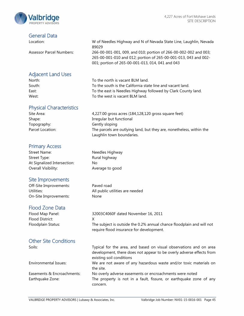
4,227 Acres of Fort Mohave Lands
SITE DESCRIPTION
VALBRIDGE PROPERTY ADVISORS | Lubawy & Associates, Inc. Valbridge Job Number: NV01-15-0016-001 Page 45
General Data Location: W of Needles Highway and N of Nevada State Line, Laughlin, Nevada
89029
Assessor Parcel Numbers: 266-00-001-001, 009, and 010; portion of 266-00-002-002 and 003;
265-00-001-010 and 012; portion of 265-00-001-013, 043 and 002-
001; portion of 265-00-001-013, 014, 041 and 043
Adjacent Land Uses North: To the north is vacant BLM land.
South: To the south is the California state line and vacant land.
East: To the east is Needles Highway followed by Clark County land.
West: To the west is vacant BLM land.
Physical Characteristics Site Area: 4,227.00 gross acres (184,128,120 gross square feet)
Shape: Irregular but functional
Topography: Gently sloping
Parcel Location: The parcels are outlying land, but they are, nonetheless, within the
Laughlin town boundaries.
Primary Access Street Name: Needles Highway
Street Type: Rural highway
At Signalized Intersection: No
Overall Visibility: Average to good
Site Improvements Off-Site Improvements: Paved road
Utilities: All public utilities are needed
On-Site Improvements: None
Flood Zone Data Flood Map Panel: 32003C4060F dated November 16, 2011
Flood District: X
Floodplain Status: The subject is outside the 0.2% annual chance floodplain and will not
require flood insurance for development.
Other Site Conditions Soils: Typical for the area, and based on visual observations and on area
development, there does not appear to be overly adverse effects from
existing soil conditions
Environmental Issues: We are not aware of any hazardous waste and/or toxic materials on
the site.
Easements & Encroachments: No overly adverse easements or encroachments were noted
Earthquake Zone: The property is not in a fault, fissure, or earthquake zone of any
concern.

4,227 Acres of Fort Mohave Lands
SITE DESCRIPTION
VALBRIDGE PROPERTY ADVISORS | Lubawy & Associates, Inc. Valbridge Job Number: NV01-15-0016-001 Page 46
Site Ratings Location: Average
Access: Good
Exposure: Average
Site Improvements: None
Overall Site Rating: Average
Zoning Designation Zoning Code: R-U, Rural Open Land
Zoning Jurisdiction: Clark County
General Plan Designation: OL, Open Land
Analysis/Comments on Site: The physical characteristics of the subject property include its present use (if any), accessibility and road
frontage, land contours and elevations, soils, views, land area, shape, availability of utilities, mineral
deposits, water rights associated with the property, easements, etc.
The subject property totals 4,227.00 acres and is being divided into two sites totaling 2,596 acres and
1,629 acres for appraisal, plus a 2.0-acre access easement. The sites have gently sloping topography, and
irregular but functional shapes. The sites are located along the west side of Needles Highway, beginning
2.6 miles south of existing development in Laughlin and extending 4.8 miles to the Nevada/California
state line.
There are no public water or sewer lines extended past existing development in Laughlin, but Laughlin
and the subject land are part of the 15,000-acre Fort Mohave Development lands sold by the federal
government in 1966 to the Nevada Colorado River Commission for expected community development.
Jordan Bunker with the Clark County Big Bend Water District indicated about 5,000 acre-feet of 15,000
acre-feet available to the Fort Mojave Development lands is currently being used in Laughlin, which leaves
10,000 acre-feet of water for future development.
The Laughlin sewer plant also has excess capacity, but even if it could handle all the added sewer
treatment needed to service development of all the subject land, a new sewer treatment plant may be
more cost effective than the cost of extending existing sewer lines miles to the subject land, and
constructing pump stations needed for changes in the land elevation. Water is also a concern, but up to
10,000 acre-feet is still available for development, and water lines and pump stations can be built,
although at a significant cost.
Other infrastructure construction would also need to be provided for any type of urban development, and
the infrastructure would be costly. The subject land is not in a FEMA-designated flood zone, but flood
control improvements would be expected to be needed to develop the land with homes and commercial
facilities.
The subject property has R-U zoning, Rural Open Land District, but because it is in the Fort Mohave
Development District, it is developable to mixed urban use. Also, because of an approved modification in
2010 to the original U.S. land patent by the U.S. Secretary of the Interior, the subject land can be
developed with solar power projects. After review, with appropriate infrastructure construction, the
subject land is concluded to be physically adequate to accommodate its legally permissible highest and
best use development potential.

4,227 Acres of Fort Mohave Lands
ZONING DESCRIPTION
VALBRIDGE PROPERTY ADVISORS | Lubawy & Associates, Inc. Valbridge Job Number: NV01-15-0016-001 Page 47
Zoning Information
Zoning Designation Zoning Code: R-U
Zoning Designation: Rural Open Land
Purpose: This district is established to provide for very low density
residential use and other appropriate uses of the vast areas of
rural land.
Permitted Uses Permitted uses include one single-family dwelling of a permanent character in a permanent location with
each residence on its own lot or parcel of land including all required yard areas. The single-family
dwelling may be a mobile home provided it is located not less than 100 feet from any other zoning
district boundary and provided the lot contains a minimum of 80,000 gross square feet. Accessory
buildings as well as farming and livestock farming are also permitted.
Development Regulations Minimum Area: The minimum area of any lot is 80,000 gross square feet.
Minimum Width: The minimum width of any lot is 200 feet.
Coverage: The floor area of the improvements shall not exceed 15% of the
total area of the lot.
Height: The height of a structure shall not exceed 35 feet.
Yards: The minimum setbacks are as follows:
Front: 50 Feet
Side: 15 Feet
Rear: 50 Feet

4,227 Acres of Fort Mohave Lands
ASSESSMENT & TAX DATA
VALBRIDGE PROPERTY ADVISORS | Lubawy & Associates, Inc. Valbridge Job Number: NV01-15-0016-001 Page 48
Assessment & Tax Data
Assessment Methodology Property taxes are based upon an appraisal of the property performed by the Clark County Assessor’s
Office. An appraisal is conducted every five years on properties located within Clark County and the
values are updated each year by an index computed by the State of Nevada Department of Taxation.
According to personnel at the Assessor’s Office, improved properties are appraised for taxable value
based upon the cost approach. This approach to value is performed by estimating the replacement cost
new of a property less depreciation of 1.5% per year of effective age, up to a maximum of 75%. State
Statute 361.227 indicates that the taxable value of the property must not exceed the current market value.
Since the cost approach in some instances may provide an indication higher than current market value,
the sales comparison approach and/or income capitalization approach may be used to establish the
taxable value of the property. Property taxes are calculated by multiplying 35% of the taxable value by
the tax rate.
Tax Rates The subject is within Tax District 107 (LAUGHLIN TOWN BIG BEND COLORADO RIVER), which has a
current tax rate of $3.34830 per $100.00 of assessed value for the 2014/15 tax year. The fiscal year starts
July 1st and ends on June 30
th of every year.
Please note that property tax increases were capped by Nevada Legislature Assembly Bill 489, which was
passed on April 6, 2005. The tax increase caps are 3% per year for a primary residence and 8% per year on
all other properties.
Assessed Values and Property Taxes The subject’s assessed values, applicable tax rates and total taxes including direct assessments are shown
in the following chart:
TAX YEAR TAX RATE
2014/15 $3.3483
2013/14 $3.3483
2012/13 $3.3483
2011/12 $3.3483

4,227 Acres of Fort Mohave Lands
ASSESSMENT & TAX DATA
VALBRIDGE PROPERTY ADVISORS | Lubawy & Associates, Inc. Valbridge Job Number: NV01-15-0016-001 Page 49
SUMMARY OF ASSESSED VALUES AND PROPERTY TAXES
Conclusions The taxes reflect the current assessed value and the tax rates that went into effect July 1, 2014. According
to the Clark County Assessor’s Office, the subject’s property taxes were exempt as of the date of value.
Tax rates have been stable and should increase at a moderate rate in the future. Please note that all of
the subject land has an assessed value of $525 per acre, which equates to an Assessor appraised value of
$1,500 per acre. However, the subject lands are exempt from property taxes, and the Assessor’s Office
noted that recent comparable sales to value the subject property have not occurred. The Assessor’s Office
indicated that the sales being used are at least a few years old, and are being revised annually on a rather
subjective basis.
Tax Year 2015
County Appraised Value
Subject 4,227 Acres
Land $6,340,500
Improvements $0
Taxable Value $6,340,500
Assessment Ratio 35.0%
Assessed Value $2,219,175
Tax Rate $3.3483
Tax Rate Per $100
Tax Amount $74,305
Special Assessments $0
Total Taxes $74,305
Payment Status Exempt
Amount Due $0

4,227 Acres of Fort Mohave Lands
HIGHEST & BEST USE
VALBRIDGE PROPERTY ADVISORS | Lubawy & Associates, Inc. Valbridge Job Number: NV01-15-0016-001 Page 50
Highest & Best Use
The Highest and Best Use of a property is the reasonably probable and legal use of vacant land or an
improved property that is: physically possible, appropriately supported, financially feasible, and that
results in the highest value.
Improved properties may have a highest and best use that is different than the existing use. The existing
use will generally continue however, until land value exceeds the total value of the property in its existing
use plus demolition costs.
Analysis of Highest and Best Use as if Vacant In determining the highest and best use of the property as though vacant, we focus on: 1) the existing
use, 2) a projected development, 3) a subdivision, 4) an assemblage, or 5) holding the land as an
investment.
Legally Permissible
The appraised site is zoned R-U, Rural Open Land, under the jurisdiction of Clark County. The R-U zoning
was “established for the vast areas of rural land to provide for a very low density residential use”. The R-U
zoning allows the following uses (some uses require a conditional use permit):
1. A permanent single family dwelling (including a manufactured home) on a minimum lot size of 2
acres.
2. Accessory, non-commercial uses permitted in conjunction with a residential dwelling for the use
and enjoyment of the family residing on the lot or parcel may include:
3. Agricultural and horticultural farming such as field crops, bush crops, orchards, vegetable
gardening, etc.;
4. Small livestock and domestic animal farming including cows, horses, goats, sheep, or similar
animals;
5. Poultry, rabbit, and chinchilla farming, aviaries, and apiaries;
6. Gravel pits, rock crushes, stone mills, and quarries;
7. Concrete or asphaltic batch plants;
8. Mines or mining operations;
9. Etc.
Besides the R-U zoning, the subject property is within the Mohave Development Area consisting of 15,000
acres sold by the Federal government to the Colorado River Commission of Nevada in 1966. The Patent
that transferred ownership to the Colorado River Commission indicates that use of the 15,000 acres is
restricted to those certain uses designated and described in the “Master Plan of the Fort Mojave
Development Area, but that the Secretary of the Interior “shall have the right at all times to waive this
covenant in whole or in part, at any time, under his own initiative or upon application by a party in
interest.’’ In other words, it appears the Fort Mohave land use master plan is flexible.
Between the subject property and the Laughlin community is the Big Bend of the Colorado State
Recreation Area which is Nevada’s newest state park (created in 1996), and the park is part of the 15,000
acre Fort Mohave Development Area. The park offers camping, fishing, picnicking, RV facilities, and a boat
launch, but visitor improvements in the park end nearly 2.6 miles north of the subject site.

4,227 Acres of Fort Mohave Lands
HIGHEST & BEST USE
VALBRIDGE PROPERTY ADVISORS | Lubawy & Associates, Inc. Valbridge Job Number: NV01-15-0016-001 Page 51
Of importance with regard to the Fort Mohave Development Area master plan and the subject is 2007
legislative action that placed the subject remote lands of the 15,000 acre development area under Clark
County ownership. As a result, Clark County now controls the Fort Mohave land south of the Big Bend of
the Colorado Park boundaries, and the subject land is now master planned for “Open Lands” use.
However, similar lands directly fronting Needles Highway and adjacent to the subject land are master
planned for Business and Design Research Park use, which allows a variety of commercial and industrial
use options. Other land like the subject land located south of Needles Highway is master planned for
Major Development Projects allowing a range of master planned development including a large
residential community.
Large Business and Design Research Parks and Major Projects are governed by development agreements
and by public facilities needs assessments that require developers to provide adequate development
infrastructure and community services as part of the development plan. Major developers are allowed
flexibility in their land use plans, which effectively would change the Fort Mohave master plan in terms of
layout of the land uses.
This point is emphasized in the Fort Mohave Valley Development Law adopted July 1, 2007 (NRS 427)
which indicates the Board of County Commissioners can authorize development either in accordance with
the original Fort Mojave Development Plan or in a way that constitutes an acceptable revision to the
master plan. Accordingly, Clark County’s Major Project approval process can allow a range of land use
layouts that would be revisions to the original Fort Mojave Development Plan.
When considering the subject land and its location, a Business and Design Research Park or Major
Projects use would likely be allowed, in accordance with the master planned uses of the other Fort
Mohave vacant land. However, any proposed use would require provision by the developer of adequate
water, sewer, and other infrastructure at the developer’s cost.
It is emphasized that Clark County wants development of the Fort Mohave lands to be of benefit to the
Laughlin community, to bring in jobs and new industry. To that end, Clark County in the recent past had
approved all 9,046 acres of vacant Fort Mohave land (including the subject land) for development of a
solar panel factory and a huge solar generation field that was proposed for development by ENN Energy
Holdings. That project fell through, but the potential for solar power generation on the Fort Mohave lands
is now on the radar of solar power companies.
Utility scale solar power projects are large, and a solar project use of the land is a long-term, if not
permanent commitment. With development of a solar project on the Fort Mohave land, that land will no
longer be available for Laughlin community expansion or for other commercial or industrial ventures. That
said, it is emphasized that power companies are required in most states to increase their percentage of
renewable energy output, and suitable locations to site new solar power, wind power, and geothermal
plants is becoming increasingly important.
Utility scale power projects require proximity to the power grid, suitable topography, favorable
government entitlement and assistance, favorable environmental impact studies, and adequate
infrastructure such as roads and electrical substations. Also, although the new Ivanpah Solar Electric
Generating Plant uses dry cooling to reduce total needed water consumption, the Nevada Solar One
(NSO) Plant on 400 acres in the Eldorado Valley uses 130 million gallons of water per year. Most solar
power projects use water like the NSO Plant because dry cooling systems have greater capital costs than
wet cooling systems, and wet cooling systems are more efficient.

4,227 Acres of Fort Mohave Lands
HIGHEST & BEST USE
VALBRIDGE PROPERTY ADVISORS | Lubawy & Associates, Inc. Valbridge Job Number: NV01-15-0016-001 Page 52
At any rate, the subject land has already been classified as a good location for solar power generation by
the USA and the Clark County governments, and by ENN, one of the world’s largest power companies.
ENN was unable to find a buyer for the solar power to be produced, but the subject land is in the vicinity
of the power line grid, which is necessary for solar power transmission. There are no other solar projects
near the subject property, but the Mohave Generating Station in Laughlin was a 1,580 megawatt power
plant that opened in 1971, then closed down in 2012 due to the projected $1 billion cost for new
pollution control. Power is also generated at the Davis Dam on the Colorado River a short distance
upstream from Laughlin. Consequently, there is infrastructure for power production, power storage, and
power transmission close to the subject site, but a buyer for the power is still unknown.
It is emphasized that solar power production is a much different legally permissible use than Laughlin
community expansion. It is also a use on the Fort Mohave land that is at the discretion of Clark County as
to whether or not it is approved for a specific solar company. As indicated, getting a buyer for the solar
power production was a problem for ENN, so just any power company being allowed to try it again likely
is not prudent.
Please note that as is, without appropriate infrastructure development, the site’s existing R-U zoning will
permit residential development at one unit per two acres of land. The R-U use is allowed to the property
owner because of the zoning, and at a minimum, the property has legally permissible R-U use potential.
In conclusion, the legally permissible use of the subject land is Laughlin community expansion with Major
Projects and Business and Design Research Parks when infrastructure can be financed and developed, and
when market demand for such uses can be demonstrated. Also, although solar power generation at the
subject location has encountered challenges in the past, it is a legally permissible use. As is, without
approval for Laughlin community expansion or solar power use, the land is developable as R-U zoned
low-density residential land.

4,227 Acres of Fort Mohave Lands
HIGHEST & BEST USE
VALBRIDGE PROPERTY ADVISORS | Lubawy & Associates, Inc. Valbridge Job Number: NV01-15-0016-001 Page 53
LAUGHLIN AREA LAND USE PLAN

4,227 Acres of Fort Mohave Lands
HIGHEST & BEST USE
VALBRIDGE PROPERTY ADVISORS | Lubawy & Associates, Inc. Valbridge Job Number: NV01-15-0016-001 Page 54
Physically Possible
The physical characteristics of the property that affect its possible use include, but are not limited to, its
location, street frontage, size, shape, street access, availability of utilities, easements/ encroachments, soils
and subsoils, and topography.
The subject property totals 4,227.00 acres and is being appraised divided into a 2,596-acre site, a 1,629-
acre site, and a 2.0-acre access easement. The sites have functional, generally rectangular shapes, level to
gently sloping topography, and they are not in a FEMA-designated flood zone. Access to the sites is from
paved Needles Highway, and community services are available in Laughlin and Bullhead City.
That said, public water and sewer lines are a minimum of 2.60 miles away from the subject land in
Laughlin, and although about 10,000 acre-feet per year of water remains available in the Laughlin water
system, and the sewer plant has excess capacity for sewer treatment, it is expected that water pump
stations and possibly a separate sewer treatment facility, along with other infrastructure, would need to be
constructed to support development of the subject property because of the higher elevation of the land
above Laughlin, the site’s large size, and its distance from Laughlin.
In the past, we have spoken with representatives of Focus Property Group, developer of master-planned
communities in the Las Vegas Valley, and it was indicated that at the outskirts of development, the cost of
providing infrastructure to their large-acreage planned communities (i.e. Mountains Edge, Lone Mountain,
etc.) typically ranged from $70,000 to $85,000 per acre. However, they also noted that the cost at the
Providence community was $95,000 per acre because of greater than anticipated infrastructure
requirements attributable to two water pressure zones requiring two water reservoirs, construction of two
major roadways, and storm drain facilities sufficient to keep all runoff water off the streets. The subject
site, like Providence, could have multiple water pressure zones.
Aside from the Focus Property Group input noted above, an article in the May 25, 2007 issue of the Las
Vegas Business Press indicated that for the Kyle Canyon master planned site, Focus and partners would
pay $1 million toward a new fire station, $3.5 million toward a new police substation, $10 million to build
a US 95 freeway interchange, and a total of around $300 million for infrastructure costs, or $185,240- per
acre for the 1,711.94 Kyle Canyon acres, and $213,271 per acre for the usable 1,406.66 acres.
The City of Henderson estimated the cost of providing basic infrastructure (not including extras the City
wanted the developer to provide) to a 1,940-acre parcel auctioned by the BLM in June 2004 for
development of the Inspirada master planned community at $158,416,206, or $81,658 per acre. The 1,940-
acre site required extensive utility line extensions along with construction of flood prevention facilities.
In 2007/2008 conversations the appraiser had with master planned community developers, the per acre
cost for outlying master planned community infrastructure had risen to an estimated $100,000 to
$125,000 per acre, but the infrastructure cost reported in the Las Vegas Business Press for the Kyle Canyon
Gateway project was above $125,000 per acre. It is possible that Focus Property Group and partners
infrastructure cost estimate was high (assuming the Las Vegas Business Press number was accurate)
because of the environmentally friendly approach the developer was taking to the project.
With all of the above considered, the appraisers are concluding that an infrastructure cost based on a
market typical approach to master planned community development, but also factoring in the physical
attributes of the subject land, and the fact that the land is not in the Las Vegas Valley but is instead tied to
the small Laughlin community, would possibly be $100,000 per acre, or $422,700,000 for 4,227 acres.

4,227 Acres of Fort Mohave Lands
HIGHEST & BEST USE
VALBRIDGE PROPERTY ADVISORS | Lubawy & Associates, Inc. Valbridge Job Number: NV01-15-0016-001 Page 55
Separate from Laughlin community expansion, the subject parcels are physically adequate for solar power
project development. The land has gently sloping topography, access from paved Needles Highway, close
proximity to Laughlin for employee residences and services, plenty of sun, and it is in a power grid zone.
In summary, the subject land is physically adequate for Laughlin community expansion, but would require
a large infrastructure cost investment to prepare the land for Major Project/Business and Design Research
Park development. Such an investment would not be warranted until demand for Major Project and
Business and Design Research Park development in the subject area can be demonstrated. Separately,
solar power project development is physically possible assuming a buyer for the power can be found.
Financially Feasible
After determining the uses that are physically possible and legally permissible, an appraiser considers the
uses that are likely to produce an adequate return on investment based on a cost/benefit analysis or
through direct market observation.
Financial feasibility of Laughlin community expansion with Major Projects and Business and Design
Research Park development is directly affected by supply and demand factors. Until the economy and real
estate market collapse in 2008, there had been several years of phenomenal ongoing population and
business growth in Southern Nevada that emanated out of the Las Vegas Valley to communities such as
Pahrump, Mesquite, and to a degree, Laughlin.
The 2007 through 2008 slowdown in the real estate market, which was exacerbated from 2008 on by tight
financing and a weak economy, will not last indefinitely. When a recovery does occur, the lack of
availability of developable land in Southern Nevada may again become a concern, and interest in areas
like Laughlin could grow.
Consequently, future Major Projects and Business and Design Research Park development of the subject
lands is projected to be financially feasible. Separately, a solar power project is also financially feasible if a
buyer for the power can be found.
Maximally Productive
Among the financially feasible uses, the use that results in the highest value (the maximally productive
use) is the highest and best use. Considering these factors, the maximally productive as though vacant use
is for Laughlin community expansion with Major Projects and Business and Design Research Park
development when the Laughlin economy, real estate market, and the financing market will allow.
Separately, development of solar power projects would trump Laughlin community expansion for
maximally productive use if a buyer for the solar power generated can be found.
Conclusion of Highest and Best Use as though Vacant
The conclusion to the highest and best use as though vacant, as analyzed in the previous sections, is for
Laughlin community expansion with Major Projects and Business and Design Research Park development
when the Laughlin economy, real estate market, and the financing market will allow. Because of the
uncertainty as to when the Laughlin economy and real estate market will improve, and given the large size
of the property and the lack of developed infrastructure in the subject area, a typical buyer of the subject
land for community expansion would likely be an investor. A buyer would want the land price to be low
enough to reflect the risk associated with holding and eventually developing or selling such a large site in
such a relatively small population area like that of Laughlin at an adequate profit.

4,227 Acres of Fort Mohave Lands
HIGHEST & BEST USE
VALBRIDGE PROPERTY ADVISORS | Lubawy & Associates, Inc. Valbridge Job Number: NV01-15-0016-001 Page 56
Separately, development of solar power projects would trump Laughlin community expansion as the
concluded to highest and best use if a buyer for the solar power generated can be found. Laughlin
community expansion and solar power generation are not similar uses of the land, and the current market
value of the land for the two uses is not interchangeable, and cannot be realistically blended. The land
buyer market for the two uses is different.
Most Probable Buyer/User As of the date of value, the most probable buyer of the subject property for Laughlin community
expansion is an investor and the most probable user would be someone willing to hold the land for
development until the Laughlin market can demonstrate demand for growth. Separately, a solar power
project developer would be the most probably buyer, if a buyer for the solar power generated can be
found.

4,227 Acres of Fort Mohave Lands
APPRAISAL METHODOLOGY
VALBRIDGE PROPERTY ADVISORS | Lubawy & Associates, Inc. Valbridge Job Number: NV01-15-0016-001 Page 57
Appraisal Methodology
Three Approaches to Value There are three of the traditional approaches to estimating real property value: the cost, sales comparison,
and income capitalization approaches.
Cost Approach
The cost approach is based upon the principle of substitution, which states that a prudent purchaser
would not pay more for a property than the amount required to purchase a similar site and construct
similar improvements without undue delay, producing a property of equal desirability and utility. This
approach is particularly applicable when the improvements being appraised are relatively new or when
the improvements are so specialized that there is little or no sales data from comparable properties.
Sales Comparison Approach
The sales comparison approach involves the direct comparison of sales and listings of similar properties,
adjusting for differences between the subject property and the comparable properties. This method can
be useful for valuing general purpose properties or vacant land. For improved properties, it is particularly
applicable when there is an active sales market for the property type being appraised – either by owner-
users or investors.
Income Capitalization Approach
The income capitalization approach is based on the principle of anticipation, or the assumption that value
is created by the expectation of benefits to be derived in the future, such as expected future income flows.
Its premise is that a prudent investor will pay no more for the property than he or she would for another
investment of similar risk and cash flow characteristics. The income capitalization approach is widely used
and relied upon in appraising income-producing properties, especially those for which there is an active
investment sales market.
Subject Valuation The subject property is vacant land and the Sales Comparison Approach was used in forming an opinion
of the value of the property. The Cost and Income Capitalization Approaches were not used as those
approaches are not typically applicable to valuing vacant land.

4,227 Acres of Fort Mohave Lands
LAND VALUATION FOR LAUGHLIN COMMUNITY DEVELOPMENT
VALBRIDGE PROPERTY ADVISORS | Lubawy & Associates, Inc. Valbridge Job Number: NV01-15-0016-001 Page 58
Land Valuation For Laughlin Community
Development
Methodology Land is valued using the Sales Comparison Approach. This approach is based on the premise that a buyer
would pay no more for a specific property than the cost of obtaining a property with the same utility. In
the sales comparison approach, the opinion of market value is based on closed sales, listings, and
pending sales of properties similar to the subject property.
A systematic procedure for applying the sales comparison approach includes the following steps: (1)
researching and verifying transactional data, (2) selecting relevant units of comparison, (3) analyzing and
adjusting the comparable sales for differences in various elements of comparison, and (4) reconciling the
adjusted sales into a value indication for the subject site.
Unit of Comparison
The unit of comparison depends on land use economics and how buyers and sellers use the property. The
unit of comparison in this analysis is price per gross acre.
Elements of Comparison
Elements of comparison are the characteristics of properties and transactions that cause the prices of real
estate to vary. The main elements of comparison in sales comparison analysis are as follows: (1) real
property rights conveyed; (2) financing terms; (3) conditions of sale; (4) expenditures made immediately
after purchase; (5) market conditions; (6) location; (7) physical characteristics; (8) economic characteristics;
(9) zoning/use; and (10) non-realty components of value.
Comparable Sales Data
The land sales data was derived from a search of data sources and public records, a field survey, and
interviews with knowledgeable real estate professionals.
Please note that there are two distinct land use conclusions for the subject land with one being
community development land for Laughlin’s future growth, and the other use being for solar power
project development as authorized recently by the U.S. Secretary of the Interior. This first section of the
valuation will provide an opinion of value of the subject land for future growth of Laughlin.
This first section of the valuation is presented to value the subject land for Laughlin community expansion
with Major Projects and Business and Design Research developments. A separate valuation for solar
power projects will follow this section of the report.
We used five sales in our analysis, which are the most useful in developing an opinion of market value.
These sales are summarized in a table on the next page, followed by a location map. Following those are
comparable sales sheets with additional data and a discussion of the specific adjustments.

4,227 Acres of Fort Mohave Lands
LAND VALUATION FOR LAUGHLIN COMMUNITY DEVELOPMENT
VALBRIDGE PROPERTY ADVISORS | Lubawy & Associates, Inc. Valbridge Job Number: NV01-15-0016-001 Page 59
COMPARABLE LAND SALES SUMMARY-LAUGHLIN COMMUNITY DEVELOPMENT
Subject Sale # 1 Sale # 2 Sale # 3 Sale # 4 Sale # 5
Address
W of Needles
Highway and N of
Nevada State Line
E of Bullhead
Pkwy, N of
La Paloma Dr
W of
Bullhead
Pkwy @
Laughlin
Ranch
Inters.
W of I-10, S of
Curtis Rd
S of
Baumgartner
Rd, W of I-10
Rocky
Road/Hyder
Rd Inter.@
Oatman Mtn
City Laughlin Bullhead City Bullhead City Eloy Eloy Maricopa
Sale Price N/A $375,000 $235,000 $1,470,912 $4,469,959 $550,000
Recording Date N/A 3/1/2012 7/1/2012 2/13/2013 4/25/2013 7/16/2013
Adjusted Sale Price N/A $375,000 $235,000 $1,470,912 $4,469,959 $550,000
Land Sq Ft 184,128,120 13,939,200 6,162,869 160,170,120 389,382,840 27,878,400 Price / SF of Land N/A $0.03 $0.04 $0.01 $0.01 $0.02
Land Acres 4,227.000 320.000 141.480 3,677.000 8,939.000 640.000 Price / Acre N/A $1,172 $1,661 $400 $500 $859
Zoning Code R-U R1L M2 PAD PAD AG
Zoning Description Rural Open LandSingle Family
ResidentialIndustrial
Planned Area
Development
Planned Area
DevelopmentAgriculture

4,227 Acres of Fort Mohave Lands
LAND VALUATION FOR LAUGHLIN COMMUNITY DEVELOPMENT
VALBRIDGE PROPERTY ADVISORS | Lubawy & Associates, Inc. Valbridge Job Number: NV01-15-0016-001 Page 60
COMPARABLE SALES MAP

4,227 Acres of Fort Mohave Lands
LAND VALUATION FOR LAUGHLIN COMMUNITY DEVELOPMENT
VALBRIDGE PROPERTY ADVISORS | Lubawy & Associates, Inc. Valbridge Job Number: NV01-15-0016-001 Page 61
Land Comparable 1
Transaction Information
Status: Closed
Recording Date: March 1, 2012
Recording #: 2012:011096
Sale Price: $375,000
Adjusted Sales Price: $375,000
Grantor: First Regional Bank
Grantee: Bullhead 320 LLP (et al)
Property Rights
Rights Conveyed: Fee Simple
Financing: All Cash to Seller
Conditions of Sale: Arm's Length
Marketing Time (Days): 270
Price Per Gross Acre: $1,172
Price Per Gross SF: $0.03
Property Type: Land
Property Sub-Type: Land
Location: E of Bullhead Pkwy, N of
La Paloma Dr, Bullhead
City, Arizona 86429
County: Mohave
Tax ID/APN: 348-01-038
Confirmed With: Bill Barnes, listing broker
(928-716-1522)
Confirmed By: Kendal Stewart
Land Description
Gross Acres: 320.00
Gross SF: 13,939,200
Zoning: R1L, Single Family
Residential
Zoning Jurisdiction: Bullhead City
Utilities: All are to the site
Off-Sites: Paved Streets
On-Sites: None-Development Plan
was in place
Frontage: 2,640
Shape: Rectangular
Topography: Low mountain
In Flood Plain: No
Encumb./Easements: Typical assumed
Proposed Improvements
Proposed Use: Single Family Residential
Highest & Best Use: Residential
Comments: The site is adjacent to a developed subdivision in Bullhead City. The property is in the
area of the Laughlin Ranch master planned community totaling 11,000 acres, that was expected to bring
44,000 new residents to Bullhead City (The city had 35,000 residents when the master plan was approved).
Laughlin Ranch has a high end golf course community, where custom home lots were expected to sell for
$180,000 to $350,000, and a few airplanes were purchased by the developer to fly prospective buyers in
three times a week form Scottsdale, Arizona and Riverside, California. The developer ended up losing
Laughlin Ranch in foreclosure when the economy collapsed, but the parts of the community that were
developed are well conceived and of good quality. This was a bank owned site that sold at a fair market
price. When sold, the site was approved for 720 single-family lots in a subdivision known as Big Horn
Ranch that overlooks Bullhead City. The property sold with 570 prepaid sewer connection fees, a water
and waste water design, and a grading plan completed.

4,227 Acres of Fort Mohave Lands
LAND VALUATION FOR LAUGHLIN COMMUNITY DEVELOPMENT
VALBRIDGE PROPERTY ADVISORS | Lubawy & Associates, Inc. Valbridge Job Number: NV01-15-0016-001 Page 62
Land Comparable 2
Transaction Information
Status: Closed
Recording Date: July 1, 2012
Recording #: 2012:053369
Sale Price: $235,000
Adjusted Sales Price: $235,000
Grantor: Chafford, Inc.
Grantee: Arena, LLC
Property Rights
Rights Conveyed: Fee Simple
Financing: All Cash to Seller
Conditions of Sale: Arm's Length
Marketing Time (Days): Not Available
Price Per Gross Acre: $1,661
Price Per Gross SF: $0.04
Property Type: Land
Property Sub-Type: Land
Location: W of Bullhead Pkwy @
Laughlin Ranch Inters.,
Bullhead City, Arizona
86429
County: Mohave
Tax ID/APN: 213-14-071
Confirmed With: Ann Pettit, Bullhead City
Realtor (928-763-2288)
Confirmed By: Kendal Stewart
Land Description
Gross Acres: 141.48
Gross SF: 6,162,869
Zoning: M2, Industrial
Zoning Jurisdiction: Bullhead City
Utilities: All are near the site
Off-Sites: Paved Street
On-Sites: Grading
Frontage: 1,600
Shape: Irregular
Topography: At and below grade
In Flood Plain: No
Encumb./Easements: Typical assumed
Proposed Improvements
Proposed Use: Unknown
Highest & Best Use: Business Park/Industrial
Comments: Roughly 20% of this site is in an eroded wash that is, nonetheless, not in a flood zone. The
remaining acreage is well graded, and utility lines are nearby. The Bullhead City Airport is also nearby, as is
the city's commercial district. This site sold at a fair market price.

4,227 Acres of Fort Mohave Lands
LAND VALUATION FOR LAUGHLIN COMMUNITY DEVELOPMENT
VALBRIDGE PROPERTY ADVISORS | Lubawy & Associates, Inc. Valbridge Job Number: NV01-15-0016-001 Page 63
Land Comparable 3
Transaction Information
Status: Closed
Recording Date: February 13, 2013
Recording #: 014480
Sale Price: $1,470,912
Adjusted Sales Price: $1,470,912
Grantor: Don and Sherry England
Grantee: Verma La Osa Ranch I-
10/Sasco Road.
Property Rights
Rights Conveyed: Fee Simple
Financing: Seller Financing
Conditions of Sale: Arm's Length
Marketing Time (Days): Not Availabe
Price Per Gross Acre: $400
Price Per Gross SF: $0.01
Property Type: Land
Property Sub-Type: Land
Location: W of I-10, S of Curtis Rd,
Eloy, Arizona 85231
County: Pinal
Tax ID/APN: 408-11-037; 409-01-014A
&014B; 409-06-006, 009,
011, 012, 014, 016; 409-
07-001 Thru 006, 007A,
007B; 409-11-007; 410-
01-002E, 003A
Confirmed With: Kirk McCarville, Land
Advisors Org. (480-483-
8100)
Confirmed By: Kendal Stewart
Land Description
Gross Acres: 3,677.00
Gross SF: 160,170,120
Zoning: PAD, Planned Area
Development
Zoning Jurisdiction: Pinal County
Utilities: All are needed
Off-Sites: Graded Roads
On-Sites: None
Frontage: 10,560
Shape: Irregular
Topography: Level to Rolling
In Flood Plain: No
Encumb./Easements: No adverse easements
and encroachments are
noted
Proposed Improvements
Proposed Use: Ranching
Highest & Best Use: Ranching
Comments: This site is outside Eloy, Arizona, and it is alongside the Santa Cruz River. The buyer of
this land is an Arizona land investor, who has large land holdings. He buys raw land for resell at a profit to
farmers and ranchers, developers of solar fields, and developers of urban communities and commercial
districts. According to the listing agent, Kirk McCarville, the price paid was a fair market price.

4,227 Acres of Fort Mohave Lands
LAND VALUATION FOR LAUGHLIN COMMUNITY DEVELOPMENT
VALBRIDGE PROPERTY ADVISORS | Lubawy & Associates, Inc. Valbridge Job Number: NV01-15-0016-001 Page 64
Land Comparable 4
Transaction Information
Status: Closed
Recording Date: April 25, 2013
Recording #: 036554
Sale Price: $4,469,959
Adjusted Sales Price: $4,469,959
Grantor: W Holdings
Grantee: Ronella T. White
Property Rights
Rights Conveyed: Fee Simple
Financing: All Cash to Seller
Conditions of Sale: Arm's Length
Marketing Time (Days): Not Available
Price Per Gross Acre: $500
Price Per Gross SF: $0.01
Property Type: Land
Property Sub-Type: Land
Location: S of Baumgartner Rd, W
of I-10, Eloy, Arizona
85231
County: Pinal
Tax ID/APN: 409-06-007, 008, 013;
409-11-005, 013C, 003D,
002D, 006C, 004, 015A,
015B, 016, 017, 018, 019;
409-14-002A, 002C, 001,
003A, 003B, 003C, etc.;
409-12-002; 409-16-001A,
001B, 001C; 409-17-002
Confirmed With: Jack Doughty, listing
agent (602-248-8335)
Confirmed By: Kendal Stewart
Land Description
Gross Acres: 8,939.00
Gross SF: 389,382,840
Zoning: PAD, Planned Area
Development
Zoning Jurisdiction: Pinal County
Utilities: All are needed
Off-Sites: Graded Roads
On-Sites: None
Frontage: 10,560
Shape: Irregular
Topography: Level to Rolling
In Flood Plain: No
Encumb./Easements: No adverse easements
and encroachments are
noted
Proposed Improvements
Proposed Use: Ranching
Highest & Best Use: Ranching
Comments: This site is outside Eloy, Arizona, alongside the Santa Cruz River. The site was at one time
considered for master planned community development, but, according to a real estate agent involved in
the transaction, the site is on the wrong side of the river with regard to available infrastructure and flood
zone issues. The buyer of this property is a rancher. According to the listing agent, the price was a fair
market price.

4,227 Acres of Fort Mohave Lands
LAND VALUATION FOR LAUGHLIN COMMUNITY DEVELOPMENT
VALBRIDGE PROPERTY ADVISORS | Lubawy & Associates, Inc. Valbridge Job Number: NV01-15-0016-001 Page 65
Land Comparable 5
Transaction Information
Status: Closed
Recording Date: July 16, 2013
Recording #: 130648038
Sale Price: $550,000
Adjusted Sales Price: $550,000
Grantor: Laurie Kirkpatrick et al
Grantee: Mad Dog Valley, LLC
Property Rights
Rights Conveyed: Fee Simple
Financing: All Cash to Seller
Conditions of Sale: Arm's Length
Marketing Time (Days): Not Available
Price Per Gross Acre: $859
Price Per Gross SF: $0.02
Property Type: Land
Property Sub-Type: Land
Location: Rocky Road/Hyder Rd
Inter.@ Oatman Mtn,
Maricopa County, Arizona
85260
County: Maricopa
Tax ID/APN: 401-82-001
Confirmed With: Kirk McCarville, listing
agent @ Land Advisors
(480-483-8100)
Confirmed By: Kendal Stewart
Land Description
Gross Acres: 640.00
Gross SF: 27,878,400
Zoning: AG, Agriculture
Zoning Jurisdiction: Maricopa County
Utilities: All are needed
Off-Sites: Paved Road
On-Sites: None
Frontage: 5,280
Shape: Square
Topography: Mountainous
In Flood Plain: No
Encumb./Easements: No adverse easements
and encroachments are
noted
Proposed Improvements
Proposed Use: Weapons Testing
Highest & Best Use: Ranching/Recreation
Comments: This site is mostly on the slopes of the Oatman Mountains. Railroad tracks cross the
northwest corner of the site, but have little impact on the use potential of the parcel. The site is 25 miles
northwest of the Gila Bend community, and 15 miles north of I-8. The buyer of this site is Dillon Aero
Systems, a manufacturer of gattling guns (machine guns) for military use. The company bought this site
for machine gun testing.

4,227 Acres of Fort Mohave Lands
LAND VALUATION
VALBRIDGE PROPERTY ADVISORS | Lubawy & Associates, Inc. Valbridge Job Number: NV01-15-0016-001 Page 66
Land Sales Comparison Analysis We analyzed the sales and made adjustments for differences in the elements of comparison listed above.
The comparable sales are adjusted to the subject: if the comparable sale was superior to the subject, we
applied a negative adjustment to the comparable sale. A positive adjustment to the comparable property
applied if it was inferior to the subject. A summary of the elements of comparison follow.
Transaction Adjustments These items are applied prior to the application of property adjustments. Transaction adjustments include
1. Real Property Rights Conveyed
2. Financing Terms
3. Conditions of Sale
4. Expenditures Made Immediately After Purchase
5. Market Conditions
The adjustments are discussed as follows:
Real Property Rights Conveyed
Before a comparable sale property can be used in the Sales Comparison Approach, the appraiser must
first ensure that the sale price of the comparable property applies to property rights that are similar to
those being appraised. In the case of the subject property, a fee simple interest is being appraised. All of
the sales should reflect a similar interest or an adjustment would be required for this element of
comparison.
The subject site has been analyzed based on fee simple ownership. All of the comparable sales involved
transfers of fee simple rights, and therefore, no adjustments were needed for real property rights
conveyed.
Financing Terms
The transaction price of one property may differ from that of an identical property due to different
financial arrangements. All of the sales used should involve typical market terms by which the sellers
received cash or its equivalent and the buyers tendered typical down payments and obtained
conventional financing at market terms for the balance. If otherwise, an adjustment would be required for
this element of comparison.
For this analysis, the subject property has been valued based upon cash equivalent terms. All of the sale
transactions were found to have been negotiated with financing that was either on an “all cash” basis or
financing that did not influence the sales price. Therefore, no adjustment for financing was considered
necessary.
Conditions of Sale
When the conditions of sale are atypical, the result may be a price that is higher or lower than that of a
normal transaction. Adjustments for conditions of sale usually reflect the motivations of either a buyer or
a seller who is under duress to complete the transaction. Another more typical condition of sale involves
the downward adjustment required to a comparable property’s for-sale listing price, which usually reflects
the upper limit of value. All of the comparable sales should involve typical conditions for closed
transactions, or an adjustment would be required for this element of comparison.

4,227 Acres of Fort Mohave Lands
LAND VALUATION
VALBRIDGE PROPERTY ADVISORS | Lubawy & Associates, Inc. Valbridge Job Number: NV01-15-0016-001 Page 67
The comparable sales used in this analysis represent arm’s length transactions with no adverse conditions
affecting the sales. Therefore, no adjustment for conditions of sale is necessary.
Expenditures Made Immediately After Purchase
A knowledgeable buyer considers expenditures that will have to be made upon purchase of a property
because these costs affect the price the buyer agrees to pay. Such expenditures may include: (1) costs to
demolish and remove any portion of the improvements, (2) costs to petition for a zoning change, and/or
(3) costs to remediate environmental contamination. The relevant figure is not the actual cost that was
incurred but the cost that was anticipated by both the buyer and seller. Unless the sales involved
expenditures made immediately after purchase, no adjustments to the comparable sales are required for
this element of comparison.
None of the sales required expenditures after purchase and, therefore, no adjustments were necessary.
Market Conditions
Market conditions may change between the time of sale of a comparable property and the date of the
appraisal of the subject property. Changes in market conditions may be caused by inflation, deflation,
fluctuations in supply and demand, or other factors. Market conditions that change over time create the
need for an adjustment. If market conditions have changed, an adjustment would be required for this
element of comparison.
The comparable sales occurred from March 2012 to July 2013, which was after the dramatic decline in real
estate pricing from late 2008 through 2009, and after prices had bottomed out and began showing
stability. The appraiser spoke with Kirk McCarville with Land Advisors Organization, and Mr. McCarville has
30 years of experience as a real estate broker and agent in Arizona. His specialty is large acreage land
brokerage for agricultural, ranching, and investment entities. He has handled over $200 million in real
estate sales, and he is an expert in large acreage brokerage. He was involved with the 2013 sales used as
comparable sales to value the subject land, and it is his opinion that the sale prices in 2012 and 2013 are
reflective of current market conditions for land like the subject. Consequently, an adjustment for market
conditions was not concluded to be necessary, and no adjustment was made.
Property Adjustments Property adjustments are usually expressed quantitatively as percentages that reflect the increase or
decrease in value attributable to the various characteristics of the property. These adjustments are based
on locational and physical characteristics and are applied after the application of transaction adjustments.
The adjustments include:
1. Location
2. Physical Characteristics
3. Encumbrance or Easements
4. Zoning/Use
Location
Location adjustments may be required when the locational characteristics of a comparable property are
different from those of the subject property. These include, but are not limited to, general neighborhood
characteristics, freeway accessibility, street exposure, corner versus interior lot location, neighboring
properties, view amenities, and other factors.

4,227 Acres of Fort Mohave Lands
LAND VALUATION
VALBRIDGE PROPERTY ADVISORS | Lubawy & Associates, Inc. Valbridge Job Number: NV01-15-0016-001 Page 68
The subject property is located a few miles south of existing development in Laughlin, and it is 100 miles
south of Las Vegas. Comparable Sales 3, 4, and 5 are considered to be similar in location to the subject
when considering development appeal anytime soon, and no adjustments are needed for these three
sales.
Sales 1 and 2 are located in Bullhead City and they have direct or very close access to all public utilities.
They are sites that have appeal for near term development when the Bullhead City market adequately
improves, and when comparing these two sales to the other sales, an adjustment is concluded to be in
order. After the size adjustment discussed later, an adjustment for location for Sales 1 and 2 was analyzed
by making the following sales comparisons:
($1,172/AC Sale 1 - $640/AC Sale 3) ÷ $1,172 = 45%
($1,172/AC Sale 1 - $800/AC Sale 4) ÷ $1,172 = 32%
($1,661/AC Sale 2 - $640/AC Sale 3) ÷ $1,661= 61%
($1,661/AC Sale 2 - $800/AC Sale 4) ÷ $1,661= 52%
The difference in price ranges from 32% to 61%. After consideration, an adjustment of 45% was selected
as supportable and applied as a downward adjustment to Sales 1 and 2.
Physical Characteristics
If the physical characteristics of a comparable property and the subject property differ, each of the
differences may require comparison and adjustment to the comparable. The most notable physical
differences for comparable sales in this market include size, shape, utility availability, offsites/onsites,
topography, and flood hazards.
Size
Typically, the price per square foot of a smaller parcel will be higher than the sales price per square foot of
a larger parcel. This assumption is based upon the principle of “economy of scale”, which is predicated
upon the inverted relationship between size and price. Conversely, the smaller the size of a site, the
higher the price (per square foot). Adjustments for size are considered when there is a wide range
between the comparable sales and the subject site.
The subject parcels total 2,596 acres and 1,629 acres, while the sales range from 141.48 to 8,939.92 acres.
For marketability based on size, it is the appraiser’s opinion that the subject sites fall between the 640-
acre sale and the 8,939.92-acre sale and the difference in price between the three sales in this range is as
follows:
($859/AC Sale 5 - $400/AC Sale 3) ÷ $400 = 115%
($859/AC Sale 5 - $500/AC Sale 4) ÷ $500 = 72%
($859/AC Sale 5 - $400/AC Sale 3) ÷ $859= 53%
($859/AC Sale 5 - $500/AC Sale 4) ÷ $859 = 42%
The percentage difference in price between the two large sales (Sales 3 and 4) and the smaller sale (Sale
5) is 72% to 115% upward. Since the larger sales and the smaller sale are all being adjusted for size to
reflect the sizes of the subject sites between the range of 640 to 8,939.92 acre sales, the 72% to 115%
midpoint is 93.5%, and half of the 93.5% equates to 46.75%. The 46.75% is being correlated to 45% and
applied as an upward adjustment to Sales 3 and 4.
4,227 Acres of Fort Mohave Lands
LAND VALUATION
VALBRIDGE PROPERTY ADVISORS | Lubawy & Associates, Inc. Valbridge Job Number: NV01-15-0016-001 Page 69
The percentage difference in price downward for the smaller sale is 42% to 53% with a midpoint of 47.5%,
and half of the 47.5% equates to 23.75%. The 23.75% is being correlated to 25% and applied as a
downward adjustment to Sale 5.
Shape
The analysis of shape takes into consideration a particular site’s dimensions, street frontage, width and
depth, and shape. It relates to the “principle of functional utility”. For example, an odd-shaped parcel
may be appropriate for a dwelling; however, it may be unacceptable for most types of commercial or
industrial uses. Generally, odd-shaped parcels will have less utility and, consequently, the sales prices are
lower than for parcels that have full functional utility.
The subject sites have functional shapes, and the comparable sales also have functional shapes. Therefore,
no adjustments were necessary.
Corner Influence
Parcels with a corner influence typically sell at a higher unit price than parcels without a corner influence.
This is especially true for commercial properties that require exposure which is increased by having
frontage along two streets. Adjustments for corner influence are derived from the pairing of two
properties which are similar, except one has a corner influence while the other does not.
For properties large in sizes like the subject property and the comparable sales and listings, corner
exposure is not concluded to influence pricing. Therefore, no adjustments are necessary.
Utility/Offsites/Onsites
The offsite adjustment takes into consideration certain infrastructure, such as utilities and services that are
available to a particular site. Additionally, the quality, condition, and adequacy of the sewer, curbs, and
access to utility hookups can influence the sales price of a particular property.
The subject property is a minimum of 2.60 miles away from water and sewer lines in Laughlin and capital
costs to extend the lines and/or construct needed water and sewer service facilities would be significant.
Marty Flynn with the Clark County Water Reclamation District indicated it would be preferable that a
developer of the subject land tie into the existing sewer treatment facilities because there is excess
capacity. However, because of miles of distance to extend the line, along with up and down terrain and
elevation differences, there is uncertainty internally with Water Reclamation personnel as to what would
be the most cost effective way to provide sewer service to the subject land. Mr. Flynn said the developer’s
engineers would need to determine the most cost effective solution, which might be a new treatment
plant for the subject land. Trying to use the existing plant would require pumping stations and a lot of
pipe.
Jordan Bunker with Clark County’s Big Bend Water District indicated Laughlin still has 10,000 of a total of
15,000 acre-feet of water available for use, but getting the water to the subject land will require miles of
pipe and pump stations. Finally, Andrew Trelease with the Clark County Flood Control District said a
District drawing of a flood control system on the subject land is only conceptual and meant to show that
development would require some sort of drainage mitigation. He said land on the east and west sides of
Needles Highway can be handled independently for drainage mitigation, and a solar panel array laid out
over the contours of the land on the west side of Needles Highway, with minimal need for drainage
mitigation, should not be an issue for developing the east side of Needles Highway with a master planned
community. However, no matter the type of development planned, drainage mitigation will still need to
be addressed to some degree.

4,227 Acres of Fort Mohave Lands
LAND VALUATION
VALBRIDGE PROPERTY ADVISORS | Lubawy & Associates, Inc. Valbridge Job Number: NV01-15-0016-001 Page 70
Please note that distance from Needles Highway for the two subject parcels is not considered to be a
factor for adjustment under the assumption public water and sewer lines would be extended along the
highway frontage. It is unknown where a distribution water line would be located since achieving
elevation for water tank storage could occur immediately after rising out of the Laughlin valley to the
subject land, which would make the farthest out subject site closest to the tank. Also, as indicated, it is not
known whether building a new sewer plant would be more cost effective than trying to use the existing
Laughlin sewer plant up and down miles away. Consequently, a new sewer plant might be built on the
mesa where the subject parcels are located, with pipeline routing in association with the new plant.
Topography/Flood Zone
This adjustment considers each comparable in relation to the subject concerning land contours, grades,
natural drainage, soil conditions, view, and general physical usability. The subject property is gently
sloping, and will be at grade with any future access or onsite roads, and it is not in a flood zone. All of the
comparables are similar to the subject, and therefore no adjustments for topography/flood zone were
required.
Environmental Concerns
There are no environmental concerns affecting the subject property or the sales, and no adjustments are
necessary.
Encumbrance or Easements
The subject property and the sales do not have any encumbrances or easements that would negatively
affect their market value and no adjustments are needed.
Zoning/Use
The highest and best use of comparable sale properties should be very similar as that of the subject
property. When comparable properties with the same zoning as the subject are lacking or scarce, parcels
with slightly different zoning but a highest and best use similar to that of the subject may be used as
comparable sales. These sales may have to be adjusted for differences in utility if the market indicates that
this is appropriate.
The subject and the sales are all large development sites with similar types of land use allowed, and no
adjustments are necessary.
Please note that Sales 1 and 2 are within Bullhead City when utilities and infrastructure are readily
available. However, any needed adjustment is considered to have been included in the previous location
adjustment.
Also, please note that Sale 3 was purchased to test machine guns for military use on helicopters,
Humvees, and boats, and firing machine guns requires clearly an appropriate site where such use is
approvable. It seems possible that the buyer for Sale 3 did not aggressively negotiate the sale price, but
the real estate agent involved in the transaction did not indicate to the appraiser that the price was high.
Therefore, no adjustment is considered necessary.
Summary of Adjustments Based on the preceding comparative analysis, we have summarized adjustments to the comparable sales
on the following table. We performed a quantitative analysis. These adjustments are based on our best
judgment and experience in the appraisal of similar properties.

4,227 Acres of Fort Mohave Lands
LAND VALUATION
VALBRIDGE PROPERTY ADVISORS | Lubawy & Associates, Inc. Valbridge Job Number: NV01-15-0016-001 Page 71
COMPARABLE LAND SALES ADJUSTMENT GRID
Subject Sale # 1 Sale # 2 Sale # 3 Sale # 4 Sale # 5
Address
W of Needles
Highway and N
of Nevada
State Line
E of Bullhead
Pkwy, N of La
Paloma Dr
W of Bullhead
Pkwy @
Laughlin Ranch
Inters.
W of I-10, S of
Curtis Rd
S of
Baumgartner
Rd, W of I-10
Rocky
Road/Hyder Rd
Inter.@
Oatman Mtn
City Laughlin Bullhead City Bullhead City Eloy EloyMaricopa
County
Land Area in Acres 4,227.000 320.000 141.480 3,677.000 8,939.000 640.000
Flood Zone XX and Shaded
X
X and Shaded
XX X X
Shape Irregular Rectangular Irregular Irregular Irregular SquareUtilities Description All public All are to the All are near the All are needed All are needed All are neededSite Improvements None None- Grading None None NoneRecording Date N/A 3/1/2012 7/1/2012 2/13/2013 4/25/2013 7/16/2013Sale Price N/A $375,000 $235,000 $1,470,912 $4,469,959 $550,000 Unadjusted Price/Acre N/A $1,172 $1,661 $400 $500 $859
Property Rights $0 $0 $0 $0 $0Adjusted Price/Acre $1,172 $1,661 $400 $500 $859
Terms/Financing $0 $0 $0 $0 $0Adjusted Price/Acre $1,172 $1,661 $400 $500 $859
Conditions of Sale $0 $0 $0 $0 $0Adjusted Price/Acre $1,172 $1,661 $400 $500 $859
Expenditures After Purchase $0 $0 $0 $0 $0Adjusted Price/Acre $1,172 $1,661 $400 $500 $859
Market Conditions Through 2/14/2015 $0 $0 $0 $0 $0Adjusted Price/SF $1,172 $1,661 $400 $500 $859
Location -$527 -$747 $0 $0 $0Size $0 $0 $240 $300 -$215Topography/Flood Hazard $0 $0 $0 $0 $0Utilities/Offsites/Onsites $0 $0 $0 $0 $0Corner Influence $0 $0 $0 $0 $0Shape $0 $0 $0 $0 $0Encumbrance/Easements $0 $0 $0 $0 $0Use/Zoning $0 $0 $0 $0 $0Economic Characteristics $0 $0 $0 $0 $0Non-Realty Components $0 $0 $0 $0 $0
Total Adjustments -$527 -$747 $240 $300 -$215
Adjustments After Market Conditions
Net % Adjustments -45.0% -45.0% 60.0% 60.0% -25.0%
Net $ Adjustments -$527.00 -$747.00 $240.00 $300.00 -$215.00
Gross % Adjustments 45.0% 45.0% 60.0% 60.0% 25.0%
Gross $ Adjustments $527.00 $747.00 $240.00 $300.00 $215.00
Adjusted Price/Acre $645 $914 $640 $800 $644

4,227 Acres of Fort Mohave Lands
LAND VALUATION
VALBRIDGE PROPERTY ADVISORS | Lubawy & Associates, Inc. Valbridge Job Number: NV01-15-0016-001 Page 72
Conclusion From the market data available, several sales in competitive market areas were selected as most
comparable to the subject. The unadjusted sale prices for the comparable sales ranged from $400 to
$1,661 per acre.
We adjusted the comparable sales based on pertinent elements of comparison as discussed earlier and
summarized in the preceding adjustment grid. The final adjusted sale prices reflected a range from $640
to $914 per acre, with three of the five sales in the range from $640 to $645 per acre. Giving greatest
weight to the tightest portion of the range and to Sales 3, 4, and 5, which are large properties like the
subject, the market value of the subject property was correlated to $650 per acre.
Based on this analysis, the indicated value for the land is summarized as follows:
VALUE INDICATIONS-LAUGHLIN COMMUNITY DEVELOPMENT
The two acres of access land is given no value because the market value as determined for the two large
subject sites assumes that access is available to the land. The access is not usable land for development. In
summary, the market value of the access land is as follows:
Land Value Conclusion – Access Land
$0
It should be noted that this parcel only has contributory value to the other two parcels as it affords access
to them. However, by itself, this parcel does not have any value as it cannot be developed.
Subject Site 2,596 Acres
Indicated Unit Value $650 per Acre
Indicated Value $1,687,400
Rounded $1,690,000
Land Value Conclusion - 2,596 Acres
Subject Site 1,629 Acres
Indicated Unit Value $650 per Acre
Indicated Value $1,058,850
Rounded $1,060,000
Land Value Conclusion -1,629 Acres

4,227 Acres of Fort Mohave Lands
VALUATION FOR SOLAR POWER USE OF THE LAND
VALBRIDGE PROPERTY ADVISORS | Lubawy & Associates, Inc. Valbridge Job Number: NV01-15-0016-001 Page 73
Valuation for Solar Power Use of the Land
The subject land is part of the Fort Mohave Valley Development Law enacted by the U.S. Congress in 1959
that authorized the sale of 15,000 acres to the Colorado River Commission for expected community
development. The Nevada Colorado River Commission purchased the land in 1966, and development of
the Laughlin community occurred in subsequent years on 6,000 acres of the Fort Mohave lands. The
remaining 9,046 acres is vacant and available for a range of U.S.-approved development options in the
original land patent to include residential, commercial, industrial, state park, and resort uses.
The original patent did not include authorization for renewable energy projects, but in 2010, Clark County
requested modification of the Fort Mohave Develop Area 1966 Master Plan to allow for development of
renewable energy (solar) facilities along with office, light manufacturing, commercial, retail and residential
development. The U.S. Secretary of the Interior approved the modification on July 22, 2011, and the
Amended Modification of Mast Plan Development was recorded on March 10, 2015.
It is strongly emphasized that community expansion land for residential, commercial, industrial and resort
facilities is a distinctly different market than the renewable energy land market with distinctly different
market participants. Owners and representatives for both types of land such as Kuldip (Ken) Verma in
Arizona view the two types of land separately when evaluating a price for the land (Verma is one of the
largest land owners in Arizona, and deals in all types of land ranging from commercial, residential, and
agricultural land to utility scale renewable energy project land).
Significant development of renewable energy projects has occurred in the recent past with large projects
built on U.S. land leased for solar power projects in the Ivanpah Valley near Primm, Nevada, and at
Crescent Dunes near Tonopah, Nevada. Other solar projects have been built on government land at Nellis
Air Force Base, and on Boulder City land in the Eldorado Valley.
Still, other projects have been, or will be developed on private land at Apex, 15 miles north of Las Vegas,
and near Searchlight, Nevada. Those projects are in the 154-acre to 204-acre size range, and close of
escrow for the properties did not occur until government approvals, environmental impact studies, loan
guarantees, and contracts with buyers of the power were in place. Diane Kendall, the real estate agent
involved with the Searchlight land sale, indicated the property was in escrow for five years before the
close of escrow. Sales information for the three solar power sites are on land sales abstracts presented
later in this section of the report. The three sites had prices ranging from $20,613 to $35,000 per acre.
With regard to the Boulder City’s Eldorado Valley renewable energy sites, Brok Armantrout, Director of the
Boulder City Community Development Department, indicated that successful solar power companies are
paying land lease rates of $1,500 to $1,750 per acre per year. He said there was a winning bidder for a
project site, but the bid was too high a rental value for the land, and that solar company has been unable
to get a project constructed because of the high bid. At a 10% capitalization rate, which is typical for land
leases, the market value of the Boulder City leased renewable energy land is $15,000 to $17,500 per acre.

4,227 Acres of Fort Mohave Lands
VALUATION FOR SOLAR POWER USE OF THE LAND
VALBRIDGE PROPERTY ADVISORS | Lubawy & Associates, Inc. Valbridge Job Number: NV01-15-0016-001 Page 74
With that in mind, Ken Verma, the aforementioned Arizona landowner, indicated he had sold several sites
for solar power projects in the price range from $8,000 to $20,000 per acre. He said major solar project
sites have sold in the range from $10,000 to $14,000 per acre. He noted that public opposition to
proposed solar projects is rare, and though time consuming, getting permits for solar projects is not a
concern. Mr. Verma indicated the critical issue is getting a buyer for the solar power produced.
On June 30, 2014, the BLM auctioned opportunities to be first in line to lease six parcels ranging in size
from 152.7 acres to 758.7 acres at Apex, 15 miles north of the Las Vegas Valley to develop solar power
projects. The six sites surround the Harry Allen Electrical Power Substation, and the BLM refers to the area
as the Dry Lake Solar Energy Zone. The winning bids averaged $2,090 per acre for 3,083 acres, and the
developers must pay an administrative fee of $45,317 for each parcel ($88 per acre average) along with
$1,836 per acre mitigation cost for taking the land out of public use, $60,000 per site for long-term
tortoise disturbance ($29 per acre), and $843 per acre for the desert tortoise fee for developing the land.
When construction of a solar facilities begins, $206.92 per acre must be paid. All of these costs combined
equal $5,210 per acre. When solar power production begins, there are annual fees of $206.92 per acre
plus $5,264 per megawatt hour of energy produced. The sites have lease terms of 25-30 years that are
subject to renewal provisions. Clearly, the value of BLM land for solar power use is not cheap.
It is important to note that the Eldorado Valley solar sites, along with solar sites at Primm, Apex, and in the
mentioned locations in Arizona are major power line grid locations, with major developed electrical
substations and switch yards facilities, and with established solar projects and solar power buyers in place.
The solar power buyer market and developed solar projects is not yet the case in Laughlin.
Sales of solar power land sites were extracted from the market, and abstracts for the sales are on the
following pages.

4,227 Acres of Fort Mohave Lands
VALUATION FOR SOLAR POWER USE OF THE LAND
VALBRIDGE PROPERTY ADVISORS | Lubawy & Associates, Inc. Valbridge Job Number: NV01-15-0016-001 Page 75
BLM APEX SOLAR POWER LAND LEASE MAP

4,227 Acres of Fort Mohave Lands
VALUATION FOR SOLAR POWER USE OF THE LAND
VALBRIDGE PROPERTY ADVISORS | Lubawy & Associates, Inc. Valbridge Job Number: NV01-15-0016-001 Page 76
Land Comparable 6
Transaction Information
Status: Closed
Recording Date: February 15, 2008
Recording #: 0138769
Sale Price: $45,189,450
Adjusted Sales Price: $45,189,450
Grantor: ABCDW, LLC
Grantee: Abengoa Solar, Inc.
Property Rights
Rights Conveyed: Fee Simple
Financing: All Cash to Seller
Conditions of Sale: Arm's Length
Marketing Time (Days): Not Available
Price Per Usable Acre: $14,718.00
Price Per Usable SF: $0.34
Property Type: Land
Property Sub-Type: Land
Address: NW I-8 & Painted Rock
Rd, Gila Bend, Arizona
85337
County: Maricopa
Tax ID/APN: 403-20-007D, 007E, 015
thru 018, 020B, 020D,
021A; 403-41-008C, 009B
(Now 403-21-021H and
021J)
Confirmed With: Santiago Seage, buyer's
office (303-928-8500)
Confirmed By: Kendal Stewart
Land Description
Net Acres: 3,070.36
Net SF: 133,744,882
Zoning: R-190
Zoning Jurisdiction: Maricopa County
Utilities: All are needed
Off-Sites: Paved Road
Frontage: 5,280
Shape: Rectangular
Topography: Mostly level
In Flood Plain: No
Encumb./Easements: Typical assumed
Proposed Improvements
Proposed Use: Renewable Energy
Comments: This site is farm land located southwest of Phoenix, near Gila Bend, Arizona. Arizona
Public Service Company was under contract to purchase all of the plant's energy output. The site was
purchased to build what would be the largest solar power plant in the world, producing 280-megawatts
using steam generators. The buyer is a subsidiary of a multi-billion-dollar international technology
company. The site sold at a fair market price.

4,227 Acres of Fort Mohave Lands
VALUATION FOR SOLAR POWER USE OF THE LAND
VALBRIDGE PROPERTY ADVISORS | Lubawy & Associates, Inc. Valbridge Job Number: NV01-15-0016-001 Page 77
Land Comparable 7
Transaction Information
Status: Closed
Recording Date: October 29, 2008
Recording #: 0934840
Sale Price: $3,800,000
Adjusted Sales Price: $3,800,000
Grantor: Verma Family, LLP
Grantee: SEP II, LLC
Property Rights
Rights Conveyed: Fee Simple
Financing: All Cash to Seller
Conditions of Sale: Arm's Length
Marketing Time (Days): Direct Sale
Price Per Usable Acre: $9,496.00
Price Per Usable SF: $0.22
Property Type: Land
Property Sub-Type: Land
Address: NW of Narramore Rd &
411th Ave., Tonopah,
Arizona 85354
County: Maricopa
Tax ID/APN: 401-48-013 and 012T
Confirmed With: Sherry Wolfert, buyer's
broker (602-954-6888)
Confirmed By: Kendal Stewart
Land Description
Net Acres: 400.18
Net SF: 17,431,841
Zoning: R-190
Zoning Jurisdiction: Maricopa County
Utilities: All are needed
Off-Sites: Paved Road
Frontage: 2,640
Shape: L-Shaped
Topography: Mostly level
In Flood Plain: No
Encumb./Easements: Typical assumed
Proposed Improvements
Proposed Use: Renewable Energy Project
Comments: This site is near Tonopah, Arizona. The property was raw land when sold, but it is within
an existing solar power generation zone. There is 69 kV power line adjacent to the site. This site was
purchased for expansion of the Sempra Mesquite Solar Generating Facility. No exact time frame for
development was in place when the property sold. The site sold at a fair market price. the property sold
when the U.S. financial crisis was underway.

4,227 Acres of Fort Mohave Lands
VALUATION FOR SOLAR POWER USE OF THE LAND
VALBRIDGE PROPERTY ADVISORS | Lubawy & Associates, Inc. Valbridge Job Number: NV01-15-0016-001 Page 78
Land Comparable 8
Transaction Information
Status: Closed
Recording Date: November 25, 2009
Recording #: 1091480
Sale Price: $2,651,500
Adjusted Sales Price: $2,651,500
Grantor: Suncor Development
Company
Grantee: Southwest Solar
Technologies
Property Rights
Rights Conveyed: Fee Simple
Financing: All Cash to Seller
Conditions of Sale: Arm's Length
Marketing Time (Days): Not Available
Price Per Usable Acre: $15,537.00
Price Per Usable SF: $0.36
Property Type: Land
Property Sub-Type: Land
Address: SW Litchfield Rd &
Maryland Ave, Litchfield
Park, Arizona 85340
County: Maricopa
Tax ID/APN: 501-58-001C, 002, 003A,
004A, 005B; 501-62-018F,
018K
Confirmed With: Nate Nathan, listing
broker (480-367-0700)
Confirmed By: Kendal Stewart
Land Description
Net Acres: 170.66
Net SF: 7,433,950
Zoning: RU-43
Zoning Jurisdiction: Maricopa County
Utilities: All are nearby
Off-Sites: Paved Road
Frontage: 1,200
Shape: Irregular
Topography: Mostly level
In Flood Plain: No
Encumb./Easements: Typical assumed
Proposed Improvements
Proposed Use: Renewable Energy
Comments: This site is raw land in Litchfield Park, and it is industrial land. There are subdivision
homes nearby. The buyer planned to go through the entitlement process in order to develop solar
energy facilities. The site sold at a fair market price.

4,227 Acres of Fort Mohave Lands
VALUATION FOR SOLAR POWER USE OF THE LAND
VALBRIDGE PROPERTY ADVISORS | Lubawy & Associates, Inc. Valbridge Job Number: NV01-15-0016-001 Page 79
Land Comparable 9
Transaction Information
Status: Closed
Recording Date: November 12, 2010
Recording #: 0991014
Sale Price: $1,310,580
Adjusted Sales Price: $1,310,580
Grantor: SOLON America
Grantee: Arizona Public Service
Company
Property Rights
Rights Conveyed: Fee Simple
Financing: All Cash to Seller
Conditions of Sale: Arm's Length
Marketing Time (Days): Not Available
Price Per Usable Acre: $9,000.00
Price Per Usable SF: $0.21
Property Type: Land
Property Sub-Type: Land
Address: SE Old Hwy 80 & Fornes
Rd, Gila Bend, Arizona
85337
County: Maricopa
Tax ID/APN: 401-74-006K (Now 401-
74-009)
Confirmed With: N/A
Confirmed By: N/A
Land Description
Net Acres: 145.62
Net SF: 6,343,207
Zoning: R-4
Zoning Jurisdiction: Gila Bend, Arizona
Utilities: All are needed.
Off-Sites: Paved Road
Frontage: 1,200
Shape: Irregular
Topography: Mostly level
In Flood Plain: No
Encumb./Easements: Typical assumed
Proposed Improvements
Proposed Use: Renewable Energy
Comments: This site is raw industrial land in the Gila Bend area. The property was purchased to
develop an 18-megawatt solar power plant. The price was a fair market price.

4,227 Acres of Fort Mohave Lands
VALUATION FOR SOLAR POWER USE OF THE LAND
VALBRIDGE PROPERTY ADVISORS | Lubawy & Associates, Inc. Valbridge Job Number: NV01-15-0016-001 Page 80
Land Comparable 10
Transaction Information
Status: Closed
Recording Date: November 22, 2010
Recording #: 1022431
Sale Price: $1,500,000
Adjusted Sales Price: $1,500,000
Grantor: Landman, Inc.
Grantee: Sep II, LLC
Property Rights
Rights Conveyed: Fee Simple
Financing: All Cash to Seller
Conditions of Sale: Arm's Length
Marketing Time (Days): Not Available
Price Per Usable Acre: $9,375.00
Price Per Usable SF: $0.22
Property Type: Land
Property Sub-Type: Land
Address: SW Eliot Rd & 419th Ave,
Buckeye, Arizona 85326
County: Maricopa
Tax ID/APN: 401-48-015A
Confirmed With: Johne Bader, seller (480-
837-3452
Confirmed By: Kendal Stewart
Land Description
Net Acres: 160.00
Net SF: 6,969,600
Zoning: R-190
Zoning Jurisdiction: Maricopa County
Utilities: All are needed
Off-Sites: Paved Road
Frontage: 1,320
Shape: Rectangular
Topography: Natural uneven desert
In Flood Plain: Yes
Encumb./Easements: Typical assumed
Proposed Improvements
Proposed Use: Renewable Energy
Comments: This site is raw land, and is assemblage acreage for second phase expansion of the
Mesquite Solar Energy Project. There were other parcels to be acquired before development of the
second phase would begin. The site is in the Eliot Road Energy Corridor where the Mesquite Solar Energy
Project is located. The overall Mesquite Solar Energy Project covers approximately 3,800 acres that is
located immediately south of Eliot Road. There is a 69 kV power line adjacent to this site. This site was
purchased as the last site needed to develop the 600-megawatt Mesquite Solar Energy Project. The price
paid was a fair market price.

4,227 Acres of Fort Mohave Lands
VALUATION FOR SOLAR POWER USE OF THE LAND
VALBRIDGE PROPERTY ADVISORS | Lubawy & Associates, Inc. Valbridge Job Number: NV01-15-0016-001 Page 81
Land Comparable 11
Transaction Information
Status: Closed
Recording Date: March 18, 2011
Recording #: 0234634
Sale Price: $2,006,180
Adjusted Sales Price: $2,006,180
Grantor: Sonoran Trails, LLC
Grantee: Arizona Public Service
Company
Property Rights
Rights Conveyed: Fee Simple
Financing: All Cash to Seller
Conditions of Sale: Arm's Length
Marketing Time (Days): Not Available
Price Per Usable Acre: $8,300.00
Price Per Usable SF: $0.19
Property Type: Land
Property Sub-Type: Land
Address: NE Old Hwy 80 &
Watermelon Rd, Gila
Bend, Arizona 85337
County: Maricopa
Tax ID/APN: 402-03-001B, 002B, 003D
(Now 402-03-016, 017)
Confirmed With: Gary Smith, seller's office
(602-224-4500)
Confirmed By: Kendal Stewart
Land Description
Net Acres: 241.71
Net SF: 10,528,888
Zoning: PC
Zoning Jurisdiction: Maricopa County
Utilities: All are needed
Off-Sites: Paved Road
Frontage: 1,200
Shape: Irregular
Topography: Mostly level
In Flood Plain: No
Encumb./Easements: Typical assumed
Proposed Improvements
Proposed Use: Renewable Energy
Comments: This site is in the Gila Bend area and was assemblage acreage to construct a 250,000 solar
panel array. The site is adjacent to a high voltage power transmission line. This site was purchased to
develop a solar power project.. The price paid was a fair market price.

4,227 Acres of Fort Mohave Lands
VALUATION FOR SOLAR POWER USE OF THE LAND
VALBRIDGE PROPERTY ADVISORS | Lubawy & Associates, Inc. Valbridge Job Number: NV01-15-0016-001 Page 82
Land Comparable 12
Transaction Information
Status: Closed
Recording Date: August 24, 2011
Recording #: N/A
Sale Price: $4,446,000
Adjusted Sales Price: $4,446,000
Grantor: Kapex, LLC
Grantee: Fotowatio Nevada Solar
Property Rights
Rights Conveyed: Fee Simple
Financing: All Cash to Seller
Conditions of Sale: Arm's Length
Marketing Time (Days): Not Available
Price Per Usable Acre: $28,771.00
Price Per Usable SF: $0.66
Property Type: Land
Property Sub-Type: Land
Address: S of U.S. 93, W of I-15,
North Las Vegas, Nevada
89124
County: Clark
Tax ID/APN: 103-17-010-002
Confirmed With: Pat Marsh, listing agent at
Colliers International 702-
836-3741
Confirmed By: Kendal Stewart
Land Description
Net Acres: 154.53
Net SF: 6,731,327
Zoning: M-2
Zoning Jurisdiction: City of North Las Vegas
Utilities: Electricity
Off-Sites: Dirt Road
Frontage: 3,000
Shape: Irregular
Topography: Level
In Flood Plain: No
Encumb./Easements: Typical assumed
Proposed Improvements
Proposed Use: Solar power field
Comments: This site is in the Apex Industrial Park alongside I-15 that totals 10,000 acres (not
including the Republic Services, Chemical Lime Company, and Georgia Pacific sites). The park was annexed
by the City of North Las Vegas to provide public utility and other infrastructure bonding, and a power
plant and a few other businesses have been constructed. This site was purchased to develop a solar
power project. The U.S. Department of Energy provided a loan guarantee for development and NV Energy
committed to purchase the energy produced. Construction was completed in early 2012. The sale price
reflects the fact that development preparation such as project use and development conditions including
a loan guarantee from the Federal government and a contract for pre-sold energy to be produced at the
site were in place. In effect, the sale represents a value in use together with the market value of the land.

4,227 Acres of Fort Mohave Lands
VALUATION FOR SOLAR POWER USE OF THE LAND
VALBRIDGE PROPERTY ADVISORS | Lubawy & Associates, Inc. Valbridge Job Number: NV01-15-0016-001 Page 83
Land Comparable 13
Transaction Information
Status: Closed
Recording Date: December 12, 2011
Recording #: 1020828
Sale Price: $722,063
Adjusted Sales Price: $722,063
Grantor: Commerce Bank of
Arizona
Grantee: Capital Power
Investments, LLC
Property Rights
Rights Conveyed: Fee Simple
Financing: All Cash to Seller
Conditions of Sale: Arm's Length
Marketing Time (Days): 516
Price Per Usable Acre: $2,525.00
Price Per Usable SF: $0.06
Property Type: Land
Property Sub-Type: Land
Address: SW 459th Ave & Indian
School Rd, Tonopah,
Arizona 85354
County: Maricopa
Tax ID/APN: 506-31-010B, 010C, 010D,
010E, 010F
Confirmed With: Costar
Confirmed By: Kendal Stewart
Land Description
Net Acres: 286.00
Net SF: 12,458,160
Zoning: R-43
Zoning Jurisdiction: Maricopa County
Utilities: All are needed
Off-Sites: Dirt Road
Frontage: 2,500
Shape: Irregular
Topography: Varies
In Flood Plain: Yes
Encumb./Easements: Typical assumed
Proposed Improvements
Proposed Use: Renewable Energy
Comments: This site is in the Tonopah, Arizona area and is bisected by the Salome Highway. The
buyer plans to use the property for a solar power generation project. The site had originally been
approved for residential development. This site was a bank owned REO sale. The bank was motivated to
sell, but the property was on the market for 516 days.

4,227 Acres of Fort Mohave Lands
VALUATION FOR SOLAR POWER USE OF THE LAND
VALBRIDGE PROPERTY ADVISORS | Lubawy & Associates, Inc. Valbridge Job Number: NV01-15-0016-001 Page 84
Land Comparable 14
Transaction Information
Status: Closed
Recording Date: May 24, 2012
Recording #: 0446521
Sale Price: $2,881,458
Adjusted Sales Price: $2,881,458
Grantor: CV Harquahala, LLC
Grantee: SunE AZ2, LLC
Property Rights
Rights Conveyed: Fee Simple
Financing: All Cash to Seller
Conditions of Sale: Arm's Length
Marketing Time (Days): Not Available
Price Per Usable Acre: $18,009.00
Price Per Usable SF: $0.41
Property Type: Land
Property Sub-Type: Land
Address: NW Baseline Rd & 523rd
Ave, Tonopah, Arizona
85354
County: Maricopa
Tax ID/APN: 506-27-034C
Confirmed With: Sean Keerman, buyer's
office (443-909-7200)
Confirmed By: Kendal Stewart
Land Description
Net Acres: 160.00
Net SF: 6,969,600
Zoning: R-43
Zoning Jurisdiction: Maricopa County
Utilities: All are needed
Off-Sites: Gravel Road
Frontage: 2,640
Shape: Rectangular
Topography: Mostly level
In Flood Plain: No
Encumb./Easements: Typical assumed
Proposed Improvements
Proposed Use: Solar Project
Comments: This site is in the Tonopah, Arizona area, and the land is suited for a solar power project.
The site is adjacent to a 69 kV power line. The buyer of this site is SunEdison, and the site was purchased
to develop a solar power project. A $350 million loan form Deutsche Bank Trust Company America for the
land purchase and construction was in place at the time of the sale. An Arizona Public Service Company
high voltage transmission line is nearby. The sale price was considered to be at the upper end of the value
range for an energy site.

4,227 Acres of Fort Mohave Lands
VALUATION FOR SOLAR POWER USE OF THE LAND
VALBRIDGE PROPERTY ADVISORS | Lubawy & Associates, Inc. Valbridge Job Number: NV01-15-0016-001 Page 85
Land Comparable 15
Transaction Information
Status: Closed
Recording Date: October 31, 2012
Recording #: 20121031:03197
Sale Price: $5,425,000
Adjusted Sales Price: $5,425,000
Grantor: FNBN Kapex, LLC
Grantee: Mountain View Solar,
LLC
Property Rights
Rights Conveyed: Fee Simple
Financing: All Cash to Seller
Conditions of Sale: Arm's Length
Marketing Time (Days): 540
Price Per Usable Acre: $35,000.00
Price Per Usable SF: $0.80
Property Type: Land
Property Sub-Type: Land
Address: NS Grand Valley Pkwy, E
of US 93, North Las Vegas,
Nevada 89124
County: Clark
Tax ID/APN: 103-16-010-011 & 103-
17-010-004
Confirmed With: Dave Brown, Listing Agent
with Land Development
Associates, 702-643-4940
Confirmed By: Andrew Johnson
Land Description
Net Acres: 155.00
Net SF: 6,751,800
Zoning: M-2
Zoning Jurisdiction: City of North Las Vegas
Utilities: None
Off-Sites: Graded Road
Frontage: 4,145
Shape: Irregular
Topography: Level
In Flood Plain: No
Encumb./Easements: There are no known
adverse easements or
encumbrances.
Proposed Improvements
Proposed Use: Solar Plant
Comments: This site is in the Apex Industrial Park region in North Las Vegas. North Las Vegas
annexed Apex to eventually provide public utility services. According to the listing agent, this property
was a part of Mountain View Industrial Park at Apex, which contained a total of 3,200 acres of which 1,600
acres remained to be sold. This property was purchased to develop a solar power plant. The solar facility
was already approved for development and a loan guarantee from the federal government was in place
before the sale closed escrow. Also, a buyer for the solar power was in place. In effect, the sale represents
a value in use together with the market value of the land.

4,227 Acres of Fort Mohave Lands
VALUATION FOR SOLAR POWER USE OF THE LAND
VALBRIDGE PROPERTY ADVISORS | Lubawy & Associates, Inc. Valbridge Job Number: NV01-15-0016-001 Page 86
Land Comparable 16
Transaction Information
Status: Closed
Recording Date: May 1, 2013
Recording #: 0398390
Sale Price: $3,800,000
Adjusted Sales Price: $3,800,000
Grantor: Jokake Holdings
Grantee: Arizona Public Services
Company
Property Rights
Rights Conveyed: Fee Simple
Financing: All Cash to Seller
Conditions of Sale: Arm's Length
Marketing Time (Days): Not Available
Price Per Usable Acre: $9,500.00
Price Per Usable SF: $0.22
Property Type: Land
Property Sub-Type: Land
Address: E/side Powerline Rd, N of
I-8, Gila Bend, Arizona
85337
County: Maricopa
Tax ID/APN: 403-45-017A, 019A, 017B,
019B (Now 403-45-972)
Confirmed With: Costar and public records
Confirmed By: Kendal Stewart
Land Description
Net Acres: 400.00
Net SF: 17,424,000
Zoning: M-M
Zoning Jurisdiction: Gila Bend, Arizona
Utilities: All are needed
Off-Sites: Dirt Road
Frontage: 2,000
Shape: Irregular
Topography: Mostly level
In Flood Plain: Yes
Encumb./Easements: Typical assumed
Proposed Improvements
Proposed Use: Solar Project
Comments: This site is in the Gila Bend area. The property is suited for a solar power project, and
there is a high voltage transmission line along the east boundary of the property. This site was purchased
to construct Arizona Public Service Company`s fourth solar facility in Gila Bend. This site was purchased to
develop a 32 megawatt solar power project. The price paid was a fair market price, and the sale was a
double escrow transaction. The first sale was at a price of $3,320,000 or $8,300 per acre.

4,227 Acres of Fort Mohave Lands
VALUATION FOR SOLAR POWER USE OF THE LAND
VALBRIDGE PROPERTY ADVISORS | Lubawy & Associates, Inc. Valbridge Job Number: NV01-15-0016-001 Page 87
Land Comparable 17
Transaction Information
Status: Closed
Recording Date: April 25, 2014
Recording #: 140270311 &
140270349
Sale Price: $310,000
Adjusted Sales Price: $310,000
Grantor: Whitefish Investors, LLC
Grantee: Verma 539/Eagletail 80
& Kotwal 539/Eagletail
80
Property Rights
Rights Conveyed: Fee Simple
Financing: All Cash to Seller
Conditions of Sale: Arm's Length
Marketing Time (Days): Not Available
Price Per Usable Acre: $1,938.00
Price Per Usable SF: $0.04
Property Type: Land
Property Sub-Type: Land
Address: SWC 535th Ave &
Eagletail Rd, Tonopah,
Arizona 85354
County: Maricopa
Tax ID/APN: 401-57-002D, 002C
Confirmed With: Anjeleigh Trefz, listing
agent (602-642-5814)
Confirmed By: Kendal Stewart
Land Description
Net Acres: 160.00
Net SF: 6,969,600
Zoning: RU-43
Zoning Jurisdiction: Maricopa County
Utilities: All are needed
Off-Sites: Dirt Road
Frontage: 2,640
Shape: Square
Topography: Mostly level
In Flood Plain: No
Encumb./Easements: N/A
Proposed Improvements
Proposed Use: Renewable Energy
Comments: The site is close to a large Australian nursery plantation. The property is in the Tonopah,
Arizona region. This site sold with existing approval for a solar farm development that was time sensitive
to get it built. The listing agent advertised the site as ideal for agriculture because of adjacency to an
irrigation canal, and because of farming ongoing in the area.

4,227 Acres of Fort Mohave Lands
VALUATION FOR SOLAR POWER USE OF THE LAND
VALBRIDGE PROPERTY ADVISORS | Lubawy & Associates, Inc. Valbridge Job Number: NV01-15-0016-001 Page 88
Land Comparable 18
Transaction Information
Status: Closed
Recording Date: May 30, 2014
Recording #: 2014053:02759
Sale Price: $4,205,000
Adjusted Sales Price: $4,205,000
Grantor: Swift Robert A
Grantee: American Cap Energy-
Searchlight
Property Rights
Rights Conveyed: Fee Simple
Financing: All Cash to Seller
Conditions of Sale: Arm's Length
Marketing Time (Days): 725
Price Per Usable Acre: $20,613.00
Price Per Usable SF: $0.47
Property Type: Land
Property Sub-Type: Land
Address: W of US 95, 1.5 Miles N of
Searchlight, Searchlight,
Nevada 89046
County: Clark
Tax ID/APN: 243-21-000-003, 243-28-
501-001
Confirmed With: Dianne Kendall, selling
agent (702-279-9928)
Confirmed By: Kendal Stewart
Land Description
Net Acres: 204.00
Net SF: 8,886,240
Zoning: R-U
Zoning Jurisdiction: Clark County
Utilities: All are needed
Off-Sites: None
Frontage: 50
Shape: Irregular
Topography: Rolling
In Flood Plain: No
Encumb./Easements: Typical assumed
Proposed Improvements
Proposed Use: Solar Farm
Comments: The solar farm being developed on this site will produce electricity for use in the
Searchlight area. There is also a large wind turbine operation planned for the Searchlight area that will
provide power for export. This site is in the area of the Coyote gold mine that is being revived by a mining
company that bought the mine a few years ago. This site was in escrow for 5.5 years while investors were
being brought together, necessary government approvals were being secured, government financing
commitments were being finalized, and contracting with a firm buyer for the solar energy was in process.
In effect, the sale represents a value in use together with the market value of the land. The final sale price
was adjusted for any changes in market conditions over the five-year period.

4,227 Acres of Fort Mohave Lands
LAND VALUATION FOR RENEWABLE ENERGY SITE
VALBRIDGE PROPERTY ADVISORS | Lubawy & Associates, Inc. Valbridge Job Number: NV01-15-0016-001 Page 89
Land Valuation for Renewable Energy Site
Methodology This second valuation section of the appraisal report is presented to value the subject land for solar power
use. Solar power developers have expressed interest in developing solar projects on the subject land, and
unlike nonexistent current demand community development in Laughlin, potential solar power project
development continues to attract interested land buyers.
Unit of Comparison
The unit of comparison depends on land use economics and how buyers and sellers use the property. The
unit of comparison in this analysis is price per gross acre.
Elements of Comparison
Elements of comparison are the characteristics of properties and transactions that cause the prices of real
estate to vary. The main elements of comparison in sales comparison analysis are as follows: (1) real
property rights conveyed; (2) financing terms; (3) conditions of sale; (4) expenditures made immediately
after purchase; (5) market conditions; (6) location; (7) physical characteristics; (8) economic characteristics;
(9) zoning/use; and (10) non-realty components of value.
Comparable Sales Data
The land sales data was derived from a search of data sources and public records, a field survey, and
interviews with knowledgeable real estate professionals.
We selected seven sales from those previously detailed solar power site sales in order to value the subject
land for solar power use. The selected sales include five sales at typical per-acre prices for solar sites in
existing solar power zones (i.e. Sales 7, 9, 10, 11 and 16), along with a sale that was not in an existing solar
power zone but was near high voltage transmission lines, and is being developed with a solar power
project (Sale 13). We also included a sale north of Searchlight, Nevada that was in escrow for five years to
get all government approvals, a government-backed loan, and a buyer for the power in place before
escrow closing (Sale 18). The selected sales are summarized in a table on the next page, followed by a
location map. Following those is a discussion of the specific adjustments.

4,227 Acres of Fort Mohave Lands
LAND VALUATION FOR RENEWABLE ENERGY SITE
VALBRIDGE PROPERTY ADVISORS | Lubawy & Associates, Inc. Valbridge Job Number: NV01-15-0016-001 Page 90
COMPARABLE LAND SALES SUMMARY
Subject Sale # 7 Sale # 9 Sale # 10 Sale # 11 Sale # 13 Sale # 16 Sale # 18
Address
W of Needles
Highway and N of
Nevada State Line
NW of
Narramore
Rd & 411th
Ave.
SE Old Hwy
80 & Fornes
Rd
SW Eliot Rd
& 419th Ave
NE Old Hwy
80 &
Watermelon
Rd
SW 459th
Ave & Indian
School Rd
E/side
Powerline
Rd, N of I-8
W of US 95,
1.5 Miles N
of
Searchlight
City Laughlin Tonopah Gila Bend Buckeye Gila Bend Tonopah Gila Bend Searchlight
Sale Price N/A $3,800,000 $1,310,580 $1,500,000 $2,006,180 $722,063 $3,800,000 $4,205,000
Recording Date N/A 10/29/2008 11/12/2010 11/22/2010 3/18/2011 12/12/2011 5/1/2013 5/30/2014
Adjusted Sale Price N/A $3,800,000 $1,310,580 $1,500,000 $2,006,180 $722,063 $3,800,000 $4,205,000
Land Sq Ft 184,128,120 17,431,841 6,343,207 6,969,600 10,528,888 12,458,160 17,424,000 8,886,240 Price / SF of Land N/A $0.22 $0.21 $0.22 $0.19 $0.06 $0.22 $0.47
Land Acres 4,227.000 400.180 145.620 160.000 241.710 286.000 400.000 204.000 Price / Acre N/A $9,496 $9,000 $9,375 $8,300 $2,525 $9,500 $20,613
Zoning Code R-U R-190 R-4 R-190 PC R-43 M-M R-U
Zoning Description Rural Open Land
Rural,
190,000
SF/Dwelling
Industrial
Rural,
190,000
SF/Dwelling
Planned
CommunityOpen Land Industrial
Rural Open
Land

4,227 Acres of Fort Mohave Lands
LAND VALUATION FOR RENEWABLE ENERGY SITE
VALBRIDGE PROPERTY ADVISORS | Lubawy & Associates, Inc. Valbridge Job Number: NV01-15-0016-001 Page 91
COMPARABLE SALES MAP

4,227 Acres of Fort Mohave Lands
LAND VALUATION FOR RENEWABLE ENERGY SITE
VALBRIDGE PROPERTY ADVISORS | Lubawy & Associates, Inc. Valbridge Job Number: NV01-15-0016-001 Page 92
Land Sales Comparison Analysis We analyzed the sales and made adjustments for differences in the elements of comparison listed above.
The comparable sales are adjusted to the subject: if the comparable sale was superior to the subject, we
applied a negative adjustment to the comparable sale. A positive adjustment to the comparable property
applied if it was inferior to the subject. A summary of the elements of comparison follow.
Transaction Adjustments These items are applied prior to the application of property adjustments. Transaction adjustments include
1. Real Property Rights Conveyed
2. Financing Terms
3. Conditions of Sale
4. Expenditures Made Immediately After Purchase
5. Market Conditions
The adjustments are discussed as follows:
Real Property Rights Conveyed
The subject site has been analyzed based on fee simple ownership. All of the comparable sales involved
transfers of fee simple rights, and therefore, no adjustments were needed for real property rights
conveyed.
Financing Terms
For this analysis, the subject property has been valued based upon cash equivalent terms. All of the sale
transactions were found to have been negotiated with financing that was either on an “all cash” basis or
financing that did not influence the sales price. Therefore, no adjustment for financing was considered
necessary.
Conditions of Sale
The comparable sales used in this analysis represent arm’s length transactions with no adverse conditions
affecting the sales. Therefore, no adjustment for conditions of sale is necessary.
Expenditures Made Immediately After Purchase
None of the sales required expenditures after purchase and, therefore, no adjustments were necessary.
Market Conditions
The comparable sales occurred from October 2008 to May 2014, which was during and after the financial
market collapse. For solar power generation sites, the market price of land fell in 2008, but stabilized
rather quickly because development of solar power projects with government support continued to move
forward. Kuldip (Ken) Verma, one of Arizona’s largest landowners, reported in CleanEnergyAuthority.com
on February 8, 2012, that he would have been in big trouble when the real estate bubble burst if it weren’t
for solar. He sold 25 solar sites totaling 12,000 acres from 2009 in to 2012, and he continues to invest in
solar lands today.
Because of the continuing demand for solar project sits, the price per acre for such lands has remained, as
indicated, stable. That noted, when comparing the comparable sales, an adjustment for market conditions
was not discernible.

4,227 Acres of Fort Mohave Lands
LAND VALUATION FOR RENEWABLE ENERGY SITE
VALBRIDGE PROPERTY ADVISORS | Lubawy & Associates, Inc. Valbridge Job Number: NV01-15-0016-001 Page 93
Property Adjustments Property adjustments are usually expressed quantitatively as percentages that reflect the increase or
decrease in value attributable to the various characteristics of the property. These adjustments are based
on locational and physical characteristics and are applied after the application of transaction adjustments.
The adjustments include:
1. Location
2. Physical Characteristics
3. Encumbrance or Easements
4. Zoning/Use
Location
The subject property and the sales are all in good locations for solar power generation. However, the
subject site and Sale 13 are not in existing solar power generation zones, and while there are high voltage
transmission lines in the area of the subject and Sale 13, substations and/or electrical switchyards, along
with upgrading or constructing adequate power transmission facilities is needed.
Comparable Sales 7, 9, 10, 11, and 16 are located in major, developing solar power zones, and necessary
high voltage power lines, substations and switchyards, and a 4+ million population base in the Phoenix
region is nearby. For Sale 18, located north of Searchlight, Nevada, high voltage power lines are already in
the area, and Duke Energy’s wind turbine power project and infrastructure is nearing development close
to Sale 18. An adjustment for Sales 7, 9, 10, 1, 16, and 18 is needed and was analyzed by making the
following sales comparisons:
($9,496/AC Sale 7 - $2,525 /AC Sale 13) ÷ $9,496 = 73%
($9,000/AC Sale 9 - $2,525/AC Sale 13) ÷ $9,000 = 72%
($8,300/AC Sale 11 - $2,525/AC Sale 13) ÷ $8,300 = 70%
The comparisons indicate a range for adjustment of from 70% to 73%. After consideration, an adjustment
of 70% was selected as supportable, and was applied as a downward adjustment to Sales 7, 9, 10, 11, 16,
and 18.
Physical Characteristics
If the physical characteristics of a comparable property and the subject property differ, each of the
differences may require comparison and adjustment to the comparable. The most notable physical
differences for comparable sales in this market include size, shape, utility availability, offsites/onsites,
topography, and flood hazards.
Size
The subject parcels total 2,596 acres and 1,629 acres, while the sales range from 145.62 to 400.16 acres.
The subject parcels are significantly larger than the sales, but it is noted that solar energy sites in the
range of the subject parcels are common (see list of solar projects on BLM acreage in the report
Addenda). The first solar site land sale abstract previously shown in this report was a 3,070-acre site that
sold at a strong per-acre price. Additionally, the 3,083 acres of solar project land at Apex, north of Las
Vega, for which six parcels ranging in size from 162.7 to 758.7 acres were auctioned by the BLM to
determine first in line to negotiate development of solar projects had three bid winners. First Solar
Development got rights to negotiate for 1,710.5 acres, Invenergy Solar Development got negotiation
rights for 712.2 acres, and NV Energy got negotiation rights for 660.4 acres.

4,227 Acres of Fort Mohave Lands
LAND VALUATION FOR RENEWABLE ENERGY SITE
VALBRIDGE PROPERTY ADVISORS | Lubawy & Associates, Inc. Valbridge Job Number: NV01-15-0016-001 Page 94
Based on the fact solar sites in the size range of the subject parcels have been, and are still now in
demand, an adjustment for size was not concluded to be necessary.
Shape
The subject sites have functional shapes, and the comparable sales also have functional shapes. Therefore,
no adjustments were necessary.
Corner Influence
For properties large in sizes like the subject property and the comparable sales and listings, corner
exposure is not concluded to influence pricing. Therefore, no adjustments are necessary.
Utility/Offsites/Onsites
For solar power development, the subject parcels and Sale 13 are considered to be similar in the
availability of utilities, offsites, and onsites. The other sales are generally closer to utilities, offsites, and
onsites. However, any needed adjustment is considered to have been included in the previous location
adjustment which used Sale 13 as the basis for the adjustment to the other sales.
Topography/Flood Zone
The subject property is gently sloping, and will be at grade with any future access or onsite roads, and it is
not in a flood zone. All of the comparables are similar to the subject, and therefore no adjustments for
topography/flood zone were required.
Environmental Concerns
There are no environmental concerns affecting the subject property or the sales, and no adjustments are
necessary.
Encumbrance or Easements
The subject property and the sales do not have any encumbrances or easements that would negatively
affect their market value and no adjustments are needed.
Zoning/Use
The subject and the sales are all large development sites with solar project land use allowed, and no
adjustments are necessary for Sales 7, 9, 10, 11, 13, and 16. Sale 18 is located north of Searchlight and was
in escrow for five years while all government approvals, along with securing government backed
financing, and getting a buyer for the solar power generated was ongoing. Only after everything needed
for the project was in hand did the escrow closing occur. The subject parcels are being appraised “as is”
under typical market value conditions, and at a cash value. They are not being assumed for valuation as
requiring a five-year escrow holding period. All of the sales except Sale 18 did not require long escrows
with associated uncertainty as to whether the sales would ultimately close escrow, and when comparing
Sale 18 with the other sales, an adjustment for Sale 18 is in order. The adjustment was analyzed by making
the following sales comparisons:
($6,184/AC Sale 18 - $2,849/AC Sale 7) ÷ $6,184 = 54%
($6,184/AC Sale 18 - $2,700/AC Sale 9) ÷ $6,184 = 56%
($6,184/AC Sale 18 - $2,490/AC Sale 11) ÷ $6,184 = 60%
The comparisons indicate a range for adjustment of from 54% to 60%. After review, an adjustment of 55%
was concluded to be supportable and was applied as a downward adjustment to Sale 18.

4,227 Acres of Fort Mohave Lands
LAND VALUATION FOR RENEWABLE ENERGY SITE
VALBRIDGE PROPERTY ADVISORS | Lubawy & Associates, Inc. Valbridge Job Number: NV01-15-0016-001 Page 95
Summary of Adjustments Based on the preceding comparative analysis, we have summarized adjustments to the comparable sales
on the following table. We performed a quantitative analysis. These adjustments are based on our best
judgment and experience in the appraisal of similar properties.
COMPARABLE LAND SALES ADJUSTMENT GRID
Conclusion From the market data available, several sales in competitive market areas were selected as most
comparable to the subject. The unadjusted sale prices for the comparable sales ranged from $2,525 to
$20,613 per acre.
We adjusted the comparable sales based on pertinent elements of comparison as discussed earlier and
summarized in the preceding adjustment grid. The final adjusted sale prices reflected a range from $2,490
to $2,850 per acre, with four of the seven sales in the range from $2,525 to $2,812 per acre. Giving
greatest weight to the tightest portion of the range and to Sale 13, which is the most similar to the subject
in physical characteristics, the market value of the subject property was correlated to $2,700 per acre.
Subject Sale # 7 Sale # 9 Sale # 10 Sale # 11 Sale # 13 Sale # 16 Sale # 18
Address
W of Needles
Highway and N
of Nevada
State Line
NW of
Narramore Rd
& 411th Ave.
SE Old Hwy 80
& Fornes Rd
SW Eliot Rd &
419th Ave
NE Old Hwy 80
& Watermelon
Rd
SW 459th Ave
& Indian
School Rd
E/side
Powerline Rd,
N of I-8
W of US 95,
1.5 Miles N of
Searchlight
City Laughlin Tonopah Gila Bend Buckeye Gila Bend Tonopah Gila Bend Searchlight
Land Area in Acres 4,227.000 400.180 145.620 160.000 241.710 286.000 400.000 204.000
Flood Zone X X X A X Partially Partially X
Shape N/A L-Shaped Irregular Rectangular Irregular Irregular Irregular IrregularUtilities Description All public All are needed All are needed. All are needed All are needed All are needed All are needed All are neededSite Improvements None None None None None None None NoneRecording Date N/A 10/29/2008 11/12/2010 11/22/2010 3/18/2011 12/12/2011 5/1/2013 5/30/2014Sale Price N/A $3,800,000 $1,310,580 $1,500,000 $2,006,180 $722,063 $3,800,000 $4,205,000 Unadjusted Price/Acre N/A $9,496 $9,000 $9,375 $8,300 $2,525 $9,500 $20,613
Property Rights $0 $0 $0 $0 $0 $0 $0Adjusted Price/Acre $9,496 $9,000 $9,375 $8,300 $2,525 $9,500 $20,613
Terms/Financing $0 $0 $0 $0 $0 $0 $0Adjusted Price/Acre $9,496 $9,000 $9,375 $8,300 $2,525 $9,500 $20,613
Conditions of Sale $0 $0 $0 $0 $0 $0 $0Adjusted Price/Acre $9,496 $9,000 $9,375 $8,300 $2,525 $9,500 $20,613
Expenditures After Purchase $0 $0 $0 $0 $0 $0 $0Adjusted Price/Acre $9,496 $9,000 $9,375 $8,300 $2,525 $9,500 $20,613
Market Conditions Through 2/14/2015 $0 $0 $0 $0 $0 $0 $0Adjusted Price/SF $9,496 $9,000 $9,375 $8,300 $2,525 $9,500 $20,613
Location -$6,647 -$6,300 -$6,563 -$5,810 $0 -$6,650 -$14,429Size $0 $0 $0 $0 $0 $0 $0Topography/Flood Hazard $0 $0 $0 $0 $0 $0 $0Utilities/Offsites/Onsites $0 $0 $0 $0 $0 $0 $0Corner Influence $0 $0 $0 $0 $0 $0 $0Shape $0 $0 $0 $0 $0 $0 $0Encumbrance/Easements $0 $0 $0 $0 $0 $0 $0Use/Zoning $0 $0 $0 $0 $0 $0 -$3,401Economic Characteristics $0 $0 $0 $0 $0 $0 $0Non-Realty Components $0 $0 $0 $0 $0 $0 $0
Total Adjustments -$6,647 -$6,300 -$6,563 -$5,810 $0 -$6,650 -$17,830
Adjustments After Market Conditions
Net % Adjustments -70.0% -70.0% -70.0% -70.0% 0.0% -70.0% -86.5%
Net $ Adjustments -$6,647.00 -$6,300.00 -$6,563.00 -$5,810.00 $0.00 -$6,650.00 -$17,830.00
Gross % Adjustments 70.0% 70.0% 70.0% 70.0% 0.0% 70.0% 86.5%
Gross $ Adjustments $6,647.00 $6,300.00 $6,563.00 $5,810.00 $0.00 $6,650.00 $17,830.00
Adjusted Price/Acre $2,849 $2,700 $2,812 $2,490 $2,525 $2,850 $2,783

4,227 Acres of Fort Mohave Lands
LAND VALUATION FOR RENEWABLE ENERGY SITE
VALBRIDGE PROPERTY ADVISORS | Lubawy & Associates, Inc. Valbridge Job Number: NV01-15-0016-001 Page 96
Based on this analysis, the indicated value for the land is summarized as follows:
VALUE INDICATIONS – SOLAR SITES
The two acres of access land is given no value because the market value as determined for the two large
subject sites assumes that access is available to the land. The access is not usable land for development. In
summary, the market value of the access land is as follows:
Land Value Conclusion – Access Land
$0
It should be noted that this parcel only has contributory value to the other two parcels as it affords access
to them. However, by itself, this parcel does not have any value as it cannot be developed.
Exposure and Marketing Periods Exposure time may be defined as: the estimated length of time the property interest being appraised
would have been offered on the market prior to the hypothetical consummation of a sale at market value
on the effective date of appraisal; a retrospective opinion based on an analysis of past events assuming a
competitive and open market. Exposure time is always presumed to occur prior to the effective date of
the appraisal. The opinion of exposure time may be expressed as a range and can be based on one or
more of the following:
Statistical information about days on market;
Information gathered through sales verification; and
Interviews of market participants.
The reasonable marketing time is an opinion of the amount of time it might take to sell a real property
interest at the concluded market value level during the period immediately after the effective date of an
appraisal. The opinion of marketing time may be a range and can be based on one or more of the
following:
Statistical information about days on market;
Information gathered through sales verification;
Subject Site 2,596 Acres
Indicated Unit Value $2,700 per Acre
Indicated Value $7,009,200
Rounded $7,000,000
Land Value Conclusion - 2,596 Acres
Subject Site 1,629 Acres
Indicated Unit Value $2,700 per Acre
Indicated Value $4,398,300
Rounded $4,400,000
Land Value Conclusion - 1,629 Acres

4,227 Acres of Fort Mohave Lands
LAND VALUATION FOR RENEWABLE ENERGY SITE
VALBRIDGE PROPERTY ADVISORS | Lubawy & Associates, Inc. Valbridge Job Number: NV01-15-0016-001 Page 97
Interviews of market participants; and
Anticipated changes in market conditions.
The marketing time is a function of price, time, use, and anticipated market conditions, such as changes in
the cost and availability of funds, and is not an isolated opinion of time alone. It is appropriate to discuss
the impact of price/value relationships on marketing time and to contrast different potential prices and
their associated marketing times with an appraiser’s market value opinion for the subject property.
Based on statistical information about days on market, escrow length, and marketing times gathered
through national investor surveys, sales verification, and interviews of market participants, marketing is 12
months. It is also our opinion that the exposure time is 12 months.

4,227 Acres of Fort Mohave Lands
GENERAL ASSUMPTIONS & LIMITING CONDITIONS
VALBRIDGE PROPERTY ADVISORS | Lubawy & Associates, Inc. Valbridge Job Number: NV01-15-0016-001 Page 98
General Assumptions & Limiting Conditions
This appraisal is subject to the following limiting conditions:
1. The legal description – if furnished us – is assumed to be correct.
2. No responsibility is assumed for legal matters, questions of survey or title, soil or subsoil
conditions, engineering, availability or capacity of utilities, or other similar technical matters. The
appraisal does not constitute a survey of the property appraised. All existing liens and
encumbrances have been disregarded and the property is appraised as though free and clear,
under responsible ownership and competent management unless otherwise noted.
3. Unless otherwise noted, the appraisal will value the property as though free of contamination.
Valbridge Property Advisors | Lubawy and Associates, Inc. will conduct no hazardous materials or
contamination inspection of any kind. It is recommended that the client hire an expert if the
presence of hazardous materials or contamination poses any concern.
4. The stamps and/or consideration placed on deeds used to indicate sales are in correct
relationship to the actual dollar amount of the transaction.
5. Unless otherwise noted, it is assumed there are no encroachments, zoning violations or
restrictions existing in the subject property.
6. The appraiser is not required to give testimony or attendance in court by reason of this appraisal,
unless previous arrangements have been made.
7. Unless expressly specified in the engagement letter, the fee for this appraisal does not include the
attendance or giving of testimony by Appraiser at any court, regulatory, or other proceedings, or
any conferences or other work in preparation for such proceeding. If any partner or employee of
Valbridge Property Advisors | Lubawy and Associates, Inc. is asked or required to appear and/or
testify at any deposition, trial, or other proceeding about the preparation, conclusions or any
other aspect of this assignment, client shall compensate Appraiser for the time spent by the
partner or employee in appearing and/or testifying and in preparing to testify according to the
Appraiser’s then current hourly rate plus reimbursement of expenses.
8. The values for land and/or improvements, as contained in this report, are constituent parts of the
total value reported and neither is (or are) to be used in making a summation appraisal of a
combination of values created by another appraiser. Either is invalidated if so used.
9. The dates of value to which the opinions expressed in this report apply are set forth in this report.
We assume no responsibility for economic or physical factors occurring at some point at a later
date, which may affect the opinions stated herein. The forecasts, projections, or operating
estimates contained herein are based on current market conditions and anticipated short-term
supply and demand factors and are subject to change with future conditions.

4,227 Acres of Fort Mohave Lands
GENERAL ASSUMPTIONS & LIMITING CONDITIONS
VALBRIDGE PROPERTY ADVISORS | Lubawy & Associates, Inc. Valbridge Job Number: NV01-15-0016-001 Page 99
10. The sketches, maps, plats and exhibits in this report are included to assist the reader in visualizing
the property. The appraiser has made no survey of the property and assumed no responsibility in
connection with such matters.
11. The information, estimates and opinions which were obtained from sources outside of this office,
are considered reliable. However, no liability for them can be assumed by the appraiser.
12. Possession of this report, or a copy thereof, does not carry with it the right of publication. Neither
all, nor any part of the content of the report, or copy thereof (including conclusions as to property
value, the identity of the appraisers, professional designations, reference to any professional
appraisal organization or the firm with which the appraisers are connected), shall be disseminated
to the public through advertising, public relations, news, sales, or other media without prior
written consent and approval.
13. No claim is intended to be expressed for matters of expertise which would require specialized
investigation or knowledge beyond that ordinarily employed by real estate appraisers. We claim
no expertise in areas such as, but not limited to, legal, survey, structural, environmental, pest
control, mechanical, etc.
14. This appraisal was prepared for the sole and exclusive use of the client for the function outlined
herein. Any party who is not the client or intended user identified in the appraisal or engagement
letter is not entitled to rely upon the contents of the appraisal without express written consent of
Valbridge Property Advisors | Lubawy and Associates, Inc. and Client. Client shall not include
partners, affiliates, or relatives of the party addressed herein. The appraiser assumes no
obligation, liability or accountability to any third party.
15. Distribution of this report is at the sole discretion of the client, but no third-parties not listed as
an intended user on the face of the appraisal or the engagement letter may rely upon the
contents of the appraisal. In no event shall client give a third-party a partial copy of the appraisal
report. We will make no distribution of the report without the specific direction of the client.
16. This appraisal shall be used only for the function outlined herein, unless expressly authorized by
Valbridge Property Advisors | Lubawy and Associates, Inc.
17. This appraisal shall be considered in its entirety. No part thereof shall be used separately or out of
context.
18. Unless otherwise noted in the body of this report, this appraisal assumes that the subject property
does not fall within the areas where mandatory flood insurance is effective. Unless otherwise
noted, we have not completed nor have we contracted to have completed an investigation to
identify and/or quantify the presence of non-tidal wetland conditions on the subject property.
Because the appraiser is not a surveyor, he or she makes no guarantees, express or implied,
regarding this determination.

4,227 Acres of Fort Mohave Lands
GENERAL ASSUMPTIONS & LIMITING CONDITIONS
VALBRIDGE PROPERTY ADVISORS | Lubawy & Associates, Inc. Valbridge Job Number: NV01-15-0016-001 Page 100
19. If the appraisal is for mortgage loan purposes 1) we assume satisfactory completion of
improvements if construction is not complete, 2) no consideration has been given for rent loss
during rent-up unless noted in the body of this report, and 3) occupancy at levels consistent with
our “Income & Expense Projection” are anticipated.
20. It is assumed that there are no hidden or unapparent conditions of the property, subsoil, or
structures which would render it more or less valuable. No responsibility is assumed for such
conditions or for engineering which may be required to discover them.
21. Our inspection included an observation of the land and improvements thereon only. It was not
possible to observe conditions beneath the soil or hidden structural components within the
improvements. We inspected the buildings involved, and reported damage (if any) by termites,
dry rot, wet rot, or other infestations as a matter of information, and no guarantee of the amount
or degree of damage (if any) is implied. Condition of heating, cooling, ventilation, electrical and
plumbing equipment is considered to be commensurate with the condition of the balance of the
improvements unless otherwise stated.
22. This appraisal does not guarantee compliance with building code and life safety code
requirements of the local jurisdiction. It is assumed that all required licenses, consents, certificates
of occupancy or other legislative or administrative authority from any local, state or national
governmental or private entity or organization have been or can be obtained or renewed for any
use on which the value conclusion contained in this report is based unless specifically stated to
the contrary.
23. When possible, we have relied upon building measurements provided by the client, owner, or
associated agents of these parties. In the absence of a detailed rent roll, reliable public records, or
“as-built” plans provided to us, we have relied upon our own measurements of the subject
improvements. We follow typical appraisal industry methods; however, we recognize that some
factors may limit our ability to obtain accurate measurements including, but not limited to,
property access on the day of inspection, basements, fenced/gated areas, grade elevations,
greenery/shrubbery, uneven surfaces, multiple story structures, obtuse or acute wall angles,
immobile obstructions, etc. Professional building area measurements of the quality, level of detail,
or accuracy of professional measurement services are beyond the scope of this appraisal
assignment.
24. We have attempted to reconcile sources of data discovered or provided during the appraisal
process, including assessment department data. Ultimately, the measurements that are deemed
by us to be the most accurate and/or reliable are used within this report. While the measurements
and any accompanying sketches are considered to be reasonably accurate and reliable, we cannot
guarantee their accuracy. Should the client desire a greater level of measuring detail, they are
urged to retain the measurement services of a qualified professional (space planner, architect or
building engineer). We reserve the right to use an alternative source of building size and amend
the analysis, narrative and concluded values (at additional cost) should this alternative
measurement source reflect or reveal substantial differences with the measurements used within
the report.

4,227 Acres of Fort Mohave Lands
GENERAL ASSUMPTIONS & LIMITING CONDITIONS
VALBRIDGE PROPERTY ADVISORS | Lubawy & Associates, Inc. Valbridge Job Number: NV01-15-0016-001 Page 101
25. In the absence of being provided with a detailed land survey, we have used assessment
department data to ascertain the physical dimensions and acreage of the property. Should a
survey prove this information to be inaccurate, we reserve the right to amend this appraisal (at
additional cost) if substantial differences are discovered.
26. If only preliminary plans and specifications were available for use in the preparation of this
appraisal, then this appraisal is subject to a review of the final plans and specifications when
available (at additional cost) and we reserve the right to amend this appraisal if substantial
differences are discovered.
27. Unless otherwise stated in this report, the value conclusion is predicated on the assumption that
the property is free of contamination, environmental impairment or hazardous materials. Unless
otherwise stated, the existence of hazardous material was not observed by the appraiser and the
appraiser has no knowledge of the existence of such materials on or in the property. The
appraiser, however, is not qualified to detect such substances. The presence of substances such as
asbestos, urea-formaldehyde foam insulation, or other potentially hazardous materials may affect
the value of the property. No responsibility is assumed for any such conditions, or for any
expertise or engineering knowledge required for discovery. The client is urged to retain an expert
in this field, if desired.
28. The Americans with Disabilities Act (“ADA”) became effective January 26, 1992. We have not made
a specific compliance survey of the property to determine if it is in conformity with the various
requirements of the ADA. It is possible that a compliance survey of the property, together with an
analysis of the requirements of the ADA, could reveal that the property is not in compliance with
one or more of the requirements of the Act. If so, this could have a negative effect on the value of
the property. Since we have no direct evidence relating to this issue, we did not consider possible
noncompliance with the requirements of ADA in developing an opinion of value.
29. This appraisal applies to the land and building improvements only. The value of trade fixtures,
furnishings, and other equipment, or subsurface rights (minerals, gas, and oil) were not
considered in this appraisal unless specifically stated to the contrary.
30. If any claim is filed against any of Valbridge Property Advisors, Inc. a Florida Corporation, its
affiliates, officers or employees, or the firm providing this report, in connection with, or in any way
arising out of, or relating to, this report, or the engagement of the firm providing this report, then
(1) under no circumstances shall such claimant be entitled to consequential, special or other
damages, except only for direct compensatory damages and (2) the maximum amount of such
compensatory damages recoverable by such claimant shall be the amount actually received by
the firm engaged to provide this report.
31. No changes in any federal, state or local laws, regulations or codes (including, without limitation,
the Internal Revenue Code) are anticipated, unless specifically stated to the contrary.

4,227 Acres of Fort Mohave Lands
GENERAL ASSUMPTIONS & LIMITING CONDITIONS
VALBRIDGE PROPERTY ADVISORS | Lubawy & Associates, Inc. Valbridge Job Number: NV01-15-0016-001 Page 102
32. Any income and expense estimates contained in the appraisal report are used only for the
purpose of estimating value and do not constitute prediction of future operating results.
Furthermore, it is inevitable that some assumptions will not materialize and that unanticipated
events may occur that will likely affect actual performance.
33. Any estimate of insurable value, if included within the scope of work and presented herein, is
based upon figures developed consistent with industry practices. However, actual local and
regional construction costs may vary significantly from our estimate and individual insurance
policies and underwriters have varied specifications, exclusions, and noninsurable items. As such,
we strongly recommend that the Client obtain estimates from professionals experienced in
establishing insurance coverage. This analysis should not be relied upon to determine insurance
coverage and we make no warranties regarding the accuracy of this estimate.
34. The data gathered in the course of this assignment (except data furnished by the Client) shall
remain the property of the Appraiser. The appraiser will not violate the confidential nature of the
appraiser-client relationship by improperly disclosing any confidential information furnished to
the appraiser. Notwithstanding the foregoing, the Appraiser is authorized by the client to disclose
all or any portion of the appraisal and related appraisal data to appropriate representatives of the
Appraisal Institute if such disclosure is required to enable the appraiser to comply with the Bylaws
and Regulations of such Institute now or hereafter in effect.
35. You and Valbridge Property Advisors | Lubawy and Associates, Inc. both agree that any dispute
over matters in excess of $5,000 will be submitted for resolution by arbitration. This includes fee
disputes and any claim of malpractice. The arbitrator shall be mutually selected. If Valbridge
Property Advisors | Lubawy and Associates, Inc. and the client cannot agree on the arbitrator, the
presiding head of the Local County Mediation & Arbitration panel shall select the arbitrator. Such
arbitration shall be binding and final. In agreeing to arbitration, we both acknowledge that, by
agreeing to binding arbitration, each of us is giving up the right to have the dispute decided in a
court of law before a judge or jury. In the event that the client, or any other party, makes a claim
against Lubawy and Associates, Inc. or any of its employees in connections with or in any way
relating to this assignment, the maximum damages recoverable by such claimant shall be the
amount actually received by Valbridge Property Advisors | Lubawy and Associates, Inc. for this
assignment, and under no circumstances shall any claim for consequential damages be made.
36. Valbridge Property Advisors | Lubawy and Associates, Inc. shall have no obligation, liability, or
accountability to any third party. Any party who is not the “client” or intended user identified on
the face of the appraisal or in the engagement letter is not entitled to rely upon the contents of
the appraisal without the express written consent of Valbridge Property Advisors | Lubawy and
Associates, Inc. “Client” shall not include partners, affiliates, or relatives of the party named in the
engagement letter. Client shall hold Valbridge Property Advisors | Lubawy and Associates, Inc. and
its employees harmless in the event of any lawsuit brought by any third party, lender, partner, or
part-owner in any form of ownership or any other party as a result of this assignment. The client
also agrees that in case of lawsuit arising from or in any way involving these appraisal services,
client will hold Valbridge Property Advisors | Lubawy and Associates, Inc. harmless from and
against any liability, loss, cost, or expense incurred or suffered by Valbridge Property Advisors |
Lubawy and Associates, Inc. in such action, regardless of its outcome.

4,227 Acres of Fort Mohave Lands
GENERAL ASSUMPTIONS & LIMITING CONDITIONS
VALBRIDGE PROPERTY ADVISORS | Lubawy & Associates, Inc. Valbridge Job Number: NV01-15-0016-001 Page 103
37. The value opinion(s) provided herein is subject to any and all predications set forth in this report.
38. The Valbridge Property Advisors office responsible for the preparation of this report is
independently owned and operated by Lubawy and Associates, Inc. Neither Valbridge Property
Advisors, Inc., nor any of its affiliates, has been engaged to provide this report. Valbridge Property
Advisors, Inc. does not provide valuation services, and has taken no part in the preparation of this
report.
39. This report and any associated work files may be subject to evaluation by Valbridge Property
Advisors, Inc., or its affiliates, for quality control purposes.
40. Acceptance and/or use of this appraisal report constitutes acceptance of the foregoing general
assumptions and limiting conditions.

4,227 Acres of Fort Mohave Lands
CERTIFICATION
VALBRIDGE PROPERTY ADVISORS | Lubawy & Associates, Inc. Valbridge Job Number: NV01-15-0016-001 Page 104
Certification
We certify that, to the best of our knowledge and belief:
1. The statements of fact contained in this report are true and correct.
2. The reported analyses, opinions, and conclusions are limited only by the reported assumptions
and limiting conditions and are our personal, impartial, and unbiased professional analyses,
opinions, and conclusions.
3. We have no present or prospective interest in the property that is the subject of this report and
no personal interest with respect to the parties involved.
4. Kendal Stewart has not provided previous services, as an appraiser, regarding the property that is
the subject within the three-year period immediately preceding acceptance of this assignment.
Matthew Lubawy, MAI, CVA, CMEA has not provided previous services, as an appraiser or in any
other capacity, regarding the property that is the subject within the three-year period
immediately preceding acceptance of this assignment.
5. We have no bias with respect to the property that is the subject of this report or to the parties
involved with this assignment.
6. Our engagement in this assignment was not contingent upon developing or reporting
predetermined results.
7. Our compensation for completing this assignment is not contingent upon the development or
reporting of a predetermined value or direction in value that favors the cause of the client, the
amount of the value opinion, the attainment of a stipulated result, or the occurrence of a
subsequent event directly related to the intended use of this appraisal.
8. The reported analyses, opinions and conclusions were developed, and this report has been
prepared, in conformity with the Uniform Standards of Professional Appraisal Practice.
9. Kendal Stewart has personally inspected the subject property. Matthew Lubawy has not
personally inspected the subject property.
10. No one provided significant real property appraisal assistance to the appraisers signing this
certification.
11. The reported analyses, opinions and conclusions were developed, and this report has been
prepared, in conformity with the requirements of the Code of Professional Ethics and the
Standards of Professional Appraisal Practice of the Appraisal Institute, which include the Uniform
Standards of Professional Appraisal Practice (USPAP).
12. The use of this report is subject to the requirements of the Appraisal Institute relating to review
by its duly authorized representatives.

4,227 Acres of Fort Mohave Lands
CERTIFICATION
VALBRIDGE PROPERTY ADVISORS | Lubawy & Associates, Inc. Valbridge Job Number: NV01-15-0016-001 Page 105
13. As of the date of this report, Matthew Lubawy has completed the continuing education program
of the Appraisal Institute.
Kendal Stewart
Senior Appraiser
Nevada License #A.0002588-CG
License Expires April 30, 2015
Matthew Lubawy, MAI, CVA, CMEA
Senior Managing Director
Nevada License #A.0000044-CG
License Expires April 30, 2015

4,227 Acres of Fort Mohave Lands
ADDENDA
VALBRIDGE PROPERTY ADVISORS | Lubawy & Associates, Inc. Valbridge Job Number: NV01-15-0016-001 Page 106
Addenda
Glossary
Subject Photographs
Legal Descriptions
Preliminary Title Report
Amended Modification of Master Plan Development
Flood Map
BLM Dry Lake Solar Energy Zone Auction
BLM Renewable Energy Projects Approved
Engagement Letter
Qualifications of the Appraiser
Information on Valbridge Property Advisors
Location of Offices

4,227 Acres of Fort Mohave Lands
ADDENDA
VALBRIDGE PROPERTY ADVISORS | Lubawy & Associates, Inc. Valbridge Job Number: NV01-15-0016-001 Page 107
Glossary Definitions are taken from the Dictionary of Real Estate Appraisal, 5
th Edition (Dictionary), the Uniform
Standards of Professional Appraisal Practice (USPAP) and Building Owners and Managers Association
International (BOMA).
Absolute Net Lease
A lease in which the tenant pays all expenses including
structural maintenance, building reserves, and
management; often a long-term lease to a credit tenant.
(Dictionary)
Additional Rent
Any amounts due under a lease that is in addition to
base rent. Most common form is operating expense
increases. (Dictionary)
Amortization
The process of retiring a debt or recovering a capital
investment, typically though scheduled, systematic
repayment of the principal; a program of periodic
contributions to a sinking fund or debt retirement fund.
(Dictionary)
As Is Market Value
The estimate of the market value of real property in its
current physical condition, use, and zoning as of the
appraisal date. (2010 Interagency)
Base (Shell) Building
The existing shell condition of a building prior to the
installation of tenant improvements. This condition
varies from building to building, landlord to landlord,
and generally involves the level of finish above the
ceiling grid. (Dictionary)
Base Rent
The minimum rent stipulated in a lease. (Dictionary)
Base Year
The year on which escalation clauses in a lease are
based. (Dictionary)
Building Common Area
The areas of the building that provide services to
building tenants but which are not included in the
rentable area of any specific tenant. These areas may
include, but shall not be limited to, main and auxiliary
lobbies, atrium spaces at the level of the finished floor,
concierge areas or security desks, conference rooms,
lounges or vending areas food service facilities, health or
fitness centers, daycare facilities, locker or shower
facilities, mail rooms, fire control rooms, fully enclosed
courtyards outside the exterior walls, and building core
and service areas such as fully enclosed mechanical or
equipment rooms. Specifically excluded from building
common areas are; floor common areas, parking spaces,
portions of loading docks outside the building line, and
major vertical penetrations. (BOMA)
Building Rentable Area
The sum of all floor rentable areas. Floor rentable area is
the result of subtracting from the gross measured area
of a floor the major vertical penetrations on that same
floor. It is generally fixed for the life of the building and
is rarely affected by changes in corridor size or
configuration. (BOMA)
Certificate of Occupancy (COO)
A statement issued by a local government verifying that
a newly constructed building is in compliance with all
codes and may be occupied.
Common Area (Public) Factor
In a lease, the common area (public) factor is the
multiplier to a tenant’s useable space that accounts for
the tenant’s proportionate share of the common area
(restrooms, elevator lobby, mechanical rooms, etc.). The
public factor is usually expressed as a percentage and
ranges from a low of 5% for a full tenant to as high as
15% or more for a multi-tenant floor. Subtracting one
(1) from the quotient of the rentable area divided by the
useable area yields the load (public) factor. At times
confused with the “loss factor” which is the total
rentable area of the full floor less the useable area
divided by the rentable area. (BOMA)
Common Area Maintenance (CAM)
The expense of operating and maintaining common
areas; may or may not include management charges and
usually does not include capital expenditures on tenant
improvements or other improvements to the property.
CAM can be a line-item expense for a group of items
that can include maintenance of the parking lot and
landscaped areas and sometimes the exterior walls of
the buildings. CAM can refer to all operating expenses.
CAM can refer to the reimbursement by the tenant to the
landlord for all expenses reimbursable under the lease.
Sometimes reimbursements have what is called an
administrative load. An example would be a 15% addition
to total operating expenses, which are then prorated

4,227 Acres of Fort Mohave Lands
ADDENDA
VALBRIDGE PROPERTY ADVISORS | Lubawy & Associates, Inc. Valbridge Job Number: NV01-15-0016-001 Page 108
among tenants. The administrative load, also called an
administrative and marketing fee, can be a substitute for
or an addition to a management fee. (Dictionary)
Condominium
A form of ownership in which each owner possesses the
exclusive right to use and occupy an allotted unit plus
an undivided interest in common areas.
A multiunit structure, or a unit within such a structure,
with a condominium form of ownership. (Dictionary)
Conservation Easement
An interest in real property restricting future land use to
preservation, conservation, wildlife habitat, or some
combination of those uses. A conservation easement
may permit farming, timber harvesting, or other uses of
a rural nature to continue, subject to the easement. In
some locations, a conservation easement may be
referred to as a conservation restriction. (Dictionary)
Contributory Value
The change in the value of a property as a whole,
whether positive or negative, resulting from the addition
or deletion of a property component. Also called
deprival value in some countries. (Dictionary)
Debt Coverage Ratio (DCR)
The ratio of net operating income to annual debt service
(DCR = NOI/Im), which measures the relative ability to a
property to meet its debt service out of net operating
income. Also called Debt Service Coverage Ratio (DSCR).
A larger DCR indicates a greater ability for a property to
withstand a downturn in revenue, providing an
improved safety margin for a lender. (Dictionary)
Deed Restriction
A provision written into a deed that limits the use of
land. Deed restrictions usually remain in effect when title
passes to subsequent owners. (Dictionary)
Depreciation
1) In appraising, the loss in a property value from any
cause; the difference between the cost of an
improvement on the effective date of the appraisal and
the market value of the improvement on the same date.
2) In accounting, an allowance made against the loss in
value of an asset for a defined purpose and computed
using a specified method. (Dictionary)
Disposition Value
The most probable price that a specified interest in real
property is likely to bring under the following
conditions:
Consummation of a sale within a exposure time
specified by the client;
The property is subjected to market conditions
prevailing as of the date of valuation;
Both the buyer and seller are acting prudently and
knowledgeably;
The seller is under compulsion to sell;
The buyer is typically motivated;
Both parties are acting in what they consider to be
their best interests;
An adequate marketing effort will be made during
the exposure time specified by the client;
Payment will be made in cash in U.S. dollars or in
terms of financial arrangements comparable
thereto; and
The price represents the normal consideration for
the property sold, unaffected by special or creative
financing or sales concessions granted by anyone
associated with the sale. (Dictionary)
Easement
The right to use another’s land for a stated purpose.
(Dictionary)
EIFS
Exterior Insulation Finishing System. This is a type of
exterior wall cladding system. Sometimes referred to as
dry-vit.
Effective Date
1) The date at which the analyses, opinions, and advice
in an appraisal, review, or consulting service apply. 2) In
a lease document, the date upon which the lease goes
into effect. (Dictionary)
Effective Rent
The rental rate net of financial concessions such as
periods of no rent during the lease term and above- or
below-market tenant improvements (TIs). (Dictionary)
EPDM
Ethylene Diene Monomer Rubber. A type of synthetic
rubber typically used for roof coverings. (Dictionary)
Escalation Clause
A clause in an agreement that provides for the
adjustment of a price or rent based on some event or
index. e.g., a provision to increase rent if operating
expenses increase; also called an expense recovery
clause or stop clause. (Dictionary)
Estoppel Certificate
A statement of material factors or conditions of which
another person can rely because it cannot be denied at
a later date. In real estate, a buyer of rental property

4,227 Acres of Fort Mohave Lands
ADDENDA
VALBRIDGE PROPERTY ADVISORS | Lubawy & Associates, Inc. Valbridge Job Number: NV01-15-0016-001 Page 109
typically requests estoppel certificates from existing
tenants. Sometimes referred to as an estoppel letter.
(Dictionary)
Excess Land
Land that is not needed to serve or support the existing
improvement. The highest and best use of the excess
land may or may not be the same as the highest and
best use of the improved parcel. Excess land may have
the potential to be sold separately and is valued
separately. (Dictionary)
Expense Stop
A clause in a lease that limits the landlord’s expense
obligation, which results in the lessee paying any
operating expenses above a stated level or amount.
(Dictionary)
Exposure Time
1) The time a property remains on the market. 2) The
estimated length of time the property interest being
appraised would have been offered on the market prior
to the hypothetical consummation of a sale at market
value on the effective date of the appraisal; a
retrospective estimate based on an analysis of past
events assuming a competitive and open market.
(Dictionary)
Extraordinary Assumption
An assumption, directly related to a specific assignment,
which, if found to be false, could alter the appraiser’s
opinions or conclusions. Extraordinary assumptions
presume as fact otherwise uncertain information about
physical, legal, or economic characteristics of the subject
property; or about conditions external to the property
such as market conditions or trends; or about the
integrity of data used in an analysis. (Dictionary)
Fair Market Value
The price at which the property should change hands
between a willing buyer and a willing seller, neither
being under any compulsion to buy or sell and both
having reasonable knowledge of relevant facts. [Treas.
Reg. 20.2031-1(b); Rev. Rul. 59-60. 1959-1 C.B. 237]
Fee Simple Estate
Absolute ownership unencumbered by any other
interest or estate, subject only to the limitations
imposed by the governmental powers of taxation,
eminent domain, police power, and escheat. (Dictionary)
Floor Common Area
Areas on a floor such as washrooms, janitorial closets,
electrical rooms, telephone rooms, mechanical rooms,
elevator lobbies, and public corridors which are available
primarily for the use of tenants on that floor. (BOMA)
Full Service (Gross) Lease
A lease in which the landlord receives stipulated rent
and is obligated to pay all of the property’s operating
and fixed expenses; also called a full service lease.
(Dictionary)
Going Concern Value
The market value of all the tangible and intangible
assets of an established and operating business
with an indefinite life, as if sold in aggregate; more
accurately termed the market value of the going
concern.
The value of an operating business enterprise.
Goodwill may be separately measured but is an
integral component of going-concern value when it
exists and is recognizable. (Dictionary)
Gross Building Area
The total constructed area of a building. It is generally
not used for leasing purposes (BOMA)
Gross Measured Area
The total area of a building enclosed by the dominant
portion (the portion of the inside finished surface of the
permanent outer building wall which is 50% or more of
the vertical floor-to-ceiling dimension, at the given point
being measured as one moves horizontally along the
wall), excluding parking areas and loading docks (or
portions of the same) outside the building line. It is
generally not used for leasing purposes and is calculated
on a floor by floor basis. (BOMA)
Gross Up Method
A method of calculating variable operating expense in
income-producing properties when less than 100%
occupancy is assumed. The gross up method
approximates the actual expense of providing services
to the rentable area of a building given a specified rate
of occupancy. (Dictionary)
Ground Lease
A lease that grants the right to use and occupy land.
Improvements made by the ground lessee typically
revert to the ground lessor at the end of the lease term.
(Dictionary)
Ground Rent
The rent paid for the right to use and occupy land
according to the terms of a ground lease; the portion of
the total rent allocated to the underlying land.
(Dictionary)

4,227 Acres of Fort Mohave Lands
ADDENDA
VALBRIDGE PROPERTY ADVISORS | Lubawy & Associates, Inc. Valbridge Job Number: NV01-15-0016-001 Page 110
HVAC
Heating, ventilation, air conditioning. A general term
encompassing any system designed to heat and cool a
building in its entirety.
Highest & Best Use
The reasonably probable and legal use of vacant land or
an improved property that is physically possible,
appropriately supported, financially feasible, and that
results in the highest value. The four criteria the highest
and best use must meet are 1) legal permissibility, 2)
physical possibility, 3) financial feasibility, and 4)
maximally profitability. Alternatively, the probable use of
land or improved –specific with respect to the user and
timing of the use–that is adequately supported and
results in the highest present value. (Dictionary)
Hypothetical Condition
That which is contrary to what exists but is supposed for
the purpose of analysis. Hypothetical conditions assume
conditions contrary to known facts about physical, legal,
or economic characteristics of the subject property; or
about conditions external to the property, such as
market conditions or trends; or about the integrity of
data used in an analysis. (Dictionary)
Industrial Gross Lease
A lease of industrial property in which the landlord and
tenant share expenses. The landlord receives stipulated
rent and is obligated to pay certain operating expenses,
often structural maintenance, insurance and real estate
taxes as specified in the lease. There are significant
regional and local differences in the use of this term.
(Dictionary)
Insurable Value
A type of value for insurance purposes. (Dictionary)
(Typically this includes replacement cost less basement
excavation, foundation, underground piping and
architect’s fees).
Investment Value
The value of a property interest to a particular investor
or class of investors based on the investor’s specific
requirements. Investment value may be different from
market value because it depends on a set of investment
criteria that are not necessarily typical of the market.
(Dictionary)
Just Compensation
In condemnation, the amount of loss for which a
property owner is compensated when his or her
property is taken. Just compensation should put the
owner in as good a position as he or she would be if the
property had not been taken. (Dictionary)
Leased Fee Interest
A freehold (ownership interest) where the possessory
interest has been granted to another party by creation
of a contractual landlord-tenant relationship (i.e., a
lease). (Dictionary)
Leasehold Interest
The tenant’s possessory interest created by a lease.
(Dictionary)
Lessee (Tenant)
One who has the right to occupancy and use of the
property of another for a period of time according to a
lease agreement. (Dictionary)
Lessor (Landlord)
One who conveys the rights of occupancy and use to
others under a lease agreement. (Dictionary)
Liquidation Value
The most probable price that a specified interest in real
property should bring under the following conditions:
Consummation of a sale within a short period.
The property is subjected to market conditions
prevailing as of the date of valuation.
Both the buyer and seller are acting prudently and
knowledgeably.
The seller is under extreme compulsion to sell.
The buyer is typically motivated.
Both parties are acting in what they consider to be
their best interests.
A normal marketing effort is not possible due to the
brief exposure time.
Payment will be made in cash in U.S. dollars or in
terms of financial arrangements comparable
thereto.
The price represents the normal consideration for
the property sold, unaffected by special or creative
financing or sales concessions granted by anyone
associated with the sale. (Dictionary)
Loan to Value Ratio (LTV)
The amount of money borrowed in relation to the total
market value of a property. Expressed as a percentage of
the loan amount divided by the property value.
(Dictionary)
Major Vertical Penetrations
Stairs, elevator shafts, flues, pipe shafts, vertical ducts,
and the like, and their enclosing walls. Atria, lightwells
and similar penetrations above the finished floor are
included in this definition. Not included, however, are
vertical penetrations built for the private use of a tenant
occupying office areas on more than one floor.

4,227 Acres of Fort Mohave Lands
ADDENDA
VALBRIDGE PROPERTY ADVISORS | Lubawy & Associates, Inc. Valbridge Job Number: NV01-15-0016-001 Page 111
Structural columns, openings for vertical electric cable or
telephone distribution, and openings for plumbing lines
are not considered to be major vertical penetrations.
(BOMA)
Market Rent
The most probable rent that a property should bring in a
competitive and open market reflecting all conditions
and restrictions of the lease agreement including
permitted uses, use restrictions, expense obligations;
term, concessions, renewal and purchase options and
tenant improvements (TIs). (Dictionary)
Market Value
The most probable price which a property should bring
in a competitive and open market under all conditions
requisite to a fair sale, the buyer and seller each acting
prudently and knowledgeably, and assuming the price is
not affected by undue stimulus. Implicit in this definition
is the consummation of a sale as of a specified date and
the passing of title from seller to buyer under conditions
whereby:
a. Buyer and seller are typically motivated;
b. Both parties are well informed or well advised, and
acting in what they consider their own best
interests;
c. A reasonable time is allowed for exposure in the
open market;
d. Payment is made in terms of cash in United States
dollars or in terms of financial arrangements
comparable thereto; and
e. The price represents the normal consideration for
the property sold unaffected by special or creative
financing or sales concessions granted by anyone
associated with the sale.
Market Value As If Complete
Market value as if complete means the market value of
the property with all proposed construction, conversion
or rehabilitation hypothetically completed or under
other specified hypothetical conditions as of the date of
the appraisal. With regard to properties wherein
anticipated market conditions indicate that stabilized
occupancy is not likely as of the date of completion, this
estimate of value shall reflect the market value of the
property as if complete and prepared for occupancy by
tenants.
Market Value As If Stabilized
Market value as if stabilized means the market value of
the property at a current point and time when all
improvements have been physically constructed and the
property has been leased to its optimum level of long
term occupancy.
Marketing Time
An opinion of the amount of time it might take to sell a
real or personal property interest at the concluded
market value level during the period immediately after
the effective date of the appraisal. Marketing time
differs from exposure time, which is always presumed to
precede the effective date of an appraisal. (Advisory
Opinion 7 of the Standards Board of the Appraisal
Foundation and Statement on Appraisal Standards No.
6, “Reasonable Exposure Time in Real Property and
Personal Property Market Value Opinions” address the
determination of reasonable exposure and marketing
time). (Dictionary)
Master Lease
A lease in which the fee owner leases a part or the entire
property to a single entity (the master lease) in return
for a stipulated rent. The master lessee then leases the
property to multiple tenants. (Dictionary)
Modified Gross Lease
A lease in which the landlord receives stipulated rent
and is obligated to pay some, but not all, of the
property’s operating and fixed expenses. Since
assignment of expenses varies among modified gross
leases, expense responsibility must always be specified.
In some markets, a modified gross lease may be called a
double net lease, net net lease, partial net lease, or
semi-gross lease. (Dictionary)
Option
A legal contract, typically purchased for a stated
consideration, that permits but does not require the
holder of the option (known as the optionee) to buy,
sell, or lease real property for a stipulated period of time
in accordance with specified terms; a unilateral right to
exercise a privilege. (Dictionary)
Partial Interest
Divided or undivided rights in real estate that represent
less than the whole (a fractional interest). (Dictionary)
Pass Through
A tenant’s portion of operating expenses that may be
composed of common area maintenance (CAM), real
estate taxes, property insurance, and any other expenses
determined in the lease agreement to be paid by the
tenant. (Dictionary)
Prospective Future Value Upon Completion
Market value “upon completion” is a prospective future
value estimate of a property at a point in time when all
of its improvements are fully completed. It assumes all
proposed construction, conversion, or rehabilitation is
hypothetically complete as of a future date when such

4,227 Acres of Fort Mohave Lands
ADDENDA
VALBRIDGE PROPERTY ADVISORS | Lubawy & Associates, Inc. Valbridge Job Number: NV01-15-0016-001 Page 112
effort is projected to occur. The projected completion
date and the value estimate must reflect the market
value of the property in its projected condition, i.e.,
completely vacant or partially occupied. The cash flow
must reflect lease-up costs, required tenant
improvements and leasing commissions on all areas not
leased and occupied.
Prospective Future Value Upon Stabilization
Market value “upon stabilization” is a prospective future
value estimate of a property at a point in time when
stabilized occupancy has been achieved. The projected
stabilization date and the value estimate must reflect the
absorption period required to achieve stabilization. In
addition, the cash flows must reflect lease-up costs,
required tenant improvements and leasing commissions
on all unleased areas.
Replacement Cost
The estimated cost to construct, at current prices as of
the effective appraisal date, a substitute for the building
being appraised, using modern materials and current
standards, design, and layout. (Dictionary)
Reproduction Cost
The estimated cost to construct, at current prices as of
the effective date of the appraisal, an exact duplicate or
replica of the building being appraised, using the same
materials, construction standards, design, layout, and
quality of workmanship and embodying all of the
deficiencies, superadequacies, and obsolescence of the
subject building. (Dictionary)
Retrospective Value Opinion
A value opinion effective as of a specified historical date.
The term does not define a type of value. Instead, it
identifies a value opinion as being effective at some
specific prior date. Value as of a historical date is
frequently sought in connection with property tax
appeals, damage models, lease renegotiation, deficiency
judgments, estate tax, and condemnation. Inclusion of
the type of value with this term is appropriate, e.g.,
“retrospective market value opinion.” (Dictionary)
Sandwich Leasehold Estate
The interest held by the original lessee when the
property is subleased to another party; a type of
leasehold estate. (Dictionary)
Sublease
An agreement in which the lessee (i.e., the tenant) leases
part or all of the property to another party and thereby
becomes a lessor. (Dictionary)
Subordination
A contractual arrangement in which a party with a claim
to certain assets agrees to make his or her claim junior,
or subordinate, to the claims of another party.
(Dictionary)
Substantial Completion
Generally used in reference to the construction of tenant
improvements (TIs). The tenant’s premises are typically
deemed to be substantially completed when all of the
TIs for the premises have been completed in accordance
with the plans and specifications previously approved by
the tenant. Sometimes used to define the
commencement date of a lease.
Surplus Land
Land that is not currently needed to support the existing
improvement but cannot be separated from the
property and sold off. Surplus land does not have an
independent highest and best use and may or may not
contribute value to the improved parcel. (Dictionary)
Triple Net (Net Net Net) Lease
A lease in which the tenant assumes all expenses (fixed
and variable) of operating a property except that the
landlord is responsible for structural maintenance,
building reserves, and management. Also called NNN,
triple net leases, or fully net lease. (Dictionary)
(The market definition of a triple net leases varies; in
some cases tenants pay for items such as roof repairs,
parking lot repairs, and other similar items.)
Usable Area
The measured area of an office area, store area or
building common area on a floor. The total of all the
usable areas or a floor shall equal floor usable area of
that same floor. The amount of floor usable area can
vary over the life of a building as corridors expand and
contract and as floors are remodeled. (BOMA)
Value-in-Use
The value of a property assuming a specific use, which
may or may not be the property’s highest and best use
on the effective date of the appraisal. Value in use may
or may not be equal to market value but is different
conceptually. (Dictionary)

4,227 Acres of Fort Mohave Lands
ADDENDA
VALBRIDGE PROPERTY ADVISORS | Lubawy & Associates, Inc. Valbridge Job Number: NV01-15-0016-001 Page 113
Subject Photographs
Looking north across the north end of the subject property
Looking south across the north end of the subject property

4,227 Acres of Fort Mohave Lands
ADDENDA
VALBRIDGE PROPERTY ADVISORS | Lubawy & Associates, Inc. Valbridge Job Number: NV01-15-0016-001 Page 114
Looking east across the north end of the subject property
Looking west across the north end of the subject property
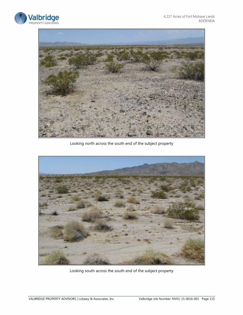
4,227 Acres of Fort Mohave Lands
ADDENDA
VALBRIDGE PROPERTY ADVISORS | Lubawy & Associates, Inc. Valbridge Job Number: NV01-15-0016-001 Page 115
Looking north across the south end of the subject property
Looking south across the south end of the subject property

4,227 Acres of Fort Mohave Lands
ADDENDA
VALBRIDGE PROPERTY ADVISORS | Lubawy & Associates, Inc. Valbridge Job Number: NV01-15-0016-001 Page 116
Looking east across the south end of the subject property
Looking west across the south end of the subject property

4,227 Acres of Fort Mohave Lands
ADDENDA
VALBRIDGE PROPERTY ADVISORS | Lubawy & Associates, Inc. Valbridge Job Number: NV01-15-0016-001 Page 117
Looking north along Needles Highway
Looking south along Needles Highway

4,227 Acres of Fort Mohave Lands
ADDENDA
VALBRIDGE PROPERTY ADVISORS | Lubawy & Associates, Inc. Valbridge Job Number: NV01-15-0016-001 Page 118
Legal Description Whole Property

4,227 Acres of Fort Mohave Lands
ADDENDA
VALBRIDGE PROPERTY ADVISORS | Lubawy & Associates, Inc. Valbridge Job Number: NV01-15-0016-001 Page 119

4,227 Acres of Fort Mohave Lands
ADDENDA
VALBRIDGE PROPERTY ADVISORS | Lubawy & Associates, Inc. Valbridge Job Number: NV01-15-0016-001 Page 120

4,227 Acres of Fort Mohave Lands
ADDENDA
VALBRIDGE PROPERTY ADVISORS | Lubawy & Associates, Inc. Valbridge Job Number: NV01-15-0016-001 Page 121
Legal Description Parcel A (2,596 Acres)

4,227 Acres of Fort Mohave Lands
ADDENDA
VALBRIDGE PROPERTY ADVISORS | Lubawy & Associates, Inc. Valbridge Job Number: NV01-15-0016-001 Page 122

4,227 Acres of Fort Mohave Lands
ADDENDA
VALBRIDGE PROPERTY ADVISORS | Lubawy & Associates, Inc. Valbridge Job Number: NV01-15-0016-001 Page 123
Legal Description Parcel B 1,629 Acres

4,227 Acres of Fort Mohave Lands
ADDENDA
VALBRIDGE PROPERTY ADVISORS | Lubawy & Associates, Inc. Valbridge Job Number: NV01-15-0016-001 Page 124

4,227 Acres of Fort Mohave Lands
ADDENDA
VALBRIDGE PROPERTY ADVISORS | Lubawy & Associates, Inc. Valbridge Job Number: NV01-15-0016-001 Page 125
Legal Description Access Easement 2.0 Acres

4,227 Acres of Fort Mohave Lands
ADDENDA
VALBRIDGE PROPERTY ADVISORS | Lubawy & Associates, Inc. Valbridge Job Number: NV01-15-0016-001 Page 126

4,227 Acres of Fort Mohave Lands
ADDENDA
VALBRIDGE PROPERTY ADVISORS | Lubawy & Associates, Inc. Valbridge Job Number: NV01-15-0016-001 Page 127
Preliminary Title Report

4,227 Acres of Fort Mohave Lands
ADDENDA
VALBRIDGE PROPERTY ADVISORS | Lubawy & Associates, Inc. Valbridge Job Number: NV01-15-0016-001 Page 128

4,227 Acres of Fort Mohave Lands
ADDENDA
VALBRIDGE PROPERTY ADVISORS | Lubawy & Associates, Inc. Valbridge Job Number: NV01-15-0016-001 Page 129

4,227 Acres of Fort Mohave Lands
ADDENDA
VALBRIDGE PROPERTY ADVISORS | Lubawy & Associates, Inc. Valbridge Job Number: NV01-15-0016-001 Page 130

4,227 Acres of Fort Mohave Lands
ADDENDA
VALBRIDGE PROPERTY ADVISORS | Lubawy & Associates, Inc. Valbridge Job Number: NV01-15-0016-001 Page 131

4,227 Acres of Fort Mohave Lands
ADDENDA
VALBRIDGE PROPERTY ADVISORS | Lubawy & Associates, Inc. Valbridge Job Number: NV01-15-0016-001 Page 132

4,227 Acres of Fort Mohave Lands
ADDENDA
VALBRIDGE PROPERTY ADVISORS | Lubawy & Associates, Inc. Valbridge Job Number: NV01-15-0016-001 Page 133

4,227 Acres of Fort Mohave Lands
ADDENDA
VALBRIDGE PROPERTY ADVISORS | Lubawy & Associates, Inc. Valbridge Job Number: NV01-15-0016-001 Page 134

4,227 Acres of Fort Mohave Lands
ADDENDA
VALBRIDGE PROPERTY ADVISORS | Lubawy & Associates, Inc. Valbridge Job Number: NV01-15-0016-001 Page 135

4,227 Acres of Fort Mohave Lands
ADDENDA
VALBRIDGE PROPERTY ADVISORS | Lubawy & Associates, Inc. Valbridge Job Number: NV01-15-0016-001 Page 136
4,227 Acres of Fort Mohave Lands
ADDENDA
VALBRIDGE PROPERTY ADVISORS | Lubawy & Associates, Inc. Valbridge Job Number: NV01-15-0016-001 Page 137

4,227 Acres of Fort Mohave Lands
ADDENDA
VALBRIDGE PROPERTY ADVISORS | Lubawy & Associates, Inc. Valbridge Job Number: NV01-15-0016-001 Page 138

4,227 Acres of Fort Mohave Lands
ADDENDA
VALBRIDGE PROPERTY ADVISORS | Lubawy & Associates, Inc. Valbridge Job Number: NV01-15-0016-001 Page 139

4,227 Acres of Fort Mohave Lands
ADDENDA
VALBRIDGE PROPERTY ADVISORS | Lubawy & Associates, Inc. Valbridge Job Number: NV01-15-0016-001 Page 140
Flood Map

4,227 Acres of Fort Mohave Lands
ADDENDA
VALBRIDGE PROPERTY ADVISORS | Lubawy & Associates, Inc. Valbridge Job Number: NV01-15-0016-001 Page 141
Modification of Master Plan Development

4,227 Acres of Fort Mohave Lands
ADDENDA
VALBRIDGE PROPERTY ADVISORS | Lubawy & Associates, Inc. Valbridge Job Number: NV01-15-0016-001 Page 142

4,227 Acres of Fort Mohave Lands
ADDENDA
VALBRIDGE PROPERTY ADVISORS | Lubawy & Associates, Inc. Valbridge Job Number: NV01-15-0016-001 Page 143

4,227 Acres of Fort Mohave Lands
ADDENDA
VALBRIDGE PROPERTY ADVISORS | Lubawy & Associates, Inc. Valbridge Job Number: NV01-15-0016-001 Page 144

4,227 Acres of Fort Mohave Lands
ADDENDA
VALBRIDGE PROPERTY ADVISORS | Lubawy & Associates, Inc. Valbridge Job Number: NV01-15-0016-001 Page 145

4,227 Acres of Fort Mohave Lands
ADDENDA
VALBRIDGE PROPERTY ADVISORS | Lubawy & Associates, Inc. Valbridge Job Number: NV01-15-0016-001 Page 146

4,227 Acres of Fort Mohave Lands
ADDENDA
VALBRIDGE PROPERTY ADVISORS | Lubawy & Associates, Inc. Valbridge Job Number: NV01-15-0016-001 Page 147

4,227 Acres of Fort Mohave Lands
ADDENDA
VALBRIDGE PROPERTY ADVISORS | Lubawy & Associates, Inc. Valbridge Job Number: NV01-15-0016-001 Page 148

4,227 Acres of Fort Mohave Lands
ADDENDA
VALBRIDGE PROPERTY ADVISORS | Lubawy & Associates, Inc. Valbridge Job Number: NV01-15-0016-001 Page 149

4,227 Acres of Fort Mohave Lands
ADDENDA
VALBRIDGE PROPERTY ADVISORS | Lubawy & Associates, Inc. Valbridge Job Number: NV01-15-0016-001 Page 150

4,227 Acres of Fort Mohave Lands
ADDENDA
VALBRIDGE PROPERTY ADVISORS | Lubawy & Associates, Inc. Valbridge Job Number: NV01-15-0016-001 Page 151

4,227 Acres of Fort Mohave Lands
ADDENDA
VALBRIDGE PROPERTY ADVISORS | Lubawy & Associates, Inc. Valbridge Job Number: NV01-15-0016-001 Page 152

4,227 Acres of Fort Mohave Lands
ADDENDA
VALBRIDGE PROPERTY ADVISORS | Lubawy & Associates, Inc. Valbridge Job Number: NV01-15-0016-001 Page 153

4,227 Acres of Fort Mohave Lands
ADDENDA
VALBRIDGE PROPERTY ADVISORS | Lubawy & Associates, Inc. Valbridge Job Number: NV01-15-0016-001 Page 154

4,227 Acres of Fort Mohave Lands
ADDENDA
VALBRIDGE PROPERTY ADVISORS | Lubawy & Associates, Inc. Valbridge Job Number: NV01-15-0016-001 Page 155

4,227 Acres of Fort Mohave Lands
ADDENDA
VALBRIDGE PROPERTY ADVISORS | Lubawy & Associates, Inc. Valbridge Job Number: NV01-15-0016-001 Page 156

4,227 Acres of Fort Mohave Lands
ADDENDA
VALBRIDGE PROPERTY ADVISORS | Lubawy & Associates, Inc. Valbridge Job Number: NV01-15-0016-001 Page 157

4,227 Acres of Fort Mohave Lands
ADDENDA
VALBRIDGE PROPERTY ADVISORS | Lubawy & Associates, Inc. Valbridge Job Number: NV01-15-0016-001 Page 158

4,227 Acres of Fort Mohave Lands
ADDENDA
VALBRIDGE PROPERTY ADVISORS | Lubawy & Associates, Inc. Valbridge Job Number: NV01-15-0016-001 Page 159

4,227 Acres of Fort Mohave Lands
ADDENDA
VALBRIDGE PROPERTY ADVISORS | Lubawy & Associates, Inc. Valbridge Job Number: NV01-15-0016-001 Page 160

4,227 Acres of Fort Mohave Lands
ADDENDA
VALBRIDGE PROPERTY ADVISORS | Lubawy & Associates, Inc. Valbridge Job Number: NV01-15-0016-001 Page 161

4,227 Acres of Fort Mohave Lands
ADDENDA
VALBRIDGE PROPERTY ADVISORS | Lubawy & Associates, Inc. Valbridge Job Number: NV01-15-0016-001 Page 162

4,227 Acres of Fort Mohave Lands
ADDENDA
VALBRIDGE PROPERTY ADVISORS | Lubawy & Associates, Inc. Valbridge Job Number: NV01-15-0016-001 Page 163

4,227 Acres of Fort Mohave Lands
ADDENDA
VALBRIDGE PROPERTY ADVISORS | Lubawy & Associates, Inc. Valbridge Job Number: NV01-15-0016-001 Page 164

4,227 Acres of Fort Mohave Lands
ADDENDA
VALBRIDGE PROPERTY ADVISORS | Lubawy & Associates, Inc. Valbridge Job Number: NV01-15-0016-001 Page 165

4,227 Acres of Fort Mohave Lands
ADDENDA
VALBRIDGE PROPERTY ADVISORS | Lubawy & Associates, Inc. Valbridge Job Number: NV01-15-0016-001 Page 166

4,227 Acres of Fort Mohave Lands
ADDENDA
VALBRIDGE PROPERTY ADVISORS | Lubawy & Associates, Inc. Valbridge Job Number: NV01-15-0016-001 Page 167

4,227 Acres of Fort Mohave Lands
ADDENDA
VALBRIDGE PROPERTY ADVISORS | Lubawy & Associates, Inc. Valbridge Job Number: NV01-15-0016-001 Page 168

4,227 Acres of Fort Mohave Lands
ADDENDA
VALBRIDGE PROPERTY ADVISORS | Lubawy & Associates, Inc. Valbridge Job Number: NV01-15-0016-001 Page 169

4,227 Acres of Fort Mohave Lands
ADDENDA
VALBRIDGE PROPERTY ADVISORS | Lubawy & Associates, Inc. Valbridge Job Number: NV01-15-0016-001 Page 170

4,227 Acres of Fort Mohave Lands
ADDENDA
VALBRIDGE PROPERTY ADVISORS | Lubawy & Associates, Inc. Valbridge Job Number: NV01-15-0016-001 Page 171

4,227 Acres of Fort Mohave Lands
ADDENDA
VALBRIDGE PROPERTY ADVISORS | Lubawy & Associates, Inc. Valbridge Job Number: NV01-15-0016-001 Page 172

4,227 Acres of Fort Mohave Lands
ADDENDA
VALBRIDGE PROPERTY ADVISORS | Lubawy & Associates, Inc. Valbridge Job Number: NV01-15-0016-001 Page 173

4,227 Acres of Fort Mohave Lands
ADDENDA
VALBRIDGE PROPERTY ADVISORS | Lubawy & Associates, Inc. Valbridge Job Number: NV01-15-0016-001 Page 174

4,227 Acres of Fort Mohave Lands
ADDENDA
VALBRIDGE PROPERTY ADVISORS | Lubawy & Associates, Inc. Valbridge Job Number: NV01-15-0016-001 Page 175

4,227 Acres of Fort Mohave Lands
ADDENDA
VALBRIDGE PROPERTY ADVISORS | Lubawy & Associates, Inc. Valbridge Job Number: NV01-15-0016-001 Page 176

4,227 Acres of Fort Mohave Lands
ADDENDA
VALBRIDGE PROPERTY ADVISORS | Lubawy & Associates, Inc. Valbridge Job Number: NV01-15-0016-001 Page 177
BLM Dry Lake Solar Energy Zone Auction

4,227 Acres of Fort Mohave Lands
ADDENDA
VALBRIDGE PROPERTY ADVISORS | Lubawy & Associates, Inc. Valbridge Job Number: NV01-15-0016-001 Page 178

4,227 Acres of Fort Mohave Lands
ADDENDA
VALBRIDGE PROPERTY ADVISORS | Lubawy & Associates, Inc. Valbridge Job Number: NV01-15-0016-001 Page 179
BLM Renewable Energy Projects Approved

4,227 Acres of Fort Mohave Lands
ADDENDA
VALBRIDGE PROPERTY ADVISORS | Lubawy & Associates, Inc. Valbridge Job Number: NV01-15-0016-001 Page 180

4,227 Acres of Fort Mohave Lands
ADDENDA
VALBRIDGE PROPERTY ADVISORS | Lubawy & Associates, Inc. Valbridge Job Number: NV01-15-0016-001 Page 181

4,227 Acres of Fort Mohave Lands
ADDENDA
VALBRIDGE PROPERTY ADVISORS | Lubawy & Associates, Inc. Valbridge Job Number: NV01-15-0016-001 Page 182

4,227 Acres of Fort Mohave Lands
ADDENDA
VALBRIDGE PROPERTY ADVISORS | Lubawy & Associates, Inc. Valbridge Job Number: NV01-15-0016-001 Page 183
Engagement Letter

4,227 Acres of Fort Mohave Lands
ADDENDA
VALBRIDGE PROPERTY ADVISORS | Lubawy & Associates, Inc. Valbridge Job Number: NV01-15-0016-001 Page 184
Qualifications of Kendal Stewart
Senior Appraiser Valbridge Property Advisors | Lubawy & Associates, Inc.
Independent Valuations for a Variable World
Membership/Affiliations:
Candidate: Appraisal Institute
Appraisal Institute & Related Courses:
Real Estate Appraisal Principles
Basic Valuation Procedures
Report Writing and Valuation Analysis
Case Studies in Real Estate Valuation
Ethics and Standards of Professional Practice
BLM Appraisal Compliance Workshop
Experience:
Senior Appraiser
Valbridge Property Advisors |Lubawy & Associates (2013-Present)
Senior Appraiser
Lubawy & Associates (2000-2013)
Senior Appraiser
Kenneth Lamb & Associates (1994-2000)
Senior Vice President-Real Estate Acquisitions
Minami Development Corp. (1988-1994)
Financial Consultant
Merrill Lynch (1986-1988)
Controller and Director of Real Estate Investments
Realty Holdings Group (1978-1986)
Appraisal/valuation and consulting assignments include: BLM, U.S.
Fish and Wildlife Service, U.S. National Park, and U.S. Army Corp of
Engineer lands; sites for master planned communities, energy
projects, mining, landfills and other large acreage uses; right-of-way,
easement, and other eminent domain appraisals; farm and ranch
properties; apartment buildings; retail stores, shopping centers; office
buildings; hotels, motels; industrial properties; restaurants; residential
subdivisions; auto dealerships; vacant commercial, residential and
industrial land; flood channel, freeway, and airport lands and
facilities; and water rights.
State Certifications
State of Nevada
License #A.0002588-CG
Education
Bachelor of Science
Business Administration
Brigham Young University
MBA, University of Las Vegas
Nevada
Contact Details
702-242-9369 (p)
702-242-6391 (f)
Valbridge Property Advisors |
Lubawy & Associates
3034 S. Durango Drive
Suite 100
Las Vegas, NV 89117
www.valbridge.com

4,227 Acres of Fort Mohave Lands
ADDENDA
VALBRIDGE PROPERTY ADVISORS | Lubawy & Associates, Inc. Valbridge Job Number: NV01-15-0016-001 Page 185

4,227 Acres of Fort Mohave Lands
ADDENDA
VALBRIDGE PROPERTY ADVISORS | Lubawy & Associates, Inc. Valbridge Job Number: NV01-15-0016-001 Page 186
Qualifications of Matthew Lubawy, MAI, CVA, CMEA
Senior Managing Director Valbridge Property Advisors | Lubawy & Associates, Inc.
Independent Valuations for a Variable World
Membership/Affiliations:
Member: Appraisal Institute - MAI Designation #10653
Director - (2008 – 2011)
President of Las Vegas Chapter (1998 - 1989)
1st V.P. of Las Vegas Chapter (1997 – 1998)
2nd
V.P. of Las Vegas Chapter (1996 – 1997)
Member: NACVA – CVA Designation (Certified Valuation
Analyst for business valuation)
Member: NEBB Institute – CMEA Designation for Machinery
and Equipment
Board Member: Valbridge Property Advisors -
Vice-Chairman of the Board of Directors
(2011 – Present)
Member: International Right of Way Association
Member: National Association of Realtors
Member: GLVAR
Board Member: Nevada State Development Corporation
Chairman of the Board (2008-Present)
Experience:
Senior Managing Director
Valbridge Property Advisors | Lubawy & Associates (2013 to Present)
Principal
Lubawy & Associates (1994-2013)
Independent Fee Appraiser and Real Estate Consultant
Timothy R. Morse and Associates (1992 – 1994)
Staff Appraiser/Assistant Vice President
First Interstate Bank (1988 - 1992)
Independent Fee Appraiser and Real Estate Consultant
The Clark Companies (1987 - 1988)
State Certifications
Nevada License
# A.0000044-CG
Arizona License
#31821
Education
Bachelor of Science
Business Administration
University of Nevada, Las
Vegas
Contact Details
702-242-9369 (p)
702-242-6391 (f)
Valbridge Property Advisors |
Lubawy & Associates, Inc.
3034 S. Durango Dr. #100
Las Vegas, NV 89117
www.valbridge.com

4,227 Acres of Fort Mohave Lands
ADDENDA
VALBRIDGE PROPERTY ADVISORS | Lubawy & Associates, Inc. Valbridge Job Number: NV01-15-0016-001 Page 187
Appraisal/valuation and consulting assignments include: vacant land; apartment buildings; retail
buildings; shopping centers; office buildings; industrial buildings; religious and special purpose
properties including schools, churches hotel/casinos air hangars, automobile dealerships, residential
subdivisions, and master-planned communities. Other assignments include tax credit valuations, Fannie
Mae and Freddie Mac reports, and HUD MAP valuations and market studies, as well as valuation of
fractional interests in FLP’s, LP’s LLC’s and/or other business entities.
Appraisal Institute & Related Courses:
NEBB Institute Machinery & Equipment Certification Training January 2014
2014-2015 National USPAP Update Course, Appraisal Institute January 2014
NACVA Business Valuation Certification and Training Center December 2013
Fundamentals of Separating Real Property, Personal Property, and Intangible
Business Assets, Appraisal Institute
March 2012
7-Hour National USPAP Update Course, Appraisal Institute January 2012
2010-2011 National USPAP Update, Appraisal Institute January 2010
Appraising Distressed Commercial Real Estate, Appraisal Institute July 2009
Understanding the Home Valuation Code of Conduct, Appraisal Institute June 2009
Introduction to Valuation for Financial Reporting, Appraisal Institute June 2009
Argus Based Discounted Cash Flow Analysis, Appraisal Institute June 2009
National Uniform Standards of Professional Practice Course 400, Appraisal Institute April 2009
Online Scope of Work: Expanding Your Range of Services, Appraisal Institute April 2009
Online Rates and Ratios: Making sense of GIMs, OARs and DCF, Appraisal Institute April 2009
Forecasting Revenue, Appraisal Institute October 2008
Law of Easements: Legal Issues & Practical Considerations,
Lorman Education Services
August 2008
Analyzing Operating Expenses, Appraisal Institute May, 2007
Valuation of Detrimental Conditions in Real Estate, Appraisal Institute April, 2007
2007 National USPAP Update, Appraisal Institute March, 2007
Analyzing Commercial Lease Clauses, Appraisal Institute February, 2007
Analyzing Distressed Real Estate, Appraisal Institute February, 2007
Uniform Appraisal Standards for Federal Land Acquisitions,
Appraisal Institute
October 2005
Online Analyzing Distressed Real Estate, Appraisal Institute September 2005
Business Practices and Ethics, Course 420, Appraisal Institute September 2005
USPAP Update – Course 400, Appraisal Institute February 2005
Litigation Appraising: Specialized Topics and Applications October 2004
Separating Real & Personal Property from Intangible Business Assets September 2003
So. NV Public Land Mgt. Act BLM Appraisal Compliance Workshop May 2003
Income Capitalization March 2003
Appraising Non-Conforming and Difficult Properties March 2003
Appraiser Liability March 2003
2003 National USPAP February 2003
Valuation of Partial Acquisitions, Course 401 through IRWA October 2000
Partial Interest Valuation – Divided, Course A7414 April 2000
Highest & Best Use and Market Analysis March 2000
Subdivision Analysis January 2000
Writing the Narrative Appraisal Report November 1999
USPAP 1999 Revisions A7415ES March 1999

4,227 Acres of Fort Mohave Lands
ADDENDA
VALBRIDGE PROPERTY ADVISORS | Lubawy & Associates, Inc. Valbridge Job Number: NV01-15-0016-001 Page 188
Reporting Sales Comparison Grid Adj. for Residential Properties March 1999
USPAP 1999 Revisions – A7415ES March 1998
Litigation Appraisal and Expert Testimony June 1997
USPAP (Parts A & B) 1996
Ethics - USPAP Statements March 1995
Comprehensive Appraisal Workshop July 1994
Current Issues and Misconceptions in Appraisal December 1993
Standards of Professional Appraisal Practice, Part B 1992
Land Faire Nevada July 1992
Appraising From Blueprints and Specifications September 1992
Accrued Depreciation September 1992
Standards of Professional Appraisal Practice, Part A 1991
Report Writing and Valuation Analysis; Exam 2-2 June 1991
Case Studies; Exam 2-1 June 1991
Capitalization Theory and Techniques, Part B; Exam 1-BB June 1990
Capitalization Theory and Techniques, Part A; Exam 1-BA June 1990
Basic Valuation; Exam 1A2 May 1989
Principles of Real Estate Appraisal ; Exam 1A1 May 1989

4,227 Acres of Fort Mohave Lands
ADDENDA
VALBRIDGE PROPERTY ADVISORS | Lubawy & Associates, Inc. Valbridge Job Number: NV01-15-0016-001 Page 189
Information on Valbridge Property Advisors Valbridge covers the U.S. from coast to coast, and is one of the Top 3 national commercial real estate
valuation and advisory services firms based on:
Total number of MAIs (145 on staff)
Total number of office locations (59 across the U.S.)
Total number of staff (600 strong)
Valbridge is owned by our local office leaders. Every Valbridge office is led by a senior managing
director who holds the MAI designation of the Appraisal Institute.
Valbridge services all property types, including:
Office
Industrial
Retail
Apartments/multifamily/senior living
Lodging/hospitality/recreational
Land
Special-purpose properties
Valbridge welcomes single-property assignments as well as portfolio, multi-market and other
bulk- property engagements. Specialty services include:
Portfolio valuation
REO/foreclosure evaluation
Real estate market and feasibility analysis
Property and lease comparables, including lease review
Due diligence
Property tax assessment and appeal-support services
Valuations and analysis of property under eminent domain proceedings
Valuations of property for financial reporting, including goodwill impairment, impairment or
disposal of long-lived assets, fair value and leasehold valuations
Valuation of property for insurance, estate planning and trusteeship, including fractional interest
valuation for gifting and IRS purposes
Cost segregation studies
Litigation support, including expert witness testimony
Business and partnership valuation and advisory services, including partial interests
Independent Valuation for a Variable World

4,227 Acres of Fort Mohave Lands
ADDENDA
VALBRIDGE PROPERTY ADVISORS | Lubawy & Associates, Inc. Valbridge Job Number: NV01-15-0016-001 Page 190