Embed Size (px)
Citation preview
Altimetry for Altimetry for Coastal ApplicationsCoastal Applications
Paul M. DiGiacomo and Amanda Paul M. DiGiacomo and Amanda BittingerBittingerNOAA NOAA CCoastoastWWatchatch ProgramProgram
5 February 20085 February 2008
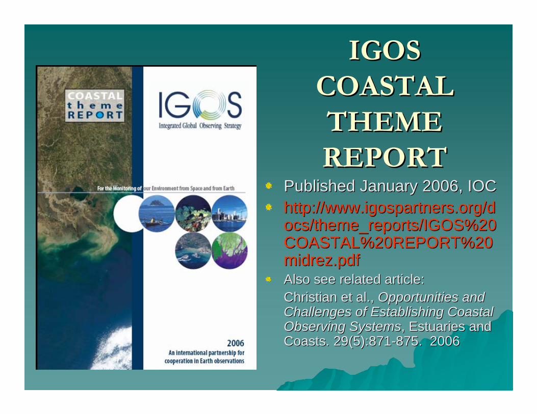
Published January 2006, IOCPublished January 2006, IOChttp://www.igospartners.org/dhttp://www.igospartners.org/docs/theme_reports/IGOS%20ocs/theme_reports/IGOS%20COASTAL%20REPORT%20COASTAL%20REPORT%20midrez.pdfmidrez.pdfAlso see related article: Also see related article: Christian et al., Christian et al., Opportunities and Opportunities and Challenges of Establishing Coastal Challenges of Establishing Coastal Observing SystemsObserving Systems, Estuaries and , Estuaries and Coasts. 29(5):871Coasts. 29(5):871--875. 2006875. 2006
IGOSIGOSCOASTAL COASTAL THEME THEME REPORTREPORT
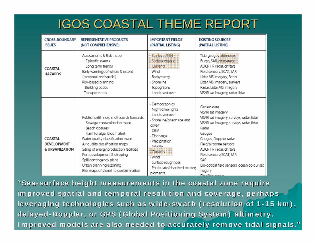
IGOS COASTAL THEME REPORTIGOS COASTAL THEME REPORT
““SeaSea--surface height measurements in the coastal zone require surface height measurements in the coastal zone require improved spatial and temporal resolution and coverage, perhaps improved spatial and temporal resolution and coverage, perhaps leveraging technologies such as wideleveraging technologies such as wide--swath (resolution of 1swath (resolution of 1--15 km), 15 km), delayeddelayed--Doppler, or GPS (Global Positioning System) altimetry. Doppler, or GPS (Global Positioning System) altimetry. Improved models are also needed to accurately remove tidal signaImproved models are also needed to accurately remove tidal signals.ls.””

Coastal (Land-Sea) Observing Requirements
IGOS Coastal Theme Report, 2006
Common needs & gaps vis-à-vis existing and planned capabilities:
• Existing global observing assetsgenerally provide inadequate spatial, temporal and spectral resolution.
• Continuity required of some existing capabilities for context and assessment of climate variability and change.
• Some observations needed for coastal users not presently made, especially synoptically and/or from space.

Coastal Observing Challenges and Priorities
IGOS Coastal Theme Report, 2006
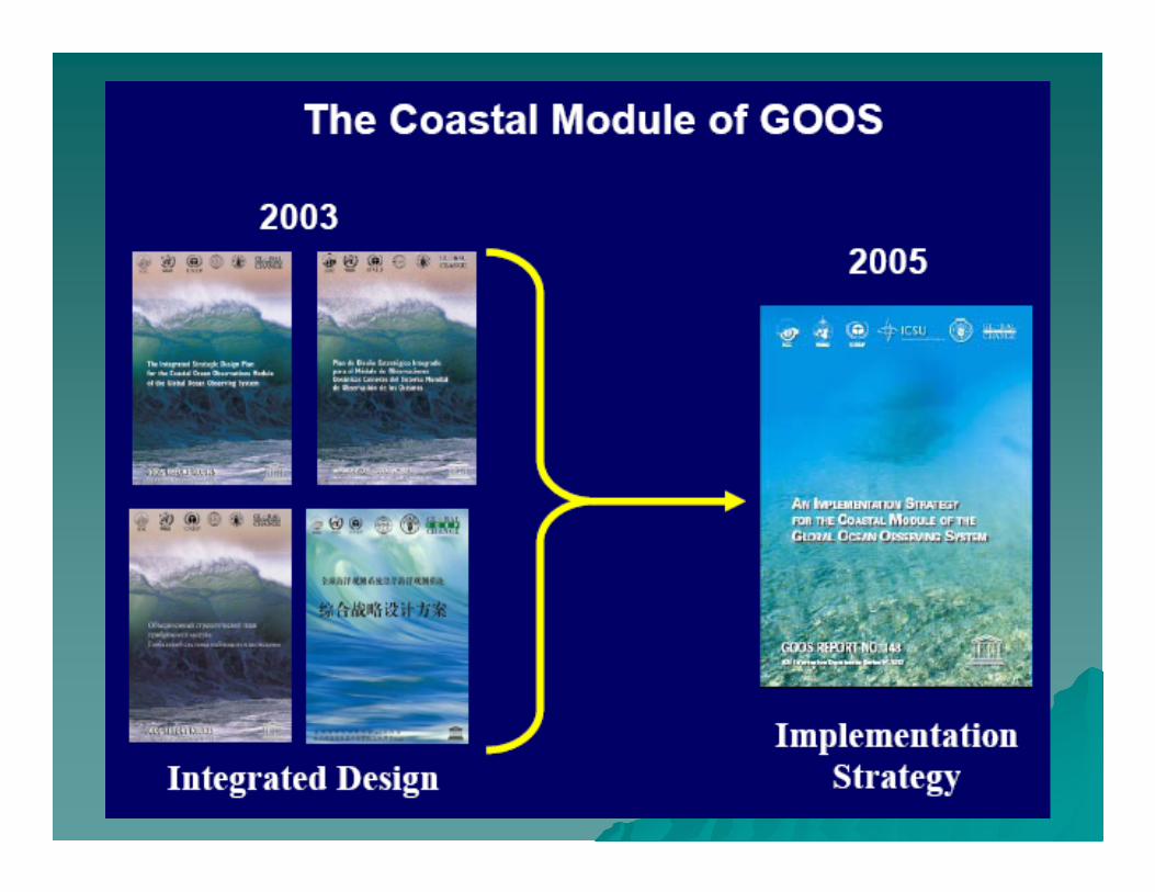
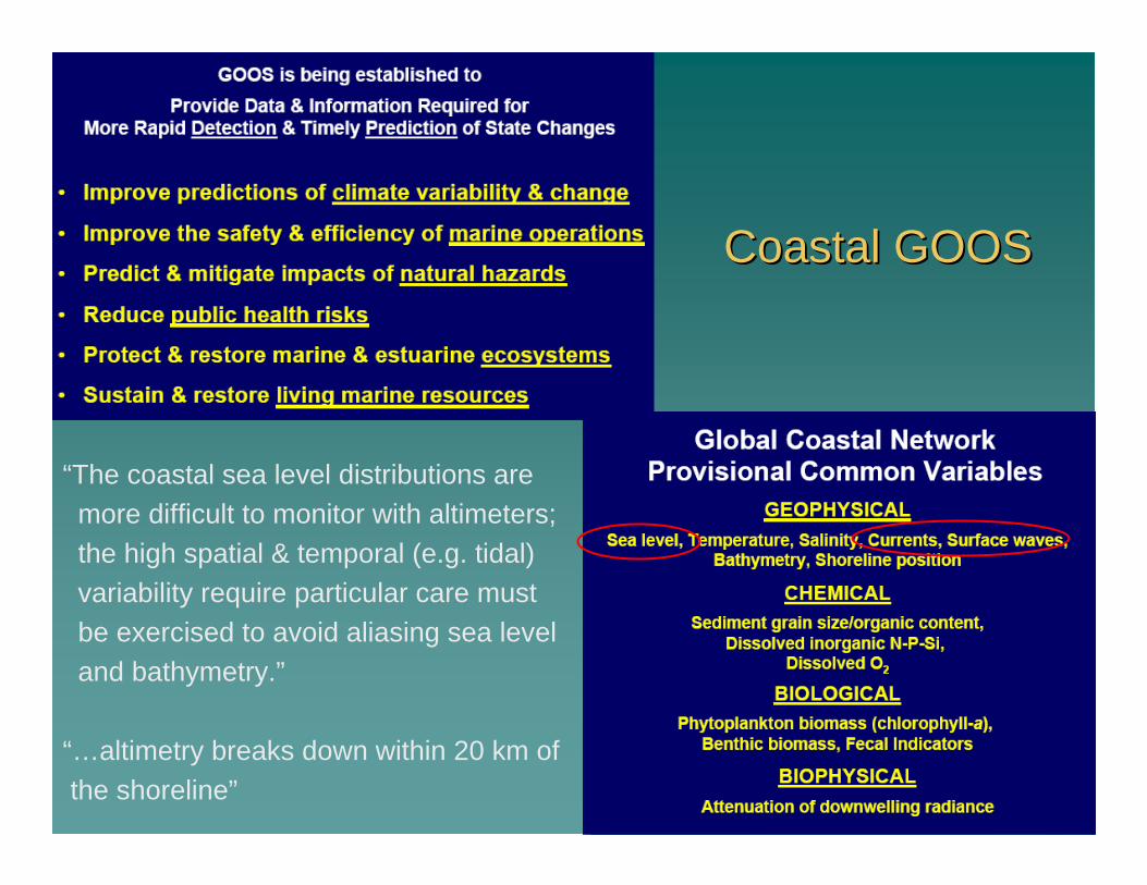
Coastal GOOSCoastal GOOS
“The coastal sea level distributions are more difficult to monitor with altimeters; the high spatial & temporal (e.g. tidal) variability require particular care must be exercised to avoid aliasing sea level and bathymetry.”
“…altimetry breaks down within 20 km of the shoreline”

Proposed GOOS Project: Global Storm Surges and Flooding Risk – Unfunded
The main objective of this project would be to construct a The main objective of this project would be to construct a storm surge modeling system with global coverage that can storm surge modeling system with global coverage that can provide shortprovide short--term forecasts and decadalterm forecasts and decadal--scale hindcasts, scale hindcasts, and also be used for climate change scenarios.and also be used for climate change scenarios.
Products GeneratedProducts Generated
Short termShort term (hours to days) (hours to days) forecasts of storm surgesforecasts of storm surges for the global coastal ocean.for the global coastal ocean.
ReanalysesReanalyses of surge variabilityof surge variability for the global coastal ocean based on the best for the global coastal ocean based on the best available wind and air pressure available wind and air pressure reanalysesreanalyses for recent decades.for recent decades.
Quality control of realQuality control of real--time and archived coastal sea level observationstime and archived coastal sea level observations (including (including data from GLOSS stations). data from GLOSS stations).
Spatial maps and trends in flooding risk overSpatial maps and trends in flooding risk over recent decades, and validation against recent decades, and validation against return periods calculated from hourly coastal tide gauge data.return periods calculated from hourly coastal tide gauge data.
Projections of flooding risk over the next centuryProjections of flooding risk over the next century under plausible global sea level under plausible global sea level rise scenarios.rise scenarios.
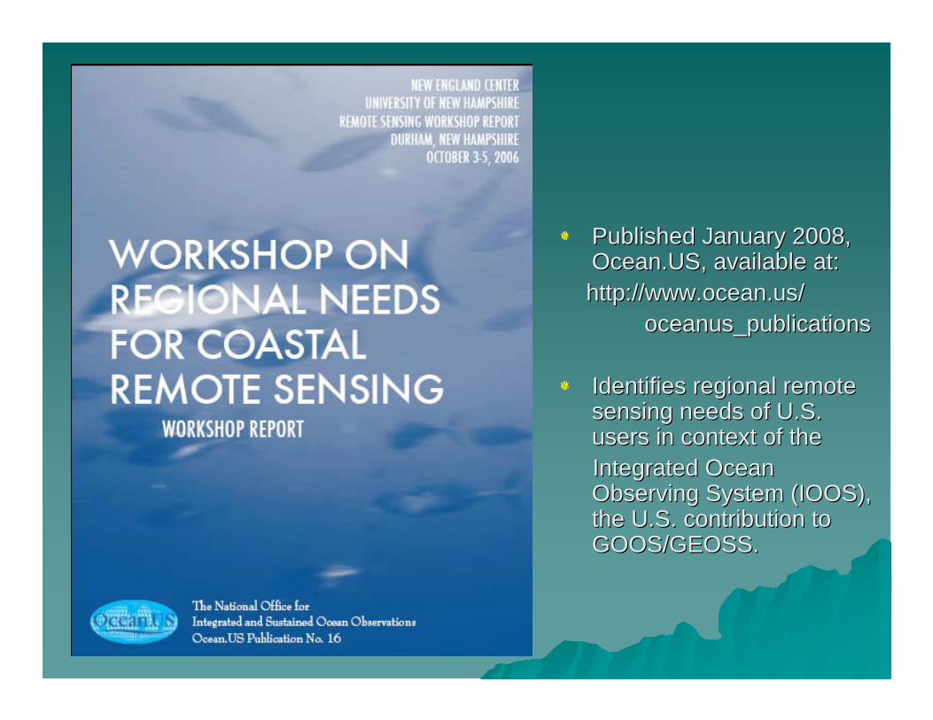
Published January 2008, Published January 2008, Ocean.USOcean.US, available at:, available at:http://http://www.ocean.uswww.ocean.us//
oceanus_publicationsoceanus_publications
Identifies regional remote Identifies regional remote sensing needs of U.S. sensing needs of U.S. users in context of the users in context of the Integrated Ocean Integrated Ocean Observing System (IOOS), Observing System (IOOS), the U.S. contribution to the U.S. contribution to GOOS/GEOSS. GOOS/GEOSS.
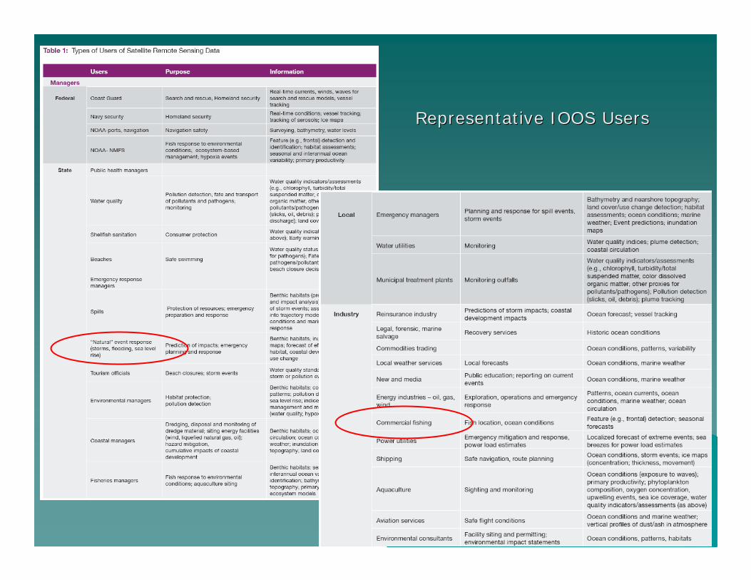
Representative IOOS UsersRepresentative IOOS Users

General Categories of Information IOOS Users DesireGeneral Categories of Information IOOS Users Desire
1.1. NearNear--realreal--time data and time data and nowcastsnowcasts for navigation, fisheries, for navigation, fisheries, aquaculture, water quality, scientific investigations, and oaquaculture, water quality, scientific investigations, and othertherusesuses
2. Early warning capacity for 2. Early warning capacity for HABsHABs, flooding erosion, ice extent/, flooding erosion, ice extent/coverage, et al.coverage, et al.
3. Long3. Long--term trends and change detection for habitats (ocean, term trends and change detection for habitats (ocean, terrestrial and benthic), water quality, fisheries, land covterrestrial and benthic), water quality, fisheries, land cover er and land use, sea level rise, carbon and water cycles, and and land use, sea level rise, carbon and water cycles, and other climate change issuesother climate change issues
4. Indices, thresholds and proxies for management purposes4. Indices, thresholds and proxies for management purposes
5. Education and visualization products for informal and formal 5. Education and visualization products for informal and formal audiencesaudiences
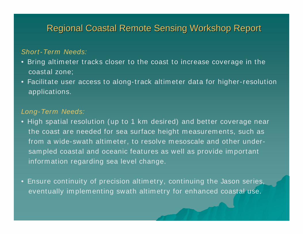
Regional Coastal Remote Sensing Workshop ReportRegional Coastal Remote Sensing Workshop Report
Short-Term Needs:• Bring altimeter tracks closer to the coast to increase coverage in the
coastal zone;• Facilitate user access to along-track altimeter data for higher-resolution
applications.
Long-Term Needs:• High spatial resolution (up to 1 km desired) and better coverage near
the coast are needed for sea surface height measurements, such as from a wide-swath altimeter, to resolve mesoscale and other under-sampled coastal and oceanic features as well as provide important information regarding sea level change.
• Ensure continuity of precision altimetry, continuing the Jason series, eventually implementing swath altimetry for enhanced coastal use.

Altimetry Use and General Needs Altimetry Use and General Needs
Geophysical ObservationsGeophysical Observations
Sea surface heightSea surface heightSurface wave height & Surface wave height & directiondirectionTsunamisTsunamisCurrentsCurrentsStorm surgeStorm surgeIce cover Ice cover TidesTidesGeostrophic velocityGeostrophic velocityVorticityVorticityEvaluation of new Evaluation of new applicationsapplications
Mapping Mapping
Land TopographyLand TopographyBathymetryBathymetry
GeneralGeneral
Higher resolutionHigher resolutionTime series neededTime series neededNearNear--RealReal--Time distributionTime distributionMinimal Cost Minimal Cost Regional users should be Regional users should be included on derivation of included on derivation of products products Telecommunication Telecommunication requirements requirements Transition to swath altimetryTransition to swath altimetryEnsure continuity of Ensure continuity of precision altimetryprecision altimetry
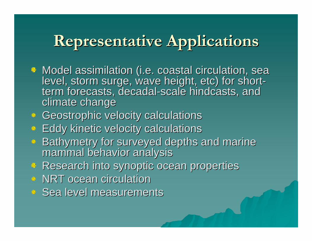
Representative ApplicationsRepresentative Applications
Model assimilation (i.e. coastal circulation, sea Model assimilation (i.e. coastal circulation, sea level, storm surge, wave height, etc) for shortlevel, storm surge, wave height, etc) for short--term forecasts, decadalterm forecasts, decadal--scale hindcasts, and scale hindcasts, and climate changeclimate changeGeostrophic velocity calculationsGeostrophic velocity calculationsEddy kinetic velocity calculationsEddy kinetic velocity calculationsBathymetry for surveyed depths and marine Bathymetry for surveyed depths and marine mammal behavior analysismammal behavior analysisResearch into synoptic ocean propertiesResearch into synoptic ocean propertiesNRT ocean circulationNRT ocean circulationSea level measurementsSea level measurements
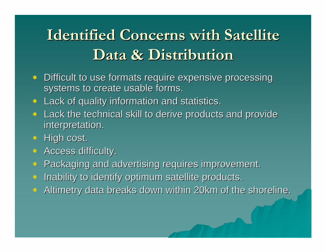
Identified Concerns with Satellite Identified Concerns with Satellite Data & DistributionData & Distribution
Difficult to use formats require expensive processing Difficult to use formats require expensive processing systems to create usable forms.systems to create usable forms.Lack of quality information and statistics.Lack of quality information and statistics.Lack the technical skill to derive products and provide Lack the technical skill to derive products and provide interpretation.interpretation.High cost. High cost. Access difficulty.Access difficulty.Packaging and advertising requires improvement.Packaging and advertising requires improvement.Inability to identify optimum satellite products.Inability to identify optimum satellite products.Altimetry data breaks down within 20km of the shoreline.Altimetry data breaks down within 20km of the shoreline.
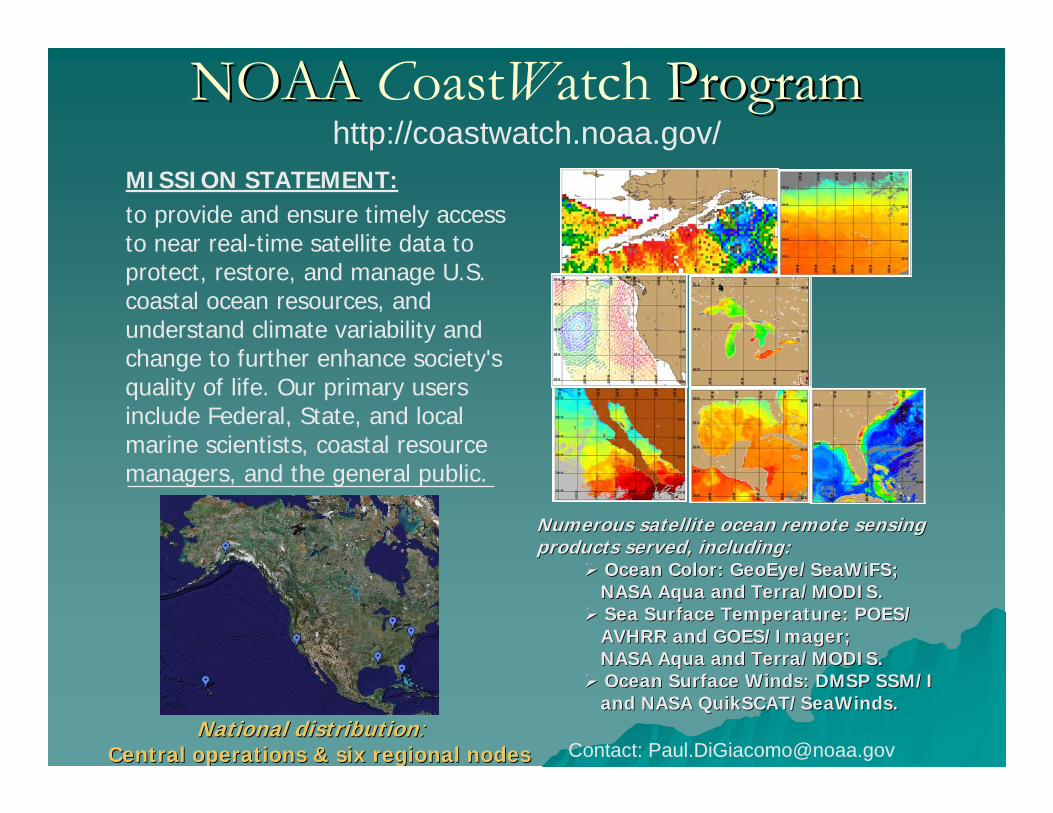
NOAA NOAA CoastWatch ProgramProgramMISSION STATEMENT:to provide and ensure timely access to near real-time satellite data to protect, restore, and manage U.S. coastal ocean resources, and understand climate variability and change to further enhance society's quality of life. Our primary users include Federal, State, and local marine scientists, coastal resource managers, and the general public.
Numerous satellite ocean remote sensing Numerous satellite ocean remote sensing products served, including:products served, including:
Ocean Color: Ocean Color: GeoEye/SeaWiFSGeoEye/SeaWiFS;;NASA Aqua and Terra/MODIS. NASA Aqua and Terra/MODIS. Sea Surface Temperature: POES/ Sea Surface Temperature: POES/ AVHRR and GOES/Imager; AVHRR and GOES/Imager; NASA Aqua and Terra/MODIS. NASA Aqua and Terra/MODIS. Ocean Surface Winds: DMSP SSM/I Ocean Surface Winds: DMSP SSM/I and NASA and NASA QuikSCAT/SeaWindsQuikSCAT/SeaWinds. .
http://coastwatch.noaa.gov/
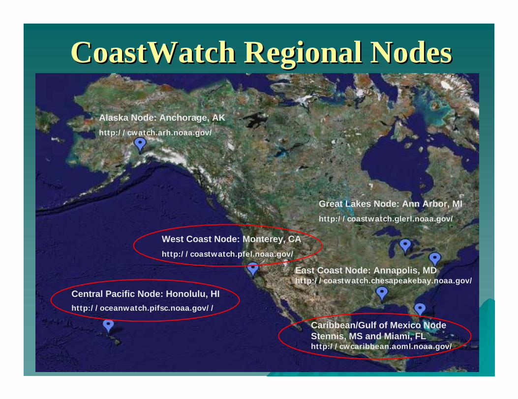
National distributionNational distribution::Central operations & six regional nodesCentral operations & six regional nodes Contact: [email protected]
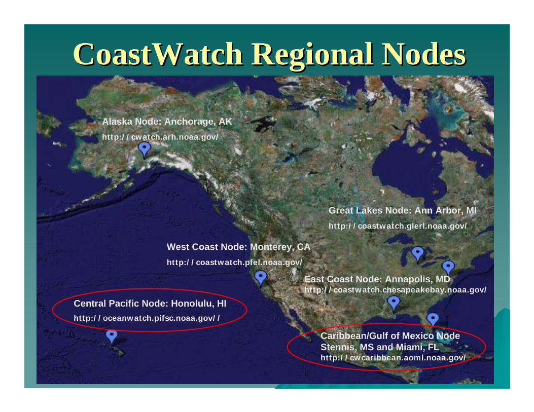
Alaska Node: Anchorage, AKhttp://cwatch.arh.noaa.gov/
Central Pacific Node: Honolulu, HI http://oceanwatch.pifsc.noaa.gov//
Great Lakes Node: Ann Arbor, MIhttp://coastwatch.glerl.noaa.gov/
West Coast Node: Monterey, CAhttp://coastwatch.pfel.noaa.gov/
Caribbean/Gulf of Mexico Node Stennis, MS and Miami, FL http://cwcaribbean.aoml.noaa.gov/
East Coast Node: Annapolis, MD http://coastwatch.chesapeakebay.noaa.gov/
CoastWatchCoastWatch Regional NodesRegional Nodes

Loggerhead track over SSH and geostrophic currents for October 2Loggerhead track over SSH and geostrophic currents for October 2003 003 (A), November 2003 (B), December 2003 (C), and January 2004 (D) (A), November 2003 (B), December 2003 (C), and January 2004 (D)
((CourtestyCourtesty ofof JeffJeff PolovinaPolovina))

((CourtestyCourtesty ofof JeffJeff PolovinaPolovina))

NOAA CoastWatch Caribbean and Gulf of Mexico Node
Use Use ofof altimetryaltimetry toto obtainobtain NearNear--RealReal--Time SHA Time SHA fieldsfieldsandand geostrophic geostrophic currentscurrents..
Data from drifter buoys allows scientists Data from drifter buoys allows scientists to validate and provide insight to the to validate and provide insight to the quality surface current field estimates.quality surface current field estimates.
These two animations show the geostrophic current field. The drifter paths are overlaid on top of it.
(Courtesy (Courtesy ofof JoaquinJoaquin Trinanes & Trinanes & Gustavo Goni)Gustavo Goni)
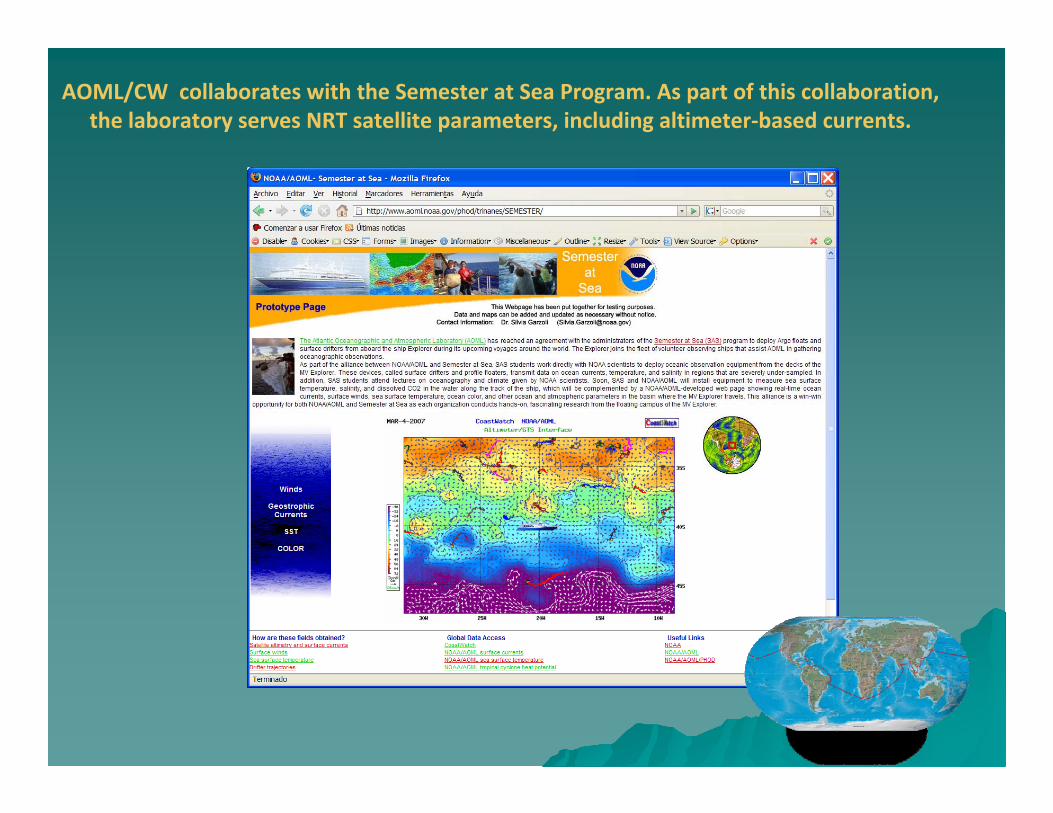
AOML/CW collaborates with the Semester at Sea Program. As part of this collaboration, the laboratory serves NRT satellite parameters, including altimeter‐based currents.

These fields have provided information on currents to the Volvo Ocean Race (VOR).
`
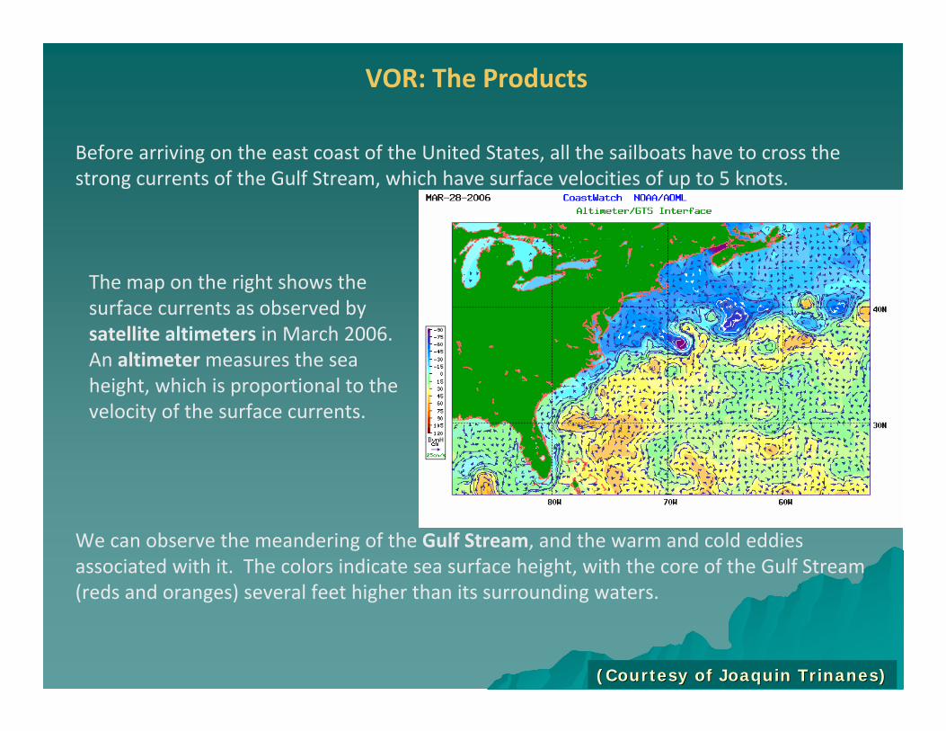
Before arriving on the east coast of the United States, all the sailboats have to cross the strong currents of the Gulf Stream, which have surface velocities of up to 5 knots.
We can observe the meandering of the Gulf Stream, and the warm and cold eddies associated with it. The colors indicate sea surface height, with the core of the Gulf Stream (reds and oranges) several feet higher than its surrounding waters.
VOR: The Products
The map on the right shows the surface currents as observed by satellite altimeters in March 2006. An altimetermeasures the sea height, which is proportional to the velocity of the surface currents.
(Courtesy (Courtesy ofof JoaquinJoaquin Trinanes)Trinanes)

This is a snapshot of one of the VOR pages showing the current field.The data files in GRIB format were available from our ftp server.

SST
SHA
D26
TCHP
Tropical Cyclone Heat Potential (TCHP)NOAA CoastWatch Caribbean and Gulf of Mexico Node
AltimetryAltimetry can can serveserve toto inferinfer oceanocean subsurfacesubsurface characteristicscharacteristics. In collaboration . In collaboration withwith AOML/AOML/PhODPhOD, , thetheNodeNode distributesdistributes NRT NRT estimatesestimates ofof global SHA, global SHA, depthsdepths ofof thethe 2020ººCC andand 2626ººCC isothermsisotherms andand TCHP. TCHP. AllAll thetheTCHP TCHP fieldsfields, , exceptexcept forfor thethe Tropical Tropical AtlanticAtlantic, are , are beingbeing usedused by by thethe JointJoint TyphoonTyphoon WarningWarning CenterCenter forforintensityintensity forecastforecast..
(Courtesy (Courtesy ofof Gustavo Gustavo GoniGoni))

One NodeOne Node’’s Perspective on Coastal Altimetrys Perspective on Coastal Altimetry
HighHigh spatialspatial andand temporal temporal resolutionresolution are desired in are desired in orderorder toto study study highhighfrequencyfrequency mesoscale processes. Do we need a mesoscale processes. Do we need a constellationconstellation? ? SynergySynergy with with other parameters (SST, other parameters (SST, ChlChl--a, etc.) can help.a, etc.) can help.
ProperlyProperly implementedimplemented widewide--swathswath altimetryaltimetry willwill greatlygreatly increaseincrease ourourknowledgeknowledge onon coastalcoastal andand openopen oceanocean dynamicsdynamics..
GreatGreat importanceimportance in in veryvery highhigh dynamicdynamic areasareas suchsuch as as EastEast andand SouthSouthFlorida. Florida. ItIt wouldwould improveimprove transporttransport estimatesestimates forfor thisthis andand otherother regionsregions..
ImproveImprove stormstorm surge surge estimatesestimates andand provideprovide anan indicationindication ofof upwellingupwellingstatus.status.
Important to develop a robust dataImportant to develop a robust data--distribution schemedistribution scheme
Will help evaluate fluxesWill help evaluate fluxes
Infrastructure and personnel needed to evaluate data for new andInfrastructure and personnel needed to evaluate data for new and improved improved altimetry products and applications specific to coastal observinaltimetry products and applications specific to coastal observing g requirements.requirements.

A series of CZCP regional users workshops is currently being plaA series of CZCP regional users workshops is currently being planned:nned:
““GEOSS Support for DecisionGEOSS Support for Decision--Making in the Coastal Zone: Managing and Mitigating Making in the Coastal Zone: Managing and Mitigating the Impacts of Human Activities and Natural Hazards In the Coasthe Impacts of Human Activities and Natural Hazards In the Coastal Zonetal Zone””
First workshop: First workshop:
““Observing System Requirements for Managing and Mitigating the ImObserving System Requirements for Managing and Mitigating the Impacts of pacts of Human Activities and Coastal Inundation in the Mediterranean RegHuman Activities and Coastal Inundation in the Mediterranean Regionion”” , to take place , to take place 99--13 June 2008, Athens, Greece; locally hosted by Greek GEO Office13 June 2008, Athens, Greece; locally hosted by Greek GEO Office (by invitation only). (by invitation only). See See http://www.greekgeo.noa.gr/geoworkshop1/page01.htmlhttp://www.greekgeo.noa.gr/geoworkshop1/page01.html for further details. for further details.
GEO Coastal Zone Community of Practice (CZCP)GEO Coastal Zone Community of Practice (CZCP)

First CZCP Workshop: First CZCP Workshop: ““Observing System Requirements for Managing and Mitigating Observing System Requirements for Managing and Mitigating the Impacts of Human Activities and Coastal Inundation in the Methe Impacts of Human Activities and Coastal Inundation in the Mediterranean Regionditerranean Region””. .
Specific objectives of the Workshop:Specific objectives of the Workshop:
Compare scientifically sound scenarios for (1) timeCompare scientifically sound scenarios for (1) time--space extent of coastal space extent of coastal inundation and storm surge in the coastal zone and for impacinundation and storm surge in the coastal zone and for impacts of coastal flooding ts of coastal flooding on coastal (2) infrastructure, (3) human health risks (exposon coastal (2) infrastructure, (3) human health risks (exposure to waterborne ure to waterborne pathogens), (4) ecosystems (e.g., water quality, habitats, bpathogens), (4) ecosystems (e.g., water quality, habitats, biodiversity), and (5) iodiversity), and (5) living resources (organisms and habitats). living resources (organisms and habitats).
Assess current observing system capacities for providing the daAssess current observing system capacities for providing the data and information ta and information required to assess changes in susceptibility (risk and resilrequired to assess changes in susceptibility (risk and resilience) both temporally ience) both temporally (annual to decadal scales) and spatially (100 meter to 1 kil(annual to decadal scales) and spatially (100 meter to 1 kilometer resolution).ometer resolution).
Increase awareness among coastal planners and managers of geospaIncrease awareness among coastal planners and managers of geospatial patterns tial patterns of susceptibility and causes of changes in susceptibility, boof susceptibility and causes of changes in susceptibility, both short term (e.g., th short term (e.g., coastal engineering) and long term (e.g., changes in sea levecoastal engineering) and long term (e.g., changes in sea level).l).
GEO Coastal Zone Community of Practice (CZCP)GEO Coastal Zone Community of Practice (CZCP)

GEO Coastal Zone Community of Practice (CZCP)GEO Coastal Zone Community of Practice (CZCP)
A series of CZCP regional users workshops is currently being plaA series of CZCP regional users workshops is currently being planned:nned:
““GEOSS Support for DecisionGEOSS Support for Decision--Making in the Coastal Zone: Managing and Mitigating Making in the Coastal Zone: Managing and Mitigating the Impacts of Human Activities and Natural Hazards In the Coasthe Impacts of Human Activities and Natural Hazards In the Coastal Zonetal Zone””
Second workshop: Second workshop:
Tentatively planned for 27Tentatively planned for 27--29 October 2008 in Accra, Ghana; hosted by the African 29 October 2008 in Accra, Ghana; hosted by the African Association of Remote Sensing of the Environment (AARSE) in assoAssociation of Remote Sensing of the Environment (AARSE) in association with their ciation with their upcoming meeting. upcoming meeting.
Third and fourth regional workshops:Third and fourth regional workshops:
Targeting workshops in the Americas and Asia in the 2009 timefraTargeting workshops in the Americas and Asia in the 2009 timeframe. me.