Embed Size (px)
Citation preview

99 4384-
allstateALLSTATE EXPLORATIONS NL
~--o.~£i.ljl..f!j?!{f MIC OFIL EDf FICHE NO.O/5182-
. E\....~\
- P ~Jnv 1999
,-' ~,I . ~ - -~. , (. - .J... " . .I . ••. iL .. _~__.--..J
( "of:"]"
" :;- y. , .. f....... ' . ,. (
M
,"/! I • ;' I I, IOverturned Ordovician sediments, Jetsons Quarry, west of theBald Tier Fault - looking south (photo J.G. Purvis).
P.B. HillsOctober 1999
MT CARELESS EL 31/96
ANNUAL &PARTIAL RELINQUISHMENTREPORT
1999
.,...,
---_.-,---_.
657002MT CARELESS
EL 31196ANNUAL & PARTIAL RELINQUISHMENT REPORT 1999
TABLE OF CONTENTSPage No.
1.
2.
3.
4.
5.
6.
7.
SUMMARY
INTRODUCTION
LAND TENURE
GEOLOGY
4.1 INTRODUCTION
4.2 STRUCTURAL FRAMEWORK
4.3 STRATIGRAPHY
4.4 IMPLICATIONS
RECOMMENDATlONS
EXPENDITURE
11.1 1998 EXPENDITURE
11.2 PROPOSED 1999 EXPENDITURE
REFERENCES
LIST OF TABLES
2
3
4
5
5
5
6
7
9
10
10
10
11
Table I Comparative stratigraphy of the Badger Head and Beaconsfield Blocks of NorthernTasmania.
LIST OF FIGURES
Figure IFigure 2
Locality PlanArea for Retention
APPENDIX
I: 50,000I: 50,000
Honours Thesis Abstract - DJ. Atchison
27/10/99 Mt Careless EL 31/96Annual & Partial Relinquishment Report 1999
Page I

6570031. SUMMARY
The 41 skm EL 31/96 (Mt Careless) covers Ordovician sediments 12 km south of theBeaconsfield Gold Mine.
Interpretation of data generated over the past 3 years by Hart, Large and StantonCook (1997), Atchison (1998) and Purvis (1998) has been reviewed in light ofdevelopments in understanding of the geology of the entire district between the BadgerHead Block and the Tamar River which Elliot, Woodward and Gray (1993) defined asthe Beaconsfield Block. The review has relied on a number of sources external to EL31/96 and particularly those discussed by Hills and MacDonald (1999).
Particular findings of the review reflect upon the perceived prospectivity of the licenceincluding
• recognition of the Bald Tier Fault as the expression of the basement thrustseparating the Badger Head and Beaconsfield Blocks (perhaps more correctly theBadger Head and Beaconsfield Allochthons) of Elliot, Woodward and Gray(1993),
• the consequent recognition that the lower Palaeozoic rocks of the Mt Carelessmassif form part of the Badger Head Block and not the Beaconsfield Block as hadpreviously been supposed, and
• the possibility that the lower Palaeozoic rocks of the two blocks, althoughcorrelateable in a Tasmania-wide sense, were not necessarily juxtaposed at the timeof deposition and did not necessarily experience a similar geological history in allrespects.
Purvis (1998) considered that the rocks east of the Bald Tier Fault were moreprospective for Tasmania Reef-style mineralisation than those to the west. The currentauthor concurs with that opinion and it forms the basis for the decision which has beentaken by Allstate Explorations NL to relinquish that portion of EL 31/96 which occurswest of the Bald Tier Fault. The remaining tenement totals 12 skm, exploration ofwhich will be planned following examination of the recent aeromagnetic data which iskeenly awaited.
-
27110/99 Mt Careless EL 31/96Annual & Partial Relinquishment Report 1999
Page 2
6570042. INTRODUCTION
EL 31/96 (Mt Careless) lies 12 km south of Beaconsfield in northern Tasmania (figureI). The 41 skm licence is 100% owned by Allstate Explorations NL. It was taken upin late 1996 to search for Beaconsfield-style quartz vein gold deposits withinOrdovician sediments considered correlates of those at the Beaconsfield Mine.
The EL covers the Supply River headwaters. The terrain is rugged with only footaccess through dense vegetation in the central 50% of the licence. The eastern part ofthe EL is undulating farmland with Ordovician rocks shallowly buried beneath Permiancover.
There are no records of mineral deposits or previous mining within the EL althoughseveral old workings, mostly on quartz veins and therefore presumably for gold, havebeen found by Allstate's field surveys. Extensive quarrying occurs at several places,excavating silica, sand and gravel for concrete aggregate and road-base materials.
Mt.Careless was largely ignored by mineral explorers prior to 1996. BHP held thearea under EL 14/65 in 1965-67 and sampled two small stream catchments forbasemetals without significant results (Gebert, 1967). In 1988 the area was coveredby a regional aeromagnetic survey for Beaconsfield Gold Mines Limited
Allstate Explorations NL commenced exploration on EL 31/96 in November 1996.Work including a BLEG stream sediment survey augmented by limited rock samplingand mapping, was reported by Hart, Large and Stanton-Cook (1997).
Purvis (1998) undertook detailed mapping of creek traverses and quarry exposures,rock sampling, limited -80mesh stream sediment sampling, lithogeochemical andpetrological studies and a structural interpretation using airphotos and re-imaged 1988aeromagnetic data. He worked in the field and to a degree collaborated with Atchison(1998) who completed a B.Sc. Honours Thesis at the University of Tasmania entitled"Geology and Structure of the Mt Careless area, Franliford, Northern Tasmania".The abstract of this thesis is included in appendix 1.
No field work was conducted during the 1999 reporting year. A decision on futurework is awaiting the release of aeromagnetic data flown by AGSO over the 1998/99summer which was originally due in August 1999. A new release date of November1999 has been advised. The current report is a precis of the authors' interpretation ofwork completed to date as it reflects upon the prospectivity of the Mt Careless area. Itis prepared with the benefit of knowledge gained from extensive explorationundertaken throughout the district by Allstate Explorations NL and its partner in theBeaconsfield Mine Joint Venture, Beaconsfield Gold NL, on several Joint Venture andindividual exploration licences.
27110/99 Mt Careless EL 31/96Annual & Partial Relinquishment Report 1999
Page 3

Figure No. 1
'J-..., ", ', ', '"'--;..-
--rI/'
".\\~/
EXPlORATIONS Nt
ftllstate
_.. ""'_.,
SCllte: 1:50000
Location Plan
--IScm
•
o
3. LAND TENURE ti5?COG
EL 31/96 (Mt Careless) of 41 skm was granted to Allstate Explorations NL on 8thNovember 1996. The licence is due to expire on 8th November 2001.
The expenditure commitment for the first three years tenure was $71,750. Thiscommitment was met during the first two years of the licence and expediture has beenlimited to time-written management during the third year.
The granted area of EL 31/96 covers 41 skm of Crown Land, State Forest - MultipleUse Forest Land, State Forest - Informal Reserve, and private property.
Within the EL boundaries but excluded from it are 101 ha of Mining Leases (the silicagravel quarries), the 344 ha Mt Careless Forest Reserve and a 25 ha Crown Reserve.
It is the intention of Allstate Explorations NL to relinquish a total of 29 skm of thelicence. The area for retention totals 12 skm and is illustrated in figure 2. The retainedarea is defined as that area encompassed within a boundary commencing at 485000E,5427000N and continuing east to 488000E and then south to 5423000N and then westto 485000E and then north to the point of commencement.
27/10/99 Mt Careless EL 31/96Annual & Partial Relinquishment Report 1999
Page 4

EXPl0RA11ONS NL
Figure No. 2
....I
allstate
_",,,,,_n
scale: 1:50000
65?CO
for RetentionArea
\'
0,
6570084. GEOLOGY
4.1 INTRODUCTION
The geology of the Mt Careless area was first mapped in detail by Gulline,Bravo and Naqvi (1973). Little further attention was shown to the area priorto the establishment of the current EL which saw the commencement ofreconnaissance work by Hart, Large and Stanton-Cook (1997) and broad scalemapping by Purvis (1998) and Atchison (1998).
4.2 STRUCTURAL FRAMEWORK
The preferred model for the regional geology of northern Tasmania from PortSorell to the Tamar River is based on the work of Elliot, Woodward and Gray(1993). Those authors divided the region into three allochthonous blocksthrust over one another from the northeast. Broadly, the blocks (perhaps morecorrectly allochthons) as defined by Elliot, Woodward and Gray (1993)comprise
• the supposed Cambrian sequences and associated igneous rocks of the PortSorell area - the Port Sorell Block,
• the Precambrian quartzwacke siltstones and sandstones of the Badger Headarea - the Badger Head Block,
• the entire lower Palaeozoic sequence east of the Badger Head Blockstretching to the Tamar River - the Beaconsfield Block.
The model of Elliot, Woodward and Gray (1993) stated that the Badger HeadBlock was fault-bounded and implied that is was comprised entirely of thePrecambrian rocks. Gulline, Bravo and Naqvi (1973) and Gulline (1981)recognised the obvious correlation of the siliciclastic sediments of the MtCareless massif with the Denison Group of western Tasmania. Elliot,Woodward and Gray (1993) did not comment upon the finding of Gulline(1981) that these rocks overlie the Precambrian rocks unconformably.Subsequent mapping by Atchison (1998) and Purvis (1998) has however,confirmed Gulline's work. Given broad acceptance of the model of Elliot,Woodward and Gray (1993) which is supported by the current author, theimplications of the unconformity are two-fold. Firstly, the Badger Head Blockdoes indeed include lower Palaeozoic strata. Secondly, the substantialbasement thrust separating the Badger Head Block from the BeaconsfieldBlock is located east of the Mt Careless massif
Gulline (1981) briefly discussed the apparent differences between the MtCareless rocks and those located south of Winkleigh. However, theirdiscussion was limited and was never intended to have a regional focus. Purvis(1998) in particular recognised the significance of the Bald Tier Fault asrepresenting recent reactivation of an earlier thrust. He noted synclinal dragfolding of the Denison Group sediments in Jetson's Quarry (485350E5422350N) as evidence of east block up movement on the Bald Tier Fault predating the post-Permian east side down movement now topographically evident(see cover photograph).
Further, Purvis (1998) observed from aeromagnetic data that the Bald Tier
27/10/99 Mt Careless EL 31/96Annual & Partial Relinquishment Report 1999
Page 5
657009Fault runs along the sharp western boundary of the of the buried SE extensionof the Anderson's Creek Ultramafic Complex. It is consistent with the modelsof Berry and Crawford (1988) and Crawford and Berry (1992) that such athrust should form the base and thus the western margin of the Anderson'sCreek Ultramafic Complex. Consequently, it follows that the Bald Tier Fault isthe western margin of the Beaconsfield Block. No age for the thrusting isconsidered here but in any case this is likely to have been a multi-phase eventand is a debate beyond the scope of the current discussion.
The model for the Bald Tier Fault serves to place the enigmatic metasedimentswhich crop out along the western margin of the Anderson's Creek UltramaficComplex at the eastern margin of the Badger Head Block. This is consistentwith the unconformity inferred between the metasediments and the Precambrianrocks by Green (1959). Gee and Legge (1979) suggest that the unit is contactmetamorphosed by the Anderson's Creek Ultramafic Complex. However, thisis unlikely given the expected sea-floor origin of the Complex, the reportedoccurrence of stromatolites in the metasediments (Banks, in Jago and Brown,1989) and the tectonic models now being advanced by most authors. Recentfield investigation supports inclusion of these rocks as correlates of the DundasGroup (Blyth's Creek Formation) rocks in the district (c.f MacDonald, 1999).Purvis (1998) also mapped a sequence of sandstone, siltstone and minorlimestone at 482500E 5426000N which he likened to the Blyth's CreekFormation at Beaconsfield. These rocks occupy the same stratigraphic positionas the metasedimentary rocks discussed herein.
4.3 STRATIGRAPHY
Atchison (1998) and Purvis (1998) defined a local stratigraphy for the MtCareless area in the field. Atchison (1998) in particular described thelithologies in detail and endeavoured to establish a formal stratigraphy for thelower Palaeozoic rocks of the Mt Careless area which he named the MtCareless SubGroup. However, these workers endeavoured to apply theirstratigraphy to the entire area of EL 31/96 whereas the current authorconsiders it appropriate to restrict the use of the Mt Careless stratigraphy tothe Lower Palaeozoic rocks cropping out west of the Bald Tier Fault. Inessence then and in recognition of the earlier discussion, the Mt CarelessSubgroup is reserved for the Denison Group correlates and associated rocks ofthe Badger Head Block.
East of the Bald Tier Fault the Lower Palaeozoic rocks show much greateraffinity with similar rocks at Beaconsfield and are described hereafter in termsof the stratigraphic nomenclature summarised by Hills and MacDonald (1999)and reserved for the Denison Group Correlates and associated rocks of theBellfonsfield Block.
To this end the Blyth's Creek Formation correlates described by Purvis (1999)from 482000E 5426000N are defined as the Kelly's Lookout Formation and asdiscussed, this formation is extended to include the metasedimentary sequencewest of the Anderson's Creek Ultramafic Complex. The Kelly's LookoutFormation is thus the Dundas Group correlate within the Badger Head Block.The Denison Group correlates in the Badger Head Block are described as theMt Careless Subgroup by Atchison (1998). This subgroup comprises the
27/10/99 Mt Careless EL 31/96Annual & Partial Relinquishment Report 1999
Page 6
-----------~---
657010Frankford Formation, the Supply River Sandstone and the Reid's CreekSiltstone after Atchison (1998) and Purvis (1998). These units are at this pointloosely correlated with the Cabbage Tree Conglomerate, Salisbury HillFormation and Eaglehawk Gully Formation within the Beaconsfield Blockrespectively.
There is no correlate of the Gordon Group within the Badger Head Block atMt Careless. Gulline, Bravo and Naqvi (1973) mapped a small occurrence oflimestone on Bald Tier at 483400E 5427300N. This limestone was relocatedby Atchison (1999) who recognised that it occurred within the Supply RiverSandstone. Similar occurrences of limestone occur within the upper section ofthe Salisbury Hill Formation and throughout the Eaglehawk Gully Formation atBeaconsfield. Correlates of the Mathinna Group are also absent from theBadger Head Block.
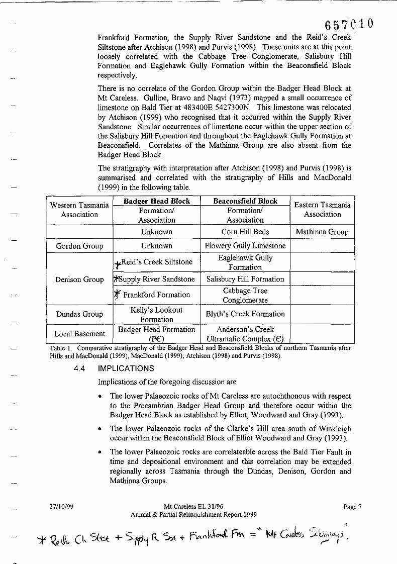
The stratigraphy with interpretation after Atchison (1998) and Purvis (1998) issummarised and correlated with the stratigraphy of Hills and MacDonald(1999) in the following table.
Western Tasmania Badl!:er Head Block Beaconsfield Block Eastern TasmaniaAssociation Formation! Formation! Association
Association Association
Unknown Corn Hill Beds Mathinna Group
Gordon Group Unknown Flowery Gully Limestone
-yR-eid's Creek Siltstone Eaglehawk GullyFormation
Denison Group r.t'Supply River Sandstone Salisbury Hill Formation
r Frankford Formation Cabbage TreeConglomerate
Dundas Group Kelly's Lookout Blyth's Creek FormationFormation
Local Basement Badger Head Formation Anderson's Creek(P€:) Ultramafic Comolex (€:)
Table J. Comparative stratigraphy of the Badger Head and Beaconsfield Blocks of northern Tasmama afterHills and MacDonald (1999), MacDonald (1999), Atchison (1998) and Purvis (1998).
4.4 IMPLICATIONS
Implications of the foregoing discussion are
• The lower Palaeozoic rocks of Mt Careless are autochthonous with respectto the Precambrian Badger Head Group and therefore occur within theBadger Head Block as established by Elliot, Woodward and Gray (1993).
• The lower Palaeozoic rocks of the Clarke's Hill area south of Winkleighoccur within the Beaconsfield Block of Elliot Woodward and Gray (1993).
• The lower Palaeozoic rocks are correlateable across the Bald Tier Fault intime and depositional environment and this correlation may be extendedregionally across Tasmania through the Dundas, Denison, Gordon andMathinna Groups.
27/10/99 Mt Careless EL 31/96Annnal & Partial Relinquishment Report 1999
Page 7
__~ H
~~)(}'tf..{f'-I,'J~I
657C11• However, the rocks were not locally juxtaposed at the time of deposition.
The foregoing discussion says little about the prospectivity of the Badger HeadBlock for mesothermal Tasmania Reef style gold deposits. It is noteworthyhowever that the discussion does establish a somewhat disparate geologicalhistory for the lower Palaeozoic rocks either side of the Bald Tier Fault. It isentirely plausible that differences in basement chemistry, in hydrothermalplumbing regimes or indeed in rock chemistry might make the geology west ofthe Bald Tier Fault less prospective. In any case, field investigations by Hart,Large and Stanton-Cook (1997) and Purvis (1998) have failed to locate anyindication of the presence of economic gold mineralisation in the area despitelocating numerous historical workings and undertaking large scale samplingprogrammes.
The prospectivity of EL 31/96 east of the Bald Tier Fault remains largelyuntested. However, the current understanding of the spatial geology asdiscussed herein enhances interest in the magnetic interpretation in the Clarke'sHill area discussed by Purvis (1998) and this will be pursued.
27/10/99 Mt Careless EL 31196Annual & Partial Relinquishment Report 1999
Page 8
657C125. RECOMMENDATIONS
Any future plans and recommendations await the release of pending AGSOaeromagnetic data. This data was originally due in August 1999 but release hasreportedly been delayed until November 1999.
Despite the delay in obtaining the data, it is recommended that the area west of theBald Tier Fault be relinquished. This recommendation is line with the foregoingdiscussion on the geology of EL 31/96 and reflects on the likely prospectivity for thediscovery of Tasmania Reef style gold mineralisation through conventional explorationduring the limited remaining tenure of the licence. The area to be retained totals 12skm.
,
27/10/99 Mt Careless EL 31/96Annual & Partial Relinquishment Report 1999
Page 9

------_ ..._-
657('136. EXPENDITURE
11.1 1999 EXPENDITURE
Little work was undertaken on EL 31/96 (Mt Careless) for the year to 8November 1999. Minor costs were incurred meeting final commitments toHonours Student David Atchison. The abstract of his thesis is appended to thisreport. Time and resources costs were also incurred in the analysis of data andpreparation of this report. Total costs including those discussed andadministrative costs are estimated at $5,000. Expenditure on the EL since itsgranting in November 1996 is estimated to total $81,422 against anexpenditure requirement during the first three years of the Licence of$71,750.
11.2 PROPOSED FUTURE EXPENDITURE
The future of EL 31/96 has yet to be determined and is awaiting the release ofAGSO aeromagnetic data originally scheduled for August 1999. AllstateExplorations NL has determined that a total of 29 skm in the western portionof the EL will be relinquished in any case. The rationale for that decision restswith the current understanding of the Geology of the Mt Careless area asoutlined above.
27/10/99 Mt Careless EL 31196Annual & Partial Relinquishment Report 1999
Page 10
------ --------
12. REFERENCES
Atchison, DJ., 1998. Geology and structure of the Mt Careless area, Frankford, NorthernTasmania. Unpublished BSc (Hons) Thesis. University of Tasmania.
Berry, R.F. and Crawford, AJ., 1988. The tectonic significance of Cambrian allochthonousmafic-ultramafic complexes in Tasmania. Australian Journal ofEarth Sciences 35:523-533.
Crawford, AJ. and Berry, R.F., 1992. Implications of late Proterozoic-early Palaeozoicigneous rock associations for the tectonic evolution of Tasmania. Tectonophysics 214:37-56.
Elliot, C.G., Woodward, N.B. and Gray, DR, 1993. Complex regional fault history of theBadger Head region, northern Tasmania. Australian Journal ofEarth Sciences, 40:155-168.
Gebert, H., 1967. Report on EL 13/65 and EL 14/65, Beaconsfield, Tasmania. BHPExploration Unpublished Open File Report No. TCR 67-465, Mineral ResourcesTasmania.
Gee, R.D. and Legge, PJ., 1979. Beaconsfield. Geological Survey Explanatory Report.Geological Atlas I Mile Series. Tasmania Department ofMines, Hobart.
Green, D.H., 1959. Geology of the Beaconsfield region, including the Anderson's CreekUltrabasic Complex, Records ofthe Queen Victoria Museum, Launceston, New SeriesNo. 10,
Gulline, A.B., Bravo, A.P. and Naqvi, 1.R., 1973. Frankford 1 Mile Map Sheet. TasmaniaDepartment of Mines.
Gulline, A.B., 1981. Frankford. Geological Survey Explanatory Report. Geological Atlas IMile Series. Tasmania Department ofMines, Hobart.
Hart, 1., Large C. and Stanton-Cook, K, 1997. Mt Careless Annual Report 1997, EL 31/96,, NE Tasmania. Allstate Explorations Unpublished Closed File Report, November
1997.
Hills, P.B. and MacDonald, G., 1999. EL 20/94 "Salisbury Hill" Mid-Term RelinquishmentReport 1999. Beaconsfield Mine JV
Jago, J.B. and Brown, A.V., 1989. Middle to Upper Cambrian Fossiliferous Rocks. In,Geology and Mineral Resource of Tasmanta (Eds C.F. Burrett and E.L. Martin).Geological Society of Australia Special Publication 15.
MacDonald, G., 1999. EL 20/94 "Salisbury Hill" Annual Report 1998/99. BeaconsfieldMine J.V
Purvis, GJ., 1998. EL 31/96 "Mt Careless" Annual Report 1998. Allstate Explorations NL.
27/10/99 Mt Careless EL 31/96Annual & Partial Relinquishment Report 1999
Page 11

APPENDIX 1
1"""1 NOU THESIS ABSTRACT - D.,'. ATCHISON

657Ci6
ABSTRACT
A regional mapping program over 22 square kilometers in the Mt Careless area was
carried out to determine the potential for Beaconsfeild style gold mineralisation in Mt
Careless EL 31/96. The area is composed of an upward fining sequence of
Ordovician siliciclastic conglomerates, sandstones and siltstone, correlated to the
Denison Group. The sequence laps unconformably onto Proterozoic sediments of the
Badger Head Group and youngs to the southeast. It differs from other Ordovician
sequences of northern Tasmania by the absence ofGordon Group correlates.
Sediments have been derived from the Proterozoic Badger Head Group, and the
Cambrian Mt Read Volcanics and Andersons Creek ultramafic complex. Deposition
of the Mt Careless Subgroup is marked by a transition in depositional environments,
from fluvial to possible shoreline deposits at the base of the sequence, and subwave
base to intertidal deposits at the top. Conodonts of Caradoc age, recorded halfway up
the succession, limit the age of the Mt Careless Subgroup.
The Mt Careless area is characterised by two NNE striking thrust faults, formed
, during the Middle Devonian Tabberabberan Orogeny. Thrusting resulted in the
repetition of basal units towards the top of the sequence, and is related to thrusting in
the Beaconsfield area. Two folding events influenced the Mt Careless area, and occur
as NNE-NNW (Fl) and SE (F2) plunging folds. Northwest striking normal faults
(D3) and northwest and northeast striking wrench faults (F4) have offset lithological
contacts and earlier deformation structures.
Whole rock analysis and immobile element studies suggests the Mt Careless
Subgroup is geochemically similar to the Cabbage Tree Formation of Beaconsfield.
Sediments have compositions compatible with derivation from the same source, and
are proposed to represent proximal and distal deposits of equivalent stratigraphic
units. Although both areas have similar deformation histories, the absence of D2
through-going shears in the Mt Careless area reduces the potential for Beaconsfield
style gold mineralisation.