Embed Size (px)
Citation preview
AIXM & WXXM ConferenceMay 12-14th 2009
“Importing and Exporting from Airport GIS Formats” – Day 3
Dejan M. DamjanovicDirector, Airport Mapping
Database Programs
2
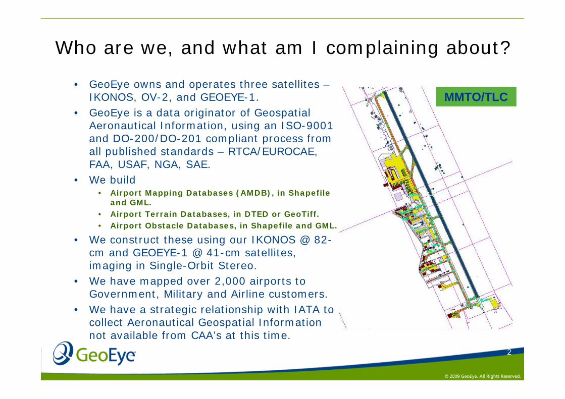
Who are we, and what am I complaining about?
• GeoEye owns and operates three satellites –IKONOS, OV-2, and GEOEYE-1.
• GeoEye is a data originator of Geospatial Aeronautical Information, using an ISO-9001 and DO-200/DO-201 compliant process from all published standards – RTCA/EUROCAE, FAA, USAF, NGA, SAE.
• We build • Airport Mapping Databases (AMDB), in Shapefile
and GML.• Airport Terrain Databases, in DTED or GeoTiff.• Airport Obstacle Databases, in Shapefile and GML.
• We construct these using our IKONOS @ 82-cm and GEOEYE-1 @ 41-cm satellites, imaging in Single-Orbit Stereo.
• We have mapped over 2,000 airports to Government, Military and Airline customers.
• We have a strategic relationship with IATA to collect Aeronautical Geospatial Information not available from CAA’s at this time.
MMTO/TLC
3
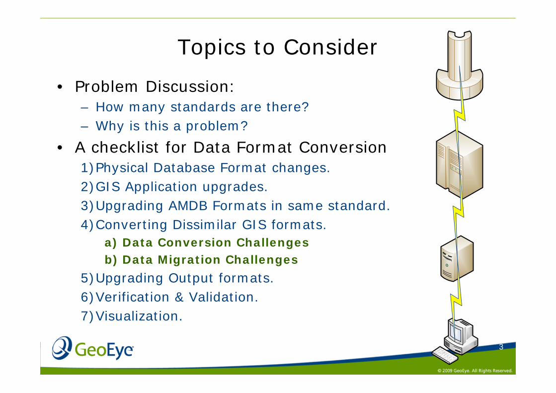
Topics to Consider
• Problem Discussion:– How many standards are there?– Why is this a problem?
• A checklist for Data Format Conversion1)Physical Database Format changes.2)GIS Application upgrades.3)Upgrading AMDB Formats in same standard.4)Converting Dissimilar GIS formats.
a) Data Conversion Challengesb) Data Migration Challenges
5)Upgrading Output formats.6)Verification & Validation.7)Visualization.
4
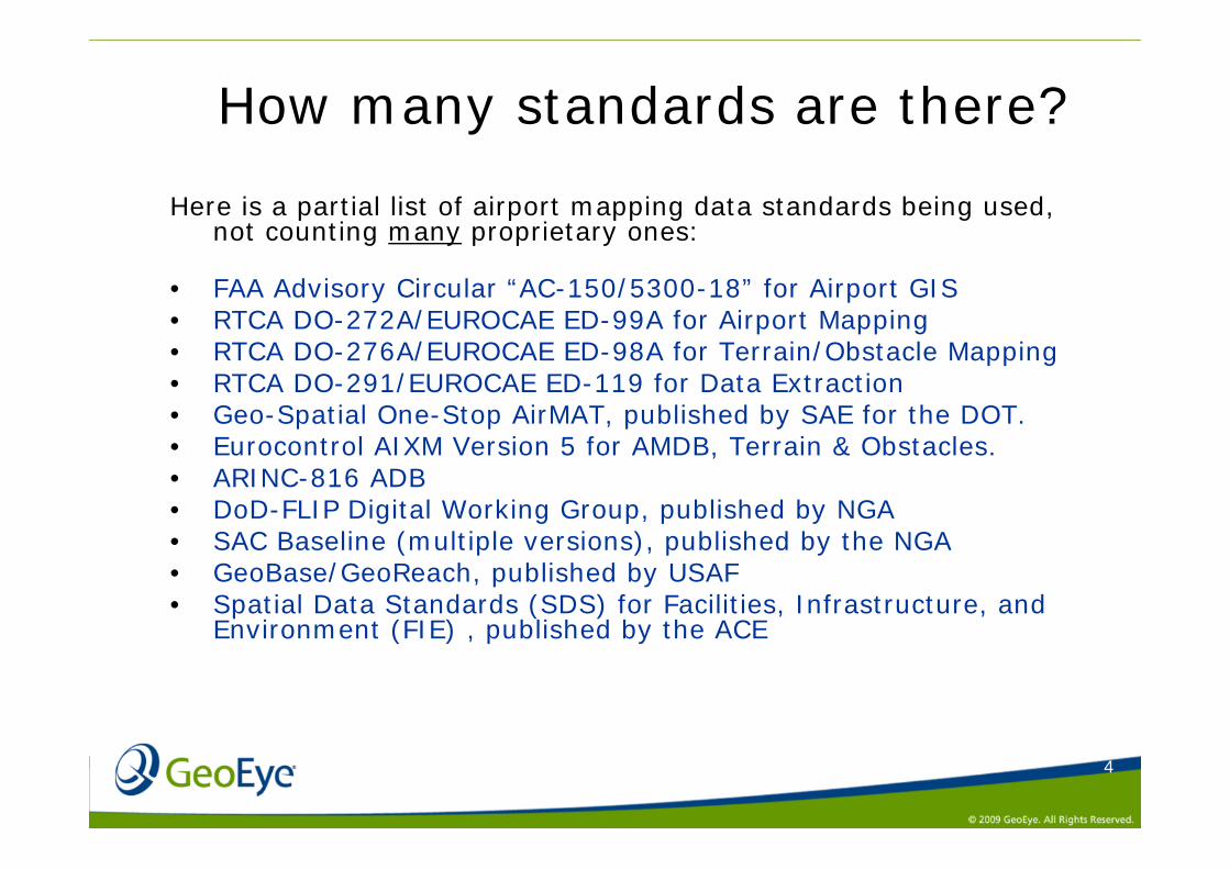
How many standards are there?
Here is a partial list of airport mapping data standards being used, not counting many proprietary ones:
• FAA Advisory Circular “AC-150/5300-18” for Airport GIS• RTCA DO-272A/EUROCAE ED-99A for Airport Mapping• RTCA DO-276A/EUROCAE ED-98A for Terrain/Obstacle Mapping• RTCA DO-291/EUROCAE ED-119 for Data Extraction• Geo-Spatial One-Stop AirMAT, published by SAE for the DOT.• Eurocontrol AIXM Version 5 for AMDB, Terrain & Obstacles.• ARINC-816 ADB• DoD-FLIP Digital Working Group, published by NGA• SAC Baseline (multiple versions), published by the NGA• GeoBase/GeoReach, published by USAF• Spatial Data Standards (SDS) for Facilities, Infrastructure, and
Environment (FIE) , published by the ACE
5
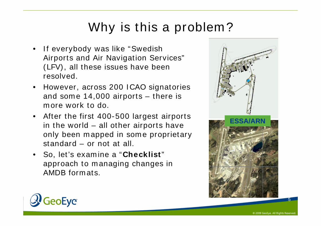
Why is this a problem?
• If everybody was like “Swedish Airports and Air Navigation Services”(LFV), all these issues have been resolved.
• However, across 200 ICAO signatories and some 14,000 airports – there is more work to do.
• After the first 400-500 largest airports in the world – all other airports have only been mapped in some proprietary standard – or not at all.
• So, let’s examine a “Checklist”approach to managing changes in AMDB formats.
ESSA/ARN
6
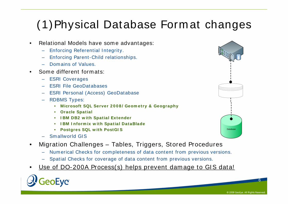
(1)Physical Database Format changes• Relational Models have some advantages:
– Enforcing Referential Integrity.– Enforcing Parent-Child relationships.– Domains of Values.
• Some different formats:– ESRI Coverages– ESRI File GeoDatabases– ESRI Personal (Access) GeoDatabase– RDBMS Types:
• Microsoft SQL Server 2008/Geometry & Geography• Oracle Spatial• IBM DB2 with Spatial Extender• IBM Informix with Spatial DataBlade• Postgres SQL with PostGIS
– Smallworld GIS
• Migration Challenges – Tables, Triggers, Stored Procedures– Numerical Checks for completeness of data content from previous versions.– Spatial Checks for coverage of data content from previous versions.
• Use of DO-200A Process(s) helps prevent damage to GIS data!
Database
7
(2) GIS Application upgrades
• Major Version Changes are not always backward compatible, or backwards compatibility is handled differently:– ARC/GIS 8.3– ARC/GIS 9– ARC/GIS 9.1– ARC/GIS 9.2– ARC/GIS 9.3
• Error Handling may change.• Application Language Support changes over time as new
languages arise or gain in popularity.• Ability to handle specialized data such as Imagery changes
over time.• Temporal Handling & Versioning changes.• Multi-User functionality (Job Tracking).• Use of DO-200A Process(s) helps prevent damage to GIS data!
8
(3) Upgrading AMDB Formats same standard
• RTCA DO-272/EUROCAE ED-99 “Baseline” published 2001– 10 Runway Features– 3 Helipad Features– 7 Taxiway Features– 6 Apron Features– 3 Vertical Structures– Construction Areas– Quality Data
• RTCA DO-291/EUROCAE ED-119 published in 2004• Revision (A) published in 2005
– Integration with Annex-15 Ammd-33, AIRAC accommodation, Geometric Relations and Constraints formally listed, Data Content & Capture Rules strengthened, Service Roads & Thresholds added, Clearways removed.
• Revision (B) published in 2008– New Features of Blastpad, Water, Hotspot, Aerodrome Surface Lighting, Attribute
idnumbers added, Rules clarified, number of attribute changes, changes to Codelists, further harmonization with ARINC-816 and AIXM.
• Use of DO-200A Process(s) helps prevent damage to GIS data!
9
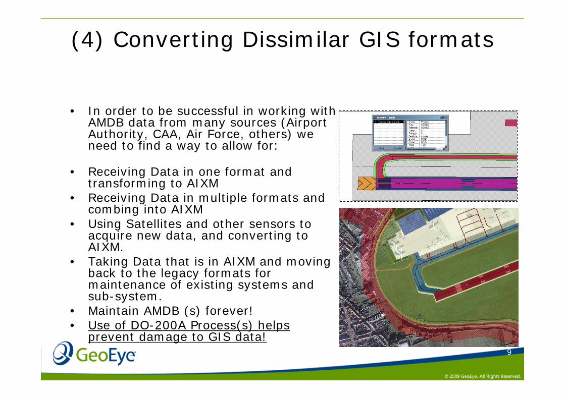
(4) Converting Dissimilar GIS formats
• In order to be successful in working with AMDB data from many sources (Airport Authority, CAA, Air Force, others) we need to find a way to allow for:
• Receiving Data in one format and transforming to AIXM
• Receiving Data in multiple formats and combing into AIXM
• Using Satellites and other sensors to acquire new data, and converting to AIXM.
• Taking Data that is in AIXM and moving back to the legacy formats for maintenance of existing systems and sub-system.
• Maintain AMDB (s) forever!• Use of DO-200A Process(s) helps
prevent damage to GIS data!
10
Data Conversion Challenge:
Physical: Is the data in the correct
NUMERICAL or TEXT formats?
Logical: Is the data in the
appropriate range of frequencies 108-136 mhz?
Temporal: Is the beginning effective
date and ending effective data of the data match the desired target?
Parent-Child: Does this airport have a
taxiway A, B and C?
Geospatial: Does these runway
coordinates fall within a buffer of the ARP?
Completeness: Did we get all the six
taxiways?
Update Metaphor: Whole AMDB? Parts of AMDB?
11
Data Conversion Challenges:
Device Specific Specific FMS or HUD or EFB
device may require additional data per location of some kind.
Aircraft Specific Specific performance
characteristic of A/C may be required (climb performance, turn radius on single engine or RNP for Surface Movements).
Operator Specific Information regarding Gates
or Parking positions only used / owned by specific airline.
12
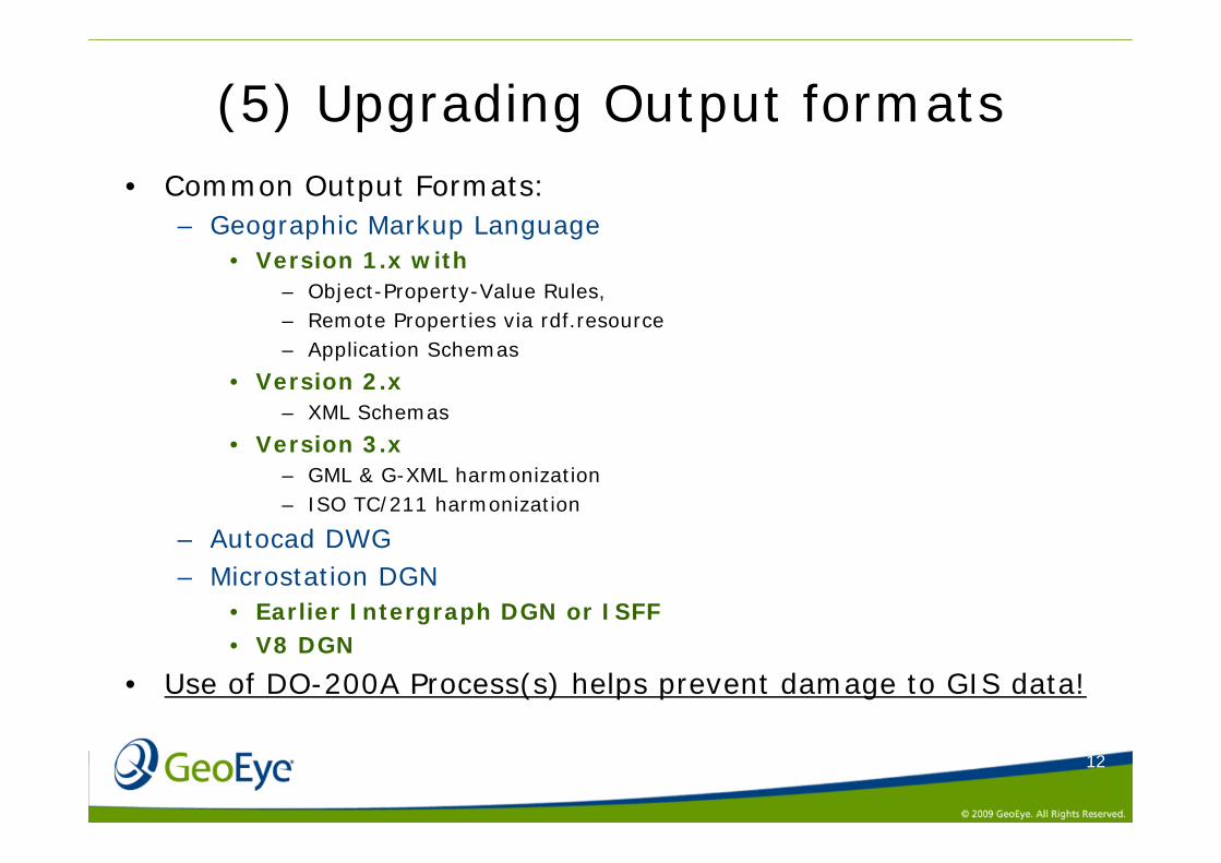
(5) Upgrading Output formats• Common Output Formats:
– Geographic Markup Language• Version 1.x with
– Object-Property-Value Rules,– Remote Properties via rdf.resource– Application Schemas
• Version 2.x– XML Schemas
• Version 3.x– GML & G-XML harmonization– ISO TC/211 harmonization
– Autocad DWG– Microstation DGN
• Earlier Intergraph DGN or ISFF• V8 DGN
• Use of DO-200A Process(s) helps prevent damage to GIS data!
13
(6) Verification & Validation
• Critical to develop tools at every step of each process, to ensure data integrity, quality, and adherence to published rules.
• Need to be able to record execution of rules, and maintain history of rules with versions of AMDB that may have changed.
• Need to consider when format transformations occur (e.g. Shapefile to GML), what additional toolsets are needed to ensure same data fidelity.
• Use of DO-200A Process(s) helps prevent damage to GIS data!
14
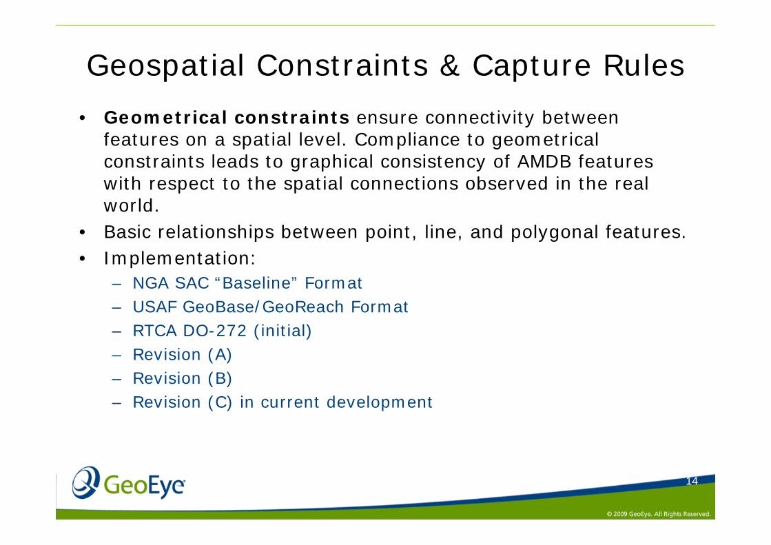
Geospatial Constraints & Capture Rules
• Geometrical constraints ensure connectivity between features on a spatial level. Compliance to geometrical constraints leads to graphical consistency of AMDB features with respect to the spatial connections observed in the real world.
• Basic relationships between point, line, and polygonal features.• Implementation:
– NGA SAC “Baseline” Format– USAF GeoBase/GeoReach Format– RTCA DO-272 (initial)– Revision (A)– Revision (B)– Revision (C) in current development
15
Run
way
Elem
ent
RunwayElementRunwayIntersection 1RunwayDisplacedArea 2RunwayShoulder 3 3 3 3Stopway 4 4 4 3RunwayMarking 5 5 5 3 5 7TaxiwayElement 6 8 15TaxiwayShoulder 16 25FrequencyAreaApronElement 17 26ParkingStandArea 18 27 33DeicingArea 19 28 36VerticaPolygonalStructure 29ConstructionAreaFinalApproachAndTakeOffAreaTouchDownLiftOffArea 40ServiceRoadArrestingGearLocation 10 10 10PaintedCenterline 11 11 12 12 43LandAndHoldShortOperationsLocation 9 44TaxiwayGuidanceLine 20 30 37TaxiwayIntersectionMarking 21 47TaxiwayHoldingPosition 22 48RunwayExitLine 13 13 23 45 49 51StandGuidanceLine 24 31 34 38 50VerticalLineStructureRunwayThreshold 14 14 14 46ParkingStandLocation 32 35 39 52VerticalPointStructureSurveyControlPointAerodromeReferencePointHelipadThreshold 41 42
Serv
iceR
oad
Polygons
Arre
stin
gGea
rLoc
atio
n
Black cell : geometrical connection is recommended and explicit rule is given below
White cell : geometrical connection is not recommended
Yellow cell : geometrical connection is possible without specific recommendation
Polygons
Taxi
way
Shou
lder
Freq
uenc
yAre
a
Points
Lines
Touc
hDow
nLift
OffA
rea
Run
way
Inte
rsec
tion
Run
way
Dis
plac
edAr
ea
Run
way
Shou
lder
Stop
way
Run
way
Mar
king
Taxi
way
Elem
ent
Con
stru
ctio
nAre
a
Fina
lApp
roac
hAnd
Take
OffA
rea
Apro
nEle
men
t
Par
king
Stan
dAre
a
Dei
cing
Area
Verti
caPo
lygo
nalS
truct
ure
Lines
Pain
tedC
ente
rline
Land
AndH
oldS
hortO
pera
tions
Loca
tion
Taxi
way
Gui
danc
eLin
e
Taxi
way
Inte
rsec
tionM
arki
ng
Taxi
way
Hol
ding
Posi
tion
Hel
ipad
Thre
shol
d
Points
Run
way
ExitL
ine
Stan
dGui
danc
eLin
e
Verti
calL
ineS
truct
ure
Run
way
Thre
shol
d
Park
ingS
tand
Loca
tion
Verti
calP
oint
Stru
ctur
e
Surv
eyC
ontro
lPoi
nt
Aero
drom
eRef
eren
cePo
int
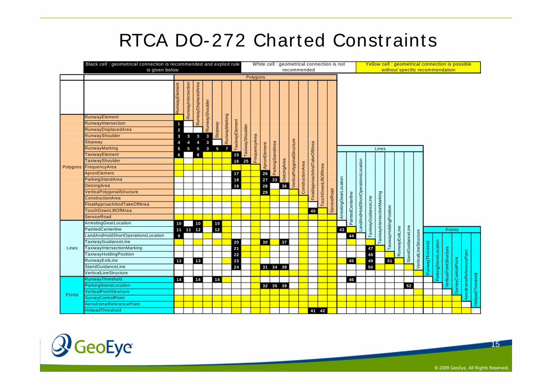
RTCA DO-272 Charted Constraints
16
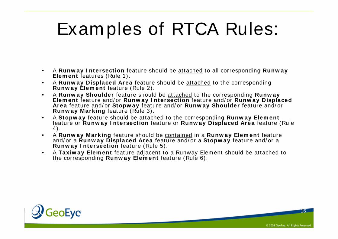
Examples of RTCA Rules:
• A Runway Intersection feature should be attached to all corresponding Runway Element features (Rule 1).
• A Runway Displaced Area feature should be attached to the corresponding Runway Element feature (Rule 2).
• A Runway Shoulder feature should be attached to the corresponding Runway Element feature and/or Runway Intersection feature and/or Runway Displaced Area feature and/or Stopway feature and/or Runway Shoulder feature and/or Runway Marking feature (Rule 3).
• A Stopway feature should be attached to the corresponding Runway Elementfeature or Runway Intersection feature or Runway Displaced Area feature (Rule 4).
• A Runway Marking feature should be contained in a Runway Element feature and/or a Runway Displaced Area feature and/or a Stopway feature and/or a Runway Intersection feature (Rule 5).
• A Taxiway Element feature adjacent to a Runway Element should be attached to the corresponding Runway Element feature (Rule 6).
17
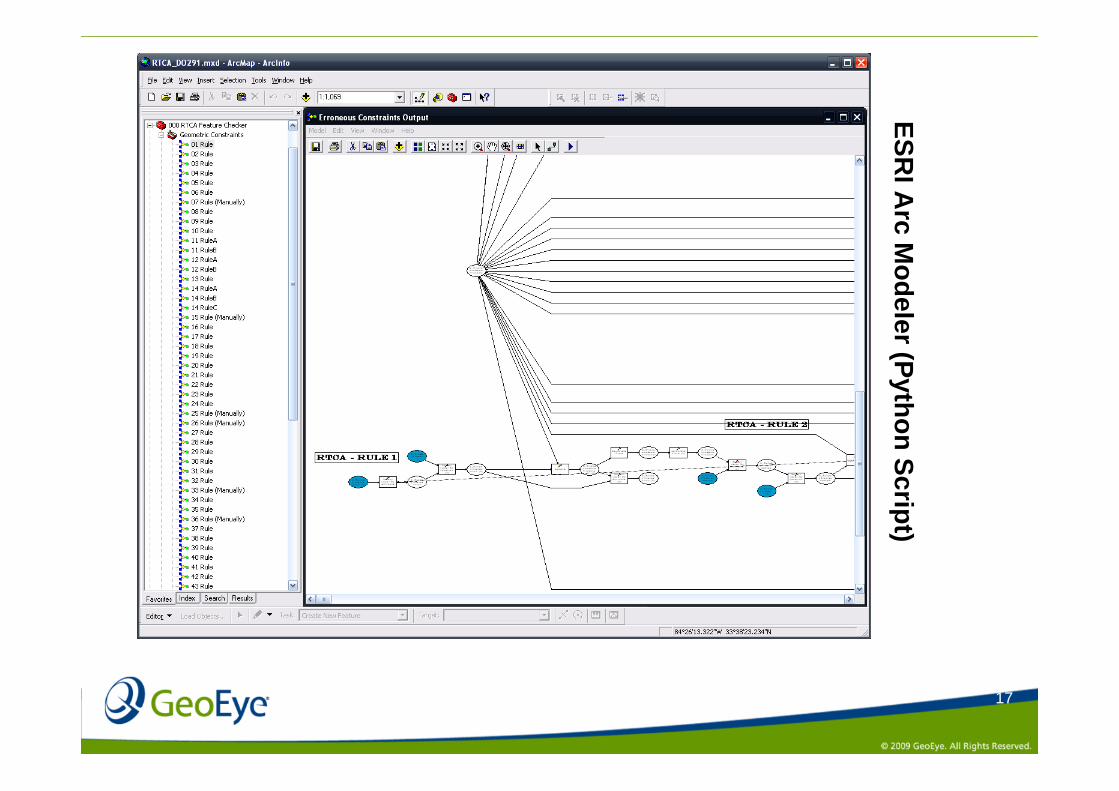
ESRI A
rc Modeler (Python Script)
18
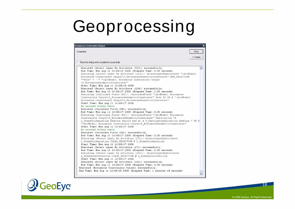
Geoprocessing
19
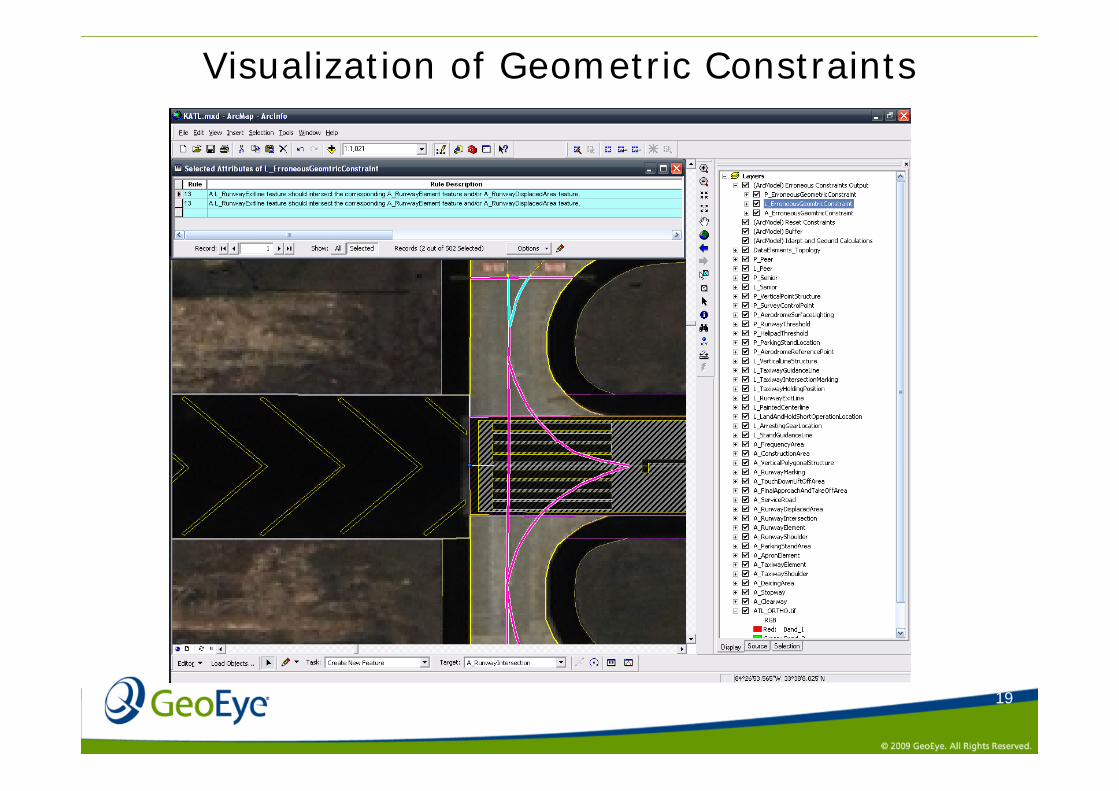
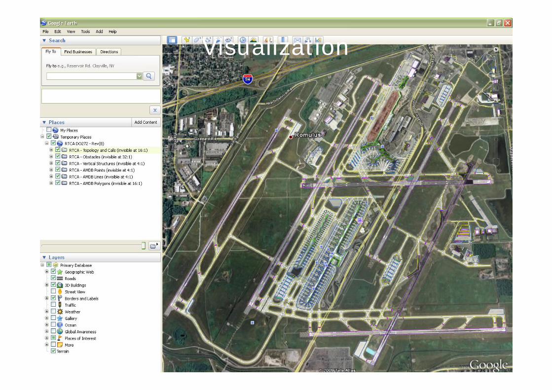
Visualization of Geometric Constraints
20
Visualization