Embed Size (px)
Citation preview
Airports and Airspace
PHAK Chapters 13, 14http://www.faa.gov/library/manuals/aviation/pilot_handbook/
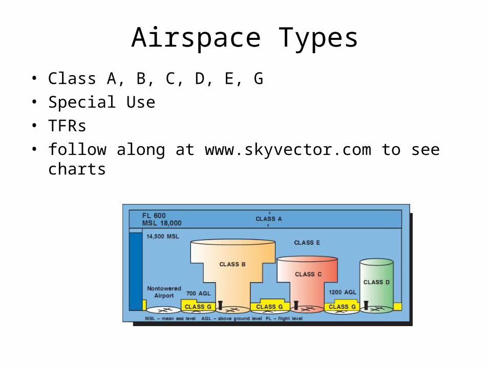
Airspace Types• Class A, B, C, D, E, G• Special Use• TFRs• follow along at www.skyvector.com to see charts
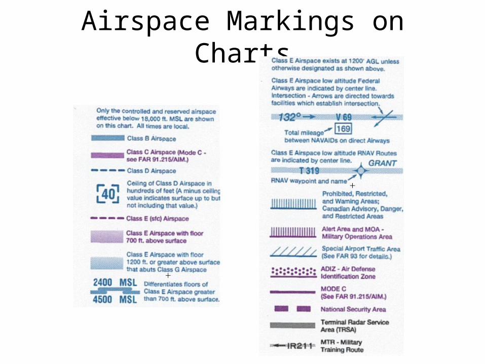
Airspace Markings on Charts
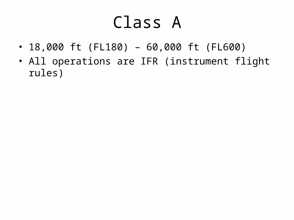
Class A• 18,000 ft (FL180) – 60,000 ft (FL600)• All operations are IFR (instrument flight rules)
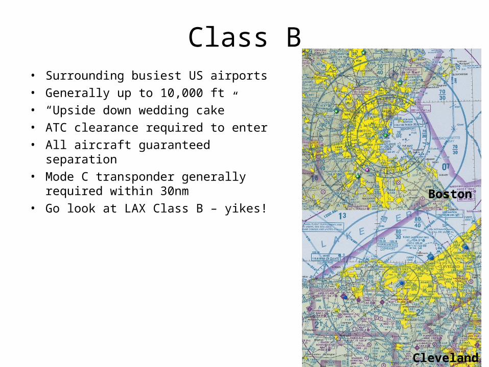
Class B• Surrounding busiest US airports• Generally up to 10,000 ft• “Upside down wedding cake”• ATC clearance required to enter• All aircraft guaranteed separation• Mode C transponder generally
required within 30nm• Go look at LAX Class B – yikes!
Boston
Cleveland
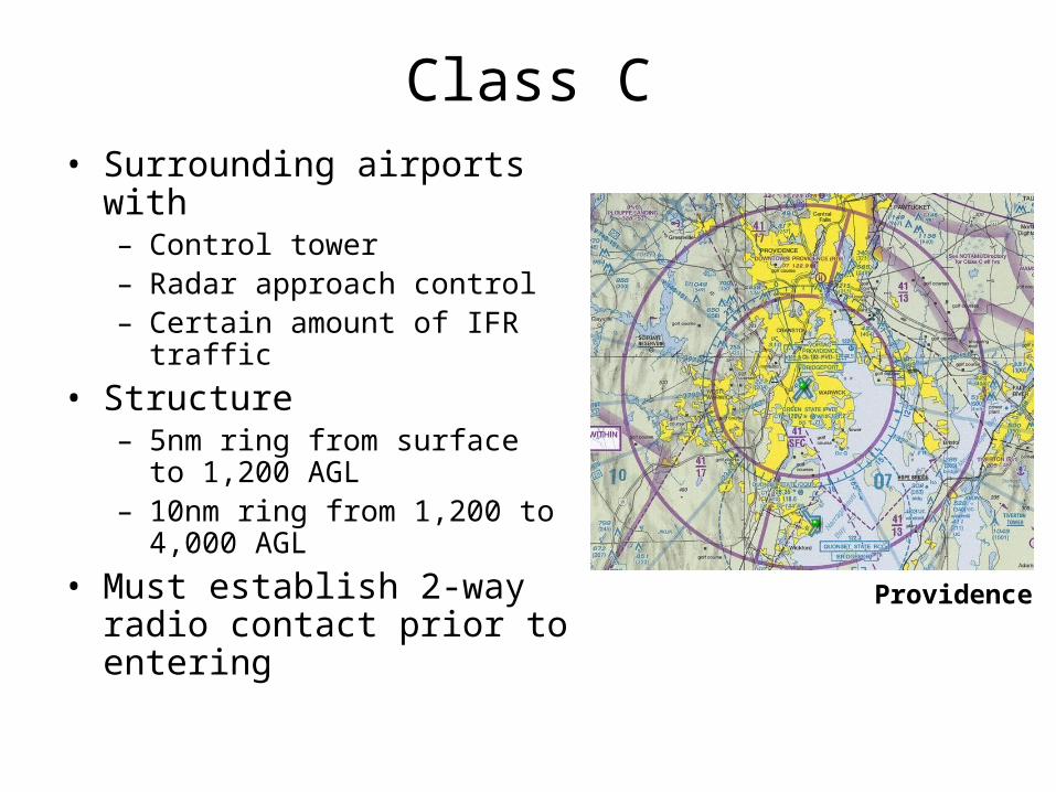
Class C• Surrounding airports with
– Control tower– Radar approach control– Certain amount of IFR traffic
• Structure– 5nm ring from surface to 1,200
AGL– 10nm ring from 1,200 to 4,000
AGL
• Must establish 2-way radio contact prior to entering
Providence
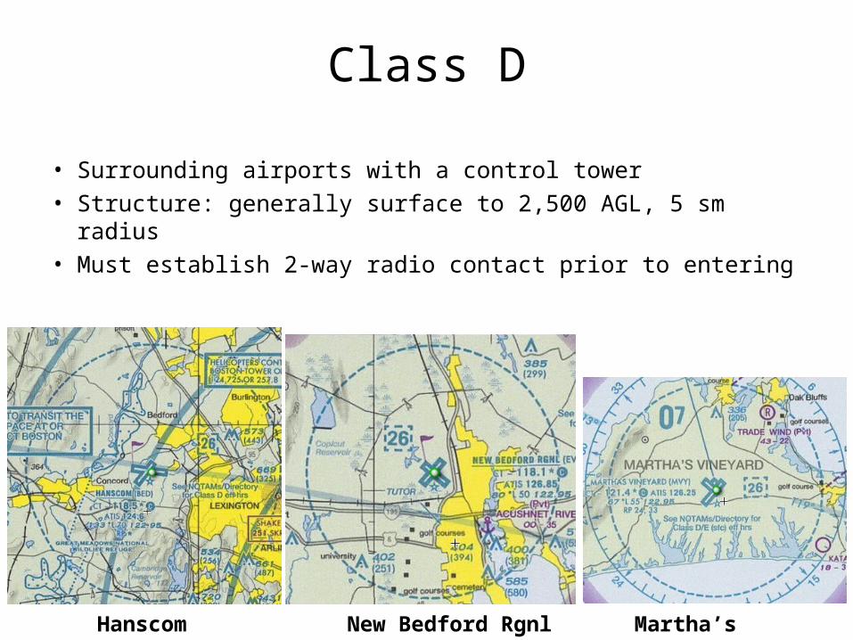
Class D
• Surrounding airports with a control tower• Structure: generally surface to 2,500 AGL, 5 sm radius• Must establish 2-way radio contact prior to entering
Martha’s VineyardNew Bedford RgnlHanscom
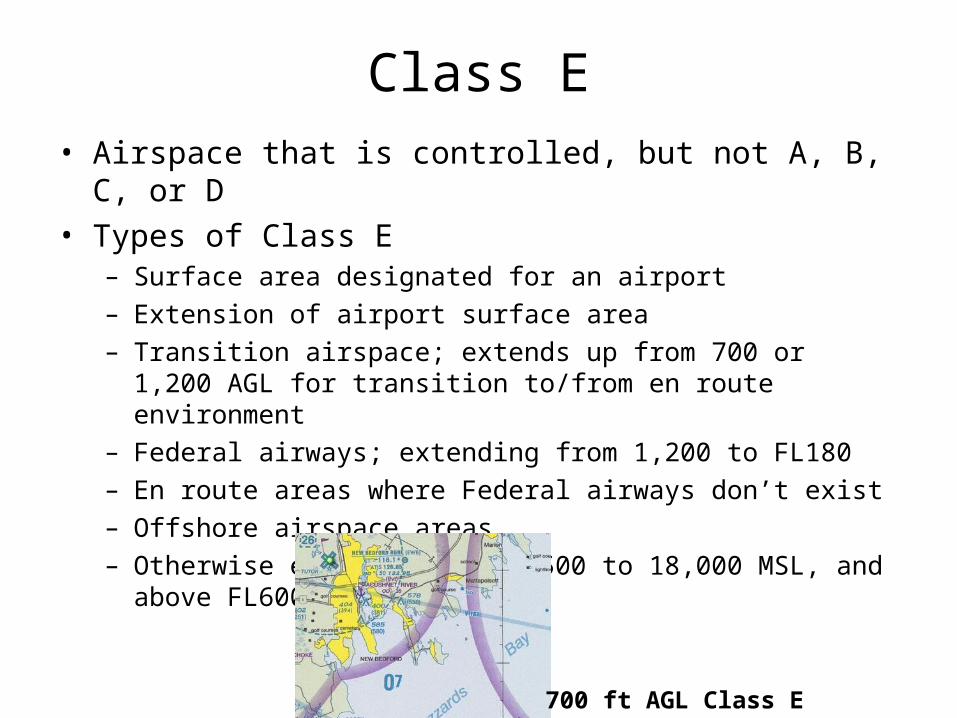
Class E• Airspace that is controlled, but not A, B, C, or D• Types of Class E
– Surface area designated for an airport– Extension of airport surface area– Transition airspace; extends up from 700 or 1,200 AGL for
transition to/from en route environment– Federal airways; extending from 1,200 to FL180– En route areas where Federal airways don’t exist– Offshore airspace areas– Otherwise extends from 14,500 to 18,000 MSL, and above
FL600
700 ft AGL Class E
Class G• Uncontrolled airspace• Airspace that is not A, B, C, D, or E• Extends from surface to overlying Class E
Special Use Airspace• Prohibited areas• Restricted areas• Warning areas• Military Operation Areas (MOAs)• Alert areas• Controlled Firing Areas (CFAs)

Prohibied Areas• Flight is NOT permitted here, EVER• Established for national security• Examples: White House, Camp David• i.e. “Prohibited P-31”
Bush’s Ranch in Crawford, TX
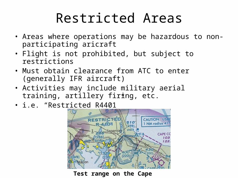
Restricted Areas• Areas where operations may be hazardous to non-
participating aricraft• Flight is not prohibited, but subject to restrictions• Must obtain clearance from ATC to enter (generally IFR
aircraft)• Activities may include military aerial training, artillery
firing, etc.• i.e. “Restricted R4401”
Test range on the Cape
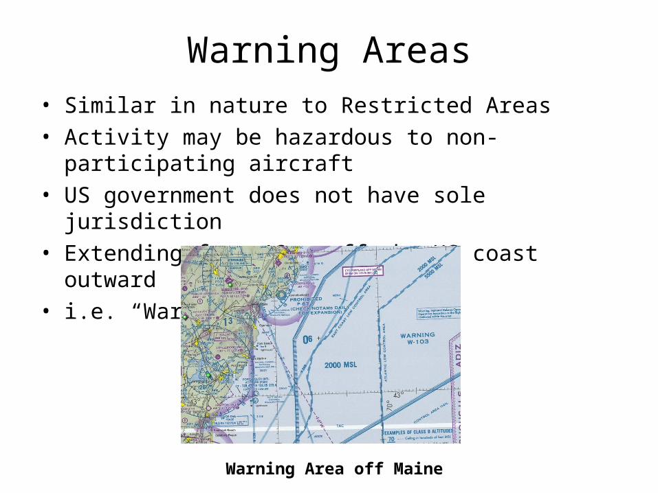
Warning Areas• Similar in nature to Restricted Areas• Activity may be hazardous to non-participating aircraft• US government does not have sole jurisdiction• Extending from 12nm off the US coast outward• i.e. “Warning W-237”
Warning Area off Maine
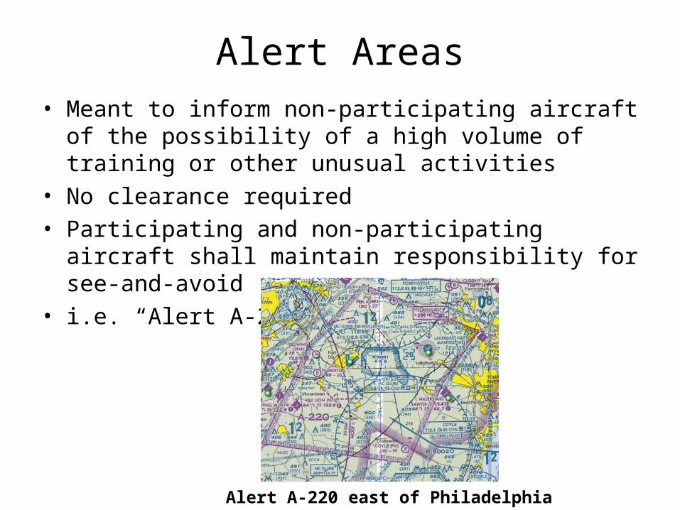
Alert Areas• Meant to inform non-participating aircraft of the
possibility of a high volume of training or other unusual activities
• No clearance required• Participating and non-participating aircraft shall maintain
responsibility for see-and-avoid• i.e. “Alert A-209”
Alert A-220 east of Philadelphia
Controlled Firing Areas• Contain activities, which if not conducted in a controlled
environment, would pose a hazard to aircraft• Primary distinction: when an aircraft is detected
approaching the area, activities must be suspended• Not marked on charts
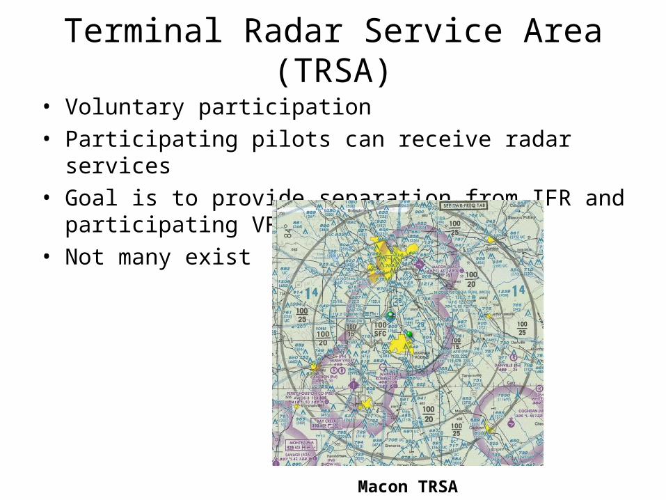
Terminal Radar Service Area (TRSA)
• Voluntary participation• Participating pilots can receive radar services• Goal is to provide separation from IFR and participating
VFR traffic• Not many exist
Macon TRSA
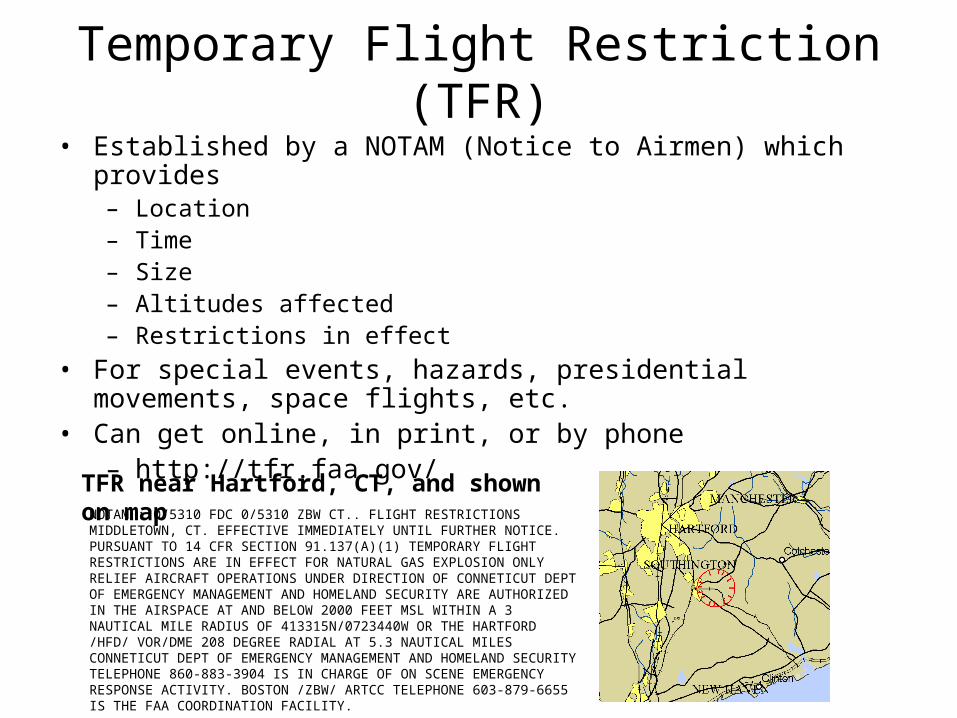
Temporary Flight Restriction (TFR)• Established by a NOTAM (Notice to Airmen) which provides
– Location– Time– Size– Altitudes affected– Restrictions in effect
• For special events, hazards, presidential movements, space flights, etc.
• Can get online, in print, or by phone– http://tfr.faa.gov/
NOTAM : 0/5310 FDC 0/5310 ZBW CT.. FLIGHT RESTRICTIONS MIDDLETOWN, CT. EFFECTIVE IMMEDIATELY UNTIL FURTHER NOTICE. PURSUANT TO 14 CFR SECTION 91.137(A)(1) TEMPORARY FLIGHT RESTRICTIONS ARE IN EFFECT FOR NATURAL GAS EXPLOSION ONLY RELIEF AIRCRAFT OPERATIONS UNDER DIRECTION OF CONNETICUT DEPT OF EMERGENCY MANAGEMENT AND HOMELAND SECURITY ARE AUTHORIZED IN THE AIRSPACE AT AND BELOW 2000 FEET MSL WITHIN A 3 NAUTICAL MILE RADIUS OF 413315N/0723440W OR THE HARTFORD /HFD/ VOR/DME 208 DEGREE RADIAL AT 5.3 NAUTICAL MILES CONNETICUT DEPT OF EMERGENCY MANAGEMENT AND HOMELAND SECURITY TELEPHONE 860-883-3904 IS IN CHARGE OF ON SCENE EMERGENCY RESPONSE ACTIVITY. BOSTON /ZBW/ ARTCC TELEPHONE 603-879-6655 IS THE FAA COORDINATION FACILITY.
TFR near Hartford, CT, and shown on map
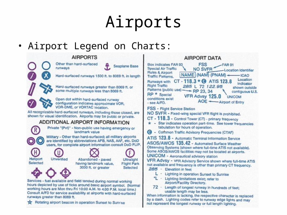
Airports• Airport Legend on Charts:
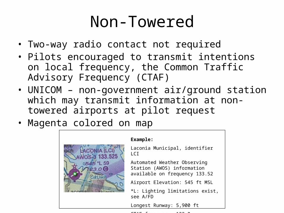
Non-Towered• Two-way radio contact not required• Pilots encouraged to transmit intentions on local
frequency, the Common Traffic Advisory Frequency (CTAF)
• UNICOM – non-government air/ground station which may transmit information at non-towered airports at pilot request
• Magenta colored on map
Example:
Laconia Municipal, identifier LCI
Automated Weather Observing Station (AWOS) information available on frequency 133.52
Airport Elevation: 545 ft MSL
*L: Lighting limitations exist, see A/FD
Longest Runway: 5,900 ft
CTAF frequency: 123.0
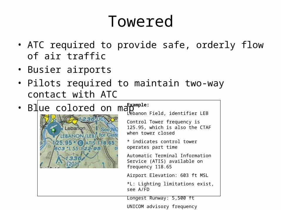
Towered• ATC required to provide safe, orderly flow of air traffic• Busier airports• Pilots required to maintain two-way contact with ATC• Blue colored on map
Example:
Lebanon Field, identifier LEB
Control Tower frequency is 125.95, which is also the CTAF when tower closed
* indicates control tower operates part time
Automatic Terminal Information Service (ATIS) available on frequency 118.65
Airport Elevation: 603 ft MSL
*L: Lighting limitations exist, see A/FD
Longest Runway: 5,500 ft
UNICOM advisory frequency available on 122.95
Sources of Airport Info• Aeronautical Charts• Airport/Facility Directory (A/FD)• Notices to Airmen (NOTAM)• Internet
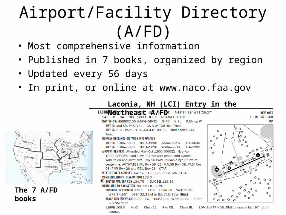
Airport/Facility Directory (A/FD)• Most comprehensive information• Published in 7 books, organized by region• Updated every 56 days• In print, or online at www.naco.faa.gov
The 7 A/FD books
Laconia, NH (LCI) Entry in the Northeast A/FD
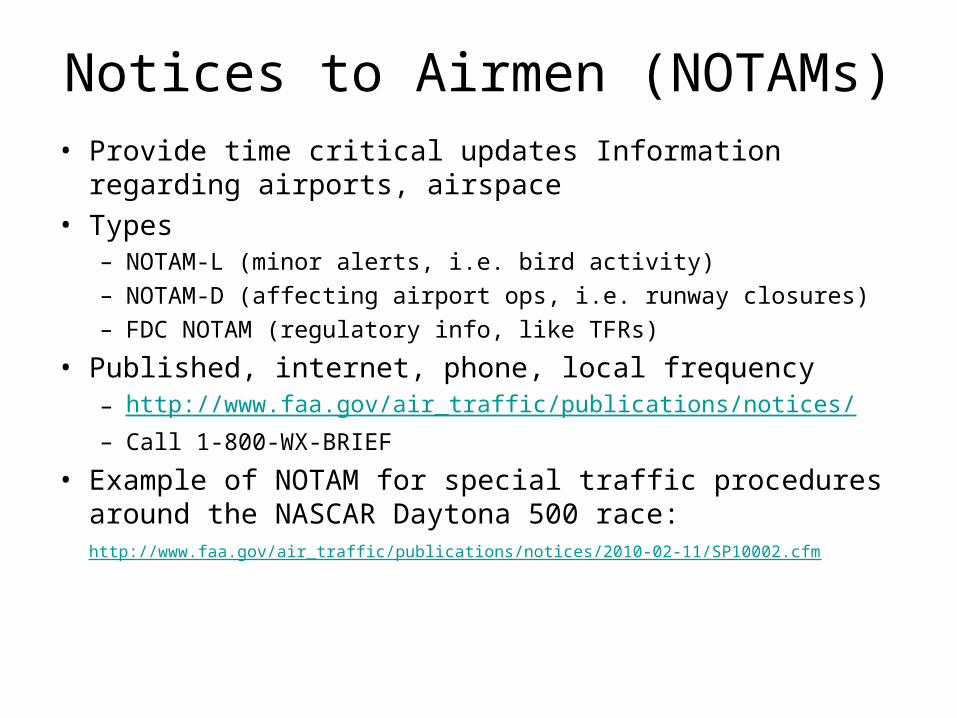
Notices to Airmen (NOTAMs)• Provide time critical updates Information regarding
airports, airspace• Types
– NOTAM-L (minor alerts, i.e. bird activity)– NOTAM-D (affecting airport ops, i.e. runway closures)– FDC NOTAM (regulatory info, like TFRs)
• Published, internet, phone, local frequency– http://www.faa.gov/air_traffic/publications/notices/ – Call 1-800-WX-BRIEF
• Example of NOTAM for special traffic procedures around the NASCAR Daytona 500 race: http://www.faa.gov/air_traffic/publications/notices/2010-02-11/SP10002.cfm
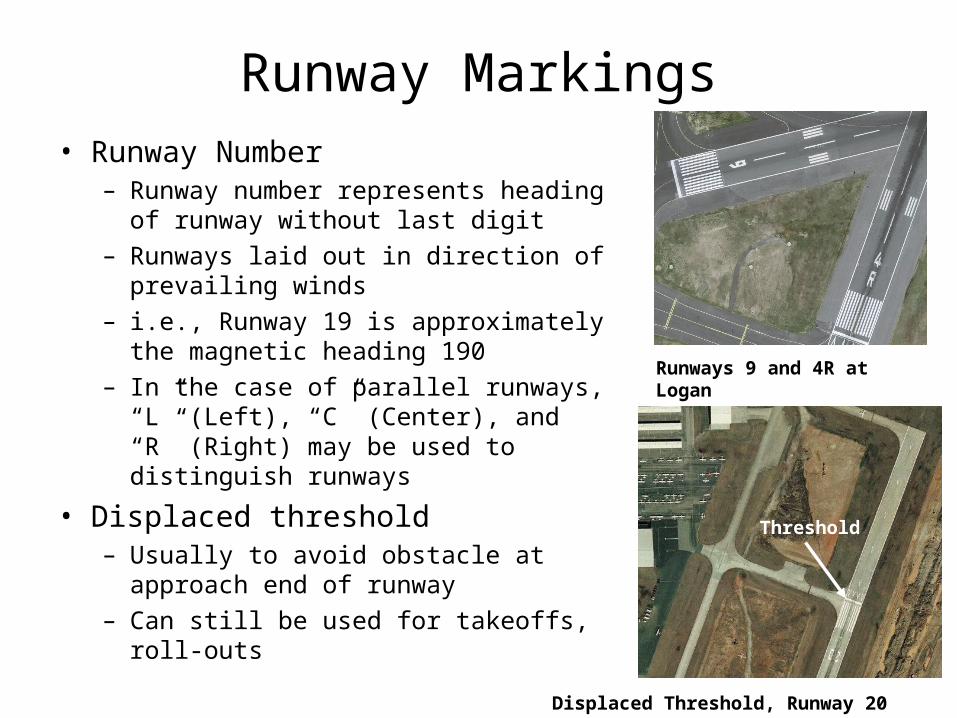
Runway Markings• Runway Number
– Runway number represents heading of runway without last digit
– Runways laid out in direction of prevailing winds
– i.e., Runway 19 is approximately the magnetic heading 190
– In the case of parallel runways, “L” (Left), “C” (Center), and “R” (Right) may be used to distinguish runways
• Displaced threshold– Usually to avoid obstacle at approach
end of runway– Can still be used for takeoffs, roll-outs
Runways 9 and 4R at Logan
Displaced Threshold, Runway 20 at PDK
Threshold
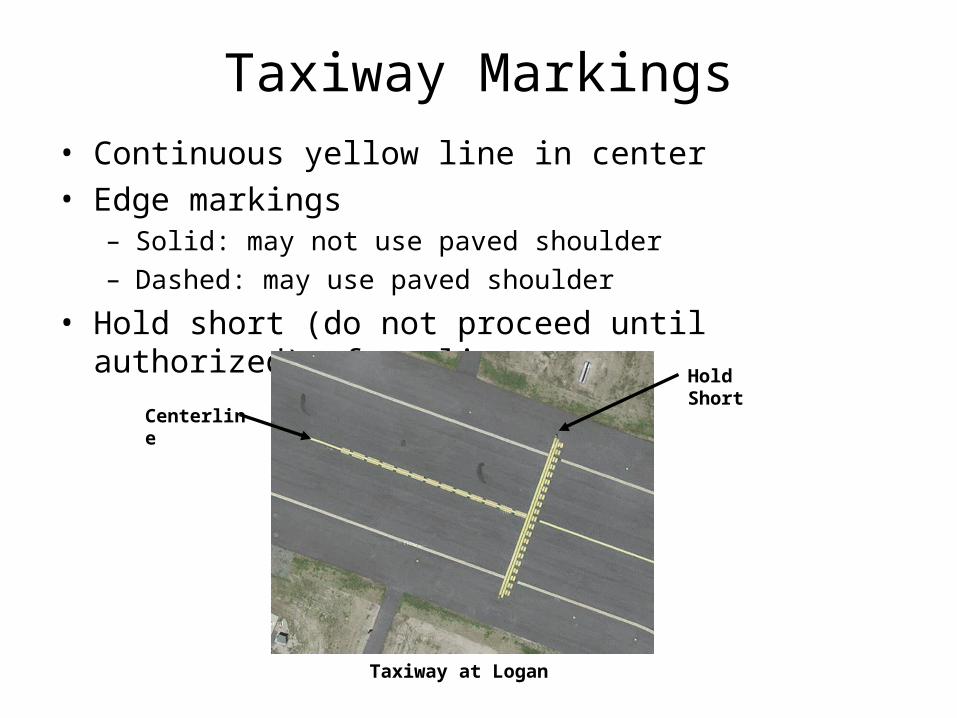
Taxiway Markings• Continuous yellow line in center• Edge markings
– Solid: may not use paved shoulder– Dashed: may use paved shoulder
• Hold short (do not proceed until authorized): four lines
Taxiway at Logan
Centerline
Hold Short
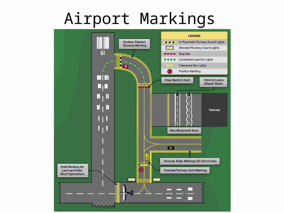
Airport Markings
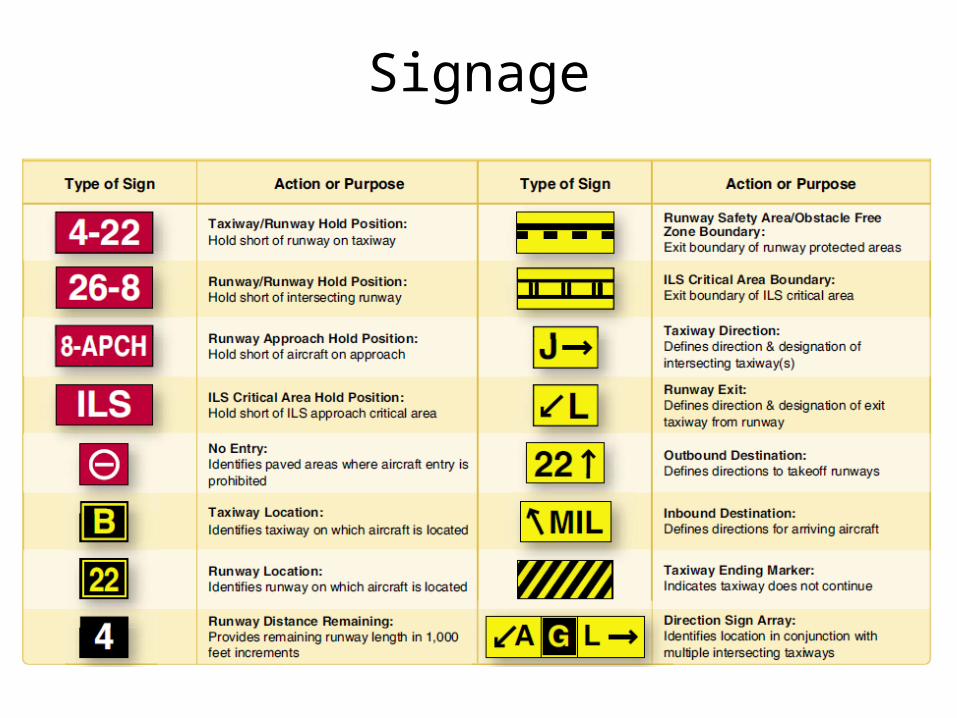
Signage
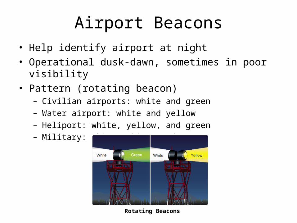
Airport Beacons• Help identify airport at night• Operational dusk-dawn, sometimes in poor visibility• Pattern (rotating beacon)
– Civilian airports: white and green– Water airport: white and yellow– Heliport: white, yellow, and green– Military: white, white, and green
Rotating Beacons
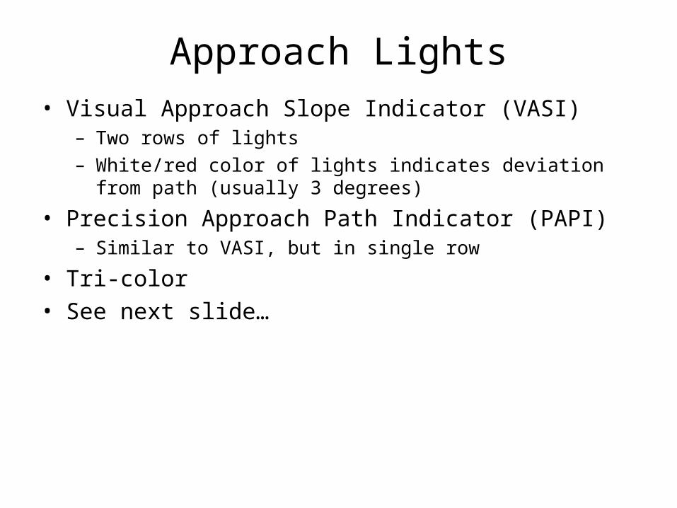
Approach Lights• Visual Approach Slope Indicator (VASI)
– Two rows of lights– White/red color of lights indicates deviation from path (usually 3
degrees)
• Precision Approach Path Indicator (PAPI)– Similar to VASI, but in single row
• Tri-color• See next slide…
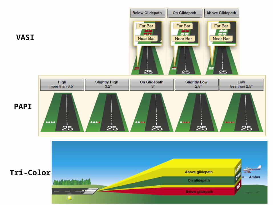
VASI
PAPI
Tri-Color
Runway Lighting• Runway End Identifier Lights (REILs)• Runway Edge Lights (white)
– HIRL (High Intensity Runway Lights)– MIRL (Medium Intensity Runway Lights)– LIRL (Low Intensity Runway Lights)
• In-Runway Lights
Control of Airport Lighting• At some non-towered airports, pilots can control lighting
via radio (see A/FD)• Controlled by “keying” or clicking the mic
– 7 times within 5 sec – highest intensity– 5 times within 5 sec – medium intensity– 3 times within 5 sec – lowest intensity
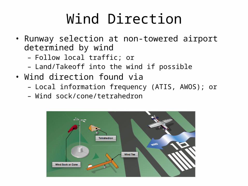
Wind Direction• Runway selection at non-towered airport determined by
wind– Follow local traffic; or– Land/Takeoff into the wind if possible
• Wind direction found via– Local information frequency (ATIS, AWOS); or– Wind sock/cone/tetrahedron
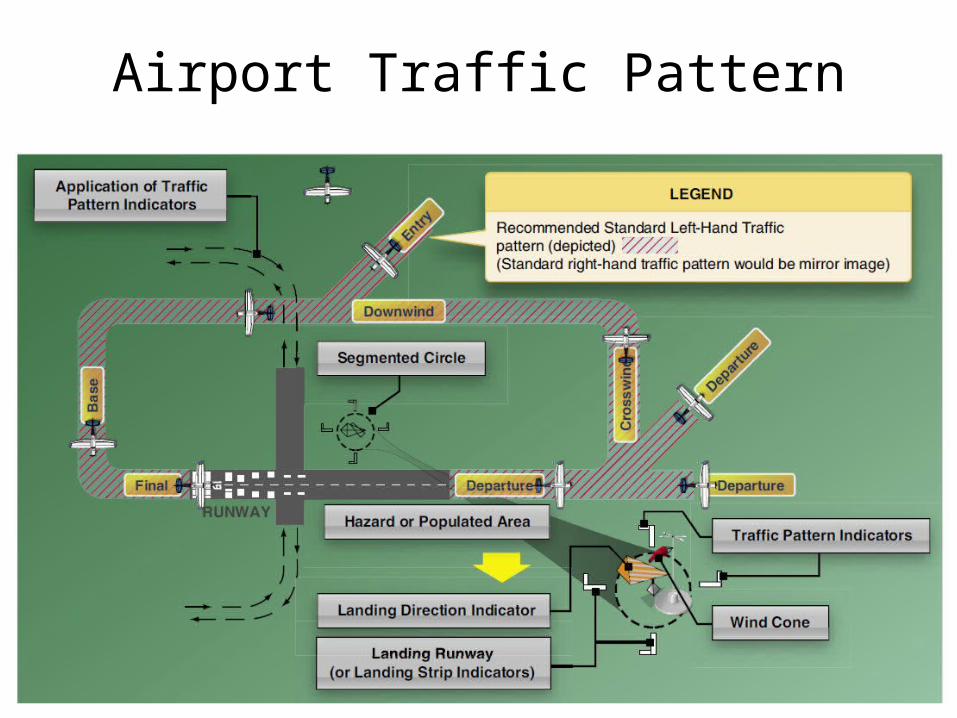
Airport Traffic Pattern