Embed Size (px)
Citation preview

MAGNETOMETRY &
RADIO EM
Airborne Robotsfor Exploration Geoscience
1
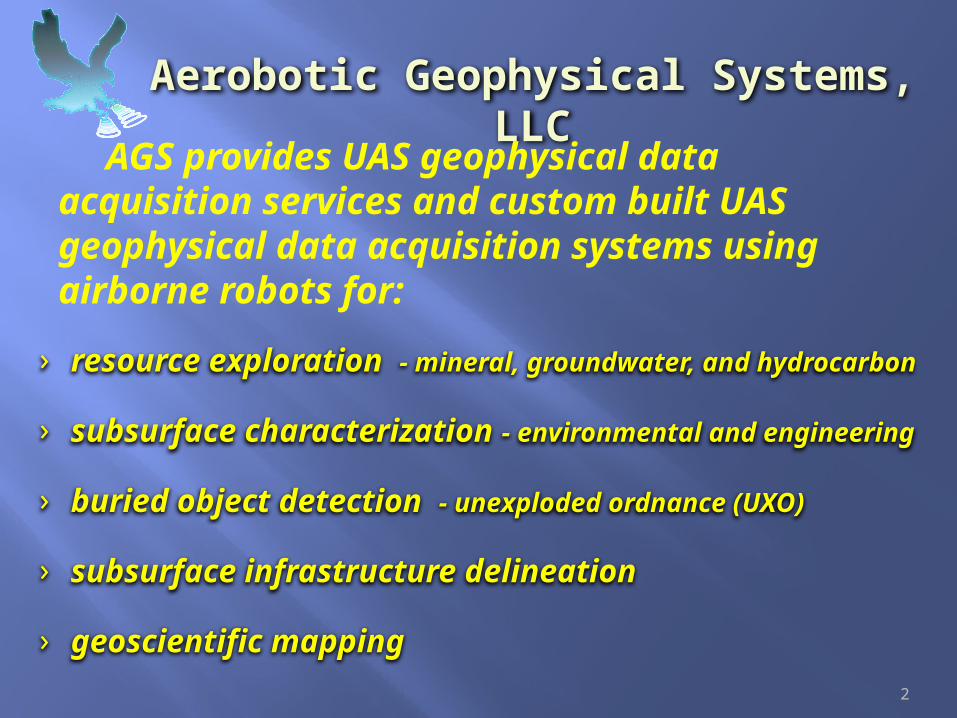
Aerobotic Geophysical Systems, LLC
AGS provides UAS geophysical data acquisition services and custom built UAS geophysical data acquisition systems using airborne robots for:
2
› resource exploration - mineral, groundwater, and hydrocarbon
› subsurface characterization - environmental and engineering
› buried object detection - unexploded ordnance (UXO)
› subsurface infrastructure delineation
› geoscientific mapping

1. Low Data Point Cost
2. Improved Productivity
3. Higher Definition
4. Greater Sensitivity
5. Access to difficult & risky areas
6. More Data Overall
7. Reduced Risk to personnel & public
3
The advantages of unmanned aircraft systems (UAS) or drones are:

4
AGS is presently offering the following sensor configurations for small UAS.
• 3 axis Fluxgate Magnetometer
• Radio Frequency EM
• Visible light camera
• Near infrared camera
• Thermal infrared camera
5
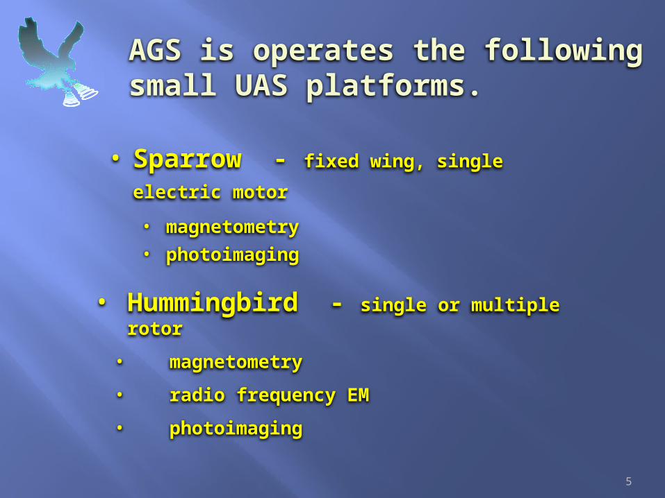
AGS is operates the following small UAS platforms.
• Hummingbird - single or multiple rotor
• magnetometry
• radio frequency EM
• photoimaging
• Sparrow - fixed wing, single electric motor • magnetometry
• photoimaging

The SparrowA UAS for low altitude, high definition magnetometry
Wing Span: 1.8 mTotal Weight: < 5kgSpeed: 40 to 100 km/hFlight time: 60 min (max) Range: 10 kmMax wind speed: 40 km/h Motor type: electricPayload: 1 kg # operators: 2
Magnetometer: 3 Axis fluxgateSensitivity: < 1 nT Survey Noise level: ~ 7 nT Data storage: SD card (4Gbyte)Data logger power: separate batteryPositioning data: aircraft GPS navigation
6

The HummingbirdA UAS for low altitude, high definition magnetometry
Aircraft Systems single rotor, quadcopter,& octocopter
Speed: 0 to 80 km/hFlight time: < 60 minRange: 10 kmMax wind speed: 50+ km/h Motor type: electric or gasPayload: 1+ kg # operators: 2
Magnetometer: 3 Axis fluxgateSensitivity: < 1 nT Survey Noise level: ~ 7 nT Data storage: SD card (4Gbyte)Data logger power: separate batteryPositioning data: aircraft GPS navigation
7

Marconi Hummingbird UAS for low altitude, radio frequency EM data acquisition
8

Applications of UAS magnetometry
• Geological Mapping – lithology, structure, etc.
• Detecting and delineating undocumented and poorly documented wells.
• Detection and mapping of buried pipelines, etc.
• Detecting and mapping buried ferromagnetic objects and UXO.
9

Applications of Radio Frequency EM
• Geological Mapping – lithology, structure, etc.
• Precious and base metal exploration
• Fracture mapping for groundwater resources in crystalline rock.
• Contaminant plume delineation
• Detection and mapping of buried pipelines, metallic objects, etc.
10

Benefits of UAS magnetometry
Cost: ~ 20% of cost for a conventional ground magnetic survey.
~ 50% or less of the cost of a typical high resolution airborne magnetic (HRAM) survey.
Acquisition Rate: 10 to 20 times the daily coverage of a ground magnetic survey with equivalent or better spatial resolution.
50% of the daily coverage of a similar HRAM survey.
Data Quality:As good or better than a conventional ground magnetic survey.
Enhanced detail compared to a typical HRAM survey.
11

Case History – Maar Volcano (Germany)
Objective: (1) compare UAS magnetic data with magnetic data acquired with an ultra-light aircraft ; (2) map geology for groundwater exploration program.
12
UAS operator & control unit
Raw Data
Processed Data
Merged Data

Case History – Landslide (Germany)
Objective: Search for rail cars and other objects buried in landslide.
13
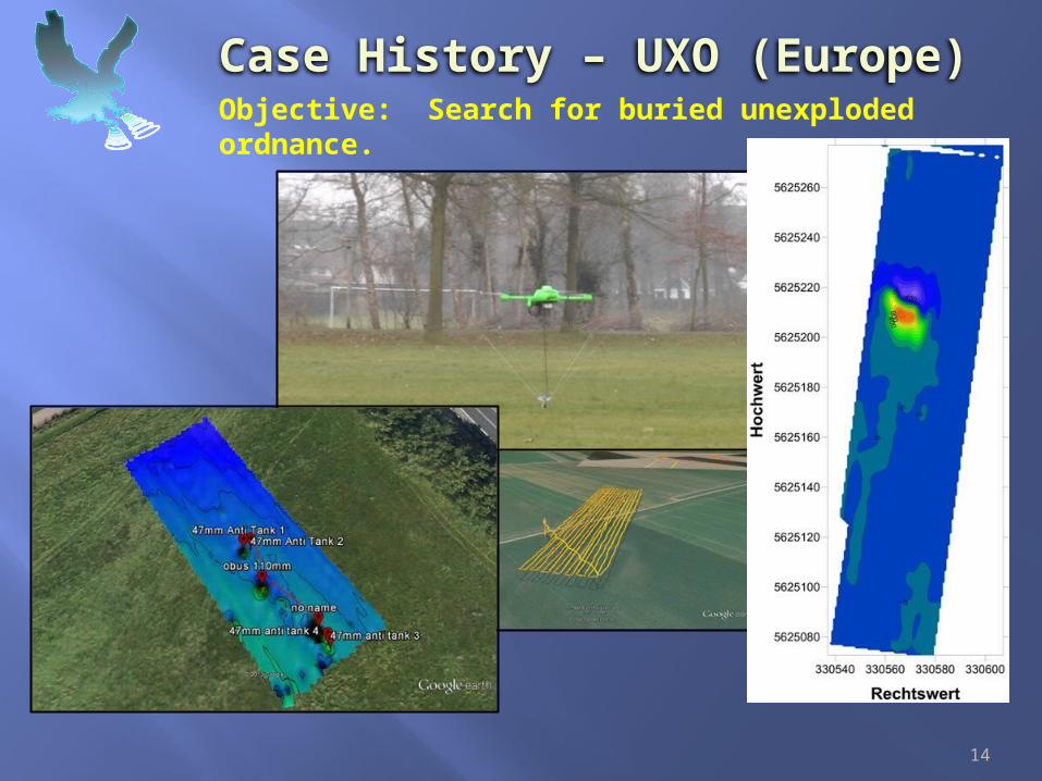
Case History – UXO (Europe) Objective: Search for buried unexploded ordnance.
14
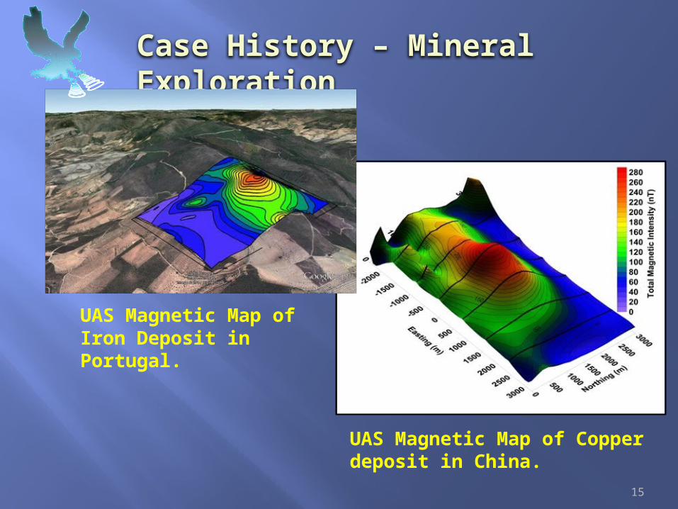
Case History – Mineral Exploration
UAS Magnetic Map of Iron Deposit in Portugal.
UAS Magnetic Map of Copper deposit in China.
15

Case History – Radio Frequency EMObjective: near surface resistivity mapping
16

Case History – Thermal Infrared Imaging Objective: detect defective panels in solar farm
Quadcopter with TIR camera
Survey flight path over solar farm
Thermal Infrared Image of solar panels – red spot indicates bad panel.
17

For more information, contact:
18
Ronald S. Bell telephone: (+01) 720-220-3596e-mail: [email protected]
Johannes B. Stolltelephone: (+49) 163-97-55-472e-mail: [email protected]
Denver, CO USA Celle, Germany


![[2015/2016] Require JS and Handlebars JS](https://img.pdfslide.us/doc/110x75/58efafb91a28abf42a8b462d/20152016-require-js-and-handlebars-js.jpg)