Embed Size (px)
Citation preview
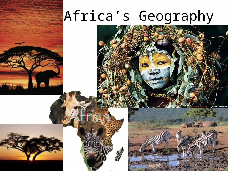
Africa’s Geography
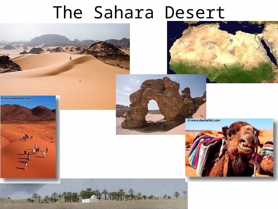
The Sahara Desert
The Sahara Desert• Largest desert in the world• Consists of basically two sub-climates, a dry
subtropical climate in the north and a dry tropical climate in the south
• One characteristic of the vegetation found in the Sahara is that these species must be able to adapt to unreliable precipitation and excessive heat
• Covers over 3.5 million square miles and has only 2.5 million inhabitants - roughly 1 person per square mile (0.4 sq km)- which is one of the lowest population densities on earth
• The Sahara is one of the harshest environments known to man
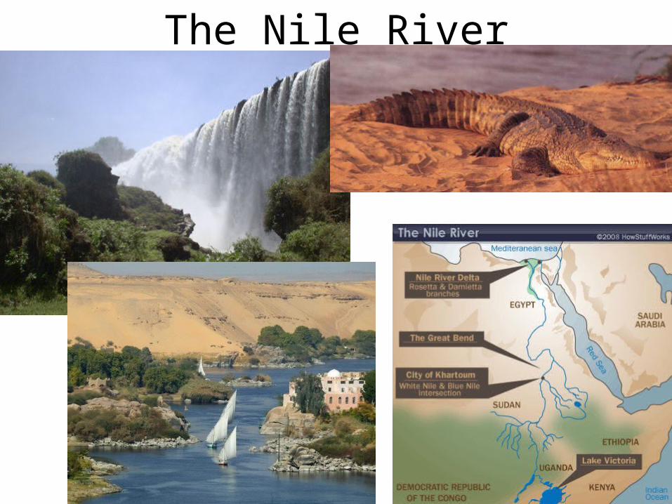
The Nile River
The Nile River• Longest river in the world
• Used for irrigation, food, transportation, drinking water
• Flows through 9 countries
• Source/originates in Burundi
• Mouth/empties in the Mediterranean
• Used for hydroelectricity
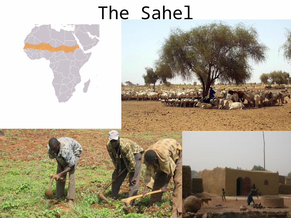
The Sahel
The Sahel
• One of the poorest regions in the world
• Continuous soil erosion, insufficient irrigation, deforestation, overpopulation, and drought cause this area to be one of the most environmentally damaged places on Earth
• Covered mostly in grasses, shrubs, and small trees
• Terrorism is increasing in this region
The Serengeti• Highly popular for tourism…safaries
• Flat land mainly used for migration and grazing of wild animals such as giraffe, zebra, deer, lions, small rodents, hyena, elephants, cheetah
• Has areas of dense population
The Congo• Low elevation land, 2nd largest river basin
• Used to drain the rainforest and central western Africa
• Major conflict area in Africa, children often abducted and made to become military or slaves
• 2nd largest rain forest in the world
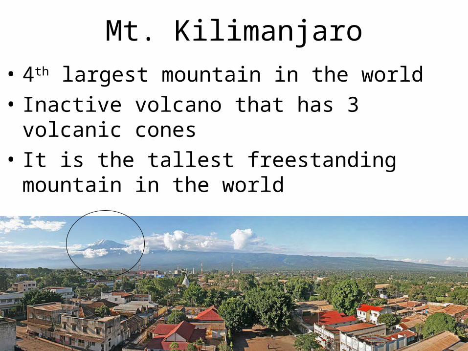
Mt. Kilimanjaro
• 4th largest mountain in the world
• Inactive volcano that has 3 volcanic cones
• It is the tallest freestanding mountain in the world
Great Rift Valley• This is a geologic system that extends from
Syria to central Mozambique
• The valley ranges in elevation from 1,300 feet below sea level to 6,000 feet above sea level
• At the lowest elevation you will find the Dead Sea
• As the two tectonic plates move away from each other the Atlas mountains and Ethiopia highlands are created
Directions
• Cardinal Directions-North, South, East, West
• Intermediate Directions-Northeast, Northwest, Southeast, Southwest