Embed Size (px)
Citation preview
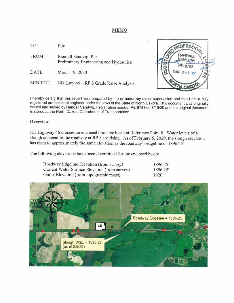
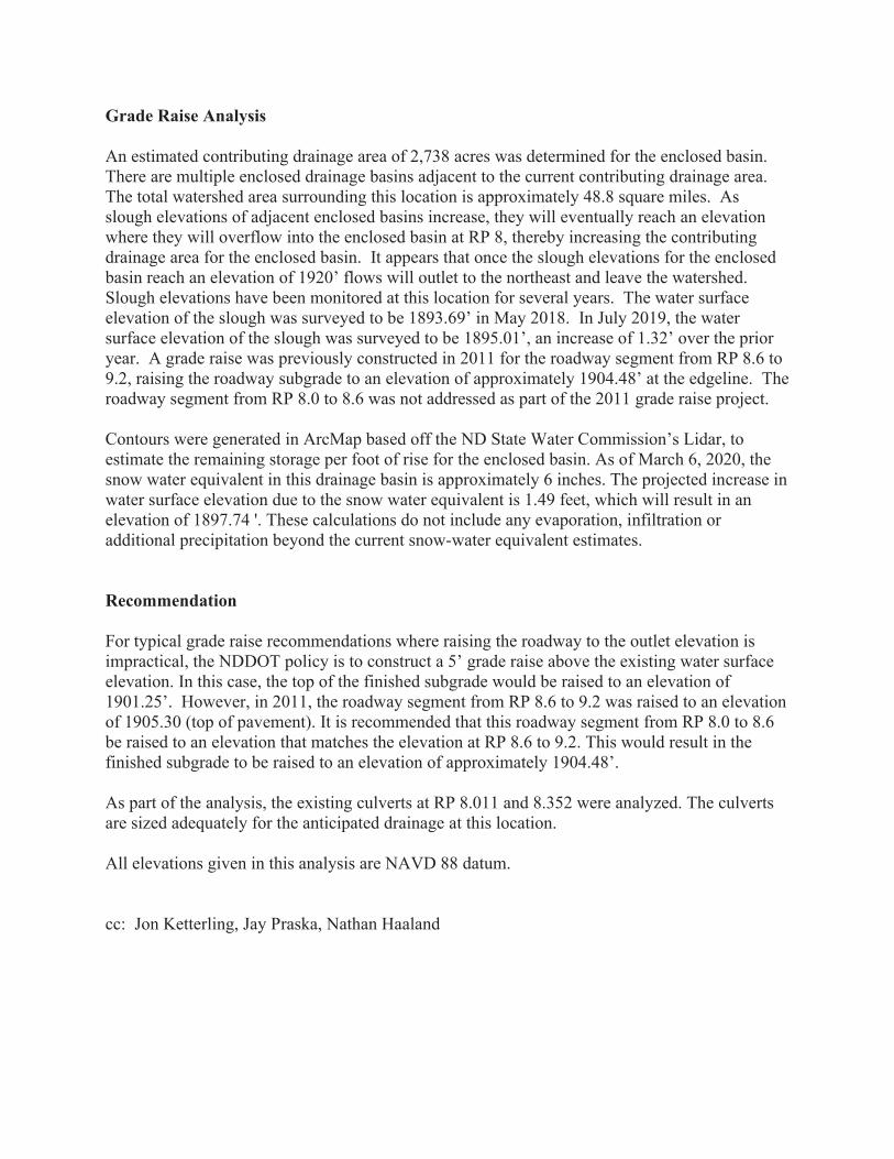
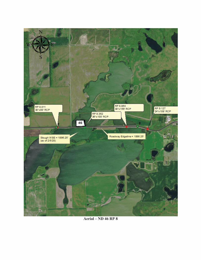
Grade Raise Analysis An estimated contributing drainage area of 2,738 acres was determined for the enclosed basin. There are multiple enclosed drainage basins adjacent to the current contributing drainage area. The total watershed area surrounding this location is approximately 48.8 square miles. As slough elevations of adjacent enclosed basins increase, they will eventually reach an elevation where they will overflow into the enclosed basin at RP 8, thereby increasing the contributing drainage area for the enclosed basin. It appears that once the slough elevations for the enclosed basin reach an elevation of 1920’ flows will outlet to the northeast and leave the watershed. Slough elevations have been monitored at this location for several years. The water surface elevation of the slough was surveyed to be 1893.69’ in May 2018. In July 2019, the water surface elevation of the slough was surveyed to be 1895.01’, an increase of 1.32’ over the prior year. A grade raise was previously constructed in 2011 for the roadway segment from RP 8.6 to 9.2, raising the roadway subgrade to an elevation of approximately 1904.48’ at the edgeline. The roadway segment from RP 8.0 to 8.6 was not addressed as part of the 2011 grade raise project. Contours were generated in ArcMap based off the ND State Water Commission’s Lidar, to estimate the remaining storage per foot of rise for the enclosed basin. As of March 6, 2020, the snow water equivalent in this drainage basin is approximately 6 inches. The projected increase in water surface elevation due to the snow water equivalent is 1.49 feet, which will result in an elevation of 1897.74 '. These calculations do not include any evaporation, infiltration or additional precipitation beyond the current snow-water equivalent estimates. Recommendation For typical grade raise recommendations where raising the roadway to the outlet elevation is impractical, the NDDOT policy is to construct a 5’ grade raise above the existing water surface elevation. In this case, the top of the finished subgrade would be raised to an elevation of 1901.25’. However, in 2011, the roadway segment from RP 8.6 to 9.2 was raised to an elevation of 1905.30 (top of pavement). It is recommended that this roadway segment from RP 8.0 to 8.6 be raised to an elevation that matches the elevation at RP 8.6 to 9.2. This would result in the finished subgrade to be raised to an elevation of approximately 1904.48’. As part of the analysis, the existing culverts at RP 8.011 and 8.352 were analyzed. The culverts are sized adequately for the anticipated drainage at this location. All elevations given in this analysis are NAVD 88 datum. cc: Jon Ketterling, Jay Praska, Nathan Haaland
Aerial – ND 46 RP 8
Drainage Area Map – ND 46 RP 8
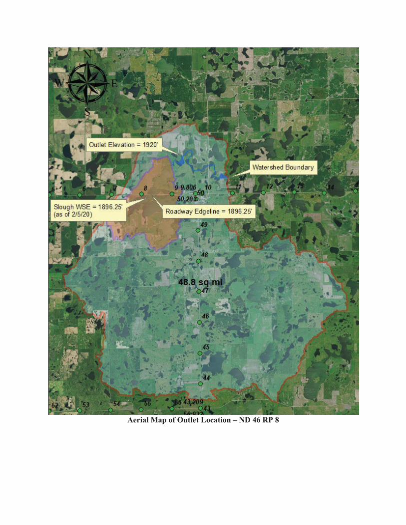
Aerial Map of Outlet Location – ND 46 RP 8
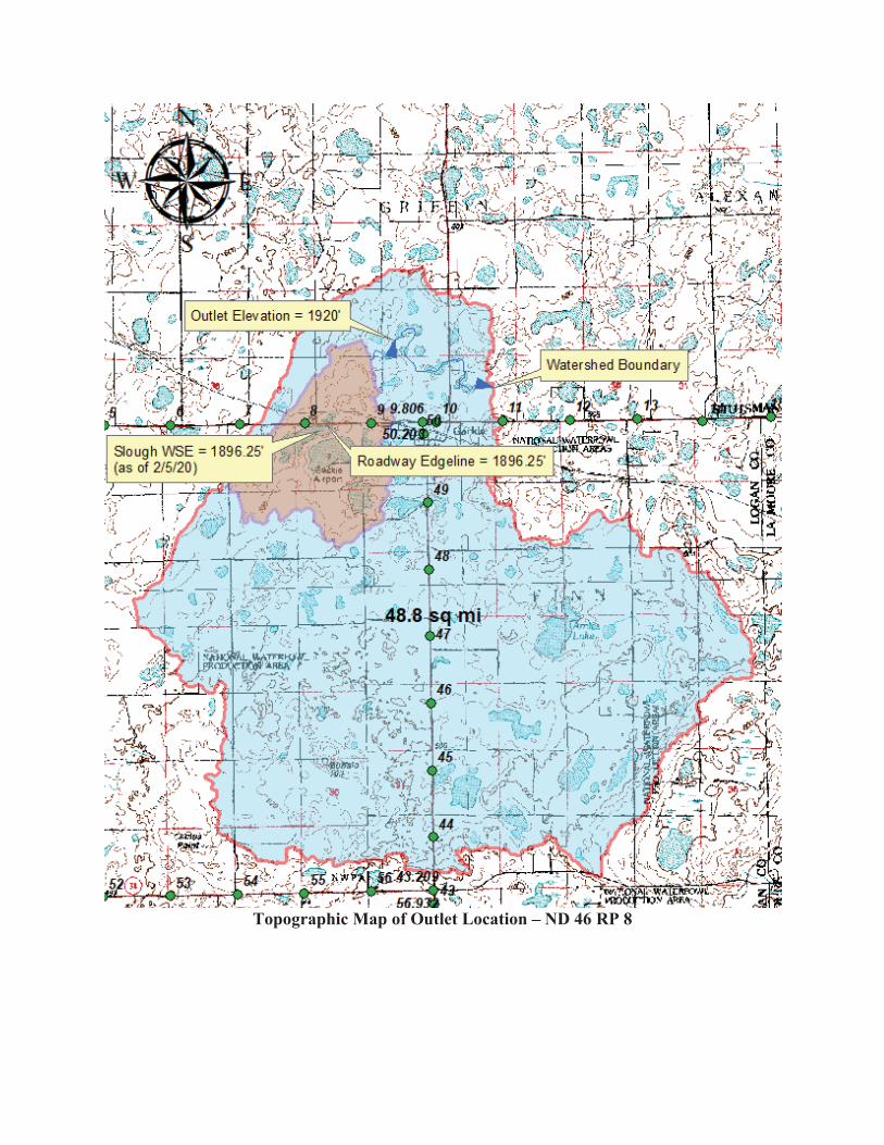
Topographic Map of Outlet Location – ND 46 RP 8