Embed Size (px)
Citation preview
chapter
Advances in Policing—New Technologies forCrime Analysis
13
ISB
N0-558-46766-0
Law Enforcement in the 21st Century, Second Edition, by Heath B. Grant and Karen J. Terry. Published by Allyn & Bacon. Copyright © 2008 by Pearson Education, Inc.
INTRODUCTION
The Stages of TechnologicalAdvancement in PolicingThe First Stage (1881–1945)
The Second Stage (1946–1959)
The Third Stage (1960–1979)
The Fourth Stage (1980–present)
Crime AnalysisStrategic Crime Analysis
Tactical Crime Analysis
Geomapping Crime Patterns: MovingBeyond Push PinsWhat Crime Maps Do: GIS as a Technical Aid toProblem-Oriented Policing
LINKAGES IN LAW ENFORCEMENT: GISApplications to Sex OffenderManagementTypes of Data with Mapping Applications
Mapping and Accountability: GIS in Action
GIS and the Patrol Officer
LINKAGES IN LAW ENFORCEMENT: GISApplications to Community PolicingOther Applications: Geographic Profiling
Twenty-First-Century Technologies in PolicingClosed-Circuit Television
Global Positioning Systems
BiometricsFacial Recognition SoftwareFingerprint Identification Systems
Interjurisdictional Communication TechnologiesOffender DatabasesCross-Jurisdictional Radio CommunicationsElectronic Warrant ProcessesInformation Security Through Encryption
The World Wide Web and Community Policing
Improving Accountability—MobileCommunications with Patrol
Mobile Digital CommunicationsAutomatic Vehicle Monitoring
Chapter Summary
LINKING THE DOTS
Chapter Out l ine
Chapter Objec t i ves
● Identify the stages of technological advance-ment in policing and the implications of tech-nological utilization in the field.
● Understand the different types of crimeanalysis and the technologies available forthem, such as GIS.
● Know the variety of applications of GIS technology.
● Appreciate the many types of technologiesavailable to modern law enforcement.
319ISB
N0-
558-
4676
6-0
Law Enforcement in the 21st Century, Second Edition, by Heath B. Grant and Karen J. Terry. Published by Allyn & Bacon. Copyright © 2008 by Pearson Education, Inc.
Throughout its history, the U.S. Border
Patrol has faced the seemingly insur-
mountable task of detecting and appre-
hending the ever-present stream of drug
traffickers and illegal immigrants. The
60-mile area around the U.S.–Mexico
border in the San Diego area alone re-
quires the management of more than
2,000 agents and 900 seismic sensors
(DeAngelis 2000). To aid them in their
efforts, the U.S. Border Patrol San Diego
Sector has many high-tech tools at their
fingertips, such as geographic informa-
tion systems (GIS), seismic sensors
(more than 900), and infrared night-
vision equipment.
The agents use the GIS technology
to map the locations of alien appre-
hensions as a means of determining
why certain areas are higher in illegal
migration and drug traffick-
ing than others. Using real-
time sensor feeds from the
Intelligent Computer Aided
Detection System (ICAD),
agents monitor “hits” corre-
sponding to potential illegal
migrant entry into the coun-
try. After identifying a possi-
ble entry point, agents are
able to map out the travel
route that has the highest
probability of leading to the
apprehension of the illegal border
crossers.
In addition to the tremendous chal-
lenges presented by the region’s moun-
tainous terrain, illegal traffic has also
found underground avenues of escaping
detection. To combat this eventuality,
the Border Patrol has used Global Posi-
tioning System (GPS) receivers and GIS
to plot storm drain and sewer system
routes that are facilitating traffic from
Mexico into the United States.
The application of such technologies
to the practice of law enforcement has
revolutionized the capacity of police to
both respond to crime that is taking
place in real time and to proactively
identify problems, analyze their causes,
and develop strategic plans that truly
enhance an agency’s crime prevention
capabilities. For example, the U.S. Bor-
der Patrol also targets high-risk areas
Introduction
320
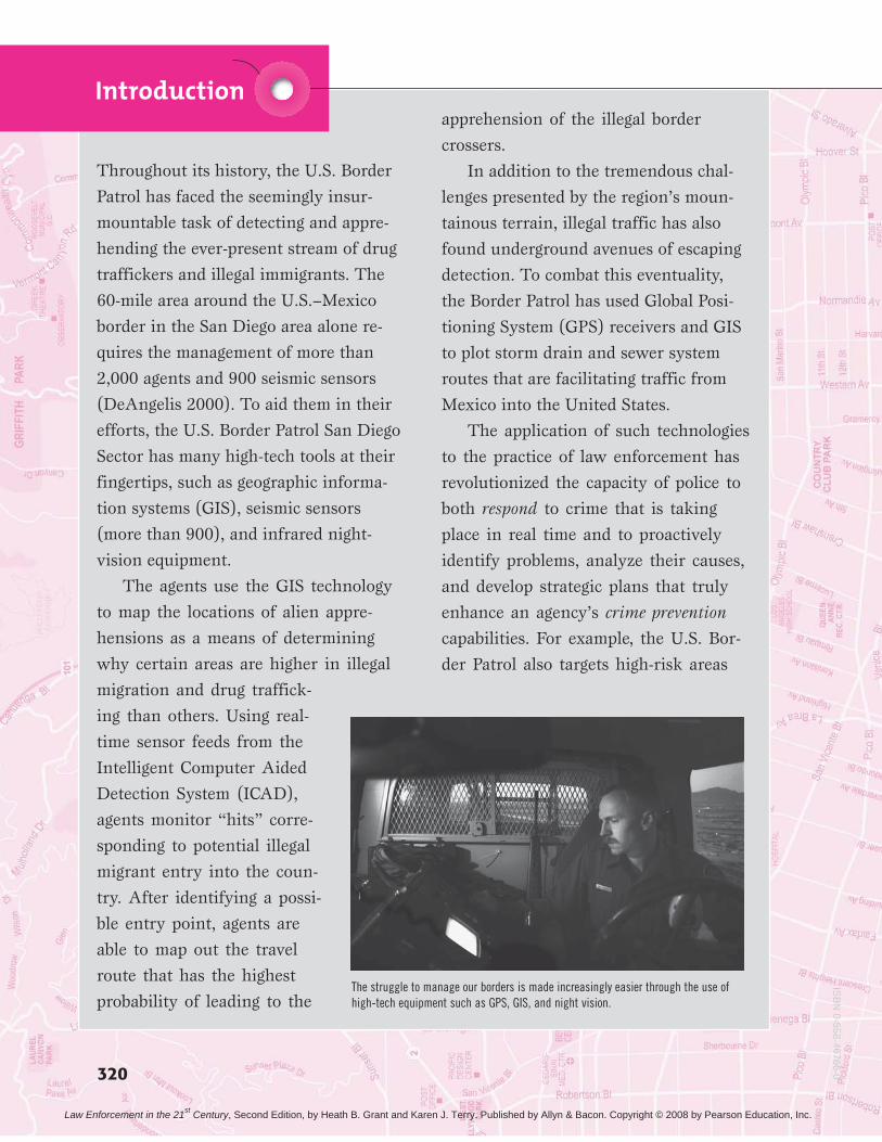
The struggle to manage our borders is made increasingly easier through the use ofhigh-tech equipment such as GPS, GIS, and night vision.
ISB
N0-558-46766-0
Law Enforcement in the 21st Century, Second Edition, by Heath B. Grant and Karen J. Terry. Published by Allyn & Bacon. Copyright © 2008 by Pearson Education, Inc.
with warning signs in Spanish regard-
ing the dangers of crossing the border
illegally.
In this technological era, law en-
forcement has had to evolve to be better
equipped to fulfill its mandate of con-
tributing to public safety. Technology
has proven invaluable in responding
to the problem of linkage blindness
across jurisdictions, as well as with other
criminal justice agencies and sectors of
the community. In an age faced with
continuing threats of transnational
crime and terrorism, the importance of
continued technological advances cannot
be overstated.
However, the increasing reliance on
and availability of technology to law en-
forcement can be intimidating. This
technology brings with it new legal chal-
lenges, particularly in relation to the bal-
ance between crime control and the
private interests of citizens introduced in
the beginning of this book. This chapter
will begin with a brief overview of the
development of technological advances
to law enforcement, followed by a de-
scriptive coverage of key technological
applications in policing. Particular atten-
tion will be paid to the use of GIS in fa-
cilitating proactive police management in
the twenty-first century.
Introduction 321
ISB
N0-
558-
4676
6-0
Law Enforcement in the 21st Century, Second Edition, by Heath B. Grant and Karen J. Terry. Published by Allyn & Bacon. Copyright © 2008 by Pearson Education, Inc.
Chapter 13: Advances in Policing—New Technologies for Crime Analysis322
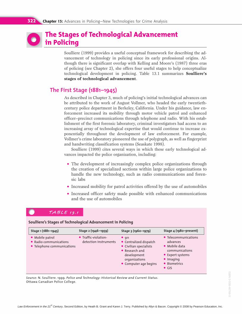
The Stages of Technological Advancementin Policing
Soulliere (1999) provides a useful conceptual framework for describing the ad-vancement of technology in policing since its early professional origins. Al-though there is significant overlap with Kelling and Moore’s (1987) three erasof policing (see Chapter 2), she offers four useful stages to help conceptualizetechnological development in policing. Table 13.1 summarizes Soulliere’s
stages of technological advancement.
The First Stage (1881–1945)As described in Chapter 3, much of policing’s initial technological advances canbe attributed to the work of August Vollmer, who headed the early twentieth-century police department in Berkeley, California. Under his guidance, law en-forcement increased its mobility through motor vehicle patrol and enhancedofficer–precinct communications through telephone and radio. With his estab-lishment of the first forensic laboratory, criminal investigators had access to anincreasing array of technological expertise that would continue to increase ex-ponentially throughout the development of law enforcement. For example,Vollmer’s crime laboratory pioneered the use of polygraph, as well as fingerprintand handwriting classification systems (Seaskate 1998).
Soulliere (1999) cites several ways in which these early technological ad-vances impacted the police organization, including:
● The development of increasingly complex police organizations throughthe creation of specialized sections within large police organizations tohandle the new technology, such as radio communications and foren-sic labs
● Increased mobility for patrol activities offered by the use of automobiles
● Increased officer safety made possible with enhanced communicationsand the use of automobiles
TABLE 13 . 1
Soulliere’s Stages of Technological Advancement in Policing
Stage 1 (1881–1945)
● Mobile patrol● Radio communications● Telephone communications
Source: N. Soulliere. 1999. Police and Technology: Historical Review and Current Status.Ottawa Canadian Police College.
Stage 2 (1946–1959)
● Traffic-violation-detection instruments
Stage 3 (1960–1979)
● 911● Centralized dispatch● Civilian specialists● Research and
developmentorganizations
● Computer age begins
Stage 4 (1980–present)
● Telecommunicationsadvances
● Mobile datacommunications
● Expert systems● Imaging● Biometrics● GIS
ISB
N0-558-46766-0
Law Enforcement in the 21st Century, Second Edition, by Heath B. Grant and Karen J. Terry. Published by Allyn & Bacon. Copyright © 2008 by Pearson Education, Inc.
The Stages of Technological Advancement in Policing 323
The Second Stage (1946–1959)Roughly corresponding with the beginnings of Kelling and Moore’s Reform Eraof policing, Soulliere (1999) claims that the second stage of technological ad-vancement facilitated a major portion of the bureaucratization of policing or-ganizations. During this stage, traffic police received a significant boost with theadvent of the first instruments to measure both speeding violations and the con-dition of the driver. Although early instruments were rather crude indicators,they would grow over time to include the significant automobile surveillancemechanisms and blood-alcohol measures briefly discussed in Chapter 7.
The Third Stage (1960–1979)As society entered the computer age, Soulliere (1999) claims that police tech-nology began to truly emerge. During this stage, call distribution centers, com-puterized databanks, and computer sections became commonplace in policeagencies. Some of the significant technological advancements in this stage canbe attributed to President Lyndon B. Johnson. In 1967, he created the Presi-dent’s Commission on Law Enforcement and the Administration of Justice toanalyze crime patterns in the country, as well as the resources available to com-bat them. The Commission’s report highlighted the slow infusion of technolog-ical advances into the criminal justice system, with particular attention paid topolicing. To this end, the report stated (President’s Commission on Law En-forcement and the Administration of Justice 1967):
The police, with crime laboratories and radio networks, made early use of technol-ogy, but most police departments could have been equipped 30 or 40 years ago aswell as they are today. . . . Of all criminal justice agencies, the police have had theclosest ties to science and technology, but they have called on scientific resourcesprimarily to help in the solution of specific serious crimes, rather than for assistancein solving general problems of policing. (p. 125)
A notable gap existed between the technologies that were currently availablethat had potential law enforcement applications and what police agencies wereactually using. In response to this gap, the Johnson administration began “theflow, a trickle at first, of what eventually became billions of dollars in direct andindirect assistance to local and state law enforcement” (Seaskate 1998, p. 2).
The commission argued for the establishment of a single telephone numberthat citizens across the country could use to contact the police in the case of anemergency. In only a matter of years following AT&T’s announcement of thefirst 911 system in 1968, 911 became a driving force for police departmentsacross the country (Seaskate 1998). As highlighted throughout earlier chapters,this increasing emphasis on calls-for-service would have both benefits (theseeming ease of access to the police in times of emergency) as well as detriments(this became the principal means of determining police resource deploymentand performance evaluation). Skolnick and Bayley (1986) point out that patrolofficers can become exhausted by rushing between calls for service, rather thantaking the time needed to truly digest and understand the human situations inwhich they are regularly thrown.
During this third stage of development, large municipalities began theprocess of centralizing the dispatch of all fire, police, and medical services
ISB
N0-
558-
4676
6-0
Law Enforcement in the 21st Century, Second Edition, by Heath B. Grant and Karen J. Terry. Published by Allyn & Bacon. Copyright © 2008 by Pearson Education, Inc.
Chapter 13: Advances in Policing—New Technologies for Crime Analysis324
(Seaskate 1998). The over-reliance of the average citizen on the use of 911, re-gardless of the nature or seriousness of the problem, has led to the establishmentof 311 systems in many metropolitan areas to try and decrease the significantburden 911 has had on city emergency resources. The 311 system is available forall calls to police and fire personnel that are not emergencies. Other recentstrategies for handling the call volume brought about by 911 include the differ-ential response approaches described in Chapter 6.
Increased research on law enforcement applications and technological de-velopment was also a key characteristic of the third stage. The National Instituteof Justice (NIJ) was created in 1968, and it continues to play a leading role inenhancing the field of law enforcement internationally (Soulliere 1999). An in-creasing reliance on civilian specialists within large police organizations alsocontinued throughout this stage with developments in the areas of forensics andcommunications technologies.
The Fourth Stage (1980–present)Information access and use characterize Soulliere’s (1999) fourth stage of tech-nological development. In addition to simply amassing a large volume of infor-mation—a task that law enforcement agencies have been successful at sincetheir creation—technology now focuses on the speed and ease of informationuse. Moreover, technology developed throughout the fourth stage now provideslaw enforcement with access to data that would be unavailable to them with-out these tools. Collaboration in the research and development activities of traditional law enforcement and the military has resulted in many of the tech-nologies introduced in this stage. Examples of such new tools include telecom-munications, mobile data computers, expert systems, imaging, and biometrictechnologies (Soulliere 1999). Each of these areas will be described furtherthroughout the chapter.
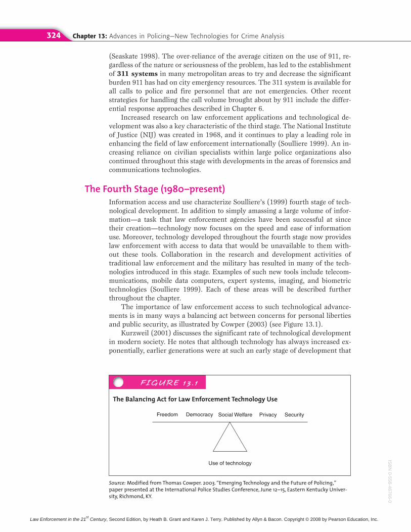
The importance of law enforcement access to such technological advance-ments is in many ways a balancing act between concerns for personal libertiesand public security, as illustrated by Cowper (2003) (see Figure 13.1).
Kurzweil (2001) discusses the significant rate of technological developmentin modern society. He notes that although technology has always increased ex-ponentially, earlier generations were at such an early stage of development that
FIGURE 13 . 1
The Balancing Act for Law Enforcement Technology Use
Use of technology
Freedom Democracy Social Welfare Privacy Security
Source: Modified from Thomas Cowper. 2003. “Emerging Technology and the Future of Policing,”paper presented at the International Police Studies Conference, June 12–15, Eastern Kentucky Univer-sity, Richmond, KY.
ISB
N0-558-46766-0
Law Enforcement in the 21st Century, Second Edition, by Heath B. Grant and Karen J. Terry. Published by Allyn & Bacon. Copyright © 2008 by Pearson Education, Inc.
Crime Analysis 325
the trends appear flat due to the low baseline. Kurzweil argues that althougheveryone in society generally expects technological progress to continue at thesame pace, the rate of change is accelerating. Rather than just being increasedincrementally every year, technological advancement is characterized by expo-nential growth, doubling every year. He organizes these observations into thelaw of accelerating returns:
● The enhanced methods resulting from one stage of progress are used tocreate the next stage.
● Consequently, the rate of progress of an evolutionary process increasesexponentially over time.
● In addition, the speed and cost-effectiveness of a technological advance-ment will also increase exponentially over time.
● Finally, current methods of solving a problem in technology (such asshrinking transistors on an integrated circuit as an approach to makingmore powerful computers) will provide exponential growth until themethod exhausts its potential. At that time, a fundamental change willresult that will allow the exponential growth to continue.
Cowper (2003) summarizes the law of accelerating returns by stating that wewill have 100 years of progress in the next 25 years and 20,000 years of progressin the next 100 years. Applications available to policing now or in the near futuremight have once seemed the work of science fiction rather than reality.
Certainly the applications of technology to policing have greatly enhancedthe ability of law enforcement organizations to meaningfully engage in the problem-solving process. Although many police departments continue to be be-hind the curve in terms of integrating new technologies into day-to-day opera-tions, the success of many applications to sound policing will make ignoringprogress increasingly difficult over time.
Crime AnalysisIntegral to the process of problem solving discussed in the previous chapter iscrime analysis. Crime analysis has been defined as involving “the collectionand analysis of data pertaining to a criminal incident, offender, and target”(Canter 2000, p. 4). Ideally, crime analysis will guide police managers in mak-ing deployment and resource allocation decisions that are linked to a true un-derstanding of the nature of the problem. The more important data bearing onall components of the crime triangle (see Chapter 12), the better equipped po-lice organizations will be to develop innovative, “out of the box” solutions thatinclude the full spectrum of suppression, intervention, and prevention options.
An important caution must be stressed here. Crime analysis will only be as good as the data or information that is collected. Three essential criteria
for crime analysis should be used by departments in designing data-collection processes and in interpreting the meaning of information resultingfrom crime analysis:
1. Timeliness. Does the pattern or trend presented reflect a current prob-lem or issue or is it more representative of a previous situation? De-ployment decisions with respect to both prevention and offender
ISB
N0-
558-
4676
6-0
Law Enforcement in the 21st Century, Second Edition, by Heath B. Grant and Karen J. Terry. Published by Allyn & Bacon. Copyright © 2008 by Pearson Education, Inc.
Chapter 13: Advances in Policing—New Technologies for Crime Analysis326
apprehension efforts must be based on information that is as current as possible.
2. Relevancy. Do the measures used in the analysis accurately reflect whatis intended? For example, whether a pattern is based on calls-for-service data or incident data can be a very important determinationdepending on what the police manager is trying to understand.
3. Reliability. Would the same data, interpreted by different people at dif-ferent times, lead to the same conclusions?
Canter (2000) categorizes crime analysis into tactical and strategic functions.
Strategic Crime AnalysisThe collection and analysis of data spanning a long period of time is strategic
crime analysis. It is said to be research focused as it includes the use of statis-tics to make conclusions (Canter 2000). This form of analysis can be useful todepartments in terms of crime-trend forecasting, or using data to estimate fu-ture crime based on past trends (Canter 2000). With crime-trend forecasting,important decisions can be made with respect to the deployment of patrol allo-cation as a reflection of the changing volume of criminal activity.
Another important benefit of strategic crime analysis is the analysis ofchanging community dynamics and risk factors that might be contributing tothe particular crime trends of a specific area (Canter 2000). Once again, thistype of analysis over time can result in more informed decision making thatis more likely to lead to police partnership with other city and communityagencies that can help create more long-term, sustainable reductions in crim-inal activity.
Tactical Crime AnalysisWhereas strategic crime analysis involves the review of data spanning generallya year or more, tactical crime analysis uses real-time data spanning severaldays. One of the principal uses of this type of analysis involves problem identi-fication, or the pattern detection of multiple offenses over a short period oftime that have common characteristics, such as type of crime, modus operandi,and type of weapon used (Canter 2000). One example of tactical crime analysisthat will be discussed later in this chapter is geographic profiling, which can beused to suggest the likelihood of where an offender lives based on the pattern ofwhere offenses occur. Tactical crime analysis can occur on as large an area as adepartment’s entire jurisdiction or as small as the few-block-radius of a hot spot.
Linkage analysis involves connecting a suspect to a series of incidentsbased on commonalities in modus operandi and suspect description, as well asknown offenders who live close proximity to a given area (Canter 2000). Fol-lowing a nationwide effort by state legislatures to implement sex offender regis-tration laws (Terry and Furlong 2004), many police departments regularlysearch their databases of registered sex offenders when a known series of sex-ual offenses is identified.
Finally, target profiling involves the use of data to determine the potentialrisks certain areas may have for criminal victimization based on known offense
ISB
N0-558-46766-0
Law Enforcement in the 21st Century, Second Edition, by Heath B. Grant and Karen J. Terry. Published by Allyn & Bacon. Copyright © 2008 by Pearson Education, Inc.
Geomapping Crime Patterns: Moving Beyond Push Pins 327
patterns in the area. Following the previous example, some departments have ex-perimented with community risk profiles (i.e., day care centers, presence ofparks, etc.) as a means of guiding the community notification process for thepresence of registered sex offenders.
Geomapping Crime Patterns:Moving Beyond Push Pins
Based on the previous discussion of the applications of crime analysis to polic-ing, the integral role that geographic information systems (GIS) play inthe process is readily apparent. A GIS is an automated systems for the cap-ture, storage, retrieval, analysis, and display of spatial data (Clarke 1990). Oth-ers have noted that “GIS technology is to geographical analysis what themicroscope, the telescope, and computers have been to other sciences” (Cowen2001, p. 3), By visually representing diverse data sources that can be geo-graphically located, such as crime events, land usage, property values, racialethnic composition, and so on, GIS enables planners to “manipulate and dis-play geographical knowledge in new and exciting ways” (Cowen 2001, p. 3).Despite its diverse applications across various fields, the common focus of GISis the enhancement of decision making.
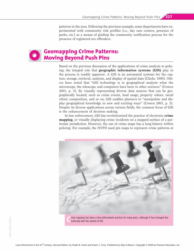
In law enforcement, GIS has revolutionized the practice of electronic crime
mapping, or visually displaying crime incidents on a mapped surface of a par-ticular jurisdiction. However, the use of crime maps has a long history withinpolicing. For example, the NYPD used pin maps to represent crime patterns at
Crime mapping has been a law enforcement practice for many years, although it has changed dra-matically with the advent of GIS.
ISB
N0-
558-
4676
6-0
Law Enforcement in the 21st Century, Second Edition, by Heath B. Grant and Karen J. Terry. Published by Allyn & Bacon. Copyright © 2008 by Pearson Education, Inc.
Chapter 13: Advances in Policing—New Technologies for Crime Analysis328
least as far back as 1900 (Harries 1999). Moreover, criminologists and sociolo-gists have examined the spatial trends of crime and delinquency since as farback as mid-nineteenth century France’s Quetelet (Phillips 1972) and theChicago school’s social ecology of crime efforts pioneered by Shaw and McKay(1942). The difference is, of course, that until the use of GIS became more com-monplace in policing practice during the 1990s, crime patterns were literallyrepresented by inserting push pins into the map of a jurisdiction that was usu-ally mounted on the wall.
Although these early crime maps proved to be useful in visually showingwhere crimes occurred, patterns would be lost over time as more and more pinswere added to the map. Additionally, these maps were very difficult to archivefor later retrieval and analysis unless they were photographed (Shaw andMcKay 1942).
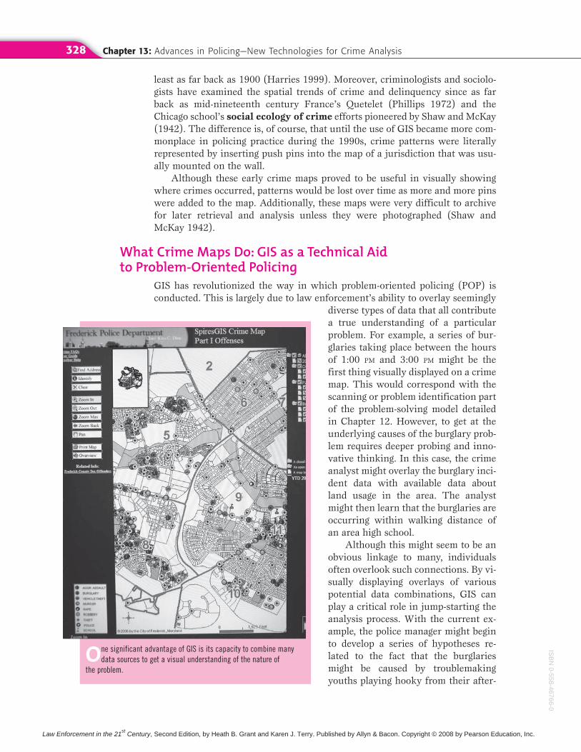
What Crime Maps Do: GIS as a Technical Aid to Problem-Oriented Policing
GIS has revolutionized the way in which problem-oriented policing (POP) isconducted. This is largely due to law enforcement’s ability to overlay seemingly
diverse types of data that all contributea true understanding of a particularproblem. For example, a series of bur-glaries taking place between the hoursof 1:00 PM and 3:00 PM might be thefirst thing visually displayed on a crimemap. This would correspond with thescanning or problem identification partof the problem-solving model detailedin Chapter 12. However, to get at theunderlying causes of the burglary prob-lem requires deeper probing and inno-vative thinking. In this case, the crimeanalyst might overlay the burglary inci-dent data with available data aboutland usage in the area. The analystmight then learn that the burglaries areoccurring within walking distance ofan area high school.
Although this might seem to be anobvious linkage to many, individualsoften overlook such connections. By vi-sually displaying overlays of variouspotential data combinations, GIS canplay a critical role in jump-starting theanalysis process. With the current ex-ample, the police manager might beginto develop a series of hypotheses re-lated to the fact that the burglariesmight be caused by troublemakingyouths playing hooky from their after-
One significant advantage of GIS is its capacity to combine manydata sources to get a visual understanding of the nature of
the problem.
ISB
N0-558-46766-0
Law Enforcement in the 21st Century, Second Edition, by Heath B. Grant and Karen J. Terry. Published by Allyn & Bacon. Copyright © 2008 by Pearson Education, Inc.
Geomapping Crime Patterns: Moving Beyond Push Pins 329
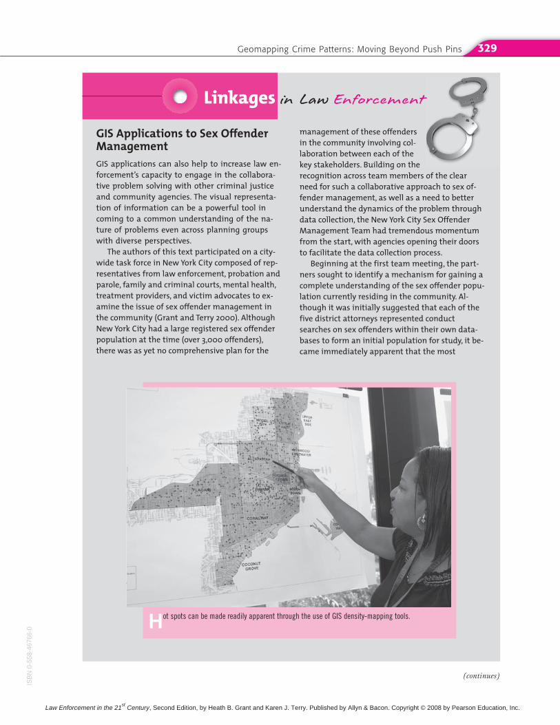
GIS Applications to Sex OffenderManagementGIS applications can also help to increase law en-forcement’s capacity to engage in the collabora-tive problem solving with other criminal justiceand community agencies. The visual representa-tion of information can be a powerful tool incoming to a common understanding of the na-ture of problems even across planning groupswith diverse perspectives.
The authors of this text participated on a city-wide task force in New York City composed of rep-resentatives from law enforcement, probation andparole, family and criminal courts, mental health,treatment providers, and victim advocates to ex-amine the issue of sex offender management inthe community (Grant and Terry 2000). AlthoughNew York City had a large registered sex offenderpopulation at the time (over 3,000 offenders),there was as yet no comprehensive plan for the
management of these offendersin the community involving col-laboration between each of thekey stakeholders. Building on therecognition across team members of the clearneed for such a collaborative approach to sex of-fender management, as well as a need to betterunderstand the dynamics of the problem throughdata collection, the New York City Sex OffenderManagement Team had tremendous momentumfrom the start, with agencies opening their doorsto facilitate the data collection process.
Beginning at the first team meeting, the part-ners sought to identify a mechanism for gaining acomplete understanding of the sex offender popu-lation currently residing in the community. Al-though it was initially suggested that each of thefive district attorneys represented conductsearches on sex offenders within their own data-bases to form an initial population for study, it be-came immediately apparent that the most
Linkages in Law Enforcement
Hot spots can be made readily apparent through the use of GIS density-mapping tools.
(continues)
ISB
N0-
558-
4676
6-0
Law Enforcement in the 21st Century, Second Edition, by Heath B. Grant and Karen J. Terry. Published by Allyn & Bacon. Copyright © 2008 by Pearson Education, Inc.
Chapter 13: Advances in Policing—New Technologies for Crime Analysis330
noon classes. In addition to providing a large pool of individuals from which in-vestigators might seek to learn information about the incidents, police plannersmay also begin to collaborate with the school to develop responses that increasetruancy enforcement in area schools.
Types of Data with Mapping ApplicationsThe data that can be used for mapping purposes are many, limited only by thecreativity of the planning body. Any data that can be geocoded, or for whichthere is geographic reference information, can be used for GIS analysis (Harries1999). Although early forms of geocoding only permitted street addresses as thegeographic unit upon which to map data, now blocks and census tracts can alsobe used. Crime incidents are readily applicable for geocoding purposes giventhat they are almost always available as street addresses or otherwise locationbased (Harries 1999). Crime-mapping applications of GIS include
● mapping incident types and modus operandi, and
● mapping attributes of victims and suspects (Harries 1999)
Based on an initial pattern analysis, overlays with other forms of data canhelp to develop a broader understanding of a particular problem. For example,pattern analysis might indicate a problem of disorderly conduct and assaults in
efficient access to such data would be use a data-base of all registered sex offenders in the city.Based on this initial database, the team sought toget complete information on probation conditions,employment, treatment, living situation, probationofficer contacts, mental status, substance abusehistory, and so on. In addition, complete criminalhistories on the offenders were requested in orderto gain a true understanding of the nature of thepopulation being managed so that accurate, com-prehensive strategies could be devised. At allpoints, ethical considerations were paramount inthe use of this information, which was always pre-sented in aggregate form and never published be-yond the law enforcement planning teampurposes.
In a city the size of New York, and with such a large number of offenders, geomapping of offender residences is essential for two reasons.First, depending on the plan developed by theteam, it might have been necessary to pilot thedemonstration project within one borough giventhe tremendous task and resources required for a citywide approach. Second, geomapping hadthe tremendous ability to demonstrate to theteam the scope of the problem, particularly given
the obvious clustering of offenders in several city locations. Mapping enabled researchers topresent the planning team with buffer zonesaround each offender, combining offender den-sity in a given area with overlays of key risk factors for re-offending drawn from the relapse-prevention literature and connected to each ofthe offender residence locations. Examination of this data by school and daycare locations, parks,available treatment resources, and so on were allpart of the process for meaningful informedproblem solving to which GIS proved the essen-tial core tool.
QUESTIONS1. How would you go about analyzing a particu-
lar problem in your community? Describe thedata you would collect to document patternsand arrive at a true understanding of theproblem’s causes. What role would GIS and hotspot mapping play in this process? How wouldyou use the data to develop a strategic plan?What does the research literature suggest aspossible alternatives for dealing with the prob-lem you identified?
ISB
N0-558-46766-0
Law Enforcement in the 21st Century, Second Edition, by Heath B. Grant and Karen J. Terry. Published by Allyn & Bacon. Copyright © 2008 by Pearson Education, Inc.
Geomapping Crime Patterns: Moving Beyond Push Pins 331
an area. An overlay with available liquor stores and bars in the area may pre-sent the planner with a series of hypotheses as to what factors might be drivingthe problem. An additional benefit of GIS analyses is that they are directly com-patible with statistical analyses to further refine causal projections. Thus, a cityplanner might be able to statistically link the rate of disorderly conduct and as-saults in city jurisdictions with the overall density of alcohol availability orother possibilities. Although such analyses can only show planners the possiblerelationship between two variables, or correlations, rather than saying conclu-sively that X causes Y (causation), there can be no doubt that such findingsgreatly enhance the level of informed decision making of law enforcement orother key stakeholders in a city.
Mapping and Accountability: GIS in ActionCrime mapping can increase the accountability of a department by visuallydemonstrating incident patterns for which departmental administrators canhold commanding officers accountable over time. A proactive police managershould use GIS and other problem–solving tools to create sound strategic and tac-tical decisions for officer deployment, for resource deployment, and for partner-ing with other agencies to facilitate sustained crime reductions. The CompStatmodel of the New York City Police Department institutionalized the use of GISfor departmental planning purposes with such apparent success that similar ver-sions of CompStat have been implemented in departments across the country.
The NYPD Crime Control Model, or CompStat, cannot be oversimplified torefer simply to quality-of-life policing, aggressive policing, or even simply data-driven policing, as is commonly found in the literature about the model. Rather,as police scholar Phyllis McDonald (2002) emphatically states, “this prolifera-tion of singularly focused descriptors does a disservice to the management prin-ciples of CompStat and its potential for use in other jurisdictions. CompStat (theabbreviation for “computer-driven crime statistics”) is a comprehensive, contin-uous analysis of results for improvement and achievement of prescribed out-comes” (p. 7). In other words, CompStat involves managing police operations byinstitutionalizing accountability and analysis processes that are the embodimentof the problem-oriented policing model.
McDonald (2002) offers a concise overview of the key elements of theCompStat model and issues involved in its replication in other departments. Tosummarize, these elements include:
● Specific objectives
● Accurate and timely intelligence
● Effective tactics
● Rapid deployment of personnel and resources
● Relentless follow-up and assessment
As we have seen in earlier chapters, police organizations, like any otherform of bureaucracy, are often extremely difficult to change. How then did sucha seemingly proactive, forward-looking model become implemented in the coun-try’s largest police department? In his prior position as head of the New YorkCity Transit Police in the early 1990s, former police commissioner William Brat-ton had seen tremendous successes in focusing departmental operations on spe-cific measurable objectives and an ongoing review of outcome achievement.
ISB
N0-
558-
4676
6-0
Law Enforcement in the 21st Century, Second Edition, by Heath B. Grant and Karen J. Terry. Published by Allyn & Bacon. Copyright © 2008 by Pearson Education, Inc.
Chapter 13: Advances in Policing—New Technologies for Crime Analysis332
Following a series of complementary strategies in then notoriously dangerousNew York City subways, such as increased undercover and uniformed policepresence and the removal of graffiti and other signs of disorder, dramatic de-clines in robberies, fare evasion, and general disorder resulted. New Yorkersonce again began to feel safe about riding the subways.
When Bratton came to the helm of the NYPD in 1994, he began a dramaticreengineering effort that included interviews and focus groups involving repre-sentatives of every rank and bureau in order to assess the state of command inthe department (Silverman 1999). Seven specific objectives were created toguide the future direction of the NYPD (McDonald 2002):
● Get guns off the street.
● Curb youth violence in the schools and on the streets.
● Drive drug dealers out of the city.
● Break the cycle of domestic violence.
● Reclaim the city’s public spaces.
● Reduce auto-related crime.
● Root out corruption and build organizational integrity in the NYPD.
To achieve these outcomes, as well as to measure departmental progress to-ward them, ready access to timely data was essential. However, a significantproblem became immediately apparent: The NYPD was not equipped to provideup-to-date crime reports. In fact, there was generally a reporting lag of three tosix months for crime statistics, and even then any meaningful analysis on theincident-based level was near impossible (Silverman 1996). Headquarters wasnot systematically tracking crime activity in the precincts, let alone using suchinformation to evaluate the performance of its commanding officers (Silverman1999). As a result, precinct commanders did not view crime reduction as a para-mount job responsibility. Common to departments across the country, efficiencyconcerns in responding to crime were seen as being more important. Detectivebureaus and other specialized functions thus only rarely collaborated with pa-trol, and often directly clashed over territorial and other concerns.
CompStat was devised as a means of reforming the NYPD by pushing allprecincts to generate weekly crime activity reports so that they could be held ac-countable for the achievement of the seven specific objectives outlined in thereengineering process (McDonald 2002). In the beginning, Patrol Bureau staffcomputerized the data and compiled it into the “CompStat Book,” which fea-tured year-to-date crime complaints and arrests for every major felony category,in addition to gun arrests (Silverman 1999). This data would then be comparedon citywide, patrol borough, and precinct levels. In addition, precinct com-manders quickly became accountable not only for the crime activity, but also forany inaccuracies in the data itself. Over time, data became even more readilyavailable by being downloadable directly from the department’s On-Line Book-ing Service (OLBS). Headquarters eventually came to rank order precincts interms of overall crime changes within their jurisdiction.
By requiring timely and accurate data, it quickly became clear to precinctcommanders that their role had changed; they were now being held account-able for the crime under their charges. As such, they began to realize thatthey had to stop simply responding to crime and had to begin to proactively
ISB
N0-558-46766-0
Law Enforcement in the 21st Century, Second Edition, by Heath B. Grant and Karen J. Terry. Published by Allyn & Bacon. Copyright © 2008 by Pearson Education, Inc.
Geomapping Crime Patterns: Moving Beyond Push Pins 333
think about ways to deal with it from all angles: suppression, intervention,and prevention.
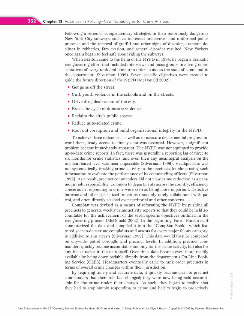
To solidify this message, the department began to hold regularly scheduledCompStat meetings in which precinct commanders and their staff met directlywith top departmental brass to discuss crime trends and issues in theirprecincts. In a very intimidating environment, precinct commanders must standbefore a lectern in front of three large video screens that flash GIS-generatedmaps of recent crime patterns (Figure 13.2). Commanders are then asked aboutwhat tactics they have tried to address the patterns, what resources they havetried or needed, and with whom they have collaborated. The session thus be-comes a brainstorming problem-solving session about how better to proactivelyrespond to crime. Suggestions for strategy directives are made and are relent-lessly followed up upon at subsequent meetings by top brass to further ensureaccountability. Having the top brass available as part of this process ensures thatdepartmental resources will be directed to precinct needs, even across precinctand unit lines. Thus, in addition to implementing accountable problem solving,CompStat seeks to reduce the problems of linkage blindness.
FIGURE 13 .2
Layout of the CompStat Room
The Precinct (local) Command
The Executive Command Panel
Source: Reprinted with permission of Launcelott Smith.
ISB
N0-
558-
4676
6-0
Law Enforcement in the 21st Century, Second Edition, by Heath B. Grant and Karen J. Terry. Published by Allyn & Bacon. Copyright © 2008 by Pearson Education, Inc.
Chapter 13: Advances in Policing—New Technologies for Crime Analysis334
FIGURE 13 .3
Conceptual Framework of the CompStat Planning Process
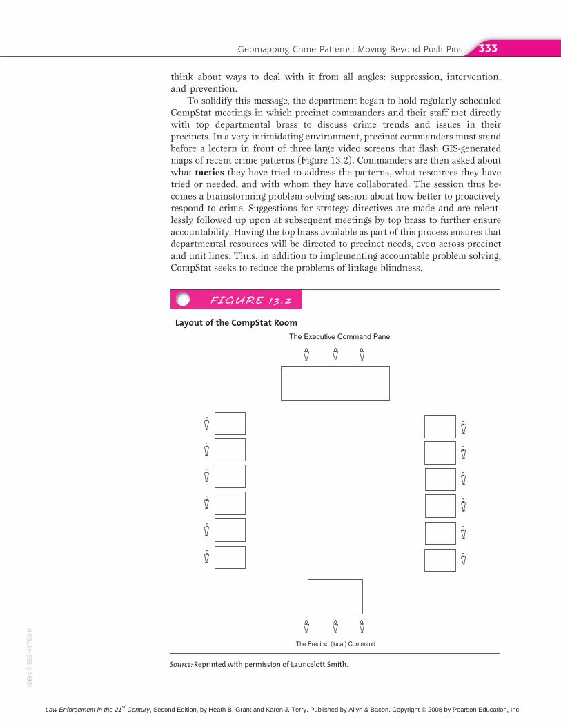
In order to be better prepared for the CompStat meetings, each boroughimplemented Pattern Identification Modules (PIMs) composed of hous-ing,transit, patrol, detective, organized crime, and robbery squads to review dailyindex crime reports and thus identify crime clusters or patterns that need to be addressed. Figure 13.3 provides a conceptual framework of thisplanning process.
Over time, the CompStat process has evolved to include other data for analy-sis, including census data, arrest and summons activity, available resources, av-erage response time, domestic violence incidents, unfounded radio runs, andpersonnel absences (Silverman 1999). Former Commissioner Howard Safir alsoadded citizen complaints and charges of officer misconduct to the process. Time-of-day photos might also be presented in CompStat meetings to monitor changesin precinct dynamics by shift period.
Many scholars and practitioners have argued that CompStat has played acritical role in the significant crime reductions witnessed by New York City fol-lowing its implementation (Silverman 1999). Others are more skeptical of theseclaims, arguing that the crime reduction in New York City can be attributed tolarger patterns in society (Karmen 1996). The answer is likely somewhere in themiddle; however, the tremendous impact CompStat has had on police manage-ment practices internationally cannot be denied. Although some reports havepointed to the demoralizing effects of the process on precinct commanders andofficers who feel a pressure to produce numbers, many others cite the signifi-cant increases in job satisfaction found by those who feel empowered by theproblem-solving aspects brought to the job.
An important concern has been whether the pressure to keep crime statis-tics low has led to a zero-tolerance policing style that loses sight of communityconcerns, further inhibiting police–community relations. The answer to thisissue is unclear, and it is probably too soon to come to any concrete conclusions.
• Precinctcrime data
• Arrestprofiles
• Citizencomplaintsand chargesof brutality
Compstat Meetings
• Top brass• Precinct commanders
and staff
PIMS STRATEGYDIRECTIVES
ISB
N0-558-46766-0
Law Enforcement in the 21st Century, Second Edition, by Heath B. Grant and Karen J. Terry. Published by Allyn & Bacon. Copyright © 2008 by Pearson Education, Inc.
Geomapping Crime Patterns: Moving Beyond Push Pins 335
These questions will have to be tracked by practitioners and academicians alikeas the model is implemented across diverse contextual conditions within theUnited States and abroad.
GIS and the Patrol OfficerAs GIS crime mapping became recognized as an important tool in both trackingand responding to crime on a neighborhood level, departments across the coun-try sought to expand its use beyond administrative planning to reach the patrolofficers and community residents. For example, the Camden New Jersey PoliceDepartment began providing officers with access to crime-mapping informationon desktop computers and even wireless laptops in patrol cars (American City
and Country 2002). The department enabled officers to access crime locations,crime types, and times throughout the city in order to focus patrol efforts. The
GIS Applications to Community PolicingBeginning in 1995, the Chicago Police Department(CPD) implemented one of the most easy-to-useand accessible GIS systems in the country as acomplement to its department-wide Chicago Al-ternative Policing Strategy (CAPS) community-policing approach. Called Information Collectionfor Automated Mapping (ICAM), the program en-ables departmental personnel to generate maps ofreported offenses by type, including charts of theten most frequently reported offenses, through aseries of easy mouse clicks (Rich 1996).
CAPS was implemented in 1993 in pilot districtsand has since been expanded to all twenty-five ofthe city’s policing districts. CAPS emphasizes officerproblem solving by assigning officers to their beatsfor at least a year, altering dispatch schedules sothat the time spent responding to crime outside oftheir beats is limited, and requiring officer atten-dance at community meetings (Rich 1996). Earlyevaluations of CAPS effectiveness showed signifi-cant declines in reported crime, victimization, andfear of crime (Skogan 1996).
ICAM is viewed as a complement to CAPS.CAPS enables officers to better understand theproblems in their assigned areas and thus bebetter facilitators of collaborative problem-solvingefforts with community residents (Rich 1996). Aspart of the ICAM development process, focus
groups were held with officersand detectives to seek their un-derstanding and cooperationand ensure that the completedprogram suited their information needs. Once thedepartment got the officers’ buy-in, maps wereregularly shared at beat meetings. Because of thesuccess of the ICAM, a Citizen ICAM program hasbeen developed. With Citizen ICAM, citizens cangenerate much of the same information (withoutspecific identifiers) that an officer can, thereby facilitating joint police–community planning efforts. Initially, confidentiality issues slowed citi-zen access to ICAM due to the specific details ofstreet locations. However, it is now running foranyone to see at http://citizenicam.chicagopolice.org/ctznicam/ctznicam.asp.
Other departments across the country have pro-duced their own mapping programs, includingWeb-based citizen crime reports, as will be dis-cussed later.
QUESTIONS1. Does your local police department have a web-
site? How does it compare to ICAM?2. Which GIS elements would you include on a de-
partment website?3. What applications of available GIS crime data
are there in your community?
Linkages in Law Enforcement
ISB
N0-
558-
4676
6-0
Law Enforcement in the 21st Century, Second Edition, by Heath B. Grant and Karen J. Terry. Published by Allyn & Bacon. Copyright © 2008 by Pearson Education, Inc.
Chapter 13: Advances in Policing—New Technologies for Crime Analysis336
maps also enable officers to pinpoint business-contact information when analarm is sounded, rather than having to call a dispatcher for the information(American City and Country 2002).
In 1998, the NIJ awarded the leading GIS software provider, Environ-
mental Systems Research Institute, Inc. (ESRI), a $500,000 grant to workwith local law enforcement agencies and universities to effectively utilize GIS asa crime-fighting tool (Carney 1998). Collaborating with several local law en-forcement agencies, ESRI developed an accessible GIS interface for large-scaledepartmental needs.
Other Applications: Geographic ProfilingGeographic profiling, the combined use of geography, psychology, and mathe-matics to identify the location of an offender, is most commonly associated withtracking down serial killers, rapists, and arsonists. However, it is actually usefulas an investigative tool in any case in which an individual offender has com-mitted criminal activity across a series of locations (including crimes as diverseas robbery, burglary, theft, and fraud). Building from the significant empirical ef-forts of Brantingham and Brantingham (1981), geographic profiling suggests in-vestigative alternatives based on the “hunting behavior” of the offender.Leading geographic profiler Kim Rossmo argues that criminals are no differentin offending as ordinary citizens are in going about their day-to-day activities(Onion 2002).
Following this logic, geographic profiling uses the nearness principle,which means that offenders will remain within a limited range that is comfort-able to them when committing their offenses (Rossmo 1998), just as animalswill tend to forage within a limited range from their base (Onion 2002). Geo-graphic profiling incorporates all possible methods of transportation available toan offender in providing a calculation of the area in which the offender is mostlikely to reside.
This research has led to the creation of a computerized geographic-profilingworkstation called Rigel. Rigel incorporates statistical analyses, GIS, and data-base management functions to generate investigative suggestions. Crime scenesare broken down into type (i.e., primary and secondary, see Chapter 8), and thenentered by location. Based on the theoretical principles of geographic profiling,addresses of suspects can be evaluated by their probability of being the actual of-fender (Harries 1999). This can help investigators to sort through their existingdatabases, such as those of registered sex offenders, and other investigative in-formation. When there is not a specific suspect pool, geographic profiling canhelp to pinpoint the highest probability areas to focus the search. As with the offender-profiling process discussed in Chapter 8, geographic profiling shouldonly be considered an additional tool for investigators; solving the offense willrequire a sound investigative strategy.
Twenty-First-Century Technologies in PolicingIn addition to GIS, over the past decade numerous other technologies have be-come available to law enforcement, from record management systems (RMS)
that help departments store and retrieve the immense amount of data they re-
ISB
N0-558-46766-0
Law Enforcement in the 21st Century, Second Edition, by Heath B. Grant and Karen J. Terry. Published by Allyn & Bacon. Copyright © 2008 by Pearson Education, Inc.
Twenty-First-Century Technologies in Policing 337
ceive on a day-to-day basis all the way to sophisticated weaponry and intelli-gence technologies that have reached law enforcement by way of the military.Covering all of these advances in significant detail is beyond the scope of thistext; however, the remainder of this chapter will provide an overview of somesignificant technological developments that are becoming part of everyday lawenforcement activities.
Closed-Circuit TelevisionThe use of closed-circuit television (CCTV) and other forms of public sur-veillance technology in the United States have witnessed significant growth inrecent years as not only police departments, but also airport security and otherpublic entities, have increasingly turned to video surveillance in their efforts toreduce crime and increase public safety. The use of this technology in the UnitedStates may not be nearly as prevalent as it is in countries such as England,where there is a camera on nearly every street corner and in every public build-ing; however, it is becoming increasingly popular, particularly following theevents of September 11. Law enforcement is now readily turning to surveillancesystems such as CCTV as a means of trying to sort through the tremendous traf-fic at our borders, airports, and dense city streets.
After spending almost two years in CCTV control rooms across England,Goold (2004) concluded that in many cases actual surveillance outcomes haveless to do with technological factors than they do with working cultures and
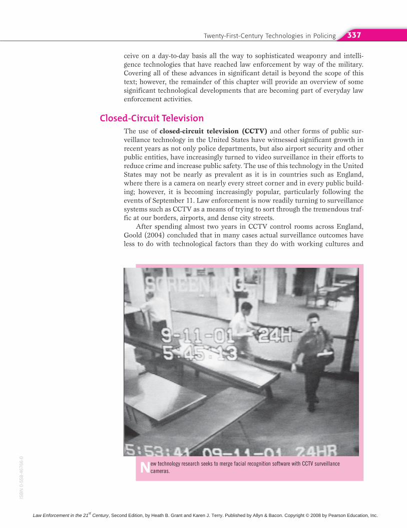
New technology research seeks to merge facial recognition software with CCTV surveillance cameras.
ISB
N0-
558-
4676
6-0
Law Enforcement in the 21st Century, Second Edition, by Heath B. Grant and Karen J. Terry. Published by Allyn & Bacon. Copyright © 2008 by Pearson Education, Inc.
Chapter 13: Advances in Policing—New Technologies for Crime Analysis338
the attitudes of individual camera operators. In particular, Goold found thatonce established, many surveillance systems in public areas quickly becomeprone to institutional inertia, with both camera operators and scheme man-agers being either unwilling or unable to update their systems or change theirworking practices in response to technological advances. Technology does notexist in a vacuum; it is shaped by social factors and by the attitudes and prac-tices of those who use it (Bijkker et al. 1987). In addition, technical workers,such as CCTV operators, often shape the implementation of new technologyby fitting it into their existing routines. Technological change may as often besubsumed into existing organizational structures as it effects organizationalchange (Barley 1986).
No one can erase the images caught on airport CCTV cameras of the Sep-tember 11 hijackers boarding their plane in Boston. Certainly such retrospectiveimages can be used as evidence of what transpired in a given incident, but lawenforcement has become increasingly more interested in finding better ways toharness CCTV technology to identify known offenders passing through a check-point, such as a wanted felon or individual on a terrorist watch list. As such,new advances have sought to merge CCTV systems with promising approachesin the field of biometrics, as will be discussed below.
Some agencies have developed innovative ways of overcoming the limita-tions of private security systems, which in many cases are useful only for record-ing crimes in progress rather than providing aid to responding units at the scene.For example, the Seal Beach Police Department installed a network that trans-mits the output of bank security cameras directly to dispatch and to respondingunits in real time in a high-robbery-incident suburb of Los Angeles (Garcia2001). The network transmits video over the air through encrypted wirelesscommunication paths in the same manner that images are sent over the Internet.
Global Positioning SystemsTracking offenders or patrol officer deployments have also been enhanced bythe use of Global Positioning Systems. Global positioning systems (GPS) usesatellite-based technologies for the purpose of tracking the movement of patrolcars or specially equipped stolen vehicles. In some cases, officers can beequipped with GPS-enabled cellular phones, providing an important alternativeto conventional address matching for an officer responding to a call. GPS tech-nology has also significantly enhanced aerial photography of crime-incident lo-cations, allowing for greater visualization of the complete context of a situation(Harries 2001). The State of Iowa has capitalized on the surveillance capacity ofGPS to monitor the real-time location of high-risk offenders released fromprison. With the use of an offender-monitoring system, law enforcement andcorrectional agencies can keep offenders away from areas where children arelikely to congregate (e.g., schools and daycare centers) (Greene 2003).
The Escambia County Sheriff’s Department’s SWAT team used a broadband-via-satellite system when responding to an emergency call involving a shootingvictim and a barricaded suspect. Through communication with the Mobile Com-mand Center’s satellite system, SWAT officers were able to determine that thesuspect had fled the scene and that the victim was likely dead (Hughes NetworkSystems 2002). Pictures of the suspect were immediately obtained via satelliteand distributed to patrol, a process that used to take hours or days.
ISB
N0-558-46766-0
Law Enforcement in the 21st Century, Second Edition, by Heath B. Grant and Karen J. Terry. Published by Allyn & Bacon. Copyright © 2008 by Pearson Education, Inc.
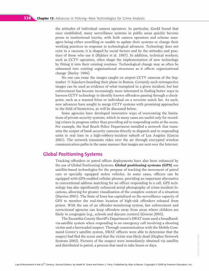
Even sophisticated tracking technology, such as GPS, can now fit in the palm of an officer’s hand!
Twenty-First Century Technologies in Policing 339
BiometricsBiometrics involves the automatic, real-time identification of individuals basedon their physiology or behavior (Cowper 2003). Biometrics thus encompasses adiversity of technologies, including voice recognition, fingerprint identification,lip movement, retinal scanning, facial recognition software, DNA profiling,thermal imagery, and iris/retinal scanning, to name just a few.
Facial Recognition Software The field of biometrics, particularly facial
recognition software, might overcome the limitations of CCTV systems, bothby reducing the need for expensive human operators and by making the suspect-identification process faster and more reliable. Several promising studies sup-port the potential applications of facial recognition software; however, little isknown about how such systems will function in real-life situations (Norris andArmstrong 1999).
Like any technology, the potential impact of facial recognition technology—from preventing crime to infringing civil liberties—depends on the quality of the
ISB
N0-
558-
4676
6-0
Law Enforcement in the 21st Century, Second Edition, by Heath B. Grant and Karen J. Terry. Published by Allyn & Bacon. Copyright © 2008 by Pearson Education, Inc.
Chapter 13: Advances in Policing—New Technologies for Crime Analysis340
database from which possible “hits” are derived. For example, an under-inclusive database might exclude potential terrorists but “catch” a child-supportviolator; whereas a mistargeted database may send out too large a net that mightunnecessarily infringe on people’s civil liberties and reduce the effective appli-cation of the technology. Cole’s (2001) groundbreaking analysis of the history ofidentification technologies highlights the need for further study of the informa-tion elements that comprise biometric databases.
Fingerprint Identification Systems Automated Fingerprint IdentificationSystems (AFISs) were introduced in Chapter 8. An advanced system to aid inthe processing, storage, and matching of fingerprints has been introduced by theFBI. Called the Integrated Automated Fingerprint Identification System
(IAFIS), this enhanced technology offers a two-hour turnaround on electroni-cally submitted criminal print searches from federal, state, and local law en-forcement agencies (Smith 1998).
Interjurisdictional Communication TechnologiesAt the core of linkage blindness is minimal amount of critical communicationthat occurs among different law enforcement jurisdictions as well as other sec-tors of the criminal justice system and community at large. Given the diver-sity of criminal justice core functions, the gathering and sharing of criminal justice information is particularly complex (Tomek 2001). The need to build information-sharing capacities, both technological and organizational, is evi-denced by the NIJ’s decision to make information sharing the number one pri-ority for information technology solutions among state and local agencies, aswell as internationally (Tomek 2001).
The need for information continuity and access is key for informed decisionmaking by all criminal justice stakeholders. One of the biggest challenges tolarger information-sharing collaborations is the large differences across agenciesin terms of agency protocols, standards, and even measures for the collectionand utilization of data (Tomek 2001). The Department of Homeland Security isworking to reduce this difficulty. In law enforcement’s effort to prevent terror-ism, the DHS has initiated the Homeland Security Information Network
(HSIN). HSIN enables state and urban law enforcement agencies to collect anddisseminate information among federal, state, and local agencies in order to prevent terrorist activity. This computer-based communications system was developed by state and local authorities in order to connect all fifty states, Wash-ington, D.C., and major metropolitan areas (DHS 2007).
Offender Databases Efforts have been made in recent years to develop suffi-cient technologies capable of overcoming many of the barriers involved in cross-and interjurisdictional information sharing. The San Diego County Automated
Regional Justice Information System (ARJIS) system warrants further de-scription as to the possibilities in interjurisdictional information sharing. ARJIScombines information from thirty-eight state, local, and federal law enforcementagencies into one website that can be accessed by registered police, court, andcorrectional officials (Walsh 2003). ARJIS includes crime-incident databasesthat are updated every 24 hours, most-wanted lists, and interactive maps. Simi-
ISB
N0-558-46766-0
Law Enforcement in the 21st Century, Second Edition, by Heath B. Grant and Karen J. Terry. Published by Allyn & Bacon. Copyright © 2008 by Pearson Education, Inc.
Twenty-First Century Technologies in Policing 341
larly, the Pennsylvania Integrated Justice Network (JNET) connects all of itscriminal justice agencies together for the sharing of critical information, in-cluding offender photos and images of distinguishing marks. In one case, an of-fender was apprehended based on the victim being able to describe theperpetrator’s tattoo to the police (Walsh 2003).
Cross-Jurisdictional Radio Communications Federal efforts at improvingcross-jurisdictional radio communications include the NIJ’s Advanced Gener-
ation of Interoperability for Law Enforcement (AGILE). AGILE providesdirect connections between the radio systems of law enforcement agencies withoverlapping or adjacent jurisdictions (Kaluta 2001). The possibilities of suchtechnologies for enhancing national security needs has been demonstrated byearly successes of the system as an enhancement to San Diego County’s ARJIS(Scanlon 2000). AGILE has also been used to establish an emergency-only radiochannel for presidential inaugurations, linking the Secret Service, the FBI, theU.S. Capitol Police, the U.S. Park Police, and the Metropolitan Police Depart-ment (Kaluta 2001).
Electronic Warrant Processes Some jurisdictions have developed solutions tothe numerous problems involved in the arrest-warrant process. With the tradi-tional process, courts issue paper warrants that are subsequently used by lawenforcement agencies to create a wanted person record in their own systems,which can then be checked by law enforcement officials throughout the countrythrough the use of the FBI’s National Crime Information Center (see Chapter 8).One of the problems with this process is the delay between when the court is-sues or cancels a warrant, creating serious officer safety concerns (Perbix 2001).Additional concerns arise from the lack of synchronization across the systems,in which warrants entered into one system are not entered into another (addingto the linkage blindness problem).
Electronic warrant systems, such as the Colorado Integrated CriminalJustice Information System (CICJIS), link the state’s main criminal justice systems (including law enforcement, prosecutors, courts, adult and juvenile corrections) so that data entered by one agency’s system is automatically trans-ferred and loaded into another agency’s system, thereby reducing linkage blind-ness and reducing the amount of inconsistent data (Perbix 2001).
Information Security Through Encryption Given the confidential informa-tion being shared by criminal justice agencies through these enhanced tech-nologies, serious privacy concerns inevitably arise. Secure law enforcementcommunication over the Internet or intranets can be achieved with virtual pri-
vate networking (VPN). VPN uses encryption software to scramble the con-tents of communications so that even if the system becomes available to hackers,they are unable to read the information (Taylor 2000). In addition to an ad-vanced encryption algorithm that is virtually impossible to break, VPNs pass en-crypted communications through a “tunnel” between communicating agencies,ensuring that users meet a high level of identification to be able to access the in-formation (Taylor 2000). With the establishment of proper identification andaccess protocols, VPNs offer law enforcement agencies the ability to exchangeand track important information, such as gang memberships, enhancing contactbetween the communicating agencies.
ISB
N0-
558-
4676
6-0
Law Enforcement in the 21st Century, Second Edition, by Heath B. Grant and Karen J. Terry. Published by Allyn & Bacon. Copyright © 2008 by Pearson Education, Inc.
Chapter 13: Advances in Policing—New Technologies for Crime Analysis342
The World Wide Web and Community PolicingWith its focus on collaborative problem solving and communication with thepublic, community policing is even more information intensive than traditionalpolicing methods (Monahan 1998). New communication technologies such asthe Internet have proven instrumental in furthering departmental community-policing objectives. Important features that are used by many departmental web-sites in reaching their constituent audiences include (Hart 1996):
● Officer photo galleries, including photos and biographical sketches
● Libraries devoted to crime prevention
● Safety tips, including information about known scam cases operatingwithin the jurisdiction
● Virtual tours of the department
● Recruitment tool with links to personnel information about the hiringprocess
● Citywide and neighborhood crime statistics, including crime-mappingcapabilities on more advanced sites, such as the Chicago Police Depart-ment’s Citizen ICAM
● Departmental wanted lists and upcoming court cases
● Capacity for anonymous and/or confidential reporting of crime infor-mation or complaints about officer conduct
Department websites move beyond the realm of being public relations tools to-ward true support for community policing activities to the extent that the de-partment shares important details about activities and arrests rather than thefiltered information generally provided to citizens by the media (Price 2001).Departmental posting of such information, however, should be balanced againstthe privacy needs of victims and nonconvicted offenders.
Improving Accountability—Mobile Communications with Patrol
Radio communications with patrol cars revolutionized the ability of depart-ments to monitor the activities of line officers. Although such technology didnot take away the high level of discretion available to officers as part of the na-ture of the job, enhancements to dispatch communications capabilities had aprofound effect on the nature of the job. More recently, cellular phone technol-ogy has provided an alternate communication forum for some jurisdictions.
Mobile Digital Communications Mobile digital communications (MDC)
offer nonverbal means of communicating information between communicationcenters and patrol (Thibault et al. 2001). Such communication is achievedthrough the use of a mobile digital terminal within the patrol car. In some ju-risdictions, MDC options allow for electronic submission of reports, thereby re-ducing the volume of paperwork. More recently, some departments haveinstalled new laptop computers into patrol cars, offering officers instant accessto information, such as notes from the communications officer, and even the Internet. Soon officers will not have to leave their cars to write even more de-tailed reports ( Johnson 2003). The Internet also facilitates interjurisdictional
ISB
N0-558-46766-0
Law Enforcement in the 21st Century, Second Edition, by Heath B. Grant and Karen J. Terry. Published by Allyn & Bacon. Copyright © 2008 by Pearson Education, Inc.
Linking the Dots 343
information-exchange opportunities immediately available to officers, again pro-viding an important tool in the reduction of linkage blindness.
Automatic Vehicle Monitoring. Through the use of automatic vehicle
monitoring (AVM) technologies, departments are able to know the locationand status of patrol vehicles, including whether the door of the vehicle has beenleft open and so on (Thibault et al. 2001). AVM systems are thus vitally impor-tant in aiding officers in high-speed pursuit situations and in determiningwhether the officer is in need of backup.
Chapter Summary
● Technology has advanced significantly in thepast twenty years, and the application of thistechnology has benefited law enforcement of-ficers in both proactive and reactive methodsof policing.
● The most important factors in crime analy-sis are timeliness, relevancy, and reliability, all of which are necessary to examine data effectively.
● With GIS crime mapping, a map is createdthat police officers can use to analyze whereand when crime occurs. It has many benefits,particularly with regard to proactive policing.It can help the police develop strategies tocombat crime, particularly in crime hot spots.
● Advanced technology allows for the collectionof more timely and accurate data, helping pa-trol officers respond more quickly and effec-tively to crime.
● One of the leading technologies of the twenty-first century is CompStat, which envelopesthe problem-oriented policing model and as-sists in more effective management of areaswhere crime occurs.
● Surveillance technology such as CCTV is ex-tremely beneficial in tracking all types ofcriminals, from shoplifters to terrorists.Through the taped monitoring of movements,combined with emerging biometrics of facerecognition technology, there are many poten-tial applications of CCTV.
● GPS is important in facilitating law enforce-ment operation in both investigatory and de-ployment capacities.
● Interjurisdictional communication technolo-gies useful to law enforcement include of-fender databases and electronic warrantssystems.
Linking the Dots
1. What have been some of the most significanttechnological advancements in policing since1980? Explain their significance.
2. What are some of the dangers associated withthe advancement in police technology? How are these dangers balanced with the benefits ofsuch technology?
3. Do you think CompStat is partially responsiblefor the significant drop in crime in New York Cityover the past decade?
4. How does law enforcement’s use of technologybenefit the community?
5. How can technology be used to help combatterrorism?
ISB
N0-
558-
4676
6-0
Law Enforcement in the 21st Century, Second Edition, by Heath B. Grant and Karen J. Terry. Published by Allyn & Bacon. Copyright © 2008 by Pearson Education, Inc.
Chapter 13: Advances in Policing—New Technologies for Crime Analysis344
KEY TERMS
311 system 324
911 system 323
Advanced Generation of
Interoperability for Law
Enforcement (AGILE) 341
Automated Regional Justice
Information System
(ARJIS) 340
Automatic vehicle monitoring
(AVM) 343
Biometrics 339
Buffer zones 330
Calls-for-service data 326
Causation 331
Chicago Alternative Policing
Strategy (CAPS) 335
Closed-circuit television
(CCTV) 337
CompStat 331
Correlations 331
Crime analysis 325
Crime mapping 327
Crime-trend forecasting 326
Electronic warrant system 341
Environmental Systems
Research Institute, Inc.
(ESRI) 336
Essential criteria for crime
analysis 325
Facial recognition software 339
Geocoded 330
Geographic information systems
(GIS) 327
Geographic profiling 336
Global positioning systems
(GPS) 338
Homeland Security Information
Network (HSIN) 340
Incident data 326
Information Collection for
Automated Mapping
(ICAM) 335
Integrated Automated
Fingerprint Identification
System (IAFIS) 340
Law of accelerating returns 325
Linkage analysis 326
Mobile digital communications
(MDC) 342
Nearness principle 326
Pattern detection 326
Pattern Identification Modules
(PIMs) 334
Record management systems
(RMS) 336
Relevancy 326
Reliability 326
Rigel 336
Social ecology of crime 328
Soulliere’s stages of
technological
advancement 322
Strategic crime analysis 326
Tactical crime analysis 326
Tactics 333
Target profiling 327
Timeliness 325
Virtual private network
(VPN) 341
REFERENCES
American City and Country. 2002. “Crime Maps Im-prove Patrols in Camden.” American City and
County, October 1, 2002. Available at www.americancityandcountry.com/ar/government_crime_maps_improve.
Barley, S. 1986. “Technology as an Occasion for Struc-turing Evidence from Observations of CT Scannersand the Social Order of Radiology Departments.”Administrative Science Quarterly 31(1):78–108.
Bijkker, M., T. Hughes, and T. Pinch. 1987. The Social
Construction of Technological Systems. New Directions
in the Sociology and History of Technology. Cam-bridge, MA: MIT Press.
Brantingham, C., and B. Brantingham. 1981. Envi-
ronmental Criminology. Thousand Oaks, CA: Sage Publications.
Canter, P. 2000. “Using a Geographic Information Sys-tem for Tactical Crime Analysis.” In Analyzing
Crime Patterns: Frontiers of Practice, edited by V.Goldsmith, P. McGuire, J. Mollenkopf, and T. Ross,pp. 3–10. Thousand Oaks, CA: Sage.
Carney, D. 1998. “Arming Beat Cops with GISWeapons.” Civic.com, April 13, 1998. Available atwww.civic.com.
Clarke, K. C. 1990. Analytical and Computer Cartogra-
phy. Upper Saddle River, NJ: Prentice Hall.
Cole, S. 2001. Suspect Identities: A History of Finger-
printing and Criminal Identification. Cambridge,MA: Harvard University Press.
Cowen, D. 2001. “Why Is GIS Important?” Available atwww.env.duke.edullel/enn351/images/uoi.txt!
Cowper, T. 2003. “Emerging Technology and the Fu-ture of Policing.” Paper presented at the Interna-tional Police Studies Conference, June 12–15,Eastern Kentucky University, Richmond, Kentucky.
DeAngelis, T. 2000. “GIS: Answering the Why ofWhere?” Police Chief, February. Available at www.iactechnology.orgllibrary/techtal/techtalk0200.htm.
Department of Homeland Security. 2007. Homeland Se-curity. Available at www.dhs.gov.
Goold, B. (2004). CCTV and Policing: Public Area Sur-
veillance and Police Practices in Britain. Oxford: Ox-ford University Press.
Garcia, M. 2001. “Force Protection Using Wireless Internet Technology.” Technology Talk. Available at www.loronit.com/solutions/casestudies/iactechtalk1201.pdf.
Grant, H., and K. Terry. 2000. The New York City Sex
Offender Management Team: Summary Progress Re-
port. New York: John Jay College of Criminal Justice.Greene, K. 2003. “Global Positioning Systems Used for
Some Offenders.” Noble News Online, April 4. Avail-
ISB
N0-558-46766-0
Law Enforcement in the 21st Century, Second Edition, by Heath B. Grant and Karen J. Terry. Published by Allyn & Bacon. Copyright © 2008 by Pearson Education, Inc.
References 345
able at www.nonlenatl.orglnews/publish/article_501.shtml.
Harries, K. 2001. Demonstration of Orthophotographic
Representation and Analysis. Washington, D.C.: Na-tional Institute of Justice.
Harries, K. 1999. Mapping Crime: Principle and Prac-
tice. Washington, D.C.: National Institute of Justice.Hart, F. 1996. “How and Why to Implement the
Worldwide Web for Community Policing.” Police
Chief 3(1):55.Hughes Network Systems. 2002. Case Study. German-
town, MD: Hughes Network Systems.Johnson, M. 2003. “City Vehicles Receive Laptops.”
Daytona Beach News Journal, April 15, 1.Kaluta, R. 2001. “New Developments in Interjurisdic-
tional Communication Technology.” Police Chief.Available at www.iacptechnology.org/library/techtalk/techtalk0401.htm.
Karmen, A. 1996. New York City Murder Mystery. NewYork: NYU Press.
Kelling, G., and M. Moore. 1987. “The Evolving Strat-egy of Policing.” Perspectives on Policing 4(1):1–15.
Kurzweil, R. 2001. “The Law of Accelerating Re-turns.” Available at www.kurzweilai.net.
McDonald, P. 2002. Managing Police Operations: Imple-
menting the New York Crime Control Model: Comp-
Stat. Belmont, CA: Wadsworth.Monahan, M. 1998. “Technology Management for
Community Policing.” Police Chief, September.Available at www.iacptechnology.orgllibrary/techtalk/techtalk0998.htm.
Norris, C., and G. Armstrong. 1999. The Maximum
Surveillance Society: The Rise of CCTV. New York:NYU Press.
Onion, A. 2002. “Coordinates of a Killer: A Mathemat-ical Method Can Help Investigators Locate Killers.”ABCnews.com, October 8. Available at www.abcnews.com.
Perbix, M. 2001. “Automating Arrest Warrants Be-tween Courts and Law Enforcement.” Police Chief,October. Available at www.iacptechnology.org/library/AutomatingArrestWarrantsBTCountsandLE.pdf.
Phillips, P. 1972. “A Prologue to the Geography ofCrime.” Proceedings, Association of American Geogra-
phers 4(1):86–91.Presidents Commission on Law Enforcement and the
Administration of Justice. 1967. Final Report of the
President’s Commission on Law Enforcement and the
Administration of Justice. Washington, D.C.: Presi-dents Commission on Law Enforcement and theAdministration of Justice.
Price, C. 2001. “The Police Web Site as a Commu-nity Policing Tool.” Police Chief, December.
Available at www.iacptechnology.orgllibrary/PoliceWebsiteasaCommunityPolicingToo1.pdf.
Rich, T. 1996. The Chicago Police Department’s Infor-
mation Collection for Automated Mapping (ICAM)
Program. Washington, D.C.: National Institute ofJustice Program Focus.
Rossmo, K. 1998. Geographic Profiling. Boca Raton, FL:CRC Press.
Scanlon, P. 2000. “A Successful Partnership: When Police and the Feds Team for Technology.” Police
Chief, October. Available at www.iacptechnology.org/library/techtalk/techtalk/co.
Seaskate, Inc. 1998. The Evolution and Development of
Police Technology. Washington, D.C.: National Insti-tute of Justice.
Shaw, C., and H. McKay. 1942. Juvenile Delinquency
and Urban Areas. Chicago: University of ChicagoPress.
Silverman, E. 1996. “Mapping Change: How the NewYork City Police Department Reengineered Itself to Drive Down Crime.” Law Enforcement News, December 15. Available at www.1ib.jjay.cuny.edu/len96/15Dec/?/htm.
Silverman, E. 1999. NYPD Battles Crime. Boston, MA:Northeastern University Press.
Skogan, W., and S. Hartnett. 1996. Community Policing
Chicago Style. New York: Oxford University Press.Skolnick, J., and D. Bayley. 1986. The New Blue Line:
Police Innovation in Six American Cities. New York:The Free Press.
Smith, K. 1998. “Integrated Automated FingerprintIdentification System: Twenty-first-century Tech-nology for Law Enforcement.” Police Chief 62(6):23.
Soulliere, N. 1999. Police and Technology: Historical Re-
view and Current Status. Ottawa: Canadian PoliceCollege.
Taylor, B. 2000. “Virtual Private Networking: SecureLaw Enforcement Communication on the Internet.”Police Chief 67(1):13.
Terry, K., and J. Furlong. 2004. Sex Offender Registra-
tion and Community Notification: A “Megan’s
Law” Sourcebook, 2d ed. Kingston, NJ: Civic Re-search Institute.
Thibault, E., L. Lynch, and R. McBride. 2001. Proactive
Police Management, 5th ed. Upper Saddle River, NJ:Prentice Hall.
Tomek, W. 2001. “Information Sharing: A StrategicNecessity.” Police Chief, February. Available atwww.iacptechnology.orgllibrary/tech talk/techtalk0201.pdf.
Walsh, T. 2003. “Data Sharing Tightens Net for theLaw-Agencies Put Criminal Justice Data On-line forSharing.” Government Computer News, July 10.Available at www.gcn.com.
ISB
N0-
558-
4676
6-0
Law Enforcement in the 21st Century, Second Edition, by Heath B. Grant and Karen J. Terry. Published by Allyn & Bacon. Copyright © 2008 by Pearson Education, Inc.