Embed Size (px)
Citation preview
Advanced Mapping Techniques
PRESENTED BY
Dan CoryJesse Gebhardt
What we are not covering…
• Geography in Your Data• Tableau’s Geography• Symbol Maps and Filled Maps• Unmapped Locations• Map Navigation• Map Options• Map Data Feedback
• (These topics are covered in the Mapping 101 session)
Agenda
• Combo Maps• Background Images• Custom Geocoding• WMS – Web Mapping Service• Point to Point Maps• Distance Calculations
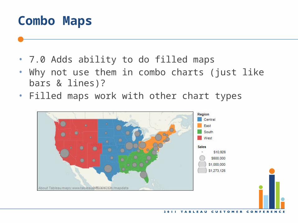
Combo Maps
• 7.0 Adds ability to do filled maps• Why not use them in combo charts (just like bars & lines)?• Filled maps work with other chart types
Agenda
• Combo Maps• Background Images• Custom Geocoding• WMS – Web Mapping Service• Point to Point Maps• Distance Calculations
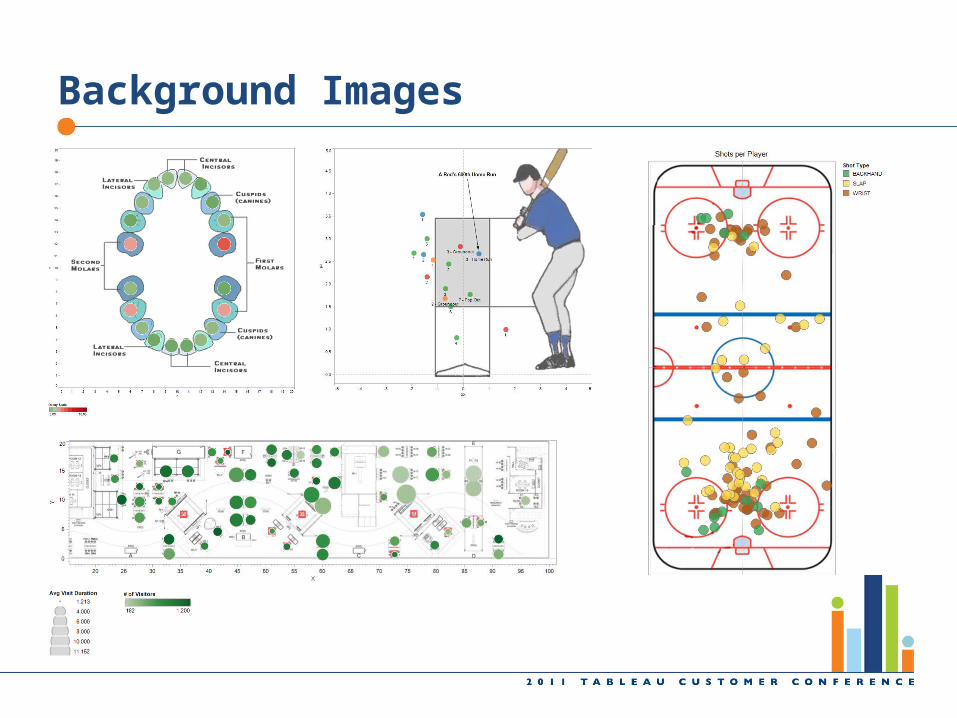
Background Images

Agenda
• Combo Maps• Background Images• Custom Geocoding• WMS – Web Mapping Service• Point to Point Maps• Distance Calculations
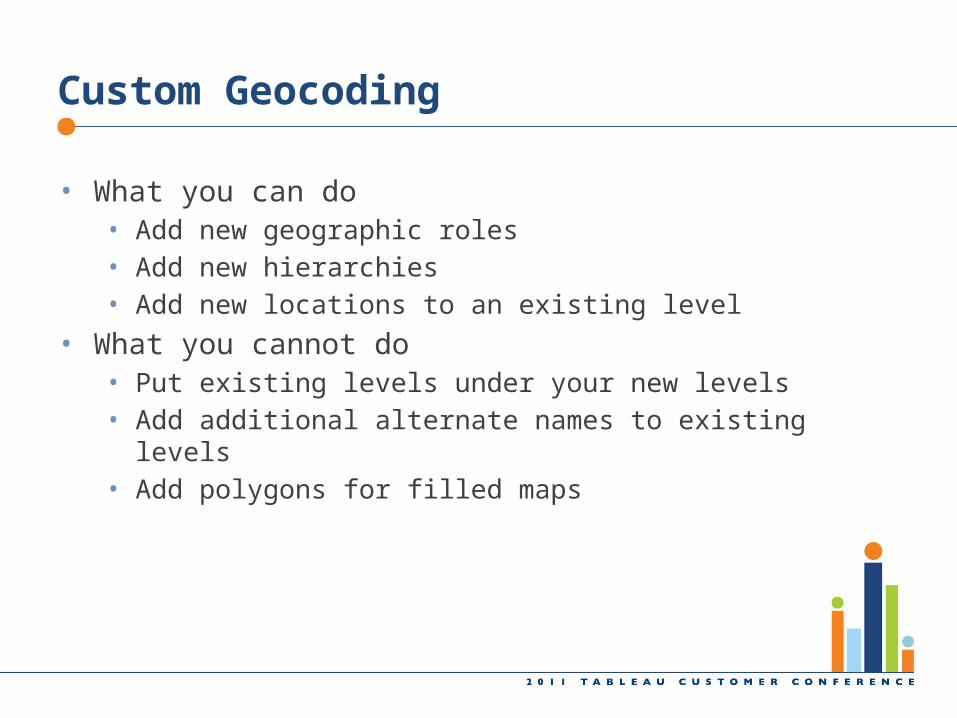
Custom Geocoding
• What you can do• Add new geographic roles• Add new hierarchies• Add new locations to an existing level
• What you cannot do• Put existing levels under your new levels• Add additional alternate names to existing levels• Add polygons for filled maps
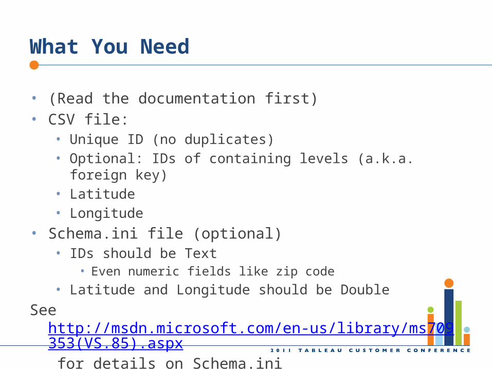
What You Need
• (Read the documentation first)• CSV file:
• Unique ID (no duplicates)• Optional: IDs of containing levels (a.k.a. foreign key)• Latitude• Longitude
• Schema.ini file (optional)• IDs should be Text
• Even numeric fields like zip code
• Latitude and Longitude should be Double
See http://msdn.microsoft.com/en-us/library/ms709353(VS.85).aspx for details on Schema.ini
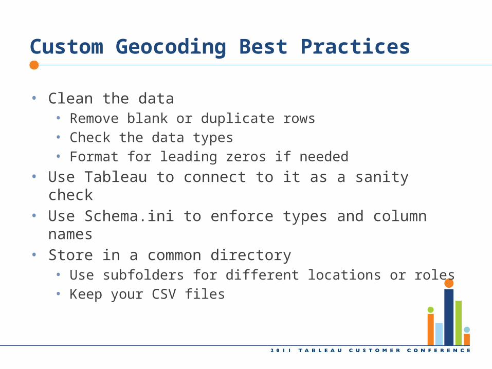
Custom Geocoding Best Practices
• Clean the data• Remove blank or duplicate rows• Check the data types• Format for leading zeros if needed
• Use Tableau to connect to it as a sanity check• Use Schema.ini to enforce types and column names• Store in a common directory
• Use subfolders for different locations or roles• Keep your CSV files
Agenda
• Combo Maps• Background Images• Custom Geocoding• WMS – Web Mapping Service• Point to Point Maps• Distance Calculations
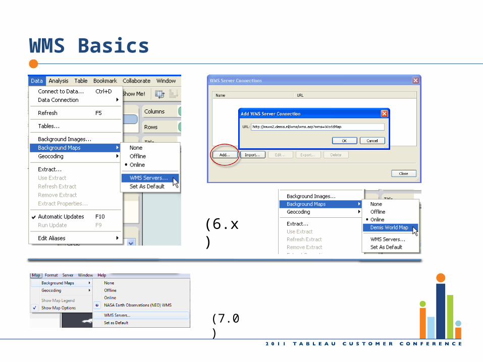
WMS Basics
(7.0)
(6.x)
Agenda
• Combo Maps• Background Images• Custom Geocoding• WMS – Web Mapping Service• Point to Point Maps• Distance Calculations
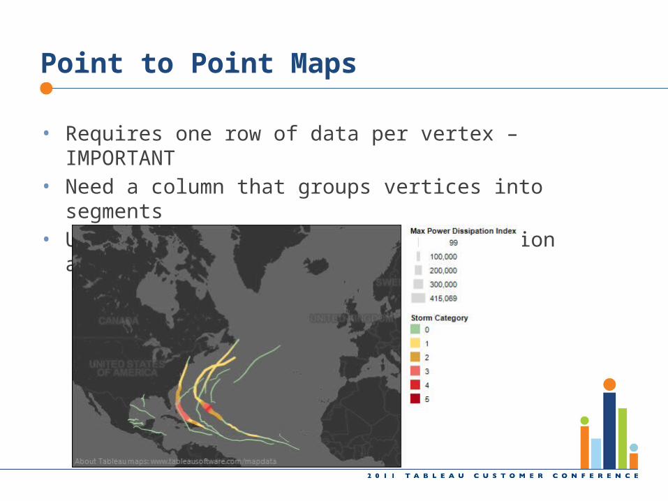
Point to Point Maps
• Requires one row of data per vertex – IMPORTANT• Need a column that groups vertices into segments• Use size and color to indicate direction and/or amount
Agenda
• Combo Maps• Background Images• Custom Geocoding• WMS – Web Mapping Service• Point to Point Maps• Distance Calculations
Distance Calculations
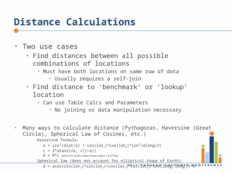
• Two use cases• Find distances between all possible combinations of locations
• Must have both locations on same row of data• Usually requires a self-join
• Find distance to ‘benchmark’ or ‘lookup’ location• Can use Table Calcs and Parameters
• No joining or data manipulation necessary
• Many ways to calculate distance (Pythagoras, Haversine (Great Circle), Spherical Law of Cosines, etc.)
Haversine formula:
a = sin²(Δlat/2) + cos(lat1)*cos(lat2)*sin²(Δlong/2)c = 2*atan2(√a, √(1−a))d = R*c where R is earth’s radius (mean radius = 6,371km)
Spherical law (does not account for elliptical shape of Earth):
d = acos(sin(lat1)*sin(lat2)+cos(lat1)*cos(lat2)*cos(long2−long1))*R
Summary
• Combo Maps• Background Images• WMS
• In house via ArcGIS and others; numerous public servers• Different layers than the Tableau built-in
• Custom Geocoding• Add your locations, augment Tableau locations
• Point to Point Maps• One row per vertex
• Distance Calculations• Data requirements, different methods
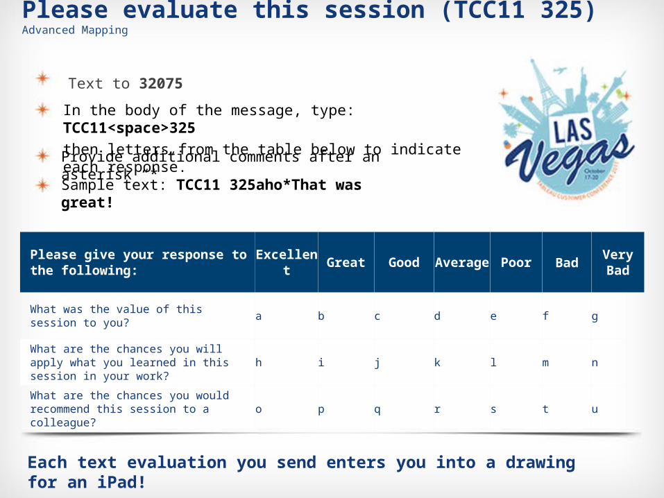
Please give your response to the following: Excellent Great Good Average Poor Bad Very Bad
What was the value of this session to you? a b c d e f g
What are the chances you will apply what you learned in this session in your work? h i j k l m n
What are the chances you would recommend this session to a colleague? o p q r s t u
Each text evaluation you send enters you into a drawing for an iPad!
Please evaluate this session (TCC11 325)Advanced Mapping
Text to 32075
Provide additional comments after an asterisk “*”
Sample text: TCC11 325aho*That was great!
In the body of the message, type: TCC11<space>325
then letters from the table below to indicate each response.