Embed Size (px)
Citation preview
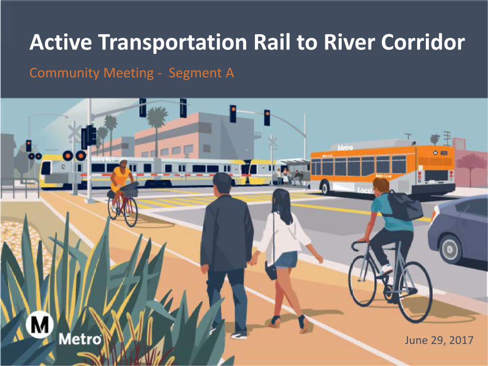
June 29, 2017
Community Meeting - Segment A
Active Transportation Rail to River Corridor
Tonight’s Agenda
> Open House (30 min)
> Welcome / Project Overview
> Presentation of 30% Design Refinements
> Next Steps
> Open House
2
Information as of June 29, 2017
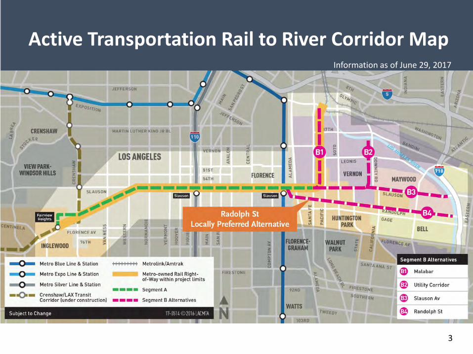
Active Transportation Rail to River Corridor Map
3
Information as of June 29, 2017
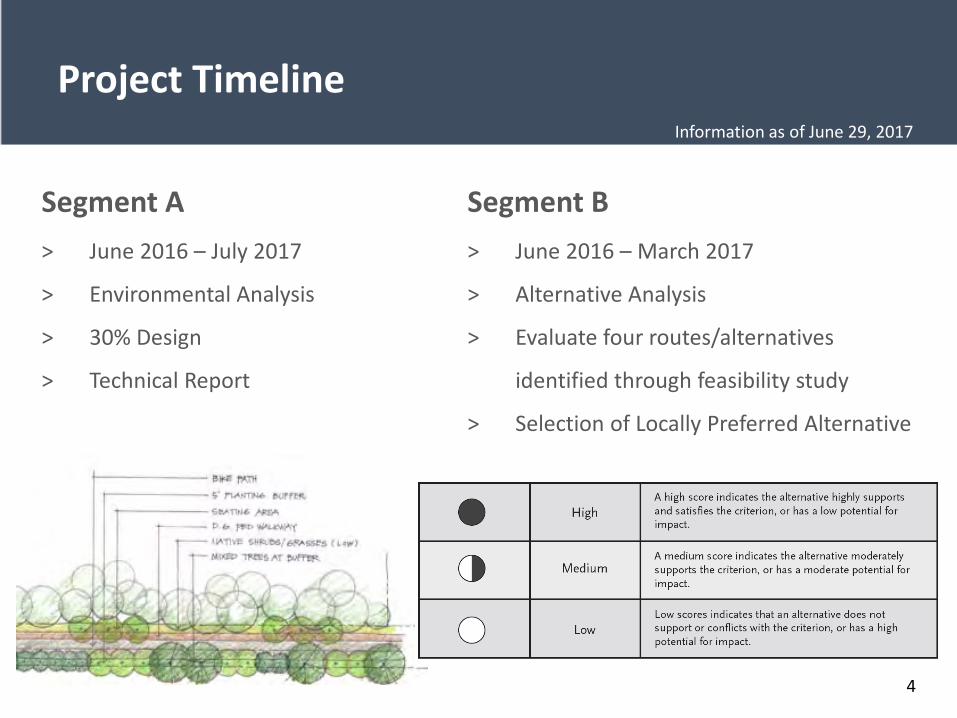
Project Timeline
Segment A> June 2016 – July 2017
> Environmental Analysis
> 30% Design
> Technical Report
Segment B> June 2016 – March 2017
> Alternative Analysis
> Evaluate four routes/alternatives
identified through feasibility study
> Selection of Locally Preferred Alternative
4
Information as of June 29, 2017
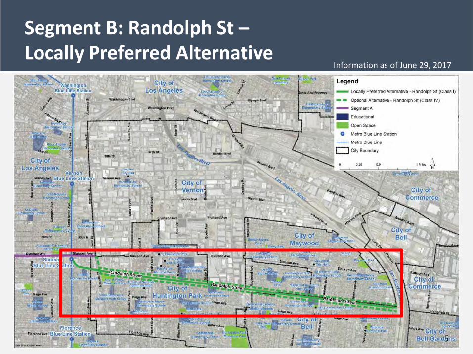
Segment B: Randolph St –Locally Preferred Alternative
5
Information as of June 29, 2017
6
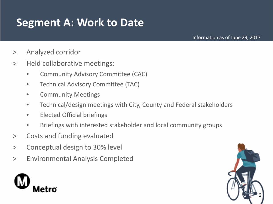
> Analyzed corridor> Held collaborative meetings:
• Community Advisory Committee (CAC)• Technical Advisory Committee (TAC)• Community Meetings• Technical/design meetings with City, County and Federal stakeholders• Elected Official briefings• Briefings with interested stakeholder and local community groups
> Costs and funding evaluated> Conceptual design to 30% level> Environmental Analysis Completed
Segment A: Work to DateInformation as of June 29, 2017
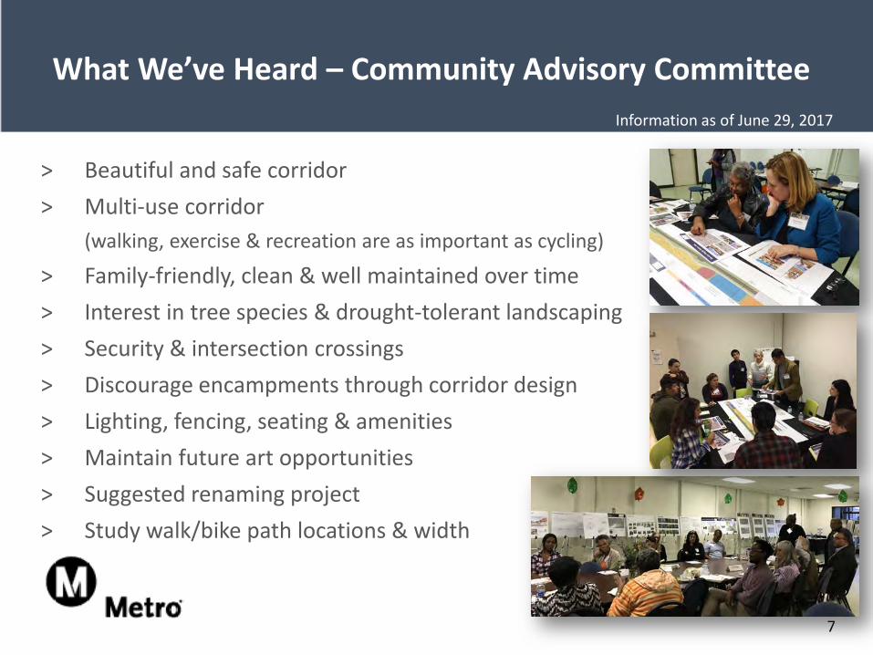
What We’ve Heard – Community Advisory Committee
> Beautiful and safe corridor> Multi-use corridor
(walking, exercise & recreation are as important as cycling)
> Family-friendly, clean & well maintained over time> Interest in tree species & drought-tolerant landscaping> Security & intersection crossings> Discourage encampments through corridor design> Lighting, fencing, seating & amenities> Maintain future art opportunities> Suggested renaming project> Study walk/bike path locations & width
7
Information as of June 29, 2017
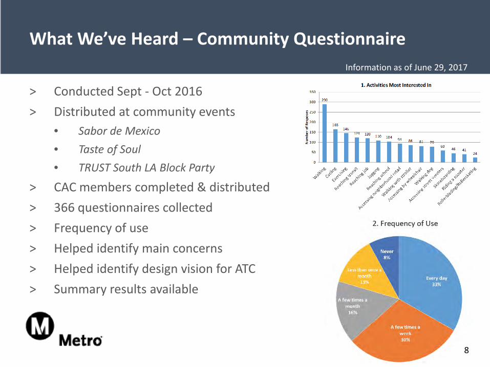
What We’ve Heard – Community Questionnaire
> Conducted Sept - Oct 2016> Distributed at community events
• Sabor de Mexico• Taste of Soul• TRUST South LA Block Party
> CAC members completed & distributed> 366 questionnaires collected> Frequency of use> Helped identify main concerns> Helped identify design vision for ATC> Summary results available
8
Information as of June 29, 2017
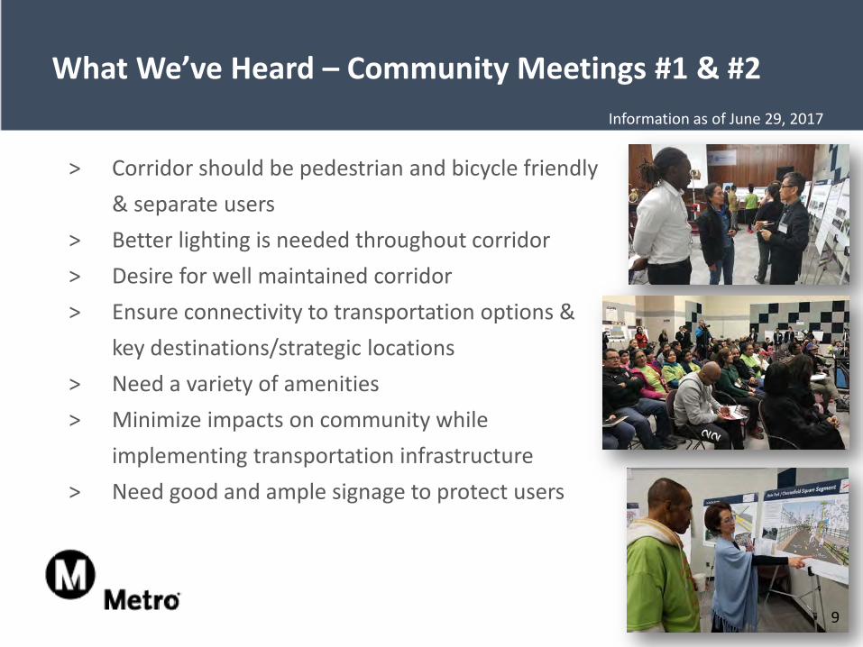
What We’ve Heard – Community Meetings #1 & #2
> Corridor should be pedestrian and bicycle friendly & separate users
> Better lighting is needed throughout corridor> Desire for well maintained corridor> Ensure connectivity to transportation options &
key destinations/strategic locations> Need a variety of amenities> Minimize impacts on community while
implementing transportation infrastructure> Need good and ample signage to protect users
9
Information as of June 29, 2017
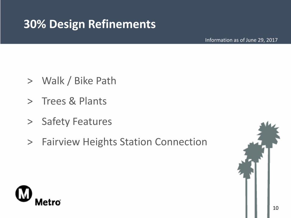
> Walk / Bike Path
> Trees & Plants
> Safety Features
> Fairview Heights Station Connection
30% Design Refinements
10
Information as of June 29, 2017
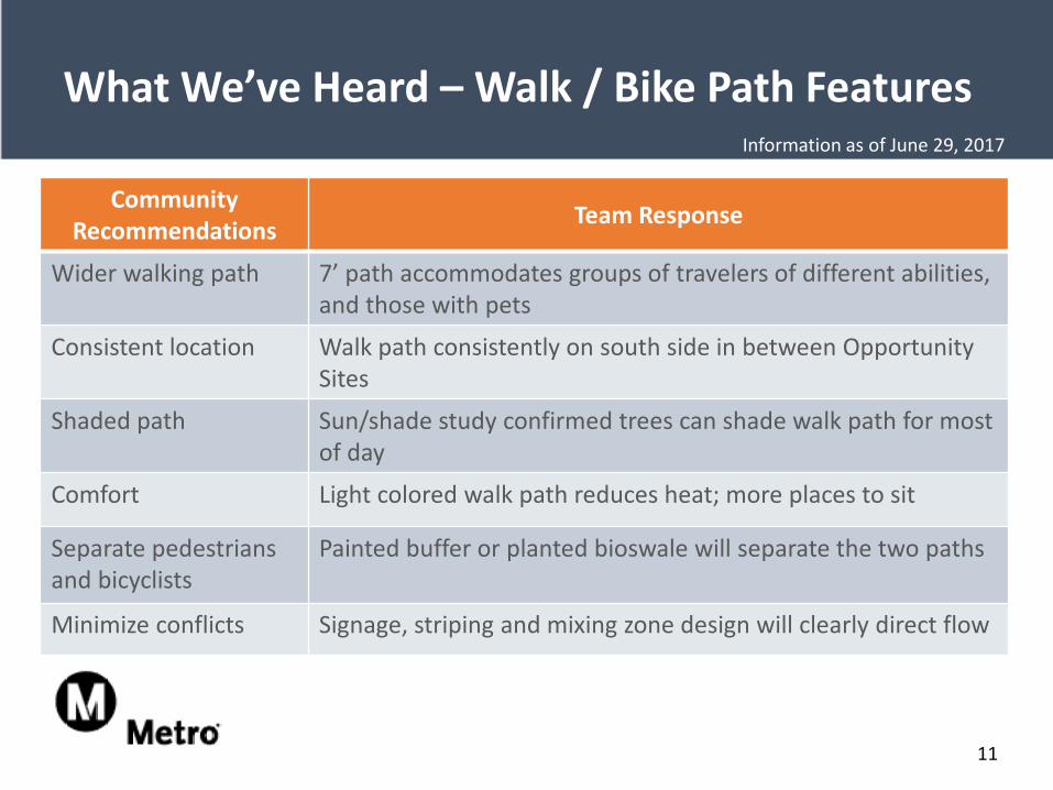
What We’ve Heard – Walk / Bike Path Features
Community Recommendations Team Response
Wider walking path 7’ path accommodates groups of travelers of different abilities, and those with pets
Consistent location Walk path consistently on south side in between Opportunity Sites
Shaded path Sun/shade study confirmed trees can shade walk path for most of day
Comfort Light colored walk path reduces heat; more places to sit
Separate pedestriansand bicyclists
Painted buffer or planted bioswale will separate the two paths
Minimize conflicts Signage, striping and mixing zone design will clearly direct flow
11
Information as of June 29, 2017
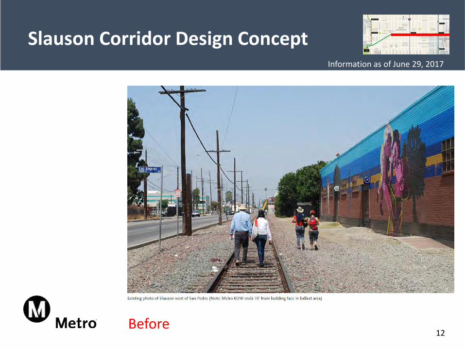
Slauson Corridor Design Concept
12Before
Information as of June 29, 2017
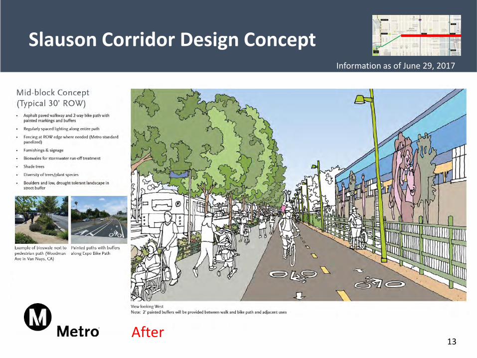
Slauson Corridor Design Concept
13After
Information as of June 29, 2017
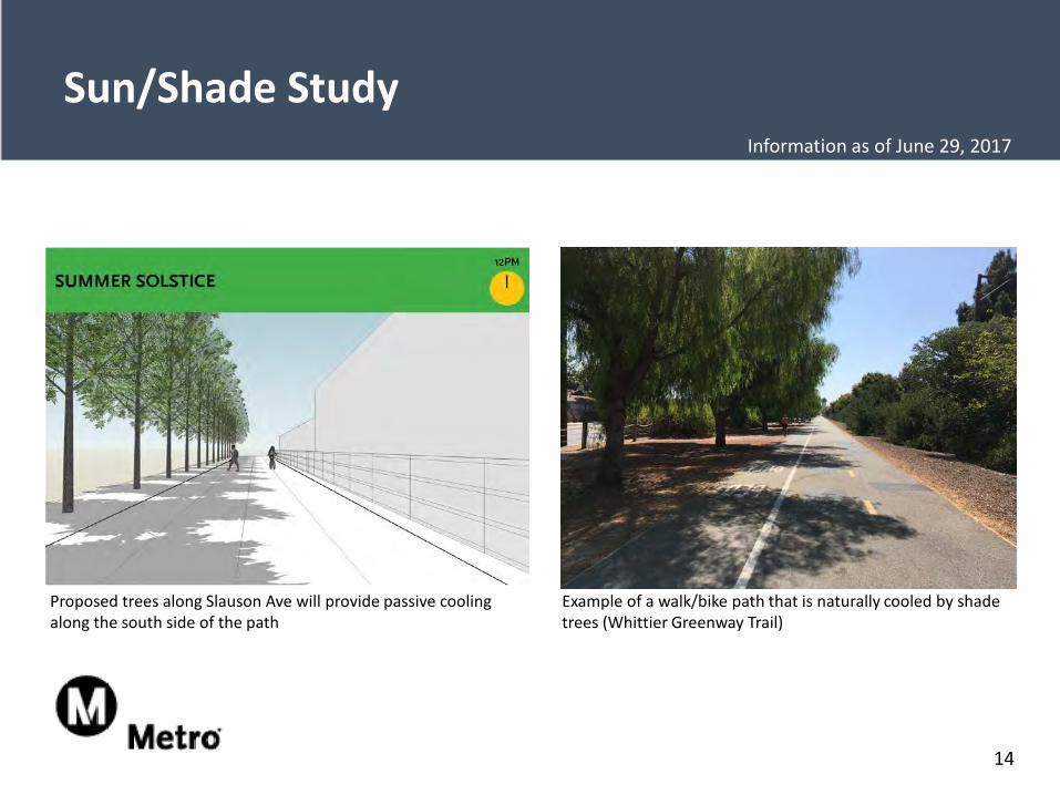
Sun/Shade Study
Proposed trees along Slauson Ave will provide passive cooling along the south side of the path
Example of a walk/bike path that is naturally cooled by shade trees (Whittier Greenway Trail)
14
Information as of June 29, 2017
(View looking West)
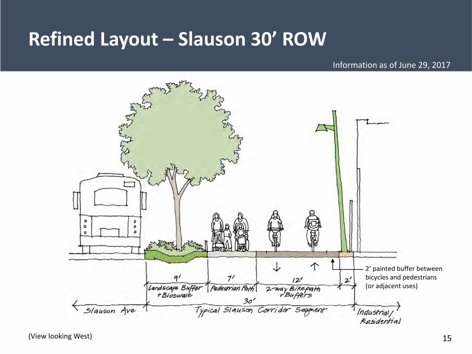
Refined Layout – Slauson 30’ ROW
2’ painted buffer between bicycles and pedestrians (or adjacent uses)
15
Information as of June 29, 2017
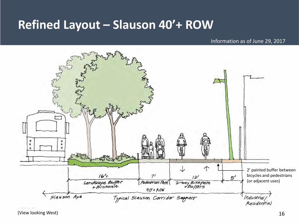
Refined Layout – Slauson 40’+ ROW
2’ painted buffer between bicycles and pedestrians (or adjacent uses)
AFTER (view looking West)(View looking West)
2’ painted buffer between bicycles and pedestrians (or adjacent uses)
16
Information as of June 29, 2017
(View looking West)
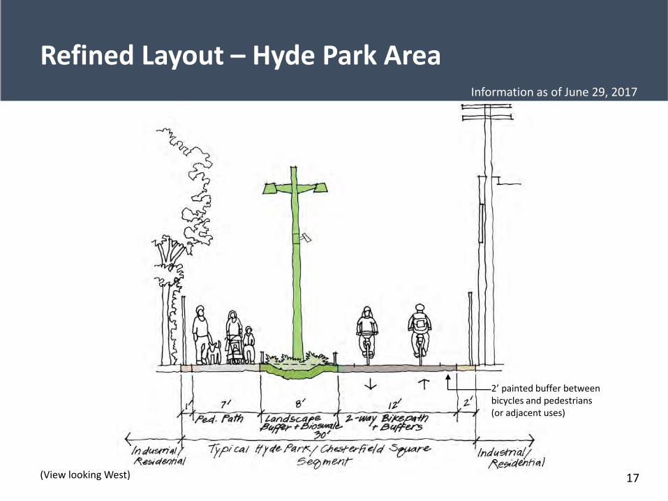
Refined Layout – Hyde Park Area
2’ painted buffer between bicycles and pedestrians (or adjacent uses)
17
Information as of June 29, 2017
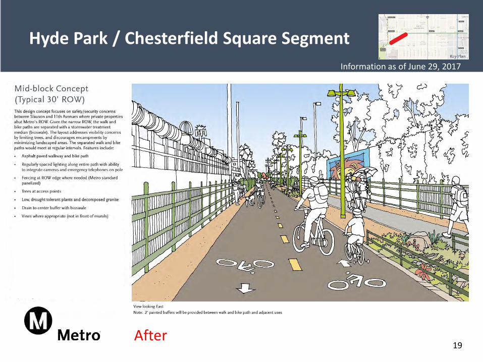
18
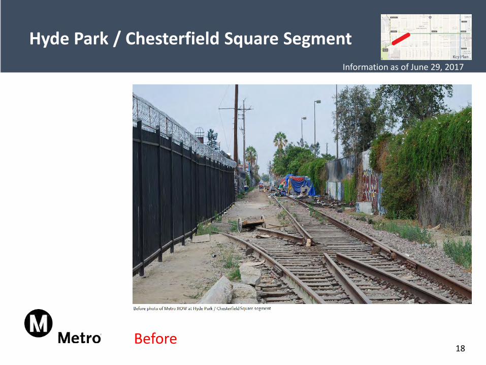
Hyde Park / Chesterfield Square Segment
Before
Information as of June 29, 2017
19
Hyde Park / Chesterfield Square Segment
After
Information as of June 29, 2017
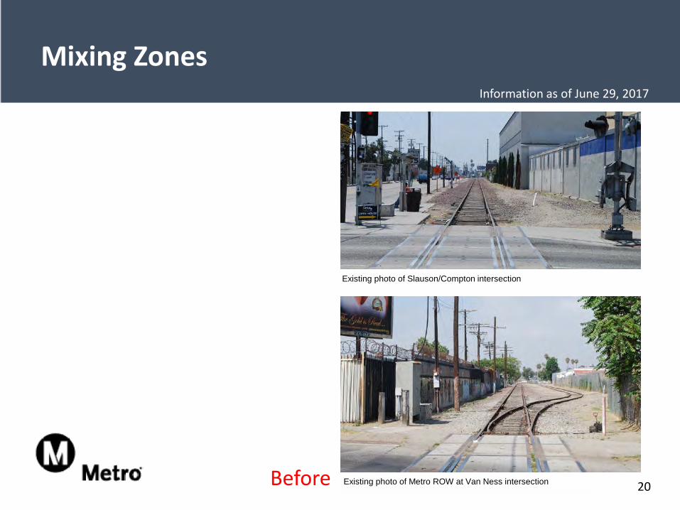
Existing photo of Metro ROW at Van Ness intersection
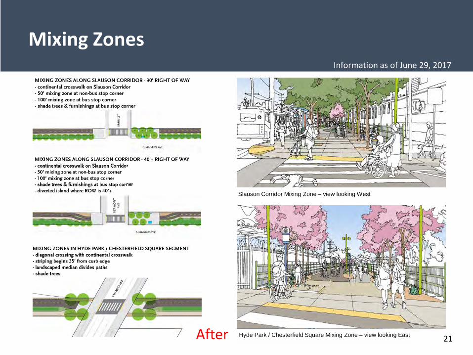
Mixing Zones
20
Existing photo of Slauson/Compton intersection
Before
Information as of June 29, 2017
Existing photo of Metro ROW at Van Ness intersection
Mixing Zones
21
Existing photo of Slauson/Compton intersectionSlauson Corridor Mixing Zone – view looking West
Hyde Park / Chesterfield Square Mixing Zone – view looking EastAfter
Information as of June 29, 2017
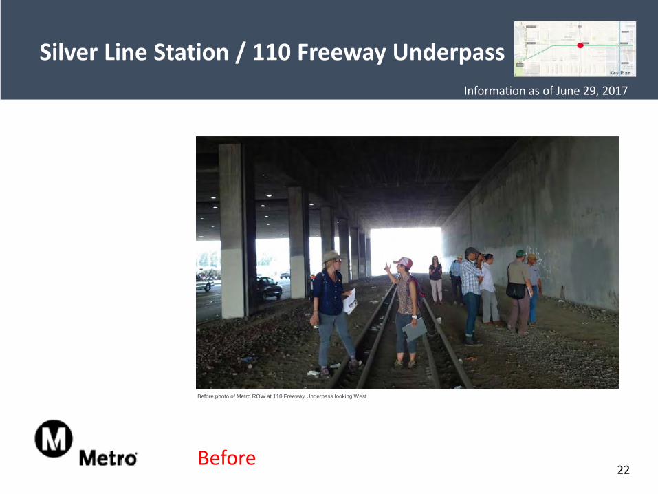
Silver Line Station / 110 Freeway Underpass
22
Before photo of Metro ROW at 110 Freeway Underpass looking West
Before
Information as of June 29, 2017
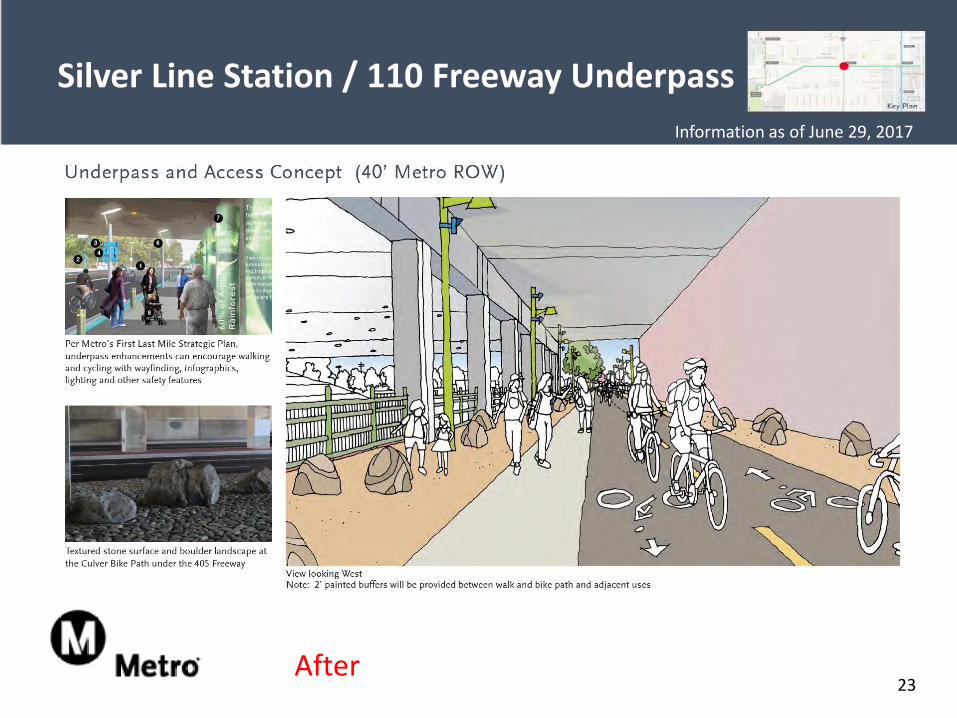
Silver Line Station / 110 Freeway Underpass
23After
Information as of June 29, 2017
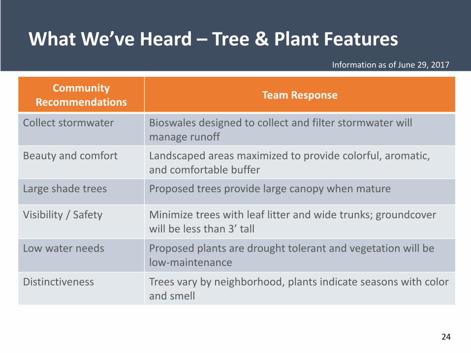
What We’ve Heard – Tree & Plant Features
Community Recommendations Team Response
Collect stormwater Bioswales designed to collect and filter stormwater will manage runoff
Beauty and comfort Landscaped areas maximized to provide colorful, aromatic, and comfortable buffer
Large shade trees Proposed trees provide large canopy when mature
Visibility / Safety Minimize trees with leaf litter and wide trunks; groundcover will be less than 3’ tall
Low water needs Proposed plants are drought tolerant and vegetation will be low-maintenance
Distinctiveness Trees vary by neighborhood, plants indicate seasons with color and smell
24
Information as of June 29, 2017
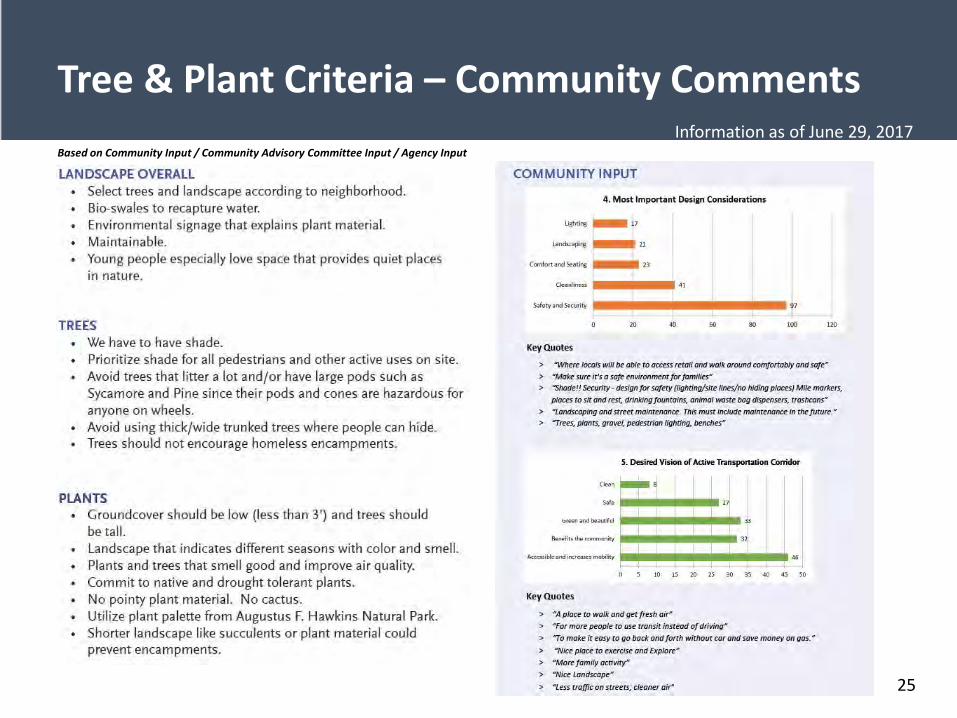
Tree & Plant Criteria – Community Comments Based on Community Input / Community Advisory Committee Input / Agency Input
25
Information as of June 29, 2017
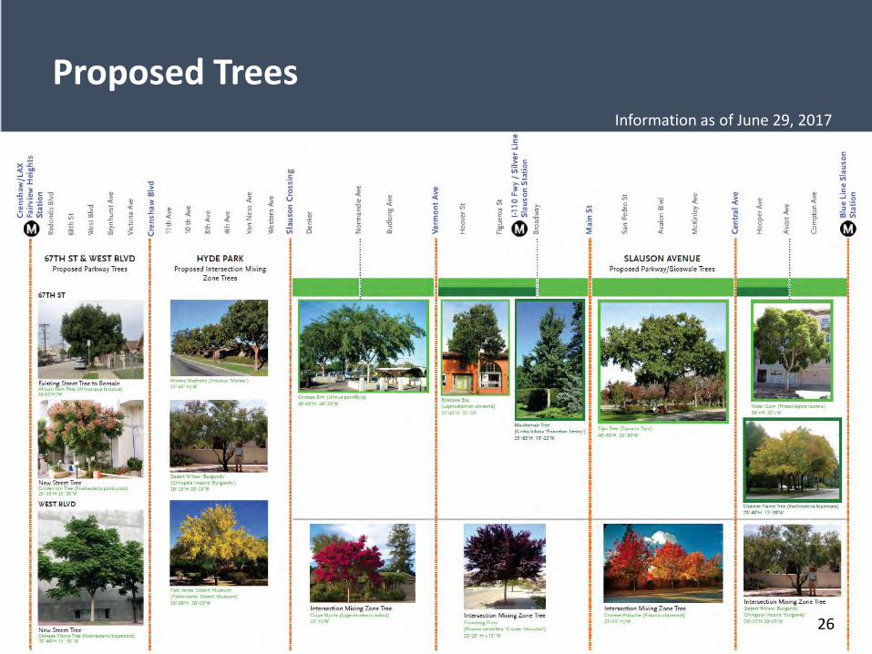
Proposed Trees
26
Information as of June 29, 2017
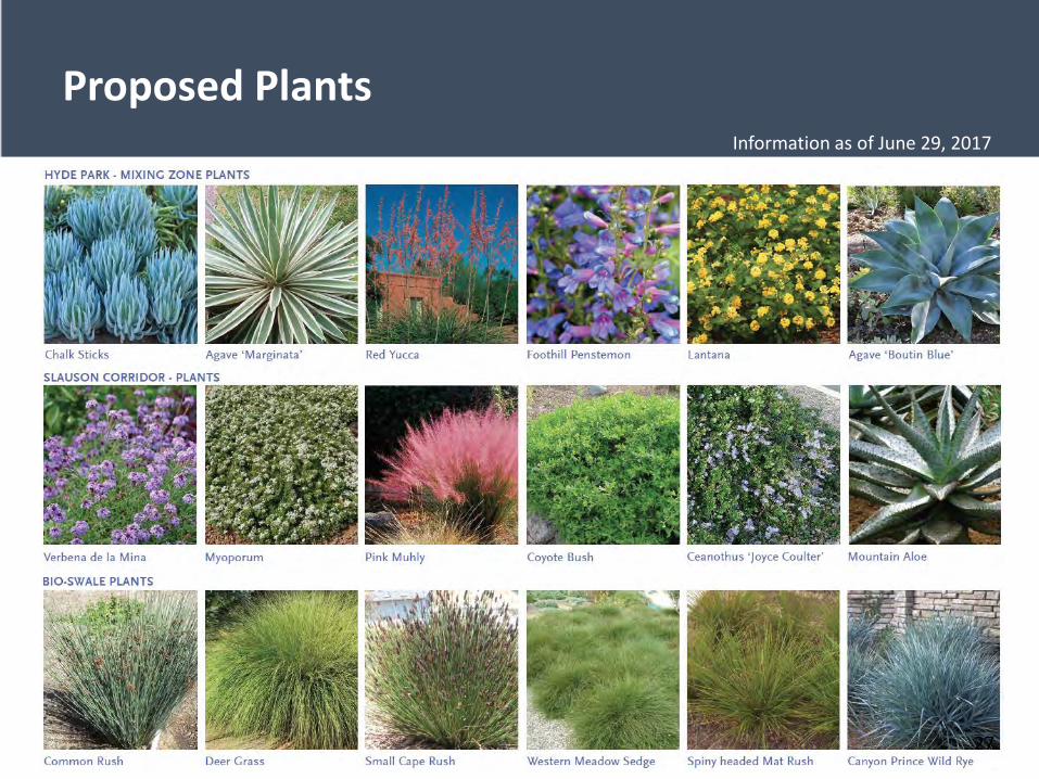
Proposed Plants
27
Information as of June 29, 2017
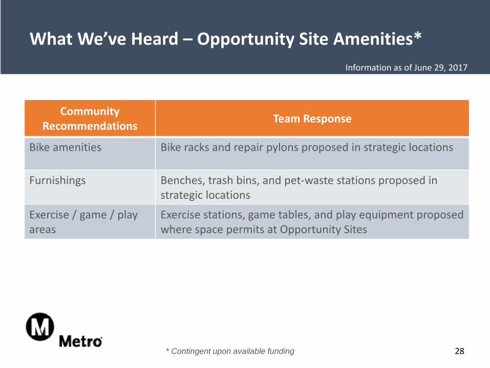
What We’ve Heard – Opportunity Site Amenities*
CommunityRecommendations Team Response
Bike amenities Bike racks and repair pylons proposed in strategic locations
Furnishings Benches, trash bins, and pet-waste stations proposed in strategic locations
Exercise / game / play areas
Exercise stations, game tables, and play equipment proposed where space permits at Opportunity Sites
28* Contingent upon available funding
Information as of June 29, 2017
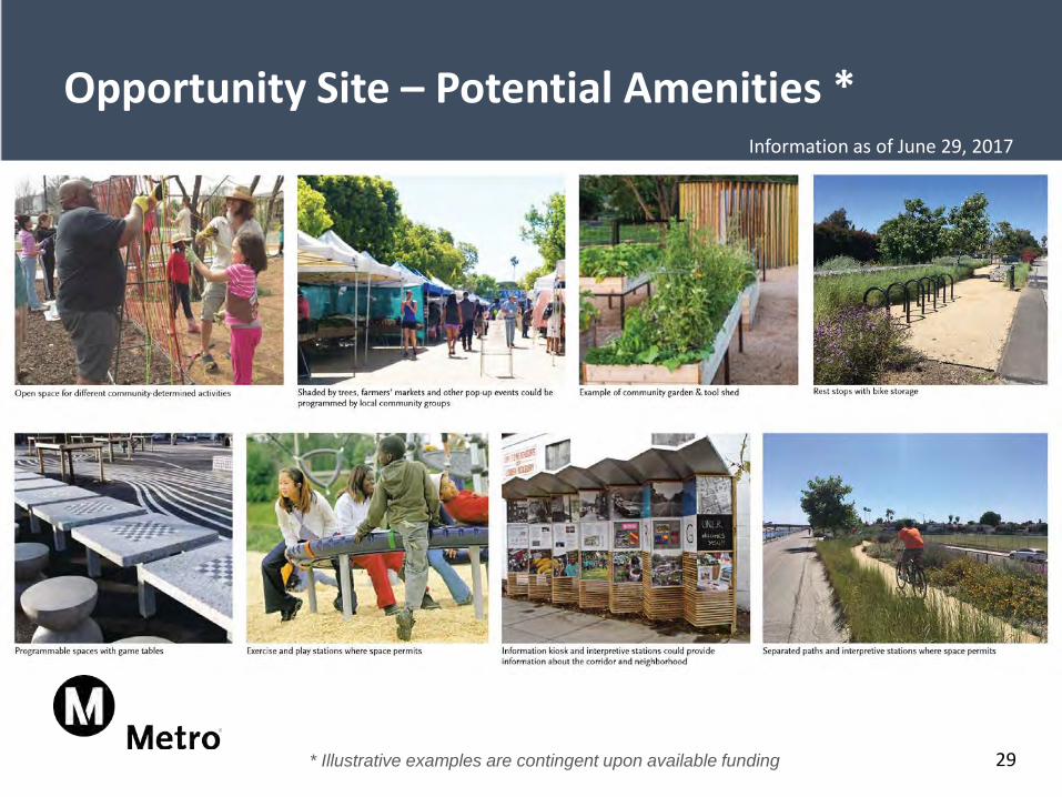
Opportunity Site – Potential Amenities *
* Illustrative examples are contingent upon available funding 29
Information as of June 29, 2017
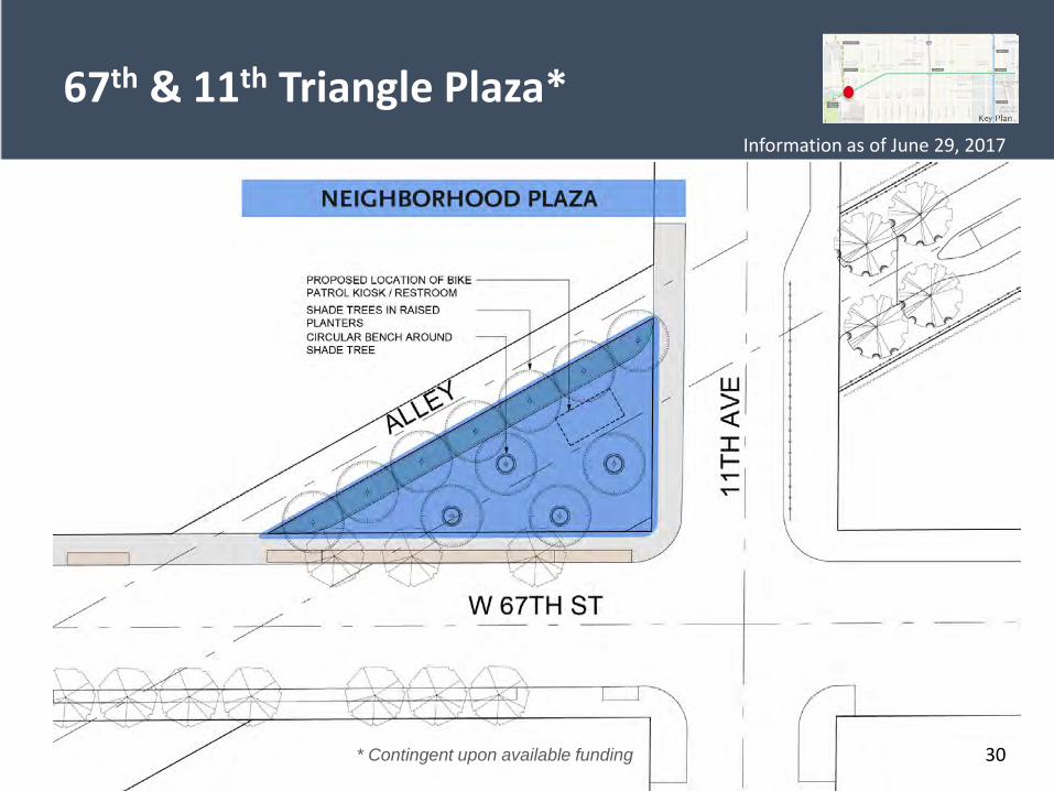
67th & 11th Triangle Plaza*
* Contingent upon available funding 30
Information as of June 29, 2017
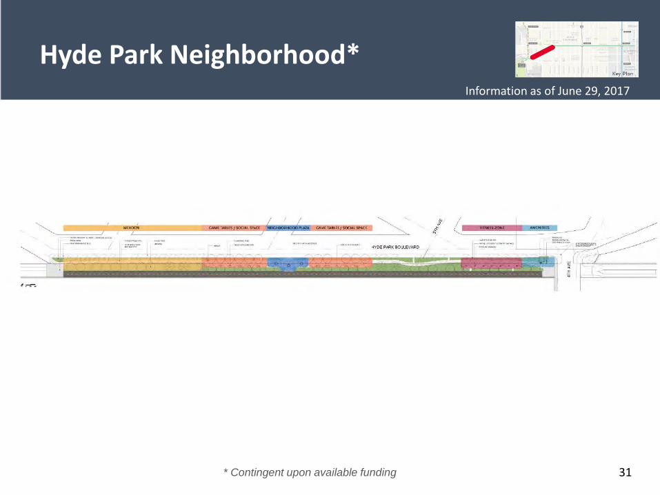
Hyde Park Neighborhood*
31* Contingent upon available funding
Information as of June 29, 2017
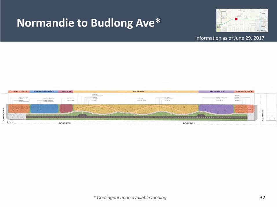
Normandie to Budlong Ave*
32* Contingent upon available funding
Information as of June 29, 2017
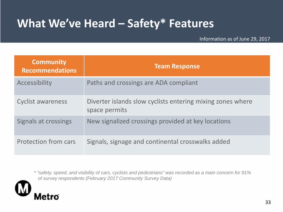
What We’ve Heard – Safety* Features
* “safety, speed, and visibility of cars, cyclists and pedestrians” was recorded as a main concern for 91% of survey respondents (February 2017 Community Survey Data)
Community Recommendations Team Response
Accessibility Paths and crossings are ADA compliant
Cyclist awareness Diverter islands slow cyclists entering mixing zones where space permits
Signals at crossings New signalized crossings provided at key locations
Protection from cars Signals, signage and continental crosswalks added
33
Information as of June 29, 2017
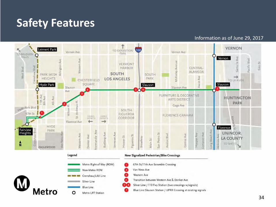
Safety Features
34
Information as of June 29, 2017
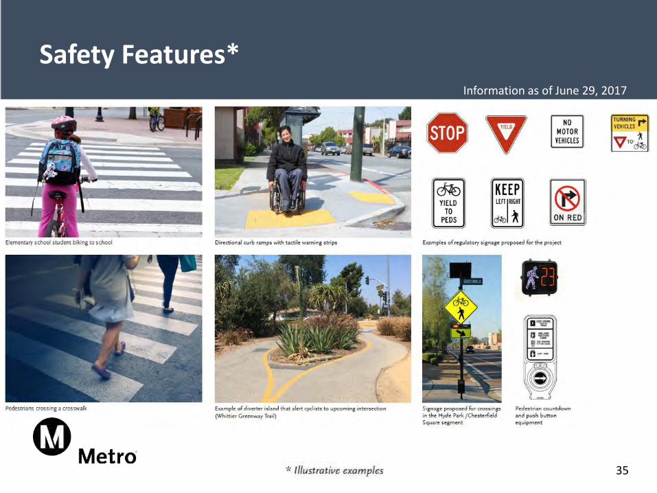
Safety Features*
35
Information as of June 29, 2017
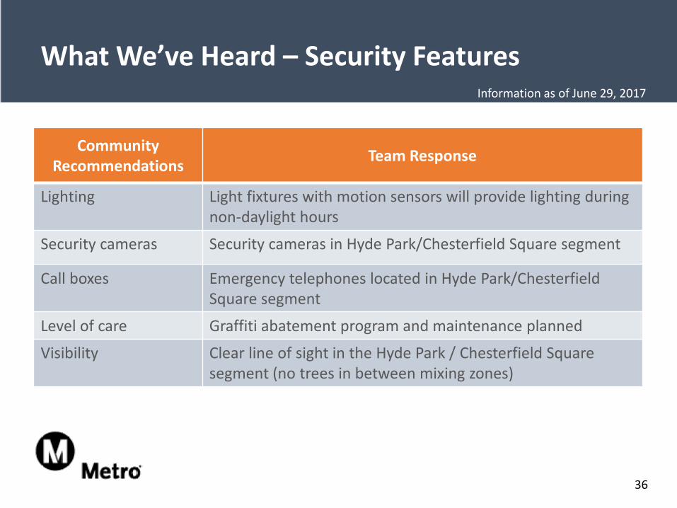
What We’ve Heard – Security Features
Community Recommendations Team Response
Lighting Light fixtures with motion sensors will provide lighting during non-daylight hours
Security cameras Security cameras in Hyde Park/Chesterfield Square segment
Call boxes Emergency telephones located in Hyde Park/Chesterfield Square segment
Level of care Graffiti abatement program and maintenance planned
Visibility Clear line of sight in the Hyde Park / Chesterfield Square segment (no trees in between mixing zones)
36
Information as of June 29, 2017
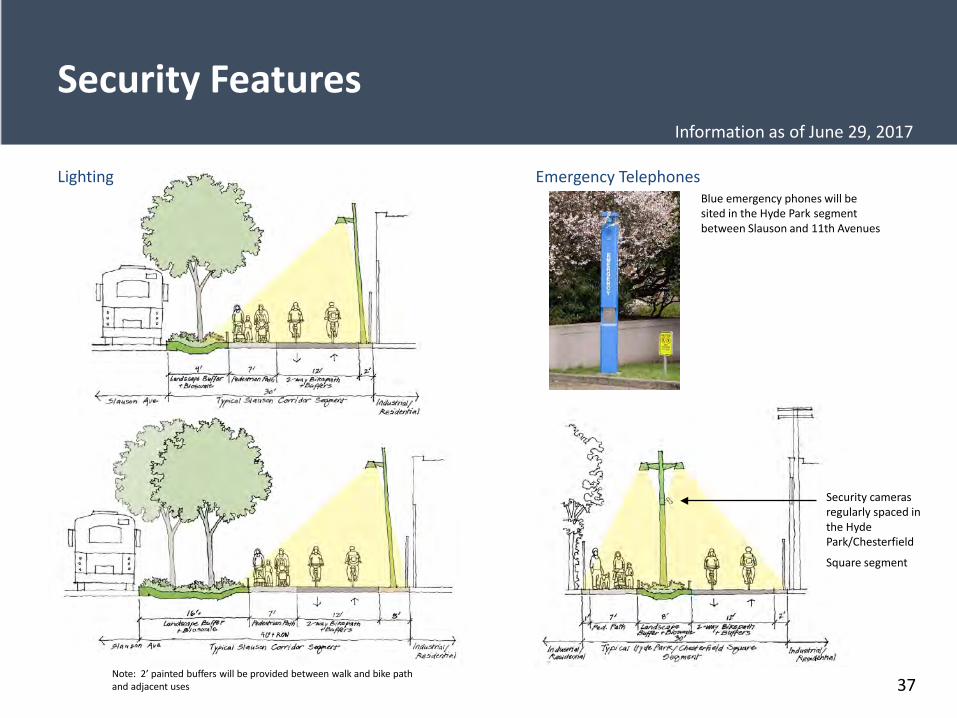
Security Features
Blue emergency phones will be sited in the Hyde Park segment between Slauson and 11th Avenues
Note: 2’ painted buffers will be provided between walk and bike path and adjacent uses
Emergency TelephonesLighting
Security cameras regularly spaced in the Hyde Park/Chesterfield
Square segment
37
Information as of June 29, 2017
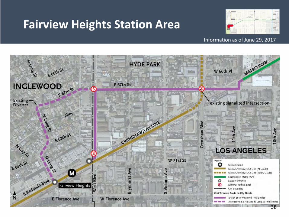
Fairview Heights Station Area
existing signalized intersection
LOS ANGELES
38
Information as of June 29, 2017
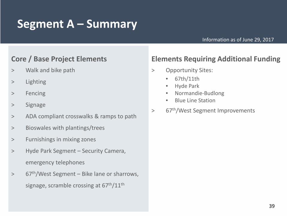
Segment A – Summary
39
Core / Base Project Elements> Walk and bike path
> Lighting
> Fencing
> Signage
> ADA compliant crosswalks & ramps to path
> Bioswales with plantings/trees
> Furnishings in mixing zones
> Hyde Park Segment – Security Camera,
emergency telephones
> 67th/West Segment – Bike lane or sharrows,
signage, scramble crossing at 67th/11th
Elements Requiring Additional Funding > Opportunity Sites:
• 67th/11th• Hyde Park• Normandie-Budlong• Blue Line Station
> 67th/West Segment Improvements
Information as of June 29, 2017
40
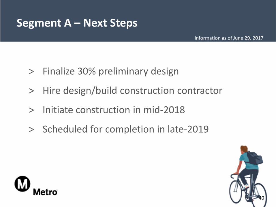
Segment A – Next Steps
> Finalize 30% preliminary design
> Hire design/build construction contractor
> Initiate construction in mid-2018
> Scheduled for completion in late-2019
Information as of June 29, 2017
Question & Answer Session
Questions?
41
Information as of June 29, 2017
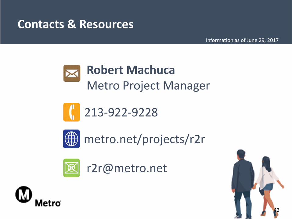
Robert MachucaMetro Project Manager
213-922-9228
metro.net/projects/r2r
42
Contacts & ResourcesInformation as of June 29, 2017
Thank youInformation as of June 29, 2017


![Virginia Department of Rail and Public Transportation (“DRPT”) · Virginia Department of Rail and Public Transportation (“DRPT”) ... [2] MWCOG ... supported by public transportation](https://img.pdfslide.us/doc/110x75/5c7ad28109d3f2f93e8c94f1/virginia-department-of-rail-and-public-transportation-drpt-virginia.jpg)