Embed Size (px)
Citation preview

U N I T E D S T A T E S E N V I R O N M E N T A L P R O T E C T I O N A G E N C YREGION 8
999 18™ S T R E E T - SUITE 500D E N V E R , CO 80202-2466
JUN 9 2000R e f : 8EPR-ER
A C T I O N MEMORANDUM
SUBJECT: .Request f or a T i m e C r i t i c a l Removal A c t i o n a t the U p p e rA r k a n s a s - F l u v i a l T a i l i n g s ( C a l i f o r n i a G u l c h N P L ) [ O U 1 1 ]S i t e , L e a d v i l l e , Lake County, Co lorado .F R O M : Mike Zimmerman, O S CEmergency Response TeamT H R O U G H : S t e v e H a w t h o r n , S u p e r v i s o rEmergency Response Unit ..-
D o u g l a s M. S k i e , ,Preparedne s s , A s s e s s m e n € : : - ' & / E m e r g e n c y Response Program'*T O : M a x H . Dodson, A s s i s t a n t Regional A d m i n i s t r a t o rO f f i c e o f E c o s y s t e m P r o t e c t i o n a n d R e m e d i a t i o n
S i t e I D # : 2 9 ( O U 1 1 )Removal No. 22Category o f Removal: Time C r i t i c a l , NPL
I . PURPOSEThe purpo s e of th i s A c t i o n Memorandum is to request anddocument approval of the Removal A c t i o n described herein fort h e U p p e r Arkansas - F l u v i a l T a i l i n g s ( C a l i f o r n i a G u l c h N P L )[ O U 1 1 ] s i t e ( S i t e ) , L e a d v i l l e , Lake C o u n t y , C o l o r a d o .T h i s Removal A c t i o n addre s s e s the response to the threatpo s ed by t a i l i n g s with e l eva t ed metal c onc en tra t i on s ofl e a d , c o p p e r , cadmium, and zinc on riverbanks and ina d j a c e n t s u r f a c e channels threatened by erosion f r o m thew a t e r f l o w in the Arkansas River. C o n d i t i o n s e x i s t i n g at theS i t e present an imminent and subs tant ial endangerment tohuman h e a l t h and the environment and meet the cr i t er ia fori n i t i a t i n g a T i m e C r i t i c a l Removal A c t i o n under 40 C F R ,§300,415 ( b ) ( 2 ) o f t h e N a t i o n a l Cont ingency Plan ( N C P ) .
Printed on Recycled Paper

I I . S I T E C O N D I T I O N S A N D B A C K G R O U N DA . S i t e D e s c r i p t i o n
1. Removal s i t e evaluationThe CERCLIS ID number o f the U p p e r Arkansas -F l u v i a l T a i l i n g s S i t e i s C O D 9 8 0 7 1 7 9 3 8 . S i t ec ond i t i on s are such that th i s Removal A c t i o n isc l a s s i f i e d a s T i m e C r i t i c a l . The area o f t h i sRemoval A c t i o n f o c u s e s upon 18 small areas in aseries of t a i l i n g s a l ong the Arkansas River southo f t h e c o n f l u e n c e wi th C a l i f o r n i a G u l c h . T h e s el o c a t i o n s are a d j a c e n t to the pre sent course ofthe Arkansas River, and f l u v i a l t a i l i n g s aree rod ing into the water on a d a i l y basis. Theerosion of t a i l i n g s has been observed bylandowner s , E P A , a n d many other p a r t i e s . T h e U . S .Environmental P r o t e c t i o n Agency ( E P A ) tasked t h eS u p e r f u n d T e c h n i c a l Asse s sment and Respons e Team( S T A R T ) t o provide a n a l t e rna t iv e s ana ly s i s f o rre sponse to the f l u v i a l t a i l i n g s a d j a c e n t to 11mi l e s of the Arkansas River ( S e e A t t a c h m e n t A -A l t e r n a t i v e s A n a l y s i s - U p p e r Arkansa s RiverF l u v i a l T a i l i n g s . Lake County. C o l o r a d o [ C o n t r a c t# 6 8 - W 5 - 0 0 3 1 ] - December 1 9 9 9 ) ; in T a b l e 1 p a g e s29-37 the f l u v i a l d e p o s i t s have beenc h a r a c t e r i z e d , and in T a b l e 3, p a g e s 38-49 of theA l t e r n a t i v e s A n a l y s i s . T h e a l t e r n a t i v e s ana ly s i swas used to s e l e c t a p p r o p r i a t e areas anda p p r o p r i a t e t e c h n o l o g i e s which w i l l reduce theimpact o f f l u v i a l t a i l i n g s d e p o s i t s on the U p p e rArkansas River and it s f l o o d p l a i n . A l t e r n a t i v e scons idered inc luded no a c t i on , i n s t i t u t i o n a lc o n t r o l s , i n - p l a c e s t a b i l i z a t i o n , removal, andriver channel a l t e r a t i o n . Each a l t e r n a t i v e wasrated according to e f f e c t i v e n e s s ,i m p l e m e n t a b i l i t y , c o s t , and a c c e p t a b i l i t y . TheS i t e s , which were s e l e c t e d , are l o c a t e d in threeareas of the Arkansas River and are d e p i c t e d onpages 39-49 of the A l t e r n a t i v e s A n a l y s i s -A t t a c h m e n t A .O r i g i n a l l y , t h e A l t e r n a t i v e A n a l y s i s d e s i g n a t e dt a i l i n g s d e p o s i t s A G , A H , A I , A J , F B , P P , Q A , Q D ,Q F , Q G , Q H , Q K , Q M , Q N , Q O , Q R , a n d t h e " L "segment for remediat ion. However , due tobudge tary c o n s t r a i n t s , the areas of c on s id e ra t i onhave been reduced to the "L" d e p o s i t s .

2. Physical l o ca t i onThe p o r t i o n of the Arkansas River to which th i sRemoval A c t i o n a p p l i e s is l o c a t e d in Lake C o u n t y ,Co lorado , and begins at the c o n f l u e n c e ofC a l i f o r n i a G u l c h and the Arkansas River. The areais shown on the a t ta ch ed F i g u r e 1, S i t e L o c a t i o nM a p . A l o n g the segment which was cons idered, theriver is fed by Lake F o r k Creek , Iowa G u l c h ,T h o m p s o n G u l c h , Empire G u l c h , Dry Union G u l c h , BigUnion Creek, S p r i n g Creek , S a w m i l l G u l c h , BoxCreek, and T w o b i t G u l c h . The L e a d v i l l e miningarea is drained by C a l i f o r n i a G u l c h . Severalunnamed w e t l a n d s are l o c a t e d a l o n g the river, andthe river is a d j a c e n t to private p r o p e r t y and theS a n I s a b e l N a t i o n a l F o r e s t . T h i s Removal A c t i o nwi l l be conducted at e i g h t e e n ( 1 8 ) small l o c a t i o n son the Arkansas River. The l o ca t i on s are shown inF i g u r e s 9, 10, and 11 of the a t t a c h e d A l t e r n a t i v e sA n a l y s i s a s L A - L B - L C - L D - L G - L H - L I - L K - L L - L M - L N - L O -L P - L Q - L R - L S - L T a n d L V .
3. S i t e charac t er i s t i c sMine t a i l i n g s f r o m the L e a d v i l l e h i s tor ical mininga c t i v i t y , t r a n s p o r t e d by weather events andf l u v i a l p ro c e s s e s , were carried downstream viaC a l i f o r n i a G u l c h to the Arkansas River andd e p o s i t e d in many l o c a t i o n s a d j a c e n t to the river.R e s i d e n t s s t a t e that t a i l i n g s ed iment s were a l s ot r a n s p o r t e d along i r r i g a t i o n channels andredepo s i t ed in f i e l d s in the river va l l ey . TheArkansas River is used for recreat ion, i r r i g a t i o nof a g r i c u l t u r a l , and range l a n d s . I r r i g a t i o n ofrangeland and agr i cu l tural land with high metalcontent water may have c on t r i bu t ed to e l evatedl ev e l s o f m e t a l s in animals and p l a n t s . T a i l i n g s ,high in metal concentrations, along riverbankshave reduced or e l i m i n a t e d riverside v e g e t a t i o n ,increasing erosion p o t e n t i a l . H i g h metalconcentrations in stream water can causedegrada t i on o f f i s h h a b i t a t s , recreational areas,and agr i cu l tura l land . Areas of h igh metalcontaminat ion are becoming more a c c e s s i b l e asdevelopment encroaches on the U p p e r ArkansasRiver. Ex tr eme ly high metal l e v e l s f o r s e l e c t e dremoval areas are i n d i c a t e d in T a b l e 3, page 39 ofthe A l t e r n a t i v e A n a l y s i s , and in Attachment E,Summary o f P h y t o t o x i c C o n c e n t r a t i o n s . The metall e v e l s are many times the a l l o w a b l e t h r e s h o l d forvege ta t ive growth, thereby l e a d i n g t o s c a r i f i e dareas a d j a c e n t to the river that are ea s i ly eroded

with continuous river f l o w s . The a l l o w a b l econcentra t i on f o r s u c c e s s f u l p l a n t growth f o rcadmium, c o p p e r , l e a d , and zinc are; 3 to 8 m g / k g ,60 to 125 m g / k g , 100 to 400 m g / k g , and 70 to 400m g / k g , r e s p e c t i v e l y . Manganese has no valuea s s i g n e d . The average t a i l i n g s concentrat ion o fthese e l ement s in the p r o p o s e d r emedia t i on areasare; 169 m g / k g , 382 k g / m g , 8441 k g / m g , and 2 3 , 4 0 9k g / m g , r e s p e c t i v e l y with manganese measured at3 , 8 3 8 k g / m g ( S e e A t t a c h m e n t D ) . T h e s e t a i l i n g sare e s s e n t i a l l y s t e r i l e and w i l l never su s ta inp lan t l i f e in their current condi t ion. Theconveyance of hazardous m a t e r i a l s into theArkansas River continues unabated. Each weatheror high f l o w event l e a d s to f u r t h e r d e g r a d a t i o n ofthe U p p e r Arkansas River.F u r t h e r evidence of the s p o i l e d r iparian areas areevidenced by d e p r e s s e d soil pH l e v e l s which arerepresented in Attachment A, T a b l e 3. Thee igh t e en ( 1 8 ) s t r eams id e t a i l i n g s areas s l a t e dfor r emed ia t i on have been a n a l y z e d . One (1) wasf o u n d in the pH 1 to 2 range, ten ( 1 0 ) in the pH 2to 3 range, f o u r (3) in the pH 3 to 4 range, two(2) in 4 to 5 range, and one (1) in the 5+ range.T h e s e c ond i t i on s are very d i f f i c u l t , i f no ti m p o s s i b l e growing c o n d i t i o n s f or any t y p e o fvege ta t ion. S t a n d i n g rainwater ( t a i l i n g s areas)with a pH of 1.0 has been observed a d j a c e n t to theriver in many of the p r o p o s e d r emed ia t i on areas,f u r t h e r a d d i n g to the environmental insult of thet a i l i n g s . Heavy m e t a l s are e a s i l y s o l u a b l i z e d inthese a c id i c c o n d i t i o n s , and thus l each intogroundwater and s u r f a c e waters of the ArkansasRiver.
4. Release or threatened release into the environmentof a hazardous substance, or p o l l u t a n t orcontaminantThe m e t a l s o f gr ea t e s t concern f o r exposurea t t r i b u t a b l e t o t h e S i t e ar e l e a d , c o p p e r ,cadmium, and zinc. Cadmium is c l a s s i f i e d as knownhuman carcinogens for certain routes of exposure,and all f o u r of the m e t a l s are a s s o c ia t ed wi thnon-carcinogenic e f f e c t s o n s p e c i f i c organsystems.Human H e a l t h C r i t e r i aCadmium

Cadmium is a hazardous substance as d e f i n e d byS e c t i o n 1 0 1 ( 1 4 ) o f C E R C L A . It i s a heavy m e t a l ,and has been shown to be a carcinogen in bothanimal s t u d i e s and o c c u p a t i o n a l l y expos ed groupsof humans via the i n h a l a t i o n route of exposure.No evidence has linked cadmium to cancer via theinge s t i on pathway. The CAG has c l a s s i f i e d cadmiumas a Group Bl -- Probab l e Human Carc inogen forinha la t i on only based on l i m i t e d evidence ofcar c inogen i c i ty in humans f r o m o c cupa t i ona ls t ud i e s . Cadmium may a l s o be a human mutagen ort e r a t o g e n , and thus may a f f e c t the k idneys , bones,l iver, r eproduc t iv e sy s t em, r e s p i r a t o r y tract orimmune sys tem. Cadmium i n h i b i t s t h e b o d y ' sa b i l i t y to absorb e s s ent ia l e l e m e n t s , such ascopper and calcium, and may lead to d e f i c i e n c i e sof those e l ement s . Exposure to t ox i c amounts ofcadmium by e i ther inha la t i on or i n g e s t i o n w i l lcause cadmium to accumulat e in the renal sy s t emand e v e n t u a l l y cause k idney f a i l u r e .LeadLead is a hazardous substance as d e f i n e d byS e c t i o n 1 0 1 ( 1 4 ) o f C E R C L A . Lead i s a l s oc l a s s i f i e d as a B2 carcinogen by E P A . T h i sc l a s s i f i c a t i o n is the re sul t of adequate animals t u d i e s d e t e r m i n i n g that the se compounds areprobab l e human carcinogens. Lead can enter thebody via i n g e s t i o n and i n h a l a t i o n . C h i l d r e nappear to be the segment of the p o p u l a t i o n atgreate s t risk f r o m tox i c e f f e c t s o f l e a d .I n i t i a l l y , lead trave l s in the b lood to the s o f tt i s su e s ( h e a r t , l iver , k idney, brain, e t c . ) , thenit g r a d u a l l y r e d i s t r i b u t e s to the bones and t e e t hwhere it tends to remain. The most seriouse f f e c t s a s s o c ia t ed wi th marked ly e l eva t ed b l oodlead l e v e l s i n c l u d e neurotoxic e f f e c t s such a sirreversible brain damage. C h i l d r e n haveexh ib i t ed nerve damage, permanent mentalr e t a r d a t i o n , c o l i c , anemia, brain damage, anddea th .C o p p e rC o p p e r is a hazardous substance as d e f i n e d byS e c t i o n 1 0 1 ( 1 4 ) o f C E R C L A . Because many c o p p e rcompounds and complexe s are r e a d i l y s o l u b l e ,copper is among the more mobile heavy me ta l s insoil and s u r f a c e environments. The m a j o r proce s sthat l i m i t s the environmental m o b i l i t y o f c opperis a d s o r p t i o n to organic m a t t e r , c l a y s , and other

m a t e r i a l s . A t m o s p h e r i c t r a n s p o r t o f c o p p e rcompounds can a l s o occur. S u f f i c i e n t da ta is notavai lab l e for c o p p e r to derive a level which wouldp r o t e c t against th e p o t e n t i a l t o x i c i t y o f t h i scompound r e la t ive to human h e a l t h . H i g h l e v e l s o fc opper can be toxic to humans. Exposure tom e t a l l i c c o p p e r dust can cause a s h o r t - t e r mi l l n e s s s imi lar to metal fume f e v e r that i scharacterized by c h i l l s , f e v e r , aching m u s c l e s ,dryness of mouth and throa t , and headache.Exposure to c o p p e r f u m e s can produce u p p e rr e s p i r a t o r y tract i r r i t a t i o n , a m e t a l l i c or sweett a s t e , nausea, metal fume f e v e r , and sometimesd i s c o l o r a t i o n of skin and hair. I n d i v i d u a l sexposed to dust and mi s t s of c o p p e r s a l t s mayexhibit congest ion of nasal mucous membranes,sometimes of the pharynx, and o c c a s i o n a l l yu l c e ra t i on wi th p e r f o r a t i o n o f nasal s ep tum. I fs u f f i c i e n t concentrations o f copper s a l t s reachthe g a s t r o i n t e s t i n a l t r a c t , they act as i r r i t a n t sand can produce s a l i v a t i o n , nausea, vomi t ing ,g a s t r i t i s and diarrhea. The inges t ion of ionicc o p p e r can cause convul s i on s , and d e a t h . Chronicexposure may re su l t in anemia. C o p p e r s a l t s actas skin i r r i t a n t s p r o d u c i n g an i t ch ing eczema.C o n j u n c t i v i t i s or even u l c e r a t i o n and t u r b i d i t yof the cornea may result f r o m d ir e c t contact ofionic c o p p e r wi th the eye. U s i n g ava i lab l eo r g a n o l e p t i c data f o r c o n t r o l l i n g unde s i rab l et a s t e and odor q u a l i t y of ambient water, thee s t ima t ed level is 1 m g / L . It should berecognized that o r g a n o l e p t i c d a t a , as a basis fore s t a b l i s h i n g as a water q u a l i t y cr i t er ia havel i m i t a t i o n s , and have no d e m o n s t r a t e d r e l a t i o n s h i pt o p o t e n t i a l adverse human h e a l t h e f f e c t s .Z i n cZinc is a hazardous substance as d e f i n e d byS e c t i o n 1 0 1 ( 1 4 ) of C E R C L A . Z i n c can occur in bothsu spended and d i s s o l v e d f o r m s . It is mob i l e inboth aquatic systems and in so i l . A t m o s p h e r i ct ran spor t o f zinc i s a l s o p o s s i b l e . However ,except near sources such as s m e l t e r s , zincconcentrations in air are r e l a t i v e l y low andf a i r l y cons tant . S i n c e it is an e s s en t ia ln u t r i e n t , zinc is s t r o n g l y b i o -a c cumula t ed even inthe absence of abnormally high ambientconcentrat ions . It does not appear to be bio-m a g n i f i e d . Zinc is one of the most impor tantm e t a l s in b i o l o g i c a l sy s t ems .

Z i n c may be i n d i r e c t l y impor tant wi th regard tocancer since its presence seems to be necessaryf or the growth o f tumors. I n g e s t i o n o f excessiveamounts of zinc may cause f e v e r , v o m i t i n g , s tomachcramps, and diarrhea. F u m e s o f f r e s h l y - f o r m e dzinc oxide can p e n e t r a t e d e e p into the a lv eo l i andcause metal fume f e v e r . Z i n c oxide dust does notproduce th i s d i s o r d e r . C o n t a c t with zinc c h l o r i d ecan cause skin and eye i r r i t a t i o n . I n h a l a t i o n ofmis t s or fumes may i r r i t a t e the r e s p i r a t o r y andg a s t r o i n t e s t i n a l t r a c t s . Z i n c in excess of 0.25%in the d i e t of rats causes growth r e t a r d a t i o n ,hypochromic anemia, and d e f e c t i v e minera l iza t i onof bone. No zinc t o x i c i t y is observed at d i e t a r yl e v e l s l e s s than 0.25%. S t u d i e s w i th animals andhumans indicate that metabo l i c changes may occurdue to the in t erac t i on of zinc and other m e t a l s inthe d i e t . Expo sur e to cadmium may cause changesin the d i s t r i b u t i o n of zinc, with increases in thel iver and k i d n e y s , organs where cadmium a l s oac cumula t e s . Excess ive intake of zinc may causecopper d e f i c i e n c i e s and result in anemia.I n t e r a c t i o n of zinc wi th iron or lead may a l solead to changes that are not produced when themeta l s are inge s t ed i n d i v i d u a l l y .B. Other A c t i o n s to Date
1. Previous actionsOther Removal A c t i o n s w i th in O p e r a b l e U n i t 11 andand a l ong the Arkansas River in the C a l i f o r n i aG u l c h are d i s cu s s ed in the C a l i f o r n i a G u l c h A c t i o nMemoranda da t ed March 7 , 1 9 8 6 ; October 28, 1 9 9 3 ;November 1. 1994; S e p t e m b e r 15, 1997; and A u g u s t4, 1998. A l s o , the waiver for s t a t u t o r y maximum of$ 2 , 0 0 0 , 0 0 0 for Removal A c t i o n s was approved perA c t i o n Memoranda, da t ed J u n e 24 , 1997. Thef o l l o w i n g summary l i s t s Fund Lead Removalsi n i t i a t e d , o r p e r f o r m e d , t o da t e f o r C a l i f o r n i aG u l c h N P L S i t e :

Previous S u p e r fund Removal A c t i o n s - Fund LeadC a l i f o r n i a G u l c h N P L S i t e
Operable Unit -P r o p o s e d A c t i o nOU 2 D M G T I -
N T C R2 ) L M G -
T C R3 ) M T I -
T C R4 ) M G T I -
T C Ro u 6 D H T I -
T C R2 ) 5 T h S t -S t a r rD i t c h -T C R3 ) Hamms -PenroseT C R4 ) M W P - P 1
N T C R5 ) M W P - P 2
N T C R6 ) R E S # 1 -
T PN T C R
7 ) R E S # 1 - T PAmendm ' tN T C R
8 ) R E S # 1 - P 3N T C ROU 7 1) A p a c h eEnergy&MineralT C R
A c t i o n Memo -Cos t C e i l i n g$ 3 7 4 , 0 0 0$480,000
$ 9 0 , 0 0 0$ 1 0 5 , 6 7 0
$ 5 0 , 0 0 0$ 5 0 , 0 0 0
$ 2 , 7 2 6 , 0 0 0
$ 7 , 2 9 0 , 0 0 0 *Amendment
$ 8 5 , 0 0 0$ 2 4 0 , 0 0 0
Amendment
$ 6 0 , 0 0 0
A c t i o n Memo -A p p r o v a l DateS e p t e m b e r 10 ,1993Augus t 9, 1995A u g u s t 9, 1996A p r i l 15, 1998
November 9, 1995May 1, 1996
J u l y 2 6 , 1996
June 24, 1997J u l y 15, 1998October 26, 1998J u n e 2, 1999
J u n e 2, 1999
Augus t 6, 1996
8

O U l l D M a e s t a sW e l l s -ER2 ) R i v e r T g sER3 ) R i v e r T g sER4 ) R i v e r T g sT C R5 ) R i v e r T g sT C R -A m e n d m ' t
$ 2 0 , 2 4 2
$ 5 0 , 0 0 0$ 5 0 , 0 0 0
$ 1 , 1 2 5 , 0 0 0Amendment**
March 7, 1986
October 28, 1993November 1, 1994S e p t e m b e r 1 5 , 1 9 9 7Augus t 4, 1998
Cumula t iv e T o t a l $ 1 2 , 7 1 0 , 9 1 2
* Waiver o f S t a t u t o r y $ 2 , 0 0 0 , 0 0 0 Limit f o r Removals.** T w e l v e ( 1 2 ) M o n t h E x e m p t i o n A p p r o v a l f o rS e p t e m b e r 15, 1997 Removal A c t i o n .Propo s ed A c t i o n LegendER : Emergency RemovalTCR : T i m e C r i t i c a l Removal*NTCR : N o n - T i m e Cr i t i ca l Removal
2. Current actionsOther than moni t or ing of the S i t e , there are noother ac t ions being taken or p r o p o s e d other thanthose d i s cus s ed in th i s A c t i o n Memorandum.Cont inued response ac t ions are required toprevent, l i m i t , or m i t i g a t e continued to l o a d i n gof heavy m e t a l s into the Arkansas River and thesurrounding v a l l e y . A l o n g wi th p o t e n t i a l thr ea t st o w i l d l i f e and p l a n t s , th i s erosion w i l l d egraderiver q u a l i t y and increase the p o t e n t i a l forp u b l i c exposure to heavy m e t a l s through i n g e s t i o no f contaminated p l a n t s / c r o p s i r r i g a t e d wi thcontaminated water. W i t h conversion of land useas a re sul t of the Lake County Open S p a c eI n i t i a t i v e ( L C O S I ) , large t r a c t s o f land w i l l b eopen to pub l i c access under the control andmanagement o f th e C o l o r a d o S t a t e Depar tment o fParks. The Arkansas River Ranch and the H a y d e nRanch, c ompr i s ing 5 , 2 0 0 acres o f f o r m e r l yp r i v a t e l y owned land a d j a c e n t to the river, arebeing opened to p u b l i c access for recreation andf i s h i n g during the summer o f 1999 ( P r o p o s e dremoval areas - Arkansas River Ranch). P o t e n t i a lfor human exposure to e l evated m e t a l s wi l l occur

without t h i s p r o j e c t . Areas LM and LN have beeni d e n t i f i e d as having very high concentra t ions ofl e a d . T h e s e measured l e v e l s are 2 2 , 0 0 0 and 4 5 , 6 0 0m g / k g , r e s p e c t i v e l y . Previous to 1999 the se areaswere c lo s ed to p u b l i c access and f i s h i n g . Landuse changes i m p l e m e n t e d by agreements between theC i t y o f Aurora, C o l o r a d o Depar tment o f W i l d l i f eand Lake County have opened the area to a widevariety o f recreational use s , e s p e c i a l l y f i s h i n g .S t a t e and Local A u t h o r i t i e s ' Roles
1. S t a t e and local actions to dateR e s i d e n t s in the Arkansas River f l o o d p l a i n haveobserved dead vege ta t ion a d j a c e n t to the riverover the la s t seventy years. Land owners be l i evethat i rr iga t i on water, carrying metal l o a d s f r o mthe Arkansas River and C a l i f o r n i a G u l c h havecaused dimini shed u s a b i l i t y of f a r m andrange land s . T h e e f f e c t s o f t h e Arkansas Riverwater qua l i ty on f i s h and w i l d l i f e have been andcontinue to be s t u d i e d by the U. S. F i s h andW i l d l i f e Serv i c e ( U S F W S ) . I n recent years t h eLake County S o i l Conservat ion D i s t r i c t ( L C S C D ) h a sbrought these concerns to E P A .Under the l e a d e r s h i p of the Lake County S o i lConservat ion D i s t r i c t ( L C S C D ) , a p u b l i c f o r u m h a sbeen created for the p u r p o s e o f a d d r e s s i n g thecurrent c o n d i t i o n of the U p p e r Arkansas River. Agroup o f s t a k e h o l d e r s involving local landowner s ,L C S C D , s t a t e a n d f e d e r a l natural resourcet r u s t e e s , pr iva t e i n d u s t r y , and EPA was f o r m e d andis known as the U p p e r Arkansas River R e s t o r a t i o nP r o j e c t S t a k e h o l d e r s CORE T e a m . Regular m o n t h l ymee t ing s are conducted wi th s t a k e h o l d e rr e p r e s e n t a t i v e s invited to a t t e n d and p a r t i c i p a t e .E P A , a l though suppor t ive o f t h e re s torat ion e f f o r tin s p i r i t , c o n f i n e d i t s e f f o r t s t o a d d r e s s i n g th ehazardous m a t e r i a l s wi th in th e f l u v i a l t a i l i n g s .
2. P o t e n t i a l f or continued S t a t e / l o c a l responseAs d i s cus s ed above repre s entat ive s of S t a t e andCounty agencies are concerned about the c o n d i t i o n se x i s t i n g at the S i t e ; however, they do not havethe f u n d s to conduct the needed removal ac t ions .S u p p o r t for the Removals has been expr e s s ed by theLake County S o i l Conservat ion D i s t r i c t , LakeCounty Board of County Commis s i oner s , pr iva t elandowner s , the U p p e r Arkansas River R e s t o r a t i o n
10

P r o j e c t S t a k e h o l d e r s Core T e a m , C o l o r a d o Mounta inC o l l e g e , and the C o l o r a d o Department o f N a t u r a lResources. S e e A t t a c h m e n t F .The p r o p e r t y upon which the "L" areas are l o c a t e dwi l l be incorporat ed into the Lake County OpenS p a c e I n i t i a t i v e f o r a propo s ed educationf a c i l i t y . T h e f a c i l i t y , c o m p l e t e wi thi n f r a s t r u c t u r e , is s cheduled for cons truct ion in2002. S p o n s o r e d by the C o l o r a d o Mounta in C o l l e g eand the Lake County Open S p a c e I n i t i a t i v e , thetheme of the p r o j e c t is an "Outdoor EnvironmentalEduca t i on Labora t ory" . T h e p r o j e c t e d Removalp r o j e c t is e xp e c t ed to be an in t egral part of thet o t a l e f f o r t . Development c o s t s f o r t h e outdoorlaboratory have been p r o j e c t e d at $ 1 , 0 0 0 , 0 0 0 andis e x p e c t e d to be f u n d e d by a grant f r o m theColorado Department of Parks and Recreation.
I I I . T H R E A T S T O P U B L I C H E A L T H O R W E L F A R E O R T H E E N V I R O N M E N T , A N DS T A T U T O R Y A N D R E G U L A T O R Y A U T H O R I T I E SA. T h r e a t s t o P u b l i c H e a l t h o r W e l f a r e
The c o n d i t i o n s at the S i t e present an imminent andsubstantial endangerment to human h e a l t h and theenvironment and meet the cr i t er ia for i n i t i a t i n g aRemoval A c t i o n under 4 0 C F R §300.415 ( b ) ( 2 ) o f t h e N C P .T h e f o l l o w i n g f a c t o r s f r o m § 3 0 0 . 4 1 5 ( b ) ( 2 ) o f t h e N C Pf o r m t h e basis f o r E P A ' s d e t e r m i n a t i o n o f t h e threatp r e s e n t e d , and the a p p r o p r i a t e a c t i on to be taken:1. "Actual or p o t e n t i a l exposure to nearby animalsor the f o o d chain f r o m hazardous subs tances orp o l l u t a n t s or contaminants" - water f r o m the Riveri s used for i r r i g a t i o n and c a t t l e / o t h e r animals f e e don p l a n t s which are i r r i g a t e d ;2. " H i g h l e v e l s of hazardous subs tance s orp o l l u t a n t s or contaminants in s o i l s l a r g e l y at ornear the s u r f a c e , that may migrate" - t a i l i n g s atthe riverbank had a p o t e n t i a l for migra t i on toareas which h e r e t o f o r e did not have contaminateds o i l .3. "Weather condi t ions that may cause hazardoussubstances or p o l l u t a n t s or contaminants tomigrate or be re l eased" - storm events a n d / o r theS p r i n g r u n o f f may cause the Arkansas River to riseand ac c e l era t e the p o t e n t i a l t hr ea t s which arel i s t e d above.
11

B. T h r e a t s to the EnvironmentS p e c i f i c t hr ea t s t o w i l d l i f e and p l a n t s which canalready, be seen have been reviewed under " S i t eC h a r a c t e r i s t i c s " and a d d i t i o n a l damage to w i l d l i f e inthe a d j a c e n t h a b i t a t s and the f i s h in the c o n f l u e n c ewaters could re su l t f r o m the continued exposure tocontaminat ion e i ther through d irec t contact w i th thee f f l u e n t s , s t and ing water, s ed iment s , or i n d i r e c t l y -through consumpt ion o f organisms ( a l g a e , aquatici n s e c t s , or a n i m a l s ) f e e d i n g in the area.C o p p e rMean acute t o x i c i t y values for a large number off r e s h w a t e r animals range f r o m 7 . 2 u g / L f o r daphniap u l i c a r i a t o 10,200 u g / L f o r t h e b l u e g i l l . T o x i c i t yt end s to decrease as hardne s s , a l k a l i n i t y , and t o t a lorganic carbon increase. Chronic values are a v a i l a b l efor 15 f r e s h w a t e r species and range f r o m 3.873 u g / L to60.36 u g / L f o r northern p ik e . F i s h a n d invertebrates p e c i e s seem to be about e q u a l l y s en s i t iv e to thechronic t o x i c i t y of c o p p e r .An example of t o x i c i t y to l i v e s t o c k is evident byexposure to sheep. S h e e p are very s u s c e p t i b l e toc o p p e r t o x i c o s i s , and p o i s o n i n g may be acute orchronic. Acut e po i s on ing is caused by direct action ofc o p p e r s a l t s on the g a s t r o i n t e s t i n a l t r a c t , r e s u l t i n gin g a s t r o e n t e r i t i s , shock, and d ea th . The tox i c doseis about 200 m g / k g and is u s u a l l y obtained througha c c i d e n t a l overdose of an a n t i h e l m i n t h i c . I n g e s t i o n ofexcess c o p p e r over a per iod of time r e s u l t s in thea d s o r p t i o n and accumulat ion of c o p p e r by the l iver.T h i s t y p e o f chronic cumulat ive p o i s o n i n g may s u d d e n l yd e v e l o p into an acute hemolyt i c crisis. C o p p e r intakeof 1.5 g / d a y for 30 days is known to be f a t a l for manybreeds of sheep . Exces s ive c o p p e r may be s tored in theliver as a result of excess copper inge s t i on , as aconsequence of impaired l iver f u n c t i o n , or inconnect ion wi th a d e f i c i e n c y or excess of other tracee l emen t s .LeadLead is ubiquitous in the environment and a l t h o u g h bio-accumulation is known to occur, and lead is f ound inthe t i s su e o f many wi ld a n i m a l s , i n c l u d i n g b i r d s ,mammals, f i s h e s , and inver t ebra t e s , the most p u b l i c i z e de f f e c t s of lead have been on the impact of i n g e s t i o n oflead by w a t e r f o w l . A c u t e and chronic l ead t o x i c i t yhave been demonstrated as a d e f i n i t e threat to bird
12

p o p u l a t i o n s . Chronic values for d a p h n i a magna and therainbow trout are 12.26 and 83.03 u g / l i t e r ,r e s p e c t i v e l y , at a f r e s h w a t e r hardness of about 50m g / l i t e r . F r e s h w a t e r algae show an inhib i t i on ofgrowth at lead concentrat ions above 500 u g / l i t e r .T h e r e is evidence that l e a d , at concentra t ionso c c a s i o n a l l y f o u n d near roads ide s and s m e l t e r s , cane l i m i n a t e p o p u l a t i o n s of bacteria and f u n g i on l e a fs u r f a c e s and in so i l . Many of the microorganisms p l a ykey ro l e s in the d e- compo s e r f o o d chain. Case s of leadp o i s o n i n g have been repor t ed for a variety of d o m e s t i canimal s , i n c l u d i n g c a t t l e , horses, d o g s , and cats..Several t y p e s of man-made sources are c i t ed as thesource of lead in these report s . Because of theirc u r i o s i t y , and the ir i n d i s c r i m i n a t e e a t i n g h a b i t s ,c a t t l e experience the grea t e s t inc idence o f leadt o x i c i t y among dome s t i c animals.CadmiumL a b o r a t o r y exper iment s sugge s t that cadmium may have.adverse e f f e c t s on reproduc t ion in f i s h at l eve l spre s ent in l i g h t l y t o m o d e r a t e l y p o l l u t e d waters. Noadverse e f f e c t s on dome s t i c or w i l d animals wererepor t ed in the s t u d i e s reviewed.ZincZ i n c produce s acute t o x i c i t y in f r e s h w a t e r organismsover a range of concentrat ions f r o m 90 to 5 8 , 1 0 0. u g / l i t e r , and appear s to be l e s s t ox i c in harder water.Acute t o x i c i t y i s s imilar for f r e s h w a t e r f i s h andinvertebrate s . A f i n a l acute-chronic ratio f orf r e s h w a t e r s p e c i e s of 3.0 has been r e p o r t e d . Z i n cp o i s o n i n g has occurred in c a t t l e . Some researchershave s p e c u l a t e d that exposure to excessive amounts ofzinc may c o n s t i t u t e a hazard to horses. Laboratorys t u d i e s and f i n d i n g s in f o a l s l i v i n g near l e a d - z i n cs m e l t e r s sugge s t that excessive exposure to zinc may.produce bone changes , j o i n t a f f l i c t i o n s , and lamenes s .To f u r t h e r demonstrate the environmental insul t f r o mt h e f l u v i a l t a i l i n g s , t h e p h y t o t o x i c c h a r a c t e r i s t i c s o fcadmium, c o p p e r , l e a d , and zinc are p r e s e n t e d inA t t a c h m e n t D. The metal concentrat ions pre sent are manyt imes the maximum recommended l e v e l s , thus p r e s e n t i n g ah o s t i l e environment for p l a n t growth. All o f the areass e l e c t e d for Removal A c t i o n s or r ev eg e ta t i on have metal. l eve l s e x c e ed ing the maximum recommended values byorders of magni tude . For e x a m p l e , average zinct a i l i n g s l e v e l s have been measured at 2 3 , 4 0 9 m g / k g wi tha peak concentration of 141,000 m g / k g for the propo s ed
13

"L" areas. The maximum recommended lev el for zinc tosu s ta in a h e a l t h y p l a n t environment is 70 - 400 m g / k g .The t a i l i n g s are overwhelmingly s t e r i l e .
I V . E N D A N G E R M E N T D E T E R M I N A T I O NA c t u a l or threa t ened re lease s of hazardous sub s tance s ,p o l l u t a n t s and contaminants f r o m t h i s S i t e , i f no t addre s s edby i m p l e m e n t i n g the response action described in this A c t i o nMemorandum, present a p o t e n t i a l imminent and s ub s t an t ia lendangerment to p u b l i c h e a l t h , or w e l f a r e , or theenvironment.
V . PROPOSED A C T I O N S A N D E S T I M A T E D C O S T SA . Proposed A c t i o n s
1. Proposed action d e s c r i p t i o nT h i s Removal A c t i o n i s d e s igned to a d d r e s s thethreat posed by an e s t i m a t e d 12,000 cubic yards oft a i l i n g s with high concentra t i on s o f l e a d ,cadmium, c o p p e r , and zinc which have beent r a n s p o r t e d a n d / o r are e rod ing into the ArkansasRiver. The actions for each of the areas s u b j e c tto th i s Removal are l i s t e d in the A l t e r n a t i v e sA n a l y s i s ( A t t a c h m e n t A), and ar e annotat ed a s th e"L" areas. A f t e r f u r t h e r analys i s and eva lua t i on ,it is a n t i c i p a t e d that the best ava i lab l et e c h n o l o g y wi l l be u t i l i z e d to r emedia t e thecontaminated areas.
2. C o n t r i b u t i o n to remedial p e r f o r m a n c eThe Removal A c t i o n w i l l not i n t e r f e r e with anyf u t u r e Remedial A c t i o n on the S i t e .
3. D e s c r i p t i o n of a l t e rna t iv e t e chno l og i e sT h e U . S . Environmental P r o t e c t i o n Agency ( E P A )tasked the S u p e r f u n d T e c h n i c a l A s s e s s m e n t andResponse Team (START) to provide an a l t ernat ive sanalys i s f o r re sponse t o t h e f l u v i a l t a i l i n g sa d j a c e n t to 11 mi l e s of the Arkansas River ( S e eAttachment A - A l t e r n a t i v e s A n a l y s i s - U p p e rArkansas River F l u v i a l T a i l i n g s . Lake County.C o l o r a d o ) . T h i s a l t e r n a t i v e s analys i s was used tos e l e c t a p p r o p r i a t e areas and a p p r o p r i a t et e c h n o l o g i e s which w i l l reduce the impact off l u v i a l t a i l i n g s d e p o s i t s on th e U p p e r Arkansas
14

River and i t s f l o o d p l a i n . A l t e r n a t i v e sconsidered in c lud ed no a c t i o n , i n s t i t u t i o n a lc on t ro l s , in-p la c e s t a b i l i z a t i o n , removal, andriver channel a l t e r a t i o n . Each a l t e r n a t i v e wasrated according t o e f f e c t i v e n e s s ,i m p l e m e n t a b i l i t y , co s t , and a c c e p t a b i l i t y . Ther e s u l t s o f t h i s a n a l y s i s i n d i c a t e d that i n - p l a c es t a b i l i z a t i o n u t i l i z i n g soil amendments with limeis recommended due to their lower cost ande f f e c t i v e n e s s a t s imi lar s i t e s . F u r t h e revaluations wi l l be p e r f o r m e d to de termine thebest avai lable t e chno l ogy for the remediat ion.Comments f r o m the Co lorado Department of Pub l i cH e a l t h and the Environment, the C i t y o f Aurora,and th e U . S . F i s h and W i l d l i f e Serv i c e have beenreceived. A Responsiveness Summary, as perA t t a c h m e n t E has been pr epared to addre s s theconcerns expre s s ed in comments received to theA l t e r n a t i v e A n a l y s i s .
4. E E / C AT h i s Removal A c t i o n i s a T i m e C r i t i c a l Respons eA c t i o n and an E E / C A is not required. AnA l t e r n a t i v e A n a l y s i s of viable op t i on s wasp e r f o r m e d t o a l l o w f o r input f r o m t h e l o ca llandowners , the Lake County S o i l ConservationD i s t r i c t , local governments, t h e S t a t e o fC o l o r a d o , pr iva t e i n d u s t r y , o ther F e d e r a lA g e n c i e s , and the general p u b l i c .
5. A p p l i c a b l e or relevant and a p p r o p r i a t erequirements ( A R A R s )Because th i s A c t i o n is being conduc t ed as a T i m eC r i t i c a l Removal A c t i o n , al l F e d e r a l and S t a t eARARs have not been i d e n t i f i e d at t h i s t ime. AnyARARs that have been i d e n t i f i e d wi l l be met to theextent p r a c t i c a b l e , given the exigencies of thes i t u a t i o n . A t e n t a t i v e l i s t of ARARs i s a t t a ch edf o r i n f o r m a t i v e p u r p o s e s .
15

B. Es t imat ed C o s t sCost E s t i m a t e : A t a b l e c on ta in ing cost e s t i m a t e s f orthe Removal p r o j e c t c e i l i n g for OU 11 is shown below:
Extramural C o s t s t E s t . C o s t s E s t . C o s t s ProposedT o Date T h i s A c t i o n C o s t ( E s t )ERRS $800,000 $ 2 5 0 , 0 0 0 $ 1 , 0 5 0 , 0 0 0Mater ia l Acqu i s i t i on $150,000 $ 50,000 $ 200,000( B i o s o l i d s / C o m p o s t )START Cos t $ 1 5 0 , 0 0 0 $ 50 ,000 $ 2 0 0 , 0 0 0C o n t i n g e n c y _______ $ 50.000 $ 5 0 , 0 0 0T O T A L , E X T R A M U R A L C O S T S $ 1 , 1 0 0 , 0 0 0 $ 4 0 0 , 0 0 0 $ 1 , 5 0 0 , 0 0 0Intramural C o s t s ;Intramural Direct C o s t s $ 40,000 $ 20,000 $ 60,000Intramural I n d i r e c t C o s t s $ 80,000 $ 40.000 $ 120,000T O T A L , I N T R A M U R A L C O S T S $ 1 2 0 , 0 0 0 $ 60 ,000 $ 180,000T O T A L P R O J E C T C E I L I N G $ 1 , 2 2 0 , 0 0 0 $460 ,000 $ 1 , 6 8 0 , 0 0 0
V I . E X P E C T E D C H A N G E I N T H E S I T U A T I O N S H O U L D A C T I O N B E D E L A Y E D O RN O T T A K E NIf no act ion is conducted at the S i t e , increased l o a d i n g ofheavy m e t a l s into the Arkansas River and the surroundingv a l l e y w i l l continue t o occur. A l o n g wi th p o t e n t i a l t h r ea t sto w i l d l i f e and p l a n t s , th i s erosion wi l l degrade riverq u a l i t y and increased the p o t e n t i a l for p u b l i c exposure toheavy meta l s through inge s t ion of contaminated p l a n t s / c r o p si r r iga t ed wi th contaminated river water. T h i s ac t ion coversonly 18 areas of 149 contaminated l o c a t i o n s i d e n t i f i e d inthe f l u v i a l p l a i n . V a l u a b l e i n f o r m a t i o n wi l l be generatedf r o m t h i s Removal A c t i o n that w i l l u s e f u l in f u t u r eremediat ion work on the U p p e r Arkansas River.
V I I . O U T S T A N D I N G P O L I C Y I S S U E SN o n e .
V I I I . E N F O R C E M E N TAttachment B is a c o n f i d e n t i a l summary of the enforcements t a t u s .
16

I X . R E C O M M E N D A T I O NT h i s d e c i s i on document repre s ent s the s e l e c t e d RemovalA c t i o n f o r t h e U p p e r Arkansas G u l c h - F l u v i a l T a i l i n g s( C a l i f o r n i a G u l c h N P L ) S i t e , i n t h e L e a d v i l l e , Lake C o u n t y ,C o l o r a d o , d e v e l o p e d in accordance wi th C E R C L A as amended,and not in con s i s t en t with the N C P . T h i s d e c i s i o n i s basedon the a d m i n i s t r a t i v e record for the S i t e .C o n d i t i o n s at the S i t e meet the NCP § 3 0 0 . 4 1 5 ( b ) ( 2 ) criteriafor a Removal A c t i o n , and I recommend your a p p r o v a l . Thet o ta l p r o j e c t c e i l i n g for th i s action is e s t imated to be$ 4 6 0 , 0 0 0 and of t h i s , an e s t ima t ed $ 3 0 0 , 0 0 0 comes f r o m theRegional removal a l lowance .
A p p r o v e : Date:M a x H . DodsonA s s i s t a n t Regional A d m i n i s t r a t o rEcosystems P r o t e c t i o nand Remedia t i on
Disapprove: Date:M a x H . DodsonA s s i s t a n t Regional A d m i n i s t r a t o rEco sy s t ems P r o t e c t i o nand Remediation
A t t a c h m e n t s :A t t a c h m e n t AA t t a c h m e n t BA t t a c h m e n t CA t t a c h m e n t DAttachment EA t t a c h m e n t F
A l t e r n a t i v e s A n a l y s i s ( C o n t r a c t # 6 8 - W 5 - 0 0 3 1 )E n f o r c e m e n t S e c t i o nARARsP h y t o t o x i c C h a r a c t e r i s t i c s SummaryResponsiveness SummaryCommunity Involvement L e t t e r s
17

T A R T S u p e r f u n d T e c h n i c a l Asse s sment and Response T e a m- Region V I I I
United S t a t e sEnvironmental Prot e c t i on AgencyContract No. 68-W5-0031
A L T E R N A T I V E S A N A L Y S I S F O R T H E Y E A R 2000U P P E R A R K A N S A S RIVER F L U V I A L T A I L I N G SLake County, C o l o r a d o
TDD No. 9702-0025
December 17, 1999
O P E R A T I N G S E R V I C E S , I N C .

URS Operating Services, Inc. U p p e r Arkansas River F l u v i a l T a i l i n g s - A l t e r n a t i v e s A n a l y s i sS T A R T , E P A Region V H I S i g n a t u r e PageContrac t No. 68-W5-0031 Revision: 0
Date: 1 2 / 1 9 9 9Page i of iv
A L T E R N A T I V E S A N A L Y S I S F O R T H E Y E A R 2000UPPER A R K A N S A S RIVER F L U V I A L T A I L I N G S
Lake County, C o l o r a d oEPA Contract No. 68-W5-0031
TDD No. 9702-0025Prepared By:
Jan Chri s tner, P.E.Chemical Engineer
URS Operating Services, Inc.1099 18th S t r e e t , S u i t e 710Denver, CO 80202-1908
A p p r o v e d : _____;_______________________________ Date:Mike Zimmerman, On-Scene Coordinator, EPA, Region VIU
Approved: __________________________________ Date:T. F. S t a i b l e , START Team Leader, UOS
A p p r o v e d : _________________________. ______ Date:Jan Christner, P.E., Chemical Engineer, UOS
T h i s document has been prepared for the U.S. Environmental Protection Agency under ContractNo. 68-W5-0031. The material contained herein is not to be di s c lo sed to, discussed with, or made avai lab l eto any person or persons for any reason without prior express approval of a r e spons ib l e o f f i c e r of the U . S .Environmental Protection Agency. In the interest of conserving natural resources, this document is printedon recycled paper and double-sided as appropriate.
75-70225.00F : \ S T A R T \ U P P E R . A R K \ 7 0 2 2 5 \ A l t e r n a t i v e s A n a l y s i s \ 2 0 0 0 \ S i g - p a g e . \ v p d : b a s

U R S O p e r a t i n g S e r v i c e s , I n c . U p p e r Arkansa s River F l u v i a l T a i l i n g s - A l t e r n a t i v e s A n a l y s i sS T A R T , E P A Region V I I I Revision: 0C o n t r a c t No. 68-W5-0031 Date: 1 2 1 1 9 9 9
P a g e i i o f iv
D I S T R I B U T I O N L I S T
U . S . E N V I R O N M E N T A L P R O T E C T I O N A G E N C YMike Zimmerman (3 c o p i e s ) On-Scene Coord ina tor , EPA Region VIII
U R S O P E R A T I N G S E R V I C E S , I N C .Jan Chrisrner, P.E. Chemical Engineer, START, EPA Region VIIIF i l e ( 2 c o p i e s ) S T A R T , E P A Region V I I I
75-70225.00F : \ S T A R T \ U P P E R . A R K \ 7 0 2 2 5 \ A l t e r n a t i v e s Analys i s \2000\Dis t-Ls t .wpd:ba s

U R S O p e r a t i n g Servi c e s , I n c . U p p e r A r k a n s a s River F l u v i a l T a i l i n g s - A l t e r n a t i v e s A n a l y s i sS T A R T , E P A Region V I I I Revision: 0Contract No. 68-W5-0031 Date: 12/1999
P a g e i i i o f i v
UPPER A R K A N S A S R I V E R F L U V I A L T A I L I N G SA l t e r n a t i v e s A n a l y s i s for the Y e a r 2000
T A B L E OF CONTENTSPage No.
S I G N A T U R E P A G E iD I S T R I B U T I O N L I S T i iT A B L E OF CONTENTS i i i
1.0 INTRODUCTION 12.0 B A C K G R O U N D 1
2.1 S i t e Location and Description2.2 S i t e His t ory and Previous Work2.3 S i t e Charac t er i s t i c s
2.3.1 G e o l o g y2.3.2 H y d r o l o g y2.3.3 C l i m a t e2.3.4 V e g e t a t i o n and Aquatic L i f e
3.0 O B J E C T I V E 74.0 D E S C R I P T I O N OF FLUVIAL TAILINGS D E P O S I T S 85.0 D E S C R I P T I O N OF ALTERNATIVES 9
5.1 No Act ion5.2 I n s t i t u t i o n a l Control s
5.2.1 Water Management Practices5.2.2 Agricul tural Best Management Practices
5.3 In-Place S t a b i l i z a t i o n5.3.1 Vegetat ion
5.3.1.1 Vegetation with Metal s Tolerant S p e c i e s5.3.1.2 Revegetation with Native S p e c i e s
5.3.2 Retaining W a l l s5.3.2.1 Retaining W a l l s5.3.2.2 W i l l o w W a t t l i n g5.3.2.3 Anchored Tree s
5.3.3 C o v e r / C a p5.3.4 S o i l Amendment
5.4 Removal5.4.1 O f f - S i t e Disposal5.4.2 On-Site Disposal
5.5 Alterat ion of the River Channel
75-70225.00F : \ S T A R T \ U P P E R - A R K \ 7 0 2 2 5 \ A 1 t e r n a t i v e s Analy s i s \2000\AA.wpd:ba s

U R S O p e r a t i n g Serv i c e s , I n c .S T A R T , E R A Region V I I IContrac t No. 68-W5-0031
U p p e r A r k a n s a s River F l u v i a l T a i l i n g s - A l t e r n a t i v e s A n a l y s i sRevision: 0
Date: 1 2 / 1 9 9 9Page i v o f iv
T A B L E O F C O N T E N T S ( c o n t i n u e d )
6.0 S E L E C T I O N OF ALTERNATIVES7.0 Y E A R 2000 DEMONSTRATION P R O J E C T S8.0 LIST OF R E F E R E N C E S
Page No.232426
T A B L E ST a b l e 1T a b l e 2T a b l e 3
F l u v i a l T a i l i n g s Deposi t CharacterizationEvaluation of Alternat ive sProposed Year 2000 Response Action S i t e s
F I G U R E SF i g u r e 1F i g u r e 2Figure 3Figure 4F i g u r e 5F i g u r e 6F i g u r e 7F i g u r e 8F i g u r e 9F i g u r e 10F i g u r e 11F i g u r e 12F i g u r e 12
S i t e Location DiagramT a i l i n g s Deposit LocationsT a i l i n g s Deposit LocationsT a i l i n g s Deposit LocationsT a i l i n g s Deposit Locat ionsT a i l i n g s Depos i t Loca t i on sT a i l i n g s Depos i t Locat ionsT a i l i n g s Depos i t Loca t i on s2000 P r o j e c t Loca t i on s2000 P r o j e c t Locat ions2000 P r o j e c t Locat ions2000 P r o j e c t Locat ions2000 P r o j e c t Loca t i on s
75-70225.00F : \ S T A R T \ U P P E R . A R K \ 7 0 2 2 5 \ A l t e m a t i v e s A n a l y s i s \ 2 0 0 0 \ A A . w p d : b a s

U R S O p e r a t i n g S e r v i c e s , I n c .S T A R T , E P A Region V I I IContract No. 68-W5-0031
1.0 INTRODUCTION
U p p e r A r k a n s a s River F l u v i a l T a i l i n g s - A l t e r n a t i v e s A n a l y s i sRevision: 0
Date: 1 2 / 1 9 9 9Page 1 of 52
The U.S. Environmental Protection Agency (EPA) tasked the S u p e r f u n d Technical Assessment and ResponseT e a m ( S T A R T ) , U R S Opera t ing Servi c e s , Inc. ( U O S ) , t o analyze t h e a l t e r n a t i v e s f o r response t o f l u v i a lt a i l i n g s a d j a c e n t to eleven mi l e s of the Arkansas River. T h i s a l t e r n a t i v e s a n a l y s i s w i l l be used to s e l e c tappropriat e t echnologie s to reduce the impact of f l u v i a l t a i l i n g s d e p o s i t s on the U p p e r Arkansas River andit s f l o o d p l a i n . In a d d i t i o n to general considerations o f the a l t ernat ive s for a l l i d e n t i f i e d t a i l i n g s d e p o s i t s , thi sa l t ernat ive s analys i s s p e c i f i c a l l y addresses ta i l ing s d epo s i t s AG, AH, AI, AJ, FB, PP, QA, QD, QF, QG, QH,QK, QL, QM, QN, QO, QP, QR, and the "L" segment of d epo s i t s as de s ignat ed in site assessment reports(URS Opera t ing Serv i c e s (UOS) 1997; UOS 1998a).
Alt erna t iv e s considered i n c l u d e no action, in s t i tu t i onal control s , in-p lac e s t a b i l i z a t i o n , removal, and riverchannel a l t e ra t i on . Each a l t ernat ive is rated according to e f f e c t i v e n e s s , i m p l e m e n t a b i l i t y , cost, andac c ep tab i l i ty . The a p p l i c a b i l i t y of the options to individual f l u v i a l t a i l i n g s d e p o s i t s is then presented.Because the f l u v i a l d e p o s i t s have wide ly varying physical and chemical characterist ics, d i f f e r e n t al ternativesare considered a p p r o p r i a t e f or d i f f e r e n t d e p o s i t s .
2.0 B A C K G R O U N D
Mine ta i l ings from historical mining activity were carried downstream via C a l i f o r n i a Gulch to the ArkansasRiver and d e p o s i t e d in many lo ca t i on s a d j a c e n t to the river. Most of the f l u v i a l t a i l i n g s d e p o s i t s havestressed or no vege ta t i on and are g r a d u a l l y eroding and l e a c h i n g into the Arkansas River. Per iod i c stormevents wash s lugs of metal-rich salts from the surface of tai l ings d e p o s i t s into the river. Leaching of metalsfrom the t a i l i n g s d e p o s i t s into the groundwater may a l s o add to the mass l o a d i n g of metal s into the river.
2 . 1 S I T E L O C A T I O N A N D D E S C R I P T I O N
The site is located along the Arkansas River from the c o n f l u e n c e with C a l i f o r n i a G u l c h to j u s t southof County Road 55 in Lake County, Colorado. The area is shown on Figure 1, S i t e LocationDiagram. A l o n g the segment under s tudy, the river is fed by C a l i f o r n i a G u l c h , Lake F o r k Creek,Half Moon Creek, Iowa G u l c h , Thompson Gulch, Empire Gulch, Dry Union Gulch, Big UnionCreek, and S p r i n g Creek. Several unnamed wet lands are located a long the river ( A S A R C O , Inc.
75-70225.00F : \ S T A R T \ U P P E R - A R K \ 7 0 2 2 5 \ A I t e n i a t i v e s A n a l y s i s \ 2 0 0 0 \ A A . w p d : b a s

U R S O p e r a t i n g S e r v i c e s , I n c . U p p e r A r k a n s a s River F l u v i a l T a i l i n g s - A l t e r n a t i v e s A n a l y s i sS T A R T , E P A Region V I I I Revision: 0Contract No. 68-W5-0031 Date: 1 2 / 1 9 9 9
Page 2 of 52
1992). The river is a d j a c e n t to p r i v a t e p r o p e r t y and is within two mile s of the San I s a b e l N a t i o n a lFores t on both the east and west. The river is located between the Mosqui to Range to the east andthe S a w a t c h Range to the west. The e l evat ion is between 9,150 and 9,500 f e e t above Mean SeaLevel ( U . S . G e o l o g i c a l Survey ( U S G S ) 1975).
The s i t e i n c l u d e s parts'of S e c t i o n 32 of T. 9 S., R. 80 W.; S e c t i o n s 5, 8, 9, 15, 16, 22, 27, and 34 ofT. 10 S., R. 80 W.; and S e c t i o n s 2 and 3 of T. 11 S., R. 80 W. (USGS 1975).
2 . 2 S I T E H I S T O R Y A N D P R E V I O U S WORK
The U p p e r Arkansas River is located in a mineral rich area of the Rocky Mountains. Copper , g o l d ,s i lver, l ead , and zinc have been mined i n t e r m i t t e n t l y since the 1850s. The history of the L e a d v i l l emining district is documented more f u l l y in S u r f a c e Water Remedial Inve s t iga t i on Report( W o o d w a r d - C l y d e C o n s u l t a n t s 1993).
H e a v y metal s-contaminated t a i l i n g s were d e p o s i t e d in the L e a d v i l l e area f rom mining and mi l l ingactivities along C a l i f o r n i a Gulch. Subsequent r u n o f f / f l o o d events and tai l ings impoundment fa i l ur e stransported the t a i l i n g s downstream via C a l i f o r n i a Gulch and the Arkansas River where they wered e p o s i t e d in i s l a n d s and on riverbanks. Resident s s ta t e that t a i l i n g s were also transport ed alongirrigation channels and d epo s i t ed in f i e l d s in the river val ley. The river has changed pa th syears, so f l u v i a l t a i l i n g d e p o s i t s are also l o ca t ed in dry river channels and oxbows.
Over the
The Arkansas River is used for recreation, irrigation of agricultural and range l a n d s , and municipaldrinking water. Irrigation of rangeland and agricultural land with high metal content water maycontribute to e levated l ev e l s of metal s in animals and p l a n t s (Roline and Boehmke 1981; Levy 1989).H i g h metals concentration along riverbanks can reduce or eliminate riverside vegetation, increasing
erosion p o t e n t i a l . Per iod i c storm events can wash s lugs of metal-rich s a l t s f rom the surface ofta i l ings depos i t s into the river. H i g h metals concentration in stream water can cause degradation off i s h and game habi tat , recreational areas, and agricultural land.
Charac t er izat ion of environmental contamination in the C a l i f o r n i a G u l c h S u p e r f u n d site has beenongoing since 1982. Extensive surface water sampling has been performed along C a l i f o r n i a Gulch
75-70225.00F : \ S T A R T \ U P P E R . A R K \ 7 0 2 2 5 \ A l t e m a t i v e s A n a l y s i s \ 2 0 0 0 \ A A . w p d : b a s

U R S O p e r a t i n g S e r v i c e s , I n c . U p p e r A r k a n s a s River F l u v i a l T a i l i n g s - A l t e r n a t i v e s A n a l y s i sS T A R T , E P A Region V I I I Revision: 0Contract No. 68-W5-0031 Date: 1 2 / 1 9 9 9
Page 3 of 52
a n d i t s t r i bu tar i e s ( G o l d e r A s s o c i a t e s 1996; S h e p h e r d M i l l e r / T e r r a M a t r i x / M o n t g o m e r y W a t s o n1998). I m p a c t s on terrestrial specie s were described in the Terr e s t r ia l E c o l o g i c a l Risk Asse s sment
v ( W e s t o n 1996). I m p a c t s on aquatic spe c i e s were described in the A q u a t i c EcosystemCharac t er iza t ion Report ( W o o d w a r d - C l y d e C o n s u l t a n t s 1996). S y s t e m a t i c soil s a m p l i n g o f theC a l i f o r n i a Gul ch site i s documented in the F i n a l S o i l s I n v e s t i g a t i o n Data Report ( C a m p Dresser &M c K e e 1994).
S t u d i e s to i d e n t i f y and characterize f l u v i a l t a i l i n g s d e p o s i t s with vi s ib l e impact to vegetation( d e a d / m i n i m a l v e g e t a t i o n ) were per formed by UOS (UOS 1997; UOS 1998a). The 1997 reportdescribes the s tudy of t a i l i n g s conducted on 10 miles of the Arkansas River f rom the c on f lu enc e withC a l i f o r n i a G u l c h to County Road 55, except for the H a y d e n Ranch where access was not granted.The 1998 report describes the study of t a i l i n g s on the H a y d e n Ranch a f t e r access was granted.S a m p l i n g and analys i s showed that the d e p o s i t s contain material with high metal content. M e t a lconcentrations far above phyto tox i c concentrations were f ound . Maximum concentrations of 1,300mil l igrams per kilogram ( m g / k g ) cadmium, 1,500 m g / k g c opper , 25,000 m g / k g l e a d , 12,000 mg/kgmanganese, and 141,000 mg/kg zinc were measured. Cut banks ind i ca t e that the t a i l i n g s d e p o s i t sare a continuing source of metal-rich sediment l o a d i n g to the river.
A s t u d y to inves t igate the transport of me ta l s through groundwater as a p o t e n t i a l source ofcontamination of the river was per formed by the U . S . Geo l og i ca l Survey (USGS) (USGS 1 9 9 6 ) ; there su l t s of thi s s tudy have not been p u b l i s h e d as of December 1999.
A geomorphologi c assessment of the river was per formed by I n t e r - F l u v e , Inc. during 1997 and 1998( I n t e r - F l u v e 1998). The assessment shows i n s t a b i l i t y in the river system due to a high sedimentload, h igh ly aggradat ional and degradational river segments, a perched river segment, and watermanagement. H y d r a u l i c and hydro log i c assessments of the river were p er f o rmed to as s i s t in thegeomorphologic assessment and to provide information on the s t a b i l i t y of t a i l ing s d e p o s i t s along theriver (UOS 1998b). A 500-year f l o o d p l a i n map and a 2-foot contour map were prepared as part ofth i s assessment.
A demonstrat ion revegetation p r o j e c t to show the e f f e c t i v e n e s s and cost of vegetation combined withsoil amendment was begun in S e p t e m b e r 1997 by C o l o r a d o S t a t e Univer s i ty and A S A R C O . Thegoal was to encourage natural succession to r e e s t ab l i s h su s ta inab l e native vegetat ive communities.
75-70225.00F : \ S T A R T \ U P P E R . A R K \ 7 0 2 2 5 \ A l t e m a t i v e s A n a l y s i s \ 2 0 0 0 \ A A . w p d : b a s

U R S O p e r a t i n g S e r v i c e s , I n c . U p p e r A r k a n s a s River F l u v i a l T a i l i n g s - A l t e r n a t i v e s A n a l y s i sS T A R T , E P A Region V I I I Revision: 0Contrac t No. 68-W5-0031 ' Date: 1 2 / 1 9 9 9
Page 4 of 52
Lime and organic matter in varying rates and combinat ions were a p p l i e d to the s o i l , then w i l l o w swere p l a n t e d . The s tudy shows that l ime a d d i t i o n caused s i g n i f i c a n t l y higher w i l l o w biomass thanno treatment or organic amendment alone. The combination of lime and organic amendment showedhigher wi l low growth that lime amendment alone. A related greenhouse experiment was per formedto s tudy the e f f e c t of soil amendments and d e p t h of incorporation on w i l l o w growth. A g a i n , the l imeamended s o i l s produced higher w i l l o w growth than s o i l s amended with organic matter alone orunamended so i l s . Increased w i l l o w growth was seen with increased lime incorporat ion d e p t h .Organic matter amendment a p p a r e n t l y reduced the required lime incorpora t i on d e p t h required fors u c c e s s f u l w i l l o w growth ( F i s h e r 1999).
B i o s o l i d s demonstration p r o j e c t s were p er f ormed on a p p r o x i m a t e l y 10 acres during the summer of1998 and an a d d i t i o n a l 18 acres in 1999. The p r o j e c t was per formed by EPA with cooperation f r o mthe U . S . Department of Agricu l ture . Previous experience on metal contaminated si tes ind i ca t e s thatthe a p p l i c a t i o n of high iron b i o s o l i d s in combination with a h igh calcium carbonate material is ableto restore and sustain a vegetative cover (Oyler 1990; S o p p e r 1988; Brown 1996). The lime a p p l i e dwith the b i o s o l i d s f orms water s o l u b l e organo-metal c ompl ex e s that correct both sur fac e andsub sur fac e a c i d i t y and reduce the b i o a v a i l a b i l i t y of metal s . The amorphous iron and manganeseox id e s prov id e an a d s o r p t i v e sur fa c e to l imi t the p h y t o a v a i l a b i l i t y of metal s . The phosphorus inb i o s o l i d s can reduce the lead and zinc uptake by p l a n t s as well as the s o l u b i l i t y of l e a d , p o s s i b l yf rom the p r e c i p i t a t i o n of lead and zinc p h o s p h a t e minerals. B i o s o l i d s can also increase the waterh o l d i n g capac i ty o f the soil. ( U . S . Department o f Agri cu l tur e (USDA) 1998a). Bio s o l i d s (1JOO drytons per acre) and agricul tural l ime (average of 140 tons per acre) were a p p l i e d to the surf a jce andimixed to a d e p t h of a p p r o x i m a t e l y one f o o t . The 1998 revege tat ion s i te s were seeded by sur fa c es cat t er ing in October 1998 and reseeded by d r i l l s e ed ing in July 1999. The vegetation wassu c c e s s f u l in all f our of the 1998 locations. Moni tor ing of the demonstration p r o j e c t s is ongoing asdescribed in the U p p e r Arkansas River Revegetation Pro j e c t Monitor ing Plan (UOS 1999).
2 . 3 S I T E C H A R A C T E R I S T I C S
2.3.1 G e o l o g y
The U p p e r Arkansas River V a l l e y is composed of H o l o c e n e stream terrace, stream channel,and f l o o d p l a i n depo s i t s . The materials were transported and redepos i t ed by glacial and
75-70225.00F : \ S T A R T \ U P P E R . A R K \ 7 0 2 2 5 \ A l t e m a t i v e s A n a l y s i s \ 2 0 0 0 V A A . w p d : b a s

L T R S O p e r a t i n g S e r v i c e s , I n c . U p p e r A r k a n s a s River F l u v i a l T a i l i n g s - A l t e r n a t i v e s A n a l y s i sS T A R T , E P A Region V I I I Revi s ion: 0C o n t r a c t N o . 68-W5-0031 Date: 1 2 / 1 9 9 9Page 5 of 52
f l u v i a l proce s s e s and are p o o r l y sorted, loose , and porous ( W o o d w a r d - C l y d e C o n s u l t a n t s1993).
The land a d j a c e n t to the Arkansas River is nearly level or g e n t l y s l o p i n g . The s o i l s ared e e p , p o o r l y d r a i n e d , and sub j e c t to f l o o d s . The soil type s are Wet A l l u v i a l , Marsh,N e w f o r k grave l ly sandy loam, and Roseanne loam (Soi l Conservation Service (SCS) 1975).Areas upstream of the s i te are heavily mineralized. The most prominent minerals in the ored e p o s i t s ups tream i n c l u d e iron, manganese, zinc, l e a d , c o p p e r , and small amounts of g o l dand silver. W a s t e rock mater ia l s in c lude quartz, s eric i te , c h l o r i t e , d o l o m i t e , l ime s tone ,pyri t e , hemati te , j a r o s i t e , and low-grade ore ( U . S . Environmental Prote c t i on Agency (EPA)1987).
2.3.2 H y d r o l o g y
The Arkansas River is formed j u s t west of L e a d v i l l e at the c o n f l u e n c e of Tenne s s e e Creekand the East F o r k of the Arkansas River. In the s tudy area, the Arkansas River is fed byC a l i f o r n i a G u l c h , Lake Fork Creek, Hal f Moon Creek, Iowa G u l c h , T h o m p s o n G u l c h ,Empire G u l c h , Dry Union Gulch , Big Union Creek, and S p r i n g Creek. Seasonal f l o o d i n goccurs in May and J u n e as a result of rapid snowmelt. U p p e r Arkansas River s t r e a m f l o wranges f r o m 40 to 500 cubic f e e t per second ( W o o d w a r d - C l y d e C o n s u l t a n t s 1993).S t r e a m f l o w s are augmented by transmountain water diversions.
S t r e a m f l o w south of the c o n f l u e n c e of the Arkansas River and Lake F o r k Creek is h i g h l yd e p e n d e n t on d i s charge s f r om the S u g a r l o a f Dam at Turquo i s e Lake. Ther e are tworeceptors of water released f rom S u g a r l o a f Dam: Mt. Elbert Condui t and Lake F o r k Creek.Water released to the Mt. Elbert Conduit f l o w s through the Mt. Elbert Power Plant and isreleased to Twin Lakes. When water is released to Lake Fork Creek, e f f o r t is made torelease the minimum amount of water, but s i g n i f i c a n t variations in s t r e a m f l o w do occur.Release volumes to Lake Fork Creek increase s i g n i f i c a n t l y during per iod s when releasesf rom S u g a r l o a f Dam exceed the capac i ty of the Mt. Elbert Condui t (Bureau of Reclamation(BOR) 1996).
75-70225.00F : \ S T A R T \ U P P E R - A R K \ 7 0 2 2 5 \ A l t e m a t i v e s A n a 1 y s i s \ 2 0 0 0 \ A A . w p d : b a s

U R S O p e r a t i n g S e r v i c e s , I n c . U p p e r A r k a n s a s River F l u v i a l T a i l i n g s - A l t e r n a t i v e s ( A n a l y s i sS T A R T , E R A Region V I I ! . F evision: 0C o n t r a c t N o . 68-W5-0031 Date: 1 2 / 1 9 9 9
Page 6 of 52
A geomorpho l og i c assessment of the river was p e r f o r m e d and p r o v i d e s an analy s i s of thes t a b i l i t y o f seven reaches o f the Arkansas River ( I n t e r - F l u v e 1998). The s t u d y i d e n t i f i e st a i l i n g s d e p o s i t s that are at risk as high pr i or i ty erosion sites .
2.3.3 C l i m a t e
Normal temperature extremes range f r o m 8 6 ° F t o - 3 0 ° F . T h e average f r o s t - f r e e season i s79 days. The wind is p r e d o m i n a n t l y f rom the northwest and ranges f r o m calm to 3 (!) milesper hour. Average annual p r e c i p i t a t i o n is 18 inches with July and Augus t recorc ing themost p r e c i p i t a t i o n , and January and December recording the l ea s t p r e c i p i t a t i o n .Summertime p r e c i p i t a t i o n is u s u a l l y as soc iated with convective showers. Annual averages n o w f a l l d e p t h s for mountains in the area are between 200 and 300 inches. During wintermonths, the d ep th of snow on the ground in L e a d v i l l e is commonly six inches (EPA 1987).
2.3.4 V e g e t a t i o n and Aquat i c L i f e
The U p p e r Arkansas River V a l l e y contains sedge-grass meadows and marshy areas a longstream banks. W e t l a n d s along the river are characterized mainly by t a l l w i l l o w shrub, withvarious emergent herbs, grasses, and s edge s o c cupying open areas and wet land margins( W o o d w a r d - C l y d e Con su l tan t s 1993). W e t l a n d t y p e s inc lude Palus tr ine scrub-shrub,s ea s ona l ly f l o o d e d ( w i l l o w shrub), palus tr ine emergent, s ea s ona l ly f l o o d e d (wet meadow),and pa lu s t r ine unconso l idated shore, s ea s ona l ly f l o o d e d (unvege ta t ed) ( A S A R C O , Inc.1992). Some land a d j a c e n t to the river is used as rangeland. The U . S . Department ofA g r i c u l t u r e , Natura l Resources Conservation Service , p e r f o r m e d a vege ta t i on assessmentof the 11-mile reach and mapped the vegetative communities within the f l o o d p l a i n (USD A1998b). Three p l a n t community types were designated in the area: riparian meadow,riparian sub irr iga t ed , and subirrigated.
The U p p e r Arkansas River contains brown trout and brook trout. B o t t o m - d w e l l i n g macroinvertebrates include a variety of mayf l i e s , s t one f l i e s , Diptera, and c a d d i s f l i e s . Only a veryfew l i m i t e d spe c i e s of aquatic invertebrates are f ound within 1.5 miles downstream of the
75-70225.00.F : \ S T A R T \ U P P E R . A R K \ 7 0 2 2 5 \ A l t e r n a t i v e s Analys i s \2000\AA.wpd:bas

U R S O p e r a t i n g S e r v i c e s , I n c . U p p e r A r k a n s a s River F l u v i a l T a i l i n g s - A l t e r n a t i v e s A n a l y s i sS T A R T , E P A Region V I I I Revis ion: 0C o n t r a c t N o . 68-W5-0031 Date: 1 2 / 1 9 9 9
Page 7 of 52
c o n f l u e n c e with C a l i f o r n i a G u l c h due to high me ta l s content in the water ( W o o d w a r d - C l y d eC o n s u l t a n t s 1993).
The benthic fauna is rich and diverse upstream of C a l i f o r n i a G u l c h but was s l i g h t l y tomoderate ly a f f e c t e d by the C a l i f o r n i a G u l c h di s charge prior to water treatment in C a l i f o r n i aG u l c h ( W o o d w a r d - C l y d e C o n s u l t a n t s 1993).
Several s t u d i e s p e r f o r m e d on the Arkansas River have shown negative impact on rivers p e c i e s d iv er s i ty and p o p u l a t i o n s downstream of the c o n f l u e n c e with C a l i f o r n i a G u l c h .Diversity of spec i e s increases downstream as water with lower me ta l s content enters theriver f rom other tributaries ( W o o d w a r d - C l y d e C o n s u l t a n t s 1 9 9 3 ) .
The U p p e r Arkansas River va l l ey is important winter range for deer and elk. C o y o t e s arecommon in the va l l ey and bobcat, red f o x , and mountain l ion are seen o c ca s i ona l ly .W a t e r f o w l such as mal lards , t ea l , and coots use the wetland areas along the river for nest ing.A variety of large and small birds p o p u l a t e the area ( W o o d w a r d - C l y d e C o n s u l t a n t s 1993).U p p e r Arkansas River va l l ey terrestrial species inc lude be l t ed k i n g f i s h e r , spo t t ed sandpiper ,red-winged b lackbird, long-tai led vole, bald eagle, and mule deer (Weston 1996). Of these ,the bald eagle is a f e d e r a l - and s ta t e- l i s t ed threatened species . Terre s tr ia l spec ie s and birdsobserved by START during the S e p t e m b e r / O c t o b e r 1996 s a m p l i n g event inc lude elk,mountain bluebird, red f o x , blue wing t ea l , green wing t e a l , marsh hawk, mallard duck, andbeaver. Many c a t t l e and some horses were observed on and near the f l u v i a l t a i l i n g d e p o s i t s .Lives tock were not present on the Hayden Ranch during the October 1997 s a m p l i n g event,but ca t t l e tracks indi ca t ed that c a t t l e are present on the ranch during part of the year. The .presence of w i l d l i f e on the d epo s i t s indicates po tent ia l exposure of terrestrial sp e c i e s to thet a i l i n g s .
3.0 O B J E C T I V E
The ob j e c t iv e of response action on the f l u v i a l t a i l i n g s d e p o s i t s a long the U p p e r Arkansas River is to reduceor e l i m i n a t e the impact of mine waste on water qual i ty, environmental receptors , and stream morphology.
75-70225.00F : \ S T A R T \ U P P E R . A R K \ 7 0 2 2 5 \ A l t e r n a t i v e s A n a l y s i s \ 2 0 0 0 \ A A . w p d : b a s

U R S O p e r a t i n g Serv i c e s , I n c . U p p e r Arkansa s River F l u v i a l T a i l i n g s - A l t e r n a t i v e s A n a l y s i sS T A R T , E P A Region V I I I Revis ion: 0C o n t r a c t No. 68-W5-0031 ' Date: 1 2 / 1 9 9 9
Page 8 of 52
4 . 0 D E S C R I P T I O N O F F L U V I A L T A I L I N G S D E P O S I T S
T a i l i n g s d e p o s i t s a long the 11-mile reach were i d e n t i f i e d and characterized in S a m p l i n g A c t i v i t i e s Report s(UOS 1997; UOS 1998a). Over 70,000 cubic yards of t a i l i n g s material were i d e n t i f i e d at 149 l o c a t i o n swhere vege tat ion was notably stressed. The l o ca t i on of each i d e n t i f i e d t a i l i n g s d e p o s i t is shown on F i g u r e s2 through 8. A e r i a l p h o t o g r a p h s showing in d e t a i l the extent of the d e p o s i t s , and ground p h o t o g r a p h sshowing s i t e c o n d i t i o n s may be f o u n d in A p p e n d i x B of each S a m p l i n g A c t i v i t i e s Report.
E s t i m a t e s of maximum metal concentrations, volume, area, d e p t h , and vege ta t i on characteri s t i c s weredetermined for each t a i l i n g s d e p o s i t and described in the S a m p l i n g A c t i v i t i e s Reports. The area impac t edby t a i l i n g s may be more extensive than the e s t imate. A j u d g m e n t a l s a m p l i n g approach was used for soilsampling. The s a m p l i n g o b j e c t i v e was to determine the locat ion of "hot spots"; th er e f or e , the concentrationsl i s t e d should be interpreted to be the maximum for the d e p o s i t . Metal-rich s a l t s found on the surface of manyof the d e p o s i t s were the source of the highest concentrations of the s o lub l e me ta l s , p a r t i c u l a r l y zinc. Somed e p o s i t s were sampl ed during or a f t e r inclement weather and metal s a l t s were not observed on the s u r f a c e ;t h e r e f o r e , the absence of s a l t s at a p a r t i c u l a r t a i l i n g s d e p o s i t does not nece s sari ly indica t e that the sa l t s donot form. Moisture f rom the inclement weather may have caused lower maximum concentrations of s o lub l eme ta l s for some d e p o s i t s . G e n e r a l l y , s a m p l e s of sur fac e s a l t s showed the highest concentrations of zinc,manganese, and copper; there fore , d e p o s i t s that were sampled a f t e r a storm event when no surface sa l t s werepresent showed lower concentrations of these metals. Because of thi s , great variabi l i ty in concentration maybe seen between d e p o s i t s when there may be l i t t l e variation in average metal concentration. The maximumconcentrations of these s o lub l e metal s can be a good ind i ca tor of site t o x i c i t y because they are very mobi leand l i k e l y to be washed into the river or groundwater or taken up by vege ta t ion, l ivestock, or w i l d l i f e .
The variab i l i ty of the d e p o s i t s requires that the areas be characterized according to fa c t or s that can i n f l u e n c ethe s e l e c t i o n of response al t ernat ive s . T a i l i n g s d e p o s i t s were characterized according to a c c e s s i b i l i ty ,erosion p o t e n t i a l , average and maximum t a i l i n g s d e p t h , t a i l i n g s volume and area, and maximum metal sconcentrations. M e t a l s concentrations were measured during site assessment a c t i v i t i e s (UOS 1997; UOS1998a) and during a d d i t i o n a l sampl ing . S i t e s i d e n t i f i e d as high priority erosion sites, locat ions that arevulnerable to erosion in the short-term or near-long-term, in the I n t e r - F l u v e g eomorpho log i c assessment arenoted. T a b l e 1 summarizes these characterist ics . F a c t o r s such as exposure of environmental receptors tothe t a i l i n g s are considered to be s imi lar in all d e p o s i t s and t h e r e f o r e are not tabularized.75-70225.00F : \ S T A R T \ U P P E R - A R K \ 7 0 2 2 5 V A l t e m a t i v e s . A n a l y s i s \ 2 0 0 0 \ A A . w p d : b a s

U R S O p e r a t i n g S e r v i c e s , I n c .S T A R T , E P A Region V I I IContrac t N o . 68-W5-0031
U p p e r A r k a n s a s River F l u v i a l T a i l i n g s - A l t e r n a t i v e s A n a l y s i sRevis ion: 0
Date: 1 2 / 1 9 9 9Page 9 of 52
5.0 D E S C R I P T I O N O F A L T E R N A T I V E S
A l t e r n a t i v e s d i s cu s s ed in th i s analys i s i n c l u d e no action, i n s t i t u t i o n a l c on tro l s , s t a b i l i z a t i o n , removal, andriver channel al t erat ion. The f o l l o w i n g paragraphs contain br i e f d e s c r i p t i o n s of the a l t ernat ive s and ad e s c r i p t i o n of how the e f f e c t i v e n e s s , i m p l e m e n t a b i l i t y , cost, and a c c e p t a b i l i t y to landowners and otherinterested par t i e s a f f e c t the po t en t ia l use of the alternative. The al t ernat ive s are then compared based on thefour criteria. From this analys i s , the most promising al ternat ive s are s e l e c t ed for use as described in S e c t i o n6. T a b l e 2 prov id e s a summary of the a p p l i c a t i o n of the f o u r criteria to each alternative.
5.1 NO ACTION
Leave all material in p l a c e . Releases to the stream in the form of erosion and l ea ch ing of me ta l scontaminated t a i l i n g s and sediments wil l continue.
E f f e c t i v e n e s s : Not e f f e c t i v e for r educ t i on-o f the impact of t a i l i n g s on the environment.
I m p l e m e n t a b i l i t y : No action required.
Cost: No cost.
A c c e p t a b i l i t y : Landowner requests for as s i s tance i n d i c a t e s that some action is de s ired .I m p a c t to the river and environment wi l l continue.
5 . 2 I N S T I T U T I O N A L C O N T R O L S
5.2.1 Water Management Practices
Current water management pract i ce s a l l ow large, sometimes r a p i d , increases in water f l o winto the Arkansas River via Lake Fork Creek. Reduct ion in the frequency a n d / o r methodof s t r e a m f l o w variations are management pract i ce s that can reduce stress on erosional banks.
75-70225.00F : \ S T A R T \ U P P E R . A R K \ 7 0 2 2 5 \ A l t e m a t i v e s A n a l y s i s \ 2 0 0 0 \ A A . w p d : b a s

U R S O p e r a t i n g S e r v i c e s , I n c .S T A R T , E R A R e g i o n V I I IContrac t No. 68-W5-0031
E f f e c t i v e n e s s :
U p p e r A r k a n s a s River F l u v i a l T a i l i n g s - A l t e r n a t i v e s A n a l y s i sDiv i s i on: 0
DaiPa:
1 2 / 1 9 9 910 of 52
Changes in water management p r a c t i c e s can reduce erosion of thet a i l i n g s d e p o s i t s , thereby reduc ing impact on the river and reducingthe a f f e c t e d area. Change of water management pra c t i c e s mayprevent some but not all erosion that is occurring in the area.W a t e r management changes would not prevent damage f romnatural processes. Prevention of erosion would reduce r e lo ca t i onof t a i l i n g s downstream either in the 11-mile reach or f a r t h e rdownstream. The t a i l i n g s would s t i l l be present in the f l o o d p l a i nand avai lab l e to erode into the river, leach into groundwater,reduce vege ta t ive cover, and minimize hea l thy habi ta t .
I m p l e m e n t a b i l i t y : Water rights and the limited size of the Mount Elbert Conduit maynot a l l o w s i g n i f i c a n t changes in current water managementprac t i c e s . W a t e r management p r a c t i c e s can be easy to changep h y s i c a l l y , but p o l i t i c a l and legal considerations may preventi m p l e m e n t a t i o n o f thi s a l t e rnat ive .
Cost: A minimal to moderate cost to research appropr ia t e watermanagement prac t i c e s may be needed. Large costs would beas soc ia t ed with purcha s ing or i n f r i n g i n g on water rights .
A c c e p t a b i l i t y : Based on comments at community meet ings, amendment of currentwater management prac t i c e s would be d e s i rab l e to landownersbecause of the reduction of all erosion, not j u s t t a i l i n g s e i j o s i o n .Changes in water management pra c t i c e s may not be a c c e p t a b l e toen t i t i e s with water r ight s or water management r e s p o n s i b i l i t i e s inthe a f f e c t e d reach.
75-70225.00F : \ S T A R T \ U P P E R . A R K \ 7 0 2 2 5 \ A l t e m a t i v e s A n a l y s i s \ 2 0 0 0 \ A A . w p d : b a s

URS Operat ing Services , I n c .S T A R T , E P A Region V I I IContract No. 68-W5-0031
U p p e r Arkansas River F l u v i a l T a i l i n g s - A l t e r n a t i v e s A n a l y s i sRevi s ion: 0
Date: 1 2 / 1 9 9 9Page 1 1 o f 5 2
5.2.2 A g r i c u l t u r a l Best Management Prac t i c e s
C a t t l e add stress to vegetation already stressed by high m e t a l s concentrations by . t rampl ingand overgrazing. C a t t l e also t rampl e riverbanks, causing erosion and reducing vegetat ionon the riverbank. Best Management Practices may require f e n c i n g a corridor along the riveror prov id ing other means to restrict c a t t l e access.
E f f e c t i v e n e s s : I n s t i t u t i o n of Best Management Pract i c e s can a l l o w vegetat ion togrow unassisted in t a i l i n g s d e p o s i t s with lower metalconcentrations and can reduce erosion of t a i l i n g s into the river.T a i l i n g s d e p o s i t s that are unable to support v ege ta t i on p r i m a r i l ybecause of ca t t l e t r a f f i c would be the most e f f e c t i v e l y treated withthis method. The method would be minimal ly e f f e c t i v e on d e p o s i t swith very high metals concentrations because the ca t t l e are not theprimary deterrent to vegetative growth. W i l d animals may have animpact similar to that of c a t t l e , but would be more d i f f i c u l t torestrict. Access restrictions to w i l d l i f e may not be desirable in thisl o ca t i on due to nearby breeding grounds. Requires long-termcooperat ion and impl ementa t i on by p r o p e r t y owners to remaine f f e c t i v e .
I m p l e m e n t a b i l i t y : F e n c i n g is r e l a t i v e l y s imp l e to implement . F e n c i n g to preventaccess by deer, elk, and other wild animals would be more d i f f i c u l tto implement.
Cost: Landowners would lose value derived f r om grazing acreage. Aminimal cost is required to provide and construct f encing. F e n c i n gmay be an inconvenience to landowners and recreational users.
A c c e p t a b i l i t y : Landowners may be reluctant to lose grazing acreage, but that canbe o f f s e t by the long-term reduction in lo s s of land due to erosion.
75-70225.00F : \ S T A R T \ U P P E R . A R K \ 7 0 2 2 5 \ A l t e r n a t i v e s A n a l y s i s \ 2 0 0 0 \ A A . w p d : b a s

U R S O p e r a t i n g S e r v i c e s , I n c .S T A R T , E P A Region V I I IContrac t N o . 68-W5-0031
U p p e r A r k a n s a s River F l u v i a l T a i l i n g s - A l t e m a t i v e j s [ A n a l y s i sRevision: 0
Date: 1 2 / 1 9 9 9Page 12 of 52
5.3 I N - P L A C E S T A B I L I Z A T I O N
T a i l i n g s material may be made les s erosive and b i oava i lab l e by s t a b i l i z i n g the material in its currentlocat ion. Three general approache s to in-place s t a b i l i z a t i o n are d i s cu s s ed: p h y s i c a l , chemica l , andb i o l o g i c a l . Physical methods i n c l u d e re taining w a l l s and c a p p i n g . Chemical me thod s inc lude soilamendment with l ime , t o p s o i l , and/or various types of f e r t i l i z e r . Bio log i ca l methods include variousmethods of revegetat ion. Combinat ions of chemical , p h y s i c a l , and b i o l o g i c a l methods maybe themost p r a c t i c a l and e f f e c t i v e means of reduc ing the hazard posed by the f l u v i a l t a i l i n g s . S p e c i f i cmethods of in-place s t a b i l i z a t i o n are d i s cu s s ed in the f o l l o w i n g sections.
The primary b e n e f i t of s t a b i l i z a t i o n is that contaminated material need not be transported andd i s p o s e d of elsewhere, so f i l l material, d i s p o s a l f a c i l i t i e s , and long term monitoring of d i s p o s a l s i t e sare not required.
However, s tab i l i za t i on only reduces the l i k e l i h o o d for f l u v i a l t a i l i n g s to impact the environment anddoes not e l iminate the p o t e n t i a l . A l s o , some s tab i l i za t i on methods would a l l o w continued exposureof terres trial spec i e s to t a i l i n g s or would a l l ow t a i l i n g s to erode and leach into the river duringextreme river f l o w s . Acce s s roads would be required for most in p l a c e s t a b i l i z a t i o n methods.
5.3.1 V e g e t a t i o n
V e g e t a t e the t a i l i n g s d e p o s i t using native or metal s-re s i s tant grass cover or wi l lows .V e g e t a t i o n may be most e f f e c t i v e for d e p o s i t s without ex tremely high c opper and zinccontent due to the p h y t o t o x i c i t y of those me ta l s , p a r t i c u l a r l y where both are present. Dueto the low metal concentrations that cause p h y t o t o x i c i t y and the high metal content foundin most of the t a i l i n g s d e p o s i t s , soil amendment may be required prior to revegetat ing.F e n c i n g may be required to restrict l iv e s t o ck access.
E f f e c t i v e n e s s : V e g e t a t i o n can be very e f f e c t i v e in reducing erosion. V e g e t a t i o nwithout soil amendment wil l not prevent exposure of terrestrialspec i e s to high me ta l s content s o i l s and f o rage .
75-70225.00F : \ S T A R T \ U P P E R . A R K \ 7 0 2 2 5 \ A l t e r n a t i v e s A n a l y s i s \ 2 0 0 0 \ A A . w p d : b a s

U R S O p e r a t i n g S e r v i c e s , I n c .S T A R T , E R A Region V I I IContrac t No. 68-W5-0031
I m p l e m e n t a b i l i t y :
U p p e r A r k a n s a s River F l u v i a l T a i l i n g s - A l t e r n a t i v e s A n a l y s i sRevi s ion: 0
Date: 1 2 / 1 9 9 9Page 13 o f 5 2
The i m p l e m e n t a b i l i t y of v ege ta t ive res toration d e p e n d s on manyvariables i n c l u d i n g concentration and a v a i l a b i l i t y of me ta l s ,consi s tency of t a i l i n g s , and height above water t a b l e , and w i l lrange f rom impos s ib l e to moderately d i f f i c u l t unless soilamendment is al so p r o v i d e d . D e p o s i t s with high and moderatemetals content wil l not support vegetat ion without soil amendment.D e p o s i t s containing pr imari ly sand and cobbles on the sur face maybe d i f f i c u l t to revegetate. H e a v y equipment, and th er e f or e accessroads, wi l l be required to amend the soil and p l a n t vegetation. Thep l a n t i n g and growing seasons are short at high a l t i t u d e and maylimit species selection and delay seeding. Long term maintenance,such as irrigation, f e r t i l i z a t i o n , reseeding, and f e n c i n g , of vegetatedareas may be required.
Cost: Cost is moderate ly high. Cos t s inc lude specie s research, s e l ec t ion,and purchase, cost of soil amendments ( f e r t i l i z e r , t o p s o i l , l ime),transpor ta t ion of soil amendments, heavy equipment cost, labor(vegetation can be a long term labor-intensive process), and soilpreparat ion. Cos t s can be reduced by using low cost soilamendments.
A c c e p t a b i l i t y : V e g e t a t i o n is an attractive o p t i o n for remediat ion unle s s largeareas of rangeland and/or we t lands must be destroyed for access orthe area is h i g h l y s u s c e p t i b l e to erosion.
5.3.1.1 V e g e t a t i o n with M e t a l s T o l e r a n t S p e c i e s
Vege ta t e with metal tolerant species capable of growth at high a l t i t u d e with a shortgrowing season. Metal tolerant spec ie s and a s u p p l y source of seed need to bedetermined. Metal tolerance is o f t e n an a d a p t a t i o n of a le s s metal tolerant spec i e sand seeds of the spe c i e s may not succeed in metal-rich so i l .
75-70225.00F : \ S T A R T \ U P P E R . A R K \ 7 0 2 2 5 \ A l t e r n a t i v e s A n a 1 y s i s \ 2 0 0 0 \ A A . w p d : b a s

U R S O p e r a t i n g Serv i c e s , I n c . U p p e r A r k a n s a s River F l u v i a l T a i l i n g s - A l t e r n a t i v e s A n a l y s i sS T A R T , E R A Region V I I I Revision: 0C o n t r a c t N o . 68-W5-0031 Date: 1 2 / 1 9 9 9
Page 14 of 52
The b ene f i t of metal tolerant spec i e s is the ir a b i l i t y to grow in the t a i l i n g s withoutlarge amounts of soil amendment. The drawback to using me ta l s to lerant spec i e sis that they may overrun or prevent the growth of native species and thereby disturbthe natural succession process. T h e y al so may provide a transport mechanism forme ta l s f r o m the soil to w i l d l i f e . Microbe s required for su s ta in ing v eg e ta t i on andd e v e l o p i n g a soil horizon may not be viable without soil amendment.
5.3.1.2 Revegetat ion with N a t i v e S p e c i e s
Plant native species on the t a i l i n g s d e p o s i t s and provide water and nutrients asnecessary.
The b e n e f i t to native spec ie s is that they provide the natural vege ta t i on for the areaand are proven to grow in the si te c l imat e and a l t i t u d e . The drawback to nativesp e c i e s is that dead vege tat ion was observed on many of the t a i l i n g s d e p o s i t s andall of the i d e n t i f i e d d e p o s i t s have either v i s i b ly stressed or no vegetat ive j f o w t h ,indicat ing an inability of native vegetation to grow in untreated ta i l ings material, sosoil amendment or t a i l i n g s removal would be required prior to revegetation.
5.3.2 R e t a i n i n g W a l l s
Construct retaining w a l l s or other devices to prov ide structural integri ty to erodingstreambanks. Quasi-permanent retaining wa l l s can also be used to protect in-situ treatmentsuntil native vegetation is established on formerly unvegetated tai l ings. Potentialconstruction materials inc lude gabions, t r e e s / w i l l o w s , or boulders . A cobble gabion wallis in p l a c e a d j a c e n t to a t a i l i n g s d e p o s i t near the c o n f l u e n c e of Lake F o r k Creek.S t a b i l i z a t i o n wal l s made of eighteen-inch and larger rip rap covered by native river materialswere p l a c e d a d j a c e n t to several of the EPA b i o s o l i d s demonstrat ion p r o j e c t s . Permanentre ta ining w a l l s should be designed within the framework of a comprehensive riverrestoration p lan. Quasi-permanent retaining wa l l s may be constructed to prevent the releaseof contaminants into the river during in-situ remediation e f f o r t s .
75-70225.00F : \ S T A R T \ U P P E R . A R K \ 7 0 2 2 5 \ A l t e r n a t i v e s A n a l y s i s \ 2 0 0 0 \ A A . w p d : b a s

U R S O p e r a t i n g Sen-i c e s , I n c .S T A R T , E R A Region V I I IContrac t N o . 6 S - W 5 - 0 0 3 1
E f f e c t i v e n e s s :
U p p e r A r k a n s a s River F l u v i a l T a i l i n g s - A l t e r n a t i v e s A n a l y s i sRevision: 0
Date: 1 2 / 1 9 9 9Page 15 of 52
Retaining w a l l s can be e f f e c t i v e in reducing erosion of t a i l i n g s intothe river. Many type s of re taining w a l l s have a l i m i t e d l i f e s p a n butthat may be all that is necessary to restore a f u n c t i o n a l streambankif revegetation is inc luded. Retaining wal l s do not prevent t a i l i n g sf rom i m p a c t i n g vege ta t ion or expo s ing terrestrial sp e c i e s throughhigh metal content soil and forage. R u n o f f may s t i l l in c lude metal-rich sa l t s .
I m p l e m e n t a b i l i t y : B u i l d i n g r e ta in ing w a l l s is labor intensive and requires heavyequipment. Heavy use access roads are required to bu i ld re ta iningwall s with pr imari ly o f f - s i t e materials. A short construction seasonwould be avai lab l e for some d e p o s i t s due to a high water tab l e(moist soil preventing heavy vehicle access). B u i l d i n g a re ta iningwall may require t emporar i ly d iver t ing river f l o w , even duringper i od s of low f l o w , to prevent s p i l l i n g t a i l i n g s into the river andto allow heavy equipment access.
Cost: Cost of construction equipment and labor may be very high. Costof materials varies with the construction mater ia l s , but may behigh. Depend ing on l o ca t i on and ex tent , river diversion may beexpensive.
A c c e p t a b i l i t y : Landowners have indicated that this is not the pre f erred method ofresponse, but may be considered in certain lo ca t ions under certainconditions. Retaining wal l s i n c l u d i n g vegetation would gain moreacceptance than rock or metal walls. Unattractive retaining wal l swould be unacceptable .
75-70225.00F : \ S T A R T M J P P E R . A R K \ 7 0 2 2 5 \ A l t e m a t i v e s A n a l y s i s \ 2 0 0 0 \ A A . w p d : b a s

U R S O p e r a t i n g S e r v i c e s . I n c .S T A R T , E P A Region V I I IContrac t N o . 68-W5-0031
U p p e r A r k a n s a s River F l u v i a l T a i l i n g s - A l t e r n a t i v e s A n a l y s i sRevis ion: 0
Date: 1 2 / 1 9 9 9Page 16 of 52
5.3.2.1 Reta in ing W a l l s
Reta in ing w a l l s can be constructed of rock or cobble contained in f e n c i n g andanchored to the bank. One gabion wall can be used, or a s t a i r s t e p p e d series of w a l l scan be constructed with vegetation between the w a l l s . The vege ta t ion would coverthe s tructuring component s , a l l o w i n g for a more a t t rac t ive w a l l . Gabion or r iprapw a l l s can be used in con junc t i on with w i l l o w w a t t l i n g and other forms of vege tat ionto provide a more at tract ive wall whose structure may be buried with t ime, l eavingonly the vege ta t ion vi s ib le .
5.3.2.2 W i l l o w W a t t l i n g
W i l l o w bundles s tabi l ized by geo fabric or f enc ing can be used to construct are ta ining wa l l . As the w i l l ow s begin growth, other vege ta t i on wi l l be e s t a b l i s h e daround them and increase s tab i l i za t i on of the streambank. T h i s method will notwork on streambanks with high metal concentrations unless soil amendment isincorporated into the construction.
5.3.2.3 Anchored T r e e s
T r e e s can be anchored along the shore to prov ide bank s t a b i l i t y through s i l ta t i on .T r e e anchors may not be e f f e c t i v e due to a lack of trees avai lab l e in the a f e a foranchoring. A l s o , tree anchoring may not be e f f e c t i v e because of the ve loc i ty andsediment l o a d i n g at th i s point on the Arkansas River.
5.3.3 C o v e r / C a p
T a i l i n g s d e p o s i t s could be covered with clay, clean soi l , limestone, and/or cobble and leftin p la c e . The e l eva t ion of the d e p o s i t is increased by the d e p t h of the cap, p o t e n t i a l l ycausing changes in the stream channel or requiring stabil ization to keep the ta i l ing s and capf rom eroding into the river. C a p p i n g may require l o n g term monitoring and maintenance.
75-70225.00F : \ S T A R T A U P P E R . A R K \ 7 0 2 2 5 \ A l t e m a t i v e s A n a l y s i s \ 2 0 0 0 \ A A . w p d : b a s

U R S O p e r a t i n g S e r v i c e s , I n c .S T A R T , E P A Region V I I IC o n t r a c t N o . 68-W5-0031
U p p e r A r k a n s a s River F l u v i a l T a i l i n g s - A l t e r n a t i v e s A n a l y s i sRevi s i on: 0
Date: 1 2 / 1 9 9 9Page 17 o f 5 2
Because most of the t a i l i n g s are l o c a t e d in the f l o o d p l a i n , c a p p i n g would only bea p p r o p r i a t e in l i m i t e d s i tua t i on s where migrat ion of contaminant s would not occur.
E f f e c t i v e n e s s : C a p p i n g t a i l i n g s d e p o s i t s would prevent the exposure of terres trialspecie s to the high me ta l s content t a i l i n g s . The u s e f u l n e s s of thecap to prevent m o b i l i z a t i o n of me ta l s through s u r f a c e wateri n f i l t r a t i o n d e p e n d s on the p e r m e a b i l i t y of the cap material towater. Mobi l i za t i on of metal s into groundwater may or may not bea problem d e p e n d i n g on the construction of the cap and theelevation of the d epo s i t in relation to the water t a b l e and the river.The c a p p i n g material can be s e l e c t ed to prov id e a good growthmedium for native vegetation. If the cap does not prevent themigration of metals and add i t i ona l treatment is deemed necessary,the c a p p i n g material w i l l add to the original volume of thecontaminated material.
I m p l e m e n t a b i l i t y : Cap material can be ea s i ly eroded if not s t a b i l i z e d p r o p e r l y .Limestone and cobble are avai lable l o c a l l y ; soil and clay may needto be obtained from a greater di s tance. The l ong term integri ty ofthe cap d e p e n d s on the material s and mechanics of construction.The cap would need to be d e ep enough to prevent t a i l i n g s andupward ly migrat ing mobile me ta l s f rom i m p a c t i n g vegetation.
Cost: Moderate to high. C o s t s inc lude c a p p i n g material , roadconstruction, labor, heavy equipment, revegetat ion mat er ia l s , andmulti-year monitoring.
A c c e p t a b i l i t y : C a p p i n g would be a moderately acceptable method of treatment aslong as continued erosion was prevented and vege ta t i on wass u p p o r t e d .
75-70225.00F : \ S T A R T \ U P P E R . A R K \ 7 0 2 2 5 \ A l t e m a t i v e s A n a l y s i s \ 2 0 0 0 \ A A . w p d : b a s

U R S O p e r a t i n g S e r v i c e s , I n c .S T A R T , E P A Region V I I IContrac t N o . 6 S - W 5 - 0 0 3 1
U p p e r A r k a n s a s River F l u v i a l T a i l i n g s - A l t e r n a t i v e s A n a l y s i sRevis ion: 0
Date: 1 2 / 1 9 9 9Page 18 o f 5 2
5.3.4 S o i l A m e n d m e n t
Amend the t a i l i n g s d e p o s i t s in p la c e with l iming agents, t o p s o i l , organic material, and/orf e r t i l i z e r to reduce the ac id-genera t ing p o t e n t i a l of the medium and prov ide a moreh o s p i t a b l e growth environment for native vegetation. A f t e r amendment, the d e p o s i t s wouldbe vegetated or left to natural succession. T h i s a l t e r n a t i v e is most e f f e c t i v e in c o n j u n c t i o nwith vege ta t i on with native or meta l s res i s tant spec ie s . Reta in ing w a l l s or regrading maybe required to s t a b i l i z e s t e e p cut banks.
E f f e c t i v e n e s s : Amendment can be e f f e c t i v e in changing metal s p e c i a t i on therebyreducing the b i o a v a i l a b i l i t y and l eaching po t en t ia l of metal s in theta i l ing s . Long term success depends on having the appropr ia t eratio of f a s t d i s s o l v i n g and slow d i s s o l v i n g forms of l ime, butstudies have been done to predict appropr ia t e ratios depending onthe acid-base p o t e n t i a l of the t a i l i n g s . The permanence ofreduction in l ea ch ing po t en t ia l is uncertain. The t a i l i n g s may s t i l lbe sub j e c t to transport during high f l o w events. The increase in pHand decrease in b i o a v a i l a b i l i t y of metal s in the t a i l i n g s due to limeand organic matter amendments may reduce the impact of anyt a i l i n g s material that is sub s equent ly reentrained in the river andt ranspor t ed downstream.
I m p l e m e n t a b i l i t y : S p e c i f i c a t i o n s and sources of l iming agents must be obtained.M a t e r i a l s must be transported to the site. Heavy machinery isrequired to till amendments into the ta i l ings . T i l l i n g p e r f ormed ont a i l i n g d e p o s i t s with large amounts of cobbles may presentc o m p l i c a t i o n s , d e p e n d i n g on th e d e p t h o f t i l l i n g s e l e c t e d , [ f i l l ingon s i te s with high a p p l i c a t i o n rates of b i o s o l i d s can be d i f f i c u l t .Long-term f e r t i l i z a t i o n and other amendment a d j u s t m e n t s may berequired.
75-70225.00F : \ S T A R T \ U P P E R . A R K \ 7 0 2 2 5 \ A l t e m a t i v e s A n a l y s i s \ 2 0 0 0 \ A A . w p d : b a s

U R S O p e r a t i n g S e r v i c e s , I n c .S T A R T , E P A Region V I I IContrac t No. 68-W5-0031
Cos t:
U p p e r A r k a n s a s River F l u v i a l T a i l i n g s - A l t e r n a t i v e s A n a l y s i sRevis ion: 0
Date: 1 2 / 1 9 9 9Page 19 o f 5 2
C o s t s in c lude raw mater ia l s ( l i m i n g agent s , t op s o i l , f e r t i l i z e r ) ,transportat ion of raw mater ia l s , labor, heavy machinery, t i l l i n gblades, and road construction. Cost may be reduced by the use ofre s idual s such as fly ash and b i o s o l i d s . The cost can vary f r o mmoderate to high d e p e n d i n g on materials and incorporationmethods used.
A c c e p t a b i l i t y : S o i l amendment would be a c c e p t a b l e to landowners if a p p r o p r i a t erevegetation and/or bank s t a b i l i z a t i o n methods are incorporated.S o i l amendment can, in the long-term, a l low landownersb ene f i c i a l use of pr ev iou s ly unusable proper ty . Amendment withb io so l id s may not be acceptable to all landowners; however,alternative forms of organic matter may be used.
5.4 R E M O V A L
Excavate the tai l ings and di spose of them at on-site or o f f - s i t e repositories. Excavation is completedusing heavy equipment. T a i l i n g s are removed to reposi torie s by trucks. Fill material may be p l a c e dwhere ta i l ing s have been removed if it is necessary to prevent realignment of the Arkansas River.Acce s s roads wi l l be required.
E f f e c t i v e n e s s : E f f e c t i v e in reducing the impact of mine t a i l i n g s to Arkansas River quali ty,morphology, and environmental receptors. The t a i l i n g s could s t i l l be athreat to the environment to the extent to which the r epo s i t ory is a threat;however, the river and riparian receptors would no longer be threatened.Removal is a permanent solution.
I m p l e m e n t a b i l i t y : Removal by truck requires heavy duty roads for continual truck t r a f f i c .Acce s s to d e p o s i t s with complex access routes or with routes throughw e t l a n d s may be d i f f i c u l t and destructive. Construct ion season may belimited in low-lying d e p o s i t s because of water-saturated soil. Removal isonly p o s s i b l e if a repos i tory can be i d e n t i f i e d . On-site r epo s i t or i e s are
75-70225.00F : \ S T A R T \ U P P E R . A R K V 7 0 2 2 5 \ A l t e r n a t i v e s A n a i y s i s \ 2 0 0 0 \ A A . w p d : b a s

U R S O p e r a t i n g S e r v i c e s , I n c .S T A R T , E R A Region V I I IContrac t No. 68-W5-0031
U p p e r A r k a n s a s River F l u v i a l T a i l i n g s - A l t e r n a t i v e s A n a l y s i sRevi s ion: 0
Date: 1 2 / 1 9 9 9Page 20 of 52
p o s s i b l e on some landowner s ' p r o p e r t y ; however, other landowners maynot own land a p p r o p r i a t e for a reposi tory. One p o t e n t i a l o f f - s i t e r epo s i tory,the H e c l a Impoundment s , may be available, but may be l e g a l l y unwi l l ingor unable to accept waste f rom out s ide of the C a l i f o r n i a G u l c h S u p e r f u n dS i t e . Borrow material needs to be i d e n t i f i e d , p o s s i b l y f r o m on-siter epo s i t ory l o ca t i on s . The river may require temporary diversion to avoidre l ea s ing t a i l i n g s to the river when d e p o s i t s d i r e c t l y a d j a c e n t to the river areremoved.
Cost: The cost of removal is high. Equipment, labor, road construction,transportat ion, borrow mater ia l , r evege ta t ion of imported borrow materialand d e d i c a t e d roads, and d i s p o s a l at o f f - s i t e r epo s i t ory or landpurcha s e / l ong- t erm monitoring at on-site r epo s i t or i e s are all po t en t ia l cos t sof excavation and removal. Long term maintenance along the river maynot be required for this alternative, thus reducing the long term cost. Whenthis al ternative is p er formed in conjunc t ion with channel m o d i f i c a t i o n , forexample when a tai l ings depos i t must be moved to allow channel s tab i l i ty,the re lat ive cost of d i s p o s a l as compared to other treatment methods maybe reduced.
A c c e p t a b i l i t y : Landowners would no longer be impac t ed by t a i l i n g s , but the interimproblems with road construction through rangeland and/or w e t l a n d s ,ded i ca t i on of land for on-site repos i torie s , and long-term l i a b i l i t y for on-siterepositories may be a problem with landowners. W i t h proper design ofb a c k f i l l and bank s tab i l i za t i on , water r ight s ho ld er s should not be a f f e c t e dunless t a i l ing s were released to the river during excavation.
5.4.1 O f f - S i t e D i s p o s a l
T a i l i n g s can be removed from their current locat ion to a reposi tory away from the ArkansasRiver. The tai l ings can be staged on a section of the landowners property for a short period
75-70225.00F : \ S T A R T \ U P P E R . A R K \ 7 0 2 2 5 V U t e r n a t i v e s A n a l y s i s \ 2 0 0 0 \ A A . w p d : b a s

U R S O p e r a t i n g S e r v i c e s , I n c . U p p e r A r k a n s a s River F l u v i a l T a i l i n g s - A l t e r n a t i v e s A n a l y s i sS T A R T , E P A Region V I I I Revis ion: 0Contrac t N o . 68-W5-0031 Date: 1 2 / 1 9 9 9
Page 21 o f 5 2
between removal from the f l u v i a l d e p o s i t site and t ran spor ta t i on to the r epo s i t ory to e x p e d i t et r a n s p o r t a t i o n a c t i v i t i e s .
A d i s p o s a l s i t e ( s ) needs to be i d e n t i f i e d . The H e c l a I m p o u n d m e n t i s a p o t e n t i a l o f f - s i t ed i s p o s a l l o ca t i on , but H e c l a may not be ava i lab l e to receive material f rom ou t s id e theC a l i f o r n i a G u l c h S u p e r f u n d S i t e . The cost of d i s p o s a l at th i s f a c i l i t y i s unknown at th i stime.
5.4.2 On-Sit e D i s p o s a l
On-site sur face impoundments may be used, d e p e n d i n g on landowner, l o c a l , and s tateapproval . On-site impoundments require landowners to i d e n t i f y p o t e n t i a l impoundmentl o c a t i o n s and agree to long-term monitoring around the impoundment. On-siteimpoundments would be most e f f e c t i v e for landowners with land ou t s ide the 500-yearf l o o d p l a i n . Landowners may not be w i l l i n g to accept another l a n d o w n e r ' s t a i l i n g s d e p o s i t ,so excavation could be c ompl i ca t ed by proper ty boundaries. On-site d i s p o s a l reducestransportat ion costs but requires construction costs and long term monitoring for eachimpoundment. Landowner l i a b i l i t y should not be an issue for on-site impoundment s if theparties responsible for the tai l ings d epo s i t s retain l i a b i l i t y and per form long-termmonitoring.
An on-site repos i tory may require that certain requirements of the S t a t e of Co l orado S o l i dW a s t e Di spo sa l Regula t ions be met i n c l u d i n g site s t a n d a r d s , groundwater monitoring,des ign and operating requirements, closure requirements, and long-term maintenance. TheH a y d e n Ranch has been i d e n t i f i e d as a p o t e n t i a l r epo s i tory l o ca t i on .
5.5 ALTERATION OF THE RIVER CHANNEL
A l t e r the river channel to decrease f l o w past f l u v i a l t a i l ing d e p o s i t s and th er e f or e reduce erosion oft a i l i n g s into the river. J e t t i e s / d e f l e c t o r s , moving the river channel, or check dams are p o t e n t i a l riverchannel alterations. Other opt ions are presented in the Geomorphologic Assessment (Inter-Fluve1 9 9 8 ) . S i g n i f i c a n t a l t e ra t i on of the river channel should be done within the framework of a
75-70225.00F : \ S T A R T \ U P P E R . A R K \ 7 0 2 2 5 \ A l t e m a t i v e s A n a l y s i s \ 2 0 0 0 \ A A . w p d : b a s

U R S O p e r a t i n g S e r v i c e s , I n c .S T A R T , E P A Region V I I IContrac t No. 68-W5-0031
U p p e r A r k a n s a s River F l u v i a l T a i l i n g s - A l t e r n a t i v e s A n a l y s i sRevision: 0
Date: 1 2 / 1 9 9 9Page 22 of 52
comprehensive channel de s ign so that a l t e r a t i o n of one river segment does not have an adverse e f f e c ton another river segment.
E f f e c t i v e n e s s :
I m p l e m e n t a b i l i t y :
Moving the river channel may reduce the p o t e n t i a l for t a i l i n g s to erode intothe Arkansas River but would not reduce the impact of me ta l s on terrestrialspec i e s and vegetation. F l o o d i n g events and storm events could s t i l l a l l o wt a i l i n g s erosion. A new river channel may reduce t a i l i n g s l o a d i n g to theArkansas River, but because river systems are dynamic, the reduction isonly as permanent as active channel maintenance. For d e p o s i t sinaccessible by land but accessible through the river, river alteration maybe the best method of l i m i t i n g the e f f e c t of t a i l i n g s on the river.
H y d r o l o g i s t s are able to de s ign river channels and direct water f l o w s withvarying degrees of success. U l t i m a t e l y river channels evolve, so continuingmaintenance of the channel a l t era t i on s may be required to keep the riveraway f r o m t a i l i n g s . Heavy equipment may be required. An overall de s ignfor the entire 11 -mile reach is desirable prior to s igni f i cant channelm o d i f i c a t i o n .
Cost:
A c c e p t a b i l i t y :
Channel m o d i f i c a t i o n methods vary in cost from moderate to very highaccording to de s ign, construction methods , and materials . The river mayrequire diversion prior to and during channelization. The cost of the des ignof river m o d i f i c a t i o n s may be high, even for short segment of river. Heavyequipment, labor, and transportation of construction materials may berequired.
T h i s op t i on wi l l be a c c e p t a b l e to landowners to the extent that their landarea is not reduced by the redesign. The channel de s ign would need toconsider each l a n d o w n e r ' s priority for the river (recreat ional, agricul tural ,maximization of dry l a n d , maximization of w e t l a n d s ) to encourageacceptance of the design.
75-70225.00F : \ S T A R T \ U P P E R - A R K \ 7 0 2 2 5 \ A l t e m a t i v e s A n a l y s i s \ 2 0 0 0 \ A A . w p d : b a s

U R S O p e r a t i n g S e r v i c e s , I n c . U p p e r Arkansa s River F l u v i a l T a i l i n g s - A l t e r n a t i v e s A n a l y s i sS T A R T , E P A Region V I I I Revis ion: 0Contract No. 68-W5-0031 Date: 1 2 / 1 9 9 9
Page 23 of 52
Changing the river channel would not addres s many of the terrestrial impac t s of the t a i l i n g s d e p o s i t s ,but would minimize direct impac t s to the river. H i g h water events, storm events, and groundwateri n f i l t r a t i o n may s t i l l a l l o w the t a i l i n g s to impact the river. The d e p o s i t s would s t i l l a f f e c t vegetat ion,soil organisms, and w i l d l i f e .
6.0 S E L E C T I O N OF ALTERNATIVES
In S e c t i o n 5, several response actions were described for p o t e n t i a l use on the U p p e r Arkansas River f l u v i a lt a i l i n g s . In th i s section, these op t i on s wil l be assessed for their a p p l i c a b i l i t y to the U p p e r Arkansas Riverf l u v i a l t a i l i n g s in general and to s p e c i f i c d e p o s i t s i d e n t i f i e d in the S a m p l i n g A c t i v i t i e s Reports.
The "No Action" alternative remains an opt ion for d e p o s i t s with d i f f i c u l t access, low i m p a c t s f rom metal s ,and/or other charac t er i s t i c s that make remediation a low priori ty at thi s time.
The "Ins t i tu t i onal Contro l s - Water Management Practices" op t i on will be pursued for the overall h ea l th ofthe riverine system but wil l not be the primary response action for any of the f l u v i a l t a i l i n g s d e p o s i t s . TheBureau of Reclamation has indicated interest in s tudying the i n f l u e n c e of water management prac t i c e s onthe Arkansas River in the 11-mile reach.
The "Inst i tu t ional Contro l s - Agricul tural Best Management Practices" op t ion will be recommended for thoseareas in which ca t t l e are the primary cause of impact s to vegetation and/or streambank erosion.
The " S t a b i l i z a t i o n - Vege ta t i on" alternative will be considered for d e p o s i t s with low enough meta l sconcentrations to support either native or metal resistant species. In depos i t s with high metalsconcentrations, vegetation wil l be used in conjunc t ion with one or more of the f o l l o w i n g : soil amendment,retaining w a l l s , c o v e r / c a p p i n g , Best Management Practices , and p o s s i b l y removal.
The " S t a b i l i z a t i o n - Retaining W a l l s " al ternative will be considered in conjunc t i on with other a l t ernat ive sthat would addres s the terrestrial impact s of the ta i l ing s . S t a b i l i z a t i o n al t ernat ive s that f i t with thegeomorpho log i c assessment wi l l be used.
75-70225.00F : \ S T A R T \ U P P E R . A R K Y 7 0 2 2 5 \ A l t e m a t i v e s A n a l y s i s \ 2 0 0 0 \ A A . w p d : b a s

U R S O p e r a t i n g S e r v i c e s , I n c . U p p e r A r k a n s a s River F l u v i a l T a i l i n g s - A l t e r n a t i v e s A n a l y s i sS T A R T , E P A Region V I I I Revi s ion: 0Contract No. 68-W5-0031 Date: 1 2 / 1 9 9 9
Page 24 of 52
The " S t a b i l i z a t i o n - C o v e r / C a p " a l t e rna t iv e wi l l not be used because there are more a c c e p t a b l e , e c o n b m i c a l l yf e a s i b l e , and e f f e c t i v e me thod s to s t a b i l i z e the t a i l i n g s .
The " S t a b i l i z a t i o n - Amend in Place" a l t e rna t iv e w i l l be used in c o n j u n c t i o n with revegetat ion and p o s s i b l yr e ta in ing w a l l s . Lime and organic material w i l l be the primary choice for s t a b i l i z a t i o n at t h i s time due tothe ir lower cost and their e f f e c t i v e n e s s at s imi lar s i t e s (Oyler 1990; S o p p e r 1988).
The "Removal - Off-Site Di spo sa l " a n d / o r "Removal - On-Sit e Di spo sa l " a l t ernat ive s w i l l not be pursuedat th i s time due to u n a v a i l a b i l i t y of a s u i t a b l e d i s p o s a l op t i on . The "On-Site D i s p o s a l " o p t i o n w i l l only bea p p l i c a b l e if a su i tab l e l o ca t i on for an on-site r epo s i t o ry can be i d e n t i f i e d .
The " A l t e r a t i o n of the River Channel" a l t ernat ive may be used in the f orm of minor a l t e r a t i o n s for smallscale changes in areas of extreme channel i n s t a b i l i t y . For e x a m p l e , a small s ide channel of the river couldbe redirected into the main port ion of the river to protec t an ac t ive ly eroding streambank composed primarilyof t a i l ing s . M a j o r a l t erat ions of moderate or large sections wi l l not be considered at this time due to the highcost, uncertainty of impac t s to a d j a c e n t segments, and l o n g ' t e r m maintenance needs. A comprehensivechannel de s ign should be in p l a c e prior to s i g n i f i c a n t a l t e r a t i o n s in the river channel. Maintenance ofe x i s t i n g bank s t a b i l i z a t i o n structures is s ugge s t ed .
A p p l i c a b i l i t y of these a l t ernat ive s to the d e p o s i t s was considered to suggest response actions for s p e c i f i cd e p o s i t s . The s e l e c t i o n process is in t ended to suggest a l t ernat ive s that best fit each s i te given the currentlevel of knowledge as pre sented in the previous sections. New in f ormat i on gained during i m p l e m e n t a t i o nand monitoring of remediation p r o j e c t s may provide a d d i t i o n a l insight into the most a p p r o p r i a t e t e chno logyfor each f l u v i a l ta i l ings d epo s i t and should be incorporated into the deci s ion making process. It is expec t edthat c l o s e l y loca t ed t a i l i n g s d e p o s i t s wi l l be treated at one time with one method, p o s s i b l y al t er ing sugges t edal t ernat ive s for some d e p o s i t s . Landowner acceptance should be sought prior to a p p l i c a t i o n of the s e l e c t edal t ernat ive s to their l and .
7 .0 Y E A R 2000 DEMONSTRATION P R O J E C T S
Several l o ca t i on s were s e l e c t ed for a d d i t i o n a l demonstrat ion p r o j e c t s ( F i g u r e s 9 through 12). T a b l e 3 l i s t sl o c a t i o n s sugge s t ed for treatment during the 2000 f i e l d season. The area treated may be increased or75-70225.00F : \ S T A R T \ U P P E R . A R K Y 7 0 2 2 5 ' ' A l t e m a t i v e s A n a l y s i s \ 2 0 0 0 \ A A . w p d : b a s

U R S O p e r a t i n g Serv i c e s , I n c . U p p e r A r k a n s a s River F l u v i a l T a i l i n g s - A l t e r n a t i v e s A n a l y s i sS T A R T , E R A Region V I I I Revi s i on: 0Contrac t N o . 6 S - W 5 - 0 0 3 1 Date: 1 2 / 1 9 9 9
Page 25 of 52
decreased d e p e n d i n g on f i e l d c o n d i t i o n s . T h e s e l o c a t i o n s were s e l e c t e d in part because of the ir l o c a t i o nre la t iv e to 1998 and 1999 demons trat ion p r o j e c t s , with the a n t i c i p a t i o n that the impact of t r ea t ing a largerreach of the river w i l l prov ide a bet ter ind i ca t i on of the p o t e n t i a l long-term success of the soi lamendment/revege ta t ion alternative. The lo ca t ions were a l s o s e l e c t ed for the ir variation in charac t er i s t i c s ,such as l o c a t i o n re la t ive to groundwater, d e p t h of t a i l i n g s , maximum metal cont ent , and e l eva t i on re la t iveto the river. The s e l e c t ed treatment for all these d e p o s i t s is soil amendment with l ime or a s imi lar produc tand organic matter, and subsequent revegetation with nativg:_ s j j e c i e s . The type of soil amendment and themethod of incorporation into the t a i l i n g s w i l l be varied. Organic soil a d d i t i v e s are e xp e c t ed to in c ludeb i o s o l i d s at varying rates, b i o s o l i d s p e l l e t s , and/or compos t ed animal manure. I n c o r p o r a t i o n of soilamendments and seed wi l l be per formed using varying techniques to determine the most economical ande f f e c t i v e methods .
Bank s tab i l i za t ion will be included for d epo s i t s with banks considered immediate ly vulnerable to erosion,such as those d e p o s i t s with cut banks a long the Arkansas River or its di s tr ibutarie s . Bank s t a b i l i z a t i o n workwi l l incorporate the i n f o r m a t i o n provided in the G e o m o r p h o l o g i c Asse s sment ( I n t e r - F l u v e 1998). It isexpected that the river will evolve; therefore, bank stabilization e f f o r t s are not intended to be permanent butto provide the infras tructure necessary to support revegetation e f f o r t s . The s t a b i l i z a t i o n work wi l l be quasi-permanent so if another river s t a b i l i z a t i o n method or l o c a t i o n is s e l e c t ed for the long-term overall channeldesign, these s tab i l i za t i on e f f o r t s may be amended or removed.
Monitor ing of 1998, 1999, and 2000 EPA demonstration p r o j e c t s w i l l be conducted according to the U p p e rArkansas River Revegetation Projec t Monitoring Plan (UOS 1999). Monitoring e f f o r t s include unsaturatedzone monitoring, groundwater m o d e l i n g and monitoring, soil f u n c t i o n a l i t y monitoring, metal resuspensionmoni tor ing, test p l o t monitoring, and organic matter and l ime s a m p l i n g . A d d i t i o n a l monitoring wi l l beper f o rmed as deemed necessary by EPA to monitor the success of the soil amendment/r evege ta t i ondemonstrat ion p r o j e c t s .
75-70225.00F : \ S T A R T \ U P P E R . A R K \ 7 0 2 2 5 \ A l t e r n a t i v e s A n a l y s i s \ 2 0 0 0 \ A A . w p d : b a s

URS O p e r a t i n g Servic e s , Inc .S T A R T , E P A Region V I I IContract No. 68-W5-0031
8.0 LIST OF R E F E R E N C E S
U p p e r Arkansa s River F l u v i a l T a i l i n g s - A l t e r n a t i v e s A n a l y s i sRevision: 0
Date: 1 2 / 1 9 9 9Page 26 of 52
A S A R C O , Inc . 1992. W e t l a n d s Map f or C a l i f o r n i a Gulch RI/FS S t u d y Area, L e a d v i l l e , Colorado. Preparedby W o o d w a r d - C l y d e C o n s u l t a n t s , Denver, Colorado.
Brown, R. et al. 1996. Eco log i ca l Restoration of A c i d i c Mine S p o i l s at H i g h Eleva t ions: Long-termS i g n i f i c a n c e of Revegetation and Natural Succession. In W.R. Keammerer (ed.) Proceedings: H i g h A l t i t u d eRevegetation Workshop Number 12. February 21-23, 1996. Colorado Water Resources I n s t i t u t e , Co l oradoS t a t e Univers i ty, Fort C o l l i n s , Colorado .
Bureau of Reclamation (BOR). 1996. Memorandum from John Guiad regarding S u g a r l o a f D a m / T u r q u o i s eLake /Mt. Elbert Conquest, April through J u l y Operation. December 17, 1996.
Camp Dresser & M c K e e . 1994. F i n a l S o i l s I n v e s t i g a t i o n Data Report, C a l i f o r n i a G u l c h CERCLA S i t e ,L e a d v i l l e , Colorado. J u l y 15 ,1994.
F i s h e r , K. T. 1999. Revegetation of F l u v i a l T a i l i n g Depo s i t s on the Arkansas River Near L e a d v i l l e ,Colorado. Master s T h e s i s for Colorado S t a t e University. October 27, 1999.
G o l d e r Associate s . 1996. S u r f a c e Water Remedial Inve s t iga t ion Report, C a l i f o r n i a G u l c h S i t e , L e a d v i l l e ,Colorado. Prepared for A S A R C O , Inc. May 1996.
Inter-Fluve , Inc. 1998. F l u v i a l Geomorphologic Assessment of U p p e r Arkansas River. November 23, 1998.
Levy, D. B., et al. 1989. Heavy Metal Contamination in S o i l s and Plant S p e c i e s of the Arkansas V a l l e y nearL e a d v i l l e , Colorado. Technical Report TR89-7, Fort Co l l in s , Colorado.
Oyler, J. 1990. Remediation of metals-contaminated site near a smelter using s l u d g e / f l y ash amendments.In Proceedings of the 44th Purdue Indus tr ia l Was t e Conference. Lewis Publ i sher s , Chel s ea , MI.
Roline, R. A .and J. R. Boehmke. 1981. Heavy M e t a l s P o l l u t i o n of the U p p e r Arkansas River, Colorado,and Its E f f e c t s on the Distr ibut ion of the Aquat i c Macrofauna. REC-ERC-81-15., Denver, Colorado .75-70225.00F : \ S T A R T \ U P P E R . A R K \ 7 0 2 2 5 \ A l t e r n a t i v e s Anatys i s \2000\AA. wpd :bas

U R S O p e r a t i n g Serv i c e s , I n c . U p p e r A r k a n s a s River F l u v i a l T a i l i n g s - A l t e r n a t i v e s A n a l y s i sS T A R T , E P A Region V I I I Revision: 0Contrac t No. 68-W5-0031 Date: 1 2 / 1 9 9 9
Page 27 of 52
S h e p h e r d M i l l e r / T e r r a M a t r i x / M o n t g o m e r y W a t s o n . 1998. F i n a l Work Plan for a Water and A q u a t i cB i o l o g i c a l M o n i t o r i n g Program f o r U p p e r Arkansas R i v e r / C a l i f o r n i a Gulch . F o r Resurrection M i n i n gCompany. January 30, 1998.
S o i l Conservation Service (SCS). 1975. S o i l Survey o f C h a f f e e - L a k e Area, C o l o r a d o ; Denver, Colorado .
S o p p e r , W. 1988. R e f o r e s t a t i o n of a zinc smel t er s up er fund site. Proce ed ing s of a conference sponsoredby the American S o c i e t y for S u r f a c e Mining and Reclamation, the Bureau of Mines and the o f f i c e of S u r f a c eMining Reclamation and Enforc ement , P i t t s b u r g h , PA. A p r i l 19-21, 1988.
U.S. Department o f Agricul ture, A g r i c u l t u r a l Research Service (USDA). 1998a. Experimental Design forDemonstration S i t e s in L e a d v i l l e , Co lorado , by S a l l y Brown. May 1998.
U.S. Department of Agricul ture , Natural Resources Conservation Service (USDA). 1998b. U p p e r ArkansasRiver V e g e t a t i o n Asse s sment. Alamo sa , Colorado .
U.S. Environmental Protection Agency (EPA). 1987. Phase I Remedial Inves t igat ion Report, C a l i f o r n i aG u l c h , L e a d v i l l e , Colorado . '
U.S. G e o l o g i c a l Survey (USGS). 1975. 1:50,000 T o p o g r a p h i c M a p , Lake County, Colorado.
U.S. G e o l o g i c a l Survey (USGS). 1996. Personal communication with Kather ine W a l t o n Day.
URS Operating Services, Inc. ( U O S ) . 1997. S a m p l i n g Act iv i t i e s Report, U p p e r Arkansas River Fluv ia lT a i l i n g s . February 10, 1997.
URS Operating Servi c e s , Inc. (UOS). 1998a. S a m p l i n g A c t i v i t i e s Report, Fal l 1997 S a m p l i n g , U p p e rArkansas River F l u v i a l T a i l i n g s . January 1 6 , 1 9 9 8 .
URS Operating Service s , Inc. (UOS). 1998b. H y d r o l o g i c and H y d r a u l i c Asses sment, U p p e r Arkansas River.November 19, 1998.
75-70225.00F : \ S T A R T \ U P P E R - A R K \ 7 0 2 2 5 \ A l t e r n a t i v e s Ana!ys i s \2000\AA.\vpd:ba s

U R S O p e r a t i n g S e r v i c e s , I n c . U p p e r A r k a n s a s River F l u v i a l T a i l i n g s - A l t e r n a t i v e s A n a l y s i sS T A R T , E P A Region V I I I Revis ion: 0Contrac t N o . 68-W5-0031 Date: 1 2 / 1 9 9 9
Page 28 of 52
URS Operat ing Servi c e s , Inc. (UOS). 1999. U p p e r Arkansas River Revege ta t i on P r o j e c t M o n i t o r i n g Plan.May 13, 1999.
Weston. 1996. D r a f t E c o l o g i c a l Risk Assessment for the Terre s tr ia l Ecosystem, C a l i f o r n i a G u l c h , L e a d v i l l e ,C o l o r a d o
W o o d w a r d - C l y d e Consu l tant s . 1993. S u r f a c e Water Remedial I n v e s t i g a t i o n Report , C a l i f o r n i a G u l c h S i t e ,L e a d v i l l e , Co lorado . D r a f t report. J u n e 1993.
W o o d w a r d - C l y d e C o n s u l t a n t s . 1996. Aquat i c Ecosys tem Charac t er iza t ion Report. C a l i f o r n i a G u l c h s i te ,L e a d v i l l e , C o l o r a d o . J a n u a r y 1996.
75-70225.00F : \ S T A R T \ U P P E R . A R K \ 7 0 2 2 5 \ A l t e r n a t i v e s A n a l y s i s \ 2 0 0 0 \ A A . w p d : b a s

URS Operat ing Service s , Inc .S T A R T , E I ' A Region V I I IContrac t No. 68-W5-0031
U p p e r A r k a n s a s River F l u v i a l T a i l i n g s - A l t e r n a t i v e s A n a l y s i sRevision: 0
Date: 1 2 / 1 9 9 9Page 29 of 52
T A B L E 1F l u v i a l T a i l i n g s Depos i t Charac t er iza t i on
Deposi t
AAABAC
A D , A EAGA H
A I , A JBBCACCCDCECFCG
CJCK
CL*
T a i l i n g sVolume(cubic f e e t )
3,50019,00019,00034,00013,0002,5005,3005,300
52,0003,60019,00024,0003,4003,600
20,00012,00027,000
Area(acres)
0.040.200.270.700.170.070.120.250.670.060.32.0550.160.170.410.280.44
MaximumDepth( f e e t )
3.54.03.02.53.01.32.00.92.51.52.01.00.50.54.03.04.0
AverageT a i l i n g s D e p t h( f e e t )
3.53.03.01.61.80.80.90.51.81.51.11.00.50.51.01.11.4
Access
ModerateM o d e r a t e
EasyModera t eModerateD i f f i c u l t
Modera t e ly D i f f i c u l tVery D i f f i c u l t
ModerateD i f f i c u l t
Modera t eD i f f i c u l tD i f f i c u l tD i f f i c u l t
M o d e r a t e l y EasyModera t e ly EasyM o d e r a t e l y Easy
Maximum MetalConcentrat ions '
H i g hH i g hH i g hH i g hH i g h
ModerateM o d e r a t e l y H i g h
H i g hM o d e r a t e l y H i g h
H i g hH i g hH i g hH i g hLowH i g hLowH i g h
Erosion P o t e n t i a l 2
H i g hH i g hH i g h
M o d e r a t eH i g hH i g hH i g hH i g hH i g hLowH i g hH i g h
Modera t eLowH i g hH i g hH i g h
75-70225.00F : \ S T A R T \ U P P E R . A R K \ 7 0 2 2 5 \ A l t e m a t i v e s A n a l y s i s \ 2 0 0 0 \ A A . w p d : b a s

U R S O p e r a t i n g S e r v i c e s , I n c .S T A R T , E l ' A Region V I I IC o n t r a c t N o . 68-W5-0031
U p p e r A r k a n s a s River F l u v i a l T a i l i n g s - A l t e r n a t i v e s A n a l y s i sRevision: 0
Date: 1 2 / 1 9 9 9Page 30 of 52
T A B L E 1F l u v i a l T a i l i n g s Depo s i t Charac t e r i za t i on( c o n t i n u e d )
D e p o s i t
C N *CO*
CPCRCS
F A *FB*
F CFEF F
F HF J
F L , F MF NGAGE
T a i l i n g sVolume
(cubic f e e t )38,00090,0006,800
44,00035,00049,00022,000
12,000700
4,2005
8,6009,9002,5006,9003,700
Area(acres)0.511.680.11.240.781.151.01
0.280.010.150.010.280.420.080.340.09
MaximumD e p t h( f e e t )
3.03.02.03.03.02.51.5
1.02.51.51.51.51.00.80.81.5
AverageT a i l i n g s D e p t h
( f e e t )0.51.51.40.91.01.00.8
0.51.30.60.20.70.60.70.51.0
Acces s
EasyEasy
M o d e r a t e l y D i f f i c u l tModerate
M o d e r a t e l y EasyM o d e r a t e l y Easy
M o d e r a t e
Modera t eModerate
M o d e r a t e l y EasyD i f f i c u l t
M o d e r a t e l y D i f f i c u l tM o d e r a t eModerate
M o d e r a t e l y D i f f i c u l tModera t e
Maximum MetalConcen tra t i on s '
H i g hH i g h
M o d e r a t eH i g hH i g hH i g hH i g h
UnknownH i g h
M o d e r a t e l y H i g hUnknown
H i g hH i g hLow
M o d e r a t e l y H i g hM o d e r a t e
Erosion P o t e n t i a l 2
LowH i g hH i g hH i g h
Moderat eM o d e r a t e
Moderat e to highd e p e n d i n g on cobble
wall in Depos i t CSH i g hH i g h
M o d e r a t eLowH i g hH i g hH i g hH i g hH i g h
75-70225.00F : \ S T A R T \ U P P E R . A R K \ 7 0 2 2 5 \ A I t c m a t i v e s A n a l y s i s \ 2 0 0 0 \ A A . w p d - . b a s

U R S O p e r a t i n g S e r v i c e s , I n c .S T A R T , l i P A Region V I I IContrac t No. 68-W5-003!
U p p e r A r k a n s a s River F l u v i a l T a i l i n g s - A l t e r n a t i v e s A n a l y s i sR e v i s i o n : 0
Date: 1 2 / 1 9 9 9I ' a g e 3 1 o f 5 2
T A B L E 1F l u v i a l T a i l i n g s Deposi t Characterization( c o n t i n u e d )
Deposi t
GCGHGI
GKG L , H A
GMG N , M B
H DH E , H I , H K
I A1C
K KK LLALBLCLD
T a i l i n g sVolume(cubic f e e t )
780560
6,600330
5,000200500710
33,3002,90017,00013,00038,0001,800
11,00016,00010,600
Area(acres)
0.020.020.250.010.270.010.050.031.120.100.460.920.570.170.210.460.49
MaximumDepth( f e e t )
2.00.90.90.91.51.40.30.71.52.01.50.32.0
0.802.402.500.80
AverageT a i l i n g s Depth( f e e t )
1.00.60.60.80.50.50.30.50.60.70.90.31.5
0.251.300.800.50
Access
M o d e r a t e l y D i f f i c u l tD i f f i c u l t '
M o d e r a t e l y D i f f i c u l tD i f f i c u l tD i f f i c u l t
Modera t e ly D i f f i c u l tD i f f i c u l t
Moderat e ly D i f f i c u l tD i f f i c u l tD i f f i c u l tD i f f i c u l t
Very D i f f i c u l tVery D i f f i c u l t
M o d e r a t e l y D i f f i c u l tModera t e ly D i f f i c u l tM o d e r a t e l y D i f f i c u l tM o d e r a t e l y D i f f i c u l t
Maximum MetalConcentrations'
UnknownLowLow
UnknownH i g hH i g hLow
ModerateH i g h
M o d e r a t e l y H i g hLow
M o d e r a t eH i g h
M o d e r a t e l y H i g hModera t e ly H i g h
H i g hM o d e r a t e l y H i g h
Erosion P o t e n t i a l 2
M o d e r a t eModerateM o d e r a t e
H i g hLowH i g hH i g hH i g h
Moderate to highH i g hH i g hH i g hH i g hLow
ModerateLowLow
75-70225.00l ; : \ S T A i m u i > l ) B R . A R K \ 7 0 2 2 5 \ A l t e r n a t i v c s A n a l y s i s \ 2 0 0 0 \ A A . w p d : b a s

oU K S O p e r a t i n g Servic e s , I n c .S T A R T , 1 5 P A Region V l l lContra c t N o . 68-W5-0031
U p p e r Arkansas Uiver F l u v i a l T a i l i n g s - A l t e r n a t i v e s A n a l y s i sRevi s i on: 0Date: 1 2 / 1 9 9 9
Page 32 of 52
T A B L E 1F l u v i a l T a i l i n g s Deposi t Characterization
( c o n t i n u e d )
Depos i t
LGLH
LILKLLLMLNLOLPLQLRLSLTLULV
MAMB*
T a i l i n g sVolume(cubic f e e t )
1006,70011,0007,3006,50015,6007,30019,60011,0009,0001,500
25,2002,200360
13,000960
26,000
Area(acres)
0.030.390.210.340.210.300.210.380.310.130.030.580.060.010.210.020.53
MaximumD e p t h( f e e t )0.801.002.601.100.902.002.003.501.202.202.003.001.900.802.50
1.5—1.5
AverageT a i l i n g s D e p t h
( f e e t )0.400.401.200.500.701.200.801.200.801.601.301.000.800.701.401.31.1
Access
Moderate ly D i f f i c u l tM o d e r a t e l y D i f f i c u l tModerat e ly D i f f i c u l tM o d e r a t e l y D i f f i c u l tModerate ly D i f f i c u l tM o d e r a t e l y D i f f i c u l tModerate ly D i f f i c u l tM o d e r a t e l y D i f f i c u l tModera t e ly D i f f i c u l tM o d e r a t e l y D i f f i c u l tM o d e r a t e l y D i f f i c u l tM o d e r a t e l y D i f f i c u l tM o d e r a t e l y D i f f i c u l t
Moderat eM o d e r a t e l y D i f f i c u l tModera t e ly D i f f i c u l t
M o d e r a t e
Maximum MetalConcentrations'Modera t e ly H i g hM o d e r a t e l y H i g h
H i g hH i g hH i g hH i g hH i g hH i g hH i g hH i g hH i g hH i g h
M o d e r a t eLowH i g h
M o d e r a t eH i g h
Erosion P o t e n t i a l 2
ModerateM o d e r a t e
M o d e r a t e l y H i g hM o d e r a t e
LowH i g h
ModerateM o d e r a t eModerate
M o d e r a t e l y H i g hM o d e r a t e l y LowM o d e r a t e l y LowM o d e r a t e l y Low
LowM o d e r a t e l y H i g h
H i g hH i g h
75-70225.00F : \ S T A R T \ U P P E R . A R K Y 7 0 2 2 5 \ A l t e r n a t i v e s A n a l y s i s \ 2 0 0 0 \ A A . w p d : b a s

U R S O p e r a t i n g S e r v i c e s , I n c .S T A R T , F . P A Region V I I IC o n t r a c t N o , 68-W5-0031
U p p e r A r k a n s a s River F l u v i a l T a i l i n g s - A l t e r n a t i v e s A n a l y s i sRevision: 0
Date: 1 2 / 1 9 9 9Page 33 of 52
T A B L E 1F l u v i a l T a i l i n g s D e p o s i t C h a r a c t e r i z a t i o n
( c o n t i n u e d )
D e p o s i t
ME*MFMGMH
MIMJ
MKML
M M . M N
MP*MQ*
N AN B , N J
N O 'N DN G
T a i l i n g sV o l u m e
(cubic f e e t )33,0003,1002,1001,900
20,0002,5003,6001,300630
7,90068,1006,50012,30017,70038,40047,000
Area(acres)
1.060.060.080.060.250.230.160.040.09
0.110.780.070.400.290.490.73
MaximumD e p t h( f e e t )
2.02.00.81.0
. 3.00.31.31.51.5
2.502.803.002.0
2.103.003.0
AverageT a i l i n g s D e p t h( f e e t )
0.71.30.6
. 0.81.80.80.50.70.2
1.702.002.200.61.401.801.5
Access
M o d e r a t eD i f f i c u l t
M o d e r a t eModerate ly D i f f i c u l t
ModerateModerateM o d e r a t eD i f f i c u l t
M o d e r a t e l y D i f f i c u l t
M o d e r a t eModerate
M o d e r a t e l y D i f f i c u l tM o d e r a t e l y D i f f i c u l tM o d e r a t e l y D i f f i c u l tModera t e ly D i f f i c u l t
Moderate
Maximum MetalC o n c e n t r a t i o n s '
H i g hH i g h
M o d e r a t eModerat e ly H i g h
LowM o d e r a t e l y H i g h
H i g hLow
MM - Moderat eMN - M o d e r a t e l y
H i g hM o d e r a t e
H i g hM o d e r a t e l y H i g h
M o d e r a t eM o d e r a t e
LowModera t e
Erosion P o t e n t i a l 2
LowH i g hLowLowLowLowLowH i g h
Moderate
H i g hH i g h
M o d e r a t e l y H i g hH i g h
M o d e r a t eM o d e r a t e l y H i g h
H i g h
75-70225.00F : \ S T A R T \ U I > l > I : R . A R K \ 7 0 2 2 5 \ A l t e r n a t i v c s A n a r y s i s \ 2 0 0 0 \ A A . w p d : b a s

U R S O p e r a t i n g S e r v i c e s , I n c .S T A R ' 1 ' , I - P A Region V I I IC o n t r a c t N o . 68-W5-0031
U p p e r A r k a n s a s River F l u v i a l T a i l i n g s - A l t e r n a t i v e s A n a l y s i sRevi s ion: 0
Date: 1 2 / 1 9 9 9Page 34 of 52
T A B L E 1F l u v i a l T a i l i n g s Depo s i t C h a r a c t e r i z a t i o n
( c o n t i n u e d )
Depos i t
N HN IN JN LNNNON PN RN TNUOAOBOCODOEOFOG
T a i l i n g sV o l u m e
(cubic f e e t )35,00054,0001,300
10,0006,4008,0004,400
40,9005,90012,60049,00042,0005,2004,500
30,8006,00018,500
Area(acres)
0.851.220.060.160.390.140.250.590.340.320.940.940.390.130.710.230.27
MaximumD e p t h( f e e t )
3.53.00.74.00.53.00.93.000.901.802.003.0
0.901.503.202.0
2.00
AverageT a i l i n g s D e p t h( f e e t )
0.91.00.51.40.41.30.41.600.400.901.201.0
0.300.801.000.61.60
Access
ModerateM o d e r a t eM o d e r a t eModera t e
M o d e r a t e l y D i f f i c u l tM o d e r a t e l y D i f f i c u l tM o d e r a t e l y D i f f i c u l tM o d e r a t e l y D i f f i c u l tM o d e r a t e l y D i f f i c u l tM o d e r a t e l y D i f f i c u l tM o d e r a t e l y D i f f i c u l tM o d e r a t e l y D i f f i c u l tM o d e r a t e l y D i f f i c u l tM o d e r a t e l y D i f f i c u l t
M o d e r a t eM o d e r a t e l y D i f f i c u l t
M o d e r a t e
Maximum MetalC o n c e n t r a t i o n s 'M o d e r a t e l y H i g h
" H i g hLowLow
M o d e r a t e l y H i g hM o d e r a t eM o d e r a t e
H i g hModerateM o d e r a t e
H i g hM o d e r a t e
H i g hM o d e r a t e
H i g hLowLow
Erosion P o t e n t i a l 2
H i g hH i g hH i g h
M o d e r a t eH i g hH i g hH i g h
M o d e r a t e l y LowH i g hH i g h
M o d e r a t e l y H i g hH i g h
M o d e r a t e l y H i g hM o d e r a t e l y Low
M o d e r a t eH i g h
M o d e r a t e l y Low
75-70225.00F : \ S T A R T \ U I > l > r - : R . A R K \ 7 0 2 2 5 \ A l t c r n a t i v c s A n a l y s i s \ 2 0 0 0 \ A A . w p d : b a s

U R S O p e r a t i n g S e r v i c e s , I n c .S T A R ' 1 ' , l i l ' A Region V I I IC o n t r a c t N o . 68-W5-0031
U p p e r A r k a n s a s River F l u v i a l T a i l i n g s - A l t e r n a t i v e s A n a l y s i sR e v i s i o n : 0
Date: 1 2 / 1 9 9 9Page 35 of 52
T A B L E 1F l u v i a l T a i l i n g s D e p o s i t C h a r a c t e r i z a t i o n
( c o n t i n u e d )
Depos i t
OHOlOJ
OKPAPCPDPEPFPG
P J , P XPMPNPP
QAQDQF
T a i l i n g sVolume
(cubic f e e t )3,400
—2,4001,700
16,0003,50014,0006,700
14061,90033,000
1,8002,30015,0003,7005,40082,000
Area(acres)
0.07— :
0.060.100.340.110.200.130.031.420.830.060.060.370.160.172.53
MaximumD e p t h( f e e t )
1.10—
1.500.803.02.03.0
2.500.802.502.00.53.02.01.52.02.0
AverageT a i l i n g s D e p t h
( f e e t )1.10—
0.900.401.20.71.7
1.200.101.000.90.71.31.00.50.50.6
Access
M o d e r a t e l y D i f f i c u l tM o d e r a t e
M o d e r a t e l y D i f f i c u l tModerate
Moderate ly D i f f i c u l tM o d e r a t e l y D i f f i c u l tM o d e r a t e l y D i f f i c u l tM o d e r a t e l y D i f f i c u l tM o d e r a t e l y D i f f i c u l t
Modera t eM o d e r a t e l y D i f f i c u l tM o d e r a t e l y D i f f i c u l t
D i f f i c u l tM o d e r a t e l y D i f f i c u l tM o d e r a t e l y D i f f i c u l tModera t e ly D i f f i c u l tM o d e r a t e l y D i f f i c u l t
Maximum MetalConcentra t i on s 1
M o d e r a t e l y H i g hH i g hH i g h
Modera t eModerat e ly H i g h
M o d e r a t eM o d e r a t e l y H i g h
H i g hLow
M o d e r a t e l y H i g hH i g hLowH i g h
M o d e r a t e l y H i g hM o d e r a t e
M o d e r a t e l y H i g hH i g h
Erosion P o t e n t i a l 2
H i g hLowLow
M o d e r a t e l y LowH i g hLowH i g h
M o d e r a t eM o d e r a t e l y H i g h
M o d e r a t eLowLowLow
M o d e r a t eH i g h
ModerateM o d e r a t e
75-70225.00l ; : V S T A R T \ U l > l > P . R . A R K Y 7 0 2 2 5 \ A l t e n i a t i v e s A n a l y s i s \ 2 0 0 0 \ A A . w p d : h a s

U R S O p e r a t i n g S e r v i c e s , I n c .S T A R T , E P A Region V I I IC o n t r a c t N o . 68-W5-0031
U p p e r A r k a n s a s River F l u v i a l T a i l i n g s - A l t e r n a t i v e s A n a l y s i sRevi s ion: 0
Date: 1 2 / 1 9 9 9Page 36 of 52
T A B L E 1F l u v i a l T a i l i n g s D e p o s i t C h a r a c t e r i z a t i o n
( c o n t i n u e d )
Depo s i t
QGQ I I
QIQJ
QKQMQNQOQPQQQRQTQVQWQXQYQZ
T a i l i n g sV o l u m e(cubic f e e t )
21,0009,5007,1001,9005,8008,100
43,0009,700
850170
5,9005,2002,60011,8004,8001,800500
Area(acres)
0.510.440.280.050.130.11.090.0510.050.010.140.110.030.120.080.080.04
MaximumD e p t h( f e e t )
1.51.92.01.32.03.02.00.91.51.02.01.5
2.503.002.300.800.40
AverageT a i l i n g s D e p t h
( f e e t )1.00.50.61.01.11.81.00.50.40.91.01.2
2.002.301.400.500.30
Acces s
M o d e r a t e l y D i f f i c u l tM o d e r a t e l y D i f f i c u l tM o d e r a t e l y D i f f i c u l tM o d e r a t e l y D i f f i c u l tM o d e r a t e l y D i f f i c u l tM o d e r a t e l y D i f f i c u l tM o d e r a t e l y D i f f i c u l t
ModerateModerateM o d e r a t eM o d e r a t eM o d e r a t eD i f f i c u l tD i f f i c u l tD i f f i c u l tD i f f i c u l tD i f f i c u l t
Maximum MetalC o n c e n t r a t i o n s '
M o d e r a t eM o d e r a t e l y H i g h
M o d e r a t eM o d e r a t eModerate
LowH i g h
ModerateH i g h
M o d e r a t eM o d e r a t e l y H i g h
M o d e r a t eH i g h
M o d e r a t e l y H i g hH i g hH i g hH i g h
Erosion P o t e n t i a l 2
M o d e r a t eLowH i g hH i g hLowLowH i g h
ModerateH i g h
M o d e r a t eLowH i g hLowLowH i g h
_ M o d e r a t e l y LowM o d e r a t e l y Low
75-70225.00F : \ S T A R T \ U P P E R . A R K Y 7 0 2 2 5 \ A l t e r n a t i v e s A n a l y s i s \ 2 0 0 0 \ A A . w p d : b a s

URS O p e r a t i n g Service s , I n c .S T A R T , H P A Region V I I IC o n t r a c t N o . 68-W5-0031
U p p e r Arkansa s River F l u v i a l T a i l i n g s - A l t e r n a t i v e s A n a l y s i sR e v i s i o n : 0
Date: 1 2 / 1 9 9 9Page 37 of 52
T A B L E 1F l u v i a l T a i l i n g s Deposi t Charac t er izat ion( c o n t i n u e d )
Depos i t
RA*RB*
RCRF
T a i l i n g sV o l u m e
(cubic f e e t )31,10015,6001,8001,100
Area(acres)
1.020.600.080.01
MaximumD e p t h( f e e t )
1.201.300.803.00
AverageT a i l i n g s D e p t h( f e e t )
0.700.600.503.00
Acces s
EasyEasyEasy
D i f f i c u l t
Maximum MetalConcentrat ions'
H i g hM o d e r a t eM o d e r a t e
H i g h
Erosion P o t e n t i a l 2
M o d e r a t eM o d e r a t e
H i g hModerate
2-
Demonstration pro j e c t location.C a d m i u m Conc en t ra t i on -C o p p e r C o n c e n t r a t i o n -Lead C o n c e n t r a t i o n -Manganese Concentrat ion -Z i n c C o n c e n t r a t i o n -Erosion P o t e n t i a l -
High (>400 m g / k g )High (>540 m g / k g ) , M o d e r a t e l y High (400 - 540 m g / k g )High (>6,700 m g / k g ) , M o d e r a t e l y I l i g h (3,500 - 6,700 m g / k g ) , M o d e r a t e (2,000 m g / k g )I l i g h (>4,000 m g / k g ) , M o d e r a t e l y I l i g h (2,000 - 4,000 m g / k g )High (>20,000 m g / k g ) , M o d e r a t e l y High (5,000 - 20,000 m g / k g ) , M o d e r a t e (1,000 - 5,000 m g / k g )High ( c u r r e n t l y e r o d i n g banks), M o d e r a t e (set back from river but near d i s t r i b u t a r i e s or otherwise v u l n e r a b l e ) , low (set back f r o m river, no s ign of short- ormoderate term v u l n e r a b i l i t y to erosion)
75-70225.00F : \ S T A K T \ U P P G R . A R K Y 7 0 2 2 5 \ A l t c m a t i v e s Analys i s \2000\AA.vvpd:bas

U R S O p e r a t i n g S e r v i c e s , I n c .S T A R T , E P A Region V I I IContract No. 68-W5-0031
U p p e r A r k a n s a s River F l u v i a l T a i l i n g s - A l t e r n a t i v e s A n a l y s i sRevis ion: 0
Date: 1 2 / 1 9 9 9Page 38 of 52
T A B L E 2Eva lua t i on o f A l t e r n a t i v e s
Alternat ive' . - , •
^o actionW a t e r Management Practices
A g r i c u l t u r a l BestManagement PracticesV e g e t a t i o nRetaining W a l l s
C o v e r / C a pS o i l AmendmentRemoval -O f f - S i t e D i s p o s a lRemoval -O n - S i t e D i s p o s a lRiver Channel A d j u s t m e n t
E f f e c t i v e n e s s 1
ReduceErosion
0+
0
++++
+0
++
++
+
ReduceExposure
00
0
00
++++
++
0
Long-Term
00
0
+0
0+++
4-
0
Short-Term
00
0
++
++++
+
+
I m p l e m e n t a b i l i t y
EasyM o d e r a t e l yD i f f i c u l tM o d e r a t e l y Easy
ModerateModerate
M o d e r a t eM o d e r a t eM o d e r a t e
D i f f i c u l t
V a r i a b l e
Cost
N o n eUnknown
Moderate
ModerateModerate lyH i g hM o d e r a t eM o d e r a t eH i g h
H i g h
V a r i a b l e
A c c e p t a b i l i t y
LowLandowners - H i g hWater Right s H o l d e r s - LowModerate
H i g hModerate
M o d e r a t e l y LowH i g hH i g h
Moderat e
H i g h- Highly e f f e c t i v e + - Hflec t ive 0 - Lit t l e or no e f f e c t i v e n e s s
75-70225.00l ; : \ S T A R T \ U P P I : R . A R K \ 7 0 2 2 5 \ A l t e r n a t i v c s A n a l y s i s \ 2 0 0 0 \ A A . w p c i : b a s

U R S O p e r a t i n g S e r v i c e s , I n c .S T A R T , E P A Region V I I IContract No. 68-W5-0031
U p p e r A r k a n s a s River F l u v i a l T a i l i n g s - A l t e r n a t i v e s A n a l y s i sRevi s ion: 0
Date: 1 2 / 1 9 9 9Page 39 of 52
T A B L E 3P r o p o s e d Y e a r 2000 Response A c t i o n S i t e s
LocationNameAGF BLALBLCLDLGLH
LILKLL
LMLNLOLPLQLRLSLTLVPP
QAQDQFQG
Area 1(acres)
0.201.000.170.210.460.490.030.390.210.340.210.300.210.380.310.010.030.580.060.21
0.4280.3031.0542.0780.483
Maximum T a i l i n g sDepth ( f t )
3.02.50.52.22.40.90.61.02.21.10.82.02.03.31.52.01.32.51.02.72
1.52.522
: ^ - ' • " V o l u m e 1 V : ' ^ : - V ; : - ' A^ i . v ; ; ; ' ( Y d 3 ) • • < • . . ; : • . • •
9684033137745
178171129
629745603271968678
20237504263
2339 .97
9151381733
425167051558
^ ^ ' V - ' : ' - ' ^ - - . ; ^ : ; , : - : 'Cadmium
—— '——
680--—--
490———
1,300———...——
580340120470
——
C o p p e r1,3001,800
--•
560——
480620
1,500—
570800
—--
850~
500—
990580200
1,600600350
Lead7,8007,7005,6004,6007,3004,0005,3003,5004,9002,9007,100
22,000 C^25,000 t^3,9002,6008,9009,90010,000
—3,60014,0002,7006,2006,3002,700
Manganese6,5002,600
—•
9,9003,300~
i4,2006,200 '
—2,5004,4006,700
—12,000
--3,900
—6,100
—2,100
——-
Zinc40,0009,00012,00012,000
141,0009,6007,7007,800
26,0006,600870
9,90090,0006,900
28,00014,0001,800
13,0001,200
33,00014,0004,3006,2004,6002,200
S o i l p H
—~1.43.01.83.51.55.34.12.52.93.22.22.72.92.73.82.44.02.13.84.22.92.62.5
75-70225.00F : \ S T A R T \ U P P E R . A R K \ 7 0 2 2 5 \ A l t e r n a t i v e s A n a l y s i s \ 2 0 0 0 \ A A . w p d : b a s

U R S O p e r a t i n g Serv i c e s , I n c .S T A R T , E P A Region V I I IContrac t No. 68-W5-0031
U p p e r A r k a n s a s River F l u v i a l T a i l i n g s - A l t e r n a t i v e s A n a l y s i sR e v i s i o n : 0
Date: 1 2 / 1 9 9 9I ' a p c 4 0 o f 5 2
T A B L E 3P r o p o s e d Y e a r 2000 Respon s e A c t i o n S i t e s
( c o n t i n u e d )Locat i on
N a m eQHQKQMQNQOQPQR
Area(acres)0.3390.15
0.0830.8600.6811.1770.257
Sum | 13.70
Maximum T a i l i n g sD e p t h ( f t )
1.72
2.51.90.8
11.9
V o l u m e 1
( Y d 3 )930484335
26368791899788
41108
Maximum Metal Concentrat ions 2 ( m g / k g )Cadmium
————
600330
—
C o p p e r——~
1,200—
940—
Lead5,1002,4001,2002,7004,7002,7004,700
Manganese----
!2,700
—6,800
—. ,
Zinc5,900920960
8,20014,0003 1 ,000
950
S o i l p H
2.03.0--
2.82.23.4-
V o l u m e c a l c u l a t i o n s assume maximum d e p t h throughout d e p o s i t .C o n c e n t r a t i o n s l i s t e d ar e maximum concentra t i on s f o r t h e t a i l i n g s d e p o s i t d u r i n g i n i t i a l s a m p l i n g or a d d i t i o n a l s a m p l i n g p e r f o r m e d f o r more d e t a i l e d c h a r a c t e r i z a t i o n pr ior t o t r e a t m e n t .
75-70225.00l - ' : \ S T A I < T M J I ' l > l i K . A R K Y 7 0 2 2 5 \ A l t c r n a t i v c s A n a l y s i s \ 2 0 0 0 \ A A . w p d : b a s .

D A T E : 1 2 / 1 7 / 9 9 K E N ( T t E M I ) F I L E N A M E : F : \ D R A W I N G S \ A R K A N S A S R l V E R \ S l T E L C C M A P . D W G
•X'
OF "A" DEPOSITS >l• * • • - . f ' ~~ ' . : ^*' 1
. . - • ' < • ; . ' - • " ' " - o ^C ' " • • . . . - ' - • ' ' * >V " \\ '^^V:'' i J :i . star i K
" C " D E P O S ! T S v> ' ' - - - r f *• ' % • x S * :
........... .M^Kvy-i } ?.i'Jf^lffXSfR^fK??:- \ ' - . . . .' , iJWfSi. fSir iS^.Bir t* 1 -;-? , . ; -; IgagjS^m . .-"^-^^^-
t^^ i .\fe, rr"Vi 24 -% : <:_-:^V I "^ '.- •'-' g;xMt, : «ta s s ive-Lsf c e« f-7^- -• if 1 •' fc:^"~ v« .• . '.VS*as?T^-.. --.^rsi^r*ti- • . - ! , v % S ^ f - ^ ^ i V a . f e f ' ^ S i r v i - ' ^ l ;*tvf.Es|^ |_ _ ^:f ;-'i^7j^^>^-:a^i
v,wi/ ^ r - ^ ^ ' . i f u f i ^ - i
' :
>J-.T «5-- af:- -?-1?---?:-:-- --. J .
' : , / " B M 5 - ! v ;
^ C ^ - ' - i j ; 1 - rrWsT--""- " " ' " - ? ' . ' - - - - - - > ^ _ . - ' - - - S _ , -.-*-.-• • " * ' • - - . " • % ; , : . " % - ' . - ' " f ' f " 'r ^ - j - V T - ^ j i ^ ^ -1-- • •- .- - ~ --_- • • - * -,- - \. ~OL - %.; -, -/-:
. ' - • : \ A\^,,• : • - • / ' • > i ^ • • < • % - V,-\ , - V -
aBa - 1% . ^l^il®-"-------^"^^'^ -\,.- \ • " C ^ v ' ; ^ / ;
S O U R C E : U S G S C O U N T Y M A PL A K E C O U N T Y , COLORADO, 1975
= 4 0 0 0 '
'
A l t e r n a t i v e s A n a l y s i sU O S J o b N o . 75-70225.00
A r k a n s a s R i v e r F l u v i a l T a i l i n g sL e a d v i l i e , C o l o r a d oS i t e L o c a t i o n M a p
' _ _ _ _ F i g u r e 1D e c e m b e r 1 9 9 9 URS

D A T E : 1 2 / 1 6 / 9 9 K E N ( T t E M i l F l L E M A M E : F : \ D R A W I N G S \ A R K A N S A S R I V E R \ 2 0 0 0 P R O J 1 . D W G
S t a t e H i g h w a y 300
1999 EPA S o l i A m s n d m e n t / R e v e g e t a t j o n P r o j e c t sDepos i t s A A , A 8 S A C , A D , A ECompo s t and Lime Amendment
Proposed 2000 EPA Pro j e c tDeposit AO
A l t e r n a t i v e A n a l y s i sD O S J o b N o . 75-70225.00
A r k a n s a s R i v e r F l u v i a l T a i l i n g sL e a d v i l l e , C o l o r a d o2000 P r o j e c t L o c a t i o n snaure a
D e c e m b e r 1 9 9 9O P E N I N G S E D G E S

1 2 / 1 6 / 9 9 K E N ( T i E V i ! ) F I L E N A M E : F : \ D R A W i N G S \ A R K A N S A S R ! V E R \ 2 0 0 0 P R O J 2 , D W G
1999 EPA Soi l A m e n d m e n t P r o j e c t sDeposi t s C A , C D / C J / C K , C E , C F , C P , C R , C SBioso l i d P e l l e t s and Lime A m e n d m e n t
'3&-.v :.' -~i - ..- • l v r . . - V - ^ V L ' * " - " V = l & 3 " _ £ : ' ' - J e S S r ;
1998 EPA S o i l Amendment Pro j e c t sD e p o s i t s C L a n d C N / C OB i o s o l i d s and Lime A m e n d m e n tRevegetated J u l y 1 9 9 9
C S U a n d E P A / U S D A Tes t Piot sD e p o s i t e FA and northern FBV a r y i n g S o i l A m e n d m e n t sand Revege ta t i on S p e c i e s
P r o p o s e d 2000 EPA S o i l A m e n d m e n t P r o j s c t sD e p o s i t F BOrganic M a t e r i a l and Lime A m e n d m e n t
A l t e r n a t i v e A n a l y s i sU O S J o b N o . 75-70225,00
A r k a n s a s R i v e r F l u v i a l T c i l i n g sL e a d v i l e , C o l o r a d o2000 P r o j e c t L o c a t i o n sr ' n - i r a * nJ : '^ W ! V : W
D e c e m b e r 1 9 9 9

- ; : ' : :" ' " " " "
A l i e r n a l i v e A n a i y s i sU O S J o b N o . 75-70Z25.00
A r k a n s a s R i v e r F l u v i a l T a i l i n g sL e a d v i i e , C o l o r a a c2000 P r o j e c t L o c a t i o n s

F I L E N A M E ; h : \ D R A > V ! N G S \ A R K A N J S A S R i V E R \ 2 0 0 0 P R O J 4 . 0 W G
A l t e r n a t i v e A n a l y s i sU O S J o b N o . 75-70225.00
A r k a n s a s R i v e r F l u v i a ; T a i l i n g sL e a a ' v i l e , C o l o r c c o2000 P r o j e c t L o c a t i o n sr r D e - ' 9 9 9

Attachment CMay, 2000U p p e r Arkansas - Fluvial Tail ings Removal Action
S U M M A R Y OF POTENTIAL FEDERAL AND STATE CHEMICAL-SPECIFIC ARARS
Clean Air Act,National Primary andSecondary Ambient Air QualityStandards
4 0 C F R P a r t 5 0 No No National ambient air quality standards (NAAQS) areimplemented through the New Source Review Programand State Implementation Plans (SIPs). The federal NewSource Review program address only major sources.Emissions associated with proposed removal actions willbe limited to fugi t ive dust emissions associated with earthmoving activities during construction. These activities willnot constitute a major source. Therefore, attainment andmaintenance of NAAQS pursuant to the New SourceReview Program are not ARARs. See Colorado AirPollution Prevention and Control Act concerningapplicabi l i ty of requirements implemented through the SIP.
RCRA Land DisposalRestrictions (LDRs)40 CFR Part 268 No No RCRA LDRs are not applicable because the materials in
issue have been identi f ied as extraction or beneficiationwastes that are sp e c i f i ca l ly exempted from the def ini t ion ofa hazardous waste. Not relevant and appropriate, seeSuper fund LDR Guide #7. __
F:\MyFiles\Documents\WP\2000 REMOVAL ARAR.FNL.wpd

S U M M A R Y O F P O T E N T I A L FEDERAL A N D S T A T E C H E M I C A L - S P E C I F I C A R A R S ( C o n t i n u e d )
Colorado Air PollutionPrevention and Control Act
5 CCR 1001-145 CCR 1001-10Part C (I) &(II)Regulation 8
Yes Pursuant to the Colorado Air Pol lu t ion Prevention andControl Act appl icants for construction permits arerequired to evaluate whether the proposed source willexceed NAAQS. A p p l i c a n t s are also required to evaluatewhether the proposed activities would cause the Coloradoambient standard for TSR to be exceeded. Constructionactivities associated with the proposed removal actions willbe limited to generation of fugi t ive dust emissions.Colorado regulates fugi t ive emissions through RegulationNo. 1. Compliance with appl icable provisions of theColorado air quality requirements will be achieved byadhering to a fugi t ive emissions control plan prepared inaccordance with Regulation No. 1 to the extent parcticable.Regulation 8 sets emission limits for lead and hydrogensul f ide. A p p l i c a n t s are required to evaluate whether theproposed activities would result in the Regulation 8 leadstandard being exceeded. The proposed removal actionsare not projected to exceed the emission levels for lead orhydrogen su l f id e , although some lead emissions may occur.Compliance with Regulation 8 will be achieved byadhering to a fugi t ive emissions control plan prepared inaccordance with Regulation No. 1 to the extent practicable.
F:\MyFiles\Documents\WP\2000 REMOVAL ARAR.FNL.wpd

S U M M A R Y O F P O T E N T I A L F E D E R A L A N D S T A T E L O C A T I O N - S P E C I F I C ARARS
Endangered Species Act 16 USC § 1 5 3 let SOL.50 CFR §§200 and 402 No No Provides protection for threatened and endangered speciesand their habitats. However, s i te-speci f ic studies did notdocument the presence of threatened or endangeredspecies. If threatened or endangered species areencountered during remedial activities, then requirementsof Act would be appl icable .
Fish and W i l d l i f e CoordinationAct 1 6 U S C § 6 6 1 e t s e g .40 CFR § 6.302
No No Requires coordination with federal and state agencies toprovide protection o f f i s h and w i l d l i f e in water resourcedevelopment programs; regulates actions that impound,divert, control, or mod i fy any body of water. However,proposed removal actions will not a f f e c t f i s h or w i ld l i f e . Ifit appears that response activities may impact w i l d l i f eresources, EPA will coordinate with both the U.S. F i s h andW i l d l i f e Service and the Colorado Department of NaturalResources.Wilderness Act 16 USC 1311,16 USC 668
50 CFR 53, 50 CFR 27No No Limits activities within areas designated as wildernessareas or National W i l d l i f e Refuge Systems.
Executive Order No. 11988F l o o d p l a i n Management40 CFR § 6.302 &
Append ix AYes Pertains to f l o o d p l a i n management and construction andimpoundments in such areas.
Executive Order No. 11990Protection of Wetlands 40 CFR § 6.302(a) andAppend ix AYes Minimizes adverse impacts on areas designated aswetlands.
Section 404, Clean Water Act( C W A )
The Historic andArchaeological DataPreservation Act of 1974
33 USC 125 let sea.33 CFR Part 330
16 USC 4694 0 C F R § 6 . 3 0 1 ( c )
Yes
Yes
Regulates discharge of dredged or fill materials into watersof the United States. Substantive requirements of portionsof Nationwide Permit No. 38 (General and S p e c i f i cConditions) are applicable to response activities conductedwithin waters of the United States.Establishes procedures to preserve historical andarcheological data that might be destroyed throughalteration of terrain as a result of a federal constructionproject or a f e d e r a l l y licensed activity program. ^^
F:\MyFUes\Documents\WP\2000 REMOVAL ARAR.FNL.wpd

S U M M A R Y O F P O T E N T I A L FEDERAL A N D S T A T E L O C A T I O N - S P E C I F I C ARARS ( C o n t i n u e d )
National Historic PreservationAct (NHPA) 1 6 U S C § 4 7 0 e t s e c i .40 CFR § 6.301(b)36 CFR Part 63, Part 65,Part 800
Yes Expands historic preservation programs; requirespreservation of resources included in or el igible for l i s t ingon the National Register for Historic Places.
Executive Order 11593Protection and Enhancement ofthe Cultural Environment
16 USC § 470 Yes Directs federal agencies to institute procedures to ensureprograms contribute to the preservation and enhancementof non-federally owned historic resources.
Historic Site s Act of 1935 16 USC § 461-467 No No Preserves for public use historic sites, buildings, andobjec t s of natural significance.The Archeological ResourcesProtection Act of 1979 1 6 U S C § § 4 7 0 a a - 4 7 0 1 1 No Yes Requires a permit for any excavation or removal ofarcheological resources from public lands or Indian lands.
Maybe relevant and appropriate if archeological resourcesare encountered during removal action activity.Resource Conservation andRecovery Act (RCRA),Subt i t l e D
40 CFR Part 257, SubpartA, § 257.3-1 Floodp la in s ,paragraph (a)No Yes Provides general class i f ication criteria for solid wastedisposal fa c i l i t i e s pertaining to f l o o d p l a i n s . Not app l i cab l e
since only in-situ actions are being taken and no disposalis occuring. Potent ial ly relevant and appropriate.
Nongame, Endangered orThreatened Species ActCRS §§ 33-2-101 to 108 No No Standards for regulation of nongame w i l d l i f e andthreatened and endangered species. If threatened orendangered species are encountered during responseactivities, then requirements of Act will be appl icable .
Colorado Register of HistoricPlacesCRS §§24-80.1-101 to 108 No No Authorizes the State Historical Socie ty to nominateproperties for inclusion on the State Register of HistoricPlaces. A p p l i c a b l e only if removal action activities impact
an area listed on the Register.Colorado Historical,Prehistorical, andArchaeological Resources Act
CRS §§24-80-401 to 4101301 to 1305
No Yes Concerns historical, prehistorical, and archaeologicalresources; -applies only to areas owned by the State or itspoli t ical subdivisions. May be relevant and appropriate ifremoval action impacts an archaeological site.______
F:\MyFiles\Documents\WP\2000 REMOVAL ARAR.FNL.wpd

S U M M A R Y O F P O T E N T I A L FEDERAL A N D S T A T E L O C A T I O N - S P E C I F I C ARARS (Cont inued)
Colorado Spec i e s of Spec ia lConcern and Specie s ofUndetermined Statu sColorado Division ofW i l d l i f e AdministrativeDirective E-l, 1985,modi f i ed
No N o Protects species l i s t ed on the Colorado Division of W i l d l i f egenerated list. Urges coordination with the Division ofWildlife if w i l d l i f e species are to be impacted. Noevidence of species of special concern have been identi f iedat this site.Colorado Natural Areas Colorado Revised Statutes,T i t l e 33 Article 33,
Section 104No No Maintains a list of plant species of "special concern."Although not protected by State statue, coordination withDivision of Parks and Outdoor Recreation is recommended
if activities will impact listed species.Colorado Solid Waste DisposalSite s and Facil i t ie s Act,
6 CCR 1007-26 CCR1007-2, Part I
No No Establishes regulations for solid waste managementfac i l i t i e s , including location standards. Proposed removalactions will not establish a solid waste managementfacility.________________________
F:\MyFiles\Documents\WP\2000 REMOVAL ARAR.FNL.wpd

S U M M A R Y O F P O T E N T I A L F E D E R A L A N D S T A T E A C T I O N - S P E C I F I C ARARS
Sol id Waste Disposal Act asamended by the ResourceConservation and Recovery Acto f l 9 7 6 ( R C R A )
40 C F R P a r t 257, SubpartA: § 257.3-1 Floodp la in s ,paragraph (a); § 257.3-7Air, paragraph (b)
No Yes Selec ted portions of Part 257 pertaining to f l o o d p l a i n sand air are po t ent ia l ly relevant and appropriate. Theseprovisions establish criteria for c las s i f icat ion of solidwaste disposal f a c i l i t i e s and practices.
Hazardous MaterialsTransportation Act 49 USC § 1801-181349 CFR 107, 171-177
No N o Regulates transportation of hazardous materials.Proposed removal actions will be conducted on privateproperty and will not entail o f f - s i t e transportation ofhazardous materials.
Colorado Sol id Waste DisposalSites and Faci l i t i e s Act 6 CCR 1007-2 No No Establishes standards for licensing, locating, constructingand operating solid waste faci l i t ie s . Proposed removalactions will not involve establishment of a solid wastedisposal faci l i ty.Colorado Water Quality ControlAct, Storm Water DischargeRegulations
5 CCR 1002-2 Yes Establishes requirements for storm water discharges(except portions relating to Site-wide Surface andGroundwater). Substantive requirements for storm waterdischarges associated with construction activities areapplicable.Colorado Mined LandReclamation Act
CRS 34-32-101 to 125Rule 3 of Mineral Rulesand Regulations
No Yes Regulates all aspects of land use for mining, including thelocation of mining operations and related reclamationactivities and other environmental and socio-economicimpacts. Substantive requirements of selected portions ofRule 3 regarding Reclamation Measures, Water -General Requirements (except portions relating to Side-wide Surface and Ground Water), Wildlife, andRevegetation are potent ial ly relevant and appropriate.
F:\MyFaes\Documents\WP\2000 REMOVAL A R A R . F N L . w p d

S U M M A R Y O F P O T E N T I A L FEDERAL A N D S T A T E A C T I O N - S P E C I F I C ARARS (Continued)
Colorado Air PollutionPrevention and Control Act
Colorado Noise Abatement Act
Regulations on the Collection ofAquatic L i f e
Colorado Hazardous WasteRegulations
Colorado Air PollutionPrevention and Control Act
Colorado Air PollutionPrevention and Control Act
5 CCR 1001-3;Sections I I I . D . l . b , c , d ..Sections I I I . D . 2 . b , c , e , f , g . .Regulation 1
CRS §§ 25-12-101 to 108
2 CCR 406-8, Ch. 13,Article m, Sec. 1316
6 CCR 1007-3, Part 264:Section 264.301, (g), (h),( i ) , a n d 0 ' ) ;Section 264.3 10, (a)(l)through (a)(4);Section 264.310, (b)(l) and
(b)(5)
5 CCR 1001-4Regulation 2Odors5 CCR 1001-5RegulationsA P E N s
Yes
Yes
No
No
Yes
Yes
—
No
Yes
—
—
Regulation No. 1 provisions concerning fugi t iveemissions for construction activities, storage ands t o ckp i l ing activities, haul roads, haul trucks, and tailingponds are applicable (5 CCR 1001-3; SectionsIII.D.2.b,c,e,f,g.). Construction activities will beconducted in accordance with a fugi t ive emissions controlplan to the extent practicable.Establishes maximum permissible noise levels forparticular time periods and land use related toconstruction projec t s .Requirements governing the collection of w i l d l i f e forscientific purposes. Removal action activities will notinclude biological monitoring.These spec i f i c provisions of the hazardous wasteregulations may be relevant and appropriate forconducting removal actions. S p e c i f i c provisions ofSection 264.301 concern run-on control, run-off control,management of run-on and run-off control systems, andwind dispersal. S p e c i f i c provisions of Section 264.3 10concern placement of a cover to minimize infi l trat ion,minimize maintenance, promote drainage and minimizeerosion, and accommodate settling.Appli cab l e only if removal action activities causeobjectionable odors. Removal action are not expected toproduce odors.Substantive provisions of APENs will be met to the extentpracticable.
F:\MyFiles\Documents\WP\2000 REMOVAL ARAR.FNL.wpd

A T T A C H M E N T D
P H Y T O T O X I C C O N C E N T R A T I O N SCOMPARED TO AVERAGE AND
M A X I M U M V A L U E S
C A D M I U M
COPPER
LEAD
M A N G A N E S E
Z I N C
P H Y T O T O X I CC O N C . I N P P M
3 TO 860 TO 125100 TO 400
NO V A L U EA S S I G N E D70 TO 400
AVE. V A L U EIN PPM
169382
8441
3,28823,409
PEAK V A L U EIN PPM1,3001,500
45,600
12,000141,000

ER E S P O N S E T O C O M M E N T S
A L T E R N A T I V E S A N A L Y S I S F O R T H E Y E A R 2000
T o m C h e r r i e r / A S A R C OSect ion 2.2Tailings are from milling activities (ore processing), not from mining.The site was first on the NPL in 1983, not 1982.Maximum metal concentrations are given. It should be emphasized that these are not averageconcentrations or indicative of the majority of tailings deposits.Emphasize that the lime and organic matter was the most successful in the CSU/ASARCO project.Make sure it is clear that the 1998 seeding efforts -were unsuccessful and that the 1999 seeding wasaccompanied by irrigation.The text will be changed to address these comments.Sect ion 2.3.4Change the statement thai "Only a very few limited species of aquatic invertebrates are found within 1.5miles downstream of the confluence with California Gulch due to high metals content in the water" toreflect changes in the yea,? since the Yak Water Treatment plant came on-line.The sentence will be dele ted.Sect ion 5.2.2Change "Fencing to prevent access by deer....." to "Fencing to restrict access by deer..."The sentence will be changed.F i g u r e 10If Deposit FB is treated, my variation in groundwater characteristics due to the test plots would be lost.It might be more important to get the longer term water quality variation due to the test plots than totreat that section at this time.A d d i t i o n a l downgradient monitoring we l l s may be installed closer to the test p l o t s to monitor the e f f e c t s oftest p l o t treatments. Work on Deposit FB will only be done if it will not interfere with existing test p l o t s .Other comments
It should be noted that the CSU/ASARCO test plots are very successful where lime and compost are usedfor amendment and that tne compost used in that study seemed very effective in allowing new growth onthe plots.Year 2000 demonstration sites should show how remediation can be accomplished without multipleseedings and without irrigation.

T h e s e comments will be incorporated into the Work Plan that will be prepared and di s tr ibuted prior toimplementat ion of alternatives.

Russ A l i e n / S t a t e o f C o l o r a d oGeneral Comments1. It is unclear how this proposed work, at an additional 33 sites, constitutes a demonstration
project. Please justify.The number of sites is deceptive. The total area proposed for treatment is les s than the area treatedin 1999 and comparable to that treated in 1998. Most of the sites are smaller than those treated inthe past. The variation in scale may cause d i f f e r enc e s in implementabil i ty and/or cost.The smaller sites in the "L" Depos i t s may allow for a more test p l o t type amendment structure,where varying rates and types of amendment and vegetation can be compared in a p h y s i c a l l ysimilar location. Two of the d e p o s i t s may require removal due to high contaminant concentrations.T h i s would give an addit ional cost comparison for removal versus in situ treatment.
2. CDPHE has remaining concerns regarding the total lack of coordination between this work andthe work that will be conducted pursuant to the NRD MOU. This work may be contrary to therecommendations of the MOU "Scientific Team."Great e f f o r t has been expended by EPA to provide all available information on the p r o j e c t s to theMOU S c i e n t i f i c Team in the format easiest for them to use. It is hoped that data generated in thedemonstration p r o j e c t s will assist the S c i e n t i f i c Team in evaluating alternatives for long termrestoration planning.The demonstration p r o j e c t s have been per formed in a manner that does not pre c lude any actions theMOU Consu l t ing Team may recommend. For example, bank s tabi l izat ion structures have beendesigned in a manner that could be modi f i ed if required by the overall conceptual design for the11-mile reach.
3. CDPHE also has remaining concerns regarding EPA's general lack of responsiveness toCDPHE issues, the general absence of groundwater characterization at the selected site, and thelack of data results from various sampling and monitoring efforts.There is no intention of hiding data results. However, there is a balance between providing datawith no interpretation j u s t to produce a data report and providing current information tostakeholders. Groundwater studies in particular require long-term monitoring before conclusionscan be drawn froro the data.Groundwater characterization is being per formed under a cooperative agreement with USGS.Groundwater movement through Deposit CO, metals transport through the vadose zone, andlong-term groundwater monitoring are being per f ormed . The groundwater movement study isbeing per f ormed by a graduate student at the Colorado School of Mines. Results will be publ i shedas a masters thesis. The vadose zone study is ongoing, however preliminary f i n d i n g s can be seenin: Walton-Day, K., R. W. Healy, F. B. Maestas, and A. J. Ranall i; Effects of Remediation onGeochemistry and Hydrology of the Unsaturated Zone of Fluvial Tailings Deposits in the Floodplainof the Upper Arkansas River, Colorado; Presented at the International Conference on Acid RockDrainage, May 21-24, 2000.Groundwater monitoring is ongoing at the wel l s shown on the " Monitoring Plan, Biosol idsRevegetation Pro j e c t , U p p e r Arkansas River F l u v i a l T a i l i n g s , U O S r 1999." USGS is doinginterpretation of the result s , but due to seasonal f l u c t u a t i o n s in river water and ground water f l o w ,

few conclusions have been drawn at this time. The data is available and has been provided to theMOU C o n s u l t i n g Team for inclusion on the site database. Data reports could be produced,however interpretive reports may require longer-term data. The study takes time, part icularlywhen both "before treatment" and "after treatment" resul t s are s tud i ed .The USGS performed a study focus ing on tailings on the Arkansas River Ranch as described inEffects of Fluvial Tailings Deposits on Soils and Surface- and Ground-Water Quality, andImplications for Remediation - Upper Arkansas River, Colorado, 1992-96, USGSWater-Resources Inve s t iga t i ons Report 99-4273. The data found in that report should be ofp a r t i c u l a r use as a background comparison in monitoring the e f f e c t s of compost and lime add i t i onon groundwater in the "N Deposits".S o i l f unc t i ona l i ty monitoring is being performed by ERT. S a m p l e s were collected before and af t ertreatment of sites treated in 1998. Before sample s were also co l l ec t ed f rom sites treated in 1999.Preliminary results of sampling on the 1998 treatment sites are available, but it was their intentionto wait until all data has undergone thorough Q A / Q C review prior to publ i sh ing results. Apresentat ion was provided to the Core Group and the MOU " S c i e n t i f i c Team" in March.A d d i t i o n a l information is provided in the Response to Memorandum from Andrew Archuleta,March 1, 2000.The monitoring p l a n is undergoing m o d i f i c a t i o n to include the lates t work undertaken and will beprovided to the Core Team when complete.
S p e c i f i c Comments1. Page 3, 3rd Complete Paragraph - Please explain how the results of the geomorphologic
assessment conducted by Inter-Fluve are integrated into this analysis.The geomorphologic assessment is used in the design of any bank stabilization required and thedetermination of locations where special consideration must be taken in the selection or design ofalternatives.
2. Page 4, 1st Paragraph - CDPHE has not been provided a copy of the referenced Fisher study.It is i n a p p r o p r i a t e for EPA to d i s t r ibu t e a CSU/ASARCO report. The s tudy was presented by Mr.F i s h e r at the March Core Group meeting.
3. Page 4, 2nd Paragraph - The text states that "the 1998 revegetation sites were seeded by surfacescattering in October 1998 and reseeded by drill seeding in July 1999. The vegetation wassuccessful in all four of the 1998 locations." Please quantify -what constitutes "success." Also,the text should explain that the "successful" seeding was apparently, in total, a result of the Julyreseeding effort (virtually no vegetation was observed on these locations in may 1999), and wasaugmented by the installation of an elaborate irrigations system. Regarding the referencedmonitoring plan, CDPHE has yet to receive any results nor have we received responses to ourcomments on this monitoring plan. (See CDPHE Comments: Monitoring Plan BiosolidsRevegetation Project Upper Arkansas River Fluvial Tailings Lake County Colorado,correspondence to EPA dated August 31, 1999.)It is acknowledged that this section is unclear. The sentences implying that the 1998 seeding wass u c c e s s f u l were not intended in that manner. The revised version will c l a r i f y the problems with the1998 seeding and describe the irrigation used for the 1999 seeding.
4. Page 25, 2ndParagraph - The text states that "the stabilization work will be quasi-permanent so

if another river stabilization method or location is selected for the long-term overall channeldesign these stabilization efforts may be amended or removed." Please see CDPHEcorrespondence to EPA dated January 3, 2000 pertaining to CDPHE Response to EPAComments: Alternatives Analysis Upper Arkansas River Fluvial Tailings Soil AmendmentRemediation Project (January 1999), Comment # 2, regarding State position on amending,removal, and O&M costs.The s tab i l i za t i on wal l s are intended to serve as erosion protect ion for the treated tail ings d epo s i t s .Prior to treatment, there was no vegetation to s tabi l ize riverbanks that contain large amounts oftai l ings. It is hoped that the treatment will allow vegetation to grow on the banks and reduceerosion, even if the wal l s gradua l ly erode. Stat e O&M p a r t i c i p a t i o n is not antic ipated.
5. Table 3, Proposed Year 2000 Response Action Sites - the analysis should present the criteria forthe selection of the specific fluvial tailings locations.Access and size were primary considerations in the selection of demonstration areas. The goal wasto get the most information about the implementabi l i ty, cost, and e f f e c t i v e n e s s of f u l l scaleimplementat ion of soil amendment p r o j e c t s with a minimum of disturbance of the natural setting.The "L" and "Q" Depos i t s are each river segments that can easily be treated as a unit.The "L" D e p o s i t s are located within a stretch of river that is h y d r o l o g i c a l l y relatively stable due tothe Highway 24 bridge. The d epo s i t s have some of the highest metal concentrations of those foundduring 1996 and 1997 sampling. It is an area with many smaller depos i t s , therefore is suitable forper forming variations in soil amendment materials and a p p l i c a t i o n rates.The "Q" Depo s i t s are a semi-continuous depo s i t of tai l ings located along the east side of the riverin the area where Big Union Creek enters the f l o o d p l a i n . The Int er-Fluve report describes thisArkansas River segment as unstable because the river is f l o w i n g above the lowest elevation in thatsegment. T h i s segment of tail ings is l ike ly to be remobilized if a dramatic rechannelization occursto overcome the instability.
S c o t t S a r b a u g h / L a n d o w n e rExisting materials should be used for construction and any native material capping that may be done foryear 2000 projects. Native material is cheaper to use and may have the benefit of native seed -within thesoil.T h i s issue will be addressed in the Work Plan.
Mike C o n l i n / L a k e CountyLake County now owns the land where the "L" Deposits are located and has three requests related to theAlternatives Analysis. The requests are based on the Lake County plan to make the land a recreationalresource and environmental education opportunity. A lake is planned near U.S. 24 and aclassroom/seminar facility that could be used for public education with facility for long-term monitoringsupport may be constructed.First, a variety of alternatives should be selected in the stream segment between the new and old highwaybridges. The benefit would be that a variety of methods could be shown for classes/seminars held on site,CMC could perform monitoring, recreational users that wouldn't normally pursue environmental

education may see the benefits of remediation, and agencies are relieved of the burden of monitoring(CMC -would do it as part of the training process).Second, the point bar above the old highway bridge should be modified to redirect flow away from thebridge abutments if any rechannelization is done. The bridge is eroding due to the flow hitting it at a 45degree angle. The bridge is an historic addition to the property and it would be nice to keep availablefor river crossings.Third, Lake County should see work plans and be informed about progress on the project. They wouldlike to film the whole assessment/remediation process for EPA use, for use at the training center, and forpublic broadcast. CMC has a video department to do the filming.The f i r s t request will be addre s s ed in the preparat ion of the Work Plan. Demonstration p r o j e c t s per formedduring 1998 and 1999 addres s ed landowner concerns and priori t i e s and there is every expectation that theprocess will remain the same.The second request may be accompli shed if bank s tabi l izat ion is required in this stream segment; however,this work on its own is out of the scope of EPA's authority.The third request will certainly be honored, as communication with landowners is key to su c c e s s fu lremediation p r o j e c t s .Additional State CommentsComments were received by Rod Van Velson via Pat Davies, Vicky Peter*, and Russ Alien entitled,Observations on the Hayaen Ranch Segment of the Arkansas River." Tfis comments are attached.Response to the'comments follow:In order to reduce the p o s s i b i l i t y that the river would erode into remediated tai l ings areas before the areassustained a vegetative cover, bank s tabi l izat ion measures were designed in conjunction with the remediale f f o r t s . S t a b i l i z a t i o n measures included bendway weirs, rip rap bank protect ion, and berms. The tailingsrelated bank protect ion activities did not include river re-alignment or bank straightening. Engineering andconstruction e f f o r t s f o cu s ed on preserving existing bank lines and p l a n f orm geometry.We agree with Mr. Van Velson's comment that this reach represents an over width channel. The channel inthe area downstream of the SH 24 Bridge is re la t ive ly s teep, braided, and appears to be unstable. Itappear s that in this area, the channel will l ikely re-align i t s e l f in the not too distant future. However, thework per f ormed by EPA in this reach did not include channelization. The work merely involved protec t ingthe bank. Some excavation of the channel near the upstream end of the r iprap was per formed in order todirect f l o w away from the protected bank. T h i s involved lowering the elevation of one riffle and creating apool . No attempt has been made to channelize the river or to inf luence the long term dynamics of the river.We believe that thi s p r o j e c t represents an overall b ene f i t to trout habitat by reducing the risk of heavy metalmine ta i l ing s entering the river. Please reference Fluvial Geomorphologic Assessment of Upper ArkansasRiver, F i n a l Report, 1999. by I n t e r - F l u v e , Inc., and Flo Engineering.

J a n _ C h r i s t n e r @ u r s c o r p . c o m on 0 1 / 1 2 / 2 0 0 0 04:49:37 PM
T o : M i k e Z i m m e r m a n / E P R / R 8 / U S E P A / U S @ E P Acc:S u b j e c t A A Comment s - T o m C h e r r i e r
Tom C h e r r i e r c a l l e d with comments t o th e A l t e r n a t i v e s A n a l y s i s . S o m e o f theses h o u l d p r o b a b l y b e a d d r e s s e d in the AA.S e c t i o n 2.2T a i l i n g s a r e f r o m m i l l i n g a c t i v i t i e s ( o r e p r o c e s s i n g ) , n o t f r o m m i n i n g .The s i t e was f i r s t on the NPL in 1993, no t 1992.M a x i m u m m e t a l c o n c e n t r a t i o n s ar e given. It s h o u l d b e e m p h a s i z e d t h a t t h e s e ar enot average c o n c e n t r a t i o n s or i n d i c a t i v e of the m a j o r i t y of t a i l i n g s d e p o s i t s .E m p h a s i z e that the l ime and organic mat t er was the most s u c c e s s f u l in theC S U / A S A R C O p r o j e c t .M a k e sure i t i s c l e a r t h a t the 1998 s e e d i n g e f f o r t s were u n s u c c e s s f u l and thatthe 1999 s e e d i n g was a c compani ed by i r r iga t i on .S e c t i o n 2.3.4C h a n g e the s ta t ement that "Only a very few l i m i t e d spec i e s o f a q u i t i ci n v e r t e b r a t e s ar e f o u n d w i t h i n 1 .5 m i l e s d o w n s t r e a m o f t h e c o n f l u e n c e withC a l i f o r n i a G u l c h due to h i g h m e t a l s content in the water" to r e f l e c t changes int h e years s ince t h e Y a k W a t e r T r e a t m e n t p l a n t came on-l ine .S e c t i o n 5.2.2C h a n g e " F e n c i n g to p r e v e n t access by deer....." to " F e n c i n g to r e s t r i c t accessby deer..."F i g u r e 10If D e p o s i t FB i s t r e a t e d , any var ia t i on in groundwater character i s t i c s due tothe test p l o t s would be l o s t . It m i g h t be more i m p o r t a n t to ge t the l o n g e r termwater q u a l i t y variat ion due to the test p l o t s than to treat that section at th i stime.Other comments

I t s h o u l d b e no t ed t h a t t h e C S U / A S A R C O tes t p l o t s a r e very s u c c e s s f u l where l i m eand c o m p o s t are used for a m e n d m e n t and tha t the c ompo s t used in that s t u d ys eemed very e f f e c t i v e in a l l o w i n g new growth on the p l o t s .Y e a r 2000 d e m o n s t r a t i o n s i t e s s h o u l d show how r e m e d i a t i o n can be a c c o m p l i s h e dw i t h o u t m u l t i p l e s e e d i n g s a n d w i thou t i r r i g a t i o n .

H f l Z M f l T E R I R L S Fax:303-759-5355 Jan 11 2000 14=13 P. 01•i*
STATE OF COLORADOBill Owens, GovernorJ a n e E. N o r t o n , Executive DirectorDedicated to protecting and improving the health ana er.vifcnmem of ihe peopk of Cc/o;adoH A Z A R D O U S M A T E R I A L S A N D W A S T E M A N A G E M E N T D I V I S I O N
222 S. 6th Stre e t , Room 232G r a n d J u n c t i o n , C o l o r a d o 81 S O T - 2 7 6 8Phone (970) 245-7164F a x (970)2^8-7198
4300 Cherry Creek Or. S.Denver, C o l o r a d o 80246-1530Phone (303) 692-3300F a x ( 3 0 3 ) 7 S 9 - S 3 5 5
January 12, 2000
Colorado Djepamnemof P\iblitl H e a l t hand Environment
Post-It" Fax N o t e 7671Mr. Mike ZimmermanU.S. EPARegion V I I I999 18 t h Street S u i t e 500Denver, C o l o r a d o ' 8 0 2 0 2 - 2 4 0 5
°
Phone*
From 3co
• 1 1
RE: C D P H E Comments: [Draft] Alternatives Analy s i s , for the year 2000, U p p e r Arkansas RiverF l u v i a l T a i l i n g s , Lake County, Colorado, December 17 ,1999 ( U R S f o r E P A ) • I j
Dear Mr. Zimmerman:Attached are the C D P H E comments for the above-referenced alternatives analysis, forincorporation into the f inal iteration of the document.In EPA's response to comments on the 1999 Alternat ive s Analys i s (EPA correspondence toC D P H E , et al, dated June 30, 1999), you r e f er to changes that have been made in s p e c i f i csect ions of the document in response to the comments received. C D P H E has not received ourdis tribut ion) copies of the Final 1999 Alternatives Analysis. Please forward such asap.As in the past we request a t imely written response to our comments. If you have any ques Jons .or wish to discuss these comments further, p l ea s e don't hesiiate in c a l l i n g me at 303-692-3382.
Sincerely,
Russ Aliencc: Mike Holme s , EPA
Tom Hesemann, RMCVicky Peters, CERCLA-AGOAngus C a m p b e l l , C D P H E

1 r MHflZ MflTERIflLS Fax:303-759-5355 Jan 11 2000 14 = 13 P.02
i •«r*.. -C D P H E C O M M E N T S : D R A F T A L T E R N A T I V E S A N A L Y S I S F O R T H E Y E A R 2000
U P P E R A R K A N S A S RIVER F L U V I A L T A I L I N G S L A K E C O U N T Y COLORADO(DECEMBER 17 1999)
%
jG E N E R A L C O M M E N T S !1. It is unclear how this propo s ed work, at an additional 33 sites, constitutes a demonstration^p r o j e c t . Please j u s t i f y . • !2. C D P H E has remaining concerns regarding the total lack of coordination between this workand the work that will be conducted pursuant to the NRD MOU. T h i s work may be contrary tothe recommendations of the MOU "Sci en t i f i c Team." T3. C D P H E also has remaining concerns regarding EPA's general lack of responsiveness to : :
C D P H E issues, the general absence of groundwater characterization at se lected sites, and the! lackof data results from various sampling and monitoring e f f o r t s . :
SPECIFIC C O M M E N T S j jj j1. Page 3.3rd Compl e t e Paragraph- ' :!|Please explain how the result s of the geomorphologi c assessment conducted by Inter-Fhive alreintegrated into this analysis.
2. Page 4. 1st Paragraph- •;:C D P H E has not been prov ided a copy of the referenced F i s h e r study.
3. Page 4.2nd Paragraph- iThe text states that "the 1998 revegetation sites were seeded by surface scattering in October;1998 and reseeded by dr i l l seeding in July 1999. The vegetation was success ful in all four of the1998 locations." Please quant i fy what constitutes "success." A l s o , the text should explain thatthe "successful" seeding was apparent ly, in total, a result of the July reseeding e f f o r t (virtually novegetation was o b s e r v e d ' o n these locations in May 1999), and was augmented by the ins ta l la t ionof an elaborate irregation system. Regarding the referenced monitoring plan, C D P H E has ybt toreceive any results nor have we received responses to our comments on this monitoring plai i i( S e e C D P H E Comments: Monitoring Plan Bioso l id s Revegetation P r o j e c t U p p e r Arkansas jRiverFluvial T a i l i n g s Lake County Colorado, correspondence to EPA dated August 31, 1999.) ;|

HflZ MflTERIRLS Fax:303-759-5355 Jan 11 2000 14:13 P.03I • t"
4. Page 25.2nd Paragraph,-The text states that ''the s tabil ization work will be quasi-permanent so if another riverstabilization method or locat ion is selected for the long-term overall channel design theses tabi l izat ion e f f o r t s may be amended or removed." Please see C D P H E correspondence to EP A.dated January 3,2000 pertaining to C D P H E Response to EPA Comments: Alternatives Analysi sUpper Arkansas River Fluv ia l T a i l i n g s Soi l Amendment Remediation P r o j e c t (January 1999),Comment £2, regarding S t a t e po s i t i on on amending, removal, and O&M costs.
5. T a b l e 3. Proposed Year 2000 ResponseAction Site s-The analysis should present the criteria for the se lect ion of the s p e c i f i c f l u v i a l ta i l ings locations

J a n _ C h r i s t n e r @ u r s c o r p . c o m on 0 1 / 1 1 / 2 0 0 0 02:27:41 PM
T o : M i k e Z i m m e r m a n / E P R / R 8 / U S E P A / U S @ E P Acc:S u b j e c t Comments
S c o t t S a r b a u g h c a l l e d wi th comment s o n t h e A l t e r n a t i v e s A n a l y s i s . T h e commentsare more d i r e c t e d at a f u t u r e work p l a n . He wants to make sure we w i l l usee x i s t i n g m a t e r i a l s f o r c o n s t r u c t i o n a n d a n y " t o p p i n g o f f o f l a s t years s i te s .I n o ther word s , h e wants u s t o u s e h i s e x cava t ed m a t e r i a l f r o m t h e l a k e s h e ' sp u t t i n g i n a l o n g S p r i n g Creek. H e wants some c r e d i t a g a i n s t a n y p o t e n t i a ll i a b i l i t y in return for the mat er ia l . I th ink i t ' s the same deal a s you weret a l k i n g about l a s t f a l l . H e noted t h e b e n e f i t o f u s i n g t h e soil because i t w i l lhave nat ive seed in it.
I t o l d him tha t t ho s e t y p e of i s sue s w i l l be a d d r e s s e d in the Work P l a n and hea c c e p t e d tha t no change s were i n d i c a t e d in the AA.

J a n _ C h r i s t n e r @ u r s c o r p . c o m on 0 1 / 1 2 / 2 0 0 0 07:44:10 AM
T o : M i k e Z i m m e r m a n / E P R / R 8 / U S E P A / U S @ E P Ac c : M i c h a e l H o l m e s / O C P / R 8 / U S E P A / U S @ E P AS u b j e c t L a k e C o u n t y A A Comment s
M i k e C o n l i n c a l l e d with c omment s o n t h e A l t e r n a t i v e s A n a l y s i s . Lake C o u n t y n o wowns the l a n d where the "L" D e p o s i t s are l o c a t e d . He had some requestsr e g a r d i n g s e l e c t i o n o f a l t e r n a t i v e s f or that s egment . The reques t s are based onL a k e C o u n t y ' s p l a n t o make t h e l a n d a r e c r ea t i ona l resource a n d e n v i r o n m e n t a le d u c a t i o n o p p o r t u n i t y . T h e y are p l a n n i n g to put a l a k e on the s i t e and b u i l d ac l a s s r o o m / s e m i n a r f a c i l i t y t ha t c o u l d b e used f o r p u b l i c e d u c a t i o n with f a c i l i t yf o r l o n g - t e r m m o n i t o r i n g s u p p o r t . ( I ' m sure M i k e H . sent y o u t h e i n f o r m a t i o nabout the i r G O C O p r o p o s a l - a full d e s c r i p t i o n is in there.)M i k e had three request s . One is t ha t a var i e ty of a l t e r n a t i v e s be s e l e c t e d inth e s t r eam s egment be tween th e n ew and o ld h i g h w a y b r i d g e s . The b e n e f i t wou ldbe that a v a r i e t y of m e t h o d s c o u l d be shown for c l a s s e s / s e m i n a r s h e l d on s i t e ,C M C c o u l d p e r f o r m m o n i t o r i n g , r e c r e a t i o n a l users that w o u l d n ' t n o r m a l l y pur suee n v i r o n m e n t a l e d u c a t i o n may see the b e n e f i t s of r e m e d i a t i o n , and a g e n c i e s arer e l i e v e d of the b u r d e n of m o n i t o r i n g (CMC would do i t as part o f the t r a i n i n gp r o c e s s ) .The second request i s that the p o i n t bar above the old h i g h w a y b r i d g e bem o d i f i e d t o r e d i r e c t f l o w away f r o m t h e b r i d g e a b u t m e n t s i f a n y r e c h a n n e l i z a t i o nis done. The b r i d g e is e r o d i n g due to the f l o w h i t t i n g it at a 45 d e g r e e a n g l e .The b r i d g e is an h i s t o r i c a d d i t i o n to the p r o p e r t y and it would be nice to ke epa v a i l a b l e f o r river cro s s ings .Third, L a k e C o u n t y wou ld l i k e t o s e e work p l a n s and be i n f o r m e d about p r o g r e s so n t h e p r o j e c t . T h e y w o u l d l i k e t o f i l m t h e who l e a s s e s s m e n t / r e m e d i a t i o npro c e s s f o r you, t h e i r t r a i n i n g c enter , a n d f o r p u b l i c b roadca s t . C M C h a s moneyand a v id eo d e p a r t m e n t to do the f i l m i n g .
I t o l d him I w o u l d send him a c o p y of the b r i d g e a s s e s sment and pa s s thesecomment s on to you.

STATE OF COLORADOBill Owens, GovernorJ a n e E. N o r t o n , Executive DirectorDedicated to protecting and improving the health and environment of the people of ColoradoH A Z A R D O U S M A T E R I A L S A N D W A S T E M A N A G E M E N T D I V I S I O Nh t t p : / / w w w . c d p h e . s t a t e . c o . u s / h m /4300 Cherry Creek Dr. S. 222 S. 6th Stree t , Room 232Denver, C o l o r a d o 80246-1 530 G r a n d J u n c t i o n , C o l o r a d o 81 501 -2768Phone (303) 692-3300 Phone (970) 248-71 64Fax (303) 759-5355 Fax (970) 248-71 98
' - i
January 20, 2000Mr. Mike ZimmermanU . S . EPARegion V I I I999 1 8 th S t r e e t , Sui t e 500Denver, Colorado 80202-2405
Colorado Departmentof Public H e a l t hand Environment
RE: A d d i t i o n a l C D P H E Comments: [Draft] A l t e r n a t i v e s A n a l y s i s for the year 2000, U p p e r ArkansasRiver F l u v i a l T a i l i n g s , Lake County, Co l orado , December 17, 1999 (URS for EPA)
Dear Mr. Zimmerman:C D P H E received these comments a f t e r January 12, 2000 when our original comments on the above-referenced Alternat ive s A n a l y s i s document were submitted.Attached are comments written by Rodney Van V e l s o n subsequent to f i e l d observations made by heand Greg Pol i cky on November 23, 1999. His comments were conveyed to Vicky Peters by coverle t t er f r om Pat Davies, Colorado Division of W i l d l i f e . Please addre s s these aquatic habitat concernsin the A l t e r n a t i v e s A n a l y s i s and/or subsequent work p lans . As you are aware from our previouscomments, we remain concerned about the lack of coordination between EPA's "quasi permanent"demonstrat ion work and the NRD, MOU restoration process.If you have any questions, or wish to di scus s this matter fur ther , p l ea s e don't hesitate in c a l l i n g meat 303-692-3382.
Sincer e ly ,/ \
Russ A l i e nHazardous Material s andWast e Management Division
cc: Mike H o l m e s , EPAAndrew Archule ta, U.S. F & WVicky Peters, CERCLA-AGOAngus Campbe l l , CDPHE
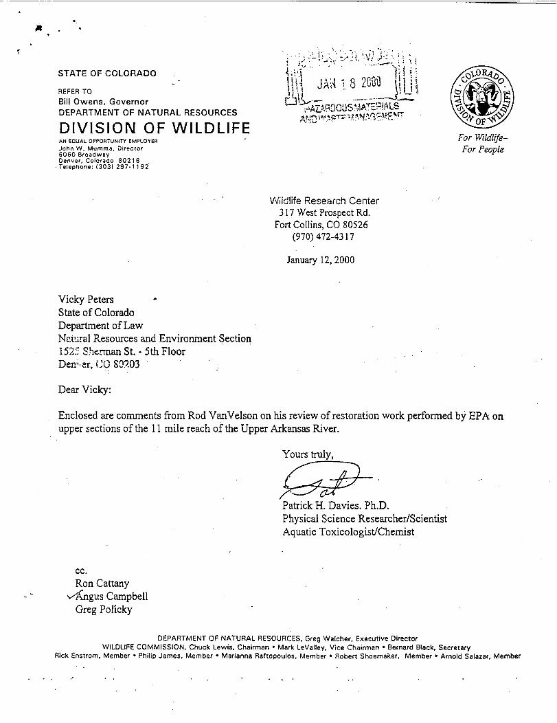
S T A T E O F C O L O R A D OR E F E R T OB i l l Owens, G o v e r n o rD E P A R T M E N T O F N A T U R A L R E S O U R C E SD I V I S I O N O F W I L D L I F E
A N E Q U A L O P P O R T U N I T Y E M P L O Y E RJ o h n W . M u m m a , D i r e c t o r6060 B r o a d w a yD e n v e r , C o l o r a d o 80216• T e l e p h o n e : ( 3 0 3 1 2 9 7 - 1 1 9 2
l & ' " ' ' ~ : r : ' * ' ~ : Y j i lW ' l J A r t I 8 2090 I j Lf - ' - i U „ . — . - - — C ^ L '• • — 1 ' - v ' , - J l ^ r s . ^ . i \ o » 4 A T C a i a ! <i* Mr, \»< tcrrr 11 w ••'.^' .» * • ' ' ' ' * "
For Wildlife-For People
W i l d l i f e Research C e n t e r317 Wes t Prospe c t Rd.
F o r t C o l l i n s , CO 80526( 9 7 0 ) 4 7 2 - 4 3 1 7
J a n u a r y 12,2000
Vicky PetersSta t e of ColoradoDepartment of LawNatura l Resources and Environment S e c t i o n1525 Sherman St. - 5th F l o o rDor-ar, CO 80203Dear Vicky:Enclosed are comments f r om Rod V a n V e l s o n on his review of restoration work per formed by EPA onu p p e r sec t ions of the 11 mile reach of the U p p e r Arkansas River.
Yours truly,
Patrick H. Davies. Ph.D.Physical Sc i enc e Res earcher /Sci en t i s tA q u a t i c T o x i c o l o g i s t / C h e m i s t
cc.Ron Cattany
.v^jigus C a m p b e l lGreg P o l i c k y
D E P A R T M E N T O F N A T U R A L R E S O U R C E S , G r e g W a l c h e r , E x e c u t i v e Direc torW I L D L I F E C O M M I S S I O N , Chuck L e w i s , Chairman • M a r k L e V a l l e y , V i c e C h a i r m a n • Bernard B l a c k , S e c r e t a r yRick E n s t r o m , M e m b e r • P h i l i p J a m e s , M e m b e r • M a r i a n n a R a f t o p o u l o s , M e m b e r • Robert S h o e m a k e r , M e m b e r • A r n o l d S a l a z a r , M e m b e r

O B S E R V A T I O N S O N T H E H A Y D E N R A N C HS E G M E N T O F T H E A R K A N S A S R I V E R
byRodney Van V e l s o n
L i f e S c i e n c e R e s e a r c h e r / S c i e n t i s tA q u a t i c H a b i t a t Res torat ion S p e c i a l i s t
On N o v e m b e r 23, 1999 G r e g P o l i c k y and I observed e x i s t i n g trout hab i ta t s in several d i f f e r e n triver reaches of the u p p e r Arkansas River on the H a y d e n Ranch, It was my f i r s t f i e l d visit to thispart of the river. T h i s was merely a cursory survey that took p l a c e one afternoon. We did notc o l l e c t any river hydraul i c or trout habitat data on this date. Several inches of snow were presentthat day.One s t op inc luded a segment of the river downstream f r o m the Highway 24 bridge near the upperend of the H a y d e n Ranch. We observed one river reach, the s i te of a recent restoration e f f o r t .Not knowing anything about the background of th i s s i t e or the p r o j e c t , I o f f e r some commentsand sugge s t i on s based upon experience I have acquired over the past decade f r o m DOW riverchannel restoration and in-stream trout habitat improvement pro j e c t s . My comments mayrepresent a d i f f e r e n t perspect ive but might be u s e f u l for other restoration e f f o r t s in the upperArkansas drainage. Thi s is the intent of my comments.The river channel through the restored reach appears extremely over width e s p e c i a l l y \vheucompared to 'the river segment immediate ly downstream. T h i s downstream river segmentcontains good trout habitat when considering water d e p t h , river gradient, diversity of waterve loc i t i e s and trout cover. The river segment appeared to have good pool spacing, adequatewater d e p t h and point bar development p lu s a good river channel w i d t h / d e p t h ratio. Compared tothe upstream restored reach, the lower river segment has a higher channel sinuosity and similar,but p r o b a b l y s l i g h t l y higher, stream gradient.Trout habitat through the restored river reach appears l imited by fa c t o r s typical of over widthriver channels. U s u a l l y over width channels containing high w i d t h / d e p t h - r a t i o s , have shallow.- ?water at low f l o w s , and a f l a t channel substrate lacking the diversi ty necessary for good aquatichabitats. Thi s is what I also observed in the restored river reach. Good trout habitat would haveundula t i on s in the river substrate, with characteristic poo l and riffle habitats. The s echaracteristics are lacking through the restored reach, r e s u l t i n g in high water ve lo c i ty and thelack of diverse trout habitat s . A trapezoid (flat bottom channel) has been created in the restoredreach of the river. It appear s to have prov id e l i t t l e or no pool/riffle habitat for trout. Creat ion oftwo p o o l s in the restored reach, between the ups tream br idge and the lower end would provide apoo l s pa c ing of about 6-9 channel widths. T h i s would create a more diverse trout habitat andh e l p e d restore natural river processes.W i l l o w s p l a n t e d in the restored reach appeared to be stub p l a n t i n g s made on a dry site a long theberm-like river bank. Low survival can be e xp e c t ed if these p l a n t i n g s were made a f t e r the spr ingr u n o f f unles s the stubs were p la c ed 1 to 2 f e e t d e e p into the river bank. When w i l l o w stubp l a n t i n g s were used a l o n g the S o u t h P l a t t e River in S o u t h Park, I encountered high m o r t a l i t i e s .

STATE OF COLORADOO F F I C E O F T H E E X E C U T I V E D I R E C T O RDepar tment o f N a t u r a l Resources1313 S h e r m a n S t r e e t , Room 718Denver, C o l o r a d o 80203P h o n e : ( 3 0 3 ) 8 6 6 - 3 3 1 1T D D : ( 3 0 3 ) 866-3543F a x : ( 3 0 3 ) 8 6 6 - 2 1 1 5 May 16,2000
Max Dodson, Ass i s tant Regional AdministratorEcosystems Protection and RemediationEnvironmental Protection Agency99918*8*661,8^16500Denver, CO 80202-2466Dear Max:It has come to my attention the Core Team of the Arkansas River Restoration Projec t wishes toproceed with a l imited demonstration pro j e c t this summer using f u n d i n g f rom the EnvironmentalProtection Agency.T h i s p r o j e c t will f o cu s on a few small parcel s of ground t o t a l i n g le s s than 10 acres located in the"L" Depos i t s between the U . S . 24 highway bridge and the old highway bridge. Thi s site is oneof the more severely a f f e c t e d areas within the pro j e c t area. Metal concentrations are as high as50,000-mg/kg l ead, 1.300 m g / k g cadmium, 1,800-mg/kg copper, 12,000-mg/kg manganese and141,000-mg/kg zinc.I understand that the Core Team f e e l s that it is imperative to continue the momentum of theiractivities and sustain the high level of landowner interest in the p r o j e c t . A l s o , this particular sitehas been i d e n t i f i e d by the county for an educat ion/demons trat ion f a c i l i t y to enhance the amountof information to be s u p p l i e d to the Consu l t ing Team. Co lorado Mountain C o l l e g e is committedto being a partner with the Core Team in monitoring this site to gather as much information aspos s ib l e . It also intends to be an example to other landowners as to the outcomes for remedialwork on sites located on their properties.As one of Colorado's Natural Resource Trustees, I support this p r o j e c t and encourage theEnvironmental Protection Agency to proceed with f u n d i n g for this e f f o r t during this summerconstruction season.
DEPARTMENT OFN A T U R A LRESOURCESB i l l OwensGovernor
' Creg E. W a l c h e rExecu t ive Director
Ronald W. CattanyDeputy Directorcc: Dr. Bernard Smith
Daniel O. ParkerJ o h n S w a r t o u t
Board of Land Commis s i oner s • Div i s i on of M i n e r a l s & C e o l o g y / C e o f o g i c a l SurveyOil & Gas C o n s e r v a t i o n C o m m i s s i o n • C o l o r a d o State Parks • Soil Conservation BoardW a t e r Cons erva t i on Board • D i v i s i o n of W a t e r Resources • D i v i s i o n of Wildl i fe

A R K A N S A S H E A D W A T E R S R E C R E A T I O N AREAPO Box 126, 307 W. Sacke t t , S a l i d a , CO 81201Phone: ( 7 1 9 ) 5 3 9 - 7 2 8 9 F a x : ( 7 1 9 ) 5 3 9 - 3 7 7 1 e m a i l : ma i l@ahra . sa l ida , c o .u s
A p r i l 24,2000Max Dodson, A s s i s t a n t Regional Admini s t ra torEPA Region 8, EPR-ER999 18th Stree tDenver, CO 80112Dear Mr. Dodson:We write to you very much in s u p p o r t of a higher pr ior i ty e f f o r t for the Techni ca lAssessment and Response Team work on the U p p e r Arkansas River Restoration Project ,and that it be f u n d e d for d emons tra t i on amendment work on 4.8 acres in the "L" sitesection as described in TDD No. 9702-0025 D r a f t Alt erna t iv e s A n a l y s i s for the Year 2000,s p e c i f i c a l l y as shown on p a g e s 24 and 25 and in T a b l e 3 on page 39.We are involved in p r o v i d i n g p u b l i c recreation to over 700,000 visitors on the ArkansasRiver each year, and the H a y d e n Meadows Pro j e c t as a major part of the Lake CountyOpen S p a c e I n i t i a t i v e P r o j e c t , f u l l y l e n d s s u p p o r t to this overall e f f o r t o f prov id ing a widerange of recreational o p p o r t u n i t i e s within the u p p e r Arkansas River valley. We believethis p r o j e c t will serve the recreating Lake County and L e a d v i l l e citizens, as well as manyvisitors to the H e a d w a t e r s region of the Arkansas River.We encourage you to f u l l y s u p p o r t a s trong continued and immediate e f f o r t to c omple t ework on the "L" sites. T h e s e s i tes are s p e c i f i c a l l y tied to the AHRA's s i g n i f i c a n t outdoorrecreation o p p o r t u n i t i e s a n d t o t h e C o l o r a d o Mountain C o l l e g e { C M C } ' s outdoorclas sroom component s at the H a y d e n Meadows location. It is important that thedemons tra t ion amendments be i n s t a l l e d as soon as po s s i b l e . The EPA Response T e a m hasworked s u c c e s s f u l l y on other sites ad jac ent to these sites during 1998 and 1999 and hasgained a measure of good re la t ions for EPA in Lake County. Plea s e f e e l f r e e to call us at719-539-7289 if we can h e l p with add i t i ona l information.
Sincere ly,
Dave T a l i a f e r r oBLM River ManagerBureau of Land Management
Dave S p e n c e rA c t i n g Park ManagerC o l o r a d o S t a t e Parks

COLORADO •5 MOUNTAIN COLLEGE
April 20, 2000
Max Dodson. Ass i s tant Regional AdministratorEPA Region 8, EPR-ER999 18th StreetDenver. CO 80112
Dear Mr. Dodson,Colorado Mountain C o l l e g e would like to express our concern in regards to the Upper Arkansas River RestorationProject which encompasses a demonstrat ion amendment e f f o r t on 4.8 acres of the L sites (described within TDDNo. 9702-0025 "Draft a l t ernat ive s Analys i s for the Year 2000"). We recognize the c o n f l i c t i n g issues associatedwith the work progress on these sites. However, we would like to express our desire for these e f f o r t s to continue ina t ime ly manner. Our reasons for wanting the project schedule to remain intact are as f o l l o w s ;* CMC has been i d e n t i f i e d as the partner to the Lake County Open Space I n i t i a t i v e for the proposed education
f a c i l i t y e f f o r t to be constructed within the project area in 2002.* As the partner responsible for providing the education component to the f a c i l i t y , we have an expressed interest
in having the project area addressed by the amendment work since our f a c i l i t y design is dependent upon itsoutcome. We may be unable to construct the narrative trails , interactive centers etc., in an e f f i c i e n t manner ifour e f f o r t s overlap with the remediation team e f f o r t s .
* Our ini t ia l goal was to couple the design of the f a c i l i t y components to be cohesive with the amendment work.In this way we will not dup l i ca t e work, nor interfere with work.
We apprec ia te your time in reviewing this matter. If you have any questions in regards to this l e t t er or CMC'sroles and r e spon s i b i l i t i e s for the proposed educational f a c i l i t y , do not hesitate to call.S i n c e r j
j av id B o r o f s K y / T i m h e r l i n e Campus Dean
Karmen K l i m a / N a t u r a l Resource Management Department - Assistant Professor
T I M B E R L I N E C A M P U S901 S o u t h H i g h w a y 24 L e a d v i l l e , C o l o r a d o 80461 719-486-2015

? i t LAKECOCNTTBOARD OFCOCOTY C O M M I S S I O N E R S
/Z(i- -; *"*"-'•'^ *->.April 20, 2000 If?Max DodsonDirectorO f f i c e of Ecosys tems Protec t ion and RemediationMail Code 8EPR /999 18 t h S t r e e t , S u i t e 500 *'Denver, CO 80202-2466Dear Mr. Dodson:
Lake County would l ike to document its suppor t and encouragement for the comple t ion ofEPA restoration e f f o r t s on the H a y d e n Meadows site, currently scheduled for the summer of 2000.The seventeen f l u v i a l t a i l i n g s d e p o s i t s encompassed within or ad ja c en t to the 60.35 acre H a y d e nMeadows proper ty are c o l l e c t i v e l y referred to as the "L" series s i te s , and are located between thenew and old highway bridges over the Arkansas River in S e c t i o n 22, T o w n s h i p 10 South , Range 80W e s t , Lake County, Colorado. The parcel was donated to Lake County by the City of Aurora underthe terms of their t r a n s f e r a b l e Prospec t ive Purchasers Agreement, and is being planned toaccommodate a water storage vessel, river park, and environmental education f a c i l i t y
As a part of the environmental education component of the p lan , it is the stated intent ofLake County, the Lake County Open S p a c e I n i t i a t i v e , and Colorado Mountain C o l l e g e toincorporate the restoration of the "L" series sites into a demonstration p r o j e c t that can be used toeducate the pub l i c regarding res toration techniques that f a c i l i t a t e d the h ea l ing of the ArkansasRiver. It is important to us that the restoration e f f o r t be initiated and completed at the earliestp o s s i b l e date, to a l l ow adequate time for the heal ing of the environment and the coordination andc o n s o l i d a t i o n of p lanning and construction e f f o r t s . I n p u t to this e f f e c t was previous ly provided toMike Zimmerman by Lake County's planning consul tant , Michael Conlin, as part of the .reviewproces s of propo s ed alternatives.
Pleas e accept this l e t t er as Lake C o u n t y ' s request that the restoration e f f o r t s proceed thissummer as or ig inal ly scheduled.Sincerely,
y&**jiA' < — • .L/ Jame s E. Morrison . ,
Chairman
C O M M I S S I O N E R SJames E. Martin • James E. Morrison • Charles R. O ' L e a r y • T i m o t h y H. Berry-County AttorneyP.O. Box 964 • L e a d v i l l e , Colorado 80461 • (719) 486-0993 • Fax (719) 486-4117Catherine A. P a t t i - C o u n t y A d m i n i s t r a t o r • (719)486-4118

-54
Lake C o u n t y S o i l Conservat ion Dis tr i c t134 Co. Rd. 44 - L e a d v i l l e . C o l o r a d o 80461
April 20,2000
Max Dodson, Assist. Regional AdministratorEPA Region 8, EPR-ER999 18th StreetDenver, CO 80112Dear Mr. Dodsoa-Lake County S o i l Conservation District (LCSCD) requests that the Technical Assessment andResponse Team working on the Upper Arkansas River Restoration Project be funded fordemonstration amendment work on 4.8 acres in the "L" sites as described in TDD No. 9702-0025 Draft Alternatives Analysi s for the Year 2000. pp 24 and 25 and Tabl e 3 page 39.L C S C D recognizes the pol i t i co/economic pressures present. However, there are several practicaland economic reasons why this work be done as soon as possible. Three of these reasons are:
1. The "L" sites are a major component of the Hayden Meadows Project T h e H a y d e nMeadows Project is to be an outdoor education site developed by Lake County, LakeCounty Open Space Initiative, and Colorado Mountain College. It is important to thesegroups that the demonstration amendments be ins tal l ed as soon as possible.2. The Response Team will already be present in Lake County doing work on the UpperArkansas River Restoration Project.3. The EPA's Response Team has the experience of working succe s s fu l ly on other sitesduring the years 1998 and 1999. The success of this work has been great PR for the EPAin Lake County.Again, the L C S C D requests that the Response Team be funded to address the "L" sites startingas soon as possible.Sincerely,
James L. Davidson, President L C S C D

April 25,2000
M a x D o d s o nAss i s t an t Regional Adminis tratorEPA Region 8, EPR-ER
• ' 9 9 9 1 8 * - S t r e e t - . .Denver, CO 80112• " . • - " v ' •Dear Mr. Dodson: .
Please accept this l e t t e r as my request that emergency response restoration e f f o r t s .on theHayden Meadows site proceed this summer as originally planned.C o m p l e t i o n of the EPA emergency response restoration e f f o r t s on the Hayden Meadowsite is being planned to accommodate an environmental education f a c i l i t y . Theenvironmental education p l a n is to incorporate the restoration of the "L" sites intp ademonstration pro j e c t to be used to educate the pub l i c on restoration techniques thatf a c i l i t a t e d the heal ing of the Arkansas River. .T h i s restoration e f f o r t must be comple t ed at the earliest p o s s i b l e date to allow enoughtime for the heal ing of the environment, prior to p lanning and construction e f f o r t s .Once again, I request that restoration e f f o r t s be f u n d e d and started as soon as poss ible.S i n c e - e l y ,
.AS c d t t SarbaughLandowner, L C S C D
S c o t t S a r b a u g h Rea l ty »18£3 Canyon Blvd. • B o u l d e r , C o l o r a d o 80302[303] 443-3939 • (303J 443-0636 Fax