Embed Size (px)
Citation preview

Acquisition of Flood Control Easements Triangle High-Ground Area
City of West Sacramento, Yolo Co.
Meeting of the Central Valley Flood Protection BoardFebruary 26, 2009
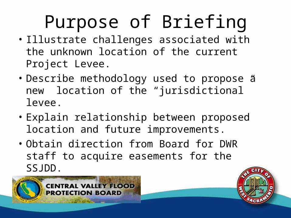
Purpose of Briefing• Illustrate challenges associated with the
unknown location of the current Project Levee.
• Describe methodology used to propose a new location of the “jurisdictional” levee.
• Explain relationship between proposed location and future improvements.
• Obtain direction from Board for DWR staff to acquire easements for the SSJDD.
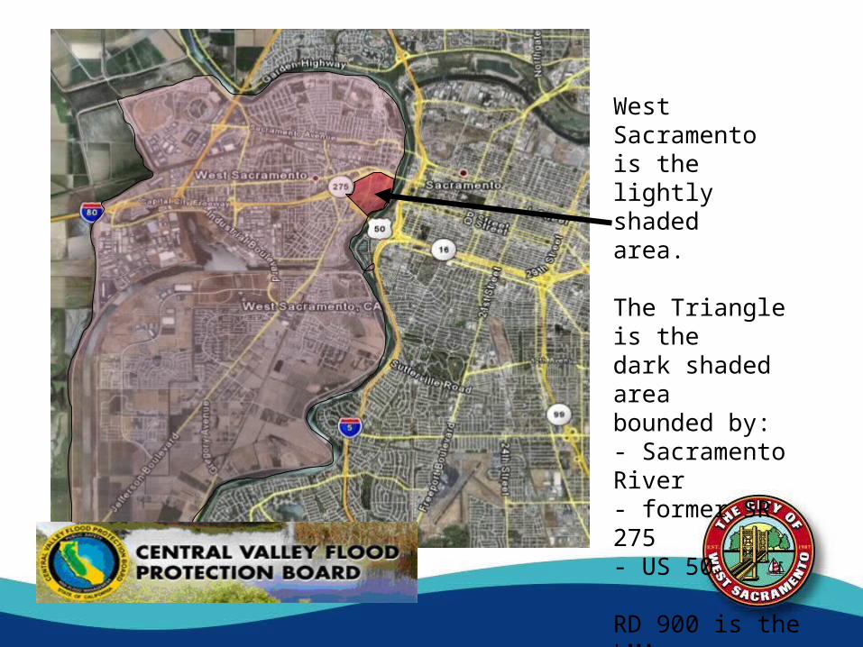
West Sacramentois the lightly shaded area.
The Triangle is thedark shaded area bounded by:- Sacramento River- former SR 275- US 50
RD 900 is the LMA
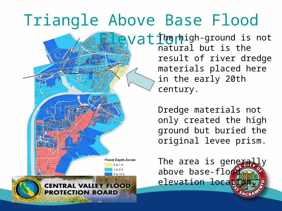
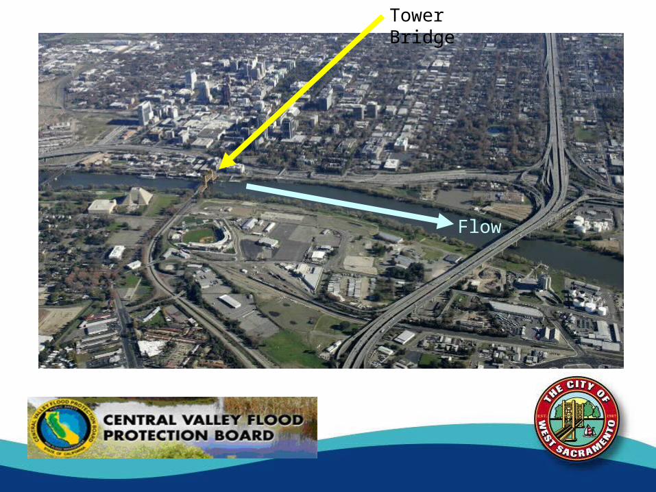
Triangle Above Base Flood ElevationThe high-ground is not natural but is the result of river dredge materials placed here in the early 20th century.
Dredge materials not only created the high ground but buried the original levee prism.
The area is generally above base-flood elevation location.
No Clear Indicators on Levee Location• Sacramento River Flood Control Project
authorized in 1917• No easements were acquired for the project in
this area.• No drawings or other records delineating the
levee location have been discovered.– Only tiny dots in the O&M manual.
• Recent borings did not provide any location data.
Board Jurisdiction?• Future development by City and landowners
will likely require encroachment permits
• Lack of easements and no physical location of the levee prism has prevented Board staff to determine Board jurisdiction
• City and landowners do not know where encroachment permits are needed
A Cooperative Process• Landowners, RD 900, city of West
Sacramento, Corps, and Board staff have worked together to determine how to protect the public safety and also allow for future development to occur.
• An informational briefing by the city to the Board in March 2008 presented this issue and requested feedback, which it received.
Proposed “Virtual Levee” Solution• Determine levee location by imagining a
“virtual levee” within high ground.• Assure that the “virtual levee” provides clear
location of Project Levee for locals, State, and Corps.
• Record location of “virtual levee” and a “building setback line” to develop undisputed Board jurisdiction by conveying easements to SSJDD.
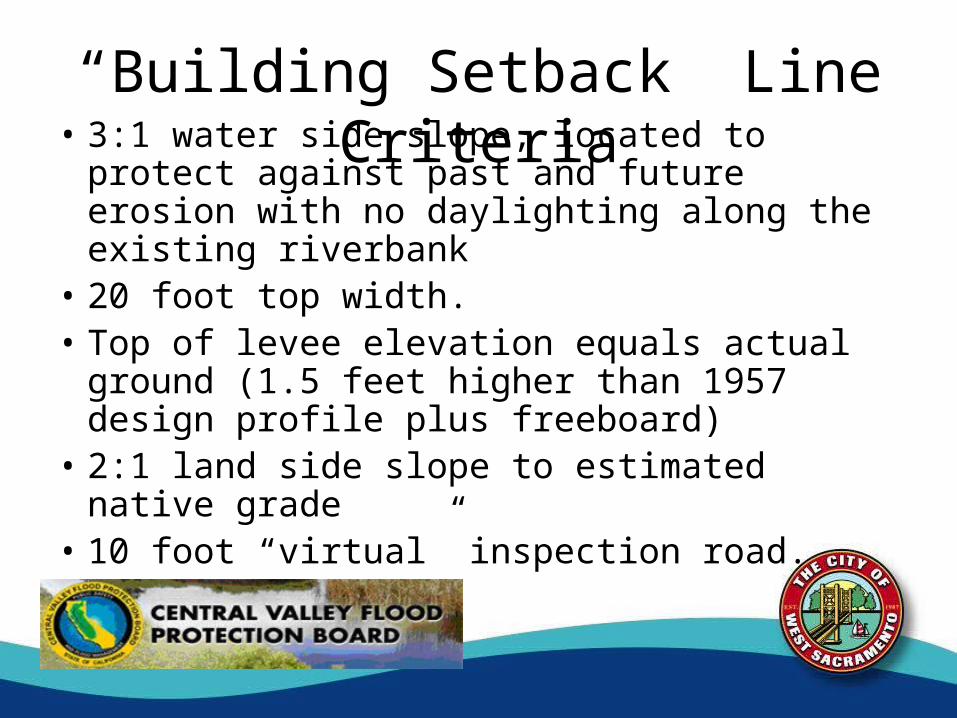
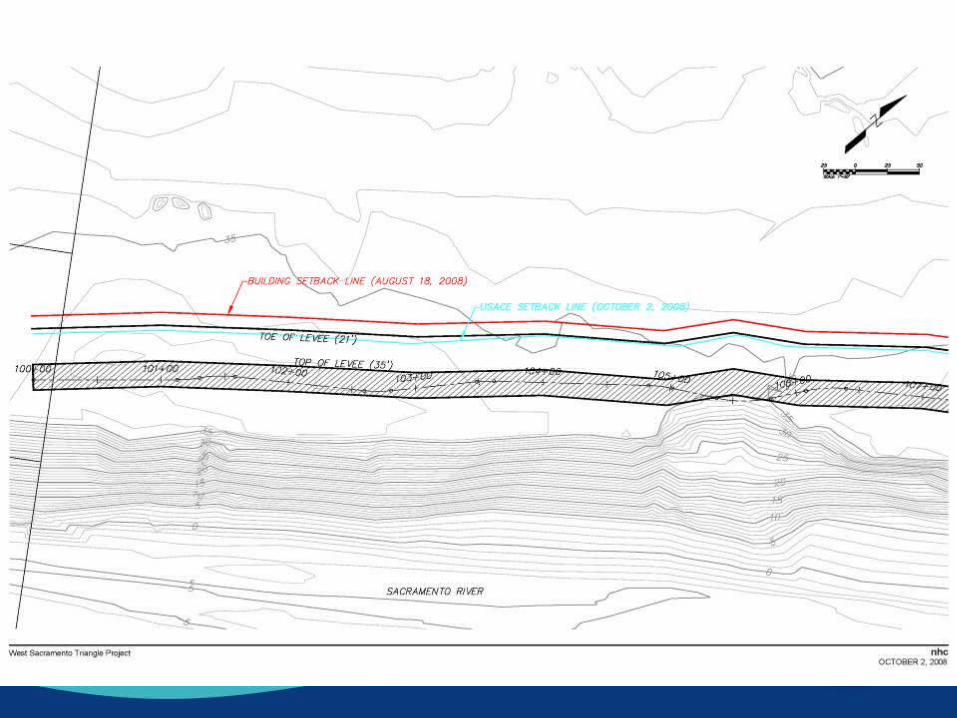
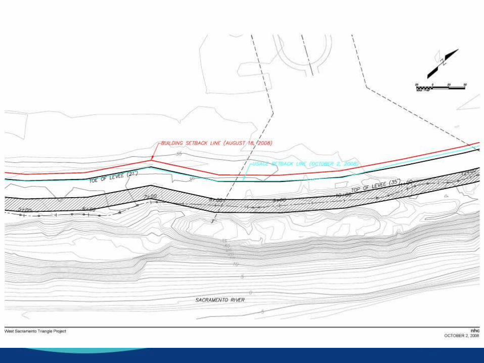
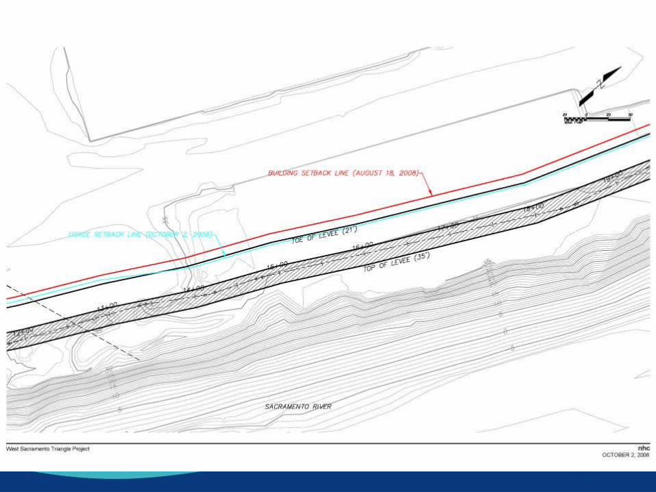
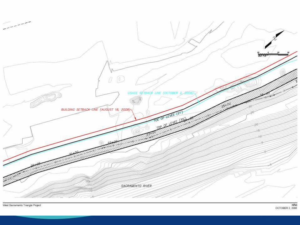
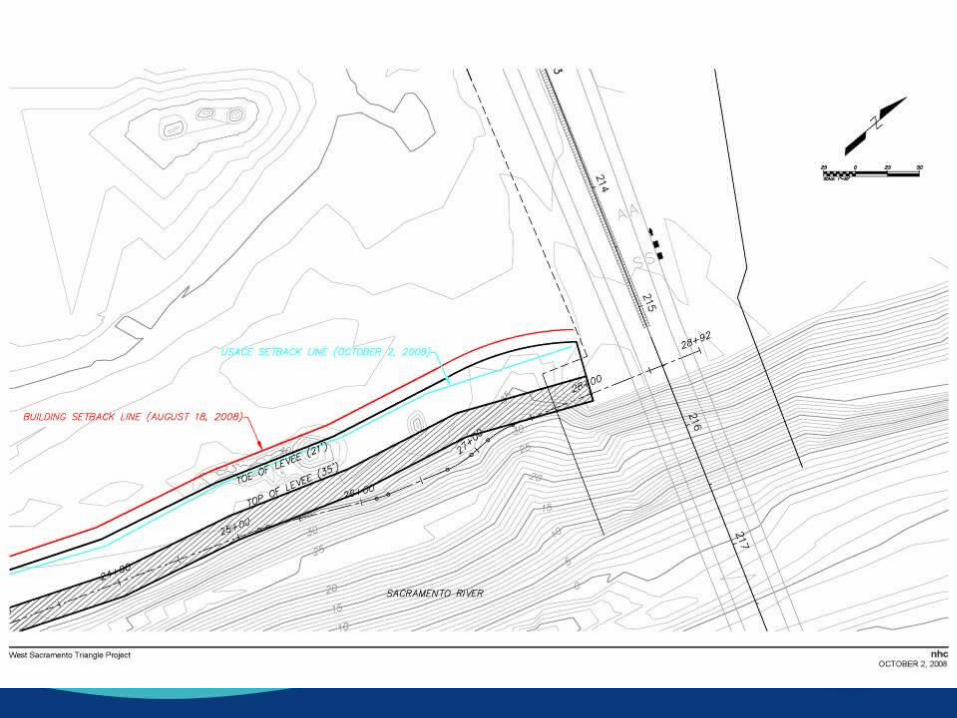
“Building Setback” Line Criteria• 3:1 water side slope, located to protect against
past and future erosion with no daylighting along the existing riverbank
• 20 foot top width.• Top of levee elevation equals actual ground
(1.5 feet higher than 1957 design profile plus freeboard)
• 2:1 land side slope to estimated native grade• 10 foot “virtual” inspection road.
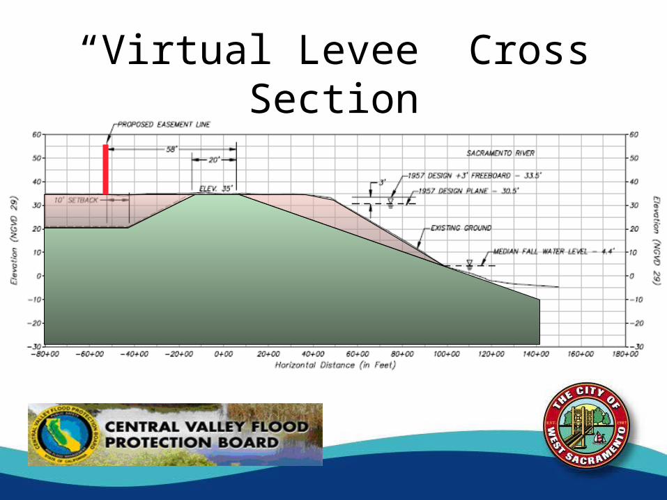
“Virtual Levee” Cross Section
Solution Will Support Future Actions to Reach 200-year Protection
• Levee will need to be raised ~1.5 feet to provide 200-year protection.
• The proposed solution will obtain a large enough easement to accommodate future 200-year improvements
• The following maps show the proposed building setback line and Corps-requested 200-year easement requirement

Process to Date• Based on Board feedback from March, 2008 briefing, West
Sacramento ran additional scenarios.• Board staff reviewed final proposal• Corps staff reviewed final proposal
– Operations and Readiness Branch (flood ops & response)– Engineering Branch (geotechnical review)
• Board and city staffs met with DWR Real Estate• City and landowners willing to offer or dedicate easements to
the State• All cooperating parties support the proposed resolution
Local Agency Endorsement• Because this is not an application for an
encroachment permit no written endorsement is required from Reclamation District 900, but the District has been an active participant throughout development of the proposed solution.
CEQA Environmental Evaluation• Board staff propose that the project is exempt from
CEQA under CEQA Guidelines Section 15061 (b) (3) because the activity is covered by the general rule that CEQA applies only to projects which have the potential for causing a significant effect on the environment.
• Where it can be seen with certainty that there is no possibility that the activity in question may have a significant effect on the environment the activity is not subject to CEQA.
CEQA Environmental Evaluation• The proposed acquisition of easements will not lead
to rebuilding the levee, but will more clearly define the levee (and thus the extent of Board jurisdiction) as it currently exists.
• Future development in the Triangle area including residential, commercial, recreation, and flood control projects may require Board encroachment permits, and will need to be evaluated for CEQA compliance at that time.
Need for Board Action• Approval of this proposal will allow the State
of California to acquire flood control easements for the Sacramento River Flood Control Project in the Triangle high ground area of West Sacramento
• New easements will give the landowners and city of West Sacramento certainty as to the landward extent of the Sacramento River Flood Control Project
Staff Recommendation• For the Central Valley Flood Protection Board
to approve Resolution 09-02– finding the project exempt from CEQA– requesting the DWR Real Estate Branch to acquire
all necessary real property rights to clear title for the Sacramento River Flood Control Project in the city of West Sacramento Triangle high ground area by acquiring all necessary easements through dedication or for nominal compensation
Acquisition of Flood Control Easements Triangle High-Ground Area
City of West Sacramento, Yolo Co.
Meeting of the Central Valley Flood Protection BoardFebruary 26, 2009