Embed Size (px)
Citation preview

Aalborg Universitet
Understanding land administration systems
P. Williamson, Ian; Enemark, Stig; Wallace, Judy; Rajabifard, Abbas
Published in:Coordinates
Publication date:2008
Document VersionPublisher's PDF, also known as Version of record
Link to publication from Aalborg University
Citation for published version (APA):P. Williamson, I., Enemark, S., Wallace, J., & Rajabifard, A. (2008). Understanding land administration systems.Coordinates, IV(10), 18-30.
General rightsCopyright and moral rights for the publications made accessible in the public portal are retained by the authors and/or other copyright ownersand it is a condition of accessing publications that users recognise and abide by the legal requirements associated with these rights.
? Users may download and print one copy of any publication from the public portal for the purpose of private study or research. ? You may not further distribute the material or use it for any profit-making activity or commercial gain ? You may freely distribute the URL identifying the publication in the public portal ?
Take down policyIf you believe that this document breaches copyright please contact us at [email protected] providing details, and we will remove access tothe work immediately and investigate your claim.
Downloaded from vbn.aau.dk on: maj 30, 2018

October 2008 | �

2 | October 2008

October 2008 | �

� | October 2008
In this issueVolume 4, issue 10, October 2008
cOlOphOn and cOntents
Mailing address
cGIT, 11C Pocket A
SFS Mayur Vihar Phase III
Delhi 110 096, India.
Phones +91 11 22632607, 98102 33422, 98107 24567
Fax +91 11 22632607
[information][email protected]
[editorial][email protected]
[advertising][email protected]
[subscriptions][email protected]
Web www.mycoordinates.org
Coordinates is an initiative of cGIT that aims to broaden the
scope of positioning, navigation and related technologies.
cGIT does not neccesarily subscribe to the views expressed
by the authors and advertisers in this magazine and may not
be held liable for any losses caused directly or indirectly due
to the information provided herein. © cGIT, 2008. Reprinting
with permission is encouraged; contact the editor for details.
annual subscription (12 issues) [India] Rs.1,200
[Overseas] US$80
printed and published by Sanjay Malaviya on behalf of Centre
for Geoinformation Technologies at A221 Mangal
Apartments, Vasundhara Enclave, Delhi 110096, India.
editor Bal Krishna
Owner Centre for Geoinformation Technologies
designed at Thomson Press India Ltd.
printer Thomson Press India Ltd., B 315, Okhla Phase I,
New Delhi-110020, India
this issue of coordinates is of 44 pages, including
cover
articles
surveying has a future?: John hannah, P Misra, siMon KwoK, williaM PatricK (Paddy) Prendergast 8 Gnss on track Paolo d’angelo 12 Understanding land administration system ian williaMson, stig eneMarK, Jude
wallace, abbas raJabifard 18
columnsMy coordinates editorial 6 news lbs 31 industry 32 gPs 37 galileo uPdate 38 reMote sensing 38 gis 40 Mark your calendar october 2008 to sePteMber 2009 42
this issue has been made possible by the support and good wishes of the following individuals and companies Abbas Rajabifard, Ian Williamson, John Hannah, Jude Wallace, Paolo D’Angelo, P Misra, Simon Kwok, Stig Enemark, William Patrick (Paddy) Prendergast and; Carlson, CHC, Deimos, HemisphereGPS, Kolida, Magellan, Navcom, Novatel, Spirent, Javad, Leica, Trimble, South, uBlox; and many others

October 2008 | �
� | October 2008
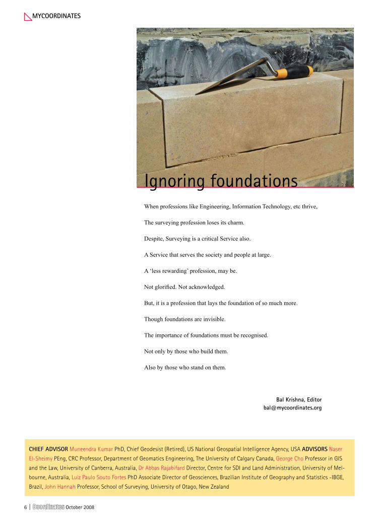
Ignoring foundationsWhen professions like Engineering, Information Technology, etc thrive,
The surveying profession loses its charm.
Despite, Surveying is a critical Service also.
A Service that serves the society and people at large.
A ‘less rewarding’ profession, may be.
Not glorified. Not acknowledged.
But, it is a profession that lays the foundation of so much more.
Though foundations are invisible.
The importance of foundations must be recognised.
Not only by those who build them.
Also by those who stand on them.
MycOOrdinates
Bal Krishna, [email protected]
chieF adVisOr Muneendra Kumar PhD, Chief Geodesist (Retired), US National Geospatial Intelligence Agency, USA adVisOrs Naser
El-Sheimy PEng, CRC Professor, Department of Geomatics Engineering, The University of Calgary Canada, George Cho Professor in GIS
and the Law, University of Canberra, Australia, Dr Abbas Rajabifard Director, Centre for SDI and Land Administration, University of Mel-
bourne, Australia, Luiz Paulo Souto Fortes PhD Associate Director of Geosciences, Brazilian Institute of Geography and Statistics -IBGE,
Brazil, John Hannah Professor, School of Surveying, University of Otago, New Zealand

October 2008 | �
your position is our focus
SuperSense® technology: -160dBm tracking sensitivity
KickStart technology: 1 second acquisition performance
12.2 x 16 mm minature module
u-blox NEO-5Q GPS receiver module
Presenting our smallest module which boasts the highest tracking accuracy and sensitivity GPS engine in the market.
Powered by the 50-channel u-blox 5 GPS and GALILEO engine, NEO-5Q is a complete, standalone ROM-based GPS module designed for mass market applications with tight space and cost constraints.
Omniscient Electronics Pvt. ltd.# 507, 9th Main, BSK II Stage, Bangalore-560070 Tel. 080-26718144, 26718162Fax 080-26718151www.omniscientelectronics.net
For more information, visit www.u-blox.com or contact our local distributor Omniscient Electronics Pvt. ltd.:
Accurately track your vehicles, goods and personnel with our miniature NEO-5Q GPS receiver module.

8 | October 2008
sUrVeyinG
Surveying has a future?While there are many opportinties for professionals working in the field of computer science and engineering, etc. many consider surveying has low profile and ‘less rewarding’. some feel that the total number of qualified and licensed surveyors are diminishing. does surveying profession has a future? experts speak
Surveying is a service oriented profession, by making maps we do service to the society. The more you serve the society, the more the profession will be known. In a country like India, there is a huge requirement of professionals in the domain of surveying. In the 1970’s a study was done to assess the requirements of the country and even then it was felt that there was need forthree Survey of India (SOI). Unfortunately, not much organized effort was made in this direction. Since the work done has not kept pace with the needs, the visibility of surveyors and organizations like SOI has been reduced.
There are many impediments for the growth of surveying profession in India, because of which it has not been able to achieve higher levels. The restrictions on aerial photography and digital mapping have had their own set of adverse consequences. They have limited the generation of data, its dissemination and ultimately its usages.
Another issue that has affected the growth of surveying profession in India is the lack of a marketing culture. Even when data was available with SOI, not many were aware of the kinds of data available, due to lack of marketing and advertising by SOI. Even today, marketing efforts leave a much to be desired and a lot of work needs to be done on it.
In this context, we also need to understand
that the market is big but not huge. To make the market grow further, private organizations have a major role to play. Unfortunately, the policy scenario does not offer a very conducive atmosphere for them to participate in this process. In addition, they suffer from their own set of problems like lack of trained professionals.
The private sector could have played a major role in updating the data. But, in India, the emphasis by SOI was on the accuracy of data, and the importance of the currency of data was not appropriately recognized. Even today, consideration can be given to constructively engage geography students, postmen, etc. to update the data.
A very interesting fact that has emerged regarding the surveying profession in India is that the technology has grown but not the profession. It was said that aerial photography was five times more effective than plane tabling, still in India, the surveying profession could not take the advantages of the technology to increase their productivity. There may be many reasons like the policy, willingness, education, etc. but the matter of the fact remains, that even today many projects, for example in the field of infrastructure and cadastral mapping, still depend on plane tabling survey. Some of the organizations might be using the advanced technologies; still critical mass is yet to be reached to make an impression.
prof p Misra, Consultant, Land Information Technologies, India [email protected]
Technology has grown but not the profession

October 2008 | �
In a single emphatic word, yes! However, before elaborating further, it is useful
to begin by clarifying what we mean when we speak of a “Surveyor”. The Royal Institute of Chartered Surveyors (RICS), using its United Kingdom model, includes specialisms such as antiques valuation, quantity surveying, and estate management under its surveying umbrella - all of which are seen as being entirely separate professional activities in most other countries. These are not included here. For the purposes of this discussion, the core competencies expected of a surveyor will be those of the collection and management of spatial (geographical) data, spatial measurement, land boundary demarcation, and land tenure arrangements.
Perhaps the best approach for this discussion lies in identifying some of the major global trends that are likely to unfold in the next decade and to identify where surveyors might influence this activity.
The first clear trend is the need to build, upgrade, and replace urban infrastructure. Demand for freight and passenger transport in most developing and transition countries, for example, is growing 1.5 to 2.0 times faster than GDP - the bulk of this increase being for road transport. All such projects require surveyors with
their specialist positioning expertise. In Australasia it is already clear that national goals for economic growth over the next decade are unlikely to be able to be met unless the number of surveyors is at least doubled. Similar issues are able to be identified in most western countries.
The second trend is the demand for higher food production from the shinking global base of arable land. As global temperatures increase, desert regions expand, and population pressures increase, the production pressure on the remaining supplies of arable land will likewise
increase. There is clear evidence to suggest that the ability to allocate rights in land to private owners leads to higher levels of economic activity. The ability to allocate rights, however, necessitates some mechanism for defining the extent of those rights (i.e., boundaries) and managing the resulting data - activities that are a core part of the surveyor’s
expertise. In addition, some of the more efficient farmimg methods now have at their heart GPS positioning technology – the development and use of which is again the domain of the surveyor.
The third trend is linked to the second in that global population growth, combined with the demand for an ever increasing level of economic activity will drive the demand for commodities.The extraction of minerals and the demand for energy, both of which are needed for economic growth, necessitiate input from surveyors, whether with specialist mining expertise or special hydrographic surveying expertise. Such activities will also demand better management information systems such as
John hannahProfessor, School of Surveying University of Otago Dunedin, New Zealand
In the face of global demand of surveyors, will we find sufficient graduates?
Users should gain from our services
Surveying profession has a future and we should shape our future. Our profession serves the society in many aspects. The services and products of survey not only support the property and construction industry, they also add value to other professions, such as legal, town planning, environmental protection, tourism, observatory, civil aviation, emergency services, public health and law enforcement. Since we are now operating in a global environment, I think surveyors should get themselves ready for serving the community in a multi-discipline and multi-nation context like the monitoring of the effect of global warming, flooding, crustal/ground movement, sea level rise and spread of disease. We should take up the opportunity to serve our clients and the society, and by doing our work well, we should make ourselves known and be understood. More importantly, we should help the users to gain value from using our services.
Simon Kwok Chair, Geomatics Faculty, Royal Institution of Chartered Surveyors Hong Kong
can be developed using GIS technology.
Finally, the trend towards urban living appears set to continue. It is expected that most of the population increase during 2000-2030 will be absorbed by the urban areas of the less developed regions. Here the surveyor will find an important role in defining boundaries and in planning and designing sustainable urban environments.
The real question is not, ”Does the surveying profession have a future”, but rather, ”In the face of the global demand for surveyors, where will we find sufficient graduates?.”

�0 | October 2008
(global, regional, national, state and local) to formalise agreements and the define technical standards necessary to integrate these various geographic information successfully. The European Union’s INSPIRE Directive, coming from an environmental background, is driving
the development of a European SDI in Europe. However, there seems to be an inconsistency between the trust placed in GIS visualisations by the general public and the quality of the geographic information used within the GIS to create the visualisations. The assessment of ‘fitness for use’ of geographic information for an application becomes far more important in the digital environment due to the enhanced accessibility of the results produced.Other initiatives such as the EU PSI Directive are driving openness and accessibility to Public Service Information including geographic information. The philosophy behind this Directive is linked to e-Government and the development of an Information Society by significantly increasing access to the information required by citizens whilst going about their daily lives. These two policy initiatives - INSPIRE and PSI - are providing the means necessary to access and combine information from many public sources.
But there are dangers in the area of privacy of personal information. Certain types of information traditionally held in paper records were hidden by virtue that paper was difficult to access. Once these records are made available in digital form this information is readily
available, for example in Ireland, land records previously held the amount of a mortgage taken out on a property, and this information is now visible over the internet. There is a need to review what information needs to be recorded and the reasons for doing so, and access policy to specific items of personal information.
The main challenges for the future in the geographic information sector are educational, institutional and policy reforms. The roles and structures of traditional public institutions need root and branch review to provide for the needs of information society. Policy review is necessary to develop a balance between information access, economic models of data supply, and privacy of personal information. Educational reform for surveyors is vital to deal with ever increasing variety, complexity and use of geographic information and to have the skills to offer quality professional service at local and international levels.
Yes, most emphatically it does, but not in the traditional sense. The
centre of gravity for the production and supply of geographic information (GI) has moved inexorably from national public agencies to private organisations at all levels during the last few decades in both primary data capture and value added services roles. Our world has undergone a proliferation of data sources from the phenomenon of Google Earth to Microsoft’s TerraServer and all the other data suppliers who are spatially enabling our world. GIS use is moving from power users to mainstream public use and there are indications of significant increases of this during the last decade or two. Old concepts of GIS using layers of static geographic information are being supplemented with live feeds to dynamic display systems for such things as vehicle tracking or environmental monitoring. One of the remaining frontiers of this geographic information sector is location based services for our mobile phones.
Government agencies are also increasingly converting their paper databases into digital format and issues previously hidden in the paper archives are increasingly more visible which is driving reform of data quality specification and evaluation. Increasingly the application of new techniques and the development of new procedures are necessary to deal with these issues in a dynamic manner. The integration of these abundant public and private datasets regularly give rise to particular challenges for which surveyors in collaboration with IT and other professionals need to develop new solutions.
Spatial Data Infrastructures are being developed and re-developed at all levels
The production and supply of GI has moved from national agencies to private organisations
dr William patrick (paddy) prendergast,Department of Spatial Information Sciences,Dublin Institute of Technology, [email protected]

October 2008 | ��

�2 | October 2008
the analysis of any other application of a GNSS system. It simulates the trajectory and attitude of train’s head and tail cabins and the measurements generated by the
Gnss
GNSS on trackThe GRAIL Environment and Sensor Simulator is a real-time software prototyped for analysing the GNSS introduction in rail sector
paolo d’angelo [email protected]
He received an Aerospace Engineering degree from the University of Rome “La Sapienza”, where he worked as member of the Astrodynamics Group in the Unisat missions. He joined DEIMOS Space in 2002, where he collaborated in the development of different Earth observation projects. Currently he is working as integrity consultant at ESA ESTEC
GESS (GRAIL Environment
and Sensor Simulator) is a real-time software prototyped for analysing the GNSS introduction in rail sector. It has been developed by DEIMOS Space in the frame of the GRAIL (GNSS Introduction in the RAIL Sector) contract, lead by Ineco/Tifsa, for the GNSS Supervisory Authority (GSA).
This software is a key element for studying the overall sensors system before the on-train test campaign and also defines a generic platform that could be used for
Figure 1: Gess high-level scheme

October 2008 | ��
on-board sensors. The system includes two GNSS receivers, one on train’s head and the other on tail, an Inertial Measurement Unit (IMU), and an odometer. All measurements provided by the sensors are sent to the GRAIL User Terminal (UT) that elaborates them: it generates and then transmits through a standard PROFIBUS (Process Field Bus) interface the messages for the on-board ETCS (European Train Control System). The GRAIL-UT is an integrated Navigation/Communication user terminal demonstrator developed by Thales Alenia Space in the frame of GRAIL program. The communication between the User Terminal and the train cabin, through the CTODL (Current Time Odometric Data Line) and PROFIBUS lines, is also simulated.
Potential application of GNSS technology as an enhanced ETCS/ERTMS (European Train Control System/European Railway Traffic Management System) applications provider has been studied in the project, analysing the results of laboratory and on-site tests. In this context, the GESS has been a key element for testing the User Terminal (UT), developed for demonstration activities, and studying the overall sensors system before the on-train test campaign.
The software runs on a standard PC with a real-time operative system and has the same interfaces of the real sensors. Its development has been divided into three main activities concerning the definition and implementation of the Simulink model, the communication protocol, and the real time algorithms. Using the autocoding tool provided by Real–Time Workshop, the Simulink model has been completely coded in C and integrated in the RTAI (Real-Time Application Interface) operative system for Linux, following specific project requirements.
The software is available in several configurations depending on the foreseen laboratory tests. The first one is the complete configuration, in which all the components of the reference scheme are simulated; partial configurations are also possible, removing some simulated modules and substituting them by hardware elements. A control
shell provides communication between the autocoded Simulink models and I/O interface. All configurations have been verified and validated in the CEDEX (Centro de Estudios y Experimentación de Obras Públicas) certified laboratory.
The main components of the GESS reference scheme are (Figure 1): the trajectory and attitude simulator; the UT sensors, including two GNSS receivers and an IMU (Inertial Measurement Unit); the CTODL and PROFIBUS lines between the UT and train cab.
simulink model
The environment and sensors Simulink model is composed by two main blocks, namely, the “train” and the “sensor system”. The train functions compute the train trajectory and attitude, which are used as inputs by the sensor system functions. These provide the UT with the estimation of position and velocity, and measurements of linear acceleration and attitude rate. The “train” module is composed by two elements: the head and tail cabins, where all sensors are located.
The mechanics of each cabin is described using the “rigid body” model. The trajectory and attitude are characterized by six variables, three linear coordinates for the position of the reference point (position on the cabin where the sensor system elements are located) and three angles for the orientation of the body frame with respect to the North-East-Down (NED) reference system.
The configuration of a train track can be done either by the geodetic latitude, longitude and height (WGS-84 Ellipsoid) or by the UTM (Universal Transverse Mercator) coordinates of real balises. Track geometry is defined by balises and control points. For each travelled distance the track position is obtained through linear interpolation of the balises coordinates. For a given configuration, the input for
the simulator is the along-track dynamic profile (acceleration, velocity and position) (Figure 2), which can be generated internally by GESS or taken as input in real time (CEDEX configuration).
For each simulation step, the trajectory simulator computes the ECI (Earth Centred Inertial) components of position, velocity, and acceleration vectors. These are obtained applying the transformation from ECEF (Earth Centred Earth Fixed) to ECI corresponding to the configured date and time. ECEF components of position, velocity, and acceleration are computed as function of geocentric coordinates and their derivatives.
The attitude simulator computes the rotation and the angular rate of the body frame with respect to NED. The first axis (XB) of body frame is aligned with the along track velocity, the third one (ZB) with the local vertical pointing toward the Earth centre and the second (YB)
Figure 2: along-track train dynamics
Figure 3: rotation angles

�� | October 2008
DOP (Diluition Of Precision). In the frame of the project, nominal conditions have been assumed: navigation solution is running with no malfunctioning.
The measurements of reference point linear acceleration and body frame angular rate are obtained directly from
completes a right-handed orthogonal system. The rotation around XB (α) is assumed to be always null, while the rotation around YB (β) and ZB (γ) are computed in terms of the derivatives of geodetic coordinates with respect to the along track position (Figure 3).
sensor system.
The “sensor system” module is composed by four elements: the GNSS receiver (RX1), the IMU and the Odometer on head cabin and the GNSS receiver (RX2) on tail cabin. The train cab (Eurocab), located on the head, provides the UT with the odometric measurements through the CTODL line. In the scope of the project this line has been simulated only for testing synchronization between the Eurocab and UT.
Position and velocity estimations are obtained filtering the raw data generated by the GNSS receiver. In addition to the navigation solution, the receiver health and status message, the clock offset, and drift and the GNSS system time are provided.
The GNSS receiver model has been built to be fully configurable: it can be used for generic GNSS multisystem simulation. In the GRAIL project, GPS, EGNOS, and Galileo were taking into account; Space, Ground and User segments are modelled for constellation simulation, navigation message evaluation, and raw data generation. The high-level GNSS receiver (RX1) Simulink model is sketched in Figure 4.
The orbital state is obtained through analytical propagation of initial ephemeris considering gravitational perturbation due to Earth’s oblateness and third body effect (Sun and Moon). The clock state is obtained using a very detailed model that defines the clock error offset and drift as the result of deterministic and stochastic components. Navigation message is generated through the satellites orbital and clock state estimation reproducing the main ground segment processes.
Raw data, comprising pseudorange, carrier phase and Doppler, are
evaluated computing the geometrical range, the range errors, and the range correction for each allocated satellite.
The principal error sources are taken into account: OD&TS (Orbit Determination & Time Synchronization) estimation error is simulated, including hardware biases; ionospheric and tropospheric delays are generated with the NeQuick and the MSIS models respectively, performing the integration of the atmosphere refractivity; multipath code and phase errors, induced by local user environment, are calculated considering configurable Gauss-Markov processes, both autocorrelation time and steady-state standard deviation can be set to simulate higher or lower multipath conditions; receiver tracking errors are computed considering the thermal noise and the dynamic stress due to relative receiver-satellite acceleration.
The receiver health and status is defined by the receiver operative mode, health, integrity status, and
Figure 5 : iMU simulink Model
Figure 6 : cedeX experimentation scheme
Figure 4 : Gnss receiver simulink Model

October 2008 | ��
�� | October 2008
although for some tests it may be substituted by a RS-232. This line supports the different exchanges of information. All the packets have a header with an identification number and the packet length, and a trailer field with a CRC check of the message.
For the Enhanced ETCS/ERTMS Absolute Positioning functionality, the GRAIL-GNSS-UT sends a message to the EUROCAB when it detects that a specific point has been reached, using a digital map of the track. This is equivalent to a “virtual balise”, so the message contains the same information that the one provided when the train passes over a real one, i.e. timestamp and identification.
real time algorithms
The real-time software is composed of several modules performing different tasks. The main real task is a skeleton running the Simulink model. It executes all engineering models at the correct rate providing to the lower layers the engineering data that should be transmitted by the output interfaces. The communication between the engineering models and the protocol layers has been done using inter-process communication (IPC) capabilities provided by the RTAI real-time operative system.
Communication protocol layers have been divided in independent threads collecting, formatting, and transmitting the engineering data by the needed interface when scheduled by the requirements.
Other modules, completing the simulator facilities, are related with database configuration, parameters configuration, and data monitoring.
experimentation in cedeX
The GESS simulator has been tested in
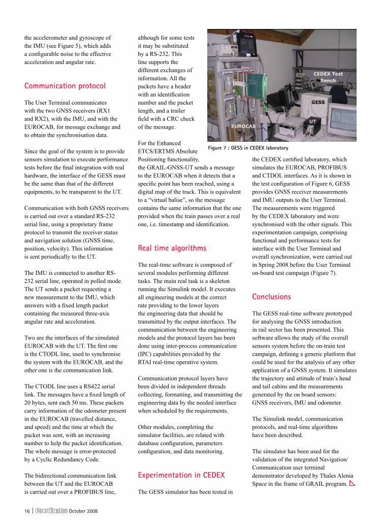
the CEDEX certified laboratory, which simulates the EUROCAB, PROFIBUS and CTDOL interfaces. As it is shown in the test configuration of Figure 6, GESS provides GNSS receiver measurements and IMU outputs to the User Terminal. The measurements were triggered by the CEDEX laboratory and were synchronised with the other signals. This experimentation campaign, comprising functional and performance tests for interface with the User Terminal and overall synchronization, were carried out in Spring 2008 before the User Terminal on-board test campaign (Figure 7).
conclusions
The GESS real-time software prototyped for analysing the GNSS introduction in rail sector has been presented. This software allows the study of the overall sensors system before the on-train test campaign, defining a generic platform that could be used for the analysis of any other application of a GNSS system. It simulates the trajectory and attitude of train’s head and tail cabins and the measurements generated by the on board sensors: GNSS receivers, IMU and odometer.
The Simulink model, communication protocols, and real-time algorithms have been described.
The simulator has been used for the validation of the integrated Navigation/Communication user terminal demonstrator developed by Thales Alenia Space in the frame of GRAIL program.
the accelerometer and gyroscope of the IMU (see Figure 5), which adds a configurable noise to the effective acceleration and angular rate.
communication protocol
The User Terminal communicates with the two GNSS receivers (RX1 and RX2), with the IMU, and with the EUROCAB, for message exchange and to obtain the synchronisation data.
Since the goal of the system is to provide sensors simulation to execute performance tests before the final integration with real hardware, the interface of the GESS must be the same than that of the different equipments, to be transparent to the UT.
Communication with both GNSS receivers is carried out over a standard RS-232 serial line, using a proprietary frame protocol to transmit the receiver status and navigation solution (GNSS time, position, velocity). This information is sent periodically to the UT.
The IMU is connected to another RS-232 serial line, operated in polled mode. The UT sends a packet requesting a new measurement to the IMU, which answers with a fixed length packet containing the measured three-axis angular rate and acceleration.
Two are the interfaces of the simulated EUROCAB with the UT. The first one is the CTODL line, used to synchronise the system with the EUROCAB, and the other one is the communication link.
The CTODL line uses a RS422 serial link. The messages have a fixed length of 20 bytes, sent each 50 ms. These packets carry information of the odometer present in the EUROCAB (travelled distance, and speed) and the time at which the packet was sent, with an increasing number to help the packet identification. The whole message is error-protected by a Cyclic Redundancy Code.
The bidirectional communication link between the UT and the EUROCAB is carried out over a PROFIBUS line,
Figure 7 : Gess in cedeX laboratory

October 2008 | ��
Explore the current state of Indian map data, updates, coverage, infrastructure, POIs and routing
Get the very latest on the device battle and learn where the biggest gains are being made
Uncover killer strategies and get the tools to redesign routing software to fit India’s address system and ensure your product sells
Discover the best tactics to capture millions of potential consumers and adapt your stratagies accordingly
Learn the best tactics for working with distributors to enhance consumer education and secure maximum revenue
Get a success checklist and learn how to successfully tailor your product for maximum profit.
To see the full agenda visit www.telematicsupdate.com/info/654 now!
The most prestigious conference for the elite of the Indian navigation industry
s m a r t m o b i l i t y
20th - 21st November, Hyatt Regency, New Delhi, India
Tele_NavIndiaFC_aw.indd 1 22/9/08 14:34:16
�8 | October 2008
Land administration systems (LAS) provide a country’s infrastructure
for implementation of its land-related policies and land management strategies. Land in modern administration includes resources, the marine environment, buildings, and all things attached to and under the surface. Each country has its own system, but the focus of this paper is about how to organise successful systems and improve existing systems.
This exploration of LAS provides an integrated framework to aid decision makers to make choices about improvement of systems. The story is based on the organised systems used throughout modern western economies where the latest technologies are available, but it is also applicable to developing countries that struggle to build even rudimentary systems.
The improvement of integrated land administration involves using four basic ingredients in the design of any national approach:
• the land management paradigm, with its four core administration functions of land tenure, land use, land valuation and land development,
• common processes found in every system,
• a toolbox approach, offering tools and implementation options, and
• a role for land administration in supporting sustainable development.
The land management paradigm is theoretical and universal in application, in that it can be used by any organisation, especially national governments, to design, construct and monitor their LAS. The core idea behind the paradigm involves moving land administration beyond its familiar functions of mapping, cadastral surveying, and registering land.
To achieve sustainable development these familiar functions need to be approached holistically and strategically integrated to deliver, or assist delivery of, the four functions in the paradigm (land tenure, value, use, and development). If the organizations and institutions performing these four functions are multi-purpose, flexible, and robust, they are capable of assisting the larger tasks of managing land, and dealing with global land and resource issues. The paradigm drives adaptability and flexibility of land administration, both in theory and in practice, and encourages developed countries to aim for good governance, eDemocracy and knowledge management, and developing countries to implement food and land security, and poverty reduction, while improving their governance, and, in many cases, building effective land markets.
While the theoretical framework offered by the land management paradigm is universal, particular implementation
lis
Understanding land administration systemsthis paper introduces basic land administration theory and highlights four key concepts that are fundamental to understanding modern land administration systems - firstly the land management paradigm and its influence on the land administration framework, secondly the role that the cadastre plays in contributing to sustainable development, thirdly the changing nature of ownership and the role of land markets, and lastly a land management vision that promotes land administration in support of sustainable development and spatial enablement of society. We present here the first part of the paper. the second part that focuses on the changing role of ownership and the role of land markets, and a land management vision will be published in november issue of coordinates
ian p. WilliamsonProfessor of Surveying and Land Information, Centre for SDI and Land Administration, University of Melbourne
stig enemarkPresident of the International Federation of Surveyors, [email protected]
Jude WallaceLawyer and a Senior Research Fellow, Centre for SDIs and Land Administration, University of Melbourne
abbas rajabifardDirector of the Centre for SDIs and Land Administration, Department of Geomatics, University of Melbourne
October 2008 | ��

20 | October 2008
October 2008 | 2�

22 | October 2008

October 2008 | 2�

2� | October 2008

October 2008 | 2�
2� | October 2008

October 2008 | 2�
paths must vary, depending on local, regional and national situations. This enigma of open-ended opportunities for implementation is solved by applying an engineering approach (design, build and manage) that relates design of a LAS to management of local practices and processes. These common processes are found in all countries and include dividing up land, allocating it to identifiable and secure uses, distributing areas to people, tracking social changes such as death and inheritance, and so on. Variations in how these processes are undertaken underlie the remarkable variety of existing LAS.
Among all the variations, market based approaches predominate, both in theory and practice. Their popularity arises from their relative success in managing these common processes and, at the same time, improving governance, transparency, and economic wealth for the countries where they are successfully used. Market based approaches thus provide best practice models for improvement of many national LAS where governments seek similar economic results. The tools used in market based systems are therefore frequently related to general economic improvement. This relationship is, however, far from self evident. Market based approaches are creatures of their history and cultural sources. Transferring them to other situations is difficult and a long term process that requires forethought, planning, and negotiation.
This leads to the third ingredient of good LAS design: the toolbox approach. The land administration toolbox for any particular country contains a variety of tools and options to implement them. The tools and their implementation reflect the capacity and history of the country. The selection of tools reflects the historical focus of land administration theory and practice in cadastral and registration activities, and includes, among others: general tools such as land policies, land markets and legal infrastructures; specialist tools such as tenure, registration systems, cadastral surveying and mapping and land boundaries; and emerging tools such as pro-poor land management and gender equity.
There are of course many other tools. Valuation, planning and development tools raise separate and distinct issues. Many countries include land use planning and valuation activities in their formal LAS. Other countries rely on separate institutions and professions to perform these functions and define their LAS more narrowly. For all LAS, however, these functions need to be undertaken in the context of the land management paradigm and integrated with the tenure function. The design of a tool by an agency engaged in any of the four functions therefore needs to reflect its integration with the others. The cadastre remains a most important tool, because it is capable of supporting all functions in the land management paradigm. Indeed, any LAS designed to support sustainable development will make the cadastre its most important tool.
The list of tools and their design will change over time, and so will the suitability of any particular tool for national LAS, and the options appropriate to deliver it. To successfully use the tool box approach, the LAS designer must understand the local situation, diagnose the next steps for improvement, and select appropriate tools and options from the possible array. Usually the steps can be clarified by international best practices explained in well-documented case studies, United Nations and World Bank reports and publications, and a wide variety of books, journal articles and reports.
One of the major problems with LAS
design, even in countries with successful systems, is the isolation of components from each other. This is known generally as the problem of “silos”. Another problem is reliance on single tool solutions in complex situations. The toolbox approach addresses both these problems. It requires that each tool be considered in the context of all the others, and tested against the over-all land management paradigm. It relies on using methods and options appropriate to a situation, compared with a “one size fits all” suite of policy and technical options.
The options now available vary widely. Land identification systems, registration systems, digital support systems, tenures, surveying and mapping systems, and so on, are both variable and increasingly adaptable. Indeed, no LAS is static. The tools used are always being adapted to reflect changes to the ways people think about and use their land, and many other influences. These changes feed back into the overall design of the LAS and its capacity to inform land policy at large. The essential theme of this paper is to inform the design of any particular LAS by starting with the broad context of the land management paradigm, observing the common processes that are actually used, then choosing options for each of the tools to manage these processes according to a well grounded understanding of what is appropriate for local circumstances and international best practice.
In practice, from a land administration
Figure 1: the land management paradigm (enemark and others 2005)

28 | October 2008
design viewpoint, LAS problems are universally shared. Whether or not a country uses private property institutions as the foundation of its land rights, land security and land management are overriding imperatives capable of being implemented by the new role of land administration in supporting sustainable development. And whether a country is economically successful or resource hungry, betterment and improvement of existing systems are essential. An overall theme is therefore developing land administration capacity to manage change. For many countries, meeting the challenges of poverty alleviation, economic development, environmental sustainability, and management of rapidly growing cities, are immediate concerns. For more developed countries, immediate concerns involve updating and integrating agencies in relatively successful LAS, and putting land information to work for emergency management, environmental protection, economic decision making, and so on as part of a wider spatial enablement of government and wider society.
the central role of the cadastre in land administration
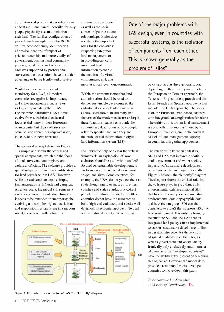
The theoretical framework of a land administration role in delivery of sustainable development relies on using the land management paradigm to guide the selection of tools in the toolbox used to manage common processes. Within this framework a wide range of options and opportunities is available to LAS designers and land policy makers. One tool is, however, fundamental – the cadastre or land parcel map (Figure 2) (FIG, 1995). The history and influence of the cadastre explain how knowledge about land administration was gathered, particularly after World War II. This background demonstrates that modern cadastres have a much more significant role than their original designers envisaged. The cadastre, or the large scale, land parcel map related to parcel indices, is the vital information layer of an integrated land management system, and, in future, will underpin information systems of modern governments.
While some developed countries do without a formal “cadastre”, most generate digital parcel maps (or digital cadastral data base or DCDB) reflecting land allocation patterns, uses and subdivision patterns, and even addresses and photographs. A country’s DCDB is its core information layer that reflects the use and occupation of land by society – the built environment. Critically it provides the spatial component for LAS and more particularly the location and place dimension with the most useful output being a geocoded street address of each property. Simply the cadastre is the central component in spatially enabling government. It is destined for a much broader role as fundamental
government infrastructure equivalent to a major highway or railway, though it was originally created on behalf of taxpayers merely for better internal administration of taxation, and, more recently, titling of land in support of more efficient and effective land markets. Without these digital facilities, modern governments cannot understand the built environment of cities, manage land competently, utilise computer capacity to assist policy making, or retrieve significant value out of land.
The greatest potential of the DCDB lies with the information industry at large, as the principal means of translating geographic coordinates and spatial descriptors of land parcels into meaningful
Figure 2 the cadastral concept (FiG, 1995)

October 2008 | 2�
Instant gratification meets the real world—with the latest GeoXH™ handheld. When your GIS project requires the
highest levels of accuracy, the GeoXH handheld sets the new standard. Using revolutionary H-Star™ technology,
the GeoXH handheld delivers real-time subfoot accuracy, and decimeter accuracy with an optional external antenna.
And with its 1 GB of storage, a crisp VGA screen, Bluetooth® connectivity, and Windows Mobile® version 6 operating
system, it’s easy to make the GeoXH handheld your choice for smarter asset relocation and management. To learn
more on the field-proven GeoXH handheld, visit trimble.com or your local reseller.© 2008, Trimble Navigation Limited. All rights reserved.
Decimeter accuracy in real time.Instant gratification is never overrated.
39°54’50.9206”N105°08’17.8710”W09:38:58 MDT
39°54’50.8894”N105°08’17.8650”W09:39:27 MDT
GeoExplorer® 2008 Series GeoXH™ Handheld
www.trimble.com/geo
Coordinates_MGIS-012_GeoExplorer 2008 Ad_0508.indd 1 14/05/2008 3:39:48 p.m.
�0 | October 2008
descriptions of places that everybody can understand. Land parcels describe the way people physically use and think about their land. The familiar configuration of parcel based descriptions in the DCDB ensures people-friendly identification of precise locations of impact of private ownership and, more vitally, of government, business and community policies, regulations and actions. In cadastres supported by professional surveyors, the descriptions have the added advantage of being legally authoritative.
While having a cadastre is not mandatory for a LAS, all modern economies recognize its importance, and either incorporate a cadastre or its key components in their LAS. For example, Australian LAS did not evolve from a traditional cadastral focus as did many of their European counterparts, but their cadastres are equal to, and sometimes improve upon, the classic European approach.
The cadastral concept shown in Figure 2 is simple and shows the textual and spatial components, which are the focus of land surveyors, land registry and cadastral officials. The cadastre provides a spatial integrity and unique identification for land parcels within LAS. However, while the cadastral concept is simple, implementation is difficult and complex. After ten years, the model still remains a useful depiction of a cadastre. However it needs to be extended to incorporate the evolving and complex rights, restrictions and responsibilities operating in a modern society concerned with delivering
sustainable development as well as the social context of people to land relationships. It also does not show the important roles for the cadastre in supporting integrated land management, or in providing critically important land information to enable the creation of a virtual environment, and, at a more practical level, e-government.
Within the constant theme that land administration should be used to deliver sustainable development, the cadastre takes on extended functions as discussed above. In summary two features of the modern cadastre underpin these functions: cadastres provide the authoritative description of how people relate to specific land, and they are the basic spatial information in digital land information system (LIS).
Even with the help of a clear theoretical framework, an explanation of how cadastres should be used within an LAS focused on sustainable development, is far from easy. Cadastres take on many shapes and sizes. Some countries, for example, the USA, do not yet use them as such, though many or most of its cities, counties and states assiduously collect parcel information in some form. Other countries do not have the resources to build high-end cadastres, and need a well designed, incremental approach. To deal with situational variety, cadastres can
be categorised as three general types, depending on their history and functions: the European or German approach, the Torrens or English title approach and the Latin, French and Spanish approach (that includes the USA approach). The focus is on the European, map-based, cadastre with integrated land registration functions. The utility of this tool in land management is seen both in its successful use by its European inventors, and in the contrast of lack of land management capacity in countries using other approaches.
The relationship between cadastres, SDIs and LAS that interact to spatially enable government and wider society in pursuit of sustainable development objectives, is shown diagrammatically in Figure 3 below – the “butterfly” diagram. The diagram shows the critical role that the cadastre plays in providing built environmental data in a national SDI that has traditionally focused on natural environmental data (topographic data) and how the integrated SDI can then contribute to a LAS that supports effective land management. It is only by bringing together the SDI and the LAS that an integrated land policy can be implemented to support sustainable development. This integration also provides the key role of spatial enablement of the LAS, as well as government and wider society. Ironically only a relatively small number of countries, the “developed countries” have the ability at the present of achieving this objective. However the model does provide a road map for less developed countries to move down this path.
To be continued in November 2008 issue of Coordinates.
Figure 3. the cadastre as an engine of las. the “butterfly” diagram.
One of the major problems with
LAS design, even in countries with
successful systems, is the isolation
of components from each other.
This is known generally as the
problem of “silos”
October 2008 | 31
Newsbriefs - Lbs
Us businesses expected to spend 11 billion dollars on mobile apps by 2012
According to CompassIntelligence.com, businesses in the U.S. will spend roughly $11.6 billion on mobile applications by 2012. This year U.S. businesses are
expected to spend an estimated $4.9 billion on mobile applications. This market is poised for double-digit annual growth over the next 5 years, driven by the growth in remote and telecommuting employees, the movement in “open Mobile Devices,” and the explosion of new and emerging free and fee-based mobile applications available for download. This research is part of Compass Intelligence’s Applications and Business Wireless research. http://www.gpsdaily.com
Mapmyindia partners with ford india to sell GPs Navigation
MapmyIndia has partnered with Ford India to sell its GPS device ‘MapmyIndia Navigator’ which would be included with the Navi Gear package of Ford Endeavour. This would be offered as a new accessory at all the authorised Ford dealerships across India, which can be fitted on all Ford vehicles, including the Ford Fiesta, Ikon, Fusion and the Endeavour, the company statement said. http://www.business-standard.com
eKA GPs camera launched in india
EKA Designs has launched of its Field Ready GPS Camera in India. It tags the locational coordinates onto the
picture along with altitude and date/time; automatically embeds latitude and longitude onto the picture and sports 8.0 megapixel resolution, wireless and Bluetooth connectivity and field ready functionality. The Single Hand operation product is dust, rain and water proof. http://www.techgadgets.in
blaupunkt enters indian PND market
German in-car entertainment company, Blaupunkt, has introduced a series of portable satellite navigation systems in India. The three devices launched are the TravelPilot 100, TravelPilot Lucca 3.5 and TravelPilot 300. MapmyIndia is the digital mapping provider for this range of products http://www.gpsbusinessnews.com
New mobile technology to breath new life into print media campaigns
With the current decline in print circulation starting to impact on advertiser confidence, Australian mobile technology company QMCODES has launched a new service that takes the mystery out of print readership and engagement, enabling publishers and their advertisers to truly understand reader behaviour.
Quick Response codes offer readers a direct gateway to the Internet via a simple camera click with a 3G mobile phone. Now using QMCODES’s Q-Lytics platform any company or individual will be able to generate a QR Code campaign for their own content. It will provide detailed feedback about the content accessed, the number of people connected, connection times and locations etc.
Abaqus Launches the MyGeorecorder
Abaqus Inc. (TM), the provider of location-based products & services, announced the launch of MyGeoRecorder, a GPS-powered mobile application that allows consumers to record personal location-based content in real-time via a mobile phone and then share it with any social network and online service on the web. http://www.mygeodiary.com.
Location based Technologies begins Pocketfinder Pilot Production
Location Based Technologies has commenced pilot production of the PocketFinder personal locator at the Jabil Circuit manufacturing facility in Meung-Sur-Loire, France, thereby setting the stage for mass production runs scheduled for the fourth quarter. The PocketFinder family of products uses advanced technology to help families stay connected. The smallest known single-board GSM/GPS device easily fits into a pocket, purse or backpack, and can be accessed via the Internet, cell phone or landline to show its real time location. http://www.gpsdaily.com
AGCO and Topcon sauer-Danfoss (TsD) to deliver Next Generation Auto-Guide
AGCO Corporation a worldwide manufacturer and distributor of agricultural equipment announced that TSD Integrated Controls, the joint venture company between Topcon Positioning Systems and Sauer-Danfoss, will be the supplier of AGCO’s next generation satellite-guided steering assist system – AUTO-GUIDE2. The AUTO-GUIDE2 system uses highly advanced inertial sensor and multi-constellation satellite positioning technology to achieve a steering system that will help increase productivity and reduce input costs. www.businesswire.com
Location based Technologies Commences Pocketfinder Pilot
Location Based Technologies has commenced pilot production of the PocketFinder personal locator. The PocketFinder family of products uses advanced technology to help families stay connected. It is a single-board GSM/GPS device easily fits into a pocket, purse or backpack, and can be accessed via the Internet, cell phone or landline to show its real time location.
The devices can even track vehicle speeds to ensure family members are driving safely. http://www.gpsdaily.com Production

32 | October 2008
Newsbriefs - iNDUsTry
Trimble to acquire rolleiMetric. introduces Multi-GNss COrs receiver
Trimble Navigation has agreed to acquire RolleiMetric from Rollei GmbH, Germany. RolleiMetric is a provider of metric camera systems for aerial imaging and terrestrial close range photogrammetry.
Trimble has introduced the Trimble® NetR8™ GNSS reference receiver. It can operate as a campaign receiver for post processing, as a Continuously Operating Reference Station receiver, portable base station for RTK applications or as a scientific reference station collecting information for specialized studies.
Specific applications include high-accuracy positioning as part of a Trimble VRS™ network, support for DGPS MSK beacons, and integrity monitoring of networks and physical infrastructure such as bridges, dams and mines. It has 76 channels and supports GPS L1, L2, L2C and L5 signals as well as GLONASS L1/L2 signals. There are also four channels dedicated to tracking SBAS.http://www.trimble.com
DAT/eM systems releases sUMMiT eVOLUTiON 4.5
DAT/EM Systems released Version 4.5 for SUMMIT EVOLUTION™, digital (softcopy) stereoplotter. It is available at no cost to all users who have a current support contract. With many new features and product improvements, this upgrade and maintenance release extends the functionality already available within both Summit Evolution and DAT/EM Capture™.
GNss market to grow to $6b to $8b by 2012
According Eric Gakstatter, contributing GPS World editor, and Position One Consulting Pty. Ltd. the global market for precision GNSS products and services will grow to between $6 billion and $8 billion by 2012.
Markets covered by the report include surveying, engineering, agriculture,
mining, deformation monitoring, GIS, and marine for both machine control and non-machine control applications for the time period 2008 through 2012. The report also discusses the background and status of the entire spectrum of GNSS including GPS and, GLONASS and its modernization, SBAS, Galileo and Compass/Beidou, QZSS, and IRNSS systems, as well as technology/market trends and potential disruptions. http://sc.gpsworld.com
Tele Atlas global database expands to deliver digital map of india
Tele Atlas has announced the availability of Tele Atlas digital maps for India, which includes 5,463 sub-districts, 593 districts and 35 states and union territories and includes detailed street level coverage for approximately 109,000 kms in 8 major cities: Ahmedabad, Bengaluru, Chennai, Delhi NCR region, Hyderabad-Secunderabad, Kolkata, Mumbai and Pune.
Tele Atlas’ new map offering of India covers the complete national highway network which includes expressways, national highways, and state highways and encompasses approximately 162,000 kms. The initial product offering also includes more than 108,000 points of interest. www.teleatlas.com
Geospatial systems, Leica Geo team up for Airborne Mapping
Geospatial Systems Inc. and Leica Geosystems AG have embarked on a partnership to create image capture and dissemination systems for airborne mapping and surveillance applications. It will be based initially on the integration of Leica’s ALS LIDAR products with GSI’s direct georeferenced aerial mapping,
GSI’s direct georeferenced aerial imaging systems is based on the TerraPix technology platform, including electro-optical, infrared, multi-spectral mapping sensor systems and camera controllers for multi-camera arrays. http://eirs.geospatial-solutions.com
Version 3.500 firmware released
Version 3.500 firmware for their OEMV family of GNSS precision receivers will include the new RT-2 L1TE positioning, ALIGN heading and the latest OmniSTAR HP 4.28 library. RT-2 L1TE is NovAtel’s new single frequency RTK solution which optimally combines GPS and GLONASS measurements to produce centimeter accurate positions for baseline lengths of up to 3 kms.
sPAN-se - New GNss + inertial receiver
GNSS + INS receiver, the SPAN-SE is designed for precision applications, it enhances the powerful OEMV® receiver with features that are critical to precision GNSS/INS system integrators such as on-board data logging, Ethernet connectivity, wheel sensor input and scalability for future GNSS advances. The pinpoint accuracy of GNSS positioning and the stability of IMU gyro and accelerometer measurements combine to provide a 3D position, velocity and attitude solution. Unlike GNSS-only navigation systems, the output is stable and continuously available, even through periods where GNSS signals are blocked.
Quadruple Constellation GNss Choke ring Antenna
GNSS-750 choke ring antenna is an innovative, 3D design of the GNSS-750 enables superior low level elevation tracking, with the ability to track satellites as soon as they are visible, down to the horizon and even below. It incorporates an ultra-wideband Dorne-Margolin element and has optimized antenna gain so it can be used with most manufacturers’ geodetic receivers.
News

October 2008 | 33
Client: Navcom | Agency: Nostrum | Job#: 08-NAV-031 NewStarFire Ad | Description: Full page Bleed Color | Size: 7.83” x 11” | Pub: Coordinates
Land Survey
Offshore Positioning
Aerial Photogrammetry and LIDAR
GIS and Asset Mapping
Machine Control
www.navcomtech.com
StarFire™ is always ready to work wherever you are. Your project could be next door or a continent away, but NavCom has you covered. The StarFire™ Network delivers decimeter positioning anywhere on Earth, with six satellites providing signal redundancy and exceptional coverage. The expansive global network allows users to roam freely while maintaining the most precise positioning information.
No matter the project, NavCom’s StarFire service can make even the largest tasks seem small. StarFire’s unique capabilities can also be utilized for RTK projects, with the power of RTK Extend,™ which is our industry-exclusive technology that allows you to work farther from base stations and maintain RTK-level accuracy even during radio outages.
The StarFire Network. Anywhere, any project. To learn more, call us at +1-310-381-2000.
GLOBAL REACH.LOCAL PRECISION.
08-NAV-031 New StarFire Brand Ad Coordinates_m.indd 1 9/16/08 11:45:31 AM

34 | October 2008
Azteca systems ties-up with rolta international
Azteca Systems, Inc., provider of GIS-centric management solutions, has tied up with Rolta International, a company in GeoSpatial Fusion™ solutions. Now, Rolta becomes the official Cityworks distributor for the UAE, Qatar, Oman, Bahrain, Kuwait, and Saudi Arabia.
sOCeT seT® software to play vital role in NGA workstations
The front-end processing Environment (FPE), which has been in use by the National Geospatial-Intelligence Agency since 1997, is due to be replaced by SOCET SET® v5.4.1 soon. FPE provides the vital NGA requirement for geopositioning, and creates Digital Point Positioning Data Base format production module and Controlled Image Base(CIB)® format production module products for U.S. troops in the field. These digital map products are used for terrain analysis, and to determine precise image coordinates such as latitude, longitude, elevation, and other image data for simulation, targeting, and mission planning operations.
r220™ GPs receiver by Hemisphere GPs
Hemisphere GPS, has introduced the R220 GPS Receiver, its first finished product to be powered by Eclipse™, Hemisphere GPS’ patented dual frequency technology. It provides extremely accurate, versatile, and robust positioning, in virtually any environment, anywhere in the world. It features RTK for fast, reliable, long range centimeter level performance. It also tracks GPS, SBAS, and L-Band (OmniSTAR® HP/XP) differential corrections.
Mb 500: GPs+GLONAss+sbAs OeM board by Magellan
Magellan has launched a new OEM board, the MB 500. It brings to the embedded GNSS board market a unique blend of technologies that increases RTK reliability and assures inter-compatibility with other
Spirent’s new GSS8000 GNSS simulator series has been designed to meet all the demanding requirements of research and development teams involved in satellite navigation and positioning systems. RF simulation is an essential part of satellite navigation receiver, system and application development. Only by providing controlled, repeatable signals to the system under test can development resources be properly focused and system performance properly optimised and assured. Due to its modular design, the
GSS8000 can be readily adapted to the requirements of different applications. The GSS8000 includes GPS, Galileo and GLONASS signals, plus SBAS combined at one RF output. The same system is also capable of generating signals representing the planned Japanese Quazi Zenith satellite system.
In a conversation with Coordinates, Mr. John Pottle, marketing director for positioning at Spirent Communications highlighted some of the key points about GSS8000 series as follows
GSS8000 Series GNSS Constellation Simulator - “A powerful flexible choice for R&D applications”
what is unique about Gss8000 series simulators?
We are moving into a world beyond just GPS testing, to a world of not only multi-signal but multi-constellation simulators. Spirent’s GSS8000 supports GPS, Galileo and GLONASS today. It is also becoming the norm to combine GNSS with augmentation and other navigation systems or aids, for example inertial
sensors or dead-reckoning sensors. The GSS8000 is designed to work with all of Spirent’s extensions and options in these areas including inertial, automotive and interference simulation.
Does Gss8000 support sbAs and all the other future signals including GAGAN?
Yes. As well as existing SBAS (WAAS, EGNOS, MSAS), the GSS8000 is designed to support GAGAN and
future GNSS such as the planned Compass system.
How cost competitive is Gss8000?
Laboratory-based simulation is a very cost-effective solution to GNSS testing. Compared to the costs and uncertainties of field-testing, where
it is never possible to repeat the same conditions, laboratory testing provides flexibility under controlled, repeatable conditions. In addition to the GSS8000, which is our fully flexible system, Spirent has a wide range of systems for different applications, test needs and budgets.
How does spirent simulator has an edge over others?
We are very proud of our more than 20 years’ heritage and deserved reputation for reliable systems with the highest fidelity signals in the industry. Each Spirent system comes with comprehensive software modelling capabilities as standard, and is backed up by regional support centres around the globe. We believe you can invest in Spirent with confidence that you will get the best test system to help you build the best products and systems for your customers.

October 2008 | 35
Take Your Choice!!
© Copyright 2008 Carlson Software, Inc. All rights reserved. Carlson Software is a registered trademark of Carlson Software, Inc. All other product names or trademarks belong to their respective holders. TOPO and 3D screen shots are courtesy of The Engineering Groupe, www.enggroupe.com
Top New Features:Area Labels: Overhaul for complete flexibility plus overlap avoidance
Field-to-Finish: Fixed parameter coding to streamline field entry
Drawing Explorer: Manageand access project data files
SurvNet: New EDM calibration function
LotNet: Ability to place buildings within the lots
Export/Import: Export to Google Earth & convert Mr. Sid images
Work with ESRI: Coordinate conversion, layer control, field selection, area filter
Find Out More NOW!Call or Email Michael Manning, Director, Carlson Software Australia:
[email protected] www.carlsonsw.com
AuthorizedIntelliCAD®
TechnologyConsortiumMember
Free Technical Support By Phone, Email, and Web
®
Carlson Survey 2009 with built-in IntelliCAD®
orCarlson Survey 2009 for AutoCAD
orCarlson Survey 2009 Embedded AutoCAD®
with AutoCAD OEM engine built-in
Colors: Cyan, Magenta, Yellow, Black. Files not trapped or preflighted.Prepress company, please Preflight and Trap this art as needed.
Carlson Survey 2009 AD, 8-7-08Position Magazine Half Page 130mm x 180mm
brands of GNSS receivers. Utilizing Magellan’s BLADE™ Technology, it provides solutions from 3 constellations: GPS, GLONASS and SBAS. It also utilizes all available GLONASS corrections without suffering from the interchannel GLONASS biases that can affect other manufacturer’s receivers.
Magellan Maestro 3210 Portable GPs with Maps
The Magellan Maestro 3210 with a size of 3.25 inches high, 3.65 inches wide and just 0.7 inches in depth fits the part of an ultra-thin portable GPS. It features the SiRFstarIII GPS chipset with an accuracy of 3 to 5 meters. Also included is a bird’s-eye 3D view, 6 million POI, pre-loaded North American maps and other features. http://www.product-reviews.net
erDAs Launches erDAs Apollo 2009
ERDAS Inc. has unveiled ERDAS
Apollo 2009, its system for integrating geospatial data formats with existing GIS environments and other business applications.
It simplifies the utilization of vector, raster, and terrain data by integrating that data with existing business systems, such as the Oracle database, for persisting intelligent metadata and application specific information. It can be integrated with IT standards such as JavaEE, SOAP/WSDL, and REST, and can also deliver geospatial information to domain-specific desktop and web client applications. It is OGC and ISO compliant and implements WMS, WCS, WFS, WFS-T and CS-W standards and the ECW-P and JPIP wavelet streaming protocols. http://gismap.geospatial-solutions.com
Topcon Announces New Organizational structure
Topcon Positioning Systems, Inc., has announced a change in its management
operations. The new structure’s four market-focused business units are:
Survey and Construction, Emerging Business (GIS, network, mobile, Precision Agriculture, and Telematics.http://www.gisuser.com/
Canon launches 44”, high-speed printer for the CAD and Gis market
The imagePROGRAF iPF810 and iPF820 are five-ink dye and pigment printers that combine fast output production speeds with efficient ink usage. Both are capable of reproducing A1 prints in 24 seconds and A0 prints in 47 seconds, in addition, they can reproduce fine line widths down to 0.02mm, with a range accuracy of 0.1%. The iPF820 is equipped with a dual roll capability with auto switching, enabling it to handle large print runs with different types and sizes of media. The iPF810, on the other hand, has an optional take-up unit for fast consecutive

36 | October 2008
printing and enabling unmanned printing. Both printers are capable of borderless printing saving time in finishing by removing the need for edge trimming. http://www.wideformatonline.com/
rockwell Collins to provide e-2D to Us Navy
Rockwell Collins has been selected by the U.S. Navy to provide the E-2D Advanced Hawkeye Integrated Training
System for Aircrew (HITS-A). It will feature a state-of-the art radar, as well as upgraded aircraft systems and avionics that will improve supportability and increase readiness. www.rockwellcollins.com.
bentley Launches building Performance Group,
Bentley has launched a new Building Performance Group which will focus on software solutions and products that
address the immediate global need to create and maintain energy-efficient, environmentally friendly, safer buildings. Bentley’s recently acquired Hevacomp line of leading building services design software includes products for energy analysis, heating and cooling load calculations, pipe and duct sizing, and electrical system design, and Tas software for fast, in-depth energy analysis and
simulation of demanding and challenging large-scale building environments. www.bentley.com/hevacomp.
DiMAC systems unveils its latest iT rack
DIMAC Systems, a provider of digital aerial imagery solutions has unveiled IT Rack, the centralized image acquisition system of its DiMAC™ (Digital Modular Aerial Camera). It has been designed to be fitted on any type of aircraft, from small single engine planes to large bi-turbo ones. Its design, size and weight make this tailor-made anti-vibration rack extremely easy to install on and remove from any aircraft.The IT Rack is made of three components: the Master Computer Unit – Powerful management brainpower, the Slave Computer Unit – Intelligent image acquisition arm, and the Removable Storage Unit – Plug-and-play memory. www.dimacsystems.com

October 2008 | 37
Govt Approves Modern Navigation Project GAGAN
In a bid to provide seamless navigation over the Indian airspace and waters, the Indian government has approved the implementation of a Rs 774-crore GPS aided futuristic project. The GPS aided Geo Augmented Navigation (GAGAN) project would place India in a select group of nations, like the US, Europe and Japan, to possess such a system that would not only guide aircraft over its airspace, but also provide them straight-line fuel-efficient routes and precision approach landings.
The Cabinet Committee on Economic Affairs approved the implementation of this project which is being developed jointly by the Indian Space Research Organisation and the Airports Authority of India. The GAGAN system would provide coverage of oceanic areas, which is not possible by the terrestrial systems that are in place now.
It would also improve airport and airspace access in all-weather conditions and provide precision-landing approaches to aircraft even at airports, where Instrument Landing Systems do not exist. Press Trust of India
satellite navigation assists workers at remote sites
CSIRO’s Minerals Down Under National Research Flagship says it is working with various stakeholders to develop two new navigation technologies for remote areas.
The GNSS technologies include an integrated receiver and a transponder. The receiver takes signals from several satellite constellations and other inputs. The transponder works with the receiver to automatically communicate the location of the user. This will allow companies with assets and people at remote sites to better manage their safety, traffic and efficiency. The enhanced workforce management systems will also increase security for workers located in remote areas.
The Queensland Government is supporting
Newsbriefs - GPs
the project through a $333,000 grant provided under its $300m Smart State Innovation Funding Program. CSIRO has also partnered with Automated Positioning Systems (APS) and Italy’s Istituto Superiore Mario Boella (ISMB). www.industrialit.com.au
Putin orders additional 2.6 billion on Glonass development
Russian Prime Minister Vladimir Putin signed a directive on allocating an additional $2.6 billion to develop the country’s Glonass satellite system. Putin also said he would soon sign a directive on 45 billion rubles ($1.8 bln) in additional funding for the country’s
space program. According to the Central Research Institute for Machine Building, the Glonass system currently consists of 16 satellites, with 13 satellites operating as intended, two undergoing maintenance and one that is due to be withdrawn from the orbital grouping. A total of 9.9 billion rubles ($418.25 million) was allocated for Glonass from the federal budget in 2007, and 4.7 billion rubles ($200 million) in 2006. http://en.rian.ru/
indian railway stations to use GPs based digital clocks
Indian Railways will install GPS-based digital clocks at all railway stations across the country for uniformity in timing. Apart from synchronising the time up to the second, the time-piece will have the same size and design all over the country, a senior Railways Ministry official said. Railways has recently successfully completed trials of the GPS-based rolling stock tracking system called SIMRAN
(Satellite Imaging for Rail Navigation). It is now planning to provide SIMRAN system on all the trains which will completely revolutionise the information dissemination system of Indian Railways. At present, railways is using the GPS for tracking trains for its location, speed, and direction of movement. www.zeenews.com
Hi-tech PCr with geospatial techniques in New Delhi
A hi-tech Central Police Control Room to be inaugurated at the Delhi Police headquarters at ITO. With over 500 PCR vans fitted with the latest GPS, GIS and an online city map installed in the CPCR to track the movement of these vehicles, senior cops are expecting that their fight against terrorism and the overall policing standard will get a major boost.
Devised by HCL Technologies, the system will function on a call centre module. It will improve the response time by 10 minutes to 30 minutes. The Delhi Police also plans to install GPS and GIS system in the official vehicles of SHOs, ACPs and DCPs. http://timesofindia.indiatimes.com/
GPs helps beat fuel rises
SAT-NAV MAKER TOMTOM has unveiled its new Go x40 Live series with the first of three models which promise to help drivers stem rising fuel costs by providing information on the cheapest petrol stations on the route.
The new devices promises better dynamic navigation by combining up-to-the minute traffic information and historical travel time information for every road, specified for every day of the week, at five minute intervals. The High Definition Traffic will be available for the first time in the UK, Germany, France, Switzerland and the Netherlands. http://www.theinquirer.net/
Download back Issues of
Coordinates from
www.mycoordinates.org
38 | October 2008
Newsbriefs - reMOTe seNsiNG
esA shortens list of bidders for Galileo
The ESA has listed 11 industrial groups invited to compete for contracts to get Europe’s satellite-navigation system, Galileo, into orbit. They are Italian, Dutch, French, British and German. Galileo now aims to launch its 30 satellites by the end of 2013, giving Galileo users more precision that the current American GPS coverage offers. Europe has already spent 1.6bn euros on Galileo. http://www.euronews.net
inauguration of the Galileo Control Centre at DLr
On 8 September 2008, the new building complex for the Galileo Control Centre at the German Aerospace Center (Deutsches Zentrum für Luft- und Raumfahrt; DLR) in Oberpfaffenhofen was formally handed over. The new control centre, with over 3000 square metres of floor space, is a fully-equipped building that has cost about 100 million euro. By the time the Galileo satellite navigation system is fully operational, up to 100 engineers and scientists will be working at over 30 control consoles in the control centre which is part of the core ground segment. The satellites are controlled and mission data is received through a globally distributed ground station network. The control centre is equipped with state-of-the-art infrastructure in order to meet the high demands made on the Galileo infrastructure and to ensure failure-free operation for the next 20 years. Important navigational data as well as the reference time which is relevant for all Galileo applications are generated on the ground in the control centres and transmitted to the Galileo satellites
via the ground stations http://www.dlr.de/en/desktopdefault.aspx/tabid-1/86_read-13448/
ssTL completes Galileo testing, GiOVe-b functioning well
Surrey Satellite Technology Ltd. (SSTL) has completed in-orbit testing that analyzed signals from the new GIOVE-B satellite for the European Space Agency (ESA), determining that the second Galileo satellite is operating well.
The analysis further suggests that the technologies integral to the European Union-funded Galileo satellite navigation project are valid, according to SSTL During May and June SSTL’s Galileo team processed data acquired by the Science and Technology Facilities Council (STFC) at its 25-meter dish in Chilbolton, United Kingdom, to analyze the center frequency, signal power, and structure of all three Galileo signals. The team validated the in-orbit signals, which met expectations and correlated with ground tests before launch. In addition to the Galileo Binary Offset Carrier (BOC) signals transmitted by GIOVE-A, GIOVE-B, is successfully transmitting the multiplexed binary offset carrier (MBOC) signal in line with the E.U./U.S. agreement on GPS/Galileo signal compatibility reached in 2007. Additional test results also indicate that the hydrogen maser atomic clock onboard GIOVE-B is working correctly.
The maser promises better long term stability and improved accuracy compared to the rubidium clock on board GIOVE-A. Following the GIOVE-B campaign, SSTL retested GIOVE-A for the ESA. The results confirm that GIOVE-A is still performing as it should five months into its mission extension.
Galileo updateGeoeye-1 in orbit: 0.5m resolution imagery starting this fall
GeoEye has announced the launch and deployment of GeoEye-1, the world’s highest resolution, commercial Earth-imaging satellite. GeoEye-1 will now undergo a calibration and check-out period before imagery products will be available for sale. GeoEye-1 will simultaneously collect 0.41-meter ground resolution black-and-white (panchromatic) images and 1.65-meter colour (multispectral) images. Designed to take digital images of the Earth from 423 miles (681 kilometers) and moving at a speed of about four-and-a-half miles (seven kilometers) per second, the satellite camera can distinguish objects on the Earth’s surface as small as 0.41-meter or 16 inches in size. Due to U.S. licensing restrictions, commercial customers will get access to imagery at half-meter ground resolution. www.gpsbusinessnews.com
rapideye looking for partners in Asia
Ahead of the start of commercial operations in December, Rapideye AG intends to establish separate distribution channels in Japan, South East Asia, China and Australia. RapidEye has an online distribution model, which means anyone, anywhere in the world, can buy data as soon as it is acquired, all that is required is a valid credit card. The imagery is available for online delivery as soon as the purchase is approved. www.rapideye.de/
Historic aerial images of britain go Online
The largest collection of historical aerial photographs of the UK can now be accessed online. Launched by Bluesky, the www.oldaerialphotos.com website allows visitors to search through millions of aerial images dating back as far as the 1940s by simply entering a postcode, address or grid reference. Detailed search results, including the age and ground coverage, of every image that matches the search criteria are displayed and the visitor can choose to purchase either a hard copy print or digital image file. www.bluesky-world.com

October 2008 | 39

40 | October 2008
india map in 3D satellite imagery
A new project to map all areas in the country using a three-dimensional satellite imagery would be launched soon, Union Minister of Science and Technology and Earth Sciences Kapil Sibal said. http://www.hindu.com/
DLr mapping provides relief after flooding in Nepal and north india
After an embankment on the Koshi river in eastern Nepal was breached on 18 August 2008, there was extensive flooding, particularly in Bihar which is situated downstream in India. The German Aerospace Center (DLR); with the help of radar images from space, mapped the flood areas in detail. The Center for Satellite-Based Crisis Information (ZKI) of DLR in Oberpfaffenhofen near Munich used data from the German radar satellite TerraSAR-X. The analysis is based on TerraSAR-X StripMap and ScanSAR data acquired on 30 August and 1 September 2008. The ZKI is a service of the German Remote Sensing Data Centre of DLR, its task is the rapid acquisition, processing and analysis of satellite data in the event of natural and environmental disasters, in humanitarian relief activities and for civil security. www.dlr.de
brunei street Directory launched
The Survey Department under the Ministry of Development in collaboration with Dr Kazimierz Becek of UBD and Brunei Press Sdn Bhd launched the new Brunei Darussalam Street Directory - a 144-page book which includes the latest street maps and essential tourist information, and is targeted at locals, tourists and expatriates http://www.brunei-online.com
sLA invites tenderers to bid for an intelligent Map system
The Singapore Land Authority (SLA) is inviting tenderers to bid for a project to design, develop and maintain a government-wide intelligent map system. SLA is embarking on an initiative to give the public and private sector a one-stop access to government geospatial content. SLA is inviting industry partners to participate in this tender and propose innovative solutions. The deadline for proposals is 12 noon on 17 Nov 2008. For more information, or to download the tender documents, please visit http://www.gebiz.gov.sg/ and search for ITT Ref No IDA(T)-728. Contact Mr Lee Wei Choong, Manager, iServices, Land Information Centre [email protected]
Google launches Google Map Maker in india
Google launched its web tool Google Map Maker in India, which was conceived and developed by the Indian engineering team.Google Map Maker allows users to add or edit features, such as roads, businesses, parks, schools, apartment buildings and localities among others. Users can also add detailed information about these locations and this user- created geographical content is updated and made visible immediately to all other users.Other than India, Google Map Maker is available in 57 countries in Asia, the Island Nations, and the Caribbean. www.business-standard.com
DsT to set up National Geo-technical facility
The Department of Science and Technology (DST), Government of India is setting up a new state-of-the-art National Geo-technical Facility (NGF) with a cost of Rs 15 crore. After Norway, this will be the world’s second facility where both the government agencies and private companies from home and abroad can get their various tests done related to big projects like drilling, hydel projects, tunnels, bridges, expressways and highways. Norway’s Prime Minister Jens
Newsbriefs - Gis

Stoltenberg will inaugurate the new facility during the forthcoming visit to India, early next year. http://business-standard.com/
OGC sDi security framework demonstrated
The Carbon Project in collaboration with CubeWerx demonstrated the security framework for Open Geospatial Consortium, Inc. (OGC) Spatial Data Infrastructure (SDI). Secure SDI extensions for The Carbon Project’s CarbonArc PRO on ArcGIS desktop and the free Gaia 3.2 geospatial viewer provide feature-level security, role-based access control and security by geographic areas in coordination with distributed security frameworks from CubeWerx. www.thecarbonproject.com.
University of bonn releases Heidelberg-3D
Recently a first version of the interactive 3D city information system Heidelberg-
3D.de has been made available online. Its free. The core of the system is one of the first implementations of the OpenGIS Web 3D Service (OGC W3DS) discussion paper. It comes with a free 3D-Client called <XNavigator>, which is a Java WebStart-Application and will be installed automatically if you follow the respective URL and if Java 6 is already installed on the computer. XNavigator allows to explore and analyse the 3D city and landscape models which are streamed by the W3DS server.
web enable Ground water information system in india
Central Ground Water Board (CGWB) is developing a “Web Enabled Ground Water Information System (GWIS)”, an internet based GIS system which will provide a platform for accessing the ground water related data/maps/information policy planning and management. GWIS will comprise the spatial data base infrastructure and a well established communication system
connected through Internet/Intranet along with security measures. The data from GWIS will be disseminated as per the Map Restriction Policy of the Government of India. http://pib.nic.in/
Use of geospatial techniques to protect wildlife in Gujarat, india
The Gujarat state forest department has decided to add a fifth zone for effective monitoring of wild life sanctuaries in the state - the north Gujarat zone. Wild life sanctuaries like the Wild Ass Sanctuary, Nal Sarovar and Thol will come under this zone. Officials said that a provision of Rs 4.61 crore has been made for the use of modern technology for the conservation of wildlife in sanctuaries.
It includes the cost of engaging a consultant for the development of specifications, system requirement study, development of GIS database, and control room applications along with hardware and software http://timesofindia.indiatimes.com/
42 | October 2008

October 2008 | 43
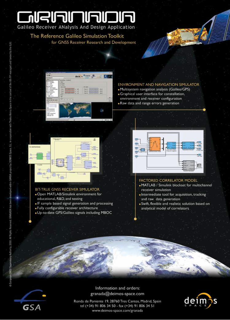
44 | October 2008