Embed Size (px)
Citation preview
A Year in Review

Density is a mathematical representation of how much “stuff” is within a certain area- the higher the number, the more tightly packed the molecules are
Less Dense More Dense
(less trees per area) (more trees per area)
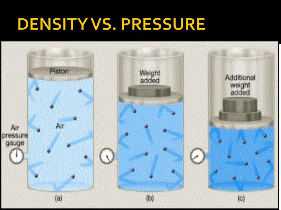
If you cut an object in half or double it in size, the density will remain the same
If you heat the object, the pressure will decrease (due to expansion) and the density will decrease (the molecules will have more room to spread out)
If you cool the object, the pressure will increase (due to contraction) and the density will increase (the molecules will have less room to spread out)

HSW: Hot Air Balloons!

If an object is less dense than water, it will float
If an object is more dense than water, it will sink
If an object is the same density as water, it will hang out in the middle

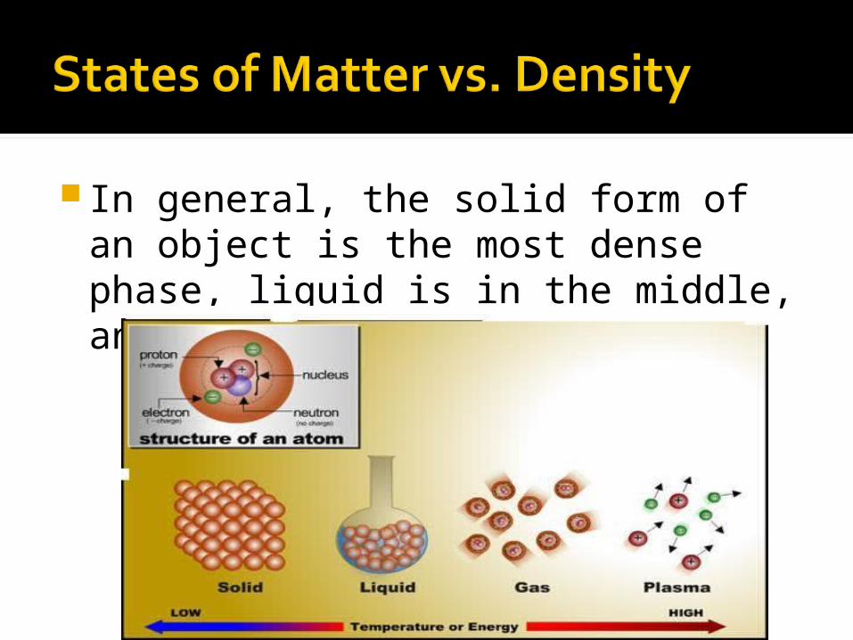
In general, the solid form of an object is the most dense phase, liquid is in the middle, and gas is the least dense.
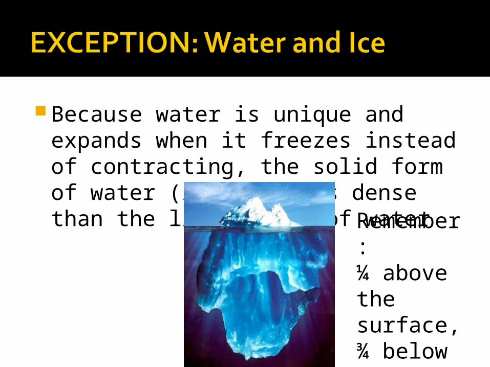
Because water is unique and expands when it freezes instead of contracting, the solid form of water (ice) is less dense than the liquid form of water Remembe
r: ¼ above the surface, ¾ below the surface
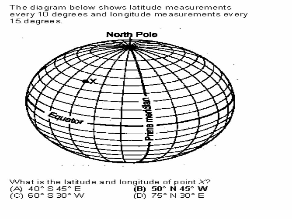
Lines run east to west, measuring north and south of the Equator (0 degrees)
Lines are parallel and equal: lines of latitude never cross and they are the same distance apart from north pole to south pole
All locations north of the Equator have the unit “N”, with the maximum being 90oN at the north pole
All locations south of the Equator have the unit
“ 0S”, with the maximum being 90oS at the south pole
As latitude increases or goes from 0 degrees to 90 degrees, the average surface temperatures decreases
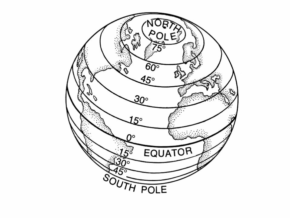

From the Equator to the north pole, the altitude of Polaris is EQUAL to the observers latitude. Remember that the units must then be oN

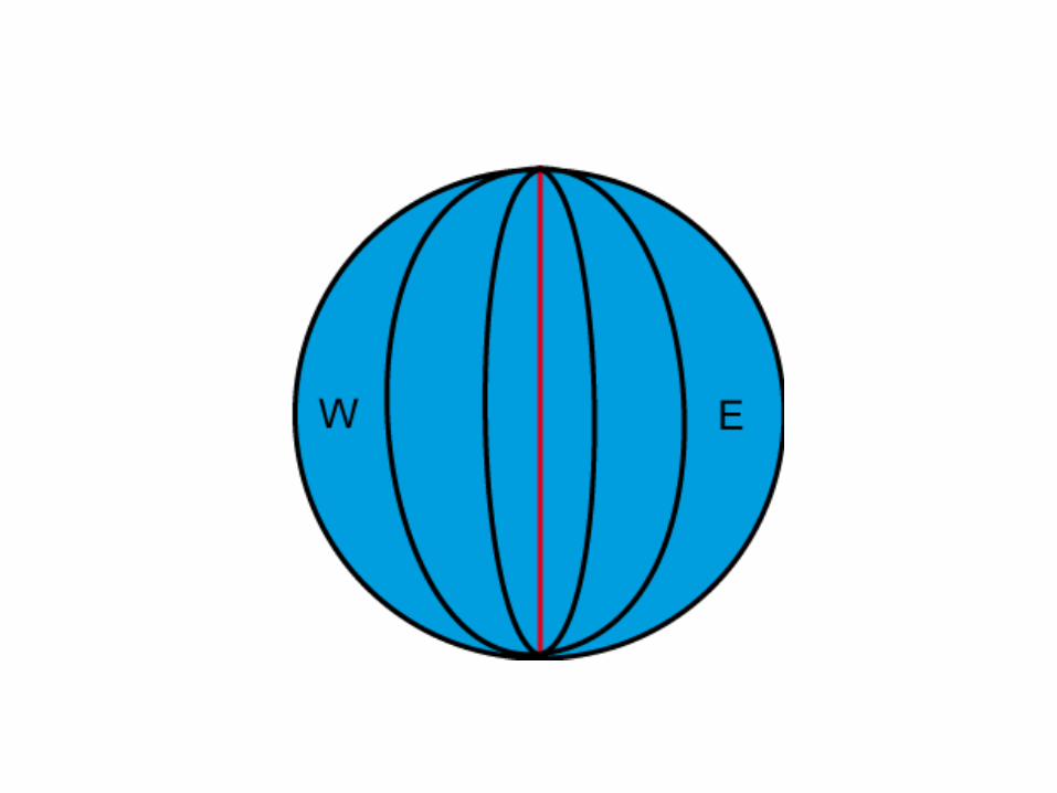
Run North to South and measure east and west of the Prime Meridian (o degrees longitude)
All lines of Longitude meet at the north and south poles
The maximum longitude is 180 degrees at the International Dateline (no units here either)
All points east of the Prime Meridian to the Dateline are oE and all point west of the Prime Meridian to the Dateline are oW
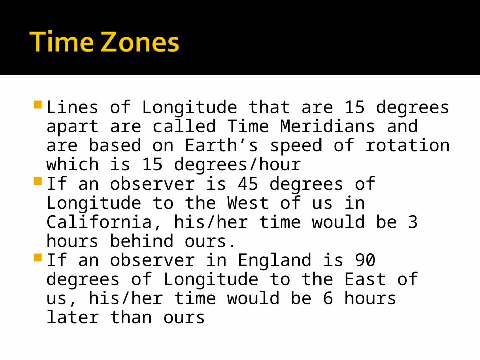
Lines of Longitude that are 15 degrees apart are called Time Meridians and are based on Earth’s speed of rotation which is 15 degrees/hour
If an observer is 45 degrees of Longitude to the West of us in California, his/her time would be 3 hours behind ours.
If an observer in England is 90 degrees of Longitude to the East of us, his/her time would be 6 hours later than ours
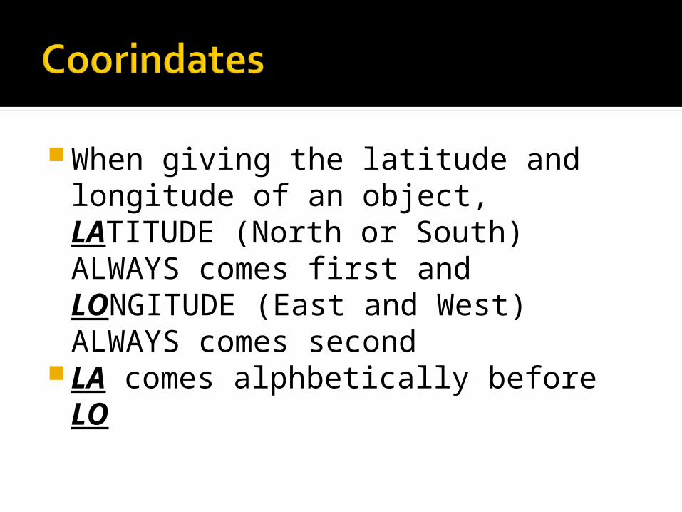
When giving the latitude and longitude of an object, LATITUDE (North or South) ALWAYS comes first and LONGITUDE (East and West) ALWAYS comes second
LA comes alphbetically before LO
Mostly in the short answer section Profiles are common Finding the Gradient is also common
(equation is on the front page of the ESRT: Difference in Elevation/Distance…. Read contour lines with interval to find difference in elevation and use the map scale to find distance)
The closer the contour lines, the steeper the slope

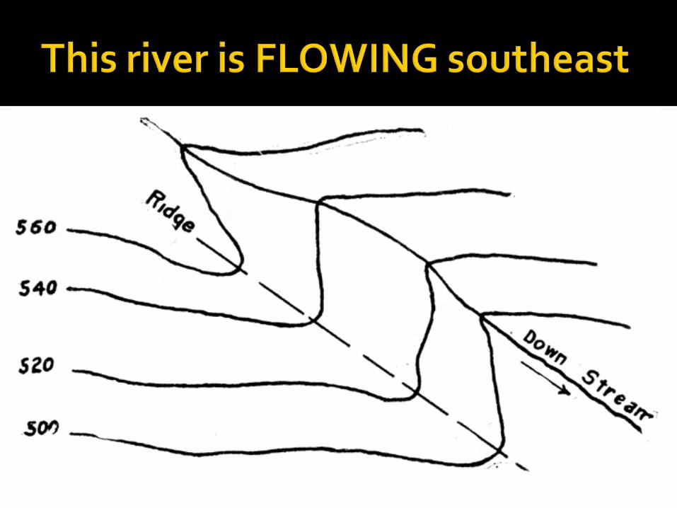
Streams always flow DOWNHILL and make a “V” in the contour lines
The point of the “V” points to where the water is coming FROM (the source)
Imagine the water pouring out of or flowing out of the V

In order from LARGEST to SMALLEST and OLDEST to YOUNGEST: Don’t forget your UGSS!- Universe Galaxy Solar System
The universe is still expanding as proven by the RED SHIFT. Lines on a spectrum are shifting to the RED END


Stars like our Sun are formed by the contraction of gases and run on nuclear fusion (the joining together of lighter elements like hydrogen to create heavier elements such as helium as well as large amount of energy)
We are closest to the Sun in January and farthest from the Sun in July. Therefore, distance from the sun has no effect on the seasons
We rotate around our axis (once per 24 hours or 15 degrees per hour) while we revolve around the sun (once per 365.25 days or 1 degree per day)
Earth’s rotation at 15 degrees per hour causes celestial objects (stars, plants, moon, etc) to appear to rise and set. This rate also causes celestial objects to appear to move at a rate of 15 degrees per hour.
If a star appears to move 45 degrees in the sky, then 3 hours have passed (45/15=3)

The closer an object is to another object, the stronger the gravitational pull, the faster the object will move
The larger the objects are, the stronger the gravitational pull, the faster the object will move.
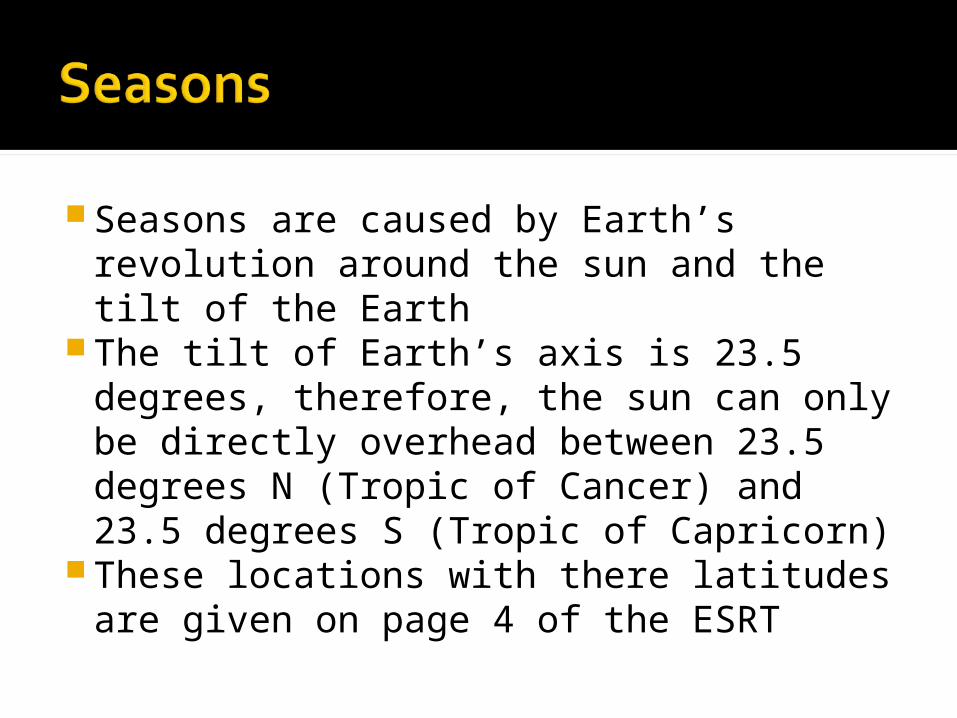
Seasons are caused by Earth’s revolution around the sun and the tilt of the Earth
The tilt of Earth’s axis is 23.5 degrees, therefore, the sun can only be directly overhead between 23.5 degrees N (Tropic of Cancer) and 23.5 degrees S (Tropic of Capricorn)
These locations with there latitudes are given on page 4 of the ESRT


The higher the angle of insolation, the longer the path, the more daylight, the warmer it is

Moon Phases are caused by the revolution of the Moon around the Earth
It takes 29.5 days for the moon to go through all the phases once (full moon back to full moon)
It takes 2 days LONGER for the moon to complete the phases than it takes for the moon to revolve once around Earth
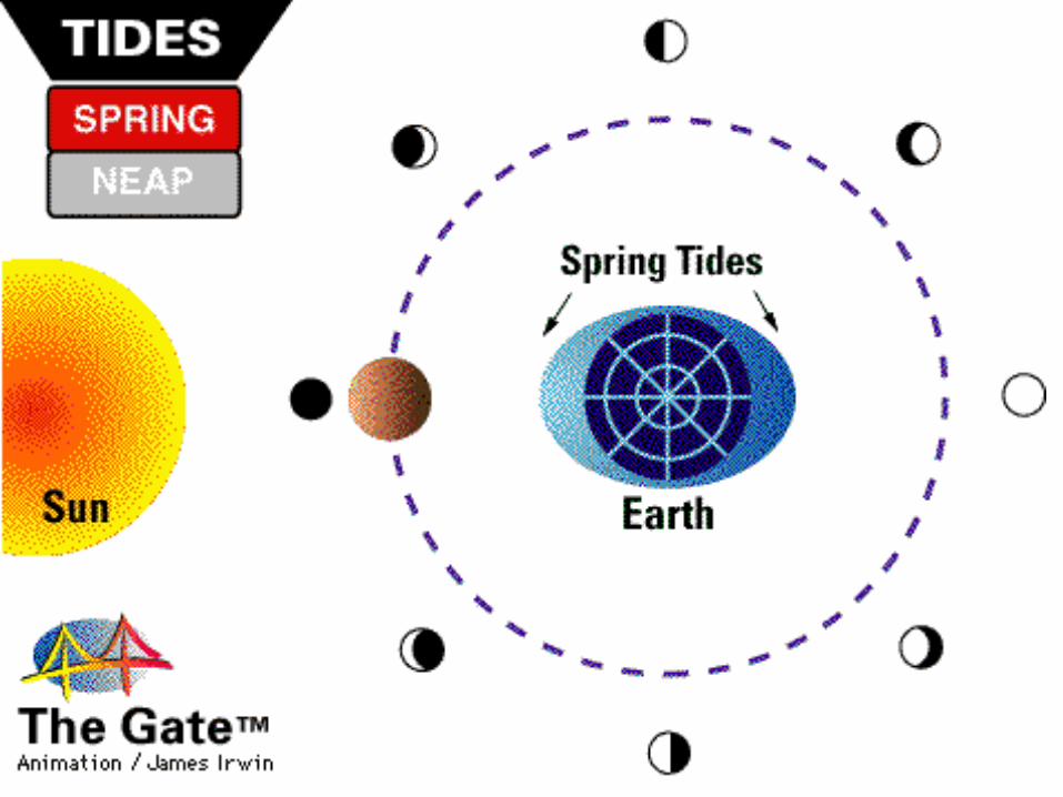
Spring tides (Highest high, lowest low) occur when the sun, the moon and the Earth are all in line

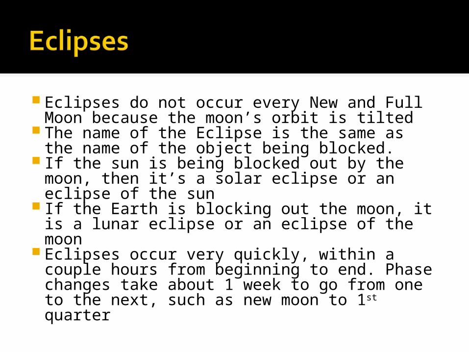
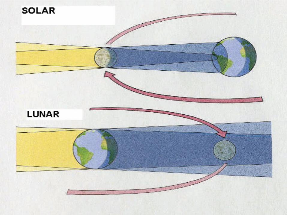
Eclipses do not occur every New and Full Moon because the moon’s orbit is tilted
The name of the Eclipse is the same as the name of the object being blocked.
If the sun is being blocked out by the moon, then it’s a solar eclipse or an eclipse of the sun
If the Earth is blocking out the moon, it is a lunar eclipse or an eclipse of the moon
Eclipses occur very quickly, within a couple hours from beginning to end. Phase changes take about 1 week to go from one to the next, such as new moon to 1st quarter

Direction of the shadow is always opposite of the location of the light source
The lower the sun is in the sky, the longer the shadow
At noon in NYS, the shadow will be short and to the north (sun is low in the sky to the south)
Morning, evening and winter=long shadowAround noon and summer= short shadow
The early atmosphere is thought to have come from volcanic eruptions
The layers of the atmosphere are in the ESRT
As altitude increases, moisture and pressure decrease.
Temperature varies with altitude depending on the layer
The troposphere is mostly nitrogen and some oxygen- ESRT page 1
A. Evaporation: changing from liquid to gas- adds moisture to atmosphere
B. Transpiration: Release of water vapor from plants- adds moisture to the atmosphere
C. Condensation: Changing from a gas to a liquid- takes moisture out of the atmosphere
D. Precipitation: Falling of rain, snow or ice from the clouds- Takes water out of the atmosphere
E. Runoff- Movement of water over the ground
F. Infiltration- Movement of water through the ground
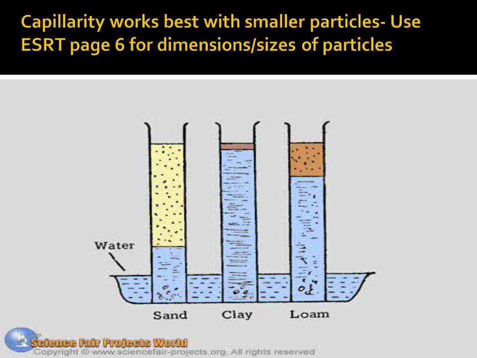
G. Capillary Action- Upward movement of water through the ground or through plants- works best with small particle sizes
H. Permeable- Ability to travel through a material- well-connected pores
I. Porosity- The amount of air space in a material- a material may be porous but impermeable because the pores aren’t well-connected


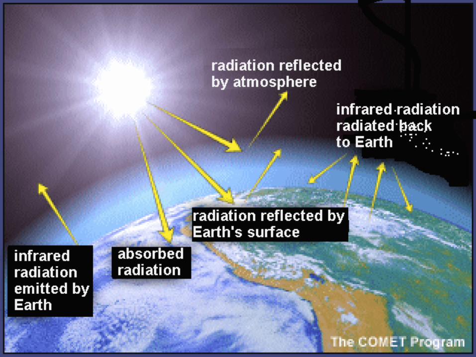
Absorbed and reflected by clouds- this makes the temperature cooler
Ultraviolet can be absorbed by ozone in the stratosphere protecting us from skin cancer- ozone is toxic for us at ground-level
Absorbed by the ground as ultraviolet and re-radiated as infrared (heat)
Reflected off water/light colored/ shiny/smooth surfaces
Absorbed by dark colored/bumpy surfaces Refraction- bent due to density differences


Methane, water vapor and carbon dioxide are greenhouse gases
These gases act like a trap to some outgoing infrared radiation from Earth’s surface
As greenhouse gases increase, the temperature also increases
A decrease in greenhouse gases or an increase in things to block out the sun (clouds, ash) causes the temperature to decrease

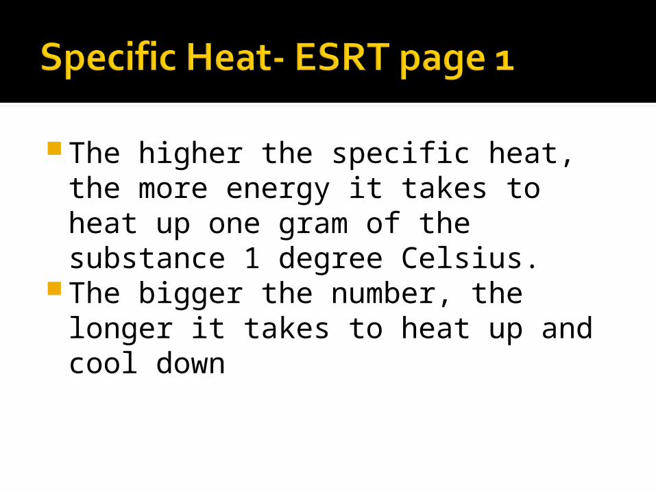
The higher the specific heat, the more energy it takes to heat up one gram of the substance 1 degree Celsius.
The bigger the number, the longer it takes to heat up and cool down
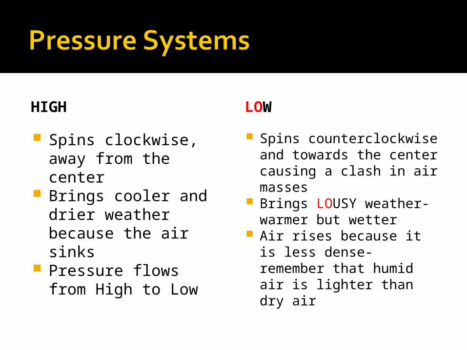
HIGH
Spins clockwise, away from the center
Brings cooler and drier weather because the air sinks
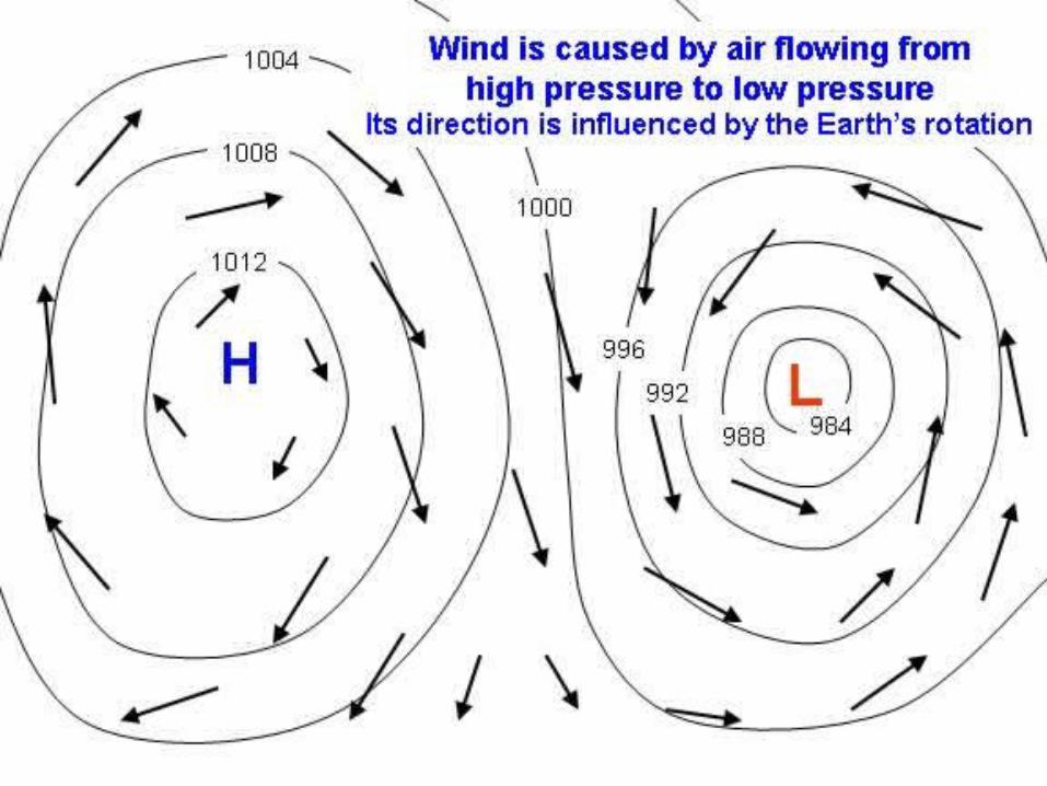
Pressure flows from High to Low
LOW
Spins counterclockwise and towards the center causing a clash in air masses
Brings LOUSY weather- warmer but wetter
Air rises because it is less dense- remember that humid air is lighter than dry air

Sea Breeze (breeze from the sea): Occurs during the day when the water is colder and has a higher pressure than the warmer, lower pressure land (remember pressure goes from high to low)
Land Breeze (breeze from the land): Occurs at night when the land is colder and has a higher pressure than the warmer, lower pressure water

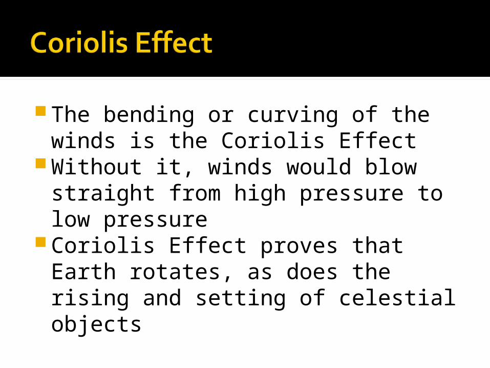
The bending or curving of the winds is the Coriolis Effect
Without it, winds would blow straight from high pressure to low pressure
Coriolis Effect proves that Earth rotates, as does the rising and setting of celestial objects


MARITIME=SEA=MOIST (m) CONTINENTAL=LAND=DRY (c)
TROPICAL=NEAR EQUATOR=WARM (T) POLAR=FROM CANADA=COLD (P)
Continental Arctic: Very cold, Very dry air mass
Fronts separate air masses
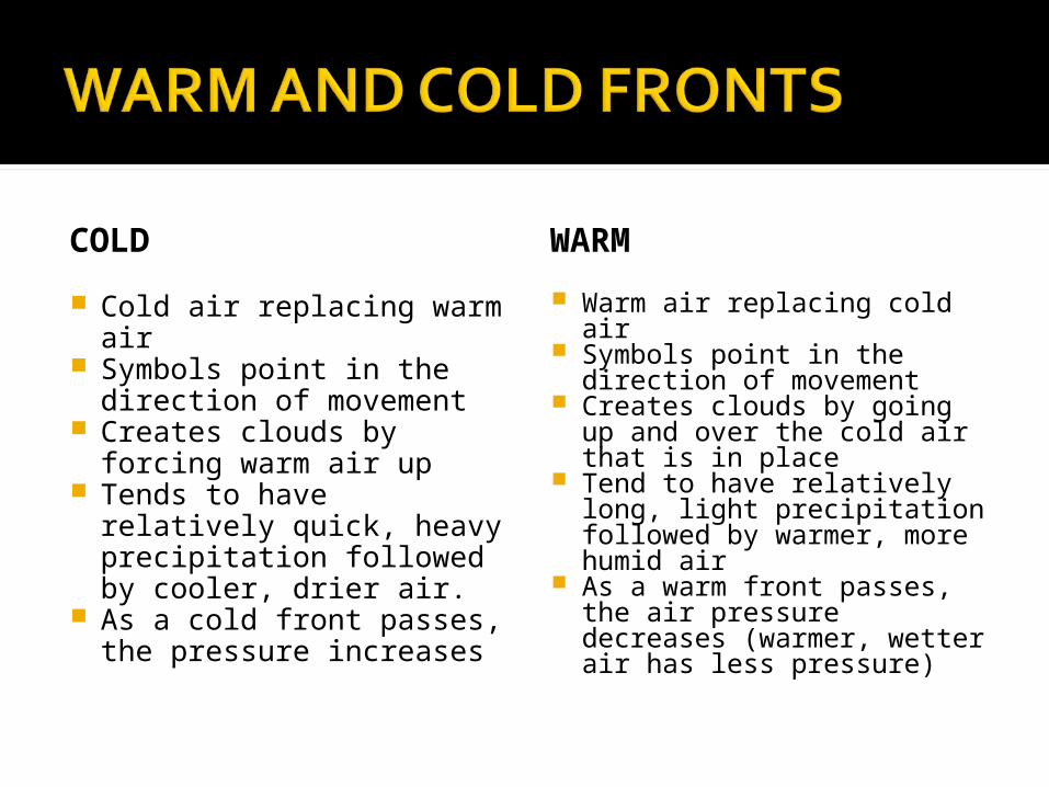
COLD
Cold air replacing warm air
Symbols point in the direction of movement
Creates clouds by forcing warm air up
Tends to have relatively quick, heavy precipitation followed by cooler, drier air.
As a cold front passes, the pressure increases
WARM
Warm air replacing cold air
Symbols point in the direction of movement
Creates clouds by going up and over the cold air that is in place
Tend to have relatively long, light precipitation followed by warmer, more humid air
As a warm front passes, the air pressure decreases (warmer, wetter air has less pressure)

The higher the temperature, the lower the pressure, the more moisture the air can hold
The lower the temperature, the higher the pressure, the less moisture the air can hold
The closer the temperature is to the dew point, the higher the humidity
When temperature and dew point are equal, the relative humidity is 100%
When temperature and dew point are not equal, use the ESRT!
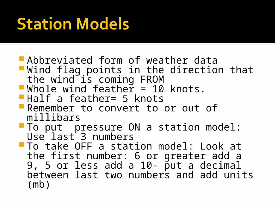
Abbreviated form of weather data Wind flag points in the direction that the
wind is coming FROM Whole wind feather = 10 knots. Half a feather= 5 knots Remember to convert to or out of
millibars To put pressure ON a station model:
Use last 3 numbers To take OFF a station model: Look at the
first number: 6 or greater add a 9, 5 or less add a 10- put a decimal between last two numbers and add units (mb)

Anemometer: Wind Speed Wind Vane: Wind Direction Barometer: Air Pressure Thermometer: Temperature Psychrometer: Humidity or Water
Contenta. Remember: as air evaporates, it takes
energy from the surface, making the surface colder. The drier the air, the faster liquids evaporate, the lower the wet-bulb temp. on the psychrometer
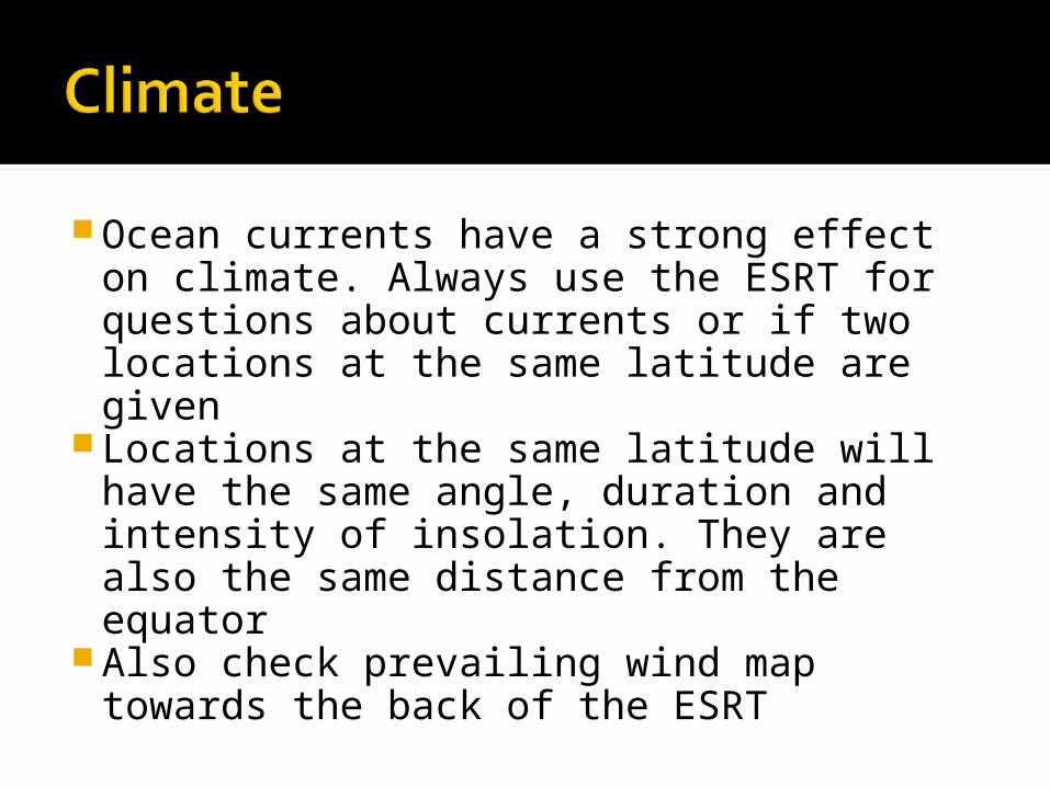
Ocean currents have a strong effect on climate. Always use the ESRT for questions about currents or if two locations at the same latitude are given
Locations at the same latitude will have the same angle, duration and intensity of insolation. They are also the same distance from the equator
Also check prevailing wind map towards the back of the ESRT

Higher the elevation, the colder the temperature
Locations closer to a large body of water will have moderated temperatures: warmer winters and cooler summers
Windward sides of mountains (faces the prevailing winds) will have colder, wetter climates
Leeward sides of mountains will have warmer, drier climates


As air rises, it expands due to less pressure, cools due to the spreading out of heat energy and may reach the dew point.
When temperature = dew point, clouds form

Physical Weathering: Changes the size or shape of something without changing what it is made of
a.Examples: Abrasion, Frost Action, Exfoliation, Plant Action
Chemical Weathering: Changes what the object is made up of
a. Examples: Oxidation (rusting), Hydrolysis (interaction with water), Dissolution (acid rain)

Rate of Weathering is affected by: Exposed surface area, composition and climate
Hot and humid climates support chemical weathering the most-marked by rounded landscapes

The longer something has been subjected to weathering and erosion, the smaller and rounder it will be
Anything that changes in speed in a relatively short amount of time will sort sediments: largest first, smallest last.
a.Examples: Wind and Running Water Anything that does not change energy
will NOT sort sedimentsa. Examples: Glaciers and Gravity


Discharge: Volume or amount of water- increases with precipitation and melting of frozen precipitation
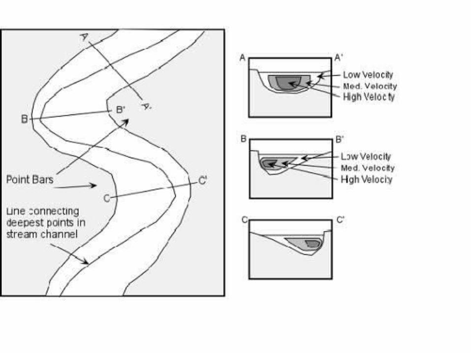
Rivers flow the fastest on the outside of the bend/meander and slowest on the inside- think of going down a slide! You go towards the outside of the curves because it’s faster. If you go towards the inside, you’ll go slower or get stuck….or in Earth Science-Speak, get deposited or left off!
Outside Curve=Faster= Higher Erosion (moving away), Lower Deposition (leaving off)
Inside Curve = Slower= Lower Erosion, Higher Deposition
Straight part of channel: Flows fastest in the middle just below the surface

The last glacier to cover NYS occurred relatively recently (use your ESRT!)
Glaciers formed Long Island (two moraines- moraines form where glaciers stop moving for a period of time) and the Finger Lakes
Evidence of Glaciers in NYS are: U-Shaped valleys, Erratics (large random boulders away from streams and rivers), striations (scratch marks) and drumlins (rounded, steep side faces direction from which the glacier came)

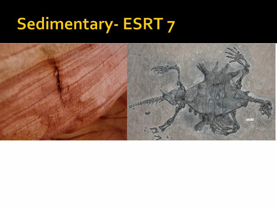
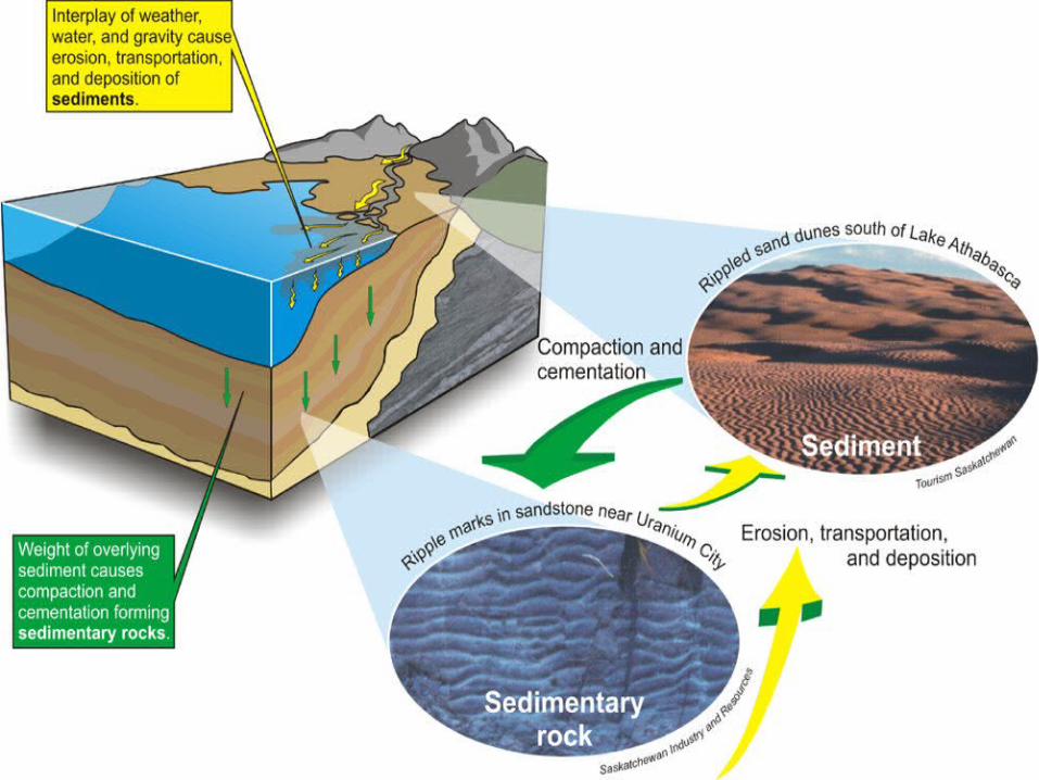
Sedimentary: Forms from the compaction and cementation of sediments- Check out ESRT page 7!
a. Coal: dead plants->peat->buried ->compacted->coal
b. Sedimentary are the only rocks to have fossilsc. Sediments are usually deposited in water
environments like lakes, oceans, streams and rivers
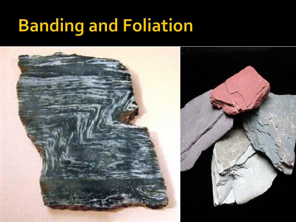
Metamorphic- “change form”- changing of a rock due to heat or heat/pressure without melting. Distorts rocks, destroys any fossils
a. Foliation, banding and mineral alignment is a key characteristic

Igneous: Solidification of molten/liquid rocks. Air pockets and glassy texture are key characterstics

Boxes=Rock TypeOvals= “Ingredients”Arrows=Processes


CONTACT
Occurs at the border of an intrusion and pre-existing rock
Marked with lines
REGIONAL
Usually caused by the “squeezing” together of land masses or sinking of an oceanic plate under a continental plate


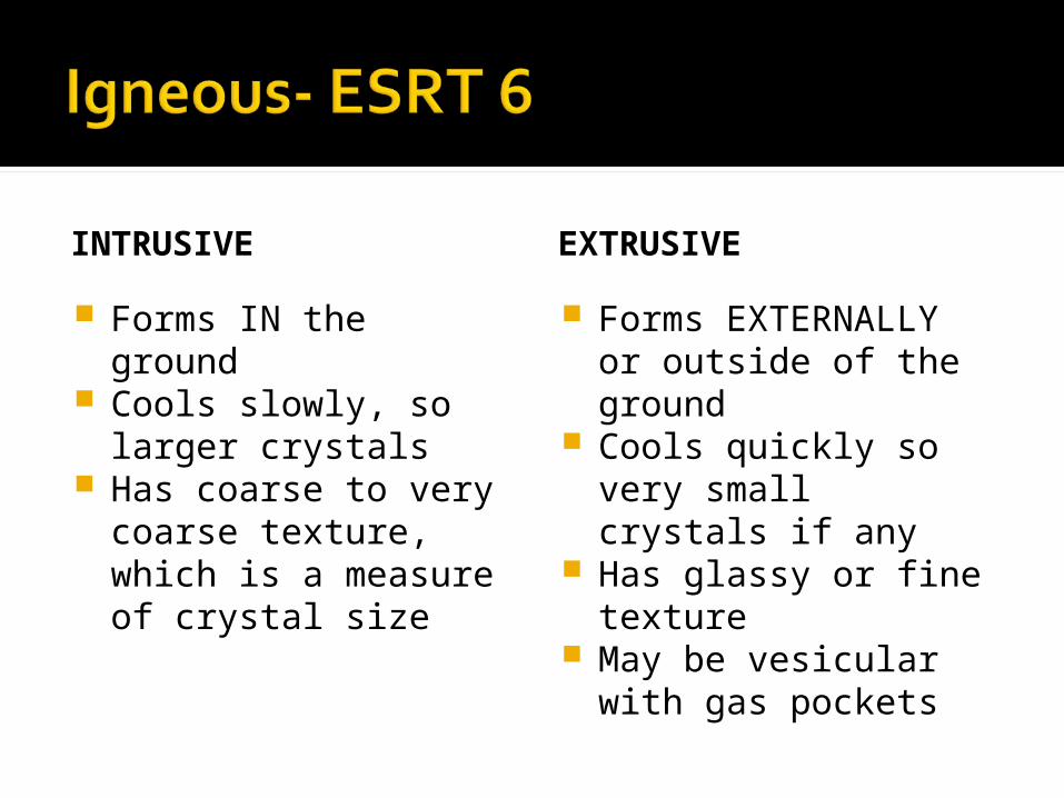
INTRUSIVE
Forms IN the ground Cools slowly, so larger
crystals Has coarse to very
coarse texture, which is a measure of crystal size
EXTRUSIVE
Forms EXTERNALLY or outside of the ground
Cools quickly so very small crystals if any
Has glassy or fine texture
May be vesicular with gas pockets


Typically occur along plate boundaries- ESRT page 5
Subduction Boundary: Two plates collide, denser one sinks (usually oceanic), forms volcano on over-riding plate (the one that doesn’t sink)

Collision: Occurs when two plates collide, neither sinks

Divergent: Two plates spread apart- main divergent boundaries are located in the center of oceans

Transform: Two plates sliding past each other- occurring in California
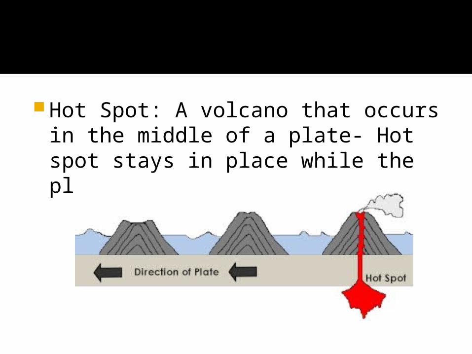
Hot Spot: A volcano that occurs in the middle of a plate- Hot spot stays in place while the plate moves over the hot spot

P-Waves: First to arrive- can travel through solids, liquids and gases. Move side-to-side
S-Waves: Second to arrive- can ONLY travel through solids- move at right angles to direction of movement
Shadow-Zone: Area opposite of epicenter that does not receive p-waves or s-waves


Oldest rocks are on bottom and youngest on top as long as they haven’t been disturbed
Rocks are deposited in flat, horizontal layers in a water environment- if folded or faulted, something has changed them
Something has to be there before anything can happen to it
Something within a rock has to be older than the rock itself
Unconformities are gaps in the geologic record, typically caused by erosion, tilting, and faulting
Index Fossils: Widespread, short geologic time in existence, commonly found- help give a more exact age

In this diagram, B and D are the same age, as well as C and F. Layer E is missing from the first group, as shown by the unconformity. Layer A may not have been deposited in the second column
The amount of time it takes for half of a radioactive element to turn into a stable element
Half life is a constant and is given on page 1 of the ESRT- nothing will change the half life of a substance, although half-life varies between substances
Use carbon for anything that comes from a plant or animal
Use Uranium or Rubidium for anything from Earth’s early geologic history- it’s half life is too long for relatively recent events, but long enough for older events

It can be your best friend on the Regents and give you answers or clues to 40% or more of the test!