Embed Size (px)
Citation preview
A WORLDSAFE FROM
NATURAL DISASTERS
The Journey of Latin America and the Caribbean
Pan American Health OrganizationPan American Sanitary Bureau, Regional Office of the
World Health Organization
International Decade for Natural Disaster ReductionRegional Office for Latin America and the Caribbean
Also published in Spanish (1994) under the title:Hacia un mundo más seguro frente a los desastres naturales: la trayectoria de América Latina y el Caribe
ISBN 92 75 12114 1
© Pan American Health Organization, 1994
The views expressed, the recommendations formulated, and the designationsemployed in this publication do not necessarily reflect the current policies or opinionsof the IDNDR Secretariat or the Pan American Health Organization or of its MemberStates.
The Pan American Health Organization welcomes requests for permission toreproduce or translate, in part or in full this publication. Applications and inquiriesshould be addressed to the Emergency Preparedness and Disaster Relief CoordinationProgram, Pan American Health Organization, 525 23rd St., NW, Washington, D.C. 20037,U.S.A.; Fax: (202) 775-4578 or Internet: [email protected].
The printing of this publication was made possible with the financial support of theOverseas Development Administration of the United Kingdom (ODA), the Canadian International Development Agency (CIDA), and the Office of U.S. Foreign Disaster Assistance of the United States Agency for International Development (OFDA/USAID,Grant No. AOT-3507-G-00-3188-00).
The 1990s has been declared the International Decade for Natural DisasterReduction (IDNDR). The mid-point in this International Decade and the WorldConference on Natural Disaster Reduction provide a golden opportunity to
showcase the progress of Latin America and the Caribbean in reducing the impact ofdisasters on life and property. It is also an appropriate time to suggest areas in need ofadditional attention at the national level during the second half of the Decade andbeyond.
During the first half of the IDNDR, each country in Latin America and the Caribbeanmade significant progress in the field of disaster management, or as we call it today,disaster reduction. However, this journey toward a safer Region by no means began in1990.
The principal purpose of this publication is to remind policy makers and theinternational community that a modest but sustained investment in disaster reduction inLatin America and the Caribbean has saved, and will continue to save, in a non-dramaticbut effective way, a large number of lives and avoid tragedies which would otherwisedrain resources for humanitarian assistance. A second purpose is to share the optimismand enthusiasm of disaster professionals at witnessing a slow but steady evolution in theRegionÛfr om the fatalistic acceptance of disasters to the determination to take steps toavoid them whenever possible or minimize their effects through long-term disasterreduction planning.
Natural disasters will continue to impact critical facilities such as hospitals andschools, public infrastructure and housing. However, we can reduce the vulnerability ofour communities to these natural hazards, that is, the potential losses can bedramatically diminished, by selecting safer locations and improving design andconstruction techniques and, most importantly, by ensuring that development decisionsimpact positively on vulnerability. The technical knowledge necessary to reduce risksfrom natural disasters has been available for some time.
The most lasting effect of the IDNDR could and should be to establish a disasterprevention Ïcultur eÓ in which safety fr om disasters is recognized as a basic requirementof individuals and of society in order to attain a Ïcomplete state of physical and mentalwell-beingÓ or , in other words, health, as defined by the Alma-Ata Conference of 1978.
Carlyle Guerra de MacedoDirectorPan American Sanitary Bureau
FOREWORD
iii
A myriad of people, initiatives and projects have fashioned the disaster manage-ment programs in this Region. No single agency or expert can possibly have an overall view of the multisectoral field of disaster prevention, mitigation, and
preparedness. This publication attempts to outline broad trends and highlight the mostsignificant events that have marked the long journey of the countries of Latin Americaand the Caribbean toward safety from disasters. Unfortunately, most of these significantevents have been tragedies that caused loss of life and property—tragedies that werepreventable.
This document is the result of a collaborative effort of the staff of the IDNDR Office forLatin America and the Caribbean and the Emergency Preparedness and Disaster ReliefCoordination Program of PAHO/WHO. They have been assisted by literally hundreds ofofficials in the countries, experts, and representatives of agencies who dedicated theirtime and effort, provided data and documentation, met with consultants and laboriouslyreviewed the draft circulated at the Inter-American Conference in Cartagena, Colombia,in March, 1994. Every effort has been made to acknowledge specific sources ofinformation. We apologize should any contributor or contribution not be properlyrecognized.
Again, without the support and cooperation of disaster experts and officialsthroughout Latin America and the Caribbean, the United Nations system, and bilateraland regional organizations, neither the progress achieved toward disaster reduction inLatin America and the Caribbean during the last 15 years nor, consequently, this bookwould have been possible.
Claude de Ville de GoyetEditor-in-Chief
ACKNOWLEDGEMENTS
iv
DEDICATION
This book is dedicated to the scientists who lost their lives in theeruption of the Galeras Volcano, one of the seven “Volcanoes of theDecade”, in Colombia in 1993, as well as to the nationals in Latin
America and the Caribbean who have enthusiastically dedicated theirprofessional lives to promoting disaster prevention and preparedness
in their countries.
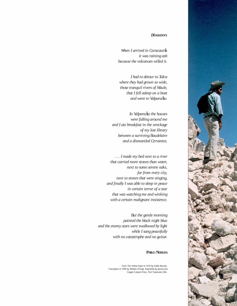
Disasters
When I arrived in CuracautÃnit was raining ash
because the volcanoes willed it.
I had to detour to Talcawhere they had grown so wide,those tranquil rivers of Maule,
that I fell asleep on a boatand went to ValparaÃso.
In ValparaÃso the houseswere falling around me
and I ate breakfast in the wreckageof my lost library
between a surviving Baudelaireand a dismantled Cervantes.
. . . I made my bed next to a riverthat carried more stones than water,
next to some serene oaks,far from every city,
next to stones that were singing,and finally I was able to sleep in peace
in certain terror of a starthat was watching me and winking
with a certain malignant insistence.
But the gentle morningpainted the black night blue
and the enemy stars were swallowed by lightwhile I sang peacefully
with no catastrophe and no guitar.
PABLO NERUDA
From The Yellow Heart © 1974 by Pablo Neruda.Translation © 1990 by William O?Daly. Reprinted by permission
Copper Canyon Press, Port Townsend, WA.
CONTENTS
vi
NO SHORTCUTS TO DISASTER REDUCTION
From Ad Hoc Response to Preparedness ......... 1From Preparedness to Prevention .................. 2A New Focus ................................................. 3
AN OVERVIEW OF THE REGION
The People and Their History .......................... 5Geography ...................................................... 6
Climate ................................................................................................................ 9Demographic Trends .......................................................................................... 10Urbanization ....................................................................................................... 10Production ............................................................................................................ 12Socioeconomic Aspects ..................................................................................... 13Health, Sanitation, and Education ....................................................................... 15The Political Process .......................................................................................... 17Conclusions ....................................................................................................... 19
WHAT PUTS LATIN AMERICA AND THE CARIBBEAN AT RISK?Natural Hazards in Latin America and the Caribbean ........................................... 23Geological Hazards ............................................................................................... 23Hydrometeorological Hazards ............................................................................. 27Vulnerability ........................................................................................................ 33The Relationship Between Disaster and Development ......................................... 37Risk in Latin America and the Caribbean ............................................................. 39
THE WAKE-UP CALL: FROM IMPROVISATION
TO RESPONSE PLANNING
The Evolution of National Response Organizations .......................... 42The Evolution of International Assistance ....................................... 44New Ideas for Answering an Old Call ............................................. 48Conclusions .................................................................................... 49
CHAPTER 1 1
CHAPTER 2 5
CHAPTER 3 21
CHAPTER 4 41
Cover photo:de Ville de Goyet, PAHO/WHO
Foreword ............................................................................................................ iiiAcknowledgements ............................................................................................... iv
vii
CHAPTER 5 51
DISASTER PREPAREDNESS TAKES CENTER STAGE
The Centralized Phase: Strengthening Relief Agencies .......................................... 51The Decentralized Phase: Preparedness of Public Sectors and the Community ...... 52Preparedness as a Multisectoral Task .................................................................... 52Legal Evolution of Disaster Preparedness ............................................................ 54Community Organization ....................................................................................... 55Collaboration Between Countries Strengthens Preparedness ................................. 57Training: A Key to Preparedness ............................................................................ 60The Current Situation: From Preparedness to Prevention and Mitigation ............... 63Specialized Preparedness Initiatives ..................................................................... 63The Moral of Preparedness .................................................................................. 71
ONE STEP AHEAD OF DISASTERS: MITIGATION AND PREVENTION
Disaster Mitigation: Maps and Scenarios for Planning ................................................... 76
Disaster Mitigation and the Environment .......... 80Mitigating the Effects of Disaster
on Infrastructure ......................................... 81The Actors--Gathering and Applying
Knowledge ................................................... 86Disaster: A Window of Opportunity ................... 90Conclusions: Disaster Mitigation Is Irreversible . 90
LOOKING TOWARD THE FUTURE
Toward Natural Disaster Reduction ..................................................................... 94The Factors ......................................................................................................... 101The Second Half of the Decade. . .and Beyond ...................................................... 102Map of the Region ................................................................................................ 104
References ............................................................................................................ 107Acronyms ............................................................................................................. 111
CHAPTER 6 72
CHAPTER 7 94
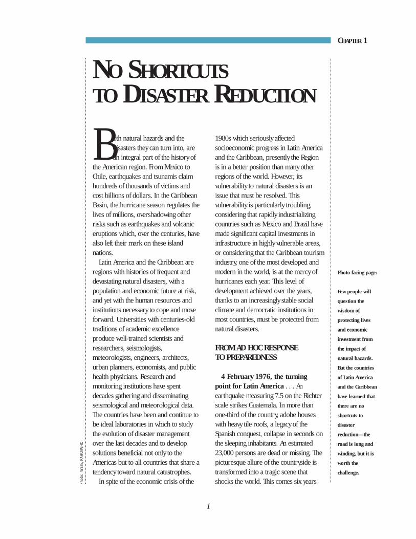
Both natural hazards and thedisasters they can turn into, arean integral part of the history of
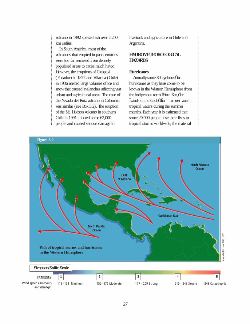
the American region. From Mexico toChile, earthquakes and tsunamis claimhundreds of thousands of victims andcost billions of dollars. In the CaribbeanBasin, the hurricane season regulates thelives of millions, overshadowing otherrisks such as earthquakes and volcaniceruptions which, over the centuries, havealso left their mark on these islandnations.
Latin America and the Caribbean areregions with histories of frequent anddevastating natural disasters, with apopulation and economic future at risk,and yet with the human resources andinstitutions necessary to cope and moveforward. Universities with centuries-oldtraditions of academic excellenceproduce well-trained scientists andresearchers, seismologists,meteorologists, engineers, architects,urban planners, economists, and publichealth physicians. Research andmonitoring institutions have spentdecades gathering and disseminatingseismological and meteorological data.The countries have been and continue tobe ideal laboratories in which to studythe evolution of disaster managementover the last decades and to developsolutions beneficial not only to theAmericas but to all countries that share atendency toward natural catastrophes.
In spite of the economic crisis of the
CHAPTER 1
1980s which seriously affectedsocioeconomic progress in Latin Americaand the Caribbean, presently the Regionis in a better position than many otherregions of the world. However, itsvulnerability to natural disasters is anissue that must be resolved. Thisvulnerability is particularly troubling,considering that rapidly industrializingcountries such as Mexico and Brazil havemade significant capital investments ininfrastructure in highly vulnerable areas,or considering that the Caribbean tourismindustry, one of the most developed andmodern in the world, is at the mercy ofhurricanes each year. This level ofdevelopment achieved over the years,thanks to an increasingly stable socialclimate and democratic institutions inmost countries, must be protected fromnatural disasters.
FROM AD HOC RESPONSE TO PREPAREDNESS
4 February 1976, the turningpoint for Latin America . . . Anearthquake measuring 7.5 on the Richterscale strikes Guatemala. In more thanone-third of the country, adobe houseswith heavy tile roofs, a legacy of theSpanish conquest, collapse in seconds onthe sleeping inhabitants. An estimated23,000 persons are dead or missing. Thepicturesque allure of the countryside istransformed into a tragic scene thatshocks the world. This comes six years
Photo facing page:
Few people will
question the
wisdom of
protecting lives
and economic
investment from
the impact of
natural hazards.
But the countries
of Latin America
and the Caribbean
have learned that
there are no
shortcuts to
disaster
reduction—the
road is long and
winding, but it is
worth the
challenge.
1
NO SHORTCUTSTO DISASTER REDUCTION
Phot
o: W
aak,
PAH
O/W
HO
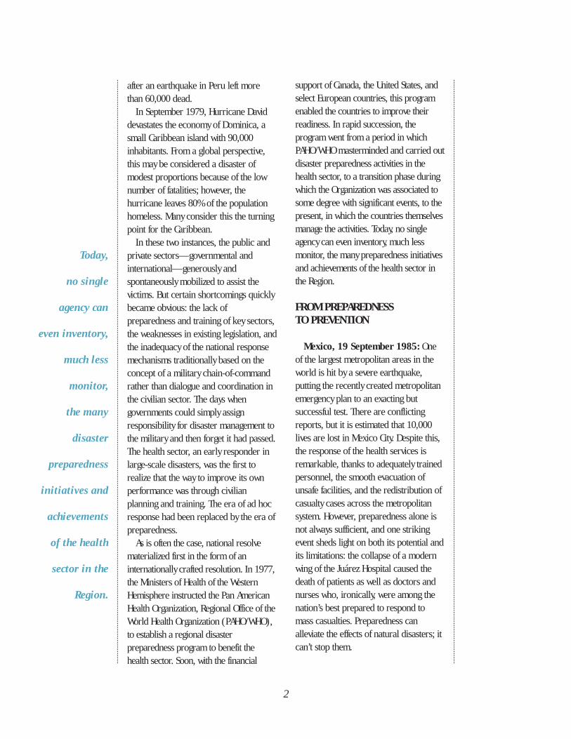
Today,
no single
agency can
even inventory,
much less
monitor,
the many
disaster
preparedness
initiatives and
achievements
of the health
sector in the
Region.
support of Canada, the United States, andselect European countries, this programenabled the countries to improve theirreadiness. In rapid succession, theprogram went from a period in whichPAHO/WHO masterminded and carried outdisaster preparedness activities in thehealth sector, to a transition phase duringwhich the Organization was associated tosome degree with significant events, to thepresent, in which the countries themselvesmanage the activities. Today, no singleagency can even inventory, much lessmonitor, the many preparedness initiativesand achievements of the health sector inthe Region.
FROM PREPAREDNESS TO PREVENTION
Mexico, 19 September 1985: Oneof the largest metropolitan areas in theworld is hit by a severe earthquake,putting the recently created metropolitanemergency plan to an exacting butsuccessful test. There are conflictingreports, but it is estimated that 10,000lives are lost in Mexico City. Despite this,the response of the health services isremarkable, thanks to adequately trainedpersonnel, the smooth evacuation ofunsafe facilities, and the redistribution ofcasualty cases across the metropolitansystem. However, preparedness alone isnot always sufficient, and one strikingevent sheds light on both its potential andits limitations: the collapse of a modernwing of the Juárez Hospital caused thedeath of patients as well as doctors andnurses who, ironically, were among thenation’s best prepared to respond tomass casualties. Preparedness canalleviate the effects of natural disasters; itcan’t stop them.
after an earthquake in Peru left morethan 60,000 dead.
In September 1979, Hurricane Daviddevastates the economy of Dominica, asmall Caribbean island with 90,000inhabitants. From a global perspective,this may be considered a disaster ofmodest proportions because of the lownumber of fatalities; however, thehurricane leaves 80% of the populationhomeless. Many consider this the turningpoint for the Caribbean.
In these two instances, the public andprivate sectors—governmental andinternational—generously andspontaneously mobilized to assist thevictims. But certain shortcomings quicklybecame obvious: the lack ofpreparedness and training of key sectors,the weaknesses in existing legislation, andthe inadequacy of the national responsemechanisms traditionally based on theconcept of a military chain-of-commandrather than dialogue and coordination inthe civilian sector. The days whengovernments could simply assignresponsibility for disaster management tothe military and then forget it had passed.The health sector, an early responder inlarge-scale disasters, was the first torealize that the way to improve its ownperformance was through civilianplanning and training. The era of ad hocresponse had been replaced by the era ofpreparedness.
As is often the case, national resolvematerialized first in the form of aninternationally crafted resolution. In 1977,the Ministers of Health of the WesternHemisphere instructed the Pan AmericanHealth Organization, Regional Office of theWorld Health Organization (PAHO/WHO),to establish a regional disasterpreparedness program to benefit thehealth sector. Soon, with the financial
2
Colombia, 13 November 1985: TheNevado del Ruiz volcano, active forseveral months, erupts violently. Withinan hour, a mudslide triggered by meltingsnow, gathers rocks and other debris as itmakes its way down the slopes of themountain, burying an estimated 23,000people. Compounding the national trage-dy, a bitter controversy divides scientistsand politicians about whether the humanlosses could have been prevented. Thefact that maps of the at-risk areas wereavailable but people were not movedfrom them illustrates the growing gapbetween the academic knowledge ofnatural hazards and how this knowledgeis translated into potentially life-saving,but costly, preventive measures.
A NEW FOCUS
These tragedies demonstrated clearlythat vertically organized responseoperations to emergencies hadlimitations. Soon, both Mexico andColombia established highly professionalpublic institutions responsible fordisaster prevention, mitigation,preparedness, and response. Othercountries took similar steps. Costa Rica, asmall nation with a constitution thatforbids an army, strengthened itsemergency commission, addingprofessionals experienced in urbanplanning, sociologists, engineers, andarchitects.
Regionally, PAHO/WHO redirected itsdisaster program to address the safety ofhealth facilities and to promotecomprehensive mitigation policies so thatlosses, such as those experienced at thesite of the Juárez Hospital in Mexico,would not occur again. Similarly, theDepartment of Regional Development andEnvironment of the Organization of
American States (OAS) included a dynamiccomponent on incorporating risk factorsinto the socioeconomic development of itsmember countries. The era of disasterprevention and mitigation had begun inLatin America.
In the Caribbean, despite differentrisks, a different culture, and a distinctdisaster history, the countries nonethelesscame to similar conclusions. In theaftermath of Hurricane David (1979),UNDRO, the Office of the UN DisasterRelief Coordinator (now the UNDepartment of Humanitarian Affairs –DHA), together with the Secretariat of theCaribbean Community (CARICOM), theInternational Federation of Red Cross andRed Crescent Societies, and PAHO/WHO,with support from bilateral agencies,established the Pan-Caribbean DisasterPreparedness and Prevention Project(PCDPPP). For nine years, thisinternationally funded project served allthe countries of this subregion. A majorachievement of PCDPPP was the develop-ment of a strategic group of professionalsand decision makers who were sensitizedto the need for a genuine local commit-ment to disaster management. HurricaneGilbert in Jamaica (1988) and HurricaneHugo in the eastern Caribbean (1989)acted as catalysts for the creation of abona fide subregional response agency:the Caribbean Disaster EmergencyResponse Agency (CDERA).
Disaster Mitigation and Preventionand the IDNDR
In decades past, disastermanagement—or “disaster reduction” asit is now called—was never recognizedas a professional activity or a scientificfield in its own right. Often, thoseworking in the field were labeled as well-intentioned amateurs. The advent of the
3
International Decade for Natural DisasterReduction (IDNDR) changed that,providing practitioners at the nationallevel with the international credentialsthey lacked. Gradually, the Decade hasweeded out those practitionersóamateurs and professionalsó who havefailed to master new methods andtechniques, or who cling to the old waysof equating disaster prevention andmitigation with stockpiling equipment,blankets, and old clothing. The IDNDR'semphasis on engineering and planningsends a strong message that traditionalsystems geared for relief operations mustbe replaced with a more development-oriented structure.
This Region's vast experience indealing with natural hazards has taught itthat there are no shortcuts to disasterreduction. Rather, countries must journeyalong a winding path of sustainabledevelopment, a path where progress ismade as countries recognize that disastermanagement is more than a simplelogistic exercise. It is a development andplanning responsibility, a responsibilitycalling for multidisciplinary collabor-ation. In Latin America and the Caribb-ean, the path from ad hoc response topreparedness and later to prevention andmitigation has been the result of a longmaturation process. There are no easyshortcuts on the road from a carelesssociety to a responsible adult nation.
Disaster reduction is too serious amatter to leave to the experts, be theyscientists or disaster managers. The mostimportant contribution of the IDNDR inLatin America and the Caribbean hasbeen to accelerate the transition into thenew era of integrated disaster reductionand development, where the entiresociety cooperates in reaching a commonobjective: building a safer world for all. ◆
4
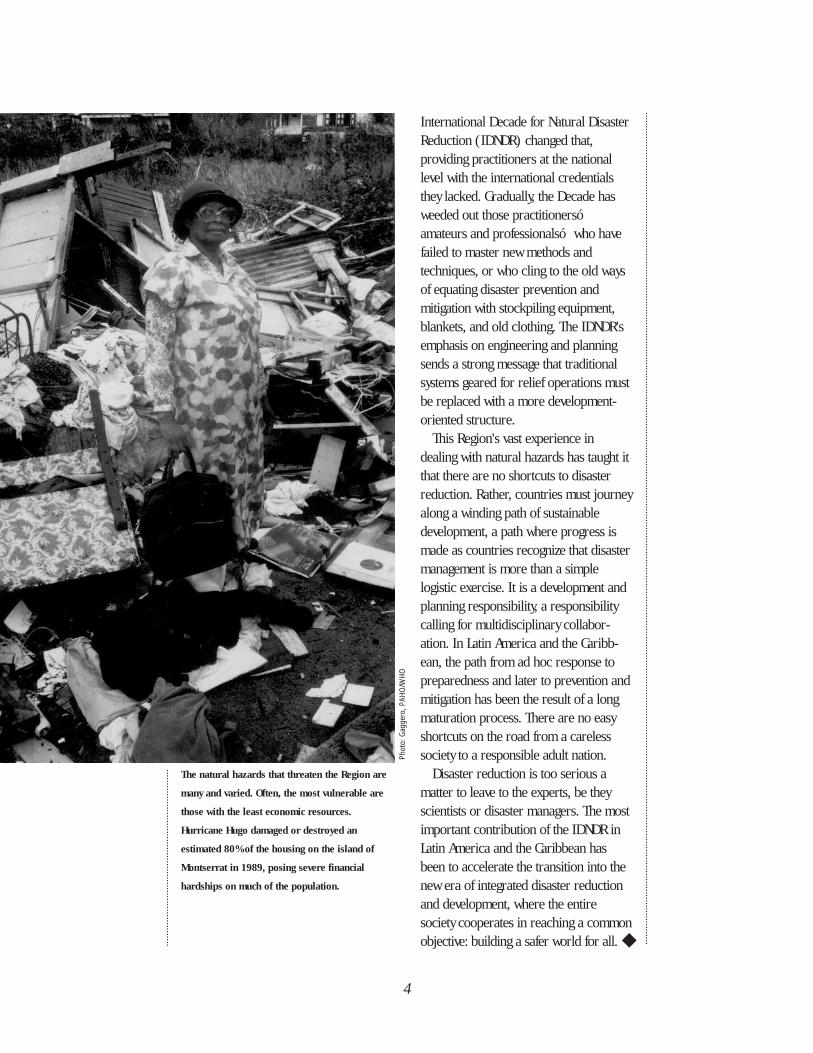
The natural hazards that threaten the Region are
many and varied. Often, the most vulnerable are
those with the least economic resources.
Hurricane Hugo damaged or destroyed an
estimated 80% of the housing on the island of
Montserrat in 1989, posing severe financial
hardships on much of the population.
Phot
o: G
agge
ro, P
AHO/
WHO
When a country decides toinvest time, energy, andresources to reduce the
effects of natural disasters, it must takeinto account the relationship between thedesired outcome and its own capabilitiesand limitations. The level of economic,political and cultural development of asociety determines the type of disastermanagement it should pursue. Thischapter presents an overview of thehuman and physical environment of thecountries of the Region of the Americaswhere disasters strike frequently andviolently. Although Canada and the UnitedStates form part of this Region, for thepurpose of this publication we arespeaking of the developing countries andterritories of Latin America and theCaribbean.
Unlike the myriad, distinct societiesand economies found in Africa, orthroughout Asia or Europe, the majorityof people of Latin America share acommon language, religion, arts andcustoms due to strong Spanish andPortuguese influence. Likewise, in thelarger Caribbean islands, the Spanishhave had extensive impact, but African,British, Dutch, East Indian, and Frenchinfluences also prevail. Despite a largedegree of homogeneity, divisions persistbetween the descendants of immigrantsand the mestizo and indigenouspopulations, which provide a source ofsocial tension and economic inequality.
THE PEOPLE AND THEIR HISTORY
Desire for wealth brought on conquestand colonization that, beginning in the15th century, profoundly affected thesocieties and cultures of the indigenouspeople. Only a partial picture of thecivilizations that flourished in theAmericas prior to conquest by theSpanish remains today. However,manifestations of these cultures in theforms of architecture, the arts,engineering, mathematics, and astronomyhave survived; many of their achievementsare still prototypes of excellence today.
The geographical diversity of theRegion contributed to the development ofdiverse cultures. These people were veryfamiliar with the natural hazards of theirworld; earthquakes, volcanoes, floods,landslides, and hurricanes affected theirlives, and the forces of nature had divinesignificance (see Box 2.1). The fact thatpre-Columbian structures still survive inthe South American plateau, the Pacificcoast, and the jungles of Central Americaand Mexico, bears witness to buildingmeasures that resisted all types of naturalphenomena.
The conquest, begun in 1492,destroyed the native civilizations andsocial structures and replaced them witha social system similar to that of feudalEurope. Through this system, thecolonizers obtained the labor necessaryfor working the plantations and for
5
AN OVERVIEWOF THE REGION
CHAPTER 2
mining huge amounts of gold and silver.Settlers from Spain and Portugal
arrived in the New World in sizablenumbers and by the end of the 16thcentury had laid the groundwork for thecities that are the capitals today.European rule continued until the slaverebellion that secured Haitianindependence from France in 1804.Napoleon's invasion of Spain and Portugalin 1808 lessened the hold of thosecountries on their colonies. Wars forindependence followed, and by the 1830salmost all of the countries of LatinAmerica had been liberated fromEuropean rule. However, after gainingindependence many countries sufferedcivil war, dictatorship and militarism:processes that have becomecommonplace throughout the Regionduring the 20th century.
As the major maritime link betweenSpain and her colonies, the Caribbeanbecame the arena for the adventures ofbuccaneers and for numerous battles ascolonial powers vied for territorial andcommercial advantage. Partitioning of theregion by the British, Danish, Dutch,French, and Spanish continuedthroughout the 17th and 18th centuries.In the mid-17th century, the colonialeconomy in the Caribbean, which hadbeen based largely on the export oftobacco and cotton to Europe, shifted toone based on sugar, and labor for thesugar plantations was in turn dependentupon the African slave trade. This ì sugarrevolutionî brought about a radicalchange in the demography, society, andculture of the islands.
6
Box 2.1
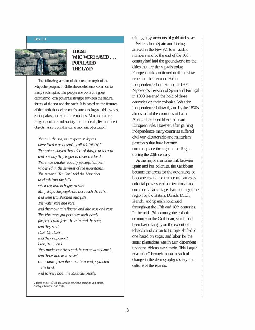
THOSE WHO WERE SAVED . . .POPULATED THE LAND
The following version of the creation myth of the
Mapuche peoples in Chile shows elements common to
many such myths: The people are born of a great
cataclysmó of a powerful struggle between the natural
forces of the sea and the earth. It is based on the features
of the earth that define man's surroundingsó tidal waves,
earthquakes, and volcanic eruptions. Man and nature,
religion, culture and society, life and death, live and inert
objects, arise from this same moment of creation:
There in the sea, in its greatest depths
there lived a great snake called ì Cai Cai.î
The waters obeyed the orders of this great serpent
and one day they began to cover the land.
There was another equally powerful serpent
who lived in the summit of the mountains.
The serpent ì Ten Tenî told the Mapuches
to climb into the hills
when the waters began to rise.
Many Mapuche people did not reach the hills
and were transformed into fish.
The water rose and rose,
and the mountain floated and also rose and rose.
The Mapuches put pots over their heads
for protection from the rain and the sun;
and they said,
ì Cai, Cai, Caiî ;
and they responded,
ì Ten, Ten, Ten.î
They made sacrifices and the water was calmed,
and those who were saved
came down from the mountain and populated
the land.
And so were born the Mapuche people.
Adapted from JosÈ Bengoa, Historia del Pueblo Mapuche, 2nd edition, Santiago: Ediciones Sur, 1987.
7
Gaining independence in the Caribbeanhas been a slower process than in thecountries of Latin America. Thefragmentation of the region by competingEuropean interests and the small size ofthe islands have favored continuedcolonialism and dependency. By the mid-1950s, only Cuba, the DominicanRepublic, and Haiti were independent. Inthe 1960s, Barbados, Guyana, Jamaica,and Trinidad and Tobago achievedindependence, and other islands did soduring the 1970s and early 1980s. Atpresent, several Caribbean islandscontinue to have either territorial statusor be closely associated to countries suchas the Netherlands, the United Kingdom,and United States, or to be an integralpart of a country, such as the FrenchDepartments.
GEOGRAPHY
Latin America and the Caribbeanrepresent a sixth of the earth’s land mass,with an extension of 11,263 km fromCape Horn to the southern border of theUnited States.
Mountains are the main geographicalcharacteristic of the Region. Thesemountains are geologically responsiblefor much of the Region’s wealth andmany of its disasters. The Andes,Caribbean, and Central Americanmountains are seated where majortectonic plates interact, a feature thatmakes the Region highly seismic. To thesouth, the Andes emerge from Antarcticato form a mountain chain that is secondonly to the Himalayas in height, risingalong the Argentine and Chilean bordersto Mount Aconcagua (6,959 m), thehighest peak of volcanic origin in theWestern Hemisphere. In Bolivia andsouthern Peru, the Andes branch apart
and enclose valleys and high plateaus, thealtiplano. In Ecuador, there are twodistinct ranges separated by basins; threeranges pass through Colombia, theeasternmost continuing on to Venezuela.
The mountains of the Caribbean and ofCentral and South America aregeologically young, with a great numberof volcanoes. In Ecuador, for example,the central plateau is surrounded bymore than two dozen volcanoes. Thevolcanic soil of this region is responsiblefor highly productive agriculture.
The location of the Andes near thePacific coast assures that the longestrivers of South America flow toward theAtlantic and the Caribbean, and thatrainfall is concentrated in the easternlowlands. The Amazon, Orinoco, Paraná,Paraguay, and La Plata Rivers togetherdrain more than 60% of the waters of thecontinent. The Amazon River Basin is thelargest in the world, draining an area ofapproximately 7,500,000 square km.During rainy periods, severe floodingoccurs in the primarily agricultural riverareas and in important urban centers.
Coastal plains with warm, moistclimates skirt both the Caribbean and thePacific coast of the Central AmericanIsthmus, and wet, forested lowlands areinterrupted by mountainous areas, wheresome 80% of the population lives. Mexicois formed mainly by a high, arid centralplateau enclosed by two mountain ranges.
Latin America contains almost 60% ofthe tropical forests of the world. But thelevel of deforestation is also the highest inthe developing world: an estimated 1.3%of existing forests are cut each year. Atthe beginning of the 1990s an estimated12% of the Amazon rainforest had beencut for timber and mining enterprises,and to increase land available foragriculture and livestock. Deforestation

puts the region’s biodiversity at risk,causes soil loss, increases the threat oflandslides and silting up of waterways,phenomena that are major concerns forthe planners in the Region. Unfortunately,short-term economic gains continue toprevail over long-term environmentalconsiderations.
The Caribbean islands form a broadarc that extends approximately 4,000 kmnorth to south from Florida (U.S.A.) toVenezuela. The size of the islands variesconsiderably: Cuba, for example, hasapproximately 111,000 square km andmore than 10.5 million inhabitants, whileAnguilla has less than 350 square km andless than 9,000 residents. Although theislands have many characteristics incommon, geographical diversity exists:from regions with exuberant flora andareas suitable for agriculture, tounproductive volcanic and coral islands.
The isolated upper parts of a chain ofsubmerged volcanic mountains, whichform the islands, are characterized bythree principal types of topography:
• High and inaccessible mountains (of almost 1,200 m), such as theBlue Mountains in Jamaica, MountDiablotin in central Dominica, theSoufrière Volcano in Saint Vincent,and the Northern Range in Trinidad,covered by dense forests andcrossed by fast rivers;
• High plateaus like those in centralJamaica;
• Sedimentary coastal plains thatoriginate along the slopes of thehills and mountains and formcoastlines of sandy beaches.
Some Caribbean islands have neitherrivers nor any other natural source ofpotable water, as is the case in Anguilla,Antigua, Aruba, and Bermuda. Todaythese islands depend completely ondesalinization plants or on collection ofrainwater, or as in the case of Nassau,Bahamas, on the importation of over 50%of its drinking water.
CLIMATE
The climates and precipitation in LatinAmerica and the Caribbean varyconsiderably. The Orinoco basin ofColombia and Venezuela, the Brazilianplateaus, and parts of western Ecuador,contain savannas with well-differentiatedwet and dry seasons. On the other hand,broad sectors of Argentina, Chile,Paraguay, and southern Brazil have moretemperate climates, with largerfluctuations in temperature. Annualrainfall in the Region varies between anaverage of 1,000 and 2,000 mm. One ofthe driest deserts of the world, theAtacama, is on the coast of Chile;Argentina, Bolivia, Brazil, Mexico, andPeru also have expanses of arid land anddesert.
The Caribbean islands share atropical climate with the Atlantic coast ofthe Central American isthmus. At sealevel, the climate is relatively constant butthen varies by elevation. Precipitationvaries widely, depending on thetopography of each island. Themountainous islands receive a great dealof rain, while flat islands of coral originsuch as Antigua and Barbuda, Curaçao,and Turks and Caicos Islands are arid.
9
Map courtesy of U.S. National Oceanic
and AtmosphericAdministration,
National GeophysicalData Center
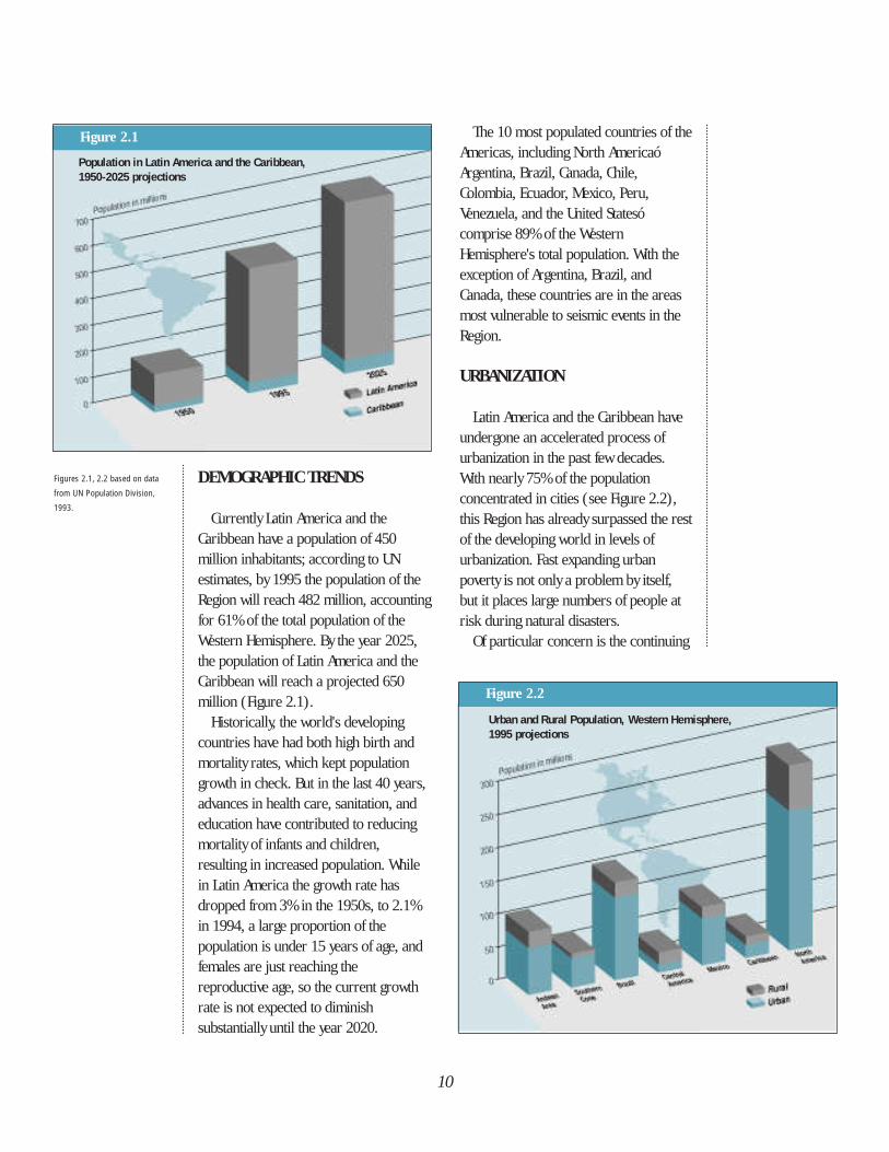
Figure 2.2
DEMOGRAPHIC TRENDS
Currently Latin America and theCaribbean have a population of 450million inhabitants; according to UNestimates, by 1995 the population of theRegion will reach 482 million, accountingfor 61% of the total population of theWestern Hemisphere. By the year 2025,the population of Latin America and theCaribbean will reach a projected 650million (Figure 2.1).
Historically, the world's developingcountries have had both high birth andmortality rates, which kept populationgrowth in check. But in the last 40 years,advances in health care, sanitation, andeducation have contributed to reducingmortality of infants and children,resulting in increased population. Whilein Latin America the growth rate hasdropped from 3% in the 1950s, to 2.1%in 1994, a large proportion of thepopulation is under 15 years of age, andfemales are just reaching thereproductive age, so the current growthrate is not expected to diminishsubstantially until the year 2020.
The 10 most populated countries of theAmericas, including North AmericaóArgentina, Brazil, Canada, Chile,Colombia, Ecuador, Mexico, Peru,Venezuela, and the United Statesócomprise 89% of the WesternHemisphere's total population. With theexception of Argentina, Brazil, andCanada, these countries are in the areasmost vulnerable to seismic events in theRegion.
URBANIZATION
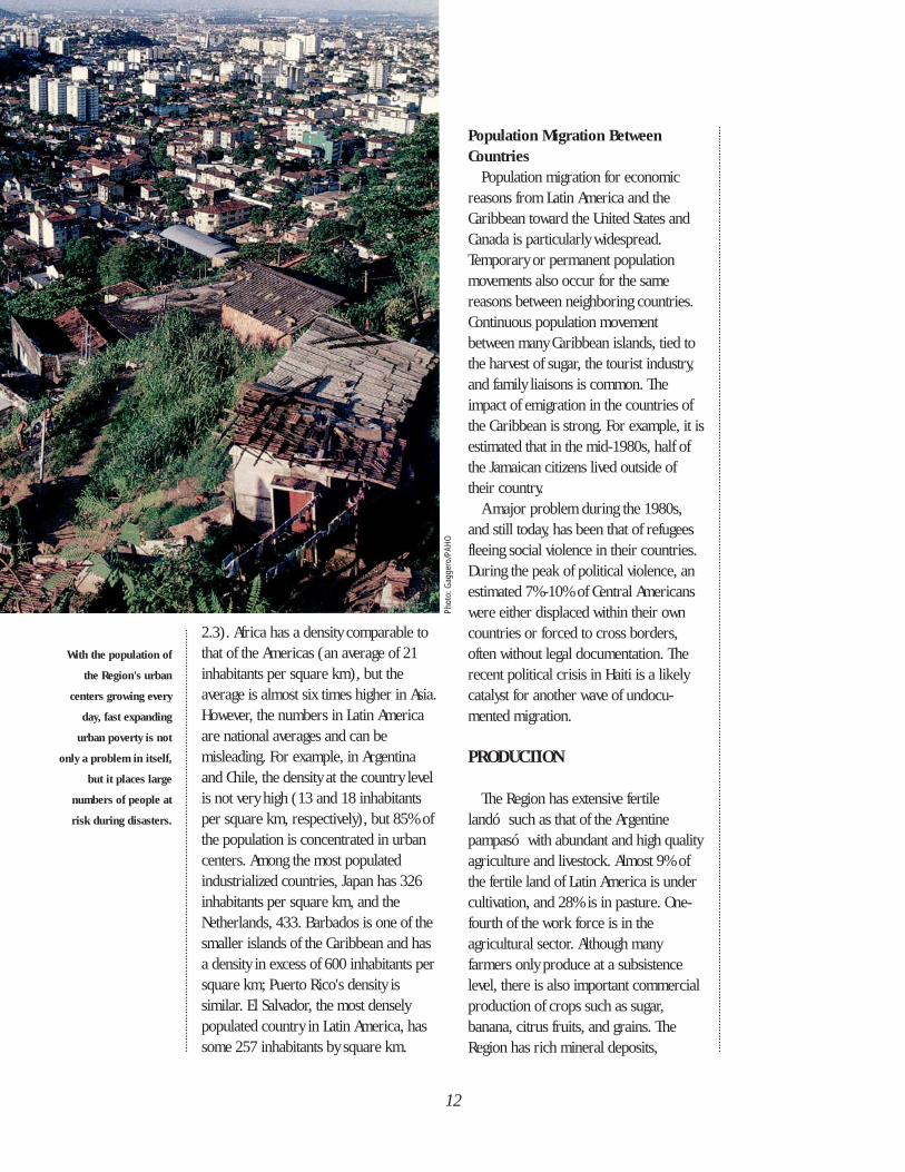
Latin America and the Caribbean haveundergone an accelerated process ofurbanization in the past few decades.With nearly 75% of the populationconcentrated in cities (see Figure 2.2),this Region has already surpassed the restof the developing world in levels ofurbanization. Fast expanding urbanpoverty is not only a problem by itself,but it places large numbers of people atrisk during natural disasters.
Of particular concern is the continuing
10
Figures 2.1, 2.2 based on data
from UN Population Division,
1993.
Urban and Rural Population, Western Hemisphere,1995 projections
Figure 2.1
Population in Latin America and the Caribbean,1950-2025 projections
growth, in number and size, of the so-called megacities (cities with more than 5million inhabitants). The serviceinfrastructure of these cities isinadequate, and the additional resourcesneeded to keep up with continuingdemand are not available. By the year2000, Mexico City is calculated to be thelargest city in the world, with more than26 million inhabitants; S„o Paulo (Brazil)will have an estimated population of 24million; Rio de Janeiro (Brazil), 13million; and Lima (Peru), more than 8million. Other cities with acceleratedgrowth are SantafÈ de Bogot· (Colombia)and Santiago (Chile).
Urbanization and PovertyMore than half the urban residents in
the larger cities in Latin America and theCaribbean live in poverty today, and bythe year 2000, it is estimated that 90% ofthe poor population of this region willlive in urban areas. The residents of theseperipheral urban areas often have lowincomes, limited education, insufficientdiets, and live in unsanitary andovercrowded conditions. Safe drinkingwater, the disposal of solid waste, decenthousing, and transportation areparticularly lacking in the marginal urbanareas. Urban residents are exposed toincreased levels of contamination, but thepoorest often live on the outskirts of thecity where factories are located andenvironmental protection is at its lowestlevels. Poor construction and theunplanned nature of these marginalsettlements also expose their dwellers tothe effects of natural phenomena such aslandslides and flooding. The traditionalsocial structure found in rural areas canbe lost in the process of migration, andsocial instability becomes another risk forthose living in urban settlements.
11
The weight of poverty falls most heavilyon certain groups. For example theindigenous population, approximately 30million in Central and South America,makes up not only a significant portion ofthe rural poor, but also of the growingpoor urban population. Of all groups,they suffer the most from limited accessto education, health services, and thepossibility of economic mobility.
Among the poor, women are seriouslydisadvantaged. They frequently support aheavier workload than do men and havelower levels of education and less accessto paid employment. Children also sufferdisproportionately, and the future qualityof their lives is in danger because ofdeficient levels of nutrition, health care,and education.
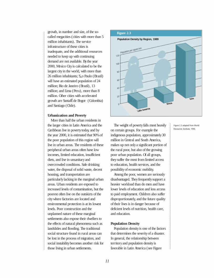
Population DensityPopulation density is one of the factors
that determines the severity of a disaster.In general, the relationship betweenterritory and population density isfavorable in Latin America (see Figure
Figure 2.3
Figure 2.3 adapted from World
Resources Institute, 1990.
Population Density by Region, 1989
With the population of
the Region's urban
centers growing every
day, fast expanding
urban poverty is not
only a problem in itself,
but it places large
numbers of people at
risk during disasters.
12
2.3). Africa has a density comparable tothat of the Americas (an average of 21inhabitants per square km), but theaverage is almost six times higher in Asia.However, the numbers in Latin Americaare national averages and can bemisleading. For example, in Argentinaand Chile, the density at the country levelis not very high (13 and 18 inhabitantsper square km, respectively), but 85% ofthe population is concentrated in urbancenters. Among the most populatedindustrialized countries, Japan has 326inhabitants per square km, and theNetherlands, 433. Barbados is one of thesmaller islands of the Caribbean and hasa density in excess of 600 inhabitants persquare km; Puerto Rico's density issimilar. El Salvador, the most denselypopulated country in Latin America, hassome 257 inhabitants by square km.
Population Migration Between Countries
Population migration for economicreasons from Latin America and theCaribbean toward the United States andCanada is particularly widespread.Temporary or permanent populationmovements also occur for the samereasons between neighboring countries.Continuous population movementbetween many Caribbean islands, tied tothe harvest of sugar, the tourist industry,and family liaisons is common. Theimpact of emigration in the countries ofthe Caribbean is strong. For example, it isestimated that in the mid-1980s, half ofthe Jamaican citizens lived outside oftheir country.
A major problem during the 1980s,and still today, has been that of refugeesfleeing social violence in their countries.During the peak of political violence, anestimated 7%-10% of Central Americanswere either displaced within their owncountries or forced to cross borders,often without legal documentation. Therecent political crisis in Haiti is a likelycatalyst for another wave of undocu-mented migration.
PRODUCTION
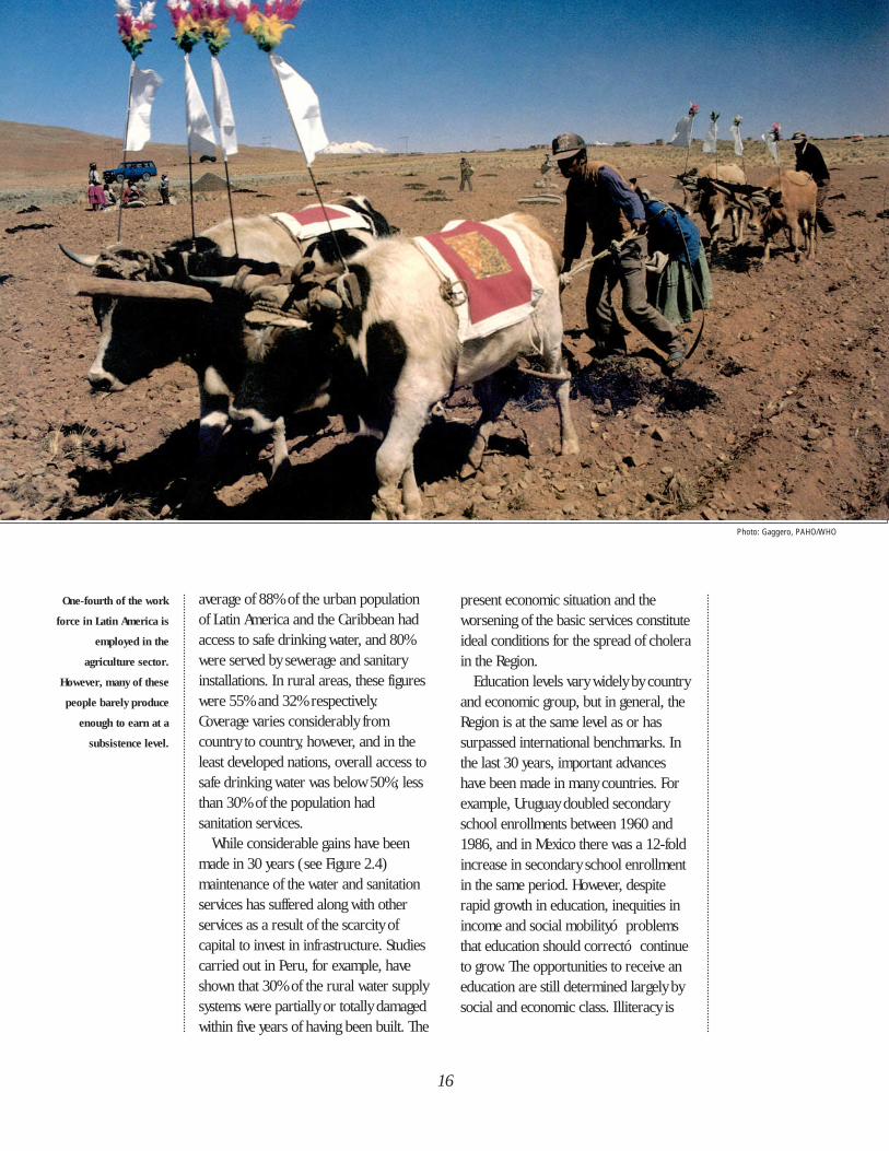
The Region has extensive fertile landó such as that of the Argentinepampasó with abundant and high qualityagriculture and livestock. Almost 9% ofthe fertile land of Latin America is undercultivation, and 28% is in pasture. One-fourth of the work force is in theagricultural sector. Although manyfarmers only produce at a subsistencelevel, there is also important commercialproduction of crops such as sugar,banana, citrus fruits, and grains. TheRegion has rich mineral deposits,
Phot
o: G
agge
ro/P
AHO
FAVELA
13
hold in the Region and that favors marketintegration through the formation oftrading blocks, will lead to thestrengthening of the productive sectors ofthe countries. One example of thisprocess is the North American Free TradeAgreement (NAFTA) signed by Canada,Mexico and the United States.
SOCIOECONOMIC ASPECTS
The World Bank has adopted the grossnational product (GNP) as a criterion inclassifying the economies of countriesand in distinguishing different levels ofeconomic development. Using GNPfigures alone, however, can give anerroneous picture of economicconditions in Latin America and theCaribbean, since they conceal thefundamental problem of these countries:the unbalanced distribution of wealth. Incertain countries of the Region wealthand political power continue to be sharedby the very few and capital is investedabroad rather than in the nationaleconomies.
By the end of the 1970s, the economiesof most of the countries of the Regionhad reached a sustained level of growth.But this growth was not always translatedinto socioeconomic improvement. Forexample Brazil, the strongest economy ofLatin America, doubled its GNP per capitabetween 1961 and 1979. However, itsgains in reducing illiteracy and infantmortality were much less than thoseachieved by such countries as Chile,Cuba, Jamaica, and Uruguay, which wereexperiencing slow economic growth.Table 2.1 shows socioeconomicindicators and the “human developmentindex” rankings, prepared by the UnitedNations Development Program (UNDP) toindicate levels of income, life expectancy,
particularly of copper (Chile and Peruhave one-fourth of the world reserve), tin(Bolivia is the highest producer on thecontinent), iron, silver, and gold. Brazil,Colombia, and Peru have importantsources of precious and semi-preciousminerals. Finally, the oil reserves of theRegion are only surpassed by those of theMiddle East.
The natural resources of the Caribbeanislands are more limited. The DominicanRepublic, Guyana, Haiti, and Jamaica,mine bauxite; Trinidad and Tobago exportoil and natural gas. Small deposits ofmanganese, lead, copper, and zinc arefound on most of the islands. Agriculturalproduction is on the decline, but thesugar and banana industries continue toprovide employment for most of the workforce in Barbados, Cuba, Dominica, theDominican Republic, Jamaica, Saint Kittsand Nevis, and Saint Lucia.
Light industry contributes to manyCaribbean economies, butindustrialization has not providedsufficient employment to compensate forthe reduction in agricultural production.Tourism is increasingly seen as theclassic solution for providing economicdiversification and development,particularly in the Lesser Antilles.
Unfortunately, in spite of theirenormous potential for development, theeconomies of Latin America and theCaribbean are fragile, mainly due to theirdependency on the export of a limitednumber of agricultural or mineralproducts (such as cotton, coffee, sugar,and copper) that are subject to pricefluctuations in the international market.How-ever, there have been significantgains toward industrialization in recentdecades, especially in Brazil, Chile,Mexico, and Venezuela. The economicliberalization that is beginning to take
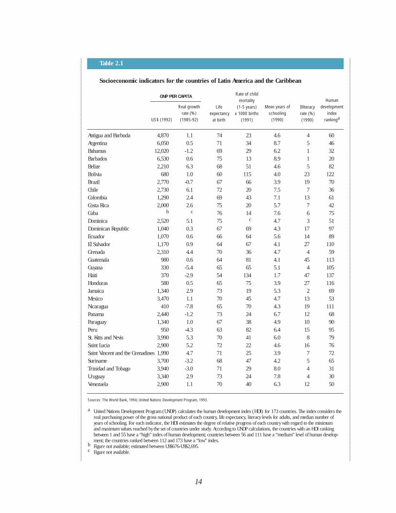
Antigua and Barbuda 4,870 1.1 74 23 4.6 4 60Argentina 6,050 0.5 71 34 8.7 5 46Bahamas 12,020 -1.2 69 29 6.2 1 32Barbados 6,530 0.6 75 13 8.9 1 20Belize 2,210 6.3 68 51 4.6 5 82Bolivia 680 1.0 60 115 4.0 23 122Brazil 2,770 -0.7 67 66 3.9 19 70Chile 2,730 6.1 72 20 7.5 7 36Colombia 1,290 2.4 69 43 7.1 13 61Costa Rica 2,000 2.6 75 20 5.7 7 42Cuba b c 76 14 7.6 6 75Dominica 2,520 5.1 75 c 4.7 3 51Dominican Republic 1,040 0.3 67 69 4.3 17 97Ecuador 1,070 0.6 66 64 5.6 14 89El Salvador 1,170 0.9 64 67 4.1 27 110Grenada 2,310 4.4 70 36 4.7 4 59Guatemala 980 0.6 64 81 4.1 45 113Guyana 330 -5.4 65 65 5.1 4 105Haiti 370 -2.9 54 134 1.7 47 137Honduras 580 0.5 65 75 3.9 27 116Jamaica 1,340 2.9 73 19 5.3 2 69Mexico 3,470 1.1 70 45 4.7 13 53Nicaragua 410 -7.8 65 70 4.3 19 111Panama 2,440 -1.2 73 24 6.7 12 68Paraguay 1,340 1.0 67 38 4.9 10 90Peru 950 -4.3 63 82 6.4 15 95St. Kitts and Nevis 3,990 5.3 70 41 6.0 8 79Saint Lucia 2,900 5.2 72 22 4.6 16 76Saint Vincent and the Grenadines 1,990 4.7 71 25 3.9 7 72Suriname 3,700 -3.2 68 47 4.2 5 65Trinidad and Tobago 3,940 -3.0 71 29 8.0 4 31Uruguay 3,340 2.9 73 24 7.8 4 30Venezuela 2,900 1.1 70 40 6.3 12 50
14
Table 2.1
US$ (1992)
Real growth rate (%)
(1985-92)
Lifeexpectancy
at birth
Rate of childmortality
(1-5 years) x 1000 births
(1991)
Mean years ofschooling
(1990)
Illiteracyrate (%)(1990)
Human development
index rankinga
Socioeconomic indicators for the countries of Latin America and the Caribbean
Sources: The World Bank, 1994; United Nations Development Program, 1993.
a United Nations Development Program (UNDP) calculates the human development index (HDI) for 173 countries. The index considers the real purchasing power of the gross national product of each country, life expectancy, literacy levels for adults, and median number of years of schooling. For each indicator, the HDI estimates the degree of relative progress of each country with regard to the minimum and maximum values reached by the set of countries under study. According to UNDP calculations, the countries with an HDI ranking between 1 and 55 have a “high” index of human development; countries between 56 and 111 have a “medium” level of human develop-ment; the countries ranked between 112 and 173 have a “low” index.
b Figure not available; estimated between US$676-US$2,695.c Figure not available.
GNP PER CAPITA
and education. This index shows thatwhile countries may have similar incomelevels, they can have very different levelsof human development, an indicator ofthe level of investment being made in theeducation and health of a population.
During the worldwide recession of the1980s, most of the countries of theRegion underwent crises in theireconomies and political systems thatreduced their share in internationalmarkets and in productive investments.The policies of structural adjustment havebeen applied at an enormous social costand have heightened social and economicinequality, having the greatest effects onthe poorer sectors of the population aswell as worsening living conditions of themiddle class. An important characteristicof this crisis has been the deterioration ofpublic services, particularly in the healthand education sectors, and in the qualityof life of the least protected populations.
HEALTH, SANITATION, AND EDUCATION
While they continue to have serioushealth problems, people in Latin Americaand the Caribbean have the longest lifeexpectancy and lowest child mortality ofany developing region in the world.Major advances in reducing childmortality have been made in all regionsworldwide; figures have dropped by one-third in developing countries in the last30 years. But millions of childrencontinue to die from diseases that arepreventable with vaccines, or with accessto safe drinking water and with adequatenutrition. In Africa, approximately 175 ofevery 1,000 children die before reachingage five; in Latin America this figure is 60deaths per 1,000 children; in the English-speaking Caribbean it is less than 30 per
1,000. In the industrialized nations thisfigure is estimated at 15 deaths per 1,000children under age five.
The reduction in infant and childmortality in Latin America and theCaribbean is due, for the most part, toachievements in primary health care.While these advances have been striking,there are still many hurdles to overcome.In urban areas there are highconcentrations of hospitals and of healthpersonnel, but many of these facilities areoutdated and poorly maintained. This isalso the case for water and sanitationservices, power, and transportationsystems which are increasinglyoverburdened. This deterioratinginfrastructure is progressively morevulnerable to the effects of naturaldisasters.
Data available in 1988 showed that an
15
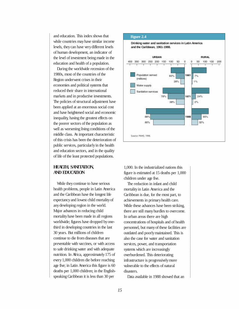
Figure 2.4
Drinking water and sanitation services in Latin America and the Caribbean, 1961-1988.
Source: PAHO, 1990.
average of 88% of the urban populationof Latin America and the Caribbean hadaccess to safe drinking water, and 80%were served by sewerage and sanitaryinstallations. In rural areas, these figureswere 55% and 32% respectively. Coverage varies considerably fromcountry to country, however, and in theleast developed nations, overall access tosafe drinking water was below 50%; lessthan 30% of the population hadsanitation services.
While considerable gains have beenmade in 30 years (see Figure 2.4)maintenance of the water and sanitationservices has suffered along with otherservices as a result of the scarcity ofcapital to invest in infrastructure. Studiescarried out in Peru, for example, haveshown that 30% of the rural water supplysystems were partially or totally damagedwithin five years of having been built. The
present economic situation and theworsening of the basic services constituteideal conditions for the spread of cholerain the Region.
Education levels vary widely by countryand economic group, but in general, theRegion is at the same level as or hassurpassed international benchmarks. Inthe last 30 years, important advanceshave been made in many countries. Forexample, Uruguay doubled secondaryschool enrollments between 1960 and1986, and in Mexico there was a 12-foldincrease in secondary school enrollmentin the same period. However, despiterapid growth in education, inequities inincome and social mobilityó problemsthat education should correctó continueto grow. The opportunities to receive aneducation are still determined largely bysocial and economic class. Illiteracy is
16
Photo: Gaggero, PAHO/WHO
One-fourth of the work
force in Latin America is
employed in the
agriculture sector.
However, many of these
people barely produce
enough to earn at a
subsistence level.
17
still above 40% in the poorer countries,and the indigenous population inparticular suffers disproportionately inlacking access to education.
While some countries have focusedmost of their resources in education toeradicate illiteracy, others have given agreat deal of importance to improvinguniversity education, resulting in a largenumber of well-trained professionals.Unfortunately though, in many countries,not enough jobs are available for thesegraduating professionals.
This excess of professionals has beenfelt particularly in the health sector. Tocope with the need for primary carephysicians, many governments promotedincreased enrollments in medicalschools. As a result, Latin America andthe Caribbean have the highest physician-to-patient ratio of all developing regionsin the world, but the lowest of nurses andmidwives per physician. In Mexico, forexample, between 1970 and 1980 theenrollment in medical schools increasedfrom 29,000 to 93,000. A study of levelsof physician employment in the mostimportant Mexican cities showed that 7%were unemployed, 11% were working atjobs not related to medicine, and 11%had very low paying medical related jobsor were serving very few patients.
THE POLITICAL PROCESS
The democratic process in the Regionwas strengthened in the 1990s, and mostauthoritarian political systems werereplaced, particularly in Argentina, Brazil,Chile, Paraguay, and Uruguay. Theremoval of the democratically electedpresident in Haiti in September 1991, thedisbanding of the Peruvian congress inMarch 1992, and the militaryinsurgencies in Venezuela during the
same year, have raised fears that theauthoritarian regimes of the past willmake a comeback. Caribbean countrieshave also had their share of politicalviolence, such as the civil unrest inTrinidad in 1990, and during elections inSaint Vincent and the Grenadines andSaint Kitts and Nevis. However, the way inwhich serious political conflicts werefaced in Brazil, Guatemala, andVenezuela, strengthens the hope thatfuture crises will be resolved through theexercise of democratic principles.
The 1980s were violent and turbulentyears in Central America, when hundredsof thousands of people died or weredisplaced because of armed conflicts inEl Salvador and Nicaragua, and becauseof serious civil disturbances inGuatemala. Even though the situation inthese countries is still fragile, a certainlevel of political stability has beenattained, and some progress has beenmade in recovering the economic levelthat was lost during the decade. Thepeace accords signed in January 1992between the government of El Salvadorand the Farabundo Martí Front forNational Liberation, and the conclusion ofthe armed conflict in Nicaragua were theresults of a long peace process that beganin 1983 with the work of the ContadoraGroup, formed by the governments ofColombia, Mexico, Panama, andVenezuela.
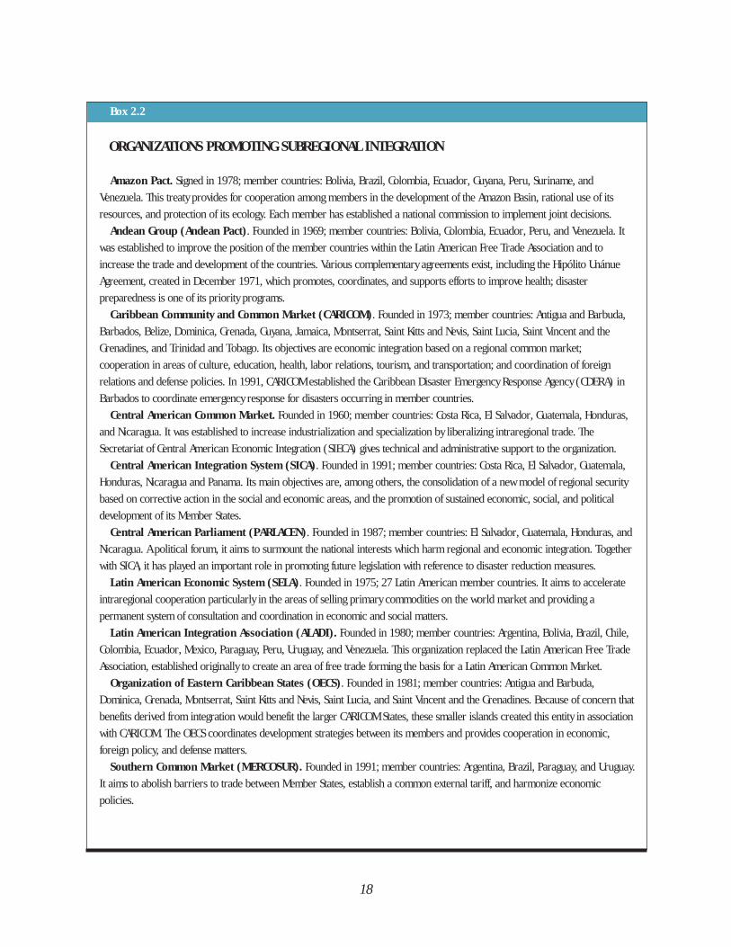
The Process of Subregional Integration
The processes of political andeconomic integration that have been seenin other regions of the world, particularlyin Europe, have encouraged countries ofLatin America and the Caribbean topromote subregional organizations thatare based on economic cooperation (see
18
ORGANIZATIONS PROMOTING SUBREGIONAL INTEGRATION
Amazon Pact. Signed in 1978; member countries: Bolivia, Brazil, Colombia, Ecuador, Guyana, Peru, Suriname, and
Venezuela. This treaty provides for cooperation among members in the development of the Amazon Basin, rational use of its
resources, and protection of its ecology. Each member has established a national commission to implement joint decisions.
Andean Group (Andean Pact). Founded in 1969; member countries: Bolivia, Colombia, Ecuador, Peru, and Venezuela. It
was established to improve the position of the member countries within the Latin American Free Trade Association and to
increase the trade and development of the countries. Various complementary agreements exist, including the Hipólito Unánue
Agreement, created in December 1971, which promotes, coordinates, and supports efforts to improve health; disaster
preparedness is one of its priority programs.
Caribbean Community and Common Market (CARICOM). Founded in 1973; member countries: Antigua and Barbuda,
Barbados, Belize, Dominica, Grenada, Guyana, Jamaica, Montserrat, Saint Kitts and Nevis, Saint Lucia, Saint Vincent and the
Grenadines, and Trinidad and Tobago. Its objectives are economic integration based on a regional common market;
cooperation in areas of culture, education, health, labor relations, tourism, and transportation; and coordination of foreign
relations and defense policies. In 1991, CARICOM established the Caribbean Disaster Emergency Response Agency (CDERA) in
Barbados to coordinate emergency response for disasters occurring in member countries.
Central American Common Market. Founded in 1960; member countries: Costa Rica, El Salvador, Guatemala, Honduras,
and Nicaragua. It was established to increase industrialization and specialization by liberalizing intraregional trade. The
Secretariat of Central American Economic Integration (SIECA) gives technical and administrative support to the organization.
Central American Integration System (SICA). Founded in 1991; member countries: Costa Rica, El Salvador, Guatemala,
Honduras, Nicaragua and Panama. Its main objectives are, among others, the consolidation of a new model of regional security
based on corrective action in the social and economic areas, and the promotion of sustained economic, social, and political
development of its Member States.
Central American Parliament (PARLACEN). Founded in 1987; member countries: El Salvador, Guatemala, Honduras, and
Nicaragua. A political forum, it aims to surmount the national interests which harm regional and economic integration. Together
with SICA, it has played an important role in promoting future legislation with reference to disaster reduction measures.
Latin American Economic System (SELA). Founded in 1975; 27 Latin American member countries. It aims to accelerate
intraregional cooperation particularly in the areas of selling primary commodities on the world market and providing a
permanent system of consultation and coordination in economic and social matters.
Latin American Integration Association (ALADI). Founded in 1980; member countries: Argentina, Bolivia, Brazil, Chile,
Colombia, Ecuador, Mexico, Paraguay, Peru, Uruguay, and Venezuela. This organization replaced the Latin American Free Trade
Association, established originally to create an area of free trade forming the basis for a Latin American Common Market.
Organization of Eastern Caribbean States (OECS). Founded in 1981; member countries: Antigua and Barbuda,
Dominica, Grenada, Montserrat, Saint Kitts and Nevis, Saint Lucia, and Saint Vincent and the Grenadines. Because of concern that
benefits derived from integration would benefit the larger CARICOM States, these smaller islands created this entity in association
with CARICOM. The OECS coordinates development strategies between its members and provides cooperation in economic,
foreign policy, and defense matters.
Southern Common Market (MERCOSUR). Founded in 1991; member countries: Argentina, Brazil, Paraguay, and Uruguay.
It aims to abolish barriers to trade between Member States, establish a common external tariff, and harmonize economic
policies.
Box 2.2
19
Box 2.2). These organizations have hadvarying degrees of success largely due tothe varying fortunes and development ofthe participating members. Commercebetween member countries representsonly a small portion of the Region'sforeign trade, and the global recessionhas had repercussions on intraregionaltrade.
Integration is relevant in the Regionbecause of the cultural proximity of thecountries, and because, in the context ofnatural disasters, neighboring countriesshare similar patterns of hazards andvulnerability. The objectives of theseorganizations have been to promoteeconomic growth while strengthening thepolitical identity of the members;generating financial cooperation;supporting exchanges in technical,scientific, and cultural development; and,in certain instances, by promotingsupport in disaster reduction betweenparticipating countries.
CONCLUSIONS
The serious economic crisis, armedcivil conflicts, and the absence ofdemocracy in many countries in theRegion during the last decade magnifiedthe endemic problems of poverty andunequal access to wealth and basicservices. In such an environment,planners and lawmakers have strugglednot to lose ground, and have had moreurgent matters on their minds than long-term development plans for, orinvestment in disaster reduction.
The Inter-American Development Bank(IDB) in its 1993 report presents anencouraging outlook concerning theeconomies of the Region. According tothe IDB, the challenge is now to initiate aì second generationî of socioeconomicreforms that would combine social equitywith long-term growth.
The countries of Latin America and theCaribbean have an enormous economicpotential and an excellent and growingcapacity of professionals. By focusinghuman and material resources on socio-economic improvements, countries canreduce the vulnerability of their people tonatural disasters and achieve genuinereforms in disaster preparedness. ◆
Photo: Gaggero, PAHO/WHO
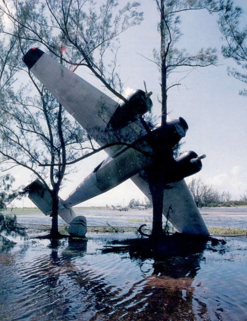
Not all violent manifestations ofnature—earthquakes, volcaniceruptions, hurricanes, floods—
necessarily become disasters. When adisaster does occur, it is not always theexclusive result of the natural hazarditself. What human beings do, or whatthey fail to do, is a key factor.
Consider the following scenario. Astrong earthquake—magnitude 7.8 onthe Richter scale—occurs in an unpopu-lated area. This violent event does notcause the loss of lives nor of infrastruc-ture, and the country does not have tomobilize resources to respond to the situ-ation. As a result, it is not a disaster. Butan earthquake of lesser magnitude, forexample 5.1 on the Richter scale, cancreate a disaster of major proportions ifit occurs in a densely populated area, orif it causes the collapse of criticalfacilities such as hospitals or schools,which were not built according to code.
Consequently, the degree of risk towhich a country or a population group isexposed when confronted with the effectsof a violent natural phenomena dependsmainly on two factors: the hazard itselfand the vulnerability of the exposedgroup.
That people have always coexisted withnatural hazards is an unchanging fact.
Photo facing page:
In the Caribbean, the
hurricane season
regulates the lives of
millions,
overshadowing other
risks such as
earthquakes and
volcanic eruptions.
Hurricane Gilbert
tossed this airplane
into the trees at the
Kingston Manley
Airport in Jamaica.
What has changed, particularly in the lastcentury, is the impact disasters have whenthey hit populated areas. In areas wherethere is no human population, theseevents for the most part do not becomedisasters. However, the very same naturalhazard—a volcanic eruption or a tropicalhurricane—can bring about verydifferent effects depending on thevulnerability of the community.
The vulnerability of a building, apopulation, or a country is measured byhow susceptible to harm or loss it is in theface of a hazard. Thus, the risk factor iscalculated by measuring the probableoccurrence of a natural hazard of certainintensity against the vulnerability of theexposed elements. For example, a buildingis at risk during an earthquake when a)the earthquake (hazard) is strong enoughto damage or destroy the building, and b)seismic-resistant construction techniquesare not used (vulnerability) in the designand construction of the building.
Risk is not an abstract concept; it isconcrete and measurable. Many countriesand communities have designed maps toillustrate their degree of risk. These mapsnot only mark the areas with the highestprobability of occurrence of an event ofcertain magnitude, but also point outvulnerable infrastructure in those areas.
A natural
disaster is an
overwhelming
ecological dis-
turbance that
exceeds the
capacity of the
affected
community to
adjust, and
consequently
requires external
assistance.
Source: PAHO/WHO, 1980.
21
WHAT PUTSLATIN AMERICA ANDTHE CARIBBEAN AT RISK?
CHAPTER 3
Photo: Gaggero, PAHO/WHO
22
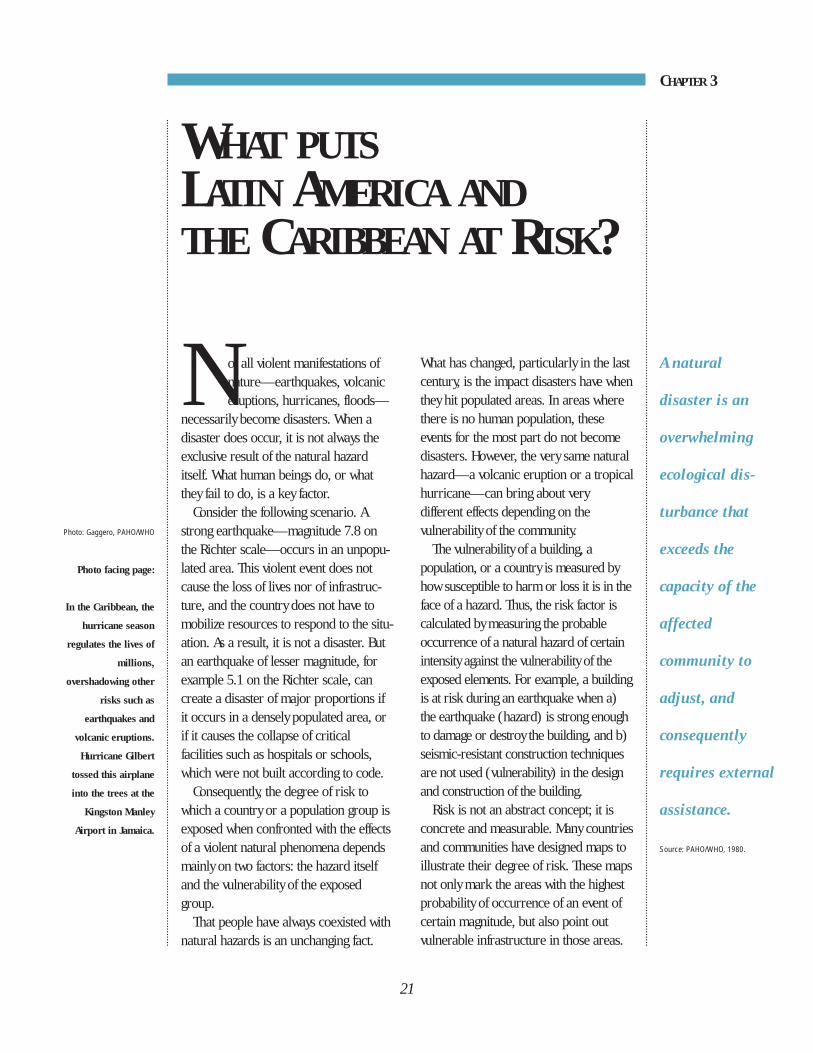
Table 3.1
Selected natural disasters in Latin America and the Caribbean, 1970-1993
No. of deaths Estimated no. ofYear Country Type of disaster reported affected people
1970 Peru Earthquake 67,000 3,139,0001972 Nicaragua Earthquake 10,000 400,0001974 Honduras Hurricane (Fifi) 7,000 15,0001976 Guatemala Earthquake 23,000 1,200,0001979 Dominica Hurricane (David) 38 81,0001979 Dominican Republic Hurricane (Frederick) 1,400 1,200,0001980 Haiti Hurricane (Allen) 220 330,0001982 Mexico Volcanic Eruption 1,770 60,0001985 Chile Earthquake 180 1,000,0001985 Mexico Earthquake 10,000 60,0001985 Colombia Volcanic Eruption 23,000 200,0001986 El Salvador Earthquake 1,100 500,0001987 Ecuador Earthquake 300 150,0001987 Dominican Republic Hurricane (Emily) 3 50,0001988 Brazil Flood 355 108,0001988 Jamaica Hurricane (Gilbert) 45 500,0001988 Mexico Hurricane (Gilbert) 225 200,0001988 Nicaragua Hurricane (Joan) 116 185,0001989 Antigua, Guadeloupe, Hurricane (Hugo) 56 220,000
Montserrat, Puerto Rico,St. Kitts and Nevis, U.S.A.,U.S. Virgin Islands
1990 Peru Earthquake 21 130,0001991 Costa Rica Earthquake 51 19,7001992 Nicaragua Tsunami 116 13,5001993 Honduras Tropical Storm (Gert) 103 11,000
Source: PAHO/WHO; OFDA/USAID; DHA/Geneva; Atlas Nacional de Riesgos de MÈxico.
Phot
o: W
aak,
PAH
O/W
HO
NATURAL HAZARDS IN LATINAMERICA AND THE CARIBBEAN
Natural hazards of all types exist inLatin America and the Caribbean. Themost common are classified by theirorigin: geological, such as earthquakes,tsunamis, volcanoes, and landslides; orhydrometeorological, such as hurricanes,tropical storms, floods, landslides, anddrought. Selected natural disasters inLatin America and the Caribbean arelisted in Table 3.1.
GEOLOGICAL HAZARDS
EarthquakesDuring the last 100 years, earthquakes
of great magnitude and intensity haverocked many countries in the Americas.Earthquake magnitude, first defined byCharles Richter, is a measure of thestrength of an earthquake as calculatedfrom records of the event made on acalibrated seismograph. The Richter scaleis used to describe an earthquake’smagnitude. In contrast, earthquakeintensity is a measure of the effects of anearthquake on structures and the earth’ssurface at a specific site. Among the manyexisting scales, the Modified MercalliIntensity Scale of 12 degrees, symbolizedas MM, is frequently used.
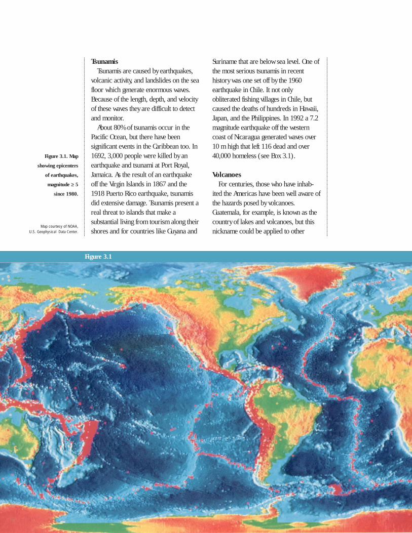
Most earthquakes in the Region havebeen caused by the interaction of activetectonic plates (see Figure 3.1). TheCocos plate, for example, subducts ordives beneath the lighter American plate.On 19 September 1985, the Cocos platesnapped at a depth of 20 km, and seismicwaves devastated Mexico City more than350 km away. This sort of activity, thesubduction and collision between thecontinental and the Cocos, Nazca, andCaribbean plates, is responsible for the
extensive seismicity along the Pacificcoast of Central and South America andin the Caribbean Basin. The earthquakethat hit northern Peru on 31 May 1970killed an estimated 67,000 people. Entirevillages, such as Yungay and Ranrahirca,were buried in the avalanches andmudslides that were triggered by thetremor. An estimated half million peoplewere left homeless.
In Central America, the Cocos andoverriding Caribbean plates are brokeninto distinct segments which arecharacterized on the earth’s surface bystructural depressions full of volcanic andalluvial sediments. The richness of thissoil has attracted dense humansettlements to spring up, precisely inthose places most prone to seismicactivity.
In 1972 most of Managua, the capitalof Nicaragua, was destroyed by a 6.2-magnitude earthquake, leaving 10,000dead. In 1976, 23,000 people perished inan earthquake in Guatemala; nearly 90%of the buildings in the central part of thecountry’s high mountains were destroyedor seriously damaged. The collapse ofunstable slopes, where thousands ofpeople of limited resources lived, causedmost of the deaths in Guatemala City. InMarch 1985 an earthquake took place incentral Chile which measured 7.8 on theRichter scale with its epicenter on thecoast near Alzarrobo. This event affectedan area where 50% of Chile’s urbanpopulation is concentrated; 180 liveswere lost; 2,575 people were injured;and nearly 84,000 homes were totallydestroyed. In El Salvador in 1986, a 20-square-block area in downtown SanSalvador was completely destroyed,claiming more than 1,000 lives.
23
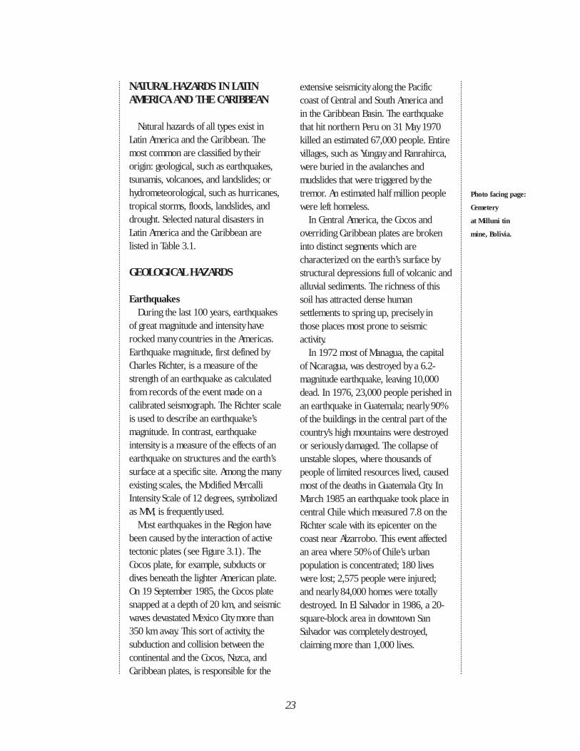
Photo facing page:
Cemetery
at Milluni tin
mine, Bolivia.
Suriname that are below sea level. One ofthe most serious tsunamis in recenthistory was one set off by the 1960earthquake in Chile. It not onlyobliterated fishing villages in Chile, butcaused the deaths of hundreds in Hawaii,Japan, and the Philippines. In 1992 a 7.2magnitude earthquake off the westerncoast of Nicaragua generated waves over10 m high that left 116 dead and over40,000 homeless (see Box 3.1).
VolcanoesFor centuries, those who have inhab-
ited the Americas have been well aware ofthe hazards posed by volcanoes.Guatemala, for example, is known as thecountry of lakes and volcanoes, but thisnickname could be applied to other
TsunamisTsunamis are caused by earthquakes,
volcanic activity, and landslides on the seafloor which generate enormous waves.Because of the length, depth, and velocityof these waves they are difficult to detectand monitor.
About 80% of tsunamis occur in thePacific Ocean, but there have beensignificant events in the Caribbean too. In1692, 3,000 people were killed by anearthquake and tsunami at Port Royal,Jamaica. As the result of an earthquakeoff the Virgin Islands in 1867 and the1918 Puerto Rico earthquake, tsunamisdid extensive damage. Tsunamis present areal threat to islands that make asubstantial living from tourism along theirshores and for countries like Guyana and
Figure 3.1
Map courtesy of NOAA, U.S. Geophysical Data Center.
Figure 3.1. Map
showing epicenters
of earthquakes,
magnitude ≥ 5
since 1980.
countries in Central America, theCaribbean, and South America as well. Asfar back as colonial times, El Salvador’sIzalco volcano was called the “Lighthouseof the Pacific.” Yet although there arenumerous active volcanoes in the Region,destructive volcanic eruptions have beenless frequent than other types of naturaldisasters in this century.
In 1902, three major volcanoeserupted with great force in the Caribbeanand in Central America. The tragedybegan with the explosion of Mount Peléein Martinique that discharged a dense
emulsion of incandescent lava and boilinggases that ran downhill to the port of St.Pierre. Thirty thousand persons weresuffocated. Twenty-four hours later, theSoufrière volcano on the neighboringisland of Saint Vincent, 150 km away,erupted in a similar manner, causing thedeath of 1,500 people. Later that sameyear, the Santa María (Santiaguito)volcano in Guatemala, took the lives of6,000 people. Three quarters of a centurylater, in 1979, the Soufrière explodedagain, causing extensive damage andmaking communication impossible
Box 3.1
WHEN THE EARTH MOVES UNDER THE SEA
A Double Hazard in Chile. In May 1960 Chile was ravaged by a triple catastrophe—two earthquakes and a tidal wave—
that affected 13 of the country’s 25 provinces, leaving a profound mark on the population and causing severe deterioration in the
economy. In just a few minutes, hundreds of lives were lost, dwellings were demolished, gas and water pipes broken,
communications interrupted, industries destroyed, livestock lost, agriculture ruined, and roads and railroads left impassable. In
several areas the topography was changed: part of the coastline sank into the sea, new islands appeared and others were
demolished by the tidal wave. Three landslides covered the natural dam of Lake Riñihue, causing an avalanche that almost
demolished the small towns that lay along the banks of the San Pedro River and the low lying areas of Valdivia. Chilean engineers
carried out the nation’s largest emergency engineering task; in two months they opened an evacuation channel from the lake,
thus avoiding the destruction of a rich agricultural, livestock, and industrial area, with a population of approximately 100,000.
Source: R. Urrutia and C. Lazcano, 1993.
Tumaco, Colombia. In 1979, a tsunami ravaged the Pacific coast of Colombia, destroying 80% of the important maritime
and fishing port of Tumaco. The vulnerability of this area was well-known; in 1906 this city had been totally destroyed by one of
the strongest tsunamis of the century. The damages were extensive because a large part of the urban area was built at sea level
on loose saturated sands, which produced the phenomenon known as soil liquefaction.
Source: DHA, Geneva.
Callao, Peru. In October 1966 a magnitude 6.3 earthquake occurred off the coast of central Peru. A tsunami followed,
hitting the port city of Callao in mid-afternoon, with waves that reached a height of 3.4 meters. Callao had already been destroyed
once, in 1746, by an earthquake believed to have registered 8.5 on the Richter scale, that was also followed by a tidal wave that
decimated the population; only 200 of the 5,000 inhabitants survived. At that time, the sea penetrated 1.5 km inland, dragging
with it several ships that were anchored in the port. Eighty percent of the buildings in the neighboring city of Lima,
capital of Peru, were damaged.
Source: Instituto Nacional de Defensa Civil, Peru, 1994.
25
between the northern and southern partsof the island of Saint Vincent.
In March 1982, the Chichonal volcanoin the state of Chiapas in southeastMexico came to life with a tremendousexplosion that launched a column of ashand gases 15 km high. Several days later,there was an even more violent eruption.Pyroclastic flows demolished the villageof Francisco LeÛn and other nearbytowns, damming up rivers and streamsand forming lakes of boiling water. Whenone of these natural reservoirs opened,the banks of the Magdalena, Syula, andGrijalva rivers overflowed. An estimated1,770 lives were lost as a result of thiseruption.
After a prolonged period of inactivity,an exceptionally violent explosion ofCosta Rica's Arenal volcano in 1968launched rocks upon a nearby village,claiming 64 lives. Between 1963 and1965 the Iraz˙ volcano, southeast of thecapital of San JosÈ, discharged such alarge quantity of ash that the coffee cropand the country's economy in generalwere seriously affected.
Presently six volcanoes in NicaraguaóConcepciÛn (Ometepe), Santiago,Momotombo, Pylas, Cerro Negro, andTelicaó are in varying states of activity,from the emission of gases to theexplosion of ash accompanied by lavaflows. The eruption of the Cerro Negro
26
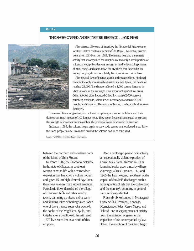
Box 3.2
THE SNOW-CAPPED ANDES INSPIRE RESPECT. . . AND FEAR
After almost 150 years of inactivity, the Nevado del Ruiz volcano,
located 120 km northwest of SantafÈ de Bogot· , Colombia, erupted
violently on 13 November 1985. The intense heat and the seismic
activity that accompanied the eruption melted only a small portion of
volcano's icecap, but this was enough to send a devastating current
of mud, rocks, and ashes down the riverbeds that descended its
slopes, burying almost completely the city of Armero at its base.
After several days of intense search and rescue efforts, hindered
because the only access to the disaster site was by air, the death toll
reached 23,000. The disaster affected a 1,000 square km area in
what was one of the country's most important agricultural areas.
Other affected cities included Chinchin· , where 2,000 persons
perished; Mariquita, where it was necessary to evacuate 20,000
people, and Guayabal. Thousands of homes, roads, and bridges were
destroyed.
These mud flows, originating from volcanic eruptions, are known as lahars, and their
descent can reach speeds of 100 km per hour. They occur frequently and equal or surpass
the strength of incandescent avalanches, the principal cause of volcanic destruction.
In January 1986, the volcano began again to spew toxic gasses on the affected area. Forty
thousand people in a 50 km radius around the volcano had to be evacuated.
Source: PAHO/WHO; Colombian Government reports.
Phot
o: V
izcar
ra, P
AHO/
WHO
119 -151 Minimum
volcano in 1992 spewed ash over a 200km radius.
In South America, most of thevolcanoes that erupted in past centurieswere too far removed from denselypopulated areas to cause much havoc.However, the eruptions of Cotopaxi(Ecuador) in 1877 and Villarica (Chile)in 1936 melted large volumes of ice andsnow that caused avalanches affecting vasturban and agricultural areas. The case ofthe Nevado del Ruiz volcano in Colombiawas similar (see Box 3.2). The eruptionof the Mt. Hudson volcano in southernChile in 1991 affected some 62,000people and caused serious damage to
livestock and agriculture in Chile andArgentina.
HYDROMETEOROLOGICAL HAZARDS
HurricanesAnnually some 80 cyclonesÛor
hurricanes as they have come to beknown in the Western Hemisphere fromthe indigenous term ÏHura Kan,Ó orÏwinds of the GodsÓÛfor m over warmtropical waters during the summermonths. Each year it is estimated thatsome 20,000 people lose their lives totropical storms worldwide; the material
27
CATEGORY
Wind speed (Km/hour)and damages
21 3 4 5
152 -176 Moderate 177 - 209 Strong 210 - 248 Severe >248 Catastrophic
Simpson/Saffir Scale
Map
ada
pted
from
OAS
, 199
1.
Path of tropical storms and hurricanesin the Western Hemisphere
North AtlanticOcean
Gulfof Mexico
Caribbean Sea
North PacificOcean
Figure 3.2
In August 1992 Hurricane Andrew toreacross Eleuthera and other islands inBahamas before delivering its mostforceful blow on the Atlantic and Gulf ofMexico coasts of the U.S., devastatingsouthern Florida and, to a lesser degree,Louisiana. Property damages in theUnited States were estimated at US$30billion.
FloodsFloods are, perhaps, the most frequent
and among the most ruinous type ofnatural disaster; however, they almostnever receive the same immediateattention, for example, that an earthquakeor a hurricane does. Almost everycountry in Latin America and theCaribbean is affected by the problem offloods.
During sudden-onset natural disasters,the different stages—impact, emergencyresponse, and rehabilitation /reconstruction—are clearly delineated.However, with slow-onset floods, theboundaries are less clear. Months canpass before the authorities realize that anemergency exists. The isolation periodmay be prolonged and rehabilitation orreconstruction may overlap with the nextflood.
The phenomenon known as El Niñohas caused cycles of heavy rains anddrought in many parts of the world. Theeffects of El Niño in 1982-83 in SouthAmerica were among the mostdevastating (see Box 3.4).
The principal river cities of Paraguaywere affected during the winter periodsof 1982, 1983, and 1987, and more than3,000 families had to be relocated.Because of its topography, large areas ofArgentina and Uruguay also experienceperiodic flooding.
Between 1990 and 1992,
losses can surpass billions of dollars. TheSimpson/Saffir Scale is used to categorizehurricanes (see Figure 3.2).
According to the OAS, between 1960and 1989 hurricanes claimed 28,000victims, altered the lives of another 6million, and destroyed property valued atclose to US$16 billion in the CaribbeanBasin alone, without counting lossescaused by those storms in Latin America,the United States, and its possessions.
More than 4,000 tropical storms haveoccurred in the last 500 years in theCaribbean, half of which have beenbecome hurricanes. The most devastatingof all happened in October 1780, strikingpractically every island in the Caribbean,beginning with Tobago, continuingthrough the Leeward Islands, and acrossHispaniola. Almost 20,000 peopleperished.
An average of 10 hurricanes threatenthe West Indies and the east coast ofCentral America and Mexico betweenJune and November every year. In 1988Hurricane Gilbert dealt a devastating blowto the Caribbean, leaving hundreds ofthousands of people without shelter inJamaica before cutting across the Yucatánpeninsula and ravaging the Mexican cityof Monterrey (see Box 3.3). Barely twomonths later, after striking the Caribbeancoasts of Venezuela and Colombia,Hurricane Joan left a trail of destructionfrom coast to coast in Nicaragua andother Central American countries. Thenext year, Hurricane Hugo ravaged theLeeward Islands, causing seriousdamages in Antigua, Guadeloupe,Montserrat, Saint Kitts and Nevis, PuertoRico and the U.S. Virgin Islands. Thestorm ended by slamming into theeastern coast of the United States, heavilydamaging the city of Charleston, SouthCarolina.
Between 1990
and 1992,
approximately
two million
people in Bolivia
were seriously
affected by both
heavy flooding
and drought.
28
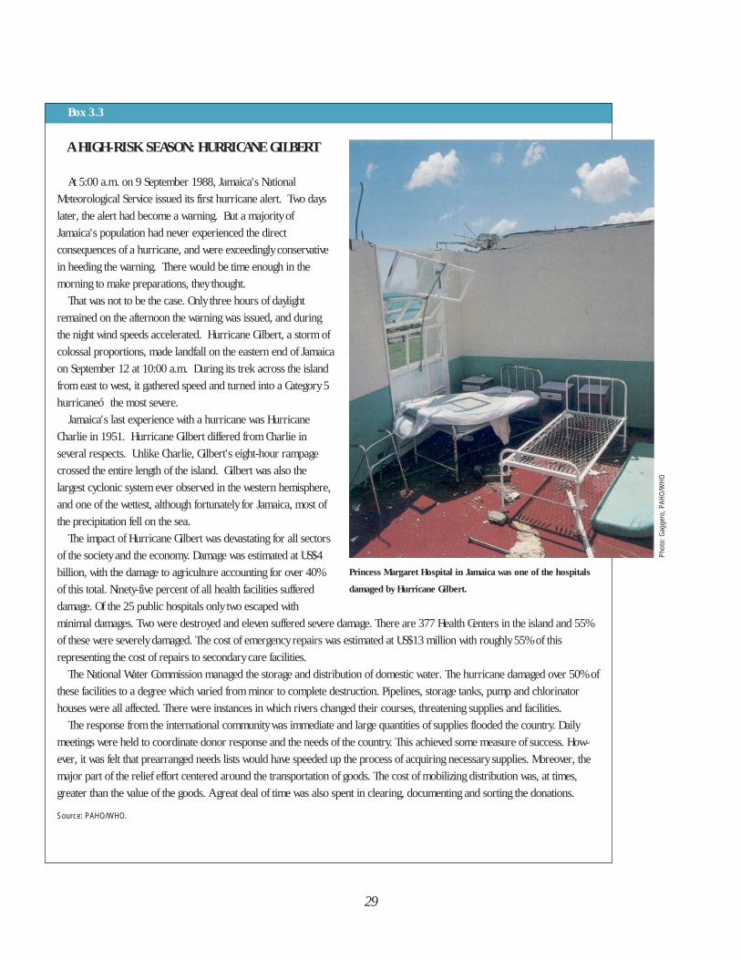
29
Box 3.3
A HIGH-RISK SEASON: HURRICANE GILBERT
At 5:00 a.m. on 9 September 1988, Jamaica's National
Meteorological Service issued its first hurricane alert. Two days
later, the alert had become a warning. But a majority of
Jamaica's population had never experienced the direct
consequences of a hurricane, and were exceedingly conservative
in heeding the warning. There would be time enough in the
morning to make preparations, they thought.
That was not to be the case. Only three hours of daylight
remained on the afternoon the warning was issued, and during
the night wind speeds accelerated. Hurricane Gilbert, a storm of
colossal proportions, made landfall on the eastern end of Jamaica
on September 12 at 10:00 a.m. During its trek across the island
from east to west, it gathered speed and turned into a Category 5
hurricaneó the most severe.
Jamaica's last experience with a hurricane was Hurricane
Charlie in 1951. Hurricane Gilbert differed from Charlie in
several respects. Unlike Charlie, Gilbert's eight-hour rampage
crossed the entire length of the island. Gilbert was also the
largest cyclonic system ever observed in the western hemisphere,
and one of the wettest, although fortunately for Jamaica, most of
the precipitation fell on the sea.
The impact of Hurricane Gilbert was devastating for all sectors
of the society and the economy. Damage was estimated at US$4
billion, with the damage to agriculture accounting for over 40%
of this total. Ninety-five percent of all health facilities suffered
damage. Of the 25 public hospitals only two escaped with
minimal damages. Two were destroyed and eleven suffered severe damage. There are 377 Health Centers in the island and 55%
of these were severely damaged. The cost of emergency repairs was estimated at US$13 million with roughly 55% of this
representing the cost of repairs to secondary care facilities.
The National Water Commission managed the storage and distribution of domestic water. The hurricane damaged over 50% of
these facilities to a degree which varied from minor to complete destruction. Pipelines, storage tanks, pump and chlorinator
houses were all affected. There were instances in which rivers changed their courses, threatening supplies and facilities.
The response from the international community was immediate and large quantities of supplies flooded the country. Daily
meetings were held to coordinate donor response and the needs of the country. This achieved some measure of success. How-
ever, it was felt that prearranged needs lists would have speeded up the process of acquiring necessary supplies. Moreover, the
major part of the relief effort centered around the transportation of goods. The cost of mobilizing distribution was, at times,
greater than the value of the goods. A great deal of time was also spent in clearing, documenting and sorting the donations.
Source: PAHO/WHO.
Princess Margaret Hospital in Jamaica was one of the hospitals
damaged by Hurricane Gilbert.
Phot
o: G
agge
ro, P
AHO/
WHO
30
approximately two million people inBolivia were seriously affected by bothheavy flooding and drought. The floods atthe beginning of 1992 in the northeastpart of the country affected more than40,000 people in 160 communities.Agricultural and livestock losses wereestimated at more than US$16.6 million.The deterioration in the standard of livingand the interruption of basic publichealth services placed the affectedpopulation at risk for outbreaks ofcommunicable diseases.
Cuba, the Dominican Republic, Jamaicaand Trinidad and Tobago are also subjectto frequent flooding which impacts on thetransportation sector, for example,destroying large numbers of bridges androads. But the Caribbean is also prone toflash floods which cannot be predicted bythe national meteorological offices. Anumber of these flash floods are theresult of other hazards such as hurricanes
or landslides.The serious flooding in the Atlantic
region of northern Nicaragua in May andJune 1990 affected more than 100,000people. The indigenous communities ofMiskitos and Sumos, located along thePrinzapolka, Bambana, and Coco Riverswere the most affected, together withsettlements in the coastal areas. Thecondition of the land made cultivationimpossible, resulting in food shortages,which in turn, made the population moresusceptible to endemic diseases in theregion.
A flood’s major effects on health are infour main areas: communicable diseases,environmental sanitation, food andnutrition, and vectors. As a rule,dramatic, well-defined outbreaks ofdiseases generally do not occur in theimmediate aftermath of a flood. Instead, aslower, widespread deterioration ofgeneral health conditions takes place,
Box 3.4
EL NIÑO
In June 1982, scientists again began to observe a series of atmospheric and oceanic changes in the region of the equatorial
Pacific, which were related to the phenomenon known as El Niño. This phenomenon causes floods and droughts at irregu-
lar intervals of between 3 and 16 years along the western coast of South America, as well as in many other areas of the
world. This 1982 occurrence of El Niño caused widespread drought in western Bolivia, southern Peru, northeastern Brazil,
Costa Rica, southern Mexico, Indonesia, the Philippines, Australia, New Guinea, parts of Africa, southern India, and southern
China. It also caused floods in Ecuador, Peru, eastern Bolivia, southern Brazil, northern Argentina, eastern Paraguay, and the
Polynesian islands.
In the housing sector in Peru, the urban slums in Lima were the most affected by this phenomenon. In total, 62,771 dwellings
were partially damaged or destroyed by flooding. The transportation and drinking water and sewerage infrastructure were
practically destroyed. The floods ruptured water and sewerage networks, causing severe shortages of services to most of Peru’s
coastal population, including the city of Piura, where 16,750 meters of pipe were destroyed.
The consequences of El Niño along the coast of Ecuador caused the country’s marine reserves to virtually disappear, severely
damaging the fishing industry. In addition, heavy rainfall in these coastal areas reached into the mountains in some parts,
causing rivers to overflow.
Source: PAHO/WHO.
which all too often becomes part of thechronic lowering of the affectedcommunity’s health status.
In areas that are continually exposed tofloods, a “disaster culture” has developedover time. The people of these regionshave adapted to both the frequency anddifference in intensity by constructingtheir houses on stilts and elevating thefloors with wooden boards as the floodwaters rise. It is not uncommon, whenwater levels have reached a high point, toobserve a boat tied to a window, whichhas become the door!
DroughtDrought is a phenomenon that has
affected large areas of the WesternHemisphere, but perhaps the case whose causes and effects have been moststudied is that of Brazil. Since the 1940s,an increase in the population, the largescale destruction of natural resources,and growing desertification have causedthis country to suffer increasingly severedroughts. These periodic droughtsdestabilize the primitive economy of theregion, deplete the natural resources,burn the grasses, decimate livestock, anddemolish crops, converting the sertãointo a desert landscape whoseinhabitants, deprived of reserves, diefrom lack of food and water. Manymigrate to the large cities, where they addto the growing number who inhabit thefavelas, or slums circling the cities.
The effects of drought, alwaysdisastrous, grow in proportion to theextent of the territory affected. If theaffected area is not very large,neighboring regions that are not affectedcan offer aid. According to the Brazilianauthor Luis Augusto da Silva Vieira, in hisaccount of drought in northeast Brazil inthe first half of this century, the crises
occur in irregular patterns: partialdrought usually occurs every 4 to 5 years,normal drought, every 10 to 11 years,and exceptionally severe cases are seenevery 50 years. The great drought of the1980s verified this, since the twoprevious large-scale droughts hadoccurred in 1877 and 1932.
LandslidesThe impact of landslides depends on
the specific nature of the event and itsorigins. For example, landslide failures ofhillsides or mountain slopes obviouslyconstitute a hazard to human beings andproperty, but in general cause damage inonly a limited geographic area. Bycontrast, volcanic-triggered slides,avalanches, mudflows and lateral blastscan affect larger areas and can causegreater life and property loss. The largemajority of landslides are caused orintensified by geologic andhydrometeorologic factors. The case ofArmero, Colombia, in 1985,demonstrated one of the most destructiveconsequences of a volcanic eruption:volcanic mudflows descended from thesummit of Nevado del Ruiz at greatspeeds following the paths of severalrivers in the area.
However, the most severe landslidesare those caused by the gradualdisplacement of large areas of the earth’ssurface, since their effect on buildingsand other infrastructure is slow butdangerous. This type of landslide istriggered by extremehydrometeorological conditions or byearthquake shaking.
Road and highway construction cancause slope failures: limited budgets oftendictate where and at what angle a slope iscut rather than what is most stable. Whensevere rains occur, the roads collapse,
31
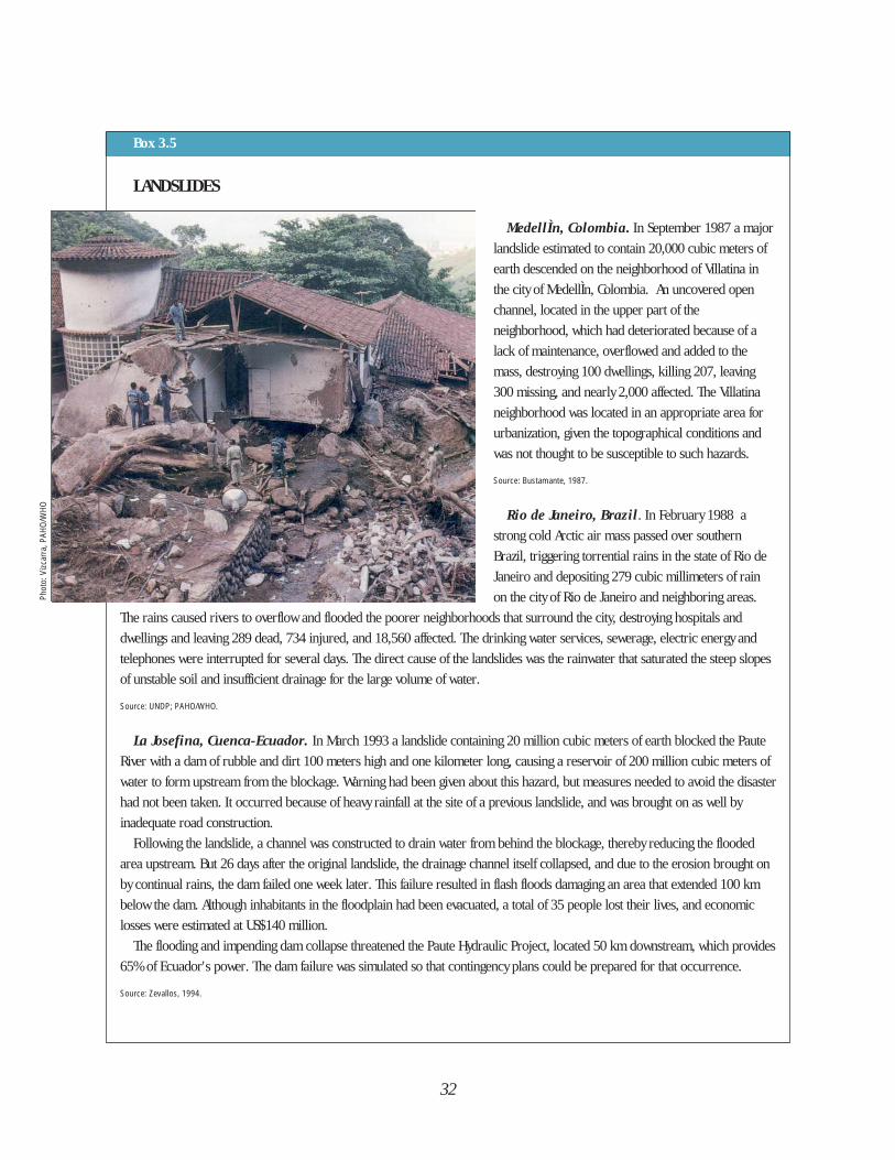
32
Box 3.5
Phot
o: V
izcar
ra, P
AHO/
WHO
LANDSLIDES
MedellÌn, Colombia. In September 1987 a major
landslide estimated to contain 20,000 cubic meters of
earth descended on the neighborhood of Villatina in
the city of MedellÌn, Colombia. An uncovered open
channel, located in the upper part of the
neighborhood, which had deteriorated because of a
lack of maintenance, overflowed and added to the
mass, destroying 100 dwellings, killing 207, leaving
300 missing, and nearly 2,000 affected. The Villatina
neighborhood was located in an appropriate area for
urbanization, given the topographical conditions and
was not thought to be susceptible to such hazards.
Source: Bustamante, 1987.
Rio de Janeiro, Brazil. In February 1988 a
strong cold Arctic air mass passed over southern
Brazil, triggering torrential rains in the state of Rio de
Janeiro and depositing 279 cubic millimeters of rain
on the city of Rio de Janeiro and neighboring areas.
The rains caused rivers to overflow and flooded the poorer neighborhoods that surround the city, destroying hospitals and
dwellings and leaving 289 dead, 734 injured, and 18,560 affected. The drinking water services, sewerage, electric energy and
telephones were interrupted for several days. The direct cause of the landslides was the rainwater that saturated the steep slopes
of unstable soil and insufficient drainage for the large volume of water.
Source: UNDP; PAHO/WHO.
La Josefina, Cuenca-Ecuador. In March 1993 a landslide containing 20 million cubic meters of earth blocked the Paute
River with a dam of rubble and dirt 100 meters high and one kilometer long, causing a reservoir of 200 million cubic meters of
water to form upstream from the blockage. Warning had been given about this hazard, but measures needed to avoid the disaster
had not been taken. It occurred because of heavy rainfall at the site of a previous landslide, and was brought on as well by
inadequate road construction.
Following the landslide, a channel was constructed to drain water from behind the blockage, thereby reducing the flooded
area upstream. But 26 days after the original landslide, the drainage channel itself collapsed, and due to the erosion brought on
by continual rains, the dam failed one week later. This failure resulted in flash floods damaging an area that extended 100 km
below the dam. Although inhabitants in the floodplain had been evacuated, a total of 35 people lost their lives, and economic
losses were estimated at US$140 million.
The flooding and impending dam collapse threatened the Paute Hydraulic Project, located 50 km downstream, which provides
65% of Ecuador's power. The dam failure was simulated so that contingency plans could be prepared for that occurrence.
Source: Zevallos, 1994.
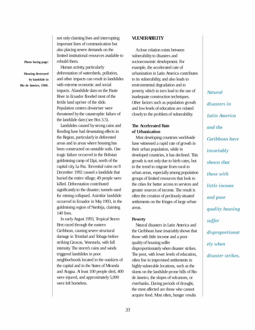
not only claiming lives and interruptingimportant lines of communication butalso placing severe demands on thelimited institutional resources available torebuild them.
Human activity, particularlydeforestation of watersheds, pollution,and other impacts can result in landslideswith extreme economic and socialimpacts. A landslide dam on the PauteRiver in Ecuador flooded most of thefertile land upriver of the slide.Population centers downriver werethreatened by the catastrophic failure ofthe landslide dam (see Box 3.5).
Landslides caused by strong rains andflooding have had devastating effects inthe Region, particularly in deforestedareas and in areas where housing hasbeen constructed on unstable soils. Onetragic failure occurred in the Boliviangoldmining camp of Llipi, north of thecapital city, La Paz. Torrential rains on 8December 1992 caused a landslide thatburied the entire village; 49 people werekilled. Deforestation contributedsignificantly to the disaster; tunnels usedfor mining collapsed. A similar landslideoccurred in Ecuador in May 1993, in thegoldmining region of Nambija, claiming140 lives.
In early August 1993, Tropical StormBret raced through the easternCaribbean, causing severe structuraldamage in Trinidad and Tobago beforestriking Caracas, Venezuela, with fullintensity. The storm’s rains and windstriggered landslides in poorneighborhoods located in the outskirts ofthe capital and in the States of Mirandaand Aragua. At least 100 people died, 400were injured, and approximately 5,000were left homeless.
VULNERABILITY
A close relation exists betweenvulnerability to disasters andsocioeconomic development. Forexample, the accelerated rate ofurbanization in Latin America contributesto its vulnerability, and also leads toenvironmental degradation and topoverty, which in turn lead to the use ofinadequate construction techniques.Other factors such as population growthand low levels of education are relatedclosely to the problem of vulnerability.
The Accelerated Rate of Urbanization
Most developing countries worldwidehave witnessed a rapid rate of growth intheir urban population, while indeveloped countries, it has declined. Thisgrowth is not only due to birth rates, butto the trend to migrate from rural tourban areas, especially among populationgroups of limited resources that look tothe cities for better access to services andgreater sources of income. The result isoften the creation of perilously situatedsettlements on the fringes of large urbanareas.
PovertyNatural disasters in Latin America and
the Caribbean have invariably shown thatthose with little income and a poorquality of housing sufferdisproportionately when disaster strikes.The poor, with lower levels of education,often live in improvised settlements inhighly vulnerable locations, such as theslums on the landslide-prone hills of Riode Janeiro, the slopes of volcanoes, orriverbanks. During periods of drought,the most affected are those who cannotacquire food. Most often, hunger results
Natural
disasters in
Latin America
and the
Caribbean have
invariably
shown that
those with
little income
and poor
quality housing
suffer
disproportionat
ely when
disaster strikes.
33
Photo facing page:
Housing destroyed
by landslide in
Rio de Janeiro, 1988.
from a lack of money to purchase foodrather than from the lack of food itself.Poverty is also the greatest cause of bothinternal and international migration,which poses serious challenges in termsof immediate assistance, as well as inlong-term development efforts.
A study by UNDRO (1988) estimatedthat 95% of the deaths caused bydisasters occurred among 66% of thepopulation of the world’s poorercountries. In Japan, for example, anaverage of 63 persons die each yearbecause of natural disasters. In Peru, acountry with a similar incidence ofdisasters, the toll is 2,900.
Latin America and the Caribbean sharea problem common to many parts of theworld: not only do the poor receive adisproportionate share of the impact ofthe disaster itself, but they also are at adisadvantage during the rehabilitationand reconstruction phases. Prior to adisaster, this group depends on theirlimited income, often generated at home,for their daily survival. A disaster not onlyrobs them of their source of income, butthey cannot absorb the additionalexpense of purchasing materials forreconstruction. This accelerates thepoverty cycle, which, in turn, heightensvulnerability to disasters.
Vulnerability of ConstructionsThe type of construction, as well as
population density in the areas of greatesthazard, increase vulnerability. It isestimated that almost 90% of the victimsof earthquakes are injured by thecollapse of buildings, as was the case inNicaragua in 1972 and in Guatemala in1976. A similar situation occured inDominica in 1979 and Montserrat in1989, where an estimated 90% of thehousing that collapsed was due to non-
compliance with hurricane or wind-resistant codes.
Most old constructions in Latin Amer-ica, both housing and institutions, aremade of adobe and unreinforcedmasonry. Adobe houses do not resistearthquakes in the same way as woodstructures, which are lighter and moreflexible. The weight of the clay tile roofsof many of these structures alsocontributes to their instability, as was thecase in the earthquake of Guatemala,where many died as a result of collapsedbuildings.
To a great extent in the Region, theinfrastructure of basic services such aswater and energy is old, and manycountries lack the resources to maintainit properly. Weak infrastructure poses agreat obstacle to providing uninterruptedservices. In times of disaster, hospitalsand educational facilities, which overdecades have undergone structuralmodifications without taking into accountsafety considerations, put alreadyvulnerable groups—children, the sick,and the poor—at greater risk.
Environmental FactorsThe environment surrounding human
settlements contributes to disasters. Insome cases, these surroundings cannotbe modified and people must learn toadapt to avoid the serious consequencesinherent to the location. For example,soil type is a determining factor as to whyearthquakes cause more damage in someplaces than in others. The earthquake of1985 in Mexico had its epicenter off thecoast of the state of Guerrero, 350 km tothe southwest of Mexico City. The coastalcity closest to the epicenter, Acapulco,suffered only minor damages, but thecapital was devastated. Mexico City wasconstructed on the site of the ancient
34
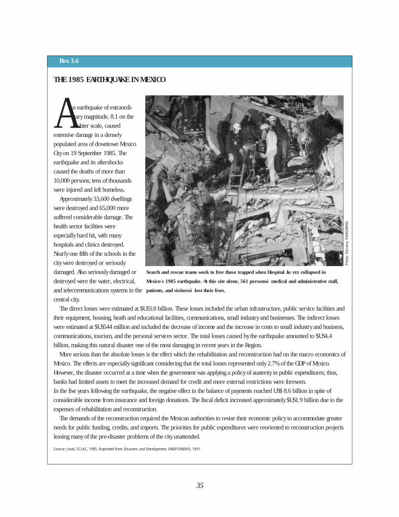
35
Box 3.6
THE 1985 EARTHQUAKE IN MEXICO
A n earthquake of extraordi-
nary magnitude, 8.1 on the
Richter scale, caused
extensive damage in a densely
populated area of downtown Mexico
City on 19 September 1985. The
earthquake and its aftershocks
caused the deaths of more than
10,000 persons; tens of thousands
were injured and left homeless.
Approximately 33,600 dwellings
were destroyed and 65,000 more
suffered considerable damage. The
health sector facilities were
especially hard hit, with many
hospitals and clinics destroyed.
Nearly one fifth of the schools in the
city were destroyed or seriously
damaged. Also seriously damaged or
destroyed were the water, electrical,
and telecommunications systems in the
central city.
The direct losses were estimated at $US3.8 billion. These losses included the urban infrastructure, public service facilities and
their equipment, housing, heath and educational facilities, communications, small industry and businesses. The indirect losses
were estimated at $US544 million and included the decrease of income and the increase in costs to small industry and business,
communications, tourism, and the personal services sector. The total losses caused by the earthquake amounted to $US4.4
billion, making this natural disaster one of the most damaging in recent years in the Region.
More serious than the absolute losses is the effect which the rehabilitation and reconstruction had on the macro economics of
Mexico. The effects are especially significant considering that the total losses represented only 2.7% of the GDP of Mexico.
However, the disaster occurred at a time when the government was applying a policy of austerity in public expenditures; thus,
banks had limited assets to meet the increased demand for credit and more external restrictions were foreseen.
In the five years following the earthquake, the negative effect in the balance of payments reached US$ 8.6 billion in spite of
considerable income from insurance and foreign donations. The fiscal deficit increased approximately $US1.9 billion due to the
expenses of rehabilitation and reconstruction.
The demands of the reconstruction required the Mexican authorities to revise their economic policy to accommodate greater
needs for public funding, credits, and imports. The priorities for public expenditures were reoriented to reconstruction projects
leaving many of the pre-disaster problems of the city unattended.
Source: Jovel, ECLAC, 1985. Reprinted from Disasters and Development, UNDP/UNDRO, 1991.
Phot
o: V
izcar
ra, P
AHO/
WHO
Search and rescue teams work to free those trapped when Hospital Ju· rez collapsed in
Mexico's 1985 earthquake. At this site alone, 561 personsó medical and administrative staff,
patients, and visitorsó lost their lives.
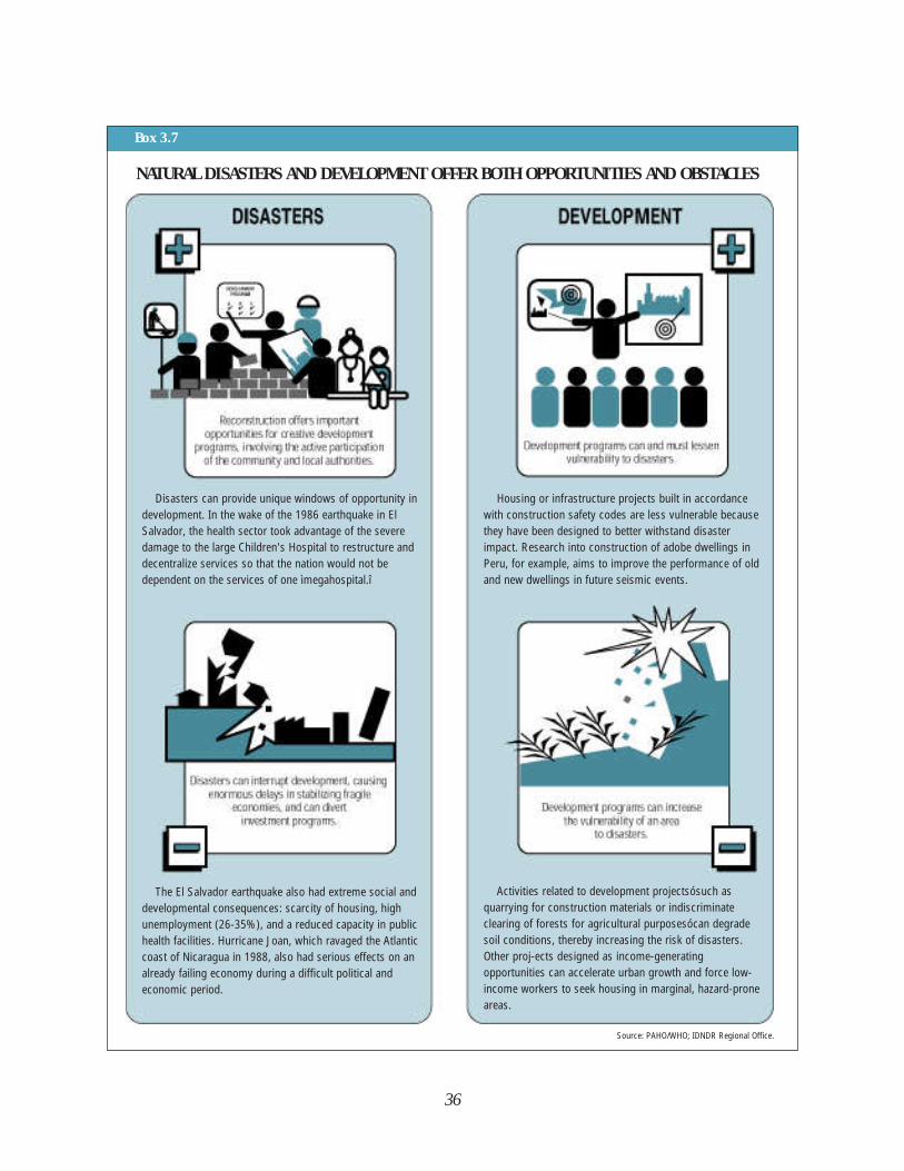
36
Box 3.7
NATURAL DISASTERS AND DEVELOPMENT OFFER BOTH OPPORTUNITIES AND OBSTACLES
Disasters can provide unique windows of opportunity indevelopment. In the wake of the 1986 earthquake in ElSalvador, the health sector took advantage of the severedamage to the large Children's Hospital to restructure anddecentralize services so that the nation would not bedependent on the services of one ìmegahospital.î
The El Salvador earthquake also had extreme social anddevelopmental consequences: scarcity of housing, highunemployment (26-35%), and a reduced capacity in publichealth facilities. Hurricane Joan, which ravaged the Atlanticcoast of Nicaragua in 1988, also had serious effects on analready failing economy during a difficult political andeconomic period.
Source: PAHO/WHO; IDNDR Regional Office.
Housing or infrastructure projects built in accordancewith construction safety codes are less vulnerable becausethey have been designed to better withstand disasterimpact. Research into construction of adobe dwellings inPeru, for example, aims to improve the performance of oldand new dwellings in future seismic events.
Activities related to development projectsósuch asquarrying for construction materials or indiscriminateclearing of forests for agricultural purposesócan degradesoil conditions, thereby increasing the risk of disasters.Other proj-ects designed as income-generatingopportunities can accelerate urban growth and force low-income workers to seek housing in marginal, hazard-proneareas.
37
THE RELATIONSHIP BETWEENDISASTER AND DEVELOPMENT
Nations increase their capacities anddecrease their vulnerabilities throughdevelopment. Development planning isused by governments to draft plans toguide economic and social development.The concept of sustainable developmentis widely recognized by internationalagencies and by governments, althoughits definition is not universally agreedupon. Sustainable development is theoutcome of comprehensive planning thatincorporates considerations of disasterrisk (reducing hazards and vulnerability)as well as strategies designed to protectthe environment and to improveeconomic growth, levels of education,and living conditions of the entirepopulation (see Box 3.7).
Economic losses caused by a disasterof great magnitude often exceed theannual gross income of a country. It isnot surprising then that these events canparalyze the affected countries and causesocial and political disturbances. TheWorld Bank has estimated that indeveloping countries, the economiclosses due to disasters, as percentages ofthe gross domestic product (GDP), are20 times higher than in industrializedcountries.
According to the EconomicCommission for Latin America and theCaribbean (ECLAC), disasters have threetypes of economic repercussions: directeffects on property; indirect effectscaused by losses in economic productionand services; and secondary effects thatare manifested after the disaster in areduced national revenue, increasedinflation, problems of foreign trade,increased public spending, the resultingfiscal deficit, and reduced monetary
Aztec capital of Tenochitlán. Over thecenturies, the lake which surrounded theAztec capital as a moat had shrunk,leaving deep layers of clay, sand, andgravel beneath the surface. Unlike solidrock, Mexico City’s soil transmittedseismic waves as rocking motions, similarto ocean swells, which many edificescould not withstand (see Box 3.6).
In other cases, man’s attempts tomodify his surroundings contribute todisaster situations. Deforestation,environmental degradation, and theirrational use of land create precariousconditions that multiply the effects ofdisasters. For example, deforestationleads to water runoff which contributes toflooding and landslides; the destructionof mangroves reduces the ability ofcoastal regions to resist tropical windsand high waves.
The use of advanced technology incommercial agricultural production canbe harmful. When machines are used tofarm fertile areas of a country, the rurallabor force loses its source ofemployment and has no recourse but tomove to more marginal areas.
Drought conditions often areexacerbated by inadequate growingpatterns, excess of pasture lands,indiscriminate exploitation of naturalresources, deforestation, orinappropriate land conservationtechniques. Deforestation in Haiti, duepartially to the exportation of fine woods,and to the lack of fuel, contributed todrought conditions in this country. InLatin America, approximately one fifth ofthe territory is threatened bydesertification, which can leave in itswake social unrest, conflicts, and massmigrations, in addition to hunger anddisease.
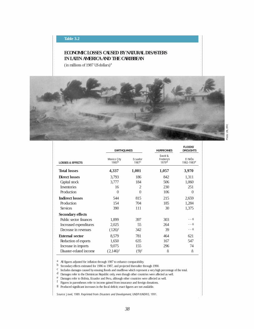
38
FLOODS/EARTHQUAKES HURRICANES DROUGHTS
David &Mexico City Ecuador Frederick El NiÒo
1985b 1987c 1979d 1982-1983e
Total losses 4,337 1,001 1,057 3,970
Direct losses 3,793 186 842 1,311Capital stock 3,777 184 506 1,060Inventories 16 2 230 251Production 0 0 106 0
Indirect losses 544 815 215 2,659Production 154 704 185 1,284Services 390 111 30 1,375
Secondary effectsPublic sector finances 1,899 397 303 . . g
Increased expenditures 2,025 55 264 . . g
Decrease in revenues (126)f 342 39 . . g
External sector 8,579 781 464 621Reduction of exports 1,650 635 167 547Increase in imports 9,075 155 296 74Disaster-related income (2,146)f (9)f ñ ñ
a All figures adjusted for inflation through 1987 to enhance comparability.b Secondary effects estimated for 1986 to 1987, and projected thereafter through 1990.c Includes damages caused by ensuing floods and mudflows which represent a very high percentage of the total.d Damages refer to the Dominican Republic only, even though other countries were affected as well.e Damages refer to Bolivia, Ecuador and Peru, although other countries were affected as well.f Figures in parentheses refer to income gained from insurance and foreign donations.g Produced significant increases in the fiscal deficit; exact figures are not available.
Source: Jovel, 1989. Reprinted from Disasters and Development, UNDP/UNDRO, 1991.
Table 3.2
ECONOMIC LOSSES CAUSED BY NATURAL DISASTERS IN LATIN AMERICA AND THE CARIBBEAN(in millions of 1987 US dollars)a
LOSSES & EFFECTS
Phot
o: U
N, IF
RC
reserves. Table 3.2 presents estimated economic
losses caused by selected naturaldisasters in Latin America and theCaribbean. Although these losses are notdevastating for industrialized countrieswith strong economies, they have seriousand lasting effects on the susceptibleeconomies of developing countries. Forexample, drought and floods in Bolivia,Ecuador, and Peru associated with ElNiÒo reduced the per capita income by10% and elevated some retail food pricesby 50%. Although the direct lossescaused by the Mexico earthquake wereequivalent to only 2.7% of the GDP, theexpenditures for reconstruction andrehabilitation of basic services wreakedhavoc on the economy, at a time whenMexico was operating under a policy offiscal austerity.
RISK IN LATIN AMERICA AND THE CARIBBEAN
While risk is concrete and measurable,it is also relative and depends on how
awaiting the food, clothing, and buildingmaterials from agencies in charge of theemergency response. Planners view thisrisk of living on the river bank asunacceptable; for them, the ideal solutionis to relocate these people. But thepeople themselves are attached tofamiliar areas, may be more afraid ofunknown hazards than familiar ones, andmay insist on staying.
In Latin America and the Caribbean,important relationships exist betweennatural hazards, the particularvulnerability of each community orpopulation group, and the risks eachfaces of suffering the effects of disaster.To convince people that they should takesteps to become less vulnerable, and thengive them a way to overcome the risk, isthe vision of all who work in the field ofdisaster reduction. ◆
39
To convince
people that
they should
take steps to
become less
vulnerable, and
then give them
a way to
overcome the
risk is the
vision of all
who work in
the field of
disaster
reduction.
communities view it. People constantlyattempt to diminish their vulnerability tohazards, while at the same timemaintaining a balance between the riskand the benefits attached to them. Forexample, living near a volcano presentsthe threat of an eruption, but provides theadvantage of fertile lands for agriculture.
Calculating to make risks measurablemakes them seem controllable. But it isone thing for planners to calculate risksand another for people to accept thecalculations, want to act on them, andthen have the means to do so. Manyfamilies who live in areas prone to theperiodic flooding of rivers rebuild theirdwellings on the same sites while
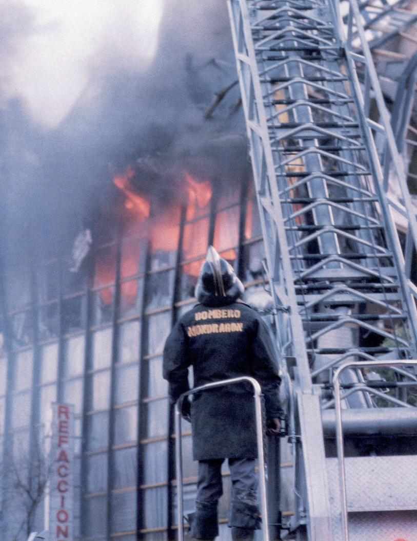
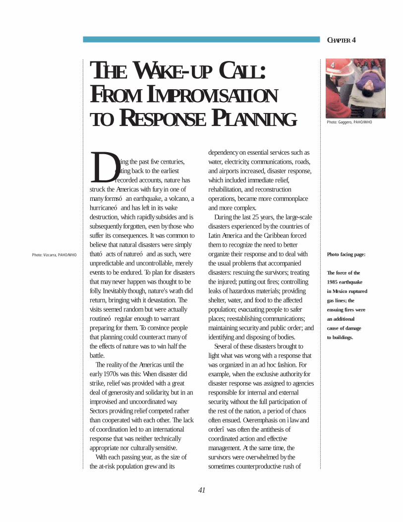
During the past five centuries,dating back to the earliestrecorded accounts, nature has
struck the Americas with fury in one ofmany formsó an earthquake, a volcano, ahurricaneó and has left in its wakedestruction, which rapidly subsides and issubsequently forgotten, even by those whosuffer its consequences. It was common tobelieve that natural disasters were simplytható acts of natureó and as such, wereunpredictable and uncontrollable, merelyevents to be endured. To plan for disastersthat may never happen was thought to befolly. Inevitably though, nature's wrath didreturn, bringing with it devastation. Thevisits seemed random but were actuallyroutineó regular enough to warrantpreparing for them. To convince peoplethat planning could counteract many ofthe effects of nature was to win half thebattle.
The reality of the Americas until theearly 1970s was this: When disaster didstrike, relief was provided with a greatdeal of generosity and solidarity, but in animprovised and uncoordinated way.Sectors providing relief competed ratherthan cooperated with each other. The lackof coordination led to an internationalresponse that was neither technicallyappropriate nor culturally sensitive.
With each passing year, as the size ofthe at-risk population grew and its
dependency on essential services such aswater, electricity, communications, roads,and airports increased, disaster response,which included immediate relief,rehabilitation, and reconstructionoperations, became more commonplaceand more complex.
During the last 25 years, the large-scaledisasters experienced by the countries ofLatin America and the Caribbean forcedthem to recognize the need to betterorganize their response and to deal withthe usual problems that accompanieddisasters: rescuing the survivors; treatingthe injured; putting out fires; controllingleaks of hazardous materials; providingshelter, water, and food to the affectedpopulation; evacuating people to saferplaces; reestablishing communications;maintaining security and public order; andidentifying and disposing of bodies.
Several of these disasters brought tolight what was wrong with a response thatwas organized in an ad hoc fashion. Forexample, when the exclusive authority fordisaster response was assigned to agenciesresponsible for internal and externalsecurity, without the full participation ofthe rest of the nation, a period of chaosoften ensued. Overemphasis on ì law andorderî was often the antithesis ofcoordinated action and effectivemanagement. At the same time, thesurvivors were overwhelmed by thesometimes counterproductive rush of
41
CHAPTER 4
THE WAKE-UP CALL:FROM IMPROVISATIONTO RESPONSE PLANNING
Photo facing page:
The force of the
1985 earthquake
in Mexico ruptured
gas lines; the
ensuing fires were
an additional
cause of damage
to buildings.
Photo: Vizcarra, PAHO/WHO
Photo: Gaggero, PAHO/WHO
During the
1980s, civil
defense
organizations
began to
include
disaster
preparedness
for the public
in their
activities.
local, national, and international agencieswhose goodwill often exceeded theirmandate to provide assistance.
The response phase to disaster iscomplex, because in addition to thenumber of organizations that are involved,the greatest problems lie in makingdecisions under uncertain circunstances.Matters become even more complicatedwhen agencies, unsure of their roles evenin normal times, undertake operationsthat interrupt rather than coordinate theefforts of all the groups involved.
THE EVOLUTION OF NATIONALRESPONSE ORGANIZATIONS
The official response to disaster in LatinAmerica and the Caribbean has steadilyimproved. Early on, emergency responsewas dominated by a country’s armedforces, national Red Cross or in the caseof English-speaking territories in theCaribbean, by the governor. Today’sresponse involves civil defense or disasterresponse agencies, usually functioningunder the Ministries of Defense orInterior. These agencies organize andcoordinate the country’s disaster responseas well as maintain public order andnational security.
Despite improvement in emergencysituations, between 1970 and 1985 manycivil defense systems had a tendency—understandable under military regimes—to confuse “coordination” with“command.” This confusion provokedconflicts regarding their role and led to anineffective use of health sector and otherpublic sector resources. Governmentaland nongovernmental institutions vied toplay a leading role and thus gain nationaland international recognition.
One of the success stories in terms of agovernment response took place in the
Huaylas Canyon disaster in Peru in 1970,during which the civil defensedemonstrated their effectiveness,delegating “first responder”responsibilities to the Armed Forces in thisremote and inaccessible area of thecountry. Medical personnel, paramedics,and drugs were on the ground four daysafter the earthquake, when a Herculesplane belonging to the Peruvian Air Forcecircled the area and dropped by parachute50 soldiers, 4 doctors, and 7 nurses onthe area—the only health personneltrained in parachuting in the country.
During the 1980s, civil defenseorganizations began to include disasterpreparedness for the public in theiractivities. As they engaged in preparingplans and programs to manage disasters,they became more capable and equippedto train personnel in many sectors andexpand their organization from the localto the regional levels.
Toward the mid-1980s, national-levelagencies and organizations with a role inresponding to disasters joined together,and with the technical support ofinternational organizations (includingPAHO/WHO, UNDRO, the Office of U.S.Foreign Disaster Assistance[OFDA/USAID], UNESCO, and others),identified priority areas in order to avoidduplication of activities. In most cases, thecivil defense institutions recognized theneed for the public to participate moreactively and become better prepared toface disasters.
42
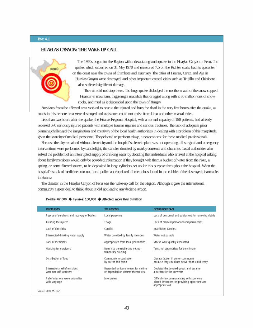
43
Box 4.1
HUAYLAS CANYON: THE WAKE-UP CALL
The 1970s began for the Region with a devastating earthquake in the Huaylas Canyon in Peru. The
quake, which occurred on 31 May 1970 and measured 7.5 on the Richter scale, had its epicenter
on the coast near the towns of Chimbote and Huarmey. The cities of Huaraz, Caraz, and Aija in
Huaylas Canyon were destroyed, and other important coastal cities such as Trujillo and Chimbote
also suffered significant damage.
The ruin did not stop there. The huge quake dislodged the northern wall of the snow-capped
Huascar· n mountain, triggering a mudslide that dragged along with it 80 million tons of snow,
rocks, and mud as it descended upon the town of Yungay.
Survivors from the affected area worked to rescue the injured and bury the dead in the very first hours after the quake, as
roads in this remote area were destroyed and assistance could not arrive from Lima and other coastal cities.
Less than two hours after the quake, the Huaraz Regional Hospital, with a normal capacity of 150 patients, had already
received 670 seriously injured patients with multiple trauma injuries and serious fractures. The lack of adequate prior
planning challenged the imagination and creativity of the local health authorities in dealing with a problem of this magnitude,
given the scarcity of medical personnel. They elected to perform triage, a new concept for these medical professionals.
Because the city remained without electricity and the hospital's electric plant was not operating, all surgical and emergency
interventions were performed by candlelight, the candles donated by nearby convents and churches. Local authorities also
solved the problem of an interrupted supply of drinking water by deciding that individuals who arrived at the hospital asking
about family members would only be provided information if they brought with them a bucket of water from the river, a
spring, or some filtered source, to be deposited in large cylinders set up for this purpose throughout the hospital. When the
hospital's stock of medicines ran out, local police appropriated all medicines found in the rubble of the destroyed pharmacies
in Huaraz.
The disaster in the Huaylas Canyon of Peru was the wake-up call for the Region. Although it gave the international
community a great deal to think about, it did not lead to any decisive action.
Deaths: 67,000 ◆ Injuries: 150,000 ◆ Affected: more than 3 million
PROBLEMS SOLUTIONS COMPLICATIONS
Rescue of survivors and recovery of bodies Local personnel Lack of personnel and equipment for removing debris
Treating the injured Triage Lack of medical personnel and paramedics
Lack of electricity Candles Insufficient candles
Interrupted drinking water supply Water provided by family members Water not potable
Lack of medicines Appropriated from local pharmacies Stocks were quickly exhausted
Housing for survivors Return to the rubble and set up Tents not appropriate for the climatetemporary housing
Distribution of food Community organization Dissatisfaction in donor community by sector and camp because they could not deliver food aid directly
International relief missions Depended on items meant for victims Depleted the donated goods and became were not self-sufficient or depended on victims themselves a burden for the survivors
Relief missions were unfamiliar Interpreters Difficulty in communicating with survivorswith language placed limitations on providing opportune and
appropriate aid
Source: CRYRZA, 1971.
THE EVOLUTION OF INTERNATIONAL ASSISTANCE
Thanks to the rapid growth ofcommunications technology, today news ofmajor disasters today spreads worldwidein a matter of minutes. One cannotunderestimate the effectÛfor good andfor badÛthis speed has had oninternational response. Quickcommunication about disasters permitsorganizations to act immediately to offerrelief. But this same quick communication
is often incomplete and can encourageinappropriate actions based on erroneousinformation.
The earthquakes of Peru (1970) andGuatemala (1976) in Latin America, andHurricane David (1979) in Dominicawere the turning points in transformingthe response of the countries of theRegionÛfr om improvised to betterpreparedÛjust as the 1970 cyclone inBan-gladesh (in which 250,000 peopledied) and the earthquake in Nicaragua(1972) served to trigger similar changes
44
Box 4.2
GUATEMALA EARTHQUAKE: THE MAGNITUDE OF THE AFFECTED AREA PRESENTS A CHALLENGE
In the early pre-dawn hours of 4 February 1976, Guatemala was rocked by an earthquake
measuring 7.5 on the Richter scale. Once again, needs during the first critical days following the
disaster were spontaneously met by the very survivors and by the national authorities, with their
own resources. Because in this situation it was easy for people from neighboring countries in
Central America and Mexico to reach Guatemala during the search and rescue phase, the country
received support in first aid.
The damages caused by the earthquake awakened a spontaneous national reaction, worthy of
commendation, and the large amount of international relief undoubtedly served the country in its short-term recovery
efforts.
The National Emergency Committee (CONE), created in 1969, worked with dedication, although the lack of preparedness
on the part of many sectors and the absence of experience in intersectoral planning caused the response to be more
improvised than coordinated. CONE?s contingency plans did not allow for meaningful participation of the civilian sector and
were not designed for an emergency of this magnitude.
This disaster served as a second warning for the international community, but in this case, the health sector at the
regional level did respond adequately.
Deaths: 23,000 ◆ Injuries: 77,000 ◆ Affected: 3.7 millionPROBLEMS SOLUTIONS COMPLICATIONS
Destruction of health infrastructure Care provided in improvised hospitals Insufficient human resources and equipment
Problems of organization in the governmental Direct command by the President Dissatisfaction among populationresponse to the disaster and the Armed Forces
Excessive amounts of unsolicited Multiple points of distribution Perishable food spoiled and clothing inappropriateinternational aid for the climate was wasted
Inappropriate temporary housing (ÏigloosÓ) Survivors stayed in the ruins of their ÏIgloosÓ were not used and thus wastedhomes or used tents Source: PAHO/WHO.
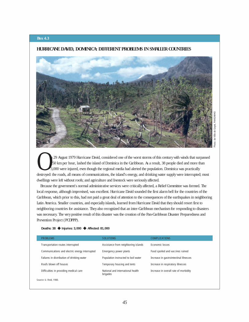
45
Box 4.3
HURRICANE DAVID, DOMINICA: DIFFERENT PROBLEMS IN SMALLER COUNTRIES
O n 29 August 1979 Hurricane David, considered one of the worst storms of this century with winds that surpassed
250 km per hour, lashed the island of Dominica in the Caribbean. As a result, 38 people died and more than
3,000 were injured, even though the regional media had alerted the population. Dominica was practically
destroyed: the roads, all means of communications, the island's energy, and drinking water supply were interrupted; most
dwellings were left without roofs; and agriculture and livestock were seriously affected.
Because the government's normal administrative services were critically affected, a Relief Committee was formed. The
local response, although improvised, was excellent. Hurricane David sounded the first alarm bell for the countries of the
Caribbean, which prior to this, had not paid a great deal of attention to the consequences of the earthquakes in neighboring
Latin America. Smaller countries, and especially islands, learned from Hurricane David that they should resort first to
neighboring countries for assistance. They also recognized that an inter-Caribbean mechanism for responding to disasters
was necessary. The very positive result of this disaster was the creation of the Pan-Caribbean Disaster Preparedness and
Prevention Project (PCDPPP).
Deaths: 38 ◆ Injuries: 3,000 ◆ Affected: 81,000
PROBLEMS SOLUTIONS COMPLICATIONS
Transportation routes interrupted Assistance from neighboring islands Economic losses
Communications and electric energy interrupted Emergency power plants Food spoiled and vaccines ruined
Failures in distribution of drinking water Population instructed to boil water Increase in gastrointestinal illnesses
Roofs blown off houses Temporary housing and tents Increase in respiratory illnesses
Difficulties in providing medical care National and international health Increase in overall rate of morbiditybrigades
Source: U. Reid, 1980.
Phot
o: d
e Vi
lle d
e Go
yet,
PAHO
/WHO
46
at the international level (see boxes 4.1-4.4).
The Earthquake in NicaraguaTwo years after the tragedy in Peru’s
Huaylas Canyon, shortly before Christmasof 1972, an earthquake shatteredNicaragua. The international communityreacted with great solidarity and assistancecame quickly and spontaneously,especially from neighboring countries.
However, the response was difficult forNicaragua; the civil agencies, sufferingserious losses, were late in gettingorganized. When they did, the responsewas uncoordinated. As more informationon the effects of the earthquake becameknown, other countries began to send all types of assistance, most of which had notbeen requested. This inundation ofsupplies created serious problems interms of classification, storage,transportation, and distribution. Most ofthe well-known anecdotes oninappropriate international assistancecome from the experience of thisearthquake: winter clothing sent to atropical country, perishable foodsunfamiliar to the local population,transport of the injured outside thecountry without documenting the cases,the construction of insulated “igloos” in awarm climate, to name a few.
At the same time, the emergencysituation itself helped to break downbarriers, and many positive examples ofinternational solidarity occurred. Anexample of humanitarian concernsprevailing over political differences wasthe mobile hospital erected in Managua bythe government of Cuba, even though thetwo governments did not maintaindiplomatic relations.
The earthquake in Nicaragua showedthe international community the problems
of an inappropriate natural disasterresponse, but knowing the problemsdidn’t automatically produce solutions. In1976, when another major earthquakestruck Guatemala, patterns of internationalassistance had changed little, and many ofthe same errors made in Nicaragua wererepeated. Improvisation and an absence ofplanning for the response resulted inwasted external aid.
Regional organizations, PAHO/WHO inparticular, saw that they faced a doublechallenge: (1) to offer technicalcooperation in disaster preparedness forthe countries of this Region and (2) tocoordinate health assistance (within theframework established by UNDRO,mandated by a resolution adopted by theU.N. General Assembly after the cyclone inBangladesh). As a result of the 1976Guatemala earthquake, the Ministers ofHealth of PAHO’s Member Countriesrequested that the Director create theEmergency Preparedness and DisasterRelief Coordination Program (Resolution X,Directing Council XXIV). The health sectorin Latin America and the Caribbean therebyset the example of integrating publicservices with the civil sector in disasterpreparedness at the regional level.
However, creating regional mechanismsfor coordinating international responseand establishing national preparednessprograms alone do not guarantee reformin international assistance; internationalorganizations have their own dynamicswhich are not always relevant to the needsof victims of disasters. Any large-scaledisaster will show what still happens, inspite of a country’s readiness, wheninternational aid does not respond tospecific needs.
The Earthquake in MexicoIn September 1985 Mexico suffered a
Any large-scale
disaster will
show what still
happens, in spite
of a country’s
readiness, when
international
aid does not
respond to
specific needs.
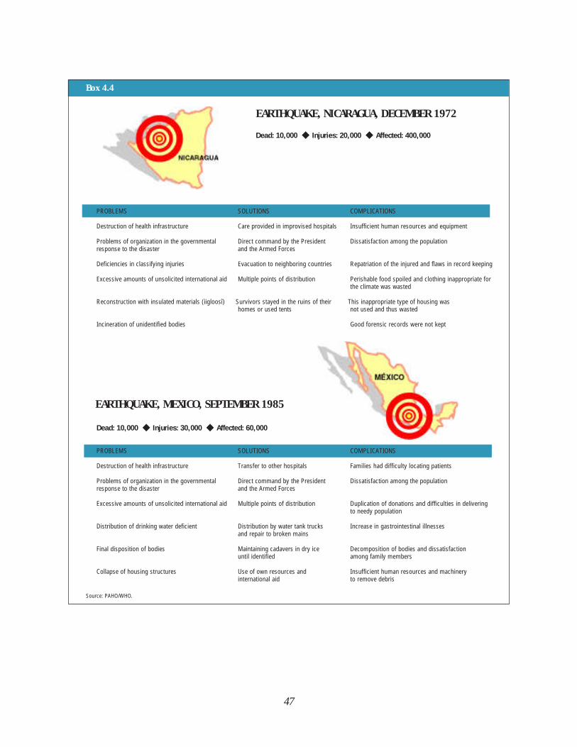
47
Box 4.4
EARTHQUAKE, NICARAGUA, DECEMBER 1972
Dead: 10,000 ◆ Injuries: 20,000 ◆ Affected: 400,000
PROBLEMS SOLUTIONS COMPLICATIONS
Destruction of health infrastructure Care provided in improvised hospitals Insufficient human resources and equipment
Problems of organization in the governmental Direct command by the President Dissatisfaction among the populationresponse to the disaster and the Armed Forces
Deficiencies in classifying injuries Evacuation to neighboring countries Repatriation of the injured and flaws in record keeping
Excessive amounts of unsolicited international aid Multiple points of distribution Perishable food spoiled and clothing inappropriate for the climate was wasted
Reconstruction with insulated materials (ìigloosî) Survivors stayed in the ruins of their This inappropriate type of housing was homes or used tents not used and thus wasted
Incineration of unidentified bodies Good forensic records were not kept
EARTHQUAKE, MEXICO, SEPTEMBER 1985
Dead: 10,000 ◆ Injuries: 30,000 ◆ Affected: 60,000
PROBLEMS SOLUTIONS COMPLICATIONS
Destruction of health infrastructure Transfer to other hospitals Families had difficulty locating patients
Problems of organization in the governmental Direct command by the President Dissatisfaction among the population response to the disaster and the Armed Forces
Excessive amounts of unsolicited international aid Multiple points of distribution Duplication of donations and difficulties in delivering to needy population
Distribution of drinking water deficient Distribution by water tank trucks Increase in gastrointestinal illnessesand repair to broken mains
Final disposition of bodies Maintaining cadavers in dry ice Decomposition of bodies and dissatisfactionuntil identified among family members
Collapse of housing structures Use of own resources and Insufficient human resources and machinery international aid to remove debris
Source: PAHO/WHO.
48
catastrophic earthquake measuring 8.1 onthe Richter scale. Hardest hit was thecapital, Mexico City. There, in spite ofhaving effective national plans in place andtrained people to carry them out, inter-national aid was disruptive and hamperedrather than helped the national response.
Almost 12 years after the earthquake inManagua, and 9 years after the one inGuatemala, the Mexican government wasprepared and provided an organizedapproach to the disaster. Immediately,hundreds of rescue and relief brigadesmobilized, both official and spontaneous,and fanned out to the various points ofdestruction. At the institutional level, triageand emergency care teams were organizedto cope with the situation. Although Mexicohad a National Emergency Plan under thedirection of the Armed Forces, thePresident of the Republic established twoemergency commissions at the nationaland city levels.
International assistance was offered onlyhours after the disaster struck.Nevertheless, despite official requests for
specific needs—specialized search andrescue teams for trapped victims; equip-ment and supplies for second and thirdlevel hospitals, particularly for operatingrooms, recovery rooms, and intensive careunits; refrigeration devices—more thantwo-thirds of the donated shipmentsconsisted of unsolicited drugs, food, usedclothing, blankets, and other low priorityitems. The international communityrealized that a strategic plan was neededto avoid these costly mistakes.
NEW IDEAS FOR ANSWERINGAN OLD CALL
As a result of experiences in LatinAmerica and the Caribbean in respondingto disasters as well as in managing theassociated flood of international assist-ance, a high-level meeting was held in1986 in San José, Costa Rica, to setguidelines for the donor community onwhat constitutes effective internationalhealth relief assistance and how to provideit (see chapter 5).
Box 4.5
VENEZUELA: INTEGRATED EMERGENCY RESPONSE
Venezuela’s Integrated Emergency Response System, an initiative of the country’s Ministry of Health and Social
Assistance, brings together a number of the country’s important public services through a single emergency
telephone communication system. The system is activated by dialing 171. The objective of the system is to
coordinate and improve the response to emergencies of these agencies: the national telephone company, the Ministry of
Health, the Fire Department of Caracas and Sucre, the metropolitan police, the municipal governments of Caracas and
Sucre, and the Venezuelan Institute of Social Security.
The system was originally designed to respond to medical emergencies caused by fires, explosions, landslides, hazardous
materials incidents, traffic accidents or collapsed structures in five of the nation’s municipalities. Following an evaluation of
the performance of the institutions involved during the first phase, a decision will be taken to expand the system to meet
growing needs by including the participation of other institutions such as the Ground Transportation Authority, the National
Guard and the Electric Company of Caracas.
Source: Ministry of Health, Venezuela.
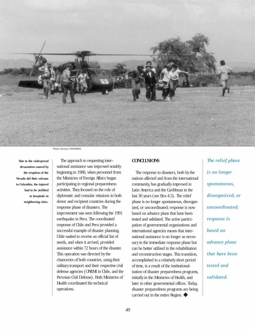
Due to the widespread
devastation caused by
the eruption of the
Nevado del Ruiz volcano
in Colombia, the injured
had to be airlifted
to hospitals in
neighboring cities.
CONCLUSIONS
The response to disasters, both by thenations affected and from the internationalcommunity, has gradually improved inLatin America and the Caribbean in thelast 30 years (see Box 4.5). The reliefphase is no longer spontaneous, disorgan-ized, or uncoordinated; response is nowbased on advance plans that have beentested and validated. The active partici-pation of governmental organizations andinternational agencies means that inter-national assistance is no longer as neces-sary in the immediate response phase butcan be better utilized in the rehabilitationand reconstruction stages. This transition,accomplished in a relatively short periodof time, is a result of the institutional-ization of disaster preparedness programs,initially in the Ministries of Health, andlater in other governmental offices. Today,disaster preparedness programs are beingcarried out in the entire Region. ◆
The relief phase
is no longer
spontaneous,
disorganized, or
uncoordinated;
response is
based on
advance plans
that have been
tested and
validated.
49
The approach to requesting inter-national assistance was improved notablybeginning in 1988, when personnel fromthe Ministries of Foreign Affairs beganparticipating in regional preparednessactivities. They focused on the role ofdiplomatic and consular missions in bothdonor and recipient countries during theresponse phase of disasters. Theimprovement was seen following the 1991earthquake in Peru. The coordinatedresponse of Chile and Peru provided asuccessful example of disaster planning.Chile waited to receive an official list ofneeds, and when it arrived, providedassistance within 72 hours of the disaster.This operation was directed by thechanceries of both countries, using theirmilitary transport and their respective civildefense agencies (ONEMI in Chile, and thePeruvian Civil Defense). Both Ministries ofHealth coordinated the technicaloperations.
Photo: Vizcarra, PAHO/WHO
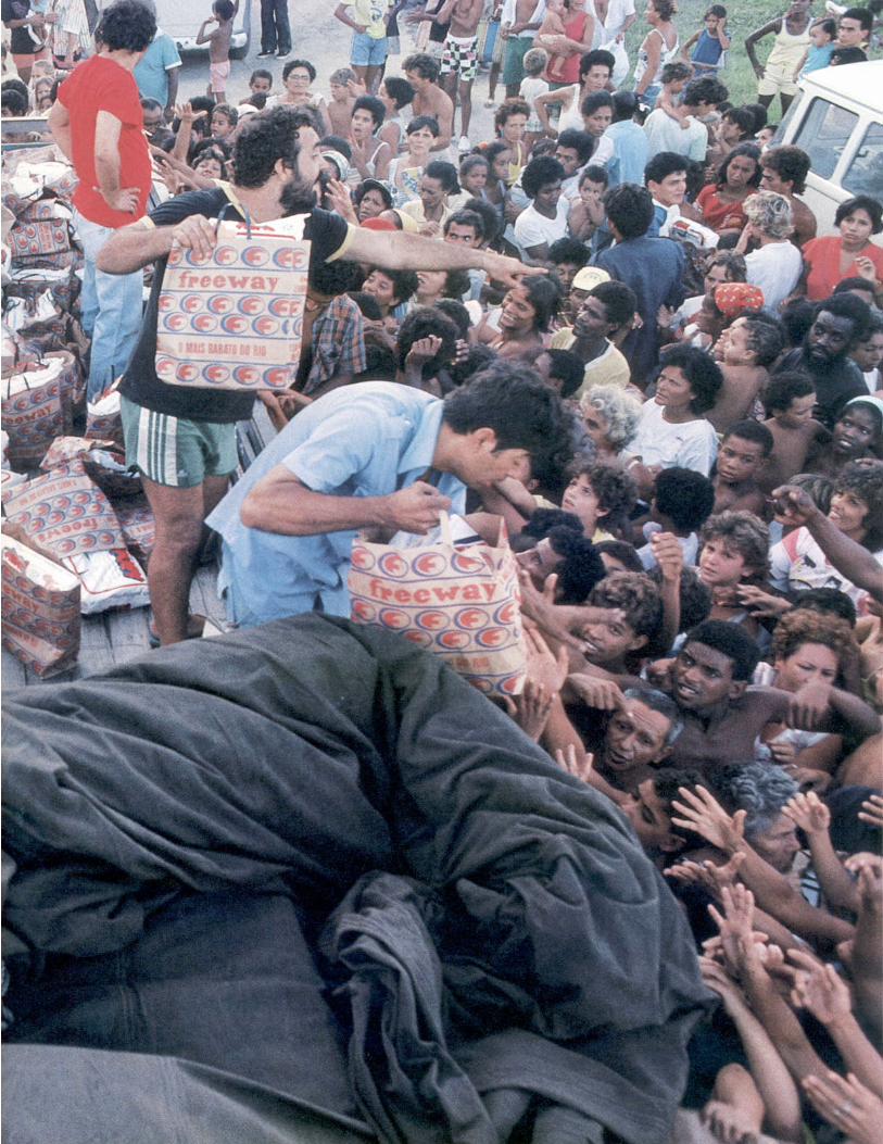
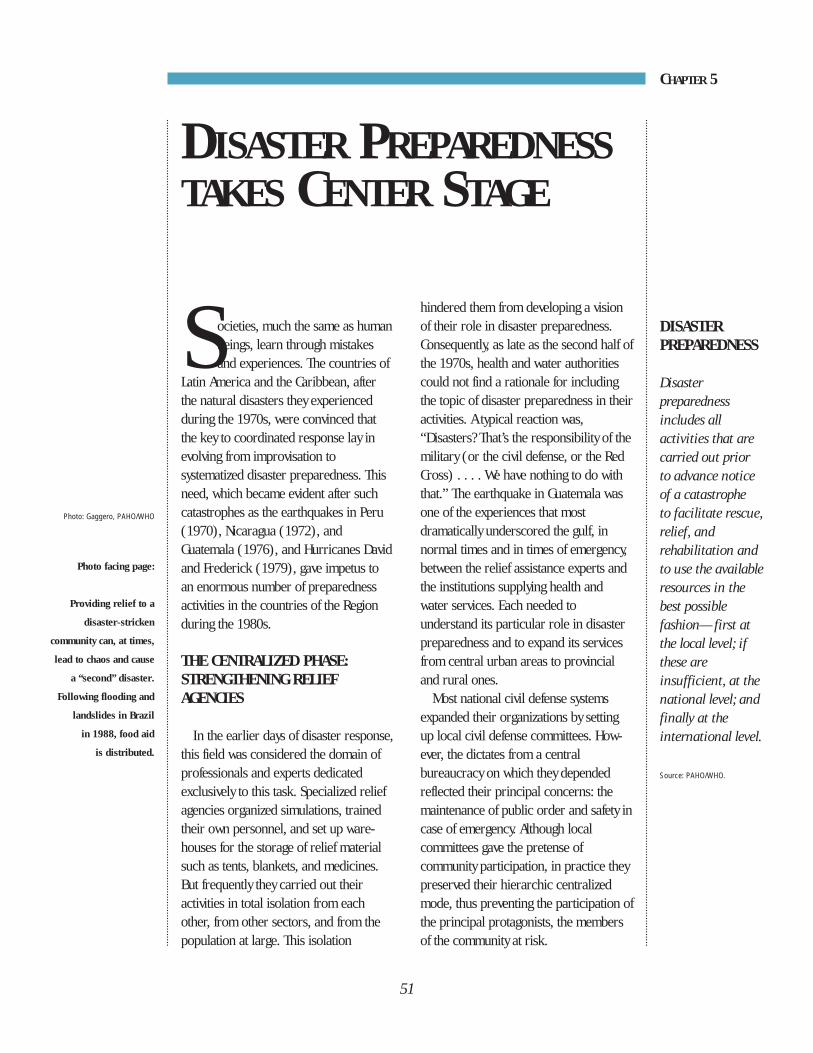
Societies, much the same as humanbeings, learn through mistakesand experiences. The countries of
Latin America and the Caribbean, afterthe natural disasters they experiencedduring the 1970s, were convinced thatthe key to coordinated response lay inevolving from improvisation tosystematized disaster preparedness. Thisneed, which became evident after suchcatastrophes as the earthquakes in Peru(1970), Nicaragua (1972), andGuatemala (1976), and Hurricanes Davidand Frederick (1979), gave impetus toan enormous number of preparednessactivities in the countries of the Regionduring the 1980s.
THE CENTRALIZED PHASE:STRENGTHENING RELIEF AGENCIES
In the earlier days of disaster response,this field was considered the domain ofprofessionals and experts dedicatedexclusively to this task. Specialized reliefagencies organized simulations, trainedtheir own personnel, and set up ware-houses for the storage of relief materialsuch as tents, blankets, and medicines.But frequently they carried out theiractivities in total isolation from eachother, from other sectors, and from thepopulation at large. This isolation
Photo: Gaggero, PAHO/WHO
Photo facing page:
Providing relief to a
disaster-stricken
community can, at times,
lead to chaos and cause
a “second” disaster.
Following flooding and
landslides in Brazil
in 1988, food aid
is distributed.
hindered them from developing a visionof their role in disaster preparedness.Consequently, as late as the second half ofthe 1970s, health and water authoritiescould not find a rationale for includingthe topic of disaster preparedness in theiractivities. A typical reaction was,“Disasters? That’s the responsibility of themilitary (or the civil defense, or the RedCross) . . . . We have nothing to do withthat.” The earthquake in Guatemala wasone of the experiences that mostdramatically underscored the gulf, innormal times and in times of emergency,between the relief assistance experts andthe institutions supplying health andwater services. Each needed tounderstand its particular role in disasterpreparedness and to expand its servicesfrom central urban areas to provincialand rural ones.
Most national civil defense systemsexpanded their organizations by settingup local civil defense committees. How-ever, the dictates from a centralbureaucracy on which they dependedreflected their principal concerns: themaintenance of public order and safety incase of emergency. Although localcommittees gave the pretense ofcommunity participation, in practice theypreserved their hierarchic centralizedmode, thus preventing the participation ofthe principal protagonists, the membersof the community at risk.
DISASTER PREPAREDNESS
Disasterpreparednessincludes allactivities that arecarried out prior to advance noticeof a catastrophe to facilitate rescue,relief, andrehabilitation andto use the availableresources in thebest possiblefashion—first atthe local level; ifthese areinsufficient, at thenational level; andfinally at theinternational level.
Source: PAHO/WHO.
51
DISASTER PREPAREDNESSTAKES CENTER STAGE
CHAPTER 5
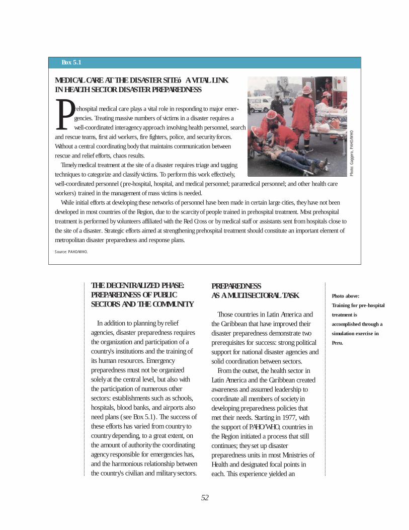
THE DECENTRALIZED PHASE:PREPAREDNESS OF PUBLIC SECTORS AND THE COMMUNITY
In addition to planning by reliefagencies, disaster preparedness requiresthe organization and participation of acountry's institutions and the training ofits human resources. Emergencypreparedness must not be organizedsolely at the central level, but also withthe participation of numerous othersectors: establishments such as schools,hospitals, blood banks, and airports alsoneed plans (see Box 5.1). The success ofthese efforts has varied from country tocountry depending, to a great extent, onthe amount of authority the coordinatingagency responsible for emergencies has,and the harmonious relationship betweenthe country's civilian and military sectors.
PREPAREDNESS AS A MULTISECTORAL TASK
Those countries in Latin America andthe Caribbean that have improved theirdisaster preparedness demonstrate twoprerequisites for success: strong politicalsupport for national disaster agencies andsolid coordination between sectors.
From the outset, the health sector inLatin America and the Caribbean createdawareness and assumed leadership tocoordinate all members of society indeveloping preparedness policies thatmet their needs. Starting in 1977, withthe support of PAHO/WHO, countries inthe Region initiated a process that stillcontinues; they set up disasterpreparedness units in most Ministries ofHealth and designated focal points ineach. This experience yielded an
52
Box 5.1
MEDICAL CARE AT THE DISASTER SITEó A VITAL LINK IN HEALTH SECTOR DISASTER PREPAREDNESS
P rehospital medical care plays a vital role in responding to major emer-
gencies. Treating massive numbers of victims in a disaster requires a
well-coordinated interagency approach involving health personnel, search
and rescue teams, first aid workers, fire fighters, police, and security forces.
Without a central coordinating body that maintains communication between
rescue and relief efforts, chaos results.
Timely medical treatment at the site of a disaster requires triage and tagging
techniques to categorize and classify victims. To perform this work effectively,
well-coordinated personnel (pre-hospital, hospital, and medical personnel; paramedical personnel; and other health care
workers) trained in the management of mass victims is needed.
While initial efforts at developing these networks of personnel have been made in certain large cities, they have not been
developed in most countries of the Region, due to the scarcity of people trained in prehospital treatment. Most prehospital
treatment is performed by volunteers affiliated with the Red Cross or by medical staff or assistants sent from hospitals close to
the site of a disaster. Strategic efforts aimed at strengthening prehospital treatment should constitute an important element of
metropolitan disaster preparedness and response plans.
Source: PAHO/WHO.
Photo above:
Training for pre-hospital
treatment is
accomplished through a
simulation exercise in
Peru.
Phot
o: G
agge
ro, P
AHO/
WHO
unprecedented technical and qualitativechange in the Region. In a few years’time, the health sector’s responsecapacity was changed so that it includedother disaster preparednessorganizations, governmental institutions,and national and international NGOs in itstraining, planning, and organizing.
The visible results of this processencouraged the countries to develop andimprove their emergency plans and toexchange information and experiences.Subregional and regional meetingspromoted by the health sector provided atimely forum. These meetings have led tothe establishment of many importantdisaster preparedness policies. One of the
most notable is a regional policy oninternational disaster assistance (see Box5.2). This policy was further strengthenedby including the Ministries of ForeignAffairs in national preparedness plans.When disaster strikes, this sector, throughits diplomatic and consular offices, playsan important role by encouragingdonations and providing information onthe kinds of donations needed fromabroad. Cooperation between the healthand foreign affairs sectors has yieldedcommon criteria for managing andcoordinating international assistance,thereby reducing the potential forconflicting requests. As a final outcome,several Ministries of Foreign Affairs have
53
Box 5.2
LATIN AMERICA AND THE CARIBBEAN SET REGIONAL POLICY ON INTERNATIONAL HEALTH RELIEF ASSISTANCE
The balance between the need for immediate international aid on the one hand, and the appropriateness of the donations
on the other, is a delicate one. In disaster after disaster, stories abound of containers of useless supplies, spoiled food,
or medical supplies bearing instructions in foreign languages. All of this competes for space and the immediate attention
of the country’s disaster managers.
The earthquake in Mexico in September 1985 was still in the headlines when, barely two months later, the volcanic eruption
of the Nevado del Ruiz took place in Colombia. After these traumatic disasters, high-level representatives of the governments of
the Americas met in San José, Costa Rica, in March 1986 to make international health relief more compatible with the needs of
affected communities. The recommendations made at this meeting—approved unanimously by the participants—became the
formal regional policy of PAHO after ratification by the Ministers of Health of Latin America and the Caribbean at the XXXII
Meeting of PAHO’s Directing Council in 1987.
This policy, to which all the countries in the Region have pledged to adhere, stipulates that:
• Donors will consult with the health authorities or with the appropriate agencies of an affected country before
providing assistance;
• The affected countries will assess health needs quickly and communicate the needs to donors as soon
as possible;
• Inasmuch as many countries in the Region are both recipients and donors of international relief assistance,
all will establish policies regarding the acceptance of unrequested or inappropriate supplies.
Source: PAHO/WHO.
designated focal points responsible fordisaster preparedness activities, thusensuring their continuity. Chile,Colombia, Ecuador, Jamaica, andPanama, among others, have alsopublished and distributed guidelines andprocedures for their diplomatic andconsular missions.
LEGAL EVOLUTION OF DISASTER PREPAREDNESS
A problem today in many Ministriesand State institutions active in disasterpreparedness is that they have neitherlegal status nor a fixed budget, althoughfrom time to time additional resourcesare mobilized on an ad hoc basis (seeBox 5.3). The situation in the healthsector illustrates this problem. Althoughall the countries in the Region have
established a health sector disasterpreparedness program, fewer than halfthe programs in Latin America have legalbacking with specific resourcesearmarked for this purpose in theirnational budgets. The laws that do existare often incomplete; without high-levelpolitical support, the authority delegatedto the disaster preparedness unit isweakened.
Until the 1980s, laws existed to supportalmost exclusively the activities of the civildefense agencies. Subsequently, morecomprehensive laws were adopted at thenational level that extended to the publicand private sectors. These laws led to thecreation, for example, of the ComisiónNacional de Emergencias (NationalEmergency Commission–CNE) in CostaRica, the Sistema Nacional para laPrevención y Atención a los Desastres
54
Box 5.3
LEGISLATION ON DISASTER MANAGEMENT IN THE ANDEAN COUNTRIES
Legislation on disaster management in the Andean countries of South America goes back to the 1930s and 1940s, when
responsibility for handling accidents, calamities, and epidemics was assigned to specialized relief organizations such as
the Red Cross in Colombia, or the National Relief Board in Venezuela.
Starting in the 1960s, civil defense systems were established in Colombia (1965), Venezuela (1971), Peru (1972), Chile
(1974), and Ecuador (1983). In the late 1980s new elements began to be integrated into the existing disaster management
programs to regulate and coordinate the participation of the health sector with other sectors. In Colombia, for example,
legislation established the National System for Disaster Prevention and Response to define the responsibilities of all public,
private, and community organizations. In 1989 regulations for the National Health Committee for Emergencies (CONASE) were
promulgated in Ecuador; and in 1992, the Advisory Council of the National Civil Defense System was set up in Peru.
The legislative framework for regulating disaster management is responsive to changing needs that have emerged in the
countries. For example, as a result of the Nevado del Ruiz tragedy in Colombia, emergency funds were set up to provide credits
to disaster victims, and grant tax exemptions for the importation of machinery and equipment. In Ecuador, the National Office
for Fire Protection was organized by the Ministry of Social Welfare to guarantee enforcement of related legislation. In 1989 the
Drought Emergency Program was organized in Peru to manage external funds obtained by the government through technical
cooperation assistance. Another example of legislation includes the Permanent Presidential Commission, established by
Venezuela in 1990 to develop contingency plans for flood control on the eastern coast of Lake Maracaibo.
Source: PAHO/WHO.
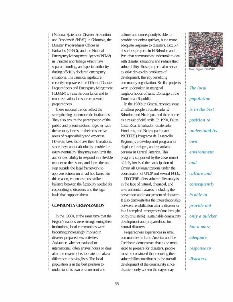
55
(National System for Disaster Preventionand Responseñ SNPAD) in Colombia, theDisaster Preparedness Offices inBarbados (CERO), and the NationalEmergency Management Agency (NEMA)in Trinidad and Tobago which haveseparate funding, and special authorityduring officially declared emergencysituations. The Jamaica legislaturerecently empowered the Office of DisasterPreparedness and Emergency Mangement(ODPEM)to raise its own funds and tomobilize national resources towardpreparedness.
These national trends reflect thestrengthening of democratic institutions.They also ensure the participation of thepublic and private sectors, together withthe security forces, in their respectiveareas of responsibility and expertise.However, laws also have their limitations,since they cannot absolutely provide forevery eventuality. They may even limit theauthorities' ability to respond in a flexiblemanner to the events, and force them tostep outside the legal framework toapprove actions on an ad hoc basis. Forthis reason, countries must strike abalance between the flexibility needed forresponding to disasters and the legalbasis that supports them.
COMMUNITY ORGANIZATION
In the 1980s, at the same time that theRegion's nations were strengthening theirinstitutions, local communities werebecoming increasingly involved indisaster preparedness activities.Assistance, whether national orinternational, often arrives hours or daysafter the catastrophe, too late to make adifference in saving lives. The localpopulation is in the best position tounderstand its own environment and
culture and consequently is able toprovide not only a quicker, but a moreadequate response to disasters. Box 5.4describes projects in El Salvador andPeru that communities undertook to dealwith disaster situations and reduce theirvulnerability. These projects also servedto solve day-to-day problems ofdevelopment, thereby benefitingcommunity organization. Similar projectswere undertaken in marginalneighborhoods of Santo Domingo in theDominican Republic.
In the 1980s in Central America some2 million people in Guatemala, ElSalvador, and Nicaragua fled their homesas a result of civil strife. In 1990, Belize,Costa Rica, El Salvador, Guatemala,Honduras, and Nicaragua initiatedPRODERE (Programa de DesarrolloRegional), a development program fordisplaced, refugee, and repatriatedpersons in Central America. Thisprogram, supported by the Governmentof Italy, involved the participation ofalmost all UN organizations under thecoordination of UNDP and several NGOs.
PRODERE offers vulnerability analysisin the face of natural, chemical, andenvironmental hazards, including theprevention and management of disasters.It also demonstrates the interrelationshipbetween rehabilitation after a disaster orin a ì complexî emergency (one broughton by civil strife), sustainable communitydevelopment and preparedness fornatural disasters.
Preparedness experiences in smallcommunities in Latin America and theCaribbean demonstrate that to be moti-vated to prepare for disasters, peoplemust be convinced that reducing theirvulnerability contributes to the overalldevelopment of the community, sincedisasters only worsen the day-to-day
The local
population
is in the best
position to
understand its
own
environment
and
culture and
consequently
is able to
provide not
only a quicker,
but a more
adequate
response to
disasters.
Photo: Gaggero, PAHO/WHO
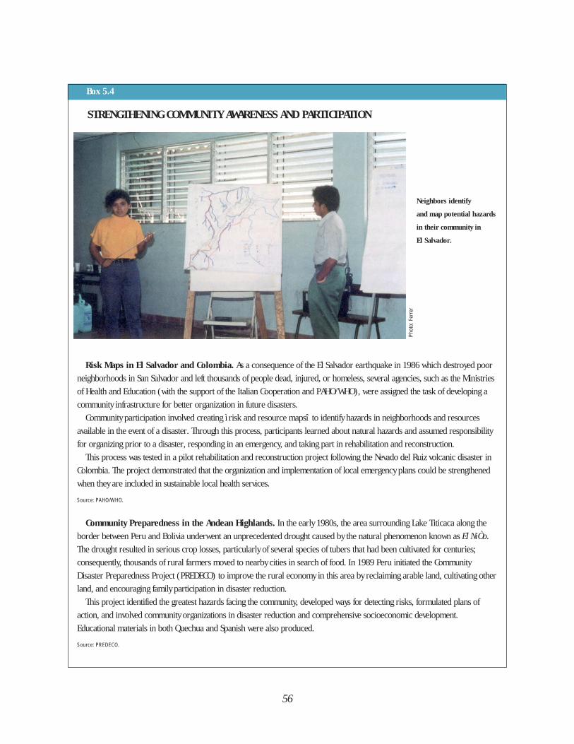
56
Box 5.4
STRENGTHENING COMMUNITY AWARENESS AND PARTICIPATION
Risk Maps in El Salvador and Colombia. As a consequence of the El Salvador earthquake in 1986 which destroyed poor
neighborhoods in San Salvador and left thousands of people dead, injured, or homeless, several agencies, such as the Ministries
of Health and Education (with the support of the Italian Cooperation and PAHO/WHO), were assigned the task of developing a
community infrastructure for better organization in future disasters.
Community participation involved creating ì risk and resource mapsî to identify hazards in neighborhoods and resources
available in the event of a disaster. Through this process, participants learned about natural hazards and assumed responsibility
for organizing prior to a disaster, responding in an emergency, and taking part in rehabilitation and reconstruction.
This process was tested in a pilot rehabilitation and reconstruction project following the Nevado del Ruiz volcanic disaster in
Colombia. The project demonstrated that the organization and implementation of local emergency plans could be strengthened
when they are included in sustainable local health services.
Source: PAHO/WHO.
Community Preparedness in the Andean Highlands. In the early 1980s, the area surrounding Lake Titicaca along the
border between Peru and Bolivia underwent an unprecedented drought caused by the natural phenomenon known as El NiÒo.
The drought resulted in serious crop losses, particularly of several species of tubers that had been cultivated for centuries;
consequently, thousands of rural farmers moved to nearby cities in search of food. In 1989 Peru initiated the Community
Disaster Preparedness Project (PREDECO) to improve the rural economy in this area by reclaiming arable land, cultivating other
land, and encouraging family participation in disaster reduction.
This project identified the greatest hazards facing the community, developed ways for detecting risks, formulated plans of
action, and involved community organizations in disaster reduction and comprehensive socioeconomic development.
Educational materials in both Quechua and Spanish were also produced.
Source: PREDECO.
Neighbors identify
and map potential hazards
in their community in
El Salvador.
Phot
o: F
erre
r
problems of poverty andunderdevelopment. In small communitiesthe lesson was learned that it is notpossible to consider the link betweendisasters on the one hand and health onthe other, without addressingcomprehensive socio-economicdevelopment as a whole.
Experience also demonstrates thatdisaster preparedness efforts should bemultisectoral since it is impossible forone sector alone to be assigned theresponsibility for communitypreparedness.
COLLABORATION BETWEENCOUNTRIES STRENGTHENS PREPAREDNESS
At the same time that disasterpreparedness activities were beingdecentralized at the national level,countries sharing geographical areaswere meeting to strengthen their
collective disaster preparednesscapabilities.
The Caribbean has made particular useof this approach. In 1979 numerousdisasters occurred, including volcaniceruptions in Saint Vincent and theGrenadines, floods in Jamaica and Belize,and—most devastating of all—Hurricanes David and Frederick, whichravaged Dominica and the DominicanRepublic. The small size of the countriesof this subregion made the impact ofnatural disasters all the greater. Althoughthe 38 deaths in Dominica caused byHurricane David may appear insignificantin overall terms, it affected the entirecountry, left 80% of the populationhomeless and destroyed the only hospitalserving Dominica.
Because of the vulnerability of theCaribbean islands and theinterdependence of island-countries indisaster situations, agreements weresigned and a subregional organization
57
Box 5.5
FROM INTERAGENCY PROJECT TO REGIONAL ORGANIZATION IN THE CARIBBEAN
The Pan-Caribbean Disaster Preparedness Project (PCDPP) was established in 1981 to improve national and regional
disaster management in the Caribbean Basin. With headquarters in Antigua, it was launched jointly by UNDRO,
CARICOM, PAHO/WHO, and the League of Red Cross Societies with the support of bilateral agencies (Canada, the United
States, United Kingdom, and the European Economic Community). Although it was conceived as a short-term, 18-month project
focused solely on preparedness, the PCDPP operated for almost ten years. In 1989, when the project extended its work to the
prevention of disasters, its acronym was lengthened to PCDPPP to accommodate the term “prevention”.
Recognizing the need to institutionalize the work begun by the PCDPPP, in 1991 the heads of Government of the Caribbean
Community established a regional agency to enable countries to cope more effectively both in the threat of and in the aftermath
of a disaster. The Caribbean Disaster Emergency Response Agency (CDERA) was formally established in September 1991 with its
headquarters in Barbados. Its main objectives are: to provide emergency relief to any affected Participating State; to provide
reliable information to governmental and non-governmental organizations regarding the effects of a disaster; to mobilize and
coordinate the supply and delivery of disaster relief to an affected country; to mitigate or eliminate the immediate consequences
of natural disasters; and to promote and establish sustainable disaster response capabilities among countries.
Sources: UNDRO; CDERA.

was established to improve national andregional capacities for managingemergencies. This was the beginning ofthe Pan-Caribbean Disaster Preparednessand Prevention Project (PCDPPP), anexternal initiative that served as aprecursor to a true regional approachóthe Caribbean Disaster EmergencyResponse Agency (CDERA)(see Box 5.5).
Because of their small populations (forexample, Montserrat has a population of10,500; Antigua and Barbuda, 60,000;Saint Kitts and Nevis, 42,000), manyCaribbean countries and territories hadurgent, unmet needs in the wake ofHurricane Hugo in 1989, but theamounts needed were relatively modest.In most cases, relief could be supplied byneighboring countries. But situationsarose where assistance destined forseveral stricken countries was shipped in
large aircraft that were not able to landon smaller islands such as Nevis orMontserrat for lack of adequate airports.As a result, the supplies had to bedistributed from another staging area.
The relatively short distances betweenmany Caribbean islands and their culturalsimilarities enable them to help eachother easily. Neighboring countries are inthe best position to meet needsimmediately after a disaster, while otherregions can provide less urgently neededsupplies for rehabilitation andreconstruction. The concept of ì firstresponderî has been a topic fordiscussion among many neighboringcountries (see Box 5.6).
One disaster can affect severalneighboring territories; thus, disasterpreparedness is often a matter of concernfor an entire region. Countries are
58
Countries that
share a common
language and
cultural ties are in
the best position
to help neighbors
following disaster,
particularly when
help can arrive
quickly.Ph
oto:
Gag
gero
, PAH
O/W
HO
Box 5.6
THE FIRST TO RESPOND ARE NEIGHBORS
The concept of “first to respond” refers to identifying a single neighboring country that will respond and provide assis-
tance immediately after a disaster. This concept was the subject of a meeting in 1987 attended by Caribbean health coor-
dinators and representatives of donor countries and international agencies. Although much discussion took place at the
political level, no formal agreements with budgets were signed to implement this policy of immediate assistance. At times, signs
of political agreement appear, but they do not always parallel the technical priorities. Nevertheless, certain positive agreements
have been reached, such as those between Saint Lucia and the French Department of Martinique. Other countries and
territories—for example, the British Virgin Islands, Dominica, Guadeloupe, and the U.S. Virgin Islands—have made progress in
this field.
Source: PAHO/WHO.
59
Box 5.7
CENTRAL AMERICAN PRESIDENTS STRENGTHEN DISASTER INSTITUTIONS
At their XIV Meeting in 1993, the Presidents of the countries of Central America adopted the following resolution: “We
recognize the social and economic impact caused by the recurrence of natural disasters in the Region, and for this rea-
son hereby agree to strengthen our national institutions to coordinate disaster prevention, management, and mitigation
efforts with the support of the Centro de Coordinación para la Prevención de los Desastres Naturales en América Central (Center
for Coordination for the Prevention of Natural Disasters in Central America—CEPREDENAC). We recommend the execution of a
Regional Plan for Disaster Reduction in Central America.”
As witnessed by this resolution, CEPREDENAC plays an important role in uniting the countries of Central America in disaster
preparedness. Established in 1988, with headquarters in Guatemala, CEPREDENAC is an association of technical and scientific
centers, formal emergency organizations, and universities that evaluate and monitor natural phenomena, coordinate response in
case of emergency, and promote regional exchange of information. The Regional Disaster Reduction Plan includes disaster
reduction as a component in regional integration, promotes the participation of various sectors, and the interdependence of
planning and administration in technical and scientific organizations.
Source: CEPREDENAC; SICA.
looking at intercountry collaboration,including joint planning and the shareduse of human, material, andtechnological resources in developingnational and intercountry policies fordisaster preparedness and response.
In South America, several generaltechnical and economic cooperationagreements have been drawn up betweencountries and subregions that share acommon vulnerability, such as Peru and
Chile, and Ecuador and Colombia.Formalizing a border agreement can behindered more by requirements aboutcustoms procedures than by realquestions about foreign affairs or civildefense. The number of agencies orinstitutions involved is great; the ability tomeet and reach consensus takes patience.These considerations often do notcoincide with the control mechanismsemployed by the governments which
60
Box 5.8
NEIGHBORS AT RISK
Chile and Peru, located in what is known as the “ring of fire” along the Pacific Rim, are highly vulnerable to earthquakes.
Both countries face the challenge of preparing communities along their shared border to deal with what could be a common
disaster, until help arrives from their respective capitals. The border cities of Tacna (Peru) and Arica (Chile) had disaster plans,
but neither country’s central emergency organization coordinated their development. Finally, a border cooperation agreement
was signed in 1993. This agreement will allow joint training of health personnel, the establishment of warehouses for disaster
equipment, a relief coordination center in border areas, and the adoption of common measures to reduce the vulnerability of
the localities involved. This agreement is an example of the decentralization of disaster management in each country.
Colombia and Ecuador share volcanic, seismic, tsunami, and hydrometeorologic risks. The Imbabura, Mojanda, and
Cachimbiro volcanoes in Ecuador; the Cumbal, Azufral, and Galeras in Colombia; and the Cerro Negro volcano on the border
can cause damage to both countries if they erupt. In April 1990, the Ministries of Foreign Affairs of both countries signed an
agreement to coordinate activities and to carry out joint studies in border areas to identify natural hazards. In case of disaster,
they will make available to each other their monitoring, communication, and warning networks, emergency management
equipment, and basic health infrastructure.
Source: PAHO/WHO.
customarily discourage direct andinformal contacts between officials ofcooperating countries. The outcome isthat too often collaboration betweencountries remains at a solely technicaland informal level without the backing ofa formal cooperation agreement—although such an agreement is not aguarantee that action will occur either(see Boxes 5.7 and 5.8).
TRAINING: A KEY TO PREPAREDNESS
People—administrators, physicians,engineers, logisticians, and otherexperts—manage disasters. Without well-trained professionals, the laws,emergency plans, and other efforts willbe insufficient. Since the end of the1970s, an entire educational disciplinehas been developed at the regional leveland directed toward disastermanagement. One of the strengths ofLatin America and the Caribbean is the
Region’s shared technical and managerialapproach to disasters (see Box 5.9),which is the result of a variety ofprofessionals being exposed to a closelycoordinated regional training program,developed in the health sector byPAHO/WHO and in other sectors byOFDA/USAID and others.
Programs were adapted to differentsituations and expanded and enriched byincluding a country’s own individualdisaster experience in them. Since thebeginning of the 1980s, the number oftraining courses, workshops, andseminars in Latin America and theCaribbean has dramatically increased.Simply maintaining a list of the mostimportant ones has become a challenge,as more and more countries andinstitutions disseminate their knowledgeto new groups. The Ministries of ForeignAffairs, for example, now carry outintercountry exchanges of professors fortheir regular courses. This dynamism intraining is demonstrated by the fact that
61
Box 5.9
Training of TrainersThe Office of U.S. Foreign Disaster Assistance of the U.S. Agency for International Development (OFDA/USAID) launched in
May 1988 a training program in which three types of courses were developed using interactive training methodologies: “Course
for Instructors,” “Disaster Management,” and, more recently, “Evaluation of Damages and Analysis of Needs.” More than 3,200
people in Latin America and the Caribbean have been trained in 139 courses: 104 courses at the national level and 35 at the
regional or subregional level.
National level activities are carried out with funds allocated by each country, an indication of the country’s interest and
commitment. OFDA/USAID continues to finance activities at the regional and subregional levels. After six years, the program has
developed a cadre of well-trained instructors and sound learning methodologies in the Region, as well as a network of managers
for disaster situations.
Reaching Future Generations of Disaster Preparedness Professionals The World Health Organization has established a multi-institution network of collaborating centers worldwide to support the
Organization’s technical cooperation activities. In 1988, the Faculty of Public Health of the University of Antioquia (Colombia)
was designated as a WHO Collaborating Center in Emergency Preparedness to promote the teaching of emergency preparedness
and disaster management activities at the undergraduate and graduate levels in universities in Latin America and the Caribbean.
This recognized academic institution carries out training, research, and information dissemination within the framework of
PAHO/WHO planned activities.
United Nations Staff as Students of Disaster ManagementStaff members of the United Nations along with officials from key national agencies are learning to provide organized and
coordinated responses when they or their agencies are called on in emergencies and when humanitarian assistance is required.
The Disaster Management Training Program (DMTP) originated as a joint initiative between the United Nations Development
Program (UNDP) and the UN Department of Humanitarian Affairs (DHA—formerly UNDRO) and was launched in 1990 to fulfill
the goals of the IDNDR. The Disaster Management Center of the University of Wisconsin (U.S.A.) developed training materials for
the program.
United Nations Offices and national institutions in 60 countries worldwide that are highly vulnerable to natural disasters are
the venue for the courses. The program collaborates with regional and national agencies with experience in disaster
management; in the Region of the Americas, PAHO/WHO and the OAS have worked together to develop courses both in
individual countries, and at subregional levels for the Caribbean and South America. Training has taken place in Barbados, Chile,
Colombia, Dominican Republic, Ecuador, El Salvador, Guatemala, Honduras, Mexico, Nicaragua, and Peru.
The DMTP seeks to create awareness of the negative impact that disasters have on countries’ efforts to achieve socioeconomic
development. It also promotes the development of case studies, research protocols, and projects for presentation to the UNDP
for possible financing.
Source: OFDA/USAID; PAHO/WHO.
STUDENTS OF DISASTER MANAGEMENT
62
in the health sector alone, PAHO/WHO isable to maintain only a list of the eventsto which it offers its technical or materialsupport.
In recent years, training has beenextended to the universities in the Region,both public and private. In manyinstitutions it has been possible tointroduce disaster preparedness into thecurriculum of public health, medicine,and nursing. Similar activities have beeninitiated in faculties of masscommunication, education, and, morerecently, engineering and architecture. Astudy carried out in 1991 by the WHO
Collaborating Center in Medellín,Colombia, shows that approximately 80%of the faculties of public health in SouthAmerica included the subject of healthmanagement as it relates to disasters intheir curricula. Approximately 20% of thepublic health schools in the Caribbeanhave intensive short courses on healthaspects of disasters in addition to thetwo-month course on disaster medicinetaught in Barbados.
Having disaster management become apart of school curricula produces acommon language among professionals.The technical and scientific development
Box 5.10
GETTING INFORMATION TO THE USERS: THE DISASTER DOCUMENTATION CENTER
In 1990 PAHO/WHO established a Disaster Documentation Center in San José, Costa Rica, with support of that country’s
National Emergency Commission (CNE). The Center was created to remedy a perceived shortage of scientific and technical
documents and training material on disasters, particularly in Spanish, that was of particular relevance to the Region. One of
the greatest challenges was finding what already existed, as it was (and still may be) common to find desks and offices flooded
with valuable material which, in many cases, would be filed away and forgotten.
Today, professionals and students in Latin America and the Caribbean are tackling issues of disaster management from
different perspectives. They not only need the most up-to-date information, they are also producing new studies that their
counterparts in other countries should know about.
One of the Center’s unique features is the importance given to distributing information, ensuring that users ultimately get what
they need most: actual hard copies of the documents. To do this, they have used a combination of traditional procedures
combined with new technologies available in the field of automated information. To catalogue the Center’s collection, a database
was created using MICROISIS, a U.N. standard software developed by UNESCO. In mid-1994, the database contained almost
5,000 records, and grows at the rate of approximately 1,500 documents per year. This disaster database is available in print
form through DESINDEX, a chronological listing of the Center’s holdings; BIBLIODES, a bibliographic index by subject; and on
PAHO’s CD-ROM LILACS, which is distributed in Latin America and the Caribbean through BIREME, the Latin American and
Caribbean Center on Health Sciences Information.
Disaster reduction is not only a health sector issue. It requires a multisector focus that covers topics from geology to economy;
from the design of seismic-resistant housing and public works to the design of a disaster curriculum for faculties of civil
engineering. Demands for non-health disaster reduction material are received by the Center and cannot be met at this time. To
expand the scope of the Disaster Documentation Center to meet requests from users outside the health sector requires that the
many institutions that research, legislate, and provide disaster assistance collect information from as many sources and disciplines
as possible to integrate the various scientific fields, professions, and approaches that focus on preventing and mitigating disasters.
Source: PAHO/WHO.
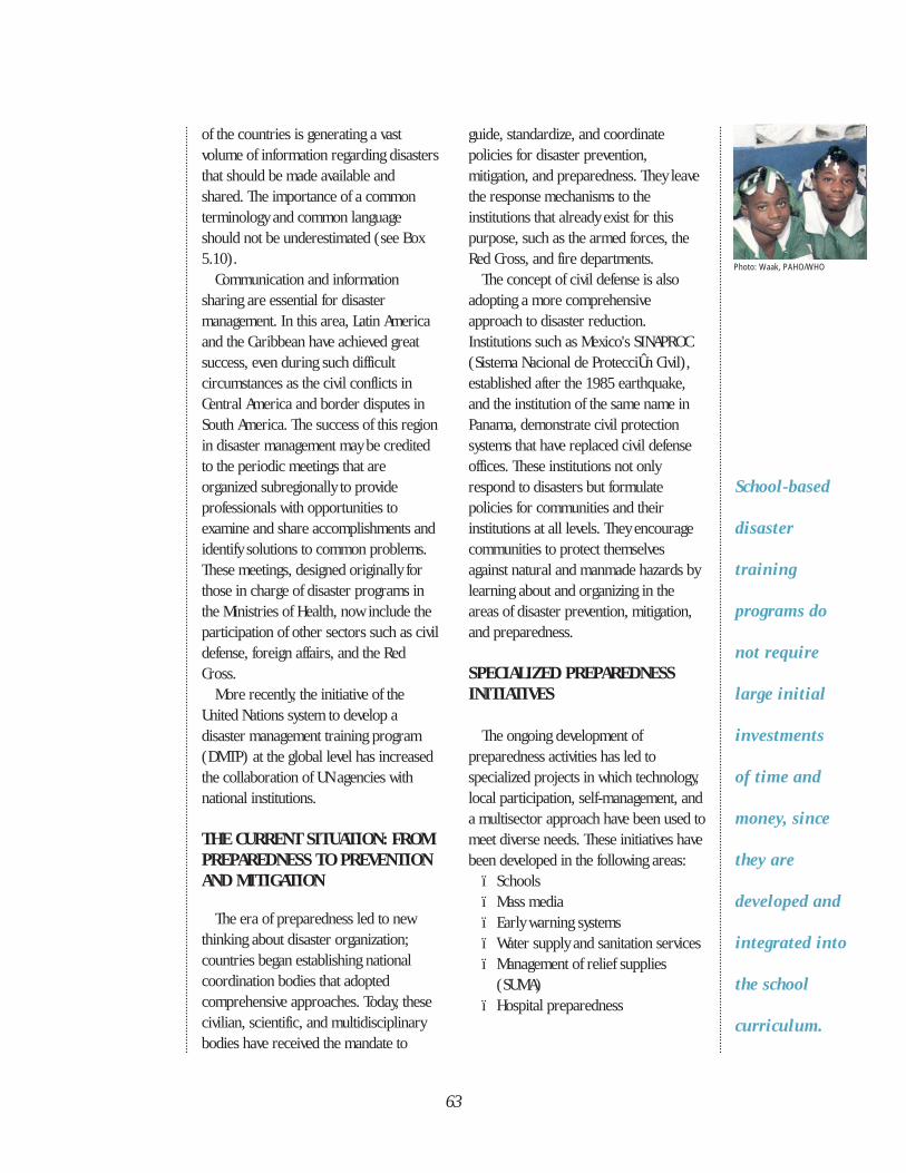
63
of the countries is generating a vastvolume of information regarding disastersthat should be made available andshared. The importance of a commonterminology and common languageshould not be underestimated (see Box5.10).
Communication and informationsharing are essential for disastermanagement. In this area, Latin Americaand the Caribbean have achieved greatsuccess, even during such difficultcircumstances as the civil conflicts inCentral America and border disputes inSouth America. The success of this regionin disaster management may be creditedto the periodic meetings that areorganized subregionally to provideprofessionals with opportunities toexamine and share accomplishments andidentify solutions to common problems.These meetings, designed originally forthose in charge of disaster programs inthe Ministries of Health, now include theparticipation of other sectors such as civildefense, foreign affairs, and the RedCross.
More recently, the initiative of theUnited Nations system to develop adisaster management training program(DMTP) at the global level has increasedthe collaboration of UN agencies withnational institutions.
THE CURRENT SITUATION: FROMPREPAREDNESS TO PREVENTIONAND MITIGATION
The era of preparedness led to newthinking about disaster organization;countries began establishing nationalcoordination bodies that adoptedcomprehensive approaches. Today, thesecivilian, scientific, and multidisciplinarybodies have received the mandate to
guide, standardize, and coordinatepolicies for disaster prevention,mitigation, and preparedness. They leavethe response mechanisms to theinstitutions that already exist for thispurpose, such as the armed forces, theRed Cross, and fire departments.
The concept of civil defense is alsoadopting a more comprehensiveapproach to disaster reduction.Institutions such as Mexico's SINAPROC(Sistema Nacional de ProtecciÛn Civil),established after the 1985 earthquake,and the institution of the same name inPanama, demonstrate civil protectionsystems that have replaced civil defenseoffices. These institutions not onlyrespond to disasters but formulatepolicies for communities and theirinstitutions at all levels. They encouragecommunities to protect themselvesagainst natural and manmade hazards bylearning about and organizing in theareas of disaster prevention, mitigation,and preparedness.
SPECIALIZED PREPAREDNESSINITIATIVES
The ongoing development ofpreparedness activities has led tospecialized projects in which technology,local participation, self-management, anda multisector approach have been used tomeet diverse needs. These initiatives havebeen developed in the following areas:
ï Schoolsï Mass mediaï Early warning systemsï Water supply and sanitation servicesï Management of relief supplies
(SUMA)ï Hospital preparedness
School-based
disaster
training
programs do
not require
large initial
investments
of time and
money, since
they are
developed and
integrated into
the school
curriculum.
Photo: Waak, PAHO/WHO
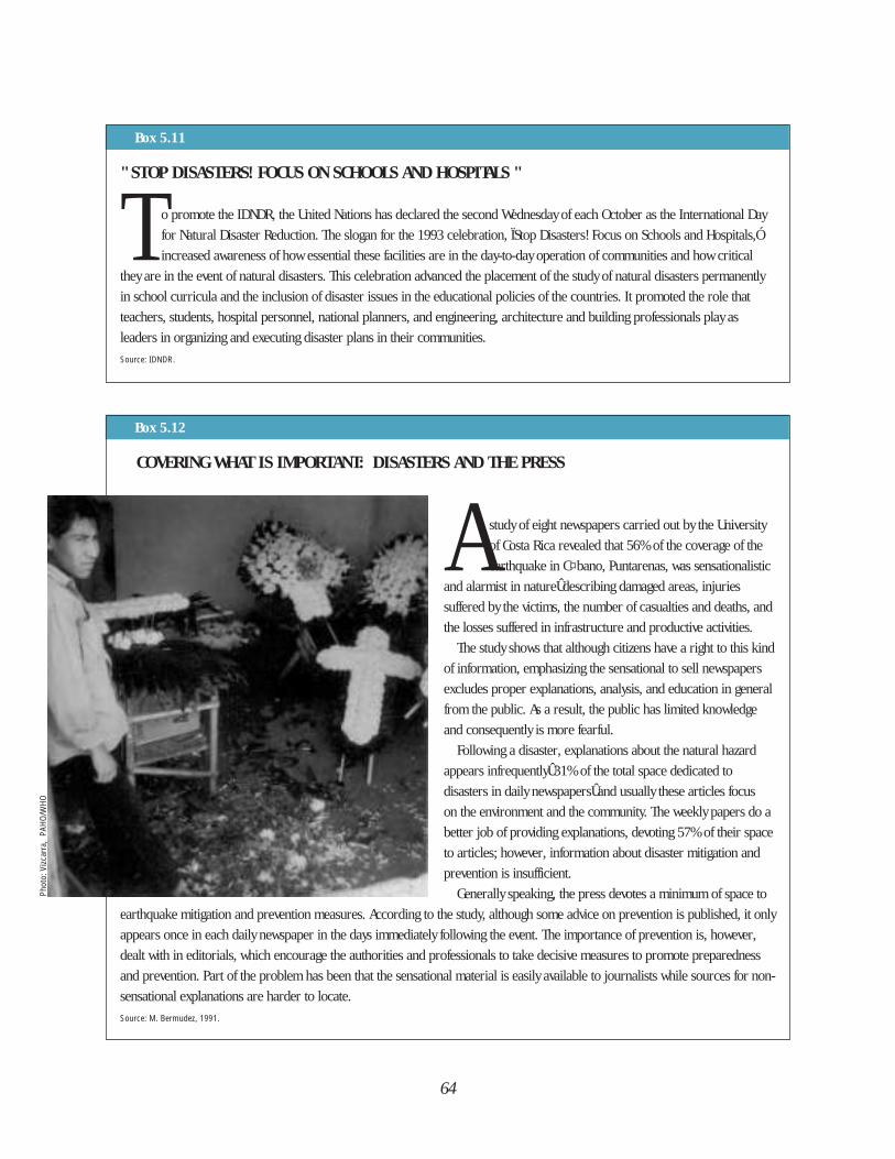
64
Box 5.11
" STOP DISASTERS! FOCUS ON SCHOOLS AND HOSPITALS "
T o promote the IDNDR, the United Nations has declared the second Wednesday of each October as the International Day
for Natural Disaster Reduction. The slogan for the 1993 celebration, ÏStop Disasters! Focus on Schools and Hospitals,Ó
increased awareness of how essential these facilities are in the day-to-day operation of communities and how critical
they are in the event of natural disasters. This celebration advanced the placement of the study of natural disasters permanently
in school curricula and the inclusion of disaster issues in the educational policies of the countries. It promoted the role that
teachers, students, hospital personnel, national planners, and engineering, architecture and building professionals play as
leaders in organizing and executing disaster plans in their communities.
Source: IDNDR.
COVERING WHAT IS IMPORTANT: DISASTERS AND THE PRESS
A study of eight newspapers carried out by the University
of Costa Rica revealed that 56% of the coverage of the
earthquake in C¤bano, Puntarenas, was sensationalistic
and alarmist in natureÛdescribing damaged areas, injuries
suffered by the victims, the number of casualties and deaths, and
the losses suffered in infrastructure and productive activities.
The study shows that although citizens have a right to this kind
of information, emphasizing the sensational to sell newspapers
excludes proper explanations, analysis, and education in general
from the public. As a result, the public has limited knowledge
and consequently is more fearful.
Following a disaster, explanations about the natural hazard
appears infrequentlyÛ31% of the total space dedicated to
disasters in daily newspapersÛand usually these articles focus
on the environment and the community. The weekly papers do a
better job of providing explanations, devoting 57% of their space
to articles; however, information about disaster mitigation and
prevention is insufficient.
Generally speaking, the press devotes a minimum of space to
earthquake mitigation and prevention measures. According to the study, although some advice on prevention is published, it only
appears once in each daily newspaper in the days immediately following the event. The importance of prevention is, however,
dealt with in editorials, which encourage the authorities and professionals to take decisive measures to promote preparedness
and prevention. Part of the problem has been that the sensational material is easily available to journalists while sources for non-
sensational explanations are harder to locate.
Source: M. Bermudez, 1991.
Box 5.12
Phot
o: V
izcar
ra,
PAHO
/WHO
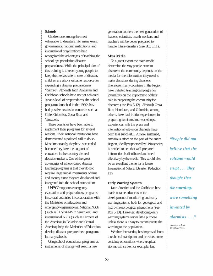
65
SchoolsChildren are among the most
vulnerable to disasters. For many years,governments, national institutions, andinternational organizations haverecognized the advantages of teaching theschool-age population disasterpreparedness. While the principal aim ofthis training is to teach young people tokeep themselves safe in case of disaster,children are also a valuable resource forexpanding a disaster preparedness“culture”. Although Latin American andCaribbean schools have not yet achievedJapan’s level of preparedness, the schoolprograms launched in the 1980s havehad positive results in countries such asChile, Colombia, Costa Rica, andVenezuela.
These countries have been able toimplement their programs for severalreasons. Their national institutions havedemonstrated a political will to do so.Most importantly, they have succeededbecause they have the support ofeducators in the country, the realdecision-makers. One of the greatadvantages of school-based disastertraining programs is that they do notrequire large initial investments of timeand money, since they are developed andintegrated into the school curriculum.
UNESCO supports emergencyevacuation and preparedness programsin several countries in collaboration withthe Ministries of Education andemergency organizations. National NGOs(such as FUNDAPRIS in Venezuela) andinternational NGOs (such as Partners ofthe Americas in Ecuador and CentralAmerica) help the Ministries of Educationdevelop disaster preparedness programsin many schools.
Using school educational programs asinstruments of change will reach a new
generation sooner: the next generation ofleaders, scientists, health workers andteachers will be better prepared tohandle future disasters (see Box 5.11).
Mass MediaTo a great extent the mass media
determine the way people react todisasters: the community depends on themedia for the information they need tomake decisions during disasters.Therefore, many countries in the Regionhave initiated training campaigns forjournalists on the importance of theirrole in preparing the community fordisasters (see Box 5.12). Although CostaRica, Honduras, and Colombia, amongothers, have had fruitful experiences inpreparing seminars and workshops,experiences with the press andinternational television channels havebeen less successful. A more sustained,ambitious effort on the part of the entireRegion, ideally supported by UN agencies,is needed to see that well-preparedinformation is distributed and usedeffectively by the media. This would alsobe an excellent theme for a futureInternational Natural Disaster ReductionDay.
Early Warning SystemsLatin America and the Caribbean have
made notable advances in thedevelopment of monitoring and earlywarning systems, both for geological andhydro-meteorological phenomena (seeBox 5.13). However, developing earlywarning systems serves little purposeunless there is a way to communicate thewarning to the population.
Weather forecasting has improved froma technical standpoint and provides somecertainty of locations where tropicalstorms will strike, for example. But
“People did not
believe that the
volcano would
erupt . . . They
thought that
the warnings
were something
invented by
alarmists . . .”
(Nosotros la Gente del Volcán, 1988).
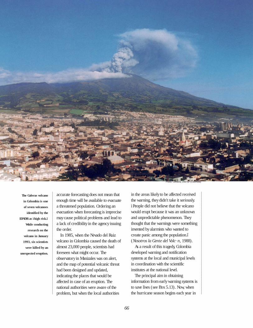
accurate forecasting does not mean thatenough time will be available to evacuatea threatened population. Ordering anevacuation when forecasting is imprecisemay cause political problems and lead toa lack of credibility in the agency issuingthe order.
In 1985, when the Nevado del Ruizvolcano in Colombia caused the death ofalmost 23,000 people, scientists hadforeseen what might occur. Theobservatory in Manizales was on alert,and the map of potential volcanic threathad been designed and updated,indicating the places that would beaffected in case of an eruption. Thenational authorities were aware of theproblem, but when the local authorities
in the areas likely to be affected receivedthe warning, they didn't take it seriously.ì People did not believe that the volcanowould erupt because it was an unknownand unpredictable phenomenon. Theythought that the warnings were somethinginvented by alarmists who wanted tocreate panic among the population.î(Nosotros la Gente del Volc· n, 1988).
As a result of this tragedy, Colombiadeveloped warning and notificationsystems at the local and municipal levelsin coordination with the scientificinstitutes at the national level.
The principal aim in obtaininginformation from early warning systems isto save lives (see Box 5.13). Now, whenthe hurricane season begins each year in
66
The Galeras volcano
in Colombia is one
of seven volcanoes
identified by the
IDNDR as ìhigh risk.î
While conducting
research on the
volcano in January
1993, six scientists
were killed by an
unexpected eruption.
Photo: Cardona, DNPAD (Colombia)
67
the Caribbean, mass informationcampaigns on how to be prepared forhurricanes and how to respond towarnings also begin. This scientificknowledge reinforces a well-knownCaribbean refrain:
“June’s too soon, July . . . stand by,August . . . a must!September . . . remember,October... all over”.
. . . Or is it? Several hurricanes haveoccurred in the month of October.
The UN’s World MeteorologicalOrganization (WMO) has providedassistance to many countries in theRegion through technical cooperation toimprove their meteorological services orflood control systems. A project isongoing to rehabilitate and improveservice related to meteorology andhydrology in Belize, Costa Rica, ElSalvador, Guatemala, Honduras,Nicaragua, and Panama (Proyecto para laRehabilitación y Mejoramiento de losServicios Meterológicos e Hidrológicosdel Istmo Centroamericano—PRIMSCEN), with the support of Finland,WMO, and the Regional Committee onWater Resouces.
Several projects on flood control havebeen carried out in Jamaica, includingmapping of flood-prone areas,improvement of control practices, anddevelopment of a flood forecast andwarning system. In addition, theDominican Republic has begun a projecton management of reservoirs and floodcontrol in the Yaque del Sur river basin.In Brazil, projects are under way formonitoring the Tocantins River in theAmazon basin, and in the State of Rio de
Janeiro a forecasting and warning systemis being set up for flood control as part ofan integrated system to manage waterresources and a program for the recoveryof rivers and watersheds (see Box 5.14).
Seismic monitoring networks andsystems have been developed at thenational and regional levels, mainly inassociation with universities orvulcanologic and seismologicobservatories. At the national level, theCentro Peruano-Japonés deInvestigaciones Sísmicas y Mitigación deDesastres (Center for Seimic Researchand Disaster Mitigation—CISMID) inPeru and the Centro Nacional dePrevención de Desastres (National Centerfor Disaster Prevention—CENAPRED) inMexico have, with the support of Japan,installed seismograph and accelerographnetworks. Other regional organizationsthat have improved monitoring systemsare the Centro Regional de Sismologíapara América del Sur (Regional Center ofSeismology for South America—CERESIS), CEPREDENAC, and the SeismicResearch Unit (SRU) of the University ofthe West Indies in Trinidad. TheCaribbean Meteorological Organization(CMO) is comprised of 16 English-speaking Caribbean governments and hasresponsibilities for issuing warnings tomembers who do not have forecastingcapabilities, since it has been agreed thatit is not necessary for every Member Stateto develop such a capability.
Water Supply and Sanitation Systems
Although the attention of the publicand the mass media is focused almostexclusively on the deaths and injuriescaused by natural hazards, theseproblems are short lived. The effects ofdisasters on the water supply, however,
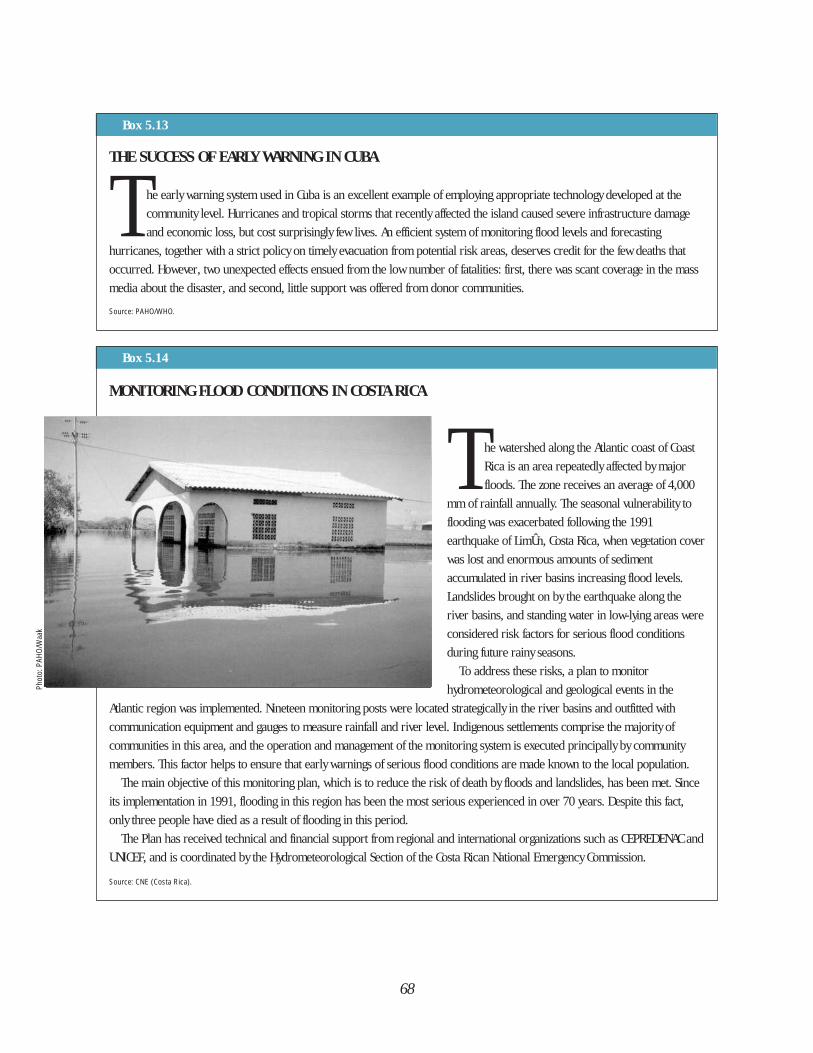
68
Box 5.13
THE SUCCESS OF EARLY WARNING IN CUBA
T he early warning system used in Cuba is an excellent example of employing appropriate technology developed at the
community level. Hurricanes and tropical storms that recently affected the island caused severe infrastructure damage
and economic loss, but cost surprisingly few lives. An efficient system of monitoring flood levels and forecasting
hurricanes, together with a strict policy on timely evacuation from potential risk areas, deserves credit for the few deaths that
occurred. However, two unexpected effects ensued from the low number of fatalities: first, there was scant coverage in the mass
media about the disaster, and second, little support was offered from donor communities.
Source: PAHO/WHO.
MONITORING FLOOD CONDITIONS IN COSTA RICA
T he watershed along the Atlantic coast of Coast
Rica is an area repeatedly affected by major
floods. The zone receives an average of 4,000
mm of rainfall annually. The seasonal vulnerability to
flooding was exacerbated following the 1991
earthquake of LimÛn, Costa Rica, when vegetation cover
was lost and enormous amounts of sediment
accumulated in river basins increasing flood levels.
Landslides brought on by the earthquake along the
river basins, and standing water in low-lying areas were
considered risk factors for serious flood conditions
during future rainy seasons.
To address these risks, a plan to monitor
hydrometeorological and geological events in the
Atlantic region was implemented. Nineteen monitoring posts were located strategically in the river basins and outfitted with
communication equipment and gauges to measure rainfall and river level. Indigenous settlements comprise the majority of
communities in this area, and the operation and management of the monitoring system is executed principally by community
members. This factor helps to ensure that early warnings of serious flood conditions are made known to the local population.
The main objective of this monitoring plan, which is to reduce the risk of death by floods and landslides, has been met. Since
its implementation in 1991, flooding in this region has been the most serious experienced in over 70 years. Despite this fact,
only three people have died as a result of flooding in this period.
The Plan has received technical and financial support from regional and international organizations such as CEPREDENAC and
UNICEF, and is coordinated by the Hydrometeorological Section of the Costa Rican National Emergency Commission.
Source: CNE (Costa Rica).
Box 5.14
Phot
o: P
AHO/
Waa
k
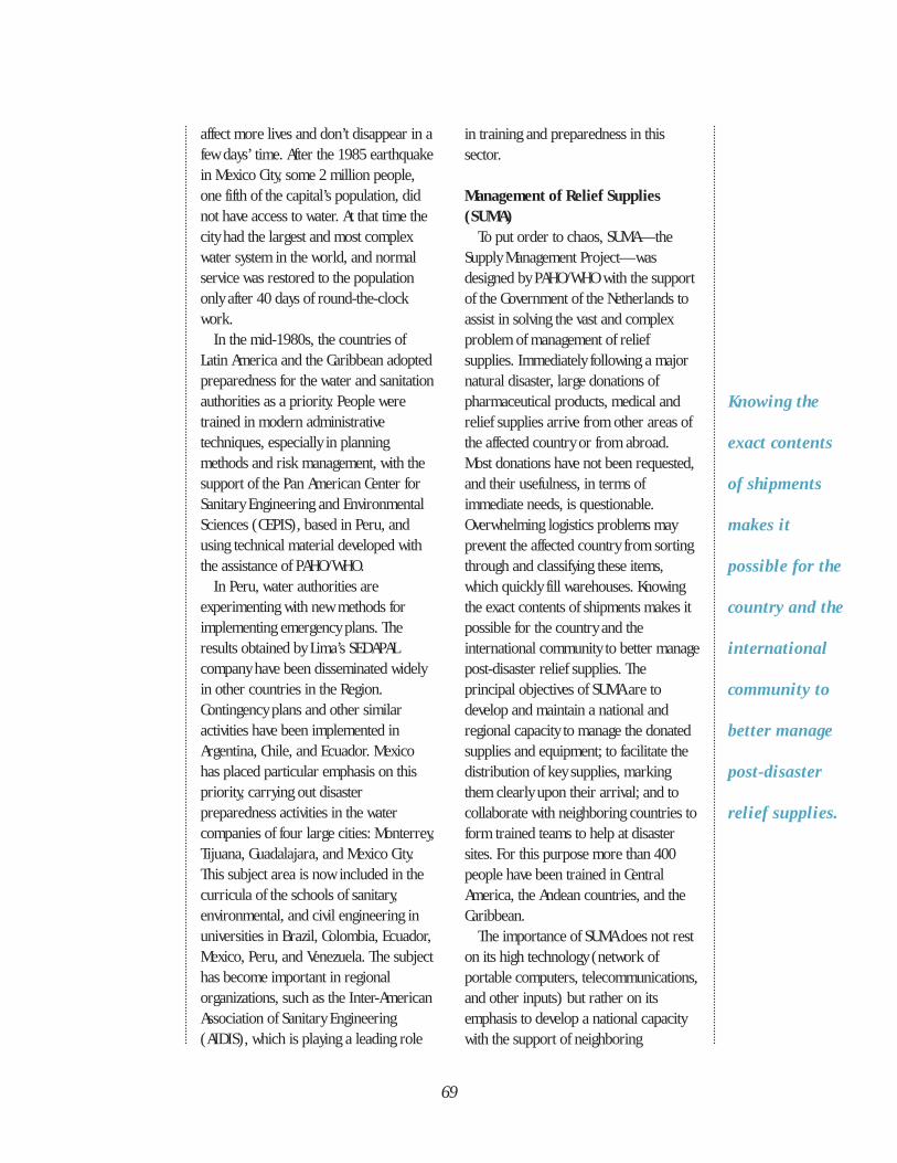
Knowing the
exact contents
of shipments
makes it
possible for the
country and the
international
community to
better manage
post-disaster
relief supplies.
affect more lives and don’t disappear in afew days’ time. After the 1985 earthquakein Mexico City, some 2 million people,one fifth of the capital’s population, didnot have access to water. At that time thecity had the largest and most complexwater system in the world, and normalservice was restored to the populationonly after 40 days of round-the-clockwork.
In the mid-1980s, the countries ofLatin America and the Caribbean adoptedpreparedness for the water and sanitationauthorities as a priority. People weretrained in modern administrativetechniques, especially in planningmethods and risk management, with thesupport of the Pan American Center forSanitary Engineering and EnvironmentalSciences (CEPIS), based in Peru, andusing technical material developed withthe assistance of PAHO/WHO.
In Peru, water authorities areexperimenting with new methods forimplementing emergency plans. Theresults obtained by Lima’s SEDAPALcompany have been disseminated widelyin other countries in the Region.Contingency plans and other similaractivities have been implemented inArgentina, Chile, and Ecuador. Mexicohas placed particular emphasis on thispriority, carrying out disasterpreparedness activities in the watercompanies of four large cities: Monterrey,Tijuana, Guadalajara, and Mexico City.This subject area is now included in thecurricula of the schools of sanitary,environmental, and civil engineering inuniversities in Brazil, Colombia, Ecuador,Mexico, Peru, and Venezuela. The subjecthas become important in regionalorganizations, such as the Inter-AmericanAssociation of Sanitary Engineering(AIDIS), which is playing a leading role
in training and preparedness in thissector.
Management of Relief Supplies(SUMA)
To put order to chaos, SUMA—theSupply Management Project—wasdesigned by PAHO/WHO with the supportof the Government of the Netherlands toassist in solving the vast and complexproblem of management of reliefsupplies. Immediately following a majornatural disaster, large donations ofpharmaceutical products, medical andrelief supplies arrive from other areas ofthe affected country or from abroad.Most donations have not been requested,and their usefulness, in terms ofimmediate needs, is questionable.Overwhelming logistics problems mayprevent the affected country from sortingthrough and classifying these items,which quickly fill warehouses. Knowingthe exact contents of shipments makes itpossible for the country and theinternational community to better managepost-disaster relief supplies. Theprincipal objectives of SUMA are todevelop and maintain a national andregional capacity to manage the donatedsupplies and equipment; to facilitate thedistribution of key supplies, markingthem clearly upon their arrival; and tocollaborate with neighboring countries toform trained teams to help at disastersites. For this purpose more than 400people have been trained in CentralAmerica, the Andean countries, and theCaribbean.
The importance of SUMA does not reston its high technology (network ofportable computers, telecommunications,and other inputs) but rather on itsemphasis to develop a national capacitywith the support of neighboring
69
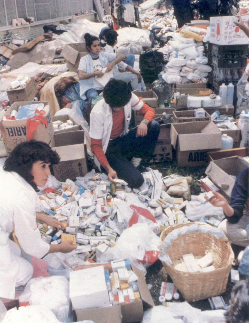
71
Disaster
reduction
must become
a priority area,
and disaster
mitigation and
prevention are
keys to
reaching that
goal.
countries. This is a critical concept at atime when the internationalcommunity—in this case the Westerncountries—has a tendency to export itsown experts and technology to solveproblems—real or perceived—createdby disasters.
Hospital PreparednessDespite the loss of more than 20,000
beds as a result of disasters in the last 20years, the use of field hospitals andmedical teams from developed countrieshas never been justified. There are morethan 13,000 hospitals in the Region, andin many countries there are sufficientnational or local resources to respond toany demand caused by disasters. The keyto this self-sufficiency has been thetraining of hospital personnel. In the1980s the health sector and PAHO/WHOpromoted hospital preparedness fordisasters on a large scale. Hospitalemergency plans were elaborated and putinto practice throughout the Americas,health aspects of disasters became part ofthe continuing education for healthprofessionals, and multisector emergencysimulations in hospitals were carried out.
With the initiation of the IDNDR, mosthospitals in the largest cities in theAmericas have emergency plans forexternal and internal disasters, organizeservices in emergency situations, and setup criteria and guidelines for evacuatinghealth facilities. However, health sectorworkers are also aware of thevulnerability of the old buildings theywork in, and how little has been done toreduce this risk.
THE MORAL OF PREPAREDNESS
Maintaining a state of disasterpreparedness year after year can be achallenge, especially in countries thatexperience long periods of relative“calm” between emergencies. Theprogress made by Latin America and theCaribbean has been spectacular, andachieved in a relatively short period oftime. This is due to the governmentagencies that coordinated and led thework, and the existence of previouslyprepared, tested, and eval-uated plans.
Still, one must not fall into the trap ofbelieving that a country or community isprepared simply because a disaster planor law exists. In many cases, these plansare simply “paper exercises” that havenever been tested or practiced. To makea true contribution to preparedness,these plans must represent a consensusof all the participants involved.Preparedness depends on people and onthe institutions they organize.
Although disaster response is moreeffective when it is local or regional, themost effective preparedness, especially inthe Caribbean and in Central America isachieved through collective orintercountry efforts. And the mosteffective assistance is the support fornational preparedness initiatives.
Disaster preparedness alone is notenough to meet the countries’ needs andexpectations for reducing the effects ofdisasters. Disaster management, or whathas been termed disaster reduction, mustbecome a priority area, and disastermitigation and prevention are keys toreaching that goal.
Photo: Vizcarra, PAHO/WHO
Photo facing page:
International
assistance can be
a mixed blessing.
The
overabundance of
donated medical
supplies kept
Mexican health
personnel from
attending
to other more
pressing tasks.
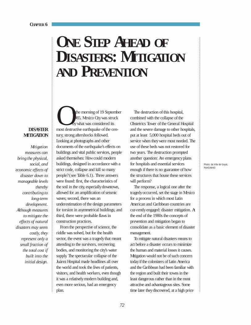
72
On the morning of 19 September1985, Mexico City was struckby what was considered its
most destructive earthquake of the cen-tury; strong aftershocks followed.Looking at photographs and otherdocuments of the earthquake’s effects onbuildings and vital public services, peopleasked themselves: How could modernbuildings, designed in accordance with astrict code, collapse and kill so manypeople? (see Table 6.1). Three answerswere found: first, the characteristics ofthe soil in the city, especially downtown,allowed for an amplification of seismicwaves; second, there was anunderestimation of the design parametersfor torsion in asymmetrical buildings; andthird, there were probable flaws inconstruction practices.
From the perspective of science, theriddle was solved, but for the healthsector, the event was a tragedy that meantattending to the survivors, recoveringbodies, and monitoring the city’s watersupply. The spectacular collapse of theJuárez Hospital made headlines all overthe world and took the lives of patients,visitors, and health workers, even thoughit was a relatively modern building and,even more serious, had an emergencyplan.
The destruction of this hospital,combined with the collapse of theObstetrics Tower of the General Hospitaland the severe damage to other hospitals,put at least 5,000 hospital beds out ofservice when they were most needed. Theuse of these beds was not restored fortwo years. The destruction promptedanother question: Are emergency plansfor hospitals and essential servicesenough if there is no guarantee of howthe structures that house these serviceswill perform?
The response, a logical one after thetragedy occurred, set the stage in Mexicofor a process in which most LatinAmerican and Caribbean countries arecur-rently engaged: disaster mitigation. Atthe end of the 1980s the concepts ofprevention and mitigation began toconsolidate as a basic element of disaster management.
To mitigate natural disasters means toact before a disaster occurs to minimizethe human and material losses it causes.Mitigation would not be of such concerntoday if the colonizers of Latin Americaand the Caribbean had been familiar withthe region and built their towns in theleast dangerous rather than in the mostattractive and advantageous sites. Sometime later they discovered, at a high price
ONE STEP AHEAD OFDISASTERS: MITIGATIONAND PREVENTION
CHAPTER 6
DISASTER MITIGATION
Mitigationmeasures can
bring the physical,social, and
economic effects ofdisaster down to
manageable levelsthereby
contributing tolong-term
development.Although measures
to mitigate theeffects of natural
disasters may seemcostly, they
represent only asmall fraction of
the total cost ifbuilt into the
initial design.
Photo: de Ville de Goyet,PAHO/WHO
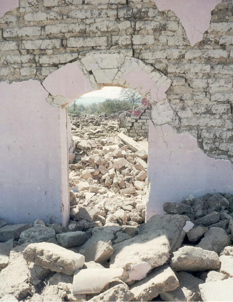
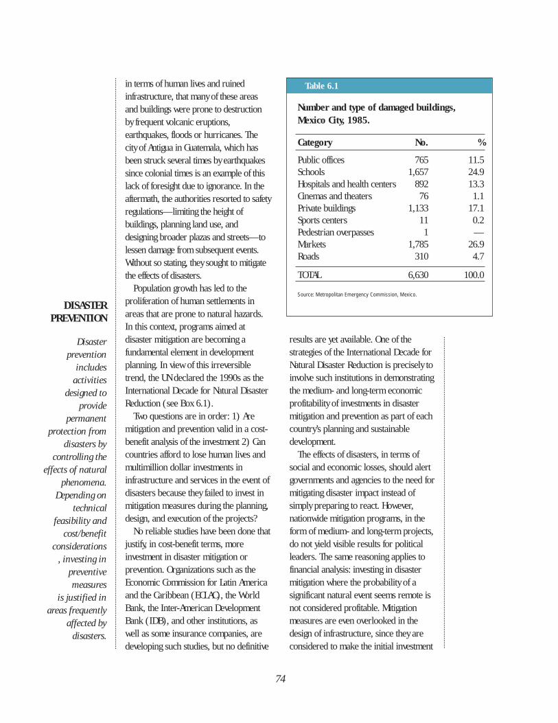
74
Number and type of damaged buildings, Mexico City, 1985.
Category No. %
Public offices 765 11.5Schools 1,657 24.9Hospitals and health centers 892 13.3Cinemas and theaters 76 1.1Private buildings 1,133 17.1Sports centers 11 0.2Pedestrian overpasses 1 —Markets 1,785 26.9Roads 310 4.7
TOTAL 6,630 100.0
Source: Metropolitan Emergency Commission, Mexico.
Table 6.1in terms of human lives and ruinedinfrastructure, that many of these areasand buildings were prone to destructionby frequent volcanic eruptions,earthquakes, floods or hurricanes. Thecity of Antigua in Guatemala, which hasbeen struck several times by earthquakessince colonial times is an example of thislack of foresight due to ignorance. In theaftermath, the authorities resorted to safetyregulations—limiting the height ofbuildings, planning land use, anddesigning broader plazas and streets—tolessen damage from subsequent events.Without so stating, they sought to mitigatethe effects of disasters.
Population growth has led to theproliferation of human settlements inareas that are prone to natural hazards.In this context, programs aimed atdisaster mitigation are becoming afundamental element in developmentplanning. In view of this irreversibletrend, the UN declared the 1990s as theInternational Decade for Natural DisasterReduction (see Box 6.1).
Two questions are in order: 1) Aremitigation and prevention valid in a cost-benefit analysis of the investment 2) Cancountries afford to lose human lives andmultimillion dollar investments ininfrastructure and services in the event ofdisasters because they failed to invest inmitigation measures during the planning,design, and execution of the projects?
No reliable studies have been done thatjustify, in cost-benefit terms, moreinvestment in disaster mitigation orprevention. Organizations such as theEconomic Commission for Latin Americaand the Caribbean (ECLAC), the WorldBank, the Inter-American DevelopmentBank (IDB), and other institutions, aswell as some insurance companies, aredeveloping such studies, but no definitive
results are yet available. One of thestrategies of the International Decade forNatural Disaster Reduction is precisely toinvolve such institutions in demonstratingthe medium- and long-term economicprofitability of investments in disastermitigation and prevention as part of eachcountry’s planning and sustainabledevelopment.
The effects of disasters, in terms ofsocial and economic losses, should alertgovernments and agencies to the need formitigating disaster impact instead ofsimply preparing to react. However,nationwide mitigation programs, in theform of medium- and long-term projects,do not yield visible results for politicalleaders. The same reasoning applies tofinancial analysis: investing in disastermitigation where the probability of asignificant natural event seems remote isnot considered profitable. Mitigationmeasures are even overlooked in thedesign of infrastructure, since they areconsidered to make the initial investment
DISASTER PREVENTION
Disasterprevention
includesactivities
designed toprovide
permanentprotection from
disasters by controlling the
effects of natural phenomena.
Depending on technical
feasibility andcost/benefit
considerations, investing in
preventivemeasures
is justified inareas frequently
affected by disasters.
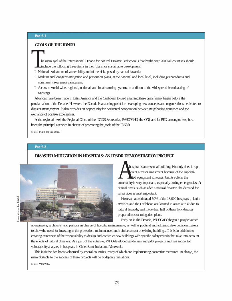
75
Box 6.1
Box 6.2
GOALS OF THE IDNDR
The main goal of the International Decade for Natural Disaster Reduction is that by the year 2000 all countries should
include the following three items in their plans for sustainable development:
ï National evaluations of vulnerability and of the risks posed by natural hazards;
ï Medium and long-term mitigation and prevention plans, at the national and local level, including preparedness and
community awareness campaigns;
ï Access to world-wide, regional, national, and local warning systems, in addition to the widespread broadcasting of
warnings.
Advances have been made in Latin America and the Caribbean toward attaining these goals; many began before the
proclamation of the Decade. However, the Decade is a starting point for developing new concepts and organizations dedicated to
disaster management. It also provides an opportunity for horizontal cooperation between neighboring countries and the
exchange of positive experiences.
At the regional level, the Regional Office of the IDNDR Secretariat, PAHO/WHO, the OAS, and La RED, among others, have
been the principal agencies in charge of promoting the goals of the IDNDR.
Source: IDNDR Regional Office.
DISASTER MITIGATION IN HOSPITALS: AN IDNDR DEMONSTRATION PROJECT
A hospital is an essential building. Not only does it rep-
resent a major investment because of the sophisti-
cated equipment it houses, but its role in the
community is very important, especially during emergencies. At
critical times, such as after a natural disaster, the demand for
its services is most important.
However, an estimated 50% of the 13,000 hospitals in Latin
America and the Caribbean are located in areas at risk due to
natural hazards, and more than half of them lack disaster
preparedness or mitigation plans.
Early on in the Decade, PAHO/WHO began a project aimed
at engineers, architects, and persons in charge of hospital maintenance, as well as political and administrative decision makers
to show the need for investing in the protection, maintenance, and reinforcement of existing buildings. This is in addition to
creating awareness of the responsibility to design and construct new buildings with specific safety criteria that take into account
the effects of natural disasters. As a part of the initiative, PAHO developed guidelines and pilot projects and has supported
vulnerability analyses in hospitals in Chile, Saint Lucia, and Venezuela.
This initiative has been welcomed by several countries, many of which are implementing corrective measures. As always, the
main obstacle to the success of these projects will be budgetary limitations.
Source: PAHO/WHO.
Phot
o: V
izcar
ra, P
AHO/
WHO
76
INSURANCE POLICIES IN THE CARIBBEAN... UNFORESEEN MITIGATION
A s a result of the damage to the Caribbean islands caused by Hurricanes Hugo, Gilbert, and especially in 1992 by
Andrew, which also lashed the coast of the United States, reinsurance companies were not willing to continue covering
such heavy and frequent economic losses. The possibility of eliminating reinsurance for natural events was even
discussed. Local insurance companies then decided to double and even triple premiums, whereupon insurance became
unaffordable for the private sector. Rates usually depend on the proximity of a building to the coastline and the quality of
construction materials used.
Some businesses decided to forego the peace of mind afforded by insurance policies and to conduct cost-benefit studies of
probable losses versus the cost of reinforcing or upgrading buildings. Not surprisingly, these studies demonstrated that it is more
profitable to reinforce buildings and systems, even if it requires major investment, than to pay for the repair of frequent damage.
In other words, it is more economical to mitigate the effects of hurricanes than to cope with the losses.
There is little incentive—in the form of preferential premiums—for those who take measures to prevent wind damage to their
property. After disasters, premiums are increased indiscriminately for all buildings, regardless of their degree of vulnerability.
Source: OAS; PAHO.
Box 6.3
unnecessarily more expensive. Changingthese patterns of thinking and behaviortakes time (see Box 6.2).
Some measures, such as reinforcingexisting structures, seem too expensivefor the limited budgets of many countries.Others, such as land-use regulations inat-risk areas, depend not only on legalbacking but also on the ability to monitorenforcement. For these reasons somefinancial institutions and cooperationagencies are reluctant to provide fundsfor disaster mitigation programs. Theyprefer to support the relief andrehabilitation phases because of theirgreater visibility.
In some countries that have achievedprogress in disaster mitigation, insuranceagencies are becoming indirectpromoters of improved constructiondesigns or of retrofitting existingbuildings. Economic incentives, in theform of preferential premiums, may begiven for buildings that are well-protectedand that comply with safety regulations(see Box 6.3).
Many mitigation projects have beencompleted in the countries of LatinAmerica and the Caribbean, frequentlywith the financial and technical supportof international agencies and institutions.These projects are in three basic areas:studying risks, reducing vulnerability, andtraining. For mitigation projects to work,an organized national system for disastermanagement must exist to support andlend continuity to a project. Ideally, asystem with multidisciplinary andmultisectoral representation and withlegal and political backing is best suitedto mitigation programs.
DISASTER MITIGATION: MAPSAND SCENARIOS FOR PLANNING
The information displayed on a map,with its striking colors and easy-to-interpret data, is a powerful tool forteaching about natural hazards. A mapcan summarize the findings of detailedscientific research and present it in a waythat nonspecialists can understand. For
77
Phot
o: C
ourte
sy o
f Bus
tam
ante
, DNP
AD
Hazard map created as
part of the Tsunami
Risk Mitigation Project
in Tumaco, Colombia.
this reason, most disaster mitigationprojects include an initial phase in whichmaps of different degrees of complexityare prepared to establish restrictions onland use or urge structural strengtheningof buildings. A vulnerability analysis isperformed during this first stage, and iscomplemented by information onpopulation and infrastructure.
Geographical Information Systems(GIS) are a relatively new form ofinformation technology. This systemrequires a large initial investment incomputer hardware, software, andtraining for managers and users;however, it facilitates data management,allowing flexible updating of maps andthe immediate incorporation ofinformation from aerial photography anddata obtained by satellites. Whereas withmanual map making, correctinginaccuracies and updating used to takehours, the versatile GIS performs theseoperations in virtually no time.
After geographical information iscollected, GIS becomes a tool forforecasting trends in urban growth and
locating areas and infrastructure at risk,thus producing useful visual aids forplanning rational land use. However, theimpressive technology and attractivemaps should be considered only aspowerful tools, not as ends in themselves.GIS has two drawbacks: first, the initialinvestment, operation, and maintenanceof the equipment may outstrip thebudgets of the institutions that use them.Second, mechanisms for updatinginformation should be established fromthe start, but many institutions do nothave the infrastructure to meet thisdemand.
The Bahamas, Barbados, the BritishVirgin Islands, Costa Rica, Jamaica,Mexico, Peru, Saint Lucia, and Trinidadand Tobago are among the countries inthe Region with experience in preparingnatural hazards maps. Examples ofprojects at the local level include theUNDP project in MedellÌn, Colombia; theì Infographicî Atlas of Quito, Ecuador(see Box 6.4); and the volcanic-hazardmaps developed by Ecuador'sGeophysical Institute of the Polytechnic
78
School. CEPREDENAC’s database onhazards in Central America, and the OASprojects to diagnose and reduce sectoralvulnerability also deserve specialmention.
Costa Rica’s Integrated EmergencyInformation System is an example of theuse made of GIS to manage the phases ofthe disaster cycle, including preventionand mitigation. This system includesgraphics that interact with a database tostrengthen two central elements of theplanning process: the country’s “Atlas ofNatural and Manmade Hazards” and the“Inventory of Strategic Resources forDisaster Preparedness, Response, andRehabilitation”. The summary,“Restrictions on Land Use,” complementsthe atlas with legal, geological,hydrometeorological, technological, andengineering references andrecommendations for local governmentauthorities and the public at large.
The Fundación de Asesoría para laPrevención del Riesgo Sísmico(Foundation for the Prevention of SeismicRisk—FUNDAPRIS; formerly known asCEAPRIS) in Venezuela has gainedvaluable experience in developing zoning
maps of geological hazards. These mapshelp to formulate state emergency plansand regulate the granting of constructionpermits based on land-use restrictions.Its disaster-mitigation activities at thelocal level include education and training,construction and urban development, andmanagement of emergencies.
In the Caribbean, the British VirginIslands have a new national physicaldevelopment plan. The section on theAnegada area contains importantinformation and conclusions on theisland’s natural hazards—the areasendangered by hurricanes, floods,seismic movements, soil liquefaction, andwater pollution. The territory’s Office ofDisaster Preparedness providedinformation on hazards and disasterswhich has been incorporated into theplan. The project has the backing of theUnited Nations Center for HumanSettlements (HABITAT).
Disaster scenarios are included inColombia’s comprehensive program forrisk mitigation. As part of this program,two activities related to risk maps deserveto be singled out: the preparation of thetsunami hazard map in Tumaco, and the
HAZARD MAPS GUIDE URBAN PLANNING IN ECUADOR
The Constitutional Resolution that declared Quito a Metropolitan District in 1978 marked the beginning of a project to
plan the future development of the nation’s capital. A central element of the project was the work of Ecuador’s Chapter of
the Instituto Panamericano de Geografía e Historia (Pan American Institute of Geography and History—IPGH), the
Military Geographic Institute of Ecuador, the Municipality of Quito, and the French Institute of Scientific Research for
Development (ORSTOM) in producing the “Infographic Atlas” of Quito. This document has maps with scales ranging from
1:1,000 to 1:50,000 showing detailed geographic, demographic, and socioeconomic aspects of Quito. The atlas includes a
chapter on the natural hazards to which this city of more than two million is exposed. The importance of this atlas is
demonstrated by the fact that its maps have been incorporated, by law, into Quito’s urban planning.
Source: Instituto Geográfico Militar (Ecuador), 1992.
Box 6.4
79
preparation of the volcanic hazard mapfor Ibagué. For these two activities,scientists, politicians, and communitygroups successfully worked together toimplement the measures planned.
The “Tumaco Tsunami Risk MitigationProject” illustrates a project for which arecent disaster was not the catalyst;rather the process began with thepossibility that such a disaster couldoccur. In addition to mapping thehazards, the Tsunami Detection and AlertNetwork has been expanded; acomprehensive relocation and housingimprovement project is beingundertaken, and the private sector isbacking and spurring economic andsocial development in the region.
The UN Department of HumanitarianAffairs promotes the idea of draftingnatural hazard maps in several countriesof the Region as the first step in acomprehensive disaster managementprogram. For example, DHA supportsArgentina in formulating andimplementing a national disastermitigation program emphasizingemergencies arising from volcaniceruptions and technological disasters.The initial phase of this project focuseson one of the 42 potentially dangerousactive volcanoes in the country toestimate hazards, develop monitoringprocedures, and encourage communitypreparedness. The experience willsubsequently be repeated with theremaining volcanoes.
In Peru, UN/DHA and the CanadianInternational Development Agency(CIDA) have carried out and financed adisaster mitigation program, with theInstituto Nacional de Defensa Civil(National Institute of Civil Defense—INDECI). It consists of the followingcomponents: a study of seismic, volcanic,
and flood risk in the city of Arequipa; astudy of seismic and tsunami risk alongthe southern coast; and the organizationof the national disaster mitigationdatabank. One aim of the project is todraft hazard maps to formulate andimplement emergency plans which willbe incorporated into the urban plans ofthe localities studied.
In 1987, the Civil Defense of Ecuadorand the National Polytechnic School withsupport from OFDA/USAID and UN/DHA,developed a project to evaluate naturalhazards and integrate their implicationsinto community protection planning. Oneof the results of this effort was thepublication of hazard maps for active andinactive volcanoes. On the basis of thesemaps it has been possible to:• Analyze potential socioeconomic
impact;• Estimate the vulnerability of
threatened areas;• Monitor the active volcanoes on a
permanent basis;• Improve Civil Defense response
plans.In summary, to mitigate the effects of
natural disasters it is necessary, first, tobe familiar with the hazard and, second,to locate it geographically in order toanalyze the vulnerability and prepare riskmaps. On the basis of these maps:• Legal measures can be taken for
design and planned development of urban areas;
• New buildings can be designed taking into consideration identified risks;
• Existing buildings can be reinforced and upgraded;
• Civil engineering works can be constructed to limit the destructive effects of disasters;
• Decisions can be made (in extreme
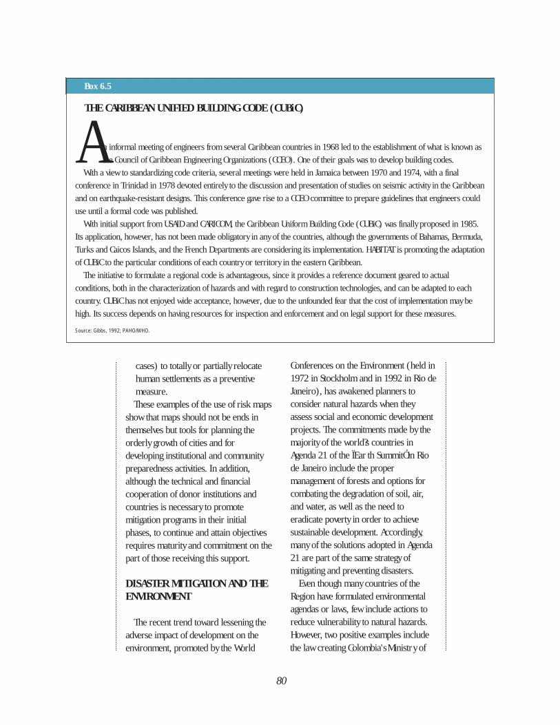
80
cases) to totally or partially relocate human settlements as a preventive measure.These examples of the use of risk maps
show that maps should not be ends inthemselves but tools for planning theorderly growth of cities and fordeveloping institutional and communitypreparedness activities. In addition,although the technical and financialcooperation of donor institutions andcountries is necessary to promotemitigation programs in their initialphases, to continue and attain objectivesrequires maturity and commitment on thepart of those receiving this support.
DISASTER MITIGATION AND THEENVIRONMENT
The recent trend toward lessening theadverse impact of development on theenvironment, promoted by the World
Conferences on the Environment (held in1972 in Stockholm and in 1992 in Rio deJaneiro), has awakened planners toconsider natural hazards when theyassess social and economic developmentprojects. The commitments made by themajority of the world?s countries inAgenda 21 of the ÏEar th SummitÓ in Riode Janeiro include the propermanagement of forests and options forcombating the degradation of soil, air,and water, as well as the need toeradicate poverty in order to achievesustainable development. Accordingly,many of the solutions adopted in Agenda21 are part of the same strategy ofmitigating and preventing disasters.
Even though many countries of theRegion have formulated environmentalagendas or laws, few include actions toreduce vulnerability to natural hazards.However, two positive examples include
THE CARIBBEAN UNIFIED BUILDING CODE (CUBiC)
A n informal meeting of engineers from several Caribbean countries in 1968 led to the establishment of what is known as
the Council of Caribbean Engineering Organizations (CCEO). One of their goals was to develop building codes.
With a view to standardizing code criteria, several meetings were held in Jamaica between 1970 and 1974, with a final
conference in Trinidad in 1978 devoted entirely to the discussion and presentation of studies on seismic activity in the Caribbean
and on earthquake-resistant designs. This conference gave rise to a CCEO committee to prepare guidelines that engineers could
use until a formal code was published.
With initial support from USAID and CARICOM, the Caribbean Uniform Building Code (CUBiC) was finally proposed in 1985.
Its application, however, has not been made obligatory in any of the countries, although the governments of Bahamas, Bermuda,
Turks and Caicos Islands, and the French Departments are considering its implementation. HABITAT is promoting the adaptation
of CUBiC to the particular conditions of each country or territory in the eastern Caribbean.
The initiative to formulate a regional code is advantageous, since it provides a reference document geared to actual
conditions, both in the characterization of hazards and with regard to construction technologies, and can be adapted to each
country. CUBiC has not enjoyed wide acceptance, however, due to the unfounded fear that the cost of implementation may be
high. Its success depends on having resources for inspection and enforcement and on legal support for these measures.
Source: Gibbs, 1992; PAHO/WHO.
Box 6.5
the law creating Colombia's Ministry of
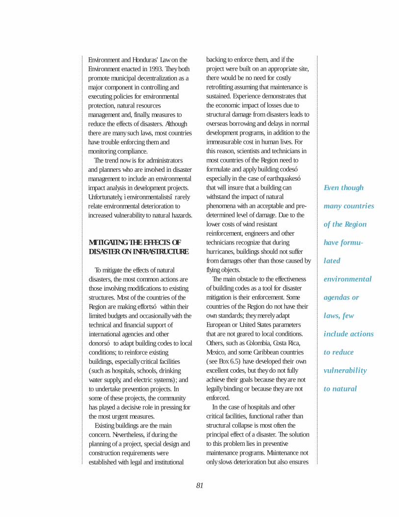
81
Even though
many countries
of the Region
have formu-
lated
environmental
agendas or
laws, few
include actions
to reduce
vulnerability
to natural
Environment and Honduras' Law on theEnvironment enacted in 1993. They bothpromote municipal decentralization as amajor component in controlling andexecuting policies for environmentalprotection, natural resourcesmanagement and, finally, measures toreduce the effects of disasters. Althoughthere are many such laws, most countrieshave trouble enforcing them andmonitoring compliance.
The trend now is for administratorsand planners who are involved in disastermanagement to include an environmentalimpact analysis in development projects.Unfortunately, ì environmentalistsî rarelyrelate environmental deterioration toincreased vulnerability to natural hazards.
MITIGATING THE EFFECTS OF DISASTER ON INFRASTRUCTURE
To mitigate the effects of naturaldisasters, the most common actions arethose involving modifications to existingstructures. Most of the countries of theRegion are making effortsó within theirlimited budgets and occasionally with thetechnical and financial support ofinternational agencies and otherdonorsó to adapt building codes to localconditions; to reinforce existingbuildings, especially critical facilities(such as hospitals, schools, drinkingwater supply, and electric systems); andto undertake prevention projects. Insome of these projects, the communityhas played a decisive role in pressing forthe most urgent measures.
Existing buildings are the mainconcern. Nevertheless, if during theplanning of a project, special design andconstruction requirements wereestablished with legal and institutional
backing to enforce them, and if theproject were built on an appropriate site,there would be no need for costlyretrofitting assuming that maintenance issustained. Experience demonstrates thatthe economic impact of losses due tostructural damage from disasters leads tooverseas borrowing and delays in normaldevelopment programs, in addition to theimmeasurable cost in human lives. Forthis reason, scientists and technicians inmost countries of the Region need toformulate and apply building codesóespecially in the case of earthquakesóthat will insure that a building canwithstand the impact of naturalphenomena with an acceptable and pre-determined level of damage. Due to thelower costs of wind resistantreinforcement, engineers and othertechnicians recognize that duringhurricanes, buildings should not sufferfrom damages other than those caused byflying objects.
The main obstacle to the effectivenessof building codes as a tool for disastermitigation is their enforcement. Somecountries of the Region do not have theirown standards; they merely adaptEuropean or United States parametersthat are not geared to local conditions.Others, such as Colombia, Costa Rica,Mexico, and some Caribbean countries(see Box 6.5) have developed their ownexcellent codes, but they do not fullyachieve their goals because they are notlegally binding or because they are notenforced.
In the case of hospitals and othercritical facilities, functional rather thanstructural collapse is most often theprincipal effect of a disaster. The solutionto this problem lies in preventivemaintenance programs. Maintenance notonly slows deterioration but also ensures
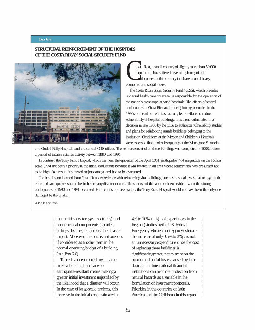
82
STRUCTURAL REINFORCEMENT OF THE HOSPITALS OF THE COSTA RICAN SOCIAL SECURITY FUND
Costa Rica, a small country of slightly more than 50,000
square km has suffered several high-magnitude
earthquakes in this century that have caused heavy
economic and social losses.
The Costa Rican Social Security Fund (CCSS), which provides
universal health care coverage, is responsible for the operation of
the nation's most sophisticated hospitals. The effects of several
earthquakes in Costa Rica and in neighboring countries in the
1980s on health care infrastructure, led to efforts to reduce
vulnerability of hospital buildings. This trend culminated in a
decision in late 1986 by the CCSS to authorize vulnerability studies
and plans for reinforcing unsafe buildings belonging to the
institution. Conditions at the Mexico and Children's Hospitals
were assessed first, and subsequently at the Monsignor Sanabria
and Ciudad Neily Hospitals and the central CCSS offices. The reinforcement of all these buildings was completed in 1988, before
a period of intense seismic activity between 1990 and 1991.
In contrast, the Tony Facio Hospital, which lies near the epicenter of the April 1991 earthquake (7.4 magnitude on the Richter
scale), had not been a priority in the initial evaluations because it was located in an area where seismic risk was presumed not
to be high. As a result, it suffered major damage and had to be evacuated.
The best lesson learned from Costa Rica's experience with reinforcing vital buildings, such as hospitals, was that mitigating the
effects of earthquakes should begin before any disaster occurs. The success of this approach was evident when the strong
earthquakes of 1990 and 1991 occurred. Had actions not been taken, the Tony Facio Hospital would not have been the only one
damaged by the quake.
Source: M. Cruz, 1992.
Box 6.6
that utilities (water, gas, electricity) andnonstructural components (facades,ceilings, fixtures, etc.) resist the disasterimpact. Moreover, the cost is not onerousif considered as another item in thenormal operating budget of a building(see Box 6.6).
There is a deep-rooted myth that tomake a building hurricane- orearthquake-resistant means making agreater initial investment unjustified bythe likelihood that a disaster will occur.In the case of large-scale projects, thisincrease in the initial cost, estimated at
4% to 10% in light of experiences in theRegion (studies by the U.S. FederalEmergency Management Agency estimatethe increase at only 0.5% to 2%), is notan unnecessary expenditure since the costof replacing these buildings issignificantly greater, not to mention thehuman and social losses caused by theirdestruction. International financialinstitutions can promote protection fromnatural hazards as a variable in theformulation of investment proposals.Priorities in the countries of LatinAmerica and the Caribbean in this regard
Phot
o: C
ruz
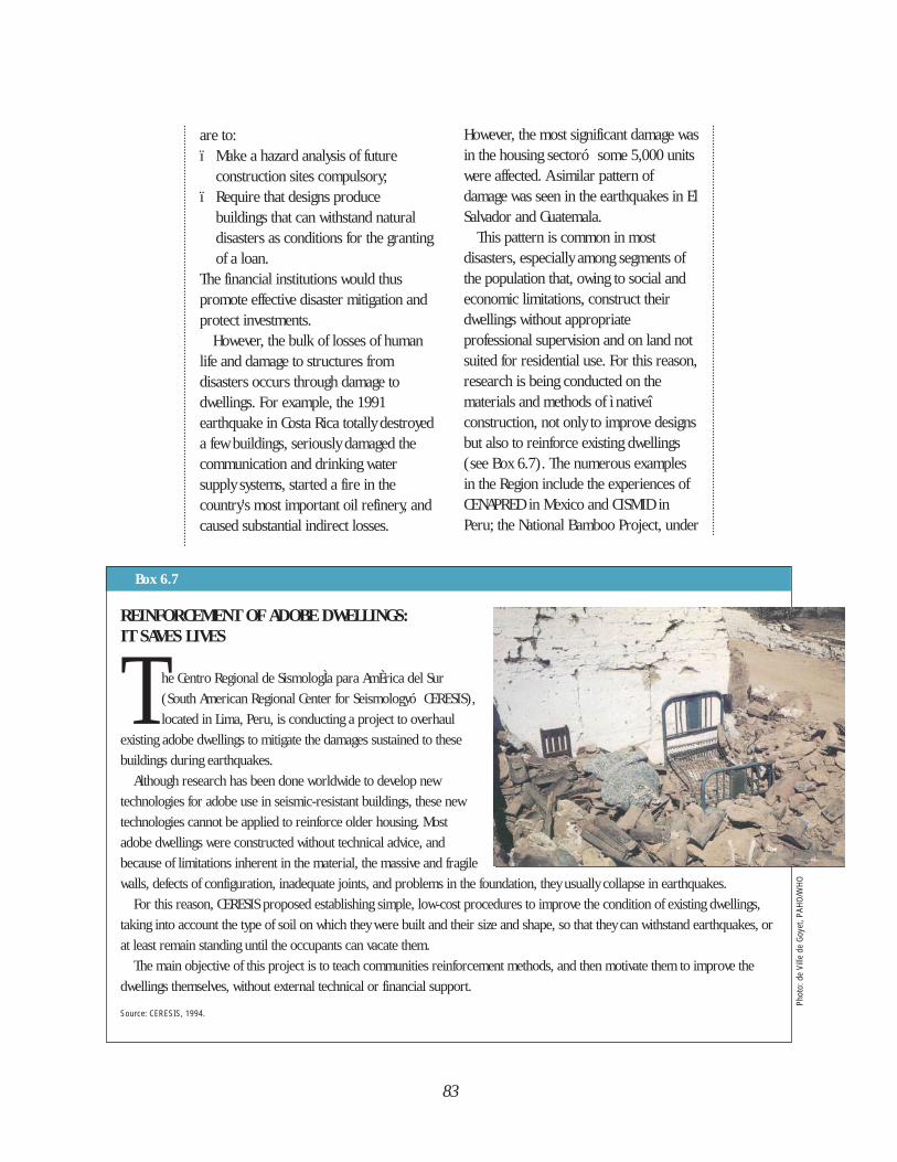
REINFORCEMENT OF ADOBE DWELLINGS: IT SAVES LIVES
T he Centro Regional de SismologÌa para AmÈrica del Sur
(South American Regional Center for Seismologyó CERESIS),
located in Lima, Peru, is conducting a project to overhaul
existing adobe dwellings to mitigate the damages sustained to these
buildings during earthquakes.
Although research has been done worldwide to develop new
technologies for adobe use in seismic-resistant buildings, these new
technologies cannot be applied to reinforce older housing. Most
adobe dwellings were constructed without technical advice, and
because of limitations inherent in the material, the massive and fragile
walls, defects of configuration, inadequate joints, and problems in the foundation, they usually collapse in earthquakes.
For this reason, CERESIS proposed establishing simple, low-cost procedures to improve the condition of existing dwellings,
taking into account the type of soil on which they were built and their size and shape, so that they can withstand earthquakes, or
at least remain standing until the occupants can vacate them.
The main objective of this project is to teach communities reinforcement methods, and then motivate them to improve the
dwellings themselves, without external technical or financial support.
Source: CERESIS, 1994.
83
are to:ï Make a hazard analysis of future
construction sites compulsory;ï Require that designs produce
buildings that can withstand natural disasters as conditions for the granting of a loan.
The financial institutions would thuspromote effective disaster mitigation andprotect investments.
However, the bulk of losses of humanlife and damage to structures fromdisasters occurs through damage todwellings. For example, the 1991earthquake in Costa Rica totally destroyeda few buildings, seriously damaged thecommunication and drinking watersupply systems, started a fire in thecountry's most important oil refinery, andcaused substantial indirect losses.
However, the most significant damage wasin the housing sectoró some 5,000 unitswere affected. A similar pattern ofdamage was seen in the earthquakes in ElSalvador and Guatemala.
This pattern is common in mostdisasters, especially among segments ofthe population that, owing to social andeconomic limitations, construct theirdwellings without appropriateprofessional supervision and on land notsuited for residential use. For this reason,research is being conducted on thematerials and methods of ì nativeîconstruction, not only to improve designsbut also to reinforce existing dwellings(see Box 6.7). The numerous examplesin the Region include the experiences ofCENAPRED in Mexico and CISMID inPeru; the National Bamboo Project, under
Box 6.7
Phot
o: d
e Vi
lle d
e Go
yet,
PAHO
/WHO
84
PARAGUAY: THE PROBLEM OF FREQUENT FLOODING
The Paraguay River's greatest floods occur approximately every 5 to 10 years. In intervening years however, major floods
can occur along specific stretches of the river's basin; the variable rainy seasons in the upper and lower river basin
produce this uneven flooding. For example, serious floods in the upper basin have affected cities such as Fuerte Olimpo,
Puerto Casado, and ConcepciÛn, while in the middle and lower basins the river barely rose. Conversely, there has been flooding
in the middle or lower basin that affected major towns such as AsunciÛn, Alberdi, and Pilar, while the upper basin saw nothing
that could be considered abnormal.
The behavior of the Paran· River is less predictable, and its flow is determined to a great degree by the fact that there are 18
hydroelectric plants built on its tributaries and on the Paran· River itself.
The damage caused by flooding in Paraguay is considerable, which means that people must be relocated and infrastructure
built for basic services: water, sewage disposal, vector control, food hygiene, and waste disposal. In addition, because flooding
occurs at the coldest time of the year, the victims need blankets and temporary shelter, obtained mainly from international
donations and governmental funds at an estimated cost of US$150,000 per flood.
The city of AsunciÛn, whose population is hit hardest by annual flooding, has made plans to build a wall around the city, and
storm waters will be pumped toward the Paraguay River during periods of rain. The government invested approximately US$5.2
million to construct dikes for riverbank protection in the cities of ConcepciÛn in the north and Pilar in the south (both on the
Paraguay River) and to build 150 km of embankments along several routes commonly affected by the flooding of the Paraguay
River. These embankments will reduce the vulnerability of more than 400 km of roads connecting riverine towns that tend to be
isolated from the rest of the country when major access routes are flooded.
There are still no laws restricting the use of areas prone to flooding.
Source: PAHO/WHO.
Box 6.8
Pho
to:
L. C
alle
85
the Housing Ministry of Costa Rica; andexperiments in building with bamboo andreed in Panama and Colombia. Inaddition, research is underway on theimproved use of adobe, quincha(construction using cane or sticks andmud), and taquezal (blocks consisting ofmud and organic materials) inNicaragua, Guatemala, and Peru.
In Jamaica and other countries of theCaribbean, a pilot project was conductedwith typical dwellings to assess first theirresponse to hurricanes and subsequentlyto promote scientifically designedanchorings and connections. The projectreceived technical and financial supportfrom the International DevelopmentResearch Center (IDRC) of Canada, theFaculty of Engineering of the University ofthe West Indies, and a Jamaican NGO, theCenter for the Development of Research inConstruction. This project is linked tosimilar activities that the OAS and theRegional Office of OFDA/USAID forHousing and Urban Development in theCaribbean are sponsoring, such as aproject to inspect electric power grids andother infrastructure, map areas susceptibleto natural hazards, cooperate withinsurance companies to improve riskmanagement, and improve building codes.
The purpose of research andexperiments with constructiontechnologies and materials is similar tothat of developing hazard maps; that is tosay, they are a means, not an end to amitigation program. The need to conveyall findings of these studies tocommunities, in easy-to-understandlanguage so that they can be applied andbecome effective tools for reducing theimpact of natural disasters, is imperative.
The city of Santiago de los Caballeros,Dominican Republic, is located in anarea of high seismic activity that is also
exposed to heavy rains from hurricanesaffecting the Caribbean. In 1989,vulnerability analysis was conducted onboth the water supply and sanitationsystems which were susceptible toextensive rupture and damage because ofinadequate maintenance programs,structural flaws, and improperly usedpiping materials. Corrections to thesystems have been carried out in part, butan indirect and even more importantconsequence has been the government’sdecision to reinforce and modernizedrinking water supply systems in theentire country.
Aside from modifications to existinginfrastructure and special designs for newprojects, measures can be taken todirectly influence the impact of naturaldisasters. A wide range of engineeringworks to prevent disasters is available,depending on technical feasibility andcost-benefit ratio considerations.Investments in disaster preventionprojects are readily justified in areasfrequently hit by disasters; thus, it is notsurprising that the control ofhydrometeorological disasters throughengineering is one of the most commonpreventive measures taken.
At certain times of the year, reports offlooding in susceptible areas arecommon. If we compare these reportsyear after year, we see that the damage ispractically the same. . .until somepolitical body decides to tackle theproblem by building control devices (seeBox 6.8).
The wide range of flood protectionworks runs from traditional dikes andretaining walls to river channelmodifications. The design of such works,in addition to the high cost, often poseschallenges to hydraulic and structuralengineers. However, in many cases, the
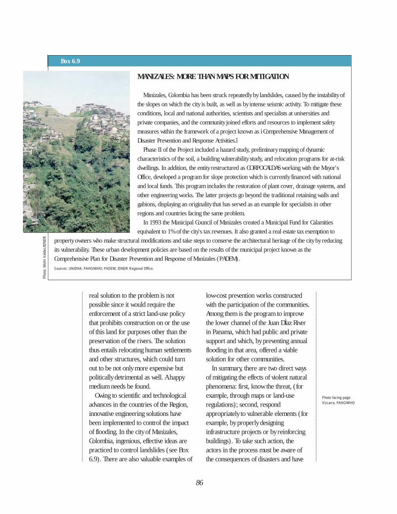
real solution to the problem is notpossible since it would require theenforcement of a strict land-use policythat prohibits construction on or the useof this land for purposes other than thepreservation of the rivers. The solutionthus entails relocating human settlementsand other structures, which could turnout to be not only more expensive butpolitically detrimental as well. A happymedium needs be found.
Owing to scientific and technologicaladvances in the countries of the Region,innovative engineering solutions havebeen implemented to control the impactof flooding. In the city of Manizales,Colombia, ingenious, effective ideas arepracticed to control landslides (see Box6.9). There are also valuable examples of
low-cost prevention works constructedwith the participation of the communities.Among them is the program to improvethe lower channel of the Juan DÌaz Riverin Panama, which had public and privatesupport and which, by preventing annualflooding in that area, offered a viablesolution for other communities.
In summary, there are two direct waysof mitigating the effects of violent naturalphenomena: first, know the threat, (forexample, through maps or land-useregulations); second, respondappropriately to vulnerable elements (forexample, by properly designinginfrastructure projects or by reinforcingbuildings). To take such action, theactors in the process must be aware ofthe consequences of disasters and have
86
MANIZALES: MORE THAN MAPS FOR MITIGATION
Manizales, Colombia has been struck repeatedly by landslides, caused by the instability of
the slopes on which the city is built, as well as by intense seismic activity. To mitigate these
conditions, local and national authorities, scientists and specialists at universities and
private companies, and the community joined efforts and resources to implement safety
measures within the framework of a project known as ì Comprehensive Management of
Disaster Prevention and Response Activities.î
Phase II of the Project included a hazard study, preliminary mapping of dynamic
characteristics of the soil, a building vulnerability study, and relocation programs for at-risk
dwellings. In addition, the entity restructured as CORPOCALDAS working with the Mayor's
Office, developed a program for slope protection which is currently financed with national
and local funds. This program includes the restoration of plant cover, drainage systems, and
other engineering works. The latter projects go beyond the traditional retaining walls and
gabions, displaying an originality that has served as an example for specialists in other
regions and countries facing the same problem.
In 1993 the Municipal Council of Manizales created a Municipal Fund for Calamities
equivalent to 1% of the city's tax revenues. It also granted a real estate tax exemption to
property owners who make structural modifications and take steps to conserve the architectural heritage of the city by reducing
its vulnerability. These urban development policies are based on the results of the municipal project known as the
Comprehensive Plan for Disaster Prevention and Response of Manizales (PADEM).
Sources: UN/DHA; PAHO/WHO; PADEM; IDNDR Regional Office.
Box 6.9
Photo facing page: Vizcarra, PAHO/WHO
Phot
o: M
olin
Val
des/
IDND
R
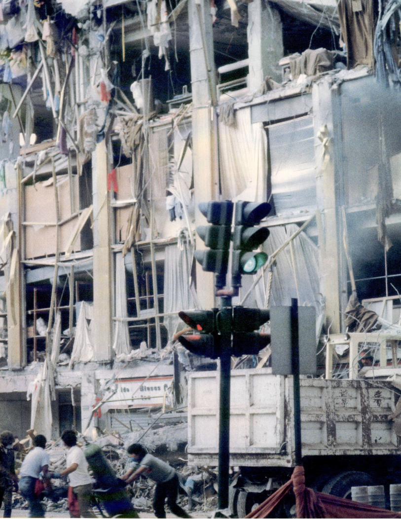
88
The challenge
of the IDNDR in
Latin America
and the
Caribbean is
to apply the
knowledge that
has been
accumulated
and developed
in the Region.
the technical and scientific knowledgeand the motivation to propose solutions.
THE ACTORS—GATHERING ANDAPPLYING KNOWLEDGE
The challenge of the IDNDR in LatinAmerica and the Caribbean is to apply theknowledge that has been accumulated anddeveloped in the Region. The institutionsof higher learning in the health sectorhave opened their doors to initiatives fromagencies like PAHO/WHO to makeemergencies and disasters an integral partof their curricula.
In disciplines such as engineering andthe applied sciences, the study of naturaldisasters is approached from a rigorousanalytical perspective, sometimesignoring socioeconomic considerations.The contribution of this research to theimproved knowledge of natural hazardshas been important, but such studies nowmust be increasingly directed towardbringing benefits to communities.
Some institutions of higher learning aremotivated by an ever-increasingawareness of their role in communityhealth and safety. There are manyexamples, but mention should be madeof the postgraduate-level curricula at theUniversity of the Andes in Venezuela andthe University of the Andes in Colombia inthe areas of structural and seismicengineering; the Center for DisasterPrevention Studies of the Faculty ofPhysical Sciences and Engineering of theUniversity of Chile; the applied studiesand research being carried out by theNational University of Engineering, Peru;the Geophysical Institute of thePolytechnic School of Ecuador; theongoing support for updating the SeismicCode that is provided by the SeismicEngineering Laboratory of the Faculty of
Civil Engineering of the University ofCosta Rica; and the applied studies of theSeismic Research Unit of the University ofthe West Indies in Trinidad. Mention mustalso be made of the interest of theNational University of Nicaragua indeveloping a postgraduate program indisaster prevention and management inCentral America; the fundamental rolethat the National University of Mexicoplays in connection with CENAPRED; andthe willingness of the Schools ofArchitecture of Federico de VillarrealUniversity in Peru and of the PilotoUniversity in Colombia to formallyincorporate the study of disasters in theircurricula. Box 6.10 describes some ofthe prominent centers carrying outapplied research in disaster mitigation inthe Region.
The ICAROS project (the IDNDR“Roving Seminar in the Caribbean”) wasinitiated by the International Union ofTechnical Associations and Organizationsand the World Federation of EngineeringOrganizations (UATI/WFEO), and otherregional and multilateral organizations todisseminate and share high-qualityinformation on natural disasters in thecountries and territories of theCaribbean. The principal subjects ofdiscussion are risk maps, training at thelocal level, workshops anddemonstrations of proper constructionmethods, improvement of warningsystems, case studies on the role ofinsurance companies and thesocioeconomic impact of disasters, andanalyses of cost-benefit ratios.
In the area of the social sciences, LaRED, the Latin American Network ofSocial Studies in Disaster Prevention,analyzes the influence of governmentalorganization on disaster prevention,response and recovery measures and
89
CENTERS OF APPLIED RESEARCH IN DISASTER MITIGATIONThe Centro Nacional para la Prevención de Desastres (National Center for Disaster Prevention—CENAPRED) was
inaugurated in 1990 in Mexico City with three aims:
• To study, develop, and apply technologies for disaster prevention and mitigation
• To promote technical training
• To disseminate information on preparedness and self-protection for the Mexican people
The Center’s research encompasses the following areas: geological risks, seismology equipment, seismic experiments,
hydrometeorological risks, and chemical hazards. CENAPRED supports the implementation and operation of detection,
surveillance, and forecasting activities and risk evaluation networks in cooperation with other government agencies.
The Centro Peruano-Japonés de Ingeniería Sísmica y Mitigación de Desastres (Peruvian-Japanese Center for Seismic
Research and Disaster Mitigation—CISMID) is an academic research center for the study and improvement of techniques to
reduce human and material losses caused by natural disasters. CISMID, established by the Faculty of Civil Engineering of Peru’s
National University of Engineering, receives support from the National Council for Science and Technology of Peru.
The Center’s facilities in Lima include a geotechnical laboratory and a building materials laboratory, and offer specialized
courses in structural engineering and building materials sciences. CISMID’s efforts have led to the creation of a standard for
building codes and land use statutes in Peru. Both CENAPRED and CISMID receive technical and financial support from JICA.
The Centro Regional de Sismología para América del Sur (South American Regional Center for Seismology—CERESIS)
was established in Lima (Peru) as an autonomous intergovernmental agency by the governments of the South American countries
in 1971, with initial backing from UNESCO and other agencies. It has had a major scientific and technical impact on the region
in the evaluation of seismic risk, digital seismic networks, production of maps and geophysical catalogues, and in developing
South America’s own professional capacity.
Since 1989 CERESIS has been carrying out a regional standarized methods project to evaluate seismic risk in South America,
based on national maps and catalogues produced by each country. The project is associated with the Latin American Map
Program on Seismic Hazards and will contribute to the Global Seismic Hazard Assessment Program.
The Seismic Research Unit (SRU) of the University of the West Indies in Trinidad was established 40 years ago to monitor
seismic events throughout the Commonwealth and Eastern Caribbean islands. It coordinates earthquake-related activities by
centralizing data on events in the area. In addition, it maintains ties with earthquake centers in the French departments of
Martinique and Guadeloupe and in Puerto Rico, the Dominican Republic, and Cuba.
Box 6.10
policies in a society faced with disasters,and evaluates the experiences of thecountries in implementing thesemeasures. The Institute for Training inPublic Administration (ICAP), located inCosta Rica and serving all of CentralAmerica, is making an importantcontribution in this field; it offers a well-structured master’s degree program thatincludes natural hazards in themanagement of investment projects. Inaddition, the Department of Social Work
of the University of Antioquia, Colombia,has established a graduate-level programthat emphasizes aspects of socialdevelopment as related to emergency anddisaster situations.
As a consequence of the commitmentby institutions of higher learning todisaster studies, many professionalengineering and architecturalassociations, which influence politicaldecision-making and enjoy credibilityamong the public in countries of the
90
THE RECONSTRUCTION OF THE HEALTH SECTOR IN EL SALVADOR:AN EXPERIENCE IN MITIGATION
In terms of damage caused to the health care infrastructure, the 1986 earthquake in the city of San Salvador was not much
different from the one that hit Mexico City barely a year before. The most striking example of this destruction was the
Benjamín Bloom Children’s Hospital. This public institution became inoperative just when it was most needed—during the
phase of emergency relief—because of structural damage and shifting and falling nonstructural components. Thanks to the
preparedness of its personnel, the existence of emergency plans, and the evacuation, there were no casualties, and medical care
was organized promptly in temporary facilities. The hospital was subsequently renovated and underwent structural
reinforcement.
This experience prompted a reorganization of the health sector so that it would not be dependent on the services of one
“mega-hospital” of 400 beds or more. In an effort to decentralize hospital care, four new health centers with 100 beds each
were constructed on the outskirts of the city.
Source: PAHO/WHO; ECLAC.
Box 6.11
Region, are giving more importance tothe consideration of natural hazards in allphases of a project, from its planning toits construction and maintenance. Toillustrate the multiple possibilities ofcooperation and the influence of this typeof professional group, the CivilEngineering Association of Ecuador andthe Colombian Association of Engineerssigned a Letter of Intent for cooperation.One of the points of this agreement callsfor mutual support in emergencysituations and joint activities to train andupdate their professionals in disaster-related subjects.
Society on the whole, because itcomprises a range of different actorsfrom government-level planners to thebeneficiaries of an individual project, isfamiliarizing itself with the termsassociated with disaster management.This process ideally leads to a greaterawareness of the problem, and helps topromote the idea that mitigation ofnatural disasters profits everyone.
DISASTER: A WINDOW OF OPPORTUNITY
A disaster can provide opportunitiesfor a sector to reorganize, as was thecase with the decentralization of thehealth care system in El Salvador’s capitalin 1986 (see Box 6.11), or for thereorganization of disaster managementsystems themselves. To cite only a fewexamples, the 1985 earthquake in Mexicoprompted the creation of the SistemaNacional de Protección Civil (NationalCivil Protection System—SINAPROC); inColombia, the violent eruption of theNevado del Ruiz Volcano in 1985 led tothe establishment of the Sistema Nacionalde Prevención y Atención a los Desastres(National Disaster Prevention andResponse System) and at the same timepromoted guidelines for mitigating futuredisasters during reconstruction. Theexample of municipal development of LaPaz, Bolivia (see box 6.12), illustratesperfectly how disasters provide theopportunity to promote long-termdevelopment programs.
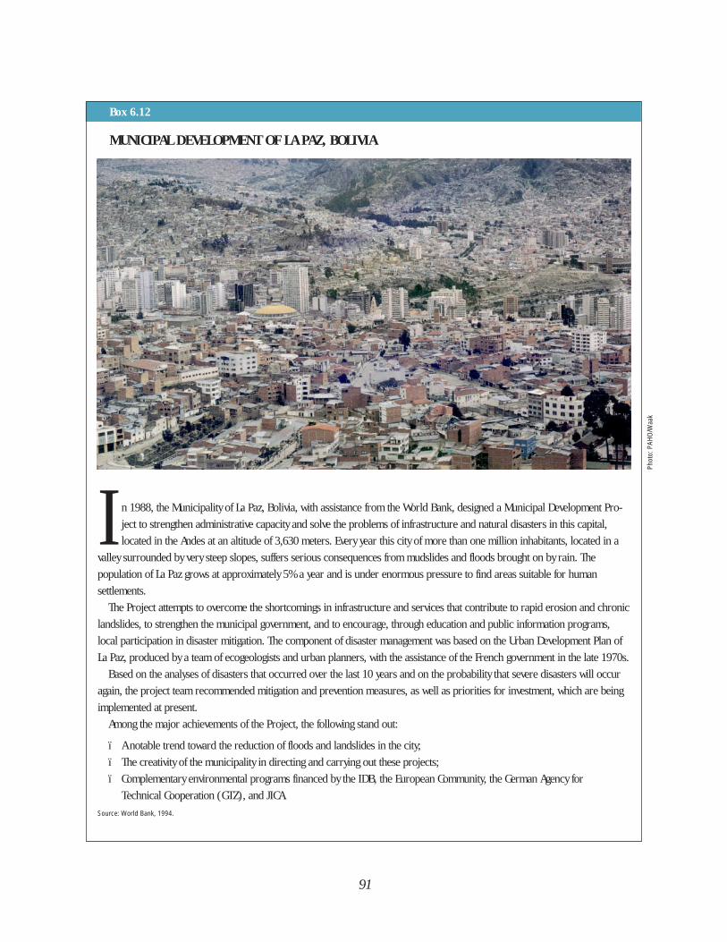
91
Phot
o: P
AHO/
Waa
k
MUNICIPAL DEVELOPMENT OF LA PAZ, BOLIVIA
I n 1988, the Municipality of La Paz, Bolivia, with assistance from the World Bank, designed a Municipal Development Pro-
ject to strengthen administrative capacity and solve the problems of infrastructure and natural disasters in this capital,
located in the Andes at an altitude of 3,630 meters. Every year this city of more than one million inhabitants, located in a
valley surrounded by very steep slopes, suffers serious consequences from mudslides and floods brought on by rain. The
population of La Paz grows at approximately 5% a year and is under enormous pressure to find areas suitable for human
settlements.
The Project attempts to overcome the shortcomings in infrastructure and services that contribute to rapid erosion and chronic
landslides, to strengthen the municipal government, and to encourage, through education and public information programs,
local participation in disaster mitigation. The component of disaster management was based on the Urban Development Plan of
La Paz, produced by a team of ecogeologists and urban planners, with the assistance of the French government in the late 1970s.
Based on the analyses of disasters that occurred over the last 10 years and on the probability that severe disasters will occur
again, the project team recommended mitigation and prevention measures, as well as priorities for investment, which are being
implemented at present.
Among the major achievements of the Project, the following stand out:
ï A notable trend toward the reduction of floods and landslides in the city;
ï The creativity of the municipality in directing and carrying out these projects;
ï Complementary environmental programs financed by the IDB, the European Community, the German Agency for
Technical Cooperation (GTZ), and JICA.
Source: World Bank, 1994.
Box 6.12

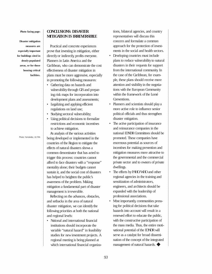
93
CONCLUSIONS: DISASTER MITIGATION IS IRREVERSIBLE
Practical and concrete experiencesprove that investing in mitigation, eitherdirectly or indirectly, profits everyone.Planners in Latin America and theCaribbean, who can demonstrate the costeffectiveness of disaster mitigation inplans must be more aggressive, especiallyin promoting the following measures:• Gathering data on hazards and
vulnerability through GIS and prepar-ing risk maps for incorporation into development plans and assessments;
• Legalizing and applying efficient regulations on land use;
• Studying sectoral vulnerability;• Using political decisions to formalize
restrictions and economic incentives to achieve mitigation.An analysis of the various activities
being developed or implemented in thecountries of the Region to mitigate theeffects of natural disasters shows acommon denominator that has acted totrigger this process: countries cannotafford to face disasters with a “response”mentality alone; their budgets cannotsustain it, and the social cost of disastershas helped to heighten the public’sawareness of the problem. Makingmitigation a fundamental part of disastermanagement is irreversible.
Reflecting on the advances, obstacles,and setbacks in the area of naturaldisaster mitigation, we can identify thefollowing priorities at both the nationaland regional levels:• National and international financial
institutions should incorporate the variable “natural hazard” in feasibility studies for new investment projects. A regional meeting is being planned at which international financial organiza-
tions, bilateral agencies, and country representatives will discuss this concern and formulate a common approach for the protection of invest-ments in the social and health sectors.
• Developing countries must include plans to reduce vulnerability to natural disasters in their requests for support from the international community. In the case of the Caribbean, for exam-ple, these plans should receive more attention and visibility in the negotia-tions with the European Community within the framework of the Lomé Conventions.
• Planners and scientists should play a more active role to influence senior political officials and thus strengthen disaster mitigation.
• The active participation of insurance and reinsurance companies in the national IDNDR Committees should bepromoted. These companies have enormous potential as sources of incentives for making prevention and mitigation measures more attractive tothe governmental and the commercial private sector and to owners of privatedwellings.
• The efforts by PAHO/WHO and other regional agencies in the training and sensitization of administrators, engineers, and architects should be expanded with the leadership of professional associations.
• Most importantly, communities press-ing for political decisions that take hazards into account will result in a renewed effort to educate the public, with the constructive participation of the mass media. Thus, the entire moti-vational potential of the IDNDR will serve as a catalyst for broad dissemi-nation of the concept of the integrated management of natural hazards. ◆
Photo: Fernández, ULTRA
Photo facing page:
Disaster mitigation
measures are
especially important
for buildings sited in
densly-populated
areas, or for those
housing critical
facilities.
In the 1970s, advances intelecommunications permitted themass media to relay images and
information about natural disastersdirectly to a world audience withunprecedented speed. People saw whathappened to their neighbors as the resultof disasters. This new knowledge helpederase boundaries between societies andhas given rise, in the 1990s, to a focus onsustainable development. This new way oflooking at disasters has integrated theconcepts of prevention, mitigation, andpreparedness to reduce the social andeconomic impacts of natural disasters.
TOWARD NATURAL DISASTERREDUCTION—THE ACTORS
No country nor agency could havereached its present level of maturity withregard to disaster reduction had itremained isolated from others. The slowprocess of transforming from vulnerableto more secure implies the participationof numerous protagonists both at thenational and international levels. Theprotagonists in this enterprise of disasterreduction are listed below in order ofvisibility, not in order of importance:
• International agencies• Scientific associations, universities,
and nongovernmental organizations• Governments• Communities
International AgenciesMuch of this report has emphasized the
achievements of the principalprotagonists, that is, the countries. It isalso important to address the contributionof the international—multilateral andbilateral—agencies, which have served ascatalysts in promoting disaster reductionin the Region of the Americas.
Among the international actors involvedin disaster reduction is the United Nationssystem. Initially, disaster reductionactivities were the mandate of UNDRO, theOffice of the UN Disaster ReliefCoordinator, until the creation of theDepartment of Humanitarian Affairs in1991. Other U.N. agencies that haveplayed important roles are the WorldMeteorological Organization, leader incoordinating early warning systems forhydrometeorological hazards; UNESCO,promoting research in the fields ofvolcanology and seismology; and, morerecently, the United Nations DevelopmentProgram (UNDP), which provides trainingfor the entire UN system through theDisaster Management Training Program.In short, all agencies in the systemcontribute to reducing natural disasters inthe Americas.
At the regional level, the EconomicCommission for Latin America and theCaribbean (ECLAC) has evaluated theeconomic repercussions of majordisasters in the last decades and created adatabase of great value in preventing and
94
LOOKING TOWARDTHE FUTURE
CHAPTER 7
Photo facing page:Gaggero, PAHO/WHO
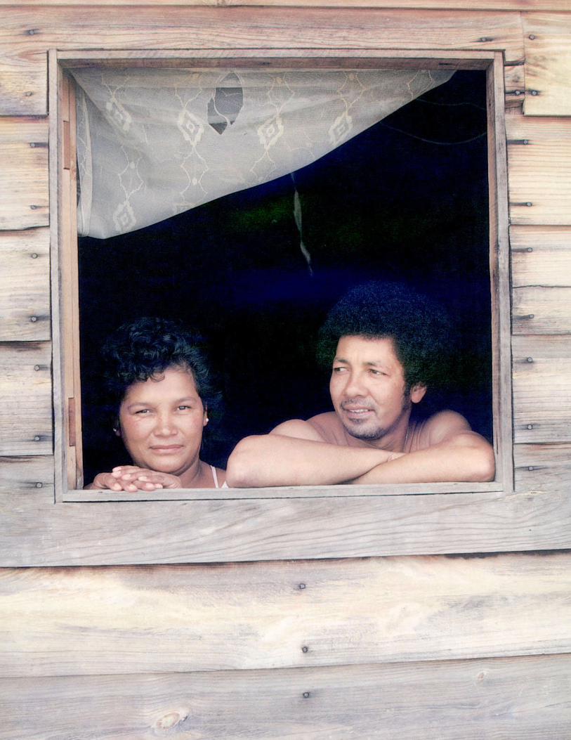
mitigating the effects of disasters.Since the early 1980s, the Organization
of American States (OAS) has helped itsmember countries to reduce the impactof natural hazards by: evaluating them aspart of the study of natural resources;identifying and formulating mitigationmeasures; making information onhazards more accessible; and trainingplanners in evaluation of natural hazardsand disaster mitigation techniques.
The Pan American Health Organization,Regional Office for the Americas of theWorld Health Organization (PAHO/WHO),is convinced that socioeconomicdevelopment goes hand in hand withprotecting the people of the Region fromnatural or manmade hazards. PAHO’sEmergency Preparedness and DisasterRelief Coordination Program placespeople’s health as the force drivingdisaster reduction in the Americas. Thus,they support some 200 courses andworkshops annually and produce anddisseminate publications, video and slideprograms, and other materials of keyimportance. Disaster professionals in theRegion benefit from PAHO/WHO’sDisaster Documentation Center whoseprimary purpose is to offer quick accessto disaster management information.
At the subregional level, the creation ofthe Caribbean Disaster EmergencyResponse Agency (CDERA) by theCaribbean Community (CARICOM)deserves mention. It was the firstintergovernmental organization in theAmericas established exclusively for themanagement of natural and manmadedisasters and funded by its MemberCountries.
Bilateral agencies have supporteddisaster reduction activities in LatinAmerica and the Caribbean either directlyor through the U.N. and nongovernmental
organizations. International cooperationagencies such as the CanadianInternational Development Agency(CIDA), the U.S. Office of ForeignDisaster Assistance of the U.S. Agency forInternational Development(OFDA/USAID), the Japan InternationalCooperation Agency (JICA), the SwedishInternational Development Authority(SIDA) and agencies of other Nordiccountries, the Overseas DevelopmentAdministration (ODA) of the UnitedKingdom, the Government of theNetherlands, and the French and ItalianCooperations provide financial supportand technical assistance to a variety ofprojects.
In 1987, OFDA/USAID, through itsregional program located in Costa Rica,began an interactive course for thetraining of trainers in disastermanagement, damage evaluation, andneeds assessment. They also developedcourses on planning and school safety,creating a fertile field for thecomplementary initiative, UNDP’s DisasterManagement Training Program.OFDA/USAID, through the U.S. GeologicalSurvey, also collaborates withgovernments and scientific institutions inthe Region on volcano surveillance andmonitoring. The reorientation of theirpriorities—from preparedness toprevention and mitigation—isexemplified by agreements made withPAHO/WHO on disaster mitigation forhospitals and health installations, andwith the OAS for a Caribbean mitigationproject.
In addition to its support for specificprojects such as flood prevention, JICAemphasizes scientific cooperation inengineering and seismology. CISMID inPeru, and CENAPRED in Mexico, arecenters of scientific and investigative
96
excellence in the Region (see chapter 6)that owe their existence to the materialand technical support of Japan.
The Nordic countries in turn, led bySweden, developed CEPREDENAC.Conceived with a scientific scope fordisaster prevention, CEPREDENAC nowfocuses on the social and politicaldimensions of disaster reduction.Currently, CEPREDENAC is recognized asan intercountry agency, and following theexample of CDERA in the Caribbean, mustsecure funding from the countries ofCentral America themselves for its coreactivities.
Other countries, such as Canada andthe United Kingdom, have given up a highlevel of visibility derived from directinvolvement and have opted to actthrough existing agencies (UN, Red Cross,NGOs). These countries have exertedconsiderable influence on disasterreduction efforts in Latin America and theCaribbean.
With so many protagonists,coordination has, at times, been an issue,but one that is being satisfactorilyresolved. At the end of the 1970s thenumber of protagonists at the regionallevel was limited (UNDRO, OFDA/USAID,the League of Red Cross and RedCrescent Societies, today the InternationalFederation, the OAS and PAHO/WHO,among others). As the numbers grew,more dialogue was needed among theprotagonists. One way to build andmaintain this dialogue was to holdmeetings at the regional and subregionallevel. Two notable examples are themeetings of national IDNDR Committees:in Guatemala in 1991 for Latin Americaand the Spanish-speaking Caribbean, andin Jamaica for the English, French, andDutch-speaking Caribbean. The U.N.World Conference in Yokohama provided
another opportunity for dialogue. The1994 Inter-American Conference onNatural Disaster Reduction in Cartagena,Colombia, represented the last stage ofpreparation for the World Conference bythe countries of Latin America and theCaribbean (see the ConferenceResolutions in Box 7.1).
Scientific Associations, Universities,and NGOs
Natural disaster reduction must bemultidisciplinary and multisectoral; itcannot be the exclusive territory of anyone group. Scientists, professionalassociations, and universities havedeveloped risk mapping, early warningsystems, and other preventive measures.Nevertheless, despite successful resultsand model projects, the percentage ofscientists in the Region that actuallyparticipate in and contribute to this fieldis not high, and the field continues to bedominated by a few experts in eachcountry.
In the last 15 years, many countrieshave successfully included disastermanagement and preparedness in theformal curriculum of universities. Thegoal is to familiarize all graduates withdisaster reduction as it relates to theirspecific discipline.
The revitalization of intergovernmentalassociations such as CERESIS (Peru), theSRU (Trinidad) and others that enjoyinternational and national support, canbe credited to the IDNDR. The objectivesof the Decade also have strengthenedother scientific and managementinitiatives: the establishment of a scientificIDNDR Committee, as in the case of Chile;the creation of networks focused ontechnical or social aspects of disasterssuch as La RED or the Latin AmericanPartnership of CUSEC; and the formation
97
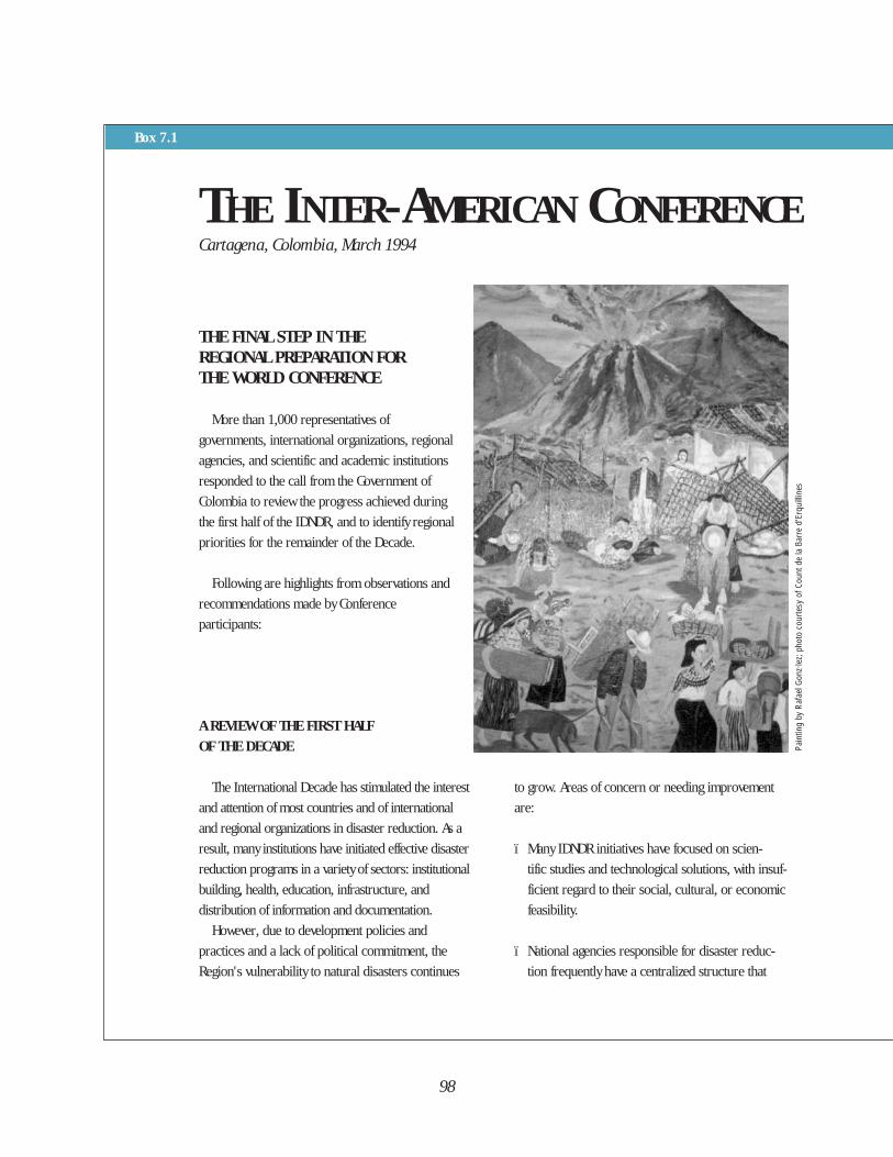
Cartagena, Colombia, March 1994
A REVIEW OF THE FIRST HALF
OF THE DECADE
The International Decade has stimulated the interest
and attention of most countries and of international
and regional organizations in disaster reduction. As a
result, many institutions have initiated effective disaster
reduction programs in a variety of sectors: institutional
building, health, education, infrastructure, and
distribution of information and documentation.
However, due to development policies and
practices and a lack of political commitment, the
Region's vulnerability to natural disasters continues
to grow. Areas of concern or needing improvement
are:
ï Many IDNDR initiatives have focused on scien-
tific studies and technological solutions, with insuf-
ficient regard to their social, cultural, or economic
feasibility.
ï National agencies responsible for disaster reduc-
tion frequently have a centralized structure that
98
THE FINAL STEP IN THE REGIONAL PREPARATION FORTHE WORLD CONFERENCE
More than 1,000 representatives of
governments, international organizations, regional
agencies, and scientific and academic institutions
responded to the call from the Government of
Colombia to review the progress achieved during
the first half of the IDNDR, and to identify regional
priorities for the remainder of the Decade.
Following are highlights from observations and
recommendations made by Conference
participants:
Box 7.1
THE INTER-AMERICAN CONFERENCE
Pain
ting
by R
afae
l Gon
z·le
z; p
hoto
cou
rtesy
of C
ount
de
la B
arre
d'E
rqui
lline
s
excludes the participation of local communities
and other sectors. These agencies are directed
toward post-disaster response rather than preven-
tion and mitigation measures.
• The link between disaster prevention and manage-
ment of the environment has not been imple-
mented because disaster reduction, as an essential
strategy for sustainable development, has not been
explicitly promoted.
LOOKING TOWARD THE FUTURE
Within their areas of expertise, the participants at
the Inter-American Conference committed themselves
to promote and implement the following actions:
• Adopt disaster reduction as both an objective and
an indicator for reaching sustainable development;
• Develop regional and national techniques to assess
and monitor vulnerability to natural disasters;
• Ensure the active participation of individuals and
communities at risk;
• Translate technological results into effective poli-
cies for disaster response by reviewing and com-
piling regional experiences and studies that inte-
grate the social and scientific sectors;
• Give priority to educating the general population
and the main protagonists to establish a disaster
prevention “culture” adapted to the reality of the
Region;
• Provide practitioners and scientists with rapid
access to information by expanding regional and
national disaster documentation centers with a
multisectoral and multiagency approach;
• Strengthen the trend toward decentralization of
institutions and promote greater participation of
the entire society in the effort to reduce vulnera-
bility to disasters;
• Promote the establishment of national and regional
parliamentary commissions on disaster reduction
to review and strengthen existing legislation;
• Recognize and support the role of the Ministries
of Foreign Affairs in promoting effective inter-
national cooperation, as well as between devel-
oping countries of the Region;
• Request that the international community support
not only relief and preparedness activities, but also
horizontal cooperation and networking between
countries to achieve the goals of the IDNDR;
• Encourage financial institutions at global and
regional levels to support disaster reduction activi-
ties by including vulnerability reduction aspects in
national development projects.
This is a summary of the conclusions elaborated
at the Inter-American Conference on Natural
Disaster Reduction, Cartagena, Colombia, March
1994. They have been translated into English
and abridged by PAHO/WHO.
99
ON NATURAL DISASTER REDUCTION
of specialized centers to promote theteaching of integrated disastermanagement, such as the WHOCollaborating Center in Medellín,Colombia.
GovernmentsDuring the 1980s, civil defense and
emergency response agencies mademajor advances in coordinating andsupporting disaster response. Today,other sectors are beginning the morecomplex process of reducing thevulnerability of infrastructures as well ascommunities and their property todisasters. The best results have beenobtained in those countries wheredevelopment authorities take a leadershiprole and obtain the technical backing ofdisaster experts.
All countries in Latin America haveestablished IDNDR Committees; thebroader the participation of the publicsector, the private sector, the Red Cross,NGOs, churches and community groupsin these Committees is, the more dynamicthey are. In those countries whereministries of finance, public works,education or health play a dominant role,a sustainable development approach hastaken place. But where a traditionaloperational response command hassimply been relabeled “The IDNDRCommittee,” little progress towarddisaster reduction has been made.
New challenges face governments inthe second half of the InternationalDecade. For example, finance andplanning sectors, on being invited toregional disaster reduction meetings, maystill ask “What does our department orministry have to do with disasters?” Thisreaction is identical to that of the healthsector when, 15 years ago, it wasencouraged to establish preparedness
programs. The IDNDR, and in particularthe U.N. World Conference, make apowerful argument for why they shouldbe involved.
The CommunityThe other protagonists in disaster
reduction are community groups and thegeneral public. The illusion that thegovernment can solve all problems whilecommunities passively wait is fading.Individuals need to participate in theplans that shelter them from the effects ofnatural disasters. Community projectsand experiences demonstrate thatdisaster reduction issues cannot beisolated from those of sustainabledevelopment. Community memberscontribute great energy and creativity tothe solutions for their own progress; theirparticipation must be developed andnurtured. The annual celebration ofInternational Natural Disaster ReductionDay has opened the door to greatercommunity involvement, and this willcontinue to be a priority for the secondpart of the Decade.
THE FACTORS
Progress toward reducing vulnerabilityto natural disasters varies from country tocountry in this Region and a number offactors determine the degree of progressmade.
Acceptable Level of RiskEach authority, each community, and
each individual has a different notion ofwhat constitutes an “acceptable” level ofrisk. Some countries do not invest inmitigation measures, but follow a “pay-the-price-later” philosophy, and chooseto wait for the consequences of disasters.The more developed countries may have
100
a greater collective conscience of theimportance of disaster management,thereby investing more in mitigation andprevention. These countries also havemore resources available to enforcelegislation and finance prevention, factorsthat influence what constitutes theiracceptable level of risk.
The “triggering” role that seriousnatural disasters have played inawakening a collective awareness cannotbe underestimated; a disaster occurringin one’s own country does much more tomotivate change than simply hearing of adisaster in a neighboring country. Butmotivating communities, institutions, orgovernments to invest in works meant toreduce damages caused by potentialdisasters is a challenge. A well-knownanecdote tells of a Latin Americanengineer who was evaluating post-earthquake damages. Looking for lessonsthat the community learned that might beapplicable to future situations, he asked avictim of the disaster what might be doneto prevent another such occurrence. Theresponse was: “I am much more worriedabout how I will get a chicken for mysoup today than about how to protectmyself from some other disaster.” Thisanecdote illustrates the need to seeksolutions to the problems of disasterswithin a broader national and localagenda aimed at eradicating poverty andmeeting urgent needs.
What today is considered a clear two-way relationship between disasters andsocioeconomic progress, was ignoreduntil recently. Disasters were seen asunavoidable events to be dealt with whenthey happen, not events to considerduring the design and preparation ofdevelopment projects. Today, thesophisticated and costly infrastructureand burgeoning economy in many
countries in the Region has significantlylowered the threshold of what isconsidered an acceptable risk.
Political and Administrative StabilityDisaster reduction has few immediately
visible benefits, and until a majorcatastrophe occurs, the results arehidden. Disaster reduction requirespolitical maturity and administrativestability. Preventing and mitigating theeffects of natural disasters had littlesupport during the social conflicts inCentral America during the 1980s or inthe midst of the political crisis of Haiti inthe 1990s. Stable government andcontinuity at high decision-making levelsare decisive factors in the countries thathave achieved advances in the field.Harmony and a history of joint workingrelations between civil and securitysectors also are important.
Availability of ResourcesPoverty indisputably increases a
population’s vulnerability. Yet thecountries with the highest per capitaincomes are not necessarily those thatsucceed best in protecting theirinvestments. Vulnerability can be reducedwith even a modest economic investmentif it is coupled with the appropriatepolitical commitment. However, a lack offinancial or human resources is thefactor most often cited as limiting theimplementation of mitigation andprevention measures.
Future solutions to the problem ofvulnerability to disasters will require that“natural hazards” be included in analysesfor new investment proposals, and thatprojects for reducing the effects of nat-ural disasters be given priority in requestsmade for technical cooperation or loansfrom the international community.
101
In Latin America and the Caribbean, asin other regions of the world, politicaldecisions are often the result of demandsby populations exposed to risks. Twomain objectives of the IDNDR are tocreate a level of awareness in the generalpublic and to develop a “critical mass” ofscientists, experts, and journalists, alongwith academic, social, and religiousleaders who can serve as advocates ofdisaster prevention.
THE SECOND HALF OF THEDECADE . . . AND BEYOND
The trends in natural disasterreduction observed at the regional leveland the extensive consultation processcarried out in regional meetings (e.g.,Guatemala 1991, Jamaica 1992,Colombia 1993 and 1994) could besummarized as follows:
Expand the “culture” of disasterprevention: The traditional tendency toequate disaster management with post-disaster response is being replaced by anapproach to disaster reduction based onthe realization that the effects of disastersmay be, in part or in whole, prevented.Increasing public awareness of thebenefits of disaster reduction is essential;this will be achieved through:
• Educational campaigns, using celebra-tions such as International Natural Disaster Reduction Day and other public events;
• Participation of the mass media at joint meetings, briefing workshops,and above all, through open and joint dialogue;
• Emphasis on including disaster preven-tion and preparedness in school curricula . . . a slow but powerful process.
Increase political support andcommitment: The IDNDR should notonly stimulate more scientific andtechnical activities, but raise the level ofpolitical commitment for prevention andmitigation measures despite the lack ofimmediate or obvious returns.
To consolidate the progress achieved atthe World Conference on Natural DisasterReduction in Yokohama, the followingactions can be taken:
• Brief elected officials and, in particu-lar, the legislative bodies at national, subregional, and regional levels; stressing the link between socio-economic development and disaster reduction.
• Discuss natural disaster reduction poli-cies and priorities periodically with subregional and regional political bodies;
• Organize regional conferences to maintain a high level of political visibil-ity of the topic. In particular, PAHO/WHO, with other interested regional and global organizations, will convene a regional meeting on mitigat-ing damage to hospitals and other crit-ical health facilities.
102
Disseminate technical knowledge:Much scientific knowledge and know-how is not sufficiently shared with thoseresponsible for formulating andimplementing disaster reduction policiesand strategies. Although Latin Americaand the Caribbean are placing moreemphasis on the development of humanresources, regional preparatory meetingsshould:
• Compile and disseminate successful pilot projects and other achievements at local or national levels;
• Expand the existing regional or national disaster documentation cen-ters using a multisectoral and multi-agency approach, to facilitate free access to existing documentation;
• Strengthen existing networks of scien-tists by increasing the participation of practitioners;
• Include disaster reduction in the cur-ricula of academic institutions, schoolsof engineering and architecture, facul-ties of medicine, etc.;
• Reduce duplication, and fill existing gaps of training activities undertaken by bilateral, regional, or global agen-cies.
Emphasize the social dimensionthrough local participation:Political commitment and scientificknowledge do not guarantee thereduction of community vulnerability tonatural disasters. Those attending theCartagena Inter-American Conferencewere committed to the social dimensionof disaster reduction by:
• Involving local communities in prac-tices that reduce their vulnerability;
• Promoting scientific findings that trans-late into effective policies;
• Improving understanding of natural hazards, and the relationship between behavior, development, and disaster reduction.
Strengthen institutions throughmultisectoral participation: Thetrend from centralized relief-orientedinstitutions toward multisectoral naturaldisaster reduction efforts will beencouraged and will require:
• Promoting the participation of govern-ment development institutions;
• Decentralizing governmental agencies to involve communities and their leaders in decision making;
• Providing a legal framework for disaster prevention, mitigation, and preparedness;
• Creating disaster committees in national parliaments and discussing disaster mitigation in subregional or regional parliamentary consultative bodies.
Recognize interdependencebetween countries: Solidarity andcooperation traditionally are strong inLatin America and the Caribbean in timesof catastrophe. Now a common purposeis emerging: to prevent the occurrence ofa disaster. To achieve this, countries willneed the following during the remainderof the IDNDR:
103
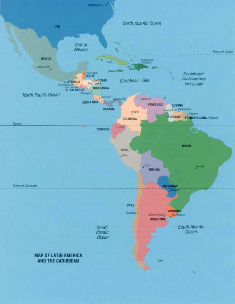
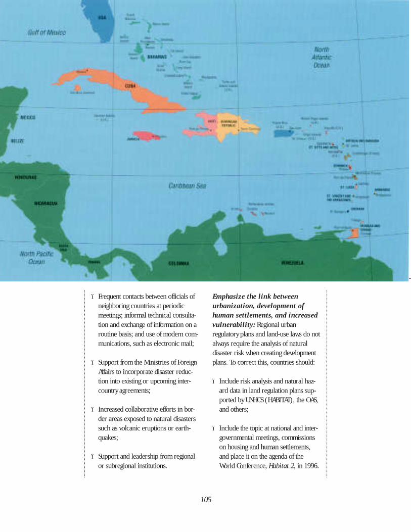
ï Frequent contacts between officials of neighboring countries at periodic meetings; informal technical consulta-tion and exchange of information on a routine basis; and use of modern com-munications, such as electronic mail;
ï Support from the Ministries of Foreign Affairs to incorporate disaster reduc-tion into existing or upcoming inter-country agreements;
ï Increased collaborative efforts in bor-der areas exposed to natural disasters such as volcanic eruptions or earth-quakes;
ï Support and leadership from regional or subregional institutions.
Emphasize the link betweenurbanization, development ofhuman settlements, and increasedvulnerability: Regional urbanregulatory plans and land-use laws do notalways require the analysis of naturaldisaster risk when creating developmentplans. To correct this, countries should:
ï Include risk analysis and natural haz-ard data in land regulation plans sup-ported by UNHCS (HABITAT), the OAS,and others;
ï Include the topic at national and inter-governmental meetings, commissions on housing and human settlements, and place it on the agenda of theWorld Conference, Habitat 2, in 1996.
105
Pay greater attention to the causesand effects of flooding andlandslides, which place a heavy burdenon the countries and have not received aproportionate share of attention, by:
ï Making systematic studies of the causes and effects of floods and landslides on agriculture and human settlements at the national and regionallevels;
ï Creating integrated flood control pro-grams, including Ministries of Agricul-ture, hydrometeorological institutes, municipalities, the housing sector, andothers.
In the same way that currentachievements of Latin America and theCaribbean have been the result of aprocess started long before theproclamation of the IDNDR, the drivetoward reducing the effects of naturaldisasters as an explicit objective andrequirement of the development processwill not end with the Decade.
In Latin America and the Caribbean,the notion that the factors involved innatural disaster reduction are the sameas those that influence socioeconomicdevelopment is gaining widespreadacceptance. This is to the credit of theIDNDR. And, it is not surprising that thetwo go hand in hand, since it isimpossible for one to advance without theother. To achieve disaster prevention andmitigation without socioeconomicdevelopment and political maturity in asociety is not possible. Nor cansustainable development be achievedwithout reducing the vulnerability ofpeople and nations to disaster. ◆
106
Anderson, M.B. and P.J. Woodrow. 1989. Rising from the ashes,development strategies in times of disaster. Boulder, Colo.:Westview Press.
Bailey, W. 1989. Hurricane Gilbert. Disaster Reports No. 5.Washington, D.C.: PAHO.
Barreto Vaquero, R. 1993. “Manejo ambiental y prevención dedesastres naturales con participación comunitaria: el caso de losbarrios populares del noroccidente de Quito.” Paper presented atthe International Seminar on Prevention and Mitigation of Disastersin Communities. Tegucigalpa, Honduras, September 1993.
Bates, F.L. 1982. Recovery, change and development. Alongitudinal study of the 1976 Guatemalan earthquake. Finalreport. Volume 1. University of Georgia.
Bender, S. 1993. “Preparación en caso de desastres y desarrollosostenible.” Desastres y Sociedad. No. 1, Vol. 1., July-December.
Bengoa, J. 1987. Historia del Pueblo Mapuche. Santiago: EdicionesSur.
Bermúdez Peralta, R. 1993. “Los socios en preparación yprevención de desastres.” Working document. San José, Costa Rica:OFDA/USAID.
Bermúdez Chavez, M. 1991. “Desastres naturales en la prensaescrita de Costa Rica,” Ciencias Sociales. No. 53, pp. 83-94.
Bolis, M. 1993. “Legislación para el manejo de desastres en losPaíses Andinos.” PAHO/WHO working document. Washington, D.C.
Bolivia, Dirección General de Salud, Depto. Nacional deEmergencias y Desastres. 1990. “Guía de atención en salud,nutrición y otros aspectos sociales en sequías.” (Draft version.) LaPaz.
Bolt, B.A., Horn, W.L., Macdonald, G.A., and R.F. Scott, editors.1977. Geological hazards. Second edition. New York: Springer-Verlag.
Bonilla González, C. D., Céspedes Robles, R., and H. Prado Monje.1993. Diseño de un instrumento de evaluación de daños yanálisis de necesidades post desastre para la toma de decisiones,con base en el análisis del terremoto de Limón, Costa Rica, Abril1991. Master’s Thesis. University of Costa Rica, Faculty of Medicine,Department of Public Health, San José.
Brazil, Ministerio do Interior, Superintendencia do Desenvolvimentode Nordeste. 1993. “Orientações básicas e reaçao de municípioscríticos da seca nordeste.” Brasilia: SUDENE.
Bustamante, M. 1994. Personal communication (Dirección Nacionalpara la Prevención y Atención a los Desastres, Colombia).
Callihan, D. 1989. Managing resource coordination for suddenonset foreign disasters: A case study of the response to hurricane
Gilbert/Jamaica. Washington, D.C.: VITA.
Candanedo, C. 1994. “Una experiencia en previsión de desastres enPanamá.” Working document. Instituto de Recursos Hidráulicos yElectrificación de Panamá.
Cardona Arboleda, O.D. 1993. “Evaluación de la amenaza, lavulnerabilidad y el riesgo.” In La Red, Los desastres no sonnaturales. Santafé de Bogotá: Tercer Mundo Editores.
___. 1993. “Manejo ambiental y prevención de desastres: dostemas asociados.” In La Red, Los desastres no son naturales.Santafé de Bogotá: Tercer Mundo Editores.
Centro Nacional de Prevención de Desastres (CENAPRED). 1993.Prevención. Mexico City: CENAPRED.
Centro de Coordinación para la Prevención de los DesastresNaturales en América Central (CEPREDENAC). 1993. Planinstitucional de reducción de desastres en Centroamérica.Mimeographed document.
___. 1994. “El Plan Regional de Reducción de Desastres yCEPREDENAC” (Interview with L.R. Durán Vargas, 1994, President,CEPREDENAC).
Centro Regional de Sismología para América del Sur (CERESIS).1989. Riesgo volcánico : Evaluación y mitigación en AméricaLatina. Lima: CERESIS.
Chile, Ministerio del Interior, Oficina Nacional de Emergencia(ONEMI). Plan nacional de emergencia. Santiago.
Chile, Ministerio de Salud. 1993. Situación y atención de la saluden Chile. Santiago.
___. 1991. “El sector salud en Chile y su rol frente a emergencias ydesastres naturales.” ( L. Busco Costa, Departamento Asuntos deEmergencia y Catástrofe). Santiago.
Collier, S., Blakemore, H., and T.E. Skidmore. 1985. TheCambridge encyclopedia of Latin America and the Caribbean.Cambridge: Cambridge University Press.
Colombia, Ministerio de Gobierno, Dirección Nacional para laPrevención y Atención a los Desastres. 1993. Programa demitigación de riesgos en Colombia. Informe de avance: Fase II.Santafé de Bogotá: Ministerio de Gobierno.
Colombia, Ministerio de Gobierno, Dirección Nacional para laPrevención y Atención a los Desastres. Interview with the DirectorGeneral, O.D. Cardona Arboleda, Costa Rica, 27 November 1993.
Colombia, Ministerio de Gobierno, Plan Integral para la Prevencióny Atención de Desastres de Manizales (PADEM). 1994. Projectreport. Manizales.
Colombia, Ministerio de Salud, Dirección de SaneamientoAmbiental. “Atención al ambiente en emergencias de origen
107
REFERENCES
˜
volcánico.” Santafé de Bogotá.
Colombia, Presidencia de la República. Oficina Nacional para laAtención de Desastres. 1988. Nosotros la gente del volcan:Prevención de riesgos con participación comunitaria. Santafé deBogotá: Dirección General para la Cooperación al Desarrollo delMinisterio de Relaciones Exteriores de Italia.
Colombia, Presidencia de la República. 1985. “El volcán y laavalancha”. Santafé de Bogotá: Imprenta Nacional.
Comisión Económica para América Latina y el Caribe (CEPALC).1994. Manual para la estimación de los efectos socioeconómicosde los desastres naturales. Santiago: CEPALC.
___. 1986. “El terremoto de 1986 en San Salvador: daños,repercusiones y ayuda requerida.” Project profiles, 16 December. Santiago.
___. 1973.“ Informe sobre los daños y repercusiones delterremoto de la ciudad de Managua en la economía Nicaraguense.”Santiago: CEPALC.
Costa Rica, Comisión Nacional de Emergencias. 1994. Personalcommunication with R. Durán and J. J. Chacón.
Costa Rica, Ministerio de Vivienda y Asentamientos Humanos. 1993.Proyecto Nacional de Bambú. Información general. San José.
___. 1991. “Bambusetum”. Boletín del Proyecto Nacional deBambú. May.
Cruz, M. 1991. “Comportamiento de hospitales en Costa Ricadurante los sismos de 1990.” Project report prepared for PAHO,San José, Costa Rica.
Cuny, F.C. 1983. Disasters and development. New York: OxfordUniversity Press.
De Castro, J. 1975. Geografía del hambre. Buenos Aires: Solar/Hachette.
De Ville de Goyet, C. 1994. “Itinéraire pour un monde plussécuritaire” Ecodecision. No. 12, April.
Durán Vargas, L.R. 1994. “Centroamérica: El reto de la reducciónde desastres en el contexto de la integración regional.” Paperpresented at U.N. World Conference on Natural Disaster Reduction,Yokohama, May 1994.
Economic Commission for Latin America and the Caribbean(ECLAC). 1979. “Report on the effects of Hurricane David on theIsland of Dominica.” 13th special session, New York, 19 October1979.
___. 1984. The natural disasters of 1982-1983 in Bolivia, Ecuadorand Perú. Santiago: ECLAC.
Ecuador, Ministerio de Salud Pública. 1990. “Desastres naturales enlos últimos 25 años en Ecuador.” (J.V. Cedeño, Director,Planeamiento de la Seguridad para el Desarrollo Nacional.)
Ediciones Ubillus. 1985. Aspectos científicos sobre el fenómenode “El Niño” y su incidencia en la region Piura-Tumbes.Ediciones Ubillus: Piura, Perú.
El Salvador, Centro de Colaboración para Situaciones deEmergencia. 1991. Organización local para situaciones de
emergencia. Rome: Cooperación Italiana.
Encyclopaedia Britannica, Inc. 1993. 1993 Britannica book of theyear. Chicago: Encyclopaedia Britannica, Inc.
Farrer, H. 1989. “Informe de la asesoría sobre aspectos de atenciónde emergencias y desastres a la Corporación de Acueducto yAlcantarillado de Santiago de los Caballeros (CORASAAN).” SantoDomingo, Dominican Republic, 1989.
Fundación para la Prevención del Riesgo Sísmico del Estado Mérida(FUNDAPRIS). 1993. Informe de actividades. Mérida, Venezuela:FUNDAPRIS.
Gavidia, J. 1992. “Los efectos económicos y sociales de losdesastres naturales.” Santiago: CEPAL.
Gibbs, T. 1994. “Caribbean Uniform Building Code” (personalcommunication).
Gibbs, T. 1992. “Case study: The mitigation of damages to criticalfacilities due to natural disasters in the Commonwealth Caribbean.”Paper presented at the Caribbean IDNDR Meeting, Kingston,Jamaica, May 1992.
Giesecke, A. 1994. “Reconditioning of existing adobe housing tomitigate the effects of earthquakes.” Lima: CERESIS.
Gueri, M. “Trip report; 9-17 February 1983”. PED/PERU. Lima,Perú, 1983.
Instituto Geográfico Militar (Ecuador), Instituto Panamericano deGeografía e Historia Sección Nacional del Ecuador, L’Institutfrancais de recherche scientifique pour le développement encoopération. 1992. Atlas Infográfico de Quito. ORSTOM: Quito.
Inter-American Development Bank. 1993. Economic and socialprogress in Latin America, 1993 report. Washington, D.C.: IDB.
International Federation of Red Cross and Red Crescent Societies.1993. World disaster report. Dordrecht: Martinus Nijhoff.
Jamaica, Construction Research Development Centre. Interview withthe Executive Director, Mr. Steven Hughes, 19 January 1994.
Jovel, R. 1989. “Los efectos económicos y sociales de los desastresnaturales en América Latina y el Caribe.” Santiago: CEPALC.
Jovel, R. and R. Zapata Martí. 1993. Macroeconomic effects ofnatural disasters in Latin America and the Caribbean. Santiago:ECLAC.
Kreimer, A. and M. Preece. 1994. “Case Study: La Paz MunicipalDevelopment Project”. World Bank working document.
Kreimer, A. and M. Munasinghe. 1991. “Managing natural disastersand the environment”. Selected materials from the Colloquium onthe Environment and Natural Disaster Management. Washington,D.C.: World Bank.
Kuroiwa, J. and L. Castro. 1987. “Planeamiento regional delDepartamento de Piura para la mitigación y (o) prevención dedesastres.” In CISMID, Report of First National Symposium onPrevention and Mitigation of Natural Disasters; 1-3 June 1987.Lima: Centro Peruano-Japonés de Investigaciones Sísmicas yMitigación de Desastres (CISMID).
Lavell, A. 1993. “The Costa Rican Hospital Retrofitting Program:Decision-making, implementation, procedures and the construction
108
process.” Project summary prepared for OFDA/USAID. Washington,D.C.
Lescano, J. L. “Proyectos de reconstrucción de los efectos de lasinundaciones.” In CISMID, Report of First National Symposium onPrevention and Mitigation of Natural Disasters; 1-3 June 1987.Lima: Centro Peruano-Japonés de Investigaciones Sísmicas yMitigación de Desastres (CISMID).
Luzuriaga C., C. “La vulnerabilidad y la respuesta institucional parael manejo de los desastres en el Ecuador.” 1993.
Maskrey, A. 1993. “Vulnerabilidad y mitigación de desastres.” In LaRed, Los desastres no son naturales. Santafé de Bogotá: TercerMundo Editores.
Meditz, S.W. and D.M. Hanratty, editors. 1989. Islands of theCommonwealth Caribbean: A regional study. Washington, D.C.:US Government Printing Office.
Mexico, Sistema Nacional de Protección Civil. 1993. Primer ciclo deconferencias sobre prevención. Mexico City: SINAPROC.
___. 1992. Atlas nacional de riesgos de la República Mexicana.Mexico City: SINAPROC.
Mexico, Universidad Nacional Autónoma de México. 1991.Preparativos para casos de desastre. Mexico City: UNAM.
Molin Valdés, H. 1994. “IDNDR and its links with Agenda 21.”Ecodecision. No. 12.
Monzón, H. “Repair and retrofitting of a brittle reinforced concretebuilding: The rehabilitation of a seismically damaged hospital in SanSalvador.” Proceedings, International Symposium on EarthquakeDisaster Prevention. Volume II.
Morales, L. D. and D. Salgado. 1993. “Sistema de información paraemergencias (SIE).” Mimeographed document. San José: ComisiónNacional de Emergencia de Costa Rica.
Morales, L. D. 1993. “Atlas de amenazas naturales de Costa Rica.”Emergencia. No. 2. (April-June). San José: Comisión Nacional deEmergencia de Costa Rica.
Nemec, J. 1993. “Inundaciones en Ecuador.” Stop Disasters. No.15, pp. 12-13.
Neruda, P. 1974. The yellow heart. Translation by William O’Daly.Port Townsend, Washington: Copper Canyon Press.
Organization of American States. 1991. Disasters, planning, anddevelopment: managing natural hazards to reduce damage.Washington, D.C.: OAS.
Organization of American States, Department of RegionalDevelopment and the Environment. 1994. Personal communicationwith J. Vermieren.
Pan American Health Organization. 1994. Health conditions in theAmericas. Draft version. Washington, D.C.: PAHO.
___. 1990. Health conditions in the Americas. Washington, D.C.:PAHO. (Scientific Publication No. 524).
___. 1989. Report on disasters and emergency preparedness forJamaica, St. Vincent and Dominica. Disaster Reports No. 2.Washington, D.C.: PAHO.
___. 1986. Health conditions in the Americas. (ScientificPublication No. 500). Washington, D.C.: PAHO.
___. 1986. Evaluation of the strategy of Health for All by theYear 2000: Seventh report on the world health situation. Vol. 3.Washington, D.C.: PAHO.
___. 1985. The earthquake in Mexico. Disaster Reports No. 3.Washington, D.C.: PAHO.
___. 1981. Emergency health management after naturaldisaster. (Scientific Publication No. 407). Washington, D.C.: PAHO.
Peraldo, G. 1993. “Desastres históricos y planificación urbana.”Emergencia. Jan/March. San José: Comisión Nacional deEmergencia de Costa Rica.
Peru, Comisión Ejecutiva. 1991. “Informe del programa deemergencia pro sequía.” Lima.
Peru, CRYRZA. 1971. “Los recursos financieros y técnicos.”Comisión de Reconstrucción y Rehabilitación de la zona afectadapor el terremoto del 31 de mayo de 1970. Lima, Peru.
Peru, Instituto Nacional de Defensa Civil. 1994. Personalcommunication.
Peru, Proyecto de Preparación para Casos de Desastre enComunidades (PREDECO). 1994. Personal communication. Lima.
Ramírez Rojas, M. A. 1993. “La educación escolar para casos deemergencia.” Working document. San José, Costa Rica: Partners ofthe Americas, USAID/OFDA.
Red de Estudios Sociales en Prevención de Desastres en AméricaLatina. 1993. “Agenda de Investigación y Constitución Orgánica.”Lima: COMECSO/ITDG.
Reid, U.V. 1980. “Dominica - Hurricane David, 29 August 1979”.Disasters, Vol 4, No. 3, pp 277-282.
Rennie, D. 1970. “After the earthquake.” The Lancet, October 3,pp. 704-707.
Rosales, V. 1991. Pérdidas en infraestructura: sismo del 22 deabril de 1991, provincia de Limón. San José: Comisión Nacionalde Emergencia de Costa Rica.
Rossi, E.E. and J.C. Plano. 1992. Latin America: A politicaldictionary. Oxford: ABC-CLIO.
Saragoni Huerta, R. 1994. Personal communication, Univ. of Chile.
Sistema de la Integración Centroamericana (SICA). 1994. Personalcommunication, Mr. P. Pastor.
South America, Central America and the Caribbean 1993. 1993.Fourth Edition. London: Europa Publications Limited.
Susuki Lopez, L. 1972. Imborrable recuerdo, terremoto enHuaraz, 1970. Lima: Servicio de Salud de Ancash.
UNESCO. 1993. Environmental and Development Briefs. No. 5.Paris: UNESCO.
United Nations, Population Division. 1993. World populationprospects: The 1992 revision. New York.
United Nations, UNDRO, and Colombia, Ministerio de Gobierno,Sistema Nacional de Prevención y Atención a los Desastres. 1991.
109
“Programa de Mitigación de Desastres en Colombia 1988-1991.Informe de proyecto.” Mimeographed document. Santafé de Bogotá.
United Nations, Department of Humanitarian Affairs. Situationreports. 1980-1993. Geneva.
___. 1992. “Disaster mitigation programme in Peru.” Workingdocuments. Geneva.
___. 1992. “Disaster mitigation programme in Argentina.” Workingdocument. Geneva.
___. 1992. Glossary: Internationally agreed glossary of basicterms related to disaster management. Geneva: UN/DHA.
United Nations Development Programme (UNDP). 1993. Humandevelopment report 1993. New York: Oxford University Press.
United Nations Development Program (UNDP) and United NationsOffice of the Disaster Relief Coordinator (UNDRO). 1991. Disastersand development: Trainer’s guide for the UNDP/UNDRO DisasterManagement Training Program. (Module prepared by R.S.Stephenson). Madison, Wisc.: University of Wisconsin, DisasterManagement Center.
United Nations, Office of the Disaster Relief Coordinator (UNDRO).1988. “Hurricane Gilbert”, UNDRO News, September/October, pp.15-16.
___. 1990. “Disaster prevention and preparedness project forEcuador and neighbouring countries.” Project report. Geneva.
United Nations, Population Division. 1988. World demographicestimates and projections, 1950-2025. New York.
United States, Agency for International Development, Office of U.S.Foreign Disaster Assistance. 1979-1993. OFDA annual reports.Washington, D.C.: USAID.
___. 1993. Disaster history: Significant data on major disastersworldwide, 1900-present. Washington, D.C.: OFDA.
United States, Federal Emergency Management Agency (FEMA).1990. Seismic considerations—Health care facilities. EarthquakeHazards Reduction Series 35. Washington, D.C.
United States, National Oceanic and Atmospheric Administration,National Geophysical Data Center. Maps.
Universidade do Estado de Santa Catarina. 1991. Seminario sobreinundações da Gacia do Brata e na Região Sul do Brasil.Florianopolis, S.C., Brazil: CETREM.
Universidade Federal de Santa Catarina. 1984. “As enchentes deJul/83 e a busca de solução. Grupo de Trabalho em hidrologia econtrole de enchentes Depto. de Engenharia Civil. Florianopolis,S.C.. Brazil: UFSC.
Urrutia de Hazbun, R. and C.L. Lazcano. 1993. Catastrofes enChile, 1541-1992. Santiago: Editorial La Noria.
Vargas de Mayo, C. A. “Vigilancia de la calidad bacteriológica delagua en situaciones de desastre en los departamentos de Piura yTumbes.” PAHO/WHO working document, October 1983-June 1984,Lima.
Venezuela, Ministerio de Sanidad y Asistencia Social. 1994. “Sistemaintegrado de emergencia.” Caracas.
Venezuela, Ministerio de Sanidad y Asistencia Social, DirecciónGeneral. 1993. “Información de situación en Venezuela porHuracán Bret.” Caracas.
Voight, B. 1990. “Nevado del Ruiz Volcano catastrophe: Anatomyand retrospection.” Journal of Volcanology and GeothermalResearch. No. 44. pp. 349-386.
World Bank. 1992. World development report 1992. New York:Oxford University Press.
___. 1993. World development report 1993. New York: OxfordUniversity Press.
___. 1994. The World Bank atlas. Washington, D.C.: World Bank.
World Meteorological Organization, Division for Latin America andthe Caribbean. 1994. “Proyectos de cooperación técnica en el areade prevencíón y alerta contra desastres naturales.” (Personalcommunication with V. Torres, Chief of Department of TechnicalCooperation.)
World Meteorological Organization. 1994. “Proyecto para laRehabilitación y Mejoramiento de los Servicios Meteortológicos eHidrológicos del Istmo Centroamericano (PRIMSCEN).” (Personalcommunication with M. Molina, Technical Advisor.)
World Resources Institute and the International Institute forEnvironmnent and Development. 1992. World resources 1992-93.New York: Oxford University Press.
___. 1990. World resources 1990-91. New York: Oxford UniversityPress.
___. 1989. World resources 1988-89. New York: Basic Books, Inc.
World Health Organization. 1989. Spotlight on the cities:Improving urban health in developing countries. Geneva: WHO.
Worrell, J. 1994. Personal communication, Office of DisasterPreparedness, British Virgin Islands.
Zamorano Godoy, M. 1991. “Informe sobre el aluvión deAntofagasta.” Ministerio de Salud, Servicio de Salud, Chile.
Zeballos, J.L. 1986. “Health aspects of the Mexico earthquake.”Disasters. Vol. 10, no. 2.
Zevallos, O. 1994. “Paute River disaster in Ecuador” (Personalcommunication.)
Zupka, D. 1988. “Economic Aspects of Disasters.” UNDRO News.Geneva: UNDRO.
110
AIDIS Asociación Interamericano de Ingeniería Sanitario (Inter-American Association of SanitaryEngineering)
BIREME Latin American and Caribbean Center for Health Sciences InformationCARICOM Caribbean CommunityCCEO Caribbean Council of Engineering OrganizationsCCSS Caja Costarricense de Seguro Social (Costa Rican Social Security Fund)CDERA Caribbean Disaster Emergency Response AgencyCDRC Center for the Development of Research in Construction (Jamaica)CENAPRED Centro Nacional de Prevención de Desastres (National Center for Disaster Prevention), MexicoCEPIS Centro Panamericano de Ingeniería Sanitaria (Pan American Center for Sanitary Engineering and Environmental
Sciences)CEPREDENAC Centro de Coordinación para la Prevención de los Desastres Naturales en América Central (Center for Coordination
of the Prevention of Natural Disasters in Central America)CERESIS Centro Regional de Sismología para América del Sur (Regional Center of Seismology for South America)CERO Central Emergency Relief Organization (Barbados)CIDA Canadian International Development AgencyCISMID Centro Peruano-Japonés de Investigaciones Sísmicas y Mitigación de Desastres (Center for Seismic Research and
Disaster Mitigation), PeruCMO Caribbean Meteorological OrganizationCNE Comisión Nacional de Emergencias (National Emergency Commission), Costa RicaCONASE Comité Nacional de Salud para Emergencias (National Health Committee for Emergencies), EcuadorCONE Comité Nacional de Emergencia (National Emergency Committee), GuatemalaCUBiC Caribbean Uniform Building CodeCUSEC Central U.S. Earthquake ConsortiumDMTP Disaster Management Training ProgramDNPAD Dirección Nacional para la Prevención y Atención a los Desastres (National Directorate for Disaster Prevention and
Response), ColombiaECLAC Economic Commission for Latin America and the CaribbeanFEMA Federal Emergency Management Agency (U.S.A.)FUNDAPRIS Fundación de Asesoría para la Prevención del Riesgo Sísmico (Foundation for the Prevention of Seismic Risk;
formerly CEAPRIS), VenezuelaGIS Geographical Information SystemsGTZ German Agency for Technical CooperationHABITAT United Nations Center for Human SettlementsICAP Instituto Centroamericano de Administración Pública (Central American Institute of Public Administration),
Costa RicaICAROS IDNDR Roving Seminar in the CaribbeanIDB Inter-American Development BankIDNDR International Decade for Natural Disaster Reduction IDRC International Development Research Center (Canada)INDECI Instituto Nacional de Defensa Civil (National Civil Defense Institute), PeruIPGH Instituto Panamericano de Geografía e Historia (Pan American Geography and History Institute)
111
ACRONYMS
JICA Japan International Cooperation AgencyMERCOSUR Mercado Común del Sur (Southern Common Market)NEMA National Emergency Management Agency (Trinidad and Tobago)OAS Organization of American StatesODA Overseas Development Administration (United Kingdom)ODPEM Office of Disaster Preparedness and Emergency Management (Jamaica)OECS Organization of Eastern Caribbean StatesOFDA/USAID Office of U.S. Foreign Disaster Assistance/U.S. Agency for International DevelopmentONEMI Oficina Nacional de Emergencias del Ministerio del Interior (Ministry of the Interior, National Emergency
Office), ChileORSTOM French Institute of Scientific Research for DevelopmentPADEM Plan Integral para la Prevención y Atención de Desastres de Manizales (Comprehensive Plan for Disaster Prevention
and Response of Manizales), ColombiaPAHO Pan American Health Organization, Regional Office of the World Health OrganizationPARLACEN Parlamento Centroamericano (Central American Parliament)PCDPPP Pan-Caribbean Disaster Preparedness and Prevention ProjectPREDECO Proyecto de Preparación para Casos de Desastres en Comunidades (Community Disaster Preparedness Project) PeruPRIMSCEN Proyecto para la Rehabilitación y Mejoramiento de los Servicios Meterológicos e Hidrológicos del Istmo
Centroamericano (Central American Project for the Rehabilitation and Improvement of Meteorologic and Hydrologic Services)
PRODERE Programa de Desarrollo Regional (Program for Regional Development)La RED Red Latinoamericana de Estudios Sociales en Prevención de Desastres (Latin American Network for Social Studies
on Disaster Prevention)SELA Sistema Económico Latinoamericano (Latin American Economic System)SICA Sistema de la Integración Centroamericana (Central American Integration System)SIDA Swedish International Development AuthoritySINAPROC Sistema Nacional de Protección Civil (National Civil Protection System), Mexico; PanamaSNPAD Sistema Nacional para la Prevención y Atención a Desastres (National System for Disaster Prevention and Response),
ColombiaSRU Seismic Research Unit, University of the West Indies, Trinidad and TobagoSUMA Supply Management Project in the Aftermath of DisastersUATI International Union of Technical AssociationsUN/DHA United Nations Department of Humanitarian AffairsUNDP United Nations Development ProgramUNDRO Office of the United Nations Disaster Relief CoordinatorUNESCO United Nations Educational, Scientific and Cultural OrganizationUNICEF United Nations Children’s FundUSGS United States Geological SurveyUWI University of West IndiesWFEO World Federation of Engineering OrganizationsWHO World Health OrganizationWMO World Meteorological Organization
112

Pan American Health OrganizationPan American Sanitary Bureau, Regional Office of the
World Health Organization
525 Twenty-third Street, N.W.Washington, D.C. 20037
Price: US$ 20.00