Embed Size (px)
Citation preview
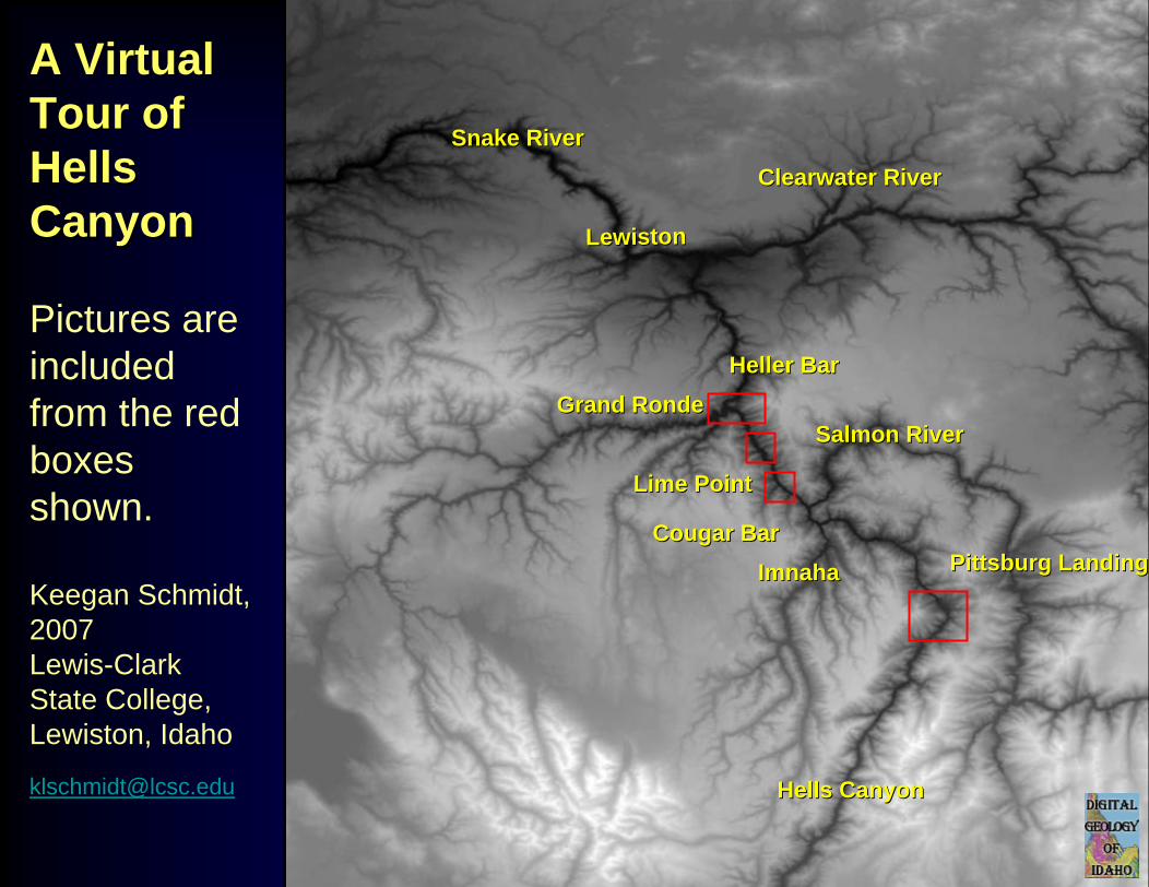
A A VirtualVirtualTourTour of of Hells Hells CanyonCanyon
Pictures are included from the red boxes shown.
Keegan Schmidt, 2007Lewis-Clark State College, Lewiston, Idaho
Grand RondeGrand RondeSalmon RiverSalmon River
ImnahaImnaha
Clearwater RiverClearwater River
LewistonLewiston
Snake RiverSnake River
Hells CanyonHells Canyon
Heller BarHeller Bar
Lime PointLime Point
Pittsburg LandingPittsburg LandingCougar BarCougar Bar
Heller BarHeller Bar
Grand RondeGrand Ronde
Lime PointLime Point
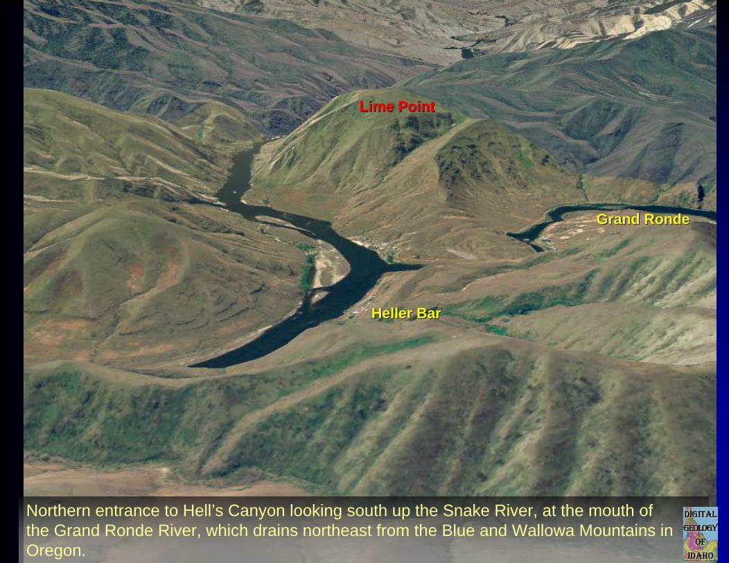
Northern entrance to Hell’s Canyon looking south up the Snake River, at the mouth of the Grand Ronde River, which drains northeast from the Blue and Wallowa Mountains in Oregon.
Heller BarHeller Bar
Grand RondeGrand Ronde
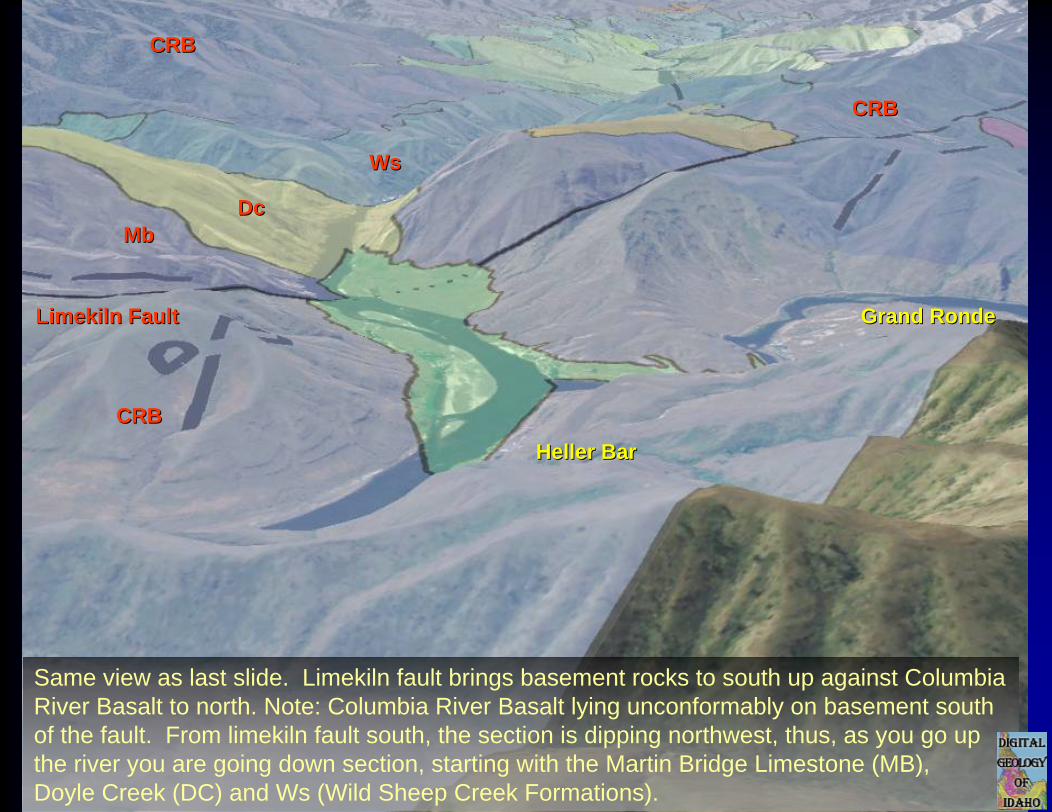
WsWs
MbMbDcDc
CRBCRB
CRBCRB
CRBCRB
Limekiln FaultLimekiln Fault
Same view as last slide. Limekiln fault brings basement rocks to south up against Columbia River Basalt to north. Note: Columbia River Basalt lying unconformably on basement south of the fault. From limekiln fault south, the section is dipping northwest, thus, as you go up the river you are going down section, starting with the Martin Bridge Limestone (MB), Doyle Creek (DC) and Ws (Wild Sheep Creek Formations).
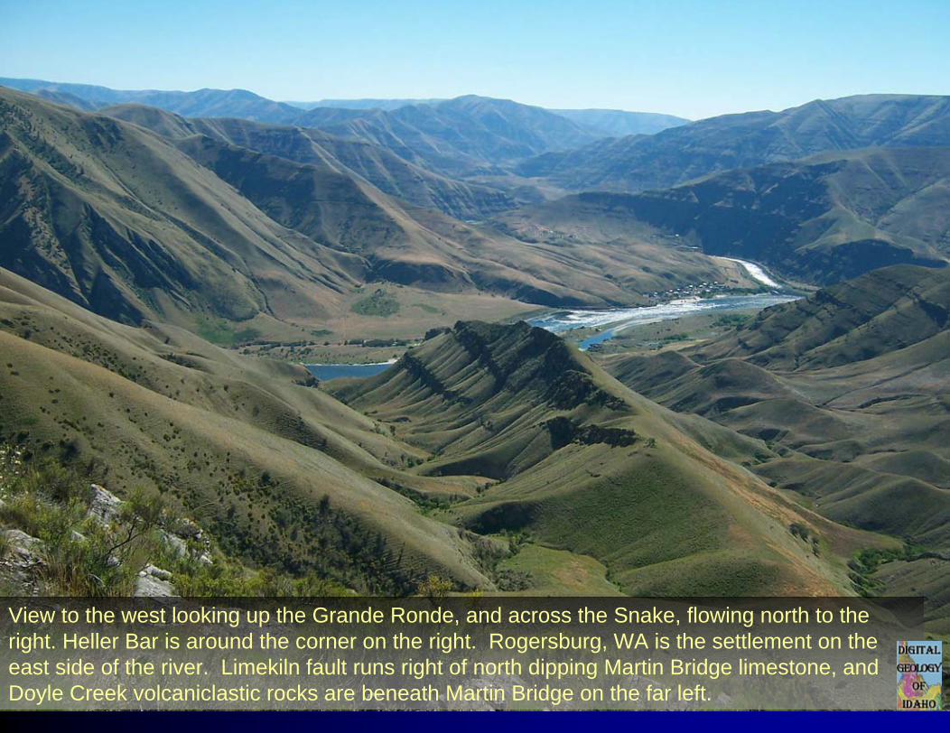
View to the west looking up the Grande Ronde, and across the Snake, flowing north to the right. Heller Bar is around the corner on the right. Rogersburg, WA is the settlement on the east side of the river. Limekiln fault runs right of north dipping Martin Bridge limestone, and Doyle Creek volcaniclastic rocks are beneath Martin Bridge on the far left.
Lime pointLime point
LimekilnLimekilnFaultFault
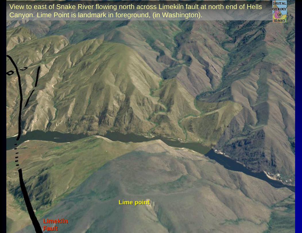
View to east of Snake River flowing north across Limekiln fault at north end of Hells Canyon. Lime Point is landmark in foreground, (in Washington).
Lime pointLime point
LimekilnLimekilnFaultFault
WsWsMbMb
DcDc
CRBCRBHH
CRBCRB
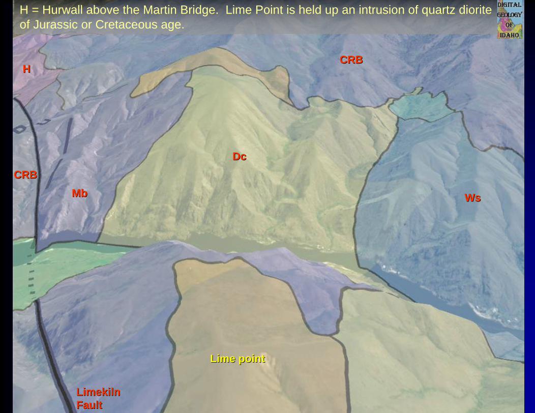
H = Hurwall above the Martin Bridge. Lime Point is held up an intrusion of quartz diorite of Jurassic or Cretaceous age.
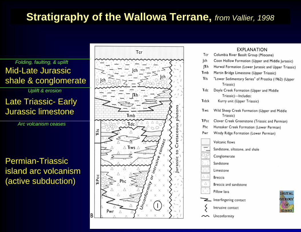
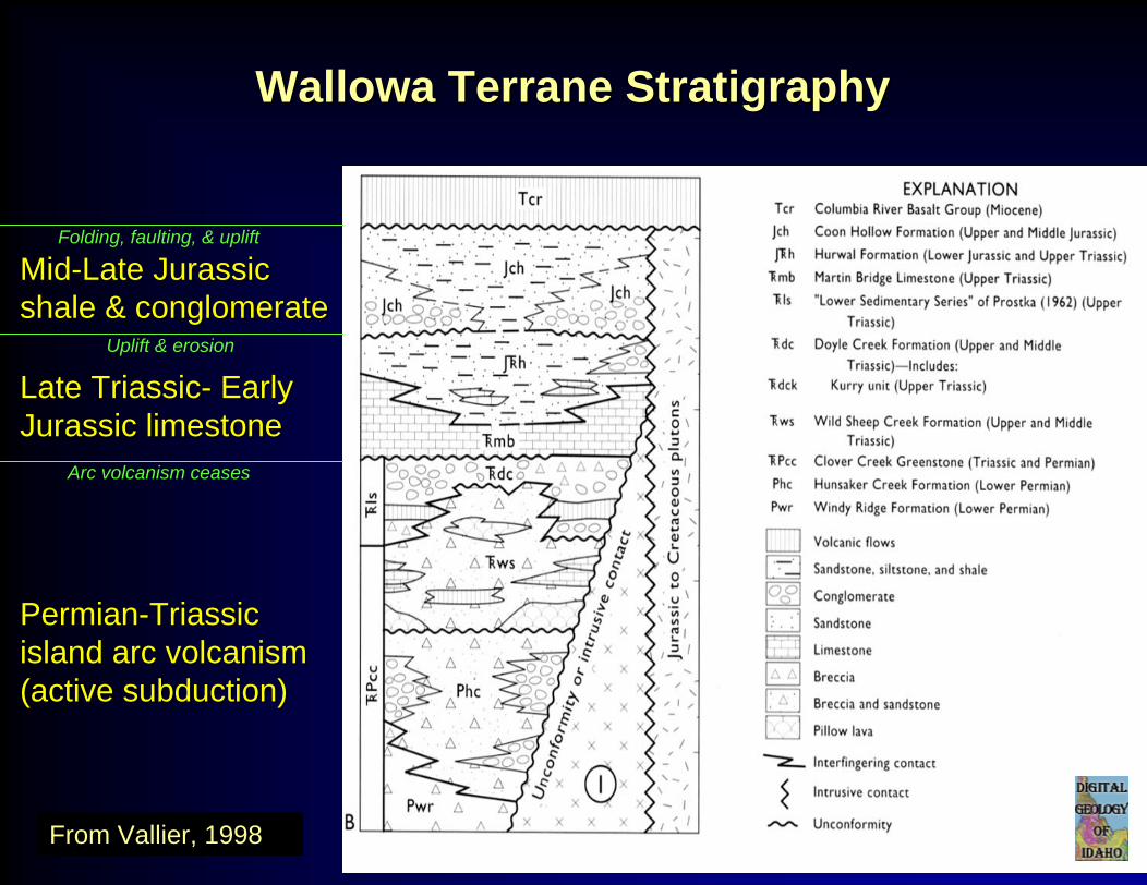
Stratigraphy of the Wallowa Terrane, from Vallier, 1998
MidMid--Late Jurassic Late Jurassic shale & conglomerateshale & conglomerate
Late TriassicLate Triassic-- Early Early Jurassic limestoneJurassic limestone
Arc volcanism ceases
Uplift & erosion
Folding, faulting, & uplift
PermianPermian--Triassic Triassic island arc volcanism island arc volcanism (active subduction)(active subduction)
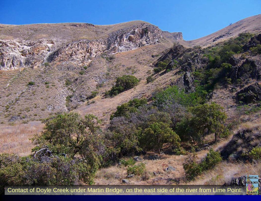
Contact of Doyle Creek under Martin Bridge, on the east side of the river from Lime Point.
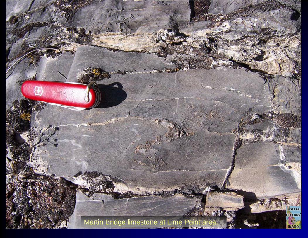
Martin Bridge limestone at Lime Point area.
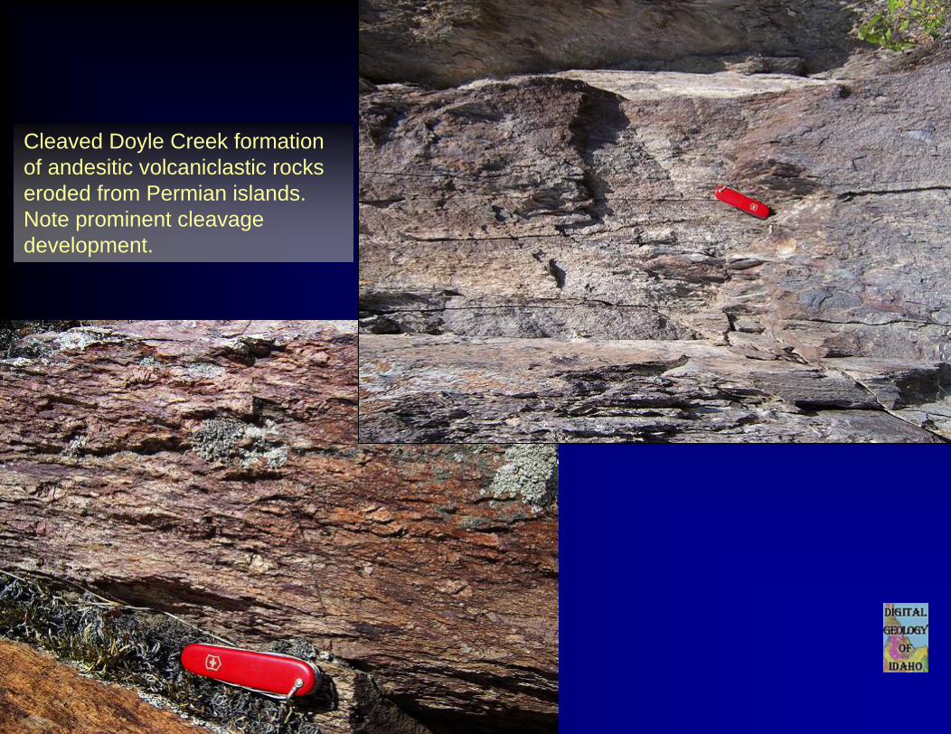
Cleaved Doyle Creek formation of andesitic volcaniclastic rocks eroded from Permian islands.Note prominent cleavage development.
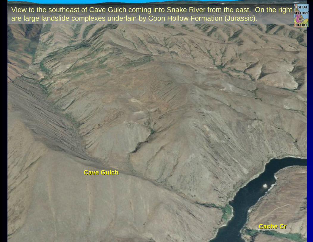
Cave GulchCave Gulch
Cache CrCache Cr
View to the southeast of Cave Gulch coming into Snake River from the east. On the right are large landslide complexes underlain by Coon Hollow Formation (Jurassic).
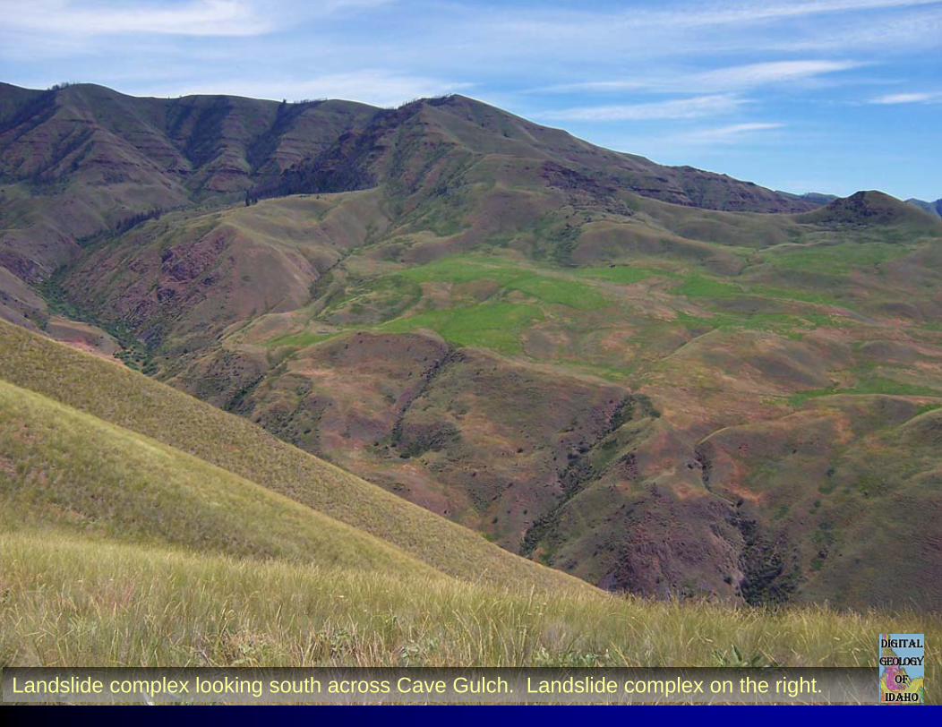
Landslide complex looking south across Cave Gulch. Landslide complex on the right.
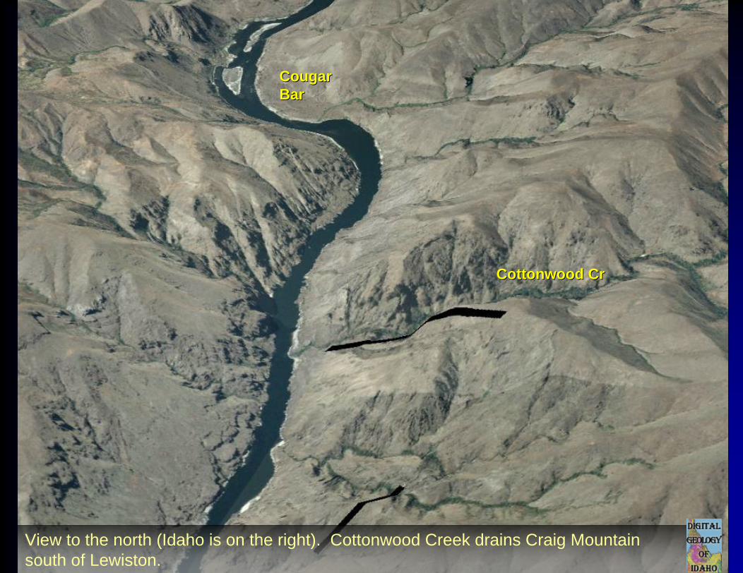
CougarCougarBarBar
Cottonwood CrCottonwood Cr
View to the north (Idaho is on the right). Cottonwood Creek drains Craig Mountain south of Lewiston.
CougarCougarBarBar
Cottonwood CrCottonwood Cr
WsWs
CRBCRB
CRBCRB
CRBCRB
WsWsWsWs
WsWs
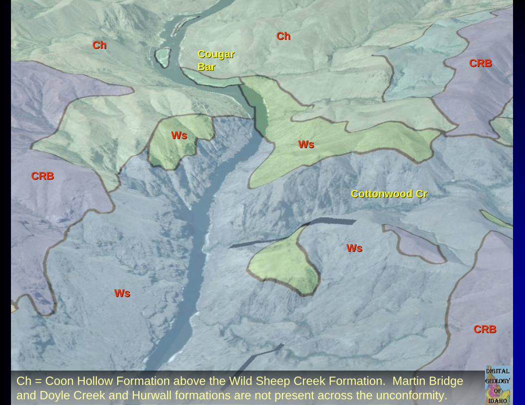
ChChChCh
Ch = Coon Hollow Formation above the Wild Sheep Creek Formation. Martin Bridge and Doyle Creek and Hurwall formations are not present across the unconformity.
Wallowa Wallowa TerraneTerrane StratigraphyStratigraphy
MidMid--Late Jurassic Late Jurassic shale & conglomerateshale & conglomerate
Late TriassicLate Triassic-- Early Early Jurassic limestoneJurassic limestone
PermianPermian--Triassic Triassic island arc volcanism island arc volcanism (active subduction)(active subduction)
Arc volcanism ceases
Uplift & erosion
Folding, faulting, & uplift
From Vallier, 1998
unconformityunconformity
WsWs
ChCh
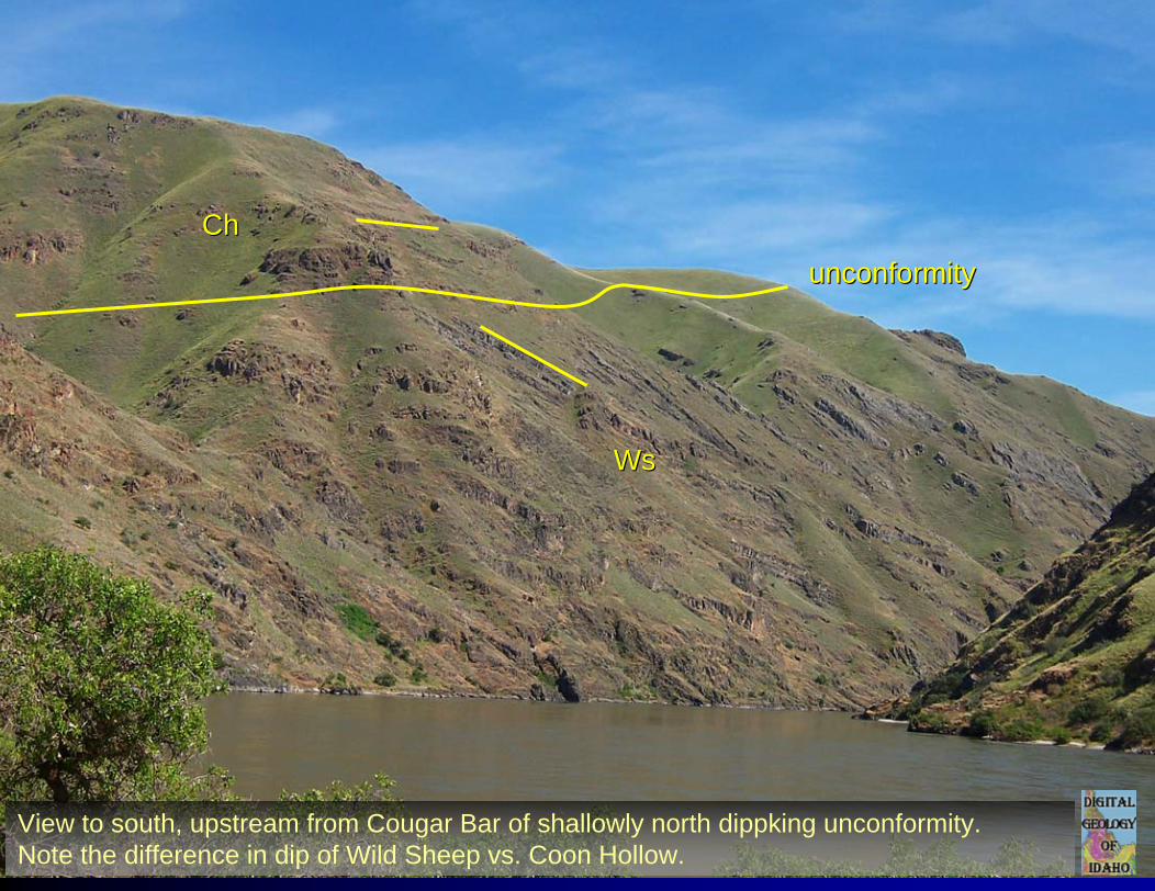
View to south, upstream from Cougar Bar of shallowly north dippking unconformity. Note the difference in dip of Wild Sheep vs. Coon Hollow.
LowerLowerPittsburgPittsburgUpperUpper
PittsburgPittsburg
KurryKurryCreekCreek
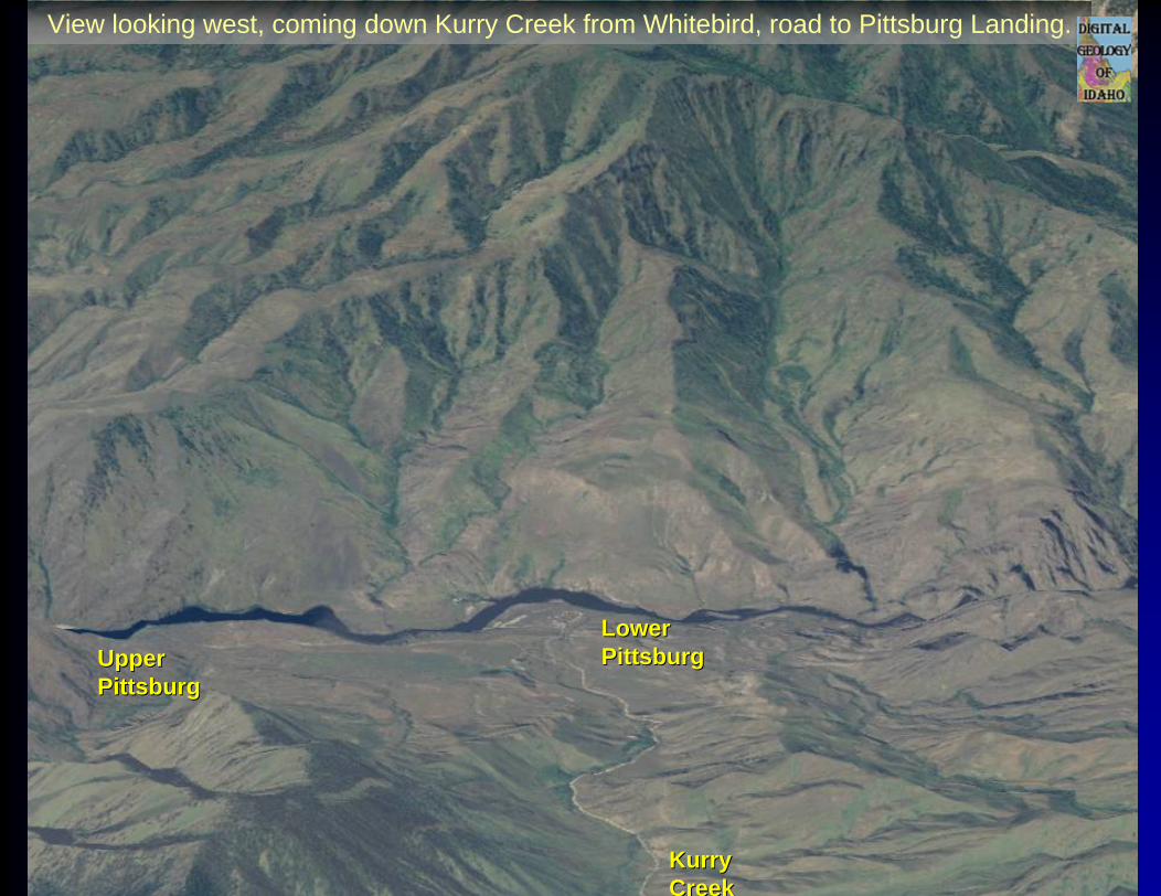
View looking west, coming down Kurry Creek from Whitebird, road to Pittsburg Landing.
LowerLowerPittsburgPittsburgUpperUpper
PittsburgPittsburg
KurryKurryCrCr
CRBCRB
WsWs
ChCh
CRBCRBChCh
CRBCRB
Cougar CrCougar CrIntrusiveIntrusivecomplexcomplex
DcDc
KloptonKlopton CrCrThrust faultThrust fault
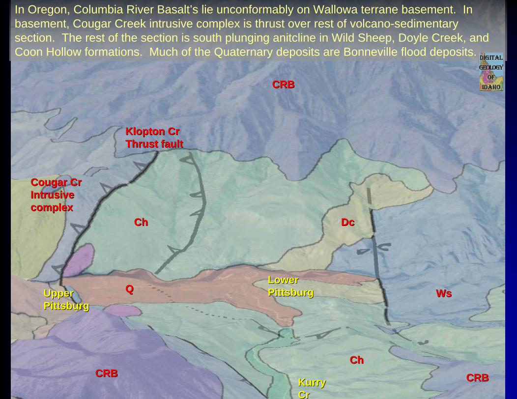
In Oregon, Columbia River Basalt’s lie unconformably on Wallowa terrane basement. In basement, Cougar Creek intrusive complex is thrust over rest of volcano-sedimentary section. The rest of the section is south plunging anitcline in Wild Sheep, Doyle Creek, and Coon Hollow formations. Much of the Quaternary deposits are Bonneville flood deposits.
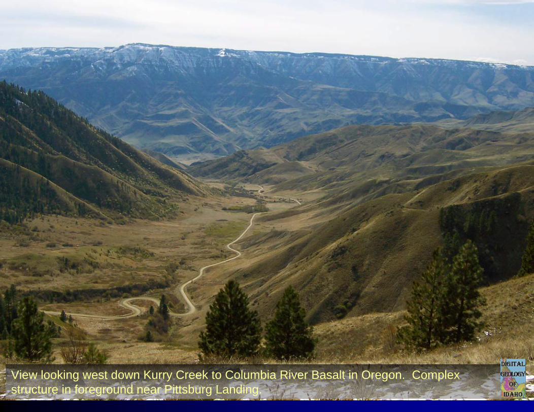
View looking west down Kurry Creek to Columbia River Basalt in Oregon. Complex structure in foreground near Pittsburg Landing.
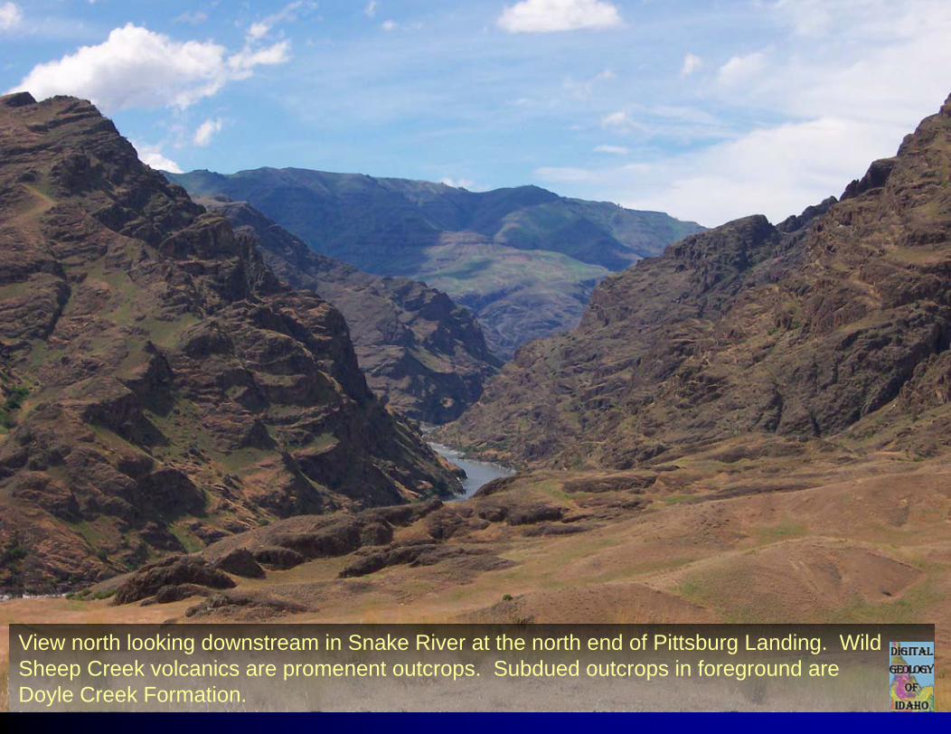
View north looking downstream in Snake River at the north end of Pittsburg Landing. Wild Sheep Creek volcanics are promenent outcrops. Subdued outcrops in foreground are Doyle Creek Formation.
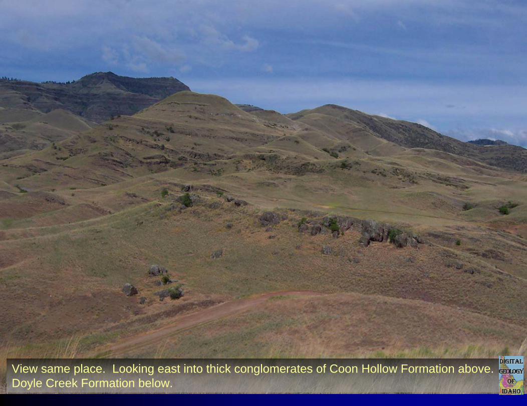
View same place. Looking east into thick conglomerates of Coon Hollow Formation above. Doyle Creek Formation below.
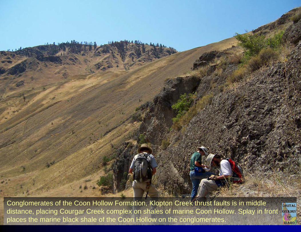
Conglomerates of the Coon Hollow Formation, Klopton Creek thrust faults is in middle distance, placing Courgar Creek complex on shales of marine Coon Hollow. Splay in front places the marine black shale of the Coon Hollow on the conglomerates.
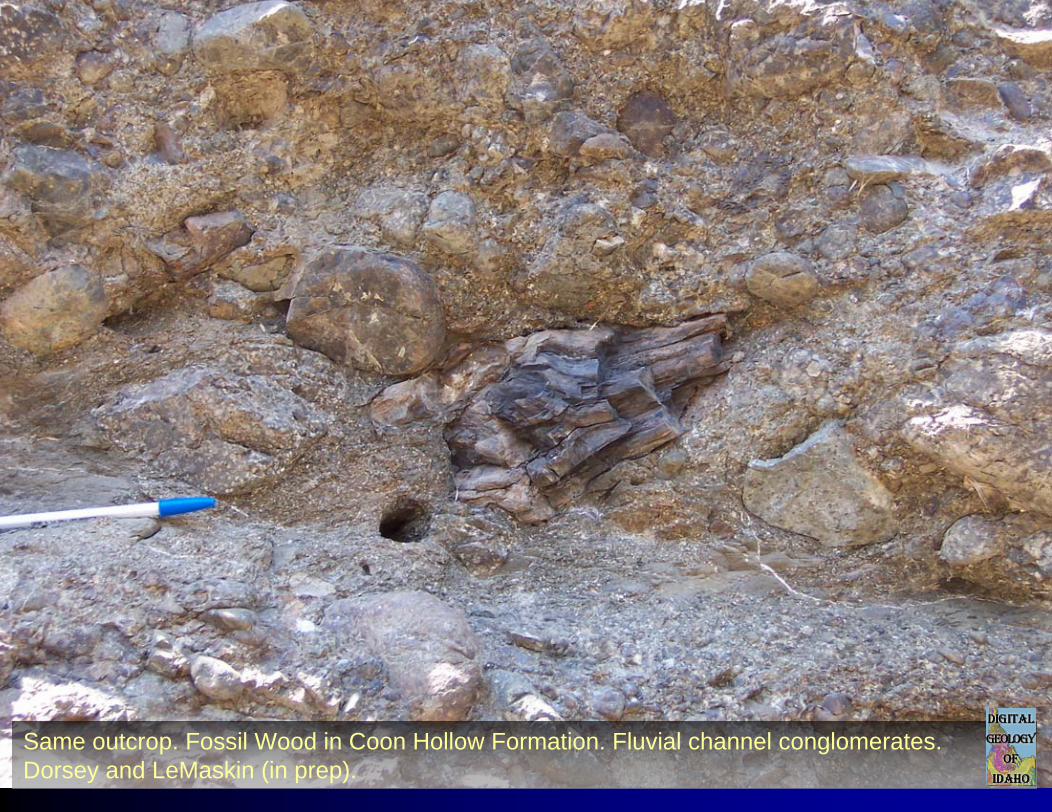
Same outcrop. Fossil Wood in Coon Hollow Formation. Fluvial channel conglomerates. Dorsey and LeMaskin (in prep).
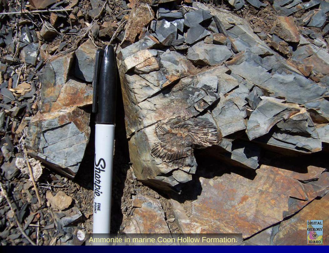
Ammonite in marine Coon Hollow Formation.
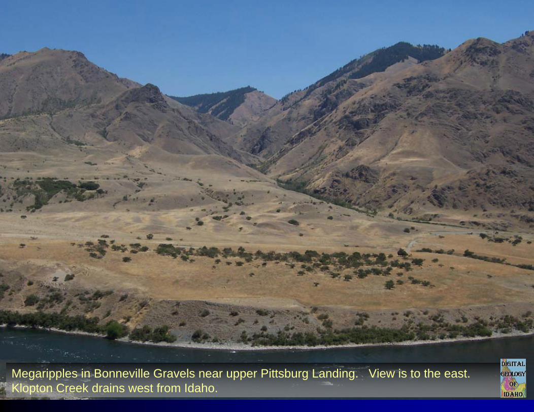
Megaripples in Bonneville Gravels near upper Pittsburg Landing. View is to the east. Klopton Creek drains west from Idaho.
LowerLowerPittsburgPittsburg
UpperUpperPittsburgPittsburg
KurryKurry CrCr
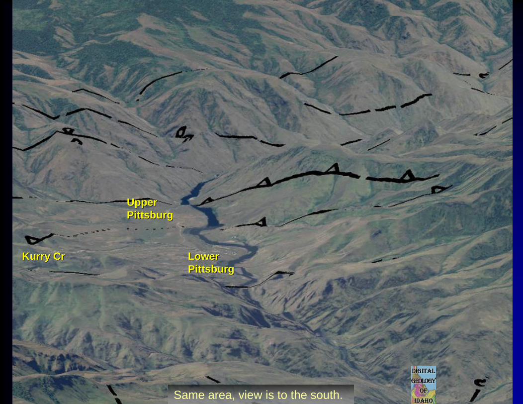
Same area, view is to the south.
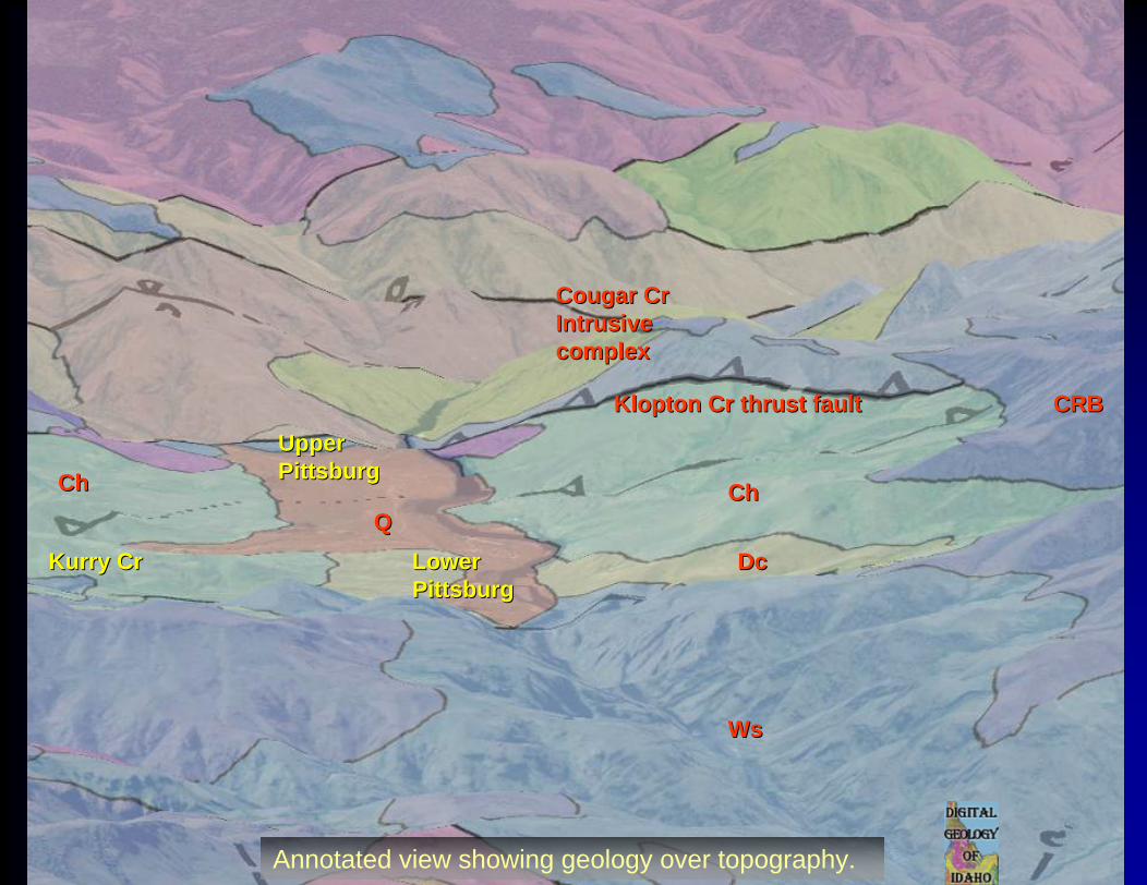
LowerLowerPittsburgPittsburg
UpperUpperPittsburgPittsburg
KurryKurry CrCr
CRBCRB
WsWs
ChCh
Cougar CrCougar CrIntrusiveIntrusivecomplexcomplex
DcDcQQ
KloptonKlopton Cr thrust faultCr thrust fault
ChCh
Annotated view showing geology over topography.
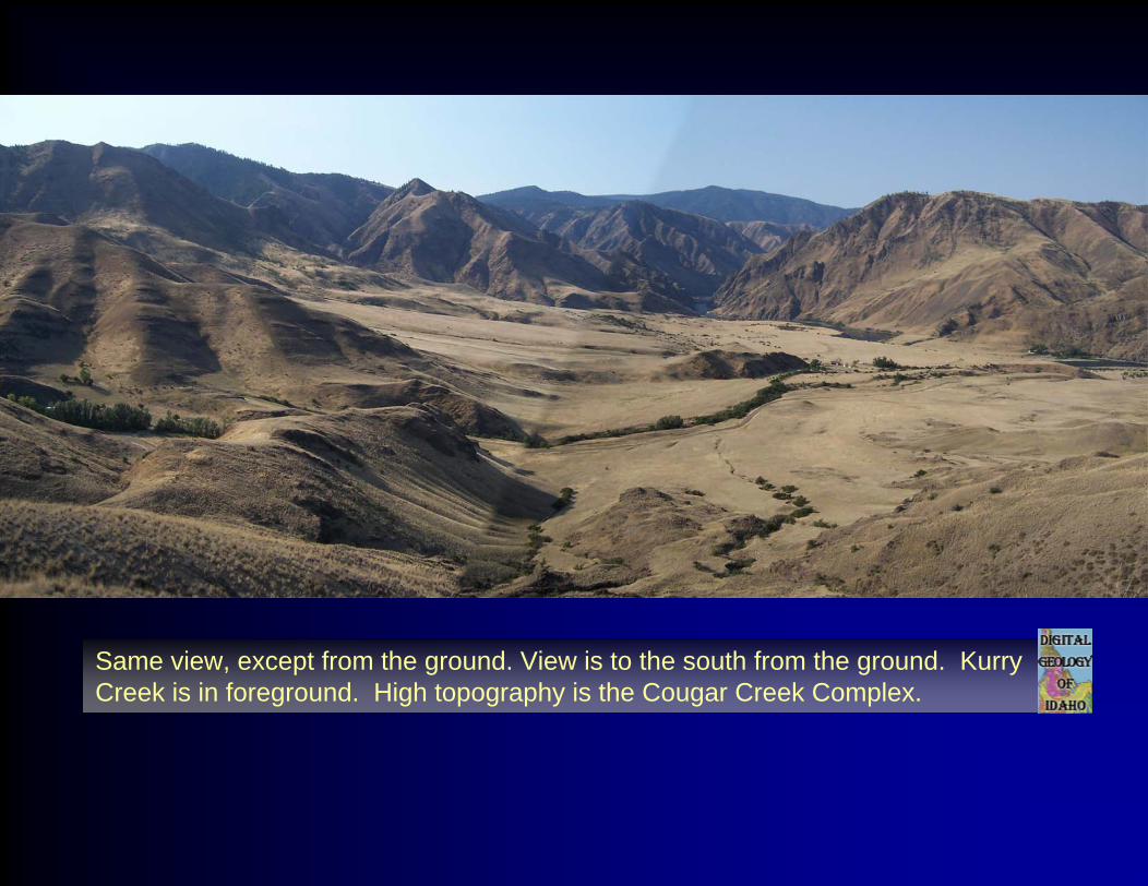
Same view, except from the ground. View is to the south from the ground. Kurry Creek is in foreground. High topography is the Cougar Creek Complex.
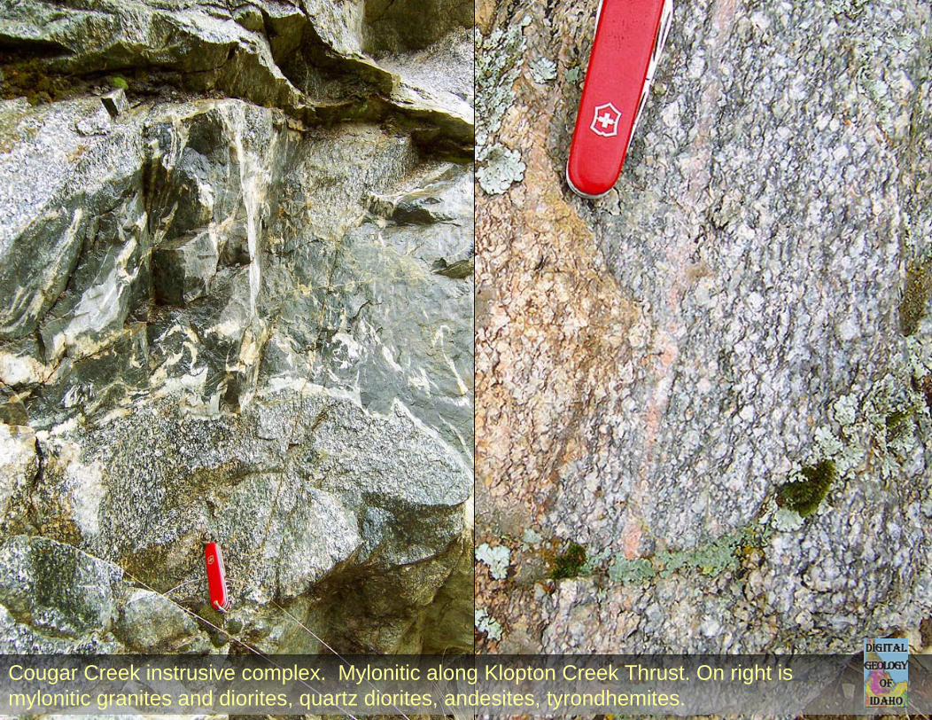
Cougar Creek instrusive complex. Mylonitic along Klopton Creek Thrust. On right is mylonitic granites and diorites, quartz diorites, andesites, tyrondhemites.