Embed Size (px)
Citation preview
A Survey of Existing Mid-Atlantic Regional Association Coastal Ocean Observing System
MARACOOS Assets
Wendell BrownUMass Dartmouth
School for Marine Science & Technology
26 September 2011MARACOOS Fisheries/Ocean Observatory Workshop

MARACOOS
is built on the framework of the
Operational Federal Backbone

Federal Operational
BACKBONE Measurements
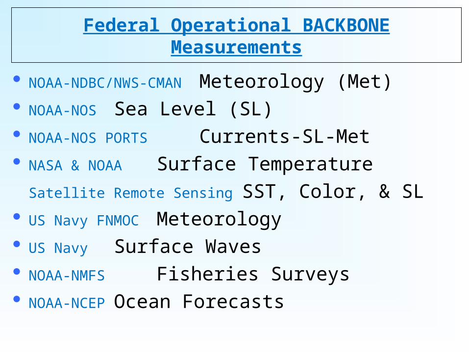
Federal Operational BACKBONE Measurements
NOAA-NDBC/NWS-CMAN Meteorology (Met) NOAA-NOS Sea Level (SL) NOAA-NOS PORTS Currents-SL-Met NASA & NOAA Surface Temperature
Satellite Remote Sensing SST, Color, & SL US Navy FNMOC Meteorology US Navy Surface Waves NOAA-NMFS Fisheries Surveys NOAA-NCEP Ocean Forecasts

Federal Operational BACKBONE NOS /Sea Level
NDBC /Buoy & NWS /C-MAN Meteorology
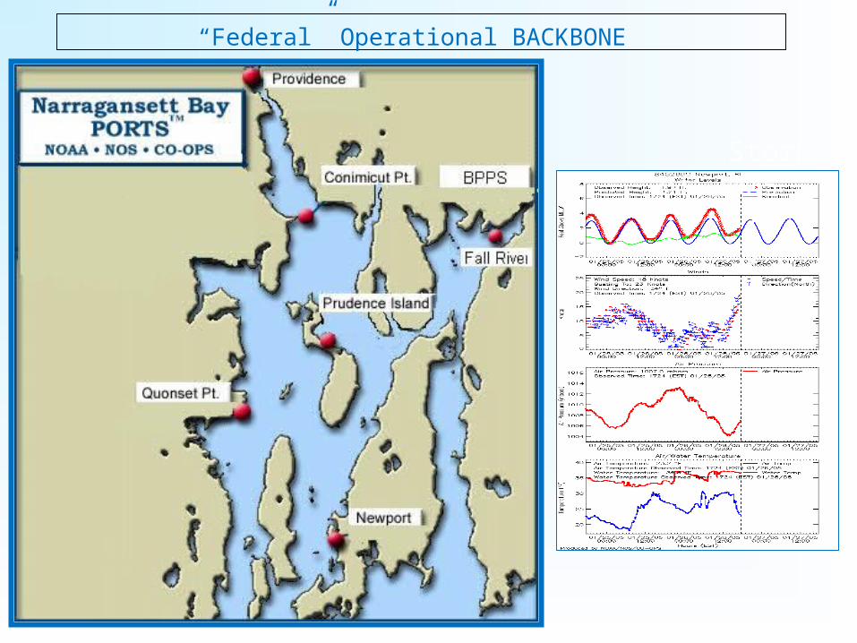
“Federal” Operational BACKBONE
Storm of 2005
|v
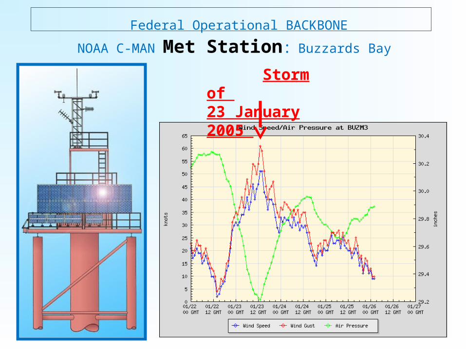
Federal Operational BACKBONE
NOAA C-MAN Met Station: Buzzards Bay
Storm of 23 January 2005

NASA & NOAA Satellite Sea Surface Temperature (SST)
Federal Operational BACKBONE

Federal Operational BACKBONE
US Navy FNMOC Meteorology: Wind Fields
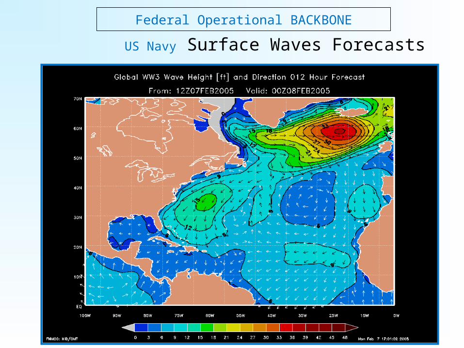
Federal Operational BACKBONE
US Navy Surface Waves Forecasts
Federal Operational BACKBONE
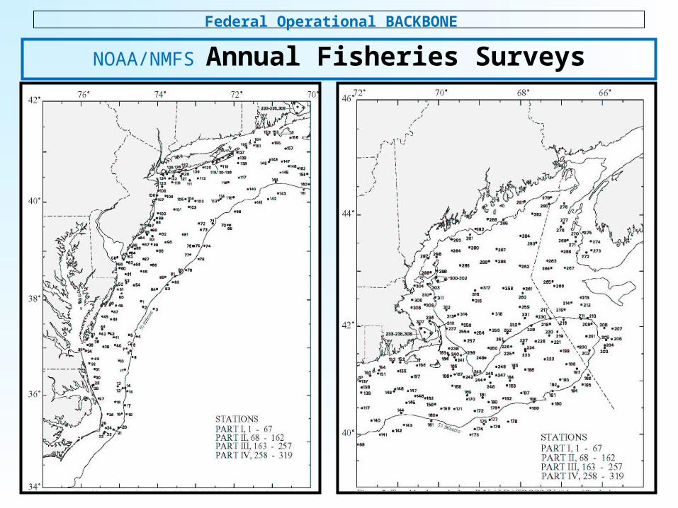
NOAA/NMFS Annual Fisheries Surveys

BASIC DATA / INFORMATION PRODUCTS
Weather Mesonet HF Radar NetworkStatistical STPS
Glider Surveys Dynamical Ocean Forecasts
Satellite Imagery

BASIC DATA / INFORMATION PRODUCTS
Weather Mesonet
BASIC DATA / INFORMATION PRODUCTS
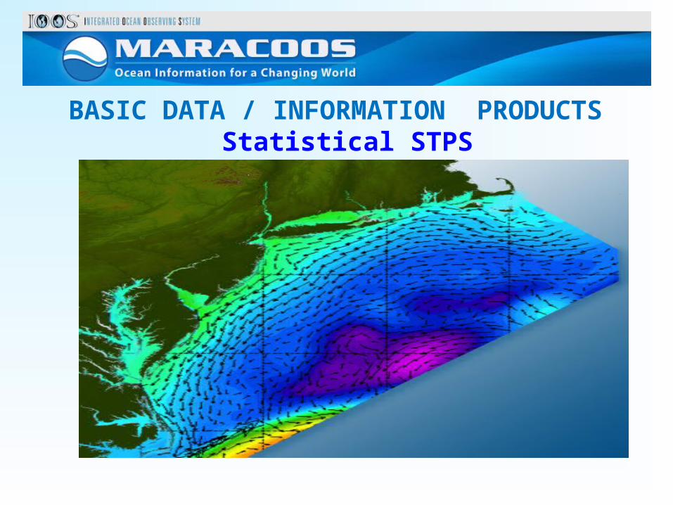
Statistical STPS

BASIC DATA / INFORMATION PRODUCTS
HF Radar Network

BASIC DATA / INFORMATION PRODUCTS
Satellite Imagery

BASIC DATA / INFORMATION PRODUCTS
Glider Surveys

BASIC DATA / INFORMATION PRODUCTS
Dynamical Ocean Forecasts

RegionalPriority Themes
Regional Observation & Modeling Capabilities
Weather Mesonet
HF Radar Network
Statistical STPS
Satellite Imagery
Glider Surveys
Dynamical Ocean
Forecasts
Theme 1. Maritime Safety
Operational Input to USCG SAROPS
Operational input to USCG SAROPS
Operational input to USCG SAROPS
SST for survivability
planning
Assimilation dataset for
forecast models
Surface currents for SAROPS
Theme 2. Ecological Decision Support
Weather forecast ensemble validation
Circulation and divergence maps
for habitat
SST & Color for habitat
Subsurface T & S for habitat
3-D fields of T, S, circulation for
habitat
Theme 3. Water Quality
Winds for transport, river
plumes, & upwelling
Surface currents for flotables, bacteria, spill
response
Surface currents for flotables, bacteria, spill
response
Ocean color for river plumes
Nearshore dissolved oxygen
surveys
Surface currents for floatables, bacteria, spill
response
Theme 4. Coastal
Inundation
Weather forecast ensemble validation
Current forecast model validation
SSTs
assimilation into forecast models
Assimilation dataset for
forecast models
Nested forecast ensembles
Theme 5. Offshore Energy
Historical analysis & wind model validation
Historical current analysis & wind model validation
Historical analysis surface fronts & plumes
for siting
Historical analysis of
subsurface fronts & plumes
Coupled ocean-atmosphere models for resource estimates
DATA & PRODUCTS

MARACOOS
Fisheries-Related
Measurements

UMassD / Industry Scallop SurveysMARACOOS Reginal Assets
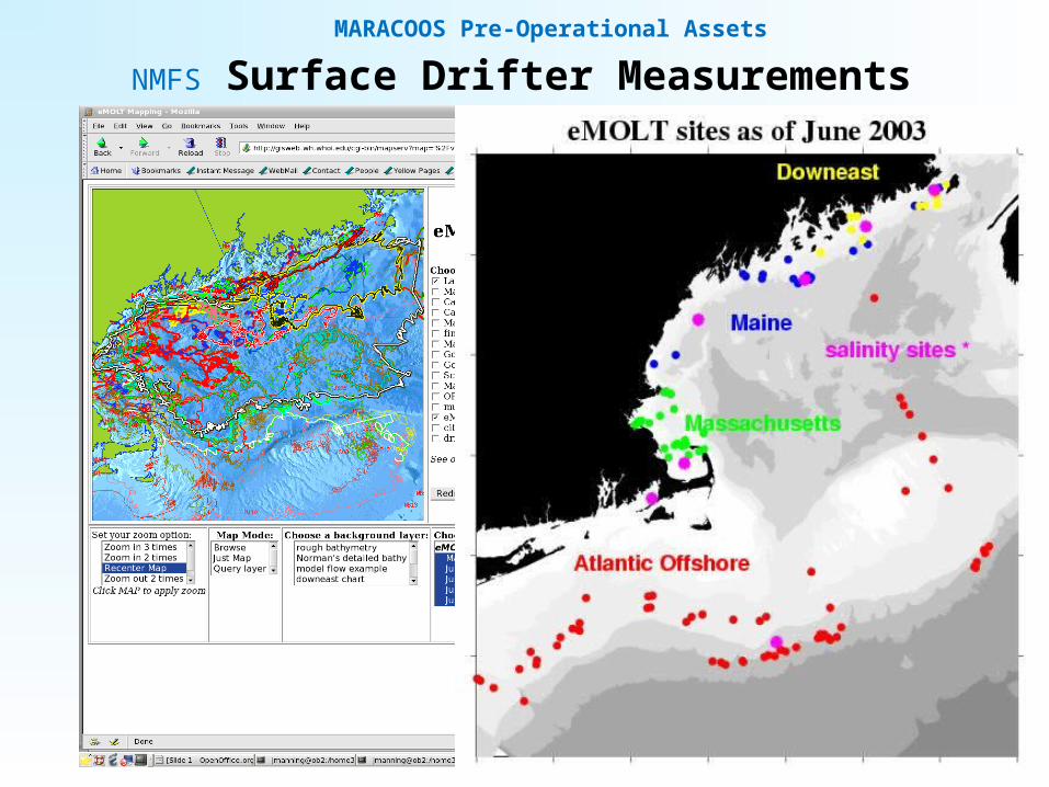
NMFS Surface Drifter Measurements
MARACOOS Pre-Operational Assets

MARACOOS
Embayment
Measurements

MARACOOS Regional Pre-Operational Assets
RI DEM Narragansett Bay Program

The annual NAO Winter Index (NAOI) values from 1864 to 2010. The NAOI running mean (bold) shows “decadal” periods of High (red) and Low (aqua)) NAOI preceding the 1968, 1986, and 1996 and 2010 Low NAOIs.
LOW NAOI HIGH NAOIA conceptual model of the large-scale response of the Gulf Stream/Slope Water system to the extremes of the NAOI. (left) During Low NAOI, the Gulf Stream shifts southward, accompanied by a westward intrusion of Labrador Slope Water (LSW). (right) During High NAOI, the Gulf Stream and associated Warm Slope Water shifts northward, thus displacing LSW (after Drinkwater et al., 2006).
A FISHERIES-RELATED ISSUE: CLIMATE VARIABILITY

Climatological average NEFSC bottom temperatures with 6-9oC Cold Pool waters for(A) 1977-94; (B) 1995-08; and (C) (A)-(B). (Richardson et al., 2010).
Smoothed maps of both northern and southern red hake spatial distribution in 5 yr time blocks using inverse distance weighting. Units of biomass are in kilograms per tow. (Nye et al., 2009)
CLIMATE VARIABILITY: FISHERIES
Cold Pool

COLD POOL EVOLUTION: A seasonal sequence of Mid-Atlantic shelf bottom temperature maps based on MARMAP 1979 water property measurements.

28
Observatory (simulated) data
Virtual Ocean
Design, Testing and Deploy
Models
Data Assimilation
DataAnalysis
Science Questions & Drivers
~100 m
~3 km
Sensor &Platform
Data Synthesis: Nowcast & Data Impact
Hyperionon EO-1
Bringing MARACOOS Power to bear on the issues!
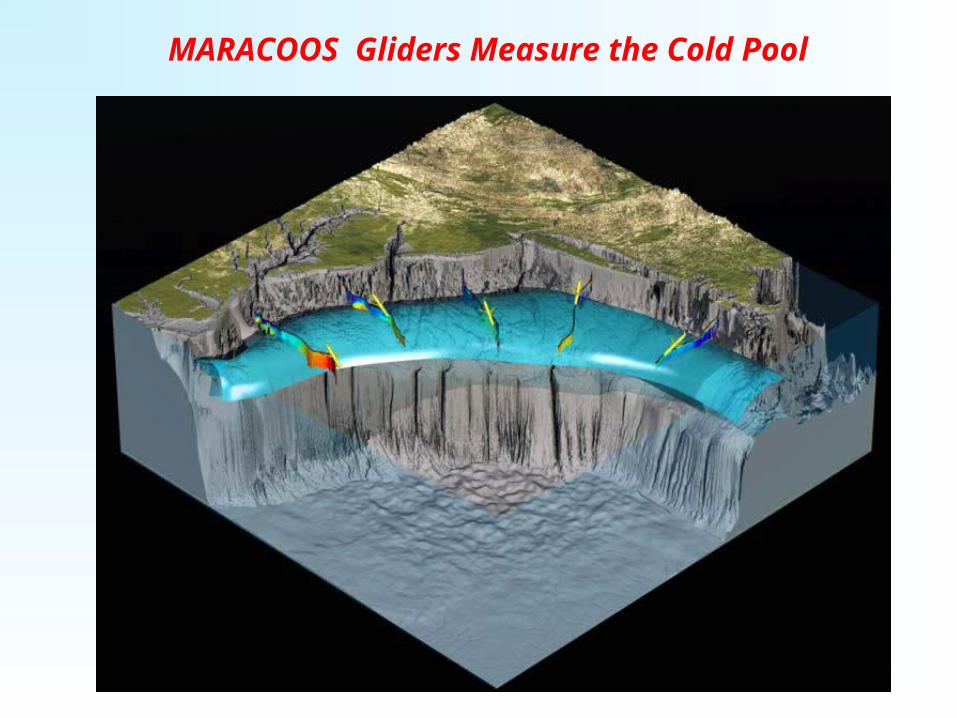
MARACOOS Gliders Measure the Cold Pool

The real-time 3-13 Aug 2011 RU-22 temperature transect reveals the Cold Pool.
GLIDER’S –EYE VIEW of the COLD POOL

The 26 July 2010 HOPS-derived temperature transects showing the Cold Pool; (upper) south of Nantucket (72oW) and (lower) New Jersey (75oW) .
MARACOOS Models Produce Cold Pool Maps

Monthly-average ROMS Cold Pool (T<oC) maps; indicating westward inflow through July.
MODEL’S –EYE VIEW of the COLD POOL

BASIC DATA / INFORMATION PRODUCTS
Weather Mesonet HF Radar NetworkStatistical STPS
Glider Surveys Dynamical Ocean Forecasts
Satellite Imagery