Embed Size (px)
Citation preview
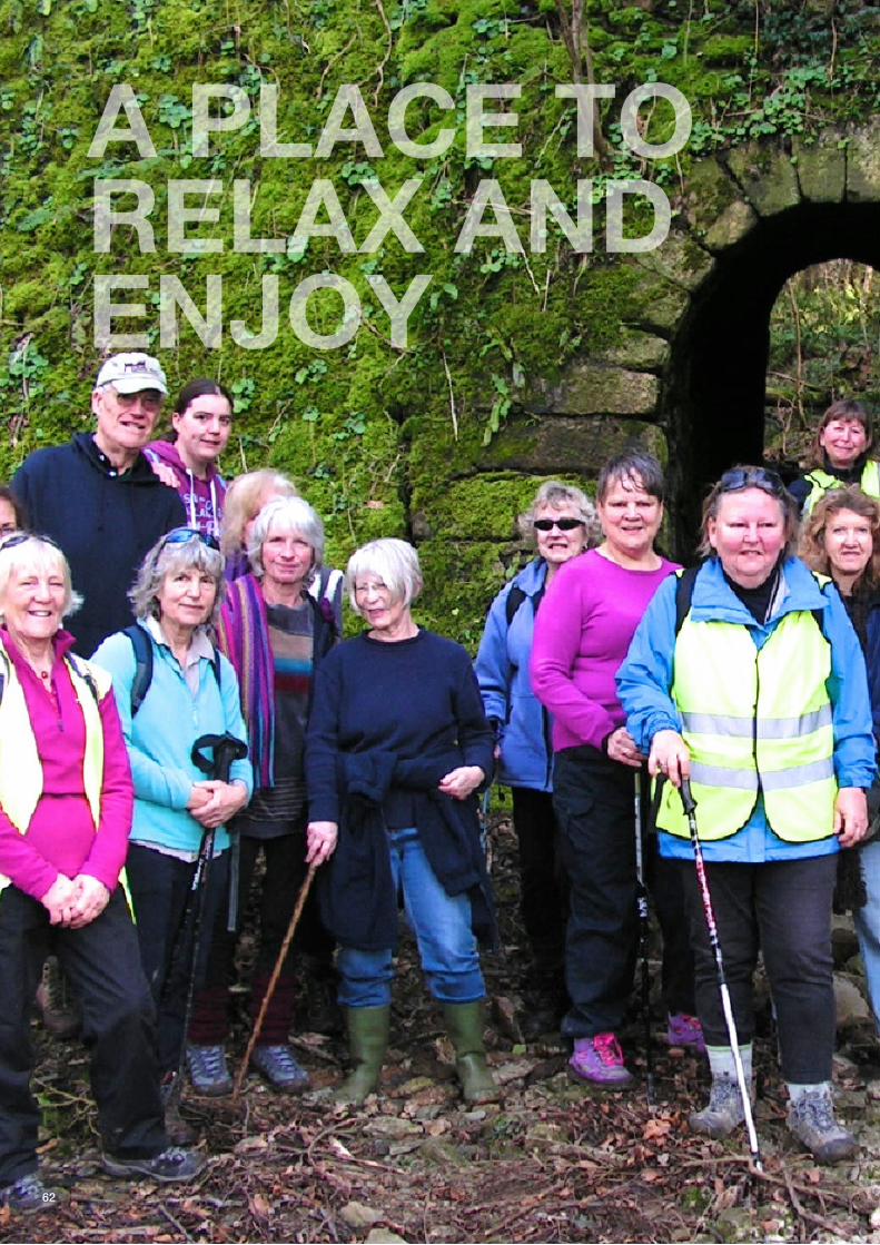
A PLACE TORELAX ANDENJOY
62
Strategic Approach The evidence collected suggests that the need is for a local open space and leisurestrategy to seize the opportunity to provide high quality recreational and green space aswell as good leisure provision that takes into a hierarchy of neighbourhood provision (forour five main neighbourhoods) and town-wide provision.
Therefore, the main elements of the strategy should be to: • Protect/conserve and enhance green spaces within the town for the benefit and good health of all ages with particular emphasis on children’s play and adult recreation • Enhance access within the town centre for pedestrians • Encourage the creation of new green spaces (formal and informal) • Encourage greater access to sports facilities • Protect and enhance the character of the surrounding countryside including designated landscapes, heritage assets and areas of local significance. • Make provision for enhanced connectivity throughout the town and into the near countryside • Support the enhancement of community leisure facilities in and around the town • Promote Liskeard as a destination for locals and visitors to support the towns economy, and increase footfall through provision of well-publicised walks, trails and formal leisure and community facilities.
A PLACE TO RELAX AND ENJOYAIMS To • Conserve and enhance existing open spaces and leisure facilities • Enhance connectivity to key facilities • Integrate with existing local walks, cycle trails (e.g. the Caradon Trail) and the World Heritage site • Develop the multi-use park at Roundbury • Protect our rural hinterland.
OBJECTIVE 1Protect/conserve and enhance green spaces within the town for the benefit and good healthof all ages with particular emphasis on children’s play and adult recreation by: a) Designating a list of open spaces as local green space (NPPF 76-78) b) Using s106 and CIL to conserve and enhance Westbourne Gardens, Castle Park and other key sites c) Providing equipped play areas for the five neighbourhood areas d) Create and conserve new green spaces as part of development and as ancillary to new growth of the town e) Enhance existing green spaces
63
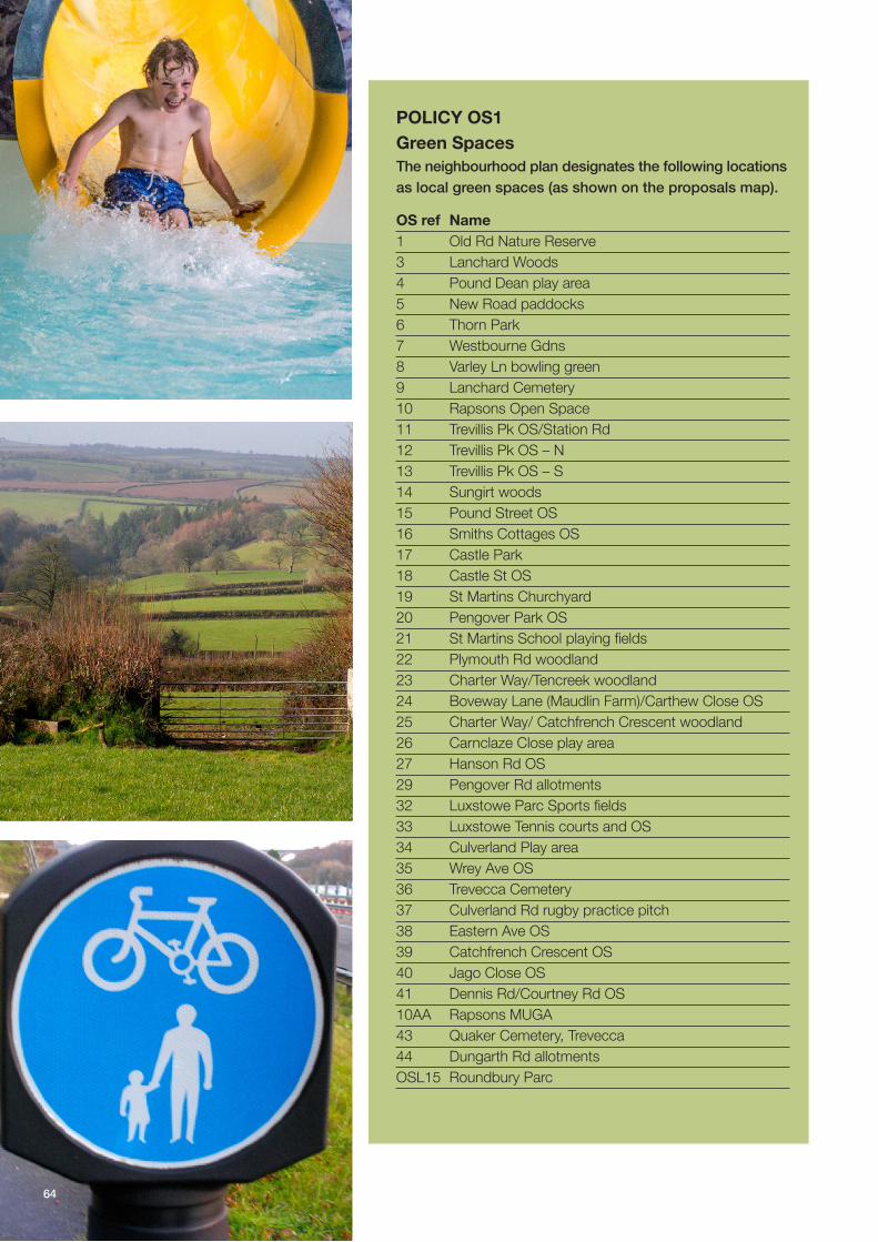
POLICY OS1 Green SpacesThe neighbourhood plan designates the following locationsas local green spaces (as shown on the proposals map).
OS ref Name1 Old Rd Nature Reserve3 Lanchard Woods4 Pound Dean play area5 New Road paddocks6 Thorn Park7 Westbourne Gdns8 Varley Ln bowling green9 Lanchard Cemetery10 Rapsons Open Space11 Trevillis Pk OS/Station Rd12 Trevillis Pk OS – N13 Trevillis Pk OS – S14 Sungirt woods15 Pound Street OS16 Smiths Cottages OS17 Castle Park18 Castle St OS19 St Martins Churchyard20 Pengover Park OS21 St Martins School playing fields22 Plymouth Rd woodland23 Charter Way/Tencreek woodland24 Boveway Lane (Maudlin Farm)/Carthew Close OS25 Charter Way/ Catchfrench Crescent woodland26 Carnclaze Close play area27 Hanson Rd OS29 Pengover Rd allotments32 Luxstowe Parc Sports fields33 Luxstowe Tennis courts and OS34 Culverland Play area35 Wrey Ave OS36 Trevecca Cemetery37 Culverland Rd rugby practice pitch38 Eastern Ave OS39 Catchfrench Crescent OS40 Jago Close OS41 Dennis Rd/Courtney Rd OS10AA Rapsons MUGA43 Quaker Cemetery, Trevecca44 Dungarth Rd allotmentsOSL15 Roundbury Parc
64
POLICY OSL2Conservation, Enhancement AndCreation Of Local Green SpacesAnd Other Parks And Green SpacesTo Accommodate Growth
No development will be permitted within thelocal green spaces listed in Policy OSL1 andshown on the local green spaces proposals mapif it would impair the effectiveness of the site inserving one or more of the following purposes: a) Providing a resource for formal and informal recreation and/or a venue for formal events; b) Forming a green foreground or background which is important to the character of Liskeard’s setting; c) Helping to preserve the cherished views of the town centre, or of individual buildings or groups of buildings, or of the surrounding rural and heritage landscapes from within the town; d) Providing areas of rural tranquility which surround or penetrate the built-up area of Liskeard and helps to maintain the relationship between the town and surrounding countryside; e) Contributing to the character and visual setting of the town by their open nature f) Conserving biodiversity, ecological assets, vegetation, watercourses and other landscape features important to the local community
POLICY OSL3Play provision in neighbourhoodareasThe Neighbourhood Plan supports theprovision of neighbourhood equipped areasfor play (NEAPS) at Castle Park, Thorn Park and Rapsons Park, and of ‘natural play facilities’ at Sungirt Woods, Lanchard Woods and ‘Roundbury Park’.
New housing or mixed use developments shallprovide equipped formal and natural play inaccordance with tables shown or providecontributions towards facilities as set out inorder to provide each of the fiveneighbourhoods (see diagram pg 67) in thetown with a range of equipped and naturalplay across all age ranges. Only familydwellings of two or more bedrooms will berequired to contribute to the provision ofchildren’s play space.
NEAPS are also required within the urbanextensions to be provided at Addington,Tencreek and Charter Way.
Scale of Local Area for Locally Neighbourhood Multi UseDevelopment Play (LAP) Equipped Area Equipped Area Games Area for Play (LEAP) for Play (NEAP) (MUGA)
5-10 dwellings √10–200 dwellings √ √ Contribution201–500 dwellings √ √ Contribution √501+ dwellings √ √ √ √
APPLICATION OF QUANTITY BENCHMARK GUIDELINES – EQUIPPED/DESIGNATED PLAY SPACE
65
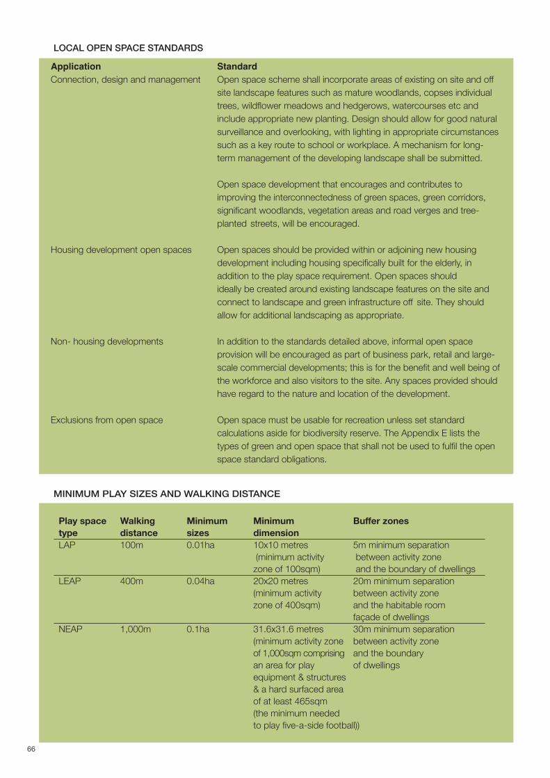
Application StandardConnection, design and management Open space scheme shall incorporate areas of existing on site and off
site landscape features such as mature woodlands, copses individual trees, wildflower meadows and hedgerows, watercourses etc and include appropriate new planting. Design should allow for good natural surveillance and overlooking, with lighting in appropriate circumstances such as a key route to school or workplace. A mechanism for long-term management of the developing landscape shall be submitted.
Open space development that encourages and contributes to improving the interconnectedness of green spaces, green corridors, significant woodlands, vegetation areas and road verges and tree-planted streets, will be encouraged.
Housing development open spaces Open spaces should be provided within or adjoining new housing development including housing specifically built for the elderly, in addition to the play space requirement. Open spaces should ideally be created around existing landscape features on the site and connect to landscape and green infrastructure off site. They should allow for additional landscaping as appropriate.
Non- housing developments In addition to the standards detailed above, informal open space provision will be encouraged as part of business park, retail and large-scale commercial developments; this is for the benefit and well being ofthe workforce and also visitors to the site. Any spaces provided should have regard to the nature and location of the development.
Exclusions from open space Open space must be usable for recreation unless set standard calculations aside for biodiversity reserve. The Appendix E lists the types of green and open space that shall not be used to fulfil the open space standard obligations.
Play space Walking Minimum Minimum Buffer zonestype distance sizes dimensionLAP 100m 0.01ha 10x10 metres 5m minimum separation
(minimum activity between activity zonezone of 100sqm) and the boundary of dwellings
LEAP 400m 0.04ha 20x20 metres 20m minimum separation(minimum activity between activity zone zone of 400sqm) and the habitable room
façade of dwellings NEAP 1,000m 0.1ha 31.6x31.6 metres 30m minimum separation
(minimum activity zone between activity zoneof 1,000sqm comprising and the boundaryan area for play of dwellingsequipment & structures & a hard surfaced area of at least 465sqm(the minimum needed to play five-a-side football))
LOCAL OPEN SPACE STANDARDS
MINIMUM PLAY SIZES AND WALKING DISTANCE
66

Reasoned JustificationPolicy OSL1 - These areas are of particularimportance to the local community and fulfill therequirements of the NPPF in that each green space: a) Is in reasonably close proximity to the community it serves; b) Is demonstrably special to a local community and holds a particular local significance, for example because of its beauty, historic significance, recreational value (including as a playing field), tranquility or richness of its wildlife; c) and concerned is local in character and is not an extensive tract of land.
Policy OSL2 - The Neighbourhood Plan OpenSpaces and Leisure Working Group audited(through site visits) 44 open spaces within Liskeardtown area (i.e. within the limits of the built up area,there being no public accessible spaces exceptpublic rights of way, outside the town limits), usingthe Green Flag Award4 quality system as a basis forthe appraisal. It revealed only 22 ha of publiclyaccessible open space. This public accessibleamount of open space is 3 ha below the levelrecommended by the Cornwall Council Open Spacestrategy which requires 42 sq m/person. i.e. 39 hatotal. It is therefore essential that existing greenspaces be protected.
The Liskeard Town Council Open Space Audit of2014 recognized the potential role of the town’sattractive and popular green hinterland and the linkto the World Heritage Site at Caradon, and inJanuary 2014 the Town Council adopted the policy:“to protect and enhance the character andaccessibility of the natural green spaces around the
boundary of the town, accessed via green corridorsand quiet lanes, which would also fulfil the objectiveof the Cornwall Local Plan to maintain the physicallink between Liskeard and the world mining heritagesite at Minions”.
Policy OSL3 - Equipped play provision in the townshould reflect neighbourhood accessibility andprovision across age groups. However, it is currentlyinadequate. Rapson’s park provides basic youngteenage play and skate ramp but needs additionalinvestment to improve natural surveillance, safeaccess (currently through a car park) and landscapedesign. The children’s play area at Castle Parkneeds significant improvement. Carnclaze Close,Trevecca and Thorn Park are well equipped thoughrequire more family seating and better disabledaccess. A new play area is planned in the newAddington development. There are other local Areasfor Play around the town for doorstep use bytoddlers but cannot to be considered strategic playareas. It is also desirable to provide areas for naturalplay that allow children to create dens and mazes,construct willow domes and arches, dig mud pits orcreate steeping stone or balance log paths. Makingaccessible and managed woodland spaces in the townsuch as at Sungirt, Lanchard and CatchfrenchCrescent woods could provide more play at reasonablecost. A rural edge of town play area with good parkingaccess would be highly valued by families.
Comment Where appropriate, investment throughplanning obligations related to developments whichbring additional population to Liskeard will bedirected towards the maintenance, conservationand enhancement of the key existing public parks atWestbourne Gardens, Castle Park, Thorn Park andRapsons Open Space, and improved access andfacilities at natural spaces Catchfrench CrescentWoods, Sungirt Woods and Lanchard Woods. The intention will be to bring greater diversity andlower maintenance costs, for example by utilizinggravel paths, mowing regimes and natural plantingwith low-cost native plants, provision of simpletimber or granites seats, localised communityplanting/gardens etc to provide more varied,accessible and interesting facilities.
Where appropriate, investment through planningobligations related to developments which bringadditional population to Liskeard will be directedtowards the maintenance, conservation andenhancement of these facilities.
67
NEIGHBOURHOODS AROUND LISKEARD

POLICY OSL4 Public Realm Access And CirculationImprovements Schemes to enhance the Public Realm for pedestriancomfort, improved convenience of access andconnectivity, including improved access for mobilityimpaired users through improved surfaces, levelchanges, handrails etc, quality signage, tree planting,cycle parking, public seating and trolley friendly surfaceswill be implemented. The main focus will be on:
a) The Dean St/Barras St/Windsor Place junction with barrier free pedestrian-prioritised design linking in with the existing Dean St civic space
b) Bay Tree Hill – in accordance with retained Policy LISK5 (with possible timed road closures) c) Liskeard Railway Station (including links between mainline and branch line stations) with disabled parking, kiss ‘n ride, rail staff parking and taxi rank to reduce conflicts and promote sense of place for arriving passengers. d) Conserve and enhance The Parade as civic space.
OBJECTIVE 2Enhance access within the town centre for pedestrians by: a) Use of shared surfaces e.g. (Dean St/Barras St/The Parade) b) Bay Tree Hill re-modelling - (Caradon saved policy) c) Liskeard Station gateway, enhancement of public realm, signage d) Improved pedestrian crossings, signage, street trees Promoting better access for disabled (TC obj)
PROJECT 1Parks and Open Space ManagementRefresh Set up a town-wide initiative and strategy withaction plan to support the positive and progressivemanagement of parks and green spaces aroundthe town based on simple objectives for openspace types and new partnerships. As part of thisstrategy, review how the local authorities can workwith community groups to utilise funding to createfacilities (podium, utilities etc) for ‘party in the park’events/live music in Westbourne Gardens, CastlePark and Sungirt Woods.
See also TC3 Castle Park Improvement Scheme -to improve a valuable public and historic resource,providing improved leisure and historic resourceinterpretation to support the Town Centre
PROJECT 2Town Council Open Space Audit review Review the 2014 town council open space audit &
policy 2014 to identify specific design andmanagement proposals for each park and greenspace, as listed in Policy OSL1. Set out a spatialstrategy, in partnership with other stakeholders, forthe enhancement of their relationship to the wider,landscape and heritage and ensuring accessconnections in this plan are accounted for. Include alandscape and heritage assessment study of the rural hinterland.
Projects 1 & 2 – Whilst Liskeard’s open spacesscore reasonably on maintenance and access(other than for disabled), they are poor in provisionof cultural heritage, interpretation and education, oradequate responsiveness to the needs of people interms of signage, seating, interest, or otherelements that would make them attractive. In anage of increasing obesity and mental healthproblems, this low quality indication suggests ouropen spaces are failing to provide basic levels ofservice that might contribute to reducing pressureon other services such as health and education.
68
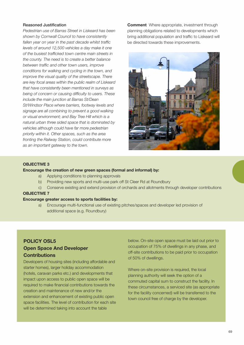
Reasoned Justification Pedestrian use of Barras Street in Liskeard has beenshown by Cornwall Council to have consistentlyfallen year on year in the past decade whilst trafficlevels of around 12,500 vehicles a day make it oneof the busiest trafficked town centre main streets inthe county. The need is to create a better balancebetween traffic and other town users, improveconditions for walking and cycling in the town, andimprove the visual quality of the streetscape. Thereare key focal areas within the public realm of Liskeardthat have consistently been mentioned in surveys asbeing of concern or causing difficulty to users. Theseinclude the main junction at Barras St/DeanSt/Windsor Place where barriers, footway levels andsignage are all combining to prevent a good walkingor visual environment; and Bay Tree Hill which is anatural urban three sided space that is dominated byvehicles although could have far more pedestrianpriority within it. Other spaces, such as the areafronting the Railway Station, could contribute moreas an important gateway to the town.
Comment Where appropriate, investment throughplanning obligations related to developments whichbring additional population and traffic to Liskeard willbe directed towards these improvements.
POLICY OSL5Open Space And DeveloperContributions Developers of housing sites (including affordable andstarter homes), larger holiday accommodation(hotels, caravan parks etc.) and developments thatimpact upon access to public open space will berequired to make financial contributions towards thecreation and maintenance of new and/or theextension and enhancement of existing public openspace facilities. The level of contribution for each sitewill be determined taking into account the table
below. On-site open space must be laid out prior tooccupation of 75% of dwellings in any phase, andoff-site contributions to be paid prior to occupationof 50% of dwellings.
Where on-site provision is required, the localplanning authority will seek the option of acommuted capital sum to construct the facility. Inthese circumstances, a serviced site (as appropriatefor the facility concerned) will be transferred to thetown council free of charge by the developer.
OBJECTIVE 3Encourage the creation of new green spaces (formal and informal) by: a) Applying conditions to planning approvals b) Providing new sports and multi-use park off St Cleer Rd at Roundbury c) Conserve existing and extend provision of orchards and allotments through developer contributions OBJECTIVE 7Encourage greater access to sports facilities by: a) Encourage multi-functional use of existing pitches/spaces and developer led provision of additional space (e.g. Roundbury)
69
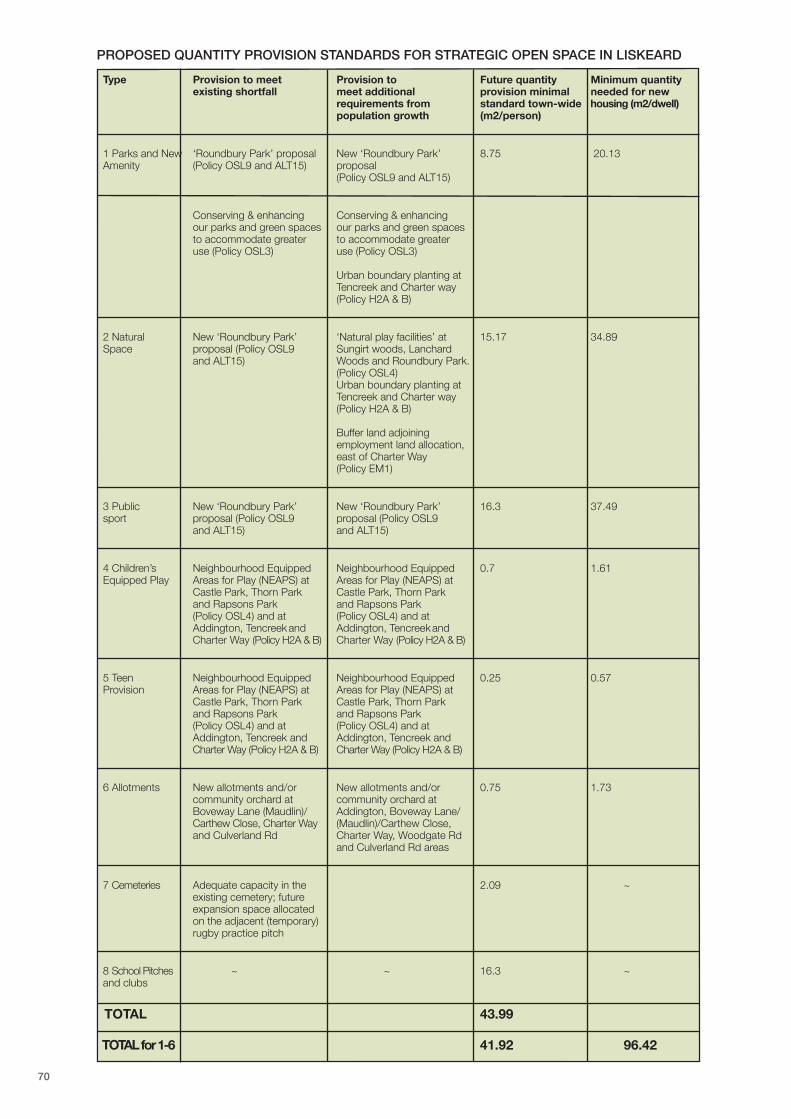
Type Provision to meet Provision to Future quantity Minimum quantityexisting shortfall meet additional provision minimal needed for new
requirements from standard town-wide housing (m2/dwell)population growth (m2/person)
1 Parks and New ‘Roundbury Park’ proposal New ‘Roundbury Park’ 8.75 20.13Amenity (Policy OSL9 and ALT15) proposal
(Policy OSL9 and ALT15)
Conserving & enhancing Conserving & enhancingour parks and green spaces our parks and green spacesto accommodate greater to accommodate greateruse (Policy OSL3) use (Policy OSL3)
Urban boundary planting at Tencreek and Charter way(Policy H2A & B)
2 Natural New ‘Roundbury Park’ ‘Natural play facilities’ at 15.17 34.89Space proposal (Policy OSL9 Sungirt woods, Lanchard
and ALT15) Woods and Roundbury Park.(Policy OSL4)Urban boundary planting at Tencreek and Charter way (Policy H2A & B)
Buffer land adjoining employment land allocation, east of Charter Way(Policy EM1)
3 Public New ‘Roundbury Park’ New ‘Roundbury Park’ 16.3 37.49sport proposal (Policy OSL9 proposal (Policy OSL9
and ALT15) and ALT15)
4 Children’s Neighbourhood Equipped Neighbourhood Equipped 0.7 1.61Equipped Play Areas for Play (NEAPS) at Areas for Play (NEAPS) at
Castle Park, Thorn Park Castle Park, Thorn Park and Rapsons Park and Rapsons Park(Policy OSL4) and at (Policy OSL4) and atAddington, Tencreek and Addington, Tencreek and Charter Way (Policy H2A & B) Charter Way (Policy H2A & B)
5 Teen Neighbourhood Equipped Neighbourhood Equipped 0.25 0.57Provision Areas for Play (NEAPS) at Areas for Play (NEAPS) at
Castle Park, Thorn Park Castle Park, Thorn Park and Rapsons Park and Rapsons Park(Policy OSL4) and at (Policy OSL4) and atAddington, Tencreek and Addington, Tencreek andCharter Way (Policy H2A & B) Charter Way (Policy H2A & B)
6 Allotments New allotments and/or New allotments and/or 0.75 1.73community orchard at community orchard atBoveway Lane (Maudlin)/ Addington, Boveway Lane/Carthew Close, Charter Way (Maudlin)/Carthew Close,and Culverland Rd Charter Way, Woodgate Rd
and Culverland Rd areas
7 Cemeteries Adequate capacity in the 2.09 ~existing cemetery; future expansion space allocated on the adjacent (temporary) rugby practice pitch
8 School Pitches ~ ~ 16.3 ~and clubs
TOTAL 43.99
TOTAL for 1-6 41.92 96.42
PROPOSED QUANTITY PROVISION STANDARDS FOR STRATEGIC OPEN SPACE IN LISKEARD
70

POLICY OSL6Meeting The Communities Need ForSports And Leisure Approximately 8.8 hectares of land adjacent to StCleer Road and identified on the proposals map isallocated for open recreational use. Land use willcomprise playing fields, play areas, public openspace, and ancillary buildings such as changingrooms, cycle hire shop, café and shelters.
Where appropriate, investment through planningobligations related to developments which bringadditional population to Liskeard will be directedtowards the creation of this new park.
In addition, parkland and natural areas will beprovided in the mixed-use urban extensions to beprovided at Addington (3.08ha), Tencreek (4.1ha)and Charter Way (4.8ha) (Policy H2a & b), and aspart of the employment land allocation on land eastof Charter Way (Policy EM1)
Reasoned JustificationPolicy OSL5 - The Neighbourhood Plan OpenSpaces Audit revealed only 22 ha of publiclyaccessible open space. This public accessibleamount of open space is 3 ha below the level recommended by the Cornwall Council Open Spacestrategy which requires 42 sq m/person. i.e. 39 hatotal. It is therefore essential that new open and greenspaces are provided to meet community requirements.
The Audit also found many of Liskeard’s parks to belacking in cultural resonance, provision of facilities for allages such as places to sit and relax, imaginative plantingor natural habitats that encourage wildlife, although theywere generally well kept with grass cut and litter usually
collected. In order to meet the needs of the existingpopulation and those living in new developments, it isnecessary to invest in improving a few parks and naturalgreen spaces as the primary community spaces, inaddition to the provision of new facilities.
Policy OSL6 - There is also a shortage playing pitchesto meet current and forecast needs, requiring rugbyand football clubs to use school pitches and limitingtheir development. The allocation for playing fields ofland at Roundbury, on the St Cleer Road will provideplaying pitches and running track as well as leisurefacilities such as a cycling hub, play area, car parkingand changing rooms/café, all in a naturally landscapedpark that should blend into the countryside.Consideration could also be given here to specialisedplay provision for disabled children.
Policy OSL7 - More innovative uses encouraged inappropriate locations will add to the attraction andversatility of green spaces, providing a betterexperience for users
POLICY OSL7Provision Of Orchards And Allotments Conserve existing allotments at Pengover Road,Dungarth Road and extend provision of orchards andallotments through developer contributions at BovewayLane (Maudlin)/Carthew Close; Charter Way,Tencreek, Woodgate Road and Culverland Roadand Addington.
71
Comment For small developments (less than 5dwellings) within acceptable range of some form ofopen space (in accordance with adopted standards)contributions will be sought off site entirely via aSection 106 agreement or planning condition. Forlarger developments this will be a combination of on-site provision and some off-site. To help work throughthe requirements the Open Space Planning toolkit hasbeen prepared by Cornwall Council for use on alldevelopments.
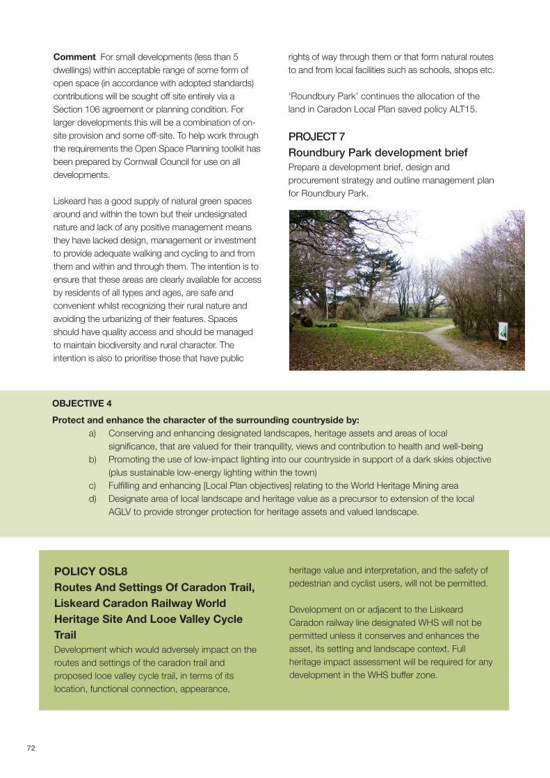
Liskeard has a good supply of natural green spacesaround and within the town but their undesignatednature and lack of any positive management meansthey have lacked design, management or investmentto provide adequate walking and cycling to and fromthem and within and through them. The intention is toensure that these areas are clearly available for accessby residents of all types and ages, are safe andconvenient whilst recognizing their rural nature andavoiding the urbanizing of their features. Spacesshould have quality access and should be managedto maintain biodiversity and rural character. Theintention is also to prioritise those that have public
rights of way through them or that form natural routesto and from local facilities such as schools, shops etc.
‘Roundbury Park’ continues the allocation of theland in Caradon Local Plan saved policy ALT15.
PROJECT 7Roundbury Park development briefPrepare a development brief, design andprocurement strategy and outline management planfor Roundbury Park.
OBJECTIVE 4Protect and enhance the character of the surrounding countryside by: a) Conserving and enhancing designated landscapes, heritage assets and areas of local significance, that are valued for their tranquility, views and contribution to health and well-being b) Promoting the use of low-impact lighting into our countryside in support of a dark skies objective (plus sustainable low-energy lighting within the town) c) Fulfilling and enhancing [Local Plan objectives] relating to the World Heritage Mining area d) Designate area of local landscape and heritage value as a precursor to extension of the local AGLV to provide stronger protection for heritage assets and valued landscape.
POLICY OSL8Routes And Settings Of Caradon Trail,Liskeard Caradon Railway WorldHeritage Site And Looe Valley CycleTrail Development which would adversely impact on theroutes and settings of the caradon trail andproposed looe valley cycle trail, in terms of itslocation, functional connection, appearance,
heritage value and interpretation, and the safety ofpedestrian and cyclist users, will not be permitted.
Development on or adjacent to the LiskeardCaradon railway line designated WHS will not bepermitted unless it conserves and enhances theasset, its setting and landscape context. Fullheritage impact assessment will be required for anydevelopment in the WHS buffer zone.
72
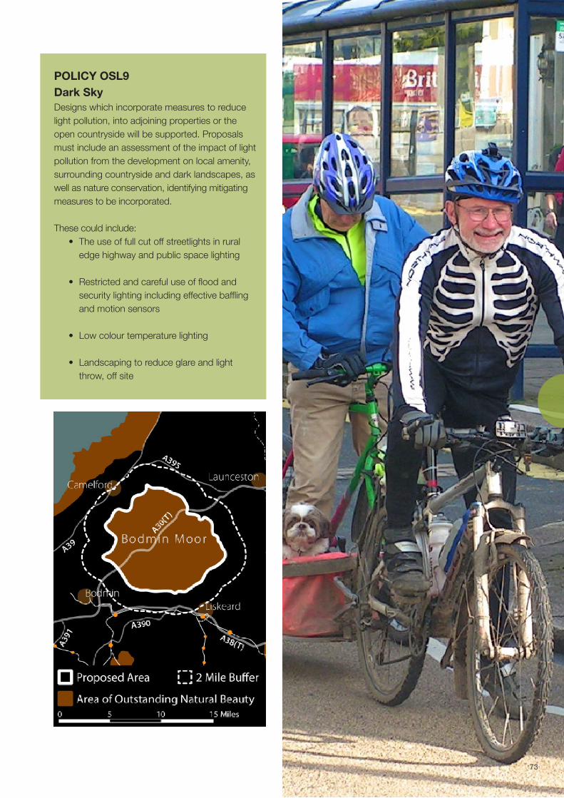
POLICY OSL9Dark Sky Designs which incorporate measures to reducelight pollution, into adjoining properties or theopen countryside will be supported. Proposalsmust include an assessment of the impact of lightpollution from the development on local amenity,surrounding countryside and dark landscapes, aswell as nature conservation, identifying mitigatingmeasures to be incorporated.
These could include: • The use of full cut off streetlights in rural edge highway and public space lighting • Restricted and careful use of flood and security lighting including effective baffling and motion sensors
• Low colour temperature lighting
• Landscaping to reduce glare and light throw, off site
73

Reasoned JustificationPolicy OSL8 – The landscape surrounding Liskeardhas escaped the plot and paddock landfragmentation often associated with the urban fringeand by-pass development, providing a setting whichis highly valued locally and through which pass theCaradon Trail and the proposed Looe Valley Trail,enabling re-connection with the landscape andheritage of the area. Developments which mightcause the blockage or relocation of these routes ortheir connections with the town, spoil theappearance of the routes, harm the heritage valueof features, and reduce the safety and convenienceof users, is undesirable.
The settings of World Heritage Sites are recognisedas making a fundamental contribution to theirOutstanding Universal Value and the agreedStatement of Outstanding Universal Value is anessential reference point when consideringdevelopment affecting the setting of a WorldHeritage Site. Cornwall & W Devon mininglandscape supplementary planning doc. (draft Feb.2016) states that “ policy frameworks at all levelsshould conserve the outstanding universal value,integrity & authenticity of each WHS and its setting,given that WHS are designated heritage assets ofthe highest significance.”
Policy OSL9 - National Planning Policy Framework(para 125) says that ‘by encouraging good design,planning policies and decisions should limit the
impact of light pollution from artificial light on localamenity, intrinsically dark landscapes and natureconservation’. Careful design can also contribute tothe proposed ‘Dark Sky Park’ initiative BodminMoor, the proposed buffer zone which enters theLiskeard Neighbourhood Development Plan area.
Policy OSL10 - to the west and north of the townlies the locally cherished landscape including theWorld Heritage Site Liskeard & Caradon railwaytrack-bed and Ladye Park/Old Park valley with itsassociated Ducal deer park, and the historicallysignificant Moorswater valley. These importantlandscapes are highly valued locally for theircontribution to character and the distinctiveness ofLiskeard and should be retained, respected andenhanced. They are considered to be of equal andin places superior quality to the already designatedArea of Great Landscape Value north fromTreworgey to St Cleer and also forms an importantpart of the distinctive setting of Liskeard.
National Planning Policy Framework says thatpolicies may “identify and protect areas of tranquilitywhich have remained relatively undisturbed by noiseand are prized for their recreational and amenityvalue for this reason” (NPPF para 123). This isreiterated in Cornwall Local Plan Policy 23 whichsays that “Development must take into account andrespect the sensitivity and capacity of the landscapeasset, considering cumulative impact and the wishto maintain dark skies and tranquility in areas thatare relatively undisturbed”
The ‘Liskeard Town Framework’ and ‘CornwallCouncil’s Historic Environment data sheet 2011’ forLiskeard and Looe refer to the need for furtherstudies/assessment of Liskeard’s heritage andlandscape hinterland. The latter includes commentson Liskeard’s setting 'on its hilltop overlooking widetranches of landscape as an importantcharacteristic‘ and mentions missing evidence,threats and proposed projects e.g. ‘threats tolandscape setting and development on skylinearound the outer limits’. (The CLP also showsrespect for “physical boundaries of existingsettlements,” such as the elevated northern edge ofthe town which looks down into the Ladye Valleyand across to the AGLV, seeking to provideprotection from inappropriate development intoopen countryside).
POLICY OSL10Area Of Local Landscape And Heritage Value The area between the development limit and theCaradon AGLV,( CL8 & 9 saved policies), isdesignated as an area of local landscape andheritage value with a view to future redesignation asan extension to the area of great landscape value. Within this area any permitted development shouldrecognise and respect the landscape character,pattern and scale of settlement, and reflect thetraditional building styles, materials and design ofthe local area . Proposals to create greater recreational linkages inthe form of permissive paths connecting to theexisting network of paths and bridleways, signageand interpretive material will be supported. .
74
The document above points out that the underlyingstructure of the area remains medieval or earlier. Thispaper emphasises that the areas beyond the urbancentres and around Bodmin Moor are under studiedand that an historic landscape characterisationstudy is required (which has not been carried out todate) which would provide a detailed assessment ofthe heritage assets and setting of the rural hinterlandof Liskeard.‘Planning Future Cornwall Growth Factors Liskeardand Looe CNA version 2 2013’, says that ‘studiesare required on the Liskeard and Looe streetscape,links to world heritage site, conservation areas,&historic landscape character reviews’.Cornwall local plan (Oct 2016) policy 23a states theintention to reassess the extent of each Area ofGreat Landscape Value “to inform and producestrong revised statements of these localdesignations of landscape value.”
Liskeard people see this area as a valuable localresource – it has quiet, Cornish lanes, abundance offlora and fauna and sweeping landscape views andas such is well-used and enjoyed by walkers,cyclists, horse riders, running groups, families withbuggies, dog walkers etc. thus contributing to thelocal communities 'health and well-being’ ( One ofNPPF core planning principles and CLP policy 17). Itis traversed by the designated Caradon heritagetrail, forming a green corridor that supports bothrecreation and nature conservation. This areasprotection and enhancement could also provide
economic benefits to the town through its attractivesetting and heritage assets, especially the WorldHeritage Site railway track bed link.
CommentA ‘dark sky park’ is an area of land that isrecognised internationally as having an exceptionalor distinguished quality of starry nights and anocturnal environment that is protected for itsscientific, natural, educational, cultural heritage,and/or public enjoyment. As well as helping toprotect the night sky from light pollution, Dark Skydesignation provides a focus for awareness andlearning about the stars and solar systems, bringhealth and bio-diversity benefits, and provide anopportunity for local tourism. Within and on theboundaries of such Parks, steps to reduce lightpollution, such as Installing lights that point downnot up, turning lights off when not needed, usingautomatic timers and only lighting where necessary,are encouraged. Recent light readings show thequality of the night sky over Bodmin Moor isamongst the best in the world. The current proposalis for the core area to follow the designated BodminMoor Area of Outstanding Natural Beauty (AONB)boundary, with a 2 mile buffer area around this inwhich good lighting practice would be encouragedand where communities would also be expected toreap some of the benefits. That 2 mile bufferincludes the northern part of the LiskeardNeighbourhood Plan area.
75

OBJECTIVE 5Make provision for enhanced connectivity throughout the town and into the near countryside by:
a) Facilitating safe access for walkers, cyclists, horse- riders & others including crossings b) Designation of footpaths, bridleways, trails, quiet lanes and green corridors c) Protecting and enhancing designated trails (Caradon Trail) and supporting creation of new ones
(Round Liskeard Trail, Looe Valley Trail), as part of leisure and sustainable transport strategies
POLICY OSL11BProtection Of Pedestrian, EquestrianAnd Cycle Links And CorridorsDevelopment which would adversely impact on theroute and setting of the round Liskeard Trail and linksto Caradon and Looe Valley cycle trail, in terms of itslocation, functional connection, appearance, heritagevalue and interpretation, and the safety of pedestrianand cyclist users, will be not be permitted.
Reasoned JustificationLiskeard has a series of open spaces scattered in valleysand hilltops across the town, the linking of these areaswill from an important way of being able to enjoy thembetter as well as providing an important green networkthat will support biodiversity. The aim is to improve theselinks as comfortable walking and, where possible, cyclinglinks. As well as the physical ability of local residents toaccess natural green space it is important to addresshow equal access to nature is for different groups in the
community. Emotional connectivity, whilst not a spatialplan issue, will be enhanced through better physicallinkages. NPPF Para 125 and policy 23 of CornwallLocal Plan, quoted earlier, are relevant here also.
Comment. These linkages may be main roads withspace for avenue tree planting and space for good cyclelanes, or at times they may be narrow lanes with lowtraffic volumes or alleys that have been built into housingestates. Importantly too there are a range of old greenlanes such as Sungirt Lane, Lanchard or Boveway Lanes,that have become part of the fabric of the town and actas regular public footpaths. Crossing points at busyroads need to be provided with traffic islands and dropkerbs, and planting improved and managed to enhancetheir amenity and natural habitats wherever possible
Where appropriate, investment through planningobligations related to developments which bringadditional population to Liskeard will be directedtowards new or improved pedestrian and cycle linksand corridors that form part of this network.
"Local amenities" are: shops and services, a primary [orsecondary] school with available places, healthcarefacilities, cultural, religious and recreational facilities,libraries, places of worship, cinemas, sports &community centres, evening classes, play parks andopen spaces, rail station, and regular bus-service stop.
POLICY OSL11APedestrian, Equestrian And Cycle LinksAnd Corridors When formulating S106 agreements associated withnew residential development, consideration shouldbe given to the inclusion of proposals that provideor support facilities that form part of the strategicpedestrian, equestrian and cycle network forLiskeard in order to:
a) Create new and improve existing walking, equestrian and cycling connections where routes are disjointed, enhance surfaces, and create safe priority road crossings and/or inline highway routes;
b) Create new designated footpaths, bridleways and cycle paths to improve the movement network for these modes and enhance permeability; and
c) Create direct and safe routes to local amenities
d) Provide linkages or safe road crossings between parts of existing or proposed routes
e) enhance the function and appearance of designated quiet lanes
76

PROJECT 3Walking, equestrian and cycling localinfrastructure plan for LiskeardPartner with Cornwall Council, Sustrans, RamblersAssociation, East Cornwall Riding Club (and otherrelevant bodies such as Living Streets, Walkers areWelcome, Cornwall Cycle Club etc) to prepare awalking, equestrian and cycling local infrastructureplan for Liskeard as figure 37, in collaboration withthe Highway Authority, including:
a) Quiet lanes – designation and traffic calming b) Caradon Trail c) Round Liskeard Trail d) Connecting the Caradon Trail and new round Liskeard Trail to a new Looe Valley Canal Cycle Trail. e) Green Avenues f) Pedestrian improvements to busy streets
PROJECT 8Liskeard street design guideIn partnership with Cornwall Council Highways andtheir contractors/consultants, develop a simpledesign guide/strategy plan for town centre streetdesign and asset management in order to conservethe traditional character of our street elementswhilst enhancing pedestrian, and cycle access thatassists the viability and vitality of the town.
77

OBJECTIVE 6Support the enhancement of community leisure facilities in and around the town by: a) Protection of existing sites, and allocation of land for additional ones b) Developing Cattle market hub ‘the Shed’ as part of overall redevelopment of site c) Enhancing orchards and allotments supporting indoor soft play/bowling d) Supporting events/live music in Westbourne Gardens, Castle Park and Sungirt Woods
POLICY OSL12Protection Of Existing Cultural,Community, Arts, Recreational AndSports And Leisure Facilities The loss of existing community, sport, leisure andrecreational facilities will be not be permitted,unless replacement facilities of at least equivalentvalue in terms of quality, accessibility and cost ofaccess are provided and fully commissioned tothe satisfaction of the planning authority inconsultation with the town council before theexisting facilities are closed.
POLICY OSL13Provision Of Additional Cultural,Community, Arts, Recreational AndSports And Leisure FacilitiesThe inclusion of new community facilities in newdevelopments and redevelopments within thetown centre, in particular facilities that provide forcinema, high quality indoor leisure such asbowling and soft play for young children withinthem will be supported provided that they:
a) Are designed in a way that integrates them into the historic built environment;
b) Provide for their flexible use as community and other facilities, and
c) Are well linked by public transport and by pedestrian and cycle access routes to all town neighbourhoods
Reasoned JustificationCultural, community, arts, recreational and sportsand leisure facilities are important to the health andwell-being of communities and therefore an essentialpart of the ‘social infrastructure’ of a town. It isimportant that these facilities and services areaccessible to all.
Policy OSL12 –Policy 4.3 of the CLP 2016 says thatthe loss of community facilities will only beacceptable where there is no need for the facility orservice or it is not viable or adequate facilities orservices exist or the service can be re-provided inlocations that are similarly accessible by walking,cycling or public transport. Policy OSL12 is intendedto clarify this policy to make it clear that replacementfacilities should be at least equivalent to those beinglost, what criteria and timescales should be involved,and that the Town Council as a local service providershould be involved in any judgement made.
Policy OSL13 - Any population growth must besupported by adequate ‘social infrastructure’. Nonsport leisure and other cultural provision, whether forarts or performance, conferences or presentation, isprovided in general purpose buildings such asLiskerrett Community Centre and the Public Hall inthe town. These buildings tend to be inflexible andare largely difficult to access for disabled users. Theschool provides halls for hire though these are againdifficult to provide full public access to when duringschool terms. There is little ability to provide forrelaxed or boutique entertainment or leisure activitiessuch as pop up cinema, theatre in the round,conferencing with modern facilities for business use,or for quality exhibition space. There is potential with land aggregation and publicproperty rationalisation around the cattle market tocombine or share public and community uses in amulti-purpose type building in the town centre thatwould provide a communal arts and cultural hub,adaptable for theatre, conferences, community andoffice use.
78
Comment. Where appropriate, investment throughplanning obligations related to developments whichbring additional population to Liskeard will bedirected towards new cultural, community, arts andrecreational facilities.
Reasoned JustificationLiskeard has important social, economic and physical linkswith Cornish mining heritage and these provide anopportunity to develop an ‘offer’ to the residents that willhelp embed a stronger sense of place and cultural heritagefor Liskeard’s community with benefits for health and well-being, whilst promoting tourism visits to the town for thebenefit of the local economy.
Comment This project will build upon the excellent workalready in place as a result of the Caradon Hill HeritageProject and the wider World Heritage Site initiative.
PROJECT 6 WHS Interpretation And Local Marketing Prepare and implement an interpretation strategy tomarket, educate and raise awareness of the worldheritage site and related to the heritage assets of thetown and surrounding countryside. Link this to directionsigning and information regarding sustainable movementroutes for residents and visitors in order to enhanceknowledge and appreciation of the locality and supportthe local economy.
Policies OSL8, OSL10, Projects 3 & 4 are also relevant
OBJECTIVE 8Promote Liskeard as a destination for locals and visitors to support the local economy and increasefootfall by: a) Well-publicised walks & trails (eg Henry Rice) as well as marketing formal leisure facilities b) Promoting designated trails (eg Caradon Trail) and the World Heritage Site c) Creating new trails (eg Round Liskeard Trail, Looe Valley Cycle Trail)
79