Embed Size (px)
Citation preview
A method for optimizing collection, transfer and transport routes of
waste using OSGeo software
Sasa Dunovic, Ljiljana Vukic, Goran Trbic
Civil Engineering Institute „IG“ Ltd, Banja Luka
University of Banja Luka, Faculty of Technology, Banja Luka
University of Banja Luka Faculty of Sciences, Banja Luka, Republika Srpska, B&H
Introduction
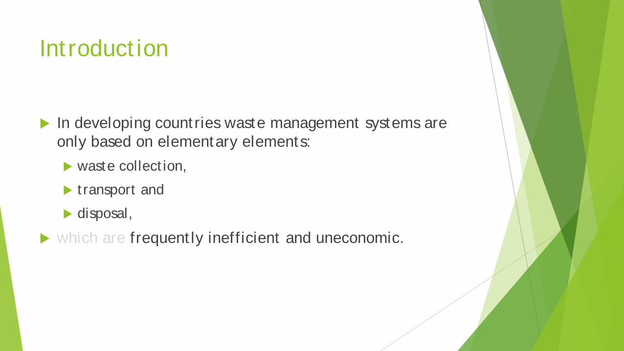
In developing countries waste management systems are only based on elementary elements:
waste collection,
transport and
disposal,
which are frequently inefficient and uneconomic.
Introduction
These three elementary functional elements represent activities that generate the highest costs even in the highly developed systems, whereas in less developed systems they represent the majority of waste management costs.
Many authors have based their research on increasing efficiency of waste collection and transport process because they were established to be the most expensive functional elements in the entire waste management process.
Introduction
From their results, we can conclude that in the solid waste management optimisation process, equal attention should be paid to both:
the collection process and
the process of waste transport to the location of final waste treatment or disposal.
Introduction
The mentioned overview in this paper of similar researches leads to a conclusion that many methods are used for routes optimisation for waste collection, transfer and transport.
Some of these methods are used in the combination with GIS, such as: ArcGIS Network Analyst, MapInfo, MapPoint, whereas others are used as mathematical algorithms for calculations and quantitative valuation of some solutions.

Introduction
Methods that are used in the combination with GIS are mostly commercial, computer, programme solutions that often are not available to a wider circle of users because of their price.
Second group of methods, available mathematic algorithms, are used by a low number of users because of their complexity.
Materials and methods
This paper presents a new method for optimizing the waste collection vehicles routes in the regional system of solid waste management, waste transfer and transport, based on:
The Open Source Geospatial Foundation (OSGeo) software tools and data of OpenStreetMap (OSM)
integrated into geographic information system (GIS).
The main objective of this study was to show the usefulness of OSGeo software tools and data of OSM to optimize the waste collection, transfer and transportvehicles routes.
Materials and methods
In the concrete case QGIS was used as a tool for data collection, storing, processing and visualisation, but also other computer programmes such as
PostgreSQL to create databases,
PostGIS to enable spatial components of the database and
pgRouting, which represents a group of mathematic algorithms for network analyses.
Apart from these, GRASS GIS was used to find a more advanced resolution to certain network analysis problems.
Materials and methods
PostgreSQL programme represents the object-relational database management system
PostGIS spatially enables the PostgreSQL object-relational database management system
pgRouting is a special extension of PostGIS programme, which enables network structures research
All these programmes, except PostgreSQL, are developed under the umbrella of The Open Source Geospatial
Foundation, or OSGeo.
Materials and methods
The simulation of optimal waste collection vehicles route was made by reducing collection problems in the classic travelling salesman problem (TSP), which was solved with one of the functions from pgRouting extension of geospatial database.
However, since pgRoutig is currently solving this problem taking only Euclidean distance into account the precision of acquired results was improved by the analysis with the aid of the GRASS GIS module tool, v.net.salesman, which calculates optimal routes of visiting individual location in the network, e.g. roads, taking costs into account.
Materials and methods
Driving distance function, one of many functions in the pgRouting programme was used for the needs of defining optimal regional landfill location, which can be presented as optimised accessibility from town centres in a region in a certain length of time, length of road etc.
With the aid of Dijkstra algorithm this function calculates the shortest paths along roads to several points that represent certain junctions on roads.
Materials and methods
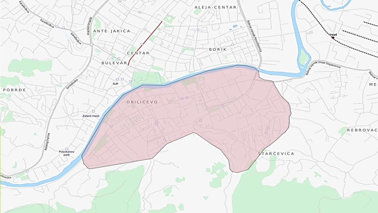
Waste collection methods were researched in the territory of the settlement of Obilićevo and partly settlement of Starčevica, meaning, one of five territorial units of the City of Banja Luka, which were formed in line with the Rulebook of the Assembly of the City as units where waste collection, method and frequency are organised.
The studied area covers an area of 6.2 square kilometers.
Materials and methods
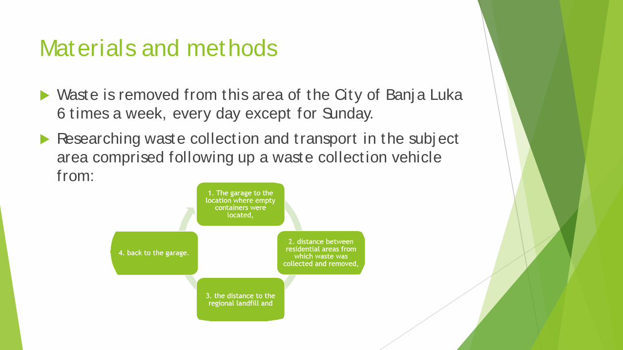
Waste is removed from this area of the City of Banja Luka 6 times a week, every day except for Sunday.
Researching waste collection and transport in the subject area comprised following up a waste collection vehicle from:
Materials and methods
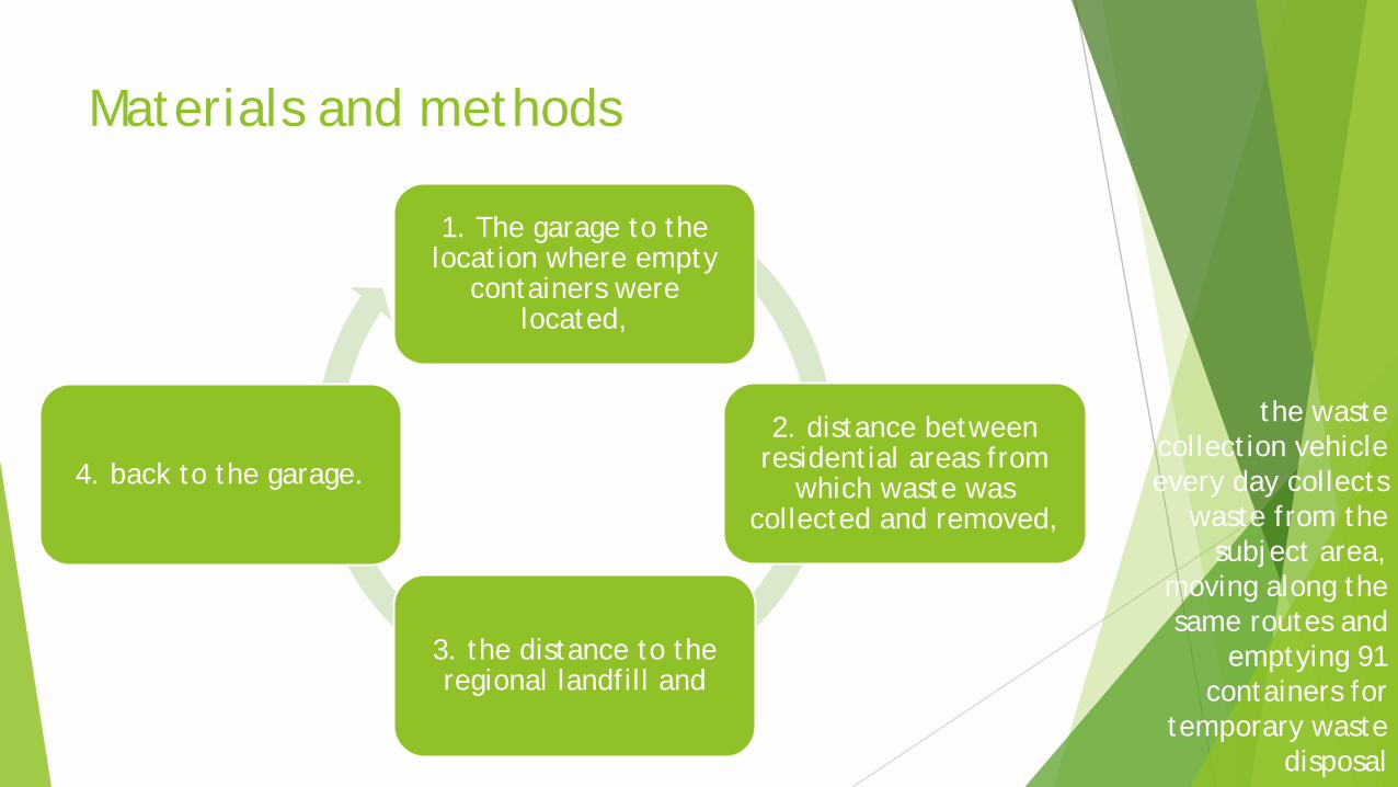
1. The garage to the location where empty
containers were located,
2. distance between residential areas from
which waste was collected and removed,
3. the distance to the regional landfill and
4. back to the garage.
the waste collection vehicle every day collects
waste from the subject area,
moving along the same routes and
emptying 91 containers for
temporary waste disposal
Materials and methods
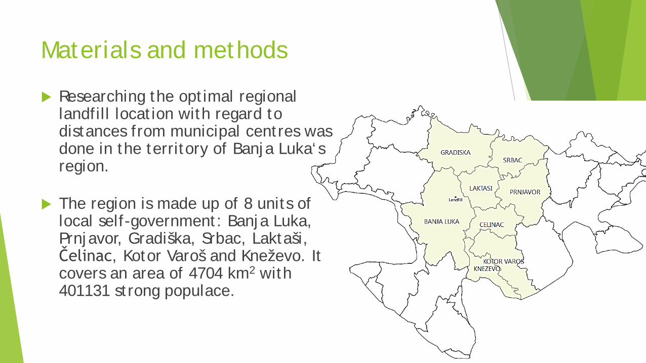
Researching the optimal regional landfill location with regard to distances from municipal centres was done in the territory of Banja Luka‘s region.
The region is made up of 8 units of local self-government: Banja Luka, Prnjavor, Gradiška, Srbac, Laktaši, Čelinac, Kotor Varoš and Kneževo. It covers an area of 4704 km2 with 401131 strong populace.
Results and discussion
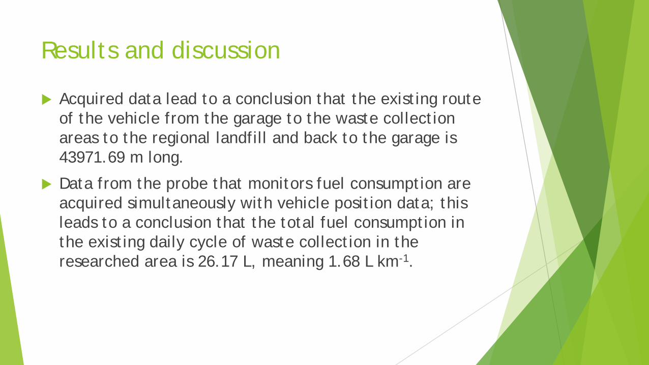
Acquired data lead to a conclusion that the existing route of the vehicle from the garage to the waste collection areas to the regional landfill and back to the garage is 43971.69 m long.
Data from the probe that monitors fuel consumption are acquired simultaneously with vehicle position data; this leads to a conclusion that the total fuel consumption in the existing daily cycle of waste collection in the researched area is 26.17 L, meaning 1.68 L km-1.
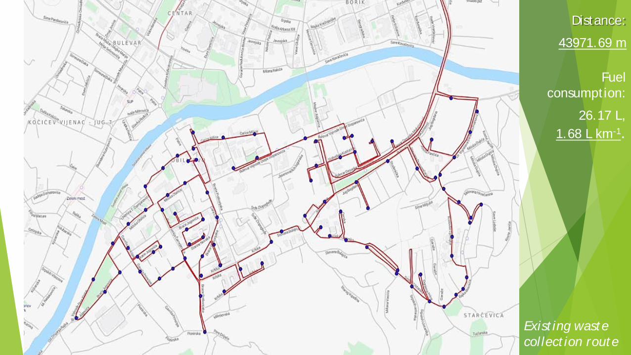
Distance:
43971.69 m
Fuelconsumption:
26.17 L, 1.68 L km-1.
Existing waste collection route
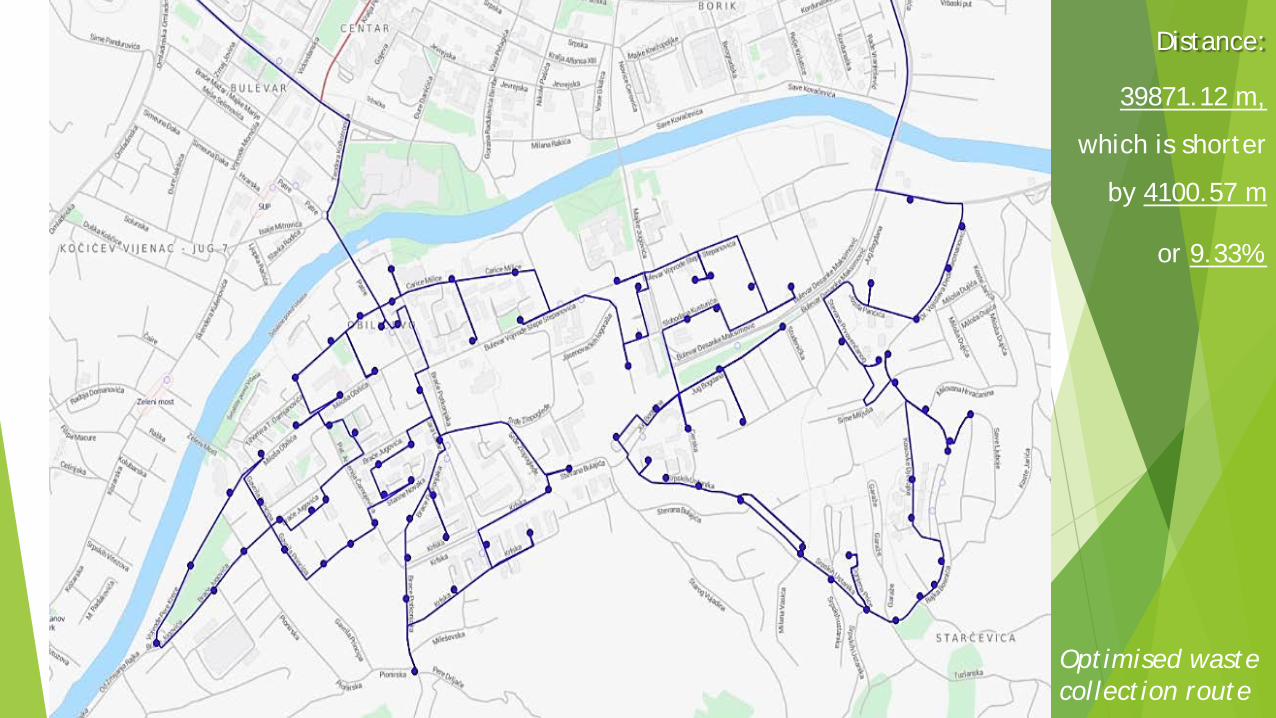
Distance:
39871.12 m,
which is shorter
by 4100.57 m
or 9.33%.
Optimised waste collection route

Results and discussion
Optimised collection route may be 15.55% shorter in comparison to the longer, now applicable route.
Optimised transport route may be 3.51% shorter.
The combination of optimal transport and optimal waste collection routes would be shorter by 9.33%, for the same operations.
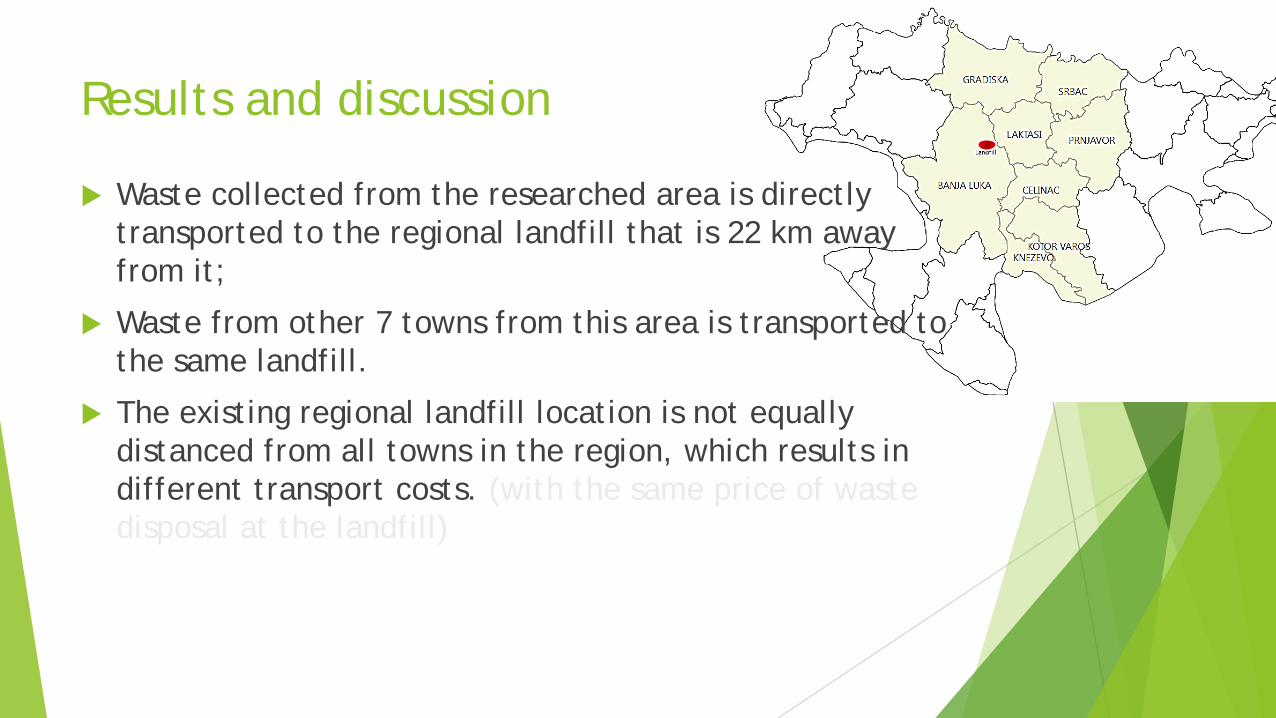
Results and discussion
Waste collected from the researched area is directly transported to the regional landfill that is 22 km away from it;
Waste from other 7 towns from this area is transported to the same landfill.
The existing regional landfill location is not equally distanced from all towns in the region, which results in different transport costs. (with the same price of waste disposal at the landfill)
Results and discussion
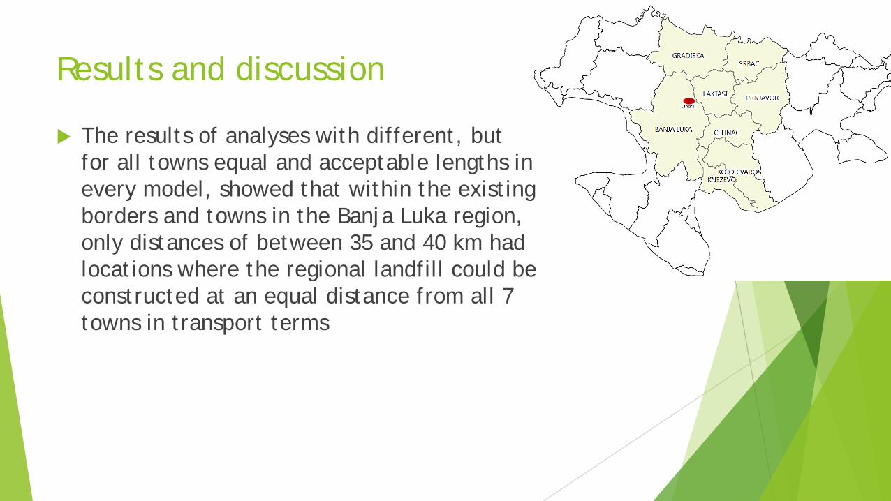
The results of analyses with different, but for all towns equal and acceptable lengths in every model, showed that within the existing borders and towns in the Banja Luka region, only distances of between 35 and 40 km had locations where the regional landfill could be constructed at an equal distance from all 7 towns in transport terms
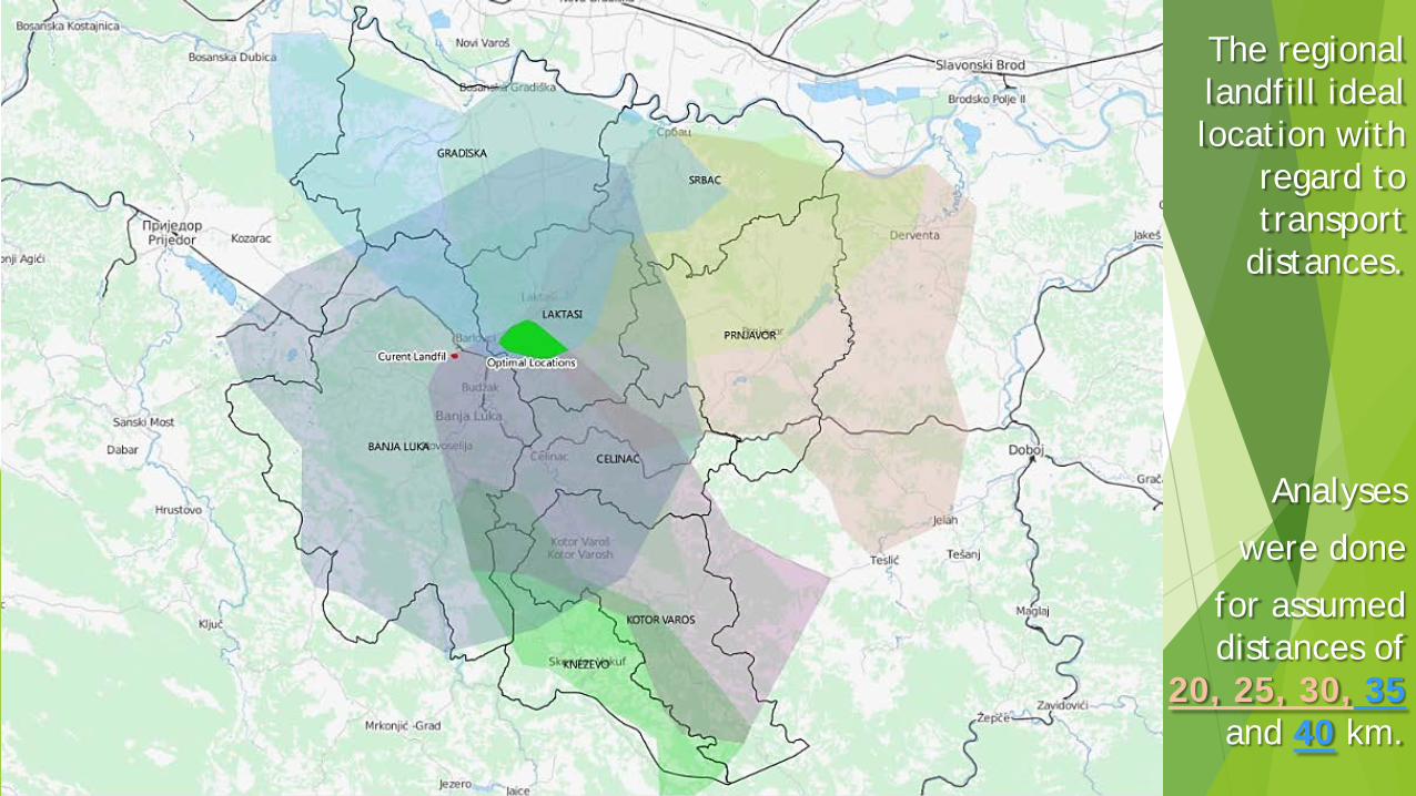
The regional landfill ideal location with
regard to transport
distances.
Analyses
were done
for assumed distances of
20, 25, 30, 35and 40 km.
Conclusion
Modelling the ideal regional landfill location in this paper was only done for a simple condition of equal distances in order to show usability of subject methodology.
However, in the created special and transport model it is possible to make other tests, and include other factors in analyses, which are closely related to waste management costs such as:
fuel consumption on some routes,
velocity,
transported waste quantity etc.

Conclusion
Used software tool and data on roads network are free and publicly available,
The presented optimization methodology is applicable everywhere, which is especially significant for developing countries.
Through the application of described methods, authorized operators and municipalities can achieve optimal exploitation of their resources having respect for economic, environmental and social factors that are related to waste management.