Embed Size (px)
Citation preview
A Hell of a Place:
How the West Went to the Devil
By Patrick Cone
When you’re going through Hell, keep going”
Winston Churchill
What the Hell is up with The American West? While this rugged land is
known for its self-reliance, conservative values, and Godliness, judging from the
maps, it is closer to Hell than Heaven. It’s a Hell of a Place.
In the American West you can cook your breakfast in Devil’s Kitchen, float
through Hells Canyon, and end up in Purgatory. You can climb Mt. Diablo, visit
Colter’s Hell, and gaze deep into Devil’s Hole. There are literally thousands of places
in the American West named after Hell or the Devil. There are slides, acres, towers,
gardens, holes, playgrounds, gates, doors, and highways, and many more. What
possessed these frontier civilizations to honor the underworld with such
expletively-named geography?
Well, Native Americans, Spanish, and Anglo-Americans created these names
for a number of reasons: the utility of geography, an expression of spirituality, or the
exertion of power. Then, successive civilizations renamed these sites, a process that
continues to this day.
2
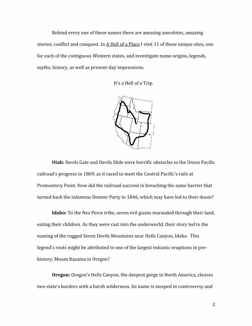
Behind every one of these names there are amusing anecdotes, amazing
stories, conflict and conquest. In A Hell of a Place I visit 11 of these unique sites, one
for each of the contiguous Western states, and investigate name origins, legends,
myths, history, as well as present-day impressions.
It’s a Hell of a Trip.
Utah: Devils Gate and Devils Slide were horrific obstacles to the Union Pacific
railroad’s progress in 1869, as it raced to meet the Central Pacific’s rails at
Promontory Point. How did the railroad succeed in breaching the same barrier that
turned back the infamous Donner Party in 1846, which may have led to their doom?
Idaho: To the Nez Perce tribe, seven evil giants marauded through their land,
eating their children. As they were cast into the underworld, their story led to the
naming of the rugged Seven Devils Mountains near Hells Canyon, Idaho. This
legend’s roots might be attributed to one of the largest volcanic eruptions in pre-
history, Mount Kazama in Oregon?
Oregon: Oregon’s Hells Canyon, the deepest gorge in North America, cleaves
two state’s borders with a harsh wilderness. Its name is steeped in controversy and
3
shrouded in mystery, but attracts thrill-seeking adventurers to this rugged gorge,
beneath the Seven Devils Mountains.
Washington: A prehistoric eruption so terrified Puget Sound natives that
they named the mountain for their own bad spirits, and wouldn’t hunt or travel near
it. Enumclaw, Washington, has taken this name as its own. Do they perpetuate this
legendary name under the shadow of a string of volcanoes which doze fitfully above
the town?
California: High above the eastern hills of San Francisco Bay, Mount Diablo’s
name is a relic of early Spanish conquest, superstition, monsters and evil spirits. But
what spirits haunt Mount Diablo’s lofty heights, and what legend terrified the first
Spanish explorers to California? And on which night, every year, does tower beacon
shine?
Nevada: Devil’s Hole stands as an oasis in the stark desert landscape just a
hangover away from fabulous Las Vegas. This remnant of the last glacial age its cool
water quenched the thirst of animals and pioneers, but has also taken lives.
Arizona: Early 16th Century Spanish explorers named El Camino del Diablo
for its harsh climate, dangerous desert, and a number of excruciating deaths. Why is
this name now reclaiming its legacy, as immigrants from the south try to reach the
Estados Unidos?
New Mexico: Governor Bill Richardson renamed U.S. Highway 666 in New
Mexico, hoping to put to the rest the superstition of hazard and death that rolled
4
down its asphalt strip. Known as the Devils Highway, 666, was well known for
violent death, unusual occurrences, and mysterious mayhem. Did renaming the road
solve these riddles and make its transit safe from the Devil’s mark?
Colorado: In southern Colorado, a 16th century Spanish expedition,
searching for Cibola gold, perished in a canyon maze of arid badlands. When the sole
survivor returned after years with the natives, the canyon was memorialized for
their lost souls, as El Rio de las Animas de Purgatoire: the River of the Lost Souls in
Purgatory. Today the canyon, once a major thoroughfare for migration, is
abandoned. A broken-down adobe church and graveyard of the priests are the only
human signs for miles. The name has spread to include the Purgatory River, and the
Picketwire Canyon.
Wyoming: A prominent volcanic butte, a native spiritual site known as the
Bears Tipi, became a symbol of the Devil, and the natives themselves, to the white
man. Who wants the original name of Devils Tower returned, and who is fighting
the name change? Nevada: Devils Hole brought life to desert travelers, and death to
others. This oasis and remnant of past prehistoric lakes still holds many secrets.
Montana: In the early 1800’s, mountain man John Colter lent his name to a
boiling, smelly, geothermal spring near Cody Wyoming, on the shores of the Shosone
River. Today it is inactive, but its name now broadly applies to all of the Greater
Yellowstone region. Was this intentional or accidental, and who borrowed this name
to help attract visitors?
5
LIST OF COMPETING BOOKS
There are none.
LENGTH OF BOOK
Total number of pages = 140
Number of color/b&w photographs and illustrations = 25
Number of black/white maps = 6
Number of backmatter pages = 11
TABLE OF CONTENTS
Introduction: The American West as a playground of the Devil.
Section 1: No Angels, Just Demons
Chapter 1: What the Hell?
Western Landscapes, Our Sense of Place, and the
Demonic Naming of the American West
Chapter 2: Who the Hell?
Natives, Spaniards and the Americans
Chapter 3: Where the Hell?
A Hell of a Road Trip, A Friend of the Devil
Section 2: Native Lands: Before the Storm
Chapter 4: Bad Spirits: Enumclaw, Washington
Chapter 5: Matea T’ipila: Devils Tower, Wyoming
Chapter 6: The Monsters Beneath: Seven Devils, Idaho
Section 3: El Norte: The Spanish in America
Chapter 7: A Harsh Death: El Camino Del Diablo, Arizona
Chapter 8: Lost: El Rio de Las Animas Perdidas en Purgatoire, Colorado
Chapter 9: Peligro! : Mount Diablo, California
6
Section 4: Westward: The American Invasion
Chapter 10: The Abyss: Hells Canyon, Oregon
Chapter 11: Hellroaring: Colter’s Hell, Montana/Wyoming
Chapter 12: A Hell of a Road: Devils Slide and Devils Gate, Utah
Chapter 13: A Friend of the Devil: Devils Hole, Nevada
Chapter 14: The Highway to Hell: U.S. 666, New Mexico
Conclusion: Are we still going to Hell? Why tourists love Hell.
Appendix A: A state-by-state listing of every Western demonic place name: including maps and geographic coordinates
Sources: A list of books, articles, and interviews, for further reading
Maps
The 11 Western states showing all sites.
The spread of civilizations across the West.
The Dougherty mountain man map of 1813
Photographs
Matea Tipil’a (Devils Tower), Wyoming
Mount Enumclaw, Washington
Seven Devils Mountains, Idaho
Picketwire Canyonlands, Colorado
Mount Diablo, California
Hells Canyon, Oregon
Firehole Lake and Colters Hell, Yellowstone
Devils Slide and Devils Gate, Utah
Devils Hole, Nevada
Quitobaquito Spring, El Camino del Diablo, Arizona
U.S. Hwy 491 (666), New Mexico
7
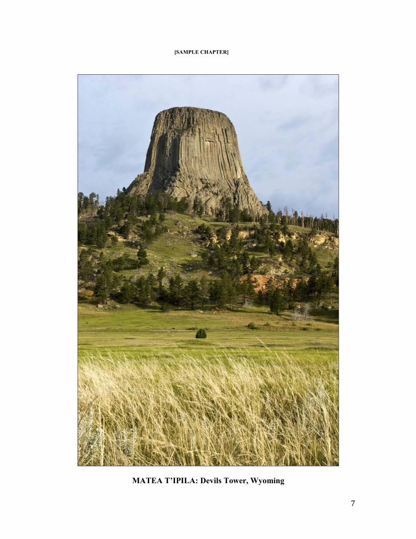
[SAMPLE CHAPTER]
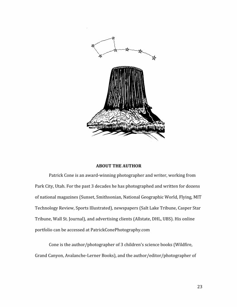
MATEA T’IPILA: Devils Tower, Wyoming
8
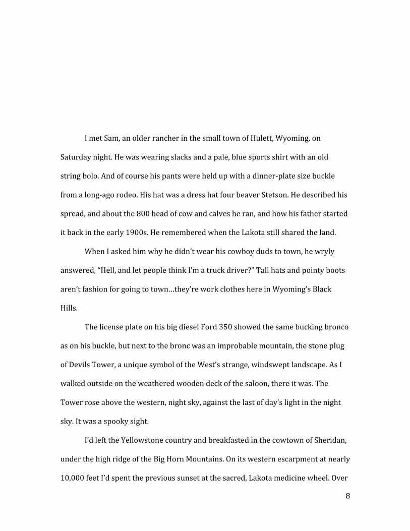
I met Sam, an older rancher in the small town of Hulett, Wyoming, on
Saturday night. He was wearing slacks and a pale, blue sports shirt with an old
string bolo. And of course his pants were held up with a dinner-plate size buckle
from a long-ago rodeo. His hat was a dress hat four beaver Stetson. He described his
spread, and about the 800 head of cow and calves he ran, and how his father started
it back in the early 1900s. He remembered when the Lakota still shared the land.
When I asked him why he didn’t wear his cowboy duds to town, he wryly
answered, “Hell, and let people think I’m a truck driver?” Tall hats and pointy boots
aren’t fashion for going to town…they’re work clothes here in Wyoming’s Black
Hills.
The license plate on his big diesel Ford 350 showed the same bucking bronco
as on his buckle, but next to the bronc was an improbable mountain, the stone plug
of Devils Tower, a unique symbol of the West’s strange, windswept landscape. As I
walked outside on the weathered wooden deck of the saloon, there it was. The
Tower rose above the western, night sky, against the last of day’s light in the night
sky. It was a spooky sight.
I’d left the Yellowstone country and breakfasted in the cowtown of Sheridan,
under the high ridge of the Big Horn Mountains. On its western escarpment at nearly
10,000 feet I’d spent the previous sunset at the sacred, Lakota medicine wheel. Over
9
80 feet in diameter with 28 rock spokes it foretold the Sun ceremonial days by the
direction of the sunrise. It was like being on top of the world, in fact I bet on a clear
day you could see the back of your own head!
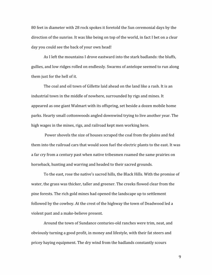
As I left the mountains I drove eastward into the stark badlands: the bluffs,
gullies, and low ridges rolled on endlessly. Swarms of antelope seemed to run along
them just for the hell of it.
The coal and oil town of Gillette laid ahead on the land like a rash. It is an
industrial town in the middle of nowhere, surrounded by rigs and mines. It
appeared as one giant Walmart with its offspring, set beside a dozen mobile home
parks. Hearty small cottonwoods angled downwind trying to live another year. The
high wages in the mines, rigs, and railroad kept men working here.
Power shovels the size of houses scraped the coal from the plains and fed
them into the railroad cars that would soon fuel the electric plants to the east. It was
a far cry from a century past when native tribesmen roamed the same prairies on
horseback, hunting and warring and headed to their sacred grounds.
To the east, rose the native’s sacred hills, the Black Hills. With the promise of
water, the grass was thicker, taller and greener. The creeks flowed clear from the
pine forests. The rich gold mines had opened the landscape up to settlement
followed by the cowboy. At the crest of the highway the town of Deadwood led a
violent past and a make-believe present.
Around the town of Sundance centuries-old ranches were trim, neat, and
obviously turning a good profit, in money and lifestyle, with their fat steers and
pricey haying equipment. The dry wind from the badlands constantly scours
10
everything here: anything not nailed down is long gone over the state line to
Montana a few dozen miles to the north.
I’m sure that if the wind ever stopped, every barn, person, horse, and cow in
the state would fall right over. Everything but Devils Tower, that is.
On the northwest side of the Black Hills, at the foot of the Bear Lodge
Mountains, tucked along the Belle Fourche River’s red cutbanks and coulees,
protected by jagged rocks and cactus and rattlesnakes, an ancient volcanic plug is
rooted to the ground and stone beneath. It’s not ever going to budge, no matter how
strong the wind.
The tower was formed 30 million years ago when a molten, igneous intrusion
pushed upwards towards the surface. It cooled, and the softer, overriding layers
eroded away. The phonolite porphyry (a type of basalt) formed a volcanic trachea
that rises gracefully from the plains. Its fluted, hexagonal columns rival any ancient,
manmade temple.
The first sight of the tower always takes my breath away. As a young
geologist in the Black Hills decades ago I vividly remember. I wasn’t sure if it was
real, this, this stone naked on the horizon. Unworldly, I thought, as obviously have
others. Kiowa ative Momaday described his first view of his spiritual totem:
A dark mist lay over the Black Hills, and the land was like iron. At the top of
the ridge I caught sight of Devils Tower up thrust against the gray sky as if in
the birth of time the core of the earth had broken through its crust and the
11
motion of the world was begun. There are things in nature that engender an
awful quiet in the heart of man: Devils Tower is one of them.
While millions of high schools murmur “awesome” at everything, this is
something that literally instills awe.
Western explorers, miners, settlers, and tourists see many unreal landscapes:
canyon, cliff, pinnacle, mesa. It’s a shocking contrast to the verdant, grassy, Eastern
or English countryside from which they had immigrated.
The planet’s fabric has been torn away, revealing everything underneath. It’s
a geographic fan dance of revelation. The soft clothing of forest and grassland are
gone. The rocks have been scoured and thrown high by persistent, unrelenting
geologic force. The landmarks suspend belief, reveal nature’s power, and have
sparked many a spiritual revelation.
Devils Tower acre-size, level summit is the ultimate altar; a spiritual power
spot, long familiar and worshipped by Native American cultures. For some of the
500,000 modern tourists, making their own pilgrimages to the West’s national
parks, it instills a reverence for the natural world. It is also well known for an extra-
terrestrial visitation, as others recognize it as the spot aliens made contact from the
Spielberg movie Close Encounters of the Third Kind.
While that may its future, Devils Tower’s past is a conflicted geographic
space. It means many things to many people. The name of the 1,200 foot rock itself
is controversial.

12
At its base, amid the pop cans and candy wrappers are the native medicine
bundles. Tobacco, twigs, totems, and colorful cloth are wrapped and wound with
string, and hang from the tree limbs at the base of the rock. These are the sacred
offerings of the Lakota, Sioux, Crow and many other native cultures.
Dangling above these sacred objects one blue-clad climber inches up the
cracks while his partner belays above, and their voices echo off the cliffs. These six-
sided rock basaltic columns are fused together like a vertical bag of chocolate
Twizzlers, and are a climber’s own spiritual experience.
Below in the National Monument’s parking lot a buffalo-like herd of rumbling
Harley-riders, their t-shirts expletively-enhanced, pass through on their way to the
Sturgis, South Dakota motorcycle rally. The tower for them is a way to appease their
spouse, a handy bathroom break and a place to pop another beer.
I asked one of them what they thought of the tower, and without trying to be
funny my new hairy friend said, “It’s a hell of a big rock.”
So this is the clash of cultures: natives, climbers, tourists and ranchers, and
others vie for the Tower’s attention. This brooding monolith oversees the American
conquest, modern tourism, and native spirituality. Historical residents,
homesteaders, and visitors all construct their own experience of Devils Tower. Some
are fleeting, but others reach back centuries. And they make their own names.
Which brings me to the reason I’m standing here, underneath the black
tower. How the Hell did the Devil get his infernal name attached to such a wondrous
and incredible place?
13
Humans have gathered here for millennia. Over 20 native tribes have some
sort of cultural and spiritual connections with Devils Tower, but of those only the
Arapaho, Crow, Lakota, Cheyenne, Kiowa, and Shoshone have actual geographic and
historic connections.
While the Shoshone had a presence in the area around 500 years ago, it was
the Kiowa who homesteaded here while George Washington led the Continental
Army against the British. The tribes recognized the two great spirit mountains that
bracket the Black Hills, and which held such power: Devils Tower on the northwest,
and Bear Butte on the northeast.
The Lakota connect, and believe their own 3,000-year-old emergence site lies
in the Black Hills. To them the landmark is a place for renewal, a place to talk to the
gods, not to the tower. To them it is not a place of the Devil, in fact it is quite the
opposite. It’s a hallowed place.
The tribe’s names for their altar varied as well. The Kiowa called it Aloft On a
Rock (T’sou’a’e). The Mandan called it Rock Tree (or Tso-I-E, for the tower’s
similarity to a broken tree stump is striking). It is Grizzly Bear’s House (No Kovea)
in Cheyenne. But Bears Lodge is the most common indigenous name, and the Lakota
still quietly and candidly call it Mateo Tipil’a, in their own language.
Dick Stone, a 20th Century Wyoming businessman, sympathetic to the
natives’ plight, knew the native’s history would be lost to the ages, and his oral
histories tell of a time before the white men. Crow leader Big-Man spoke,
14
The Indians called the Devils Tower Bears Tipi, or Bear Lodge, because so many
bears lived there. They believed the Great Spirit had a special reason to put it
there, because it was different from the other rocks, rising high up in the air,
instead of being on the ground.
For this reason the natives looked upon the tower as a holy place. They went
there to worship and fast. While no written language existed, annual picture stories
painted on skins did depict the yearly events of the tribes, including the Bears
Lodge.
Big-Man described how Kills-Coming-To-The-Birds, who lived to be 117,
remembered worshipping at Bears Lodge as far back as The Night the Stars Fell, in
1833. (This event, recorded accurately on the winter counts picture-maps by the
natives, refers to the two nights of November 10-12 in 1833, when stars fell like
rain. People throughout the world watched with fear and awe as over 240,000
meteors from the Leonid shower lighted the night skies.)
According to the legend, Mateo Tipil’a (Bears Lodge) got its name when a
bear chased seven girls as they played away from their village. As the bear drew
close, the girls jumped up on a low rock and prayed, “Rock, take pity on us, Rock, save
us.” The rock pushed the children high, out of reach of the bear, who frantically
clawed at the stone, leaving the gouges and scratches on the rock. Could have
happened, I guess.
Pat Frohlander is a ranger, rancher, and poet who has deep roots in the land.
She walks a thin the wire between this native legend and Anglo version.
15
But why then is the landmark not called Bears Lodge, or Mateo Tipil’a? Why
is it called Devils Tower? The conquerors, with little knowledge of the local culture
(sound familiar) did that, but not without controversy.
After centuries of spiritual contact with Bears Lodge, the tribes were
naturally startled by the appearance of the Americans. The Europeans were
everywhere, and they just kept coming. When the Treaty of 1868 set aside the Black
Hills for the Lakota people the gold-greedy Anglo miners took no heed and
trespassed for riches. Though General George Crook was sent to expel them, the die
of conquest had been cast.
In 1874, Lt. Col. George A. Custer (who for some of the locals got his deserved
comeuppance two years afterwards) was part of an expedition into the Black Hills to
counter, or prove, the reports of gold. The next year the War and Interior
Departments cooperated in a scientific survey of the region, with 17 scientists, two
infantry and six cavalry companies led by Lt. Col. Richard Irving Dodge, an expert
field commander and decent diarist. He wrote that the Indians were:
crude, inhuman savages who lack the ability to utilize the land allocated to
them….We have to keep our God placated with prayers, and even then we are
never sure of him…how much higher and finer is the Indian’s God….Our illogical
God is all-powerful, but does the very best he can for his injun and does it free of
charge.

16
When the expedition geologist Henry Newton saw Bears Lodge he wrote to
Dodge that the landmark was:
…recently known among the Indians as ‘the bad god’s tower,’ or, in better
English, ‘the Devil’s tower.
Native-Americans have often been cast as both heroic figures but previously,
as red devils. Some native place-names remain, some were subverted, some
incorporated, and some were discarded. Some weren’t accepted by the vanquished,
but survive privately within their culture.
The landmark was apparently known for decades to the mountain men and
trappers who travelled the Yellowstone River country to the north, but Newtown
and Dodge made no reference to that.
So I took a side-trip to the National Archives in College Park, Maryland to see
this map for myself. Sure enough, it suggests that an early trapper, John Dougherty,
referred to the highly-visible volcanic plug as “Devils Mountain,” long before Colonel
Dodge entered the Black Hills.
In July of 1809 Dougherty and 150 American and French trappers left St.
Louis. The large group split into smaller trapping parties, and Dougherty, along with
leader Thomas James and guide John Colter, explored the Gallatin, Madison, and
Jefferson Rivers and their junction to form the Missouri at Three Forks (Montana)
for many months.
17
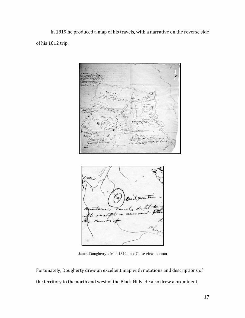
In 1819 he produced a map of his travels, with a narrative on the reverse side
of his 1812 trip.
James Dougherty’s Map 1812, top. Close view, bottom
Fortunately, Dougherty drew an excellent map with notations and descriptions of
the territory to the north and west of the Black Hills. He also drew a prominent
18
circumpunct: west of the Missouri, and east of the Yellowstone River. He labeled it
Devils Mountain. Sure enough, I was able to see the landmark to the south at times
from the lowlands of the Yellowstone River drainages in Montana, and his mark
corresponds to its location.
Dodge verified the renaming from Bears Lodge to Devil’s Tower in his
journal, and wrote:
…the Indians call this shaft the Bad God’s Tower, a name adopted with
proper modification, by our surveyors…. I modified the name to a better
form of English, calling it Devil’s Tower.” (The possessive apostrophe
was dropped during the Monument’s proclamation, to conform to U.S.
Geological Survey standards.)
Was this misnaming inadvertent, innocent, or purposeful? Oglala Sioux Chief
Luther Standing Bear wrote in a letter to Stone:
Dodge was, as were so many white men in meddling with Indian history, wrong
in saying the Indians called the place ‘the bad god’s tower.’ The Sioux had no
word for Devil, for the Devil and Hades of the white man had no place in Indian
thought.
Or perhaps it was a translation error? While the Sioux word for bear is
wahanksica, their word for a bad spirit is wakansica. Whatever and however it
19
happened the new name survived, as they often do when a new and powerful
civilization conquers territory.
Recognizing its unique nature, in 1906 President Theodore Roosevelt
proclaimed Devils Tower our premier National Monument, for the protection of
native artifacts and archaeological sites. The Proclamation itself reads:
In 1875 Lieutenant Colonel Richard Irving Dodge described the tower as “An
immense obelisk of granite….its summit is inaccessible to anything without
wings. The sides are fluted and scored by the action of the elements, and
immense blocks of granite, split off from the column by frost, are piled in huge,
irregular mounds about its base.
The Tower hit the national headlines in 1941, when George Hopkins
parachuted to its top. He planned to rappel off of the top was foiled when his rope
tangled. There he was stuck on the barren summit, and worse, on the front page of
the nation’s newspapers.
With bad weather looming and crowds gathering below, Hopkins was finally
rescued six days later when premier rock climbers Dick Durrance, Paul Petzoldt,
Harold Rapp, and three others, pushed a route to the top. (The first ascent two
decades earlier utilized a wooden ladder hammered into stone racks.) This media
attention increased visitation, and Devils Tower entered the American
consciousness.
20
Today Devils Tower is mostly a recreational site where hikers, climbers and
campers in aluminum trailers escape the Midwestern heat. By 1970, only 312
people had climbed Devils Tower, but today over 6,000 climbers summit the tower
every year, challenged by the expert-level cracks to the top. In deference to the
native culture, the Park Service bans commercially-led climbs during the month of
June, when the native tribes gather during summer solstice for their Sun Dance.
It’s one person’s playground but another’s chapel.
The politically correct and ultra-sensitive National Park Service administers
the site, and collects information, interviews, and artifacts from the Native American
tribes who call it special. “Devils Tower is a sacred place and looms large as an
important landmark in tribal religion and cosmology,” a 1977 the report stated.
However many of the native ceremonies are secret, and make the government’s job
more difficult.
During 45 days in the late summer the tribes camp and hold their private Sun
Dance at the base of the tower. They pray to their gods, take part in vision quests,
fast, take sweats in sweat lodges, and even perform secret burials, when possible. It
is a communal, religious ceremony wherein the group is joined with the universe
and is renewed.
Of course most Native Americans are diplomatic and cautious about any
attempt to revert to the original name, knowing where modern power lies, and it’s
not with them.
To them the renaming didn’t change the fact that it’s a powerful spiritual
totem. Lakota Gloria Runs-To-Water spends summer evenings describing the
21
natural herbs and medicines that her people have used for centuries. She’s coy when
asked about the name, but in the end she says, “I think I’d like to see it changed back.”
She’s not alone, but their calls for renaming are sedate, not wanting to be the high
nail found by the white hammer.
The naming of Devils Tower is downright offensive to others. Eastern
Shoshone Diana Mitchell said, “To name it Devils Tower is a slap in the face because of
what the whites used to call Indians back then: they were Devils, dirty Devils….Who
wants to pray at something called Devils Tower?”
But the local, Anglo residents resist the idea of changing the name back to
Bears Lodge, and wouldn’t even agree to a dual designation, citing that their own
history and the tourist economy built Devils Tower. This dual designation of Bears
Lodge and Devils Tower, would take an act of Congress, and much more public
support.
To counter any change, Representative Barbara Cubin of Wyoming
introduced a bill in the 109th Congress (H.R. 1154) to retain the name of Devils
Tower. In her remarks of January 7, 1997, she stated that she had “….received a
petition with an estimated 2,000 names from not only those in and around the
monument, but from all over the county.” So, the push to rename the tower is
unlikely, as the power to do so does not lie with the native Americans.
Conflict between the worshippers and casual visitors does continue. In March
of 1990 a tourist, unfamiliar with the native culture and heritage, brought in a long
string of 400 tobacco pouches, medicine items from the native Americans. Thinking
that someone was littering, he presented it to the park rangers, who quickly sent
22
them back into the woods. Imagine if someone had brought in your grandparent’s
gravestone? The mixture of religion and government is the third-rail of politics.
Former Park Superintendent Deborah Liggett recognized this:
The tower is revered by all Americans as an embodiment of the national park
idea, but this small patch of real estate in northeastern Wyoming is also the
embodiment of a classic modern conflict. The conflict is not just recreation
versus the sacred, but the separation of church and state.
Many Indian place-names are lost to the American conquest. Devils Tower is
just one of them. To the native civilizations their geography is a sacred place, where
they had deep and lasting connection, of the land, not proprietors of it.
Rarely do original names, especially from cultures with different languages,
customs, and religions, survive an invading culture. In this case the language wasn’t
written, but an oral tradition.
When American trappers, surveyors and explorers entered the Black Hills,
the peak became an obvious landmark for navigation, and required a name that
meant something to them, and they used their own spiritual backgrounds to find a
name for it. It’s a classic struggle of old versus new, winners and losers, and the
transformation from a spiritual ideal to the mark of the ultimate evil… Devils Tower.
So I left these cultural ambiguities behind me in Wyoming, and headed off for
another place, another Hell of a Place.
23
ABOUT THE AUTHOR
Patrick Cone is an award-winning photographer and writer, working from
Park City, Utah. For the past 3 decades he has photographed and written for dozens
of national magazines (Sunset, Smithsonian, National Geographic World, Flying, MIT
Technology Review, Sports Illustrated), newspapers (Salt Lake Tribune, Casper Star
Tribune, Wall St. Journal), and advertising clients (Allstate, DHL, UBS). His online
portfolio can be accessed at PatrickConePhotography.com
Cone is the author/photographer of 3 children’s science books (Wildfire,
Grand Canyon, Avalanche-Lerner Books), and the author/editor/photographer of
24
the large format book, Park City (Meridian Intl). His awards include the New York
Art Director’s Show and the Communication Arts Photography Annuals
Cone grew up in a prominent Western mining family and has worked as a
geophysicist, helicopter navigator, pilot, flight engineer, county commissioner, and
historian. He has a BFA in Art and Design and an MS in Communication, and is on the
faculty in the Department of Communication at the University of Utah. He is
currently the Director of Photography for the Browning/Winchester Company, and
is represented by BlackStar, New York.