Embed Size (px)
Citation preview
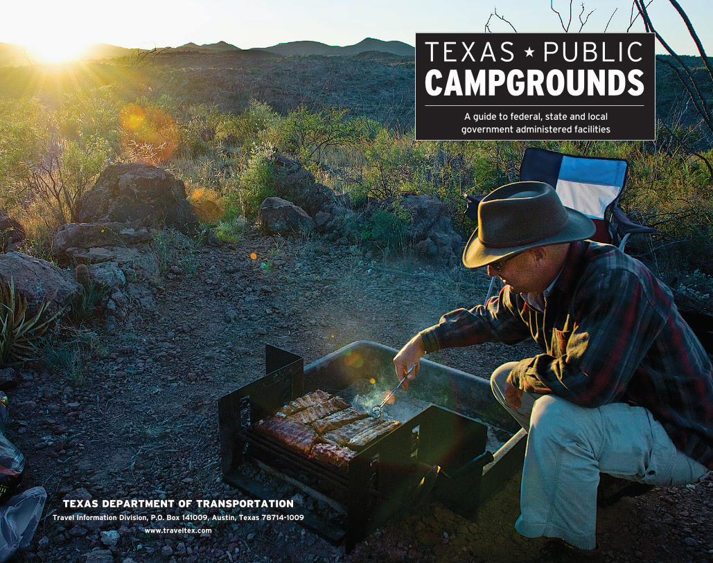
TEXAS DEPARTMENT OF TRANSPORTATIONTravel Information Division, P.O. Box 141009, Austin, Texas 78714-1009
www.traveltex.com
A guide to federal, state and local government administered facilities
CAMPGROUNDSTEXAS ★ PUBLIC

Try the first two issues Risk-free. If you like the first two issues, pay our low 1-year U.S. subscription price of $24.95 for 10 additional issues (12 issues in all).
DIGITAL SUBSCRIPTIONSFor details, visit www.zinio.com/texashighways
Visit WWW.TEXASHIGHWAYS.COM,go to “subscribe,” click on “new subscriptions,” or call 800-839-4997. Use promo code ATXC150 This offer expires July 31, 2017
Discover True Texas...for FREE!
Find Texas’ best destinations, culinary treats, events, and attractions each month in Texas
Highways, the state’s official travel magazine.
!
YEAR-ROUND,THE CAMPING’S GREAT IN TEXAS!
NOTE: Some campgrounds may be temporarily closed or have restricted hours of operation because of budgetary constraints, drought, flood or storm damage. Please contact the campground or its reservations to verify the availability.
This directory lists only facilities administered by federal, state and local government authorities in Texas. Commercial campground information is available from the Texas Association of Campground Owners, 910 S. Crowley Road, Suite 9-504, Crowley, TX 76036, 877/518-1989, www.texascampgrounds.com.
USING THIS GUIDEThe campgrounds are listed alphabetically by a nearby town, so you can easily find the information on campgrounds and read about them as you travel through the vastly different areas that make up Texas. Campgrounds with dump stations are listed in ALL CAPS.
Map coordinates to the right of the city refer to its location on the Texas Official Travel Map.
In directions and addresses: I- refers to interstate, US is a U.S. highway, TX is a state highway, FM or RM (RR) are farm- or ranch-to-market roads, Loop is a state loop, and PR is park road.
Fees are not shown in this publication because they can change so frequently. Be prepared to pay an entry fee at each park. In addition, fees may be charged for camping and use of pavilions, group shelters, cabins, etc.
NOAA WEATHER RADIOThe National Oceanic and Atmospheric Administration broadcasts the latest weather information directly from the National Weather Service.
For current weather information, tune to one of the NOAA radio frequencies: 162.4, 162.425, 162.45, 162.475, 162.5, 162.525 or 162.55. www.srh.noaa.gov.
About the cover: Big Bend Ranch State Park (see page 48)
Photographs in this publication are courtesy of the Texas Department of Transportation, Texas Parks and Wildlife Department, and Lower Colorado River Authority.
June 2015 061526
1
3
AMARILLO
AUSTIN
San Antonio
CorpusChristi
McAllen Harlingen
Fort Worth Dallas
Houston
El Paso
Big Bend Natl. Park
Midland
Lubbock
Odessa
WICHITA FALLS
TEXARKANA
WASKOM
ORANGE
VALLEY
LAREDO
LANGTRY
ANTHONY
GAINESVILLE
DENISON
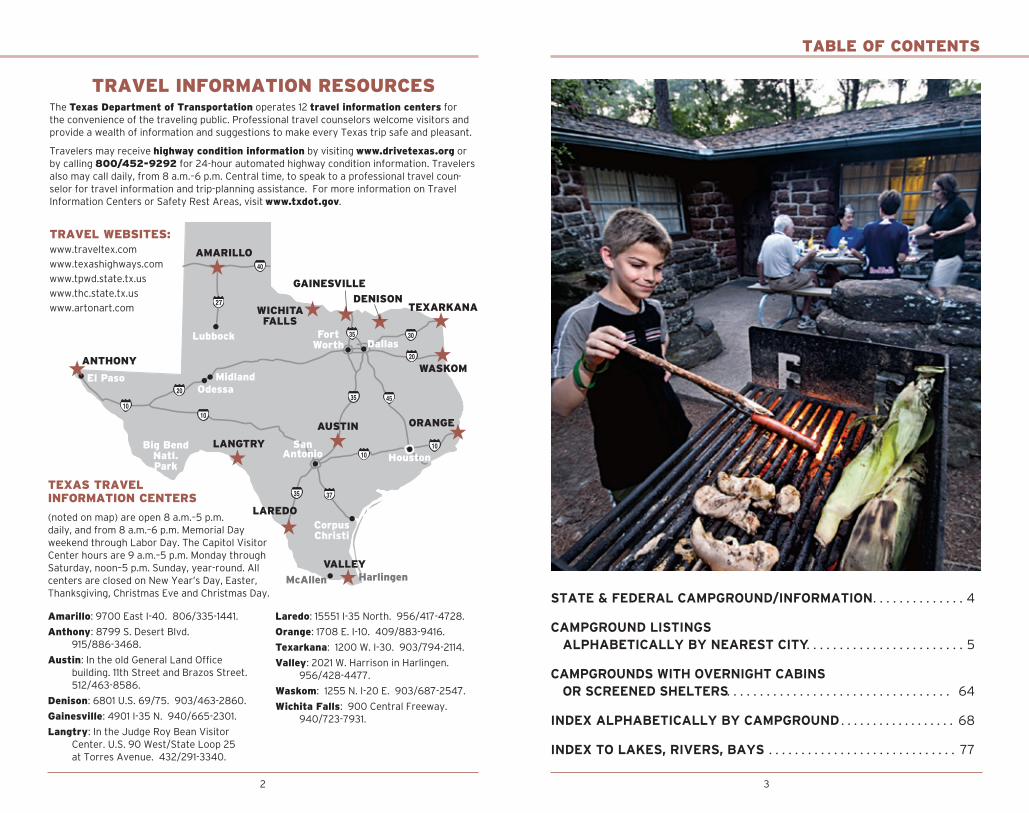
TRAVEL INFORMATION RESOURCESThe Texas Department of Trans portation operates 12 travel information centers for the convenience of the traveling public. Professional travel counselors welcome visitors and provide a wealth of information and suggestions to make every Texas trip safe and pleasant.
Travelers may receive highway condition information by visiting www.drivetexas.org or by calling 800/452-9292 for 24-hour automated highway condition information. Travelers also may call daily, from 8 a.m.–6 p.m. Central time, to speak to a professional travel coun-selor for travel information and trip-planning assistance. For more information on Travel Information Centers or Safety Rest Areas, visit www.txdot.gov.
TRAVEL WEBSITES:www.traveltex.com
www.texashighways.com
www.tpwd.state.tx.us
www.thc.state.tx.us
www.artonart.com
TEXAS TRAVEL INFORMATION CENTERS
(noted on map) are open 8 a.m.–5 p.m. daily, and from 8 a.m.–6 p.m. Memorial Day weekend through Labor Day. The Capitol Visitor Center hours are 9 a.m.–5 p.m. Monday through Saturday, noon–5 p.m. Sunday, year-round. All centers are closed on New Year’s Day, Easter, Thanks giving, Christ mas Eve and Christmas Day.
Amarillo: 9700 East I-40. 806/335-1441.
Anthony: 8799 S. Desert Blvd. 915/886-3468.
Austin: In the old General Land Office building. 11th Street and Brazos Street. 512/463-8586.
Denison: 6801 U.S. 69/75. 903/463-2860.
Gainesville: 4901 I-35 N. 940/665-2301.
Langtry: In the Judge Roy Bean Visitor Center. U.S. 90 West/State Loop 25 at Torres Avenue. 432/291-3340.
Laredo: 15551 I-35 North. 956/417-4728.
Orange: 1708 E. I-10. 409/883-9416.
Texarkana: 1200 W. I-30. 903/794-2114.
Valley: 2021 W. Harrison in Harlingen. 956/428-4477.
Waskom: 1255 N. I-20 E. 903/687-2547.
Wichita Falls: 900 Central Freeway. 940/723-7931.
STATE & FEDERAL CAMPGROUND/INFORMATION . . . . . . . . . . . . . .4
CAMPGROUND LISTINGS ALPHABETICALLY BY NEAREST CITY . . . . . . . . . . . . . . . . . . . . . . . .5
CAMPGROUNDS WITH OVERNIGHT CABINS OR SCREENED SHELTERS . . . . . . . . . . . . . . . . . . . . . . . . . . . . . . . . . . 64
INDEX ALPHABETICALLY BY CAMPGROUND . . . . . . . . . . . . . . . . . . 68
INDEX TO LAKES, RIVERS, BAYS . . . . . . . . . . . . . . . . . . . . . . . . . . . . . 77
TABLE OF CONTENTS
2

4 5
STATE/FEDERAL CAMPGROUND INFORMATION
STATE CAMPGROUNDSTexas state parks offer a range of amenities, from full hookups to wilderness camping. The improved camping areas have restrooms with flush toilets and hot showers. Some primitive camping areas have self-composting toilets but no showers. Wilderness areas offer trails and maps but no utilities—those operate on the “pack-it-in, pack-it-out” principle. Improved camp-sites have utilities, a tent pad or trailer parking pad, a picnic table and fire ring. Many also include a grill standing waist-high as well as a pole with a lantern hook.
For camping reservations or cancellations, call 512/389-8900 9 a.m.–6 p.m. Monday through Friday or leave a voice mail for cancellations 24 hours a day. For reservations at Indian Lodge in Davis Mountains State Park, call 512/389-8982. To make reservations online, visit www.tpwd.texas.gov/business/park_reservations.
Texas State Parks Pass offers many special benefits, including unlimited visits for the pass holder and entire carload of guests to more than 90 state parks and historic sites, as well as camping discounts and more. Passes are available at park offices or by calling the State Parks Customer Service Center at 512/389-8900.
Texas State Parklands Passport offers free entrance to everyone who was born before September 1, 1930, and to veterans with a 60 percent or greater disability. For visitors that are 65 years of age or older and are a Texas resident, or have a documented physical or mental impairment that substantially limits one or more major life activities, will receive a 50 percent off discount on entrance fees. For a Texas Parklands Passport, apply in person, with proof of eligibility, at any Texas State Park.
Texas State Parks are not part of the National Park Service. They do not accept passes/pass-ports from the national parks.
For more information about state parks, visit the Texas Parks and Wildlife Department website, www.texasstateparks.org; call 800/792-1112; or send mail to Texas Parks and Wildlife, 4200 Smith School Road, Austin, TX 78744.
FEDERAL/NATIONAL CAMPGROUNDSThe America the Beautiful Pass provides entrance or day-use fees at federally operated recreation sites across the country for the driver and all vehicle passengers at a per vehicle fee area or up to four adults at sites that charge per person. A Senior Pass is available to U.S. Citizens or permanent residents who are age 62 or older. An Access Pass may be available to citizens or permanent U.S. residents with a medically-determined permanent disability. The senior and access passes may provide the pass owner a discount on some expanded amenity fees such as camping. The pass is issued by and covers entrance fees at sites managed by the U.S. Forest Service, National Park Service, U.S. Fish and Wildlife Service, Bureau of Land Management and Bureau of Reclamation.
For information on passes that the U.S. Army Corps of Engineers is authorized to issue, sell or accept, including the Corps of Engineers Annual Pass, visit corpslakes.usace.army.mil/visitors/passes.cfm.
Pass holders are encouraged to contact the site they plan to visit and inquire about pass acceptance and discounts before visiting. For more information, call 888/ASK-USGS or visit store.usgs.gov/pass/index.html.
Reservations: Visitors to most federal campgrounds managed by the U.S. Army Corps of Engineers, U.S. Forest Service, National Park Service, Bureau of Land Management and Bureau of Reclamation may make reservations through the National Recreation Reservation Service for selected facilities and activities across the nation. For camping and tour reserva-tions by phone, call 877/444-6777 or (international) 518/885-3639. For customer service, call 888/448-1474. To place reservations online, visit www.recreation.gov.
CAMPGROUND LISTINGS BY NEAREST CITY
——————————— A ———————————
ABILENE—Map K13 ABILENE STATE PARKFrom US 84: FM 89 S 14.5 miles to Park Road 32. Adjacent to Lake Abilene. Back-in wheeled-camper sites: 3 with electric, sewer and water; 72 with electric and water. Other: 12 tent sites with water; 5 screened shelters; 6 yurts with electric; 1 lake house cabin; 2 group day-use buildings. Limit 14 days. Dump station, flush toilets, showers, grills. Swimming pool, scenic views, nature trails. Fee. (150 Park Road 32, Tuscola 79562, 325/572-3204. Reservations: 512/389-8900 or online. www.texasstateparks.org.) PANHANDLE PLAINS
ABILENE—Map K13 Johnson ParkFrom I-20: FM 600 N 6.6 miles; FM 1082 E .6 mile. On Lake Fort Phantom Hill. Camping area on 37 acres. No prepared sites. Limit 48 hours. Flush toilets, drinking water. Fishing, boat ramp, disc golf, picnic shelters. (City Park Department, Box 60, Abilene 79604, 325/676-6217.) PANHANDLE PLAINS
ABILENE—Map K13 Seabee ParkFrom I-20: FM 600 N 3.2 miles; local road E. On Elm Creek. Camping area on 40 acres; 4 prepared sites. Limit 48 hours. Flush toilets. Fishing, boat ramp, picnic shelter. (City Park Department, Box 60, Abilene 79604, 325/676-6217.) PANHANDLE PLAINS
ALBANY—Map J14 FORT GRIFFIN STATE HISTORIC SITEFrom US 180: US 283 N 14.4 miles; Park Road 54 E. On Clear Fork of Brazos River. Sites: 8 with full hookups; 20 with water and electric; 5 with water only; 1 screened shelter. Reservations accepted. Dump station, flush toilets, showers. Fishing, boat rental, playground, hiking trails, visitor center, scenic views, home to the Official State of Texas Longhorn Herd. Fee. (1701 N US 283, Albany 76430, 325/762-3592. www.visitfortgriffin.com.) PANHANDLE PLAINS
ALTO—Map M21 MISSION TEJAS STATE PARKFrom US 69: TX 21 SW 12.3 miles. Wheeled-camper sites: 4 with water, electric and sewer; 8 with water and electric. Tent sites: 3 with water and electric; 2 with water only. Group camping
Abilene State Park

A
6 7
CAMPGROUND LISTINGS BY NEAREST CITYCAMPGROUND LISTINGS BY NEAREST CITY
and picnic areas, picnic sites. Dump station, flush toilets, showers, ice, nature trail, Rice family log home, San Francisco de los Tejas Mission. Fee. (120 State Park Road 44, Grapeland 75844, 936/687-2394. www.texasstateparks.org.) PINEY WOODS
ALVIN—Map R21 Camp Mohawk County ParkFrom Alvin: TX 35 S 5 miles to park entrance sign on right. On Chocolate Bayou. Tent camp-ing; 2 group dorms with AC; 2 cabins with AC; 4 covered pavilions. Swimming pool, bathhouse, fishing, kayaking, canoeing, walking trails, playground. Handicap accessible. Reservations required. (Camp Mohawk County Park, 110 Mohawk Drive (N. TX 35), Alvin 77511, 281/581-2319. www.BrazoriaCountyParks.org.) GULF COAST
AMARILLO—Map D10 Rosita Flats AreaFrom Amarillo: US 87/287 N 19 miles; turn E at Canadian River Bridge 1 mile. On Lake Meredith. Undeveloped camping area. Limit 14 days. No firewood available; no drinking water. Horseback riding, off-road vehicles allowed. (National Park Service, Box 1460, Fritch 79036, 806/857-3151. www.nps.gov/lamr/planyourvisit/camping.htm.) PANHANDLE PLAINS
ANAHUAC—Map Q22 Cedar Hill ParkTake I-10: Exit 810, on FM 563 N 5 miles to Lake Charollette Road, to entrance at 1275 Lake Charlotte Road. On Lake Charollette. Camping, covered pavilions, restrooms, picnic areas. Birding, fishing, nature trails. Fee. (Chambers County Commissioner Precinct 2 office, PO Box 430 Anahuac 77514, 409/267-2409. www.co.chambers.tx.us.) GULF COAST
ANAHUAC—Map Q22 Double Bayou ParkFrom I-10: TX 61 S 4 miles; FM 562 S 7 miles; Eagle Ferry Road W .5 mile at 2814 Eagle Ferry Road. On East Fork of Double Bayou. Camping, covered pavilions with electric and water, pic-nic areas, restrooms. Birding, fishing, kayak/canoe launch, playground equipment. (Chambers County Commissioner Precinct 2 office, PO Box 430, Anahuac 77514, 409/267-2409. www.co.chambers.tx.us.) GULF COAST
ANAHUAC—Map Q22 Fort Anahuac ParkFrom I-10: FM 563 S 7 miles; TX 61 W 1 mile; S Main Street S 1 mile at 1704 S. Main St. On Trinity Bay. Camping, covered pavilions with electric and water, picnic area, restrooms with showers. Birding towers, boat ramp, fishing, historical markers, lighted fishing pier, nature trails, play-ground equipment, baseball and softball fields. (Chambers County Commissioner Precinct 2 office, PO Box 430, Anahuac 77514, 409/267-2409. www.co.chambers.tx.us.) GULF COAST
ANAHUAC—Map Q22 Job Beason ParkFrom I-10: FM 563 S 11 miles; Eagle Road S 4.7 miles; W Bay Shore Road S .5 mile at 130 W. Bay Shore Road. On Double Bayou. Camping, covered pavilion with electric and water, restrooms. Boat ramp, fishing. (Chambers County Commissioner Precinct 2 office, PO Box 430, Anahuac 77514, 409/267-2409. www.co.chambers.tx.us.) GULF COAST
ANAHUAC—Map Q22 Whites ParkFrom I-10: TX 61 S .1 mile at 225 White Park Road. On Turtle Bayou. Camping, covered pavilions with electric and water, restrooms with showers. Birding, boat ramp, fishing, historical mark-ers, livestock show facilities, riding area. (Chambers County Commissioner Precinct 2 office, PO Box 430, Anahuac 77514, 409/267-2409. www.co.chambers.tx.us.) GULF COAST
ANAHUAC—Map Q22 Winnie-Stowell ParkFrom I-10: TX 124 S 1 mile; LeBlanc Road E .1 mile at 335 Park St. Camping, covered pavilions, restrooms. Covered outdoor stage, annual festivals, historical markers, livestock show fa-cilities, playground equipment, baseball and softball fields, riding area. (Chambers County Commissioner Precinct 1 office, PO Box 260, Winnie 77665, 409/267-2644. www.co. chambers.tx.us.) GULF COAST
ANDERSON—Map P20 GIBBONS CREEK RESERVOIR and PARKFrom TX 30: FM 244 N .5 mile. From TX 21: FM 39 S 12 miles; FM 244 S 10 miles. On Gibbons Creek Reservoir. RV sites: 17 with electric and water. Primitive camping available. Reservations recommended. Fee. Dump station, restrooms, showers, picnic tables, fire rings, barbecue pits. Lake swimming in designated areas, boat ramp (motorboats permitted), fish-ing. Park open Friday-Sunday and Memorial Day, Independence Day and Labor Day. (Texas Municipal Power Agency, PO Box 7000, Bryan 77805, 936/873-2424. www.gibbonscreek.com.) PRAIRIES AND LAKES
ANDREWS—Map K8 FLOREY PARKFrom city: US 385 N 9.6 miles; local road E 1 mile. In shady grove. Wheeled-camper or tent sites: 64 with electric and water; 62 with electric, water and sewer. Limit 7 days. Dump stations, flush toilets, grills, community center, pavilion (by reservation). Basketball, play-ground. (5969 NE County Road 1011, Andrews 79714, 432/847-7857. www.co.andrews.tx.us.) PANHANDLE PLAINS
ANDREWS—Map K8 Municipal Trailer ParkFrom US 385: TX 115/176 (W. Broadway) W 7 blocks. Pull-through wheeled-camper sites: 12 with electric, water and sewer. Limit 3 days. Fishing and playground (nearby). (Chamber of Commerce, 700 W. Broadway, Andrews 79714, 432/523-2695.) PANHANDLE PLAINS
ARROYO CITY—Map Y17 (See Rio Hondo)
ATLANTA—Map H23 Jackson Creek ParkFrom TX 77: FM 96 N 2.7 miles; FM 2791 W 1.6 miles; local road N and W 3.3 miles. On Lake Wright Patman. Back-in wheeled-camper or tent sites: 20. Limit 14 days. RV maximum length 25 feet. Pit toilets, grills. Fishing, boat ramp. Open March 1–October 31. (Corps of Engineers, Box 1817, Texarkana 75501, 903/838-8781.) PINEY WOODS
ATLANTA—Map H23 (See Queen City, Maud, Texarkana)
AUSTIN—Map P17 Arkansas Bend ParkFrom I-35: US 183 NW 13.5 miles; FM 1431 W 11.3 miles; Lohman’s Crossing S 4.5 miles to Sylvester Ford Road. On Lake Travis. Primitive camping area on 323 acres; 200 tent camp-ing sites. Limit 7 days. Pit toilets, grills. Lake swimming, fishing, boat ramp (motorboats permitted), scenic views. Fee. (Travis County Parks, Box 1748, Austin 78767, 512/854-9437; Reservations: 512/854-7275. parks.traviscountytx.gov.) HILL COUNTRY
AUSTIN—Map P17 EMMA LONG METROPOLITAN PARKFrom Loop 360: FM 2222 W .6 mile; left on City Park Road 6 miles; road dead-ends into park. On Lake Austin. Utility camping sites: 20 with electric and water. Limit 14 days in a 30-day pe-riod. Other camping area 5 acres; 46 primitive campsites. Dump station, flush toilets, showers, grills, bathhouse. Lake swimming, big sandy beach, fishing, boat ramp, trail bike area. (Austin Parks Department, 1706 City Park Road, Austin 78730, 512/346-1831.) HILL COUNTRY
AUSTIN—Map P17 McKINNEY FALLS STATE PARKFrom US 183 S: On McKinney Falls Parkway W 3 miles. On Onion Creek. Wheeled-camper or tent sites: 85 with electric and water; 6 limited-use cabins. Limit 14 days. Dump station, flush toilets, showers, group dining hall. Swimming in creek, fishing, surfaced and unsurfaced bicycle trails, picnicking, playground, grills, park naturalist, nature trails, gift shop. Fee. (5808 McKinney Falls Parkway, Austin 78744, 512/243-1643. www.texasstateparks.org.) HILL COUNTRY
AUSTIN—Map P17 Sandy Creek ParkFrom I-35: US 183 NW 13.5 miles; FM 1431 W 1.8 miles; Lime Creek Road S 6 miles at 9500 Lime
8 9
CAMPGROUND LISTINGS BY NEAREST CITY
Creek Road. On Lake Travis. Tent-camping sites: 23. Limit 7 days. Flush toilets, grills. Lake swimming, fishing, boat ramp (motorboats permitted), scenic views, nature trails. Fee. (Travis County Parks, Box 1748, Austin 78767, 512/854-9437; Reservations: 512/854-7275. parks.traviscountytx.gov.) HILL COUNTRY
——————————— B ———————————
BALLINGER—Map M13 BALLINGER CITY PARKFrom TX 158: Crosson Street E .1 mile. On Elm Creek. Back-in wheeled-camper sites: 4; 2 with electric. Limit 3 days. Dump station, flush toilets, grills. Swimming pool, fishing, playground. (Box 497, Ballinger 76821, 325/365-3511.) PANHANDLE PLAINS
BALLINGER—Map M13 BALLINGER LAKE PARKFrom W city limit: TX 158 NW 4.8 miles; FM 2111 S 1.2 miles; local road W and S .7 mile. On Lake Ballinger. Wheeled-camper or tent sites: 22; 11 with electric and water. Dump station, flush toi-lets, covered picnic tables, wheelchair accessible facilities. Lake swimming, fishing, boat ramp, scenic views. (Box 497, Ballinger 76821, 325/365-3511.) PANHANDLE PLAINS
BALLINGER—Map M13 O.H. IVIE RESERVOIR CONCHO PARKFrom US 83: S 11 miles; FM 1929 E 13 miles; Park Road N 2 miles. On O.H. Ivie Reservoir. Back-in wheeled-camper sites: 50; 30 with electric, water and sewer. Motel units: 15. Primitive camping on 35 acres. Limit 7 days. Picnic tables with grills. Group pavilion. Bass tournament pavilion. Dump station, pit toilets. Bait, snack bar, ice, grocery. Lake swimming, fishing, boat ramp (de-pending on water level). No hunting; no ATVs. Fee. (CRMWD, Box 869, Big Spring 79721-0869, 432/267-6341. Concessionaire: 325/357-4466.) PANHANDLE PLAINS
BALMORHEA—Map N6 (See Toyahvale)
BANDERA—Map Q14 Hill Country State Natural AreaFrom TX 173: S .75 mile to FM 1077, SW 8.5 miles; Bandera Creek Road SW 2 miles. On West Verde Creek. Wheeled-camper sites: 6 with no hookups; 10 with electric only (available if not rented by a group). Limit 1-14 days. Prepared tent sites: 10. Limit 14 days. Equestrian camp-sites: 6, reservations required. Group equestrian site with electric and water, reservations required. Group Lodge sleeps 9, with horse stalls and arena (extra fee for arena use), reser-vations required. Backpack primitive camping areas from 2- to 3.5-mile hike in, all first-come, first-served. All water on-site is nonpotable. Flush, pit and chem toilets; picnic tables; grills/ fire rings; hiking, biking and equestrian trails. Call for guided horseback ride information. (10600 Bandera Creek Road, Bandera 78003, 830/796-4413. www.texasstateparks.org.) HILL COUNTRY
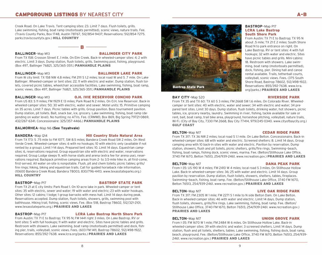
BASTROP—Map P17 BASTROP STATE PARKFrom TX 21 at E city limits: Park Road 1. On 10-acre lake in park. Wheeled-camper or tent sites: 35 with electric, sewer and water; 19 with water and electric; 23 with water hookups. Other sites: 12 cabins; 1 lodge; 1 group barracks with mess hall. Limit 14 days during peak. Reservations accepted. Dump station, flush toilets, showers, grills, swimming pool with bathhouse. Hiking trail, fishing, scenic views. Fee. (Box 518, Bastrop 78602, 512/321-2101. www.texasstateparks.org.) PRAIRIES AND LAKES
BASTROP—Map P17 LCRA Lake Bastrop North Shore ParkFrom Austin: TX 71 E to Bastrop; TX 95 N; FM 1441 right 3 miles. On Lake Bastrop. RV or tent sites: 5 with full hookups; 11 with water and electric. Sites have picnic tables and grills. Restroom with showers. Lake swimming, boat ramp (motorboats permitted) and dock, fish-ing pier, trails, volleyball, scenic views. Fees. (603 FM 1411, Bastrop 78602, 512/498-1922. Reservations: 855/392-7638. www.lcra.org/parks.) PRAIRIES AND LAKES
CAMPGROUND LISTINGS BY NEAREST CITY A-B
BASTROP—Map P17 LCRA Lake Bastrop South Shore ParkFrom Austin: TX 71 E to Bastrop; TX 95 N about .5 mile; TX 21 E 2 miles: South Shore Road N to park entrance on right. On Lake Bastrop. RV or tent sites: 4 with full hookups; 32 with water and electric. Sites have picnic tables and grills. Mini-cabins: 18. Restroom with showers. Lake swim-ming, boat ramp (motorboats permitted), dock, fishing, pier. Dining hall and canoe rental available. Trails, tetherball courts, volleyball, scenic views. Fees. (375 South Shore Road, Bastrop 78602, 512/498-1922. Reservations: 855/392-7638. www.lcra.org/parks.) PRAIRIES AND LAKES
BAY CITY—Map S20 RIVERSIDE PARKFrom TX 35 and TX 60: TX 60 S 3 miles; FM 2668 SW 1.6 miles. On Colorado River. Wheeled-camper or tent sites: 40 with electric, water and sewer; 34 with electric and water; 34 pre-pared tent sites. Limit 30 days. Dump station, flush toilets, drinking water, hot showers, picnic tables, ice, grocery nearby, laundry. Swimming in river, fishing, tackle available for sale or rent, bait, boat ramp, trail bike area, playground, horseshoe pitching, volleyball, nature trails, Wi-Fi. (City of Bay City, 7330 FM 2668, Bay City 77414, 979/245-0340. www.cityofbaycity.org.) GULF COAST
BELTON—Map N17 CEDAR RIDGE PARKFrom TX 317: TX 36 NW 2 miles; local road S 1.1 mile. On Lake Belton. Concessionaire. Back-in wheeled-camper sites: 68 with water and electric. Screened shelters: 8. Limit 14 days. Group camping area with 10 back-in sites with water and electric. Pavilion by reservation. Dump station, showers, flush and pit toilets, picnic shelters, grills/fire rings. Swimming—beach, fishing, boat ramps, fishing dock, scenic views, marina. Fee. (Belton/Stillhouse Lake Office, 3740 FM 1670, Belton 76513, 254/939-2461. www.recreation.gov.) PRAIRIES AND LAKES
BELTON—Map N17 DANA PEAK PARKFrom I-35: US 190 W 4 miles; FM 2410 W 4 miles; local road S 3 miles. On Stillhouse Hollow Lake. Back-in wheeled-camper sites: 36; 25 with water and electric. Limit 14 days. Group pavilion by reservation. Dump station, flush toilets, showers, shelters, tables, fireplaces. Swimming—beach, fishing, boat ramp. Fee. (Belton/Stillhouse Lake Office, 3740 FM 1670, Belton 76513, 254/939-2461. www.recreation.gov.) PRAIRIES AND LAKES
BELTON—Map N17 LIVE OAK RIDGE PARKFrom TX 317: FM 2305 W 1 mile; FM 2271 S 1 mile to N side Belton Dam. On Lake Belton. Back-in wheeled-camper sites: 46 with water and electric. Limit 14 days. Dump station, flush toilets, showers, grills/fire rings. Lake swimming, fishing, boat ramp. Fee. (Belton/Stillhouse Lake Office, 3740 FM 1670, Belton 76513, 254/939-2461. www.recreation.gov.) PRAIRIES AND LAKES
BELTON—Map N17 UNION GROVE PARKFrom I-35: FM 1670 W 1 mile; FM 2484 W 6 miles. On Stillhouse Hollow Lake. Back-in wheeled-camper sites: 39 with electric and water; 3 screened shelters. Limit 14 days. Dump station, flush and pit toilets, shelters, tables. Lake swimming, fishing, fishing dock, boat ramp, beach, playground. Fee. (Belton/Stillhouse Lake Office, 3740 FM 1670, Belton 76513, 254/939-2461. www.recreation.gov.) PRAIRIES AND LAKES
Bastrop State Park
10 11
CAMPGROUND LISTINGS BY NEAREST CITY
BELTON—Map N17 WESTCLIFF PARKFrom TX 317: FM 439 W 4.9 miles; Sparta Road NW 1 mile. On Lake Belton. Wheeled pull-through camper sites: 20 with electric and water; back-in wheeled-camper sites: 7 with electric and water. Primitive tent-only sites: 11. Limit 14 days. Dump station, flush and pit toilets, show-ers, picnic shelters, grills/fire rings. Lake swimming, fishing, boat ramp. Fee. (Belton/Stillhouse Lake Office, 3740 FM 1670, Belton 76513, 254/939-2461. www.recreation.gov.) PRAIRIES AND LAKES
BELTON—Map N17 WHITE FLINT PARKFrom TX 317 at TX 36: W 6 miles. On Lake Belton. Wheeled-camper sites: 13 with electric and water. Screened shelters: 12. Limit 14 days. Dump station, flush and pit toilets, showers, picnic shelters, grills/fire rings. Lake swimming, fishing, boat ramp. Fee. (Belton/Stillhouse Lake Office, 3740 FM 1670, Belton 76513, 254/939-2461. www.recreation.gov.) PRAIRIES AND LAKES
BELTON—Map N17 Winkler ParkFrom TX 317: TX 36 NW 5.8 miles to W side of Leon River bridge; local road N 2 miles. On Lake Belton. Camping area 20 acres. Camper sites: 14 with water. Limit 14 days. Flush toilets, showers, picnic shelters, tables, grills/fire rings. Lake swimming, fishing. Fee. (Belton/Stillhouse Lake Office, 3740 FM 1670, Belton 76513, 254/939-2461. www.recreation.gov.) PRAIRIES AND LAKES
BENBROOK—Map K17 HOLIDAY PARKFrom I-20: US 377 SW 5.7 miles; South Lakeview Drive E 1.7 miles. On Lake Benbrook. Wheeled-camper or tent sites: 105; 79 with water and electric; 34 with water nearby. Screened shelters: 5. Limit 14 days. Dump station, flush and pit toilets, showers. Fishing, nature trails, horseback riding. Fee. (Corps of Engineers, 7001 Lakeside Drive, Fort Worth 76132, 817/292-2400. www.recreation.gov.) PRAIRIES AND LAKES
BENBROOK—Map K17 MUSTANG POINT (BEAR CREEK CAMPGROUND)Open April 1–Sept 30. From I-20: US 377 SW 6.4 miles; FM 1187 SE 1.4 miles; Day-Murrin Road E 1.7 miles. On Lake Benbrook. Wheeled-camper or tent sites: 40 with water and electric; 2 with sewer. Group shelter: 1. Limit 14 days. Dump station, flush and pit toilets, shower. Lake swim-ming, fishing, boat ramp. Fee. (Corps of Engineers, 7001 Lakeside Drive, Fort Worth 76132, 817/292-2400. www.recreation.gov.) PRAIRIES AND LAKES
BENBROOK—Map K17 MUSTANG POINT CAMPGROUNDOpen April 1–Sept 30. From I-20: US 377 SW 6.4 miles; FM 1187 SE 4 miles; Winscott-Plover Road N 1.1 miles. On Lake Benbrook. Wheeled-camper or tent sites: 11 with water nearby. Group shelter: 1. Limit 14 days. Dump station, pit toilets. Lake swimming, boat ramps, fishing. Fee. (Corps of Engineers, 7001 Lakeside Drive, Fort Worth 76132, 817/292-2400. www.recreation.gov.) PRAIRIES AND LAKES
BENBROOK—Map K17 Rocky Creek ParkFrom I-20: US 377 SW 6.4 miles; FM 1187 SE 7.7 miles; Old Granbury Road N 3.5 miles; Rocky Creek Park Road SW 1.3 miles. On Lake Benbrook. Wheeled-camper or tent sites: 18 with water nearby. Limit 14 days. Flush and pit toilets. Fishing, marina. Boat launch. Fee. (Corps of Engineers, 7001 Lakeside Drive, Fort Worth 76132, 817/292-2400. www.recreation.gov.) PRAIRIES AND LAKES
BEND—Map N15 Colorado Bend State ParkFrom FM 580: S and E 4 miles on County Road 442. On Colorado River. Day-use fee. Primitive camping. No hookups; drinking water available. Compost toilets, tables, fire rings. Swimming in natural spring, fishing, scenic view, hiking and mountain bike trails. Waterfall and cave tours
B
weekends only. Reservations recommended for cave tours. White bass run March–April. Park closed for wildlife management hunt on selected days December–January; call. Fee. (Box 118, Bend 76824, 325/628-3240. www.texasstateparks.org.) HILL COUNTRY
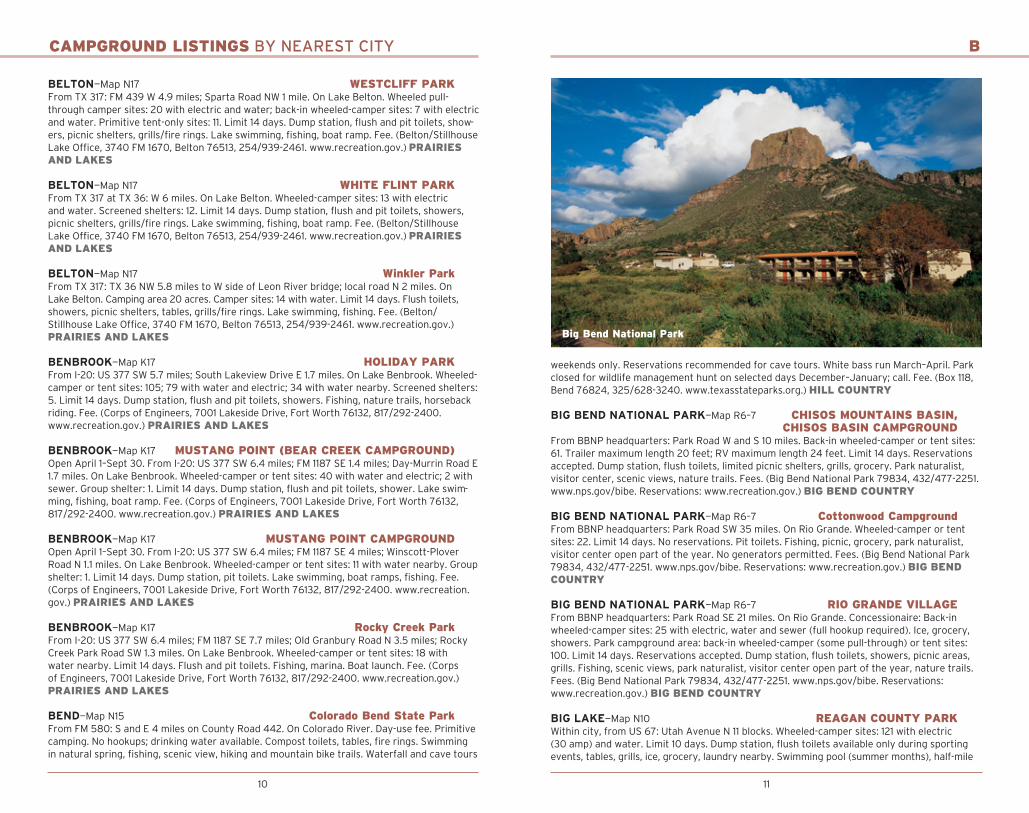
BIG BEND NATIONAL PARK—Map R6–7 CHISOS MOUNTAINS BASIN, CHISOS BASIN CAMPGROUNDFrom BBNP headquarters: Park Road W and S 10 miles. Back-in wheeled-camper or tent sites: 61. Trailer maximum length 20 feet; RV maximum length 24 feet. Limit 14 days. Reservations accepted. Dump station, flush toilets, limited picnic shelters, grills, grocery. Park naturalist, visitor center, scenic views, nature trails. Fees. (Big Bend National Park 79834, 432/477-2251. www.nps.gov/bibe. Reservations: www.recreation.gov.) BIG BEND COUNTRY
BIG BEND NATIONAL PARK—Map R6–7 Cottonwood CampgroundFrom BBNP headquarters: Park Road SW 35 miles. On Rio Grande. Wheeled-camper or tent sites: 22. Limit 14 days. No reservations. Pit toilets. Fishing, picnic, grocery, park naturalist, visitor center open part of the year. No generators permitted. Fees. (Big Bend National Park 79834, 432/477-2251. www.nps.gov/bibe. Reservations: www.recreation.gov.) BIG BEND COUNTRY
BIG BEND NATIONAL PARK—Map R6–7 RIO GRANDE VILLAGEFrom BBNP headquarters: Park Road SE 21 miles. On Rio Grande. Concessionaire: Back-in wheeled-camper sites: 25 with electric, water and sewer (full hookup required). Ice, grocery, showers. Park campground area: back-in wheeled-camper (some pull-through) or tent sites: 100. Limit 14 days. Reservations accepted. Dump station, flush toilets, showers, picnic areas, grills. Fishing, scenic views, park naturalist, visitor center open part of the year, nature trails. Fees. (Big Bend National Park 79834, 432/477-2251. www.nps.gov/bibe. Reservations: www.recreation.gov.) BIG BEND COUNTRY
BIG LAKE—Map N10 REAGAN COUNTY PARKWithin city, from US 67: Utah Avenue N 11 blocks. Wheeled-camper sites: 121 with electric (30 amp) and water. Limit 10 days. Dump station, flush toilets available only during sporting events, tables, grills, ice, grocery, laundry nearby. Swimming pool (summer months), half-mile
Big Bend National Park
12 13
CAMPGROUND LISTINGS BY NEAREST CITY
walking trail, playground, tennis with in two blocks, volleyball, softball, group meeting facili-ties. (Box 100, Big Lake 76932, 325/884-2376 or 325/884-2665.) HILL COUNTRY
BIG SPRING—Map L10 Comanche Trail ParkFrom I-20: US 87 S 3.6 miles. Near Comanche Trail Lake. Pads only; wheeled-camper sites: 5 with no hookups. Limit 3 days. Reservations not accepted. Fishing, golf, tennis, playgrounds, pavilions, hike, bike and nature trails. Outdoor amphitheater and new Family Aquatic Center lo-cated in nearby city park. (City Park Department, 310 Nolan Road, Big Spring 79720, 432/264-2376, www.mybigspring.com/pages/Parks_And_Recreation.) PANHANDLE PLAINS
BIG SPRING—Map L10 MOSS CREEK LAKE PARK
From US 87: I-20 E 7.2 miles; Moss Lake Road S 4.1 miles. On Moss Creek Lake. RV Park and campground have full hookup and half-hookup (water and electric) sites. Overnight camping by permit. Dump station. Fees. (Moss Creek Lake Park, 10000 E. Moss Lake Road, Big Spring 79720, 432/393-5246. www.mybigspring.com/moss_lake.) PANHANDLE PLAINS
BLANCO—Map Q15 BLANCO STATE PARKFrom US 281 at S city limits: Park Road 23 W. On Blanco River. Back-in wheeled-camper or tent sites: 23 with electric, water and sewer; 12 with water and electric. Screened shelters: 7. Limit 14 days in summer. Reservations recommended. Winter rates November–February. Dump station, flush toilets, showers, picnic areas, grills. Swimming in river, fishing (usually stocked with rainbow trout during winter December–February; call for exact times); group picnic area; playground, hiking, nature trails; group pavilion with kitchen. Fee. (Box 493, Blanco 78606, 830/833-4333. www.texasstateparks.org.) HILL COUNTRY
BLUFFTON—Map O15 LCRA Cedar Point Recreation AreaFrom TX 29/US 281 in Burnet: TX 29 W; TX 261 W into Bluffton; FM 2241 N to FM 3014 and en-trance. On Lake Buchanan. Primitive camping sites with picnic tables and grills. Vault toilets. Lake swimming, fishing, boat ramp (motorboats permitted), horseback riding. (545 RR 3014, Tow 78672, 512/473-3366. www.lcra.org/parks.) HILL COUNTRY
BLUM—Map L17 Kimball Bend ParkFrom FM 67: FM 933 N 1.7 miles; TX 174 SW 6 miles; at Brazos River bridge. On Lake Whitney. Wheeled-camper or tent sites: 10. Limit 14 days. Pit toilets, grills. Lake swimming, fishing, boat ramp. (Corps of Engineers, 285 County Road 3602, Laguna Park 76634-5038, 254/622-3332. www.recreation.gov.) PRAIRIES AND LAKES
BOERNE—Map Q15 GUADALUPE RIVER STATE PARKFrom US 281: TX 46 W 8 miles; Park Road 31 N 3 miles. On Guadalupe River. Back-in wheeled-camper sites: 85; 48 with 50 amp electric and water; 37 with 30 amp electric and water (trailer size restriction of 20 feet or less). Primitive, walk-in sites: 9. Group tent site. Dump station, flush toilets, showers. Swimming in river, canoeing, playground, fishing, pic-nicking with grills, hiking trails. Honey Creek State Natural Area guided walk, 9 a.m. Saturday, donation. Entrance fee. (3350 Park Road 31, Spring Branch 78070, 830/438-2656. www. texasstateparks.org.) HILL COUNTRY
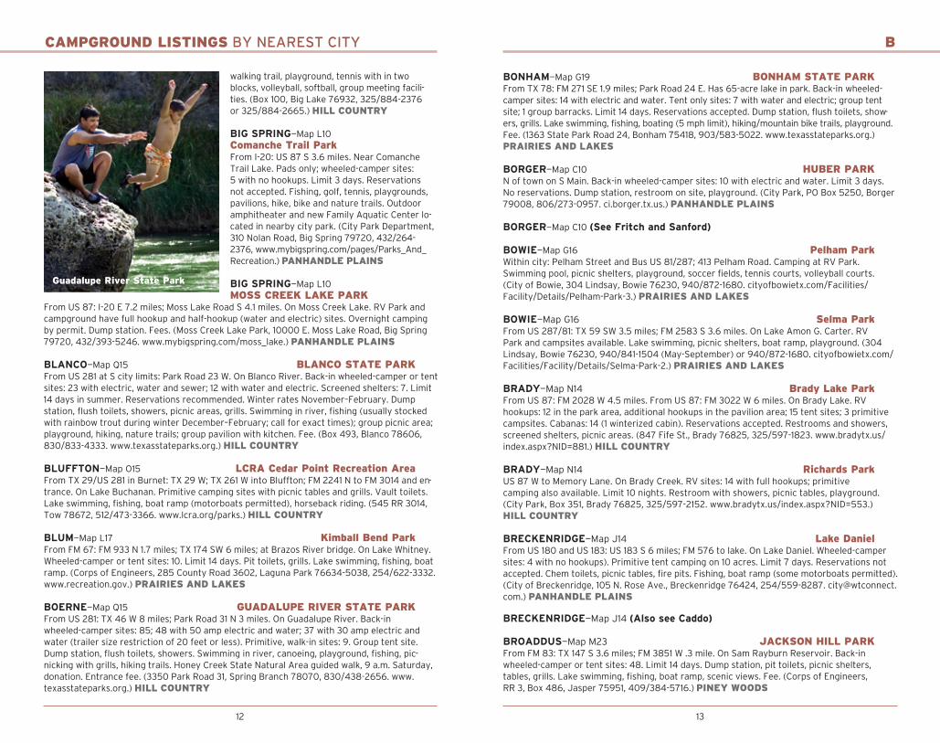
Guadalupe River State Park
B
BONHAM—Map G19 BONHAM STATE PARKFrom TX 78: FM 271 SE 1.9 miles; Park Road 24 E. Has 65-acre lake in park. Back-in wheeled- camper sites: 14 with electric and water. Tent only sites: 7 with water and electric; group tent site; 1 group barracks. Limit 14 days. Reservations accepted. Dump station, flush toilets, show-ers, grills. Lake swimming, fishing, boating (5 mph limit), hiking/mountain bike trails, playground. Fee. (1363 State Park Road 24, Bonham 75418, 903/583-5022. www.texasstateparks.org.) PRAIRIES AND LAKES
BORGER—Map C10 HUBER PARKN of town on S Main. Back-in wheeled-camper sites: 10 with electric and water. Limit 3 days. No reservations. Dump station, restroom on site, playground. (City Park, PO Box 5250, Borger 79008, 806/273-0957. ci.borger.tx.us.) PANHANDLE PLAINS
BORGER—Map C10 (See Fritch and Sanford)
BOWIE—Map G16 Pelham ParkWithin city: Pelham Street and Bus US 81/287; 413 Pelham Road. Camping at RV Park. Swimming pool, picnic shelters, playground, soccer fields, tennis courts, volleyball courts. (City of Bowie, 304 Lindsay, Bowie 76230, 940/872-1680. cityofbowietx.com/Facilities/Facility/Details/Pelham-Park-3.) PRAIRIES AND LAKES
BOWIE—Map G16 Selma ParkFrom US 287/81: TX 59 SW 3.5 miles; FM 2583 S 3.6 miles. On Lake Amon G. Carter. RV Park and campsites available. Lake swimming, picnic shelters, boat ramp, playground. (304 Lindsay, Bowie 76230, 940/841-1504 (May-September) or 940/872-1680. cityofbowietx.com/Facilities/Facility/Details/Selma-Park-2.) PRAIRIES AND LAKES
BRADY—Map N14 Brady Lake ParkFrom US 87: FM 2028 W 4.5 miles. From US 87: FM 3022 W 6 miles. On Brady Lake. RV hookups: 12 in the park area, additional hookups in the pavilion area; 15 tent sites; 3 primitive campsites. Cabanas: 14 (1 winterized cabin). Reservations accepted. Restrooms and showers, screened shelters, picnic areas. (847 Fife St., Brady 76825, 325/597-1823. www.bradytx.us/index.aspx?NID=881.) HILL COUNTRY
BRADY—Map N14 Richards ParkUS 87 W to Memory Lane. On Brady Creek. RV sites: 14 with full hookups; primitive camping also available. Limit 10 nights. Restroom with showers, picnic tables, playground. (City Park, Box 351, Brady 76825, 325/597-2152. www.bradytx.us/index.aspx?NID=553.) HILL COUNTRY
BRECKENRIDGE—Map J14 Lake DanielFrom US 180 and US 183: US 183 S 6 miles; FM 576 to lake. On Lake Daniel. Wheeled-camper sites: 4 with no hookups). Primitive tent camping on 10 acres. Limit 7 days. Reservations not accepted. Chem toilets, picnic tables, fire pits. Fishing, boat ramp (some motorboats permitted). (City of Breckenridge, 105 N. Rose Ave., Breckenridge 76424, 254/559-8287. [email protected].) PANHANDLE PLAINS
BRECKENRIDGE—Map J14 (Also see Caddo)
BROADDUS—Map M23 JACKSON HILL PARKFrom FM 83: TX 147 S 3.6 miles; FM 3851 W .3 mile. On Sam Rayburn Reservoir. Back-in wheeled-camper or tent sites: 48. Limit 14 days. Dump station, pit toilets, picnic shelters, tables, grills. Lake swimming, fishing, boat ramp, scenic views. Fee. (Corps of Engineers, RR 3, Box 486, Jasper 75951, 409/384-5716.) PINEY WOODS

14 15
CAMPGROUND LISTINGS BY NEAREST CITY
BRONTE—Map L12 BRONTE PARKFrom US 277: Oliver Street E .5 mile; right on first street past bridge onto Park Street. Near Lake Knierim. Wheeled-camper sites: 6 with electric, water and sewer. Limit 7 days. Tables, flush toilets, cold showers only, dump station. Swimming pool and lake, park naturalist, bicycle and nature trails, scenic views, fishing, playground, tennis, volleyball and softball. Fee. (269 E. Park Road, Bronte 76933, 325/473-8944; 325/473-2410.) PANHANDLE PLAINS
BROOKELAND—Map N23 MILL CREEK PARKFrom US 96: Loop 149 N 1 mile; Spur 165 W .6 mile. On Sam Rayburn Reservoir. Wheeled-camper sites: 108 with electric and water. Limit 14 days. Dump station, flush toilets, showers, grills, bathhouse, picnic shelters. Lake swimming, fishing, boat ramp, scenic views. Volleyball, horseshoes, playground. Fee. (Corps of Engineers, RR 3, Box 486, Jasper 75951, 409/384-5716. www.recreation.gov.) PINEY WOODS
BROWNFIELD—Map H9 Coleman ParkWithin city: 1 block S of US 62/385 and S Second Street intersection. Near Brownfield Family Aquatic Center. (201 W. Broadway, Brownfield 79316, 806/637-4547. www.ci.brownfield.tx.us.) PANHANDLE PLAINS
BROWNWOOD—Map M14 LAKE BROWNWOOD STATE PARKFrom US 67/377: TX 279 NW 15.2 miles; 5.2 miles on Park Road 15. On Lake Brownwood. Back-in wheeled-camper or tent sites: 55 with electric; 20 with sewer. Other sites: 12 tent sites; 10 screened shelters; 16 cabins; 4 lodges; 2 group facilities. Limit 14 days. Group recreational hall (day use for 75). Dump station, flush toilets, showers, grills. Lake swimming, fishing, boat ramp, nature and hiking trails, skiing, lighted fishing pier. Fee. (200 Park Road 15, Brownwood 76801, 325/784-5223. www.texasstateparks.org.) HILL COUNTRY
BURNET—Map O16 Canyon of the Eagles Lodge and Nature ParkFrom Burnet: TX 29 W 3.5 miles; RR 2341 right 15 miles to end of road and entrance. On Lake Buchanan. RV or tent sites: 25 with electric, water and sewer; 35 tent sites. Sites have picnic tables and grills. Park has 62 lodge-type units. Restroom with showers. Lake swimming and pool for RV and resort guests. Restaurant, park store, ice, fishing, horseshoes, park programs, nature trails, scenic views. Meeting rooms and kayak rentals available. Fees. (16942 RR 2341, Burnet 78611, 800/977-0081. www.canyonoftheeagles.com.) HILL COUNTRY
BURNET—Map O16 INKS LAKE STATE PARKFrom US 281: TX 29 W 9.1 miles; Park Road 4 S 3 miles. On Inks Lake. Back-in wheeled-camper or tent sites: 136 with electric and water; 49 with water only; 4 tent only with water and elec-tric. Mini-cabins: 22. Limit 14 days. Reservations accepted. Dump station, flush and pit toilets, showers, boat rental and park store, grills, picnicking, hiking trail. Lake swimming, fishing, boat ramp, lighted fishing piers, playground, scenic views, hiking trails, park naturalist and programs. Fee. (3630 Park Road 4 W., Burnet 78611, 512/793-2223, www.texasstateparks.org.) HILL COUNTRY
——————————— C ———————————
CADDO—Map J15 POSSUM KINGDOM STATE PARKFrom US 180: Park Road 33 N 18 miles. On Possum Kingdom Lake. Back-in wheeled-camper or tent sites: 61 with electric and water; 53 with water. Other sites: 4 cabins with AC (limit 4 adults); 1 lodge with AC (limit 8 adults). Limit 14 days. Reservations accepted. Dump station, flush toilets, showers, grills, grocery, ice. Lake swimming, fishing, boat ramp, playground, skiing. Fee. (Box 70, Caddo 76429, 940/549-1803. www.texasstateparks.org.) PANHANDLE PLAINS
CAMP WOOD—Map R13 Wes Cooksey RV ParkFrom Camp Wood: TX 55 S 3.5 miles; 33719 TX 55 N. On Lake Nueces. RV sites: 30 with water
B-C
and electric, most have sewer. Tent camping available. Paved interior roads, showers. Boat ramp, swimming, horseshoes, basketball, volleyball. (Box 985, Camp Wood 78833, 830/597-3223.) HILL COUNTRY
CANADIAN—Map B12 HEMPHILL COUNTY RV PARKFrom N city limits of Canadian on US83/US60: Turn E on Sixth Street, go one block, campground behind rodeo grounds. No reservations. RV sites: 20 with electric and water. Primitive camping available. Limit 5 days. Dump station, no toilets, picnic tables. Playground nearby, horseshoe pitching,
nature trails, historical wagon bridge nearby. Fees. (400 Main, Courthouse, Canadian 79014, 806/323-6234.) PANHANDLE PLAINS
CANYON—Map D9 PALO DURO CANYON STATE PARKFrom US 87: TX 217 E 12.4 miles; Park Road 5 E and S. On Prairie Dog Town Fork of Red River. Wheeled-camper or tent sites: 73 with electric and water; 43 with water nearby. Other sites: 3 cabin with AC; 4 mini-cabins with AC. Limit 14 days. Reservations recommended. Dump sta-tion, flush toilets, showers, park store, gift shop, snack bar. Horseback riding, hiking, nature and geological study. Pioneer Amphitheater: “TEXAS” outdoor historical musical drama, mid-June–late August. Fee. (11450 Park Road 5, Canyon 79015, 806/488-2227. www.texasstate parks.org.) PANHANDLE PLAINS
CASTROVILLE—Map R15 CASTROVILLE REGIONAL PARKFrom US 90 and Athens Street in city: Athens Street S 5 blocks; Lisbon Street W 3 blocks; S on Alsace Street. On Medina River. 126 acres. Pull-through wheeled camper sites (most shaded): 40 with electric (30/50 amps), water and sewer. Dump station, picnic tables, bathhouse, rec hall with kitchen. Adjacent playground, on-site laundry, Wi-Fi. Fee. (816 Alsace St., Castroville 78009, 830/931-0033. Picnic area/pavilion reservations: 830/931-4070. www.castroville.com, click Castroville Regional Park.) HILL COUNTRY
CEDAR HILL—Map K18 CEDAR HILL STATE PARKLess than 30 minutes from downtown Dallas. From I-20: FM 1382 S 4.5 miles. From US 67: FM 1382 W 2.5 miles. On Joe Pool Lake. Wheeled-camper and tent sites: 145 with electric, water and sewer; 189 with electric and water. Primitive tent areas: 20. Limit 14 days. Dump station, flush toilets, showers, playground, picnic tables. Lake swimming, 2 public boat ramps. guided hikes, self-guided Penn Farm tours, naturalist programs, nature trails, bicycle trails, scenic views, wildlife viewing. Joe Pool Marina with fishing, tackle, bait, boat slip, ice, grocery, firewood. Fee. (1570 W. FM 1382, Cedar Hill 75104, 972/291-3900. www.texasstateparks.org.) PRAIRIES AND LAKES
CENTER—Map L23 Ragtown Recreation AreaFrom TX 87: FM 139 E 6.5 miles; veer right onto FM 3184 for 5 miles. On Toledo Bend Reservoir in Sabine National Forest. Back-in camper or tent sites: 12 single and 13 double. Flush toilets, hot showers, centrally located water hydrants, grills, fire pit. Boat ramp, fishing, hiking trail. Fee. (Sabine River Authority, 450 Spur 135, Burkeville 75932, 409/565-2273.) PINEY WOODS
CHILDRESS—Map F12 City Fair ParkAt Childress: Exit US 287; Commerce Street N 3 blocks; turn right after entering park. On Fair Park Lake. RV sites: 5 with electric and water. Undeveloped tent sites available. Limit 3 days. Flush toilets, covered picnic areas. Swimming pool, fishing, playground, tennis, softball, nature
Possum Kingdom State Park
16 17
CAMPGROUND LISTINGS BY NEAREST CITY
trails, scenic views. Fees for camping and pool. (PO Box 1087, Childress 79201, 940/937-3684.) PANHANDLE PLAINS
CLARENDON—Map D11 Kincaid ParkFrom US 287: TX 70 N about 4 miles. Near Greenbelt Lake. Campsites available. Fees. (PO Box 665, Clarendon 79226, 806/874-3650.) PANHANDLE PLAINS
CLEBURNE—Map K17 CLEBURNE STATE PARKFrom I-35W at Exit 26A: US 67 W 25.5 miles; take Park Road 21 SW 6 miles. to park. On Cedar Lake. Back-in wheeled-camper or tent sites: 58; 27 with electric, water and sewer. Group Camp Facility (2 barracks and dining hall); 6 screened shelters. Limit 14 days. Reservations accept-ed. Dump station, flush toilets, hot showers, picnic tables, grills. Lake swimming; fishing; boat ramp (motorboats permitted, no-wake speed); mountain bike and nature trails, playground, Wi-Fi access. Entry and camping fees. (5800 Park Road 21, Cleburne 76033, 817/645-4215. www.texasstateparks.org. Reservations: www.tpwd.state.tx.us/business/park_reservations/web.) PRAIRIES AND LAKES
CLIFTON—Map M17 (See Whitney)
COLDSPRING—Map O21 Double Lake Recreation AreaFrom US 59 in Cleveland: FM 2025 N 14 miles; FSR 210 right 1.5 miles. On Double Lake in Sam Houston National Forest. Concessionaire: Back-in camper or tent sites: 20 with electric, water and sewer; 21 with electric and water; 24 with no hookups. Family sites for up to 8 people; 9 group sites for up to 25 people. 37 of all the campsites are wheelchair accessible. Limit 14 days. Flush toilets, showers, 2 picnic shelters, canoe and paddleboat rental, grills, snack bar, ice. Lake swimming, fishing, boating (small electric motors only), nature trails, bike trail. Fee. (US Forest Service, 394 W. FM 1375, New Waverly 77358, 936/653-3448.) PINEY WOODS
COLDSPRING—Map O21 Wolf Creek ParkOpen March 1–Nov 30. From Coldspring: TX 156 NW 2 miles; FM 224 5 miles. Park entrance on right. On Lake Livingston. Back-in camper sites: 46 with electric, water and sewer; 57 with electric and water. Reservations accepted. Flush toilets, hot showers. Boat ramps, fish-ing piers, fish-cleaning station, volleyball court, basketball court, playground. (Trinity River Authority, PO Box 309, Coldspring 77331, 936/653-4312. www.trinityra.org.) PINEY WOODS
COLEMAN—Map M14 FLATROCK PARKOpen May 1–Oct 15. From TX 206: TX 153 W 8 miles; local road S 2 miles. On Hords Creek Lake. Wheeled-camper sites: 57 with electric and water, 5 with sewer. Group camping pavilion with electric; 6 screened shelters, 3 with AC. Limit 14 days. Dump station, flush toilets, shelters, grills. Lake swimming, fishing, boat ramp, fishing pier. Fee. (Corps of Engineers, 230 Friend ship Park Road, Coleman 76834, 432/625-2322. www.recreation.gov.) PANHANDLE PLAINS
COLEMAN—Map M14 LAKESIDE PARKFrom TX 206: TX 153 W 9 miles; local road S .4 miles. On Hords Creek Lake. Wheeled-camper or tent sites: 67 with electric and water. Other sites: 3 group camping pavilions with electric; 6 screened shelters, 3 with AC. Limit 14 days. Dump station, flush and pit toilets, showers, shelters, grills. Lake swimming, fishing, fishing pier, fish-cleaning station, boat ramp, nature trails, park naturalist. Fee. (Corps of Engineers, 230 Friendship Park Road, Coleman 76834, 432/625-2322. www.recreation.gov.) PANHANDLE PLAINS
COLEMAN—Map M14 O.H. IVIE RESERVOIR KENNEDY PARKFrom TX 206: 6 miles S; US 67 W 4.6 miles; FM 503 S 13.8 miles; FM 1929 W 6.5 miles. On O.H. Ivie Reservoir. Wheeled-camper sites: 30; 18 with electric and water; 12 with electric, water and sewer. Primitive camping on 70 acres. Other sites: 12 cabins; 30 motel rooms. Limit 7 days. Picnic tables with grills; group pavilion. Dump station, flush and pit toilets. Bait, snack bar, ice,
C
grocery. Lake swimming, fishing, boat ramp (depending on water level). No hunting; no ATVs. Fee. (CRMWD, Box 869, Big Spring 79721-0869, 432/267-6341. Concessionaire: 325/357-4776.) PANHANDLE PLAINS
COLEMAN—Map M14 O.H. Ivie Reservoir Padgitt ParkFrom TX 206: 6 miles N; US 67 W 4.6 miles; FM 503 S 11 miles; FM 2134 W 7 miles. On O.H. Ivie Reservoir. Wheeled-campers sites with no hookups and primitive camping available. Limit 7 days. Picnic tables with grills. Pit toilets. Lake swimming, fishing,
boat ramp (depending on water level). No hunting; no ATVs. Fee. (CRMWD, Box 869, Big Spring 79721-0869, 432/267-6341.) PANHANDLE PLAINS
COLMESNEIL—Map N22 Lake TejasFrom Colmesneil: 1 mile E, on the N side of FM 256. On Lake Tejas. Sites: 12 with full hookups; open campsites with water and electric; primitive sites with no water or electric; 3 cabins with AC; 3 self-contained units with AC and kitchenettes; 2 camping pavilions. Lake swimming, fishing (catch and release). Fee. (Lake Tejas, 127 Lake Tejas Loop, Colmesneil 75938, 713/825-6039. www.laketejas.net.) PINEY WOODS
COLORADO CITY—Map K11 LAKE COLORADO CITY STATE PARKFrom I-20: FM 2836 S 6 miles; park Road W. On Lake Colorado City. Back-in wheeled-camper or tent sites: 69 with electric and water; 9 pull-through sites with electric and water. Other sites: 11 mini-cabins; 34 prepared tent sites with water nearby. Reservations accepted. Group dining hall. Dump station, flush toilets, showers, grills, fishing barge. Lake swimming, lighted fishing pier, picnic pavilion, playgrounds, walking trail, boat ramp, skiing, star gazing, birding, canoeing, kayaking, Wi-Fi. Canoes and kayaks rentals. Fee. (4582 FM 2836, Colorado City 79512, 325/728-3931. www.texasstateparks.org.) PANHANDLE PLAINS
COMANCHE—Map L15 COPPERAS CREEK PARKFrom TX 36: US 67/377 E 5.4 miles; FM 2861 N 1.9 miles. On Proctor Lake. Wheeled-camper sites: 66 with electric and water; 6 with sewer. Group shelters: 2. Limit 14 days. Dump station, flush toilets, showers, picnic shelters, grills. Lake swimming, fishing, boat ramp, scenic views. Fee. (Corps of Engineers, 2180 FM 2861, Comanche 76442, 254/879-2424. www.recreation.gov.) PRAIRIES AND LAKES
COMANCHE—Map L15 PROMONTORY PARKFrom TX 36: TX 16 N 12 miles; FM 2318 E 5 miles. On Proctor Lake. Wheeled-camper or tent sites: 81; 66 with water and electric. Other sites: 5 screened shelters; 3 group shelters. Limit 14 days. Dump station, flush toilets, showers, picnic shelters, grills. Lake swimming, boat ramp, fishing, scenic views. Fee. Open April 1–September 30. (Corps of Engineers, 2180 FM 2861, Comanche 76442, 254/879-2424. www.recreation.gov.) PRAIRIES AND LAKES
COMSTOCK—Map Q11 SEMINOLE CANYON STATE PARK and HISTORIC SITEW of Comstock 10 miles on US 90; W of Del Rio 42 miles. Back-in wheeled-camper or tent sites: 23 with electric and water; 8 tent sites; 15 primitive camping sites. Limit 14 days. Reservations accepted. Dump station, flush toilets, drinking water, hot showers, picnic tables, fire pits, ice. Bicycle trails, park naturalist, nature trails, scenic views, Wi-Fi, park store and interpretive center, guided tours of prehistoric pictographs. Fee. (PO Box 820, Comstock 78837, 432/292-4464. www.texasstateparks.org.) BIG BEND COUNTRY
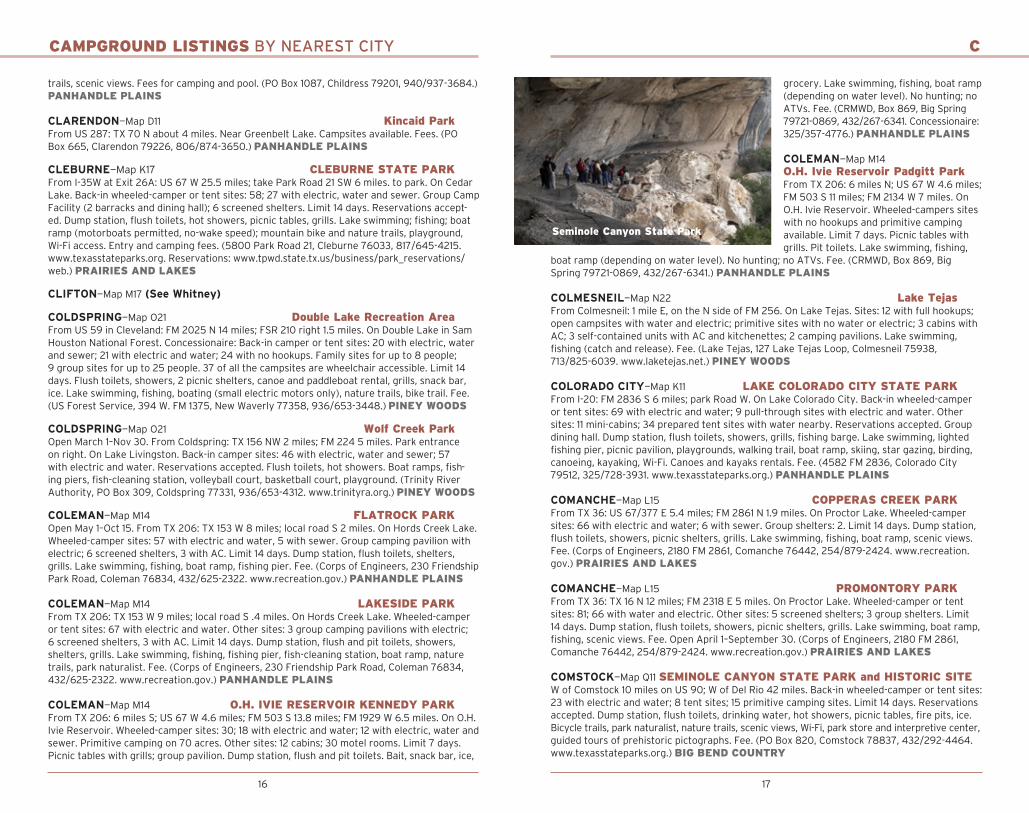
Seminole Canyon State Park

18 19
CAMPGROUND LISTINGS
CONCAN—Map R13 GARNER STATE PARKFrom TX 127: US 83 N 7.2 miles; Park Road 29 E. On Frio River. Back-in wheeled-camper or tent sites: 236 with electric and water: 125 tent sites with water hookups. Other sites: 37 screened shelters; 17 cabins; 2 group-camp-ing facilities with full kitchen. Limit 14 days. Reservations accepted. Dump station, flush toilets, hot showers. Seasonal: park store, gift shop, miniature golf, pedal boats, snack bar, nightly dance during summer. Swimming in river, fishing, hiking and mountain biking trails, educational programs. Fee. (234 RR 1050, Concan 78838, 830/232-6132. www. texasstateparks.org.) HILL COUNTRY
COOPER—Map H20 COOPER LAKE STATE PARK (DOCTOR’S CREEK UNIT)From TX 154: 2 miles S on FR 1529. Half-mile N of Cooper Lake Dam. On Cooper Lake. Wheeled-camper or tent sites: 42 with electric (2 for park hosts). Other sites: 5 screened shel-ters; 2 cottages with AC. Limit 14 days. Dump station, flush toilets, showers, fire rings. Group picnic shelter, amphitheater. Lake swimming, fishing, fishing pier, boat ramp, playground, nature trails. Fee. (1664 FM 1529 S., Cooper 75432, 903/395-3100. www.texasstateparks.org.) PRAIRIES AND LAKES
COOPER—Map H20 (See also Sulphur Springs)
CORPUS CHRISTI—Map V17 PADRE BALLI PARKFrom Park Road 22: TX 361 SW 2.8 miles; local road E .2 mile. On Gulf of Mexico; 374.5 acres. Wheeled-camper sites: 54 with 30 amp electric and water. Prepared tent sites available with water and electric. Limit 14 days. Reservations accepted. Dump station nearby, hot showers, laundry. Fishing, swimming in gulf, scenic views. (Nueces County Parks Department, PO Box 18608, Corpus Christi 78480, 361/949-8121. www.nuecesbeachparks.com/padreballipark.html.) GULF COAST
CORPUS CHRISTI—Map V17 PADRE ISLAND NATIONAL SEASHOREFrom TX 358 (S Padre Island Drive): Park Road 22 to National Seashore about 15 miles. On Gulf of Mexico (to east) and Laguna Madre (to west). RV or tent camping sites at Malaquite Campground, Bird Island Basin Campground and Windsurfing Area, and North and South Beach. Tent camping only at Yarborough Pass on South Beach. All camping primitive; no electric hookups or water. Limit 14 days, minimum 48 hours between stays after 14 days, max-imum 56 calendar days per year. All camping first-come, first-served; permit required. Dump station, water fill-up station, flush toilets, cold-water rinse showers at Malaquite Campground. Fishing (boat or surf), swimming, boat ramp, interpretive programs, nature trail birding driv-ing tour, star parties (seasonal), kayaking, windsurfing. (20420 Park Road 22, Corpus Christi 78480, 361/949-8068. www.nps.gov/pais/planyourvisit/camp.) GULF COAST
CORSICANA—Map L19 (See Dawson)
CRANE—Map M9 CRANE COUNTY 4-H RV PARKFrom US 385 and TX 329: TX 329 W .7 mile; N on truck route about 700 feet to park entrance. On Sixth Street Pond. Wheeled-camper sites: 8 with electric, water and sewer. Dump station, flush toilets, drinking water, picnic tables, fire pits. Fishing (winter months), swimming pool, playground, volleyball, horseshoes, basketball, walking trail, skate park. (900 W. Sixth St., Crane 79731, 432/558-3522.) BIG BEND COUNTRY
Ratcliff Lake Recreation Area
C
CROCKETT—Map N21 Ratcliff Lake Recreation AreaFrom Crockett: TX 7 E 15 miles. Ratcliff Lake in Davy Crockett National Forest. RV, camper or tent sites: 76; 17 with electric. Other sites: 2 picnic shelters. Several electric and non-electric campsites on reservation system. Limit 14 days. RV maximum length 50 feet. Flush toilets, hot showers, grills, snack bar (summer only). Lake swimming, fishing (no gas motors), sce-nic views, hiking trails. Fee. (US Forest Service, 18551 State Highway 7 E., Kennard 75847, 936/655-2299. Reservations: 877/644-6777 or www.recreation.gov.) PINEY WOODS
CROSBYTON—Map G10 Campground #1From US 82: FM 651 S 13.5 miles; FM 2794 E and S 8.6 miles. On White River Lake. Wheeled-camper or tent sites: 20. RV maximum length 25 feet. Limit 7 days. Flush toilets, cold showers. Boat ramps, lake swimming, fishing, skiing. Fee. (White River Municipal Water District, 2880 FM 2794, Spur 79370, 806/263-4240.) PANHANDLE PLAINS
CROSBYTON—Map G10 Campground #2From US 82: FM 651 S 13.5 miles; FM 2794 E and S 8.6 miles; West Road NE 1.5 miles. On White River Lake. Wheeled-camper or tent sites: 25; 10 with electric and water. RV maximum length 25 feet. Limit 7 days. Flush toilets. Lake swimming, fishing, skiing. (White River Municipal Water District, 2880 FM 2794, Spur 79370, 806/263-4240.) PANHANDLE PLAINS
CROSBYTON—Map G10 Campground #3From US 82: FM 651 S 13.5 miles; FM 2794 E and S 7.2 miles; White River Road NW 1.9 miles. On White River Lake. Wheeled-camper or tent sites: 25. RV maximum length 25 feet. Limit 7 days. Flush toilets. Lake swimming, fishing, boat skiing, hiking, dock. (White River Municipal Water District, 2880 FM 2794, Spur 79370, 806/263-4240.) PANHANDLE PLAINS
CROSBYTON—Map G10 Campground #4From US 82: FM 651 S 13.5 miles; FM 2794 E and S 7.2 miles; White River Road 4 miles past Campground #3, Sand Creek Road to the right 1 mile. On White River Lake. Primitive camping only. Limit 7 days. Park has 6 tables with shade. No toilets, no water. Lake swimming, skiing, fishing, hiking. (White River Municipal Water District, 2880 FM 2794, Spur 79370, 806/263-4240.) PANHANDLE PLAINS
CROSBYTON—Map G10 CITY PARKUS 82 at E city limit. Wheeled-camper or tent sites: 8 with water, electric, and sewer. Limit 3 days. Dump station, picnic tables. Swimming pool, playground. (221 W. Main, Crosbyton 79322, 806/675-2301.) PANHANDLE PLAINS
CROSBYTON—Map G10 WHITE RIVER LAKEFrom Crosbyton: Take FM 651 S 13.6 miles; E (left) onto FM 2794 8 miles to White River Lake. On White River Lake. Wheeled-camper or tent sites: 20 with electric and water; 25 prepared tent sites; primitive camping on 100 acres. Limit 7 days. No reservations. Dump station, flush toilets, drinking water, cold showers, picnic tables, fire pits, fire places, ice, grocery, snack bar. Fishing, tackle for sale or rent, bait, lake swimming, boat ramp (motorboats permitted), play-ground, horseshoe pitching, scenic views. (2880 FM 2794, Crosbyton 79370, 806/263-4240.) PANHANDLE PLAINS
CROWELL—Map G13 COPPER BREAKS STATE PARKFrom US 70: TX 6 N 9 miles, Park Road 62 .5 mile. On Lake Copper Breaks. Holds a gold-tier International Dark Sky rating. Comanche Camping Area: .25 mile from Lake Copper Breaks has wheeled-camper sites with electric, water, covered tables. Kiowa Camping Area: .1 mile from Lake Copper Break has 11 tent sites. Big Pond Camping Area: 1 mile from Lake Copper Breaks has 10 tent and equestrian camping sites with covered tables. All sites listed above have a table, fire ring, grill and drinking water nearby. Primitive Camping Area: 1-acre site, maxi-mum 48 people. Group Camping Area: 5 tent sites, maximum 40 people. Self-guided nature

20 21
CAMPGROUND LISTINGS BY NEAREST CITY
trail, hiking trails, equestrian trail, longhorns, fishing, lake swimming, boating (limit 5 mph), boat ramp, fishing pier, interpretive center, amphitheater, group picnic area, volleyball court, playgrounds, picnicking, flush toilets, dump station, showers, scenic views. Fee. (777 Park Road 62, Quanah 79252, 940/839-4331. www.texasstateparks.org.) PANHANDLE PLAINS
——————————— D ———————————
DAINGERFIELD—Map J22 DAINGERFIELD STATE PARKFrom Daingerfield: TX 49E to Park Road 17. On Lake Daingerfield. Wheeled-camper or tent sites: 40 with electric, water and sewer; 12 with water only. Group dining hall; group lodge; 3 cabins. Limit 14 days. Dump station, flush toilets, showers, ice. State Park store, interpretive center, lake swimming, fishing, boat ramp, playground, bicycle trails, nature trails. Fee. (455 Park Road 17, Daingerfield 75638, 903/645-2921. www.texasstateparks.org.) PINEY WOODS
DALHART—Map B9 RITA BLANCA LAKE PARKFrom US 54/87/385 intersection: S 2 miles to FM 281, take FM 281 W 1.5 miles. On Rita Blanca Lake. Wheeled-camper sites: 8 with electric, water and sewer. Prepared tent sites: 3. Limit 14 days. No reservations. Dump station, vault toilets, picnic tables. Bicycle trails, horseback riding, nature trails, scenic views, 18-hole disc golf, fishing pond, playground in area. Fees. (PO Box 2005, Dalhart 79022, 806/244-5511.) PANHANDLE PLAINS
DAWSON—Map L18 LIBERTY HILL PARKFrom TX 31: FM 709 NW 3.5 miles. On Navarro Mills Lake. Back-in wheeled-camper sites: 92 with electric and water, 12 with sewer. Other sites: 5 screened shelters; 1 group shelter. Limit 14 days. Dump station, flush toilets, showers, bait, picnic shelters, grills, ice, grocery. Lake swimming, fishing, boat ramps, scenic views. Fee. (Corps of Engineers, 1175 FM 667, Purdon 76679-9707, 254/578-1431. www.recreation.gov.) PRAIRIES AND LAKES
DAWSON—Map L18 OAK PARKFrom TX 31: NE 4.3 miles; FM 667 NW 1.5 miles. On Navarro Mills Lake. Back-in wheeled-camp-er sites: 48 with electric and water, 6 with sewer. Group shelter 1. Limit 14 days. Dump station, flush toilets, showers, picnic shelters, grills. Lake swimming, fishing, boat ramp, scenic views, nature trail. Fee. (Corps of Engineers, 1175 FM 667, Purdon 76679-9707, 254/578-1431. www.recreation.gov.) PRAIRIES AND LAKES
DAWSON—Map L18 Pecan Point ParkOpen April–September. From TX 31: NE 4.3 miles; FM 667 NW 5 miles; FM 744 SW 2.5 miles; FM 1578 S 2 miles. On Navarro Mills Lake. Back-in wheeled-camper sites: 35, 5 with hookups. Limit 14 days. Pit toilets, shower, picnic shelters, grills. Lake swimming, fishing, boat ramp. (1175 FM 667, Purdon 76679-3187, 254/578-1431. www.recreation.gov.) PRAIRIES AND LAKES
DAWSON—Map L18 WOLF CREEK PARKOpen April 1–Sept 30. From TX 31: NE 4.3 miles; FM 667 NW 3.1 miles; FM 639 SW 2.1 miles. On Navarro Mills Lake. Back-in wheeled-camper sites: 50 with electric and water; 22 with water. Park has 1 group shelter. Limit 14 days. Dump station, flush toilets, showers, picnic shelters, grills. Lake swimming, fishing, boat ramp, scenic views. Fee. (Corps of Engineers, 1175 FM 667, Purdon 76679-9707, 254/578-1431. www.recreation.gov.) PRAIRIES AND LAKES
DECATUR—Map H17 Black Creek Recreation AreaFrom Decatur: FM 730 N 7 miles; County Road 2360 left 2 miles; County Road 2372 right .25 mile; County Road 2461 right .5 mile; FS Road 902 left. On Black Creek Lake, LBJ National Grassland. Camping area on 2 acres. Limit 14 days. Pit toilets, no drinking water. Fishing, boat ramp, no swimming or shooting. (US Forest Service, Box 507, Decatur 76234, 940/627-5475.) PRAIRIES AND LAKES
C-D
DECATUR—Map H17 Tadra Point Trailhead CampFrom Decatur: FM 730 N 10 miles; County Road 2461 (Cottonwood Cemetery Road) left; at fork stay on County Road 2461 (left) 2 miles; FSR 904 right 1 mile; FSR 900 right 1 mile. Entrance on left. Camping area 20 acres. Back-in camper and tent sites: 26; primitive areas available. Limit 14 days. Pit toilets, fire rings, bicycle trails, horseback riding, hiking. (US Forest Service, Box 507, Decatur 76234, 940/627-5475.) PRAIRIES AND LAKES
DECATUR—Map H17 Valley View Group Use CampgroundFrom Decatur: US 81/287 N 11 miles; FM 1655 right 8 miles; Roberts Road right 1.5 mi: County Road 2690 left 2 miles; County Road 2675 right 100 yards; County Road 2777 left, to entrance on right. Camping area 20 acres; by permit only—call 940/627-5475. Back-in camper and tent sites: 15. Primitive areas available. Limit 14 days. Pit toilets, fire rings, tables, picnic shelter, stock water, bicycle trails, horseback riding, hiking. Fee. (US Forest Service, Box 507, Decatur 76234, 940/627-5475.) PRAIRIES AND LAKES
DEL RIO—Map R11 Amistad National Recreation Area (277 North Campground)From Del Rio: US 90 about 5 miles; US 277 N 6 miles; E on 277 N campground road. On Lake Amistad. Wheeled-camper or tent sites: 17, no hookups or water. Limit 14 days. All sites first-come, first-served. Group site available by reservation. Drinking water and dump station at Diablo East. Vault toilets, tables, shelters, grills. No ground fires. Launch ramp may be avail-able depending on lake levels. Fee. (Amistad National Rec Area, 4121 Veterans Blvd., Del Rio 78840, 830/775-7491 ext. 0.) BIG BEND COUNTRY
DEL RIO—Map R11 Amistad National Recreation Area (Governor’s Landing)From Del Rio: US 90 W 15 miles; Spur 349 toward Amistad Dam; turn at first road toward campground. On Lake Amistad. Wheeled-camper or tent sites: 15 with no hookups. Limit 14 days. All sites first-come, first-served. Dump station at Diablo East, US 90 W. Vault toilets, water, tables, shelters, grills. No ground fires. Access to water dependent on lake levels. Lake swimming. Fee. (Amistad National Rec Area, 4121 Veterans Blvd., Del Rio 78840, 830/775-7491 ext. 0.) BIG BEND COUNTRY
DEL RIO—Map R11 Amistad National Recreation Area (Rough Canyon Campground)From Del Rio: US 90 about 5 miles; US 277 N 15 miles; Recreation Road 2 W 11 miles. On Lake Amistad. Wheeled-camper or tent sites: 4 with no hookups or water. Limit 14 days. All sites first-come, first-served. Dump station at Diablo East. Drinking water at parking lot adjacent to site. Flush toilets next to campground, tables, shelters, grills. No ground fires. Launch ramp. Access to water dependent on lake levels. Fee. (Amistad National Rec Area, 4121 Veterans Blvd., Del Rio 78840-9350, 830/775-7491 ext. 0.) BIG BEND COUNTRY
DEL RIO—Map R11 Amistad National Recreation Area (San Pedro Campground)From Del Rio: US 90 W 9 miles to Spur 454; follow signs from Spur 454 on graded dirt road to campground. On Lake Amistad. Wheeled-camper or tent sites: 34 with no hookups or water. Limit 14 days. All sites first-come, first-served. Group site available by reservation. Drinking
Daingerfield State Park

22 23
CAMPGROUND LISTINGS BY NEAREST CITY
water and dump station at Diablo East. Vault toilets, tables, shelters, grills. No ground fires. Access to water dependent on lake levels. Fee. (Amistad National Rec Area, 4121 Veterans Blvd., Del Rio 78840-9350, 830/775-7491 ext. 0.) BIG BEND COUNTRY
DEL RIO—Map R11 Amistad National Recreation Area (Spur 406 Campground)From Del Rio: US 90 W 20 miles; Spur 406 S 5 miles to campground. On Lake Amistad. Wheeled-camper or tent sites: 6 with no hookups or water. Limit 14 days. All sites first-come, first-served. Drinking water and dump station at Diablo East. Vault toilets, tables, shelters, grills. No ground fires. Launch ramp may be available depending on lake levels. Fee. (Amistad National Rec Area, 4121 Veterans Blvd., Del Rio 78840-9350, 830/775-7491 ext. 0.) BIG BEND COUNTRY
DEL RIO—Map R11 Devils River State Natural AreaFrom Del Rio: N TX 277 45 miles; left on Dolan Creek Road 18.6 miles. On Devils River. Primitive drive-up and paddle-up sites available. Picnic table, fire ring at drive-up sites; no shade, water or restrooms. Group barrack with 5 bedrooms, electric and water; no kitchen, no linens. Reservations required for all camping. Canoeing/kayaking (Devils River State Natural Area Access Permit required), scenic views. (HC 01, Box 513, Del Rio 78840, 830/395-2133. Reservations: 512/389-8901. www.texasstateparks.org.) BIG BEND COUNTRY
DENISON—Map G19 EISENHOWER STATE PARKFrom US 75, Exit 72: TX 91 N 2 miles to Denison Dam; FM 1310 W 2 miles to park entrance. On Lake Texoma; 463 acres. Wheeled-camper or tent sites: 50 with electric, water and sewer; 45 with electric and water. All-paved group camp area for RVs and travel trailers: 37 sites with water and electric, plus restroom and pavilion. Other sites: 47 prepared tent sites; 34 screened shelters; 1 limited-use cabin with AC; 3 group sites. Limit 14 days. Reservations ac-cepted. Dump station, flush toilets, drinking water, hot showers, picnic tables, fire pits, ice, grocery, snack bar, bathhouse. Fishing, tackle for sale or rent, bait, lake swimming, boat ramp (motorboats permitted), bicycle trails, trail bike area, playground, horseshoe pitching, park naturalist, nature trails, scenic views, Wi-Fi, ATV trail, fishing piers, amphitheater, pavilion, recreation hall. Fee. (50 Park Road 20, Denison 75020, 903/465-1956. www.texasstateparks.org.) PRAIRIES AND LAKES
DENISON—Map G19 PRESTON BEND RECREATION AREAOpen April 1–Sept 30. From US 69/75: FM 120 W 5.6 miles; SH 289 N 8.5 miles. On Lake Texoma. Camper trailer or tent sites: 26 with electric and water; 12 tent sites with water; 2 group shelters. Limit 14 days. Dump station, flush and pit toilets, showers, picnic shelters, grills. Courtesy boat dock and boat ramp. Fees. (Corps of Engineers, 351 Corps Road, Denison 75020, 903/465-4990. www.recreation.gov.) PRAIRIES AND LAKES
DENISON—Map G19 TEXAS DAM SITEOpen year-round. From Denison: TX 91 N 4 miles; Corps Road N 1 mile. On Red River. Camper trailer or tent sites: 22 with electric and water; 6 tent sites with water; 1 group shelter. Limit 14 days. Dump station, flush and pit toilets, showers, picnic shelters, grills. Boat ramp located above dam at Spillway Boat Ramp. Fees. (Corps of Engineers, 351 Corps Road, Denison 75020-6425, 903/465-4990.) PRAIRIES AND LAKES
DENVER CITY—Map J8 YOAKUM COUNTY PARKFrom TX 83: TX 214 N 5.9 miles. Back-in wheeled-camper sites: 10 with electric and water. Limit 4 days. Dump station, flush toilets, softball field, horseshoes, playground. (County Park Department, PO Box 643, Denver City 79323, 806/592-3166.) PANHANDLE PLAINS
DUMAS—Map B9 Blue Creek Bridge Public Use AreaFrom US 87/287: FM 1913 E 15.6 miles. On Lake Meredith. Undeveloped camping area. Limit 14
D-E
days. No firewood available; no drinking water. Vault toilets, fire rings, grills. Horseback riding, off-road vehicles allowed. (National Park Service, Box 1460, Fritch 79036, 806/857-3151. www.nps.gov/lamr/planyourvisit/camping.htm.) PANHANDLE PLAINS
DUMAS—Map B9 Blue West Public Use AreaFrom US 87/287: FM 1913 E 15.6 miles; local road E 2.6 miles. On Lake Meredith. Wheeled-camper or tent sites: 50. Limit 14 days. No firewood available. Vault toilets, fire rings, tables, grills, no drinking water. Fishing, boat ramp—depending on water level—(motorboats permitted, fee), picnic shelters, scenic views. Courtesy dock available when lake level is 70 feet. (National Park Service, Box 1460, Fritch 79036, 806/857-3151. www.nps.gov/lamr/planyourvisit/ camping.htm.) PANHANDLE PLAINS
DUMAS—Map B9 Plum CreekFrom US 87/287: TX 152 E 16 miles; FM 1913 S 12 miles to access road. On Lake Meredith. Undeveloped camping area. Limit 14 days. No firewood available. Vault toilets, fire rings, grills, no drinking water. Horseback riding, boat ramp—accessible when water level is above 95 feet, picnic shelters. (National Park Service, Box 1460, Fritch 79036, 806/857-3151. www.nps.gov/lamr/planyourvisit/camping.htm.) PANHANDLE PLAINS
DUMAS—Map B9 TEXHOMA PARKWithin city: 500 W. First (US 87N). Wheeled-camper sites with electric. Limit 1 day. Dump sta-tion, flush toilets, picnic area. (City Park Department, Box 438, Dumas 79029, 806/934-0837. www.ci.dumas.tx.us/visitors/recreation/texhoma_park.jsp.) PANHANDLE PLAINS
DUMAS—Map B9 (See Fritch)
——————————— E ———————————
EDNA—Map S18 BRACKENRIDGE PARK and CAMPGROUNDFrom Edna: TX 111 E 8 miles. On Lake Texana; park is 275 acres; campground is 85 acres. Wheeled-camper sites: 98 with electric, water and sewer (16 pull-through); 36 with electric and water. Limit 90 days. Other sites: 36 prepared tent sites; primitive camping on 250 acres; 5 cabins with AC, linens provided. Reservations accepted. Dump station, flush toilets, drinking water, AC comfort stations with hot showers, picnic tables, fire pits, ice, small convenience store with snacks and drinks, laundry. Auditorium, meeting room, pavilion, gazebo, marina building for rent. Fishing, tackle for sale or rent, lake swimming, boat ramp (motorboats permitted), bi-cycle trails, trail bike area, equestrian trail, playgrounds, 9-hole miniature golf course, volley-ball, softball field, nature and historical trails, paintball field, soccer field, basketball, disc golf, Wi-Fi. Brackenridge Recreation Complex: Brackenridge Main Event Center (all-weather eques-trian arena with concessions and horse stalls). Monthly wheeled-camper sites: 108 with electric, water and sewer; 62 with electric and water. Limit 90 says. Fishing pond with piers, covered picnic tables, day-use picnic area, playground. (Lavaca-Navidad River Authority, 891 Bracken-ridge Parkway, Edna 77957, 361/782-5456. www.brackenridgepark.com.) GULF COAST
EDNA—Map S18 TEXANA PARK AND CAMPGROUNDFrom TX 111, 7 miles E of Edna. On Lake Texana; 575 acres. Back-in wheeled-camper or tent sites: 62 with electric, water and sewer; 79 with electric and water. Limit 90 days. Reserva tions accepted. Other sites: 141 prepared tent sites; 2 cabins (3 bedroom/2 bathroom) with AC. Dump station, flush toilets, drinking water, AC comfort stations with hot showers, fire pits, ice, grocery store nearby, snack bar. Lake swimming, fishing, tackle for sale or rent, boat ramp (motorboats permitted), bicycle trails, trail bike area, playground, nature trails, park naturalist and Nature Center, canoe and kayak rentals, scenic views, Wi-Fi. Fee. (Lavaca-Navidad River Authority, 46 Park Road 1, Edna 77957, 361/782-5718. www.brackenridgepark.com.) GULF COAST

24 25
CAMPGROUND LISTINGS BY NEAREST CITY
EDNA—Map S18 Mustang WildernessFrom E city limit: US 59 E 8 miles to Ganado; Loop 521 1 mile; FM 2982 S 2.2 miles; County Road 249 .5 mile to entrance. On Lake Texana. Prepared tent sites: 28; primitive camping available. Pack in only. Water and electricity available at restroom only. Centrally located re-stroom and shower facility, Eloo waste system. Lake swimming, fishing, boat ramp, bird watch-ing, wildlife viewing, nature trails, scenic views. (Lavaca-Navidad River Authority, Box 429, Edna 77957, 361/782-5456. www.brackenridgepark.com.) GULF COAST
ENNIS—Map K18 HIGH VIEW PARKFrom US 75/287: TX 34 S 5.8 miles; local road SE .3 mile. On Bardwell Lake. Wheeled-camper sites: 39 with electric and water. Limit 14 days. Dump station, pit toilets, shower. Lake swimming, 10 picnic sites, grills, snack bar, fishing, bait, paddleboats, boat ramp, marina. Fee. (Bardwell Lake Office, 4000 Observation Drive, Ennis 75119, 972/875-5711. www.recreation.gov.) PRAIRIES AND LAKES
ENNIS—Map K18 MOTT PARKOpen April 1–Sept 30. From US 75/287: TX 34 S 6.8 miles; FM 985 SE 1.6 miles. On Bardwell Lake. Back-in wheeled-camper sites: 33 with water and electric (12 pull-through, 21 back-in). Prepared tent sites: 7. Limit 14 days. Also group shelter with 4 RV hookups, by reservation. Dump station, pit toilets, showers. Lake swimming, fishing, boat ramp, grills. Fee. (Bardwell Lake Office, 4000 Observation Drive, Ennis 75119, 972/875-5711. www.recreation.gov.) PRAIRIES AND LAKES
ENNIS—Map K18 WAXAHACHIE CREEK PARKFrom US 75/287: TX 34 S 6.2 miles; local road NW 1.7 miles. On Bardwell Lake. Wheeled-camper sites: 60 with water and electric (14 pull-through, 41 back-in). Primitive campsites: 7. Limit 14 days. Also group shelter with 8 RV hookups, by reservation. Dump station, flush and pit toilets, showers, grills. Fishing, boat ramp, nature trail. Fee. (Bardwell Lake Office, 4000 Observation Drive, Ennis 75119, 972/875-5711. www.recreation.gov.) PRAIRIES AND LAKES
EUSTACE—Map K20 PURTIS CREEK STATE PARKFrom US 175: FM 316 N 3 miles. Park, 1,533 acres, includes 355-acre Purtis Creek Lake. Back-in wheeled-camper or tent sites: 58 with water and electric; 5 prepared tent sites with water. Reservations accepted. Dump station, flush toilets, showers. Fishing (largemouth black bass on catch-and-release basis only; contact park headquarters for details), lighted boat ramp, 50-boat maximum on lake (no-wake rule). Lake swimming, tables, playground, picnic pavilion, fish-cleaning areas, lighted fishing piers, 4-mile hike/bike trail, primitive campsites along 1.7-mile nature path. Fee. (14225 FM 316, Eustace 75124, 903/425-2332. Reservations: 512/389-8900. www.texasstateparks.org.) PRAIRIES AND LAKES
——————————— F ———————————
FAIRFIELD—Map M19 FAIRFIELD LAKE STATE PARKFrom I-45: US 84 E to FM 488 NE 2.3 miles; FM 2570 NE 1.3 miles; FM 3285/Park Road 64 3.2 miles. On Lake Fairfield. Multi-use sites: 99 with electric and water; 36 with water only; also primitive campsites at end of 2.1-mile hiking trail. Limit 14 days. Reservations accepted. Dump station, flush toilets, showers, tables, ice, firewood, park store. Lake swimming, fishing, boat ramp, playground, dining hall with heat/AC seats 60, picnic area, nature trails, park naturalist, scenic views, horseback riding with your horse. Fee. (123 State Park Road 64, Fairfield 75840, 903/389-4514. www.texasstateparks.org.) PRAIRIES AND LAKES
FALCON—Map X14 (See Roma)
FLOWER MOUND—Map J18 Murrell ParkFrom TX 121: FM 2499 N 3 miles; Flower Mound Road W .3 mile; McKamy Creek Road W .8;
E-F
Simmons Road S 1 mile. On Grapevine Lake. Primitive campsites: 36. Limit 14 days. Pit toilets; grills and fire rings; marina and store nearby. Lake swimming, fishing, boat ramp. (Corps of Engineers, 110 Fairway Drive, Grapevine 76051, 817/865-2600.) PRAIRIES AND LAKES
FLOYDADA—Map G10 WAYNE RUSSELL RV PARKOn US 70, N side of town; 801 N. 2nd St. Near Mackenzie Lake and Buffalo Springs Lake. Wheeled-camper sites: 16 with electric and water. Primitive tent camping available. Dump station, drinking water, no toilets. Swimming-pool, play-ground, tennis court, softball field, nature trails,
scenic views. First 2 days free, then fee per day. (City Hall, 114 W. Virginia St., Floydada 79235, 806/983-2834.) PANHANDLE PLAINS
FORT DAVIS—Map O6 Davis Mountains State ParkFrom TX 17: TX 118 W 2.8 miles; Park Road 3 SW. Wheeled-camper or tent sites: 27 with elec-tric, water and sewer; 33 with electric and water. Other sites: 33 tent sites; 6 primitive sites; 6 primitive equestrian sites. Flush toilets, showers, grills, restaurant. Scenic views, hiking trails, playground, interpretive center, amphitheater, nature viewing areas, group picnic area. Fee. (Box 1707, Fort Davis 79734, 432/426-3337. Reservations: 512/389-8900.) Indian Lodge in park has 39 rooms with TV, phones, restaurant, pool. Fee. (Indian Lodge: Box 1707, Fort Davis 79734. Lodge reservations: 512/389-8982. www.texasstateparks.org.) BIG BEND COUNTRY
FORT WORTH—Map J17 (See Benbrook)
FREDERICKSBURG—Map P15 Enchanted Rock State Natural AreaFrom Main Street (Highway 290) in Fredericksburg: Take RR 965 N 18 miles to park entrance on left. Near Sandy Creek. Prepared tent sites: 35. Primitive tent camping sites: 20; primitive group camping area available. Weekends require a 2 night minimum stay. Limit 14 days. Reservations required. Flush toilets, hot showers, playgrounds, picnic tables, fire pits, park naturalist, scenic views. Note: Visitation to this area is limited to protect the natural and cultural resources. Once the park reaches capacity during heavy-use periods, it will close temporarily. Campers with reservations are admitted during closure period. Fee for age 13 and older. (16710 RR 965, Fredericksburg 78624, 830/685-3636. www.texasstateparks.org.) HILL COUNTRY
FREDERICKSBURG—Map P15 Lady Bird Johnson Municipal ParkFrom US 290: TX 16 SW 3 miles; Lady Bird Johnson Drive W .3 mile. On Live Oak Creek. RV Park has 98 sites with electric (30 and 50 amp), water, sewer and cable TV. Primitive tent camping available. Monthly rates September–March. Reservations required. Swimming pool (summer months), fishing, tennis, softball, Wi-Fi. (432 Lady Bird Johnson Drive, Fredericks-burg 78624, 830/997-4202. www.fbgtx.org/index.aspx?NID=343.) HILL COUNTRY
FREEPORT—Map S21 San Luis Pass County ParkFrom TX 288: TX 332 S to Surfside: County Road 257 left about 14 miles. On Gulf of Mexico/West Bay. Paved/concreted wheeled-camper sites: 79 with water, electric (30 and 50 amp) and sewer; 4 cabins with AC. Meeting room with AC; pavilion. Reservations required. Bathhouse, showers, laundry. Fishing, boat ramp, playground, handicap accessible, scenic views. (San Luis Pass County Park, 14001 County Road 257, Freeport 77541, 800/372-7578. www.BrazoriaCountyParks.org.) GULF COAST
Texana Park

26 27
CAMPGROUND LISTINGS BY NEAREST CITY
FRIONA—Map E8 Reeve Lake RV ParkFrom US 60: N on Highway 214 .2 mile, look for windmill on W side of Highway 214. Near Reeve Lake. Wheeled-camper sites: 10 with electric, water and sewer. Limit 30 days. First night free with 30 day stay, charge per day. (623 Main St, Friona 79035, 806/250-2761. www.frionachamber.com.) PANHANDLE PLAINS
FRISCO—Map H18 (See Little Elm)
FRITCH—Map C10 Cedar Canyon Public Use AreaFrom E city limit: TX 136 E .1 mile; local road N and E 3 miles. On Lake Meredith. Undeveloped tent camping area. Limit 14 days. No firewood or drinking water. Flush toilets. Lake swimming, fishing, boat ramp available when water level above 64 feet (motorboats permitted). (National Park Service, Box 1460, Fritch 79036, 806/857-3151. www.nps.gov/lamr/plan yourvisit/camping.htm.) PANHANDLE PLAINS
FRITCH—Map C10 FRITCH FORTRESS PUBLIC USE AREAFrom E city limit: TX 136 E .1 mile; local road N and W 3.4 miles. On Lake Meredith. Undeveloped tent-camping area. Limit 14 days. No firewood available. Dump station, flush toilets, fire rings, shelters, tables, grills. Fishing, boat ramp available when water level above 50 feet (motorboats permitted). Scenic views. (National Park Service, Box 1460, Fritch 79036, 806/857-3151. www.nps.gov/lamr/planyourvisit/camping.htm.) PANHANDLE PLAINS
FRITCH—Map C10 Harbor BayFrom city limit: TX 136 2 miles. On Lake Meredith. Undeveloped camping area. Limit 14 days. No firewood available. Vault toilets, fire rings, shelters, grills. Mountain biking, hiking trails, lake swimming, fishing, boat ramp available when water level above 79 feet (motorboats per-mitted). Double R boat ramp available when water level is 53.75 feet. (National Park Service, Box 1460, Fritch 79036, 806/857-3151. www.nps.gov/lamr/planyourvisit/camping.htm.) PANHANDLE PLAINS
FRITCH—Map C10 McBride Canyon and Mullinaw CreekFrom S city limit: TX 136 SW 7 miles; local road W and SW 6 miles. Undeveloped camping area. Limit 14 days. No firewood available; no drinking water. Vault toilets, picnic areas. Mountain biking, hiking trails, horseback riding. (National Park Service, Box 1460, Fritch 79036, 806/857-3151. www.nps.gov/lamr/planyourvisit/camping.htm.) PANHANDLE PLAINS
FRITCH—Map C10 Sanford-Yake Public Use AreaFrom E city limits: TX 136 E .1 mile; local road N and E 3.7 miles. On Lake Meredith. Wheeled-camper or tent-camping sites: 70. Limit 14 days. No firewood available. Flush toilets, fire rings, bait, picnic shelters, tables, grills. Fishing, boat ramp (motorboats permitted), ranger station. (National Park Service, Box 1460, Fritch 79036, 806/857-3151. www.nps.gov/lamr/planyour visit/camping.htm.) PANHANDLE PLAINS
FRITCH—Map C10 (Also see Dumas)
Enchanted Rock State Park
F-G
——————————— G ———————————
GALVESTON—Map R22 GALVESTON ISLAND STATE PARKFrom I-45: 61st SE 2 miles; FM 3005 (Seawall Blvd SW 11 miles. On Gulf of Mexico. Sites on beach side: 30 with water and electric (50 amp). Bay side sites: 20 with water and electric (50 amp); 10 with water only. Limit 14 days. Reservations recommended. Dump stations (1 on each side), restrooms, showers (at 2 of 3 beachside campgrounds; one bayside in the water only loop), picnic tables, grills, fish-cleaning shelter. Day-use area with outdoor rinse off showers, changing rooms, restrooms, covered picnic tables with barbecue pits. Swimming—beach, hiking trails, fishing. Fee. (14901 FM 3005, Galveston 77554, 409/737-1222. Reservations: 512/389-8900. www.texasstateparks.org.) GULF COAST
GATESVILLE—Map M17 FAUNT LEROY PARKWithin city: Seventh Street S, 2 blocks S of courthouse. On Leon River. Back-in wheeled-camp-er sites: 8 with electric and water. Primitive tent sites available. Limit 14 days. Reservations accepted. Dump station, flush toilets, hot showers, picnic tables, grills. Playground, volleyball, horseshoes. (City Police Department, 200 N. Eighth St., Gatesville 76528, 254/865-2226. www.ci.gatesville.tx.us.) PRAIRIES AND LAKES
GEORGETOWN—Map O17 Berry Springs Park and PreserveFrom S I-35, Exit 265 for S 130: Right at stop sign, take 130 Access Road S; left on County Road 152, 1.5 miles E to park entrance. From N I-35, Exit 266: Follow signs to SB 130, stay on access road, left on County Road 152, 1.5 miles to entrance. Near Berry Creek. Prepared tent sites: 18. Designated primitive tent camping sites: 10. Limit 14 days in a 30-day period. Reservations accepted. Flush toilets, drinking water, hot showers, picnic tables, fire pits. Fishing, bicycle trails, playground, park naturalist, nature trails. Horseback riders must bring their own horse and have an orientation with park staff prior to riding (current Coggins test must be on file; waivers must be signed before riding; no riding on weekends during peak seasons—Spring and Fall). (1801 County Road 152, Georgetown 78626, 512/930-0400. parks.wilco.org.) HILL COUNTRY
GEORGETOWN—Map O17 CEDAR BREAKS PARKFrom I-35: FM 2338 W 3.5 miles; Cedar Breaks Road S 2 miles. On Lake Georgetown. Back-in wheeled-camper or tent sites: 64 with electric and water. Limit 14 days. Dump station, flush toilets, showers, tables, shelters, grills. Lake swimming, fishing, boating, boat ramp, nature trails. Fee. (Corps of Engineers, 500 Lake Overlook Drive, Georgetown 78628, 512/819-9046. www.recreation.gov.) HILL COUNTRY
GEORGETOWN—Map O17 JIM HOGG PARKFrom I-35: FM 2338 W 6 miles; Jim Hogg Road S 2 miles. On Lake Georgetown. Back-in wheeled-camper or tent sites: 143 with electric and water; 5 screened shelters. Limit 14 days. Dump station, flush toilets, showers, tables, grills. Lake swimming, fishing, boating, boat ramp. Fee. (Corps of Engineers, 500 Lake Overlook Drive, Georgetown 78626, 512/819-9046. www.recreation.gov.) HILL COUNTRY
GEORGETOWN—Map O17 Tejas ParkFrom I-35: FM 2338 W 6.5 miles; FM 3405 S 4 miles; County Road 258 N 2 miles to park entrance. On North San Gabriel River near Lake Georgetown. Prepared tent sites: 12. Limit 14 days. Pit toilets, picnic tables, fishing, nature trails. Fee. (Corps of Engineers, 500 Lake Overlook Drive, Georgetown 78626, 512/819-9046.) HILL COUNTRY
GLEN ROSE—Map L17 DINOSAUR VALLEY STATE PARKFrom US 67: FM 205 W 2.8 miles; Park Road 59 N 1 mile. On Paluxy River. Back-in wheeled-camper or tent sites: 45 with water and electric; 7 backpacking sites; 8 walk-in

28 29
CAMPGROUND LISTINGS BY NEAREST CITY
campsites. Limit 14 days. Dump station, flush toilets, showers, picnic tables, grills. Swimming in river, fishing, bicycle trails, children’s trail, ADA trail, horseback riding, playground, na-ture trails, gift shop, dinosaur exhibits, pavilion. Fee. (1629 Park Road 59, Glen Rose 76043, 254/897-4588. www.texasstateparks.org.) PRAIRIES AND LAKES
GLEN ROSE—Map L17 OAKDALE PARKFrom TX 144/US 67 intersection: US 67 W; left on Barnard St; entrance 1 mile on right. On Paluxy River. Wheeled-camper sites with electric, water and sewer: 104. Limit 180 days. Prepared tent sites: 20; primitive camping available on 5 acres. Limit 30 days. Reservations accepted. Other sites: 3 shelters; 7 cottages with AC; 14 cabins with AC; 3 group sites; 3 bunkhouses. Dump station, flush toilets, drinking water, hot showers, picnic tables, fire pits, ice, grocery, snack bar, laundry. Swimming pool, fishing, playground, horseshoe pitching, vol-leyball, shuffleboard, nature trails, scenic views. Fee. (1019 NE Barnard St., Glen Rose 76043, 254/897-2321. www.oakdalepark.com.) PRAIRIES AND LAKES
GOLIAD—Map T17 GOLIAD STATE PARKFrom US 59: US 77-A/183 S 1 mile. On San Antonio River. Sites: 20 with full hookups; 24 with water and electric. Tent-only sites: 14. Other sites: 5 screened shelters; 1 group dining hall. Reservations accepted. Dump station, flush toilets, showers, playground, riverfront picnic sites, grills. Restored Mission Espiritu Santo, museum/interpretive center, Gen. Zaragoza birthplace. Fishing, hiking and nature/historical study. Presidio La Bahia nearby. Fee. (108 Park Road 6, Goliad 77963, 361/645-3405. www.texasstateparks.org.) SOUTH TEXAS PLAINS
GONZALES—Map R17 LAKE WOOD RECREATION AREAFrom US 183: US 90-A W 3.1 miles; FM 2091 S 3 miles. On 488-acre Lake Wood and Guadalupe River. Multi-use sites: 16 with full hookups; 3 with water. Tent sites: 16; 5 acres available for primitive camping. Extended stays available. Reservations accepted. Fee. Dump station, flush toilets, hot showers, picnic tables, grills, ice, grocery. Lake swimming, fishing, bait, boat ramp (motorboats permitted), playground, volleyball, laundry. (Guadalupe-Blanco River Authority, 167 County Road 254, Gonzales 78629, 830/672-2779. www.gbra.org.) PRAIRIES AND LAKES
GRAHAM—Map J15 Kindley ParkFrom TX 16: US 380 NW 7 miles, at E end of bridge. On Lake Graham. Back-in wheeled-camper sites: 12 with electric. Limit 14 days. Lake swimming, picnic tables, nature trails, scenic views, fishing. Fee. (429 Fourth St., Box 1449, Graham 76450, 940/549-3324.) PANHANDLE PLAINS
GRAHAM—Map J15 LAKE EDDLEMAN PARKFrom TX 16: US 380 N 1.6 miles. On Lake Eddleman. Back-in wheeled-camper sites: 12 with electric and water. Limit 14 days. Dump station. Lake swimming, lighted fishing pier, boat ramp, scenic views. Fee. (429 Fourth St., Box 1449, Graham 76450, 940/549-3324.) PANHANDLE PLAINS
GRAHAM—Map J15 Young County Event CenterWithin city. Back-in wheeled-camper sites with electric and water. Fee. (120 Barclay Blvd., Graham 76450, 940/521-0434). PANHANDLE PLAINS
GRAND PRAIRIE—Map J18 LOYD PARKFrom I-20 and TX 360: TX 360 S 4.5 miles; Ragland Road E (left) .5 mile to park. On Joe Pool Lake. Back-in wheeled-camper sites: 221 with electric and water. Other sites: 9 cabins; 1 lodge. Limit 14 days. Dump station, flush toilets, showers, tables, fireplaces, snack bar, ice. Lake swimming, bathhouse, fishing, boat ramp, horseback riding. Volleyball, softball, trail bike area, nature trails. (City of Grand Prairie, 3401 Ragland Road, Grand Prairie 75052, 972/237-4120. www.grandfungp.org/lakeparks/Camping.htm.) PRAIRIES AND LAKES
G-H
GRANGER—Map O17 TAYLOR PARKFrom TX 95: FM 1331 E 5.5 miles. On Granger Lake. Back-in wheeled-camper or tent sites: 48 with electric and wa-ter. Limit 14 days. Dump station, flush toilets, showers, grills, picnic area. Fishing, boat ramp, nature trail. Fee. Open March 1–September 30. (Corps of Engineers, 3100 Granger Dam Road, Granger 76530, 512/859-2668. www.recreation.gov.) HILL COUNTRY
GRANGER—Map O17 WILLIS CREEK PARKFrom TX 95: County Road 346 E 3
miles. On Granger Lake. Back-in wheeled-camper or tent sites: 27 with water and electric; 4 with sewer. Universally accessible sites: 1. Limit 14 days. Dump station, flush toilets, show-ers, grills. Fishing, picnic area, boat ramp, trails around lake. Fee. (Corps of Engineers, 3100 Granger Dam Road, Granger 76530, 512/859-2668. www.recreation.gov.) HILL COUNTRY
GRANGER—Map O17 WILSON H. FOX PARKFrom TX 95: FM 1331 E 6.4 miles. On Granger Lake. Back-in wheeled-camper or tent sites: 53 with electric and water. Screened shelters: 5. Universally accessible sites: 1. Limit 14 days. Dump station, flush toilets, showers, grills. Lake swimming designated area, fishing dock, boat ramps. Playground, trails around lake. Fee. (Corps of Engineers, 3100 Granger Dam Road, Granger 76530, 512/859-2668. www.recreation.gov.) HILL COUNTRY
GROESBECK—Map M19 Public Use Area #2From TX 164: FM 937 SE 11.3 miles; FM 3371 E and N 3.6 miles to W side of Lake Limestone. Primitive camping area on 17 acres, no drinking water. Fishing, boat ramp. (Limestone County Park, County Courthouse, Groesbeck 76642, 254/729-3810.) PRAIRIES AND LAKES
GROESBECK—Map M19 Public Use Area #3From TX 164: FM 937 SE 11.3 miles; FM 3371 E and N 5 miles to E side of Lake Limestone. Primitive camping area on 25 acres, no drinking water. Fishing, boat ramp. (Limestone County Park, County Courthouse, Groesbeck 76642, 254/729-3810.) PRAIRIES AND LAKES
GROESBECK—Map M19 Public Use Area #5From US 79: FM 1146 N 6.7 miles; local road W 1.8 miles to E end of dam. On Lake Limestone. Primitive camping area on 10 acres, no drinking water. Limit 7 days. Flush toilets, fishing, boat ramp (Brazos River Authority, 20226 Sterling Robertson Dam Road, Thornton 76687, 903/529-2141.) PRAIRIES AND LAKES
GUADALUPE MOUNTAINS—Map L4 (See Pine Springs)
——————————— H ———————————
HAMLIN—Map J12 Hamlin City ParkWithin city from 500 S Central Ave: S Central Avenue W 5 blocks; SW Fifth Street 6 blocks; SW Avenue E 1 block. Camping area on 13 acres. Limit 7 days. Grills, playground, ball fields. (Box 157, Hamlin 79520, 325/576-2711.) PANHANDLE PLAINS
HASKELL—Map H13 Haskell ParkFrom US 380: Avenue C S 6 blocks; 401 S. Avenue C. Campsites: 36 with water, electric (30
Dinosaur Valley State Park

30 31
CAMPGROUND LISTINGS BY NEAREST CITY
and 50 amp) and sewer. Most sites are pull-through. (Box 1003, Haskell 79521, 940/864-2333. haskelltexasusa.com/visit-haskell/attractions/haskell-municipal-rv-park.) PANHANDLE PLAINS
HAWKINS—Map K21 LAKE HAWKINS COUNTY RV PARKFrom FM 14: US 80 in Hawkins go W 3.5 miles on US 80; N County Road 3440 1 mile. On Lake Hawkins. Wheeled-camper sites: 4 with electric, water and sewer; 37 with electric and water. Primitive camping available on 8 acres. Cabins with AC: 2. Limit 7 days. Reservations accept-ed. Dump station, flush toilets, drinking water, hot showers, bathhouse, picnic tables, fire pits, ice, split wood. Lake swimming, bathhouse, fishing, boat ramp (motorboats permitted), playground, horseshoe pitching, volleyball, nature trails, scenic views. Fees. (156 County Road 3455, Hawkins 75765, 903/769-4545. www.lakehawkinsrvpark.com.) PINEY WOODS
HEMPHILL—Map M23 Indian Mounds Recreation AreaFrom TX 87: TX 83 E 7 miles; FM 3382 S 3.5 miles. On Toledo Bend Reservoir in Sabine National Forest. Back-in camper or tent sites: 37. Limit 14 days. Chem toilets. Fishing, boat ramp, skiing, grills. No reservations. Fee. (Sabine River Authority, 450 Spur 135, Burkeville 75932, 409/565-2273.) PINEY WOODS
HEMPHILL—Map M23 Lakeview Recreation AreaFrom TX 83: TX 87 SE 9.6 miles; FM 2928 E 4.2 miles to end of road, follow signs 2.74 miles. On Toledo Bend Reservoir in Sabine National Forest. Trailhead for Trail-Between-the-Lakes. Back-in camper or tent sites: 10. Limit 14 days. Chem toilets, grills. Fishing, canoe (no other type of boat). No reservations. Fee. (Sabine River Authority, 450 Spur 135, Burkeville 75932, 409/565-2273.) PINEY WOODS
HEMPHILL—Map M23 Willow Oak Recreation AreaFrom TX 83: TX 87 SE 13.3 miles; E at Willow Oak Sign FSR 105. On Toledo Bend Reservoir in Sabine National Forest. Tent sites—single: 5. Limit 14 days. Chem toilets, grills. Fishing, boat ramp. Fee. (Sabine River Authority, 450 Spur 135, Burkeville 75932, 409/565-2273.) PINEY WOODS
HENRIETTA—Map G16 HAPGOOD RV PARKFrom US 287 traveling W: exit Spur 510; Spur 510 N about .5 mile. From US 287 traveling E: exit Spur 510 and stay on access road; Spur 510 N about .5 mile. Wheeled-camper sites: 12 with electric, water and sewer. Limit 7 days; maximum 30 days with approval by city secretary/manager. Dump station, flush toilets, tables, playground, softball field, horseshoes. (Henrietta, PO Box 409, 76365-0409, 940/538-4316.) PANHANDLE PLAINS
HIGHLAND VILLAGE— Map J18 PILOT KNOLL PARKFrom TX 121: I-35E N 3.4 miles; FM 407 W 4 miles; Chin Chapel Road N 3.5 miles; Orchid Hill Road .6 mile. Borders Lewisville Lake. RV and tent campsites: 57 with 50 amp electric and water, includes grill, picnic table, fire ring. Dump station for grey water, restrooms, showers, playground with picnic table and grill. Day-use area: 32 covered and uncovered picnic tables with grills; boat ramp and dock; large and medium pavilions with grills, electricity, water, pic-nic tables; Poindexter and Hickory Creek equestrian trails; restroom facility; kayak rentals; ice; sand volleyball court, horseshoe pits, fire pit. (City of Highland Village, 1000 Highland Village Road, Highland Village 75077, 972/317-7430 or 940/455-2228. www.hvparks.com.) PRAIRIES AND LAKES
HOLLIDAY—Map G15 Stonewall Jackson CampFrom US 82/277: FM 368 S 3 miles to camp entrance. On Holliday Creek. Primitive tent camp-ing area on 81 acres. No drinking water. Small pavilion, picnic tables, 4 Little League baseball fields, T-ball field, softball field, Indian marker tree (one of six verified in country), Civil War
H-I-J
monument, historical marker at the gate, playground equipment. (City Park, Box 508, Holliday 76366, 940/586-1313.) PANHANDLE PLAINS
HONEY GROVE—Map G20 Coffee Mill Lake Recreation AreaFrom US 82: FM 100 N 10.5 miles; FM 409 W 3.5 miles. On 750-acre Coffee Mill Lake, Caddo National Grassland. Camping area on 2 acres. Limit 14 days. Pit toilets. Fishing, boat ramp, waterfowl hunting, no swimming. Fee. (US Forest Service, Box 507, Decatur 76234, 940/627-5475.) PRAIRIES AND LAKES
HONEY GROVE—Map G20 West Lake CrockettFrom US 82: FM 100 N 10.5 miles; FM 409 W 2 miles. At 450-acre Lake Davy Crockett, Caddo National Grassland. Camping area on 1 acre. Limit 14 days. Pit toilets. Fishing, boat ramp at East Lake Crockett, waterfowl hunting, no swimming. Fee. (US Forest Service, Box 507, Decatur 76234, 940/627-5475.) PRAIRIES AND LAKES
HUNTSVILLE—Map O20 HUNTSVILLE STATE PARKOff I-45: Exit 109, 6 miles S of Huntsville on Park Road 40. On Lake Raven. Wheeled-camper or tent sites: 67 with water and electric; 23 with sewer; 61 with water only. Other sites: 28 screened shelters; 2 shelters with amenities. Limit 14 days. Reservations recommended. Group picnic shelter and recreation lodge. Dump station, flush toilets, showers, picnic areas with grills, park store. Lake swimming; fishing, boat ramp, boat rentals, fishing piers, playgrounds, hiking/biking trails, nature study and horseback riding tours, fee. (PO Box 508, Huntsville 77342, 936/295-5644. www.texasstateparks.org.) PINEY WOODS
——————————— I ———————————
IRAAN—Map O9 ALLEY OOP PARKWithin city: just off US 190/TX 349 on Alley Oop Lane. Pull-through wheeled camper sites: 10 with water and electric. No limit on stay. Reservations not accepted. Dump station, grills, picnic tables, basic cable included, Alley Oop Fantasy Land Museum. Adjoining county park has swimming pool and playgrounds. Temporarily closed for maintenance during spring 2015; call to confirm availability. (City Office, PO Box 457, Iraan 79744, 432/639-2301.) BIG BEND COUNTRY
IRAAN—Map O9 THE LANDINGFrom TX 349: E on Second Street 600 feet; Hallmark Lane S to park. 101 S. Hallmark Lane. Wheeled-camper sites: 12 with electric; water and sewer hookups available. No limit on stay. Reservations not accepted. Dump station, no toilets, fire pits, basic cable included. (City Office, PO Box 457, Iraan 79744, 432/639-2301.) BIG BEND COUNTRY
IRAAN—Map O9 ROCKY TOPFrom TX 190: S on Underwood to park (314 S Underwood). Wheeled-camper sites: 12 with elec-tric; water and sewer hookups available. No limit on stay. Reservations not accepted. Dump station, no toilets, fire pits, basic TV cable included. (City Office, PO Box 457, Iraan 79744, 432/639-2301.) BIG BEND COUNTRY
——————————— J ———————————
JACKSBORO—Map H16 FORT RICHARDSON STATE PARK AND HISTORIC SITEFrom town square: US 281 S 1 mile. Wheeled-camper or tent sites: 37 with electric and water; 5 with electric, water and sewer. Limit 14 days. Reservations accepted. Other sites: primitive camping, 11 limited-use cabins; 1 covered pavilion; 5 overnight equestrian sites. Dump station, flush toilets, showers. Restored fort buildings, stabilized ruins, museum, interpretive center,

32 33
CAMPGROUND LISTINGS BY NEAREST CITY
hiking trails, park naturalist. Fishing in 8-acre lake. Fee. (228 State Park Road 61, Jacksboro 76458, 940/567-3506. www.texasstateparks.org.) PANHANDLE PLAINS
JACKSONVILLE—Map L21 Lake Jacksonville CampgroundFrom junction of US 69 and 79: US 79 SW .5 mile, College Avenue S 3 miles. On Lake Jacksonville. RV sites: 10 with electric and water; 7 campsites with water and electricity. Screened shelters: 10. Restrooms, showers, picnic tables. Lake swimming, fishing, boat ramps. (Municipal Park, Box 1390, Jacksonville 75766, 903/589-3510. jacksonville-texas.com/visitors/lake_jacksonville.php.) PINEY WOODS
JASPER—Map N23 EBENEZER PARKFrom TX 63: FM 255 E 3.9 miles; park road N 1 mile. On Sam Rayburn Reservoir. Wheeled-camper or tent sites: 30; 10 with water and electric. Limit 14 days. Dump station, pit toilets, picnic shelters, grills. Lake swimming, fishing, boating, scenic views. Fee. Open March 1–September 30. (Corps of Engineers, RR 3, Box 486, Jasper 75951, 409/384-5716. www.recreation.gov.) PINEY WOODS
JASPER—Map N23 MARTIN DIES, JR. STATE PARKFrom US 96: US 190 W 11 miles; Park Road 48 S. 4 units on B.A. Steinhagen Lake. Dump sta-tion, flush toilets, hot showers (E side lake only). Hen House Ridge Unit (Park Headquarters) E side lake, S side US 190: 56 wheeled-camper or tent sites with electric and water; 43 tent sites with water only. Dump station. Other sites: 18 screened shelters; 2 shelter with AC and heat; 1 mini-cabin with AC and heat. Walnut Ridge Unit E side lake, N side US 190: 66 wheeled back-in camper sites with electric and water. Tent sites: 8 with water only. Other sites: 20 screened shelters; 4 shelters with AC and heat; 1 mini-cabin with AC and heat; 1 dining hall/group shel-ter. Cherokee Units N and S, W side lake (day use and boat launch; overnight camping only when other 2 units are filled): no dump station, water nearby. All units: boat ramps, canoe/kayak/bicycle rentals, picnic area, grills, playground, nature and hiking trails. Lake swimming, fishing, lighted fishing pier, water ski, hike, bike, wildlife observation, birding, star gazing, nature study, park naturalist, Nature Center. Entry fee. (634 Park Road 48 S, Jasper 75951, 409/384-5231. www.texasstateparks.org.) PINEY WOODS
JASPER—Map N23 SANDY CREEK PARKFrom US 190: W 5.3 miles; FM 777 S 1.3 miles; local road W 2.3 miles. On B.A. Steinhagen Lake. Back-in wheeled-camper sites: 80; 72 with electric. Screened shelters: 2. Limit 14 days. Dump station, flush and pit toilets, showers. Picnic shelters, grills. Lake swimming, fishing, boat ramp. Fee. (Corps of Engineers, 890 FM 92, Woodville 75979, 409/429-3491. www.recreation.gov.) PINEY WOODS
JASPER—Map N23 TWIN DIKES PARKFrom US 96: FM 255 W 5 miles. On Sam Rayburn Reservoir. Back-in wheeled-camper sites: 46; 16 with electric and water; 6 with sewer. Screened shelters: 3. Limit 14 days. Dump station, flush toilets, showers, picnic shelter, grills. Fishing, boat ramp, scenic views. Fee. (Corps of Engineers, RR 3, Box 486, Jasper 75951, 409/384-5716. www.recreation.gov.) PINEY WOODS
JAYTON—Map H12 Jayton RV ParkOn TX 70 N of Jayton. Wheeled-camper sites: 8 with electric, water, sewer and garbage. Unlimited stay. Fee. (PO Box 46, Jayton 79528, 806/237-3822.) PANHANDLE PLAINS
JEFFERSON—Map J22 ALLEY CREEK PARKFrom TX 49: FM 729 W 11 miles; local road S .2 mile. On Lake O’ The Pines. Wheeled-camper sites: 49 with electric and water. Other sites: 30 tent sites; reserved group area; 12 sites with electric and water, pavilion. Limit 14 days. Dump station, flush toilets, showers, grills. Lake swimming, fishing, boat ramp, near service facilities. Open March 1–September 30. (Corps
J
of Engineers, 2669 FM 726, Jefferson 75657, 903/665-2336. www.recreation. gov.) PINEY WOODS
JEFFERSON—Map J22 BRUSHY CREEK PARKFrom TX 49: FM 729 W 3.4 miles; FM 726 SW 5 miles; local road NW .7 mile. On Lake O’ The Pines. Wheeled-camper sites: 71 with electric and water. Tent sites: 25. Limit 14 days. Dump station, flush toilets, showers, grills. Lake swim-ming, fishing, boat ramp. Fee. (Corps of Engineers, 2669 FM 726, Jefferson 75657, 903/665-2336. www.recreation.gov.) PINEY WOODS
JEFFERSON—Map J22 BUCKHORN CREEK PARKFrom TX 49: FM 729 W 3.4 miles; FM 726 SW 4 miles. On Lake O’ The Pines. Wheeled-camper sites: 58 with electric and water. Tent sites: 38. Limit 14 days. Dump station, flush toilets, show-ers, grills. Lake swimming, fishing, boat ramp. Fee. Open March 1–September 30. (Corps of Engi-neers, 2669 FM 726, Jefferson 75657, 903/665-2336. www.recreation.gov.) PINEY WOODS
JEFFERSON—Map J22 Hurricane Creek ParkFrom TX 49: FM 729 W 6.2 miles. On Lake O’ The Pines. Camping sites: 23. Limit 14 days. Flush toilets, grills. Fishing, boat ramp, near service facilities. (Corps of Engineers, 2669 FM 726, Jefferson 75657, 903/665-2336.) PINEY WOODS
JEFFERSON—Map J22 JOHNSON CREEK PARKFrom TX 49: FM 729 W 15 miles; park road S 1 mile. On Lake O’ The Pines. Wheeled-camper sites: 75 with electric and water. Other sites: 22 tent sites; reserved group area, 12 sites with electric and water, pavilion. Limit 14 days. Dump station, flush toilets, showers, grills. Lake swimming, fishing, boat ramp. Fee. (Corps of Engineers, 2669 FM 726, Jefferson 75657, 903/665-2336. www.recreation.gov.) PINEY WOODS
JOHNSON CITY—Map P15 PEDERNALES FALLS STATE PARKFrom US 281: FM 2766 E 9.4 miles. From US 290: FM 3232 N 6.4 miles. On Pedernales River. Back-in trailer or tent sites: 66 with electric and water. Primitive camping on 20 acres (no vehicles, requires 2-plus-mile hike). Limit 14 days. Reservations accepted. Dump station; flush, chem and vault toilets; showers; picnic tables; fire pits; ice. Swimming in river, mountain-bike trails, horseback riding, nature trails, scenic views, bird viewing blinds, Wi-Fi. Fee. (2585 Park Road 6026, Johnson City 78636, 830/868-7304. www.texasstateparks.org.) HILL COUNTRY
JUNCTION—Map P13 Schreiner ParkLoop 481 at Lake Junction. From I-10 W, Exit 460. From I-10 E, Exit 456. On South Llano River. Primitive camping area on 15 acres. Limit 3 days. Flush toilets, drinking water. Fishing, picnic tables, lake swimming, swimming pool, bathhouse, motorboats permitted, playground, softball field, basketball court, walking trails. Restrooms closed during winter months. (730 Main St, Junction 76849, 325/446-2622. www.cityofjunction.com.) HILL COUNTRY
JUNCTION—Map P13 SOUTH LLANO RIVER STATE PARKFrom I-10: US 377 S 6.5 miles to park entrance. On South Llano River. Back-in wheeled-camper sites: 56 with electric and water. Walk-in tent sites: 6. Reservations accepted. Dump station, flush and chem toilets, showers, bathhouse, picnic tables, grills. Swimming in river, fishing,
South Llano River State Park

34 35
CAMPGROUND LISTINGS BY NEAREST CITY
boat ramp, scenic views, nature trails, park naturalist. Fee. Closed selected dates in November, December, January and February for drawn public hunts. (1927 Park Road 73, Junction 76849, 325/446-3994. www.texasstateparks.org.) HILL COUNTRY
——————————— K ———————————
KARNACK—Map J23 CADDO LAKE STATE PARKFrom TX 43: FM 2198 E .4 mile; Park Road 2 N. Fronts Big Cypress Bayou, access to Caddo Lake. Wheeled-camper or tent sites: 8 with electric, water and sewer; 18 with electric and water; 20 with water only. Other sites: 7 screened shelters; 9 cabins; 1 limited-use cabin with bunk beds and AC. Limit 14 days. Reservations accepted. Dump station, flush toilets, showers, group recreation hall, picnic areas, grills. Fishing, boat ramp, playground, visitor center with interpretive displays, scenic views, nature and hiking trails. Fee. (245 Park Road 2, Karnack 75661, 903/679-3351. www.texasstateparks.org.) PINEY WOODS
KENNARD—Map M21 Piney Creek Horse CampFrom Crockett: TX 7 E 15 miles; County Road 4625 in Kennard right 3 miles; Forest Service Road 566 right .5 mile.; camp on right. Wheeled-camper sites: 15 with no hookups. Limit 14 days. No reservations. Chem toilets, drinking water, horseback riding. Fee for camping or trail use. (Davy Crockett NF, 18551 State Highway 7 E., Kennard 75847, 936/655-2299. www.fs.fed.us/r8/texas.) PINEY WOODS
KERRVILLE—Map Q14 KERRVILLE-SCHREINER PARKFrom TX 16: TX 173 SE 2.1 miles; Park Road 19 W. On Guadalupe River. RV/motor home/camper sites: 50 with electric, water and sewer; 22 with electric and water; 58 with no hookups. Limit 90 days. Prepared tent and primitive campsites available. Limit 60 days. Other sites: 23 fully enclosed mini-cabins with AC, heating, barbecue pit, fire ring and picnic table; 1 park cabin with indoor restroom and shower facility, limited kitchen; 1 ranch house with AC, heating, full kitchen facilities, 2 indoor restrooms, 3 bathrooms. Reservations accepted. Group picnic area; dining hall with limited kitchen facilities, picnic tables, barbecue grill; overnight-use recreation hall with full kitchen, banquet tables, bar, stainless steel food prep area, barbecue grill, AC, in-door restrooms (handicap accessible). Teepee available for overnight camping. Dump station, flush toilets, drinking water, hot showers, picnic areas, grills, grocery, laundry. Swimming in river in designated areas, playground, horseshoe pitching, volleyball, hiking and biking trails, fishing, boat ramp, tube/canoe/paddle board rentals, half-court basketball, butterfly garden, amphitheater with river view, floating fishing pier. Immediate access to New River Trail. Monthly rates available Sept 15–March 15. Day use entrance fees. (2385 Bandera Highway, Kerrville 78028, 830/257-7300. www.kerrvilletx.gov.) HILL COUNTRY
KINGSVILLE—Map V17 SEAWIND RV RESORTFrom US 77: 12 miles S of city; FM 628 E 9.4 miles to Kaufer-Hubert Memorial Park. On Baffin Bay. Wheeled-camper sites: 159 with electric, water and sewer; 25 with electric and water. Reservations not accepted. Dump station, flush toilets, drinking water, hot showers, laundry, picnic tables, fire pit, ice. Fishing, boat ramp (motorboats permitted), bicycle trails, play-ground, horseshoe pitching, softball fields, nature trails, Wi-Fi access. (1066 E. FM 628, Riviera 78379, 361/297-5738. www.seawindrvresort.com.) GULF COAST
——————————— L ———————————
LA GRANGE—Map Q18 LCRA Oak Thicket ParkFrom TX 71: TX 159 E 10 miles. On Lake Fayette. RV or tent sites: 20 with electric and water, picnic tables and grills. Other sites: 8 cabins; 6 screened shelters. Restroom with showers. Lake swimming, boat ramp (motorboats permitted), fishing, playground, nature trails, scenic views. Fees. (4819 W. State Highway 159, Fayetteville 78940, 979/249-3504. Reservations: 855/392-7638. www.lcra.org/parks.) PRAIRIES AND LAKES
J-K-L
LA GRANGE—Map Q18 LCRA Park PrairieFrom TX 71: TX 159 E 9 miles. On Lake Fayette. Primitive tent sites: 12 with picnic tables and grills. Group camping area with a screened shel-ter. Restroom. Lake swimming, fishing, boat ramp (motorboats permitted), nature trails, scenic views. Fees. (1250 Park Prairie Road, La Grange 78940, 979/249-3504. Reservations: 855/392-7638. www.lcra.org/parks.) PRAIRIES AND LAKES
LA GRANGE—Map Q18 LCRA Plum ParkFrom city: TX 71 W about 8 miles; Prairie Valley (County Road 448) right; 2.25 miles to access road to park entrance. On Colorado River.
Primitive camping sites with picnic tables and grills. Vault toilet, potable water. Swimming in river, fishing. Fee. (1517 Prairie Valley Road, Westpoint 78963, 512/498-1922. www.lcra.org/parks.) PRAIRIES AND LAKES
LAGO VISTA—Map P16 LCRA Turkey Bend Recreation AreaFrom Marble Falls/US 281: FM 1431 E; Shaw Drive right to entrance. On Lake Travis. Primitive camping sites with picnic tables and grills. Restroom at park entrance and vault toilet near campsites. Lake swimming, fishing, horseback riding, scenic views. Fees. (4000 Shaw Drive, Marble Falls 78654, 512/473-3366. Reservations: 855/392-7638. www.lcra.org/parks.) HILL COUNTRY
LAMESA—Map J9 FORREST PARKWithin city: S Ninth Street and Bryan Avenue. Back-in sites: 8 with electric and water. Dump station. (City Office, 601 S. First, Lamesa 79331, 806/872-2124. www.ci.lamesa.tx.us/index.aspx?NID=21.) PANHANDLE PLAINS
LANGTRY—Map Q10 (See Comstock)
LAREDO—Map V14 LAKE CASA BLANCA INTL STATE PARK5102 Bob Bullock Loop. From US 59: N 1 mile. On Casa Blanca Lake. Wheeled-camper or tent sites: 10 with electric, water and sewer; 56 with electric and water. Day-use group fa-cilities. Dump station, flush toilets, showers. Lake swimming, picnicking, fishing, boat ramp. Playground, tennis court, volleyball, softball, scenic views. Fee. (PO Box 1844, Laredo 78044, 956/725-3826. www.texasstateparks.org.) SOUTH TEXAS PLAINS
LAVON—Map J19 Lakeland ParkFrom Lavon: TX 78 N 6 miles; local road W 2 miles. On Lavon Lake. Tent sites: 32. Group shelter: 1. Limit 14 days. Flush toilets, shelters, grills. Lake swimming, fishing, boat ramp. Fee. Open March 1–September 30. (Corps of Engineers, 3375 Skyview Drive, Wylie 75098-5775, 972/442-3141.) PRAIRIES AND LAKES
LAVON—Map J19 LAVONIA PARKFrom TX 78 in Lavon: local road W 1 mile; E end of dam. On Lavon Lake. Back-in wheeled- camper sites: 37 with electric and water; 15 tent sites. Limit 14 days. Dump station, flush toilets, showers, shelters, grills, bathhouse, amphitheater (summer only). Lake swimming, trail-bike area, fishing, boat ramp. Fee. Open March 1–September 30. (Corps of Engineers, 3375 Skyview Drive, Wylie 75098-5775, 972/442-3141. www.recreation.gov.) PRAIRIES AND LAKES
LAVON—Map J19 (Also see Wylie)
Caddo Lake State Park

36 37
CAMPGROUND LISTINGS
LEVELLAND—Map G9 LEVELLAND RV PARKFrom TX 114: US 385 S 3.3 miles. Next to Levelland Airport and Mallet Events Center. Wheeled-camper sites: 7 with electric and water. Limit 3 days. Dump station, tables. (Box 1010, Levelland 79336, 806/894-0113. www.levelland texas.org/rvpark.) PANHANDLE PLAINS
LEWISVILLE—Map J18 HICKORY CREEK PARKFrom TX 121: I-35E N 7.3 miles; exit Hundly Drive .1 mile; overpass W .1 mile; service Road S .2 mile; Turbeville Road W .2 mile; Point Vista Road S .5 mile. On Lewisville Lake. RV or tent sites: 121 with electric and water; 10 primitive sites. Dump station, flush toilets, showers. Lake swimming, boat ramp. Group-camping area by reservation. Fee. (Corps of Engineers, 1801 N. Mill St, Lewisville 75057, 469/645-9100. www.recreation.gov.) PRAIRIES AND LAKES
LEWISVILLE—Map J18 LAKE PARK CAMPGROUNDFrom I-35 E: FM 407-E; Lake Park Road E 1 mile. On Lewisville Lake. Wheeled-camper sites: 80 with electric and water; 22 tent sites. Reservations accepted. Dump station, flush toilets, hot showers, laundry, picnic tables, grocery. Lake swimming, fishing, boat ramp (motorboats permitted), playground, fishing barge, golf course, disc golf. Fee. (City Park, PO Box 299002, Lewisville 75029-9002, 972/219-3742.) PRAIRIES AND LAKES
LEWISVILLE—Map J18 OAKLAND PARKFrom TX 121: I-35E N 6.8 miles; Main Street SE .8 mile; local road S 1 mile. On Lewisville Lake. Back-in wheeled-camper or tent sites: 82 with electric and water. Other sites: 2 screened shelters; 1 group shelter; 8 primitive campsites. RV maximum length 40 feet. Dump station, flush toilets, showers. Lake swimming, fishing, boat ramp, 2 playgrounds. Fee. Open April 1–September 30. (Corps of Engineers. 1801 N. Mill St., Lewisville 75057, 469/645-9100.) PRAIRIES AND LAKES
LEWISVILLE—Map J18 (See The Colony)
LITTLE ELM—Map PP6 Little Elm ParkFrom TX 289: Eldorado Parkway W 8.2 miles to 701 W Eldorado Parkway. On Lewisville Lake. Tent camping area on 2 acres. Limit 4 nights. Pit toilets; pavilion by reservation. Public beach/lake swimming, snack bar, fishing, boat ramp, volleyball and softball fields, playground, horse-shoe pitching, hiking trail, scenic views. (City, 100 W. Eldorado Parkway, Little Elm 75068, 972/731-3296. www.littleelm.org/lepark.) PRAIRIES AND LAKES
LITTLEFIELD—Map G9 WAYLON JENNINGS FREE CAMPGROUNDFrom US 84: US 385 N .3 mile. Back-in wheeled-camper sites: 20 with electric; 20 with electric and water. Limit 4 days in 1 month. Dump station, picnic shelters, grills. Softball field, horse-shoes. (Box 1267, Littlefield 79339, 806/385-5161.) PANHANDLE PLAINS
LIVINGSTON—Map O21 LAKE LIVINGSTON STATE PARKFrom US 190: US 59 S 2.3 miles; FM 1988 SW 4 miles; FM 3126 N .5 mile; Park Road 65 W .8 mile. On Lake Livingston. Back-in wheeled-camper or tent sites: 147 with electric and water, 77 with sewer hookups. Screened shelters: 10. Limit 14 days. Reservations accepted. Dump station, flush toilets, showers. Group pavilion activity center. Boat ramps (motorboat permitted), play-grounds. Interpretive programs, fishing, bait, lighted fishing pier, fish-cleaning shelters, picnic tables with grills, bicycle trails, horseback riding, nature trails, ice, park store. Fee. (300 State Park Road 65, Livingston 77351, 936/365-2201. www.texasstateparks.org.) PINEY WOODS
Lake Livingston State Park
L
LIVINGSTON—Map O21 Lake Tombigbee CampgroundFrom Livingston: 16 miles E on US 190; 1427 Campground Road. On Lake Tombigbee. RV sites with full hookups; campsites with electric and water; pull-through campsites with elec-tric and water; primitive tent camping. Cabins with AC: 7. Reservations accepted. Fishing, lake swimming, scenic views. Fees. (Alabama-Coushatta Indian Reservation, 571 State Park Road 56, Livingston 77351, 800/926-9038 or 936/563-1221. www.alabama-coushatta.com/Tombigbeecampground.aspx.) PINEY WOODS
LLANO—Map O15 Badu ParkFrom intersection of TX 16 and TX 29: TX 16 S 4 blocks; Legion Drive right .8 mile, 300 Legion Drive. RV sites: 11 with electric (50, 30 and 20 amp), water and sewer. Reservations not accepted. Limit 7 days; unless prior approval from city manager. Long weekend bookings must have city manager approval. Pavilions available for rent. Fee; on-site drop box with pay-ment envelopes provided. (301 W. Main, Llano 78643, 325/247-4158. www.cityofllano.com.) HILL COUNTRY
LLANO—Map O15 LCRA Black Rock ParkFrom TX 16: TX 29 E 16 miles; TX 261 N 4 miles. On Lake Buchanan. RV or tent sites: 15 with electric, water and sewer. Other sites: 21 primitive campsites; 18 mini-cabins. Campsites have picnic tables and grills. Dining hall available. Restrooms with showers. Lake swimming, fishing, boat ramp nearby (motorboats permitted), scenic views. Fees. (3400 RR 261, Buchanan Dam 78609, 512/793-3138. Reservations: 855/392-7638. www.lcra.org/parks.) HILL COUNTRY
LLANO—Map O15 Llano City RV Park @ Robinson City ParkFrom TX 16: FM 152 W 2 miles; entrance on right; 100 Robinson Park Drive. On Llano River next to Llano River Golf and RV Resort. Wheeled-camper sites: 25 with electric (50 and 30 amp at each site), water and sewer. No cable TV. Concrete patio at each site with picnic table. Tent camping on Llano River with access to flush toilets, drinking water, hot showers, picnic tables, barbecue pits. No reservations needed for tent camping. Swimming, fishing, boat ramp (non-motorized boats), scenic views, free Wi-Fi. (City Office: 301 W. Main St., Llano 78643, 325/247-4158. RV reservations: 325/247-7905. Pavilion reservations (on the river): City Office at 325/247-4158. www.llanocityrvpark.com.) HILL COUNTRY
LOCKHART—Map Q17 Lockhart State ParkFrom US 183: FM 20: W 2 miles; Park Road 10 S. Wheeled-camper or tent sites: 10 with electric, water and sewer; 10 with electric and water. Recreation hall with kitchen (day-use fee, over-night-use fee). Limit 14 days. Reservations accepted. Flush toilets, showers, grills. Swimming pool, playground, basketball, volleyball, shuffleboard, golf. Fee. (2012 State Park Road, Lockhart 78644, 512/398-3479. www.texasstateparks.org.) PRAIRIES AND LAKES
LOMETA—Map N15 LOMETA REGIONAL PARKFrom intersection of FM 581 and US 183, S 1 mile on US 183. Wheeled-camper sites: 12 with electric and water, plus outdoor pit and picnic table. Dump station, flush toilets, showers, bathhouse. Picnic shelters, playground, rodeo arena. Fees. (PO Box 280, Lometa 76583, 512/752-3331. www.lometatx.com/rvpark.html.) HILL COUNTRY
LONE OAK—Map J20 WIND POINT PARKFrom Lone Oak: FM 1571 W and S 4.5 miles. On Lake Tawakoni. Commercial operator: Wheeled-camper or tent sites: 90 with electric, water and sewer; 69 with electric and water. Other sites: 15 screened shelters; 8 cabins with kitchenette. Reservations accepted. Deposit required for shelters/cabins. Air-conditioned lodge with kitchens for day use. Dump station, flush toilets, showers, grills. Lake swimming, fishing, bait and tackle, laundry, bathhouse, boat ramps, play-grounds, softball, basketball, lighted fishing pier, abundant wildlife. (6553 State Park Road 55, Lone Oak 75453, 903/634-9463. www.windpointparktx.com.) PRAIRIES AND LAKES

38 39
CAMPGROUND LISTINGS BY NEAREST CITY
LUBBOCK—Map G9 BUFFALO SPRINGS LAKEFrom Loop 289: FM 835 (E. 50th St.) E 5 miles. On Buffalo Springs Lake. Wheeled-camper sites: 32 with electric, water and sewer; 60 with water and electric. Primitive camping on 20 acres. Limit 30 days. Dump station, flush toilets, hot showers, picnic tables, fire pits, grocery. Fishing, lake swimming, boat ramps (motorboats permitted), bicycle trails, trail bike area, horseshoe pitching, nature trails, scenic views, Wi-Fi access. Fee. (9999 High Meadow Road, Lubbock 79404, 806/747-3353. www.buffalospringslake.net.) PANHANDLE PLAINS
LUBBOCK—Map G9 Samuel W. Wahl Recreational AreaFrom S TX 84: FM 2456 E about 2.5 miles; FM 3519 E about 4.5 miles. On Lake Alan Henry. Near Post, Texas. Wheeled-camper sites: 32 with no hookups. Limit 6 nights. Reservations not accepted. Hot showers, flush toilets. Lake swimming, lighted fishing pier, fishing, park naturalist, scenic views, nature trails, boat ramp (motorboats permitted). Ice, grocery, bait, water, fuel, RV hookups available nearby. Office staffed All year (weather pending). Fee. (City of Lubbock, PO Box 2000, Lubbock 79457, 806/775-2687. www.lakealanhenry.org.) PANHANDLE PLAINS
LUFKIN—Map M22 Etoile ParkFrom FM 226: TX 103 W 2.1 miles. On Sam Rayburn Reservoir. Back-in wheeled-camper sites: 9. Limit 14 days. Pit toilets, picnic shelters, grills. Fishing, boat ramp, scenic views. Fee. (Corps of Engineers, RR 3, Box 486, Jasper 75951, 409/384-5716.) PINEY WOODS
LUFKIN—Map M22 SHIRLEY CREEK CAMPGROUNDFrom TX 103: FM 226 S 6 miles. On Sam Rayburn Reservoir. Concessionaire: Wheeled-camper sites: 27 with water and electric; 54 with electric, water and sewer. Other sites: primitive camping area; 13 cabins. Dump station, flush toilets, showers, tables. Lake swimming, fishing, boat ramps, 90 boat slips. Scenic views. (23177 FM 226, Etoile 75944, 936/854-2233.) PINEY WOODS
LULING—Map Q17 PALMETTO STATE PARKFrom US 183: Park Road 11 S 2.3 miles. On San Marcos River. Back-in wheeled-camper sites: 1 with electric, water and sewer; 17 with electric and water. Other sites: 19 prepared tent sites with water only; 1 cabin with AC. Limit 14 days. Reservations accepted; reservations suggested for Friday and Saturday nights. Dump station, flush toilets, drinking water, hot showers, picnic tables, fire pits, ice. Fishing, tackle for sale or loan, bait, lake swimming, paddle boat, canoe/kayak rentals, bicycle trails, playground, nature trails, scenic views, Wi-Fi. Fee. (78 Park Road 11 S., Gonzales 78629, 830/672-3266. www.texasstateparks.org.) PRAIRIES AND LAKES
LUMBERTON—Map P23 VILLAGE CREEK STATE PARKFrom US 69: Exit at Mitchell Road E; immediately N on Village Creek Parkway about 2 miles; Alma Drive E; cross railroad tracks; veer to left about .5 mile, park entrance will be on the left. On Village Creek. Wheeled-camper sites: 25 with electric and water. Tent sites: 16. Limit 14 days. Cabin with AC. Group primitive campground for sponsored youth groups. Grills, tables at campsites. Dump station, flush and chem toilets, drinking water, hot showers, picnic tables, fire pits, fireplaces, bathhouse. Fishing; playground, bicycle trails, park naturalist, nature trails, scenic views, swimming in creek, canoe/kayak launch. Fee. (PO Box 8565, Lumberton 77657, 409/755-7322. www.texasstateparks.org.) PINEY WOODS
——————————— M ———————————
MARBLE FALLS—Map O16 LCRA Shaffer Bend Recreation AreaFrom Marble Falls: FM 1431 E 9 miles to County Road 343. On Lake Travis. Primitive campsites with picnic tables and grills. Restroom at park entrance. Lake swimming, fishing (motorboats permitted), horseback riding, scenic views. (706 County Road 343A, Marble Falls 78654, 512/473-3366. Reservations: 855/392-7638. www.lcra.org/parks.) HILL COUNTRY
L-M
MARBLE FALLS—Map O16 Sunset Point RV ResortFrom US 281 and FM 1431 in Marble Falls: FM 1431 W 3.3 miles; Wirtz Dam Road S 2.2 miles to second gated park entrance on right. On Lake LBJ. Wheeled-camper sites: 55 with electric, water and sewer; 5 with electric and water. All sites have Wi-Fi and cable TV. Cabin with full kitchen, full bathroom with shower, living room, separate bedrooms, cable TV, Wi-Fi (sleeps 6). No pop-ups or tent camping sites. No day use. Reservations accepted. Flush toilets, drinking water, hot
showers, picnic tables, ice, grocery, laundry. Lake swimming, bathhouse, boat launch (motor-boats permitted), fishing, scenic views, rally and meeting room. Fee. (2322 N Wirtz Dam Road, Marble Falls 78654, 830/798-8199. www.sunsetpointlbj.com.) HILL COUNTRY
MARLIN—Map N18 Falls On The Brazos ParkFrom TX 7 in Marlin: TX 6 S 2.1 miles; FM 712 SW 3 miles. On Brazos River. RV sites with electric and water hookups, picnic benches, barbecue pits. Primitive campsites available. Reservations accepted. Showers, playground, 2 pavilions for rent, park store. Fees. (644 FM 712, Marlin 76661, 254/883-2772. www.fallsonthebrazospark.com.) PRAIRIES AND LAKES
MARSHALL—Map K22 (See Karnack)
MASON—Map O14 FORT MASON CITY RV PARKFrom US 87: S .5 mile from city limits. Near Llano River. Campground is 80 acres. Wheeled-camper sites: 29 with electric, water and sewer. Primitive tent camping on 2 acres. Limit 90 days. Dump station, flush toilets, hot showers, picnic tables, grocery. Playground, nature trails, golf course, Wi-Fi. Fee. (City Park, Box 68, Mason 76856, 325/347-2064. www.mason.tx.city govt.org.) HILL COUNTRY
MATAGORDA—Map T20 LCRA Matagorda Bay RV and Nature ParkFrom Bay City: TX 60 17 miles. At the mouth of the Colorado River on the Matagorda peninsu-la; 1,600 acres. RV or tent sites: 70 with electric and sewer, plus picnic tables. Restrooms with showers, laundry facilities. Swimming in ocean, boat ramp (motorboats permitted), fishing, piers, beachcombing, bird watching. Dining hall and canoe rental available. Fees. (6430 FM 2031, Matagorda 77457, 512/369-4778. Reservations: 855/392-7638. www.lcra.org/parks.) GULF COAST
MATHIS—Map U17 La Fruta ParkFrom Corpus Christi: I-37 N, exit at Mathis, take TX 359 toward Lake Corpus Christi 4 miles, left on County Road 1092, right on County Road 1094. On Nueces River below Wesley Seale Dam. Wheeled-camper paved pull-through sites with electric, water and sewer; 16 RV spaces. Reservations accepted. Primitive camping available on 130 acres along the Nueces River. Flush toilets, drinking water, picnic tables, fire pits, ice. Fishing, horseback riding, horseshoe pitching, volleyball, kayaks for rent, nature trails, scenic views. Fee. (313 N. Rachal, Sinton 75387, 361/364-6208 ext. 110 or 361/385-0591. www.sanpatriciocountyparks.com.) GULF COAST
MATHIS—Map U17 LAKE CORPUS CHRISTI STATE PARKFrom I-37: TX 359 S 4.7 miles; Park Road 25 NW 1.4 miles. On Lake Corpus Christi; 365 acres. Wheeled-camper or tent sites: 25 with electric, water and sewer; 23 with electric and water. Other sites: 60 prepared tent sites; 15 screened shelters; 10 shelters with AC. Reservations accepted. Dump station, flush toilets, drinking water, hot showers, picnic
Palmetto State Park

40 41
CAMPGROUND LISTINGS BY NEAREST CITY
tables, fire pits. Lake swimming, fishing, boat ramp (motorboat permitted), scenic views, hiking and biking trails. Fee. (PO Box 1167, Mathis 78368, 361/547-2635. www.texasstate parks.org.) GULF COAST
MAUD—Map H22 Big Creek LandingFrom US 67: TX 8 S 1.1 miles; FM 2624 E 5.4 miles; local road E .6 mile; S .6 mile; E .2 mile. On Lake Wright Patman. Wheeled-camper or tent sites with electric and water. Limit 42 days. Boat ramp. (Route 2, Box 1165, Maud 75567, 903/585-5453.) PINEY WOODS
MAUD—Map H22 KELLY CREEK PARKFrom US 67: TX 8 S 1.1 miles; FM 2624 E 5.4 miles; local road E .6 mile; 4221 County Road 1208. On Lake Wright Patman. Concessionaire: Wheeled-camper sites with electric (30 and 50 amp) and water. Tent sites available. Limit 42 days. Dump station, bathhouse, store. Fishing, boat ramp, boat slips, fishing dock. Pavilion rental. (Route 2, Box 1165, Maud 75567, 903/585-5453.) PINEY WOODS
MAUD—Map H22 MALDEN LAKE PARKFrom US 67: TX 8 S 4.7 miles; local road SE .1 mile. On Lake Wright Patman. Wheeled-camper sites: 39 with electric and water. Limit 14 days. Dump station, flush and pit toilets. Fishing, boat ramp, grills. Fee. (Corps of Engineers, Box 1817, Texarkana 75504, 903/838-8781. www.recreation.gov.) PINEY WOODS
MERIDIAN—Map L17 Meridian State ParkFrom Meridian: 2.7 miles SW on TX 22 W to Park Road 7. Wheeled-camper sites: 8 with elec-tric, water and sewer; 7 with electric and water (length restriction of 21 feet or less). Other sites: 17 prepared tent sites; 18 screened shelters. Limit 14 days. Reservations accepted. Flush toilets, hot showers, grills. On 72-acre lake in park: lake swimming, line and pole fishing only, boat ramp. No Jet Skis or PWC allowed; no-wake lake. Nature trails, scenic views, historic site…CCC facilities in park. Entrance fee/camping fee required. (173 Park Road 7, Meridian 76665, 254/435-2536. www.texasstateparks.org.) PRAIRIES AND LAKES
MERIDIAN—Map L17 (Also see Morgan)
MEXIA—Map M19 FORT PARKER STATE PARKFrom US 84: TX 14 S 6.6 miles; Park Road 28 W. On Lake Fort Parker. Wheeled-camper or tent sites: 25 with electric and water. Other sites: 10 tent sites with water; 10 screened shelters; group barracks and mess hall; activity center. Limit 14 days. Reservations accepted. Dump station, flush toilets, showers, picnic tables, grills. Lake swimming, fishing, boat ramp, canoe and paddleboat rental, playground, nature and hiking trails, trail bike area. Old Fort Parker Historical Site and Confederate Reunion Grounds State Historical Site nearby. Fee. (194 Park Road 28, Mexia 76667, 254/562-5751. www.texasstateparks.org.) PRAIRIES AND LAKES
MEXIA—Map M19 LAKE MEXIA RECREATION AREAFrom TX 14: US 84 W 6.4 miles; FM 2681 S 1.3 miles. On Lake Mexia. Wheeled-camper sites: 11 with electric and water. Other sites: 9 screened shelters with electric and water; group use building with full kitchen and AC/heat available for rent. Dump station, flush toilets, show-ers, picnic area, boat ramp. Fee. (Bistone Municipal Water Supply District, PO Box 145, Mexia 76667, 254/562-5922. Reservations: 254/562-2387.) PRAIRIES AND LAKES
MILAM—Map M23 RED HILLS LAKE RECREATION AREAFrom TX 21: TX 87 N 2.5 miles; FSR 116 E 1 mile. On Red Hills Lake in Sabine National Forest. Open May through Labor Day weekend. Wheeled-camper or tent sites: 26; 9 with electric. Limit 14 days. Reservations not accepted. Dump station, 3 SST toilets, showers, picnic shelter, grills. Lake swimming, fishing. Canoe or electric motorboats only. Fee. (US Forest Service, 5050 State Highway 21 E., Hemphill 75948, 409/625-1940.) PINEY WOODS
M
MINEOLA—Map J20 Lake Holbrook ParkFrom TX 37: US 80 W 3.6 miles; County Road 2231 W 1 mile; County Road 2260 N .3 mile. to County Road 2263. On Lake Holbrook. Tent sites available. Limit 7 days; 30 days total per year. Reservations not accepted. Flush and pit toilets, picnic tables, no drinking water. Lake swimming, fishing, boat ramp (motorboats permitted), volley-ball, scenic views. (Precinct 2, PO Box 938, Quit-man 75783, 903/569-6351.) PINEY WOODS
MINERAL WELLS—Map J16 LAKE MINERAL WELLS STATE PARK and TRAILWAYFrom US 281: US 180 E 3.9 miles; local road N .6 mile. On Lake Mineral Wells. Concessionaire: Back-in wheeled-camper or tent sites: 77 with electric and water; 20 equestrian sites with water. Other sites: 11 tent only sites with water; primitive hike-in sites; 15 screened shelters. Limit 14 days. Reservations accepted. Dump station,
flush toilets, showers, grills. Lake swimming, fishing, hiking and horseback riding trails, boat ramp, climbing/rappelling/scenic views. A 20-mile trailway connects the cities of Mineral Wells and Weatherford to the state park. Trailway serves hikers, bicyclists, equestrians. Trailheads located in downtown Mineral Wells, the state park, the community of Garner and near Weatherford. Trailheads have paved parking, restrooms. Fee. (100 Park Road 71, Mineral Wells 76067, 940/328-1171. www.texasstateparks.org.) PANHANDLE PLAINS
MISSION—Map Y16 Bentsen-Rio Grande Valley State ParkFrom Mission: BU 83 W 3 miles; S on FM 2062 (Bentsen Palm Drive) 3 miles to entrance of park. Primitive tent sites: 10. Toilets, showers, picnicking, fishing, kayaking and canoeing, 7-plus miles of nature and hiking trails, ADA trail, scenic views, park naturalists, interpretive programs. Bird feeding stations (winter) with water features, bird blinds, butterfly gardens, hawk tower, nature center, exhibit hall, gift store. No public vehicle traffic; access by park tram, bicycle or walking. Call for tram schedule and facility hours. Fee. (2800 S. Bentsen Palm Drive, Mission 78572, 956/584-9156. www.texasstateparks.org.) SOUTH TEXAS PLAINS
MONAHANS—Map M8 MONAHANS SANDHILLS STATE PARKFrom I-20: Exit 86, Park Road 41 N. Wheeled-camper or tent sites: 26 with electric and water. Limit 14 days. Reservations accepted. Dump station, flush toilets, showers, grills. Scenic views, hiking, sand surfing, interpretive center, horseback-riding area. Entrance and camping fees. (Box 1738, Monahans 79756, 432/943-2092. www.texasstateparks.org.) BIG BEND COUNTRY
MOODY—Map N17 Mother Neff State ParkFrom Moody take FM 107 W 6.4 miles; then TX 236 S.; park entrance on right 1,500 feet ahead. CCC Camping Loop has 20 sites with water, electric (50 and 30 amp) and sewer (new restrooms and showers); 6 pull-through sites for larger RVs; 15 tent sites with water. Water, restrooms and showers nearby. Group shelter with electric and tables for reunions/weddings. Hike trails to Wash Pond, Rock Tower, Tonkawa Cave, playground. Fee. (1680 TX 236, Moody 76557, 254/853-2389. www.texasstateparks.org. Reservations: 512/389-8900 or www.tpwd.state.tx.us/business/park_reservations/web.) PRAIRIES AND LAKES
MORGAN—Map L17 Plowman Creek ParkFrom TX 174: FM 56 S and E 2.3 miles; local road E 1 mile. On Lake Whitney. Back-in
Lake Mineral Wells State Park

42 43
CAMPGROUND LISTINGS BY NEAREST CITY
wheeled-camper or tent sites: 22 with electric and water; 12 with water only. Limit 14 days. Flush and pit toilets, showers, picnic tables, grills. Lake swimming, fishing, boat ramp, scenic views. Fee. (Corps of Engineers, 285 County Road 3602, Laguna Park 76634-5038, 254/622-3332. www.recreation.gov.) PRAIRIES AND LAKES
MORGAN—Map L17 Steeles Creek ParkFrom TX 174: FM 56 S 8 miles; local road E 2.5 miles. On Lake Whitney. Back-in wheeled-camper or tent sites: 21; 10 with water. Limit 14 days. Pit toilets, grills. Lake swimming, fishing, boat ramp, scenic views. (Corps of Engineers, 285 County Road 3602, Laguna Park 76634-5038, 254/622-3332.) PRAIRIES AND LAKES
MOUNT PLEASANT—Map H21 LAKE BOB SANDLIN STATE PARKFrom I-30 Exit 160): US 271 SE 1.3 miles; FM 127 SW 10.4 miles; FM 21 SW 2 miles. From Pittsburg: TX 11 W 5 miles; FM 21 5.5 miles. On Lake Bob Sandlin. Wheeled-camper or tent sites: 75 with electric and water. Primitive sites available. Limit 14 days. Other sites: 12 screened shelters; 8 cottages with AC and heat. Dump station, flush toilets, showers, tables. Lake swim-ming, fishing, boat ramp, playground, nature trails, bicycle trails, scenic views, park store. Fee. (341 State Park Road 2117, Pittsburg 75686, 903/572-5531. www.texasstateparks.org.) PINEY WOODS
MOUNT PLEASANT—Map H21 MONTICELLO PARKFrom I-30: US 271 SE 1.3 miles; FM 127 SW 8 miles; County Road 2710 SE 1.4 miles. On Monticello Reservoir/Lake Bob Sandlin. Wheeled-camper sites: 28 with electric and water. Prepared tent sites and primitive camping available. Limit 14 days. Dump station, drinking water nearby, flush toilets, hot showers, tables, grills. No swimming. Fishing, boat ramp, scenic views. Bait, fishing tackle rental, ice, grocery within 2 miles. (100 W. First St., Suite 200, Mount Pleasant 75455, 903/767-2615.) PINEY WOODS
MOUNT VERNON—Map H21 Dogwood ParkFrom I-30: TX 37 S 1 mile; FM 21 SE 7.8 miles; FM 3007 S 2.5 miles. South side of dam on Lake Cypress Springs. 10-acre park. Undeveloped tent camping. Flush toilets. Lake swimming, fish-ing, boat ramp. No reservations. (Franklin County Water District, PO Box 559, Mount Vernon 75457, 903/537-4536.) PRAIRIES AND LAKES
Monahans Sandhills State Park
M-N
MOUNT VERNON—Map H21 Overlook ParkFrom I-30: TX 37 S 1 mile; FM 21 E 3.2 miles; FM 2723 SE 4.6 miles. On Lake Cypress Springs. 16 acres. Undeveloped tent camping. Flush toilets, picnic tables. Lake swimming, boat ramp. Reservations not accepted. (Franklin County Water District, PO Box 559, Mount Vernon 75457, 903/537-4536.) PRAIRIES AND LAKES
MOUNT VERNON—Map H21 Twin Oaks ParkFrom I-30: TX 37 S 1 mile; FM 21 E 3.3 miles; FM 2723 S 4.5 miles; FM 3122 E 2.5 miles; turn S into park. On Lake Cypress Springs. Rented for group camping only. Reservation required. Wheeled-camper sites: 15 with electric, water and sewer. Flush toilets, showers, tables, pa-vilion, fishing, scenic views. Minimum 3 nights. (Franklin County Water District, PO Box 559, Mount Vernon 75457, 903/537-4536.) PRAIRIES AND LAKES
MOUNT VERNON—Map H21 WALLEYE PARKFrom I-30: TX 37 S 1 mile; FM 21 E 3.2 miles; FM 2723 S 4.5 miles; FM 3122 E 2 miles; FM 4220 S into park. On Lake Cypress Springs. Wheeled-camper sites: 18 with electric, water and sewer; 84 with electric and water. Reservations accepted, 3-day minimum. Dump stations, flush toi-lets, showers, tables, grills. Lake swimming, boat ramp, fishing pier, pavilion. (Franklin County Water District, PO Box 559, Mount Vernon 75457, 903/537-4536. www.fcwd.com for reserva-tions.) PRAIRIES AND LAKES
MOUNT VERNON—Map H21 W.D. JACK GUTHRIE PARKFrom I-30: TX 37 S 1 mile; FM 21 SE 7.3 miles; FM 3007 S 1.4 miles; north side dam. On Lake Cypress Springs. Primitive camping only. No reservations, 3-day minimum. Dump station, flush toilets, showers, tables, grills. Lake swimming (nice sandy beach), volleyball, fishing, fishing piers, boat ramp, basketball, tennis, softball, scenic views. (Franklin County Water District, PO Box 559, Mount Vernon 75457, 903/537-4536.) PRAIRIES AND LAKES
——————————— N ———————————
NAVASOTA—Map P19 CITY OF NAVASOTA RV PARKTX 105 W at city limits. Wheeled-camper sites: 10 with electric and water. Limit 14 days in a 45-day period. Dump station, restrooms, showers, picnic tables. (City of Navasota, PO Box 910, Navasota 77868, 936/825-2241 or 936/825-6475. www.navasotatx.gov/p/getconnected/park-and-recreation-/community-facilities-/311.) PRAIRIES AND LAKES
NEW BRAUNFELS—Map Q16 CANYON PARKOpen April 1–Sept 30. From FM 2673: NE 1.5 miles; FM 306 NW 6 miles; local road SW .5 mile. On Canyon Lake. Wheeled-camper or tent sites: 150. Group shelters: 2. Limit 14 days. Dump station, vault toilets, picnic shelters, grills. Swimming—beach, fishing, boat ramp, scenic views, marina with restaurant and boat rental. Guadalupe River information: 830/964-3342. Fee. (Corps of Engineers, 601 COE Road, Canyon Lake 78133, 830/964-3341.) HILL COUNTRY
NEW BRAUNFELS—Map Q16 Cranes Mill ParkFrom FM 2673: S and W 8.6 miles. On Canyon Lake. Wheeled, back-in or tent sites: 71. Limit 14 days. Vault toilets, showers, picnic shelters, grills. Lake swimming, fishing, boat ramp, scenic views, fishing pier, marina, boat rental. Guadalupe River information: 830/964-3342. Fee. (Corps of Engineers, 601 COE Road, Canyon Lake 78133, 830/964-3341.) HILL COUNTRY
NEW BRAUNFELS—Map Q16 North ParkOpen March 1–Oct 31. From FM 2673: NW 1.5 miles; FM 306 NW 2.3 miles; local road S 1.1 miles. On Canyon Lake. Camping area 35 acres. Back-in wheeled-camper and tent sites: 20. Limit 14 days. Vault toilets, picnic shelters, grills. Fishing, scenic views. Guadalupe River information: 830/964-3342. Fee. (Corps of Engineers, 601 COE Road, Canyon Lake 78133, 830/964-3341.) HILL COUNTRY
44 45
CAMPGROUND LISTINGS BY NEAREST CITY
NEW BRAUNFELS—Map Q16 POTTERS CREEK PARKFrom FM 2673: NW 1.5 miles; FM 306 NW 9.5 miles; local road S 2 miles. On Canyon Lake. Wheeled-camper sites: 107 with electric and water. Other sites: 7 screened shelters; 1 group shelter. Limit 14 days. Dump station, flush toilets, showers, picnic tables, fire rings, grills. Lake swimming, fishing, boat ramp, scenic views. Guadalupe River information: 830/964-3341. Fee. (Corps of Engineers, 601 COE Road, Canyon Lake 78133, 830/964-3341. www.recreation.gov.) HILL COUNTRY
NEW CANEY—Map P21 Lake Houston Wilderness ParkFrom US 59: Exit FM 1485/New Caney; FM 1485 E; Loop 494 right to signal light; left over railroad tracks; FM 1485 E 2.5 miles to park entrance on right. On the East Fork of the San Jacinto River, and Peach and Caney creeks just north of Lake Houston. Tent sites: 24; primi-tive tent camping on 100 acres. Other sites: 8 shelters; 6 cabins with AC; 2 group bunkhouses. Limit 14 days. Reservations accepted. Flush and chem toilets, drinking water, hot showers, picnic tables, fire pits, grocery. Fishing, volleyball, bicycle trails, horseback riding, horseshoes, park naturalist, nature trails. Fee. (25840 FM 1485, New Caney 77357, 281/354-6881. www.houstonparks.org.) PINEY WOODS
NEW WAVERLY—Map O21 Cagle Recreation AreaFrom I-45: FM 1375 W 8 miles, entrance on left. On Lake Conroe in Sam Houston National Forest. RV, camper or tent sites: 47 with electric, water and sewer. Limit 14 days. Campsites on reservation system. Flush toilets, hot showers, fire rings, picnic tables, boat ramp, boat dock. Day use, fishing, hiking trail. Fee. (US Forest Service, 394 W. FM 1375, New Waverly 77358, 936/344-6205. Reservations: 877/444-6777 or www.recreation.gov.) PINEY WOODS
NEW WAVERLY—Map O21 Kelley’s PondFrom I-45: FM 1375 W 9.5 miles; FSR 204 S 1 mile; FSR 271 W 1 mile. In piney-hardwoods of Sam Houston National Forest. Primitive tent camping. No water. Vault toilets. No swimming area. Picnic tables. (US Forest Service, 394 W. FM 1375, New Waverly 77358, 936/344-6205.) PINEY WOODS
NEW WAVERLY—Map O21 Stubblefield Lake Recreation AreaFrom I-45: FM 1375 W 9.5 miles; Stubblefield Road left about 3 miles to entrance. On Lake Conroe in Sam Houston National Forest. Sites: 30 that accommodate vehicles and campers up to 20 feet long. Flush toilets, hot showers, picnic shelter, grills. Fishing, nature and hiking trails. No swimming area. Fee. (US Forest Service, 394 W. FM 1375, New Waverly 77358, 936/344-6205.) PINEY WOODS
NEWCASTLE—Map H15 Fort BelknapFrom Newcastle: US 380 1.5 miles W to FM 61, S 2 miles to Fort Belknap. Near Newcastle and Graham lakes. Wheeled-camper sites: 10 with electric and water. Hookup fee. Primitive camp-ing available on 5 acres. Flush toilets, drinking water, picnic tables, fire pits. (114 Fort Circle, Newcastle 76372, 940/846-3222.) PANHANDLE PLAINS
NOCONA—Map G17 Boone ParkFrom FM 103: FM 2634 E 3 miles; FM 2953 NE 2 miles. On Lake Nocona. Tent camping sites available. Pit toilets, picnic tables, ice, grocery. Lake swimming, fishing, boat ramp. (North Montague County Water District, 100 Cooke St., Nocona 76255, 940/825-3282.) PRAIRIES AND LAKES
NOCONA—Map G17 Joe Benton ParkFrom FM 103: FM 2634 E 3 miles; FM 2953 NE 1.2 miles. On Lake Nocona. Tent camping sites available. Pit toilets, sheltered tables, grills. Lake swimming, fishing, pier, boat ramp. (North Montague County Water District, 100 Cooke St., Nocona 76255, 940/825-3282.) PRAIRIES AND LAKES
N-O-P
NOCONA—Map G17 WELDON ROBB MEMORIAL PARKFrom FM 103: FM 2634 E 3 miles, SE .7 mile. On Lake Nocona. RV sites with electric, water and sewer: 10 (fee with hookups). Tent camping sites available. Dump station, pit toilets, sheltered tables, grills. Lake swimming, fishing, pier, boat ramp (motorboats permitted), ice, grocery, bait. Limit 14 days. (North Montague County Water District, 100 Cooke St., Nocona 76255, 940/825-3282.) PRAIRIES AND LAKES
——————————— O ———————————
ORANGE—Map P24 (See Vidor)
ORE CITY—Map J22 Cedar Springs From US 259: TX 155 NE .7 mile; local road E 1 mile. On Lake O’ The Pines. Wheeled back-in or tent sites: 28. Limit 14 days. Pit toilets, grills, picnic area. Lake swimming, fishing, boat ramp; near service facilities. (Corps of Engineers, 2669 FM 726, Jefferson 75657, 903/665-2336. www.swf-wc.usace.army.mil/lakeopines.) PINEY WOODS
OVERTON—Map K21 Overton RV ParkWithin city, from TX 135: W on West Henderson Street; S on Meadowbrook Drive; local road W. Near Overton City Lake. Back-in wheeled-camper sites: 22 with electric, water and sewer. Limit 3 months. Reservations accepted. Flush toilets, hot showers, picnic tables. Swimming pool, horseshoe pitching. Motorboats permitted on lake. (Drawer D, Overton 75684, 903/834-3171. www.ci.overton.tx.us/index.aspx?NID=15.) PINEY WOODS
——————————— P ———————————
PAMPA—Map C11 RECREATION PARKFrom Pampa: US 60 E to park entrance. On city lake. RV sites: 25 with electric and water. Limit 30 days. Tent camping in designated areas. Limit 7 days. Dump stations, flush toilets, showers. Fee. (City Recreation Department, Box 2499, Pampa 79066-2499, 806/669-5750. www.cityofpampa.org/index.aspx?NID=109.) PANHANDLE PLAINS
PARIS—Map G20 Lamar PointFrom US 82: US 271 N 3.6 miles; FM 1499 W 5.3 miles; FM 1500 N 4.4 miles. On Pat Mayse Lake. Back-in wheeled-camper or tent sites: 10. Limit 14 days. Pit toilets, grills. Lake swimming, fishing, boat ramp. (Corps of Engineers, Box 129, Powderly 75473, 903/732-3020. www.swt.usace.army.mil.) PRAIRIES AND LAKES
PARIS—Map G20 Pat Mayse Park EastFrom US 82: US 271 N 11.2 miles; FM 906 W 4.6 miles; FM 197 W 1.2 miles. On Pat Mayse Lake. Back-in wheeled-camper or tent sites: 26 with electric and water. Limit 14 days. Pit toilets. Lake swimming, fishing, boat ramp (motorboats permitted). (Corps of Engineers, Box 129, Powderly 75473, 903/732-3020. www.swt.usace.army.mil.) PRAIRIES AND LAKES
PARIS—Map G20 PAT MAYSE PARK WESTFrom US 82: US 271 N 11.2 miles; FM 906 W 4.6 miles; FM 197 W 2.8 miles. On Pat Mayse Lake. Back-in wheeled-camper or tent sites: 88; 83 with electric and water. Limit 14 days. Dump station, flush toilets, showers, grills. Lake swimming, fishing, boat dock, boat ramp. (Corps of Engineers, Box 129, Powderly 75473, 903/732-3020. www.recreation.gov.) PRAIRIES AND LAKES
PARIS—Map G20 SANDERS COVE PARKFrom US 82: US 271 N 11.2 miles; FM 906 W 1 mile. On Pat Mayse Lake. Back-in wheeled-camper or tent sites: 89; 85 with electric and water. Limit 14 days. Dump station, flush and pit toilets,

46 47
CAMPGROUND LISTINGS BY NEAREST CITY
showers. Lake swimming, fishing, boat ramp (motorboats permitted). (Corps of Engineers, Box 129, Powderly 75473, 903/732-3020. www.recreation.gov.) PRAIRIES AND LAKES
PERRYTON—Map A11 WHIGHAM PARKWithin city: US 83/FM 377. Back-in wheeled-camper sites: 5 with electric and water. Limit 2 days. Dump station, flush toilets (locked in winter). Basketball court, playground. (City Hall, PO Box 849, Perryton 79070, 806/435-4014.) PANHANDLE PLAINS
PERRYTON—Map A11 Wolf Creek ParkFrom Perryton: US 83 S 12 miles; County Road U E 6 miles. On Lake Fryer. RV sites: 94 with electric and water. Picnic tables, grills, restrooms, hot showers. Park offers fishing, swimming, boating, playgrounds, jogging path, tennis/basketball court, handicap-accessible floating fish dock. (13560 County Road U, Perryton 79070, 806/435-4559. www.perryton.com/park.htm.) PANHANDLE PLAINS
PILOT POINT—Map H18 RAY ROBERTS LAKE STATE PARK, ISLE DU BOIS UNITFrom city: US 377 S .8 mile; FM 455 W 3 miles. On Lake Ray Roberts; 11 miles of shoreline. Wheeled-camper sites: 115 with electric and water; 55 walk-in campsites with water in area; 14 multi-use campsites approved for equestrian use with water in area; group pavilions by reser-vation. Dump station, flush toilets, showers. Lake swimming, playgrounds, boat ramps, fishing pier, fish-cleaning station, bathhouse, 4.5-mile hike/bike trail to Jordan Satellite Park, 10-mile multi-use greenbelt corridor between Lake Ray Roberts and Lake Lewisville. Fee. (100 PW 4137, Pilot Point 76258, 940/686-2148. www.texasstateparks.org.) PRAIRIES AND LAKES
PINE SPRINGS—Map L4 Guadalupe Mountains National Park (Dog Canyon)From Pine Springs Visitor Center in GMNP: US 62/180 N 46 miles; County Road 408 (Dark Can-yon Road) W 24 miles; NM 137 S 46 miles. Distance via trails 11.7 miles. Wheeled-camper sites: 4 with no hookups. Tent sites: 9. No reservations except group sites. Group sites minimum 10 people, maximum 20 people. Flush toilets, nature trails, trail head for backcountry hiking, per-mit required; corrals for horses, no fires. Fee. (Guadalupe Mountains National Park, 400 Pine Canyon Drive, Salt Flat 79847, 915/828-3251. www.nps.gov/gumo.) BIG BEND COUNTRY
PINE SPRINGS—Map L4 Guadalupe Mountains National Park (Pine Springs Campground)From Pine Springs Visitor Center in GMNP: US 62/180 W .2 mile. Wheeled-camper sites: 19 with no hookups. Tent sites: 21. Flush toilets. Water nearby. No reservations except group sites. Group sites minimum 10 people, maximum 20 people. Hiking trails, picnic tables, no fires. Fee. (Guadalupe Mountains National Park, 400 Pine Canyon Drive, Salt Flat 79847, 915/828-3251. www.nps.gov/gumo.) BIG BEND COUNTRY
PINELAND—Map N23 RAYBURN PARKFrom US 96: FM 83 W 10.2 miles; FM 705 S 11.7 miles; FM 3127 W 1 mile; Spur 3127 S .8 mile. On Sam Rayburn Reservoir. Wheeled-camper or tent sites: 77; 24 with electric and water. Limit 14 days. Dump station, pit toilets, picnic shelters, grills. Lake swimming, fishing, boat ramp. Fee. (Corps of Engineers, RR 3, Box 486, Jasper 75951, 409/384-5716. www.recreation.gov.) PINEY WOODS
PINELAND—Map N23 SAN AUGUSTINE PARKFrom US 96: FM 83 W 5.6 miles; FM 1751 S 3.8 miles. On Sam Rayburn Reservoir. Wheeled-camper or tent sites: 90 with electric and water. Limit 14 days. Dump station, flush and pit toilets, showers, picnic shelters, grills. Lake swimming, fishing, boat ramp, interpretive trail, playground. Fee. (Corps of Engineers, RR 3, Box 486, Jasper 75951, 409/384-5716. www. recreation.gov.) PINEY WOODS
P
PLAINVIEW—Map F10 OLLIE LINER RV PARKI-27: Northbound Exit 53 S 4.6 miles. Southbound Exit 45 3 miles US 70; Bus I-27 S 1.6 miles; 2000 S Columbia. Wheeled-camper sites: 20 with electric and water; 20 with electric only; no tents. Maximum 7 days. Fee. Dump station and flush toilets. (500 Broadway St. Room 100, Plainview 79072, 806/293-2183.) PANHANDLE PLAINS
PORT ARANSAS—Map V18 I.B. MAGEE BEACH PARKFrom TX 361 ferry landing in Port Aransas: Cotter Street to park. On Gulf of Mexico; 167 acres. Pad sites:
75 with 30 amp electric and water. Primitive tent camping available on the beach. Limit 30 days. Reservations accepted. Dump station, hot showers, restrooms, laundry facilities. Fishing, lighted fishing pier, swimming in gulf, scenic views. (Nueces County Parks Department, PO Box 18608, Corpus Christi 78480, 361/749-6117. www.nuecesbeachparks.com/ibmageebeachpark.html.) GULF COAST
PORT ARANSAS—Map V18 MUSTANG ISLAND STATE PARKFrom Port Aransas: TX 361 S 14 miles. On Gulf of Mexico. Back-in wheeled-camper sites: 48 with electric (20, 30 and 50 amps) and water. Dump station, flush toilets, showers, picnic shelters, free Wi-Fi available. Reservations recommended. Primitive beach camping (2 miles) with chem toilets, cold water rinse-off, 2 fishing jetties. Fee. (Box 326, Port Aransas 78373, 361/749-5246. www.texasstateparks.org.) GULF COAST
PORT ISABEL—Map Z18 (See South Padre Island)
PORT LAVACA—Map T19 LIGHTHOUSE BEACH and BIRD SANCTUARY RV PARKFrom TX 35: 1 block E on TX 238. On Lavaca Bay. Wheeled-camper sites: 55 with electric, water, sewer and cable TV, 1 has no sewer; 19 have adjacent covered picnic shelters. Tent sites: 8. Rec building, dump station, flush toilets, showers, bathhouse. Lighted fishing pier, playground, BBQ pits, covered picnic tables, boat ramp, bird-watching tower, nature trails, scenic views, Wi-Fi. (City of Port Lavaca, 700 Lighthouse Beach Drive, Port Lavaca 77979, 361/552-5311, 8 a.m.–4 p.m.) GULF COAST
POST—Map H10 (See Lubbock)
POTTSBORO—Map G18 LIGHTHOUSE RESORT and MARINAFrom US 69/75: FM 120 W 8.2 miles; N 7.2 miles; local road N 1.4 miles. From Pottsboro: FM 1207 N 7 miles. On Lake Texoma. Concessionaire. Wheeled-camper sites: 31 with 30 and 50 amp hookups; cabins/homes with AC. Dump station, flush toilets, showers. Boat rentals, fu-el dock, general store, boat ramps, scenic views. (300 Lighthouse Drive, Pottsboro 75076, 903/786-2311. Reservations: 877/289-9652. www.lighthouseresort.com.) PRAIRIES AND LAKES
POTTSBORO—Map G18 Mill Creek Resort and MarinaFrom FM 996 W 5.5 miles, left Locust Road 2 miles to stop sign, right on Mill Creek Road 2
Guadalupe Mountains National Park

48 49
CAMPGROUND LISTINGS BY NEAREST CITY
miles. On Lake Texoma. Concessionaire. RV sites available; 7 cabins. Primitive campsites with showers/restrooms located within walking distance. Picnic tables, charcoal grills, fire pits. Lake swimming, fishing, boat ramp, gas. Fees. (512 Mill Creek Resort Road, Pottsboro 75076, 903/786-2227. www.millcreekresortand marina.com.) PRAIRIES AND LAKES
PRESIDIO—Map R5 Big Bend Ranch State ParkFrom Presidio: FM 170 E to Fort Leaton State Historic Site, continue 4.1 miles to Casa Piedra road, turn left on dirt road, 27 miles to ranger station, follow Big Bend Ranch State Park signs. Tent sites: 55; primitive tent camping available on 311,000 acres. Limit 14 days. Other sites: 5 group sites; ranch house with 3 private rooms; lodge with 30 rooms. Pit and chem toilets, drinking water, hot showers, picnic tables, fire pits, fireplaces, ice, bathhouse. Fishing, bicycle trails, trail bike area, horseback riding, horse rental, park naturalist, nature trails, scenic views, Wi-Fi. Entry and camping fees. (HCR 67 Box 33, Marfa 79843, 432/358-4444. www.texas stateparks.org.) BIG BEND COUNTRY
PRINCETON—Map H19 Clear Lake ParkOpen March 1–Sept 30. From US 380: FM 982 S 9 miles. On Lavon Lake. Prepared wheeled- camper or tent sites: 23 with electric and water. Group shelter: 1. Limit 14 days. Flush toilets, showers, bait, bathhouse, shelters, grills. Lake swimming, fishing, boat ramp. Fee. (Corps of Engineers, 3375 Skyview Drive, Wylie 75098, 972/442-3141. www.recreation.gov.) PRAIRIES AND LAKES
PROCTOR—Map L15 SOWELL CREEK PARKFrom US 67/377 in Proctor: FM 1476 NW 1.2 miles; local road S .3 mile. On Proctor Lake. Wheeled-camper sites: 59 with electric and water; 7 with sewer. Group picnic shelters: 2. Limit 14 days. Dump station, flush toilets, showers, picnic shelters, grills. Lake swimming, fishing, boat ramp, scenic views. Fee. (Corps of Engineers, 2180 FM 2861, Comanche 76442, 254/879-2424. www.recreation.gov.) PRAIRIES AND LAKES
——————————— Q ———————————
QUANAH—Map F13 (See Crowell)
QUEEN CITY—Map H23 ATLANTA STATE PARKFrom US 59: FM 96 NW 7.2 miles; FM 1154 N 1.6 miles; Park Road 42. On Lake Wright Patman. Wheeled-camper sites: 17 with electric, water and sewer; 44 with electric and water. Prepared tent sites: 61. Reservations accepted. Dump station, flush toilets, hot showers, picnic tables, fire pits, grills. Lake swimming, ski, fishing, boat ramps (motorboats permitted). Scenic views, amphitheater, playground, volleyball, horseshoes, group picnic, nature and hiking trails, canoe rentals, ice, gift shop. Entry fee. (927 Park Road 42, Atlanta 75551, 903/796-6476. www. texasstateparks.org.) PINEY WOODS
QUEEN CITY—Map H23 CASS COUNTY PARKFrom city limits: US 59 N 6 miles; County Road 3659 N 4.4 miles; County Road 3558 W and N 3 miles. On Lake Wright Patman. Wheeled-camper or tent sites: 46 with electric and water. All waterfront camping. Dump station, flush toilets, hot showers, picnic shelter. Lake swim-ming, fishing, boat ramp (motorboats permitted), playground, volleyball. (1293 County Road 3558, Queen City 75572, 903/796-9254.) PINEY WOODS
QUINTANA—Map DD14 Quintana Beach County ParkFrom TX 288: FM 1495 S 1.7 miles; County Road 723 E 2 miles to park entrance. On Gulf of Mexico. Paved/concreted wheeled-camper sites: 56 with water, electric (30 and 50 amp) and sewer. Cabins with AC: 6. Reservations required. Bathhouse, laundry for RV campers only. Day-use area has paved parking, restrooms, showers, playground, horseshoes, washer pits, volleyball, fishing. Swimming—beach. Elevated boardwalks handicap accessible, covered.
P-Q-R
(Brazoria County Park, 330 Fifth St, Quintana 77541, 800/872-7578. www.BrazoriaCountyParks.org.) GULF COAST
QUITAQUE—Map F11 CAPROCK CANYONS STATE PARKFrom TX 86: FM 1065 N 3.5 miles. Honey Flats: .25 mile from Lake Theo. Wheeled-camper sites: with electric and water 35. Dump station, flush toilets, showers, picnic shelters. RV Equestrian Camping Area: 12 wheeled-camper sites with individual horse corrals and water. South Prong Tent
Camping Area: 4 miles from Lake Theo with 20 tent sites; 2 primitive camping areas. Little Red Tent Camping Area: 10 tent sites with covered tables, grills and fire rings. North Prong Primitive Camping Area and South Prong Primitive Camping Area: 20 sites; 20 eques-trian primitive camping sites. Lake Area: Picnic shelters; group shelter. Group lodge has 3 full and 1 twin beds, restroom, shower, kitchen, refrigerator, living room, fireplace (bring linens). Amphitheater, interpretive center, 30 miles of hiking, mountain biking and equestrian trails. Fishing, boat ramp. Lake swimming. Texas State Bison Herd—last remaining descendants of the Great Southern Herd of bison, saved by Charles Goodnight in 1878, range within the park. Caprock Canyons State Park Trailway is a 64.25-mile multi-use trail (horse, hiking and non-motorized bicycles) through cultivated fields of the high plains and the rugged canyons of the Caprock Escarpment. A 742-foot abandoned railroad tunnel on the trail is listed on National Register of Historic Places, one of only a few such tunnels in Texas. Hundreds of thousands of Mexican free-tailed bats roost in the tunnel during the summer. Fee. (Box 204, Quitaque 79255, 806/455-1492. www.texasstateparks.org.) PANHANDLE PLAINS
QUITMAN—Map J20 GOVERNOR JIM HOGG RV PARKIn Quitman on TX 37 4 blocks S of courthouse. Operated by city. Back-in wheeled-camper sites with water, electric, sewer, cable TV and Internet. Dump station, playground, picnic facilities, out-door meeting facilities, arboretum and botanical gardens, museum, scenic nature walk. Onsite management. (100 Governor Hogg Parkway, Quitman 75783, 903/763-4411.) PINEY WOODS
——————————— R ———————————
RICHMOND—Map R20 BRAZOS BEND STATE PARKFrom US 59: FM 762 E and S 18.3 miles; FM 1462 E 1.3 miles; local road N 1 mile. On Brazos River. Wheeled-camper or tent sites: 77 with water and electric. Other sites: 13 screened shel-ters; 1 mini-cabin; 30 primitive campsites; 20 primitive equestrian campsites. Limit 14 days. Reservations recommended. Banquet hall; group picnic areas; group overnight facility. Dump station, flush and pit toilets, showers, grills, picnicking, playgrounds. No swimming. Fishing; fishing piers; hiking, biking and equestrian trails. The George Observatory, with 3 telescope domes, offers public viewing programs, as well as stargazing activities for schoolchildren, field astronomers and university researchers. Observatory operated by Houston Museum of Natural Science. For observatory information, 979/553-3400. Fee. (21901 FM 762, Needville 77461, 979/553-5101. www.texasstateparks.org.) GULF COAST
RIO HONDO—Map Y17 Adolph Thomae Jr. ParkFrom US 77/83 S: Exit FM 2520 E to FM 106, right to FM 1847, N to FM 2925, right 4 miles to end of road. On Arroyo Colorado River. Near Laguna Atascosa National Refuge. Wheeled-sites:
Big Bend Ranch State Park

50 51
CAMPGROUND LISTINGS BY NEAREST CITY
35 with electric, water and sewer. Limit 180 days. Reservations required. Tent sites: 15. Flush toilets, drinking water, hot showers, picnic tables, country store nearby. Fishing, lighted fishing piers, boat ramp (motorboats permitted), playground, nature trails, scenic views. Fee. (37844 Marshall Hutts Road, Rio Hondo 78583, 956/748-2044. www.co.cameron.tx.us/parks/index.htm.) GULF COAST
RIO VISTA—Map L17 HAMM CREEK PARKFrom TX 174 S of Cleburne: FM 916 W 8 miles; left into park entrance at 6957 W. FM 916 in Rio Vista. On Brazos River. Full hookup RV; water and electric RV; non-electric camps sites; group pavilion. Reservations recommended. Dump station. Fishing, boat ramp (depending on water level), swimming, playgrounds, scenic views. Fee. (Johnson County Precinct 1, 2744 W FM 4, Cleburne, 76033, 817/556-9311. www.johnsoncountytx.org or www.hammcreek.com.) PRAIRIES AND LAKES
ROBERT LEE—Map L12 E.V. Spence Reservoir Lake View ParkFrom TX 158: TX 208 N .6 mile; FM 1904 W 1.5 miles; park Road S .3 mile. On E.V. Spence Reservoir. Camping area on 100 acres. Limit 7 days. Pit toilets, no drinking water, picnic ta-bles with grills. Lake swimming, fishing, boat ramp (depending on water level). No hunting; no ATVs. Fee. (CRMWD, Box 869, Big Spring 79721-0869, 432/267-6341.) PANHANDLE PLAINS
ROBERT LEE—Map L12 E.V. Spence Reservoir Paint Creek ParkFrom TX 208: TX 158 W 8 miles; local road N .2 mile; local road E .3 mile; park Road N .7 mile. On E.V. Spence Reservoir. Camping area on 5 acres. Wheeled-camper sites: 10 with electric, water and sewer. Limit 7 days. Flush toilets, no drinking water, picnic tables with grills. Lake swimming, fishing, boat ramp (depending on water level). No hunting; no ATVs. Fee. (CRMWD, Box 869, Big Spring 79721-0869, 432/267-6341.) PANHANDLE PLAINS
ROBERT LEE—Map L12 E.V. Spence Reservoir Rough Creek ParkFrom TX 158: TX 208 N 9.9 miles; local road SW 4 miles. On E.V. Spence Reservoir. Camping area on 50 acres. Limit 7 days. Pit toilets, no drinking water, picnic tables with grills. Lake swimming, fishing, boat ramp (depending on water level). No hunting; no ATVs. Fee. (CRMWD, Box 869, Big Spring 79721-0869, 432/267-6341.) PANHANDLE PLAINS
ROBERT LEE—Map L12 E.V. Spence Reservoir Wildcat ParkFrom TX 208: TX 158 W 4 miles; local road N .2 mile; local road E .4 mile; park road N .7 mile. On E.V. Spence Reservoir. Camping area on 150 acres. Wheeled-camper sites: 14 with electric, water and sewer; 4 with electric. Other sites: 4 screened shelters; 6 motel rooms. Open-air group shelter with BBQ pit, without electric 1. Limit 7 days. Picnic tables with electric 8. Pit toi-lets, no drinking water, picnic tables with grills. Lake swimming, fishing, boat ramp (depending on water level). Bait, snack bar, ice, grocery. No hunting; no ATVs. Fee. (CRMWD, Box 869, Big Spring 79721-0869, 432/267-6341. Concessionaire: 325/453-2801.) PANHANDLE PLAINS
ROBERT LEE—Map L12 ROBERT LEE PARKFrom TX 208 in city: Austin Street N 2 miles to park. About 3 miles from E.V. Spence Reservoir. Wheeled-camper sites: 8, all with electric and 5 with water. Dump station. Swimming pool, playground, tennis, volleyball and softball. Fee. (13 E. 7th St., Robert Lee 76945, 325/453-264 or 325/473-1504.) PANHANDLE PLAINS
ROCKPORT—Map U18 GOOSE ISLAND STATE PARKFrom FM 3036: TX 35 N 5.9 miles; Park Road 13 E 1.4 miles and S 1.2 miles. On Aransas, Copano and St. Charles bays. Wheeled-camper sites: 101 with electric and water; 40 overflow sites with no hookups. Prepared tent sites: 25. Youth group camping area. Limit 14 days, ex-tensions depend on site availability. Reservations accepted. Recreation Hall (day-use capacity 75) can be used for day or overnight camping (overnight capacity 24; bring own bedding),
R-S
includes tables and chairs for 60; no kitchen facilities; 2-day consecutive rental required for overnight use of recreation hall. Dump station, flush toilets, drinking water, hot showers, picnic tables, fire pits, nearby grocery. Fishing, loaner tackle program, bait nearby, lighted fishing pier, boat ramp (motorboats permitted), park naturalist, nature trails, scenic views, “Big Tree” state-champion live oak, boardwalk, interpretive shelter, interpre-tive programs, wade fishing, kayaking, sea-sonal birding programs, seasonal bird walks. Fee. (202 S. Palmetto St. (Lamar), Rockport
78382, 361/729-2858. www.texasstateparks.org.) GULF COAST
ROMA—Map Y14 FALCON STATE PARKFrom US 83: FM 2098 NW 3.2 miles; Park Road 46 N. On Falcon Lake Reservoir; 572.6 acres. RV-camper sites: 31 with water, electric and sewer; 31 with water and electric. Other sites: 36 developed campsites; primitive camping; 12 screened shelters; 12 cabins with AC. Rented 14 days at a time. Reservations accepted. Dump station, flush toilets, hot/cold showers, covered picnic tables, fire pits, grocery in Falcon Heights. Fishing, cycling, canoe or kayaking, lake swimming, boat ramp (motorboats permitted), nature trails, photo blinds, scenic views. Fee. (Box 2, Falcon Heights 78545, 956/848-5327. Reservations: 512/389-8900. www.texasstate parks.org.) SOUTH TEXAS PLAINS
RUSK—Map l21 TEXAS STATE RAILROAD- RUSK DEPOT CAMPGROUNDSFrom Rusk: 3 miles W on US 84 or 3 miles E of Palestine on US 84, 535 Park Road 76. Near Lake Cherokee. Wheeled-camper sites: 32 with water, electric and sewer; 39 electric and water only; 39 no hookups. Prepared tent sites: 16. Limit 90 days. Reservations accepted. Dump station, flush toilets, hot showers, fishing, picnic tables, fire pits, ice, laundry. Swimming-lake, horseshoes, tennis court, shuffle board, nature trails, scenic views. At eastern terminus of Texas State Railroad. Tent and RV sites with water only at Palestine Depot Campgrounds. Fee. (Texas State Railroad, PO Box 166, Rusk 75785, 877/726-7245. www.texasstaterr.com.) PINEY WOODS
——————————— S ———————————
SAN ANGELO—Map M12 Middle Concho ParkFrom US 67: US 87 S 1.3 miles; FM 584 SW 4.2 miles; Red Bluff Road W and S 4 miles. On Lake Nasworthy. Primitive camping area 25 acres. Limit 14 days. Reservations not accepted. Flush toilets, no drinking water. Lake swimming, fishing, boat ramp (boat speed limit 30 mph). Curfew 10:30 p.m.–6 a.m. Fee. (Information: 325/277-8766. San Angelo Police Department: 325/481-2750.) PANHANDLE PLAINS
SAN ANGELO—Map M12 SAN ANGELO STATE PARKFrom US 87: FM 2288 S .75 mile to N shore entrance; S 8 miles to S shore entrance. From US 67: FM 2288 N 1.5 miles to S shore; 8 miles to N Shore. On O.C. Fisher Lake and North Concho River. Wheeled-camper sites: 4 with electric, water and sewer; 61 with electric and water. Other sites: 41 prepared tent sites; 6 cabins; 1 bunkhouse. Primitive camping on 2,000 acres. Reservations accepted. Dump station, flush and chem toilets, drinking water, hot showers, picnic tables, fire pits. Fishing, bicycle trails, horseback riding, playground, horseshoe pitching, volleyball, park naturalist, nature trails. Wi-Fi accessible at South Shore Gatehouse. Fee. (3900 Mercedes St. Suite 2, San Angelo 76901, 325/949-8935. www.texasstateparks.org.) PANHANDLE PLAINS
Goose Island State Park

52 53
CAMPGROUND LISTINGS BY NEAREST CITY
SAN ANGELO—Map M12 Spring Creek ParkFrom US 67: US 87 S 1.3 miles; FM 584 SW 6 miles; Fisherman’s Road W and N 1.5 miles. On Lake Nasworthy. Primitive camping area on 25 acres. Limit 14 days. Reservations not accepted. Flush toilets, no drinking water. Lake swimming, fishing, boat ramp (boat speed limit 30 mph). Curfew 10:30 p.m.–6 a.m. Fee. (Information: 325/277-8766. San Angelo Police Department: 325/481-2750.) PANHANDLE PLAINS
SAN ANGELO—Map M12 Twin Buttes ReservoirFrom US 87: FM 2288 S 11 miles; US 67 W 3.5 miles. On Twin Buttes Reservoir. Camping ar-ea on 200 acres. Limit 14 days. Primitive tent area. Lake swimming, fishing, boating, boat ramp. Fee. (Information: 325/277-8766. San Angelo Police Department: 325/481-2750.) PANHANDLE PLAINS
SAN ANTONIO—Map R15 Government Canyon State Natural AreaFrom Loop 1604 and Shaenfield Road intersection; Shaenfield Road W 1.6 miles; Shaenfield becomes Galm Road 2 miles to gate. Prepared tent sites: 25. Fee. Limit 2 days. Aerobic toilets, drinking water, picnic tables, fire pits, grocery nearby. Bicycle trails, park naturalist, nature trails, scenic views. (12861 Galm Road, San Antonio 78254, 210/688-9055. www.texasstate parks.org.) SOUTH TEXAS PLAINS
SAN FELIPE—Map Q20 STEPHEN F. AUSTIN STATE PARKFrom I-10, Exit 723: FM 1458 N 2.2 miles; Park Road 38 W. Pull-through sites: 40 with electric (30 amp), water and sewer. Other sites: 62 tent sites with water; 19 screened shelters; 1 limit-ed-use cabin; 1 dining hall with kitchen; 1 group lodge; 1 screened dining hall with a day-use fee per adult. Limit 14 days. Reservations accepted. Dump station, flush toilets, showers, grills, picnicking. Fishing on Brazos riverbank, hiking and biking trails, park store. Fee. (PO Box 125, San Felipe 77473, 979/885-3613. www.texasstateparks.org.) PRAIRIES AND LAKES
SANFORD—Map C10 Bugbee Public Use AreaFrom N city limits: FM 1319 N 1.9 miles; local road NW and SW 1.5 miles. On Lake Meredith. Semi-improved camping area. Limit 14 days. No firewood available. Vault toilets, picnic area, grills. Fishing and motorboats permitted. No drinking water. (National Park Service, Box 1460, Fritch 79036, 806/857-3151. www.nps.gov/lamr/planyourvisit/camping.htm.) PANHANDLE PLAINS
SANFORD—Map C10 Chimney HollowFrom N city limits: FM 1319 E 2.5 miles; left on dirt road 1 mile. On Lake Meredith. Undeveloped camping area. Limit 14 days. No firewood or drinking water available. Vault toilets, fire rings, picnic tables. (National Park Service, Box 1460, Fritch 79036, 806/857-3151. www.nps.gov/lamr/planyourvisit/camping.htm.) PANHANDLE PLAINS
SEALY—Map Q19 (See San Felipe)
SHELBYVILLE—Map L23 Boles Field Recreation AreaFrom Center, TX: TX 87 S 4 miles; FM 2694 8 miles to entrance. Campsites: 20 with electric and water. No campsite reservations. Flush toilets, hot showers. Amphitheater and picnic shel-ter available for reservation. (US Forest Service, 5050 State Highway 21 E., Hemphill 75948, 409/625-1940. Reservations: 877/444-6777 or www.recreation.gov.) PINEY WOODS
SILVERTON—Map E10 LAKE MACKENZIE PARKFrom Silverton: TX 86 W 5 miles; TX 207 N 7 miles. On Lake Mackenzie. Wheeled-camper sites: 42 with electric and water. Tent sites and primitive camping available. Picnic tables (wheel-chair-accessible tables). Group shelter by reservation. Flush toilets, 3 dump stations, hot showers, bait, shelters, tables, grills, snack bar, ice, grocery. Lake swimming (unsupervised),
S
fishing, boat ramp (currently Jet Skis are not allowed due to depth of lake), scenic views, na-ture trails. Playground, horseback riding, dirt bike and ATV area. (Lake Mackenzie Municipal Water Authority, 141 S Mackenzie Road, Silverton 79257, 806/633-4335. www.lakemackenzie.com.) PANHANDLE PLAINS
SILVERTON—Map E10 Silverton Municipal ParkAdjacent to TX 86, between Louetta and Braid Foot streets. Wheeled-camper sites: 2 with electric and water. Playground, grocery, ice. (City of Silverton, PO Box 250, Silverton 79257, 806/823-2125.) PANHANDLE PLAINS
SMITHVILLE—Map Q17 BUESCHER STATE PARKFrom TX 71/95: FM 153 E .5 mile; Park Road 1 N. On 25-acre lake in park. Back-in wheeled- camper or tent sites: 40 with electric and water; 25 with water. Other sites: 4 screened shel-ters; 3 mini-cabins; group picnic shelter; recreation hall with kitchen and restrooms, overnight and day use. Limit 14 days. Reservations accepted. Dump station, flush toilets, showers, grills, playground. Fishing, 7.5-mile hiking trail. Daily entrance fee and facility fee. (100 Park Road 1E, Smithville 78957, 512/237-2241. www.texasstateparks.org.) PRAIRIES AND LAKES
SNYDER—Map J11 Lake J.B. Thomas Bull Creek ParkFrom TX 350: FM 1606 W 4.9 miles; FM 2085 W 2.6 miles; FM 1298 N 1.9 miles; FM 1610 W 3.2 miles; local road S 2 miles. On Lake J.B. Thomas. Camping area on 2 acres. Limit 7 days. Picnic tables. Pit toilets, no drinking water. Public boat ramp. Lake swimming, fishing, boat ramp (de-pending on water level). No hunting; no ATVs. Fee. (CRMWD, Box 869, Big Spring 79721-0869, 432/267-6341.) PANHANDLE PLAINS
SNYDER—Map J11 Lake J.B. Thomas Sandy Beach ParkFrom TX 350: FM 1606 W 4.9 miles; FM 2085 W 2.6 miles; FM 1298 W .5 mile and local road W 2 miles. On Lake J.B. Thomas. Camping area on 2 acres. Limit 7 days. Pit toilets, no drinking water, picnic tables with and without grills. Lake swimming, fishing. No hunting; no ATVs. Fee. (CRMWD, Box 869, Big Spring 79721-0869, 432/267-6341.) PANHANDLE PLAINS
SNYDER—Map J11 LAKE J.B. THOMAS SOUTH SIDE PARKFrom TX 350: FM 1606 W 4.9 miles; FM 2085 W 2.6 miles; FM 1298 W .6 mile and S 1.8 miles. On Lake J.B. Thomas. Camping area on 100 acres. Limit 7 days. Group pavilion. Dump station, flush toilets, no drinking water, picnic tables with grills. Lake swimming, fishing, boat ramp (de-pending on water level). No hunting; no ATVs. Fee. (CRMWD, Box 869, Big Spring 79721-0869, 432/267-6341.) PANHANDLE PLAINS
SNYDER—Map J11 LAKE J.B. THOMAS WHITE ISLAND PARKFrom TX 350: FM 1606 W 4.9 miles; FM 2085 W 2.6 miles; FM 1298 S 3.1 miles; local road W 2.2 miles. On Lake J.B. Thomas. Camping area on 5 acres. Limit 7 days. Group pavilion. No drink-ing water. Dump station, pit toilets, picnic tables with grills. Lake swimming, fishing, boat ramp (depending on lake level). No hunting; no ATVs. Fee. (CRMWD, Box 869, Big Spring 79721-0869, 432/267-6341.) PANHANDLE PLAINS
SOMERVILLE—Map P19 BIG CREEK RESORT, MARINA and CAMPGROUNDFrom TX 36: FM 60 W 4 miles; Park Road 4 S 4 miles. On Somerville Lake; 300 acres. Back-in wheeled-camper or tent sites: 120 with water and electric (30 and 50 amp), 3 with sewer also. Other sites: 10 cabins with AC; 4 cottages with AC; bunkhouse; primitive camping on 60 acres. Reservations required. Dump station, flush toilets, drinking water, hot showers, picnic tables, fire pits, ice, grocery, snack bar. Lake swimming, fishing, boat ramp (motorboats permitted), tackle, bait, pavilion, bicycle trails, trail bike area, horseshoes, nature trail, scenic views, boat and Jet Ski rentals, gas dock. (Big Creek Marina, PO Box 418, Lyons 77863, 979/596-1616. www.big-creek-marina.com.) PRAIRIES AND LAKES

54 55
CAMPGROUND LISTINGS BY NEAREST CITY
SOMERVILLE—Map P19 LAKE SOMERVILLE STATE PARKFour areas on Somerville Lake: 2 parks (Birch Creek and Nails Creek), Lake Somerville Trailway and Somerville Public Hunting Area; entrance fee good for entire complex. Limit 14 days per park. Reservations accepted. 40 miles of multi-use trails for hiking, mountain biking, backpacking, birding and nature study. More than 20 miles of trails for equestrian use. Birch Creek and Nails Creek units are connected via the 13-mile of Lake Somerville Trailway.
Birch Creek Unit: From TX 36: FM 60 W 7.6 miles; Park Road 57 S 4.3 miles. Campsites with water and electric; walk-in tent sites; equestrian campsites with water; primitive camp-sites; group camping area with recreation hall. Dump station. Park store, boat ramps, fishing jetty, fish-cleaning shelter, multi-use trails. (14222 Park Road 57, Somerville 77879, 979/535-7763. www.texasstateparks.org)
Nails Creek Unit: From US 290 in Burton: FM 1697 NW 11 miles; FM 180 NE 4 miles. Campsites with water and electric; equestrian campsites with water only; equestrian camp-sites with water and electric; walk-in tent sites, primitive campsites. Group picnic pavilion 1; en-closed group pavilion with electricity available to rent. Dump station. Boat ramps, fish-cleaning shelter. Fee. (6280 FM 180, Ledbetter 78946, 979/289-2392. www.texasstateparks.org.) PRAIRIES AND LAKES
SOMERVILLE—Map P19 ROCKY CREEK PARKFrom Somerville: TX 36 S 4 miles; FM 1948 W 4 miles; park road N .5 mile. On Somerville Lake. Back-in wheeled-camper or tent sites: 203; 82 with electric and water. Limit 14 days. Dump station, flush and pit toilets, showers, tables, shelters, grills. Lake swimming, fishing, boat ramps (motorboats permitted), playground, scenic views, nature trail. Fee. (Corps of Engineers, 6500 Thornberry Drive, Somerville 77879, 979/596-1622. www.recreation.gov.) PRAIRIES AND LAKES
SOMERVILLE—Map P19 YEGUA CREEK PARKFrom Somerville: TX 36 S 4 miles; FM 1948 W 2 miles; access road NW 1.5 miles. On Somerville Lake. Back-in wheeled-camper or tent sites: 82; 47 with electric and water. Limit 14 days. Dump station, flush and pit toilets, showers, shelters, tables, grills. Lake swimming, trail bike area, fishing, boat ramps (motorboats permitted), amphitheater, playground, nature trails, scenic views. Fee. (Corps of Engineers, 6500 Thornberry Drive, Somerville 77879, 979/596-1622. www.recreation.gov.) PRAIRIES AND LAKES
SOUTH PADRE ISLAND—Map Z18 ANDY BOWIE PARKFrom US 77/83 S: Exit US 100 E to Port Isabel, cross Queen Isabella Memorial Causeway on South Padre Island, left on State Park Road 100 (N Padre Blvd) 5 miles, right side. Near Laguna Madre Bay and Gulf of Mexico. Wheeled-camper sites: 18 with electric, water and sew-er. Limit 180 days. Reservations required. Primitive camping on 70 acres. Dump station, flush and chem toilets, hot showers, picnic tables. Fishing, swimming, playground, volleyball, nature trails, scenic views, bird watching trail. Entrance fee. (7300 N. Padre Blvd., South Padre Island 78597, 956/761-3704. www.co.cameron.tx.us/parks/index.htm.) GULF COAST
SOUTH PADRE ISLAND—Map Z18 ISLA BLANCA COUNTY PARKFrom US 77/83 S: Exit US 100 E to Port Isabel, cross Queen Isabella Memorial Causeway on South Padre Island, right on State Park Road 100 .5 mile. On Gulf of Mexico. Wheeled-camper sites: nearly 600. Limit 180 days. Reservations required. Cabanas with AC: 8. Deposit required on cabanas. Dump station, flush toilets, hot showers. Boat ramp, jetty fishing. Entrance fee. (33174 State Park Road 100, South Padre Island 78597, 956/761-5494. www.co.cameron.tx.us/parks/index.htm.) GULF COAST
SPEARMAN—Map A11 LAKE PALO DUROFrom city: TX 15 4.5 miles; left on County Road 28 9 miles to Palo Duro Dam; right to camp-ground. On Lake Palo Duro. 10,000 acres. Wheeled-camper sites: 37 with electric and water; primitive camping available. RV campsites are in 2 places. Limit 14 days. Reservations ac-
S
cepted. Dump station, flush and chem toilets, drinking water, hot showers, picnic tables, fire pits. Fishing, lake swimming, bathhouse, boat ramp (motorboats permitted), bicycle trails, trail bike area, horseback riding, playground, horseshoes, volleyball, softball fields, nature trails, scenic views. Abundant wildlife—bald ea-gles, geese, ducks in winter; deer, turkey, birds all year. Covered shelter behind dam available for rent for large gatherings. (Palo Duro River Authority, PO Box 99, Spearman, 79081, 806/822-4401.) PANHANDLE PLAINS
SPICEWOOD—Map P16 LCRA Grelle Recreation AreaFrom FM 620/TX 71 in Bee Cave: TX 71 W; Spur
191 N 1 mile; County Road 404 right 1 mile; County Road 412. On Lake Travis. Primitive camp-sites with picnic tables and grills. Vault toilets, lake swimming, fishing, horseback riding, scenic views, nature trails. Fees. (640 County Road 412, Spicewood 78669, 512/473-3366. www.lcra.org/parks.) HILL COUNTRY
SPICEWOOD—Map P16 LCRA Muleshoe Bend Recreation AreaFrom Bee Cave, W of Austin: TX 71 W; County Road 404; then take County Road 414 to park entrance. On Lake Travis. Primitive campsites with picnic tables and grills. Restroom at park entrance; vault toilet near campsites. Lake swimming, boat ramp (motorboats permitted), fish-ing, mountain bike trails, nature trails, scenic views. Fees. (2820 County Road 414, Spicewood 78669, 512/473-3366. Reservations: 855/392-7638.www.lcra.org/parks.) HILL COUNTRY
SPICEWOOD—Map P16 PACE BEND PARKFrom TX 71: FM 2322 NE 4.6 miles. On Lake Travis. Back-in wheeled-camper sites: 20 with water and electric. Tent sites with water nearby: 400. Limit 7 days. Reservations accepted. Dump station, flush and vault toilets, showers. Lake swimming, fishing, boat ramp (motor-boats permitted), water skiing, windsurfing, sailing, mountain bike trails, scenic views. Fee. (Travis County Parks, Box 1748, Austin 78767, 512/854-9437; Reservations: 512/854-7275. Reservations: 512/854-9437. parks.traviscountytx.gov.) HILL COUNTRY
STEPHENVILLE—Map L16 STEPHENVILLE CITY PARKFrom US 377/67/281 (South Loop): Graham Street (TX 108) N .1 mi, across Bosque River. 80 acres. Wheeled-camper sites: 7 with electric, water and sewer. Limit 7 days. Dump station, hot/cold showers, fire pits, picnic tables, grocery. Swimming-pool, fishing, bicycle trails, play-ground, tennis, horseshoes, volleyball, softball field, nature trails, scenic views. Reservations not accepted—except for July 4 activities. (378 W. Long St., Stephenville 76401, 254/918-1295. www.ci.stephenville.tx.us.) PRAIRIES AND LAKES
STINNETT—Map B10 STINNETT CITY PARKWithin city: From BU 152 and S Mackenzie, turn south, 1 block. Wheeled-camper sites: 3 with electric, water and sewer. Limit 3 days no fee; additional days have fee. Check in at City Hall, located diagonally across the street. Dump station, flush toilets, grocery and café nearby. Swimming pool June-August. (City of Stinnett, PO Box 909, Stinnett 79083, 806/878-2422; after hours: 806/878-2422.) PANHANDLE PLAINS
SULPHUR SPRINGS—Map H20 COOPER LAKE STATE PARK (SOUTH SULPHUR UNIT)From I-30: Exit 122, on TX 19 N 10 miles; on FM 71 W 4 miles; on FM 3505 N 1 mile. About 2,500 acres. On Cooper Lake. Back-in and pull-through wheeled-camper sites: 87 with electric and
Muleshoe Bend Recreation Area

56 57
CAMPGROUND LISTINGS BY NEAREST CITY
water. Other sites: 17 screened shelters; 14 cabins with AC; 4 cottages with AC; 15 prepared tent sites. Limit 14 days. Equestrian camping area. Group picnic pavilion. Dump station, flush and chem toilets, showers. Lake swimming, fishing, boat ramp, horseback riding, playground, ice, tables, park naturalist, scenic views, nature trails. Fee. Also see Cooper. (1690 FM 3505, Sulphur Springs 75482, 903/945-5256. www.texasstateparks.org.) PRAIRIES AND LAKES
SWEETWATER—Map K12 LAKE SWEETWATER PARKFrom I-20: FM 1856 S 3.6 miles; FM 2035 E .4 mile. On Lake Sweetwater. Concessionaire: Wheeled-camper sites: 19; 10 with electric and water. Other camping area 25 acres. Dump station, flush toilets. Lake level is low. Playground. (326 FM 2035, Sweetwater 79556, 325/235-1223.) PANHANDLE PLAINS
SWEETWATER—Map K12 Lake Trammell ParkFrom I-20: TX 70 S 4 miles; FM 1809 W 2.8 miles and S 1.2 miles. On Lake Trammell. Primitive camping area on 300 acres. Tables. Dry lake. Bicycle trails, horseback riding, nature trails. (103 County Road 296, Sweetwater 79556, 325/235-4166.) PANHANDLE PLAINS
——————————— T ———————————
TERLINGUA—Map R6 Barton Warnock Visitor CenterFrom Study Butte: FM 170 17 miles W to Barton Warnock Visitor Center (the eastern entrance to Big Bend Ranch State Park); park entrance is 2 miles farther. Along FM 170 between Lajitas and Redford, 4 campgrounds have 47 primitive campsites with picnic table and fire ring. Composting toilet at the Grassy Banks, Madera and Arenosa campgrounds. No water or elec-tric available. Mountain bike, equestrian and hiking trails; canoeing; rafting; bird watching; fish-ing; scenic views. Interpretive exhibits and gardens at Visitor Center. (Barton Warnock Visitor Center, HC 70 Box 375, Terlingua 79852, 432/424-3327. Reservations: 512/389-8919. www.texasstateparks.org.) BIG BEND COUNTRY
TATUM—Map K22 MARTIN CREEK LAKE STATE PARKFrom TX 43: SW 3 miles; County Road 2183 S 2 miles. On Martin Creek Lake. Wheeled-camper or tent sites: 60 with electric and water (53 with 30 amp and 7 with 50 amp). Other sites: 12 primitive island tent sites (boat-in or walk-in); 19 screened shelters with electric and water; 2 cottages with AC/heat and bunk beds (sleeps 5); 2 cabins with AC/heat, full beds, kitchen, bathroom with shower, living room and screened-in back porch (sleeps 4); 1 group pavilion (capacity 75). Dump station. Lake swimming, grills, picnic tables, fishing pier, fish-cleaning sta-tion, boat ramps, playground, multi-use hike and bike trails. Park store has souvenirs, loaner fishing tackle and boat rentals. Fee. (9515 County Road 2181D, Tatum 75691, 903/836-4336. www.texasstateparks.org.) PINEY WOODS
TEXARKANA—Map G23 CLEAR SPRINGS PARKFrom US 59: FM 2148 NW .6 mile; park Road W 1.5 miles. On Lake Wright Patman. Back-in wheeled-camper or tent sites: 101; 88 with electric and water. Group camping pavilion with 13 sites. Limit 14 days. Day-use pavilion 1. Dump station, flush and pit toilets, grills, showers, tables, bathhouse. Lake swimming, playground, fishing, boat ramp, scenic views. Fee. (Corps of Engineers, Box 1817, Texarkana 75504, 903/838-8781. www.recreation.gov.) PINEY WOODS
TEXARKANA—Map G23 PINEY POINT PARKOpen March 1–Oct 31. From Seventh and State Line Ave: US 59 S 12.8 miles; local road W .8 mile. On Lake Wright Patman. Back-in wheeled-camper or tent sites: 68; 48 with electric and water. Prepared tent sites: 20. Limit 14 days. Dump station, flush toilets, showers, tables, bathhouse. Fishing, boat ramp, volleyball. Scenic views. Fee. (Corps of Engineers, Box 1817, Texarkana 75504, 903/838-8781. www.recreation.gov.) PINEY WOODS
S-T
TEXARKANA—Map G23 ROCKY POINT PARKFrom Seventh and State Line Avenue: US 59 S 12.8 miles; local road W 1.1 miles. On Lake Wright Patman. Back-in wheeled-camper or tent sites: 119 with electric and water; 9 with sew-er. Group shelter available. Limit 14 days. Covered pavilion. Dump station, flush toilets, show-ers, grills. Lake swimming, fishing, boat ramp, playground. Fee. (Corps of Engineers, Box 1817, Texarkana 75504, 903/838-8781. www.recreation.gov.) PINEY WOODS
TEXARKANA—Map G23 (Also see Queen City)
THE COLONY—Map H18 HIDDEN COVE PARK and MARINAFrom I-35E: TX 121 E 6.6 miles; FM 423 N 5.3 miles; local road W 2.1 miles, S and W .2 mile. On Lewisville Lake. Back-in wheeled-camper sites: 50 with water and electric; 5 with water, elec-tric and sewer. Other sites: 15 tent sites; primitive camping available; 38 screened shelters; group pavilions; dining hall with full kitchen. Limit 14 days. Dump station, flush toilets, showers, picnic sites, playgrounds. Lake swimming, fishing, fish-cleaning shelter, boat ramp, marina, ship’s store. Volleyball, softball, horseshoes, nature trail. (20400 Hackberry Creek Park Road, The Colony 75034, 972/294-1443. www.marinequest.net.) PRAIRIES AND LAKES
THE COLONY—Map H18 STEWART CREEK PARKFrom TX 121: FM 423 N 2.1 miles; local road W 2 miles. On Lewisville Lake. Tent sites: 30. Dump station, flush toilets, showers, picnic shelters, grills, group pavilion. Lake swimming, fishing, boat ramp. Playground, volleyball, softball, horseshoes. (3700 Sparks Road, The Colony 75056, 972/624-2248. www.thecolonytx.gov.) PRAIRIES AND LAKES
THREE RIVERS—Map T16 CHOKE CANYON STATE PARKCalliham Unit: From US 281: TX 72 W 11 mi, PR 8 N 2 miles. On Choke Canyon Reservoir. Wheeled-camper sites: 40 with electric and water. Other sites: 20 screened shelters; 16 primi-tive tent sites. Limit 14 days. Dump station, flush toilets, showers. Lake swimming, fishing, boat ramps, sports complex, nature trail. Covered group picnic pavilion; dining hall; air-conditioned auditorium (day use); bathhouse; restrooms. Bird trail, wildlife management area. Fee. (PO Box 2, Calliham 78007, 361/786-3868. www.texasstateparks.org.) SOUTH TEXAS PLAINS
THREE RIVERS—Map T16 Tips ParkFrom US 281: TX 72 W .4 mile. On Frio River. Wheeled-camper sites with electric, water and sewer or with electric and water. Tent sites available. First-come, first-served. Fee. (City of Three Rivers, Box 398, Three Rivers 78071, 361/786-2528; chamber: 361/786-4330.) SOUTH TEXAS PLAINS
THROCKMORTON—Map H14 City RV ParkSouth of city on US 183/283. Wheeled-camper sites: 11 with full hookups. Near city swimming pool and city park with picnic shelters, grills, playground, ball fields. Fee. (City Hall, 940/849-4411, or self-pay at the site. www.throckmortontx.org.) PANHANDLE PLAINS
TOMBALL—Map Q21 Spring Creek ParkFrom FM 1960: FM 249 NW 11.5 miles; Brown Road W 1 mile; 15012 Brown Road. On Spring Creek. Back-in wheeled-camper sites: 8 with electric and water. Tent sites: 3 (75 people per site). Limit 7 days. Reservations required; should be made 7 days in advance. Flush toilets, pic-nic tables, fire pits, grocery nearby. Fishing, playground, tennis courts, volleyball, softball field, nature trails. (709 Riley Fuzzel Road, Spring 77373, 281/353-4196. www.hcp4.net/community/parks/springcreek.) GULF COAST
TOYAHVALE—Map N6 BALMORHEA STATE PARKFrom I-10: Exit 209 S through Balmorhea, 4 miles S of Balmorhea, park on left. Near San Solomon Springs. Wheeled-camper sites: 27 with electric and water. Other sites: 6 prepared tent sites; 1 group camping site (maximum 16 people). Limit 14 days. San Solomon Springs
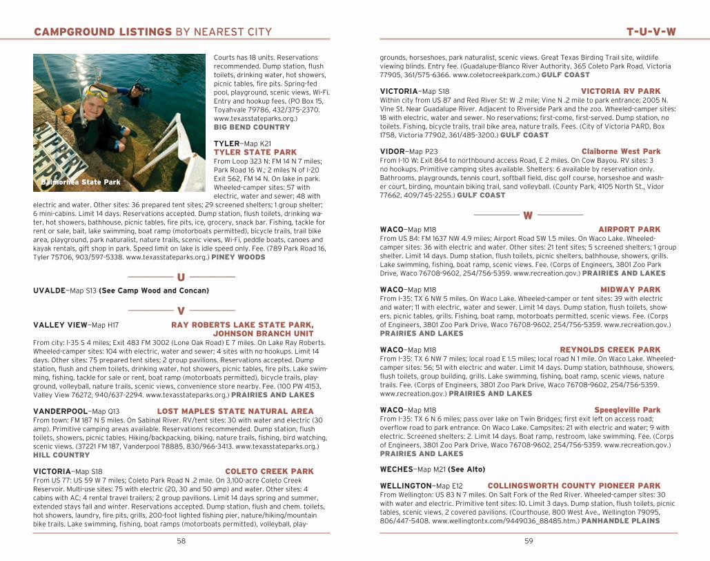
58 59
CAMPGROUND LISTINGS BY NEAREST CITY
Courts has 18 units. Reservations recommended. Dump station, flush toilets, drinking water, hot showers, picnic tables, fire pits. Spring-fed pool, playground, scenic views, Wi-Fi. Entry and hookup fees. (PO Box 15, Toyahvale 79786, 432/375-2370. www.texasstateparks.org.) BIG BEND COUNTRY
TYLER—Map K21 TYLER STATE PARKFrom Loop 323 N: FM 14 N 7 miles; Park Road 16 W.; 2 miles N of I-20 Exit 562, FM 14 N. On lake in park. Wheeled-camper sites: 57 with electric, water and sewer; 48 with
electric and water. Other sites: 36 prepared tent sites; 29 screened shelters; 1 group shelter; 6 mini-cabins. Limit 14 days. Reservations accepted. Dump station, flush toilets, drinking wa-ter, hot showers, bathhouse, picnic tables, fire pits, ice, grocery, snack bar. Fishing, tackle for rent or sale, bait, lake swimming, boat ramp (motorboats permitted), bicycle trails, trail bike area, playground, park naturalist, nature trails, scenic views, Wi-Fi, peddle boats, canoes and kayak rentals, gift shop in park. Speed limit on lake is idle speed only. Fee. (789 Park Road 16, Tyler 75706, 903/597-5338. www.texasstateparks.org.) PINEY WOODS
——————————— U ———————————
UVALDE—Map S13 (See Camp Wood and Concan)
——————————— V ———————————
VALLEY VIEW—Map H17 RAY ROBERTS LAKE STATE PARK, JOHNSON BRANCH UNITFrom city: I-35 S 4 miles; Exit 483 FM 3002 (Lone Oak Road) E 7 miles. On Lake Ray Roberts. Wheeled-camper sites: 104 with electric, water and sewer; 4 sites with no hookups. Limit 14 days. Other sites: 75 prepared tent sites; 2 group pavilions. Reservations accepted. Dump station, flush and chem toilets, drinking water, hot showers, picnic tables, fire pits. Lake swim-ming, fishing, tackle for sale or rent, boat ramp (motorboats permitted), bicycle trails, play-ground, volleyball, nature trails, scenic views, convenience store nearby. Fee. (100 PW 4153, Valley View 76272, 940/637-2294. www.texasstateparks.org.) PRAIRIES AND LAKES
VANDERPOOL—Map Q13 LOST MAPLES STATE NATURAL AREAFrom town: FM 187 N 5 miles. On Sabinal River. RV/tent sites: 30 with water and electric (30 amp). Primitive camping areas available. Reservations recommended. Dump station, flush toilets, showers, picnic tables. Hiking/backpacking, biking, nature trails, fishing, bird watching, scenic views. (37221 FM 187, Vanderpool 78885, 830/966-3413. www.texasstateparks.org.) HILL COUNTRY
VICTORIA—Map S18 COLETO CREEK PARKFrom US 77: US 59 W 7 miles; Coleto Park Road N .2 mile. On 3,100-acre Coleto Creek Reservoir. Multi-use sites: 75 with electric (20, 30 and 50 amp) and water. Other sites: 4 cabins with AC; 4 rental travel trailers; 2 group pavilions. Limit 14 days spring and summer, extended stays fall and winter. Reservations accepted. Dump station, flush and chem. toilets, hot showers, laundry, fire pits, grills, 200-foot lighted fishing pier, nature/hiking/mountain bike trails. Lake swimming, fishing, boat ramps (motorboats permitted), volleyball, play-
Balmorhea State Park
T-U-V-W
grounds, horseshoes, park naturalist, scenic views. Great Texas Birding Trail site, wildlife viewing blinds. Entry fee. (Guadalupe-Blanco River Authority, 365 Coleto Park Road, Victoria 77905, 361/575-6366. www.coletocreekpark.com.) GULF COAST
VICTORIA—Map S18 VICTORIA RV PARKWithin city from US 87 and Red River St: W .2 mile; Vine N .2 mile to park entrance; 2005 N. Vine St. Near Guadalupe River. Adjacent to Riverside Park and the zoo. Wheeled-camper sites: 18 with electric, water and sewer. No reservations; first-come, first-served. Dump station, no toilets. Fishing, bicycle trails, trail bike area, nature trails. Fees. (City of Victoria PARD, Box 1758, Victoria 77902, 361/485-3200.) GULF COAST
VIDOR—Map P23 Claiborne West ParkFrom I-10 W: Exit 864 to northbound access Road, E 2 miles. On Cow Bayou. RV sites: 3 no hookups. Primitive camping sites available. Shelters: 6 available by reservation only. Bathrooms, playgrounds, tennis court, softball field, disc golf course, horseshoe and wash-er court, birding, mountain biking trail, sand volleyball. (County Park, 4105 North St., Vidor 77662, 409/745-2255.) GULF COAST
——————————— W ———————————
WACO—Map M18 AIRPORT PARKFrom US 84: FM 1637 NW 4.9 miles; Airport Road SW 1.5 miles. On Waco Lake. Wheeled-camper sites: 36 with electric and water. Other sites: 21 tent sites; 5 screened shelters; 1 group shelter. Limit 14 days. Dump station, flush toilets, picnic shelters, bathhouse, showers, grills. Lake swimming, fishing, boat ramp, scenic views. Fee. (Corps of Engineers, 3801 Zoo Park Drive, Waco 76708-9602, 254/756-5359. www.recreation.gov.) PRAIRIES AND LAKES
WACO—Map M18 MIDWAY PARKFrom I-35: TX 6 NW 5 miles. On Waco Lake. Wheeled-camper or tent sites: 39 with electric and water; 11 with electric, water and sewer. Limit 14 days. Dump station, flush toilets, show-ers, picnic tables, grills. Fishing, boat ramp, motorboats permitted, scenic views. Fee. (Corps of Engineers, 3801 Zoo Park Drive, Waco 76708-9602, 254/756-5359. www.recreation.gov.) PRAIRIES AND LAKES
WACO—Map M18 REYNOLDS CREEK PARKFrom I-35: TX 6 NW 7 miles; local road E 1.5 miles; local road N 1 mile. On Waco Lake. Wheeled-camper sites: 56; 51 with electric and water. Limit 14 days. Dump station, bathhouse, showers, flush toilets, group building, grills. Lake swimming, fishing, boat ramp, scenic views, nature trails. Fee. (Corps of Engineers, 3801 Zoo Park Drive, Waco 76708-9602, 254/756-5359. www.recreation.gov.) PRAIRIES AND LAKES
WACO—Map M18 Speegleville ParkFrom I-35: TX 6 N 6 miles; pass over lake on Twin Bridges; first exit left on access road; overflow road to park entrance. On Waco Lake. Campsites: 21 with electric and water; 9 with electric. Screened shelters: 2. Limit 14 days. Boat ramp, restroom, lake swimming. Fee. (Corps of Engineers, 3801 Zoo Park Drive, Waco 76708-9602, 254/756-5359. www.recreation.gov.) PRAIRIES AND LAKES
WECHES—Map M21 (See Alto)
WELLINGTON—Map E12 COLLINGSWORTH COUNTY PIONEER PARKFrom Wellington: US 83 N 7 miles. On Salt Fork of the Red River. Wheeled-camper sites: 30 with water and electric. Primitive tent sites: 10. Limit 3 days. Dump station, flush toilets, picnic tables, scenic views, 2 covered pavilions. (Courthouse, 800 West Ave., Wellington 79095, 806/447-5408. www.wellingtontx.com/9449036_88485.htm.) PANHANDLE PLAINS

60 61
CAMPGROUND LISTINGS BY NEAREST CITY
WESLACO—Map Z16 Estero Llano Grande State ParkFrom US 83/FM 1015: FM 1015 S 2 miles. Group lodges only: 50-person minimum for north complex with shower houses, recreation hall with kitchen, dining hall/meeting space, bar-becue pit; 30-person minimum for south complex with bathrooms, showers, large kitchen, meeting space. Birding, wildlife-viewing deck, observation deck, boardwalks, nature trails, scenic views. Fee. (3301 S. International Blvd. (FM 1015), Weslaco 78596, 956/565-3919. Reservations: 512/389-8901. www.texasstateparks.org.) SOUTH TEXAS PLAINS
WHITESBORO—Map G18 Big Mineral CampFrom US 377: FM 901 E 1.5 miles; local road E 2.5 miles; 2889 Big Mineral Road in Sadler. On Lake Texoma. Concessionaire: Wheeled-camper or tent sites with electric, water and sewer; with electric and water; or electric only. Primitive tent sites available. Cabins with kitchen: 5. Convenience store, snack bar, boat ramp, gas dock. (Box 576, Gordonville 76245, 903/523-4287. www.bigmineral.com.) PRAIRIES AND LAKES
WHITESBORO—Map G18 Cedar Bayou MarinaFrom US 82: US 377 N 13.2 miles; local road N and W .4 mile. On Lake Texoma. Concessionaire: Wheeled-camper sites: 15 with electric (must lease/reserve in advance). Other sites: 8 cabins; 4 motel rooms. Pit toilets, ice. Fishing, boat ramp, pontoon boat rentals, gas, tackle, snacks, bicycle trails, hiking trail, park naturalist, scenic views. Parking fee. (513 Cedar Bayou Blvd., Gordonville 76245, 903/523-4248. cedarbayou.com.) PRAIRIES AND LAKES
WHITESBORO—Map G18 CEDAR MILLS MARINA and RESORTFrom US 82: US 377 N 11 mi, local road E 2 miles. On Lake Texoma. Concessionaire: Wheeled-camper sites: 25 with electric, water and sewer. Other sites: 13 prepared tent sites; 18 cabins fully equipped. Meeting/activity lodge. Dump station, flush toilets, showers, grills. Lake swim-ming, fishing, nature trail, butterfly garden, boat ramp, gas dock, marina, restaurant, laundry. Modem friendly. (500 Harbour View Road, Gordonville 76245, 903/523-4222. www.cedar mills.com.) PRAIRIES AND LAKES
WHITESBORO—Map G18 JUNIPER POINTJuniper Point East open April 1–Sept 30; Juniper Point West open year-round. From US 82: US 377 N 14.3 miles. On Lake Texoma. Camper trailer or tent sites: 44 with electric and water. Other sites: 25 tent sites with water; 1 group shelter. Limit 14 days. Dump station, flush and pit toilets, showers, grills. Courtesy boat dock, boat ramp, Cross Timbers hiking trail. Fees. (Corps of Engineers, 351 Corps Road, Denison 75020, 903/465-4990. www.recreation.gov.) PRAIRIES AND LAKES
WHITESBORO—Map G18 Texoma Marina And ResortFrom US 377: FM 901 W and N 6.7 miles; local road E 1.2 miles; local road N .5 mile; local road E .2 mile. On Lake Texoma. Concessionaire: Wheeled-camper sites: 25 with electric (30 and 50 amp) and water. Other sites: 8 cabins with AC; 4 houses with AC and heat; tent sites available. Reser vations accepted. Tent sites available. Fishing, boat ramp, marina, gas, full ship store. Fee. (4499 Rock Creek Road, Whitesboro 76273, 903/523-4308. www.marinequest.net/texoma. www.facebook.com/pages/Lake-Texoma-Marina/655100677851701?fref=ts.) PRAIRIES AND LAKES
WHITESBORO—Map G18 WALNUT CREEK RESORTFrom US 377: FM 901 E 1.2 miles; local road N 1.2 miles; local road E .7 mile. On Lake Texoma. Concessionaire: Wheeled-camper or tent sites: 4 with electric, water and sewer; 15 with water and electric. Cabins: 10. Limit 14 days. Dump station, flush toilets, store. Fishing, boat ramp, hiking. Kayaks available for rent or sale. (Box 346, Gordonville 76245, 903/523-4211. www.walnutcreekresort.com.) PRAIRIES AND LAKES
WHITNEY—Map L17 Cedar Creek ParkFrom TX 22: FM 933 N 5.3 miles; FM 2604 SW 3 miles; local road SE .8 mile. On Lake Whitney. Wheeled-camper or tent sites: 21. Group day-use shelter: 1. Limit 14 days. Pit toilets, picnic
W
shelters. Lake swimming, fishing, boat ramp. (Corps of Engineers, 285 County Road 3602, Laguna Park 76634-5038, 254/622-3332.) PRAIRIES AND LAKES
WHITNEY—Map L17 CEDRON CREEK PARKOpen April 1–Sept 30. From FM 933: FM 1713 W 5.8 miles. On Lake Whitney. Wheeled-camper or tent sites: 65 with electric and water. Group shelter: 1. Limit 14 days. Dump station, flush toi-lets, showers, grills. Lake swimming, picnicking, fishing, boat ramp. Fee. (Corps of Engineers, 285 County Road 3602, Laguna Park 76634-5038, 254/622-3332. www.recreation.gov.) PRAIRIES AND LAKES
WHITNEY—Map L17 LAKE WHITNEY MARINA @ JUNIPER COVEFrom TX 22: FM 933 N 2.4 miles; FM 1713 SW 1.5 miles; right on Juniper Cove Road 1 mile. On Lake Whitney. More than 60 acres. Concessionaire: Wheeled-camper sites: 20 with electric (30 amp and 50 amp), water and septic; 63 with water and electric. Cabins with AC: 20. Advance reservations required. Meeting room with AC, full kitchen and restrooms. Dump station, flush toilets, showers, picnic tables, fire rings. Pet friendly. No ATVs. Lake swimming, fishing, full-service marina, floating ship’s store, gas dock, boat ramps, boat slips, indoor fishing area (license required), fish cleaning station, bait, tackle, firewood, food, ice, scenic views. Fishing guides, boat and Jet Ski rentals. Near Brazos River, golf, shopping, restaurants, laundry. I-35 and Hillsboro less than 20 miles away. Fees. (Lake Whitney Marina, Box 1340, Whitney 76692, 254/694-3129. www.lakewhitneymarina.com.) PRAIRIES AND LAKES
WHITNEY—Map L17 LAKE WHITNEY STATE PARKFrom TX 22: FM 933 N .6 mile; FM 1244 W 2.5 miles; Park Road 47 SW. On Lake Whitney. Wheeled-camper or tent sites: 51 with water, electric and sewer; 31 with water and electric; 64 with water only. Campsites with electricity have 30 and 50 amp connections plus a 120v electrical plug. Screened shelters: 21. Limit 14 days. Group shelter with kitchen (dining hall with 8 screened shelters; recreational building with kitchen. Limit 14 days. Reservations accepted. Dump station, flush toilets, drinking water, hot showers, picnic tables, fire pits, ice. Lake swim-ming, picnic areas, fishing, boat ramp (motorboats permitted), playground, nature trail, hike and bike trail, water skiing, model air field, special events and interpretive programs. Fee. (Box 1175, Whitney 76692, 254/694-3793. www.texasstateparks.org.) PRAIRIES AND LAKES
WHITNEY—Map L17 LOFERS BEND PARKFrom FM 933: TX 22 SW 5 miles; local road NW .6 mile. On Lake Whitney. Back-in
Lake Whitney State Park
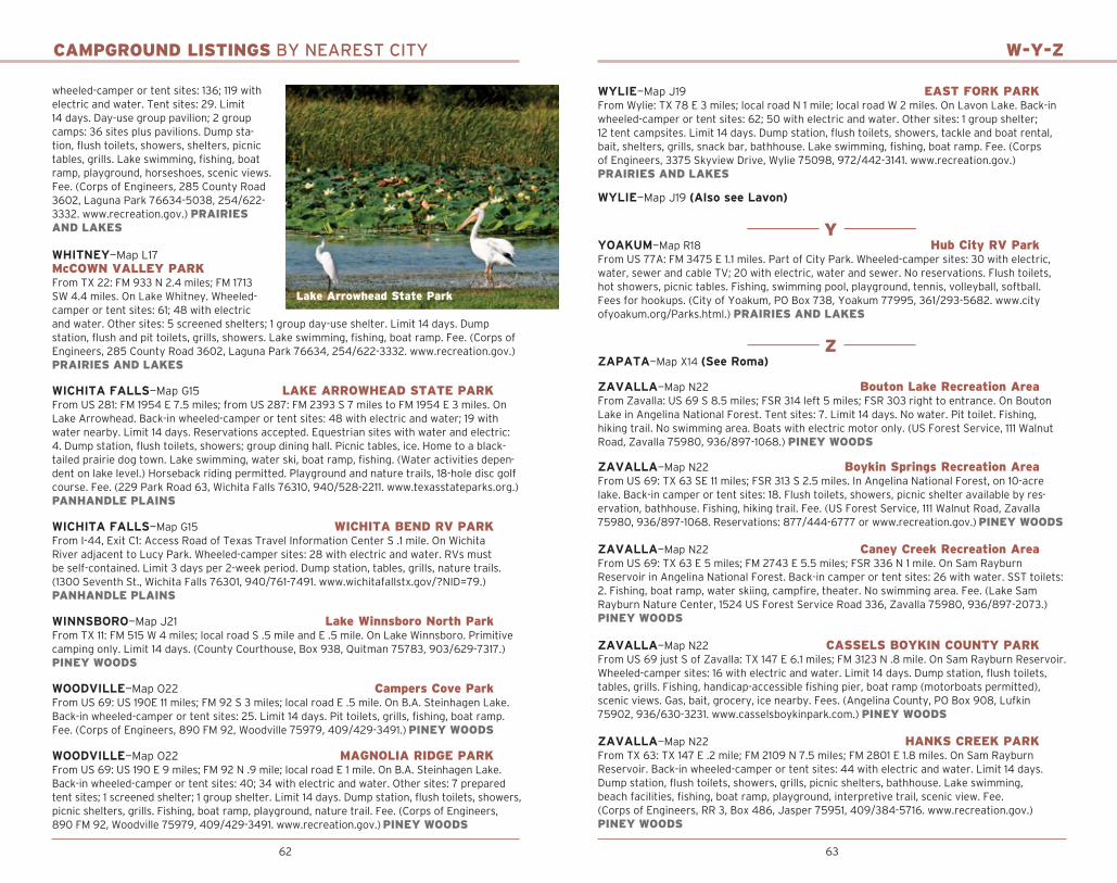
62 63
CAMPGROUND LISTINGS BY NEAREST CITY
wheeled-camper or tent sites: 136; 119 with electric and water. Tent sites: 29. Limit 14 days. Day-use group pavilion; 2 group camps: 36 sites plus pavilions. Dump sta-tion, flush toilets, showers, shelters, picnic tables, grills. Lake swimming, fishing, boat ramp, playground, horseshoes, scenic views. Fee. (Corps of Engineers, 285 County Road 3602, Laguna Park 76634-5038, 254/622-3332. www.recreation.gov.) PRAIRIES AND LAKES
WHITNEY—Map L17 McCOWN VALLEY PARKFrom TX 22: FM 933 N 2.4 miles; FM 1713 SW 4.4 miles. On Lake Whitney. Wheeled-camper or tent sites: 61; 48 with electric and water. Other sites: 5 screened shelters; 1 group day-use shelter. Limit 14 days. Dump station, flush and pit toilets, grills, showers. Lake swimming, fishing, boat ramp. Fee. (Corps of Engineers, 285 County Road 3602, Laguna Park 76634, 254/622-3332. www.recreation.gov.) PRAIRIES AND LAKES
WICHITA FALLS—Map G15 LAKE ARROWHEAD STATE PARKFrom US 281: FM 1954 E 7.5 miles; from US 287: FM 2393 S 7 miles to FM 1954 E 3 miles. On Lake Arrowhead. Back-in wheeled-camper or tent sites: 48 with electric and water; 19 with water nearby. Limit 14 days. Reservations accepted. Equestrian sites with water and electric: 4. Dump station, flush toilets, showers; group dining hall. Picnic tables, ice. Home to a black-tailed prairie dog town. Lake swimming, water ski, boat ramp, fishing. (Water activities depen-dent on lake level.) Horseback riding permitted. Playground and nature trails, 18-hole disc golf course. Fee. (229 Park Road 63, Wichita Falls 76310, 940/528-2211. www.texasstateparks.org.) PANHANDLE PLAINS
WICHITA FALLS—Map G15 WICHITA BEND RV PARKFrom I-44, Exit C1: Access Road of Texas Travel Information Center S .1 mile. On Wichita River adjacent to Lucy Park. Wheeled-camper sites: 28 with electric and water. RVs must be self-contained. Limit 3 days per 2-week period. Dump station, tables, grills, nature trails. (1300 Seventh St., Wichita Falls 76301, 940/761-7491. www.wichitafallstx.gov/?NID=79.) PANHANDLE PLAINS
WINNSBORO—Map J21 Lake Winnsboro North ParkFrom TX 11: FM 515 W 4 miles; local road S .5 mile and E .5 mile. On Lake Winnsboro. Primitive camping only. Limit 14 days. (County Courthouse, Box 938, Quitman 75783, 903/629-7317.) PINEY WOODS
WOODVILLE—Map O22 Campers Cove ParkFrom US 69: US 190E 11 miles; FM 92 S 3 miles; local road E .5 mile. On B.A. Steinhagen Lake. Back-in wheeled-camper or tent sites: 25. Limit 14 days. Pit toilets, grills, fishing, boat ramp. Fee. (Corps of Engineers, 890 FM 92, Woodville 75979, 409/429-3491.) PINEY WOODS
WOODVILLE—Map O22 MAGNOLIA RIDGE PARKFrom US 69: US 190 E 9 miles; FM 92 N .9 mile; local road E 1 mile. On B.A. Steinhagen Lake. Back-in wheeled-camper or tent sites: 40; 34 with electric and water. Other sites: 7 prepared tent sites; 1 screened shelter; 1 group shelter. Limit 14 days. Dump station, flush toilets, showers, picnic shelters, grills. Fishing, boat ramp, playground, nature trail. Fee. (Corps of Engineers, 890 FM 92, Woodville 75979, 409/429-3491. www.recreation.gov.) PINEY WOODS
Lake Arrowhead State Park
W-Y-Z
WYLIE—Map J19 EAST FORK PARKFrom Wylie: TX 78 E 3 miles; local road N 1 mile; local road W 2 miles. On Lavon Lake. Back-in wheeled-camper or tent sites: 62; 50 with electric and water. Other sites: 1 group shelter; 12 tent campsites. Limit 14 days. Dump station, flush toilets, showers, tackle and boat rental, bait, shelters, grills, snack bar, bathhouse. Lake swimming, fishing, boat ramp. Fee. (Corps of Engineers, 3375 Skyview Drive, Wylie 75098, 972/442-3141. www.recreation.gov.) PRAIRIES AND LAKES
WYLIE—Map J19 (Also see Lavon)
——————————— Y ———————————YOAKUM—Map R18 Hub City RV ParkFrom US 77A: FM 3475 E 1.1 miles. Part of City Park. Wheeled-camper sites: 30 with electric, water, sewer and cable TV; 20 with electric, water and sewer. No reservations. Flush toilets, hot showers, picnic tables. Fishing, swimming pool, playground, tennis, volleyball, softball. Fees for hookups. (City of Yoakum, PO Box 738, Yoakum 77995, 361/293-5682. www.city ofyoakum.org/Parks.html.) PRAIRIES AND LAKES
——————————— Z ———————————ZAPATA—Map X14 (See Roma)
ZAVALLA—Map N22 Bouton Lake Recreation AreaFrom Zavalla: US 69 S 8.5 miles; FSR 314 left 5 miles; FSR 303 right to entrance. On Bouton Lake in Angelina National Forest. Tent sites: 7. Limit 14 days. No water. Pit toilet. Fishing, hiking trail. No swimming area. Boats with electric motor only. (US Forest Service, 111 Walnut Road, Zavalla 75980, 936/897-1068.) PINEY WOODS
ZAVALLA—Map N22 Boykin Springs Recreation AreaFrom US 69: TX 63 SE 11 miles; FSR 313 S 2.5 miles. In Angelina National Forest, on 10-acre lake. Back-in camper or tent sites: 18. Flush toilets, showers, picnic shelter available by res-ervation, bathhouse. Fishing, hiking trail. Fee. (US Forest Service, 111 Walnut Road, Zavalla 75980, 936/897-1068. Reservations: 877/444-6777 or www.recreation.gov.) PINEY WOODS
ZAVALLA—Map N22 Caney Creek Recreation AreaFrom US 69: TX 63 E 5 miles; FM 2743 E 5.5 miles; FSR 336 N 1 mile. On Sam Rayburn Reservoir in Angelina National Forest. Back-in camper or tent sites: 26 with water. SST toilets: 2. Fishing, boat ramp, water skiing, campfire, theater. No swimming area. Fee. (Lake Sam Rayburn Nature Center, 1524 US Forest Service Road 336, Zavalla 75980, 936/897-2073.) PINEY WOODS
ZAVALLA—Map N22 CASSELS BOYKIN COUNTY PARKFrom US 69 just S of Zavalla: TX 147 E 6.1 miles; FM 3123 N .8 mile. On Sam Rayburn Reservoir. Wheeled-camper sites: 16 with electric and water. Limit 14 days. Dump station, flush toilets, tables, grills. Fishing, handicap-accessible fishing pier, boat ramp (motorboats permitted), scenic views. Gas, bait, grocery, ice nearby. Fees. (Angelina County, PO Box 908, Lufkin 75902, 936/630-3231. www.casselsboykinpark.com.) PINEY WOODS
ZAVALLA—Map N22 HANKS CREEK PARKFrom TX 63: TX 147 E .2 mile; FM 2109 N 7.5 miles; FM 2801 E 1.8 miles. On Sam Rayburn Reservoir. Back-in wheeled-camper or tent sites: 44 with electric and water. Limit 14 days. Dump station, flush toilets, showers, grills, picnic shelters, bathhouse. Lake swimming, beach facilities, fishing, boat ramp, playground, interpretive trail, scenic view. Fee. (Corps of Engineers, RR 3, Box 486, Jasper 75951, 409/384-5716. www.recreation.gov.) PINEY WOODS

64 65
INDOOR CAMPINGTEXAS PUBLIC CAMPGROUNDS WITH OVERNIGHT SCREENED SHELTERS, CABINS, BUNKS AND LODGES
SHEL
TERS
COTT
AGES
/YUR
TS
CABI
NS
CABI
NS W
/AC
MIN
I-CAB
INS
GROU
P SH
ELTE
R
BUNK
HOUS
E
GROU
P DO
RM
LODG
E
ROOM
S/UN
ITS
CABINS AND SHELTERS
ABILENE Abilene State Park 5 6 1
ALBANY Fort Griffin State Park & Historic Site 1
ALVIN Camp Mohawk County Park 2 2
AUSTIN McKinney Falls State Park 6
BALLINGER O.H. Ivie Reservoir Concho Park 15
BANDERA Hill Country State Natural Area 1
BASTROP Bastrop State Park 12 1 1
Lake Bastrop South Shore Park 18 BELTON
Cedar Ridge Park 8 Union Grove Park 3
White Flint Park 12 BENBROOK
Holiday Park 5 Mustang Point Campground 1 Mustang Point-Bear Creek 1
BLANCO Blanco State Park 7
BONHAM Bonham State Park 1
BRADY Brady Lake Park 14
BROWNWOOD Lake Brownwood State Park 10 16 2 4
BURNET Canyon of the Eagles Lodge and Nature Park 1 62 Inks Lake State Park 22
CADDO Possum Kingdom State Park 4 1
CANYON Palo Duro Canyon State Park 7
CLEBURNE Cleburne State Park 6 1
COLEMAN Flatrock Park 6 1 Lakeside Park 6 3 O.H. Ivie Reservoir Kennedy Park 12 30
COLMESNEIL Lake Tejas 6
COLORADO CITY Lake Colorado City State Park 11
COMANCHE Copperas Creek Park 2 Promontory Park 5 3
CONCAN Garner State Park 37 17
INDOOR CAMPINGTEXAS PUBLIC CAMPGROUNDS WITH OVERNIGHT SCREENED SHELTERS, CABINS, BUNKS AND LODGES
SHEL
TERS
COTT
AGES
/YUR
TS
CABI
NS
CABI
NS W
/AC
MIN
I-CAB
INS
GROU
P SH
ELTE
R
BUNK
HOUS
E
GROU
P DO
RM
LODG
E
ROOM
S/UN
ITS
COOPER/SULPHUR SPRINGS Cooper Lake State Park 22 18
DAINGERFIELD Daingerfield State Park 3 1
DAWSON Liberty Hill Park 5 1 Oak Park 1 Wolf Creek Park 1
DEL RIO Devils River State Natural Area 1
DENISON Eisenhower State Park 34 1 3
Preston Bend Recreation Area 2 Texas Dam Site 1EDNA
Brackenridge Park and Campground 5 Texana Park and Campground 2
ENNIS Waxahachie Creek Park 1
FORT DAVIS Davis Mountains State Park Indian Lodge 39
FREEPORT San Luis Pass County Park 4
GEORGETOWN Jim Hogg Park 5
GLEN ROSE Oakdale Park 3 7 14 3 2
GOLIAD Goliad State Park 5
GRAND PRAIRIE Loyd Park 9 1
GRANGER Willis Creek Park 1 Wilson H. Fox Park 5 1
HAWKINS Lake Hawkins County RV Park 2
HUNTSVILLE Huntsville State Park 28 2 1
JACKSBORO Fort Richardson State Park & Historic Site 11
JACKSONVILLE Lake Jacksonville Campground 10
JASPER Martin Dies, Jr. State Park 38 8 Sandy Creek Park 2 Twin Dikes Park 3
JEFFERSON Alley Creek Park 1 Johnson Creek Park 1
KARNAK Caddo Lake State Park 7 10
KERRVILLE Kerrville-Schreiner Park 2 1 23 1 1 1

66
INDOOR CAMPINGTEXAS PUBLIC CAMPGROUNDS WITH OVERNIGHT SCREENED SHELTERS, CABINS, BUNKS AND LODGES
SHEL
TERS
COTT
AGES
/YUR
TS
CABI
NS
CABI
NS W
/AC
MIN
I-CAB
INS
GROU
P SH
ELTE
R
BUNK
HOUS
E
GROU
P DO
RM
LODG
E
ROOM
S/UN
ITS
CABINS AND SHELTERS
LA GRANGE LCRA Oak Thicket Park 6 8
LAVON Lakeland Park 1
LEWISVILLE Hickory Creek Park 1 Oakland Park 2 1
LIVINGSTON Lake Livingston State Park 10
LLANO LCRA Black Rock Park 18
LONE OAK Wind Point Park 15 8 1
LUFKIN Shirley Creek Campground 13
LULING Palmetto State Park 1
LUMBERTON Village Creek State Park 1
MATHIS Lake Corpus Christi State Park 15 10
MERIDIAN Meridian State Park 18
MEXIA Fort Parker State Park 10 1 Lake Mexia Recreation Area 9
MINERAL WELLS Lake Mineral Wells State Park 15
MOUNT PLEASANT Lake Bob Sandlin State Park 12 8
NEW BRAUNFELS Canyon Park 2 Potters Creek Park 7 1
NEW CANEY Lake Houston Wilderness Park 8 6 2
PILOT POINT Ray Roberts Lake State Park 1 30
POTTSBORO Mill Creek Resort & Marina 7
PRESIDIO Big Bend Ranch State Park 1 1 30
PRINCETON Clear Lake Park 1
PROCTOR Sowell Park 2
QUINTANA Quintana Beach County Park 6
QUITAQUE Caprock Canyons State Park 1 1
RICHMOND Brazos Bend State Park 13 1
ROBERT LEE E.V. Spence Reservoir Wildcat Park 4 1 6
67
INDOOR CAMPINGTEXAS PUBLIC CAMPGROUNDS WITH OVERNIGHT SCREENED SHELTERS, CABINS, BUNKS AND LODGES
SHEL
TERS
COTT
AGES
/YUR
TS
CABI
NS
CABI
NS W
/AC
MIN
I-CAB
INS
GROU
P SH
ELTE
R
BUNK
HOUS
E
GROU
P DO
RM
LODG
E
ROOM
S/UN
ITS
ROCKPORT
Goose Island State Park 1 ROMA
Falcon State Park 12 12 SAN ANGELO
San Angelo State Park 6 1 SAN FELIPE
Stephen F. Austin State Park 20 1 1 1 SMITHVILLE
Buescher State Park 4 3 1 SOMERVILLE
Big Creek Park & Marina 4 10 1 SOUTH PADRE ISLAND
Isla Blanca County Park 8 TATUM
Martin Creek Lake State Park 19 4 TEXARKANA
Clear Springs Park 1 Rocky Point Park 1
THE COLONY Hidden Cove Park 38
THREE RIVERS Choke Canyon State Park- Calliham Unit 10 10
TOYAHVALE Balmorhea State Park 18
TYLER Tyler State Park 29 6 1
VICTORIA Coleto Creek Park 4
WACO Airport Park 5 1 Speegleville Park 2
WESLACO Estero Llano Grande State Park 2
WHITESBORO Big Mineral Camp 5 Cedar Bayou Marina 8 4 Cedar Mills Marina & Resort 18 Juniper Point 1 Texoma Marina & Resort 2 6 Walnut Creek Resort 10
WHITNEY Cedron Creek Park 1 Lake Whitney Marina @ Juniper Cove 20 Lake Whitney State Park 21 1 1 Lofers Bend Park 2 McCown Valley Park 5
WOODVILLE Magnolia Ridge Park 1 1
WYLIE East Fork Park 1
68 69
PUBLIC CAMPGROUND INDEX
— A —Abilene State Park . . . . . . . . . . . . . . . . . . . . . . . . . . . . . Abilene. . . . . . . . . . . . . . . . . . . . . . 5Adolph Thomae Jr. Park. . . . . . . . . . . . . . . . . . . . . . . . . Rio Hondo . . . . . . . . . . . . . . . . . . 49Airport Park . . . . . . . . . . . . . . . . . . . . . . . . . . . . . . . . . . . Waco. . . . . . . . . . . . . . . . . . . . . . . 59Alley Creek Park . . . . . . . . . . . . . . . . . . . . . . . . . . . . . . . Jefferson. . . . . . . . . . . . . . . . . . . 32Alley Oop Park . . . . . . . . . . . . . . . . . . . . . . . . . . . . . . . . . Iraan. . . . . . . . . . . . . . . . . . . . . . . .31Amistad Natl Recreation Area
(277 North Campground). . . . . . . . . . . . . . . . . . . . . . Del Rio . . . . . . . . . . . . . . . . . . . . . 21Amistad Natl Recreation Area
(Governor’s Landing) . . . . . . . . . . . . . . . . . . . . . . . . . Del Rio . . . . . . . . . . . . . . . . . . . . . 21Amistad Natl Recreation Area
(Rough Canyon Campground) . . . . . . . . . . . . . . . . . . Del Rio . . . . . . . . . . . . . . . . . . . . . 21Amistad Natl Recreation Area
(San Pedro Campground) . . . . . . . . . . . . . . . . . . . . . Del Rio . . . . . . . . . . . . . . . . . . . . . 21Amistad Natl Recreation Area
(Spur 406 Campground) . . . . . . . . . . . . . . . . . . . . . . Del Rio . . . . . . . . . . . . . . . . . . . . . 22Andy Bowie County Park . . . . . . . . . . . . . . . . . . . . . . . . South Padre Island . . . . . . . . . . 54Arkansas Bend Park . . . . . . . . . . . . . . . . . . . . . . . . . . . . Austin. . . . . . . . . . . . . . . . . . . . . . . 7Atlanta State Park . . . . . . . . . . . . . . . . . . . . . . . . . . . . . Queen City . . . . . . . . . . . . . . . . . 48
— B —Badu Park . . . . . . . . . . . . . . . . . . . . . . . . . . . . . . . . . . . . . Llano . . . . . . . . . . . . . . . . . . . . . . 37Ballinger City Park . . . . . . . . . . . . . . . . . . . . . . . . . . . . . Ballinger . . . . . . . . . . . . . . . . . . . . 8Ballinger Lake Park. . . . . . . . . . . . . . . . . . . . . . . . . . . . . Ballinger . . . . . . . . . . . . . . . . . . . . 8Barton Warnock Visitor Center. . . . . . . . . . . . . . . . . . . Terlingua . . . . . . . . . . . . . . . . . . . 56Balmorhea State Park . . . . . . . . . . . . . . . . . . . . . . . . . . Toyahvale . . . . . . . . . . . . . . . . . . 57Bastrop State Park . . . . . . . . . . . . . . . . . . . . . . . . . . . . . Bastrop . . . . . . . . . . . . . . . . . . . . . 8Bentsen-Rio Grande Valley State Park . . . . . . . . . . . . Mission. . . . . . . . . . . . . . . . . . . . . 41Berry Springs Park & Preserve. . . . . . . . . . . . . . . . . . . Georgetown. . . . . . . . . . . . . . . . . 27Big Bend National Park . . . . . . . . . . . . . . . . . . . . . . . . . Big Bend National Park. . . . . . . . 11Big Bend Ranch State Park . . . . . . . . . . . . . . . . . . . . . . Presidio . . . . . . . . . . . . . . . . . . . . 48Big Creek Landing . . . . . . . . . . . . . . . . . . . . . . . . . . . . . . Maud. . . . . . . . . . . . . . . . . . . . . . . 40Big Creek Resort, Marina & Campground . . . . . . . . . . Somerville . . . . . . . . . . . . . . . . . . 53Big Mineral Camp . . . . . . . . . . . . . . . . . . . . . . . . . . . . . . Whitesboro . . . . . . . . . . . . . . . . . 60Black Creek Recreation Area . . . . . . . . . . . . . . . . . . . . Decatur . . . . . . . . . . . . . . . . . . . . 20Black Rock Park (LCRA). . . . . . . . . . . . . . . . . . . . . . . . . Llano . . . . . . . . . . . . . . . . . . . . . . 37Blanco State Park . . . . . . . . . . . . . . . . . . . . . . . . . . . . . . Blanco . . . . . . . . . . . . . . . . . . . . . 12Blue Creek Bridge Public Use Area . . . . . . . . . . . . . . . Dumas . . . . . . . . . . . . . . . . . . . . . 22Blue West Public Use Area . . . . . . . . . . . . . . . . . . . . . . Dumas . . . . . . . . . . . . . . . . . . . . . 23Boles Field Recreation Area . . . . . . . . . . . . . . . . . . . . . Shelbyville. . . . . . . . . . . . . . . . . . 52Bonham State Park. . . . . . . . . . . . . . . . . . . . . . . . . . . . . Bonham . . . . . . . . . . . . . . . . . . . . .13Boone Park . . . . . . . . . . . . . . . . . . . . . . . . . . . . . . . . . . . Nocona. . . . . . . . . . . . . . . . . . . . . 44Bouton Lake Recreation Area. . . . . . . . . . . . . . . . . . . . Zavalla . . . . . . . . . . . . . . . . . . . . . 63Boykin Springs Recreation Area. . . . . . . . . . . . . . . . . . Zavalla . . . . . . . . . . . . . . . . . . . . . 63Brackenridge Park & Campground . . . . . . . . . . . . . . . . Edna . . . . . . . . . . . . . . . . . . . . . . . 23Brady Lake Park . . . . . . . . . . . . . . . . . . . . . . . . . . . . . . . Brady . . . . . . . . . . . . . . . . . . . . . . .13Brazos Bend State Park. . . . . . . . . . . . . . . . . . . . . . . . . Richmond . . . . . . . . . . . . . . . . . . 49Bronte Park . . . . . . . . . . . . . . . . . . . . . . . . . . . . . . . . . . . Bronte . . . . . . . . . . . . . . . . . . . . . 14Brushy Creek Park . . . . . . . . . . . . . . . . . . . . . . . . . . . . . Jefferson. . . . . . . . . . . . . . . . . . . 33
CAMPGROUND CITY PAGE
A-C
Buckhorn Creek Park . . . . . . . . . . . . . . . . . . . . . . . . . . . Jefferson. . . . . . . . . . . . . . . . . . . 33Buescher State Park. . . . . . . . . . . . . . . . . . . . . . . . . . . . Smithville . . . . . . . . . . . . . . . . . . 53Buffalo Springs Lake. . . . . . . . . . . . . . . . . . . . . . . . . . . . Lubbock . . . . . . . . . . . . . . . . . . . . 38Bugbee Public Use Area. . . . . . . . . . . . . . . . . . . . . . . . . Sanford . . . . . . . . . . . . . . . . . . . . 52
— C —Caddo Lake State Park. . . . . . . . . . . . . . . . . . . . . . . . . . Karnack . . . . . . . . . . . . . . . . . . . . 34Cagle Recreation Area . . . . . . . . . . . . . . . . . . . . . . . . . . New Waverly. . . . . . . . . . . . . . . . 44Camp Mowhawk County Park . . . . . . . . . . . . . . . . . . . . Alvin . . . . . . . . . . . . . . . . . . . . . . . . 6Campers Cove Park. . . . . . . . . . . . . . . . . . . . . . . . . . . . . Woodville . . . . . . . . . . . . . . . . . . . 62Campground #1 . . . . . . . . . . . . . . . . . . . . . . . . . . . . . . . . Crosbyton . . . . . . . . . . . . . . . . . . 19Campground #2. . . . . . . . . . . . . . . . . . . . . . . . . . . . . . . . Crosbyton . . . . . . . . . . . . . . . . . . 19Campground #3. . . . . . . . . . . . . . . . . . . . . . . . . . . . . . . . Crosbyton . . . . . . . . . . . . . . . . . . 19Campground #4. . . . . . . . . . . . . . . . . . . . . . . . . . . . . . . . Crosbyton . . . . . . . . . . . . . . . . . . 19Caney Creek Recreation Area. . . . . . . . . . . . . . . . . . . . Zavalla . . . . . . . . . . . . . . . . . . . . . 63Canyon of the Eagles Lodge
and Nature Park . . . . . . . . . . . . . . . . . . . . . . . . . . . . . Burnet . . . . . . . . . . . . . . . . . . . . . 14Canyon Park . . . . . . . . . . . . . . . . . . . . . . . . . . . . . . . . . . . New Braunfels . . . . . . . . . . . . . . 43Caprock Canyons State Park. . . . . . . . . . . . . . . . . . . . . Quitaque . . . . . . . . . . . . . . . . . . . 49Cass County Park . . . . . . . . . . . . . . . . . . . . . . . . . . . . . . Queen City . . . . . . . . . . . . . . . . . 48Cassels Boykin County Park . . . . . . . . . . . . . . . . . . . . . Zavalla . . . . . . . . . . . . . . . . . . . . . 63Castroville Regional Park. . . . . . . . . . . . . . . . . . . . . . . . Castroville . . . . . . . . . . . . . . . . . . 15Cedar Bayou Marina . . . . . . . . . . . . . . . . . . . . . . . . . . . . Whitesboro . . . . . . . . . . . . . . . . . 60Cedar Breaks Park . . . . . . . . . . . . . . . . . . . . . . . . . . . . . Georgetown. . . . . . . . . . . . . . . . . 27Cedar Canyon Public Use Area . . . . . . . . . . . . . . . . . . . Fritch . . . . . . . . . . . . . . . . . . . . . . 26Cedar Creek Park . . . . . . . . . . . . . . . . . . . . . . . . . . . . . . Whitney . . . . . . . . . . . . . . . . . . . . 60Cedar Hill Park. . . . . . . . . . . . . . . . . . . . . . . . . . . . . . . . . Anahuac. . . . . . . . . . . . . . . . . . . . . 6Cedar Hill State Park . . . . . . . . . . . . . . . . . . . . . . . . . . . Cedar Hill. . . . . . . . . . . . . . . . . . . 15Cedar Mills Marina & Resort . . . . . . . . . . . . . . . . . . . . . Whitesboro . . . . . . . . . . . . . . . . . 60Cedar Point Recreation Area (LCRA) . . . . . . . . . . . . . Bluffton . . . . . . . . . . . . . . . . . . . . 12Cedar Ridge Park . . . . . . . . . . . . . . . . . . . . . . . . . . . . . . Belton . . . . . . . . . . . . . . . . . . . . . . 9Cedar Springs. . . . . . . . . . . . . . . . . . . . . . . . . . . . . . . . . . Ore City . . . . . . . . . . . . . . . . . . . . 45Cedron Creek Park . . . . . . . . . . . . . . . . . . . . . . . . . . . . . Whitney . . . . . . . . . . . . . . . . . . . . 61Chimney Hollow . . . . . . . . . . . . . . . . . . . . . . . . . . . . . . . . Sanford . . . . . . . . . . . . . . . . . . . . 52Chisos Mountains Basin,
Chisos Basin Campground . . . . . . . . . . . . . . . . . . . . . Big Bend National Park. . . . . . . . 11Choke Canyon State Park . . . . . . . . . . . . . . . . . . . . . . . Three Rivers . . . . . . . . . . . . . . . . 57City Fair Park . . . . . . . . . . . . . . . . . . . . . . . . . . . . . . . . . . Childress . . . . . . . . . . . . . . . . . . . 15City Park . . . . . . . . . . . . . . . . . . . . . . . . . . . . . . . . . . . . . . Crosbyton . . . . . . . . . . . . . . . . . . 19City of Navasota RV Park . . . . . . . . . . . . . . . . . . . . . . . Navasota . . . . . . . . . . . . . . . . . . . 43City RV Park. . . . . . . . . . . . . . . . . . . . . . . . . . . . . . . . . . . Throckmorton. . . . . . . . . . . . . . . 57Claiborne West Park . . . . . . . . . . . . . . . . . . . . . . . . . . . . Vidor . . . . . . . . . . . . . . . . . . . . . . 59Clear Lake Park . . . . . . . . . . . . . . . . . . . . . . . . . . . . . . . . Princeton. . . . . . . . . . . . . . . . . . . 48Clear Springs Park . . . . . . . . . . . . . . . . . . . . . . . . . . . . . Texarkana . . . . . . . . . . . . . . . . . . 56Cleburne State Park . . . . . . . . . . . . . . . . . . . . . . . . . . . . Cleburne . . . . . . . . . . . . . . . . . . . 16Coffee Mill Lake Recreation Area. . . . . . . . . . . . . . . . . Honey Grove . . . . . . . . . . . . . . . . .31Coleman Park. . . . . . . . . . . . . . . . . . . . . . . . . . . . . . . . . . Brownfield . . . . . . . . . . . . . . . . . . 14Coleto Creek Park . . . . . . . . . . . . . . . . . . . . . . . . . . . . . . Victoria . . . . . . . . . . . . . . . . . . . . 58Collingsworth County Pioneer Park . . . . . . . . . . . . . . . Wellington . . . . . . . . . . . . . . . . . . 59
CAMPGROUND CITY PAGE

70 71
Colorado Bend State Park . . . . . . . . . . . . . . . . . . . . . . . Bend . . . . . . . . . . . . . . . . . . . . . . . 10Comanche Trail Park. . . . . . . . . . . . . . . . . . . . . . . . . . . . Big Spring . . . . . . . . . . . . . . . . . . 12Cooper Lake State Park (Doctor’s Creek Unit) . . . . . Cooper . . . . . . . . . . . . . . . . . . . . . 18Cooper Lake State Park (South Sulphur Unit) . . . . . . Sulphur Springs . . . . . . . . . . . . . 55Copper Breaks State Park . . . . . . . . . . . . . . . . . . . . . . . Crowell. . . . . . . . . . . . . . . . . . . . . 19Copperas Creek Park . . . . . . . . . . . . . . . . . . . . . . . . . . . Comanche . . . . . . . . . . . . . . . . . . .17Cottonwood Campground . . . . . . . . . . . . . . . . . . . . . . . Big Bend National Park. . . . . . . . 11Crane County 4-H RV Park . . . . . . . . . . . . . . . . . . . . . . Crane . . . . . . . . . . . . . . . . . . . . . . 18Cranes Mill Park. . . . . . . . . . . . . . . . . . . . . . . . . . . . . . . . New Braunfels . . . . . . . . . . . . . . 43
— D —Daingerfield State Park . . . . . . . . . . . . . . . . . . . . . . . . . Daingerfield. . . . . . . . . . . . . . . . . 20Dana Peak Park . . . . . . . . . . . . . . . . . . . . . . . . . . . . . . . . Belton . . . . . . . . . . . . . . . . . . . . . . 9Davis Mountains State Park . . . . . . . . . . . . . . . . . . . . . Fort Davis . . . . . . . . . . . . . . . . . . 25Devils River State Natural Area . . . . . . . . . . . . . . . . . . Del Rio . . . . . . . . . . . . . . . . . . . . . 22Dinosaur Valley State Park . . . . . . . . . . . . . . . . . . . . . . Glen Rose . . . . . . . . . . . . . . . . . . 27Dogwood Park . . . . . . . . . . . . . . . . . . . . . . . . . . . . . . . . . Mount Vernon. . . . . . . . . . . . . . . 42Double Bayou Park . . . . . . . . . . . . . . . . . . . . . . . . . . . . . Anahuac. . . . . . . . . . . . . . . . . . . . . 6Double Lake Recreation Area . . . . . . . . . . . . . . . . . . . . Coldspring . . . . . . . . . . . . . . . . . . 16
— E —East Fork Park . . . . . . . . . . . . . . . . . . . . . . . . . . . . . . . . . Wylie. . . . . . . . . . . . . . . . . . . . . . . 63Ebenezer Park . . . . . . . . . . . . . . . . . . . . . . . . . . . . . . . . . Jasper . . . . . . . . . . . . . . . . . . . . . 32Eisenhower State Park . . . . . . . . . . . . . . . . . . . . . . . . . . Denison . . . . . . . . . . . . . . . . . . . . 22Emma Long Metropolitan Park . . . . . . . . . . . . . . . . . . . Austin. . . . . . . . . . . . . . . . . . . . . . . 7Enchanted Rock State Natural Area . . . . . . . . . . . . . . Fredericksburg . . . . . . . . . . . . . . 25Estero Llano Grande State Park . . . . . . . . . . . . . . . . . . Weslaco . . . . . . . . . . . . . . . . . . . . 60Etoile Park . . . . . . . . . . . . . . . . . . . . . . . . . . . . . . . . . . . . Lufkin . . . . . . . . . . . . . . . . . . . . . . 38E.V. Spence Reservoir Lake View Park . . . . . . . . . . . . Robert Lee . . . . . . . . . . . . . . . . . 50E.V. Spence Reservoir Paint Creek Park. . . . . . . . . . . Robert Lee . . . . . . . . . . . . . . . . . 50E.V. Spence Reservoir Rough Creek Park. . . . . . . . . . Robert Lee . . . . . . . . . . . . . . . . . 50E.V. Spence Reservoir Wildcat Park. . . . . . . . . . . . . . . Robert Lee . . . . . . . . . . . . . . . . . 50
— F —Fairfield Lake State Park . . . . . . . . . . . . . . . . . . . . . . . . Fairfield . . . . . . . . . . . . . . . . . . . . 24Falcon State Park . . . . . . . . . . . . . . . . . . . . . . . . . . . . . . Roma . . . . . . . . . . . . . . . . . . . . . . 51Falls on the Brazos Park . . . . . . . . . . . . . . . . . . . . . . . . Marlin . . . . . . . . . . . . . . . . . . . . . . 39Faunt Leroy Park. . . . . . . . . . . . . . . . . . . . . . . . . . . . . . . Gatesville. . . . . . . . . . . . . . . . . . . 27Flatrock Park . . . . . . . . . . . . . . . . . . . . . . . . . . . . . . . . . . Coleman. . . . . . . . . . . . . . . . . . . . 16Florey Park . . . . . . . . . . . . . . . . . . . . . . . . . . . . . . . . . . . . Andrews. . . . . . . . . . . . . . . . . . . . . 7Forrest Park . . . . . . . . . . . . . . . . . . . . . . . . . . . . . . . . . . . Lamesa . . . . . . . . . . . . . . . . . . . . 35Fort Anahuac Park . . . . . . . . . . . . . . . . . . . . . . . . . . . . . Anahuac. . . . . . . . . . . . . . . . . . . . . 6Fort Belknap. . . . . . . . . . . . . . . . . . . . . . . . . . . . . . . . . . . Newcastle . . . . . . . . . . . . . . . . . . 44Fort Griffin State Historic Site . . . . . . . . . . . . . . . . . . . Albany . . . . . . . . . . . . . . . . . . . . . . 5Fort Mason City Park . . . . . . . . . . . . . . . . . . . . . . . . . . . Mason. . . . . . . . . . . . . . . . . . . . . . 39Fort Parker State Park. . . . . . . . . . . . . . . . . . . . . . . . . . Mexia . . . . . . . . . . . . . . . . . . . . . . 40Fort Richardson State Park and Historic Site . . . . . . Jacksboro . . . . . . . . . . . . . . . . . . .31Fritch Fortress Public Use Area . . . . . . . . . . . . . . . . . . Fritch . . . . . . . . . . . . . . . . . . . . . . 26
CAMPGROUND CITY PAGE
PUBLIC CAMPGROUND INDEX
— G —Galveston Island State Park . . . . . . . . . . . . . . . . . . . . . Galveston . . . . . . . . . . . . . . . . . . 27Garner State Park . . . . . . . . . . . . . . . . . . . . . . . . . . . . . . Concan. . . . . . . . . . . . . . . . . . . . . 18Gibbons Creek Reservoir . . . . . . . . . . . . . . . . . . . . . . . . Anderson . . . . . . . . . . . . . . . . . . . . 7Goliad State Park . . . . . . . . . . . . . . . . . . . . . . . . . . . . . . Goliad . . . . . . . . . . . . . . . . . . . . . . 28Goose Island State Park. . . . . . . . . . . . . . . . . . . . . . . . . Rockport . . . . . . . . . . . . . . . . . . . 50Government Canyon State Park . . . . . . . . . . . . . . . . . . San Antonio . . . . . . . . . . . . . . . . 52Governor Jim Hogg RV Park . . . . . . . . . . . . . . . . . . . . . Quitman . . . . . . . . . . . . . . . . . . . . 49Grelle Recreation Area. . . . . . . . . . . . . . . . . . . . . . . . . . Spicewood . . . . . . . . . . . . . . . . . . 55Guadalupe Mountains National Park
(Dog Canyon) . . . . . . . . . . . . . . . . . . . . . . . . . . . . . . . . Pine Springs . . . . . . . . . . . . . . . . 46Guadalupe Mountains National Park
(Pine Springs Campground). . . . . . . . . . . . . . . . . . . . Pine Springs . . . . . . . . . . . . . . . . 46Guadalupe River State Park . . . . . . . . . . . . . . . . . . . . . Boerne . . . . . . . . . . . . . . . . . . . . . 12
— H —Hamlin City Park . . . . . . . . . . . . . . . . . . . . . . . . . . . . . . . Hamlin . . . . . . . . . . . . . . . . . . . . . 29Hamm Creek Park . . . . . . . . . . . . . . . . . . . . . . . . . . . . . Rio Vista . . . . . . . . . . . . . . . . . . . 50Hanks Creek Park . . . . . . . . . . . . . . . . . . . . . . . . . . . . . . Zavalla . . . . . . . . . . . . . . . . . . . . . 63Hapgood RV Park . . . . . . . . . . . . . . . . . . . . . . . . . . . . . . Henrietta . . . . . . . . . . . . . . . . . . . 30Harbor Bay . . . . . . . . . . . . . . . . . . . . . . . . . . . . . . . . . . . . Fritch . . . . . . . . . . . . . . . . . . . . . . 26Haskell Park . . . . . . . . . . . . . . . . . . . . . . . . . . . . . . . . . . . Haskell . . . . . . . . . . . . . . . . . . . . . 29Hemphill County RV Park . . . . . . . . . . . . . . . . . . . . . . . Canadian . . . . . . . . . . . . . . . . . . . 15Hickory Creek Park . . . . . . . . . . . . . . . . . . . . . . . . . . . . . Lewisville. . . . . . . . . . . . . . . . . . . 36Hidden Cove Park & Marina. . . . . . . . . . . . . . . . . . . . . . The Colony . . . . . . . . . . . . . . . . . 57High View Park . . . . . . . . . . . . . . . . . . . . . . . . . . . . . . . . Ennis . . . . . . . . . . . . . . . . . . . . . . 24Hill Country State Natural Area . . . . . . . . . . . . . . . . . Bandera . . . . . . . . . . . . . . . . . . . . . 8Holiday Park. . . . . . . . . . . . . . . . . . . . . . . . . . . . . . . . . . . Benbrook . . . . . . . . . . . . . . . . . . . 10Hub City RV Park . . . . . . . . . . . . . . . . . . . . . . . . . . . . . . Yoakum . . . . . . . . . . . . . . . . . . . . 63Huber Park . . . . . . . . . . . . . . . . . . . . . . . . . . . . . . . . . . . . Borger . . . . . . . . . . . . . . . . . . . . . .13Huntsville State Park . . . . . . . . . . . . . . . . . . . . . . . . . . . Huntsville . . . . . . . . . . . . . . . . . . .31Hurricane Creek Park . . . . . . . . . . . . . . . . . . . . . . . . . . . Jefferson. . . . . . . . . . . . . . . . . . . 33
— I —I.B. Magee Beach Park . . . . . . . . . . . . . . . . . . . . . . . . . . Port Aransas. . . . . . . . . . . . . . . . 47Indian Mounds Recreation Area . . . . . . . . . . . . . . . . . . Hemphill. . . . . . . . . . . . . . . . . . . . 30Inks Lake State Park. . . . . . . . . . . . . . . . . . . . . . . . . . . . Burnet . . . . . . . . . . . . . . . . . . . . . 14Isla Blanca County Park . . . . . . . . . . . . . . . . . . . . . . . . . South Padre Island . . . . . . . . . . 54
— J —Jackson Creek Park . . . . . . . . . . . . . . . . . . . . . . . . . . . . Atlanta. . . . . . . . . . . . . . . . . . . . . . 7Jackson Hill Park. . . . . . . . . . . . . . . . . . . . . . . . . . . . . . . Broaddus . . . . . . . . . . . . . . . . . . . .13Jayton RV Park . . . . . . . . . . . . . . . . . . . . . . . . . . . . . . . Jayton . . . . . . . . . . . . . . . . . . . . . 32Jim Hogg Park . . . . . . . . . . . . . . . . . . . . . . . . . . . . . . . . . Georgetown. . . . . . . . . . . . . . . . . 27Job Beason Park . . . . . . . . . . . . . . . . . . . . . . . . . . . . . . . Anahuac. . . . . . . . . . . . . . . . . . . . . 6Joe Benton Park . . . . . . . . . . . . . . . . . . . . . . . . . . . . . . . Nocona. . . . . . . . . . . . . . . . . . . . . 44Johnson Creek Park . . . . . . . . . . . . . . . . . . . . . . . . . . . . Jefferson. . . . . . . . . . . . . . . . . . . 33Johnson Park . . . . . . . . . . . . . . . . . . . . . . . . . . . . . . . . . . Abilene. . . . . . . . . . . . . . . . . . . . . . 5Juniper Point . . . . . . . . . . . . . . . . . . . . . . . . . . . . . . . . . . Whitesboro . . . . . . . . . . . . . . . . . 60
CAMPGROUND CITY PAGE
C-K

72 73
— K —Kelley’s Pond . . . . . . . . . . . . . . . . . . . . . . . . . . . . . . . . . . New Waverly. . . . . . . . . . . . . . . . 44Kelly Creek Park . . . . . . . . . . . . . . . . . . . . . . . . . . . . . . . Maud. . . . . . . . . . . . . . . . . . . . . . . 40Kerrville-Schreiner Park. . . . . . . . . . . . . . . . . . . . . . . . . Kerrville. . . . . . . . . . . . . . . . . . . . 34Kimball Bend Park. . . . . . . . . . . . . . . . . . . . . . . . . . . . . . Blum. . . . . . . . . . . . . . . . . . . . . . . 12Kincaid Park . . . . . . . . . . . . . . . . . . . . . . . . . . . . . . . . . . . Clarendon . . . . . . . . . . . . . . . . . . 16Kindley Park . . . . . . . . . . . . . . . . . . . . . . . . . . . . . . . . . . . Graham . . . . . . . . . . . . . . . . . . . . 28
— L —La Fruta Park . . . . . . . . . . . . . . . . . . . . . . . . . . . . . . . . . . Mathis . . . . . . . . . . . . . . . . . . . . . 39Lady Bird Johnson Municipal Park . . . . . . . . . . . . . . . . Fredericksburg . . . . . . . . . . . . . . 25Lake Arrowhead State Park . . . . . . . . . . . . . . . . . . . . . Wichita Falls . . . . . . . . . . . . . . . . 62Lake Bastrop North Shore Park (LCRA) . . . . . . . . . . . Bastrop . . . . . . . . . . . . . . . . . . . . . 8Lake Bastrop South Shore Park (LCRA) . . . . . . . . . . . Bastrop . . . . . . . . . . . . . . . . . . . . . 9Lake Bob Sandlin State Park. . . . . . . . . . . . . . . . . . . . . Mount Pleasant . . . . . . . . . . . . . 42Lake Brownwood State Park . . . . . . . . . . . . . . . . . . . . . Brownwood . . . . . . . . . . . . . . . . . 14Lake Casa Blanca Intl State Park . . . . . . . . . . . . . . . . . Laredo . . . . . . . . . . . . . . . . . . . . . 35Lake Colorado City State Park . . . . . . . . . . . . . . . . . . . Colorado City . . . . . . . . . . . . . . . .17Lake Corpus Christi State Park . . . . . . . . . . . . . . . . . . Mathis . . . . . . . . . . . . . . . . . . . . . 39Lake Daniel . . . . . . . . . . . . . . . . . . . . . . . . . . . . . . . . . . . . Breckenridge . . . . . . . . . . . . . . . .13Lake Eddleman Park . . . . . . . . . . . . . . . . . . . . . . . . . . . . Graham . . . . . . . . . . . . . . . . . . . . 28Lake Hawkins County RV Park . . . . . . . . . . . . . . . . . . Hawkins . . . . . . . . . . . . . . . . . . . . 30Lake Holbrook Park. . . . . . . . . . . . . . . . . . . . . . . . . . . . . Mineola . . . . . . . . . . . . . . . . . . . . 41Lake Houston Wilderness Park . . . . . . . . . . . . . . . . . . . New Caney . . . . . . . . . . . . . . . . . 44Lake Jacksonville Campground . . . . . . . . . . . . . . . . . . Jacksonville . . . . . . . . . . . . . . . . 32Lake J.B. Thomas Bull Creek Park . . . . . . . . . . . . . . . . Snyder . . . . . . . . . . . . . . . . . . . . . 53Lake J.B. Thomas Sandy Beach Park. . . . . . . . . . . . . . Snyder . . . . . . . . . . . . . . . . . . . . . 53Lake J.B. Thomas South Side Park . . . . . . . . . . . . . . . Snyder . . . . . . . . . . . . . . . . . . . . . 53Lake J.B. Thomas White Island Park . . . . . . . . . . . . . . Snyder . . . . . . . . . . . . . . . . . . . . . 53Lake Livingston State Park . . . . . . . . . . . . . . . . . . . . . . Livingston . . . . . . . . . . . . . . . . . . 36Lake Mackenzie Park . . . . . . . . . . . . . . . . . . . . . . . . . . . Silverton . . . . . . . . . . . . . . . . . . . 52Lake Mexia Recreation Area . . . . . . . . . . . . . . . . . . . . . Mexia . . . . . . . . . . . . . . . . . . . . . . 40Lake Mineral Wells State Park and Trailway . . . . . . . Mineral Wells. . . . . . . . . . . . . . . . 41Lake Palo Duro . . . . . . . . . . . . . . . . . . . . . . . . . . . . . . . . Spearman . . . . . . . . . . . . . . . . . . 54Lake Park Campground . . . . . . . . . . . . . . . . . . . . . . . . . Lewisville. . . . . . . . . . . . . . . . . . . 36Lake Somerville State Park . . . . . . . . . . . . . . . . . . . . . . Somerville . . . . . . . . . . . . . . . . . . 54Lake Sweetwater Park . . . . . . . . . . . . . . . . . . . . . . . . . . Sweetwater. . . . . . . . . . . . . . . . . 56Lake Tejas . . . . . . . . . . . . . . . . . . . . . . . . . . . . . . . . . . . . Colmesneil. . . . . . . . . . . . . . . . . . .17Lake Tombigbee Campground. . . . . . . . . . . . . . . . . . . . Livingston . . . . . . . . . . . . . . . . . . 37Lake Trammell Park . . . . . . . . . . . . . . . . . . . . . . . . . . . . Sweetwater. . . . . . . . . . . . . . . . . 56Lake Whitney Marina @ Juniper Cove . . . . . . . . . . . . . Whitney . . . . . . . . . . . . . . . . . . . . 61Lake Whitney State Park . . . . . . . . . . . . . . . . . . . . . . . . Whitney . . . . . . . . . . . . . . . . . . . . 61Lake Winnsboro North Park. . . . . . . . . . . . . . . . . . . . . . Winnsboro . . . . . . . . . . . . . . . . . . 62Lake Wood Recreation Area . . . . . . . . . . . . . . . . . . . . . Gonzales . . . . . . . . . . . . . . . . . . . 28Lakeland Park . . . . . . . . . . . . . . . . . . . . . . . . . . . . . . . . . Lavon . . . . . . . . . . . . . . . . . . . . . . 35Lakeside Park. . . . . . . . . . . . . . . . . . . . . . . . . . . . . . . . . . Coleman. . . . . . . . . . . . . . . . . . . . 16Lakeview Recreation Area. . . . . . . . . . . . . . . . . . . . . . . Hemphill. . . . . . . . . . . . . . . . . . . . 30Lamar Point . . . . . . . . . . . . . . . . . . . . . . . . . . . . . . . . . . . Paris . . . . . . . . . . . . . . . . . . . . . . . 45The Landing . . . . . . . . . . . . . . . . . . . . . . . . . . . . . . . . . . . Iraan. . . . . . . . . . . . . . . . . . . . . . . .31
CAMPGROUND CITY PAGE
PUBLIC CAMPGROUND INDEX
Lavonia Park . . . . . . . . . . . . . . . . . . . . . . . . . . . . . . . . . . Lavon . . . . . . . . . . . . . . . . . . . . . . 35Levelland RV Park. . . . . . . . . . . . . . . . . . . . . . . . . . . . . . Levelland . . . . . . . . . . . . . . . . . . . 36Liberty Hill Park. . . . . . . . . . . . . . . . . . . . . . . . . . . . . . . . Dawson . . . . . . . . . . . . . . . . . . . . 20Lighthouse Beach & Bird Sanctuary RV Park . . . . . . Port Lavaca . . . . . . . . . . . . . . . . 47Lighthouse Resort & Marina . . . . . . . . . . . . . . . . . . . . . Pottsboro . . . . . . . . . . . . . . . . . . 47Little Elm Park . . . . . . . . . . . . . . . . . . . . . . . . . . . . . . . . Little Elm. . . . . . . . . . . . . . . . . . . 36Live Oak Ridge Park . . . . . . . . . . . . . . . . . . . . . . . . . . . . Belton . . . . . . . . . . . . . . . . . . . . . . 9Llano City RV Park . . . . . . . . . . . . . . . . . . . . . . . . . . . . . Llano . . . . . . . . . . . . . . . . . . . . . . 37Lockhart State Park . . . . . . . . . . . . . . . . . . . . . . . . . . . . Lockhart . . . . . . . . . . . . . . . . . . . 37Lofers Bend Park. . . . . . . . . . . . . . . . . . . . . . . . . . . . . . . Whitney . . . . . . . . . . . . . . . . . . . . 61Lometa Regional Park . . . . . . . . . . . . . . . . . . . . . . . . . . Lometa. . . . . . . . . . . . . . . . . . . . . 37Lost Maples State Natural Area . . . . . . . . . . . . . . . . . . Vanderpool . . . . . . . . . . . . . . . . . 58Loyd Park . . . . . . . . . . . . . . . . . . . . . . . . . . . . . . . . . . . . . Grand Prairie . . . . . . . . . . . . . . . 28
— M —Magnolia Ridge Park . . . . . . . . . . . . . . . . . . . . . . . . . . . . Woodville . . . . . . . . . . . . . . . . . . . 62Malden Lake Park . . . . . . . . . . . . . . . . . . . . . . . . . . . . . . Maud. . . . . . . . . . . . . . . . . . . . . . . 40Martin Creek Lake State Park. . . . . . . . . . . . . . . . . . . . Tatum. . . . . . . . . . . . . . . . . . . . . . 56Martin Dies, Jr. State Park . . . . . . . . . . . . . . . . . . . . . . Jasper . . . . . . . . . . . . . . . . . . . . . 32Matagorda Bay RV & Nature Park (LCRA) . . . . . . . . . Matagorda . . . . . . . . . . . . . . . . . . 39McBride Canyon & Mullinaw Creek. . . . . . . . . . . . . . . . Fritch . . . . . . . . . . . . . . . . . . . . . . 26McCown Valley Park . . . . . . . . . . . . . . . . . . . . . . . . . . . . Whitney . . . . . . . . . . . . . . . . . . . . 62McKinney Falls State Park. . . . . . . . . . . . . . . . . . . . . . . Austin. . . . . . . . . . . . . . . . . . . . . . . 7Meridian State Park . . . . . . . . . . . . . . . . . . . . . . . . . . . . Meridian. . . . . . . . . . . . . . . . . . . . 40Middle Concho . . . . . . . . . . . . . . . . . . . . . . . . . . . . . . . . . San Angelo . . . . . . . . . . . . . . . . . 51Midway Park. . . . . . . . . . . . . . . . . . . . . . . . . . . . . . . . . . . Waco. . . . . . . . . . . . . . . . . . . . . . . 59Mill Creek Park. . . . . . . . . . . . . . . . . . . . . . . . . . . . . . . . . Brookeland . . . . . . . . . . . . . . . . . 14Mill Creek Resort & Marina . . . . . . . . . . . . . . . . . . . . . . Pottsboro . . . . . . . . . . . . . . . . . . 47Mission Tejas State Park . . . . . . . . . . . . . . . . . . . . . . . . Alto. . . . . . . . . . . . . . . . . . . . . . . . . 5Monahans Sandhills State Park . . . . . . . . . . . . . . . . . . Monahans . . . . . . . . . . . . . . . . . . 41Monticello Park . . . . . . . . . . . . . . . . . . . . . . . . . . . . . . . . Mount Pleasant . . . . . . . . . . . . . 42Moss Creek Lake Park . . . . . . . . . . . . . . . . . . . . . . . . . . Big Spring . . . . . . . . . . . . . . . . . . 12Mother Neff State Park . . . . . . . . . . . . . . . . . . . . . . . . . Moody . . . . . . . . . . . . . . . . . . . . . 41Mott Park . . . . . . . . . . . . . . . . . . . . . . . . . . . . . . . . . . . . . Ennis . . . . . . . . . . . . . . . . . . . . . . 24Muleshoe Bend Recreation Area (LCRA) . . . . . . . . . . . Spicewood . . . . . . . . . . . . . . . . . . 55Municipal Trailer Park. . . . . . . . . . . . . . . . . . . . . . . . . . . Andrews. . . . . . . . . . . . . . . . . . . . . 7Murrell Park . . . . . . . . . . . . . . . . . . . . . . . . . . . . . . . . . . . Flower Mound . . . . . . . . . . . . . . . 24Mustang Island State Park. . . . . . . . . . . . . . . . . . . . . . . Port Aransas. . . . . . . . . . . . . . . . 47Mustang Point (Bear Creek Campground). . . . . . . . . . Benbrook . . . . . . . . . . . . . . . . . . . 10Mustang Point Campground . . . . . . . . . . . . . . . . . . . . . Benbrook . . . . . . . . . . . . . . . . . . . 10Mustang Wilderness . . . . . . . . . . . . . . . . . . . . . . . . . . . . Edna . . . . . . . . . . . . . . . . . . . . . . . 24
— N —North Park . . . . . . . . . . . . . . . . . . . . . . . . . . . . . . . . . . . . New Braunfels . . . . . . . . . . . . . . 43
— O —Oak Park . . . . . . . . . . . . . . . . . . . . . . . . . . . . . . . . . . . . . . Dawson . . . . . . . . . . . . . . . . . . . . 20Oak Thicket Park (LCRA) . . . . . . . . . . . . . . . . . . . . . . . . La Grange . . . . . . . . . . . . . . . . . . 34Oakdale Park . . . . . . . . . . . . . . . . . . . . . . . . . . . . . . . . . . Glen Rose . . . . . . . . . . . . . . . . . . 28
CAMPGROUND CITY PAGE
K-O

74 75
Oakland Park . . . . . . . . . . . . . . . . . . . . . . . . . . . . . . . . . . Lewisville. . . . . . . . . . . . . . . . . . . 36O.H. Ivie Reservoir Concho Park. . . . . . . . . . . . . . . . . . Ballinger . . . . . . . . . . . . . . . . . . . . 8O.H. Ivie Reservoir Kennedy Park . . . . . . . . . . . . . . . . Coleman. . . . . . . . . . . . . . . . . . . . 16O.H. Ivie Reservoir Padgitt Park. . . . . . . . . . . . . . . . . . Coleman. . . . . . . . . . . . . . . . . . . . .17Ollie Liner RV Park . . . . . . . . . . . . . . . . . . . . . . . . . . . . . Plainview . . . . . . . . . . . . . . . . . . . 47Overlook Park . . . . . . . . . . . . . . . . . . . . . . . . . . . . . . . . . Mount Vernon. . . . . . . . . . . . . . . 43Overton RV Park . . . . . . . . . . . . . . . . . . . . . . . . . . . . . . . Overton . . . . . . . . . . . . . . . . . . . . 45
— P —Pace Bend Park . . . . . . . . . . . . . . . . . . . . . . . . . . . . . . . . Spicewood . . . . . . . . . . . . . . . . . . 55Padre Balli Park. . . . . . . . . . . . . . . . . . . . . . . . . . . . . . . . Corpus Christi. . . . . . . . . . . . . . . 18Padre Island National Seashore . . . . . . . . . . . . . . . . . . Corpus Christi. . . . . . . . . . . . . . . 18Palmetto State Park . . . . . . . . . . . . . . . . . . . . . . . . . . . . Luling . . . . . . . . . . . . . . . . . . . . . . 38Palo Duro Canyon State Park . . . . . . . . . . . . . . . . . . . . Canyon. . . . . . . . . . . . . . . . . . . . . 15Park Prairie (LCRA) . . . . . . . . . . . . . . . . . . . . . . . . . . . . La Grange . . . . . . . . . . . . . . . . . . 35Pat Mayse Park East. . . . . . . . . . . . . . . . . . . . . . . . . . . . Paris . . . . . . . . . . . . . . . . . . . . . . . 45Pat Mayse Park West . . . . . . . . . . . . . . . . . . . . . . . . . . . Paris . . . . . . . . . . . . . . . . . . . . . . . 45Pecan Point Park. . . . . . . . . . . . . . . . . . . . . . . . . . . . . . . Dawson . . . . . . . . . . . . . . . . . . . . 20Pedernales Falls State Park . . . . . . . . . . . . . . . . . . . . . Johnson City. . . . . . . . . . . . . . . . 33Pelham Park . . . . . . . . . . . . . . . . . . . . . . . . . . . . . . . . . . . Bowie . . . . . . . . . . . . . . . . . . . . . . .13Pilot Knoll Park . . . . . . . . . . . . . . . . . . . . . . . . . . . . . . . . Highland Village . . . . . . . . . . . . . 30Piney Creek Horse Camp . . . . . . . . . . . . . . . . . . . . . . . . Kennard . . . . . . . . . . . . . . . . . . . . 34Piney Point Park . . . . . . . . . . . . . . . . . . . . . . . . . . . . . . . Texarkana . . . . . . . . . . . . . . . . . . 56Plowman Creek Park. . . . . . . . . . . . . . . . . . . . . . . . . . . . Morgan. . . . . . . . . . . . . . . . . . . . . 41Plum Creek . . . . . . . . . . . . . . . . . . . . . . . . . . . . . . . . . . . . Dumas . . . . . . . . . . . . . . . . . . . . . 23Plum Park (LCRA) . . . . . . . . . . . . . . . . . . . . . . . . . . . . . . La Grange . . . . . . . . . . . . . . . . . . 35Possum Kingdom State Park. . . . . . . . . . . . . . . . . . . . . Caddo. . . . . . . . . . . . . . . . . . . . . . 14Potters Creek Park . . . . . . . . . . . . . . . . . . . . . . . . . . . . . New Braunfels . . . . . . . . . . . . . . 44Preston Bend Recreation Area . . . . . . . . . . . . . . . . . . . Denison . . . . . . . . . . . . . . . . . . . . 22Promontory Park. . . . . . . . . . . . . . . . . . . . . . . . . . . . . . . Comanche . . . . . . . . . . . . . . . . . . .17Public Use Area #2. . . . . . . . . . . . . . . . . . . . . . . . . . . . . Groesbeck . . . . . . . . . . . . . . . . . . 29Public Use Area #3 . . . . . . . . . . . . . . . . . . . . . . . . . . . . . Groesbeck . . . . . . . . . . . . . . . . . . 29Public Use Area #5. . . . . . . . . . . . . . . . . . . . . . . . . . . . . Groesbeck . . . . . . . . . . . . . . . . . . 29Purtis Creek State Park . . . . . . . . . . . . . . . . . . . . . . . . . Eustace . . . . . . . . . . . . . . . . . . . . 24
— Q —Quintana Beach County Park . . . . . . . . . . . . . . . . . . . . Quintana . . . . . . . . . . . . . . . . . . . 48
— R —Ragtown Recreation Area . . . . . . . . . . . . . . . . . . . . . . . Center . . . . . . . . . . . . . . . . . . . . . 15Ratcliff Lake Recreation Area. . . . . . . . . . . . . . . . . . . . Crockett. . . . . . . . . . . . . . . . . . . . 19Ray Roberts Lake State Park, Isle Du Bois Unit . . . . Pilot Point . . . . . . . . . . . . . . . . . . 46Ray Roberts Lake State Park, Johnson Branch Unit Valley View . . . . . . . . . . . . . . . . . 58Rayburn Park . . . . . . . . . . . . . . . . . . . . . . . . . . . . . . . . . . Pineland. . . . . . . . . . . . . . . . . . . . 46Reagan County Park . . . . . . . . . . . . . . . . . . . . . . . . . . . . Big Lake. . . . . . . . . . . . . . . . . . . . . 11Recreation Park. . . . . . . . . . . . . . . . . . . . . . . . . . . . . . . . Pampa . . . . . . . . . . . . . . . . . . . . . 45Red Hills Lake Recreation Area . . . . . . . . . . . . . . . . . . Milam . . . . . . . . . . . . . . . . . . . . . . 40Reeve Lake RV Park . . . . . . . . . . . . . . . . . . . . . . . . . . . . Friona. . . . . . . . . . . . . . . . . . . . . . 26Reynolds Creek Park . . . . . . . . . . . . . . . . . . . . . . . . . . . Waco. . . . . . . . . . . . . . . . . . . . . . . 59
CAMPGROUND CITY PAGE
PUBLIC CAMPGROUND INDEX
Richards Park. . . . . . . . . . . . . . . . . . . . . . . . . . . . . . . . . . Brady . . . . . . . . . . . . . . . . . . . . . . .13Rio Grande Village. . . . . . . . . . . . . . . . . . . . . . . . . . . . . . Big Bend National Park. . . . . . . . 11Rita Blanca Lake Park . . . . . . . . . . . . . . . . . . . . . . . . . . Dalhart . . . . . . . . . . . . . . . . . . . . . 20Riverside Park . . . . . . . . . . . . . . . . . . . . . . . . . . . . . . . . . Bay City. . . . . . . . . . . . . . . . . . . . . 9Robert Lee Park . . . . . . . . . . . . . . . . . . . . . . . . . . . . . . . Robert Lee . . . . . . . . . . . . . . . . . 50Rocky Creek Park . . . . . . . . . . . . . . . . . . . . . . . . . . . . . . Benbrook . . . . . . . . . . . . . . . . . . . 10Rocky Creek Park . . . . . . . . . . . . . . . . . . . . . . . . . . . . . . Somerville . . . . . . . . . . . . . . . . . . 54Rocky Point Park. . . . . . . . . . . . . . . . . . . . . . . . . . . . . . . Texarkana . . . . . . . . . . . . . . . . . . 57Rocky Top. . . . . . . . . . . . . . . . . . . . . . . . . . . . . . . . . . . . . Iraan. . . . . . . . . . . . . . . . . . . . . . . .31Rosita Flats Area. . . . . . . . . . . . . . . . . . . . . . . . . . . . . . . Amarillo . . . . . . . . . . . . . . . . . . . . . 6
— S —Samuel W. Wahl Recreational Area . . . . . . . . . . . . . . . Lubbock . . . . . . . . . . . . . . . . . . . . 38San Angelo State Park . . . . . . . . . . . . . . . . . . . . . . . . . . San Angelo . . . . . . . . . . . . . . . . . 51San Augustine Park . . . . . . . . . . . . . . . . . . . . . . . . . . . . Pineland. . . . . . . . . . . . . . . . . . . . 46San Luis Pass County Park . . . . . . . . . . . . . . . . . . . . . . Freeport. . . . . . . . . . . . . . . . . . . . 25Sanders Cove Park . . . . . . . . . . . . . . . . . . . . . . . . . . . . . Paris . . . . . . . . . . . . . . . . . . . . . . . 45Sandy Creek Park . . . . . . . . . . . . . . . . . . . . . . . . . . . . . . Austin. . . . . . . . . . . . . . . . . . . . . . . 7Sandy Creek Park . . . . . . . . . . . . . . . . . . . . . . . . . . . . . . Jasper . . . . . . . . . . . . . . . . . . . . . 32Sanford-Yake Public Use Area . . . . . . . . . . . . . . . . . . . Fritch . . . . . . . . . . . . . . . . . . . . . . 26Schreiner Park . . . . . . . . . . . . . . . . . . . . . . . . . . . . . . . . . Junction. . . . . . . . . . . . . . . . . . . . 33Seawind RV Resort . . . . . . . . . . . . . . . . . . . . . . . . . . . . . Kingsville . . . . . . . . . . . . . . . . . . . 34Seabee Park . . . . . . . . . . . . . . . . . . . . . . . . . . . . . . . . . . . Abilene. . . . . . . . . . . . . . . . . . . . . . 5Selma Park . . . . . . . . . . . . . . . . . . . . . . . . . . . . . . . . . . . . Bowie . . . . . . . . . . . . . . . . . . . . . . .13Seminole Canyon State Park & Historic Site . . . . . . . Comstock . . . . . . . . . . . . . . . . . . .17Shaffer Bend Recreation Area (LCRA) . . . . . . . . . . . . Marble Falls. . . . . . . . . . . . . . . . . 38Shirley Creek Campground . . . . . . . . . . . . . . . . . . . . . . Lufkin . . . . . . . . . . . . . . . . . . . . . . 38Silverton Municipal Park . . . . . . . . . . . . . . . . . . . . . . . . Silverton . . . . . . . . . . . . . . . . . . . 53South Llano River State Park . . . . . . . . . . . . . . . . . . . . Junction. . . . . . . . . . . . . . . . . . . . 33Sowell Creek Park . . . . . . . . . . . . . . . . . . . . . . . . . . . . . . Proctor . . . . . . . . . . . . . . . . . . . . 48Speegleville Park. . . . . . . . . . . . . . . . . . . . . . . . . . . . . . . Waco. . . . . . . . . . . . . . . . . . . . . . . 59Spring Creek Park . . . . . . . . . . . . . . . . . . . . . . . . . . . . . . Tomball . . . . . . . . . . . . . . . . . . . . 57Spring Creek Park . . . . . . . . . . . . . . . . . . . . . . . . . . . . . . San Angelo . . . . . . . . . . . . . . . . . 52Steeles Creek Park . . . . . . . . . . . . . . . . . . . . . . . . . . . . . Morgan. . . . . . . . . . . . . . . . . . . . . 42Stephen F. Austin State Park . . . . . . . . . . . . . . . . . . . . San Felipe . . . . . . . . . . . . . . . . . . 52Stephenville City Park . . . . . . . . . . . . . . . . . . . . . . . . . . Stephenville . . . . . . . . . . . . . . . . 55Stewart Creek Park. . . . . . . . . . . . . . . . . . . . . . . . . . . . . The Colony . . . . . . . . . . . . . . . . . 57Stinnett City Park . . . . . . . . . . . . . . . . . . . . . . . . . . . . . . Stinnett . . . . . . . . . . . . . . . . . . . . 55Stonewall Jackson Camp . . . . . . . . . . . . . . . . . . . . . . . . Holliday . . . . . . . . . . . . . . . . . . . . 30Stubblefield Lake Recreation Area . . . . . . . . . . . . . . . New Waverly. . . . . . . . . . . . . . . . 44Sunset Point RV Resort . . . . . . . . . . . . . . . . . . . . . . . . . Marble Falls. . . . . . . . . . . . . . . . . 39
— T —Tadra Point Trailhead Camp . . . . . . . . . . . . . . . . . . . . . Decatur . . . . . . . . . . . . . . . . . . . . 21Taylor Park. . . . . . . . . . . . . . . . . . . . . . . . . . . . . . . . . . . . Granger . . . . . . . . . . . . . . . . . . . . 29Tejas Park. . . . . . . . . . . . . . . . . . . . . . . . . . . . . . . . . . . . . Georgetown. . . . . . . . . . . . . . . . . 27Texana Park and Campground . . . . . . . . . . . . . . . . . . . Edna . . . . . . . . . . . . . . . . . . . . . . . 23Texas Dam Site . . . . . . . . . . . . . . . . . . . . . . . . . . . . . . . . Denison . . . . . . . . . . . . . . . . . . . . 22Texas State Railroad . . . . . . . . . . . . . . . . . . . . . . . . . . . Rusk . . . . . . . . . . . . . . . . . . . . . . . 51
CAMPGROUND CITY PAGE
O-T

76
Texhoma Park . . . . . . . . . . . . . . . . . . . . . . . . . . . . . . . . . Dumas . . . . . . . . . . . . . . . . . . . . . 23Texoma Marina & Resort . . . . . . . . . . . . . . . . . . . . . . . . Whitesboro . . . . . . . . . . . . . . . . . 60Tips Park. . . . . . . . . . . . . . . . . . . . . . . . . . . . . . . . . . . . . . Three Rivers . . . . . . . . . . . . . . . . 57Turkey Bend Recreation Area (LCRA). . . . . . . . . . . . . Lago Vista . . . . . . . . . . . . . . . . . . 35Twin Buttes Reservoir . . . . . . . . . . . . . . . . . . . . . . . . . . San Angelo . . . . . . . . . . . . . . . . . 52Twin Dikes Park . . . . . . . . . . . . . . . . . . . . . . . . . . . . . . . . Jasper . . . . . . . . . . . . . . . . . . . . . 32Twin Oaks Park . . . . . . . . . . . . . . . . . . . . . . . . . . . . . . . . Mount Vernon. . . . . . . . . . . . . . . 43Tyler State Park . . . . . . . . . . . . . . . . . . . . . . . . . . . . . . . Tyler. . . . . . . . . . . . . . . . . . . . . . . 58
— U —Union Grove Park . . . . . . . . . . . . . . . . . . . . . . . . . . . . . . Belton . . . . . . . . . . . . . . . . . . . . . . 9
— V —Valley View Group Use Campground . . . . . . . . . . . . . . Decatur . . . . . . . . . . . . . . . . . . . . 21Victoria RV Park . . . . . . . . . . . . . . . . . . . . . . . . . . . . . . . Victoria . . . . . . . . . . . . . . . . . . . . 59Village Creek State Park . . . . . . . . . . . . . . . . . . . . . . . . Lumberton. . . . . . . . . . . . . . . . . . 38
— W —Walleye Park . . . . . . . . . . . . . . . . . . . . . . . . . . . . . . . . . . Mount Vernon. . . . . . . . . . . . . . . 43Walnut Creek Resort. . . . . . . . . . . . . . . . . . . . . . . . . . . . Whitesboro . . . . . . . . . . . . . . . . . 60Waxahachie Creek Park . . . . . . . . . . . . . . . . . . . . . . . . . Ennis . . . . . . . . . . . . . . . . . . . . . . 24Waylon Jennings Free Campground. . . . . . . . . . . . . . . Littlefield. . . . . . . . . . . . . . . . . . . 36Wayne Russell RV Park . . . . . . . . . . . . . . . . . . . . . . . . . Floydada . . . . . . . . . . . . . . . . . . . 25W.D. Jack Guthrie Park. . . . . . . . . . . . . . . . . . . . . . . . . . Mount Vernon. . . . . . . . . . . . . . . 43Weldon Robb Memorial Park . . . . . . . . . . . . . . . . . . . . . Nocona. . . . . . . . . . . . . . . . . . . . . 45Wes Cooksey RV Park . . . . . . . . . . . . . . . . . . . . . . . . . . Camp Wood . . . . . . . . . . . . . . . . . 14West Lake Crockett . . . . . . . . . . . . . . . . . . . . . . . . . . . . Honey Grove . . . . . . . . . . . . . . . . .31Westcliff Park. . . . . . . . . . . . . . . . . . . . . . . . . . . . . . . . . . Belton . . . . . . . . . . . . . . . . . . . . . 10Whigham Park . . . . . . . . . . . . . . . . . . . . . . . . . . . . . . . . . Perryton . . . . . . . . . . . . . . . . . . . 46White Flint Park . . . . . . . . . . . . . . . . . . . . . . . . . . . . . . . . Belton . . . . . . . . . . . . . . . . . . . . . 10Whites Park . . . . . . . . . . . . . . . . . . . . . . . . . . . . . . . . . . . Anahuac. . . . . . . . . . . . . . . . . . . . . 6White River Lake . . . . . . . . . . . . . . . . . . . . . . . . . . . . . . . Crosbyton . . . . . . . . . . . . . . . . . . 19Wichita Bend RV Park. . . . . . . . . . . . . . . . . . . . . . . . . . . Wichita Falls . . . . . . . . . . . . . . . . 62Willis Creek Park . . . . . . . . . . . . . . . . . . . . . . . . . . . . . . . Granger . . . . . . . . . . . . . . . . . . . . 29Willow Oak Recreation Area . . . . . . . . . . . . . . . . . . . . . Hemphill. . . . . . . . . . . . . . . . . . . . 30Wilson H. Fox Park . . . . . . . . . . . . . . . . . . . . . . . . . . . . . Granger . . . . . . . . . . . . . . . . . . . . 29Wind Point Park . . . . . . . . . . . . . . . . . . . . . . . . . . . . . . . . Lone Oak . . . . . . . . . . . . . . . . . . . 37Winkler Park . . . . . . . . . . . . . . . . . . . . . . . . . . . . . . . . . . . Belton . . . . . . . . . . . . . . . . . . . . . 10Winnie-Stowell Park . . . . . . . . . . . . . . . . . . . . . . . . . . . . Anahuac. . . . . . . . . . . . . . . . . . . . . 6Wolf Creek Park. . . . . . . . . . . . . . . . . . . . . . . . . . . . . . . . Coldspring . . . . . . . . . . . . . . . . . . 16Wolf Creek Park. . . . . . . . . . . . . . . . . . . . . . . . . . . . . . . . Dawson . . . . . . . . . . . . . . . . . . . . 20Wolf Creek Park at Lake Fryer . . . . . . . . . . . . . . . . . . . Perryton . . . . . . . . . . . . . . . . . . . 46
— Y —Yegua Creek Park . . . . . . . . . . . . . . . . . . . . . . . . . . . . . . Somerville . . . . . . . . . . . . . . . . . . 54Yoakum County Park . . . . . . . . . . . . . . . . . . . . . . . . . . . Denver City . . . . . . . . . . . . . . . . . 22Young County Event Center . . . . . . . . . . . . . . . . . . . . . Graham . . . . . . . . . . . . . . . . . . . . 28
CAMPGROUND CITY PAGE
PUBLIC CAMPGROUND INDEX T-Y
77
INDEX TO LAKES, RIVERS AND BAYS A-C
— A —Abilene, Lake . . . . . . . . . . . . . . . . . . . . . . . . . . . . . . . . . . . . . . . . . . . . . . . . . . . . . . . . . . . . . . . . 5Alan Henry, Lake . . . . . . . . . . . . . . . . . . . . . . . . . . . . . . . . . . . . . . . . . . . . . . . . . . . . . . . . . . . . 38Amistad, Lake . . . . . . . . . . . . . . . . . . . . . . . . . . . . . . . . . . . . . . . . . . . . . . . . . . . . . . . . . . . 21, 22Amon G. Carter, Lake . . . . . . . . . . . . . . . . . . . . . . . . . . . . . . . . . . . . . . . . . . . . . . . . . . . . . . . . .13Aransas Bay . . . . . . . . . . . . . . . . . . . . . . . . . . . . . . . . . . . . . . . . . . . . . . . . . . . . . . . . . . . . . . . . 50Arrowhead, Lake . . . . . . . . . . . . . . . . . . . . . . . . . . . . . . . . . . . . . . . . . . . . . . . . . . . . . . . . . . . . 62Arroyo Colorado . . . . . . . . . . . . . . . . . . . . . . . . . . . . . . . . . . . . . . . . . . . . . . . . . . . . . . . . . . . . 49Austin, Lake . . . . . . . . . . . . . . . . . . . . . . . . . . . . . . . . . . . . . . . . . . . . . . . . . . . . . . . . . . . . . . . . . 7
— B —B.A. Steinhagen Lake . . . . . . . . . . . . . . . . . . . . . . . . . . . . . . . . . . . . . . . . . . . . . . . . . . . . .32, 62Baffin Bay . . . . . . . . . . . . . . . . . . . . . . . . . . . . . . . . . . . . . . . . . . . . . . . . . . . . . . . . . . . . . . . . . . 34Ballinger, Lake . . . . . . . . . . . . . . . . . . . . . . . . . . . . . . . . . . . . . . . . . . . . . . . . . . . . . . . . . . . . . . . 8Bardwell Lake . . . . . . . . . . . . . . . . . . . . . . . . . . . . . . . . . . . . . . . . . . . . . . . . . . . . . . . . . . . . . . 24Bastrop, Lake . . . . . . . . . . . . . . . . . . . . . . . . . . . . . . . . . . . . . . . . . . . . . . . . . . . . . . . . . . . . . . 8, 9Belton, Lake . . . . . . . . . . . . . . . . . . . . . . . . . . . . . . . . . . . . . . . . . . . . . . . . . . . . . . . . . . . . . . 9, 10Benbrook, Lake . . . . . . . . . . . . . . . . . . . . . . . . . . . . . . . . . . . . . . . . . . . . . . . . . . . . . . . . . . . . . 10Berry Creek . . . . . . . . . . . . . . . . . . . . . . . . . . . . . . . . . . . . . . . . . . . . . . . . . . . . . . . . . . . . . . . . 27Big Cypress Bayou . . . . . . . . . . . . . . . . . . . . . . . . . . . . . . . . . . . . . . . . . . . . . . . . . . . . . . . . . . 34Black Creek Lake . . . . . . . . . . . . . . . . . . . . . . . . . . . . . . . . . . . . . . . . . . . . . . . . . . . . . . . . . . . . 20Blanco River . . . . . . . . . . . . . . . . . . . . . . . . . . . . . . . . . . . . . . . . . . . . . . . . . . . . . . . . . . . . . . . . .12Bob Sandlin, Lake . . . . . . . . . . . . . . . . . . . . . . . . . . . . . . . . . . . . . . . . . . . . . . . . . . . . . . . . . . . 42Bosque River . . . . . . . . . . . . . . . . . . . . . . . . . . . . . . . . . . . . . . . . . . . . . . . . . . . . . . . . . . . . . . . 55Bouton Lake . . . . . . . . . . . . . . . . . . . . . . . . . . . . . . . . . . . . . . . . . . . . . . . . . . . . . . . . . . . . . . . . 63Brady Creek . . . . . . . . . . . . . . . . . . . . . . . . . . . . . . . . . . . . . . . . . . . . . . . . . . . . . . . . . . . . . . . . .13Brady Lake . . . . . . . . . . . . . . . . . . . . . . . . . . . . . . . . . . . . . . . . . . . . . . . . . . . . . . . . . . . . . . . . . .13Brazos River . . . . . . . . . . . . . . . . . . . . . . . . . . . . . . . . . . . . . . . . . . . . . . . . . . 5, 39, 49, 50, 52Brownwood, Lake . . . . . . . . . . . . . . . . . . . . . . . . . . . . . . . . . . . . . . . . . . . . . . . . . . . . . . . . . . . 14Buchanan, Lake . . . . . . . . . . . . . . . . . . . . . . . . . . . . . . . . . . . . . . . . . . . . . . . . . . . . . . . 12, 14, 37Buffalo Springs Lake . . . . . . . . . . . . . . . . . . . . . . . . . . . . . . . . . . . . . . . . . . . . . . . . . . . . 25, 38
— C —Caddo Lake . . . . . . . . . . . . . . . . . . . . . . . . . . . . . . . . . . . . . . . . . . . . . . . . . . . . . . . . . . . . . . . . . 34Canyon Lake . . . . . . . . . . . . . . . . . . . . . . . . . . . . . . . . . . . . . . . . . . . . . . . . . . . . . . . . . . . . 43, 44Casa Blanca Lake . . . . . . . . . . . . . . . . . . . . . . . . . . . . . . . . . . . . . . . . . . . . . . . . . . . . . . . . . . . 35

78
Cedar Lake . . . . . . . . . . . . . . . . . . . . . . . . . . . . . . . . . . . . . . . . . . . . . . . . . . . . . . . . . . . . . . . . . 16Charollette, Lake . . . . . . . . . . . . . . . . . . . . . . . . . . . . . . . . . . . . . . . . . . . . . . . . . . . . . . . . . . . . . 6Cherokee, Lake . . . . . . . . . . . . . . . . . . . . . . . . . . . . . . . . . . . . . . . . . . . . . . . . . . . . . . . . . . . . . . 51Chocolate Bayou . . . . . . . . . . . . . . . . . . . . . . . . . . . . . . . . . . . . . . . . . . . . . . . . . . . . . . . . . . . . . 6Choke Canyon Reservoir . . . . . . . . . . . . . . . . . . . . . . . . . . . . . . . . . . . . . . . . . . . . . . . . . . . . . 57Coffee Mill Lake . . . . . . . . . . . . . . . . . . . . . . . . . . . . . . . . . . . . . . . . . . . . . . . . . . . . . . . . . . . . . .31Coleto Creek Reservoir . . . . . . . . . . . . . . . . . . . . . . . . . . . . . . . . . . . . . . . . . . . . . . . . . . . . . . 58Colorado City, Lake . . . . . . . . . . . . . . . . . . . . . . . . . . . . . . . . . . . . . . . . . . . . . . . . . . . . . . . . . . .17Colorado River . . . . . . . . . . . . . . . . . . . . . . . . . . . . . . . . . . . . . . . . . . . . . . . . . . . . . 9, 10, 35, 39Comanche Trail Lake . . . . . . . . . . . . . . . . . . . . . . . . . . . . . . . . . . . . . . . . . . . . . . . . . . . . . . . . . .12Concho River . . . . . . . . . . . . . . . . . . . . . . . . . . . . . . . . . . . . . . . . . . . . . . . . . . . . . . . . . . . . . . . 51Conroe, Lake . . . . . . . . . . . . . . . . . . . . . . . . . . . . . . . . . . . . . . . . . . . . . . . . . . . . . . . . . . . . . . . 44Cooper Lake . . . . . . . . . . . . . . . . . . . . . . . . . . . . . . . . . . . . . . . . . . . . . . . . . . . . . . . . . . . . . 18, 55Copano Bay . . . . . . . . . . . . . . . . . . . . . . . . . . . . . . . . . . . . . . . . . . . . . . . . . . . . . . . . . . . . . . . . 50Copper Breaks, Lake . . . . . . . . . . . . . . . . . . . . . . . . . . . . . . . . . . . . . . . . . . . . . . . . . . . . . . . . . 19Corpus Christi, Lake . . . . . . . . . . . . . . . . . . . . . . . . . . . . . . . . . . . . . . . . . . . . . . . . . . . . . . . . . 39Cow Bayou . . . . . . . . . . . . . . . . . . . . . . . . . . . . . . . . . . . . . . . . . . . . . . . . . . . . . . . . . . . . . . . . . 59Cypress Springs, Lake . . . . . . . . . . . . . . . . . . . . . . . . . . . . . . . . . . . . . . . . . . . . . . . . . . . 42, 43
— D —Daingerfield, Lake . . . . . . . . . . . . . . . . . . . . . . . . . . . . . . . . . . . . . . . . . . . . . . . . . . . . . . . . . . . 20Daniel, Lake . . . . . . . . . . . . . . . . . . . . . . . . . . . . . . . . . . . . . . . . . . . . . . . . . . . . . . . . . . . . . . . . .13Davy Crockett, Lake . . . . . . . . . . . . . . . . . . . . . . . . . . . . . . . . . . . . . . . . . . . . . . . . . . . . . . . . . .31Devils River . . . . . . . . . . . . . . . . . . . . . . . . . . . . . . . . . . . . . . . . . . . . . . . . . . . . . . . . . . . . . . . . . 22Double Bayou . . . . . . . . . . . . . . . . . . . . . . . . . . . . . . . . . . . . . . . . . . . . . . . . . . . . . . . . . . . . . . . . 6Double Lake . . . . . . . . . . . . . . . . . . . . . . . . . . . . . . . . . . . . . . . . . . . . . . . . . . . . . . . . . . . . . . . . 16
— E —E.V. Spence Reservoir . . . . . . . . . . . . . . . . . . . . . . . . . . . . . . . . . . . . . . . . . . . . . . . . . . . . . . . 50Eddleman, Lake . . . . . . . . . . . . . . . . . . . . . . . . . . . . . . . . . . . . . . . . . . . . . . . . . . . . . . . . . . . . . 28Elm Creek . . . . . . . . . . . . . . . . . . . . . . . . . . . . . . . . . . . . . . . . . . . . . . . . . . . . . . . . . . . . . . . . . 5, 8
— F —Fairfield, Lake . . . . . . . . . . . . . . . . . . . . . . . . . . . . . . . . . . . . . . . . . . . . . . . . . . . . . . . . . . . . . . 24Fair Park Lake . . . . . . . . . . . . . . . . . . . . . . . . . . . . . . . . . . . . . . . . . . . . . . . . . . . . . . . . . . . . . . . 15Falcon Reservoir . . . . . . . . . . . . . . . . . . . . . . . . . . . . . . . . . . . . . . . . . . . . . . . . . . . . . . . . . . . . 51Fayette, Lake . . . . . . . . . . . . . . . . . . . . . . . . . . . . . . . . . . . . . . . . . . . . . . . . . . . . . . . . . . . 34, 35Fort Parker, Lake . . . . . . . . . . . . . . . . . . . . . . . . . . . . . . . . . . . . . . . . . . . . . . . . . . . . . . . . . . . 40Fort Phantom Hill, Lake . . . . . . . . . . . . . . . . . . . . . . . . . . . . . . . . . . . . . . . . . . . . . . . . . . . . . . . 5Frio River . . . . . . . . . . . . . . . . . . . . . . . . . . . . . . . . . . . . . . . . . . . . . . . . . . . . . . . . . . . . . . . 18, 57Fryer, Lake . . . . . . . . . . . . . . . . . . . . . . . . . . . . . . . . . . . . . . . . . . . . . . . . . . . . . . . . . . . . . . . . . 46
— G —Georgetown, Lake . . . . . . . . . . . . . . . . . . . . . . . . . . . . . . . . . . . . . . . . . . . . . . . . . . . . . . . . . . . 27Gibbons Creek Reservoir . . . . . . . . . . . . . . . . . . . . . . . . . . . . . . . . . . . . . . . . . . . . . . . . . . . . . . 7Graham, Lake . . . . . . . . . . . . . . . . . . . . . . . . . . . . . . . . . . . . . . . . . . . . . . . . . . . . . . . . . . . 28, 44Granger Lake . . . . . . . . . . . . . . . . . . . . . . . . . . . . . . . . . . . . . . . . . . . . . . . . . . . . . . . . . . . . . . . 29Grapevine Lake . . . . . . . . . . . . . . . . . . . . . . . . . . . . . . . . . . . . . . . . . . . . . . . . . . . . . . . . . . . . . 25Greenbelt Lake . . . . . . . . . . . . . . . . . . . . . . . . . . . . . . . . . . . . . . . . . . . . . . . . . . . . . . . . . . . . . 16Guadalupe River . . . . . . . . . . . . . . . . . . . . . . . . . . . . . . . . . . . . . . . . . . . . . . . . . . 12, 28, 34, 59Gulf of Mexico . . . . . . . . . . . . . . . . . . . . . . . . . . . . . . . . . . . . . . . . . . . . . 18, 25, 27, 47, 48, 54
— H —Hawkins, Lake . . . . . . . . . . . . . . . . . . . . . . . . . . . . . . . . . . . . . . . . . . . . . . . . . . . . . . . . . . . . . . 30Holbrook, Lake . . . . . . . . . . . . . . . . . . . . . . . . . . . . . . . . . . . . . . . . . . . . . . . . . . . . . . . . . . . . . . 41Holliday Creek . . . . . . . . . . . . . . . . . . . . . . . . . . . . . . . . . . . . . . . . . . . . . . . . . . . . . . . . . . . . . . 30Hords Creek Lake . . . . . . . . . . . . . . . . . . . . . . . . . . . . . . . . . . . . . . . . . . . . . . . . . . . . . . . . . . . 16
INDEX TO LAKES, RIVERS AND BAYS
79
— I —Inks Lake . . . . . . . . . . . . . . . . . . . . . . . . . . . . . . . . . . . . . . . . . . . . . . . . . . . . . . . . . . . . . . . . . . . 14
— J —J.B. Thomas, Lake . . . . . . . . . . . . . . . . . . . . . . . . . . . . . . . . . . . . . . . . . . . . . . . . . . . . . . . . . . . 53Jacksonville, Lake . . . . . . . . . . . . . . . . . . . . . . . . . . . . . . . . . . . . . . . . . . . . . . . . . . . . . . . . . . . 32Joe Pool Lake . . . . . . . . . . . . . . . . . . . . . . . . . . . . . . . . . . . . . . . . . . . . . . . . . . . . . . . . . . . 15, 28Junction, Lake . . . . . . . . . . . . . . . . . . . . . . . . . . . . . . . . . . . . . . . . . . . . . . . . . . . . . . . . . . . . . . 33
— K —Knierim, Lake . . . . . . . . . . . . . . . . . . . . . . . . . . . . . . . . . . . . . . . . . . . . . . . . . . . . . . . . . . . . . . . .13
— L —Laguna Madre . . . . . . . . . . . . . . . . . . . . . . . . . . . . . . . . . . . . . . . . . . . . . . . . . . . . . . . . . . . 18, 54Lake O’ The Pines . . . . . . . . . . . . . . . . . . . . . . . . . . . . . . . . . . . . . . . . . . . . . . . . . . . . 32, 33, 45Lavaca Bay . . . . . . . . . . . . . . . . . . . . . . . . . . . . . . . . . . . . . . . . . . . . . . . . . . . . . . . . . . . . . . . . . 47Lavon Lake . . . . . . . . . . . . . . . . . . . . . . . . . . . . . . . . . . . . . . . . . . . . . . . . . . . . . . . . . . 35, 48, 63LBJ, Lake . . . . . . . . . . . . . . . . . . . . . . . . . . . . . . . . . . . . . . . . . . . . . . . . . . . . . . . . . . . . . . . . . . . 39Leon River . . . . . . . . . . . . . . . . . . . . . . . . . . . . . . . . . . . . . . . . . . . . . . . . . . . . . . . . . . . . . . . . . 27Lewisville Lake . . . . . . . . . . . . . . . . . . . . . . . . . . . . . . . . . . . . . . . . . . . . . . . . . . . . . . 30, 36, 57Limestone, Lake . . . . . . . . . . . . . . . . . . . . . . . . . . . . . . . . . . . . . . . . . . . . . . . . . . . . . . . . . . . . 29Live Oak Creek . . . . . . . . . . . . . . . . . . . . . . . . . . . . . . . . . . . . . . . . . . . . . . . . . . . . . . . . . . . . . . 25Livingston, Lake . . . . . . . . . . . . . . . . . . . . . . . . . . . . . . . . . . . . . . . . . . . . . . . . . . . . . . . . . 16, 36Llano River . . . . . . . . . . . . . . . . . . . . . . . . . . . . . . . . . . . . . . . . . . . . . . . . . . . . . . . . . . 33, 37, 39
— M —Mackenzie, Lake . . . . . . . . . . . . . . . . . . . . . . . . . . . . . . . . . . . . . . . . . . . . . . . . . . . . . . . . 25, 52Martin Creek Lake . . . . . . . . . . . . . . . . . . . . . . . . . . . . . . . . . . . . . . . . . . . . . . . . . . . . . . . . . . . 56Medina River . . . . . . . . . . . . . . . . . . . . . . . . . . . . . . . . . . . . . . . . . . . . . . . . . . . . . . . . . . . . . . . 15Meredith, Lake . . . . . . . . . . . . . . . . . . . . . . . . . . . . . . . . . . . . . . . . . . . . . . . . . 6, 22, 23, 26, 52Mexia, Lake . . . . . . . . . . . . . . . . . . . . . . . . . . . . . . . . . . . . . . . . . . . . . . . . . . . . . . . . . . . . . . . . 40Mineral Wells, Lake . . . . . . . . . . . . . . . . . . . . . . . . . . . . . . . . . . . . . . . . . . . . . . . . . . . . . . . . . . 41Monticello Reservoir . . . . . . . . . . . . . . . . . . . . . . . . . . . . . . . . . . . . . . . . . . . . . . . . . . . . . . . . . 42Moss Creek Lake . . . . . . . . . . . . . . . . . . . . . . . . . . . . . . . . . . . . . . . . . . . . . . . . . . . . . . . . . . . . .12
— N —Nasworthy, Lake . . . . . . . . . . . . . . . . . . . . . . . . . . . . . . . . . . . . . . . . . . . . . . . . . . . . . . . . . 51, 52Navarro Mills Lake . . . . . . . . . . . . . . . . . . . . . . . . . . . . . . . . . . . . . . . . . . . . . . . . . . . . . . . . . . 20Nocona, Lake . . . . . . . . . . . . . . . . . . . . . . . . . . . . . . . . . . . . . . . . . . . . . . . . . . . . . . . . . . . 44, 45Newcastle Lake . . . . . . . . . . . . . . . . . . . . . . . . . . . . . . . . . . . . . . . . . . . . . . . . . . . . . . . . . . . . . . 44Nueces, Lake . . . . . . . . . . . . . . . . . . . . . . . . . . . . . . . . . . . . . . . . . . . . . . . . . . . . . . . . . . . . . . . . 14Nueces River . . . . . . . . . . . . . . . . . . . . . . . . . . . . . . . . . . . . . . . . . . . . . . . . . . . . . . . . . . . . . . . . 39
— O —O.C. Fisher Lake . . . . . . . . . . . . . . . . . . . . . . . . . . . . . . . . . . . . . . . . . . . . . . . . . . . . . . . . . . . . 51O.H. Ivie Reservoir . . . . . . . . . . . . . . . . . . . . . . . . . . . . . . . . . . . . . . . . . . . . . . . . . . . . . 8, 16, 17Onion Creek . . . . . . . . . . . . . . . . . . . . . . . . . . . . . . . . . . . . . . . . . . . . . . . . . . . . . . . . . . . . . . . . . 7Overton City Lakes . . . . . . . . . . . . . . . . . . . . . . . . . . . . . . . . . . . . . . . . . . . . . . . . . . . . . . . . . . 45
— P —Palo Duro, Lake . . . . . . . . . . . . . . . . . . . . . . . . . . . . . . . . . . . . . . . . . . . . . . . . . . . . . . . . . . . . . 54Paluxy River . . . . . . . . . . . . . . . . . . . . . . . . . . . . . . . . . . . . . . . . . . . . . . . . . . . . . . . . . . . . 27, 28Pat Mayse Lake . . . . . . . . . . . . . . . . . . . . . . . . . . . . . . . . . . . . . . . . . . . . . . . . . . . . . . . . . . . . . 45Pedernales River . . . . . . . . . . . . . . . . . . . . . . . . . . . . . . . . . . . . . . . . . . . . . . . . . . . . . . . . . . . . 33Possum Kingdom Lake . . . . . . . . . . . . . . . . . . . . . . . . . . . . . . . . . . . . . . . . . . . . . . . . . . . . . . . 14Proctor Lake . . . . . . . . . . . . . . . . . . . . . . . . . . . . . . . . . . . . . . . . . . . . . . . . . . . . . . . . . . . . 17, 48Purtis Creek Lake . . . . . . . . . . . . . . . . . . . . . . . . . . . . . . . . . . . . . . . . . . . . . . . . . . . . . . . . . . . 24
D-P

80
— R —Ratcliff Lake . . . . . . . . . . . . . . . . . . . . . . . . . . . . . . . . . . . . . . . . . . . . . . . . . . . . . . . . . . . . . . . . 19Raven, Lake . . . . . . . . . . . . . . . . . . . . . . . . . . . . . . . . . . . . . . . . . . . . . . . . . . . . . . . . . . . . . . . . .31Ray Roberts, Lake . . . . . . . . . . . . . . . . . . . . . . . . . . . . . . . . . . . . . . . . . . . . . . . . . . . . . . . 46, 58Red Hills Lake . . . . . . . . . . . . . . . . . . . . . . . . . . . . . . . . . . . . . . . . . . . . . . . . . . . . . . . . . . . . . . 40Red River . . . . . . . . . . . . . . . . . . . . . . . . . . . . . . . . . . . . . . . . . . . . . . . . . . . . . . . . . . . .15, 22, 59Reeve Lake . . . . . . . . . . . . . . . . . . . . . . . . . . . . . . . . . . . . . . . . . . . . . . . . . . . . . . . . . . . . . . . . . 27Rio Grande . . . . . . . . . . . . . . . . . . . . . . . . . . . . . . . . . . . . . . . . . . . . . . . . . . . . . . . . . . . . . . . . . . 11Rita Blanca Lake . . . . . . . . . . . . . . . . . . . . . . . . . . . . . . . . . . . . . . . . . . . . . . . . . . . . . . . . . . . . 20
— S —Sabinal River . . . . . . . . . . . . . . . . . . . . . . . . . . . . . . . . . . . . . . . . . . . . . . . . . . . . . . . . . . . . . . . . 58Sam Rayburn Reservoir . . . . . . . . . . . . . . . . . . . . . . . . . . . . . . . . . . . . . .13, 14, 32, 38, 46, 63San Antonio River . . . . . . . . . . . . . . . . . . . . . . . . . . . . . . . . . . . . . . . . . . . . . . . . . . . . . . . . . . . 28San Gabriel River . . . . . . . . . . . . . . . . . . . . . . . . . . . . . . . . . . . . . . . . . . . . . . . . . . . . . . . . . . . 27San Jacinto River . . . . . . . . . . . . . . . . . . . . . . . . . . . . . . . . . . . . . . . . . . . . . . . . . . . . . . . . . . . 44San Marcos River . . . . . . . . . . . . . . . . . . . . . . . . . . . . . . . . . . . . . . . . . . . . . . . . . . . . . . . . . . . 38San Solomon Springs . . . . . . . . . . . . . . . . . . . . . . . . . . . . . . . . . . . . . . . . . . . . . . . . . . . . . . . . . 57Somerville Lake . . . . . . . . . . . . . . . . . . . . . . . . . . . . . . . . . . . . . . . . . . . . . . . . . . . . . . . . . 53, 54Spring Creek . . . . . . . . . . . . . . . . . . . . . . . . . . . . . . . . . . . . . . . . . . . . . . . . . . . . . . . . . . . . . . . 57St Charles Bay . . . . . . . . . . . . . . . . . . . . . . . . . . . . . . . . . . . . . . . . . . . . . . . . . . . . . . . . . . . . . . 50Stillhouse Hollow Lake . . . . . . . . . . . . . . . . . . . . . . . . . . . . . . . . . . . . . . . . . . . . . . . . . . . . . . . . 9Sweetwater, Lake . . . . . . . . . . . . . . . . . . . . . . . . . . . . . . . . . . . . . . . . . . . . . . . . . . . . . . . . . . . 56
— T —Tawakoni, Lake . . . . . . . . . . . . . . . . . . . . . . . . . . . . . . . . . . . . . . . . . . . . . . . . . . . . . . . . . . . . . 37Tejas, Lake . . . . . . . . . . . . . . . . . . . . . . . . . . . . . . . . . . . . . . . . . . . . . . . . . . . . . . . . . . . . . . . . . .17Texana, Lake . . . . . . . . . . . . . . . . . . . . . . . . . . . . . . . . . . . . . . . . . . . . . . . . . . . . . . . . . . . 23, 24Texoma, Lake . . . . . . . . . . . . . . . . . . . . . . . . . . . . . . . . . . . . . . . . . . . . . . . . . . . . . . . . 22, 47, 60Theo, Lake . . . . . . . . . . . . . . . . . . . . . . . . . . . . . . . . . . . . . . . . . . . . . . . . . . . . . . . . . . . . . . . . . 49Toledo Bend Reservoir . . . . . . . . . . . . . . . . . . . . . . . . . . . . . . . . . . . . . . . . . . . . . . . . . . . . 15, 30Tombigbee Lake . . . . . . . . . . . . . . . . . . . . . . . . . . . . . . . . . . . . . . . . . . . . . . . . . . . . . . . . . . . . 37Trammell, Lake . . . . . . . . . . . . . . . . . . . . . . . . . . . . . . . . . . . . . . . . . . . . . . . . . . . . . . . . . . . . . 56Travis, Lake . . . . . . . . . . . . . . . . . . . . . . . . . . . . . . . . . . . . . . . . . . . . . . . . . . . . 7, 8, 35, 38, 55Trinity Bay . . . . . . . . . . . . . . . . . . . . . . . . . . . . . . . . . . . . . . . . . . . . . . . . . . . . . . . . . . . . . . . . . . 6Turtle Bayou . . . . . . . . . . . . . . . . . . . . . . . . . . . . . . . . . . . . . . . . . . . . . . . . . . . . . . . . . . . . . . . . 6Twin Buttes Reservoir . . . . . . . . . . . . . . . . . . . . . . . . . . . . . . . . . . . . . . . . . . . . . . . . . . . . . . . 52
— V —Village Creek . . . . . . . . . . . . . . . . . . . . . . . . . . . . . . . . . . . . . . . . . . . . . . . . . . . . . . . . . . . . . . . 38
— W —Waco Lake . . . . . . . . . . . . . . . . . . . . . . . . . . . . . . . . . . . . . . . . . . . . . . . . . . . . . . . . . . . . . . . . . 59West Verde Creek . . . . . . . . . . . . . . . . . . . . . . . . . . . . . . . . . . . . . . . . . . . . . . . . . . . . . . . . . . . . 8White River Lake . . . . . . . . . . . . . . . . . . . . . . . . . . . . . . . . . . . . . . . . . . . . . . . . . . . . . . . . . . . . 19Whitney, Lake . . . . . . . . . . . . . . . . . . . . . . . . . . . . . . . . . . . . . . . . . . . . . . 12, 41, 42, 60, 61, 62Wichita River . . . . . . . . . . . . . . . . . . . . . . . . . . . . . . . . . . . . . . . . . . . . . . . . . . . . . . . . . . . . . . . 62Winnsboro, Lake . . . . . . . . . . . . . . . . . . . . . . . . . . . . . . . . . . . . . . . . . . . . . . . . . . . . . . . . . . . . 62Wood, Lake . . . . . . . . . . . . . . . . . . . . . . . . . . . . . . . . . . . . . . . . . . . . . . . . . . . . . . . . . . . . . . . . . 28Wright Patman, Lake . . . . . . . . . . . . . . . . . . . . . . . . . . . . . . . . . . . . . . . . . . . 7, 40, 48, 56, 57
INDEX TO LAKES, RIVERS AND BAYS R-W
TEXAS TRAVEL INFORMATION
The Texas State Travel Guide and the Official Travel Map are available at all 12 Texas Travel Information Centers. (See page 3.) Or you can order online at www.traveltex.com or by calling 800/452-9292.