Embed Size (px)
Citation preview
Exploring GPS - A GPS Users Guide
First published in Australia by GPSCO - February, 1998Second edition published in Australia - July, 2001Second edition, epublished – December 2007
ISBN 0 7313 8837 2
For further information, please write to:Land and Property InformationDepartment of LandsPO Box 143BATHURST NSW 2795 AUSTRALIA
Phone: (02) 6332 8200Fax: (02) 6331 8095E-mail: [email protected] [email protected] © GPSCO, 1998
This work is copyright. All rights reserved. No part of this publication may be reproduced, stored in a retrieval system, or transmitted in any form, or by any means, electronic, mechanical, photocopying, recording or otherwise without the prior written permission of the copyright owner.
Cover design Damien Bennett. Cartoons by George Youssef, I. C. Magic image creation.Diagrams by authors and contributors.
Proudly printed by Graphic Services, Land and Property Information.
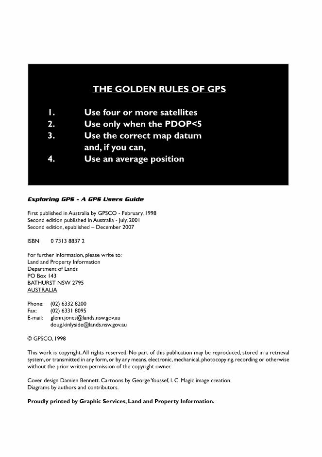
THE GOLDEN RULES OF GPS 1. Use four or more satellites 2. Use only when the PDOP<5 3. Use the correct map datum and, if you can, 4. Use an average position
By
Simon McElroy
Ian Robins
Glenn Jones
Doug Kinlyside
For
The Global Positioning System
Consortium
(GPSCO)

iv Exploring GPS
Although aimed at the general user, this book will go a long way towards satisfying the
curious and technical reader
vA GPS Users Guide
Introduction
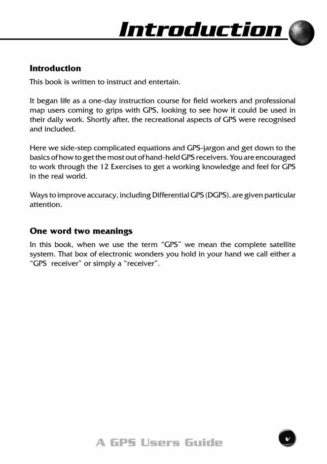
This book is written to instruct and entertain.
It began life as a one-day instruction course for field workers and professional map users coming to grips with GPS, looking to see how it could be used in their daily work. Shortly after, the recreational aspects of GPS were recognised and included.
Here we side-step complicated equations and GPS-jargon and get down to the basics of how to get the most out of hand-held GPS receivers. You are encouraged to work through the 12 Exercises to get a working knowledge and feel for GPS in the real world.
Ways to improve accuracy, including Differential GPS (DGPS), are given particular attention.
One word two meanings
In this book, when we use the term “GPS” we mean the complete satellite system. That box of electronic wonders you hold in your hand we call either a “GPS receiver” or simply a “receiver”.
Introduction

vi Exploring GPS
GPSCO
GPSCO was formed in 1989 as a consortium of four organisations with an interest in GPS. The original membership changed in 1993 and now comprises:
• TheSchoolofSurveyingandSpatialInformationSystems University of New South Wales.
• TechnicalandFurtherEducationNewSouthWales. (TAFENSW).
• LandandPropertyInformation,DepartmentofInformation Technology and Management.
• SchoolofCivilEngineering,UNSWattheAustralian
DefenceForceAcademy,(ADFA).
In 1990, GPSCO won a grant from the New South Wales Education andTrainingFoundationwhichenableddevelopmentofaseriesofGPStrainingcourses.FurtherfundsfromGPSCOandthecooperationofLandand Property Information allowed refinement of the course notes and production of this book.
viiA GPS Users Guide
What’s this book all about? What’s in it for me?
Relax!
This book was written with you - the reader - as the central person.
The questions that are buzzing around in your head right now have almost certainly been asked before by people attending our courses over the last dozen or so years. So we have a fair idea of what you want to know. Even though you may be an absolute novice, we know you are not a fool, so we won’t treat you like one.
We expect you to take a little while to get used to new concepts and new words, so we will explain their meaning when they first occur, after that, we won’t bore you by repeating explanations. If you come up against a new word or phrase which is not explained, chances are, you missed it earlier. As an aid, we have also included at the back of the book, a list of commonly used abbreviations, and index.
TRY TO RESIST the temptation to jump chapters - it really is important to understand why things happen the way they do - that way getting the most out of GPS will be so much easier. And that, after all, is why you are reading this book. The technical bits
A book of this nature cannot avoid technical explanations, but it can limit their intrusion. We believe that too much techno-speak interrupts the flow
of the text and could lead to incomplete understanding, or worse, confusion. So, we have printed the TECHNICAL BITS in italics. You can skip them the first time round, and come back and read them later to nicely round off the subject.
Introduction

viii Exploring GPS
ixA GPS Users Guide
Contents
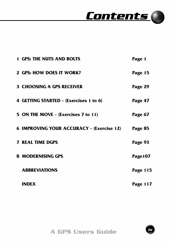
1 GPS: THE NUTS AND BOLTS Page 1
2 GPS: HOW DOES IT WORK? Page 15
3 CHOOSING A GPS RECEIVER Page 29
4 GETTING STARTED - (Exercises 1 to 6) Page 47
5 ON THE MOVE - (Exercises 7 to 11) Page 67
6 IMPROVING YOUR ACCURACY - (Exercise 12) Page 85
7 REAL TIME DGPS Page 93
8 MODERNISING GPS Page107
ABBREVIATIONS Page 115
INDEX Page 117

x Exploring GPS

The Nuts And BoltsChapter 1

2 Exploring GPS
That’s easyWhat is GPS?
3A GPS Users Guide
the nuts and bolts 1
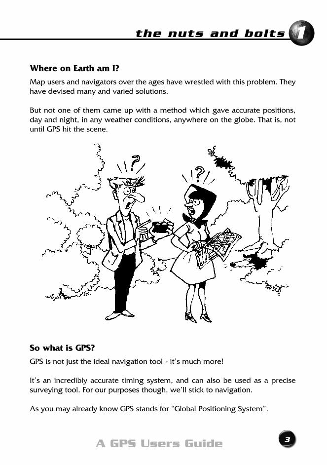
Where on Earth am I?
Map users and navigators over the ages have wrestled with this problem. They have devised many and varied solutions.
But not one of them came up with a method which gave accurate positions, day and night, in any weather conditions, anywhere on the globe. That is, not until GPS hit the scene.
So what is GPS?
GPS is not just the ideal navigation tool - it’s much more!
It’s an incredibly accurate timing system, and can also be used as a precise surveyingtool.Forourpurposesthough,we’llsticktonavigation.
As you may already know GPS stands for “Global Positioning System”.
4 Exploring GPS
What’s in it for me?
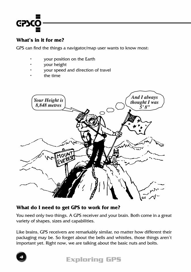
GPS can find the things a navigator/map user wants to know most: • yourpositionontheEarth • yourheight • yourspeedanddirectionoftravel • thetime
What do I need to get GPS to work for me?
You need only two things. A GPS receiver and your brain. Both come in a great variety of shapes, sizes and capabilities.
Likebrains,GPSreceiversareremarkablysimilar,nomatterhowdifferenttheirpackaging may be. So forget about the bells and whistles, those things aren’t important yet. Right now, we are talking about the basic nuts and bolts.
And I alwaysthought I was
5’ 8”Your Height is8,848 metres
5A GPS Users Guide
the nuts and bolts 1
Is GPS a new idea?
Not really! Satellites are only artificial moons, and mankind has navigated by the moon and stars for thousands of years. Today though, we find ourselves staring at a GPS receiver’s screen rather than star gazing. So when you think about it, it’s not exactly a new idea.
GPS is not even the first satellite navigation system. That honour goes to the TRANSIT Doppler System and it has been in use since the sixties.
Who developed GPS?
Actually, GPS has been under development since flared pants were the ‘in’ fashion. The United States Department of Defense (DoD) found the money and did all the hard work.
This ideal positioning system did not come cheaply. It cost DoD over 12 billion US dollars to develop GPS. And they don’t let us forget who’s in charge.
What did they get for all that money?
The best navigation system of all time - that’s what!
We’ve already said that GPS gives you your position, speed and time.
What’s not so well known - and extremely useful - is that GPS will also work:
• anywhereintheworld
• 24hoursaday,everyday
• inanyweathercondition
• withoutanycosttoyou.It’sFREE!
6 Exploring GPS
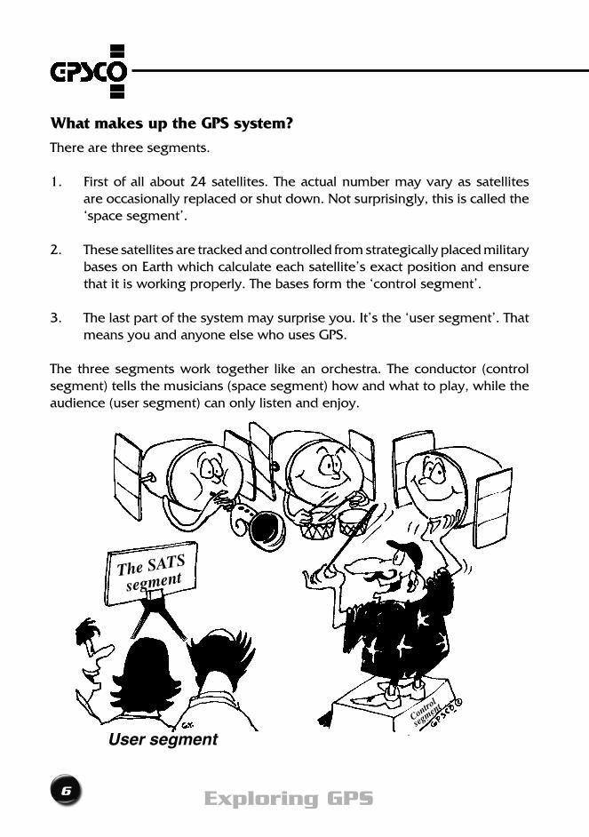
What makes up the GPS system?
There are three segments.
1. Firstofallabout24satellites.Theactualnumbermayvaryassatellitesare occasionally replaced or shut down. Not surprisingly, this is called the ‘space segment’.
2. These satellites are tracked and controlled from strategically placed military bases on Earth which calculate each satellite’s exact position and ensure that it is working properly. The bases form the ‘control segment’.
3. The last part of the system may surprise you. It’s the ‘user segment’. That means you and anyone else who uses GPS.
The three segments work together like an orchestra. The conductor (control segment) tells the musicians (space segment) how and what to play, while the audience (user segment) can only listen and enjoy.
User segment
The SATS
segment
Control
segmen
t

7A GPS Users Guide
the nuts and bolts 1
What is a GPS satellite?Basically, it’s an orbiting radio station - a transmitter.
Antennas for sending and receiving radio signals project from the casing of the ‘platform’, as the body of the satellite is called in space jargon. Attached are two large ‘wings’. These wings are covered with solar cells which generate the power to run the satellite. All up, the satellite is about the size and weight of a large four-wheel-drive vehicle.
The heart of a GPS satellite is its atomic clocks. No, they don’t run on atomic power; they are called atomic clocks because they use the regular vibration of atoms as a metronome. Atomic clocks are incredibly accurate. They lose only one second every three hundred thousand years or so, give or take a millennium. The satellites use them to generate the morse code-like signals that they transmit.
Although GPS satellites are built to withstand a lot of punishment, their real enemy is technology. Older models are continually being replaced by newer ones, with the latest design features.
Over the last two decades several generations of GPS satellites have been designed, built, launched, and eventually put out to pasture.
The Block I satellites were the ‘experimental bunnies’. Eleven were launched between 1978 and 1985. Some proved their reliability by still functioning up to ten years later. They were replaced by the Block II ‘Operational’ satellites.
The next generation, the Block IIR’s (‘R’ for Replenishment), began being launched in 1997. The last will be launched early in the 21st Century. These satellites have the special ability to operate without commands from the Control Segment for up to six months if necessary - called “AUTO-NAV” - it’s an amazing and innovative feat.
Thelatestgeneration,theBlockIIF’s(‘F’forFollow-on),willbeourmainworkhorsesfor the next ten to twenty years. They have a longer design life, new signals, fancier atomic clocks, and can be easily upgraded with future satellite software improvements. Planning has already started on the Block III satellites. The first one should be ready around 2010.
8 Exploring GPS
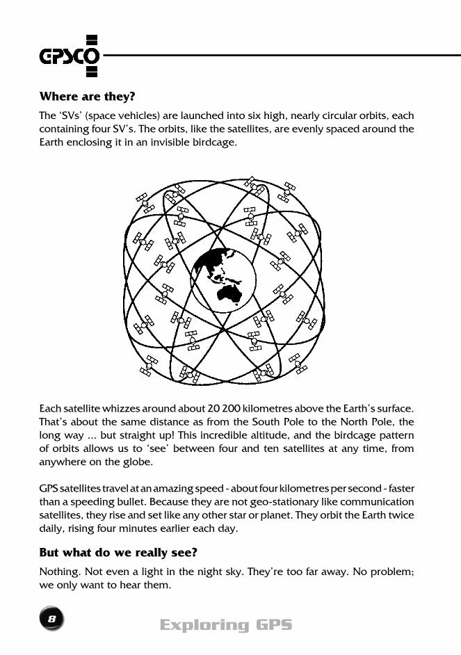
Where are they?
The ‘SVs’ (space vehicles) are launched into six high, nearly circular orbits, each containing four SV’s. The orbits, like the satellites, are evenly spaced around the Earth enclosing it in an invisible birdcage.
Each satellite whizzes around about 20 200 kilometres above the Earth’s surface. That’s about the same distance as from the South Pole to the North Pole, the long way ... but straight up! This incredible altitude, and the birdcage pattern of orbits allows us to ‘see’ between four and ten satellites at any time, from anywhere on the globe.
GPS satellites travel at an amazing speed - about four kilometres per second - faster than a speeding bullet. Because they are not geo-stationary like communication satellites, they rise and set like any other star or planet. They orbit the Earth twice daily, rising four minutes earlier each day.
But what do we really see?
Nothing. Not even a light in the night sky. They’re too far away. No problem; we only want to hear them.
9A GPS Users Guide
the nuts and bolts 1
On what frequencies can we hear GPS signals?
GPSsatellitestransmitontwofrequencies,calledL1andL2.
L1 and L2 are microwave (L-band) frequencies of 1575.4 MHz and 1227.6 MHz respectively. GPS uses these frequencies because instead
of bouncing off or being absorbed by the atmosphere, as some radio waves are, they penetrate cloud, rain, smoke, smog, dust and air pollution.
What sort of signals do GPS satellites send?
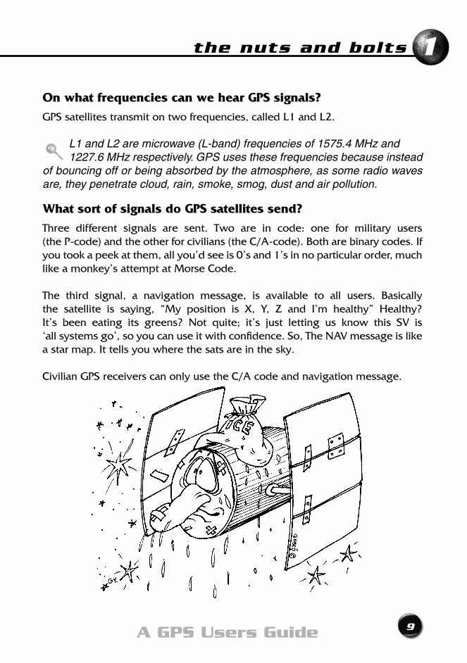
Three different signals are sent. Two are in code: one for military users (the P-code) and the other for civilians (the C/A-code). Both are binary codes. If you took a peek at them, all you’d see is 0’s and 1’s in no particular order, much like a monkey’s attempt at Morse Code.
The third signal, a navigation message, is available to all users. Basically the satellite is saying, “My position is X, Y, Z and I’m healthy” Healthy? It’s been eating its greens? Not quite; it’s just letting us know this SV is ‘all systems go’, so you can use it with confidence. So, The NAV message is like a star map. It tells you where the sats are in the sky.
Civilian GPS receivers can only use the C/A code and navigation message.
10 Exploring GPS
More about GPS signals
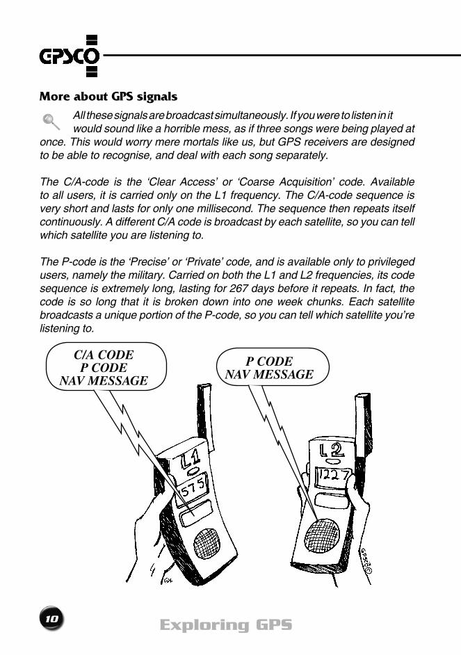
All these signals are broadcast simultaneously. If you were to listen in it would sound like a horrible mess, as if three songs were being played at once. This would worry mere mortals like us, but GPS receivers are designed to be able to recognise, and deal with each song separately.
The C/A-code is the ‘Clear Access’ or ‘Coarse Acquisition’ code. Available to all users, it is carried only on the L1 frequency. The C/A-code sequence is very short and lasts for only one millisecond. The sequence then repeats itself continuously. A different C/A code is broadcast by each satellite, so you can tell which satellite you are listening to.
The P-code is the ‘Precise’ or ‘Private’ code, and is available only to privileged users, namely the military. Carried on both the L1 and L2 frequencies, its code sequence is extremely long, lasting for 267 days before it repeats. In fact, the code is so long that it is broken down into one week chunks. Each satellite broadcasts a unique portion of the P-code, so you can tell which satellite you’re listening to.
C/A CODEP CODE
NAV MESSAGE
P CODENAV MESSAGE
11A GPS Users Guide
the nuts and bolts 1
Anti-Spoofing (A/S)
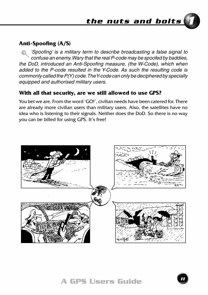
‘Spoofing’ is a military term to describe broadcasting a false signal to confuse an enemy. Wary that the real P-code may be spoofed by baddies,
the DoD, introduced an Anti-Spoofing measure, (the W-Code), which when added to the P-code resulted in the Y-Code. As such the resulting code is commonly called the P(Y) code. The Y-code can only be deciphered by specially equipped and authorised military users.
With all that security, are we still allowed to use GPS?
Youbetweare.Fromtheword‘GO!’,civilianneedshavebeencateredfor.Thereare already more civilian users than military users. Also, the satellites have no idea who is listening to their signals. Neither does the DoD. So there is no way you can be billed for using GPS. It’s free!

12 Exploring GPS
There must be a catch?
There is. In fact, there are a few.
You have no control over how the system is operated. The DoD and Department of Transport (DoT) have complete control.
At the risk of stating the obvious - we must say that GPS will only work when you can ‘see’ some satellites. GPS will not work in a building, underground or underwater.
Another catch is that you must be prepared to give over to blind faith when using GPS. GPS is a set and forget system. You just set up your GPS receiver, turn it on, and it tells you where you are.
“But you said the User Segment was an important part!”, we hear you say. It is; this is where your brain comes in. Don’t leave it at home. You’ll need it to make sure the results you read on the GPS receiver’s screen make sense. How do you do that? Well, first you’ll need to know how the system works.
Chapter Summary
13A GPS Users Guide
1
• TheUSDepartmentofDefensedevelopedGPS as the ideal navigation tool
• GPScangiveyouyourposition,velocityand the time anywhere, anytime, in any weather
• GPSismadeupofthreemainparts: - the space segment - the control segment
- the user segment
• GPSsatellitescurrentlytransmitontwodifferentfrequencies:
- L1 - L2
• GPSsatellitescurrentlysendthreedifferentsignals:
- C/A-code - P(Y)-code
- a navigation message

14 Exploring GPS

How Does it Work?Chapter 2
16 Exploring GPS
That’s classified information
How does GPS work?
how does it work ?
17A GPS Users Guide
2
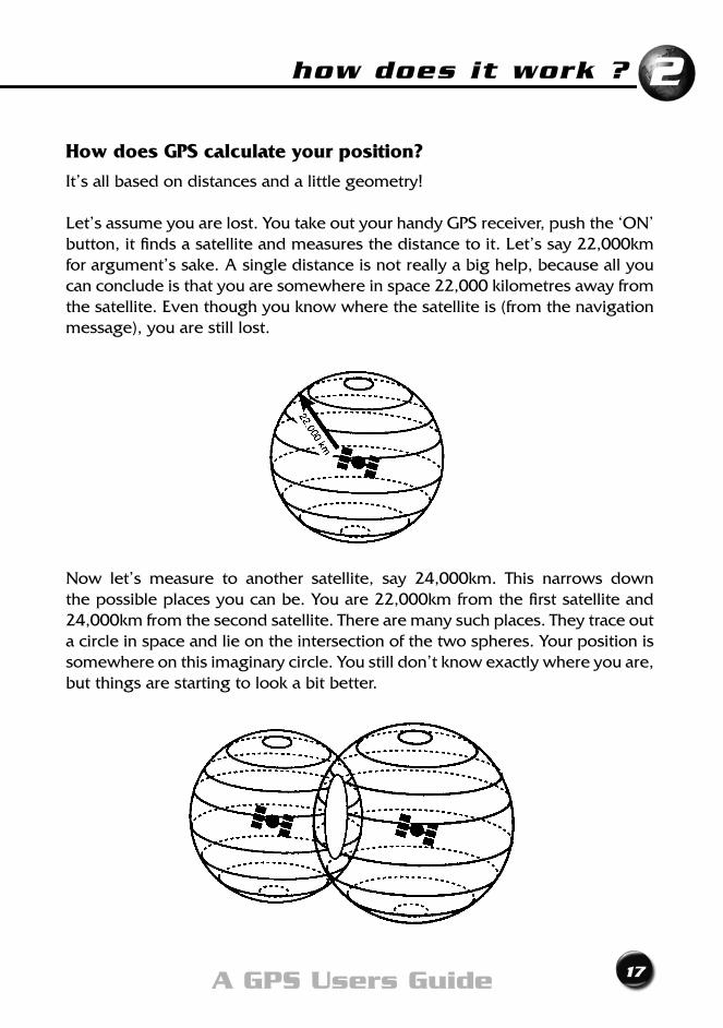
How does GPS calculate your position?
It’s all based on distances and a little geometry!
Let’sassumeyouarelost.YoutakeoutyourhandyGPSreceiver,pushthe‘ON’button,itfindsasatelliteandmeasuresthedistancetoit.Let’ssay22,000kmfor argument’s sake. A single distance is not really a big help, because all you can conclude is that you are somewhere in space 22,000 kilometres away from the satellite. Even though you know where the satellite is (from the navigation message), you are still lost.
Now let’s measure to another satellite, say 24,000km. This narrows downthe possible places you can be. You are 22,000km from the first satellite and 24,000kmfromthesecondsatellite.Therearemanysuchplaces.Theytraceouta circle in space and lie on the intersection of the two spheres. Your position is somewhere on this imaginary circle. You still don’t know exactly where you are, but things are starting to look a bit better.
18 Exploring GPS
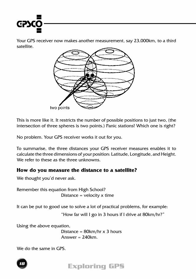
Your GPS receiver now makes another measurement, say 23,000km, to a third satellite.
This is more like it. It restricts the number of possible positions to just two, (the intersection of three spheres is two points.) Panic stations! Which one is right?
No problem. Your GPS receiver works it out for you.
To summarise, the three distances your GPS receiver measures enables it to calculatethethreedimensionsofyourposition:Latitude,Longitude,andHeight.We refer to these as the three unknowns.
How do you measure the distance to a satellite?
We thought you’d never ask.
Remember this equation from High School? Distance = velocity x time
It can be put to good use to solve a lot of practical problems, for example:
“How far will I go in 3 hours if I drive at 80km/hr?”
Using the above equation, Distance = 80km/hr x 3 hours Answer=240km.
We do the same in GPS.
how does it work ?
19A GPS Users Guide
2
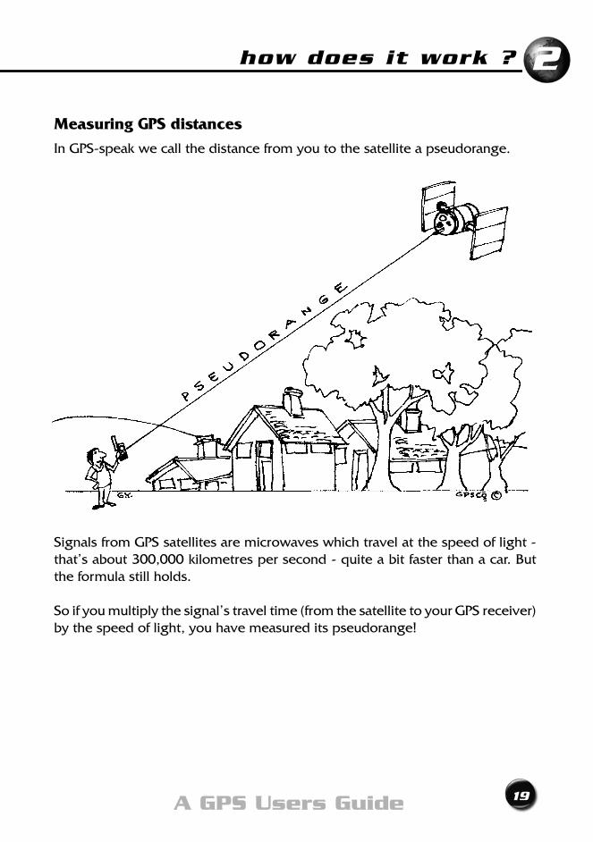
Measuring GPS distances
In GPS-speak we call the distance from you to the satellite a pseudorange.
Signals from GPS satellites are microwaves which travel at the speed of light - that’s about 300,000 kilometres per second - quite a bit faster than a car. But the formula still holds.
So if you multiply the signal’s travel time (from the satellite to your GPS receiver) by the speed of light, you have measured its pseudorange!
20 Exploring GPS
But how do you measure the travel time?
With a good stop watch?
Right! It needs to be a VERY good stopwatch, because a signal from a satellite takes only about seven one hundredths (0.07) of a second to reach us!
What if, instead of a stopwatch, you only had a clock?
Still OK! You note the time the satellite sent the signal and the time you receive it. The difference between the two is the time of travel.
Let’slookatarealexample; You leave home to drive to work, noting that the time on the kitchen clock is exactly 8:00am. After battling the peak hour traffic you finally ‘bundy’ on at exactly 9:00am on the bundy clock. Your time of travel is exactly one hour.Right? Well... almost! You have used two different clocks to measure your travel time. Who’s to say that the kitchen clock keeps the same time as the bundy clock? It’s the same with GPS. Who’s to say that the satellite clock keeps the same time as your GPS receiver’s clock? Surely they must have to be synchronised ...
How can you be sure that both clocks are synchronised?
You can’t. GPS receivers and satellites cannot keep precisely the same time. This is because the satellites are provided with those extremely accurate, and expensive atomic clocks. GPS receivers, on the other hand, have only cheaper, lessaccurate,quartzcrystalclocks-similartothewatchonyourwrist.Likeyourwatch, they may run fast or slow.
So your GPS receivers clock does not keep exactly the same time as satellite clocks. This lack of synchronisation leads to an error in the time of travel and therefore the length of the pseudoranges. Any change in the length of the pseudoranges results in a change to your computed position.
how does it work ?
21A GPS Users Guide
2
What to do?
For our purposes, all the satellites keep the same time. And our GPS receiver’s clock is out of synchronisation by an equal amount for each satellite. All the distances measured by our GPS receiver will be affected by the same error.Sowhynotjustmakeitanother‘unknown’(liketheLatitude,Longitudeand Height) and work it out at the same time, and in the same way?
Four unknowns
Now we have a total of four unknowns - the three position dimensions (latitude, longitude and height) and our GPS receivers clock error. So, instead of measuring pseudorangestojustthreesatellites,wemeasuretoFOURsatellites.That’lldoit!Fromthefourknownquantities,themeasuredpseudoranges,wecanfindthefourunknowns-Latitude,Longitude,HeightandClockError.
How many satellites do we need?
This is such an important point we call it our first Golden Rule;
GOLDEN RULE No.1 For a three dimensional (3D) position,
use four or more satellites.
So how accurate is GPS?
Statistical testing tells us that most of the time the civilian (C/A) code will give an answer to within 7 to 15 metres of your true horizontal position and about 12 to 35 metres of your true height.
Authorised P(Y)-code users can expect the same accuracy or better, and some signal protection advantages.
22 Exploring GPS
What do these ‘errors in position’ actually mean?
Let’sbeginwithhorizonalerrors.
Horizontal errors
Say you took a position with a GPS receiver outside your front door two days ago, another yesterday, and a third today. You must expect that the difference in position given - for that same point! - will vary by anything from zero to up to 15m - or even, occasionally, up to 30m. Even positions taken seconds apart will have variations.
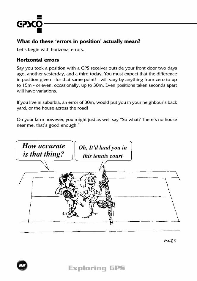
If you live in suburbia, an error of 30m, would put you in your neighbour’s back yard, or the house across the road!
On your farm however, you might just as well say “So what? There’s no house near me, that’s good enough.”
How accurate is that thing?
Oh, It’d land you in this tennis court
how does it work ?
23A GPS Users Guide
2
Another way of looking at it is to imagine you are standing in a tennis court. Your true position lies somewhere within an area of ground, about the same size as two tennis courts side by side.
Then again, a fisherman, or glider pilot, or traveller in the outback, only has to be navigated by his GPS receiver to within sight of his objective, to be thankful for the day he bought it.
Vertical errors
Vertical errors could be serious. The accuracy is about 30 metres most of the time. That’s nearly 100 feet in the language aviators still use. Sailors at or near sea level are usually quite surprised when their GPS receiver indicates - by displaying a negative height - that they are under water.
Didn’t the DoD scramble the GPS signals to decrease accuracy?
Yes, you’re right, they did. But they stopped it in May 2000. Read on.
Selective Availability
The policy of degrading the civilian (C/A) code was called “Selective Availability”, or S/A for short. It was first invoked in early 1990. Basically, the DoD went to a whole lot of trouble to scramble the satellite signals so that civilians could not get accurate GPS results. This helped protect GPS being used against the establishment, as only authorised users could get accurate results.
S/A worked by introducing an artificial clock error into each satellite’s signals and errors into each satellite’s position in the Navigation Message.
The combined effect of these errors was to downgrade the accuracy of GPS.
What was the accuracy when S/A was on?
FortenlongyearsGPSusershadtoputupwithhorizontalpositionsthatwereaccurate to only 100m. Heights were even worse; errors up to 150 metres were the norm. In those days, GPS only got you within sight of your objective, unless you went to a whole lot of extra effort and trouble.
So if you have the position of any favourite spots that you marked with your GPS receiver before May 2000, they may not be very accurate. It may be a good idea to do them again, since GPS is more accurate today.
24 Exploring GPS
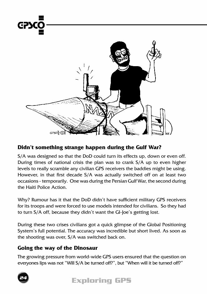
Didn’t something strange happen during the Gulf War?
S/A was designed so that the DoD could turn its effects up, down or even off. During times of national crisis the plan was to crank S/A up to even higher levels to really scramble any civilian GPS receivers the baddies might be using. However, in that first decade S/A was actually switched off on at least two occasions - temporarily. One was during the Persian Gulf War, the second during the Haiti Police Action.
Why? Rumour has it that the DoD didn’t have sufficient military GPS receivers for its troops and were forced to use models intended for civilians. So they had to turn S/A off, because they didn’t want the GI-Joe’s getting lost.
During these two crises civilians got a quick glimpse of the Global Positioning System’s full potential. The accuracy was incredible but short lived. As soon as the shooting was over, S/A was switched back on.
Going the way of the Dinosaur
The growing pressure from world-wide GPS users ensured that the question on everyones lips was not “Will S/A be turned off?”, but “When will it be turned off?”
how does it work ?
25A GPS Users Guide
2
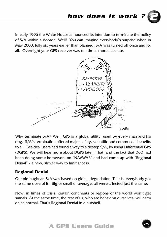
In early 1996 the White House announced its intention to terminate the policy of S/A within a decade. Well! You can imagine everybody’s surprise when in May 2000, fully six years earlier than planned, S/A was turned off once and for all. Overnight your GPS receiver was ten times more accurate.
Why terminate S/A? Well, GPS is a global utility, used by every man and his dog. S/A’s termination offered major safety, scientific and commercial benefits to all. Besides, users had found a way to sidestep S/A, by using Differential GPS (DGPS). We will hear more about DGPS later. That, and the fact that DoD had been doing some homework on “NAVWAR” and had come up with “Regional Denial” - a new, slicker way to limit access.
Regional Denial
Our old bugbear S/A was based on global degradation. That is, everybody got the same dose of it. Big or small or average, all were affected just the same.
Now, in times of crisis, certain continents or regions of the world won’t get signals. At the same time, the rest of us, who are behaving ourselves, will carry on as normal. That’s Regional Denial in a nutshell.

26 Exploring GPS
What about Anti-Spoofing?
If you happen to have a Military P(Y)-code GPS receiver, then you should know that Anti-Spoofing (P-code encryption) will continue.
I need a more accurate position than that!
Suppose you do need to get the right house in the street, or to locate the source of pollution to better than 15m? Or, being more ambitious, find the exact position of Council’s assets or a mine shaft to within a metre or two? Don’t fret. You can. We describe how soon. But first, we need to choose a GPS receiver.
Chapter Summary
27A GPS Users Guide
• Yourpositionhasfourunknownquantities: - Latitude
- Longitude - Height -Clockerror
• YourGPSreceivercalculatesyourpositionby measuring pseudoranges (distances) to satellites
• Tofixyour3Dpositionyouneedtoreceivesignals from at least four satellites
• GPSisaccuratetobetween: ± 7 and 15m Horizontally ± 12 and 35m Vertically
• SelectiveAvailabilitywasterminatedinMay 2000
2

28 Exploring GPS

Choosing a GPS ReceiverChapter 3
30 Exploring GPS
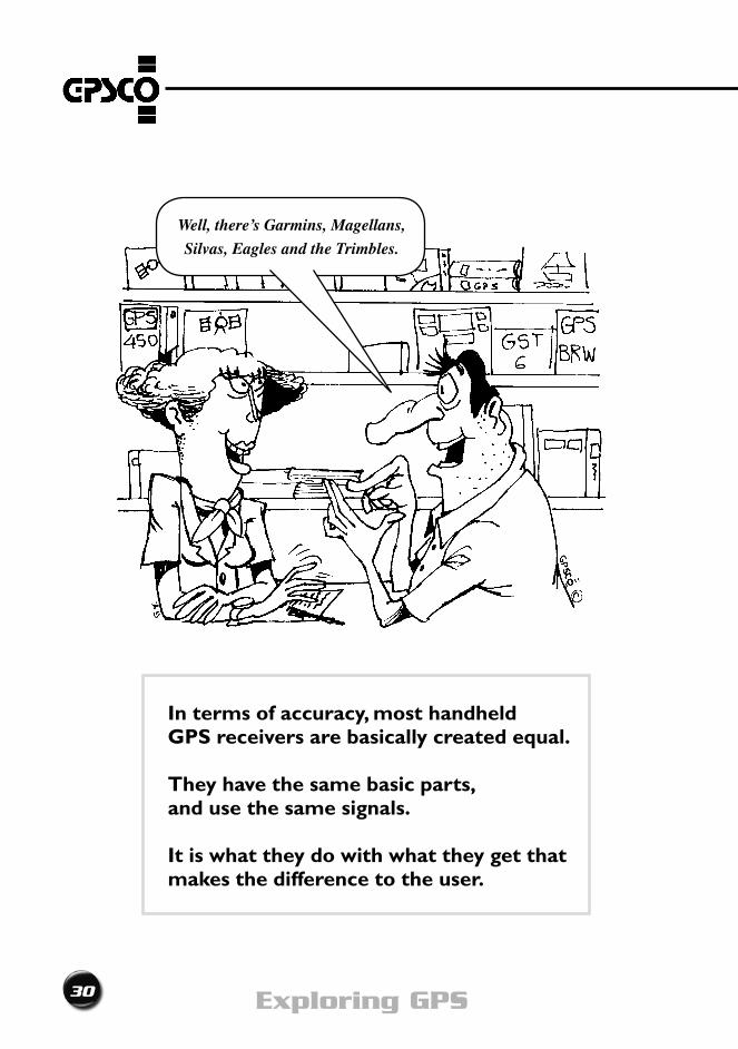
In terms of accuracy, most handheld GPS receivers are basically created equal.
They have the same basic parts, and use the same signals.
It is what they do with what they get that makesthedifferencetotheuser.
Well, there’s Garmins, Magellans,
Silvas, Eagles and the Trimbles.
choosing a GPS receiver
31A GPS Users Guide
3
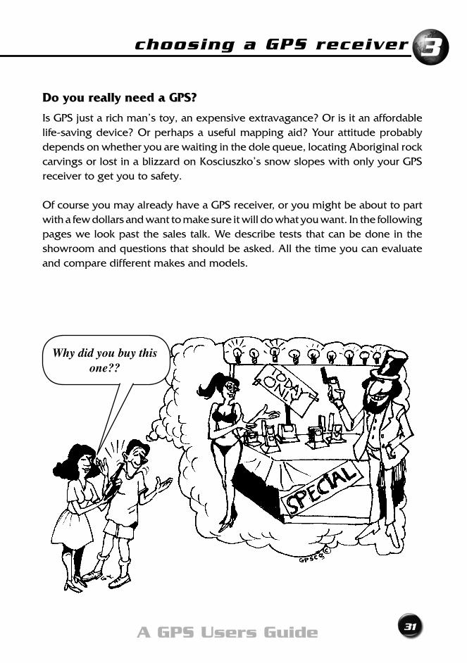
Do you really need a GPS?
Is GPS just a rich man’s toy, an expensive extravagance? Or is it an affordable life-saving device? Or perhaps a useful mapping aid? Your attitude probably depends on whether you are waiting in the dole queue, locating Aboriginal rock carvings or lost in a blizzard on Kosciuszko’s snow slopes with only your GPS receiver to get you to safety.
Of course you may already have a GPS receiver, or you might be about to part with a few dollars and want to make sure it will do what you want. In the following pages we look past the sales talk. We describe tests that can be done in the showroom and questions that should be asked. All the time you can evaluate and compare different makes and models.
Why did you buy this one??
32 Exploring GPS
I want one!
Your GPS receiver is an investment, and you need to choose wisely. You are going to make and trust decisions based on the answers it gives you, so not only must they be the right answers, they must be in a form you can understand and use.
Let’snotbeatabout thebush.Unlessyouarepreparedtospendbucketsofmoney, all the latest GPS receivers will give you the same basic accuracy.
What really should interest you is what you get for your money.
Featuresoffered,andtheflexibilitytosetcontrolstoyourparticularneedsarethemost important things to be considered. Don’t be conned by the pretty colours or bells and whistles - unless they really will be useful.
The salesperson doesn’t know your needs - although he/she may try to tell you. Only you can decide.
If you want to use GPS in aviation or marine navigation, you may have to check with the authorities for compliance of a particular model to
certain regulations.
How much does it cost?
Formostofuscostisthemajorconsideration.Butbeawarethatafewdollarsmore, spent wisely, might just ensure that you buy a useful tool rather than a useless toy.
choosing a GPS receiver
33A GPS Users Guide
3
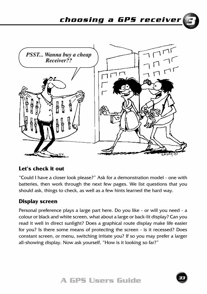
Let’s check it out
“Could I have a closer look please?” Ask for a demonstration model - one with batteries, then work through the next few pages. We list questions that you should ask, things to check, as well as a few hints learned the hard way.
Display screen
Personal preference plays a large part here. Do you like - or will you need - a colour or black and white screen, what about a large or back-lit display? Can you read it well in direct sunlight? Does a graphical route display make life easier for you? Is there some means of protecting the screen - is it recessed? Does constant screen, or menu, switching irritate you? If so you may prefer a larger all-showing display. Now ask yourself, “How is it looking so far?”
PSST... Wanna buy a cheap Receiver??
34 Exploring GPS
Understanding what is being displayed
The hourglass you may see on the screen commonly means “Please wait” and is used to indicate the GPS receiver is ‘thinking’ or calculating, or loading data. There will be other cryptic icons used. They are different for each brand, and sometimes different for models of the same brand. There is nothing for it but to find out by diving into the Manual. Somewhere there should be a list of icons. Don’tassumewhataniconmeans.Fancydisplaysofsatellitetracks,orbitsetc.are all very well - but are you getting the information you want, or simply being misled into thinking you are?
Lookingahead,youwillwanttoknowthingssuchas:howmanysatellitesyou’retracking; the PDOP; your present position; the Map Datum; whether it is a 2D or 3D position, and if it is differentially corrected. This is probably all gobbledegook at present, but the ideal GPS receiver will give you this basic data all on one - or at most two - screens. In short, you will want to know that the Golden Rules of GPS are being satisfied.
choosing a GPS receiver
35A GPS Users Guide
3
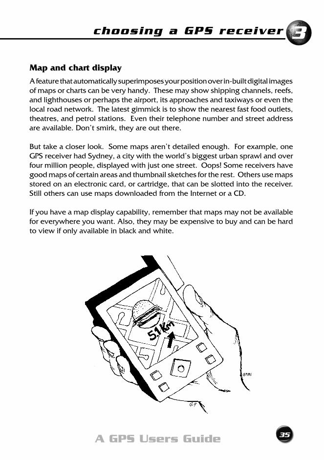
Map and chart display
A feature that automatically superimposes your position over in-built digital images of maps or charts can be very handy. These may show shipping channels, reefs, and lighthouses or perhaps the airport, its approaches and taxiways or even the local road network. The latest gimmick is to show the nearest fast food outlets, theatres, and petrol stations. Even their telephone number and street address are available. Don’t smirk, they are out there.
Buttakeacloserlook.Somemapsaren’tdetailedenough.Forexample,oneGPS receiver had Sydney, a city with the world’s biggest urban sprawl and over four million people, displayed with just one street. Oops! Some receivers have good maps of certain areas and thumbnail sketches for the rest. Others use maps stored on an electronic card, or cartridge, that can be slotted into the receiver. Still others can use maps downloaded from the Internet or a CD.
If you have a map display capability, remember that maps may not be available for everywhere you want. Also, they may be expensive to buy and can be hard to view if only available in black and white.
36 Exploring GPS
Buttons or control keys
GPS receivers often have push buttons, rather than a regular keypad, to give them commands. Commands are a combination of button pushes, so it is useful if you can feel a distinct ‘click’ when a button is pushed, so that you know each stroke has been registered. A simple key layout may look nice and easy to use - but pushing six or seven buttons for each command soon gets a little tedious.
Things to check out include: Does it beep to confirm a task is completed? Are the buttons so close together that it could be easy to push the wrong one? How do you enter numbers or letters? Are the buttons or keys backlit for night use?
Findouthowtomovefromscreentoscreenandtodifferentmenus.Somehavea four way direction switch that is quick and positive - like a flat joystick.
How weatherproof is each button, or the keypad itself? Dust and moisture are the greatest enemies of electronic switches like these push-buttons. As before, ask yourself “How is it looking so far?”
The antenna
The antenna receives the signal from each satellite. There are two main types; the Helix and the Microstrip.
Helix antennas are designed to operate in a vertical position, and usually pivot on the body of the receiver.
Micro strip antennas are more common, and since they are often built into the body of the GPS receiver, you may not even recognise it is there.
A flat microstrip antenna, sometimes called a ‘patch’, may be better in situations (eg on a vehicle roof) where the erect form of the helix could get caught in branches, rigging etc. But on a rocking boat in a choppy sea, the same feature of the erect helix may enable a better lock on satellites when the horizon is constantly changing.
choosing a GPS receiver
37A GPS Users Guide
3
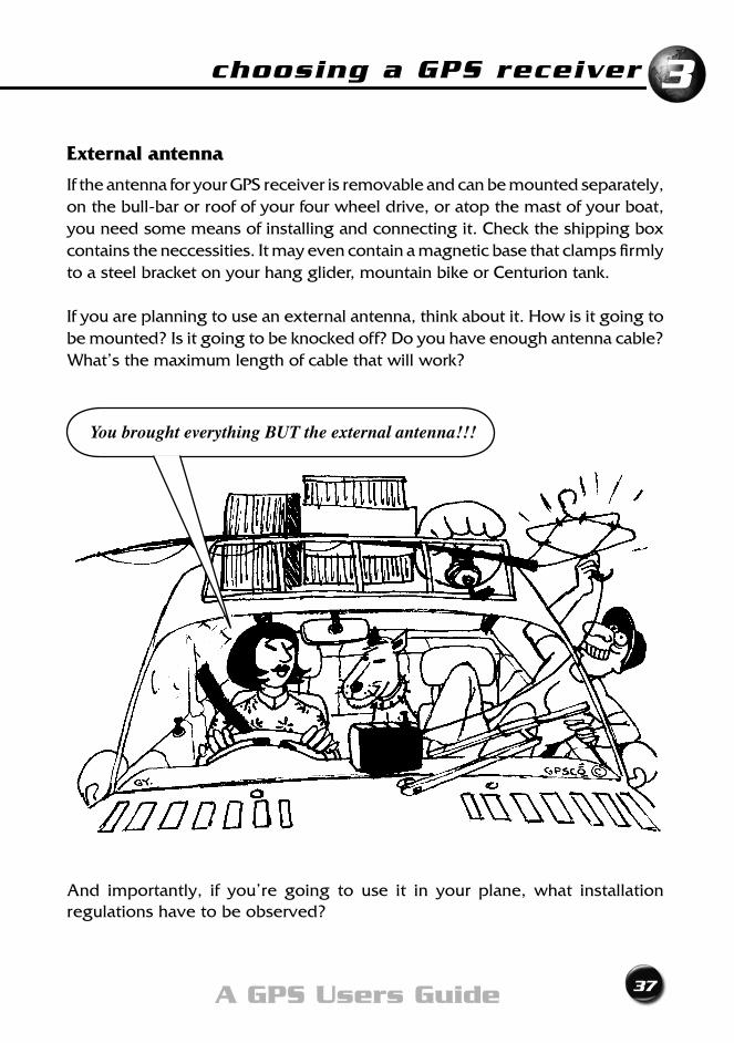
External antenna
If the antenna for your GPS receiver is removable and can be mounted separately, on the bull-bar or roof of your four wheel drive, or atop the mast of your boat, you need some means of installing and connecting it. Check the shipping box contains the neccessities. It may even contain a magnetic base that clamps firmly to a steel bracket on your hang glider, mountain bike or Centurion tank.
If you are planning to use an external antenna, think about it. How is it going to be mounted? Is it going to be knocked off? Do you have enough antenna cable? What’s the maximum length of cable that will work?
And importantly, if you’re going to use it in your plane, what installation regulations have to be observed?
You brought everything BUT the external antenna!!!
38 Exploring GPS
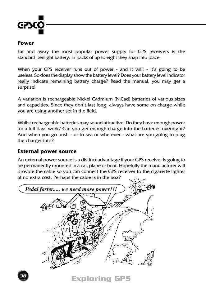
Power
Far and away the most popular power supply for GPS receivers is the standard penlight battery. In packs of up to eight they snap into place.
When your GPS receiver runs out of power - and it will! - it’s going to be useless. So does the display show the battery level? Does your battery level indicator really indicate remaining battery charge? Read the manual, you may get a surprise!
A variation is rechargeable Nickel Cadmium (NiCad) batteries of various sizes and capacities. Since they don’t last long, always have some on charge while you are using another set in the field.
Whilst rechargeable batteries may sound attractive; Do they have enough power for a full days work? Can you get enough charge into the batteries overnight? And when you go bush - or to sea or wherever - what are you going to plug the charger into?
External power source
An external power source is a distinct advantage if your GPS receiver is going to be permanently mounted in a car, plane or boat. Hopefully the manufacturer will provide the cable so you can connect the GPS receiver to the cigarette lighter at no extra cost. Perhaps the cable is in the box?
Pedal faster..... we need more power!!!
choosing a GPS receiver
39A GPS Users Guide
3
The hidden battery
Your GPS receiver has an internal battery to sustain life to its memory while the main power supply is switched off. What is its shelf life? What happens when it runs out? And how long will it last? Some last for years, others don’t.
Power savers
Most GPS receivers have some form of power saver.
Some receivers can only be turned ON by pressing certain keys in a certain order or by holding a key down for a few seconds. This is an excellent feature, as anyone who has discovered too late that batteries are flat through an accidental start that you knew nothing about.
It may also have an option to measure less frequently, therefore using less power. Likewise,itshouldhaveanauto-shutoff.Checkifthisappliestothedisplaylightalso, as a display that remains lit when not being viewed is a drain on battery power. We all love surprises, but no power when you were counting on it is one surprise we can do without.
External casing
Will the GPS receiver stand up to the job you have in mind for it? It will be used outdoors, in all weathers and be expected to perform after having been packed, backpacked and unpacked time and time again. It’s a big ask for a little miracle of electronics.
Does it float? Is it water proof, splash proof, dust-proof or shockproof? If it conforms to ‘Military Specifications’ then it should work even if run over by a tank! An external soft case may be an expensive extra. Is it included in the price? Maybe another type of protection (your old mobile phone cover?) will suffice. Colour can be important; is it easily seen - or easily camouflaged. A sexy black GPS receiver is more easily overlooked and left behind than its garish fluoro cousin.
Ergonomics
How do you have to hold the GPS receiver? An awkward operating position may result in repetitive strain injury - the rare GPS RSI syndrome!
40 Exploring GPS
Check its weight. A lighter model could be preferable if it has to be carried around all day, or held up to read or record for any length of time. When you’re using it, does it have a safety cord or lanyard? Very useful to free a hand while working, or to save the GPS receiver from falling overboard.
Memory
You will want to store in the GPS receiver data such as the positions of landmarks, and how you prefer it to operate - (the setup parameters). Generally, anything stored can be recalled and viewed. It is helpful (to a fallible and fragile human memory) if landmarks (or waypoints) can be entered using letters instead of just numbers. A waypoint named “HOME” means much more than “WP15”. Check if you can do this. If not, you may have to keep lists of numbered waypoints and descriptions, and update them regularly.
Memory limits
As you use your GPS receiver, you will gradually add more and more data to the memory. Does it have enough memory for your needs? What happens when the memory fills up? Does it automatically overwrite old waypoints? If it does what is the overwriting order or process? How do you overwrite or cancel existing or unwanted data? Don’t wait until it is too late to find out.
But it doesn’t have a WOMAN OVERBOARD key.... Ha Ha Ha!!! We don’t need one. No woman
would be so silly as to fall overboard.
choosing a GPS receiver
41A GPS Users Guide
3
Channels
A ‘channel’ is the collective name for all the electronics in the GPS receiver that lock onto the signals from a satellite. There is a lot of techno-babble about channels. But twelve dedicated or parallel channels is the norm.
Sequencing and Dedicated channels
‘Dedicated’ or ‘Parallel’ channels lock onto one signal from one satellite. ‘Sequencing’ or ‘multiplexing’ channels, however, locate a satellite, lock
onto it, and store the data from it in its memory . The GPS receiver then finds another satellite, locks on and stores that data, and repeats the process until it has enough stored data to compute a position. And it can do it all on only one channel. There are variations on these themes with some GPS receivers having a combination of the two.
It will take up to 256 KILLER BITES of DATA!
42 Exploring GPS
Dataports
Usually the dataport (that is, the socket to take some type of computer cable) is used for exporting position fixes into a fishfinder, autopilot, Nintendo - or any other gadget. If you want to connect your GPS receiver to a depth sounder, fish finder, computer and so on, then it must have a dataport and it must support NMEA (National Maritime Electronics Association) data.
Likewise, if youwant togetmoreaccuratepositionsusingReal TimeDGPS,your GPS receiver must be able to receive RTCM (Radio Technical Commission - Maritime) transmissions, via the dataport.
GPS Mapping Software
Does it have any mapping software you can load into your home PC? Why? So that attheendofthatbig4WDadventure,crosscountryskiweekendorpigshootingtrip you can download and store information on all your favourite spots.
This type of software generally allows you to measure the distance and direction between locations. Display a vertical cross section to show how far you climbed. Zoom in or out. Print a mud map. Click and upload new waypoints in a flash. Or output a file to email to friends. The slicker versions even allow you to import topo maps, nautical charts, aerial photographs, or satellite images as a fancy background image.
Check if the mapping software will work with any GPS receiver. Or is it specific to only one particular make or model, hopefully the one you use.
An ever-growing variety of GPS mapping software can be found on the Internet. Go for a surf. You may even find some free, low resolution, aerial photos, maps, or satellite images.
A new lease on life
Firmwareisthesoftwarethatlivesinsidethereceiver.Itmakesitthinkandbreatheand gives it a personality. As we all know, software can have bugs.
Some wise GPS receiver manufacturers have recognised that they won’t get it
choosing a GPS receiver
43A GPS Users Guide
3
exactly right, first time, every time. They also may want to offer you new features in the future. So their receivers firmware can be updated. It’s a great idea. Just hook it up to your PC, run a program and your receiver gets a new lease on life. The better guys allow you to download the latest firmware versions, and matching user manuals, for free from their website. Just download and upgrade. Too easy.
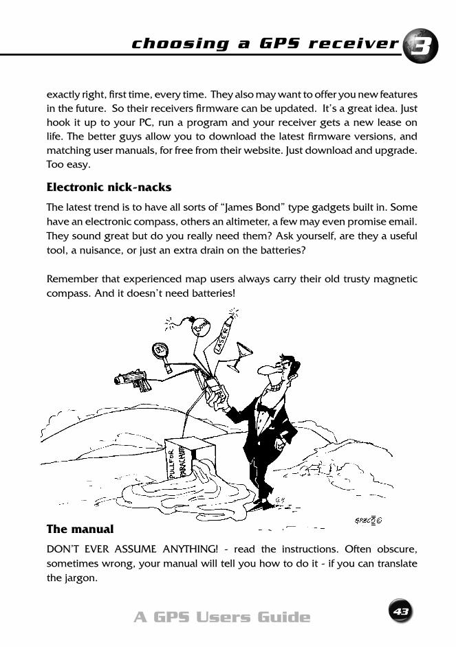
Electronic nick-nacks
The latest trend is to have all sorts of “James Bond” type gadgets built in. Some have an electronic compass, others an altimeter, a few may even promise email. They sound great but do you really need them? Ask yourself, are they a useful tool, a nuisance, or just an extra drain on the batteries?
Remember that experienced map users always carry their old trusty magnetic compass. And it doesn’t need batteries!
The manual
DON’T EVER ASSUME ANYTHING! - read the instructions. Often obscure, sometimes wrong, your manual will tell you how to do it - if you can translate the jargon.
44 Exploring GPS
Quick Reference Card
Most GPS receivers come complete with a handy quick reference card which is your manual in miniature, and can be carried in the soft case. As soon as you can after purchase, photocopy both sides of the card a few times. Store the original where you keep your will, as you will probably never get another.
This little card will show you which buttons to push, and in what order. Highlight frequently used procedures and consider adding a list of setup parameters and/orthecoordinatesofmost-usedwaypoints.Laminateoneormoreofthecopiesfor field use. Use these copies when working and never lend the original to anyone. They are worth their weight in Aztec gold, and need constant vigilance to avoid being ‘borrowed’.
Types of GPS Receivers
Having looked at all the separate parts that make up a GPS receiver, let’s put them all back together again and look at the types available. Hand held GPS receivers can be broadly classified into two types: Navigation and Mapping.
Navigation GPS Receivers
For the vast majority of users, a Navigation GPS receiver will do just fine.Bushwalkers,sailors,archaeologists,fishermen,4WDmotorists,cross-countryskiers, prospectors - can all find satisfaction with a ‘no frills’ unit.
From Archeologist to Zoologist
choosing a GPS receiver
45A GPS Users Guide
3
Mapping GPS Receivers
Mapping GPS receivers have additional features such as greater memory, control of output and input. It is important to realise that any single position - one POS button press - will still only deliver much the same accuracy as for Navigation GPS Receivers. Professional users, such as abalone divers, Customs Officers and LocalGovernmentengineers,willprobablyneeditsadvancedcapabilitiestosatisfy their serious requirements.
Survey GPS Receivers
You don’t need one of these! While navigation and mapping receivers tend to look rather similar, you can’t help noticing that Survey receivers are in a
league of their own. For the cost of just one Survey receiver, you could equip a whole fleet with Navigation units. Larger, and designed for use with an antenna plumbed accurately over a survey mark, they require special observation and computation techniques. Surveyors have found ways to get their position to centimetre accuracy. This is a science in its own right, and well outside the range of this book.
Anything else?
Before you part with your hard-earned cash find out what guarantee is being offered. What is covered? What isn’t covered? When does it expire? And when I have a problem, who will help?
At last ...
By this stage you will be chomping at the bit to get outside and try out your new toy. So let’s go...
46 Exploring GPS
• AllGPSreceivershavethesamebasicparts
• Choosebetween: - Navigation receiver - Mapping receiver
• Don’tletcostbeyouronlyguide
• Featuresandperformancemaketherealdifference between a toy and a tool
• Testdriveit,tocheckitdoeswhatyouwant
Chapter Summary
Getting StartedChapter 4

48 Exploring GPS
getting started
49A GPS Users Guide
4
In the real world
Getting our position from satellites whizzing around in space is all very exciting, but there is more to GPS than just wandering off, GPS receiver in hand, pressing the ‘ON’ button and expecting it to function exactly as you want.
Things which affect its performance, and usefulness, are not all obvious and may not be obvious from the manual.
Probably the best way to find out what is happening is to get your hands dirty - in the field. So let’s go outside and do some Exercises.
Things you will need
• GPSreceiver
• Manual,FieldGuide,orquickreferencecard
• amapofyourarea-onewithgridlines
• pencilandnotebook
• awatch
• anopenarea;yourbackyard,acarpark,footyoval,beachor
similar
• sparebatteries
• and...yourbrain!
50 Exploring GPS
EXERCISE 1:- How quick is my GPS receiver?
In today’s world, we expect everything to happen NOW! - GPS is not always like that.
Step 1 Go to an open area.
Step 2 Turn your GPS receiver ON, noting the time on your watch.
Step 3 Press the POS button (or equivalent) to get a position.
“Why is it taking so long? What’s going on?”, we hear you ask.
Your GPS receiver is trying its best. Sometimes that may seem too slow for us. Do you always jump into your daily tasks straight out of bed? Or are you sometimes a little sluggish, and need a kick start? GPS receivers are like people - and need care and a little understanding at times.
Let’sgiveitthebenefitofthedoubt,andlookatwhatcouldbehappening.YourGPS receiver is in one of three states of readiness.
Frozen start - It’s straight out of the packing box for the first time. Or it’s been doing a Rip van Winkle for the past few weeks. In either case, it does not have a recent navigation message and/or current position in its memory. Getting this information is called ‘Initialisation’. Unfortunately it may take up to 15 minutes for your first position fix. So sit back and relax.
Cold start - Your GPS receiver is either trying to use an old navigation message or has been moved more than 300km since the last time you used it. You should only have to wait up to 5 minutes for your first position answer.
Warm start - Your GPS receiver has both a recent navigation message and is less than 300 km from its last position. It should be up and running in a minute or two.
getting started
51A GPS Users Guide
4
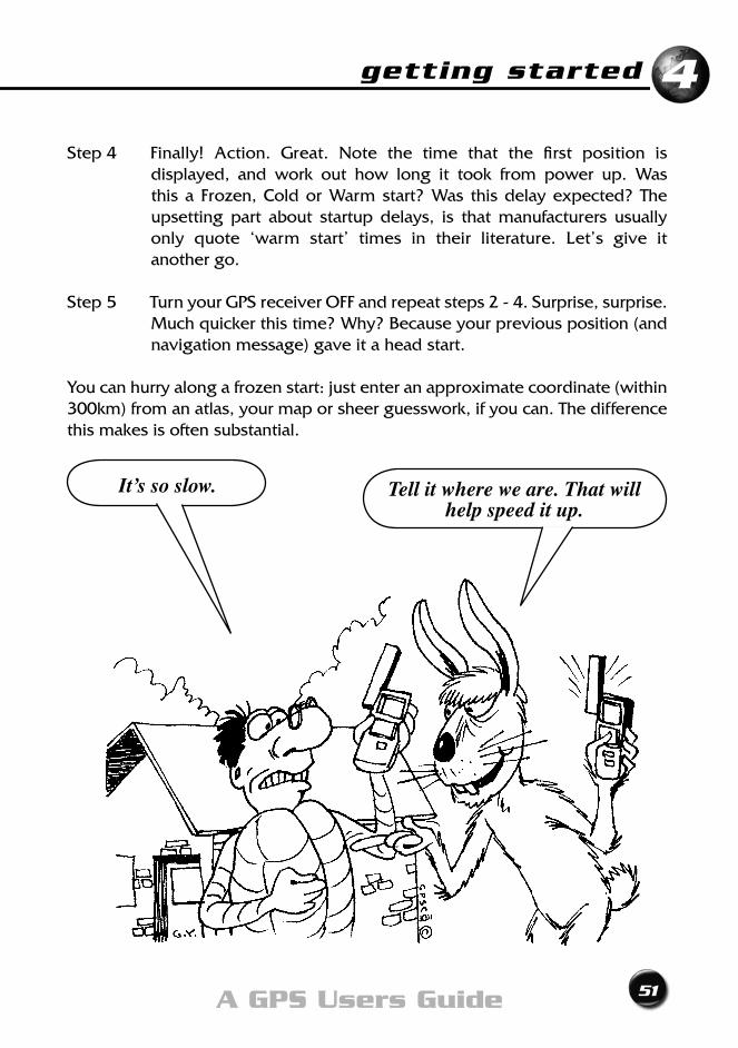
Step4 Finally! Action. Great. Note the time that the first position is displayed, and work out how long it took from power up. Was this a Frozen,ColdorWarmstart?Was thisdelayexpected?The upsetting part about startup delays, is that manufacturers usually only quote ‘warm start’ times in their literature. Let’s give it another go.
Step5 TurnyourGPSreceiverOFFandrepeatsteps2-4.Surprise,surprise.Much quicker this time? Why? Because your previous position (and navigation message) gave it a head start.
You can hurry along a frozen start: just enter an approximate coordinate (within 300km) from an atlas, your map or sheer guesswork, if you can. The difference this makes is often substantial.
It’s so slow. Tell it where we are. That will help speed it up.
52 Exploring GPS
EXERCISE 2:- Is this where I am? - or where I was?
Oops! A real estate agent wanted to use his new GPS receiver to find the positions of five rural properties. At each property he pressed the ON button, then the POS button, wrote down the position displayed, turned the GPS receiver off, and drove to the next site.
Only when he got home again did he realise that he had listed the identical position five times. And that position was the same as the carpark at the office where he had tested his GPS receiver that morning. What had gone wrong?
He was only the latest in a long line of new users who assumed that the position displayed was where he was standing when he pushed the POS button. In each case he had not given his GPS receiver enough time to get a new position before he recorded it.
This story shows the need to satisfy yourself that you have a current position. How do you do it?
Step 1 Go to an open area.
Step 2 Turn your GPS receiver ON.
Step 3 Get a position. Stand still and watch the display for a minute or so.
Step4 Is thisposition changing? If it is, good - it’swhat youwant. Thechanging values prove that it is being updated every few seconds.
This is your current position. IFNOT,chancesarethatthisisanOLDPOSITION-andisNOTwhere
you are now. Don’t fall for the old GPS position trick like so many other novices.
Hint : Heights are less accurate than horizontal position. They vary
more and it may be easier to check the height is changing.
getting started
53A GPS Users Guide
4
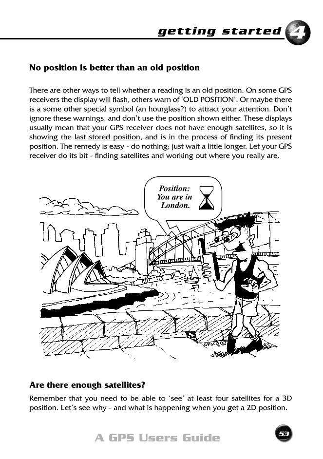
No position is better than an old position
There are other ways to tell whether a reading is an old position. On some GPS receiversthedisplaywillflash,otherswarnof‘OLDPOSITION’.Ormaybethereis a some other special symbol (an hourglass?) to attract your attention. Don’t ignore these warnings, and don’t use the position shown either. These displays usually mean that your GPS receiver does not have enough satellites, so it is showing the last stored position, and is in the process of finding its present position.Theremedyiseasy-donothing;justwaitalittlelonger.LetyourGPSreceiver do its bit - finding satellites and working out where you really are.
Are there enough satellites?
Remember that you need to be able to ‘see’ at least four satellites for a 3D position.Let’sseewhy-andwhatishappeningwhenyougeta2Dposition.
Position:You are in London.
54 Exploring GPS
EXERCISE 3:- 3D vs 2D positions
Step 1 Start with an up-to-date position on your GPS receivers screen.
Step 2 If you have a latitude, a longitude and a height, worry not - you have a three dimensional (3D) position. In fact ‘3D’ is probably shown on the screen somewhere. You have at least four satellites, and this is what we are after. However...
If you have a latitude and longitude only and no height - a 2D position
- your GPS receiver is telling you that it doesn’t have enough satellites for a 3D position. What it isn’t telling you is that even to produce the 2D position, it has had to fudge it.
2D Positioning
In valleys, canyons of skyscrapers, deep gullies or dense tree cover, where there are only three satellites in view, your GPS receiver may try to get a 2D position. To do this it will have to know, or assume, either the true time oryourheight.(Rememberwith3satelliteswecanonlysolvefor3ofthe4 unknowns. The other one has to be assumed). Not many of us carry atomic clocks in our back pocket, so it assumes a height. Where does your GPS receiver get it? Read on.
Automatic height aiding
This is the way most GPS receivers will attempt to do 2D positioning unless you tell them otherwise. It will automatically use the height of the last position in its memory. That may be fine if you’re on a large flat surface, like the ocean or a desert plain, but if you’re in undulating or mountainous terrain, watch out.
Warning!!!
If the height assumed is wrong, then so is your position. A useful rule of thumb to remember is that every one metre error in the height can introduce an extra 1 to 2 metre error in your position. Wow! That sort of error could put you “off the map.”
getting started
55A GPS Users Guide
4
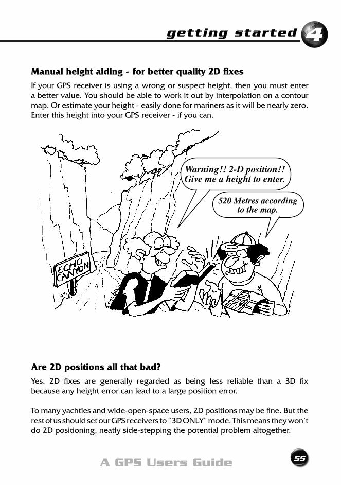
Manual height aiding - for better quality 2D fixes
If your GPS receiver is using a wrong or suspect height, then you must enter a better value. You should be able to work it out by interpolation on a contour map. Or estimate your height - easily done for mariners as it will be nearly zero. Enter this height into your GPS receiver - if you can.
Are 2D positions all that bad?
Yes. 2D fixes are generally regarded as being less reliable than a 3D fix because any height error can lead to a large position error.
To many yachties and wide-open-space users, 2D positions may be fine. But the restofusshouldsetourGPSreceiversto“3DONLY”mode.Thismeanstheywon’tdo 2D positioning, neatly side-stepping the potential problem altogether.
Warning!! 2-D position!!Give me a height to enter.
520 Metres according to the map.
56 Exploring GPS
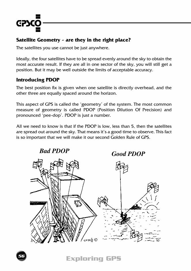
Bad PDOP Good PDOP
Satellite Geometry - are they in the right place?
The satellites you use cannot be just anywhere.
Ideally, the four satellites have to be spread evenly around the sky to obtain the most accurate result. If they are all in one sector of the sky, you will still get a position. But it may be well outside the limits of acceptable accuracy.
Introducing PDOP
The best position fix is given when one satellite is directly overhead, and the other three are equally spaced around the horizon.
This aspect of GPS is called the ‘geometry’ of the system. The most common measure of geometry is called PDOP (Position Dilution Of Precision) and pronounced ‘pee-dop’. PDOP is just a number.
All we need to know is that if the PDOP is low, less than 5, then the satellites are spread out around the sky. That means it’s a good time to observe. This fact is so important that we will make it our second Golden Rule of GPS.
getting started
57A GPS Users Guide
4
GOLDEN RULE No. 2Use only when the PDOP<5.
You must check the PDOP every time you take a position. If your GPS receiver does not display PDOP, there will be some indication of ‘poor geometry’ - perhaps an icon flashes. This is a warning. You decide whether you want to risk positional errors greater than expected.
With experience, you will soon discover that the more satellites you use the betterthechancethatthePDOPwillbelow.Likewise,ifwholesectionsofthesky are blocked by nearby buildings, the roof of your vehicle, or even your body, you will get a high PDOP.
Luckily,withafullconstellationofGPSsatellitesinorbittheaveragePDOPislessthan 5. Even so, there may be a few times each day when the PDOP is higher. A period of high PDOP is called an ‘outage’ and only lasts a handful of minutes until another satellite comes into view.
Still confused?
Ok, let’s put it another way. PDOP is a multiplier. If the PDOP is 2 your GPS receiver may give results that are only half as accurate as for a PDOP of 1. If the PDOP is three, your displayed position may be may be three times less accurate.
Got the idea?
Now think what happens when the PDOP is 10, 20, or even 35. You could be better off stopping for lunch until the satellite geometry improves - and it will.
Proper PDOP Planning Prevents %^&* Poor Performance
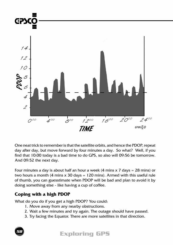
PDOP depends on many things such as your latitude, longitude, the time of day, the number of healthy satellites and how many of them are available to you. The graph over the page is an example, and shows how it can vary over just one day. Site specific graphs are available from good GPS Mapping Software and some web sites.
58 Exploring GPS
One neat trick to remember is that the satellite orbits, and hence the PDOP, repeat day after day, but move forward by four minutes a day. So what? Well, if you find that 10:00 today is a bad time to do GPS, so also will 09:56 be tomorrow. And 09:52 the next day.
Fourminutesadayisabouthalfanhouraweek(4minsx7days=28mins)ortwohoursamonth(4minsx30days=120mins).Armedwiththisusefulruleof thumb, you can guesstimate when PDOP will be bad and plan to avoid it by doing something else - like having a cup of coffee.
Coping with a high PDOP
What do you do if you get a high PDOP? You could: 1. Move away from any nearby obstructions. 2. Wait a few minutes and try again. The outage should have passed. 3. Try facing the Equator. There are more satellites in that direction.
getting started
59A GPS Users Guide
4
What is HDOP?
A value for HDOP (Horizontal Dilution of Precision), instead of a PDOP, may be shown by your GPS receiver. It is used when in 2D mode.
When the HDOP is less than 2.5 the satellite geometry is good.
Map Datum
Even if you have followed the Golden Rules so far, you may find that your position fixes, when plotted on a map, are still wrong by hundreds of metres. Obviouslysomethingisstillamiss.Let’sdelvealittledeeper.
EXERCISE 4:- Checking the Map Datum
Step 1 Pull out the map you’ll be using. Go to a place that you can easily identify on the ground as well as on the map. Choose a road junction, bridge, wharf or other landmark.
Step 2 Turn ON your GPS receiver; and get a 3D position, with a PDOP less than 5.
Step 3 Write down your position; either latitude and longitude, or Easting and Northing.
Step4 Plotthesecoordinatestoscaleonyourmaporchart.Don’ttrytofudge it. You will only be fooling yourself.
Step 5 Does your GPS position correspond with the true position on the map? Almost certainly they will not be exactly the same. Remember that a single point position from GPS should give you an accuracy of better than15 metres from your true position. Is your plotted map position within these limits. If not, why not?
WHAT? ... Wrong? ... Who’s wrong?
Good question. Who, or what, is wrong?
Chances are you’re wrong, not the map. Government-made topographic maps havetoconformtorigorousstandards.Forexample,ona1:25000Standard
60 Exploring GPS
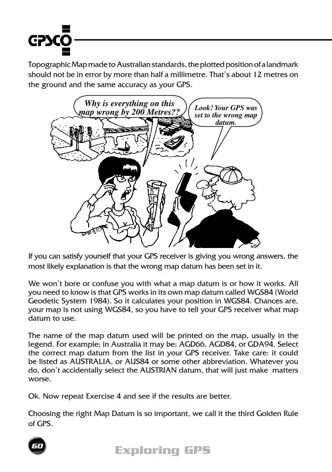
Topographic Map made to Australian standards, the plotted position of a landmark should not be in error by more than half a millimetre. That’s about 12 metres on the ground and the same accuracy as your GPS.
If you can satisfy yourself that your GPS receiver is giving you wrong answers, the most likely explanation is that the wrong map datum has been set in it.
We won’t bore or confuse you with what a map datum is or how it works. All youneedtoknowisthatGPSworksinitsownmapdatumcalledWGS84(WorldGeodeticSystem1984).SoitcalculatesyourpositioninWGS84.Chancesare,yourmapisnotusingWGS84,soyouhavetotellyourGPSreceiverwhatmapdatum to use.
The name of the map datum used will be printed on the map, usually in the legend.Forexample;inAustraliaitmaybe;AGD66,AGD84,orGDA94.Selectthe correct map datum from the list in your GPS receiver. Take care: it could belistedasAUSTRALIA,orAUS84orsomeotherabbreviation.Whateveryoudo, don’t accidentally select the AUSTRIAN datum, that will just make matters worse.
Ok.NowrepeatExercise4andseeiftheresultsarebetter.
Choosing the right Map Datum is so important, we call it the third Golden Rule of GPS.
Why is everything on this map wrong by 200 Metres?? Look! Your GPS was
set to the wrong map datum.
getting started
61A GPS Users Guide
4
GOLDEN RULE No. 3Use the correct map datum.
Before you go anywhere with your GPS receiver always check the map datum. Don’t assume that the previous user wanted everything the way you do. Kids, gremlins and Murphy love to push buttons. As you will read a few times in this book, DON’T EVER ASSUME ANYTHING. Check and doublecheck everything.
Note for Australian GPS users
All new (1996+) Australian topographic, hydrographic and aeronautical maps are being produced on the GDA94 (Geocentric Datum of Australia
1994) map datum. GDA94 is the same as WGS84.Your GPS receiver may not show GDA94 as an option - simply select WGS84 instead.
Map heights and GPS
Imagine it’s late afternoon and you’re out at sea. You have been fishing all day with no luck, then all of a sudden you’re up to your elbows in fish. You can’t keep fishing because you have reached the ‘bag’ limit. So what do you do?
Being a smart bloke you decide to get a position fix from your trusty GPS receiver so you can come back another day.
Your GPS receiver says your height is 100 metres below sea level. How can this be? Is this gadget on the blink? You are as near dammit to being actually on the sea’ssurfaceandyouknowthatallheightsaremeasuredfromMeanSeaLevelAren’t they? No!
GPS heights are NOT Mean Sea Level heights
GPSheightsarenotmeasuredabove,orbelow,MeanSeaLevel!GPSheightsaremeasuredrelativetoWGS84.
The heights on Australian maps are measured with respect to the average Mean SeaLevelaroundthecontinent.This iscalledthe‘AustralianHeightDatum’,often shortened to AHD. Heights on maps may be given for a particular spot
62 Exploring GPS
(usually the top of a hill), or depicted by contour lines which have a number representing their height above AHD.
ThedifferencebetweenAHDandWGS84heightscanbeaslargeas80metresinAustralia.Foranavigator,thedifferencemaybeignored.Ontheotherhand,if you need more accurate heights, it cannot.
GPS heights can be corrected to MSL heights
One way to do this is to read off the correction from your topo map. The size of the correction and how to apply it should be written in the legend of the map. Forexampleitmaysay“decreaseallsatelliteheightsby17metres”.YourGPSreceiver may have these approximate corrections stored in its memory. This allowsthedisplayofMSLheightsatthepushofabutton.
So, as well as the map datum, you should also be aware of what height reference is used by your GPS receiver.
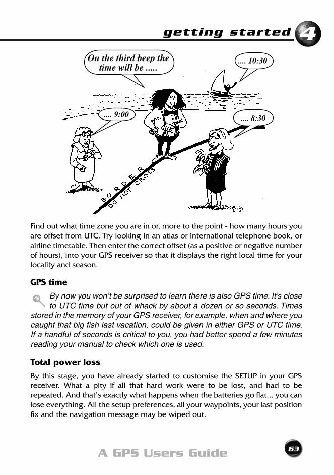
World Time Zones
Although not essential for the operation of a GPS receiver, it is handy to have the correct time displayed.
EXERCISE 5:- Checking the Time Zone
Step 1 Turn your GPS receiver ON. Display the time.
Step 2 Ignoring the seconds, is this close to what your watch shows? Iit s it hours out? And what happens when our clocks are reset to Summer Time ... will your GPS receiver still be right?
This all has to do with time zones. Time zones are defined as being so many hours before or after Universal Time Coordinated. Universal Time Coordinated (UTC) is sometimes called Greenwich Mean Time (GMT). In Australia we have: - Eastern Standard Time, +10hr - Central Standard Time, +9.5hr - Western Standard Time, +8hr
In summer many countries, states, even towns, add an extra hour to make Summer Time.
getting started
63A GPS Users Guide
4
Findoutwhattimezoneyouareinor,moretothepoint-howmanyhoursyouare offset from UTC. Try looking in an atlas or international telephone book, or airline timetable. Then enter the correct offset (as a positive or negative number of hours), into your GPS receiver so that it displays the right local time for your locality and season.
GPS time
By now you won’t be surprised to learn there is also GPS time. It’s close to UTC time but out of whack by about a dozen or so seconds. Times
stored in the memory of your GPS receiver, for example, when and where you caught that big fish last vacation, could be given in either GPS or UTC time. If a handful of seconds is critical to you, you had better spend a few minutes reading your manual to check which one is used.
Total power loss
By this stage, you have already started to customise the SETUP in your GPS receiver. What a pity if all that hard work were to be lost, and had to be repeated. And that’s exactly what happens when the batteries go flat... you can lose everything. All the setup preferences, all your waypoints, your last position fix and the navigation message may be wiped out.
On the third beep the time will be .....
.... 9:00
.... 10:30
.... 8:30
64 Exploring GPS
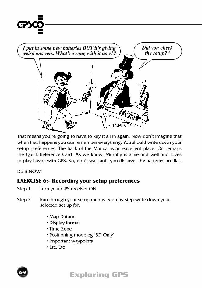
That means you’re going to have to key it all in again. Now don’t imagine that when that happens you can remember everything. You should write down your setup preferences. The back of the Manual is an excellent place. Or perhaps the Quick Reference Card. As we know, Murphy is alive and well and loves to play havoc with GPS. So, don’t wait until you discover the batteries are flat.
Do it NOW!
EXERCISE 6:- Recording your setup preferencesStep 1 Turn your GPS receiver ON.
Step 2 Run through your setup menus. Step by step write down your selected set up for:
•MapDatum •Displayformat •TimeZone •Positioningmodeeg‘3DOnly’ •Importantwaypoints •Etc,Etc
I put in some new batteries BUT it’s giving weird answers. What’s wrong with it now??
Did you check the setup??
getting started
65A GPS Users Guide
44
All dressed up and nowhere to go Now you are armed with the knowledge of how to get a good GPS position, you will undoubtedly want to use it to navigate somewhere. Perhaps to revisit your favourite fishing hole or to help you cross the Simpson desert.
You and your GPS receiver will be on the move, the very subject of our next chapter.
66 Exploring GPS
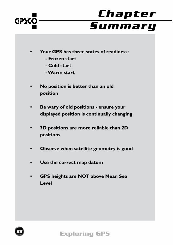
• YourGPShasthreestatesofreadiness: - Frozen start - Cold start - Warm start
• Nopositionisbetterthananold position
• Bewaryofoldpositions-ensureyourdisplayed position is continually changing
• 3Dpositionsaremorereliablethan2Dpositions
• Observewhensatellitegeometryisgood
• Usethecorrectmapdatum
• GPSheightsareNOTaboveMeanSeaLevel
Chapter Summary
On the MoveChapter 5

68 Exploring GPS
on the move
69A GPS Users Guide
5
Getting moving
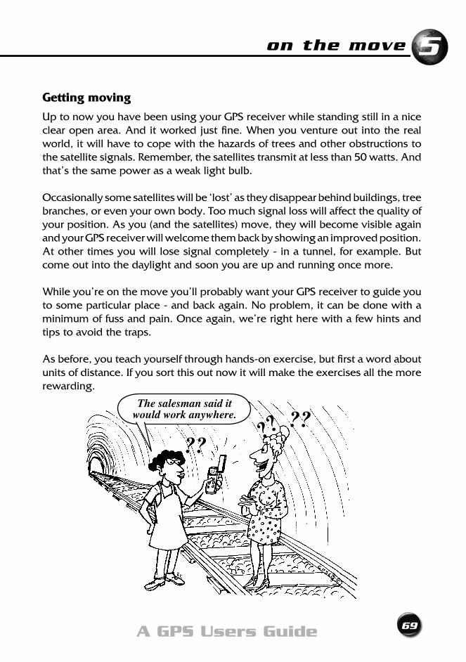
Up to now you have been using your GPS receiver while standing still in a nice clear open area. And it worked just fine. When you venture out into the real world, it will have to cope with the hazards of trees and other obstructions to the satellite signals. Remember, the satellites transmit at less than 50 watts. And that’s the same power as a weak light bulb.
Occasionally some satellites will be ‘lost’ as they disappear behind buildings, tree branches, or even your own body. Too much signal loss will affect the quality of your position. As you (and the satellites) move, they will become visible again and your GPS receiver will welcome them back by showing an improved position. At other times you will lose signal completely - in a tunnel, for example. But come out into the daylight and soon you are up and running once more.
While you’re on the move you’ll probably want your GPS receiver to guide you to some particular place - and back again. No problem, it can be done with a minimum of fuss and pain. Once again, we’re right here with a few hints and tips to avoid the traps.
As before, you teach yourself through hands-on exercise, but first a word about units of distance. If you sort this out now it will make the exercises all the more rewarding.
The salesman said it would work anywhere.
??????
70 Exploring GPS
Miles, Nautical Miles, or Kilometres?
We have to choose how we want speed and distance to be shown. The usual options are knots, miles per hour (mph) or kilometres per hour (km/h). Select the one that suits you best, then set it in your GPS receiver.
Which North?
Distance is one major component of travel, and the other is direction. By combining the two, we can go anywhere. Statements such as “Twenty two miles due North” are very definite. If we start where expected and travel for 22 miles in a northerly direction we will get to our destination. Provided we used the right NORTH! There is usually a choice of True North; Grid North or Magnetic North. If you’re using a compass - use magnetic. If you’re using a map to plot bearings - use Grid. Select the one which suits you, and set it in your GPS receiver. With that done we can get moving.
Navigating with GPS
Your GPS receiver is designed to work on the move. Every second or so it updates its position, and works out how fast you’re going, and in what direction.Aswehavecometoexpect -all isnotperfectlyclearsailing.Forexample, your GPS receiver may be slower off the mark or indicate you are moving even when you are standing still! Why? Read on.
Why does my receiver take longer to lock onto satellites when I’m moving?
Imagine you are motoring along in your car. You switch your GPS receiver on. As you whizz down the road objects that block signals may be coming thick and fast. One moment they are there and the next they’re not. You’re constantly losing lock on satellites, their signals and bits and pieces of the navigation message. You’re only getting a fraction of the whole story. This makes life a lot tougher for our electronic friend as it has to wait until those lost bits and pieces are repeated again later. Result: your GPS receiver is slower off the mark.
on the move
71A GPS Users Guide
5
The Almanac and Ephemeris at workThe Navigation message contains all sorts of useful goodies about the satellites, including the almanac and an ephemeris.
The almanac is used to calculate every satellite’s rough orbit. It allows your receiver to work out which “birds” are in view and where to start looking for them. The almanac takes 12.5 minutes to transmit but is valid for up to a couple of months.
On the other hand, the ephemeris is used to calculate an exact orbit. Each satellite broadcasts its own ephemeris every 30 seconds. It is valid for just that satellite and the next couple of hours only.
Back on the road and moving along. Your GPS receiver must collect a complete, up to date and error free ephemeris from each satellite it wants to use. As you zoom along, the receiver may momentarily lose signal and lose a bit of the ephemeris. It then has to wait for it to be repeated 30 seconds later. This all takes time and slows the receiver down.
How do you hurry it along?
Easy. In a clear place, slam on the brakes and stop. With fewer obstructions and less signal interruptions your receiver can quickly download the ephemeris.
EXERCISE 7:- Navigation displays
Step 1 Go to an open area.
Step 2 Turn ON your GPS receiver, and display your current position. Don’t forget the Golden Rules of GPS - listed inside the front cover of this book.
Step 3 Now switch to the screen that shows your speed and direction of travel. Satisfy yourself that you know which is the speed (HINT: often shown as SOG for Speed Over Ground) and which is the direction (often shown as BRG for Bearing). All OK? It may say you’re moving. How can that be? You’re standing still! There is a simple explanation: remember those continually changing positions we said you must have to prove that your GPS receiver was working? Because your
72 Exploring GPS
GPS receiver records a new position every few seconds, it figures you must be moving around. This is the speed it displays. At the same time, and for the same reason, you will notice the direction is constantly changing too. Actually the speed and bearing display only startsworkingproperlywhenyouaremoving.Let’stryit.
Step4 Selectaplacewhereyoucanwalkforatleast200pacesinastraightline without interruption or danger to yourself. A footpath or across the park is ideal. We will call your destination “AWAY”. Where you startwewillcall“HOME”.FromHOMEwalkatasteadyratetowardsAWAY and watch the speed display. In a few seconds, it should settle. This is your walking speed. On the same screen should also be your direction of travel. Since you are walking in a straight line the bearing will not change significantly. Write down both your speed and bearing.
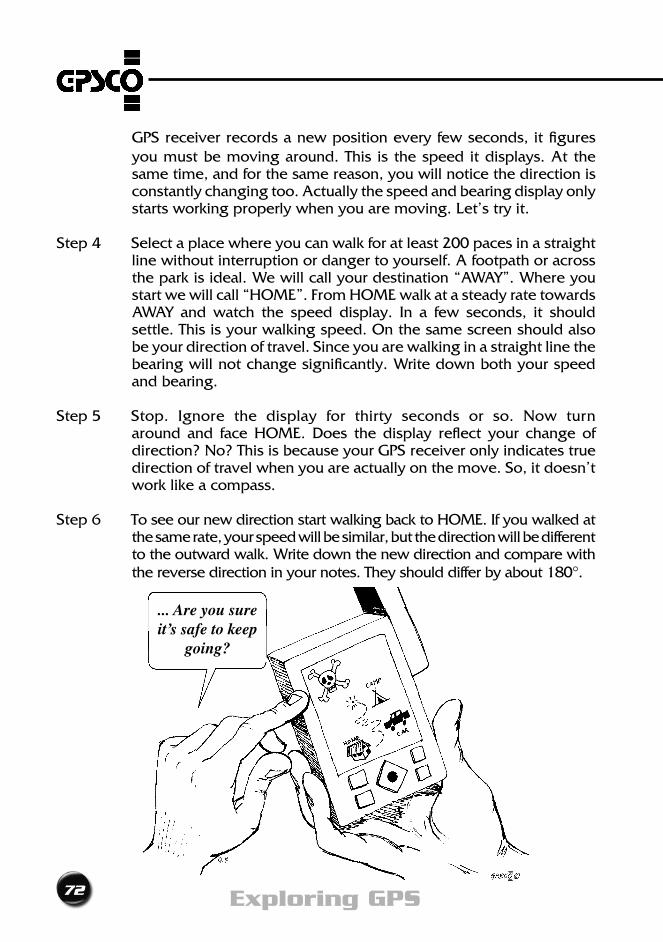
Step 5 Stop. Ignore the display for thirty seconds or so. Now turn around and face HOME. Does the display reflect your change of direction? No? This is because your GPS receiver only indicates true direction of travel when you are actually on the move. So, it doesn’t work like a compass.
Step 6 To see our new direction start walking back to HOME. If you walked at the same rate, your speed will be similar, but the direction will be different to the outward walk. Write down the new direction and compare with the reverse direction in your notes. They should differ by about 180°.
... Are you sure it’s safe to keep
going?
on the move
73A GPS Users Guide
5
How responsive is your GPS receiver?As you have seen, your GPS receiver works well when you’re cruising along. Likemanyofus,however,itisalittleslowtorespondtosuddenchangestothe status quo. What happens when you slam on the brakes or make a quick turn?Let’ssee.
EXERCISE 8:- Response times Step 1 At HOME get a current position.
Step 2 Start walking at a steady pace towards AWAY. (If nothing else you’re going to get a bit fitter by the end of these Exercises!). Read the current speed and direction display on your GPS receiver.
Step3 Afterabout100paces,stopsuddenly.Lookat thespeeddisplay.Does it now read zero or nearly zero? No? How long does it take to respond? What’s going on? Why so long? All good questions.
Step4 Resumewalking.Thistimelookatthedirectiondisplay.Afterabout50paces do an abrupt about face, and head back to HOME. What direction does the GPS receiver say you’re heading? Still towards AWAY I’ll bet. How long does it take till it gives you the correct direction?
Is my GPS receiver a bit slow on the uptake?Plainly your GPS receiver does not show instantaneous changes. This needn’t bother us, as long as we are aware of it. It’s all part of the design of the GPS receiver to provide continuous navigation information, through firmware known as a ‘filter’. Will it affect you? It depends on what you plan to do.
Let’ssaythatyouwanttorecordthepositionofmailboxesalongaroadasyouare driving by in your car. Your GPS receiver may not give accurate positions, unless you approach slowly - or even stop - next to each mailbox.
Filters
Similiar to dead reckoning a filter uses a history of positions over a certain period to predict a forward position, direction and speed. Your GPS receiver
shows a predicted position, direction and speed based on the measurements made over the period, with emphasis on the most recent.
Bad points:- As we may have found above, filters can cause a slow response to sudden changes in position, direction or speed. The displayed values are based on where you were and your speed and direction in the last few seconds.
74 Exploring GPS
Good points:- You’ll still get answers in heavily obstructed locations where you are frequently losing lock, and regaining it. For example; a road flanked by tall buildings, or shady trees will provide continuous speed and heading even though there have been short periods when the signals have been lost.
Moving right along...In your travels you will encounter many different operating conditions. How your GPS receiver reacts really boils down to the degree of obstruction that can be tolerated and what we can do about it. As ex-Boy Scouts we are fully aware of the benefits of “Being Prepared”. So let’s prepare ourselves by seeing how different obstructions affect our GPS receiver.
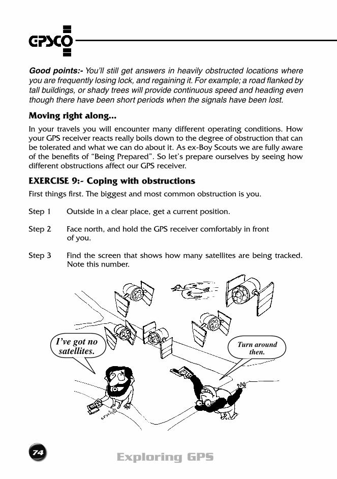
EXERCISE 9:- Coping with obstructionsFirstthingsfirst.Thebiggestandmostcommonobstructionisyou.
Step 1 Outside in a clear place, get a current position.
Step2 Facenorth,andholdtheGPSreceivercomfortablyinfront of you.
Step3 Findthescreenthatshowshowmanysatellitesarebeingtracked.Note this number.
I’ve got no satellites.
Turn around then.
on the move
75A GPS Users Guide
5
Step4 Facesouth,stillholdingtheGPSreceiverinfrontofyou.Notehowmany satellites are being tracked.
Step 5 You will find that, either facing north or south will give you more satellites. This is proof that your body is blocking the signals from some satellites. Actually if you simply face the Equator, you’ll get the best results. This useful fact can help us to overcome the effect of other obstructions too. For example, if you think a big tree or building is going to block signals, place yourself between it and the equator.
What about trees and things?
The radio transmissions from the satellites have travelled some twenty thousand kilometres before they reach the antenna of your GPS receiver. We should not be surprised to learn that the signals are weak and easily interrupted. A completely clear sky, free of buildings and trees, such as at sea, or in a desert, with nothing to interfere with the signals, is the best.
Forthoseofuswhoareneitherpaddlinganocean-goingcanoenorridingacamel,weareboundtofindobstructionsalmosteverywherewego.Let’sseewhat effect some common things have on the microwave signals from GPS satellites.
EXERCISE 10:- When is an obstruction not an obstruction?Step 1 Go to a clear spot, face the Equator, and get a current position on
your GPS receiver.
Step 2 Display the screen that shows how many satellites are being tracked. Take a mental note of this number.
Step 3 Cover the antenna with your hand, totally blocking all the signals. Observe the screen carefully. What is your GPS receiver telling you? Is there a warning that the signals have been lost? Check the signal strength display. Keep looking, it may take up to 30 seconds before your GPS receiver reacts to this indignity. Now you know what happens on total signal blockage, you can use this as a yardstick.
Step4 Remove your hand and get a good position again. Now try covering the antenna with a plastic bag. Does it still work? How many satellites have you got now? What’s the signal strength like? Can you wrap your GPS receiver in a plastic bag in rainy weather?
76 Exploring GPS
Step 5 Repeat these steps with as many items as you like. You might like to try your hat, a sail cloth, a pane of glass - why not try it in your car, under the windscreen, or in your tent?
Step 6 Wander off into the garden, climb a tree, or scramble amongst the bushes. Most GPS receivers should work in light tree cover. Chances are, you will find that getting a GPS position will be a little slower than normal, thanks to the leaves and branches reducing signal strength or maybe even totally blocking them.
How well your GPS receiver works under the trees will depend on many factors including what type of trees they are, how dense they are, even how wet their leaves are. The best way to find their effect is to test it.
Put your GPS receiver hard against a mighty oak, then move it around the trunk, trying different positions. Experiment with different densities and combinations of cover.
Step 7 Try it at night, in smoke or fog, under an umbrella or anywhere else that takes your fancy.
Tests like these are very educational and you quickly discover limits. You’ll find that overhead power lines are no problem, but if you get too close to some radio, tv or mobile phone transmitters the signals to your GPS receiver may be swamped and it won’t work.
The OFFSET feature - coordinates from a bearing and distance
What do you do if you want to find the position of a spot you can’t occupy?
Noworries.Firstly,findanotherplacewhereyoucangetaGPSpositionandstillsee the spot you want to coordinate. Take and record your position. Now read a magnetic bearing, then pace or tape or estimate the distance to the obstructed point. Write them down. Armed with this bearing and distance, and the position of the unobstructed point, you can draw both positions on a map. Doing this is called using an ‘offset’ and it means that you can get a position for just about anywhere. Some smart GPS receivers have a built in offset feature that allows
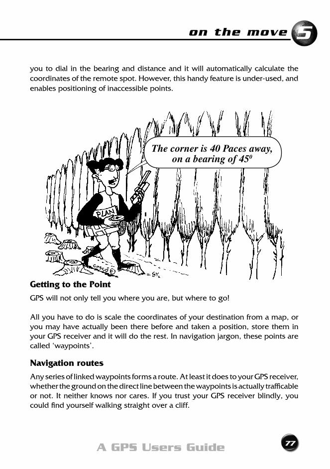
on the move
77A GPS Users Guide
5
you to dial in the bearing and distance and it will automatically calculate the coordinates of the remote spot. However, this handy feature is under-used, and enables positioning of inaccessible points.
Getting to the Point
GPS will not only tell you where you are, but where to go!
All you have to do is scale the coordinates of your destination from a map, or you may have actually been there before and taken a position, store them in your GPS receiver and it will do the rest. In navigation jargon, these points are called ‘waypoints’.
Navigation routes
Any series of linked waypoints forms a route. At least it does to your GPS receiver, whether the ground on the direct line between the waypoints is actually trafficable or not. It neither knows nor cares. If you trust your GPS receiver blindly, you could find yourself walking straight over a cliff.
The corner is 40 Paces away, on a bearing of 450
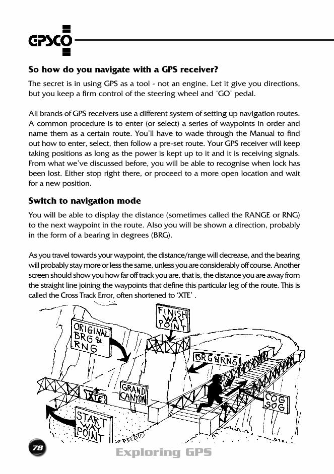
78 Exploring GPS
So how do you navigate with a GPS receiver?
ThesecretisinusingGPSasatool-notanengine.Letitgiveyoudirections,but you keep a firm control of the steering wheel and ‘GO’ pedal.
All brands of GPS receivers use a different system of setting up navigation routes. A common procedure is to enter (or select) a series of waypoints in order and name them as a certain route. You’ll have to wade through the Manual to find out how to enter, select, then follow a pre-set route. Your GPS receiver will keep taking positions as long as the power is kept up to it and it is receiving signals. Fromwhatwe’vediscussedbefore,youwillbeabletorecognisewhenlockhasbeen lost. Either stop right there, or proceed to a more open location and wait for a new position.
Switch to navigation mode
You will be able to display the distance (sometimes called the RANGE or RNG) to the next waypoint in the route. Also you will be shown a direction, probably in the form of a bearing in degrees (BRG).
As you travel towards your waypoint, the distance/range will decrease, and the bearing will probably stay more or less the same, unless you are considerably off course. Another screen should show you how far off track you are, that is, the distance you are away from the straight line joining the waypoints that define this particular leg of the route. This is called the Cross Track Error, often shortened to ‘XTE’ .
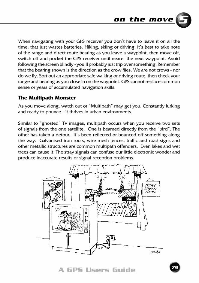
on the move
79A GPS Users Guide
5
When navigating with your GPS receiver you don’t have to leave it on all the time; that just wastes batteries. Hiking, skiing or driving, it’s best to take note of the range and direct route bearing as you leave a waypoint, then move off, switch off and pocket the GPS receiver until nearer the next waypoint. Avoid following the screen blindly - you’ll probably just trip over something. Remember that the bearing shown is the direction as the crow flies. We are not crows - nor do we fly. Sort out an appropriate safe walking or driving route, then check your range and bearing as you close in on the waypoint. GPS cannot replace common sense or years of accumulated navigation skills.
The Multipath Monster
As you move along, watch out or “Multipath” may get you. Constantly lurking and ready to pounce - it thrives in urban environments.
Similar to “ghosted” TV images, multipath occurs when you receive two sets of signals from the one satellite. One is beamed directly from the “bird”. The other has taken a detour. It’s been reflected or bounced off something along the way. Galvanised iron roofs, wire mesh fences, traffic and road signs and other metallic structures are common multipath offenders. Even lakes and wet trees can cause it. The stray signals can confuse our little electronic wonder and produce inaccurate results or signal reception problems.
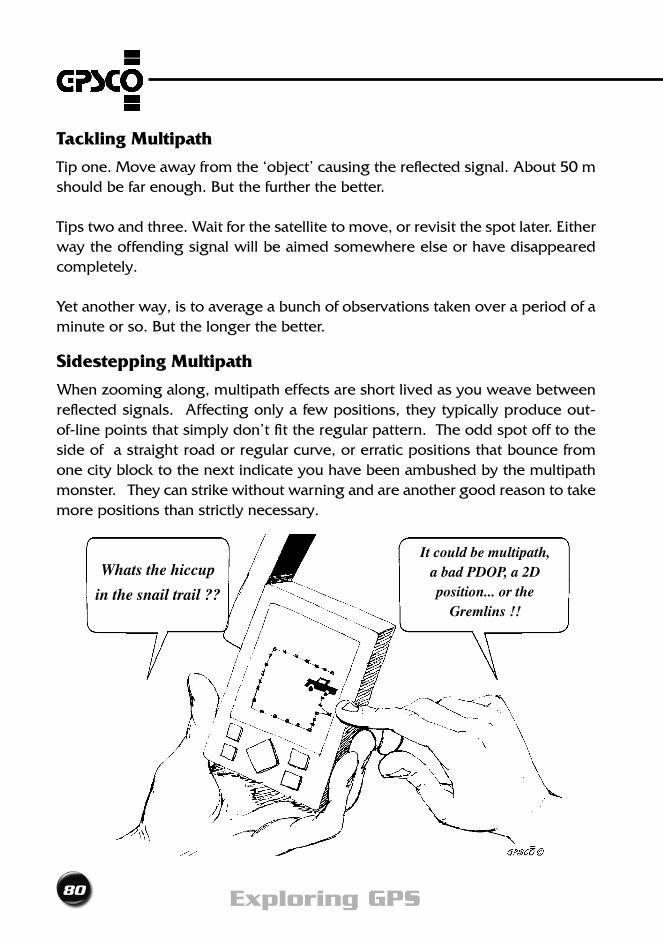
80 Exploring GPS
Tackling Multipath
Tip one. Move away from the ‘object’ causing the reflected signal. About 50 m should be far enough. But the further the better.
Tips two and three. Wait for the satellite to move, or revisit the spot later. Either way the offending signal will be aimed somewhere else or have disappeared completely.
Yet another way, is to average a bunch of observations taken over a period of a minute or so. But the longer the better.
Sidestepping Multipath
When zooming along, multipath effects are short lived as you weave between reflected signals. Affecting only a few positions, they typically produce out-of-line points that simply don’t fit the regular pattern. The odd spot off to the side of a straight road or regular curve, or erratic positions that bounce from one city block to the next indicate you have been ambushed by the multipath monster. They can strike without warning and are another good reason to take more positions than strictly necessary.
Whats the hiccup
in the snail trail ??
It could be multipath, a bad PDOP, a 2D position... or the
Gremlins !!
on the move
81A GPS Users Guide
5
Are we there yet?
Most GPS receivers will give a warning or alarm when you are close. At this time, the GPS receiver may automatically start navigating to the next waypoint on the selected route. So if arrival at a waypoint is crucial, monitor closely when you are nearing it. If you can see the point, for example a bridge, summit, road junction, go to it and do whatever you have to do there. If the point is not definite, know that you can only get to within 15m with confidence.
How accurate is a waypoint?
It all depends. Positions scaled from a map are limited by the scale and your map reading skills. Work out the ground distance (in metres) of 1/2 mm at map scale; this is an approximation of your waypoint accuracy.
Inthiswayaccuraciesofscaledpointsfrommapsat1:4000=2m;1:25 000=12.5m; 1:50 000 = 25m; 1:100 000=50m and 1:250 000 = 125m.
When measured using GPS it depends on the receiver’s accuracy. But if taken from a list in a magazine or book ...who knows? Whatever it is, the degree of accuracy of determination of position will directly affect how closely you can expect to navigate to that point.
EXERCISE 11:- Approaching a waypointStep 1 At HOME get a current position. Store it as a waypoint (call it HOME
if you can).
Step2 Forthistesttobemeaningful,you’llhavetoleaveHOME.Threeorfour hundred paces should do the trick - preferably in a straight line. Bye...
Step 3 When you are tired of walking, and want to return, get a position and set the Navigation mode in your GPS receiver to give you the bearing and distance to HOME.
Step4 Asyouwalkback,keepaneyeonthedisplay,aswellasthetraffic.
82 Exploring GPS
Note how the distance steadily reduces, and the bearing stays reasonably constant, perhaps increasing or decreasing slightly. As you get closer and closer to HOME, the bearing will vary more and more.
Step 5 Keep walking up to and past HOME. As you pass the waypoint - or within a certain range of it - your GPS receiver should sound a beep or alarm to alert you of your imminent arrival. When the alarm sounds, note the distance, steadily increasing as you pass the waypoint, and keep walking. Watch the bearing too, as it may appear quite erratic for a short while, then slowly settle as your distance from HOME increases.
Step 6 Stop, and head back for HOME. You may like to try to find how close your GPS receiver can get you. When you are down to the smallest distance (it is rarely at zero), are you exactly where you started out? All this goes to show the importance of choosing recognisable landmarks as waypoints.
An experienced navigator will choose only obvious features as waypoints. Road junctions, harbour entrances, landing grounds, vehicle parking areas, or other significant landmarks are excellent examples of well chosen waypoints. In the same way, a hike tour leader will enter the position where the bus will pick the group up, or where the group will camp for the night, having first located these points on a map and scaled the coordinates. That way you know when you have arrived, using the GPS receiver as a general guide, keeping you from taking a wrong turn, or straying too far off the route.
Even if you are navigating to a point you have never visited before, try to find some way that you can recognise your destination. When you think about it, there is very little sense in choosing anything as a waypoint unless it is significant as a landmark. Your map will help here as almost any mapped feature is a landmark - that’s why it’s on the map!
Now you’ve arrived, ... rest awhile
Havingarrived,askyourself“Doesthismakesense?”Lookaround,checkyourposition by reference to other landmarks. Use the sun or a compass to orientate yourself. Don’t assume all is well simply because you want it to be. There’s always the possibility that you entered the wrong coordinates for the waypoint.
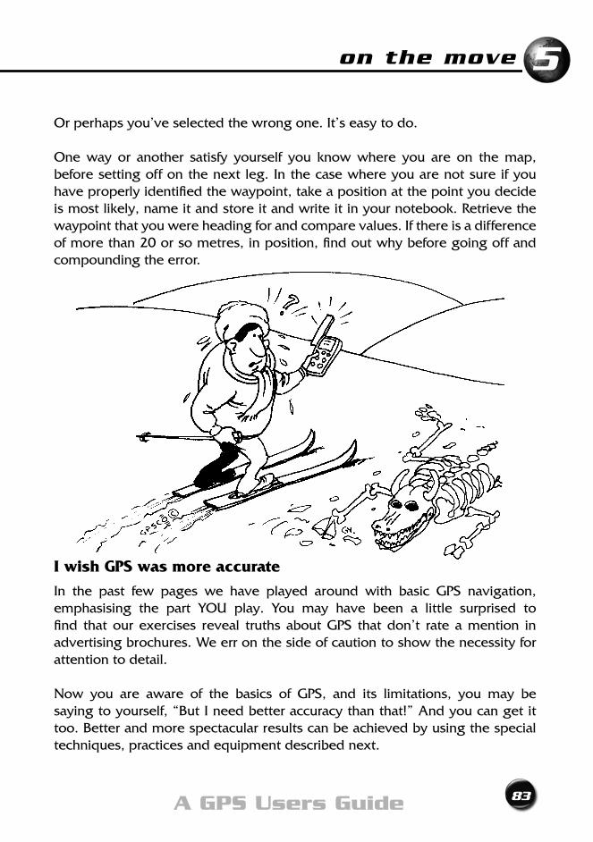
on the move
83A GPS Users Guide
5
Or perhaps you’ve selected the wrong one. It’s easy to do.
One way or another satisfy yourself you know where you are on the map, before setting off on the next leg. In the case where you are not sure if you have properly identified the waypoint, take a position at the point you decide is most likely, name it and store it and write it in your notebook. Retrieve the waypoint that you were heading for and compare values. If there is a difference of more than 20 or so metres, in position, find out why before going off and compounding the error.
I wish GPS was more accurate
In the past few pages we have played around with basic GPS navigation, emphasising the part YOU play. You may have been a little surprised to find that our exercises reveal truths about GPS that don’t rate a mention in advertising brochures. We err on the side of caution to show the necessity for attention to detail.
Now you are aware of the basics of GPS, and its limitations, you may be saying to yourself, “But I need better accuracy than that!” And you can get it too. Better and more spectacular results can be achieved by using the special techniques, practices and equipment described next.
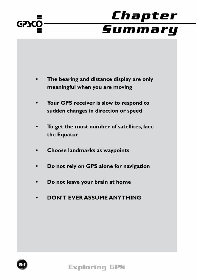
84 Exploring GPS
• Thebearinganddistancedisplayareonlymeaningful when you are moving
• YourGPSreceiverisslowtorespondtosudden changes in direction or speed
• Togetthemostnumberofsatellites,facethe Equator
• Chooselandmarksaswaypoints
• DonotrelyonGPSalonefornavigation
• Donotleaveyourbrainathome
• DON’TEVERASSUMEANYTHING
Chapter Summary
Improving Your AccuracyChapter 6
86 Exploring GPS
I wish GPS was more accurate
improving your accuracy
87A GPS Users Guide
6
The story so far...
Now we know that if we follow the “Golden Rules of GPS“: • Use3Dpositionsonly • ObserveonlywhenthePDOPislessthan5 • Usethecorrectmapdatum then the horizontal position displayed on the screen of your GPS receiver should be accurate to within 15m.
Formanyusersthisaccuracyisjustfine.It’senoughtogetthemwithinastonesthrow of the boat ramp, the airfield or their car. However there will be times when some of us want, or need, more accurate positions. In this chapter we will look at a number of easy ways to do this.
Want more accurate heights?
OK,here’sanidea.Findatopographicmapthatcoverswhereyouare.Itwillneed to be one that shows contours and a mapping grid. Go to the spot where youwanttheheight.FireupyourGPSreceiver.Ignoretheheightdisplayed,but note and plot the horizontal position on the map. Interpolate the height of your position between the contours on the map. Assume an even gradient between contours (and accurate plotting!) and adjust to actual conditions. In this way, you should be able to estimate the ground elevation to the nearest half, or even quarter, of a contour interval.
Will accuracy improve... if the PDOP is lower?
Yes. The smaller the PDOP the more accurate the position fix. Some GPS receivers display the PDOP, others don’t. If there are no cautionary signs or flashing icons or statements about ‘Poor Geometry’ - it’s likely that you have a low PDOP.
Will accuracy improve... if I use more satellites?Yes. The more satellites, the more accurate your position. This principle is commonly used by “all in view” or “12 channel” receivers to help squeeze out better results.
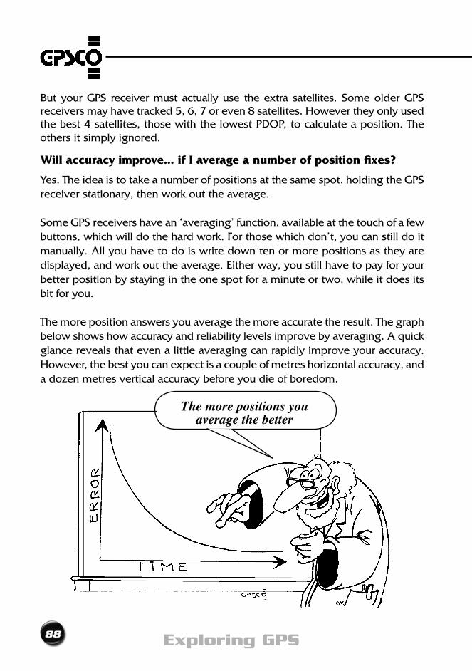
88 Exploring GPS
But your GPS receiver must actually use the extra satellites. Some older GPS receivers may have tracked 5, 6, 7 or even 8 satellites. However they only used thebest4satellites,thosewiththelowestPDOP,tocalculateaposition.Theothers it simply ignored.
Will accuracy improve... if I average a number of position fixes?
Yes. The idea is to take a number of positions at the same spot, holding the GPS receiver stationary, then work out the average.
Some GPS receivers have an ‘averaging’ function, available at the touch of a few buttons,whichwilldothehardwork.Forthosewhichdon’t,youcanstilldoitmanually. All you have to do is write down ten or more positions as they are displayed, and work out the average. Either way, you still have to pay for your better position by staying in the one spot for a minute or two, while it does its bit for you.
The more position answers you average the more accurate the result. The graph below shows how accuracy and reliability levels improve by averaging. A quick glance reveals that even a little averaging can rapidly improve your accuracy. However, the best you can expect is a couple of metres horizontal accuracy, and a dozen metres vertical accuracy before you die of boredom.
The more positions you average the better
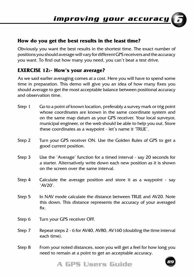
improving your accuracy
89A GPS Users Guide
6
How do you get the best results in the least time?
Obviously you want the best results in the shortest time. The exact number of positions you should average will vary for different GPS receivers and the accuracy you want. To find out how many you need, you can’t beat a test drive.
EXERCISE 12:- How’s your average?
As we said earlier averaging comes at a cost. Here you will have to spend some time in preparation. This demo will give you an idea of how many fixes you should average to get the most acceptable balance between positional accuracy and observation time.
Step 1 Go to a point of known location, preferably a survey mark or trig point whose coordinates are known in the same coordinate system and on the same map datum as your GPS receiver. Your local surveyor, municipal engineer, or the web should be able to help you out. Store these coordinates as a waypoint - let’s name it ‘TRUE’.
Step 2 Turn your GPS receiver ON. Use the Golden Rules of GPS to get a good current position.
Step 3 Use the ‘Average’ function for a timed interval - say 20 seconds for a starter. Alternatively write down each new position as it is shown on the screen over the same interval.
Step4 Calculate the average position and store it as a waypoint - say‘AV20’.
Step 5 In NAV mode calculate the distance between TRUE and AV20. Note this down. This distance represents the accuracy of your averaged fix.
Step6 TurnyourGPSreceiverOFF.
Step7 Repeatsteps2-6forAV40,AV80,AV160(doublingthetimeintervaleach time).
Step8 Fromyournoteddistances,soonyouwillgetafeelforhowlongyouneed to remain at a point to get an acceptable accuracy.
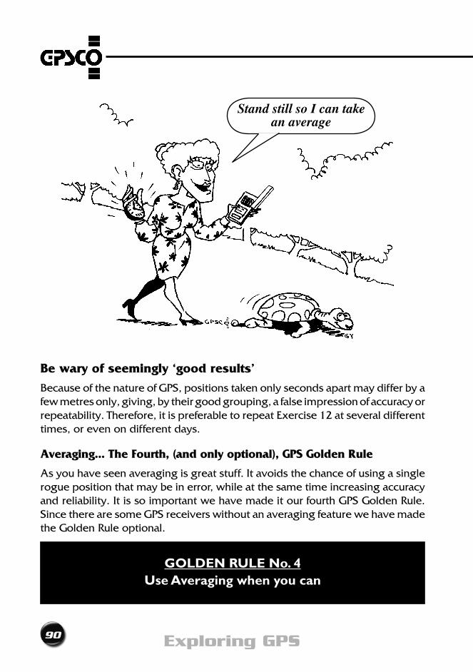
90 Exploring GPS
Be wary of seemingly ‘good results’
Because of the nature of GPS, positions taken only seconds apart may differ by a few metres only, giving, by their good grouping, a false impression of accuracy or repeatability. Therefore, it is preferable to repeat Exercise 12 at several different times, or even on different days.
Averaging... The Fourth, (and only optional), GPS Golden Rule
As you have seen averaging is great stuff. It avoids the chance of using a single rogue position that may be in error, while at the same time increasing accuracy and reliability. It is so important we have made it our fourth GPS Golden Rule. Since there are some GPS receivers without an averaging feature we have made the Golden Rule optional.
GOLDEN RULE No. 4Use Averaging when you can
Stand still so I can take an average
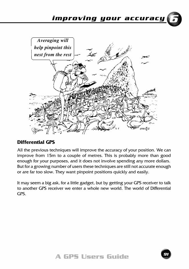
improving your accuracy
91A GPS Users Guide
6
Differential GPS
All the previous techniques will improve the accuracy of your position. We can improve from 15m to a couple of metres. This is probably more than good enough for your purposes, and it does not involve spending any more dollars.But for a growing number of users these techniques are still not accurate enough or are far too slow. They want pinpoint positions quickly and easily.
It may seem a big ask, for a little gadget, but by getting your GPS receiver to talk to another GPS receiver we enter a whole new world. The world of Differential GPS.
Averaging will
help pinpoint this
nest from the rest
92 Exploring GPS
• TheremovalofSelectiveAvailabilityhasincreased GPS accuracy
• AlowerPDOPwillgiveabetteraccuracy
• Moresatellitesinyourpositionsolutionwillimprove accuracy and reliability
• Averagingisagoodandcheapwaytoimprove accuracy and reliability
• Averagingisthefourth(andonlyoptional)GPS Golden rule
Chapter Summary

Real Time DGPSChapter 7

94 Exploring GPS
We should have used DGPS when we buried the loot
Yeh!!
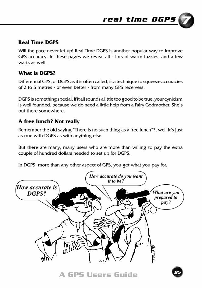
real time DGPS
95A GPS Users Guide
7
Real Time DGPS
Will the pace never let up! Real Time DGPS is another popular way to improve GPS accuracy. In these pages we reveal all - lots of warm fuzzies, and a few warts as well.
What is DGPS?
Differential GPS, or DGPS as it is often called, is a technique to squeeze accuracies of 2 to 5 metres - or even better - from many GPS receivers.
DGPS is something special. If it all sounds a little too good to be true, your cynicism iswellfounded,becausewedoneedalittlehelpfromaFairyGodmother.She’sout there somewhere.
A free lunch? Not really
Remember the old saying “There is no such thing as a free lunch”?, well it’s just as true with DGPS as with anything else.
But there are many, many users who are more than willing to pay the extra couple of hundred dollars needed to set up for DGPS.
In DGPS, more than any other aspect of GPS, you get what you pay for.
How accurate is DGPS?
How accurate do you want it to be?
What are you prepared to
pay?
96 Exploring GPS
Essential DGPS equipment
Unlike averaging, where the extra cost was only in time, for DGPS you are going to have to beg, borrow or even buy, two main pieces of equipment: a special GPS receiver, and a special radio.
The GPS receiver
You’ll need an “RTCM” capable GPS receiver - hopefully this is what you already own or are about to buy. Many suppliers simply call this “DGPS Ready”. The “DGPS Ready” feature is standard in many of the latest and cheapest GPS receivers. Evenifyouhavetobuytheup-market,upgraded,luxury“XL”version,don’tworry, the extra cost won’t send you broke.
The radio
You’ll also need a DGPS-capable radio designed to receive DGPS correction signals from something called a ‘Base Station’. Don’t worry, you don’t have to buy a Base Station... just the radio. More about this shortly.
RTCM (Radio Technical Commission Maritime) is an internationally- accepted format for expressing Real Time DGPS corrections.
Is DGPS hard to do?
No, not really. If you can follow the Exercises in this book, and plug the right lead into the right socket, you can do DGPS.
“Off the shelf” systems from the big GPS players are easy to use. Basically all you have to do is connect power to the radio, link it and the GPS receiver by a computer data cable, and push a few buttons to check that both are talking to one another in the same language and at the same speed. That’s all there is to it. Accurate DGPS-corrected positions are displayed on your GPS receiver’s screen.
In fact, it’s all a little too simple. Some people could be lulled into a false sense of security. Don’t be one of them... you still have to obey the Golden Rules.
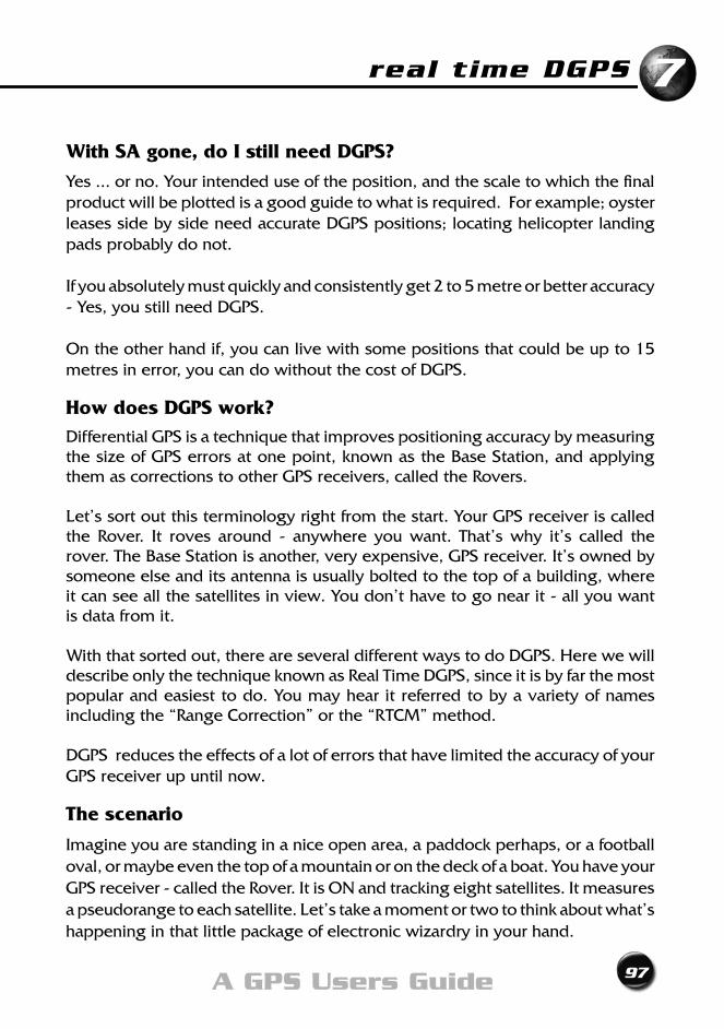
real time DGPS
97A GPS Users Guide
7
With SA gone, do I still need DGPS?
Yes ... or no. Your intended use of the position, and the scale to which the final productwillbeplottedisagoodguidetowhatisrequired.Forexample;oysterleases side by side need accurate DGPS positions; locating helicopter landing pads probably do not.
If you absolutely must quickly and consistently get 2 to 5 metre or better accuracy - Yes, you still need DGPS.
On the other hand if, you can live with some positions that could be up to 15 metres in error, you can do without the cost of DGPS.
How does DGPS work? Differential GPS is a technique that improves positioning accuracy by measuring the size of GPS errors at one point, known as the Base Station, and applying them as corrections to other GPS receivers, called the Rovers.
Let’ssortoutthisterminologyrightfromthestart.YourGPSreceiveriscalledthe Rover. It roves around - anywhere you want. That’s why it’s called the rover. The Base Station is another, very expensive, GPS receiver. It’s owned by someone else and its antenna is usually bolted to the top of a building, where it can see all the satellites in view. You don’t have to go near it - all you want is data from it.
With that sorted out, there are several different ways to do DGPS. Here we will describe only the technique known as Real Time DGPS, since it is by far the most popular and easiest to do. You may hear it referred to by a variety of names including the “Range Correction” or the “RTCM” method.
DGPS reduces the effects of a lot of errors that have limited the accuracy of your GPS receiver up until now.
The scenario
Imagine you are standing in a nice open area, a paddock perhaps, or a football oval, or maybe even the top of a mountain or on the deck of a boat. You have your GPS receiver - called the Rover. It is ON and tracking eight satellites. It measures apseudorangetoeachsatellite.Let’stakeamomentortwotothinkaboutwhat’shappening in that little package of electronic wizardry in your hand.
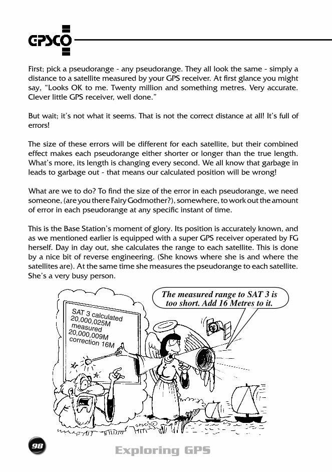
98 Exploring GPS
First;pickapseudorange-anypseudorange.Theyalllookthesame-simplyadistance to a satellite measured by your GPS receiver. At first glance you might say,“LooksOKtome.Twentymillionandsomethingmetres.Veryaccurate.Clever little GPS receiver, well done.”
But wait; it’s not what it seems. That is not the correct distance at all! It’s full of errors!
The size of these errors will be different for each satellite, but their combined effect makes each pseudorange either shorter or longer than the true length. What’s more, its length is changing every second. We all know that garbage in leads to garbage out - that means our calculated position will be wrong!
What are we to do? To find the size of the error in each pseudorange, we need someone,(areyouthereFairyGodmother?),somewhere,toworkouttheamountof error in each pseudorange at any specific instant of time.
This is the Base Station’s moment of glory. Its position is accurately known, and aswementionedearlierisequippedwithasuperGPSreceiveroperatedbyFGherself. Day in day out, she calculates the range to each satellite. This is done by a nice bit of reverse engineering. (She knows where she is and where the satellites are). At the same time she measures the pseudorange to each satellite. She’s a very busy person.
SAT 3 calculated 20,000,025M measured 20,000,009M correction 16M
The measured range to SAT 3 is too short. Add 16 Metres to it.
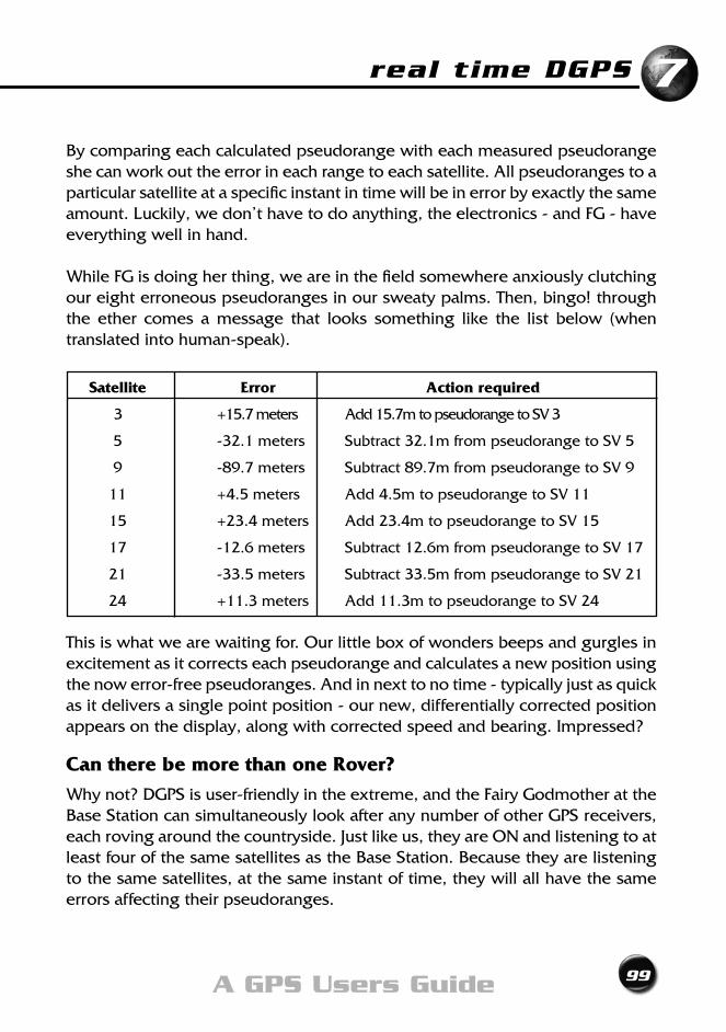
real time DGPS
99A GPS Users Guide
7
By comparing each calculated pseudorange with each measured pseudorange she can work out the error in each range to each satellite. All pseudoranges to a particular satellite at a specific instant in time will be in error by exactly the same amount.Luckily,wedon’thavetodoanything,theelectronics-andFG-haveeverything well in hand.
WhileFGisdoingherthing,weareinthefieldsomewhereanxiouslyclutchingour eight erroneous pseudoranges in our sweaty palms. Then, bingo! through the ether comes a message that looks something like the list below (when translated into human-speak).
Satellite Error Action required
3 +15.7 meters Add 15.7m to pseudorange to SV 3
5 -32.1 meters Subtract 32.1m from pseudorange to SV 5
9 -89.7 meters Subtract 89.7m from pseudorange to SV 9
11 +4.5meters Add4.5mtopseudorangetoSV11
15 +23.4meters Add23.4mtopseudorangetoSV15
17 -12.6 meters Subtract 12.6m from pseudorange to SV 17
21 -33.5 meters Subtract 33.5m from pseudorange to SV 21
24 +11.3meters Add11.3mtopseudorangetoSV24
This is what we are waiting for. Our little box of wonders beeps and gurgles in excitement as it corrects each pseudorange and calculates a new position using the now error-free pseudoranges. And in next to no time - typically just as quick as it delivers a single point position - our new, differentially corrected position appears on the display, along with corrected speed and bearing. Impressed?
Can there be more than one Rover?
Whynot?DGPSisuser-friendlyintheextreme,andtheFairyGodmotherattheBase Station can simultaneously look after any number of other GPS receivers, each roving around the countryside. Just like us, they are ON and listening to at least four of the same satellites as the Base Station. Because they are listening to the same satellites, at the same instant of time, they will all have the same errors affecting their pseudoranges.
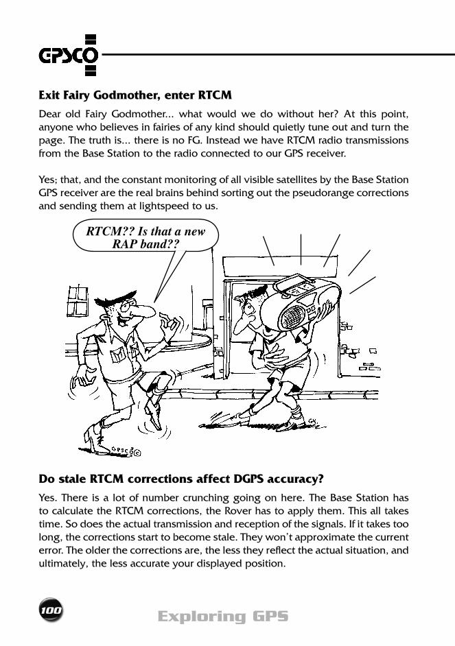
100 Exploring GPS
Exit Fairy Godmother, enter RTCM
Dear old Fairy Godmother... what would we do without her? At this point, anyone who believes in fairies of any kind should quietly tune out and turn the page.Thetruthis...thereisnoFG.InsteadwehaveRTCMradiotransmissionsfrom the Base Station to the radio connected to our GPS receiver.
Yes; that, and the constant monitoring of all visible satellites by the Base Station GPS receiver are the real brains behind sorting out the pseudorange corrections and sending them at lightspeed to us.
Do stale RTCM corrections affect DGPS accuracy?
Yes. There is a lot of number crunching going on here. The Base Station has to calculate the RTCM corrections, the Rover has to apply them. This all takes time. So does the actual transmission and reception of the signals. If it takes too long, the corrections start to become stale. They won’t approximate the current error. The older the corrections are, the less they reflect the actual situation, and ultimately, the less accurate your displayed position.
RTCM?? Is that a new RAP band??
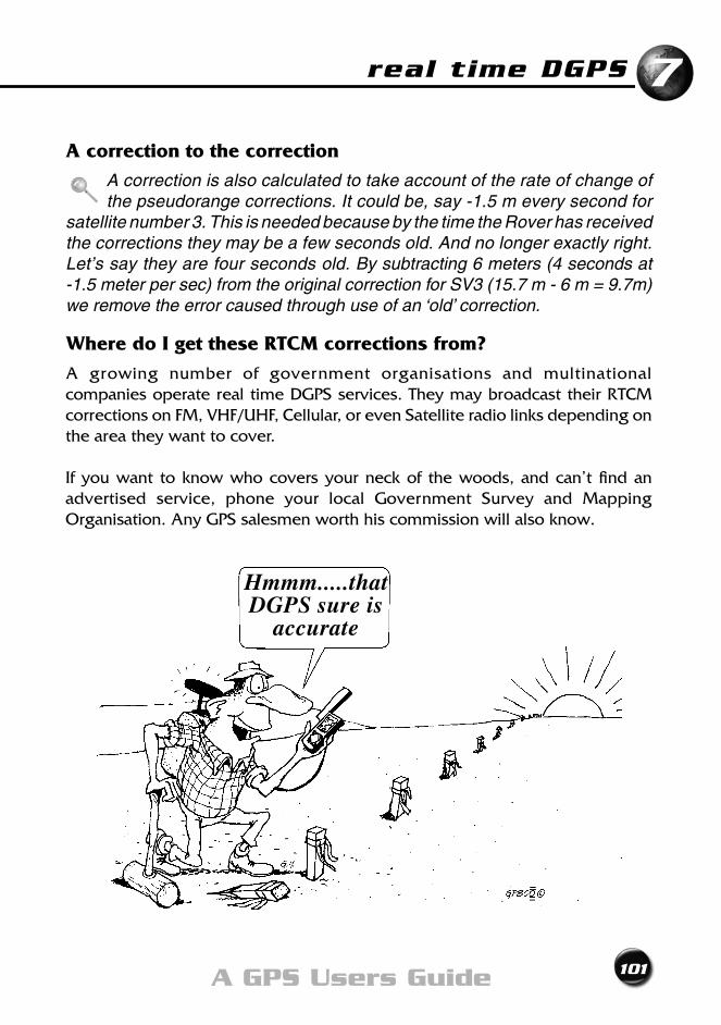
real time DGPS
101A GPS Users Guide
7
A correction to the correction
A correction is also calculated to take account of the rate of change of the pseudorange corrections. It could be, say -1.5 m every second for
satellite number 3. This is needed because by the time the Rover has received the corrections they may be a few seconds old. And no longer exactly right. Let’s say they are four seconds old. By subtracting 6 meters (4 seconds at -1.5 meter per sec) from the original correction for SV3 (15.7 m - 6 m = 9.7m) we remove the error caused through use of an ‘old’ correction.
Where do I get these RTCM corrections from?
A growing number of government organisations and multinational companies operate real time DGPS services. They may broadcast their RTCM correctionsonFM,VHF/UHF,Cellular,orevenSatelliteradiolinksdependingonthe area they want to cover.
If you want to know who covers your neck of the woods, and can’t find an advertised service, phone your local Government Survey and Mapping Organisation. Any GPS salesmen worth his commission will also know.
Hmmm.....that DGPS sure is
accurate
102 Exploring GPS
Most services have, in addition to a radio hire rate, a data usage cost that is based on the amount of correction signals you use. This could be charged by the minute, hour, day, month or even a flat yearly rate. The charge will vary dependingonwhetheryou’reusingFM,VHF/UHForSatelliteradiolinks.Shoparound, some even offer free signals.
Is DGPS more accurate now that S/A has gone?
Not really. There was little improvement in accuracy, since DGPS already removed most of the effects of Selective Availability.
Do all DGPS receivers give the same accuracy?
Most. But not all. Your standard “run of the mill” DGPS-ready receiver will give a basic accuracy of 2 to 5 metres. But some older GPS receivers only have a DGPS accuracy of 10 metres. Your GPS receiver’s differential accuracy will normally be quoted in either the manual or the specification sheet, or maybe even on the back of the box. Check it out before you hand over the cash!
If money is no problem, you can get top-of-the-range GPS receivers. With units like these one metre - or even submetre - positioning can be achieved using standard RTCM corrections. But if you have high blood pressure, make sure you are sitting down before you ask the salesperson “How much for one of these?”
Does the distance between the Base Station and Rovers affect accuracy?
Yes. The general 2 to 5 metre accuracy we expect from DGPS occurs when you are within about 100 kilometres from your nearest Base Station. As the distance from the Base Station increases the accuracy will drop off by about an extra one metreforeveryextra100kilometres.Forexample,ifyouare300kilometresfromthenearestBaseStationyouwouldexpectapositionwithin4to7metres(2 to 5 for the first 100km and an extra 2m for the extra 200km).
Stop!Hang on a moment! You may have just missed an important point. That example just showed that DGPS was accurate to about 7 m over 300 km. Has the penny dropped? That’s right; that 7m could just be the accuracy of your bare bones GPS receiver anyway. That’s without all that extra gadgetry hanging off it. So DGPS may not have improved your position after all. Back to square one.
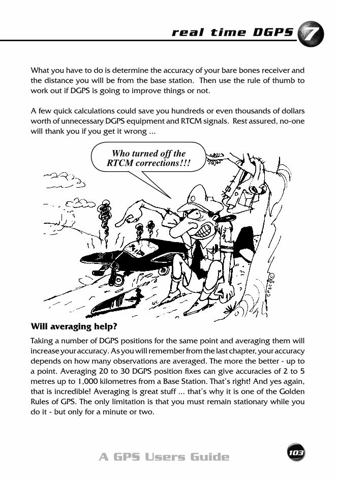
real time DGPS
103A GPS Users Guide
7
What you have to do is determine the accuracy of your bare bones receiver and the distance you will be from the base station. Then use the rule of thumb to work out if DGPS is going to improve things or not.
A few quick calculations could save you hundreds or even thousands of dollars worth of unnecessary DGPS equipment and RTCM signals. Rest assured, no-one will thank you if you get it wrong ...
Will averaging help?
Taking a number of DGPS positions for the same point and averaging them will increase your accuracy. As you will remember from the last chapter, your accuracy depends on how many observations are averaged. The more the better - up to a point. Averaging 20 to 30 DGPS position fixes can give accuracies of 2 to 5 metres up to 1,000 kilometres from a Base Station. That’s right! And yes again, that is incredible! Averaging is great stuff ... that’s why it is one of the Golden Rules of GPS. The only limitation is that you must remain stationary while you do it - but only for a minute or two.
Who turned off the RTCM corrections!!!
104 Exploring GPS
Wide Area DGPS
Another DGPS method called Wide Area DGPS (WADS) has avoided the problem of the extra 1m per 100km, and the necessity to remain still
while observing. WADS can achieve 2 to 5 metres for each and every position - while on the move. Even better results are possible if you have top class GPS equipment.
The ‘wide area’ can be as large as continental Australia and its waters. WADS works by using standard RTCM signals from a network of surrounding Base Stations, not just the nearest. From all these it will calculate the best RTCM correction for your location.
Can I get even more accurate positions?
If you need centimetre, or even millimetre, accuracy it can be, and is regularly achieved using GPS. The techniques employ DGPS principles, but there the similarities end. This type of GPS work is not for the novice or fainthearted. It uses specialised equipment and skills. You can learn what’s involved by reading this book’s big brother called “Getting Started with GPS Surveying”.
If you really need high accuracy you should contact the professionals. It’s NOT justamatterofmoreexpensivegear.Factorssuchasmanagementofmulti-disciplinary parties in a field situation, a thorough grasp of statistics and use of specialised software have to be considered. Surveying firms specialising in GPS are the people to see. When it comes to millimetre squeezing, they are the experts.
Chapter Summary
105A GPS Users Guide
• DGPSgivesaccuraciesof2-5m,orevenbetter
• You’llneedaDGPS-readyreceiver,anda radio receiving corrections in RTCM format
• DGPSworksbycalculatingandapplyingcorrections to each pseudorange
• Accuracydeterioratesbyanadditional1mforeach100kmbetweentheRoverandtheBaseStation
• AveragingimprovesDGPSaccuracy
• Higheraccuraciesrequirespecialisedsurveying DGPS techniques and instruments

106 Exploring GPS
Modernising GPSChapter 8

108 Exploring GPS
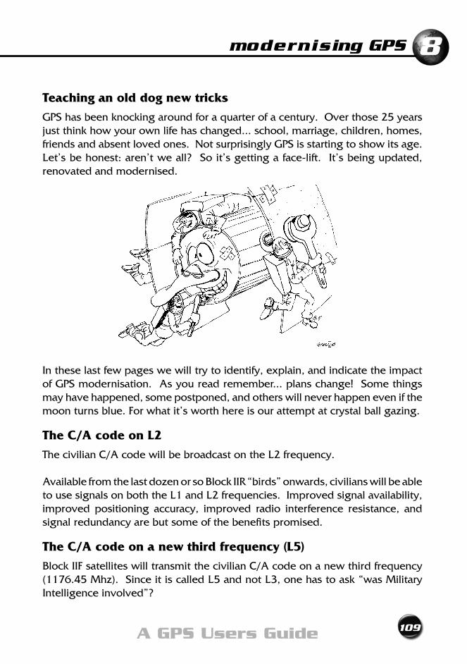
modernising GPS 8
109A GPS Users Guide
Teaching an old dog new tricks
GPS has been knocking around for a quarter of a century. Over those 25 years just think how your own life has changed... school, marriage, children, homes, friends and absent loved ones. Not surprisingly GPS is starting to show its age. Let’sbehonest:aren’tweall?Soit’sgettingaface-lift.It’sbeingupdated,renovated and modernised.
In these last few pages we will try to identify, explain, and indicate the impact of GPS modernisation. As you read remember... plans change! Some things may have happened, some postponed, and others will never happen even if the moonturnsblue.Forwhatit’sworthhereisourattemptatcrystalballgazing.
The C/A code on L2
ThecivilianC/AcodewillbebroadcastontheL2frequency.
Available from the last dozen or so Block IIR “birds” onwards, civilians will be able tousesignalsonboththeL1andL2frequencies.Improvedsignalavailability,improved positioning accuracy, improved radio interference resistance, and signal redundancy are but some of the benefits promised.
The C/A code on a new third frequency (L5)
BlockIIFsatelliteswilltransmitthecivilianC/Acodeonanewthirdfrequency(1176.45Mhz).SinceitiscalledL5andnotL3,onehastoask“wasMilitaryIntelligence involved”?
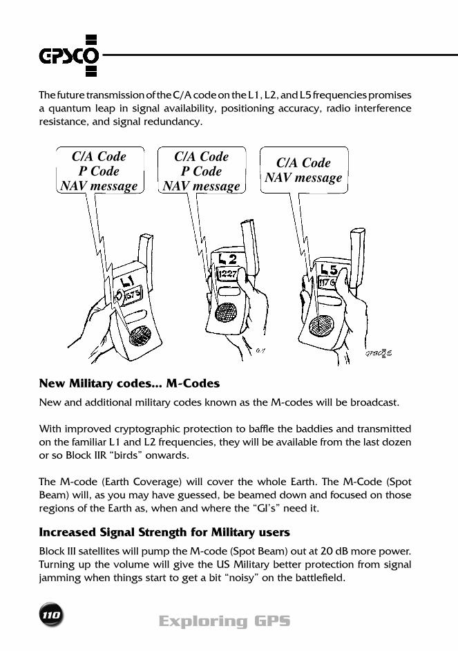
110 Exploring GPS
ThefuturetransmissionoftheC/AcodeontheL1,L2,andL5frequenciespromisesa quantum leap in signal availability, positioning accuracy, radio interference resistance, and signal redundancy.
New Military codes... M-Codes
New and additional military codes known as the M-codes will be broadcast.
With improved cryptographic protection to baffle the baddies and transmitted onthefamiliarL1andL2frequencies,theywillbeavailablefromthelastdozenor so Block IIR “birds” onwards.
The M-code (Earth Coverage) will cover the whole Earth. The M-Code (Spot Beam) will, as you may have guessed, be beamed down and focused on those regions of the Earth as, when and where the “GI’s” need it.
Increased Signal Strength for Military users
Block III satellites will pump the M-code (Spot Beam) out at 20 dB more power. Turning up the volume will give the US Military better protection from signal jamming when things start to get a bit “noisy” on the battlefield.
C/A Code P Code
NAV message
C/A Code P Code
NAV message
C/A Code NAV message
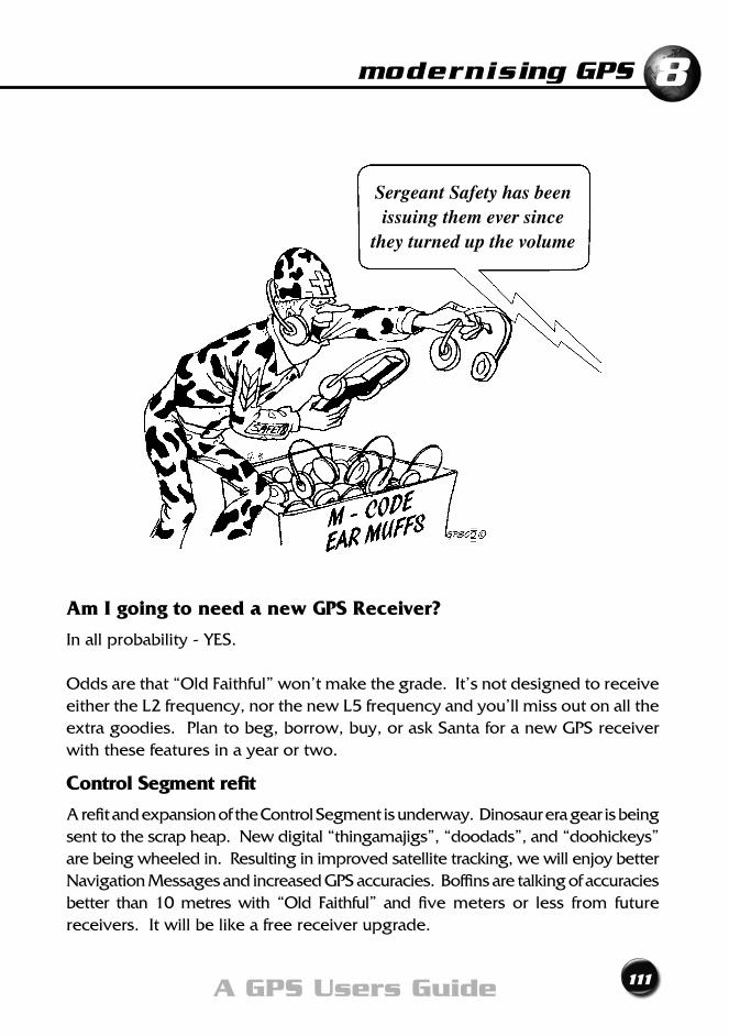
modernising GPS 8
111A GPS Users Guide
Am I going to need a new GPS Receiver?
In all probability - YES.
Oddsarethat“OldFaithful”won’tmakethegrade.It’snotdesignedtoreceiveeithertheL2frequency,northenewL5frequencyandyou’llmissoutonalltheextra goodies. Plan to beg, borrow, buy, or ask Santa for a new GPS receiver with these features in a year or two.
Control Segment refit
A refit and expansion of the Control Segment is underway. Dinosaur era gear is being sent to the scrap heap. New digital “thingamajigs”, “doodads”, and “doohickeys” are being wheeled in. Resulting in improved satellite tracking, we will enjoy better Navigation Messages and increased GPS accuracies. Boffins are talking of accuracies better than10metreswith “Old Faithful” and five meters or less from futurereceivers. It will be like a free receiver upgrade.
Sergeant Safety has been issuing them ever since
they turned up the volume
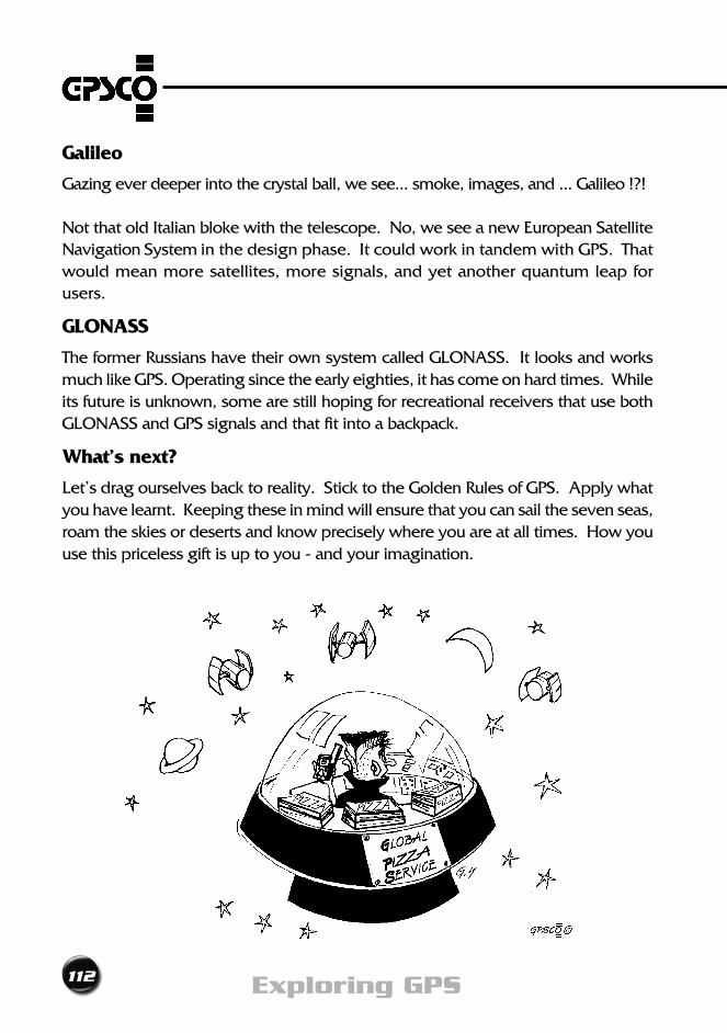
112 Exploring GPS
Galileo
Gazing ever deeper into the crystal ball, we see... smoke, images, and ... Galileo !?!
Not that old Italian bloke with the telescope. No, we see a new European Satellite Navigation System in the design phase. It could work in tandem with GPS. That would mean more satellites, more signals, and yet another quantum leap for users.
GLONASS
TheformerRussianshavetheirownsystemcalledGLONASS.Itlooksandworksmuch like GPS. Operating since the early eighties, it has come on hard times. While its future is unknown, some are still hoping for recreational receivers that use both GLONASSandGPSsignalsandthatfitintoabackpack.
What’s next?
Let’sdragourselvesbacktoreality.SticktotheGoldenRulesofGPS.Applywhatyou have learnt. Keeping these in mind will ensure that you can sail the seven seas, roam the skies or deserts and know precisely where you are at all times. How you use this priceless gift is up to you - and your imagination.
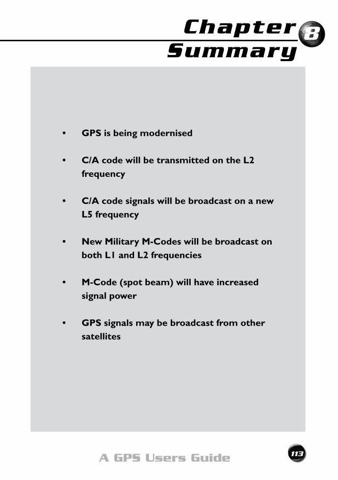
Chapter Summary
113A GPS Users Guide
• GPSisbeingmodernised
• C/AcodewillbetransmittedontheL2frequency
• C/AcodesignalswillbebroadcastonanewL5 frequency
• NewMilitaryM-Codeswillbebroadcastonboth L1 and L2 frequencies
• M-Code(spotbeam)willhaveincreasedsignal power
• GPSsignalsmaybebroadcastfromothersatellites
8

114 Exploring GPS
Abbreviations
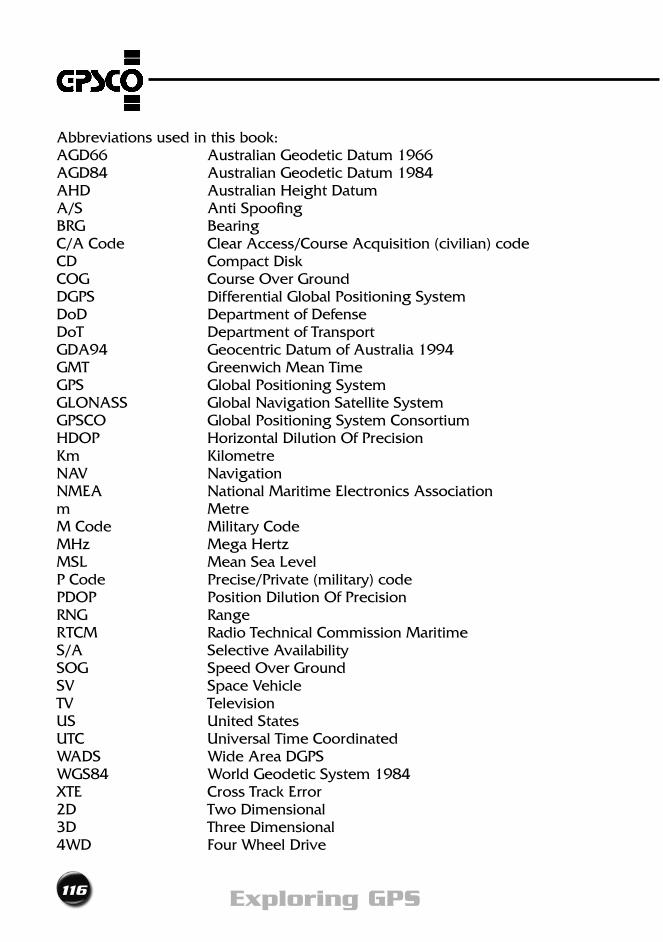
116 Exploring GPS
Abbreviations used in this book:AGD66 Australian Geodetic Datum 1966AGD84 AustralianGeodeticDatum1984AHD Australian Height DatumA/S Anti SpoofingBRG BearingC/A Code Clear Access/Course Acquisition (civilian) codeCD Compact DiskCOG Course Over GroundDGPS Differential Global Positioning SystemDoD Department of DefenseDoT Department of TransportGDA94 GeocentricDatumofAustralia1994GMT Greenwich Mean TimeGPS Global Positioning SystemGLONASS GlobalNavigationSatelliteSystemGPSCO Global Positioning System ConsortiumHDOP Horizontal Dilution Of PrecisionKm KilometreNAV NavigationNMEA National Maritime Electronics Associationm MetreM Code Military CodeMHz Mega HertzMSL MeanSeaLevelP Code Precise/Private (military) codePDOP Position Dilution Of PrecisionRNG RangeRTCM Radio Technical Commission MaritimeS/A Selective AvailabilitySOG Speed Over GroundSV Space VehicleTV TelevisionUS United StatesUTC Universal Time CoordinatedWADS Wide Area DGPSWGS84 WorldGeodeticSystem1984XTE Cross Track Error2D Two Dimensional3D Three Dimensional4WD FourWheelDrive

Index
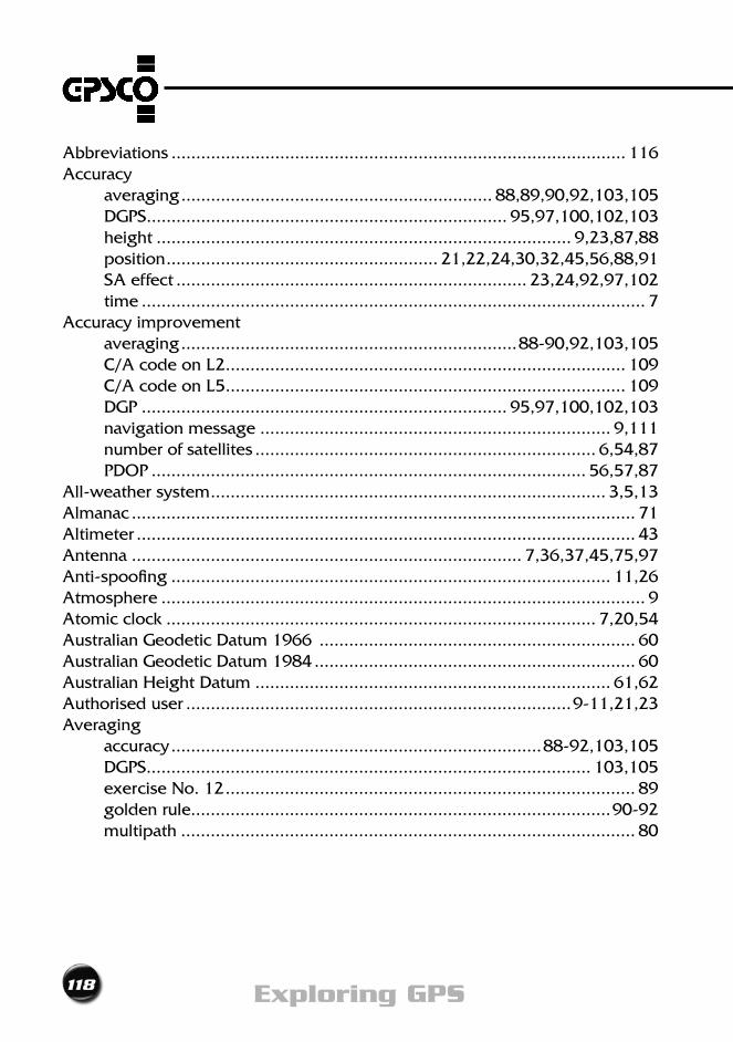
118 Exploring GPS
Abbreviations ............................................................................................ 116Accuracy averaging ............................................................... 88,89,90,92,103,105 DGPS......................................................................... 95,97,100,102,103 height .................................................................................... 9,23,87,88 position ....................................................... 21,22,24,30,32,45,56,88,91 SA effect ....................................................................... 23,24,92,97,102 time ...................................................................................................... 7Accuracy improvement averaging ....................................................................88-90,92,103,105 C/AcodeonL2 ................................................................................. 109 C/AcodeonL5 ................................................................................. 109 DGP .......................................................................... 95,97,100,102,103 navigation message ....................................................................... 9,111 number of satellites ..................................................................... 6,54,87 PDOP ........................................................................................ 56,57,87All-weather system ................................................................................ 3,5,13Almanac ...................................................................................................... 71Altimeter ..................................................................................................... 43Antenna ............................................................................... 7,36,37,45,75,97Anti-spoofing ......................................................................................... 11,26Atmosphere .................................................................................................. 9Atomic clock ....................................................................................... 7,20,54Australian Geodetic Datum 1966 ................................................................ 60 AustralianGeodeticDatum1984 ................................................................. 60 Australian Height Datum ........................................................................ 61,62Authorised user ..............................................................................9-11,21,23Averaging accuracy ...........................................................................88-92,103,105 DGPS.......................................................................................... 103,105 exercise No. 12 ................................................................................... 89 golden rule.....................................................................................90-92 multipath ............................................................................................ 80
119A GPS Users Guide
Index
Base station ..........................................................................................96-105Batteries ........................................................................ 38,39,43,49,63,64,79Block I satellite ............................................................................................... 7Block II satellite ....................................................................................... 7,109BlockIIFsatellite ..................................................................................... 7,109Block IIR satellite .............................................................................. 7,109,110Block III satellite ...................................................................................... 7,110
C/A code .............................................................. 9,10,13,21,23,109,110,113Channels ............................................................................................ 35,41,87Clock atomic ........................................................................................ 7,20,54 error ............................................................................................. 21,23 quartz crystal ....................................................................................... 20 receiver ............................................................................................... 21 satellite ............................................................................................... 20 synchronisation .............................................................................. 20,21Codes C/A .............................................................. 9,10,13,21,23,109,110,113 M (Earth) ........................................................................................... 110 M (Spot Beam) ........................................................................... 110,113 P(Y) ................................................................................. 10,11,13,21,26 W ................................................................................................... 11,26Cold start ................................................................................................ 50,56Constellation ............................................................................................. 6,57Control segment AUTO-NAV ........................................................................................ 6,7 refit ................................................................................................... 111Cross Track Error .......................................................................................... 78Course over ground ..................................................................................... 78
120 Exploring GPS
Data download ........................................................................ 34,35,42,43,71 ports .............................................................................................. 42,96Datum map ...........................................................................34,59,60-62,64,89 vertical ........................................................................................... 61,62Dead reckoning ........................................................................................... 73Department of Defense ...........................................................5,6,11-13,23-25Dilution of Precision PDOP .........................................................................34,56-59,87,88,92 HDOP ................................................................................................. 59Display screen ............................................................................................. 33Doppler system ........................................................................................... 51Downloading ........................................................................... 34,35,42,43,71Differential GPS accuracy ...........................................................................95,97,100-103 averaging ................................................................................... 103,105 corrections .......................................................................96,97,100-105 data link ..................................................................................... 101,102 equipment .......................................................................................... 96 RTCM ..........................................................................42,96,97,100-105 separation ......................................................................................... 102 Wide Area ......................................................................................... 104Distance units .............................................................................................. 70
Encryption code ...................................................................................... 11,26Elevation .......................................................... 4,18,21,23,52,54,55,61,62,87Ephemeris ................................................................................................... 71Exercise No. 1 - How quick is my receiver? ..................................................... 50 No. 2 - Is this where I am? Or where I was? ....................................... 52 No. 3 - 3D vs 2D positions ................................................................. 54 No.4-Checkingthemapdatum ....................................................... 59 No. 5 - Checking the time zone .......................................................... 62 No. 6 - Recording your setup preferences .......................................... 64 No. 7 - Navigation displays ................................................................ 71 No. 8 - Response times ...................................................................... 73
121A GPS Users Guide
Index
No. 9 - Coping with obstructions ........................................................ 74 No. 10 - When is an obstruction not an obstruction? ........................... 75 No. 11 - Approaching a waypoint ....................................................... 81 No. 12 - How’s your average? ............................................................. 89
Frequencies L1 .......................................................................... 9,10,13,109,110,113 L2 ................................................................... 9,10,13,109,110,111,113 L5 .......................................................................................109-111,113Filters ........................................................................................................... 73Firmware ........................................................................................... 42,43,73Frozenstart ............................................................................................. 50,66
Galileo ....................................................................................................... 112GeocentricDatumofAustralia1994 ....................................................... 60,61 Greenwich Mean Time ................................................................................. 62GLONASS .................................................................................................. 112Global coverage .................................................................................. 3,5,8,25Golden rules of GPS averaging .......................................................................................90-92 map datum ......................................................................................... 61 number of satellites ............................................................................. 21 PDOP .................................................................................................. 57
HDOP .......................................................................................................... 59Health of satellites .................................................................................... 9,57Height accuracy .................................................................................... 23,87,88 aiding ............................................................................................. 54,55 MeanSeaLevel ......................................................................... 23,61,62 improvement ............................................................................ 61,62,87
Icons ........................................................................................................... 34Initialisation time required ...................................................................................... 50 speeding up ........................................................................................ 51Internet ................................................................................... 35,42,43,57,89
122 Exploring GPS
Jamming .................................................................................................... 110Kalman filter ................................................................................................ 73
L1Frequency .................................................................. 9,10,13,109,110,113 L2Frequency ........................................................... 9,10,13,109,110,111,113L5Frequency ...............................................................................109-111,113
M code (Earth) ........................................................................................... 110M code (Spot beam) ........................................................................... 110,113Manual .............................................................. 34,38,43,44,49,63,64,78,102Map accuracy ............................................................................... 35,59,60,81 Australian Standard ........................................................................ 59,60 display ................................................................................................ 35Map datum AGD66 ................................................................................................ 60 AGD84 ................................................................................................ 60 GDA94 ........................................................................................... 60,61 golden rule.......................................................................................... 61 WGS84 ..........................................................................................60-62Mapping software .................................................................................. 42,57MeanSeaLevel ................................................................................. 23,61,62Memory battery ................................................................................................ 39 capacity.......................................................................................... 40,45Microwave .......................................................................................... 9,19,75Military codes ............................................................................9-11,26,110,113 control ........................................................................................ 6,7,109 user ...................................................................................9-11,21,23,39Multipath ................................................................................................ 79,80
Navigation message ..................................................... 9,13,17,23,50,63,70,71,111 route .........................................................................................32,77-82 almanac .............................................................................................. 71 ephemeris ........................................................................................... 71
123A GPS Users Guide
Index
NAVWAR ..................................................................................................... 25NMEA ......................................................................................................... 42North facing ............................................................................................. 74,75 grid ..................................................................................................... 70 magnetic ............................................................................................. 70 pole ...................................................................................................... 8 true ..................................................................................................... 70Obstructions ...........................................................................................74-76Orbits ..................................................................................... 7,8,34,57,58,71Offset feature ......................................................................................... 76,77Outage .............................................................................................. 57,58,87Overdetermined position ............................................................................ 87
P(Y) code ................................................................................. 10,11,13,21,26Position 2D ........................................................................................ 34,54,55,59 3D .........................................................................21,34,53-55,59,64,87 changing .............................................................................. 20,52,71,73 old ................................................................................................. 52,53 overdetermined .................................................................................. 87 unknowns ................................................................................. 18,21,54PDOP accuracy improvement .............................................................. 56,57,87 coping with a high value ..................................................................... 58 golden rule.......................................................................................... 57 multiplier effect ................................................................................... 57 outage ........................................................................................... 57,58 planning ......................................................................................... 57,58 typical value ........................................................................................ 57Power auto shut off ........................................................................................ 39 display ................................................................................................ 38 failure ............................................................................................. 38,63 savers.................................................................................................. 39Psuedorange correction ..............................................................................98-101,105
124 Exploring GPS
definition ............................................................................................. 19 measuring ............................................................................18-21,97,98
Quartz crystal clock ...................................................................................... 20Quick reference card ......................................................................... 44,49,64
Radio interference ....................................................................... 9,76,109,110Range ..................................................................................................... 78,79Real time DGPS ................................................................................42,93-105Receiver antenna .......................................................................................... 36,37 buttons................................................................................................ 36 casing ................................................................................................. 39 colour............................................................................................. 32,39 compliance .................................................................................... 32,37 cost ........................................................................................... 32,45,96 channels ......................................................................................... 41,87 dataport ......................................................................................... 42,96 display ...........................................................................................33-35 ergonomics .................................................................................... 39,40 firmware ................................................................................... 42,43,73 guarantee ............................................................................................ 45 quick reference card .................................................................. 44,49,64 map display ........................................................................................ 35 manual ...................................................... 34,38,43,44,49,63,64,78,102 memory ......................................................................................... 40,45 power ............................................................................................ 38,39 states of readiness .......................................................................... 50,66 survey ................................................................................... 45,104,105 types .............................................................................................. 44,45 waterproof .......................................................................................... 39Reflected signal ...................................................................................... 79,80Regional denial ............................................................................................ 25Response times ........................................................................................... 73Routes ...............................................................................................32,77-82Rover ....................................................................................................97-105RTCM age of corrections .............................................................................. 100 rate of change correction ................................................................... 101
125A GPS Users Guide
Index
Satellite categories ............................................................................................. 7 clock ................................................................................................... 20 constellation ..................................................................................... 6,57 geometry .................................................................................. 56,57,87 golden rule.......................................................................................... 21 health ............................................................................................... 9,57 number of ................................................................................... 6,54,87 orbit ............................................................................... 7,8,34,57,58,71 speed .................................................................................................... 8 tracking ................................................................................ 6,34,88,111Sea level ............................................................................................ 23,61,62Segments control ................................................................................... 6,7,13,111 space ............................................................................................... 6,13 user ............................................................................................. 6,12,13Selective availability accuracy ........................................................................ 23,24,92,97,102 Gulf War .............................................................................................. 24 introduction ........................................................................................ 23 termination .......................................................................... 23,25,92,97Signal strength ................................................................................ 75,76,110Speed over ground ...................................................................................... 71Software mapping ........................................................................................ 42,57 maping software ................................................................................. 45 upgrades ............................................................................................... 7Space segment ......................................................................................... 6,13Speed of light .............................................................................................. 19Surveying ............................................................................ 3,45,101,104,105
Time accuracy ................................................................................................ 7 GPS ..................................................................................................... 63 GMT .................................................................................................... 62 UTC ................................................................................................ 62,63 zones ............................................................................................. 62,63Timing system ............................................................................................... 3Tracking ........................................................................................ 6,34,88,111
126 Exploring GPS
TRANSIT Doppler system ............................................................................... 5
Underground ............................................................................................... 12Underwater ............................................................................................ 12,23Universal Time Coordinated .................................................................... 62,63User segment ...................................................................................... 6,12,13
Velocity ........................................................................ 4,5,13,18,70,74,84,99Vertical accuracy ............................................................................... 21,23,52,88 datum ............................................................................................ 61,62
W code ................................................................................................... 11,26 Warm start.............................................................................................. 50,66Waterproof .................................................................................................. 39Waypoint accuracy ......................................................................................... 23,81 naming................................................................................................ 40WorldGeodeticSystem1984 .................................................................60-62 Wide Area DGPS ....................................................................................... 104World Wide Web ..................................................................... 35,42,43,57,89
Y code ..................................................................................... 10,11,13,21,26

127A GPS Users Guide
Index
Over 10,000 Copies Sold
Readthisbookand get the most out of your GPS
ExplorethegoldenrulesofGPS
Discoverpracticalhints,tipsandtricks
Find out what the manual forgot to tell you
Step by step guide to a dozen hands-onexercises
Cartoons illustrate common problems and solutions
Easy to read and understand