Embed Size (px)
Citation preview

A comparison of techniques for investigating
groundwater-surface water interactions along the
Brunswick River, Western Australia.
Katrina Annan
Supervisor: Dr. David Reynolds
October 2006
This dissertation is submitted for partial fulfillment of the Bachelor of Engineering
(Environmental) degree requirements at the University of Western Australia.

2

3
Acknowledgements
There are many people who have been helped me with this project in some way or
another, and deserve recognition.
Firstly, I would like to thank David Reynolds, for being a great supervisor, always quick
to reply to my emails, phone calls and always accommodating me with meeting times.
Thank you to my ‘industry mentors’ from the Department of Water; Mark Pearcey, Rob
Donohue and Louise Stelfox, for getting the project off the ground and for their
continuous enthusiasm and support. A special thank you to Mark for his endless
assistance during the year.
Debbie Blake, for providing me with accommodation during field work, no matter how
short the notice. Knowing there was a relaxing home and warm shower waiting at the end
of a long drive or a hard days work out in the field, made the project so much easier.
To everyone at the Department of Water who I have come across and shared my project
with. Lin and Gene for their help with the hydrogeological mapping, Muriel and
Rosemary for providing me with data. A special thank you to Lidia, Jacqui and Mary-ann
for making me feel so welcome when I started on the project.
Thanks to Jeff Turner from CSIRO for lending me seepage meters. To Ross Brodie and
Baskaran from the Bureau of Rural Sciences in Canberra for their advice, and to Trevor
from Odyssey Data helpdesk in S.A. for teaching me, over the phone, how to use the
temperature loggers.
Thank you to all of those who helped me with field work: Geoff Sadgove, Ian
Macpherson, Geoff Wood, Andrew Bland, Darren Orr, Mark Williams, Rob Gibbs, Milly
Subotic, Allan Pastega, Henry Sierakzki, Emily Said and Tina Pitsonis. A special thank
you to Carolyn Hawkes for helping me out with the final stages of field work and over
coming her fear of cows so we could make it to the seepage meters on time.

4
Thank you to the property owners along the Brunswick River, for welcoming me to the
area and allowing me onto your properties to take bore measurements. Your friendly
assistance was greatly appreciated.
My team of proof readers and editors; Mum, Melanie, Niko, Mark and Kathryn. Your
comments and attention to detail is greatly appreciated.
Thank you to Mildred, Laurence and Gary at the CEED office for providing me with this
opportunity, and to everyone else involved with a CEED project this year. We’ve have
some great times, and a lot of pizza!
To all the staff at SESE and CWR for all their assistance and advice over the years.
To my final year class, who have kept me going and provided much inspiration, and
entertainment in the wee hours of the morning. I will miss you all next year.
A special thanks to Vinnie, for all his helpful advice, and for supporting me through the
projects most difficult times (including printing). Now it’s your turn…..good luck babe.
To my sisters (Melanie, Natasha, and Jessica) and brother (Ben) for their unconditional
support and understanding throughout this year, and every other.
Finally, this thesis is dedicated to my mother (Leonie) and father (Graham), who have
provided me with every opportunity for success throughout my lifetime. Your consistent
support has given me the confidence to achieve many things throughout my life so far,
and this thesis is among the biggest of those.
Thank you.

5
Abstract
Traditionally groundwater and surface water have been managed as separate water
resources. However, in many regions, they are hydraulically connected and the
abstraction from one can influence the other. There is an increasing body of knowledge
recognising the significant implications of groundwater-surface water interactions.
Similarly, there are an increasing number of methods being developed to assess these
interactions. Throughout Australia the methodology is still in the developmental stage
and with a growing number of methods to choose from, selecting the most suitable one is
a challenge.
Seven methods were compared for investigating groundwater-surface water interactions
in the Brunswick River. These included hydrogeological mapping, hydrograph analysis,
temperature studies, seepage measurements, a salinity survey, field observations and
water budgeting. The suitability, advantages and disadvantages and the overall results of
each method were compared. All the techniques, except a salinity survey, were found to
be suited to the Brunswick River environment. The results produced from this project are
among the first for groundwater-surface water assessment in Western Australia. The
project was successful in determining the spatial variability and scale of connectivity
along the Brunswick River, and produced a hydrogeological cross section displaying
connected reaches along the river. The temporal variability in connectivity was not
immediately assessed and should be considered in future work.

6
TABLE OF CONTENTS
Acknowledgements……………………………………………………………………….3
Abstract…………………………………………..............................................................5
Table of Contents………………………………………………………………………...6
List of Figures……………………………………………………………………………8
List of Tables…………………………………………………………………………….10
Introduction…………………………………………………………………………..11
1.0 Catchment Description………………………………………………………..13
2.0 Literature Review................................................................................................18 2.1 Definition of connectivity………………………………………………..…..18
2.2 Techniques used to investigate connectivity…………………………….…...24
2.3 Connectivity mapping………………………………………………………..25
Hydrograph Analysis………………………………………………………...28
Baseflow Separation……………………………………………………..29
Frequency Analysis………………………………………………….......30
Recession Analysis………………………………………………………30
Environmental Tracers………………………………………………………32
Temperature survey……………………………………………………...33
Salinity survey…………………………………………………………...37
Seepage measurements………………………………………………………48
Water budgeting…………………………………………………………...…42
Geophysics and remote sensing……………………………………………...43
Field Observations…………………………………………………………...44
Ecological Indicators………………………………………………………....45
2.4 Literature summary and study motivation…………………………………...46
3.0 Methodology…………………………………………………………………….48 3.1 Field Studies…………………………………………………………………49
3.1.1 Study reach site selection………………………………………..51
3.2 Techniques…………………………………………………………………..52
3.2.1 Connectivity mapping…………………………………………...52
3.2.1.1 Assessing river base elevation…………………………...52
3.2.1.2 Assessing groundwater elevation………………………...53
3.2.1.3 Assessing underlying geological structure………………55
3.2.1.4 Data compilation…………………………………………56
3.2.2 Baseflow Separation……………………………………………..56
3.2.3 Temperature Survey……………………………………………...58
3.2.4 Salinity Survey…………………………………………………...63
3.2.5 Water Budgeting…………………………………………............65
3.2.6 Seepage Meters…………………………………………..............71
3.2.7 Field Observations………………………………………….........76

7
4.0 Results and Findings…………………………………………..........................78 4.1 Results of each technique…….………………………………………….......78
4.1.1 Connectivity mapping……………………………………………78
4.1.2 Baseflow separation………………………………………….......83
4.1.3 Temperature survey………………………………...………........88
4.1.4 Salinity survey…………………………………………...............90
4.1.5 Water budgets……………………………………………………91
4.1.6 Seepage meters…………………………………………..............93
4.1.7 Field observations………………………………………………..94
4.2 Comparison of results of each technique…………………………………...100
5.0 Discussion………………………………………….............................................101 5.1 Significance of results at each study reach…………………………………101
5.2 Significance of results for connectivity along the Brunswick River……….102
5.3 Limitations of Methodology…………………………………………..........104
5.3.1 Limitations of techniques………………………………………104
5.3.2 Timescale limitations of techniques characterising connection..105
5.3.3 Site specific limitations of the Brunswick River environment…105
5.4 Comparisons of techniques…………………………………………...........106
5.4.1 Overall suitable conditions and recommended application of
techniques………………………………………………………107
5.4.2 Advantages and disadvantages…………………………………110
5.5 Considerations of connectivity for water management and implications of
Dam
construction…………………………………………………………………113
5.6 Implications of future climate change for connectivity…………………….114
6.0 Conclusion………………………………………….......……………………….115
7.0 Recommendations and Future Work…………………………………….117
References………………………………………….......…………………………….119
Appendices………………………………………….......……………………………129

8
LIST OF FIGURES
Figure 1. Brunswick River Catchment and location ........................................................ 14
Figure 2. Period of operation of streamflow gauging sites in the Brunswick River
Catchment.............................................................................................................. 15
Figure 3. Mean monthly rainfall in the Brunswick River catchment ............................... 16
Figure 4. Monthly mean rainfall recorded at Brunswick Junction PO for 2006 (as at
16/10/06) ............................................................................................................... 17
Figure 5. Observed and mean annual streamflow recorded at 612032 ............................ 17
Figure 6. The hydrologic cycle and key components of groundwater-surface water
interaction............................................................................................................. 19
Figure 7. Vertical directions of seepage flux ................................................................... 20
Figure 8. a) Gaining system and b) Losing system .......................................................... 21
Figure 9. Hydraulically neutral system ........................................................................... 22
Figure 10. A disconnected system, where the stream is separated from the groundwater
by an unsaturated zone.. ........................................................................................ 22
Figure 11. Groundwater contour patterns around streams to indicate gaining or losing
stream systems....................................................................................................... 27
Figure 12. Components of a typical streamflow hydrograph .......................................... 28
Figure 13. Hypothesised temperature signals for gaining , losing and neutral condition 34
Figure 14. Stream and sediment temperature signals for gaining and losing conditions
along Dumersq River, Border Rivers catchment ................................................ 36
Figure 15. Components of a typical seepage meter.......................................................... 39
Figure 16. Discharge of groundwater through a subaqeuous spring................................ 44
Figure 17 Conceptual model of techniques used in groundwater-surface water interaction
assessment along the Brunswick River. ................................................................ 48
Figure 18. Location and components of field work ......................................................... 50
Figure 19. The Solinst water level meter used in groundwater level assessment ............ 54
Figure 20. Example of an open well not included in analysis.......................................... 55
Figure 21. Features of the Odyssey submersible temperature loggers............................. 58
Figure 22. Inserting temperature loggers at Sandalwood into a) the stream bed and b) the
stream .................................................................................................................... 59
Figure 23. Temperature survey set up at Sandalwood ..................................................... 60
Figure 24. Temperature survey set up at Cross Farm....................................................... 61
Figure 25. WTW conductivity measuring probe.............................................................. 63
Figure 26. Sites where salinity samples were taken......................................................... 64
Figure 27. Stream transect along the river used to determine flow discharge in the area-
velocity method . ................................................................................................... 66
Figure 28. Conducting discharge measurement at site 1.1............................................... 66
Figure 29. Reaches where water budgeting occurred and points where discharge
measurements were taken...................................................................................... 69
Figure 30. Seepage meter design 3................................................................................... 71
Figure 31. Close up of the tap valve and seal between the chamber and collection bag . 72
Figure 32. Seepage meter design 1................................................................................... 75
Figure 33. Seepage meter design 2................................................................................... 75
Figure 34. Detecting a spring line in the field ................................................................. 76

9
Figure 35. Hydrogeologcial cross section of the Brunswick River.................................. 81
Figure 36. Annual BFI versus minimum annual stream flow at Sandalwood (612022).. 84
Figure 37. Annual BFI versus minimum annual streamflow at Beela station (612047).. 84
Figure 38. Annual BFI versus minimum annual streamflow at Cross Farm (612032) .... 85
Figure 39. Linear regression showing the relationship between annual BFI and minimum
streamflow data, line of best fit and correlation coefficient at 612022................. 86
Figure 40. Linear regression showing the relationship between annual BFI and minimum
stream flow data, line of best fit and correlation coefficient at 612047................ 86
Figure 41. Linear regression showing the relationship between annual BFI and minimum
stream flow data, line of best fit and correlation coefficient at 612032................ 87
Figure 42. Losing temperature signal at study reach one: Cross Farm ............................ 88
Figure 43. Gaining temperature signal at study reach two: Sandalwood........................ 89
Figure 44. Salinity readings measured at sites along the Brunswick River during
February and June ................................................................................................. 90
Figure 45. Location of field observations ........................................................................ 94
Figure 46. Following a spring line along the hillslope..................................................... 96
Figure 47. Spring line, indicated by clumps of rushes and also the presence of water
troughs used to store water as it passes over the landscape .................................. 96
Figure 48. Geological indicator of dolerite outcrop ......................................................... 97
Figure 49. Natural fill dam at an elevation higher than the river base ............................. 97
Figure 50. Bank seepage: flow coming directly from the river bank into the river ......... 97
Figure 51. Iron flocculation, occurring at the edge of the river bank............................... 98
Figure 52. Seepage occurring along a hillslope. .............................................................. 99

10
LIST OF TABLES
Table 1. Date and purpose of field work carried out during 2006.................................... 49
Table 2. Dates and times of temperature surveys ............................................................. 62
Table 3. Standard width to number of verticals relationship............................................ 67
Table 4. Methods used at each site to determine streamflow inputs and outputs for water
budgeting........................................................................................................................... 68
Table 5. Dates and design type used in seepage meter trials............................................ 75
Table 6. Baseflow indicies for recorded streamflow data at 612022, 612047 and 612032
streamflow gauging stations.............................................................................................. 83
Table 7. Variations in groundwater salinities measured at bore sites and a spring in the
brunswick catchment during june and september 2006 .................................................... 91
Table 8. Water budgeting results for study reach one (Cross Farm) on the 29th of June . 91
Table 9. Water budgeting results for study reach two (Sandalwood) on the 26th
September 2006................................................................................................................. 92
Table 10. Seepage meter trial periods, design type and results ........................................ 93
Table 11. Visual indicates of groundwater-surface water interaction located in the field95
Table 12. Comparison of techniques based on scale, results and suitability to the
Brunswick River.............................................................................................................. 100
Table 13. Suitability and application of techniques in the broader context ................... 107
Table 14. Advantages and disadvantages associated with each technique..................... 110

Introduction Katrina Annan
11
Introduction
Nearly all surface water features interact with groundwater (Winter et al. 1998). These
interactions can have significant implications for both water quantity and quality.
However, in many regions groundwater and surface water are managed as separate
resources. This can cause many water management issues. An example of this is the over-
allocation of water, where the same parcel of water may be allocated twice, once to a
groundwater user and then again to a surface water user. This overlap can become a
serious issue where allocation is high relative to water availability, as is increasingly
becoming the case throughout Australia and many parts of the world. Seepage of
groundwater into a river can be important in maintaining flows during extended dry
periods and many groundwater dependent ecosystems rely on contributions from
groundwater as part of their survival. Therefore, analysis of groundwater inputs and
interactions with streams becomes critical when dealing with issues such as water
allocation and trading, ecosystem water requirements, reliability of water supply and
design of water storages.
Groundwater-surface water interactions are difficult to observe and measure and have
commonly been ignored in water management considerations and policies (Winter et. al.,
1998). The National Water Initiative, a comprehensive strategy driven by the Australian
Government to improve water management across the country, promotes the management
of Australia’s water resources as a single resource, recognising the connection between
surface water and groundwater systems. This has resulted in a large number of river
research projects and method development focusing on assessing the connection between
groundwater and surface water.
The Department of Water, like many water resource management agencies throughout
Australia, is expanding its understanding of groundwater-surface water interactions to
assist with sustainable decision making. Many rivers throughout Australia, particularly in
the south west of Western Australia, are under increasing pressure to be developed for
use as water resources. Damming the Brunswick River is among a list of potential options

Introduction Katrina Annan
12
for Western Australia’s future water supply sources (Water Corporation 2005). It is
important to understand the functionality of a river system before any adjustments to its
natural state can be made. However, while several studies have begun classifying
groundwater dependent ecosystems in the area, very little is currently known about the
connectivity between groundwater and surface water along the Brunswick River.
The objectives of this project were:
1) To identify reaches of hydraulic connection along the river and determine whether
they are gaining (where groundwater discharges into surface water), losing (where
surface water infiltrates into and recharges groundwater stores) or neutral (neither
gaining nor losing) in character, and in doing so,
2) Compare several techniques for investigating groundwater-surface water
interactions along the Brunswick River
Techniques are compared by evaluating their assumptions, limitations, advantages and
disadvantages, suitability to the Brunswick River and other environmental conditions,
their spatial scale of assessment and the overall implications of their results.

1.0 Catchment Description Katrina Annan
13
1.0 Catchment Description
The Brunswick River is located approximately 30 km north east of Bunbury and passes
through the town of Brunswick Junction. Its catchment area is 286 km2 and extends past
the Darling Scarp into the State Forest (Figure 1). The Brunswick River joins with the
Collie River approximately 6 km upstream of the Leschenault inlet. The main tributaries
of the Brunswick River are the Wellesley, Lunenburgh and Augustus rivers.
The catchment can be divided into two areas, the upper catchment which is upstream of
the Darling fault line including the scarp and its foothills; and the lower catchment, west
of the Darling scarp, which lies on the Swan coastal plain. Approximately 75% of the
lower catchment is cleared of native vegetation and approximately 25% of the upper
catchment is cleared (Rose 2004).
Land use in the upper catchment is dominated by the Worsley Alumina refinery and the
State Forest. Historically known for its large population of cattle and dairy farming
within Brunswick Junction, the lower part of the catchment is now dominated by private
horticultural and agricultural land users, mostly beef livestock. A recent water use survey
along the river found there are eight licensed surface water users and ten unlicensed
groundwater users extracting water from the Brunswick River system (DoW 2006). The
majority of land owners in the lower catchment receive water for stock and irrigation
purposes from the Wellington reservoir. Harvey Water control the distribution of
irrigation water during the irrigation season, which typically runs from October to April
(Harvey Water 2003). During the irrigation season, excess surface water runs off the
properties and is discharged into the Brunswick River.
Two storage dams lie within the Brunswick River catchment, Beela Dam, which lies on
the Brunswick River and has a storage capacity of 0.02 GL, and the Worsley Alumina
refinery dam on the Augustus River, which creates a large fresh water reservoir with a
storage capacity of 5.2 GL. Beela Dam was constructed in 1948 to supply the Brunswick

14
Figure 1. Brunswick River Catchment and location (K.Annan 2006)

1.0 Catchment Description Katrina Annan
________________________________________________________________________
15
Junction Regional Water Supply Scheme, serving Brunswick Junction and the nearby
towns of Burekup and Roelands (Water and Rivers Commission 2001). Beela Dam is no
longer used for water supply to the scheme and the towns are now connected to the
Western Australia’s integrated water supply scheme (IWSS) (Worsley Alumina 2005).
Worsley are licensed to abstract 2.1 GL per year from the freshwater reservoir for their
bauxite mining operations and are required by contract to maintain an output summer
flow of approximately 35 ML per hour from the reservoir to maintain flows in the
Brunswick River (Worsley Alumina 2005).
Several streamflow gauging sites exist along the Brunswick River and its main
tributaries, operating at varying periods of time (Figure 2). Three sites along the
Brunswick River, (612032, 612022 and 612047), and one along the Wellesley River
(612024), remain operational while the other sites have been shut down and are no longer
used to report flow data.
Jan-
40
Jan-
45
Jan-
50
Jan-
55
Jan-
60
Jan-
65
Jan-
70
Jan-
75
Jan-
80
Jan-
85
Jan-
90
Jan-
95
Jan-
00
Jan-
05
Brunswick River - Olive Hill
(612152)
Brunswick River - Beela
(612047)
Lunenburgh River - Silver
Springs (612023)
Brunswick River - Sandalwood
(612022)
Augustus River - Worsley
Refinery (612024)
Brunswick River - Beela Dam
(612018)
Brunswick River- Cross Farm
(612032)
Wellesley River- Juegenup
(612039)
Figure 2. Period of operation for streamflow gauging sites in the Brunswick River, reffered to by
their name and AWRC reference number.

1.0 Catchment Description Katrina Annan
________________________________________________________________________
16
The Brunswick catchment lies in a high rainfall zone, crossing the 900 mm to 1200 mm
isohyets, common for Darling Scarp jarrah forest. Mean annual catchment rainfall is 909
mm, recorded between 1975 and 2004, at Brunswick Junction Post Office. Mean monthly
rainfall recorded at the Brunswick Junction Post Office from 1981 to 2005 (Figure 3),
shows June as the peak rainfall month. Comparatively, this year (2006), was an unusually
dry year, with well below average rainfall recordings during May to July (Figure 4) and a
shift in peak monthly rainfall from June to August. The shift in peak rainfall caused a
shift in peak flow during 2006 from the average peak stream flow month of June to
August.
0
20
40
60
80
100
120
140
160
180
Jan Feb March April May June July Aug Sept Oct Nov Dec
Rain (mm)
Figure 3. Mean monthly rainfall in the Brunswick River catchment (recorded at Brunswick Junction
Post Office
(009513))

1.0 Catchment Description Katrina Annan
________________________________________________________________________
17
0
20
40
60
80
100
120
140
160
180
Jan Feb March April May June July Aug Sept Oct Nov Dec
Rain (mm)
Figure 4. Monthly mean rainfall recorded at Brunswick Junction PO for 2006 (as at 16/10/06)
The mean annual flow of the Brunswick River, recorded at Cross Farm streamflow
gauging station (612032) from 1990 to 2005, is 130 GL (Figure 5). The Brunswick River
may be classified as a perennial and unregulated stream, as it flows all year, and while
natural summer flows are maintained by input from the Worsley Dam along the Augustus
River, storage capacity of the dam (5.2 GL) is only a small proportion of the mean annual
flow (130 GL). Therefore the river is not subject to major regulating effects (Pearcey
pers. comm. 2006a).
0
50
100
150
200
250
300
1990 1995 2000 2005
Annual flow (GL)
Observed annual flow Mean annual flow (1990-2005)
Figure 5. Observed and mean annual streamflow recorded at 612032

2.0 Literature Review Katrina Annan
18
2.0 Literature Review
Traditionally groundwater and surface water have been managed as isolated components
of the hydrologic cycle, even though they interact in a variety of physiographic settings
(Sophocleous 2002). Interactions between these systems have commonly been ignored in
water management considerations and policies (Winter et al. 1998). Some believe this is
due to the separation of the fields of hydrology and hydrogeology (Sophocleous 2002),
while others believe it is because the interactions are difficult to assess (Winter et al.
1998). There is a growing consensus among Australian water managers that groundwater
and surface water interactions have many significant implications for sensitive water
issues including over-allocation, environmental water requirements, river restoration and
overall water quantity and quality (Baskaran et al. 2005; Brodie et al. 2005; Evans et al.
2005). In the last decade recognition of the importance of groundwater-surface water
interaction has flourished (Langhoff et al. 2006), and today it is widely recognised that to
better manage these water issues there is a need to manage groundwater and surface
water together as a connected resource.
Before any further discussion on groundwater-surface-water interactions and assessing
connectivity can occur it is important to understand the underlying concepts of
connectivity and how it is recognised in a river system.
2.1 Definitions of connectivity
A connected water resource is the combination of a surface water feature, such as a river,
and the groundwater system that can directly interact in terms of movement of water. The
hydrological cycle describes the constant movement of water above, on, and below the
Earth's surface (Figure 6). The cycle operates across all scales, from the global to the
smallest stream catchment (Smith 1998) and involves the movement of water through
evapotranspiration, precipitation, surface runoff, subsurface flow and groundwater
pathways. The water table is the expression of groundwater in the shallow aquifer. A

2.0 Literature Review Katrina Annan
19
confined aquifer is created by the presence of an impermeable barrier, known as an aqui-
tard at the base of the shallow aquifer.
Figure 6. The hydrologic cycle and components of groundwater-surface water interaction (K. Annan
2006, adapted from (Church 1996))
Groundwater and surface water are not isolated components of the hydrological cycle and
they may interact in a range of topographic, geologic and climatic landscapes (Winter et
al. 1998). A variety of definitions for the terms surface water and groundwater have been
presented in hydrology literature. This thesis will use the basic definition that all water
above the surface of the land is considered surface water and all water below the surface
of the land is groundwater. Also ambiguous is the name given to the interface between
groundwater and surface water, some scholars have called it the groundwater-surface
water transition zone (Ford 2005), groundwater-surface water interface (Sophocleous
2002), the stream-aquifer interface (BRS 2006) or the hyporheric zone (Kaleris 1998).
This thesis will call it the groundwater-surface water interface.
While the definitions of these terms are ambiguous, the terms used to describe the
processes of exchange among them (including fluxes, recharge, discharge, leakage and
seepage), are even less clearly defined. The term seepage usually relates to the flow of
Precipitation
Confined Aquifer
Aquifer
Baseflow
Water table
Bank storage
Interflow
Infiltration
Overland flow (runoff)
River
Evaporation

2.0 Literature Review Katrina Annan
20
water through porous medium (such as sediments). The term flux relates to the flow rate
of fluid through a given surface area. Hence, seepage flux refers to the direction and rate
of water movement through the groundwater-surface water interface. This thesis will
refer to the exchange across the groundwater-surface water interface as seepage flux,
where downward (negative) seepage flux indicates flow from surface water to
groundwater (recharge) and upward (positive) seepage flux indicates flow from
groundwater to surface water (discharge). The term ‘high seepage’ will refer to relatively
large fluxes of either discharging or recharging seepage and the term ‘low seepage’ will
refer to relatively small exchange fluxes. These concepts are based on definitions used by
Sebestyrn and Schneider (2001) and have been diagrammatically interpreted for visual
understanding below (Figure 7).
Figure 7. Vertical directions of seepage flux (Sebestyen & Schneider 2001)

2.0 Literature Review Katrina Annan
21
In order for interaction between surface water and groundwater systems to occur, the
systems need to be hydraulically connected. Hydraulic connection is believed to exist
between surface water and ground water systems when the water table is near or above
the river bed. Interactions between rivers and groundwater may be classified in three
ways:
1) Gaining system: gain water from inflow of groundwater through the stream bed.
2) Losing system: lose water to groundwater by outflow through the streambed.
3) Neutral system: neither gaining nor losing
In order for groundwater to discharge into a stream, the elevation of the water table
adjacent to the stream must be higher than the elevation of the river bed. This setting
creates an upward hydraulic gradient, which promotes groundwater inflow to the stream
and thus a gaining system (Figure 8a). For surface water to seep into groundwater the
elevation of the water table must be lower than the elevation of the river bed. This creates
a downward hydraulic gradient between the stream and aquifer, promoting the outflow of
surface water through the stream bed and thus a losing system (Figure 8b). In both cases
it is assumed a permeable structure exists that allows the hydraulic head to move water
across the stream bed (Braaten & Gates 2001).
a)
b)
Figure 8. a) Gaining system and b) Losing system (Winter et al. 1998)

2.0 Literature Review Katrina Annan
22
A neutral system occurs where the water table is at the same elevation as the river bed
and thus in hydraulic continuity with the stream (Figure 9).
Figure 9. Hydraulically neutral system (Silliman & Booth 1993)
A neutral system may also occur where the system is hydraulically disconnected, usually
due to the presence of a thick impermeable barrier (Sophocleous 2002). Although this
setting has been more commonly described as a disconnected losing system (Figure 10).
In this setting the stream is disconnected from the groundwater system by an unsaturated
zone, the water table may have a discernible mound below the stream (Figure 10) if the
rate of recharge through the streambed and unsaturated zone is greater than the rate of
lateral groundwater flow away from the water table mound (Winter et al. 1998).
Figure 10. A disconnected system, where the stream is separated from the groundwater by an
unsaturated zone. The overall system is losing to the aquifer (Winter et al. 1998).
It is possible to have a variably gaining/losing situation where the stream may be gaining
and losing in the same reach at different times of the year. Furthermore, a stream may be
gaining in some reaches and losing in others. Therefore, it is important to consider spatial

2.0 Literature Review Katrina Annan
23
and temporal variations in groundwater-surface water interaction before the connectivity
along a stream can be classified.
Scale issues in time and space are a significant issue in the assessment and management
of stream-aquifer connectivity (BRS 2006). Connectivity may vary temporally, due to
changes in seasons or decreasing water stores over time. In a spatial context there are
three main scales relating to connectivity:
1) Regional/catchment-scale, where the stream is placed in context with the overall
setting of the catchment (typically >100 km2).
2) Intermediate/feature-scale, at the level of individual surface water features, such
as the stream reach (typically 1-100km); and the
3) Local/site-scale, where site-specific studies provide insights into processes
particularly at the stream-aquifer interface (<100 m).
The concept of groundwater interacting with surface water is not new and has been
studied since the 1960’s (Meyboom 1961, Toth 1962, 1963, Freeze and Witherspoon
1967). Early studies arose from interest in interactions between groundwater and lakes
due to concerns related to eutrophication and acid rain (Sophocleous 2002). Over the past
two decades interest in the relationship of groundwater to headwater streams, wetlands
and coastal areas has increased (Sophocleous 2002). Recently, attention has been focused
on exchanges between near-channel and in-channel water (Woessner 2000; Evans et al.
2005; Ivkovic et al. 2005). However, as described by Sophocleous (2002) the work done
has mainly focused on the exchange of water, solutes and energy within the hyporheric
zone and at the local scale. Studies of the interaction between groundwater and streams
on the intermediate scale, including the flood plain (Brusch & Nilsson 1993; Hoffman et
al. 2000), are fewer, yet they have shown that interaction between ground water and
surface water can occur in a number of ways (Langhoff et al. 2006), including seepages
that not only occur through the streambed, but also bank seepage and over bank flow.

2.0 Literature Review Katrina Annan
24
2.2 Techniques used to investigate connectivity
Assessing groundwater-surface water interactions is often complex and difficult (Brodie
et al. 2005a). Commonly, groundwater level measurements are used to define the
hydraulic gradient and the direction of groundwater flow. Flow measurements at various
points along the stream are used to estimate the magnitude of gains or losses with the
underlying aquifer. Other tools used to investigate groundwater-surface water interaction
include seepage meters (Lee & Hynes 1978; Cherkauer & McBride 1998), river bed
piezometers (Baxter et al. 2003), time-series temperature measurements (Stonestrom &
Constanz 2003) and environmental tracers (McCarthy et al. 1992; Crandall et al. 1999;
Herczeg et al. 2001; Baskaran et al. 2004). In most cases the limited number of data
collection points results in a lack of detailed understanding of groundwater-surface water
interactions in the field (Brodie et al. 2005a).
The Bureau of Rural Sciences (BRS), a government agency at the interface between
science and policy within the department of Agriculture, Fisheries and Forestry Australia,
is leading the way for managing connected groundwater-surface water resources in
Australia, and has produced a framework for doing so. This report (Brodie et al. 2006),
discusses an array of investigation and assessment techniques for identifying
groundwater-surface water interactions. Whilst this is a major leap forward in
understanding groundwater-surface water interactions across Australia, the development
of these techniques is still in the experimental stage and it is weakly understood which
techniques are the most applicable in certain stream environments. With many trials using
several techniques, often producing different results, it is hard to decide which techniques
are the most appropriate. A lot of the experimentation has occurred in Australia’s eastern
states, adding to a data base of connection characterisation for these streams. This extent
of experimentation is lacking in Western Australia and although it is assumed the
techniques can be used universally, it is not completely certain that the same techniques
can be adapted to WA streams. This dissertation contributes to initial steps being taken to
apply these techniques and gain understanding of connected waters in WA.

2.0 Literature Review Katrina Annan
25
Connectivity mapping
Hydraulic connection refers to systems where there is an opportunity for groundwater and
surface water to exchange, and occurs where river bed and groundwater elevations are in
close proximity to each other. The main factor controlling connectivity is the difference
between the surface water level and the groundwater level (BRS 2006). Connectivity
mapping refers to methods used to determine the presence of hydraulic connection along
a river reach or throughout a catchment. The simplest way to assess connectivity is to
compare the elevation of the base of the river channel with the elevation of groundwater.
Ivkovic et al. (2005) used this method as a first step in determining whether the major
rivers in the Naomi catchment, NSW, were in hydraulic connection with the underlying
aquifers. They used a GIS and groundwater database to achieve this. The potential for
hydraulic connection was assumed to exist where groundwater levels were within 10 m
from the surface. The 10 m measure is an estimated difference between the elevation of
the floodplain, where groundwater levels were measured, and the base of the river within
the Naomi catchment.
Knowledge of the hydrogeological setting is critical in understanding groundwater-
surface water interactions (BRS 2006). Specific information on hydrogeological
parameters, such as those listed below, provide a useful context when evaluating the
extent and direction of groundwater-surface water exchanges. However, hydrogeological
mapping across Australia is by no means complete (Brodie et al. 2006). Useful
hydrogeological parameters to evaluate groundwater-surface water exchange, include
(BRS 2006):
• groundwater availability, in terms of bore yield
• groundwater quality, typically salinity
• potentials, in terms of depth to water table, elevation of groundwater surfaces,
groundwater flow paths and head difference between aquifers
• aquifer hydraulic properties, typically transmissivity and storativity
• aquifer structure, typically aquifer boundaries, structural contours of the aquifer
top and base, aquifer thickness, and specific features such as faults.

2.0 Literature Review Katrina Annan
26
In the absence of specific hydrogeological mapping, more generic geological information
is useful at the stream reach level as well as the catchment level (BRS 2006).
Identification of geological structures such as faults or basement highs that control the
geometry and hydraulic properties of aquifers is particularly important. Stratigraphic
information such as the distribution of low-permeability clay layers or paleochannels that
act as preferential pathways is used to map variability of stream-aquifer connectivity. For
example, connectivity in the Cudgegong Valley NSW is controlled by geological features
(Hamilton 2004). Bedrock constrictions or faulting restricts groundwater throughflow in
the alluvial aquifer resulting in shallower water tables and gaining conditions in the river.
Away from these geological features, the regulated Cudgegong River is largely a losing
stream (Hamilton 2004).
Mapping of geomorphologic features has also been used to characterise connectivity.
Analysis of the geomorphology of some North American alluvial aquifers inferred a
relationship between dominant groundwater direction and parameters such as channel
slope, sinuosity, incision and channel width-to-depth ratio (Larkin & Sharp 1992).
State wide connectivity mapping occurred in the major inland valleys of New South
Wales (Braaten & Gates 2001), where the majority of the state’s water extraction occurs.
Hydraulic connection was established by overlapping groundwater depths with locations
of major rivers. Groundwater depths were determined from several digital groundwater
maps and monitoring bores within 1 km of the rivers. Again, in this study, hydraulic
connection was assumed to be present where river reaches overlay groundwater levels
less than 10m from the surface. A map showing hydraulic connection of inland rivers and
aquifers was produced which revealed a consistent geomorphologic pattern of
groundwater extraction at various distances to connected river reaches (Braaten & Gates
2001). The map was useful in providing sufficient information for prioritisation of
connected river-aquifer systems for further research and policy development.
Once hydraulic connection is established, it is important to establish the predominant
direction of flux between the river and groundwater system. This is often done by
installing a series of mini-piezometer transects crossing the river and coupled with river

2.0 Literature Review Katrina Annan
27
stage information, to compare water table and river bed elevations (Cey et al. 1998).
Direction of flux may also be assessed by examining groundwater contours, which
represent lines of equal potentiometric head. Contours that curve in towards the upstream
end of the stream indicate a gaining stream (Figure 11a) and contours that curve towards
the downstream end indicate a losing stream (Figure 11b).
Figure 11: Groundwater contour patterns around streams (a) contours pointing upstream for gaining streams (b) contours pointing downstream for losing streams (Winter et al, 1998)
Groundwater modelling has also been used to determine the flow path and movement of
water through the aquifer system. An array of predictive models has been developed and
used throughout the literature to improve understanding of the key hydrological
processes, to evaluate flow behaviour within groundwater-surface water systems and to
quantify the water balance components in terms of storage and flux. Many existing
numerical groundwater models omit or oversimplify surface-groundwater interaction
processes (CDM 2001). The commonly used groundwater flow model, MODFLOW
(Harbaugh et al. 2000), includes packages that represent interactions with various surface
water features. The MODFLOW River package calculates seepage flux using Darcy's
Law with estimates of a leakage coefficient and the head difference between the
groundwater elevation in the model cell and the specified stream elevation. Holland et al.
(2005) used this MODFLOW package to tests the impacts of groundwater abstraction on
stream flows in the Upper Ovens River, Victoria. The relationship between the
commencement of groundwater abstraction and stream flow impacts has also been
assessed in groundwater modelling by Braaten and Gates (2004) using numerical
solutions and analytical approaches (Evans et al. 2005).

2.0 Literature Review Katrina Annan
28
Hydrograph Analysis
A stream hydrograph is the time-series record of stream flow conditions. The hydrograph
represents the aggregate of the different water sources that contribute to stream flow
(Brodie & Hostetler 2005). Two main components that make up the stream flow
hydrograph are:
(i.) Quickflow – the direct response to a rainfall event including overland flow
(runoff), and direct rainfall onto the stream surface (direct precipitation), and;
(ii.) Baseflow – the longer-term discharge derived from natural storages and from
lateral movement in the soil profile (interflow)
Figure 12: Components of a typical streamflow hydrograph (Brodie & Hostetler 2005)
The relative contributions of quickflow and baseflow changes through the stream
hydrographic record, and the flood or storm hydrograph (Figure 12) is the classic
response to a rainfall event and consists of three main stages (Brodie & Hostetler 2005).
Initially low-flow conditions exist in the stream consisting entirely of baseflow at the end
of a dry period. Then as rainfall begins, an increase in streamflow is observed by the
quickflow response dominated by runoff. This initiates the rising limb towards the crest
of the flood hydrograph. The rapid rise of the stream level relative to surrounding
groundwater levels reduces the hydraulic gradient towards the stream and is expressed by

2.0 Literature Review Katrina Annan
29
a reduction in the baseflow component at this stage. Eventually the quickflow component
passes, expressed by the falling limb of the flood hydrograph (also called the recession
curve). With declining stream levels timed with the delayed response of a rising water
table from infiltrating rainfall, the hydraulic gradient towards the stream increases
(Brodie & Hostetler 2005). At this time, the baseflow component starts to increase. At
some point along the falling limb, quickflow ceases and streamflow is again entirely
baseflow. Over time, baseflow declines as natural storages are gradually drained during
the dry period up until the next significant rainfall event (Brodie & Hostetler 2005).
Hydrograph analysis involves analyzing the stream flow hydrograph to separate and
interpret baseflow from quickflow. The technique has had a long history of development
since the early theoretical and empirical work of Boussinesq (1904), Maillet (1905) and
Horton (1930). A multitude of methods have since evolved, which can be categorised into
three main approaches: baseflow separation, frequency analysis and recession analysis.
Baseflow Separation
Baseflow separation uses the time-series record of stream flow to derive the baseflow
signature, either by graphical methods or more automated techniques, such as digital
filters. Graphical separation methods focus on defining points along the hydrograph
where baseflow intersects the rising and falling limbs of the quickflow response. Filtering
methods process the entire stream hydrograph to derive a baseflow hydrograph and
involve the use of digital filters. Early work with digital filters (O'Loughlin et al. 1982;
Chapman 1987) was based on a filter commonly used for signal processing (Lyne and
Hollick, 1979), which has been shown to yield similar results to conventional graphical
methods (Nathan & McMahon 1990). Ivkovic et. al (2005) used baseflow filtering
techniques to analyse daily stream data as part of their investigation into groundwater-
surface interactions in the Naomi catchment, NSW. Comparisons of the baseflow
component were made across ten gauging stations, spread out over two sub-catchments
representing downstream and upstream environments. Results showed that baseflow
contributions were greatest within the upland streams. However, the data used at each site
was collected over different time intervals between 1957 and 2000, which would make it

2.0 Literature Review Katrina Annan
30
difficult to compare the flow characteristics across stations and would produce
misleading results. For an accurate comparison across stations, identical time intervals
would need to be used. A recursive digital filter was used by Evans and Neal (2005) to
separate the baseflow component of hydrographs from 178 gauging sites across the
Murray-Darling Basin. The filter applied was developed by Lyne and Hollick (1979) and
a consistent filter parameter value of 0.925 was adopted. Seasonal and annual baseflow
indices were then calculated. The criteria for selecting sites for analysis in the study by
Evans and Neal (2005) were more robust than Ivkovic et al. (2005) and included sites
where flow was unregulated, the flow record covered the period 1990 to 1999 inclusive,
and no more than 5% of the data record was missing.
Frequency analysis
Frequency analysis takes a statistical approach and involves evaluating the relationship
between the magnitude and frequency of streamflow discharges. In its most common
application, a flow duration curve (FDC) is generated showing the percentage of time that
a given flow rate is equalled or exceeded (Brodie & Hostetler 2005). As well as the
general shape of the FDC, various low-flow indices have been developed to characterise
baseflow, but many of these are strongly intercorrelated (Smakhtin 2001) and limited
work has been undertaken to link these indices to groundwater processes (Brodie &
Hostetler 2005). To this end, some studies have combined low-flow frequency analysis
with recession analysis (Loganathan et al. 1986; Gottschalk et al. 1997).
Recession analysis
Recession analysis focuses on the recession curve and involves selecting particular
recession segments from the hydrographic record to be individually or collectively
analysed to gain an understanding of the processes that influence baseflow (Brodie &
Hostetler 2005). Hydrograph recession analysis is widely used in hydrological research
and water resources planning and management (Tallaksen 1995; Smakhtin 2001).
Graphical methods, such as correlation or matching strip techniques, involve plotting
multiple recession curves to derive a master recession curve representing a composite of
baseflow conditions. In analytical methods, equations are applied to fit the recession

2.0 Literature Review Katrina Annan
31
segments. The applications of recession analysis since the early 1900’s have been
numerous and include such areas as low-flow forecasting (Vogel & Kroll 1992),
separation of baseflow from surface runoff and the assessment of evapotranspiration loss
(Wittenberg & Sivapalan 1999). The rate at which a groundwater store discharges in the
absence of recharge is one of the earliest fields of investigation in hydrology and has
developed into a closed system of repetitive discovery and re-discovery (Nathan &
McMahon 1990).
Overall, hydrograph analysis, is heavily based on the assumption that baseflow equates to
groundwater discharge, which may not always be valid. Other storages can contribute to
the baseflow regime of the stream as water can be released into streams over different
timeframes from different storages such as connected lakes or wetlands, snow, glaciers,
caverns in karst terrains, or bank storage (Griffiths & Clausen 1997). As the hydrographic
record represents a net water balance, baseflow is also influenced by any water losses
from the stream such as direct evaporation, transpiration from riparian vegetation, or
seepage into aquifers along specific reaches (Brodie & Hostetler 2005). Studies have
shown that water use or management activities such as stream regulation, direct water
extraction, or nearby groundwater pumping can significantly alter the baseflow
component (Evans & Neal 2005). Hence, careful consideration of the overall water
budget and management regime for the stream is required when evaluating the
significance of groundwater to the baseflow signal. For groundwater to be a significant
contribution to baseflow, the unconfined aquifer needs to be adequately replenished
(typically on a seasonal basis), have a shallow water table that is higher than the stream
water level, and have adequate water storage and transmission properties to maintain flow
to the stream (Smakhtin 2001). This means that other methods need to be used in
conjunction with this technique to confirm groundwater discharge to the river. Methods
such as hydrometric analysis and connectivity mapping have been used in conjunction
with baseflow analysis (BRS 2006).

2.0 Literature Review Katrina Annan
32
From the literature reviewed it is clear that hydrograph analysis is a well established
strategy in understanding the magnitude and dynamics of groundwater discharge, and
there is a strong consensus among practicing hydrologists that baseflow analysis provides
a very useful tool for understanding groundwater discharge to streams (Evans & Neal
2005; Brodie & Hostetler 2005; Ivkovic et al. 2005). Specifically, Evans & Neal (2005)
state ‘these underused techniques provide valuable insights to groundwater processes,
especially the relative and absolute magnitude of surface water and groundwater
interaction’. While much of the focus has been on developing and refining baseflow
methods, very little published data exists on trends in baseflow over time. According to
Evans and Neal (2005) the combination of baseflow separation, trend analysis and
knowledge of catchment conditions provides a very powerful technique to identify and
quantify groundwater impacts on stream flow.
Environmental Tracers
The quality and quantity of water can both be affected by the interaction of groundwater
and surface water (Dixon-Jain et al. 2005). For example, contaminated aquifers that
discharge into streams can result in long-term contamination of surface water or,
conversely, streams can be a source of contamination to aquifers (Winter et al. 1998).
Analysing and interpreting the chemistry of water can provide valuable insights into
groundwater-surface water interactions. Dissolved constituents can be used as
environmental tracers to track the movement of water (Brodie et al. 2005a).
Environmental tracers can be used to determine source areas of water and dissolved
chemicals in catchments, to calculate hydrologic and chemical fluxes between
groundwater and surface water, to calculate water ages indicating residence times, and to
determine average rates of chemical reactions that take place during transport (Winter et
al. 1998). Environmental tracers can occur naturally or may be introduced specifically to
study groundwater-surface water interactions, the later referred to as artificial tracers.
Some of the commonly used environmental tracers include field parameters such as
electrical conductivity or pH, temperature, dissolved oxygen, major ions such as calcium,
magnesium and sodium, stable isotopes, radioactive isotopes, and industrial chemicals
such as chlorofluorocarbons (Brodie et al. 2005a). Several studies have used a

2.0 Literature Review Katrina Annan
33
combination of these tracers to assess groundwater-surface water interactions (McCarthy
et al. 1992; Crandall et al. 1999; Herczeg et al. 2001; Cook et al. 2003; Baskaran et al.
2004). Geochemical mass balance models have been used to estimate mixing ratios of
river water and groundwater (Cook et al. 2003).
Temperature Survey
Heat has been widely used as a tracer of water movement to estimate areas of seepage
flux (Silliman & Booth 1993; Barron 2003; Conant 2004). Heat is a useful tracer of water
movement as it is conservative throughout the hydrological cycle and can be readily
measured in the field. Stonestorm and Constanz (2003) have recognised that the use of
heat as a tracer is a robust method for quantifying groundwater-surface water exchanges
in a range of environments, from perennial to ephemeral channels. In a connected system,
the exchange of water between the stream and shallow aquifer plays a key role in
influencing temperature not only in streams, but also in their underlying sediments
(Baskaran et al. 2005a). A comparison of stream and sediment temperatures can
characterize the type of connection occurring at a reach (Silliman & Booth 1993).
Comparing variations in the temperature of streams and their river bed sediments over a
number of days is a well practiced technique in characterising connected reaches
(Constantz 1998; Constantz et al. 2002; Baskaran et al. 2005b).
The key of temperature surveys is the varying temperature signals within the stream,
stream sediment and groundwater systems. Stream temperature varies diurnally due to
solar radiation, air temperature, rainfall and stream inflows, including groundwater
discharge. In contrast, regional groundwater is constant at the daily time scale. Sediment
temperature may be influenced by stream or groundwater temperature depending on the
connection at that reach. In a losing system, the sediment temperature is influenced by
stream temperature as the seepage flux is downwards. In a gaining stream, sediment
temperature is influenced by groundwater temperature as the flux is upwards.
Silliman and Booth 1993 were among the first researchers to conduct an investigation
into the potential for using time-series measurements of surface water and sediment

2.0 Literature Review Katrina Annan
34
temperatures to identify gaining or losing portions of a stream. Their work was developed
when it was realised ‘substantial studies had been performed on the variability of
groundwater temperature over annual cycles, yet fewer studies had been performed in
following temperature cycles near the ground water surface over periods of a few days to
weeks’ (Silliman & Booth 1993). From this work temperature signals for three potential
forms of stream-aquifer connectivity (gaining, losing and neutral) were hypothesized
Figure 13: Temperature signals (Fahrenheit versus time of day) as proposed by Silliman and Booth
(1993) showing a) gaining , b) losing and c) neutral conditions (Silliman & Booth 1993)
The first case (Figure 13a) shows signals for a stream that is strongly gaining
groundwater. In this case, the temperature in the sediments is controlled by advection
from the groundwater system. The sediment will reflect the temperature of the
groundwater and would be expected to remain relatively constant over periods of days. In
gaining conditions, shallow sediments show little variation as the influence of surface
temperature is moderated by water flowing upward from depths where temperatures are
constant (Baskaran et al. 2005a).
The second case (Figure 13b) represents a losing condition and a negative seepage flux
from the stream to the aquifer, where the temperature in the sediments closely mimic the
temperature of the surface water. In losing streams the downward flow of water
transports heat from the stream into the sediments, which propagates diurnal temperature
fluctuation into the sediment profile (Baskaran et al. 2005a).
The third case (Figure 13c) involves zero flux through the sediments. In this case, the
temperature within the sediments will be driven by conduction (Silliman & Booth 1993).
The temperature within the sediments will vary during the day as the temperature of the
surface water varies (Silliman & Booth 1993). The average temperature of the sediments
b) a) c)

2.0 Literature Review Katrina Annan
35
will fall between that of the surface water and the temperature predicted at the depth of
measurement through consideration of the subsurface geothermal gradient (Silliman &
Booth 1993).
While hypothesis for the first two cases, gaining and losing conditions, are reasonable
and have been widely agreed upon and applied in analysing temperature signals for many
studies, it is the authors belief that the hypothesis of temperature signals for a neutral
condition is too generalized, and the similarity between losing and neutral signals would
make distinction between these two systems difficult. Temperature surveys are restricted
in classifying neutral conditions, and a hypothesis for such a condition is unrealistic.
While used extensively overseas, the use of temperature analysis in Australia is relatively
new. Baskaran et al. (2005) pioneered the use of time-series temperature monitoring for
defining seepage flux in Australia and trialled temperature loggers in two contrasting
catchments; the Borders Rivers Catchment, which is part of the Murray Darling basin
crossing the Queensland/NSW border and the Lower Richmond catchment, a coastal
catchment on the north coast of NSW. Temperature signals were examined during 2004
and 2005 to capture the high flow season (summer) and the low flow season (winter). At
different sites in both catchments, submersible temperature recorders were installed
within the stream as well as at various depths (0.25-1.2 m) within the stream bed
(Baskaran et al. 2005a). At the same site mini-piezometers were constructed to measure
the shallow water table and stilling wells were constructed to measure stream stage. The
temperature profiles recorded at one site in the Border Rivers catchment are shown in
Figure 14. The stream temperature during high flow (November-December) shows
variation over a range of 26.1-35.9oC, whereas no diurnal variation is evident in the
sediment temperature over the same time period (Figure 14a) and it was concluded this
time-series temperature data provides evidence of shallow groundwater input to the
stream (a gaining system). During the low flow season (July 2005) there is significantly
less diurnal variation in stream temperature, in the order of 0.7-2.2ºC (Figure 14b).
Regardless, the sediment temperature record has slight fluctuations that relate to the

2.0 Literature Review Katrina Annan
36
diurnal stream pattern, with a lag of about 3-4 hours (Baskaran et al. 2005a). This pattern
indicates that the stream is losing water to the groundwater at this time.
a) )
Figure 14. Stream and sediment temperature signals showing a) gaining conditions and b) losing
conditions along Dumersq River, Border Rivers catchment (Baskaran et al. 2005a)
Groundwater and stream level measurements complemented the results showing that in
July groundwater levels were generally below the stream level, which confirms losing
conditions. This study concluded that the river at this site can gain groundwater during
high flow periods and lose water to the groundwater system during low flow periods
(Baskaran et al. 2005a).
The method is based on the assumption that the temperature in the sediments will be
controlled (ignoring internal sources of thermal energy such as those which may be
derived from biological activity) by advection of thermal energy via water flow and
conduction of thermal energy owing to a temperature difference between the stream
water and the ground (Silliman & Booth 1993; Baskaran et al. 2005a).
While a relatively new technique in Australia, temperature analysis shows promise for
characterising the type of connection occurring along a river.

2.0 Literature Review Katrina Annan
37
Salinity Survey
Salinity surveys measure the salinity of surface water at a number of locations along a
river reach, determine if any noticeable pattern exists and whether this pattern can be
related to local groundwater salinity. Salinity surveys have been used successfully in
studies identifying contributions to the stream from groundwater discharges (Porter 2001;
Stelfox 2004). The salinity survey is specifically applicable in areas where the shallow
groundwater is relatively saline compared to the stream and is a significant contributor to
the overall salt load of the stream. In this situation groundwater inflows can be located by
a corresponding peak in the stream salinity plot. Salinity surveys have the potential to
quantify the groundwater contribution to stream flow using a simple mass balance
equation (Oxtobee & Novakowski 2002):
)/()( GGSGSSSG ECECECECQQ −−=++
where QG is the relative contribution from the groundwater system
QS is the ambient stream discharge
ECS is the measured ambient electrical conductivity of the stream
ECG
is the measured electrical conductivity of the discharging groundwater, and
ECS+G
is the electrical conductivity of the stream resulting from mixing with the
groundwater input.
Differences in the salinity of the shallow and deeper groundwater systems were the basis
for investigating groundwater discharge to streams on the Alstonville Plateau, northern
NSW (Brodie et al. 2006). A field chemistry survey of the plateau streams was
undertaken, involving the measurement of electrical conductivity. The mass balance
equation described by Oxtobee & Novakowski (2002) was used to determine the relative
contribution of the deeper groundwater, estimated as being in the order of 10% of stream
flow under these low-flow conditions (Brodie et al. 2006).

2.0 Literature Review Katrina Annan
38
Seepage measurements
Seepage measurements involve the use of seepage meters to measure the flux across the
groundwater-surface water interface. This technique differs from the other techniques
described so far, in that it provides a direct indication of seepage flux, rather than being
inferred from other parameters such as temperature, salinity, head differences or
unaccounted water budgets. Seepage meters are the most commonly used devices for the
direct measurement of seepage flux (Brodie et al. 2006).
Seepage meters were initially developed in the 1940’s in response to the need to measure
loss of water from irrigation channels (Israelson & Reeve 1944) and their application was
extended in the 1970’s for use in small lakes and estuaries (McBride & Pfannkuch 1975;
Lee 1977; John & Lock 1977; Lee & Cherry 1978). Since the meters were popularised by
Lee (1977) and Lee & Cherry (1978) they have been used in numerous studies of seepage
fluxes in rivers (Lee & Hynes 1978; Libelo & McIntyre 1994; Cey et al. 1998; Landon et
al. 2001; Langhoff et al. 2006), the near-shore marine zone (Bokunieicz & Pavlik 1990;
Valiela et al. 1990; Simmons 1992; Cable et al. 1997; Taniguchi et al. 2003), tidal zones
(Belanger & Walker 1990; Robinson et al. 1998; Byrne & Meeder 1999), coral reefs
(Simmons & Love 1986; Simmons 1986; Lewis 1987), large lakes (Cherkauer &
McBride 1998) and water-supply reservoirs (Woessner & Sullivan 1984). Seepage meters
have been used to determine water budgets and quantify contaminant flux (Fellows &
Brezonik 1980) and have the potential to determine the quality of the water being
discharged to surface water (U.S. EPA 2006), although few studies have achieved this.
The basic concept of the seepage meter is to cover and isolate part of the sediment-water
interface with a chamber open at the base and to measure the change in the volume of,
water contained in a bag attached to the chamber, over a measured time interval (Brodie
et al. 2005b). Additional water in the bag represents an upward (gaining) flux. A decrease
in bag volume represents downward (losing) flux. Potential sources of installation and
measurement error that can influence the amount of water exchanged to the bag have
been identified. These include: upward advection of interstitial water (the Bernoulli
effect), venturi effects of stream flow on the collection bag, anomalous short term influx

2.0 Literature Review Katrina Annan
39
due to bag properties, gas accumulation in the chamber, frictional resistance causing head
losses, ineffective seals, and the capture of shallow through flow rather than groundwater
(Brodie et al. 2005b). The success of seepage meter depends on the environment they are
being used in and the control of installation and measurement errors.
Seepage meters can be successfully applied in a variety of settings due to their flexible
design. The components of the seepage meter (Figure 15) can be adjusted to suit
particular environmental settings, a feature which has allowed the meters to be widely
applied in numerous studies. The conventional seepage meter design by Lee (1977) uses
one third of a 200 L steel oil drum with an outlet for a tube attached to the drum and a
collection bag attached to the tube with rubber bands.
Figure 15. Components of a typical seepage meter; (1) inverted chamber open at base, (2) collection
bag, (3) connection tube, (4) protective cover and (5) gas venting tube (Brodei et al. 2005a)
Over the years, various modifications have been made to the basic seepage meter to
address potential sources of installation and measurement error and to accommodate
designs to environmental settings. Whilst the inverted open drum described by Lee
(1977) is still the basis of the chamber, a wide range of materials have been used for the
drum including capped PVC casing (Schincariol & McNeil 2002), plastic buckets (Cey et
al. 1998; Alexander & Caissie 2003), a purpose built rectangular stainless-steel funnel
(Paulsen et al. 2001), fibreglass domes (Shinn et al. 2002) or a cut-down galvanised water
tank (Rosenberry & Morin 2004). The choice of material depends on environmental
settings and requirements. For example, Cherkauer and McBride (1988) carried out
seepage studies in Lake Michigan, USA, where meter designs needed to be robust and
stable for use in dynamic flow conditions. In this case the chamber was modified by

2.0 Literature Review Katrina Annan
40
adding a 50-70 kg layer of concrete to the inside of the chamber, with the lower surface
of the concrete conically shaped to direct upward flow of water and gas to the chamber
outlets (Brodie et al. 2006).
Gas accumulation in the chamber during operation may be avoided by placing the tube
for the collection bag on the side of the chamber and inserting another tube at the top of
the chamber which is extended above the water surface and open to the
atmosphere(Brodie et al. 2006). Another way of achieving gas release was trialled by
Cherkauer and McBride (1988) and involved adding a small pipe with a ball valve to the
top of the chamber to vent any trapped air when the chamber is initially placed into the
water body. After the air is released the valve is closed and the bag is attached, and so
this design does not allow for gas accumulation release during the operation of the meter.
Collection bag composition has also been recognised as a factor affecting the accuracy of
results. A lot of focus in seepage meter design has been on the type of collection bag used
varying from plastic glad bags (Lee & Cherry 1978), wine cask bladders (Brodie et al.
2005b), bladders from hydration systems (Brodie et al. 2005b) and oven basting bags
(Shinn et al. 2002). Small volume elastic bags such as balloons and condoms have been
trialled and found to give useful results (Isiorho & Meyer 1999). However, comment by
Harvey and Lee (2000) on these trials suggests the results to be questionable and
misleading. Harvey and Lee (2000), while pleased that researchers were working to
improve the conventional seepage meter, were particularly concerned that the paper by
Isiorho and Meyer (1999) would lead others to believe that small-volume, elastic
measurement bags are desirable for seepage measurement. They believed the variability
in results collected, a seepage flux variation between 0.18 – 1.27 m/d, did not support the
use of any type of small volume elastic bag for seepage measurement.
Seepage meters have been applied successfully in many environments. However, their
failure is also common. Despite a series of trials, seepage measurements failed to provide
any measurement of water flux into or out of the river system in a study conducted by
Cey et al. (1998) quantifying groundwater discharge to a small perennial stream in
southern Ontario, Canada. Seepage measurements were conducted with time intervals

2.0 Literature Review Katrina Annan
41
ranging from one hour to over 24 hours, yet no appreciable seepage was detected at any
location or at any time (Cey et al. 1998). At some installation locations, the failure of the
seepage meters was attributed to an improper seal between the seepage meter and the
coarse streambed sediments. At other locations the seepage flux through low conductivity
sediments may have been too small to detect (Cey et al. 1998). Similarly, after many
unsuccessful attempts Langevin (2000) determined that seepage meters could not be used
within the tidal environment of Biscayne Bay, Florida because flow rates measured at
seepage meters were not in agreement with tidal phases, or were not proportional to
vertical head differences at nested offshore monitoring wells (Langevin 2000).
Several logistical problems were encountered by Brodie et al. (2005a) during trials of
various seepage meter configurations in the Borders and Richmond River catchments,
NSW, including; the inability to adequately embed the meter into the clay profile and the
accumulation of biogenic gas and kinking or submerging of the venting tube, which was
brought about by relatively high stream flows (Baskaran et al. 2005a). In the Borders
River catchment, some of the seepage meters measured positive (gaining) seepage,
contrary to other assessment methods (such as mini-piezometers or hydrochemistry)
which suggested negative (losing) seepage. This was attributed to anomalous input of
water to the bag due to capture of shallow throughflow and upwards advection, which
was due to the inability to install the meter to sufficient depth.
Overall measurements of the exchange rate by means of seepage meters are problematic
because it is difficult to evaluate their reliability (Kaleris 1998). High spatial and
temporal variability in seepage characteristics can result in poor repeatability of
measurements. Such variability can be attributed to variations in water levels through
time, spatial variations in aquifer hydraulic conductivity, the presence of a thin clogging
layer and changes in its hydraulic resistance, or variable seepage velocities across the
stream profile, with velocity decreasing with increasing distance from the bank (Kaleris
1998). While questionable in their ability to provide accurate quantitative details of
seepage flux, such as its magnitude at a particular location, they are a successful in their
ability to provide directional analysis of seepage flux, and can indicate gaining or losing.

2.0 Literature Review Katrina Annan
42
Water budgeting
Water budgeting involves determining a component of the hydrologic cycle, by
measuring or having knowledge of all other components. Water budgeting is a common
approach for investigating seepage flux between a stream and underlying aquifer
(Brassington 1998). Measuring stream flow at specific sites along the stream subdivides
the stream into reaches. A water budget can be determined for each reach, by measuring
flow into and out of the reach and accounting for all inputs and outputs.
Flow measurements can be taken from gauging stations, by relating the river stage to the
historic rating curve to determine a flow rate. Flow measurements may also be conducted
directly in the field by measuring stream flow at particular points in the river, often
referred to as discharge measurements. Common methods for conducting discharge
measurements are; volumetric analysis, velocity-area method, slope-area method, dilution
gauging and thin plate weirs (Brassington 1998; Hauer & Lamberti 1996). These methods
differ in their approach but the end product of each is a measurement of stream flow
discharge.
The difference between inflows and outflows along a reach may then be attributed to the
interaction between the stream and the underlying aquifer. When applied to a defined
reach, the groundwater flux (Qgw) is estimated from:
∑ ∑−+−= QinQoutQupQdnQgw
where Qdn is the flow at the downstream end of the reach
Qup is the flow at the upstream end
Qout are outputs from the reach (evaporation, extraction), and
Qin are inputs to the reach (rainfall, runoff, tributaries and irrigation drainage).
This follows the convention that a positive Qgw indicates a net input of groundwater to the
reach. A negative Qgw indicates a net loss of surface water to the groundwater system
(BRS 2006)

2.0 Literature Review Katrina Annan
43
Geophysics and remote sensing
Geophysical or remote sensing imagery can assist in the interpretation of groundwater-
surface water interactions. Geophysical surveys provide mapping of the spatial and
temporal variations in properties such as groundwater chemistry (particularly salinity),
soil moisture content and soil/sediment texture. Mapping of these parameters can be
useful in identifying hotspots in terms of saline groundwater discharges into streams or
leakage of fresh water into alluvial aquifers (Brodie et al. 2005a). Such surveys can map
the geological and geomorphological features that control stream-aquifer connectivity.
They can also be used to map indicators of groundwater discharge (such as vegetation
types, waterlogged or saline areas) in the landscape. Geophysical data collection can be
undertaken at different scales using different platforms, including satellite, aircraft,
vehicles or boats (BRS 2006). There are three main types of geophysical and remote
sensing surveys:
1) Remote Sensing, including airborne and satellite imagery, such as Landsat TM multi-
spectral imagery, airborne electromagnetics, magnetics, radiometrics and radar.
2) Ground surveys; electromagnetics, electrical conductivity and seismic studies.
3) Borehole logging; involves running either one or a combination of different
geophysical tools down boreholes drilled into the ground.
Borehole logging involves running either one or a combination of different geophysical
tools down boreholes drilled into the ground. It is the most invasive of the three main
geophysical methods, but it is capable of giving a far more detailed picture of the
hydrogeology. Geophysics and remote sensing provide opportunities for rapid, non-
invasive mapping of landscape parameters that either indicate or control groundwater-
surface water interactions. Surveys can provide good spatial resolution in the vicinity of
surface water features, while multiple surveys can provide information in terms of
changes through time. However, undertaking and interpreting these surveys can be
complex, requiring specific technical expertise and extensive calibration with other
datasets, such as borehole logs and chemical analyses.

2.0 Literature Review Katrina Annan
44
Field Observations
Visual indications of the interaction of groundwater and surface water systems can be
observed in certain catchments and settings (Brodie et al. 2006). A case study
highlighting the use of field indicators occurred in the Tuckean Swamp, a large estuarine
swamp within the Lower Richmond catchment, NSW. This swamp has been highly
modified with construction of drains and a tidal barrage to manage frequent flooding.
Seepage of shallow acid groundwater into the Tuckean Swamp drains is believed to be
occurring and can be indicated in the field by these observations (Hagley 1996):
• Unusually clear water, due to the presence of aluminum in the acidic water
• Extensive deposition of yellow-brown iron precipitates on the drain bed and on
vegetation
• The establishment of acid tolerant plants such as lilies
Common visual indicators of groundwater discharge into streams have been defined by
(Brodie et al. 2006) and include:
• The direct observation of water flow from seepages and springs at the margins or
within the bed of the surface water feature. Springs may occur on banks or hill
slopes and in some locations subaqueous springs can result from preferred paths
of ground water flow through highly permeable sediments (Figure 16).
Figure 16. Discharge of groundwater into surface water through a subaqeuous spring (Winter 1999)

2.0 Literature Review Katrina Annan
45
• In colder times of the year, water vapour above discharge zones may be observed
due to the contrast between the warmer groundwater and cooler air temperatures.
In alpine areas during winter, seepage areas can remain continually ice or snow-
free in contrast with their surroundings.
• Changes in the groundwater chemistry due to mixing with surface water can result
in mineral precipitates such as iron and manganese oxides.
• Water colour and odour can be an indicator, particularly if the groundwater is
contaminated. This may be the case in catchments with urban, industrial, mining
or intensive agricultural development. Discharge of highly acidic groundwater can
be indicated by a dramatic increase in the clarity of the surface water, due to the
flocculating of clay particles by elevated levels of dissolved aluminum.
Identifying and mapping field indicators of groundwater discharge can be readily
incorporated into a fieldwork program with little additional costs. However, there is a
high dependence on the observer’s knowledge of visual indicators. Field indicators can
show where groundwater seepage occurs but are limited in quantifying seepage flux.
Ecological Indicators
Certain plants and animals can be used to identify the nature and extent of groundwater-
surface water interaction. The most common ecological indicators are aquatic plants,
phreatophytes and hyporheic biota.
Aquatic plants can be indicators of groundwater discharge. For example, cattail plants
have been used as indicators of fresh groundwater input to saline prairie lakes in North
Dakota (Swanson et al. 1984). Lodge et al (1989) indicated that submerged aquatic plant
biomass was enhanced where groundwater inflow velocity was greater. In a desert stream
setting, algae abundances in streambed sediments recovered more rapidly from flash
flooding in areas with upward movement of groundwater (Valett et al 1994). This was
attributed to the groundwater providing a source of nutrients to the algae (Brodie et al.
2006). Groundwater discharge may favour the growth of particular aquatic plants. The
predominance of acid-tolerant species such as water lilies can indicate significant
discharge of acidic groundwater (Brodie et al. 2006).

2.0 Literature Review Katrina Annan
46
While monitoring of ecological indicators is a method that can be readily incorporated
into a field work program and is useful as a reconnaissance tool to target sites of
groundwater discharge, it is dependent on observer's expertise in biological identification
and limited in providing quantitative information on seepage flux .
2.3 Literature summary and study motivation
Interactions between groundwater and surface water are complex (Sophecelous 2002) and
difficult to observe and measure (Winter et al 1998). An array of techniques has been
developed throughout history to investigate these interactions. Some techniques are well
established and have a strong historical backing, while others are relatively new and still
developing. A common challenge with assessing groundwater-surface water interactions
is selecting the most appropriate techniques for the river environment. Whilst
combinations of these techniques have been applied in numerous studies investigating
groundwater-surface water interaction along eastern Australian rivers and overseas, at the
commencement of this project, no such study had occurred along a Western Australian
river.
Seven techniques were selected to investigate groundwater-surface water interaction
along the Brunswick River, including: connectivity mapping, baseflow separation,
temperature survey, salinity survey, water budgeting, seepage meters and field
observations. These particular methods were selected from those discussed in the
Literature Review based on particular aspects which made them suitable for the
Brunswick River environment:
• Connectivity mapping was used to determine seepage flux direction, because the
flow of water between a surface water feature and the underlying aquifer is
largely controlled by the difference between the surface water level and the
groundwater level. This was used instead of groundwater contour or flow system
methods, because detailed groundwater contour information along the Brunswick
River did not exist, therefore limiting the use of groundwater contours to indicate
flow direction.

2.0 Literature Review Katrina Annan
47
• Baseflow separation was selected due to the extensive record of historical flow
data for several gauging stations spread spatially along the river.
• Temperature survey showed promise because it had been used successfully in
similar environments, as discussed above, and temperature loggers were
obtainable.
• Salinity survey was selected because it had been applied successfully in a similar
study along the Moore River (Stelfox 2004), and a database of salinity data
already existed at several sites along the river.
• Water budgeting is a well established and highly used technique, and equipment
for conducting flow measurements and resources for determining other water
budget parameters were available.
• Seepage meters were selected because a lot of research regarding their design and
operation was available to aid seepage trials, and they hadn’t yet been trialled
successfully along rivers in Western Australia yet.
• Field observations could readily be carried out in conjunction with all other
methods, and many field trips and on site visits occurred
This combination of techniques was selected because they cover a range of scales,
assessing connectivity at the catchment scale (connectivity mapping), the river feature
scale (baseflow separation, salinity survey, water budgeting), and the local/site specific
scale (temperature survey, seepage measurements, field observations). They also
involved a balance between field work and desktop analysis.

3.0 Methodology Katrina Annan
48
3.0 Methodology
This section outlines the techniques used to investigate groundwater-surface interactions
in the Brunswick River and the methodology involved. Some techniques involved
desktop studies, some field studies and some a combination of both (Figure 17). Two
reaches along the river, one near the Cross Farm streamflow gauging station and the other
near Sandalwood streamflow gauging station, were selected for focused field
investigation involving the installation of seepage meters, temperature loggers and water
budget analysis. The location of the study reaches are displayed in Figure 18 and the
reasons for selecting these sites are discussed in Section 3.1.1.
Figure 17 Conceptual model of techniques used in groundwater-surface water interaction assessment
along the Brunswick River.
- Analyse
salinity data
Desktop Studies
TECHNIQUES
- Measure groundwater
levels from bores
- Insert submersible
temperature loggers into
the river system
- EC measurements
in stream and bores
- Install seepage meters
- Measure stream flows
- Record rainfall and
evaporation
Connectivity mapping
Baseflow analysis
Temperature survey
Salinity survey
Water budgeting
Seepage measurements
Field observations
- Analyse bore logs
and groundwater
contours
- Apply digital filter
to historical stream
flow data record
- Analyse
temperature signals
Field Studies
- Create TIN in
ArcGIS
- Compare river
bed and water table
elevations
- Look for visual indicators
of groundwater discharge

3.0 Methodology Katrina Annan
49
3.1 Field Studies
Field work was carried out on several occasions to gain information and data necessary to
analyse groundwater-surface water connectivity along the Brunswick River. The date and
purpose of each field trip has been summarised in Table 1.
Table 1. Date and purpose of field work carried out during 2006
Date Purpose
27/2/06-1/3/06 Initial field reconnaissance and water quality testing
14/3/06-15/3/06 Flow measurements representing summer conditions
20/4/06-21/4/06 Refined flow measurements
15/5/06 Searching for groundwater bores
26/6/06-30/6/06 Major field investigation with techniques (1)
20/9/06-26/9/06 Major field investigation with techniques (2)
In late February, 2006, a field reconnaissance was conducted to gain understanding and
orientation along the river and its surrounding environment. Two major field
investigations occurred in June and September 2006. The original objective of these
investigations was to apply all of the techniques on both occasions, at both study reaches,
and compare their outcomes, as seen through different seasons; Winter (June) and Spring
(September). Ideally, more contrasting seasons, such as summer and winter, would have
been selected. In general summer is the best time to conduct groundwater-surface
interaction studies, as it represents baseflow conditions (Bureau of Rural Sciences (BRS)
2006). However, due to timing of the project, this was not possible.
Figure 18 displays the location and sites involved in field work methodology, including
the study reaches, bores measured, gauging stations used to collect daily and historical
records of flow data. This figure will be referred to frequently in subsequent sections.

3.0 Methodology Katrina Annan
________________________________________________________________________
50
Figure 18. Location and components of field work (K.Annan 2006)

3.0 Methodology Katrina Annan
________________________________________________________________________
51
3.1.1 Study Reach Selection
Selection of reaches for more focused field investigation was based on the following
parameters:
• Quantity and quality of available on-site data resources,
• Minimal effect by irrigation inflow and extraction outflow, and
• Ease of access
The site required 4WD access to the river so that heavy equipment could be brought to
the study sites. Public access along the river is relatively restricted, with over 60% of the
river running through private property. In the upper catchment the river is enclosed in
thick State Forest and pine plantations, with access possible only at bridges and crossings.
Some equipment, such as temperature loggers and seepage meters, were required to be
left on site for many days. For this reason, sites with high public usage were avoided due
to vandalism or theft risk. Study sites also required nearby bores to measure lateral
groundwater trends in the area, and a currently operating gauging station so that baseflow
analysis could be conducted, and flow rates calculated. For purposes of accurate water
budgets, sites were selected so there was minimal impact from land users, either
contributing to water balance outflows via groundwater pumping or direct streamflow
extraction; or contributing to inflows from run off during the irrigation season.
From a choice of four possible sites that matched these criteria, two study reaches; Cross
Farm (study reach 1) and Sandalwood (study reach 2) were selected. Cross Farm has easy
access under the Australind By-pass, with a current streamflow gauging station and at
least three bores within a one km radius. Access to Sandalwood, whilst much more
restricted, is possible through a private property where access was organised through
communication with the land owner. Due to the relatively high elevation at Sandalwood
(up to 90m above sea level (AHD)) and underlying geology (dolerite and granite), bores
and thus bore data in the vicinity of Sandalwood were very limited, apart from five Water
Corporation bores located 4 km upstream of the study reach. However, upon further field
investigation these bores were found to be decommissioned and could not assist with
current groundwater level data. However, records kept from the time of their construction

3.0 Methodology Katrina Annan
________________________________________________________________________
52
and operation (1982-1983) contained useful information such as bore logs and historic
water levels.
3.2 Techniques
The seven techniques employed in this study and related to the conceptual methodology
diagram presented in Figure 15 are;
• Connectivity mapping
• Baseflow separation
• Temperature survey
• Salinity survey
• Water budgeting
• Seepage meters
• Field observations
3.2.1 Connectivity Mapping
Mapping river bed and water table elevation was carried out to indicate the presence and
character of connected reaches by comparing their elevations. River base elevation was
determined from a series of topographic contour data sets analysed used the Geographical
Information System (GIS) software ArcGIS. Water table elevation was determined from
a combination of data sets including bore logs, groundwater contours and water levels
measured from bore dipping. Underlying geological structure was investigated from a
combination of geological maps and bore logs. More details on assessing river base
elevation, groundwater level elevation and underlying geology are described in the
following sections.
3.2.1.1 Assessing river base elevation
A digital elevation model (DEM) of the Brunswick River area was not readily available.
River base elevation was determined using ArcGIS software to create a triangular
irregular network (TIN), a data structure used to model continuous surfaces (Burrough &
McDonnell 1998). A TIN is built from joining known point values into a series of
triangles based on a Delaunay triangulation. The triangulation allows a variable density
and distribution of points to be used which reflects the changes in altitude values within

3.0 Methodology Katrina Annan
________________________________________________________________________
53
an area. Delaunay triangulation method is a proximal method that satisfies the
requirement that a circle drawn through the three nodes of a triangle will contact no other
point. Restated, this means that all sample points are connected with their two nearest
neighbours to form triangles. Elevation data points and values from topographical
contour maps within a 2 km radius of the river were used as input data for TIN creation.
Varying scales of contour mapping were available along the river, ranging from 1 m
interval contours in the lower catchment, 2 m contours in the middle of the catchment and
5 m intervals in the upper catchment. As a result three contour maps were used and their
data combined to create the TIN surface model. Details of the contour maps used and a
map showing their extent may be found in Appendix A.
A supporting ArcGIS programme, 3D Analyst, was used to intersect the line of the river
with the TIN. The values at points where the river intersected the TIN were recorded. At
each intersection point two values were given, one value giving the elevation (in metres
AHD) and another showing the distance along the river. From this process a data set of
point values, with x (distance)/y (elevation) coordinates was established.
3.2.1.2 Assessing groundwater elevation
Overall, limited groundwater information was available directly along the river. As
shown in Figure 18 the closest monitoring bores owned by the Department of Water
(DoW) and readily available for analysis did not lie on the river itself but were within
2km. Using only the DoW bore data it was difficult to assess groundwater levels across
the catchment, and private bore data was also used to improve spatial resolution. A letter
was sent to private land owners asking of the existence of any bore or wells on their
property and for their assistance with obtaining groundwater information and current
water level measurements. A copy of the letter sent out to all private land owners within a
2km radius of the Brunswick River is shown in Appendix A.
Replies were quick and, by June, permission to assess bores had been granted from all
private land owners and a groundwater level investigation plan was established. The plan
involved assessing 19 bores along the river (named B1 to B19), displayed in Figure 18.

3.0 Methodology Katrina Annan
________________________________________________________________________
54
The objective of the investigation was to measure the depth to resting water level at each
bore, determine the total drilled depth of the bore and other construction details, such as
distance from top of casing to ground level and the length of the screened interval. The
bores varied in their construction type, between those that were built for suburban
residential purposes to those that were built on farms for agricultural use. Based on their
level of construction and ability to provide data the 19 bores were classified into four
groups; private residential bores, private farm land bores, DoW monitoring bores and
decommissioned Water Corporation bores (as shown in Figure 18).
Bore analysis began on 26th of June 2006. Information regarding the total drilled depth of
each bore and their construction details were sourced from conversations with bore
owners and records kept from bore construction. The method of groundwater level
assessment varied for each group of bores. Residential style bores did not allow the
current/direct measurement of water levels as they had sealed and bolted protective
casings, and therefore information for bore analysis was restricted to historic records of
data collected at the time of their construction. Whereas, farm style bores, allowed the
insertion of a water level meter for direct, on site and current water level measurement.
At these bores water levels were recorded using a Solinst water level meter displayed in
Figure 19.
Figure 19. The Solinst water level meter used in groundwater level assessment
Water levels in the DoW monitoring bores were also directly measurable during the bore
analysis period with the water level meter. The decommissioned Water Corporation bores
included two of the five bores that were once in operation but had since been destroyed,

3.0 Methodology Katrina Annan
________________________________________________________________________
55
and therefore water level information for these bores was also restricted to records from
the time of their construction. Several springs in the vicinity of the river were also
included in groundwater level analysis (Figure 18), as were a set of groundwater contours
sourced from a study done on the hydrogeology of the Collie River basin (Rutherford
2000). Details on the bores used for groundwater level analysis are provided in Appendix
A.
On arrival some ‘bores’ turned out to be wells. Open wells such as those shown in Figure
20 were excluded from analysis because it was suspected that water levels in the wells
were influenced by outside atmospheric effects such as rainfall and evaporation,
especially as 16mm of rainfall had been recorded the day before analysis begun, and
water levels measured at the wells were higher than expected.
Figure 20. Example of an open well not included in analysis
3.2.1.3 Assessing underlying geological structures
As stated by Brodie et al. (2006) knowledge of the hydrogeological setting is critical in
understanding groundwater-surface water interactions. Therefore, an assessment of
underlying geology along the river was carried out to complement groundwater analysis.
Bore logs from DoW monitoring bores and some privately owned bores were used to
assess the vertical extent and character of superficial formations. Several geological maps
were used to assess the horizontal extent of underlying geological formations. Most of the
maps were sourced from the DoW internal GIS database, IntraGIS, and from a study
assessing the geology of the Collie River basin (Rutherford 2000).

3.0 Methodology Katrina Annan
________________________________________________________________________
56
3.2.1.4 Data compilation
River bed and groundwater elevation data was combined with underlying geological
information by creating a hydrogeological cross section of the river. The process of
producing the cross section involved the use of a computer aided drawing programme,
Corel Draw, to draw in geological boundaries. GIS software was then used to add in lines
representing accurate river bed and water table elevations and to accurately mark the
locations of any bores, gauging stations, springs, major river and road crossings, the
darling fault line and Brunswick Junction.
The major assumption associated with this technique is that river bed elevation as derived
from ArcGIS and groundwater levels projected onto the stream show a true comparison
between river bed and groundwater elevation.
3.2.2 Baseflow Separation
A baseflow separation technique was applied in this study to determine and compare the
baseflow index (BFI), the ratio of baseflow to total stream flow, at three locations along
the river. The Lyne and Hollick (1979) recursive digital filter, a common tool used in
signal analysis and processing, was used to separate the quickflow from the baseflow by
removing the high-frequency quickflow signal to derive the low-frequency baseflow
signal. It uses the time series record of stream flow as input, and was applied to daily
stream flow data sourced from 612032 (Cross Farm), 612047 (Beela) and 612022
(Sandalwood) (Figure 18). The stations record river level and output flow discharge
based on a rating table developed from the historic record of flow data. For accurate
comparisons of baseflow separation across locations, observations within the same time
interval were analysed. The time when all three stations were operating and recording
daily flow data simultaneously was from 10/5/2000 to 6/4/2006.
The Lyne and Hollick (1979) recursive digital filter was selected because it is commonly
applied to daily flow data (Grayson et al.). The Lyne and Hollick algorithm is of the
form;

3.0 Methodology Katrina Annan
________________________________________________________________________
57
2
1)( )1()()1()(
αα
+−+=
−− iiifif qqqq
Where; qf(i) is the filtered quick flow response at the ith sampling instant (flow units)
q(i) is the original stream flow (flow units)
α is the filter parameter
The filtered baseflow = q –qf and, the baseflow index (BFI) is calculated as;
q
qqBFIf
−=
The filter was run through a visual basic macro in Microsoft Excel, developed in 2000 by
Dr. Aditya Jha for the Surface Water Hydrology branch of the Department of Water. The
model takes the date and volume of daily streamflow data as its input, and runs it through
three passes. The first and third passes are forward passes using Equation 1 directly,
whereas the second pass is a backwards pass using (i+1) instead of (i-1) in Equation 1. In
the first pass, q(i) is the measured streamflow, in the second pass it is the computed
baseflow from the first pass, and in the third pass it is the computed baseflow from the
second pass. These passes smooth the data (Evans & Neal 2005). The model estimates
the contribution from baseflow at each daily observation, which can combine to get the
total contribution from baseflow over a given time period.
The estimated baseflow is sensitive to the value of the filter parameter (Evans & Neal
2005). A filter parameter of 0.925 was selected for use in this study, as it is recommended
for daily data and has been found to provide the best match to graphical baseflow
estimates (Nathan & McMahon 1990).
According to Evans and Neal (2005) very little published data exists on trends in
baseflow over time. Due to the underlying assumptions of baseflow contribution, and the
structure of the stream hydrograph, it was perceived that there should be a relationship
between the BFI and minimum stream flows. In this study, annual trends in the BFI over
the entire record of stream flow at each station were determined and compared with

3.0 Methodology Katrina Annan
________________________________________________________________________
58
annual trends in the minimum flow recorded at each year. The two series were displayed
together through graphical techniques in Microsoft Excel, and compared to determine if
there is any relationship between the two series. Linear regression was applied to
determine the correlation coefficient, which is an indicator of how well the data sets are
correlated. Linear regression involves fitting a trend line to the two data set series and
determining the equation of the trend line, which ultimately produces the co-efficient of
determination (r2). The correlation coefficient (r) may be calculated by taking the square
root of the co-efficient of determination.
3.2.3 Temperature Survey
Monitoring of temperature within the stream as well as underlying river bed sediments
was used to investigate groundwater-surface water interaction at Cross Farm and
Sandalwood. Odyssey submersible temperature recorders (Figure 21) were employed to
collect temperature signals at 15 minute intervals. The Odyssey logger was chosen due to
its low cost, compact waterproof design and memory capacity, and was highly
recommended by other field researchers (Baskaran pers. comm. 2006). The loggers are
submersible up to 10 m and record temperature in the range of -10ºC to 50ºC (ODRS
1995).
Figure 21. Features of the Odyssey submersible temperature loggers
Installation processes differed for each logger, depending if they were being deployed
into the stream or stream bed and at which location. At Sandalwood one logger was
Sensor
tip
O-ring
seal

3.0 Methodology Katrina Annan
________________________________________________________________________
59
inserted 0.5m into the stream bed by pushing a 50mm diameter galvanised pipe, into the
river and removing sediment from its core. The logger, attached to the end of a 40mm
PVC pipe, was slipped into the sediment through the galvanised pipe (Figure 22a). The
galvanised pipe was removed leaving the logger imbedded in sediment with the PVC pipe
protruding above the stream (Figure 23). Wiring was attached to the end of the logger and
fed through the PVC pipe so that the logger could be retrieved successfully at the end of
monitoring. The installation process for the stream temperature logger was different, and
involved securing it onto a metal picket with a cable tie. The free end of the picket was
pushed into the sediment until the sensor tip was in the desired position, approximately
5cm below the current river stage (Figure 22b). This position was selected because it
assured the tip would remain among the flowing stream at all times during the monitoring
period, taking into account any anticipated changes in river stage.
a) b)
Figure 22. Inserting temperature loggers at Sandalwood into a) the stream bed and b) the stream

3.0 Methodology Katrina Annan
________________________________________________________________________
60
Figure 23. Temperature survey set up at Sandalwood
Installation at Cross Farm followed the same process, but due to the potentially high
public access at the site it was desirable to make the loggers less noticeable to passers-by.
Vandalism was an issue which was given serious consideration in the design of
temperature logger installation. To make them more secure and less noticeable to passers-
by PVC piping from the stream bed logger was cut at river bed level so that it did not
protrude above the stream surface, as it did at Sandalwood. Positioning of the stream
temperature logger also varied from the Sandalwood design, and involved turning the
logger upside down so that the body of the logger did not stick above river level, whilst
keeping the sensor tip at the desired position. At Cross Farm, it was obvious that the
south bank of the river had a much higher public access potential than the north side.
Another precaution taken to avoid vandalism was to place the loggers as far away from
the south bank as possible, as it was anticipated that passers-by would not risk getting wet
Stream bed temperature logger
Stream temperature logger

3.0 Methodology Katrina Annan
________________________________________________________________________
61
to destroy the equipment. The loggers were therefore inserted by wading out into the river
closer to the north bank. Once the loggers were satisfactorily secured, GPS coordinates,
photos and detailed notes and sketches outlining the loggers’ positions were taken to
record the exact location of the loggers so they could be retrieved after the monitoring
period.
Figure 24. Temperature survey set up at Cross Farm
To allow temperature loggers time to settle into equilibrium at least the first day should
not be included in analysis (Baskaran pers. comm. 2006). Installation and collection of
temperature loggers was carried out on the following dates and times listed in Table 2.
The effective monitoring period (EMP) has been determined to allow for the desired
settling time and has been determined by subtracting the first day from the start date at
Cross Farm and the first two days at Sandalwood. A two day settling period was selected
for Sandalwood because field work, trialling other techniques, was conducted in the
vicinity of the temperature survey set up for the first two days. It is considered that the
activities on these two days could have disrupted temperature signals and these days were
not included in analysis.
Stream bed logger
Stream logger

3.0 Methodology Katrina Annan
________________________________________________________________________
62
Table 2. Dates and times of installation, collected and effective monitoring period of the temperature
surveys
Cross Farm Sandalwood
Date of installation and start time 26/6/06 @ 1200 20/9/06 @ 1130
Date of collection and end time 30/6/06 @ 1230 26/9/06 @ 900
Total period of monitoring 96.5 hours 141.5 hours
Date and start time of EMP 27/6/06 @ 1200 22/9/06 @ 1130
Total period of effective monitoring 72.5 hours 117.5 hours
The two major assumptions made with this method are that groundwater is constant at the
daily timescale and sediment temperature is influenced by positive seepage from
groundwater to surface water or by negative seepage from surface water into
groundwater.

3.0 Methodology Katrina Annan
________________________________________________________________________
63
3.2.4 Salinity Survey
An assessment of surface water salinity along the river was used in an attempt to
determine groundwater seepage into the river. Electrical conductivity (EC) is a typical
measure of salinity, based on the theory that solutions with a higher salinity concentration
are better conductors of electricity and therefore produce higher EC values. EC was
measured on site at 13 locations along the stream (shown in Figure 26) and compared
with local groundwater salinity. Groundwater salinity was determined from records of
groundwater analysis from DoW monitoring bores contained on the Departments’ water
information network (WIN) system, and by taking in field measurements from the same
private farm land bores used in groundwater level assessment (displayed in Figure 18).
A WTW conductivity probe meter (Figure 25) was used to measure EC in the stream and
groundwater samples. It was calibrated to standard conditions in the Bunbury DoW
laboratory on the morning of salinity assessment. Details on the calibration process are
included in Appendix A
In stream salinity measurements were conducted by placing the probe in a flowing
section of the stream and waiting for the digital reading on the meter to equilibrate. Three
samples were taken at each location and the average of these was used. For salinity
measurements at private bores, water samples were pumped from the bore. In the case of
wells or bores without operational pumps, a bailer was used to purge samples for
analysis.
Figure 25. WTW conductivity measuring probe

3.0 Methodology Katrina Annan
________________________________________________________________________
64
Figure 26. Sites where salinity samples were taken (K.Annan 2006)

3.0 Methodology Katrina Annan
________________________________________________________________________
65
Figure 26 shows the location of sites selected for salinity assessment, numbered 1 - 13.
Site selection for salinity survey points was based on accessibility and even distribution
along the river.
The aim of this method is to detect any significant changes in stream salinity and, from
analysis of groundwater salinity data, assess whether these changes are a result of
groundwater discharge.
The major assumption behind the application of this method is that there is a significant
difference between groundwater and surface water salinities. For instance, it can be
readily applied, in the case where shallow groundwater is relatively saline, compared to
stream flow, and is a significant contributor to the salt load of the stream (Brodie et al.
2006).
3.2.5 Water Budgeting
Stream flow inputs (rainfall, stream inflow including tributary inflow and runoff) were
compared with stream flow outputs (stream outflow, evaporation and abstraction) through
a water budgeting process, which assumes the unaccounted difference reflects the water
exchanged between groundwater and surface water (Langhoff et al. 2006). Rainfall was
recorded at the rain gauge at Brunswick Office (station 009513). Evaporation was
estimated from daily pan measurements at the closest Bureau of Meteorology (BOM)
site, at Harvey (station 009812). Abstraction from surface water users was estimated from
a user survey, and involved contacting owners along the river to determine the quantity of
water they had abstracted during the water budgeting period. Inflow into the stream from
irrigation return water, rainfall and runoff from rainfall events was difficult to measure
and water budgeting was conducted in periods where these components would be
avoided, (ie. after several days of fine conditions and outside of the irrigation season).
Stream inflows and outflows at the beginning and end of the study reaches were
determined from discharge measurements, either inferred from gauging station records or
measured directly in the field using the area/velocity method.

3.0 Methodology Katrina Annan
________________________________________________________________________
66
Field discharge measurements used the area velocity method to calculate flow through
the river. It is based on the measurement of velocity, depth and distances at a number of
vertical slices along a transect perpendicular to the stream (Figure 27).
Figure 27. Stream transect along the river used to determine flow discharge in the area/velocity
method (WRC 1998).
The combination of distance and depth is used to calculate the cross sectional area. The
stream width was measured using a measuring tape, and depth along the verticals was
measured from a graduated pole. An OTT C31 fan type current meter, with a horizontally
aligned vane that rotates in proportion to stream velocity, was used to measure velocity in
the stream, by calculating the revolutions per second. Figure 28 shows an image of a
discharge measurement being conducted in the field.
Figure 28. Conducting discharge measurement at site 1.1
Vertical and points along the vertical
Depth
Distance

3.0 Methodology Katrina Annan
________________________________________________________________________
67
Flow is typically measured at 0.6 D (0.6 of the stream depth measured downward from
the surface), a depth considered to reflect average velocity conditions. Where necessary,
up to three depths can be used to measure velocity at a vertical; usually at 0.2D, 0.6D and
0.8D. The number of vertical slices across the river width necessary to get an accurate
flow measurement depends upon the width of the stream itself (Table 3).
Table 3. Standard width to number of verticals relationship practiced by DoW (WRC 1998)
Width Number of Verticals
Less than 2m 10-12
2m-3m 12-15
3m-6m 15-20
6m-30+m 20-25
Total discharge (Q) is calculated by integrating the stream velocities with the cross
sectional area of the stream profile, and can be calculated using the mid-section method;
2
))((1
1111∑=
++++−=
n
i
iiiii YUYUXXQ
where i is the number of verticals (1 indicates the initial point on the starting bank),
n is the total number of verticals,
Xi are the distances to successive measurement points along the transect,
Ui is stream velocity, and
Yi is the water depth.
An initial discharge measurement run was conducted in March at 15 sites to gain an
understanding of flow distribution along the river and indicate any sites for further
investigation. From this assessment two reaches were selected for detailed water
budgeting analysis (Figure 29). These particular reaches were selected because they
contain the two study sites, Cross Farm and Sandalwood, and results from the initial
discharge measurement run in March (Appendix B) identified a significant change in
flow volume between the start and end of each reach. Detailed flow budgeting at Cross

3.0 Methodology Katrina Annan
________________________________________________________________________
68
Farm occurred on 29th June 2006 and at Sandalwood on 25
th of September 2006. Water
budgeting reaches and points where discharge measurements were taken are shown in
Figure 29. The method of streamflow measurement at each point has been summarised in
Table 4. Figures showing the cross sectional transects, including distance, depths and
number of vertical slices, for discharge measurements are in Appendix B.
Table 4. Methods used at each site to determine streamflow inputs and outputs for water budgeting
Site Streamflow measurement method
1.1 Discharge measurement with velocity-area
method
1.2 Reading river stage level from 612039
gauging station and determining flow from
rating curve from gauging station
1.3 Reading river stage level from 612032
gauging station and determining flow from
rating curve from gauging station Rating
curve from gauging station
2.1 Reading river stage level from gauging
station 612047 and determining flow from
rating curve from gauging station
2.2 Discharge measurement with velocity-area
method
2.3 Reading river stage level from gauging
station and determining flow from rating
curve from gauging station

69
Figure 29. Reaches where water budgeting occurred and points where discharge measurements were taken (K.Annan 2006)

3.0 Methodology Katrina Annan
________________________________________________________________________
70
There is a portion of error associated with discharge measurement taken at gauging
stations and in the field. A standard 4% measurement error is expected for all discharge
measurements, but will vary at each site, depending on river bed, gauging station set up
and flow conditions (Williams pers. comm. 2006). Field discharge measurements were
given a standard error of 4%, due to standard river bed and flow conditions, while
measurements from gauging stations 612022 and 612047 were given an 8% error interval
and 612032 a 10% error interval, due to the run down nature of the gauging stations.
612032 has a specifically higher error interval because the station was not originally built
to record daily flow levels, it was initially built as a flood warning site and is not
adequately set up to record accurate changes in daily river levels (Williams pers. comm.
2006).
The major assumption of this technique is that it assumes the unaccounted difference
between inputs and outputs indicates the amount of water exchanged between
groundwater and surface water systems.

3.0 Methodology Katrina Annan
________________________________________________________________________
71
3.2.6 Seepage Meters
The methods described so far have been indirect ways of measuring seepage flux, where
the nature and magnitude of groundwater flow is inferred from other parameters such as
hydraulic head, temperature, salinity or baseflow analysis. Conversely, direct methods
use instruments that directly measure the flow of water at the interface between the
surface water feature and the aquifer. Seepage meters are the most commonly used
devices for the direct measurement of seepage flux (Brodie et al. 2005b).
3.2.6.1 Seepage meter design
As discussed in the Literature Review (Section 2.0), various seepage meter designs and
modifications have been used in river studies. In this study three seepage meter designs
were trialled. The third and final design, was most suitable for the Brunswick River
(Figure 30).
Figure 30. Seepage meter design three: chamber made from one third of a 200 L steel oil drum (a),
with an outlet (b) for 12.5 mm ID tubing (c) attached to the collection bag (d) by a 13 mm male
defender fitting (e) and through a tap valve (f). Bag was housed in an open length of PVC (g). A
second outlet (h) for a 7mm piece of tubing (i) allowed gas ventilation and was held in place by a
metal picket (j).
The meter was based on the classic design by Lee (1977) and used the top third of a 200
L steel oil drum converted into an open chamber. Diameter of the drum was 56.5 cm,
which is considered relatively large and is recommended as laboratory tests indicate that
a
b
c d e
f
g
h
i
j

3.0 Methodology Katrina Annan
________________________________________________________________________
72
variability in seepage measurements decrease with increasing diameter of the chamber
(Isiorho & Meyer 1999). Typical seepage meters are 30-60 cm in diameter (ANCID
2000). The chamber had an outlet on the side wide enough to attach 12.5mm diameter
clear flexible plastic tubing. Laboratory tests recommended that the tubing diameter
should exceed 7.9mm to reduce the hydraulic resistance that can cause measurement error
(Rosenberry & Morin 2004). The tubing was attached to a 4L wine bladder, chosen as the
collection bag due to its flexible, smooth, compliant and thin walled structure (Brodie et
al. 2005b). Connection between the tubing and the wine bladders was achieved by
removing the original tap of the bladder and inserting a 13mm male defender in its place.
The tubing was pushed over the male defender and an air tight seal was created (Figure
31). A valve was placed between the chamber and the collection bag, located three
quarters along the tubing length. The idea of the valve was to incorporate a control for the
commencement and end of the test. Another outlet on top of the chamber was used for a
tube to be extended above the water surface, open to the atmosphere to allow venting of
any accumulated gas. The outlet tube was made of 7mm rigid plastic tubing and held in
an upright position by a metal picket. The bag was housed in an open length of PVC pipe
to protect it from being pierced, or detached or from drifting upwards.
Figure 31. Close up of the tap valve and seal between the chamber and collection bag
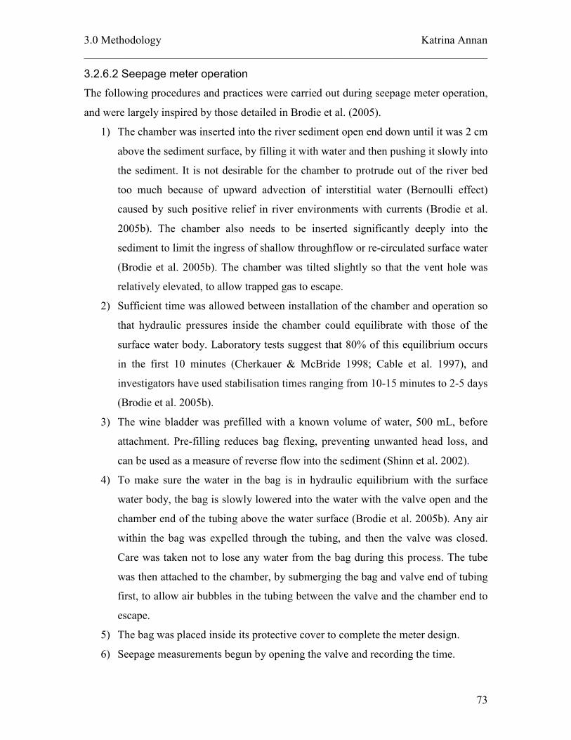
3.0 Methodology Katrina Annan
________________________________________________________________________
73
3.2.6.2 Seepage meter operation
The following procedures and practices were carried out during seepage meter operation,
and were largely inspired by those detailed in Brodie et al. (2005).
1) The chamber was inserted into the river sediment open end down until it was 2 cm
above the sediment surface, by filling it with water and then pushing it slowly into
the sediment. It is not desirable for the chamber to protrude out of the river bed
too much because of upward advection of interstitial water (Bernoulli effect)
caused by such positive relief in river environments with currents (Brodie et al.
2005b). The chamber also needs to be inserted significantly deeply into the
sediment to limit the ingress of shallow throughflow or re-circulated surface water
(Brodie et al. 2005b). The chamber was tilted slightly so that the vent hole was
relatively elevated, to allow trapped gas to escape.
2) Sufficient time was allowed between installation of the chamber and operation so
that hydraulic pressures inside the chamber could equilibrate with those of the
surface water body. Laboratory tests suggest that 80% of this equilibrium occurs
in the first 10 minutes (Cherkauer & McBride 1998; Cable et al. 1997), and
investigators have used stabilisation times ranging from 10-15 minutes to 2-5 days
(Brodie et al. 2005b).
3) The wine bladder was prefilled with a known volume of water, 500 mL, before
attachment. Pre-filling reduces bag flexing, preventing unwanted head loss, and
can be used as a measure of reverse flow into the sediment (Shinn et al. 2002).
4) To make sure the water in the bag is in hydraulic equilibrium with the surface
water body, the bag is slowly lowered into the water with the valve open and the
chamber end of the tubing above the water surface (Brodie et al. 2005b). Any air
within the bag was expelled through the tubing, and then the valve was closed.
Care was taken not to lose any water from the bag during this process. The tube
was then attached to the chamber, by submerging the bag and valve end of tubing
first, to allow air bubbles in the tubing between the valve and the chamber end to
escape.
5) The bag was placed inside its protective cover to complete the meter design.
6) Seepage measurements begun by opening the valve and recording the time.

3.0 Methodology Katrina Annan
________________________________________________________________________
74
7) After a period of time the seepage measurement was ended by returning to the
meter, turning the valve closed and recording the time. The total duration of the
test is based on local seepage regime and can vary from less than an hour to
several days (Brodie et al. 2005b).
8) The bag was removed from the chamber via the tubing and the volume of water in
the bag was measured on site with a 5L measuring bucket.
Seepage flux (Q) can then be calculated by:
tA
VVQ of )( −=
where Vo is the initial volume of water in the bag,
Vf is the final volume of water in the bag,
t is the time elapsed between when the bag was connected and disconnected, and
A is the plan area of the chamber
Seepage meters were employed in study reach one (Cross Farm) during June and in study
reach two (Sandalwood) during June and September. The original seepage meter design
trialled in June (design 1) differed from the one described above (design 3). While based
on the same foundation by Lee (1977), only one outlet from the drum, the top outlet, was
present in design 1. The single outlet was used for tubing attached directly to a GLAD-
lock plastic freezer bag, the collection bag in this design, selected originally for its
flexible design and recommendation by Lee and Cherry (1979). Connection between the
bag and tubing was made with duct tape, and did not involve the use of tap values or
fittings to ensure an air tight seal (Figure 32b). An open length of PVC piping was again
used to house the collection bag. The preliminary design is shown in Figure 30a. Meters
borrowed from CSIRO were also trialed (design 2), which were similar in design to
design 1 yet lighter as the drum was made of plastic (Figure 33).

3.0 Methodology Katrina Annan
________________________________________________________________________
75
Figure 32. Seepage meter design 1 (a) and its collection bag attachment to the tubing (b)
Figure 33. Seepage meter design 2 (CSIRO)
Table 5 shows the dates and design type of seepage measurement trials conducted.
Original seepage meters placed at Cross Farm during the June trial were vandalised,
producing no results. To avoid further damage seepage measurements were not carried
out at this site again.
Table 5. Dates and design type used in seepage meter trials
Dates of seepage
measurements
Cross Farm Sandalwood
28/6/06-29/6/06 Design 1
VANDALISED
Design 1
20/9/06-25/9/06 n/a Design 2 and
Design 3
25/9/06-26/9/06 n/a Design 2 and
Design 3
26/9/06-9/10/06 n/a Design 3

3.0 Methodology Katrina Annan
________________________________________________________________________
76
3.2.7 Field Observations
A field reconnaissance survey was carried out in late February 2006 to identify locations
showing signs of groundwater discharge. Visual indicators of groundwater discharge that
were searched for in the field included:
• Seepages and springs
• River pools in baseflow conditions
• Reaches were flow has ceased
• Reaches were flow is continuous, and
• Changes in water composition, colour and odour
There are tell tale signs to look for when locating springs (Brassington 1998). Springs can
be noted on a landscape by a change in colour at their location compared to the rest of the
field. Rushes and sedges which grow in wet places are often a darker green than the grass
covering the rest of the field (Brassington 1998). Clumps of sedges and rushes seen at
intervals can indicate the spring line (Figure 34).
Figure 34. Detecting a spring line in the field (Brassington 1998)
Formation of river pools and maintenance of pool levels outside the wet season are an
indication of areas where the stream is groundwater fed, with potentially gaining
conditions. Reaches where flow is continuous throughout the year also suggests gaining

3.0 Methodology Katrina Annan
________________________________________________________________________
77
conditions, as the stream does not dry up with the season. Conversely, reaches where
flow has ceased may indicate losing conditions.
Water colour and odour can be an indicator of groundwater discharge, particularly if the
groundwater is contaminated, which may be the case in catchments with urban, industrial,
mining or intensive agricultural development (Brodie et al. 2006). For example, discharge
of highly acidic groundwater can be indicated by a dramatic increase in the clarity of the
surface water, due to the flocculating of clay particles by elevated levels of dissolved
aluminum (Brodie et al. 2006).
Field observations were not restricted to the original reconnaissance survey and were
continued in conjunction with other field work and site visits. A Garmin III global
positioning system (GPS) was used to record the location of any field observations for
later identification on digital maps.

4.0 Results and Findings Katrina Annan
78
4.0 Results and Findings
This section displays the major results of each technique and includes a comparison of
their spatial scale, results, and suitability to the Brunswick River environment.
4.1 Results of each technique
4.1.1 Connectivity Mapping
Information from groundwater level analysis during the groundwater level assessment in
June 2006, as well as levels collected in September have been tabulated in Appendix C.
The results from hydrogeological investigations to determine connection along the river,
including river bed and groundwater level assessment, and the interpretation of
underlying geology have been combined into a hydrogeological cross section of the river.
River bed and groundwater elevations
The cross section shows the elevation of the water table compared to elevation of the
river bed along the river from its confluence with the Collie River to its most upstream
point in the State Forest. Based on the difference between these elevations the cross
section can indicate the presence of gaining and losing reaches, which will be further
discussed in section 5.3 (Significance of results for connectivity along the Brunswick
River). From the difference in these elevations a map showing connectivity along the
river has been developed (Figure 34).

4.0 Results and Findings Katrina Annan
79
Figure 34. Gaining and losing reaches of the Brunswick River (K.Annan 2006)

4.0 Results and Findings Katrina Annan
80
Underlying geological structure
The geological structure underlying the Brunswick River in the lower catchment (east of
the Darling fault line) is vastly different from that underlying the river in the upper
catchment. Quaternary deposits and superficial formations consisting of Tamala
Limestone, clay and sand members of the Guildford formation and Bassendean sands
make up the underlying structure in the lower catchment. Older, Archaean age,
formations underlie the river in the upper catchment, with the variable presence of
colluvium valley fill deposits, containing varying amounts of laterite. Outcrops of
Cainozoic laterite were also indicated in the upper catchment by geological map sheets.
Consultation with other geological investigations revealed this pattern of geology is
common for the Darling Scarp, which is the name given to the surface expression of the
Darling Fault lying on the western edge of the Yilgarn Block, a plateau of stable,
Archaean crystalline rocks where linear belts of metamorphosed sedimentary and
volcanic rocks are invaded by large areas of granite (Briggs et al. 1980). Cainozoic
laterite covers the majority of the Darling Range and consists of a ferruginous or
aluminous layer generally 2 m thick overlying a pallid, kaolinitic zone (Briggs et al.
1980). The soils of the region are largely of granitic origin with laterites dominating those
of the ridges and slopes on the Darling Range (Churchward & McArthur 1980).

4.0 Results and Findings Katrina Annan
81
(Please see the cross section attached on separate .pdf ‘Brunswick River hydrogeological cross section’)
Figure 35. Hydrogeologcial cross section of the Brunswick River (K. Annan 2006)

4.0 Results and Findings Katrina Annan
82
This page was left intentionally blank

4.0 Results and Findings Katrina Annan
83
4.1.2 Baseflow Analysis
Results from base flow analysis and determination of the baseflow index (BFI) have been
summarised in Table 6. There is a decreasing trend in BFI downstream, from Sandalwood
(612022) with a BFI of 44% to Beela (612047) with a BFI of 39% to Cross Farm
(612032) with a BFI of 32%. For comparison across stations, analysis was conducted
over the coinciding periods of flow records for each station (10/5/2000 – 6/4/2006), and a
separate BFI was generated for each year. The BFI’s produced in 2006 were significantly
larger than any other year, because the flow record for 2006 only included data for the
first four months of the year (1/1/2006 to 6/4/2006), which represent baseflow conditions
and the stage where baseflow dominates the hydrograph. Since the following quickflow
period was not included in the BFI calculation for 2006 the results were biased towards
higher BFI’s. Therefore streamflow data for 2006 was not included in the overall
comparative calculation of BFI across each station. Consistent with this rationale of not
including partial yearly flow data, data from the year 2000 was also disregarded when
comparing the BFI at each station.
Table 6. Baseflow indices (BFI’s) for recorded streamflow data at the three streamflow gauging
stations (most upstream station (612022) to most downstream station (612032))
Year 612022 612047 612032
2000 48% 64% 39%
2001 57% 53% 38%
2002 45% 36% 35%
2003 42% 33% 31%
2004 41% 37% 30%
2005 45% 43% 31%
2006 72% 72% 66%
BFI from the complete
yearly coinciding record at
each station (2001 to 2005) 44% 39% 32%
The results show that baseflow contributions were greatest within the upper catchment,
with baseflow contribution to streamflow decreasing downstream. Trend analysis
comparing the fluctuation in annual BFI over the entire record of streamflow with annual
fluctuations in the minimum stream flow record at each site, showed there is a clear
correlation between the two series (Figure 36 - 38).

4.0 Results and Findings Katrina Annan
84
0%
10%
20%
30%
40%
50%
60%
70%
1975 1980 1985 1990 1995 2000 2005
Year
Baseflow Index (%)
0
0.05
0.1
0.15
0.2
0.25
0.3
0.35
0.4
0.45
0.5
Stream flow discharge (m3/s)
Baseflow Index (%) Minimum streamflow discharge (m3/s)
Figure 36. Annual BFI versus minimum annual stream flow at Sandalwood (612022)
0%
10%
20%
30%
40%
50%
60%
70%
1999 2000 2001 2002 2003 2004 2005
Year
Baseflow Index (%)
0
0.05
0.1
0.15
0.2
0.25
0.3
Stream flow discharge (m3/s)
Baseflow Index (%) Minimum streamflow discharge (m3/s)
Figure 37. Annual BFI versus minimum annual streamflow at Beela station (612047)

4.0 Results and Findings Katrina Annan
85
0%
5%
10%
15%
20%
25%
30%
35%
40%
45%
50%
1990 1995 2000 2005
Year
Baseflow Index (%)
0
0.2
0.4
0.6
0.8
1
1.2
1.4
1.6
1.8
2
Stream flow discharge (m3/s)
Baseflow Index (%) Minimum streamflow discharge (m3/s)
Figure 38. Annual BFI versus minimum annual streamflow at Cross Farm (612032)
Linear regression analysis quantified a strong correlation (r > 0.5) between BFI and
annual minimum flow at each station, as shown in Figure 39- 41. Equations of linear
regression trend lines and the coefficient of determination are displayed in Appendix C.

4.0 Results and Findings Katrina Annan
86
Annual minimum streamflow vs. Annual BFI
at Sandalwood (612022)
Correlation (r) = 0.537
0
0.02
0.04
0.06
0.08
0.1
0.12
0.14
0.16
0.18
0.2
0% 10% 20% 30% 40% 50% 60% 70%
BFI (%)
Streamflow (cms)
Figure 39. Linear regression showing the relationship between annual BFI and minimum stream flow
data, line of best fit and correlation coefficient at stream gauging site 612022
Annual minimum streamflow vs. Annual BFI
at Beela (612047)
Correlation (r) = 0.955
0
0.02
0.04
0.06
0.08
0.1
0.12
0.14
0.16
0% 10% 20% 30% 40% 50% 60% 70%
BFI (%)
Streamflow (cms)
Figure 40. Linear regression showing the relationship between annual BFI and minimum stream flow
data, line of best fit and correlation coefficient at stream gauging site 612047

4.0 Results and Findings Katrina Annan
87
Annual minimum streamflow vs. Annual BFI
at Cross Farm (612032)
Correlation (r) = 0.842
0
0.1
0.2
0.3
0.4
0.5
0.6
0.7
0.8
0.9
1
0% 10% 20% 30% 40% 50%
BFI (%)
Streamflow (cms)
Figure 41. Linear regression showing the relationship between annual BFI and minimum stream flow
data, line of best fit and correlation coefficient at stream gauging site 612032
The highest correlation occurred at Beela (612047) station. This is an interesting result
because Beela station is the most accurate of the three stations in recording daily
streamflow data.

4.0 Results and Findings Katrina Annan
88
4.1.3 Temperature Survey
Stream bed and river bed temperature variations over the effective monitoring period
were plotted against one another to analyse the temperature signal patterns at study reach
one; Cross Farm (Figure 42) and study reach two; Sandalwood (Figure 43). Stream
surface temperature signals at Cross Farm during June 2006 show a typical diurnal
variation in temperature, in the range 11.6ºC to 14.2ºC. The sediment temperature signal
is not constant and varies over the range 13.9 ºC to 14.1 ºC over the monitoring period.
When compared to the pattern of variation in stream temperature, sediment temperature
has an approximate lag time of 3-5 hours. Average shallow groundwater temperature
measured in this region was 17.5 ºC. The pattern shown here suggests sediment
temperature is not influenced by groundwater temperature, because it is not constant over
the monitoring period and rather it is influenced by surface temperature, as it shows a
slight fluctuation over time and sediment temperature values are within the range of
surface temperature values. This pattern suggests a downward rather than upward
seepage of water across the stream bed and thus represents a losing condition.
11
12
13
14
15
16
17
18
27/06/06 28/06/06 29/06/06 30/06/06 1/07/06
Temperature (degrees C)
Surface temperature Sediment temperature Groundwater temperature
Figure 42. Losing temperature signal at study reach one: Cross Farm

4.0 Results and Findings Katrina Annan
89
Temperature monitoring during September 2006 at Sandalwood showed the characteristic
diurnal surface variation signal, with values ranging between 12.1 ºC and 14.8 ºC.
However, unlike Cross Farm, no variation at all was recorded in the sediment profile, and
it remained at a constant value of 14.7ºC during the monitoring period. Local
groundwater temperature in this upstream reach is assumed the same as near Cross Farm,
due to constant temporal and spatial properties of groundwater temperature. The fact that
no variation in the sediment temperature profile occurred during the period, suggests that
sediment temperatures are not influenced by stream water and are rather controlled by
groundwater influences. Therefore, gaining conditions are experienced at this reach.
11
12
13
14
15
16
17
18
22/09/06 23/09/06 24/09/06 25/09/06 26/09/06 27/09/06
Temperature (degrees C)
Surface temperature Sediment temperature Groundwater temperature
Figure 43. Gaining temperature signal at study reach two: Sandalwood

4.0 Results and Findings Katrina Annan
90
4.1.4 Salinity Survey
All salinity measurements taken at each study site are shown in Appendix B. The average
of the three measurements at each site is displayed in the graph below.
0
500
1000
1500
2000
2500
0 10 20 30 40 50 60
Distance along river from confluence with the Collie (km)
Conductivity (uS/cm)
February measurements June measurements
Figure 44. Salinity readings measured at sites along the Brunswick River during February and June
Groundwater salinities measured at 8 locations, including 7 bores and 1 spring,
throughout the catchment during June 2006 showed a large variation in conductivity,
ranging from 250µS/cm to 1735µS/cm (Table 7). Four of these 8 sites were measured in
September 2006 and the range in salinities was still variable from 321µS/cm to 890µS/m.
Some sites gave similar readings to their June recordings, such as B8 from 884µS/cm in
June to 890µS/cm in September, while others changed considerably over the three
months; B16 decreased in salinity by more than half from June (1735µS/cm) to
September (627µS/cm). Due to the inconsistent readings of groundwater salinity
throughout the catchment it was difficult to determine an overall value for local
groundwater salinity. Therefore any changes in stream salinity could not be matched with
groundwater seepage.

4.0 Results and Findings Katrina Annan
91
Table 7. Variations in groundwater salinities measured at bore sites and a spring in the Brunswick
catchment during June and September 2006
Site for groundwater
salinity measurement
June 2006
September 2006
B11 349µS/cm -
B14 534µS/cm -
B15 250µS/cm 321 µS/cm
B16 1735µS/cm 627 µS/cm
B9 508 µS/cm -
B10 537 µS/cm -
B8 884 µS/cm 890 µS/cm
S1 585 µS/cm 385 µS/cm
4.1.5 Water Budgets
Results from water budgeting based on measurements of inputs and outputs in the study
reaches are tabulated below (Table 8). For location of study reaches and discharge
measurement sites please refer back to Figure 29 in Section 3.2.5 (Water Budget
Methodology).
Table 8. Water budgeting results for study reach one (Cross Farm) on the 29
th of June
Component Measured at Discharge (L/s) Error
Flow at the start of the reach: Site 1.1 322 (+/- 4%)
Inputs:
Tributary inflow from Wellesley river Site 1.2 43 (+/- 8%)
Rainfall Brunswick Post Office n/a n/a
Runoff - n/a n/a
Outputs:
Evaporation Harvey BOM site n/a n/a
Abstraction from water users water user survey n/a n/a
Balance of inputs and outputs + 43
Estimated flow at end of the reach 365
Measured flow at end of reach Site 1.3 450 (+-10%)
Unaccounted difference 85
At study reach one (Cross Farm) no rainfall, negligible evaporation and no abstraction
from water users occurred during the period of water budgeting. Initial budgeting
suggests there is an additional 85L/s entering stream flow along the reach. When
considering the errors involved with gauging station and discharge measurements, the
difference could reduce to 25L/s (calculated by taking the upper error bound of discharge

4.0 Results and Findings Katrina Annan
92
for inflows and flow at the start of the reach, and subtracting the lower error bound of
discharge for flow at the end of the reach). Conversely, by taking the lower error bound
of discharge for inflows and the upper error bound of discharge for flow at the end of the
reach, the unaccounted difference could be as much as 147L/s. Overall, this balance
suggests the study area is gaining water along its reach.
Table 9. Water budgeting results for study reach two (Sandalwood) on the 26th September 2006
Component Measured at Discharge (L/s) Error
Flow at the start of the reach Site 2.1 433 (+/- 8%)
Inputs:
Tributary inflow from Lunenburgh river Site 2.2 209 (+/- 4%)
Rainfall Brunswick post office n/a n/a
Runoff - n/a n/a
Outputs:
Evaporation Harvey BOM site n/a n/a
Abstraction from water users Water user survey n/a n/a
Balance of inputs and outputs +209
Estimated flow at end of reach 642
Measured flow at end of reach Site 2.3 1060 (+/- 8%)
Unaccounted difference 418
At study reach two (Sandalwood) no rainfall, negligible evaporation and no abstraction
from water users occurred during the period of water budgeting. Initial budgeting
suggests there is an additional 415L/s entering stream flow along the reach. When
considering the errors involved with gauging station and discharge measurements, in a
similar fashion to that at study reach one, the unaccounted difference could reduce to
290L/s or could be as much as 540 L/s. This balance suggests there is a strong positive
flux of seepage occurring in this area, and thus a gaining reach.

4.0 Results and Findings Katrina Annan
93
4.1.6 Seepage Meters
Results from all seepage meter trials at study reach two have been tabulated below (Table
10). As discussed earlier, no results were produced for study reach one (Cross Farm) due
to vandalism. Calculations of seepage flux have been included in Appendix C.
Table 10. Seepage meter trial periods, design type and results
Date and time of
measurement
period
Trial Design
Type
Diameter
(m)
Plan Area
(m2)
(2rA π= )
Test
duration
(days)
Difference
(mL)
Seepage flux
(L/d/m2)
28/6/06 12.30pm-
29/6/06 11.30am
A 1 0.56 0.2463 0.958 270 1.14
B 2 0.57 0.255 5.22 No change n/a 20/9/06 11.30am-
25/9/06 4.45pm
C 3 0.56 0.2463 5.22 1365 1.06
D 2 0.57 0.2463 0.67 No change n/a 25/9/06 5.15pm -
26/10/06 9.15am
E 3 0.56 0.2463 0.67 160 0.97
26/9/06 9.30am-
9/10/06 12.30pm
F 3 0.56 0.2463 13.125 2850 0.87
No results were collected with design two, due to a restrictive hydraulic gradient that the
design presents, where water needs to flow upwards against gravity before it can reach
the bag. A great proportion of the 270mL collected during trial 6, is thought to be
influenced more by installation errors than actual seepage flux. While the bag was
already intact, the chamber was shifted further into the river bed and this is thought to
have created a pressure within the chamber strong enough to exert water into the
collection bag. Due to different design set ups, it is good practice to compare results from
the same design only. All trials from design three (C, E and F) show that the reach is
receiving a low positive gaining flux ranging between 0.88 – 1.06 L/d/m2.
Investigators have incorporated a meter correction factor to the calculation of seepage
rates, taking account of the measurement error due to frictional resistance and head losses

4.0 Results and Findings Katrina Annan
94
within the meter. Laboratory testing indicated a ratio of measured to actual seepage of
0.77 (Belanger & Montgomery 1992). However, such correction factors would be unique
to a particular seepage meter and would require calibration in a laboratory flume (Brodie
et al. 2005b). Such calibration did not occur in this study and thus the results can not be
used to give a quantified indication of seepage flux. Instead, results are limited to a
qualitative assessment, showing an overall positive seepage flux occurring in the reach.
Successive trials with seepage meter design 3 produced results in a similar range, which
suggests the meter is suitable for the Brunswick River environment and has the potential
to produce more quantitative data.
4.1.7 Field Observations
Several visual indicators suggesting groundwater-surface water interaction were located
in the field. The exact location of these indicators can be viewed in Figure 45 and a
corresponding table of the observations and a description of what they imply, in terms of
groundwater-surface water interaction, have been tabulated (Table 11). Supporting
photographs for several of the observations are also displayed (Figure 46 to Figure 52).
Figure 45. Location of field observations (K.Annan 2006)

4.0 Results and Findings Katrina Annan
95
Table 11. Visual indicates of groundwater-surface water interaction located in the field
Visual
Indicator
Observation
Implication
1
Inundation: river looks
swampy and is heavily
inundated
Indicating completely saturated underlying
aquifer and a high water table
2
Very murky water
immediately after a rainfall
event
Contribution from overland run off
3
Spring and spring line
(Figure 46)
Upwelling of groundwater to the surface
through preferential flow paths.
4
Spring (Figure 47)
Upwelling of groundwater to the surface
through preferential flow paths.
5
Dolerite outcrop
(Figure 48)
Presence of dolerite formations in the
catchment
6
Natural fill dam (Figure 49)
Natural fill dam above the elevation of the
river. Indicates strong contribution from
water stored in banks and a high
potentiometric head of groundwater in the
area, relative to the river bed
7
Seepage running down the
hillside (Figure 52)
Contribution from groundwater to the
stream via over hill side seepage
8
Iron flocculation
(Figure 51)
Groundwater discharge from underlying
geological structure brings water to the
stream that has leached through laterite
containing iron stone
9
Seepage coming directly
out of the bank and into the
river (Figure 50)
Contribution from groundwater to the
stream via over bank flow

4.0 Results and Findings Katrina Annan
96
Figure 46. Following a spring line along the hillslope (a), start of the spring noted by clumps of rushes
and green patches of land, and by a small outcrop of rocks (b), continuation of the spring line (c) to a
well which utilises water from the spring. Note the location of the river in the background at the
bottom of the hillslope noted by cluster of trees.
Figure 47. Spring line, indicated by clumps of rushes and also the presence of water troughs used to
store water as it passes over the landscape
N
N
River
b
c
d
a

4.0 Results and Findings Katrina Annan
97
Figure 48. Geological indicator of dolerite outcrop
Figure 49. Natural fill dam at an elevation higher than the river base
Figure 50. Bank seepage: flow coming directly from the river bank into the river

4.0 Results and Findings Katrina Annan
98
Figure 51. Iron flocculation, occurring at the edge of the river bank

4.0 Results and Findings Katrina Annan
99
Figure 52. Seepage occurring along the hillslope (a), seepage streaming over exposed clay material
(b), seepage running onto the road (c) and further down its path seepage following lower elevations to
the river (d). Note the blue arrow indicating the location of the river.
a) b)
d)
N N
N
River c)

4.0 Results and Findings Katrina Annan
100
4.2 Comparison of results at each study reach
Table 12. Comparison of techniques based on scale, results and suitability to the Brunswick River
Results at Study
Reach
Technique
Spatial
Scale
One Two
Suitable for
Brunswick
River
environment
Connectivity
mapping
Intermediate
to regional
Gaining
and
losing
Gaining Yes
Baseflow
analysis
Intermediate Gaining Gaining Yes
Temperature
survey
Local Losing Gaining Yes
Salinity
survey
Intermediate n/a n/a No
Water
budgeting
Local Gaining Gaining Yes
Seepage
measurements
Local n/a Gaining Yes
Field
observations
Intermediate
to regional
n/a n/a Yes

5.0 Discussion Katrina Annan
101
5.0 Discussion
5.1 Significance of results at each study reach
Study Reach One (Cross Farm)
The area shows signs of gaining (in the part of the river overlying Bassendean sands) and
losing (in the part of the river overlying Tamala Limestone). Overall water budgeting
indicated the reach was gaining up to 85L/s along its reach. Temperature surveys and
connectivity mapping suggest the reach is losing in its lower boundary. Baseflow analysis
showed that this section of the river has a BFI of 32%, which shows a fair contribution
from baseflow (Brodie pers. comm. 2006). However, in comparison across sites baseflow
analysis shows that Cross Farm receives a decreasing amount of baseflow contribution
than sites further upstream. This is in agreement with connectivity mapping which shows
a gaining to losing trend from Sandalwood to Cross Farm.
Study Reach Two (Sandalwood)
All the techniques utilised within this reach, apart from the inconclusive results from the
salinity survey, show signs of gaining. Water budgeting suggests the reach is gaining up
to 540L/s within the reach. Temperature survey, seepage meters, connectivity mapping
and baseflow analysis also suggest gaining conditions at this reach. This is a reasonable
result because it is common for upper catchments to act as a collection source for water
from their surrounding environment and gain stream flow volume for discharge further
downstream.

5.0 Discussion Katrina Annan
102
5.2 Significance of results for connectivity along the Brunswick
River
Overall results show that the Brunswick River is strongly connected with the underlying
aquifer along its entire length. A discussion of connectivity along the river will follow
(from upstream to downstream) and should be read in conjunction with Figure 35, the
Hydrogeological Cross Section presented in Section 4.1.1 (from right to left).
Start of the river to Sandalwood:
This section can be classified as slowly gaining, which is common for upper catchment
reaches in the Darling Scarp (Commander 1988). It receives a gaining contribution from
groundwater as indicated by the higher piezometric pressure head compared to river bed
elevation in the area and large amount of hillside and bank side seepage, as visually
indicated through field observations. The underlying geological structure has the
potential to create preferential flow paths and outward expressions of groundwater, which
can explain the path of seepages along the hillside and points where direct bankside
seepage occurs.
Sandalwood to Beela:
This reach continues to show a gaining system. The reach is specifically classified as
strongly gaining, due to results from baseflow separation, water balance and seepage
meters. Whilst temperature loggers showed gaining within this reach, and defined the
direction of seepage flux, they were not able to quantify the magnitude of flux.
Beela station to the Tamala Limstone/Guildford Formation geological boundary
Overall this reach is gaining steadily down stream, as shown by the higher elevation of
groundwater piezometric head compared to river bed elevation. The presence of a gaining
system within this reach was also noted by field observations showing visual indications
of seepages and springs flowing towards the river. Piezometric head values were
interpreted from current bore measurements and the bores used for analysis along this

5.0 Discussion Katrina Annan
103
section were the closest to the river available. There is more certainty in piezometric head
levels within this reach, with less error in projection expected and therefore a higher level
of confidence in results for this reach can be assumed.
Tamala limestone/Guildford formation geological boundary to approximately 1.3km
upstream of Paris Road crossing
At the start of this reach the river becomes a losing system, caused by a drop in
groundwater elevation at the geological boundary between the Guildford sands and
Tamala limestone. This drop in water table is common and can always be expected when
these two geological formations meet (Commander 1988). The temperature surveys
within this reach also showed losing conditions.
1.3km upstream from Paris Road crossing to the Confluence with the Collie
This reach is gaining, as shown by the higher elevation of groundwater (piezometric
head) in the area compared to river bed elevation. Gaining within this section of the river
has also been indicated by field observations such as heavy inundation in the area.
Gaining conditions are common at the intersection of two major rivers. The Brunswick
River meets another major river, the Collie River, within this section. It is also expected
that within this section of the river, groundwater levels and ultimately surface water
levels would be impacted by tidal fluctuations from the Leschenault Inlet (Pearcey pers.
comm. 2006b).

5.0 Discussion Katrina Annan
104
5.3 Limitations of methodology
This sub-section will outline the major limitations associated with the application of each
technique to the Brunswick River environment, in terms of the results they produced. It
will also discuss the major limitations of the Brunswick River environment for the
application of techniques.
5.3.1 Limitations of Techniques
Connectivity mapping: Relies on the projection of groundwater levels onto the stream,
assuming that the elevation where the bore is measured and the elevation of the point on
the stream where the data is projected are the same. This is not always true, especially
further upstream. However this technique can be useful for comparison along the river
reach, when the assumptions are kept constant.
Baseflow analysis: BFI’s recorded during some years showed a clear jump in BFI from
Sandalwood (612022) to Beela (612047), which is likely to be due to the presence of a
storage reservoir, Beela Dam, between the two sites. Inflow into the reservoir is often less
than outflow, which may influence the low flow signal subsequently recorded at 612047.
Salinity survey: Variability in groundwater salinities restricted the use of this method to
the Brunswick River environment. Variability in groundwater salinity is higher during the
irrigation season, which is considered to be due to irrigation run off seeping through the
ground and infiltrating to groundwater stores.
Temperature survey: Restricted in showing the direction of seepage flux, and can not be
used to quantify the magnitude of seepage flux. Temperature surveys could show gaining
or losing conditions, but not the presence of neutral conditions.
Water budgeting: The method relies on the accurate measurement of surface water flow,
as well as appropriately accounting for all other gains and losses evident for the reach.
The uncertainties associated with the flow measurements and estimates for water balance

5.0 Discussion Katrina Annan
105
components such as unmetered extraction, evaporation, ungauged tributary flows,
overbank flooding losses and flood return flows can often exceed the magnitude of the
seepage flux being estimated. This project used different techniques, associated with
different error bounds, to measure streamflows, which influence the effectiveness of
comparing measurements across sites.
Seepage measurements: During the project seepage meter designs kept evolving, so that
accurate comparisons between sites and across time using the same seepage meter design
were not made. When the same designs were comparable (ie. between trials C, E and F),
they were employed at different duration times, and so again could not effectively be
compared.
Field observations: no limitation of this technique occurred during this project.
5.3.2 Timescale limitations of techniques characterising connectivity
It is recognised that there are many configurations of exchange flow between surface
water and groundwater. A reach can not simply be defined as gaining because it could
lose during another season. Direct observation and measurement of groundwater
processes is hindered by the differing timescales associated with the movement of water
in the landscape. The movement of water above ground can be quite rapid in response to
rainfall events. However, the movement of water beneath the land surface can be sluggish
and more difficult to predict. (BRS 2006).
5.3.3 Site Specific limitations
The main factors affect the application of these techniques to the Brunswick River
environment:
1) Brunswick River is heavily irrigated in the lower catchment during the irrigation
season, typically October to April. Therefore flows volumes and water quality are
seasonally affected by irrigation run off and,
2) Public access at important field study sites, for example Cross Farm, is very high,
which promotes the likely hood and in the case of this research, the occurrence of
vandalism.

5.0 Discussion Katrina Annan
106
5.4 Comparison of Techniques
This sub-section will include a discussion on the comparison between techniques, their
spatial scale, results, suitability to the Brunswick River, universally suitable conditions,
and best use practices and recommendations for their use. The advantages and
disadvantages of each technique, based on findings and experience from this study and
others, will also be addressed.
A note on costs: This study did not consider the specific costs of each technique, as they
will vary between regions. However, it is recognised that costs are a major consideration
of the suitability of a technique. Despite capital costs incurred when purchasing
equipment, such as the temperature loggers, costs for all techniques were relatively
minimal and therefore can be widely applied in a lot of regions.
5.4.1 Overall suitable conditions and recommended application of each technique
Suitable environmental conditions and best use practice recommendations for each
technique have been summarised in Table 13.

5.0 Discussion Katrina Annan
107
Table 13. Suitability and application of techniques in the broader context
Technique Suitable environmental conditions Best-use practice recommendations
Connectivity
mapping
Where there is a measurable difference between
groundwater and river bed elevation, and a
knowledge of underlying geological structure is
available.
Important to have a good understanding of the underlying
geological structure, which may influence the direction of
groundwater flow paths
Baseflow analysis In rivers which are perennial and are not
regulated, and where the historical record of
streamflow is available.
Coinciding periods of streamflow data should be used when
comparing baseflow contributions between different sites.
Temperature survey In conditions where there is a significant
difference in surface water and groundwater
temperatures.
To be used in conjunction with a knowledge of nearby
piezometric pressure head information. This can be achieved
by setting up a transect of mini-piezometers along the stream
if bores directly adjacent to the stream do not exist.
Salinity survey
Where there is a significant difference between
groundwater and stream salinities, such that the
input of groundwater into the stream can be
detected.
Take salinity measurements in a section of the river which is
flowing to give an accurate reading and take the average of
three or more samples as the final reading. Conduct
measurements in the direction from the most upstream point
to the most downstream point.

5.0 Discussion Katrina Annan
108
Technique Suitable environmental conditions Best-use practice recommendations
Water budgeting
Suitable in any river environment, as long as it
is possible to measure all of the input and
output components of the water balance (either
remotely or on site). It is best applied in low
flow conditions (which is summer for south
west WA, but differs for northern parts of the
state and country).
It is widely recognised that runoff and baseflow contributions
are the most difficult to measure components of the water
balance over a given time interval (Wittenberg & Sivapalan
1999). Therefore best use practices involve avoiding water
budgeting periods when rainfall is forecasted and to wait for
a sufficient amount of time to pass after a rainfall event (at
least 3 days) before water budgeting begins. This is to allow
time for runoff or delayed baseflow response from a rainfall
event to pass into the stream before measurements. Flow
measurements are best taken upstream to downstream in a
‘snap shot’ fashion, where the path of streamflow is followed
downstream. It is very important to take into account
measurement errors associated with each of the water balance
components when calculating final budgets.

5.0 Discussion Katrina Annan
109
Technique Suitable environmental conditions Best-use practice recommendations
Seepage meters Most suitable in environments with slow
moving water (less than 6m/s is recommended
(ANCID 2000)) and limited surface water
fluctuations from waves, currents or fast
moving streamflow which can cause a
reduction in hydraulic head in the collection
bag and induce a false upward groundwater
seepage under gaining conditions. Found to
be more suitable in sandy geological profiles,
rather than basement rock or clay areas, in
terms of ability to push the chamber into the
river bed.
Best practice involves giving the meter time to settle and
adjust to equilibrium after installation. Settling times ranging
between 1 hour to 6 days were used for in this study. An
overnight settling period is recommended by this study.
However, it has been shown that 80% of equilibrium can
occur in the first 10 minutes (Cherkauer & McBride 1998). It
is recommended that an air ventilation tube is always used in
seepage meter design, regardless of underlying soil
conditions.
Field observations Useful in all conditions and environmental
settings. However, this is only the case if the
observer is familiar with visual indicators of
groundwater-surface water interaction and their
implications.
It is recommended that detailed notes of the observation be
made (including GPS location coordinates, photos and an in
field). Where possible, the observation should be repeated
during any successive field work to see whether there is any
variation over time.

5.0 Discussion Katrina Annan
110
5.4.2 Advantages and Disadvantages
Table 14. Advantages and disadvantages associated with each technique
Technique Advantages Disadvantages
Connectivity
mapping
Provides an understanding of the overall
hydrogeology of the river system, which is
critical in defining connectivity between
streams and aquifers (BRS 2006).
Hydrogeological mapping is an important part
of developing a conceptual model showing the
broader perspective of the nature and
configuration of groundwater systems, the scale
and direction of groundwater flow,
geomorphological features and the hydraulic
properties of aquifers.
Compiling and interpreting hydrogeological data was
time consuming and complex. It involved interpolation
of limited data from a sparse network of bores, and
therefore is subject to misinterpretation (BRS 2006).
Baseflow analysis Readily available input data, as it relies on
stream flow data that is commonly collected
and publicly available.
Only applicable to gaining stream conditions. Baseflow
is assumed to be entirely groundwater discharge which
may not always be valid. The method cannot be applied
in rivers that are regulated or have significant diversions
or extractions, or have large natural.

5.0 Discussion Katrina Annan
111
Technique Advantages Disadvantages
Temperature survey Temperature is a natural environmental tracer,
therefore the signals arrive easily and are
immediately available for interpretation.
Submersible temperature logging devices are
robust, simple, relatively inexpensive and
available for various scales of measurement.
Interpretation of the temperature data can be ambiguous
when viewed in isolation. Several potential operational
issues that could effect temperature signals have been
highlighted (BRS 2006); including timing the monitoring
to coincide with reasonable diurnal variations of stream
temperature, the requirement of understanding the
shallow stratigraphy of the stream bed, and separating
out localised effects (such as from weirs).
Salinity survey An environmental tracer that is readily
measured in the field and does not require
sample collection for laboratory analysis. Has
been shown to be a valuable tool in developing
a conceptual understanding of groundwater
flow near a stream and useful in providing
information on groundwater evolution,
residence times or mixing ratios that would
otherwise be difficult to determine.
Relies on a significant difference between groundwater
and stream salinities. And also relies that there is no
spatial variability in groundwater salinities throughout
the catchment, in order to guarantee a single local
groundwater salinity value. Limitation only good for
identifying gaining conditions, trying to interpret the loss
of groundwater from the system with this method is
rather ambiguous (BRS 2006).

5.0 Discussion Katrina Annan
112
Technique Advantages Disadvantages
Water budgeting Simple and based on data that is commonly
collected and publicly available. Temporal and
spatial changes in seepage flux can be
estimated.
The method relies on the accurate measurement of
surface water flows, rainfall, evaporation and other gains
and losses evident for the reach. A lot of measurement
error is associated with flow measurements and estimates
of the water budget components. Measurement errors can
exceed the magnitude of the seepage flux, particularly for
relatively short reaches. Therefore seepage estimates can
be misleading.
Seepage meters Simple and cheap design, which can be
adjusted to suit particular environmental
conditions.
Only measures flux at a single point in space, and require
that many measurements occur to derive meaningful
interpolations, which is labour intensive and time
consuming. High spatial and temporal variability in
seepage characteristics can result in poor repeatability of
measurements
Field observations Readily incorporated into field work Relies on the observers knowledge of groundwater-
surface water visual indications and their implications

5.0 Discussion Katrina Annan
113
5.5 Consideration of connectivity for water management and
implications of Dam construction
The major difference between a hydraulically connected and disconnected system in
terms of water management, is that changes in water table influence the rate at which
surface water gains water from or loses water to the aquifer in a connected system.
Whereas activities causing water table adjustments, such as pumping shallow
groundwater near the stream or reservoir development, do not affect the flow of the
stream in a disconnected system (Winter et al. 1998). The Brunswick River is a highly
connected system, and therefore any alterations to its storage regime upstream will be felt
downstream, effecting downstream flows and the presence of any groundwater dependent
ecosystems.
A new dam on the Brunswick River, with the capacity to supply up to 30 GL a year to the
Western Australia’s integrated water supply scheme (IWSS), is being considered (Water
Corporation 2005). Although the slightly gaining conditions of the upper reach may be
considered ideal for reservoir development, due to the natural fill of the reservoir, it will
still act as a storage barrier and restrict flows downstream
The construction and operation of a reservoir can have a substantial effect on the stability
of the river or stream channel downstream from a dam (Juracek 2000). Primary changes
introduced by a dam include a reduction in the river's sediment load and an alteration of
the flow regime (Juracek 2000). Typical changes in the flow regime include a reduction
in the magnitude of peak flows and a possible increase in the magnitude of low flows
(Williams & Wolman 1984). Such artificially introduced changes may trigger an
adjustment by the river as it attempts to re-establish equilibrium (Leopold & Maddock
1953). Channel adjustments through width, depth and gradient changes, may be achieved
in several ways, including channel degradation, aggradation or changes in channel pattern
and shape.
In general, rivers downstream from dams initially adjust by channel degradation,
enhancing river scouring and lowering the river bed levels. Typically, channel

5.0 Discussion Katrina Annan
114
degradation begins near the dam and eventually migrates a considerable distance
downstream (Juracek 2000). Although Williams and Wolman (1984) stated that most
channel changes occur during the first 5 or 10 years after dam construction, others have
speculated that the complete adjustment of a channel may require 100 years or more
(Andrews 1986; Knighton 1984).
From this discussion it is clear that reservoir construction will effect the current state of
the river, and has the potential to influence connectivity at reaches along the river. In
addition to reservoirs, several other natural or human influenced factors may cause
changes in channel-bed elevation over time, including regional climate change (Juracek
2000).
5.6 Implications of future climate change for connectivity
Climate change and decreasing trends in rainfall throughout the southwest of Western
Australia over the next decade may influence connectivity along the Brunswick River.
Predicted climate changes will result in shortened hydrographs, with flow occurring only
at certain periods of the year and changing river classification from perennial to
ephemeral.
The overall contribution from baseflow will be less. Connected reaches may start to
become disconnected reaches, and gaining systems could turn into losing or neutral
systems. A loss in connectivity along the river will not only see a loss in stream flow in
the river, but the loss of groundwater dependent ecosystems can also be expected.

6.0 Conclusion Katrina Annan
115
6.0 Conclusion
Effective management of water requires an understanding of the components of the
hydrological cycle as well as the linkages between these components. One important
connection that has been traditionally overlooked in water resource management in
Australia is the interaction between surface water and groundwater resources.
This study discussed a broad range of techniques used currently and throughout history to
assess groundwater-surface water interactions between streams and aquifers. Seven of
these techniques were selected and used to investigate groundwater-surface water
interactions along the Brunswick River, including; connectivity mapping, baseflow
separation, temperature and salinity surveys, water budgeting, seepage meters and field
observations. These methods were originally selected for the spatial and temporal
variation they provide and because they offered a mix of field work and desktop studies.
Six of the seven techniques, excluding salinity surveys, were found to be suitable to the
Brunswick River environment. Connectivity mapping proved to be a successful technique
in mapping groundwater versus river bed elevations along the river to indicate gaining
and losing reaches, despite associated errors in projecting groundwater levels onto the
stream. Baseflow separation and the comparison of baseflow indices across different sites
in the river indicated a decreasing contribution from groundwater to streamflow
downstream. Temperature surveys, involved monitoring of stream and sediment
temperature patterns, and revealed a losing seepage flux at study site one (Cross Farm)
and a gaining seepage flux at study site two (Sandalwood). Water budgeting successfully
quantified the unaccounted difference along each study reach and seepage meters showed
study reach two was receiving a positive seepage flux. Field observations were helpful in
confirming results from other techniques, including the location of seepage and springs in
a connected and gaining reach. Salinity surveys proved inconclusive and unsuitable for
the Brunswick River environment.

6.0 Conclusion Katrina Annan
116
However, all techniques may be successfully applied in other river environments. Several
recommendations for best use practices and ideal conditions for their application were
outlined for each technique.
In general, the combined results of each technique show the Brunswick River is a highly
connected system. Unlike many other connected streams throughout Australia, the
Brunswick River is not over-allocated or highly regulated. Therefore, managers in this
region can take lessons learned from eastern Australian examples and begin managing the
system as a connected resource, before serious water issues such as over-allocation of the
water resource emerge.

7.0 Recommendations and Future Work Katrina Annan
117
7.0 Recommendations and Future Work
It is anticipated that future work along the Brunswick River will occur in two areas
including;
1) Studies involving environmental water requirements and determination of
groundwater dependent ecosystems; and,
2) Assessment of the upper catchment for reservoir development.
Information contained and results found within this study will be useful for both areas of
research as they require a detailed understanding of groundwater-surface water
interactions along the river. However, subsequent interaction assessment studies should
follow, because, whilst this study was successful in determining the spatial scale along
the Brunswick River, it was unable to determine the temporal scale of the river.
Assessment in this study occurred during high flow (winter) conditions. Therefore, it is
recommended that the techniques used in this study be applied during low flow (summer)
conditions to gain an understanding of the spatial extent of interactions along the river. It
is recommended that the same techniques, not including the salinity survey, be applied.
Best use recommendations, previously outlined in Section 5.4.1, should be taken into
account when applying these techniques.
While a dam on the Brunswick River has been labelled as a highly prospective water
source (Water Corporation 2005), it is anticipated that up to five years will be required to
complete regulatory approval processes. It is highly recommended that this approval
process involves an assessment of the temporal scale of groundwater-surface water
interactions. Before a decision can be made on the effect of reservoir development it is
recommended that a more detailed temporal assessment of connectivity occurs. It is
recommended that the techniques outlined and used in this survey be considered,
particularly water budgeting, temperature survey, connectivity mapping, baseflow
analysis and field observations because these are suitably applied in conjunction. A
salinity assessment in this upper reach is not recommended, as results have shown it to be

7.0 Recommendations and Future Work Katrina Annan
118
inconclusive. However the use of other environmental tracers, such as dissolved oxygen
and stable isotopes could work in this situation.
Several extensions to the techniques used within this study and the adoption of other
techniques, not specifically used in this study but introduced in the Literature Review, are
recommended for future studies, including;
• Establishing a network of mini-piezometers to be used in conjunction with other
techniques (namely temperature surveys and seepage meters). A network of mini-
piezometers will also assist the knowledge of groundwater levels within the area,
and can be monitored periodically to assess the temporal variation of connection.
• Temperature loggers could be placed in the stream for longer monitoring periods
(up to months) to provide information in seasonal changes in seepage flux.
• Extend seepage meters to more quantitative results, involving calculating the total
seepage flux across a section of the river by using a transect of seepage meters.
Also, in gaining conditions, water collected in the collection bag could be used for
chemical and physical analysis to assess the quality of incoming groundwater.
• Apply a groundwater flow model to help predict the movement of groundwater in
areas where there is little recorded groundwater information, particularly in the
upper catchment. The choice of model would be based upon available inputs for
data sources. Specific groundwater-surface water interaction models are currently
being designed to address these issues, and help assess connectivity (BRS 2006).
• Ecological indicator studies are recommended for any environmental water
requirement work, including the identification of groundwater dependent
ecosystems. The presence of unique aquatic habitats and fringing vegetation can
help indicate groundwater dependent ecosystems, particular during low flow
periods.
The Brunswick River is connected and should be managed accordingly.
Finally, it is recommended that the results from this research be added to the growing
database of connected water resources throughout Australia, and be included on the
managing connected surface water and groundwater resources website as a case study.

119
References
Alexander, M. D. & Caissie, D. 2003, 'Variability and comparison of hyporheic water
temperatures and seepage fluxes in a small Atlantic salmon stream', Ground
Water, vol. 41, pp. 72-82.
Andrews, E. D. 1986, 'Downstream effects of Flaming Gorge Reservoir on the Green
River', Geological Society of America Bulletin, pp. 1012-1023.
Barron, O. 2003, Investigation of groundwater/surface water interaction using surface
water thermal survey, CSIRO, Floreat Park, Western Australia.
Baskaran, S., Budd, K. L., Habermehl, R. & Carter, A. 2004, Groundwater-surface water
interactions in upper Lachlan valley: preliminary investigation using
hydrochemical and stable isotopes. in 9th Murray Darling Basin Groundwater
Workshop Bendigo, Victoria.
Baskaran, S., Brodie, R. S., Ransley, T. & Baker, P. 2005a, Time-Series Measurements of
Stream and Sediment Temperature for Understanding River-Groundwater
Interactions: Borders Rivers and Lower Richmond Catchments, Australia, B. o. R.
Sciences, Canberra.
Baskaran, S., Ransley, T., Brodie, R. S. & Baker, P. 2005b, Investigating Groundwater-
River Interactions Using Environmental Tracers, B. o. R. Sciences, Canberra.
Baskaran, S. 2006, Personal communication regarding temperature survey set up and
analysis of results, K. Annan, Canberra
Baxter, C., Hauer, R. F. & Woessner, W. W. 2003, 'Measuring groundwater-stream water
exchange: New techniques for installing mini-piezometers and estimating
hydraulic conductivity', Transactions of the American Fisheries Society, vol. 132,
pp. 493-502.
Belanger, T. & Montgomery, M. 1992, 'Seepage meter errors', Limnology and
Oceanography, vol. 37, no. 8, pp. 1787-1795.
Belanger, T. V. & Walker, R. B. 1990, 'Ground water seepage in the Indian River
Lagoon, Florida', in International Symposium on Tropical Hydrology and Fourth
Caribbean Islands Water Resources Congress, American Water Resources
Association. .
Bokunieicz, H. & Pavlik, B. 1990, 'Groundwater seepage along a barrier island',
Biogeochemistry, vol. 10, pp. 437-444.

120
Braaten, R. & Gates, G. 2001, Groundwater-surface water interaction in inland New
South Wales: a scoping study, Department of Land and Water Conservation,
Canberra.
Brassington, R. 1998, Field Hydrogeology, second edn, John Wiley & Sons, West
Sussex, England.
Briggs, E. R., Wilde, A. S. & Leech, E. J. 1980, 'Geology, Mineral Resources and
Hydrogeology of the Darling System, Western Australia', in Atlas of Natural
Resources, Darling System, Western Australia, Department of Conservation and
Environment, Perth, Western Australia.
Brodie, R., Baskaran, S. & Hostetler, S. 2005a, Tools for assessing groundwater-surface
water interactions: a case study in the Lower Richmond catchment, NSW, Bureau
of Rural Sciences, Canberra.
Brodie, R. S., Baskaran, S., Ransley, T. & Spring, J. 2005b, The Seepage Meter:
Progressing a Simple Method of Directly Measuring Water Flow Between Surface
Water and Groundwater Systems, B. o. R. Sciences, Canberra.
Brodie, R. S. & Hostetler, S. 2005, A Review of Techniques for Analysing Baseflow from
Stream Hydrographs, B. o. R. Sciences, Canberra.
Brodie, R., Baskaran, S., Tottenham, R., Hostetler, S. & Ransley, T. 2006, A Framework
for Managing Connected Groundwater-Surface Water Resources in Australia,
Bureau of Rural Sciences, Canberra.
Brodie, R. 2006, Personal communication regarding baseflow indices, their meaning and
their ability to suggest contributions from baseflow to the stream, K. Annan, Perth
Brusch, W. & Nilsson, B. 1993, 'Nitrate transformations and water movement in a
wetland area', Hydrobiologia, vol. 251, no. 103-111.
Bureau of Rural Sciences (BRS) 2006, Connected Water: Managing the linkages between
surface water and ground water, F. F. Australian Government Department of
Agriculture, Commonwealth of Australia.
Burrough, P. A. & McDonnell, R. A. 1998, Principles of Geographic Information
Systems, Oxford University Press Inc., New York.
Byrne, M. J. & Meeder, J. 1999, Groundwater nutrient loading in Biscayne Bay,
Biscayne National Park, Florida International University, Florida.
Cable, J., Burnett, W., Chanton, J., Corbett, D. & Cable, P. 1997, 'Field evaluation of
seepage meters in the coastal marine environment', Estuarine, Coastal and Shelf
Science, vol. 45, no. 367-375.

121
CDM 2001, Evaluation of integrated surface water and groundwater modelling tools,
Camp Dresser and McKee.
Cey, E. E., Rudolph, D. L., Parkin, G. W. & Aravena, R. 1998, 'Quantifying groundwater
discharge to a small perennial stream in southern Ontario, Canada', Journal of
Hydrology, vol. 210, no. 1, pp. 21-37.
Chapman, T. G. 1987, 'Unit hydrograph identification using only streamflow data',
Transactions of the Institute of Engineers Australia, vol. CE29, pp. 187-191.
Cherkauer, D. S. & McBride, J. M. 1998, 'A largely operated seepage meter for use in
large lakes and rivers', Ground Water, vol. 26, pp. 165-171.
Church, T. M. 1996, 'An underground route for the water cycle', Nature, vol. 380, no.
579-580.
Churchward, H. M. & McArthur 1980, 'Landforms and Soils of the Darling System:
Perth, Pinjarra and Collie Sheets', in Atlas of Natural Resources, Department of
Conservation and Environment, Western Australia.
Commander, D. P. 1988, Geology and hydrogeology of the superficial formations and
coastal lakes between Harvey and Leschenault Inlets (Lake Clifton Project),
Geological Survey of Western Australia.
Conant, B. 2004, 'Delineating and Quantifying Ground Water Discharge Zones Using
Streambed Temperature', Ground Water, vol. 42, no. 2, pp. 243-257.
Constantz, J. 1998, 'Interaction between stream temperature, streamflow, and
groundwater exchanges in alpine streams', Water Resources Research, vol. 34, no.
7, pp. 1609-1615.
Constantz, J., Stewart, A. E., Niswonger, R. & Sarma, L. 2002, 'Analysis of temperature
profile for investigating stream losses beneath ephemeral channels', Water
Resources Research, vol. 38, no. 12, p. 1316.
Cook, P. G., Favreau, G., Dighton, J. C. & Tickell, S. 2003, 'Determining natural
groundwater influx to a tropical river using radon, chlorofluorocarbons and ionic
environmental tracers', Journal of Hydrology vol. 277, pp. 74-88.
Crandall, C. A., Katz, B. G. & Hirten, J. J. 1999, 'Hydrochemical evidence for mixing of
river water and groundwater during high-flow conditions, lower Suwannee River
basin', Hydrogeology Journal, vol. 7, pp. 454-467.
Department of Water, 2006, Brunswick River water use survey: draft report, Government
of Western Australia, Bunbury.

122
Dixon-Jain, P., Croke, B., Letcher, R. & Sims, J. 2005, Managing water quality in river
and groundwater systems: a case study from the Herbert River Catchment, North
Qld in 29th Hydrology and Water Resources Symposium, Engineers Australia,
Canberra.
Evans, R., Dudding, M. & Holland, G. 2005, River-groundwater interaction: a practical
management approach in 29th Hydrology and Water Resources Symposium,
Engineers Australia, Canberra.
Evans, R. & Neal, B. 2005, Baseflow Analysis as a Tool for Groundwater-Surface Water
Interaction Assessment, Sinclair Knight Merz, Victoria.
Fellows, C. R. & Brezonik, P. L. 1980, 'Seepage flow into Florida lakes', Water
Resources Bulletin 16, no. 4, pp. 635-641.
Ford, R. 2005, The Impact of Ground-Water/Surface-Water Interactions on Contaminant
Transport with Application to an Arsenic Contaminated Site, United States
Environmental Protection Authority (EPA).
Gottschalk, L., Tallaksen, L. M. & Persyna, G. 1997, 'Derivation of low flow distribution
functions using recession curves', Journal of Hydrology, vol. 194, pp. 239-262.
Grayson, R. B., Argent, R. M., Nathan, R. J., NcMahon, T. A. & Mein, R. G.,
Hydrological Recipes: Estimation Techniques in Australian Hydrology, Co-
operative Research Centre for Catchment Hydrology.
Griffiths, G. A. & Clausen, B. 1997, 'Streamflow recession in basins with multiple water
storages', Journal of Hydrology, vol. 190, pp. 60 - 74.
Harvey Water, 2003, [Online]. Available at: <http://www.harveywater.com.au/>
(29 March 2006)
Hagley, R. 1996, 'The Tuckean Project', in 2nd National Conference on Acid Sulfate
Soils, Coffs Harbour, NSW.
Hamilton, S. 2004, River-groundwater interactions in the Cudgegong Valley, Mudgee
NSW in 9th Murray Darling Basin Groundwater Workshop, Bendigo, Victoria.
Harbaugh, A. W., Banta, E. R., Hill, M. C. & McDonald, M. G. 2000, 'MODFLOW-
2000; The U.S.Geological Survey Modular Groundwater model - user guide to
modularisation concepts and the groundwater flow process', US Geological
Survey Report 00-92.
Hauer, F. R. & Lamberti, G. A. 1996, Methods in stream ecology, Academic Press.

123
Herczeg, A., Lamontagne, S., Pritchard, J., Leaney, F. & Dighton, J. 2001, Groundwater-
surface water interactions: testing conceptual models with environmental tracers.
in 8th Murray Darling Basin Groundwater Workshop, Victor Harbor, South
Australia.
Hoffman, C. C., Rysgaard, S. & Berg, P. 2000, 'Denitrification rates predicted by
nitrogen-15 labeled nitrate microcosm studies, in situ measurements and
modeling', Journal of Environmental Quality, vol. 29, no. 6, pp. 2020-2028.
Isiorho, S. A. & Meyer, J. H. 1999, 'The effects of bag type and meter size on seepage
meter measurements', Ground Water, vol. 37, no. 3, pp. 411-413.
Israelson, O. W. & Reeve, R. C. 1944, Canal lining experiments in the Delta Area, Utah
in Bulletin 313, Utah Agricultural Experimental Station, Utah State University,
pp. 15-35.
Ivkovic, K., Letcher, R., Croke, B., Evans, W. R. & Stauffacher 2005, A framework for
characterising groundwater and river water interactions: a case study for the
Naomi Catchment, NSW in 29th Hydrology and Water Resources Symposium,
Engineers Australia, Canberra.
John, P. H. & Lock, M. A. 1977, 'The spatial distribution of groundwater discharge into
the littoral zone of a New Zealand lake', Journal of Hydrology, vol. 3, no. 391-
395.
Juracek, K. E. 2000, Channel-bed elevation changes downstream from large reservoirs in
Kansas, United States Geological Survey, Kansas.
Kaleris, V. 1998, 'Quantifying the exchange rate between groundwater and small
streams', Journal of Hydraulic Research, vol. 36, no. 6, pp. 913-931.
Knighton, A. D. 1984, Fluvial forms and processes, Edward Arnold, Baltimore,
Maryland.
Landon, M. K., Rus, D. L. & Harvey, F. E. 2001, 'Comparison of instream methods for
measuring hydraulic conductivity in sandy streambeds', Ground Water, vol. 39,
no. 870-885.
Langevin, C. D. 2000, Simulation of Ground-Water Discharge to Biscayne Bay,
Southeastern Florida, W.-R. I. Report, U.S. Geological Survey and the U.S. Army
Corps of Engineers, .U.S.A.
Langhoff, J., Rasmussen, K. & Christensen, S. 2006, 'Quantification and regionalization
of groundwater-surface water interaction along an alluvial stream', Journal of
Hydrology, vol. 320, no. 3, pp. 343-358.

124
Lee, D. R. 1977, ' A device for measuring seepage flux in lakes and estuaries', Limnology
and Oceanography, vol. 22, no. 1, pp. 140-147.
Lee, D. R. & Cherry, J. A. 1978, 'A field exercise on groundwater flow using seepage
meters and mini-piezometers', Journal of Geological Education, vol. 27, pp. 6-
10.
Lee, D. R. & Hynes, H. B. N. 1978, 'Identification of groundwater discharge zones in a
reach of Hillman Creek in southern Ontario', Water Pollution Research Canada,
vol. 13, pp. 121-133.
Leopold, L. B. & Maddock, T. 1953, 'The hydraulic geometry of stream channels and
some physiographic implications', U.S. Geological Survey Professional Paper,
vol. 252, p. 57.
Lewis, J. B. 1987, 'Measurements of groundwater seepage-flux into a coral reef: Spatial
and temporal variation', Limnology and Oceanography, vol. 32, no. 1165-1169.
Libelo, E. L. & McIntyre, W. G. 1994, 'Effects of surface-water movement on seepage
meter measurements of flow through the sediment-water interface', Hydrogeology
Journal, vol. 2, pp. 49-54.
Loganathan, G. V., Mattejat, P., Kuo, C. Y. & Diskin, M. H. 1986, 'Frequency analysis of
low flows: hypothetical distribution methods and a physically based approach',
Nordic Hydrology, vol. 17, no. 3, pp. 129-150.
McBride, M. S. & Pfannkuch, H. O. 1975, 'The distribution of seepage within lakebeds',
Journal of Research, US Geological Survey,, vol. 3, no. 5, pp. 505-512.
McCarthy, K. A., McFarland, W. D. & Wilkinson, J. M. 1992, 'The dynamic relationship
between ground water and the Columbia River: using deuterium and oxygen-18 as
tracers', Journal of Hydrology vol. 135, pp. 1-12.
Nathan, R. J. & McMahon, T. A. 1990, 'Evaluations of Automated Techniques for Base
Flow and Recession Analysis', Water Resources Research, vol. 26, no. 7, pp.
1465-1473.
Odyssey Data Recording Systems (ODRS) 1995, User Manual, Dataflow Systems Pty
Ltd, Christchurch, New Zealand.
O'Loughlin, E. M., Cheney, N. P. & Burns, J. 1982, 'The Bushrangers experiment:
Hydrological response of a eucalypt catchment to fire', Insitute of Engineers
Australia National Conference Publication, vol. 82/6, pp. 132-138.

125
Oxtobee, J. & Novakowski, K. 2002, 'A field investigation of groundwater/surface water
interaction in a fractured bedrock environment', Journal of Hydrology, vol. 269,
no. 169-193.
Paulsen, R. J., Smith, C. F., O'Rourke, D. & Wong, T. F. 2001, 'Development and
evaluation of an ultrasonic ground water seepage meter', Ground Water, vol. 39,
no. 904-911.
Pearcey, M. 2006a, Personal communication regarding regulation effects along the
Brunswick River from the Worsley Dam, K. Annan, Perth.
Pearcey, M. 2006b, Personal communication regarding the likely impact of the
Leschenault estuary on the lower Brunswick River, K. Annan, Perth
Porter, B. 2001, Run of river surveys. A method of measuring salt load accessions to the
River Murray on a km by km basis Groundwater Workshop in 8th Murray-Darling
basin Victor Harbour, SA.
Robinson, M., Gallagher, D. & Reay, W. 1998, 'Field observations of tidal and seasonal
variations in ground water discharge to tidal estuarine surface water', Ground
Water Monitoring and Remediation, vol. 18, no. 1, pp. 83-92.
Rose, T. 2004, The Brunswick River: Considerations for Assessing Small Scale Water
Extractions and Possible Effects on the River and Lower Collie River, Aquatic
Sciences Branch, Department of Environment.
Rosenberry, D. O. & Morin, R. H. 2004, 'Use of an electromagnetic seepage meter to
investigate temporal variability in lake seepage', Ground Water, vol. 42, no. 1, pp.
68-77.
Rutherford, J. L. 2000, Hydrogeology of the COLLIE (1:250 000 Sheet), W. a. R.
Commission, Water and Rivers Commission, Western Australia.
Schincariol, R. & McNeil, J. 2002, 'Errors with Small Volume Elastic Seepage Meter
Bags', Ground Water, vol. 40, no. 6, pp. 649-651.
Sebestyen, S. D. & Schneider, R. L. 2001, 'Dynamic temporal patterns of nearshore
seepage flux in a headwater Adirondack lake', Journal of Hydrology, vol. 247,
pp. 137-150.
Shinn, E. A., Reich, C. D. & Hickey, T. D. 2002, 'Seepage Meters and Bernoulli’s
Revenge', Estuaries, vol. 25, no. 1, pp. 126-132.
Silliman, S. E. & Booth, D. F. 1993, 'Analysis of time-series measurements of sediment
temperature for identification of gaining vs. losing portions of Juday Creek,
Indiana', Journal of Hydrology, vol. 146, pp. 131-148.

126
Simmons, G. M. & Love, F. G. 1986, Water quality of newly discovered submarine
ground water discharge into a deep coral reef habitat, Sanctuary Programmes
Division, Office of Ocean and Coastal Resource, National Oceanic and
Atmospheric Administration.
Simmons, J. R. 1986, Groundwater discharge quality in a deep coral reef habitat,
Sanctuary Programmes Division, Office of Ocean and Coastal Resource
Management, National Oceanic and Atmospheric Administration,, Washington,
D.C.
Simmons, J. R. 1992, 'Importance of submarine ground water discharge (SGWD) and sea
water cycling to material flux across sediment-water interfaces in marine
environments ', Marine Ecology Progress Series, vol. 84, pp. 173-184.
Smakhtin, V. U. 2001, 'Low flow hydrology: a review', Journal of Hydrology, vol. 210,
pp. 147-186.
Smith, D. I. 1998, Water in Australia: resources and management, Oxford University
Press, Melbourne.
Sophocleous, M. 2002, 'Interactions between groundwater and surface water: The state of
the science', Hydrogeology Journal, vol. 10, no. 1, pp. 52-67.
Stelfox, L. 2004, Assessment of Potential Groundwater Contamination from the Moore
River, vol. Salinity and Land Use Impacts Series, Department of Environment.
Stonestrom, D. A. & Constanz, J. 2003, Heat as a tool for studying the movement of
groundwater near streams, US Geological Survey Circular 1260.
Swanson, G. A., Adomaitis, V. A., Lee, F. B., Serie, J. R. & Shoessmith, J. A. 1984,
'Limnological conditions influencing duckling use of saline lakes in south-central
North Dakota. ' Journal of Wildlife Management.
Tallaksen, L. M. 1995, 'A review of baseflow recession analysis', Journal of Hydrology,
vol. 165, no. 349-370.
Taniguchi, M., Turner, J. V. & Smith, A. J. 2003, 'Evaluations of groundwater discharge
rates from subsurfce temperature in Cockburn Sound, Western Australia',
Biogeochemistry, vol. 66, pp. 111-124.
U.S. EPA 2006, Great Lakes Contaminated Sediments, United State Environmental
Protection Agency.
Valiela, I., Costa, J., Foreman, K., Teal, J. M., Howes, B. & Aubrey, D. 1990, 'Transport
of groundwater-borne nutrients from watersheds and their effects on coastal
waters', Biogeochemistry, vol. 10, pp. 177-197.

127
Vogel, R. M. & Kroll, C. N. 1992, 'Regional geohydrologic–geomorphic relationships for
the estimation of low-flow statistics', Water Resources Research, vol. 28, pp.
2451-2458.
Water and Rivers Commission 2001, Brunswick Catchment Area Water Source
Protection Plan, Water and Rivers Commission, Water Resource Protection
Series No WRP 39.
Water Corporation 2005, Integrated Water Supply Scheme Source Development Plan,
Western Australia.
Williams, G. P. & Wolman, M. G. 1984, 'Downstream effects of dams on alluvial rivers',
U.S. Geological Survey Professional Paper vol. 1286, p. 83.
Williams, M. 2006, Personal communication regarding errors associated with stream
flow gauging stations and discharge measurements, K. Annan, Perth
Winter, T. C. 1999, 'Relation of streams, lakes and wetlands to groundwater flow
systems', Hydrogeology Journal vol. 7, pp. 28-45.
Winter, T. C., Harvey, J. W., Franke, O. L. & Alley, W. M. 1998, Groundwater and
surface water a single resource, U.S. Geological Survey, Denver.
Wittenberg, H. & Sivapalan, M. 1999, 'Watershed groundwater balance estimation using
streamflow recession analysis and baseflow separation', Journal of Hydrology vol.
219, pp. 20-33.
Woessner, W. W. 2000, 'Stream and fluvial plain ground water interactions: Rescaling
hydrogeologic thought', Ground Water, vol. 38, no. 3, pp. 423-429.
Woessner, W. W. & Sullivan, K. E. 1984, 'Results of seepage meter and mini-piezometer
study, Lake Mead, Nevada', Ground Water, vol. 22, no. 5, pp. 561-568.
Worsley Alumina, 2005, Water Resources report regarding operations of dam in the
Brunswick River catchment, [Online], Available at: <http://worsley.geo.net.
au/docs/volume1/Vol11%20Ch5%20Water.pdf (26 August 2006)

128
Appendices

129
APPENDIX A: METHODOLOGY
Appendix A1: Contours used in TIN creation

130
Appendix A2:
Letter sent to Private land owners requesting assistance with bore information
24 March 2006
TO:
(Owner of )
Dear Sir/Madam
I am a student at the University of Western Australia, doing an honours project on the Brunswick River.
My aim is to identify areas of surface water/groundwater interaction along the river and determine the
direction of interchange. I also hope to quantify the amount of water exchanging over these interacting
areas.
I am particularly interested in any data you may have relating to your groundwater bore (eg. depth, rest
water level, elevation of ground level at the bore, geology, bore logs, water quality information, yield). I
am also interested to gain local knowledge of the river and its surrounding area (such as when the river
usually stops flowing or slows down, locating areas where pools often form and any sites known for seeps).
I would appreciate any data or information you can share and will gladly provide you with the results of my
study upon its conclusion.
I would be grateful for your response in the enclosed reply paid envelope by
7 April 2006. My study is sponsored by the Department of Water (DoW). If you would like any further
information on my research project please contact me at the DoW on (08) 6364 6930.
Thanking you in anticipation Yours Sincerely
Katrina Annan
Environmental Engineering and Geographical Sciences Student School of Environmental Systems Engineering
The University of Western Australia
35 Stirling Highway
Crawley WA 6009
Email: [email protected]
Phone: (08) 6364 6930

131
Appendix A3: Summary of bore details and data collected from groundwater level
analysis
Bore
In field
reference Type
Owner/
Authorisation Easting Northing
B1
Bunbury
Shallow BY3 DoW monitoring bore Department of Water
382808 6317982
B2 Spence Private residential bore Spence 382245 6318001
B3 Howsen Private residential bore Howsen 382025 6318183
B4
Harvey
Shallow
HS74A DoW monitoring bore Department of Water 381095 6318454
B5 Symington Private residential bore Symington 382192 6319946
B6 Engligh Private residential bore English 382946 6320132
B7 Christy Private residential bore Christy 383164 6320135
B8 Ridley 1 Private farm land bore Bernard Ridley 384414 6319975
B9 Ridley 3 Private farm land bore Bernard Ridley 384853 6319144
B10 Ridley 2 Private farm land bore Bernard Ridley 385265 6318875
B11 Salom 1 Private farm land bore Salom Brothers 385692 6320705
B12
Harvey
Shallow
HS73A DoW monitoring bore Department of Water 386046 6318617
B13 Clifton Private farm land bore Clifton 386170 6319179
B14 Treasure Private farm land bore Treasure 386752 6319745
B15 Davies Private farm land bore Kim Davies 387550 6319104
B16 Galati Private farm land bore Rodney Galati 389264 6319507
B17
Harvey
Shallow
HS72A DoW monitoring bore Department of Water 391751 6318886
B18
Brunswick
Dam site 6
Decommissioned Water
Corporation bore Water Corporation 401889 6323648
B19
Brunswick
Dam site 5
Decommissioned Water
Corporation bore Water Corporation 402739 6323798

132
Appendix A4 Calibration Process for WTW conductivity meter (Davies 1999)
A calibration check for the WTW conductivity meter is completed by taking observations
using 1413, 6670, and 12880 µS/cm standard solutions at a temperature at, or close to,
25°C. The following details are noted:
_ Date;
_ Observer;
_ Cell constant;
_ Solution temperature(°C);
_ Observed values for 1413, 6670, and 12880 µS/cm;
_ Observed value adjusted to 25°C for the three solutions; and
_ Appropriate comments.
Calibration checks (adjusted to 25°C) outside the following
tolerances should be investigated.

133
APPENDIX B: Results
Appendix B1: Flow measurement results from initial discharge measurement
(13th March – 14
th March 2006)

134
Appendix B2: Area transects of discharge measurements, displaying depths,
distance and vertical slices
Flow Transect from discharge measurement at site 1.1
Flow Transect from discharge measurement at site 2.2

135
Appendix B3: Results collected from groundwater level analysis
Bore
Elevation of bore at ground level (m AHD)
Measured water level from ground level
Water Level (m) AHD Drilled depth
Equivalent distance along river (km)
B1 14 8.73m on 6/9/06 5.27 ? (up to -307.56) 2.5
B2 11.00 11.200 m on 2/6/1998 -0.22 -34 2.83
B3 2.02 2m on 24/7/2001 0 -3 2.9
B4 7 5.36m on 5/9/06 1.64 -33 3.25
B5 5.58 5.500 m on 23/12/1998 0.08 -21 4.77
B6 6.01 5.800 m on 09/01/1996 0.21 -13 5.25
B7 4.47 3.600 m on 26/09/1989 0.87 -14 5.66
B8 6.00 1.75m on 26/7/06l 4.25 ? 7.09
B9 14.00 8.10m on 27/6/06 5.9 -15.85 7.9
B10 14.00 7.34m on 27/6/06 6.66 -21.95 8.5
B11 11.00 3.71m on 27/6/06 0.29 -4.60 9.084
B12 15.40 2.4 on 6/9/06 12.6 -6.6 9.7
B13 10.00 0.760 m on 30/06/1947 9.24 -4 10.04
B14 14 2.56m on 28/6/06 11.33 -4.2 10.78
B15 13 1.17m on 29/6/06 11.83 -3.66 11.729
B16 17.00 0.65m on 27/6/06 16.35 -5 13.7
B17 34 8.03m on 6/9/06 25.97 -27 18.4
B18 145.00 2.25m on 27/1/83 142.75 ? 38.30
B19 152.00 7.57m on 27/1/83 144.43 ? 39.52

136
Spring
number
Elevation of water level
at Spring (m AHD)
Equivalent distance
along river (km)
S1 27.5 18.576
S2 115.6 20.9798
S3 83.5 22.94435
S4 96.6 23.10228
S5 84.9 30.1947
S6 119.2 33.44056
S7 232.9 51.24
S8 239.1 51.41
S9 245.7 52.21

137
Appendix B4: Raw salinity measurement results at each site
Salinity in February: 28/2/06
(µS/cm) Site
In field
reference
Easting
Northing
Distance
along the
river (km) Readings AVERAGE
1529
1530 1
Paris Road 381962 6317500 2 1530
1530
1942
1938 2
Cross Farm 383415 6310915 5.8 1940
1940
2015
2016 3
Salom 384700 6320265 9.08 2015
2015
1975
1974 4
Kims
property 387325 6319474 13.75 1975
1975
2041
2040 5
Arthurs
Brdige 390439 6121130 15 2040
2040
1423
1424 6
Caravan
Park River 392040 6320321 18.25 1424
1424
321
320 7
Beela Dam 398135 6323008 32 320
320
269
271 8
Sandalwood 399540 6323921 33.5 269
270
264
264 9
Flynn 1 400062 6323061 34 264
264
261
261 10
Flynn 2 401075 6323374 35.8 261
261
273
272 11
Flynn 3 401775 6323415 38 272
272
276
277 12
Mornington
Rd 406012 6324634 44 277
277
222
222 13
Lanark Farm 409101 6329421 52 222
222

138
Salinity in June: 28/6/06 (µS/cm) Site Number
Readings AVERAGE
638
637 1
637
637
583
582 2
582
582
461
461 3
462
461
451
450 4
450
450
413
414 5
414
414
286
285 6
285
285
245
246 7
245
245
202
201 8
201
201
201
201 9
202
201
200
199 10
200
200
199
199 11
200
200
198
199 12
198
198
191
190 13
189
190

139
APPENDIX C: Calculations and equations
Appendix C1: Calculations of seepage flux
Date and time of
measurement
period
Trial Design
Type
Diameter
(m)
Plan Area
(m2)
(2rA π= )
Test
duration
(days)
Difference
(mL)
Difference
(L)
28/6/06 12.30pm-
29/6/06 11.30am
A 1 0.56 0.2463 0.958 270 0.27
B 2 0.57 0.255 5.22 No change n/s 20/9/06 11.30am-
25/9/06 4.45pm
C 3 0.56 0.2463 5.22 1365 1.365
D 2 0.57 0.2463 0.67 No change n/a 25/9/06 5.15pm -
26/10/06 9.15am
E 3 0.56 0.2463 0.67 160 .160
26/9/06 9.30am-
9/10/06 12.30pm
F 3 0.56 0.2463 13.125 2850 2.850
Seepage flux (Q) can then be calculated by:
tA
VVQ of )( −=
where Vo is the initial volume of water in the bag,
Vf is the final volume of water in the bag,
t is the time elapsed between when the bag was connected and disconnected, and
A is the plan area of the chamber
Seepage meter trial A:
dL
Q
/14.1
)2463.0958.0/(270.0
=
×=
DESIGN 1
Diameter = 0.56
Plan Area= 0.2463
DESIGN 2
Diameter = 0.57cm
Plan Area= 0.255
DESIGN 3
Diameter = 0.56
Plan Area= 0.2463

140
Seepage meter trial B: n/a
Seepage meter trial C:
dL
Q
/06.1
)2463.022.5/(365.1
=
×=
Seepage meter trial D: n/a
Seepage meter trial E:
dL
Q
/97.0
)2463.067/(.160.
=
×=
Seepage meter trial F:
dL
Q
/87.0
)2463.025.13/(85.2
=
×=

141
Appendix C2:
Linear regression equations and coefficient of determination (R2) for baseflow trend
analysis
Sandalwood (612022):
y = 0.4523x - 0.1599
R2 = 0.2887
Beela (612047)
y = 0.484x - 0.1762
R2 = 0.9129
Cross Farm (612032)
y = 5.274x - 1.6241
R2 = 0.7086