Embed Size (px)
Citation preview
4905 Lake Shore DriveP.O. Box 1250
Bolton Landing, NY 12814(518) 644-9673
www.lglc.org
Updated 09/2016
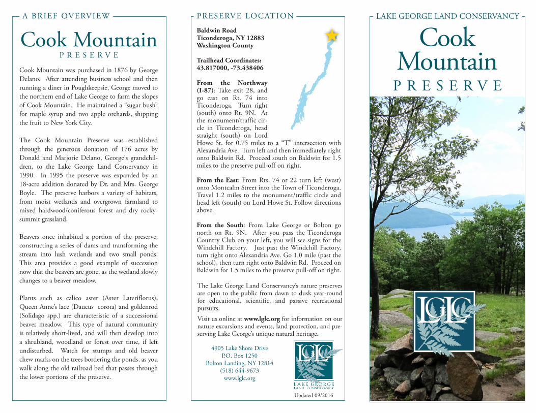
Baldwin Road Ticonderoga, NY 12883Washington County
Trailhead Coordinates:43.817000, -73.438406
From the Northway (I-87): Take exit 28, and go east on Rt. 74 into Ticonderoga. Turn right (south) onto Rt. 9N. At the monument/traffic cir-cle in Ticonderoga, head straight (south) on Lord Howe St. for 0.75 miles to a “T” intersection with Alexandria Ave. Turn left and then immediately right onto Baldwin Rd. Proceed south on Baldwin for 1.5 miles to the preserve pull-off on right.
From the East: From Rts. 74 or 22 turn left (west) onto Montcalm Street into the Town of Ticonderoga. Travel 1.2 miles to the monument/traffic circle and head left (south) on Lord Howe St. Follow directions above.
From the South: From Lake George or Bolton go north on Rt. 9N. After you pass the Ticonderoga Country Club on your left, you will see signs for the Windchill Factory. Just past the Windchill Factory, turn right onto Alexandria Ave. Go 1.0 mile (past the school), then turn right onto Baldwin Rd. Proceed on Baldwin for 1.5 miles to the preserve pull-off on right.
Cook MountainP R E S E R V E
A BRIEF OVERVIEW PRESERVE LOCATION
The Lake George Land Conservancy’s nature preserves are open to the public from dawn to dusk year-round for educational, scientific, and passive recreational pursuits. Visit us online at www.lglc.org for information on our nature excursions and events, land protection, and pre-serving Lake George’s unique natural heritage.
Cook Mountain was purchased in 1876 by George Delano. After attending business school and then running a diner in Poughkeepsie, George moved to the northern end of Lake George to farm the slopes of Cook Mountain. He maintained a “sugar bush” for maple syrup and two apple orchards, shipping the fruit to New York City.
The Cook Mountain Preserve was established through the generous donation of 176 acres by Donald and Marjorie Delano, George's grandchil-dren, to the Lake George Land Conservancy in 1990. In 1995 the preserve was expanded by an 18-acre addition donated by Dr. and Mrs. George Boyle. The preserve harbors a variety of habitats, from moist wetlands and overgrown farmland to mixed hardwood/coniferous forest and dry rocky-summit grassland.
Beavers once inhabited a portion of the preserve, constructing a series of dams and transforming the stream into lush wetlands and two small ponds. This area provides a good example of succession now that the beavers are gone, as the wetland slowly changes to a beaver meadow.
Plants such as calico aster (Aster Lateriflorus), Queen Anne’s lace (Daucus corota) and goldenrod (Solidago spp.) are characteristic of a successional beaver meadow. This type of natural community is relatively short-lived, and will then develop into a shrubland, woodland or forest over time, if left undisturbed. Watch for stumps and old beaver chew marks on the trees bordering the ponds, as you walk along the old railroad bed that passes through the lower portions of the preserve.
P R E S E R V E
Cook Mountain
LAKE GEORGE LAND CONSERVANCY
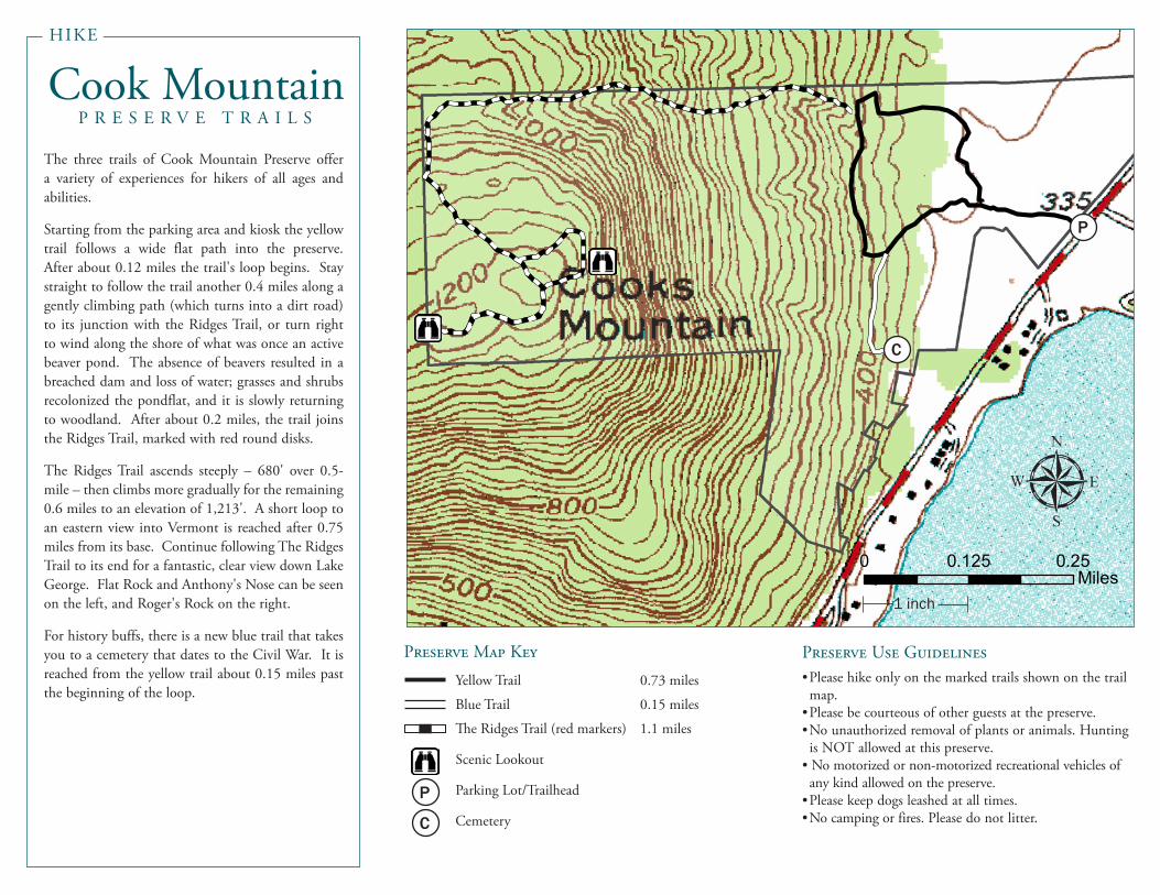
Cook MountainP R E S E R V E T R A I L S
The three trails of Cook Mountain Preserve offer a variety of experiences for hikers of all ages and abilities.
Starting from the parking area and kiosk the yellow trail follows a wide flat path into the preserve. After about 0.12 miles the trail's loop begins. Stay straight to follow the trail another 0.4 miles along a gently climbing path (which turns into a dirt road) to its junction with the Ridges Trail, or turn right to wind along the shore of what was once an active beaver pond. The absence of beavers resulted in a breached dam and loss of water; grasses and shrubs recolonized the pondflat, and it is slowly returning to woodland. After about 0.2 miles, the trail joins the Ridges Trail, marked with red round disks.
The Ridges Trail ascends steeply – 680' over 0.5-mile – then climbs more gradually for the remaining 0.6 miles to an elevation of 1,213'. A short loop to an eastern view into Vermont is reached after 0.75 miles from its base. Continue following The Ridges Trail to its end for a fantastic, clear view down Lake George. Flat Rock and Anthony's Nose can be seen on the left, and Roger's Rock on the right.
For history buffs, there is a new blue trail that takes you to a cemetery that dates to the Civil War. It is reached from the yellow trail about 0.15 miles past the beginning of the loop.
1 in = 0.13 miles0 0.250.125
Miles
LegendCook Red Trail Full
Cook Blue Trail
Cook Yellow Trail P
Preserve Use Guidelines•Please hike only on the marked trails shown on the trail map.
•Please be courteous of other guests at the preserve.•No unauthorized removal of plants or animals. Hunting is NOT allowed at this preserve.
• No motorized or non-motorized recreational vehicles of any kind allowed on the preserve.
•Please keep dogs leashed at all times.•No camping or fires. Please do not litter.
1 in = 0.13 miles0 0.250.125
Miles
LegendCook Red Trail Full
Cook Blue Trail
Cook Yellow Trail
1 inch
C
Yellow Trail 0.73 miles
Blue Trail 0.15 miles
The Ridges Trail (red markers) 1.1 miles
Scenic Lookout
Parking Lot/Trailhead
Cemetery
P
C
Preserve Map Key
HIKE