Embed Size (px)
DESCRIPTION
Sequence
Citation preview
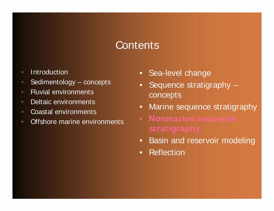
Contents
• Introduction• Sedimentology – concepts• Fluvial environments• Deltaic environments• Coastal environments• Offshore marine environments
• Sea-level change• Sequence stratigraphy –
concepts• Marine sequence stratigraphy• Nonmarine sequence
stratigraphy• Basin and reservoir modeling• Reflection
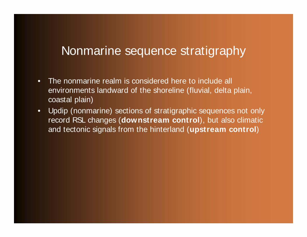
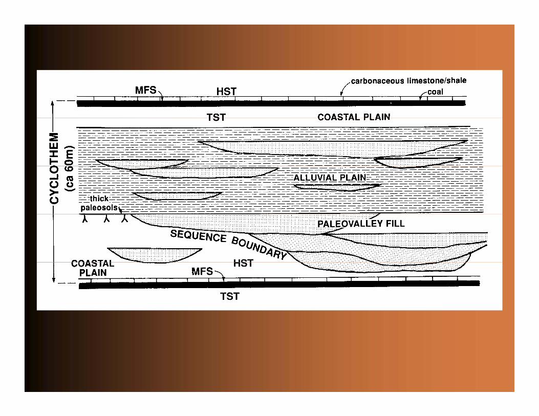
Nonmarine sequence stratigraphy
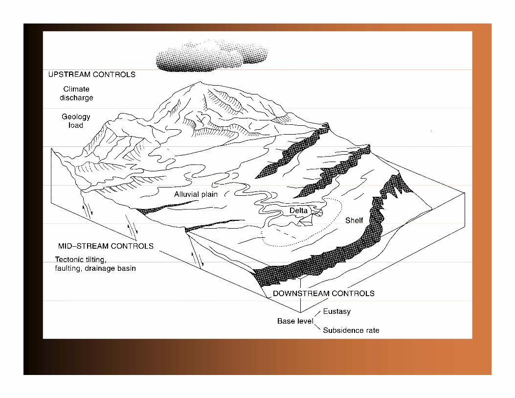
• The nonmarine realm is considered here to include all environments landward of the shoreline (fluvial, delta plain, coastal plain)
• Updip (nonmarine) sections of stratigraphic sequences not only record RSL changes (downstream control), but also climatic and tectonic signals from the hinterland (upstream control)
Nonmarine sequence stratigraphy
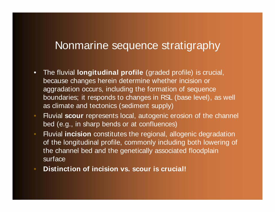
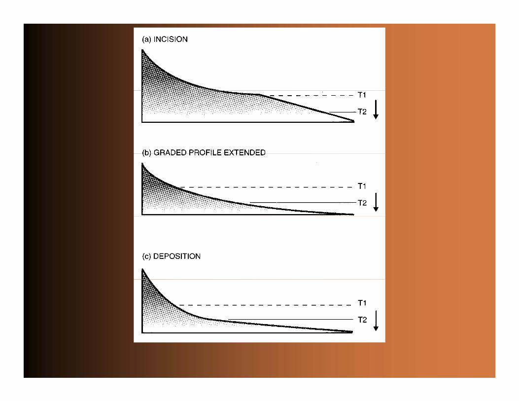
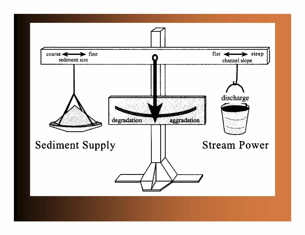
• The fluvial longitudinal profile (graded profile) is crucial, because changes herein determine whether incision or aggradation occurs, including the formation of sequence boundaries; it responds to changes in RSL (base level), as well as climate and tectonics (sediment supply)
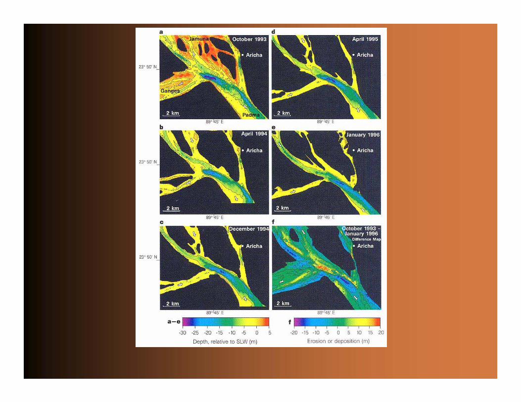
• Fluvial scour represents local, autogenic erosion of the channel bed (e.g., in sharp bends or at confluences)
• Fluvial incision constitutes the regional, allogenic degradation of the longitudinal profile, commonly including both lowering ofthe channel bed and the genetically associated floodplain surface
• Distinction of incision vs. scour is crucial!

Nonmarine sequence stratigraphy
• The fluvial longitudinal profile (graded profile) is crucial, because changes herein determine whether incision or aggradation occurs, including the formation of sequence boundaries; it responds to changes in RSL (base level), as well as climate and tectonics (sediment supply)
• Fluvial scour represents local, autogenic erosion of the channel bed (e.g., in sharp bends or at confluences)
• Fluvial incision constitutes the regional, allogenic degradation of the longitudinal profile, commonly including both lowering ofthe channel bed and the genetically associated floodplain surface
• Distinction of incision vs. scour is crucial!
Nonmarine sequence stratigraphy
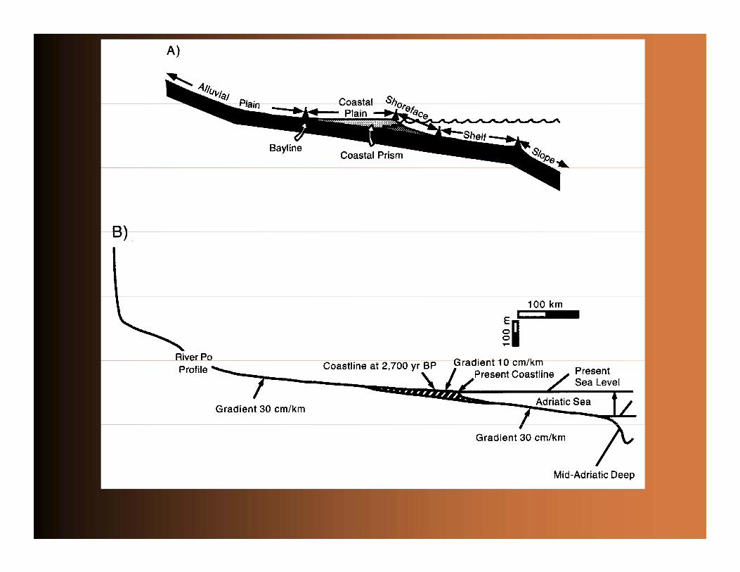
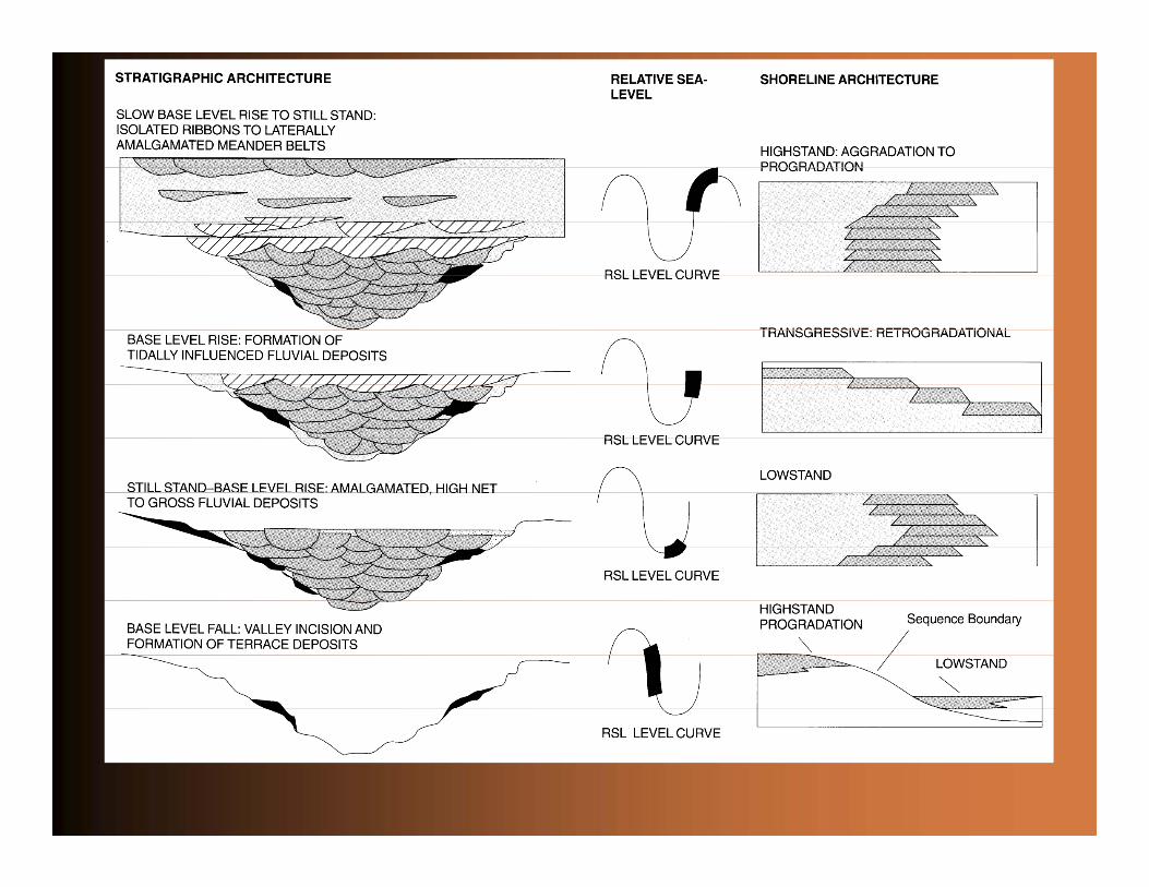
• Whenever the longitudinal profile is graded to a more or less stable RSL for any prolonged time interval, and given sufficientsediment supply, a coastal prism will develop, representing a delta plain (possibly laterally connected to a more extensive coastal plain), with a very low gradient that increases rapidly across the shoreline
• The coastal prism is highly sensitive to erosion during RSL fall; therefore, incision and the formation of sequence boundaries is likely to occur even if RSL does not fall below the shelf edge
Nonmarine sequence stratigraphy
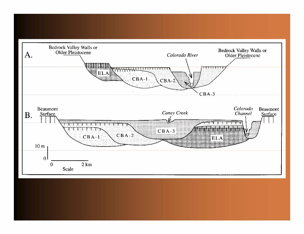
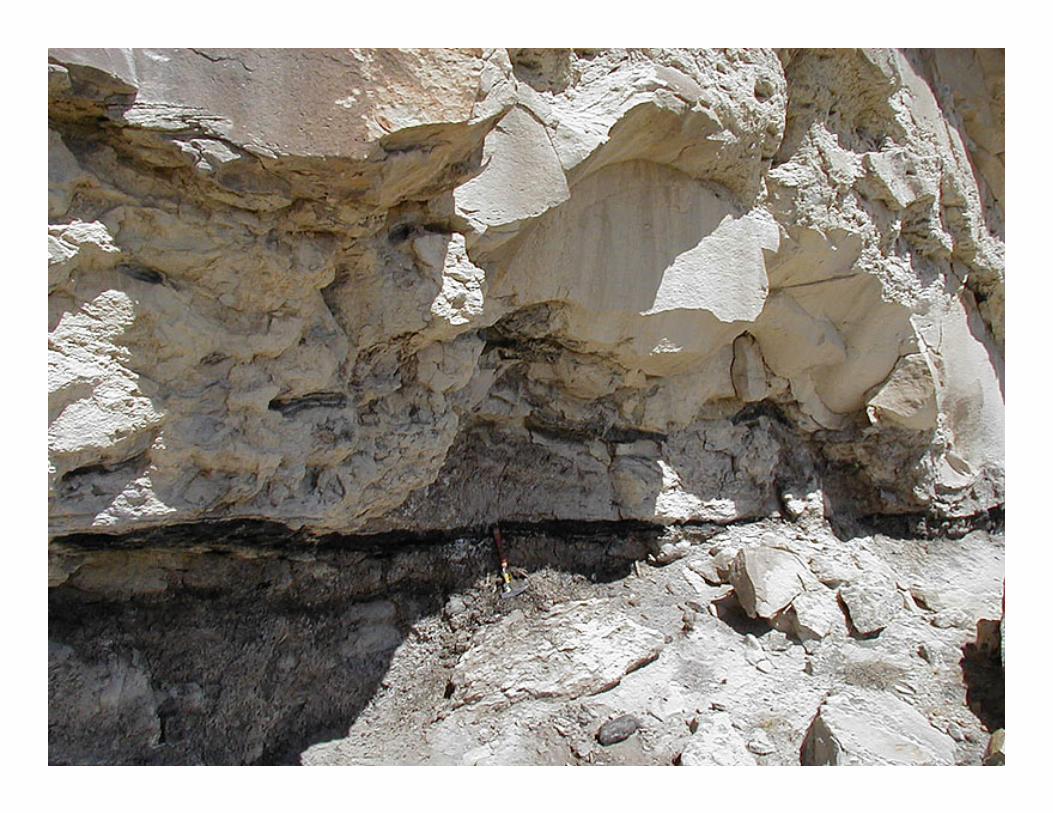
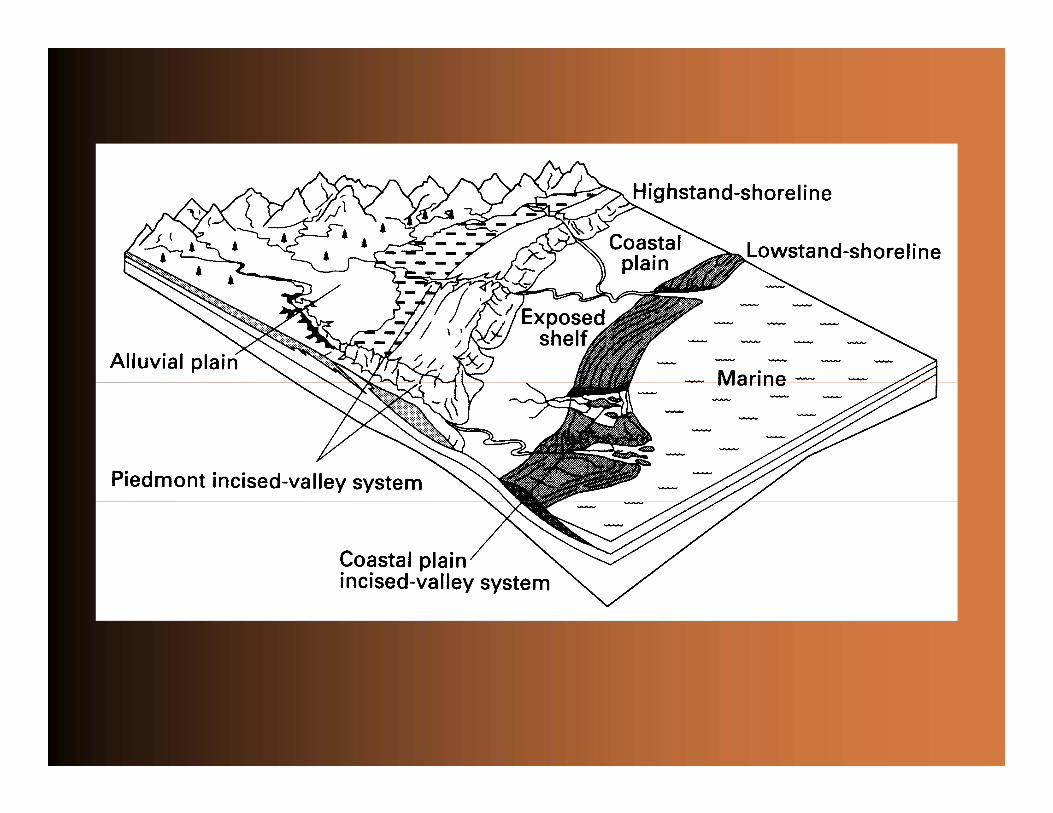
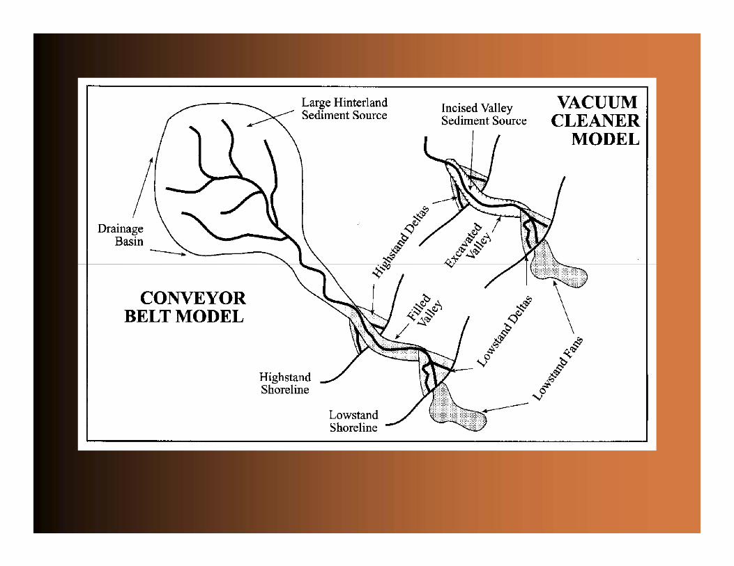
• Fluvial incision leads to valley cutting; paleovalleys (also known as ‘incised valleys’) are valleys that have been subsequently filled with sediment• Even during incision a fluvial deposit is always left behind
(terraces); rivers act as conveyor belts, not as vacuum cleaners!• Unequivocal recognition of paleovalleys requires incision that must
substantially exceed channel depth, with interfluves topped by mature paleosols
• The distinction between paleovalleys and channel belts is tricky• RSL fall does not necessarily always lead to the formation of well-
developed sequence boundaries (e.g., fluvial systems do not always respond to RSL fall by means of incision); sequence boundaries may therefore be very indistinct and difficult to detect
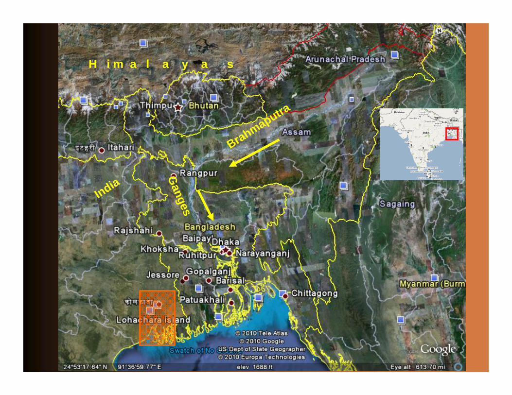
Brahmaputra
Ganges
H i m a l a y a s
India
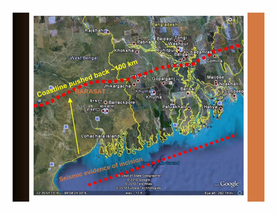
BARASAT
Seismic evidence of incision
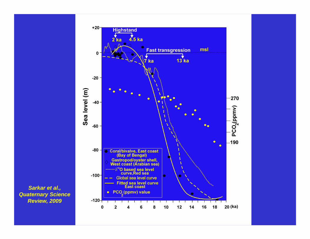
Sarkar et al., Quaternary Science
Review, 2009
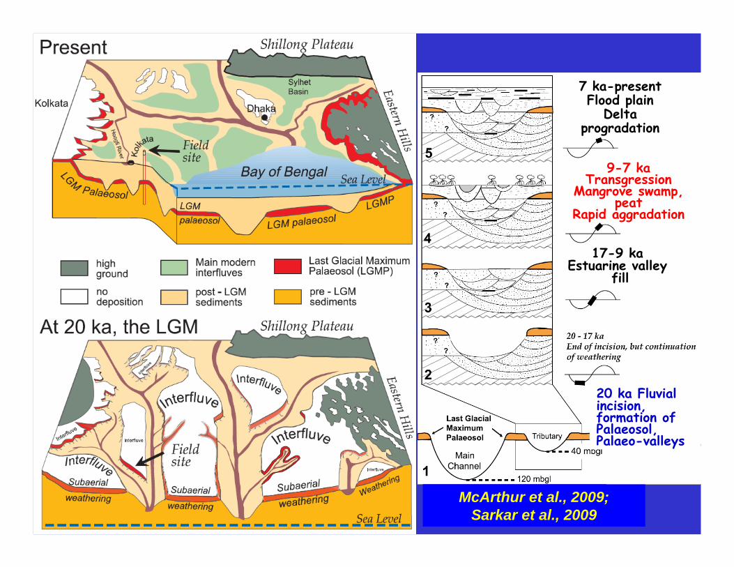
17-9 kaEstuarine valley
fill
9-7 kaTransgression
Mangrove swamp, peat
Rapid aggradation
7 ka-presentFlood plain
Delta progradation
McArthur et al., 2009; Sarkar et al., 2009
20 ka Fluvial incision, formation of Palaeosol, Palaeo-valleys


Nonmarine sequence stratigraphy
• Fluvial incision leads to valley cutting; paleovalleys (also known as ‘incised valleys’) are valleys that have been subsequently filled with sediment• Even during incision a fluvial deposit is always left behind
(terraces); rivers act as conveyor belts, not as vacuum cleaners!• Unequivocal recognition of paleovalleys requires incision that must
substantially exceed channel depth, with interfluves topped by mature paleosols
• The distinction between paleovalleys and channel belts is tricky• RSL fall does not necessarily always lead to the formation of well-
developed sequence boundaries (e.g., fluvial systems do not always respond to RSL fall by means of incision); sequence boundaries may therefore be very indistinct and difficult to detect
Nonmarine sequence stratigraphy
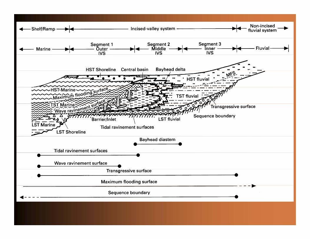
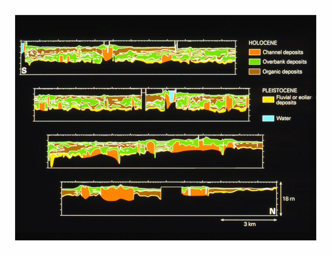
• Paleovalleys are commonly occupied by estuaries during transgression; their stratigraphy is a sensitive recorder of RSL change
• A typical vertical succession, depending on the position in dip direction, includes:• A basal, fluvial FSST/LST overlying a sequence boundary• An overlying TST that is either fully marine, estuarine, or tide-
influenced fluvial• A capping HST that is again more fluvial-dominated
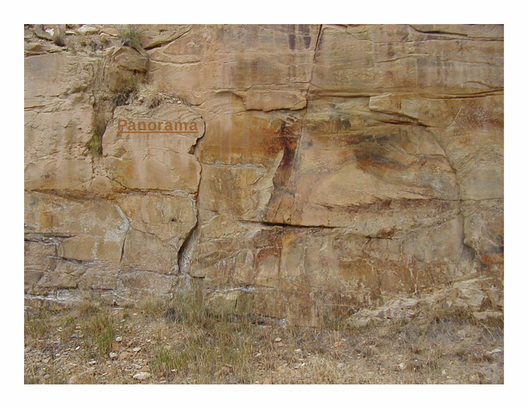
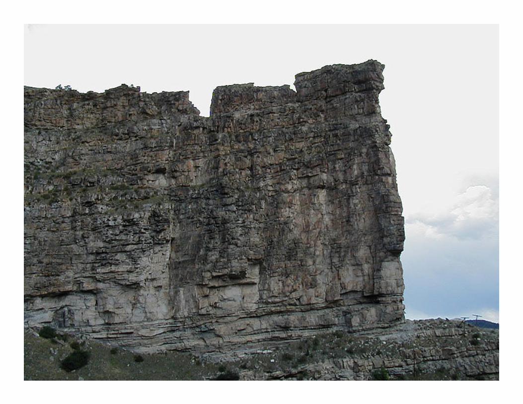
Panorama

Nonmarine sequence stratigraphy
• In view of the difficulty to identify parasequence stacking patterns, identification of systems tracts in upper deltaic to fluvial environments is problematic; however, there is a close relationship between fluvial style, alluvial architecture, and systems tracts• FSST/LST: destruction of accommodation; high channel-deposit
proportion• TST: rapid creation of accommodation; low channel-deposit
proportion, possibly with tidal influence• HST: moderate accommodation; intermediate channel-deposit
proportion

Nonmarine sequence stratigraphy
• Coastal prisms are essentially composed of TSTs and HSTs, and in view of their sensitivity to erosion during RSL fall, the FSST/LST has a relatively high preservation potential; this is particularly the case when subsidence rates are low
• Vertical stacking of relatively amalgamated channel belts, characteristic of the FSST/LST, leads to sequence boundaries that are hard to identify (‘cryptic’ sequence boundaries)
• Climatic and tectonic controls can operate in an opposite direction than RSL, rendering nonmarine sequence-stratigraphicinterpretations considerably more difficult than their marine counterparts