Embed Size (px)
Citation preview

9/19/20129/19/2012
On your desk: Ch 15 notes, pen/pencilNo quiz…partner project using notes for
quiz grade!
Warm-up: Day “2”
List one way your life is influenced by 1. climate, 2. landforms, 3. natural
resources
On your desk: Ch 15 notes, pen/pencilNo quiz…partner project using notes for
quiz grade!
Warm-up: Day “2”
List one way your life is influenced by 1. climate, 2. landforms, 3. natural
resources

MAP TEST NEXT CLASSMAP TEST NEXT CLASS
Have you:Finished labeling your maps?Colored your maps?Practiced on ilike2learn.com?YAY!! You will make an excellent
grade!!
Have you:Finished labeling your maps?Colored your maps?Practiced on ilike2learn.com?YAY!! You will make an excellent
grade!!
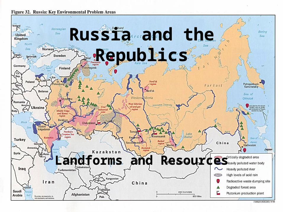
Russia and the Republics
Russia and the Republics
Landforms and ResourcesLandforms and Resources
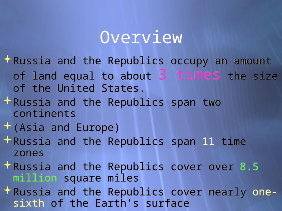
OverviewOverviewRussia and the Republics occupy an amount of
land equal to about 3 times the size of the United States.
Russia and the Republics span two continents(Asia and Europe)Russia and the Republics span 11 time zonesRussia and the Republics cover over 8.5 million
square milesRussia and the Republics cover nearly one-sixth
of the Earth’s surface
Russia and the Republics occupy an amount of land equal to about 3 times the size of the United States.
Russia and the Republics span two continents(Asia and Europe)Russia and the Republics span 11 time zonesRussia and the Republics cover over 8.5 million
square milesRussia and the Republics cover nearly one-sixth
of the Earth’s surface

Northern LandformsNorthern LandformsNorthern European Plain
Lowland area from western border of Russia to the Ural Mountains
Home to chernozem, or black earth, which is very fertile. Because of this, many of the region’s agricultural areas are located here.
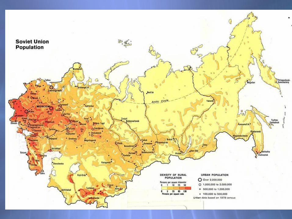
Home to nearly 75% of the region’s population3 of region’s largest cities are
located there
Northern European PlainLowland area from western
border of Russia to the Ural Mountains
Home to chernozem, or black earth, which is very fertile. Because of this, many of the region’s agricultural areas are located here.
Home to nearly 75% of the region’s population3 of region’s largest cities are
located there

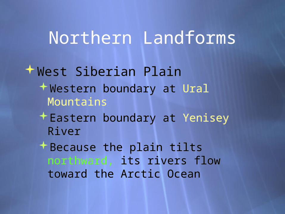
Northern LandformsNorthern Landforms
West Siberian PlainWestern boundary at Ural MountainsEastern boundary at Yenisey RiverBecause the plain tilts northward, its
rivers flow toward the Arctic Ocean
West Siberian PlainWestern boundary at Ural MountainsEastern boundary at Yenisey RiverBecause the plain tilts northward, its
rivers flow toward the Arctic Ocean

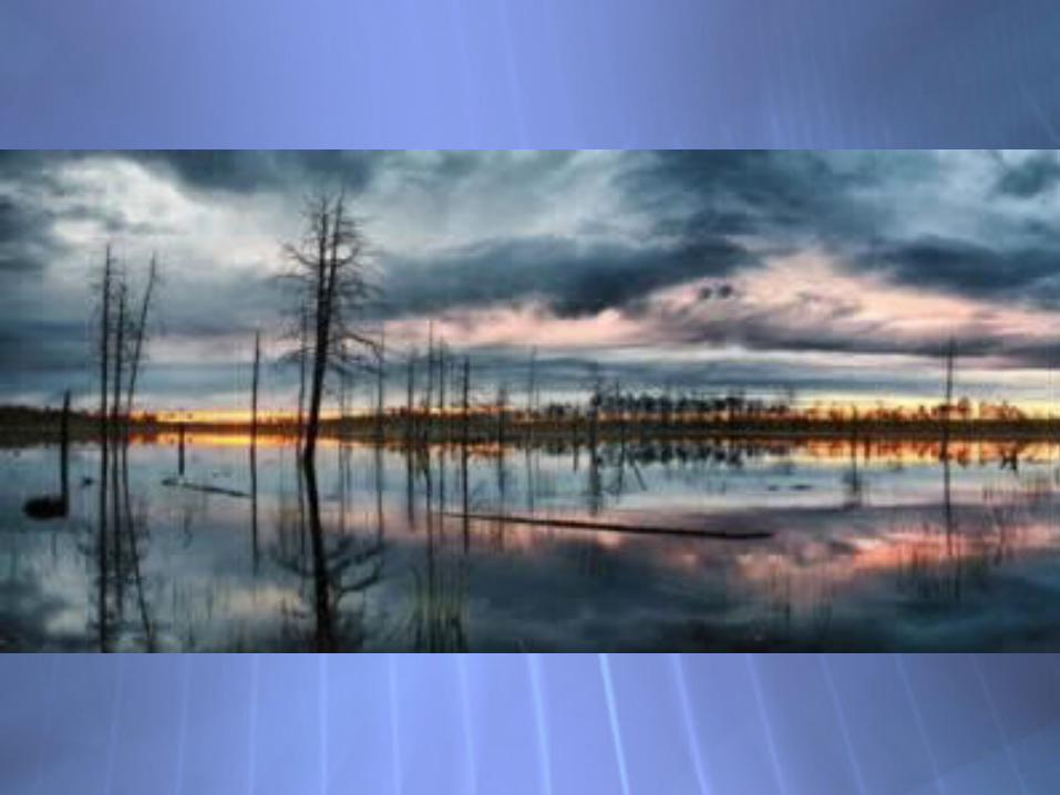
The left bank of the river includes a huge Vasyugan Bog covering the area of 53 thousand sq. km.
Altogether there are 573 rivers with a length more than 20 km. and 35 lakes with an area larger than 5 sq. km. in the Region.
1/5 of the Region’s territory is a spot of river valleys.
The left bank of the river includes a huge Vasyugan Bog covering the area of 53 thousand sq. km.
Altogether there are 573 rivers with a length more than 20 km. and 35 lakes with an area larger than 5 sq. km. in the Region.
1/5 of the Region’s territory is a spot of river valleys.

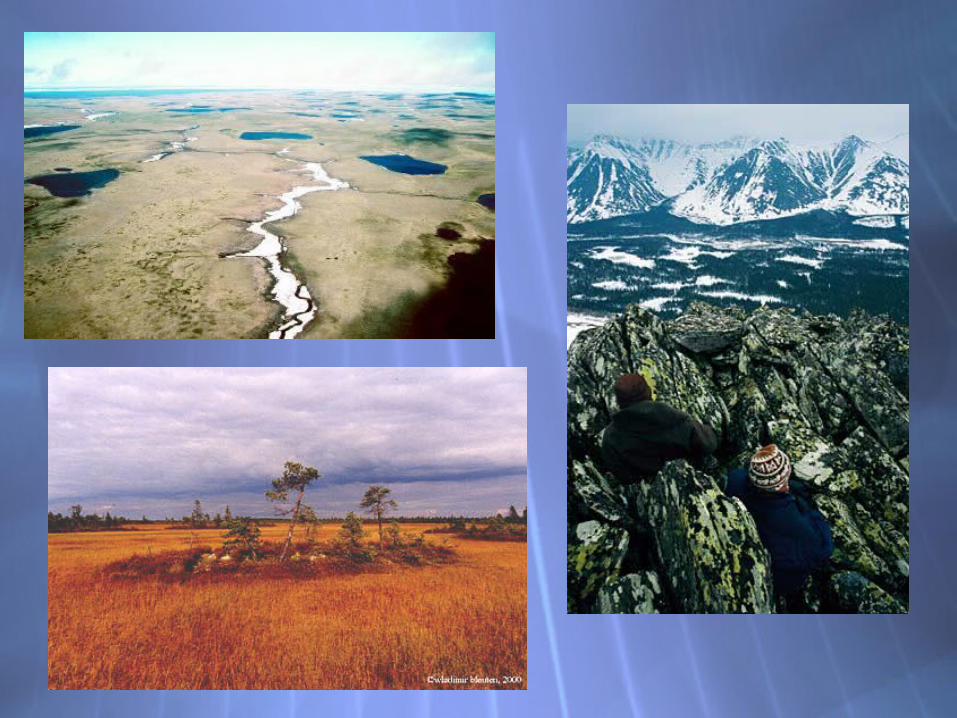

Northern LandformsNorthern Landforms
Central Siberian PlateauMade up of high plateaus with
average heights of 1,000 to 2,000 feet
Russian Far EastMade up of a system of volcanic
ranges, with many active volcanoes
Central Siberian PlateauMade up of high plateaus with
average heights of 1,000 to 2,000 feet
Russian Far EastMade up of a system of volcanic
ranges, with many active volcanoes

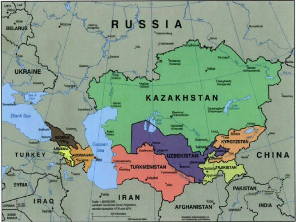
Southern LandformsSouthern LandformsCaucasus and other mountains
Caucasus - stretch across land between the Black and Caspian Seas
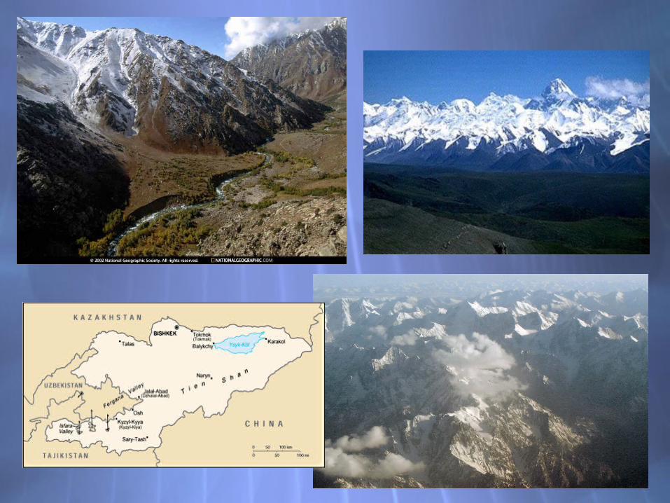
Tian Shan - along the southern border of Russia and the Republics
Turan PlainLies between the Caspian Sea and
Central Asia
Caucasus and other mountainsCaucasus - stretch across land
between the Black and Caspian Seas
Tian Shan - along the southern border of Russia and the Republics
Turan PlainLies between the Caspian Sea and
Central Asia


Kara Kum Desert
Kyzyl Kum Desert
These two deserts (the Kara Kum in Turkmenistan and the Kyzyl Kum in Uzbekistan) cover about 230,000 square miles.

Rivers and LakesRivers and Lakes
RiversVolga, Ob, Yenisey, Lena Rivers are
largest in the regionLakes
Caspian Sea - actually a saltwater lake. It stretches for nearly 750 miles from North to South
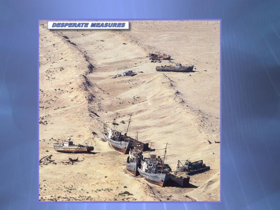
Aral Sea - has lost about 80% of its water in the past 40 years
Lake Baikal - the deepest lake in the world. At its deepest point, it is more than a mile from the surface to the bottom. It holds 20% of the world’s fresh water
RiversVolga, Ob, Yenisey, Lena Rivers are
largest in the regionLakes
Caspian Sea - actually a saltwater lake. It stretches for nearly 750 miles from North to South
Aral Sea - has lost about 80% of its water in the past 40 years
Lake Baikal - the deepest lake in the world. At its deepest point, it is more than a mile from the surface to the bottom. It holds 20% of the world’s fresh water


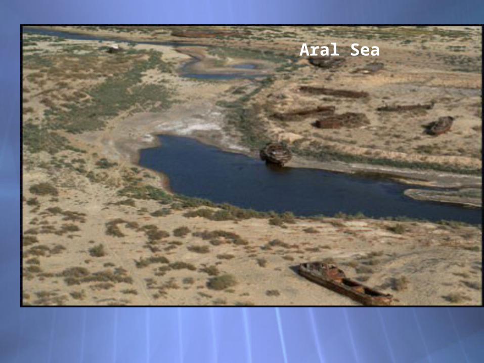
Aral Sea

Lake Baikal
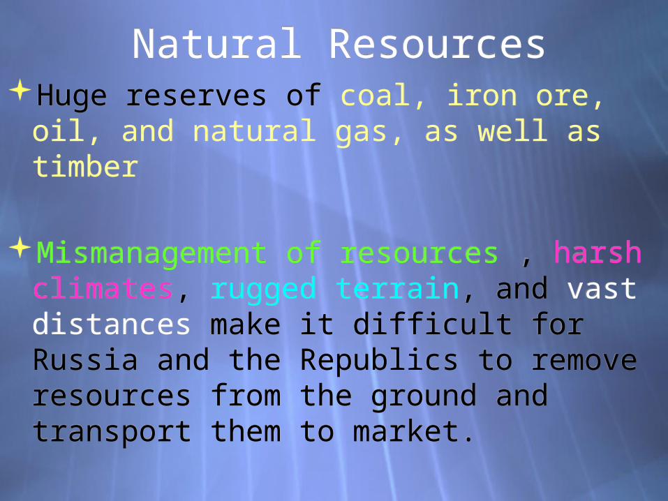
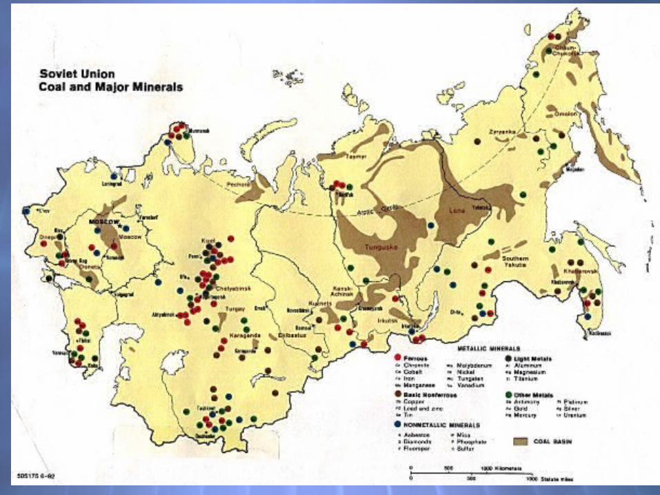
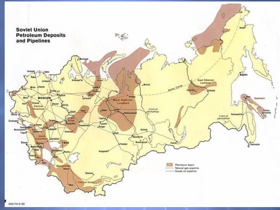
Natural ResourcesNatural ResourcesHuge reserves of coal, iron ore, oil, and
natural gas, as well as timber
Mismanagement of resources , harsh climates, rugged terrain, and vast distances make it difficult for Russia and the Republics to remove resources from the ground and transport them to market.
Huge reserves of coal, iron ore, oil, and natural gas, as well as timber
Mismanagement of resources , harsh climates, rugged terrain, and vast distances make it difficult for Russia and the Republics to remove resources from the ground and transport them to market.
Human-Environment Interaction
Human-Environment Interaction
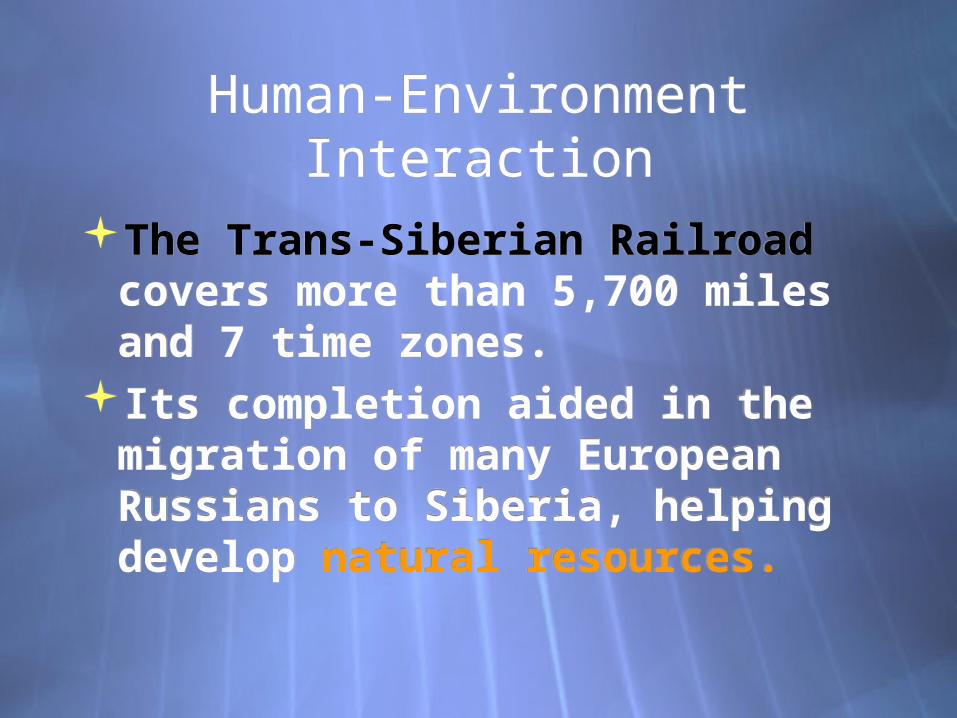
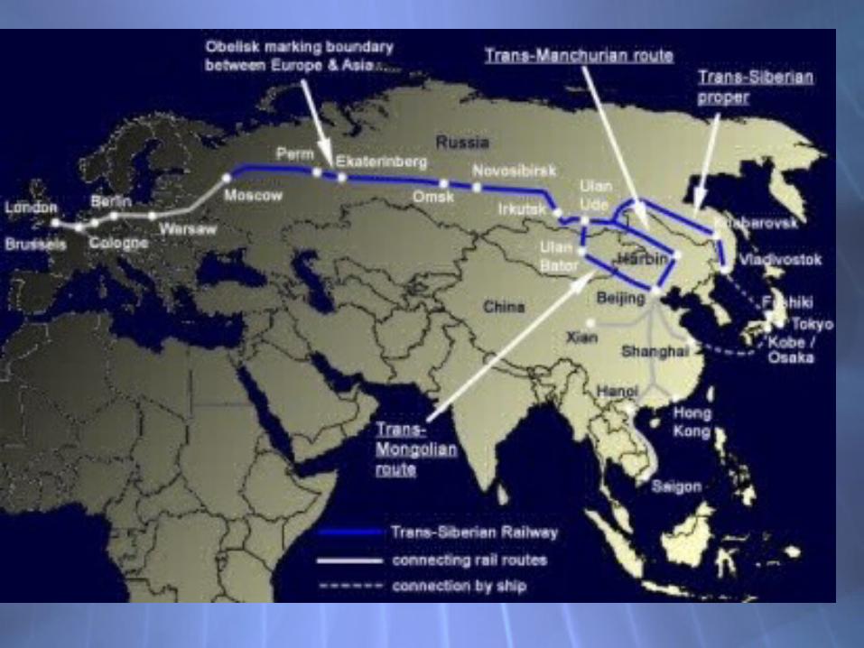
The Trans-Siberian Railroad covers more than 5,700 miles and 7 time zones.
Its completion aided in the migration of many European Russians to Siberia, helping develop natural resources.
The Trans-Siberian Railroad covers more than 5,700 miles and 7 time zones.
Its completion aided in the migration of many European Russians to Siberia, helping develop natural resources.

Environmental issues – Environmental issues – mining operations have caused
significant damage the many hydroelectric plants
discharge thermal pollution, damaging surrounding plant and animal habitats
Agricultural practices devestated rivers and lakes with chemical runoff from pesticides.
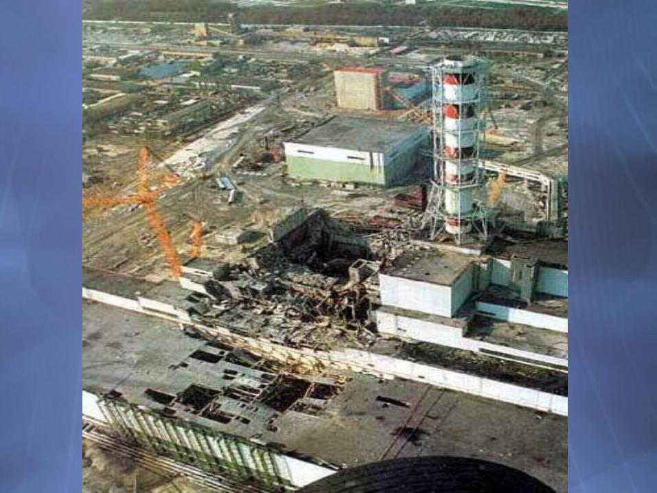
Chernobyl- nuclear plant explosion in 1986
mining operations have caused significant damage
the many hydroelectric plants discharge thermal pollution, damaging surrounding plant and animal habitats
Agricultural practices devestated rivers and lakes with chemical runoff from pesticides.
Chernobyl- nuclear plant explosion in 1986


1971, geologists discovered a massive underground deposit of natural gas on this site. Whilst excavating the hole to tap the gas, the drilling rig collapsed leaving a massive hole. To prevent poisonous gasses from escaping, the hole was allowed to burn. It continues to burn to this day and has done so without ceasing.

The Trans-Siberian Railroad covers more than 5,700 miles and 7 time zones.
Its completion aided in the migration of many European Russians to Siberia, helping develop natural resources.


Major climate regions:Major climate regions:1. Humid continental- variety in
temperature and precipitation, Northern hemisphere, 4 seasons
2. Subarctic- huge temperature variations, usually freezing or below 5-8 months a year. Short cool summers, harsh winters.
3. Semiarid- low precipitation, interior of continents
4. Desert-less than 10 inches rain per year extreme temperature changes
1. Humid continental- variety in temperature and precipitation, Northern hemisphere, 4 seasons
2. Subarctic- huge temperature variations, usually freezing or below 5-8 months a year. Short cool summers, harsh winters.
3. Semiarid- low precipitation, interior of continents
4. Desert-less than 10 inches rain per year extreme temperature changes

Continentality-A region’s distance from the
moderating influence of the sea.(rain, moisture, temperature, etc)
Russia’s extreme climate effected by this.
Continentality-A region’s distance from the
moderating influence of the sea.(rain, moisture, temperature, etc)
Russia’s extreme climate effected by this.

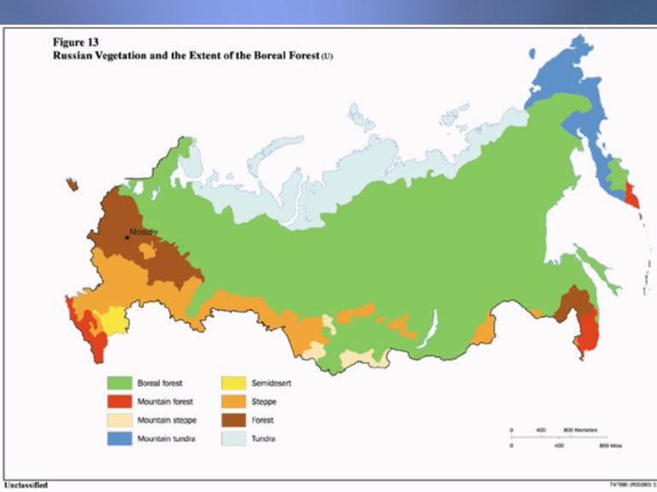
VegetationVegetation
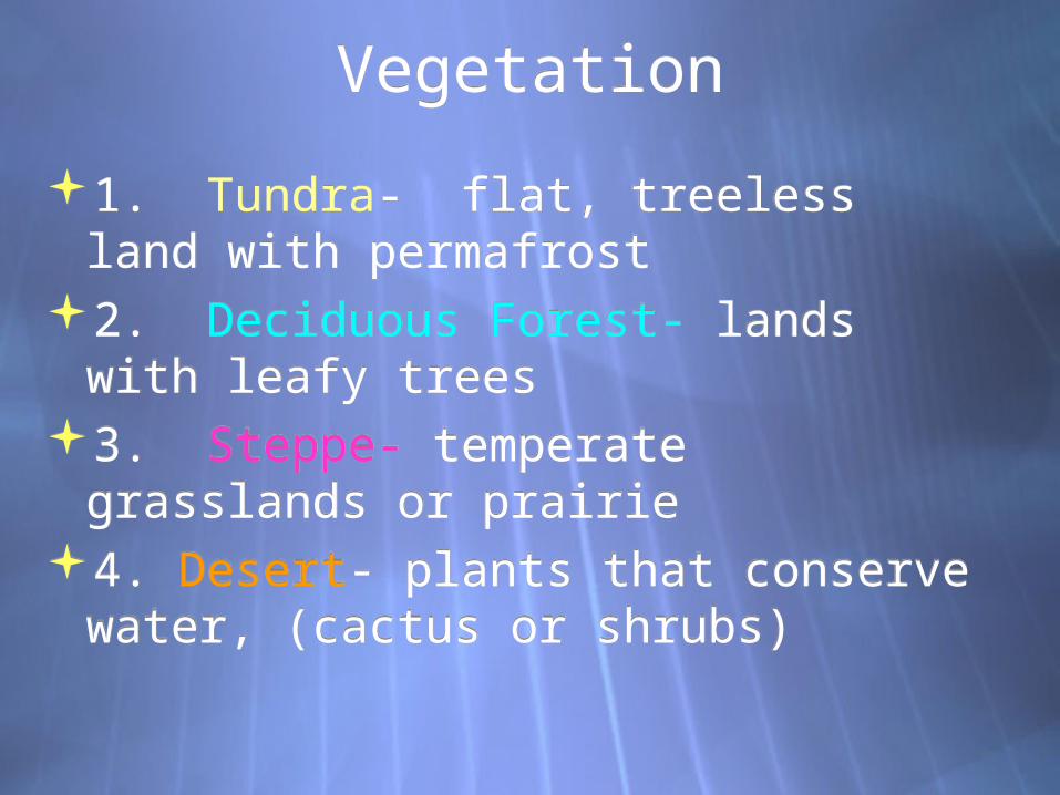
1. Tundra- flat, treeless land with permafrost
2. Deciduous Forest- lands with leafy trees
3. Steppe- temperate grasslands or prairie
4. Desert- plants that conserve water, (cactus or shrubs)
1. Tundra- flat, treeless land with permafrost
2. Deciduous Forest- lands with leafy trees
3. Steppe- temperate grasslands or prairie
4. Desert- plants that conserve water, (cactus or shrubs)

Russia and Republics Scramble Russia and Republics Scramble
1. carefully cut each fact out. (don’t lose any)
2. organize into outline form (all capitals are the headings) 3. Have me check it before you glue. 4. Write a summary statement under
each section (take turns writing) 5. Include both of your names.
1. carefully cut each fact out. (don’t lose any)
2. organize into outline form (all capitals are the headings) 3. Have me check it before you glue. 4. Write a summary statement under
each section (take turns writing) 5. Include both of your names.