Embed Size (px)
Citation preview
1
Mapping news issue 21 winter 2001
ww
w.o
rdn
ancesu
rvey.co.u
k/edu
cation
Head of GeographyGeography teachersGeography coordinatorsGeography advisorsHead of HistoryHead of HumanitiesICT coordinatorsHead of ICT
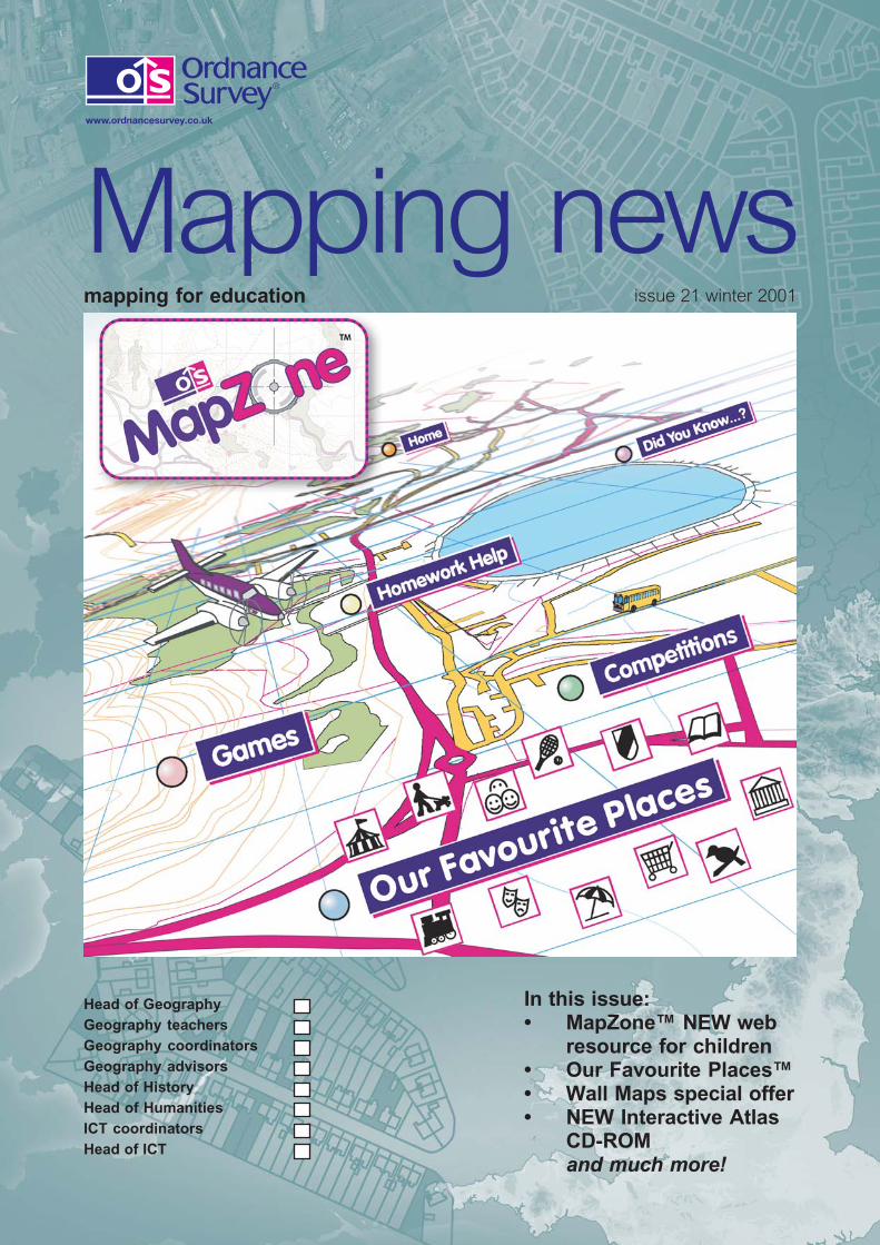
mapping for education issue 21 winter 2001
Mapping news
In this issue:• MapZone™ NEW web
resource for children• Our Favourite Places™• Wall Maps special offer• NEW Interactive Atlas
CD-ROMand much more!
2
Mapping news issue 21 winter 2001
ww
w.o
rdn
ance
surv
ey.c
o.u
k/ed
uca
tio
n
Contents
Editorial 2Teachers taught a lesson 3Wall maps special offer 4–5Celebrating Coastline 2000 6–8How to obtain map data 9The Outdoors Show 10–11British Geological Survey 11Geography and the World of Work12–13Mind mapping– a mapwork mystery 14–15National Schools Grounds Week 16Interactive Atlas CD-ROM 17Using GIS with Aegis 3 18–19MapZone andOur Favourite Places 20–21The Duke of Edinburgh’s Award 22–23International Geographic Olympiad 24RAC competition results 25Scapes and fringes 26–27Geographical Association conference 28It’s a small world! 29Lie of the Land exhibition 30–31Local History Week 2002 32Images from the web 33–35Education Software 36–37Approved Educational Suppliers 38–39
Publishing Editor: Sandy SimsPhone: 023 8079 2394Fax: 023 8079 2014Email: [email protected]
Ordnance Survey, the OS Symbol, ADDRESS-POINT, Code-Point, Land-Form PANORAMA, Land-Line, Landplan, Landranger,OSCAR Asset-Manager and Superplan are registeredtrademarks and Boundary-Line, Interactive MapExplorer,MapZone, Our Favourite Places, Our Favourite Places logo andQuiz Zone are trademarks of Ordnance Survey, the nationalmapping agency of Great Britain.
Mac is a registered trademark of Apple Computer Incorporated.Microsoft and Windows are registered trademarks of MicrosoftCorporation. Pentium is a registered trademark of IntelCorporation.
Acorn is a trademark of Acorn Software Incorporated. ArcView isa trademark of ESRI (UK) Ltd. Map Maker Pro is a trademark ofMap Maker Ltd.
Ordnance Survey acknowledges all other trademarks.
© Crown copyright
Mapping newsis printed on80% recycledfibre.
ContactsFor product advice and to place an order:Please contact yourApproved Educational Supplier(see pages 38–39)For copyright and general enquiries:Please contact our Customer HelpLinePhone: 08456 05 05 05Welsh HelpLine: 08456 05 05 04Textphone: 023 8079 2906(hearing impaired users only please)
Fax: 023 8079 2615
Email: [email protected] site:www.ordnancesurvey.co.uk
Front cover:MapZone
Editorial2
Welcome to the winter issue of Mapping news.
As I write this the aftermath of the tragic events in America isstill headline news and the papers are tracing the globalisationof terrorism in their pages. Now everyone can find Afghanistanon the map and the whole world suddenly feels uncomfortablysmall. Teaching of geography and the humanities has,therefore, never been more relevant.
On a much brighter note, our front cover and centre articlecelebrate the relaunch of MapZone, our web site for children.Within the site is Our Favourite Places, an activity based oninteractive mapping that will build to provide a genuinely usefulservice to children and parents alike. Read all about this uniquechildren’s GIS on page 20.
MapZone also features a variety of games and competitionsaround a mapping theme. Some activities are clearlyeducational, others more silly and fun – guess which ones ouryoung testers enjoyed most!
While you explore MapZone why not revisit our main web site?Changes have been made here, too, with improved navigationmaking it easier for you to find the information and resourcesyou need for teaching.
I hope you enjoy this issue of Mapping news; we are pleasedto include articles from some of the foremost names andorganisations in modern geography teaching.
Elaine OwenEducation Manager
ww
w.o
rdn
ance
surv
ey.c
o.u
k/ed
uca
tio
n
3
Mapping news issue 21 winter 2001
ww
w.o
rdn
ancesu
rvey.co.u
k/edu
cation
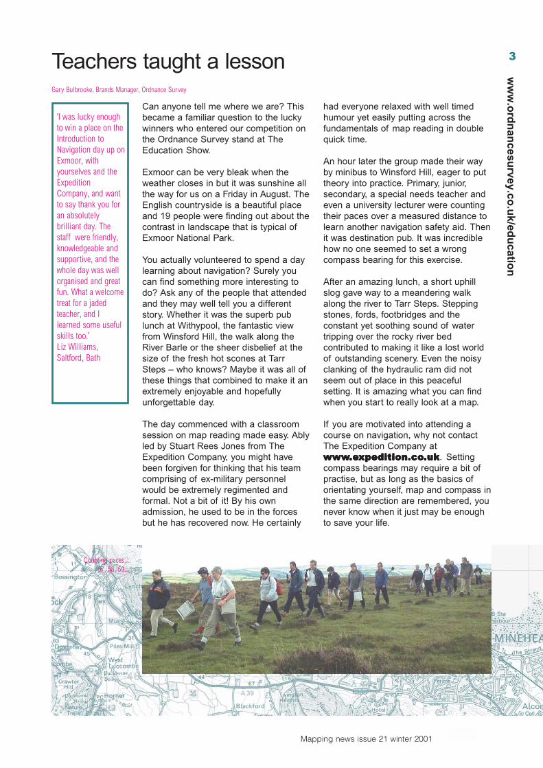
Can anyone tell me where we are? Thisbecame a familiar question to the luckywinners who entered our competition onthe Ordnance Survey stand at TheEducation Show.
Exmoor can be very bleak when theweather closes in but it was sunshine allthe way for us on a Friday in August. TheEnglish countryside is a beautiful placeand 19 people were finding out about thecontrast in landscape that is typical ofExmoor National Park.
You actually volunteered to spend a daylearning about navigation? Surely youcan find something more interesting todo? Ask any of the people that attendedand they may well tell you a differentstory. Whether it was the superb publunch at Withypool, the fantastic viewfrom Winsford Hill, the walk along theRiver Barle or the sheer disbelief at thesize of the fresh hot scones at TarrSteps – who knows? Maybe it was all ofthese things that combined to make it anextremely enjoyable and hopefullyunforgettable day.
The day commenced with a classroomsession on map reading made easy. Ablyled by Stuart Rees Jones from TheExpedition Company, you might havebeen forgiven for thinking that his teamcomprising of ex-military personnelwould be extremely regimented andformal. Not a bit of it! By his ownadmission, he used to be in the forcesbut he has recovered now. He certainly
had everyone relaxed with well timedhumour yet easily putting across thefundamentals of map reading in doublequick time.
An hour later the group made their wayby minibus to Winsford Hill, eager to puttheory into practice. Primary, junior,secondary, a special needs teacher andeven a university lecturer were countingtheir paces over a measured distance tolearn another navigation safety aid. Thenit was destination pub. It was incrediblehow no one seemed to set a wrongcompass bearing for this exercise.
After an amazing lunch, a short uphillslog gave way to a meandering walkalong the river to Tarr Steps. Steppingstones, fords, footbridges and theconstant yet soothing sound of watertripping over the rocky river bedcontributed to making it like a lost worldof outstanding scenery. Even the noisyclanking of the hydraulic ram did notseem out of place in this peacefulsetting. It is amazing what you can findwhen you start to really look at a map.
If you are motivated into attending acourse on navigation, why not contactThe Expedition Company atwwwwwwwwwwwwwww.e.e.e.e.expedition.coxpedition.coxpedition.coxpedition.coxpedition.co.uk.uk.uk.uk.uk. Settingcompass bearings may require a bit ofpractise, but as long as the basics oforientating yourself, map and compass inthe same direction are remembered, younever know when it just may be enoughto save your life.
Teachers taught a lessonGary Bulbrooke, Brands Manager, Ordnance Survey
‘I was lucky enoughto win a place on theIntroduction toNavigation day up onExmoor, withyourselves and theExpeditionCompany, and wantto say thank you foran absolutelybrilliant day. Thestaff were friendly,knowledgeable andsupportive, and thewhole day was wellorganised and greatfun. What a welcometreat for a jadedteacher, and Ilearned some usefulskills too.’Liz Williams,Saltford, Bath
Counting paces...57, 58, 59...
4
Mapping news issue 21 winter 2001
ww
w.o
rdn
ance
surv
ey.c
o.u
k/ed
uca
tio
n
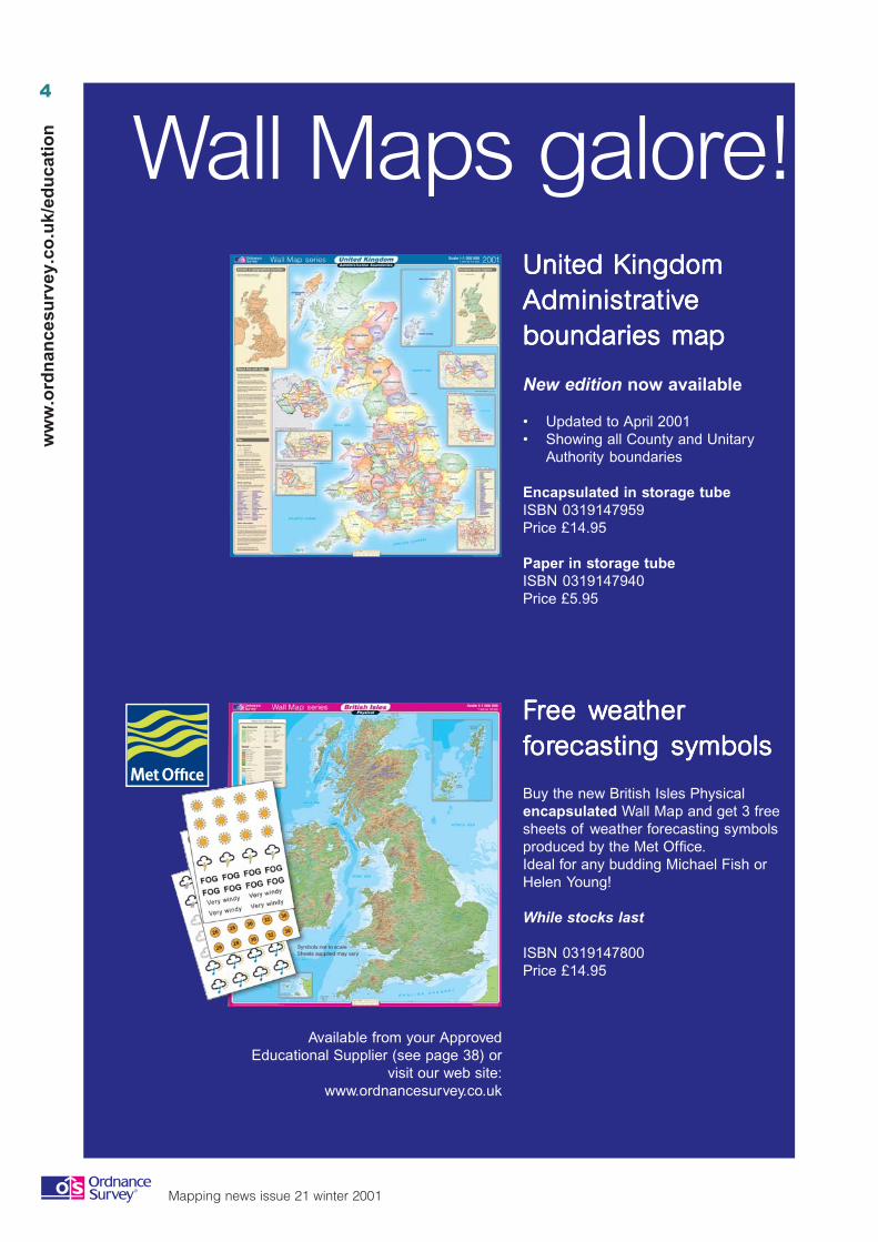
United KingdomUnited KingdomUnited KingdomUnited KingdomUnited KingdomAdministrAdministrAdministrAdministrAdministraaaaatititititivvvvveeeeeboundaries maboundaries maboundaries maboundaries maboundaries mappppp
New edition now available
• Updated to April 2001• Showing all County and Unitary
Authority boundaries
Encapsulated in storage tubeISBN 0319147959Price £14.95
Paper in storage tubeISBN 0319147940Price £5.95
FFFFFrrrrree wee wee wee wee weaeaeaeaeatherthertherthertherffffforororororecasting symbolsecasting symbolsecasting symbolsecasting symbolsecasting symbols
Buy the new British Isles Physicalencapsulated Wall Map and get 3 freesheets of weather forecasting symbolsproduced by the Met Office.Ideal for any budding Michael Fish orHelen Young!
While stocks last
ISBN 0319147800Price £14.95
Wall Maps galore!
Available from your ApprovedEducational Supplier (see page 38) or
visit our web site:www.ordnancesurvey.co.uk
5
Mapping news issue 21 winter 2001
ww
w.o
rdn
ancesu
rvey.co.u
k/edu
cation
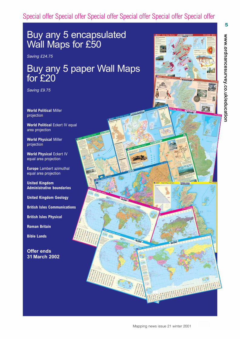
Special offer Special offer Special offer Special offer Special offer Special offer
Buy any 5 encapsulatedWall Maps for £50Saving £24.75
Buy any 5 paper Wall Mapsfor £20Saving £9.75
World Political Millerprojection
World Political Eckert IV equalarea projection
World Physical Millerprojection
World Physical Eckert IVequal area projection
Europe Lambert azimuthalequal area projection
United KingdomAdministrative boundaries
United Kingdom Geology
British Isles Communications
British Isles Physical
Roman Britain
Bible Lands
Offer ends31 March 2002
6
Mapping news issue 21 winter 2001
ww
w.o
rdn
ance
surv
ey.c
o.u
k/ed
uca
tio
n Celebrating Coastline 2000John Abbett
Since Coastline 2000 was launched in April 2000 by Helen Young 3 000 kilometresof coastline have been successfully surveyed. Approximately 15 000 young peoplefrom primary, secondary and special schools, referral centres and universitystudents took part in this survey. This has been one of the biggest undertakingsever organised by the Geographical Association (GA) with support from theNational Trust and Ordnance Survey. The primary objective was to involve largenumbers of young people in a massive teamwork exercise, a simple field surveyof the coastline of England and Wales.
In the year 2000 geography has provided a medium for the delivery of citizenshipand sustainability now high on the education agenda. Most importantly, we haveelicited young people’s views and visions about the coastline they visited and atthe turn of the millennium encouraged their sense of responsibility for the coast.We collected data about the physical nature of the coast, its accessibility to bothable bodied and disabled and about land use along the coastal margin.
Fundamental to the project was provision of 1:10 000 scale mapping by OrdnanceSurvey. As an educational project Coastline 2000 was highly successful; there wasplenty of evidence of genuine engagement. The project pack was extremely wellreceived and many schools reported that they will use this exercise in the comingyears. The project helped to develop both geographical skills and at the same timeit provided an excellent vehicle for the continuing delivery by geographers of suchtransferable skills as literacy, numeracy and the use of ICT.
Safety was a critical concern, and careful adherence to the fieldwork safety codeled to the completion without accident, which is a testimony to the professionalismof those involved.
There is a full set of data for each square surveyed on the Anglia Multimedia website www.angliacampus.com. The connection is at the bottom of the home page,titled Secondary Geography: Coastlines. We are extremely grateful to them forsponsoring the project in this way. This is a rich resource; the views and visions ofthe surveyors provide interesting stories about the relationship between natureand culture.
National results from coastal squares
The coastline of England and Wales was split into 704, 5 km by 5 km squares,based on the Ordnance Survey 1:10 000 scale maps. There were 574 of thesecoastal transects allocated in England and Wales and an additional 29 wereallocated across Scotland and Jersey. However, only 408 transects were returnedto the GA in time for inclusion in this report.
The length of coastline surveyed across England, Wales, Scotland and Jerseytotals 3 149.29 km. Due to the fact that complete coverage has not been achieved,the results presented below can only be looked upon as a sample of the coastline.When the data is expressed as a percentage, it refers to the percentage ofcoastline surveyed not as a percentage of the total coastline of Great Britain.Data from the tidal rivers have been analysed independently of the coastal data,and the results from these transects are presented in a separate section.
7
Mapping news issue 21 winter 2001
ww
w.o
rdn
ancesu
rvey.co.u
k/edu
cation
Summary of key findings
Some of the key findings from Coastline 2000 are summarised below.Of the 3 149.29 km of coastline surveyed:• 78% of the coastal margin is accessible;• 52% of the coastal margin has safe access to the shoreline; and• 35% of the coastline is defended from the sea.
The physical environment
The five most common coastal environments are:• beach as a single class (14.4%);• cliff with shore platform at base (13.8%);• cliff with beach at the base (10.7%);• cliff as a single class (7.1%); and• sand dune fringed by beach (6.4%).
In total the surveyed coastal margin is fringed by:• 1 662.2 km of rock and natural vegetation;• 723.3 km of agricultural land;• 633.6 km of land used for transport and communication;• 378.9 km of residential land;• 314.6 km of tended open space;• 209.2 km of land used for commerce and business; and• 135.2 km of industrial land.
Views and visions of the surveyors
• The most liked features of the coast are the landscape, scenery andviews, the general atmosphere (for example, peace and quiet), and thephysical setting and coastal class.
• The amount of litter is the most disliked feature of the coast, along withpoor access and the amount of dog and animal faeces.
• Pollution is the leading coastal environmental issue, followed by coastalerosion and litter and dog faeces.
• The most frequent changes the surveyors would make would be to reducelitter, increase the number of general amenities and improve thegeneral appearance of the coastline.
• The most common vision of thecoast in 20 years time is thatthere will be no change, followedby an increase in coastalerosion and an increase inurban development.
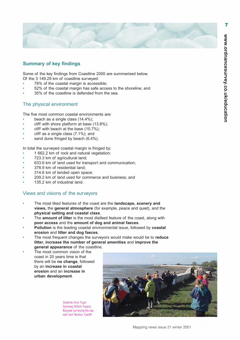
Students from YsgolGymraeg Gilfach Fargod,Bargoed surveying the seawall near Newton, Cardiff
8
Mapping news issue 21 winter 2001
ww
w.o
rdn
ance
surv
ey.c
o.u
k/ed
uca
tio
n
Student comments, views and visions
Here are some views and visions from the hundreds that were received to give aflavour of our coastline as it is now and may be in the future.
Brookfield High School, Kirkby
Surveyed an artificial coastline, Manchester Ship Canal. At Ince Marshes we foundopen space and farmland which was in total contrast to the industry which dominatedthe landscape on the rest of our transect. The air was full of pollutants and at onepoint there was a pipe pumping out hot steaming liquid into the canal. Weexperienced major access problems throughout the day.
Watergate Special School
Visited the Mersey estuary near the site of the International Garden Festival 1984.There was access for all, including wheelchairs; we found five shopping trolleys, threebikes, a motorbike and a ladder. We would like to see the otters return to OtterspoolPromenade, showing that we have created a cleaner coastal environment foreveryone to enjoy. We visited the site three times with carers and support assistants.
Pyramid of Stone High School, Stone, and local primaries
Stone High school joined together with its local primaries for a cross-phaseexperience to Llandudno. They presented their work to the mayor of Stone at anevening event called Stone-by-the-Sea. On the west of the Great Orme the surveyteam found the remains of the Royal Artillery’s Coast Artillery School. Here, hugeguns fired out to anchored vessels and training in radio direction finding took place.Only a few concrete bunkers remain. To the east of the survey squares, thesurveyors liked the cycle paths recently developed at Rhôs-on-Sea. This stretch ofthe coast has had to be heavily defended.
Telescombe Cliffs CP School
Surveyed the coast near Peacehaven, East Sussex. The Meridian line leavesEngland here; a monument marks the spot and a beacon was built beside it for themillennium celebrations. Part of the walk was quite dangerous with much evidence ofcliff erosion, which the children were concerned about for the future. The children,aged 10 and 11, thoroughly enjoyed the challenge of the day and all learnt a greatdeal about their local coastline. As one boy wrote, ‘It was fun, exciting, very pricklyand quite dangerous. I was tired. It was better than school. Geography doesn’t comebetter than this!’
John Abbett is a Geography teacher and Information Technology Co-ordinator at Tupton Hall School,Chesterfield, Derbyshire. ([email protected])
9
Mapping news issue 21 winter 2001
ww
w.o
rdn
ancesu
rvey.co.u
k/edu
cation
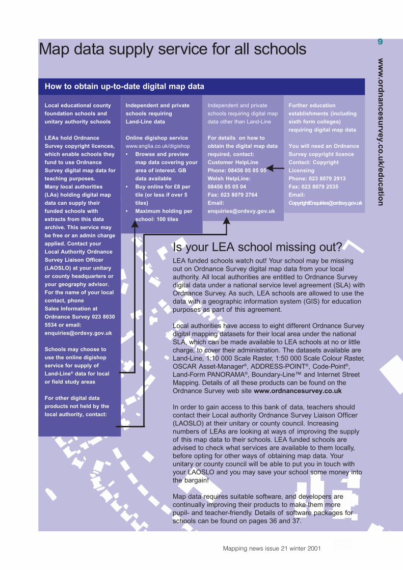
Is your LEA school missing out?LEA funded schools watch out! Your school may be missingout on Ordnance Survey digital map data from your localauthority. All local authorities are entitled to Ordnance Surveydigital data under a national service level agreement (SLA) withOrdnance Survey. As such, LEA schools are allowed to use thedata with a geographic information system (GIS) for educationpurposes as part of this agreement.
Local authorities have access to eight different Ordnance Surveydigital mapping datasets for their local area under the nationalSLA, which can be made available to LEA schools at no or littlecharge, to cover their administration. The datasets available areLand-Line, 1:10 000 Scale Raster, 1:50 000 Scale Colour Raster,OSCAR Asset-Manager®, ADDRESS-POINT®, Code-Point®,Land-Form PANORAMA®, Boundary-Line™ and Internet StreetMapping. Details of all these products can be found on theOrdnance Survey web site www.ordnancesurvey.co.uk
In order to gain access to this bank of data, teachers shouldcontact their Local authority Ordnance Survey Liaison Officer(LAOSLO) at their unitary or county council. Increasingnumbers of LEAs are looking at ways of improving the supplyof this map data to their schools. LEA funded schools areadvised to check what services are available to them locally,before opting for other ways of obtaining map data. Yourunitary or county council will be able to put you in touch withyour LAOSLO and you may save your school some money intothe bargain!
Map data requires suitable software, and developers arecontinually improving their products to make them morepupil- and teacher-friendly. Details of software packages forschools can be found on pages 36 and 37.
How to obtain up-to-date digital map data
Local educational county
foundation schools and
unitary authority schools
LEAs hold Ordnance
Survey copyright licences,
which enable schools they
fund to use Ordnance
Survey digital map data for
teaching purposes.
Many local authorities
(LAs) holding digital map
data can supply their
funded schools with
extracts from this data
archive. This service may
be free or an admin charge
applied. Contact your
Local Authority Ordnance
Survey Liaison Officer
(LAOSLO) at your unitary
or county headquarters or
your geography advisor.
For the name of your local
contact, phone
Sales Information at
Ordnance Survey 023 8030
5534 or email:
Schools may choose to
use the online digishop
service for supply of
Land-Line® data for local
or field study areas
For other digital data
products not held by the
local authority, contact:
Independent and private
schools requiring
Land-Line data
Online digishop service
www.anglia.co.uk/digishop
• Browse and preview
map data covering your
area of interest. GB
data available
• Buy online for £8 per
tile (or less if over 5
tiles)
• Maximum holding per
school: 100 tiles
Independent and private
schools requiring digital map
data other than Land-Line
For details on how to
obtain the digital map data
required, contact:
Customer HelpLine
Phone: 08456 05 05 05
Welsh HelpLine:
08456 05 05 04
Fax: 023 8079 2764
Email:
Further education
establishments (including
sixth form colleges)
requiring digital map data
You will need an Ordnance
Survey copyright licence
Contact: Copyright
Licensing
Phone: 023 8079 2913
Fax: 023 8079 2535
Email:
Map data supply service for all schools9
ww
w.o
rdn
ancesu
rvey.co.u
k/edu
cation
10
Mapping news issue 21 winter 2001
ww
w.o
rdn
ance
surv
ey.c
o.u
k/ed
uca
tio
n
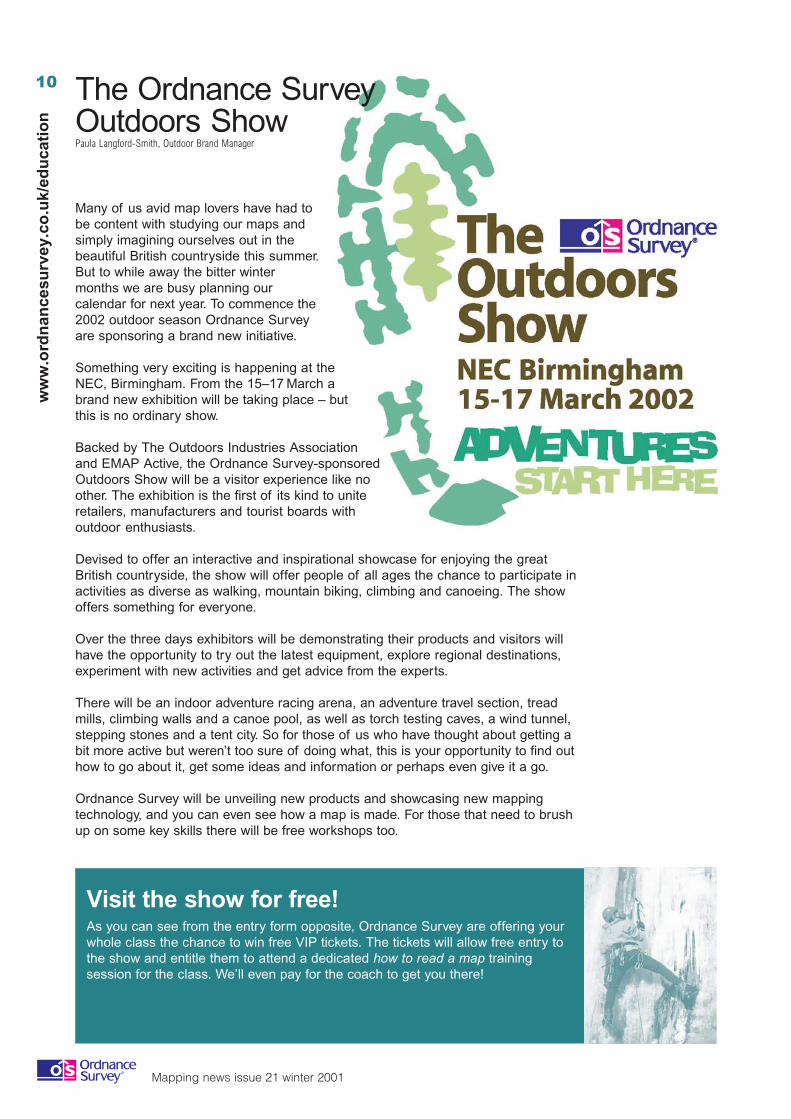
The Ordnance SurveyOutdoors ShowPaula Langford-Smith, Outdoor Brand Manager
Many of us avid map lovers have had tobe content with studying our maps andsimply imagining ourselves out in thebeautiful British countryside this summer.But to while away the bitter wintermonths we are busy planning ourcalendar for next year. To commence the2002 outdoor season Ordnance Surveyare sponsoring a brand new initiative.
Something very exciting is happening at theNEC, Birmingham. From the 15–17 March abrand new exhibition will be taking place – butthis is no ordinary show.
Backed by The Outdoors Industries Associationand EMAP Active, the Ordnance Survey-sponsoredOutdoors Show will be a visitor experience like noother. The exhibition is the first of its kind to uniteretailers, manufacturers and tourist boards withoutdoor enthusiasts.
Devised to offer an interactive and inspirational showcase for enjoying the greatBritish countryside, the show will offer people of all ages the chance to participate inactivities as diverse as walking, mountain biking, climbing and canoeing. The showoffers something for everyone.
Over the three days exhibitors will be demonstrating their products and visitors willhave the opportunity to try out the latest equipment, explore regional destinations,experiment with new activities and get advice from the experts.
There will be an indoor adventure racing arena, an adventure travel section, treadmills, climbing walls and a canoe pool, as well as torch testing caves, a wind tunnel,stepping stones and a tent city. So for those of us who have thought about getting abit more active but weren’t too sure of doing what, this is your opportunity to find outhow to go about it, get some ideas and information or perhaps even give it a go.
Ordnance Survey will be unveiling new products and showcasing new mappingtechnology, and you can even see how a map is made. For those that need to brushup on some key skills there will be free workshops too.
Visit the show for free!As you can see from the entry form opposite, Ordnance Survey are offering yourwhole class the chance to win free VIP tickets. The tickets will allow free entry tothe show and entitle them to attend a dedicated how to read a map trainingsession for the class. We’ll even pay for the coach to get you there!
11
Mapping news issue 21 winter 2001
ww
w.o
rdn
ancesu
rvey.co.u
k/edu
cation
FREE PRIZE DRAWOrdnance Survey Outdoors Show
Name ........................................................................................................
Job title ......................................................................................................
School name ..............................................................................................
Address ........................................................................................................
.....................................................................................................................
Email ............................................................................................................
Postcode ...............................................................................................................
Closing date for entries is 8 February 2002. Only one entry per school.
Send your entry to: Jacky Frampton, Education Team, Ordnance Survey,Romsey Road, SOUTHAMPTON, SO16 4GUIf you would like to receive more information on Ordnance Survey products please tick the box
Photocopies are acceptable if you don’t wish to cut out the form.
Are you frustrated by a lack of good,imaginative teaching resources?Then you might like what the BritishGeological Survey (BGS) is planning!
The market research programme willinitially take the form of a questionnaire,and will be backed up by face-to-facemeetings with teachers, to discussspecific resource needs in detail.
We are keen to get in touch with asmany teachers as possible, and wewould like as wide a range of input as wecan gather. With this issue of Mappingnews, you will have been sent a copy ofthe BGS questionnaire. We would bevery grateful indeed if you could findtime to complete it and send it back tome at the contact address below:
Elaine JohnstonBritish Geological SurveyKeyworthNottingham NG12 5GG
Phone: 0115 936 3325 (direct)Fax: 0115 936 3488Email: [email protected]
We have just launched a new project – aprogramme of market research aimed atUK teachers of earth science, geographyand geology to find out what they requirein the way of teaching resources andmaterials; to identify any gaps in thespectrum of available teaching resourcesfor those subjects; and to attempt todiscover what those teachers would ideallylike in terms of teaching resources.
The purpose of this market research willbe to determine if the BGS can produceteaching materials and resources tomeet teachers’ requirements. We are notonly considering books as teachingresources – we shall be looking atresources across all media: printed text,web pages and downloadableinformation, CD-ROMs, slide sets andother photographic resources, sets ofrock and mineral samples…let us knowyour needs! If new BGS products andpublications prove to be feasible, theywill be developed in tandem with thoseteachers willing to help the BGS with thisaspect of the market research.
The questionnairemay also be foundon the BGS website:www.bgs.ac.uk/education/home.html .This will take youto the BGSEducation homepage; there is alink on that pagecalled Teachers’Questionnaire,where thequestionnaire caneither bedownloaded orcompleted online.

12
Mapping news issue 21 winter 2001
ww
w.o
rdn
ance
surv
ey.c
o.u
k/ed
uca
tio
n

13
Mapping news issue 21 winter 2001
ww
w.o
rdn
ancesu
rvey.co.u
k/edu
cation
Geography andthe world of work posterJudith Mansell, Education Officer, RGS-IBG
All secondary schools and furthereducation establishments will be sent anA1 size poster with this edition ofMapping news. If yours is missing, or ifyou need an additional copy, pleasecontact the RGS-IBG Education Officerat [email protected].
The poster, for use in secondary schools,illustrates some of the employmentopportunities open to people who havestudied geography for GCSE andbeyond. Statistics show thatgeographers are very employable,because they possess the abilities andskills that employers are looking for.Teachers can use the poster to help withthe marketing of geography at optionchoice time.
The following question and supportingstatements could form the basis for anenquiry session by the students toillustrate the employability ofgeographers.
What sort of people doemployers want and what dogeography courses provide?
Employers want people with goodcommunication skills – geographycourses include a wide range of writtenand oral skills, writing essays, projectsand presentations.
Employers want people who can work ina team – Fieldwork is an essentialcomponent of geography courses and isan ideal setting in which to developteamwork and leadership skills.
Employers want people who can managethemselves – The preparation of aGCSE AS/A Level or a higher-gradeinvestigation fosters such skills.
Employers want people who can analysetheir work – Geographical investigationstest hypotheses and involve analysis.
Forthcoming
events at the
Royal
Geographical
Society
6 February 2002Teachersin-servicetraining day
26 June 2002Careers day
3 October 2002On Course forSuccess –sixth form day
For details visit ourweb sitewww.rgs.org
Employers want people who can askquestions and then find the answers –Geographers can pose problems andthen investigate the answers. They canundertake complex decision-makingexercises using information at a varietyof scales.
Employers want people who arecomputer literate – Geographers use ICTin many aspects of their work, for datacollection, through the Internet,analysing spreadsheets; all vital skills,especially in a commercial businessenvironment.
Employers want people who are spatiallyaware – Geographers use maps all thetime. Mapping has witnessed arevolution in recent years by harnessingremote sensing from satellites and thedevelopment of GIS, which are usedincreasingly in geography lessons.
Employers want people who areenvironmentally and socially aware –Geographers understand the linksbetween places and people. They canlook at complex systems in astraightforward way.
Is geography a good subjectchoice in terms of gettinga job?The answer is a resounding YES!
The RGS-IBG has produced a freebooklet – Geography and Careers:Exploring the world of work – which isavailable from the Society at 1Kensington Gore, LONDON, SW7 2AR.It is also available on the Society’s website – www.rgs.org/education –where further careers advice and thebiographies of geographers and theircareer paths can be found in thesecondary education section. TheGeographical Association producescareers information and more details canbe found on their web site atwww.geography.org.uk
13
14
Mapping news issue 21 winter 2001
ww
w.o
rdn
ance
surv
ey.c
o.u
k/ed
uca
tio
n
Edward de Bono wrote: ‘Thinking is askill that can be learnt, practised anddeveloped’.1
Dr. D Leat has developed a number offlexible strategies designed to infuse‘Teaching Thinking’ into the geographycurriculum.2
www.ncl.ac.uk/think.
One of these strategies based on ideasdeveloped for cooperative group workhas become known as a mystery.Thinking skills are now embedded in thenew national curriculum, Key Stage 4and the AS/A2 syllabus. One mysterywas included in the optional tests andtasks publication (SCAA 1996) for KeyStage 3 teacher assessment; itconcerned the Kobe earthquake of1995.
During 2000–01 I was a member of theThinking in Geography Classroom-Based Research project, with fundingfrom the DfES Best Practice ResearchScholarship. The focus was Key Stage 3,and this map work mystery follows myclassroom-based research. Furtherinformation on the Cheshire project canbe found atwww.salt.cheshire.org.uk/geography.
My map work mystery Why did theRomans come to Chester? has thefollowing aims:• To encourage students to use their
map skills.• To add sparkle and fun to the
teaching and learningexperiences.
• To use cooperative group work.• To teach and use a range of skills
– construction, mental modelling,literacy, cognitive skills andmetacognition.
Mind mappingStephen A SchwabHead of Humanities and Geography at Neston High School, Cheshire
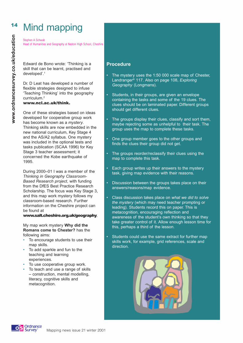
Procedure
• The mystery uses the 1:50 000 scale map of Chester,Landranger® 117. Also on page 108, ExploringGeography (Longmans).
• Students, in their groups, are given an envelopecontaining the tasks and some of the 19 clues. Theclues should be on laminated paper. Different groupsshould get different clues.
• The groups display their clues, classify and sort them,maybe rejecting some as unhelpful to their task. Thegroup uses the map to complete these tasks.
• One group member goes to the other groups andfinds the clues their group did not get.
• The groups reorder/reclassify their clues using themap to complete this task.
• Each group writes up their answers to the mysterytask, giving map evidence with their reasons.
• Discussion between the groups takes place on theiranswers/reasons/map evidence.
• Class discussion takes place on what we did to solvethe mystery (which may need teacher prompting orleading). Students record this on paper. This ismetacognition, encouraging reflection andawareness of the student’s own thinking so that theytake greater control of it. Allow enough lesson time forthis, perhaps a third of the lesson.
• Students could use the same extract for further mapskills work, for example, grid references, scale anddirection.
15
Mapping news issue 21 winter 2001
ww
w.o
rdn
ancesu
rvey.co.u
k/edu
cation
My year 7 students found this mysteryenjoyable and motivating. In thediscussion of what they had done, thestudents identified the elements of goodcooperative work; listening with an openmind, discussing and sharing ideas andwriting and recording the group’s ideasand work. The students also showedtheir awareness of the map as the key tosolving the mystery and that it was byusing their map skills that they solved themystery. The students became awarethat the mystery had many answers; thatit was like so much in geography:multicausal.
Such conclusions give us as educatorsan insight into how students think andlearn, and provide the students withscaffolding for their future thinking andlearning processes.
So that our students may progress fromsaying ‘Thinking kills’ to saying ‘Thinkingskills’ or even ‘Thinking thrills’.
1 de Bono, E., 1995. Teach yourself to think.2 Leat, D., 1998. Thinking through Geography.
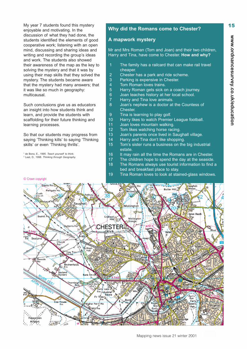
Why did the Romans come to Chester?
A mapwork mystery
Mr and Mrs Roman (Tom and Joan) and their two children,Harry and Tina, have come to Chester. How and why?
1 The family has a railcard that can make rail travelcheaper.
2 Chester has a park and ride scheme.3 Parking is expensive in Chester.4 Tom Roman loves trains.5 Harry Roman gets sick on a coach journey.6 Joan teaches history at her local school.7 Harry and Tina love animals.8 Joan’s nephew is a doctor at the Countess of
Chester.9 Tina is learning to play golf.
10 Harry likes to watch Premier League football.11 Joan loves mountain walking.12 Tom likes watching horse racing.13 Joan’s parents once lived in Saughall village.14 Harry and Tina don’t like shopping.15 Tom’s sister runs a business on the big industrial
estate.16 It may rain all the time the Romans are in Chester.17 The children hope to spend the day at the seaside.18 The Romans always use tourist information to find a
bed and breakfast place to stay.19 Tina Roman loves to look at stained-glass windows.
© Crown copyright
16
Mapping news issue 21 winter 2001
ww
w.o
rdn
ance
surv
ey.c
o.u
k/ed
uca
tio
n
National School Grounds Week 2001Kathy Humphries, Learning through Landscapes
Learning through Landscapes (LTL) is the UK national charity dedicated topromoting the effective use of school grounds to support the full development ofevery child. Each year LTL organises National School Grounds Week – a week inwhich schools are invited to celebrate their grounds and their use. It is anopportunity for schools throughout the UK to join with thousands of others instaging activities designed to highlight the importance and value of school groundsfor learning and play.
This year the theme was Living Today for Tomorrow’s World which explored thetopic of sustainable development. Sustainable development education is now partof the revised national curriculum and the outdoor environment of the schoolgrounds, along with the many resources available in the local community, provide anumber of opportunities to explore sustainable development issues.
A resource pack was sent to each participating school suggesting creative ways ofusing the grounds during the week. Schools were also invited to send in the bestexamples of work produced by their pupils.
Ideas linked to maps and mapping
• It was suggested that pupils could survey their site, make a plan of thephysical features, observe how the site is used and how they feel about whatthey have. They were advised to obtain a base plan and collect information onthe services and site constraints. Creating a zoning plan would enable them toidentify and locate different major land uses and possibilities for improvementsof the grounds. Areas or features for development could be prioritised.
• A suggested project was for pupils to work in groups or on their own and toplan a tour of their grounds to show round a visitor. This would encouragethe children to consider points such as deciding on the most importantfeatures, finding out about them and working out the best route for differentvisitors, taking into account how long the tour would take and whether seatingwould be required.
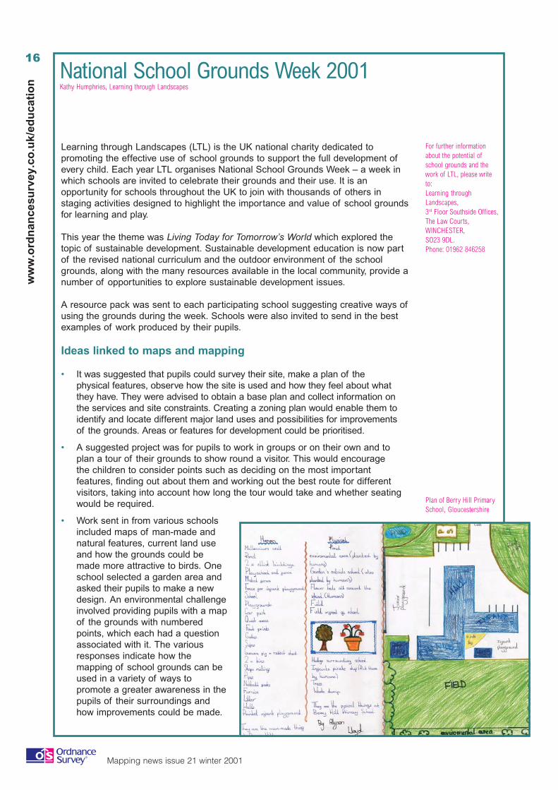
• Work sent in from various schoolsincluded maps of man-made andnatural features, current land useand how the grounds could bemade more attractive to birds. Oneschool selected a garden area andasked their pupils to make a newdesign. An environmental challengeinvolved providing pupils with a mapof the grounds with numberedpoints, which each had a questionassociated with it. The variousresponses indicate how themapping of school grounds can beused in a variety of ways topromote a greater awareness in thepupils of their surroundings andhow improvements could be made.
For further informationabout the potential ofschool grounds and thework of LTL, please writeto:Learning throughLandscapes,3rd Floor Southside Offices,The Law Courts,WINCHESTER,SO23 9DL.Phone: 01962 846258
Plan of Berry Hill PrimarySchool, Gloucestershire
17
Mapping news issue 21 winter 2001
ww
w.o
rdn
ancesu
rvey.co.u
k/edu
cation
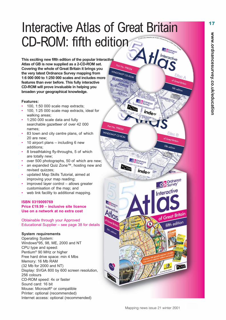
Interactive Atlas of Great BritainCD-ROM: fifth editionThis exciting new fifth edition of the popular InteractiveAtlas of GB is now supplied as a 2-CD-ROM set.Covering the whole of Great Britain it brings youthe very latest Ordnance Survey mapping from1:6 000 000 to 1:250 000 scales and includes morefeatures than ever before. This fully interactiveCD-ROM will prove invaluable in helping youbroaden your geographical knowledge.
Features:• 100, 1:50 000 scale map extracts;• 100, 1:25 000 scale map extracts, ideal for
walking areas;• 1:250 000 scale data and fully
searchable gazetteer of over 42 000names;
• 83 town and city centre plans, of which20 are new;
• 10 airport plans – including 6 newadditions;
• 8 breathtaking fly-throughs, 5 of whichare totally new;
• over 500 photographs, 50 of which are new;• an expanded Quiz Zone™, hosting new and
revised quizzes;• updated Map Skills Tutorial, aimed at
improving your map reading;• improved layer control – allows greater
customisation of the map; and• web link facility to additional mapping.
ISBN 0319009769Price £19.99 – inclusive site licenceUse on a network at no extra cost
Obtainable through your ApprovedEducational Supplier – see page 38 for details
System requirementsOperating System:Windows®95, 98, ME, 2000 and NTCPU type and speed:Pentium® 90 MHz or higherFree hard drive space: min 4 MbsMemory: 16 Mb RAM(32 Mb for 2000 and NT)Display: SVGA 800 by 600 screen resolution,256 coloursCD-ROM speed: 4x or fasterSound card: 16 bitMouse: Microsoft® or compatiblePrinter: optional (recommended)Internet access: optional (recommended)
18
Mapping news issue 21 winter 2001
ww
w.o
rdn
ance
surv
ey.c
o.u
k/ed
uca
tio
n
Easier to use GIS with AEGIS 3Diana Freeman, The Advisory Unit
This new version of AEGIS comes with interactive worksheets ofgeography topics from Year 7 to A level that teachers can use rightaway in the classroom. They have tasks to extend pupilsunderstanding of geography through guided GIS activities. Thereare also ideas and guidance for setting up maps and data forteachers or pupils to create interactive worksheets or courseworkreports of their own.
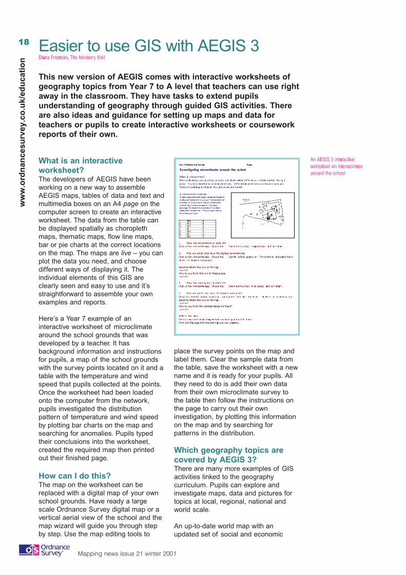
What is an interactiveworksheet?The developers of AEGIS have beenworking on a new way to assembleAEGIS maps, tables of data and text andmultimedia boxes on an A4 page on thecomputer screen to create an interactiveworksheet. The data from the table canbe displayed spatially as choroplethmaps, thematic maps, flow line maps,bar or pie charts at the correct locationson the map. The maps are live – you canplot the data you need, and choosedifferent ways of displaying it. Theindividual elements of this GIS areclearly seen and easy to use and it’sstraightforward to assemble your ownexamples and reports.
Here’s a Year 7 example of aninteractive worksheet of microclimatearound the school grounds that wasdeveloped by a teacher. It hasbackground information and instructionsfor pupils, a map of the school groundswith the survey points located on it and atable with the temperature and windspeed that pupils collected at the points.Once the worksheet had been loadedonto the computer from the network,pupils investigated the distributionpattern of temperature and wind speedby plotting bar charts on the map andsearching for anomalies. Pupils typedtheir conclusions into the worksheet,created the required map then printedout their finished page.
How can I do this?The map on the worksheet can bereplaced with a digital map of your ownschool grounds. Have ready a largescale Ordnance Survey digital map or avertical aerial view of the school and themap wizard will guide you through stepby step. Use the map editing tools to
place the survey points on the map andlabel them. Clear the sample data fromthe table, save the worksheet with a newname and it is ready for your pupils. Allthey need to do is add their own datafrom their own microclimate survey tothe table then follow the instructions onthe page to carry out their owninvestigation, by plotting this informationon the map and by searching forpatterns in the distribution.
Which geography topics arecovered by AEGIS 3?There are many more examples of GISactivities linked to the geographycurriculum. Pupils can explore andinvestigate maps, data and pictures fortopics at local, regional, national andworld scale.
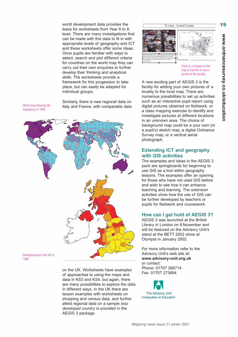
An up-to-date world map with anupdated set of social and economic
An AEGIS 3 interactiveworksheet on microclimatearound the school
19
Mapping news issue 21 winter 2001
ww
w.o
rdn
ancesu
rvey.co.u
k/edu
cation
world development data provides thebasis for worksheets from Year 8 to Alevel. There are many investigations thatcan be made with this data to fit in withappropriate levels of geography and ICTand these worksheets offer some ideas.Once pupils are familiar with ways toselect, search and plot different criteriafor countries on the world map they cancarry out their own enquiries to furtherdevelop their thinking and analyticalskills. The worksheets provide aframework for this progession to takeplace, but can easily be adapted forindividual groups.
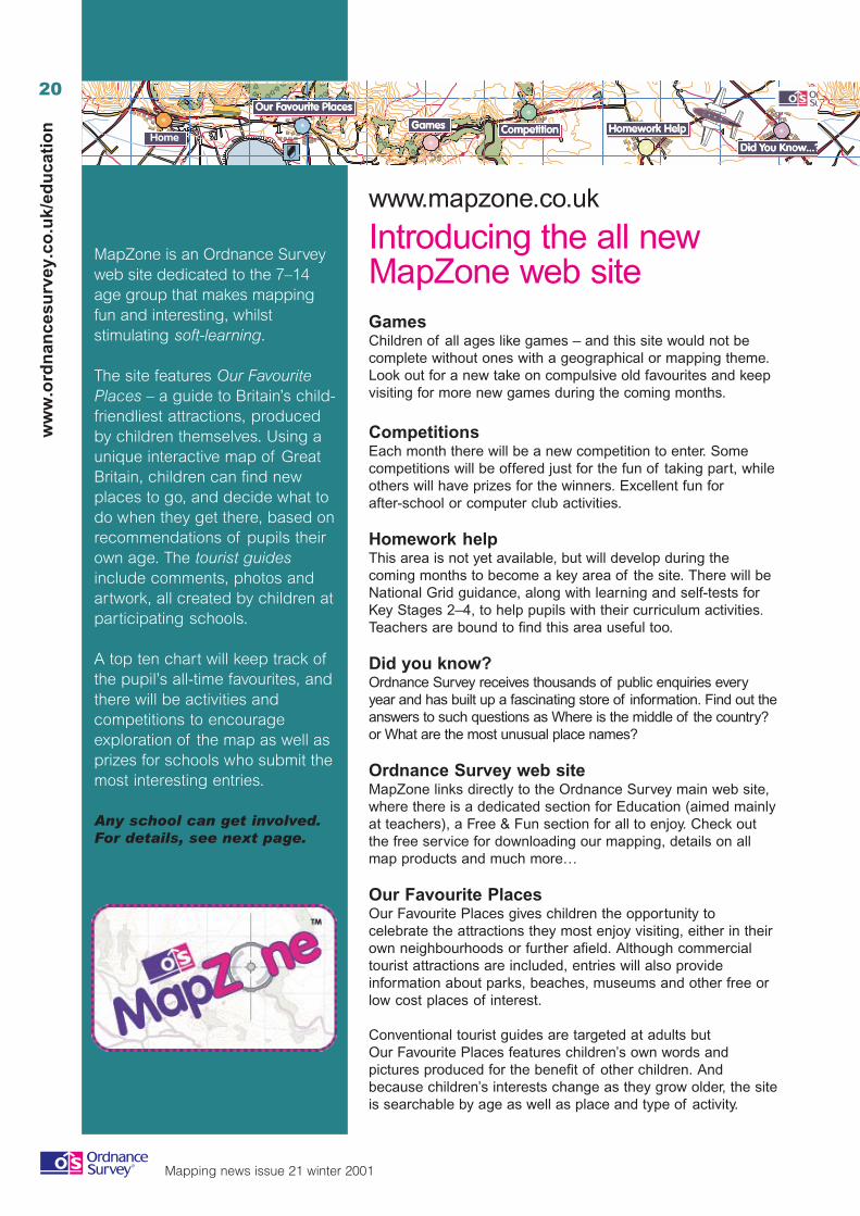
Similarly, there is new regional data onItaly and France, with comparable data
on the UK. Worksheets have examplesof approaches to using the maps anddata in KS3 and KS4, but again, thereare many possibilities to explore the datain different ways. In the UK there arelesson examples with worksheets onshopping and census data, and furtherafield regional data on a sample lessdeveloped country is provided in theAEGIS 3 package.
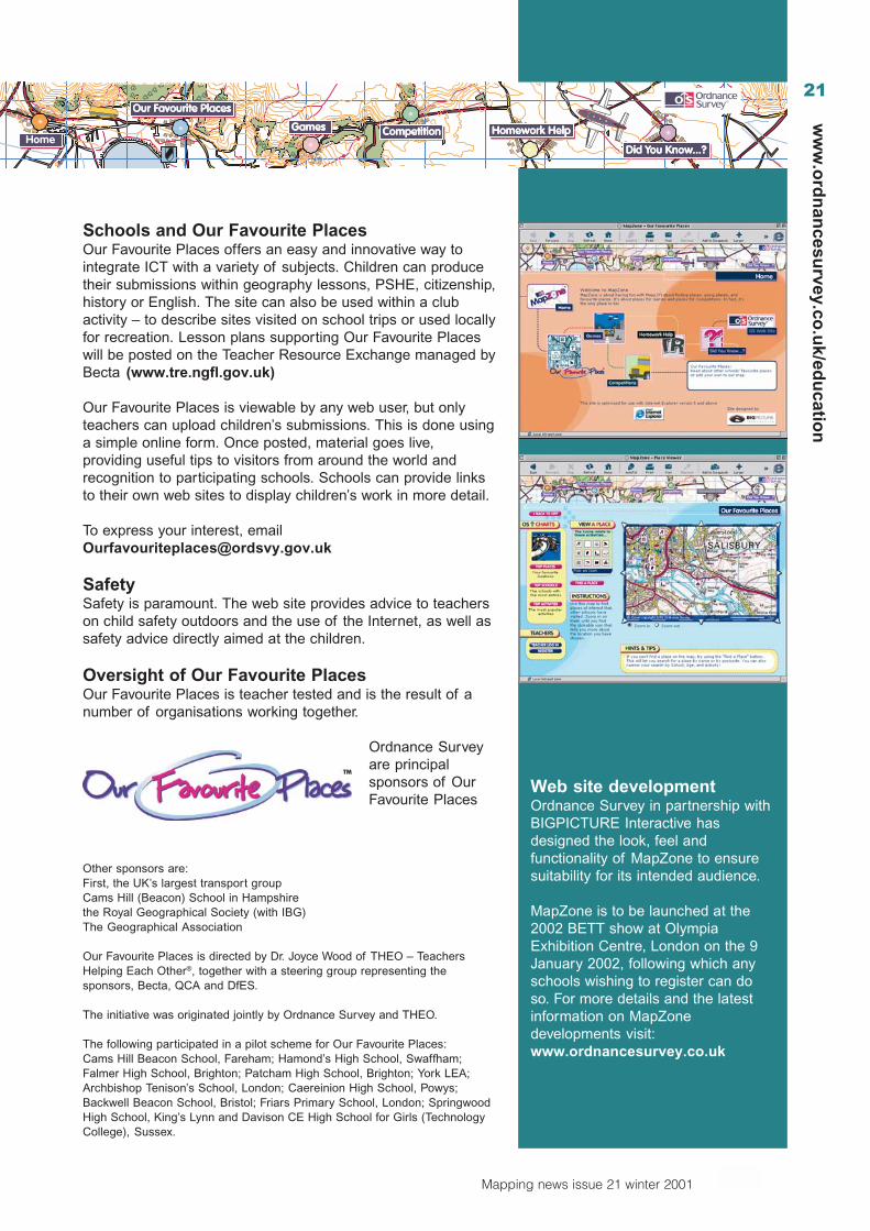
A new exciting part of AEGIS 3 is thefacility for adding your own pictures of alocality to the local map. There arenumerous possibilities to set up activitiessuch as an interactive pupil report usingdigital pictures obtained on fieldwork, ora class mapping exercise to identify andinvestigate pictures at different locationsin an unknown area. The choice ofbackground map could be a your own (ora pupil’s) sketch map, a digital OrdnanceSurvey map, or a vertical aerialphotograph.
Extending ICT and geographywith GIS activitiesThe examples and ideas in the AEGIS 3pack are springboards for beginning touse GIS as a tool within geographylessons. The examples offer an openingfor those who have not used GIS beforeand wish to see how it can enhanceteaching and learning. The extensionactivities show how the use of GIS canbe further developed by teachers orpupils for fieldwork and coursework.
How can I get hold of AEGIS 3?AEGIS 3 was launched at the BritishLibrary in London on 8 November andwill be featured on the Advisory Unit’sstand at the BETT 2002 show atOlympia in January 2002.
For more information refer to theAdvisory Unit’s web site at:www.advisory-unit.org.ukor contact:Phone: 01707 266714Fax: 01707 273684.
World map showing lifeexpectancy in 1999
Unemployment in the UK in1999
Click on a hotspot on themap of Castries to see apicture of the locality
20
Mapping news issue 21 winter 2001
ww
w.o
rdn
ance
surv
ey.c
o.u
k/ed
uca
tio
n
www.mapzone.co.uk
Introducing the all newMapZone web site
MapZone is an Ordnance Surveyweb site dedicated to the 7–14age group that makes mappingfun and interesting, whilststimulating soft-learning.
The site features Our FavouritePlaces – a guide to Britain’s child-friendliest attractions, producedby children themselves. Using aunique interactive map of GreatBritain, children can find newplaces to go, and decide what todo when they get there, based onrecommendations of pupils theirown age. The tourist guidesinclude comments, photos andartwork, all created by children atparticipating schools.
A top ten chart will keep track ofthe pupil’s all-time favourites, andthere will be activities andcompetitions to encourageexploration of the map as well asprizes for schools who submit themost interesting entries.
Any school can get involved.For details, see next page.
GamesChildren of all ages like games – and this site would not becomplete without ones with a geographical or mapping theme.Look out for a new take on compulsive old favourites and keepvisiting for more new games during the coming months.
CompetitionsEach month there will be a new competition to enter. Somecompetitions will be offered just for the fun of taking part, whileothers will have prizes for the winners. Excellent fun forafter-school or computer club activities.
Homework helpThis area is not yet available, but will develop during thecoming months to become a key area of the site. There will beNational Grid guidance, along with learning and self-tests forKey Stages 2–4, to help pupils with their curriculum activities.Teachers are bound to find this area useful too.
Did you know?Ordnance Survey receives thousands of public enquiries everyyear and has built up a fascinating store of information. Find out theanswers to such questions as Where is the middle of the country?or What are the most unusual place names?
Ordnance Survey web siteMapZone links directly to the Ordnance Survey main web site,where there is a dedicated section for Education (aimed mainlyat teachers), a Free & Fun section for all to enjoy. Check outthe free service for downloading our mapping, details on allmap products and much more…
Our Favourite PlacesOur Favourite Places gives children the opportunity tocelebrate the attractions they most enjoy visiting, either in theirown neighbourhoods or further afield. Although commercialtourist attractions are included, entries will also provideinformation about parks, beaches, museums and other free orlow cost places of interest.
Conventional tourist guides are targeted at adults butOur Favourite Places features children’s own words andpictures produced for the benefit of other children. Andbecause children’s interests change as they grow older, the siteis searchable by age as well as place and type of activity.
21
Mapping news issue 21 winter 2001
ww
w.o
rdn
ancesu
rvey.co.u
k/edu
cation
Schools and Our Favourite PlacesOur Favourite Places offers an easy and innovative way tointegrate ICT with a variety of subjects. Children can producetheir submissions within geography lessons, PSHE, citizenship,history or English. The site can also be used within a clubactivity – to describe sites visited on school trips or used locallyfor recreation. Lesson plans supporting Our Favourite Placeswill be posted on the Teacher Resource Exchange managed byBecta (www.tre.ngfl.gov.uk)
Our Favourite Places is viewable by any web user, but onlyteachers can upload children’s submissions. This is done usinga simple online form. Once posted, material goes live,providing useful tips to visitors from around the world andrecognition to participating schools. Schools can provide linksto their own web sites to display children’s work in more detail.
To express your interest, [email protected]
SafetySafety is paramount. The web site provides advice to teacherson child safety outdoors and the use of the Internet, as well assafety advice directly aimed at the children.
Oversight of Our Favourite PlacesOur Favourite Places is teacher tested and is the result of anumber of organisations working together.
Ordnance Surveyare principalsponsors of OurFavourite Places
Other sponsors are:First, the UK’s largest transport groupCams Hill (Beacon) School in Hampshirethe Royal Geographical Society (with IBG)The Geographical Association
Our Favourite Places is directed by Dr. Joyce Wood of THEO – TeachersHelping Each Other®, together with a steering group representing thesponsors, Becta, QCA and DfES.
The initiative was originated jointly by Ordnance Survey and THEO.
The following participated in a pilot scheme for Our Favourite Places:Cams Hill Beacon School, Fareham; Hamond’s High School, Swaffham;Falmer High School, Brighton; Patcham High School, Brighton; York LEA;Archbishop Tenison’s School, London; Caereinion High School, Powys;Backwell Beacon School, Bristol; Friars Primary School, London; SpringwoodHigh School, King’s Lynn and Davison CE High School for Girls (TechnologyCollege), Sussex.
Web site developmentOrdnance Survey in partnership withBIGPICTURE Interactive hasdesigned the look, feel andfunctionality of MapZone to ensuresuitability for its intended audience.
MapZone is to be launched at the2002 BETT show at OlympiaExhibition Centre, London on the 9January 2002, following which anyschools wishing to register can doso. For more details and the latestinformation on MapZonedevelopments visit:www.ordnancesurvey.co.uk
22
Mapping news issue 21 winter 2001
ww
w.o
rdn
ance
surv
ey.c
o.u
k/ed
uca
tio
n
We all know that if you’re going to teach someone how to read a map, it’s no goodjust sitting in a classroom pointing at an overhead projection screen for an hour,pointing at squiggles, blobs and letters. You need to get outside and relate thefeatures on a map to the real world.
Maximum challenge…maximum achievementDave Wood
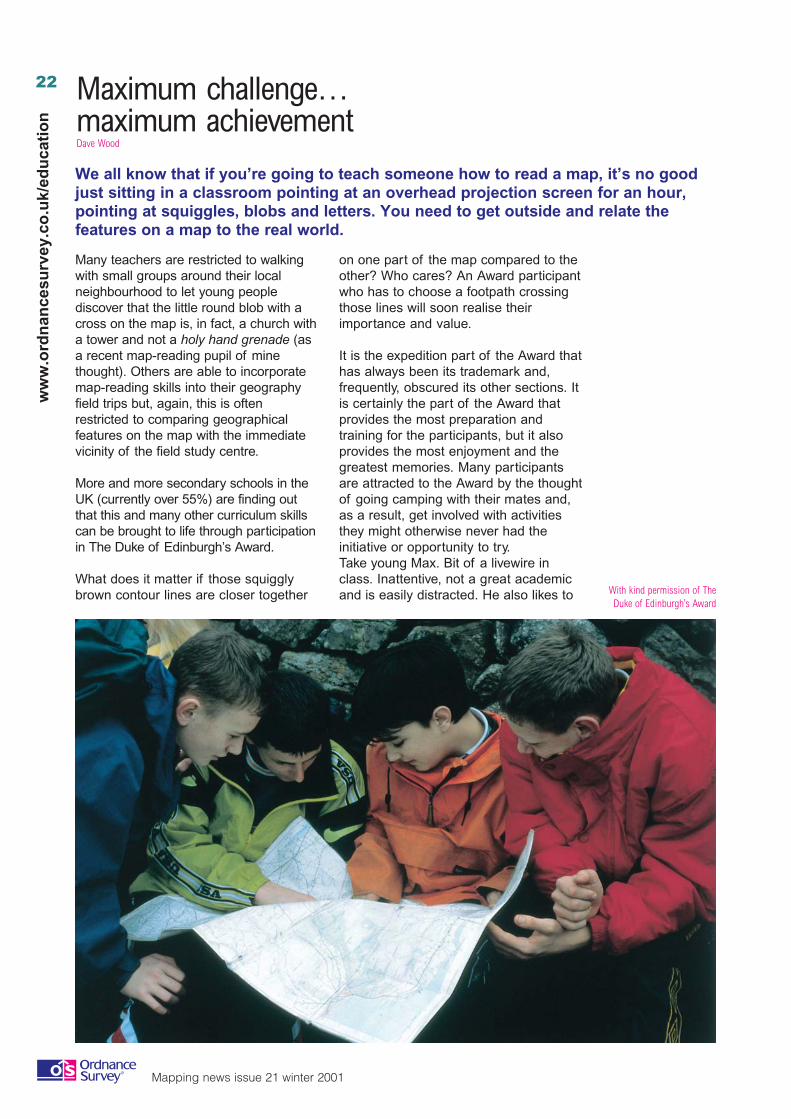
Many teachers are restricted to walkingwith small groups around their localneighbourhood to let young peoplediscover that the little round blob with across on the map is, in fact, a church witha tower and not a holy hand grenade (asa recent map-reading pupil of minethought). Others are able to incorporatemap-reading skills into their geographyfield trips but, again, this is oftenrestricted to comparing geographicalfeatures on the map with the immediatevicinity of the field study centre.
More and more secondary schools in theUK (currently over 55%) are finding outthat this and many other curriculum skillscan be brought to life through participationin The Duke of Edinburgh’s Award.
What does it matter if those squigglybrown contour lines are closer together
on one part of the map compared to theother? Who cares? An Award participantwho has to choose a footpath crossingthose lines will soon realise theirimportance and value.
It is the expedition part of the Award thathas always been its trademark and,frequently, obscured its other sections. Itis certainly the part of the Award thatprovides the most preparation andtraining for the participants, but it alsoprovides the most enjoyment and thegreatest memories. Many participantsare attracted to the Award by the thoughtof going camping with their mates and,as a result, get involved with activitiesthey might otherwise never had theinitiative or opportunity to try.Take young Max. Bit of a livewire inclass. Inattentive, not a great academicand is easily distracted. He also likes to With kind permission of The
Duke of Edinburgh’s Award
23
Mapping news issue 21 winter 2001
ww
w.o
rdn
ancesu
rvey.co.u
k/edu
cation
disturb lessons and be the centre ofattention. In the gym and away from theclassroom, though, he starts to excel.He’d certainly enjoy the physicalrecreation section of the Award andwould also love the expedition. Is he thesort of lad you’d imagine would happilycut the grass in an old lady’s gardenonce a week and help with hershopping? As he would be halfwaythrough his Award, and would alreadyhave two sectional certificates to markhis achievements, he would probably bekeen to complete the other two sections,of which service is one. Finally, he’dneed to undertake a skill for a set periodof time – this can be any hobby frombilliards and circus skills to music andfantasy games.
At bronze level, participants mustundertake an expedition lasting two days.They must also undertake activities in theother three sections for three monthseach, with an extra three months spent ontheir favourite of these three sections.
Many schools offer the Award to theirYear 9 pupils (the starting age for bronzeis 14, although 13-year-olds may enterwith their peer group if they arepredominantly 14) and guide themthrough it over the academic year,culminating with the final expedition inthe summer term. Imagine theconfidence boost young Max gets when,for the first time in his life, he is praisedby the head teacher in front of theschool for his achievements.
The Award is voluntary and a significantamount of it should be completed in thepupil’s own time out of school hours. It isa registered charity run by a head officein Windsor and with a network ofnational and regional offices who providesupport to those running the programme.
Why not join those thousands of schoolsalready involved in the Award and seewhat it can do for the Max’s – and hisfriends – in your school.
Why do schools bother with the Award?Schools benefit from running the Award in a variety ofways:• It demonstrates their implementation of government
policy.• It improves their reputation with the local community.• It encourages parental support for their schools.• It promotes equality within their school.• It improves their pupils prospects for the future.• It contributes positively to their OFSTED report.• It plays a part in reducing absenteeism and truancy.
For the young people, participation in theAward leads to personal development throughthe acquisition of:• Qualities: independence, self motivation, commitment,
self awareness, initiative, perseverance, self-disciplineand responsibility for both themselves and theircommunity.
• Key skills: working with others, communications,problem solving, improving own learning andperformance, application of numbers and informationtechnology.
• Accreditation: accrediting learning via a nationallyrecognised programme.
To get involved or to get a special information andposter pack on the DofE,Email: [email protected]: 01753 727400Web Site: www.theaward.orgor write to: Schools Unit
The Duke of Edinburgh’s AwardGulliver HouseMadeira WalkWINDSORBerkshireSL4 1EU
24
Mapping news issue 21 winter 2001
ww
w.o
rdn
ance
surv
ey.c
o.u
k/ed
uca
tio
n
International GeographicOlympiad
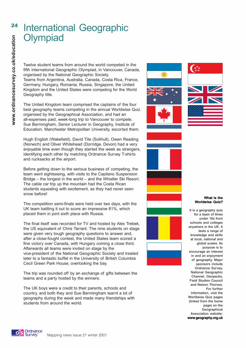
Twelve student teams from around the world competed in thefifth International Geographic Olympiad, in Vancouver, Canada,organised by the National Geographic Society.Teams from Argentina, Australia, Canada, Costa Rica, France,Germany, Hungary, Romania, Russia, Singapore, the UnitedKingdom and the United States were competing for the WorldGeography title.
The United Kingdom team comprised the captains of the fourbest geography teams competing in the annual Worldwise Quizorganised by the Geographical Association, and had anall-expenses paid, week-long trip to Vancouver to compete.Sue Bermingham, Senior Lecturer in Geography, Institute ofEducation, Manchester Metropolitan University, escorted them.
Hugh English (Wakefield), David Tite (Solihull), Owen Reading(Norwich) and Oliver Whitehead (Dorridge, Devon) had a veryenjoyable time even though they started the week as strangers,identifying each other by matching Ordnance Survey T-shirtsand rucksacks at the airport.
Before getting down to the serious business of competing, theteam went sightseeing, with visits to the Capilano SuspensionBridge – the longest in the world – and the Whistler Ski Resort.The cable car trip up the mountain had the Costa Ricanstudents squealing with excitement, as they had never seensnow before!
The competition semi-finals were held over two days, with theUK team battling it out to score an impressive 81%, whichplaced them in joint sixth place with Russia.
The final itself was recorded for TV and hosted by Alex Trebek,the US equivalent of Chris Tarrant. The nine students on stagewere given very tough geography questions to answer and,after a close-fought contest, the United States team scored afine victory over Canada, with Hungary coming a close third.Afterwards all teams were invited on stage by thevice-president of the National Geographic Society and treatedlater to a fantastic buffet in the University of British ColumbiaCecil Green Park House, overlooking the bay.
The trip was rounded off by an exchange of gifts between theteams and a party hosted by the winners.
The UK boys were a credit to their parents, schools andcountry, and both they and Sue Bermingham learnt a lot ofgeography during the week and made many friendships withstudents from around the world.
WWWWWhahahahahat is thet is thet is thet is thet is theWWWWWorororororldldldldldwise Quiz?wise Quiz?wise Quiz?wise Quiz?wise Quiz?
It is a geography quizfor a team of three
under 16s fromschools and colleges
anywhere in the UK. Ittests a range of
knowledge and skillsat local, national and
global scales. Itspurpose is to
encourage an interestin and an enjoymentof geography. Major
sponsors includeOrdnance Survey,
National GeographicChannel, Geopacks,
Field Studies Counciland Nelson Thornes.
For furtherinformation, visit the
Worldwise Quiz pages(linked from the home
page) on theGeographical
Association website:wwwwwwwwwwwwwww.g.g.g.g.geoeoeoeoeogggggrrrrraaaaaphphphphphyyyyy.or.or.or.or.orggggg.uk.uk.uk.uk.uk
25
Mapping news issue 21 winter 2001
ww
w.o
rdn
ancesu
rvey.co.u
k/edu
cation
RAC Grass Routes Challenge 2001Established in 1999, Grass Routes is a national competition which challengesstudents to develop a school travel plan in order to reduce congestion and improveroad safety around their school.
Students were asked to:
• look at the problems faced by everyone travelling to schooland identify the solutions; and
• research the reasons staff and pupils choose the mode oftransport they currently use and then find ways toencourage them to choose healthier more sustainableoptions.
This year 1300 schools took part, with the winning projectbeing produced by Emma Higgins, Camilla Bruce, VickyStephens and Kirsty Venables of Knowles Hill School, NewtonAbbot, Devon.
The team, all aged fifteen, devised a travel plan that addressedthe problems facing cyclists, walkers and users of publictransport alike. They also focussed on ways of reducing cartravel to and from school. Its hallmarks were the strong use ofsurveys, widespread consultation, clear target setting, goodimplementation plans and ongoing proposals for monitoringand review.
Key proposals were:
• installing bike lockers;• providing showers and changing facilities for bike riders;• offering vouchers for safety helmets;• campaigning for more cycle paths, street lighting and
car-free entrances; and• meeting representatives of Stagecoach to try to establish a
pupil-friendly timetable.
One of the judges, Paul Osborne of Sustrans, commented thatthis was ‘ ...a really excellent example of what can be achievedby a school’.
The presentationThe prize ceremony, which took place atthe school in early October, wasattended by the local MP, RichardYounger-Ross, and the Mayor of NewtonAbbot, along with representatives of thepolice, Travelwise, Sustrans and localcouncillors and TV’s John Craven.
RAC Managing Director, Graeme Potts,presented the prizes of £4 000 for theschool to implement the travel plan, aselection of Ordnance Survey maps,£150 Virgin voucher for each studentand a trip in the RAC balloon for thewinning team.
The guests heard presentations fromstudents on their plan as well as ideasfor future work on the environment androad safety within the community. One oflast year’s winning schools reaped afurther £40 000 in local grants toimplement their plan based on theirGrass Routes Challenge work.
26
Mapping news issue 21 winter 2001
ww
w.o
rdn
ance
surv
ey.c
o.u
k/ed
uca
tio
n
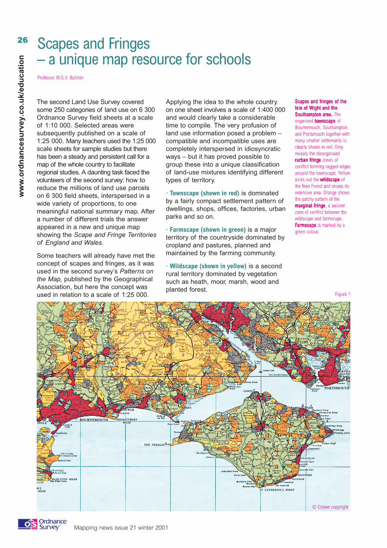
The second Land Use Survey coveredsome 250 categories of land use on 6 300Ordnance Survey field sheets at a scaleof 1:10 000. Selected areas weresubsequently published on a scale of1:25 000. Many teachers used the 1:25 000scale sheets for sample studies but therehas been a steady and persistent call for amap of the whole country to facilitateregional studies. A daunting task faced thevolunteers of the second survey: how toreduce the millions of land use parcelson 6 300 field sheets, interspersed in awide variety of proportions, to onemeaningful national summary map. Aftera number of different trials the answerappeared in a new and unique mapshowing the Scape and Fringe Territoriesof England and Wales.
Some teachers will already have met theconcept of scapes and fringes, as it wasused in the second survey’s Patterns onthe Map, published by the GeographicalAssociation, but here the concept wasused in relation to a scale of 1:25 000.
Scapes and Fringes– a unique map resource for schoolsProfessor W.G.V. Balchin
Applying the idea to the whole countryon one sheet involves a scale of 1:400 000and would clearly take a considerabletime to compile. The very profusion ofland use information posed a problem –compatible and incompatible uses arecompletely interspersed in idiosyncraticways – but it has proved possible togroup these into a unique classificationof land-use mixtures identifying differenttypes of territory.
· Townscape (shown in red) is dominatedby a fairly compact settlement pattern ofdwellings, shops, offices, factories, urbanparks and so on.
· Farmscape (shown in green) is a majorterritory of the countryside dominated bycropland and pastures, planned andmaintained by the farming community.
· Wildscape (shown in yellow) is a secondrural territory dominated by vegetationsuch as heath, moor, marsh, wood andplanted forest.
Figure 1
© Crown copyright
ScaScaScaScaScapes and fringpes and fringpes and fringpes and fringpes and fringes ofes ofes ofes ofes of the the the the theIsle ofIsle ofIsle ofIsle ofIsle of WWWWWight and theight and theight and theight and theight and theSouthampton arSouthampton arSouthampton arSouthampton arSouthampton area.ea.ea.ea.ea. Theorganised tototototownscawnscawnscawnscawnscape pe pe pe pe ofBournemouth, Southamptonand Portsmouth together withmany smaller settlements isclearly shown in red. Greyreveals the disorganisedrrrrrurban fringurban fringurban fringurban fringurban fringeeeee zones ofconflict forming ragged edgesaround the townscape. Yellowpicks out the wildscawildscawildscawildscawildscape pe pe pe pe ofthe New Forest and shows itsextensive area. Orange showsthe patchy pattern of themarmarmarmarmarginal fringginal fringginal fringginal fringginal fringeeeee, a secondzone of conflict between thewildscape and farmscape.FFFFFarararararmscamscamscamscamscapepepepepe is marked by agreen colour.
27
Mapping news issue 21 winter 2001
ww
w.o
rdn
ancesu
rvey.co.u
k/edu
cation
· Marginal fringe (shown in orange) is athird rural territory of a patchy mixture ofimproved farmland and wildscape. Thisis a zone of conflict.
· Rurban fringe (shown in grey) is a mixtureof settlement and associateddevelopments with farmland constitutinga second zone of conflict.
A technique of reduction had to bedevised so that different cartographersproduced identical boundaries; theresulting map is highly objective and is afaithful reflection of the real world –many lines on the map representfeatures that are actually visible in thefield. Printed in seven colours on a basemap showing settlement, roads, railwaysand so on with names, the map hasmany applications at the national andlocal level. Figure 1 is an extract showingthe Southampton area.
The characteristics of the scapes andfringes and their potential problems aredescribed in a 98-page book that is partof a pack. The book also relates thenational area of each territory toenvironmental factors such as elevation,slope angle, rainfall and populationdensity graphed as histograms.
The unique methodology has created amap with multiple uses in teaching:
Getting to know the homelandTeachers complain that even sixth-formersare very ignorant of the geography oftheir own country, and the Scape andFringe map can provide a short-cutremedy. As a wall map it strikinglyillustrates the salient features of the landof Britain. The moorland edge is oftenperceived more clearly as a land use factthan when the extent of upland has to bederived from the graduated layer coloursof a relief map, and this highlights thegaps exploited by upland road and railroutes. Regions such as the Brecklandand New Forest stand out in strongcontrast, the coalfields’ legacy ofdereliction appears as a spottydistribution of rurban fringe, and theconurbations show their townscapecores and rurban aureoles.
Putting current events intocontextAs a permanent wall display in primaryand secondary schools, the Scape andFringe map can be used to pinpointcurrent events. Sports venues can be
located and natural disasters explained.For example, areas of flooding can berelated to swollen rivers descending fromthe Welsh mountains, the Pennines orthe High Weald and so on. The westerlydistribution of the foot and mouthepidemic can be related to theprevalence of animal farming in thewetter west as opposed to arablefarming in the drier east.
Understanding the localenvironmentAll localities comprise of at least onescape or fringe. How far does the localland use fit the book’s description of theterritories shown on the map? Are theyrelated to the environmental factors suchas land elevation, slope angle, rainfalland population density, in the same waysthat are shown in the book throughgraphs for their relationships in the wholecountry? More detailed follow-up ispossible in areas for which the 1:25 000scale land use sheets have beenpublished.
Inspiration for individual studiesFresh topics are often hard to find and theScape and Fringe map can suggest newones. Teachers who have seen it havediscerned a number of fresh possibilities.Are there new developments in greenwedges and do they consolidatetownscape or proliferate rurban fringe? Isthe massive kill of farm animals causingpastures to revert and so expandmarginal fringe? Do new bypasses arrestrurban sprawl or attract more of it beyondtheir outer sides? Is it possible to identifyany subtypes of the scapes and fringesdescribed in the book?
Enquiring into land use changeAny map becomes out of date as soonas it is made and this time dimensioncan be turned to advantage in teaching.The local area on the map may beinspected for possible post-surveytrends, to focus discussion on theirinfluence for good or ill. For example, weknow that permission has been given tobuild new housing estates on flood plainswhere some have been inundated intimes of heavy rainfall, and have trafficjams been created by refusingpermission to build houses in townscapeareas where people could walk to work?
The Scapeand FringePackcomprisestwo sheets,which makeup into awall map 6feet by 4½feet (1.8 mby 1.3 m),togetherwith a98- pageexplanatorybook. Thepack can beobtained for£30 postfree from:The SecondLandUtilisationSurvey,19–20 GilesCoppice,DulwichWood Park,LONDON,SE19 1XF.
28
Mapping news issue 21 winter 2001
ww
w.o
rdn
ance
surv
ey.c
o.u
k/ed
uca
tio
n
29
Mapping news issue 21 winter 2001
ww
w.o
rdn
ancesu
rvey.co.u
k/edu
cation
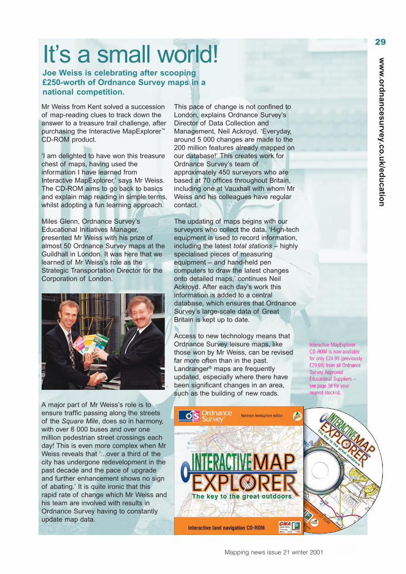
It’s a small world!Joe Weiss is celebrating after scooping£250-worth of Ordnance Survey maps in anational competition.
Mr Weiss from Kent solved a successionof map-reading clues to track down theanswer to a treasure trail challenge, afterpurchasing the Interactive MapExplorer™
CD-ROM product.
‘I am delighted to have won this treasurechest of maps, having used theinformation I have learned fromInteractive MapExplorer,’ says Mr Weiss.The CD-ROM aims to go back to basicsand explain map reading in simple terms,whilst adopting a fun learning approach.
Miles Glenn, Ordnance Survey’sEducational Initiatives Manager,presented Mr Weiss with his prize ofalmost 50 Ordnance Survey maps at theGuildhall in London. It was here that welearned of Mr Weiss’s role as theStrategic Transportation Director for theCorporation of London.
A major part of Mr Weiss’s role is toensure traffic passing along the streetsof the Square Mile, does so in harmony,with over 8 000 buses and over onemillion pedestrian street crossings eachday! This is even more complex when MrWeiss reveals that ‘...over a third of thecity has undergone redevelopment in thepast decade and the pace of upgradeand further enhancement shows no signof abating.’ It is quite ironic that thisrapid rate of change which Mr Weiss andhis team are involved with results inOrdnance Survey having to constantlyupdate map data.
This pace of change is not confined toLondon, explains Ordnance Survey’sDirector of Data Collection andManagement, Neil Ackroyd. ‘Everyday,around 5 000 changes are made to the200 million features already mapped onour database!’ This creates work forOrdnance Survey’s team ofapproximately 450 surveyors who arebased at 70 offices throughout Britain,including one at Vauxhall with whom MrWeiss and his colleagues have regularcontact.
The updating of maps begins with oursurveyors who collect the data. ‘High-techequipment is used to record information,including the latest total stations – highlyspecialised pieces of measuringequipment – and hand-held pencomputers to draw the latest changesonto detailed maps,’ continues NeilAckroyd. After each day’s work thisinformation is added to a centraldatabase, which ensures that OrdnanceSurvey’s large-scale data of GreatBritain is kept up to date.
Access to new technology means thatOrdnance Survey leisure maps, likethose won by Mr Weiss, can be revisedfar more often than in the past.Landranger® maps are frequentlyupdated, especially where there havebeen significant changes in an area,such as the building of new roads.
Interactive MapExplorerCD-ROM is now availablefor only £24.99 (previously£29.99) from all OrdnanceSurvey ApprovedEducational Suppliers –see page 38 for yournearest stockist.
30
Mapping news issue 21 winter 2001
ww
w.o
rdn
ance
surv
ey.c
o.u
k/ed
uca
tio
n
Can you always believe what you see on a map? Is a mapalways a true reflection of the land beneath our feet? TheBritish Library’s new Lie of the Land exhibition runs until April2002 and invites schools and the public to take a closer look atmaps and to discover that there is always more to a map thanmeets the eye.
Since drawings were first produced, maps have been afundamental part of the way we understand our world – amental attempt to rise above our normal, ground-based pointof view. They are an expression of human ability to thinkimaginatively, spatially – and strategically. We apply theoverview principle not just in the geographical maps that weuse to navigate, but also in circuit diagrams, architecturalblueprints, underground railway diagrams, staff organisationalcharts, the periodic table of elements, flow charts, boardgames and even school timetables, which map time rather thanphysical space.
What all the above have in common is that they are ways ofsummarising information in a spatial, two-dimensional form.Pictures find it hard to show theoretical relationships, andmathematical equations are just one-dimensional and hard toread. A map is as much about interpreting reality as justrepresenting it, a quality that makes it an amazingly potentteaching tool.
Drawing the LineEvery country in every era has its own views of the world, andlooking closely at historical maps can provide us with a whollynew world view – literally. One of the earliest maps in theexhibition is a TO map, created in mediaeval times. It does notattempt geographical accuracy, instead dividing the continentswith straight lines. Lie of the Land offers us the development ofa world view based firstly on theory, theology, hearsay andspeculation but increasingly on direct observation and rigorousscientific method. In the early renaissance, Ptolemy’sgeographical map replaced the TO maps. Then GerardMercator’s 1569 Eurocentric view of the world came todominate cartography for centuries until we come to moderncontroversies over the most recent projections: Mollweide,Albers, Lambert, Eckert and, most dramatically, the Gall-Peters.All of these differ in the prominence and size they seem to giveto different continents and in the degree to which they give true
shape. Debate continues to rage aboutwhich projection gives the truest pictureof the world. Even this is a far cry fromthe unabashedly Imperial Britishschoolroom maps of the 1800s – whichgive prominence to territory controlled bythe British.
Nowadays we are used to seeing mapsthat have definite limits and every sectionfilled in, but it is interesting to examineEuropean maps from the sixteenthcentury, where unexplored coastlines inAmerica, Siberia or Australia just tail offinto mysterious white nothingness.
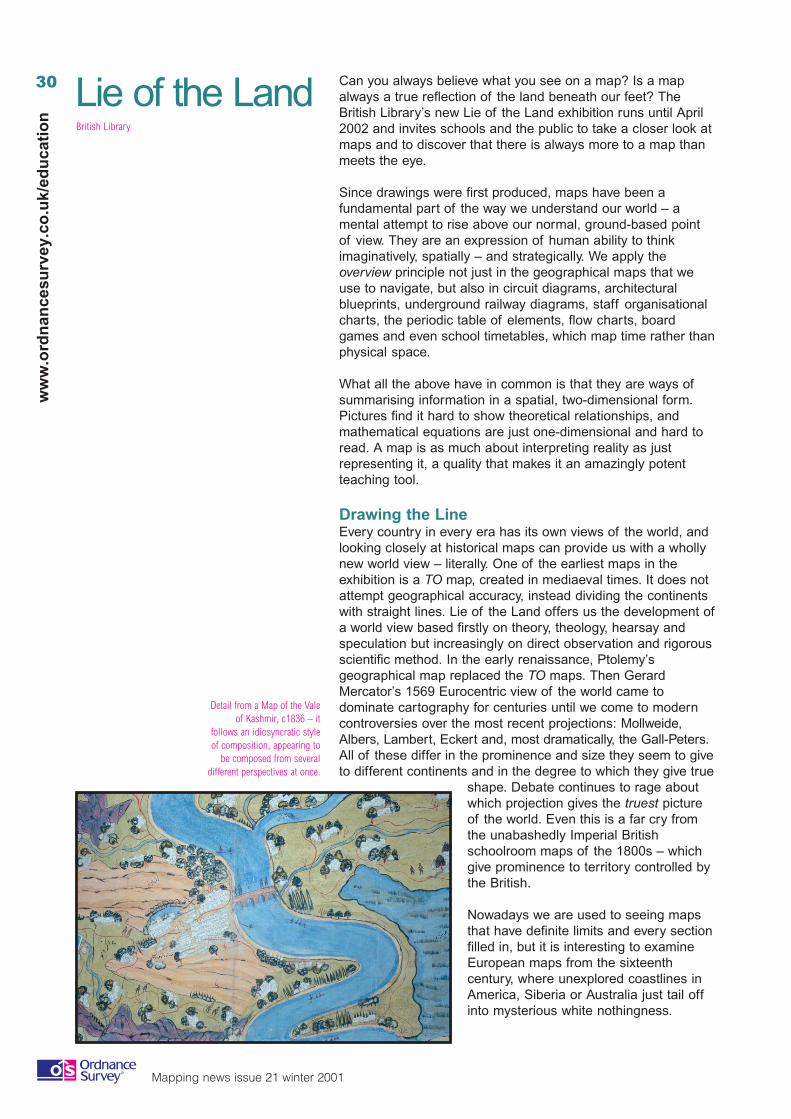
Detail from a Map of the Valeof Kashmir, c1836 – it
follows an idiosyncratic styleof composition, appearing to
be composed from severaldifferent perspectives at once.
Lie of the LandBritish Library
31
Mapping news issue 21 winter 2001
ww
w.o
rdn
ancesu
rvey.co.u
k/edu
cation
Spinning the WorldBecause they interpret at the same time as representing, mapsonly tell part of the truth about what they depict. Some mapsuse misleading symbolism (such as green for low-lying areasand brown for uplands) that fails to give an accurate picture ofsome parts of the world. Other maps do this kind of thing onpurpose. Allied propaganda maps from the Second World Wartend to show encroaching Nazi Germany in pitch black.
Maps have often been objets d’art too, with aestheticsbecoming just as important as geographical accuracy.
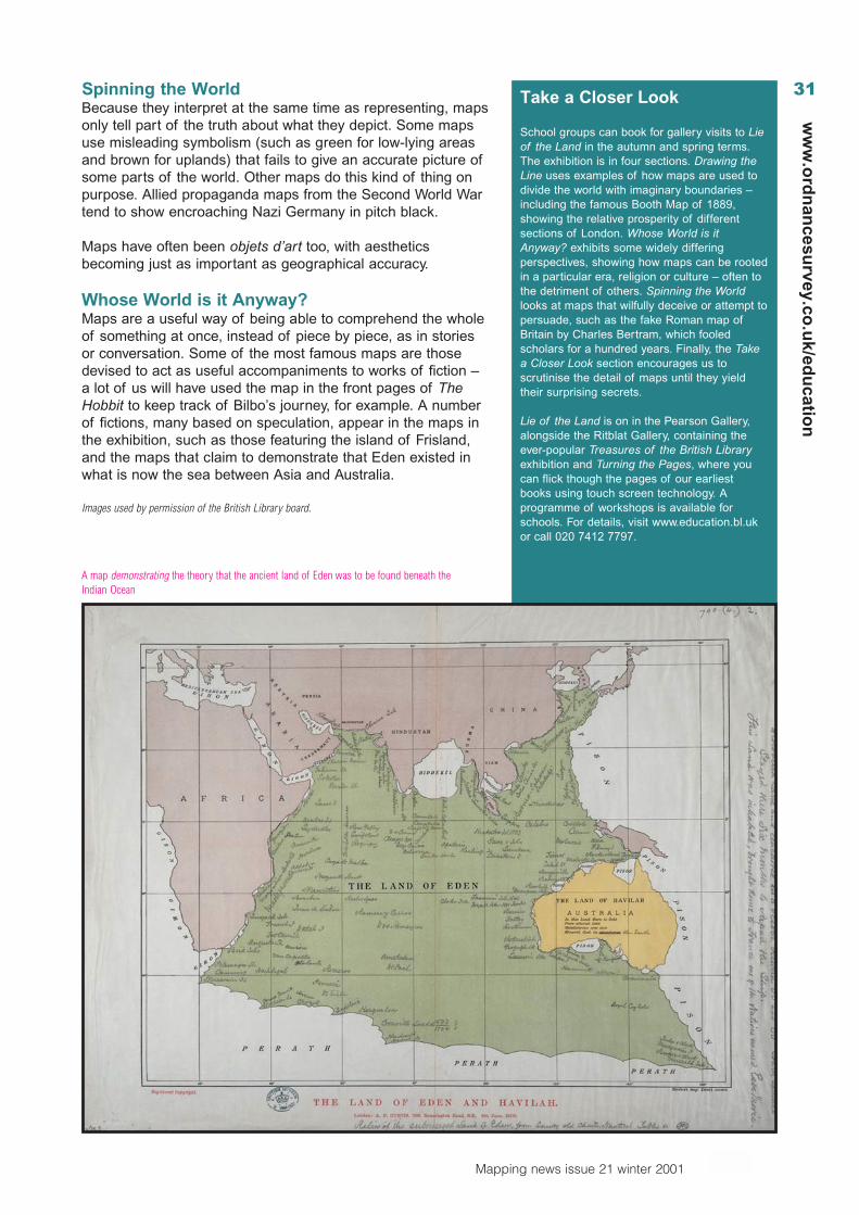
Whose World is it Anyway?Maps are a useful way of being able to comprehend the wholeof something at once, instead of piece by piece, as in storiesor conversation. Some of the most famous maps are thosedevised to act as useful accompaniments to works of fiction –a lot of us will have used the map in the front pages of TheHobbit to keep track of Bilbo’s journey, for example. A numberof fictions, many based on speculation, appear in the maps inthe exhibition, such as those featuring the island of Frisland,and the maps that claim to demonstrate that Eden existed inwhat is now the sea between Asia and Australia.
Images used by permission of the British Library board.
Take a Closer Look
School groups can book for gallery visits to Lieof the Land in the autumn and spring terms.The exhibition is in four sections. Drawing theLine uses examples of how maps are used todivide the world with imaginary boundaries –including the famous Booth Map of 1889,showing the relative prosperity of differentsections of London. Whose World is itAnyway? exhibits some widely differingperspectives, showing how maps can be rootedin a particular era, religion or culture – often tothe detriment of others. Spinning the Worldlooks at maps that wilfully deceive or attempt topersuade, such as the fake Roman map ofBritain by Charles Bertram, which fooledscholars for a hundred years. Finally, the Takea Closer Look section encourages us toscrutinise the detail of maps until they yieldtheir surprising secrets.
Lie of the Land is on in the Pearson Gallery,alongside the Ritblat Gallery, containing theever-popular Treasures of the British Libraryexhibition and Turning the Pages, where youcan flick though the pages of our earliestbooks using touch screen technology. Aprogramme of workshops is available forschools. For details, visit www.education.bl.ukor call 020 7412 7797.
A map demonstrating the theory that the ancient land of Eden was to be found beneath theIndian Ocean
32
Mapping news issue 21 winter 2001
ww
w.o
rdn
ance
surv
ey.c
o.u
k/ed
uca
tio
n
The HistoricalAssociation is currentlybringing togetherorganisations all overBritain to celebrate aweek of local historyevents from 4–12 May2002. Already hundreds of local andnational history societies, museums,archives and other places haveresponded enthusiastically to the idea ofsuch a celebration and have organised ahuge range of exciting events for theweek. The idea is to use Local HistoryWeek (LHW) as a way of combining thediverse activities which already exist at alocal level and to give them morewidespread publicity and appreciation.
Local history is a historical theme thatcan involve everyone, from professionalsto enthusiasts and from the biggestorganisations right down to individualswho have an interest in theircommunities. It is also an increasinglyimportant area of the national curriculumand access to local historical resourcesis relatively easy for teachers andstudents.
The eventsHundreds of events will be taking placeacross England, Wales and Scotland,everywhere from Cornwall to theOrkneys and will include things like:
• local and family history fairs;• history adventure walks;• museum and archive discovery days;• special exhibitions;• talks and debates;• conferences and events;• history projects;• online activities;• re-enactments and demonstrations;
and• competitions and prizes.
The full programme of events and lotsmore information about LHW isaccessible online and will be updatedregularly. Visit The Historical Association
home page atwww.history.org.ukand click on the LHWlogo. This will take youthrough to the mainLHW menu.
The long-term benefits of LHW will bevaluable; highlighting the importance ofhistory both as an academic subject inschools and as a way of encouragingpeople to take pride in their communities,providing encouragement to localhistorians to undertake research andpublish their findings, encouraging theuse of IT and multimedia in researchingand presenting findings, and above allenjoying history and the diversity whichits study entails. In the short term, theimmediate aim of the week is toencourage wider active participation inlocal history by helping everyone find outjust how much is going on in their areaand how they can join in. As to thefuture, if LHW 2002 is a success wehope that national history weeks mightbe held regularly.
If you would like more details or areinterested in becoming involved, pleasecontact Suzanne Cawsey at:The Historical Association59A Kennington Park RoadLONDONSE11 4JHPhone: 020 7735 2021.Email: [email protected]
Schools that have obtained their freeOrdnance Survey digital map data willfind it a useful additional resource thatwill enhance any LHW project. Seedetails of how to obtain your data onpage 9.
To support LHW a discount on allOrdnance Survey historical mapping willbe available from 1 April to 31 May 2002.Further information will be posted on ourweb site www.ordnancesurvey.co.uk indue course.
Local History Week: 4–12 May 2002A celebration of local and family history organised by The Historical Association
Suzanne Cawsey
33
Mapping news issue 21 winter 2001
ww
w.o
rdn
ancesu
rvey.co.u
k/edu
cation
A few years ago I discovered, when showing a group of young people a range oflearn. By my not telling them where the photograph was taken, the pupils lookedfor evidence in all the corners. They were challenged to draw on their priorknowledge and understanding. Like any good idea, it should not be overused, butit seemed to work well and it was an example of counter-intuitive thinkingnecessary to increase the strategies of the teacher in a media-rich world.
In this series of articles for Mapping news,there has been an emphasis ondeveloping critical thinking and creativitywith web sources. This is a vital element ineducation and in supporting young peopleto cope with the information-overloadsociety. The range of images availablehas often been cited as one of the greatstrengths of the Internet for geography.This is only true if we use themeffectively to:• broaden young people’s
geographical understanding ofthe world;
• understand the role of images inshaping perceptions andprejudices towards people andplaces; and
• understand the partial picture weget from highly selected sources,whether they are geographytextbooks, tourist brochures orleaflets from a development agency.
The interpretation of images, be theyphotographs, sketches, maps, graphs andso on, is at the heart of geography for allages. There is increasing evidence ofimages from the web being used byteachers (and young people). There arecertain questions that we need to askabout how we enable young people touse them. Can young people:
1. write captions which include atleast the subject, location anddate?
2. use evidence in a photograph todescribe landscape, climate,vegetation and human activity (asappropriate) and to suggest alocation?
3. suggest subgroups from a biggerset of photographs?
Images from the web –What can we do with them?Chris DurbinCounty Inspector for Geography Staffordshire
www.sln.org.uk/geography
4. understand the purpose andaudience for a photograph?
5. sequence a set of photographs?6. relate photographs to locations
on a map?
Here are some examples of how youmight use images from the web toachieve some of the above. The teacherprepared the lesson by saving a set ofimages from the web sites indicated andusing them off-line.
Lesson 1Worldgeography –KS2 and 3
Using WOW!www.sln.org.uk/wow the teachersaved about 30images fromdifferent continents.
The lesson beganwith a world map. The continents wereidentified and there was some discussionabout landscapes, climates, and humanactivities. The class was divided intopairs and the photographs had to besorted into folders named by thecontinents. The extension activity was tosearch the web to add to the sets ofimages. The pupils then individuallyfocussed on two photographs fromdifferent continents and had to give theirreasons for believing that eachphotograph was taken in the continentthey had chosen.A good site to do this with UK regionalgeography is www.freefoto.com
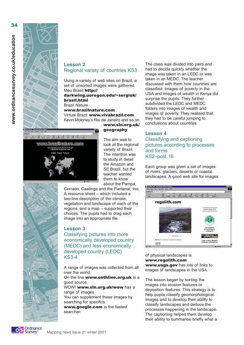
34
Mapping news issue 21 winter 2001
ww
w.o
rdn
ance
surv
ey.c
o.u
k/ed
uca
tio
n
The class was divided into pairs andhad to decide quickly whether theimage was taken in an LEDC or wastaken in an MEDC. The teacherdiscussed with them how countries areclassified. Images of poverty in theUSA and images of wealth in Kenya didsurprise the pupils. They furthersubdivided the LEDC and MEDCfolders into images of wealth andimages of poverty. They realised thatthey had to be careful jumping toconclusions about countries.
Lesson 4Classifying and captioningpictures according to processesand formsKS2–post 16
Each group was given a set of imagesof rivers, glaciers, deserts or coastallandscapes. A good web site for images
of physical landscapes iswww.regolith.comwww.usgs.gov has lots of links toimages of landscapes in the USA.
The lesson began by sorting theimages into erosion features ordeposition features. This strategy is tohelp pupils classify geomorphologicalimages and to develop their ability toclassify landscapes and deduce theprocesses happening in the landscape.The captioning helped them developtheir ability to summarise briefly what a
Lesson 2Regional variety of countries KS3
Using a variety of web sites on Brazil, aset of unsorted images were gathered.Meu Brasil http://darkwing.uoregon.edu/~sergiok/brasil.htmlBrazil Naturewww.brazilnature.comVirtual Brazil www.vivabrazil.comKevin Moloney’s Rio de Janeiro and so on
www.sln.org.uk/geography
The aim was tolook at the regionalvariety of Brazil.The intention wasto study in detailthe Amazon andSE Brazil, but theteacher wantedthem to knowabout the Pampa,
Cerrado, Caatinga and the Pantanal, too.A resource sheet – which included atwo-line description of the climate,vegetation and landscape of each of theregions, and a map – supported theirchoices. The pupils had to drag eachimage into an appropriate file.
Lesson 3Classifying pictures into moreeconomically developed country(MEDC) and less economicallydeveloped country (LEDC)KS3-4
A range of images was collected from allover the world.On the line www.onthline.org.uk is agood source.WOW! www.sln.org.uk/wow has arange of images.You can supplement these images bysearching for specifics.www.google.com is the fastestsearcher.
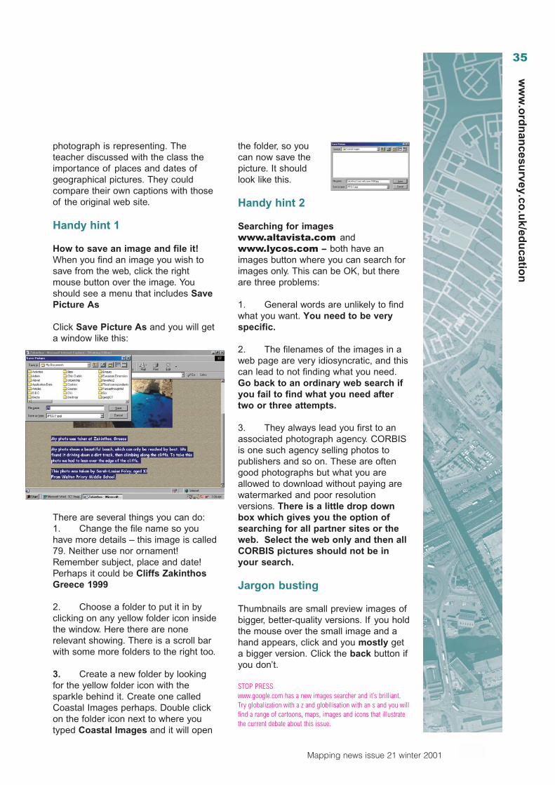
35
Mapping news issue 21 winter 2001
ww
w.o
rdn
ancesu
rvey.co.u
k/edu
cation
photograph is representing. Theteacher discussed with the class theimportance of places and dates ofgeographical pictures. They couldcompare their own captions with thoseof the original web site.
Handy hint 1
How to save an image and file it!When you find an image you wish tosave from the web, click the rightmouse button over the image. Youshould see a menu that includes SavePicture As
Click Save Picture As and you will geta window like this:
There are several things you can do:1. Change the file name so youhave more details – this image is called79. Neither use nor ornament!Remember subject, place and date!Perhaps it could be Cliffs ZakinthosGreece 1999
2. Choose a folder to put it in byclicking on any yellow folder icon insidethe window. Here there are nonerelevant showing. There is a scroll barwith some more folders to the right too.
3. Create a new folder by lookingfor the yellow folder icon with thesparkle behind it. Create one calledCoastal Images perhaps. Double clickon the folder icon next to where youtyped Coastal Images and it will open
the folder, so youcan now save thepicture. It shouldlook like this.
Handy hint 2
Searching for imageswww.altavista.com andwww.lycos.com – both have animages button where you can search forimages only. This can be OK, but thereare three problems:
1. General words are unlikely to findwhat you want. You need to be veryspecific.
2. The filenames of the images in aweb page are very idiosyncratic, and thiscan lead to not finding what you need.Go back to an ordinary web search ifyou fail to find what you need aftertwo or three attempts.
3. They always lead you first to anassociated photograph agency. CORBISis one such agency selling photos topublishers and so on. These are oftengood photographs but what you areallowed to download without paying arewatermarked and poor resolutionversions. There is a little drop downbox which gives you the option ofsearching for all partner sites or theweb. Select the web only and then allCORBIS pictures should not be inyour search.
Jargon busting
Thumbnails are small preview images ofbigger, better-quality versions. If you holdthe mouse over the small image and ahand appears, click and you mostly geta bigger version. Click the back button ifyou don’t.
STOP PRESSwww.google.com has a new images searcher and it’s brilliant.Try globalization with a z and globilisation with an s and you willfind a range of cartoons, maps, images and icons that illustratethe current debate about this issue.
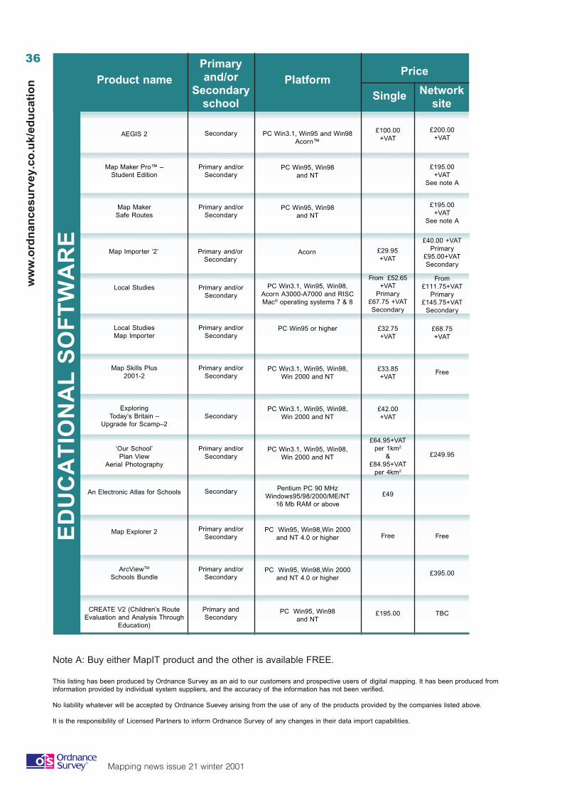
36
Mapping news issue 21 winter 2001
ww
w.o
rdn
ance
surv
ey.c
o.u
k/ed
uca
tio
n
ED
UC
AT
ION
AL
SO
FT
WA
RE
Product namePrimaryand/or
Secondaryschool
PlatformPrice
Single Networksite
AEGIS 2 Secondary PC Win3.1, Win95 and Win98Acorn™
£100.00+VAT
£200.00+VAT
Map Maker Pro™ –Student Edition
Primary and/orSecondary
PC Win95, Win98and NT
£195.00+VAT
See note A
Map MakerSafe Routes
Primary and/orSecondary
PC Win95, Win98and NT
£195.00+VAT
See note A
Map Importer ‘2’ Primary and/orSecondary
Acorn
£40.00 +VATPrimary
£95.00+VATSecondary
£29.95+VAT
Local Studies Primary and/orSecondary
PC Win3.1, Win95, Win98,Acorn A3000-A7000 and RISCMac® operating systems 7 & 8
From£111.75+VAT
Primary£145.75+VAT
Secondary
From £52.65+VAT
Primary£67.75 +VATSecondary
Local StudiesMap Importer
Primary and/orSecondary
PC Win95 or higher £68.75+VAT
£32.75+VAT
Map Skills Plus2001-2
Primary and/orSecondary
PC Win3.1, Win95, Win98,Win 2000 and NT
Free£33.85+VAT
ExploringToday’s Britain –
Upgrade for Scamp–2Secondary
PC Win3.1, Win95, Win98,Win 2000 and NT
£42.00+VAT
‘Our School’Plan View
Aerial Photography
Primary and/orSecondary
PC Win3.1, Win95, Win98,Win 2000 and NT £249.95
£64.95+VATper 1km2
&£84.95+VAT
per 4km2
An Electronic Atlas for Schools Secondary Pentium PC 90 MHzWindows95/98/2000/ME/NT
16 Mb RAM or above
£49
Map Explorer 2 Primary and/orSecondary
PC Win95, Win98,Win 2000and NT 4.0 or higher FreeFree
ArcViewTM
Schools BundlePrimary and/or
SecondaryPC Win95, Win98,Win 2000
and NT 4.0 or higher£395.00
CREATE V2 (Children’s RouteEvaluation and Analysis Through
Education)
Primary andSecondary
PC Win95, Win98and NT
TBC£195.00
Note A: Buy either MapIT product and the other is available FREE.
This listing has been produced by Ordnance Survey as an aid to our customers and prospective users of digital mapping. It has been produced frominformation provided by individual system suppliers, and the accuracy of the information has not been verified.
No liability whatever will be accepted by Ordnance Suevey arising from the use of any of the products provided by the companies listed above.
It is the responsibility of Licensed Partners to inform Ordnance Survey of any changes in their data import capabilities.
37
Mapping news issue 21 winter 2001
ww
w.o
rdn
ancesu
rvey.co.u
k/edu
cation
Dem
o on
web
site
La
nd
-Lin
e
La
nd
-Lin
e.P
lus
Ra
ste
r1:
10 0
00
Ra
ste
r1:
50 0
00
La
nd
-Fo
rmD
TM
His
tori
cal
Address Contact information
Ordnance Survey data accepted in
• • • • •• • • • • •• • •• • •
• • •• • • • •
• • • • •• • • • •
• •• •• • • •• • • • • •• • • • •
The Advisory Unit Computers in Education126 Great North RoadHATFIELDAL9 5JZ
Phone: 01707 266714Fax: 01707 273684Email: [email protected] site: www.advisory-unit.org.uk
MapIT Limited1 Lawrence Road, RamseyHUNTINGDONCambsPE26 1UY
Phone: 01487 813745Fax: 01487 813745Email: [email protected]
MapIT Limited1 Lawrence Road, RamseyHUNTINGDONCambsPE26 1UY
Phone: 01487 813745Fax: 01487 813745Email: [email protected] site: www.mapit-uk.co.uk
Minerva SystemsMinerva HouseBaring CrescentEXETEREX1 1TL
Phone: 01392 437756Fax: 01392 421762Email: [email protected]
Soft Teach EducationalSturgess FarmhouseLongbridge DeverillWARMINSTERBA12 7EA
Phone: 01985 840329Fax: 01985 840331Email: [email protected] site: www.soft-teach.co.uk
Soft Teach EducationalSturgess FarmhouseLongbridge DeverillWARMINSTERBA12 7EA
Phone: 01985 840329Fax: 01985 840331Email: [email protected] site: www.soft-teach.co.uk
PebbleshoreLewes Enterprise Centre112 Malling StreetLEWESBN7 2RJ
Phone: 01273 483890Fax: 01273 479645Email: [email protected] site: www.pebbleshore.co.uk
PebbleshoreLewes Enterprise Centre112 Malling StreetLEWESBN7 2RJ
Phone: 01273 483890Fax: 01273 479645Email: [email protected] site: www.pebbleshore.co.uk
Wildgoose PublicationsThe Old Toy Factory10 The Business ParkJackson StreetCOALVILLE LE67 3NR
Phone: 01530 835685Fax: 01530 835691
Anglia MultimediaAnglia HouseNORWICHNR1 3JG
Phone: 0161 827 2887Email: [email protected]
ESRI (UK)Prebendal HouseParsons FeeAYLESBURYBucks HP20 2QA
Phone: 01296 745500Fax: 01296 745544Email: [email protected] site: www.esriuk.com
ESRI (UK)Prebendal HouseParsons FeeAYLESBURYBucks HP20 2QA
Phone: 01296 745500Fax: 01296 745544Email: [email protected] site: www.esriuk.com
allied integrated technologies ltd7 Moulton Park Office VillageScirocco CloseMoulton ParkNORTHAMPTON NN3 6AP
Phone: 01604 493389Fax: 01604 493239Email: [email protected] site: www.a-i-t.co.uk

38
Mapping news issue 21 winter 2001
ww
w.o
rdn
ance
surv
ey.c
o.u
k/ed
uca
tio
n
Approved Educational Suppliers
Sue WrightBookland & Co12 Bridge StreetCHESTERCH1 1NQPhone: 01244 401920Fax: 01244 341868Email: [email protected] site: www.bookland.co.uk
Tanya GreenwoodMason Land Surveys LtdDickson StreetDUNFERMLINEKY12 7SLPhone: 01383 727261Fax: 01383 739480Email:[email protected] site: www.mason.co.uk
Rachel WattsTrident Map Services70 High StreetHoughton RegisDUNSTABLELU5 5BJPhone: 01582 867211Fax: 01582 867689Email: [email protected]
Ordnance Survey has an approved network of Educational Suppliers (AES) locatedthroughout the country. Each AES has trained staff fully conversant in the use ofOrdnance Survey mapping within the curriculum and are always happy to dedicate timeto your enquiry and advise where necessary.
Our full range of products, including Superplan®, Landplan®, aerial photography and thenew QCA mapping can be obtained from any AES listed. All AES will offer a discount aswell as help and advice and will deal with you on a mail order basis with most havingonline ordering facilities as well.
So don’t delay, contact an AES today for all your Ordnance Survey mappingrequirements!
Val McGavinJames Thin Ltd53–59 South BridgeEDINBURGHEH1 1YSPhone: 0131 622 8222Fax: 0131557 8149Email: [email protected] site: www.jamesthin.co.uk
Andrew GuyBlackwell’s21 Blenheim TerraceWoodhouse LaneLEEDSLS2 9HJPhone: 0113 246 0483Fax: 0113 243 0809Email:[email protected] site: www.maps.blackwell.co.uk
June GroomThe Map Shop30A Belvoir StreetLEICESTERLE1 6QHPhone: 0116 247 1400Fax: 0116 247 1401Email:[email protected] site:www.mapshopleicester.co.uk
Stefan Evans/Murielle ToullicGeopacks92–104 Carnwath RoadLONDONSW6 3HWPhone: 08705 133168Fax: 020 7371 0473Email: [email protected]
Peter ClarkNational Map Centre22–24 Caxton StreetVictoriaLONDONSW1H 0QUPhone: 020 7222 2466Fax: 020 7222 2619Email: [email protected] site: www.mapsworld.com
Trish McPhersonTibbenham House112 Thorpe RoadNORWICHNR1 1RTPhone: 01603 762799Fax: 01603 762844Email:[email protected]
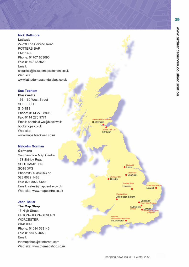
39
Mapping news issue 21 winter 2001
ww
w.o
rdn
ancesu
rvey.co.u
k/edu
cation
Nick BullmoreLatitude27–28 The Service RoadPOTTERS BAREN6 1QAPhone: 01707 663090Fax: 01707 663029Email:[email protected] site:www.latitudemapsandglobes.co.uk
Sue TophamBlackwell’s156–160 West StreetSHEFFIELDS10 3BBPhone: 0114 273 8906Fax: 0114 275 9771Email: [email protected] site:www.maps.blackwell.co.uk
Malcolm GormanGormansSouthampton Map Centre173 Shirley RoadSOUTHAMPTONSO15 3FGPhone:0800 387053 or023 8022 1488Fax: 023 8022 0688Email: [email protected] site: www.mapcentre.co.uk
John BakerThe Map Shop15 High StreetUPTON–UPON–SEVERNWORCESTERWR8 0HJPhone: 01684 593146Fax: 01684 594559Email:[email protected] site: www.themapshop.co.uk
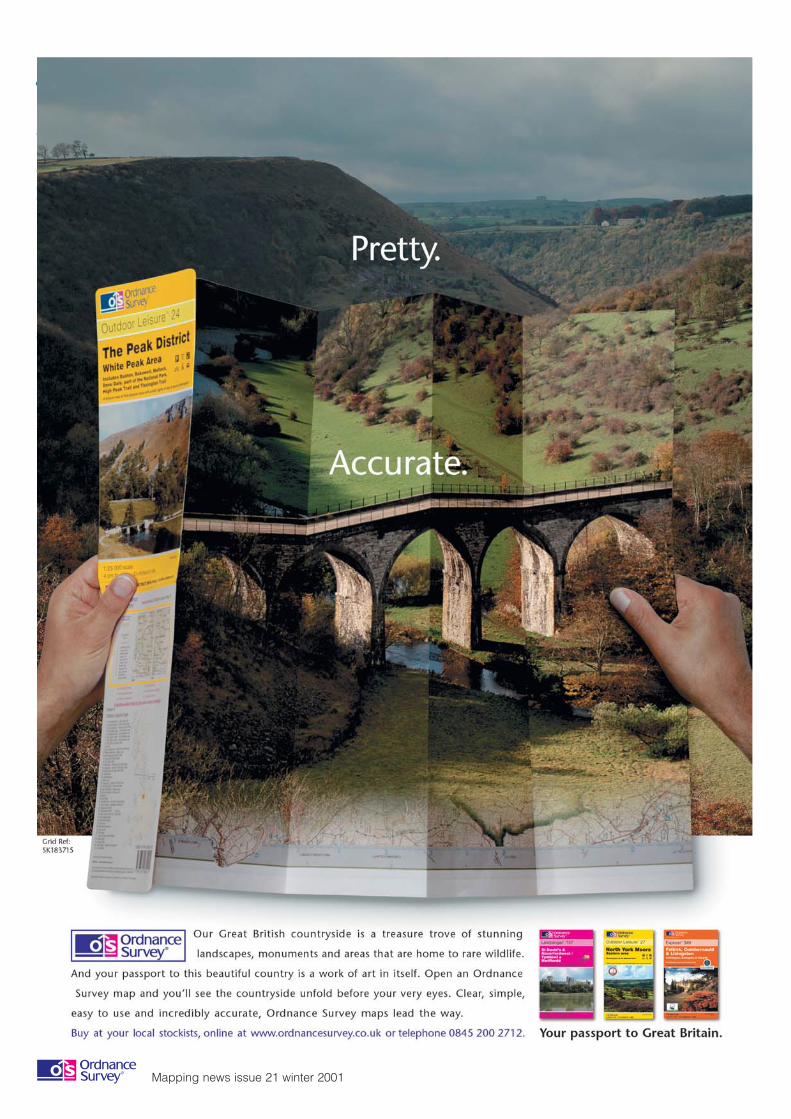
40
Mapping news issue 21 winter 2001
ww
w.o
rdn
ance
surv
ey.c
o.u
k/ed
uca
tio
n