Embed Size (px)
Citation preview
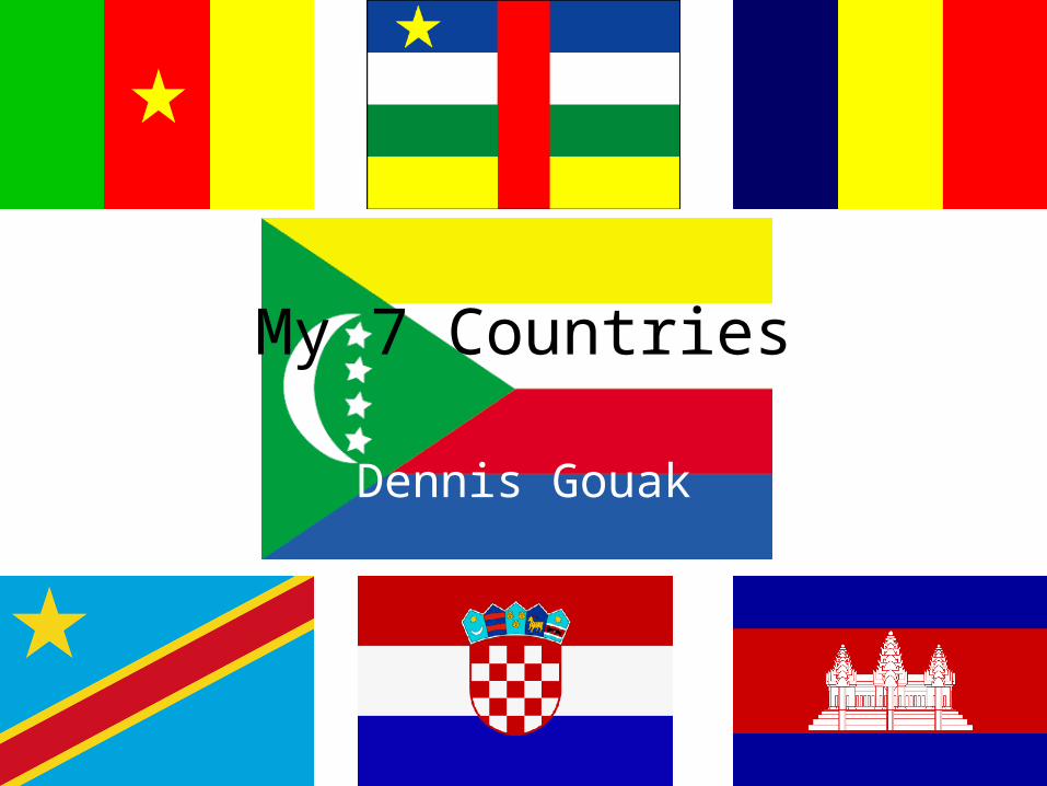
My 7 Countries
Dennis Gouak
The Kingdom of Cambodia
Dennis Gouak
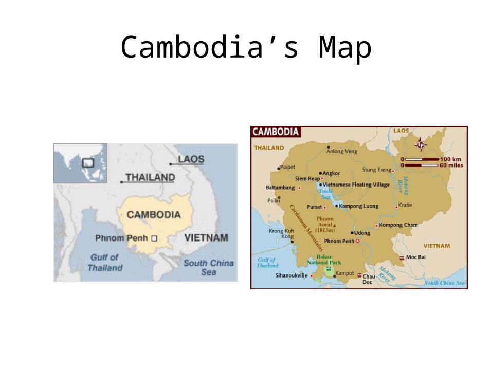
Cambodia’s Map
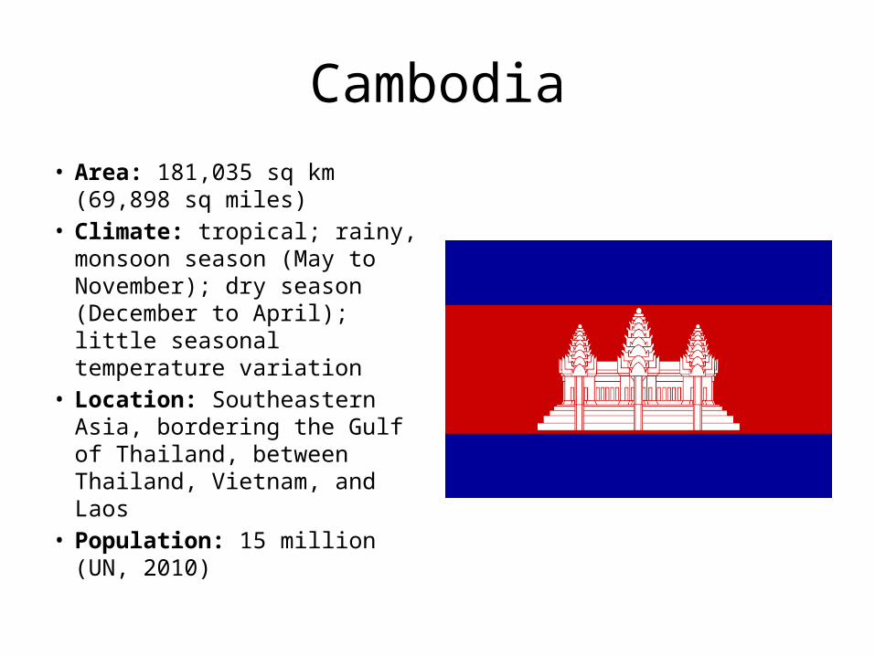
Cambodia• Area: 181,035 sq km (69,898 sq
miles) • Climate: tropical; rainy,
monsoon season (May to November); dry season (December to April); little seasonal temperature variation
• Location: Southeastern Asia, bordering the Gulf of Thailand, between Thailand, Vietnam, and Laos
• Population: 15 million (UN, 2010)
Geographic Features• Mostly low, flat plains; mountains in
southwest and north• Mekong River; Tonle Sap Lake; the Gulf of
Thailand• Cambodia’s mountainous area with dense
virgin forests, has a wide variety of plant and animal life. There are palm, rubber, coconut, kapok, mango, banana, and orange trees, as well as the high sharp grass of the savannas. Birds, including cranes, pheasants, and wild ducks, and mammals such as elephants, wild oxen, panthers, and bears abound throughout the country. Fish, snakes, and insects also are present in abundance.
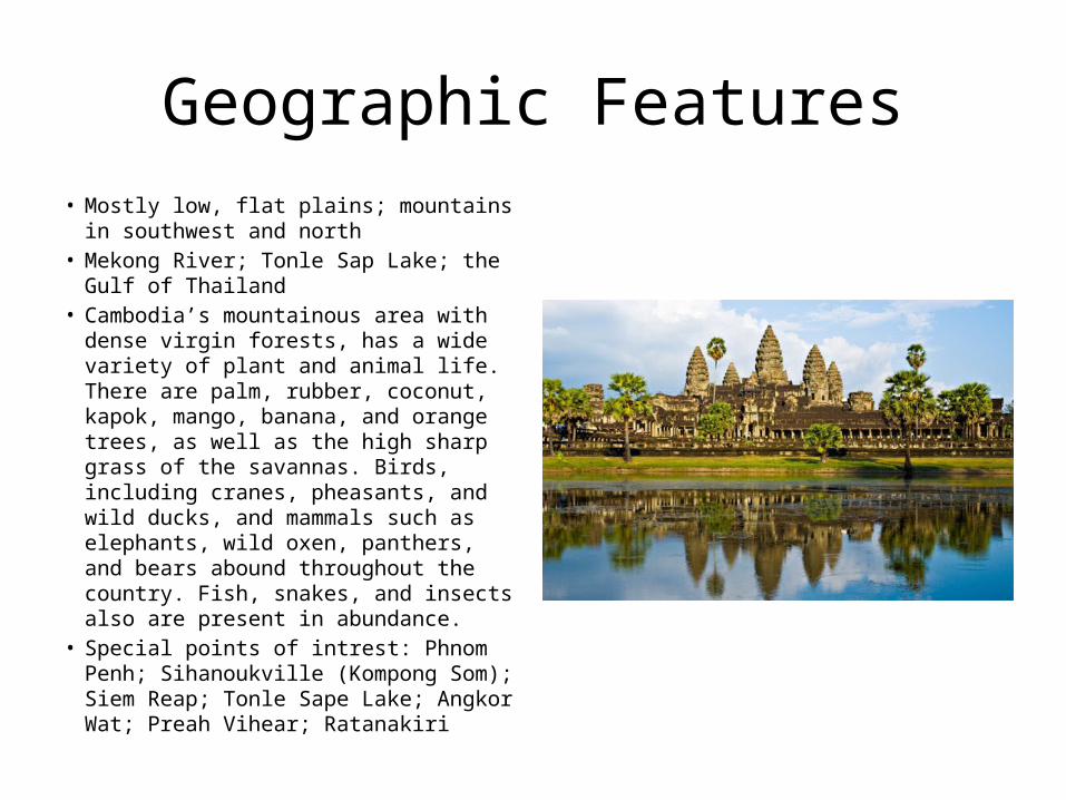
• Special points of intrest: Phnom Penh; Sihanoukville (Kompong Som); Siem Reap; Tonle Sape Lake; Angkor Wat; Preah Vihear; Ratanakiri
Vacation tour
• The chaotic yet charismatic capital of Phnom Penh is a hub of political intrigue, economic vitality and intellectual debate. All too often overlooked by hit-and-run tourists ticking off Angkor on a regional tour, the revitalized city of Siem Reap is finally earning plaudits in its own right thanks to a gorgeous riverside location, a cultural renaissance, and a dining and drinking scene to rival the best in the region. And don’t forget the rest of the country: relax in the sleepy seaside town of Kampot and trek the nearby Bokor National Park; take an elephant ride in the jungles of Mondulkiri Province; ogle the Mekong dolphins at Kratie or simply choose a beach near Sihanoukville.
History• Most Cambodians consider themselves to be Khmers, descendants of the
Angkor Empire that extended over much of Southeast Asia and reached its zenith between the 10th and 13th centuries. Attacks by the Thai and Cham (from present-day Vietnam) weakened the empire, ushering in a long period of decline. The king placed the country under French protection in 1863 and it became part of French Indochina in 1887. Following Japanese occupation in World War II, Cambodia gained full independence from France in 1953. In April 1975, after a five-year struggle, Communist Khmer Rouge forces captured Phnom Penh and evacuated all cities and towns. At least 1.5 million Cambodians died from execution, forced hardships, or starvation during the Khmer Rouge regime under POL POT. A December 1978 Vietnamese invasion drove the Khmer Rouge into the countryside, began a 10-year Vietnamese occupation, and touched off almost 13 years of civil war. The 1991 Paris Peace Accords mandated democratic elections and a ceasefire, which was not fully respected by the Khmer Rouge. UN-sponsored elections in 1993 helped restore some semblance of normalcy under a coalition government.
History (continued)• Factional fighting in 1997 ended the first coalition government, but a second
round of national elections in 1998 led to the formation of another coalition government and renewed political stability. The remaining elements of the Khmer Rouge surrendered in early 1999. Some of the surviving Khmer Rouge leaders have been tried or are awaiting trial for crimes against humanity by a hybrid UN-Cambodian tribunal supported by international assistance. Elections in July 2003 were relatively peaceful, but it took one year of negotiations between contending political parties before a coalition government was formed. In October 2004, King Norodom SIHANOUK abdicated the throne and his son, Prince Norodom SIHAMONI, was selected to succeed him. Local elections were held in Cambodia in April 2007, with little of the pre-election violence that preceded prior elections. National elections in July 2008 were relatively peaceful.
• 2011 February - Thai and Cambodian forces exchange fire across the disputed border area near the Preah Vihear temple. PM Hun Sen calls for the UN to send in peacekeepers.
Political
• Type of government: multiparty democracy under a constitutional monarchy
• King and Head of State--Norodom Sihamoni• Prime Minister and Head of Government--Hun
Sen• President of the Senate--Chea Sim• President of National Assembly--Heng Samrin
Economy
• Industry: 21.4% of GDP• Exports: garments, shoes, rice, cigarettes,
natural rubber, pepper, wood, fish. Major partners--United States, Germany, U.K., Singapore, Japan, Vietnam.
• Imports: fuels, cigarettes, vehicles, consumer goods, machinery. Major partners--Thailand, Singapore, China, Hong Kong, Vietnam, Taiwan, United States.
Daily Life
• Standard of living: not the best but liveable• Literacy: 73.6% of the population over the age
of 15 are literate• Internet users:78,500(2009)
Cultural• Gifts are usually given at Cambodian New Year (Chaul Chnam).• Unlike most other cultures, Cambodians do not celebrate birthdays. In fact, many
older people may not know the exact date of their birth.Religions: Buddhist (official) 96.4%, Muslim 2.1%, other 1.3%, unspecified 0.2% (1998 census)
• Foods: The staples are rice and fish. Traditionally, a home meal is served on a mat on the floor or with the diners seated together on a raised bamboo platform. Meals are eaten in shifts according to status, with adult males and guests eating first and food preparers last. Breakfast typically consists of rice porridge or rice noodles. Lunch and dinner may be a combination of a spiced broth with fish or meat and vegetables, fish, fresh vegetables eaten with a fish-based paste, and stir-fried vegetables with chopped meat. The tradition of Khmer cuisine in restaurants is undeveloped, and restaurants typically serve what is regarded as Chinese food. There are no food taboos, although devout Buddhists refrain from alcohol. Monks also cannot eat after noon and are enjoined to eat whatever they are given without making special requests.
• As a foreigner you may find that people ask personal questions - this is a means to identify your 'rank' rather than being nosy. They may change the way they communicate depending on your status.
Conclusion• The fate of Cambodia shocked the world when the radical communist
Khmer Rouge under their leader Pol Pot seized power in 1975 after years of guerrilla warfare.
• An estimated 1.7 million Cambodians died during the next three years, many from exhaustion or starvation. Others were tortured and executed.
• Today, Cambodia is one of the poorest countries in the world and relies heavily on aid. Foreign donors have urged the government to clamp down on pervasive corruption.
• Cambodians tend to have two types of smiles. One indicates pleasure and the other embarrassment. It is sometimes hard for foreigners to tell them apart, but this is why some Cambodians will smile or giggle nervously when imparting bad news.
• I learned that when a Cambodian asks you personal questions they are not being nosy they are just trying to determine your social class
Republic of Cameroon
Dennis Gouak
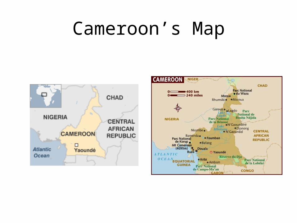
Cameroon’s Map
Cameroon
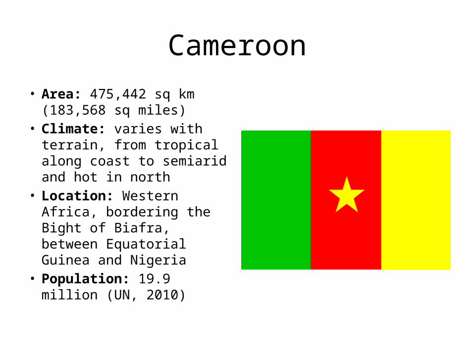
• Area: 475,442 sq km (183,568 sq miles)
• Climate: varies with terrain, from tropical along coast to semiarid and hot in north
• Location: Western Africa, bordering the Bight of Biafra, between Equatorial Guinea and Nigeria
• Population: 19.9 million (UN, 2010)
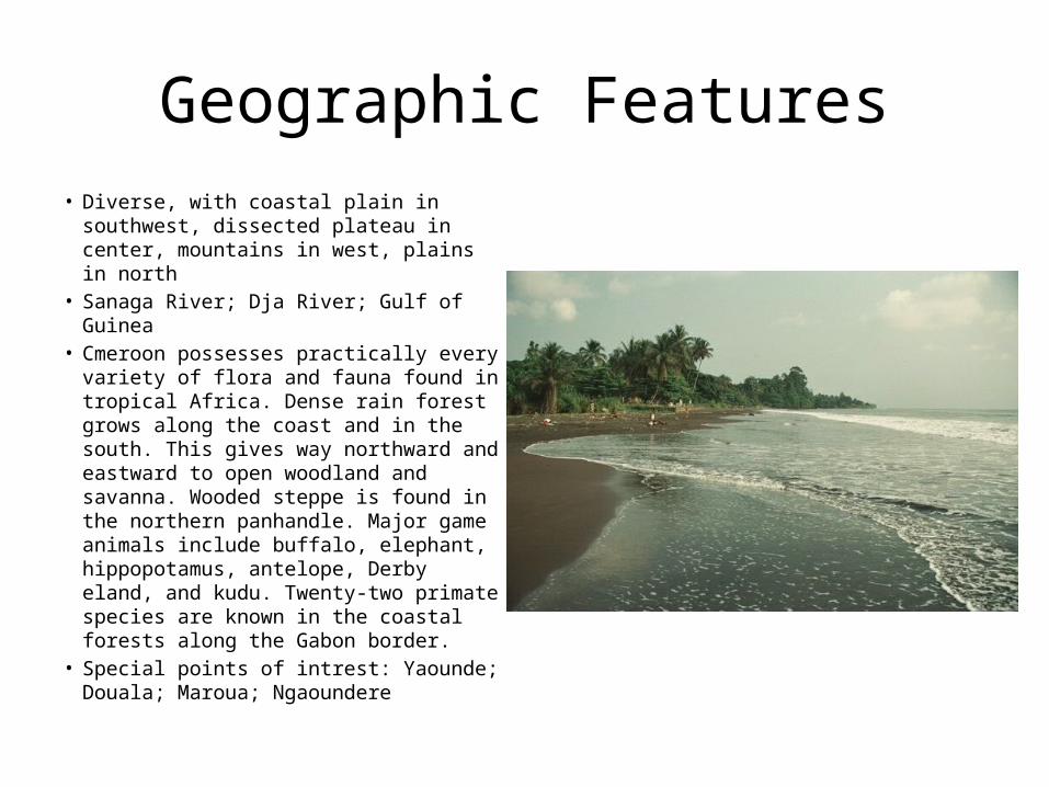
Geographic Features• Diverse, with coastal plain in southwest,
dissected plateau in center, mountains in west, plains in north
• Sanaga River; Dja River; Gulf of Guinea• Cmeroon possesses practically every
variety of flora and fauna found in tropical Africa. Dense rain forest grows along the coast and in the south. This gives way northward and eastward to open woodland and savanna. Wooded steppe is found in the northern panhandle. Major game animals include buffalo, elephant, hippopotamus, antelope, Derby eland, and kudu. Twenty-two primate species are known in the coastal forests along the Gabon border.
• Special points of intrest: Yaounde; Douala; Maroua; Ngaoundere
Vacation tour
• The landscape is no less dizzying in its diversity. Mt Cameroon (4095m) is the highest peak in West Africa and attracts plenty of trekking interest. A still-active volcano, it rises almost straight from the sea in a spectacular manner. Further north are the rolling grass fields of the Ring Road area, while the Mandara Mountains are a complete contrast again – dry and rocky, with isolated villages eking out a living. Fringing all of this are some of Africa’s oldest rainforests, and the excellent Parc National de Waza, with abundant mammal and birdlife, and large herds of elephants gathering at water holes in the dry season.
• If all this exhausts you, you can retire to some fine palm-fringed beaches and fantastic seafood, which should help to recharge your batteries. Throw in a cold beer or two, some lively home-grown makossa music and the Indomitable Lions of the national football team, and you’ll be reveling in your discovery.
History
• The former French Cameroon and part of British Cameroon merged in 1961 to form the present country. Cameroon has generally enjoyed stability, which has permitted the development of agriculture, roads, and railways, as well as a petroleum industry. Despite slow movement toward democratic reform, political power remains firmly in the hands of President Paul BIYA.
• 2010 November - Five die in a suspected pirate attack on a boat on its way to an oil rig in the Cameroonian part of the Gulf of Guinea.
Political
• Type of government: republic; multiparty presidential regime
• President--Paul Biya• President of the National Assembly--Djibril Cavaye Yeguie• Prime Minister--Philemon Yang• Minister of External Relations--Henri Eyebe Ayissi• Minister of Defense--Edgar Alain Mebe Ngo’o
Ambassador to the United States--Joseph Bienvenu Charles Foe Atangana
• Ambassador to the United Nations--Michel Tommo Month
Economy
• Industry: 30.9% of GDP• Exports: crude oil, timber and finished wood
products, cotton, cocoa, aluminum and aluminum products, coffee, rubber, bananas. Major markets--European Union, CEMAC, China, U.S., Nigeria
• Imports: crude oil, vehicles, pharmaceuticals, aluminum oxide, rubber, foodstuffs and grains, agricultural inputs, lubricants, used clothing. Major suppliers--France, Nigeria, Italy, U.S., Germany, Belgium, Japan.
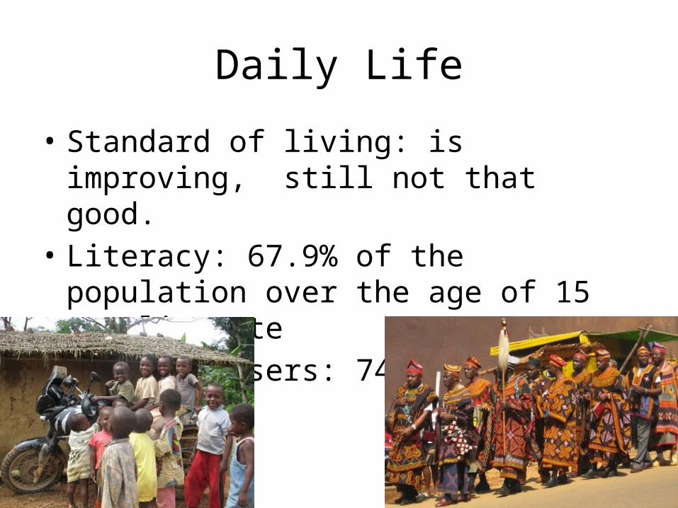
Daily Life
• Standard of living: is improving, still not that good.
• Literacy: 67.9% of the population over the age of 15 are literate
• Internet users: 749,600 (2009)
Cultural• As a sign of respect men often lower their head and avert their
eyes when greeting someone superior to them in age or position.
• As with many family orientated cultures nepotism does not have the negative connotation. In fact, hiring relatives is part of the cultural context since it not only provides for the family, but also ensures that Cameroonians work with those they know and trust.
• Religions: indigenous beliefs 40%, Christian 40%, Muslim 20%• Many Cameroonians eat with their hands, although foreign
guests may be offered cutlery. • The extended family is the focus of the social system. It is the
extended family and includes grandparents, cousins, aunts, uncles, etc. Members of the extended family are considered as close as the nuclear family is in the West.
Conclusion
• The modern state of Cameroon was created in 1961 by the unification of two former colonies, one British and one French.
• Since then it has struggled from one-party rule to a multi-party system in which the freedom of expression is severely limited.
• If planning a conference or a meeting, one can expect everyone will come an hour late.
• I learned that Cameroonians typically eat with their hands
The Republic of Chad
Dennis Gouak
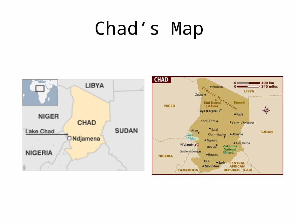
Chad’s Map
Chad
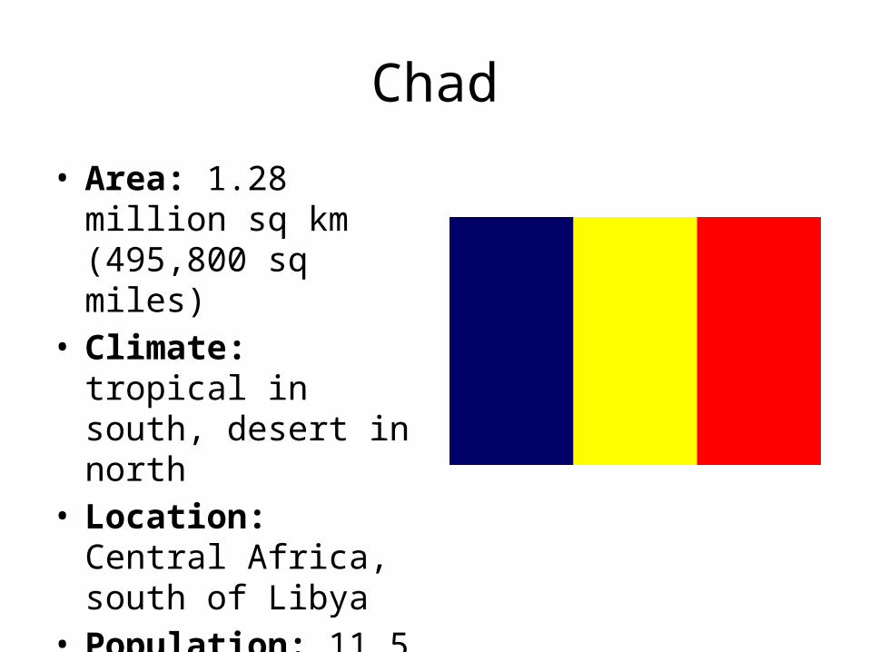
• Area: 1.28 million sq km (495,800 sq miles)
• Climate: tropical in south, desert in north
• Location: Central Africa, south of Libya
• Population: 11.5 million (UN, 2010)
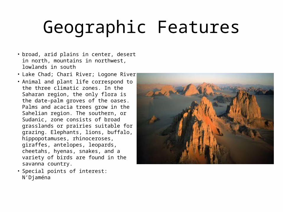
Geographic Features• broad, arid plains in center, desert in
north, mountains in northwest, lowlands in south
• Lake Chad; Chari River; Logone River• Animal and plant life correspond to the
three climatic zones. In the Saharan region, the only flora is the date-palm groves of the oases. Palms and acacia trees grow in the Sahelian region. The southern, or Sudanic, zone consists of broad grasslands or prairies suitable for grazing. Elephants, lions, buffalo, hippopotamuses, rhinoceroses, giraffes, antelopes, leopards, cheetahs, hyenas, snakes, and a variety of birds are found in the savanna country.
• Special points of interest: N’Djaména
Vacation tour
• Known for its endless Sahelien expanses, Chad has a few surprises up its sleeve, too, like boat rides on Lake Chad or strolling the shady streets of southern towns where the dusty landscape, fed by small rivers, is interspersed with incongruously green scenes providing a quasi-tropical break from the rigors of the road. The best destinations – the otherworldly desert landscapes of Ennedi and the teeming wildlife of Zakouma National Park just South of N’Djaména – lie way beyond backpacker budgets but are both world class.
History• Chad, part of France's African holdings until 1960, endured three decades
of civil warfare as well as invasions by Libya before a semblance of peace was finally restored in 1990. The government eventually drafted a democratic constitution and held flawed presidential elections in 1996 and 2001. In 1998, a rebellion broke out in northern Chad, which has sporadically flared up despite several peace agreements between the government and the rebels. In 2005, new rebel groups emerged in western Sudan and made probing attacks into eastern Chad despite signing peace agreements in December 2006 and October 2007. Power remains in the hands of an ethnic minority. In June 2005, President Idriss DEBY held a referendum successfully removing constitutional term limits and won another controversial election in 2006. Sporadic rebel campaigns continued throughout 2006 and 2007. The capital experienced a significant rebel threat in early 2008.
• 2011 January - Chad marks 50 years of independence from France.
Political• Type of government: republic• President--Idriss Deby Itno• Prime Minister--Emmanuel Nadingar• Minister of Foreign Affairs and African Integration--Moussa Faki• Minister of Defense--Abdelkadir Kamougue• Minister of Finance and Budget--Gata Ngoulou• Minister of Infrastructure and Transportation--Adoum Younousmi• Minister of Petroleum--Eugene Tabe• President of the National Assembly--Nassour Guelengdouksia
Ouaidou• Mediator of the Republic--Abderamane Moussa• Ambassador to the U.S.--Mahamat Adam Bechir
Economy
• Industry: 7% of GDP• Exports: oil, cotton, livestock, gum arabic.
Major markets--United States, Nigeria, France, Cameroon, Portugal, Germany, Thailand, Costa Rica, South Africa.
• Imports: petroleum products, machinery and transportation equipment, foodstuffs, industrial goods, textiles. Major suppliers (2004)--U.S., France, Cameroon, Nigeria.
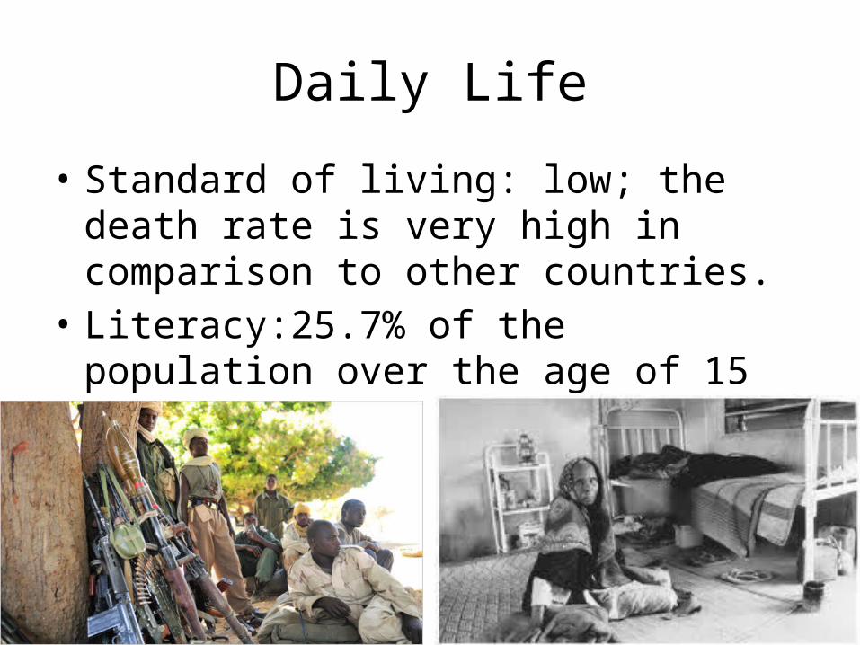
Daily Life
• Standard of living: low; the death rate is very high in comparison to other countries.
• Literacy:25.7% of the population over the age of 15 is literate
• Internet users: 168,100 (2009)
Cultural• Chadians tend to stand quite close when speaking with one another. Less than an
arm's length of personal space tends to be the norm. • Male colleagues will often touch each other on the arm or shoulder while speaking
to emphasize something or to be close. Women will do this as well, although perhaps not as much.
• Religions: Muslim 53.1%, Catholic 20.1%, Protestant 14.2%, animist 7.3%, other 0.5%, unknown 1.7%, atheist 3.1% (1993 census)
• Patterns of food production and consumption are rather diverse across the various ethnic groups. There is no shared "national food culture," although the one dish fairly common throughout the country is a kind of set grain porridge, made of sorghum or millet flour, served with sauces that contain meat, dried fish, tomatoes, onions, and good spices. Some north-south divide is apparent in food traditions.
• Music and dance: sai- uses rhythms from the Sothern part of Chad• Pushing your hand forward with an open palm and all fingers out is a strong insult.
Conclusion
• A largely semi-desert country, Chad is rich in gold and uranium and stands to benefit from its recently-acquired status as an oil-exporting state.
• However, Africa's fifth-largest nation suffers from inadequate infrastructure and internal conflict. Poverty is rife, and health and social conditions compare unfavourably with those elsewhere in the region.
• Gifts are usually opened in private.• I learned that Chad contains two climates: it is both
tropical and desert
The Democratic Republic of Congo
Dennis Gouak
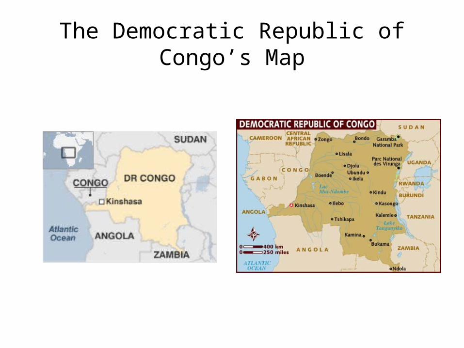
The Democratic Republic of Congo’s Map
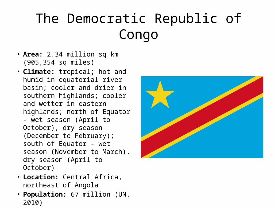
The Democratic Republic of Congo• Area: 2.34 million sq km (905,354
sq miles)• Climate: tropical; hot and humid
in equatorial river basin; cooler and drier in southern highlands; cooler and wetter in eastern highlands; north of Equator - wet season (April to October), dry season (December to February); south of Equator - wet season (November to March), dry season (April to October)
• Location: Central Africa, northeast of Angola
• Population: 67 million (UN, 2010)
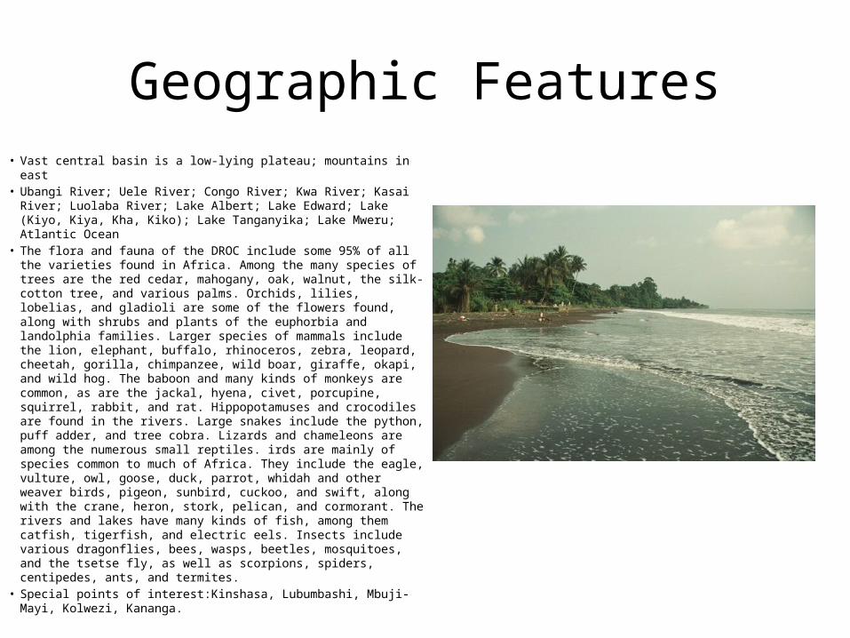
Geographic Features• Vast central basin is a low-lying plateau; mountains in east• Ubangi River; Uele River; Congo River; Kwa River; Kasai River;
Luolaba River; Lake Albert; Lake Edward; Lake (Kiyo, Kiya, Kha, Kiko); Lake Tanganyika; Lake Mweru; Atlantic Ocean
• The flora and fauna of the DROC include some 95% of all the varieties found in Africa. Among the many species of trees are the red cedar, mahogany, oak, walnut, the silk-cotton tree, and various palms. Orchids, lilies, lobelias, and gladioli are some of the flowers found, along with shrubs and plants of the euphorbia and landolphia families. Larger species of mammals include the lion, elephant, buffalo, rhinoceros, zebra, leopard, cheetah, gorilla, chimpanzee, wild boar, giraffe, okapi, and wild hog. The baboon and many kinds of monkeys are common, as are the jackal, hyena, civet, porcupine, squirrel, rabbit, and rat. Hippopotamuses and crocodiles are found in the rivers. Large snakes include the python, puff adder, and tree cobra. Lizards and chameleons are among the numerous small reptiles. irds are mainly of species common to much of Africa. They include the eagle, vulture, owl, goose, duck, parrot, whidah and other weaver birds, pigeon, sunbird, cuckoo, and swift, along with the crane, heron, stork, pelican, and cormorant. The rivers and lakes have many kinds of fish, among them catfish, tigerfish, and electric eels. Insects include various dragonflies, bees, wasps, beetles, mosquitoes, and the tsetse fly, as well as scorpions, spiders, centipedes, ants, and termites.
• Special points of interest:Kinshasa, Lubumbashi, Mbuji-Mayi, Kolwezi, Kananga.
Vacation tour
• More a geographical concept than a fully fledged nation, the Democratic Republic of Congo (DRC, formerly Zaïre) is a bubbling cauldron of untamed wilderness carpeted by swathes of rainforest and punctuated by gushing rivers and smoking volcanoes. Rendered almost ungovernable by the central administration in Kinshasa, the country remains closed to all but the most brave-hearted travelers. The nation’s history reads like something out of Dante’s Inferno – from the brazen political folly of King Leopold of Belgium to the hideously corrupt ‘kleptocracy’ of maverick megalomaniac Mobutu Sese Seko, and the blood-stained battlegrounds of Africa’s first ‘world war’.
History• Established as a Belgian colony in 1908, the then-Republic of the Congo gained
its independence in 1960, but its early years were marred by political and social instability. Col. Joseph MOBUTU seized power and declared himself president in a November 1965 coup. He subsequently changed his name - to MOBUTU Sese Seko - as well as that of the country - to Zaire. MOBUTU retained his position for 32 years through several sham elections, as well as through brutal force. Ethnic strife and civil war, touched off by a massive inflow of refugees in 1994 from fighting in Rwanda and Burundi, led in May 1997 to the toppling of the MOBUTU regime by a rebellion backed by Rwanda and Uganda and fronted by Laurent KABILA. He renamed the country the Democratic Republic of the Congo (DRC), but in August 1998 his regime was itself challenged by a second insurrection again backed by Rwanda and Uganda. Troops from Angola, Chad, Namibia, Sudan, and Zimbabwe intervened to support KABILA's regime. A cease-fire was signed in July 1999 by the DRC, Congolese armed rebel groups, Angola, Namibia, Rwanda, Uganda, and Zimbabwe but sporadic fighting continued. Laurent KABILA was assassinated in January 2001 and his son, Joseph KABILA, was named head of state.
History (continued)• In October 2002, the new president was successful in negotiating the withdrawal
of Rwandan forces occupying eastern Congo; two months later, the Pretoria Accord was signed by all remaining warring parties to end the fighting and establish a government of national unity. A transitional government was set up in July 2003. Joseph KABILA as president and four vice presidents represented the former government, former rebel groups, the political opposition, and civil society. The transitional government held a successful constitutional referendum in December 2005 and elections for the presidency, National Assembly, and provincial legislatures in 2006. The National Assembly was installed in September 2006 and KABILA was inaugurated president in December 2006. Provincial assemblies were constituted in early 2007, and elected governors and national senators in January 2007. The next national elections are scheduled for November 2011.
• 2011 February - Court sentences Lt-Col Kibibi Mutware to 20 years in jail in a mass rape case in eastern Congo. This is the first conviction of a commanding officer for rape in eastern DR Congo.
Political
• Type of government: republic• President--Joseph Kabila• Prime Minister--Adolphe Muzito• Foreign Minister--Alexis Thambwe Mwamba• Defense Minister--Charles Mwando Nsimba• Finance Minister--Matata Ponyo Mapon• Minister of International and Regional
Cooperation--Raymond Tshibanda
Economy
• Industry: 26% of GDP• Exports: diamonds, cobalt, copper, coffee,
petroleum. Main partners--EU, Japan, South Africa, U.S., China.
• Imports: consumer goods (food, textiles), capital equipment, refined petroleum products. Partners--EU, China, South Africa, U.S.
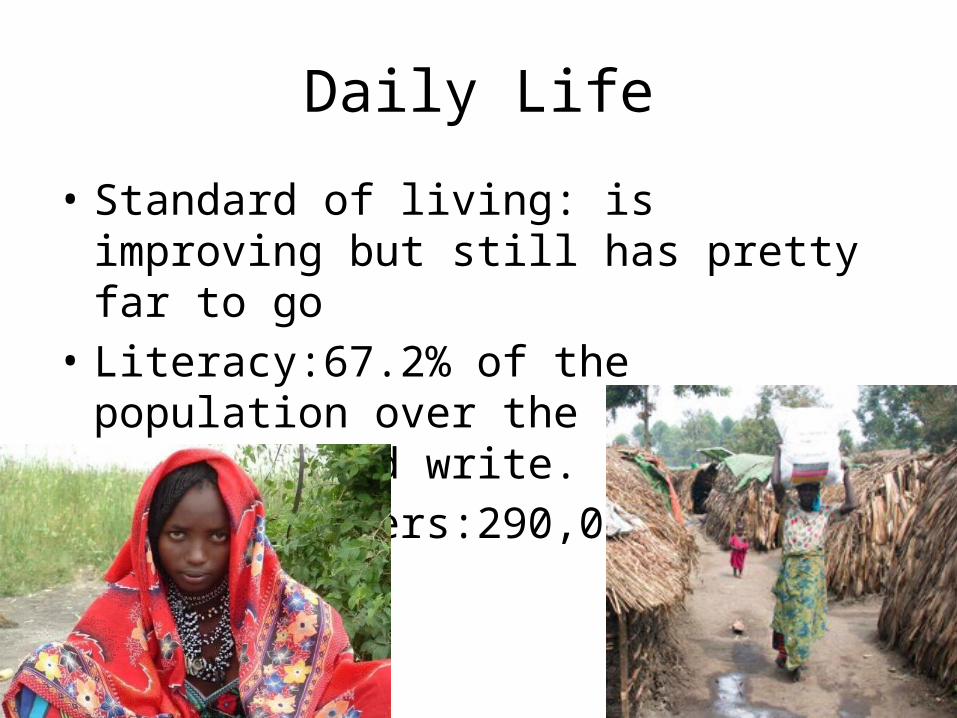
Daily Life
• Standard of living: is improving but still has pretty far to go
• Literacy:67.2% of the population over the age of 15 can read and write.
• Internet users:290,000 (2008)
Cultural• Most political, economic, and religious institutions have male leadership.• Soldiers rape women, inflict arbitrary fines on citizens, and pillage and
harass the villagers• Religions: Roman Catholic 50%, Protestant 20%, Kimbanguist 10%, Muslim
10%, other (includes syncretic sects and indigenous beliefs) 10%• Unfortunately, for many in the Congo, food is not necessarily a part of daily
life. And, when food is available, it usually does not contain the vitamins and minerals required to help ward off disease and maintain proper health.
• Music: Genres- Rumba, Madiaba, Mutuasi, Soukous, Folk music, Pop music• In the past, single women in the Congo belonged to their fathers, and,
upon marriage, their ownership would be transferred to the husband. The man's father would give gifts such as knives, food, or slaves to the new wife's father, in exchange for his loss of precious labor and kinship.
Conclusion• A vast country with immense economic resources, the Democratic
Republic of Congo (DR Congo) has been at the centre of what could be termed Africa's world war.
• This has left it in the grip of a humanitarian crisis. The five-year conflict pitted government forces, supported by Angola, Namibia and Zimbabwe, against rebels backed by Uganda and Rwanda. Despite a peace deal and the formation of a transitional government in 2003, people in the east of the country remain in terror of marauding militia and the army.
• The war claimed an estimated three million lives, either as a direct result of fighting or because of disease and malnutrition. It has been called possibly the worst emergency to unfold in Africa in recent decades.
• I learned that many of the people in DR Congo are starving.
The Republic of Croatia
Dennis Gouak
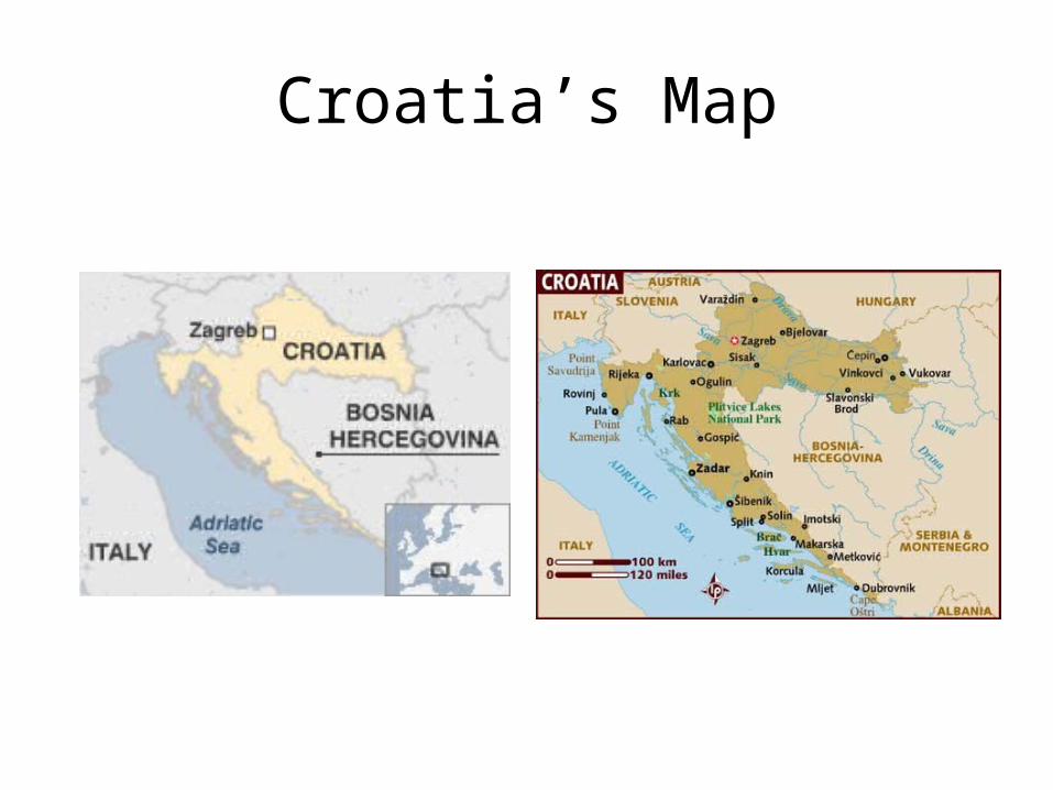
Croatia’s Map
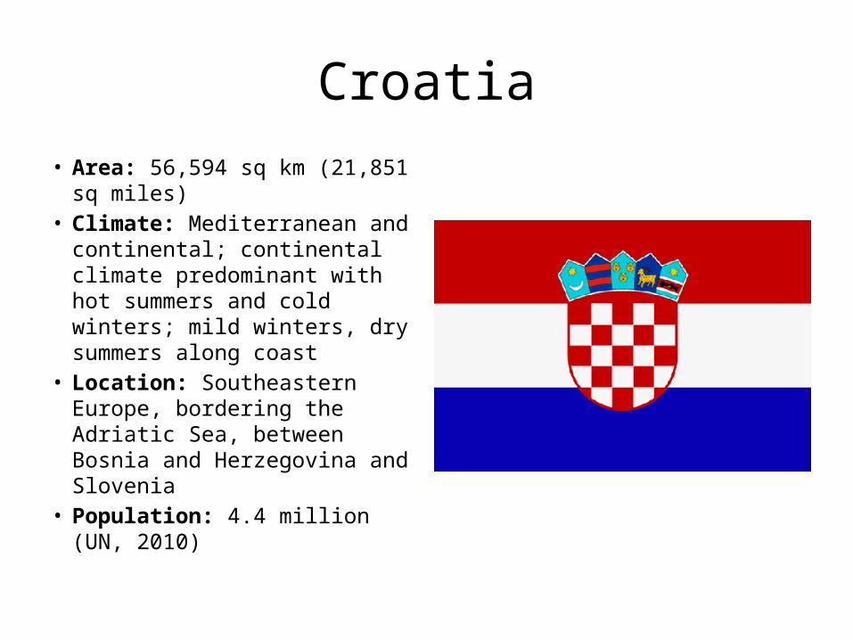
Croatia• Area: 56,594 sq km (21,851 sq
miles)• Climate: Mediterranean and
continental; continental climate predominant with hot summers and cold winters; mild winters, dry summers along coast
• Location: Southeastern Europe, bordering the Adriatic Sea, between Bosnia and Herzegovina and Slovenia
• Population: 4.4 million (UN, 2010)
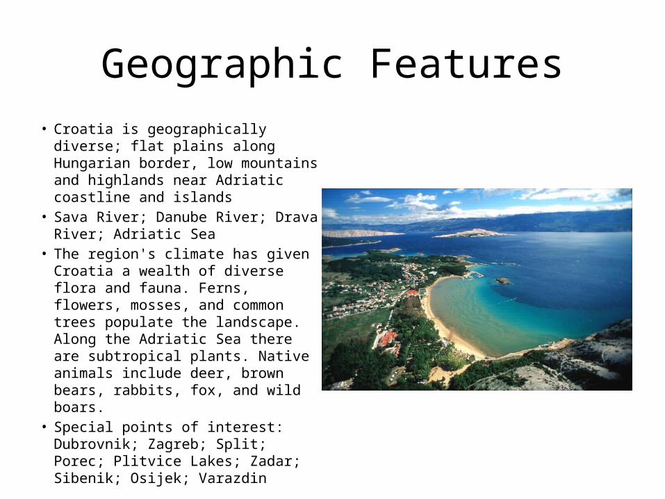
Geographic Features• Croatia is geographically diverse;
flat plains along Hungarian border, low mountains and highlands near Adriatic coastline and islands
• Sava River; Danube River; Drava River; Adriatic Sea
• The region's climate has given Croatia a wealth of diverse flora and fauna. Ferns, flowers, mosses, and common trees populate the landscape. Along the Adriatic Sea there are subtropical plants. Native animals include deer, brown bears, rabbits, fox, and wild boars.
• Special points of interest: Dubrovnik; Zagreb; Split; Porec; Plitvice Lakes; Zadar; Sibenik; Osijek; Varazdin
Vacation tour
• Despite the hype, Croatia’s pleasures are more timeless than trendy. Along its 1778km coastline, a glistening sea winds around rocky coves, lapping at pine-fringed beaches. Istrian ports bustle with fishermen while children dive into the sparkling water. In Dalmatia, cities throb with nightlife amid ancient Roman ruins.
• Yachts glide up the coast, movie stars discreetly arrange to buy one of Croatia’s 1185 islands and no Mediterranean cruise is complete without a stop in Dubrovnik. The interior landscape is as beguiling, even though less visited. Soak in a thermal spa at Istarske Toplice in Istria. Hike through pristine forests watered by mountain streams in the west. Let the waterfalls of Plitvice moisten your face.
History• The lands that today comprise Croatia were part of the Austro-
Hungarian Empire until the close of World War I. In 1918, the Croats, Serbs, and Slovenes formed a kingdom known after 1929 as Yugoslavia. Following World War II, Yugoslavia became a federal independent Communist state under the strong hand of Marshal TITO. Although Croatia declared its independence from Yugoslavia in 1991, it took four years of sporadic, but often bitter, fighting before occupying Serb armies were mostly cleared from Croatian lands. Under UN supervision, the last Serb-held enclave in eastern Slavonia was returned to Croatia in 1998. In April 2009, Croatia joined NATO; it is a candidate for eventual EU accession.
• 2010 November - Zagreb court convicts six men for mafia-style murder of investigative journalist Ivo Pukanic in October 2010.
Political• Type of government: presidential/parliamentary democracy• President--Ivo Josipovic• Prime Minister--Jadranka Kosor (HDZ)• Deputy Prime Minister/Minister for Economy, Labor and
Entrepreneurship--Duro Popijac• Deputy Prime Minister for Regional Development, Forestry and
Water Management--Bozidar Pankretic (HSS)• Deputy Prime Minister for Regional Development, Reconstruction
and Returns--Slobodan Uzelac (SDSS)• Minister of Foreign Affairs and European Integration--Gordan
Jandrokovic• Minister of Defense--Branko Vukelic
Economy
• Industry: 27.2% of GDP• Exports: transport equipment, machinery,
textiles, chemicals, foodstuffs, fuels. Partners: Bosnia and Herzegovina, Germany, Slovenia, Austria, Serbia
• Imports: machinery, transport and electrical equipment; chemicals, fuels and lubricants; foodstuffs. Partners: Italy, Germany, Russia, China, Slovenia, Austria.
Daily Life
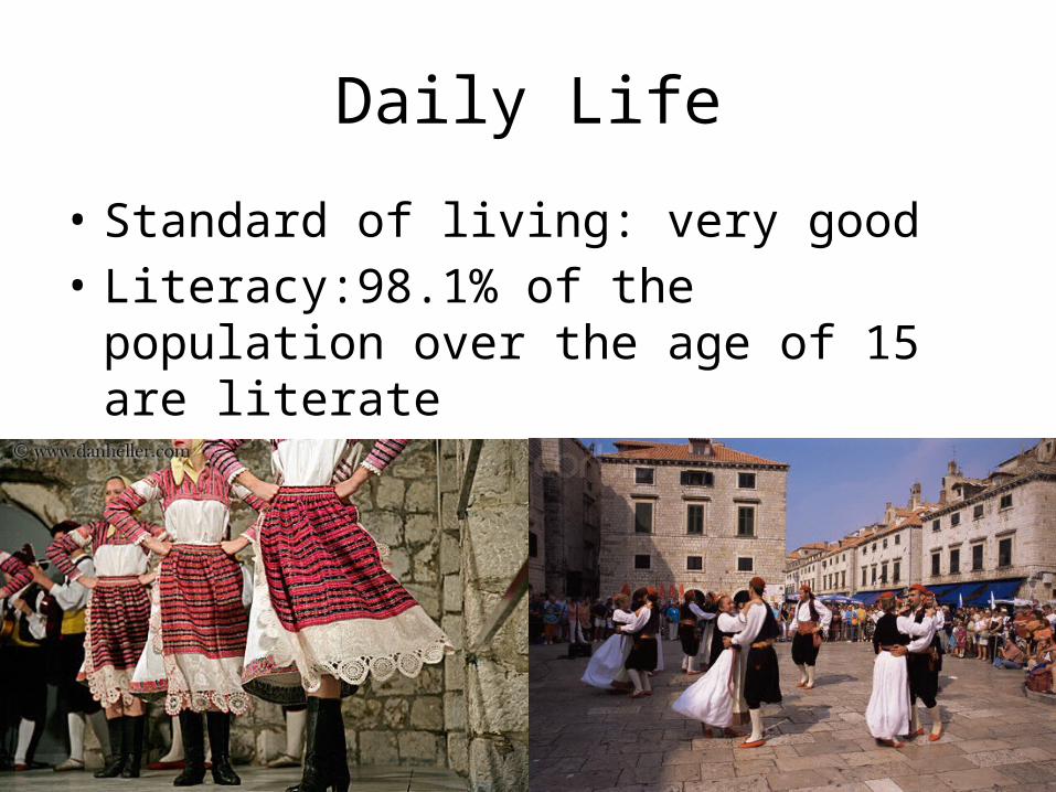
• Standard of living: very good• Literacy:98.1% of the population over the age
of 15 are literate• Internet users:2.234 million (2009)

Cultural• In many areas, women are expected to fulfill the more traditional
roles (cooking, cleaning, child rearing, etc) even if they work.• Raising the thumb, index, and middle finger at once is a Serbian
gesture and is connected to Serbian nationalism. Avoid it at all costs, especially if ordering or asking for three of something. Use the ring, index, and middle fingers instead.
• Religions: Roman Catholic 87.8%, Orthodox 4.4%, other Christian 0.4%, Muslim 1.3%, other and unspecified 0.9%, none 5.2% (2001 census)
• The main meal of the day is a late lunch.• Croatia is known for the specific Dalmatian sound • Direct eye contact is expected and appreciated. Avoiding eye contact
is usually regarded as a sign that you do not care for a person.
Conclusion
• Croatia's declaration of independence in 1991 was followed by four years of war and the best part of a decade of authoritarian nationalism under President Franjo Tudjman.
• By early 2003 it had made enough progress in shaking off the legacy of those years to apply for EU membership, becoming the second former Yugoslav republic after Slovenia to do so.
• A country of striking natural beauty with a stunning Adriatic coastline, Croatia is again very popular as a tourist destination.
• Hello in Croatian is "Dobar dan".• I learned that Croatia’s coast is now a place I want to visit
The Union of the Comoros
Dennis Gouak
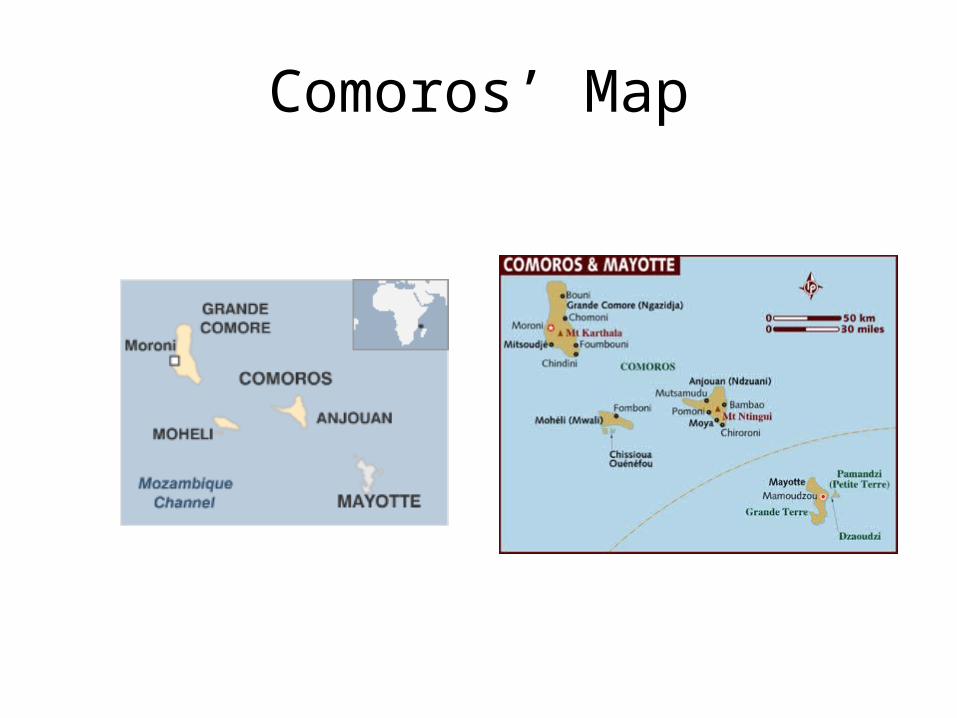
Comoros’ Map
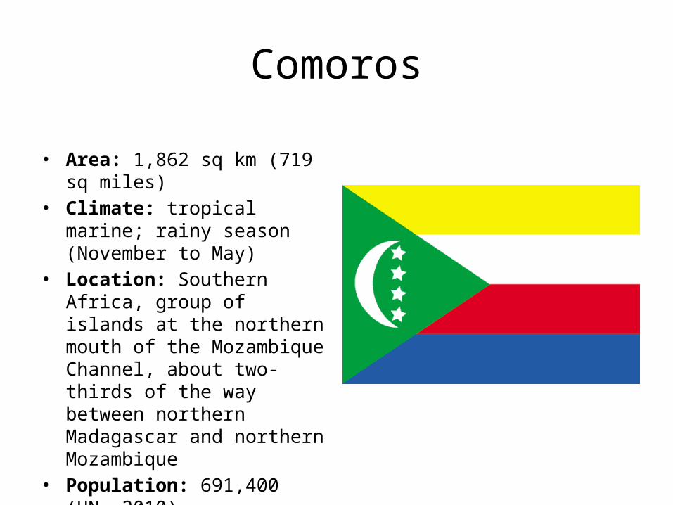
Comoros
• Area: 1,862 sq km (719 sq miles)• Climate: tropical marine; rainy
season (November to May)• Location: Southern Africa, group
of islands at the northern mouth of the Mozambique Channel, about two-thirds of the way between northern Madagascar and northern Mozambique
• Population: 691,400 (UN, 2010)
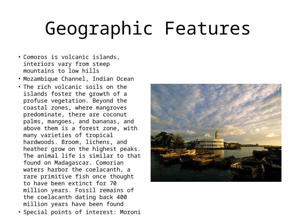
Geographic Features• Comoros is volcanic islands, interiors
vary from steep mountains to low hills• Mozambique Channel, Indian Ocean• The rich volcanic soils on the islands
foster the growth of a profuse vegetation. Beyond the coastal zones, where mangroves predominate, there are coconut palms, mangoes, and bananas, and above them is a forest zone, with many varieties of tropical hardwoods. Broom, lichens, and heather grow on the highest peaks. The animal life is similar to that found on Madagascar. Comorian waters harbor the coelacanth, a rare primitive fish once thought to have been extinct for 70 million years. Fossil remains of the coelacanth dating back 400 million years have been found
• Special points of interest: Moroni
Vacation tour
• Haphazardly scattered across the Indian Ocean, the mysterious, outrageous and enchanting Comoros islands are the kind of place you go to just drop off the planet for a while. Far removed from the clutter that comes with conventional paradises – sprawling hotels, neon discos – the Comoros are so remote even an international fugitive could hide out here. In particular, the island of Mohéli, boasting the sleepy town of Famboni. Anjouan is the beautiful sister among the already good looking cluster of islands, it does paradise so well, it actually lives up to all the clichéd expectations any traveler could possibly muster – Palms, bananas and the scent of ylang-ylang and cloves borne on the breeze.
• The four developed islands offer everything from relaxing on white-sand beaches by turquoise seas to hiking through rainforests on the lookout for giant bats. Grande Comore, the largest of the islands, boasts the largest active volcano in the world, Mt Karthala, which last blew its lid in 2005, flattening villages. The aftermath, though has created a spectacular desert landscape on the mountain, and walking and trekking here is particularly good.
• Everything moves mora mora (slowly slowly) and tourism facilities are far from plush. Islam, and all its traditions, is evident everywhere. Women are expected to show modesty and cover up, and alcohol is a no-no for both sexes.
• But if your idea of the perfect holiday is less about drinking rum punch in a skimpy bikini at a swank resort, and more about long, lazy days sipping tea and talking politics with the locals, then a safari in the exotic Comoros will probably be the kind of unpredictable, swashbuckling adventure you’ve been craving.
History• Comoros has endured more than 20 coups or attempted coups since gaining
independence from France in 1975. In 1997, the islands of Anjouan and Moheli declared independence from Comoros. In 1999, military chief Col. AZALI seized power in a bloodless coup, and helped negotiate the 2000 Fomboni Accords power-sharing agreement in which the federal presidency rotates among the three islands, and each island maintains its own local government. AZALI won the 2002 presidential election, and each island in the archipelago elected its own president. AZALI stepped down in 2006 and President SAMBI was elected to office. In 2007, Mohamed BACAR effected Anjouan's de-facto secession from the Union, refusing to step down in favor of fresh Anjouanais elections when Comoros' other islands held legitimate elections in July. The African Union (AU) initially attempted to resolve the political crisis by applying sanctions and a naval blockade on Anjouan, but in March 2008, AU and Comoran soldiers seized the island. The move was generally welcomed by the island's inhabitants.
• 2010 December - Ikililou Dhoinine wins presidential elections.
Political
• Type of government: republic• President--Ahmed Abdallah Mohamed Sambi• Minister of Foreign Affairs--Fahmi Said Ibrahim
El Maceli• Ambassador to the United States and to the
United Nations--Mohamed Toihiri
Economy
• Industry: 4% of GDP• Exports: vanilla, cloves, perfume essences,
copra. Major markets--Turkey, France, Singapore, Saudi Arabia
• Imports: rice and other foodstuffs, consumer goods, petroleum, cement, transport equipment. Major suppliers--France, U.A.E., South Africa, Pakistan, Kenya, China, India.
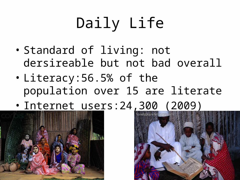
Daily Life
• Standard of living: not dersireable but not bad overall
• Literacy:56.5% of the population over 15 are literate
• Internet users:24,300 (2009)
Cultural
• Children help their parents collect water and wood; girls often work inside the house, while boys work outside.
• Male social organization rests on age group and status.• Religions: Sunni Muslim 98%, Roman Catholic 2%• Rice is the staple of the daily diet, along with manioc and
other root vegetables, plantains, fresh and dried fish, and milk from grated coconuts.
• Music: Zanzabar’s taraab• The army consists of about a thousand men.
Conclusion• Potentially a holiday paradise with picture-postcard beaches, the
Comoros islands are trying to consolidate political stability amid tensions between semi-autonomous islands and the central government.
• A history of political violence has left the Comoros desperately poor. At times, the country has teetered on the brink of disintegration.
• The three Indian Ocean islands have experienced more than 20 coups or attempted coups, beginning just weeks after independence from France in 1975
• I learned that another place I would like to visit is Comoros and that Comoros is not an often tourist destination. I think it should be.
The Central African Republic
Dennis Gouak
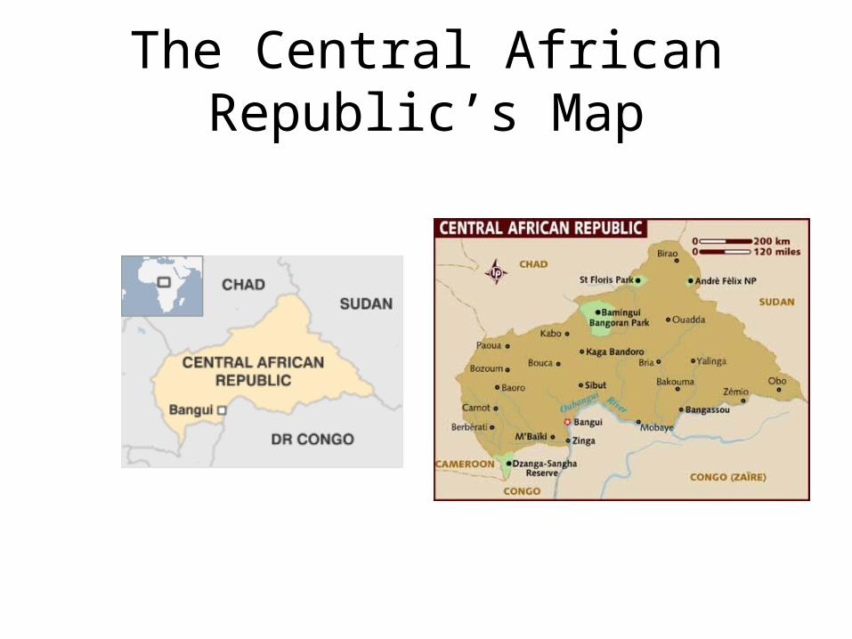
The Central African Republic’s Map
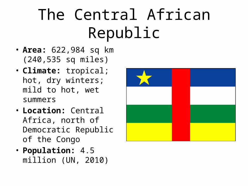
The Central African Republic
• Area: 622,984 sq km (240,535 sq miles)
• Climate: tropical; hot, dry winters; mild to hot, wet summers
• Location: Central Africa, north of Democratic Republic of the Congo
• Population: 4.5 million (UN, 2010)
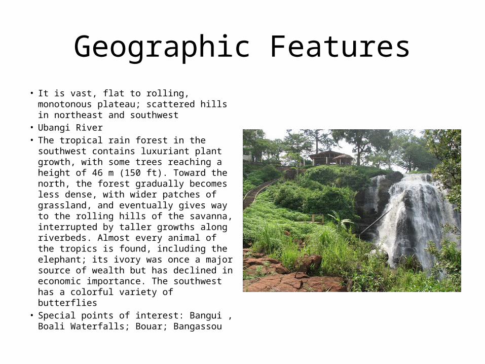
Geographic Features• It is vast, flat to rolling, monotonous
plateau; scattered hills in northeast and southwest
• Ubangi River• The tropical rain forest in the southwest
contains luxuriant plant growth, with some trees reaching a height of 46 m (150 ft). Toward the north, the forest gradually becomes less dense, with wider patches of grassland, and eventually gives way to the rolling hills of the savanna, interrupted by taller growths along riverbeds. Almost every animal of the tropics is found, including the elephant; its ivory was once a major source of wealth but has declined in economic importance. The southwest has a colorful variety of butterflies
• Special points of interest: Bangui , Boali Waterfalls; Bouar; Bangassou
Vacation tour
• If it’s the ‘real’ Africa you’re looking for, Central African Republic (CAR) may be it. A country of staggering rare natural beauty, with some of the world’s most amazing wildlife, it nonetheless remains underdeveloped, fragmented and poverty-stricken.
• There are a handful of lucky visitors that search for gorillas and elephants in the Dzanga-Sangha National Park, in the little finger of land in the southeast corner of the CAR. Whatever you do check the situation with your embassy before attempting to visit.
History• The former French colony of Ubangi-Shari became the Central African
Republic upon independence in 1960. After three tumultuous decades of misrule - mostly by military governments - civilian rule was established in 1993 and lasted for one decade. President Ange-Felix PATASSE's civilian government was plagued by unrest, and in March 2003 he was deposed in a military coup led by General Francois BOZIZE, who established a transitional government. Though the government has the tacit support of civil society groups and the main parties, a wide field of candidates contested the municipal, legislative, and presidential elections held in March and May of 2005 in which General BOZIZE was affirmed as president. The government still does not fully control the countryside, where pockets of lawlessness persist. Unrest in the neighboring nations of Chad, Sudan, and the DRC continues to affect stability in the Central African Republic as well.
• 2011 January - Presidential and parliamentary elections. Mr Bozize wins another term.
Political
• Type of government: republic• President of the Republic, Head of State--Francois
Bozize• Prime Minister--Faustin Archange Touadéra• Minister of Foreign Affairs, Regional Integration and
Francophone World--Antoine Gambi• Minister of Finance and Budget--Albert Besse• Ambassador to the United States--Stanislas Moussa-
Kembe• Ambassador to the United Nations--Fernand Poukre-
Kono
Economy
• Industry: 20% of GDP• Exports: timber and diamonds, with some
exports of coffee, cotton, and tobacco. Major markets--Belgium, Indonesia, China, Morocco, and Democratic Republic of the Congo.
• Imports: petroleum products, items to support public sector investment programme Major suppliers--France, United States, Cameroon, Netherlands, Republic of Korea.
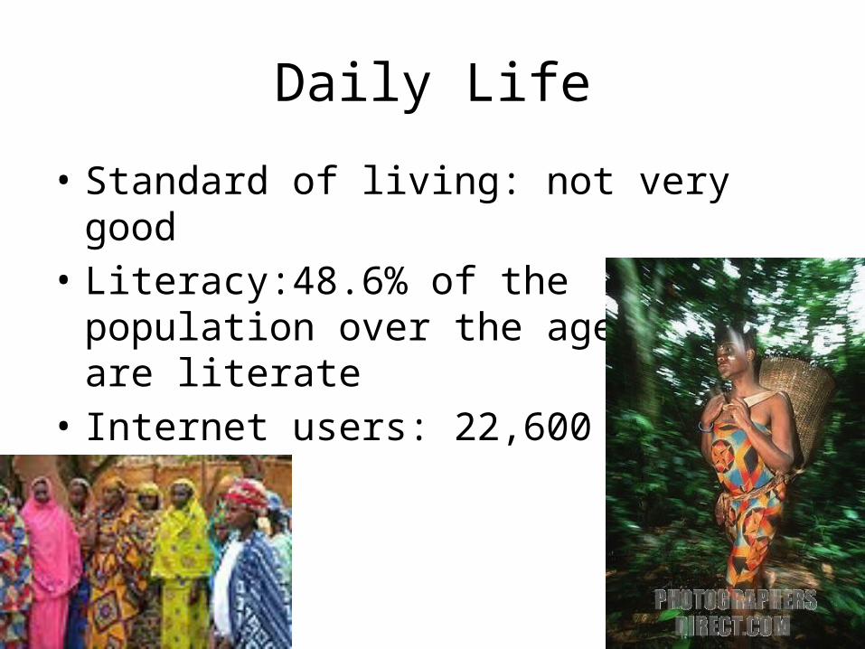
Daily Life
• Standard of living: not very good• Literacy:48.6% of the population over the age
of 15 are literate• Internet users: 22,600 (2009)
Cultural• Social class is differentiated by place of residence and work: rural versus
urban.• Infants traditionally were not weaned until about age two, and everyone in
the family was involved in their care.• Religions: indigenous beliefs 35%, Protestant 25%, Roman Catholic 25%,
Muslim 15%• The staple is a dough like mixture of processed and dried detoxified
cassava ( gozo ) or sorghum. This is accompanied by a sauce made of vegetables, poultry, meat, or fish.
• Music: Western rock and pop music, as well as Afrobeat, soukous and other genres have become popular nation-wide.
• With a baccalaureate degree a person may enroll at the University of Bangui to prepare for a career in public service or to emigrate to France. The majority of the students attending higher education are male.
Conclusion
• The Central African Republic (CAR) has been unstable since its independence from France in 1960 and is one of the least-developed countries in the world.
• It has endured several coups and a notorious period under a self-declared emperor, Jean-Bedel Bokassa, who headed a brutal regime.
• There are only 12,000 main line telephones in use• I learned that people here are among the world’s
poorest.
Works Cited
• https://www.cia.gov/library/publications/the-world-factbook/index.html
• http://news.bbc.co.uk/2/hi/country_profiles/default.stm
• Because of the short notice, I was unable to keep track of all of my sources. Sorry.