Embed Size (px)
Citation preview

240 Northland Lakes Ecological Status 2013
6.8 Lake Parawanui (Pouto), NRC Lake No. 297; surveyed in 2005
Plate: Southern end of Lake Parawanui showing the pasture catchment and grazed margin wit h an exposed turf community.
Summary of last survey 2001
Overall ranking Low: A degraded lake, with poor water quality, grazed lake margins, sparse submerged vegetation and pest fish present.
Threats Pest fish and Potamogeton crispus already established. Nutrient enrichment and cattle access to margin.
Management recommendations No monitoring recommended.
Description
Lake Parawanui (1676581E, 6008811N) is a dune lake 5.8 ha in area with a 20 m maximum recorded depth. The catchment is pasture. There is one inflow entering the eastern bay at the southern end of the lake draining from approximately 1 km to the east. There is no outlet. Access is through 1 km of private farmland, mostly on well-formed tracks. Small boats can be launched from much of the shore with a 4-WD.

Northland Lakes Ecological Status 2013 241
Wetland vegetation Emergent vegetation was sparse (5%) with Schoenoplectus tabernaemontani the dominant species in this lake. The turf community lining the southern margin of the lake contained the regionally threatened Fimbristylis velata.
Submerged vegetation The only vegetation present in 2001 was the exotic weed Potamogeton crispus, present at low covers from 0.2 to 2.4 m depth.
LakeSPI LakeSPI score is not generated from previous survey data.
Water birds The pasture catchment and poor emergent cover provide poor waterbird habitat. There are previous reports of large numbers of waterfowl including the regionally rare dabchick (Poliocephalus rufopectus), however this was prior to the collapse of submerged vegetation.
Fish The pest fish rudd (Scardinius erythrophthalmus), koi carp (Cyprinus carpio) and orfe (Leuciscus idus) were reported as liberated into Lake Parawanui. NIWA FBIS records include shortfin eel (Anguilla australis), common bully (Gobiomorphus cotidianus) and rudd caught in this lake.
Aquatic invertebrates Abundant freshwater mussels (Hyridella menzesii) were noted.
Changes in indicators Seven submerged species were present in 1988, with beds of Potamogeton ochreatus and Nitella hookeri extending to 5.5 and 8 m water depth respectively, while P. crispus was not reported.
Threats It appears that coarse or pest fish have been deliberately stocked in this lake. Possibly a combination of this, cattle access and nutrient run-off from the steep pasture catchment has resulted in nutrient enrichment and a loss of submerged vegetation. Further pest plant or fish introductions are unlikely to further impact on the lake.
Management recommendations No monitoring recommended.

242 Northland Lakes Ecological Status 2013
6.9 Phoebe’s Lake (Pouto), NRC No. 346; surveyed in 2001, re-visited in 2008
Plate: Phoebe’s Lake with a dense margin of Eleocharis sphacelata.
Summary
Overall ranking Low: A small lake, heavily impacted by the exotic submerged weed Lagarosiphon major.
Threats Highly impacted by aquatic weeds.
Management recommendations Consider management of L. major. No monitoring recommended.
Description
A small (0.9 ha) dune lake (1696778E, 5981948N), 4 m deep. The catchment is primarily pasture. There are no inflows or outflows. Access is through less than 1 km of well-formed track, but with no easy access into the lake.
Wetland vegetation Emergent vegetation was dense and surrounded the lake; with Manchurian wild rice (Zizania latifolia) occupied 50% of the margin in 2001. Manchurian wild rice has been targeted for eradication and in 2008 only small patches of young re-growth were found. Typha orientalis, Eleocharis sphacelata, and Baumea articulata were abundant.
Northland Lakes Ecological Status 2013 243
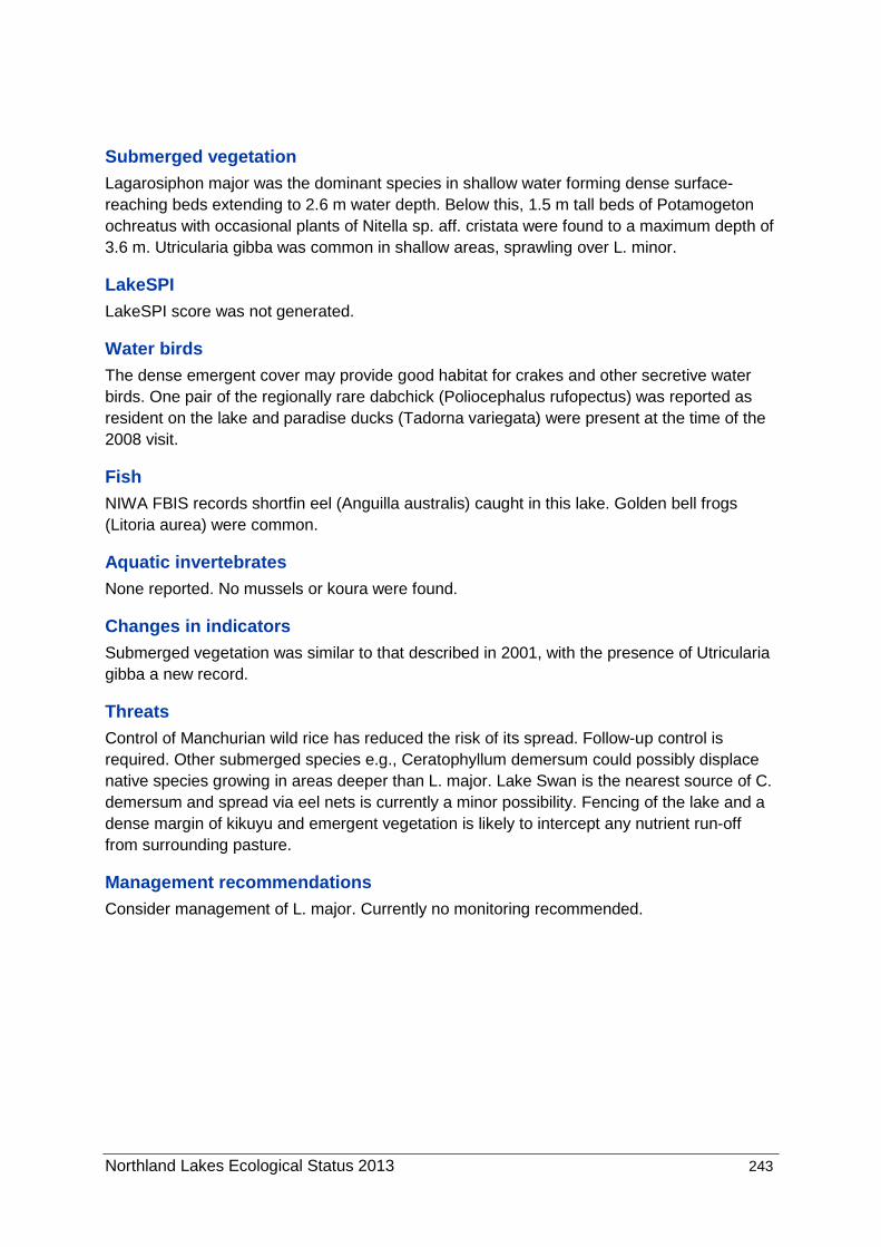
Submerged vegetation Lagarosiphon major was the dominant species in shallow water forming dense surface-reaching beds extending to 2.6 m water depth. Below this, 1.5 m tall beds of Potamogeton ochreatus with occasional plants of Nitella sp. aff. cristata were found to a maximum depth of 3.6 m. Utricularia gibba was common in shallow areas, sprawling over L. minor.
LakeSPI LakeSPI score was not generated.
Water birds The dense emergent cover may provide good habitat for crakes and other secretive water birds. One pair of the regionally rare dabchick (Poliocephalus rufopectus) was reported as resident on the lake and paradise ducks (Tadorna variegata) were present at the time of the 2008 visit.
Fish NIWA FBIS records shortfin eel (Anguilla australis) caught in this lake. Golden bell frogs (Litoria aurea) were common.
Aquatic invertebrates None reported. No mussels or koura were found.
Changes in indicators Submerged vegetation was similar to that described in 2001, with the presence of Utricularia gibba a new record.
Threats Control of Manchurian wild rice has reduced the risk of its spread. Follow-up control is required. Other submerged species e.g., Ceratophyllum demersum could possibly displace native species growing in areas deeper than L. major. Lake Swan is the nearest source of C. demersum and spread via eel nets is currently a minor possibility. Fencing of the lake and a dense margin of kikuyu and emergent vegetation is likely to intercept any nutrient run-off from surrounding pasture.
Management recommendations Consider management of L. major. Currently no monitoring recommended.

244 Northland Lakes Ecological Status 2013
6.10 Lake Rotokawau (Pouto), NRC Lake No. 364.
Plate: Lake Rotokawau showing the exposed north east shoreline with few emergent species.
Summary
Survey dates 2005, 2007, 2012.
Overall ranking High: The submerged weed Egeria densa is established, however it appears to be declining,
possibly due to improving water quality. The lake supports extensive turf communities
dominated by the nationally endangered Trithuria inconspicua, charophyte meadows with
tall-growing native species, and a good population of nationally rare dwarf inanga.
Threats E. densa (introduced in early 1990’s) was present in many submerged profiles and
Utricularia gibba was present but prolific only in the sheltered lagoon. Ceratophyllum
demersum could have a much greater impact if introduced, with nearby Lake Swan the most
likely source. Presumably eel fishing nets were the mode of introduction and pose a threat
for future introductions, although access to the lake is now much more difficult than
previously due to changing farm use. Water quality is still good but prone to nutrient
enrichment if pastoral practices intensify. The lake is currently fenced preventing cattle
access.
Management recommendations
Lake ecological assessment every 5 years.

Northland Lakes Ecological Status 2013 245
Description
This dune lake (1702929E 5976997N) is 26.4 ha in size and 12 m deep. The catchment is
pastoral, with plantation pine and shrubland. Access is across private farmland, requiring 4-
WD but it is possible to launch a boat.
Wetland vegetation
Pockets of emergent species on occasional soft shores occupied 15% of the lake margin.
Dominant species included Schoenoplectus tabernaemontani, Machaerina articulata, M
juncea, Eleocharis acuta, Isolepis prolifera, Typha orientalis, Apodasmia similis and E.
sphacelata. The sheltered arm to the north had a dense fringe of emergents. Exposed turf
communities were common just above the water line and included regionally significant
Myriophyllum votschii. The pest plant royal fern (Osmunda regalis) was collected from the
lake margin in 2010.
Submerged vegetation
Turf communities were well developed with Lilaeopsis novae-zelandiae and the nationally
threatened Trithuria inconspicua co-dominants. There was a very significant T. inconspicua
habitat within this lake, apparently the largest population of this species in Northland. Tall-
growing native species, Potamogeton cheesemanii and P. ochreatus were common. The
exotic species Egeria densa, with lesser amounts of Elodea canadensis, were widespread
but were not having a major impact on native vegetation. In 2012 E. densa was much
reduced in abundance (lake wide) and did not exceed 0.2 m tall or 25% maximum cover.
Utricularia gibba was present on some profiles but was of little impact also. Charophytes
were the dominant vegetation in much of the lake with Chara fibrosa and Chara australis the
most abundant species and grew across the bottom of the lake.
Table 6-4: LakeSPI results for Lake Rotokawau . LakeSPI Indices expressed as a percentage of lake maximum potential.
* The 2001 survey is based on 3 sites and some of the 2005 sites differed from later years.
State Year LakeSPI
Index (%)
Native
Cond ition
Index (%)
Invasive
Impact
Index (%)
Pristine 95 92 0
Historical data
1985 84 71 0
1988 77 58 0
2001 45 58 62
2005 41 53 64
2007 56 71 52
Present day 2012 70 78 33

246 Northland Lakes Ecological Status 2013
41
56
70
53
71
78
64
52
33
0
20
40
60
80
100
Sco
re (
%)
LakeSPI Native Invasive
Figure 6-4: LakeSPI Index as % of potential score in Lake Rotokawau with Native Condition Index, and Invasive Impact Index for 2005; 2007; 2012 (from left to right).
Lake Rotokawau is currently categorised by LakeSPI as being in high ecological condition
with a LakeSPI index of 70% (Table 6-4, Figure 6-4). The LakeSPI index for this lake has
notably improved since the 2007 survey as a result of a reduction in the invasive impact
scores. E. densa and U. gibba while still present during the 2012 survey did not exceed a
10% cover at any of the baseline sites. It is also likely improved water clarity (excess of 5 m
during the 2012 survey) has contributed to the growth of native charophyte meadows down
to 11.1 m, the maximum depth found at the time.
Water birds
Limited marginal vegetation provides limited cover for resident water birds although good
water clarity and submerged vegetation would attract feeding birds. Logan Forrest recorded
a total of 19 aquatic birds from Lake Rotokawau including the nationally endangered bittern
(Botaurus poiciloptilus) and regionally significant dabchick (Poliocephalus rufopectus) and
scaup (Aythya novaezeelandiae). In 2012, dabchick, scaup, paradise shelduck and a pair of
Cape Barren geese (Cereopsis novaehollandiae) were seen.
Fish
Good habitat for fish. Common bully (Gobiomorphus cotidianus) and the rare dwarf inanga
(Galaxias gracilis) were observed in this lake, with NIWA FBIS records of these species and
also shortfin eel (Anguilla australis).

Northland Lakes Ecological Status 2013 247
Aquatic invertebrates
Abundant freshwater mussels (Echyridella menziesii), leeches (Richardsonianus mauianus),
and Potamopyrgus antipodarum snails were noted.
Changes in indicators
Other surveys were carried out in 1985, 1988, 2001, 2005 and 2007. Depth limits of the
vegetation have varied between 10.5 and 6.0 m and are currently at 11.1 m, the maximum
depth we found in the lake at the time. Charophytes grew to a maximum depth of 7.6 m in
2001, now 11.1 m. The exotic weed E. densa were first reported in 1993 and E. canadensis
in 2001 and both were common throughout the lake with E. densa probably having reached
its maximum impact in the 2007 survey. It is now only a minor component of the vegetation
and E. canadensis was not seen. U. gibba was reported for the first time in 2007 but now has
little impact on the lake. Why lake condition has improved so markedly is not clear without
further study.
Threats
Ceratophyllum demersum introduction would be the greatest threat to the high ecological
values. C. demersum is invasive in clear water low-nutrient lakes (e.g., Lake Taupo,
Tarawera) and poses a much greater threat to this lake than E. densa.
Although C. demersum risk has been eliminated from the adjacent Lake Swan, the
mechanism for its spread, via eel fishing nets, presumably the source of the E. densa
incursion, still remains although access is now much more difficult.
Management recommendations
Poor access to the lake reduces the risk of weed incursion so weed surveillance monitoring
has been suspended. Lake ecological assessment every 5 years.
248 Northland Lakes Ecological Status 2013
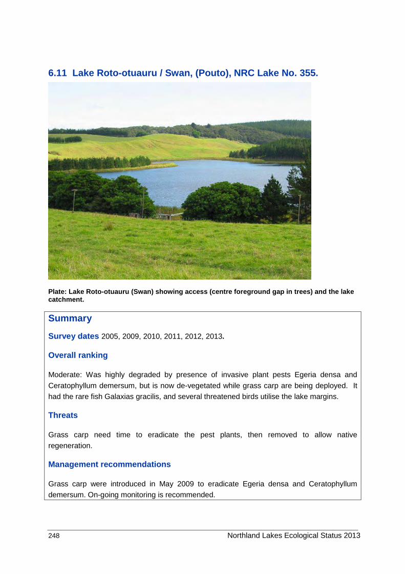
6.11 Lake Roto-otuauru / Swan, (Pouto), NRC Lake No. 355.
Plate: Lake Roto-otuauru (Swan) showing access (centre foreground gap in trees) and the lake catchment.
Summary
Survey dates 2005, 2009, 2010, 2011, 2012, 2013.
Overall ranking
Moderate: Was highly degraded by presence of invasive plant pests Egeria densa and
Ceratophyllum demersum, but is now de-vegetated while grass carp are being deployed. It
had the rare fish Galaxias gracilis, and several threatened birds utilise the lake margins.
Threats
Grass carp need time to eradicate the pest plants, then removed to allow native
regeneration.
Management recommendations
Grass carp were introduced in May 2009 to eradicate Egeria densa and Ceratophyllum
demersum. On-going monitoring is recommended.

Northland Lakes Ecological Status 2013 249
Description
The lake (1702249E, 5978792N) is 17.4 ha and is 5.5 m deep. The catchment was mostly pasture, with 30% pine plantation and some areas of scrub. The lake perimeter is fenced. Access is by 4-WD across private land and small boat launching is possible.
Wetland vegetation Emergent species surround about 75% of the lake forming a dense fringe about 5 to 15 m wide of Eleocharis sphacelata (to 2 m tall) with a mix of Eleocharis acuta, Schoenoplectus tabernaemontani, Machaerina articulata and Typha orientalis. Grass carp grazing has reduced these species.
Exposed turf areas contained large mats of the ‘Regionally Rare’ Gratiola sexdentata, and also Triglochin striata and Myriophyllum votschii. The invasive alligator weed (Alternanthera philoxeroides) was present at low cover.
Submerged vegetation
At a few locations a wide range of turf species were present with Glossostigma elatinoides
the dominant species. The rare plant Hydatella inconspicua has not been seen since 1988.
In 2010 charophytes persisted at one small area in shallow water (to 1.8m) on the northern
shore of the main body of the lake but have been eaten by grass carp. These plants
dominated the lake vegetation in the past but were displaced by invasives. Prior to 2010 the
submerged vegetation was dominated by tall-growing invasive species Egeria densa and C.
demersum. E. densa was first reported in the lake in 1992, and C. demersum was first
recorded in the 2005 survey.
Grass carp were introduced in May 2009 to eradicate the C. demersum and E. densa. In
April 2010 virtually all the E. densa had gone and about half the C. demersum. In 2011 all the
C. demersum had gone except for a few shoots amongst the marginal vegetation. Utricularia
gibba heavily covered much of the E. densa in 2010, but none remained in 2011. In 2012
and 2013 there were no signs of C. demersum or E. densa or other submerged plants other
than the turf species.

250 Northland Lakes Ecological Status 2013
LakeSPI
21 21
14
3733
18
86
9694
0
20
40
60
80
100
Sco
re (
%)
LakeSPI Native Invasive
Figure 6-5: LakeSPI Index as % of potential score for Lake Roto-otuauru with Native Condition Index, and Invasive Impact Index shown from 2005, 2009 and 2010 (from left to right). Note grass carp directly affect LakeSPI metrics and currently the default score is zero with no submerged macrophytes found.
A very low LakeSPI score of 14% was recorded in 2010 as E. densa and C. demersum have
greatly reduced native values in the lake (Figure 6-5). By 2011 grass carp had removed all
the submerged vegetation so it scored 0% (Non-vegetated), as in 2012 but as grass carp
directly affect the LakeSPI metrics the value of LakeSPI in monitoring ecological condition is
markedly reduced. When grass carp grazing pressure is removed LakeSPI is expected to
improve markedly with an all-native submerged vegetation restored from the seed bank.
Water birds
Fencing of the lake to exclude cattle and the large emergent beds surrounding much of this
lake created a desirable habitat for many water birds. Large numbers of black swan (Cygnus
atratus) and mallard (Anas platyrhynchus) were recorded. Threatened species recorded from
the lake include the nationally endangered bittern (Botaurus poiciloptilus) and regionally
significant dabchick (Poliocephalus rufopectus) and fernbird (Bowdleria punctata vealeae).
More recently bird numbers, particularly black swan have decreased as the aquatic
vegetation is eaten by grass carp.
Fish
In shallower water, the large emergent beds provide good habitat for some species. Dwarf
inanga (Galaxias gracilis), bully (Gobiomorphus cotidianus) and shortfin eels (Anguilla
australis) were noted in 2010.
Grass carp were introduced in May 2009. They will change fish habitat, but other studies have
not reported significant fisheries impacts.

Northland Lakes Ecological Status 2013 251
Aquatic invertebrates Large numbers of invertebrates including freshwater mussels (Echyridella menziesi) were recorded.
Changes in indicators
Previously this was a native lake of high value, with charophyte meadows and the tall-
growing species Potomogeton ochreatus dominant. Native species were then displaced by
the pest plants E. densa and C. demersum. Grass carp have since been used to remove all
submerged vegetation except for the turf species and emergent vegetation.
Threats
E. densa and C. demersum posed a significant risk to other lakes in the region, particularly
nearby ‘outstanding’ Lakes Humuhumu and Kanono. Boat access to Lake Swan with a 4-WD
is easy across private land. This risk has gone with grass carp removal of the pest plants.
Re-introduction of pest plants is not a risk until the grass carp have gone.
Alligator weed is apparently present at the access point only and threatens the marginal
vegetation of this lake.
Management recommendations
Eradication of submerged weeds by introduction of grass carp has been implemented and
this eradication strategy should continue for one more year and be monitored annually.
A survey of alligator weed abundance and management (if appropriate) is recommended.

252 Northland Lakes Ecological Status 2013
6.12 Lake Rotopouua (Pouto), NRC Lake No. 348.
Plate: Lake Rotopouua.
Summary
Survey dates 2008, 2012.
Overall ranking
Outstanding: Good intact native emergent margin and submerged vegetation with some
endangered biota. Utricularia gibba present.
Threats
Introduction of invasive species. Further nutrient enrichment and de-oxygenation.
Management recommendations
Lake ecological assessment every 5 years. Algal blooms indicate possible nutrient threat to
ecological condition. A nutrient budget is recommended.

Northland Lakes Ecological Status 2013 253
Description
Lake Rotopouua (1699531E, 590047N) is a small (<5ha) lake with a maximum depth c. 9 m.
The lake is ponded between dunes to the west and weathered hill country, with heavy clay
soils, to the east. The catchment is primarily plantation pine forestry manuka/kanuka scrub
and fenced pasture. Access is across farm land from the Pouto Road and the lake has
limited boat access as it is fenced off from stock.
Wetland vegetation
The lake is completely fringed with emergent species. The dominant emergent species are
Eleocharis sphacelata, Typha orientalis, Machaerina juncea, M. articulata, Schoenoplectus
tabernaemontani and Carex secta. The nationally threatened fern Thelypteris confluens was
common growing amongst emergent sedges, especially M. juncea.
Submerged vegetation
Turf communities were not recorded due to extensive and dense emergent beds. Some
Utricularia gibba was found in shallow water amongst emergent sedges. Tall-growing
Potamogeon ochreatus was common with charophyte meadows dominated by Nitella sp. aff.
cristata and Chara australis to about 5 m.
LakeSPI
Table 6-5: LakeSPI results for Lake Rotopouua. LakeSPI Indices expressed as a percentage of lake maximum potential.
*LakeSPI results are based on 3 sites.
State Year LakeSPI
Index (%)
Native
Cond ition
Index (%)
Invasive
Impact
Index (%)
Pristine 95 91 0
2008 72 68 21
Present day 2012 71 67 21

254 Northland Lakes Ecological Status 2013
72 7168 67
21 21
0
20
40
60
80
100
Sco
re (
%)
LakeSPI Native Invasive
Figure 6-6: LakeSPI Index as % of potential score for lake Rotopouua with Native Condition Index and Invasive Impact Index for 2008 and 2012 shown (from left to right).
Lake Rotopouua is in ‘high’ ecological condition as categorised by LakeSPI (Table 6-5,
Figure 6-6).
Utricularia gibba continues to have a negative impact on lake values but this lake has
remained stable since its first LakeSPI assessment in 2008.
Water birds
Extensive emergent vegetation and a relatively isolated lake provide good habitat for water
birds. The nationally endangered bittern (Botaurus poiciloptilus) and regionally threatened
dabchick (Poliocephalus rufopectus) were seen and a spotless crake (Porzana tabuensis
plumbea) was observed from the lake margin.
Fish
Abundant common bullies (Gobiomorphus cotidianus), were observed during vegetation
surveys. The endangered dwarf inanga (Galaxias gracilis) were reported as common in this
lake (Rowe and Chisnall 1997), but a thorough search by DOC Northland Conservancy staff
could not relocate this species.
Aquatic invertebrates
Many dead shells of the freshwater mussels (Echyridella menziesi) were common throughout
the lake in 2008 and no live ones were found. It is likely the lake has been anoxic. Snails,
Potamopyrgus antipodarum, as well as freshwater sponges and hydra were common.

Northland Lakes Ecological Status 2013 255
Changes in indicators
No change.
Threats
The restricted access to this lake reduces the threat of introduction of pest plants. Should
invasive species be introduced to the lake it is likely that they would displace much of the
current native vegetation. The lake appeared to have deteriorated in 2008 with a mass
extinction of mussels and apparently dwarf inanga, probably caused by the lake going anoxic
for a period. This indicates increased nutrient input (from farming or forestry?) and resulting
algal blooms. The lake is fenced preventing direct access to the lake by livestock. However,
an extensive pugged wetland area was noted at the northern end of the lake, a possible
source of nutrient enrichment along with fertiliser from pine forests.
Management recommendations
An assessment of lake native biodiversity value at 5 yearly intervals is recommended.
Analysis of annual monitoring of water quality should be undertaken to determine the extent
of nutrient enrichment and consideration of sources of nutrients to the lake may find a means
of mitigating the nutrient enrichment threat.

256 Northland Lakes Ecological Status 2013
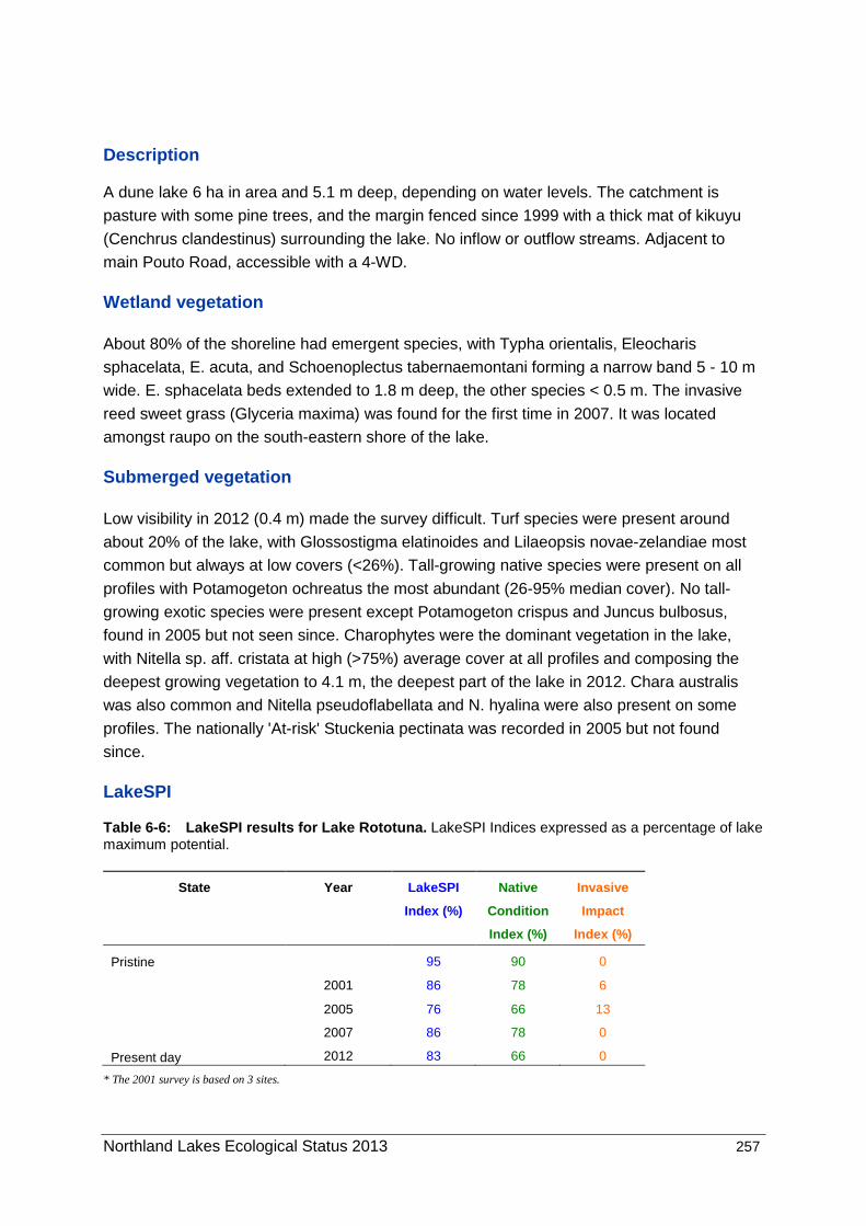
6.13 Lake Rototuna (Pouto), NRC Lake No. 328.
Plate: Lake Rototuna in a pastoral catchment with some pines on the western margin.
Summary
Survey dates 2005, 2007, 2012.
Overall ranking
High: A lake with retired margins, native vegetated with endangered biota, and pest fish
established.
Threats
Invasive submerged weeds would displace the existing vegetation, though access is now
more difficult. Possibly issues with road run-off entering lake via a culvert with
turbidity/nutrient issues. The invasive reed sweet grass (Glyceria maxima) threatens the lake
margins.
Management recommendations
Lake ecological assessment every 2 to 3 years. Eradicate Glyceria maxima.
Northland Lakes Ecological Status 2013 257
Description
A dune lake 6 ha in area and 5.1 m deep, depending on water levels. The catchment is
pasture with some pine trees, and the margin fenced since 1999 with a thick mat of kikuyu
(Cenchrus clandestinus) surrounding the lake. No inflow or outflow streams. Adjacent to
main Pouto Road, accessible with a 4-WD.
Wetland vegetation
About 80% of the shoreline had emergent species, with Typha orientalis, Eleocharis
sphacelata, E. acuta, and Schoenoplectus tabernaemontani forming a narrow band 5 - 10 m
wide. E. sphacelata beds extended to 1.8 m deep, the other species < 0.5 m. The invasive
reed sweet grass (Glyceria maxima) was found for the first time in 2007. It was located
amongst raupo on the south-eastern shore of the lake.
Submerged vegetation
Low visibility in 2012 (0.4 m) made the survey difficult. Turf species were present around
about 20% of the lake, with Glossostigma elatinoides and Lilaeopsis novae-zelandiae most
common but always at low covers (<26%). Tall-growing native species were present on all
profiles with Potamogeton ochreatus the most abundant (26-95% median cover). No tall-
growing exotic species were present except Potamogeton crispus and Juncus bulbosus,
found in 2005 but not seen since. Charophytes were the dominant vegetation in the lake,
with Nitella sp. aff. cristata at high (>75%) average cover at all profiles and composing the
deepest growing vegetation to 4.1 m, the deepest part of the lake in 2012. Chara australis
was also common and Nitella pseudoflabellata and N. hyalina were also present on some
profiles. The nationally 'At-risk' Stuckenia pectinata was recorded in 2005 but not found
since.
LakeSPI
Table 6-6: LakeSPI results for Lake Rototuna. LakeSPI Indices expressed as a percentage of lake maximum potential.
* The 2001 survey is based on 3 sites.
State Year LakeSPI
Index (%)
Native
Cond ition
Index (%)
Invasive
Impact
Index (%)
Pristine 95 90 0
2001 86 78 6
2005 76 66 13
2007 86 78 0
Present day 2012 83 66 0

258 Northland Lakes Ecological Status 2013
76
8683
66
78
66
13
0 0
0
20
40
60
80
100
Sco
re (
%)
LakeSPI Native Invasive
Figure 6-7: LakeSPI Index as % of potential score for Lake Rototuna with Native Condition Index, and Invasive Impact Index shown for 2005; 2007; 2012 (from left to right).
Lake Rototuna is categorised as being in ‘excellent’ ecological condition with a high LakeSPI
index of 83% (Table 6-6, Figure 6-7). LakeSPI values for this lake have remained stable
since surveys begun in 2001 with only a small change noted in the invasive impact scores
during the 2001 and 2005 surveys on account of Potamogeton crispus and Juncus bulbosus
being present at that time.
Water birds
Dabchick (Poliocephalus rufopectus), regionally significant, and scaup (Aythya
novaezeelandiae) were noted in previous visits, with 18 other common birds, the most
dominant being black swans (Cygnus atratus) and paradise shelduck (Tardorna variegata).
Additional to swans and regionally significant scaup (Aythya novaezeelandiae), an
endangered Australasian bittern (Botaurus poiciloptilus) was seen during the 2012 visit.
Fish
Nationally threatened dwarf inanga (Galaxias gracilis) were recorded by the NIWA FBIS
database although none were seen during the survey. Common bully (Gobiomorphus
cotidianus) and exotic Gambusia affinis were observed. Rudd (Scardinius erythrophthalmus)
were also reported.
Aquatic invertebrates
The introduced snail Physa acuta was recorded during the vegetation survey.

Northland Lakes Ecological Status 2013 259
Changes in indicators
Previous surveys were undertaken in 1988, 2001 and 2005 survey. The 1988 survey had much reduced bottom limits with the maximum depth of vegetation only 2.5 m, but subsequent surveys found the lake mostly vegetated with only a small area deeper than 5 m beyond the bottom limit of the vegetation. The water level in 2012 was low with the maximum depth 4.2 m and the clarity was poor at around 0.4 m with a dense algal bloom that is likely to be recent as the vegetation still grew across the bottom.
Threats
The vegetation is native dominated and introduction of other weed species is a risk. The
sprawling emergent weed reed sweet grass, threatens much of the marginal vegetation and
has not been controlled yet.
Pest fish (gambusia and rudd) are of concern. The possible loss of dwarf inanga from Lake
Kai-iwi, may have resulted from gambusia impacts, and the recent introduction of these pest
fish may have similar impacts in Lake Rototuna. Rudd are herbivorous in large part and have
been implicated in loss of vegetation in nutrient stressed lakes similar to Lake Rototuna,
however they have been present in the lake for around a decade with little apparent impact.
Management recommendations
Lake ecological assessment every 2-3 years.
Eradicate reed sweet grass from the lake margin using a grass-specific herbicide. Investigate dwarf inanga recovery.
260 Northland Lakes Ecological Status 2013
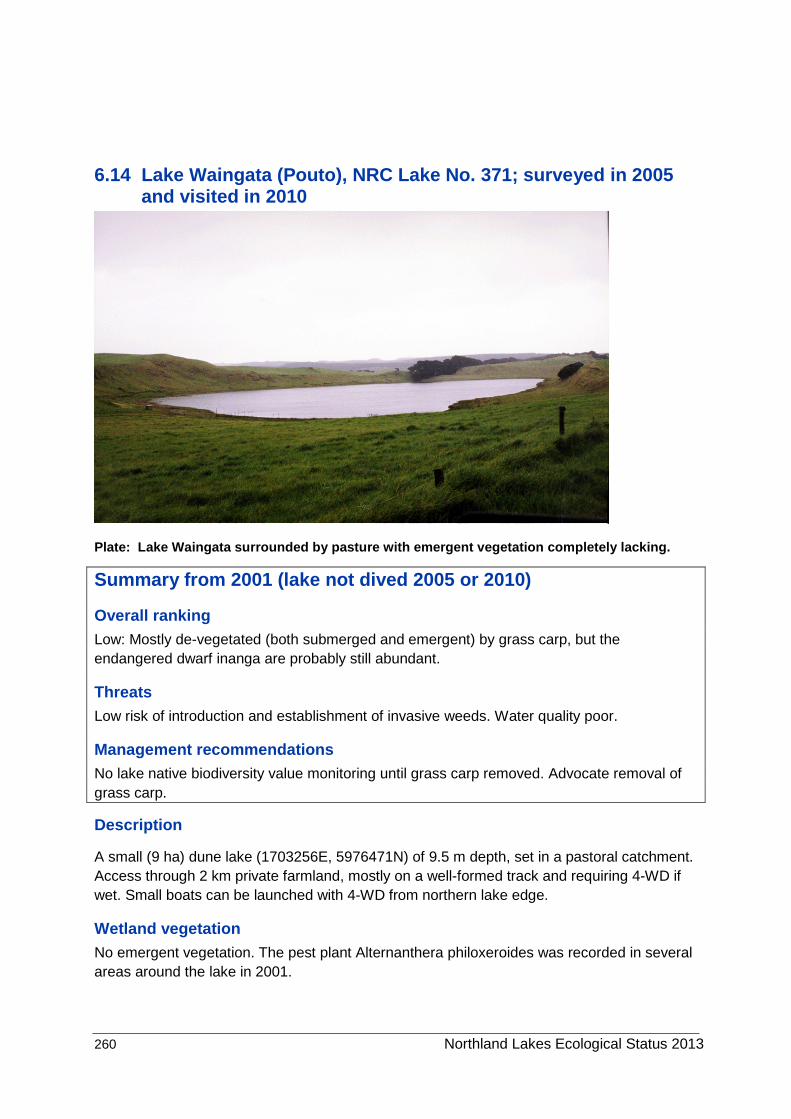
6.14 Lake Waingata (Pouto), NRC Lake No. 371; surveyed in 2005 and visited in 2010
Plate: Lake Waingata surrounded by pasture with emergent vegetation completely lacking.
Summary from 2001 (lake not dived 2005 or 2010)
Overall ranking Low: Mostly de-vegetated (both submerged and emergent) by grass carp, but the endangered dwarf inanga are probably still abundant.
Threats Low risk of introduction and establishment of invasive weeds. Water quality poor.
Management recommendations No lake native biodiversity value monitoring until grass carp removed. Advocate removal of grass carp.
Description
A small (9 ha) dune lake (1703256E, 5976471N) of 9.5 m depth, set in a pastoral catchment. Access through 2 km private farmland, mostly on a well-formed track and requiring 4-WD if wet. Small boats can be launched with 4-WD from northern lake edge.
Wetland vegetation No emergent vegetation. The pest plant Alternanthera philoxeroides was recorded in several areas around the lake in 2001.

Northland Lakes Ecological Status 2013 261
Submerged vegetation Casual observations made in 2005 and 2010 showed turf community was common, with Lilaeopsis novae-zelandiae, Elatine gratioloides and Glossostigma elatinoides the dominant turf species. These species and 6 others were found in 2001, with the turf extending between the lake margin and 1 m deep with scattered plants of Chara australis extending to 1.9 m.
LakeSPI LakeSPI score is not generated from previous survey data.
Water birds The lake provides minimal bird habitat. Twenty scaup (Aythya novaezeelandiae) were seen on the lake in 2005. Early (pre-1995) records from this lake included the regionally significant dabchick (Poliocephalus rufopectus).
Fish The lake was stocked with rainbow trout (Oncorhynchus mykiss) in the 1950’s until 1980, but have since died out. The nationally endangered dwarf inanga (Galaxias gracilis) is present in the lake, and was recorded as abundant in 1997. Common bully (Gobiomorphus cotidianus) were the only other fish present in Lake Waingata until 67 grass carp (Ctenopharyngodon idella) were introduced in 1995 to eradicate the elodea.
Aquatic invertebrates No invertebrates were recorded in 2001.
Changes in indicators Prior to grass carp introduction there was a marginal emergent cover of 77% of the shoreline dominated by E. sphacelata, but also including Baumea articulata, B. arthrophylla, E. acuta, Schoenoplectus tabernaemontani and Typha orientalis. Thirteen submerged species were reported including the nationally endangered Trithuria inconspicua and Nitella sp. aff. cristata which grew to a maximum depth of 6 m along with C. australis. The exotic weed Elodea canadensis was present in Lake Waingata until 1996, after which it was eliminated by grass carp browsing. Grass carp have subsequently eliminated all emergent vegetation and restricted submerged vegetation to shallow turfs.
Threats The isolation of the lake and absence of eels provide a low risk of introduction and establishment of invasive weeds is most unlikely due to grass carp browsing pressure. Water quality is currently poor.
Management recommendations
No lake native biodiversity value monitoring until grass carp removed.
Advocate removal of grass carp.

262 Northland Lakes Ecological Status 2013
6.15 Lake Wainui (Pouto), NRC Lake No. 305; surveyed in 2001, 2005 and 2007
Plate: Lake Wainui viewed from the north (access point south end by sheds). Note the steep
sided pasture catchment. Photo Lisa Forester 2010.
Summary
Overall ranking Moderate to High: A small lake with native submerged vegetation, prone to nutrient enrichment. Margins were fenced in 2010.
Threats Risk of pest introduction is low, but should these be introduced there would be major impacts on the lake. Nutrient enrichment and nutrient release from anoxic bottom sediments from stratification turnover.
Management recommendations Lake native biodiversity value monitoring every 5 years. Re-vegetation of steep sloping margins.
Description
A small (4.8 ha) dune lake (1679414E, 6004475N) with a maximum depth of 11.8 m and situated in a pastoral catchment with cattle grazing to the lake edge. No inflow or outflow streams. Access across 1 km private farmland by 4-WD, difficult with a boat.

Northland Lakes Ecological Status 2013 263
Wetland vegetation Narrow (2 to 5 m) marginal fringe on ~75% of shoreline dominated by Schoenoplectus tabernaemontani with some areas of Typha orientalis, Baumea articulata, Eleocharis acuta and E. sphacelata growing to a maximum depth of 1.5 m. Apart from the western shore where emergent vegetation grew to the lake edge, emergents in Lake Wainui were disturbed by cattle access on the shoreline, with a zone of bare pugged soil surrounding the lake (Plate). Mostly annual weeds dominated this zone although one plant of the regionally significant native sedge Fimbristylis velata, a new record, found for the first time.
A new record the pest plant primrose willow, (Ludwigia peploides) formed floating mats at the south end of the lake. A non-weedy exotic, swamp lily (Ottelia ovalifolia), was also present with both submerged and floating leaved forms.
Submerged vegetation No turf species were noted and charophyte meadows composed mostly of Nitella sp. aff. cristata and Chara australis grew to 5.9 m deep with tall-growing native species mostly Potamogeton ochreatus (to 3.5 m deep), and some P. cheesemanii and Myriophyllum triphyllum dominated the submerged vegetation. No exotic submerged species were recorded.
LakeSPI
0; 0
63; 56
80; 76
0
20
40
60
80
100
LakeSPI Native Invasive
Sco
re (
%)
Figure: 2007 LakeSPI Index as % of potential score, Native Condition Index, and Invasive Impact Index (from left to right) with 2005; 2007 values shown respectively.
A high LakeSPI score of 76% is driven by a totally native vegetation, but moderated by poor water clarity and shallow depth limits.
Water birds Limited marginal habitat, due to grazing. Four regionally rare dabchick (Poliocephalus rufopectus) and black swan (Cygnus atrata) and paradise shelduck (Tadorna variegata) were seen during the 2007 field visit. Earlier reports include the nationally endangered bittern (Botaurus poiciloptilus) and regionally significant scaup (Aythya novaezeelandiae).

264 Northland Lakes Ecological Status 2013
Fish No species recorded.
Aquatic invertebrates Leeches (Richardsonianus mauianus), backswimmers (Sigara arguta) and Physella acuta snails were common.
Changes in indicators In 2001 submerged vegetation reached a depth of only 2.6 m whilst bottom limits of up to 5.6 m were recorded in 2005 and 5.1 in 2007. Similar species composition was recorded on all surveys.
Threats An indigenous submerged vegetation with tall-growing natives, is very susceptible to invasion by tall-growing exotic species. Risk of introduction is low. The catchment is grazed pasture with little buffer to run-off entering the lake.
Management recommendations
Lake native biodiversity value monitoring every 5 years.
Recommend fencing lake and enhance/stabilise the steep catchment with marginal plantings.

Northland Lakes Ecological Status 2013 265
6.16 Lake Wairere (Pouto), NRC Lake No. 339; surveyed in 2005
Plate: Lake Wairere surrounded by rough pasture and scrub to the west (left) and steep scrub cov ered cliffs to the east. Note the raupo (Typha orientalis) dominated emergent vegetation.
Summary
Overall ranking Moderate-High: Isolated and set within mostly indigenous vegetation, with native aquatic vegetation, but algal bloom, endangered bird spp. present.
Threats Low risk of introduction of invasive weeds. Water quality poor.
Management recommendations Lake native biodiversity value monitoring every 5 years.
Description
This narrow (~2 km long, <100 m wide) dune lake (1691256E, 5985189N) is 16.5 ha in size and at least 2 m deep. It has a margin of steep scrub covered cliff to the east and rough pasture, wetland and mobile sand dunes to the west. Access is through 3 km of pine forestry roads and rough pasture, mostly on a well-formed track requiring 4-WD. No boat access.

266 Northland Lakes Ecological Status 2013
Wetland vegetation Extensive wetlands to the west of lake with Typha orientalis, Schoenoplectus tabernaemontani, Baumea articulata, B. arthrophylla, Eleocharis acuta, E. sphacelata and Carex secta common. The lake was fringed with a dense 5-10 m bed of T. orientalis.
Submerged vegetation Vegetation comprised a dense 0.4 m tall meadow of Chara australis extending to over 2 m deep with a few shoots of Potamogeton cheesemanii present.
LakeSPI Reconnaissance only – no LakeSPI score generated.
Water birds The lake and surrounding wetlands provide excellent bird habitat. DoC SSBI records (1977) of the nationally threatened bittern (Botaurus poiciloptilus) and regionally threatened dabchick (Poliocephalus rufopectus) and scaup (Aythya novaezeelandiae). A spotless crake (Porzana tabuensis plumbea) was seen in the wetland during the field visit.
Fish Poor underwater visibility, no fish seen.
Aquatic invertebrates Poor underwater visibility, no invertebrates seen.
Changes in indicators First surveyed in 2005.
Threats The isolation of the lake provides a low risk of introduction of invasive weeds but establishment is likely should this occur. Water clarity is currently poor due to a dense planktonic algal bloom, probably due to nutrient addition from the forestry area to the east.
Management recommendations
Lake native biodiversity value monitoring every 5 years.

Northland Lakes Ecological Status 2013 267
6.17 Lake Whakaneke, NRC Lake No. 390
Plate: Lake Whakaneke surrounded by manuka scrub with dense emergent vegetation dom inated by Typha orientalis and Schoenoplectus tabernaemontani.
Summary
Survey dates 2005, 2012.
Overall ranking
Moderate: Isolated and set within indigenous vegetation and dense emergent margins, with
excellent water bird habitat and good populations of several endangered birds, but with no
submerged vegetation and very poor water clarity.
Threats
Low risk of introduction of invasive weeds as it is isolated and conditions are unsuitable for
submerged plants.
Management recommendations
Lake ecological assessment every 5 years. Elevated nutrients have likely severely impacted
ecological condition. A nutrient budget is recommended.

268 Northland Lakes Ecological Status 2013
Description
A dune lake (1696559E, 5973120N) of 20.5 ha size, about 2.5 m deep, set within a manuka
scrub covered area. There were no inflow streams but it appears that water flows south from
Lake Mokeno via areas of wetland, with an outflow at the entry point on the western shore,
discharging to the entrance to Kaipara Harbour via an extensive wetland. A dune face is
situated to the east and rough pasture, wetland and mobile sand dunes to the west. Access
is by 4-WD through forestry and Māori land (15 km of tracks, some very boggy) requiring
passage through a locked gate. No boat access.
Wetland vegetation
The lake was fringed by dense 10-20 m wide beds of Typha orientalis and Schoenoplectus
tabernaemontani extending from the shore to 0.5 m deep. Eleocharis sphacelata, E. acuta
and Machaerina articulata were present in the emergent zone, with the indigenous Persicaria
decipiens and Isachne globularis commonly sprawling amongst these emergent beds.
Submerged vegetation
No submerged vegetation was found in 2007 and 2012 and only occasional stalks of
Myriophyllum triphyllum and Chara australis fragments were found in 2005 during a more
detailed search of the lake.
LakeSPI
Lake Whakaneke receives a default LakeSPI index of 0% (Non-vegetated) on account of
submerged plants being recorded at <10% cover.
Water birds
The lake and surrounding wetlands provide excellent bird habitat. The nationally rare bittern
(Botaurus poiciloptilus) and 20 of the regionally threatened dabchick (Poliocephalus
rufopectus), 10 scaup (Aythya novaezeelandiae) and a spotless crake (Porzana tabuensis
plumbea) were observed from the lake margin in 2007. Other threatened species reported
include the regionally significant banded rail (Rallus philippensis assimilis) and fernbird
(Bowdleria punctata vealeae). Brown teal (Anas aucklandica chlorotis) ‘Critically
Endangered’, were recorded in this area. Birds observations were hampered by lack of light
in 2012.
Fish
Common bullies (Gobiomorphus cotidianus) were seen.
Aquatic invertebrates
Backswimmers (Sigara arguta), snails Potamopyrgus antipodarum and Physella acuta
(exotic species) were present with a large number of benthic chironomids.

Northland Lakes Ecological Status 2013 269
Changes in indicators
No submerged plant indicators to monitor. The lake is likely to support good populations of a
number of endangered birds and although not seen in 2012, this visit was carried out near
dusk so visibility was poor.
Threats
Isolation provides a lower risk of introduction of invasive weeds and establishment is unlikely
should this occur as water clarity is currently very low.
Management recommendations
Lake ecological assessment every 5 years.

270 Northland Lakes Ecological Status 2013
7 Biosecurity – minimising the spread of aquatic weeds in Northland lakes
7.1 Introduction Once weeds become established in a water body, eradication is rarely an option and many of the problem weeds (like hornwort, egeria and alligator weed) continue to spread through the country. Therefore a pro-active approach, attempting to keep unaffected water bodies weed-free, would appear to be the best approach. This strategy involves educating those groups responsible for spreading weeds, carrying out surveillance at high-risk sites and attempting eradication or containment of any new weed detections early.
The Northland Regional Council (NRC) Plant Pest Management Strategy has the following objectives:
1. Collection of baseline data: Collection of current and historic data on aquatic vegetation of water bodies within the region and survey of water bodies for current weed status.
2. Prioritisation of water bodies: Rank water bodies in the region for biodiversity, factoring in current weed status and vulnerability to weed invasion from data collected in 1.
3. Identification of weed introduction pathways and risks: Identify nearest, or most accessible weed sources, vectors and consider the probability of weed transfer.
4. Surveillance of prioritised water bodies.
5. Preparation of contingency plans to enable a pre-considered rapid response to invasions at an early stage.
This section reports on these objectives and includes generic guidelines for a rapid response contingency plan.
7.2 Weed status of Northland lakes The baseline vegetation methods and assessments are outlined in Sections 2 & 3. Alien invasive weeds which deleteriously impact or threaten the Northland lakes are listed in Table 4.1. Those not included in this exercise were: Azolla pinnata, Callitriche stagnalis, Elodea canadensis, Juncus bulbosus, Landoltia (Spirodela) punctata, Ludwigia palustris, Nymphaea alba and hybrids, Ottelia ovalifolia, Paspalum distichum, and Potamogeton crispus. The impacts of these weeds (Section 4.4) are minor compared to those weeds in Table 4.1, although elodea would need to be considered as a threat in a number of high priority water bodies.

Northland Lakes Ecological Status 2013
271
Table 4.1: Pest plant species distribution in Northland (First record for each lake in parentheses).
Species Lake or location Lake
No.
Grid reference (if not part of
lake survey)
Comments
Submerged plants
Ceratophyllum demersum Heather (2001) 125 Co-dominant with Egeria densa
Kihona (2004) 31 Dominant throughout lake
Mini (2004) 130 Reconnaissance survey at 1 site, local with Egeria densa
dominant species
Ngakeketa (1985) 14 Dominant throughout lake
Te Werahi Lagoon (2004) 6 Reconnaissance survey at 1 site, co-dominant with Egeria densa
and Potamogeton ochreatus (native)
Waimimiha N (2004) 135 Dominant throughout lake
Swan (2005) 355 Dominant through much of lake, displacing Egeria densa below
2.8m since 2001, increasing in abundance.
Awanui River (2001) 2534465E; 6683974N
Drains west of Kaitaia (2004) DoC records (L. Sherwood pers. comm.)
Drains south of Karikari
Peninsula (2004)
DoC records (L. Sherwood pers. comm.)
North Wairoa and Kaihu
Rivers and associated drains
(2010)
C. Cooper (NRC pers. comm.)

272 Northland Lakes Ecological Status 2013
Species Lake or location Lake
No.
Grid reference (if not part of
lake survey)
Comments
Egeria densa Heather (2001) 125 Co-dominant with Ceratophyllum demersum
Mini (2004) 130 Reconnaissance survey at 1 site, dominant at this site
Ngakeketa N (Te Paki)
(2004)
13 A recent introduction, widespread and becoming dominant
Carrot (2010) 118 One 1 m tall plant found
Rotoroa (1985) 126 Dominant throughout lake
Te Werahi Lagoon (2004) 6 Reconnaissance survey at 1 site, co-dominant with
Ceratophyllum demersum and Potamogeton ochreatus
Waiparera (1985) 102 Limited impact
Omapere (1983) 173 Formerly dominant throughout lake, now eradicated?
Owhareiti (1983) 177 Dominant throughout lake
Stanner’s Road Dam (2008) 148A Dominant throughout dam
Waro (2006) 410 Early invasion, scattered throughout depth range
Rotokawau (2001) 364 Patchy distribution and limited impact, not all native spp.
displaced
Roto-otuauru (2001) 355 Formerly dominant throughout lake, now common and locally
dominant from 2 – 2.8 m deep
Awanui River (1964) 2534465E; 6683974N Herbarium specimen
Wairua Falls (1993) 2608753E; 6605562N DoC record

Northland Lakes Ecological Status 2013
273
Species Lake or location Lake
No.
Grid reference (if not part of
lake survey)
Comments
Waipapa River (2001) 2588888E; 6667723N NIWA survey
Waitangi River trib. (2001) 2589999E; 6658733N NIWA survey
Waitangi River trib. (2001) 2588643E; 6658333N NIWA survey
Lagarosiphon major Waiparera (1970) 102 Limited impact
Ngatu (1988) 120 Patchy distribution and localised impact at entry point in shallows
(<3 m), limited native spp. displacement
Phoebe (2000) 346 Reconnaissance survey at 1 site, dominant from 1 to 2.5 m,
native vegetation below this
Vallisneria spiralis Purerua, Kerikeri (2004) 2597300E; 6668600N Artificial dam 20 x 24m, 90-100% cover
Utricularia gibba Rapid spread from 1999 to 2010, spreading from one lake to
most of the region including the Kai-Iwi lakes.
Austria (2004) 22 Covers of >50% over most submerged vegetation
Carrot (2004) 118 Low covers (<5%) to 2.5 m
Forest Lake/Deans Swamp 114 Not surveyed in 2004, but likely to be similar impact to other
lakes in area
Heather (2004) 125 Abundant (to 1.3 – 3m deep),on E. densa
Little Gem (2007) 123 Dense amongst emergents, scattered to 2.6 m
Mini (2004) 130 Covers of 25-50% in shallows (~ 1 m)
Morehurehu (2004) 32 Dominant amongst emergents, scattered to 3 m, native
vegetation below this

274 Northland Lakes Ecological Status 2013
Species Lake or location Lake
No.
Grid reference (if not part of
lake survey)
Comments
Morehurehu S 1(2010) 33 High covers across the lake and in wetland vegetation
Morehurehu S 2 (2004) 36 Covers of >50% over most submerged vegetation
Ngakapua N (2004) 115 Covers of 25-50% over most submerged vegetation to 3 m deep
Ngakapua S (2004) 117 Covers of 25-50% over most submerged vegetation to 2.6 m
deep
Ngatu (2004) 120 Common in shallow water sprawling over Lagarosiphon major
and emergents
Rotokawau (2004) 116 Covers of >50% over most submerged vegetation to 2.8 m deep
Rotoroa (2004) 126 Low covers (<5%) to 2.5 m, absent from 3 of 5 profiles
Te Arai Lake (2004) 47 Low covers and limited apparent impact amongst emergents
Utricularia gibba Te Paki Dune (2007) 13 One small fragment found
Wahakari (2008) 35 Abundant amongst emergents, scattered to 1.5 m
Waihopo (2004) 78 Covers of >50% over most submerged vegetation
Waiparera (2004) 102 Limited impact in emergent /turf zone, absent from exposed
shores
W. Coast Rd (2007) 121 Abundant throughout open water areas in emergents

Northland Lakes Ecological Status 2013
275
Species Lake or location Lake
No.
Grid reference (if not part of
lake survey)
Comments
Yelavich (2008) 105 High covers to 2 m over much of lake
Matai roadside pond (2005) Dominant and surface-reaching outside of emergent zone
Omapere (1999) 173 Local surface mats in eastern basin, probably eradicated
Owhareiti (2006) 177 Small amounts widespread
Sands Lake (2008) 309A Common throughout lake
Stanner’s Road Dam (2008) 148A Common to 2 m deep
Waro (2006) 410 High covers to 3 m deep
Fredericks (2005) 282 Covers of >50% over most submerged vegetation to 1 m deep
Kai iwi (2008) 236 Small amounts but not in 2010
Taharoa (2008) 229 Small amounts but not in 2010
Waikere (2009) 227 Small amounts but not in 2010
Kahuparere (2007) 384 Dominant and surface-reaching outside of emergent zone
Rotokawau (2007) 364 Dominant in sheltered lagoon, sparse elsewhere
Roto-otuauru (2006) 355 Common in shallow water sprawling over Egeria densa
Rotopouua (2008) 348 Dominant amongst emergents

276 Northland Lakes Ecological Status 2013
Species Lake or location Lake
No.
Grid reference (if not part of
lake survey)
Comments
Phoebes (2008) 346 Common in shallow water sprawling over Lagarosiphon major
Humuhumu (2008) 350 Common in very shallow water on landward edge of emergents
Jack Bisset Wetlands near
Tangiteroria
2706800E; 6600800N Collected Sept. 2004 (herbarium specimen)
Emergent or Wetland Plants
Zizania latifolia Phoebe’s (2000) 346 Dominates ~50% of lake margin, since subjected to an
eradication programme (C. Cooper pers. comm.) with few shoots
seen in 2008
Common on N. Wairoa River
Alternanthera philoxeroides Widespread throughout Northland
Heather (2004) 125 One patch (80 m2) seen associated with maimai
Kihona (2004) 31 Small area seen at outlet, probably recent introduction
Mini (2004) 130 Common at northern end of lake
Rotoroa (2004) 126 Small areas at south western end of lake
Waimimiha N (2004) 135 Common in outlet stream
Waiparera (2004) 102 Common with floating mats at south west of lake
Omapere (2005) 173 Common on shoreline near outlet
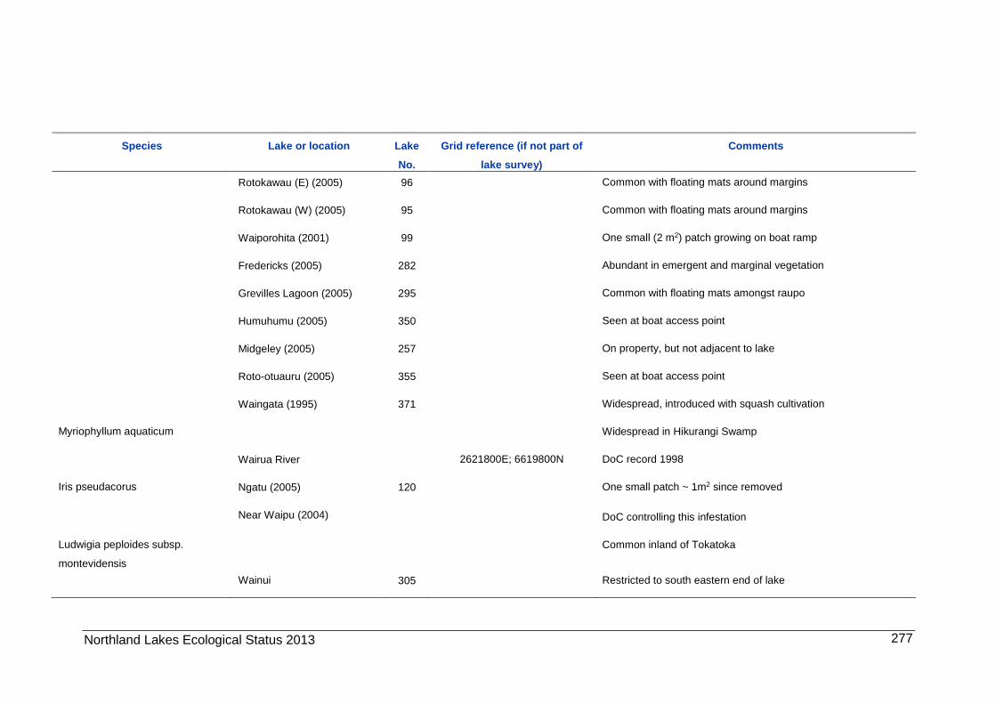
Northland Lakes Ecological Status 2013
277
Species Lake or location Lake
No.
Grid reference (if not part of
lake survey)
Comments
Rotokawau (E) (2005) 96 Common with floating mats around margins
Rotokawau (W) (2005) 95 Common with floating mats around margins
Waiporohita (2001) 99 One small (2 m2) patch growing on boat ramp
Fredericks (2005) 282 Abundant in emergent and marginal vegetation
Grevilles Lagoon (2005) 295 Common with floating mats amongst raupo
Humuhumu (2005) 350 Seen at boat access point
Midgeley (2005) 257 On property, but not adjacent to lake
Roto-otuauru (2005) 355 Seen at boat access point
Waingata (1995) 371 Widespread, introduced with squash cultivation
Myriophyllum aquaticum Widespread in Hikurangi Swamp
Wairua River 2621800E; 6619800N DoC record 1998
Iris pseudacorus Ngatu (2005) 120 One small patch ~ 1m2 since removed
Near Waipu (2004) DoC controlling this infestation
Ludwigia peploides subsp.
montevidensis
Common inland of Tokatoka
Wainui 305 Restricted to south eastern end of lake

278 Northland Lakes Ecological Status 2013
Species Lake or location Lake
No.
Grid reference (if not part of
lake survey)
Comments
Glyceria maxima Widespread throughout Northland
West Coast Road (2005) 121
Waimimiha S (1988) 136 Herbarium record 1988
Jacks (2005) 180 Locally common at north eastern edge of lake
Rototuna (2007) 328 Small patch amongst raupo near entry point
Osmunda regalis Waiparera (2010) 102 One 2 m tall plant. DoC controlling this plant
Rotokawau (2010) 364 Two plants seen and removed
Mokeno 356 Scattered plants at northern end of lake. DoC controlling this
infestation
Maitahi, near Dargaville
(1996)
None available In peat reedland

Northland Lakes Ecological Status 2013 279
7.3 Aquatic weed risk The Aquatic Weed Assessment Risk Model (AWRAM; Champion and Clayton, 2000) scores aquatic weeds accounting for weediness and biological success, so that success or potential success of one aquatic species, can be compared to another (Champion and Clayton 2000).
The free-floating Salvinia molesta (salvinia) and Eichhornia crassipes (water hyacinth) were once found at several lakes and many other Northland water bodies in the past. Ministry of Agriculture and Fisheries (MAF) eradication programmes in the 1980’s and 1990’s eradicated these weeds at most sites, but they remain a potential threat to all but the largest exposed Northland lakes. These species are not considered further.
The wetland weed royal fern (Osmunda regalis) is not aquatic and therefore was not be ranked using AWRAM. However it has Unwanted Organism Status (Biosecurity Act 1993 designation) and low incidence in Northland merits its inclusion.
7.4 Aquatic weed distribution and potential impacts High-risk species are discussed within life-form groups and in order of weed risk as scored by AWRAM.
7.4.1 Submerged species Ceratophyllum demersum
Ceratophyllum demersum (hornwort) was only known from 3 sites in Northland prior to commencing the NRC Lakes Strategy in 2005 and 2 of these records were from the 2001 NIWA survey (Champion et al. 2002). There are now 11 sites in three geographically distinct areas; North Cape (Lakes Te Werahi, Ngakeketa and Kihona), South Aupouri (Lakes Heather, Mini, Waimimiha North, Awanui River and drains near Kaitaia and Karikari) and Pouto (Lake Rotootuaruru / Swan and waterways in the vicinity of Dargaville). The incursion in Lake Swan is likely to have occurred since 2001, whereas other new sites were in lakes that had not been previously surveyed. C. demersum has a widespread distribution in much of the North Island, including the northwest coastal lakes in Auckland Region and the Waikato River system.
It is currently the worst submerged weed in New Zealand, with major impacts on power generation, irrigation, flood control and recreational activities in addition to severe impacts on aquatic ecosystems (Hofstra 2002). Its potential to displace all submerged vegetation (including other introduced species) is illustrated in several central North Island lakes where it grows from the water’s edge in sheltered bays to depths around 15 m. The species dominates Lakes Ngakeketa, Kihona, Rotootuaruru and Waimimiha North. If introduced to other lakes, this species is likely to displace all submerged vegetation from sheltered sites and would have the greatest impact on charophyte meadows. Unlike all other submerged weeds C. demersum has the ability to grow to ~15 m deep.
Egeria densa
Egeria densa is more widespread than C. demersum occurring in at least 18 sites in four geographically distinct areas: North Cape (Te Werahi and Ngakeketa North), Sweetwater (Waiparera, Heather, Rotoroa, Mini, Carrot and Awanui River), Central Northland (Omapere, Owhareiti, rivers near Kerikeri, Stanner’s Road Dam, Wairua Falls and Waro) and Pouto

280 Northland Lakes Ecological Status 2013
(Rotootuaruru and Rotokawau). E. densa is widespread in the North Island and is well established in the southwest coastal lakes and Lake Pupuke in Auckland Region and the Waikato River system.
It is a major concern in eutrophic water bodies and has displaced native and introduced species like Elodea canadensis and Potamogeton crispus from many sites. In clear lakes it can grow to depths of around 8 m forming tall dense beds. In shallow nutrient-rich lakes this species is implicated in the collapse of submerged vegetation and consequent toxic algal blooms as has occurred in Lake Omapere and many lower Waikato lakes (Champion and Burns 2001).
Lagarosiphon major
Lagarosiphon major is sparsely distributed in Northland restricted to 3 sites in Sweetwater (Waiparera and Ngatu) and Pouto (Phoebe’s Lake).
It has similar impacts to E. densa although it is more tolerant of wave exposure and grows successfully in oligotrophic waters, but will not grow to depths greater than 6.5 m. Wells et al. (1999) documented its displacement of E. canadensis in Lake Tarawera from depths between 2 and 4 m, and following the subsequent invasion of that lake by C. demersum, L. major was still able to occupy this zone in sheltered and moderately exposed sites.
Utricularia gibba
Prior to commencing the NRC Lakes Strategy in 2005, the invasive bladderwort (Utricularia gibba) was sampled on one occasion in Northland, from Lake Omapere (Champion & Burns 2001). Introduction to Lake Omapere could have occurred either from contaminated nets for eels or when grass carp were liberated into the lake, but is also spread easily by water fowl. U. gibba is widespread in Waitakere and South Rodney Districts in Auckland but appeared to be spreading slowly there.
It was collected from a Kaimaumau peat lake, Lake Waikaremu, with the first collection made in December 1999. Salmon (2001) reports this “Far-North” form to differ from West Auckland plants, with a short flower spur and the ability to self-pollinate and produce viable seed. He speculated that this may be self-introduced (via water birds) from Eastern Australia, much in the same way that Gratiola pedunculata and Alternanthera denticulata (both occurring at Lake Waiporohita) have been recently recorded. As the plants are dispersed by birds they can rapidly colonise new water bodies.
In 2004/05 U. gibba was found in 20 Northland sites, with isolated occurrences in Karikari (pond near Matai), Bayleys Beach (Friedrich’s Lake) and a swamp near Tangiteroria, but the majority of sites are at Aupouri, from Sweetwater to Lake Austria (west of Parengarenga Harbour). There was no record of U. gibba in 9 of those lakes in Aupouri surveyed in 2001. In 2006, 3 new sites were recorded: Lakes Owhareiti and Waro and the drains in the Hikurangi wetland. Lake Owhareiti was previously surveyed in 2001, with no U. gibba reported. In 2007, U. gibba was found in Te Paki Dune Lake (not present in 2004) and Lakes Roto-otuaru and Rotokawau on the Pouto Peninsula (not recorded in 2006). The 2008 survey has found the species for the first time in Lakes Wahakari (not recorded in 2004), Yelavich, Stanner’s Road Dam, Kai Iwi (not recorded in 2007), Humuhumu (not recorded in 2007), Rotopouua, Phoebe and Sands Lake at Mangawai. In 2009 it was found in all water bodies visited in

Northland Lakes Ecological Status 2013 281
Aupouri (except acid Lake Te Kahika), and was present in all lakes visited on the Pouto Peninsula. Thus this species has probably reached its potential range in Northland. It is now spreading in Auckland and Waikato Regions.
It is the sprawling nature of U. gibba, covering other submerged species, which differs from the impacts of other submerged weeds, which are rooted or attached to bottom sediments and competitively displace other species through forming dense tall canopies. In the smaller, shallower, less exposed Northland water bodies impacts seemed severe, especially where associated epiphyton (attached algae) formed a dense mat which reduced light to plants growing beneath. U. gibba seldom appears to grow deeper than 3.0 m, and in most larger lakes its main impacts appear to be in the zone sheltered by emergent sedges such as Eleocharis sphacelata. Unfortunately this is also the favoured habitat of Utricularia australis, now classified as nationally endangered, although the two species do co-exist in Lake Rotokawau (near Ngatu) and Lake Ngakapua South.
U. gibba does not appear to threaten Trithuria inconspicua (formerly Hydatella) which generally favours more exposed sites than those colonised by U. gibba mats.
Vallisneria australis
Vallisneria australis was commonly available in the aquarium trade, and is now naturalised in a few sites (the closest site being Meola Creek in Western Springs, Auckland) and more recently in Blenheim. It has now been banned from sale, placed on the National Pest Plant Accord in 2006 (http://www.biosecurity.govt.nz/nppa accessed July 2009).
This species had been collected from a farm dam near Kerikeri in 2004.
All but one field site of this plant is in flowing water. At the lake site (Lake Wiritoa near Wanganui) it grows to a depth of 2 m, with C. demersum or E. densa below this depth (Wells and Taumoepeau 2003). It could threaten many Northland water bodies and could be deliberately planted (see Section 4.5 on Introduction Pathways).
7.4.2 Emergent and wetland species Zizania latifolia
Zizania latifolia (Manchurian wild rice) is of limited distribution in New Zealand, but is extremely abundant in the vicinity of Dargaville, being introduced there around 100 years ago. Joynt and Newby (1998) estimated a total infested area of 338 ha, mostly in drains, river margins and flood-prone pasture. The only lake impacted by this weed is Phoebe’s Lake in Pouto. Manchurian wild rice is now scheduled for eradication at this and other outlier sites, funded by the MAF BNZ National Interest Pest Response programme (http://www.biosecurity.govt.nz/pests/surv-mgmt/mgmt/prog/nipr accessed July 2009).
Z. latifolia is taller (up to 4 m) and grows much more densely than native emergent species which it is likely to invade in small lakes, sheltered bays of larger lakes, and wetlands. Impacts on indigenous biota were documented by Champion et al. (2001).
Alternanthera philoxeroides
Alternanthera philoxeroides (alligator weed) is widespread in wetlands, drains and cultivated land in Northland, especially in the low-lying alluvial plains surrounding the Northern Wairoa

282 Northland Lakes Ecological Status 2013
River, but is sparsely distributed in other parts of the region. It was reported from two of the 33 lakes surveyed in 2001, but since then it has spread to a further five of these lakes. It is now known from 15 lakes throughout the region (from Kihona west of Parengarenga Harbour to Waingata at the bottom of the Pouto Peninsula). In seven of these lakes (Kihona, Heather, Rotoroa, Mini, Waiporohita, Humuhumu and Roto-otuauru) only small areas of this plant were seen and management could be contemplated before impacts become greater.
Alligator weed is a sprawling emergent forming dense floating mats which raft over and shade out submerged vegetation. Alligator weed can be a major weed in nutrient enriched water bodies, growing in sheltered areas amongst tall emergent plants. It is likely to invade and displace other herbaceous plants in nutrient-rich wetlands, but would have minimal impact on vegetation of larger lakes.
Alligator weed does not appear to be spreading much in Lakes Waiporohita, Roto-otuaru and Humuhumu, despite its presence there for several years. It seems to be unable to rapidly dominate the wetland fringes of these lakes (as it does in several other lakes such as the 2 Rotokawau Lakes on Karikari Peninsula and Waiparera in Aupouri). Perhaps nutrient status or substrate type limits its success in these lakes.
Myriophyllum aquaticum
Myriophyllum aquaticum (parrots feather) is widespread throughout the North Island but surprisingly has only been collected from the Wairua River in Northland, with no records from the lakes sampled in 2004/05. It is widespread in the drains of the Hikurangi Swamp and is likely to occur in similar habitats elsewhere in Northland.
Parrots feather could be a major drain weed throughout Northland, but would have minimal impact on vegetation in large exposed lakes. It could impact on shallow aquatic areas within sheltered, nutrient-rich lakes and swamps, with floating mats displacing shallow water vegetation.
Iris pseudacorus
Iris pseudacorus (yellow flag iris) has a widespread naturalised distribution in New Zealand, but is apparently rare north of the Waikato, with only two known Northland sites, Lake Ngatu (now removed) and Mill Brook near Waipu. A further site was reported from the 1960’s near Haruru Falls, Waitangi but this appears to have been eradicated. It was propagated and distributed for sale until relatively recently and it is likely to be widely cultivated, potentially present in gardens anywhere within the region.
Yellow flag iris has a major impact on the emergent vegetation of sheltered lakes, as it may form dense floating mats of rhizomes that displace other vegetation. It is also a weed of salt marshes and has spread into saline influenced sites on the Avon River, Christchurch, and will invade wet pasture. It seeds prolifically and spreads rapidly along stream and river banks. It can be toxic to livestock (Connor 1977) and is of low value to wildlife and exposes nests to greater predatory risk from rodents and cats.
The Lake Ngatu site has probably been eradicated by digging up the plant (L. Sherwood, DoC, pers. comm.), but regular visits to ensure re-establishment from rhizome material or seed is required at this site.

Northland Lakes Ecological Status 2013 283
Ludwigia peploides subsp. montevidensis
Ludwigia peploides subsp. montevidensis (primrose willow) has a limited naturalised distribution, predominantly restricted to the lower Waikato Basin where it is abundant, and has significant populations in Manawatu and West Auckland. It was only found in Lake Wainui and the adjacent pond, however it is widespread in limestone country in the vicinity of Tokatoka (P. Joynt, NRC, pers. comm.).
It is unlikely to impact most lakes within Northland, but can form large sprawling mats over shallow, sheltered, nutrient-rich lakes extending into adjacent nutrient-rich swamps.
Glyceria maxima
Glyceria maxima (reed sweet grass) is widespread in much of Northland and the rest of New Zealand, being a common weed of drains. It was recorded from Jack’s Lake in 2005, with previous records from Lakes Waimimiha South and West Coast Road from where it has probably been eradicated.
This highly productive and competitive species has come to dominate riparian areas along many nutrient rich lowland waterways, also forming floating mats which can block pumps and promote flooding. In nutrient rich sites, it could exclude other emergent species, but impacts on the Northland lakes are not likely to be significant. Livestock readily eat it although sometimes it can cause stock deaths (Connor 1977).
Osmunda regalis
Osmunda regalis (royal fern) is restricted in its New Zealand distribution being locally abundant in Waikato, with scattered sites in the Bay of Plenty, Taranaki, Wellington and Great Barrier Island.
Royal fern is known from the vicinity of Lake Mokeno and a 1996 record from a peat reedland near Maitahi, just off SH12, about 8km north of Dargaville. New records of this plant in 2010 from Lakes Waiparera (Sweetwater) and Rotokawau (Pouto) indicate this species maybe more widespread in Northland. DoC is continuing to target this species for eradication wherever it occurs in Northland Conservancy (T. McCluggage and G. Williams pers. comm.)
Royal fern is a potential weed of many of Northlands wetlands, found in a range of habitats from Empodisma minus dominated bog to fens and even some fertile swamps (usually but not exclusively under a canopy of willow or manuka) within the Waikato. In areas previously disturbed by fire or vegetation clearance, royal fern can dominate the understorey of these areas forming 100% covers up to 2 m tall (Champion 2006).
7.5 Prioritisation of lakes The method of lake prioritisation is covered in Section 2.4 with the biodiversity value ranking of lakes given in (Table 1-1).
7.6 Introduction pathways, risks and targeted surveillance Submerged weeds may be dispersed to new sites by a range of natural and human means. Pathways and likelihood of spread of the highest-ranking weeds are discussed in this section.

284 Northland Lakes Ecological Status 2013
Natural dispersal includes the movement of propagules by:
� water (e.g., flood waters spreading contents of ornamental ponds)
� waterfowl (e.g., seed palatable to ducks or attached to their legs etc.)
� wind (e.g., spores of royal fern).
Weed dispersal by humans can be divided into deliberate and accidental means as follows:
� Deliberate dispersal:
− liberation of aquarium contents and dumping of garden waste
− plantings in natural water bodies (ornamental or misguided ‘enhancement’ e.g., duck shooters planting willow, S. molesta, A. philoxeroides and E. densa
− introduction of aquatic plants with coarse fish.
� Accidental dispersal:
− contaminated watercraft or vehicles
− contaminated fishing nets
− contaminated drain clearing or weed cutting machinery
− contaminated dive gear (dive training or surveillance staff).
The risk of transfer of these propagules to unimpacted water bodies is essentially the probability that one or more of the pathways noted above will move plant material (seeds and vegetative fragments) from a weed source to an unimpacted area.
These distribution pathways and their relevance to the spread of aquatic weeds are discussed in the following sections.
7.6.1 Natural dispersal Most of submerged aquatic weeds discussed in Section 3 do not set seed in New Zealand, either because only one sex is present or, in the case of C. demersum, due to unfavourable environmental conditions and/or self-incompatibility. Therefore natural dispersal is not going to move these species to a new catchment. Flood events could feasibly transfer those species to downstream sites should an outdoor pond containing one of those species be inundated by floodwaters.
Those species that do produce seed like P. crispus and R. trichophyllus can be spread by waterfowl and are widespread in the Rotorua lakes. U. gibba seems to be dispersed by natural means, either by seed or by fine filamentous stems tangled around bird’s feet.
Thus aquatic weeds adapted for dispersal by birds have the potential to be effectively dispersed between catchments and their spread is impossible to contain if naturalised within Northland. However, most species are dispersed between catchments by human activities, as discussed in the following sections.

Northland Lakes Ecological Status 2013 285
7.6.2 Deliberate dispersal The majority of alien submerged aquatic weeds present in New Zealand were intentionally introduced for ornamental ponds or aquaria.
As the majority of these weeds do not reproduce sexually, deliberate or unintentional transfer by human activities provides the main means of dispersal. A number of species with high weed potential have been declared as Unwanted Organisms and included on the National Pest Plant Accord (http://www.biosecurity.govt.nz/nppa accessed July 2009), under legislation to prevent sale, distribution and propagation (Sections 52 and 53 of the Biosecurity Act 1993) to strongly discourage their dispersal around New Zealand.
Despite their ban from sale and distribution (some from as early as 1983), some of these plants are still being illegally distributed around New Zealand as pond and aquarium plants. The deliberate transfer of coarse fish is often accompanied by release of aquatic plants that may have been used to transport fish or eggs from site to site, as evidenced in the two recent C. demersum incursions in the South Island (Matthew Bloxham pers. comm., authors pers. observations), where this species was found in water bodies also containing the pest fish rudd (Scardinius erythrophthalmus).
7.6.3 Accidental dispersal The submerged plants in the family Hydrocharitaceae (e.g., E. densa, L. major and E. canadensis), C. demersum and most likely U. gibba are all dispersed via stem fragmentation and their main mode of spread to new water bodies is via contaminated watercraft, drainage machinery and weed harvesters and fishing nets. Scuba equipment is also a potential mechanism, with some recreational diving and scuba dive training classes in some lakes.
The risk of accidental spread of these weeds is dependent on a number of factors:
� adaptations of weed species enabling dispersal to new sites (such as tolerance to desiccation, ease of attachment to a vector, regenerative capacity)
� proximity of weed source to an unimpacted site. Generally the closer the distance, the greater the risk (Johnstone et al. 1987)
� abundance of weed sources. The greater the number and extent of sources, the greater the risk of spread
� type of dispersal vector (boats nets or digger)
� accessibility of the weed site(s) and unimpacted sites to the potential vector (such as well-formed boat ramps)
� frequency of vector movements between sites.
7.6.4 Targeted surveillance Before undertaking a surveillance programme, selection of sites based on the analysis of introduction pathways (Sections 4.1 to 4.3) allowed for a targeted search of high risk areas within each of the lakes. Likely sites of introduction in the case of watercraft would be boat entry points (e.g., boat ramps and commonly used beach accesses) and mooring areas

286 Northland Lakes Ecological Status 2013
(such as common fishing areas and sheltered bays) where plant fragments in the anchor well could be unwittingly liberated.
Other pathways are through planting contaminated water lily rhizomes and liberation of aquaria / pond contents either through deliberate release or the result of a flood event. Therefore a survey of ponds within the catchment of each high-risk lake and publicity warning of the risks posed by the target species (outlined in this report) in aquaria and ornamental ponds should be part of the strategy. Surveillance should also include nurseries and pet shops along with regular contact with Aquarium Societies.
7.7 Threat evaluation and management implications The consideration of vectors and associated risks along with the risks posed by each species to high priority lakes needs addressing in order to make appropriate management decisions to lessen aquatic weed spread. These are presented in Table 7-1 below:

Northland Lakes Ecological Status 2013 287
Table 7-1: Vectors, risk of spread and management opportunities for aquatic weed species in the Northland.
Species Vectors Risk of spread Management opportunities
Submerged
Ceratophyllum demersum
Egeria densa
Lagarosiphon major
Ornamental ponds or aquaria
Moderate– not quantified but has often been found to be the source of infestation.
Surveillance of properties near lakes or tributaries of lakes.
Accidental (fishing nets) Moderate-High – requires transfer from infested water bodies. Can get into remote water bodies sometimes with no defined access.
Notify fishers of contaminated water bodies. Monitor eel fishing patterns. Compel net sterilisation or exclude from infested areas*. Control weed at sites likely to source material (e.g., Lake Swan).
Accidental (boats) Moderate-High in lakes with public access – requires transfer from infested lakes.
Educate boat users in publicly accessible lakes (e.g., Ngatu, Waiparera, Manuwai, Waikere, Taharoa). Monitor boat use to quantify number of boats using these lakes.
Accidental (drainage equipment)
Moderate - High – if infested sites nearby. Surveillance of drains near lakes. Monitor drainage machinery use in contaminated areas. Notify contractors of contaminated sites. Compel equipment cleaning on leaving contaminated sites.
All Exclude vectors access to extra high value, water bodies.
Vallisneria spiralis Ornamental ponds or aquaria
Low – Kerikeri field site or commercially obtained plants (potential sources). Plants require deliberate planting into new sites.
Eradicate field site. Ban from sale and distribution.
Utricularia gibba Natural and accidental High – appears to be widely distributed in Northland.
Too widespread (and spreading naturally) to effectively manage.
*Remove fragments on site and soak in 1 part salt per 14 of water (by volume) for one hour (Matheson et al. 2004).

288 Northland Lakes Ecological Status 2013
Species Vectors Risk of spread Management implications
Emergent
Zizania latifolia Accidental (drainage machinery)
Moderate/high – if infested sites are nearby (plants would be obvious to informed operators).
Educate and notify contractors of contaminated sites, clean diggers before moving to new sites.
Natural (water borne seed)
High – seed dispersed in infested catchments. Investigate control/eradication where naturalised in high-risk sites.
Alternanthera
philoxeroides
Accidental (drainage machinery)
High – requires transfer from infested sites (plants not obvious to operator – widespread in region).
Educate and notify contractors of contaminated sites, clean diggers before moving to new sites.
Deliberate planting High near shooting hides. Notify Fish and Game, educate shooters.
Myriophyllum aquaticum Ornamental ponds or aquaria
High –often the source of the weed in an un-infested region / area.
Surveillance of ornamental ponds near lakes or tributaries of lakes.
Accidental (drainage machinery)
High – if infested sites are nearby (plants not obvious to operator – widespread in parts of region).
Educate and notify contractors of contaminated sites, clean diggers before moving to new sites.
Iris pseudacorus Deliberate planting Low – probably scattered in gardens and ponds.
Surveillance for Northland sites.
Natural (water borne seed)
High – seed dispersal in infested catchments. Investigate control/eradication where naturalised in high-risk sites (e.g., DoC control at Waipu)
Accidental (drainage machinery)
Moderate – rhizomes and seed could be dispersed from infested sites.
Notify contractors of contaminated sites.
Ludwigia peploides subsp. montevidensis
Accidental (drainage machinery)
Low – requires transfer of seeds or stem fragments from infested sites (plants limited in distribution).
Surveillance of suspected areas for plants. Educate and notify contractors of contaminated sites, clean diggers before moving to new sites.

Northland Lakes Ecological Status 2013 289
Species Vectors Risk of spread Management implications
Glyceria maxima Natural (water borne seed)
High – seed dispersal in infested catchments. Instigate control/eradication where naturalised in high-risk sites (e.g., tributaries of high-ranking lakes).
Accidental (drainage machinery)
High – rhizomes and seed could be dispersed from infested sites.
Educate and notify contractors of contaminated sites, clean diggers before moving to new sites.
Wetland
Osmunda regalis Natural (wind borne spores)
High – spore dispersal. Surveillance for sites of plant around Lake Mokeno and similar habitats. Control/eradication where found (DoC currently doing this).

Northland Lakes Ecological Status 2013 290
7.8 Contingency planning One of the benefits of surveillance is early detection of invasive species. In order to respond rapidly and appropriately to an incursion it is necessary to plan for the contingency. It is a useful exercise to work through likely scenarios for selected invasive weeds and locations and consider appropriate contingencies. It is apparent that for a rapid response a number of things need to be in place:
� adequate emergency funds need to be allocated
� a dive team (for most submerged species) with appropriate skills need to be available to respond. The extent of the infestation needs to be surveyed as soon as possible. The divers also need to have excellent plant identification skills and experience with hand weeding (knowledge of the methods of dispersal of the target species, and how to remove them without dispersing them further)
� compression screens (a frame with a light screen attached such as weed mat) need to be available at short notice and divers available to place them over small infestations at short notice
� herbicide options considered in advance with approvals for use in place so they can be used at short notice.
Prior meetings with owners and stakeholders (DoC, Fish and Game, and LINZ) Iwi, and public are necessary to establish acceptable contingency plans for implementation in the event of an incursion. Thought needs to be given to containment within a water body using enclosure netting, and quarantine capability such as control of lake access and departures or activities undertaken.
Detailed recommendations for an aquatic weed strategy have been prepared for the Kai-Iwi Lakes (Wells and Bodmin, 2008).
8 Acknowledgements We would like to thank the following who have contributed to the project over a number of years:
NIWA: Aleki Taumoepeau for a huge amount of field work; John Clayton for pioneering the survey methods; Kerry Bodmin for wetland expertise, Mary de Winton for field work, charophyte expertise and lakes database work; and Tracey Edwards for LakeSPI processing data and guidance.
Northland Region Council : Lisa Forester for much organising and assistance in the field. Thanks to Lisa for her botanical assistance, enthusiasm, and intimate knowledge of the areas. Gail Townsend also assisted with shoreline botanical work on some lakes, Irene Middleton for underwater survey assistance, Sara Brill for wetland botany and Kane McElrea for snorkelling skills.

Northland Lakes Ecological Status 2013 291
Department of Conservation : Andrew Townsend botanist assisted with shoreline botanical descriptions on some lakes.
Maureen Young, botanist, again gave freely of her time assisting with shoreline botanical descriptions and located some rare species.

Northland Lakes Ecological Status 2013 292
9 References Amokura: quarterly bulletin of the Northland/Far North Regions of the Ornithological
Society of New Zealand. (1991–2000) Northland lakes bird counts (various authors).
Bartlett, J.K. (1980) New and significant plant distribution records from northern New Zealand. New Zealand Journal of Botany, 18: 347–351.
Burns, N., Bryers, G., Bowman, E. (2000) Protocol for Monitoring Trophic Levels of New Zealand Lakes and Reservoirs. Lakes Consulting Client Report 99/2: 122.
Burns, N.M., Rutherford, J.C. (1998) Results of monitoring New Zealand lakes 1992-1996. Volume 1 - General findings. NIWA Client Report for Ministry for the Environment, No. MFE80216.
Cameron, E.K., Jones, S., Wilcox, M.D., Young, M.E. (2001) Flora and vegetation of Pouto Peninsula, North Head of Kaipara Harbour, Northland, New Zealand, 26-29 January 2001: 38–51.
Champion, P., Wells, R., Matheson, F., Winton, M. (2005) Northland Lakes Assessment 2004/05, NIWA Client Report HAM2005-113, NRC05215 Northland Regional Council: 265.
Champion, P.D. (2006) Ecology and management of royal fern (Osmunda regalis) in the Lower Waikato/Hauraki. NIWA Client Report HAM2006-021, Hamilton: 39.
Champion, P.D., Burns, N. (2001) Lake Omapere: Current understanding of ecological condition with short- and long-term management options. NIWA Client Report MFE01231, Hamilton.
Champion, P.D., Clayton, J.S. (2000) Border control for potential aquatic weeds. Stage 1 Weed risk model. Science for Conservation, 141. Department of Conservation, Wellington.
Champion, P.D., Clayton, J.S., de Winton, M.D. (1993) Study on Hydatella inconspicua seed production, germination and maintenance of habitat in the Northland dune Lakes. NIWA Consultancy Report DOC001, Hamilton.
Champion, P.D., de Winton, M.D. (2012) Northland Lakes Strategy. NIWA Client Report HAM2012-121. Project ELF12213: 42.
Champion, P.D., Dugdale, T.M., Taumoepeau, A.T. (2002) The aquatic vegetation of 33 Northland lakes. NIWA Client Report NRC01203, Hamilton.
Champion, P.D., Williams, E., Chisnall, B. (2001) Lake Manchurian wild rice - Ecological impact, herbicide trial, and non-target effects of the herbicide Gallant®
NIWA Client Report NRC00202, Hamilton.
Northland Lakes Ecological Status 2013 293
Clayton, J.S. (1983) Sampling aquatic macrophyte communities. In: Biggs, B.J., Gifford, J.S., Smith, D.G. (Eds.) Biological methods for water quality surveys. Water and Soil Miscellaneous Publication 54, Wellington, Ministry of Works and Development.
Conning, L., Holland, W. (2003) Natural areas of Aupouri Ecological District. NZPNAP, Department of Conservation, Whangarei.
Connor, H.E. (1977) The poisonous plants of New Zealand. Government Printer, Wellington.
de Lange, P.J., Norton, D.A., Courtney, S.P., Heenan, P.B., Barkla, J.W., Cameron, E.K., Hitchmough, R., Townsend, A.J. (2009) Threatened and uncommon plants of New Zealand (2008 revision). New Zealand Journal of Botany, 47: 61–96.
de Winton, M.D., Clayton, J.S.; Edwards, T. (2012) Incorporating invasive weeds into a plant indicator method (LakeSPI) to assess lake ecological condition. Hydrobiologia, 691: 47–58.
Dugdale, T.M., Champion, P.D. (2001) The submerged vegetation of Manuwai and Waingaro reservoirs. NIWA Consultancy Report SCJ01201, Hamilton.
Forester, L., Townsend, A. (2004) Threatened plants of Northland Conservancy. Department of Conservation, Wellington.
Heenan, P.B. (1998) Mazus novaezeelandiae (Scrophulariaceae): taxonomy, distribution, habitats, and conservation. New Zealand Journal of Botany, 36: 407–416.
Hitchmough, R., Bull, L., Cromarty, P. (compilers) (2007) New Zealand Threat Classification System lists—2005. Wellington, Department of Conservation: 194.
Hofstra, D.E. (2002) Ceratophyllum demersum. NIWA Client Report DOC02247, Hamilton.
Johnstone, I.M., Coffey, B.T., Howard-Williams, C. (1987) The role of recreational boat traffic in interlake dispersal of macrophytes: a New Zealand case study. Journal of Environmental Management, 20: 263–279.
Joynt, P., Newby, L. (1998) Kaipara District Manchurian rice grass management plan. Northland Regional Council, Dargaville.
Kerr, V. (2000) Dwarf inanga Galaxias gracilis draft recovery plan. Department of Conservation, Whangarei.
Kokich, D.C. (1991) Kai iwi – Pouto dune lakes water resources. Northland Regional Council, Whangarei.
MAF Biosecurity Authority (Protect New Zealand) (2002) National Pest Plant Accord http://www.maf.govt.nz/biosecurity/pests-diseases/ plants/accord.htm

294 Northland Lakes Ecological Status 2013
Matheson, F., Dugdale, T., Wells, R., Taumoepeau, A., Smith, J. (2004) A new method to sterilise freshwater fishing nets. Water & Atmosphere,12(3): 17.
Richardson, J. (2005) Freshwater fish and koura in Northland lakes and wetlands. NIWA Consultancy Report NRC05215, Hamilton.
Rowe, D.K., Champion, P.D., de Winton, M.D. (1999) Lake management trials for dwarf inanga (Galaxias gracilis) and a rare plant (Hydatella inconspicua) in Northland dune lakes. NIWA Consultancy Report DOC90202, Hamilton.
Rowe, D.K., Chisnall, B.L. (1997) Distribution and conservation status of the dwarf inanga Galaxias gracilis (Teleostei: Galaxiidae) an endemic fish of Northland dune lakes. Journal of the Royal Society of New Zealand, 27(2): 223–233.
Salmon, B. (2001) Carnivorous Plants of New Zealand. Ecosphere Publications, Auckland.
Tanner, C.C., Clayton, J.S., Harper, L.M. (1986) Observations on aquatic macrophytes in 26 northern New Zealand lakes. NZ Journal of Botany, 24: 539–551.
Tanner, C.C., Clayton, J.S., Wells, R.D.S. (1988) The distribution, biology, habitat and conservation status of the endangered aquatic plants Hydatella inconspicua and Myriophyllum robustum; with recommendations for future management. MAF Aquatic Plants Section unpublished report.
Webb, C.J., Sykes, W.R., Garnock-Jones, P.J. (1988) Flora of New Zealand. Vol. IV. Botany Division, DSIR, Christchurch.
Wells, R., Bodmin, K. (2008) Kai-iwi Lakes Aquatic Weed Strategy. NIWA Client Report HAM2008-180, KDC09201: 30.
Wells, R.D.S., Champion, P.D. (2013) Northland Lakes – Annual Report 2013. NIWA Client Report HAM2013-077, NIWA Project: NRC13205: 61.
Wells, R.D.S., de Winton, M.D., Clayton, J.S. (1999) Successive macrophyte invasions within the submerged flora of Lake Tarawera, Central North Island, New Zealand. NZ Journal of Marine and Freshwater Research, 31: 449–459.
Wells, R.D.S., Taumoepeau, A.T. (2003) Weed control using diquat in Lake Wiritoa, Wanganui. NIWA Client Report HAM2003-031, Hamilton.