Embed Size (px)
Citation preview
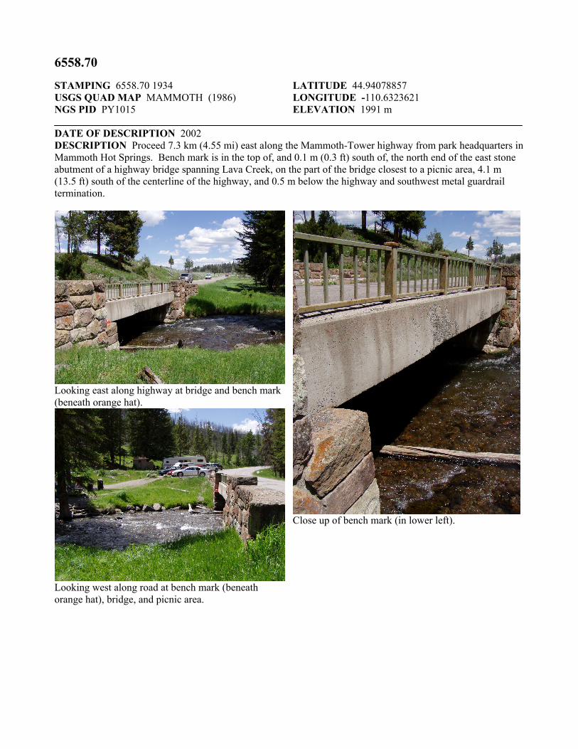
6558.70 STAMPING 6558.70 1934 USGS QUAD MAP MAMMOTH (1986) NGS PID PY1015
LATITUDE 44.94078857 LONGITUDE -110.6323621 ELEVATION 1991 m
DATE OF DESCRIPTION 2002 DESCRIPTION Proceed 7.3 km (4.55 mi) east along the Mammoth-Tower highway from park headquarters in Mammoth Hot Springs. Bench mark is in the top of, and 0.1 m (0.3 ft) south of, the north end of the east stone abutment of a highway bridge spanning Lava Creek, on the part of the bridge closest to a picnic area, 4.1 m (13.5 ft) south of the centerline of the highway, and 0.5 m below the highway and southwest metal guardrail termination.
Looking east along highway at bridge and bench mark (beneath orange hat).
Looking west along road at bench mark (beneath orange hat), bridge, and picnic area.
Close up of bench mark (in lower left).


![this page%PDF-1.5 %âãÏÓ 6558 0 obj > endobj 6575 0 obj >/Filter/FlateDecode/ID[611E9B7B17826D49AC12B5C3FAB403A1>]/Index[6558 32]/Info 6557 0 R/Length 98/Prev 5813450/Root 6559](https://img.pdfslide.us/doc/110x75/5aaafda17f8b9aa9488b6c05/translate-this-pagepdf-15-6558-0-obj-endobj-6575-0-obj-filterflatedecodeid611e9b7b17826d49ac12b5c3fab403a1index6558.jpg)


![IN THE HIGH COURT OF NEW ZEALAND AUCKLAND … · 2007-404-6558 [17 february 2010] in the high court of new zealand auckland registry civ-2007-404-6558 between motorworld limited (in](https://img.pdfslide.us/doc/110x75/5c0e01b209d3f23c2a8c415e/in-the-high-court-of-new-zealand-auckland-2007-404-6558-17-february-2010-in.jpg)