Embed Size (px)
Citation preview

6-2 Climate and Biomes
Fig. 5-9, p. 106

Where is the water and life at?

A closer look at the relationship between latitude, solar energy, and
climate.
• Some facts to know:
• Earth receives energy from the sun – the light rays strike the surface essentially parallel to each other.
• The earth’s orbit is elliptical and it is closer to the sun at some times of the year and farther away at other times of the year.

• What day are we closest to the sun?• January 3• What day are we farthest away from the
sun?• July 4• What does that mean about the relationship
between distance from the sun, temperature, and seasonal differences in temperature?

Some more facts..
• The earth’s surface is curved.
• The earth is at a tilt relative to the sun - as the earth orbits the sun during the year there are times when the northern hemisphere is titled toward the sun and at other times of the year the northern hemisphere is tilted away from the sun.

Fig. 5-3, p. 102

Because the intensity with which light rays strikes the earth’s surface varies……..
• Daylight length varies.
• The farther away from the equator (north or south) …– . Light is less intense as it strikes surface at less
than 90 degree angles.– Longer daylight length in the summer.– Seasons based on temperature.

How does light intensity determines temperature?
• Near the equator light rays strike the earth at a 90 degree angle (perpendicular) during much of the year. Temperature remains mostly constant throughout the year. (varies from tropic of Cancer and Capricorn)
• Greatest degree of heating occurs at the equator.• Away from the equator, because of the curve of the
earth and the tilt of the earth, the light rays strike the earth at angles less than 90 degrees (relative to the perpendicular).
• Less intense light = less heating.


What are the physical properties of air how do they affect current, temperature, and climate?
• Hot air rises.• Rising air creates areas of low pressure and that
draws more air behind it.• Rising air cools and descends creating a cycle of
circulating air called “Hadley cells”.• Hadley cells are located at roughly 30 degree
intervals of latitude.– Midlatitude deserts are caused by the descent of
formerly tropical air that is dry and warms as it descends.

Fig. 5-5, p. 103

Fig. 5-6, p. 103

Fig. 5-4, p. 102

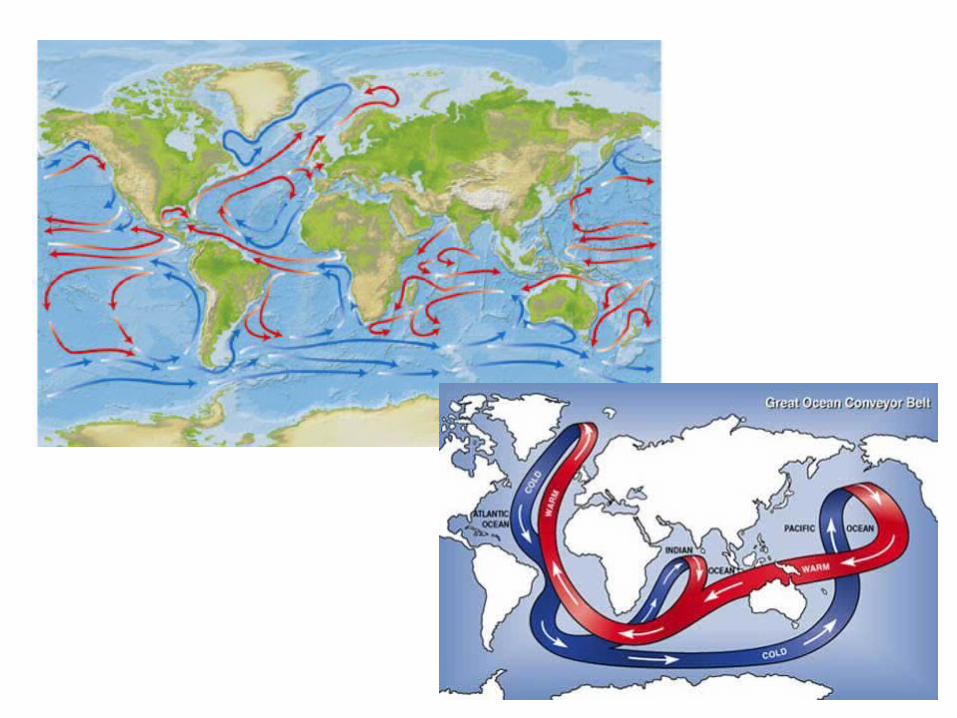
Water Properties and Ocean Currents
• Water has different densities at different temperatures.
• Warm water is less dense than cold water – that is until it freezes. (then it becomes less dense and floats)
• In aquatic systems, warm water rises and cool water sinks.
• Ocean currents are a combination of circulating water due to temperature, wind currents that move water, and rotation of the earth.

Fig. 5-2, p. 101

How Biomes are determined by climate?
• The biome that exists in any given area will be determined by both temperature and rainfall.
• Look at page 124 in your text. Figure 6-21
• Vegetation types vary = Biomes vary.

Climate Regions
• Tropical – warm year round– 23.5 N – 23.5 S
• Temperate – distinct warm and cold/cool seasons.– 23.6N to 66.4 N, 23.6 S to 66.4 S
• Polar – cool or cold year round– 66.5 N to north pole, 66.5 S to south pole.

What other factors affect the type of Biome that may exist in any given
area?
• Local climate (microclimate)
• Soil conditions
• Natural and human caused disturbances.
As a result of local variations, biomes do not exist as uniform ecosystems within the boundaries shown on the map. In reality, they are a patchwork of similar ecosystems that sometimes overlap.

North- and south-facing slopes, showing microclimates, Southern California.

Ecotone
• Transitional zone between overlapping ecosystems (and biomes).
• Shows characteristics of both systems.
• A “blended” ecosystem.

El Nino and La Nina – ocean temperature extremes that affect weather world-wide and occur every 2-7 years.
• El Nino – Southern Oscillation (ENSO) – westerly winds over the Pacific ocean weaken, which allows the
ocean water along the western NA and SA coast to becomes warmer.
– Changes the patterns of ocean upwelling off the coast which affects ocean organisms and the fishing industry.
– Can trigger extreme weather changes in certain parts of the world especially land along side Pacific and Indian Oceans
• Drought in Southern Africa, Southern India, Sri Lanka, Philippines, Indonesia, Australia, Southern Peru, Western Bolivia, Mexico, Central America
• Heavy rain and flooding in Bolivia, Ecuador, Northern Peru, Cuba, U.S. Gulf States
• Hurricanes in Tahiti, Hawaii
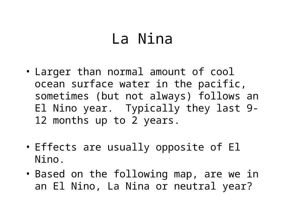
La Nina
• Larger than normal amount of cool ocean surface water in the pacific, sometimes (but not always) follows an El Nino year. Typically they last 9-12 months up to 2 years.
• Effects are usually opposite of El Nino.• Based on the following map, are we in an El Nino,
La Nina or neutral year?